
Grid & Form Studio Plan 630
Advanced Professional Planning Studio
Falconridge, Castleridge and Westwinds
Date - 22nd April 2025

Devika Thatte | Munmun Ahlawat | Samiksha Chiddarwar

Advanced Professional Planning Studio
Falconridge, Castleridge and Westwinds
Date - 22nd April 2025
In the spirit of respect, reciprocity and truth, we honour and acknowledge Moh’kinsstis, and the traditional Treaty 7 territory and oral practices of the Blackfoot confederacy: Siksika, Kainai, Piikani, as well as the Îyâxe Nakoda and Tsuut’ina nations. We acknowledge that this territory is home to the Métis Nation of Alberta, Region 3 within the historical Northwest Métis homeland. Finally, we acknowledge all Nations – Indigenous and non – who live, work and play on this land, and who honour and celebrate this territory.

Instructor
Zach Hoefs
BA, BEd, MPlan, RPP MCIP
Senior Urban Planner, CivicWorks
Teaching Assistant
Ryan Lebell
BA, MPlan, PhD
University of Calgary
Steering Committee
Evan Goldstrom
Sen. Planner at City of Calgary
Allison Davelaar
Development Coordinator at CMLC
Maggie Thi Dycke
Neighbourhood Coordinator at City of Calgary
Community Association
Dhruv Sharma
President of Falconridge/Castleridge CA
Grid & Form Studio expresses their sincere gratitude to Professor Zach Hoefs, Ryan Lebell and the members of the steering committee and communities for providing feedback, support, and guidance throughout the development of this project.
Grid and Form Studio is a boutique planning and urban design firm proudly based in Calgary, Alberta. Our team brings a rich and diverse background in architecture and urban design, with expertise gained from India and Dubai. This global perspective allows us to deliver thoughtful, innovative, and context-sensitive solutions tailored to the unique challenges of urban spaces.
As a multidisciplinary team, we provide a comprehensive range of urban planning and design services, including detailed analysis, meaningful public engagement, and holistic community planning. We are deeply committed to fostering healthier, happier, and more inclusive communities through every project we undertake.
At Grid and Form Studio, our design philosophy is rooted in compassion and a people-centered approach. We aim to integrate the cultures, identities, and stories of the places we inhabit into the built environment. We are passionate about creating vibrant, accessible, and welcoming places that people are proud to call home. Our expertise extends to the application of LEED Neighbourhood Development guidelines, ensuring sustainable and environmentally responsible design practices. We prioritize creating barrier-free public spaces, emphasizing inclusivity and equity in every project.
Our mission is simple yet profound: to design spaces that celebrate community, enhance livability, and contribute to a more sustainable and joyful urban future.

B.arch’19 | M.Plan’25
With 2 years in architecture and interiors and 2 in green building consulting, Devika, a LEED AP, is passionate about community engagement. She enjoys watercolor painting and culinary creations in her free time.

B.arch’19 | M.Plan’25
Bringing over 4 years of expertise in architecture and urban planning, Munmun has a keen interest in research and planning policy analysis. When not working, she loves outdoor adventures and exploring new cuisines.

B.arch’21 | M.Plan’25
With 3 years as an architect in Dubai, Samiksha is deeply interested in urban design and creating inclusive communities. She spends her free time in dancing, traveling, and discovering new places and flavors.
Grid & Form Studio, a Calgary-based urban planning and design firm, partnered with the Falconridge & Castleridge Community Association and the Federation of Calgary Communities to develop a comprehensive Local Area Plan and Urban Design Guidelines for the Falconridge & Castleridge communities and West winds industrial area. This project forms part of the University of Calgary’s Master of Planning coursework, where a student consulting group, Grid & Form Studio, was tasked with analyzing the current conditions and proposing strategies for community improvement.
The project aims to guide the future development of these diverse and multicultural neighborhoods by enhancing mobility, improving open spaces, optimizing land use, and fostering economic development. Our team conducted a detailed analysis of the social dynamics, environmental conditions, and built environment within the communities and the Westwinds industrial area. Based on this analysis, we formulated recommendations to improve connectivity, create accessible public spaces, and address housing needs, while emphasizing sustainability and inclusivity.
We integrated best practices from statutory and non-statutory documents such as Calgary Climate Strategy, TOD Policy Guidelines, Location Criteria for Multi-Residential Infill, Natural Area Management Plan, Step Forward, Access Design Standards and LEED Guide for Neighborhood Development. These frameworks shape our recommendations, ensuring alignment with city-wide goals like reducing greenhouse gas emissions and promoting walkability. Additionally, we incorporated principles for transit-oriented development and multi-residential infill, creating a balanced and integrated approach to growth.
Engaging with the residents of Falconridge and Castleridge is central to the planning process. Their input shapes the plan and ensures it reflects the community’s needs and aspirations. We also collaborated with business owners, real estate developers, and city departments to ensure the plan is both practical and aligned with broader city policies.
The Falconridge & Castleridge Community Association, in partnership with the Federation of Calgary Communities, recognized the need for a comprehensive plan to guide the future development and improvement of their neighborhoods. To address this need, they engaged the University of Calgary School of Architecture, Planning and Landscape.
As part of their Master of Planning coursework, a student consulting group named Grid & Form Studio was tasked with developing this Local Area Plan. Our team conducted a thorough analysis of the existing conditions within the Falconridge and Castleridge communities and West winds industrial area, considering factors such as social dynamics, environmental conditions, and the existing built environment.
Based on this analysis, we formulated a set of recommendations aimed at enhancing mobility, improving access to and quality of open spaces, optimizing land use patterns to support diverse housing needs, stimulating economic development opportunities, and strengthening the community’s unique identity.
Throughout the planning process, we prioritized the development of realistic and achievable solutions that could be implemented by the community association, recognizing their limited resources and volunteer-based structure. We drew upon best practices and successful precedents from other communities to inform our recommendations and ensure their feasibility and long-term sustainability.


Various statutory and non-statutory documents from the City of Calgary guided efforts to address key issues in the Falconridge & Castleridge community. The Municipal Development Plan (MDP) and Calgary Transportation Plan (CTP) provide overarching guidance on sustainable growth, housing, mobility, and transportation networks. The Guide for Local Area Planning supports context-sensitive development, while the Access Design Standards promote inclusivity and accessibility. Step Forward – Calgary’s Walking Strategy focuses on enhancing pedestrian infrastructure and safety. The LEED Guide for Neighborhood Development emphasizes sustainable, walkable, and energy-efficient design. The Transit-Oriented Development (TOD) Policy Guidelines encourage higher density and mixed-use communities near transit hubs. These documents collectively informed a comprehensive approach to planning for Falconridge & Castleridge.


A guide to creating inclusive, barrier-free spaces that ensure accessibility for all.

A framework for preserving and enhancing Calgary’s natural spaces and ecosystems.

Principles for creating transit-oriented developments that integrate land use and transportation.

A comprehensive manual for designing sustainable, livable, and environmentally responsible communities.


A guide to creating inclusive, barrier-free spaces that ensure accessibility for all.
A guide to creating inclusive, barrier-free spaces that ensure accessibility for all.
Guidelines for situating multi-residential developments in ways that complement existing communities.

A strategic vision for preserving, enhancing, and connecting Calgary’s parks and open spaces.
Goal :
The goal is to create a Local Area Plan and urban design guidelines for the Falconridge and Castleridge communities along with the West winds industrial area. This plan will involve a comprehensive analysis of the neighborhoods to inform strategies for redevelopment and improvements. It will outline both short-term, actionable goals for enhancing urban design and functionality, as well as a long-term vision for land use planning and development across the communities. The plan will include background information, an inventory and analysis of community assets, and recommendations to address key urban planning challenges at the neighborhood level, as identified by residents.
Define a future vision for the Falconridge & Castleridge communities and Westwinds industrial area. Identify and assess opportunities, challenges, and limitations in planning. Collaborate with all relevant stakeholders throughout the process. Develop urban design strategies for future community enhancements. Suggest actionable steps for the implementation of these design strategies.
Scope:
Mobility and Infrastructure: Improvising the street network, transportation and walkability. Parks and Open Space: Developing more open spaces with diverse functions. Land Use: Addressing housing diversity, commercial and business zones, and educational institutions. Public Realm and Community Spaces: Enhancing community spaces through tactical urbanism and improving the pedestrian environment. Redevelopment & Future development: Identifying a key sites with potential for future redevelopments.
Falconridge and Castleridge face several challenges that affect residents’ daily lives. Crime is a big concern, especially along busy areas like McKnight to Redstone. Drug issues, unsafe pedestrian zones, and crimes near transit stations make people feel unsafe. Neglect of the area and fears of urban decline highlight the need for better planning.
Housing options are limited, with mostly single-family homes and very few affordable or multi-unit housing choices. This lack of variety leads to overcrowding and leaves out middle- and low-income families. Balancing new development with affordability and community needs is essential. Parks and public spaces are also underused, especially in winter, because there aren’t enough activities to keep them lively year-round.
Recreational facilities, like playgrounds, sports courts, and baseball diamonds, are not enough for the growing community. Old infrastructure and poor connections between neighborhoods and amenities make it hard for people to access the resources they need. Public art and murals add character but don’t address the need for more active and inclusive spaces.
Transportation options, while available, need improvements to better connect homes to shops and nearby neighborhoods. Poor connections within the community leave key facilities harder to reach and limit mobility.


1. The Falconridge/Castleridge Community Association is one of the most engaged and active community organizations in Calgary. Its Community Centre serves as a hub for the Northeast Family Connections, which provides essential social services to families in the area, including counseling, baby clinics, immigrant support, parenting assistance, and financial aid. The association hosts a variety of activities for residents of all ages, making it a vibrant and dynamic part of the community.

2. The Federation of Calgary Communities supports local organizations by providing resources in areas like governance, advocacy, and financial literacy, empowering them to actively participate in developing local area plans that reflect community needs and aspirations.

3.The City of Calgary plays a crucial role in this planning project. As the governing authority, the City holds significant influence over land use decisions, infrastructure development, and resource allocation. Their active participation is essential for the successful implementation of the plan’s recommendations. Collaboration with City departments, such as transportation, parks and recreation, and community services, will be vital to ensure the project’s success and align the plan with broader city-wide goals.

4. The Business Owners Association in Falconridge and Castleridge is a vital stakeholder in this planning project. Their insights into local economic challenges and opportunities are invaluable. Engaging with business owners will ensure the plan considers their needs and supports the growth of local businesses. This will contribute to a thriving local economy of the communities.
5. The input from Real Estate Developers in the planning project ensures the feasibility and practicality of proposed development initiatives. Engaging with developers will foster collaborative solutions that balance community housing needs. This will lead to more affordable and diverse housing options that enhance the overall quality of life within the community.
6.The residents of Falconridge and Castleridge are central to this project, and it is crucial that their perspectives are actively incorporated throughout the engagement process. These communities are diverse and multicultural, with a rich mix of backgrounds and experiences that will inform and shape the planning efforts.


Grid & Form Studio
School of Architecture, Planning and Design University of Calgary.
2500, University Dr, NW. Calgary (AB) T2N 1N4.
01-21-2025
To,
The Falconridge/Castleridge Community Association 95 Falshire Drive Northeast, Calgary (AB) T3J 1P7.
Subject: Expression of interest
Respected board,
We are writing to express our interest in collaborating with the Falconridge/Castleridge Community Association on the development of a Local Area Plan and Urban Design Guidelines for the Falconridge, Castleridge, and Westwinds Industrial areas of Calgary. At Grid & Form Studio, we are committed to creating inclusive, sustainable, and thoughtful urban spaces, and we believe this project aligns with our expertise and values.
Our studio consists of a dedicated team of three planners, urban designers, and a sustainability consultant who bring diverse skills and experience to the table. We are well-equipped to develop a comprehensive plan that not only addresses the unique needs and aspirations of the community but also ensures alignment with broader city planning objectives.
We are excited about the opportunity to engage with local stakeholders and work collaboratively to create a plan that enhances the quality of life for current and future residents, while also fostering sustainable and resilient growth. Our approach will prioritize community input, inclusivity, and practical urban design solutions that balance social, environmental, and economic considerations. As requested, we have provided our proposal in this document for your consideration.
We look forward to the possibility of working together and would be happy to meet at your convenience to discuss the next steps. Thank you for considering our team for this important initiative.
Sincerely,
Devika Thatte, Munmun Ahlawat, Samiksha Chiddarwar.
Grid & Form Studio.
Contact number: +15874359579
This section provides a breakdown of the work required for this project and outlines the approach we will use to manage it effectively.
Upon receiving notice of the award, Grid & Form Studio will promptly begin gathering project-related information and will schedule a project kick-off meeting and site visit. This will ensure the project team can discuss a framework for the scope of work, roles and responsibilities, communication protocols, schedule, budget, and quality expectations for deliverables. We will also meet with the community association to confirm the project scope, identify opportunities and challenges, and assess constraints and risks.
Our work will include a review of all relevant neighbourhood, municipal, and regional plans and policies to establish an understanding of land use and infrastructure. Additionally, we will collect background data on environmental factors (e.g., topography, water bodies, local weather patterns), historic evolution (e.g., timeline and photo inventory), housing and building typologies, socio-demographics, and the public realm, including walkability. Once this data is gathered, we will conduct a spatial site and context analysis to evaluate the functionality and feasibility of potential design opportunities.
Phase 2 begins with engaging members of the community association, local business owners, and residents to discuss community issues and aspirations. We will analyze the feedback received to identify major gaps in community development and prepare a ‘What We Heard‘ report.
Our initial analysis will then be presented to the Steering Committee for review, and their feedback will be incorporated. To further collaboration, we propose hosting a community workshop with residents and stakeholders to review progress and refine our approach.
Key Deliverable:
• A Report consisting: project understanding , methodology including key dates, project schedule, including lead person, budget and deliverables & base maps
Key Deliverable:
• Updated report.
• Analysis presentation to steering committee.
In Phase 3, we will establish a long-term vision and objectives for the communities. Our team will design prototypes for urban design interventions, conduct shadow studies, and develop public realm strategies that address community issues and align with a sustainable future.
We will create 3D models and site plans to visualize the proposed interventions. These conceptual designs will be presented to the Steering Committee for review, and their feedback will be integrated into the next iteration of the plan.
In this phase, we will host an open house for the communities of Falconridge, Castleridge, and Westwinds. During this session, we will present the draft plan to the community and utilize public engagement tools to encourage a collaborative approach to design.
This workshop will address any concerns raised by the community regarding the draft Local Area Plan and gather additional feedback. Following the workshop, we will prepare a ‘What We Heard’ report for the benefit of stakeholders and the Steering Committee.
In the final phase, we will revise the draft Local Area Plan to incorporate the community feedback from the open house session. This updated draft, which includes input from both the Steering Committee and the community, will be ready for final presentation to the Steering Committee.
The process will conclude with a formal presentation to the Council for approval of the Local Area Plan.
Key Deliverable:
• Updated Report.
• Presentation of draft concept/ strategies to Steering Committee.
Key Deliverable:
• Updated Report.
• Five printed posters, paper size 24” by 36”, portrait orientation, for Public Workshop
Key Deliverable:
• Presentation for Steering Committee.
• Final Report and Digital Posters.
Project Understanding
Jan 16
Site visit & Meeting with CA
Neighbourhood/ Site Analysis
Historical Evolution Site Analysis
Socio-Demographics
Stakeholders
Engagement Session
Jan 23 In-person/Online Workshop
Conceptual Design
Conceptual Design Interventions solving key issues of the communities.
Steering Committee
Presentation-01
Feb 04
Steering committee Crit
Steering Committee
Presentation-02
Mar 17
Steering committee Crit
Community Workshop
Feb 06
Review of analysis and workshop with community members.
Discussion of issues, opportunities and constraints. Open house and return to community.
Final Report
Apr 22
Final Deliverables submitted.
Open House
Apr 12
Community Engagement with Falconridge/ Castleridge Community Association.
Revise based on comments.
Steering Committee
Presentation -03
Apr 15
Final Presentation to the Steering Committee.
Final Design
Revisions based on comments from steering committee
Project Understanding
Project Kick-off meeting - 01
Data collection & analysis
• Site visit & meeting with CA
• Context analysis
• Base mapping
• Existing policies & documents review
• Project timeline and budget
• Community profile
• Historical evolution
• Envionmental analysis
• Land use+ function
• Traffic
• Housing
• Walkability & public realm
• SWOT analysis
Stakeholders Call
• In- person/online call

Steering Committee
Meeting- 01
Vision & Objectives Gaps Community Workshop
• What we heard report
• Gap analysis
• Review of analysis
• Engaging with community
Phase 03: LAP draft
Implementation Plan
Steering Committee
Meeting- 02
Draft plan revision
Phase
• Prototype design
• Shadow study
• Public realm plan
• Review of draft plan
• Draft revision
Community Open house
Phase
• Present draft plan to community
• What we heard report
Draft final LAP
Steering Committee
Meeting- 03
• Draft revision
• Final presenation
Council presentation & Final Delivery
Client Reporting
• Progress updates
• Invoices


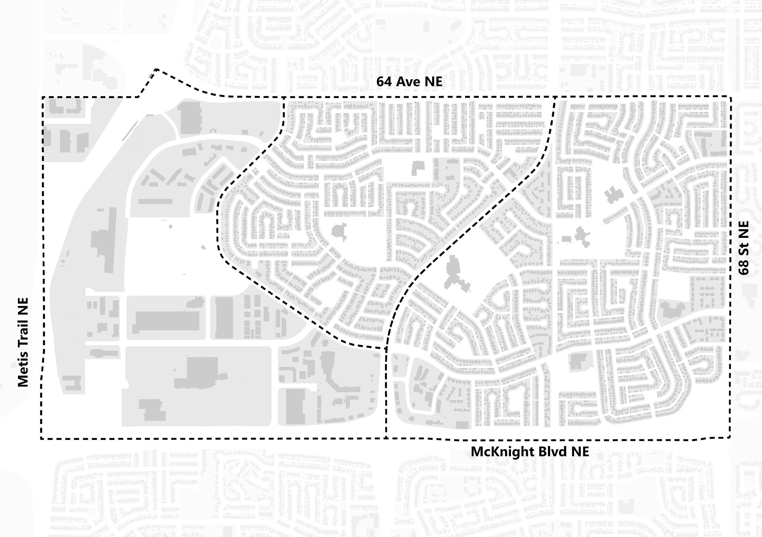
Falconridge, Castleridge, and Westwinds, a culturally rich neighnbourhoods in Northeast Calgary, benefits from its proximity to the airport and is well-connected by major roadways. 64th Avenue NE and Metis Trail NE form two of its boundaries, while McKnight Boulevard NE runs along its southern edge, shaping three sides of the community.


The western edge of the community is served by the Blue Line LRT, with the McKnight-Westwinds station located on its western edge. Additionally, the MAX Orange BRT operates along Falconridge Boulevard, which runs between the two communities. This location provides good connectivity to downtown Calgary and regional destinations such as CrossIron Mills and Drumheller.

Historical timeline

Indigenous peoples have lived in the region for over 12,000 years, relying on its rich natural resources for sustenance, trade, and cultural practices.


The Falconridge/Castleridge area was part of the Municipal District of Rockyview prior to its 1961 annexation to Calgary.

Calgary’s first airport was in Bowness in 1914. In 1956, a new airport terminal opened making it Canada’s most advanced and modern airport facility.

The park in 1990, with a gazebo in the Grant MacEwan grove, where 90 trees were planted for his 90th birthday. It then underwent an $11.90M renovation from 2014 to 2017.

Opened in 2007 as part of the line’s first extension


Formation of Falconridge/ Castleridge.
Bishop McNally was appointed Bishop of Calgary from 1913 to 1924. career was marked by his efforts to elevate English-speaking Catholics in Canada.
The Ahmadiyya Muslim Community opened Baitun Nur, the largest mosque in Canada, in Castleridge.
Historical evolution

Construction of Single-family homes began.


With half the community comprising immigrants from diverse backgrounds like India, Pakistan, China, the Philippines, and Afghanistan, it’s notable that growth projections indicate a potential decline. This negative growth could be linked to the current large population of children and young adults possibly facing limited recreational opportunities within the community, potentially leading families to seek more amenity-rich areas as their children grow.
The larger average household size in this community, coupled with a lower median income than Calgary, underscores a need for more diverse housing options better suited to accommodate larger families’ budgets. This situation also highlights the potential benefit of increased local job opportunities to improve overall household financial stability.


The community currently has a significant portion of single-detached homes, and a concerningly high percentage of residents in Castleridge spend over 30% of their income on shelter compared to the Calgary average, indicating a growing affordability challenge and limited housing diversity. With the majority of dwellings constructed in the 1980s, many are now aging and outdated.


Land Uses allowed in NEF 25-29 area
• Residences
• Schools
• Day cares
• Clinics
• Medical care facilities
• Halls and auditoriums
• Places of worship
• Outdoor eating establishments
• Outdoor exhibition and fairgrounds
• Outdoor spectator entertainment / sports facilities
• Campgrounds


A functional analysis of the site reveals several urban design challenges that hinder connectivity, accessibility, and community cohesion. The area is bordered by strong, unwelcoming edges—64 Avenue NE, Metis Trail, and McKnight Boulevard NE—that act as physical and psychological barriers.
A lack of entrance signage reduces legibility, making it hard for residents and visitors to navigate or feel a sense of arrival. Fragmented pocket parks and the nearby LRT remain underutilized due to poor connectivity and limited active transportation links. Key landmarks like the Community Association need maintenance, and houses facing away from the BRT route along Falconridge Boulevard contribute to unsafe, disconnected intersections.


The parks in the community, while offering valuable green space, are often defined by unwelcoming boundaries that limit their accessibility and comfort. Strong fencing around the dog parks creates a sense of separation rather than openness, discouraging casual use or interaction from outside. Similarly, Prairie Winds Park is bordered by harsh, uninviting edge; most notably its western side, which is flanked by industrial developments. These surroundings, dominated by concrete and machinery, detract from the natural appeal of the park and can make the space feel isolated or even unsafe. Altogether, these conditions contribute to a lack of visual and physical connection between the parks and the broader community

The community benefits from a rich variety of multicultural food stores and two major supermarkets—Real Canadian Superstore and Safeway— offering diverse grocery options. However, a key issue is that all these amenities are concentrated on the western edge near McKnight’s industrial area, rather than being evenly distributed throughout the community. This lack of integration limits accessibility for many residents and reduces opportunities for walkable, community-centered shopping experiences. Additionally, the large, unmonitored parking lots in front of these stores often become hotspots for criminal activity, creating safety concerns and making these commercial spaces feel vulnerable and unwelcoming.


from community.
The large parking lots in front of the community’s major superstores and near the LRT stations are significantly under-used and often lack any meaningful activity, especially outside of peak shopping hours. This absence of regular foot traffic and passive surveillance creates spaces that feel empty, uninviting, and unsafe. These vast, paved areas not only fail to contribute to the vibrancy of the neighborhood but also occupy high-value land that holds potential for more impactful uses. Instead of serving solely as parking, these spaces could be reimagined as mixed-use zones, community plazas, or active transit hubs that promote safety, engagement, and better land utilization.


The community is rich in multicultural social spaces, reflecting its diverse demographics, with a significant portion of residents being immigrants from India, Pakistan, Afghanistan, China, and the Philippines. The presence of seven schools within the neighborhood highlights the growing population of young families and children.
However, despite this diversity and vibrancy, key social spaces— such as churches, mosques, and community centers—are clustered on the western side near McKnight, creating a disconnect for residents in other parts of the community. This concentration limits accessibility and weakens the overall connectivity between people and the social infrastructure meant to serve them.


Narrow sidewalks throughout the community limit safe pedestrian movement and discourage walking, especially for families and seniors. In Prairie Winds Park, the presence of vehicle theft warning signs in parking lots adds to the perception of crime and unease, making the area feel unsafe rather than inviting. Additionally, many of the social spaces—such as religious institutions and community centers—suffer from aging infrastructure, which not only affects their functionality but also contributes to a neglected appearance. Altogether, these elements create an environment where safety feels compromised, and public spaces are underutilized due to concerns about security and comfort.
The built form across Falconridge, Castleridge, and Westwinds shows a fragmented urban structure. The figure ground analysis indicates that only 15 percent of the land is built up, while the remaining 85 percent consists of open or underutilized space. This is largely the result of wide roads, large setbacks, and extensive surface parking, especially in Westwinds. The spread-out nature of development contributes to inactive areas and reduced pedestrian visibility, which can affect both safety and accessibility. These underused spaces present an opportunity for strategic infill and improved spatial continuity.
Falconridge and Castleridge were primarily developed in the early 1980s with a focus on low density housing and car-oriented infrastructure. As the neighborhoods age, infrastructure renewal and expanded housing options have become increasingly important. Westwinds, although more recently developed as a commercial and employment hub, remains poorly integrated with adjacent residential areas. Enhancing connectivity between these zones, along with targeted public space upgrades and infill development, can support a more cohesive and active urban environment.


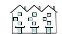
The area includes a variety of housing types such as single detached, semi detached, duplexes, row houses, and low rise apartments. These forms reflect a predominantly low to medium density residential layout shaped by earlier development patterns that prioritized car access and distinct zoning for different functions. While the mix offers some level of housing choice, it provides limited flexibility for adding density or accommodating changing household needs over time.


Single-detached poorly maintained entrance with a narrow and steep access.

Semi-detached homes look like a single unit, reducing clarity and street presence.

Staggered row house layout creates inefficient space use.

Poorly planned layouts place cars directly in front of entrances and balconies.
The residential layout in the area reveals a range of design limitations that affect both functionality and user experience. Access to several units is restricted by narrow and uneven pathways, which can create difficulties for movement and reduce overall comfort. The design of building entrances lacks definition, often making multiple units appear as a single structure and reducing visual clarity along the street. Housing layouts make inefficient use of space, with fragmented access that discourages pedestrian activity and limits opportunities for meaningful interaction with the public realm. In addition, the placement of vehicles directly in front of entrances and balconies diminishes the quality of shared spaces and weakens the connection between private dwellings and the surrounding environment.
Parcel sizes across the site are highly fragmented, with only 16 percent publicly owned land. Most parcels are small and privately held, limiting opportunities for large-scale redevelopment and coordinated improvements. Though fewer in number, municipal parcels offer strong potential for parks and public uses. Scattered ownership weakens oversight of shared spaces and reduces flexibility in planning. Clearer boundaries and stronger public space management can support safer, more connected neighbourhoods.
Residential parcels show varying redevelopment potential based on street layout. Rectangular lots on straight streets allow efficient use and adaptability, while curved roads reduce buildable area. Inward-facing loops and cul-de-sacs result in irregular parcels with minimal flexibility. These patterns limit access to main roads and transit, increase car dependence, and reduce safety. Improving pedestrian routes and exploring land consolidation can support better access and future growth.


The geometry of parcels directly influences how space can be adapted over time. Rectangular parcels along straight roads enable efficient side and rear access, facilitating additions, secondary suites, or subdivision. In contrast, parcels on curved streets limit expansion options due to irregular boundaries and setbacks, often resulting in leftover spaces that are difficult to program or maintain. Cul-de-sac configurations further constrain possibilities by concentrating access at a single point, restricting movement and emergency access. These spatial patterns not only shape individual development potential but also affect long-term adaptability, resilience, and land use efficiency across the neighbourhood.


Land use across the site is defined by a strong separation between residential, commercial, and institutional areas, which impacts how people move through the neighbourhood and access services. Falconridge and Castleridge are largely residential, with limited integration of schools and community facilities, while Westwinds functions as an isolated commercial and industrial zone. This strict zoning results in uneven activity patterns and reduces opportunities for continuous engagement across the area. The lack of gradual transitions between uses also weakens pedestrian connectivity and increases car dependency for everyday needs.
Nearly 50% of the land is low-rise residential, primarily single-family homes.
Climate and topography study


Flat terrain offers limited natural wind protection, and standing water is common during spring melt and Chinook events. North-facing sidewalks often retain ice due to limited sun exposure, raising pedestrian safety concerns.


The study area experiences high solar exposure, typical of much of Calgary, offering strong potential for passive solar design. As medium density buildings are introduced, building orientation and setbacks will play a key role in mitigating shadow impacts and maximizing solar gain. Prioritizing south-facing façades and maintaining adequate spacing between buildings can help preserve sunlight access for both public spaces and surrounding properties. These strategies contribute to energy efficiency, improved comfort, and overall environmental performance.


The neighbourhood’s open spaces face several challenges that limit their everyday use and community value. Many parks are difficult to access due to uninviting edges, lack of clear entry points, or physical barriers. In addition, limited amenities such as seating, lighting, or recreational infrastructure make these spaces less suitable for relaxation, gathering, or informal use. The absence of year-round programming further contributes to their underuse, particularly during colder months. These conditions collectively reduce the role of open spaces as active, inclusive, and welcoming environments within the community.

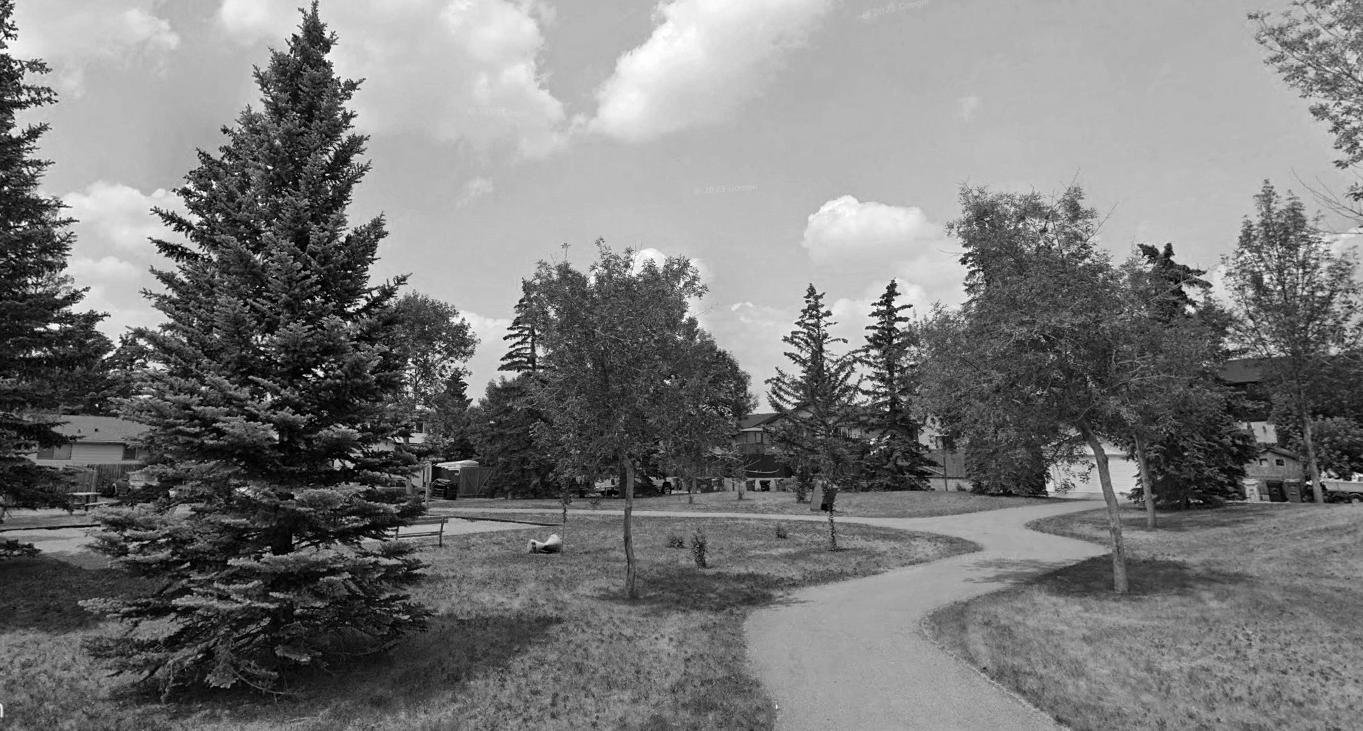
Although the area contains several open spaces, residents perceive a lack of accessible and functional parks. Many existing parks are associated with school sites and have unwelcoming edges that limit entry and discourage casual use. Amenities for relaxation and social interaction are minimal, making most parks less appealing, with Prairie Winds Park standing out as the primary exception. Limited walking and cycling connections further reduce park accessibility. However, the proposed 5A network presents an opportunity to strengthen these links. Enhancing lighting, improving visibility, and designing active, welcoming park edges can significantly increase both safety and usability.
Urban forest

The tree canopy across all three communities falls significantly below the City’s 16 percent target. While trees are more frequently found along arterial roads, residential areas remain sparsely vegetated. Expanding tree cover is essential but challenged by harsh weather conditions, including temperature fluctuations and high winds, as well as pressures from redevelopment and densification. Integrating trees with stormwater management systems can enhance runoff control, reduce erosion, and improve longterm tree health. Strategic planting also contributes to improved sightlines, effective buffering, and a stronger sense of neighbourhood identity.

Site observations revealed that public spaces are significantly underutilized during colder months, often feeling empty and disconnected from surrounding activity. Despite the presence of amenities such as skating rinks and fire pits, pedestrian movement was limited, particularly along internal residential streets. Accumulated snow, icy surfaces, and poor lighting contributed to walking hazards, blind spots, and a heightened perception of insecurity.
To improve winter usability, the strategy recommends activating spaces year-round through community-oriented programming and adaptive use of existing infrastructure. Enhancing lighting along pedestrian routes and implementing clear signage and wayfinding are also proposed to improve visibility and support a greater sense of safety.


Living in this community offers the convenience of well-served public transit. The Blue Line LRT and MAX Orange BRT run along the community, providing rapid connections to the wider city.
Inside the neighbourhood, routes 21 and 55 operate frequently, approximately every 25 minutes, along the proposed 5A network. These internal routes make it easy for residents to access the BRT stops and the Westwinds train station.
Furthermore, additional bus routes weave through the area, linking residents to neighbouring communities, the Prairie Winds Park, and other LRT stations, making commuting and exploring the city highly accessible.

Intersections within the neighbourhood present safety risks due to confusion over right of way, frequently resulting in T-bone collisions. Contributing factors include inadequate signage, poorly timed traffic signals, and inconsistent interpretation of traffic rules. These conditions lead to abrupt stops, misjudged crossings, and increased risk for both drivers and pedestrians, particularly at unsignalized or poorly marked junctions. In winter months, these challenges are compounded by slippery surfaces and faded or obscured pavement markings. To improve safety, upgrades such as clearer signage, visible road markings, and properly timed traffic signals are recommended to support predictable movements and reduce the likelihood of collisions.


The community is bordered by two major arterial routes, Metis Trail and 64th Avenue, providing efficient regional connections along its edges. McKnight Boulevard forms a skeletal road along the southern boundary. Within the community, a network of collector roads facilitates local traffic flow and access to residential areas.
The residential streets within the community currently lack vibrant activation, and their narrow sidewalks pose a challenge for both pedestrians and cyclists. The limited width makes it difficult for individuals to comfortably walk or bike in groups, potentially impacting social interaction and active transportation options within the neighbourhood.


6th February, 2025
The first community engagement session was held on February 6, 2025, in collaboration with the Falconridge/Castleridge Community Association (FCCA). This workshop aimed to gain a deeper understanding of the lived experiences, challenges, and priorities of local residents. Posters displaying preliminary site analysis and urban issues were set up to prompt discussion, while key questions were presented to initiate open, friendly conversations. The session encouraged participants to share their concerns on topics such as accessibility, safety, housing conditions, and public space usage. Insights gathered from this workshop played a critical role in shaping the direction of the design proposals, ensuring they responded to actual community needs rather than abstract planning assumptions.
12th April, 2025
The second open house was conducted on April 12, 2025, again at the FCCA, and focused on presenting the team’s proposed design interventions. This session provided an opportunity for residents to review and comment on the spatial ideas, planned improvements, and design solutions developed in response to earlier feedback. Through visual displays and one-on-one conversations, community members were invited to engage with the proposals, share their thoughts, and suggest possible changes. The feedback collected during this session helped shape the final recommendations and highlighted the importance of an open, collaborative approach to community planning. The event also served as a platform to build trust and transparency between the design team and local residents, reinforcing the community’s role in shaping its future.


Community feedback revealed a strong desire for a safer and more connected neighbourhood environment. Residents emphasized the need to upgrade aging parks and open spaces, noting that many facilities no longer meet current community needs. Concerns were raised about limited access to schools and the lack of nearby recreational amenities for all age groups. Gaps in pedestrian and cycling infrastructure were seen as barriers to everyday mobility, especially for families and seniors. Additionally, language barriers and generational differences were mentioned as factors contributing to social isolation, reinforcing the need for more inclusive and supportive public spaces that bring the community together.
Housingchallenges


Strengths and weakness
Strengths


Under-Utilized Public Spaces
This community has several strengths that enhance the quality of life for its residents. The presence of the LRT and the proposed 5A bike network by the City of Calgary offer excellent sustainable transportation options. With seven school sites located throughout the area, families with children are wellserved. The significant Prairie Winds Park in the Northeast provides a valuable green space for cultural events and recreational activities for children during the summer. Furthermore, bus stops are conveniently located throughout the community, and the BRT running along Falconridge Boulevard ensures efficient and accessible public transit connections.
Despite its strengths, the community faces certain weaknesses. The absence of dedicated bike lanes throughout the neighbourhood hinders safe and convenient cycling. Large, underutilized parking lots represent a potential for more vibrant land use. Additionally, the presence of fragmented pocket parks limits their usability and impact. The unwelcoming edges of open spaces, along with barriers like industrial zones and fences, detract from the overall appeal and accessibility of these areas. Furthermore, traffic incidents at major intersections raise concerns about pedestrian safety, contributing to a potentially unsafe environment.

Connect the proposed 5A bike network directly to LRT stations for better active transportation and transit integration.
Transform underutilized parking lots into dynamic mixed-use developments with residential, commercial, and community spaces.
Integrate and enhance the existing fragmented pocket parks to create larger, more functional green spaces.
Improve the edges of open spaces by adding landscaping and pathways to make them more inviting and accessible.
Implement safety measures at major intersections to reduce traffic incidents and enhance pedestrian safety.
Introduce initiatives to activate residential streets and foster community interaction and pedestrian comfort.

Natural surveillance occurs by designing the placement of physical features, activities and people in such a way as to maximize visibility.

Natural access control is a physical guidance for people coming and going from a space by the placement of entrances, fences, landscaping and lighting.

Territorial reinforcement provides clear boundaries between public and private areas using physical elements to express ownership.

Activity support involves planning and organizing spaces to foster positive social interactions, by facilitating legitimate activities such as community gatherings, recreational areas, and mixed-use developments.

Image refers to the maintenance and design of a space to create a positive, well-caredfor appearance that deters crime and promotes community pride.

The urban form map outlines Castleridge Boulevard as the primary main street, connecting key community destinations such as Westwinds Corner and Castleridge Plaza. Fixed commercial zoning is limited, with neighbourhood flex zones introduced to accommodate small-scale businesses and adaptable land uses. At key intersections, flexible designations allow local character to respond to evolving community needs. A recreation centre is located adjacent to the LRT station to enhance accessibility and activate the surrounding area. Castleridge Drive, Falconridge Boulevard, and Falton Drive function as neighbourhood connectors, supporting transit access, walkability, and safe, multimodal circulation. The overall structure aligns with the principles of the 5A Network, promoting a connected and inclusive built environment.

The urban scale map highlights the building height strategy that supports future growth while maintaining the character of existing neighbourhoods. Heights of up to six storeys are concentrated near the LRT station and intersection along Castleridge Blvd to encourage higher activity levels and mixed use development in areas with strong transit access. Along primary connectors such as Castleridge Drive NE, Falconridge Boulevard, and Falton Drive NE, up to four storeys are supported to promote active frontages and provide a smooth transition into adjacent residential areas. The remaining neighbourhood context supports heights of up to three storeys, aligning with the existing residential character. This gradual change of building heights enables balanced intensification, while directing density toward transit nodes, surface parking lots, collector roads, and open spaces helps activate underused areas and improve pedestrian safety.


Adding approx. 30 km of bike paths enhancing connectivity to fragmented parks, LRT, and BRT, fostering safe, active transportation and improving community mobility.
The Open Spaces and Connectivity plan enhances the City’s proposed 5A network by addressing key connectivity gaps. Currently, the network lacks a direct link to the LRT and fails to connect several fragmented pocket parks, leaving them underused and isolated.
To resolve this, the network has been extended to create a continuous route to both the LRT and Prairie Winds Park. New bike lanes have also been added, branching from the main network to link these smaller green spaces. These improvements aim to activate underutilized parks, promote active transportation, and create a more accessible, integrated, and inclusive system of open spaces across the city.


Our strategy begins with identifying underutilized spaces and assigning them land uses that encourage activity and community engagement. These spaces are reimagined to support recreation, social interaction, and local events. The next layer focuses on revitalizing open spaces—such as school playgrounds, the utility corridor, and pocket parks—transforming them into vibrant, multi-functional areas.
To connect these improvements, we enhance the pedestrian and bicycle network, making the neighborhood more walkable, accessible, and cohesive. Together, these interventions create a layered, integrated system that activates public space, strengthens community connections, and supports a more inclusive and dynamic neighborhood environment.


Castleridge Boulevard currently lacks pedestrian activity, with narrow sidewalks and minimal street engagement. The proposed design introduces wider sidewalks, active commercial frontages, and improved pedestrian and cycling connections. Buildings are reoriented toward the street to create a more inviting and connected public realm.
Introducing neighbourhood main street
Contribution of pedestrian & bicycle routes to vitality.
Clear sightlines through landscaping.
Continuity with the existing streets & pedestrian routes.
Views from buildings on public spaces.
Sufficient activities to provide spontaneous surveillance.

Street activation along Castleridge Blvd
Promoting mixed-use development along Castleridge Boulevard as a potential main street.


The surroundings of the Westwinds LRT station experience low activity levels and limited visibility, raising safety concerns due to the absence of consistent pedestrian presence. Residents noted the station feels isolated during off peak hours and emphasized the lack of accessible recreational facilities. Existing centres were reported to be insufficient, particularly in providing swimming and cricket amenities, which are of high interest to children and youth. These insights point to the need for improved passive surveillance and better community-oriented infrastructure.
Clear view landscaping
Public art installation to define the space
Shaded seating areas acting as passive surveillance
Year-round activation
Transparent facades for visual connections

Activating public space near transit to enhance safety and community presence.


The housing strategy introduces a wider range of low-rise residential typologies to increase diversity within the neighbourhood. The current residential pattern is predominantly composed of single detached homes, often occupied by multi-generational families. To support more inclusive and adaptable housing options, new forms such as duplexes, triplexes, row houses, multiplexes, and live work units are proposed. These “missing middle” housing types provide a gentle increase in density while respecting the existing scale and built character. This approach enables gradual growth and accommodates changing household needs without significantly altering the neighbourhood’s form.
Source: Parolek, D. G. (2020). Missing middle housing: Thinking big and building small to respond to today›s housing crisis (pp. 175–92).
Policy recommendations (Land use)
1.0 Policy recommendations for neighbourhood main street :-
1.1. Encourage redevelopment that introduces active ground-floor uses to support a more vibrant street environment and reinforce the corridor’s role as a local destination.
1.2.Support building design that enhances the relationship between private development and the public realm, including clearly defined entrances, transparent facades, and human-scale frontage elements.
1.3. Promote a street design that accommodates a range of users, including those walking, cycling, using mobility aids, and accessing transit, through dedicated facilities and safe, accessible crossings.
1.4. Integrate landscape and streetscape improvements that balance aesthetic value with visibility and safety, supporting both comfort and passive oversight in the public realm.
1.5. Strengthen physical and visual connections between adjacent uses and the main street to support more seamless movement and encourage everyday community interaction.
1.6. Facilitate opportunities for informal gathering and short-term activity along the corridor, such as seating areas, waiting zones, and frontage spaces that adapt to various community needs throughout the day.


2.0 Policy recommendations for Westwinds commercial hub :-
2.1 Support the redevelopment of vacant or underutilized parcels near the LRT station into a vibrant commercial and civic hub that accommodates essential services, cultural venues, and institutional uses.
2.2 Encourage the development of a recreation and wellness centre that includes indoor and outdoor facilities meeting the needs of a diverse population, including fitness, health, and youth-focused programming.
2.3 Promote the inclusion of commercial retail, dining, and entertainment uses such as a movie theatre to enhance local vibrancy and establish the hub as a key social and economic destination.
2.4 Incorporate crime prevention and safety-oriented design principles in new development and public spaces, including natural surveillance, appropriate lighting, unobstructed sightlines, and defined pedestrian routes to enhance user comfort and community well-being.
2.5 Facilitate year-round activation of public spaces through community events, seasonal programming, and temporary installations that encourages ongoing social interaction.


Several open spaces along residential streets remain underutilized. To enhance their function and community value, features such as picnic areas, discovery gardens for children, community food gardens, and covered seating are proposed. The integration of native trees and shrubs will help transform these spaces into local biodiversity zones, contributing to a wider ecological network that supports pollinators and wildlife movement across the neighbourhood.


The open space strategy focuses on enhancing everyday access to nature while contributing to broader environmental goals. A key objective is to help increase the urban tree canopy, which currently remains below the city’s 16 percent target. Beyond ecological function, these improvements are intended to elevate the quality of life for residents by creating inviting, well-used public spaces. During the second open house, community members expressed strong support for the approach, emphasizing the value of revitalizing underutilized green areas throughout the neighbourhood.


Native plants & shrubs for ecological benefits
Ambient lighting to support passive surveillance
Proposed Flexible spaces for picnics & gatherings
Winter friendly activities

Activating the pocket parks with year round activites
Revitalizing pocket parks
Fence to restrict access
Amenities to support daily activities
Distinct paving to define transition
Ambient lighting to support passive surveillance
as natural sightlines

Redesigning the utility corridor to add vibrancy and make it safe.
Revitalizing pocket parks
Native plants & shrubs for ecological benefits
Edge activation for spontaneous survellience
Organic shaped seating adding friendly character
Heated seating for winter
Inclusive activities

Pocket park at the intersection of Falsby Rd,NE & Falsby PI, NE
Naturalizing the neglected pockets to enhance the quality of life.


Open space analysis identified two main types in the neighbourhood: large areas linked to school grounds and smaller green pockets within residential streets. Residents noted a lack of adequate parks, largely due to the limited functionality of school sites, which often lack amenities and social uses. Many open spaces also have inactive edges that reduce accessibility and discourage use. To address these issues, proposed improvements include defined entry points, seating, bike racks, lighting, signage, and enhanced landscaping. Activation through community programming such as festivals and public events is also recommended to improve safety, vibrancy, and inclusivity. Together, these strategies aim to transform underused spaces into accessible and welcoming places for all residents.

Sports transforming underutilized spaces into vibrant spaces.
Well placed amenities encourages social interaction
Clear pathway provides improved accessibility
Trees for traffic calming

Bishop McNally School, Falworth Rd-Falconridge Blvd NE
Activating open spaces by redesigning edge conditions.
Repurposing school sites
Multiuse spaces for cultural performaces
Encouraging public gatherings to improve vibrancy

Proposing diverse activities to enhance vibrancy.
3.0 Policy recommendations for open space functionality.
3.1 Prioritize infrastructure upgrades in open spaces, including school grounds and smaller green pockets, to enhance their overall functionality, accessibility, and seasonal usability as integral components of the public realm.
3.2 Support the integration of site furnishings such as benches, bicycle parking, and pedestrian-scale lighting, along with clear way finding and universally accessible entry points, to improve comfort, safety, and visibility for a diverse range of users.
3.3 Encourage design interventions that activate currently underutilized spaces by accommodating both passive and active recreational opportunities, promoting more consistent community engagement throughout the year.
3.4 Reinforce the role of open spaces as everyday gathering places by facilitating inclusive, flexible environments that support spontaneous use and a variety of programming possibilities across seasons.
4.0 Policy recommendations for open space activation.
4.1 Encourage the programming and redesign of open spaces to accommodate a variety of temporary and permanent uses that foster community gathering, cultural celebration, and everyday social interaction.
4.2 Support a broad range of activities including sports and outdoor games, cultural festivals, local markets, workshops, and public events through adaptable infrastructure and multi-functional design elements that ensure year-round use and inclusivity.
4.3 Promote inclusive design principles that enable open spaces to be welcoming and accessible for users of all ages, backgrounds, and abilities, reinforcing equitable access to cultural and recreational opportunities.
4.4 Strengthen the identity of open spaces as dynamic social and cultural hubs within the neighbourhood by supporting interventions that reflect and celebrate local character, creativity, and community life.

5.0 Policy recommendations for open space connectivity and edge activation.
5.1 Encourage new development around existing open spaces to strengthen visual and physical connections within the neighbourhood and enhance the role of parks as central, accessible elements of the public realm.
5.2 Support the orientation of adjacent buildings, windows, and shared amenity spaces toward open spaces to promote passive surveillance, reduce shadow impacts, and create opportunities for residential or commercial frontages that contribute to a more vibrant and engaged park edge.
5.3 Promote the integration of clear access routes and active interfaces between open spaces and surrounding development, reinforcing walkability and supporting seamless connections across neighbourhood destinations.
5.4 Enhance edge conditions through the provision of continuous pathways, landscaped buffers, lighting, and gateway features that improve comfort, visibility, and accessibility, consistent with pedestrian-first design principles.

6.0 Policy recommendations for urban forest expansion.
6.1 Integrate urban tree planting strategies into all park redevelopments and open space enhancements to contribute to the citywide urban canopy target of 16%, reinforcing the ecological and environmental value of public green spaces.
6.2 Prioritize planting initiatives in areas with low existing canopy coverage, as identified through the City’s environmental inventory, to support equitable access to the benefits of a healthy urban forest.
6.3 Promote tree planting that delivers functional outcomes such as shade provision, urban heat island mitigation, and year-round ecological value, supporting both environmental resilience and user comfort.
6.4 Ensure the long-term health and vitality of newly planted trees through regular maintenance, and where feasible, integrate trees into stormwater management systems including bioswales and stormwater ponds— to support sustainable irrigation and climate resilience..

7.0 Policy recommendations for pocket parks and ecological activation.
7.1 Encourage the transformation of pocket parks and small green spaces within residential areas through the introduction of active uses such as picnic areas, children’s discovery gardens, community food gardens, and covered seating to promote regular use and social interaction.
7.2 Support inclusive design strategies that ensure these spaces are welcoming and accessible for users of all ages and abilities, reinforcing equitable access to local green amenities.
7.3 Promote naturalization through the integration of native plantings, including trees and shrubs, to enhance biodiversity, support pollinators, and establish pocket parks as integral components of a broader ecological network.
7.4 Prioritize adaptable design interventions—such as heated seating, fire pits, winter lighting, and heated pathways—to facilitate year-round usability and seasonal programming that responds to local climate conditions.
7.5 Strengthen the role of pocket parks as everyday nature-based destinations that enhance community well-being, foster environmental stewardship, and contribute to a higher quality of life for residents.


Panna Park is an underused space with narrow sidewalks, no bike lanes, and little to invite people in. With improved bike lanes, active uses, and natural surveillance from surrounding homes, Panna Park becomes a vibrant, welcoming hub for the community. Before
Connecting pocket parks with new bike lanes
Play areas to support activity
Homes facing the park provide natural surveillance
Extensive bike path network to connect fragmented pocket
Pocket parks activation Trees for traffic calm-


The Falconridge-Castleridge Boulevard intersection is unsafe for pedestrians, with houses facing away from the street, no bike lanes, narrow sidewalks, small crossing islands, and a lack of street-level activity. Redesigned with separate pedestrian and bike lanes, relocated bus stops, and buildings oriented toward the intersection, the area gains natural surveillance, improved safety, and vibrant, active edges along the 5A Network.
Connecting fragmented parks with new bike
Islands can provide a safer, more accessible waiting area
5A network connecting BRT/ LRT & commercial hub.
Eyes on street
Trees for traffic calming
Bringing buildings closer to Intersections for increased visibility

Separate cyclists & pedestrians pathways to reduce conflicts
Intersection at Castleridge & Falconridge blvd.
5 Drive Lanes without bicycle paths

Inadequately designed BRT stop area

Existing Section-AA
Storefronts activating 5A Network. No eyes on the street, residential street pushing buildings away. Eyes on the street

Proposed Section-AA


8.1 Expand the 5A mobility network to establish uninterrupted, well-defined cycling connections to the LRT station and Prairie Winds Park. Prioritize clear sightlines for enhanced natural surveillance and implement vehicle access restrictions to minimize conflicts and improve overall user safety.
8.2 Reconfigure high-conflict intersections through the addition of dedicated pedestrian and cycling infrastructure, strategic relocation of transit stops, and enhanced lighting to elevate visibility, reduce collisions, and foster a safer, more user-friendly environment.
8.3 Strengthen the 5A network by orienting adjacent buildings and retail frontages toward key intersections and sidewalks, promoting natural surveillance, enhancing visibility and access, and supporting lively, people-oriented edges along primary transit corridors.
8.4 Extend bike connections from the 5A network to nearby pocket parks, leveraging surrounding visibility to increase natural surveillance and re-energize underused spaces as safe, inviting community destinations.
8.5 Improve BRT bus stops by incorporating secure bicycle parking, upgraded lighting, and clearly marked pedestrian routes to support multi-modal travel and elevate perceptions of safety through enhanced visibility and passive oversight.


Short, medium, & long-term
Land use
Westwinds Commercial Hub
2.4 Apply safety-focused design: lighting, clear sightlines, and pedestrian routes.
2.5 Activate public spaces with events, seasonal programming, and installations.
Connectivity
Immediate Action
8.1 Improve bike routes with lighting and restricted vehicle access.
8.5 Upgrade BRT stops with bike parking and clear pathways.
Land use
Neighbourhood Main Street
1.2 Improve building frontages with defined entries and transparent facades.
1.3 Enhance streets for all users with safe crossings and dedicated facilities.
Open spaces
Activating parks
4.1 support temporary and permanent uses that foster community gathering and cultural expression.
6.1 Integrate tree planting into park redevelopment to expand the urban
Land use
Westwinds Commercial Hub
2.2 Develop a recreation and wellness centre with diverse indoor/outdoor amenities.

Open spaces
Infrastructure Upgrade
3.1 Upgrade open space infrastructure for better accessibility and year-round use.
3.2 Add benches, bike racks, lighting, and clear wayfinding for improved comfort and
Land use
Neighbourhood Main Street
1.1 Introduce active ground-floor uses to create a more vibrant street life.
1.6 Add flexible seating, waiting zones, and spaces for informal gathering.
Land use
Westwinds Commercial Hub
2.1 Redevelop vacant parcels near LRT into a vibrant, mixed-use hub.
2.3 Introduce commercial, dining, and entertainment to boost activity.
Connectivity
Intersection safety
8.2 Reconfigure intersections with separated lanes and relocated transit stops.
8.3 Orient buildings to enhance visibility and street life.
Connectivity
Bike network expansion
8.4 Extend 5A bike network to key parks and the LRT.
Open spaces
Transforming open spaces
5.1 Encourage development around open spaces to strengthen visual and physical connections.
5.2 Orient buildings to enhance park edge vibrancy and passive surveillance.
Land use
Neighbourhood Main Street
1.4 Upgrade landscapes to improve comfort, visibility, and safety.
1.5 Strengthen visual and physical links between the street and surrounding areas.
1.Commonwealth Community Recreation Centre / MacLennan Jaunkalns Miller Architects. (2013, June 15). ArchDaily. https://www.archdaily.com/380617/commonwealth-community-recreation-centre-maclennan-jaunkalns-miller-architects
2.Wallingford, in. (2020, May 8). b9 architects. B9 Architects. https://www.b9architects.com/wallingford45
3.906 16th Ave SW, Calgary, AB T2R 1C1 - Mount Royal West | LoopNet Canada. (2024). LoopNet. https://www.loopnet.ca/Listing/906-16th-Ave-SW-CalgaryAB/26853923/
4.H A N D B O, O., & Diap. (n.d.). Servizio Politiche per la sicurezza e la polizia locale Servizio Riqualificazione Urbana PLANNING URBAN DESIGN AND MANAGEMENT FOR CRIME PREVENTION. https://designforsecurity.org/downloads/Designing_Out_Crime.pdf
5.Crime Prevention Through Environmental Design Guidelines: An Illustrated Guide to Safer Development in Our Community Safe Growth and CPTED in Saskatoon. (n.d.). Retrieved March 13, 2025, from https://www.saskatoon.ca/sites/default/files/documents/community-services/planning-development/neighbourhood-planning/CPTED%20Guidelines_WEB.pdf
6.Zhang, H., Kiyai, G., & City Graduate School, City University Malaysia. (2024). Pocket Parks in Urban Design: Enhancing urban environment and community Well-being. In Highlights in Art and Design (Vol. 5, Issue 3).
7.Major Intersections. (2013, July 11). National Association of City Transportation Officials. https://nacto.org/publication/urban-street-design-guide/intersections/major-intersections/
8.National Association of City Transportation Officials. (n.d.). Major intersections. Urban street design guide. National Association of City Transportation Officials. Retrieved March 13, 2025, from https://nacto.org/publication/urban-street-design-guide/intersections/major-intersections/
9.University High School (Los Angeles). (2025, March 13). Wikipedia. Retrieved March 13, 2025, from https://en.wikipedia.org/wiki/University_High_School_ (Los_Angeles)
10.Stantec. (2021, June 22). More than just another bus route: Can BRT spur compact urban development? Stantec. Retrieved March 13, 2025, from https:// www.stantec.com/en/ideas/topic/mobility/more-than-just-another-bus-route-can-brt-spur-compact-urban-development
11.Pete’s Elementary. (n.d.). Home page. Pete’s Elementary. Retrieved March 13, 2025, from https://peteselementary.com/
12.City of Kelowna. (n.d.). Bike routes & safety tips. Active transportation. City of Kelowna. Retrieved March 13, 2025, from https://www.kelowna.ca/ roads-transportation/active-transportation/bicycling/bike-routes-safety-tips
Grid & Form Studio Plan 630
Advanced Professional Planning Studio
Falconridge, Castleridge and Westwinds