DEFINE
LOCAL AREA PLANNING CONCEPT DOCUMENT FOR FALCONRIDGE, CASTLERIDGE & WESTWINDS

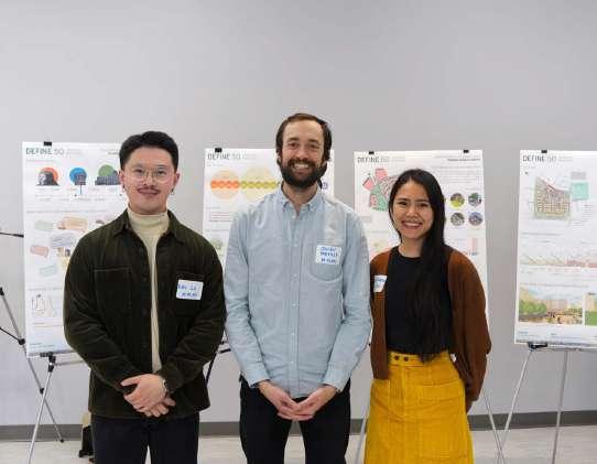
Prepared by Donghao Lu, Julien Doucette-Preville, & Stacy Florendo
ACKNOWLEDGEMENTS
In the Blackfoot language, Calgary is Moh’kin’stis; in Stoney Nakoda, Wiçispa Oyade; in Tsuut’ina, Gu’tsi’tsi and in Métis, it is Otoskwunee. For each of these Indigenous languages, the words translate to ‘Elbow,’ representing the confluence of the Bow and Elbow Rivers.
This is where the story of Calgary begins as the confluence has been a trading hub for Indigenous peoples for millennia and the site where they celebrated natural abundance, ceremony, culture, and partnerships.
This plan acknowledges the traditional lands of the Treaty Seven Nations – the Blackfoot confederacy, (Siksika, Kainai, Piikani), the Tsuut’ina, the Îyâxe Nakoda Nations (Bearspaw, Chiniki, Wesley), the Métis Nation of Alberta, Region 3, and all people who have made Calgary their home. This plan honours their long history and deep connections to this land. The strength and energy of Calgary comes from the land it was built on, as well as the Indigenous people and newcomers whose footsteps have marked this territory.
- City of Calgary, Municipal Development Plan, p. viii
As Common Plan undertakes the Define 50: Planning for a Vibrant Future Plan, we are committed to embedding inclusivity, respect, and reconciliation into our planning process, ensuring that this work contributes to a future empowering all communities for the common good.
Instructor
Teaching Assistant
Steering Committee
Zach HOEFS
Ryan LEBELL
Allison DAVELAAR
Maggie DYCKE
Evan GOLDSTROM
Common Plan would also like to thank CivicWorks Planning + Design and the Falconridge / Castleridge Community Association for their assistance.
EXECUTIVE SUMMARY
Common Plan is a simulated urban planning & design studio as part of the Master of Planning program at the School of Architecture, Planning & Landscape (SAPL) of the University of Calgary. Through SAPL's CITIZEN+STUDENT partnership with the Federation of Calgary Communities, Common Plan helps the northeast communities of Falconridge, Castleridge, and Westwinds to build their capacity on development issues in the area. Through Common Plan's work with the Falconridge / Castleridge Community Association (FCCA) and directly with residents and interested parties from January to April 2025, Common Plan delivered this visioning document titled Define 50: Planning for a Vibrant Future
This document outlines a long-term vision for how the three communities could evolve over the next half-century. Common Plan presents a comprehensive analysis of each community to identify their strengths, weaknesses, opportunities, and constraints. Building on this analysis, we propose a two-layered planning framework to guide interventions in land use, mobility, and the open space and public realm. To illustrate how these strategies might be applied, we developed conceptual designs for three key sites: the McKnight–Westwinds LRT Station area, Castleridge Plaza, and the stretch of Falshire Drive NE adjacent to the FCCA.
Please note: this document is not intended to resemble formal municipal planning documents such as Local Area Plans or Area Structure/Re-development Plans. Rather, it offers the community a set of ideas and directions to consider when the opportunity for formal local area planning arises.

PART I: INTRODUCTION
Common Plan is excited to partner with the Falcondridge / Castledridge Comunity Association and the School of Architecture, Planning and Landscape at the University of Calgary on the development of a local area plan. This process will allow the community to develop a common path forward in creating a vibrant, functional, human-scale community.
1. OUR TEAM
Donghao is a final year Master of Planning student at the University of Calgary with a commitment to sustainable and equitable regional and urban development. He is experienced in policy and socioeconomic data analysis, real-estate market analysis and proposal, and urban design with a passion for human-centred community planning solutions.


Julien is an experienced engagement professional with a strong background in public speaking and policy analysis. He is committed to creating design-oriented and community-led solutions to urban issues. He is completing his Master of Planning at the School of Architecture, Planning and Landscape in Calgary with a focus on environmental sustainability in the realm of urban planning.
Stacy is a Master of Planning candidate at the University of Calgary, with a strong focus on sustainable urban growth and community engagement. She brings experience in policy development, data analysis, and urban design, with a passion for creating livable, inclusive cities. Stacy is dedicated to bridging the gap between environmental stewardship and social equity in her planning approach, working towards solutions that benefit both people and the planet.

Donghao Lu
Junior Planner
Julien Doucette-Préville
2. Our vision
Common Plan envisions communities where nature, culture, and urban life flourish together - where every development strengthens environmental resilience while fostering meaningful connections between people and place.
3. Our mission
Common Plan creates enduring urban environments through comprehensive analysis and collaborative design. By understanding the deep layers of placefrom natural systems to cultural heritage - we shape communities that are both environmentally wise and socially vibrant. Our designs celebrate local identity while building lasting value for future generations.
4. Our approach
Common Plan's methodology rests on three pillars:
Environmental Stewardship:
We treat landscape as the foundation of all urban design, ensuring our projects enhance natural systems and strengthen ecological resilience.
Public Realm Excellence:
We craft high-quality streets, parks, and gathering spaces that form the backbone of community life and civic engagement.
Cultural Continuity:
We honour each place’s unique character by understanding its evolution over time and designing solutions that respect local patterns while addressing contemporary needs.
2. PROJECT UNDERSTANDING
1. Legal & policy framework
The communities of Falconridge, Castleridge, and Westwinds is subject to a series of federal, provincial, and municipal laws and plans to varying degrees. For simplicity, only directly impactful ones are included.
Calgary International Airport Zoning Regulations (C.R.C., c. 77) (CIAZR)
Due to the communities’ vicinity to the Calgary International Airport, building heights therein are subject to the parametres established by the CIAZR. In proposing changes in building heights, in the communities, these building height parametres and non-negotiable factors to comply with.
Airport Vicinity Protection Area Regulation (R.177.2009) (AVPAR)
The AVPAR regulates land use and development in the Calgary International Aiport protection area to mitigate impacts on and from airport operations. Because all Westwinds, Castleridge, and part of Falconridge fall within the protection area, proposed interventions will comply with acoustic and land use requirements of the AVPAR along with building height requirements of the CIAZR.
Calgary Municipal Development Plan (MDP)
The MDP sets out a vision for Calgary’s development with a 60-year horizon. It consists of the Municipal Development Plan (vol. 1), Community Guidebooks (vol. 2), and the Calgary Transit Plan (vol. 3). None of Falconridge, Castleridge or Westwinds is subject to any ASP or ARP.
Land Use Bylaw (LUB)
The LUB establishes an array of land use districts in Calgary and set out regulations applicable to each of them. The LUB also provides for administrative matters, including specifying the Approving and Subdivision Authorities required under the MGA, and prescribed mechanisms for land use amendment and development permit applications.
Guide for Local Area Planning (Guide)
The Guide provides direction for managing planning and development in Calgary’s neighbourhoods by aligning Local Area Plans with city-wide goals.
Federal: Provincial:
Municipal:

2. Key issues
Public realm interface
The poverty of the public realm is a major challenge for the community and no longer inline with city design guidelines. The commercial nodes of the community are geographically clustered in the west of the community and are largely composed of vehicle-oriented commercial substantially setback from the street. Neighborhood vibrancy and pedestrian comfort could be improved through improvements in the public realm interface and street redesign.
Mobility
The original curvilinear street layout creates a disorienting pedestrian experience and emphasizes vehicular based mobility. Additionally, the communities are hemmed in by high traffic roadways creating barriers to accessing amenities. Community members have highlighted concerns about a lack of pedestrian connectivity and comfort and high traffic volumes.
Neighbourhood lifecycle
The communities are predominantly composed of older single-family dwellings, and many are nearing the end of their lifecycle. Attracting developer interest is essential in renewing the housing stock and presents an opportunity to diversify the housing typology of the communities. Greater housing diversity will allow younger community members to remain as residents by lowering the entry threshold into the housing market.
Densification
As an established developed area, these communities are expected to densify to accommodate growth particularly near activity centers and LRT stations. The neighbourhood is particularly sensitive to concerns over densification with a recent major project having faced strong community opposition. Neighbourhood redevelopment will require densification in order to support public realm investments and commercial viability. Careful consideration will have to be given to siting increased density within the community. Mixed use projects can present an opportunity for community rejuvenation, densification and eyes on the street.
3. Key parties of interest
Key parties of interest include the City of Calgary, community members, FCCA, the steering committee, SAPL, University of Calgary, developers, businesses, cultural & religious institutions, and schools.


3. METHODOLOGY
Common Plan proposes a five-phase approach to provide a solid understanding of the porject and a comprehensive, reasonable, and realistic intervention strategies. Common Plan’s quintet includes Phase 1: Discover, Phase 2: Understand, Phase 3 Conceptualise, Phase 4: Define, and Phase 5: Refine.
Phase 1: Discover
Phase 1 is the initial response to the request by the Falconridge Castleridge Community Association for a community renewal project proposal. In this phase Common Plan will collect the relevant information to create an initial portrait of the community and begin its preliminary analysis. Included in this phase will be an outlining of the scope of work, key stakeholders, work plan, budget and research methodology.
Data collection
Datasets from the Spatial & Numeric Data Service which includes, orthophotos, digital aerial surveys, parcel information, 3D Models, digital elevation model, census data and traffic flow information will be organized and assigned to analysis categories. These resources will be combined with a site visit, open data from the City of Calgary and policy regime to create a fundamental understanding of the community and discover the key issues that it faces.
Stakeholder & Policy Mapping
Important actors in the community will be identified to understand priorities in engagement. The community’s current policy framework and legal rubric will be researched and analyzed to understand the scope of the project interventions and standards that must be met.
Research methodologhy
Develop a research methodology that will outline the flow and scope of the project in order to respond in a systematic manner to the concerns of the community and create meaningful design interventions.
Base map
Base maps will be created that will enable further analysis in Phase 2 of the project. Base maps can be found in the Annex to this proposal and include maps outlining the arrangements, features and networks of the communities.
Phase 2: Understand
Phase 2 will focus on a detailed analysis of the community including its historic evolution, socio-demographics, urban morphology, environmental features, built form and infrastructure. Through spatially situated mapping, these findings will identify areas that require design intervention and revitalization. A community workshop will be integral in further defining issues, opportunities and constraints. In conjunction with feedback from the steering committee, this will inform the next phase which will be the creation of a land use and development concept.
Cultural landscape
The analysis of the community will provide context to the sense of place and character that has historically defined it. By understanding its legacy, our interventions will be better guided and reflect the past while moving towards a bold future. People are the foundation of a community and through both a personal and data driven approach, we will better understand the needs that are unaddressed by the current urban morphology.
Natural landscape
The identification of key environmental features will be essential in creating a plan that responds sustainably to the need for community revitalization. This will allow to further the ecological integrity of the community through design interventions that foster biodiversity, connectivity and resilience.
Urban morphology
The current land use and parcel composition pattern is an important foundational element of the urban form. Land use patterns inclusive of housing and commercial makeup will be assessed against best practices to understand how urban form might be aligned with City of Calgary standards to ensure housing diversity and complete communities.
Infrastructure
Early engagement has highlighted issues with connectivity within the communities. This assessment will look at mobility choice and movement patterns to understand the state of current transportation infrastructure. Added considerations will be given to infrastructure elements that may need upgrading or present constraints.
Gap analysis
The main findings from the above sections will be analyzed to identify opportunities and constraints that exist within the community and how future interventions may best address issues in a manner that creates design synergies.
Phase 3: Conceptualise
The analysis from the earlier phase will be used to create a conceptual plan that will address community concerns and leverage opportunities. The draft concept will include elements related to growth, urban mobility, accessibility, placemaking, hwousing needs, open space and land use. These will be presented to the steering committee to ensure that the strategic direction of the project is aligned with City of Calgary goals and responds to resident needs.
Enagagement with community
Input from the community workshop will be summarized and serve to guide the design interventions in the draft concept plan.
Vision building
The development of a core vision for the concept plan will be an important element of creating a holistic design approach. This framework will guide the implementation of the design interventions.
Design concept
This schematic concept will consist of several key elements notably, design guidelines, a land use plan, a mobility plan and an open space plan. Together, these will inform future development ensuring housing diversity, connectivity and recreational opportunities. These conceptual elements will help guide the community towards revitalization and the creation of a safe, livable and vibrant neighborhood.
Phase 4: Define
The conceptual design will be refined into a final concept integrating feedback from the steering committee. This land use and development plan will respond to key issues through site specific interventions and policy recommendations.

Concept, strategies & guidelines
Working from the design guidelines and spatial mapping of system interventions, refined site-specific concepts will be elaborated. These will address issues related to land uses, connectivity, morphology, public realm and housing. These interventions will be illustrated using plan views, sections, 3D models and renders.
Open house
The final concept will be presented to the community for feedback during an open house session. The results of the open house will be integrated in the subsequent phase.
Phase 5: Refine
In phase 5, community feedback will be integrated into the design to present to the steering committee. Their input will inform the final deliverable of a local area plan for the communities of Falconridge, Castleridge and Westwinds.
Integration & revision
All elements of the final concept will undergo a comprehensive revision and vetting to ensure quality standards and design guidelines are met. This process is crucial in ensuring that the final document aligns with City of Calgary policies, responds to the needs of stakeholders and provides a common path forward for the community.
FINAL PLAN
A comprehensive document will be delivered to stakeholders. This document will catalog all phases of this iterative process and summarize final recommendations. Stakeholders may utilize the document to promote short term tactical urbanism and local interventions and in future engagement with the city once these communities enter the Local Area Planning process.
Phase 1: Discover
Site Visit
Data Collection
Policy Review
Stakeholder Mapping
Research Methodology
Base Maps
Document Layout
Project Management
Phase 2: Understand
Cultural Landscape
Natural Landscape
Urban Morphology
Infrastructure
Gap Analysis
Steering Committee Presentation
Project Management
Phase 3: Conceptualize
Community Workshop
Design Vision
Design Concept
Steering Committee Presentation
Project Management
Phase 4: Define
Design Framework
Design Interventions
Open House
Steering Committee Presentation
Project Management
Phase 5: Refine
Integration & Revision
Final Plan
Document Layout
Final Deliverable
Project Management
14 Mar 2025
Phase 3 complete
15 Apr 2025
Phase 4 complete
Phase 5 complete 22 Apr 2025
This page is intentionally left blank.
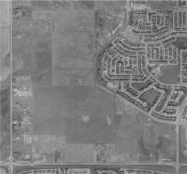
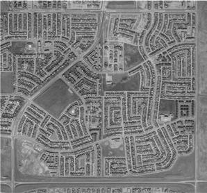
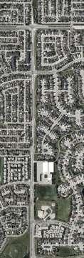
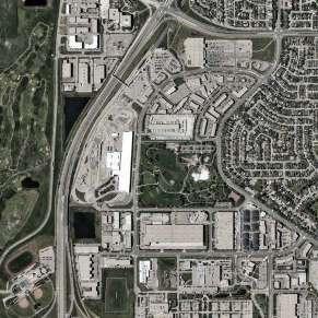
PART II: SITE ANALYSIS
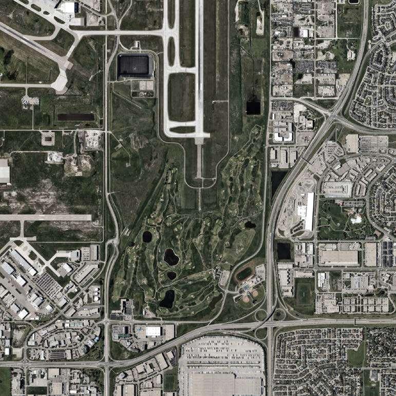
TARADALE
CORAL SPRINGS
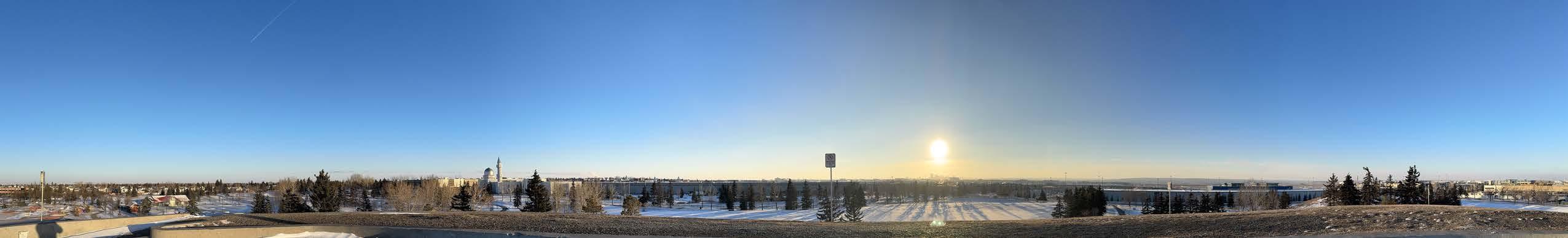
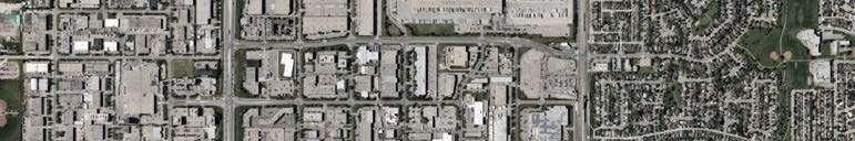
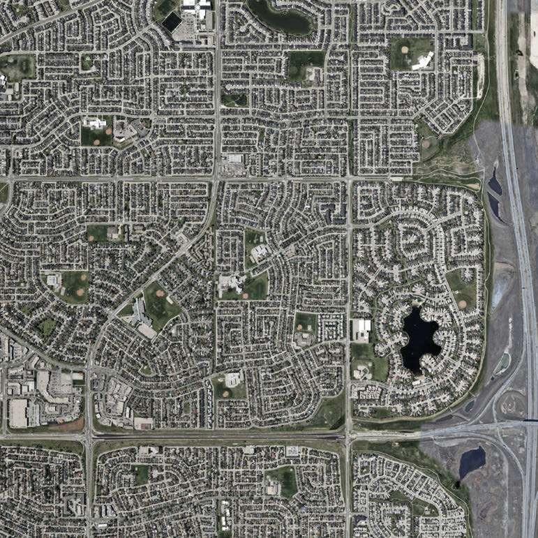
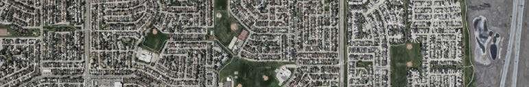
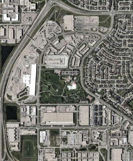
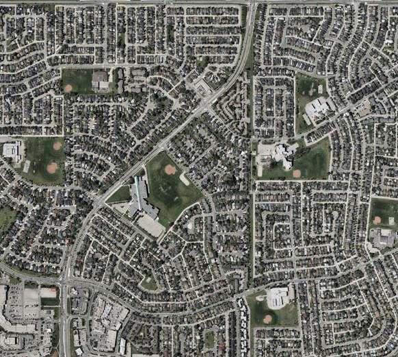
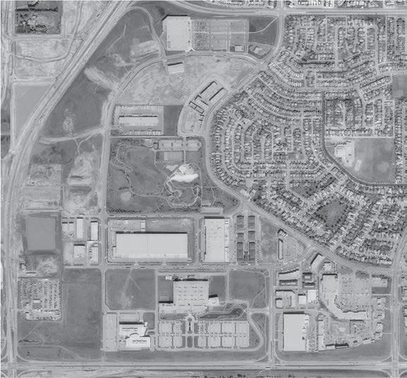
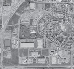
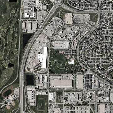
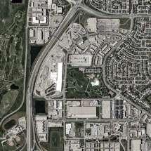
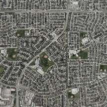
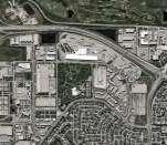
The communities of Westwinds, Castleridge and Falconridge are situated in the NE quadrant of Calgary. They are situated within close proximity to the Calgary International Airport which has influenced the urban form through the Airport Vicinity Protection Act which limits the land uses and occupancy types allowed in certain sections of Westwinds. Additionally, the close proximity to major transport infrastructure has encouraged the growth of logistics and distribution hubs that have situated themselves in the western industrial sectors of the communities. The majority of employment is concentrated within the community of Westwinds. This commercial and industrial corridor extends northward in the sector of Saddle Ridge Industrial.
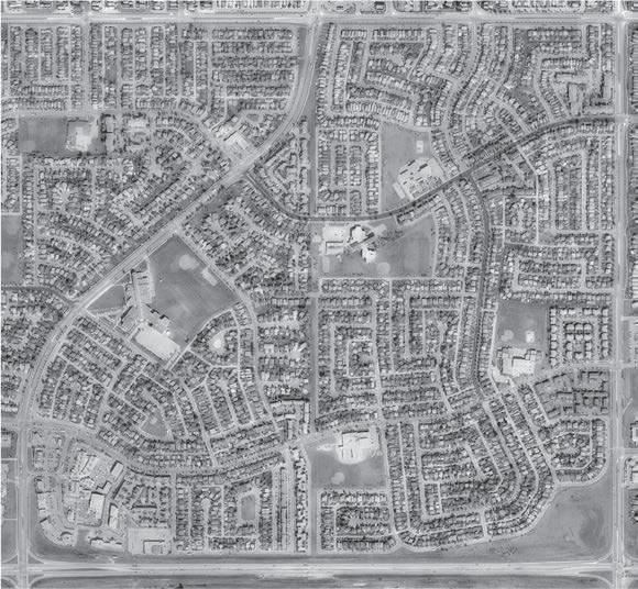
The predominantly residential communities of Martindale, Taradale, Coral Springs, Temple and Whitehorn border the site. These communities were created during the Calgary suburban expansion of the late 1980s. The communities of Castleridge and Westwards are predominantly residential in nature with few commercial zones.
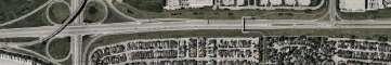
Major infrastructure in proximity to the community include the McKnight-Westwinds Station, a light rail transit station of the Blue Line which connects community members to downtown Calgary with a transit time of 30 minutes. To the north, Airdrie is a 25 minute drive and the industrial and commercial developments of Rocky View County are a 20 minute drive. Large arterial roads bound the community such as Metis Trail NE to the east, McKnight Blvd to the south and 64 Ave to the north.
These communities, situated in Treaty 7 territory are the ancestral lands of the Siksikaitsitapi. Settlers began arriving in the area in the 1800s and transforming this vast grasslands ecosystem into agricultural land.
The area was annexed to Calgary in 1961 at a time where the city was vastly expanding its boundaries. The Faclconridge Castleridge Community Association was founded in 1981.

Indigenous Presence On the Land
Land Annexed by Calgay
Falconridge
Prairie Winds Parks Founded
Falconridge Castleridge Community Association
The residential neighbourhoods of Castleride and Falconridge were the first to be built out while Westwinds would remain as agricultural and raw land that would be developed parcel by parce over the yearsl.
A major public connectivity improvement came to the community in 2007 with the extension of the Blue Line LRT and the construction of McKnight-Westwinds station. Max Orange was extended to the community in 2018.

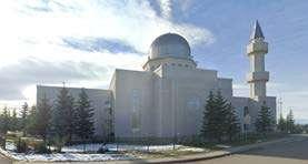
Baitun Nur Mosque
Prairie Winds Parks Redevelopment
Westwinds Police Campus
McKnightWestwinds Station
MaxOrange
Bishop McNally High School
Sociodemographics
The community demographics exhibit certain characteristics that deviate significantly from the Calgary norm. Notable is the demographic pyramid which skews to a younger demographic. 23% of the population the community is younger than 14 years of age whereas Calgary averages 18%.While the area is predicted to face declining population numbers in the coming years due to neighbourhood demographic cycling, this high proportion of young people in the community demonstrate that there is a need for physical and social infrastructure for this particular cohort.
A large part of the population (49%) are from immigrant backgrounds. This also correlated strongly to the languages most spoken at home. More than 50% of the population predominantly speaks a non-official language at home. The principal non-official languages are Punjabi, Tagalog, Urdu, Spanish and Arabic.
Coming years will see an increase in the population in early adult hood. If residents wish for the community to be a place that this new cohort can live in, it may have to rethink its housing typology and shift towards smaller more affordable homes.
Housing poverty is a serious issue in these communities. A large percentage of the population is in core housing need (12%).
Core housing need is met when a household is below one or more of the adequacy, suitability and affordability standards and the household would have to spend 30% or more of its before-tax household income to access local housing that meets all three standards.
This indicates that many of the houses in the community need major repairs, are overcrowded or unaffordable. Overcrowded and inadequate housing was also identified as a major issue during our community engagement.
Further indications of economic stress in the community can be gathered from the larger percentage of individuals in the bottom quintiles of income distribution. The median household income in the community is $85 000 roughly $13 000 below the Calgary median.
Drivers make up a smaller percentage of commuters and public transit use is 4% higher than in the rest of Calgary. Cycling as a commute style is nearly non-existent.
Sociodemographics
H OU SING TYPO LOGY
Household composition in the community of Falconridge and Castleridge have several key differences with those in Calgary. Multigenerational households in Falconridge and Castleridg, accounting for 7% of total households, is nearly double that of Calgary.
Single-detached
There are many complex reasons as for the high percentage of multigenerational households in the community but these types of households are often linked to immigrant families. Different families choose this arrangement for a variety of reasons including income pooling which can help offest the high cost of housing. Additionally, grandparents can help with childcare which allows parents to work, run errands and save on the cost of childcare. Although this can be a cultural preference, it is also often chosen out of economic necessity. In such instances, multigenerational living arrangements can contribute to core housing needs through overcrowding creating a downfiltering in the communities housing stock.
These types of arrangements are additionally reflected in the household composition index with households of 5 or more being the second largest category. While the average household size in Calgary is 2.6 persons, it is 3.2 in these communities demonstrating that there is a need for housing typologies that respond to the communities composition.


Grocery
Religious Facilities
Public Schools Cultural Health Falconridge Castleridge Community Association
The area has a wide range of social infrastructure and commerces that support diverse needs and preferences. Westwinds commercial and industrial area is home to a multitude of cultural and religious institutions.
The Baitun Nor Mosque which was inaugurated in 2008 is one of the largest mosques in North America and draws worshippers and visitors from throughout the Calgary region. Many other religious institutions call the community home and draw a diverse population in for days of worship.
The community additionally hosts a multitude of social and cultural institutions including the Punjabi Community Health Association, a notfor-profit which focuses on the mental well being of members of the South Asian community.
The incredible cultural diversity of the community is also reflected in the amount and types of grocers. There are a plethora of ethnic grocery stores located in the west end commercial areas.
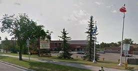

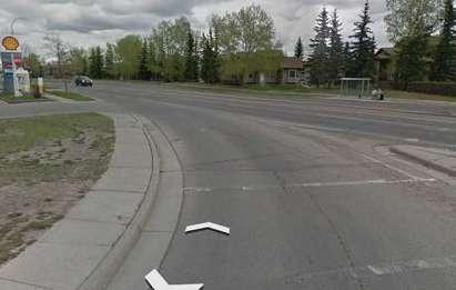
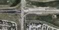
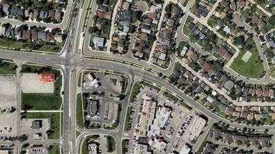
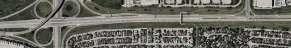
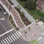
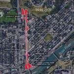
The intersection at Falshire Drive NE and Falconridge Boulevard NE reflects common issues found at many other junctions in the area. It is shaped by a car-oriented layout that limits safe, accessible, and comfortable travel for those walking, cycling, or using public transport.
Falconridge Boulevard is a wide arterial road with fast-moving traffic, contributing to a noisy and hostile environment. The noise levels impact nearby residences and discourage active use of the public realm.
Narrow footpaths reduce pedestrian comfort and fail to meet accessibility needs. There are no dedicated cycling facilities, creating safety risks and deterring active travel. Bus stops lack basic amenities such as shelters or seating, making transit use less appealing.
The design prioritises vehicle movement, creating safety concerns for more vulnerable road users. High vehicle speeds, limited crossings, and poor visibility at corners further reduce the perceived and actual safety of the space.
3. OPEN SPACES & ENVIRONMENT
Landscapes Transformed
Wetlands (1948)


The orthophoto shows that the site once contained multiple wetland ecosystems. These original wetlands contributed to the ecological diversity of the site and were lost during redevelopment from the late 1970s through to the early 2000s. The current site does contain a few stormwater wet-ponds but these offer limited ecological benefits.
The site contains limited topography and is situated between the altitudes of 1090 and 1100 metres. There are small deviations in these altitudes such as with the hill at Prairie Winds Park but the area does not contain significant slope challenges. The draining of wetlands however may contribute to minor ongoing catchment basin flooding issues in certain parts of the community.

Compared to Calgary, the community has less public trees and a lower degree of canopy coverage. The area averages 7 public trees per hectare which compares unfavourably to certain communities such as Eau Claire that have 31 public trees per hectare.
Trees not only help with ecological integrity but are also essential in contributing to the wellbeing of the community. They provide a myriad of benefits to physical and mental wellbeing and contribute to ecological integrity and diversity. A robust tree canopy can help mitigate the impacts of climate change by lowering temperatures through shading.
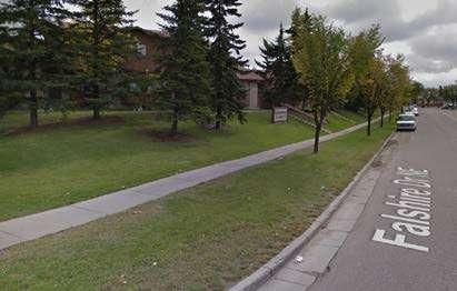
The majority of public trees are situated along the internal road loop (Falshire Dr, Falconridge Dr, Castleridge Blvd and Castleridge Dr) which presents an opportunity for developing a human scaled mobility network.


Parks and Open Spaces
Typology
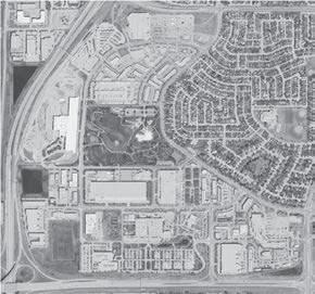
Prairie Winds Park
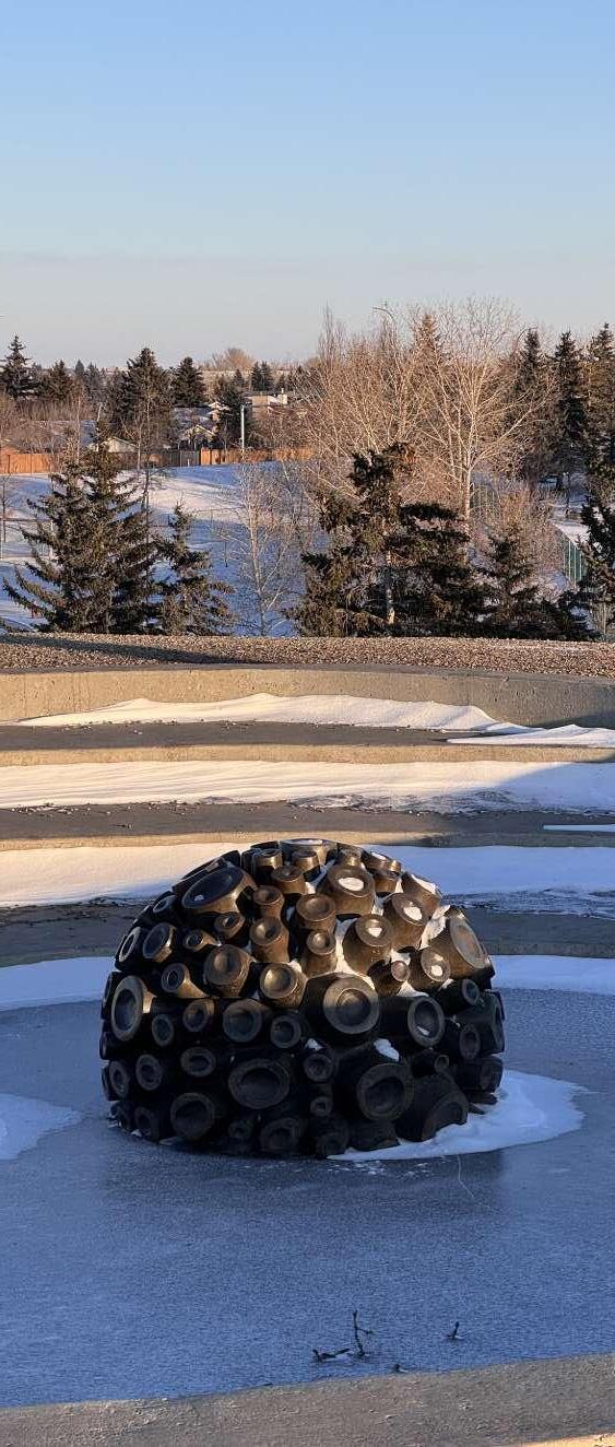
The open space and green spaces within the community benefit from being dispersed and relatively abundant. There are four principal types of open spaces. The first is a regional park known as Prairie Winds which underwent large scale revitalization in 2001. The park is rich in amenities and programming and is a great year round draw not only for members of the community but the entire NE of Calgary.
The next large class of open space is that related to infrastructure purposes. Included in this category are dry ponds, utility right of ways, and other infrastructure reserves and green meridians. Some of these areas already serve dual functions such as the dry pond in the south west corner which has been converted into a cricket field and the road right of way in the south west which is utilized as a dog park.
The open spaces linked to schools are predominantly utilized for recreational sports activities. Most of the communities soccer fields and baseball diamonds are sited in these parks. These see usage throughout the day through school based and after hour recreational sports. Some of these school parks also have additional infrastructure such as playgrounds.
The last category of open spaces are the neighbourhood parks. Similar to school parks, these are located exclusively in the residential communities of Falconridge and Castleridge. These parks are geographically spread out and with the school parks allow for most residents to be within 800m of an open space.
While the neighbourhood parks are in close proximity to many residents they are underutilized due to their lack of infrastructure. Additionally, the open spaces within the community suffer from a lack of pedestrian and cycling connectivity. The lack of connectivity and programming present an opportunity for future interventions.
Understanding Green Connections
Prairie Winds Park
Catwalk Cycleways Open Space Trees School Parks Storm Ponds

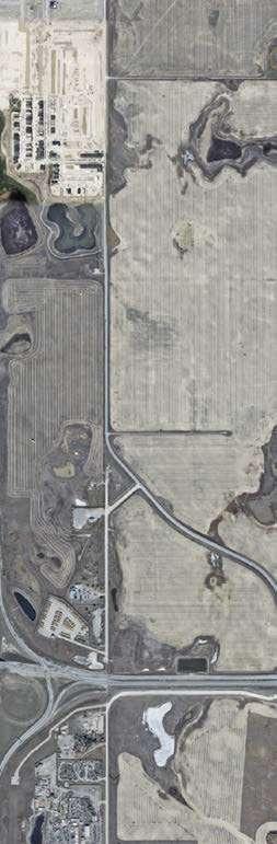
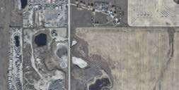
The area is predominantly agricultural with a multitude of waterbodies. A few homesteads exist.
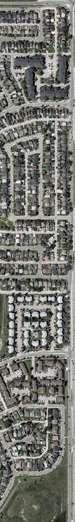
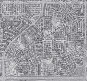
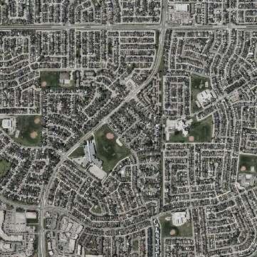
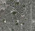
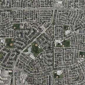
Castleridge and Falconridge are largely built out as a suburb by 1984. The street grid of the community follows patterns of development common to the era with warped grids and loops and lollipops.
By the mid-90s, the residential areas of the communities are completely built out. Westwinds has largely developed with commercial and industrial being the established land use.
In the present day, the area is fully built out without any parcels left over. The last remaining undeveloped parcel becomes an LRT maintenance and storage facility.
Tracing the evolution of the built form in the community allows us to see the patterns inherent in their layout. The residential communities of Castleride and Falconridge were established in 1979 and 1981 respectively and were quickly built out as a greenfield development over the next decade.
Following the patterns and modes of development popular in that era, the street layouts follow two dominant styles of loop and lollipops and warped grid. These street layout tyopologies impact the walkability of a community as they create less accessible walk-sheds.
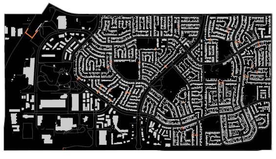
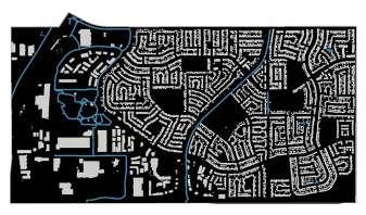
The figure ground above allows us to understand the relationship between void and fill. Castleridge and Falconridge are dominated by single detached dwellings which impacs this relationship, leaving a lot of the area void of built form.
This relationship is particularly evident in the community of Westwinds which is predominantly composed of car dependent industrial, commercial and institutional buildings surrounded by seas of parking lots. The waterbodies were drained and replaced by asphalt.
Warped Grid
Loops & Lollipops
Figure Ground
AVPA & Residential Typologies
Apartment Rowhouse
The Airport Vicinity Protection Act (AVPA) which regulates development in the vicinity of the Calgary International Airport limits the built form of the community and its available land uses. All of Westwinds and a portion of Castleridge fall under the purview of this act.
The outer ring of the AVPA noise guidelines which are qualified by acoustic levels between 25-30db allow for residential uses but these become prohibited within the 30-35db range. This limits the land use within this zone to industrial or commercial uses. The AVPA present a challenge to any future TOD development as it is prohibited to develop residential housing close to the Westwinds-McKnight Station. However, the upper and lower east quadrants of the Westwinds community present an opportunity for redevelopment into mixed-use hubs.
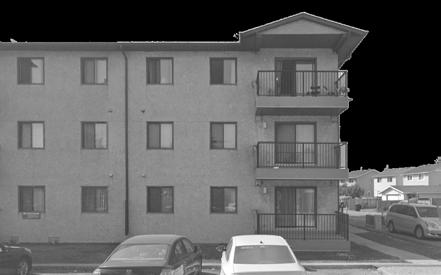
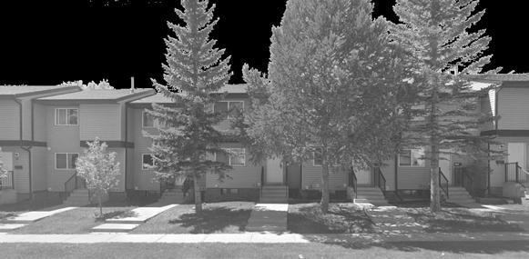
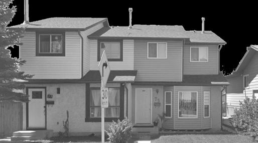
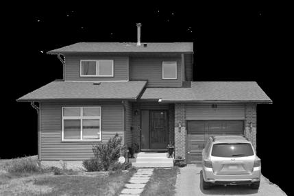
The community has a lack of housing typologies and is mostly dominated by single detached housing which accounts for 56% of the total stock. Other housing typologies found in the community are semi-detached (14%), row-houses (11%), apartments or flats in a duplex (11%) and apartments in a building that is less than 5 storeys (5%). Our analysis concludes that the community is lacking in housing diversity and could benefit from housing stock renewal.
The next decades will be an opportune time to introduce a variety of housing stock to the community as most residential buildings were constructed more than 25 years ago (88%) and nearly half (39%) are approaching the 50 year mark.
family
Land Uses
Roadways
Major infra. Industrial Direct Control Institutional Rec, Park, Edu Commercial
Single family
Our analysis of land use patterns demonstrates that there is a strong segregation of uses between these communities. While Falconridge has a couple commercial zones, Castleridge only has one. The majority of the commercial zone is within Westwinds, at considerable walking or cycling distance from the residential communities. Notably, medium density residential is concentrated in limited pockets and this presents an opportunity for expansion. Overall, residential uses account for 34% of the surface area.
Direct control district, representing 14% of the land area, are heavily utilized and are a combination of industrial and commercial uses. These are primarily situated on large parcels in Westwinds.
A major takeaway from this analysis is that roadways represent nearly 30% of the surface area. This number indicates that there may be room for improvement in limiting the amount of roadway in the next iteration of these communities. Implementing road diets and converting some of these roadways to cycling and pedestrian uses presents an opportunity for developping more equitable mobility.
6. INFRASTRUCTURE
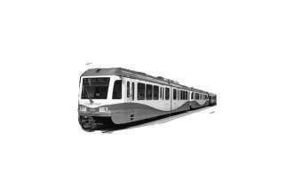
The area benefits from strong public transit connectivity and has local routes, a BRT and an LRT. McKnightWestwinds, a blue line LRT station, provides a north-south link via light rail transit providing connections to the Red Line and Downtown Calgary.
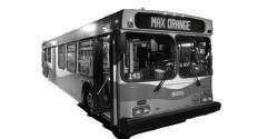
The main connector bus route is the Max Orange which provides a rapid north-south connection which runs every 10-20 minutes. Several bus routes run along the periphery of the community provide additional connections. The main neighbourhood circulator is Route 55 which runs every 15-20 minutes. It provides a neighbourhood connection to Max Orange and to the Blue Line LRT via McKnight-Westwinds station.
The communities have strong public transit connectivity and utilization. Many residents use public transit as their mode of commuting to work. Densification would provide an opportunity to increase service frequency and to develop additional bus routes.
Station
McKnightWestwinds Station
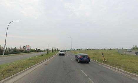
The communities are surrounded by large arterial roads that allow for efficient vehicle connectivity to the detriment of human scaled mobility. These suffer from poor edge conditions and create connectivity gaps effectively separating the area from surrounding communities.
While the collector roads, within the communities, provide a relatively efficient network for servicing the residential and commercial areas, they also suffer from poor edge conditions. Particularly, Westwinds Dr NE which must be utilized to connect to the LRT at McKnight-Westwinds Station.
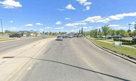
These three sections are illustrative of the streetscape along a variety of roads. They were selected to demonstrate an array of road typologies within the community including arterial (section AA), collector (section BB) and local (section CC).
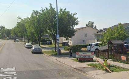
These sections highlight some of the key issues with roadways and streetscapes within our area of study. Falconridge Blvd NE, an arterial road, demonstrates the wide separation between the roadway and the built form. Pedestrians are effectively left on an isolated canal of a sidewalk and disconnected from the commercial zone.
A similar issue can be found on Falconridge Dr NE, a collector road, where the commercial element is substantially set back from the pedestrian realm and is heavily auto-oriented. Our local street example, Falsby Way NE, demonstrates an example of an acceptable building to street ratio creating a more pleasant streetscape and improved pedestrian experience. However, it is not without its shortcomings as it only has a sidewalk on one side of the street.
Street Section AA
Street Section BB
Street Section CC
Mobility Connections
While the catwalks help with pedestrian movement, they are often unpleasant, dark and unmaintained connections. Nearly all local roads have sidewalks on one side only, creating a difficult pedestrian experience especially for those with mobility issues. The existing street layout significantly diminishes the pedestrian experience due to inadequate connections throughout the area.
Multiuse Pathways
With very few multi-use pathways available, residents have limited options for non-vehicular travel. To address these issues, the area requires comprehensive improvements to human-scaled mobility infrastructure, creating an interconnected network that makes walking, cycling, and other alternative transportation methods both viable and appealing for residents.
Sidewalks Catwalks
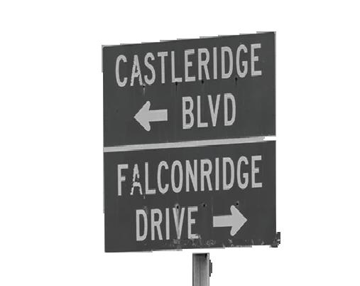
Castleridge
Falconridge
Falshire
Westwinds
Sidewalks and Catwalks
Conflict Mapping Collisions
McKnight Blvd -
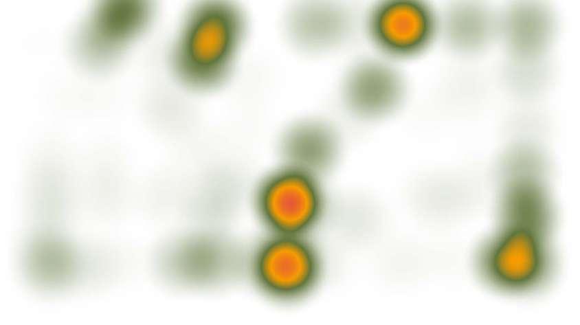
Vehicle Only Pedestrian or Cyclist Involved
Falconridge Blvd
Castleridge BlvdFalconridge Blvd
64 AveFalconridge Blvd
Collision Hotspot
64 AveCastleridge Blvd
Our analysis reveals several high-risk intersections in the area requiring redesign, particularly where arterial roads meet other arterial or collector roads. These busy intersections with complex traffic patterns present significant safety hazards.
The data shows pedestrians and cyclists are especially vulnerable at these locations. To address these safety concerns, we recommend implementing targeted design interventions including elevated crosswalks, separated bike lanes, curb extensions, enhanced lighting, removal of slip-lanes, and narrower roadways.
Implementation of these safety measures should be prioritized based on collision frequency data and potential impact on vulnerable road users.
These modifications would reduce collision frequency and create a safer transportation environment for all users—drivers, pedestrians, and cyclists alike.
7. CONSTRAINTS & OPPORTUNITIES
Opportunity
Opportunity 1
The industrial and commercial areas of Westwinds are autocentric with large parking lots. These expansive parcels and parking areas present opportunities for comprehensive redevelopment. Areas outside of the AVPA restrictions would benefit from mixed-use redevelopment, while those within the restrictions would be suitable for commercial redevelopment.
Empty Parking Lots Are Ideal Sites for Infill Developments
Opportunity 2
Improving & Connecting Fragmented Parks and Open Spaces
Residents of Falconridge and Castleridge benefit from a widespread array of green spaces distributed throughout their neighborhoods. However, many of these spaces currently lack proper programming, adequate infrastructure, and meaningful connectivity between them. Strategic improvements focusing on these three key areas would significantly enhance the value these spaces provide to the community.
Ideally, the area immediately surrounding the McKnightWestwinds station could be redeveloped into a TransitOriented Development (TOD) but the AVPA guidelines limit Zone 2 to non-residential uses. This constraint requires creative planning solutions to balance transit accessibility with regulatory compliance while still achieving community development goals.
Motorways Isolate Communities from Each Other
Collector and arterial roadways present a major challenge in the way they separate and isolate communities both within and outside the study site. Although these high-traffic corridors create constraints, they also provide an opportunity to mitigate their negative impacts through strategic improvements to edge conditions and increased human-scaled connectivity options for pedestrians and cyclists.


PART III: ENGAGEMENT


Both section of PLAN 630 [Advanced Professional Planning Studio] met Dhruv Sharma, President of the FCCA, and Lee Pederson, General Manager, for an in-depth discussion about the our upcoming local area planning exercise for the communities of Falconridge, Castleridge, and Westwinds. Following the meeting, we joined them for a site visit to gain a clearer understanding of the project’s scope and the key considerations shaping its future development.
During the visit, particular focus was placed on parks, open spaces, and the FCCA facility itself. Concerns were raised about the limited amenities in local parks, which restrict their usability and reduce their overall benefit to the community. At the FCCA, safety emerged as a significant issue for residents, especially in relation to individuals experiencing homelessness who frequently gather around the facility. This has caused discomfort among some community members and highlighted the need for improved safety measures and supportive services.
The group also discussed the proposed development near the Superstore. Many residents voiced strong opposition, citing that the existing community infrastructure and services are already stretched to their limits. Through coordinated advocacy efforts, residents were ultimately successful in halting the proposed project.
2. MEETING WITH LOCAL INTERESTED PARTIES
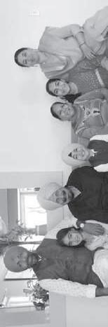
On 30 January, 2025, a virtual meeting was held with professionals and business owners
The meeting began with a round of introductions, during which each participant shared their name, role, and connection to the community, along with a personal reflection on one positive and one challenging aspect of working in the area.
Jessica Wishart, a community social worker with the City of Calgary, spoke about her work supporting residents in Falconridge and Castleridge. She highlighted language barriers as a significant challenge for newcomers and emphasized the importance of the Community Connectors Grant in fostering inclusivity and community engagement.
Chetan Shory, a lawyer who grew up in Castleridge, praised the community’s supportive spirit and strong local economy, but expressed concerns about inadequate commercial planning in the area.
Neha Sharma, a local dental practitioner, shared insights on public health, accessibility, and the needs of families in the area. She highlighted a significant lack of essential infrastructure, including schools, daycares, and playgrounds.
Participants shared their reflections on how the community has evolved over time and identified areas that still require attention. Jessica noted that income insecurity remains one of the most pressing challenges, especially as rising rent prices make even basic apartments increasingly unaffordable. She emphasized that many families are living paycheck to paycheck, often forced into substandard housing due to the high cost of living.
The group collectively agreed that language support continues to be a critical need. Many newcomers face significant barriers to employment, education, and accessing essential services due to limited English proficiency. Jessica underscored the importance of accessible language programs as a means of fostering integration and a stronger sense of belonging.
Another long-standing concern raised was the visible presence of unhoused individuals in the area. Jessica pointed out that this issue has persisted for over 25 years and is deeply rooted in broader systemic challenges, including poverty, housing instability, and gaps in mental health and addiction support services.
The topic of safety and crime was a central theme in the conversation. While official
Jessica Wishart
Chetan Shory
Neha Sharma
Open House [Analysis & Prelim. Concepts]
Mobility and access within the community were also discussed. Participants generally viewed public transit as reliable, with the Westwinds LRT station offering a convenient connection to the broader city. Bus routes such as Route 11 were frequently mentioned as being widely used by both clients and residents.
Housing emerged as one of the most pressing concerns. Many community members currently reside in basement suites that are poorly maintained, inadequately lit, and lack sufficient heating. While these units are often more affordable, they are not viable long-term housing solutions. Participants expressed a strong need for more diverse and affordable housing options, including secondary suites, purpose-built rentals, and housing that meets the needs of families, seniors, and students. Emphasis was placed not only on increasing supply, but ensuring that housing is livable, accessible, and dignified.
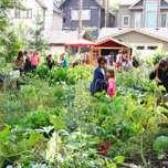
Recreational infrastructure and green space were also key topics. While participants acknowledged recent upgrades to Prairie Winds Park, they agreed that the community still lacks sufficient recreational amenities. The absence of features such as playgrounds, swimming pools, soccer fields, and indoor facilities limits opportunities for families and youth. There was a strong desire to see more green space and natural landscaping— trees, gardens, and other ecological features—which were viewed not only as aesthetic enhancements, but as vital to community pride, mental well-being, and environmental resilience.
Finally, the conversation highlighted a need for more inclusive, connected public spaces and better programming—particularly for seniors and youth. Participants noted gaps in community programming that, if addressed, could strengthen social cohesion and improve quality of life for a broad range of residents.
Overall, the meeting offered valuable insights to guide future community development and engagement efforts. The perspectives shared by professionals and business owners will play a critical role in shaping initiatives focused on housing, safety, infrastructure, and social well-being in Falconridge, Castleridge, and Westwinds.
3. FIRST OPEN HOUSE
Our first open house took place on 6 February, 2025, at the FCCA building. During the event, our team presented early concepts with a focus on built form. Although attendance was limited and no direct feedback was received from community members, the open house proved to be a valuable learning opportunity. It allowed us to refine our presentation materials and identify strategies to enhance community outreach and increase participation in future engagement efforts.
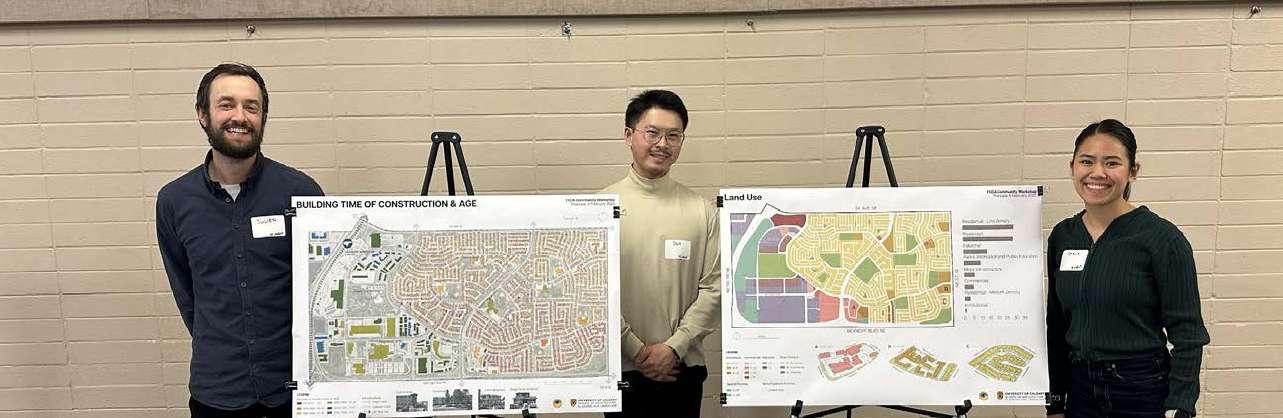
Don, Julien & Stacy of Common Plan at the 1st open house (Photo: Kaden Szentmiklossy)
4. SECOND OPEN HOUSE
Our second open house was held on Saturday, April 12, 2025, at the FCCA. This event provided an opportunity to showcase our work and present the outcomes of our ongoing community engagement efforts. We shared key insights gathered from our initial meeting with professionals and business owners, as well as takeaways from the first open house. Most importantly, the event allowed us to hear directly from residents about their needs, concerns, and aspirations for the community.


usedAreasareNOTbeing dueto lackof amenities . Iwouldliketosee more shelteredcovered/ areas for exercise.


Rental properties dominate the housing landscapeaffordability is a

In our community,marginalization is a real issue... The community connector is key in bridging gaps and fostering a sense of belonging


a pondin Prairie Winds.

Many residents struggle with financial stress.


Don, Julien & Stacy of Common Plan at the 2nd open house (Photo: Kaden Szentmiklossy)
The figure below highlights a selection of representative feedback received by Common Plan during the engagement process.


Rising thefts and traffic concerns, especially on main roads, have become bigger issues.


Manyresidentslivein basementsuitesor overcrowded

...more planting creating a more environment


I’dliketoseea withcommunitycentre avarietyofuses .


The sense of connection community is powerful.


Make the area around the LRT station more accessible.

canNavitagingthearea behard,somesignagewouldhelp.
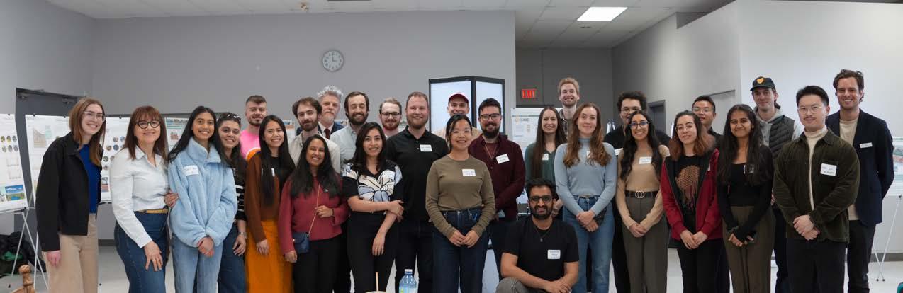
All PLAN 630 students and professors & FCC at the second open house (Photo: Donghao Lu)
This page is intentionally left blank.
PART IV: DESIGN CONCEPT
Common Plan envisions communities where nature, culture, and urban life flourish together - where every development strengthens environmental resilience while fostering meaningful connections between people and place.
Following a thorough analysis and engagement process, Common Plan heard that residents in Falconridge, Castleridge, and Westwinds value walkable, welcoming neighbourhoods with diverse spaces for living, gathering, and meeting daily needs. There’s a strong desire for vibrant, community-focused areas that feel safe, active, and connected, with more local amenities, varied housing options, and accessible green spaces close to home.
Our Planning Approaches Our design principles
Plan's Vision Connecting Green Spaces with More Interesting Streets
In response, we revisited our original vision for this local planning exercise and developed two planning approaches supported by three core design principles. Common Plan seeks to better integrate the environment with urban living, create lively spaces for community life, and strengthen neighbourhood identity and pride through placemaking. To bring these principles to life, we propose connecting the communities' green spaces with more engaging streets, leveraging the proposed '5A' Network. These connections will, in turn, support additional housing and public spaces, fostering a more vibrant, inclusive, and complete community. Environment Meets Urban Living


Spaces for Community Life


Vibrant
Under Calgary’s Pathway and Bikeway Network (5A) Program, two proposed 5A corridors are planned primarily along Falconridge Boulevard and Castleridge Boulevard, highlighted in dark green in the figure below.
The proposed 5A network forms the backbone of our densification and growth strategy. Aligned with key higher-order roads such as Falconridge Boulevard and Falshire Drive, these corridors establish a connected framework for accommodating new housing, commercial spaces, and public amenities. Common Plan also proposes three network extensions, shown in mustard in the figure above, which span much of the community and link its major green spaces. By focusing future development along these routes, we can enhance walkability, expand mobility options, and create vibrant, active streetscapes that support daily community life. Through our engagement process, residents consistently expressed a desire to revitalize underused and industrial areas into parks, plazas, and accessible public spaces. Many emphasized the importance of places where neighbours can gather, access services, and enjoy nature close to home — reaffirming the value of compact, well-connected neighbourhood centres anchored by the 5A network.
General Recommendations
Future Transit-Oriented Developments by McKnightWestwinds Station:
• To increase mid-rise mixed-use buildings (4-6 storeys) near the station to promote density while maintaining a human scale.
• To prioritize active ground floors with retail, community services, or live-work units to create a vibrant street edge.
• To remediate industrial area into green spaces.
Future Brownfield Developments:
• To reconfigure surface parking to allow for infill development
• To introduce a mix of low-rise commercial and residential (2-4 storeys) around the plaza’s edge to create enclosure and activity.
• To establish flexible-use spaces that can transition between commercial, community, and cultural uses based on need.
Future Neighbourhood Infill:
• To support gentle density through zoning such as duplexes, fourplexes.
• To introduce small-scale mixed-use nodes at key intersections and designated streets to bring daily services closer to residents.
• To preserve and enhance green spaces as key organizing elements of land use, not just leftover parcels.
Commercial
Flex
Connector
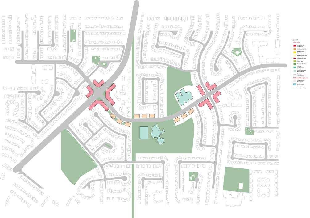
Urban Form
The urban form map above illustrates different land use categories based on their intended function and development pattern. These categories are adapted from the Riley LAP and support a planning strategy that promotes complete communities and adaptable urban growth.
Commercial activity is concentrated at key nodes: Neighbourhood Commercial areas at major intersections serve as local retail and service hubs, while Commercial Centres offer a broader, more regional mix of uses. Surrounding these are Neighbourhood Flex areas, which allow for mixed-use or evolving development in response to future community needs.
Neighbourhood Connector zones follow major roadways, including the 5A network, supporting transportation access, street-oriented commercial
activity, and walkability. Most of the area is designated Neighbourhood Local, representing primarily residential zones with low-density housing and community services.
Public and recreational amenities are integrated through City Civic and Recreation areas, alongside Private Institutional and Recreation spaces like schools and private sports facilities. Industrial uses are located on the neighbourhood’s west side, buffered from residential areas to minimize noise and traffic impacts. Active Frontage designations along main roads highlight streets intended for vibrant, pedestrianfriendly activity.
Neighbourhood
Neighbourhood
Neighbourhood
Neighbourhood Local Commercial Centre
City Civic & Rec.
Private Inst. & Rec. Active Frontage Industrial
Built Form
The building scale map illustrates the permitted building heights across the neighborhood. Most residential areas are limited to three storeys, maintaining a low-rise, people-friendly character. Transitional zones allow for buildings up to four storeys, creating a smooth shift between low-density housing and more intensive development.
Along commercial corridors and in mixed-use areas, buildings can reach up to six storeys, supporting higher-density options like apartments, offices, and multi-family housing. In the commercial core, the plan allows mid-rise buildings up to twelve storeys, encouraging greater population density and economic activity in well-connected areas with strong access to transit and services.
The map also highlights areas with no specified building height limits, mainly because they’re located near LRT infrastructure, where height restrictions are not set. Green spaces, shown throughout the map, are strategically placed to protect the environment, support outdoor activities, and improve overall quality of life.
Limited (≤3 Storeys)
Low Modified [≤4 Storeys]
Potential Land Use Designations in Land Use Bylaw
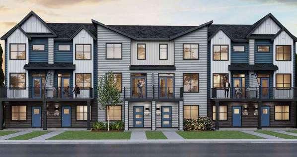
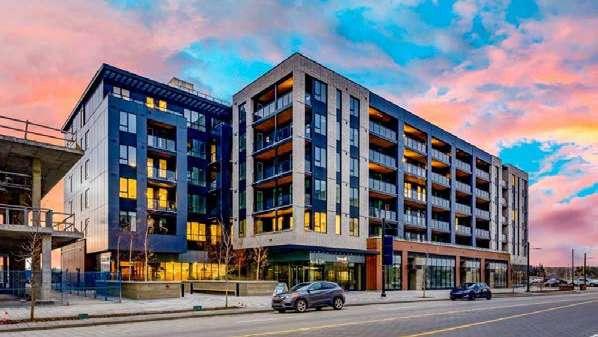
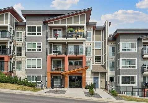
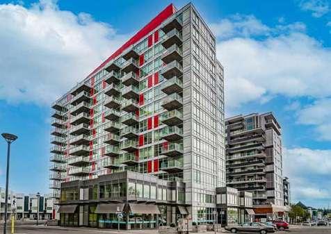
Typology: Townhomes Low Density Apartment Buildings Mid Mixed-Use/Apartment Buildings High Density Mixed Use/Apartments Buildings
Use: Residential
Floors: <3 Storeys
Possible Land Use Zone:
R-CG – Residential –Grade-Oriented Infill
M-CG – Multi-Residential –Contextual Grade-Oriented
<4 Storeys
M-C1 – Multi-Residential – Contextual Low Profile
M-G – Multi-Residential – At Grade
Location in the community:
Neighbourhood Infill
Neighbourhood Infill
<6 Storeys
M-C2 – Multi-Residential –Contextual Medium Profile
MU-1 – Mixed Use – General (flexible, less active frontage required)
MU-2 – Mixed Use – Active Frontage (used along Main Streets, busier corridors)
Directly around LRT Station to support transit-oriented development and Key intersections and designated streets
<12 Storeys
MU-2 – Mixed Use – Active Frontage
C-COR2 or C-COR3 – Commercial – Corridor (with residential above ground floor)
DC (Direct Control) – Often used for custom developments near LRT stations or urban hubs
Brownfield
Townhomes, Seton Brightside, Calgary
Condominia, University District, Calgary
Condominia, Bridgeland/Riverside, Calgary
Condominia, Brentwood Commons, Calgary
LAND USE STRATEGY
FALSHIRE & FALCONRIDGE “NODE” CONCEPT
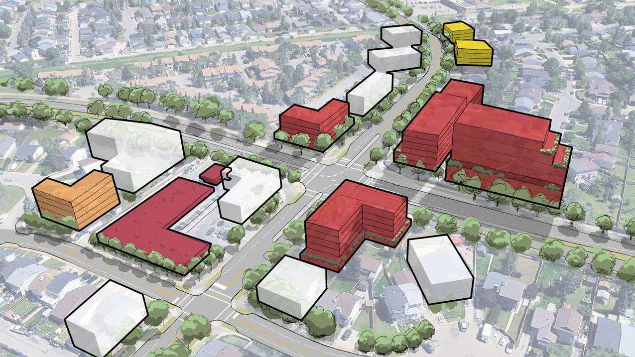
LAND USE STRATEGY
FALCONRIDGE
CASTLERIDGE “PLAZA” CONCEPT
3. MOBILITY CONCEPT
1. Mobility
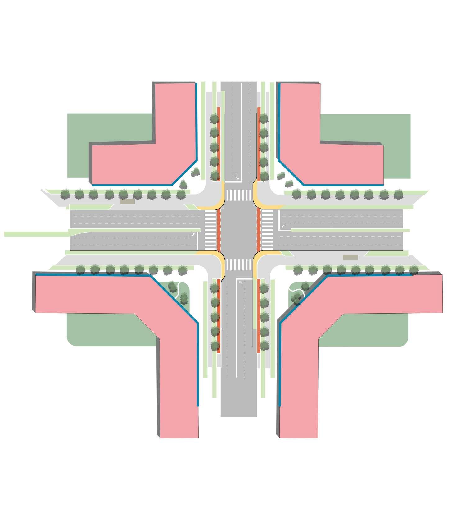
This concept envisions a future where everyday mobility is intuitive, inclusive, and safe for everyone. Centred around a major LRT station, the design transforms the surrounding community into a walkable, bike-friendly, and transit-connected urban environment. The approach prioritises short, local journeys by improving access to essential destinations such as schools, shops, and transit are accessible within a comfortable walking or cycling distance. Three walkability zones—400m, 800m, and 1200m—radiate from the LRT station, shaping the foundation for layered connectivity and guiding the placement of key infrastructure interventions.
A continuous 5A (All Ages and Abilities Active) Network weaves through the neighbourhood, forming the backbone of this active mobility vision. Designed to reduce barriers and enhance movement across the community, the network connects residential areas with school zones, green spaces, and civic destinations. Layered onto this spine are new multi-use pathways along arterial and collector roads, enabling seamless movement for cyclists, pedestrians, and other non-motorized users.
To complement mobility enhancements, a series of human-scaled interventions reframe the experience of streets. Key intersections are reimagined with both major and minor upgrades, reinforcing pedestrian safety at critical crossings. Slow streets—areas where walking, biking, and play are prioritized over through-traffic—create pockets of calm throughout the network. School zones are foregrounded in the concept, with targeted design solutions that reflect the movement patterns and safety needs of children and families. The result is a community framework that is not only functionally connected, but emotionally legible—a place where infrastructure quietly supports freedom of movement, safety, and a deeper sense of neighbourhood identity.
Recommendations
• To expand the 5A network to strengthen connections across the community, including links to parks and open spaces.
• To introduce traffic calming measures and slow streets, especially at high-incident intersections, to improve pedestrian safety and comfort.
• To promote multi-modal transportation options by improving integration between walking, biking, transit, and other mobility choices.
• To enhance lighting infrastructure along pedestrian and cycling routes to improve visibility and safety during evening hours.
LRT Station
Proposed Slow Streets
Walkshed Radius
5A Network School Zones
Proposed Multi Use Pathway
Proposed Intersection Upgrade: Arterial Major Collector Minor
5A Network
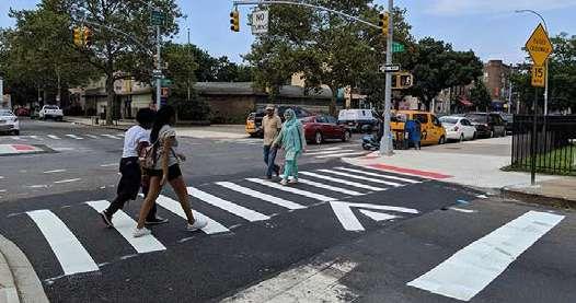
The City of Calgary’s 5A Network Plan guides a mobility concept focused on safety, accessibility, and ease of use for all types of travel. By separating travel speeds, improving visibility, and ensuring reliability, the network supports pedestrians, cyclists, transit users, and drivers in a safe, inclusive way.
Multi-Modal Streets are key to this approach, improving connections along major roads while supporting
walking, biking, transit, and vehicles. These corridors also help create active, community-friendly spaces that support local businesses.
This strategy centres on safety for everyone. Features like clearer crossings, separated paths, and traffic calming reduce conflicts and make travel more predictable.

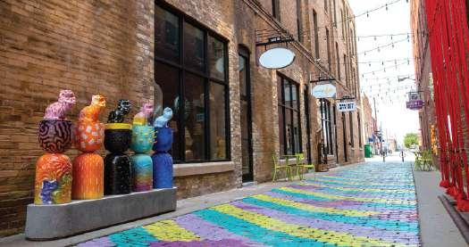
Asheville, North Carolina
Portland, Oregon Berlin
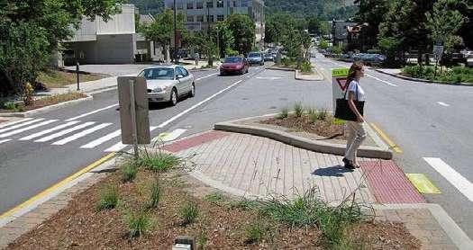
Crossing Islands
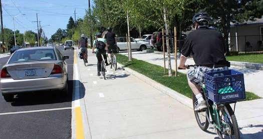
Raised, Parking-Protected Bike Lane
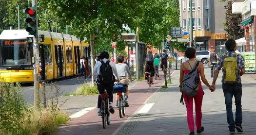
Multi Modal Street
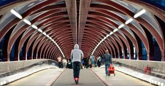
Peace Bridge, Calgary
Pedestrian Scale Lighting
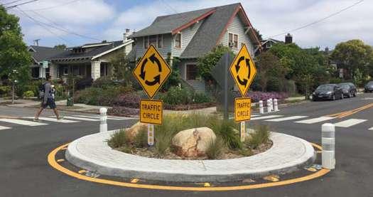
Slow Streets
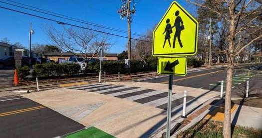
This intervention is focused on school zones that currently lack safe intersections. By reducing vehicle speeds in these areas, the goal is to create a safer environment for children walking or biking to school.
Examples of Slow Streets measures include speed humps, curb extensions, bulb outs, raised crosswalks, and improved signage. These features help calm traffic and increase visibility, making it easier and safer for students to cross the street.
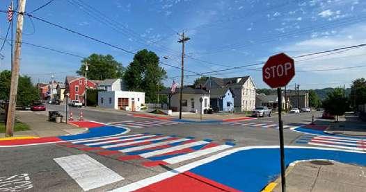
The Slow Streets intervention combines infrastructure improvements with public education to create a comprehensive approach to traffic safety in school zones. By slowing down traffic and increasing awareness, this initiative supports safer routes for children and promotes a more livable, community-oriented street environment.
Oakland, CA
City of Dayton, Kentucky
City of Dayton, Kentucky
San Francisco’s Slow Streets
St. Mary’s Street, City of Raleigh
E 5th Street and Fort Hamilton Parkway, Brooklyn
Bulb Outs Traffic Circle
Painted Intersection
Painted Crosswalk
Raised Crosswalk
Raised Intersection
1. Green, Open Space & Public Realm
Through engagement and analysis, we heard that open spaces are deeply valued across Falconridge, Castleridge, and Westwinds. Residents expressed a strong desire for more parks, natural areas, and places to gather outdoors — spaces where people of all ages can relax, play, and connect with nature. While some parks are well-used, others are hard to reach or lack amenities that support regular use.
Many participants shared that smaller “pocket parks” and underutilized open spaces could be improved or activated to better serve the community. We also heard a desire for more community gardens, shaded seating areas, and natural landscaping. Accessibility remains a concern, with some open spaces disconnected from walking or biking routes, and catwalks between areas often feeling unsafe or unclear. There is also growing interest in creating more environmentally sustainable landscapes that support biodiversity and address issues like drainage and urban heat.
Recommendations
• Upgrade neighbourhood park infrastructure to create equitable access to high quality green spaces throughout the community
• Improve pedestrian connectivity to park spaces through the implementation of upgraded sidewalks and catwalks
• Install clear and consistent wayfinding signage to support navigation to key destinations such as parks, public plazas, transit, schools, community centres, and local hubs.
• Promote the naturalization of greenspaces to increase biodiversity and wellbeing.
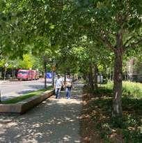
• Increase tree canopy coverage to reach parity with city average, focusing on plaza spaces and active mobility networks.
PROPOSED OPEN SPACES INTERVENTIONS
INTERVENTIONS
Open Space Nodes
5A Network Green Corridors
Wayfinding
Catwalks & Sidewalks
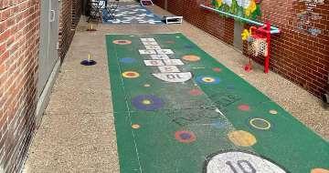
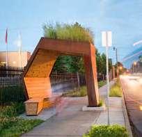
Wayfinding
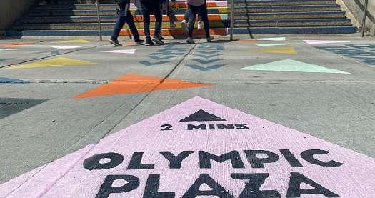
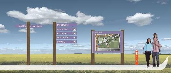
One of the central interventions will focus on wayfinding, which plays a crucial role in helping residents and visitors navigate the neighbourhood confidently and intuitively. The goal is not only to provide clear direction but also to enhance the area’s identity and sense of place. To achieve this, several strategies will be implemented. First, bus stations will be made more prominent through improved visual design, making them easier to locate and recognize from a distance.
This could include architectural elements, colour treatments, and lighting. Additionally, illuminated steps will be installed in key areas to ensure safety and visibility, especially at night. Freestanding signs will be positioned strategically throughout the neighbourhood to provide clear, readable directions and landmarks. Painted sidewalk signage will further support navigation by offering visual cues on footpaths that guide people to important destinations or features.
Edmonton, Alberta
17 Ave Sw, Calgary
Seton Urban District, Calgary
Public Transit Signage
Free Standing Illuminated Sign
Illuminated Steps
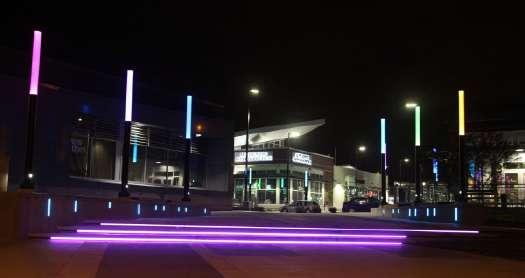
Olympic Plaza, Calgary
Painted Sidewalk Signage
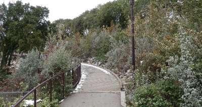
Catwalks
Originally created to provide shortcuts or direct pedestrian routes through neighbourhoods, catwalks are intended to make daily movement more convenient. However, many of these routes currently lack the safety, comfort, and visual interest needed to support active and enjoyable use.
This intervention aims to revitalize these spaces by transforming them into vibrant, accessible corridors
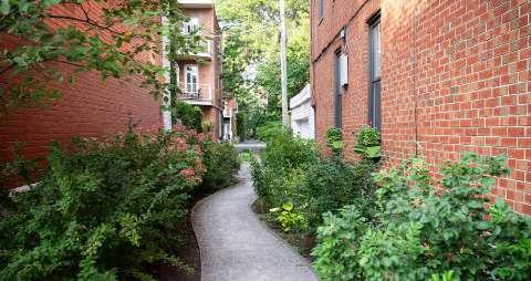
that encourage walking, enhance connectivity, and strengthen community ties.
This can be improved by including pedestrian-scale lighting for increased safety at night, painted walkways that both guide movement and add artistic flair, and the addition of vegetation such as low-maintenance plants and small trees to create a more inviting atmosphere.
Montreal, Quebec
Portland, Oregon
Evansville, Indianna
Vegetation
Painted Walkways
Active Programming
Cambridge, Ontario
Pedestrian Scale Lighting
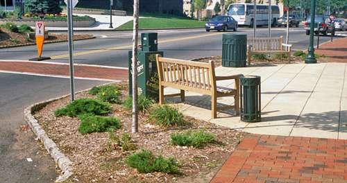
Neighbourhood Park Upgrades
Our engagement sessions brought to our attention the lack of sufficient places for community members to gather, play, eat and exercise outdoors. This intervention is focused on infrastructure upgrades to the communities neighbourhood parks which are currently lacking in amenities and programming.
The dispersed neighbourhood parks provide an exceptional opportunity to offer these amenities to a wide range of residents — combining these with an
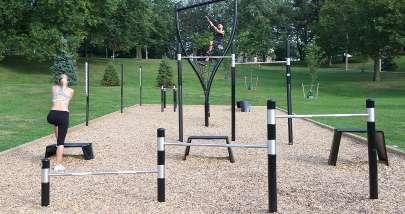
upgraded network of wheeling lanes, sidewalks and catwalks will ensure accessibility. Elements such as exercise and play structures will be complimented by seating, shelters, native trees and lighting.
These upgraded neighbourhood parks will become central to residential life and the communities new backyards.

Kiboek, Denmark
Toronto, Ontario
Sportgrounds Playgrounds
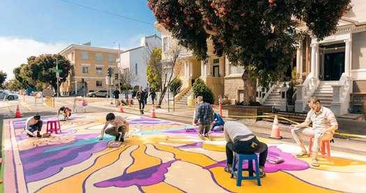
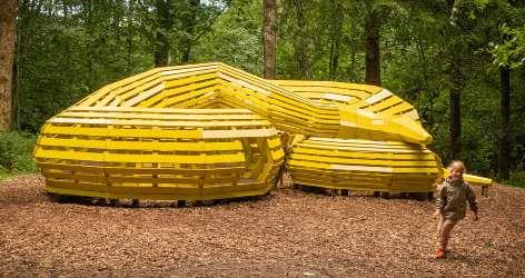
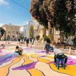
Naturalization & Community Plazas
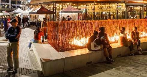
The area lacks wild space that can provide biodiversity and natural respite from the urban environment. Our interventions propose to bring those places back to the community through the creation of wetlands and ecologically diverse landscapes. Drawing inspiration from naturalization projects implemented in the City of Calgary, these will bring native plants to park spaces and help provide buffer zones for wildlife.
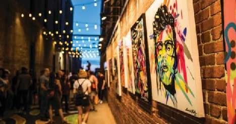
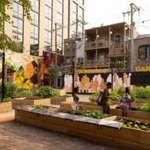
Gathering spaces can help community cohesion and provide third spaces for people to engage with each other. These neutral public areas are essential in generating connections and openness from residents. Through proper design and programming they can become community beacons and generate engagement. Our interventions propose a series of plaza spaces to create urban vibrancy.

Calgary, Alberta
Saskatoon, Saskatchewan
Naturalized Spaces
Public Plazas
PART V: SITES OF INTEREST

Overview

To illustrate how Common Plan's [Connecting Green Spaces with More Interesting Streets] and [Densification Where It Makes Sense] approaches can be specifically implemented, Common Plan planned for three significant and representative sites in the communities. These sites of interest are planned on our three design principles.

Design Principles
Environment Meets Urban Living
Transit-Oriented Development

Vibrant Spaces for Community Life
Brownfield Development
Neighbourhood Infill Development

Sense of Community through Placemaking
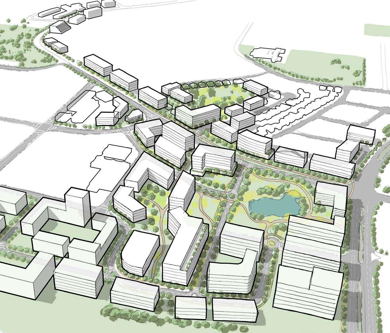
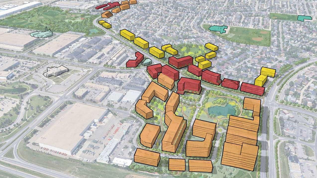
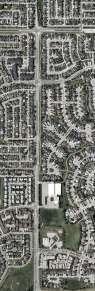
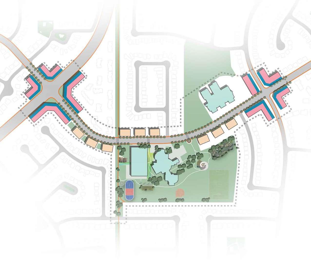
1. PRAIRIE WINDS CAMPUS
1. OVERVIEW
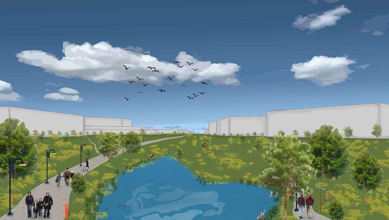
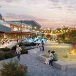
Prairie Winds Campus is a revitalized commercial and activity hub that leverages its strategic location near the McKnight–Westwinds LRT Station. Through the introduction of new amenities and a programmed public plaza, the Campus brings vibrancy to an area currently dominated by vehicle-oriented commercial development.
A central green corridor anchors the site, creating a direct and seamless connection between the LRT station and Prairie Winds Park—the namesake of the Campus. This green space incorporates a naturalized pond, a remnant of the area’s original landscape, reintroducing a natural feature into the urban fabric. In addition to complementing the already over-saturated Prairie Winds Park, the corridor offers a nearby place for rest and relaxation for future workers and visitors.

Altogether, this design fosters a more engaging, comfortable, and inviting last-mile experience for LRT commuters, while redefining the area as a lively and welcoming destination.


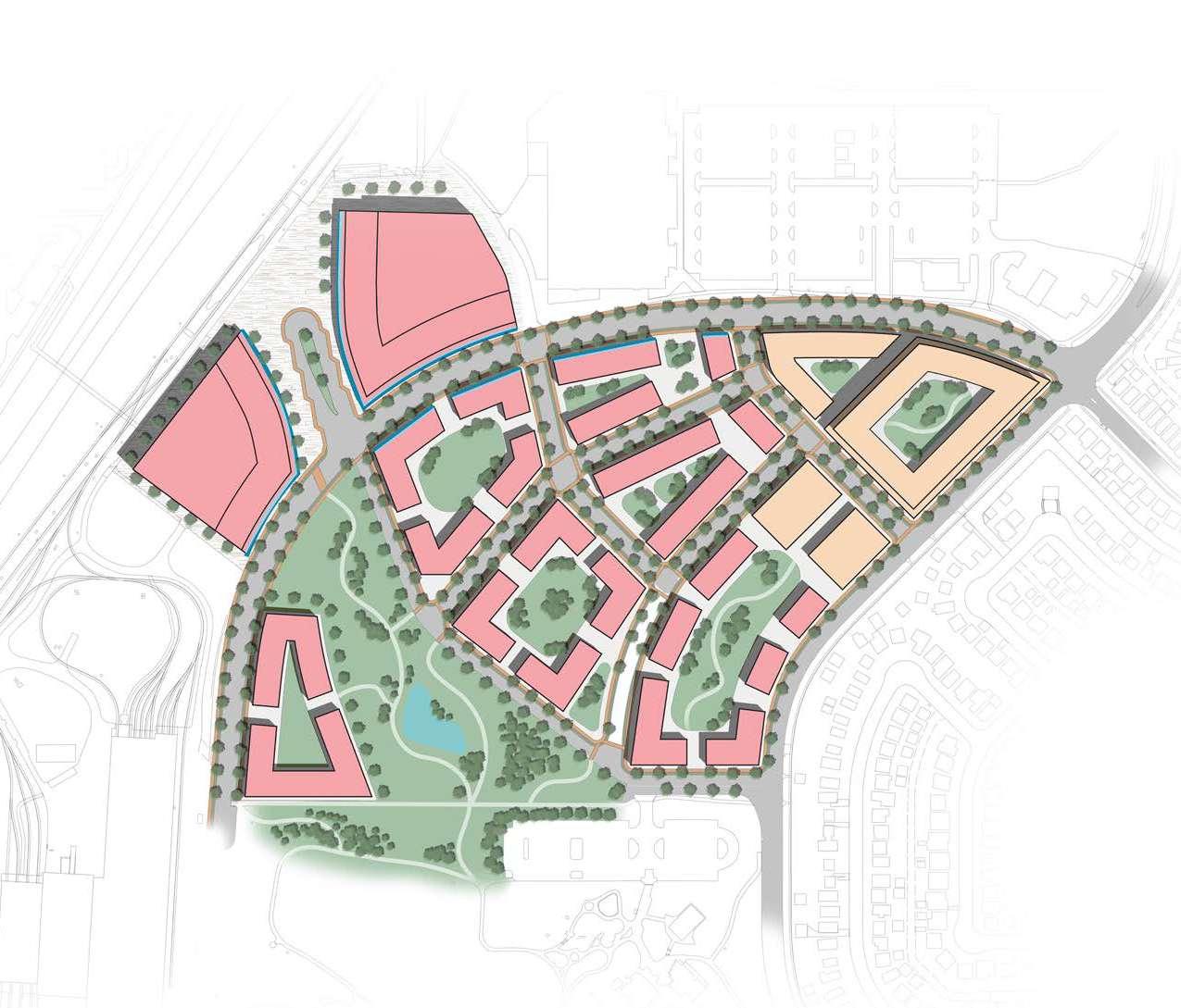

Section A: Commercial Area
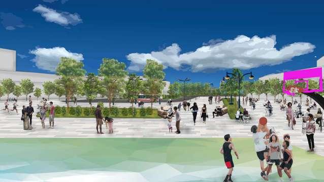
Illustration 1: Pedestrian-Friendly Transit Plaza
Section B: Mixed-Use Area
Due to restrictions under the Airport Vicinity Protection Area Regulation, residential development is prohibited across most of Prairie Winds Campus.
Instead, the Campus is planned as a vibrant employment hub that takes full advantage of its adjacency to the LRT station and bus terminal, offering excellent access both locally and city-wide.
The site is organized into five blocks of commercial or institutional buildings, and a small number of mixed-use residential buildings, each featuring shared courtyards that serve as outdoor gathering spaces for workers and visitors.
A pedestrian- and cyclist-friendly streetscape prioritizes walkability, with reduced vehicle presence making way for wider sidewalks and dedicated bike lanes.
As Calgary looks to a sustainable future, Prairie Winds Campus offers a modern, connected setting that supports innovation and drives economic growth in the city’s Northeast.
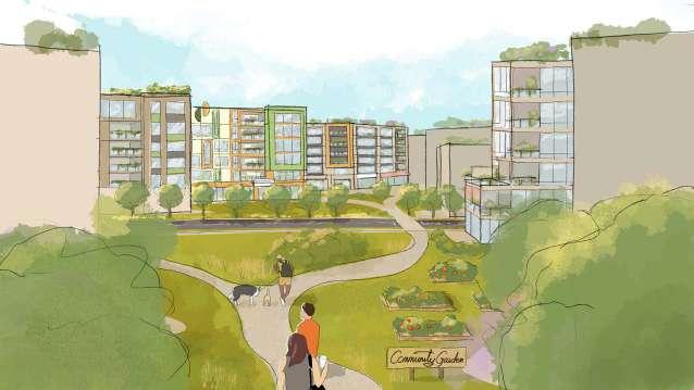
2. WESTWINDS COMMONS
Westwinds Commons is a vibrant, mixed-use neighbourhood that transforms big-box stores and parking lots into a connected urban fabric of greenways, community gardens, and an active main street. The design fosters social connection while balancing energy and calm.
The site of Westwinds Commons is divided into a dozen blocks of residential and mixed-use buildings. In the middle of blocks are shared green nodes featuring amenities such as playgrounds, exercising equipments, and community gardens. These green/ social nodes are connected by a trail network.
By overlaying the systems of main streets, green/social nodes, trails, and nodes, the Westwinds Commons forms a regional attraction like the successful University District in the Northwest Quadrant.

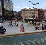
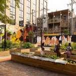
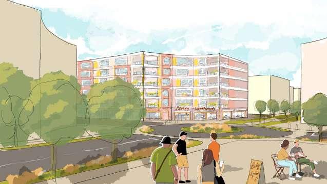
Illustration 1: Plaza Circus
Westwinds Commons is designed to strike a balance between the vibrancy of urban life and the tranquility of suburban living. Under Common Plan's [Density Where It Makes Sense] design principle, more density is allocated to this site to create an urban village similar to University District and West District of Calgary. A mix of tenure types for different income types shall be encouraged there.
By concentrating main street activity in the northern half of the site, the plan creates a gradual transition—from energy to calm, and from lively public spaces to quieter residential areas. As a whole, Westwinds Commons aspires to be a convenient, distinctive, and welcoming neighbourhood for people of all ages and backgrounds.
The success of University District demonstrates the strong appeal of urban living beyond the Downtown core and traditional infill sites. It also proves that the convenience and connectivity of urban environments can coexist with the comfort and serenity of the suburban neighbourhoods people value.
3. FALSHIRE MAIN STREET
1. OVERVIEW
Falshire Main Street is a reimagined segment of Falshire Drive, centered around the Falconridge/Castleridge Community Association building.
This transformation brings a vibrant main street to the heart of Falconridge, serving as a beacon for contemporary infill development within a mature suburban context.
Key interventions include a redesigned streetscape featuring fewer vehicle lanes, widened sidewalks, and dedicated wheeling lanes to support a more walkable, accessible environment. Two neighbourhood commercial micro-cores anchor this stretch, providing hubs of local activities such as corner stores, cafés and more. Complementing these changes, residential densification introduces diverse building typologies, generating more movement and vibrancy throughout the area.
Green Nodes Green Link Social Nodes Main Streets

Bow to Bluff, Sunnyside,

Falshire Main Street offers a practical path to infuse new vitality into an established suburban neighbourhood without clashing with its surrounding built form.
Building on the existing commercial plaza at the Falshire/ Falton intersection, Common Plan envisions modest residential intensification and additional storefronts there— and at the Falshire/Falconridge intersection as well.
Community members repeatedly asked for a wider range of uses inside the FCCA building and a stronger sense of safety around it. Together, these three refreshed “anchor points” can spark enough momentum to draw new housing, shops, and services along the blocks between them. Over time, the corridor will coalesce into a lively main street.
By assigning the right urban form and mixed-use zoning in an eventual Local Area Plan, Falshire Drive can realize its full potential while helping ease high housing costs. This concept is also applicable to other collector roads in the community.
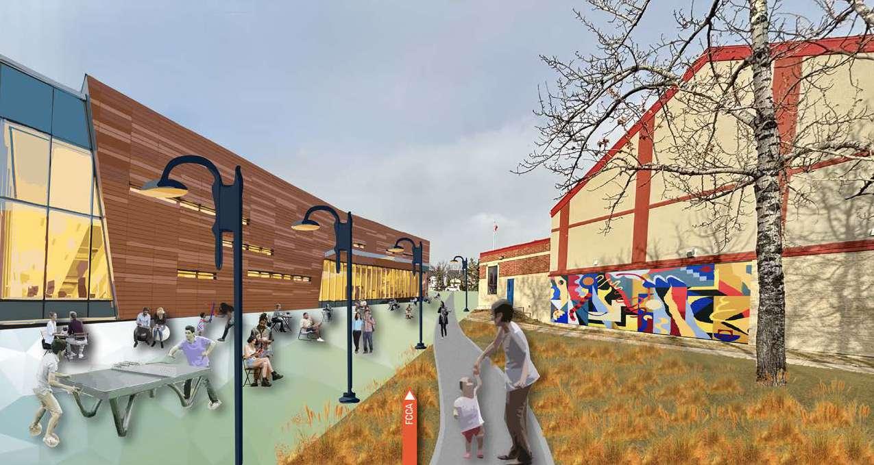
Illustration 2: Falshire Plaza at Community Association
Street Furniture, London, England
Sidewalk Widening, Toronto, Ontario
Bus Shelter, Louisville, Kentucky
Multi Modal Path, Indianapolis, Indiana
Thank you for taking this local area planning journey with Common Plan for Falconridge, Castleridge, and Westwinds.
Stacy Natalie Florendo
Donghao Lu
Julien Doucette-Préville
Please note that this document is a student-led local area planning exercise intended to simulate real-world planning processes. It is not an official plan and should not be interpreted as part of the City of Calgary’s formal local area planning program.

REFERENCES
24D Studio. (n.d.). Crater Lake project. Retrieved from https:// www.24d-studio.com/en/studioprojects/crater-lake
Alberta Planners. (n.d.). Complete streets and urban design guidelines. Retrieved from https://www.albertaplanners.com/sites/default/files/ CCUDG%20document_0.pdf
ArcGIS. (n.d.). Interactive dashboard. Retrieved from https://www.arcgis.com/apps/ dashboards/09ef336a4b8d4f8b98045821edea71a2
Banff Trail Community. (n.d.). Community garden. Retrieved from https://www.banfftrailcommunity.ca/community-garden
City of Calgary. (2014). Complete streets guide. Retrieved from https:// www.calgary.ca/content/dam/www/transportation/tp/documents/ ctp2010/complete-streets-guide-2014-web.pdf
City of Calgary. (n.d.). Bridgeland Main Street project. Retrieved from https://www.calgary.ca/planning/projects/bridgeland-main-street. html
City of Calgary. (n.d.). Building for Calgary's future. Retrieved from https://newsroom.calgary.ca/building-for-calgarys-future/
City of Calgary. (n.d.). Municipal development plan. Retrieved from https://www.calgary.ca/planning/municipal-development-plan.html
City of Calgary. (n.d.). Pathway and bikeway connections in ward 5. Retrieved from https://engage.calgary.ca/pathwaybikeway/ ward5connections
City of Calgary. (n.d.). Pump tracks. Retrieved from https://www. calgary.ca/bike-walk-roll/pump-tracks.html
Calgary Communities. (2019, June). Playbook. Retrieved from https://activateyyc.calgarycommunities.com/wp-content/uploads/ sites/3/2019/06/Playbook-June-18-compressed.pdf
Calgary Planning. (n.d.). Engage: Riley. Retrieved from https://engage. calgary.ca/Riley
Calgary Planning. (n.d.). Municipal development plan. Retrieved from https://www.calgary.ca/planning/municipal-development-plan.html
Calgary Police. (n.d.). Statistical reports. Retrieved from https://www. calgary.ca/cps/statistics/calgary-police-statistical-reports.html
City of Edmonton. (2021). Complete streets design standards. Retrieved from https://www.edmonton.ca/sites/default/files/publicfiles/documents/PDF/CompleteStreets_DesignStandards_2021.pdf
City of Edmonton. (n.d.). Winter city design guidelines (draft). Retrieved from https://www.edmonton.ca/public-files/assets/ document?path=PDF/WinterCityDesignGuidelines_draft.pdf
Elemente Magazine. (n.d.). Historic Waterton Lakes National Park gets a new visitor centre. Retrieved from https://elementemagazine.com/ historic-waterton-lakes-national-park-gets-a-new-visitor-centre/
Engage Calgary. (n.d.). Guidebook. Retrieved from https://engage. calgary.ca/guidebook
Federal Highway Administration. (n.d.). Medians and pedestrian refuge islands. Retrieved from https://highways.dot.gov/sites/fhwa. dot.gov/files/Medians%20and%20Pedestrian%20Refuge%20 Islands_508.pdf
HiSigns. (n.d.). Public transit signage. Retrieved from https://hisigns. com/projects/public-transit-signage/
KTMPO. (2018, June 21). Regional multimodal plan: Chapter 3 –Complete streets. Retrieved from https://ktmpo.org/wp-content/ uploads/2017/09/KTMPO-Regional-Multimodal-Plan-Chapter-3Complete-Streets-20180621.pdf
LiveWire Calgary. (2023, June). Calgary downtown wayfinding [Image]. Retrieved from https://livewirecalgary.com/wp-content/ uploads/2023/06/Calgary-DT-wayfinding.jpg
Nacto. (n.d.). Urban bikeway design guide. Retrieved from https:// nacto.org/publication/urban-bikeway-design-guide/
Nacto. (n.d.). Urban street design guide. Retrieved from https://nacto. org/publication/urban-street-design-guide/
NYC Street Design Manual. (n.d.). Raised crosswalk geometry. Retrieved from https://www.nycstreetdesign.info/geometry/raisedcrosswalk
Oakland DOT & PGA Design. (n.d.). Oakland slow streets. Retrieved from https://pgadesign.com/projects/oakland-slow-streets/
Outdoor Design. (n.d.). Combining art with play. Retrieved from https://www.outdoordesign.com.au/news-info/combining-art-withplay/8560.htm
Planetizen. (n.d.). Toward more comprehensive multi-modal transport planning. Retrieved from https://www.planetizen.com/blogs/102295toward-more-comprehensive-multi-modal-transport-planning
Queen’s University School of Urban and Regional Planning. (n.d.). Great streets final report. Retrieved from https://www.queensu. ca/geographyandplanning/sites/dgpwww/files/uploaded_files/
SURP/Project%20Course%20Documents/Great%20Streets%20 Final%20Report.pdf
San Francisco Municipal Transportation Agency. (n.d.). SF’s first raised parking-protected bike lane under construction on Valencia. Retrieved from https://www.sfmta.com/blog/sfs-first-raised-parkingprotected-bike-lane-construction-valencia
Secret San Francisco. (n.d.). San Francisco’s slow streets are home to some awesome murals. Retrieved from https://secretsanfrancisco. com/san-francisco-slow-streets-murals/
SCAG. (n.d.). First and last mile strategic plan. Retrieved from https:// scag.ca.gov/sites/main/files/file-attachments/first_last_mile_ strategic_plan.pdf
Schreder. (n.d.). Sustainable self-supporting lighting on Mandel bike path. Retrieved from https://ca.schreder.com/en/projects/sustainableself-supporting-lighting-mandel-bike-path
Sport Court Alberta. (n.d.). Game courts. Retrieved from https://www. sportcourtalberta.com/gamecourts.htm
Stats Canada. (n.d.). Census data. Retrieved from https://www12. statcan.gc.ca/census-recensement/index-eng.cfm
Streetsblog Mass. (2024, May 20). Eyes on the street: Somerville's new garden-protected bike lane. Retrieved from https://mass. streetsblog.org/2024/05/20/eyes-on-the-street-somervilles-newgarden-protected-bike-lane
The Urbanist. (2022, August 6). Tree sapling along Green Lake bike lane. Retrieved from https://www.theurbanist.org/wpcontent/uploads/2022/08/Tree-sapling-along-Green-Lake-bikelane-20220806.jpg
The Urbanist. (2022, August 11). Canopy-heavy green streets hold the key to climate-proofing transportation systems. Retrieved from https://www.theurbanist.org/2022/08/11/canopy-heavy-greenstreets-hold-the-key-to-climate-proofing-transportation-systems/
Topmade Plastics & Neon Signs Ltd. (n.d.). Four-sided LED illuminated multi-tenant pylon sign structure – 1103 17 Avenue SW, Calgary. Retrieved from https://topmade.com/portfolio/four-sided-ledilluminated-multi-tenant-pylon-sign-structure-1103-17-avenue-swcalgary/
Waterton Amphitheatre. (n.d.). Historic Waterton Lakes National Park gets a new visitor centre. Retrieved from https://elementemagazine. com/historic-waterton-lakes-national-park-gets-a-new-visitorcentre/
Zandona, M. (2023, May 10). A new mixed-use development shines in Calgary. Construction Canada. Retrieved from https://www. constructioncanada.net/a-new-mixed-use-development-shines-incalgary/
