Banff Trail
Neighbourhood Study
Plan 630 | Advanced Professional Planning Studio
Sidrah Anees | Nissmah Atif | Chetna Sidhu
April 20th 2024


Banff Trail
Neighbourhood Study
Plan 630 | Advanced Professional Planning Studio
Sidrah Anees | Nissmah Atif | Chetna Sidhu
April 20th 2024


Support & Guidance
On behalf of the team at Sukoon, we would like to extend our immense appreciation and gratitude to our professor Francisco Alaniz Uribe, the members our steering committee the Banff Trail community, and our many School of Architecture, Planning, and Landscape (SAPL) colleagues who provided feedback, encouragement, and perspective throughout the duration of this project.

Francisco Alaniz Uribe
Professor Banff Trail Community Association:
David Kowel
Kathryn Davies
Wayne Lui
The City of Calgary - Planning & Development
Scott Thomson
Planner – Local Area Planning Team
The City of Calgary – Community Partners
Yana Soldatenko
Neighbourhood Partnership Coordinator
Arcadis
Ben Lee
Associate Principal
Studio Manager, Placemaking
Special thanks to:
Farah Anees, Husnain Anees, Zanjeel Anees, Shadan Atif, Manal Atif, Mustafa Atif, Sohela Bozai, Atif Ehsan, Anadil Ittehad, Maliha Rasool, Maneet Singh Duggal (SAPL), Mustafa Kagdi (SAPL), Kinjal Ribadia (B&A), Chanita Shum, Mohit Sidhu, Poonam Sidhu, Tarun Sidhu, Roop Lal Sidhu, Komal Syed, Mariam Tohamy, Laura Young (B&A)
We would like to acknowledge and pay tribute to the traditional territories of the peoples of Treaty 7, which include the Blackfoot Confederacy (comprised of the Siksika, the Piikani, and the Kainai First Nations), the Tsuut’ina First Nation, and the Stoney Nakoda (including Chiniki, Bearspaw, and Goodstoney First Nations). The City of Calgary is also home to the Métis Nation of Alberta (Districts 5 and 6).
The University of Calgary is situated on land Northwest of where the Bow River meets the Elbow River, a site traditionally known as Moh’kins’tsis to the Blackfoot, Wîchîspa to the Stoney Nakoda, and Guts’ists’i to the Tsuut’ina. On this land and in this place we strive to learn together, walk together, and grow together “in a good way.”

Cities have the capability of providing something for everybody, only because, and only when, they are created by everybody.”
- Jane Jacobs
INTRODUCTION
Executive Summary
Company Profile
The Banff Trail Community
Legal Framework & Policies
Project Goals
Scope of Work
Interest Groups
Roles & Responsibilities
Phasing & Deliverables
Project Methodology & Timeline
RESEARCH & ANALYSIS
Site Introduction
Environmental Analysis
Mobility Analysis
Land Use & Built Form Analysis
Research & Analysis Summary
COMMUNITY ENGAGEMENT
Community Engagement Strategy
Analysis Workshop
Open House
Virtual Reality
Physical Model
CONCEPT DEVELOPMENT
Overview
Mobility Precedent Study
Open Spaces Precedent Study
Built Form Precedent Study
DESIGN RECOMMENDATIONS
Vision & Principles
Mobility
Open Spaces
Land Use & Built Form
Motel Village Redesign
Tactical Urbanism & Wayfinding
Community Identity & Placemaking
CONCLUSION
“
Moving elements in a city , and in particular the people and their activities , are as important as the stationary physical parts. We are not simply observers of this spectacle, but are ourselves a part of it, on the stage with the other participants.”
- Kevin Lynch

Introduction

The Banff Trail Neighbourhood Study aims to develop a holistic understanding of the current and future needs of the Banff Trail community, establish a clear community vision and identity, and provide a set of design and planning recommendations to guide future development within Banff Trail. This is an academic study conducted as part of the Citizens + Students project at the University of Calgary School of Architecture, Planning, and Landscape, in partnership with the Banff Trail Community Association.
Banff Trail is a neighbourhood in the midst of rapid change. Historically, this neighbourhood has consisted primarily of single-family residential development, but in recent years has seen increasing density and a changing urban form. Located in northwest Calgary, this site is adjacent to the University of Calgary, McMahon Stadium, SAIT, and AUArts. The site is well-connected to the downtown core and broader city through two LRT stations and several bus routes, and there is significant potential for community growth.
Through extensive research, analysis and community consultation, we identified key opportunities and challenges within Banff Trail. Existing assets such as the well-used community association hall, transit stations and stops, local commercial establishments, parks and open spaces, and street trees were catalogued and helped to inform our design concepts. Our environmental, infrastructure, and built form analysis also identified key challenges such as disconnected mobility networks, underutilized parks and open spaces, disconnection to motel village and surrounding neighbourhoods due to major thoroughfares, and a significant need for density and diversity within this community.
In collaboration with Banff Trail residents through a series of public engagements, we have developed a set of recommendations in the areas of mobility, open spaces, land use and built form, special sites, and placemaking. Additionally, this report provides information on tactical interventions, community branding and identity, and social programming. Each recommendation area is supported by an implementation plan, which includes suggested policy frameworks, guidelines for development, and potential funding avenues for community projects.


Sukoon is an innovative urban planning and design firm that focuses on increasing community connectivity and active transportation, enhancing the public realm through human centric design, and sustainable solutions to urban living that support biodiversity and a flourishing natural environment. We specialize in developing “big ideas” to empower communities to make meaningful change through a focused and realistic vision. Diversity, equity, inclusion, and accessibility are core tenants of our design philosophy and set the foundation for projects that create a positive social impact.
Our interdisciplinary approach to planning and design is rooted in our varied expertise and commitment to holistic solution design. Our team brings together backgrounds in architecture, planning, urban design, sociology, and education through a collaborative and participatory design and planning methodology.
The Sukoon design process begins with an analysis-based approach to deeply understand the scope and factors involved in a project. This analysis supports our data-driven solution development, ensuring that our project designs respond to key contextual factors and the needs of the community. We prioritize community engagement within the planning process, working collaboratively with community members to share knowledge and co-design solutions. At our core, we seek to design people-centric urban spaces that allow for a vibrant, active, and sustainable quality of life, through rigorous and innovative analysis, ideation, and strategy development.

Nissmah Atif is an architect and urban designer holding a Bachelor’s in Architecture and pursuing a Master of Urban Planning degree. Her professional career has taken her from the UAE, to the Netherlands and now Canada, with a portfolio of projects ranging from low to mid rise residential and mixed used developments. Her keen eye for detail, problem solving skills and her passion in leading empowerment initiatives for local communities, has led her to projects that keep inclusivity, the public good and meaningful design at the core of their values.
Sidrah Anees is an urban planner and researcher with a passion for sustainable development and regenerative community design. She holds dual degrees in sociology and education, with an academic focus on crime, deviance, and social control. She is pursuing a Master of Urban Planning at the University of Calgary. With a prior professional background in communications and granting, Sidrah specializes in concept ideation, project logic and branding, and accessible community engagement. She is passionate about data-driven climate change solutions within the built form that prioritize environmental justice and equity.


Chetna Sidhu is a dedicated urban planner, known for her innovative approach to urban development and design. Holding a degree in Architecture and pursuing a Master of Urban Planning, she combines technical proficiency with a deep understanding of urban landscapes. Chetna’s expertise lies in sustainable development, mobility, GIS mapping, 3D modeling, and data analysis. She has actively contributed to several urban planning initiatives, demonstrating a keen eye for design and planning that balances aesthetic appeal with functional practicality.
The community of Banff Trail was established in 1951. Named for the route that connects Calgary to the mountain town of Banff, this community is a well-connected and wellloved neighbourhood with significant potential for positive growth. This community has a population of 3,805 (2021) and is located in the northwest quadrant of Calgary. Bordered by Crowchild Trail to the west, the Trans-Canada Highway to the south, with two LRT stations and several bus routes, this neighbourhood is well-connected to the broader city of Calgary and downtown core. Proximity to the University of Calgary, Southern Alberta Institute of Technology, and the Alberta University for the Arts means that many students live in Banff Trail or experience this community as part of their daily commute. McMahon stadium, located immediately West of Banff Trail, adds an additional level of vibrancy to this area when activated through programming and events.
While primarily a residential community, Banff Trail is home to a large motel village in the south of the community, as well as pockets of commercial activity along Morley Trail and 20th avenue. There are three schools located in this community, Banff Trail School, Branton Junior High School, and William Aberhart High School. West Confederation park, located at the east edge of this community provides recreation opportunities in a natural environment, connected to Confederation Park and the Confederation Park Golf Course. This community has a relatively young population, with 74% of residents under the age of 50. Most residents live in 1 or 2 person households (67% overall) and 58% of households are renters. 24% of residents identified themselves as immigrants, and 36% of residents identified themselves as belonging to a visible minority. There is slightly higher unemployment rate of 16% compared to the city average of 16%, particularly high for women (19%); however there are a higher number of residents with post-secondary education (72%) compared to the city at large (61%).
One of the major strengths of this community is its strong neighbourhood association, the Banff Trail Community Association, founded in 1954. There is a strong sense of community bolstered by the active neighbourhood association and numerous social and recreation programming opportunities taking place in an around the Banff Trail Community Association Hall (est. 1956). The BTCA provides many community services, from a skating rink to a conversation club to a good food box program. The community hall also partners with external organizations to provide additional recreation and wellness opportunities. Through the support of this organizing body, Banff Trail has become an attractive neighbourhood with an enduring community character and a high-quality built form.
Guided by the 1986 Banff Trail Area Redevelopment Plan, this area has grown and changed in many ways and will continue to change rapidly as Calgary expands. Urban design elements such as raised bike lanes along 24th street, and a destination bicycle pump track in West Confederation Park indicate a trend towards positive urban development, but a more focused vision is needed to ensure that the future growth of Banff Trail enhances neighbourhood character, improves quality of life for residents, and offers triple bottom line sustainability. This neighbourhood study will work with residents to create a strategic path forward for Banff Trail that meets the goals and objectives of the community.
We fulfill our purpose by engaging residents in a range of community-related activities and events, and work to improve the attractiveness of the Banff Trail Community at large. We directly engage with the community to influence the character and quality of our neighbourhood.


To align the Banff Trail Neighbourhood Study with the City of Calgary’s policy framework, we have identified several important statutory and non-statutory documents. These documents will serve as references throughout the project, guiding us on addressing the key issues we have previously identified. This approach ensures that our project remains consistent with the city’s overall policy direction and strategic goals.


Municipal Development Plan
Banff Trail Area Redevelopment Plan

South Shaganappi Area Plan

Calgary Transport Plan


Connect: Calgary’s Parks Plan

BiodiverCity: Strategic Plan
This is a statutory document that outlines the vision for Calgary’s growth and development over the next several decades.
This is a statutory document that provide specific guidelines for redevelopment and land use in the Banff Trail Community.
This is a statutory document that provide specific guidelines for redevelopment and land use in the South Shaganappi Area. This is being redeveloped into a Local Area Plan currently.
This plan outlines the future of public transportation in Calgary. It includes strategies for improving the transit network and services, which is crucial for neighborhoods like Banff Trail with multiple LRT stations.
This plan will focus on the development and maintenance of park spaces in Calgary, ensuring that they meet the needs of residents and contribute to the city’s environmental goals. It is currently under development.
This plan focuses on strategies for preserving and enhancing biodiversity within the city and provides direction on integrating biodiversity considerations into planning processes.
As Banff Trail experiences rapid densification and growth, the project will focus on aligning existing amenities with this expansion through a detailed neighbourhood study. Through a focused vision and strategic design plan, we will ensure that new developments are implemented in ways which maximize community benefit, and align with the stated goals and objectives of the association. These objectives include leveraging investments in infill development to enhance pedestrian infrastructure, improve parks and open space opportunities, and introduce new commercial amenities like coffee shops and small-scale retail. This planning work is crucial as it sets an aspirational vision to guide advocacy efforts, aiming to create a harmonious balance between growth and community enrichment.
Key Goals:
1. Enhancing Walkability and Safety: Focus on creating pedestrian-friendly infrastructure, ensuring safety in public spaces and around schools.
2. Improving Commercial and Recreational Spaces: Further intensify commercial areas along Morley Trail and 20 Ave NW and enhance recreational facilities to foster community engagement.
3. Sustainable and Inclusive Development: Implement environmentally responsible practices and inclusive planning to cater to diverse community needs.
4. Activating Community Main Streets: Transforming 20 Ave NW and 24 Ave NW into vibrant community hubs.
5. Strengthening Neighborhood Connections: Improving connectivity between Banff Trail and Capitol Hill, particularly across 19 St SW.
6. Activating LRT Stations: Enhancing the vibrancy and safety of Banff Trail LRT and University LRT stations to benefit commuters and the community.
The Banff Trail neighbourhood scope includes the following work: Site and data analysis to create a detailed neighbourhood study including built form, social and community aspects, and an environmental inventory
Community engagement and a synthesis of community feedback into project direction
A land use and development concept for the Banff Trail community
Design concepts and recommendations for:
open space and parks systems
street network and pedestrian experience
public space programming
housing diversity and built form typologies
The identification of commercial areas and corridors, including strategic recommendations for smart growth
Development of an inclusive mobility and transportation strategy, including recommendations for revitalization of LRT stations
A focused and cohesive vision for the Banff Trail Community
Urban design guidelines that will support the realization of the community vision
A preliminary assessment of major interest groups includes:
1. 2. 3. 4.
The association is instrumental to ensuring design concepts and recommendations reflect the rich history of this community, preserve community character, and support social connection for residents.
Their insights are key to integrating commercial interests with community needs and enhancing local services and economy.
Both homeowners and renters are crucial to the redevelopment process. Their feedback will guide the development of more effective and user-friendly spaces and inform the development of a cohesive community vision.
City of Calgary
Essential for policy, approvals, and resources; their role is vital in shaping the project’s framework and success.
Other interest groups to consult during the planning process include:
Calgary Transit: Their involvement is critical in enhancing public transport infrastructure, improving access and mobility in Banff Trail, which is uniquely served by two LRT stations.
Calgary Board of Education: Neighboring schools will be key in addressing educational infrastructure and the impacts of redevelopment on children and youth.
Non-Profit Organizations: Provide insights on social issues and community needs, aiding in inclusive and holistic development.
Religious Groups: Represent cultural and spiritual aspects of the community, contributing to the diverse fabric of Banff Trail.
Recreational Visitors: Their input can help shape recreational amenities, making Banff Trail a more attractive destination.
Heritage Preservation Groups: Important for maintaining the historical integrity and cultural heritage of the community.
Private Landowners & Developers: Key in shaping the physical landscape of Banff Trail, their investments and developments will greatly influence the area’s future.
The successful redevelopment of Banff Trail hinges on the collaborative efforts and distinct roles of several key entities. This section outlines the responsibilities and functions of the major stakeholders: Sukoon Studio, the Banff Trail Community Association, the Steering Committee, and the City of Calgary. Each plays a unique and critical role in steering the project towards its vision of a vibrant, sustainable, and community-focused neighborhood. Understanding these roles is fundamental to ensuring a cohesive and efficient redevelopment process.
1. Sukoon Studio
As project consultants, we oversee the day-to-day management of the project. This includes detailed project planning, design and implementation, coordination among interest groups, managing timelines, and budget. We are responsible for ensuring that project deliverables meet quality standards, and for tracking and reporting on project progress. Sukoon Studio also plays a crucial role in risk management and problem-solving throughout the project life cycle.
2. Banff Trail Community Association
As the coordinating body for Banff Trail, they are responsible for facilitating community engagement and feedback by working with the project team to design engagement opportunities that work for resident needs. Their tasks include organizing community consultations, gathering and articulating resident concerns and aspirations, and ensuring that these are accurately represented in the project plans. They also work to maintain transparency and build trust between the community and the project team.
3. Steering Committee
Serving as the project governance body, the committee provides oversight and strategic direction. Responsibilities include monitoring project progress, ensuring adherence to agreed objectives, and providing feedback at regular project intervals. The committee acts as a mediator in resolving interest group conflicts and ensures that different perspectives are considered in decision-making processes.


This section will provide a comprehensive understanding of the work plan developed for this project based on the request for proposal. It will outline our approach, engagement methods, and project deliverables by breaking it down into four phases as follows:
& Kick-off
Upon approval of the budget and commencement of the project, Sukoon will undertake a process of data collection needed for the context analysis, examine relevant municipal policy documents, and schedule an initial kick-off meeting with the BTCA to discuss the scope of work, timeline, deliverables, communication protocols, and roles and responsibilities.
A site visit with the Banff Trail Community Association will be conducted to better understand the context through the lens of the community members and various interest groups involved.
To develop an in-depth understanding of the context, Sukoon will review all the policy documents to guide the project development in alignment with the current policy context. We will also collect data to undertake a thorough site analysis by developing a detailed community profile to understand the socio-demographics of the community, study its historic evolution, and conduct an environmental analysis that includes shadow studies, topography, urban canopies etc., analyze housing, building typologies, infrastructure, and create a public realm inventory. The collection and analysis of all this data will then be used to conduct a SWOT analysis to evaluate the feasibility of potential design solutions.
This phase also includes a community workshop with residents and interest groups to further deepen and validate findings of our data analysis.
Key Deliverable: Work Plan
Key Deliverables: Site Analysis Presentation
Community Workshop
Moving into the conceptual design phase, the team will review the feedback from the community workshop to come up with a vision and guidelines for the Banff Trail Community neighbourhood study. The guiding principles will enable us to develop a set of design recommendations and strategies that shall be illustrated in the form of plans, sections, diagrams, and 3D models to guide future redevelopment and improvements in the community. Various elements such as land-use, growth areas, parcel and block layouts, public spaces programming, transport and mobility, housing and building typologies shall be considered in the process and presented to the steering committee in the form of a draft design concept.
The final phase will culminate in the development of a report for the Banff Trail Community neighbourhood study that shall encapsulate the refined design by summarizing all the findings from the site analysis, public engagement with the community members, and design recommendations for the future redevelopment of the community.
The final proposal shall also be presented at an open house using posters, presentations, and an interactive virtual reality element for public viewing and feedback that will be incorporated into the final report with implementation strategies for the community association.
Key Deliverables: 3D Model
Concept Design Presentation
Key Deliverables:
Open House Exhibition
Final Presentation
Final Report
Public
Presentation
“
Human survival depends upon adapting ourselves and our landscapes—cities, buildings, and gardens, roadways and rivers— in new, life-sustaining ways, designing places that are functional, sustainable, meaningful, and artful, places that help us feel and understand the relationship of the natural and the built.”
- Anne Spirn

Research & Analysis


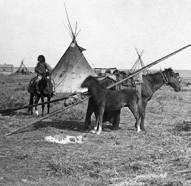


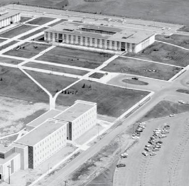


1926: Land annexed by city, some single family developments established.
1948: Additional single family developments, primarily along 24th Avenue or 19th Street.
1953: Banff Trail community established, southern half of community below 24th Avenue significantly developed
1957: Northern half of community established. North Hill Center, Calgary’s first mall opens just south east of Banff Trail in 1958.
1960s: Trans Canada highway redirected straight west, Crowchild Trail becomes major N-S connection.
1975: Upper northwest corner developed, significant growth at the University of Calgary and development of McMahon Stadium to the west.
2022: Banff Trail and surrounding communities consist of primarily lowdensity residential development as well as number of major education health, and recreation institutions.


School Enrollment by Count
School Enrollment Rate
• Calgary Montessori School
• Maria Montessori Education Centre
Schools
• St. Piux X School
• St. Francis High School
• St. Margaret School
• Banff Trail School (K-6 French Immersion)
• William Aberhart High School (10-12 French Immersion, Spanish Bilingual)
• Senator Patrick Burns School (6-9 Spanish Bilingual)
• St. Piux X School (K-6 French Immersion)
• St. Francis High School (10-12 French)
• St. Margaret School (K-7 Spanish Bilingual)

Banff Trail and the adjacent areas are home to a number of schools, including several elementary and junior high schools, and a senior high school. The area is also adjacent to several post-secondary institutes, including the University of Calgary, Souther Alberta Institute of Technology, and Alberta University of the Arts. Local public school enrollment in Banff Trail has seen a slight decline since 2019, but is relatively stable- this may indicate a decline of young families in this area.

Violence Other (Non-Domestic)
VIOLENCE OTHER (NON-DOMESTIC)
THEFT OF VEHICLE
Theft of Vehicle
THEFT FROM VEHICLE
Theft from Vehicle
STREET ROBBERY
Street Robbery
COMMERCIAL ROBBERY
Commercial Robbery
BREAK & ENTER - OTHER PREMISES
Break & Enter- Other
BREAK & ENTER - DWELLING
Break & Enter- Dwelling
BREAK & ENTER - COMMERCIAL
Break & Enter- Commercial
ASSAULT (NON-DOMESTIC)
Assault (Non-Domestic)
Overall, crime rates are stable in Banff Trail, but relatively high compared to neighbouring communities A high number of cars parked on the street (from students or renters) could explain the increased rate of thefts from vehicles.
Perceptions of safety are also impacted through urban design- limited sight lines to LRT platforms decrease feelings of safety at Banff Trail and University LRT stations.
Banff Trail is a relatively flat site, but features a few areas of raised and lowered topography. Steep hill slides can lead to unwelcoming park approaches and increased stormwater and snow melt runoff to the adjacent sidewalks. Through an analysis of site drainage, we can see that most drainage flows along roadways, which leads to icy roads and sidewalks in the winter. Overall, the site features a high degree of impervious surface, which leads to increased stormwater and snow melt runoff, further reducing the quality of the sidewalks and roads in the winter time. Of the 145 total hectares of the site, 112.8 hectares (excluding building footprints) feature hard or impervious surface.
The cumulative effects of Banff Trail’s topography, natural drainage pathways, and high degree of impervious surfaces result in icy sidewalks and roads, leading to dangerous winter conditions for pedestrians, cyclists, and motorists.


Open Space Typology
Highly programmed recreation spaces with multi-community appeal.
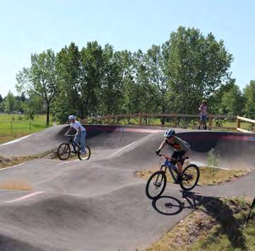
Recreational spaces that feature some yearround programming and primarily serve Banff Trail.

West Confederation Park
• Bicycle Pump Track
• Tennis Courts
• Splash Park
• Cross-Country Skiing
Open spaces connected to schools, often completely fenced.

Cathedral Road Park Banff Trail Park
• Playground
• Ice Rink
• Baseball Diamond
Open spaces located within neighbourhoods, no specific programming.

Branton Jr. High
William Aberhart Sr. High
• Football Field
• Outdoor Exercise Equipment
Strips of trees or grass located adjacent to major roads.

Exshaw Park
• Mix of Tree Species
• Open space
Public Seating at 16th Ave
• Pedestrian Bridge
• Mix of Tree Species

Banff Trail has a robust tree canopy and a high number of street trees, but there are a few notable gaps in tree planting and ecosystem connectivity. Motel Village has significantly fewer trees, smaller tree canopy coverage, and trees that are generally younger and more homogeneous in their species variation.
Diverse planting of street trees can improve ecosystem health and increase local biodiversity. Tree canopies are critical in reducing the urban heat island effect, a concern that is only exacerbated by climate change and rising temperatures. The urban heat island effect occurs in urban areas due to high heat exposure and emission from impervious surfaces such as roads and buildings, as compared to more naturalized landscapes wherein trees and plants can absorb and store heat. Increasing street trees can improve the tree canopy and help to mitigate this effect.


• 3276 public trees
• 923 private trees

• 25.6 hectares covered by tree canopy
• 17% tree canopy cover, almost double the city target of 9% by 2026


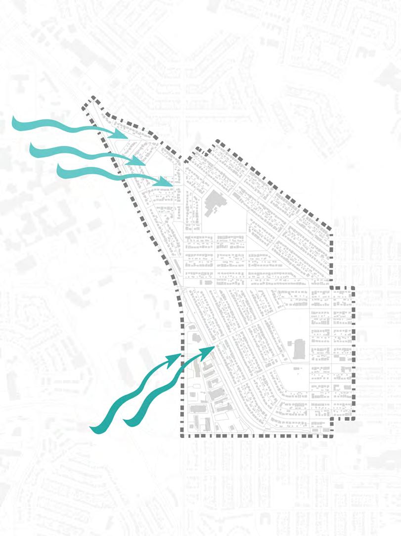
The microclimate within most of Banff Trail is similar to that within the greater city of Calgary. Extended winter climate requires winter city considerations to ensure that essential services, amenities, and recreation opportunities are available throughout the year. Banff Trail currently offers several recreational activity options throughout the year, from soccer to ice skating.
Motel Village features a distinct microclimate. Chinook and prevailing winds, particularly along Banff Trail NW create an unpleasant pedestrian experience. This is exacerbated by a lack of healthy street trees along this road.


Analysis & Shadow Study


We examined solar potential in Banff Trail to better understand the capacity for solar energy utilization within the site. The site has a high degree of overall exposure and solar potential. South facing roofs can be utilized for solar energy harvesting through solar panels within the site. The parcel blocks below 24th ave are likely to have the greatest solar energy yield due to their slanted north-south orientation, which allows for extended sunlight capture throughout the day.
Solar power could also be used for interactive urban realm elements, such as solar powered street lights within parks or touch-screen signage for improved wayfinding.
Banff Trail receives year-round sun exposure on most south-facing sidewalks. There is increased ice build-up on north-facing sidewalks, due to the lack of sun exposure. The angled street grid in parts of the site has enhanced sunlight distribution, as compared to the west-east oriented streets.


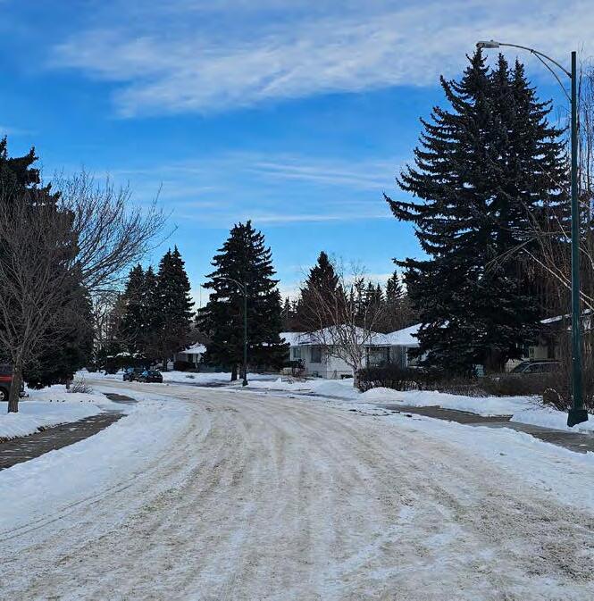
Poor winter city considerations within Banff Trail have led to an unsafe and unpleasant mobility experience through most of the community in the winter time, due to ice and snow build-up. A lack of snow removal on pedestrian paths creates icy sidewalks. Windrows block pedestrian pathways, making crosswalks difficult to access, particularly for those with increased mobility needs. The overall winter condition of Banff Trail leads to a low degree of accessibility within the public realm.




• Programming limited to Banff Trail Park and Cathedral Road Park
• Existing parks programming works best for children and families- more diversity is needed
• Pocket parks with no activation
• Largest open spaces are under utilized
• No continuity between parks
• Breaks within potential ecological corridors limiting ecosystem cohesion
• Pathways (pedestrian, bike) do not have a continuous connection to parks
• High degree of impervious surfaces leads to significant stormwater runoff
• Greatly impacts winter city conditions as ice and snow builds up on sidewalks and roads
• Drainage pathways along roads can be blocked by snow and ice
• Tree canopy exceeds city goals, but there is limited plant diversity
• Street trees are not equally distributed
• Major roadways result in poor sensory microclimate through sound and exhaust pollution
• Only major roads are plowed
• Residential roads orientation results in significant shadowing, prolonging snow and ice melt times
• Windy corridors worsen pedestrian experience

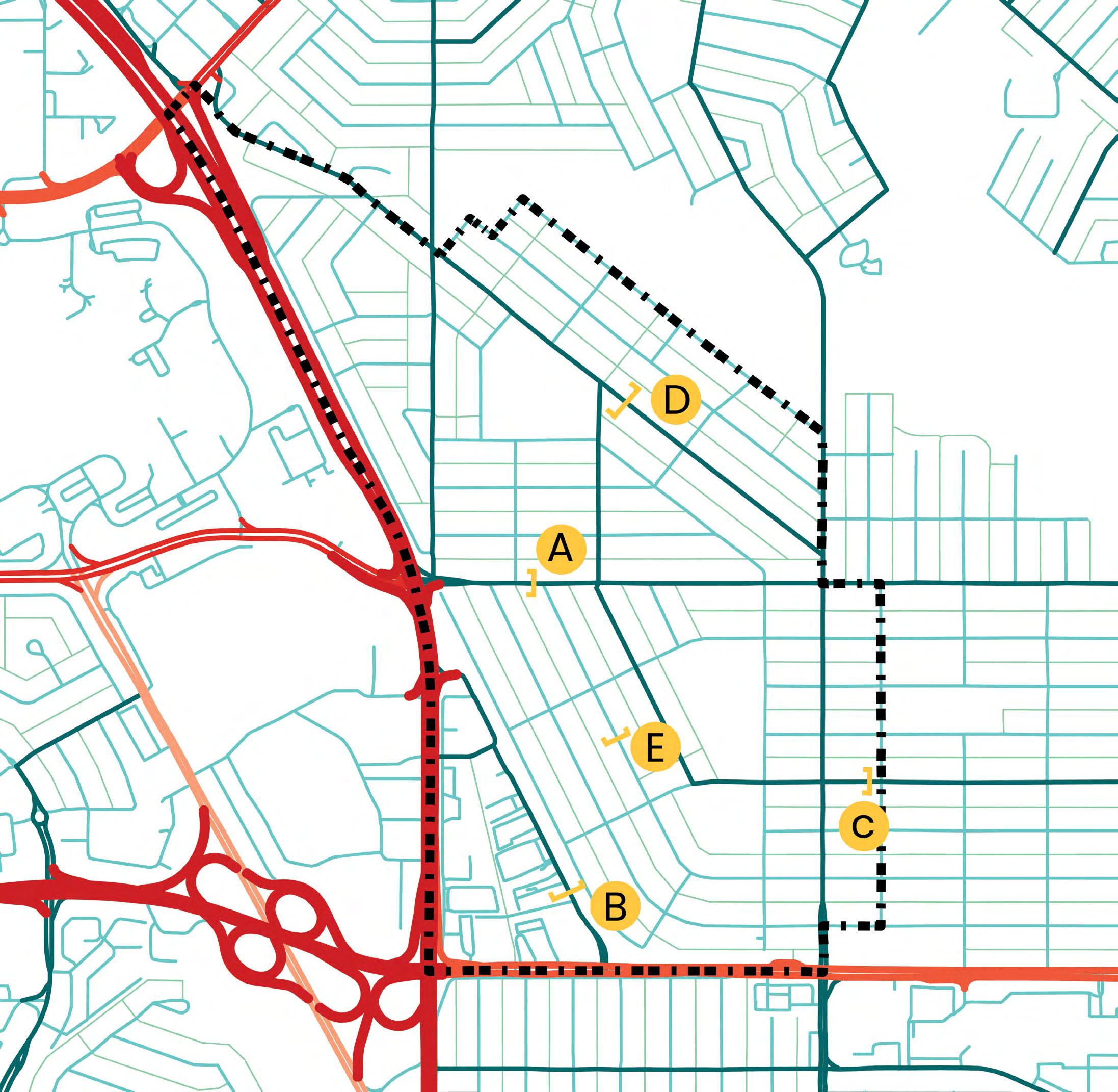
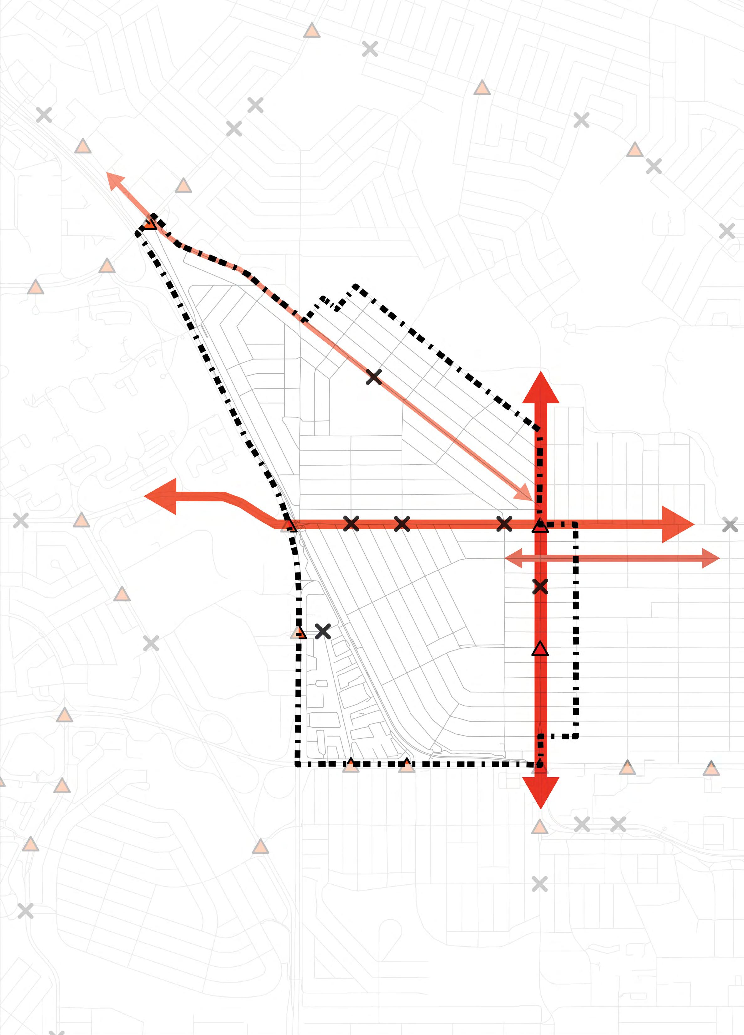
• Surrounded by Crowchild Trail & 16th Ave Trans-Canada Highway.
• Collector roads link the community to major roads.
• Predominantly car-oriented design, with grid patterns favoring vehicles.
RESIDENTIAL STREET
Banff Trail has several problematic and dangerous intersections, identified through our traffic analysis and feedback from community members. These intersections, outlined below, often feature blind corners, limited pedestrian and crosswalk infrastructure, and high volumes of traffic.
This issue is particularly concerning in the areas around schools, leading parents to prefer dropping their children off, which in turn creates a negative traffic feedback loop.
19th Street NW, Morley Trail, and 24th Avenue NW are the areas with highest traffic, and the greatest number of vehicular and pedestrian incidents. 19th Street NW and 24th Avenue NW have been identified as barriers within the community, due to their high traffic volumes and dangerous crosswalk conditions.


• Very dangerous
• No crosswalks
• No pedestrian crossing light •


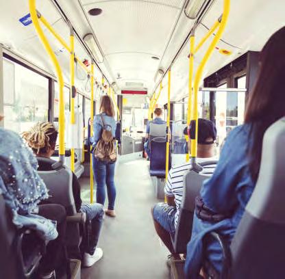

Five bus routes are present within the community, but service within these routes can be improved to better serve the community. A Max Orange BRT stop is located on the south edge, benefiting only some residents. Bus service frequency and route design are suboptimal, leading to longer travel times and making driving a more attractive option. There is a lack of a multi-modal transit network, leading to a disconnect between different travel modes and limiting active transportation options for residents.


• 85-90% walkability
• Gaps in pedestrian network due to missing sidewalks.
• Unsafe conditions lead pedestrians to walk on roads.


No indication of
• Separated bike paths on 24th Ave & Banff Trail Ave.
• Other paths lack safety features.
• Network doesn’t connect to city.

• Grids are not pedestrian-friendly.
• Crowchild Trail and LRT create walkability barriers.
• Access to local stores and community association hindered.
• FreshCo’s location and surrounding roads reduce its walkability.
• Short walking distance between LRT stations and schools

Public Realm Qualities


• An island within Crowchild Trail, leading to poor sensory experience (sound, smell)
• Stairs and ramps to access platform build up snow and ice
• Many students park adjacent to the station (but do not use LRT)
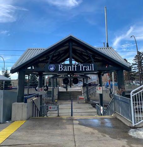


• Poor legibility and visibility of the main platform
• Accessible ramp can become icy due to high walls reducing sun exposure
• Dangerous pedestrian crossing


• Limited seating at bus stops
• Narrow sidewalks with little space both pedestrians and those waiting for their bus
• Unsheltered stops with poor seating experience

Public Realm Qualities
There are 15 public seating options across the whole site, but we observed that there is private investment in the public realm, with some businesses providing outdoor seating (beyond private café patios). There are 9 controlled pedestrian crossings, but streetlight outage reporting showed that there are many outages near these crosswalks, limiting their impact on safety at night. Other community features such as notice boards, little free libraries, and bike racks, visually demonstrate that there is community investment in a pleasant public realm experience.

• 15 Public Seating Options

• Private businesses enhance the public realm by providing outdoor seating 9 4 1

• Controlled pedestrian crosswalks increase safety along 24th Ave
• Many street light outages along 24th reduce pedestrian visibility


• No heavy infrastructure like transmission lines or CPR nearby.
• No wet/dry stormwater ponds present.
• Highways, LRT line, and bike paths are main infrastructures.


Above ground power infrastructure
Low-voltage power pole
Low-voltage power line


Along 16th Ave in
• No high-voltage power lines.
• All power structures require a 3m setback, both vertically and horizontally, in certain cases.
• Integrate bus routes with two LRT stations to improve connectivity.
• Offer seamless access to multi-modal transit.
• Ensure efficient and convenient transitions between buses and trains.
• Enhance the overall travel experience for residents.
• Opportunity for improvement in bike and pedestrian path network.
• To offer seamless connectivity to broader Calgary area.
• Potential expansion of 24th Ave westward.
• Introduction of new bicycle route along 20th Ave extending eastward.
• Opportunity to transform 20th Ave into a complete street.
• Aim to enrich community’s commercial hub for pedestrians.
• Elevate pedestrian experience
• Foster a vibrant, accessible urban environment
• Skeletal road and Trans-Canada Highway encircle the community.
• Inadvertently directs traffic through the community causing an influx of vehicles within the community during peak hours.
• Creates obstacles for walking and cycling.
• Severely limits active transportation options.
• Varying grid patterns reduce walkability
• Pedestrian experience not enhanced.
• Paved sidewalks present but unwelcoming.
• Unsafe conditions for pedestrians and cyclists.

In our analysis of the Banff Trail area, we observed that while the site is extensively built-out, it maintains a low-density profile. The building density across the 359-acre expanse of Banff Trail is quantified by a 21.1% building coverage rate, with an average of 3.5 buildings per acre.

Our analysis of land ownership reveals that only 3% of the land is municipally owned, and mainly consists of parks & open spaces. The land is divided into 18 zoning districts and a vast majority lies in the hands of private owners and developers.


Banff Trail saw most of it’s development happen between the years of 1950 to 1975 and about, 64% of the built form in Banff Trail is 80 years old, making this community more suited to infill and redevelopment opportunities.
77% of the buildings in Banff Trail are single-family dwellings, ranging in average property values of 600-700k. Rents range from $500-3000, depending on the type of dwelling, which is significant for the below-average median income of $84,000.

64% of the built form in Banff Trail is 80 years old!


In our parcel and block analysis of Banff Trail, we identified three distinct block layouts within the community: warped grid, diagonal grid, and perpendicular grid. Each layout corresponds to specific lot types; the warped grid predominantly features narrow lots, the diagonal grid consists of standard lots, and the perpendicular grid is characterized by multi-residential lots. This differentiation in grid orientation and lot type is crucial for understanding the spatial arrangement and potential development constraints within the neighborhood.
Block lengths within these layouts vary significantly, ranging from a more manageable 100 meters to a more expansive 300 meters, indicating a diverse scale of urban form across different sections of the community. Parcel sizes also vary widely, from as small as 0.1 acres to as large as 10 acres, accommodating a variety of land uses.
Warped Grid Layout


In our analysis of land use within Banff Trail, we categorized and quantified the distribution of different land uses across the site. Our findings revealed seven distinct land uses. The zoning specifics reveals a predominance of zones designated for singledetached housing and semi-detached duplexes, reflecting the primarily residential character of the community and fragmented commercial nodes.


Building Typologies


We conducted a thorough assessment of building typologies to understand the distribution and diversity of architectural forms within the community. This analysis identified seven primary building typologies, offering insights into the dominant architectural styles and their functional implications for the area.
The most prevalent type is single-detached homes, which constitute 75% of all structures, reflecting the community’s residential character. Semi-detached duplexes are also significant, comprising 20% of the typologies and providing a form of medium-density housing. In contrast, townhouses and apartments represent a smaller fraction, totaling only 2%, which indicates a limited availability of higher-density residential options.
Building Typologies


3-6 Storey Apartment Buildings Mixed-Use MultiUnit Residential & Commercial typologies Community Library & Co-working Spaces Grocery Store
Commercial buildings make up approximately 2.4% of the structures, supporting local commerce and services. The least common are community buildings, such as community centers and public halls, which account for just 0.8% of the total.
There is a marked absence of mid-rise apartments (3-6 stories), which limits housing diversity and density. The area also lacks mixed-use buildings that combine residential living with commercial spaces, which are essential for vibrant community life. Additionally, the community would benefit from the development of major grocery stores and facilities such as libraries and co-working spaces, which are currently lacking within the site.
Functional Analysis
To understand the functionality of the Banff Trail area, we conducted a detailed functional analysis focusing on how various elements contribute to the site’s overall utility and legibility. This analysis highlighted four major landmarks:
Community Landmarks


In our 3D built-form analysis we observed several key characteristics that impact the pedestrian experience and the area’s visual cohesion. Buildings, including nonresidential ones, are set far back from the street. This creates an unpleasant street experience, as the large setbacks contribute to a sense of openness that can diminish the feeling of enclosure that typically enhances pedestrian comfort.
The scale of the buildings within Banff Trail is highly inconsistent, ranging from low-density housing to tall hotels and The Hub, sitting at 26 storeys. There is a noticeable absence of midscale developments, particularly 4-6 storey multi-family buildings, which represent a crucial ‘missing middle’ in urban residential options. This gap in the built environment spectrum results in a lack of progressive density transition between single-family homes and high-rise structures.
Despite its proximity to the University of Calgary and other major schools, the built form does not reflect or integrate elements that might suggest a connection to such a dynamic academic environment. This disconnect indicates a missed opportunity for architectural synergy and thematic continuity that could enhance both the identity and functional integration of the community with the adjacent research institute.


• Areas around transit stations lack density and diversity of uses
• Potential for alignment with TOD Guidelines in the MDP
• Limited permeability along major transit routes
• Prioritizes cars and reduces walkability
• Flexibility of parcel sizes
• Adaptability to redevelopment and land-use changes
• Smaller blocks enhance pedestrian experience and walkability
• Dominance of single family residential zoning challenges the opportunity to allow a mix of uses and create active nodes within the community
• Lacks a range of housing choices, that would cover a mix of built forms and ownership tenures

Opportunity to expand existing bike network on 24th Avenue westward towards University of Calgary & Foothills Medical Centre
Opportunity for complete Main Street along 20th Avenue due to existing commercial node, Community Association & School with the opportunity to expand and connect to Motel Village.
Create a network green corridors connecting all the big & small green spaces in the community towards West-Confederation Park which will further connect to Nose Hill Park.
TOD areas lack density and mix of uses and lack alignment with the vision of the MDP.
Crowchild Trail, Trans-Canada Highway & the LRT Line act as barriers to connectivity for the residents dividing the community in two halves.

“
By being sweet to the pedestrian and the cyclist you hit five birds with one stone – you get a lively city, you get an attractive city, you get a safe city, you get a sustainable city, and you get a city that’s good for your health.”
- Jan Gehl

At Sukoon Studio, we believe community engagement is crucial for ensuring our projects meet the real needs of the people they’re designed for. It’s about building trust, understanding diverse perspectives, and creating solutions that are beneficial and sustainable.
Our Community Engagement Principles:
Ensuring engagement is accessible through plain language, translation options, and physical & virtual accessibility.
Listening to community feedback and adapting our approaches accordingly.
Our engagement methods included a walkabout with community members, an interactive workshop, and an open house. Additionally, we utilized digital platforms for wider reach and accessibility. These diverse methods ensure a comprehensive understanding and integration of community insights into our projects.
1. Walkabout with the Community:
Sukoon team members were joined by community members for a community walkabout, gaining first-hand insights into their experiences, concerns, and suggestions. A critical part of the kick-off phase, this engagement informed our site analysis and helped us to begin forming a relationship of trust with Banff Trail residents.
Maintaining open communication and providing clear, accessible information.
Working alongside the community to develop solutions.
2. Community Workshop:
This interactive session allowed community members to actively participate in discussions, share their ideas, and do mapping exercises. This workshop gave us the opportunity to better inform our analysis findings and test our initial conclusions against lived community experience. Additionally, this workshop, particularly the community mapping exercise with residents allowed us to more concretely understand the needs and desires of residents as they relate the spatial form of the community.
3. Open House:
We shared our final design recommendations with the Banff Trail community at an open house. Residents dropped in to learn about the project, ask questions, and provide feedback in a relaxed setting. The formative feedback received during this engagement session is included within this final recommendation report.
Sukoon Studio conducted an in-depth analysis of the Banff Trail community, focusing on the urban morphology, natural environment, built form, and infrastructure of the site. The findings from this research were presented to the Steering Committee on February 8th, 2024, at the University of Calgary. Our Steering Committee provided valuable insight into how the analysis aligns with the current needs of the community.
Following this presentation, Sukoon hosted a community analysis workshop at the Banff Trail Community Hall on February 10th, 2024. The workshop was attended by 12 community members and served as a platform to delve deeper into the current challenges and future possibilities of Banff Trail. Over the course of two hours, participants provided valuable feedback on today’s challenges and the future possibilities of the community.
The discussion covered areas such as walking and cycling challenges, the need for improved amenities and services, options for staying active in winter, transit issues, safety concerns, traffic, housing needs, and commercial space development. Additionally, the workshop explored improvements to parks and open spaces, streetscape enhancements, and the integration of pet-friendly infrastructure.
Community members particularly highlighted the need for better pedestrian safety at high-traffic intersections and also around school zones. They also expressed the desire for more middle-density housing options, rather than having high-rise apartments. The lack of programmed parks or a community dog park were also highlighted. These discussions informed our design concepts, ensuring that we addressed the needs and aspirations of the Banff Trail community.

“While
many amenities are missing, feels well served by surrounding communities.”

“Biking towards the university is very awkward and unsafe.”


Our final recommendations were presented to the Banff Trail community for their feedback on April 13th, 2024. Residents were invited to learn about our proposed design and planning recommendations, and share their feedback on these recommendations.
The open house display included detailed posters of final design proposals, a meticulously crafted physical model of the project site, and innovative interactive virtual reality experiences that allowed attendees to explore the proposed changes in a dynamic and immersive environment.
We received generally positive feedback from the community on our recommendations. Residents expressed appreciation of increased parks programming, improved access and site mobility, and density located within motel village. Some hesitations around density adjacent to single family housing was expressed.


“Best idea is permeable ground cover!”

“Really thoughtful approach to redevelopment at different scales”
“Like your LRT crossing. I can see patios and a plaza at 20th + 23rd”
“Like idea of mini main streets”
“I’ve been living in the community for 60yrs. Too much density creates conflict with people. My backyard has a shadow cast on it and my privacy is gone”
“Dog parks need to be cleaned + separate dogs by size”
“Making Exshaw Park more active is great!”
“Dog park grass dies so it’s great that you left some green area around it. Consider gravel or other paving“
“I love the idea of at-grade crossing. Its so accessible and easy to cross-over””
“Great job!”


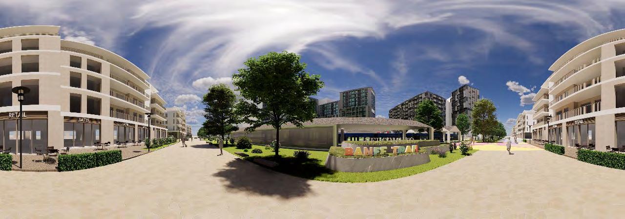
Banff Trail Community Design Concepts


Scan the QR codes below to experience our vibrant conceptual renders, showcasing transformative urban planning and design ideas tailored to the Banff Trail community.


A 2.4m x 1.8m, 1:1000 physical model of Banff Trail was built. The model was a collaborative effort from the Winter 2024 class of the PLAN 630 Advanced Professional Planning Studio. This model showcases the latest ortho-photos printed on hardboard as its base. Buildings were precisely laser-cut from 3mm wood and glued to the model base, accurately representing the height and scale of these structures.
Designed for flexibility and educational purposes, the model can be disassembled into six individual panels, each measuring 2’ x 4’. The model was prominently featured at the open house, allowing attendees to visually explore and understand the intricate urban landscape of Banff Trail.


“
Cities
have the capability of providing something for everybody only because and only when they are created by everybody
”
- Jane Jacobs

Based on our analysis & the community feedback, we identified key challenges in Banff Trail, categorizing them into three primary areas: land use and built form, open spaces, and mobility. To address these challenges, we conducted a detailed precedent study to explore effective solutions. For mobility, we explored various streetscape interventions and traffic calming measures used elsewhere to enhance pedestrian safety and streamline traffic flow. In terms of open spaces, the study looked at successful implementations of greenways, the application of green design guidelines, and innovative park programming and recreational activities that enrich community life and promote ecological benefits. Additionally, for land use and built form, we analyzed the current layout of Banff Trail to identify the most effective use of different lots. This included exploring diverse housing types and optimizing building designs to create active street fronts. A particular focus was placed on motel village, where we examined building massing, public realm integration, and parking solutions.


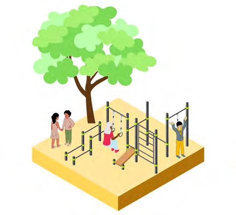
All-Ages
Infrastructure Fitness & other infrastructure that works for everyone
Greenway

Off-Leash Dog Area
Social connection & healthy pets

Fire Pits with Seating Winter park recreation & social space

Public Art
Engaging art that reflects community identity


Parks & Programming


Plazas, Parklets, & Alleyway Activation


USA
School Field Recreation


Green Design


“
Design a thing by considering it in its next larger context - a chair in a room, a room in a house, a house in a community, a community in a city”
- Eliel Saarinen


Our Vision
Banff Trail is a vibrant community where connectivity, diversity, & sustainability flourish, fostering intergenerational harmony & a strong sense of identity.
Diversity & Vibrancy
New housing, parks, & streets typologies
Sustainability & Resiliency
Retrofitting & expanding green infrastructure & design
Connectivity & Mobility
Safer streets & seamless active transportation networks
Safety & Wellbeing
Inclusive design that supports healthy community growth
Intergenerational Approaches
Spaces that work for everyone
Community Identity
Community pride & a strong sense of place
Our guiding question for the concept was “How can we make our community safer & more connected for everyone?” This was informed by some of the challenges that came up during our analysis and engagement along the lines of pedestrian safety, poor sidewalks, lack of biking infrastructure, road safety around schools & the lack of a multi-modal transit network.
Concept Approach


Create a safe & connected community with a diverse & seamless multi-modal transit network fostering intergenerational mobility. Major Intersections
Enhances safety and efficiency, incorporating traffic calming measures and pedestrian-friendly features.

Network
Widen sidewalks, adding bike lanes, improving lighting, and integrating green spaces to encourage walking and cycling.
Build a cohesive bike network to promote cycling as a viable and safe transportation option.

Major Interventions

Our proposed active transportation network is designed to enhance cyclist safety and promote biking as a preferred mode of transportation. This network includes separated raised bike paths for busy areas, dedicated shared streets for less trafficked zones, and sharrows where separate lanes are not feasible. For added safety, where raised paths are impractical, bike lane delineators will be used. All pathways will incorporate night safety features like reflective materials and enhanced lighting to ensure visibility after dark.

Potential Night Safety Measures for Cyclists


Our mobility network promotes a multi-modal transit approach, advocating for bike routes on residential roads that connect directly to LRT stations equipped with dedicated bike parking, facilitating a seamless bike-and-ride system. Additionally, we propose installing bus shelters at high-ridership stops near main streets and schools. These shelters will provide safe waiting areas for transit users, protecting them from harsh weather and enhancing overall transit accessibility and user comfort.


We propose transforming Capitol Hill Crescent NW into a pedestrian street next to Banff Trail LRT station. Limiting vehicle access and adding active frontages will enhance safety and local business. An at-grade crossing at 20th Avenue will improve connectivity to Motel Village, enhancing the pedestrian experience.



19th Street
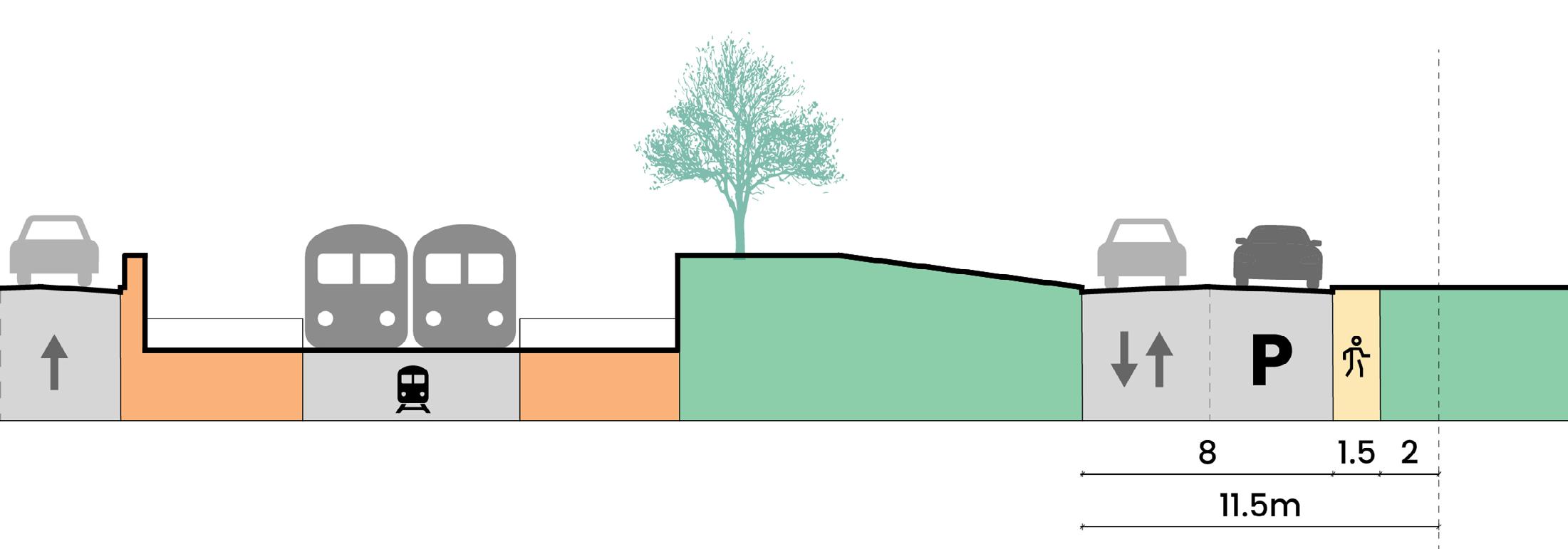
We propose reducing 19th Street NW from four vehicular lanes to two to accommodate raised, separated bike lanes and wider sidewalks. This


Scan the QR codes below to experience our vibrant conceptual renders, showcasing transformative urban planning and design ideas tailored to the Banff Trail community.


Scan the QR codes below to experience our vibrant conceptual renders, showcasing transformative urban planning and design ideas tailored to the Banff Trail community.

Main Street - 20th Ave NW
We propose transforming 20th Avenue NW into a Main Street by reducing it to one traffic lane each way and adding a parking lane that doubles as a woonerf. This shared space will extend sidewalks into the roadway, supporting flexible uses like outdoor dining and pop-up events, thus fostering a vibrant street life.


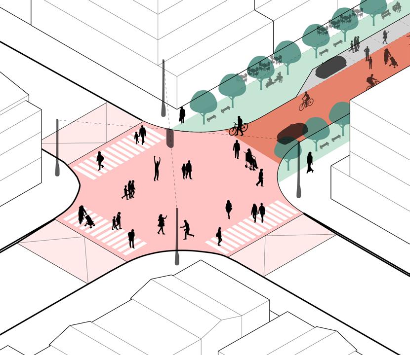


To enhance pedestrian safety and universal accessibility, we propose simple interventions such as installing raised crosswalks, curb extensions, and flashing lights at key intersections, particularly those near schools or with heavy traffic, like 19th Street and 20th Avenue. Additionally, at the Morley Trail and 24th Street intersection near Banff Trail School, we recommend converting Cochrane Road into a pedestrian plaza during school hours and summer months to improve safety and public space utilization.

Intersection Safety Mobility Network Active Transportation Streetscape Redesign


Tactical Urbanism Design + Planning Design + Planning Design + Planning


• City of Calgary Capital Projects (City of Calgary)
• Calgary Safer Mobility Plan (City of Calgary)
• City of Calgary Neighbourhood Grants
• ActivateYYC Grant (Federation of Calgary Communities)
• Active Transportation: Bike lanes along designated separate bike paths should have physical barriers to delineate the bike lane.
• Banff Trail should adopt a multi-modal approach to mobility. Bike paths should connect to LRT stations and LRT stations must have dedicated bike parking.
• To improve connectivity and increase pedestrian safety, several roads should be converted from vehicle-oriented streets to pedestrian oriented streets. Capitol Hill Crescent NW should be converted to a pedestrian street and our 20th avenue NW Main Street should be a shared street.
• 19th Street NW should be reduced to 2 lanes of bidirectional traffic, with dedicated bike paths on both sides of the street. A green buffer should serve as a divider between the bike path and vehicular traffic lanes, wherever possible.
• Sidewalk curbs at 10th avenue and 19th street NW intersection and Morley Trail and 24th Street intersection should be extended to shorten pedestrian crosswalk width. Crosswalks should be raised to calm traffic and maintain a continuous pedestrian grade. Signaled light crossings should be added at the Morley Trail intersection.
• We recommend night safety considerations along bike lanes, such as lighted bike lanes, for added cyclist safety. Sharrows can also be used to indicate shared bike-vehicle lanes.
• We recommend investing in sheltered bus stops along key bus routes. These bus stops can feature Banff Trail community branding to reinforce community identity and a sense of place.
• We recommend the development of a pedestrianized plaza adjacent to Banff Trail Elementary School, with drop-off and pick-up traffic can be rerouted away from the school entrance to create a safer environment for children.
• We recommend tactical interventions such as art crosswalks, painted curb extensions, pop-up bike paths, and branded wayfinding to improve pedestrian safety and reinforce community identity.
Our guiding question for the concept was “How can we make Banff Trail parks and open spaces work better for people and the environment?” This was informed by our extensive environmental analysis and community engagement, which identified key challenges for open spaces, including: disconnected park and open spaces, underutilized environmental assets, lack of diverse, accessible parks infrastructure and programming, microclimate and biodiversity, site drainage, snow melt, and stormwater runoff, and quality of experience within open space networks.
Support a healthy, connected and active environmental landscape that offers something for everyone through inclusive and accessible design.


Street tree and landscaping equity will ensure that all areas have a pleasant microclimate and reflect community identity. Connected parks will increase recreation opportunities and take advantage of neighbouring green space assets. Parks programming that offers something for everyone will increase community connection and lead to vibrant park spaces.

Banff Trail Greenway


The Banff Trail Greenway will connect Banff Trail parks through a shared-use pathway and landscaped green buffer, offering a safe, connected, and sustainable park network. The greenway street redesign utilizes parking lanes and unused space to expand the public realm along this loop significantly and create a vibrant and cozy pedestrian experience. We’ve left 1 lane of parking available in locations where there is increased pick up/drop off traffic, such as the streets adjacent to schools.
The expanded street design creates dual shared-use pathways on both sides of the street, separated from vehicular traffic with a wide green buffer. This green buffer is planted with street trees, Indigenous grasses, and companion plants to support a robust pollinator and ecosystem corridor along the greenway.
Existing Condition- 20th St NW


Our second open spaces recommendation is to utilize the largest open spaces in Banff Trail, school fields, to increase social and recreational opportunities in the community. We’re proposing the addition of a basketball court to the William Aberhart field and tennis and pickleball courts in the Branton School field. These spaces make use of currently under programmed spaces, offering activation year-round. Courts can be flooded in the winter and used as ice rinks, and the shared seating spaces can be activated by students at lunch hours, and the broader community in the evenings.
Proposed Design

Increased recreation opportunities Shared social and amenity spaces Fences removed, improved access


At Exshaw Park, we have designed an enclosed dog park, surrounded on all sides by a diversely planted green buffer, offering space for flexible outdoor usage. We’ve incorporated a fire pit, shade trees, and ample seating to encourage socialization in this space year-round. A new sidewalk along all sides of park increases site accessibility.


At Cathedral Road Park, we have designed 5 key zones. From a flexible outdoor spillout space, to all-ages playgrounds, an large fenced dog park, open lawn space, and a miyawaki mini forest. This redesign offers a greater diversity of programming and a greater number of shared social spaces for all ages and needs.


Banff Trail Park
At Banff Trail Park, we’ve proposed an expansion of the community association building with co-working spaces and green roofs, to further intensify the uses of this space. A large plaza and event space is programmed with seating and inclusive play infrastructure- from playground to ping pong tables. We’ve expanded the community gardens, taken advantage of the topography with a zip line, and added fire pits throughout our Miyawaki mini forest.


Alleyway Activation
Alleyways in Banff trail offer a great opportunity for expanded public realm space. We’ve identified strategic locations for alleyway activation along existing and proposed high-pedestrian traffic corridors. These alleys can be activated using colourful paving, streetlights and string lights, street tree planting, flower and plant boxes, and branded community flags that support community identity and wayfinding.


our vibrant conceptual urban planning and design community.


Safety and Wellbeing
Scan the QR codes below to experience our vibrant conceptual renders, showcasing transformative urban planning and design ideas tailored to the Banff Trail community.

Connectivity and Mobility

We have developed a set of green design guidelines and urban forest strategy, to support the sustainability and resiliency of Banff Trail. These guidelines support biodiversity, carbon capture, and site drainage through the addition of miyawaki mini forests within existing parks and open spaces, green roofs on infrastructure retrofits and new high density developments, and bioswales along key streets to capture snow melt and stormwater runoff.


Mini forests should be planted within existing parks and open spaces to support biodiversity and capture and sequester carbon.


Infrastructure and institutional retrofits and new high density developments should feature green roofs to support biodiversity in Banff Trail.


Bioswales should be placed at strategic locations to capture stormwater and snow melt runoff.

Our urban forest strategy seeks to fill in gaps with Banff Trail’s otherwise robust street trees, and to support complete ecosystems with the planting of companion plants with existing environmental assets to bring together fragmented ecosystems and create a more symbiotic and resilient environmental landscape.
Our environmental analysis identified green ash, cotoneaster, american elm, lilac, and colorado spruce as the most common tree species found within Banff Trail. Below, we have identified 15 companion plants that can be planted in combination with these trees to create a more complete ecosystem.

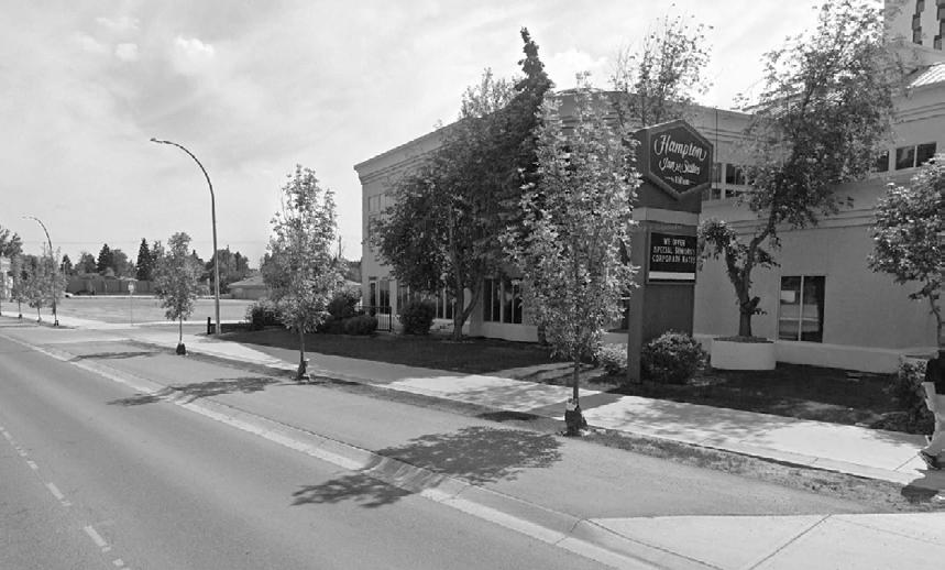




Zoning Changes 20th Avenue Main Street Laneway Guidelines Missing Middle Housing Design + Planning Design + Planning Design + Planning Policy + Guidelines

Statements
Parks redevelopment must consider the following:
• Parks must be accessible, accounting for topography in site access and ensuring all parks have a sidewalk where adjacent to a street.
• Street trees should be planted along park perimeters to improve tree canopy coverage, support ecosystem health, and create a pleasant edge condition.
• Dog parks should cover no more than 40% of a given park site, as this use can deteriorate soil and environmental quality. Dog parks should feature trees and animal-safe plants that allow for some preservation of these lands.
• Park seating and amenities must consider winter city conditions. Fire pits create an opportunity for year-round usage to open spaces and should be added in strategic locations.
• Play infrastructure must account for all-ages and levels of ability.
• Mini forests should be planted in all parks and open spaces to support biodiversity and ecosystem health.


• Building Communities Grant (Parks Foundation Calgary)
• City of Calgary Neighbourhood Grants
• Community Facility Enhancement Program (Government of Alberta)
• Stepping Stones Grants (Calgary Foundation)
• ActivateYYC Grant (Federation of Calgary Communities)
• We recommend the development of a Greenway to connect Banff Trail parks and open spaces. The Greenway can utilize parking lanes to create an expanded shared-use pathway and robust green buffer, featuring biodiverse landscaping. One lane of parking can be preserved in areas that require increased pick-up and drop-off, such as the road adjacent to Branton School.
• We recommend the development of a partnership between the Calgary Board of Education and City of Calgary to convert school fields to more flexible and programmed public park spaces. Sport courts should be added to these fields, with seating and amenities to support community use. Fences should be removed to improve site access.
• We recommend strategic alleyway activation through colorful paving, string lights, planter boxes, and Banff Trail branded flags to improve connectivity and safety.
Our guiding question for the concept was “How we can ensure people of all ages and incomes can find a place in Banff Trail to call home?” This was informed by some of the key challenges that came up during our analysis and engagement phase such as housing affordability for young people, diversity of housing types, on grade housing for seniors, poor condition of old housing stock and the lack of commercial diversity such as coffee shops and co-working spaces in the area.
Concept Goal
Create an inclusive, vibrant, & age-friendly environment that addresses the needs of students, residents, & the empowerment of local businesses.
Concept Approach


Introducing Gentle Density Neighborhood Connectors & Transit Nodes Pedestrian Activity Levels
Allowing for a variety of housing choices and budget options for a variety of people.
Increasing density along major corridors to provide more housing options for residents that do not have a car or prefer using transit.
Enhancing vibrancy of the neighborhood along streets with high pedestrian activity with commercial uses facing the street.

Urban Form Categories


The way we would achieve our built form goals would firstly be to introduce gentle density in developed areas. About 75% of the BT trail community consists of single family dwellings, so adding gentle density through neighborhood local typology will allow for a variety of housing choices and budget options on existing lots.
Secondly, Banff trail is a pretty well connected neighborhood, hence adding neighborhood connectors along the major transportation network and nodes will provide greater accessibility for people that prefer to use transit or want to live in close proximity to it.
Next, we also mapped areas of high pedestrian activity along which we have placed the neighborhood flex. This type will allow for a mix of residential and commercial uses to activate the street level and encourage pedestrian activity.
Lastly, the neighborhood commercial will be concentrated in motel village consisting of 9-25 storeys that gradually transition in height from the 6 storeys across Banff trail. This will help accommodate high scale multi- unit housing to address housing shortages in combination with a vibrant public realm.
In order to achieve this distribution of typologies across Banff Trail, a few zoning changes will be required. As per April 2024, the City of Calgary is proposing the rezoning of RC-1 and RC-2’s to R-CG which will help with introducing gentle density in Banff Trail. However, areas along major corridors and main street will require high and medium multi-residential zoning as well as mixed use districts in order to mandate commercial and residential uses with street oriented uses.


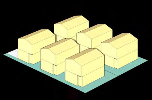


Rowhouses, townhouses and multi-unit dwellings all play important role in the context of redeveloping existing communities and cater to the needs of Calgary’s growing population. The “Missing Middle” represents housing types that are moderately priced and suitable for middle income earners and requires policies and initiatives aimed at promoting the development of housing options that are accessible to individuals and families to suit their lifestyle. They include a range of affordable, space efficient and appealing homes, that can significantly contribute to the character of a neighborhood.
The missing middle forms a very small percentage in the Banff Trail Community with only 0.9% of multi-unit housing. Being a potential site for TOD but with a predominantly low density residential character, middle housing can introduce gentle density within an established neighborhood like Banff Trail. By involving local residents, Banff Trail can aim for a shift in how middle housing is addressed in the community, by introducing various housing options like Laneway Housing, Multiplexes, Cottage Clusters and live/ work units leading to gradual densification overtime.


Typical lot sizes in Banff Trail can be combined in various ways to accommodate more units in the same plot size. The idea with this is to create housing options for seniors looking to downsize within their community, offer students affordable units and create more options for young families and professionals to move in.
Current lots can easily accommodate missing middle typologies that can offer diversity within the same neighborhood and laneway housing can enhance the overall laneway experience in the community as well.
The introduction of laneway housing can also help with improving some of the existing laneway conditions and to ensure that laneway housing contributes positively to the neighborhood and respects existing urban fabric and infrastructure, we have developed a set of design guidelines for future development to follow. These include a rear 1.5m landscape setback, a set of laneway facing balconies and windows to maintain eyes on the street, at least a 5m setback from the main building to maintain garden space on the lot and provision for bicycle racks on smaller lots or a 3M provision for parking on larger lots. The introduction of laneway housing will not only add more housing options in the community but also increase property values and give landowners an additional means to generate income through rentals as well.


Our concept for the main street is to serve as an extension of the existing commercial node to fill in the amenities gap by creating a place for local businesses such as coffee shops, repair shops, daycares to thrive. We have added a co-working space and library as an extension to the Community Association where people can find a place to work or study in proximity to the community park and socialize with other members.
To celebrate Banff Trail and being one of the older neighborhoods in Calgary, façade guidelines will give a historic and contemporary character to the street, and the shared street with no curbs and street trees will breakdown the scale and create an intimate pedestrian experience that Is accessible and becomes a destination in the community


Zoning Changes 20th Avenue Main Street Laneway Guidelines Missing Middle Housing Design + Planning Design + Planning Policy + Guidelines Policy + Guidelines


• Community Facility Enhancement Program (CFEP) Funding
• Enhanced Capacity Advancement Program (Govt. of Alberta)
• Housing Accelerator Fund (CMHC)
• Dual Credit – Enhancement (Govt. of Alberta)
• Funding for Schools (Govt. of Alberta)
• Stepping Stone Grants (Calgary Foundation)
• ActivateYYC Grant (Federation of Calgary Communities)
• City of Calgary Neighbourhood Grants
• To allow for a built form that reflects the changing needs of Banff Trail, strategic areas of the community must be up-zoned, as outlined on our proposed land use and zoning map.
• Buildings along the 20th avenue Main Street should be set back 2m from the property line to allow for spill out space.
• Buildings along the Main Street must have clear glazing street facing storefronts with awnings over exterior spill out spaces.
• Banff Trail Park land use should be examined to determine a flexible designation that would preserve the park and recreational uses of this space, while allowing for an expansion of the community association building to feature a new co-working space and library.
• New commercial or mixed-use developments within Banff Trail must have service and parking access routed through rear service lanes. No streetfacing parking lots will be allowed.
• New laneway housing must have direct access from the laneway. The maximum building height for a laneway house is 2 storeys. A minimum of 1.5m must be preserved in front of the laneway house for landscaping. Laneway houses may cover no more than 20% of the plot area. Bike parking must be provided in all laneway developments- an additional 3M of provisional parking can be provided where possible within plot width.
• We recommend façade treatments along the 20th avenue main street that reflect the unique character of Banff Trail. A combination of materiality and textures must be used to give a contemporary and historic character to the street.
We know that there is a need for housing and adding density can be a challenge and Banff Trail has the best opportunity to create a vibrant community at the Motel Village. However, there are some challenges such as:
• Disconnection with the rest of the community due to LRT route
• Lack of Transit-Oriented Development
• Lack of diverse housing options
• Crowchild Trail west of Motel Village
• Lack of any pedestrian or cyclist infrastructure
• Lack of any parks or open space for recreation
• Underutilized plots

In order to realize the areas complete potential we are transforming Motel village with the following goal:
Create the B.E.A.T. community - a bustling, energetic, accessible, and thriving transit-oriented hub that intensifies commercial, residential, and public realm activities in Banff Trail.


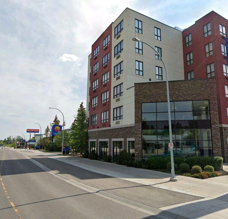

Site Observations
Underutilized Lots
Inactive Street Edge
Missing Connections
Poor Alley Experience
Wind Tunnel
Connection to green buffer


In our design you can see how the public experience drastically changes as you get off the Banff Trail LRT and land into a vibrant open plaza bordered by a shared street with spill out cafes to the east, the senior housing complex to the north and hotel apartments on either side. You can then move down our shared street with active frontages on both sides or take a meandering walk through our programmed green plaza. The site is anchored on the southern edge with our event space, like C space in Calgary - offering creative studio spaces and an event hall bordered by the Miyawaki mini forest as well as a large sign that marks the approach into the community.


Design + Planning Design + Planning Design + Planning Design + Planning


• Community Facility Enhancement Program (CFEP) Funding
• Enhanced Capacity Advancement Program (Govt. of Alberta)
• Housing Accelerator Fund (CMHC)
• Dual Credit – Enhancement (Govt. of Alberta)
• Funding for Schools (Govt. of Alberta)
• Stepping Stone Grants (Calgary Foundation)
• ActivateYYC Grant (Federation of Calgary Communities)
• City of Calgary Neighbourhood Grants
• Building Communities Grant (Parks Foundation Calgary)
• City of Calgary Capital Projects (City of Calgary)
• Calgary Safer Mobility Plan (City of Calgary)
New developments with the motel village should:
• provide underground parking, limiting surface parking to the greatest possible extent,
• feature green roofs for improved biodiversity and to support pollinator corridors,
• consider green connectivity to adjacent plots,
• reserve green and recreational spaces outdoors to allow for the development of sport courts,
• feature a landscaped setback that would support Banff Trail’s urban forest,
• ensure plazas and larger public realm spaces are south-facing, or have a north-south linear orientation for improved sun exposure,
• and feature active frontages along Banff Trail NW.
Tactical urbanism can be applied strategically throughout the site to improve pedestrian safety and increase the vibrancy of the public realm.
Art crosswalks and painted curb extensions offer an opportunity to showcase local artist talent and reflect a sense of community identity.
Pop-up bike paths can be utilized on streets with informal or unprotected bike lanes as a way to add safety and aesthetic appeal to a street.


To support a sense of community identity, we have created a set of branding tools for Banff Trail. This logo and set of colours can be applied to community flags along street poles, street signs, even signage and maps, and community signs at entry points and at the Banff Trail Community Association.
The font style and colours reflect the friendly and welcoming atmosphere of the community, inviting both residents and visitors to feel at home, wherever they are in Banff Trail.


“
First
life, then spaces, then buildings - the other way around never works.
”
- Jan Gehl

Open Spaces
• Banff Trail Greenway
• School Field Recreation
• Park Redesign
• Alleyway Activation
• Green Design Guidelines
• Urban Forest Strategy
Mobility
• Active Transportation
• Mobility Network
• Streetscape Redesign
• Pedestrian Safety & Universal Accessibility
• Tactical Urbanism
Land Use & Built Form
• Zoning Recommendations
• Main Street - 20th Avenue
• Missing Middle Housing
• Laneway Guidelines
Motel Village Redesign
• Densification
• Mixed Use TOD
• Improved Connectivity
• Programmed Parks & Open Spaces
To envision the recommended strategies, Sukoon has outlined a timeline of implementation for the Banff Trail Community Association, starting with easily implementable tactical interventions. These initial actions are designed to quickly show visible improvements and lay the groundwork for more extensive changes.
Following these initial improvements, we suggest that the Community Association consider updating relevant policies to support and sustain these changes. This is crucial for laying the foundation for further development.
Our proposed plan progresses through a series of short-term and long-term projects, building upon the early tactical interventions and subsequent policy updates. We recommend concluding this phased approach with comprehensive policy implementation. This final phase would involve significant developments, such as transforming main streets and updating land use regulations, aimed at systematically reshaping the Banff Trail community in line with our urban planning vision. These suggestions provide a roadmap for the Community Association to follow, ensuring a structured and effective implementation of the proposed developments.
• Wayfinding
• Pop-up Bike Lanes
• Alleyway Activation
• Intersection Safety
• Art Crosswalks
• Painted Curbs
• Parklets
• Parking to Patio
• Education & Awareness
• Community Workshops
• Open Houses • Land-Use Bylaws Amendments • Green Design Guidelines
Laneway Guidelines
Street Trees
Active Transportation
Mobility Network • Streetscape Redesign • Banff Trail Greenway • Parks Programming • Motel Village Redesign
• Implementation of Land Use Changes for development
• Main Street Development
• Missing Middle Housing development
Abdel, H. (2023, August 6). Jin Wellbeing County / Shma Company Limited. ArchDaily. https://www.archdaily.com/1005021/jin-wellbeing-county-shma-company-limited?ad_ source=search&ad_medium=projects_tab
ASLA. (n.d.). Bioswales. Improving Water Efficiency: Residential Bioswales and Bioretention Ponds. https://www.asla.org/bioswales.aspx
Behance. (n.d.). https://www.behance.net/gallery/67895693/Slnecnice-Residentialcomplex?log_shim_removal=1
Bromley Town Centre by Studio Egret West. (n.d.). Landezine. https://landezine.com/ bromley-town-centre-by-studio-egret-west/ CBC/Radio Canada. (2020, September 26). Protected Bike Lane opens on Park Street in Regina | CBC News. CBCnews. https://www.cbc.ca/news/canada/saskatchewan/ protected-bike-lane-regina-1.5740739
Charenton-le-Pont Town Centre by Agence Babylone. (n.d.). Landezine. https://landezine. com/charenton-le-pont-town-centre-by-agence-babylone/
City of Toronto. (2024, April 4). Toronto’s cycling infrastructure. https://www.toronto.ca/ services-payments/streets-parking-transportation/cycling-in-toronto/torontos-cyclinginfrastructure/?accordion=sharrows-or-shared-lane-markings
Community use of Schools. Renfrew County District School Board. (n.d.). https://www. rcdsb.on.ca/en/our-schools/community-use-of-schools.aspx
Concha, A. (2011, April 22). Centro Creación Joven Espacio vias / estudio SIC. ArchDaily Colombia. https://www.archdaily.co/co/02-85954/centro-creacion-joven-espacio-viasestudio-sic
Complete Streets for Canada. (n.d.). https://completestreetsforcanada.ca/locations/ guelph/
Curb extension. Curb Extension | NYC Street Design Manual. (n.d.). https://www. nycstreetdesign.info/geometry/curb-extension
Cyclists and pedestrians share Stephen Avenue | calgary herald. (n.d.). https:// calgaryherald.com/news/local-news/cyclists-pedestrians-begin-coexistence-onstephen-avenue
East Grand - Team Better Block. (n.d.). https://teambetterblock.com/East-Grand Bikes on bart. Bikes on BART | Bay Area Rapid Transit. (n.d.). https://www.bart.gov/guide/ bikes
Elgin Street. THE PLANNING PARTNERSHIP. (n.d.). https://www.planpart.ca/elgin-street
Fayna Town (1st phase) | Archimatika | Archello. (n.d.). Archello. https://archello.com/ project/fayna-town-1st-phase
Fausey, C. (2024, February 9). Santa Barbara Unified opens two schools’ fields for after-hours public use . The Santa Barbara Independent. https://www.independent. com/2024/02/09/santa-barbara-unified-opens-two-schools-fields-for-after-hourspublic-use/
Features of the garden. Taylor Street Farms. (2020, May 10). https://taylorstreetfarms. com/about/features/
Gallery of Nygaard Square Renovation / Mad arkitekter - 3. (n.d.). ArchDaily. https:// www.archdaily.com/946814/nygaard-square-renovation-mad-arkitekter/5f4dd0 85b35765f7b0000160-nygaard-square-renovation-mad-arkitekter-photo?next_ project=no
Green Venture. (2024, March 13). Using the miyawaki method in Hamilton’s reforestation efforts. https://greenventure.ca/using-the-miyawaki-method-inhamiltons-reforestation-efforts/
Highlights_admin. (2013a, November 6). NYC school playgrounds: They aren’t just for Recess Anymore. WEF Highlights. https://news.wef.org/nyc-school-playgrounds-theyarent-just-for-recess-anymore/
Harrouk, C. (2020, September 4). Camille Walala unveils public urban interventions in London. ArchDaily. https://www.archdaily.com/945826/camille-walala-unveilspublic-urban-intervention-in-white-city-west-london
Joint-use agreement. Joint-Use Agreement - Edmonton Public Schools. (n.d.). https:// www.epsb.ca/schools/communityuse/jointuse/
Lakeshore Nature Preserve Fire Pit. Lakeshore Nature Preserve. (n.d.). https:// lakeshorepreserve.wisc.edu/reserve-a-fire-circle/
Lake 2 lake: Rayobello – Graham projects. (n.d.-b). https://grahamprojects.com/ projects/lake2lake-rayobello/
Lanescape. (2023, January 25). Seaton Village Laneway Suite - Lanescape. Lanescape - Toronto Laneway Housing Project. https://lanescape.ca/projects/seaton-villagelaneway-suite/
Lu, H., Gaur, A., Krayenhoff, E. S., Jandaghian, Z., Lacasse, M., & Moore, T. (2023). Thermal effects of cool roofs and urban vegetation during extreme heat events in three Canadian regions. Sustainable Cities and Society, 99, 104925.
Main & Clay. (2024, February 26). Architect. https://www.architectmagazine.com/ project-gallery/main-clay
Montgomery Main Streets. Urban Systems. (2022, August 3). https://urbansystems.ca/ case-studies/montgomery-main-street/
Manzocco, N. (2020, August 11). Gerrard East Market brings the beach to an east-end parking lot. NOW Toronto. https://nowtoronto.com/food-and-drink/food/gerrard-eastmarket-toronto/
NYC DOT tests out a new, faster way to build raised crosswalks. Streetsblog New York City. (2023, June 13). https://nyc.streetsblog.org/2017/01/09/nyc-dot-tests-out-a-newfaster-way-to-build-raised-crosswalks
Smith Gee Studio. (2023, June 14). Main & Clay - Smith Gee Studio. https:// smithgeestudio.com/portfolio-item/main-clay/
Steuteville, R. (2021, April 29). Setting the standard for main street transformation. CNU. https://www.cnu.org/publicsquare/2021/04/26/setting-standard-main-streettransformation
Tapia, D. (2022, December 26). CORE Modern Homes / Batay-Csorba Architects. ArchDaily. https://www.archdaily.com/878567/core-modern-homes-batay-csorbaarchitects
The first bounce - the bounce games park: The bounce games park, 4th St & 8th ave SE, Calgary. To Do Canada. (2019, June 2). https://www.todocanada.ca/bounce-gamespark-yyc/
The miyawaki method for creating forests - creating tomorrow’s forests: Restoring biodiversity by creating habitats and planting trees. Creating Tomorrow’s Forests’. (n.d.). https://www.creatingtomorrowsforests.co.uk/blog/the-miyawaki-method-for-creatingforests
The miyawaki method: Imagining a mini-forest’s potential. Chelsea Green Publishing. (2024, March 22). https://www.chelseagreen.com/2023/the-miyawaki-method/
Tom Ravenscroft | 11 December 2019 Leave a comment. (2019, December 12). Station of being is an interactive Arctic Bus Stop. Dezeen. https://www.dezeen.com/2019/12/11/ rombout-frieling-lab-arctic-bus-stop-umea-sweden/
Truman. (2023, January 27). 17 West | Truman. Truman. https://trumanhomes. com/17west/
Pacific Plaza by SWA Group. Landezine. (n.d.). https://landezine.com/pacific-plaza-byswa-group/
Parklet. shiftspace. (n.d.). https://www.shiftspacedesign.com/portfolio/parklet/
Pedestrians and crosswalks. https://www.calgary.ca. (n.d.). https://www.calgary.ca/ bike-walk-roll/crosswalk-signals.html
Pintos, P. (2020, August 29). Footbridge of the High Speed Train Station Saint Laud / Dietmar Feichtinger Architectes. ArchDaily. https://www.archdaily.com/946375/ footbridge-of-the-high-speed-train-station-saint-laud-dietmar-feichtingerarchitectes?ad_medium=gallery
Pittsfield - Team Better Block. (n.d.). https://teambetterblock.com/Pittsfield
Railway station projects. Bee Friendly Trust. (n.d.). https://beefriendlytrust.org/railwaystation-projects/
Rent Ellen Fletcher middle school classrooms, fields, gymnasiums and more through facilitron. Rent Tennis Courts in Palo Alto. (n.d.). https://www.facilitron.com/ facilities/1660dc04b47ffde25bca
Sankt Kjelds Plads & Bryggervangen. SLA. (2023, August 15). https://www.sla.dk/cases/ sankt-kjelds-square-and-bryggervangen/
Spengler, J. O., Young, S. J., & Linton, L. S. (2007). Schools as a Community Resource for Physical Activity: Legal Considerations for Decision Makers. American Journal of Health Promotion, 21(4_suppl), 390–396. https://doi.org/10.4278/0890-1171-21.4s.390
Sundance Square Plaza. David M. Schwarz Architects, Inc. (2021, April 30). https:// www.dmsas.com/project/sundance-square-plaza/
2500 NW University Drive, Calgary
sukoonstudio_

