

ACKNOWLEDGEMENTS
Students
Jennifer Herring
Matthew Gauthier
Jordan Schumaker
Instructor
Professor Francisco Alaniz Uribe (Instructor | University of Calgary
Steering Committee
Kathryn Davies Banff Trail Community Association
Ben Lee Associate Principal; Studio Manager, Placemaking: Arcadis
Wayne Lui Banff Trail Community Association
David Kowel Banff Trail Community Association
Scott Thomson Planner, Local Area Planning Team: Planning and Development, City of Calgary
Yana Soldatenko Neighbourhood Partnership Coordinator; Community Partners, City of Calgary
LAND ACKNOWLEDGEMENT
Calgary, also known as Mohkinstsis, is located at the confluence of the Bow and Elbow Rivers. We acknowledge the people of Treaty 7, which include the Blackfoot Confederacy (Piikani, Kainai, and Siksika), Tsuu T’ina Nation, Stoney Nakoda Nation, which consists of the Chiniki, Bearspaw and Goodstoney bands, and Metis Region 3. We acknowledge that Banff Trail sits upon Treaty 7 land, and that all those that live, work, and play upon this land are treaty people.
EXECUTIVE SUMMARY
Throughout the winter semester students from the School of architecture Planning and Landscape had the opportunity to envision what Banff Trail could be like in the next 30 years as the community continues to evolve for the needs of it diverse popultion. As the community is part of the larger South Shaganappi Local area Plan, it was integral for the students to visualize how Banff Trail connects to its surrounding communities as they are undergoing the same transformations as Banff Trail. Through thorough analysis, including site visits, meetings with residents and the streering committee, Two Tree envisions a connected Banff Trail of the future which is prepared for changes in demographics, climate and attitudes towards collective goals for the future.
0.1 INTRODUCTION
Our Team
Jennifer Herring
Jennifer Herring is planner, active transportation advocate, grassroots initiative enthusiast, and artist who has experience volunteering with the Banff Trail Community Association in 2019, and has been involved in other city building projects across Calgary. She brings experience in public engagement in her role at Calgary Municipal Land Corporation, as well as experience in design and planning best practices in collaboration with communities.

Jordan Schumaker
Jordan Schumaker completed his bachelor of urban studies while working with the communities of Greater Forest Lawn in 2020. A born and raised Calgarian, he also brings experience in engagement, design and spatial analytical skills including GIS.

Matthew Gauthier
Matthew is a dedicated Masters of Planning student with a background in Geography and Environmental Studies. Passionate about enhancing urban life through thoughtful planning, he brings GIS expertise to inform decision-making. Committed to creating sustainable urban environments, Matthew is poised to contribute significantly to the planning field.

Introduction
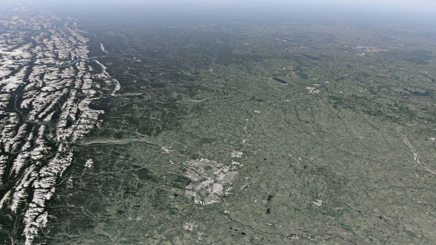
Banff Trail is located in the inner city of Calgary, Alberta, and has a population of 4,370 as of 2023. Banff Trail was originally annexed from farm land in 1910, alongside other pieces of land that eventually developed into Parkdale, Varsity, Montgomery, University Heights, University District, St. Andrew’s Heights, and Point Mckay. While this annexation occurred in the first half of the century, WWI and WWII impacted the growth of Calgary at large; consequently, Banff Trail was built in 1951 in the post-war development boom as one of Calgary’s first suburbs.
Consisting mainly of single detached bungalows, Banff Trail has low density typical of historic suburban communities at the beginning of a community lifecycle renewal. However, less than half of the population own their homes, with the majority residing as renters. Higher density also exists in the community within some pockets of multiresidential developments, and an addition of the Hub,a 28 storey tower built specifically for student housing within Motel Village. Activity Centres in the community revolve around pockets of local business, particularly at the intersection of 20th Avenue and 19th Street. Larger commercial activity occurs within Motel Village, named for its historic prevalence of motels, and now hotels. Banff Trail has many popular local businesses, particularly coffee shops, restaurants, medical offices, and hotels. Community members are young and highly educated, with 53% of the population having obtained a university degree, and the average household income of $90,566.
South Shaganappi LAP
City of Calgary
Southern Alberta Banff Trail
Site Context
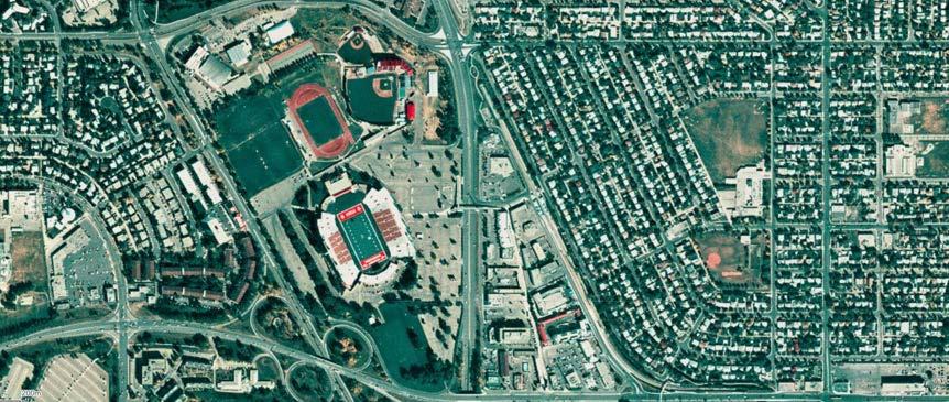
Banff Trail is located in the northwest quadrant of Calgary along historic roads such as Banff and Morley Trails. The community is within close proximity to destinations such as the University of Calgary, Foothills Medical Centre, and a short transit ride away from Downtown Calgary. Located directly to the west of Banff Trail is the University of Calgary, which is the city’s largest university.
The community is also within close proximity of natural amenities such as Confederation Park, Nose Hill Park and the Bow River pathway system via the regional pathways that encircle the community.
Site Context
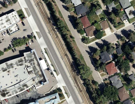
Banff Trail has always been a community connected by mobility networks. Within the community exists two historic roads: Morley Trail and Banff Trail NW (of which the Banff Trail community is named after). Morley Trail was historically the (dirt) road that led to the community of Morley, and Banff Trail was the first paved road leading to Banff until the completion of Crowchild Trail in the 1930s. Both of these roads still service the community and have retained their name, giving historical significance of the identity and growth of the Calgary region. Currently, Banff Trail is straddled by 5 major roads: highways Crowchild Trail and 16th Avenue N, and local major roads 20th Avenue, 24th Avenue, and 19th Street. The development of the University of Calgary in 1966 and city-wide growth in the years following facilitated the building of two LRT stations within the community - Banff Trail Station and University Station - making the community uniquely connected to transit. Improvements in cycling infrastructure along 24th avenue have been implemented, connecting to the larger city cycling network in the popular recreational open space of Confederation Park.
Redevelopment of Banff Trail was approved in a 1984 redevelopment plan, and has since been amended in 2023. Recently, the City has begun engagement for the creation of the South Shaganappi Local Area Plan, of which would guide growth in Banff Trail and surrounding communities,and replace the existing ARP. This presents an opportunity for Banff Trail to dream into the future development and growth of this historic and dynamic place.


Policy Framework
Municipal Government Act (MGA)
The MGA is the set of laws that governs the operations of all municipalities and municipal entities in Alberta. Cities, towns, villages, municipal districts, specialized municipalities, and other local government entities are all governed by the MGA. It establishes the framework for the operations of local councils, municipalities, and citizen-municipal cooperation.
Calgary Municipal Development Plan (MDP)
This document serves as a guide for how and where development shall occur within the City of Calgary as well as guides for street design, neighbourhood interface and other city-shaping policies.
Banff Trail Area Redevelopment Plan ( Banff Trail ARP)
This document was created to help inform the future shape of the community of Banff Trail. The Banff Trail ARP is meant to be used in addition to the Calgary Land Use Bylaw to give the Approving Authority with a local policy framework and, when necessary, specific land use and development guidelines. These will help the Approving Authority make decisions regarding community planning-related proposals.


Policy Framework
South Shaganappi Communities LAP (SSCLAP)
The growth and transformation of a set of communities over the next thirty or more years is outlined in this LAP. When new ideas are put forth for the area, residents, landowners, builders/developers, city planners, and council members can commonly refer to it for guidance and direction on development, investment, and community improvements.
Calgary Land Use Bylaw (LUB)
This bylaw stipulates what development and type of use may occur on perspective parcels within the community. This includes discretionary and permitted uses.
Calgary Transportation Plan (CTP)
The CTP serves as a guide for where transportation should be enhanced, including road, transit and cycling infrastructure. It also contains a framework of projects that should be implemented in the short to long term, which may impact the community of Banff Trail as it is situated along major roadways and transit routes connecting to the rest of Calgary.


South Shaganappi Local Area Plan
Project Understanding
Key Issues
Transit and Mobility
• Room to improve accessibility throughout the community including curb cuts, adequate lighting and improved pedestrian crossings.
• Connectivity between cycling networks, particularly 19th and 20th Street, and connecting to existing networks.
• Better connections between destinations within the community, especially for seniors and children.
• TOD opportunity at Banff Trail LRT Station and along the Max Orange line on 16th Avenue.
• Road safety with a focus on pedestrian and cycling infrastructure: opportunity to bring best practices to the table.
Housing Access
• 58% of Banff Trail households are renters as per the 2021 census, making more affordable and available housing an important goal for the community.
• Secondary Suite opportunities as modes for redevelopment and density in community density shift.
• Older and often original housing stock is being redeveloped into smaller, more costly units. This is adding to the ever increasing need for more attainable housing for all people in the community.
Motel Village
• Opportunity to increase density and transform the use of this important node in the community.
• Potential for more mixed use development including housing.
• Opportunity to further improve the public realm along 16th Avenue and Banff Trail NW where the City of Calgary has already implemented infrastructure including upgraded utilities and a multi use pathway.
Project Understanding
Community Lifecycle
Integrate historic elements of Banff Trail into redevelopment.
Banff Trail is at the end of its first lifecycle, and development of amenities for original owners (such as local medical facilities, assisted living, and safe, walkable infrastructure) is an opportunity.
Vibrancy is important to the community as it has a younger population when compared to the City and many are renters who may be transient.
Support Local Business
Potential to create connections between local businesses, particularly on 20th and 24th avenues. Create vibrancy for the community at large and for the inner city region, thus making residents want to stay in the community long term. There is great potential in the community to support local businesses due to its proximity to the University of Calgary, SAIT, AuArts, North Hill Centre and the Foothills Medical Centre.
Affordability
Banff Trail has a medium income gap, leading to many renters and owners in the community, although there is still lacking affordable housing for new residents. This is particularly concerning for students, many who are international and often lack nearby housing to higher education or jobs.
Many of the older housing stock is being turned over to higher priced housing, leading to a gap in terms of housing. In recent years this has forced students and newcomers to seek housing elsewhere as well as where they can afford to live.
Key Stakeholders

Established in 1954 to meet the needs of the community, the Banff Trail Community Association (BTCA) will act as one of the main collaborators with the team on our project. The BTCA provides various services and facilities to the community and advocates for the implementation of appropriate planning measures to ensure that the community’s growth happens intentionally and functionally. The Urban Places team will collaborate closely with the BTCA to identify community priorities and further refine and develop our planning interventions.

The City of Calgary provides overarching resulatry framework guiding the urban development of the entire city. The South Shaganappi Local Area Plan, which the city is also in charge of creating, will have a significant influence on Banff Trail’s future expansion and development. Considering the two LRT stations and numerous bus routes that pass through the community, Calgary Transit will be an additional important partner in this project. Our team will put forth great effort to adhere to the standards established by these organisations and create design implementations that are in accordance.
The core components of the Two Tree’s strategy will include analytical and iterative design procedures. Therefore, it is crucial to engage in meaningful dialogue with community members in order to generate the final design implementation recommendations. There will be several community involvement events, and the data received there will be thoroughly examined and integrated into the finished project.
The following groups will be important to collaborate with as the project progresses a sthey provide unique local prespectives:
• Local Schools
• Post Secondary Students
• Motel Village Businesses
• Edelweiss Village
• Weeds Cafe
• Katsu and Rolls
• Tomato n Basil
• Lil’ Empire
• Chesse and Dough Pizza
• Pop’s n Snack
• Other Organizations
Methodology
Mapping analysis
• Street network/walkability
• Natural resource analysis
• Housing market analysis
• Urban form analysis
Complete analysis
Present to Steering Committee
Site Visit #1
• Create model
• Site visit #2
• Present model
• Begin draft concept
• Site Visit #3
• Present to Steering Committee (community engagement)
• Complete draft concept
• Begin final concept (1/2)
• Finalize community engagement material
• Open House (Public)
• Create Final Concept (2/2) using public feedback
• Present findings to Steering Committee
• Submit final concept
Methodology
Methodology

Site
Network
Owner/Renter
Environmental
Income
Density
Urban
Demographic
Commerical
Building
Methodology
• The first engagement session was on Friday, January 19th, 2024, in the format of a walkabout. Information gathered from community members during this engagement guided the creation of our analysis in Phase 1. The goal of the engagement was to gather invaluable insights and information about on-the-ground conditions from residents, setting the stage for our journey.
• Within Phase 2, this engagement event was in workshop format, scheduled for Saturday, February 10. This interactive, in person session fostered dialogue and gathered ideas from the public and community members and received feedback regarding information gathered and analysis completed during Phase 1: Visualize.
• Within Phase 3, we collaboratively undertook an on-site evaluation with the Steering Committee on Monday, March 11, to share our progress and gather critical feedback regarding the progression of the Draft Design. Feedback gathered from this engagement steered the direction of the completed Draft Design.
• Engagement was undertook with the general public in the form of an Open House; this engagement session was held on Saturday, April 13th, from 10 am to 12 pm, with emphasis on public deliberation that was incorporated into the Final Draft of Phase 4. The Open House accommodated community members’ time with food and beverages, and ample time for questions and answers, fostering a sense of community participation among the members and guiding the process of the Final Design.
• Concluding our engagement series, we conducted a presentation of the Final Design on Monday, April 15th. The goal of this session was gather final remarks and information from the Steering Committee, in order to incorporate this data into this final document.
Urban Morphology
analysis | urban morphology
Thousands of years of Indigenous history


Survey of Banff Trail
Develops Capitol Hill
Banff Trail known for its “last stop” Motel Village
Land Annexed
Southern Development
Motel Village is Built
Crowchild Trail alignment along Banff Trail NW
Mainly Farming
Morley Trail exists as a dirt path
Blackfoot Children
analysis | urban morphology
Post War Boom


Trail is realigned to the east of Motel Village


Motel Village booms
analysis | urban morphology
Motel Village


Unique to Banff Trail, Motel Village sits in the southwestern section of the community. It was the last stop out of Calgary toward Banff (giving the community its name), serving as a pitstop to fuel up and wind down before heading into the mountains or enjoying the city. Motel Village has evolved from a collection of low-rise motels to a higher-density area, notably with the addition of The Hub in

analysis | urban morphology
Functional Analysis
Banff Trail has 2 LRT stations: Banff Trail Station in the south, and University Station in the north. The most significant open space is just outside the community boundaries in West Confederation Park, while in community greenspace largely is reserved for school sites. Banff Trail has close proximity to major employment centres of Brentwood Village to the north, the University of Calgary to the west, and North Hill Mall to the southeast. The community is highly connected along major roads, which serve both vehicular and pedestrian connections.


Brentwood Shopping Centre
North Hill Shopping Centre
Pedestrian Bridge over 16th Ave
analysis | urban morphology
3,805
Population Projection
Population within Banff Trail are projected to increase 120% within the next 20 years. Currently, the demographic of 15-29 year old residents is 13.4% more than the Calgary average, with lower amounts of seniors and children 14 years and under. Banff Trail’s population density is about 1.5 times the Calgary average.
Age Distribution
Age Distribution
BANFF TRAIL POPULATION PROJECTION
CALGARY
analysis | urban morphology
Household Structure
Family Structure
Family Structure 2021
In comparison to Calgary Banff Trail families with sole parents are 3% more prevalent. Typically, single household dwelling is 6% more in Banff Trail than Calgary, with smaller household sizes in general.
|
Economics and Housing
Income
Tenure
Affordability
Banff Trail, on average, has 11% more renters than the Calgary average. A major reason for this to be the case is because of its proximity to the University of Calgary, which increases demand for rental stock.
Affordability within Banff Trail is a major concern, with divisions between renters and owners indicating a lack of affordability in housing and living within the community. On average, Banff Trail is lower income and less affordable than the Calgary average.
analysis | urban morphology
Banff Trail School
Banff Trail is generally quite highly educated, which is most likely because of its proximity to the University of Calgary. Lower rates of residents with a highschool diploma is most likely because the demographics of the community are heavily weighted to those of ages most commonly enrolled in university.
Banff Trail is home to three schools: Banff Trail School (K-5), Branton School (6-9), and William Aberhart Highschool (10-12). Enrollments in in these schools have stayed somewhat consistent, particularly because catchment areas for these school are large, due to their french language programs.

Banff Trail
analysis | urban morphology demographics
William Aberhart Highschool Enrollment 20192024
Branton School Enrollment 2019-2024
Branton School
William Aberhart Highschool


Natural Environment
analysis | environment
Natural Systems
Species observed in the community


Rabbit
Coyote
Bald Eagle
Brown Trout
analysis | environment
Density of Trees


American Elm
Oak Deciduous
White Ash
Colorado Spruce
Lodgepole Pine
White Spruce Evergreen
analysis | environment
Elevation
The 20-meter elevation difference in Banff Trail, Calgary, from 1115m in the north to 1095m in the south, indicates a gentle slope that can impact water flow, landscaping, and building design, highlighting the importance of contour analysis in site planning and development.


analysis | environment
Water Drainage
Banff Trail’s water drainage primarily relies on groundwater infiltration, minimizing surface water pooling within the community Understanding water accumulation an flow is crucial in site analysis as it helps identify potential drainage issues, informs landscaping decisions, and ensures the overall sustainability and resilience of the area’s infrastructure.
analysis | environment
Slope
Banff Trail’s gentle slopes, mostly around 2%, contribute to its overall accessibility and ease of movement.
This correlates with the community’s high walkability and allows for more efficent use of land including services such as transit, which are impacted drastically by terrain change during winter weather patterns.


analysis | environment
Natural Features
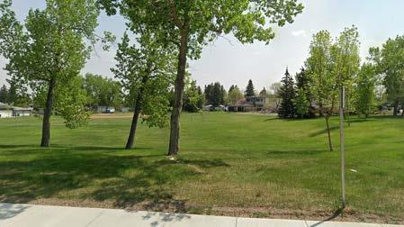
Confedera�on Park


Banff Trail Community


Banff Trail Park


American Crow Red-breasted Nuthatch Great Horned OwlCooper’s Hawk
Red-belted bumble bee Western bumble bee
Feral Pigeon Black-billed Magpie
analysis | environment
Open Space Typology

Designed to facilitate outdoor pastimes such as opportunities to engage with residents and nature.

Designated areas within a neighbourhood that are intentially preserved for public use, leisure, and community engagement.

Designed to guide pedestrians and cyclists throug the natural or landscaped surroundings.
Cathedral Park
Banff Trail Park
Linear Park along 16th Avenue NW

Designed space within a park, school, or community equipped with play structures, swings, sliudes and other features for children.
analysis | environment
Climate Analysis
The sun exposure throughout Banff Trail is typical of Calgary, which allows for adequate solar gain for solar energy projects. The community gets most of its winds from the west which is also important to consider for new builds such as the Hub due to downdrafts.

Average Annual Winds
Chinook Winds
analysis | environment
Winter Cities
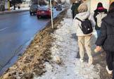
Analyzing winter conditions in Banff Trail is important for understanding how the community functions during the winter months - especially in terms of accessibility for both vehicular and foot traffic. This aspect is also key to identifying which parks have been best utilized throughout the year. We observed that while snow removal routes worked well for snow clearing upon roads, snow pack and build up was an issue upon sidewalks along these routes.


analysis | environment
Shadow Analysis
The shadow analysis shows that Banff Trail receives adequate sunlight on its sidewalks throughout most of the year. This is important for informing where ice buildup may occur during the winter months as well as to where sun exposure is most important on the public realm.


Infrastructure
analysis | infrastructure
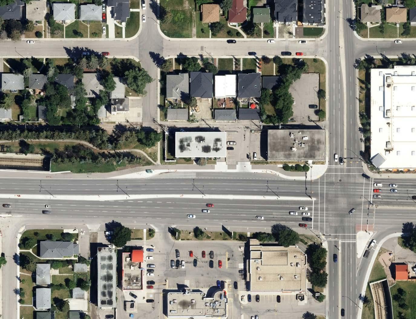
Major Roads
The major roads in Banff Trail play a vital role in the community’s connectivity and accessibility. Roads like 24th Ave NW, Morley Trail, Crowchild Trail, 19th St NW, 20 Ave NW, and 16 Ave NW serve as key transportation corridors, linking Banff Trail to other parts of Calgary. These roads not only support vehicular traffic but also accommodate pedestrians and cyclists, enhancing the overall mobility and connectivity within the neighborhood.
32Avenue
analysis | infrastructure
Road Typology
In Banff Trail, the road typology includes skeletal, arterial, urban boulevard, and urban collector roads, each serving different functions and contributing to the overall transportation network and urban design of the community.
CrowchildTrail
analysis | infrastructure
Traffic Volumes
The major roads in Banff Trail play a vital role in the community’s connectivity and accessibility. Major city roads 16th Avenue and Crowchild Trail have the heaviest traffic. Roads like 24th Ave NW, Morley Trail, 19th St NW and 20 Ave NW serve as key transportation corridors through the community, linking Banff Trail to other parts of Calgary. These roads not only support vehicular traffic but also accommodate pedestrians and cyclists, enhancing the overall mobility and connectivity within the neighborhood.
CrowchildTrail
analysis | infrastructure
Block Permeability
Analyzing block permeability in Banff Trail is crucial for urban planners as it can reveal areas where pedestrian and vehicular movement is restricted or encouraged, allowing for improvements to enhance overall connectivity and accessibility in the community. Identifying these patterns helps optimize urban design, contributing to a more functional and livable environment.
CrowchildTrail
analysis | infrastructure
School Walkability
Banff Trail is extremely walkable for many students who reside within the community as well as the adjacent communities of Charleswood and Capitol hill. Many of these schools are within a 400m walk of school which is ideal for small children and seniors who have limited mobility
analysis | infrastructure
Walkability Barriers


LRT and Highway Barriers
Sound Barriers
analysis | infrastructure
Walkshed to Transit Stops
The walkshed analysis of Banff Trail reveals that many residences are within close proximity of transit, including 4 bus routes, a BRT and light rail transit. This shows how accessbile the community is and how desirable the area is for transit-oriented development.
analysis | infrastructure
Traffic Incidents 2016-2023
Analyzing the number of traffic incidents in Banff Trail, the highest occur at Crowchild Trail and 24th Ave NW, while the lowest are at 19th St NW and 16 Ave. This analysis shows that there is still a need for rethinking of intersections within Banff Trail in terms of safety and efficiency.


analysis | infrastructure
Intersections and Volumes
The major intersections of Banff Trail demonstrate how the arterial roads impact the community. Since cyclist infrastructure has been implemented along 24th Avenue bicycle ridership has increased along this route. It is worth noting that upgrades along the intersection of 24th Avenue and Crowchild Trail has also resulted in decreased pedestrian incidents.


#1 24th Ave NW & Crowchild Trail
#2 24th Ave NW & 19th ST NW


analysis | infrastructure
Walkability Barriers
Banff Trail faces several walkability challenges, including missing crosswalks, significant barriers like the LRT right-ofway, and major roads such as Crowchild Trail and 16th Avenue. This highlights the need for interventions to improve walkability and safety in the community.
analysis | infrastructure
Community Cycling Routes and Pathways
Banff Trail’s abundance of cycling routes and pathways highlights its potential to enhance these benefits and create a more bike-friendly community. Popular routes such as 19th Street may require permanent protected infrastructure to facilitate the needs of the growing community.
Regional Pathway Local Pathway On-Street Bikeway
Track
Pathway
Pathway On-Street Bikeway
and Stairs
and Stairs
analysis | infrastructure


analysis | infrastructure
Mode of transportation
In Banff Trail, walking comprises 7% of transportation modes, biking 3%, bus usage is at 20%, and car usage is lower at 62% compared to the city average. These figures highlight the community’s reliance on sustainable modes of transportation and underscore the importance of supporting these choices through infrastructure and planning initiatives.
analysis | infrastructure
24th Avenue NW
• Adequately sized sidewalks
• Separated cycling infrastructure


• Adequate Parking
• Narrow two way road with slower speeds
• Numerous controlled crosswalks

• Signalized crosswalks and major intersections
• Feels very comfortable for walking and cycling


analysis | infrastructure
19th Street NW

• Narrow sidewalks with sound attenuation barrier
• No landscaping to spearate pedestrians from cars
• No parking
• Wide driving lanes with 50km/h speed limit
• Snow cleared onto sidewalks
• Very few crosswalks, even less that are controlled
• Feels very dangerous


23rd Avenue NW


analysis | infrastructure

• Narrow sidewalks
• Lots of parking
• Narrow bidirectional driving lane with slower speeds
• Snow cleared onto sidewalks
• Feels very private
• Minimal people on the street


20th Avenue NW
analysis | infrastructure
• Narrow sidewalks
• Lots of people walking
• Lots of on street and lot parking
• Narrow driving lanes with slower speeds yet still feels very busy
• Numerous crosswalks
• Drainage issues
• Lack of space to wait for bus
• Large separation between buildings and the street

analysis | infrastructure
Load Capacity
Understanding the load capacity of Banff Trail, particularly the nearing capacity in Motel Village, is crucial for our team to ensure that infrastructure, particularly for electricity, can support current and future development without compromising reliability or safety.
5,000-6,999KVA
5,000-6,999KVA
1,000-2,999KVA
1,000-2,999KVA
Power Lines (Overhead and Underground)
Power Lines (Overhead and Underground)
analysis | infrastructure
Water
This map shows the major water line routes throughout the community as well as how it may impact development as can be seen in the Aberhart High School play field. this can be important when subdividing lots which can lead to added costs for developers, and similarly with electrical load capacity, shows the abillity for Banff Trail to accomodate future growth.
Built Form
analysis | built form
Land Use
Banff Trail is comprised mainly of low density residential.Commercial activity exists at major nodes in the community, such as beside William Aberhart Highschool, along 24th Avenue, and within Motel Village. Office space in the community is currently only found at two locations within the residential zone of Banff Trail, while larger offices can be found in Motel Village. Mixed use land use is sparse, with only small pockets within Banff Trail.
analysis | built form
Zoning
(C-COR2) Commercial - Corridor 2
(C-N1) Commercial - Neighbourhood 1
(C-N2) Commercial - Neighbourhood 2
(C-O) Commercial - O ce
Zoning in Banff Trail primarily consists of R-C1, R-C2, and R-CG, indicating a mix of single-detached and multi-family residential, as well as commercial and residential mixed-use areas. This map shows the enormous potential for rezoning in Banff Trail for more diverse uses.
(DC) Direct Control
(H-GO) Housing - Grade-Oriented
(M-C1) Multi-Residential - Contextual Low Pro le
(M-C2) Multi-Residential - Contextual Medium Pro le
(C-COR2) Commercial - Corridor 2
(M-CG) Multi-Residential - Contextual Ground Oriented
(C-N1) Commercial - Neighbourhood 1
(M-H1) Multi-Residential - High Density, Low Rise
(C-N2) Commercial - Neighbourhood 2
(MU-1) Mixed Use - General
(C-O) Commercial - O ce
(MU-2) Mixed Use - Active Frontage
(DC) Direct Control
(R-C1) Residential - Contextual One Dwelling
(H-GO) Housing - Grade-Oriented
(R-C2) Residential - Contextual One/Two Dwelling
(M-C1) Multi-Residential - Contextual Low Pro le
(R-CG) Residential - Grade-Oriented In ll
(M-C2) Multi-Residential - Contextual Medium Pro le
(M-CG) Multi-Residential - Contextual Ground Oriented
(R-CI) Special Purpose - Community Institution
(M-H1) Multi-Residential - High Density, Low Rise
(S-CS) Special Purpose - Community Service
(MU-1) Mixed Use - General
(S-SPR) Special Purpose - School, Park and Community Reserve
(MU-2) Mixed Use - Active Frontage
(R-C1) Residential - Contextual One Dwelling
(R-C2) Residential - Contextual One/Two Dwelling
(R-CG) Residential - Grade-Oriented In ll
(R-CI) Special Purpose - Community Institution
(S-CS) Special Purpose - Community Service
(S-SPR) Special Purpose - School, Park and Community Reserve
analysis | built form
City Owned Land vs Private
Banff Trail is primarily privately-owned land with limited city-owned parcels. These city-owned parcels are largely designated for schools, though smaller parcels are designated for parks. This existing pattern underscores the need for thoughtful planning to balance private development with public spaces and amenities, ensuring a cohesive and sustainable community design.
analysis | built form
Footprint Density
Footprint density analysis in Banff Trail reveals that the majority of the built form covers less than 50% of the parcel land. This shows great opportunity for redevelopment of parcels for diverse building types that emphasize higher density living.
analysis | built form
Parcel Size
Analyzing parcel sizes in Banff Trail reveals a diverse range, reflecting the existing mix of lot configurations and potential development opportunities. This information is essential for our team to optimize land use and ensure compatibility with the neighborhood’s existing fabric.
Within Banff Trail, we found that parcels are typically large enough for redevelopment for larger typologies such as rowhouses, lowrise apartments, and secondary suites.
analysis | built form
Year of Construction
Examining the construction years of buildings in Banff Trail reveals that the majority were built in the early 1950s at the genesis of the community, indicating the potential need for redevelopment or renovation to modernize infrastructure and accommodate evolving community needs. This points to the lifecycle of the community at the end of its first revolution, and the opportunity to diversify housing. Many of these buildings have begun redevelopment as of 2011 and the area that has seen the most change is Motel Village, which alsso boasts the largest parcel sizes in the community of Banff Trail.
analysis | built form
Building Heights
Understanding building height is crucial in urban planning as it directly impacts the density, character, and functionality of a community. In Banff Trail, where most buildings are currently 2 floors or less, aligning with the LAP team’s recommendation of a minimum of 3 floors for future development could help enhance the area’s urban fabric and support sustainable growth.
This information is crucial for assessing the community’s overall density, identifying areas suitable for infill development or redevelopment, and ensuring that future developments align with the community’s character and goals.

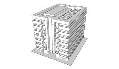
The 3D density map of Banff Trail provides a visual representation of the community’s massing, providing information about actual conditions of building height and massing. Banff Trail is typically low in building height density, with the exception of Motel Village, where buildings are, at their tallest, 28 storeys with the addition of The Hub in 2020.
Banff Trail
Briar Hill
Capitol Hill
University of Calgary
Collingwood
Charleswood
analysis | built form
Density: Bedrooms
Density: Population
While Calgary has 15% more single detached homes than Banff Trail, the community has a staggering 28% more apartments in a duplex. This statistic could be explained through lack of housing diversity and high demand of student housing, and potentially refer to illegal secondary suites being offered as housing within the community. Additionally, there currently are less than 1% of rowhouses, pointing to an occurrence of missing middle housing.
Banff Trail Calgary


analysis | built form
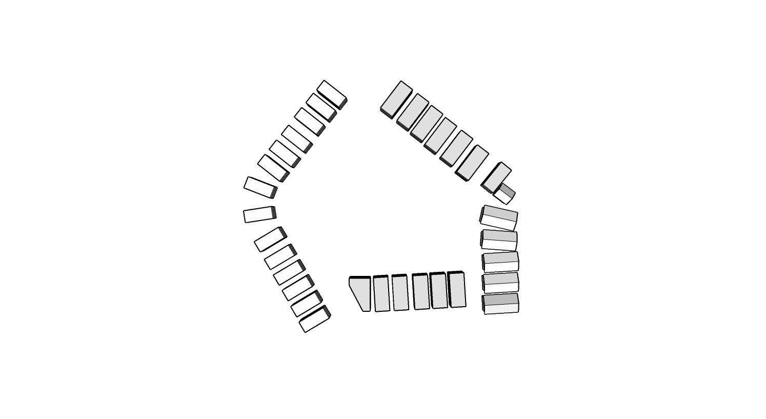
Building Typologies
Single Detached, One Storey
Two Storey Duplex
Sources: Esri, Airbus DS, USGS, NGA, NASA, CGIAR, N Robinson, NCEAS, NLS, OS, NMA, Geodatastyrelsen, Rijkswaterstaat, GSA, Geoland, FEMA, Intermap and the GIS user community, Esri Community Maps Contributors, City of Calgary, District of East Kootenay, Esri Canada, Esri, TomTom, Garmin, SafeGraph, GeoTechnologies, Inc, METI/NASA, USGS, EPA, US Census Bureau, USDA, NRCan, Parks Canada

Single Detached, Two Storey
Row House

Sources: Esri, Airbus DS, USGS, NGA, NASA, CGIAR, N Robinson, NCEAS, NLS, OS, NMA, Geodatastyrelsen, Rijkswaterstaat, GSA, Geoland, FEMA, Intermap and the GIS user community, Esri Community Maps Contributors, City of Calgary, District of East Kootenay, Esri Canada, Esri, TomTom, Garmin, SafeGraph, GeoTechnologies, Inc, METI/NASA, USGS, EPA, US Census Bureau, USDA, NRCan, Parks Canada

Sources: Esri, Airbus DS, USGS, NGA, NASA, CGIAR, N Robinson, NCEAS, NLS, OS, NMA, Geodatastyrelsen, Rijkswaterstaat, GSA, Geoland, FEMA, Intermap and the GIS user community, Esri Community Maps Contributors, City of Calgary, District of East Kootenay, Esri Canada, Esri, TomTom, Garmin, SafeGraph, GeoTechnologies, Inc, METI/NASA, USGS, EPA, US Census Bureau, USDA, NRCan, Parks Canada

Sources: Esri, Airbus DS, USGS, NGA, NASA, CGIAR, N Robinson, NCEAS, NLS, Rijkswaterstaat, GSA, Geoland, FEMA, Intermap and the GIS user community, Contributors, City of Calgary, District of East Kootenay, Esri Canada, Esri, GeoTechnologies, Inc, METI/NASA, USGS, EPA, US Census Bureau,

Townhouse

analysis | built form
Apartment less than 5 storeys

Apartment more than 5 storeys

Sources: Esri, Airbus DS, USGS, NGA, NASA, CGIAR, N Robinson, NCEAS, NLS, OS, NMA, Geodatastyrelsen, Rijkswaterstaat, GSA, Geoland, FEMA, Intermap and the GIS user community, Esri Community Maps
Mixed use apartment more than 5 storeys
Contributors, City of Calgary, District of East
Kootenay, Esri Canada, Esri, TomTom, Garmin, SafeGraph, GeoTechnologies, Inc, METI/NASA, USGS, EPA, US Census Bureau, USDA, NRCan, Parks Canada

analysis | built form

Continued
Neighbourhood
Sources: Esri, Airbus DS, USGS, NGA, NASA, CGIAR, N Robinson, NCEAS, NLS, OS, NMA, Geodatastyrelsen, Rijkswaterstaat, GSA, Geoland, FEMA, Intermap and the GIS user community, Esri Community Maps Contributors, City of Calgary, District of East Kootenay, Esri Canada, Esri, TomTom, Garmin, SafeGraph, GeoTechnologies, Inc, METI/NASA, USGS, EPA, US Census Bureau, USDA, NRCan, Parks Canada

Commercial Strip mall
Sources: Esri, Airbus DS, USGS, NGA, NASA, CGIAR, N Robinson, NCEAS, NLS, OS, NMA, Geodatastyrelsen, Rijkswaterstaat, GSA, Geoland, FEMA, Intermap and the GIS user community, Esri Community Maps Contributors, City of Calgary, District of East Kootenay, Esri Canada, Esri, TomTom, Garmin, SafeGraph, GeoTechnologies, Inc, METI/ NASA, USGS, EPA, US Census Bureau, USDA, NRCan, Parks Canada


analysis | summary
Findings
• Historic resources within the community are mainly tied to Banff Trail NW and Morley Trail roads, though significant history exists in Motel Village. The Firestation in the south is the only historically significant building within the community context.
• Major commercial and employment centres surround Banff Trail to the north, south, and west of the community.
• Social nodes like schools, the community centre, and commercial along 19th Street and 20th Avenue are a major cultural resource that serves the entire community.
Findings
• There are a lack of trees and greenscape along 19th Street, with barely any trees lining this busy road.
• Within Motel Village, there is a lack of greenery in any capacity, creating a cold and uninviting place to be.
• The Banff Trail Community Association is one of the main open spaces that is utilized within the community.
• There is low connectivity between parks within the community, with most natural trails to the north in West Confederation Park.
Findings
• Highways act as major barriers to cross on foot or by bicycle, and affect design opportunities to improve connections.
• There are missing sidewalk crossings most prolifically along 19th Street, though inner community streets also lack adequate crossings.
• LRT is very present in Banff Trail, bisecting the community in the south and continuing along its edge to the north, while transit is well distributed along and within the community.
• Banff Trail is highly connected within itself, with some challenges to connections externally.
Findings
• There is a low amount of commercial within Banff Trail, with an opportunity for more local commercial.
• Banff Trail is just starting to redevelop.
• The Direct Control district in Motel Village offers some opportunity to freely densify in this area without having to rezone within our current Land Use Bylaw.
• While multiple ypologies exist within the community, housing diversity is low within Banff Trail, lending an opportunity for increasing diversity and access to housing.
0.3 PUBLIC ENGAGEMENT
public engagement | our approach


The community engagement process for the Banff Trail urban planning project began with the formation of a steering committee consisting of representatives from the city, community, and private consulting firms. Typically, steering committees in urban planning cases play a crucial role in providing guidance, oversight, and decision-making authority throughout the planning process. They help ensure that the project aligns with community needs and objectives, while also considering broader city goals and policies.
Following the formation of the steering committee, the community engagement process kicked off with a walkabout led by community members. This walkabout served as a hands-on introduction to the Banff Trail area, allowing participants to familiarize themselves with the community’s layout, amenities, and challenges. This immersive experience helped us gain valuable insights into the area’s dynamics and potential opportunities for improvement.
The engagement process continued with a successful workshop on February 10th, where a significant number of community members attended and expressed their thoughts and feelings about Banff Trail. Discussions ranged from cycling and walking to driving, highlighting areas of concer n as well as aspects of the community that were appreciated. This feedback was integral in identifying specific locations for intervention and improvement within Banff Trail, ensuring that community input drove our decision-making process. The outcomes of these discussions were then presented to the steering committee for further consideration and action.
4.
Feburary 8, March 15, April 15 2024
Consultations with Steering Committee
1. Community Walkabout January 23, 2024
Banff Trail Community Association
3. Open House April 13th
Banff Trail Community Association
2. Community Workshop Feburary 10, 2024
Banff Trail Community Association


Increase in affordable housing
Increase in urban form
diversity
What We Heard
Additional safe crossings
Increase in local retail
Decrease in neighbourhood traffic
Increase in pet friendly space
Increase in greenery throughout Banff Trail
Concern with shadowing in development
Residents of Banff Trail highlighted challenges such as unsafe pedestrian crossings and a lack of amenities like coffee shops. They expressed interest in more diverse housing options, improved mobility, and enhanced green spaces. Participants highlighted the desire for more retail throughout the community and mixed use spaces. Residents responded well to streetscape enhancements including the added connection to Motel Village, and the activation of Cathedral Park in particular. There were some concerns towards the proposed city rezoning which were out of the scope of our team.
0.4 DESIGN INTERVENTIONS
urban form and land use placemaking open spaces mobility
Vision: Banff Trail is highly connected with cohesive community identity, a sense of place and places to gather, recreate, to stay and build a life, together.
Design Approach
Our approach to designing Banff Trail has been to identify the challenges and opportunities identified by our analysis and through feedback from public engagement. We then have taken this information, and sythesized it into spatial opportunities that rane in scale from the community, to the block, to the parcel.
BLOCK
PARCEL
Design Strategy
From what we heard and what we observed throughout the enagement and analysis process, there are many opportunities to connect Banff Trail to more and better services, outdoor and open space programming, more affordable and diverse housing, through the community on foot, transit, or bike, and neighbour to neighbour.
Our strategy Connect the Community, Weave the Neighbourhood recognizes these opportunities and categorizes them into four main areas of focus to improve the lived experience of community members: Mobility, Land Use, Open Space, and Placemaking.
Opportunities
Public engagement propelled our design approach toward dientifying main goals and areas of opportunity. We utilized this feedback to map these places of opportunity with main community design goals.
Background
What we heard from the steering committee and the residents of Banff Trail directed us toward housing diversity and choice, increased places for local commercial activity such as local pubs, restaurants, and cafes, and to connect Motel Village to the rest of the community. Residents also remarked that they wanted to see Banff Trail and University of Calgary Stations become vibrant places to meet and move through, with higher densities surrounding both places.
Strategies
Through zoning and land use changes, Goals for the built form interventions include
Transit Oriented Design (TOD)
Housing Diversity and Mix

Commercial
Main Streets as Places
Adequate setbacks
Green Roofs
Semi private park space
Land Use and Built Form
design | built form and land use
Master Plan
Over the next 30 years, the Shaganappi Local Area Plan will influence planning and development within Banff Trail. Our master plan of the community is a vision of a complete build out of the potential that Banff Trail has to densify, diversify, and create a sense of place within the inner city of Calgary throughout this time span. This vision for Banff Trail includes places gather, to shop, to study, to work, and to grow into a community lifecycle renewal that supports sustianable development and, most importantly, the people who call Banff Trail home.

RECOMMENDATIONS
1. Densify near LRT stations
2. Provide housing choice by developing diverse housing typologies
3. Integrate commercial and greenery into main streets to increase vitality and sense of place through housing


design | built form and land use
Land Use
Transit Oriented Design
University of Calgary Station and Banff Trail Stations are densified with a focus on pedestrian and transit experience and access. Both stations are activated through mixed-use development that will foster a place for local business and cater to the needs of residents and transit users, such as corner stores, cafes, restaurants, and workspaces.
Main Streets
Morley Trail and 19th Street are transformed into community and regional mainstreets, supported by higher density mixed use massing to provide services for the community such as cafes, doctor’s offices, working spaces, and local business. These mixed use mainstreets have a maximum of 6 storeys in height.
design | built form and land use
Zoning
Housing Diversity
Diversity in housing typology and zoning provide opportunities for young families to age in place, affordable units for University Students, and the adaptation of historic blocks. This diversity allows for adaptability into the future of the community, offering missing middle housing for community lifecycle renewal
In our design, Banff Trail is zoned to encourage housing diversity and mixed use typologies, with lower density existing within the middle of the community. What we heard from public engagements steered the design of allowing much more local commercial within the community , and building higher density typologies to the outer edges of Banff Trail.
design | built form and land use
Housing Typologies
Historic district with secondary suites at the back. Eventually, there could be an opportunity for creative adaptive reuse of these homes.

Lowest density new development in the community, and most common typology outside of the Transit Oriented Design district and Main Streets district. This is gentle density at the scale of at-grade, and could serve to house young families searching for a starter home.
Community R-C2


Community R-CG
Laneway houses: Calgary


Townhouses: Calgary
design | built form and land use
Continued

These skinnier homes utilise the length of a subdivided lot, which Banff Trail has an adequate amount of. This zoning typology serves to transition land usage to be more efficient with the building to parcel ratio.
R-C1N
Community


Duplexes in the community serve a purpose of bringing another low-density option for at-grade community scale development, while being more efficient with land than original bungalow typologies.

R-C2
Community


Duplexes: Calgary
Skinny Detached: Edmonton and Nashville
design | built form and land use
Continued
These low rise apartments offer more affordable living for community members, and could serve young families, as well as students and young professionals working and studying at the University of Calgary.

While within the community, these typologies serve as a high density transition from highrise TOD living to low density apartments, and is located close by major amenities. This typology is most likely to serve students and young professionals, as well as older adults looking to downsize later in life.
Community MC-2


Apartments: Vancouver
MH-1
Community TOD


8 Storey Condos: Calgary
design | built form and land use
Continued
Located along main streets, these 6 storey mixed-use typologies serve to add density while also bringing commerical opportunities like local coffee shops, work spaces, and other amenities. Courtyard architecture may be implemented into this to provide sense of place not just on the street, but also just off of the main street.

Main Streets MH-1


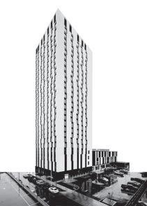
At the highest of 28 storeys (of which height already exists with The Hub), this typology is found only within the Motel Village Transit Oriented Design Area. The base houses three stories of commercial, with semi-private patios and greenery. This typology typically consists of smaller units with underground parking, and serves students, young professionals, and small families up to three in size.


Brentwood Station: Calgary
Courtyard 33: Calgary
design | built form and land use
Main Street
Parcels are prioritized along the street front for 6 storey mixed use development, utlizing 2-3 parcels per building. Subdivided parcels away from the street are not utilized for development that requires aquisition of multiple small parcels.
Community Curve
Along the southern edge of Banff Trail, parcels have typically not been subdivided. This curve is where two parcels have been joined together to accomodate 8 storey apartments.
TOD Spine
Large lot sizes and current commercial zoning provide the ability to densify easily and faster than smaller, privately owned residential parcels.
design | built form and land use
Building Heights
Following the form of a wave, building massing is straddled along major activity centres of the TOD areas and along major roads. Acting as a sound barrier from Crowchild Trail and 16th Avenue NW, the tallest buildings of maximum 28 storeys are located in Motel Village, while building heights terrace into the inner community to a minimum of 2 stories. New single detached RC-G housing typologies will be a minimum of 3 stories tall, while the main streets of 19th Street, 24th Avenue, and Morley Trail will have 5-6 storeys.
design | built form and land use

Adesign | built form and land use
Districts of Banff Trail
Historic Districts
At the heart of the community rests the historical district. This comprises of mainly original bungalow style homes and a few duplexes, and is oriented as whole streets so that historical community character and feel may be experienced on the street. The goal of this district is adaptation of these typologies, not preservation.
Transit Oriented Zones
B
C
University of Calgary Station and Banff Trail Stations are densified with a focus on pedestrian and transit experience and access. Both stations are activated through mixed-use development that will foster a place for local business and cater to the needs of residents and transit users, such as corner stores, cafes, restaurants, and workspaces.
Main Streets
Main Streets feature a maximum of 6 storeys and minimum of 5 Storeys, with a focus on the pedestrian and cycling realm. These developments may feature courtyard style buildings, allowing for high porosity between the street and the block. These fingers weave together public and community life through local business and proximity to amenites.

design | built form and land use


Community history and sense of place are fostered through historic districts, with mostly original bungalows with laneway suites and low density housing with the potential for adaptive reuse. At the end of the South Shaganappi Local Area Plan, these homes will be over 100 years old, and will tie Banff Trail to its past and future.
design | built form and land use


Street are transformed into community and regional mainstreets, supported by higher density mixed use massing to provide services for the community such as cafes, doctor’s offices, working spaces, and local business. These mixed use mainstreets have a maximum of 6 storeys in height.
| built form and land use


Transit Oriented Design drives major densification in Banff Trail, with a focus on the pedestrian experience within the TOD area. The highest densities exist in these two areas, which offer housing choice and proximity to the University of Calgary for students, as well as options for young families and single parents.
design | built form and land use
Green Housing
Offset from 19th Street and 24th Avenue, This green housing offers semi private garden space within the courtyard of the building massings, as well as private rooftop lawns to offer housing choice and access to private green space within the densified community.


design | built form and land use
Greening Through Housing
Places to Gather
In the proximity to higher density development, greenery is not taken away, but is in fact added as an amenity through building massing and green roofs. Commercial activity and a community sense of place is supported with these green roofs by providing public and semi private green space, while also offsetting the urban heat island effect that is a risk in denser development.


Main Street Mixed Use
Commerical Frontages
Green Roofs
Munich, Germany
design | built form and land use

Greenery is added into Motel Village through green roofs. These public and semi-public spaces serve the community by offsetting dense development within the Banff Trail Station TOD, offering a new urban canopy for the community, and increasing biodiversity by introducing a pollinator corridor through to the community.


Policy - Land Use and Built Form
1.1. Diversify housing to encourage affordability and aging in place
1.1.1 Grade-oriented housing will be prioritized within the Banff Trail Community Area, which includes townhouses, duplexes, triplexes, and fourplexes
1.1.2 low to mid rise apartments will be incorporated into the Banff Trail Community Area, which includes low to mid rise apartments
1.1.3 Within the TOD areas, high rise apartments will be developed, with mixed income towers and more affordable units.
1.1.4 Historic districts of Victoria Crescent and 26th Avenue should be kept low density, with original duplex architecture and laneway suites at the back of the parcel
1.2 Increase density surrounding main connector areas
1.2.1 Density will be prioritized within the Transit Oriented Development Areas
1.2.1.1 Motel Village will be densified with building heights at minimum 10 storeys and at maximum 28 storeys.
1.2.1.2 University Station will be densified with a maximum of 8 storeys and a minimum of 4 storeys .
1.2.2 Density will be provided along main streets, with a minimum of 5 storeys and a maximum of 6 storeys.
1.2.3 In parcels directly beside and the major roads of 16th Avenue and Crowchild Trail, building heights will be a minimum of 7 stories and a maximum of 8 stories.
1.2.4 Historic districts of Victoria Crescent and 26th Avenue should be kept low density, with original duplex architecture facing the street and laneway suites to the rear of the parcel.
Policy - Land Use and Built Form
1.3 Increase commercial opportunities and amenities to enhance and activate the public realm
1.3.1 Commercial frontages should face the main streets of Morley Trail, 24th Avenue, and 19th Street.
1.3.2 At Cathedral Park, parcels zoned as MU-2 will include commercial at grade and residential above, while parcels zoned MU-1 may include commercial so that demand may drive commercial development of these parcels through the growth and change of Banff Trail over time.
1.3.2.3 On parcels backing onto Morley Trail, commercial must have dual frontage facing the park as well as Morley Trail to provide a connection from the street to the park.
1.3.3 In the TOD Areas, commercial opportunities should enhance the experience of the public realm. These developments may include both residential and commercial activity, such as hotels, cafes, grocery stores, restaurants, pubs, shared work spaces, and medical offices.
1.4 Low Impact Development shall be utilized within the entire community, where appropriate, to offset potential effects of higher density development and loss of greenery.
1.4.1 Development will incorporate appropriate setbacks for foliage and urban forest within new development to preserve and foster public greenery
1.4.2 Where possible, green roofs and private rooftop lawns should be incorporated into the architectural design of new developments, specifically along major roads and within TOD areas.
Background
What we heard from the steering committee and the residents of Banff Trail was that shared green spaces were severely lacking within the community. Further, They emphasized the need for engaging activities and amenities in these areas, highlighting a specific desire for more dog parks or pet-friendly spaces. This feedback reflects the community’s interest in enhancing the funstionality and appeal of its green spaces to better serve residents.
Strategies
Through zoning and land use changes, Goals for open space and public realm interventions include:
Parks through Programming
Parks through Commercial Activity

Enhance Open Spaces in Connector Parks
Public Realm Greenery
Improve Greenspaces
Open Space & Public Realm
design | open space
RECOMMENDATIONS
1. Activating neighourhood parks.
2. Activating linear parks.
3. Incorporating winter city interventions to create more vibrancy.
4. Enhancing public realm with parkway connections.
Through multiuse pathways, Banff Trail is connected by greenways that snake throughout the neighbourhood and add a sense of place to complete street interventions.

design | open space
RECOMMENDATIONS
1. Activating neighourhood parks.
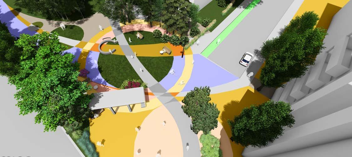
We propose activating Cathedral Park in the northwest end of Banff Trail with amenities advocated for by community members. The plan includes a dog park, an all-age playground, and sheltered areas for cooking, while preserving much of the green open space. The park’s activation will be complemented by commercial zoning in the northeast and south boundaries of the park, enhancing its appeal and utility for residents.


Main Street Mixed Use
Commerical Frontages Green Roofs
design | open space
Shadow Study


This shadow analysis indicates that Cathedral Park recieves sufficient sunlight throughout the year while its edges are densified to maximum four storeys in height. Cathedral Park is an excellent location for an open space and recreational gathering place with year round amenities, providing a connection to the outdoors that the northern part of Banff Trail is currently missing, as well as Banff Trail at large.

design | open space
Before

1. Neighbourhood parks
Currently, there is no designated dog park for the entire Banff Trail community, making the proposed dog park in Cathedral Park a crucial addition. This initial dog park in the northwest end could pave the way for more in the future, based on its success and community demand.
The all-inclusive playground creates an opportunity for all community members to play together, and encourages neighbours to age in place through provision of adewuate amenities.


design | open space
RECOMMENDATIONS
2. Activating linear parks.
The proposed linear park in Banff Trail aims to create a vibrant and inviting green space for the community. By incorporating features such as a history walk, public art installations, benches, street furniture, wayfinding, public art, and adequate lighting, the park will offer a multifunctional environment for residents to enjoy recreational activities, social gatherings, and cultural experiences.


Calgary
Park, Calgary
Park, Calgary
Walk, East Village, Calgary
design | open space


2. Linear Parks
Activation of the linear park in the south of the community is For the linear park just north of 16 avenue in Banff Trail, the focus is on activation and creating an identity. This park currently lacks designation and requires activation to fulfill its potential as a community asset.


design | open space
RECOMMENDATIONS
3. Incorporating winter city interventions to create more vibrancy.
The addition of cross-country skiing in Banff Trail will provide diverse winter activities beyond just skating, enhancing the neighborhood’s winter appeal and promoting outdoor recreation during the colder months. This intervention aligns with the goal of creating a more vibrant and active community year-round.

design | open space
3. Winter City Interventions
Banff Trail lacks winter activities primarily due to limited infrastructure, with only a skating rink at Banff Trail Park and a small temporary one in Cathedral Park, highlighting the need for more diverse and accessible winter recreation options in the community.


design | open space
RECOMMENDATIONS
4. Enhancing public realm with parkway connections.
The proposed parkway connection networks in Banff Trail will enhance the pedestrian experience by providing proper infrastructure, such as wider sidewalks, adequate lighting, and comfortable street furniture. These improvements aim to make walking to and connecting with existing parks a more enjoyable and accessible experience for the community.


Policy - Open Spaces and Parks
3.1 Parks shall be places for everyone to enjoy, regardless of abilities.
3.1.1 Parks and open spaces must comply with established accessibility standards to ensure they are inclusive and accessible to people of all ages and abilities, including those with disabilities.
3.1.2 Park activities shall be driven by community input, ensuring regular and diverse programming that reflects local interests and needs.
3.1.3 Parks shall maintain and improve playgrounds, picnic areas, and other recreational facilities to enhance visitor experience.
3.1.4 Parks must incorporate design features that enhance safety and security, such as adequate lighting, clear sightlines, and emergency call boxes.
3.1.5 New developments near parks must include mixed-use zoning to integrate commercial or retail spaces, enhancing park accessibility and activation.
3.2 Green spaces within the community shall be protected and enhanced where possible.
3.2.1 The city shall prioritize the preservation of existing green space within parks, ensuring that development and enhancements do not compromise the natural environment and overall greenery.
3.1.8 Interpretive elements such as wayfinding and signage should be incorpotrated into parks where appropriate.
Background
What we heard from the steering committee and residents of Banff Trail is that they value the connectedness of their community and this is one of the many reasons people choose to live here. Feedback from the open house and engagement sessions largely favored active modes of transportation within the community as well as safety improvementsthroughout the community; particularly at the LRT station and along major roads such as 19 street, which are lacking in safe crossings.

Strategies
Through infrastructure improvements and redesign, goals for moblity interventions include:
Open Station Design
Improved Lighting
Accessibility
Improved Mobility Networks
Repurpose Roads
Mobility
Interventions
01
Complete Green Streets
RECOMMENDATIONS
1. Complete streets throughout community.
2. Protected and separated cycling infrastructure
3. Additional pedestrian crossing with Motel Village to reconnect the community.
4. Greening of main streets to address Heat Island effect.
Banff Trail currently lacks muti-modal connectivity throughout its main arteries. These roadways are also lacking in street trees, landcaping and benches. this initiative seeks to thread the community from north to south through a network of comlete streets for all abilities.
02
Enhanced Transit Stations
Banff trail is serviced by numerous transit routes inclduing LRT, BRT and bus. This proposal seeks to address the concerns for safety and accessibility at transit stations with an emphasis on the LRT station and the MAX Orange BRT stop. This will be done by opening up both of these stations and makinging them feel more integrated into the communtity with public realm improvments.
03
Pedestrian-Only Connection
Motel Village is often treated as a separate community from the rest fo Banff Trail. This projecct aims to reconnect Banff Trail to the east across the LRT right of way with an open, at-grade crossing to provide access to all the services in Motel Village as it evolves alongside the larger community.
Intersections
Throughout our engagement sessions with the public and the steering committtee we heard that pedestrian safety was of utmost concern for residents in the community. Respondents were largely in favour of infrastructure such as protected bike lanes, green buffers for noise abatement and wider sidewalks throughout the community. This feedback informed our big move to create a network fo complete streets throughout the community to connect people to their daily lives.
16Avenue
Crowchild Trail
19Street ConfederationPark
MorleyTrail
Intersection Elements


Community Seating
Protected Cycle Tracks
Landscaping
Mature Street Trees
24 St @ Morley Trail

Roundabout
Landscaped buffer with mature trees
Separated protectected cycle track
Curb extensions with seating
Raised crosswalk


Typical Complete Street

Banff Trail Station
Feedback obtained from residents resulted a desire to avoid the Banff Trail LRT station - especially at night. Our solution to this problem was to open up the station (Similar to stations in Zurich, see image), removing barriers to visibility and access through a public plaza that interfaces with the proposed pedestrian street along Capitol Hill Crescent.
It was important to reconnect the station with the community in this case, as many people walk or bicycle along capitol Hill Cresecent and the road current lacks adequate space for users other than vehicles.
Just as important to the barrier free design was a connection to the redsigned Motel Village through a public plaza as this are is the most likely to see intensification in the future.

Stettbach Station - Zurich, Switzerland (Wikimedia Coommons)
Banff Trail Station


Motel Village Plaza

LRT Pedestrian Street


20 Ave Crossing
During our engagement sessions our team heard that many residents do not access the businesses in Motel Village and that this section of the community is often treated as a separate community - not a part of Banff Trail.
We found this to be an excellent opportunity to reconnect bowth parts fo the communtiy through an accessible and wide at-grade crossing where 20th Avenue presently terminates at the LRT right of way. This would improve access for all non-vehicular traffic as well as reconnect established bike routes along Banff Trail, Capitol Hill Crescent and 20th Avenue.
This intervention could further stimulate development along this corridor, including the potential for commercial development at-grade near this crossing in both Motel Village and the east side of Banff Trail along the avenue.
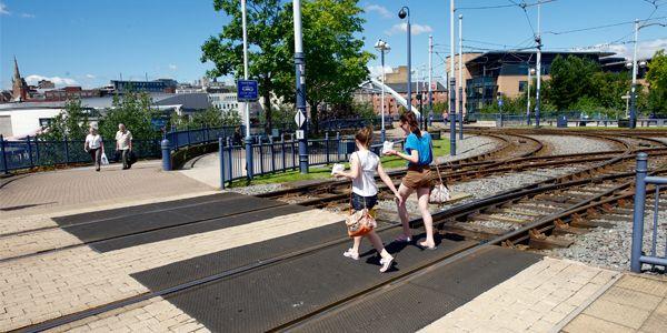
At-grade crossing - Australia
20 Ave Crossing


20 Ave Crossing


Sidewalk
Sidewalk
Sidewalk
20 Ave Crossing


MAX Orange BRT
The current MAX Bus Rapid Transit station lacks identity as well as saafe connections for all users on foor or by bike. Two Tree saw this as an opportunity to enhnace this space by creasting a green public plaza along with bike and pedestrian connections along 16th avenue and 20th Street.
The plaza would also tie into the linear park redesign, allowing for efficient travel between the LRT and BRT routes via Capitol Hill Crescent.

Existing BRT stations - Calgary (HDR Inc.)
MAX BRT Circulation

Pedestrian MAX Connection

Policy - Mobility and Connection
2.1 Make active mobility the preferred method of getting around the community.
2.1.1 All new sidewalks shall have a minimum 2 meter width where possible.
2.1.2 Put in place measures to make sidewalks safer, such as creating crosswalks with proper signage, upgrading sidewalk infrastructure, particularly in areas with high traffic and near transit stops.
2.1.3 Create and extend facilities for cycling, including protected bike lanes and safe places to store bikes.
2.1.4 Make routes to transit stops more accessible by providing barrier free accesss and seating wherever possible.
2.2 Implement traffic calming strategies to lower vehicle speeds and improve safety for cyclists and pedestrians.
2.2.1 All major intersections shall accommodate curb extensions to ensure pedestrian visibility and safety.
2.2.2 Crosswalks shall be maintained to remain visible during all months of the year and in all weather.
2.2.3 Where possible, roadways shall be narrowed to allow for the slowing down of vehicles to maintain pedestrian safety.
2.3 Include locals in transportation planning and decision-making processes, as well as companies and community organisations.
2.3.1 Offer outreach initiatives and instructional materials to encourage people to make ethical and sustainable transportation decisions.
2.3.2 Support programs that promote walking, bicycling, and using public transportation while planning transportation.
2.3.3 Encourage cooperation between businesses, community organisations, transportation authorities, and local government agencies to solve mobility issues and put into place efficient transportation options that benefit the entire community.
0.5 CONCLUSION AND STEPS FORWARD
Summary conclusion
The Banff Trail is strategically located and has historical significance, but it also faces a number of opportunities and problems as it develops. Improvements in community services and infrastructure are necessary, since residents have pointed out concerns including dangerous pedestrian crossings and a dearth of coffee shops. In addition, there’s a rising need for a wider range of housing options to meet the population’s changing wants.
Residents’ priorities have shifted to include improving green areas and transportation infrastructure, which reflects their desire for a more living and sustainable neighbourhood. Additionally, the neighbourhood has shown interest in promoting mixed-use buildings and expanding the range of retail options available. Residents have responded favourably to streetscape improvements, such as the suggested connection to Motel Village and the activation of Cathedral Park, indicating a promising future for development projects. These infrastructure projects should be pursued to maintain Banff Trail’s atrractiveness for people of all types and incomes.
Though these concerns are outside the purview of our team’s assistance, there have been some raised about the proposed city rezoning. Despite these obstacles, Banff Trail is nevertheless positioned for expansion and constructive change thanks to the involvement and shared vision of its citizens.
Furthermore, Banff Trail is well-positioned for future expansion and development due to its strategic placement close to transit networks. Banff Trail provides inhabitants with easy access to public transport, such as the LRT line, and allows them to easily travel to other sections of the city and downtown Calgary. This accessibility helps the neighborhood’s transition to mixed-use zoning, which includes larger densities, and acts as a driver for future growth.
With its unique blend of historical history and contemporary conveniences, Banff Trail is becoming an increasingly sought-after place to live. The Banff Trail, with its emphasis on sustainable development and growth, is still a symbol of Calgary’s persistent innovation and advancement.
what residents Summarywant
Residents expressed that they want denser, connected comunities. They also expressed their love for green green spaces and their concern that higher density development would demolish street trees and leave Banff Trail feeling desolate and barren. They expressed deep appreciation for community programming and events, and especially focused on how much of a social asset local restaurants and cafes are, such as Edelweiss and Weeds Cafe. Residents want more neighbours to stay longer, to build lives in the community and to connect with eachother in the public realm.
Residents also expressed that they are confused about the boundaries of the community, and would like to realign these boundaries to better reflect morphological issues, like being on the Capitol Hill Community Association Board, but technically living within Banff Trail. Residents feel positvely about change within their community, and care deeply about the form that it will take within the next 30 years of the South Shaganappi Local Area Plan.
Community Action Recommendations
While the South Shaganappi Local Area Plan is being developed, we recommend to the BTCA:
Advocate to the City of Calgary to place policy for higher density in TOD areas within the South Shaganappi LAP 1 2 3 4
Work with community members and external organizations to bring open space programming to the community
Apply for community grants for open space improvements
Apply for community grants for pedestrian and cyclist focused mobility improvements
5 Partner with organizations such as Habitat For Humanity to further secure affordable housing
Abilities. (n.d.). Playgrounds for Senior Citizens - A Genius Idea! https://www.abilities.ca/health-activity/playgrounds-for-senior-citizens-genius-idea/
Arbor Valley Nursery. (n.d.). Landscaping Guide for Colorado Blue Spruce. https://www.arborvalleynursery.com/article/landscaping-guide-for-colorado-bluespruce
Architectural Review. (n.d.). Chip off the Old Block: Reinventing Courtyard Housing in Berlin. https://www.architectural-review.com/today/chip-off-the-oldblock-reinventing-courtyard-housing-in-berlin
Ark Inc. (n.d.). Hub. https://www.arkinc.ca/projects/hub
Asphalt Art Initiative. (n.d.). Pittsburgh, Pennsylvania, USA: Empowering a Community to Improve Their Streets. https://asphaltart.bloomberg.org/projects/ pittsburgh-pennsylvania-usa-empowering-a-community-to-improve-their-streets/
Auckland Design Manual. (n.d.). Connectivity. https://www.aucklanddesignmanual.co.nz/sites-and-buildings/mixed-use/guidance/sitedesign/connectivity
Avenue Calgary. (n.d.). Designing Laneway Homes in Calgary for Successful Aging: John Brown, Housebrand & University of Calgary Environmental Design. https://www.avenuecalgary.com/City-Life/Retirement-In-Calgary/Designing-Laneway-Homes-in-Calgary-for-Successful-Aging-John-Brown-HousebrandUniversity-of-Calgary-Environmental-Design/
Banff Trail Community Association. (2024, January 12). Banff Trail Community Association. https://www.banfftrail-community.ca/
Banff Trail School. (n.d.). https://banfftrail.cbe.ab.ca/
Branton School. (n.d.). https://branton.cbe.ab.ca/
Brandon Industries. (n.d.). Different Purposes of Street Lighting. https://www.brandonindustries.com/different-purposes-of-street-lighting/
CAI. (n.d.). Calgary Imagery. Maps.calgary.ca. https://maps.calgary.ca/CalgaryImagery/
Calgary Arts Development. (n.d.). Renfrew Community Association South Patio Wall Mural. https://calgaryartsdevelopment.com/public-art/projects/renfrewcommunity-association-south-patio-wall-mural/
Calgary Herald. (n.d.). 3 Laneway Homes Adding Value and Urban Context to Inner City Communities. https://calgaryherald.com/life/homes/new-homes/3laneway-homes-adding-value-and-urban-context-to-inner-city-communities
Calgary Playground Review. (n.d.). Confederation Park. https://calgaryplaygroundreview.com/confederation-park/
Calgary Ring Road, A. (n.d.). Calgary Ring Road. Calgary Ring Road. https://calgaryringroad.com/City of Calgary. (2024). Land Use. https://www.calgary.ca/planning/ land-use.htmlCity of Calgary. (n.d.). Funding: Inspiring Neighbourhoods. https://www.calgary.ca/social-services/funding/inspiring-neighbourhoods.html
Catamount Trail Association. (n.d.). Community Ski Days. https://catamounttrail.org/community-ski-days/
Census Program. (n.d.). Statistics Canada. https://www12.statcan.gc.ca/census-recensement/index-eng.cfm
City of Calgary. (n.d.). Inspiring Neighbourhoods. https://www.calgary.ca/social-services/funding/inspiring-neighbourhoods.html
City of Calgary. (2022). Banff Trail Area Improvements. https://www.calgary.ca/planning/projects/banff-trail.html?redirect=/banfftrailareaimprovements
City of Calgary. (n.d.). Communities. https://www.calgary.ca/communities/profiles.html
City of Calgary. (2020). Municipal Development Plan. https://www.calgary.ca/planning/municipal-development-plan.html
City of Calgary. (n.d.). Neighborhoods. Banff Trail profile. Https://Www.calgary.ca. https://www.calgary.ca/communities/profiles/banff-trail.html
City of Calgary. (n.d.). Social Services: Inspiring Neighbourhoods. https://www.calgary.ca/social-services/funding/inspiring-neighbourhoods.html
City of Calgary. (n.d.). Transportation. https://www.calgary.ca/planning/transportation.html
City of Calgary Newsroom. (n.d.). Building Consistency in Calgary Communities. https://newsroom.calgary.ca/building-consistency-in-calgary-communities/
Chip off the Old Block: Reinventing Courtyard Housing in Berlin. (n.d.). Architectural Review. https://www.architectural-review.com/today/chip-off-the-old-blockreinventing-courtyard-housing-in-berlin
CivicWorks. (n.d.). Courtyard 33. https://www.civicworks.ca/courtyard-33
Confederation Park. (n.d.). Calgary Playground Review. https://calgaryplaygroundreview.com/confederation-park/
Cornwall Conservation Trust. (n.d.). White Ash. https://cornwallconservationtrust.org/white-ash/
Cornell University. (n.d.). White Spruce. https://arboretum.uoguelph.ca/thingstosee/trees/whitespruce
Delta Opens "Un-Fur-Gettable" New Agility Centre. (n.d.). Talking Energy. https://talkingenergy.ca/stories/delta-opens-un-fur-gettable-new-agility-centre rethinks-the-box
References
Development, P. and. (n.d.). Registered Secondary Suites. Secondarysuites.calgary.ca. https://secondarysuites.calgary.ca/
Dippel, S. (2018, February 22). Residents mount last ditch attempt to stop high-rise in Motel Village. CBC. https://www.cbc.ca/news/canada/calgary/ student-housing-tower-motel-village-1.4546325
Everyday Tourist. (n.d.). Calgary Architecture Arks: The Hub rethinks the box. https://everydaytourist.ca/city-planning-101/calgary-architecture-arks-thehub-
Finch, D. (2013, October 29). Native leader set trail for his people. www.calgaryherald.com. https://web.archive.org/web/20170113151720/http://www. calgaryherald.com/sports/Native+leader+trail+people/8298286/story.html
George on 17th Offers Fantastic City Views. (2017, November). SkyriseCities. https://calgary.skyrisecities.com/news/2017/11/george-17th-offers-fantasticcity-views.29471Gravity Architecture. (n.d.). Mount Pleasant 8. https://www.gravityarchitecture.com/mount-pleasant-8
Government of Alberta. (n.d.). M26. https://open.alberta.ca/publications/m26
iNaturalist. (n.d.). https://www.inaturalist.org/
Infrastructure, T. (n.d.). Banff Trail Area Improvements. Https://Www.calgary.ca. Retrieved January 13, 2024, from https://www.calgary.ca/planning/ projects/banff-trail.html?redirect=/banfftrailareaimprovements
Jamboree Housing. (n.d.). West Gateway Place - West Sacramento, Yolo County. https://www.jamboreehousing.com/blogs/affordable-housing-developerpartner/west-gateway-place-west-sacramento-yolo-county
Jonite. (n.d.). 11 Benefits of Street Trees. https://www.jonite.com/11-benefits-of-street-trees/
Killeshal. (n.d.). Durable Street Furniture Makes Great Public Spaces. https://killeshal.com/durable-street-furniture-makes-great-public-spaces/
Klauzus, Jeremy . “The Battle of Banff Trail.” The Sprawl, 6 Nov. 2022, www.sprawlcalgary.com/the-battle-of-banff-trail. Accessed 13 Jan. 2024.
Landscaping Guide for Colorado Blue Spruce. (n.d.). Arbor Valley Nursery. https://www.arborvalleynursery.com/article/landscaping-guide-for-coloradoblue-spruce
The Noun Project. (n.d.). https://thenounproject.com/
Land Use Districts | Open Calgary. (2024). Data.calgary.ca. https://data.calgary.ca/Base-Maps/Land-Use-Districts/mw9j-jik5
References
My University District. (n.d.). Time to Play: A Guide to NW Calgary Playgrounds for All Ages. https://myuniversitydistrict.ca/uncategorized/time-to-play-aguide-to-nw-calgary-playgrounds-for-all-ages/
National Land Transport Programme. (n.d.). NZ Transport Agency. https://www.nzta.govt.nz/planning-and-investment/national-land-transportprogramme/2021-24-nltp/in-the-spotlight/innovating-streets/
Nimji Real Estate. (n.d.). 2505 20 Street SW, Calgary. https://www.nimji.com/wps/mylistings/17252/mylistings%28sold%29.def/listing.a2083848-250520-street-sw-calgary-t2t-4z4.100303436/
Orenco Station: Is it on Track? (2013, August). PlannersWeb. https://plannersweb.com/2013/08/is-orenco-station-on-track
“Our Story.” Banff Trail Community Association, www.banfftrailcommunity.ca/our-story#:~:text=Back%20in%201910%2C%20the%20City. Accessed 13 Jan. 2024.
renfrew-community-association-south-patio-wall-mural/
Shape Your City. (n.d.). https://www.shapeyourcity.ca/rental-rz/widgets/59199/photos/16326
Pinus contorta. (n.d.). Gardenia. https://www.gardenia.net/plant/pinus-contorta
Public Art. (n.d.). Artist Initiated Public Art Microgrant. https://calgaryartsdevelopment.com/public-art/projects/artist-initiated-public-art-microgrant/
Renfrew Community Association South Patio Wall Mural. (n.d.). Calgary Arts Development. https://calgaryartsdevelopment.com/public-art/projects/
Sidewalking Victoria. (2018, June 2). Adaptive Reuse in Victoria
Tennessean. (2017, September 21). Nashville’s tall, skinny homes: 5 things to know. https://www.tennessean.com/story/news/2017/09/21/nashvilles-tallskinny-homes-5-things-to-know/679288001/
Underwood, C. (2019, January 9). Motel Village needs new name as it goes upscale, say local businesses. CBC. https://www.cbc.ca/news/canada/calgary/ motel-village-calgary-1.4952416
University City. (n.d.). https://www.universitycity-online.com/
University of Calgary. (n.d.). University Station | Archives and Special Collections. https://asc.ucalgary.ca/building/universi-ty-station/
William Aberhart High School. (n.d.). https://williamaberhart.cbe.ab.ca