
triangle studio
coach hill | patterson heights
Leigh Linsey (30188947), Nathan Galan (10163351), Ryan Lebell (30042561)

triangle studio would like to formally acknowledge the orginial inhabitants of the territory now refered to as Calgary. This includes the people of the Blackfoot Confederacy, the Tsuut’ina First Nations, the Stoney Nakoda peoples and the Metis Nation of Alberta, Districts 4, 5 & 6.
We would also like to formally extend our appreciation to our valued instructor, Beverly Sandalack, and Steering Committee from Stantec, the City of Calgary, and the CHPH Community Association, for their guidance, feedback, and support through the development of this project.
Instructor
CHPH Community Association
CHPH Community Association
City of Calgary
City of Calgary
Stantec
Beverly Sandalack
Talena Klypak
Inam Teja
Ben Bailey
Asia Walker
Eric Schertzer


This advanced planning studio is designed for final year Master of Planning students to exercise their capabilities and skill sets through closely working with a real community, with real challenges. It involves comprehensive analysis, synthesis, and development of urban design solutions, culminating in a professional report and presentation. Utilizing a studio model, students collaborate closely with faculty and community associations to produce creative solutions, while navigating the complexities of conceptualization to realization.
This report has been compiled by the small team at triangle studio for the community of Coach Hill Patterson Heights. Through collaborative problem solving, community engagement and professional tutelage, a series of tangible results have been refined, outlined and delivered to the community. These are compiled in the following report and are inclusive of a comprehensive shared spaces plan, street redesign and pedestrian realm overhaul and an innovative strategy for improving and integrating the communities walking and trail system into the city at large.
These interventions are designed with existing policy recommendations and requirements in mind, and aim to equip the community with a deeper understanding of the planning framework within the city.
the critic - lead analyst
Nathan is a second year Master of Planning student at the University of Calgary’s School of Architecture, Planning and Landscape. As a graduate from the University of Saskatchewan with a Bachelor’s of Arts in Economics, minoring in Psychology, his interest lies at the intersection of behavioural science, planning policy, and urban design.

the designer - gis lead


the visionary - lead urban historian Ryan is a second year Master of Planning student at the University of Calgary’s School of Architecture, Planning, and Landscape. He has Bachelor of Arts in Urban Studies which focused on human geography, engagement, and GIS analysis. Ryan has an interest in sustainable design and circular economies.
Leigh is a second year Master of Planning student at the University of Calgary’s School of Architecture, Planning, and Landscape. He holds a Bachelor of Arts in History with a concentration on Western Canadian history and Canadian Identity. He has a passion for multimodal transportation, human scaled urban design and creating opportunities for character and intrigue in the built form.

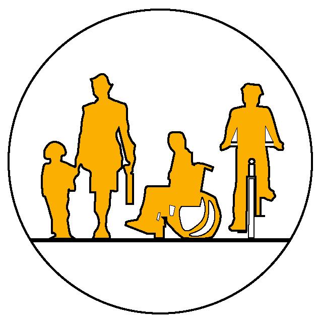
Central to the vibrancy of urban life are those that reside within it. Foundational to our practice is a dedication to the well-being and inclusivity of people from varying backgrounds, experiences, and cultures. This focus on people and social cohesion recognizes the city as a living organism shaped by the experiences and interactions between its residents.
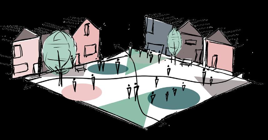
A well-designed place is not just a physical space but a reflection of the community’s history and culture. By celebrating local context, architectural heritage, and natural amenities, we craft spaces that evoke a sense of pride, are appropriate in scale, use, and quality, and contribute to the creation of vibrant and sustainable neighborhoods.

At triangle studio, we acknowledge that successful planning goes beyond the built form. We prioritize the functionality and livability of the spaces we design by incorporating elements that support the everyday activities, hobbies, pastimes, and leisures that enrich people’s lives. We aim to create environments that promote physical and mental well-being, ultimately contributing to a higher quality of life for all members of the community.

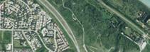
Coach Hill and Patterson Heights are two neighbouring communities located in Calgary’s South West quadrant. They are in proximity to cultural and recreational sites such as the Bow River Valley, Canada Olympic Park, and Edworthy Park. Patterson Heights is home to the Historic Hart residence, and CTV Calgary’s broadcasting studios with an extremely visible broadcasting tower placed high on the bluff above the Bow River Valley.
The two communities are well connected to the major roadways of Bow Trail SW, Sarcee Trail SW and Old Banff Coach Rd SW. Calgary Transit bus routes 93, 111 connect residents to LRT stations, adjacent neighbourhoods, and commercial centres.
Preliminary analysis and community testimony reveal a variety of potential key issues and challenges. The communities face limited access to
recreation, leisure, and commercial opportunities due to dominance by single-family zoning and outdated commercial form. Concerns about high vehicular traffic volume and speed, along with uncomfortable walking conditions on major roads like Bow Trail, Old Banff Coach Road, and Sarcee Trail, have been raised. Growing population pressures necessitate thoughtful planning for density, balancing growth with preserving community character, preventing congestion, and improving parks and open spaces as well as the connections between them.


alberta land-use framework (aluf)

The Alberta Land-Use Framework manages public and private land, as well as natural resources for economic, environmental, and social goals at the highest level. Within the framework, 7 strategies are identified pertaining to the definition of landuse regions; the creation of a landuse authorities and advisory council; the conservation and stewardship of land; the efficiency of land use; the monitoring of land use information; the inclusion of Indigenous communities; and , priority actions for the ALUF.
south saskatchewan regional plan (ssrp)
The SSRP guides the long-term vision for the South Saskatchewan zone, aiming to strike a balance between economic, environmental, and social needs. Much like the ALUF, the SSRP is designed to identify strategic directions for the growth of the South Saskatchewan region over the next 10 years (2014-2024) and to align provincial policies at the regional level.

municipal government act (mga)
The MGA outlines the powers and responsibilities for municipal governments within Alberta. Additionally, the document provides a legal framework for the organization, governance, and operation of municipalities, including planning decisions. As part of the MGA, municipalities
are required to develop Municipal Development Plans (MDP) and are enabled to develop other statutory planning documents, such as Local Area Plans (LAP).
municipal development plan (mdp)
The MDP serves as the guiding document for development and growth in the city within the medium and long terms. Supported by Council’s Sustainability Principles, the MDP aims to build a city which strategically accomodates growth through diverse housing types, compact development, multimodal transportation, and open space preservation.
calgary transportation plan (ctp)
ple revisions (most recently in 2014), the PHCP provides land use policy recommendations, architectural design guidlines, and transportation goals for the purpose of asisting approving authorities in making decisions concerning future use, development, and design.
guidebook for great communities
calgary metropolitan region board (cmrb) growth plan
Replacing the Interim Growth Plan, the CMRB Growth Plan represents a new strategy for sustainable growth for the Calgary Metropolitan Region. The plan provides a policy framework for growth management and vision implementation over the next 50 years. It achieves this by setting out objectives for the region which focus on a strategic approach to planning, an understanding of development patterns and infrastructure needs, a coordination of decision-making within the CMR, and strategies to ensure the well-being and competitiveness of the CMR.
calgary metropolitan region board (cmrb) growth plan
Intermunicipal Development Plans are designed to align the outcomes and goals between neighbouring municipalities. With respect to Calgary, intermunicipal plans are provided with Foothills County, Rockyview County, and Chestermere.
Included within the MDP, the Calgary Transportation outlines a citywide vision for the city’s many transportation networks. With a focus on sustanable modes of movement (walking, wheeling, cycling, and transit), afforability and accessibility, efficiency of goods movement, and commercial / emergency servicing needs,. the plan seeks to “promote vibrant, connected communities, protect the natural environment, and support a prosperous and competitive economy.”
developed v. developing areas
Identified within the MDP, Calgary neighbourhoods are categorized as either developed or developing areas, each with their own visions for growth. Communities are understood as developed or developing based on their build out, and if this occured before or after the 1P2007 Land Use Bylaw. The Coach Hill and Patterson Heights communities are defined as developed areas.
patterson heights concept plan
As the area lacks an updated Local Area Plan (such as Westbrook Communities Local Area Plan) the only area-specific planning document provided for the CHPH Communities is the Patterson Heights Concept Plan. Adopted in 1991, with multi-
The Guidebook for Great Communities is designed to bridge the gap between the MDP and Local Area Plans, directing how Calgary communities will evolve and change to achieve greatness for everyone. The document is a tool used by planners which establishes the principles of Opportunity and Choice, Social Interaction, Health and Wellness, Natural Environment, Economic Vitality, and Identity and Place to achieve its goals for great communities.
main streets program
Lastly, the City’s Main Streets program was develop in conjunction with the MDP. Understanding that main streets are places “where [people] want to go, enjoy, and connect as a community,” the program was designed to identify streets within Calgary which serve significant roles as transportation and commercial corridors. These streets were also prioritized based on their potential to accomodate future growth. Though the CHPH community does not contain any identified main streets under the program, lessons about street safety, mobility and functionality, character and identity, and economic vitality will prove vital in addressing concerns from the CHPH community.
1 2 3 understand project analyze material engage community
The initial phase when the triangle team began developing base maps for the CHPH area, collecting required photos, testimonial, and policy documentation to better understand the area.
The team then underwent comprehensive analysis. Environmental surveys, comprised of topographic studies, tree canopy studies, and natural & open space catalogues were executed. A historic evolution and timeline of the area, including land use, parcel, and housing typology composition and changes was completed. Lastly, the team completed an overall mobility assessment including pedestrian and public realm quality evaluation, mode split assessment, and traffic study.
The team engaged with community members to share findings from previous phases, and collaborate to understanding the community strengths and weaknesses from the perspective of residents.
4 5 6 initialize concepts finalize designs develop report
A synthesis of all that was learned was used to develop objectives for the CHPH communities. These were presented alongside design conceptualizations to the steering committee made up of community association members, professional advisors and faculty.
Finalized design interventions and proposals were presented to the community and steering community through an open house and formal presentation.
After feedback on considerations and implementation, the team submitted final documentation, visual media, and plans for use by the community in navigating future planning decisions.


Using a combination of GIS data software, physical site observation, and cataloguing of community testimony, triangle studios has organized the analysis of Coach Hill Patterson Heights within 3 categories: context, at a glance, and understanding chph.
context:
Initial understandings of the community in terms of its location within the Calgary context. Historical evolution is also explored.
at a glance:
What was notcied about the structural composition and arrangement of the community. triangle studios additionally took note of the unique characteristics and identity of place, including architecture, block structure, and other stufffffff.
understanding chph:
Deeper, analytical understanding of the community. Fine grain details, livability, density, typology, and how it operates.
Coach Hill Patterson Heights is located in Calgary’s southwest quadrant, set atop the Paskapoo Slopes of the Bow River Valley. It is in close proximity to Canada Olympic Park and has easy access out of the city to the west. It borders West Springs and Strathcona Park and is easily accessible via major roadways like Sarcee Trail and Bow Trail. With downtown just 10 kilometers away, residents can quickly commute to downtown Calgary by car.


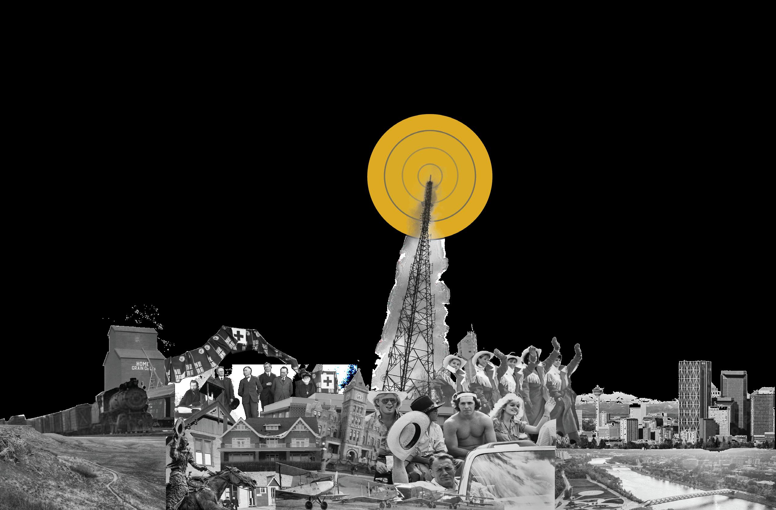
The historical narrative of Coach Hill-Patterson Heights holds a fascinating combination of elements that frequently played into the larger history of Calgary. At the heart of the community lies the Paskapoo Slopes, a region now identified for its indigenous heritage through the discovery of archaeological sites along the slopes. These sites hold evidence of ancient hunting and processing sites that appear to have been used seasonally by local indigenous peoples.
The landscape began to transform in the early 20th century with the forming of homesteads and most notable in 1905 with the construction of the CrandellHart House. This coincided with the burgeoning sandstone industry along the Bow River Valley, that contributed to the construction of some of the most iconic structures in Calgary. Additionally, the area was used for the establishment of the Banff Coach Road, an alternative to the challenging hills found in Cochrane, Alberta connecting Calgary to the Rocky Mountains. This period marked a pivotal moment for the area, as it began to transform from its natural form to a new site of settlement.
In 1951, the Crandell-Hart House found new ownership in Stu Hart of stampede wrestling fame, becoming an enduring landmark in the community. The mid-20th century brought further development
with the installation of the CFCN broadcast tower in 1954, a structure that remained one of the tallest in Calgary for some 3 decades. Additionally, areas of Coach Hill and Patterson Heights began to see annexation by 1956.
The late 1970s witnessed the beginning of construction in Coach Hill as it can be seen today. This occurred with the construction of the major thoroughfares of Sarcee Trail and later Bow Trail, which played pivotal roles in connecting the community to the wider cityscape. Patterson Heights saw its own construction boom by 1983. During the 1988 Winter Olympics, Patterson Heights was identified as the location of the events media village due to its close proximity to the CFCN and broadcasting facilities, this media village remains to this day.
Coach Hill-Patterson Heights continued to evolve into the early 2000’s, witnessing small yet significant changes in its built form and development. Most notably, the westward expansion on the Paskapoo Slopes.


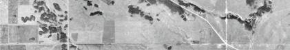


The area of Coach Hill Patterson Heights was initially characterized by agricultural lands and acreages utilized by area homesteaders. Over time, the emergence of more properties occurred as Calgary expanded its borders. By the time of annexation by the City of Calgary in the 1950s, signs of urbanization became more pronounced, marking the transition from rural to suburban. However, it wasn’t until 1979 that Coach Hill began to experience rapid


development, with the residential community taking shape and large pieces of infrastructure beginning to form the areas identity.
The development of the area from the 80’s to the mid 2000’s saw the bulk of construction completed in the community, bringing it to a state that is largely representative of the built form today.


With a combined population of approximately 7,400 residents, Coach Hill Patterson Heights represent a common suburban makeup within the Calgary context. With low to minimal population growth projections from the city, the neighborhoods is a predominantly working-age population with an average household size of 2.2 people. The lack of amenities for young families could be a contributing factor to this.
While a significant 82% of residents own rather than rent, housing affordability is slightly above the desired threshold, with upwards of 25% of the community spending over 30% of their income on lodging.

What was identified by the team was that Coach Hill Patterson Heights has seen a fascinating and rapid evolution from a rural landscape to a built out suburban community. Being situated on the Paskapoo Slopes, it holds a fascinating historical narrative that is not at first evident. Intertwined with Indigenous heritage and unique landmark buildings spanning some 5 decades.
Significant development occurred from the late 1970s onwards, shaping the community’s current built form by the mid-2000s. This has resulted in a fascinating mix of architecture styles, built form and street composition. Today, it maintains a stable population with moderate incomes, high homeownership rates, and a predominantly working-age demographic.

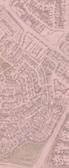
Warped grid block structure is a modern iteration of the classic grid. Here it combines traditional North American neighbourhood layout including back lanes, street trees, and a larger pedestrian realm, with suburban design of the 1960s. These roadways provide traffic calming measures due to the irregular bends in the street network.

Loop and Lollipop block structures present challenges as they often lack adequate pedestrian realm, relaying on roadway for most uses. This block type typically has the same entry and exit point, often times fragmenting the urban realm.

Patterson Heights’ curvilinear block structure is a consequence of 1990s planning paradigms and the sloping topography of the site often found with sidewalks on only one side of the street. This block type presents challenges for navigability and wayfinding.


The road network in and around Coach Hill Patterson Heights comprises a wide range of designated road types. There is a clear hierarchy of thoroughfares designed to accommodate various levels of traffic and prioritize different modes of vehicle movement. At the top of the hierarchy are skeletal roadway such as Sarcee Trail sw, which boasts a speed limit of 80 km/h and handles thousands of vehicles daily. This roadway borders the community on the east side and accommodates the full spectrum of vehicular traffic, from private vehicles to freight trucks. The arterial roads of Bow Trail and Old Banff Coach Road have a speed limit of 60 km/h, and are designed for the movement of hundreds to thousands of vehicles per day. Bow Trail borders the community on the southern side, while Old Banff Coach Road bisects the community. While mobility is quite high for these roadways, they are less livable and enjoyable to use when not in a motor vehicle. Moving down the hierarchy, collector roads such as Patterson Boulevard and Patina Drive, have a speed limit of 50 km/h, they serve the local community by channeling hundreds of vehicles towards the larger scaled roadways in the community. In addition they provide access for transit into the community and funnel traffic into the single commercial node within the community. Lastly, local roads with a speed limit of 40 km/h prioritize livability, connecting properties and residents with minimal infrastructure and low speeds.


infrequent & disconnected
Transit access in Coach Hill Patterson Heights is currently limited, with bus services operating every 30 minutes on lines 111 and 93. While these lines connect residents to the transit hubs of Westbrook and 69 St LRT stations, stops distant from large areas of the community, leaving them convenient to reach.


Barriers and edges play a significant role in shaping the character and atmosphere of Coach Hill Patterson Heights. The challenging topography of the area necessitates the presence of numerous retaining walls and escarpments, which, while important, create obstacles within the public realm. Moreover, the composition of large infrastructure elements, particularly the roadways of Sarcee Trail, Bow Trail and Old Banff Coach rd, act as further constraints on the neighborhood’s spatial layout. The community is hemmed in by major thoroughfares on almost all sides, leaving the community rather isolated from its surroundings. Additionally, the installation of sound barriers along these roadways, while beneficial for noise reduction, disrupts visual and physical connections throughout the community, adding to the sense of enclosure.
In addition, the aforementioned topographical challenges necessitate a block composition and structural layout that is largely tiered and separated from one another. This is particularly evident on the eastern side of the community and in the residential extension creeping to the northwest along the Paskapoo Slopes. The tiered arrangement of blocks and structures reflects the need to navigate the steep terrain effectively, however, this tiered layout also contributes to a sense of fragmentation within the community, as it creates distinct pockets of development that are somewhat disconnected from one another.

Coach Hill Patterson Heights is home to a variety of unique urban design challenges. Most notably, barriers and edges significantly shape the community. From the challenging topography that necessitates retaining walls and escarpments, produce obstacles within the public realm to mobility and navigability. Major thoroughfares like Sarcee Trail, Bow Trail, and Old Banff Coach Road constrain the neighborhood’s spatial layout and require the need for sound barriers; while these mitigate traffic noise they also disrupt visual and physical connections inside and out of the community, adding to a sense of enclosure. The tiered block compositions reflects the need to navigate steep terrain, though they further contribute to a fragmented community feel.
Transit access is present in almost all parts of the community, but service is infrequent and stops are
few and far-between. The built condition of Coach Hill Patterson Heights lends itself almost entirely to single vehicle use, making it challenging for other means to safely and effectively navigate the area.

Within Coach Hill Patterson Heights, parcel size and ownership makeup varies, ranging from single family lots to much larger multi residential spaces. These multi-residential lots range from 1.5 to over 10 acres, and are predominately found along the major thoroughfare of Old Banff Coach Road. One area of exception can be found along the eastern part of Patterson, where the sloping terrain lends itself to larger residential developments rather than single parcels. In addition to these private lots the city owns a small number of areas within the community, designated as parks, open space, and natural areas that are found within the community and extend onto the Paskapoo Slopes to the north.

The most prominent residential land use consists of residential contextual (RC1/RC2) zones, characterized by single-family dwellings. Following closely is the multi-residential contextual (MC1) designation, accommodating condos, apartments, and townhouses providing some variety to the housing typology of the community. Unique requirements are addressed through a combination of direct control (DC) designations, used in areas such as the Prominence Way Retirement Home and the CTV broadcasting facility near the CFCN tower. Parks and open spaces are designated under S-SPR, S-UN and S-CS classifications, some of which are zoned for school and educational facilities. Additionally, a single CN-2 commercial designation is situated at the heart of the community, serving as the single focal point for local businesses and services.
land use (code)
residential contextual (rc1/rc2)
multi residential contextual (mc1/g)
neighbourhood commercial (cn-2)
special purpose community service (s-cs_
special purpose school, parks, community (s-spr)
special purpose urban nature(s-un)
special purpose future urban development (s-fun)
direct control (dc)


In Coach Hill Patterson Heights, single-family dwellings constitute the majority of housing, comprising approximately 60% of the community’s residential landscape. These single-family homes come in various types; these include garage in-front designs, indicative of traditional suburban developments, as well as rear-garaged units that utilize alleys or lanes for access, these are found only in the oldest part of the community, the western portion of Coach Hill. Additionally, duplexes and triplexes contribute to the mix of single family housing options with the entire community.


Typically have large front set backs, low lot coverage, and front facing garages that interrupt pedestrian realm.
Offers advantages of privacy,space, and customization at the expense of higher maintenance costs and potential high environmental footprint compared to higher density options.
Offers the advantage of shared infrastructure and reduced land use. Promoting denser and potentially more sustainable development at the consequence of potential lose of privacy and increased noise.

Optimizing landuse and encouraging interaction through shared amenities and lower cost per unit at the expense of privacy and potential loss of aesthetic autonomy.

Multi-residential land use accounts for approximately 32% of the community’s overall residential composition. Within this segment, townhouses and row houses offer a blend of shared amenities, while multi-residential complexes provide residents with a mix of apartments and town-homes in a centralized location. Additionally, the community features apartments below 12 stories, and notably, a collection of 3 apartment towers standing at over 12 stories in the form of the Odyssey Towers.

Offering ease of access and smaller scale, but does not maximize density like taller structures.
Offering a balancing of community connective and individual ownership with the added benefit of reduced landuse. There is the possible consequence of a lose of privacy and an increase in noise.

Maximize density within a parcel and more efficient landuse at the expense of building cost and added complexity.
Coach Hill Patterson Heights is home to a variety of unique land-uses, most of which fall under the Direct Control designation. Majority of these are residential in nature, with a small number of outliers in the form of the CTV broadcast facility and Prominence Way luxury retirement home. Additionally, there is a single church, community association building and commercial area serving the community.


Offers convenience and a range of amenities for elderly residence, promoting social interaction and support networks.
Offering a community based employment centre within a niche industry.
Offering a point of community connection when in use. Currently unoccupied due to costly maintenance.

Provide opportunity for business and economic growth within a community with the potential consequence of traffic congestion and increased noise.
Offering a point of spiritual and social connection between community members.
While Coach Hill Patterson Heights have a variety of housing types in scale, density and composition, the community lacks some of the modern built form exemplary of modern neighbourhoods. In particular, there is a lack of mixed-use residential units that offer a balance between commercial access and residential units.


• Active ground floor uses that serve building and community residents.
• Provides intensification and amenities within redevlopment areas
• Generally requires land use amendment
• Efficient development of lot
• Desirable walk-up units that interface well with public realm
• Provide eyes on the street
• Incorporate density at a sensitive scale
The livability of Coach Hill Patterson Heights is characterized by a small amount of commercial and daily amenities and large outdoor recreational spaces that lack unique programming. There is a centrally located off-leash dog park provides residents with a dedicated space for running and socializing their pets, but it lacks a buffer or safety measures for users between the park and Old Banff Coach Road.
The community lacks daily amenities such as a grocery store or café, necessitating reliance on nearby areas for daily needs and socializing spaces. Additionally, the absence of a school within walking distance requires residents to use vehicles for student commutes, highlighting an area for potential improvement in neighborhood infrastructure.
activity hub

The walkability of Coach Hill Patterson Heights is hindered by oversized roadways and limited pedestrian infrastructure, creating a disparity between vehicular and pedestrian spaces. Underscaled crosswalks contribute to an inconvenient and challenging to use pedestrian realm, complicating means of navigating the area. The combination of a warped grid, loop, and lollipop and curvilinear bock layout further challenges navigation, making it unintuitive to traverse the community on foot or by bike. Certain sections of the neighborhood are
isolated from central community and commercial nodes, necessitating vehicle use even for internal travel. While some streets feature a streetscapes that enhances the pedestrian experience such as street trees and curb cuts, these improvements are limited to select areas, leaving much of the community without pedestrian-friendly amenities.


Coach Hill Patterson Heights has a select number of community nodes that serve as focal points for recreation and social spaces, these are designed for team sports such as soccer, football, and baseball. There is however, untapped potential to elevate these areas into more impactful community spaces by enhancing amenities and programming. Prominence Park in particular has the potential of being a community anchor through more diverse uses. Additionally, the central commercial space, currently oriented around vehicular access and minimal commercial uses, holds strong potential to activate the community. Its central location and easy accessibility from both Coach Hill and Patterson Heights make it a prime candidate for revitalization efforts that could transform it into a vibrant space for commerce and social interaction.
community node: prominence park

commercial node


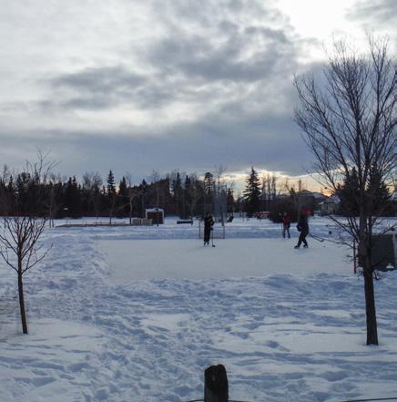
Winter city considerations detail key elements such as sun path, prevailing winds, and site slope, alongside existing winter city amenities like a skating rink and dog park. These elements collectively inform the site’s adaptability in accommodating various activities and addressing seasonal concerns

The winter season can pose significant challenges for Coach Hill Patterson Heights, particularly due to its unique topography. Situated atop a hillside overlooking the Bow River Valley, the community experiences large areas of shading, exacerbating the freeze-thaw cycles characteristic of Calgary’s winter and spring seasons. The limited sun exposure and short days further compound these issues, leaving sections of the neighborhood prone to icing.


The open space typology classifies community spaces into five categories: ecological landscapes, urban open space, community recreation, linear parks, and buffer zones. Through this categorization, we can discern the connections, disconnections, and fragmentation within the open space network and begin to plan preliminary connections between them.


An area identified by the city as largely natural space, left relatively underdeveloped in terms of built form or programming. Majority of the Paskapoo slopes are considered to be under this classification.
Community centred natural spaces that accommodate visitors with park furniture and social spaces. These spaces are not organized around recreational needs but rather aesthetics and socializing.
Large spaces used for sporting events, recreational and a mix of personal uses. Characterized by large, level playing fields or surfaces, for team sports or community recreation events. Coach Hill Patterson Heights has two recreation spaces for sports and one for dog owners.
Linear parks are characterized by long stretches of green space, often accommodating infrastructure needs such as power lines or utility right of ways. They are often more informal than other park spaces.
Often taking form as escarpments towards roadways or buffers between pieces of heavy infrastructure, these large areas of undeveloped space function as often informal thoroughfares for walking and biking. Coach Hill Patterson Heights utilizes these spaces on the eastern and southern portion of the community for such purposes.
The tree canopy in Coach Hill Patterson Heights comprises more than 2500 deciduous and coniferous trees, predominantly located within the Paskapoo Slopes and other naturalized areas like Patterson park and Coach Hill park.
Street trees are largely centralized to larger internal thoroughfares such as Coach Hill rd and Patterson Blvd. These provide an improved pedestrian and aesthetic experience within the community. Aside from these locations, trees are predominately located on private parcels. Most evident within Coach Hill, where development has been present for longer than in other parts of the community, allowing for a fuller canopy.


Coach Hill Patterson Heights is largely characterized by its unique and challenging elevation changes. Located on top of and along the Bow River Valley poses unique obstacles to development and buildable area.

These Steep slopes in tandem with era of construction shape how the community has formed, and continue to influence development within the community. Significant areas of land are considered unbuildable due to their slope, fragmenting the community.


The ecological corridors surrounding Coach Hill Patterson Heights have undergone 4 distinct fragmentations leading to segregated park space and wildlife habitat. Beginning first nearest the Bow River with The CP rail line effectively cutting off the hill side from the river. The completion of Sarcee Trail sw by the late 70’s further separated the river valley from the hill side. Lastly the development of the community has led to a confusing disjointed ecological condition. However, the abundance of parks and open spaces within the community presents itself as an opportunity to connect some of these fragmented ecological spaces. The community is known for its abundance of wildlife encounters, therefore sewing these areas back together an important element.


Coach Hill Patterson Heights is home to a unique and varying array of built and natural conditions. The community’s evolution has been largely influenced by its challenging topography, characterized by steep slopes and fragmented land parcels on the north and eastern areas of the community. While the development of singlefamily dwellings dominates, multi-residential complexes also play a significant role, contributing to the area’s rather diverse housing landscape. This housing mix makes Coach Hill Patterson Heights stand out when compared to communities of similar era. Some interventions and design criteria have enhanced walkability within the community,
but oversized roadways and disjointed pedestrian infrastructure remain challenging. Additionally, the community lacks essential amenities like a grocery store, cafe or school, necessitating reliance on private vehicles for transportation to areas that provide daily amenities. The unique elevation of the community poses challenges in regards to the winter season due to excessive shading and icy conditions exacerbated by the hillside location.
The unique mix of housing typology and environmental context present many opportunities for redesign and clever implementation of some community enhancing elements.

Coach Hill Patterson Heights built form and functionality is characterized by heavy infrastructure both within and surrounding the community, contributing to a fragmented and isolated condition. The presence of major roadways and infrastructure generates noise and imposes physical barriers, complicating outward connections to neighboring areas. Moreover, the neighborhood’s design is predominantly car-oriented, with minimal entry points and limited access to robust transit options. As a result, residents must rely on personal vehicles for daily transportation needs, further reinforcing the community’s car-centric nature.
Challenges with node functionality, are particularly evident in the single commercial space within the community, which is underscaled and auto oriented. While parks and community nodes are well placed for ample usage by both neighbourhoods they lack diverse and unique programming from one another, limiting their effectiveness in catering to residents’ varying needs and preferences.
community workshop


triangle studio participated in three forms of communitity engagement throughout the length of the project. The first being a walk-through where our studio was introduced to the community spaces and witnessed the challenges and opportunities first hand. The second being a community workshop where the community was invited to voice concerns as well as their special spaces. Finally, triangle studio participated in an open house where design concepts were shared with community members.


The node redesign introduces new commercial, recreational, and educational spaces to meet diverse community needs and support evolving lifestyle preferences, fostering a vibrant, inclusive environment. By re-imagining shared spaces as dynamic hubs for interaction and engagement, the plan promotes social connectivity, cultural enrichment, and overall well-being in the neighborhood.


These design concepts were born out of an understanding and analysis of the existing condition within Coach Hill Patterson Heights. The auto oriented design of the community allows for adaptive reuse of roadways, while not impeding vehicular traffic significantly. Draft designs were based upon the Good Streets Guidebook from the City of Calgary. Based on these, preliminary design were conceived, including lane narrowing, sidewalk widening, curb extensions, increased signage and improved pedestrian crossing safety.


The extension of the rotary/mattamy regional trail network into coach hill patterson heights introduces an educational loop to help residents and visitors better understand the area. This loop strategically integrates natural features and landmarks into the trail network;catering to all users. The blue loop prioritizes connecting major greenspaces via multi-use pathways, complementing the road redesigns to enhance the pedestrian realm. Meanwhile, the Pink Loop focuses on accessibility and recreation for all, forming a comprehensive, inclusive, and educational trail network.


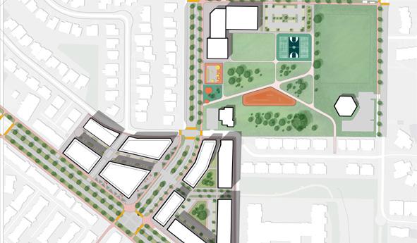
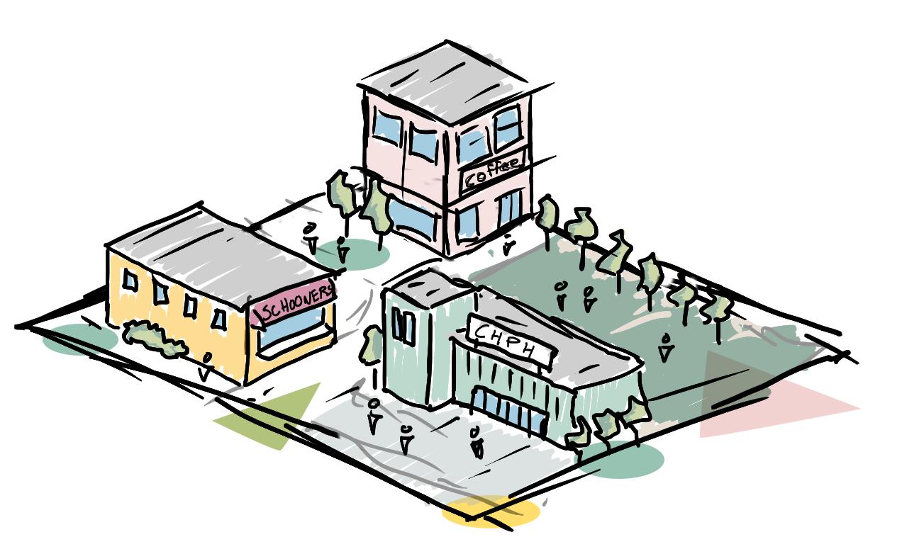
6.1 share spaces plan
The shared spaces plan comes as a result of an understanding that within any community, there exist shared spaces; places that facilitate a variety of activities, bring people together, and foster community growth. During our analysis and engagement phases, we identified the location of these spaces within Coach Hill Patterson Heights, but found that their current conditions do not lend themselves to the future vitality of the community, offering opportunities for redesign. The goal: to strengthen the community of CHPH, stimulating growth and incorporating the programs, amenities, and spaces that fulfill the components of a complete community.
A complete community is one that functions to meet the diverse needs of its residents across the many aspects of life, be it housing, employment, recreation, or education. These communities often contain a variety of different built and non-built environments that facilitate many uses and activities. They are walkable, safe, and engaging, affording their residents access to amenities, services, and opportunities that enrich their daily lives.
Thus, the shared spaces plan wishes to transform the identified spaces within CHPH, introducing and supporting the aspects of complete communities that are vital to its continued growth.

amenity-rich for current and future residents a complete community
In our initial scan of Coach Hill Patterson Heights, it became clear that multiple spaces served the functions of gathering, amenity, and recreation spots. These included chph plaza, prominence park, patterson heights dog park, and coach hill park. During our iteration, we found it important to narrow our focus and find the spaces where intervention could have greatest degree of positive change. Thus, ch plaza and prominence park became our focus areas within the shared spaces plan.
Existing nodes lack the program and spaces to encourage interaction between community members. Exacerbated by an underutilized commercial space without social and daily amenities.
The community possesses numerous underutilized spaces, comprising parks, community areas, and recreational zones, which hold vast potential for community engagement and enrichment, these are awaiting creative programming initiatives to unlock their full value.
The current condition of the nodes impact the internal functioning as well as the relationships between them, therefore, disconnecting valuable community spaces.
A flexible, inclusive pedestrian realm accommodates diverse needs, fostering accessibility, social interaction, and active lifestyles, contributing to vibrant, equitable communities.
Understanding the importance of future growth in determining a community’s access to services and amenities.
The current commercial offerings are inadequate for the needs of current and future residents. We aim to incorporate a greater variety of commercial spaces to support new businesses in the area.
We are committed to incorporating recreation spaces and types that consider a variety of different age groups to be confident our plan is inclusive of the entire community.

Taking all that was learned within analysis and engagement of the community, and incorporating a variety of principles, a shared spaces master plan was created. The site plan sees a complete redevelopment of the ch plaza and prominence park sites, creating spaces that are complimentary to one another, introduce a variety of uses and activities, and aim to support the growth and development of the community well into the future.


A vital component which we found absent from the community, which could be a strong catalyst for growth, was a dedicated, local school. Demographics revealed a significant number of school-age children in chph that are currently forced to travel outside their community. These institutions offer both educational opportunity, as well as important adolescent relationship-building. The goal of its inclusion was to introduce one of the missing components of a complete community that could attract new families, support current residents, and enhance the vitality of chph.


With precedents in mind, the school has been designed at a maximum of 3 storeys, providing adequate space for kindergarten to grade 9. The spacious entry plaza and corner orientation creates better street activation and welcomes students arriving by all modes of travel.

Community commercial centres play a pivotal role in communities, supporting local economies, attracting visitors and passerby, and encouraging active and safe streets.
The redeveloped ch plaza re-envisions the space as a vibrant mixed use district, incorporating new building types, more community members, and a more robust commercial experience. Boasting a double frontage, the redevelopment activates Patterson Blvd and creates an inviting neighbourhood main street. Partnering this in a fine grain internal shared street which allows for a new and interesting shopping experience that creates an important connection to the neighbouring prominence way retirement.


With the added commercial space, the redevelopment presents the opportunity to support new and existing anchor tenants. No longer do the members of chph need to leave their community to get a cup of coffee or grab their necessary groceries.


There are plenty of local examples which served as inspiration for the integration of a vibrant and active commercial setting within a residential community context.

Prominence Park plays a central role as a community recreation hub, yet concerns about accessibility and underutilized areas have been addressed. The park has been reimagined with new landscaping, creating distinct and manageable spaces. These enhancements have opened doors to a range of recreational activities, including a multi-sport park, skate/bike facilities, and a community gathering plaza. These amenities are designed for use by both the new K-9 school and community members alike.
Flexible green spaces allow for year-round activities, catering to a wide range of age groups. The park seamlessly integrates into our greenway network, promoting connectivity and outdoor exploration. Access to the park is facilitated by two nearby bus stops and a newly constructed sidewalk along the northern edge, ensuring ease of use for all visitors.


Central to our shared spaces plan are the activities, events, and programs that the area currently incorporated, as well as those it could in the future. With the principles of allage recreation and community growth, we aimed to provide novel programs within chph that residents previously had to access outside their community. The new spaces and activities are also meant to attract visitors and new residents.


Integral to the site planning and design process were the considerations of access and circulation patterns. Understanding how people arrive at CH Plaza and Prominence Park, their movement within the space, and identifying missing links in connections to the surrounding area were paramount in designing the circulation network.
In particular, the node’s strategic location and design responding to the three main bus stops enhances accessibility and encourages sustainable transportation options. This proximity facilitates easy access for residents from both communities, reducing reliance on private vehicles and promoting a more connected and environmentally friendly mode of travel. That said, the location and orientation of the school allows for dedicated pick-up and drop-off sites along streets which can accommodate the increased volume. By fostering a pedestrian-friendly environment and integrating with existing transportation infrastructure, The development aims to create an active link between the communities of Coach Hill and Patterson Heights, establishing a vibrant and amenity-rich shared space.
The redevelopment within the shared spaces plan would require minor adjustments and changes to existing land-use. The changes involve a re-designation of the existing C-N1 commercial neighbourhood site to MU-1. The site south of patterson blvd would be subdivided and upzoned to both MU-1 and MC-2, allowing for future growth and flexibility.
The school site is already designated as a school site by the City of Calgary, and is zoned appropriately. It seems a consolidation of lots in order to accommodate the new built form is the only adjustment necessary.
Proposed heights take offer a moderate intensification of the area, while paying attention to shadowing and sensitive to surroudning uses.


With the intention of the shared spaces plan to support community growth years into the future, it was important for triangle studio to identify areas within the community that could accommodate this future growth. The residential site, currently zoned as RC-1, has been understood as a prime are for future densification that would compliment the new chph plaza and chph school developments. Initially identified in the analysis phase, missing mixed and residential types such as multi-residential row/town homes and mixed-use apartment-style developments would be appropriate forms to integrate within this future development area.


Small, organized community events such as movies in the park and makers/seasonal markets, as well as organized children’s camps and sports can begin to foster the community activity and excitment that we see as central to the shared spaces plan.


Within the medium timeframe, policy change can begin to reflect the visions for the community of chph. The shared spaces plan site can be identified within the upcoming LAP as a community activity centre, allowing for its future redevelopment. Additionally, the future vision of the site can be incorporated into the decision-making within the local school board to recognize and designate Prominence Park as a future school site.

Once policy is in place, the area can begin to garner interest by potential developers and provincial authorities. This will allow the physical transformation of the site into a vibrant mixed-use district and K-9 school site that will bring growth and excitment into the community of Coach Hill Patterson Heights.

neighbourhood activity centre (NAC): upon the introduction of LAP site area 11, as designated by the City, pursue NAC identification allowing for redevelopment and intensification of the site
school designation: within the next CBE capital plan, identify the site and request the construction of CHPH school based on area intensification and neighbourhood needs, no land use amendment required
neighbourhood mainstreet: commercial frontage should activate patterson blvd establishing a neighbourhood mainstreet with the goal of a walkable, active and safe commercial zone
pedestrian circulation: building setbacks should be generous to allow for pedestrian circulation and community plaza space
massing: building heights and scale should respond to sun path and be sensitive to their immediate context
mixed uses: development should accommodate future flexibility and growth through a mix use zoning to align with the Guide Book for Great Communities
shared and inclusive programming: recreation spaces should reflect the needs of a variety of activities and users and should be shared


6.2 street life strategy

safe, lively streets for all modes, at all times
The Street Life Strategy is a design approach aimed at transforming the main roadways of Coach Hill Patterson Heights into vibrant, people-oriented spaces. This is accomplished through the prioritization of pedestrian needs while promoting safety, accessibility, and multimodal transportation options. At its core, this strategy seeks to create a more flexible and inclusive pedestrian realm by reimagining streets as dynamic, multipurpose environments that accommodate diverse activities and users.
Central to the Street Life Strategy is the concept of traffic calming. This involves the implementation of measures to reduce vehicle speeds, enhance safety, and create a more pedestrian-friendly atmosphere. This includes the re-designation of Old Banff Coach Road from an arterial to a collector, allowing for the transformation of the four major intersections along the roadway.
Furthermore, the Street Life Strategy aims to enhance the walking experience by prioritizing pedestrian infrastructure such as wider sidewalks, well-marked crosswalks, and curb extensions for enhanced visibility. These improvements not only make walking safer and more enjoyable but also encourage active transportation. Building upon this, the Street Life Strategy emphasizes the importance of providing multi-modal transportation options to reduce the reliance on cars within the community and improve overall mobility. This involves the expansion of dedicated bike routes and the introduction of the communities first protected bike lanes.
By implementing the Street Life Strategy, Coach Hill Patterson Heights can create a more livable, sustainable, and inclusive street environments that prioritize the needs of pedestrians, promote safety, and provide a range of transportation options for residents and visitors alike.

The communities of CHPH are challenged by the predominately car oriented character of its road-scape. With challenged pedestrian realm, often unsafe road crossings and junctions, and an overall lack of multi-modal options.
Unifying community spaces and providing shared areas are vital for fostering social cohesion and interaction. They break down barriers, encourage collaboration, and promote understanding among diverse groups. These spaces serve as hubs for collective activities, facilitating connections, and nurturing a sense of belonging, making communities stronger and more resilient.
Community identity shapes the collective narrative and fosters a sense of belonging among residents. A strong community identity strengthens social bonds, promotes civic engagement, and enhances resilience, making neighborhoods vibrant and cohesive places to live.
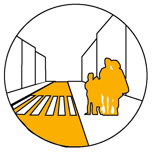
Pedestrian mobility and mode choice are essential for fostering sustainable, healthy, and inclusive communities. Encouraging walking and providing diverse transportation options not only reduces congestion and pollution but also promotes physical activity, social interaction, and equitable access to urban amenities.

A flexible, inclusive pedestrian realm accommodates diverse needs, fostering accessibility, social interaction, and active lifestyles, contributing to vibrant, equitable communities.
Street safety is paramount for community well-being, ensuring pedestrian, cyclist, and driver security. It promotes mobility, reduces accidents, and fosters trust, enhancing quality of life.

Multi-modal choices offer flexibility, efficiency, and accessibility in transportation, catering to diverse needs. They reduce congestion, pollution, and dependency on cars, promoting sustainability and enhancing community connectivity.
Traffic calming and speed reduction enhance safety, prioritize pedestrian and cyclist well-being, and create more livable, people-centric environments, fostering a sense of community and belonging.

The Street Life Strategy aims to transform Coach Hill Patterson Heights’ main thoroughfares into vibrant, pedestrian-centric spaces that prioritizes safety and multi-modal transportation. This approach reimagines the communities streets as dynamic environments accommodating diverse activities. Emphasizing traffic calming, it reduces speeds, and enhances safety for all users. It promotes a pedestrian-friendly atmosphere though enhanced pedestrian infrastructure like wider sidewalks and well-marked crosswalks. Through the Introduction of multi-modal options, including protected bike lanes, new forms of mobility can take place within the community. Through this the reduction of lane widths and the removal of turn lanes can be justified and a new transportation condition of the neighbourhood can be realized.

The vehicular network plan introduces two new signaled crosswalks along Old Banff Coach rd that are adjusted with time delays to cater to a range of pedestrian needs. In addition the removal of left and right turn lanes create for a more comfortable and welcoming pedestrian experience. Additionally, five crosswalks are upgraded with enhanced safety measures. The plan extends the school zone, prioritizing safety for students and reducing vehicle speeds within the community. These improvements aim to create a safer, more inclusive transportation network accommodating both pedestrians and vehicles, enhancing overall community mobility and well-being.


Conceptualization of


Drawing inspiration from local and international examples the plan for Old Banff Coach Rd prioritizes pedestrian and modal safety. Replicating the success found in Davis, California, a balanced approach to vehicular and pedestrian safety can be found. Enhancements to pedestrian infrastructure such as that seen on 17th Avenue and 37th Street aiming to create a safer and more inviting environment. Additionally, utilizing lefthand turns between medians such as those on Memorial Drive streamlines traffic flow while ensuring safety, ultimately enhancing the livability and condition of Old Banff Coach Rd.


The existing condition of Old Banff Coach rd lends itself to innovative redesign, accommodating all forms of movement and travel.


The comprehensive multi-modal network plan introduces various infrastructure enhancements to promote diverse mobility options. This includes the implementation of 1.6 km of protected bike lanes, ensuring the safety of cyclists. Additionally, 1.5 km of on-road bike routes are extended to improve accessibility. In addition over 3.7 km of multi-use pathways are being added to accomodating pedestrians, cyclists, and other non-motorized forms of transportation. These improvements aim to encourage active commuting, reduce traffic congestion, and create a more inclusive and sustainable transportation system.


Calgary has numerous examples of multi-modal infrastructure. Taking the opportunity to build upon the extensive pathway network within the city, Coach Hill Patterson Heights can utilize a variety of implementations such as multi-use paths, shared space on roadways and dedicated protected bike lanes where they are most applicable.


Patina dr stands as the most applicable location for dedicated protected bike lanes due its accessibility to large parts of the community, access in and out of the community and navigating the needs of residents.


The proposed redesign of Intersections within Coach Hill Patterson Heights employs a number of strategies. Incorporating curb extensions significantly enhances pedestrian visibility, fostering comfort for both walkers and drivers. Additionally, the integration of 3 m multi-use pathways, complemented by generous green buffers, ensures separation from vehicular traffic, promoting pedestrian safety and well-being. This design not only reduces vehicle speeds but also mitigates the risk of pedestrian fatalities from collisions, enhancing overall accessibility and inclusivity. Timed and staggered crosswalks further optimize safety and facilitate ease of movement, underscoring the commitment to creating pedestrianfriendly intersections that prioritize community welfare.

Addressing the challenging intersections along Old Banff Coach Road involves transforming them into inviting hubs that seamlessly connect Coach Hill and Patterson Heights. Through strategic interventions like lane redesign, curb extensions, and staggered crossing signals, these intersections become more pedestrian-friendly and accessible. This approach not only enhances safety but fosters a sense of community cohesion. The transformation of the nearest intersection to the existing commercial areas serves as a model for improving all intersections along Old Banff Coach Road, creating a more welcoming and functional thoroughfare for residents and visitors alike.

Off Old Banff Coach Road, several non-signaled intersections demand similar interventions to enhance safety and accessibility. Vital to intersection conceptualization is linking CHPH Plaza with Prominence Park, enhancing commercial connectivity. Implementing curb extensions, accessible sidewalks, and user-friendly parking supports all users. This comprehensive approach ensures seamless navigation and fosters community engagement, reflecting a commitment to inclusive urban design and enhancing the overall livability of the area.


Old Banff Coach Road currently divides rather than connects Coach Hill and Patterson Heights, prompting a reevaluation of its purpose. By reallocating needs and priorities, its designation shifts from arterial to collector, exchanging vehicular mobility for livability. This transformation involves narrowing lanes to 3.5 meters, adhering to Good Streets standards, and introducing multi-use pathways and dedicated bike lanes away from traffic. Though this may impede vehicle flow, the result fosters a safer, more inclusive environment, promoting active transportation and enhancing the overall quality of life for residents.
Multi-modal infrastructure, including bike lanes and multi-use pathways, offers myriad benefits by providing safer alternatives for individuals wary of sharing roadways with cars. These improvements expand accessibility, encouraging more people to use active transportation modes, consequently reducing single-vehicle use and alleviating congestion on streets. By accommodating diverse preferences and needs, infrastructure enhancements not only promote sustainable mobility but also foster healthier and more inclusive communities, where individuals feel empowered to choose modes of transportation that align with their comfort and values.
Patina Drive serves as a important connector as it navigates some of the challenging topography found in Patterson Heights. Its location makes it integral for navigating large parts of the community and hold strong potential for more mobility and recreation options. Introducing protected bike lanes along both sides of the roadway enhances its utility, ensuring safe usage for cyclists while considering parking and accessibility needs of adjacent properties.

phase 1: traffic calming phase 2: tactical urbanism


Temporary bollards, serving as curb extensions, are invaluable tools for testing the feasibility of permanent infrastructure changes. Offered by the City of Calgary as part of its Safer Mobility Plan, these bollards allow for quick and cost-effective trials of traffic-calming measures and pedestrian enhancements. By demonstrating their effectiveness in improving safety and traffic flow, they inform future structural interventions.
Tactical urbanism initiatives such as painted crosswalks and curb extensions, along with community events like Parking Days, can transform spaces temporarily to enhance safety and livability. Through Activate YYC and the Federation of Calgary Communities, access to funding mechanisms empowers community associations to execute such initiatives. These interventions not only improve pedestrian safety and urban aesthetics but also foster community engagement, encouraging residents to actively participate in shaping their neighborhoods for the better.


phase 3: complete streets


Through comprehensive sidewalk and multi-modal improvements, including curb extensions for safety, sidewalk widening for ease of use and access and lane narrowing for a reduction in vehicle traffic, speed and noise, the community can become a more walkable and accessible one. These interventions are in accordance with the city’s Good Streets design Guide and offers a substantial improvement to the livability and diversity of uses of roadways. In addition to these, leveraging the Main Streets program from the city can produce a range of positive outcomes. Through the techniques and strategies encouraged by the city the vitality and character of community thoroughfares, can promote a more vibrant and inclusive environment.

innovation and vibrancy

I.2.2 Principles of Road Right-of-Way Variance 3.1.2 Street Design Principles
3.2.5 Pedestrian Design Guidelines


making complete streets: adopt a street palette that narrows lane widths, widens green buffers, and improves public interface around roadways along Old Banff Coach Road
active transportation: create opportunities for active recreation and commuting. Street design within Street Life Strategy areas shall reflect the balanced mode split objectives found in CTP
accessibility: utilize time delayed crossing singles at major intersections identified within the Street Life Strategy to accommodate users of all abilities, allowing for safe crossings
livability and mobility: realign Old Banff Coach Road’s designation within the roadway hierarchy from an arterial to collector to accommodate a greater livability within the community. Through reducing maximum speeds from 60km/h to 50km/h, and allow for future pedestrian infrastructure improvements
intersection safety: use a combination of structural and tactical urbanism strategies (curb extensions and visual aids) along Old Banff Coach Road and Patterson Blvd to improve crossing safety, reduce vehicle speed and vehicle noise


6.3 green network plan

creating a natural neighbourhood network
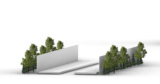
Triangle Studio aims to create a cohesive and natural neighbourhood network that not only connects the community to Calgary through a series of diverse park spaces, interpretative trails, and unique destinations but also addresses community concerns regarding separated spaces, walkability, and ecological connectivity. By integrating nearly 30% of the area’s park spaces into our design, we enhance the network with the communities’ most cherished parks, paths, and open spaces, fostering an outdoor greenspace network that seamlessly blends a beautiful landscape with functionality. This approach not only makes the landscape more appealing to residents but also practical by improving overall community cohesion and ecological harmony.
Additionally, our design emphasizes accessibility and inclusivity, ensuring that residents of all ages and abilities can enjoy and benefit from the greenspace network. By strategically locating the green network along unique destinations throughout the community, we aim to foster exploration and promote active lifestyles.

The green network plan focused on addressing fragmented and underutilized green-spaces within the community. Through our analysis, we identified escarpments and edge green-spaces as often overlooked and neglected areas. By strategically designing a trail network, we aimed to connect these forgotten spaces with larger, well-loved green areas, while also highlighting the significance of small pocket parks that may be overlooked, but still highly used by residents. Additionally, our plan took into account both internal and external barriers such as Old Banff Coach Road and steep slopes, ensuring that the trail network enhances accessibility and connectivity while mitigating challenges posed by the site’s topography and infrastructure.
fragmentation can lead to underutilization of community and park space, hinder community interaction, and create pockets of isolation, which can affect social equity and limit access to community services and amenities. This disconnection can also impact the overall livability and vibrancy of a city.
detached ecologies within urban environments presents a substantial challenge by disrupting local biodiversity and ecological functions. This often results from inconsistent urban development, utility cooridors, and arterial roadways, leading to isolated patches of natural habitats that struggle to support diverse wildlife populations and maintain ecological resilience.
inadequate infrastructure, long distances between key destinations, and unsafe pedestrian environments remain community challenges when dealing with fragmented open spaces. Improving walkability requires safe, accessible, and direct routes that encourage walking as an enjoyable mode of transportation for all residents.
essential to enhance sustainability, recreation spaces, and connections between the communities.
a clear and understandable community fosters a sense of place and fosters easy navigation for residents and visitors.
create appealing greenspaces through strategic design and programming. Encouraging more users, more activities, and more interactions.
varying sizes and types of greenspace create diverisity within places and users.


connecting the varying park types enhances accessibility and usability for residents by providing recreation opporunities for all, within a cohesive green network.
incorporating desinations into the green network plan increase the cultural identity of the community while also encouraging exploration and connection.

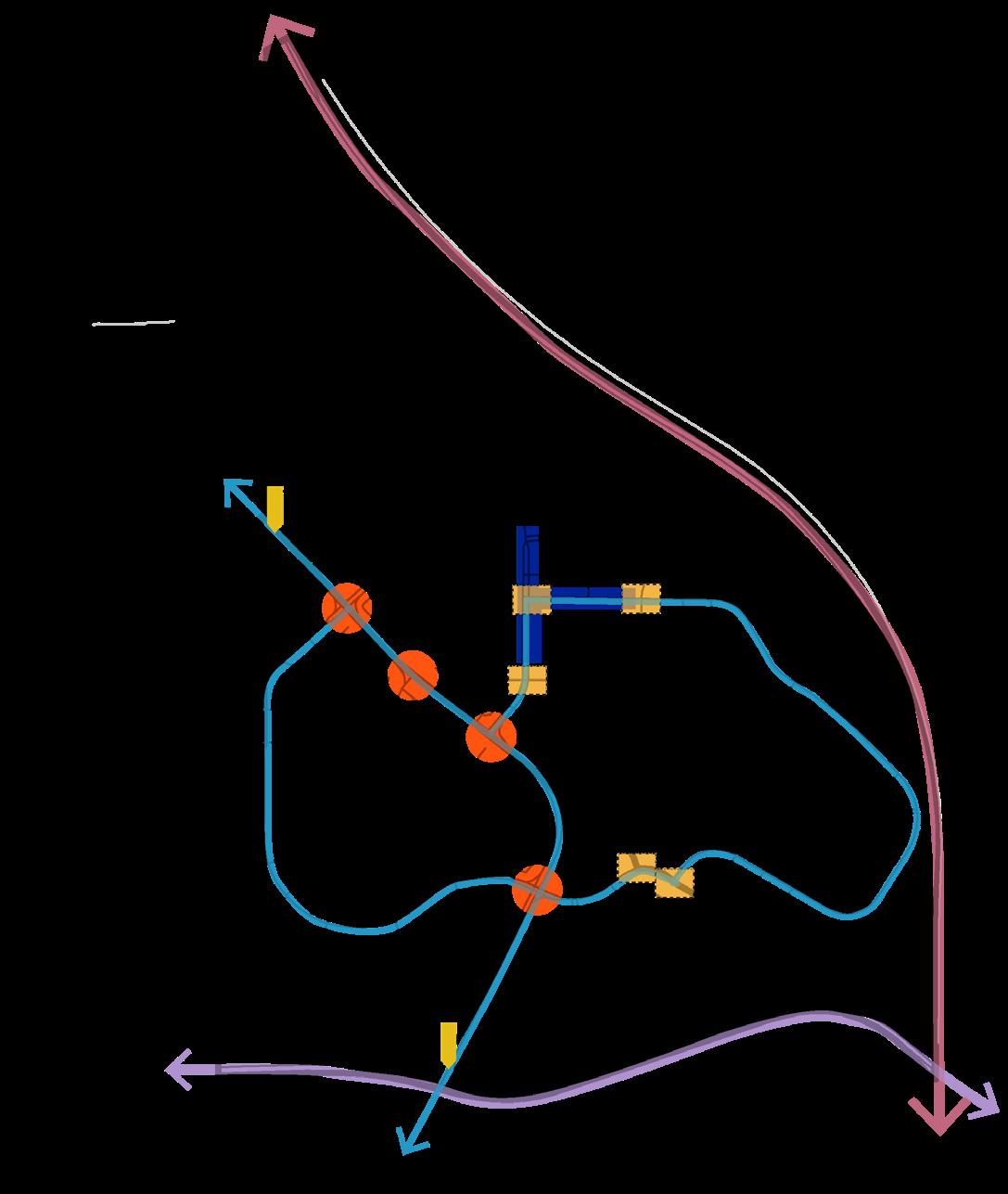
The Rotary Mattamy Greenway Network provides a model for expansive green infrastructure. This network has the potential to extend well into the community and integrate into the larger Calgary pathway system. Additionally, projects like the Bow to Bluff initiative and the Regina Harbour Landing Linear Park System demonstrate the potential to stitch together small park spaces, fostering cohesion and accessibility within urban environments. In terms of wayfinding, inspiration was drawn from the Intertwine Trail Network in Oregon, that incorporates wayfinding and signage into a unified local visual language. Additionally, the Fenland Trail in Banff showcases the creative use of natural interpretive pathways to educate users and enhance recreational experiences. Lastly, the seamless integration of Edmonton’s 83 Ave NW bike lanes exemplifies effective community connectivity strategies, offering valuable lessons for linking neighborhoods and promoting active transportation. By leveraging these precedents, Coach Hill Patterson Heights can develop a comprehensive green network plan that enhances accessibility, fosters community cohesion, and promotes sustainable living.


The first proposal is the extension of the Rotary/Mattamy regional trail network into the Coach Hill Patterson Heights community. Currently the Rotary/Mattamy trail bypasses the community in favour of Edworthy park, and descends towards the Bow River. This extension is envisioned as an educational loop that will deepen users’ understanding of chph. Strategically routed through the southwest edge of the site, the loop will leverage the natural escarpments and pass significant landmarks including historic acreages, the distinctive architecture of the A-frames and Odyssey Towers, before integrating into the Paskapoo Slopes. Here, it will connect with an extensive trail system suitable for walking, hiking, and biking. Furthermore, the eastern pathway is designed to offer a historical journey, guiding users past the radio tower, the Hart House, and an archaeological site, once again connecting to the trail networks of the Paskapoo Slopes. This integration not only preserves but elevates the cultural and natural heritage of the area, ensuring a comprehensive and educative user experience.
the green network plan is safe and accessible for everyone. However, depending on the mode of transportation the rotary/mattamy extension is more suitable for some users.
wheeling walking cycling

Due to its length, the rotary/mattamy trail is more suitable for walking and cycling.
Suitable for families, seniors, and everyone in between.
Best suited for cycling as it lets users venture around the city efficiently.


section through rotary/mattamy extension showing integration into escarpments

The Blue Loop is a cyclist’s best friend. It serves as an integral component of the larger Calgary cycling network, specifically designed to cater to cyclists. By integrating existing bike routes, this loop facilitates efficient and safe movement throughout Calgary and the community. Incorporating dedicated bike lanes and paths into the streetscape, the blue loop not only ensures a efficient and safe cycling experience but also enhances access to key destinations such as the Odyssey Towers. This design approach emphasizes our commitment to promoting sustainable and active transportation within the urban fabric.
The green network plan is safe and accessible for everyone. However, depending on the mode of transportation the Blue Loop is more suitable for some users.
wheeling walking cycling


More suitable for cyclists as it connects to calgary’s cycling network.
Walking is more suited for other loops as they accommodate multiuse paths and wide sidewalks.
Best suited for cycling with protected bike lanes and paths throughout the community.


section through blue loop on patina dr showing bike integration


The Pink Loop is heavily used by all residents of Coach Hill and Patterson Heights, however, its most frequent users are families with young children, students, and seniors out for a leisurely stroll. This is because of the generous sidewalks and short walking loops throughout the community. With a smaller scale, the pink loop creates more local journeys and navigates less topographical change, creating a fine grain pedestrian network.
The green network plan is safe and accessible for everyone. However, depending on the mode of transportation the pink loop is more suitable for some users.


Most suitable for wheeling with short loops and minimal incline.
Most suitable for walking with wide sidewalks and generous seating.
Cycling is more suitable on the other loops with multi-use paths, and protected lanes.


section through pink loop on coach ridge rise sw


A comprehensive wayfinding toolkit incorporating signage, placemaking, distinct color, a mobile app, and prominent landmarks is instrumental in creating easy navigation within the community. This approach ensures accessibility for all residents and visitors while enhancing the sense of place and fostering a cohesive identity for the community. Through the incorporation of these various components, the wayfinding toolkit not only improves spatial orientation and facilitates mobility but also encourages community involvement.


The proposed implementation timeline integrates short, medium, and long-term interventions, including the installation of wayfinding signage, development of a community app, and enhancements to parks. Furthermore, the green network plan is designed to align with the existing Municipal Development Plan, future Local Area Plans, as well as the Connect Calgary Parks Plan, ensuring coherence with broader urban planning initiatives.
wayfindingposts appcreation wayfindingmaps additionofbikelanes alignmentwithconnect: calgaryparksplan
wayfindingseating establishnewtrails parkactivation& impovement alignmentwithfuturelaprotarypedestrian bridge destinationplaques


rotary-mattamy extension: create partnership with Calgary Parks Foundation to propose a Rotary-Mattamy extension along identified route in the green network plan
different loops at different scales: offer a variety of recreation types and intensity to accommodate users Pink loops (small scale) should connect people to pocket parks, neighbours, and bus stops. Blue loop (medium scale) should connect to larger community nodes such as Coach Hill Plaza, CHPH School and the outdoor activity hub, ntegrating with existing and new bike routes. Rotary-Mattamy extension (large scale) should connect with the city wide pathway network
leverage existing infrastructure: where possible, proposed loops fill gaps in connectivity while mitigating unnecessary infrastructure; using elements such as the existing Nilo trail
filling gaps: network development should occur on city owned property wherever possible. Should the need arise, land acquisition should occur to fully realize the network
wayfinding: use a wayfinding tool box to ensure consistent branding, colour and signage to aid navigation within the community and provide greater legibility
usability: wayfinding and signage should clearly communicate pathway accessibility, especially where paving conditions may be problematic, evident in locations of paving transition or challenging topography

a complete community


reconnecting the outdoors
overview


Embracing a modern approach, the Shared Spaces Plan aims to meet the diverse needs of the community by introducing new commercial, recreational, and educational spaces. These initiatives are designed to support the evolving lifestyle preferences of current and future residents, fostering a vibrant and inclusive community environment. By re-imagining shared spaces as dynamic hubs for interaction and engagement, the plan seeks to promote social connectivity, cultural enrichment, and overall well-being within the neighborhood. recommendation a complete community through targeted intensification and school development that introduces education, recreation, amenity and commercial variety to transform CHPH
overview
The Street Life Strategy aims to create dynamic, inclusive pedestrian environments by revitalizing streets to accommodate diverse activities and users. It emphasizes pedestrian infrastructure enhancements and multi-modal transportation options, including wider sidewalks, wellmarked crosswalks, and expanded bike routes with protected lanes. Implementing this strategy in Coach Hill Patterson Heights can foster livable, sustainable streets that prioritize pedestrian safety and offer a range of transportation choices.
recommendation multi-modal mobility network where:
-street palette and road design reflects adjacent land use, activity, and frontages
-mode split is improved through widened sidewalks, narrowed roadways, and dedicated cycling routes
-intersection safety is enhanced through visibility and traffic calming improvements
-traffic volume is accommodated along major routes while emphasizing public realm quality
overview
Triangle Studio aimed to create a cohesive neighborhood network connecting Coach Hill and Patterson Heights to Calgary through diverse park spaces, interpretative trails, and unique destinations while addressing concerns of separated spaces, walkability, and ecological connectivity. Integrating 30% of the area’s park spaces enhances the network, fostering outdoor greenspaces that blend beauty with functionality, promoting community cohesion and ecological harmony. Emphasizing accessibility and inclusivity, the design strategically locates green spaces to encourage exploration and active lifestyles for residents of all ages and abilities.
recommendation an integrated park network that connects local amenities, regional green space and city-wide pathways, supported through consistent and legible wayfinding

our Community Cohesion Plan is the culmination of three distinct yet interconnected developments that look to create a holistic experience for residents of Coach Hill and Patterson Heights. Together, the Shared Spaces Plan, the Street Life Strategy, and the Green Network Plan weave and compliment one another while fostering a vibrant community where residents benefit from increased safety, enhanced recreational opportunities, and convenient access to local amenities.
open house engagement postcard: front


open house engagement postcard: back

Banff & Lake Louise Tourism. (n.d.). Fenland Trail. Retrieved April 20, 2024, from https://www.banfflakelouise.com/experiences/fenland-trail
Calgary Board of Education. (2024). Three-Year School Capital Plan. Retrieved from https://www.cbe. ab.ca/FormsManuals/Three-Year-School-Capital-Plan.pdf
CBC News. (2014, May 30). Rotary/Mattamy Greenway pathway marks completion of 2nd phase. CBC News. https://www.cbc.ca/news/canada/calgary/rotary-mattamy-greenway-pathway-marks-completion-of-2nd-phase-1.2653383
City of Calgary. (n.d.-a). Digital Aerial Survey. Retrieved April 20, 2024, from https://www.calgary.ca/ maps/digital-aerial-survey.html
City of Calgary. (n.d.-b). Pathways and Bikeways. Retrieved April 20, 2024, from https://maps.calgary. ca/PathwaysandBikeways/
City of Calgary. (n.d.-c). Local Area Planning. Retrieved from https://www.calgary.ca/planning/local-area.html
City of Calgary. (n.d.-d). REALIZE Westbrook. Retrieved April 20, 2024, from https://engage.calgary.ca/ westbrook/REALIZE
City of Calgary. (2014). TP021 Complete Streets Policy. Retrieved April 20, 2024, from https://www.calgary. ca/content/dam/www/ca/city-clerks/documents/council-policy-library/tp021-complete-streets-policy.pdf
City of Calgary. (2018, April). Main Streets Implementation Plan. Retrieved April 20, 2024, from https:// www.calgary.ca/content/dam/www/pda/pd/documents/main-streets/reports/main-streets-implementation-plan-april-2018.pdf
The City of Calgary. (2018, November 27). Calgary safer mobility plan. Retrieved from https://www. calgary.ca/content/dam/www/transportation/roads/documents/traffic/traffic-safety-programs/calgary-safer-mobility-plan.pdf
City of Calgary. (2021, February). Calgary Transportation Plan. Retrieved April 20, 2024, from https://publicaccess.calgary.ca/lldm01/exccpa?func=ccpa.general&msgID=ETerrTTsycC&msgAction=Download
City of Calgary. (2022). Guidebook for Great Communities. Calgary, AB
City of Calgary. (2023). The City of Calgary Community Profiles. https://www.calgary.ca/communities/ profiles.html
City of Calgary. (2008). Land Use Bylaw. Retrieved from https://www.calgary.ca/maps/land-use-bylaw. html
City of Calgary. (2012, February 12). Bow to Bluff Urban Design Framework. Retrieved April 20, 2024, from https://www.calgary.ca/content/dam/www/pda/pd/documents/development/bow-to-bluff-urbandesign-framework.pdf
Federation of Calgary Communities. (2022). The Community Guide to The Planning Process. Retrieved April 20, 2024, from https://calgarycommunities.com/wp-content/uploads/2022/10/Guide-To-Planning-Process.pdf
Felt, Zarren. (2019, September 19). Elementary School Zarren Felt. ArchDaily. Retrieved from https://www.archdaily. com/928882/elementary-school-zarren-felt
Glenbow Museum. (n.d.). Library & Archives. Retrieved April 20, 2024, from https://www.glenbow.org/art-objects/ library-archives/
Google. (n.d.). [Google Maps]. Retrieved April 20, 2024, from https://www.google.com/maps/@53.519083,113.5110601,3a,75y,87.05h,89.55t/data=!3m7!1e1!3m5!1sFl6s5ElqkR_vcSyO81Rsjw!2e0!6shttps:%2F%2Fstreetviewpixels-pa.googleapis.com%2Fv1%2Fthumbnail%3Fpanoid%3DFl6s5ElqkR_vcSyO81Rsjw%26cb_client%3Dmaps_sv.tactile.gps%26w%3D203%26h%3D100%26yaw%3D28.461756%26pitch%3D0%26thumbfov%3D100!7i16384!8i8192?authus er=0&entry=ttu
Endpoint. (n.d.). University of East London wayfinding audit and strategy. Retrieved April 20, 2024, from https://www. weareendpoint.com/work/university-of-east-london-wayfinding-audit-and-strategy
Modus Studio. (2011, November 30). Green Forest Middle School. ArchDaily. Retrieved from https://www.archdaily. com/188913/green-forest-middle-school-modus-studio?ad_source=search&ad_medium=projects_tab
New Line Skateparks. (n.d.). Melfort Skatepark. Retrieved from https://www.newlineskateparks.com/project/melfort-skatepark/
Sandalack et al. The EVDS Urban Design Lab (2017) Urban Schools: Causes and Consequences of De-Population of Urban Schools in Calgary and Edmonton.
The Intertwine. (n.d.). Walk this way. Retrieved April 20, 2024, from https://www.theintertwine.org/outside-voice/ walk-way
Tandem Design. (n.d.). Mount Sandel. Retrieved April 20, 2024, from https://tandemdesign.co.uk/mountsandel
Urban Systems. (2022). MONTGOMERY MAIN STREETS Project Description [PDF]. Retrieved April 20, 2024, from https:// urbansystems.ca/app/uploads/2022/08/MONTGOMERY-MAIN-STREETS-Project-Description-USL-Case-Study-link.pdf