A BRIDGE TO THE FUTURE:
THE BATAAN-CAVITE INTERLINK BRIDGE

Copyright © 2024 by TYLin
All rights reserved. No part of this coffee table book may be reproduced, distributed, or transmitted in any form or by any means, including photocopying, recording, or other electronic or mechanical methods, without the prior written permission of the publisher, except in the case of brief quotations embodied in critical reviews and certain other noncommercial uses permitted by copyright law.
Published by TYLin
Address: [Insert mailing address or contact information]
Website: [Insert website URL]
First Edition
ISBN: [Insert ISBN number]
Printed in [Country]
Typography and Design By [Name of Design Team or Individual]
Cover Design By [Cover Designer’s Name]
Photographs By [Photographers’ Names]
Illustrations By [Illustrators’ Names]
A BRIDGE TO THE FUTURE:
THE BATAAN-CAVITE INTERLINK BRIDGE
DEDICATED TO THE PEOPLE OF THIS NATION — THE PHILIPPINES
4
Lorem ipsum dolor sit amet, consectetur adipiscing elit. Suspendisse ut suscipit dolor. Nunc eleifend orci non efficitur egestas. Pellentesque cursus laoreet augue, id porttitor mi scelerisque vel. In congue erat vitae diam congue sollicitudin condimentum imperdiet sapien. Sed placerat in purus quis ultricies. Suspendisse potenti. Praesent mauris lectus, semper ac auctor sed, aliquam nec dui. Proin vehicula sollicitudin hendrerit. Nam ultricies dolor nulla, nec scelerisque arcu rhoncus sit amet.
Morbi et metus eget augue tincidunt bibendum. Vestibulum ante ipsum primis in faucibus orci luctus et ultrices posuere cubilia curae; Aenean ac faucibus felis. In quis mauris vitae nisi pellentesque maximus. Class aptent taciti sociosqu ad litora torquent per conubia nostra, per inceptos himenaeos. Mauris nunc lacus, aliquet id lectus ac, efficitur commodo eros. Nulla in turpis elit.
FOREWARD
Contents FOREWARD 1 MESSAGE FROM THE PRESIDENT 2 DEDICATIONS 4 DESIGNING THE BRIDGE 8 A BRIDGE TO THE FUTURE 32 BRIDGE DESIGN GALLERY XX THE TEAM IN ACTION XX ABOUT TYLIN


MESSAGE FROM THE PRESIDENT

Lorem ipsum dolor sit amet, consectetur adipiscing elit. Suspendisse ut suscipit dolor. Nunc eleifend orci non efficitur egestas. Pellentesque cursus laoreet augue, id porttitor mi scelerisque vel. In congue erat vitae diam congue sollicitudin condimentum imperdiet sapien. Sed placerat in purus quis ultricies. Suspendisse potenti. Praesent mauris lectus, semper ac auctor sed, aliquam nec dui. Proin vehicula sollicitudin hendrerit. Nam ultricies dolor nulla, nec scelerisque arcu rhoncus sit amet.
Morbi et metus eget augue tincidunt bibendum. Vestibulum ante ipsum primis in faucibus orci luctus et ultrices posuere cubilia curae; Aenean ac faucibus felis. In quis mauris vitae nisi pellentesque maximus. Class aptent taciti sociosqu ad litora torquent per conubia nostra, per inceptos himenaeos. Mauris nunc lacus, aliquet id lectus ac, efficitur commodo eros. Nulla in turpis elit.
Morbi et metus eget augue tincidunt bibendum. Vestibulum ante ipsum primis in faucibus orci luctus et ultrices posuere Morbi et metus eget augue tincidunt bibendum. Vestibulum ante ipsum primis in faucibus orci luctus et ultrices posuere cubilia curae; Aenean ac faucibus felis. In quis mauris vitae nisi pellentesque maximus. Class aptent taciti sociosqu ad litora torquent per conubia nostra, per inceptos himenaeos. Mauris nunc lacus, aliquet id lectus ac, efficitur commodo eros. Nulla in turpis elit.
FERDINAND
MARCOS, JR. President of the Republic of the Philippines
1
Designing the Bridge
BY MARWAN NADER, PHD, PE, PENG, CHIEF BRIDGE ENGINEER, TYLIN
Ilearned we had won the Bataan-Cavite Interlink Bridge (BCIB) Project right before the pandemic hit in 2020.
I had seen the site virtually through satellite imagery and pictures and had even envisioned what the bridge crossing might look like. But it wasn’t until early 2022 that I could finally travel to the Philippines to meet the client and go to the bridge site.
During this visit, I first saw the bridge site from Manila and got to appreciate the magnitude and vastness of the scale of this undertaking. There was the island of Corregidor, far from shore in the middle of Manila Bay and further out on the horizon, the Bataan peninsula. The view gave me a sense of how immense this project would be and the challenges we would have to overcome to link Bataan to Cavite.
The next day, we drove up to Cavite, where we walked in the silky sand of the shore where the bridge would land. I could picture the soft soils we’d be working with 50 meters down from the bay’s surface and how large the
deep marine foundations would need to be. However, talking with fisherman and other locals told me how the BCIB will change their lives for the better.
One thing you notice when you land in Manila is how congested the city is. Driving five kilometers in Metro Manila can take over an hour. Our trip to Cavite, only a few kilometers south of Manila, took more than two hours. And the drive from Cavite to Bataan can take five hours or more. This colossal endeavor will significantly reduce traffic congestion and boost local economies.
Designing a bridge like the BCIB requires an acute awareness of multiple factors. This project represents a major investment by the government of the Philippines and the Asian Development Bank (ADB), so strict design criteria were established. These pivot on a required design life of 100 years for a bridge in a hot, humid environment that crosses two deep and essential navigational channels in a region subject to severe earthquakes and violent typhoons.
4
I am proud to say that TYLin is known for taking on large and challenging bridge projects worldwide, providing engineering solutions tailored to each project’s environment and purpose. By applying our experience, ingenuity, and the latest engineering technologies for both design and construction, we have provided the best solutions for this project.
It gives me great pride to be the Chief Bridge Engineer on this enormous undertaking, and I am honored to be entrusted with the design of the BCIB by the Republic of the Philippines Department of Public Works and Highways (DPWH) and ADB. I have also been fortunate to lead a great engineering team that proved they could face and solve any challenge. Along with my staff from TYLin, I want to acknowledge GR8 GEO (geotechnical engineering), Boundary Layer Wind Tunnel Laboratory (BLWTL) (wind engineering), WEST Consultants, Inc. (hydrodynamics), FUGRO (geotechnical investigation), and PetroVietnam Technical Services Corporation (PTSC) (geotechnical investigation). I also wish to recognize our joint venture
partners, the Republic of Korea’s Pyunghwa Engineering Consultants, Switzerland-based Renardet, and the Philippines’ DCCD Engineering Corporation.
The people of the Philippines people are hard-working and very proud. This new bridge will show the world they are ready to take their nation to the next level. By driving growth in local communities and economies, the BCIB will draw visitors from across the globe to experience what is most remarkable about this country and its citizens. That is why the BCIB is more than a bridge; it is a gateway to a brighter future.
5
Marwan Nader

As such, I assure you, we will remain committed to a highly interconnected network of transport (infrastructure) that will serve as the backbone and strong driving force of our rapid, inclusive, and sustainable (economic) growth.
– PRESIDENT FERDINAND MARCOS, JR.
8
”
“
A Bridge to the Future
BY MARWAN NADER, PHD, PE, PENG, CHIEF BRIDGE ENGINEER, TYLIN
INTRODUCTION
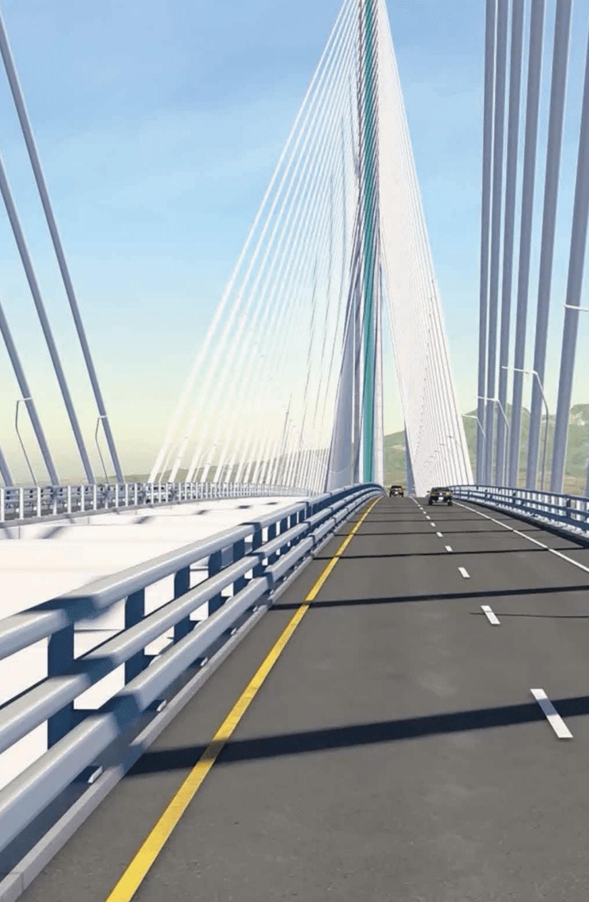
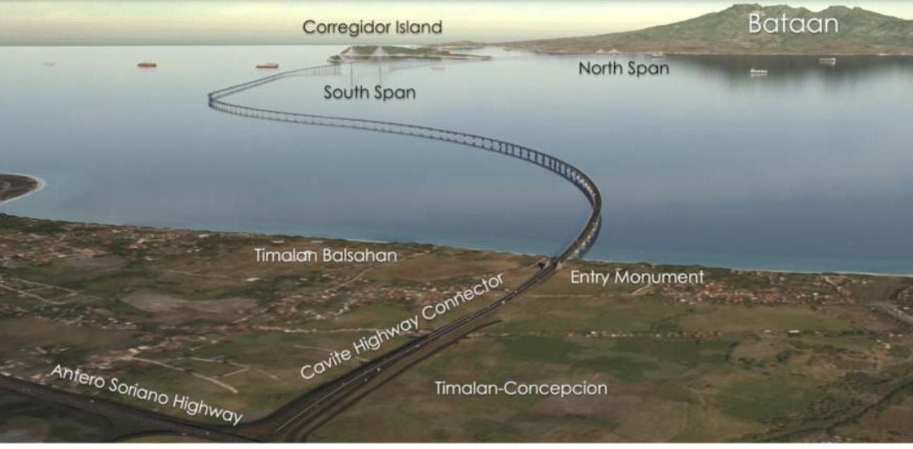
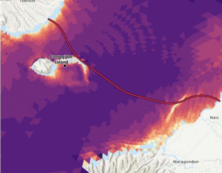
The Bataan–Cavite Interlink Bridge (BCIB) Project was launched by visionary leaders able to foresee the potential long-term growth and prosperity of mega Manila and the nation of the Philippines. The focus of this project is a 32-kilometer-long signature bridge that will serve as a vital transportation link over Manila Bay.
Rapid urbanization and population growth in and around Manila have led to a substantial increase in the number of vehicles on the road, including private cars, public buses, jeepneys, and motorcycles. While the existing road network in Metro Manila has tried to keep pace, limited road capacity consistently caused bottlenecks and congestion, particularly in major thoroughfares during peak hours. The BCIB will significantly reduce traffic congestion and vehicle emissions and is expected to cut the travel time from Bataan to Cavite from four to five hours down to only 45 minutes or less.
The BCIB Project will also contribute to economic growth. Connecting the key economic regions of Central Luzon and Calabarzon will provide countless growth opportunities for local businesses and tourism, while supporting an ever-expanding population. The new crossing will also enable the development of seaports that spotlight Cavite
and Bataan as a premier international shipping gateway to the Philippines.
To finance this project, the government of the Philippines obtained a technical assistance loan from the Asian Development Bank (ADB) under the broad umbrella of the Infrastructure Preparation and Innovation Facility (IPIF). The IPIF promotes the continued enhancement and development of transport infrastructure in the Philippines, with the high-profile BCIB Project identified as a key priority under the country’s “Build Better More” (BBM) Infrastructure Program.
As the agency responsible for directing and managing major road and bridge projects within the framework of BBM Program, the Department of Public Works and Highways (DPWH) is overseeing the BCIB Project. In 2020, DPWH embarked upon a design-bid-build delivery method for the design and construction of the project. TYLin, in a joint venture with Pyunghwa Engineering Consultants, Ltd. and in association with Renardet S.A., and DCCD Engineering Corporation (TYLin/PEC Design Team), was selected to perform and deliver the Detailed Engineering Design and bid documents.
9
10 Placeholder Caption
PRIMARY BRIDGE ELEMENTS
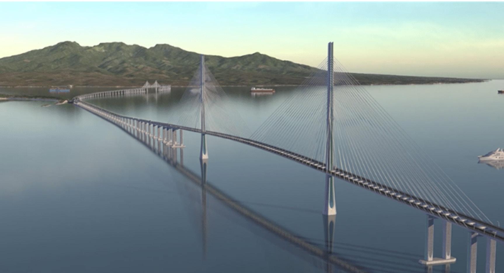
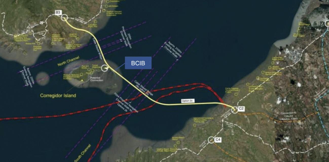
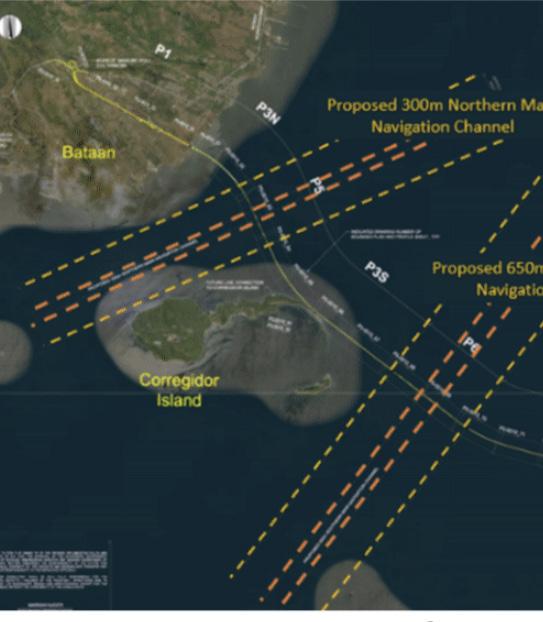
Our concept for the BCIB includes a marine bridge comprising two cable-stayed bridges and 25 kilometers of marine viaducts, with an additional five kilometers of approach roads and land viaducts. The bridge will carry a 4-lane roadway with two travel lanes in each direction, with shoulders to the outside and a barrier or separation in the median. A vehicular turnaround will be constructed in a shallow portion of Manila Bay east of Corregidor Island, which is located between the cable-stayed bridges. The turnaround is designed to accommodate a future access road to the island.
11
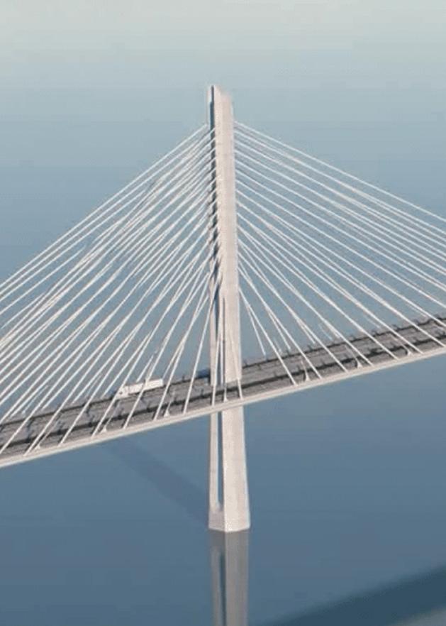
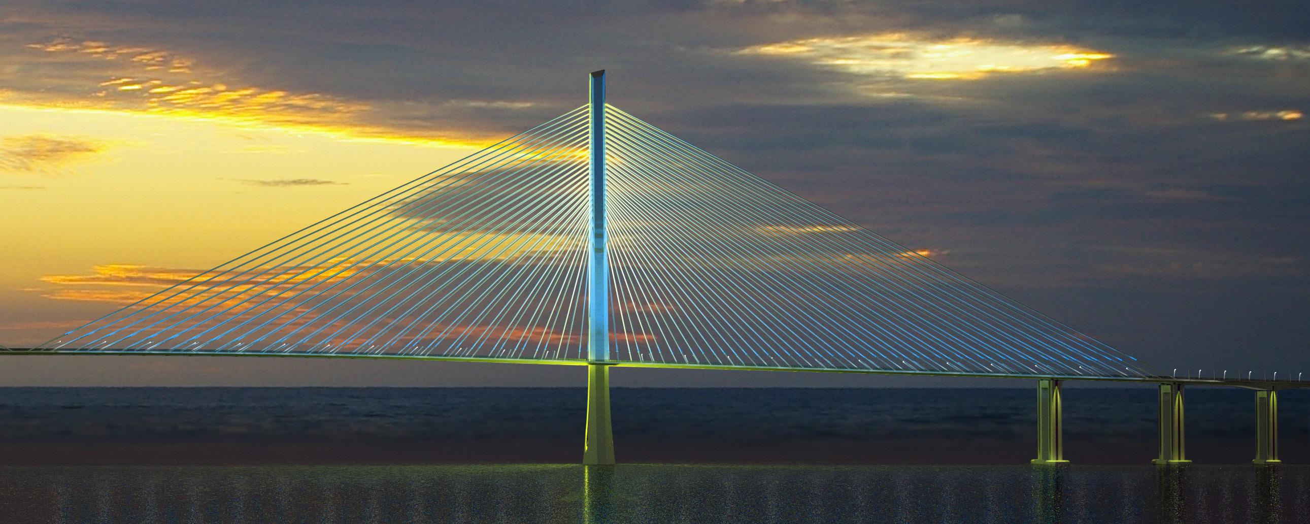
Bataan-Cavite Interlink Bridge Rendering (Credit: TYLin)
Placeholder Caption
12
Project Overview – Aerial View
Project Overview – Horizontal Alignment
The detailed design and bid process will be completed in 2024, after which the complex constructure process will take five years. Featuring advanced design solutions based on a comprehensive series of tests and studies, here are the main bridge elements:
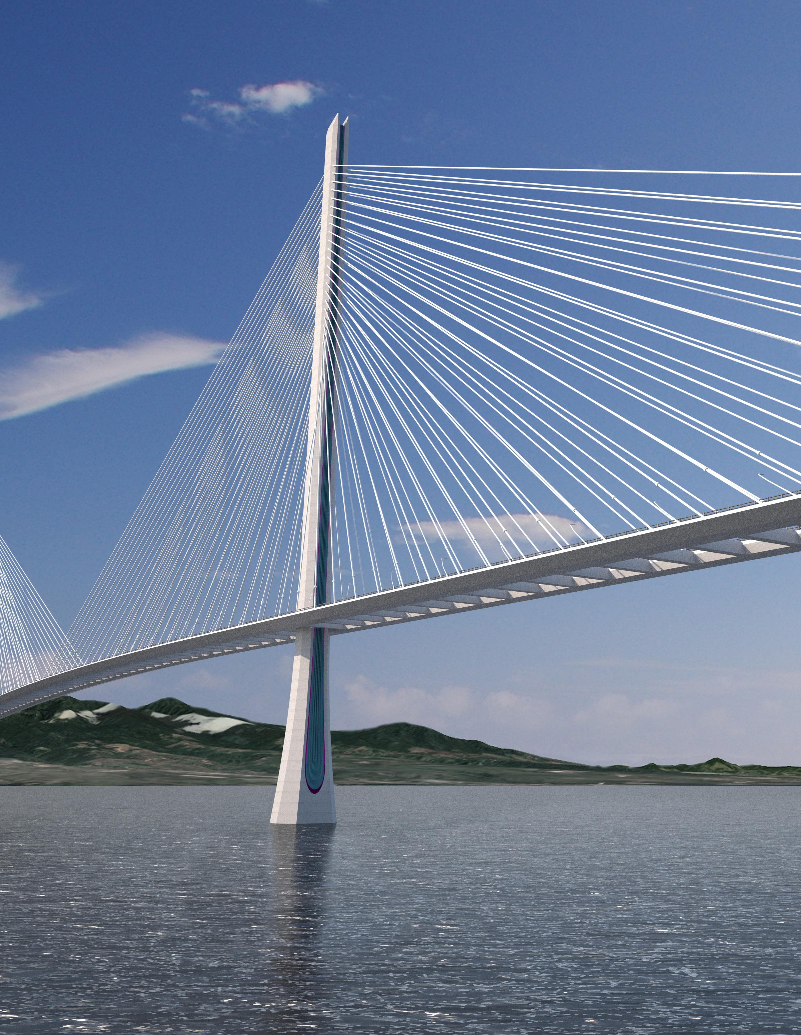
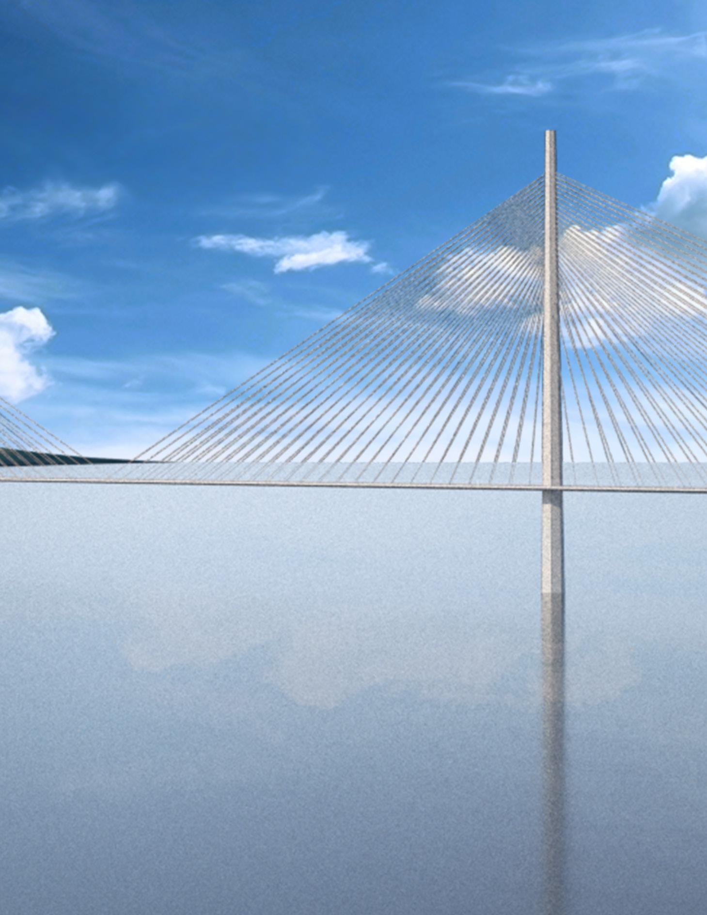
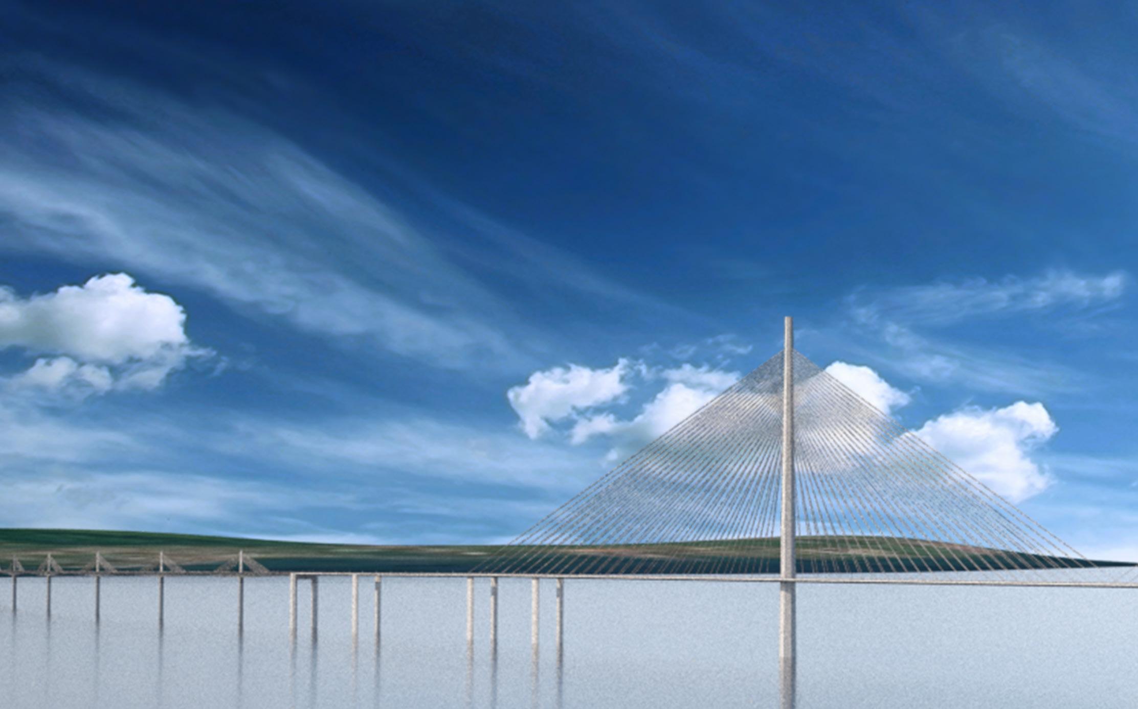
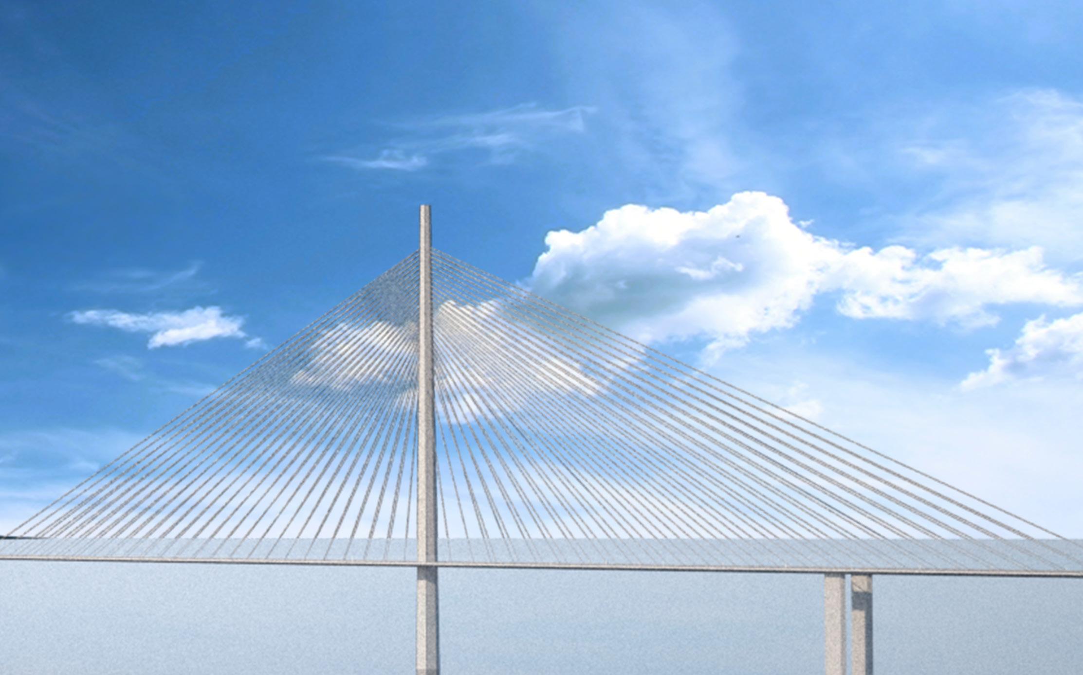
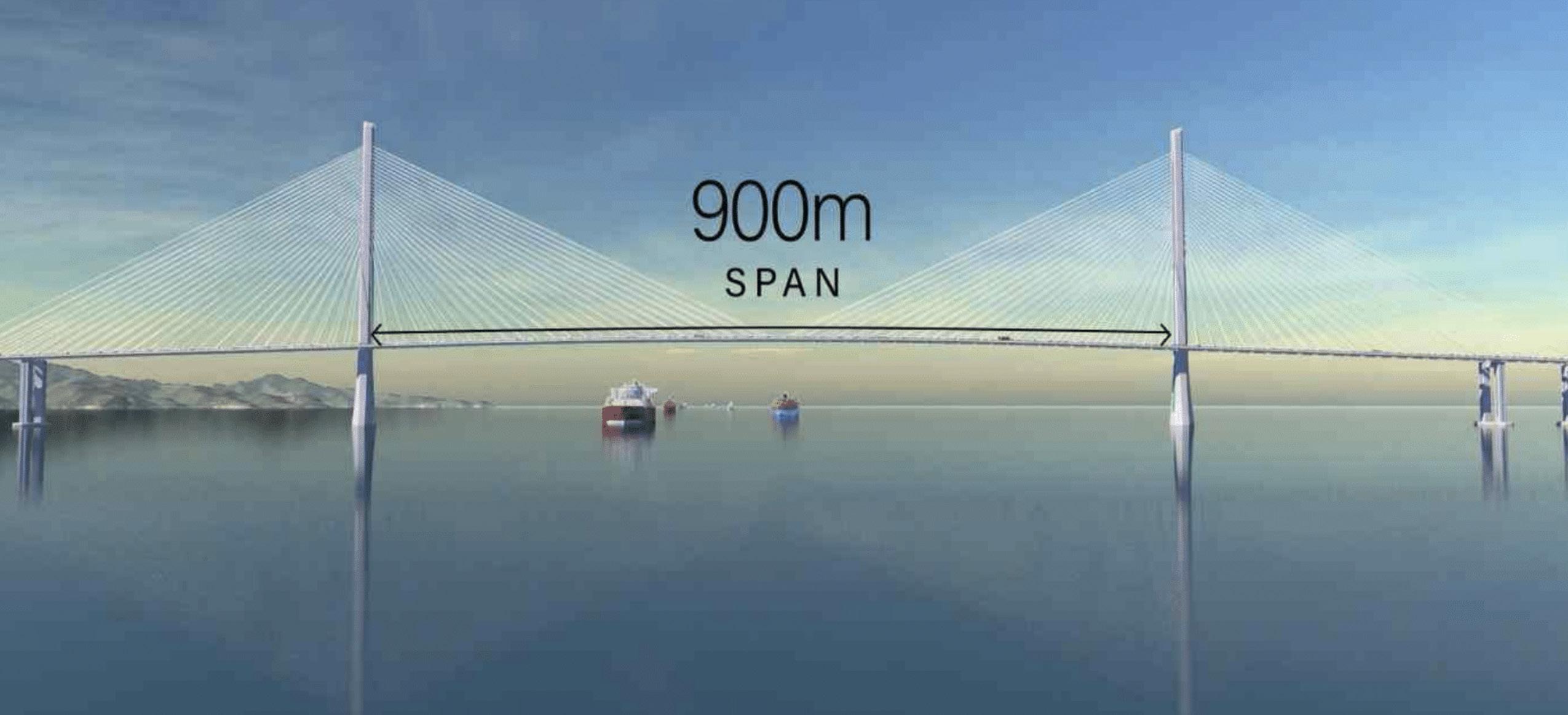
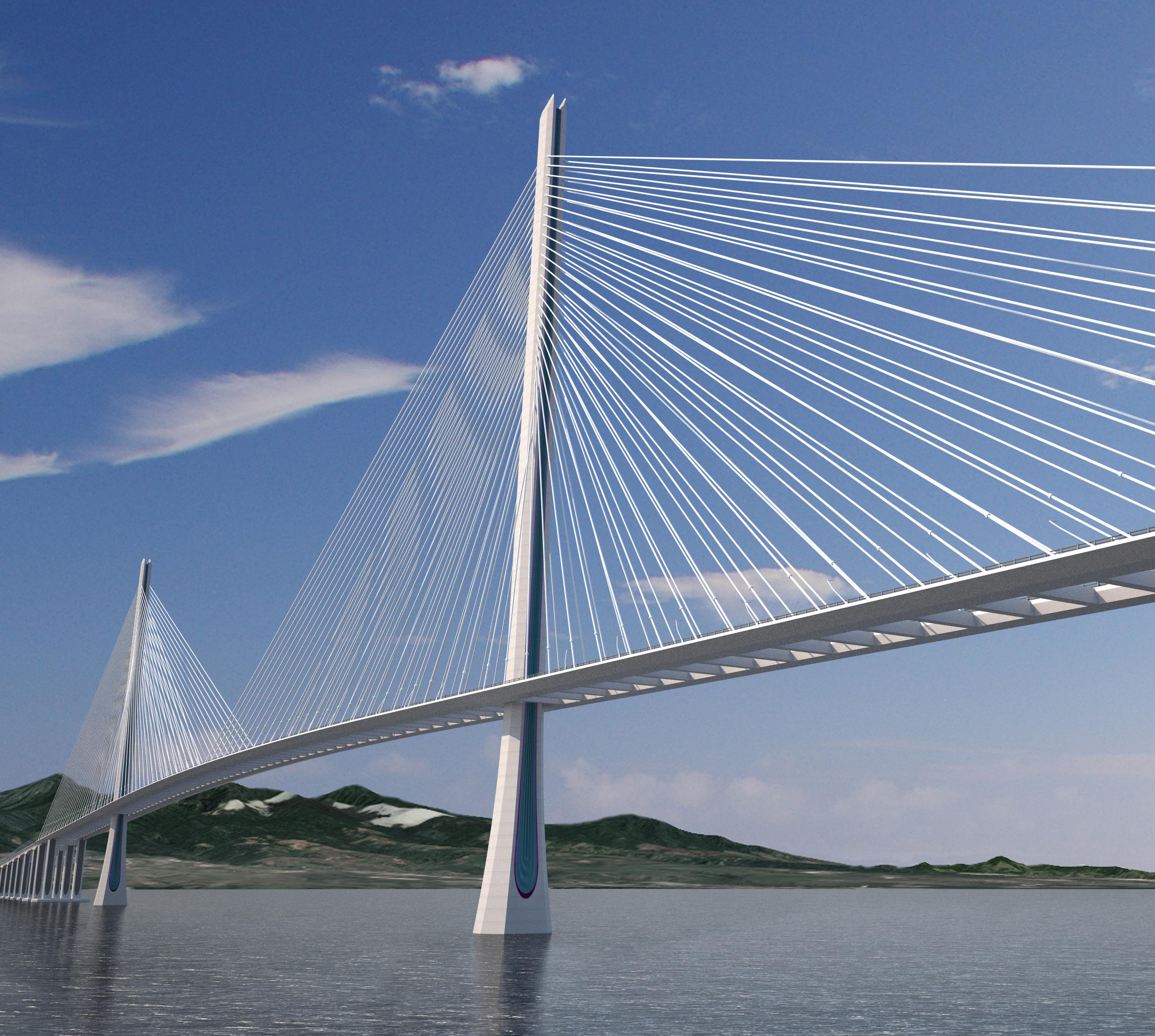
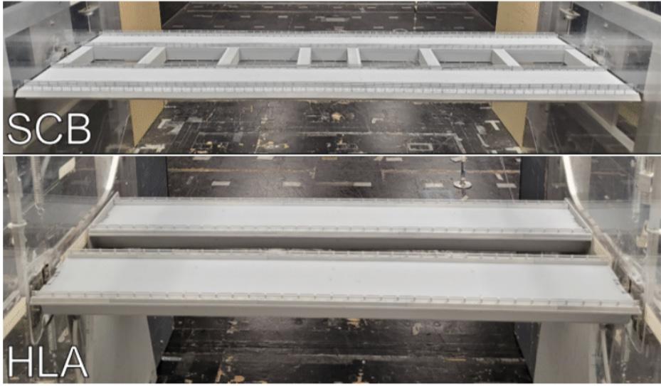
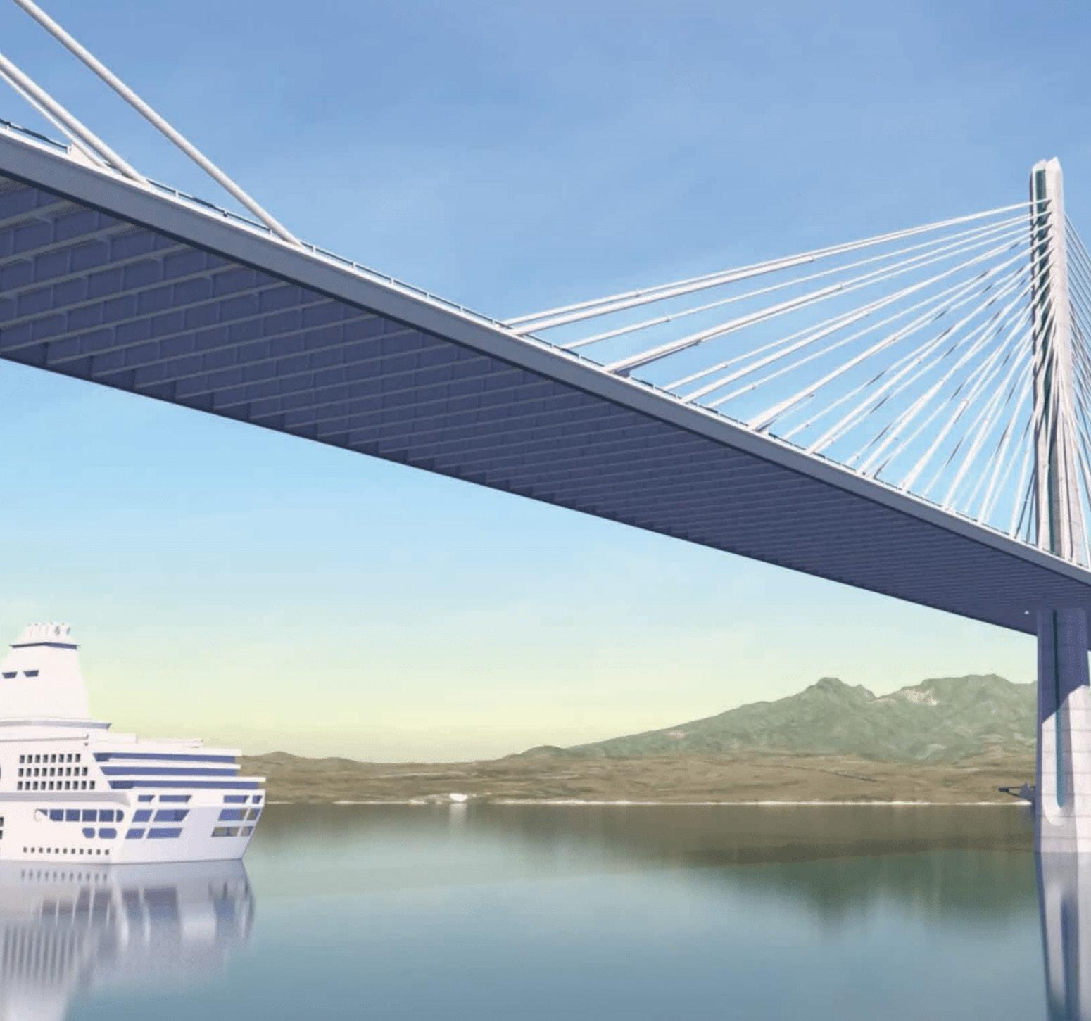
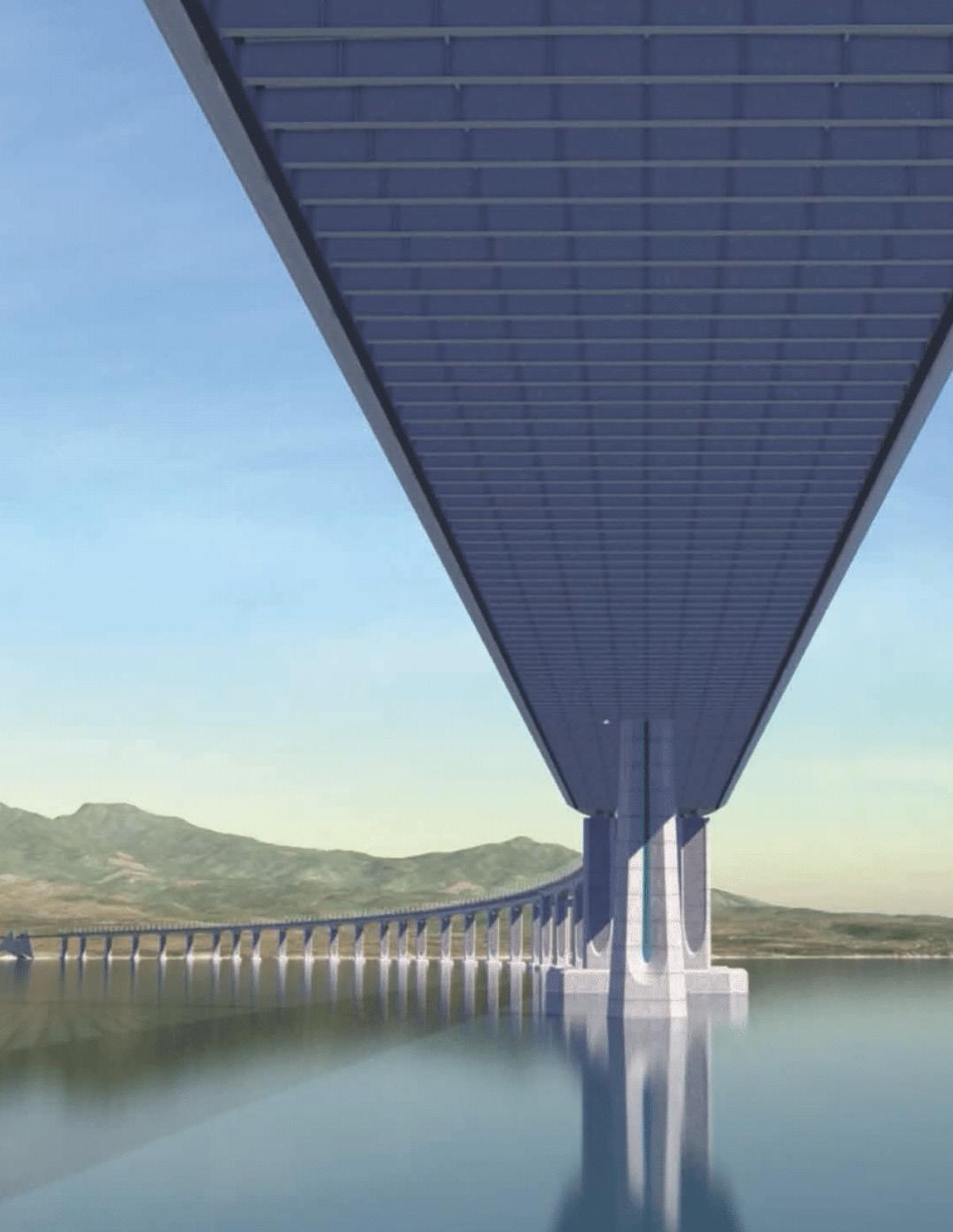
Cable-stayed bridges represent the most prominent architectural features. The South Channel Bridge (SCB) is the larger of the two structures and will be located between Corregidor Island and the Cavite shore and cross the South Navigation Channel. With a main span of 900 meters and two 450-meter-long back spans, the SCB will have a total length of 1800 meters.
To accommodate the 2-way passage of large oceangoing vessels, the SCB will provide a 72.3-meter vertical clearance beneath the bridge deck and a navigation channel of 650 meters. Near the Cavite shore, the marine viaduct will include a third navigation bridge for use by smaller commercial and service vessels.
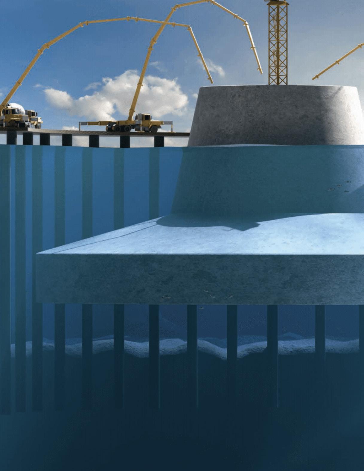
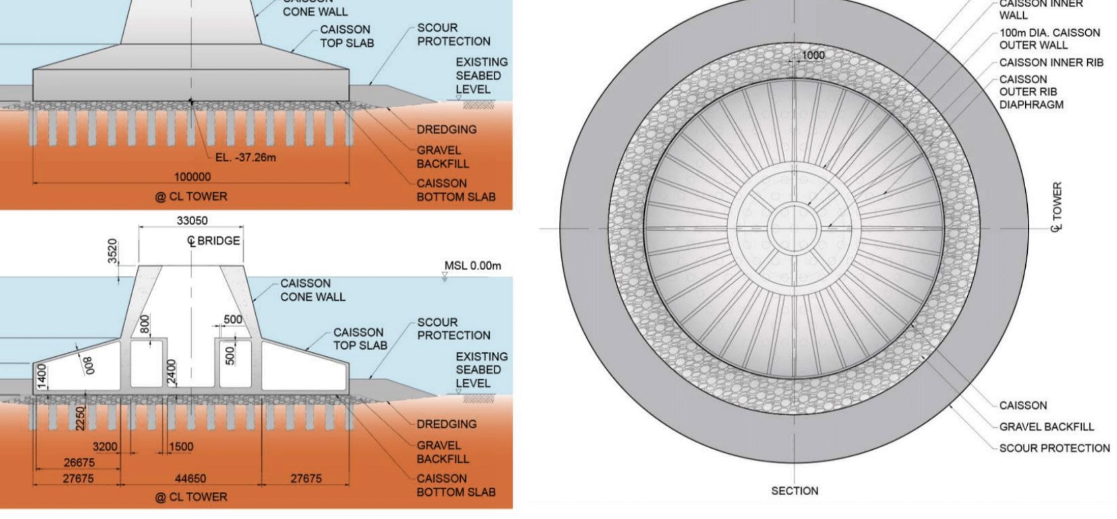
The two dramatic, monopole-style bridge towers will measure over 300 meters tall and be founded on enormous, 100-meter-diameter concrete caissons. Below each caisson, the soil will be reinforced by 2.5-meterdiameter inclusion piles.

13
Tower and Deck Height
305M TOWER HEIGHT
80M DECK HEIGHT
Bataan-Cavite: South Channel Bridge
14
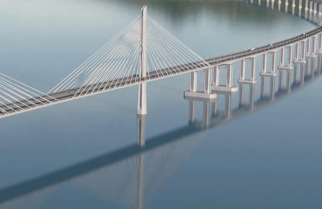
Bataan-Cavite: North Channel Bridge Rendering (Credit: TYLin)
The ends of the bridge are supported on anchor piers and intermediate piers that serve as tie-down piers to resist uplift due to any unbalanced dead loads and other loads put on the bridge.
The backspans are divided by intermediate piers into two spans of 354 meters and 96 meters to improve performance with respect to deflections and peak local demands. The SCB superstructure consists of dual orthotropic box girders connected with crossbeams and is arranged so that the towers are located between the two roadways at the tower locations.
The North Channel Bridge (NCB) will be located between Corregidor Island and the Bataan Peninsula, spanning the North Navigation Channel. Providing a 300-meter navigation channel and a 40.5-meter vertical clearance, the 736-meter-long bridge will include a 400-meter-long main span and two 168-meter-long back spans.
The two towers of the NCB will rise more than 180 meters and be founded on immense, 70-meter-diameter concrete caissons. The NCB superstructure is a composite structure that consists of box edge girders and I-shaped floor beams with a concrete precast deck panel system.
15
16
Bataan-Cavite: Marine Viaduct - View from Cavite (Credit: TYLin)
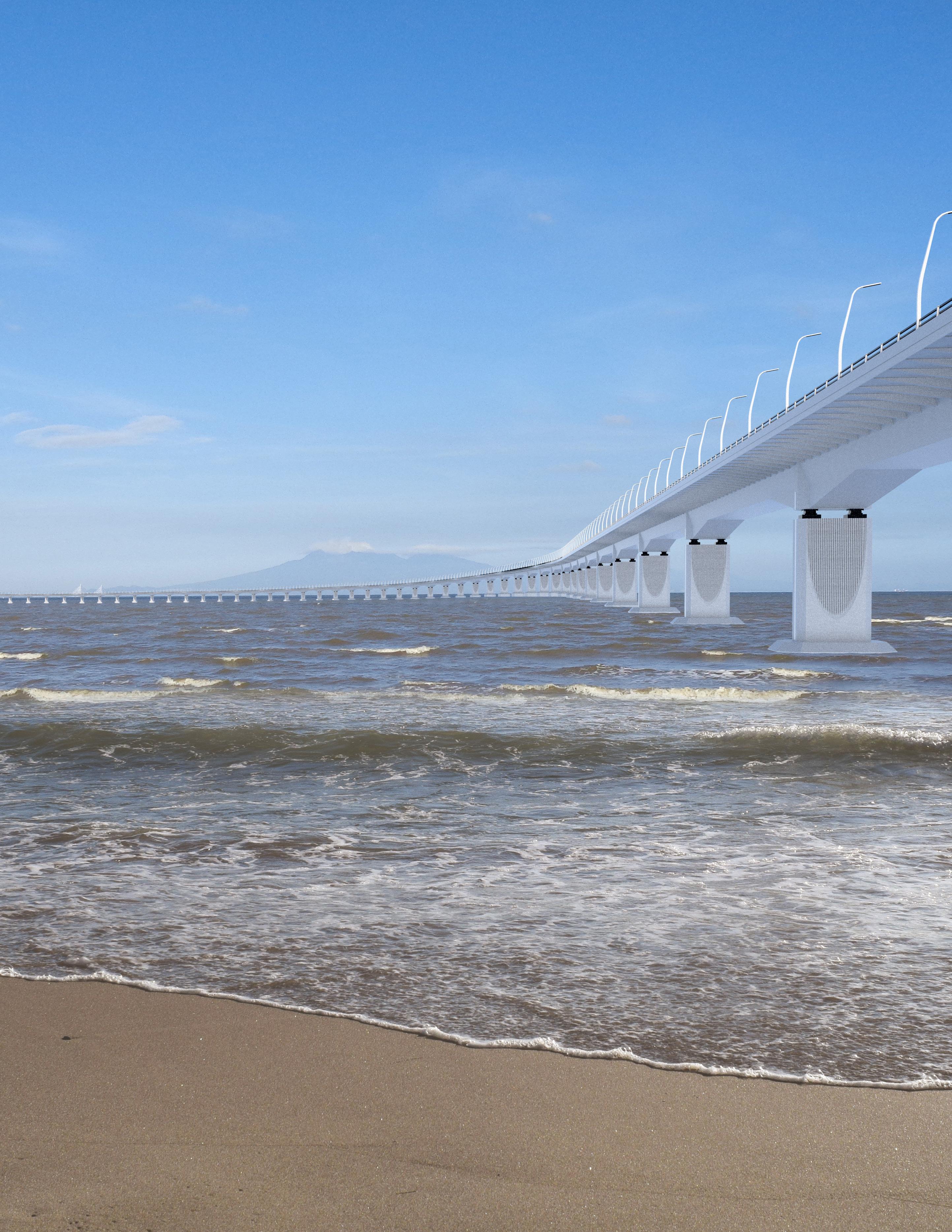
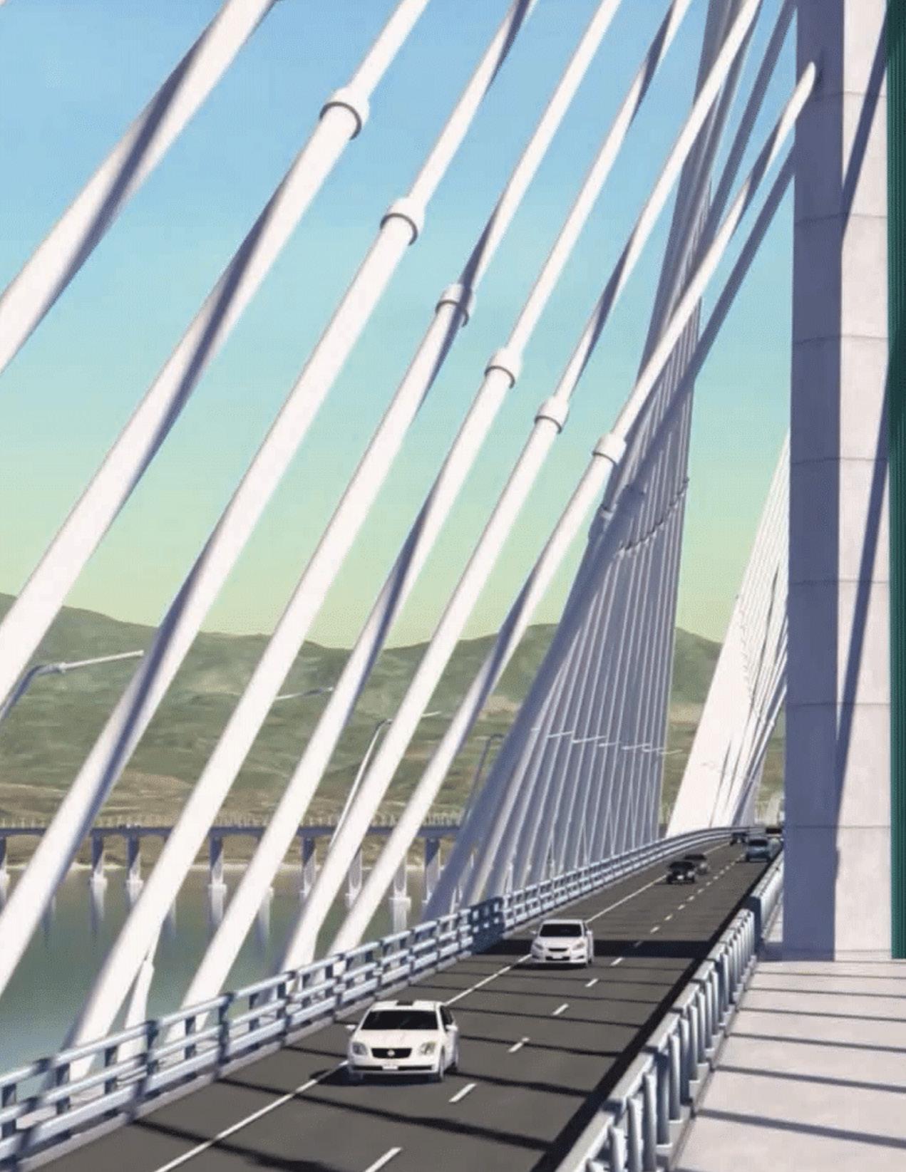
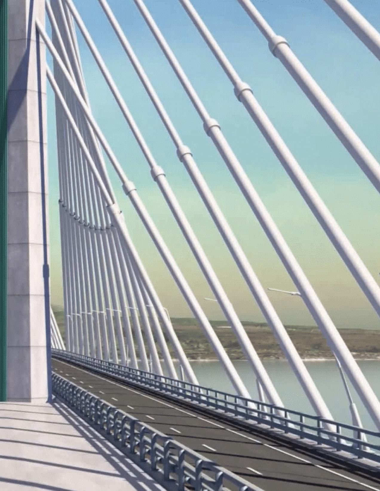
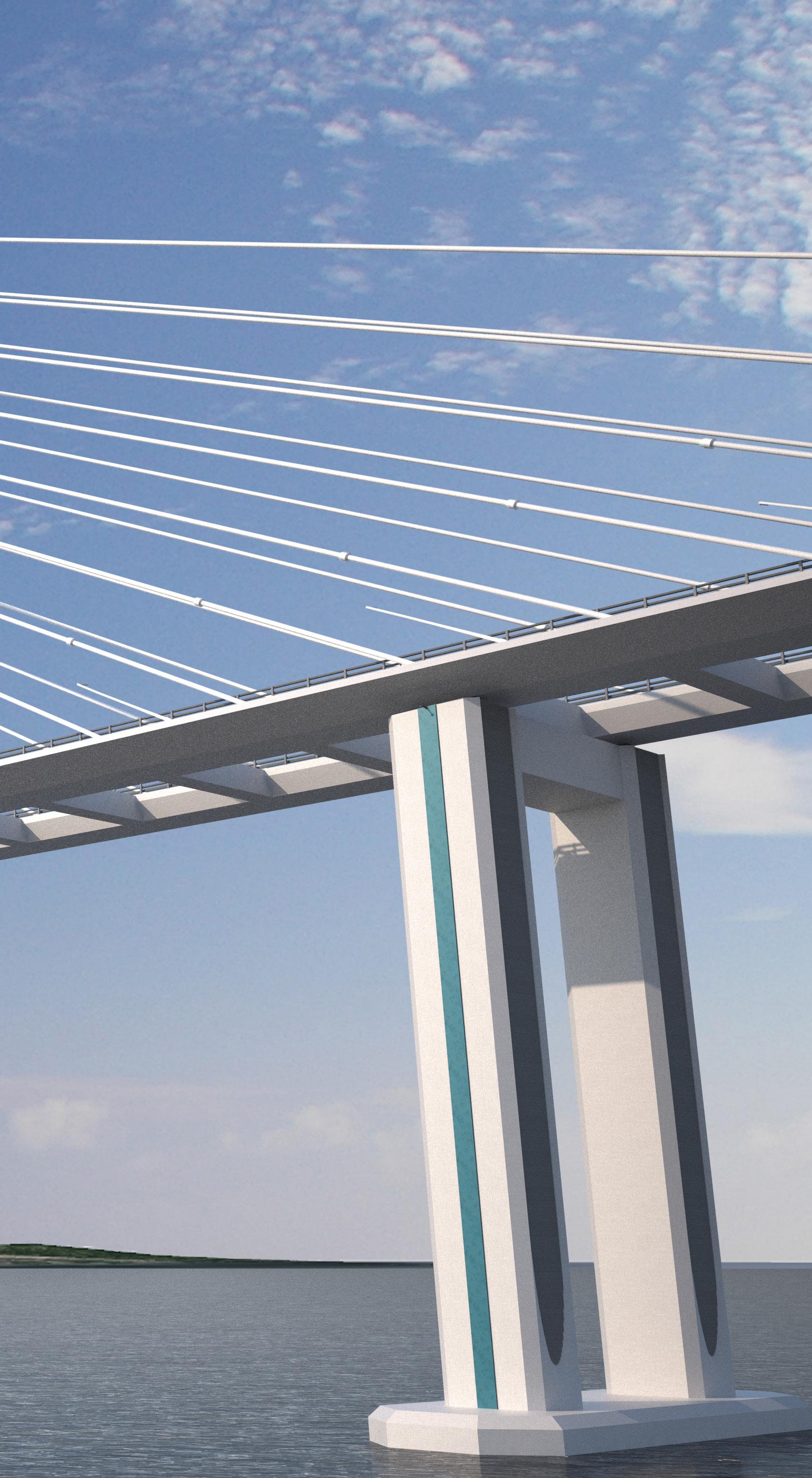
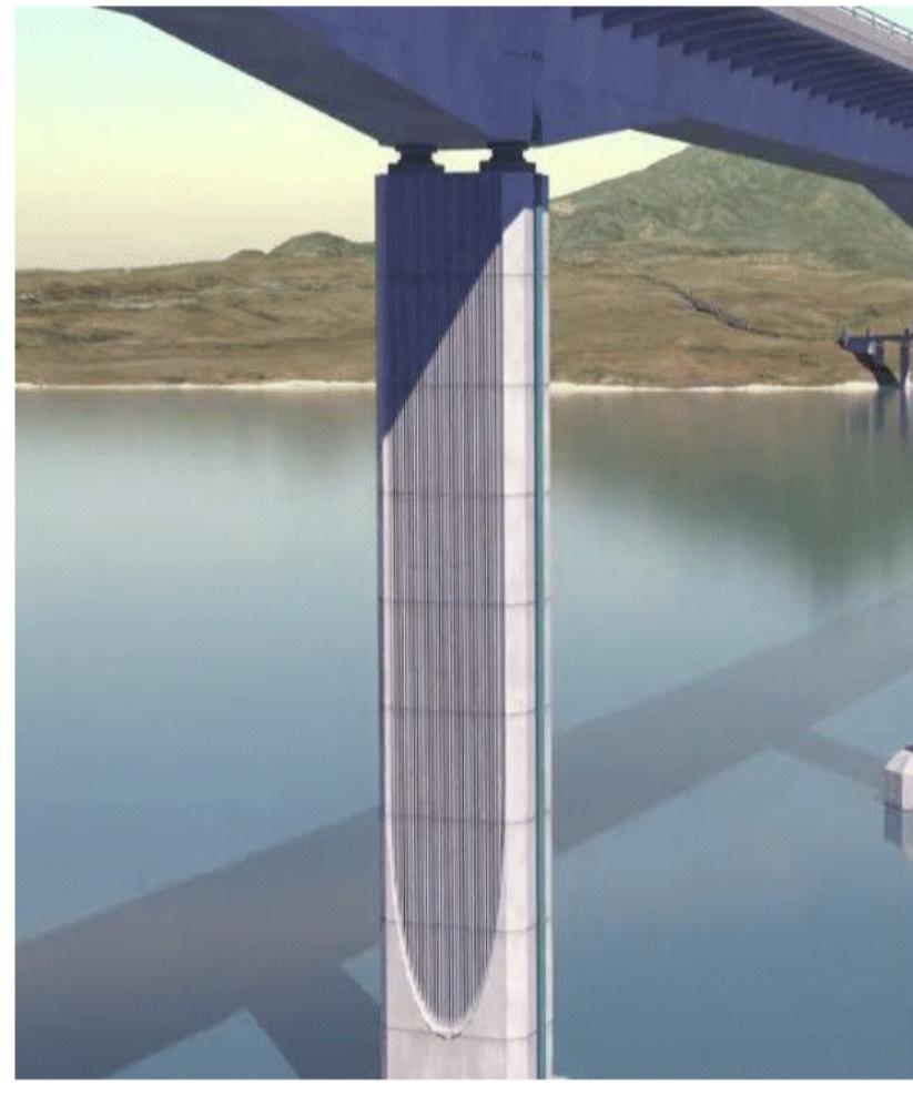
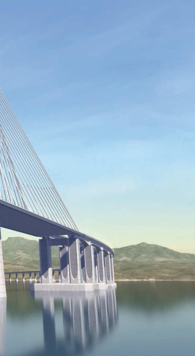
Connecting the marine viaduct to the cable-stayed bridges are the highlevel approaches . Here, the typical superstructure is a twin concrete box girder, with each girder carrying north- or south-bound traffic. The supporting pier consists of a pair of hollow rectangular section columns with architectural recesses, founded on a pile cap with a group of 2.8-meter-diameter piles.
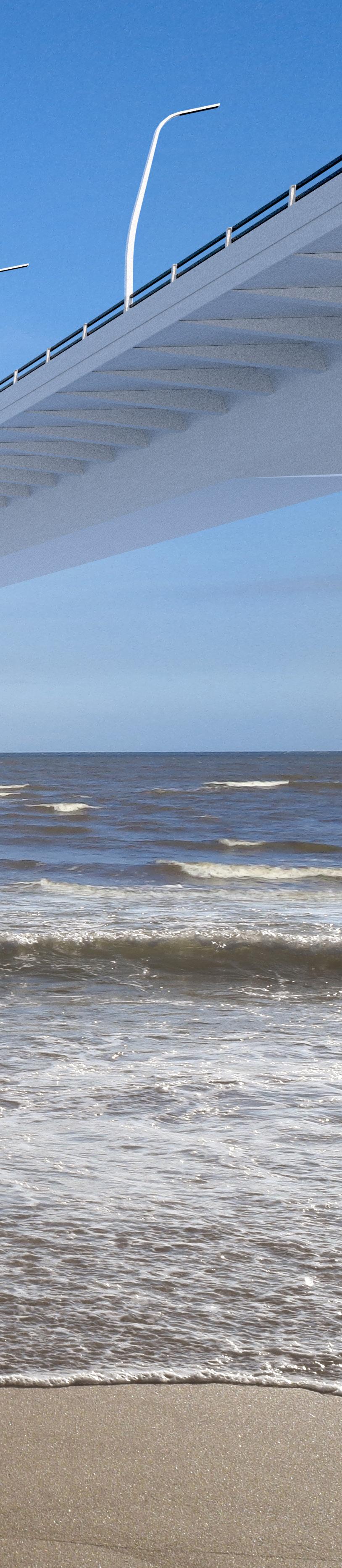
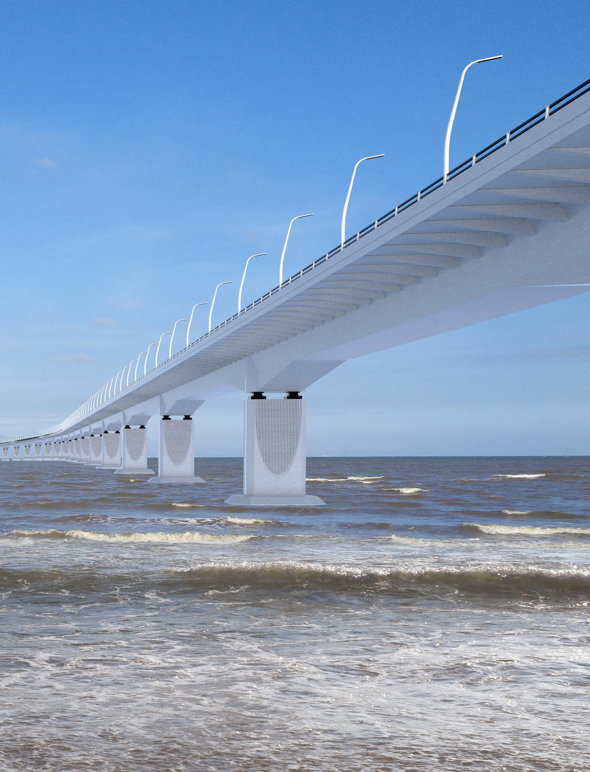
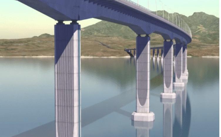
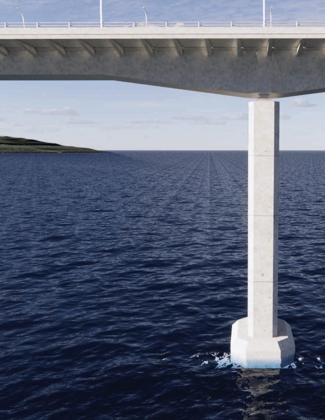
Marine viaducts form most of the BCIB alignment and include 60-meter spans over shallow water and 100-meter spans over deep-water areas. Span length increases to 150 meters over the Nearshore Navigation Channel. The typical superstructure will be a single concrete box girder supporting both carriageways and sitting atop piers. The pier structure consists of a hollow rectangular section and is founded on a pile cap with a group of 2.8-meter-diameter drilled shafts.
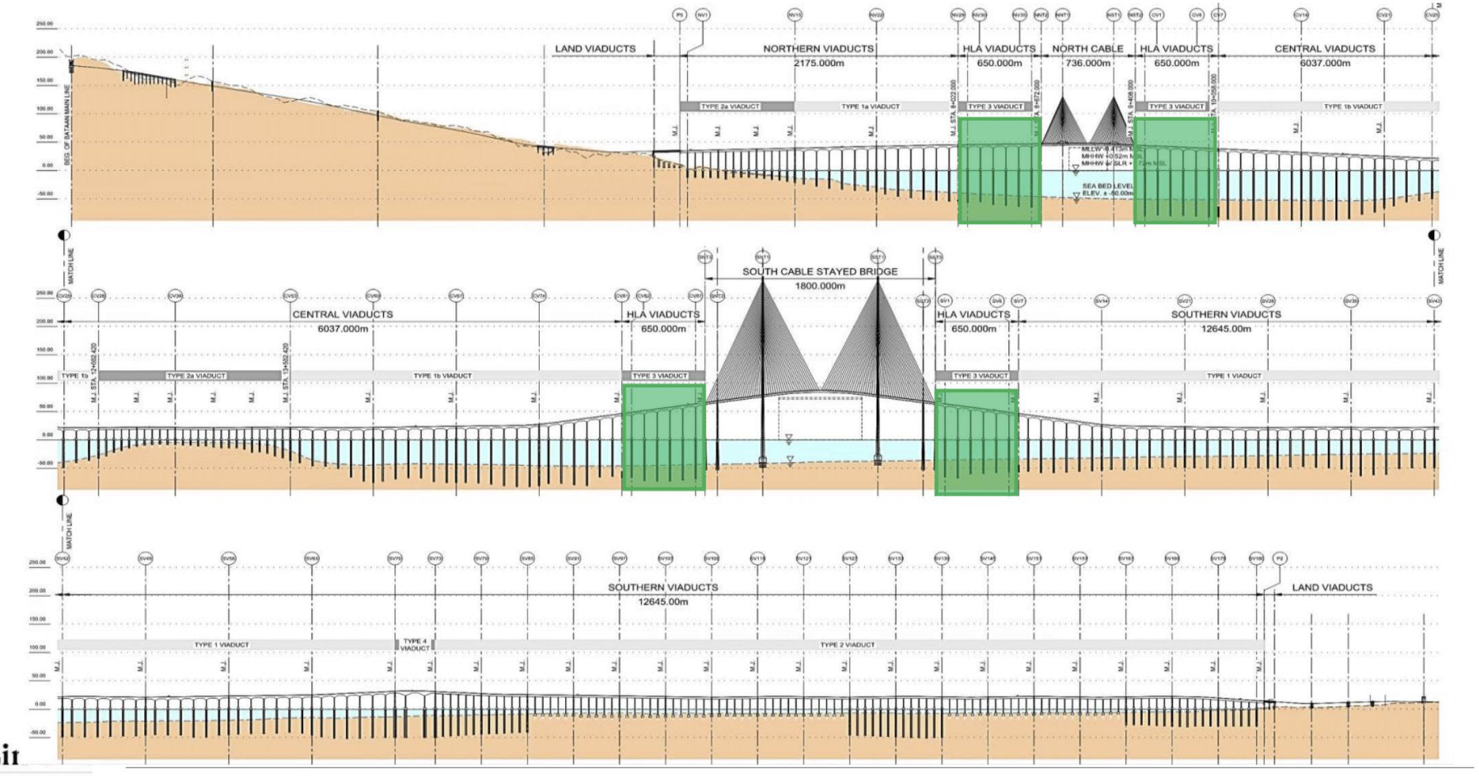
High-Level Approaches
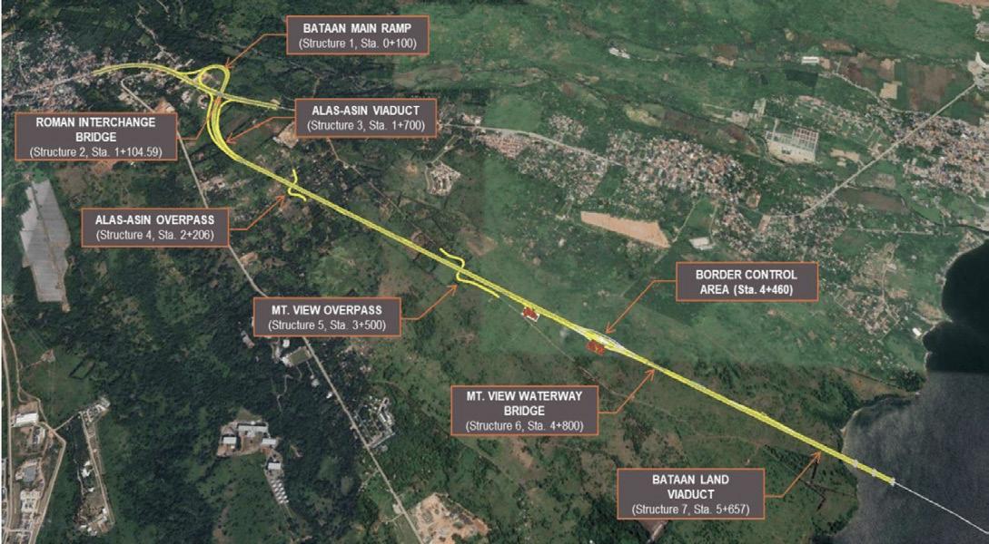
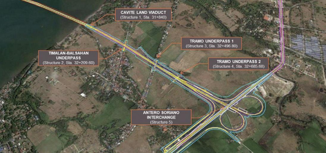
The land viaduct on the Bataan side will travel 5.4 kilometers and include seven structures that terminate at the Roman Superhighway at an interchange in Mariveles. On the Cavite side, the land viaduct is 1.8 kilometers long and includes five structures that end at the Antero Soriano Highway at an interchange in Naic.
17
Rendering of the Marine Viaducts (Credit: TYLin)
Bataan Land Approach (top) and Cavite Land Approach (bottom)

DESIGNED FOR DURABILITY
For travelers, the drive across the BCIB will be an expedient, gracefully sweeping journey that offers panoramic views of the surrounding landscape. However, behind the elegant profile is a structure designed for longevity and endurance. Its 100-year design life includes the ability to stand strong under extreme events and in an aggressive environment, such as large earthquakes, typhoons, vessel collisions, tsunamis, a hot tropical climate, and bridge scour caused by fast-moving and corrosive saltwater. To design a bridge that met such rigorous criteria, we performed numerous studies on site-specific hazards.
Seismicity was the foremost concern. Since the BCIB is in a high seismic zone in proximity to an active fault, advanced geophysical and geotechnical surveys were commissioned to study the surface and subsurface conditions found along and adjacent to the bridge alignment in Manila Bay. The surfaces were identified to include weak sandstone, eroded marine sediments, and loose sand susceptible to liquefaction and lateral spreading.
To maximize seismic resilience, design response spectra were developed for the strongest earthquakes that can be anticipated over 100-year, 1,000-year, and 2,500-year periods. Where the bedrock surface is relatively deep, we conducted site response analyses or kinematic soil-structure interaction analyses to develop near-seabed design ground motions for use in structural analyses. Where rock is near the seabed, the bedrock ground motions were directly applied. Where slopes with liquefiable soils were identified, dynamic slope stability, including the pile structure, was conducted to quantify the forces imposed on the piles by the downslope movement of the soils.
19
Placeholder Caption
20
Caisson Foundation at South Channel Bridge (Credit: TYLin)
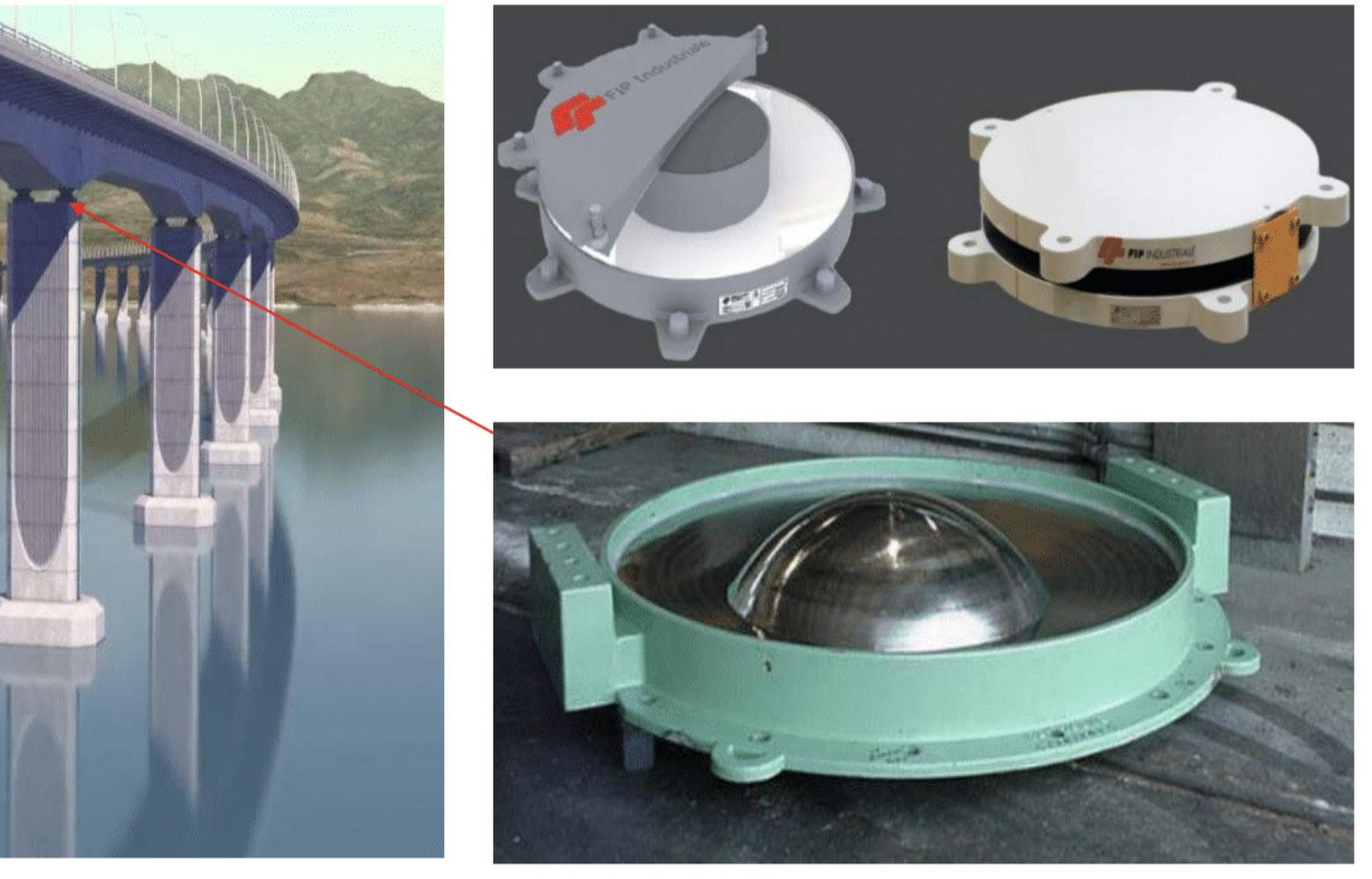
Friction Pendulum Bearing System isolates the Marine Viaduct Superstructure (Credit: TYLin)
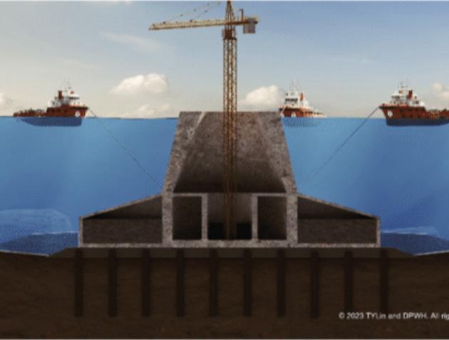
When designing large structures in a high-seismic zone and on irregular soils, the most effective and innovative design solutions are required. Examples for this project include isolating the majestic bridge towers of the SCB and NCB from the seabed using “base-isolated caisson foundations.” The caissons, which are huge precast concrete boxes submerged and then filled with concrete to form a foundation, will function as gravity base structures that can slide during seismic events, isolating seismic forces.
The superstructure of the marine viaducts will be supported on and isolated from the substructure using a “friction pendulum system.” These slidingbased isolators work on the same principle as a clock pendulum, allowing the superstructure to sway naturally along specially designed concave surfaces during an earthquake.
21
Caisson Foundation at South Channel Bridge (Credit: TYLin)
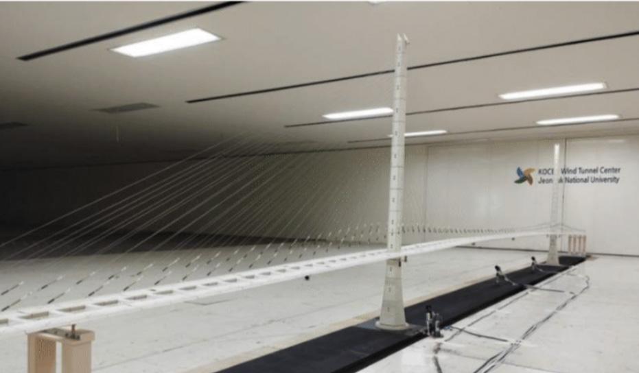
Wind hazards are also a concern and required a sitespecific climate and topography study to establish wind speeds and turbulence characteristics for a range of return periods and averaging times. These included typhoon winds from simulations of a typhoon climate model and non-typhoon winds extrapolated from surface-level measurements from Ninoy Aquino International Airport.
The aerodynamic stability of all portions of the bridge was evaluated in a wind tunnel, including scaled- section models of the SCB and NCB bridge decks, a SCB tower, and a marine viaduct span. We incorporated strategic design solutions to arrest or minimize damage caused by buffeting and wind-induced vibrations. Examples include target damping levels for the stay cables and light poles, and wind barriers placed at key locations to protect against vehicles overturning.
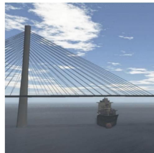
Vessel collisions pose a serious threat to public safety, bridge and roadway travel, coastal and port operations, and more. The BCIB is classified as a “Critical/Essential Bridge” – the highest classification for determining vessel collision risk.
Using an Extreme Event condition with a return period of 1 in 10,000 years, our marine navigational study determined vessel traffic patterns, navigation channel restrictions, and limitations on vessel ship sizes to accommodate geometric clearances and evaluated the effects of the project on future traffic flows, traffic growth, and channel capacities. Ship maneuverability, aid to navigation during construction, vessel collision risk, and pier protection systems were also part of the study.
22
Full Aerolastic Model of Bataan-Cavite Interlink Bridge and South Channel Bridge (top) and Section Models of BCIB Components
3D Ship Maneuvering Simulation for South Channel Bridge

Hydrodynamic hazards include the powerful forces caused by typhoons and tsunamis, as well as typical tidal conditions and potential loss of pile capacity in exposed piles due to scour. A hydrodynamic model of Manila Bay, with an extension to the West Philippine Sea, was developed to simulate typical tidal conditions and design events to estimate design loads. Scour patterns were analyzed to evaluate the potential loss of pile capacity and informed details such as the marine foundation types, pile sizes and numbers, and the design decision to found on competent substrate.
Deterioration mechanisms also had to be identified and resisted if bridge elements are to meet their intended 100year design life. These include corrosion due to saltwater, sea spray, and elevated temperatures, as well as alkali aggregate reaction, sulphate attack, and cracking.
Our durability design process resulted in high levels of corrosion protection. For example, we set specific performance requirements for the concrete, including a corrosion inhibitor to be added to the concrete mixture at specific locations. For steel elements, a zinc metalizing/ sealer/polyurethane coating will be applied where needed.
Our method of designing for durability is summarized in a holistic approach based on design, material selection, operations and maintenance, and construction quality control and assurance. Together with structural health monitoring systems, they will contribute to achieving the project design life.
23
Tsnuami Model Results
Plan View of BCIB Showing Navigation Channels (Credit: TYLin)
24
DESIGNED FOR AESTHETICS
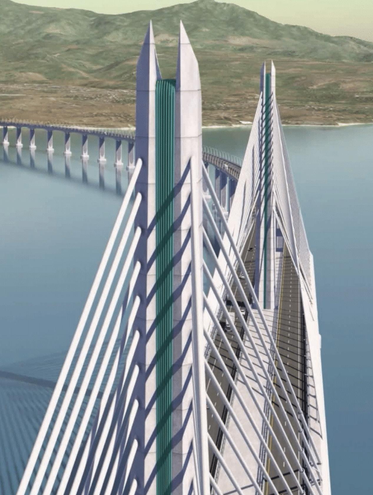
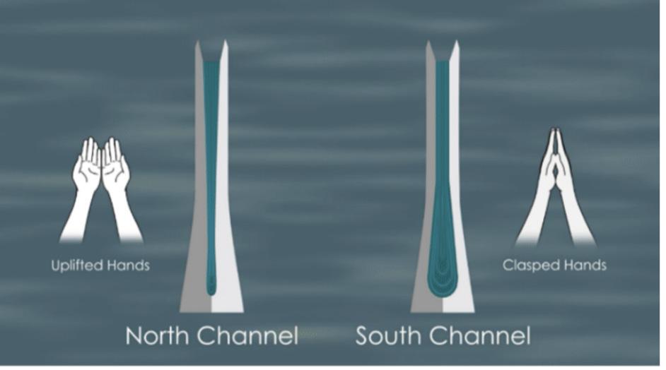
Aesthetics also played an essential role in our design. This is especially evident in the architectural shape of the towers that takes inspiration from the national flag of the Philippines.
The three distinct parts of the flag are reflected in the left, right, and middle sections of the bridge towers. The eight original provinces, depicted as sun rays on the flag, are represented by the folded rays of concrete in the middle of the towers. The folded rays will be painted to match the famous teal waters of the island nation. Finally, we designed the towers shapes to reflect the country’s profound faith. The shape of the SCB tower shape folds inward, symbolizing clasped hands in prayer, while the NCB tower opens, evoking uplifted hands.
25
Architectural Design of Towers Modeled after Uplifted and Clasped Hands (Credit: TYLin)
ENVIRONMENTAL AND SOCIAL SAFEGUARDS
Specialty studies and site investigations encompassed a wide range of disciplines and served as inputs to the design criteria and engineering design. The project also paid careful attention to project-related environmental and social factors.
An Environmental Impact Assessment was performed that resulted in an Environmental Management Plan (EMP), a Critical Habitat Assessment (CHA), and a Preliminary Biodiversity Action Plan (BAP).
The EMP includes the proposed structure, staffing, and delivery methods for managing, monitoring, and mitigating environmental impacts and social grievances, from the preconstruction through operational phases. It is also the primary vehicle for ensuring that project implementation is conducted in compliance with national laws and in accordance with ADB safeguards requirements. The EMP will be the chief mechanism for complying with the terms of the Environmental Compliance Certificate throughout the project life cycle.
The CHA communicates the underlying rationale for many of the biodiversityrelated mitigation measures indicated in the EMP. The BAP details proposed measures to address residual biodiversity impacts that require continuing action and partnerships with other entities, typically extending for some years into the operation phase.
The Social Safeguards Report included a Land Acquisition and Resettlement Plan (LARP) and a Gender Equality and Social Inclusion (GESI) – Analysis and Action Plan aligned with the DPWH policies. LARP was developed to analyze the resettlement impacts on affected persons, lands, structures, trees and crops, business/livelihood activities and vulnerable households. It sets out requirements in terms of standards, entitlements, and practices to be applied by the Government of the Philippines (GoP) to ensure that resettlement impacts caused by the project are appropriately identified and mitigated.
The project also required a BCIB Gender Equality and Social Inclusion Analysis and Action Plan with gender mainstreaming strategies addressing equality issues in affected barangays, such as a lack of income sources, jobs, financial literacy, or involvement in decision-making at home. The plan also ensures that women and persons with disabilities are involved, well-represented, and will benefit from the project. Criteria include a minimum percentage of workforce allotted for women that contractors must hire at equal pay for equal work for the project’s skilled and unskilled labor force.

26
Placeholder Caption

CONCLUSION
Our detailed design for the BCIB Project includes innovations and leading-edge technologies adopted from the successful design of some of the world’s largest and most complex bridges. Once the BCIB opens to traffic, we are confident that this project will stand as one of the most important and structurally significant bridges in the world – designed for durability and representing the future promise and prosperity of the Philippines and its people.
29
Placeholder Caption
IMAGE GALLERIES (BRIDGE ELEMENTS)
30
IMAGE GALLERIES (TEAM IN ACTION)
31

32
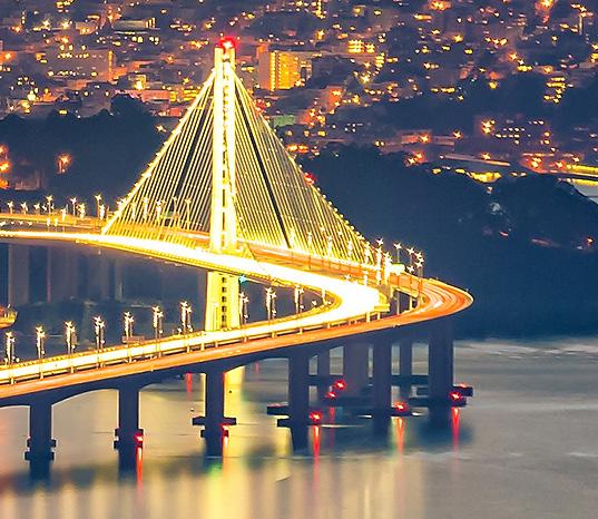
San Francisco-Oakland Bay Bridge New East Span in Oakland, California, USA
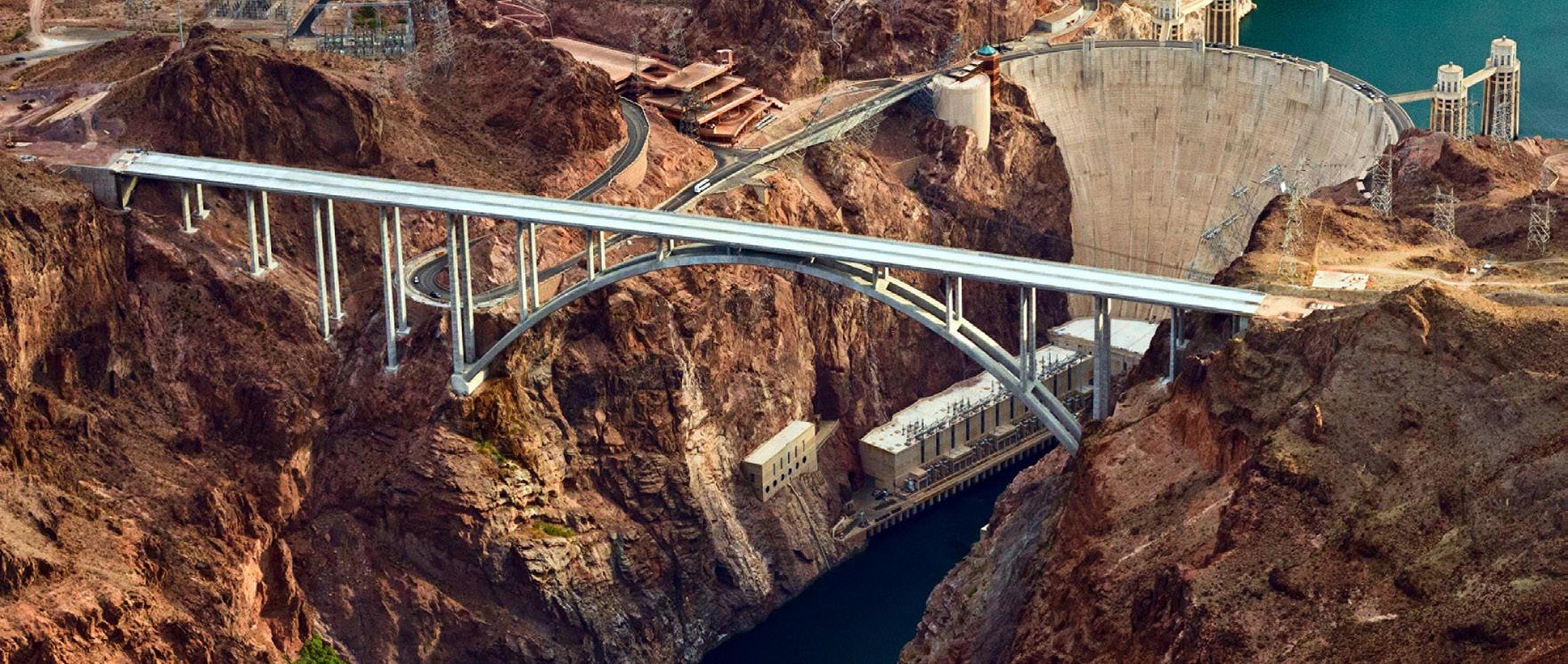
Hoover Dam Bypass Bridge in Mojave County, Arizona, USA
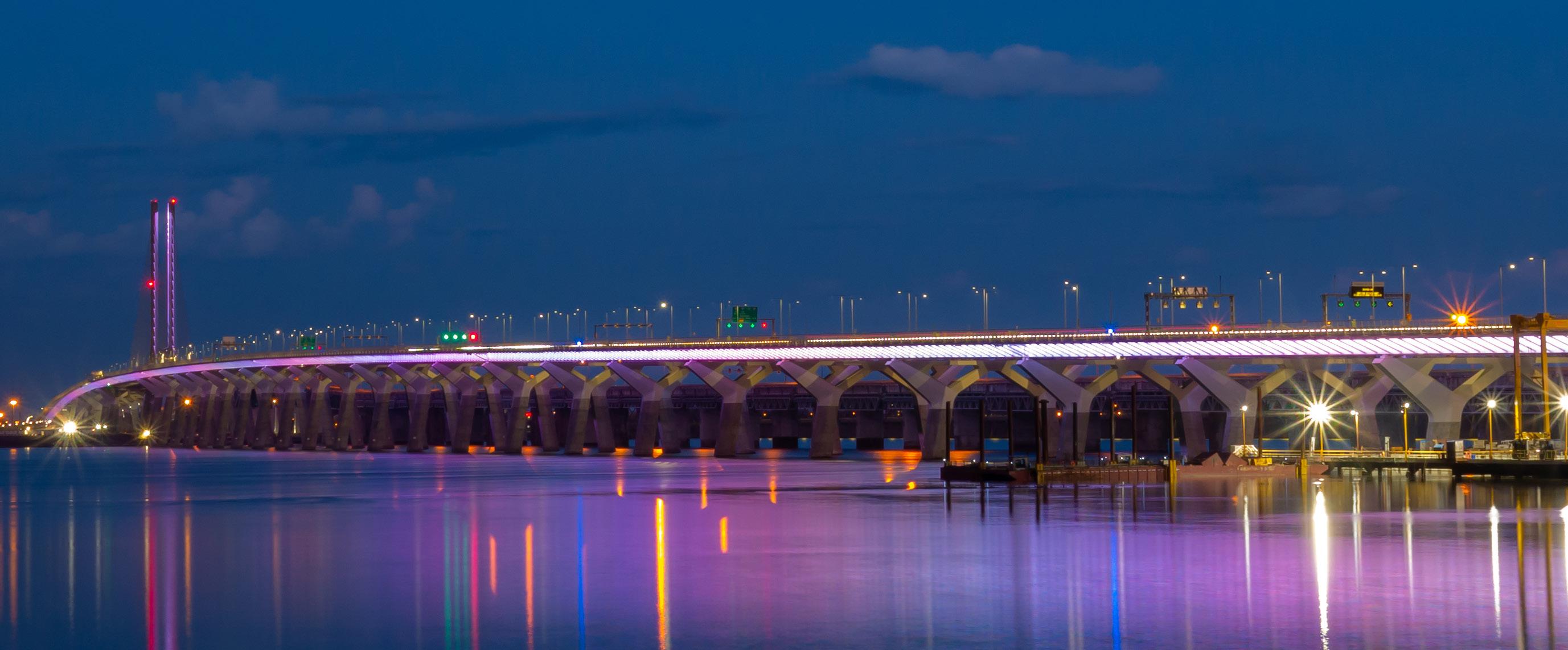
Samuel De Champlain Bridge in Montreal, Quebec, Canada
ABOUT TYLIN
TYLin is a member of a global alliance of consulting and engineering firms, with unique and complementary specializations, serving the building, transportation, and water sectors. Together, we provide our clients with the resources and reach of a truly global company and the innovative thinking and deep focus of a bestin-class specialty firm. Our alliance enables us to tailor and scale our solutions to our client’s specific needs. Through technical excellence, local knowledge, and future insight we empower positive change in our communities and for our planet.
Building on the vision of our founder, Professor T.Y. Lin, we design and build bridges like the ones you see here that help communities connect and prosper. Bridges that allow the safe movement of people and goods. Iconic structures that define a city. And, with an eye to the future, bridges that will stand the test of time for generations.
Learn more at TYLin.com.
33
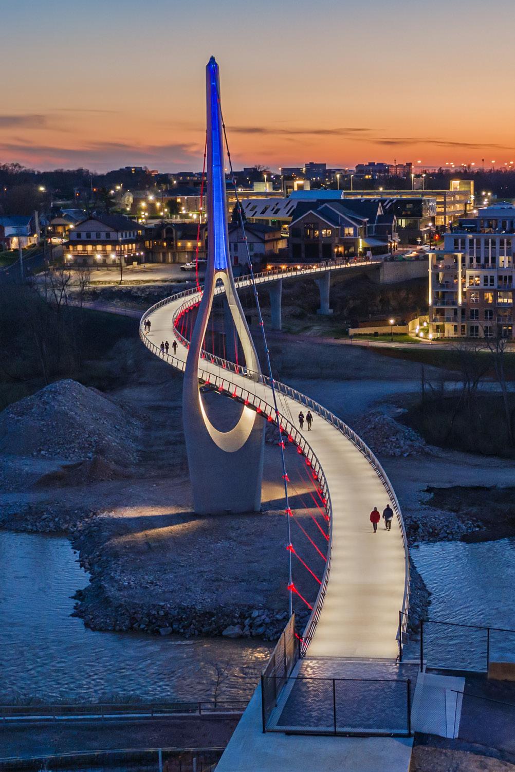
Dublin Link in Dublin, Ohio, USA
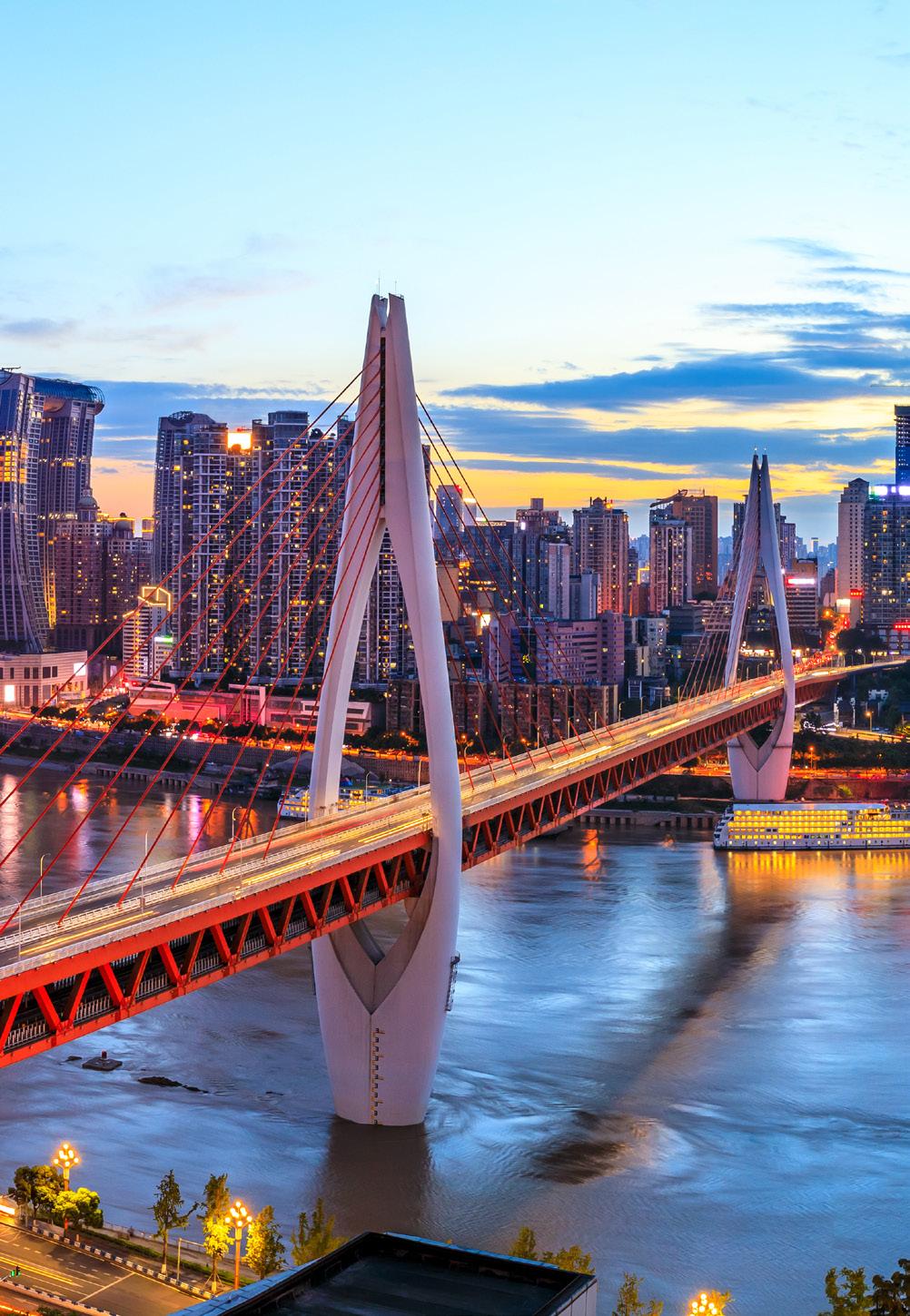
Twin River Bridges in Chongqing, China