Caught off guard in March 2017 Cyclone Debbie crossed the Queensland Coast north of Mackay as a Category 4 system on 28 March 2017. Two days later after weakening to a tropical low and turning south, it brought heavy rain to northern New South Wales. In the weeks before, the Tweed had rain that caused ‘below minor’ flooding, which meant the ground was already soaked and could not absorb much of the additional rainfall.
The rapid rise of the flood was notable, as was the final peak from the last burst of rain. Within two hours on Thursday 30 March, the Bureau of Meteorology warnings went from ‘minor to moderate’ flooding to ‘minor to major’ flooding, then three hours later ‘moderate to major’ flooding. Many residents and businesses
were caught off guard, including Council. Six people lost their lives, hundreds were rendered homeless and thousands suffered significant property damage and loss.
This was such a swiftly changing flood – looking outside at what was actually happening was necessary. We had to make our own decisions. – Cudgen The highest water levels since river gauging began more than 100 years ago were recorded on the Tweed River at Murwillumbah (6.3m Australian Height Datum) and Tumbulgum (4.0m AHD). Luckily, rainfall
on the coast was moderate and there was no significant ocean storm surge or king tide coinciding with the flood peak, therefore Tweed Heads and Chinderah were not as severely affected as upstream areas. The Rous River catchment received some of the heaviest rainfall. Flood water heights in the lower Rous reached record levels with 7.5m AHD at Boat Harbour and 5.3m AHD at Kynnumboon. Outside of the Tweed Valley, there was widespread flooding in the Burringbar, Mooball and Crabbes Creek areas after heavy rain. The heaviest rain recorded in the Tweed in 24 hours fell at Couchy Creek, 747mm; Numinbah, 674mm; Chillingham, 663mm; and, Eungella, 638mm.
City of Gold Coat
Fingal Bilambil
Lower Tweed River
Condong
Chillingham
Murwillumbah
Oxley River
Tyalgum
Kingscliff
Tumbulgum
Rous River
Cabarita Beach
Eungella
Hastings Point
Coastal creeks
Tweed stormwater catchments Rous River catchment
Pottsville
Oxley River catchment
Uki
Upper Tweed River catchment
Burringbar
Lower Tweed River catchment
Mooball
Coastal creeks catchment
Upper Tweed River Kunghur
Tweed Shire boundary Surrounding LGAs
Doon Doon Km 0
Byron Shire Lismore City
2
4
N
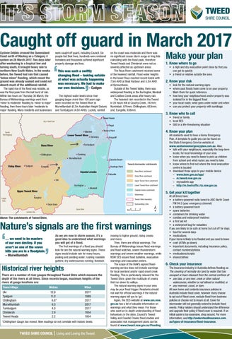
Above: The catchments of Tweed Shire.
Nature’s signals are the first warnings … we need to be masters of our own destiny. If you aren’t on one of the seven hills you are in a floodplain. – Murwillumbah
As we are now in storm season, it’s a good idea to understand what warnings you will get of a flood. The first warnings of a flood you should look for are the natural warning signs. These signs would include rain for many hours; pooling and ponding water; rushing roadside gutters; dry watercourses running; livestock
Historical river heights There are a number of river gauges throughout Tweed Shire which measure the depth of the rivers at all times. Since records began, maximum heights of the rivers at gauge locations are: Town/village
Metres
When
Uki Tyalgum Chillingham Murwillumbah Tumbulgum Chinderah Tweed Heads
12.9 11.0 6.8* 6.3 4.0 2.9 2.2
2017 1989 2017 2017 2017 1954 1954
*Chillingham Gauge has moved. New readings do not correlate with historic levels.
Living and Loving the Tweed
2. Know your risk
• look for the natural warning signs • where past floods have come to on your property. Mark them for quick reference • how long your neighbourhood and/or property was isolated for in the biggest flood • your local roads; what goes under water and when • can you protect your property with sandbags
3. Know who to call
All residents need to have a Home Emergency Plan. A template to guide you can be found on the State Emergency Service website at www.seshomeemergencyplan.com.au. Also: • talk with your neighbours, especially the long-term locals, for local knowledge of your area • know when you need to leave to pick up children from school and what routes you need to take • know where to find out where the local evacuation centre is located • download these apps to your mobile device: –– www.bom.gov.au/app/ –– m.tweed.nsw.gov.au –– myroadinfo app –– http://m.livetraffic.rta.nsw.gov.au
5. Get your kit together
Waterways Kyogle Shire
• a high and dry evacuation point close by that you can get to quickly • a friend or relative outside the area
4. Know your plan
Banora Point
Terranora
1. Know where to go
• friend or family • local SES • 000 in a life-threatening situation
Tweed Heads
Scenic Rim Regional
Make your plan
moving to higher ground; rising creeks and rivers. Then, there are official warnings. The Bureau of Meteorology issues flood warnings and flood watches, severe thunderstorm warnings and severe weather warnings, while NSW SES issues flood bulletins, evacuation warnings and evacuation orders. The scope of the BoM’s agreed floodwarning service does not include warnings for local overland and/or rapid onset creek flooding. This is particularly relevant for the Tweed Shire, given the multitude of creeks that run down its valleys. The natural warning signs in your area may be your flood trigger. Residents should not wait for official warnings if the natural warning signs tell you to ‘go’. Again, the SES website at www.ses.nsw. gov.au has a lot of valuable information on warnings and what they mean. For those who want an in-depth understanding of flood behaviours in the shire, Council’s Tweed Valley and Coastal Creeks flood studies and associated risk management plans can be found at www.tweed.nsw.gov.au/Flooding.
At all times have: • a battery-powered radio tuned to ABC North Coast FM 94.5 (your emergency channel) • a battery-powered torch • spare batteries • containers for drinking water • candles and waterproof matches • a first aid kit • a waterproof bag for valuables If you are likely to be safe at home but cut off for days: • food for several days • medications If your home is likely to be flooded and you need to leave: • cash (ATMs go down) • important documents, including insurance policy, contact numbers/photos • medications/scripts • shoes/clothes
6. Check your insurance
The insurance industry in Australia defines flooding as: The covering of normally dry land by water that has escaped or been released from the normal confines of: • any lake, or any river, creek or other natural watercourse, whether or not altered or modified; or • any reservoir, canal, or dam. All new home and contents insurance policies in Australia include flood cover, however many choose to opt out of flood cover, exclude flood from business policies or choose not to insure at all. Cover for stormwater will not generally extend to include flood events. Policy holders should understand the difference and upgrade their policy if flood cover is required. If an initial quote is too expensive, shop around. For more information, see http://understandinsurance.com. au/types-of-insurance/flood-insurance.