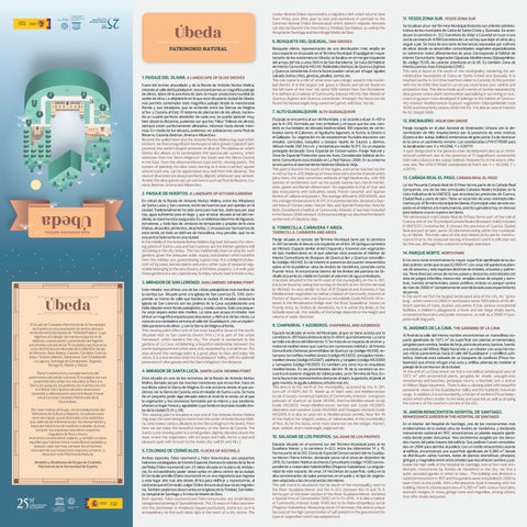
Úbeda PATRIMONIO NATURAL
1. PAISAJE DEL OLIVAR. A LANDSCAPE OF OLIVE GROVES Fuera del recinto amurallado y de la Ronda de Antonio Muñoz Molina, mirando al valle del Guadalquivir, nos encontramos un magnífico paisaje de olivos, típico de la provincia de Jaén, la mayor productora mundial de aceite de oliva. La altiplanicie en la que está situada la ciudad de Úbeda, nos permite contemplar este magnífico paisaje desde la mencionada Ronda y sus miradores, que se extiende entre las Sierras de Mágina al Sur y Cazorla al Este. El sistema de plantación de los olivos, haciendo un cuadro perfecto alrededor de cada uno, se puede apreciar muy bien desde la distancia, pudiendo ver que los “hilos” (hileras de olivos), siempre están perfectamente alineados, miremos hacia donde miremos. En medio de los olivares, podemos ver poblaciones como Peal de Becerro, Cazorla, Bedmar, Jimena o Albanchez. Beyond the walled town and the Antonio Muñoz Molina ring road which circles it, we find a magnificent landscape of olive groves typical of Jaén province, the world´s largest producer of olive oil. The plateau on which Úbeda sits allows us to contemplate this spectacular scenery, which stretches from the Sierra Mágina in the South and the Sierra Cazorla in the East, from the aforementioned road and its viewing points. The system of planting the olive trees, leaving as it does a perfect square around each one, can be appreciated very well from this distance. The rows of olive trees are always perfectly aligned, whichever way we look. Amidst the olive groves we can see towns such as Peal de Becerro, Cazorla, Bedmar, Jimena and Albanchez.
2. PAISAJE DE HUERTOS. A LANDSAPE OF KITCHEN GARDENS En mitad de la Ronda de Antonio Muñoz Molina, entre los Miradores de Santa Lucía y San Lorenzo, están las huertas que aún quedan en la ciudad. Tradicionalmente ha sido zona para huertos, dado que por aquí hay agua suficiente para el riego, y que al estar situada al sol del mediodía, la cosecha está asegurada. Es un delicioso laberinto de higueras, tomateras, y todo tipo de verduras de temporada y propias de la zona (habas, alcauciles, pimientos, alcachofas…). Un paseo por las huertas de esta ronda, es todo un disfrute de naturaleza, muy peculiar, que no se encuentra fácilmente en una ciudad. In the middle of the Antonio Muñoz Molina ring road, between the viewing points of Santa Lucía and San Lorenzo, are the kitchen gardens still remaining in the city today. This has traditionally been an area for such gardens, given the adequate water supply and position which benefits from the midday sun, guaranteeing a good crop. It is a delightful labyrinth of fig trees, tomato plants and every other type of seasonal vegetable belonging to the area (beans, artichokes, peppers…). A walk past these gardens is a very special way to enjoy nature, hard to find in a city.
3. MIRADOR DE SAN LORENZO. SAN LORENZO VIEWING POINT Este mirador nos ofrece una de las vistas paisajísticas más bonitas de la cornisa sur. Situado junto a la iglesia de San Lorenzo (S. XVI), comprende un tramo de calle que bordea la ciudad. El mirador conecta la iglesia de San Lorenzo con los jardines de la Cava, estableciendo una bella relación entre fondo paisajístico y medio urbano. Sólo una pequeña verja separa estos dos medios. La zona que ocupa el mirador nos ofrece un magnífico espacio para descansar y disfrutar de las vistas. La zona es una verdadera ventana al valle del Guadalquivir, con un espléndido panorama de olivar, y con la Sierra de Mágina al fondo. This viewing point offers one of the most beautiful views of the south. Situated next to San Lorenzo church (XVI c.) it is part of the urban framework which borders the city. The church is connected to the gardens of La Cava, establishing a beautiful relationship between the scenic background and urban area, only separated by a small fence. The area around this vantage point is a great place to relax and enjoy the views. It is a real window onto the Guadalquivir Valley, with its splendid panorama of olive groves and the Sierra Mágina in the distance.
4. MIRADOR DE SANTA LUCÍA. SANTA LUCÍA VIEWING POINT Está situado en uno de los extremos de la Ronda de Antonio Muñoz Molina, llamada así por las muchas menciones que el escritor, hace en sus libros sobre la Sierra de Mágina. En ese extremo desde el que podemos ver la Sierra de Cazorla, está el mirador de Santa Lucía. Se trata de un pequeño jardín algo elevado sobre el nivel de la ronda, en el que la vegetación y los recovecos formados por la misma y sus senderos, ofrecen un lugar fresco y agradable cuyo fondo es la propia muralla Árabe de la ciudad (S. IX y XII). This viewing point is situated at one end of the Antonio Muñoz Molina ring road, the road taking its name from the writer Antonio Munoz Molina, who makes various allusions to the Sierra Magina in his books. From here we can enjoy the beautiful scenery of the Sierra de Cazorla. The Santa Lucía viewing point is a small garden, slightly elevated above the road, where the vegetation, with its loops and trails, forms a cool and pleasant spot with its back to the Arabic city wall (IX and XII c.)
5. COLONIAS DE CERNÍCALOS. FLOCKS OF KESTRELS Ambas especies, Falco naumanni y Falco tinnunculus, son pequeños halcones catalogados de Interés Especial. Destaca la colonia de la Torre del Reloj (Falco naumanni) con 25 nidos situada en la plaza de Andalucía. Es extraordinario poder observarlos en pleno centro de la ciudad. El Cernícalo primilla (Falco naumanni) es un ave migratoria que regresa a este lugar año tras año desde África para nidificar y reproducirse, al contrario que el Cernícalo vulgar (Falco tinnunculus) que no es migratoria. También podemos observarlos en la Iglesia de la Trinidad, San Isidoro, Hospital de Santiago y Ermita de Madre de Dios. Both species, Falco naumanni and Falco tinnunculus, are small falcons categorised as being of Special Interest. The 25 nests of Falco naumanni in the clocktower in Andalucía Square particularly stand out, as it is extraordinary to find such birds right in the heart of a city centre. The
Lesser Kestrel (Falco naumanni) is a migratory bird which returns here from Africa year after year to nest and reproduce, in contrast to the Common Kestrel (Falco tinnunculus) which doesn´t migrate. Kestrels can also be found in the churches La Trinidad, San Isidoro, as well as the Hospital de Santiago and Hermitage Madre de Dios.
6. BOSQUETE DEL QUEJIGAL. OAK GROVES Bosquete relicto, representación de una distribución más amplia de esta especie en el pasado en el Término Municipal. El quejigal de mayor tamaño de los existentes en Úbeda, se localiza en el margen izquierdo del arroyo del Val, a unos 500 m de San Bartolomé. Se trata del Hábitat de Interés Comunitario H9240, Robledales Ibéricos de Quercus faginea y Quercus canariensis. Entre la fauna pueden verse por el lugar águilas calzada, buhos chico, ginetas, jabalíes, zorros, etc. This oak copse is a relic of what once was a larger wood in this municipal district. It is the largest oak grove in Úbeda and can be found on the left bank of the river Val, some 500 metres from San Bartolomé. It is defined as a habitat of Community Interest H9240, Oak Woods of Quercus faginea and Quercus canariensis. Amongst the fauna can be found the booted eagle, long-eared owl, genet, wild boar, fox etc.
7. ALTO GUADALQUIVIR. ALTO GUADALQUIVIR El paraje se encuentra al sur del Municipio, y se accede a él por A-401 o por la A-315. Formado por tres embalses y el cauce que los une, consiste en humedales de elevada biodiversidad: 160 especies de vertebrados como el Calamón, el Aguilucho lagunero, la Nutria, la Gineta o el Gallipato. Su vegetación es de ecosistemas fluviales-lacustres con eneales, carrizales, tarayales y bosque ripario de Sauces y álamos. Altitud media 350 ms.n.m. y temperatura media 16,5ºC. Es un espacio protegido declarado Zona Especial de Conservación, Paraje Natural y Zona de Especial Protección para las Aves. Considerado Hábitat de Interés Comunitario está incluido en La Red Natura 2000. En su entorno se encuentra el asentamiento histórico Úbeda la Vieja. This spot is found in the south of the region, and can be reached via the A-401 or the A-315. Made up of three reservoirs and the channel which joins them, the area comprises wetlands of high biodiversity, with 160 species of vertebrates such as the purple swamp hen, marsh harrier, otter, genet and Iberian ribbed newt. Its vegetation is that of river and lake ecosystems with bulrushes, reeds, French tamarisk and riparian forests of willows and poplars. The average altitude is 350 MAMSL and the average temperature is 16.5ºC. It is a protected site, declared a Special Area of Conservation, Nature Site, and Special Protection Area for birds. Considered a habitat of Community Interest, it has been included in the Natura 2000 network. In its surroundings we also find the historic settlement of Úbeda la vieja.
8. TORRECILLA, CAÑAVERA Y ARIZA. TORRECILLA, CAÑAVERA AND ARIZA
Paraje situado al noreste del Término Municipal tiene por la carretera A-301 tomando el desvío a la izquierda en el Km 39 (antigua carretera de Vilches). Espacio similar al del Chaparral y Azoreros con vegetación de tipo mediterráneo en el que además está presente el Hábitat de Interés Comunitario de Bosques de Quercus ilex y Quercus rotundifolia (código H9340). Es de interés la presencia del puente renacentista sobre el río Guadalimar, obra de Andrés de Vandelvira, conocido como Puente Ariza. Al encontrarse dentro de los límites del pantano de Giribaile el puente es visible en función al volumen de agua embalsada. A location situated in the north-east of the municipality on the A-301, it is to be found by taking the turning on the left at Km 39 (the old road to Vilches). An area similar to that of El Chaparral and Azoreros, it has Mediteranean vegetation as well as a habitat of Community Interest of Forests of Quercus ilex and Quercus rotundifolia (code H9340). Of interest is the Renaissance bridge over the River Guadalimar, known as Puente Ariza, by Andrés de Vandelvira. As it is within the limits of the Giribaile reservoir, the visibility of the bridge depends on the height and volume of water dammed.
9. CHAPARRAL Y AZOREROS. CHAPARRAL AND AZOREROS Espacio localizado al norte del Municipio, al que se tiene acceso por la carretera A-301 hasta el desvío de la JV-6041, que tomaremos. La zona se halla a la altura del kilómetros 11. Se trata de un espacio de encinar y matorral mediterráneo que cuenta con numerosos hábitats de Interés Comunitario: Dehesas perennifolias de Quercus sp (código H6310), retamares termófilos mediterráneos (código H53303), coscojales mesomediterráneos (código H53307), adelfares y tarajales (código H92D00) y tamujares (código H92D01). Es también una zona rica en orquídeas mediterráneas. En las proximidades del Km 10 de la carretera se encuentra el oratorio visigodo de Valdecanales, ya en Término de Rus. Entre la fauna más representativa destacan el tejón, la garduña, el jabalí, el gato montés, la águila culebrera, el búho real, etc. This area is to the north of the municipality, accessed by the A-301, turn-off JV-6041, Km 11. Made up of Holm oaks and Mediterranean scrub, it boasts numerous habitats of Community Interest: evergreen pastures of Quercus sp (code H6310), thermo-Mediterranean scrub (code H53303), meso-Mediterranean kermes oak (code H53307), oleanders and tamarisk (code H92D00) and Flueggea tinctoria (code H92D01). It is also an area rich in Mediterranean orchids. Near Km 10 of the road is the Visigoth oratory of Valdecanales, in the municipality of Rus. As for the fauna, what most stand out are the badger, marten, boar, wildcat, short-toed eagle, eagle owl etc.
10. SALADAR DE LOS PROPIOS. SALADAR DE LOS PROPIOS Espacio situado en el extremo sur del Término Municipal junto al río Guadiana Menor y la carretera A-322, entre los kilómetros 14 y 15. Forma parte de la ZEC (Zona de Especial Conservación) del río Guadiana Menor-Tramo Inferior, declarada como tal el cinco de diciembre de 2015. Es también Hábitat de Interés Comunitario (código 1430) correspondiente a matorrales halonitrófilos (Pegano-Salsoletea). La singularidad de este espacio, de unas 24 hectáreas de superficie, radica en la alta concentración de sales presentes en el suelo y el tipo de vegetación adaptada a las circunstancias del mismo. This salt marsh is situated in the far south of the municipality, next to the River Guadiana Menor and the A-322, between Km 14 and 15. It forms part of the lower section of the River Guadiana Menor, declared a Special Area of Consevation (SAC) on 5-12-2015. It is also a habitat of Community Interest (code 1430) due to its Halo-nitrophilous scrub (Pegano-Salsoletea). Measuring some 24 hectares, this area is unique because of the high concentration of salt present in the ground and the type of vegetation which has adapted to it.
11. YESOS ZONA SUR. YESOS ZONA SUR Se localizan al sur del Término Municipal, lindando con el límite administrativo de los municipios de Cabra de Santo Cristo y Quesada. Se accede por la carretera A- 322 (carretera de Jódar a Cazorla) en cuyo cruce con la carretera JA-6109 (carretera de Larva) hay que dejar el vehículo y seguir a pie. Se trata de una serie de barrancos separados por cultivos de olivar donde se desarrollan comunidades vegetales especializadas en sobrevivir sobre afloramientos de yeso. Corresponde al Hábitat de Interés Comunitario Vegetación Gipsícola Mediterránea (Gipsophiletalia, código 1520), de carácter prioritario en la UE. Es también Zona de Interés para las Aves Esteparias (ZIAE). This area is found at the south of the municipality, bordering the administrative boundaries of Cabra de Santo Cristol and Quesada. It is reached via the A-322 (the road from Jódar to Cazorla). At the junction with the JA-6109 (the road to Larva) you must leave your vehicle and proceed on foot. This site is made up of a series of ravines separated by olive groves where plant communities specialising in surviving on outcrops of gypsum have developed. It belongs to the habitat of Community Interest Mediterranean Gypsum vegetation (Gipsophiletalia code 1520) and has priority status within the EU. It is also an area of interest for its Steppic birds.
12. ENCINAJERO. HOLM OAK GROVE Paraje recogido en el plan General de Ordenación Urbana con la denominación de Hito Arquitectónico por la presencia de once encinas (Quercus ilex subsp. ballota) centenarias de gran porte. Es de destacar en la zona un yacimiento romano. Las coordenadas UTM ETRS89 para su localización son: X = 463398, Y = 4207111. A spot designated in the general urban development plan as an Architectural Landmark due to the presence of 11 magnificent centenarian holm oaks (Quercus ilex subsp. ballota). Noteworthy in the area is a Roman site. The UTM ETRS89 coordinates to find it are: X = 463398, Y = 4207111.
13. CAÑADA REAL EL PASO. CAÑADA REAL EL PASO La Vía Pecuaria Cañada Real de El Paso forma parte de la Cañada Real Conquense, una de las diez principales Cañadas Reales incluidas en la Lista Indicativa de la UNESCO, que atraviesa las provincias de Cuenca, Ciudad Real y parte de Jaén. Tiene un recorrido de unos veintiséis kilómetros por el Término Municipal de Úbeda. El principal valor de este espacio es el relativo a la trashumancia, práctica ganadera hoy en desuso pero todavía viva en nuestro territorio. The old livestock trail Cañada Real de El Paso forms part of the trail of Cuenca, one of the 10 principal Cañada Reales (livestock trails) included in UNESCO´s tentative list. It crosses the provinces of Cuenca, Ciudad Real and part of Jaén, some 26 kilometres being within the municipality of Úbeda. The main value of this area relates to its use for transhumance (that is, the seasonal moving of livestock) and it is still reserved for this use, although the custom is no longer practised.
14. PARQUE NORTE. NORTH PARK En la zona norte encontramos la mayor superficie ajardinada de la ciudad, pulmón verde que ocupa 62.000 m2, con unas mil quinientas plantas de sesenta y seis especies distintas de árboles, arbustos y palmeras. Tiene diversas zonas de recreo, paseo y descanso, está dotado con área de juegos infantiles, kiosco-bar, amplias zonas de césped y sombras, fuentes ornamentales, aseos públicos, incluso un parque canino de más de 2000 m2 completamente acondicionado para esparcimiento de perros. In the north we find the largest landscaped area of the city, its ¨green lung¨, which covers 62,000 m2 and boasts some 1500 plants of 66 different species of trees, bushes and palms. It has various recreational facilities, a children´s playground, a kiosk and bar, large shady lawns, ornamental fountains and public restrooms, as well as a 2000 m2 purpose-built dog park.
15. JARDINES DE LA CAVA. THE GARDENS OF LA CAVA Al final de la calle del mismo nombre encontramos un maravilloso espacio ajardinado de 1.972 m² de superficie con plantas ornamentales, pérgolas para sombra, farolas de forja, pista de petanca, bancos, fuente, una estatua del Alférez Rojas Navarrete y un mirador con unas hermosas vistas panorámicas hacia el valle del Guadalquivir y cordillera subbética. Además está rodeado de un bosquete de coníferas (Pinus halepensis) que ofrece refugio a las aves y ardillas además de modelar el paisaje de la cornisa sur de la ciudad. At the end of La Cava street we find a marvellous landscaped area of 1,972 m² with ornamental plants, pergolas for shade, wrought-iron streetlamps and benches, petanque courts, a fountain, and a statue of Alférez Rojas Navarrete. There is also a viewing point with beautiful panoramic views of the Guadalquivir Valley and the Subbetic mountain range. In addition, it is surrounded by a thicket of conifers (Pinus halepensis) which offers shelter to the birds and squirrels as well as shaping the scenery of the southern cornice of the city.
16. JARDÍN RENACENTISTA HOSPITAL DE SANTIAGO. RENAISSANCE GARDEN IN THE HOSPITAL DE SANTIAGO
En el interior del Hospital de Santiago, uno de los monumentos más emblemáticos de la ciudad, obra de Andrés de Vandelvira, y declarado monumento nacional en 1917, encontramos un plácido espacio ajardinado donde poder descansar. Nos sentiremos acogido por los elevados muros del patio trasero del edificio. Sus jardines fueron remodelados en 2006 para abrirlos al público. Con un estilo renacentista acorde al edificio, encontramos una superficie ajardinada de 5.385 m² donde se distribuyen varias fuentes, setos de plantas aromáticas, pinsapos, ginkgos y magnolios entre otros árboles que nos ofrecen sombra y paz. Inside the high walls of the Hospital de Santiago, one of the most emblematic monuments by Andrés de Vandelvira in the city, we find a quiet, secluded garden in which to relax. The building was declared a national monument in 1917 and the gardens were remodelled in 2006 to open them to the public. With a Renaissance style in keeping with the building, there is a landscaped area of 5,385 m² with various fountains, aromatic hedges, fir trees, ginkgo trees and magnolias, among others, that offer shade and peace.