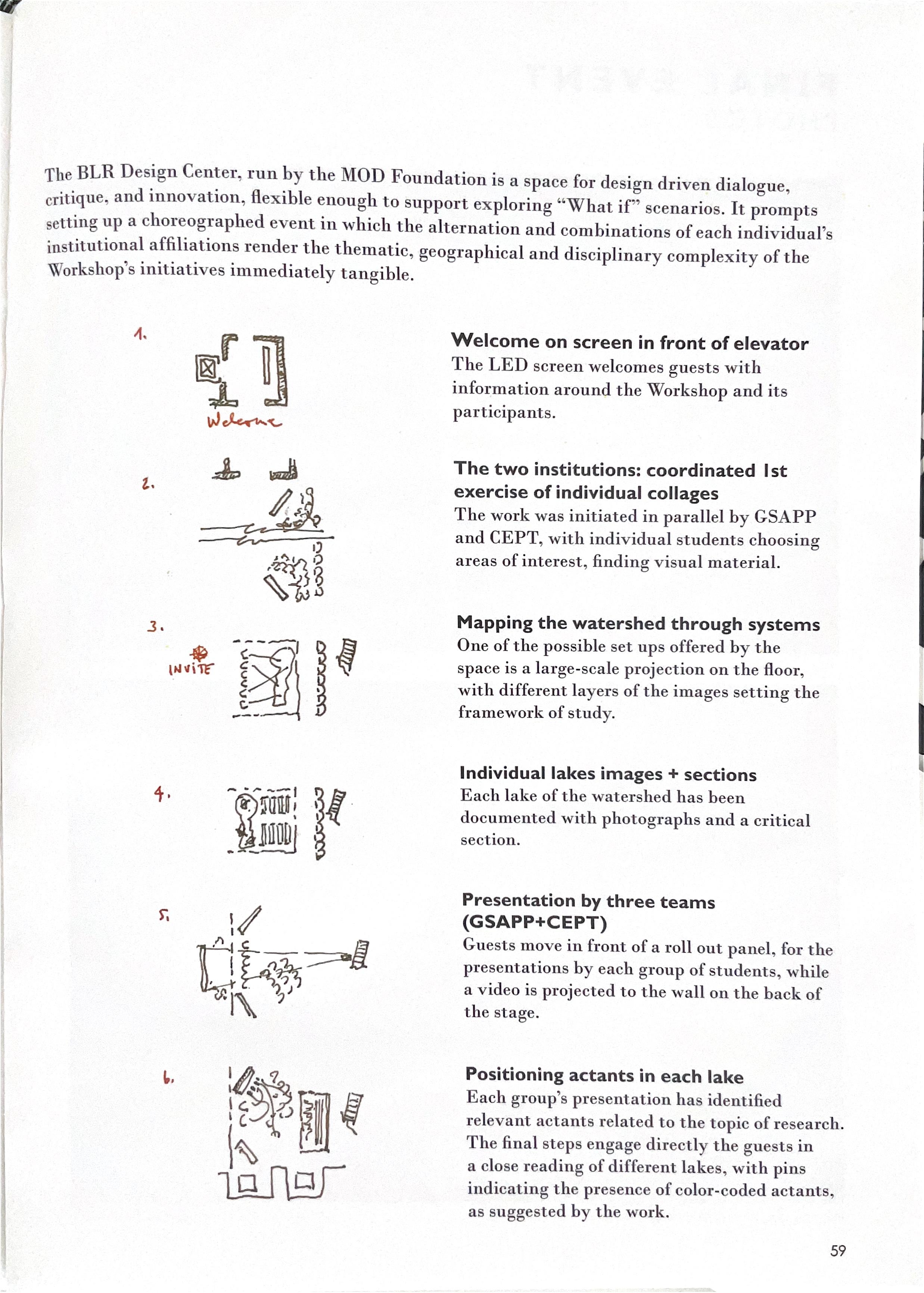

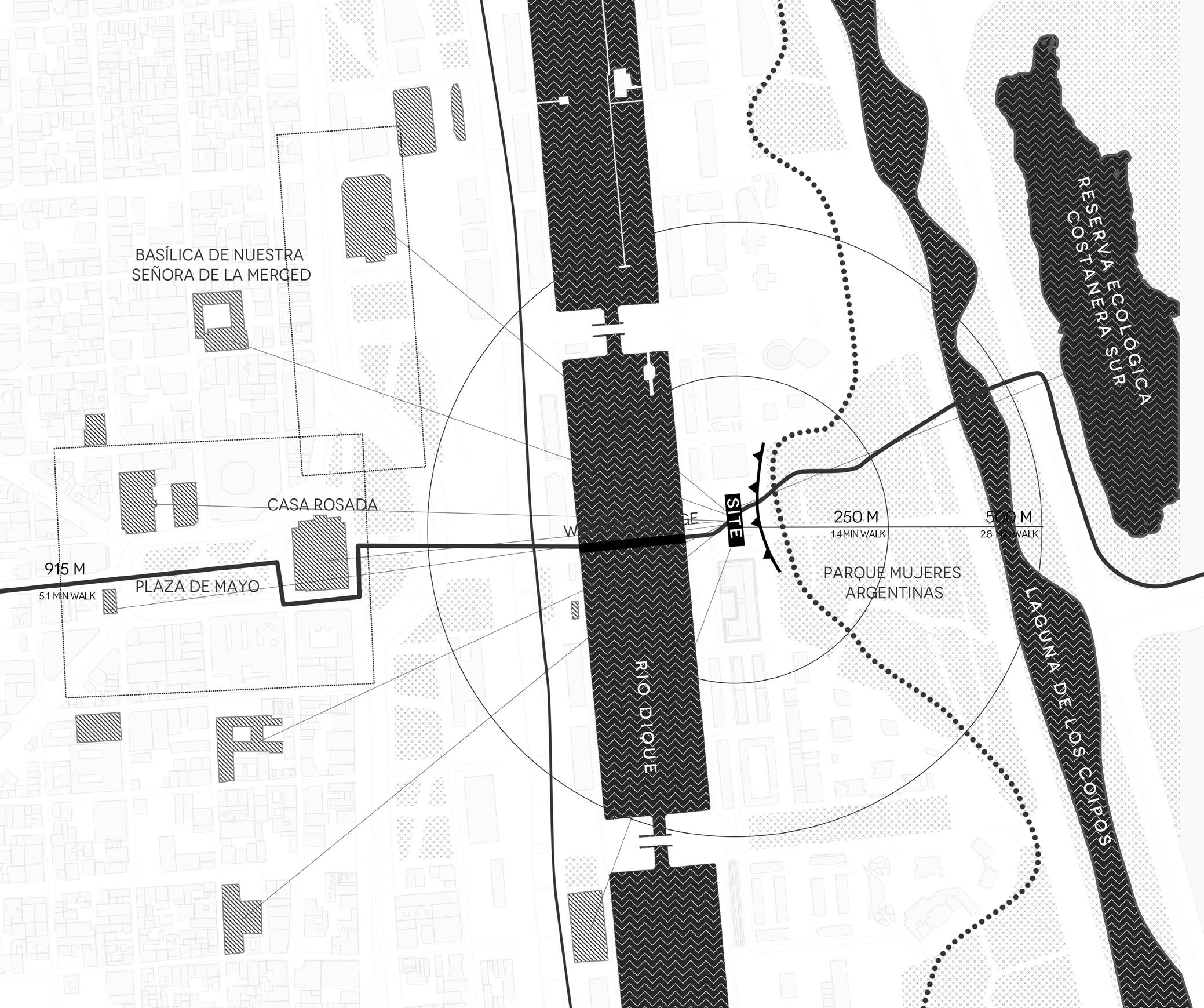
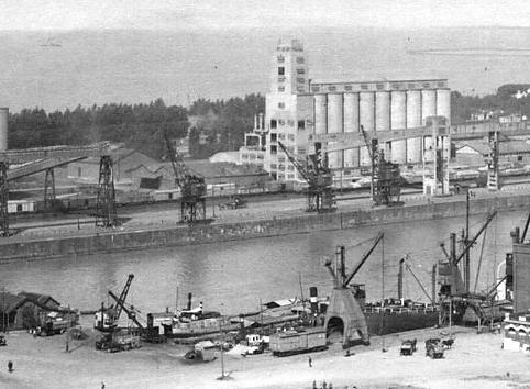
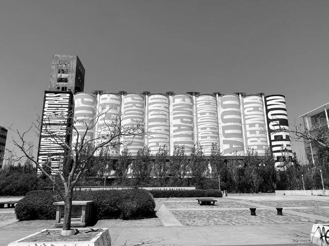
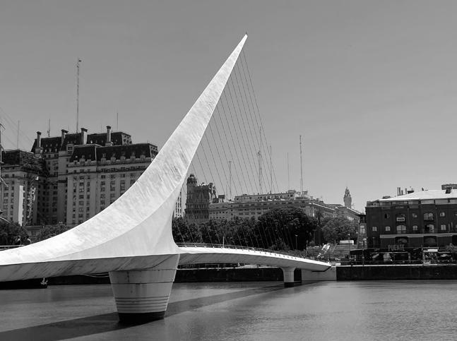
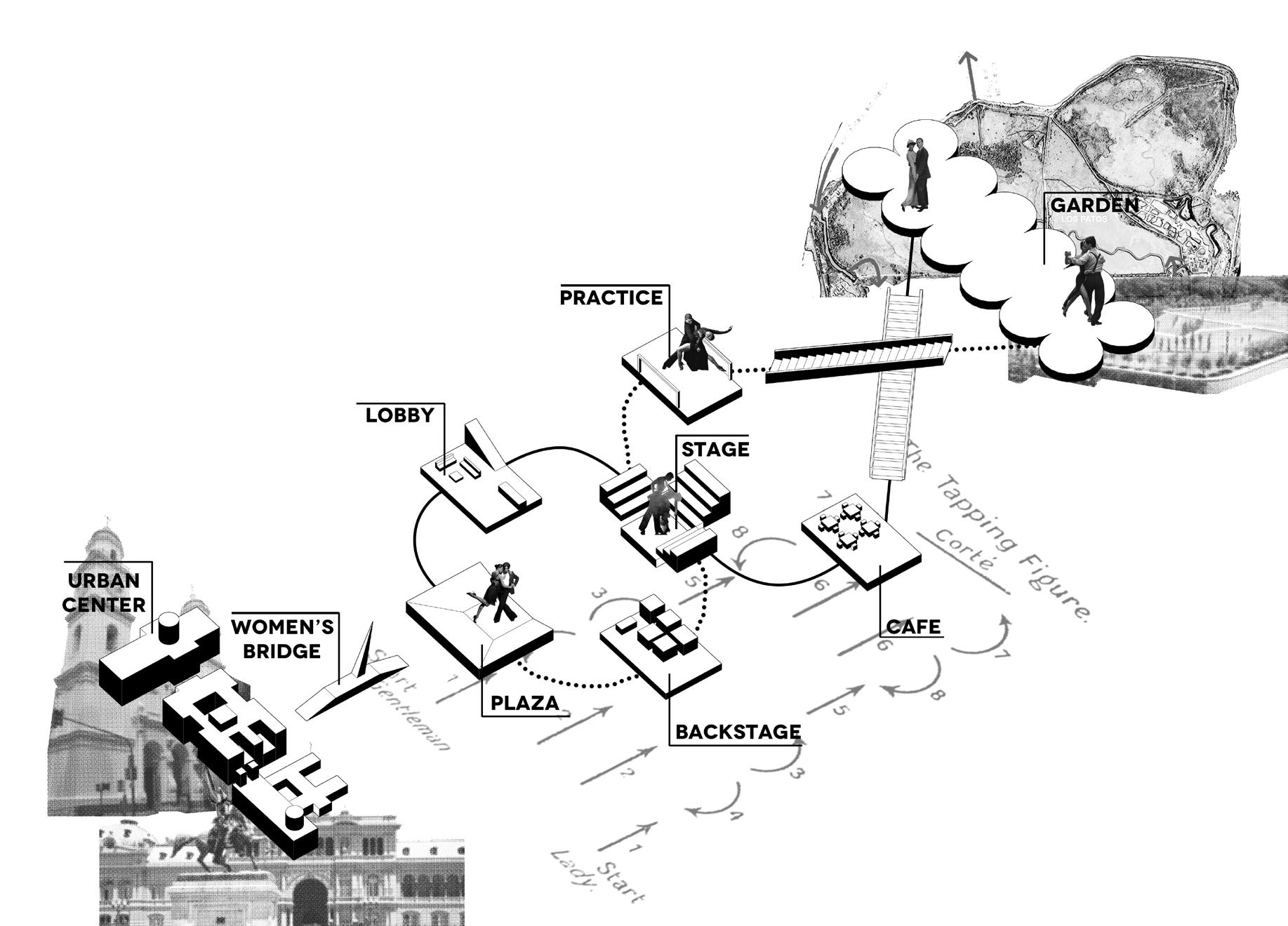
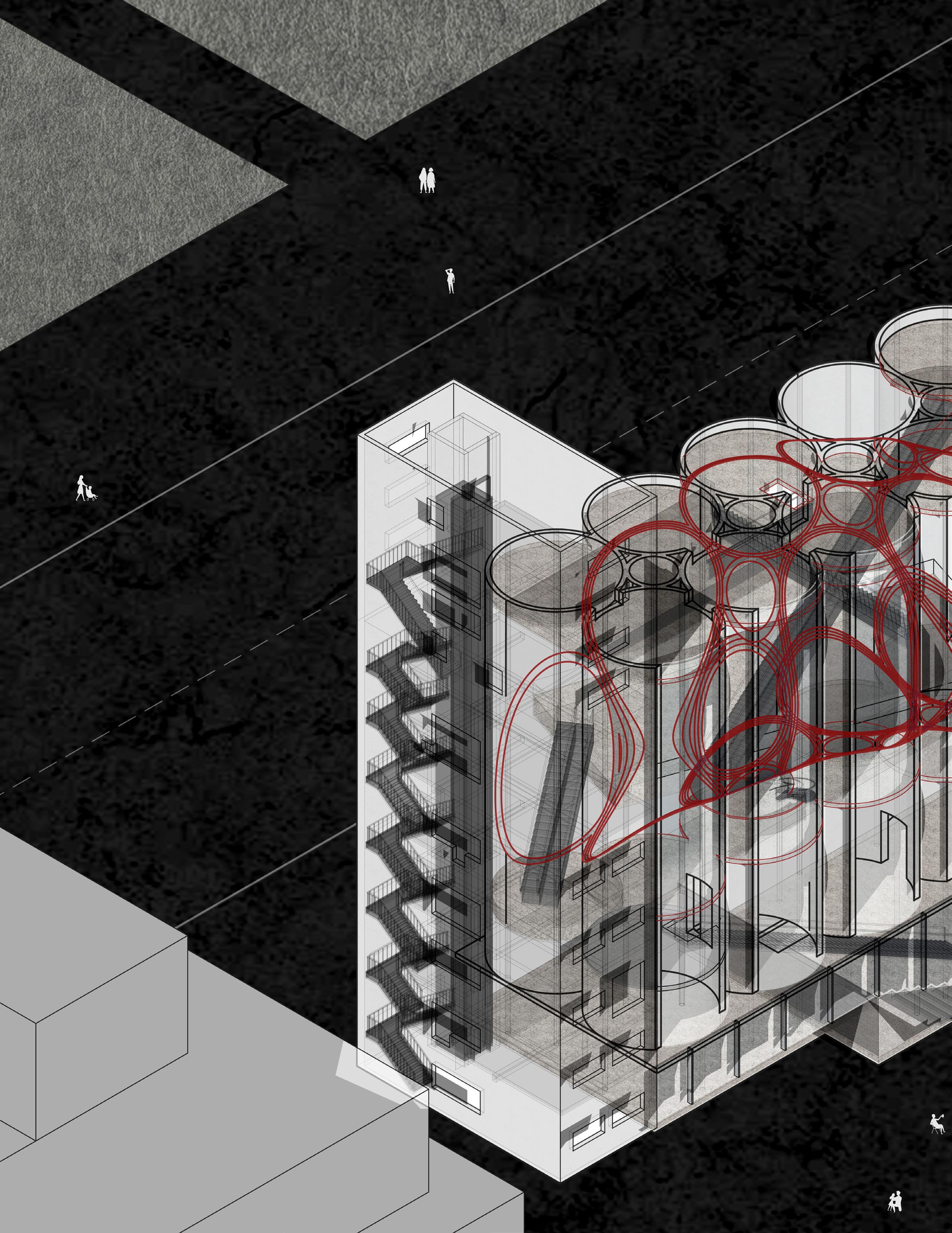
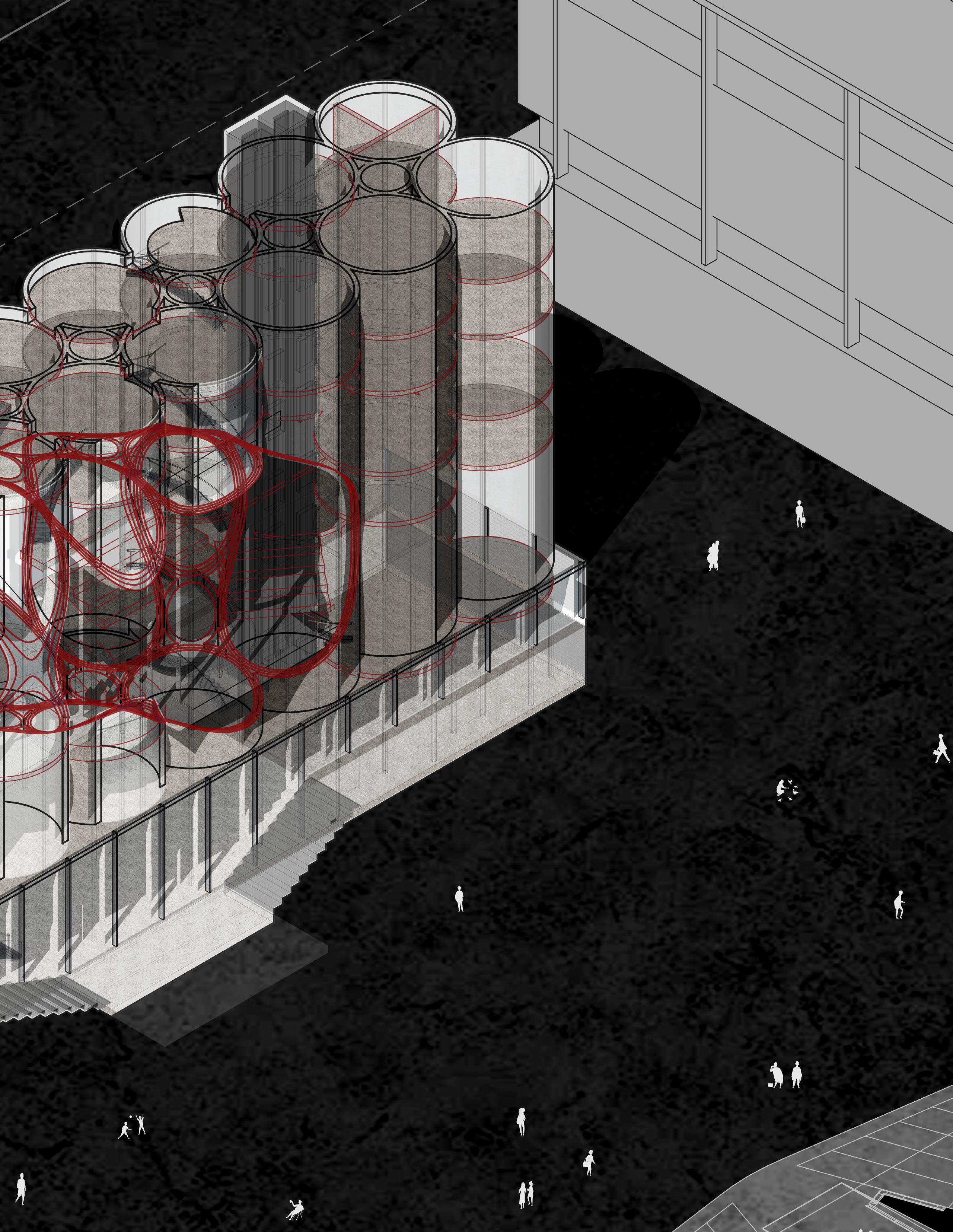
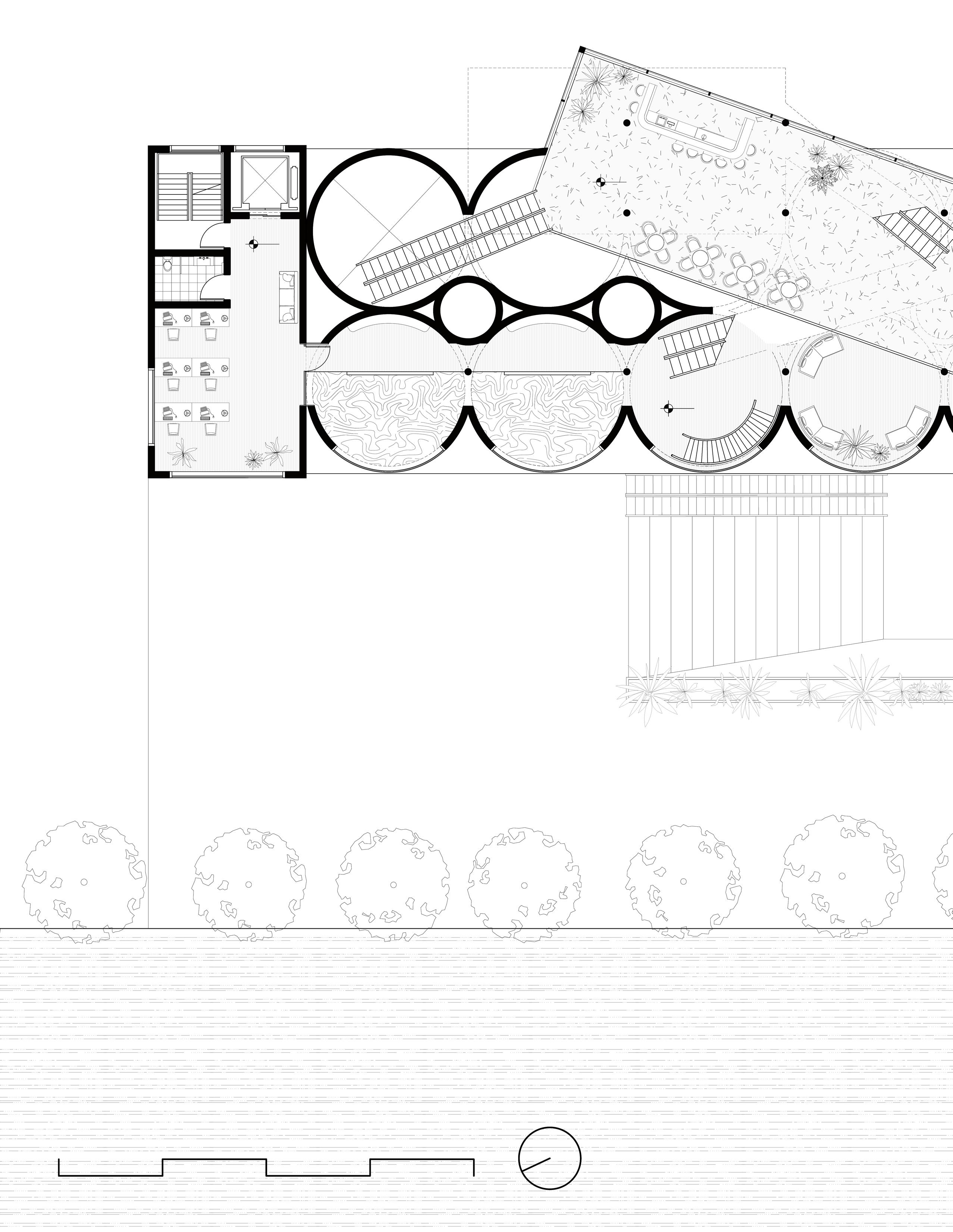
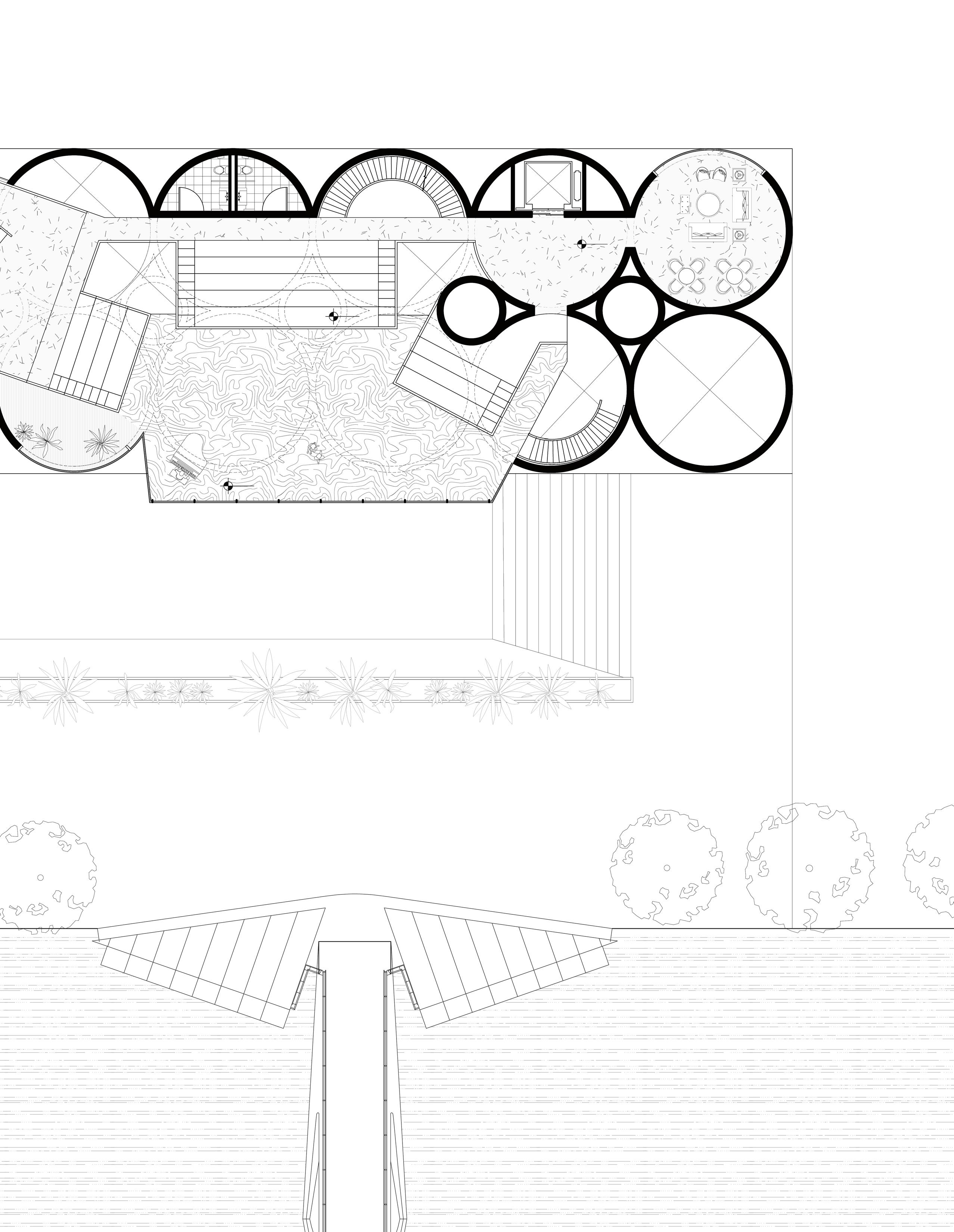
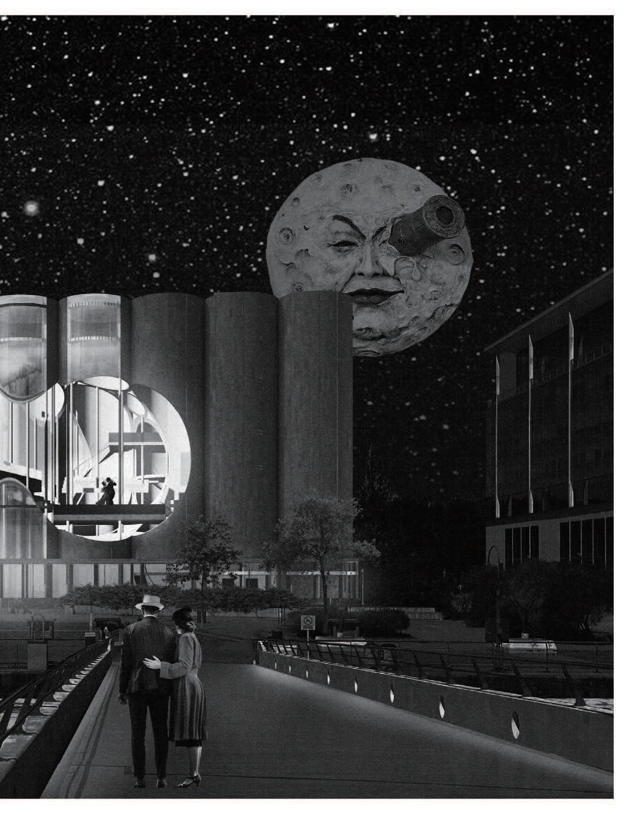
Situated in one of the most strategic places in Buenos Aires, the Silos that belonged to the old “Junta Nacional de Granos” are located on a monumental axis of great historical and cultural importance: through the Puente de la Mujer they connect directly with the Government House, the Plaza de Mayo and the National Congress. Built in 1903, the Silos contained telescopic pipes to store bulk products, emphasizing verticality in the still horizontal landscape of the time. Its industrial materiality in reinforced concrete, the configuration of its openings and the proximity to the river, are just some of the characteristics defined by the program. Out of use for more than 90 years, today this majestic ruin has remained suspended in time.
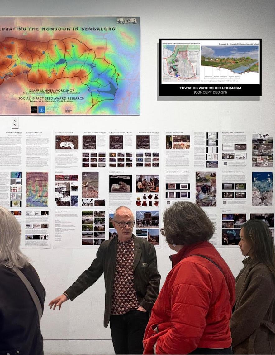
Bengaluru, India
Urban research fellowship
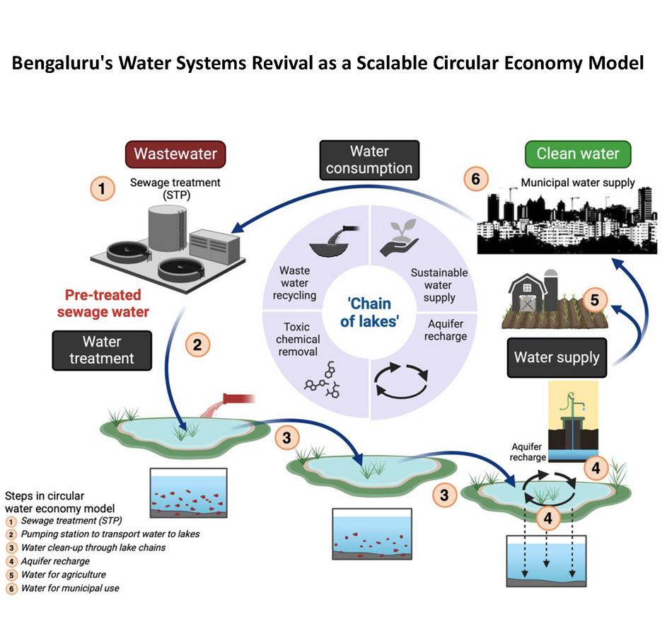
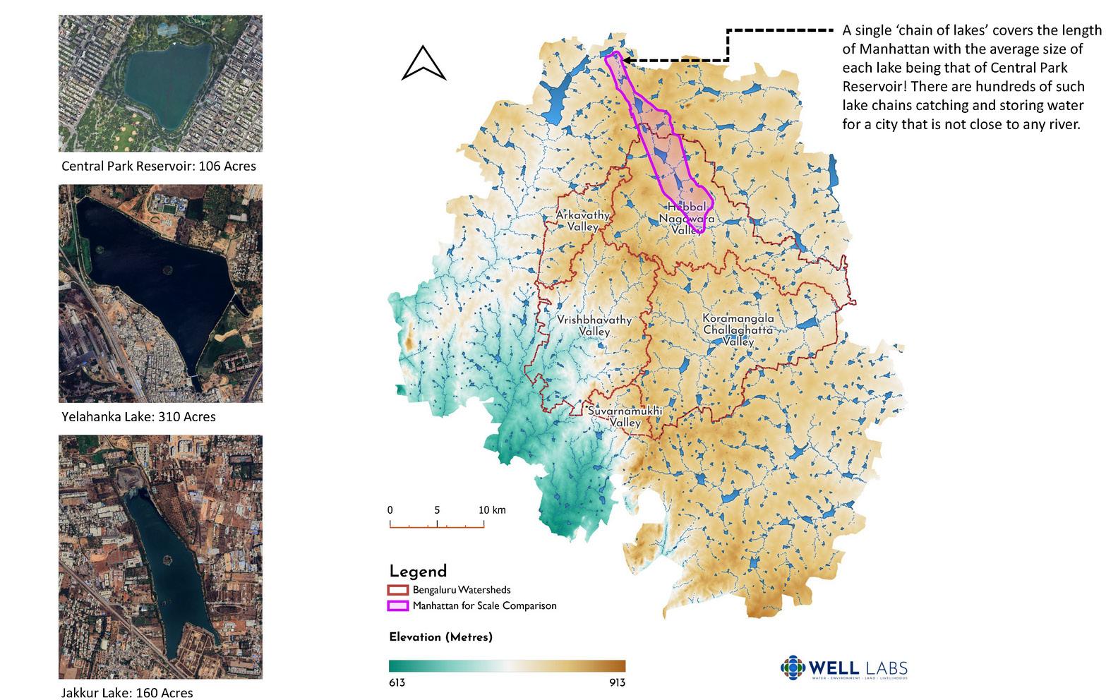
Bengaluru’s water crisis is not the result of climatic scarcity, but of a persistent misalignment between urban form and monsoon-driven hydrological systems. Despite receiving abundant seasonal rainfall, the city depends heavily on artificially pumped water and groundwater extraction, producing the paradox of simultaneous flooding and drought. By revisiting Bengaluru’s historic lake-chain systems and valley-based hydrology, this project depicts water not as a centralized utility, but as a spatial, ecological, and social infrastructure capable of mediating peri-urban growth.
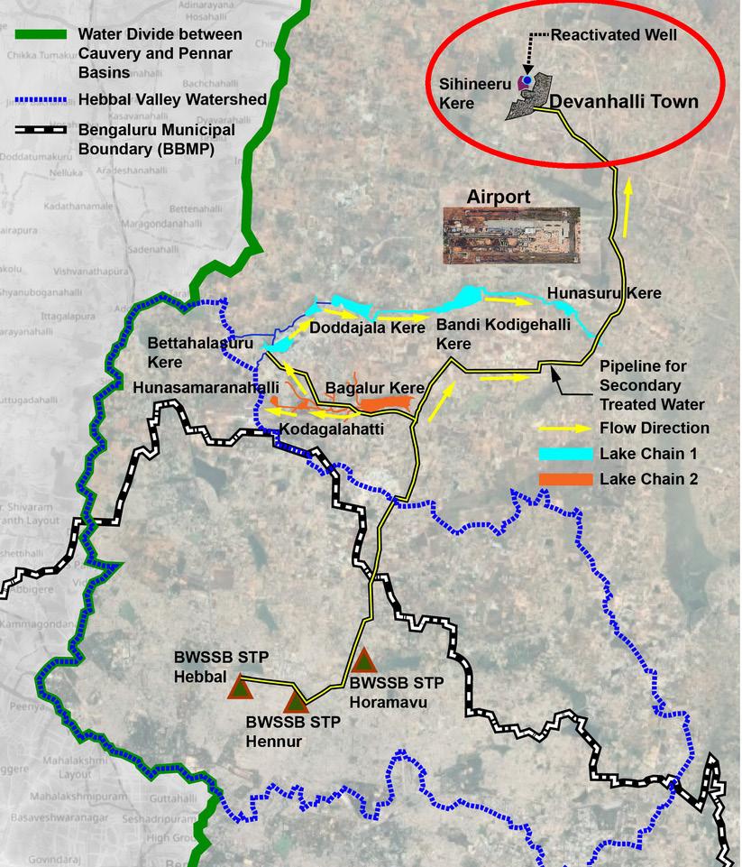
Situated on a ridge of the Deccan Plateau, Bengaluru is divided into two major watersheds corresponding to the Cauvery and Pennar river basins. Unlike river-based cities, Bengaluru historically relied on a constructed network of cascading lakes, earthen dams, and drainage channels that captured monsoon rainfall and distributed it through gravity across valleys. These lake chains functioned as continuous systems rather than isolated reservoirs, supporting agriculture and recharging shallow aquifers.
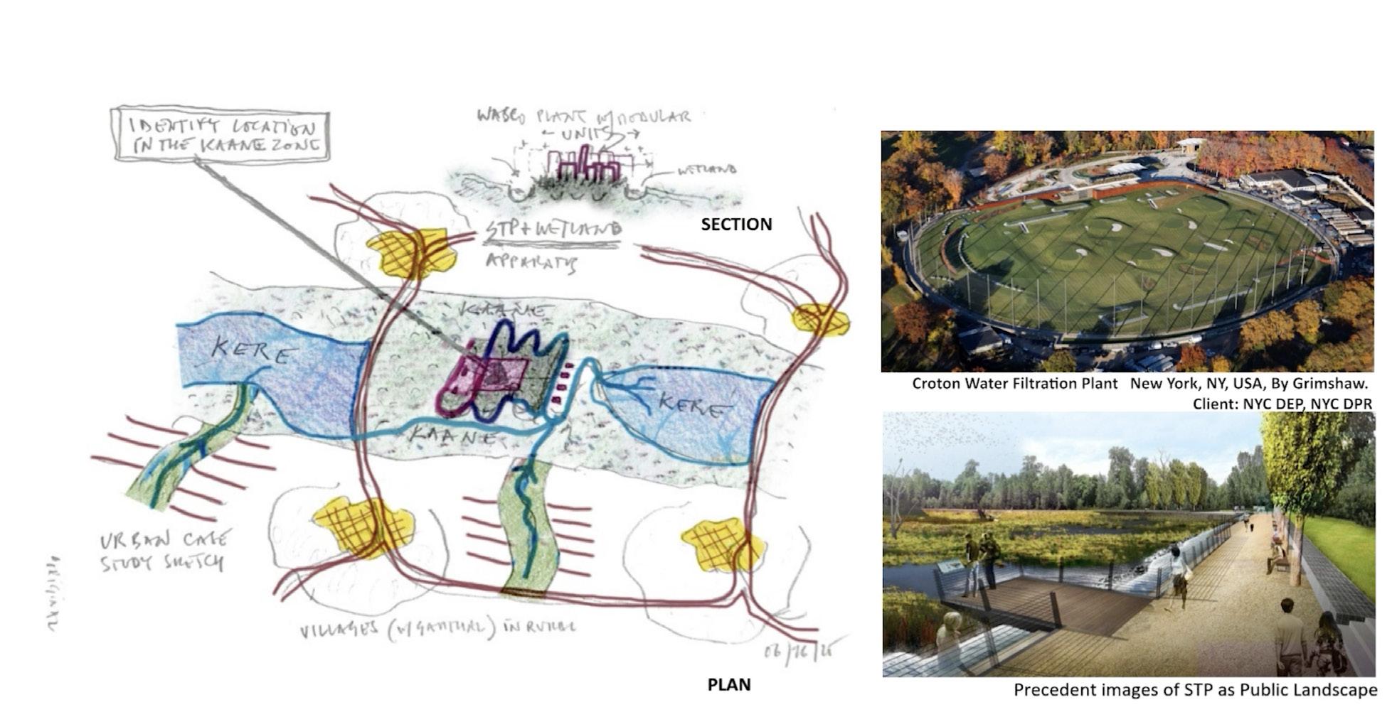
Building on this understanding, the design proposal advances a projective framework for peri-urban Bengaluru grounded in a circular water economy and sectional thinking. Rather than extending development uniformly across the landscape, growth is reimagined as clustered interventions aligned with hydrological capacity. Secondary-treated wastewater from sewage treatment plants is redirected into historic lake chains, where constructed wetlands slow, filter, and distribute water across valleys. Through soil percolation, this water recharges shallow aquifers accessed via open wells and further treated for potable use.
The proposal is structured through sectional relationships rather than a fixed master plan. Each cluster integrates water treatment infrastructure, wetlands, agricultural zones, and settlement within the same hydrological section, allowing urban form to respond directly to topography and flow. Lakes operate as mediating basins that regulate seasonal excess, support biodiversity, and enable productive landscapes. Infrastructure is hybridized with public space and ecology, dissolving conventional distinctions between urban and rural systems.
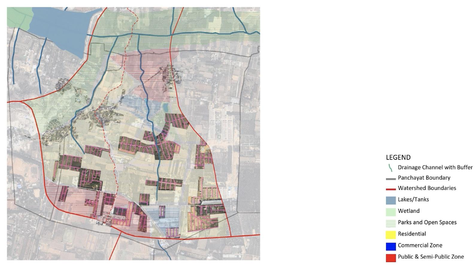
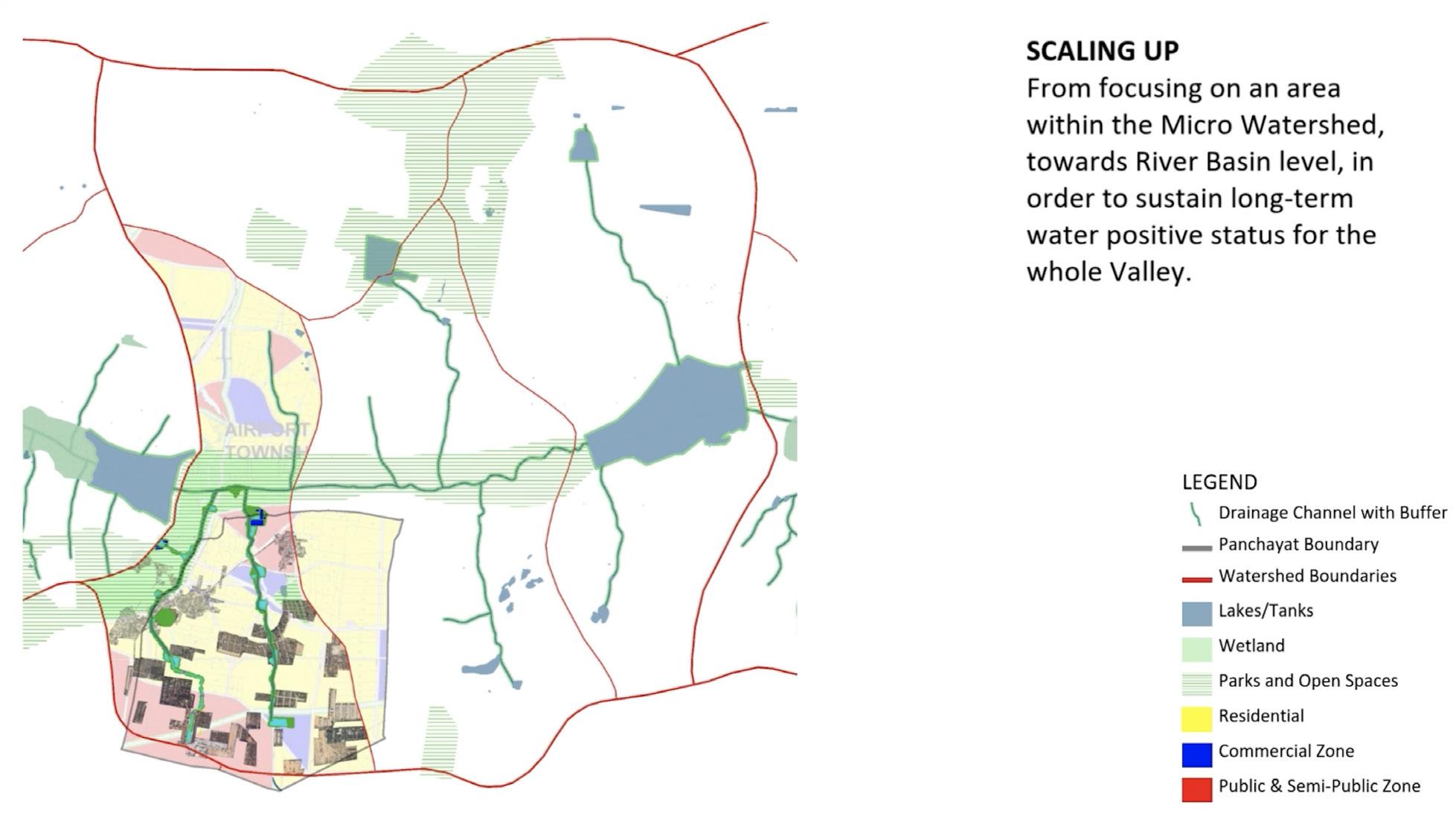
From our understanding of the cultural and topological contexts of the land, we arrived at two proposals: Together, Proposals A and B operate as complementary scales of intervention. Proposal A establishes localized stewardship and social engagement, grounding water management in everyday practices and education. Proposal B extends this logic territorially, using drainage infrastructure to structure ecological performance and growth across the watershed. Both proposals reject purely technical or plan-based solutions, instead advancing a sectional, landscape-driven approach where water infrastructure doubles as public space, ecological system, and social framework.
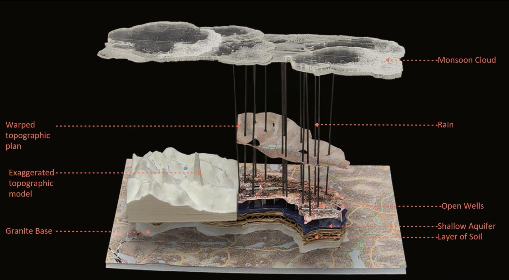
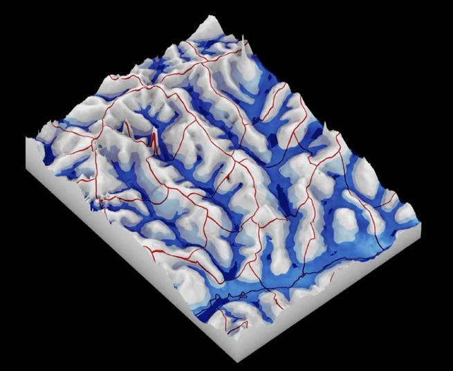
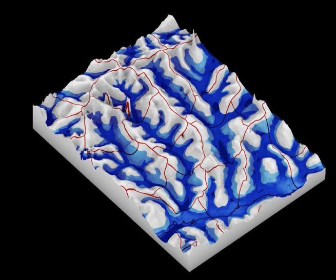
Physical model for the monsoon cycle
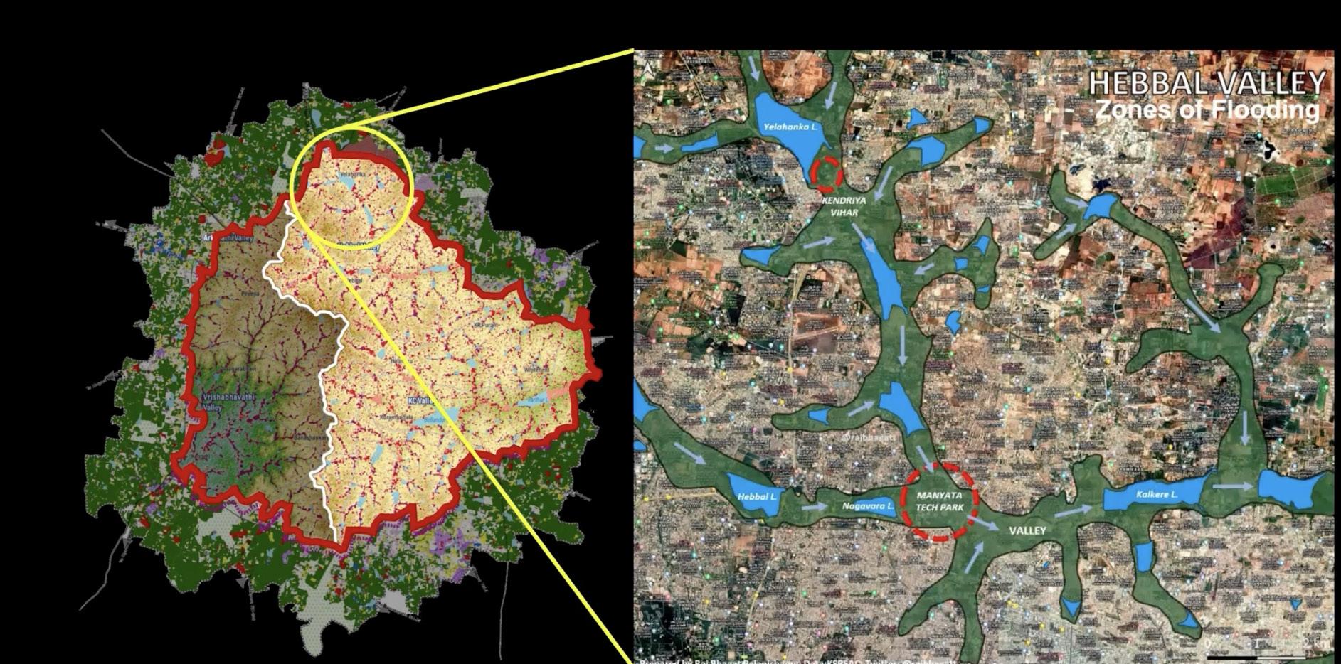
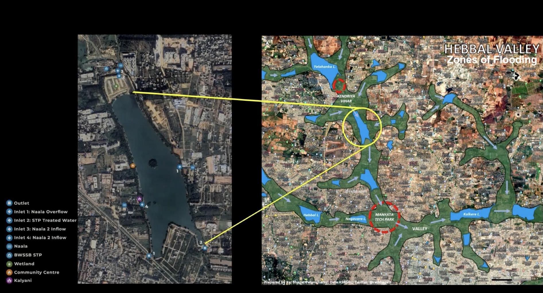
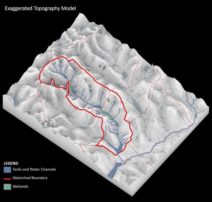
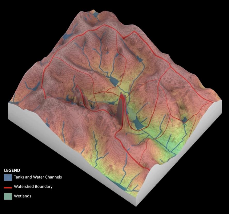
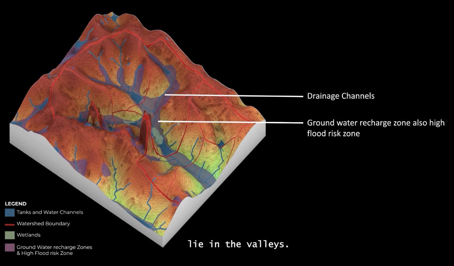
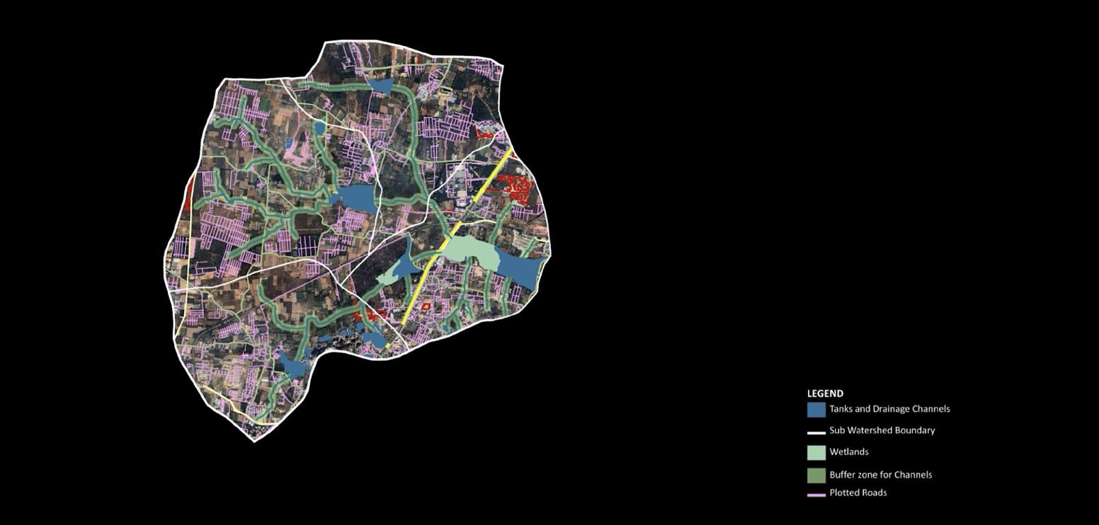
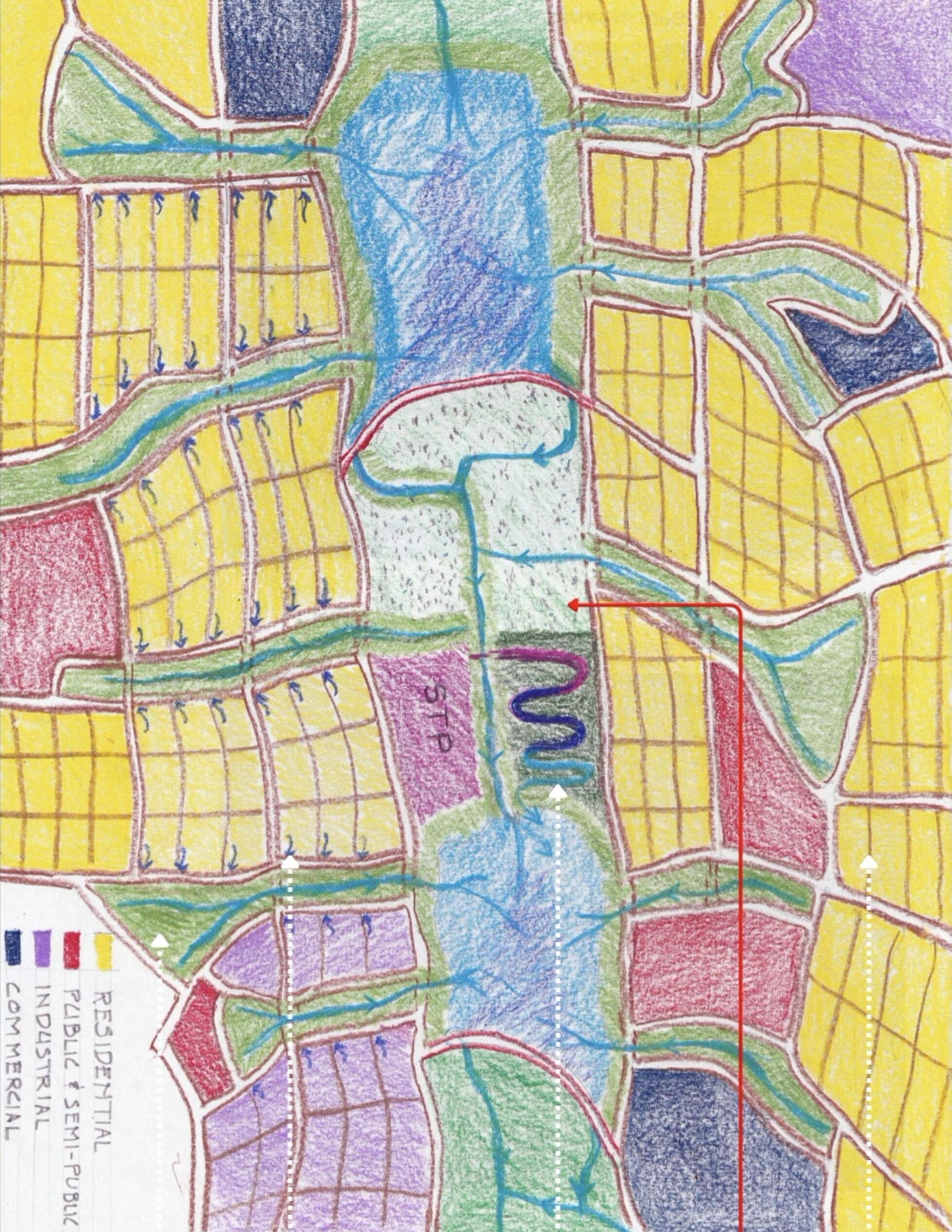
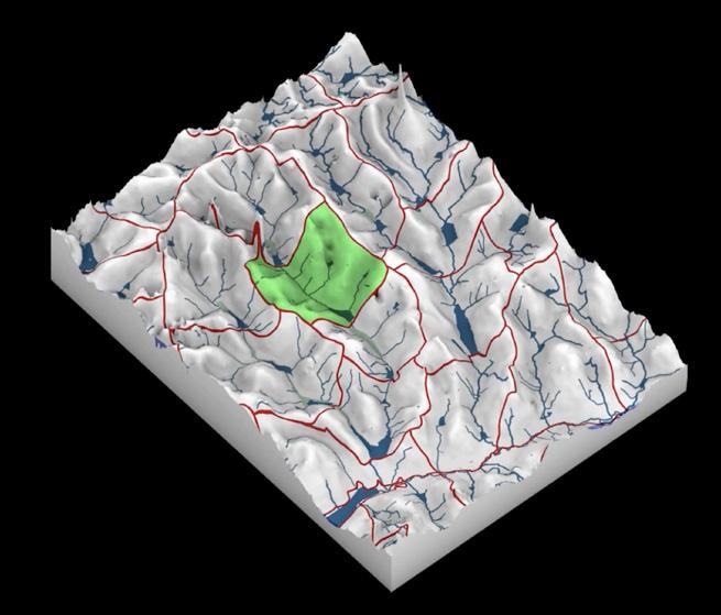
This diagram situates the project within a nested hydrological logic, moving from the scale of the sub-watershed to the lake chain, and finally to a localized intervention zone. The top image establishes the overall sub-watershed boundary, revealing how tanks, drainage channels, wetlands, and buffer zones form a continuous water system that cuts across plotted roads and development parcels rather than aligning with them.
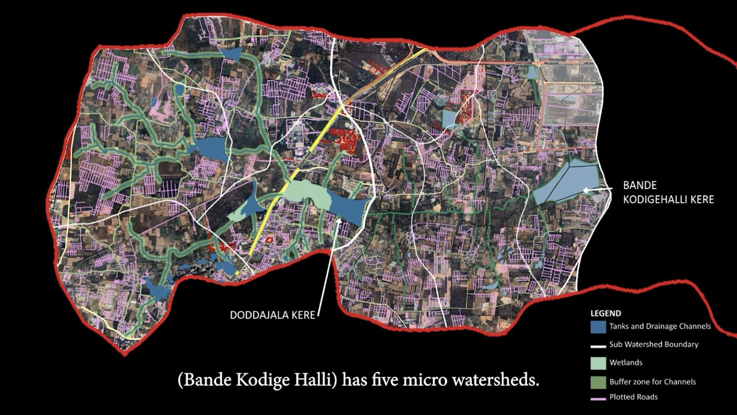
expanding this logic across the full lake chain, from Doddajala Kere to Bande Kodigehalli Kere—showing how water moves laterally through connected tanks and channels within a single watershed, despite administrative and infrastructural fragmentation.
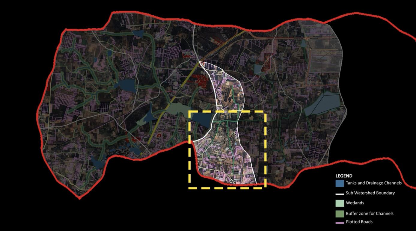
By concentrating wetlands, buffer zones, retention ponds, and controlled inundation areas within this zone, the proposal amplifies its capacity to receive, slow, and redistribute water moving through the lake chain. This transforms the highlighted area into a hydrological mediator, where upstream flows are absorbed and filtered before continuing downstream.
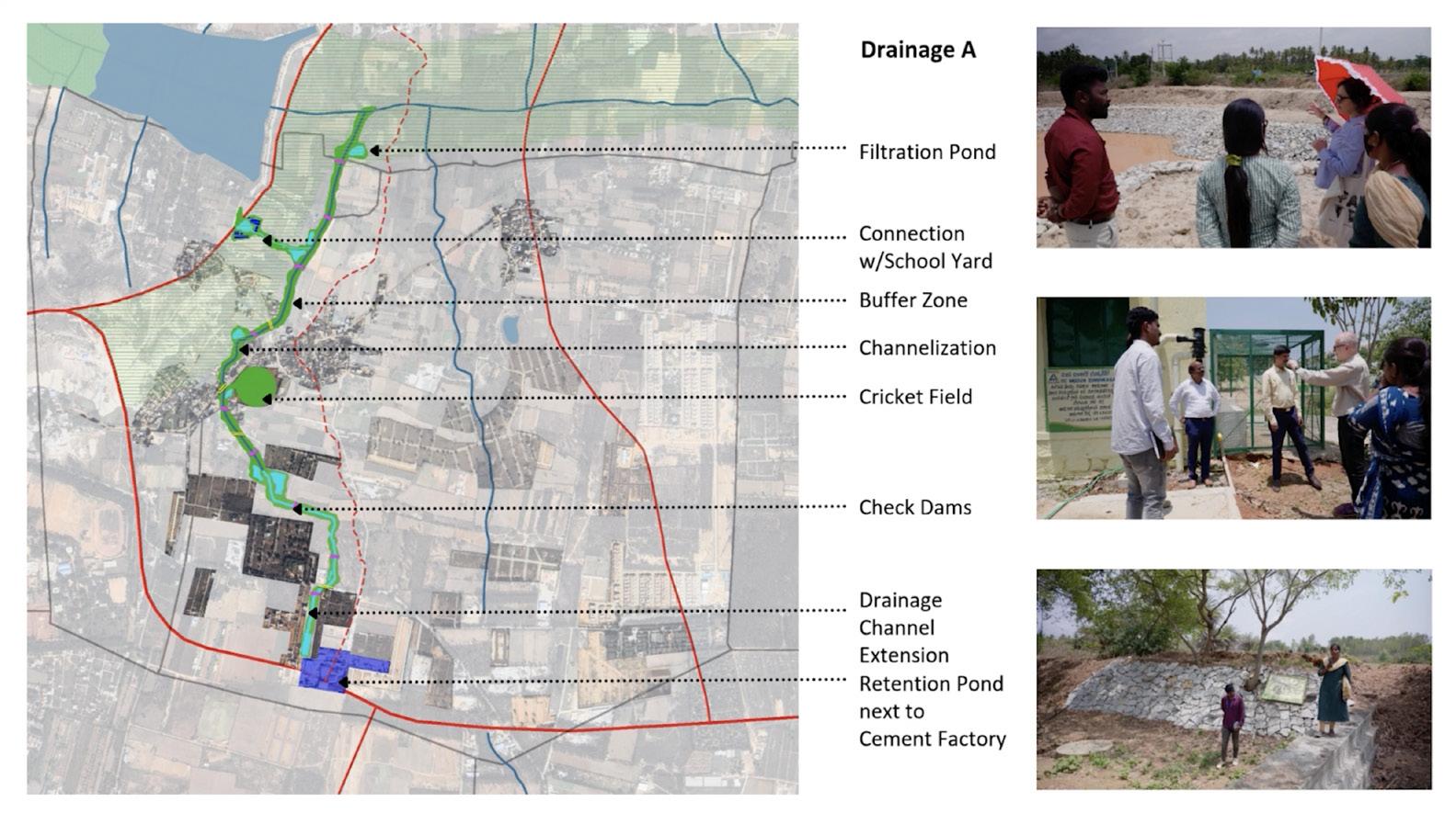
Proposal A restructures a defined segment of the drainage channel adjacent to the school into a four-zone hydrological section. A 20 m planted buffer separates the school from flood risk, followed by a recharge zone aligned with existing open wells, a lowered inundation zone sized for peak monsoon overflow, and a continuous drainage channel that maintains downstream flow. During heavy rainfall, water spills into the inundation zone, then slowly infiltrates through the recharge zone to replenish the shallow aquifer, making groundwater levels visible and usable via the wells. A pedestrian path runs along the buffer and recharge zones, ensuring the channel functions simultaneously as flood infrastructure, aquifer recharge system, and everyday public landscape.
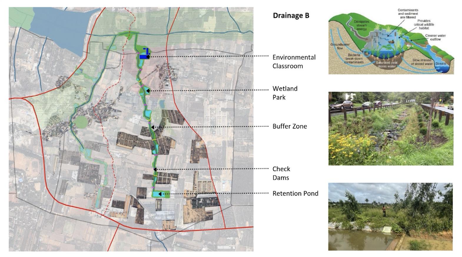
Proposal B transforms the full length of the drainage channel into a continuous bio-remediation corridor that operates at the scale of the micro-watershed. The channel is thickened through a sequence of constructed wetlands, check dams, retention ponds, and a terminal quarry reservoir, each positioned to slow flow, filter runoff, and recharge groundwater before water enters downstream lakes such as Doddajala Kere. Development gaps between plotted parcels are consolidated into buffer zones that accommodate controlled flooding during monsoon events.
This project positions Bengaluru’s water landscape as an active system shaped by monsoon cycles, topography, and long-term patterns of settlement rather than as a technical problem to be solved through isolated infrastructure. By working with drainage channels, lake chains, and shallow aquifers, the proposals reintroduce continuity to a fragmented hydrological network, allowing water to slow, spread, and recharge within designed thresholds. Flooding is not treated as an exception, but as a seasonal condition that can be spatially accommodated and made legible through landscape form.
Proposals A and B operate across complementary scales, demonstrating how localized sectional interventions can influence watershed-wide performance. At the scale of the drainage channel, water is filtered, stored, and redistributed through wetlands, buffers, and recharge zones that remain accessible and visible. At the territorial scale, these same systems structure peri-urban growth, linking open space, agriculture, and infrastructure within a continuous ecological framework.
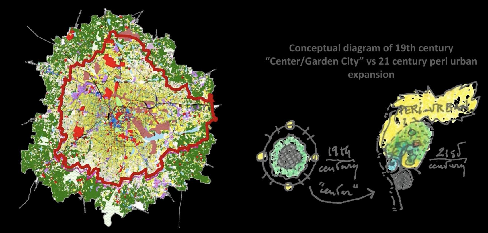
Together, the project suggests an alternative model for urban expansion in Bengaluru. The design is guided by hydrological capacity rather than zoning abstractions, and by gradual mediation rather than control. By embedding water processes into everyday landscapes and social spaces, the work proposes a resilient future in which urbanization and ecological systems are not in opposition, but operate in mutual dependence over time.
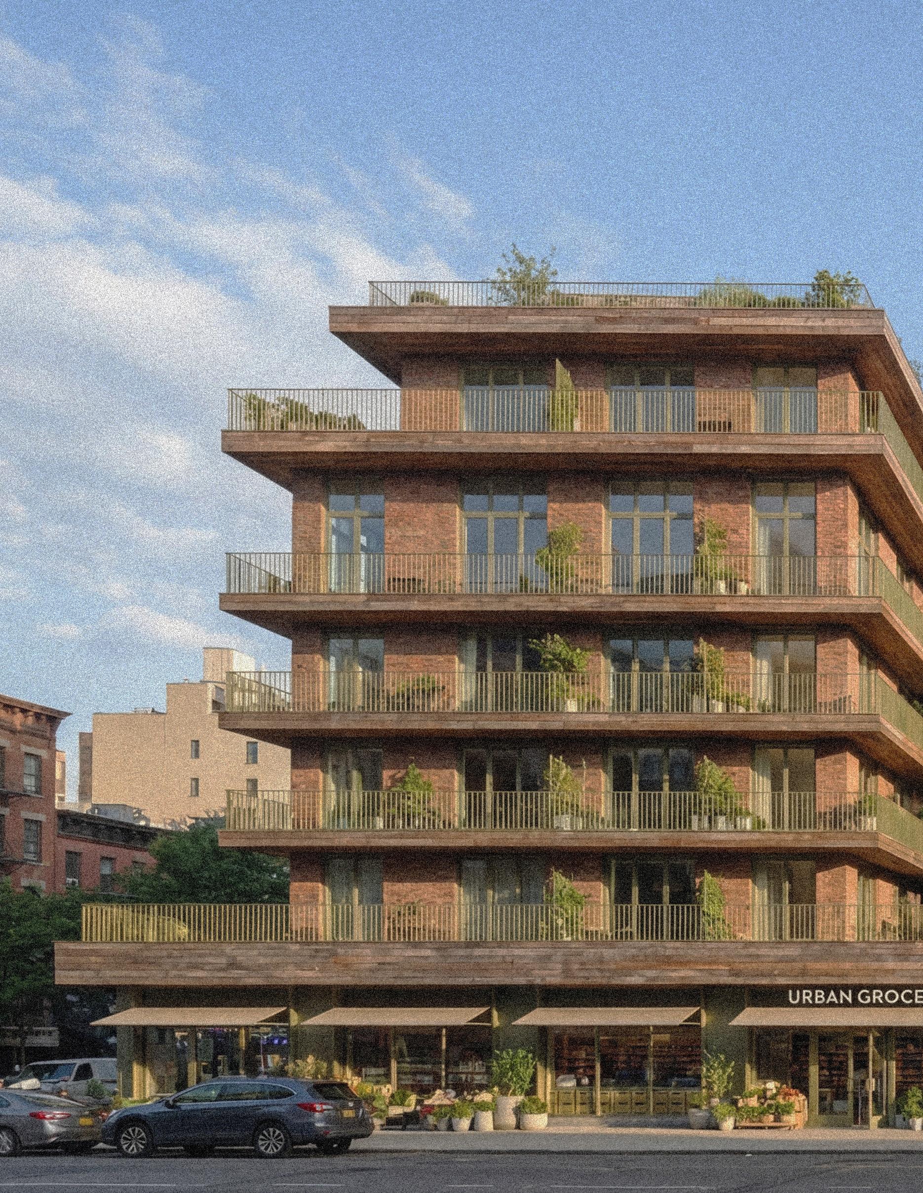
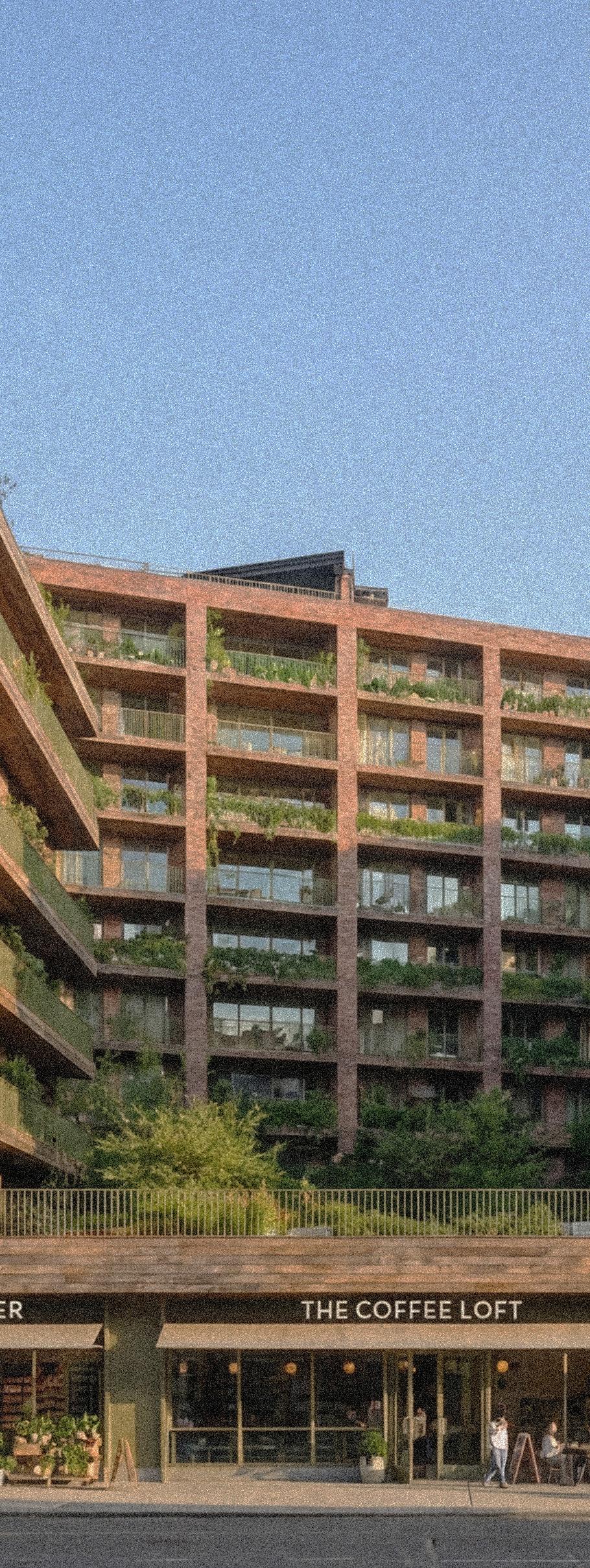
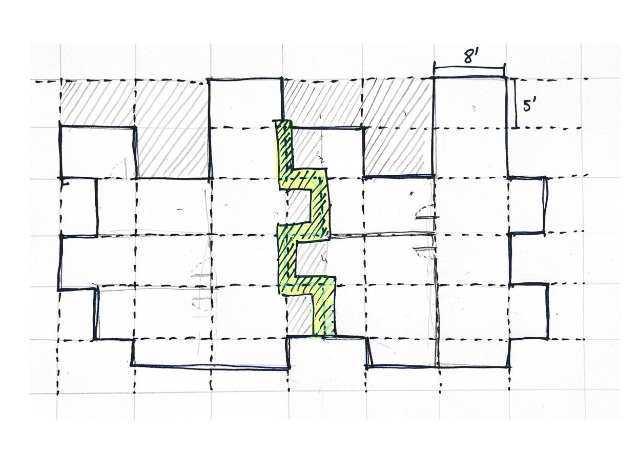
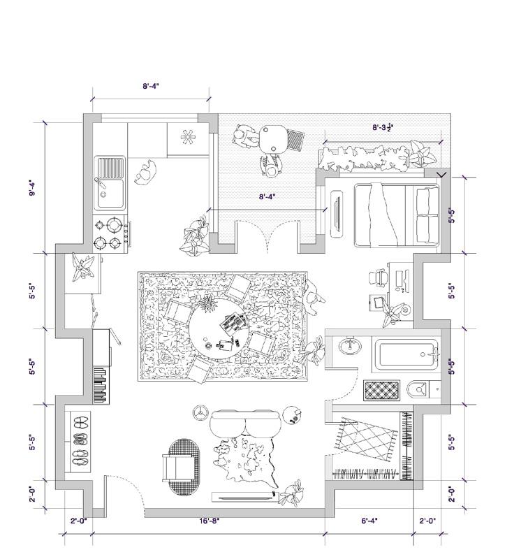
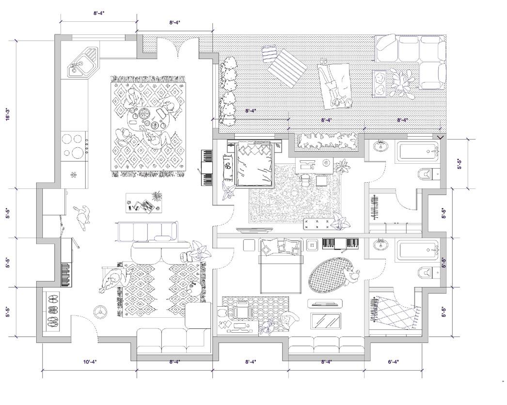
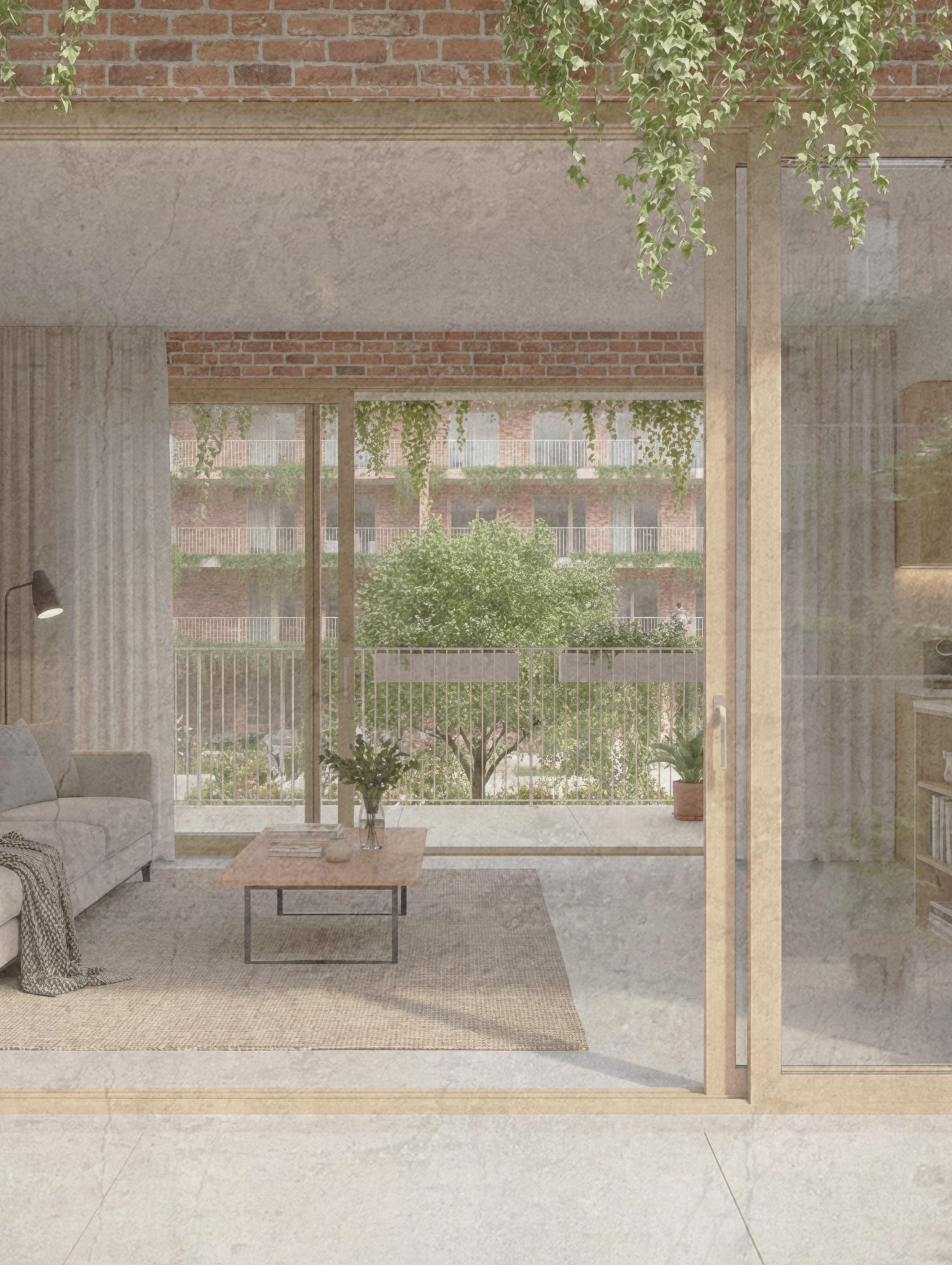
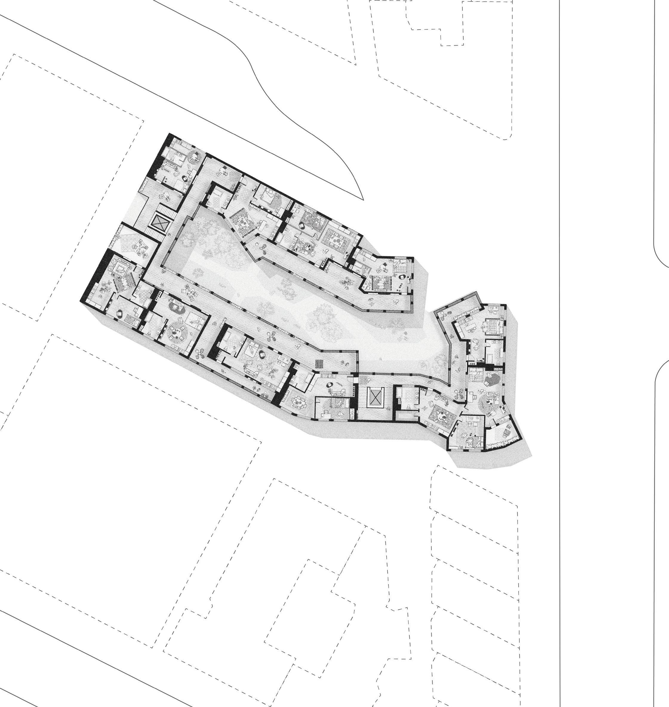
The apartments are generated from a 5ft × 8ft planning grid, which acts as both a dimensional discipline and a social framework. Rather than treating walls as flat separators, each unit’s perimeter steps in and out along the grid, producing a thickened edge condition. These interlocking wall segments align across adjacent apartments, allowing units to nest into one another rather than sit as isolated boxes.
This strategy creates a series of nooks, alcoves, and thresholds, spaces that are neither fully private nor fully shared. Within units, these moments become places for sitting, storage, or pause; between units, they form soft connections that register the presence of neighbors without direct exposure. As the building steps up, the grid logic remains consistent, allowing the massing to shift vertically while preserving alignment and continuity.

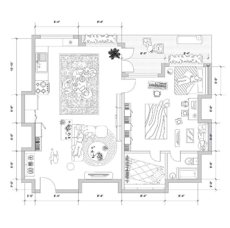
1-BEDROOM
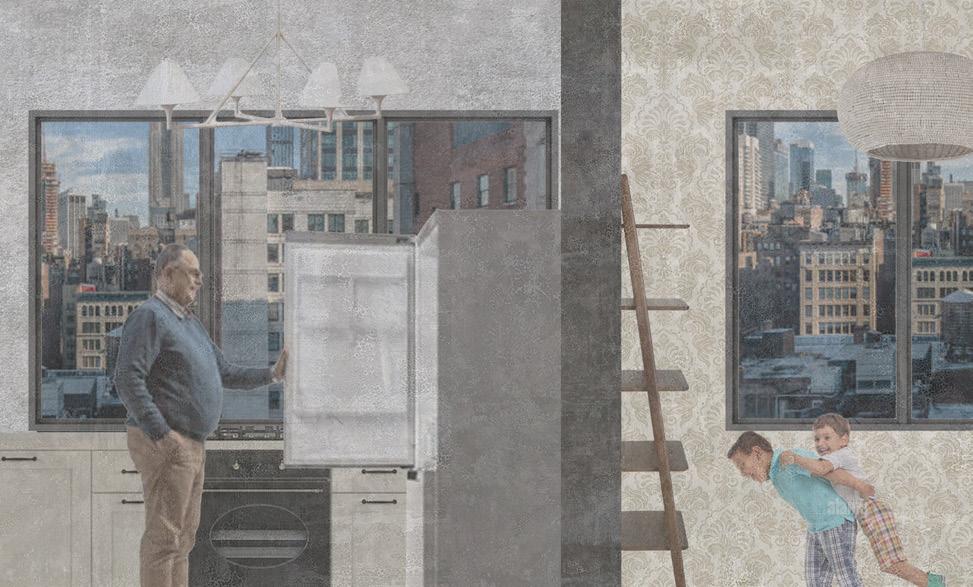
He lives deliberately, using the apartment to pace his inner life rather than impress anyone else. Elias moves between zones with intention, working by hand at the table, cooking quietly for himself, retreating early to protect his sleep. He keeps few possessions but tends carefully to plants and daily rituals, hosting only those who feel close enough to share the softened center of his home. The space reflects a man who thinks spatially, feels deeply, and uses design as a way to stay grounded in a dense, demanding city.

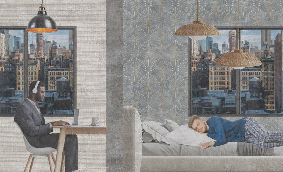
They share the apartment as a negotiated terrain, comfortable moving between intimacy and autonomy. The open living space holds their shared life, slow dinners, overlapping work, friends gathered on the rug while the quieter edges allow each of them to withdraw without friction. One is expressive and leaves traces behind; the other is attentive and subtly reorders. The plan reflects a couple who value closeness but understand that a strong relationship is sustained by space, rhythm, and mutual respect for difference.


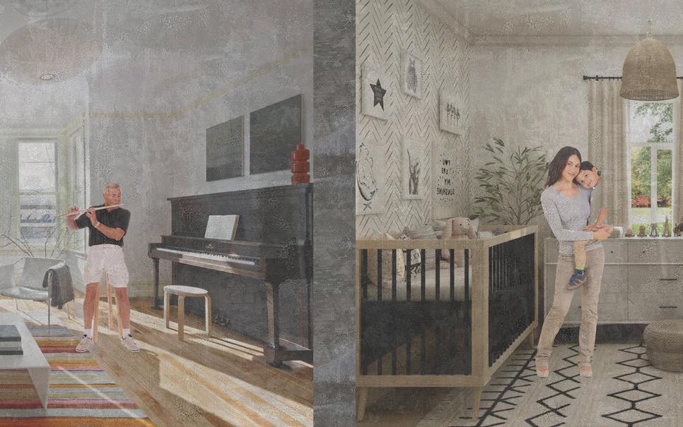
They inhabit the apartment as a shared ecosystem shaped around family life, balancing collective routines with moments of retreat. The central living spaces anchor daily togetherness, meals, play, homework, and conversation. while Smaller rooms and thresholds give each family member room to decompress without isolation. Movement is constant and overlapping, with objects and activities migrating throughout the day. The plan reflects a family that values adaptability, emotional closeness, and spatial generosity, using the home as a flexible framework that supports care, growth, and changing rhythms rather than fixed roles or rigid order.


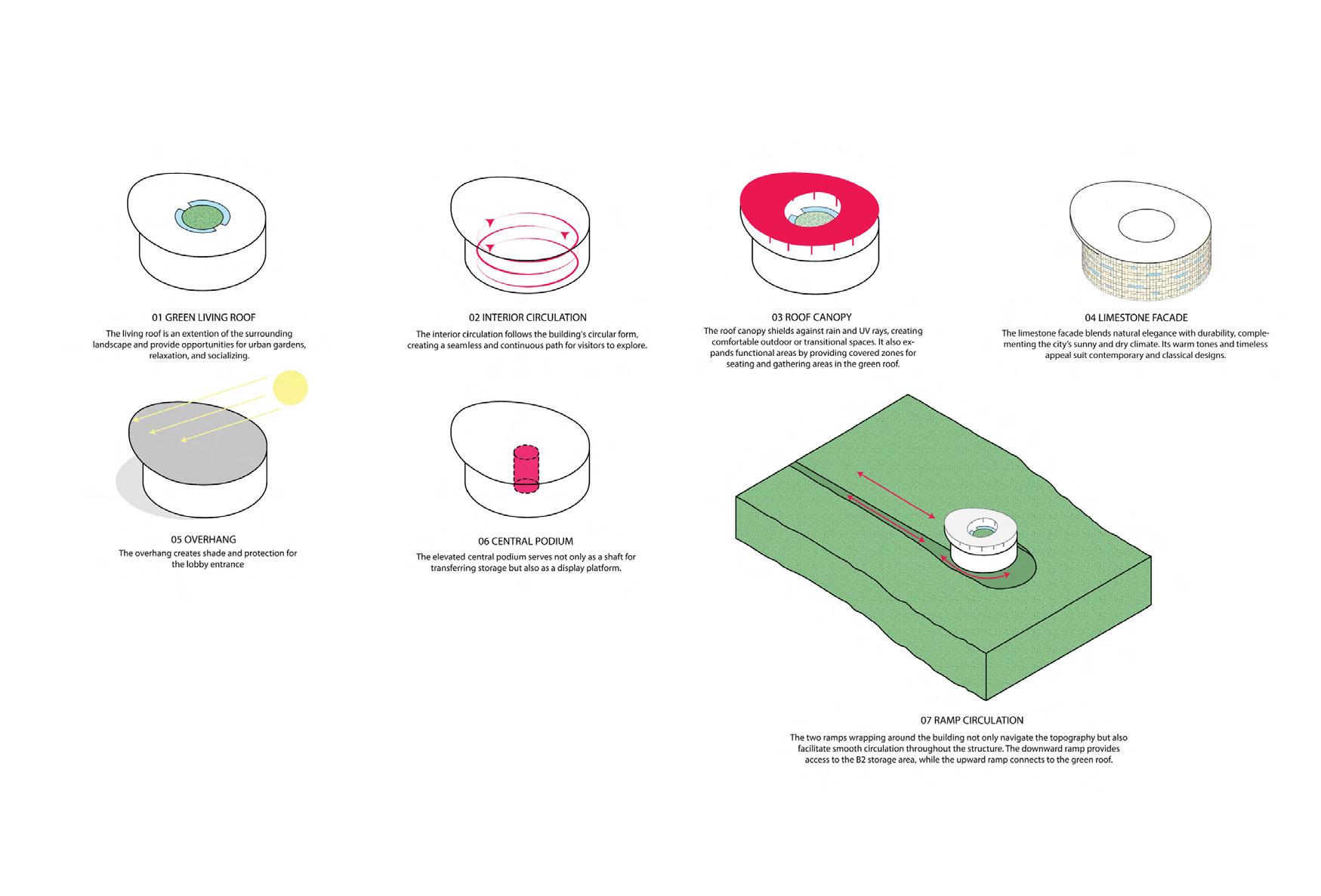
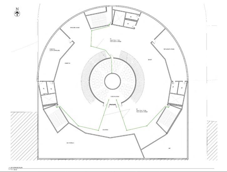
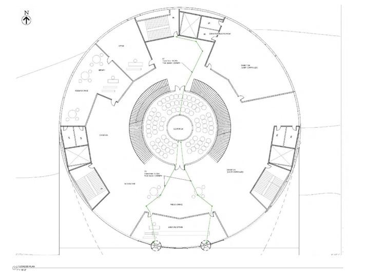
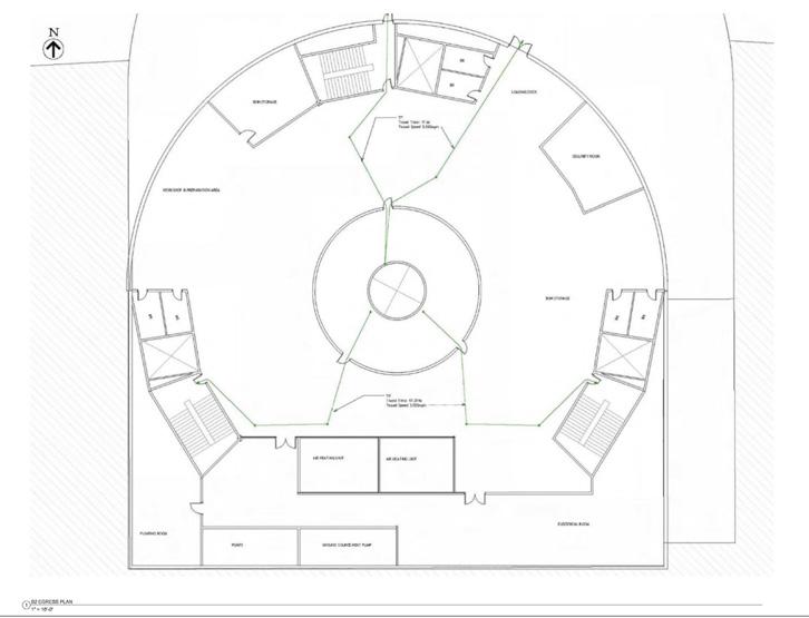
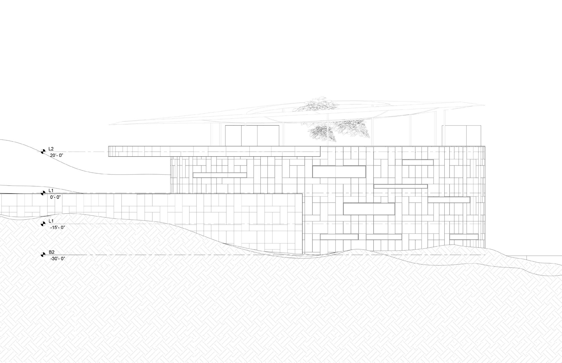
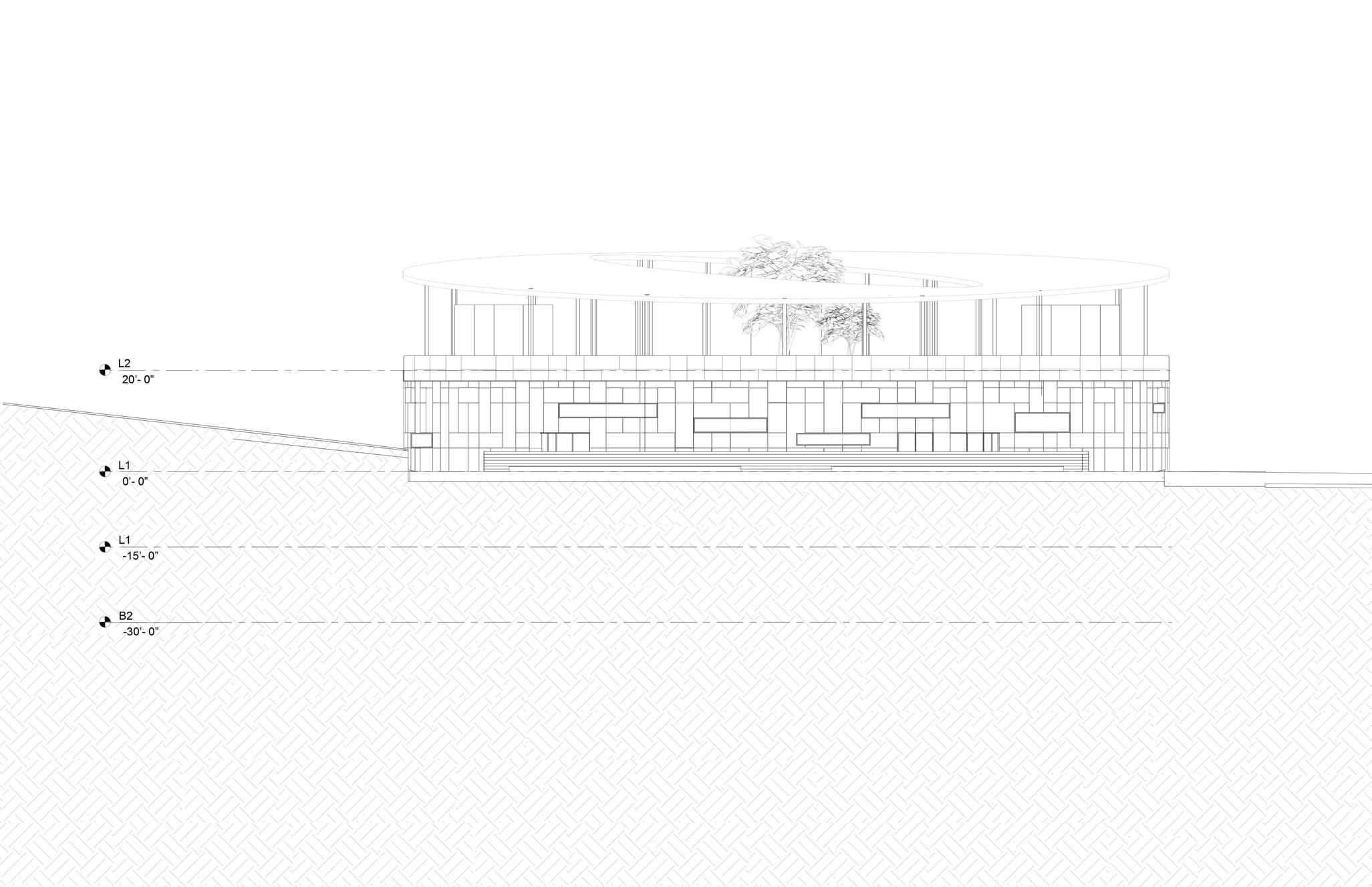
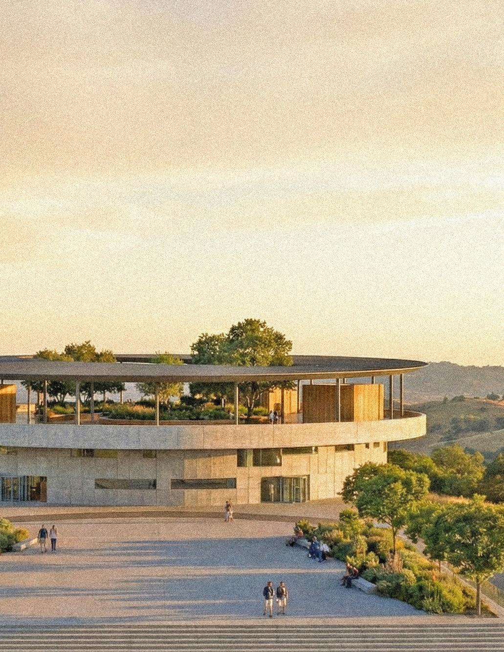
The Museum of Rebirth is a circular museum embedded into a sloping landscape, conceived as an architectural instrument for slow movement, reflection, and spatial continuity. The project explores how geometry, section, and structure can choreograph experience, using the circle not as a symbolic object alone but as an organizing system that unifies circulation, structure, and light. The building is partially submerged into the terrain, allowing it to emerge gradually from the site while minimizing visual impact and grounding the museum as an extension of the landscape rather than a freestanding object
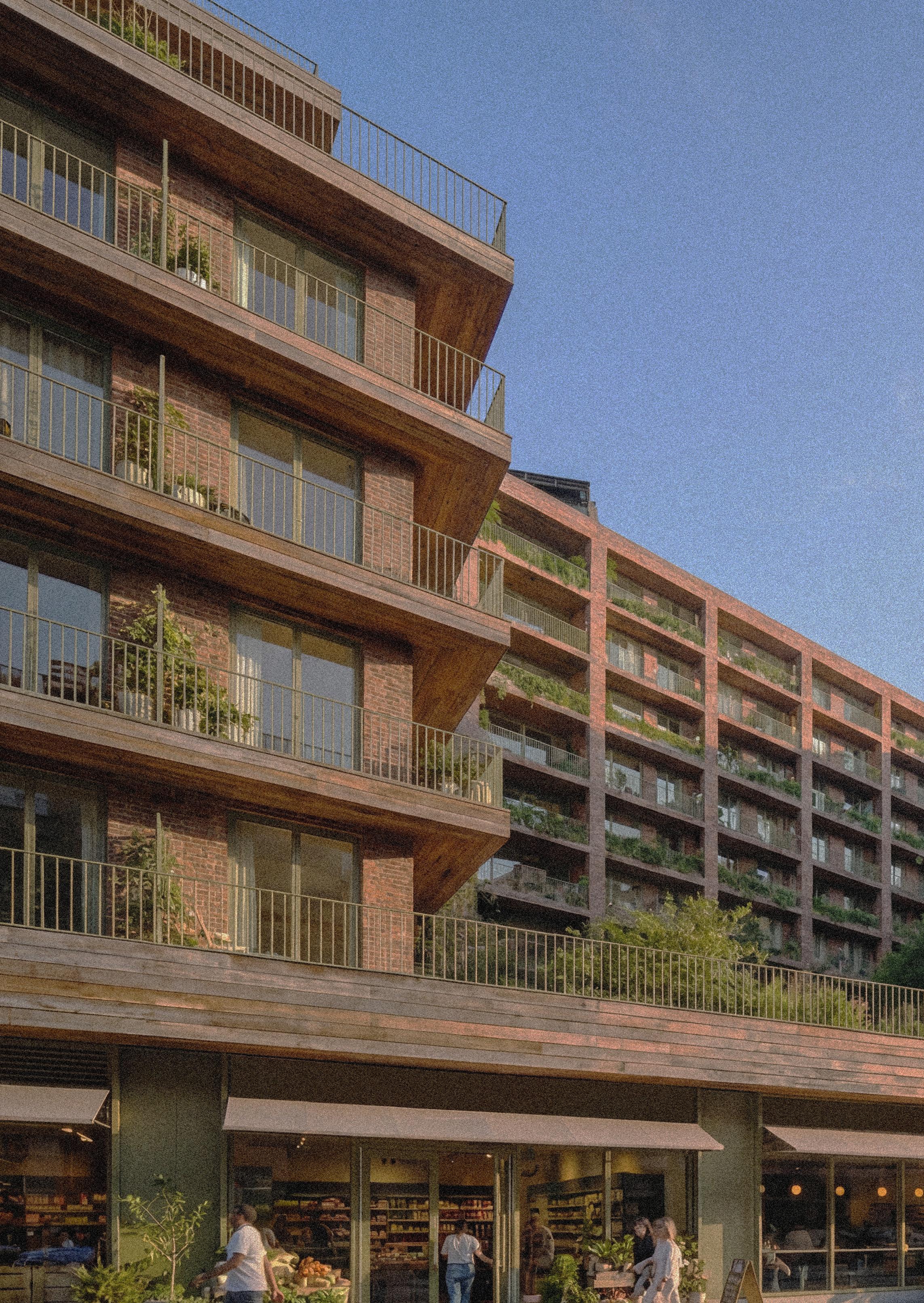
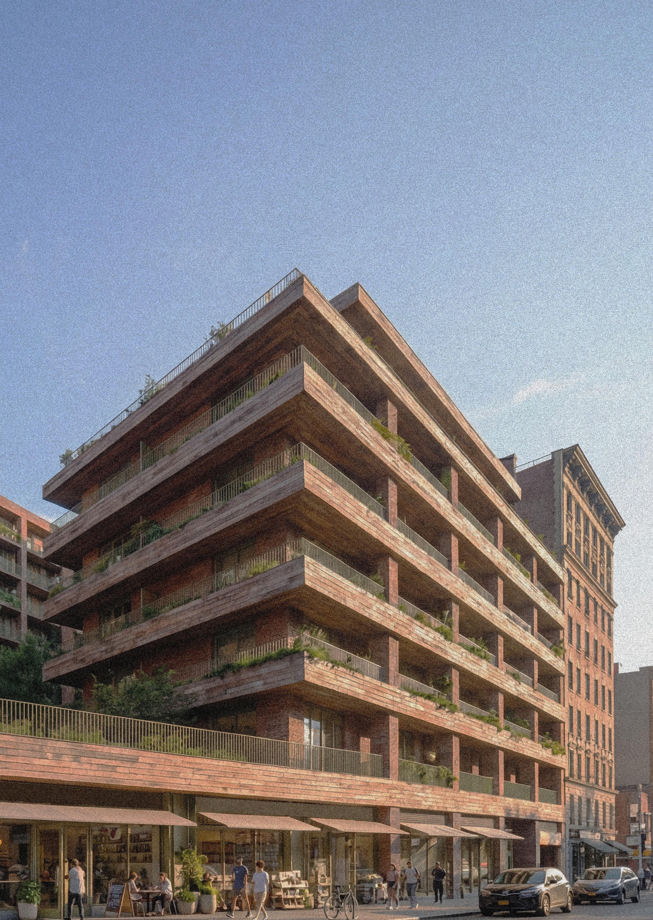
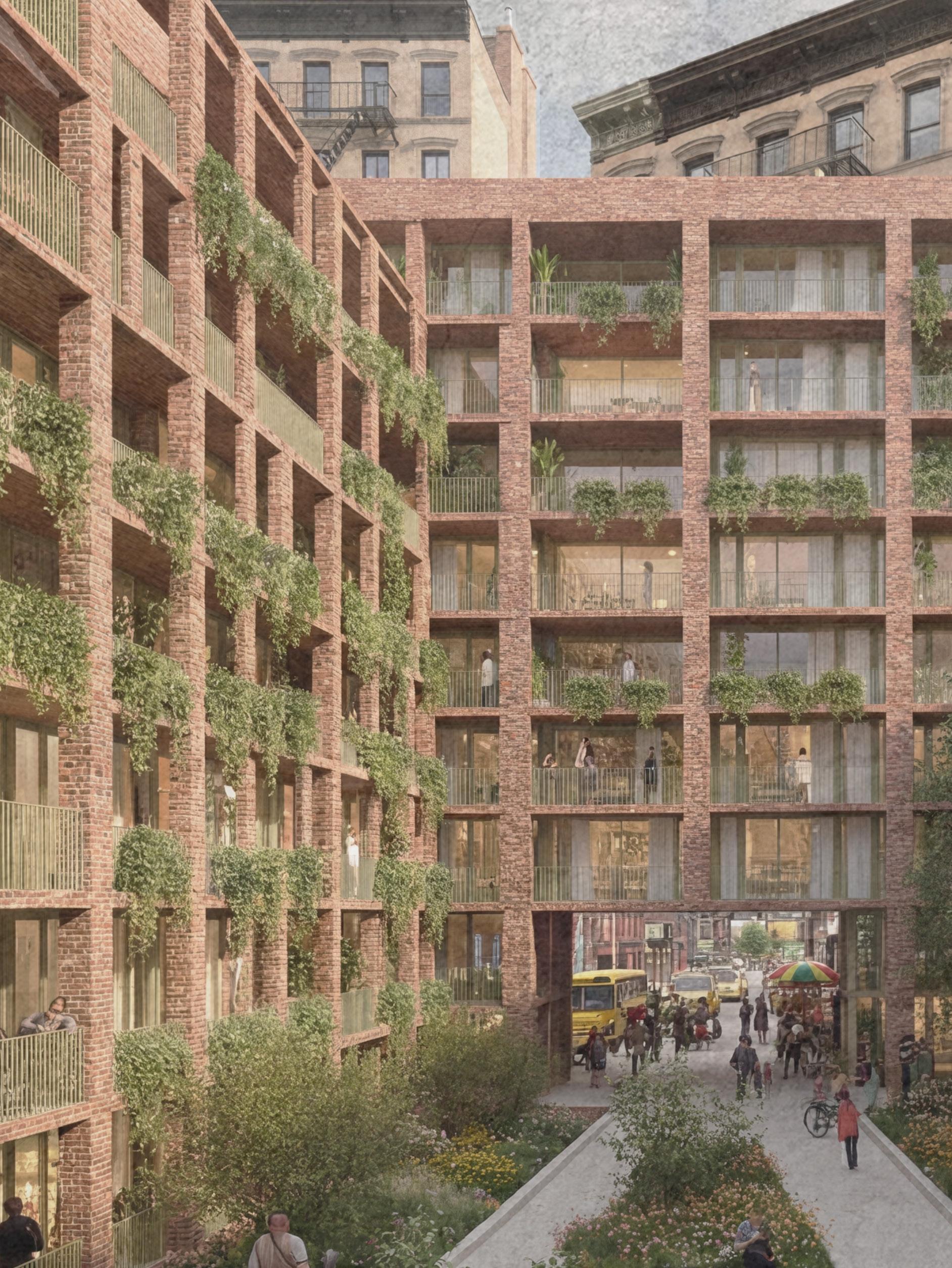
17 Convent uses a mixed-use strategy to integrate housing into the social life of the neighborhood rather than separating it from it. By combining residential units with community-facing programs at the ground level, the building creates porous thresholds that invite interaction, support local activity, and reflect Harlem’s tradition of overlapping living, working, and gathering. This approach extends the building’s role beyond its residents, fostering shared ownership, everyday encounters, and a stronger sense of community integration.
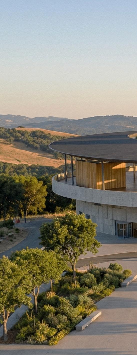
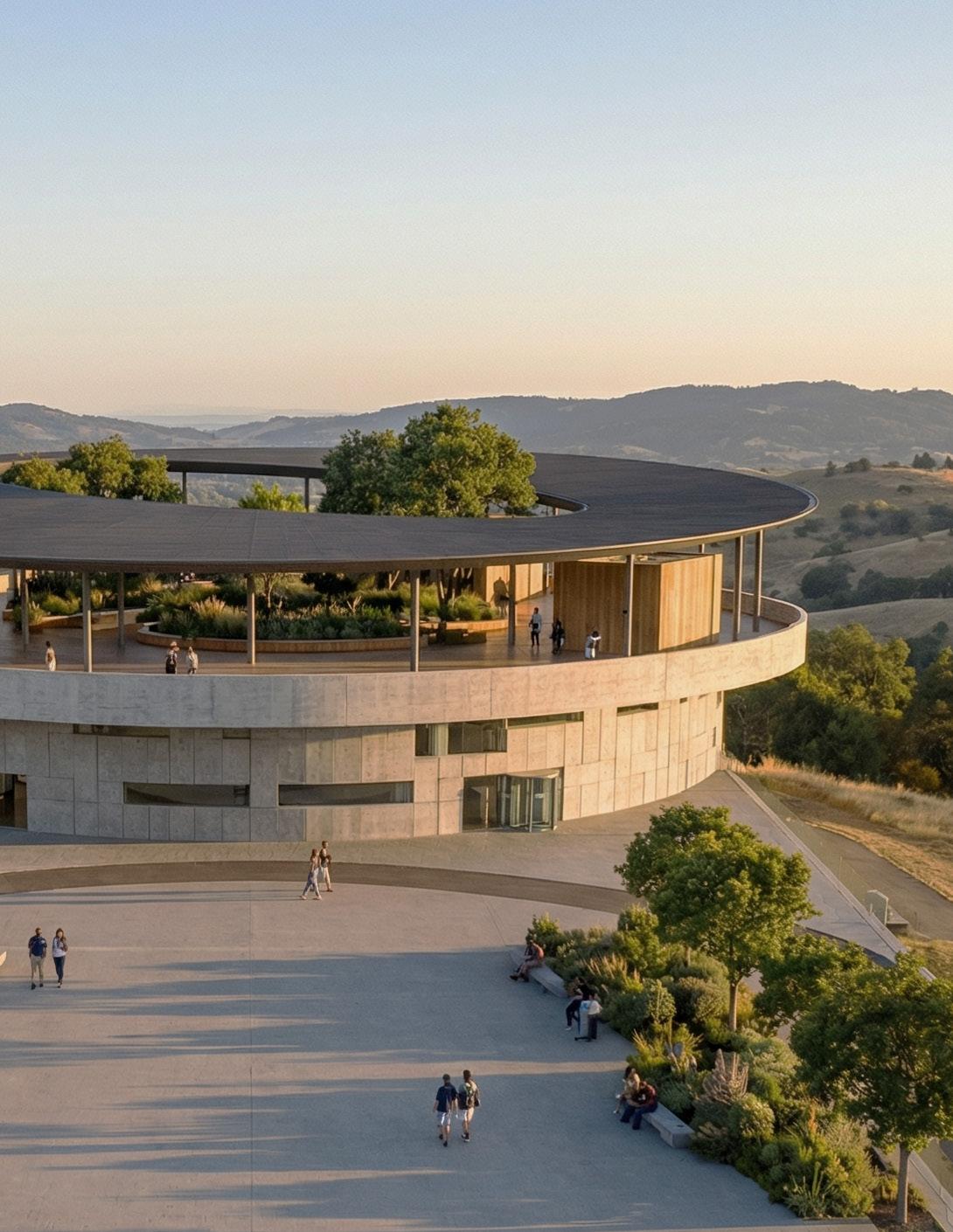
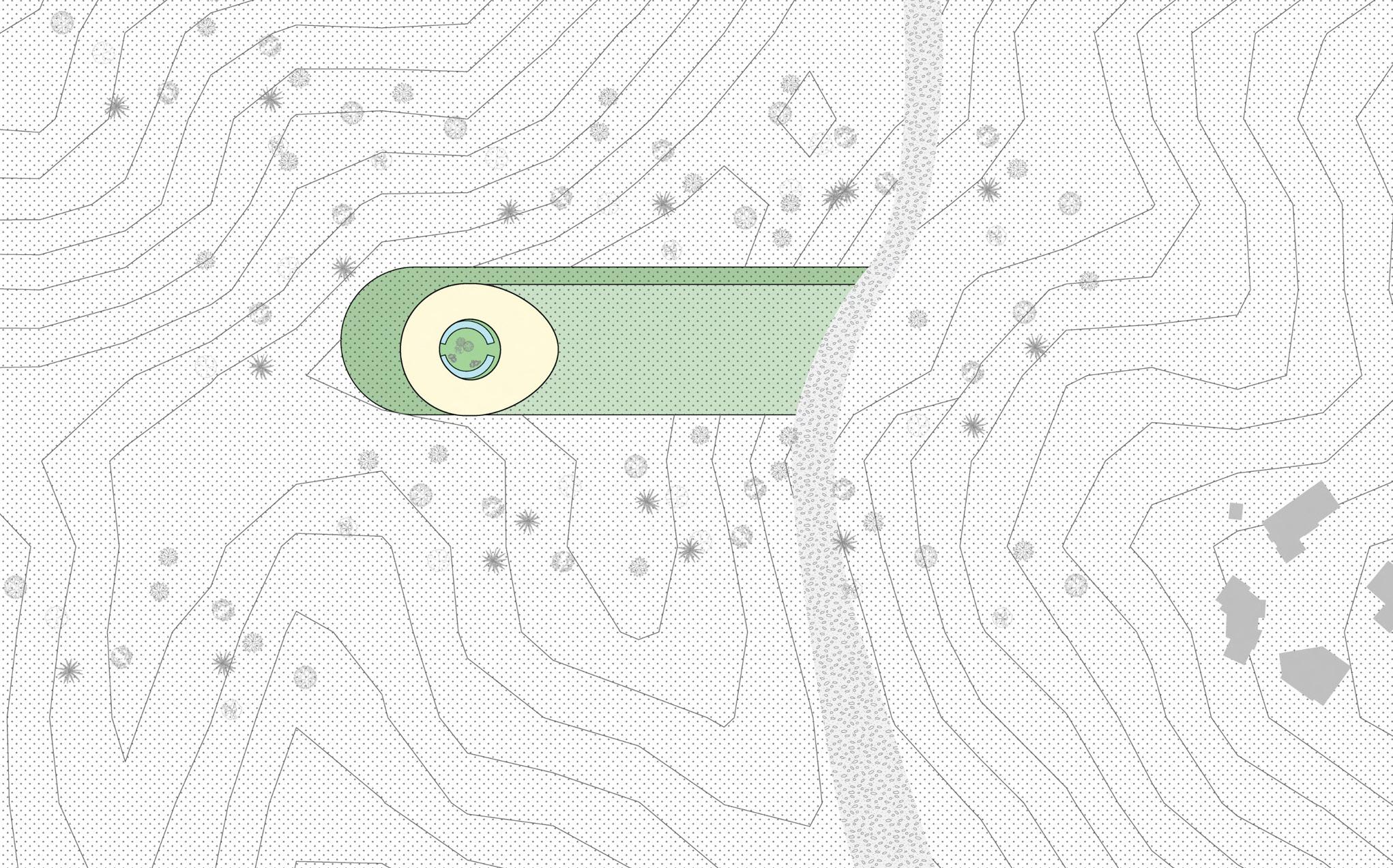
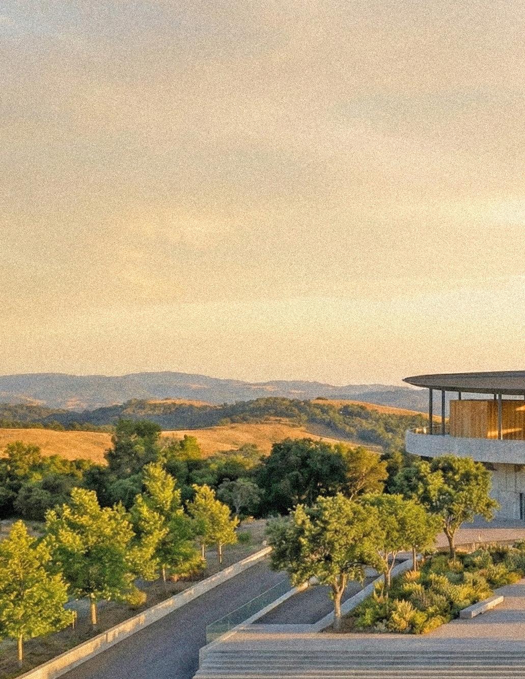
The Museum of Rebirth is sited on a secluded hillside within Elysian Park, near Chavez Ridge in Los Angeles, California. The project occupies a quiet edge condition between urban neighborhoods and protected parkland, where steep topography and limited access create a sense of isolation. The hillside site enables the building to be partially embedded into the terrain, reinforcing a grounded, inward-focused spatial experience while maintaining distant views across the Los Angeles basin.
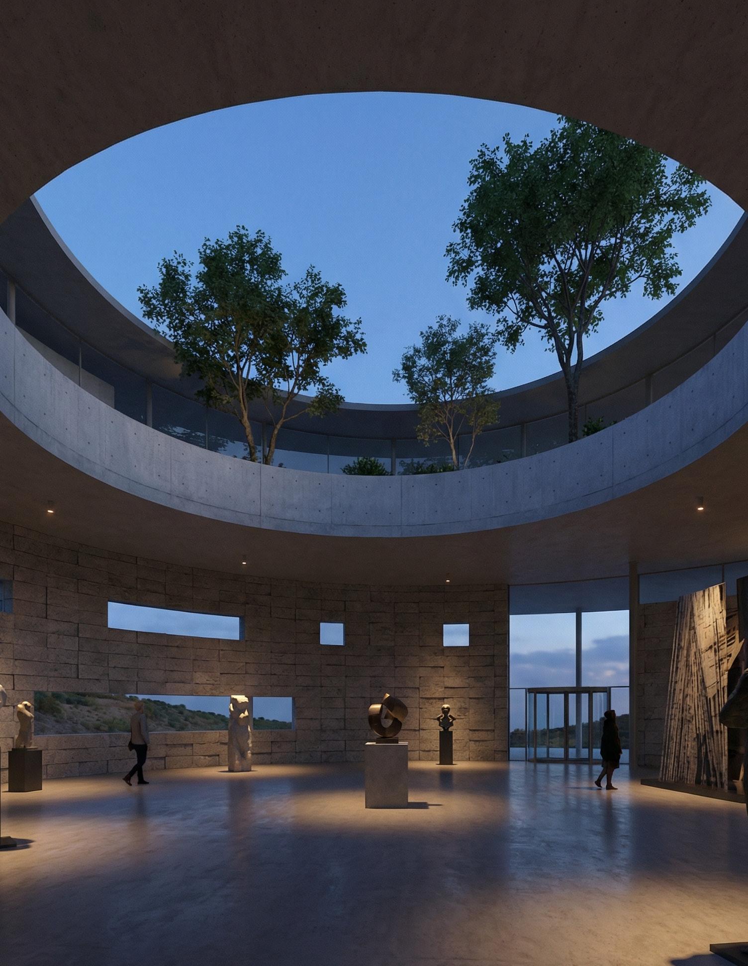
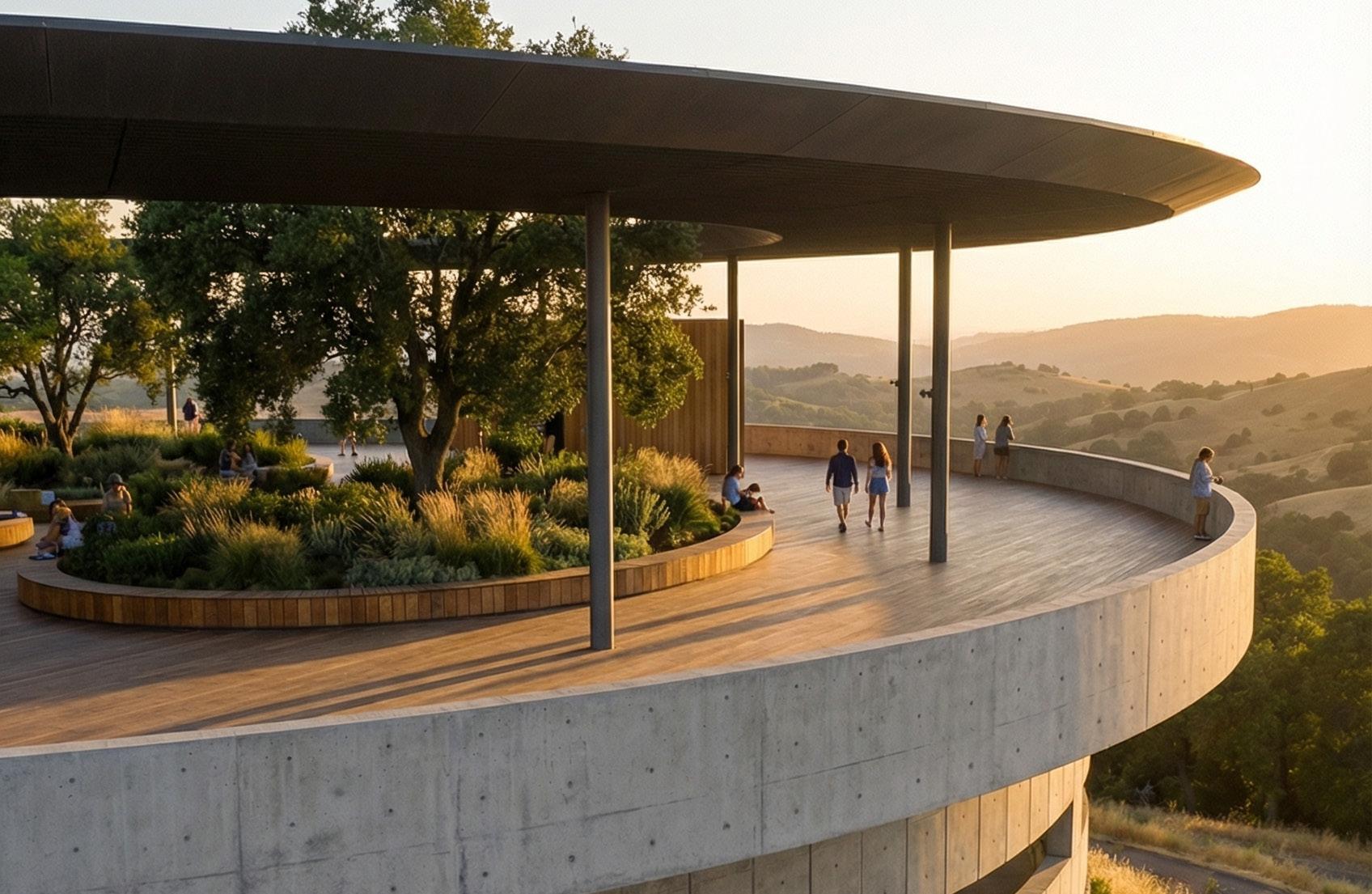
Exhibition spaces are organized as concentric bands that alternate between enclosed galleries and transitional zones. This gradation of spatial density creates a rhythm between compression and release, darkness and filtered light. Openings are strategically limited and precisely placed, allowing daylight to enter indirectly and protecting sensitive exhibition areas while still maintaining a perceptual connection to the exterior. Circulation is not treated as a separate element but is absorbed into the architectural thickness, producing moments where movement, viewing, and pause overlap.
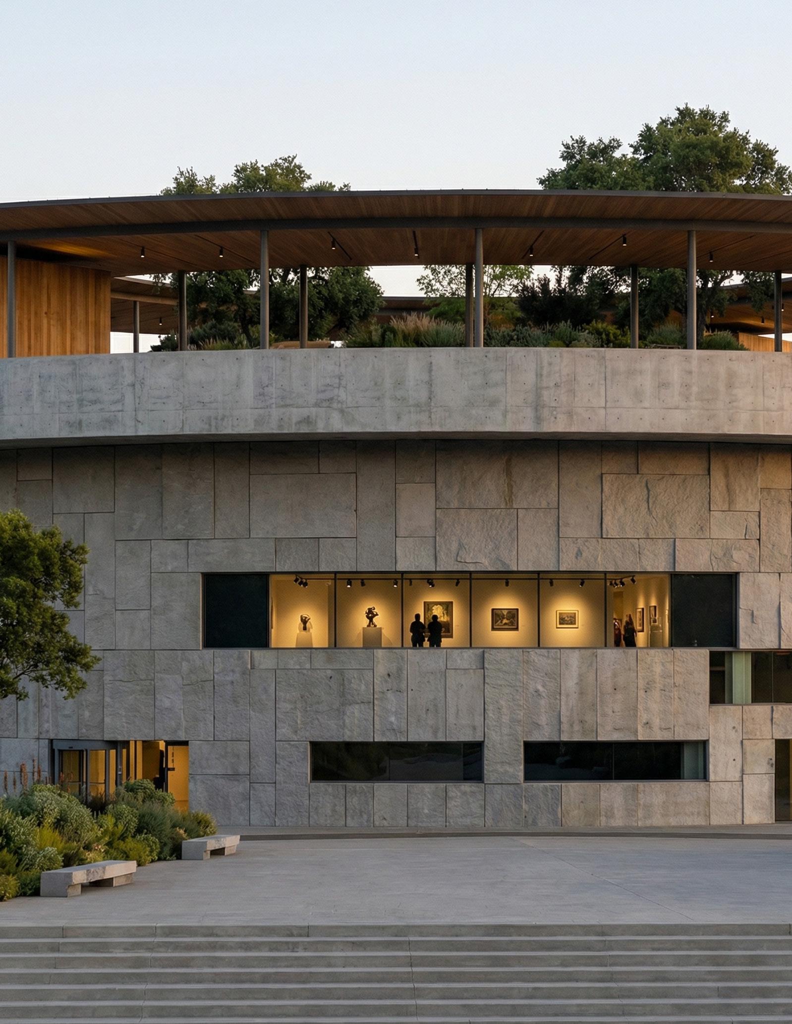
The architectural language is restrained and monolithic, emphasizing mass, weight, and horizontality. Thick perimeter walls are punctured selectively to control daylight and views, reinforcing a sense of enclosure while framing moments of outward connection to the landscape.
ELEVATION 1 1:16
ELEVATION 2
1:16
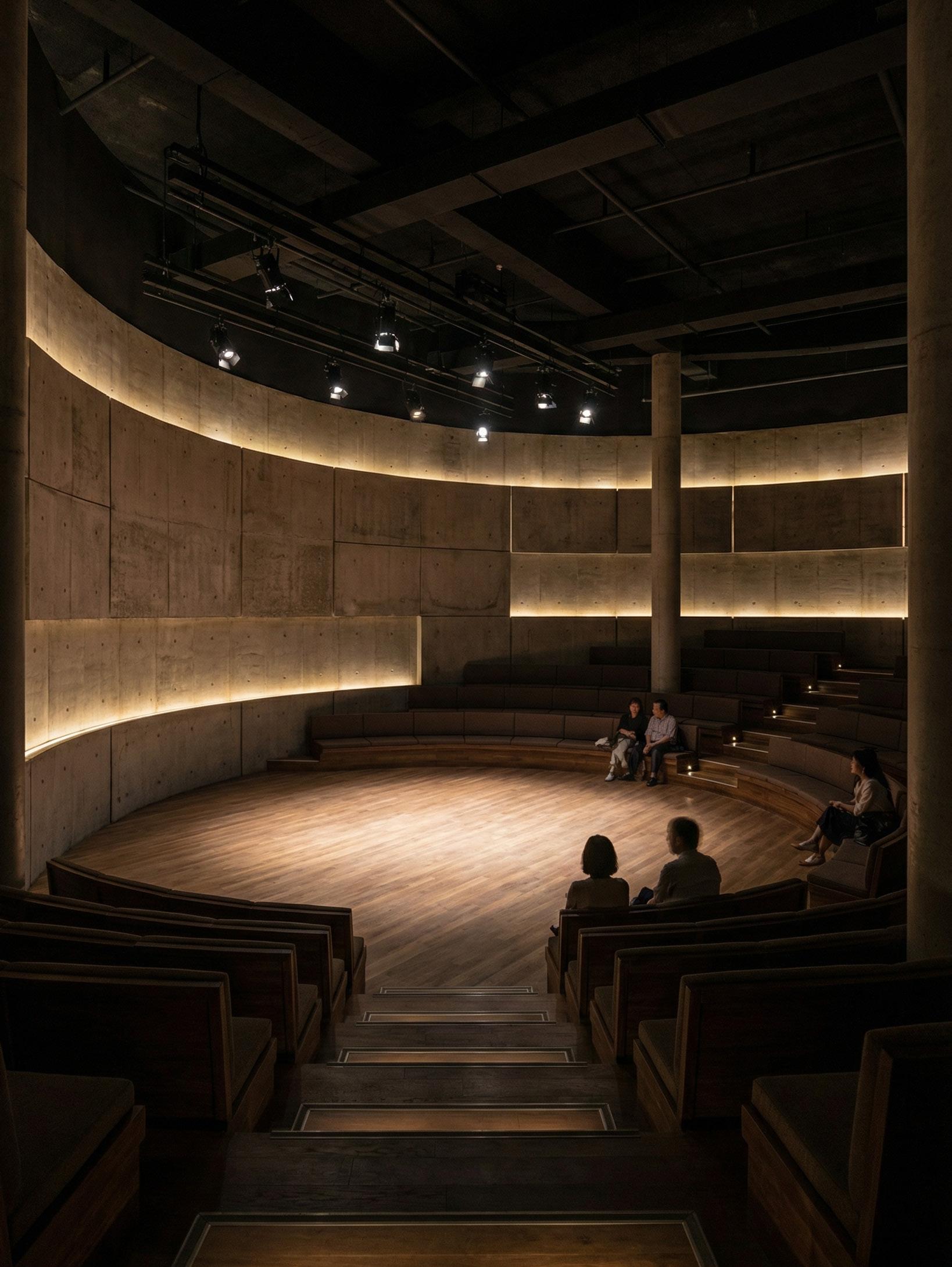
BASEMENT THEATHER
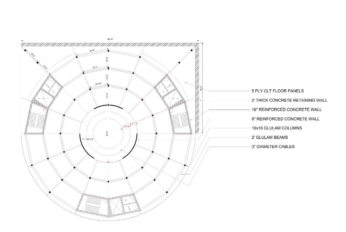
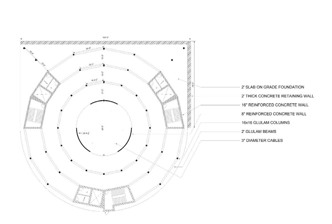
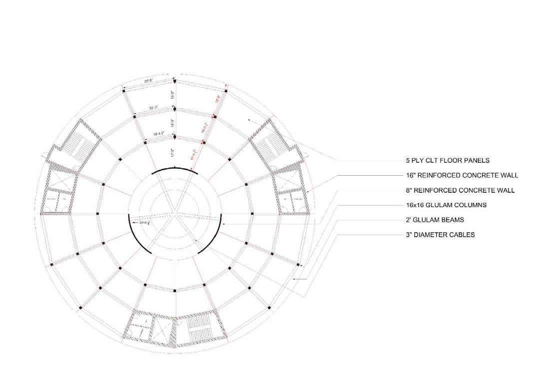
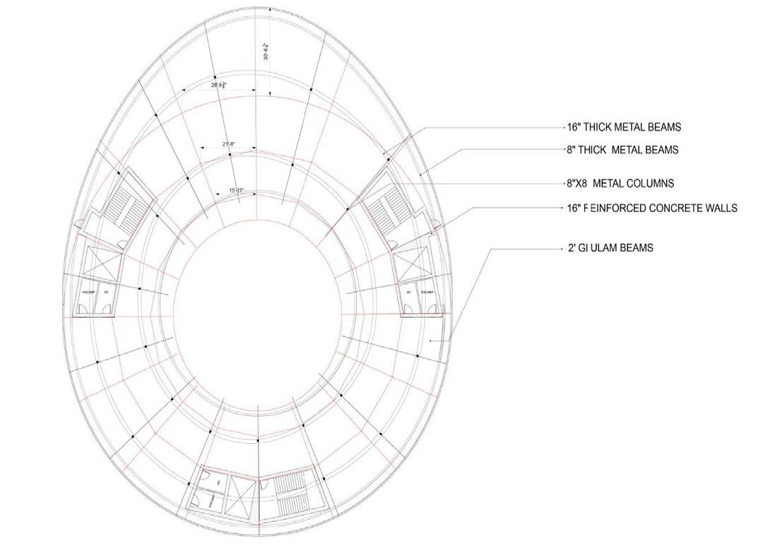
The structural strategy is driven by the building’s circular geometry and hillside condition, using structure as an ordering system rather than a hidden support. The museum is organized around a reinforced concrete ring structure that combines perimeter load-bearing walls with a concentric system of interior columns. This approach allows the structure to follow the architectural form directly, minimizing transfers and producing a clear load path from roof to foundation.
Floor plates are constructed as cast-in-place flat slabs, spanning between the perimeter wall and interior columns. This system provides flexibility for gallery layouts while maintaining consistent structural depth across levels. The slabs step with the topography, allowing the building to be partially embedded into the hillside and reducing the need for excessive excavation.
Lateral stability is achieved through the continuous perimeter shear wall and strategically placed vertical circulation cores, which act as stiffening elements resisting seismic and wind forces—particularly critical in the Los Angeles seismic context. These cores are integrated into the plan symmetrically, ensuring torsional stability within the circular form.
The roof structure supports a planted landscape and central oculus, requiring long-span concrete elements designed to accommodate soil loads while maintaining minimal structural expression. Foundations are designed as stepped reinforced concrete footings and retaining walls, anchoring the building into the hillside and responding directly to the site’s slope.
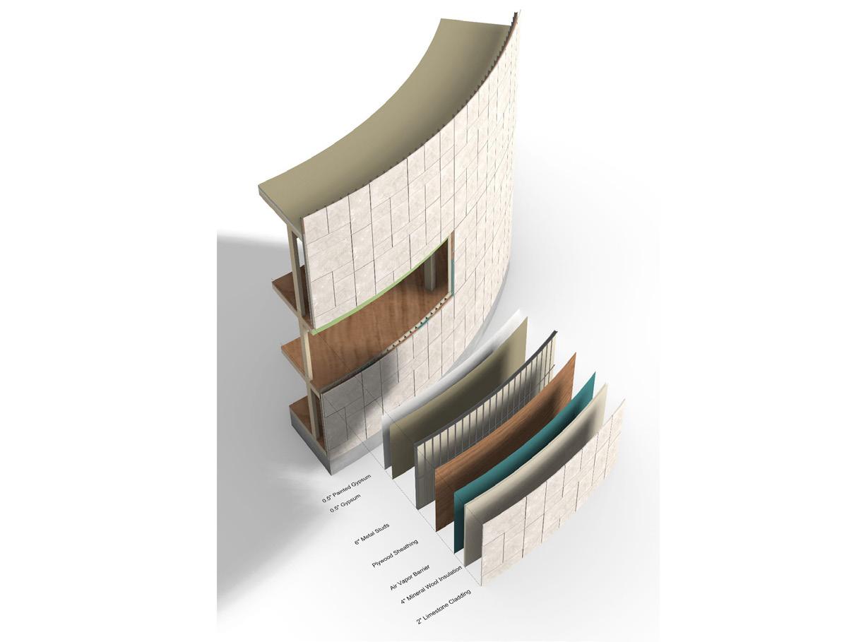
The façade is conceived as a modular panel system that transforms the building envelope into a performative and site-responsive assembly. Rather than a continuous curtain wall, the exterior is composed of repeating vertical façade panels, each integrating glazing, structure, and shading into a single unit. This panelized approach allows the façade to adapt incrementally to changes in solar exposure, slope condition, and interior program across the circular plan.
The invention lies in how the panel system is structurally registered to the building’s floor plates and circulation ring. Panels align with the rhythm of interior movement, making the façade legible from within as a sequence rather than a surface. This alignment allows the façade to act as a spatial index—visually marking progression through the museum while producing dynamic patterns of light and shadow within the galleries.
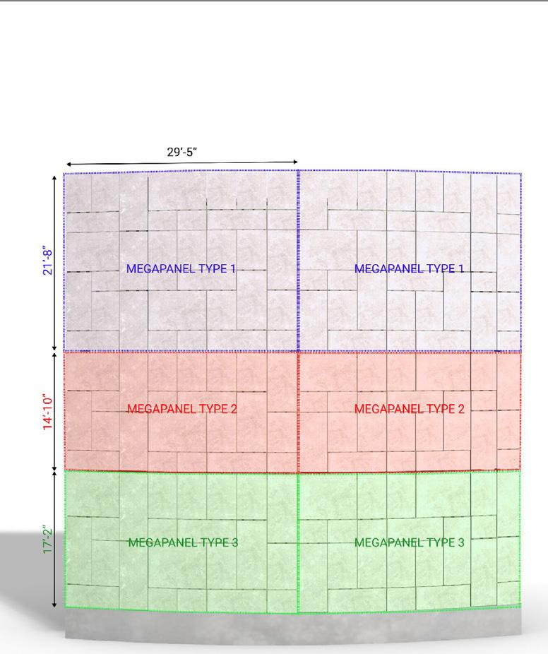
PANEL SYSTEM
Each panel consists of a glazed infill paired with a projecting vertical fin that is dimensioned and rotated based on orientation. On south- and west-facing elevations, the panels become deeper and more closely spaced, operating as fixed solar-control devices that mitigate heat gain while preserving outward views. On more shaded or embedded elevations, the panels reduce in depth, allowing increased transparency and visual continuity with the landscape.
Because the system is modular, it supports constructability and repetition while still allowing variation across the envelope. The façade operates simultaneously as an environmental filter, a structural extension, and an architectural expression of movement, redefining the curtain wall as a site-calibrated panel system rather than a generic enclosure.
Museum of Rebirth explores cycles of decay, transformation, and renewal through the reuse of discarded and reclaimed materials. Functioning as an art museum, it provides flexible exhibition spaces for installations, performances, and experimental material practices.
The spatial organization is conceived as a vertical journey rather than a single static gallery. At the lower levels, darker and more compressed spaces evoke burial, accumulation, and material exhaustion. As visitors move upward through the museum, openings increase and natural light is gradually introduced. This slow amplification of sunlight marks a transition from obscurity to clarity.
Upper galleries are brighter and more porous, allowing light to interact directly with exposed materials and artworks. Sunlight becomes both an atmospheric and symbolic element, reinforcing themes of rebirth and emergence. The architecture treats waste not as residue but as a generative design resource. Material scars, joints, and repairs are intentionally left visible to emphasize processes over perfection.
The museum encourages visitors to read transformation spatially, bodily, and temporally. In doing so, the project positions architecture as an active cultural and ecological agent of regeneration rather than a neutral container.