Visitor Information Centres,
Destination Centres & Welcome Centres/ Centres d’information touristique, Centres de destination et Centres d’accueil
Interpretive Panels
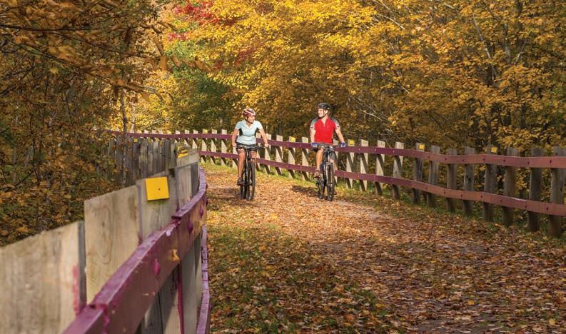
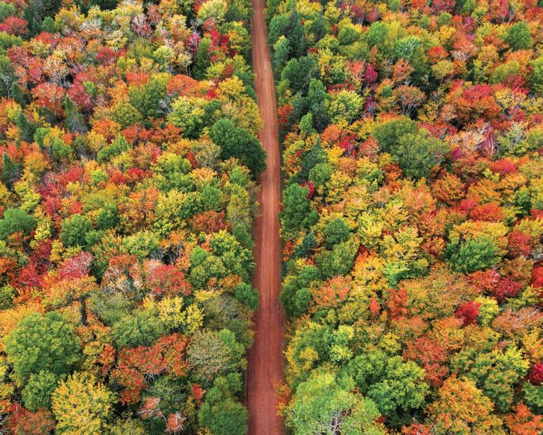
You can now view online almost 250 bilingual interpretive panels spanning Tip to Tip including the Branch Trails. There is a great deal of information outlining the history of the railway, the development of the Trail and the fauna and flora along the Trail.
Go to: www.tourismpei.com/pei-confederation-trail or www.ipe.ca/sentier-confederation
Panneaux d’interprétation
Vous pouvez maintenant consulter en ligne les quelque 250 panneaux d’interprétation bilingues qui sont installés le long du Sentier de la Confédération et de ses embranchements. Vous y trouverez une foule de renseignements intéressants sur l’histoire du chemin de fer, l’aménagement du sentier et la faune et la flore qui caractérisent le réseau.
Détails à www.tourismpei.com/pei-confederation-trail (en anglais) et à www.ipe.ca/sentier-confederation (en français).
2022 Confederation Trail Guide 5
Information Centres/Centres d’information touristique (WiFi) Q Borden-Carleton Visitor Information Centre / Centre d’information touistique de Borden-Carleton .... 902-437-8570 Charlottetown Visitor Information Centre / Centre d’information touristique de Charlottetown ....... 902-368-4444 Montaque Information Centre (Montaque) / Centre d’information de Montaque (Montaque) 902-838-8428 Souris Visitor Information Centre / Centre d’information touristique de Souris ..................................... 902-687-7030 West Prince Visitor Information Centre / Centre d’information touristique de Prince-Quest............... 902-831-7930 Wood Islands Visitor Information Centre / Centre d’information touristique de Wood Islands ........... 902-962-7411 Destination Centres/Centres de destination (WiFi) Q Cavendish Destination Centre / Centre de destination de Cavendish 902-963-7830 St. Peters Destination Centre / Centre de destination de St. Peters ............................................................. 902-961-3540 Summerside Destination Centre / Centre de destination de Summerside ................................................. 902-888-8364 Welcome Centres/Centres d’accueil Alberton Welcome Centre / Alberton Centre d’Accueil...................................................................................... 902-853-3190 Cardigan Area Heritage (Cardigan) / Patrimoine de la région de Cardigan (Cardigan) .......................... 902-583-2253 Community of Morell (Morell) / Communauté de Morell (Morell)................................................................... 902-961-3213 Evangeline Tourist Assoc. (Wellington) / Association touristique Évangéline (Wellington) ................... 902-854-2920 North Cape Gift Shop (North Cape) / North Cape boutique Cadeau 902-882-2991 Tignish Cultural Centre (Tignish) / Centre culturel de Tignish (Tignish) 902-882-2392 Town of Georgetown (Georgetown) / Ville de Georgetown (Georgetown) ................................................... 902-652-2053 Victoria Welcome Centre / Victoria Centre d’Accueil 902-658-2541
1-800-463-4734 Visitor
Tignish - O’Leary 45 km easy to moderate/facile à modéré
Accommodations / Hébergement
Tignish Heritage Inn & Gardens (0 km)
206 Maple Street, Tignish • 902.882.2491
www.tignishheritageinn.ca
La Petite France (21 km)
441 Church Street, Alberton • 902.853.3975
www.lapetitefrance-pei.com
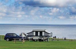
Camp Kildare (Exit at 21 km)
82 Stolen Road, Alberton • 902.853.3193
Jacques Cartier Provincial Park (Exit at 21 km)
16448 Route 12, Kildare Capes • 1.877.445.4938 www.tourismpei.com/provincial-park/jacques-cartier
Northport Pier Inn (Exit at 21 km)
298 Main St, Rte 152, Alberton • 902.853.4900 www.northportpier.ca
Mill River Resort (42 km)
3 Mill River Resort Road, Woodstock • 902.859.3555 www.millriverexperience.ca
Dining / Restauration
Shirley’s Cafe (0 km) 284 Church Street, Tignish • 902.882.3987
MJ Bakery & Caboose (0 km) 300 Church Street, Tignish • 902.882.2454
Our Family Traditions (1 km) 276 Philips Street, Tignish • 902.882.3664
Alberton Bakery & Café (21 km) 451 Main Street, Alberton • 902.853.2796
The Albert & Crown Pub & Eatery (21 km) 480 Main Street, Alberton • 902.853.0000
The Sidewalk Grill (21 km) 467 Main Street, Alberton • 902.853.4211
Northport Pier Restaurant (21 km) 296 Route 152, Northport • 902.853.4905
Attractions
North Cape, Nature and Technology in Perfect Harmony (Exit at 0 km) 21817, Route 12, North Cape • 902.882.2991 www.northcape.ca
Bicycle – Sales, Services & Rentals / Vélo - Ventes, Services et Locations
Proud’s Bicycle Works Studio (0 km) 231 Church Street, Tignish • 902.214.1187 bicycleworksstudio@gmail.com
Paul’s Bike Shop (11 km) 104 Chaisson Road, St. Edward • 902.882.3750
Iron Haven Gym – Bike Rentals (21 km)
16 Argyle Street, Alberton • 902.853.3421
www.ironhavengym.com
Mill River Aquaplex (42 km)
3 Mill River Resort Road, Woodstock • 902.859.1575
Information
North Cape Gift Shop (Exit at 0 km) 21817, Route 12, North Cape • 902.882.2991
www.northcape.ca
Side Trips and Attractions along the Trail
13 km North on Rte 12 to Atlantic Wind Test Site & North Cape Lighthouse
North Cape Nature Trail is a 5.5 km return easy hiking trail
Tignish Cultural Centre, Acadian & Irish Community Heritage
St Simon & St Jude RC Church, 1860 (km 0)
Tignish Run, 4 km East of Tignish off Rte 12, commercial fishing harbour, beach
Train wreck interpretation site 1932 (km 2)
Alberton Courthouse Museum, built 1877 - 1878, 457 Church Street
Northport Sea Rescue Station, Interpretive Centre, 296, Route 152
Bloomfield, km 35 - 4 km East on Rte. 145 & 1 km South on Rte. 2, MacAusland’s Woollen Mill
Mill River, km 42 - 5 km East on Rte. 143, Mill River Resort/Aqua Plex/Golf & Bike Rentals
Détours intéressants et attractions le long du sentier
13 km au nord sur la route 12 au Terrain d’essais éoliens de l’Atlantique et au phare de North Cape
Sentier d’interprétation de la nature de North Cape : randonnée facile de 5,5 km de retour
Centre culturel de Tignish, patrimoine communautaire acadien et irlandais
Église St. Simon & St. Jude, 1860 (km 0)
Tignish Run, 4 km à l’est de Tignish près de la route 12, port de pêche commercial, plage
Site d’interprétation du déraillement de train, 1932 (km 2)
Musée du palais de justice d’Alberton, construit en 18771878 – 457, rue Church
Centre d’interprétation de sauvetage en mer, Northport –296, route 152
Bloomfield, km 35 – 4 km à l’est sur la route 145 & 1 km au sud sur la route 2, MacAusland’s Wollen Mill
Mill River, km 42, 5 km vers l’est sur la route 143 (Mill River Resort, Aquaplex, locations pour le vélo et le golf)
2022 Confederation Trail Guide 6
Not all accommodations are located directly on the Confederation Trail. Please contact your accommodation provider for details.
Il faut quitter le Sentier de la Confédération pour se rendre à certains établissements. Veuillez vous renseigner auprès de l’établissement en question.
7 Tignish -
45
Mill River Resort 21 59 45 36 27 15 11 0.0 1 2
O’Leary
km easy to moderate/facile à modéré
O’Leary
Accommodations / Hébergement
Cedar Dunes Provincial Park (Exit at 72 km)
364 Cedar Dunes Park Road, West Point • 1.877.445.4938
www.tourismpei.com/provincial-park/cedar-dunes
Dining / Restauration
Vinny’s Restaurant & Take Out (45 km)
487 A Main Street, O’Leary • 902.859.2020
Maple House Bakery & Café (45 km)
79 Ellis Street, O’Leary • 902.859.2774
Freeland Dining and Gass Stop (64 km) 9552 Route 12, Freeland • 902.831.2244
Kenny’s Restaurant & Dairy Bar (72 km)
1256 Ellerslie Road, Ellerslie • 902.831.2045
Backwoods Burger (74 km)
1327 Porthill Station Rd., Tyne Valley • 902.831.2992 www.backwoodsburger.com
Dillon’s Kwik Way (74 km)
1349 Port Hill Station Rd., Tyne Valley • 902.831.2719
Richmond Bakin Express Coffee (83 km) 31472 Western Road, Richmond • 902.394.1645
Chez Island Family Restaurant (91 km)
16 Commercial Street, Wellington • 902.854.2704
Attractions
Canadian Potato Museum (Welcome Centre) (45 km)
1 Dewar Lane, O’Leary 902-859-2039
PEI Shellfish Museum (Welcome Centre) (72 km)
156 Bideford Road, Ellerslie 902-831-3374
Barlow’s Interpretive Centre (WELCOME CENTRE) (91 km)
9 Mill Road, Wellington 902-854-2920
Information
West Prince Visitor
33460 Route 2, Mount Pleasant • 1.800.463.4734 www.tourismpei.com
Side Trips and Attractions along the Trail
Canadian Potato Museum (km 45)
O’Leary, Quilts, Fabric, Yarn – 534 Main Street
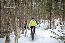
2 km Mountain Bike Trail (km 46)
Leard’s Mill (km 47)
West Point, km 50 - 19 km West of Coleman on Rte. 14, Cedar Dunes Provincial Park, Beach
Portage, Wildlife Management Area Wetland (km 59)
Ellerslie Bog (km 70)
Arched culvert (1922) under trail (km 72)
Tyne Valley, km 74 - 7 km East on Rte. 12, Green Park, Historic Yeo House
Barlow’s Mill Interpretation Centre (km 91)
Wellington, Quagmire BMX Bike Park (km 91)
Détours intéressants et attractions le long du sentier
Musée de la pomme de terre canadienne (km 45)
Sentier de vélo de montagne de 2 km (km 46)
Courtepointes, tissus et laine (magasin), O’Leary 534, rue Main
Moulin Leard (km 47)
West Point, km 50 – 19 km à l’ouest de Coleman sur la route 14, parc provincial Cedar Dunes, plage
Portage, zone humide de l’aire de gestion de la faune (km 59)
Marais d’Ellerslie (km 70)
Ponceau voûté (1922) sous le sentier (km 72)
Tyne Valley, km 74 – 7 km à l’est sur la route 12, Green Park Yeo Maison
Centre d’interprétation Barlow (km 91)
Wellington, parc de BMX Quagmire (km 91)
2022 Confederation Trail Guide 8
72 km)
(Exit at Information Centre
- Wellington 45 km easy to moderate/facile à modéré
TOURISM PEI / ST. PETERS / STEPHEN HARRIS
Not all accommodations are located directly on the Confederation Trail. Please contact your accommodation provider for details.
Il faut quitter le Sentier de la Confédération pour se rendre à certains établissements. Veuillez vous renseigner auprès de l’établissement en question.
2022 Confederation Trail Guide 9 O’Leary - Wellington 45 km easy to moderate/facile à modéré Mill River Resort 21 72 59 45 27 15 91 83 2
Accommodations / Hébergement
Prince County Guest House (101 km) 11 Lady Slipper Drive, Miscouche • 902.436.3216 herbgoliver@gmail.com
Linkletter Provincial Park (103 km) 437 Linkletter Beach Road, Summerside Area • 1.877.445.4938 www.tourismpei.com/provincial-park/linkletter
Slemon Park Hotel & Conference Centre (Exit at 12 Redwood Avenue, Slemon Park • 902.432.1780 106 km) www.slemonparkhotel.com
Cairns Motel
721 Water Street, Summerside • 1.877.224.7676 www.cairnsmotel.net
(109 km)
Canada’s Best Value Inn & Suites (109 km) 3081 Route 1A, Summerside Area • 902.436.5564 www.canadasbestvaluesummerside.ca
C & B Corner Café (123 km)
55 Broadway Street, Kensington • 902.836.4378
Family and Friends Restaurant (123 km)
45 Broadway Street, Kensington • 902.291.3334
The Island Stone Pub (123 km)
62 Broadway Street, Kensington • 902.836.3063
The Willow Bakery & Café (123 km)
13 Commercial Street, Kensington • 902.303.5127
For more information on Dining in the Summerside area, please visit their website at www.exploresummerside.com.
Pour plus d’informations sur les restaurants dans la région de Summerside, visitez www.exploresummerside.com.
Attractions
Haunted Mansion (123 km)
81 Victoria Street West, Kensington • 902.836.3336
The Warn House B&B
(109 km) 330 Central Street, Summerside • 1.888.436.7512 www.warnhousebandb.ca
Willowgreen Farm Bed & Breakfast (109 km) 117 Bishop Dr. Summerside • 1.888.436.4420 www.willowgreenfarm.com
Quality Inn and Suites (109 km) 618 Water St East, Summerside • 1.800.265.5551 www.qualityinnpei.com
Victoria Inn (123 km) 32 Victoria Street East, Kensington • 902.836.3010 www.victoriainnpei.com
The Home Place Inn (123 km) 21 Victoria Street, Kensington • 902.836.5686 www.thehomeplace.ca
Weeping Willow House (123 km) 54 Woodleigh Drive, Kensington • 902.954.1883 info@weepingwillowhouse.com
The Cottages at Twin Shores (Exit at 123 km) 705 Lower Darnley Rd, Kensington • 902.836.4142 www.twinshores.com
Twin Shores Camping Area (Exit at 123 km)
705 Lower Darnley Road, Malpeque • 902.836.4142 www.twinshores.com
Cabot Beach Provincial Park (Exit at 123 km) 449 King Street, Malpeque • 1.877.445.4938 www.tourismpei.com/provincial-park/cabot-beach
Stargazer Cottage (Exit at 123 km)
45 Riley Drive, Darnley • 780.668.8777 stargazercottages@gmail.com
Dining / Restauration
Cook’s Convenience Store (101 km)
4 Main Drive, Miscouche • 902.724.3304
Village Pub (101 km)
11 Lady Slipper Drive, Miscouche • 902.436.3216
Anson’s Restaurant & Pub (Exit at 106 km)
12 Redwood Avenue, Slemon Park • 902.432.1774
Evermoore Brewing Co.
192 Water Street, Summerside • 902.436.7218
Frosty Treat Dairy Bar
109 Victoria Street W, Kensington • 902.836.3000
www.hauntedmansionpei.ca
Bicycle – Sales, Services & Rentals / Vélo - Ventes, Services et Locations
Slemon Park Hotel (Exit at 106 km)
12 Redwood Avenue, Slemon Park • 902.432.1780
www.Slemonparkhotel.com
Summerside Bike Works (109 km)
208 MacEwen Road, Summerside • 902.436.3842
The Knot Beach, Bar & Rentals (109 km)
368 Water Street, Summerside • 902.388.7873
www.suppei.ca
C&P Enterprise Bicycle Repair (122 km) 25206 Route 2, Kensington • 902.836.4134
cpmacfarlane1@gmail.com
Information
Summerside Destination Centre (109 km)
124 Heather Moyse Dr., Summerside • 1.877.734.2382
www.exploresummerside.com
(109 km)
(123 km)
2022 Confederation Trail Guide 10
65
easy to moderate/facile
Wellington - Hunter River
km
à modéré
21 72 59 91 83
Side Trips and Attractions along the Trail
Acadian region, km 90 - West on Rte. 124 and South on Rte. 11
Miscouche, km 101 - 0.5 km North, Acadian Museum, St. John the Baptist Church 1892
Scenic potato country and rivers from Miscouche to Emerald
Linkletter Provincial Park, km 103 – 0.6 km South on Kinsman Drive & 2 km East on Rte. 11
Summerside, km 109, Eptek Centre, waterfront, downtown (km 109)
College of Piping (km 112)
Rotary Friendship Park (km 113)
Engine 1762, diesel locomotive, built in early 1960, arrived at the Kensington Rail Road Station in 1990, National Historic Site (km 122)
St Marks Anglican Church 1866 (km 123)
Indian River, km 118 - 5.5 km North on Rte. 106, Indian River Music Festival
Malpeque, km 122 - 14 km North of Kensington on Rte. 20, Cabot Beach Provincial Park
The Hogg Trail (km 124)
2.7 hiking and mountain bike trail
Breadalbane to Loyalist – scenic central hills (km 140 to 169)
The Breadalbane Nature Trail is up to 6.5 km of looped trail.
Mark Arendz Provincial Park at Brookvale provides up to 30 km of trails for mountain biking and hiking.
Bonshaw Hills Provincial Park provides over 18 km for hikers and bikers.
Not all accommodations are located directly on the Confederation Trail. Please contact your accommodation provider for details.
Détours intéressants et attractions le long du sentier
Région acadienne, km 90 – à l’ouest sur la route 124 et au sud sur la route 11
Miscouche, km 101 – 0,5 km au nord, Musée acadien, Église Saint-Jean-Baptiste, 1892
Pays de la pomme de terre et rivières pittoresques de Miscouche à Emerald
Parc provincial Linkletter, km 103 – 0,6 km au sud sur la promenade Kinsman et 2 km à l’est sur la route 11, Summerside, km 109, Centre Eptek, bord de l’eau, centre-ville (km 109)
College of Piping (km 112)
Rotary Friendship Park (km 113)
Locomotive diesel 1762, construit au début des années 1960, arrivée à la gare de Kensington en 1990, site historique national (km 122)
Église anglicane St. Marks, 1866 (km 123)
Indian River, km 118 – 5,5 km au nord sur la route 106, Festival de musique d’Indian River
Malpeque, km 122 – 14 km au nord de Kensington sur la route 20, parc provincial Cabot Beach
Sentier Hogg (km 124)
Sentier de randonnée et de vélo de montagne, 2,7 km
Breadalbane à Loyalist – collines pittoresques du centre de l’Île (km 140 à 169)
Sentier d’interprétation de la nature de Breadalbane : sentier en boucle couvrant environ 6,5 km
Mark Arendz parc provincial de Brookvale : 30 km de sentiers pour la randonnée et le vélo de montagne
Sentiers du Parc provincial Bonshaw : plus de 18 km de sentiers pour randonneurs et cyclistes.
Il faut quitter le Sentier de la Confédération pour se rendre à certains établissements. Veuillez vous renseigner auprès de l’établissement en question.
2022 Confederation Trail Guide 11
65
moderate/facile
155 147 137 131 109 12 6 3 4
Wellington - Hunter River
km easy to
à modéré
Hunter River - Morell
65 km easy to moderate/facile à modéré
Accommodations / Hébergement
Heritage Classic Inn B&B (155 km) 19826, Rte 2, Hunter River • 902.621.0930 sylv_05@hotmail.com
Bedford Station Stopover & Gallery (190 km) 96 Route 6, Bedford • 902.213.4165 waynewilliamcrouse@gmail.com
Confederation Trailside Tourist Grounds (194 km) 12398 St. Peters Rd., Mt. Stewart • 902.218.0757 confederationtrailsidecamping@gmail.com
Kelly’s Homestead (Exit at 195 km) 872 Blooming Point Road, Blooming Point • 902-676.2381 www.kellyshomestead.ca
Bishop’s Rest B & B (207 km) 16 Cemetery Road, St. Andrews • 902.676.2585 admin@bishoprest.ca
Side Trips and Attractions along the Trail
Stanhope/Dalvay, (km 183) – 12 km North at York Road Route 25, PEI National Park
Pink Lady’s-slippers in June/July, provincial flower (km 177)
York, km 183 - 1 km South on Rte. 25, Vessey’s Seeds & flower gardens
Winter River Trail is up to 6 km of woodland trail.
Scotchfort – Canadian Heritage Rivers Monument (km 200)
Hillsborough River salt marsh views to Mt Stewart (km 199-203)
Mount Stewart, Hillsborough River Eco-Centre (km 204)
Wildlife Management Area wetlands (km 205)
St Andrews, km 207 - 0.5 km North, Memorial to Bishop
A. B. MacEachern, pioneer cemetery
km) 25 Creek Rd. St. Peters Harbour • 902.961.3087 www.shadylanecottage.ca
Shady Lane B&B and Cottages
Rodd Crowbush Golf & Beach Resort (Exit at 217
632 Rte 350, Lakeside • 902.961.5600 www.roddcrowbush.com
Dining / Restauration
km) 4327 Route 13, Hunter River • 902.964.3300
By the River Bakery & Café
Sprinkles Ice Cream Shop
km) 4276 Hopedale Rd, Hunter River • 902.626.5950
Little Poultry Company (155 km)
19777 Route 2, Hunter River
Tim Hortons (175 km)
537 Malpeque Rd., Winsloe • 902.566.1230
Not all accommodations are located directly on the Confederation Trail. Please contact your accommodation provider for details.
(190 km) 13272 St. Peters Rd, Bedford • 902.629.6633
Lily’s Convenience Store
Mount Stewart Irving (204 km)
10693 St. Peters Rd., Mt. Stewart • 902.676.2390
In the Mix Bakery
104 Main Street, Mt. Stewart • 902.213.2167
(204 km)
Laurie’s Country Kitchen (204 km)
324 Main Street, Mt. Stewart • 902.739.2095
The Bake Shop (207 km)
16 Cemetery Rd., St. Andrews • 902.676.2585
Bicycle – Sales, Services & Rentals / Vélo - Ventes, Services et Locations
PEI Guide and Drive Service
1 Beacon Hill Drive, Stratford • 902.393.6029
www.peibikeshuttleservice.com
2022 Confederation Trail Guide 12
(217
km)
(155
(155
171 155 147 137 131 3
Détours intéressants et attractions le long du sentier
Stanhope/Dalvay (km 183) – 12 km au nord, chemin York, route 25, Parc national de l’Î.-P.-É.
Sabots-de-la-vierge roses en juin/juillet, fleur provinciale (km 177)
York, km 183 – 1 km au sud sur la route 25, Vessey’s Seeds et jardins de fleur
Sentier de la rivière Winter : sentier boisé de 6 km
Scotchfort – monument dédié aux rivières du patrimoine canadien (km 200)
Vue des marais salés bordant la rivière Hillsborough jusqu’à Mount Stewart (km 199 à 203)
Mount Stewart, Éco-centre de la rivière Hillsborough (km 204)
Zone humide de l’aire de gestion de la faune (km 205)
St. Andrews, km 207 – 0,5 km au nord, monument commémoratif à l’évêque A. B. MacEachern, cimetière de pionnierscanadien (km 200)
Vue des marais salés bordant la rivière Hillsborough jusqu’à Mount Stewart (km 199 à 203)
Mount Stewart, Éco-centre de la rivière Hillsborough (km 204)
Zone humide de l’aire de gestion de la faune (km 205)
St. Andrews, km 206 – 0,5 km au nord, monument commémoratif à l’évêque A. B. MacEachern, cimetière de pionniers
2022 Confederation Trail Guide 13 Hunter River - Morell 65 km easy to moderate/facile à modéré 26 25 231 219 204 195 183 177 8 0 11 24 14 30 37 15 4 9
6 7
Dalvay
Il faut quitter le Sentier de la Confédération pour se rendre à certains établissements. Veuillez vous renseigner auprès de l’établissement en question.
Accommodations / Hébergement
St. Peters Park (230 km)
5930 Rte 2, St. Peters • 902.961.2786
www.stpeterspark.com
Points East Coastal Inn
5749 St. Peters Rd., St. Peters Bay • 902.961.3004
www.pointseastcoastalinn.com
St. Peters Bayview Suites
5560 Route 2, St. Peters Bay • 902.316.0398 www.stpetersbayviewsuites.com
(231 km)
(231 km)
Mysa Nordic Spa & Resort (231 km) 1668 Greenwich Road, St. Peters reservations@mysanordicspa.com
Red Point Provincial Park
249 Red Point Park Road, Red Point • 1.877.445.4938 www.tourismpei.com/provincial-park/red-point.com
(265 km)
Campbells Cove Campground and Cabins (Exit at 269 km)
7516 Northside Rd, Rte 16, Campbells Cove • 902.357.2233 www.campbellscovecampground.com
Between Two Waters Summer Home (273 km)
485 Elmira Road, Elmira • 902.357.2776 www.betweentwowaters.ca
All Points East Campground (Exit at 273 km)
515 North Lake Harbour Road, Souris • 902.327.0356 www.allpointseastcampground.ca
Siren’s Beach Motel (Exit at 273 km)
7 Cape Road, North Lake • 902.357.2228 www.sirensbeachmotel.com
Dining / Restauration
Holy Cow
95 Altons Dr., Morell • 902.739.3797
(219 km)
Rick’s Fish ’n’ Chips and Seafood House (231 km)
5544 Rte 2, St. Peters • 902.961.3438 www.ricksfishnchips.com
Black & White Café & Bakery (231 km)
5549 St. Peters Road, St. Peters • 902.393.3547
One Tuna Cafe and Fishmart (Exit at 273 km)
6295 North Side Road, North Lake • 902.215.8862 jason@onetuna.com
Pirates Galley Café (Exit at 273 km)
404 Lighthouse Rd., Elmira • 902.357.9277
North Lake Boathouse Eatery (Exit at 273 km)
67 Cape Road, North Lake • 902.215.0160
Red Neil’s Eatery (Exit at 273 km)
496 Elmira Road, Elmira • 902.357.2200
Attractions
PEI National Park - Greenwich (231 km)
59 Wild Rose Rd, St. Peters Area • 902.672.6350
www.parkscanada.gc.ca/pei
Elmira Railway Museum (273 km)
457 Elmira Road, Route 16A, Elmira • 902.357.7234
www.peimuseum.com
Bicycle – Sales, Services & Rentals / Vélo - Ventes, Services et Locations
Confederation Trail Bike Rentals (231 km)
15465 Northside Road, St. Peters Area • 902.367.7900
Information
St. Peters Destination Centre (231 km)
1915 Cardigan Head Road, St. Peters • 1.800.463.4PEI
www.tourismpei.com
Side Trips and Attractions along the Trail
Leo Rossister’s Park Picnic Area, Morell
Meinke Walking Trail, 2 km trail to a lookout over the Morell River
Morell River Bridge, former swing bridge; longest (km 221)
St. Peters Landing – shops, village of St. Peters Bay
St Peters Bay – water vistas from Morell to St. Peters (km 219-230)
St. Peters Church visible up the bay
St. Peters Park (km 231)
Greenwich, PEI National Park (Interpretive Centre), km 23011 km West, Rte. 313, beach
Larkins Pond, Canada geese, ducks, warblers (km 243)
The Boughton River trail provides up to 9 km of woodland trail. McVarish Pond Hybrid Fish Ladder (km 257)
Red Point, km 265 - 6 km South Rte. 302, Red Point Provincial Park, beach
Naufrage, km 245 - 8 km North Rte. 308, historic fishing harbor, beach
The Forest Hill Trail provides flat hiking for up to about 10 km. Hardwood uplands to end of trail (km 245-273)
Basin Head, km 265 - 8 km South Rte. 302, 2 km East Rte. 16, Provincial Park, beach
Campbells Cove, km 271 - 6 km North Rte. 301 to Campbells Cove Park, beach
Elmira Railway Museum in restored Elmira station (1912)
North Lake, km 273 - 6 km North Rte. 16A, Tuna fishing port, East Point Wind Farm
East Point, km 273 - 9 km South & East to East Point Lighthouse, Rte. 16A, best seabird viewing
Greenwich Hiking Trails features three hiking trails varying in length from 1.25 km to 4.5 kms. The landscape varies from secluded wooded areas to open abandoned agricultural fields to spectacular vistas over Bowley Pond.
2022 Confederation Trail Guide 14
Morell - Elmira 54 km easy/facile 231 219 9
Détours intéressants et attractions le long du sentier
Parc Leo Rossister, aire de pique-nique, Morell
Sentier pédestre Meinke : sentier de 2 km menant jusqu’à un point d’observation sur la rivière Morell
Pont de la rivière Morell, ancien pont suspendu le plus long (km 221)
St. Peters Landing – Boutiques et village de St. Peters Bay
Baie de St. Peters – vue sur l’eau de Morell à St. Peters (km 219 à 230)
Église St. Peters visible de la baie
Parc St. Peters (km 231)
Greenwich, Parc national de l’Î.-P.-É., centre d’interprétation (km 230) – 11 km à l’ouest, route 313, plage
Larkins Pond, outardes, canards, parulines (km 243)
Sentier de la rivière Boughton : sentier boisé couvrant environ 9 km
Échelle à poissons, étang McVarish (km 257)
Red Point, km 265 – 6 km au sud, route 302, parc provincial Red Point, plage
Naufrage, km 245 – 8 km au nord, route 308, port de pêche historique, plage
Sentier Forest Hill : sentier de randonnée plat couvrant environ 10 km
Bois feuillus des hautes terres jusqu’à la fin du sentier (km 245-273)
Basin Head, km 265 – 8 km au sud, route 302, 2 km à l’est, route 16, parc provincial, plage
Campbells Cove, km 271 – 6 km au nord, route 301, au parc Campbells Cove, plage
Musée du chemin de fer Elmira dans la gare restaurée d’Elmira (1912)
North Lake, km 273 – 6 km au nord, route 16A, port de pêche du thon, parc éolien East Point
East Point, km 273 – 9 km au sud et à l’est vers le phare de East Point, route 16A, meilleur site d’observation des oiseaux de mer
Greenwich propose trois sentiers de randonnée pédestre mesurant entre 1,25 et 4,5 km. Ils offrent des paysages variés, dont des boisés retirés, des champs agricoles ouverts et des vues imprenables près de l’étang Bowley.
Not all accommodations are located directly on the Confederation Trail. Please contact your accommodation provider for details.
Il faut quitter le Sentier de la Confédération pour se rendre à certains établissements. Veuillez vous renseigner auprès de l’établissement en question.
2022 Confederation Trail Guide 15 Morell - Elmira 54 km easy/facile 8 258 249 242 273 8
Branch Trail / Embranchement :
Accommodations / Hébergement
Chez Shea Kinkora Country Inn & Spa (6 km)
51 Anderson St., Kinkora • 1.888.270.3337
www.chezshea.ca
Borden/Summerside KOA Journey (17 km)
23714 TCH, Borden-Carleton • 902.855.3492
www.Koa.com/campgrounds/borden
Carleton Motel and Coffee Shop (17 km)
23650 TCH, Borden-Carleton • 902.437.3030 www.carletonmotelpei.com
Dining / Restauration
O’Shea’s Pub & Eatery (6 km)
47 Anderson Rd., Kinkora • 902.887.3633
The Handpie Company (12 km)
1788 Route 15, Albany • 902.437.3100
Subway Restaurant (Gateway Village) (18 km)
106 Abegweit Blvd, Borden-Carleton • 902.368.1728
Cows (Gateway Village) (18 km)
126 Abegweit Blvd, Borden-Carleton • 902.437.6883
Lone Oak Brewing Co. (18 km)
103 Abegweit Blvd, Borden-Carleton • 902.729.2228
Information
Borden-Carleton Visitor’s Information Centre (18 km)
100 Abegweit Blvd., Borden-Carleton • 1.800.463.4PEI www.tourismpei.com
Side Trips and Attractions along the Trail
Gateway Village Business Park, located at the foot of the Confederation Bridge - Borden-Carleton
Cavendish Figurines, located on Abegweit Blvd, Gateway Village
Start of the International Appalachian Trail
Freetown, km 131 - 1 km West on Rte. 8, Jacob Gould Schurman National Historic Site
Borden-Carleton, km 136 - 18 km South on trail from Emerald Junction to Confederation Bridge
Détours intéressants et attractions le long du sentier
Parc commercial de Gateway Village, au pied du pont de la Confédération, Borden-Carleton
Cavendish Figurines, boulevard Abegweit, Gateway Village
Début du Sentier international des Appalaches
Freetown, km 131 – 1 km à l’ouest sur la route 8, lieu historique national Jacob Gould Schurman
Borden-Carleton, km 136 – 18 km au sud sur le sentier d’Emerald Junction au pont de la Confédération
Not all accommodations are located directly on the Confederation Trail. Please contact your accommodation provider for details.
2022 Confederation Trail Guide 16
Emerald - Borden-Carleton 18 km easy / facile
11 www.iat-sia.org 147 137 131 109 18 12 6 3
Branch Trail / Embranchement : Cardigan Junction - Montague 10 km easy/facile
Side Trips and Attractions along the Trail
Brudenell Bridge, highest on the trail, vistas of the estuary (km 4)
Roma Point, km 5 – 6.5 km East, Rte. 319, National Historic Site, park, interpretation
Montague Train Station Marina & Wharf – 1 Station Street
Montague River vistas (km 7.5-10)
Montague, Commercial Centre (km 10)
Garden of the Gulf Museum, Eastern PEI history (km 10)
The
Attractions
Détours intéressants et attractions le long du sentier
Pont de Brudenell, le plus élevé sur le sentier, vue de l’estuaire (km 4)
Roma Point, km 5 – 6,5 km à l’est, route 319, lieu historique national, parc, interprétation
Gare, marina et quai de Montague – 1, rue Station Vue de la rivière de Montague (km 7,5 à 10)
Information Montague
Il faut quitter le Sentier de la Confédération pour se rendre à certains établissements. Veuillez vous renseigner auprès de l’établissement en question.
Montague, centre commercial (km 10)
Musée Garden of the Gulf, histoire de l’est de l’Î.-P.-É. (km 10)
17 8 26 242 231 219 27 30 10 9
Accommodations / Hébergement
Cottages
Riverhouse Inn &
(10 km) 33 Brook Street, Montague • 902.838.2433 www.lanesriverhouseinn.com
Provincial Park
/ Restauration
Panmure Island
350 Panmure Island Road, Panmure Island • 1.877.445.4938 www.tourismpei.com/provincial-park/panmure-island Dining
Station Cafe (10 km)
Station Street, Montague
1
• 902.838.2233
(10 km)
Artisans Waterfront
1 Station Street, Montague • 902.838.4387 www.artisanswaterfront.ca
Information Centre (10 km) Station Street, Montague
• 902.838.8428
TOURISM PEI / STEPHEN HARRIS / CONFEDERATION TRAIL
Branch Trail / Embranchement : Royalty Junction - Charlottetown 8 km
easy / facile
Accommodations / Hébergement
University of Prince Edward Island
550 University Ave. Charlottetown • 1.877.734.7327
www.upei.ca/conference
The Great George 58 Great George Street, Charlottetown • 902.892.0606
www.thegreatgeorge.com
Comfort Inn
112 Capital Drive, Charlottetown • 902.566.4424
www.choicehotels.ca/cn320
Canada’s Best Value Inn & Suites
20 Capital Drive, Charlottetown • 1.877.890.2481
www.canadasbestvalueinnpei.com
Shipwright Inn
51 Fitzroy St, Charlottetown • 902.368.1905
www.shipwrightinn.com
Rodd Charlottetown Hotel
75 Kent Street, Charlottetown • 902.894.7371 www.roddvacations.com
Rodd Royalty
14 Capital Drive, Charlottetown • 902.894.8566 www.roddvacations.com
The Glendenning 331 Grafton Street • 1.866.740.7702 www.stayathollandcollege.com
Charlotte’s Rose Inn
11 Grafton Street, Charlottetown • 902.892.3699 www.charlottesrose.com
Charlottetown Inn & Conference Centre
238 Grafton Street, Charlottetown • 902.892.2461 www.charlottetowninn.com
Hillhurst Inn
181 Fitzroy Street, Charlottetown • 902.894.8004 www.hillhurst.com
The Hotel on Pownal 146 Pownal Street, Charlottetown • 902-892-1217 www.TheHotelOnPownal.com
Dining / Restauration
For more information on Dining in the Charlottetown area, please visit their website at www.discovercharlottetown.com.
Pour plus d’informations sur les restaurants dans la région de Charlottetown, s’il vous plaît visitez leur site Web à www.discovercharlottetown.com
Attractions
Province House National Historic Site
165 Richmond Street, Charlottetown • 902.566.7626
www.parkscanada.gc.ca/provincehouse
For more information on Attractions in the Charlottetown area, please visit their website at www.discovercharlottetown.com.
Pour plus d’informations sur les attractions dans la région de Charlottetown, s’il vous plaît visitez leur site Web à www.discovercharlottetown.com
Bicycle – Sales, Services & Rentals / Vélo - Ventes, Services et Locations
Rising Tide EVs Inc.
125 Queen Street, Charlottetown • 902.626.9292
www.risingtideevs.com
MacQueen’s Bike Shop & Island Tours
430 Queen Street, Charlottetown • 902.368.2453
www.macqueens.com
Outer Limit Sports
330 University Avenue, Charlottetown • 902.569.5690
www.ols.ca
PEI Cycling Tours
Stratford • 902.569.4925
www.peicyclingtours.ca
Meridian 63 MTB
Charlottetown (Island Wide) • 902.628.9665
www.meridian63mtb.com
Information
Charlottetown Visitor Information Centre
6 Prince Street, Charlottetown • 1.800.463.4734
www.tourismpei.com
Side Trips and Attractions along the Trail
Charlottetown 9 km South on trail, Confederation Centre, Province House
University of PEI, Charlottetown Farmer’s Market (km 5)
Joseph A. Ghiz Memorial Park, Trans Canada Trail Pavilion (km 9)
Downtown, km 9 – 1 km W Grafton Street, Confederation Centre, Province House
km 178 - 2 km South on Brackley Point Road, Charlottetown Airport
Détours intéressants et attractions le long du sentier
Charlottetown, 9 km au sud sur le sentier, Centre des arts de la Confédération, Province House
Université de l’Î.-P.-É., Marché des fermiers de Charlottetown (km 5)
Parc commémoratif Joseph A. Ghiz, pavillon du Sentier transcanadien (km 9)
Centre-ville, km 9 – 1 km à l’ouest, rue Grafton, Centre des arts de la Confédération, Province House
Km 178 – 2 km au sud sur le chemin Brackley Point, aéroport de Charlottetown
2022 Confederation Trail Guide 18
2022 Confederation Trail Guide 19 Lieu historique national Skmaqn Port-la-Joye Fort Amherst National Historic Site www.iat-sia.org 195 183 177 171 8 0 11 Dalvay 5 6 Not
for
Il faut quitter le Sentier de la Confédération pour se rendre à certains établissements. Veuillez vous renseigner auprès de l’établissement en question.
all accommodations are located directly on the Confederation Trail. Please contact your accommodation provider
details.
Branch Trail / Embranchement : Stratford - Murray Harbour
Accommodations / Hébergement
Avondale Suites (27 km)
319 Avondale Road, Hermitage • 902.313.0295 avondalesuites@gmail.com (off season 902-626-1944)
Northumberland Provincial Park (Exit at 62 km
12547 Shore Road, Wood Islands to Wood Islands)
1.877.445.4938
www.tourismpei.com/provincial-park/northumberland
Come From Away B&B & Cottages (74 km)
9509 Main Street, Murray River • 902.962.3437
www.airbnb.ca/rooms/34479320
The Olde Anchor B&B (74 km) 9457 Main Street, Murray River • 902.838.4675 www.the-olde-anchor-bed-breakfast.business.site
Somers By the Beach (77 km)
1934 Gladstone Road, Murray River • 902.962.3501 www.somerscampground.com
Country Charm B&B (77 km)
446 Fox River Road, Murray Harbour • 1.800.227.9943 www.countrycharmpei.com
Forest and Lake PEI Cottages & B&B (77 km)
446 Fox River Road, Murray Harbour • 902.962.3537 www.forestandlakepei.com
Ocean Acres Cottages & Campground (77 km)
247 Fox River Road, Murray Harbour • 902.962.3913 www.oceanacres.ca
80 km easy to moderate/facile à modéré
Harbour Motel PEI (80 km)
174 Mill Road, Murray Harbour • 902.417.5604
www.harbourmotel.pei.ca
Camping Rentals & Service / Camping Location et Services
Wood Islands Commissary (Exit at & Liquor Store 62 km)
13054 Shore Road, Belle River • 902.962.3978
Dining / Restauration
Reactive Wellness Café (3 km)
17 Glen Stewart Drive, Stratford • 902.370.2106
Avondale Golf Course (27 km)
586 Avondale Road, Vernon River • 902.651.4653
Sir Andrew MacPhail Homestead (37 km)
271 MacPhail Park Road, Orwell • 902.651.2789
Sweet Factory (Exit at 62 km)
36 Upton Park Drive, Wood Islands • 902.962.3896
Wood Island Take Out (Exit at 62 km)
84 Lighthouse Road, Belle River • 902.962.2730
Lady Slipper Express (Exit at 62 km)
84 Lighthouse Road, Belle River • 902.962.2700
Millstone Grill (74 km) 9350 Main Street, Murray River • 902.741.6455
Not all accommodations are located directly on the Confederation Trail. Please contact your accommodation provider for details.
faut quitter le Sentier de la Confédération pour se rendre à certains établissements. Veuillez vous renseigner auprès de l’établissement en question.
20
Including Wood Islands Junction - Wood Islands 4 km easy/facile
204 195 183 177 171 8 0 11 24 14 4 Dalvay 4 5 6 7
Lieu historique national Skmaqn Port-la-Joye Fort Amherst National Historic Site
Il
The Deck (77 km)
247 Fox River Road, Murray Harbour • 902.962.3913
9
Harbourview Restaurant (80 km)
7 Mariner Lane, Murray Harbour • 902.962.3141
Bicycle – Sales, Services & Rentals / Vélo - Ventes, Services et Locations
Ted’s Bicycle Studio (3 km)
26 Hollis Avenue, Stratford • 902.367.5191 www.tedsbikes.ca
Foxfyre Farm (49 km)
1286 Colville Road, Oceanview • 902.960.2727
Facebook: @foxfyrefarmpei
Nellies Landing (80 km)
5 Riverside Drive, Murray Harbour • 902.218.8740
Information
Wood Islands Visitor
Information Centre (Exit at 62 km)
13054 Shore Road, Wood Islands • 1.800.463.4PEI
www.tourismpei.com
Side Trips and Attractions along the Trail
Mt. Albion Ducks Unlimited Nesting Area
Macphail Homestead, dining and interpretive centre –271 MacPhail Park Road
MacPhail Ecological Woods Forestry Project
Orwell Corner Historic Village – 98 MacPhail Park Road
Gairloch Trail, a 7 km hiking and mountain biking looped trail. (km 53)
Wood Islands Lighthouse Museum and Interpretive Center –173 Lighthouse Road
Rossignol Estate Winery, vineyard and art gallery –11147 Shore Road
Détours intéressants et attractions le long du sentier
Aire de nidification de Ducks Unlimited, Mt. Albion
MacPhail Homestead, restaurant et centre d’interprétation – 271, chemin MacPhail Park
Projet de foresterie écologique de Macphail Woods
Village historique d’Orwell Corner – 98, chemin MacPhail Park
Sentier Gairloch : sentier en boucle de 7 km se prêtant à la randonnée et au vélo de montagne (km 53)
Musée et centre d’interprétation du phare de Wood Islands – 173, chemin Lighthouse
Rossignol Estate Winery : vignoble et galerie d’art, 11147, chemin Shore
21 10 8 26 25 231 219 27 30 37 44 62 4 74 80 15 30 39 10
Accommodations / Hébergement
Rodd Brudenell River Resort (32 km)
86 Dewars Lane, Georgetown • 902.652.2332
www.roddvacations.com
Brudenell River Provincial Park (32 km)
283 Brudenell Island Blvd, Georgetown • 1.877.445.4938
www.tourismpei.com/provincial-park/brudenell-river
Georgetown Historic Inn (39 km)
62 Richmond Street, Georgetown • 1.877.641.2414
www.georgetownhistoricinn.com
Dining / Restauration
Peakes Tee (13 km) Route 22, Mount Stewart • 902.583.2632 www.peakestee.com
Clam Diggers Restaurant (30 km)
6864 Water Street, Cardigan • 902.652.2466
Cardigan Lobster Suppers (30 km)
4557 Wharf Road, Cardigan • 902.583.2020 www.peicardiganlobstersuppers.com
Eden’s Gate (38 km)
117 East Royalty Road, Georgetown • 902.652.2772
Maroon Pig (39 km)
37 Water Street, Georgetown • 902.652.2569
www.maroonpig.ca
Georgetown Historic Inn Pub & Three Rivers Dining (39 km)
62 Richmond Street, Georgetown • 902.652.2511
Wheelhouse
7 West Street, Georgetown • 902-652-2474
Attractions
Red House Art Gallery (1 km)
26 MacIntyre Road, Mt. Stewart • 902.731.2053
Rodd Spa Boutique at Brudenell (32 km)
86 Dewars Lane, Georgetown • 1.800.565.7633
www.roddbrudenell.com
For more information, visit www.pointseastcoastaldrive.com. Pour plus d’informations, visitez www.pointseastcoastaldrive.com.
Brudenell Chalets
1068 Georgetown Road, Georgetown • 902.652.2900
www.brudenellchalets.com
Outside Expeditions
240 Brudenell Island Blvd., Brudenell • 902.652.2434
adventure@getoutside.com
Cardigan Area Heritage
4537 Wharf Road, Cardigan • 902.583.2253
2022 Confederation Trail Guide 22
Branch Trail / Embranchement : Mt. Stewart - Georgetown 39 km easy/facile
(39 km)
www.iat-sia.org www.iat-sia.org www.iat-sia.org www.iat-sia.org 25 219 204 195 24 14 30 15 4 7
Bicycle – Sales, Services & Rentals / Vélo - Ventes, Services et Locations
Information
4 km
Including Pisquid to Lake Verde Branch
easy/facile
Side Trips and Attractions along the Trail
Georgetown to Mt Stewart km 204, 39 km East on trail, historic port
Mooney’s Pond 2 km nature trail around the pond. (11 km)
The Dromore Woodland Trails consist of four sections totaling roughly 14 km
St. Teresa, km 13 – 0.5 km South, Memorial Flower Gardens, interpretation
48 Road wetlands, wildlife, birds, wild orchids (km 20-22)
Montague Junction to Montague (km 31)
Cardigan Farmer’s Market, the Old Train Station –338 Station Road
Cardigan Heritage Centre (km 29)
Cardigan Mountain Bike and Hiking Trails (km 29) 4364 Chapel Road/Route 321
Canada’s Smallest Library – Cardigan
Cardigan River Heritage Centre and Marina - Cardigan
Brudenell Provincial Park, golf courses (km 33)
Georgetown, Transportation History Interpretation Centre (km 39)
A.A. MacDonald Memorial Garden (km 39)
Détours intéressants et attractions le long du sentier
Georgetown à Mount Stewart, km 204, 39 km à l’est sur le sentier, port historique
Mooney’s Pond sentier nature de 2 km autour de l’étang (11 km)
Sentiers boisés Dromore : quatre sections totalisant près de 14 km
St. Teresa, km 13 – 0,5 km au sud, jardins de fleurs commémoratifs, interprétation
48 zones humides, faune, oiseaux, orchidées sauvages le long de la route (km 20 à 22)
Montague Junction à Montague (km 31)
Marché agricole de Cardigan, dans l’ancienne gare –338, chemin Station
Centre du patrimoine de Cardigan (km 29)
Sentiers de randonnée et de vélo de montagne de Cardigan (km 29) 4364, chemin Chapel, route 321
Plus petite bibliothèque du Canada – Cardigan
Centre du patrimoine de la rivière Cardigan et MarinaCardigan
Parc provincial Brudenell, terrains de golf (km 33)
Georgetown, Centre d’interprétation de l’histoire du transport (km 39)
A.A. MacDonald Memorial (km 39)
Not all accommodations are located directly on the Confederation Trail. Please contact your accommodation provider for details.
Il faut quitter le Sentier de la Confédération pour se rendre à certains établissements. Veuillez vous renseigner auprès de l’établissement en question.
2022 Confederation Trail Guide 23 8 26 249 242 231 27 30 39 10 9
Accommodations / Hébergement
Shanty Stay (7 km)
6 Belle Avenue, Souris • 902.215.8503
McLean House Inn (8 km)
16 Washington Street, Souris • 902.687.1875
www.mcleanhouseinn.com
Red Point Provincial Park (Exit at 265 km)
249 Red Point Park Rd, Red Point • 1.877.445.4938
www.tourismpei.com/provincial-park/red-point
Dining / Restauration
Evergreen Café (7.5 km)
21 Breakfast Restaurant, Souris • 902.687.2556
21 Breakwater (8 km)
21 Breakwater Street, Souris • 902.687.2556
Attractions
Artisian on Main (7.5 km)
120 Main Street, Souris • 902.327.0441
Bicycle – Sales, Services & Rentals / Vélo - Ventes, Services et Locations
East Coast Paddle Adventures (Exit 7 km)
8 Main Street, Souris • 902.316.1641
www.eastcoastpaddle.ca
Information
Souris Visitor Information Centre (7 km)
95 Main Street, Souris • 1.800.463.4734
www.tourismpei.com
Side Trips and Attractions along the Trail
Souris, km 257 - 8 km South from Harmony Junction, Magdalen Islands Ferry
St. Mary’s Roman Catholic Church is constructed almost entirely of PEI sandstone completed in 1902.
Détours intéressants et attractions le long du sentier
Souris, km 257 – 8 km au sud de Harmony Junction, traversier aux Îles-de-la-Madeleine
L’église catholique romaine St. Mary’s est faite presque entièrement de grès rouge de l’Île. Sa construction a été achevée en 1902.
24
Branch Trail / Embranchement : New Harmony Junction - Souris 8 km easy / facile
TOURISM PEI / SANDER MEURS / RED POINT
Not all accommodations are located directly on the Confederation Trail. Please contact your accommodation provider for details.
Il faut quitter le Sentier de la Confédération pour se rendre à certains établissements. Veuillez vous renseigner auprès de l’établissement en question.
25 258 249 273 8
Accommodations / Hébergement
The Gables of PEI
10 Schoolhouse Lane, Stanley Bridge • 1.855.770.6963 www.thegablesofpei.com
Stanley Bridge Country Resort & Conference Centre
10090 Rte 6, Stanley Bridge • 1.800.361.2882 www.stanleybridgeresort.com
Bay Vista Motel & Cottage
9517 Cavendish Road West, Cavendish • 902.963.2225 www.bayvista.ca
Fairways Cottages
7420 Mayfield Road, Cavendish • 1.877.963.2843 www.fairwayscottages.com
Dreams to Sea Cottages
8285 Cavendish Rd. Cavendish • 902.626.6492 www.dreamstosea.ca
Ingleside Lodge Motel & Cottages
7600 Cawnpore Lane, Cavendish • 1.877.963.2251
www.resortatcavendishcorner.com
New Glasgow Highlands Camp
Cabins/Camping
2499 Glasgow Road, New Glasgow • 902.964.3232 www.newglasgowhighlands.com
St. Lawrence Motel - Hsk Suites
351 Gulf Shore Parkway, North Rustico • 1.800.387.2053
www.stlawrencemotel.com
The Olney House
19 Lantern Hill Drive, North Rustico • 905.758.9059
www.theolneyhouse.ca
Dreamweavers Home Place & Cottages
6948 Rustico Road, Rusticoville • 1.888.496.8272
www.dreamweaverscottages.com
Barachois Inn
2193 Church Road, Rustico • 902.963.2194
www.barachoisinn.com
Brackley Beach North Winds Inn & Suites
38128 Portage Rd, Brackley Beach • 1.800.901.2245
www.brackleybeachnorthwinds.com
Sandpiper Cottages and Suites
25 Roberts Road, Stanhope • 902.672.2899
www.sandpiperpei.com
Dalvay By The Sea Inn
16 Cottage Crescent, Dalvay • 902.672.2048
www.dalvaybythesea.com
Hunter Clyde Rentals
38 Cemetery Rd, New Glasgow • 902.963.3438
angiemgallant@gmail.com
Dining / Restauration
Fisherman’s Wharf Restaurant
7230 Rustico Rd Rte 6, North Rustico • 1.877.289.1010
www.fishermanswharf.ca
Dalvay By The Sea Dining Room
16 Cottage Crescent, Dalvay • 902.672.2048
www.dalvaybythesea.com
For more information on Dining along the North Shore, please visit the Central Coastal Region website at www.centralcoastaldrive.com. Pour plus d’informations, visitez www.centralcoastaldrive.com.
Attractions
Green Gables Heritage Place
8619 Route 6, Cavendish • 902.963.7874
www.parkscanada.gc.ca/greengables
The Farmers’ Bank of Rustico & Doucet House Museums
2188 Church Rd, Rustico • 902.963.3168
www.farmersbank.ca
2022 Confederation Trail Guide 26
National
50 km moderate/modéré
Gulfshore Parkway in
Park Over
Bicycle – Sales, Services & Rentals / Vélo - Ventes, Services et Locations
Cavendish Petro-Canada Bike Rentals
7550 Route 13, Cavendish • 902.963.2075
Outside Expeditions Bike Rentals
370 Harbourview Drive, North Rustico • 902.963.3366 adventure@getoutside.com
Dalvay By The Sea Bike Rentals
16 Cottage Crescent, Dalvay • 902.672.2048 www.dalvaybythesea.com
Information
Cavendish Destination Centre 7591 Cawnpore Lane, Cavendish • 1.800.463.4734 www.tourismpei.com
Side Trips and Attractions along the Trail
Cavendish Grove Trails & Homestead, This area has over 12 kilometres of trails for cycling and hiking, offering excellent views of the beaches, sand dunes, freshwater ponds and salt marshes.
Robinson’s Island Trail System, 5 kilometers of multi-use trail. Located on a small island, this family-friendly trail has options for hikers and bikers of all levels. Designed as a “stacked loop,” explorers can choose a shorter or longer route depending on skill level or time constraints.
Not all accommodations are located directly on the Confederation Trail. Please contact your accommodation provider for details.
Détours intéressants et attractions le long du sentier
Sentiers de Cavendish Grove et Homestead : plus de 12 km de sentiers pédestres et cyclables; belles vues sur des plages, des dunes, des étangs d’eau douce et des marais salés.
Réseau de sentiers de l’île Robinson : sentier polyvalent de 5 km. Situé sur une petite île, ce sentier familial offre plusieurs options à tous les randonneurs et cyclistes. Grâce à la série de boucles du réseau, les gens peuvent adapter la longueur de leur parcours en fonction de leur niveau de compétence ou du temps dont ils disposent.
2022 Confederation Trail Guide 27 195 183
6
Dalvay
Il faut quitter le Sentier de la Confédération pour se rendre à certains établissements. Veuillez vous renseigner auprès de l’établissement en question.