
PROTECTING OUR NATURAL ENVIRONMENT 07
Introduction
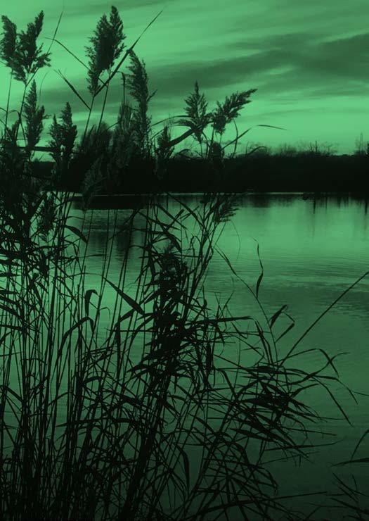
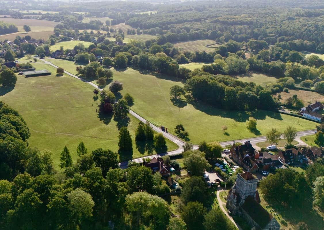
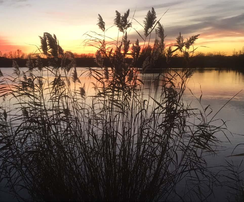
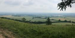
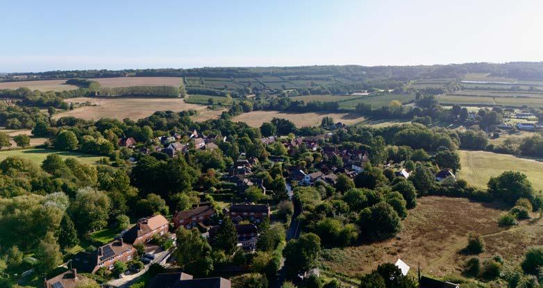
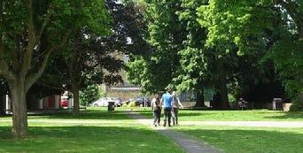
7.1 The borough of Tonbridge and Malling has a predominantly rural character.
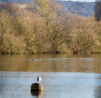
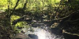
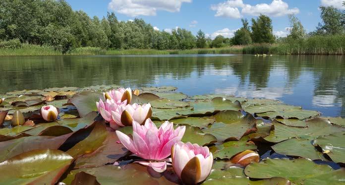
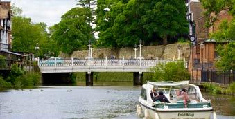
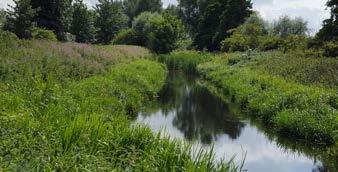
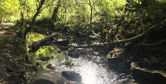
7.2 With a diverse natural environment including internationally, nationally and locally protected wildlife sites, areas of rare habitats that support protected and priority species, swathes of woodland including ancient woodlands and veteran trees, as well as the River Medway, the River Bourne and their tributaries that support fresh and intertidal habitats.
7.3 The borough’s natural environment provides a diverse range of benefits to people, nature and the economy. It supports the health and wellbeing of residents and visitors, biodiversity, food and energy production, flood control, climate change mitigation and adaptation, pollution and much more.

Landscape
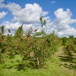
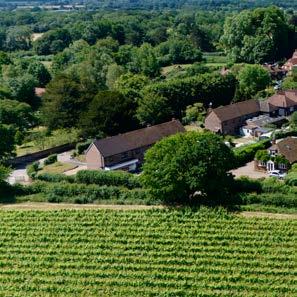
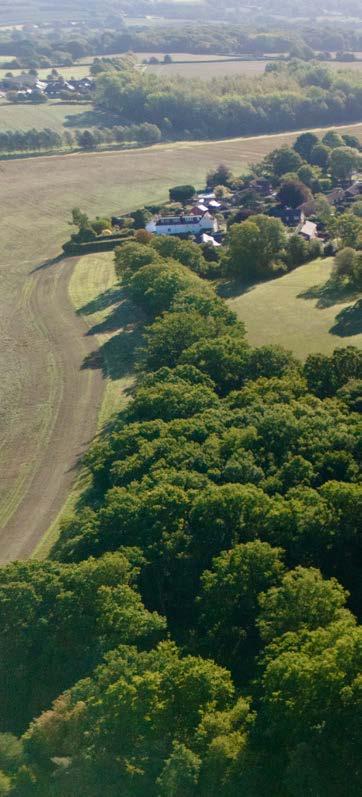
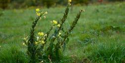
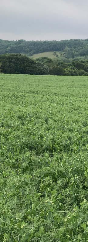
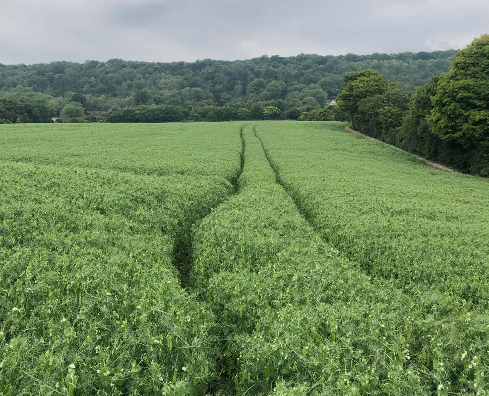
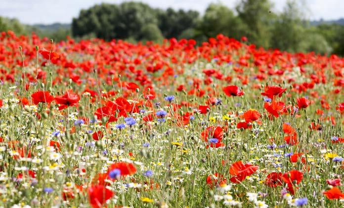
7.4 The borough’s landscape is heavily influenced by its underlying geology, which is important in determining the character of the landscape. It also influences the quality of the soil resource in the borough. Areas of the borough, particularly in the lower lying centre and north, are identified as being best and most versatile (BMV) agricultural land and support a range of cereal crops (approximately 30% of the borough) as well as orchards and soft fruit farming. In recent years, the south facing slopes in the north of the borough have also seen an increase in viticulture as the climate has warmed. These valuable soils support biodiversity, food production and carbon storage.
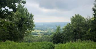
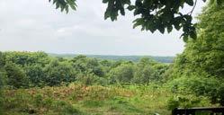
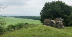
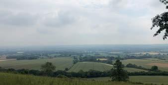
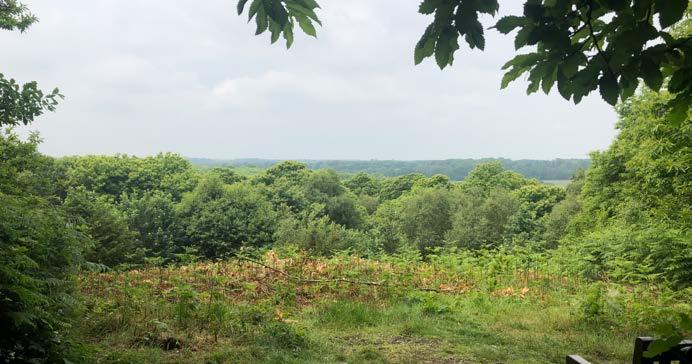
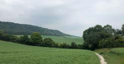
7.5 Much of the north of the borough is encompassed by the Kent Downs National Landscape, known for its wooded hill tops, scarp slopes and long views, as well as internationally rare chalk grassland which supports species of international conservation importance. Woodland and Lowland Meadow also contribute to a significant biodiversity network, protected and valued for its nature conservation interest and potential. A smaller area to the south of Tonbridge lies within the High Weald National Landscape which has a more intimate and wooded character and supports habitats, including ancient woodlands, heathlands, and flower-rich grasslands. In total, approximately 27% of the borough falls within these nationally protected landscapes, designated for their natural beauty.
Biodiversity
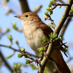
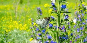
7.6 Biodiversity refers to the variety of all living organisms including animals, insects, plants, and micro-organisms as well as the variety of ecosystems and their component habitats.
7.7 The borough supports a range of habitats, which in turn, support a wide range of flora and fauna. The diversity of the natural environment within Tonbridge and Malling is one of the borough’s great assets and many of the existing landscapes and spaces are accessible to the public.
7.8 However, the State of Nature Report (2023) identifies that nature has been declining across the UK, and as a country, it is one of the most nature depleted in the world. This not only has an impact on wildlife, but on our ability to engage with nature as part of our response to climate change and for our physical and mental health and wellbeing. As the resident population of the borough grows, the conservation and enhancement of the natural environment will need to be managed to ensure net gains in biodiversity to try and halt this decline whilst delivering high quality, distinct urban and rural environments, accessible diverse open spaces, and ecological networks that will allow species to move across the landscape.
7.9 There are many areas in the borough that are designated for the biodiversity value. The North Downs Woodland and Peters Pit, in the north of the borough, have been identified as being of international importance for nature conservation and have been designated as Special Areas of Conservation. In addition, there are 11 Sites of Special Scientific Interest, predominantly in the north of the borough around the Medway Valley and the scarp slopes of the Kent Downs National Landscape.
7.10 Although not a statutory designation, the borough also has 46 Local Wildlife Sites (LWS) which are of county wildlife importance for wildlife, the largest of which is Mereworth Woods in the centre of the borough. These assets should be protected and enhanced.
The Environment Act 2021
7.11 The Environment Act (2021) establishes clear statutory targets for the recovery of the natural world in four priority areas: air quality, biodiversity, water and waste, and includes an important new target to reverse the decline in species abundance by the end of 2030. The Act places a new duty on all public authorities to conserve and enhance biodiversity and report on actions taken. Local authorities are also required to have regard to relevant local nature recovery strategies and the council is working collaboratively with Kent County Council, Medway Council and the local authorities in Kent to support the delivery of the Kent and Medway Local Nature Recovery Strategy (LNRS).
7.12 The LNRS will provide an opportunity to deliver an ecologically coherent and landscape scale, strategic approach to nature recovery including identifying priorities for nature, areas of importance and areas of opportunity, and where action could be best targeted to best deliver gains in biodiversity across Kent.

Conserving and Enhancing the Natural Environment
Introduction
7.13 The natural environment and the assets it provides help to foster the borough’s strong sense of character and identity. It can also help to mitigate the impacts of pollution as well as deliver a wide range of environmental, economic, health and well-being benefits for nature, climate, local, and wider communities and prosperity. Understanding the location of our existing natural assets and the multifunctional role they play is fundamental in achieving sustainable development.
7.14 The need to conserve and enhance the natural environment requires an ecosystems services approach due to the multifunctional role that many of the natural assets of the borough provide. This approach looks beyond designated sites and protected species to consider natural systems as a whole.
7.15 The Local Plan seeks to contribute to the conservation and enhancement of the natural environment by protecting and enhancing valued landscapes, sites of biodiversity or geodiversity value and soils, recognising the intrinsic character and beauty of the countryside, minimising impacts on and delivering net gains in biodiversity, and preventing new and existing development from contributing to, or being adversely affected by, unacceptable levels of pollution.
7.16 Policies are provided to ensure that the delivery of new development is balanced against the need to conserve and enhance the character and distinctiveness of the borough’s natural environment.
7.17 Policy NE1 sets out the borough’s overarching approach to the natural environment that will support our vision of conserving and enhancing natural assets and increasing biodiversity.
Policy NE1: Conserving and Enhancing the Natural Environment
Development should seek the protection, conservation and enhancement of the natural environment, through:
a Protecting and enhancing sites designated for biodiversity or geological value;
b Promoting the conservation, restoration and enhancement of priority habitats, ecological networks and green infrastructure, planning positively for people, nature and for addressing climate change taking an ecosystem services approach;
c Protecting and assisting the recovery of protected species and irreplaceable habitats;
d Supporting proposals that seek to conserve or enhance biodiversity as their primary objective;
e Securing measurable net gains in biodiversity;
f Ensuring that development maximises opportunities to help deliver the Local Nature Recovery Strategy and provide wider environmental benefits;
g Ensuring the positive conservation and enhancement of the Kent Downs and High Weald National Landscapes and their settings, in accordance with the relevant Management Plan;
h Protecting and enhancing the borough’s most valued landscapes, landscape character, soils, trees and woodland;
i Requiring the protection of the boroughs soil resource including minimising disturbance to soils and seeking opportunities to improve soil health to protect soil biodiversity, food production and carbon storage and to minimise the loss of the most fertile soils and soil erosion;
j Seeking to avoid and minimise the loss of the best and most versatile agricultural land (Grades 1, 2 and 3a) to major new development;
k Ensuring that development does not contribute further to adverse air pollution levels, ground, water or light pollution and taking opportunities to make improvements where possible, and in accordance with relevant guidance, action plans and frameworks;
l Supporting high-quality, well-designed development that maximises nature-based solutions and landscape led design that respects local character and contributes to establishing a strong sense of place; and
m Ensuring that development applies the mitigation hierarchy where it may affect designated sites and biodiversity assets, including protected and priority species.
Reasoned Justification
7.18 The council is committed to the protection, conservation and enhancement of the natural environment. The planning system is a key tool in addressing the need to conserve and enhance the natural environment and to protect it from harm.
Policy Implementation
7.19 Applicants should demonstrate how their proposals align to strategic priorities and actions With consideration to the Tonbridge and Malling Green and Blue Infrastructure Strategy (2024) and Kent and Medway Local Nature Recovery Strategy in order to secure maximum biodiversity benefits and to deliver the greatest gains from habitat enhancement, restoration and re-creation. Proposals for development within, or in the setting of, a National Landscape should have regard to the relevant Management Plan from the outset of a schemes design, to ensure the scheme conserves and enhances the protected landscape.
7.20 Planning applications will need to include relevant ecological surveys and baseline information. This will ensure that the council can address the Environment Act 2021 Biodiversity Duty in the decision.
7.21 To avoid significant harm to biodiversity, applicants should apply the mitigation hierarchy from an early stage in scheme design.
7.22 Avoidance of adverse impacts to biodiversity as a direct or indirect result of development must be the first consideration. Compensation is only considered after all other options have been explored and strictly as a last resort. Where a development cannot satisfy these requirements, planning permission should be refused.
7.23 Soil is also a valuable natural resource and is under threat from loss and degradation. The structure and health of soils is important for food production, biodiversity and carbon storage and development should protect and enhance soils from design stage through to construction. Applicants are encouraged to refer to Defra’s guidance Construction code of practice for the sustainable use of soils on construction sites (2018).
AVOID
Where possible, habitat damage should be avoided.
MINIMISE
RESTORE
Where possible, habitat damage and loss should be minimised. Where possible, any damage to or loss of habitat should be restored.
COMPENSATE
As a last resort, damaged or lost habitat should be compensated for.
Figure 7.1: Mitigation Hierarchy of Avoidance, Mitigation and Compensation.
National Landscapes
Introduction
7.24 In 2023, Areas of Outstanding Natural Beauty (AONBs) were renamed National Landscapes.
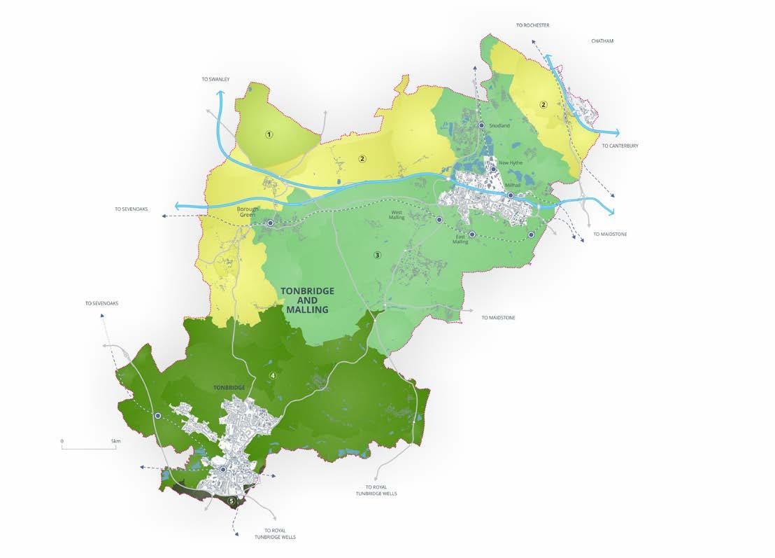
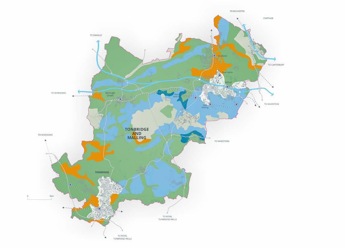
7.25 Tonbridge and Malling borough contains two National Landscapes: the Kent Downs; and the High Weald. Over 25% of the borough is located within the Kent Downs National Landscape to the north and west, and the High Weald National Landscape is located in the south of the borough, as illustrated in Figure 7.2 on page 126.
7.26 These are nationally designated landscapes that are afforded the highest level of landscape protection, where great weight is given to the need to conserve its landscape and scenic beauty. The primary purpose of their designation is to conserve and enhance the natural beauty of the area. The council has a statutory duty, under the Countryside and Rights of Way (CROW) Act (2000) (as amended by the Levelling up and Regeneration Act 2023), to seek to further the purpose of the National Landscapes.
7.27 The Kent Downs Management Plan and the High Weald Management Plan identify the distinctive features of the respective landscapes and set out the objectives for protecting, conserving and enhancing their locally distinctive features, as well as considering wider environmental issues, local communities, and the rural economy. The Management Plans set out the council’s policies for managing land within these landscapes and are a material consideration that must be taken in to account when considering the siting, layout and design of any development including materials.
7.28 In addition, large areas of the borough, although outside of these protected national landscapes, fall within their setting. The setting of national landscapes is also an important consideration, both individually and cumulatively, including on views into and out of the protected landscapes.
7.29 National Landscapes are living, working landscapes. They provide a livelihood for the agricultural and tourism sectors as well as other parts of the rural economy. They also provide an attractive setting for settlements and an important recreational resource for residents and visitors.
7.2: National Landscape Coverage in the Borough
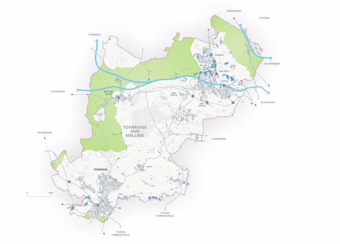
Figure
Policy NE2: National Landscapes
1 All proposals within, or affecting the setting of, the Kent Downs National Landscape and the High Weald National Landscape, must conserve and enhance the natural beauty of these nationally designated landscapes, including the national landscapes.
2 The scale and extent of development within the National Landscapes should be limited and will only be supported where the nature of the development, location, siting, scale, form, and design would conserve and enhance the components of natural beauty of the relevant National Landscape as defined in the AONB Management Plan, including; its distinctive landscape character and features, historic settlement patterns, dark skies and tranquillity; and would positively contribute to the targets, aims and objectives as defined in the relevant Management Plan, avoiding adverse impacts, unless these can be satisfactorily mitigated.
3 Development compatible with furthering the purpose of a National Landscape should apply a landscape-led approach that reflects the character and features of the National Landscape and should be of high design quality. The impact of development on views into and out of the National Landscape should also be considered.
4 Proposals will be required to submit appropriate information as part of an application to enable any impacts to be considered, taking into account the relevant Management Plan, landscape character or sensitivity assessments and any associated supporting documents and/or guidance.
5 Major development within the National Landscapes will only be supported in exceptional circumstances and where it can be demonstrated to be in the public interest.
Setting of the National Landscapes:
6 Development within land that contributes to the setting of a National Landscape will only be permitted where:
a it does not adversely affect the National Landscape’s natural beauty (including dark skies and tranquillity);
b It is sensitively located and designed to avoid or minimise adverse impacts on the National Landscapes; and
c It is consistent with National Landscape purposes, and in particular does not adversely affect transitional landscape character in the setting of the National Landscape and views, outlook and aspect, into and out of the National Landscape by virtue of its location, scale, form or design.
7 Assessment of such development proposals should have regard to the relevant AONB Management Plan and supporting documents.
Reasoned Justification
7.30 National Policy (paragraphs 189190) states that great weight should be given to conserving and enhancing landscape and scenic beauty in the National Landscape and that the scale and extent of development within such landscapes should be limited, while development within their setting should be sensitively located and designed to avoid or minimise adverse impacts on the designated areas, and advises that planning applications for major development in National Landscapes should be refused other than in exceptional circumstances.
7.31 The setting of National Landscapes comprises land adjacent to or within close proximity of their boundaries, including but not limited to, land which is visible from the National Landscape and from which the National Landscape can be seen. In some cases, the setting area will be compact and close to the boundary, in other cases the setting may be wider.
7.32 Large sections of the strategic road network, including the M2, M20, M26, as well as a number of settlements, are located within the National Landscapes and their settings. Good accessibility to infrastructure and services in some of these locations is likely to result in development pressures in these areas and there is a need to effectively manage this to ensure the purpose of conserving and enhancing the natural beauty of the protected landscapes is furthered.
Policy Implementation
7.33 The Kent Downs Management Plan and High Weald Management Plan are material considerations in planning decisions, and the council expects developers to have regard to the Management Plans from the outset of a schemes design. The council will have regard to the principles and defining components of character as set out within the Management Plans when considering development proposals affecting the National Landscapes and their setting.
7.34 Consideration will also be given to their associated supporting guidance including, but not limited to, the Kent Downs Landscape Design Handbook, Kent Downs National Landscape Guidance on the selection and use of colour in development, the High Weald Housing Design Guide, the High Weald Dark Skies Planning Advice Note, and High Weald Colour Study. Applications for equine related development should have regard to the Kent Downs AONB Good Practice Guide: Managing Land for Horses.
7.35 Major development within the National Landscape will not be permitted unless it can be demonstrated that the development is in the public interest, in accordance with the tests set out in paragraph 190 of the NPPF. However, the council acknowledges that there may be cases where development is necessary within the setting, or that small scale development is necessary within the National Landscapes themselves. In these instances, the council will work with applicants and the relevant National Landscape Unit to ensure appropriate and acceptable development is achieved.
7.36 All applications for development (excluding householder and advertisement applications) in, or within the setting of, the National Landscapes should be accompanied by a landscape and visual impact assessment when undertaking new building works, and an assessment of the proposal against all relevant Management Plan objectives.
Landscape Character
Introduction
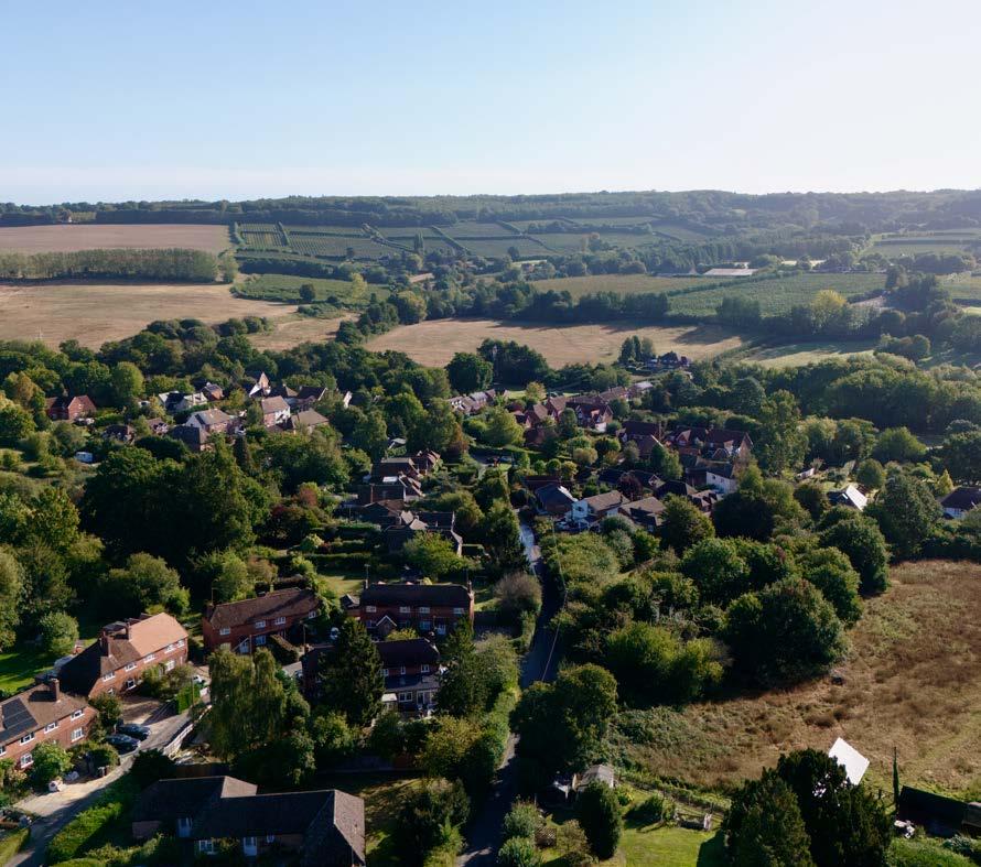
7.37 The high-quality landscapes of the borough are one of its greatest assets. Tonbridge and Malling lies within four National Character Areas, the North Downs, Wealden Greensand, Low Weald and High Weald. From the chalk grassland in of the Kent Downs in the north of the borough to the traditional orchards and ancient woodland in the central areas and flood plains and wetland around Tonbridge in the south. These diverse landscapes provide a haven for wildlife, a livelihood for the agricultural and tourism sectors, an attractive setting for settlements and an important recreational resource for residents and visitors.
7.38 Landscape character varies across the borough and is influenced by a range of factors including geology, soils, topography, climate, land cover and land use, and historic and cultural development. These natural, cultural and perceptual attributes combine to create landscape character, and these processes have resulted in a series of distinctive landscapes across the borough, proving a valuable resource contributing to the borough’s rural economy, and ecosystem services, as well as providing opportunities for recreation.
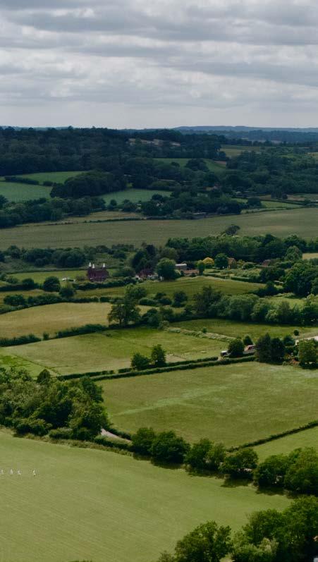
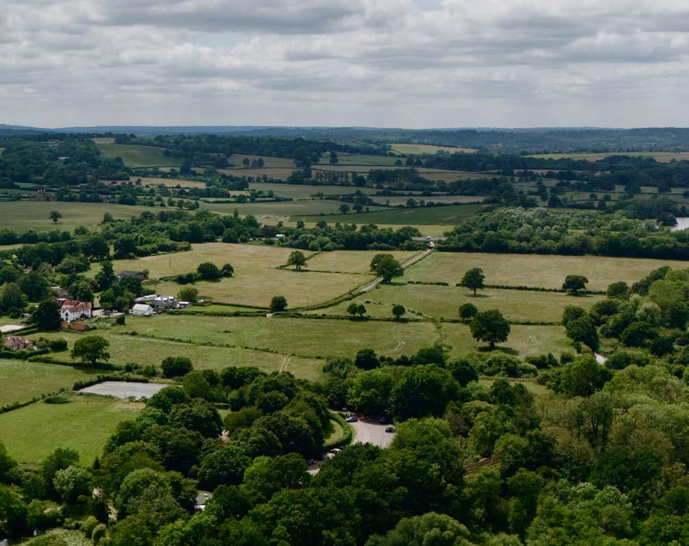
Figure 7.3: Landscape Character Areas

Tonbridge and Malling Local
Policy NE3: Landscape Character
1 Proposals should adopt a landscape led approach and must protect and enhance the intrinsic character and quality of the landscape character area, within which development will be situated, as defined by the Tonbridge and Malling Landscape Character Assessment (2025) and the Kent Downs AONB Landscape Character Assessment Review (2020) and any other relevant guidance / information.
2 Development proposals will need to demonstrate that they have considered the following in respect of their potential impact on the landscape, including any cumulative impacts:
a Landform, topography, geology and natural patterns of drainage;
b The pattern and composition of trees and woodlands;
c The type and composition of wildlife habitats, biodiversity and ecological character;
d The pattern and composition of field boundaries;
e The pattern and distribution of settlements, roads and footpaths;
f The presence and pattern of historic landscape features; and
g The setting, scale, layout, design and detailing of vernacular buildings and other traditional man-made features.
3 Development proposals will be expected to demonstrate that they effectively prevent, reduce and mitigate any negative impacts on landscape character (in that order), having regard to the condition and sensitivity of the character area, as well as contribute to local character and distinctiveness, and the green infrastructure network. Where possible, planting should be informed by and contribute to landscape character and make use of native and / or climate resilient species characteristic of that landscape character area.
Reasoned Justification
7.39 The National Planning Policy Framework is clear that plans should recognise the intrinsic character and beauty of the countryside, and that strategic policies should provide for the conservation and enhancement of landscapes. This can include nationally and locally designated landscapes but also the wider countryside.
7.40 To further understand the intrinsic character and beauty of the countryside in line with national policy, landscape evidence was commissioned to support plan-making. The Tonbridge and Malling Landscape Character Assessment (2025) that accompanies this Plan, provides an assessment of landscape character across the borough.
7.41 For each of the landscape character areas identified, the assessment sets out the key characteristics that are particularly valued for their contribution to character and for the ecosystem services they provide, as well as the condition and sensitivities of that specific area, the forces for change within the character area and landscape guidelines on how the landscape can be managed to ensure future change respects local character.
7.42 This includes guidance on patterns of development, plants and species, boundary treatments, building materials and the managing the relationships between any historic and new development.
7.43 In addition, the Tonbridge and Malling Landscape Sensitivity Assessment (2025) considers the sensitivity of land surrounding the borough’s most sustainable settlements to development, and the Tonbridge and Malling Landscape and Visual Appraisal (2025) considers potential landscape impacts and mitigation for the sites identified for development within this plan in order to define matters of landscape management and development management which should be considered in decision making.
Policy Implementation
7.44 Development should enhance, respect and reinforce the landscape through a landscape-led design approach, informed by contextual analysis of the local landscape character at the earliest opportunity. Planting should be informed by and contribute to landscape character and use native species where possible.
7.45 Proposals for development should have regard to the assessment of landscape sensitivity and landscape strategy guidance for that character area, as well as the Landscape and Visual Appraisal conclusions as relevant. Proposals should be accompanied by a Landscape Appraisal, which should be proportionate to the size and likely impacts of the scheme and be carried out in accordance with the Landscape Institute Guidelines for Landscape and Visual Impact Assessment and undertaken by a Chartered Landscape Architect.
Designated Sites, Irreplaceable Habitat and Priority Habitats and Species
Introduction
7.46 Sites designated for nature conservation perform key roles in protecting and supporting nature. They are classified into a hierarchy according to their status and the level of protection they should be afforded. International sites form the top tier of the hierarchy with the highest level of protection, followed by national and then locally designated sites, which include Local Wildlife Sites, Regionally Important Geological Sites and Local Nature Reserves.
7.47 Tonbridge and Malling borough has many areas that are designated for their biodiversity value, and these support a wide variety of species and habitats. They comprise:
• Two Special Areas of Conservation (SAC)
• 11 Sites of Special Scientific Interest (SSSI)
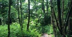
• 46 Local Wildlife Sites (LWS) and two Local Nature Reserves (LNR) and eight Regionally Important Geological Sites (RIGS).
7.48 In addition, approximately 11% of the borough is covered by Ancient Woodland. The Natural England Ancient Woodland Inventory and Woodland Trust Ancient Tree Inventory identify locations of these irreplaceable habitats.
7.49 A number of the priority habitats and species identified in the Kent Biodiversity Strategy 2020-2045 can be found in the borough, including traditional orchards, deciduous woodland and chalk grassland. Together, these natural assets help to make up a web of stepping-stones and corridors for wildlife, forming key components of ecological networks.
7.50 Policy NE4 seeks to ensures that appropriate weight is given to the importance of these sites and the contribution they make to wider ecological networks.
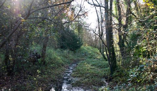
Figure 7.4: Coverage of SACs, SSSIs, LWS, LNR, and Ancient Woodland coverage in the borough
Policy NE4: Designated Sites, Irreplaceable Habitat and Priority Habitat and Species
1 Designated sites of importance for biodiversity will be safeguarded in line with the hierarchy set out in the NPPF.
2 Development proposals that will have an adverse impact on the integrity of international wildlife sites, as defined on the Policies Map, will not be supported other than in exceptional circumstances, in accordance with the NPPF:
a Development proposals that are likely to result in a significant adverse effect, either alone or in combination with other proposals, on any internationally designated site, must satisfy the requirements of the Habitats Regulations (or any superseding similar UK legislation);
b Development requiring Appropriate Assessment will only be allowed where it can be determined, taking into account mitigation, that the proposal would not result in significant adverse effects on the site’s integrity.
3 Developments which would adversely affect a Site of Special Scientific Interest (SSSI) (individually or cumulatively), as defined on the Policies Map, will not be supported. Exceptions will only be made where the benefits of the development on the particular site clearly outweigh both the impacts that it is likely to have on the features of the site that make it of special scientific interest and any broader impacts. Where an exception is considered, the mitigation hierarchy will apply.
4 Proposals for development in, or likely to have an adverse effect (directly or indirectly) on a Local Wildlife Site (LWS), Local Nature Reserve (LNR) or Regionally Important Geological Sites (RIGS), as defined on the Policies Map, will not be supported. In considering whether such an effect arises, the mitigation hierarchy of avoidance, mitigation and then compensation will apply.
5 The enhancement of biodiversity through the creation, enhancement and extension of designated sites locally will be supported.
6 Development should seek to conserve, restore and where possible enhance irreplaceable habitat, and priority habitats and species.
7 Development proposals directly or indirectly affecting biodiversity will be required to apply the mitigation hierarchy of avoidance, mitigation and compensation. The council will not support development proposals where significant harm is not adequately avoided, mitigated or compensated for.
8 Development proposals will need to demonstrate that biodiversity has been considered at an early stage in site identification and design to ensure that the location and/or use of land for development will not undermine designated sites, priority habitats and species and irreplaceable habitats, either directly or indirectly.
9 Opportunities to extend and buffer designated sites, irreplaceable habitats, priority habitats where applicable should be explored in order to support and implement measures within priority areas that could become of particular importance for nature recovery (as identified in the Local Nature Recovery Strategy).
10 Planning applications will be expected to be supported by relevant environmental information, including protected species and habitat records, which are informed by appropriate and up-to-date ecological data/ surveys. Any ecological surveys should be undertaken by suitably qualified professionals and be in line with best practice / guidance and Government standing advice.
Reasoned Justification
7.51 The NPPF states that planning should contribute to conserving nature and securing ‘net gains’ for biodiversity. Protecting and enhancing designated sites, as well as wider wildlife corridors and stepping stones, can assist in ensuring the connectivity of ecological networks and facilitate species migration, including in response to climate change.
Policy Implementation
7.52 Planning applications should be informed by a thorough understanding of the potential impacts, direct and indirect, on habitats and species. In all cases, development proposals will be required to follow the mitigation hierarchy when considering the potential impacts of the proposal on the borough’s habitats and species, both designated and non-designated. Applicants are encouraged to contact the Kent and Medway Biological Record Centre for protected habitats and species information within the borough.
7.53 Avoidance of adverse impacts on biodiversity as a direct or indirect result of development must be the first consideration. Mitigation and, if required, compensatory measures will be secured through planning obligations or conditions. Compensation will only be considered after all other options have been explored and strictly as a last resort.
7.54 If significant harm to biodiversity resulting from development cannot be avoided, adequately mitigated, or, as a last resort, compensated for, then planning permission should be refused.
7.55 Where necessary, due to the presence of designated sites, and/ or biodiversity assets, including the presence of habitats and features on or adjacent to a development site that indicate the potential for protected or priority species to be present, planning application submissions will need to include relevant ecological surveys and baseline information, along with proposals for addressing the requirements of this policy, and should have regard to industry best practice guidance and to Natural England’s guidance on preparing planning proposals to avoid harm or disturbance to protected species and on how to avoid harming protected areas and species during development work.
7.56 Regionally Important Geological Sites are geological Earth Science sites of particular importance as an educational, research, historical or recreational resource, identified by the Geo-Conservation Kent Group. Where possible, opportunities for access and/or interpretation should be improved.
7.57 Ancient woodland, and trees classed as ‘ancient’, ‘veteran’ or ‘aged’ are an irreplaceable, nationally important and threatened habitat. The council will use Natural England and Forestry Commission Standing Advice for Ancient Woodlands, ancient trees and veteran trees to review applications that might affect ancient woodland and ancient or veteran trees. Development resulting in the loss or deterioration of irreplaceable habitats will be refused unless there are wholly exceptional reasons (such as the examples provided by paragraph 180 (c) of the NPPF) and a suitable compensation strategy exists.
Biodiversity Net Gain
Introduction
7.58 Biodiversity net gain (BNG) is an approach to development, and/ or land management, that aims to leave the natural environment in a measurably better state than it was before a development takes place. The Environment Act (2021) requires that planning permissions granted in England (with a few exemptions) deliver at least 10% biodiversity net gain above the ecological baseline and expects developers to maintain any habitat creation or enhancement for a minimum of 30 years.
7.59 Local Nature Recovery Strategies will guide delivery of BNG and other nature recovery measures by helping developers and planning authorities avoid the most valuable existing habitat and focus habitat creation or improvement where it will achieve the best outcomes.
7.60 BNG can be achieved on-site, off-site or through a combination of on-site and off-site measures, and where this can’t be achieved, following application of the mitigation hierarchy, through the purchasing of biodiversity units as part of the BNG credits scheme. It will be important to consider whether provisions for biodiversity net gain will be resilient to future pressures including climate change, and ensure they are supported by an appropriate long term management plan.
7.61 Any mitigation and/or compensation requirements for internationally designated sites, other statutory designated sites or irreplaceable habitats should be dealt with separately from biodiversity net gain provision.
Policy NE5: Biodiversity Net Gain (BNG)
1 All relevant new developments are required to provide a minimum of 10% biodiversity net gain (BNG) and submit a Biodiversity Gain Plan. BNG must be calculated using the relevant Statutory biodiversity metric and be secured for a minimum of 30 years after the development is completed.
2 Proposals for BNG should be delivered on-site, taking into account local green infrastructure priorities set out in the Local Nature Recovery Strategy, the Tonbridge and Malling Green and Blue Infrastructure Strategy (2024) and the Kent Biodiversity Strategy. Off-site delivery will only be considered where it can be demonstrated that, after following the mitigation hierarchy, all reasonable opportunities to achieve net gains on-site have been exhausted.
3 Where off-site biodiversity gain is proposed, the Kent and Medway Local Nature Recovery Strategy (2025), once published, should be used to guide the locations of BNG. Delivery on sites within the borough should be fully explored and evidenced prior to considering delivery on sites outside the borough.
4 Only where delivery on-site and off-site have been fully explored and evidenced will the use of statutory credits be supported.
5 Development proposals must provide sufficient BNG information to demonstrate that the BNG requirement is capable of being successfully discharged and ensure that any BNG is in addition to any mitigation or compensatory measures. This should include a draft Biodiversity Gain Plan and draft Habitat Management and Monitoring Plan that follow the DEFRA and Natural England templates which should also include the following local considerations:
a The method of BNG delivery (for example on or off site);
b Evidence to demonstrate that the biodiversity gain hierarchy and locational hierarchy set out in criteria 3 of this Policy has been followed;
c The Statutory Biodiversity Metric should seek to align with and meet the objectives of the Kent and Medway Local Nature Recovery Strategy;
d Where baseline habitat of high or very high distinctiveness is retained onsite, the draft Habitat Management and Monitoring Plan should include proposals to secure its management to ensure that no deterioration would occur that results in reduced overall BNG.
6 BNG proposals will be secured by condition and/or legal agreement with the council or a conservation covenant with a Responsible Body. Where legal agreements are with the council this will include a requirement to cover the council’s costs associated with the long-term monitoring of the BNG delivery.
7 BNG that helps deliver nature-based solutions for climate change as well as biodiversity loss, such as the restoration and creation of ecosystems to protect communities from flooding or increasing carbon sequestration, will be encouraged.
Reasoned Justification
7.62 The Environment Act (2021) mandates at least 10% BNG for new development and is seen as a key mechanism for halting the decline in nature. The council declared a climate and biodiversity emergency in 2019, and this policy sets out the council approach responding to this.
7.63 The Kent and Medway Local Nature Recovery Strategy (2025), the Tonbridge and Malling Green and Blue Infrastructure Strategy (2024) and the Kent Biodiversity Strategy 2020-2045, set out the local priorities for nature in the borough, and these should inform the type and location of BNG to be delivered.
7.64 The statutory metric includes a ‘strategic significance’ component which will be informed by the Kent and Medway Local Nature Recovery Strategy (2025).
Policy Implementation
7.65 This Policy applies to all new planning applications, with the exception of those types of development set out in The Biodiversity Net Gain Requirements (Exemptions) Regulations 2024.Development that falls outside the scope of mandatory BNG should still seek to provide biodiversity gains in accordance with NPPF.
7.66 Planning applications will be required to demonstrate that proposals meet the requirements for a minimum of 10% BNG, informed by appropriate ecological surveys and assessments, which should be carried out by a suitably qualified ecologist. The British Standard for Biodiversity BS42020 outlines detailed guidance on ecological appraisal and the ecological information that should be submitted in planning applications.
7.67 The Statutory Biodiversity Metric should be used for all non-exempt major development, and the Small Sites Metric used for small sites. A Biodiversity Gain Plan is required to be submitted once permission has been granted and be approved by the council prior to commencement of the development. Applicants are encouraged to use the DEFRA Biodiversity Gain Plan, and the Natural England Habitat Management and Monitoring Plan templates in their submissions. Applications seeking to achieve in excess of 10% net gain will be supported.
7.68 Proposals for BNG must be acceptable to the council in terms of design and location. Proposals should have appropriate delivery and funding mechanisms that are capable of being secured by condition and/or legal agreement. Monitoring of biodiversity net gain projects will be funded by the developer, with reports provided to the council for BNG reporting.
7.69 Before the council approves the use of statutory credits, the applicant/agent will need to demonstrate that the developer has explored all on-site BNG options and can provide evidence showing why this is not possible; and can show evidence that no off-site options are available in England.


Green and Blue Infrastructure
Introduction
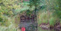
7.70 Green Infrastructure (GI) is a network of multi-functional green and blue spaces which can deliver a wide range of environmental, economic and social benefits. It can include parks, green spaces, allotments and woodlands, urban features such as street trees, green roofs and walls as well as the footpaths and corridors that connect them. The term also incorporates ‘blue infrastructure’ such as streams, ponds, rivers, wetlands and sustainable drainage systems.
7.71 The suite of designated sites, open spaces and waterways, along with valued National Landscapes and the wider countryside, contribute to a network of green infrastructure which can help provide for biodiversity as well as delivering wider benefits to the environment and economy including climate change adaptation and mitigation.
7.72 Recent years have seen an increased recognition of the important role that access to nature can play in improving physical and mental health, wellbeing and happiness. This network provides valuable wildlife corridors and stepping stones through which species, including protected species, can migrate, as well as recreational opportunities and ecosystem services. Protecting and enhancing this network of spaces, and linkages between them, is important to achieving the vision and aims of the Local Plan.
Policy NE6: Green and Blue Infrastructure
1 New development proposals must ensure that the loss of existing new green and blue infrastructure is avoided, and that new green and blue infrastructure is considered and integrated into scheme design from the outset. The loss of existing wildlife rich corridors and stepping stones, should be avoided.
2 Proposals that cause loss or harm to existing green or blue infrastructure assets, as identified in the Tonbridge and Malling Green and Blue Infrastructure Strategy (2024), will not be supported unless:
a The need for and benefits of the development demonstrably outweigh any adverse impacts.
b Where adverse impacts on green and blue infrastructure are unavoidable, development will only be supported if suitable mitigation and/or compensation measures for the network are provided in line with the mitigation hierarchy.
3 The design and layout of new green and blue infrastructure should:
a Take opportunities to incorporate a range of spaces, green routes and environmental features including footpaths, urban greening, green walls/green roofs and landscape features that contribute to public amenity, that are appropriate to the development and reinforce the wider green and blue infrastructure network;
b Deliver biodiversity net gain and support ecosystem services in support of the Local Nature Recovery Strategy;
c Minimise any indirect adverse effects on habitats and species including those relating to recreation, lighting, disturbance, water quality, pollution or invasive species;
d Have due regard to landscape/ townscape and historic character and contribute to establishing a strong sense of place;
e Support climate change adaptation and resilience for both people and nature including through use of appropriate habitats and climate resilient species to provide opportunities for species migration, and the use of new tree planting to facilitate shading and cooling;
f Encourage healthy, inclusive and safe places to maximise the delivery of green infrastructure benefits; and
g Comply with Natural England’s Green Infrastructure Standards.
4 Where new or enhanced green and blue infrastructure is proposed, details of appropriate species selection and long-term management and maintenance must be provided.
5 Planning applications will be expected to be supported by relevant environmental information, which is informed by appropriate and up-to-date ecological data/surveys. Any ecological surveys should be undertaken by suitably qualified professionals and be in line with best practice / guidance and Government standing advice.
6 Where major development involving the provision of housing is proposed on land released from the Green Belt, new or improvements to existing green spaces that are accessible to the public, in accordance with Policy SP8 should support the green and blue infrastructure network of the borough.
Reasoned Justification
7.73 The NPPF states that Plans should take a strategic approach to maintaining and enhancing networks of habitats and green infrastructure, planning for the enhancement of natural capital at a catchment or landscape scale across local authority boundaries.
7.74 Green and blue infrastructure is integral to place-making, significantly contributing towards places where people want to live, work and invest. As the borough continues to grow and develop, it will be important to conserve the existing green and blue infrastructure network as well as ensuring that opportunities to enhance the network and deliver new multifunctional green infrastructure are taken.
7.75 The Kent and Medway Nature Recovery Strategy (2025) and the Tonbridge and Malling Green and Blue Infrastructure Strategy (2024) identify the existing green and blue infrastructure assets within the borough, as well as identifying potential opportunities to enhance this network. Additionally, the Open Space, Indoor and Outdoor Sport and Recreation Study (2025) identifies those open space assets to be protected from development. Protection and enhancement of these assets can ensure multifunctional benefits for both nature and communities.
Policy Implementation
7.76 New development should contribute to the extension of the green and blue infrastructure network, helping to address deficiencies in provision and providing good quality connections to the network and throughout the development.
7.77 Green infrastructure principles should be considered and incorporated into a scheme from the earliest stages of the design process, at every scale (from a single building to a new settlement), and be capable of delivering a range of environmental and health and wellbeing benefits.
7.78 Opportunities to achieve multi-functionality by bringing green and blue infrastructure functions together should be explored. Proposals should comply with Natural England’s Green Infrastructure Standards to enable equitable provision of good Green Infrastructure.
7.79 In developing proposals, regard should be had to the Kent and Medway Nature Recovery Strategy (2025), the Tonbridge and Malling Green and Blue Infrastructure Strategy (2024). In addition, Parish Infrastructure Plans and Neighbourhood Plans should be considered to identify local needs and opportunities for new green infrastructure.
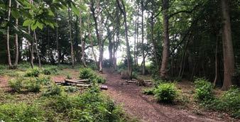
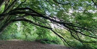
Woodland, Trees and Hedgerows
Introduction
7.80 Woods, trees and hedgerows are essential for people, biodiversity and climate change resilience, and are key components of green infrastructure. They can support species, improve health and wellbeing, clean the air, cool our towns, help to manage flood risk, and, by capturing and storing carbon, they play a vital role in addressing climate change as well as making an important contribution to the local character.
7.81 The importance of woodlands and trees is reflected in the Environment Act (2021), and the Government’s Environmental Improvement Plan (2023) which introduced a target to increase tree canopy cover and woodland cover to 16% of total land area by 2025.
7.82 Tonbridge and Malling has large areas of existing woodland, some of which are ancient, and there are many pressures that can affect these including an ongoing decline in traditional woodland management practises, under or inappropriate management of woodlands, introduction of new species, disease and pests, pollution and disturbance. All these pressures can result in the loss of species diversity.
7.83 Hedgerows are also important features in the borough, not only being a traditional feature of the landscape and contributing to local character but also providing corridors through which species can travel.
7.84 The council will seek to ensure that, wherever possible, new development does not result in the loss of or damage to any trees or hedgerows and will seek to maximise appropriate tree cover in new development.
Policy NE7: Woodland, Trees and Hedgerows
1 Development proposals will be supported where they protect, restore, manage, enhance and supplement existing woodland, trees and hedgerows in accordance with best practice guidance and relevant standing advice.
2 New trees, woodland and hedgerows should be located to enhance and restore biodiversity to support the Kent and Medway Nature Recovery Strategy outcomes, landscape character, visual amenity, the green and blue infrastructure network including that set out in the Tonbridge and Malling Green and Blue Infrastructure Strategy (2024), facilitate climate change mitigation and adaptation and enhance biodiversity. Any planting should be characteristic of the local area, in keeping with the site surroundings, including any historic context, and comprise of a diverse range and mixture of climate resilient and native species.
3 Development proposals will be supported where existing woodland, hedgerows and trees are taken account of and integrated into the design of development with long-term sustainable relationships being achieved. Proposals which would affect woodlands, trees and/or hedges within the application site or on land adjacent to the site (including street trees), will need to be supported by a survey showing the trees/hedges and providing details of protection measures. Tree surveys and details of tree/hedge protection measures should be prepared by a suitably qualified arboriculturist in accordance with the recommendations of BS5837: 2012: Trees in Relation to Design, Demolition and Construction (or subsequently updated version of that Standard) and the requirements of the Validation Checklist. Sufficient evidence and measures, with allowance for future growth and maintenance requirements, must be provided to ensure protection from any likely impacts from development, including, but not limited to, access and provision of services.
4 Proposals should incorporate trees within the design and layout of development within both urban and rural areas, including tree-lined streets, to enhance the amenity of the public realm as well as providing climate change adaptation and mitigation benefits.
5 Proposals will need to demonstrate that sufficient measures can be implemented to protect trees, woodland and hedgerows both during and for the lifetime of the development to achieve current and longterm sustainable relationships.
6 Development which would result in the loss or deterioration of irreplaceable habitats, including ancient woodland and ancient or veteran trees, will only be permitted in wholly exceptional circumstances, where the public benefit would clearly outweigh the loss or deterioration, and where a suitable compensation strategy exists.
Reasoned Justification
7.85 Natural England’s Ancient Woodland Inventory identifies approximately 2,600 ha of ancient woodland in Tonbridge and Malling, accounting for c.11% of the borough. In addition, the Woodland Trust’s Ancient Tree Inventory identifies numerous ancient trees across the borough, some individual specimens, and others in groups. National policy requires that development resulting in the loss of or deterioration of such irreplaceable habitats should only be permitted in exceptional circumstances where the public benefit would clearly outweigh the loss or deterioration, and a suitable compensation strategy exists.
7.86 The NPPF also recognises the important contribution that trees play in the character and quality of the environment, and their role in addressing climate change, through ensuring that new streets are treelined, that opportunities are taken to incorporate trees in developments, that appropriate measures are in place to secure the long-term maintenance of newly-planted trees, and that existing trees are retained wherever possible.
7.87 The Kent County Council (KCC) Tree Canopy Cover Report (2020) identifies that Tonbridge and Malling has an estimated canopy cover of 28%, the second highest in the county and significantly above the county average of 17%, and above the national canopy cover target. This provides an important asset to support biodiversity that in line with the Biodiversity Duty on public authorities, should be conserved and enhanced.
7.88 In addition, the Tonbridge and Malling Tree Charter (2021) recognises the value of trees, not just for biodiversity but the increasingly important role they can play in mitigating the effects of climate change, risks of flooding and pollution control. The Tree Charter seeks opportunities to increase tree cover across the borough to help respond to climate change and help reverse the collapse of biodiversity by creating opportunities for species to adapt and thrive.
7.89 Woodland, trees and hedgerows is also identified by the Kent and Medway Nature Recovery Strategy (2025) as one of six habitat priorities for nature recovery in the county and seeks improvements in management as well as the expansion of existing and creation of new woodland and hedgerows.
Policy Implementation
7.90 The council will protect existing woodlands, trees and hedgerows and will support all suitable opportunities for new planting of these as part of development schemes, and the protection of new trees via Tree Preservation Orders, where appropriate. This includes protecting trees and other vegetation from damage during construction phases.
7.91 The council will seek to ensure that where development is proposed close to ancient woodland and/or veteran trees, or where development may result in harm to ancient woodland and/or veteran trees, suitable and appropriate protection is provided in the form of buffer zones and any other measures deemed necessary. Where developments are proposed in, or adjacent to, ancient woodland, the council will have regard to Natural England and Forestry Commission Standing Advice for Ancient Woodlands, ancient trees and veteran trees.
7.92 Proposals for development will be expected to avoid harm to existing trees, woodlands and hedgerows, seek to protect and incorporate them into any landscape scheme, and seek to maximise opportunities for tree planting and woodland creation, as appropriate, including the provision of tree lined streets. When planning for tree, woodland or hedgerows planting, applicants should have regard to the Forestry Commission’s best practice guidance on the right tree, in the right place for the right reasons and the Tonbridge and Malling Landscape Character Assessment (2025).
7.93 Where tree planting, hedgerow or woodland creation is proposed as part of developments within a National Landscape, applicants should take account of the relevant Kent Downs or High Weald Management Plan and any associated guidance.
7.94 Where trees are present on, or within 15 metres of a development site, a full tree survey and Arboricultural Impact Assessment in accordance with the current ‘BS5837: Trees in relation to design, demolition and construction – Recommendations’, the Validation Checklist and any other related survey information, should be submitted alongside the planning application.
7.95 The preference will be to incorporate existing trees into the development. However, there may be instances where the loss of trees is unavoidable. Where the loss of such features is demonstrably unavoidable, adequate replacement provision, of appropriate species, will be sought. The proposal will also be required to demonstrate:
• That the development could not equally be delivered elsewhere, where no harm to tree(s) would be involved;
• That the proposed development scheme could not be modified to retain the tree(s); and
• That the amenity value of the tree(s) is/are outweighed by the benefits to the community of the development proposal.

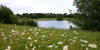
Local Green Space
Introduction
7.96 Green spaces within and around towns and villages can play an important role in defining the character of an area, as well as being an important social, environmental, and economic resource to a local community.
7.97 The council recognises the benefits that green and open spaces have for the physical and mental health and wellbeing of people in the borough, and the value communities place upon them. This is to be reflected in the council’s new Local Plan as Local Green Spaces.
7.98 The NPPF in 2012 introduced the ability for communities to identify areas of Local Green Space (LGS) of particular importance to them and designate them for protection through Local Plans and Neighbourhood Plans for example because of their beauty, historic significance, recreational value, tranquillity or wildlife value. National policy advises that managing development within a LGS should be consistent with Green Belt policy. This means that development on a designated LGS will only be permitted in very special circumstances.
7.99 Planning Practice Guidance is very clear that LGS designations should not be used in a way that undermines the ability to identify sufficient land in suitable locations to meet identified development needs and therefore designating Local Green Space will need to be consistent with local planning for sustainable development. For land to be designated as LGS it must meet set criteria as set out in national planning policy (para 107), this means that for a site to be designated it must be:
a in reasonably close proximity to the community it serves;
b demonstrably special to a local community and holds a particular local significance, for example because of its beauty, historic significance, recreational value (including as a playing field), tranquillity or richness of its wildlife; and
c local in character and is not an extensive tract of land.
7.100 Planning Practice Guidance provides further guidance on LGS designation, and this has been used to identify a methodology to evaluate the appropriateness of Local Green Space designation for sites put forward. The methodology requires that proposed LGS must not already be sufficiently protected by policy and that a proposed site must meet five criteria to be formally designated in the Local Plan.
7.101 In relation to existing policy protection, this may include policy protection such as that provided by national Green Belt policy, national landscapes, ancient woodland, European / national biodiversity policy protection, policy relating to registered parks and gardens, scheduled ancient monuments, Conservation areas or village greens. The five criteria that a proposed site must meet includes:
• The space does not have planning permission for development;
• The space is not allocated or proposed for development in the Local Plan;
• The space is not an extensive tract of land and is local in character;
• The space is within close proximity of the community it serves; and
• The space is demonstrably special to the local community and holds particular significance.
7.102 For further information on the methodology please see the LGS Topic Paper.
7.103 To date the council have received 185 sites for consideration as potential Local Green Spaces and work is on-going to understand whether they meet the national criteria and whether they meet the five criteria for designation. Out of these 185 sites, 123 sites have been screened out for a variety of reasons for example due to an existing planning permission being in place, it being an extensive tract of land and existing onsite designations already providing adequate policy protection from future development. A full list of the 185 sites and the justification for them being screen out, can be found in the LGS Topic Paper (2025).
7.104 This leaves 63 sites for further consideration. The sites that are being taken forward for further consideration are set out in Annex 3. To understand whether each of the sites are demonstrably special to the local community as per (b) above, elected members and Parish Councils have been invited (on behalf of their communities) to submit evidence to the council as to why the sites are demonstrably special to their local communities.
7.105 The sites submitted so far can be seen in the LGS Topic Paper. Once we have progressed the site assessments, should any sites successfully demonstrate that they meet national criteria, then these will be included in the Regulation 19 Local Plan and listed within a Policy.
7.106 Policies for managing development within a LGS should be consistent with those for Green Belts, excluding provisions relating to grey belt and previously developed land as set out in chapter 13 of the NPPF.
Agricultural Land
Introduction
7.107 National planning policy requires local planning authorities to take into account the economic and other benefits of the best and most versatile (BMV) agricultural land and looks to direct significant development, where this is demonstrated to be necessary, to areas of poorer quality land.
7.108 BMV agricultural land is defined as land in Grades 1, 2, and 3a of the Agricultural Land Classification (ALC), with grade 1 being the highest. Land within these grades are considered to be the most versatile, productive and efficient, i.e. areas that have the greatest potential to produce high and consistent yields that require less input. Grades 3b and 4 are not considered BMV agricultural land.
7.109 Policy NE8 seeks to restrict development on BMV agricultural land unless there is an overriding need and no suitable lower grade land (3b, 4 and 5) is available, taking into account other constraints or planning balance matters.
7.6: Agricultural Land Grades
Figure
Policy NE8: Best and Most Versatile Agricultural Land
1 The council will seek to protect the best and most versatile (BMV) agricultural land from development.
2 Planning applications that would result in the loss of BMV land will be expected to justify why the loss of the agricultural land is acceptable and assess its value and wider contribution in terms of farming resources, food production, natural capital and ecosystem services.
3 Applicants will be required to submit information on the status of a site which will be used alongside other material considerations for the purposes of determining planning applications.
4 Proposals for development on land indicated as containing any BMV land will need to be supported by a detailed and up to date survey and evaluation of soil types.
5 Overall, applicants should seek to use areas of poorer quality agricultural land in preference to that of higher quality, except where this would be inconsistent with other sustainability objectives.
6 In exceptional circumstances, where development is permitted on BMV land, applicants will be required to submit details to show how disturbance to soils will be minimised to protect soil biodiversity during construction.
Reasoned Justification
7.110 Planning Practice Guidance describes soil as an essential, finite resource, which is used as a growing medium for food, timber and other crops, as a store for carbon and water, as a reservoir of biodiversity and as a buffer against pollution.
7.111 To sustain long-term food security and healthy soils in a changing climate, the protection of BMV land is key to ensure that food production is not negatively impacted by development, and that the wider ecosystem services provided by soils are retained.
7.112 The Agricultural Land Classification (ALC) shows that there are areas of Grade 1 land around Wateringbury, Pizien Well, Offham and West Malling and that elsewhere in the borough that the majority of agricultural land within Tonbridge and Malling is either Grade 2 or Grade 3. This includes land around settlements where development pressure is the greatest.
Policy Implementation
7.113 The loss of potential food production capacity will be considered when assessing proposals whilst also balancing this with the need to accommodate development. This includes where BMV graded land is proposed for Biodiversity Net Gain (BNG) land.
7.114 For the purpose of applying this policy, significant loss of agricultural land should mean the following:
a The loss of 20 hectares of grades 1, 2 or 3a agricultural land which is for the time being used (or was last used) for agricultural purposes; or
b The loss of less than 20 hectares of grades 1, 2, 3a agricultural land which is for the time being used (or was last used) for agricultural purposes, where development is likely to lead to a further loss of agricultural land amounting cumulatively to 20 hectares or more.
7.115 In accordance with Guidance and the Town and Country Planning (Development Management Procedure (England) Order (DMPO) (2015) Natural England will be consulted on proposals that are not allocated in a development plan where it would result in the loss of more than 20 hectares of BMV land, including cumulative loss if it is part of a phased development.
7.116 Where detailed information is lacking, proposals for development on land indicated as containing any BMV Land (Grade 1, 2 and 3a) will need to be supported by a detailed and up to date survey and evaluation of soil types. Applicants should use soil scientists or experienced soil specialists to carry out surveys, as per the ‘Guide to assessing development proposals on agricultural land’ February 2021.
7.117 It is important to recognise and acknowledge that the ‘quality’ of agricultural land may be determined by more than the ALC grade, and the ‘economic and other benefits’ such as infrastructure, fragmentation, and access, as well as the contribution land may make to wider ecosystem services and natural capital are important considerations in relation to the effects of development on agricultural land and the districts landscape character.

Noise, Vibration and Odour Pollution
Introduction
7.118 The planning system plays an important role in safeguarding the quality of life of residents and improving the environmental condition of the borough. Loss of amenity from noise, vibration, and odour pollution can have an adverse impact on people’s health and living conditions but also on the amenities of an area.
7.119 National guidance advises that new development should be appropriate for its location, taking into account the likely individual and cumulative effects of pollution on health, living conditions and the natural environment, as well as the potential sensitivity of the site or the wider area to impacts that could arise from the development.
7.120 Development should be designed and located where it will not have a harmful impact on the existing natural, historic and built environment, and the amenity or safety of an area or occupants. Wherever possible development should help to improve local environmental conditions. This shall include taking into account likely sources of noise, odour and vibration levels from proposed uses but also from existing established uses and operations.
Policy NE9: Noise, Vibration and Odour
1 All development proposals should minimise, and where possible reduce noise, vibration, and odour pollution and ensure that the development is appropriate for its location when considered alone and cumulatively.
2 The following receptors will be protected from unacceptable levels of noise, vibration and odour pollution, as relevant:
a National Landscapes
b Designated nature conservation sites
c Historic environments
d Occupants of residential development
e Other sensitive receptors including schools, nurseries, hospitals, care facilities, areas used for amenity or recreation.
3 Development will only be permitted, if applicants can demonstrate that their development will not result in unacceptable pollution levels having regard to the relevant British Standards and other relevant national guidance and good practice.
4 Development proposals will be required to identify any likely impacts arising from the proposed development on existing nearby sensitive receptors and where an impact is likely will be required to submit an assessment that meets the relevant requirements and / or standards. The Assessment must be undertaken by a suitably qualified person and consider the relationship in detail.
5 Where an adverse impact is identified, applicants must demonstrate how the proposed development will be designed and implemented to prevent, avoid and mitigate the adverse impact. Planning applications will not be supported where adverse impacts cannot be adequately mitigated.
Reasoned Justification
7.121 Paragraph 198 of the NPPF requires planning policies to ensure that new development is appropriate for its location taking into account the likely effects of pollution sources on health, living conditions and the natural environment. Policies should therefore:
a mitigate and reduce to a minimum potential adverse impacts resulting from pollution sources from new development; and b identify and protect tranquil areas.
7.122 The borough is predominantly rural but also has extensive built-up areas that accommodates various industries such as agriculture, minerals extraction and processing and manufacturing that can generate disturbance from noise, odour and vibration.
7.123 Some of these are longstanding, well-established operations that can be in areas where new development opportunities are likely to be proposed such as residential or new commercial uses.
7.124 It is therefore important that the Local Plan effectively addresses the issues of pollution and disturbance issues that are likely to arise within the borough, to help protect the environment and ensure the quality of life and amenities of existing and future communities.
Policy Implementation
7.125 This policy refers to all developments regardless of the scale and nature of the proposal across the borough. Development should not be located where site conditions make it unsuitable for its intended use, unless it can be demonstrated that the effects of the development can be satisfactorily remediated or mitigated.
7.126 Development proposals (the agent of change) which are incompatible with neighbouring existing uses due to harmful impacts, for example from noise generating businesses or odour from wastewater treatment works, may not be acceptable. Development will not be considered favourably where the amenity of future residents would be detrimentally affected or where it is likely to prejudice the continuation of lawful operations of existing uses or prevent commercial growth or expansion, unless the impacts can be suitably mitigated as part of the proposed development.
7.127 The policy applies to all applications involving amenity issues and requires that these are comprehensively assessed, and appropriate mitigation and acoustic measures are addressed and incorporated into the design of development proposals at an early stage. Issues of light pollution are addressed under policy NE12. This policy seeks to avoid harmful impacts to both human receptors as well as the natural environment such as designated nature conservation sites.
7.128 In addition, particular attention should be given to avoiding noise generating uses within or adjacent to National Landscapes and historic environments such as conservation areas or within the curtilage of a listed building where the tranquillity of these areas is likely to be affected that can in turn, affect the special character and setting of these areas.
7.129 Where noise, vibration or odour issues are anticipated, the council will expect the submission of an appropriate assessment to accompany the application prepared by a suitably qualified and competent person and identified detailed mitigation measures as part of the planning application process.
7.130 Applications with such associated amenity issues will be considered in light of the relevant British Standards which are:
• BS5228: Noise and Vibration Control on Construction and Open Sites;
• BS4142: Methods for rating and assessing industrial and commercial sound; and
• BS8233: Guidance on sound insulation and noise reduction for buildings.
7.131 Mitigation measures where deemed necessary, will depend on the proposed development and should be proportionate to the likely impact. Such measure may include (but not limited to) applying high-quality design standards in the development and the appropriate layouts, triple glazing, acoustic fencing and bunds as well as agreed operational times for business activities.
7.132 Unacceptable levels of noise, odour or vibration are deemed to be levels which, when assessed on a case-by-case basis, having regard to relevant legislation, British Standards and other guidance, would be considered demonstrably harmful to the amenities of residents, the natural environment, and the setting of historic environments or would prejudice and impede the continuation of an existing lawful operation.
Air Quality
Introduction
7.133 The planning system has an important role to play in pursuing improvements in local air quality, minimising exposure to pollution, improving the health and wellbeing of the population, and minimising potential harm to habitats and species. The council, through its Air Quality Action Plan (2021), is committed to improving air quality within its borough and therefore seeks to address air quality within the new Local Plan.
7.134 Clean air is vitally important to the quality of life, and a variety of air pollutants have known or suspected harmful effects on human health and the environment. These pollutants are predominantly the products of combustion from heating, power generation or from motor vehicles.
Pollutants from these sources may not only cause a deterioration in air quality in the immediate vicinity of these sources but can travel long distances and affect other areas.
7.135 Air pollution is associated with a number of adverse health impacts including being recognised as a contributing factor in the onset of heart and cancer and particularly affects the most vulnerable in society such as children and the elderly. Additionally, people living in less affluent areas are most exposed to dangerous levels of air pollution. It can also impact the natural environment affecting plants, habitats and fauna.
7.136 The Tonbridge and Malling Air Quality Annual Status Report (2024) advises that Within Tonbridge and Malling the main pollutant of concern is Nitrogen Dioxide (NO2) associated with motor vehicles from large volumes of traffic on key highways running through the borough including the M20 motorway. Other air pollutants of concern in the borough are Particulate Matter PM10 and PM2.5 and of less concern, sulphur dioxide and carbon monoxide.
Policy NE10: Air Quality
1 Development proposals should seek to improve air quality and reduce the effects of poor air quality by minimising exposure to air pollution and assist in facilitating compliance with relevant limit values and/or national objectives for air pollutants.
2 Where air quality issues are anticipated submission of an air quality assessment is required to determine whether the predicted impact of a development on local air quality would adversely affect public health and / or the local environment and to identify appropriate mitigation. Where an Air Quality Assessment identifies potential significant adverse impacts on sensitive receptors from any source, the applicant must detail the appropriate avoidance and mitigation measures that will be implemented to prevent the identified impacts, including impacts on future occupiers or users of the site. Major developments will require an emissions mitigation assessment to be submitted.
3 Development, either individually or cumulatively with other existing or proposed uses in the vicinity that could directly or indirectly result in a significant deterioration in air quality levels within the development locality will not be permitted unless specific, identified and acceptable measures to offset or mitigate those impacts are introduced as part of the development.
4 In relation to declared Air Quality Management Areas (AQMA), and any areas in the process of becoming a declared AQMA, at the time of application, (as shown on the DEFRA UK AIR AQMAs interactive map) development will not be permitted where new receptors would be introduced into an area of poor air quality unless the proposals incorporate acceptable measures to ensure those receptors would not be subject to unacceptable risks as a result of poor air quality.
5 Proposals that will result in National Air Quality Objectives being exceeded will not be supported.
6 Development shall safeguard ecology, local wildlife and habitats and those development proposals, (alone or in combination) that are anticipated to have an impact on an internationally designated site will be subject to a Habitats Regulations Assessment.
7 Mitigation measures on a scheme will be secured through planning condition and / or planning obligation depending on the scale and nature of the development and its associated impacts on air quality.

Reasoned Justification
7.137 National policy requires planning policies to address pollution with Paragraph 199 of the NPPF requiring planning policies to sustain and contribute towards compliance with relevant limit values or national objectives for pollutants taking into account the presence of Air Quality Management Areas and Clean Air Zones, and the cumulative impacts from individual sites in local areas. It also requires opportunities to improve air quality or mitigate impacts to be identified.
7.138 Owing to past air quality levels, the council has six Air Quality Management Areas (AQMAs) in the borough and an Air Quality Action Plan (AQAP) has been undertaken for the borough. The primary focus of this Action Plan is to implement measures which will ensure levels of NO2 across the borough and specifically within the six declared AQMAs, are consistently below the threshold of 40μg/m3 expressed as an annual mean, which is the current level regarded as safeguarding the most vulnerable in society against the impacts of NO2.
7.139 The Local Plan and planning decisions can play a key role in contributing to improving air quality across the borough by seeking to improve the health and living conditions of existing and future residents and visitors. One of the many ways this will be achieved is to protect and control air quality from the effects of new development.
7.140 Developments, if not properly planned and designed, can contribute to the deterioration of air quality which can harm the health of residents, workers and visitors to the borough as well as harm the natural environment. Advancements in technologies such as cleaner vehicles and the growing demand for electric cars and ultra-low emissions vehicles will help alleviate to an extent current problems, but there is still a need to ensure development does not, individually or cumulatively result in a worsening of air quality.
Policy Implementation
7.141 The quest for clean air and the need to protect air quality objectives apply to all developments regardless of the scale and nature of the proposal. However, this will need to be applied in a proportionate manner as major developments are likely to have a greater impact and require greater mitigation measures.
7.142 To determine if air quality is a material consideration to a planning decision, and whether an Air Quality Assessment is needed as part of the application, will depend on the nature, scale and location of the development. Permission may be withheld if the nature of the proposed development is likely to result in a deterioration in air quality levels, particularly in an area where air quality is already known to be poor, for example in or adjacent to a AQMA or where the development is likely to adversely impact on a designated nature conservation site, such as the internationally protected Special Areas of Conservation in the borough.
7.143 Where air quality issues are deemed to be a material consideration, submission of an air quality assessment will be required to accompany the application and identify detailed mitigation measures as part of the planning application process. The assessment should be prepared by a suitably qualified and competent person, as defined by the NPPF.
7.144 For developments that require an air quality assessment, the current policy guidance and technical guidance documents that should be referred to are:
• DEFRA PG(22); and
• DEFRA TG(22)
7.145 Where a development is likely to have air quality impacts upon ecology and designated nature conservation sites, applicants are also advised to refer to the Chartered Institute of Ecology and Environmental Management (CIEEM) Advisory Note: Ecological Assessment of Air Quality Impacts’ (2021). Where an Air Quality Assessment identifies potential significant adverse impacts on internationally or European designated nature conservation sites, a Habitats Regulation Assessment (HRA) will be required.
7.146 Mitigation measures to reduce air pollution can be (but are not limited to), the promotion of walking, cycling and use of public transport strategies. Where the use of the private car is unavoidable, then travel plans and congestion management measures are recommended. Good design principles should also be applied including avoiding new street canyons or a building layout that prevents pollution dispersion as well as careful positioning of habitable room windows away from pollution sources such as busy road frontages.
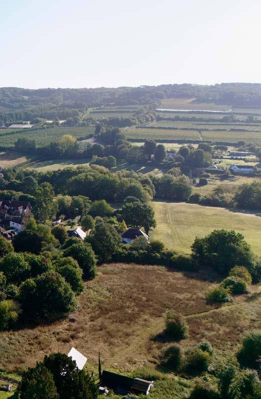
Ground Contamination
Introduction
7.147 The reclamation of contaminated land is crucial to making the most efficient use of previously developed land which is one of the council’s priorities by pursuing a brownfield first approach.
7.148 Contaminated land is used to describe land that due to its previous development history or geology is considered to be polluted by chemicals, gases, substances or structures. Land contamination can come from many different sources including from invasive species such as Japanese knotweed and failing to deal with contamination can be extremely harmful to human health, buildings and the natural environment.
7.149 In identifying sites for development, it is important to be mindful of previous activities that may have taken place on the land and the legacy they may have left behind. Ahead of the approval and commencement of development, it is important that the issue of contamination is thoroughly investigated and understood to make safe the development and protect the future end users and the environment.
Policy NE11: Ground Contamination
1 Development proposals located on or near sites which have previously been used for activities which pose a risk of land contamination shall be informed by a contaminated land desktop study identifying all previous site uses, potential contaminations associated with those uses including a survey of the condition of any existing building(s), a conceptual model of the site indicating sources, pathways and receptors and any potential unacceptable risks to human health and the local environment arising from contamination at the site.
2 Where contamination is identified, development proposals must incorporate a detailed strategy for site investigation works, along with details of any site clearance, ground investigations or site survey work that may be required to allow for intrusive investigations to be undertaken to inform a risk assessment of the degree and nature of any contamination on site and the impact on human health, controlled waters and the wider environment.
3 Development will be supported if it can be demonstrated, having regard to the other relevant policies in the Local Plan, that any contamination can be effectively addressed in a manner that ensures the site would be suitable for its end use through remediation measures.
Reasoned Justification
7.150 National policy advises that the planning system has a role in seeking to ensure land and sites are suitable for a proposed use, taking account of ground conditions and any risks arising from contamination, including risks arising from natural hazards or former activities such as mining, and any proposals for mitigation including land remediation, as well as the potential impacts on the natural environment arising from that remediation.
7.151 Such sites are more likely to be brownfield sites, i.e, those which have been previously developed most commonly for past commercial and industrial uses but can also include past mining and processing uses. The Local Plan seeks (as a priority) to develop previously developed land first as well as a preference for the reuse of existing buildings where feasible and viable, therefore there is a strong likelihood of development sites encountering ground contamination which will need to be managed.
Policy Implementation
7.152 National policy is clear that where a site is affected by contamination the responsibility for securing a safe development rests with the developer/landowner. This policy refers to all developments regardless of the scale and nature of the proposal including change of use applications where there could be a risk of contamination.
7.153 If there is reason to believe land contamination could be present on site, the developer should ensure that they carry out adequate investigations and risk assessments (carried out by a competent person as defined in the NPPF) to ensure that any associated risks are fully understood and can be remediated to an acceptable level following best practice and industry standards. This should be submitted to the council to support the application.
7.154 Details of the site assessment and remediation should be carried out in three main stages.
Stage 1 - To begin with, where contamination is anticipated or there is good reason to believe that contamination may be present [for example, from a previous use], then a desk top survey should be completed.
Stage 2 - If this confirms that contamination is likely to be present then a detailed site investigation, potentially requiring intrusive ground investigations with a risk assessment and remediation strategy should be carried out. Where a Remediation Strategy cannot demonstrate that the proposed development site would be remediated appropriately, or if insufficient information is provided to make this determination, the planning application will be refused.
Stage 3 - After the works are completed a remediation report shall be provided to confirm the remediation works are complete and the site is safe for its end use.
After remediation, as a minimum, the land should not be capable of being determined as contaminated land under Part IIA of the Environmental Protection Act 1990.
7.155 All investigations and subsequent remediation should be carried out in accordance with the Environment Agency’s Land Contamination Risk Management (LCRM) Guidance, and at each stage of the LCRM process, the development proposal must demonstrate compliance with relevant British Standards as set out below:
• BS 10175: Investigation of potentially contaminated sites - code of practice; and BS 5930: Code of practice for ground investigations.
7.156 Developers are also directed to the national contaminated land guidance – Land contamination technical guidance as well as the Tonbridge and Malling Contaminated Land Inspection Strategy (2016) for further advice and information about developing sites that are contaminated and what the council would expect.
Policy NE12: Light Pollution
Light Pollution
Introduction
7.157 Managing light levels, (particularly external lighting) within new development is an important part of protecting the built and natural environments as well as people’s amenities.
7.158 Poor lighting schemes and excessive light pollution can cause significant loss of residential amenities from sleep disturbance and high levels of glare. It can affect sensitive wildlife and habitats from disturbance and interruption with breeding and foraging patterns. Poor lighting can also be detrimental to historic settings, as well as the dark skies of the National Landscapes and wider countryside of the borough. Unnecessary lighting can also lead to a significant waste of energy.
7.159 Lighting schemes should therefore be designed carefully as part of the overall development design to reduce light pollution and energy usage.
7.160 Policy NE12 seeks to manage and control lighting to prevent light pollution within the borough and protect the built and natural environment, taking into consideration cumulative impacts of an area.
1 All new development will be supported which does not lead to significant levels of light pollution on the natural and built environment (including cumulative impacts).
2 Development will only be permitted, if it can be demonstrated, having regard to the relevant British Standards, Institute of Lighting Professionals and good practice that it is located and designed to minimise the impact of light pollution on the locality and amenities of residents to an acceptable level and have due regard to the following:
a Developments located within the Kent Downs and High Weald National Landscapes and their setting, will be required to propose lighting that conserves the dark skies and/or character of that National Landscape;
b The type and level of lighting would not adversely impact upon wildlife, habitats, the historic environment, heritage assets and their settings or the wider countryside and rural character; and
c The lighting is energy efficient and utilises low energy bulbs/LED’s where possible and has control mechanisms to dim or switch off the external lighting when not needed.
3 Where lighting issues are anticipated the submission of a light assessment (that accords with the Institute of Lighting Professionals) should accompany the application and detailed mitigation measures as part of the planning application process.
Reasoned Justification
7.161 The borough has a varied and diverse environment including residential areas, industrial locations, and sensitive nature conservation areas but is also very historic with numerous heritage assets and accommodates two National Landscapes with dark skies. Light pollution has the potential to have a significant impact on all these areas and their individual qualities.
7.162 National planning policy guidance advises that artificial light provides valuable benefits to society. However, poorly designed lighting can be a significant source of pollution that can cause detrimental impacts upon the human and natural environment.
7.163 National policy therefore requires that planning policies and decisions to ensure that new development is appropriate for its location taking into account cumulative impacts and by doing this, should limit the impact of light pollution from artificial light on local amenity, intrinsically dark landscapes and nature conservation.
7.164 Furthermore, excessive and/or unnecessary lighting can lead to a waste of energy and contribute to greenhouse gas emissions.
Policy Implementation
7.165 This policy applies widely across the borough. The policy applies to all proposals which involve the installation of external lighting and/ or developments that result in light spill from internal lighting. It will also apply to specific lighting schemes which in their own right, require planning permission or listed building consent.
7.166 Proposals involving lighting will need to take into account the overall visual impact that the lighting will have on the area and any sensitive historic areas and landscapes that are likely to be impacted upon. This should include the current daytime intrusion, ground surface reflectivity, the number of lights, the level of light spill and existing and proposed landscaping.
7.167 Careful consideration should be given to schemes within or adjacent to the National Landscapes, Conservation Areas and in the curtilage of a listed building where inappropriate lighting could adversely affect dark skies or the historic setting of a heritage asset. To ensure that dark skies are protected within National Landscapes, installation of lighting should be minimal, avoiding flood lighting and should comply with the relevant National Landscape Design handbook and Dark Skies guidance.
7.168 Lighting that would affect sensitive habitats such as by shinning or spilling light into these areas should be shielded or removed, particularly if nocturnal species are present. Direct illumination of habitats and key foraging areas and/or green corridors must be avoided.
7.169 For applications where light issues are anticipated, the council will expect the submission of a lighting assessment to accompany the application prepared by a suitably qualified and competent person, as defined by the NPPF and identified detailed mitigation measures as part of the planning application process.
7.170 Lighting schemes should be designed in consultation with the up-to-date relevant guidance which is contained in:
• Professional guides issued by the Institute of Lighting Professionals.
• High Weald National Landscape Dark Skies Planning Advice Note.
7.171 All proposed lighting should be energy efficient and should be controllable. Mitigation measures could include, but are not limited to, the control of illumination levels (lumens) and/or the use of light cowls and shades and the use of timer mechanisms.