
SPATIAL STRATEGY FOR THE BOROUGH 05
Introduction
5.1 This chapter sets out our draft spatial strategy for the borough. We are presenting a draft strategy at this early stage to ensure effective engagement with our communities, stakeholders, infrastructure providers, and landowners / developers, so that we can take account of feedback ahead of preparing and publishing the Regulation 19 Local Plan. The draft spatial strategy builds on our previous Local Plan consultation where we sought views on a number of different spatial options. It also takes account of information and evidence that we have gathered since our last consultation.


Spatial strategy growth options
5.2 We have undertaken various stages to develop the spatial strategy and have assessed several options for the distribution of development.
5.3 Our first Regulation 18 consultation (2022) considered five different spatial options. Since this time, we have been required to account for new national planning policy which takes a different approach to Green Belt release, as well as increasing our objectively assessed housing needs, as per the Government’s standard method. This has resulted in a need to review our approach and revisit our growth options, including considering the merits of individual sites to address our significant need to deliver homes against the new national policy requirements.
5.4 As part of this Regulation 18 stage, we have assessed eight growth options. The options test different ranges and distributions of growth. Further information in relation to how the draft spatial strategy has been developed is provided in the Spatial Strategy Topic Paper and Interim Sustainability Appraisal, both of which form part of this Local Plan consultation.
Draft spatial strategy
5.5 The spatial strategy sets out the overarching framework for the distribution of development for the Local Plan period between 2024 to 2042.
5.6 It takes into account national planning policy, supporting the delivery of sustainable growth and seeks to deliver the Local Plan vision and objectives, meet local needs and priorities as well as deliver the quantum of growth, as set by the Government’s standard method for calculating housing need.
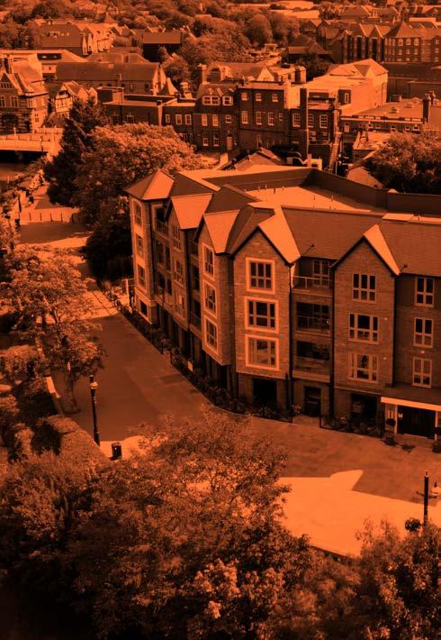
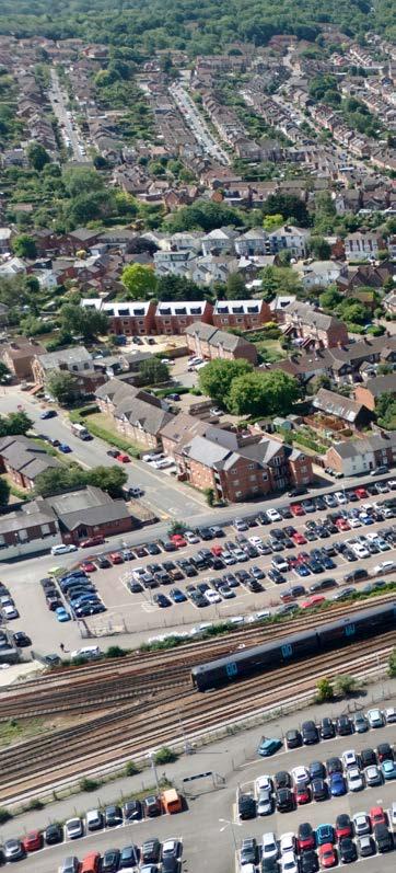
5.7 Tonbridge and Malling borough includes a diverse range of settlements over a varied geography, and our spatial strategy seeks to deliver patterns of sustainable growth, in a way that supports climate resilience, protects natural and historic assets, provides opportunities for regeneration and promotes inclusive and prosperous communities.
5.8 The spatial strategy also looks to protect the National Landscape and its setting and protect the Metropolitan Green Belt, taking into account that we are unable to deliver our housing need without releasing some sites within the Green Belt. Key to the spatial strategy is ensuring that development is directed to the right places and at the right time, to ensure that the necessary infrastructure is in place to support both new and existing communities.
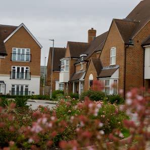
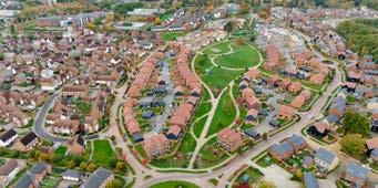
5.9 The draft spatial strategy seeks to allocate growth in and around our most sustainable towns and villages, where communities will have access to a wide range of services and facilities and sustainable transport options to larger settlements. Growth in these areas will also support existing communities by bringing forward new or improved infrastructure and community services and facilities. In addition, our spatial strategy will also support smaller villages by providing some limited housing and employment growth.
Policy SP1: Spatial Strategy
During the plan period the Local Plan will:
Growth
1 Deliver sustainable communities that balance the provision of housing, employment and infrastructure provision alongside floodrisk, environmental, biodiversity, landscape, heritage and Green Belt protection.
2 Respond to the borough’s diverse geography, including supporting and sustaining the role of both our urban and more rural settlements providing growth in suitable locations across the borough.
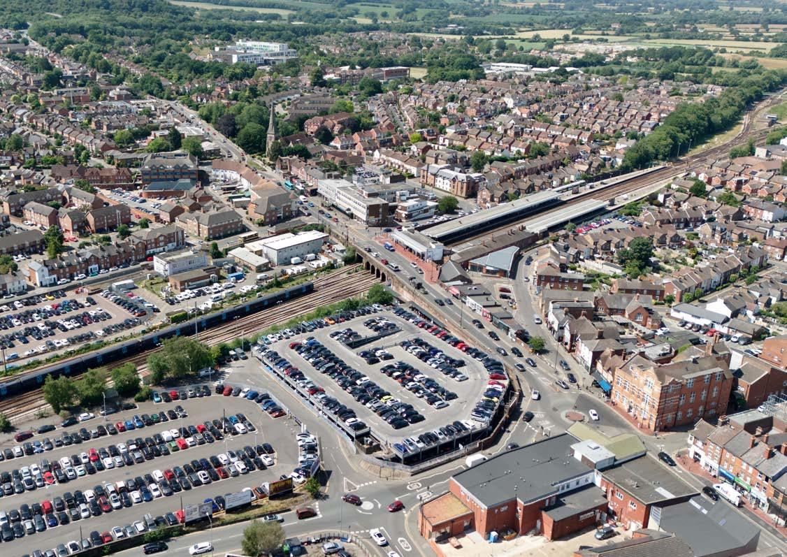
3 Focus the majority of growth within or adjacent to our most urban and sustainable settlements including those with reasonable proximity to existing transport hubs and sustainable movement opportunities. In these locations residential, employment, retail and leisure development will take place.
4 Support improvements to local services, community facilities and infrastructure through facilitating growth in the right locations to contribute to the continued sustainability of our towns and villages and ensure healthy and vibrant communities. This includes allocating growth in nearly all of our sustainable settlements.
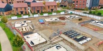
5 Meet our housing need requirement in a way that maximises development on suitable previously developed land/brownfield sites. Given the limited amount of previously developed land in the borough, greenfield sites have been identified in sustainable locations to meet our development needs. This includes a number of ‘edge of settlement’ large strategic development sites that can be developed for housing, employment as well as help to deliver infrastructure to support both new and existing communities.
6 Maintain the role of our more rural settlements (Tier 5) through supporting appropriate growth to help sustain existing services and facilities or to sustain communities through appropriate small-scale housing that meets need, as supported by policies within this plan.
Town centres
7 Ensure that town centres are supported to be vibrant, accessible, and resilient hubs for retail, leisure, employment, and community activities.
8 Protect and enhance the role of our town, district and local centres encouraging a range of uses, services and facilities commensurate with the role and function of the centre. Proposals should enhance the historic character while supporting modern retail formats and flexible workspaces.
9 Focus new retail development within our town centres which support the services and facilities provided, and improvements to the public realm which will increase footfall and improve the night-time economy.
Town centre strategy
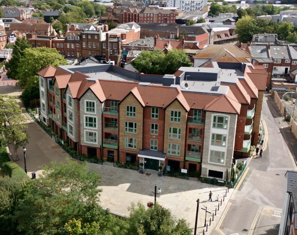
10 Tonbridge Town Centre will remain the principal retail and service centre, with investment in public realm, active travel infrastructure, and redevelopment opportunities including new leisure and retail facilities delivering well designed, accessible, mixed-use developments to support the local community. This includes strengthening the evening economy.
11 District centres will continue to evolve as mixed-use locations with a focus on convenience retail, employment, and community services. Development should support walkability and integration with surrounding residential areas.
12 Local centres across the borough will be protected and enhancements supported to ensure access to day-to-day services, particularly in rural areas. Employment
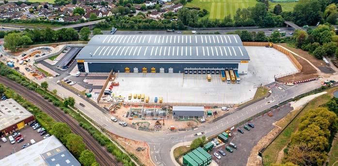
13 Ensure that the borough sustains its strong economic base improving its range of job provision in key sectors including logistics, technology and rural enterprise.
14 Strategic and key employment sites will be protected, expanded and regenerated to ensure that employment provision is fit for purpose, including the reconfiguration of offices.
15 Allocate and focus new employment provision in sustainable locations with good transport access and in locations where the business can be supported locally by workers.
16 Support economic growth in the rural economy to ensure that the needs of land based and other rural businesses can be achieved.
Maintain and enhance a sustainable and attractive borough
17 Maintain and where possible enhance the identity, distinctiveness and character of cherished locations.
18 Protect the Metropolitan Green belt by amending Green Belt boundaries only where ‘exceptional circumstances’ exist and in locations where sustainable patterns of development can be achieved. The focus will be releasing the Green Belt in the borough’s most sustainable locations, as per our settlement hierarchy.
19 Balance the release of the Green Belt between delivering the development needs of the borough whilst limiting and mitigating as far as possible, the impact that Green Belt release may have on Green Belt purposes. Green Belt release will be defined by allocations proposed in this Local Plan.
20 Ensure the setting, character and identities of Kings Hill and Medway Gap settlements, East Malling, Mill Street and West Malling are protected and conserved through the identification of Green Gaps to allow the appropriate management of development.
21 Ensure that development is prioritised outside National Landscapes and their setting, while enabling some smallscale, landscape-led development within sustainable locations to help sustain and meet community needs.
Defining the Local Plan Spatial Strategy and Next Steps
5.10 In defining our draft spatial strategy, we have worked with partners and consultants to understand and test our strategic priorities, opportunities, our constraints and capacity for additional growth. This includes considering our options for delivering these spatially, including ensuring that we meet the latest national planning policy updates including the Government’s standard method for housing need and legislative requirements. These conversations and testing of our spatial strategy, site allocations and supporting policies will continue both during and after this consultation, before we can finalise the council’s preferred spatial strategy (and site allocations) and progress the next stage of the Local Plan.
5.11 Prior to publishing our Regulation 19 Local Plan we will need to take into account responses made to this consultation, undertake more detailed testing and engagement with infrastructure providers on the preferred spatial strategy and site allocations and engage with landowners and developers and other partners as relevant. We will also obtain further information and evidence where we are required to do so, to ensure that our spatial strategy is deliverable, justified, sound and robust.
5.12 Taken as a whole, and once the Local Plan is adopted, the draft spatial strategy, alongside the planning policies detailed within this plan, will ultimately ensure that future growth is delivered in a positive and sustainable manner, to ensure that both our existing and new communities can live healthy and equitable lives.

Future Housing Provision
Housing requirement
5.13 Local Plans are required to provide a framework for meeting housing need, including an appropriate mix of housing types for the local community.
5.14 The Government has confirmed that boosting housing supply across the country is a key priority and this has been reflected in the latest updates to the Government’s standard method, which is the tool that national planning policy requires us to use to understand our minimum annual housing need figure, to ensure that plan-making is informed by an unconstrained assessment of the number of homes needed in an area. The majority of local authorities across the country have seen an increase in their housing need figure, including this council, as a result of an update to the Government’s standard method.
5.15 The latest standard method, introduced by the Government in December 2024 with March 2025 and May 2025 updates using the affordability ratio and housing stock dataset, identifies that the local plan must deliver 1,097 dwellings per year. This means that our housing need figure is to deliver 19,746 homes during the plan period between 2024 – 2042.
5.16 Historically, there has been a significant under delivery of housing in the borough and the NPPF (paragraph 78b) stipulates that where this is the case that a 20% buffer is therefore required to be added to the five-year supply, which equates to an additional 1,097 dwellings being added / frontloaded from subsequent years to the five-year supply.
5.17 The local plan on submission will therefore need to show a five-year supply of housing against the housing requirement, with a 20% increase, and will need to demonstrate that it can deliver 6,540 homes in its fiveyear supply.
5.18 To understand our housing requirements, the Strategic Housing Market Assessment (2025) considers a number of matters relating to housing in our borough including the housing market, housing need, affordable housing and the types and sizes of homes required to meet community needs. The Local Plan is then required to provide a sufficient supply and mix of sites to meet our overall housing requirement.
5.19 Our overall housing development needs over the plan period include:
• A need to deliver approximately 647 affordable homes per annum1.
• 33 Gypsy and Traveller and Travelling Showpeople pitches
• 950 additional housing units with support (sheltered/retirement housing)
• 220 housing units with care, such as extra care units
• 720 nursing and residential care bedspaces
1 Please note that it will not be possible to deliver this level of affordable housing on an annual basis, therefore this figure is provided as a guide to show our exceptional affordable housing need.
Unmet housing need
5.20 National Planning Policy requires local planning authorities to provide for our objectively assessed housing needs for housing and other uses, as well as any needs that cannot be met within neighbouring areas. Defining Housing Market Areas (HMAs) is key to this process to understand whether neighbouring authorities can demonstrate a cross-boundary relationship and whether housing is a strategic cross-boundary issue that should be addressed between the authorities. Tonbridge and Malling does not have its own HMA, and is instead influenced by larger settlements outside the borough such as Tunbridge Wells, Maidstone and Sevenoaks. Tonbridge and Malling therefore forms part of the West Kent HMA, encompassing Tonbridge and Malling, Tunbridge Wells, Maidstone and Sevenoaks.
5.21 In relation to our neighbours with whom we share a HMA with, Sevenoaks District Council have asked whether there is any potential to meet any of Sevenoaks’s unmet housing need. This is something we have explored as required and we have now confirmed with Sevenoaks District Council that it is unlikely that we will be in a position to meet their need, given the similar constraints that we have in our borough.
5.22 In addition, as per this Regulation 18 consultation, we now understand more fully our position on whether we can meet our housing need, including whether we can meet our housing need outside the Green Belt. Given that we are unable to meet our need without releasing Green Belt, we have similarly contacted our neighbouring authorities to ask whether they have any potential to meet our housing need. This is a national planning policy requirement (NPPF, para 147). We will continue to engage with our neighbours on this matter. Further information in relation to cross boundary strategic matters is provided in the Duty to Cooperate Topic Paper.


Delivering Homes for our Communities
5.23 Extensive work has been undertaken to understand whether it is possible to meet our minimum housing need requirement. This has included understanding the many constraints that there are in the borough, as well as undertaking a proactive approach to identify sites that could help to meet our growth requirements through numerous ‘call for sites’ exercises. The Interim Land Availability Assessment (LAA) (2025) provides detail on the suitability and deliverability of potential sites to deliver growth taking into account national policy and evidence and information. The LAA will be progressed and updated further to inform the Regulation 19 Local Plan.
Policy SP2: Delivering Homes for Our Communities
1 A minimum housing requirement of 19,746 homes will be delivered over the plan period between 2024 – 2042, with an annual target of 1,097 dwellings.
2 Development will be supported in accordance with the spatial strategy and the site allocations set out within this Plan (and any future ‘Made’ Neighbourhood Plans) including windfall development coming forward within the borough’s most sustainable settlements as defined by settlement confine boundaries.
3 Small scale development will also be supported in accordance with Policy SP3 and other relevant policies within the Plan.
Policy Justification
5.24 National planning policy requires us to meet our housing needs to support the Government’s objective of boosting supply. This policy therefore responds to national planning policy requirements. It also addresses the council’s priorities in relation to housing need and delivering much needed affordable homes.
Policy Implementation
5.25 The following table sets out how we will meet our housing requirement of 19,746 homes. Our Local Plan housing supply takes into account our existing commitments (completions and extant permissions) and a windfall allowance which is based on our understanding of small sites coming forward. Further detail is provided in the Housing Windfall Methodology Topic Paper.
Completions (from 1st April 2024-2025)
Number of Dwellings if Further Sites to be Tested are Deliverable
Figure 5.1: Housing Supply
Housing Supply
Meeting our housing requirement
5.26 Meeting our housing requirement is one of the most difficult challenges for this Local Plan. At this stage, we consider that we will be in a position to meet our minimum housing need requirement of 19,746 dwellings within the plan period, if we release significant areas of land in the Green Belt. We are not however, at this stage, able to demonstrate a buffer to meeting our housing requirement, such as that which would be required to compensate for sites not coming forward or for sites where rates of delivery are slower than anticipated.
5.27 Ideally, we would like to be in a position to offer around a 10% buffer; this is something we will investigate further to ensure a greater resilience in housing supply. Given that we have no more land that is considered deliverable, we are also not in a position to meet any unmet need from our neighbouring authorities.
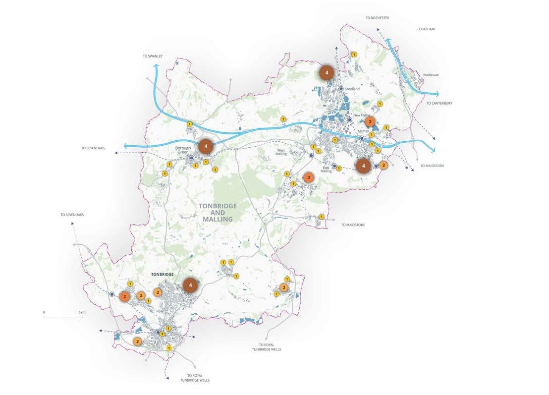
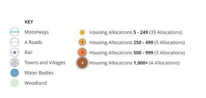
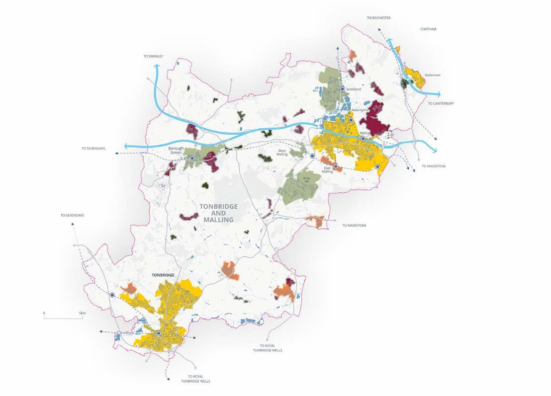
5.28 Figure 5.2 sets out the distribution of growth within the borough proposed within this draft Regulation 18 consultation Local Plan.
Figure 5.2: Housing and Employment Growth by Settlement to 2042
Spatial Strategy Next Steps
Land at Borough Green Gardens
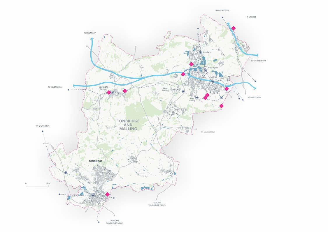
5.29 Due to the constraints in the borough as well as a limited supply of land, delivering the spatial strategy in a way that meets our housing requirement will rely on bringing a number of large strategic allocations forward. The largest of these is the potential allocation at Borough Green as a mixed-use development. This site has capacity to deliver around 3,000 dwellings, alongside employment, community uses and infrastructure. This site is around 50% previously developed land as it is both a former and current minerals extraction site. The site is located within the Green Belt but has been identified for potential release.
5.30 We have undertaken the testing that is required for an early-stage Regulation 18 consultation for this site, however, further testing and engagement is required prior to the Regulation 19 stage to confirm the deliverability of this site, as well as understanding the quantum of growth that can be delivered within the plan period. Following discussions with landowners, at this stage, we have identified that this site has the potential to deliver around 2,000 dwellings, with an additional 1,000 dwellings to be delivered post 2042.
5.31 Housing delivery of 2,000 dwellings within the plan period takes into account the current constraints on the site, in particular the minerals extraction permissions that are live on parts of the eastern section of the site until 2030, as well as the requirement for significant infrastructure provision. This includes a relief road from the Ightham bypass (A25) to the A20, to be delivered in advance of any dwellings being occupied based on the current transport evidence. As part of our further transport modelling between Regulation 18 and 19 we wish to further understand the timing and funding for delivery of a relief road and the phasing and deliverability of development within the plan period.
5.32 Should this site not be deliverable / deliverable within the plan period, including a delay to housing delivery, then it may be the case that we would not be able to meet our housing need given the reliance on this site to meet our housing requirement.
Other large strategic sites
5.33 In addition to the Borough Green potential strategic allocation, the spatial strategy also includes the allocation of a number of other large potential strategic allocations.
5.34 These are detailed in the table to the right. We have considered these sites and at this stage these sites have potential to be delivered within the plan period, subject to mitigation including infrastructure provision.
5.35 At this stage the council has not identified any suitable alternative sites to bring forward for development elsewhere in the borough to meet our housing requirement. Consequently, it will be important for these sites to come forward within the plan period, if the council is to meet the Government’s housing requirements.
1 Borough Green gardens is allocated for 3,000 dwellings within this Regulation 18 Local Plan, however it is anticipated that 2,000 dwellings will be delivered within the plan period, with the remaining 1,000 dwellings to be delivered post 2042.
Figure 5.3: Large Strategic Allocations Over 500 Units
Further Testing of the Spatial Strategy
Highways modelling
5.36 As with any Local Plan, we will be undertaking further testing of our Spatial Strategy to inform our Regulation 19 Local Plan.
5.37 This will include further testing of all sites to understand their deliverability in relation to constraints, viability and whether the necessary infrastructure can be provided to support the development, both on their own and cumulatively. Further testing will provide us the confidence about the deliverability of the spatial strategy for when we publish our Regulation 19 Local Plan.
5.38 Whilst there are many constraints within the borough, highways capacity has historically and for good reason been a particular concern. However, with mitigation schemes already delivered or in the pipeline to be delivered, alongside the confirmation from National Highways that Lower Thames Crossing (LTC) will come forward within the plan period, our transport modelling has confirmed that the level of growth that we are putting forward is likely to be achievable, subject to further detailed and refined testing. We will therefore look to further understand the impacts of the emerging spatial strategy on the highway network in our continuing partnership working with KCC and National Highways to understand deliverability and mitigation requirements as well as costs and the impact on site viability. This will include cumulative assessments to account for growth in neighbouring authorities.
5.39 Should further detailed work conclude that it is not possible to deliver a mitigation scheme to address either the quantum of growth set out in our draft spatial strategy or a particular site(s), then it will be necessary for us to reassess the sites proposed. i.e. certain sites might not be able to come forward in this Local Plan. However, this will only be the case, as set out by the NPPF (Paragraphs 115 - 116) where it is deemed that development would result in a severe impact under ‘all reasonable future scenarios’ that cannot be mitigated or where a scheme would result in an unacceptable impact on highways safety. In addition, we would also need to reassess sites where mitigation would affect the deliverability / viability of a scheme.
Green Belt
5.40 In considering the 71% coverage of Green Belt within the borough we are unable to meet our housing need without releasing sites located within the Green Belt. National Policy (NPPF 146) makes it clear that where an authority cannot meet its identified need for homes, commercial or other development through other means, then authorities should review Green Belt boundaries to meet these needs in full (in accordance with other policies in the NPPF).
5.41 Green Belt boundaries can be reviewed and, if necessary, amended through the Local Plan process, based on relevant evidence. However, National Planning Policy is clear that Green Belt boundaries can only be amended in exceptional circumstances, through the preparation or review of a Local Plan that can demonstrate an exceptional circumstances case. Even where amended, the boundaries need to be able to endure beyond the plan period. Exceptional circumstances includes (NPPF 147) where an authority cannot meet its identified need for homes, commercial or other development through other means, having already:
• made as much use as possible of suitable brownfield sites and underutilised non-Green Belt land;
• optimised the density of development on non-Green Belt land in line with the policies in the NPPF, including significant uplifts in minimum density standards in town and city centres and other locations well served by public transport; and
• discussed with neighbouring authorities whether they could accommodate some of the identified need for development, as demonstrated through the Statement of Common Ground.
5.42 The council recognises the importance of the Green Belt and the role it will continue to play in shaping the borough. However, the Government’s housing target means that the council must alter the Green Belt boundary to meet identified needs.
5.43 To inform the review of Green Belt boundaries, a borough wide Stage 1 Green Belt Assessment and targeted Stage 2 Green Belt. Assessment focused on land around settlements, has been undertaken. The Assessments inform plan preparation by assessing how parcels of land within the borough perform against the five main purposes of the Green Belt set out in the national policy. Recommendations from the Assessments are then reviewed in the round alongside other relevant evidence produced in support of the Local Plan to ensure a balanced picture of current circumstances.
5.44 The 2024 NPPF introduced the new concept of ‘grey belt’. Revised national guidance requires the identification of grey belt land to be included as part of a Green Belt review. The Stage 2 Green Belt Assessment has provisionally identified areas of grey belt within the borough. IIt recommends release of some of this from the Green Belt around some of our sustainable settlements, as well as locations outside of settlements which provide good access to public transport, and, in the case of employment land, the strategic highway network.
5.45 This approach is in accordance with Paragraph 110 of the NPPF that identifies that significant development should be focused on locations which are or can be made sustainable, through limiting the need to travel and offering a genuine choice of transport modes.
Sequential approach to Green Belt release
5.46 The NPPF (paragraph 148) sets out a sequential approach to the release of Green Belt land. It states:
“Where it is necessary to release Green Belt land for development, plans should give priority to previously developed land, then consider grey belt which is not previously developed, and then other Green Belt locations.”
5.47 The Stage 2 Green Belt Assessment has been used to inform the proposed amendments to the Green Belt boundary as shown on the Policies Map, carried out in line with this sequential approach.
5.48 In accordance with the sequential approach, and in accordance with the need to promote sustainable patterns of development in accordance with Paragraphs 110 and 115 of the NPPF, a number of allocations are proposed to be removed from the Green Belt where the Stage 2 Green Belt Assessment identifies them as provisional grey belt and recommends them for further consideration for potential development.
5.49 However, it is not possible to meet our housing need without considering other grey belt land, in sustainable locations around sustainable settlements, that was not recommended by the Stage 2 Green Belt Assessment. Such additional locations were selected based on their adjacency to a Principal Service Centre or Service Centre, which provide a wide range of accessible infrastructure and services, and in locations which would not fundamentally undermine the purposes (taken together) of the remaining Green Belt as identified in the Stage 1 Green Belt Assessment. Sites to be removed from the Green Belt are listed in Annex 2.
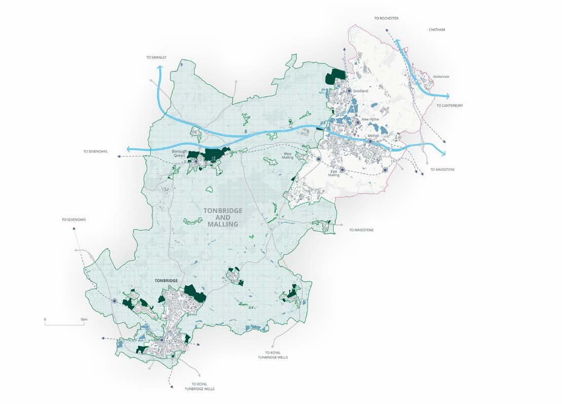
5.50 Figure 5.4 opposite illustrates the existing Green Belt Boundary, and the proposed new Green Belt boundary.
5.51 In relation to further testing, prior to the Regulation 19 Local Plan stage, we will need to ensure that we have maximised housing potential in all non-Green Belt locations, ensure that we have optimised density on sites in town centres and in locations served by public transport, as well as further understand whether neighbouring authorities are able to meet all or some of our unmet needs. However, at this stage, we anticipate that it is likely that we will need to release Green Belt to the extent that we are currently identifying.
Figure
Call for sites
5.52 Given the Government’s housing target and the lack of deliverable sites in sustainable locations, as part of this Regulation 18 consultation we are undertaking a further and final call for sites and we encourage landowners and developers to put forward sites, particularly in and around our most sustainable settlements.
5.53 These sites will be assessed to help inform our Regulation 19 Pre-Publication Local Plan. We will also be undertaking further work to actively identify sites that may have potential to be brought forward including looking at any opportunities to bring forward council owned land. Details on how to submit a site can be found on our website.
Tonbridge and Malling Local Plan
Figure
Tonbridge and Malling
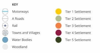
Sustainable Settlement Hierarchy
5.54 A key part of delivering our spatial strategy is our settlement hierarchy.
5.55 The settlement hierarchy identifies and groups together towns and villages based on their role and function, providing a basis for understanding the sustainability of settlements. This is identified by considering the services and facilities present in each settlement or in nearby settlements and the accessibility to existing public transport networks.
5.56 The Regulation 18 consultation document published in 2022 identified a draft settlement hierarchy and asked the question as to whether the settlement hierarchy presented in that document should be retained. Consultation responses received highlighted the importance of facilities and infrastructure to those living in the borough and the need to look again at the settlements to ensure that settlements are categorised appropriately. From the feedback received we have updated our settlement hierarchy and this is presented in Figure 5.6. A more detailed analysis is set out in the Sustainable Settlement Study.
Settlement Category Settlement Name
Tier 1:
Principal Service Centre
Tier 2:
Service Centre
Tier 3:
Primary Village
Tier 4:
Secondary Village
Tonbridge and Hilden Park, Medway Gap, Walderslade
Snodland, Borough Green, West Malling, Kings Hill
Hildenborough, Hadlow, East Malling, East Peckham, Wateringbury, Wouldham
Aylesford Village, Hale Street, Burham, Snoll Hatch, Wrotham, Eccles, Leybourne Chase, Peter’s Village, Plaxtol, Platt, Ightham, Birling, Ryarsh, Mereworth & Herne Pound
Tier 5:
Other rural settlements
Stansted, Offham, Shipbourne, Fairseat, Addington, Addington Clearway, Golden Green, West Peckham, Wrotham Heath, Dunks Green, Crouch, Trottiscliffe, Blue Bell Hill
Figure 5.6: Draft Settlement Hierarchy
Figure
Tonbridge
5.57 The settlement hierarchy presents five settlement Tiers. We have used the list of settlements defined previously in our development plan with the addition of Leybourne Chase and Peters Village which have been constructed in the intervening years. Stansted and Shipbourne have also been deemed suitable for assessment under our definition of ‘settlement’ set out in the Sustainable Settlement Study. Tonbridge and Hilden Park, and the Medway Gap have continued to be assessed as ‘wholes’ – that is they function as standalone settlements, sharing services across named areas with close relationships in both proximity, services and accessibility.
5.58 The more sustainable settlements are the higher numbered tiers, given that there are a greater range of services and facilities more easily accessible without the need to travel by car. The settlements with less facilities are at the bottom of the hierarchy, and it is expected that in these locations most people would travel by car to access services and facilities, given that public transport is minimal in these areas also.
5.59 Given that the Tier 1-4 settlements are sustainable locations, these are provided with a settlement confines boundary. A settlement confines boundary is a planning tool that is used to direct development to the most sustainable locations, within the confines of the boundary provided. Areas outside the boundary are classed as countryside for the purpose of planning policy.
5.60 It is important to note that the Settlement Hierarchy does not determine how much growth can be delivered in each settlement. The level of growth that will be distributed across the borough is dependent on many factors, for example, the availability of land, environmental constraints such as landscape, Green Belt and flooding as well as physical and social constraints such as the availability of infrastructure to support new growth. Therefore, the settlement hierarchy is only one aspect that we take into account when defining the spatial strategy.
5.61 Development allocations have been made for the majority of Tier 1-4 settlements. Apart from Birling, Mereworth and Herne Pound, Peters Village and Plaxtol. This is because there are no suitable sites in these locations to bring forward for development. However, development in these locations is supported in principle and can come forward within the defined settlement confines boundary, subject to other policies in the Plan.
5.62 Development allocations have not been made for Tier 5 settlements. This is because these settlements are considered to be unsustainable locations and do not meet the requirements of the NPPF in relation to the presumption of sustainable development. However, small-scale development may still come forward in these locations via a number of means, for example, as a Rural Exception Site or through a Neighbourhood Plan or other Parish endorsement.
5.63 The settlement hierarchy will be kept under review to ensure that it is based on upto-date information ahead of the Regulation 19 consultation. We are consulting on our Sustainable Settlement Study and settlement hierarchy as part of this consultation and will update this as required ahead of our Regulation 19 consultation.
5.64 The Open Countryside comprises that part of the Local Plan area outside of identified settlement confine boundaries. Development in the Open Countryside will normally be unacceptable unless it can be shown to be essential to local needs and the rural economy and cannot be accommodated within existing settlements.
Policy SP3: Settlement Hierarchy and General Development Principles
1 Development will be supported, in addition to allocations proposed within this plan, within sustainable settlements as defined by the settlement hierarchy. This includes Tier 1 – Tier 4 settlements. Development will be supported, subject to meeting other policy requirements in this Plan or within made Neighbourhood Plans. Development in the countryside
2 Areas outside the defined settlement confine boundaries will be protected and will be considered to be countryside for planning purposes, unless development is supported by a specific policy referenced in this plan or elsewhere.
Tier 5 Rural settlements
3 As an exception to (2) above, some very limited residential development either within (infill) or directly adjacent (limited frontage development) to Tier 5 settlements may be considered acceptable, subject to compliance with other policies in this plan, where this is justified on the basis of supporting the continued sustainability of the settlement, including meeting local housing need. This will only be acceptable subject to meeting all the following criteria:
a The scale of the residential development is proportionate to the size of the settlement and the type and level of local services available;
b The development takes into account its countryside location in relation to design;
c It can be linked to the retention or expansion of specific infrastructure or service assets within the settlement;
d It has community support, either through a Neighbourhood Plan, or other Parish endorsement, for example as a Rural Exception Site;
e Suitable and safe vehicular access can be provided to the site including the provision of footpaths.
4 In all other circumstances, countryside policies will apply.
Gypsy, Traveller and Travelling Showpeople
5.65 The National Planning Policy Framework (NPPF) requires local planning authorities to assess and plan for the housing needs of all residents, including Gypsies, Travellers and Travelling Showpeople. The council recognises its legal duty to facilitate the traditional and nomadic way of life of these communities, while also promoting social inclusion and ensuring fair and equal access to suitable accommodation.
5.66 The council undertook a Gypsy and Traveller and Travelling Showpeople Accommodation Assessment (GTAA) in 2022 and has recently updated this assessment to provide a robust evidence base for understanding the level of need within the borough.
5.67 The PPTS was updated in December 2024, with Annex 1 clarifying the criteria for determining whether individuals are considered Gypsies and Travellers for planning purposes. These include:
• Whether they previously led a nomadic habit of life.
• The reasons for ceasing that lifestyle.
• Whether there is an intention to resume a nomadic lifestyle in the future, and under what circumstances.
This definition has implications for how accommodation need is assessed and how planning policies are applied.
5.68 The latest GTAA (2025) identifies the specific accommodation needs for Tonbridge and Malling over the plan period (2018–2042), including:
• The number of pitches required for Gypsies and Travellers under both the planning and ethnic definitions.
• The number of plots required for Travelling Showpeople.
• The potential need for transit provision to manage unauthorised encampments.
5.69 In terms of site supply, the council will explore a range of options to meet identified needs. It is most likely that needs can be met through the upgrading, enhancement or intensification of existing permanent and temporary authorised Gypsy and Traveller sites. However, further work is being undertaken to understand this, to ensure that the Local Plan meets identified needs. It is worth noting that the GTAA has identified that there is not a need to provide plots for Travelling Showpeople within the plan period.
Policy SP4: Gypsy, Traveller and Travelling Showpeople - Accommodation Needs
To meet the identified accommodation need for Gypsies, Travellers and Travelling Showpeople within the Borough up to 2042, the council will make provision for 33 pitches for Gypsies and Travellers in accordance with the needs identified in the GTAA for those who meet the PPTS definitions.
Future Economic Development Needs


5.70 The Planning Practice Guidance (PPG) requires local planning authorities to prepare robust evidence to understand existing business needs and to keep this under review to reflect local circumstances and market conditions.
5.71 In gathering evidence to plan for business uses we need to liaise with the business community, and take account of relevant economic strategies, to understand current and potential future requirements. This includes identifying and assessing the following:
• the best fit functional economic market area(s);
• the existing stock of land for employment uses within the borough;
• the recent pattern of employment land supply and loss;
• evidence of market demand including the locational and premises requirements; for existing and inward investing businesses, drawing upon known market intelligence;
• wider market signals relating to economic growth, diversification and innovation; and
• any evidence of market failure, such as physical, ownership or other constraints that have prevented employment sites being used or delivered.
5.72 The PPG also advises that local planning authorities need to develop an understanding of future needs based on a range of data that is current and robust. To achieve this, the council commissioned consultants to prepare up-todate economic evidence. The Economy Study (2025) takes account of the PPG and sets out the employment land and floorspace requirements for Tonbridge and Malling between 2024 to 2042.
5.73 The study identifies that the borough’s commercial property market has undergone significant change over recent years. With the overall stock of office floorspace gradually declining in recent years due to wider structural changes brought about by the Covid-19 pandemic. The borough’s industrial market is comparatively more buoyant, with current patterns of demand and activity largely focused on logistics and mixed industrial uses.
5.74 The study considers three different scenarios of future employment space requirements in the borough. These indicate the broad scale and type of growth arising from different approaches to modelling future employment space needs; forecast economic growth, past development trends, and potential housing growth.
5.75 The gross employment requirements resulting from these scenarios range between 290,000 sqm and 538,700 sqm.
Figure 5.8: Gross Employment Floorspace Requirements in Tonbridge & Malling, 2024 to 2042 (sqm GEA)
5.9: Employment Planning Requirements
5.76 Scenarios 1 (labour demand) and 2 (development trends) imply a comparable overall employment floorspace requirement for Tonbridge & Malling over the plan period. Scenario 3 (labour supply) generates the highest overall requirement, driven by strong population and housing growth implied by the latest (December
2024) Standard Method. This represents a substantial increase in housing delivery in Tonbridge & Malling over the plan period compared with previous targets. The study suggests that regard should be had to this scenario if the council wishes to align future housing requirements and employment growth.
5.77 In relation to which scenarios to take forward, the study recommends scenario 1 (labour demand) for office requirements and Scenario 2 (development trends) for B2 and B8 development. This provides an overall requirement of 361,500 sqm, which equates to an 83.2 ha land requirement.
5.78 The labour supply office requirement is recommended in the context of subdued past development trends and modest growth forecasts. For B2 / B8 scenario 2 is recommended for a number of reasons including recent levels of activity, the strong local representation within the modern economy sectors of freight and logistics and future investment in major infrastructure, such as the Lower Thames Crossing.
Figure
Employment Land Supply
5.79 Through ongoing annual monitoring, the council has an understanding of recent employment floorspace losses and gains as well as consented but not yet implemented employment developments, otherwise known as commitments.
5.80 Figure 5.9 shows the remaining employment floorspace requirements having taken account of completions and losses of employment floorspace during the first year of the plan period 2024-25.
5.81 The NPPF requires us to identify specific employment sites to meet identified needs. However, the council can only allocate sites that are identified as suitable, deliverable and available for employment purposes in our Land Availability Assessment. Policy A1 in Chapter 14 of this Local Plan identifies how employment floorspace needs will be met over the plan period.
Figure 5.10: Employment Floorspace Commitments and Local Plan Employment Need
Employment and Retail Needs Accounting for Completions and Extant Permissions 2024-25
Remaining Need 2025-42
B2 and B8
Policy SP5: Future Employment Growth
The council will support positive economic growth across the borough and will seek to meet employment needs in full. At a minimum we will deliver 301,000 sqm of B2 and B8 employment floorspace and 60,500 sqm of office floorspace over the plan period. This will be achieved through the following measures:
a The allocation of employment sites as set out in Policy A1 (chapter 14);
b The delivery of existing commitments for employment uses;
c The retention of existing employment premises;
d Supporting existing business through new floorspace, redevelopment conversion, upgrading, intensification or reconfiguration of floorspace on existing sites;
e Supporting economic development in rural areas and farm diversification; and
f Supporting the provision of new office floorspace in sustainable locations.
5.82 The supply of industrial land (B2 and B8) is positive and the council is able to deliver suitable sites to meet this need. The Local Plan seeks to allocate 78,700 sqm of B2 and B8 floorspace. This provides a surplus of employment land over scenario 2 (development demand). This is considered as a positive position to ensure that employment land comes forward alongside the increase in housing required to be delivered as per the Government’s standard method. It also accounts for the high contribution of existing commitments allowing supply to move towards the labour supply scenario.
5.83 In relation to office need, for the purpose of this Regulation 18 draft Local Plan, we are able to allocate sites to deliver 56,580 sqm. This is slightly below our need of 60,500 sqm. However, our ‘call for sites’ is open as part of this consultation and the council hopes that further sites are submitted which can be considered in updating the Plan at Regulation 19 stage. We also consider that there will be opportunities to promote offices as mixed use schemes.
5.84 Through the course of the plan period, the council will monitor whether the economic expectations projected remain realistic in response to any changes in the national or local economy, and where necessary will act accordingly to deliver economic growth opportunities.
Figure
Town Centre Needs
5.85 The NPPF states that planning policies and decisions should support the role that town centres play at the heart of local communities, by taking a positive approach to their growth, management and adaptation. The NPPF further requires that local planning authorities also assess their floorspace needs for retail, leisure and other main town centre uses over the plan period, allocating a range of suitable sites to meet the scale and type of developments needed within defined centres and elsewhere.
5.86 The council has commissioned consultants to prepare up-to-date retail and town centres evidence. This identifies a total retail capacity projection to 2042 of 18,250 sqm (gross). Whilst extant permissions for the extension of South Aylesford Retail Park in Quarry Wood would take up 4,877sqm, and floorspace at Bushey Wood, Eccles would take up a further 4,000 sqm. Based on a reasonable reduction in the current shop vacancy rates or the reoccupation of the former Beales unit in Tonbridge town centre, reoccupied space could accommodate half of the remaining projected need of 12,005 sqm.
5.87 It is expected that there will be a continuing shift from comparison goods retail space to convenience goods retail, food/beverage and leisure/cultural uses over the plan period, with vacant shop premises also converting to these uses to reflect occupier demand. Not all vacant shop units will be suitable for conversion to leisure/ cultural uses, therefore new retail development will still be required.
5.88 Given the retail floorspace capacity identified is largely driven by population growth, it is expected that new local centres and neighbourhood parades are required to support strategic housing allocations. This is where the remainder of the retail need is expected to be met over the plan period.
5.89 Given that most of this growth will be met in new local centres and neighbourhood parades over the plan period, the council will work with the promoters of the strategic residential site allocations to identify the location and scale of these. Further details will be included in the Local Plan at Regulation 19 stage.
Policy SP6: Town Centre Needs
The council will seek to meet the identified retail floorspace need of 18,250 sqm through existing commitments, vacant units / reoccupation of space and through new local centres within strategic allocations to support new communities.
Green Belt
5.90 The Green Belt affords protection to designated areas of the countryside from inappropriate development and national policies for its protection as set out in the NPPF. Approximately 71% of Tonbridge and Malling is designated as Metropolitan Green Belt (which surrounds Greater London) as illustrated on the Key Diagram. Many hamlets and small clusters of development are ‘washed over’ by the Green Belt designation, while larger settlements are inset from it. The main aim of Green Belt is to prevent urban sprawl by keeping land permanently open, but like all countryside, it can also provide multifunctional benefits including for recreation, nature conservation, food production and flood mitigation
5.91 In addition to preventing sprawl, the Local Plan also has an opportunity to establish a positive strategy for planning for the beneficial use and management of Green Belt. Opportunities for multifunctional enhancement should focus on enhancing a variety of its aspects, such as natural capital, the quality of the landscape and visual amenity, recreational access and amenities, sustainable water management, combatting the urban heat island effect, carbon capture and storage, biodiversity, food growing or restoring damaged and derelict land.
Policy SP7: Green Belt
1 Tonbridge and Malling’s Green Belt as designated on the Policies Map, will be protected against inappropriate development in line with national policy.
2 The beneficial use and management of land in the Green Belt will be supported, particularly where it protects and enhances the wider bluegreen infrastructure network as set out in the Green and Blue Infrastructure Strategy, contributes to the Kent and Medway Nature Recovery Strategy and is consistent with the essential characteristics of openness and permanence of the Green Belt.
5.92 In line with paragraph 156 of the NPPF, where major development2 involving the provision of housing is proposed on land to be released from the Green Belt through plan preparation, or on sites in the Green Belt subject to a planning application, the following ‘Golden Rules’ will apply:
• 50% affordable housing;
• necessary improvements to local or national infrastructure; and
• the provision of new, or improvements to existing, green spaces that are accessible to the public. New residents should be able to access good quality green spaces within a short walk of their home, whether through onsite provision or through access to offsite spaces.
Extension of the Green Belt boundary
5.93 We are currently progressing work to consider whether there is potential to extend the Green Belt boundary to the east of West Malling to the bypass as well as to the east of the bypass towards Wateringbury Road, East Malling. We will confirm the outcome of this work at the Regulation 19 stage. In the meantime, we have progressed a Local Green Gap policy for the area east of the bypass, as below, should a Green Belt extension not be supported by evidence.
2 Any scheme over 10 units.
Development in the Green Belt
5.94 Although Policy SP7 establishes the revised Green Belt boundary in the borough, proposals for development in the Green Belt are still likely to come forward over the plan period through the planning application process.
5.95 The NPPF states that substantial weight should be given to any harm to the Green Belt, and that inappropriate development should not be approved except in very special circumstances. National policy also identifies what types of development are considered ‘not inappropriate’ in the Green Belt. Policy SP8 establishes the local criteria against which proposals in the Green Belt will be tested.
Policy SP8: Managing Development in the Green Belt
1 Inappropriate development within the Green Belt (as shown on the Policies Map) will be resisted in accordance with national planning policy. Inappropriate development is by definition harmful to the Green Belt and will only be approved in very special circumstances.
2 Development that is not inappropriate development will only be permitted where:
a the siting, scale, height and bulk of the proposed development is sympathetic to and compatible with the primary aim of preserving the openness of the Green Belt;
b it displays a high standard of design and landscaping, and takes all measures to ensure that the visual impact on the wider Green Belt is minimised;
c the nature, quality, finish and colour of materials reflect the local landscape character (as defined in the Landscape Character Assessment and National Landscape Management Plans where relevant); and
d appropriate parking provision, safe access, egress and landscaping is provided to ensure vehicles are parked safely.
3 Applications for all development proposals in the Green Belt will require a Green Belt Assessment, in accordance with methodology set out in the Planning Practice Guidance, including for development utilising grey belt land in whole or in part.
4 Where major development involving the provision of housing is proposed on land in the Green Belt, or on an allocation released from the Green Belt (as identified on the Policies Map), the following Golden Rules contributions should be made and evidenced in the accompanying Planning Statement:
a The provision of 50% affordable housing3;
b The necessary improvements to local or national infrastructure as set out in the Infrastructure Delivery Plan;
c The provision of new, or improvements to existing, green space that are accessible to the public; and measures to protect and enhance the current green and blue infrastructure of the borough as set out in the Tonbridge and Malling Green and Blue Infrastructure Strategy. The provision of any new open space should be in accordance with the open space standards set out in Policy INF5 Outdoor and Indoor sports, recreation and open space provision;
3 The 50% cap does not apply to rural exceptions sites or community-led development exception sites.
d Positive contributions to the landscape setting of the development having regard to the Tonbridge and Malling Landscape Character Assessment;
e Where land is released from the Green Belt, and where the Green Belt Assessment identifies that the new Green Belt boundary requires strengthening, development proposals will need to address these requirements; and
f Where land is identified as having particular potential for habitat creation or nature recovery within the Kent and Medway Nature Recovery Strategy, green space proposals should contribute to these outcomes.
Extensions, Alteration and Replacement Buildings
5 Extensions and alterations to buildings in the Green Belt should not be disproportionate to the original building and should be in accordance with Policy D2. Replacement buildings should be in the same use as and not materially larger than the previous building.
6 In all cases, whether a development is disproportionate to or materially larger than the original building will be assessed by considering:
a The scale, mass, height, footprint and volume of the development proposed;
b The degree of activity likely to be generated, including traffic;
c The duration of the development, and its remediation; and
d The extent of existing development on the site.
5.96 Given the extensive Green Belt land across the borough around many sustainable settlements experiencing pressure for development, as well as the introduction of grey belt, applications for development in such locations are likely to continue to come forward during the plan period.
5.97 Grey belt is defined in the NPPF as land in the Green Belt comprising previously developed land and/or any other land that, in either case, does not strongly contribute to any of purposes (a), (b), or (d) (NPPF 143). Where land does not strongly contribute to one or more of these purposes, then the land can be considered grey belt. However, ‘Grey belt’ excludes land where the application of the policies relating to the areas or assets in footnote 7 of the NPPF (other than Green Belt) would provide a strong reason for refusing or restricting development.
5.98 Policy SP8 sets out a detailed list of local criteria against which development proposals will be considered, in order to ensure that where development does take place, that it is high quality, well designed, and sustainable. These criteria have regard to potential spatial and visual impacts of development on the openness of the Green Belt that need to be considered as set out in the Green Belt PPG.
5.99 When attempting to prove ‘very special circumstances’, the onus is on the applicant to prove that the exceptional nature of the proposal clearly outweighs the harm it might cause to the Green Belt.
5.100 Where development is proposed in the Green Belt, applications are required to undertake a Green Belt Assessment (including a grey belt assessment) to support their proposal. This assessment should be carried out in accordance with the Planning Practice Guidance. Where the proposal is for major development involving the provision of housing, the applicant must demonstrate how the proposal meets the Golden Rules.
5.101 Applicants should, through design and access statements, demonstrate how their development has been designed to reduce all types of harm to the Green Belt. Furthermore, they should clarify how it will improve the attractiveness and quality of the landscape through positive enhancements including hedgerows and tree planting in line with the Landscape Character Assessment, Green and Blue Infrastructure Strategy and Kent and Medway Nature Recovery Strategy.
Local Green Gap
5.102 As part of this Local Plan, the council has explored the concept of ‘Green Gaps’ - a designation which helps to avoid coalescence and preserve the separate characters and identities of different settlements by providing physical and visual breaks. The designation of Green Gaps, and policies to protect them, can help in maintaining open landscapes between settlements, contributing to the amenity of an area.
5.103 The council has undertaken work to explore if there is any merit in introducing Green Gaps within the borough. TMBC subsequently commissioned consultants to prepare a study which looks into this in detail.
5.104 Other than national planning guidance for the Green Belt, the NPPF includes no specific requirement to seek to prevent the coalescence of settlements to maintain their separate identities. However, there is support in the NPPF for maintaining the identifiable characteristics of places, albeit that this is with regard to new development and the achieving of well-designed places.
5.105 For example, paragraph 135 requires development to be sympathetic to local character or history, including the surrounding built environment and landscape setting; and “to establish or maintain a strong sense of place… to create attractive, welcoming and distinctive place to live, work and visit.”
5.106 Green Gaps should have clearly defined boundaries, which, where possible, follow physical features on the ground to ensure they are legible and emphasise their role in defining settlement edges. They should be informed by landscape analysis of the sensitivity to change; the fragility and susceptibility of a gap to erosion; visual breaks between settlements; and where there is a sense of travelling from one settlement to another. Only land necessary to secure the objectives of the gap should be included.
5.107 Green Gap policies should also allow for development that does not compromise the aim of the Gap. In this way, the council can plan for and incorporate future development needs, direct strategic allocations to preferred areas and manage (through planning decisions) the evolution of settlement edges in a way that is sympathetic to the distinctiveness of place.
5.108 The Study concludes that there is a justification for a Green Gap between Kings Hill, West Malling and the Medway Gap settlements (including East Malling and Mill Street).
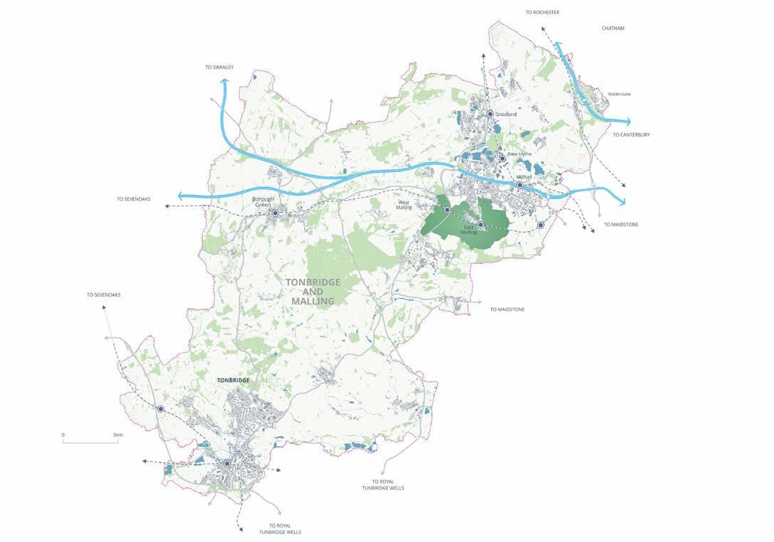

Figure 5.12: Proposed Local Green Gap
Tonbridge and Malling Local Plan
Policy SP9: Local Green Gap
1 A Local Green Gap between the settlements of Kings Hill, West Malling and the Medway Gap (including East Malling and Mill Street), as shown on the Policies Map is defined to retain the existing settlement pattern by maintaining openness, provide long-term protection against coalescence and to protect the setting and separate identities of these settlements.
2 Within the Local Green Gap, countryside policies will apply, and only proposals that demonstrably maintain the integrity of the gap will be supported, and such proposals must contribute positively to the landscape, biodiversity, or recreational value of the area.
Reasoned Justification
5.111 The NPPF requires development to be sympathetic to local character and history, support a sense of place and achieve the creation of distinctive places. If the characters of settlements in an area are distinct, and coalescence (or the process of coalescence) would erode their separate identities, directing development in a way that avoids closing identifiable gaps between settlements is justified.
5.112 The Sustainable Settlement Study identifies Kings Hill and West Malling as ‘Service Centres’. These settlements are sustainable and accessible (by road and public transport) and provide a very high level of community infrastructure including schools, shops and health services. These settlements meet the majority of their own needs and also meet the day-to-day services and facilities needs of surrounding smaller settlements.
5.113 Such sustainable and well serviced areas are typically capable of supporting new development and therefore may experience development pressures moving forward beyond those sites already identified for potential growth in this Plan.
5.114 To support the strategic objective of maintaining the distinct identity and separation of settlements within the borough in the context of the spatial strategy, the area between Kings Hill and the Medway Gap is designated as a Strategic Green Gap. This designation seeks to prevent the coalescence of Kings Hill with nearby settlements such as East Malling, Larkfield, and Leybourne, preserving the open character of the countryside and reinforcing the individual identity of each community.
Policy Implementation
5.109 Development within the Green Gap must provide evidence as part of the planning submission to demonstrate compliance with Policy SP9.
5.110 Development within this Green Gap will be controlled to ensure that it does not compromise the openness, visual separation, or functional role of the gap. Only proposals that demonstrably maintain the integrity of the gap will be supported, and such proposals must contribute positively to the landscape, biodiversity, or recreational value of the area. The boundaries of the Green Gap have been defined using permanent physical features and informed by landscape character assessments. Pre-application consultation is encouraged prior to the submission of planning applications within the Green Gap, and should any major applications be proposed then these will be expected to demonstrate early, proactive and effective engagement with both the LPA and the community.
5.115 The key diagram sets out a visual representation of the council’s strategic vision and key spatial policies.
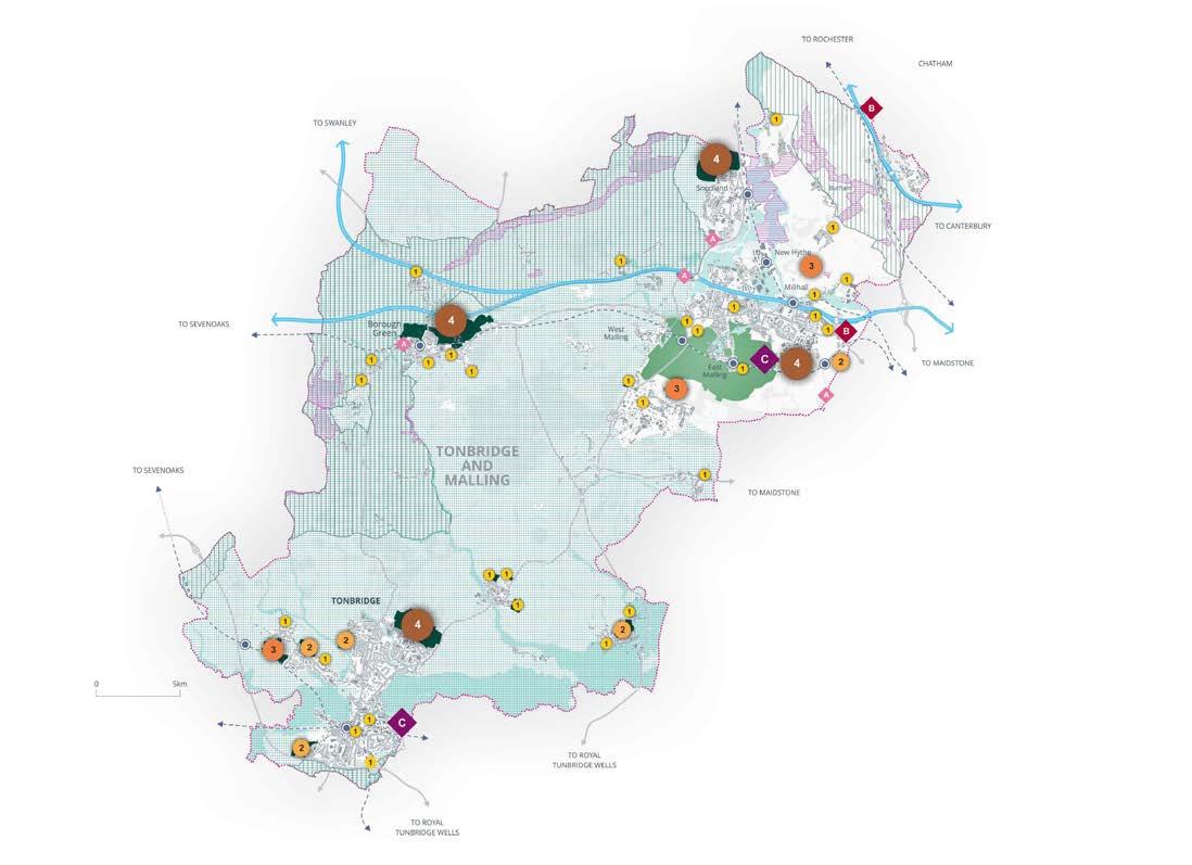
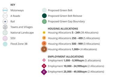
Figure 5.13: Local Plan Key Diagram