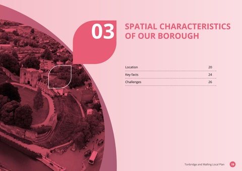
SPATIAL CHARACTERISTICS OF OUR BOROUGH 03
Location
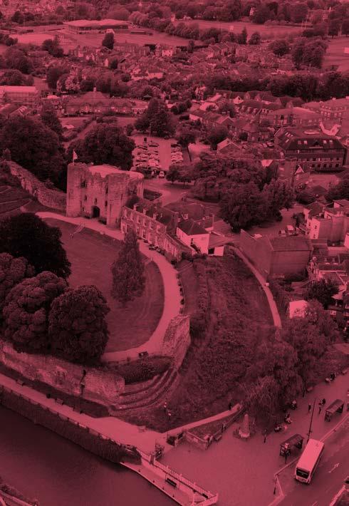
3.1 Tonbridge and Malling Borough is located in the South East region of the country and is one of twelve local councils within the county of Kent.
Character
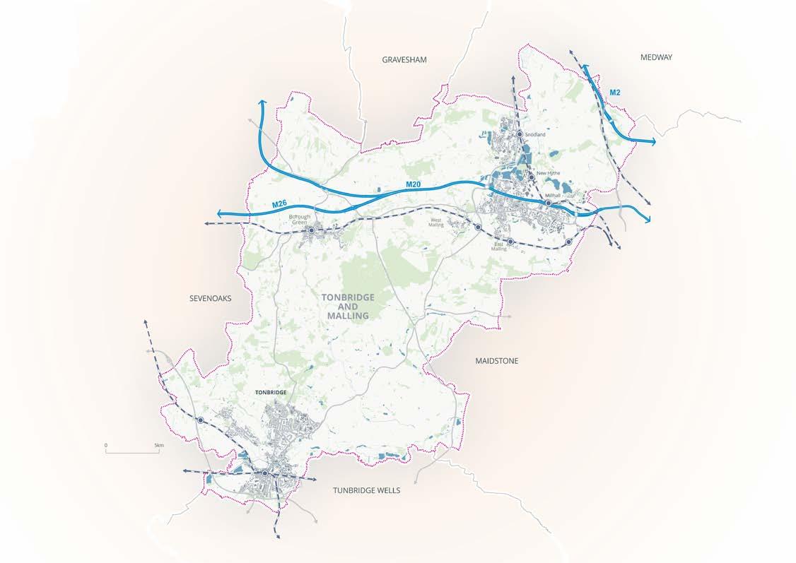
3.2 Tonbridge and Malling borders the districts of Gravesham, Sevenoaks, Tunbridge Wells, and Maidstone, in addition to the Medway Unitary Authority. Immediately to the east of the borough lies the County town of Maidstone. Sevenoaks lies some 10km to the west, and Tunbridge Wells is located to the south, close to Tonbridge.
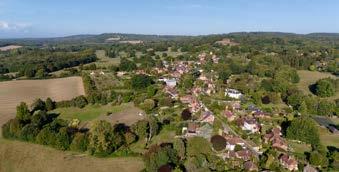
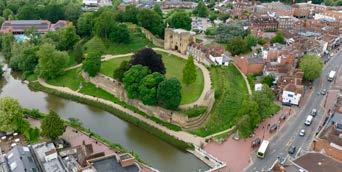
3.3 The borough is mainly rural in character, set within a context of a variety of beautiful landscapes and townscapes. The attractiveness of these areas includes a rich historic heritage, a working countryside that includes small villages and hamlets supported by agriculture, horticulture and forestry. The countryside includes some of the very best productive agricultural land in the country and other notable features such as the upper reaches of the River Medway, and areas with rich and diverse wildlife habitats.
3.4 The borough stretches to the north to include areas of Walderslade and the Kent Downs National Landscape, to Tonbridge in the south which also includes areas of the High Weald National Landscape. The borough also extends from the historic village of Ightham in the west, to settlements in the Medway Valley in the east, including Aylesford.
3.1:
and
and adjacent neighbouring local authorities
KEY
Motorways
A Roads
Rail
Towns and Villages
Neighbouring Local Authorities
Water Bodies
Woodland
Figure
Tonbridge
Malling
Main settlements
3.5 Tonbridge is the borough’s principal town, offering a wide range of services and facilities. Other large settlements and urban areas include West Malling, Borough Green, Hadlow, Hildenborough, settlements in the Medway Gap, Snodland, part of Walderslade, and East Peckham. Kings Hill is a recent and comprehensively master planned mixed-use community on the former West Malling Airfield. Kings Hill includes commercial floorspace and dwellings together with shops, schools and other community and recreation facilities.
Transport
3.6 Overall, the borough benefits from proximity to London and the Kent coast. There are four railway lines that pass through the borough: London to Ashford via Maidstone East, London to Dover and Ramsgate via Tonbridge and the Medway Valley Line, with rail services to Hastings and Redhill also available from Tonbridge. Within the borough there are various strategic and prominent local roads, including the A20, M20, A21, A227, A228, M2, A25, A26, A229 and M26 roads. These roads connect the borough to other boroughs, including the M25 motorway and the channel ports.
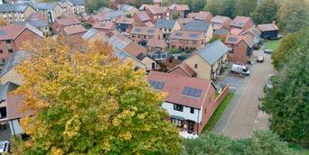
Recent development
3.7 The longstanding designation of the west of the borough as Metropolitan Green Belt has resulted in much development coming forward outside of the Green Belt. This has resulted in a focus of development to the east of the borough, where many new housing estates have coalesced, particularly along the A20 London Road and through to Maidstone.
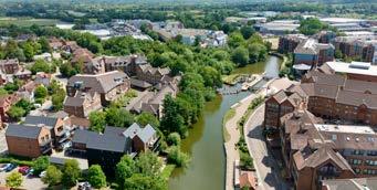

The River Medway
3.8 The River Medway and its tributaries pass through the borough and an extensive area of the borough lies within flood zones. The improved Leigh Barrier and Hildenborough embankment scheme to the west of Tonbridge should be complete by winter 2025/26; these measures help to mitigate flood risk downstream for communities including Hildenborough and Tonbridge.
Geology and landscape
3.9 The geography and landscape of the borough is strongly influenced by the underlying geology with alternating bands of hard and soft rock leading to a strong east-west grain to the landscape. This geological sequence is important in determining the character of the landscape and the historic nature of land use, with predominantly agriculture on the low-lying areas and woodland on the higher ground. The underlying geology has resulted in extensive areas of quarrying in the borough, some still active, whilst others, where mineral working has been restored, providing space for new development of housing and recreation.
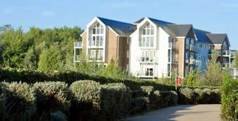
Popular and attractive place to live
3.10 Tonbridge and Malling has been a popular place to live for many decades, particularly as accessibility and connectivity has improved. More recently, improved internet speeds and remote working have also contributed to the borough being an attractive place to live. It has increased local spending and demand for local services and has also raised expectations about lifestyle and living spaces.
3.11 The increasing attractiveness of the borough as a place to relocate and live has led to an increase in house prices making it more difficult for people to be able to buy or indeed rent their own home. This is a key challenge that this Local Plan will need to address. Traditional and modern businesses thrive where established and new communities have flourished, but the pressures on infrastructure and the diverse natural environment are demanding.
Figure 3.2:
Key Facts of the borough
POPULATION
AND MALLING
Largely rural borough 557
2 usual residents per km (data from 2022)
Overall Population
132,201
ELDERLY POPULATION
25,306 people aged 65 or older
2 usual residents per km (data from 2022)
HEALTH TOWN CENTRES HOUSING
People identified as disabled under the Equality Act (5.9% are 'limited a lot' , 9.4% are 'limited a little')
19.1% (data from 2021)
of the population (data from 2021)
52% of people have access within a 15-minute walk / by public transport (DfT data 2019)
The average shop unit vacancy rate in the borough's main centres is
As of March 2023, there are around social housing dwellings in the borough 8,613
In 2024, average house prices are over times average earnings, this is higher than the national and regional average 11.2
1,694
Housing need –In 2024, there were households on the housing register There are households in the borough 53,573
ENVIRONMENT ECONOMY
of the borough covers
Of people in 2021 aged 16-64 are economically active, with 81.7% in employment, higher than national and regional average.
32.5% Of the borough's residents in 2021 aged 16 or over had a Level 4 qualification or above. 15.5% Of the population in 2025 aged 16 or over had no qualifications.
The following sectors have a proportionately higher number of workers in comparison to Kent and England.
KNOWLEDGE ECONOMY
Knowledge economy jobs in the borough occupy of the 16.8% workforce in comparison to the Kent average of (BRES 2023). 13.8%
In 2023 the GVA per head in the borough was this compares £39,983, to £29,379 for the rest of Kent and for the £36,632 rest of England.
GVA per hour worked - £45.80 compared to UK average of £38.10 (data from 2023)
3.3: Key challenges that we need to address
Growing and aging population
Addressing housing need
Managing floodrisk
Mitigating and adapting to climate change
Encouraging sustainable transport use
Protecting and enhancing natural and heritage assets
Addressing accessibility to key services and facilities
Maintaining landscape and townscape identify
Improving air quality
Preserving the best and most versatile agricultural land
Addressing skills imbalance
Figure