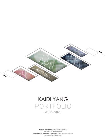
KAIDI YANG PORTFOLIO
2019 - 2025
Auburn University | 08/ 2018 - 05/2023
Bachelor of Architecture
University of Southern California | 08/ 2023 - 05/ 2025
Master of Architecture
CONTACT
2019 - 2025
Auburn University | 08/ 2018 - 05/2023
Bachelor of Architecture
University of Southern California | 08/ 2023 - 05/ 2025
Master of Architecture
CONTACT
Email kdyangtoby98@gmail.com
Tel (+1)334-444-9793
Add 2343 Scarff St, 210
Los Angeles, 90007, California
EDUCATION
University of Southern California | 08/ 2023 - 2025
Master of Architecture
Auburn University | 08/ 2018 - 06/ 2023
Bachelor of Architecture
CERTIFICATE
INTERNSHIP
EXPERIENCE
Certificate in Building Façade Art Science and Technology
Williams Blackstock Architects | 01- 05/ 2023
Architecture practice in University of Memphis Business School
Other works in architecture
Birmingham Rainbow Bridge Revitalization Project 09 - 12/ 2022
Research on both structural and economic conditions of the existing bridge. Incremental development while collaborating with the City Hall and residents.
The first phase of intervention started in 10/ 2023
Montgomery Downtown Master Planning Charette 09/ 2022
Investigation of local communities around Troy University with local City . Master planning of business patterns and proposals for housing projects.
Wedowee Neighborhoods Development Charette 09/ 2020
Investigation and analysis of housing situations. Master planning and Urbanism interventions with local community and city hall.
COMPETITIONS
Los Angeles Affordable Housing Challenge by BUILDNER - 2023
-Housing / Communal Living / CLT Assembly / Cultural Emphasis
4th Year Students Annual SPIRE Competition, AL - 2022
-K-5 Education Design / Comprehensive / Code Study / Steel Structure
The Annual Alabama Forestry Student Design Competition - 2020 -Final list of 8 / CLT Assembly / Landscape
Tau Sigma Delta Honor Society for Architecture Class of 2025 HONOR
PROFICIENCY
Software Revit, Rhino, AutoCAD, Sketchup, Grasshopper, Houdini, Adobe Design Suite, Blender, Maya 3D, Rendering engines
Language English, Chinese (native speaker)
Hobbies: Hobby crafting, painting (sketch, watercolor, architectural drawing), graphic design, music production, photography, traveling


next gen data center
Topic Studio: Meta Build
Architecture program | Team Work
Teammate: Ernest Tse
Site: 215 S Broadway, Los Angeles, CA Instructor: Soomeen Hahm
In response to the escalating demand for artificial intelligence (AI) servers, the necessity for innovative cooling solutions becomes increasingly apparent. As data centers worldwide face rising energy requirements, conventional cooling technologies prove inadequate. Our project envisions a transformative, 10-megawatt, 300,000 square foot mixed-use data center situated in downtown Los Angeles, pioneering a sustainable model that integrates ambient cooling through three-dimensional water reservoirs
Our design seeks to establish an avant-garde green data center that defies traditional paradigms by integrating cutting-edge ambient cooling technology while providing water-related amenities to the surrounding community. By intertwining technological innovation with environmental stewardship, we envision a future where data centers play a crucial role in urban ecosystems, actively contributing to both the digital economy and the well-being of the communities they serve.


Please scan the QR code to enjoy video version.
“What if...? What if we see the city breath and shine?”


necessity for innovative cooling solutions requirements, conventional cooling tech300,000 square foot mixed-use data integrates ambient cooling through


A key innovation in our design is the utilization of the thermal properties of water. The proposed reservoirs will provide ambient cooling, drastically reducing power consumption for temperature regulation. To ensure efficient operation, the data center will require approximately the equivalent of six Olympic-sized swimming pools of water, strategically utilized to maintain optimal operating temperatures. This not only addresses cooling needs but also aligns with our goal of conserving resources and enhancing the overall sustainability of the facility.
conversion of electricity into heat. This energy. Astonishingly, U.S. data censupplies, exacerbating water scarcity only minimizes freshwater utiliza-
improve connectivity by leveraging proxtrans-Pacific internet traffic. This advancement and community engageto cultivate a vibrant urban eco-
towering structure. This vertical through exterior displays that showto change public perception of
proposed reservoirs will provide To ensure efficient operation, the pools of water, strategically utilized but also aligns with our goal of conparadigms by integrating cutthe surrounding community. By interfuture where data centers play a crucial well-being of the communities they


SKY LOBBY INTERIOR

RESIDENTIAL INTERIOR
To minimize the spatial footprint while maximizing functionality, our design features a towering structure. This vertical approach not only creates enhanced visibility but also promotes public awareness through exterior displays that showcase real-time data usage, thus fostering transparency in the digital landscape. We aim to change public perception of data centers from mere technological facilities to valuable community assets.
UPPER LEVEL EXTERIOR

SITE PERSPECTIVE

Waterfront Waterfront Art Destination

Waller Creek Waterfront Proposal Project
Architecture program | Individual Work Site: Austin, Texas
Instructor: Ernesto Bilbao exb0001@auburn.edu
Austin City has its magic characteristics between citizens and nature. Waller Creek is the green belt that is meandering across the core of downtown area. However, the flood issue and chaotic development created countless vacant parcels along the trail and made the creek an unbearable void.
This project is meant to take one of the most vacant block that has old hotel blocking the city view and trail. It uses Waller Creek as the asset to generate the music & art cultural center. These two are the famous impression that Austin contains. By collecting these cultural elements, this project could strengthen the cultural value of the city and gain the financial factors to benefit back to the maintenance of the creek.

Waller creek, as the unique green space across the heart of Austin City, connects all the important assets from Lady Bird Lake all the way to the state capitol. It represents a different speed to experience the city compared with the I-35 on the side.


Austin City was developed from the original courts in 1893. Through the time line of city growth, the original district has always been the center of the focus point. After the airport and interstate was built, the city was connected through north and south, while the mean circulation was still attaching on the green strip - Waller Creek. It became the unique moment that a slow and quiet area could occur in the heart of city.
Flood has been the biggest issue that was brought by the creek during the rainy season. In the early 1960s, the flood impacted the adjacent ten blocks and caused countless economic loss for the feudal department. In 1990s, the government tried to solve the flood by replacing the conduits underneath but the strict code caused the underdevelopment of the surrounding parcels.
The project is shaped by different components that connect by a specific geometric logic. Every component has the common hight as eighteen feet in order to create the smooth circulation experience for each floor. However, inside the upper level, the hight of each unit could be various based on the proposal use. The trimmed geometry provided the direction of light to go through indirectly.


Geometry : Basic Core

Space: Trim Connection:

SECTION POSITION 1

SECTION POSITION 2

SECTION POSITION 3
The interweaving relations of internal space keep changing from the west entry to the east entry. The major gallery hall is traversed by exhibition halls and the doors between different entities. The intersection of two entities would have the hight change as the opportunity to shape the indoor balcony for rich experience of space and light.


On the ground level, two major clusters are connected by the outdoor amphitheater space. It provides the major circulation access towards the back of site, while being used as the stage for outdoor music events. Austin has unique culture of local bands. This would be the anchor point to activate the potential of musical business and become the new musical center for people to gather together with their passion.
DIAGRAM ANALYSIS
There are elevators and stair cases on each cluster. The specific spiring stair case follows the geometry of the gallery unit. It leads visitors to the second floor in a tangible way and shows the unexpected difference view on the upper level to enrich the hierarchy of the art gallery.


The folding section goes through all the major spaces at the same time through western and eastern side. The whole circulation flow is full of surprise and unexpected points. On the western side, a double-hight in the hall area. The secret path in between the unites would have the visual access to see the event
RENDERING PERSPECTIVE


The intersection of three major clusters are connecting by the sky bridge with clear view of the city. space occupied as the light well and also provide the echoing environment for instrument practice happening from above and bring the natural light at the same time.


A game between cars and doors: Enjoyable infinite growing system of strip mall

Spring 2021, Suburban strip mall system research project
Architecture program | Individual Work
Site: Auburn Mall, Auburn, Alabama
Instructor: Matthew Hall msh0029@auburn.edu
Design Description
Suburban area is the important representation of American social structure. More people do not tend to live in crowded downtown and went to suburbs instead. We live, we drive, and we complain about this abnormal karma that designed completely for the four-wheel boxes instead of human. Is there any way to break the checkmate?
This project is to focus on the biggest symbol of suburban areastrip mall. By analyzing its logic of conflict between automobiles and pedestrians, the project would attempt to develop a system that could make strip mall an enjoyable place on human scale. It meant to be the system that beyond the limit of sites, and has the potential to grow infinitely as the new way to live.

“Wait....did we just pass the entrance?...uh never mind this is the way in.”
Suburban condition defines the lower density of population and less demand of centralized economic complex. Under this condition, whatever programs would have less limits of boundaries but more freedom of manipulation and growing.
The site is Auburn Mall - a strip mall at the intersection between Auburn and Opelika, AL. This is the typical condition that occurs on almost all the suburbans as the way people live. The highly automobilized society defined this system for people to shop, gather or suffer from the distance between their homes and stores on the car. Strip malls are not designed for pedestrians, and people cannot expect pedestrian experience, the demand would not support the change to happen. Is there any way to break this endless circle of suburbs?


Intersection
Suburban Area


Clusters have surrounding corridors to connect public courtyards. Each unit has the secondary transparency between outside place and inner courtyard. It provides the options of fast access from automobiles or keep walking in for deeper exploration.


The system would be the sample solution for the suburban condition. It provides the opportunity for different programs to exist together and fabricate the flexible system which could be any scale The system starts from a unit that has a cluster of four elements on 360 degrees. All the elements have the access from outside towards the interior courtyard that formed by itself.
The sizes of units are different which could be divided by various proportions to contain different programs but still keeps the same structural language. They are connected by the corridor of the width of a drive way. There is flexibility to form a larger project by connecting several 100x100’ units to satisfy the various sizes of programs, and at the same time it would create different space while respecting the same structural language and scale.


Each cluster would form a unique public space by mixing different unit facades. It challenged how different languages can communicate with each other and collaborate on a clear grid. No matter what the chess is, they will always have the opportunity to celebrate on this chessboard.

The system will be cut on a specific direction by the main drive way under the context. Units will be split by a road that is perpendicular to the main road to approach interior space. Automobiles would park in the pocket space which provides the easy and safe access from car door to the storefront. The units could combine together to form a larger cluster as the possibility of civic and cultural programs. The hight of the middle cluster has the flexibility to change in order to create the hierarchy on vertical scale.
Each cluster would form a unique public space by mixing different unit facades. It challenged how different languages can communicate with each other and collaborate on a clear grid. No matter what the chess is, they will always have the opportunity to celebrate on this chessboard.


Midtown - Uptown Connection: New downtown destination across city heart

Fall 2022, Birmingham Rainbow Bridge Renewal Project
Teammates: Clay Causey, Bob Williams, Hester, Kang
Site: Birmingham Richard Arrington Jr Blvd S, Alabama
Instructors: Alex Krumdiek, John Pittari azk0036@auburn.edu
johnpittari.jr@auburn.edu

What can a bridge become beyond the structure of connection? Rainbow Bridge is one of the three main bridges that connect northern and southern areas in Birmingham. This bridge stood across railways and provided a quick path for cars from south to north for several decades. It is not safe to pass through due to aging and lack of maintenance and thereby now worked as a site for commemorating the civil rights movement in Birmingham’s history. Nevertheless, the cost of reconstruction will put a heavy strain on local finances.
The project was commissioned by Birmingham City Hall to find the direction as alternative answer of demolishing. The purpose of this project is to make the bridge a pedestrian park and even further, the new core destination of the city for people to enjoy.


The city is divided by the rail road track across in the middle. Even though there are plenty of anchor points with magnificent business and residential potential, people barely have ways to easily access from south to north. This river of iron needs the stronger connection. Rainbow Bridge, which is on 21 st street, has the most efficient character as the connection compared to the automobile bridge and tunnels on both sides. It also connects to both sides with the highest quality of pedestrian walkability. This site becomes the core part that can create the space for people to walk through safely and enjoy the unique view.


Birmingham set up on the clear city fabric grid. Since 1990s, more population is coming back into downtown area to create more residential and commercial opportunities. Besides the Railroad Park, there are a lot of vacant parcels around rail road which is at the physical and economic center among all the development growing.


Basic logic is rising up the addition level for heavier constructions and trees, and fold it down to create the second level between the ground parcel and untouchable bridge. In this case, various hierarchies would provide more opportunities for the adjacent development to engage with the bridge but still within their own freedom of designing.

The original bridge is still readable, but it even becomes the structural language blended in the park, which represents the historical value of what the bridge captured for the city.


Public spaces on both sides would form pocket areas that interact with adjacent developments. Architects might not have the right to decide what they would be designed, but this is giving the vision of how the district could grow and achieve based on the bridge project. Parking lots would be absorbed underneath, while all commercial or quite residential are occupying on the middle and higher hierarchy on both sides.


Top level are defined as fast access, including the pedestrian-focused green space along the building side and mobile-focused smooth area along the eastern side with faster access. This provide people different options to experience the space through various speed. Lower level is supposed to be more private area, with massive shade by dense tree canopies to create the quite park experience.


Three powerful moves constructed the system of the whole project. The first one is amphitheater area that sits right next to the PNC parking deck area. The screen wall system is proposed on the facade of parking deck with LED screen to create the cultural characteristic of bridge. Upper level and lower level defined the two different functions of the project— public and private.

At both ends of the bridge, the cross road area would become the pedestrian entrance based on the traffic pattern master plan. It not only connects 1st Ave N and Rotary Trail, but also activated the safe and attractive opportunities for people to easily access.
Considering about the weak load condition on the bridge surface, the pedestal system is introduced to the structure. The sizable cone components could stack together to hold the new layer of material without directly hurting the original surface, and creates space underneath as the opportunities for drainage and thermal deformation


Pedestal System


Co-dividual Housing for 100 residents

The Return of Housing Project Architecture program | Team Work
Teammate: Charles Lafon
Site: Exposition Park West, Los Angeles, CA
Instructor: Hadrian Predock
Here we are in Los Angeles, one of the biggest urban environments that are suffering from housing crisis. Standing on the perspective of entry level workers, young starters, married or simple, the of living could be challenged as the logic of how housing could be designed and constructed for the high quality living experience. This project provides the concept of Co-divided housing, starting from the minimum dwelling units for one person to generate the system of complex in the larger scale for 100 people.
Co-housing means a group of homes that include some shared facilities (= areas, rooms, equipment, or services for particular activities): The village was inspired by co-housing in Denmark. Most co-housing communities include a common house with a kitchen, mailboxes, and laundry rooms.
Co-sharing means the use of an office or other working environment by people who are self-employed or working for different employers, typically so as to share equipment, ideas, and knowledge.
Co-dividual is a strange aggregate as semantically it means with divisions, means an aggregate of many small pieces...

“Residents in the affordable housing deserves the better quality of daily uses, cultural celebrations, and the respect, through the caring and logical designing.”

The fundamental strategy of the spatial organizing is to define the hierarchy of different functionalities of residents’ daily uses. In the general architectural logic, spaces are usually connected by “connections” such as corridors and lean spaces, which could generate isolation and weaken the sense of co-sharing. We defined the strategy of Space x Space which is the anti-corridor method that use spaces to connect other space. It utilizes all the space in the complex, not only by spatial connection, but also by spaces being used visually and mentally.
Following diagrams show the analyzation of the relationships of different uses of space by the scale of how many people are using them.


After clarifying the scale and functionality of spaces, we input another logic layer of privacy and publicity onto the diagram. The smallest unit for one person would be the absolute private area of the project, which is defined as minimal dwelling units. In between five units, residents would share a more private socializing zone for more quiet and smaller activities. In addition, every two groups of five “pod” would share one kitchen and dining area as more public activities. The spaces connect all the pods are for the most public activities such as gardening and party. Based on that, the top layer are programs such as common-owned thrift store and tool rooms to support the co-sharing lifestyle.


The lower floor plan shows the logic of the overall project. The minimal dwelling units have the single type for one person and another type of two for the couple or family’s temporary stay. They all share the same amount of sunlight and have equivalent access towards the bathrooms and laundry. Each two pods not only share the kitchen area but also an outdoor courtyard that brings the natural light and form the natural cooling tower. The two ends of projects are for the bigger public-owned facilities such as the thrift store, green house, and community party area.
Inside the grand hallway, the zigzagging spaces are designed for not being able to see through but have partial visual connection. When residents are walking through the grand hall towards their units, they would be able to see and smell people from different cultures cooking and dining. We believed that dining is the fundamental demand of human and also the easiest connection to bring people into the conversation regardless the culture or careers. The space not just assume people to go together, but instead the connection would naturally happen through how residents see, smell, and touch.


The language of arch was implied in the indenture project. The arches in the hallway are carved CLT panel to show the nature of wooden structure. It not only emphasizes the characteristics of the project, but also creates the overlapping tunnel spaces as the visual language to divide spaces and reveal the functionalities at the same time.
The project remains two-story high to blend into the surrounding neighborhoods of Los Angeles residential fabrication. The facade is using painted steel to show the gradient of the sunset color tone as the representation of the cultural icon of Los Angeles.


Parametric penalization modeling practice
Fall 2023, Computational geometry assignment
Architecture program | Individual Work
Instructor: Matt Conway mconway3@usc.edu
Understanding the mathematics and geometry behind surface types, rationalization, and discretization is fundamental knowledge for designers to master form. However, it is equally important to practice techniques for translating this information into measured drawings and schedules, as this is key to utilizing complex geometry in professional practice and scaled construction.
The physical model serves as a tactile means to engage with the process of physical assembly and assess the effects produced by its modulation, allowing the observation of form in light and space. Using the grasshopper script to construct the penalization surfaces as the practice of parametric fabrication. This pair of models meant to represent the idea of “egg and shell” as the opposite of pawns of the chess game.


Spring 2022, K-5 School Project Montgomery, Alabama


Korita Kent Art Foundation
Site : 681 W 37th Avenue
Semester: 2024 Spring
Individual Work


Site: Any second of daily life


E-mail kdyangtoby98@gmail.com
Address 2343 Scarff St, 210, 90007 Selected Work from 2019-2025