CHRISTINA LE


WYE RESEARCH & EDUCATION
GROUNDSMITH COLLECTIVE
CONSTRUCTION DOCUMENTS....................................................................................
HAND GRAPHICS.......................................................................................................
University of Maryland
Expected May 2025
Bachelor of Science in Landscape Architecture
Minor in Sustainability Studies
Groundsmith Collective / Fall 2022 - Present
Landscape Designer
• Work closely with lead landscape architect to provide support on 3 current projects, making a cumulative total of 16 projects focused on residential and community design
• Conduct in-person site inventory/analysis, evaluating site conditions and constraints with clients. These assessments inform innovative design solutions
ASLA Legacy Project / Summer 2024
Volunteer
• Engaged with 100+ members of the Anacostia neighborhood to conduct a comprehensive survey resulting in gained insight of community needs
CERTIFICATIONS
LEED Green Associate / Jan. 2025
• Prepared realistic renderings in Adobe Suite of proposed changes to communicate design intent and enhance stakeholder engagement
Architect of the Capitol / Summer 2023
Horticulture Intern
• Assisted senior horticulturists, gaining hands-on experience in plant cultivation and maintenance around the U.S. Capitol campus
Digital
AutoCAD
Vectorworks
Revit
ArcGIS
Sketchup
Lumion
Microsoft 365
Adobe Photoshop Illustrator
Indesign
Analog
Hand Sketching
3D Model Making
Language
English Vietnamese Japanese
Lechristina092@gmail.com Silver Spring, MD
| PROJECT BRIEF
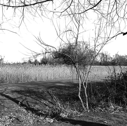
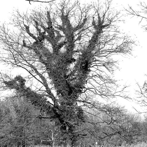
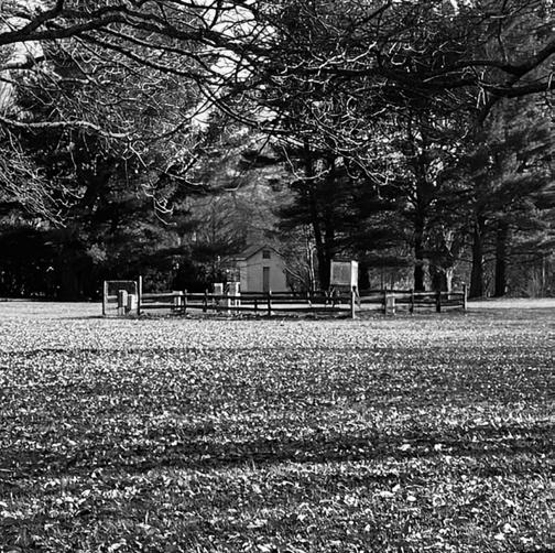
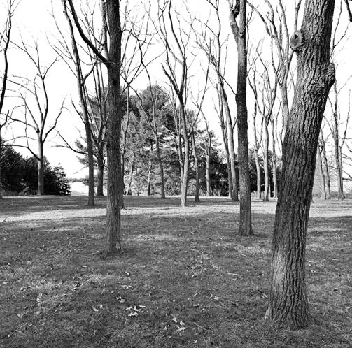
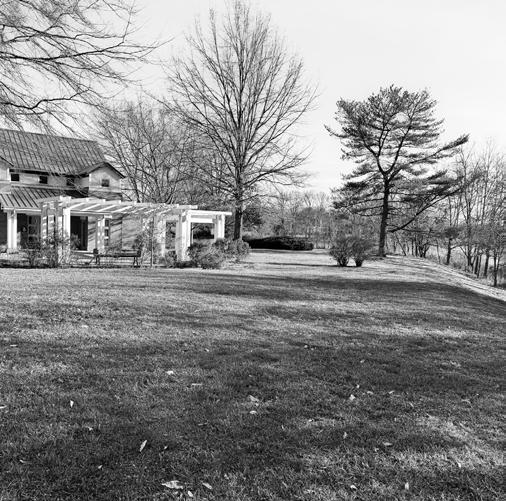
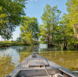
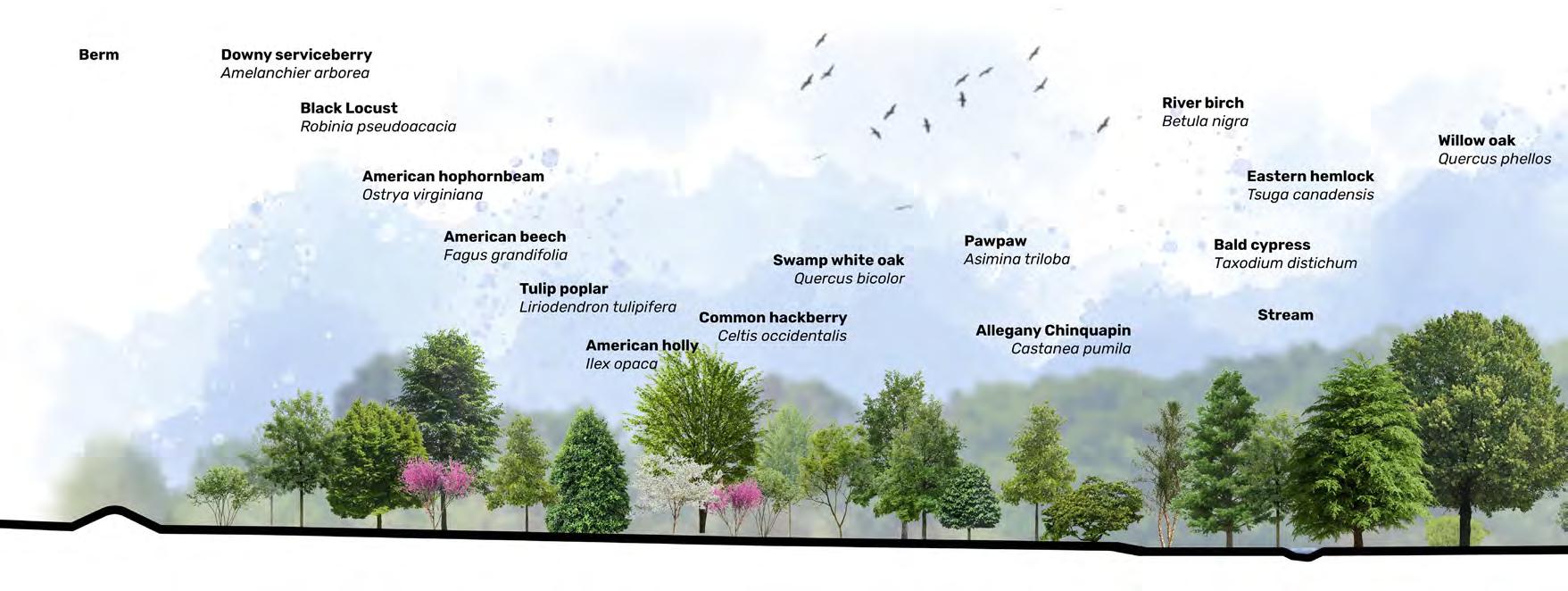
The Wye Research & Education Center (WyeREC), a 1,000-acre facility on Maryland’s Eastern Shore, exemplifies the region’s dedication to agricultural innovation and environmental conservation. The land, historically known as Wye Plantation, has experienced significant deforestation throughout the past centuries. The proposed WyeREC proposed master plan emphasizes ecological restoration, aiming to transform the center into a dynamic hub where native habitat renewal, education, and scientific research converge.
| OBJECTIVE
To develop a long term ecological restoration plan that includes a planting plan, habitat designation, and an invasive management plan.
| COLLABORATION
| PROGRAMS
Caleb Austin, Elia Choi, Grazelle Giray, Joe Mallow, Gracie Guerrero-Osorio & David Phan AutoCAD, Photoshop, Indesign, & ArcGIS.

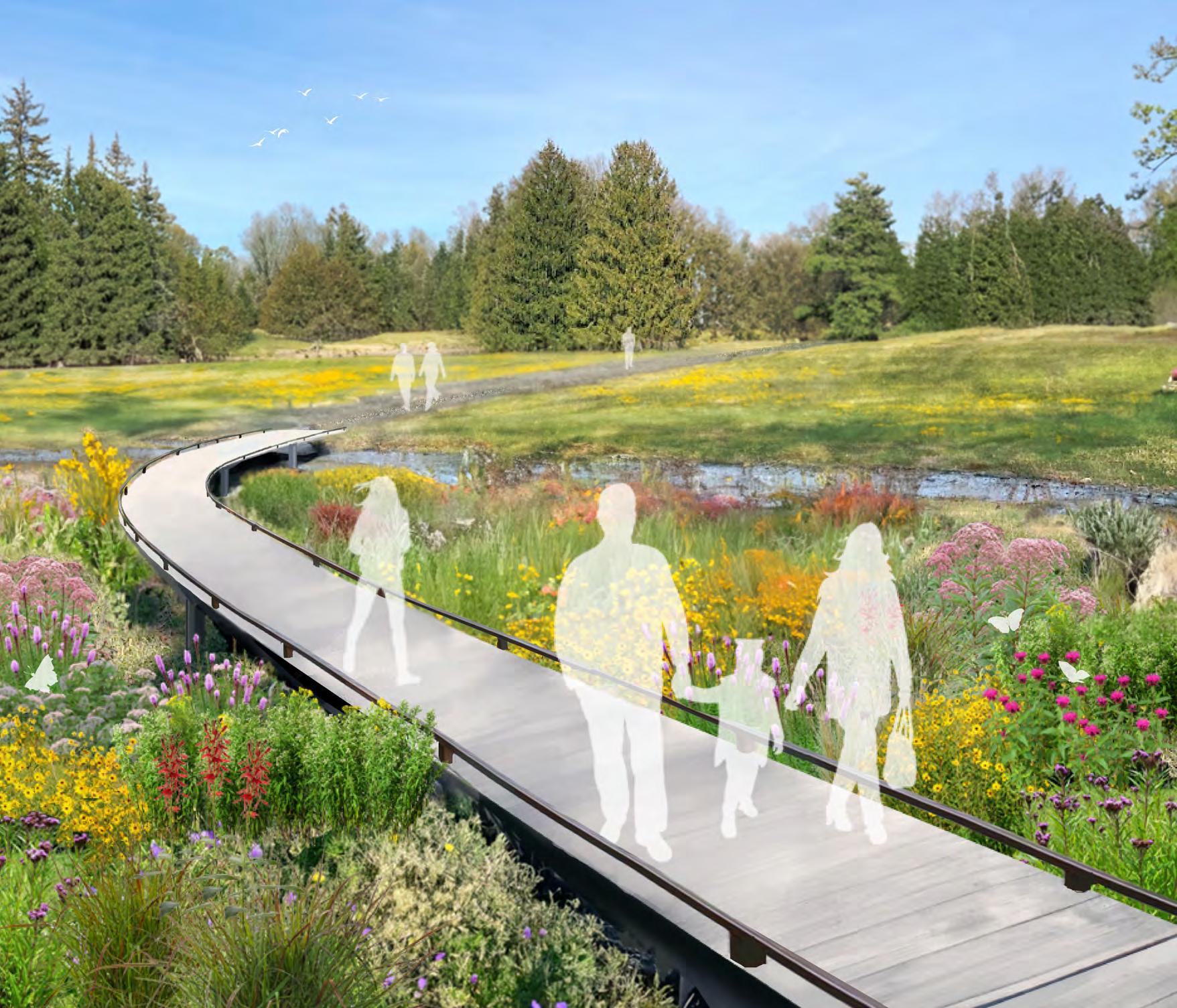
| PROPOSED WET
Establishing a biodiverse maintenance, and
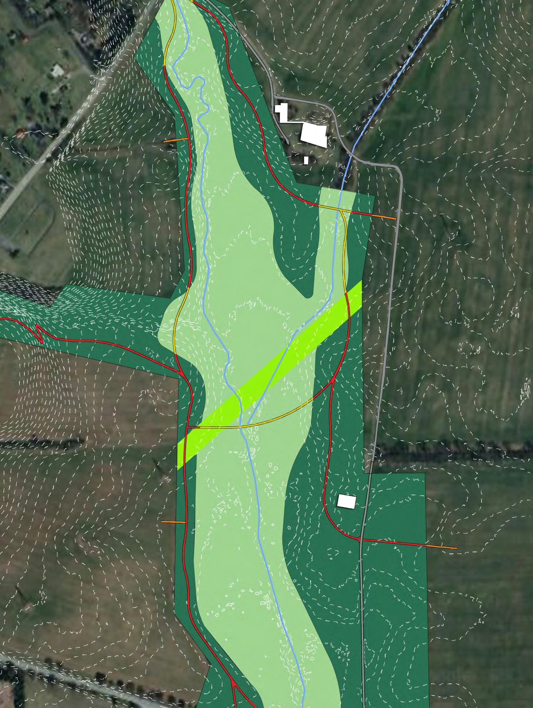
| SITE INVENTORY: CONSTRAINTS AND OPPORTUNITIES


YORK IRONWEED
VERNONIA NOVEBORACENSIS
BLAZING STAR
LIATRIS SPICATA
BEE
JOE-PYE WEED EUTROCHIUM PURPUREUM
STANDING
SWAMP SUNFLOWER
HELIANTHUS ANGUSTIFOLIUS
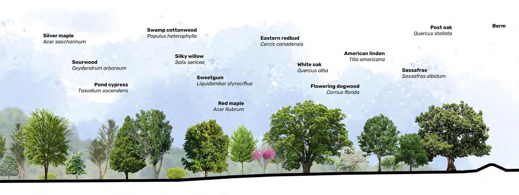
biodiverse planting plan mimicking Maryland’s natural ecology creates resilient landscapes that require less enhanced water absorption, helping to prevent inland flooding.
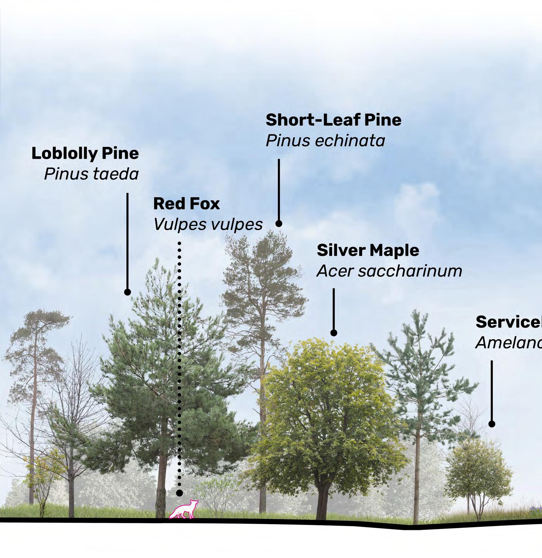
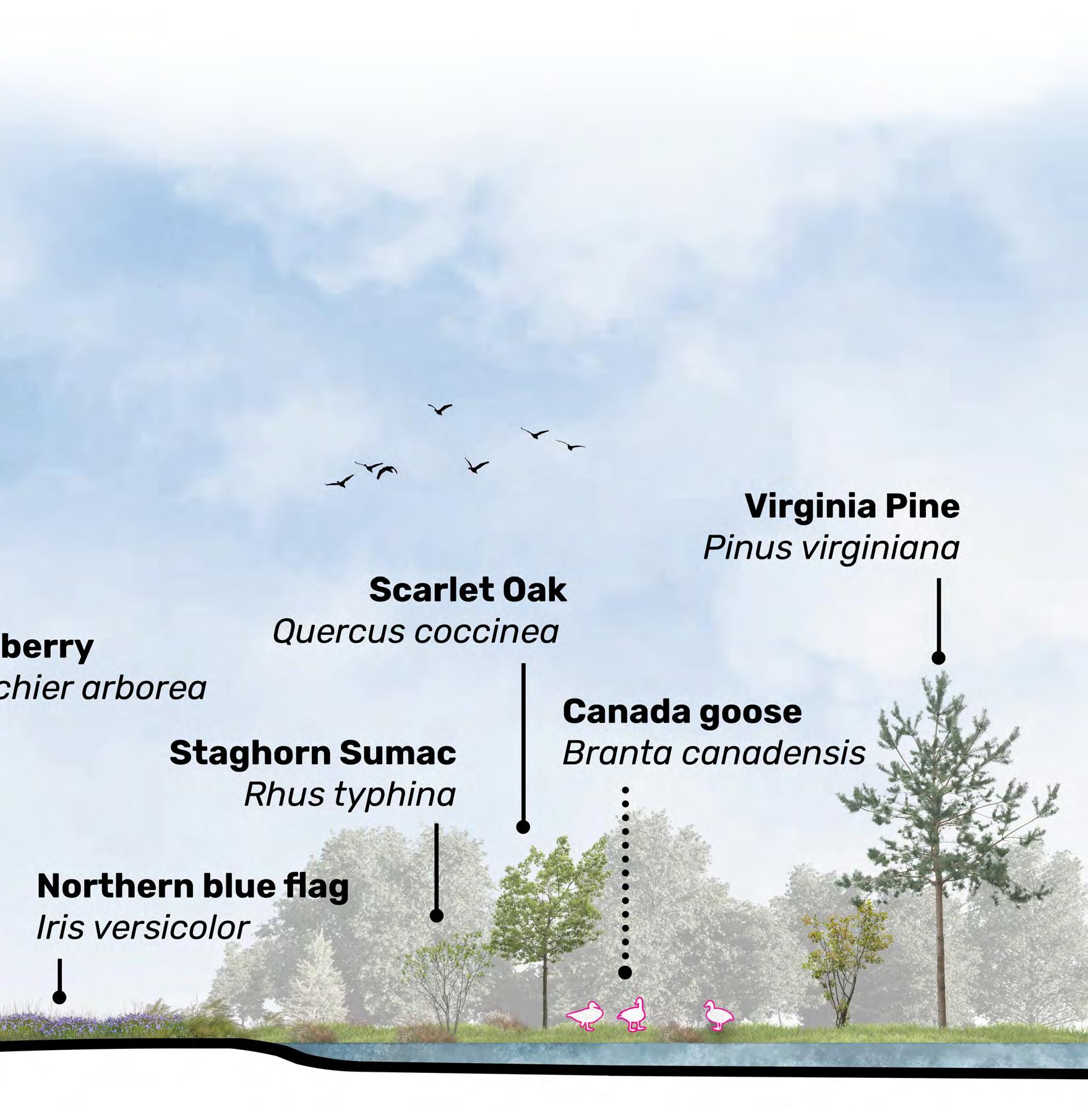
AUTOCAD: CHRISTINA LE COLORING: CALEB AUSTIN TRAILS: DAVID PHAN
Pre-colonial Forest
Upland Forest
Wet Meadow
Food Forest
Bald Cypress Bog
Secondary Pedestrian Pathway PRE
Main Pedestrian Pathway
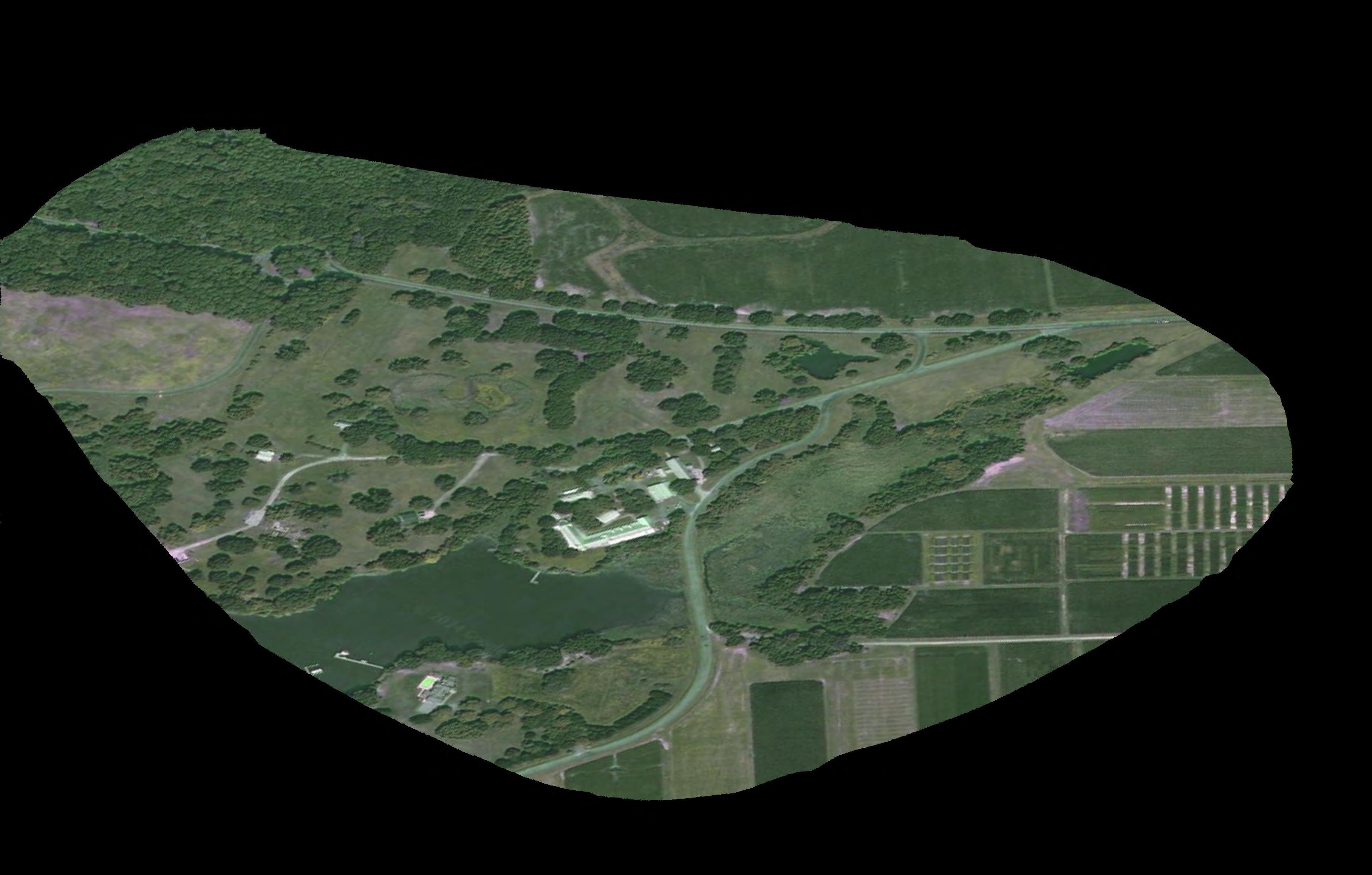

Ponds Lawn
Impervious Surfaces


| PROJECT
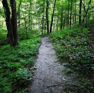
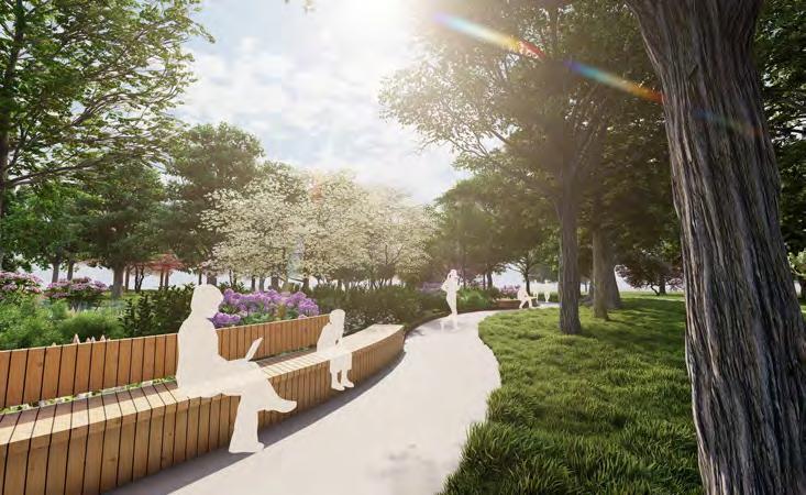
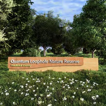
Quantum Loophole is a proposed data center project located in Frederick County, Maryland. It includes a dedicated 600-acre nature reserve designated to enhance and preserve mature ecosystems for environmental benefit. This project will convert a former brownfield industrial site into a thriving forest ecosystem, serving as a crucial wildlife corridor while offsetting carbon emissions from data center operations.
This project aims to focus on the following objectives:
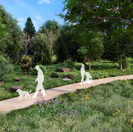
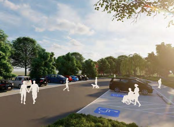
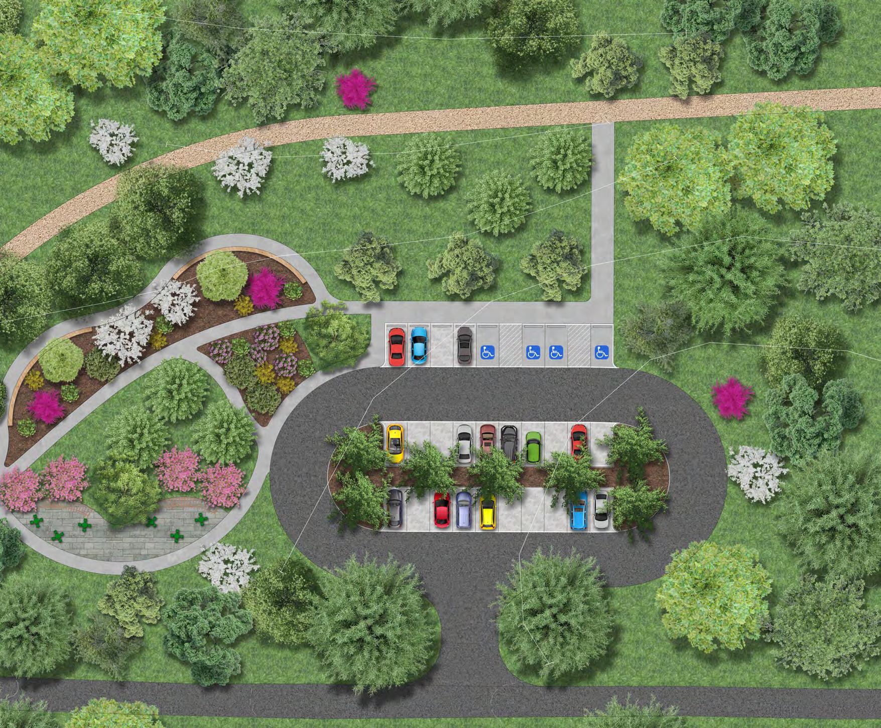
• Create an ADA accessible trail system and parking lot
• Create a plant list with a variety of plant species that do well with the area to ensure a diverse habitat
• Connect the trail system to the surrounding communities and facilities
• Design inclusive and naturesque gathering spaces at trail head locations
| OBJECTIVE
To develop a forest reserve that prioritizes both environmental sustainability and accessibility for all.
Lili Francisco and Rachel Kinsey
| PROGRAMS
AutoCAD, Photoshop, Indesign, ArcGIS & Lumion. | COLLABORATION
| BIODIVERSITY CALCULATIONS
Shannon Diversity Index of 100’ area:
• Shannon Diversity Index = 3.21
• Evenness = 0.962
• Richness = 28
• Total number of individuals = 11
• Average population size = 4.11
| STORMWATER BENEFIT CALCULATIONS
Floodplain:
• (110,217) x (37.9117221) = 2089 tons
Upland:
• (116,519) x (39.0751686) = 2276.5 tons
Total:
• These trees are estimated to reduce atmospheric carbon dioxide by 4366 tons
| CARBON SEQUESTRATION CALCULATIONS
Floodplain:
• (7,672) x (37.9117221) = 290,858.73 gallons
Upland:
• (10,917) x (39.0751686) = 426,583.615 gallons
Total:
• These trees are estimated to help avoid 717,442.347 gallons of stormwater runoff


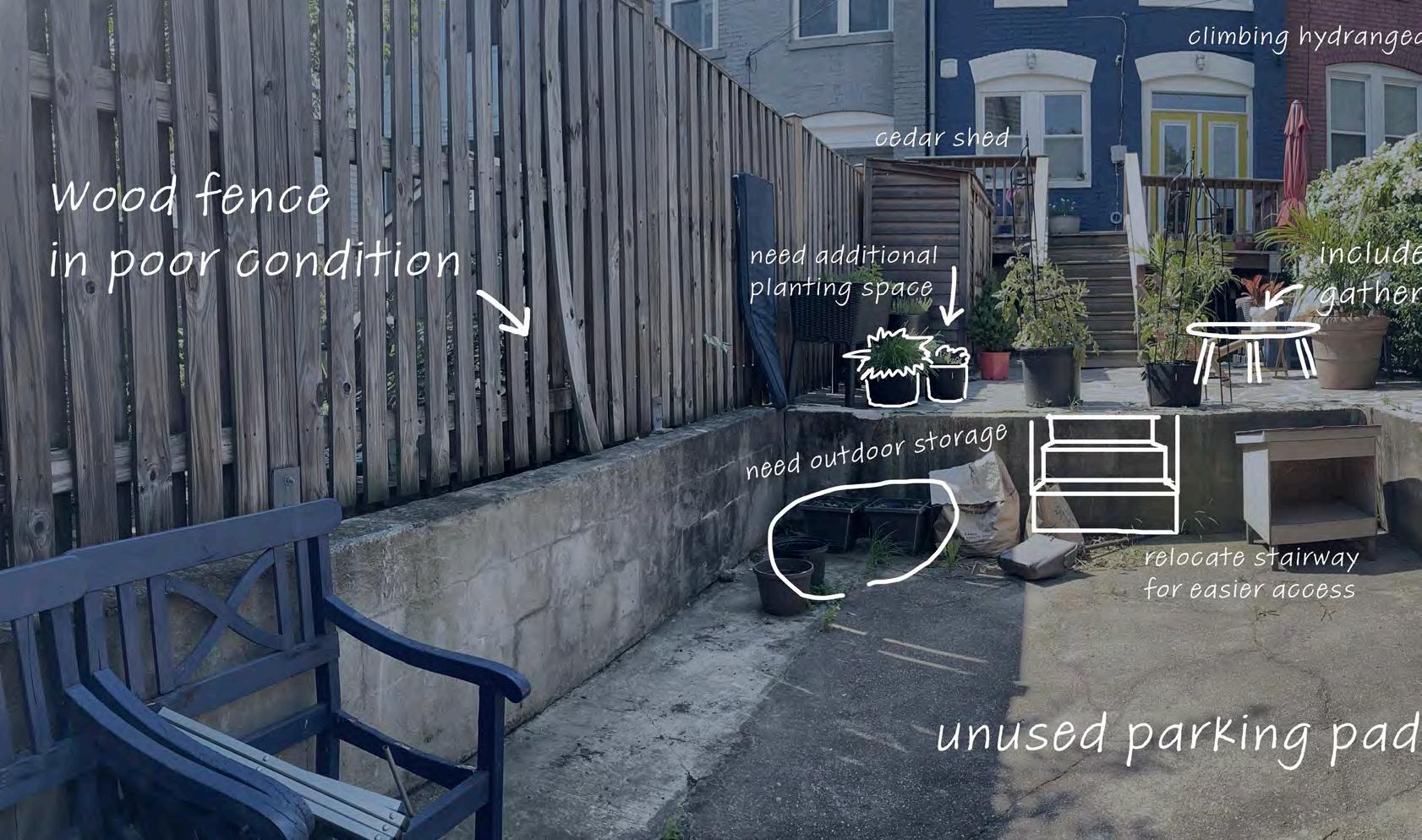
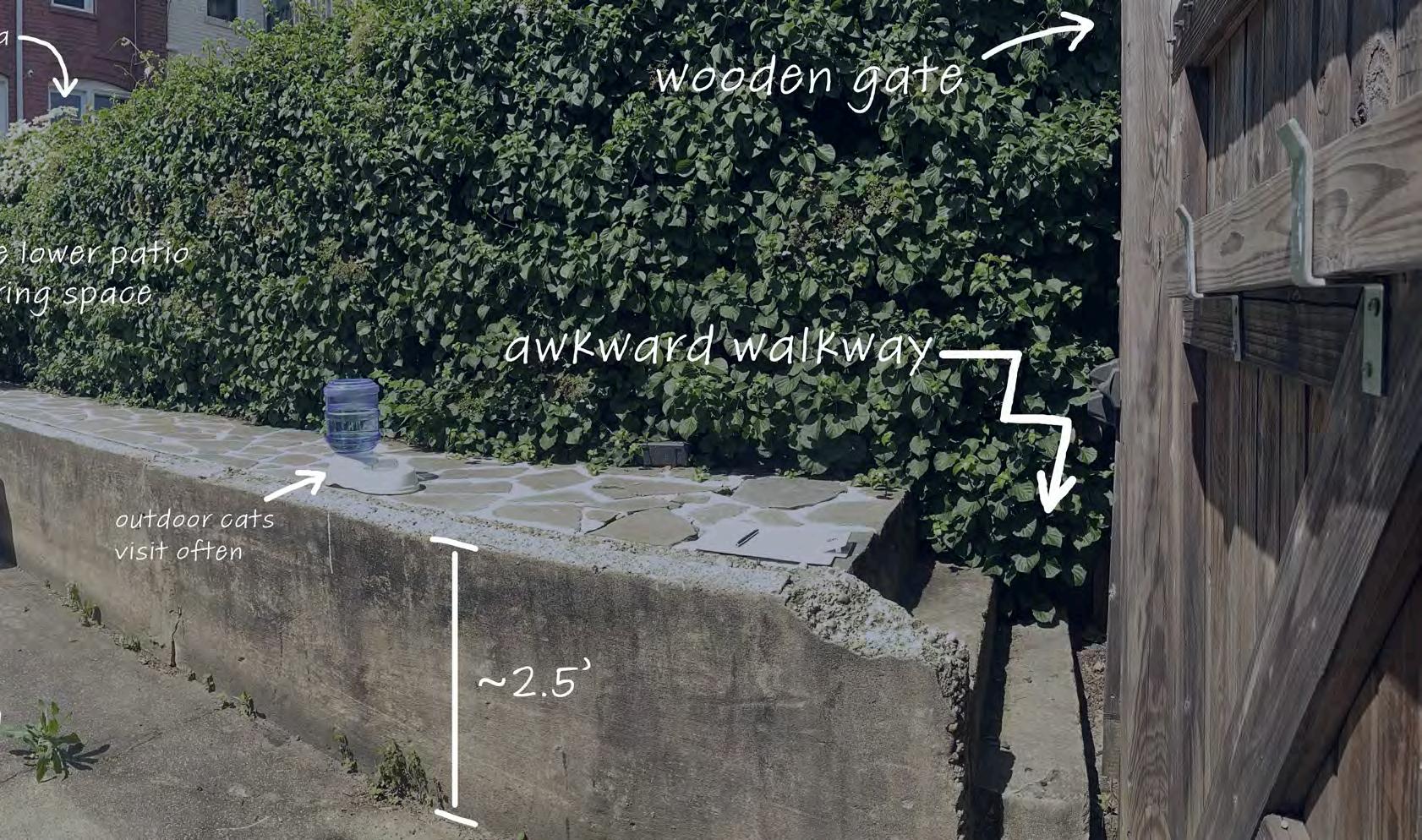
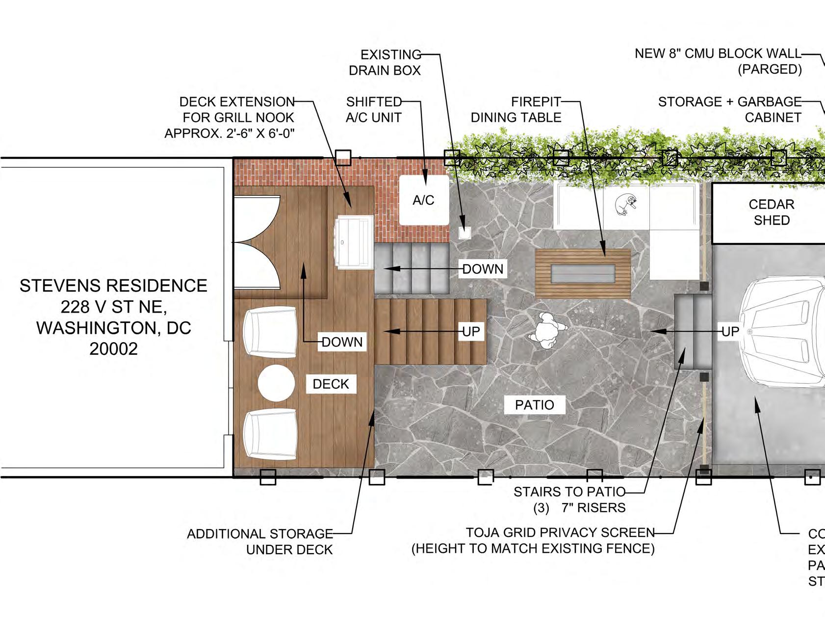
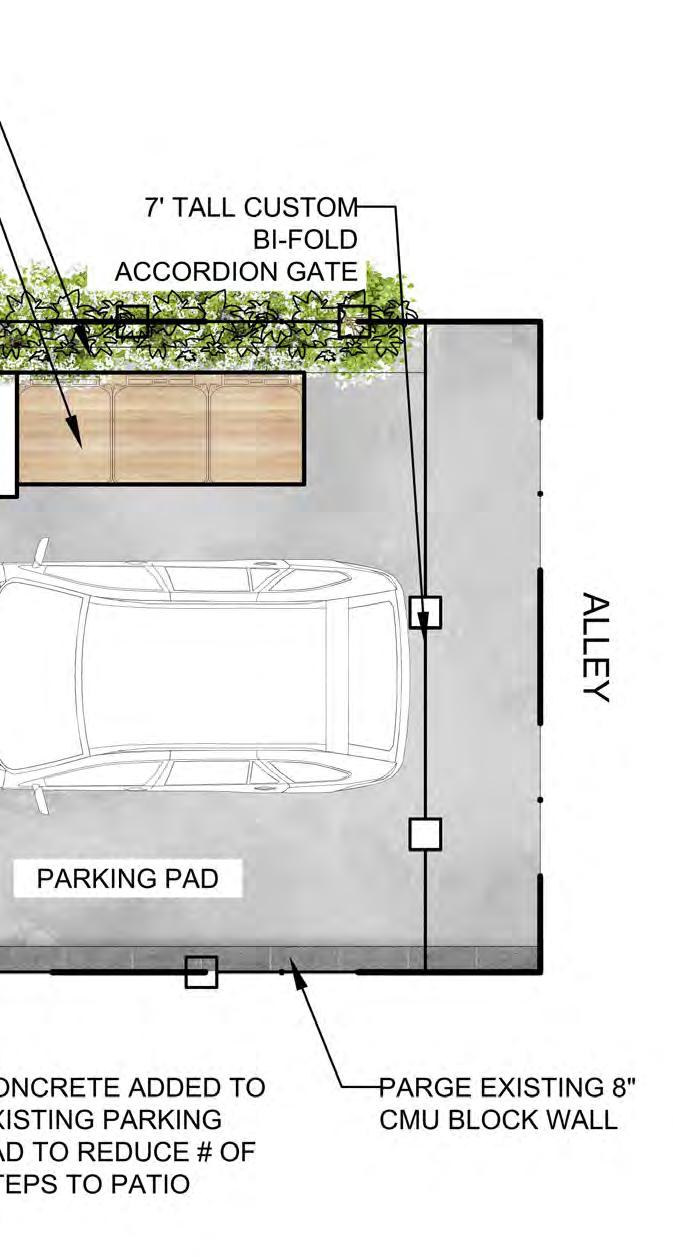
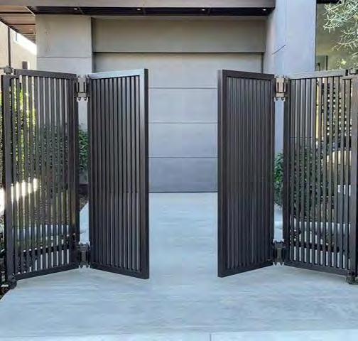
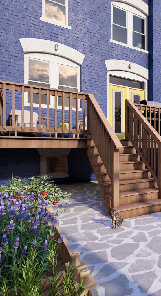
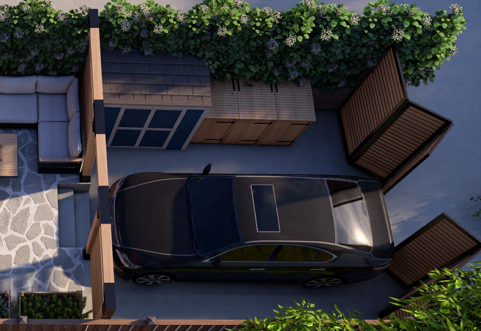
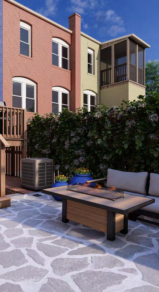
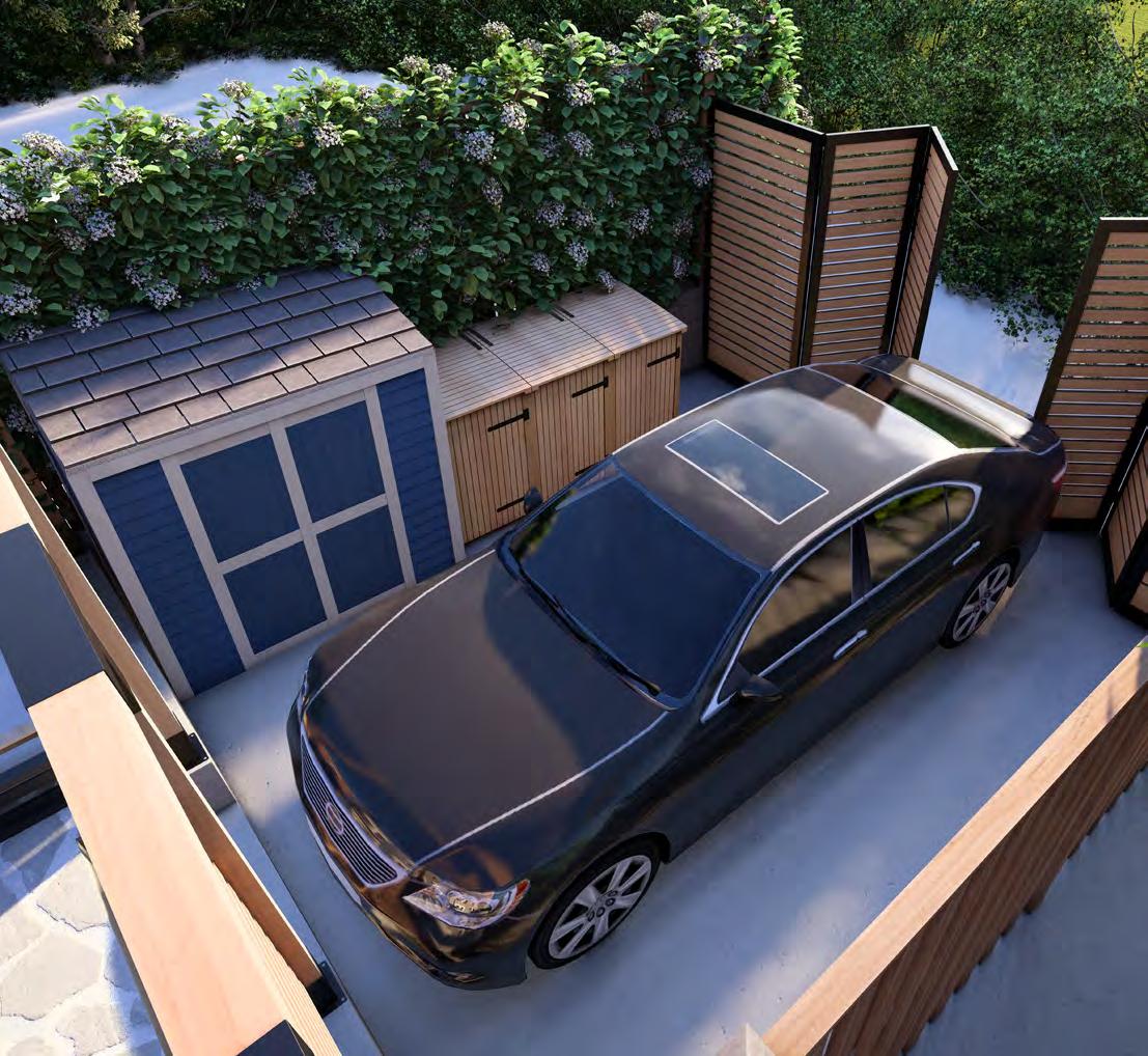
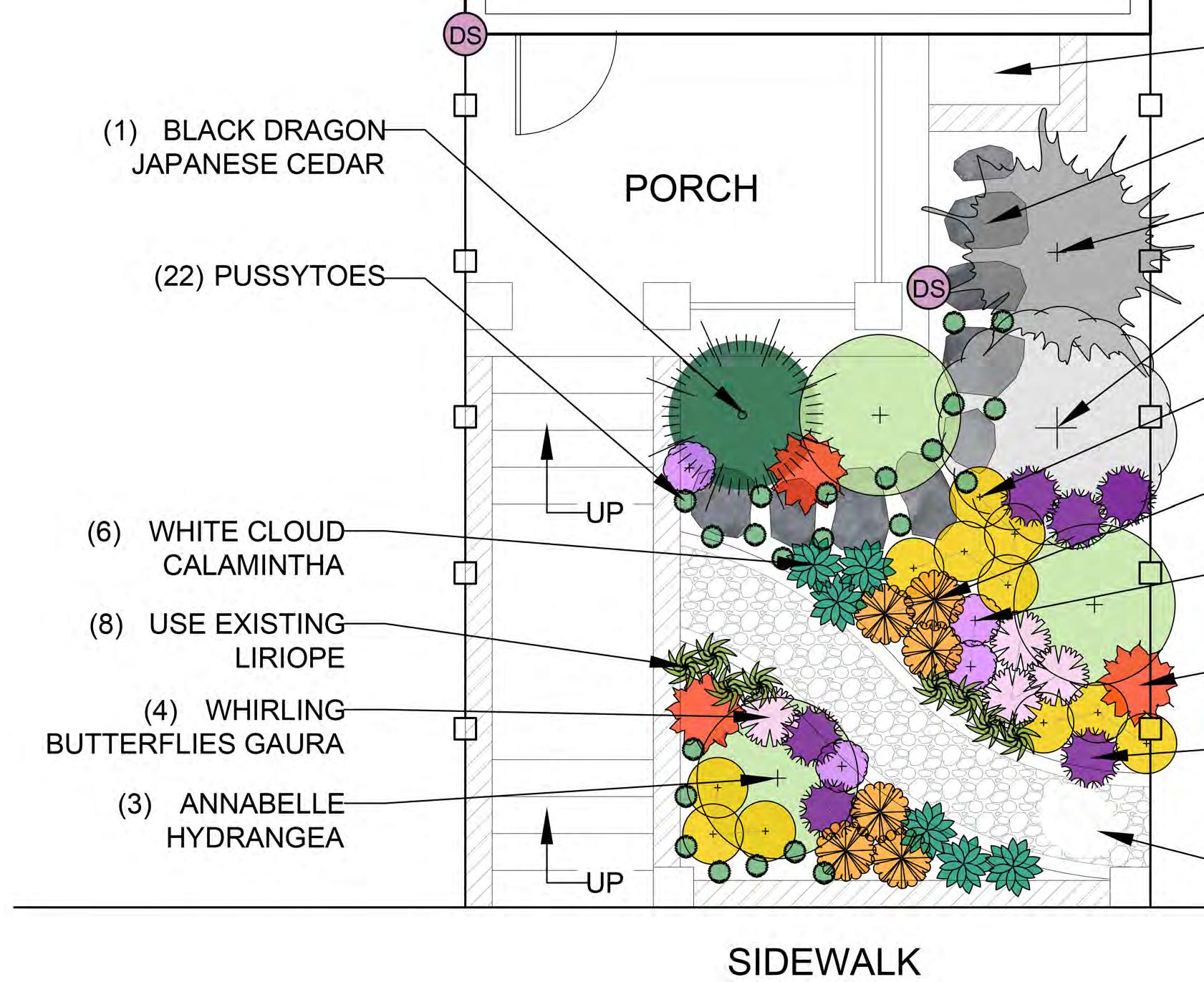
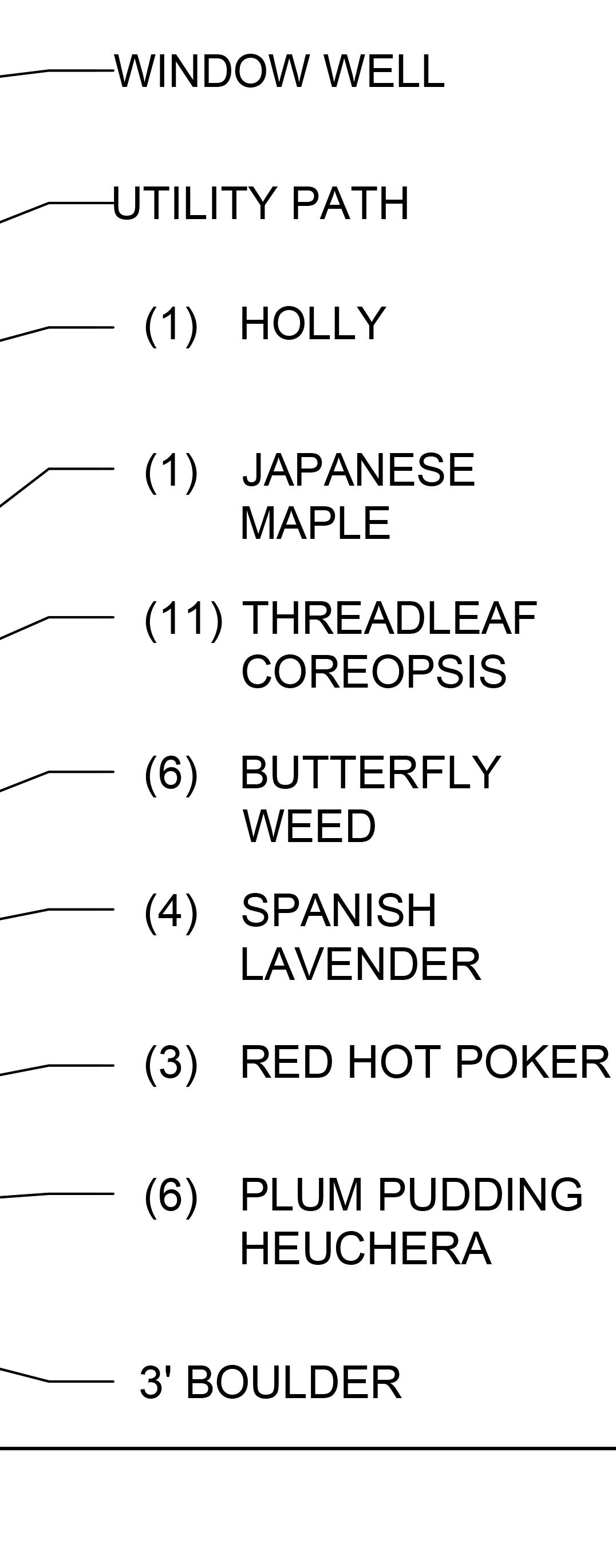
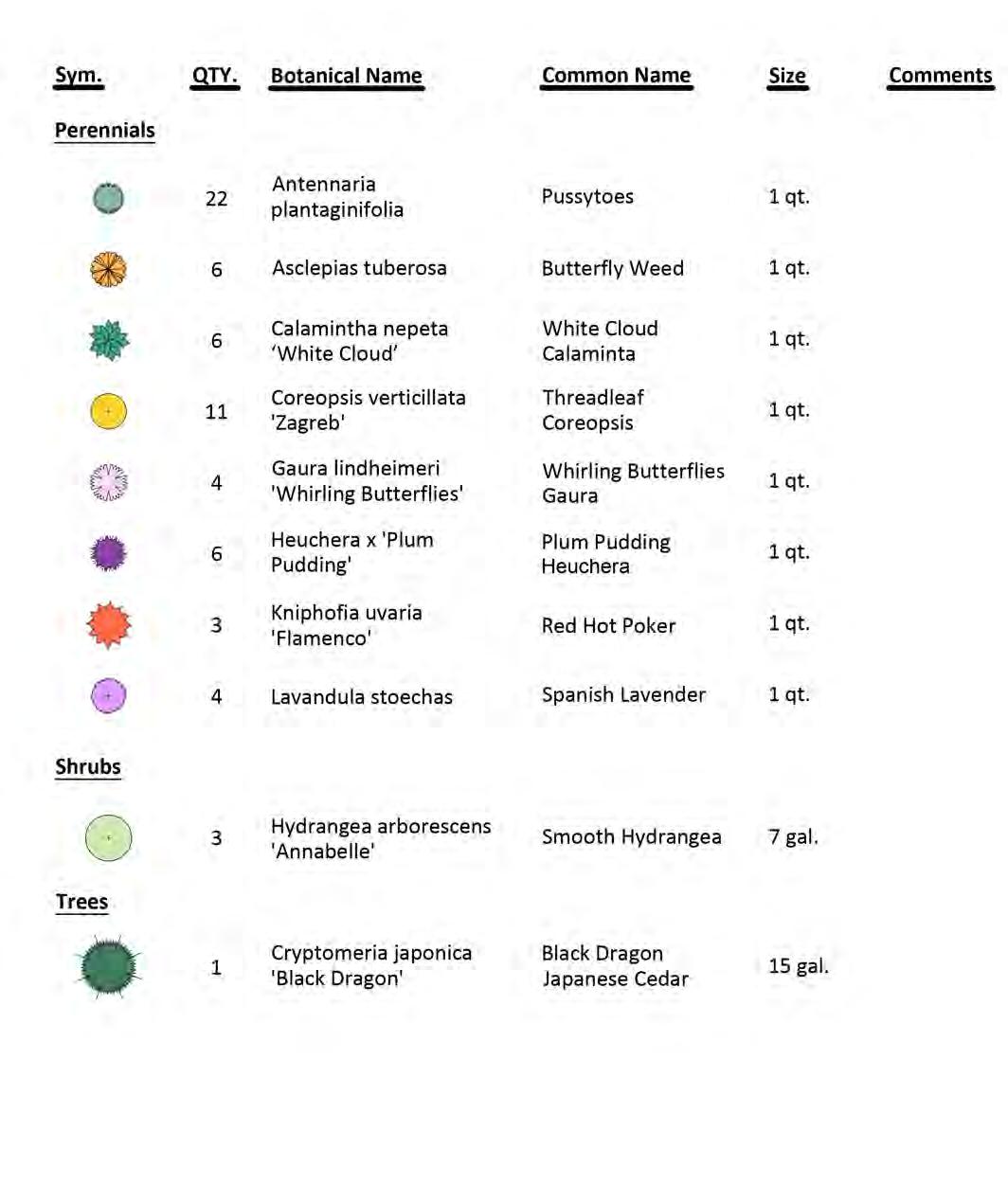
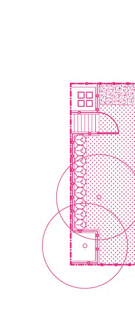
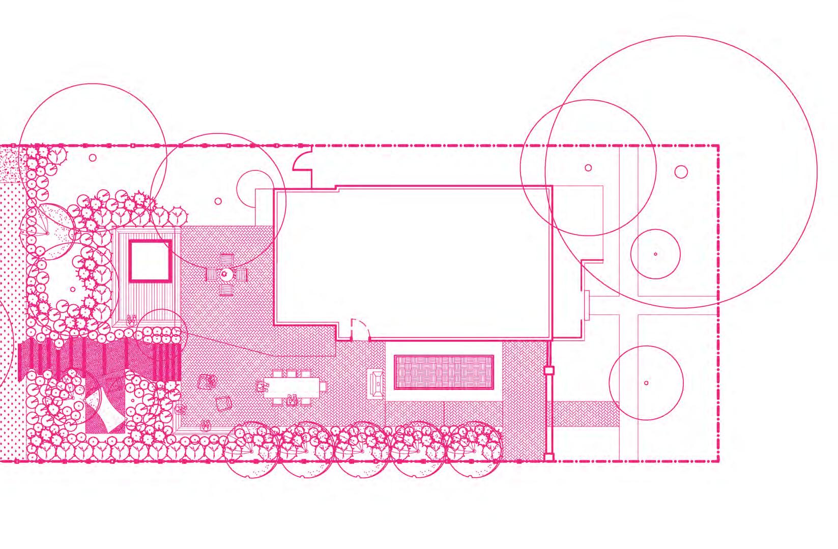
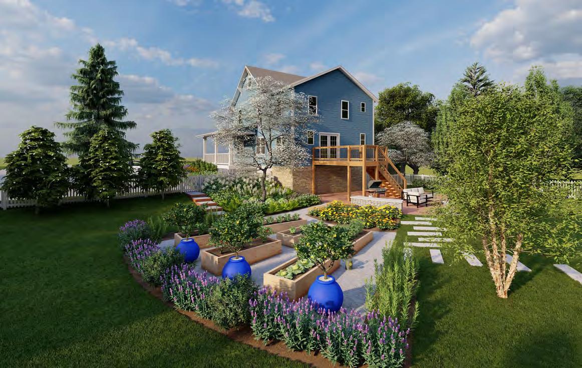
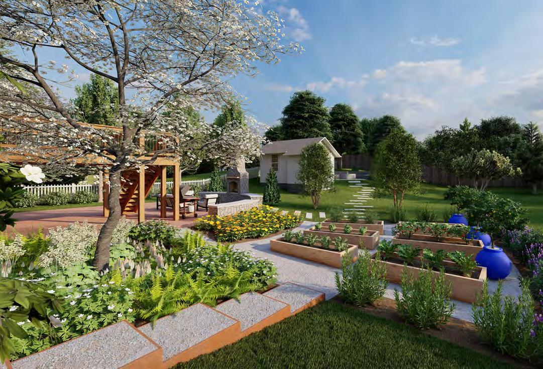
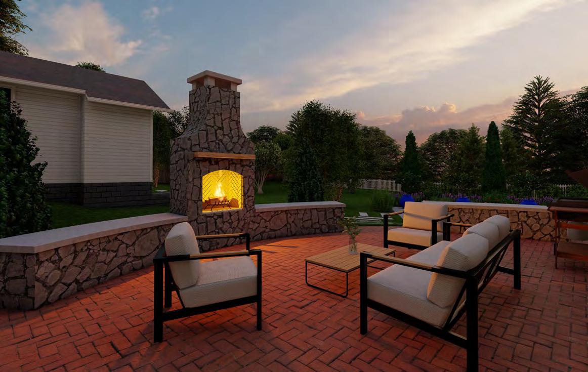
Located in Washington, DC, our client’s Colonial row house presented a unique design challenge. With a narrow lot width of 17 feet, we were tasked with transforming both the front and rear yards into contemporary outdoor spaces. Despite the spatial constraints, our design needed to accommodate multiple elements: an accessible parking pad with an updated bi-fold gate, dedicated areas for a vegetable garden, a gathering space featuring a fire pit for entertaining, storage for tools and garbage, and a designated grill nook.
To transform both the front and rear yards into welcoming outdoor retreats.
Kelley Oklesson
AutoCAD, Photoshop, Indesign, & Lumion.
4.1' CLEARANCE UNDER DECK CLIMBING HYDRANGEA
FLAGSTONE ON CONCRETE
PARGE EXISTING 8" CMU BLOCK WALL
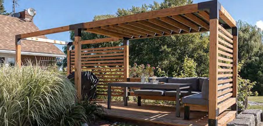
Concept A prioritizes a stairway on the east side of the property. A modular pergola with horizontal screening provides separation between the parking pad and main patio. The lower patio area features a firepit that converts to a dining table depending on the occasion.
| FINAL DESIGN
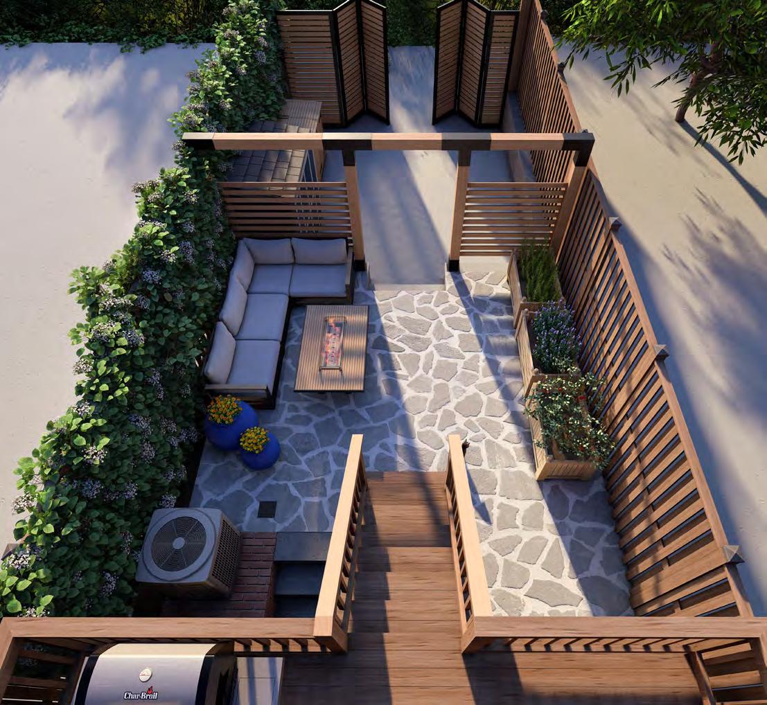
Concept B separates the dining area the stair layout is similar to Concept the addition of a built-in seat wall compact solo stove on the parking moved to a spot beneath the deck, serves to divide the firepit area from

area from the firepit space. While Concept A, this design allows for wall with storage and space for a parking pad. Garbage storage is deck, and a wooden trellis screen from the dining space.
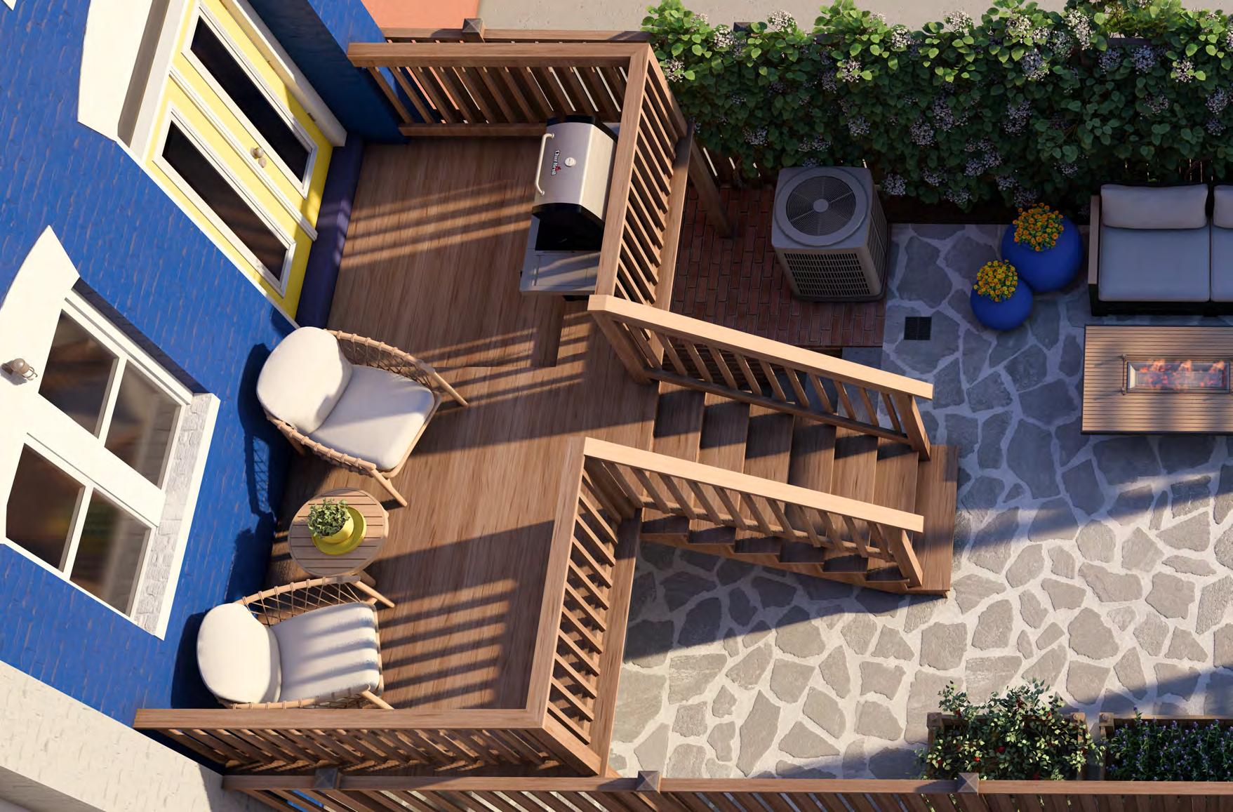
Concept C aligns the staircase with the existing deck stairs and allows the opportunity to construct built-in planters for narrow screening trees. The parking pad is extended with permeable pavers and will make way for garbage and outdoor storage cabinets. The centered layout divides the dining and firepit space on opposite ends along the main patio.

| DISCLAIMER
Drawings are not to scale and are intended to be printed on a 11” x 17” sheet. Drawings have been scaled to fit on a 23.5” x 16.5” sheet.

| DISCLAIMER
Drawings are not to scale and are intended to be printed on a 11” x 17” sheet. Drawings have been scaled to fit on a 23.5” x 16.5” sheet.
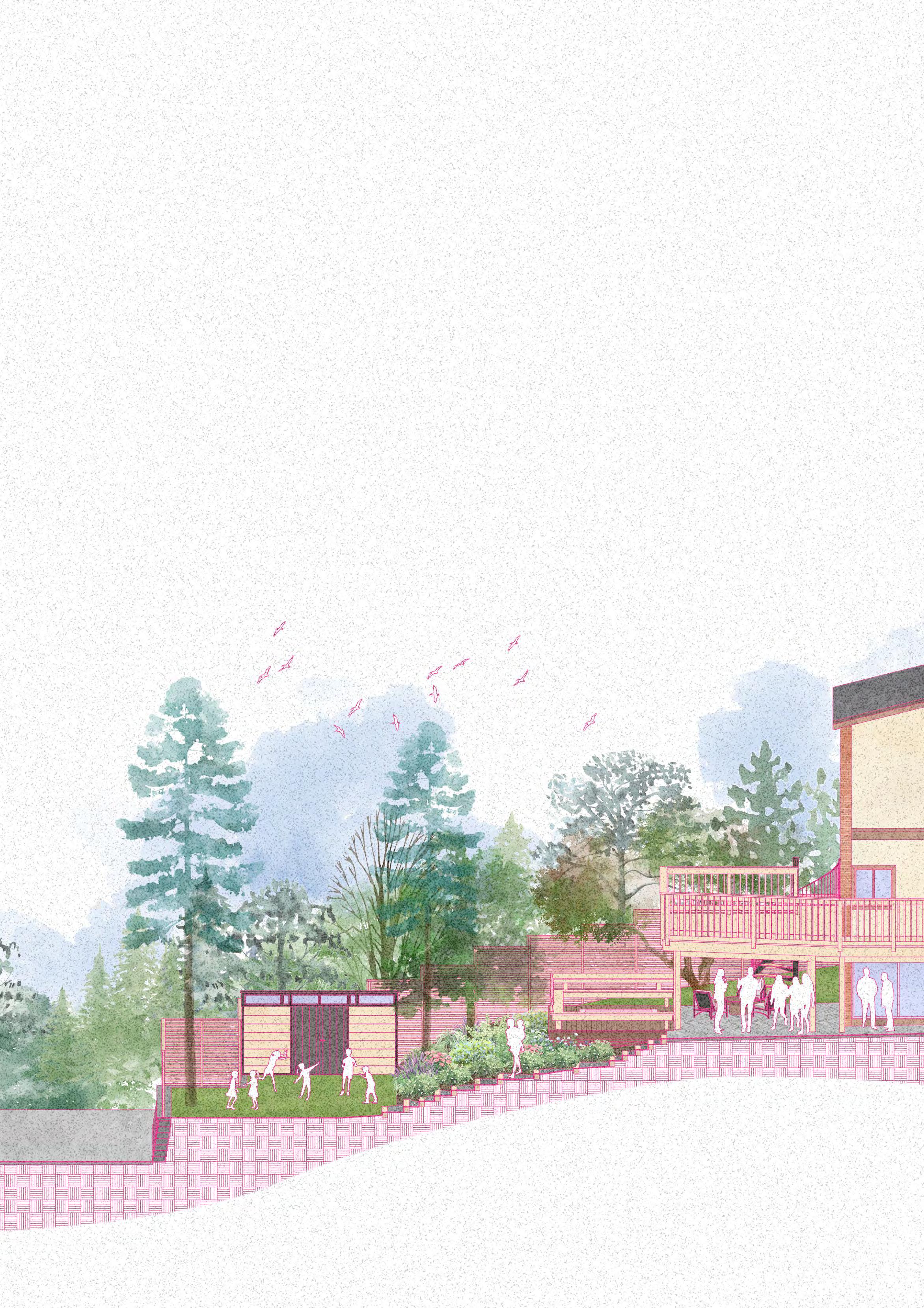
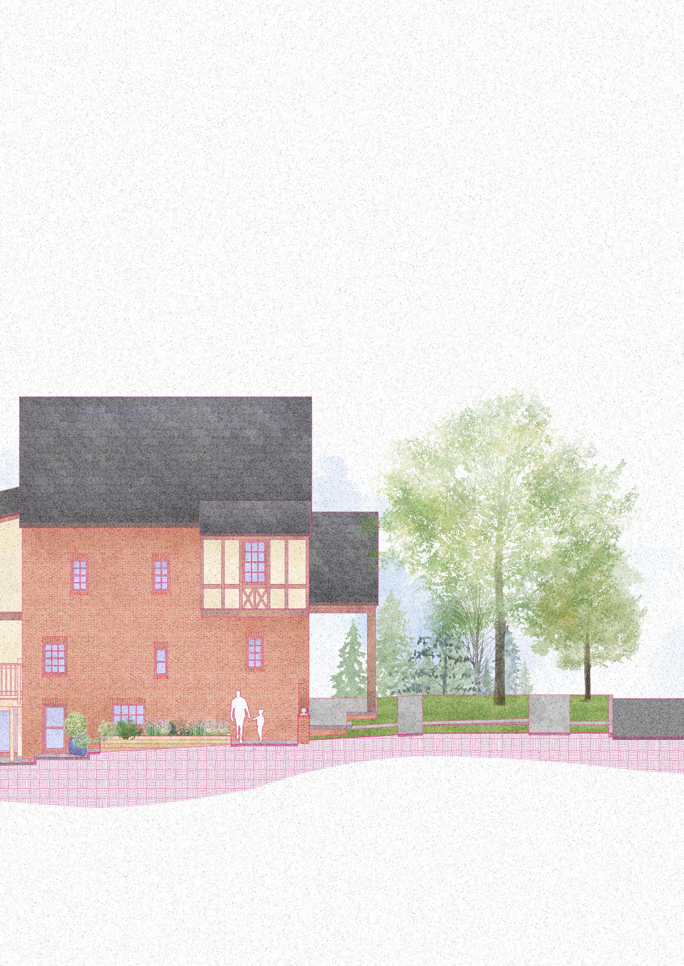
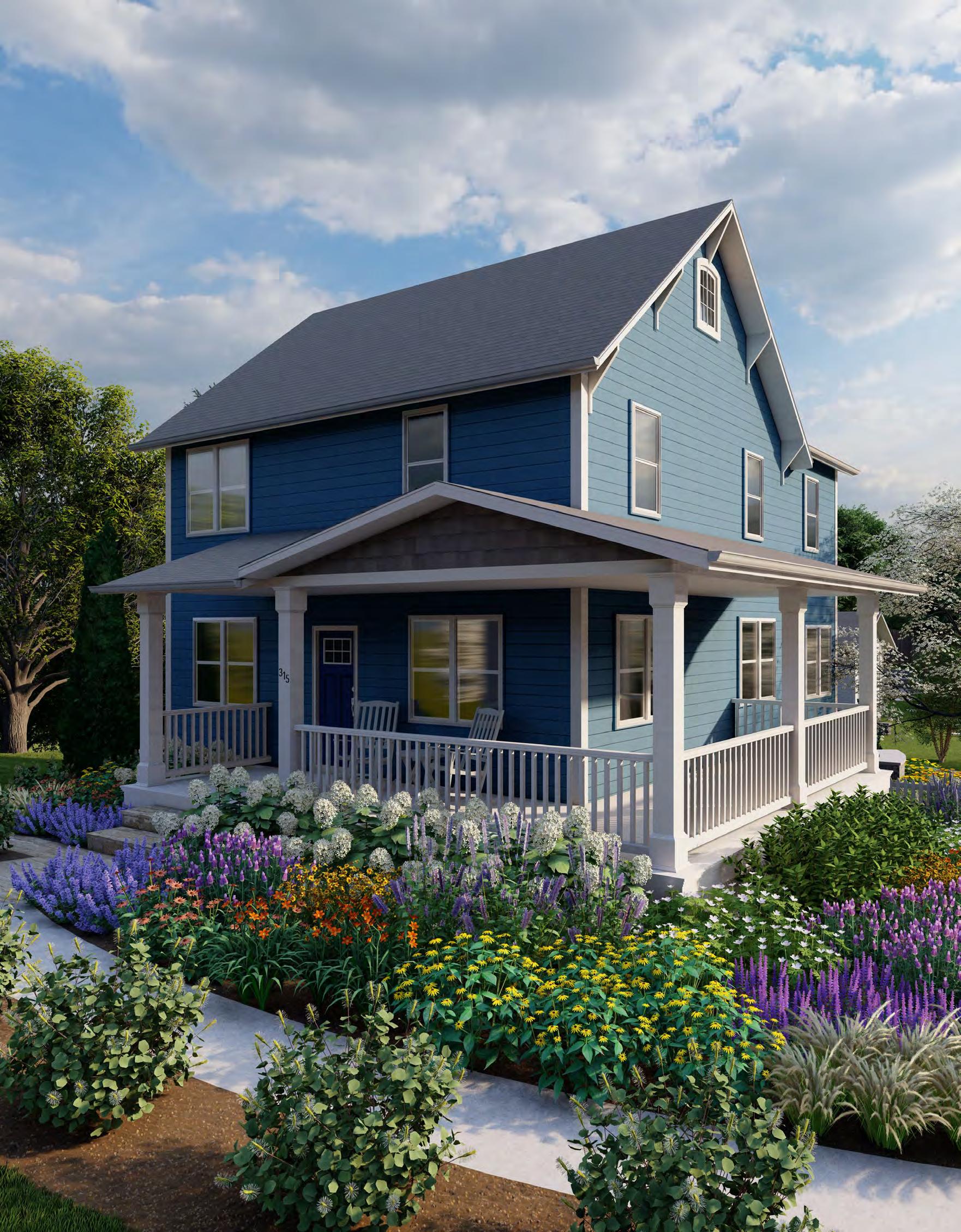
Often times, plan view is difficult to interpret to a general audience. These illustrations were created to translate spatial information to enable viewers understand the intended design, layout, and functionality.
| OBJECTIVE
To create illustrations that act as a visual communication tool to aid clients in understanding conceptual design work.
| COLLABORATION
Kelley Oklesson
| PROGRAMS
AutoCAD, Photoshop, Indesign, & Lumion.

ASPHALT PAVERS ON ASPHALT BASE
SCALE: FOUNTAIN 5 3/4"=1'-0"
NOTE: ASPHALT PAVERS SHALL BE OF THE DIMENSIONS AND COLOR AS SHOWN IN THE SPECIFICATIONS. THE UNIT PAVERS SHALL BE LAID INTO SPECIFIED PATTERN.
MORTAR SETTING BED CONCRETE PAVER
MATERIALS VARY 3
CONCRETE BASE 3000 PSI MIX
GRANULAR SUBBASE
DIA. LAG BOLT 4# REBAR REINFORCEMENT
HAND TIGHT SWEPT JOINTS, 1 4 "
MAXIMUM FOR BRICK PAVER BRICK PAVERS
NEOPRENE MODIFIED ASPHALT ADHESIVE
3 4" ROLLED BITUMINOUS SETTING BED (7% ASPHALT, 93% SAND)
4" ASPHALT PAVEMENT
4" STONE SCREENINGS
COMPACTED SUBGRADE
CONCRETE PAVING SLABS ON PEDESTALS
CONCRETE RAMP CROSS SECTION
3/4"=1'-0"
SECTION
JUNCTION
2" NOSE RADIUS OILED OAK WOOD PANELS WITH 1 4" GAPS TYPICAL CORTEN STEEL RETAINING WALL 52" x 24" CONCRETE FOOTING 4" X 8" PAVERS 3 8" MORTAR JOINTS 3 4" DIA. LAG BOLT
NOTE: REFER TO ENGINEERING DRAWING FOR OUTFALL INFORMATION
STRUCTURAL WALL WITH WATERPROOFING DOWNSPOUT PEBBLE SPLASH ZONE
WATERPROOF EPOXY COATING
PLANTING MIX
OVERFLOW DRAIN: 4" DIA. PVC PIPE WITH HOOD AT 6" ABOVE FINISH GRADE
PRE-CAST CONCRETE WITH WATERPROOF MEMBRANE
3" CHOKER/ 1 4" - 1 2 " WASHED P-GRAVEL 4" PERFORATED PIPE TO RUN
DEPARTMENT OF PLANT SCIENCE AND LANDSCAPE ARCHITECTURE THE SUBMITTED DETAIL IS A COMPUTER DRAWN DETAIL DIGITALLY DRAWN FROM SCRATCH PROJECT
ACO NW 100P PRECAST POLYMER CONCRETE DRAIN SYSTEM APPROVED EQUAL
GRATE
SCALE: EMBEDDED CORTEN STEEL 9 1"=1'-0"
SCALE:
NOTE: REFER FOR OUTFALL
SUBGRADE WHEN
REINFORCEMENT
4" DIA. PIPE
GRANITE COBBLES
GRANITE COBBLES
HAND TIGHT, SAND FILLED JOINT
HAND TIGHT, SAND FILLED JOINT
1" SAND SETTING BED
1" SAND SETTING BED
GRANITE CURB
GRANITE CURB
GALVANIZED STEEL HANDRAILS
12" WIDE GEOTEXTILE ALONG PERIMETER TURN UP AGAINST CURB
12" WIDE GEOTEXTILE ALONG PERIMETER TURN UP AGAINST CURB
RAMP CURB WALL
PAVER EDGING
PAVER EDGING
COMPACTED CRUSHED STONE
COMPACTED CRUSHED STONE MIN. 4" THICKNESS
4" THICKNESS
FINISH GRADE
GEOTEXTILE AS REQUIRED
GEOTEXTILE AS REQUIRED
MIN. LENGTH OF BASE EQUAL TO BASE THICKNESS
MIN. LENGTH OF BASE EQUAL TO BASE THICKNESS
COMPACTED SUBGRADE
COMPACTED SUBGRADE
6" - 9" PONDING DEPTH
12" DIA. OVERFLOW/ CLEANOUT STRUCTURE
3" SHREDDED HARDWOOD MULCH
6" CONCRETE CURB
18" - 30" MODIFIED SOIL STONE AGGREGATE "CHOKER" LAYER STONE AGGREGATE "BASE" LAYER
8" DIA. SUBDRAIN
UNDISTURBED SUB SOIL
SCALE: TRENCH DRAIN
1-1/2"=1'-0"
CONCRETE PAVING SLABS ON PEDESTALS 2 1-1/2"=1'-0"
SCALE:
MAXIMUM 1 4 "/ft (2%) CROSS SLOPE
CONCRETE PAVER
MORTAR SETTING BED
CONCRETE BASE 3000 PSI MIX
GRANULAR SUBBASE
STONE OR BRICK COPING (4" X 12") 4" WEEP HOLES (2") AT 4'-0" O.C.TYPICAL
STONE OR BRICK COPING (4" X 12")
4" STONE VENEER WITH MORTAR CONCAVE JOINTS GRAVEL FILL (34" STONE) 4" DRAIN PERFORATED WRAPPED WITH GEOTEXTILE GALVANIZED WALL TILE
4" WEEP HOLES (2") AT 4'-0"
O.C.TYPICAL
2" X 6" GRATE
4" X 8" PAVERS
3 8" MORTAR JOINTS
12" CMU
FROST LINE
4" STONE VENEER WITH MORTAR CONCAVE JOINTS GRAVEL FILL (34" STONE) 4" DRAIN PERFORATED WRAPPED WITH GEOTEXTILE GALVANIZED WALL TILE 2" X 6" GRATE 4" X 8" PAVERS 12" CMU FROST LINE 24" X 8" CONCRETE FOOTING WITH #4 REBAR REINFORCEMENT 3 8" MORTAR JOINTS
24" X 8" CONCRETE FOOTING WITH #4 REBAR REINFORCEMENT
4" DIA. PIPE
4" DIA. PIPE
NOTE: REFER TO ENGINEERING DRAWING FOR OUTFALL INFORMATION
ACO NW 100P PRECAST POLYMER CONCRETE DRAIN SYSTEM OR APPROVED EQUAL
ACO NW 100P PRECAST POLYMER CONCRETE DRAIN SYSTEM OR APPROVED EQUAL
STRUCTURAL WALL WITH WATERPROOFING DOWNSPOUT
ACO #40 PERFORATED GALV. STEEL GRATE
ACO #40 PERFORATED GALV. STEEL GRATE
PEBBLE SPLASH ZONE
TOPSOIL/ PLANTING MIX
SODDED LAWN PANEL
OVERFLOW DRAIN: 4" DIA. PVC PIPE WITH HOOD AT 6" ABOVE FINISH GRADE
PRE-CAST CONCRETE WITH WATERPROOF MEMBRANE
3" CHOKER/ 1 4" - 1 2 " WASHED P-GRAVEL
4" PERFORATED PIPE TO RUN LENGTH OF PLANTER
2" NOSE RADIUS OILED OAK WOOD PANELS WITH 1 4" GAPS TYPICAL CORTEN STEEL RETAINING WALL 52" x 24" CONCRETE FOOTING 4" X 8" PAVERS 3 8" MORTAR
FOUNDATION DRAIN
STRUCTURAL FOOTING
GALVANIZED STEEL HANDRAILS RAMP CURB WALL
SCALE: CONCRETE RAMP 7 3/4"=1'-0"
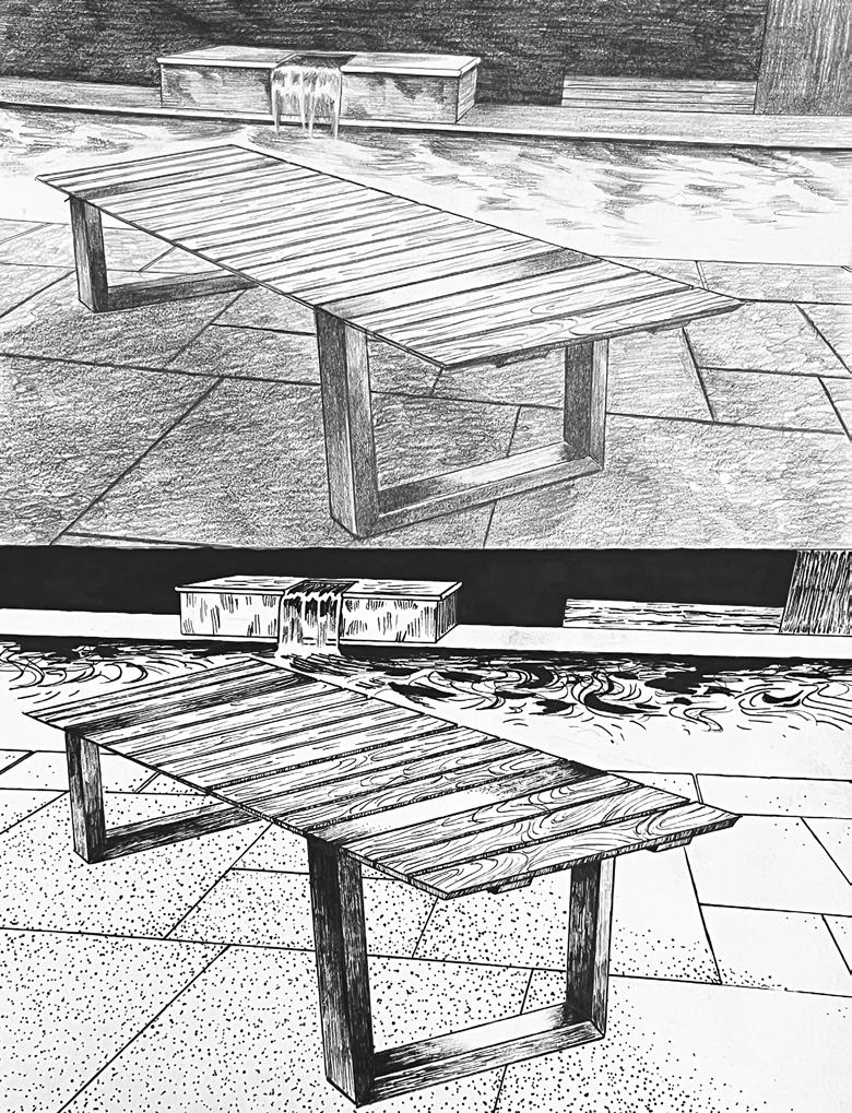
Bench study in ink pen and graphite

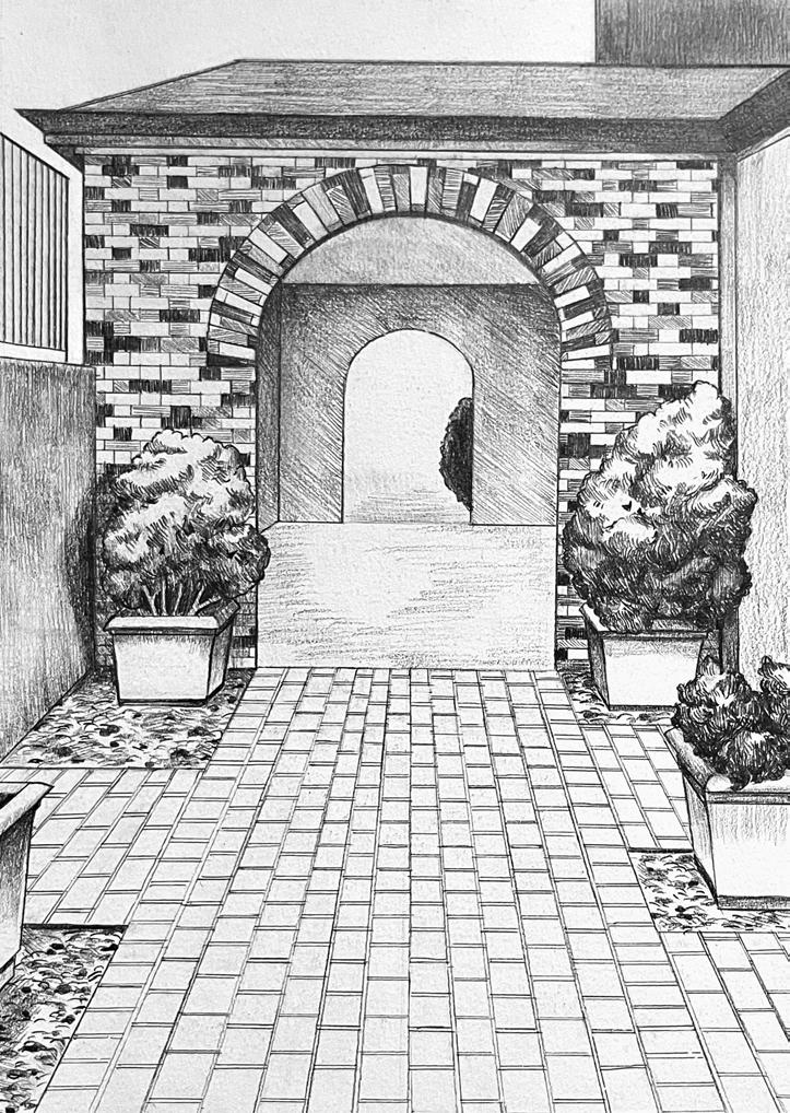
Graphite sketch observation of arched walkway at Jimenez Hall, University of Maryland


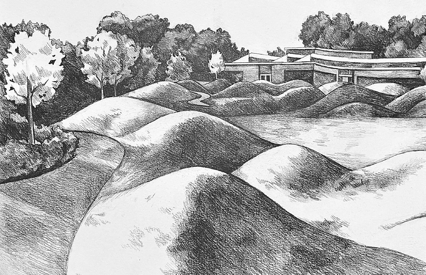
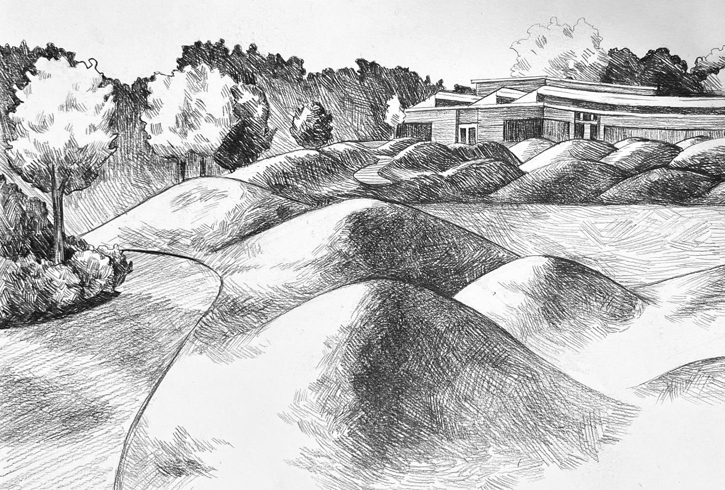
Tone and texture exercise of the Chicago Botanic Garden with graphite.