Research Paper
Geography
E-ISSN No : 2454-9916 | Volume : 3 | Issue : 6 | June 2017
AN ANALYSIS OF NINE FOLD CLASSIFICATION LAND USE LAND COVER CHANGES IN TIRUVANNAMALAI DISTRICT, TAMIL NADU, INDIA 1
2
Kannadasan. K | Ganesh. A | Vinothkanna. S
3
1
Research Scholar, Department of Geography, Bharathidasan University, Tiruchirappalli. Rtd Professor, Department of Geography, Bharathidasan University, Tiruchirappalli. 3 Guest Lecturer, Department of Geography, Madurai Kamaraj University, Madurai.
2
ABSTRACT The study area of Tiruvannamalai District lies between 11. 55° to 13. 15° North Latitudes and 78.20° to 79.50° East Longitudes. The North and west of Tiruvannamalai is covered by Vellore district and the southwest is by Krishnagiri District. Both Villupuram and Kanchipuram Districts are located in south and east side of Tiruvannamalai District respectively. The total geographical area of the district is 6191 sq.km. This paper is given total nine-fold classification of land in the district. The data has been used two different time periods (2007-08 and 2011-12). The present study deals with based on the secondary data of Gwritten. KEYWORDS: Agriculture, Cultivation, Statistics, Spatial, Nine-fold, Temporal. Introduction Land use classification based on different type of uses shows that of a total land mass of 328.73 million ha in the country. The states were also finding it difficult to present comparable data according to this classification owing to the lack of uniformity in the definitions and scope of classification covered by these five broad categories. Till 1949-50, the land area in India was classified into five categories known as the five-fold land utilization classification. This five-fold classification was, however, a very broad outline of land-use in the country & was not found adequate enough to meet the needs of agricultural planning in the country. In present day we are using this nine fold classes. Study Area The district lies between 11°. 55 and 13°. 15 North Latitudes and 78°.20 and 79°.50 East Longitudes of Tiruvannamalai District. North and west of Tiruvannamalai is covered by Vellore district and the southwest is by Krishnagiri district. Both Villupuram and Kanchipuram districts are located in south and east side of Tiruvannamalai district respectively. The total geographical area of the district is 6,191 sq.km. Physiographically, the district formed on undulating terrain dotted with clusters of hillocks, particularly in the western and northwestern parts. Jawadhu hills are the major hilly regions and other smaller hillocks are scattered in Tiruvannamalai, Chengam, Polur, Arni and Kalasapakkam blocks. The important hills in the district are Jawadhu hill (2500 ft. above MSL), Kailasagiri hill (2743 ft. above MSL) and Tiruvannamalai (2668 ft. above MSL) hill. The area under forest during 2005 - 06 was 1, 53,318 hectares. The location map shown in Fig. No.1
maximum forest in year of 2007-08 area wise 497.75 hectare covered in Annakkavoor Block, Jawadhu Hills covering 331.66, Polur block covered 43 hectare,Thellar block has 24.96, Thurinjapuram covered 11.27 and Chetpet covering only 2.36 hectare. Other blocks are no forest area in the year of 2007-08. Compare to the year of 2007-08 the forest in year 2011-12 Polur block increased 1.33 hectares. The map showing forest, figure no.2.
Figure No. 2 Forest Uncultivable waste The Uncultivable waste land, in year of 2007-08 the highest uncultivable waste area of Arani having 6552.30 hectares, respectively the Thandarampat block having 3800.06 hectares, Chngam occupies 1775.74 hectares, Tiruvannamalai block has 1539.64 hectares , Polur 1178.90 hectares, Kilpennanthur has 1159.80 hectares, Jawadhuhills block has 1121.14 hectares, Remaining eleven blocks area has less than thousand hectares. The Annakkavoor and Pudupalayam have less than hundred hectares. In year of 2011-12 compared to 2007-08 Thandarampet, Tiruvannamalai, Polur, Jawadhuhills, Thellar blocks the uncultivable waste is reduced. The result shown in figure no.3.
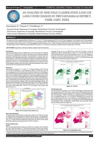
Figure No.1 Location of the Study Area Data and methodology The present study is based on the secondary data collection of G-Written, the data is collected from the department of statistics and Economic, Tiruvannamalai. Two different time period the data has been collected. The data from 2007-8 and 2011-12. A simple statistical method has followed for this study. All the spatial distribution maps layout prepared by the Arc GIS 9.3 software. Result and Discussion Forest The nine fold classification of land use and land cover changes were calculated the year of 2007-08 and 2011-12. The forest area totally covered in the western part of the study area. Only six blocks having the forest area in the district. The
Figure No.3 Uncultivable waste
Copyright© 2016, IERJ. This open-access article is published under the terms of the Creative Commons Attribution-NonCommercial 4.0 International License which permits Share (copy and redistribute the material in any medium or format) and Adapt (remix, transform, and build upon the material) under the Attribution-NonCommercial terms.
International Education & Research Journal [IERJ]
30