Draft Precinct Plan
Castle Hill Strategic Centre
A Plan to reinforce Castle Hill as a regional entertainment, leisure and shopping destination, offering a range of educational, employment and residential opportunities.
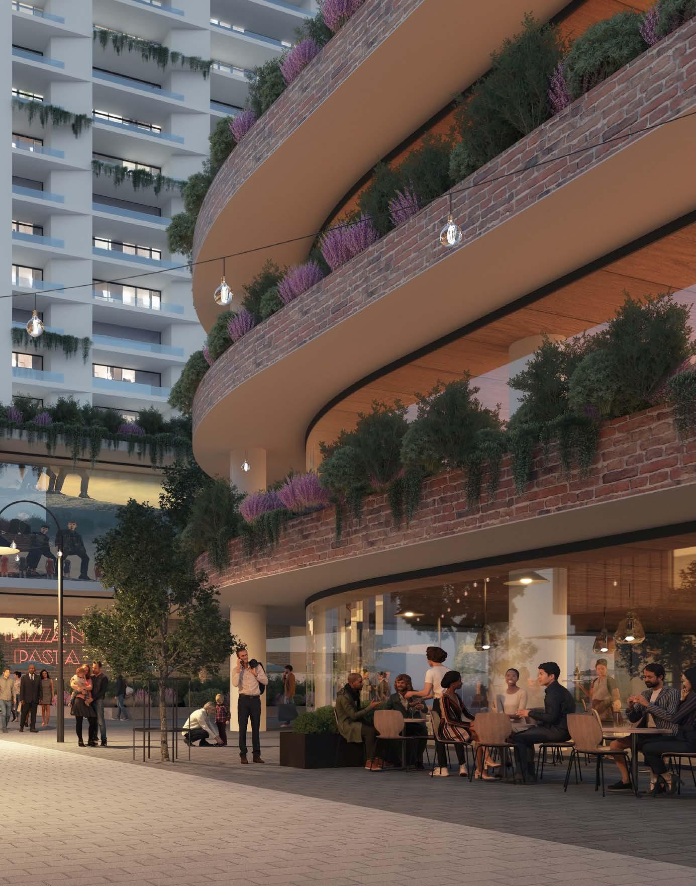
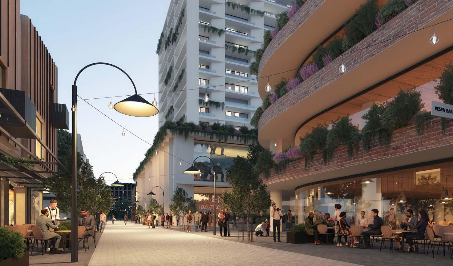
Front Cover Image: Artist’s Impression of McDougall Lane Eat Street (Source: Tome Visuals)
May 2023
The Draft Castle Hill Precinct Plan was endorsed by Council for exhibition on 7 February 2023, Minute No. 16. It has since been subject to graphic design and editing however there has been no material change to the content or outcomes presented to Council and endorsed for public exhibition.
Disclaimer
Every reasonable effort has been made to ensure that this document is correct at the time of printing. The Hills Shire Council disclaims all liability in respect of the consequences of anything done or omitted.
The indicative outcomes and planning controls identified within this Precinct Plan are for consultation purposes only to provide context. In some instances, they simply portray the types of outcomes that are currently being sought by landowners and developers through relevant application process. In other instances, imagery has been used to assist in communicating the potential outcomes that may occur in the future, in accordance with the vision articulated within this Plan.
The images contained within this Precinct Plan have been included as a part of the analysis for this Plan, which is a study and review of development within the Precinct. These images are publicly available in the respective applications and have been referenced accordingly in this Plan.
Images within this document should not be taken to be final products or outcomes that have been endorsed or approved on any site (either formally or implicitly by way of their inclusion within this document). All future development will be subject to the relevant approval processes set out under the Environmental Planning and Assessment Act (including planning proposals and/or development applications) and detailed consideration and determination by the relevant planning or consent authority.
Copyright Notice
This document represents the collaboration of information from a number of sources, including Government plans and policies, and plans and policies of The Hills Shire Council in addition to onsite investigations. This document may be reproduced for personal, inhouse or non-commercial use. Reproduction of this document for any other purpose shall only be permitted with the written permission of The Hills Shire Council.
How To Read This Document
1. Executive Summary
Introduces the Castle Hill Strategic Centre and summarises the key vision and outcomes of the Precinct Plan.
2. Precinct Analysis
Provides an overview of the Castle Hill Strategic Centre, introduces the Study Area, strategic planning context and relationship to other work. It also considers demographic and economic trends along with analysis of the built and natural environment.
3. Vision
Sets the guiding principles and vision that will inform future development within the Castle Hill Strategic Centre.
4. Focus Areas and Structure Plan
Examines specific focus areas and provides a structure plan, growth projections, actions and phasing to guide future outcomes.
5. Infrastructure Investigates current infrastructure, expected demand and additional requirements to respond to growth within the Castle Hill Strategic Centre.
6. Implementation Plan Sets out an approach to implementation, identifying actions and responsibilities.
Appendix A
The Precinct Plan is supported by acronym and glossary lists, along with an overview of assumptions, provided as Appendix A.
2
1.
The Hills Shire Council Draft Precinct Plan Castle Hill Strategic Centre 1
1.1 Vision for the Castle Hill Strategic Centre 04 1.2 Structure Plan and Key Desired Outcomes 06 1.3 Key Changes and Refinements 08 1.4 Implementation and Phasing 11 2. Precinct Analysis 2.1 Study Area 14 2.2 Strategic Context 16 2.3 Status of Planning Processes 17 2.4 Existing Land Uses 18 2.5 Existing Character and Public Domain 20 2.6 Strategic Planning Investigations 23 2.6.1 Technical Studies 23 2.6.2 Economic Analysis 24 2.6.3 Market Attractiveness 28 2.7 Demographic Analysis 30 2.8 Key Strategic Influences 32 2.9 Existing Travel Behaviour and Trends 34 2.10 Public and Active Transport 35 2.11 Road and Freight Network 36 2.12 Natural Environment and Special Uses 37 2.13 Key Constraints and Challenges 40 2.14 Key Opportunities 41 3. Vision 3.1 Vision for the Castle Hill Strategic Centre 44 3.2 Castle Hill - A Mixed Use and Transit Oriented Centre 46 3.3 Guiding Principles 48 3.4 Environment and Sustainability 51 3.5 Evolution into a ‘Smart Castle Hill’ 52 6. Implementation Plan 4. Focus Areas and Structure Plan 4.1 Focus Areas 56 4.1.1 Focus Area 1 - Castle Towers Mixed Use 58 4.1.2 Focus Area 2 - Castle Towers Entertainment 60 and Heritage Precinct 4.1.3 Focus Area 3 - Southern Ring Road Completion 62 4.1.4 Focus Area 4 - Terminus Street West 66 4.1.5 Focus Area 5 - Terminus Street East 70 4.1.6 Focus Area 6 - Kentwell Avenue 74 4.1.7 Focus Area 7 - Worthing Avenue 78 4.1.8 Focus Area 8 - Southern Corner of Cecil Avenue and 80 Old Northern Road 4.1.9 Focus Area 9 - Cecil Avenue and Orange Grove 82 4.1.10 Focus Area 10 - Crane Road and Mercer Street 84 4.1.11 Focus Area 11 - Orange Grove West 86 4.1.12 Focus Area 12 - Brisbane Road 88 4.1.13 Focus Area 13 - Arthur Whitling Reserve and 4-12 Old Castle Hill Road 90 4.1.14 Focus Area 14 - Connectivity and Pedestrian Permeability 94 4.1.15 Focus Area 15 - Encouraging Medium Density 96 Residential Outcomes 5. Infrastructure 5.1 Infrastructure Analysis 116 5.1.1 Active Open Space 118 5.1.2 Passive Open Space 119 5.1.3 Traffic and Transport 120 5.1.4 Regional Public Transport 127 5.1.5 Community Facilities 128 5.1.6 Education Facilities 129 5.1.7 Water Management 130 5.2 Actions 131 Appendix A Acronyms 142 Assumptions 143 Glossary 144 Disclaimer and Copyright Notice on Flooding and GIS Data 145 Contents 4.1.16 Focus Area 16 - Activating High Density 97 Residential Areas 4.1.17 Focus Area 17 - Public Domain 98 4.2 Structure Plan 102 4.3 Character Areas 106 4.4 Yields and Projections 108 4.5 Actions and Phasing 110 Implementation Plan 136
Executive Summary
 Castle Hill Heritage Park.
01
Executive Summary
1.1 Vision for the Castle Hill Strategic Centre
This Precinct Plan sets the framework for reinforcing Castle Hill as a vibrant regional destination and expanding the mix of uses within the Strategic Centre, including increased housing capacity and more employment opportunities aligned with the skills of local residents. The vision for Castle Hill builds on previous strategic work by Council and the NSW Government as well as technical investigations focused on the Shire’s centres that provide insight into their unique features, role and function in the Region. It advances the planning into finer grain, site specific detail to inform potential changes to planning controls and the infrastructure framework, which can occur as the market demands, with the support of appropriate infrastructure.
By 2041, the Castle Hill Strategic Centre will be the leading shopping and entertainment destination for North West Sydney. It will offer a dedicated commercial area that enables businesses to establish themselves in a thriving local economy and provide jobs close to home for residents, tailored to their skillsets. A mix of apartments and terraces will be provided within walking distance of shops and job opportunities, supported by lively alfresco dining and eat streets along Old Northern Road, Old Castle Hill Road and McDougall Lane, which will be transformed and revitalised as enticing public domain areas, establishing Castle Hill as a safe and lively place to be at all hours of the day and into the night. Residents and visitors to Castle Hill will enjoy a thriving cultural landscape, with a rich offering of theatre, literary and civic events.
The next evolution of Castle Hill as a vibrant and resilient CBD for The Shire will be dependent on having the right mix and quantum of different land uses within the Centre. There is already a strong and successful retail presence within the Castle Hill Strategic Centre, as well as significant growth potential for additional residential development over the next 20 years and beyond. In this context, the Precinct Plan identifies the need to create more capacity for job-generating commercial development (particularly offices to provide high-skill jobs close to home for our residents) and community, civic, leisure and social uses. It also identifies how the implementation of key placemaking initiatives (such as completion of the Ring Road, extension of Main Street and pedestrianisation of McDougall Lane) will be necessary to create an enticing environment for development activity and investment, activate underutilised land and achieve the longterm vision for the Strategic Centre.
The status of Castle Hill as a high-quality Strategic Centre for The Hills will be reinforced through the promotion of quality built form outcomes and public domain elements. Buildings will be designed with regard to the unique environmental characteristics of the locality, most notably its varying topography. Buildings will be diverse and distinctive in their expression, shape and form. All street frontages at and within the Ring Road should be activated and encourage vibrancy at these locations.
Residents and workers will find walking and cycling an attractive and convenient option with enhanced open spaces, public plazas, new pedestrian bridges, through site links and upgraded pedestrian/cycle paths providing improved permeability and a seamless connection between the Metro Station and key locations within the Centre. New road links, upgraded intersections and the completion of the Ring Road will make it easier for people to travel within and around Castle Hill.
With its unique lifestyle offer, access to skilled workforce, capacity to grow and increased accessibility resulting from existing and planned public transport investment, the Local Government Area (LGA) has the right ingredients to become a magnet for employment growth and business activity.”
- Mecone 2021
4
Artist’s Impression of McDougall Lane Eat Street (Source: Tome Visuals)
Purpose
This Precinct Plan serves as a tool to:
Address the principles and actions identified for Strategic Centres within the Greater Sydney Region Plan and Central City District Plan and strengthen each of the Strategic Centres.
Engage and discuss with the community and stakeholders about how the Strategic Centre will grow and evolve into the future.
Establish a clear vision and parameters to guide medium to longer term growth for key strategic locations.
Create a structure for urban development that is place based, resolves competing issues and gives certainty and confidence to Council, the local community, developers and businesses.
Inform changes to planning controls to facilitate implementation of planned outcomes in the short term.
Identify the need for any new or additional infrastructure to support the anticipated growth and inform associated discussions with the NSW Government.
The Hills Shire Council Draft Precinct Plan Castle Hill Strategic Centre 5
3,720 Dwellings People Growth Forecast 4,640 10,480 11,130 7,440 9,280 20,960 22,260 8,080 9,292 19,485 21,610 2016 (Actual) 2021 (Estimate) 2036 (Forecast) 2041 (Forecast)
Jobs
1.2 Structure Plan and Key Desired Outcomes
• Capacity for a total of around 21,610 jobs (approximately 13,530 additional jobs) by 2041, with further capacity beyond this development horizon subject to market take-up.
Employment
• A designated commercial area will provide a strong focus on commercial and retail uses within and around the Ring Road, to meet job targets and achieve the ‘30 minute city’ vision for the rapidly growing residential population in the North West.
Retail
• Capacity for retail floor space to respond to market demand. Reconfiguration of floorspace to prioritise an additional supermarket, hospitality, lifestyle and entertainment offerings (including theatre, cinema, library and civic spaces).
• Active shopfronts and outdoor dining along Old Northern Road, Main Street, McDougall Lane and Old Castle Hill Road (fronting Arthur Whitling Reserve and the Station Site).
• Capacity for nearly 11,130 dwellings (approximately 7,415 additional dwellings) by 2041.
• Diverse housing choice of varying sizes and typologies, to cater for the unique demographic and demand profile within The Hills.
• Transit oriented neighbourhoods with convenient access to the Metro Station, bus services, shops, jobs, cafes, recreation and high density apartments in appropriate locations.
Residential
• Encourage the delivery of medium density housing typologies (the ‘missing middle’) in the Centre, to provide housing choice for residents at an appropriate density and character in the context of the Centre and locality.
• Retain the existing detached low density residential housing supply towards the periphery of the Precinct.
• A mix of uses throughout the Precinct, including retail, business, office, leisure, entertainment and community uses, with some higher density housing in appropriate locations.
• Castle Towers Shopping Centre and surrounds will continue to service the region with diverse retail, leisure, recreation and dining opportunities.
Mixed Use
• A mix of residential and non-residential uses will extend along Terminus Street between Crane Road and Cecil Avenue, activating McDougall Lane and providing transition between the commercial and residential areas within the Precinct.
• New vehicle connections and key intersection upgrades will improve vehicular connectivity through the Precinct.
• The Old Northern Road and Terminus Street portion of the Ring Road will remain the primary north-south thoroughfare through the Centre, with changes to the alignment at Brisbane Road and McMullen Avenue to improve accessibility and safety.
Connectivity and Sustainability
• Completion of the missing portion of the Ring Road by extending Pennant Street from Showground Road to the intersection of Old Northern Road and Cecil Avenue.
• Enhanced network of footpaths, forecourts, bridges and boardwalks to create an attractive environment for pedestrians and cyclists and improve ease of movement through the Precinct. This includes new pedestrian bridges across Terminus Street, Pennant Street and Crane Road.
• Streetscape upgrades on major thoroughfares will provide attractive and accessible pedestrian connections between the retail and commercial areas of Castle Hill and adjacent uses.
• Encourage sustainable practices to protect the natural environment, including the use of smart initiatives where possible.
• A range of public spaces that meet the needs of the growing community and local workforce, including public parks, playgrounds and enhanced public domain.
• Active street level uses alongside urban plazas and recreational zones where people can gather, particularly near the Metro Station and other central areas.
Open Space and Community
• A focus on the creation of vibrant, activated and pedestrian friendly shared-zones along Old Northern Road, Main Street, McDougall Lane and Old Castle Hill Road (fronting Arthur Whitling Reserve and the Station Site).
• Protection and enhancement of existing passive open spaces within the Centre including opportunities for the expansion of Olola Avenue Reserve, Worthing Avenue Reserve, Orange Grove Reserve and Arthur Whitling Reserve.
• Height allowed as a mechanism to achieve better built form and public domain outcomes (increased landscaping, setbacks and separation at the ground plane to minimise perceived bulk from the pedestrian realm and public domain).
Built Form
• Transit oriented development - tallest buildings (up to 30 storeys) located in central areas of the Precinct near the Metro Station, seamlessly transitioning into lower density forms (approximately 2-3 storeys) which will be retained at the periphery of the Strategic Centre.
• Development within the Strategic Centre will incorporate a variety of building heights, including some distinctive or landmark heights.
• Protect existing and future open space and public domain areas from significant overshadowing.
6
Table 1. Key Desired Outcomes
Metro Station
Metro Line (Underground)
Castle Hill Strategic Centre
Proposed Road / Road Widening

Low Density Residential
Medium Density Residential
High Density Residential
Commercial Offices
Mixed Use
Retail
Special Use
Environmental
Public Open Space
Private Open Space
Potential Options Identified
Heritage Precinct
Signalised Intersection
Pedestrian Bridge
Left-in-left-out Intersection
Urban Plazas
Roundabout
University
Special Uses with potential for longer term job growth
High density residential with retail uses on the lower levels
Pedestrian Link
Extension of Main Street / Eat Street
The Hills Shire Council Draft Precinct Plan Castle Hill Strategic Centre 7
M T
Figure 1. Structure Plan - Castle Hill Strategic Centre
1.3 Key Changes and Refinements
Strategic Work Completed
While the Plan relates to the entire Strategic Centre, it is anticipated that many areas will either remain unchanged or will continue to develop under the current planning controls which apply. These include:
• Low and medium density housing areas on the edges of the Precinct that are not contemplated for change or uplift due to the quality of housing stock, strata or community title tenure and distance from the Castle Hill Metro Station.
• Existing development to remain unchanged as these areas have been able to recently develop under the current planning controls. The outcome that exists is considered to be contextually appropriate and should remain for the foreseeable future.
• Land that is able to develop under the existing planning controls and where the outcome that can be achieved under the current controls is contextually appropriate. This includes the Castle Hill North Precinct that was rezoned by Council in 2020, sites previously rezoned through site-specific planning proposals and some other locations that are ideal opportunities to address the need for ‘missing middle’ medium density housing typologies, which is further considered in Section 4 Precinct Plan.
This Precinct Plan does not anticipate any additional uplift in these areas, beyond that already envisaged and available under the existing controls.
*Note: A full list of implementation actions is provided in Section 6 of this Precinct Plan.
Metro Station
Metro Line (Underground)
Castle Hill Strategic Centre
Strategic Work Completed
Castle Hill North Precinct
Potential Options Identified
8
M
Council-Led Change
Council-initiated change has been identified to facilitate the retention and expansion of key open spaces in the Precinct and ensure adequate provision of passive open space as future development occurs.
It is envisaged that Arthur Whitling Reserve will be expanded to facilitate a large consolidated open space across the entire Metro Station block bound by Old Northern Road, Old Castle Hill Road and McMullen Avenue. This would involve the incorporation of land at 4 – 12 Old Castle Hill Road into the existing Arthur Whitling Reserve.*
The park expansion would bring the total area of the park area to in excess of 2 hectares (although it is noted that a portion of land at the south-eastern corner will be required for the realignment of Brisbane Road and McMullen Avenue intersection in the future). This is an important opportunity given the scarcity of options for new public open space throughout the Castle Hill Precinct. This park will become increasingly important and utilised as densities increase in the vicinity of the Metro Station.
Council-initiated change is identified to facilitate the expansion of W Avenue Reserve, Orange Grove Reserve and Olola Reserve. The rezoning of these areas will provide additional passive open space areas for the enjoyment of residents and increase permeability within the Centre by enabling additional through site links to be delivered.
Concurrent changes to the contributions framework will be required to ensure funding is in place to facilitate the relevant land acquisition and embellishment of these open space areas.
*Note: A full list of implementation actions is provided in Section 6 of this Precinct Plan. The proposed expansion of Arthur Whitling Reserve has been earmarked for Council-led change. However, potential options have been canvassed for exhibition purposes (refer to Focus Area 13 in Section 4 of this Precinct Plan for further details on the potential options).
Metro Station
Metro Line (Underground)
Castle Hill Strategic Centre
Strategic Work Completed
Council-Led Change
Potential Options Identified*
M
The Hills Shire Council Draft Precinct Plan Castle Hill Strategic Centre 9
Landowner-Initiated and Market Driven Change
A number of areas have been identified for future market driven change. Some sites are large consolidated landholdings under single ownership, whereas other areas are challenged by fragmented ownership patterns. It is considered that the market is best placed to determine the appropriate timing for amendments to the planning controls in these instances (having regard to development demand, life-cycle of existing assets and feasibility) and put forward development outcomes and infrastructure solutions consistent with the strategic framework and Council’s vision articulated within the Precinct Plan.
Prematurely increasing development potential in these areas before feasible redevelopment can occur would artificially increase land values without actually unlocking any viable redevelopment opportunities. Changes to the planning framework would be driven by landowner-initiated planning proposals, along with associated amendments to the Development Control Plan, Public Domain Plan and appropriate infrastructure contribution mechanisms.
It is not anticipated that each of these areas will be subject to redevelopment in the short term or at the same time. They have been grouped into two categories, being ‘short to medium term’ and ‘longer term’.
• Short to Medium Term - It is expected that planning proposals for short to medium term areas would eventuate over the next 5 to 10 years, as market-driven solutions and redevelopment opportunities for these sites are likely to be logical, orderly and feasible within this period.
• Longer Term - Market driven solutions and planning proposals for longer term areas are unlikely to eventuate within this same period and are expected to occur beyond a 10-year horizon (10-20 years). These areas are either substantially more complex, require amalgamation of fragmented land or are unlikely to be feasible (at an appropriate density and scale outcome) within this initial 10-year horizon.
*Note: A full list of implementation actions is provided in Section 6 of this Precinct Plan.
Metro Station
Metro Line (Underground)
Castle Hill Strategic Centre
Strategic Work Completed
Council-Led Change
Short to Medium Term Market Driven Change
Long Term Market Driven Change
Potential Options Identified
10
M
1.4 Implementation and Phasing
This Plan sets a holistic vision and ‘blueprint’ for the Castle Hill Strategic Centre. It includes a list of actions that will be subject to future processes and decisions of Council. It will be necessary to work through these actions over time, to establish the planning framework that facilitates the vision and
The Plan identifies areas where strategic work has been completed and where development is expected to either remain unchanged or continue to roll-out under the current planning framework. It then groups actions into three distinct phases, having regard to potential timing and responsibility for each action.
Strategic Work Completed
Areas where strategic planning work has already been completed or where no further change to the planning controls is anticipated. Development is expected to either remain unchanged or continue to roll-out under the current planning framework (including development applications and/or construction).
Phase 1: Housekeeping Amendments
Areas where Council-led housekeeping amendments are recommended to facilitate improved and/or orderly development outcomes. While no housekeeping amendments are currently mapped within the draft Precinct Plan, this phase has been retained for the purposes of engagement, as landowners or stakeholders may have a view with respect to the need for such changes.
Phase 2: Council-Led Change
Short to medium term actions that could be led by Council. For example, Council-initiated changes to the planning controls to allow for the achievement of the vision and outcomes in this Plan.
Phase 3: Market Driven Change
Actions that will be market driven. It is considered that the market is best placed to determine the appropriate timing for amendments to the planning controls in these instances (having regard to development demand, life-cycle of existing assets and feasibility) and put forward development outcomes and infrastructure solutions consistent with the strategic framework and Council’s vision articulated within the Plan.
Metro Line (Underground)
Castle Hill Strategic Centre
Strategic Work Completed
Phase 1 - Housekeeping Amendments
Phase 2 - Council-Led Change

Phase 3 - Market Driven Change
Potential Options Identified*
*Notes: While there are some additional actions identified within Phase 1 and 2, they are holistic to the centre, not specific to individual sites and therefore not shown on the map above (refer to actions identified in Sections 4 and 6 of this Precinct Plan).
The proposed expansion of Arthur Whitling Reserve has been earmarked for Council-led change above. However, potential options have been canvassed for exhibition purposes (refer to Focus Area 13 in Section 4 of this Precinct Plan for further details on the potential options).
Whilst some market driven solutions may be achievable in the short to medium term, feasible redevelopment in other market driven areas is unlikely to occur until beyond the short to medium term horizon. Changes to the planning framework would be driven by landowner-initiated planning proposals, along with associated amendments to the Development Control Plan, Public Domain Plan and appropriate infrastructure contribution mechanisms.
In terms of timing, it is expected that planning proposals for land in short to medium term areas would eventuate over the next 5 to 10 years. Market driven solutions and planning proposals for sites in longer term areas are unlikely to eventuate within this same period and are expected to occur beyond a 10-year horizon (1020 years), as these are either substantially more complex, require amalgamation of fragmented areas or are unlikely to be feasible (at an appropriate density and scale outcome) within this initial 10-year horizon.
The Hills Shire Council Draft Precinct Plan Castle Hill Strategic Centre 11
PHASING
M
 Castle Hill Heritage Park.
The Hills Shire Council Draft Precinct Plan Castle Hill Strategic Centre 13
02
Precinct Analysis
2.1 Study Area
Regional Context
The Castle Hill Strategic Centre is one of the three Strategic Centres located within The Hills Shire, alongside the Rouse Hill and Norwest Strategic Centres. These are expected to be flexible and diverse places that provide quality access to a range of goods, services and jobs for the catchments they service.
Our Strategic Centres will accommodate the bulk of the jobs within The Hills Shire, providing jobs close to home for our residents. These Centres drive much of the economic activity in North West Sydney, with each playing a distinctive role in the Shire.
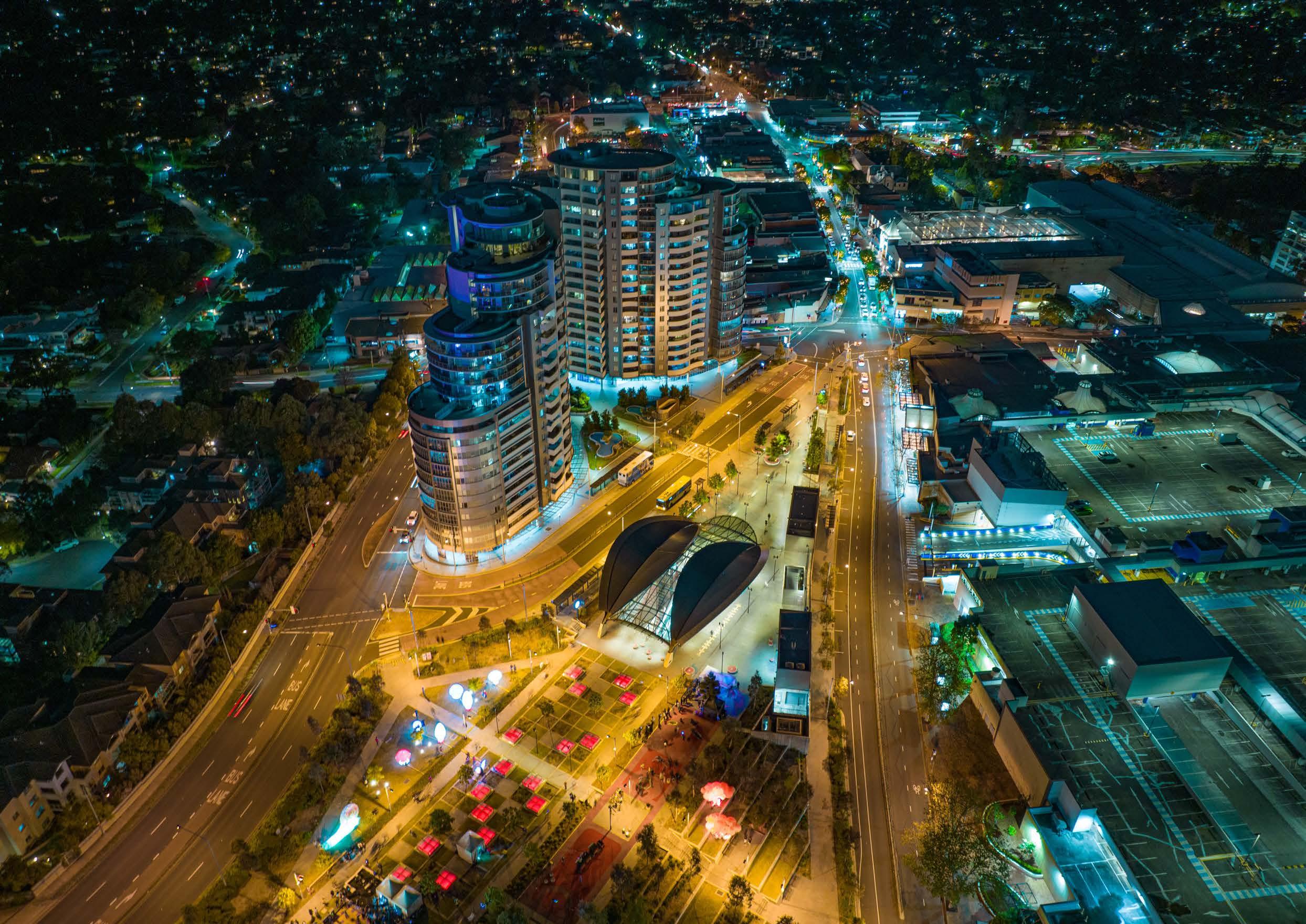
Castle Hill has traditionally been the Shire’s Central Business District (CBD) and will continue to be a vibrant and active centre comprising offices, retail, community facilities, recreation, cultural facilities, education and housing opportunities within walking distance of the Castle Hill Metro Station.
Castle Hill is well serviced by the arterial road network and is positioned along the Sydney Metro North West Corridor with access to a Metro Station, connecting to Sydney CBD and Chatswood. This improves Castle Hill’s attractiveness as a retail and commercial destination for the broader catchment area.
Castle Hill has good access to key major roads, particularly Showground Road (through to Windsor Road), Northern Road and Castle Hill Road, providing vehicular connectivity to various areas within The Hills and the Greater Sydney Region more broadly.
Future transport connections will be pivotal in realising the vision for Castle Hill, particularly the future connection from Tallawong Station to St Marys Station (and Western Sydney Aerotropolis), the mass transit corridor from Norwest to Parramatta, the rapid bus link from Castle Hill to Parramatta, the Outer Sydney Orbital and the final stages of the Sydney Metro connection to the city and beyond.
14
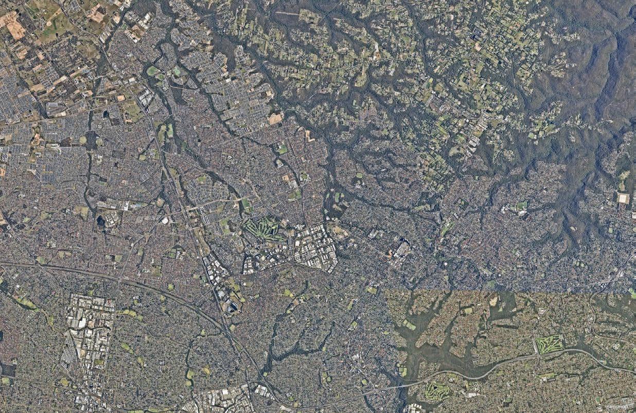
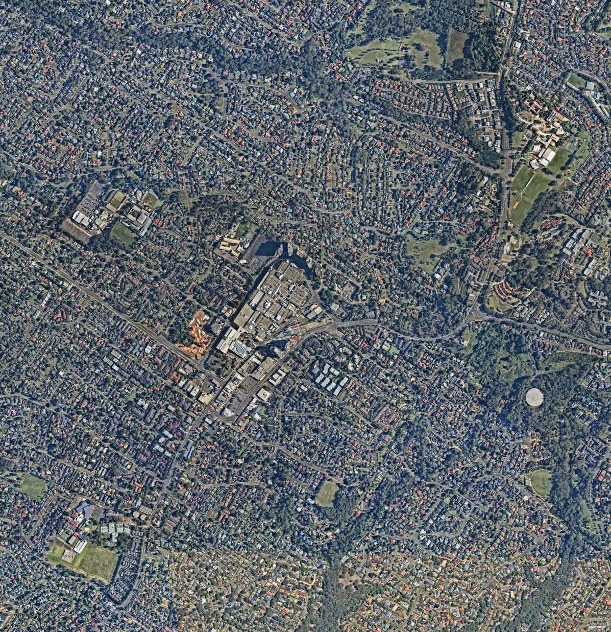
Figure 6. Regional Context (Source: Nearmap Aerial Imagery, copyright Nearmap)
T T
T
Rouse Hill Blacktown
Quakers Hill Marayong
To Richmond
North-West T-way to Parramatta
Norwest
Castle Hill
Future extension to Western Sydney Aerotropolis
Future Mass Transit Link to Parramatta (via Baulkham Hills)
Metro Station Metro Line
Hill Strategic Centre Strategic Centre Train Station Train Line
T-way
Hills Shire T
To Chatswood and Sydney CBD
Castle
North-West
The
Local Context

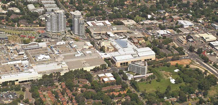
The Castle Hill Strategic Centre, as defined by this Precinct Plan, is generally bound by Whitling Avenue, Cecil Avenue and Britannia Road to the west, Tuckwell Road and First Farm Drive to the north, Parsonage Road and Francis Street to the south and Telfer Road and Old Northern Road to the east.
The Centre is around 247 hectares in size and accommodated approximately 3,720 dwellings and 8,080 jobs in 2016. The boundaries have regard to the area identified within Council’s Local Strategic Planning Statement, as well as the State Government’s North West Rail Link Corridor Strategy and Castle Hill Station Structure Plan, which was typically based on land within an 800 metre radius from Castle Hill Metro Station, with adjustments having consideration of key points of interest, existing character, predominant land uses and natural features or roads which formed logical boundaries to the Precinct.
The Study Area includes the Castle Hill North Precinct, which was previously rezoned in 2020 as the first phase in the broader Castle Hill Strategic Centre. The western boundary of the Strategic Centre abuts the eastern boundary of the Norwest Strategic Centre (specifically, the Showground Station Residential Precinct on the western side of Whitling Avenue and Britannia Avenue).
Castle Hill is the Shire’s major centre and key destination along the Sydney Metro Northwest containing a mix of commercial, retail, residential and entertainment activities. Its retail area is relatively compact and focussed on Old Northern Road with traditional strip shopping, the large Castle Towers complex to the west and Castle Mall to the east. There is a small commercial, restaurant and educational Precinct along the eastern side of Terminus Street, separated by the Ring Road. In addition to a range of low, medium and high density housing, the Precinct also contains a number of schools (three primary and one high school), public and private recreational facilities (RSL, Bowling Club and Greenup Park) and community facilities (Castle Hill Library and community rooms at Castle Grand).
Metro Station
Line (Underground)
Castle Hill Strategic Centre
800m Walkability Catchment (current / existing connections)
Castle Hill North Precinct
Draft Precinct Plan Castle Hill Strategic Centre 15
Metro
M St Bernadette’s Primary School Castle Mall Hills Adventist College Greenup Park St Paul’s Cemetery
Castle Hill High School Castle Hill Public School Castle Hill Library Arthur Whitling Reserve Castle Hill Shopping Centre M
Castle Hill RSL
2.2 Strategic Context
2013 2015 2015 - 2020 2018 2019
North West Rail Link Corridor Strategy
The North West Rail Link (NWRL) Corridor Strategy was released by the State Government in 2013 to guide development along the NWRL Corridor over a 20-25 year period.
It includes a structure plan for each of the Station Precincts, including Castle Hill. The structure plan identifies areas with potential for growth and articulates the desired development outcomes for these key growth areas.
The Strategy articulates that Castle Hill will remain the major retail hub for the North West and anticipates that the expansion of retail offerings will occur in line with projected population growth in the catchment. It noted that there is opportunity to integrate expanded retail uses with community and cultural facilities which could address pedestrian streets, plazas and squares.
It acknowledges that the introduction of the Metro will enable Castle Hill to transform into a major transport hub. The Strategy also indicated that there will be opportunities for increased employment and housing capacities within walking distance of the Metro Station, while ensuring the local amenity, heritage, open spaces and natural environment are protected.
The Hills Corridor Strategy
The Hills Corridor Strategy was adopted by Council in November 2015, to articulate Council’s vision for future growth in each of the seven (7) Station Precincts within The Hills Shire.
It envisages that Castle Hill will become a vibrant and active centre comprising offices, retail, community facilities, recreation, cultural, education and increased housing densities within walking distance of the Metro Station. It articulates that future development will reinforce the centre as a high quality Major Centre with a variety of building heights, including some distinctive or ‘iconic’ heights.
The Strategy articulates that the ‘core’ of Castle Hill should extend to the sites within the Ring Road as well as sites that have frontage to the Ring Road, with a strong focus on commercial and retail uses and limited residential within the Ring Road. It encourages the aggregation of land holdings and the creation of permeable pedestrian linkages through development sites. All street frontages at and within the Ring Road are envisaged to be activated and encourage people to be there.
Castle Hill North Precinct Plan
In November 2015, Council resolved to adopt the Castle Hill North Precinct Plan and forward a planning proposal to the Department of Planning and Environment for Gateway Determination. While this is part of the broader Castle Hill Strategic Centre, the planning for this area was expedited by Council as an earlier phase.
The Castle Hill North Precinct Plan facilitates future housing that responds to the values of the Hills Shire and is supported by adequate infrastructure. It capitalises on the arrival of the Metro Station and focuses on promoting the role of Castle Hill as a premier strategic centre.
It envisages that Castle Hill North will become the urban village of the centre through the integration of high quality urban design and sustainable residential development in proximity to the core of the centre and close to the jobs, transport and services available in Castle Hill.
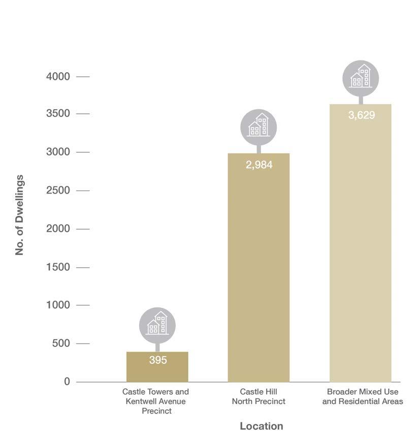
Council’s planning proposal for the Castle Hill North Precinct was finalised in July 2020 as part of the State Government’s Planning System Acceleration Program (facilitating approximately 2,984 additional dwellings that can be delivered by the market through development applications). A site-specific Development Control Plan has also since been adopted to guide future development outcomes within the Castle Hill North Precinct and Contributions Plan No. 17 – Castle Hill North levies development for the provision of supporting local infrastructure.
Greater Sydney Region Plan and Central City District Plan
The Greater Sydney Region Plan – A Metropolis of Three Cities was released in 2018 by the Greater Cities Commission (formerly, the Greater Sydney Commission). It provides a vision for the Greater Sydney Region that will encourage productivity, sustainability and liveability. It is supported by the Central City District Plan, which translates the objectives articulated within the Region Plan to a more localised context for each District.
In comparison to earlier strategic work, the District and Region Plans identify the elevated role that Castle Hill must play in providing new jobs as an employment destination for the growing North West Region.
Castle Hill is identified as a Strategic Centre, along with Rouse Hill and Norwest. These are expected to be places that feature:
• High levels of private sector investment
• Flexibility, so that the private sector can choose where and when to invest
• Co-location of a wide mix of land uses, including residential
• High levels of amenity and walkability and being cycle friendly
• Areas identified for commercial uses, and where appropriate, commercial cores.
These strategies are now being reviewed by the Greater Cities Commission (GCC) to establish a new strategic framework for the ‘Six Cities’.
Hills Future 2036
Hills Future 2036 is Council’s Local Strategic Planning Statement (LSPS). It was formally made on 6 March 2020 and sets a vision for growth in The Hills Shire over the next 20 years. It is supported by a suite of strategies including Housing, Productivity & Centres, Recreation, Integrated Transport & Land Use, Environment and Rural Lands.
The LSPS articulates that Castle Hill is the Shire’s CBD and will become a vibrant and active centre comprising offices, retail, community facilities, recreation, cultural facilities, education and higher housing densities within walking distance of the station.
While Castle Hill is located near a skilled workforce, with transport infrastructure and has sites for potential office development, growth has been inhibited by businesses migrating to business parks (Norwest in particular), traffic congestion and lack of premium grade commercial office space.
It recognises that Castle Hill requires a clear vision for its commercial future and states that Council may need to lead commercial development in the Centre to provide a catalyst for investors. The LSPS flags the potential for future park expansions and earmarks potential new road connections, including the completion of the Ring Road.
*Note: Both the District Plan and LSPS identify a total job target of between 16,000 and 19,500 by 2036. The additional jobs under the LSPS as shown above is the additional jobs needed to reach this total District Plan target (based on the 2016 data Travel Zone Projections released in 2022). The District Plan 2016 assumption was an estimation only (which significantly overestimated the number of jobs within the Centre as at 2016 and as such, the additional jobs estimate in the District Plan would not achieve the total job target set by the District Plan).
16
+ 9,500 Jobs + 4,400 dwellings +10,304 Jobs +4,807 dwellings +2,984 dwellings +6,200 - 9,700 Jobs* +7,920 - 11,420 Jobs* +6,500 dwellings Growth Projection for Station Precinct (2012 - 2036) Growth Projection for Station Precinct (2012 - 2036) Growth Projection for the Strategic Centre (2016 - 2036) Growth Projection for the Strategic Centre (2016 - 2036) Growth Projection for Castle Hill North Precinct (2016 - 2036)
2.3 Status of Planning Processes
Planning work led by Council and landowners has been undertaken and completed within some areas of the Castle Hill Strategic Centre. This Plan recognises and builds on this significant body of work and planning processes which have already occurred. Whilst it considers outcomes for the broader precinct and Study Area holistically, it is appropriate for many areas to either remain unchanged or to continue to develop under the current framework applied as an outcome of these planning processes.
• Low and Medium Density Housing Areas (identified in grey in Figure 9): These areas are on the edges of the Precinct and are not contemplated for change or uplift due to the age of housing stock, strata or community title tenure and distance from the Castle Hill Metro Station.
• Existing Development to Remain Unchanged (identified in yellow in Figure 9): These areas have been able to develop under the current planning controls. The outcome that exists is considered to be contextually appropriate and should remain for the foreseeable future.
• Existing Development Opportunities (identified in orange in Figure 9): It is considered that the level of uplift and redevelopment potential that can already be achieved under the current controls is contextually appropriate without the need for additional LEP amendments. No change to the planning controls is contemplated. The extent of density that can justifiably be accommodated on these sites is limited by their location at the periphery of the Precinct, their fragmented nature which creates difficulty in forming an appropriately sized development site and the need to remain contextually appropriate with the surrounding development character.
• Castle Hill North and Site-Specific Planning Proposals (identified in purple in Figure 9): Precinct planning has already been completed for the Castle Hill North Precinct, culminating in the rezoning of this area in 2020 to allow for nearly 3,000 additional dwellings that can now be delivered by the market through development applications. A site-specific Development Control Plan was also adopted to guide future development outcomes within the Castle Hill North Precinct and Contributions Plan No. 17 – Castle Hill North is in place, which levies development for the provision of supporting local infrastructure. While this area forms part of the broader Castle Hill Strategic Centre, the planning for this area was expedited by Council as the first phase of precinct planning and to unlock increased residential capacity. A number of other individual sites have also been subject to site-specific planning proposals (along Crane Road, Cecil Avenue and Garthowen Crescent). No changes to the planning controls are envisaged under this Precinct Plan for land within the Castle Hill North Precinct or subject to recent site specific planning proposals.
• Areas for Potential Change (identified in blue in Figure 9): These areas are identified within the Precinct Plan as key focus areas where changes to the planning controls and subsequent development opportunities will be instrumental to the achievement of the strategic vision for Castle Hill Strategic Centre.
Metro Line (Underground)
Castle Hill Strategic Centre
Low and Medium Density Housing Areas
Strategic Work Completed (Expected to Remain Unchanged)
Strategic Work Completed (Existing Development Opportunities)
Castle Hill North and Site-Specific Planning Proposals
Focus Area for Change
Open Space / Recreation
Potential Options Identified*
The Hills Shire Council Draft Precinct Plan Castle Hill Strategic Centre 17
Reserve for exhibition purposes (refer to Focus Area 13 in Section 4 of this Precinct Plan for further details on the potential options).
2.4 Existing Land Uses
The Castle Hill Strategic Centre is a diverse Precinct, containing a varied mix of office, retail, education, residential, recreational and infrastructure land uses, all near the Castle Hill Metro Station. Development within the Ring Road currently contains a predominance of commercial and retail uses with some community facilities. There is one pocket of residential land within the Ring Road known as the ‘Atmosphere’ development, situated opposite the Metro Station.
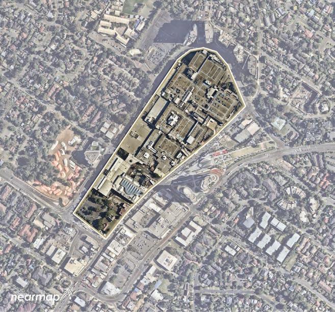
Retail Development
The Castle Towers Shopping Centre is the largest shopping centre and retail agglomeration within The Hills Shire and is one of the largest shopping centres in Australia. It has a total site area of 11.32 hectares and is currently zoned MU1 Mixed Use (formerly B4 Mixed Use). It is bound by Pennant Street to the west and north, Old Castle Hill Road and Old Northern Road to the east and Showground Road to the south.
Castle Towers is surrounded by a broader mixed use area that is currently zoned MU1 Mixed Use and represents 14% of developable land within the Strategic Centre (or 13% of all land within the Centre). It accounts for approximately 70% (117,000m²) of retail floor space within the Strategic Centre (Mecone, 2021). The remaining retail floor space is provided in a smaller enclosed mall (Castle Hill Shopping Mall) and retail shopfronts along Old Northern Road.
Commercial Development
Some small commercial offices are clustered along Terminus Street and Old Northern Road, in areas currently zoned MU1 Mixed Use and R1 General Residential. These are provided in a mix of older style, 2-3 storey strata-titled office buildings. These buildings accommodate a range of medical practices, allied health and educational/tutoring groups, in addition to typical localised business services.
R1 General Residential Zone
There are pockets of R1 General Residential zoned land along Pennant Street and Old Castle Hill Road within the Castle Hill North Precinct and along Terminus Street. The R1 General Residential zone was originally intended to provide a mix of land uses that supplemented residential outcomes, including business premises, offices, hotels, restaurants and cafes. However, for the Terminus Street locality it has been reported that this zoning has caused confusion among investors considering commercial office and retail development, given the opportunity for residential outcomes as the highest and best use. This has created a lack of certainty for Developers.
18
Figure 10. Breakdown of Existing Land Use Zones
0% 5% 10% 15% 20% 25% 30% 35% RE2 Private Recreation RE1 Public Recreation R4 High Density Residential R3 Medium Density Residential R2 Low Density Residential R1 General Residential MU1 Mixed Use C4 Environmental Living C3 Environmental Management 2% 4% 18% 24% 30% 3% 13% 4% 1%
Figure 11. Aerial View of Castle Towers Shopping Centre (Source: Nearmap Aerial Imagery, copyright Nearmap)
Residential Uses
Residential land uses are permitted on nearly all developable land within a 1.2km walking catchment of the Metro Station. Residential areas provide for a variety of housing types including detached dwellings, townhouses and low and high rise apartment living. Much of the medium and high density zoned land has already been developed and is subject to Strata Title arrangements. This is particularly prevalent on residential land to the south and east of the Precinct.
In 2016, there were approximately 3,700 dwellings within the Castle Hill Strategic Centre. However, recent planning work has predominately focused on unlocking further residential opportunities. Nearly 3,000 additional dwellings in the Castle Hill North Precinct are yet to be delivered by the market. There is now significant capacity under the current controls for approximately 6,600 dwellings within the Strategic Centre.
Council’s strong focus on planning for residential growth over the past 1020 years means Council is well on track to meet (and exceed) the residential targets established in the relevant strategic planning policies. The vibrancy and activity created by residential yields within the Centre will continue to grow as the market delivers on the opportunities already available under the current controls.
The Strategic Centre also contains some environmentally sensitive land (zoned C4 Environmental Living and C3 Environmental Management) to the north-east which is characterised by residential housing on large lots.
Infrastructure
Approximately 6% of land within the Strategic Centre is zoned for infrastructure and public uses. Some residential and mixed use land also accommodates community uses, such as the Castle Hill Library and Community Centre and various schools.
Land zoned RE1 Public Recreation is scattered throughout the Strategic Centre and includes active open space facilities such as Greenup Park along with smaller local parks and passive recreation areas such as Arthur Whitling Reserve, Olola Avenue Reserve, Worthing Avenue Reserve, Orange Grove Reserve and Eric Felton Reserve.
Castle Hill RSL and Bowling Club are located in the far western portion of the Precinct, cumulatively comprising more than 6 hectares of land.
Draft Precinct Plan Castle Hill Strategic Centre 19
Figure 12. Remaining Residential Capacity within Strategic Centre under current controls (as at 2016)
Metro Station Metro Line (Underground) Castle Hill Strategic Centre General Residential Low Density Residential Medium Density Residential High Density Residential Private Recreation Public Recreation Infrastructure Mixed Use Environmental Management Environmental Living 800m Walkability Catchment (current / existing connections) M R1 R2 R3 R4 RE2 RE1 SP2 MU1 C3 C4
Figure 13. Existing Land Use Zones
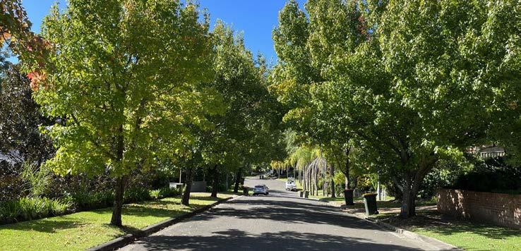
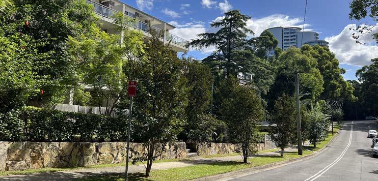
2.5 Existing Character and Public Domain
Central Areas and Surrounds
Mixed Use Area
The Precinct is anchored by a well-established mixed use area surrounding the Castle Hill Metro Station and Arthur Whitling Reserve. These areas provide an attractive green pocket for the enjoyment of the local community, workers, commuters and visitors.
Castle Towers
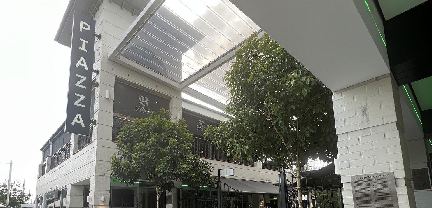
Castle Towers is centrally located and provides a variety of dining, shopping and entertainment opportunities, supported by some commercial businesses and residential living on Crane Road. The Piazza offers a unique street feel and alfresco design which creates a strong and distinguishable sense of character flowing out onto Main Street.
Terminus Street Precinct
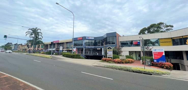
Castle Hill features a fine grain ‘village’ offering along Terminus Street and Old Northern Road. It is provided in a mix of older-style, 2-3 storey strata titled office buildings. These buildings comprise a cluster of medical practices, allied health and educational/tutoring groups, in addition to typical localised business services.
Ring Road
The Precinct is bisected by the Ring Road, which is a high traffic environment that restricts pedestrian permeability within and around the Town Centre.
Local Heritage
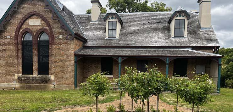
The former school and police station on the corner of Old Northern Road and Showground Road are intact Victorian-style buildings of local heritage significance. Built in 1880, these buildings are in good condition. They tell the story of Castle Hill’s history and transformation over time, contributing to a distinct sense of place and identity for the Strategic Centre.
20
Terminus Street
Castle Towers Shopping Centre
Heritage Item Ring Road
Castle Hill Metro Station
Northern
Western Residential Areas
Parking and Other Facilities
A generous amount of at-grade parking is provided on Les Shore Place to support the operation of businesses within Castle Towers. The area further west features the Castle Hill RSL and Bowling Club along with Castle Hill Primary School and Castle Hill High School.
Pioneer Theatre and Community Centre
The Pioneer Theatre and Community Centre is a cultural asset colocated with the Castle Hill Library at the corner of Castle Street and Pennant Street. These community facilities provide access to information resources, internet services, community and leisure activities and meeting facilities. It is a key anchor for the Precinct driving pedestrian activity.
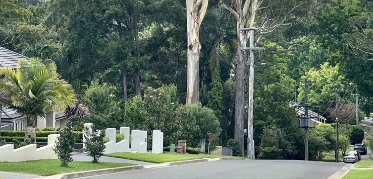
Established Residential Area
Land in the northern and western parts of the Precinct is a wellestablished residential area which is undergoing transition to predominately high-density residential living. Higher density residential development activity has already commenced in this area in recent years in the Castle Hill North Precinct.
Underdeveloped Areas
Whilst some development activity has already occurred (particularly the Atmosphere Development), the Town Centre is framed by some undeveloped land holdings (such as the area bound by Kentwell Avenue, Showground Road and Pennant Street), posing a unique opportunity to shape holistic development outcomes. While there have been some public domain improvements near the Metro Station, other areas are quite dated and would benefit from revitalisation.
The Hills Shire Council Draft Precinct Plan Castle Hill Strategic Centre 21
Pennant Street Target Site
Pioneer Theatre
Kentwell Avenue and Surrounds
Les Shore Car Park
and
Southern and Eastern Areas
Strata-Controlled Residential Areas
The established residential area to the east of Terminus Street and north of Crane Road features a high quantum of strata-controlled residential flat buildings and townhouses which are unlikely to turnover in the short to medium term. The age of this building stock is highly varied, with some dating back decades and some recently constructed.
Lower Density Housing
The residential area to the south of Crane Road features a range of lower density housing that was constructed more than 20 years ago. The large quantity of cul-de-sacs in this area result in poor pedestrian permeability.
Environmentally Sensitive Land
Land within the eastern periphery of the Precinct features environmentally sensitive land. This area features low density residential housing on large lots with generous setbacks and a landscaped street feel. However, the steep and varying topography results in poor pedestrian walkability in this part of the Precinct.
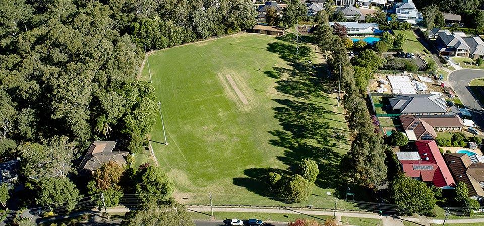
Greenup Park
Greenup Park is located in the far south east corner of the Precinct. It provides active open space facilities for local residents, featuring a single sports field, synthetic cricket pitch and a playground.
22
Greenup Park
Existing Residential Area
Existing Environmentally Sensitive Area
Existing Apartments
2.6 Strategic Planning Investigations
2.6.1 Technical Studies
In late-2020, Council engaged various consultants to establish a robust evidence base to assist with precinct planning, including:
• Shire Economic Health Check
Prepared by .ID Consulting, December 2020)
• Shire Economic Profile

(Prepared by .ID Consulting, December 2020)
• COVID-19 Business Implications
(Prepared by McCrindle, December 2020)
• Investment Attraction Study
(Prepared by McCrindle, December 2020)
• Strategic Centres Discussion Paper
(Prepared by Mecone, January 2021)
• Retail Floorspace Analysis
(Prepared by SGS Economics and Planning, February 2021)
• Commercial Floorspace Demand
(Prepared by SGS Economics and Planning, October 2021)
• Transit Centres Parking Requirements Report
(Prepared by PeopleTrans, January 2021)
• Housing Market Report
Prepared by Bis Oxford Economics, December 2020)

• Public Domain Audit and Analysis
(Prepared by Aspect Studios, January 2021)
• Big Data Analytics
(Prepared by Place Intelligence, April 2021)
These studies confirm that currently Castle Hill has a localised role in the Shire’s economy generating $1.1 billion worth of Value Added* in 2019 (in comparison to $5.05 billion for Norwest and $449 million for Rouse Hill). This contribution is characterised by the Strategic Centre’s significant retail sector and a small but important industry cluster of real estate and financial services.
The significant scale and range of retail amenity provided by Castle Towers Shopping Centre is currently the Strategic Centre’s major strength and core economic driver, which complements the finer grain ‘village’ offering along Old Northern Road. Whilst the accessibility improvements facilitated by the Sydney Metro Northwest and the planned expansion of Castle Towers will be major drivers for the retail and hospitality sectors, the distinct lack of commercial take up and available floorspace is a key barrier to employment growth and diversification in the centre. The investigations indicate that Castle Hill will need to grow the knowledge intensive and health and education sectors to ensure a more diverse and resilient local economy. Public realm improvements, increased walkability and growth in night time economy can enhance the appeal of Castle Hill as a vibrant and active employment, service and recreation hub for a large population catchment.
The Hills Shire Council Draft Precinct Plan Castle Hill Strategic Centre 23
*Note: Value Added is defined by Mecone as being the value of output after deducting the cost of goods and services inputs in the production process.
Figure 14. Strategic Planning Investigations
2.6.2 Economic Analysis
The key economic findings from the investigations and evidence base relevant to Castle Hill are summarised below.
A Population Serving Centre
The Castle Hill Strategic Centre supported 7,688 jobs in 2016 (Mecone, 2021). The employment is concentrated in the sectors of retail trade and accommodation and food services which accounted for most of the population serving employment (58.2%), reflecting the size and dominance of Castle Towers Shopping Centre. The knowledge intensive (19.8%) and health and education (19.5%) sectors both accommodated notable and comparable levels of employment (as shown in Table 2). Most of these jobs are located in the small commercial precinct along Terminus Street.
The Castle Hill Strategic Centre’s retail market has performed well over recent years with a low retail vacancy rate of just 1.4% in October 2020 (Mecone, 2021). The proposed expansion of Castle Towers will make Castle Hill one of the largest contemporary retail precincts in Australia, providing a confidence boost for other businesses in the Precinct. Good access via the Metro and ongoing residential development at key locations in the Centre will further sustain the hospitality, retail and service sectors.
An identified weakness of Castle Hill Strategic Centre is its distinct lack of contemporary office space, with existing office stock along Terminus Street being dated. This limits the capacity of the centre to attract new occupiers. The planning framework in this location is seen as a constraint with the application of the R1 General Residential zone along Terminus Street causing confusion among investors who might otherwise consider office and retail development. It is critical for the Centre to expand its commercial capacity if it is to grow and diversify employment and ensure economic sustainability and prosperity over the long term as envisaged by the strategic framework.
The baseline scenario for jobs growth anticipates that the Castle Hill Strategic Centre will grow by an additional 6,900 jobs for the period 20162036 (SGS 2021). These forecasts are undertaken by SGS at a State level to understand long term demands based on economic growth drivers. They are at the lower end of the Central City District Plan job targets of an additional 6,200 – 9,700 jobs by 2036. SGS has identified that the Strategic Centre will have demand for a total of 429,000m² of employment floorspace by 2036, which is an additional 168,500m² of floorspace on top of the existing amount (estimated at approximately 260,500m² in 2020).
In comparison, demand for additional floorspace in the context of the higher growth scenario set out in the Central City District Plan and Council’s goals for employment rates in The Hills would be approximately 257,000m², which, whilst aspirational, is intended to reflect the outcomes of investment and planning for strategic centres. The investigations completed by Mecone and SGS has identified that this extent of growth is beyond the capacity of the current planning controls.
It has been identified that the capacity for delivery of new employment floorspace is constrained within Castle Hill Strategic Centre and that if this remains the case, forecasted demand will not be met, which could lead to adverse consequences such as inflated lease prices and/or the loss of businesses and jobs from the Centre.
A clear land use planning framework is needed to provide certainty, confidence and viability for the market and landowners to make informed investment and development decisions with a clear knowledge of highest and best use.
Whilst SGS has sought to quantify the complexities of demand using travel zone projections, the analysis is a conservative baseline estimate and does not account for Council’s key employment objectives to maintain the current ratio of jobs to the growing Shire workforce.
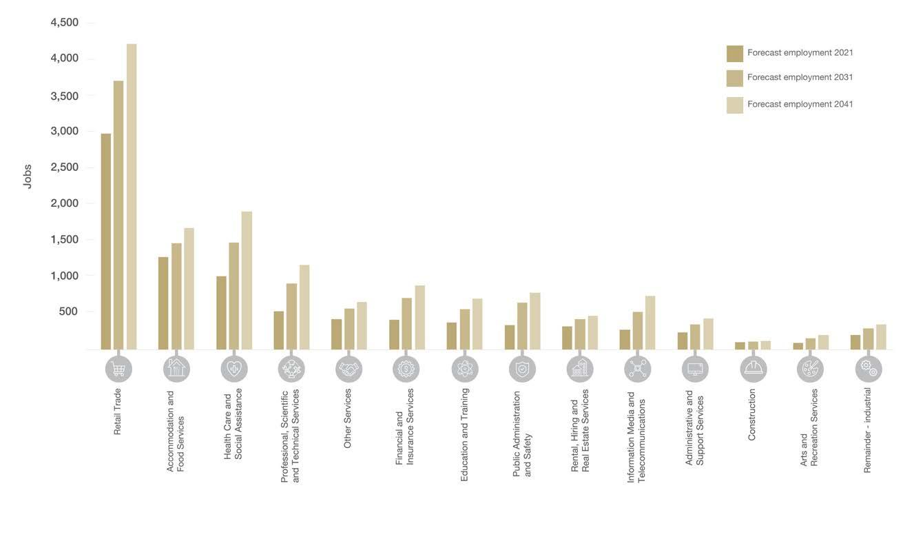
However, they do provide an understanding of the key industries that currently provide employment to be targeted. A ‘business as usual’ trend would see that in 2041, the key industries would continue to be Retail Trade, Health Care and Social Assistance, Accommodation and Food Services and Professional, Scientific and Technical Services (as shown in Figure 15).
This Precinct Plan serves to identify sufficient capacity for this growth as well as safeguarding opportunities to accommodate further economic growth and employment beyond 2036.
24
Table 2. Employment and Value Added Across Big Industry Categories within the Castle Hill Strategic Centre (Source: Adapted from Strategic Centres Discussion Paper Mecone, 2021)
Industry Category Value Added¹ 2019 Employment 2016 Castle Hill² $M % Jobs % Population Serving $331 32.5 4,477 58.2 Knowledge Intensive $516 50.7 1,532 19.8 Industrial $34 3.3 175 2.3 Health and Education $137 13.5 1,504 19.5 Total $1,108 100 7,688 100 Compared to Shire $10,382 67,189 *Note: 1. Productivity
2.
is measured by value added which is the value of outputs after deducting the cost of inputs in the productive process.
The Mecone Study Area is larger than the Precinct Plan Study Area aligning
with travel zone boundaries.
Figure 15. Forecast Employment Growth by Industry Sector for Castle Hill Strategic Centre (Source: Travel Zone Projections 2019)
Driving Economic Growth and Activity in Castle Hill
The investment in Sydney Metro Northwest has strengthened the Shire’s links to the Eastern City, and it is now well placed to capitalise on ‘city shaping’ projects such as the Western Sydney Airport, Sydney Metro West and Parramatta to Norwest mass transit connection.
Future job growth for the Shire, beyond the business-as-usual trends, will rely upon targeting key knowledge industry sectors of Professional, Scientific and Technical Services, Hospitals, Tertiary Education, and Advanced Manufacturing (medical and surgical equipment). The Castle Hill Strategic Centre is well suited to commercial services in addition to retail, hospitality and education that does not compete with Norwest from a commercial perspective. Ensuring the centre has the capacity to grow will be important moving forward with studies flagging opportunities to investigate the introduction of a commercial core zone. The role of Council as one of the two biggest landowners in the centre is also identified, with potential for Council owned land to be leveraged to transform the centre into a more attractive location for businesses.
This Precinct Plan identifies the expected capacity for commercial growth, and together with Council’s Economic Growth Plan, will uphold a pivotal role in the evolution of Castle Hill as a more diversified centre.
Retail Floor Space Demand
The estimated current retail floorspace is over 90,000m² with anticipated future supply of 73,000m² (SGS 2021). The methodology used by SGS for current floorspace supply focuses on retail floorspace as defined by ABS categories and eliminates any non-retail floorspace that is often defined as services (such as doctor’s surgeries and banks etc.). The future supply is largely based on approved development within the centre and is subject to delivery by the market.
The Castle Hill Strategic Centre is projected to have a retail floorspace surplus of around 12,000m² to 2036. These findings account for the uptake of approved development opportunities by 2026 and are influenced by retail trends as well as the emergence of Showground Station Precinct which will benefit from the surrounding residential growth. The projected surplus mainly comprises the three commodities most affected by the growing presence of online retail (5,835m² department store, 5,670m² clothing and 4,150m² other retail) as shown in Figure 16.
A potential gap of around 4,650m² supermarket floor space is also identified for the Strategic Centre. The analysis suggests that such demand could be met by reconfiguration of existing floorspace to prioritise supermarket floorspace over other commodity groups where the projected surplus may eventuate. This would assist in drawing down the projected overall retail surplus.
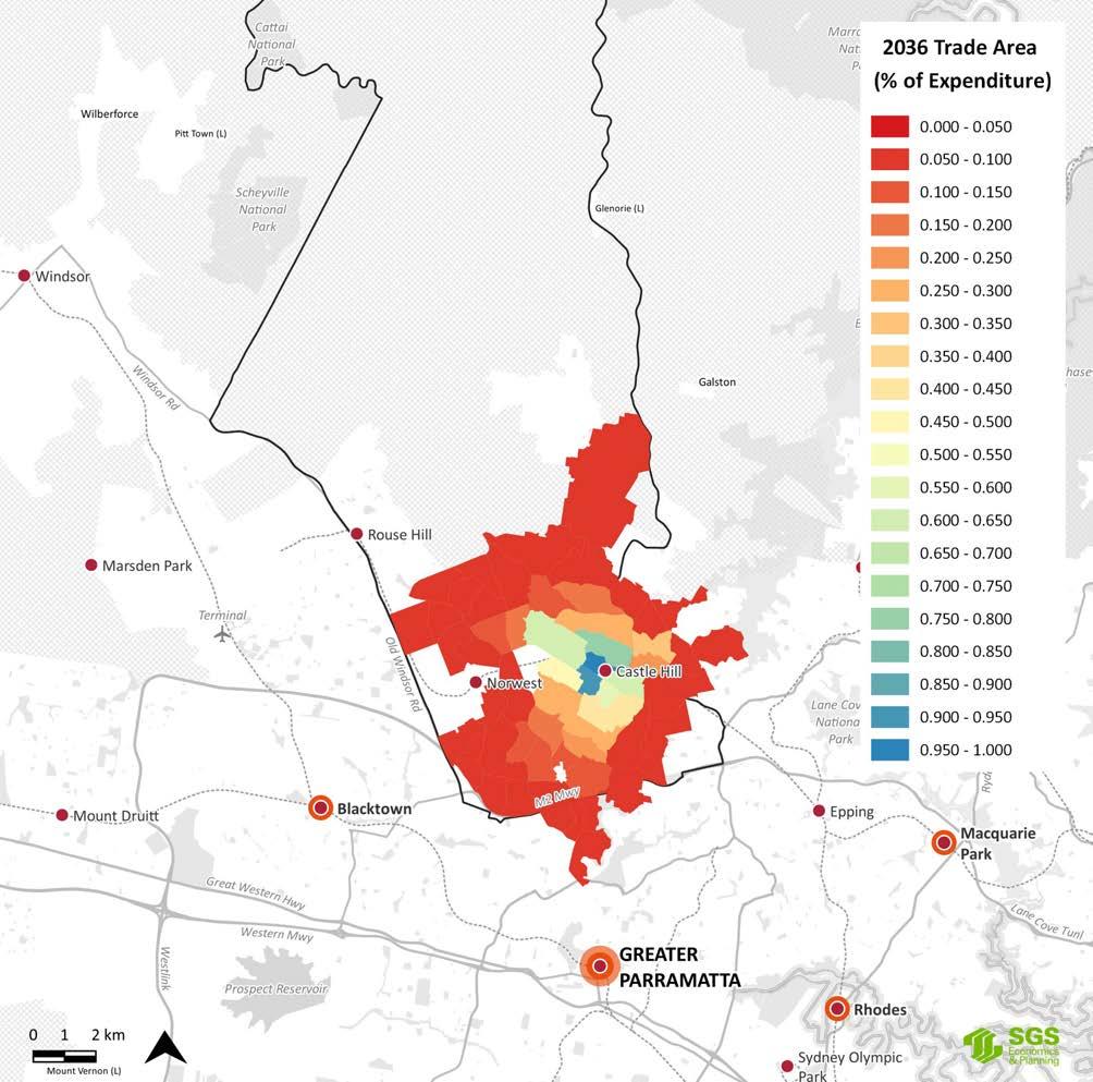
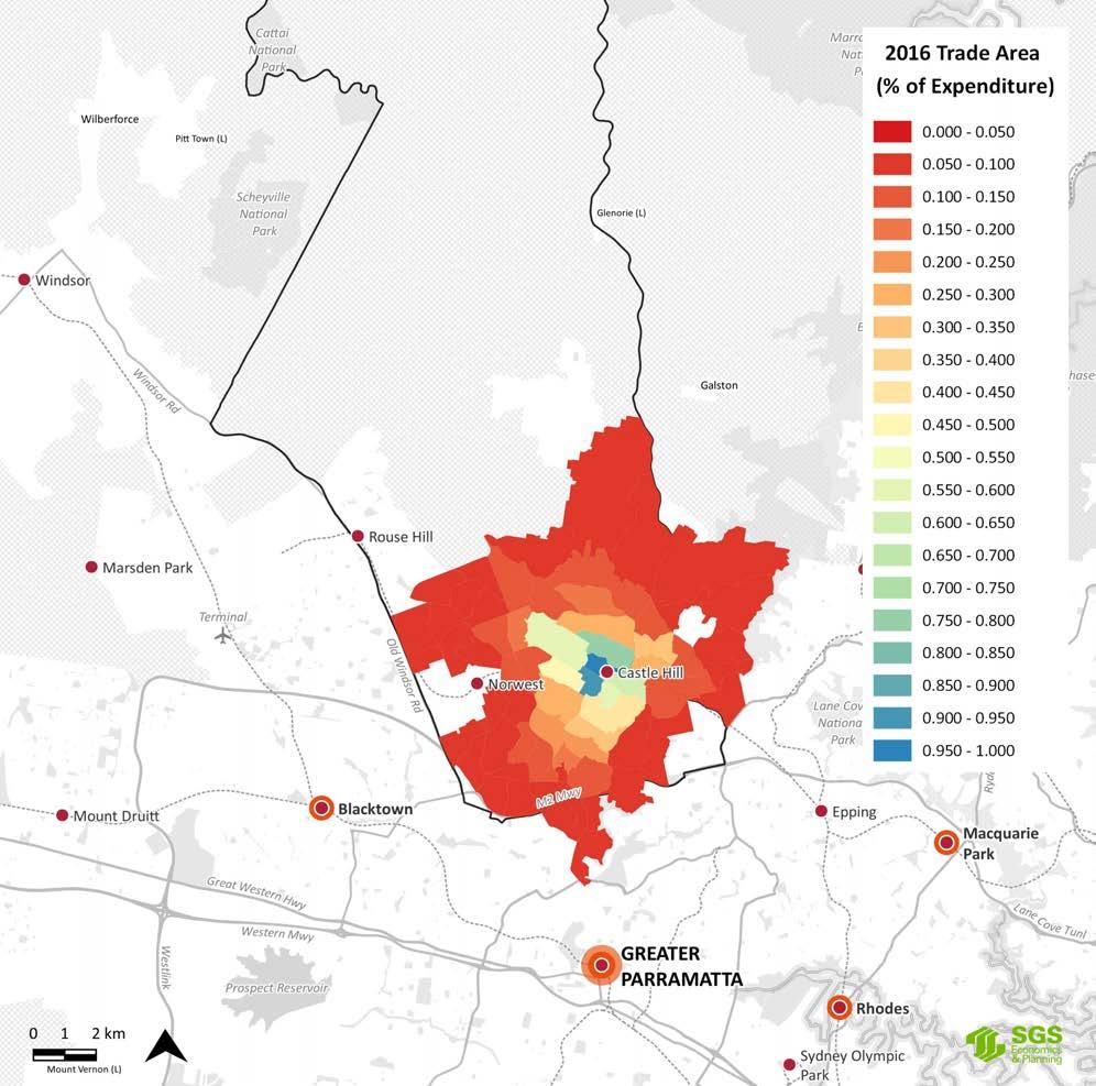
By 2036, the trade area of Castle Hill is expected to diminish as shown in Figure 17, due to competing centres at Cherrybrook and Norwest and the growing role of online retail. Whilst being cognisant of the impacts of additional centres, the status of Castle Hill at the top of the hierarchy and the future growth expected post 2036 will likely alleviate oversupply with additional demand.
Should the approved expansion of retail space not eventuate, it is anticipated that the longer term outlook for Castle Hill is a shortfall of approximately 20,000m² of retail floorspace by 2036, mainly in the hospitality and supermarket space. The analysis indicates that the staged introduction of floorspace with a focus on wellness, fitness, lifestyle, entertainment and showrooms/omnimarketing (where consumers can find and purchase online, instore or a combination of both) has the potential to enhance the Centre, whilst responding to changing consumer tastes.
The Hills Shire Council Draft Precinct Plan Castle Hill Strategic Centre 25
-6,000 -4,000 -2,000 0 2,000 4,000 6,000 8,000 375 1190 Projected retail surplus/gaps m 2 Hospitality Other foods Clothing Supermarket Household Goods Other
Retail Department
Store
Figure 16. Projected Retail Gaps and Surplus by Commodity (m2) to 2036 (Source: Adapted from Retail Floor Space Analysis SGS, 2021)
26
Figure 17.
Projected Trade Area Changes 2016-2036 (Source Retail Floor Space Analysis SGS, 2021)
 Castle Hill Town Centre and Surrounds.
2.6.3 Market Attractiveness


What Businesses Want
The Castle Hill Strategic Centre has the potential to be part of a linear city that spans across the Greater Sydney Region, connecting to the Region’s major employment precincts, universities, hospitals and community service (Mecone, 2021). However, to achieve this and attract knowledge-intensive industries, it is critical that consideration be given to what businesses want and need to be successful.
The Discussion Paper prepared by Mecone in 2021 identified that office-based businesses are most sensitive to location and amenity with knowledge intensive business actively seeking to attract and retain skilled labour through their property decisions. Apart from the cost and suitability of premises for operational requirements, key selection criteria include:
• Employee Amenity: High levels of employee amenity are crucial in attracting and retaining businesses, as well as talent. This includes access to high quality hospitality, recreational facilities and other key services. Castle Hill currently has a significant offering by virtue of the Castle Towers Shopping Centre and ‘high street’ offering along Old Northern Road.
• Public Transport and Accessibility: Growing traffic congestion and work-life balance makes high quality public transport a key requirement for knowledge workers. There are currently high levels of accessibility due to the strategic location of the Castle Hill Metro Station and a variety of local and regional bus routes. It is highly accessible by both private vehicle and public transport. The compact nature of the Precinct and linkages between Castle Towers, Old Northern Road and Showground Road is a key strength.
• Skilled Workforce: Businesses that depend on skilled labour will select locations accordingly. The Shire has a large and growing skilled labour pool with a greater proportion of managers and professionals compared to the Greater Sydney average.
• Market Catchment: Businesses will gravitate to locations that are close to key customer and supplier pools. The perception of distance from Sydney CBD and knowledge intensive sectors in eastern and north shore suburbs is a challenge. Castle Hill is still perceived as isolated from these precincts.
• Critical Mass: Critical mass of occupiers is needed for facilities that support worker amenity to be viable - cafes, restaurants, gym and fitness centres. Castle Hill currently has only a small amount of commercial offices with no critical mass.
• Suitability for Office Types: The existing office stock within Castle Hill is dated and relatively small. The current stock is only likely to attract smaller, service-orientated occupiers.
• Exposure and Surrounding Retailers: Castle Hill is one of the largest retail precincts in the Greater Sydney Region, offering a cluster of hospitality uses with strong exposure along Old Northern Road. The size and offerings of Castle Towers makes it a destination retail location.
• Population Size and Demographics: Castle Hill services a large and growing resident population with a high proportion of affluent households. The size of Castle Towers services a significant trade catchment beyond the immediately surrounding suburbs.
28
Figure 18. Site Selection Criteria for Business (Source: Adapted from Mecone, 2021) Table 3. Top Three Attractors for Industries to Relocate or Add an Additional Location in The Hills (Source: Adapted from McCrindle ‘Investment Attraction Study’, 2020)
Manufacturing and Construction Wholesale Trade and Retail Trade Accommodation and Food Services / Arts and Recreation Services Education and Training Health Care and Social Assistance Low traffic congestion (32%) Low traffic congestion (30%) Low traffic congestion (37%) Access to public transport (34%) Availability of suitable premises (34%) Availability of parking (36%) Availability of parking (30%) Access to public transport (30%) Availability of parking (30%) Proximity to customers/ clients (31%) Availability of parking (29%) Low traffic congestion (33%) Convenient for employees (25%) Cost of renting or buying commercial property in the area (27%) Availability of parking (27%) Low traffic congestion (27%) Proximity to customers/ clients (27%) Proximity to customers/ clients (22%) Site Selection Criteria for Businesses Corporate Image and Brand Access to Skilled Workforce Market Catchment Suppliers/ Supply Chain Accommodation Cost Certainty and Ease of Doing Business Place and Amenity
 Castle Hill Metro Station
2.7
Analysis
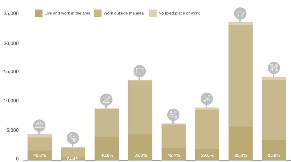
To better understand the demographic characteristics of the local catchment, a demographic analysis has been undertaken using the 2021 ABS Census Data for The Hills Shire.
As of 2021, the Shire was home to a resident workforce of around 101,770 people – that is, people who live in the Shire and are employed – and around 84,157 local jobs. However, of the jobs in the Shire, only 30,075 (or 31%) are filled by residents.
Approximately 96% of residents engaged in the labour force are employed. Unemployment in The Hills has historically remained much lower than that of Greater Sydney, though fluctuations in the unemployment rate have followed similar trends.
In terms of jobs in the Shire, the top industries are retail trade, health care and social assistance, construction and professional and technical services. While retail is still one of The Hills biggest employers, as a percentage of overall employment, retail has been decreasing, as has professional and technical services. Health care and social assistance is the fastest growing industry in The Hills. Construction is experiencing a sharp increase related to steady construction of new homes in the North West Growth Area, which is expected to continue in the short term owing to development around Station Precincts.
In terms of the resident workforce, the highest proportions of Hills residents are employed in technical and highly skilled industries including professional and technical services, finance, health care and education. This reflects the comparatively high levels of education attained by Hills residents. Health care and social assistance is the fastest growing industry both for the resident workforce and for local jobs.
The Hills has a predominantly highly educated, highly skilled and highly paid resident workforce. In 2021, The Hills had a larger proportion of high income earners than Greater Sydney, with over 47% of households earning over $3,000 per week. Hills residents also benefit from high levels of education, with over 60% of residents having undertaken some form of higher education and 40.5% of residents having attained a Bachelor degree or higher (compared with 33.4% in Greater Sydney).
It is evident that the jobs currently available within The Hills Shire do not sufficiently align with the knowledge intensive and technical skills of working residents, forcing most working residents to travel outside of The Hills for work.
30
Figure 19. Comparison of Local Jobs vs Skills of Resident Workers
Figure 20. Higher Education Attainment (% all people over 15)
Manufacturing Retail Trade Health Care and Social Assistance Education and Training 0 2,000 4,000 6,000 8,000 10,000 12,000 No. of workers Resident workers Local jobs Financial and Insurance Services Professional, Scientific and Technical Services 14,000 16,000 Construction No. of Workers Diploma % of Population 0% 5% 10% 15% 20% 25% 30% 35% 40% Bachelor or Higher Degree Advanced Diploma or Diploma Vocational Diploma % of population The Hills Greater Sydney 45%
Demographic
Aligning Jobs Growth with Demand
There are over 8 jobs within the Shire for every 10 working residents, meaning there is theoretical opportunity for more than 80% of working residents to work within The Hills Shire.
Despite this, the job containment rate is currently just over 30% within The Hills Shire - which means that only 31.2% of the resident workforce works in The Hills Shire. Approximately 65.3% of working residents travel outside of the Shire for work (nearly 14.6% travel to Sydney and 10.1% travel to Parramatta). This reflects that the jobs currently available within the Shire are not well-enough aligned with the skills of working residents and means that we are exporting a large proportion of our highly skilled and educated workforce to other Local Government Areas where they participate in knowledge intensive and technical jobs.
From a simple numerical perspective, if Council is to retain this same ratio and quantum of employment opportunities as we experience the projected population growth, then there will be a need for just over 50,000 additional jobs within the Shire by 2036. This quantum and objective are identified within Council’s Local Strategic Planning Statement, and link back to the goals and benefits of the ‘30 minute city’, providing good access to jobs for residents within easy travel from their home.
Taking into account the potential within strategic centres, as well as other medium and longer term locations, such as Annangrove Road and Box Hill, there is theoretical capacity more broadly across the Shire to accommodate this growth in employment opportunities, however the key challenges will be to stimulate the take-up of opportunities and delivery of jobs by the market in the short and medium term, and to encourage the delivery of jobs that better align with the skills and education of our residents, particularly a greater proportion of knowledge intensive jobs.
As reflected in the job targets set by the Greater Cities Commission, it is the three Strategic Centres that are critical to achieving these goals and overcoming these challenges, as these are the areas where Council can expect short term economic interest and investment on the back of the Sydney Metro Northwest and delivery of jobs in locations that are well serviced and accessible for residents of the Shire.
These are also the locations which are the most conducive to the delivery and co-location of knowledge intensive jobs, technical jobs and health and education. As a result, both the State and Local strategic planning frameworks establish and reinforce the importance of the Strategic Centres doing the heavy lifting in terms of short to medium term provision of jobs.
- Council’s Local Strategic Planning Statement, Hills Future 2036
The Hills Shire Council Draft Precinct Plan Castle Hill Strategic Centre 31
Figure 21. Job Containment by Occupation in The Hills Shire 2016
Table 4. Implied Demand - Number of Jobs to Maintain the Ratio of Shire Workers (Source: Council’s Productivity and Centres Strategy)
“When more residents can work locally, commute times and congestion will lessen, helping to meet the vision of Greater Sydney as a 30-minute city. This will encourage a better work-life balance, increased local spending and stronger local communities.”
Population Resident workers Local jobs Ratio of Shire workers to jobs Existing (2016) 162,500 80,170 63,865 0.8:1 Forecast (2036) 290,900 143,500 114,500 0.8:1 Growth 2016 – 2036 128,400 63,500 50,600 0.8:1 Occupation No. of People Technicians and trades workers Sales workers Machinery operators and drivers Professionals Labourers Clerical and administrative workers Community and personal service workers Managers
2.8 Key Strategic Influences
Challenges
• Facilitating employment opportunities that complement rather than compete with the Norwest and Rouse Hill Strategic Centres.
• Continued pressure for shorter term ‘highest and best use’ residential or mixed use outcomes.
• Castle Hill has solidified its role as a major retail destination, rather than diversifying the employment offering. The core weakness of Castle Hill Strategic Centre is its distinct lack of contemporary office space. Existing office stock along Terminus Street is dated, limiting the capacity of the Strategic Centre to attract new occupiers.
Economy
• Ongoing threat of e-commerce and online shopping as the uptake of online shopping continues to grow across Australia.
• Market uptake inhibited by various factors (e.g., land cost, speculation, traffic issues and fragmented land ownership etc.).
• The existing R1 General Residential zoning and density controls along Terminus Street are a constraint to redevelopment, particularly given the predominance of strata-titled buildings.
Opportunities
• Leveraging off the scale and range of retail amenity provided at Castle Towers Shopping Centre to drive economic growth and investment.
• Ensuring planning policy is flexible enough to allow shopping centres to respond to changing consumer needs.
• Castle Hill has the essential characteristics needed to emerge as the premier retail, hospitality and commercial services precinct in Sydney’s North West.
• Large, vacant or underdeveloped land holdings providing capacity for growth in commercial services. Opportunity for Council, as a major landowner, to be a catalyst for change by leading commercial development activity and creating certainty for investment.
• Access to highly skilled and educated local workforce and opportunity to be an evolving educational precinct with a University Campus strategically located in the heart of the Precinct.
• Provide a clear framework and vision to stimulate investment in more diverse employment uses.
Access and Movement
• Congestion from regional and local traffic.
• Limited vehicular connectivity forces traffic onto a handful of key roads, complicated by the incomplete nature of the Ring Road.
• Significant topographic constraints and major road barriers, particularly across the Ring Road, inhibit pedestrian permeability and amenity throughout the Precinct.
• Enhance pedestrian and cycling connections throughout the Precinct, particularly with new through site links, widening of footpaths and new pedestrian bridges in key locations.
• Introduction of reduced parking rates and car share provisions for non-residential developments.
• Encourage a mode shift towards public transportation, leveraging off investments in key transport infrastructure (such as the Sydney Metro North West).
Amenity and Place
• Achieving a cohesive vision and approach to development throughout the Precinct.
• Poor pedestrian connectivity and permeability.
• Limited passive open space and urban plazas to enable incidental social interactions.
• Insufficient pedestrian friendly and high amenity public domain areas within the Precinct.
• Underutilised main street and lack of activated frontages.
• Build on the positive foundation and success of the existing Castle Towers Shopping Centre and Main Street to establish a distinct and identifiable local character and local heritage, sense of place and enticing public domain areas.
• Encourage a stronger night-time economy to attract and retain workers and visitors.
• Strategically locate landmark buildings at gateway locations to signify the entrance to the Precinct and create a memorable ‘Castle Hill’ skyline.
• School capacity to cater for increased population.
• Uncertainty of future local and regional infrastructure contribution costs.
• Capacity of open space network and limited land available to facilitate new active open space areas.
Infrastructure
• Improved mass transit links to Parramatta and the Western Sydney International Airport.
• Delivery of new passive open spaces and urban plazas in the heart of commercial and residential areas.
• Various new road connections and upgrades, including the completion of the Ring Road, to improve permeability and active transport opportunities and provide additional capacity on the State road network.
32
Table
5. Key Strategic Influences that will Guide and Shape Future Development within Castle Hill Strategic Centre
 Castle Hill Heritage Park.
2.9 Existing Travel Behaviour and Trends
In 2016, there were approximately 1.9 cars per household on average in Castle Hill (slightly lower than the average for The Hills Shire, being 2 cars per household). It is estimated that if current car ownership trends within The Hills Shire continue, by 2036, there will be an additional 70,000 vehicles on our roads. If this is the case, the roads and infrastructure will not be able to cope, as they are already at capacity in many locations throughout the Castle Hill Strategic Centre.
This is largely reflective of our unique family dominated demographic and the slow rate of modal shift following the opening of the Metro. Many families will need a car for private use on weekends for travel to sport and other activities that are not easily accessible via the Metro or other forms of public transport.
Whilst car share, increased public transport usage and reduced parking rates may be part of the solution to solving our traffic issues, ultimately many families will continue to require access to a private vehicle and associated parking. Whilst this does not necessarily mean that residents will utilise their vehicles to drive to work (as further explained below), this needs to be thoughtfully considered to ensure that the narrative correctly reflects the transit behaviours of our residents outside of work hours and on weekends and that new residential developments continue to accommodate space for private vehicles and lifestyle choices.
This approach focuses on the modal shift for trips to the Castle Hill Strategic Centre during peak periods, not necessarily preventing residents from being able to own a car and store it at their place of residence.
Whilst Castle Hill has traditionally been a car dependent destination, the arrival of the Sydney Metro Northwest poses an opportunity to reimagine the travel behaviours of our local residents and workers. It provides a convenient rail connection from The Hills Shire to Chatswood, Macquarie Park and the Sydney CBD. When the project is extended, it will provide a direct connection to the Sydney CBD and through to Bankstown. There are also plans to expand the network to ultimately connect The Hills Shire with the new Western Sydney Airport.
A Parking Analysis undertaken by PeopleTrans in late 2020 revealed that between 2011 and 2016 there was a significant increase in public transport to access the Castle Hill Strategic Centre (+3.2% to 17.5%) and a subsequent reduction in trips to the Centre via car (-3.3% to 64.7%). An analysis of demand within more established comparable transit centres across Sydney shows that approximately 37% of workers travel to work by car, indicating potential for even greater mode shift to public transport use to occur in The Hills, particularly for trips to/from the inner walkable catchment of stations. It could be reasonably assumed that this mode shift towards public transportation will continue, especially given the metro did not open until after the 2016 Census.
• Parking Costs
• Road Use Costs
• Distance to and Availability of Public Transport
• Routes and Travel Times
• Accessibility


• Comfort of Personal Vehicle
• Reliability of Service
• Availability of Parking at Origin and Destination
• ‘Freedom’ of Car Use
• Personal Safety Concerns
• Social Status Linked to Car Ownership
• Life Stage Based Difficulties (e.g. Travelling with Small Children)
34 Social Psychological Physical Economic
Figure 22. Factors Influencing Mode Choice (Source: Adapted from Integrated Transport and Land Use Strategy)
Table 6. Summary of Key Travel Behaviour (Source: Adapted from PeopleTrans – Transit Centres Car Parking Report, 2021)
Demographic Details Castle Hill Norwest Rouse Hill The Hill Shire Journey to work (residents) Mode share Car 64.7% Public transport 17.5% Car 62.9% Public transport 15.6% Car 70.0% Public transport 13.1% Car 65.7% Public transport 16.1% Changes (2011 vs 2016) Car -3.3% Public transport +3.2% Car -6.0% Public transport +4.7% Car -1.8% Public transport +3.3% Car -2.5% Public transport +3.1% Journey to work (workers) Car (driver) 62.9% Public transport 9.0% Car (driver) 80.3% Public transport 5.3% Car (driver) 62.3% Public transport 7.1% Car (driver) 70.6% Public transport 5.0% Car ownership (average) 1.9 cars per household 1.8 cars per household 2.04 cars per household 2 cars per household Household size (average) 3.05 persons per household 2.78 persons per household 3.47 persons per household 3.18 persons per household
• Fare Costs
• Vehicle Operating Costs
2.10 Public and Active Transport
Public Transport
• The arrival of the Sydney Metro Northwest in May 2019 has begun to transform travel behaviour within The Hills Shire, by providing a rapid transit service that stretches from Tallawong Station through to Chatswood Station. The next phase, stretching from Chatswood to Sydenham, is currently under construction and once complete, the indicative travel time from Castle Hill to Martin Place will be approximately 35 minutes. It is set to open in 2024.
• The Strategic Centre is well-serviced by the ‘Hillsbus Network’. This service primarily runs along key roads within the Castle Hill Strategic Centre, including Showground Road, Old Northern Road and Tuckwell Road. These routes provide direct connectivity to other key areas such as Norwest, Baulkham Hills, Northmead, Cherrybrook, Dural, Annangrove and Kenthurst.
Active Transport
• Walkability across the Strategic Centre varies due to topography, existing lot patterns and physical barriers to movement such as major roads. While the network provides easy access by motor vehicle, it hampers good accessibility by pedestrians to the centre of the Precinct which contains the businesses, services and transport hub.
• While Castle Hill benefits from a wide range of recreational cycling and pedestrian routes, the arterial Ring Road around the Town Centre is a major barrier to accessibility to the services and facilities on offer. The high levels of vehicular activity on Showground Road and Old Northern Road, coupled with the lack of amenity in some parts of the Precinct are also major impediments to pedestrian walkability and cycling connectivity.
• Areas within a 400m walking catchment from the Metro Station are predominately within and around the Ring Road (bound by Pennant Street and Terminus Street).
Metro Station
Metro Line (Underground)
Castle Hill Strategic Centre
Bus Routes (Current)
Metro Station
Metro Line (Underground)
Castle Hill Strategic Centre
400m Walkability*
800m Walkability*
based on current connections.
Draft Precinct Plan Castle Hill Strategic Centre 35
M
M
2.11 Road and Freight Network
Road Network
• The Study Area is serviced by an extensive road network regularly utilised by pedestrians, bicycles, buses, freight and general traffic. Roads are classified as either regional and local roads. Classification is based on connectivity and the importance of the road to the broader road network (volume of traffic) with State roads (arterial roads) managed and funded by Transport for NSW and regional and local roads managed and funded by Council.
• The Centre is located at the convergence of two arterial roads - being Old Northern Road and Showground Road. These roads signify the approach to Castle Hill from the west (along Showground Road) and from the north and south along Old Northern Road. This road network connects Castle Hill with neighbouring centres (such as Norwest Strategic Centre), as well as connecting beyond to the City, rural areas to the north and the future Western Sydney Airport.
• The heart of Castle Hill is surrounded by Pennant Street, McMullen Avenue, Terminus Street, part of Cecil Avenue, part of Old Northern Road and Showground Road that form the ‘Ring Road’ network that aims to manage the regional through traffic. A balance is needed between managing regional traffic flows and improving pedestrian accessibility throughout the Precinct.
• Castle Hill includes various collector roads such as Castle Street, Cecil Avenue, Crane Road, Castle Hill Road and Tuckwell Road. Collector roads provide links between key land use and activity areas, as well as the arterial road network and local roads.
• Congestion is currently significant along Showground Road, Old Northern Road and some local feeder roads during peak periods.
Freight Network
• Efficient freight links facilitate effective movement of goods, allowing supply chains to function smoothly and influence new markets. Planning for freight and servicing of residential and commercial development is crucial to how the Shire works and connects to adjoining areas, Greater Sydney and beyond. It is a shared responsibility between the NSW Government and Councils.
• Generally, within The Hills Shire, the freight network is confined to the road network in the absence of heavy rail infrastructure. As such, congestion on the local and regional road network presents a challenge for freight movements and for residents living within and around The Hills.
• The Strategic Centre contains a few existing freight routes including Old Northern Road, Terminus Street, Pennant Street and Showground Road. Tertiary freight routes provide connections from the local road network, serving numerous major business and freight origins and destinations.
• These roads carry lower volumes of heavy vehicles (<2,000 heavy vehicle annual average daily traffic) than primary routes such as the M7 and M2 Motorways which typically carry volumes of more than 4,000 heavy vehicle annual average daily traffic.
Metro Station Metro Line (Underground)
Castle Hill Strategic Centre Signalised Intersection Roundabout
Metro Station Metro Line (Underground)
Castle Hill Strategic Centre Freight Routes
M
36
M T
2.12 Natural Environment and Special Uses
Topography
• Topography is a significant constraint, especially for surrounding residential areas and access within and around the Centre.
• The highest geographic points are located along Old Northern Road, Telfer Road and Old Castle Hill Road towards the eastern side of the Precinct and running along Old Northern Road towards the centre of the Precinct (shown in blue in Figure 27). The topography drops away towards the west and south from the centre of the Precinct.
• Some sites in these areas have been identified as subject to landslip risk, which is discussed further in the ‘Special Uses’ section of the site analysis. These are hatched in Figure 27.
• The lowest points in the Strategic Centre are along the existing creeks and tributaries, including Cattai Creek and Excelsior Creek (shown in yellow in Figure 27).
• There is a high level of variability in topography across the Strategic Centre, which is a key challenge that will need to be overcome in terms of creating an active and walkable neighbourhood and delivering built form outcomes that are contextually appropriate.
Open Space and Vegetation
• The Centre is currently dominated by impermeable hardscape surfaces, primarily roads, buildings and at-grade vehicular parking areas. There are limited areas of permeable soft landscaped surfaces within both public and private land. There is also a lack of established vegetation in the heart of the Precinct.
• Greenup Park is an active open space facility located in the south eastern corner of the Precinct. It provides a single sports field with a synthetic cricket pitch. The facility features lighting for training, a kiosk, change rooms and a playground.
• The Strategic Centre includes several pocket parks and passive open space areas, typically providing opportunities for play, social gatherings, informal games and sports activities, exercise and aesthetically pleasing space. These include Olola Avenue Reserve, Orange Grove Reserve, Worthing Avenue Reserve, Arthur Whitling Reserve, Britannia Road Reserve, Eric Felton Reserve and Bert Parkinson Reserve. However, these were intended to service traditional lower density housing stock across much of the Precinct, not the higher densities envisaged under the current strategic framework.
• Most of the commercial and mixed use areas are unconstrained by vegetation. In the surrounding residential areas, there are significant clusters of critically endangered ecological communities. These comprise Sydney Turpentine Ironbark Forest in the north west and south east of the Precinct and Blue Gum High Forest to the east on environmentally sensitive land.
The Hills Shire Council Draft Precinct Plan Castle Hill Strategic Centre 37
Metro Station Metro Line (Underground) Castle Hill Strategic Centre Active Open Space Passive Open Space Vegetation Metro Station Metro Line (Underground) Castle Hill Strategic Centre 27.5 - 76.6 76.7 - 88.3 88.4 - 98.8 98.9 - 110 110.1 - 121.8 121.9 - 136.8 136.9 - 153.2 153.3 - 169.6 Landslip Risk
M M
Metro Station
M
Hydrology
• The Precinct currently features some hydrological considerations, including flood prone land, creeks and overland flow paths. These overland flow paths and tributaries traverse through well-established residential areas towards the periphery of the Strategic Centre. These factors have formed key considerations in developing this Precinct Plan, as they will substantially influence future development outcomes.
• Old Northern Road separates two (2) major drainage catchments within the Precinct. To the south-east, the Precinct drains through tributaries of Darling Mills Creek to the Parramatta River. To the north and north-west, the Precinct drains through tributaries of Cattai Creek, which ultimately drains to the Hawkesbury River.
• A number of overland flowpaths are located on private land traversing through residential areas and potential development sites within the Precinct. Upgrades to ageing stormwater infrastructure will likely be needed as redevelopment occurs together with careful siting of development, roads and through site links to maintain and improve the capacity of the stormwater network.
Metro Line (Underground)
Castle Hill Strategic Centre
100 Year Flood Extent

Creek Lines and Overland
Flow Paths
Catchment Boundary
*Note: The infomation presented in this map on flood extent is subject to disclaimer and copyright notice. Refer to Appendix A for details.
Special Uses and Landslide Risk
• The Castle Hill Strategic Centre and its surrounds has a rich local history and includes various heritage items such as, Cristadelphian Church, St Paul’s Cemetery, “Garthowen”, The Former Police Station, Castle Hill Public School, “Wansbrough House” and a house on Showground Road (of significance for its association in the life of Patrick White).
• The Cheriton Zone Substation is located on Showground Road. Other substations are located in the far-eastern portion of the Precinct on Cecil Avenue and near Arthur Whitling Reserve.
• There are a few schools scattered throughout the Precinct, including Castle Hill High School, St Bernadette’s Primary School, Hills Adventist College and Castle Hill Public School.
• Churches are also dispersed throughout the Precinct, including Wesley Uniting Church, St Columba’s Presbyterian Church, Indonesian Reformed Church, Castle Hill Baptist Church, Arise Anglican Church and St Bernadette’s Parish.
• There are areas within the Shire that are subject to significant landslide hazard. Areas located within and surrounding the north-east portion of the Precinct are identified as landslip risk. A previous study of several sites within the surrounding area provided advice on how this land should be assessed and developed. Council has developed a risk-based approach to areas impacted by landslides and a process is in place to consider any future development.
• A new University of Canberra Campus has opened at the junction of Terminus Street, McDougall Lane and Cecil Avenue.
• The Castle Hill Scout Hall is located on the corner of Rowallan Avenue and Castle Street.
Metro Station
Metro Line (Underground)
Castle Hill Strategic Centre
Open Space
Heritage Item
University
Scout Hall
Landslip Risk Substation
38
M
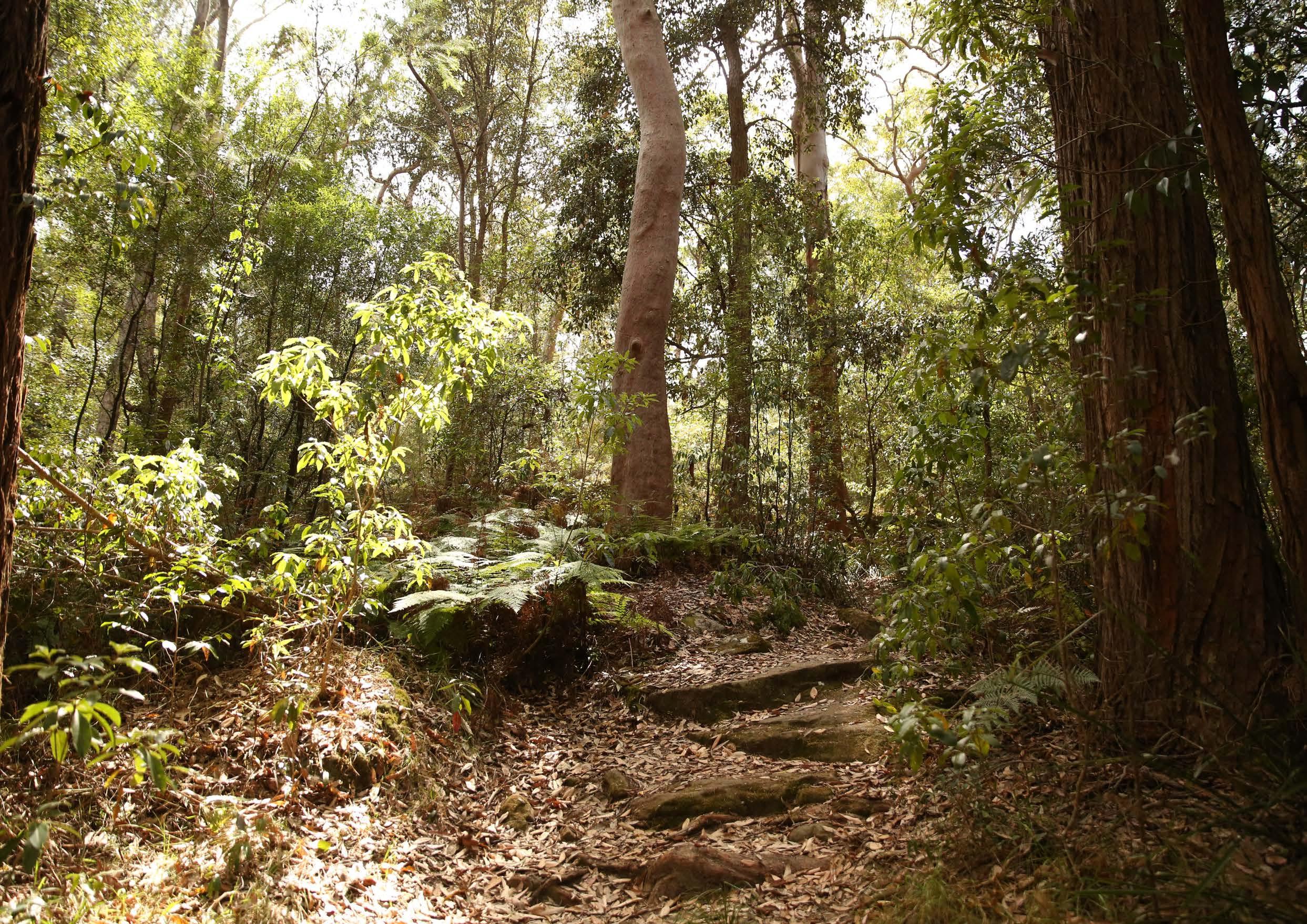
Bidjigal Reserve.
2.13 Key Constraints and Challenges
Age of Building Stock and Development Potential
There are various pockets of well-established residential areas which are unlikely to turn over in the foreseeable future predominately due to the age of the building stock and fragmented ownership of land.
Traffic Congestion
Traffic congestion will be a key challenge that may inhibit the Precinct from reaching its full potential, as the traffic network is already under stress. The efficient movement of traffic will hinge upon future infrastructure upgrades and a mode shift towards public transportation.
Connectivity
Castle Hill is bisected by various major roads and vehicular barriers, including Old Northern Road, Showground Road, Pennant Street and Terminus Street. This poses a challenge in terms of walkability and permeability, given there are limited pedestrian crossings along these roads.
Environmental Constraints
Areas within the Precinct are affected by environmental constraints such as the presence of threatened species, geotechnical landslip constraints, flood prone land and tributaries. These constraints can inhibit further development potential and require careful management.
Limited Public Open Space
Whilst there are some open space facilities within the Strategic Centre, these facilities primarily service the needs of existing residents and some of the growth already planned under current controls. Active open space within and surrounding the Precinct is currently at capacity, with minimal opportunities for new land areas to be set aside for this purpose to cater for further residential growth.
Land Tenure and Rail Corridor
Existing Strata and community title arrangements will impact on the uptake of redevelopment. Redevelopment will need to manage its impact on the underground Metro line, which runs through the heart of the Strategic Centre. Large areas of the Precinct are heavily constrained by strata ownership or fragmentation which creates difficulty in establishing consolidated sites suitable for redevelopment.
School Infrastructure
There is currently a lack of school infrastructure to cater for increased residential yields. This will need to be resolved by the NSW Government and Schools Infrastructure NSW to appropriately service the needs of the future population.
Heritage
There are various items of local and state environmental heritage within the Strategic Centre and its surrounds.
Metro Station
Metro Line (Underground)
Castle Hill Strategic Centre
Vegetation
Heritage Item
Open Space
M
Strata Development
Landslide Risk
Electricity Substation
Major Roads and Barriers
Urban Overland Flowpaths / Creeks

40
2.14 Key Opportunities
Employment Growth
There is opportunity to grow the education sector and employment and commercial activity within the Castle Hill Strategic Centre and diversify economic activity.
Diverse Housing Opportunities
Various areas have been earmarked within the Centre to provide diverse and varied housing opportunities to meet the unique needs of residents.
Maximising Underdeveloped Sites
There are a number of underdeveloped and minimally constrained opportunity sites throughout the Precinct, where growth could occur in the shorter term. Council, through its capacity as a major landowner, could be a catalyst for change and encourage investment in the Centre.
Regional Transport Upgrades
Continued advocacy for regional transport upgrades will be critical in achieving a 30-minute city, attracting highly skilled and knowledge intensive workers to the Precinct and reducing pressures on the road network.
Topography
The elevated and sloping nature of the land offers opportunities for views to and from the Precinct. The higher parts of Precinct pose an opportunity for distinctive developments to capitalise on the views and signify Castle Hill’s status as Council’s thriving retail, commercial and cultural hub.
Local Pocket Parks and Urban Plazas
There is scope to deliver additional local pocket parks and urban plazas, particularly near high activity areas, providing informal open space areas that can be enjoyed by local workers and residents.
Public Domain Improvements
There is potential for a variety of public domain improvements throughout the Precinct, to establish a clear identity and create places that people will enjoy. The revitalisation and extension of ‘Main Street’ and creation of an ‘Eat Street’ along McDougall Lane will be critical in reinforcing in Castle Hill as the Shire’s premier centre.
Heritage
There are opportunities for future development to showcase the existing heritage items to create a distinctive character for the area.
Enhanced Pedestrian and Cycling Links
There is potential to improve pedestrian and cycling links, including new pedestrian bridges to improve permeability, especially across Terminus Street and Pennant Street.
New Vehicular Links
There is potential to deliver key new vehicular links to improve permeability and connectivity, including the completion of the Ring Road.
Metro Line (Underground)
Castle Hill Strategic Centre
Diverse Housing Opportunities
High Density Commercial Offices
Mixed Use
Special Uses
Open Space
Intersection
Proposed Pedestrian Bridge
Left-in-left-out Intersection
Urban Plazas
Roundabout
Pedestrian Link
Vehicular Link
T
The Hills Shire Council Draft Precinct Plan Castle Hill Strategic Centre 41
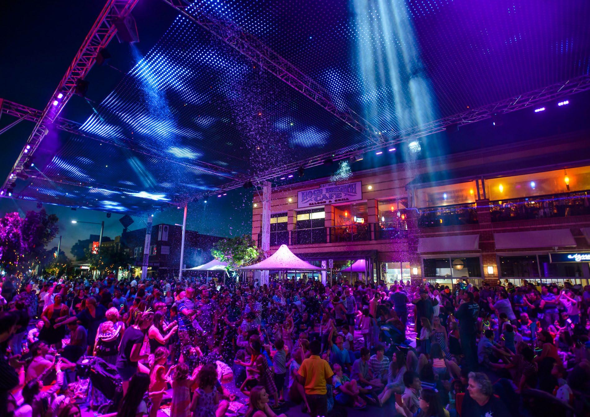
Castle Hill Main Street.
03
Vision
3.1 Vision for the Castle Hill Strategic Centre
This Precinct Plan sets the framework for reinforcing Castle Hill as a vibrant regional destination and expanding the mix of uses within the Strategic Centre, including increased housing capacity and more employment opportunities aligned with the skills of local residents. The vision for Castle Hill builds on previous strategic work by Council and the NSW Government as well as technical investigations focused on the Shire’s centres that provide insight into their unique features, role and function in the Region. It advances the planning into finer grain, site specific detail to inform potential changes to planning controls and the infrastructure framework, which can occur as the market demands, with the support of appropriate infrastructure.
By 2041, the Castle Hill Strategic Centre will be the leading shopping and entertainment destination for North West Sydney. It will offer a dedicated commercial area that enables businesses to establish themselves in a thriving local economy and provide jobs close to home for residents, tailored to their skillsets. A mix of apartments and terraces will be provided within walking distance of shops and job opportunities, supported by lively alfresco dining and eat streets along Old Northern Road, Old Castle Hill Road and McDougall Lane, which will be transformed and revitalised as enticing public domain areas, establishing Castle Hill as a safe and lively place to be at all hours of the day and into the night. Residents and visitors to Castle Hill will enjoy a thriving cultural landscape, with a rich offering of theatre, literary and civic events.
The next evolution of Castle Hill as a vibrant and resilient CBD for The Shire will be dependent on having the right mix and quantum of different land uses within the Centre. There is already a strong and successful retail presence within the Castle Hill Strategic Centre, as well as significant growth potential for additional residential development over the next 20 years and beyond. In this context, the Precinct Plan identifies the need to create more capacity for job-generating commercial development (particularly offices to provide high-skill jobs close to home for our residents) and community, civic, leisure and social uses. It also identifies how the implementation of key placemaking initiatives (such as completion of the Ring Road, extension of Main Street and pedestrianisation of McDougall Lane) will be necessary to create an enticing environment for development activity and investment, activate underutilised land and achieve the long-term vision for the Strategic Centre.
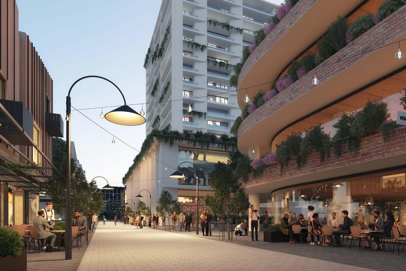
The status of Castle Hill as a high-quality Strategic Centre for The Hills will be reinforced through the promotion of quality built form outcomes and public domain elements. Buildings will be designed with regard to the unique environmental characteristics of the locality, most notably its varying topography. Buildings will be diverse and distinctive in their expression, shape and form. All street frontages at and within the Ring Road should be activated and encourage vibrancy at these locations.
Residents and workers will find walking and cycling an attractive and convenient option with enhanced open spaces, public plazas, new pedestrian bridges, through site links and upgraded pedestrian/cycle paths providing improved permeability and a seamless connection between the Metro Station and key locations within the Centre. New road links, upgraded intersections and the completion of the Ring Road will make it easier for people to travel within and around Castle Hill.
44
“The Strategic Centres of Castle Hill, Norwest and Rouse Hill will be part of a linear city that spans across the Metropolis of Three Cities, connecting the region’s major employment precincts, universities, hospitals and community services.”
- Mecone 2021
Indicative Concept of McDougall Lane Eat Street (Source: Tome Visuals)
Metro Station
Metro Line (Underground)
Castle Hill Strategic Centre
Proposed Road / Road Widening
Low Density Residential
Medium Density Residential
High Density Residential
Commercial Offices
Mixed Use
Retail
Special Use
Environmental
Public Open Space
Private Open Space
Potential Options Identified
Heritage Precinct
Signalised Intersection
Pedestrian Bridge
Left-in-left-out Intersection
Urban Plazas
Roundabout
University
Special Uses with potential for longer term job growth
High density residential with retail uses on the lower levels
Pedestrian Link
Extension of Main Street / Eat Street
The Hills Shire Council Draft Precinct Plan Castle Hill Strategic Centre 45
M T
3.2 Castle Hill - A Mixed Use and Transit Oriented Centre
This Precinct Plan will apply the principles of transit-oriented development to future growth in Castle Hill Strategic Centre and promote a compact and walkable Precinct which accommodates a mix of uses, all centred around the well-established Town Centre, Old Northern Road ‘Main Street’ and Castle Hill Metro Station.
Transit Oriented Development is the concept of maximising the density of development (be it housing, employment, retail, services and leisure) within walking distance of public transport to create walkable and highamenity precincts containing the right mix of uses. The concept of Transit Oriented Development is more relevant in the context of how the broader catchment areas around transport nodes are planned and work together as an agglomeration of land, as opposed to referring to a specific outcome on an individual site in isolation.
Generally, the catchment for Transit Oriented Development is measured based on walkable distance from a transport node, with a focus on land that is within 800 metres of a transport node. This specific distance can vary, often depending on how walkable an area is having regard to factors such as slope and the quality of pedestrian connections. However, it generally correlates with how far the average person could walk in 10 - 15 minutes and how far someone will be willing to walk between their origin or destination and a transport node. In short, it is the threshold under which we observe behavioural changes and in particular, a shift to rely on public transport versus private vehicle usage.
Key areas of the Precinct (such as the Castle Hill Metro Station) are located on a prominent ridgeline, being Old Northern Road, with topography a significant factor inhibiting walkability in the Precinct. In recognition of this, an 800m walking distance is considered to be the “walkable catchment” for Castle Hill.
Some of the key benefits of Transit Oriented Development are that it:
Reduces car dependence and traffic congestion and encourages the use of public and active transport over private vehicle trips.
Allows for the creation of pedestrian friendly areas with greater emphasis on place-making, amenity and active transport, in comparison to more traditional vehicle dominated areas.
Maximises the efficient use of public transport infrastructure, such as the Sydney Metro Northwest.
Reduces the relative cost of servicing new development with infrastructure able to be provided more efficiently to service growth in a consolidated and compact area, as opposed to a sprawling greenfield area.

Creates active and vibrant areas where local economic activity and investment can be focused with confidence.
Achievement of the long-term vision and objectives for Castle Hill will require a planning framework which allows for a broad mix of retail, commercial, residential, community and leisure uses to occur close to each other and within the walkable catchment around the Metro Station. This will help to create engaging and vibrant areas where diverse activities and functions can occur and where a viable day, night and weekend economy can exist.
In the context of a mixed use and transit-oriented precinct, it remains important that certain areas can be designated for specific outcomes. A clear land use framework provides certainty, confidence and viability for the market and landowners to make informed investment and development decisions with the clear knowledge of highest and best use. This will facilitate the achievement of short and long term strategic planning objectives for the Centre and avoid potential land use conflicts and amenity issues.
It will also reduce the risks associated with investment decisions spurred by speculation around the permissibility of higher value uses, which can artificially drive up land values to the point where development outcomes are no longer viable. In recent times, it has generally been the case that speculation around the potential for higher density residential outcomes to become permitted on land can artificially inflate land values such that the feasibility of strategically identified commercial outcomes becomes less viable.
The concept of a mixed use strategic centre is not incompatible with also designating specific areas for viable commercial development. This philosophy is supported within the strategic planning framework, including the Greater Sydney Region Plan, Central City District Plan and Council’s Local Strategic Planning Statement which envisage Castle Hill as a mixed use Strategic Centre, containing designated commercial areas, and low, medium and high density residential development.
Currently, residential development outcomes are permitted on all developable land within 800m walking distance of the Castle Hill Metro Station (noting some is where residential outcomes are complementary to retail outcomes). As the existing zoned capacity for new dwellings in these areas is realised by the market over the next 10-20 years, a significant residential population will reside within 800m of the Metro Station, bringing with it the activity, vibrancy and viability that is the goal for mixed use precincts. This Plan also identifies further residential growth potential, beyond these currently anticipated outcomes.
In contrast to residential outcomes, which are currently permitted on most land within the Strategic Centre, there is currently no land within the Precinct that is designated solely and specifically for employment outcomes. In the context of significant incoming residential development and acknowledging the underlying economic goal of employment growth within the Strategic Centre, it is important to identify areas for a predominance of retail, commercial and office development outcomes, even if the pace at which the market capitalises on these opportunities is more moderate than has been experienced for residential outcomes over recent decades.
46
400m 800m M Metro Station Metro Line Road Link Local Roads, Pedestrian and Cycle Paths Land Use Intensity/Density M
The residential targets for Castle Hill set out within this Plan should be achievable, noting the capacity for uplift already permitted within Castle Hill North Precinct and the range of other residential opportunities across the Precinct. The achievement of the job targets set out within this Plan however will be difficult and will be contingent on creating significant capacity for new and dense employment outcomes on land within and along the Ring Road and fostering an environment where investment in Castle Hill is an enticing prospect for the market, through key placemaking initiatives and Council’s concurrent work on the Economic Growth Plan. While this Precinct Plan sets the vision for the Precinct until 2041, it is critical that it has consideration for commercial development potential beyond this horizon to ensure that key employment land is safeguarded to futureproof employment prospects for future generations as The Shire’s population continues to grow.
For Castle Hill, achieving the right balance of mixed use and residential land around designated commercial areas will be crucial to delivering necessary commercial services that support the growing population, without competing with the higher order economic clusters intended for the nearby Norwest Strategic Centre.
This Plan sets the framework for Castle Hill’s continued evolution into a thriving mixed use Strategic Centre, ensuring that the Centre contains adequate and appropriately defined areas of land to facilitate the varied range of uses that can be expected to deliver a truly mixed use and thriving transit oriented Strategic Centre.
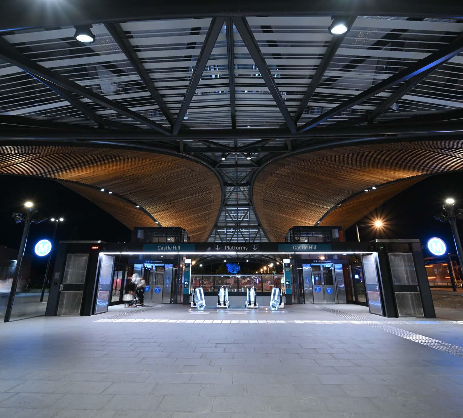
The Hills Shire Council Draft Precinct Plan Castle Hill Strategic Centre 47
Castle Hill Metro Station
3.3 Guiding Principles
The Precinct Plans for all three of Council’s Strategic Centres are underpinned by 12 guiding principles, which provide a framework for them to reach their full potential as highly diverse, liveable and desirable places to work, live and play for existing and future workers, residents and visitors. These guiding principles have been derived from the guidance and objectives provided within the relevant strategic planning policies, along with the strategic planning investigations commissioned by Council in late 2020. They also reflect Council’s aspirations for the strategic centres as articulated within the Local Strategic Planning Statement and the objectives identified within Council’s Community Strategic Plan.
Growing Employment
Delivering quality jobs so that our residents can have a genuine choice to work locally in fields that suit their individual needs and skillsets, whilst simultaneously reaping the lifestyle benefits that our Strategic Centre have to offer. In addition to matching the skillsets of local workers, the attraction of investment in knowledge intensive and innovative industries will bring a higher value and resilience to the local economy enabling our centres to grow into competitive, productive and thriving employment hubs.
Delivering Transit-Oriented Development (TOD)
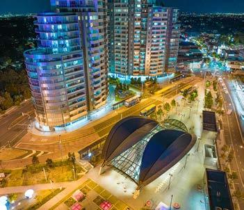
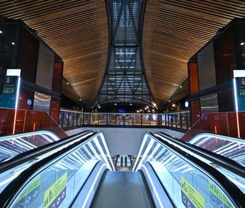
This principle is central to urban renewal and focuses on locating the highest density of development in closest proximity to transport hubs, enhancing walking and cycling connections and carefully managing parking locations and delivering compact, walkable and liveable centres which contain a mix of uses. Building height will be used in moderation, to allow for appropriate densities in the context of each individual site and prioritise the experience of the urban environment for pedestrians at the ground plane through generous landscaping, plazas, setbacks and building separation.
Improving Regional Connectivity
Quality connectivity to the wider Greater Sydney Region will be pivotal in enhancing the desirability of the Strategic Centres as places to live, work and visit. In addition to capitalising on the existing public transport system and connections to the Sydney Central Business District, the realisation of mass transit connections to Parramatta and the Western Sydney Airport provides opportunity to transform how the Shire’s Strategic Centre are perceived and thereby leverage investment and economic growth.
Achieving a 30-Minute City
Ensuring that people live within 30 minutes of their nearest Strategic Centre, when accessed by public transport, will enable more residents to work close to home, decrease commute times, reduce traffic congestion and improve the lifestyles of our residents. Whilst the strategic centres collectively benefit from proximity to Metro stations, improving active transport connections and place-making are key considerations in precinct planning to encourage a shift from reliance on private car use to more sustainable transport modes.
Infrastructure to Meet Needs
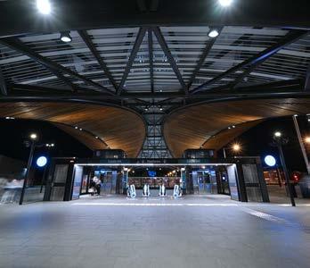
Our residents and workers require and deserve adequate local and regional infrastructure to enable them to go about their everyday lives. The provision of regional facilities including schools, emergency services, public transport and traffic upgrades will require meaningful collaboration with State agencies informed by anticipated growth projections. The provision of local infrastructure facilities including playing fields, parks, traffic and transport works, libraries, community facilities and stormwater works will require appropriate infrastructure contribution mechanism to be put in place in line with any changes to planning controls.
Supporting Business and Residents with Urban Services
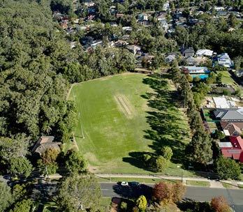
The term ‘urban services’ covers a range of industries and activities that are fundamental to how the Shire functions and are critical to supporting population and jobs growth. The need for services close to homes and workplaces such as motor vehicle services, repairers, printers, waste management and food preparation is only going to increase with expected growth. As the Shire undergoes transition and urban renewal, protecting industrial and urban services land will ensure capacity is maintained for a range of essential activities to co-exist with new development.
48
Castle Hill Metro Station
Commercial Development
Castle Hill Metro Station
Castle Hill Metro Station and surrounds Greenup Park
Urban Support Services
Diversity of Housing
Providing a choice of housing opportunities is essential in meeting the needs of a range of budgets and lifestyles. With the Shire’s demographic expected to continue to feature family groups, there is a need to plan for an adequate amount of apartments to cater to these groups. Future residential development will be guided by transit oriented development principles and focused upon walkability, activation and vibrancy. With sufficient land zoned within the Shire to meet and exceed housing targets to 2036 and beyond, the provision of additional housing must not be at the expense of ensuring that key employment lands are protected and identified, providing certainty to the market and facilitating the necessary commercial investment to achieve the Shire’s job targets.
Creating Places for People
The COVID-19 Pandemic has highlighted the importance of having access to everyday necessities and feeling connected within a ‘5-minute neighbourhood’, especially with people now valuing their local communities more than ever before. A focus on quality urban design outcomes and public domain improvements together with access to a range of everyday necessities will draw people to the Precincts and enable the Strategic Centres to evolve to great places for residents and workers.
Enhancing the Public Domain
Providing a desirable, accessible, safe and functional public domain that is useable by all people will be pivotal to the success of the Castle Hill Strategic Centre. The Precinct Plans will continue to protect, enhance and showcase the successful elements that already exist, as these are assets valued and regularly utilised by the local community. With people now becoming more active and looking to alternative modes of transportation, active movement opportunities will be prioritised through additional walking and cycling routes. This will be supported by a variety of rest and gathering opportunities along local streets. A unified palette of materials and finishes, along with public art and informative wayfinding, will assist in creating a clear ‘brand’ for our Centres.
Showcasing Local Character
The Shire has a rich local culture and heritage and extensive open space network which can draw people to the precincts. A focus on the key landmarks throughout the Precinct such as Arthur Whitling Reserve, former Police Station, Castle Hill Public School buildings (heritage items), Old Northern Road ‘Main Street’ and McDougall Lane will help to deliver spaces that the community are proud of and want to visit. Fostering a unique and distinguishable local character will be a key ingredient in building local connections and encouraging a strong sense of place.

Integrating ‘Smart’ Technology

To ensure our Strategic Centres keep pace with technological advancements, this Precinct Plan will seek to integrate technology as they continue to evolve into competitive employment destinations in a bid to better support residents, workers and visitors.
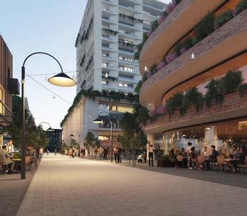

Encouraging Sustainability
Sustainability will be a key driving factor in planning for future growth within Castle Hill over the next 20 years. Sustainable practices will be increased and prioritised within future developments, such as green walls and roofs, solar panels, lighter colour palettes, active movement corridors, stormwater management or utilising sustainable materials in the public domain. Green infrastructure will be expanded where possible. Natural environments will be protected and maintained. These areas will be enhanced where possible, so they can be enjoyed by residents, workers and visitors, providing places where they can socialise and relax.

The Hills Shire Council Draft Precinct Plan Castle Hill Strategic Centre 49
Indicative Outcomes for Residential Development (Source: Turners)
Artist’s Impression of McDougall Lane (Source: Tome Visuals)
Public Domain (Source: Aspect Studio)
Castle Hill Heritage Park Smart City
Natural Environment

Natural Environment.
3.4 Environment and Sustainability
The Castle Hill Strategic Centre currently offers a diverse array of environmental assets and features that are regularly enjoyed by the community. These include existing green links, public domain areas, parks and local creeks and tributaries.
As Castle Hill continues to grow and evolve, further consideration must be given to sustainability and the environment. Sustainable practices must be embedded within any new developments, upgrades and improvements to the public domain. Examples of this may include stormwater management, active movement corridors, reducing urban heat or utilising sustainable materials.
Given Castle Hill has historically been quite car-dependent, encouraging a mode shift towards public transportation will be a key way to improve sustainability. This could be through increasing the proportion of trips by public transport (capitalising on the arrival of the Sydney Metro Northwest), providing additional walking and cycling links and reduced parking rates. Not only will this improve traffic flow on the road network, but this will also have substantial benefits for the environment, by reducing emissions and improving air quality. Implementing a high quality and well-connected public domain that focuses on active transport opportunities will be pivotal to achieving this.
Green links will be enhanced throughout the Castle Hill Strategic Centre, providing high quality pedestrian and cycling connectivity within and surrounding the Centre. Road upgrades, including the proposed extension of the ‘Ring Road’ and other new local roads, will improve pedestrian and cyclist connectivity into and out of the commercial areas from the residential surrounds. Pedestrian bridges across high traffic thoroughfares (such as Terminus Street, Pennant Street, Cecil Avenue and Crane Road) will be provided to prioritise the pedestrian experience.
Increasing the urban tree canopy cover within the Castle Hill Strategic Centre will be key to managing and mitigating urban heat. The urban tree canopy is a form of green infrastructure providing shade, which reduces ambient temperatures and mitigates urban heat. Urban heat is where large amounts of hard and dark-coloured surfaces like roads and roofs cause localised warming.
This Precinct Plan envisages more trees along streets, in parks and other public spaces, as well as on privately owned land. Large areas of individual sites will be expected to accommodate soft landscaping and deep soil zones capable of supporting mature trees. It also anticipates that more efficient glazing, shading, water capture and storage and passive solar heating design will be incorporated into future developments to reduce use of electricity and water.
Public domain areas will be enhanced throughout the Strategic Centre and it is envisaged that high quality urban plazas will be incorporated into future developments. Future developments will also be sympathetically designed to be compatible with the natural surroundings.
The Hills Development Control Plan will be the key mechanism to achieve this vision, along with the Public Domain Plan. While development controls and objectives relating to sustainable design are already being rolled out in Station Precincts and in association with site-specific planning proposals, this Plan recommends that these policy settings be applied more broadly across the Centre, in a consistent and streamlined manner.
Future DCP amendments will seek to achieve this by incorporating controls relating to the following:
• Green Star Ratings.
• NABERS energy and water ratings.
• Cool roofs, green walls and green roofs.
• Tree plantings in street verges.
• Photovoltaic facades and shading devices.
• Maximisation of natural light and cross ventilation.
• Reduced reliance on mechanical heating and cooling (through the use of eaves, awnings, good insulation and landscaping).
• Energy efficient light fittings and water fittings. This is further discussed in Section 4.5 of this Precinct Plan.
The Hills Shire Council Draft Precinct Plan Castle Hill Strategic Centre 51
3.5 Evolution into a ‘Smart Castle Hill’
To ensure that Castle Hill keeps pace with technological advancements and strategies being employed in other major employment destinations, this Precinct Plan aims to facilitate discussion and feedback on the types of infrastructure that Council, or the private sector, may wish to pursue over the coming years as Castle Hill grows and evolves.
Achieving a Smart Castle Hill will assist in cementing the Castle Hill Strategic Centre as a thriving retail, employment and entertainment destination. The delivery and use of evolving technologies can also improve operational efficiency, better meet the needs of our community, boost economic investment and improve sustainability measures.
What are Smart Places?
There is no global definition for smart places, as this can vary from place to place, tailored to the unique local situation at hand and having consideration for the following:
• Converging technological advancements with place making.
• Helping business thrive and attract highly skilled talent.
• Fast and efficient movement of data, not just people.
• Fostering collaboration, innovation and creativity.
• Encouraging future education opportunities.
• Driving competitive advantage.
• Prioritising amenity, liveability and the overall user experience with people at the heart of decisions.
Given technology is quickly becoming a part of everyday life, this Precinct Plan presents potential options that Council or other key stakeholders may wish to pursue moving forward. These will be further explored in a future Council-led policy which will supplement Council’s Strategic Centre Precinct Plans and guide the delivery and use of evolving technologies in the urban environment to provide better connected and informed communities.
It is intended that this policy will serve as an overarching guiding document that will assist in establishing partnerships between Local, State and Federal Governments, along with the private sector, to maximise investments in smart initiatives.
Early planning and consideration of how to integrate these technologies during master planning will make it easier and more cost effective for the private sector to deliver these technologies as they become more widespread. Ensuring the right digital plumbing (being the necessary digital infrastructure provision) is in place early in the process will be critical in digitally futureproofing Castle Hill, to ensure opportunities to integrate smart technologies within developments remains achievable and viable for Developers and other stakeholders moving forward. This is further discussed in Section 4.5 of this Precinct Plan.
Case Study: Smart Mobility, City of Newcastle
The City of Newcastle is striving to create a city with connected technology-enabled infrastructure. This idea of ‘smart mobility’ focuses on how people move around the city and use technology to support transport network design/function and to promote active and multi-modal travel.
City of Newcastle will have a lead role in various areas, including the deployment of traffic monitoring systems, collecting cycling data, delivering wayfinding systems and developing a strategy for transitioning Council’s fleet to electric vehicles and providing E-bikes for staff for work trips.
City of Newcastle will also uphold key supportive, advocative and collaborative roles in achieving a smart city. It is anticipated that it will collaborate with key stakeholders (such as developers and research partners) to pilot new programs and test new mobility technologies.
It will also investigate opportunities to integrate technologies into Council’s everyday operations. This includes investigating opportunities to include rideshare (e.g. GoGet) as part of Council’s fleet to reduce fleet costs and vehicle use.
- LSPS Action 22.1

52
Council will prepare and endorse a policy to guide the delivery and use of evolving technologies in the urban environment.
Easy Park App (Source: CIty of Newcastle)
Governance
Collaboration across government, industry and business.
• Develop a series of smart places training programs to build awareness, understanding and confidence in the use of data and digital technologies.
• Work with local businesses to integrate smart technologies that support economic recovery and sustainability.
• QR codes for planning application notices and other uses.
• Virtual and augmented reality apps that can enable citizens to see and experience proposed developments and projects to inform their feedback.
• Pedestrian counters at Metro Station to monitor pedestrian flows.
Living
Connects people and uses technology-enabled infrastructure.
• Outdoor benches which allow residents/visitors to charge their phones/devices.
• Smart signage which provide live travel information to pedestrians/ road users.
• Digital touch screens which help people find their way around and find out what’s on.
• Delivery of energy efficient and green buildings.
• Provision of electric vehicle charging points.
Economy
Digital infrastructure to support business growth, investment and sustainability.
• Investment in co-working spaces to support workers.
• Outdoor ‘work hubs’ which allow office workers or students to work outdoors, connect their laptops and connect to free Wi-Fi.
• Roll-out of 5G network to enable high speed internet and data.
• High-speed Wi-Fi throughout the public realm in Strategic Centres.
• Roll out of underground fibre optic cabling.
• Delivery of future education opportunities.
People
A strong and connected community using technology that enables everyone to participate.
• Develop an app that allows users to pay, start, stop or extend their parking with their phone.
• Install sensors in the streets of the strategic centres which help guide drivers to the best available parking near a destination.
• Sensor-based interactive lighting to create a dynamic public domain and provide entertainment and bring innovation to the streets.
• CCTV to improve safety after dark and encourage greater numbers of businesses and creative organisations to participate in the night-time economy.
• Interactive play features in our local parks (e.g. sensor based interactive lighting and water features).
Environment
Technology and innovation to improve the environment.
• Bin sensors to help improve waste management services.
• Council vehicles transitioning to electric vehicles.
• Provision of e-bikes to support sustainable transport options.
• Energy harvesting i.e. solar panels and wind generators as alternative energy sources for power.
• Sensors by plants and trees that send alerts when public gardens need to be watered.
• Access to environmental monitoring data to help determine environmental quality, such as soil moisture, air quality and pollution monitoring.
*Note: this page builds on the principles identified in Council’s LSPS and presents a list of potential indicative options that stakeholders may wish to consider moving forward. It does not commit Council or other stakeholders to delivering the abovementioned items, it just presents potential options to facilitate discussions moving forward.
The Hills Shire Council Draft Precinct Plan Castle Hill Strategic Centre 53
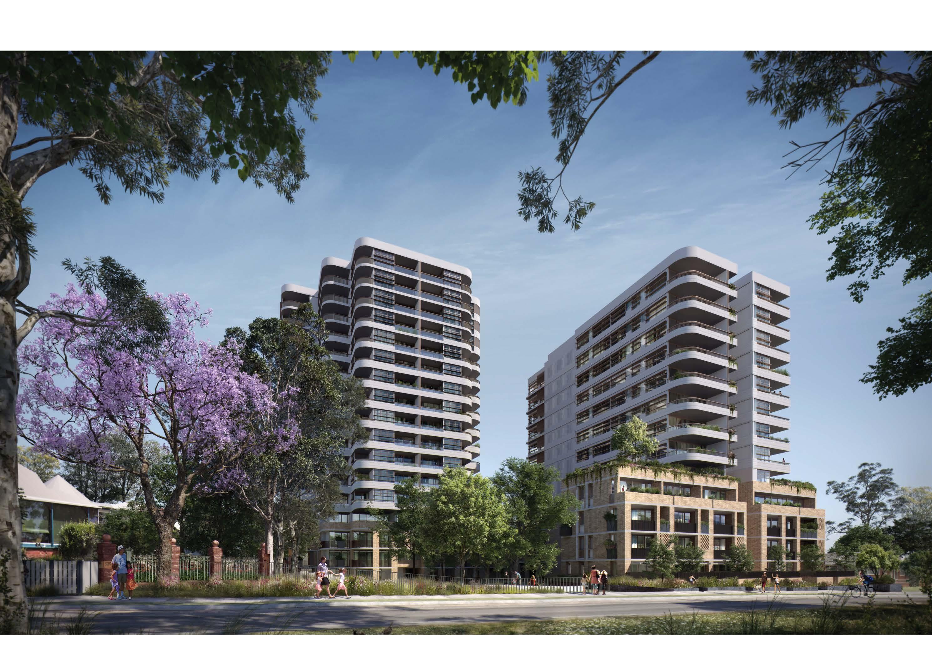
Indicative Outcomes for Residential Development (Source: Turners)
Focus Areas and Structure Plan
04
4.1 Focus Areas
A number of “Focus Areas” have been identified for the Precinct. These build on the planning work completed to date and guide the achievement of the vision for the Precinct. These outcomes are reflected
Murray Farm
Metro Line (Underground)
Proposed Road / Road Widening
Castle Towers Mixed Use
owers Entertainment and Heritage Precinct
Southern Ring Road Completion

Terminus Street West
Terminus Street East
Kentwell Avenue
Worthing Avenue
n Corner of Cecil Avenue and Old Northern Road
venue and Orange Grove
Crane Road and Mercer Street
Orange Grove West
Brisbane Road
Arthur Whitling Reserve and 4-12 Old Castle Hill Road
M
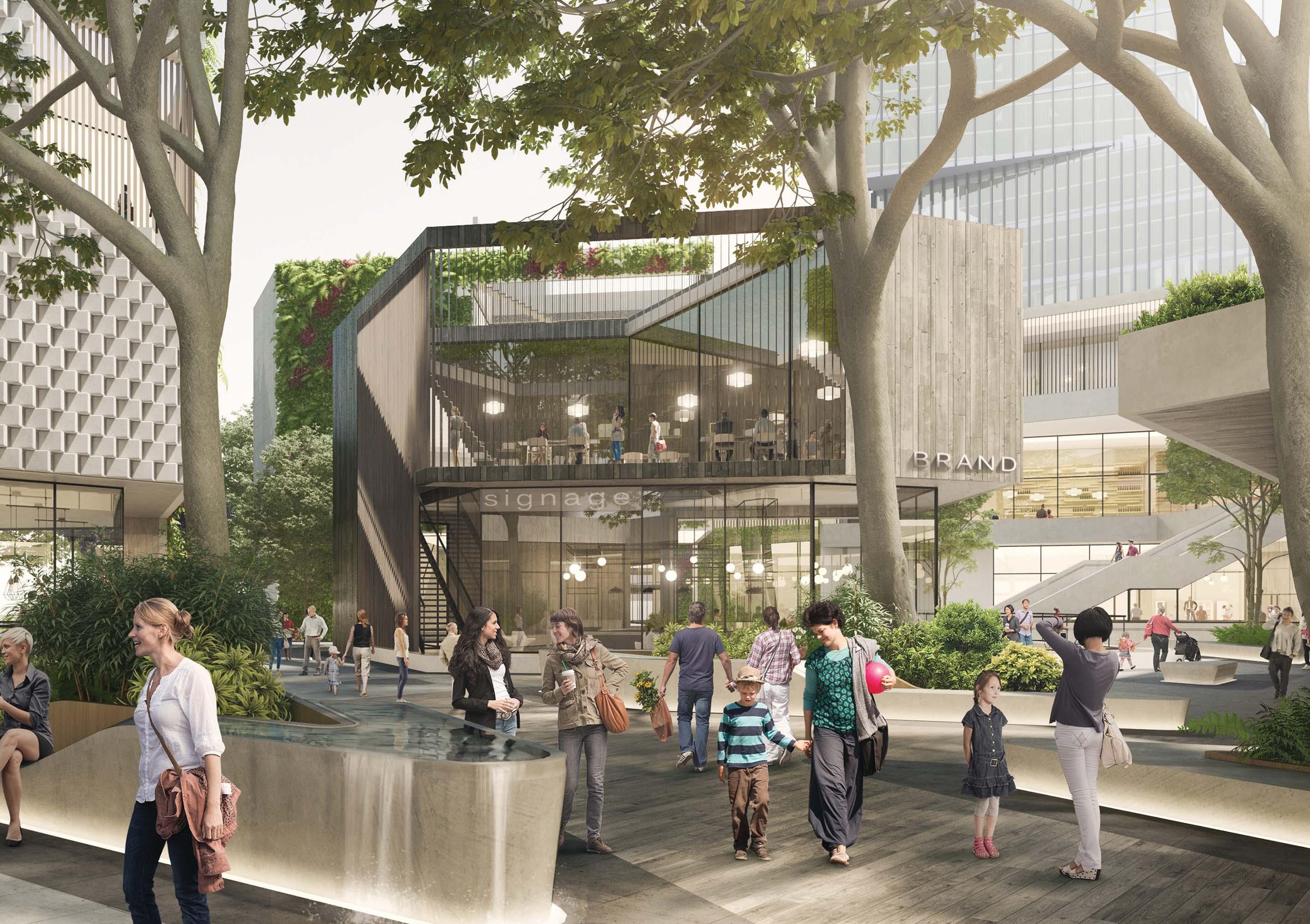 Artist Impression of Retail Development (Source: Buchan Group)
Metro Station
Metro Line (Underground)
Focus Area
Proposed Road / Road Widening
High Density Residential
Commercial Offices

Mixed Use
Retail
Special Use
Open Space
Potential Options Identified
Signalised Intersection
Pedestrian Bridge
Urban Plaza
Roundabout
High Density Residential with Retail Uses on Lower Levels
Pedestrian Link
Extension of Main Street
T M
Various design principles have been developed to guide future outcomes for the Focus Area:
Land Uses
• Commercial and retail development will be the key focus, significantly contributing to job growth within Castle Hill.
• Some residential uses are anticipated for this Focus Area fronting Pennant Street and transitioning to future residential development in Castle Hill North.
• Active ground floor uses will be encouraged to facilitate vibrant streets and interfaces.
• Build on the extensive range of dining and entertainment opportunities with workers being encouraged to socialise outside of working hours, expanding the night-time economy in Castle Hill.
• Redevelopment needs to demonstrate how the anticipated longer term retail demand can be accommodated having regard to the findings of the SGS Retail Floorspace Analysis (2021). This includes potential reconfiguration of floorspace to provide an additional supermarket, hospitality, lifestyle and entertainment offerings.
• Any residential dwellings should feature a diverse array of housing typologies of differing sizes, consistent with Council’s Housing Diversity provision (Clause 7.11 of LEP 2019).
Built Form
• Development is to be oriented to the street and be outward facing, reinforcing that streets are areas of activity.
• Taller buildings are to be strategically located in closest proximity to the Metro Station and will be slender with a high standard of architectural design, distinctly marking the heart of the Strategic Centre.
• Buildings up to a maximum of 30 storeys in height may be appropriate for this Focus Area, transitioning to lower built forms away from the Metro Station.
• Building heights will be varied and carefully sited having regard to the impacts on nearby open space, plazas, surrounding properties and the skyline of Castle Hill.
• Development will be sited, angled and designed to provide high levels of solar access.
• Appropriate height transitions will be provided to seamlessly integrate with nearby buildings.
•
Built Form (Cont.)
• Layouts of commercial buildings should be flexible and adaptable to suit the diverse needs of potential tenants, with larger floorplates (maximum of 1,500m²) encouraged.
• For residential towers, floor plates are to be a maximum of 750m² of GFA.
• Rooftop open space will be provided to support commercial and residential tower developments.
• Podiums will be efficiently used for common open space, entertainment and dining areas and to improve outlooks for those in taller towers looking across the Precinct.
Public Domain and Open Space
• The public domain will be attractive, safe, functional and accessible with a pedestrian focus and through site links a key feature of future development.
• Main Street will extend further north along Old Castle Hill Road and Arthur Whitling Reserve.
• Public domain will comprise well defined and comfortable places for people to gather, including informal seating.
• A unified hierarchy of materials and furniture elements will be used to create a sense of place and clear brand for Castle Hill. High quality treatments are to be provided including generous paving, integrated seating, landscaping, water features and public art.
• Significant landscaping and public plaza spaces will be provided to create a sense of place, especially along Old Castle Hill Road and Main Street.
• Publicly accessible plaza areas are to be delivered and maintained by private developers.
Connectivity
• Future development will be transit oriented by reducing car dependency and encouraging walking and cycling to and from the nearby Castle Hill Metro Station.
• Active movement opportunities will be encouraged by providing additional pedestrian links, as shown in Figure 36.
• Reduced parking provisions (for non-residential uses) to encourage a shift towards public transportation, away from the current cardependent model.
• Residential parking rates will be implemented in accordance with Council’s Housing Diversity provision (Clause 7.11 of LEP 2019).
Infrastructure
• Tangible infrastructure solutions (including traffic, open space and water management) and an appropriate funding and delivery mechanism will be required to ensure that the uplift can be appropriately serviced.
• Evolving technologies, including digital infrastructure provisions, will be integrated within future developments to provide better connected and informed communities.
The Hills Shire Council Draft Precinct Plan Castle Hill Strategic Centre 59
Metro Line (Underground)
Focus Area
Proposed Road / Road Widening
High Density Residential
Commercial Offices
Mixed Use
Retail
Special Use
Open Space
Heritage Precinct
Signalised Intersection
Pedestrian Bridge
Urban Plaza
Roundabout
High Density Residential with Retail Uses on Lower Levels
Heritage Item
Pedestrian Link
Extension of Main Street
H T
Heritage Item - Former Castle Hill Public School
Various design principles have been developed to guide future outcomes for this Focus Area, as follows:
Land Uses
• Commercial development will be the key focus, significantly contributing to job growth within Castle Hill.
• No residential uses are anticipated for this Focus Area, as this would reduce the long-term viability of the employment area and would likely be beyond the quantum of residential development that can be supported by key local infrastructure within and surrounding the Strategic Centre. Residential uses are better suited to the extensive areas already zoned and identified for residential purposes within the strategic framework and planning work to date.
• Active ground floor uses will be encouraged to facilitate vibrant streets and interfaces.
• New development will build on the extensive range of dining and entertainment opportunities with workers being encouraged to socialise outside of working hours, expanding the night-time economy in Castle Hill.
• Redevelopment needs to demonstrate how the anticipated longer term retail demand can be accommodated having regard to the findings of the SGS Retail Floorspace Analysis (2021). This includes potential reconfiguration of floorspace to provide an additional supermarket, hospitality, lifestyle and entertainment offerings.
• Sensitive and compatible land uses, such as cafes and small scale retail could allow for the adaptive reuse of the heritage buildings.
Built Form
• Development is to be oriented to the street and be outward facing, reinforcing that streets are areas of activity.
• Taller buildings are to be strategically located in closest proximity to the Metro Station and will be slender, with a high standard of architectural design, distinctly marking the heart of the Strategic Centre.
• Buildings up to a maximum of 30 storeys in height may be appropriate for this Focus Area, transitioning to lower built forms away from the station.
• Building heights will be varied and carefully sited having regard to the impacts on nearby open space, plazas, surrounding properties and the skyline of Castle Hill.
• Development will be sited, angled and designed to provide high levels of solar access.
• Appropriate height transitions will be provided to seamlessly integrate with nearby buildings.
• Layouts of commercial buildings should be flexible and adaptable to suit the diverse needs of potential tenants, with larger floorplates (maximum of 1,500m²) encouraged.
Public Domain and Open Space
• The public domain will be attractive, safe, functional and accessible, with a pedestrian focus and through site links a key feature of future development.
• A series of urban plazas that integrate with the street will be located along Old Northern Road (Main Street).
• Public domain will comprise well defined and comfortable places for people to gather, including informal seating.
• A unified hierarchy of materials and furniture elements will be used to create a sense of place and clear brand for Castle Hill. High quality treatments are to be provided including generous paving, integrated seating, landscaping, water features and public art.
• Significant landscaping and public plaza spaces will be provided to create a sense of place, especially along Main Street.
• Publicly accessible plaza areas are to be delivered and maintained by private developers.
Heritage
• Future development will be sympathetic to the existing heritage items (the Former Police Station and Castle Hill Public School).
• Any future planning proposal will be accompanied by heritage investigations to enable a greater understanding of nearby heritage items and what components of the place are significant, including identification of a curtilage and view corridors where appropriate.
• Development is not to detract from the identified significance of the nearby heritage items, its setting, nor obstruct important views to and from the site.
•
Connectivity
• Future development will be transit oriented by reducing car dependency and encouraging walking and cycling to and from the nearby Castle Hill Metro Station.
• Active movement opportunities will be encouraged by providing pedestrian links, as shown in Figure 38.
• Reduced parking provisions to encourage a shift towards public transportation, away from the current car-dependent model.
Infrastructure
• Tangible infrastructure solutions (including traffic, open space and water management) and an appropriate funding and delivery mechanism will be required to ensure that the uplift can be appropriately serviced.
• Evolving technologies, including digital infrastructure provisions, will be integrated within future developments to provide better connected and informed communities.
The Hills Shire Council Draft Precinct Plan Castle Hill Strategic Centre 61
4.1.3 Focus Area 3 - Southern Ring Road Completion
This Focus Area relates to 11 lots in fragmented ownership, bound by Showground Road and Castle Towers to the north, Cecil Avenue to the south and Old Northern Road to the east. The cumulative area of these lots is approximately 2.6 hectares (including the Barwell Avenue road reserve and far eastern portion of the Showground Road reserve between Pennant Street and Old Northern Road).
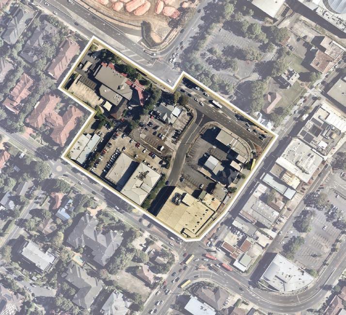
The completion of the Ring Road would reimagine the road layouts, traffic flows, public domain areas, site constraints and developable land areas for the benefit of the broader Strategic Centre, including:
• Enabling closure of Barwell Avenue and the eastern end of Showground Road and the amalgamation of these unused road reserves into a large consolidated development site. This would significantly improve development prospects on this land in comparison to the current lot configuration and planning controls.
• Enabling the extension of the Main Street pedestrian shared zone along Old Northern Road, up to Cecil Avenue, greatly improving the vibrancy and amenity in this area of the Precinct.

• Integrating this Focus Area and land on the opposite side of Old Northern Road (bound by Terminus Street) with Castle Towers into one consolidated area within the Ring Road, bisected by a shared pedestrianised Main Street.
• Providing additional capacity and efficiency on the State Road network.
• Providing a delineation between land uses, with a clearly defined commercial area inside the Ring Road and some higher density residential development on the western (external) side of the Ring Road.
It is anticipated that any uplift would be facilitated by a landownerinitiated planning proposal in the future, which addresses the design principles for the Focus Area set out within this Precinct Plan and explores the appropriate land use zoning, height of building controls and maximum floor space ratio controls. Further urban design work will be required to determine appropriate built form outcomes on the land, following reconfiguration of the lots and road reserves.
Critically, any potential for uplift on the land would be contingent on the following matters being overcome:
• Amalgamation of all land within the Focus Area by the market, to form one consolidated development site; and
• Reservation of land to enable the completion of the Ring Road from Pennant Street to Cecil Avenue and Old Northern Road.
In the absence of an amalgamated landholding which achieves the above outcomes, it is considered that the current planning controls applicable to the land (maximum floor space ratio of 1:1 and maximum building height of between 12 – 16 metres) continue to represent the most appropriate outcome for any future redevelopment.
It is expected that future development will comprise a designated commercial area within the new Ring Road alignment, providing a substantial contribution to longer-term job growth for the Strategic Centre.
While some residential outcomes may be appropriate on the western side of the Ring Road, this would be contingent on the achievement of the outcomes articulated within this Precinct Plan, as well as demonstrating that residential yield can be adequately serviced by infrastructure and accommodated in an appropriate built form, having regard to the current and future character of the locality.
Associated Development Control Plan (DCP) amendments will be required to guide future development outcomes on this site, including height distribution, setbacks, pedestrian links, public domain, privacy, overshadowing, ground floor activation and smart places provisions.
The existing development currently accommodates a range of uses including McDonalds, Castle Hill Masonic Centre, Castle Hill Baptist Church, Castle Hill Medical Centre, Douglass Hanly Moir Pathology, supporting health and medical services, retail shops and food outlets. Connectivity is currently quite constrained, generally due to the large lot sizes, limited through-site links and the major road barriers to the north and east (being Showground Road and Old Northern Road).
This Plan identifies the opportunity for redevelopment of this Focus Area to facilitate the completion of the Ring Road, by extending it from Pennant Street through to Cecil Avenue. This has the potential to create transformative change for the future of Castle Hill Strategic Centre, in terms of job growth, infrastructure provision and placemaking.
In reserving the land corridor necessary for the completion of the Ring Road, there is opportunity to explore a potential land swap whereby Barwell Avenue and the eastern end of Showground Road could be closed and incorporated into the commercial development area earmarked for the area inside the new alignment of the Ring Road. If included in an amalgamated development site, the areas of Barwell Avenue and the eastern portion of Showground Road would generally offset the new area to be reserved and transferred for the completion of the Ring Road alignment. Accordingly, a land swap of this nature would reserve the new road alignment and create a more consolidated and orderly development site, without impacting on the overall developable area available within the Focus Area.
62
Figure 39. Aerial View of Focus Area 4.1.3 (Source: Nearmap Aerial Imaagery, Copyright Nearmap)
Area identified for Ring Road Completion
Signalised intersection upgrades at the Pennant Street and Showground Road intersection, as well as the Cecil Avenue and Old Northern Road intersection, would also be required, which may require some land acquisition from properties along Cecil Avenue (shown indicatively in Figure 40 and subject to more detailed designs). Left-in-left-out upgrades would also be required along the new section of the Ring Road (at the Pennant Street and Cecil Avenue intersection).
As part of the consultation process for this Precinct Plan, Council is seeking feedback on the long term vision for this Focus Area from landowners, stakeholders, the community and Transport for NSW.
The achievement of the vision for this Focus Area will ultimately be dependent on further investigations and design in close consultation with Transport for NSW.
If this outcome is pursued, it is anticipated that the required road reservation could be secured at no cost to Council, through a potential land swap arrangement. Further consideration would be required with respect to funding of capital costs for the road construction and intersection upgrades, which may include State Government funding assistance and/or inclusion of some costs within an updated contributions framework for the Strategic Centre.
Focus Area
Proposed Road / Road Widening
High Density Residential
Commercial Offices
Mixed Use
Retail Special Use
Heritage Precinct
Signalised Intersection
Pedestrian Bridge
Left-in-left-out Intersection
Urban Plaza
Roundabout
Heritage Item
Pedestrian Link
Extension of Main Street
Figure 40. Indicative Layout Plan
T H
Various design principles have been developed to guide future outcomes for the Focus Area, as follows:
Land Uses
• Development will strike an appropriate mix of land uses providing a clear delineation between a designated commercial area (entirely non-residential outcomes) inside the Ring Road, complemented by some higher density residential outcomes on the western (external) side of the Ring Road.
• Active uses will be incorporated into the ground floor level to create a desirable and vibrant streetscape. This will be in keeping with the active frontages envisaged along the remainder of the Ring Road.
• Any residential dwellings should feature a diverse array of housing typologies of differing sizes, consistent with Council’s Housing Diversity provision (Clause 7.11 of LEP 2019).
Built Form
• Given the strategic importance of the Focus Area as a Gateway signifying the southern and western entry to the central areas of the Strategic Centre, the commercial portion will feature taller buildings elements.
• Building heights will be carefully sited having regard to the topographic constraints.
• Buildings will be tall and slender and will display a high standard of architectural design, distinctly marking the entry to the central parts of the Strategic Centre.
• Building heights will be varied creating visual interest in the skyline and minimising potential overshadowing impacts on surrounding properties.
• Tower elements are to be strategically positioned to maximise solar access, natural ventilation, and views (both into and through the site and from key vantage points in the public domain).
• Buildings will be appropriately setback from the street to minimise building bulk and create a highly desirable pedestrian environment.
• Layouts should be flexible and adaptable to suit the diverse needs of potential tenants, with commercial tower floor plates to be a maximum GFA of 1,500m² and residential floor plates to be a maximum GFA of 750m².
• Building lengths are to be a maximum of 50m.
Public Domain and Open Space
• Development should assist with the future extension of Main Street south west to Cecil Avenue as a key area of public domain with active frontages.
• Public domain will be attractive, safe, functional and accessible. It will feature high quality treatments including generous paving, integrated seating, landscaping and public art. High quality urban plazas are to be incorporated and located in centralised areas.
• Incorporate public art and informative way finding signage to strengthen Castle Hill’s identity.
• Maximise active movement opportunities by providing cycling routes and pedestrian through site links.
• Buildings will be sited to encourage passive surveillance of the public domain.
• Accessible bicycle parking should also be provided.
• Publicly accessible plaza areas are to be delivered and maintained by private developers.
Heritage
• Future development will be sympathetic to nearby heritage items (the Former Police Station and Castle Hill Public School).
• Any future planning proposal will be accompanied by heritage investigations to enable a greater understanding of nearby heritage items and what components of the place are significant, including identification of a curtilage and view corridors where appropriate.
• Development is not to detract from the identified significance of the nearby heritage items, their setting, nor obstruct important views to and from the site.
Connectivity
• Future uplift is contingent on the reservation of land for the extension of the Ring Road, from Pennant Street to Cecil Avenue and Old Northern Road.
• Future redevelopment must ensure that vehicular movement within and surrounding the Focus Area is safe and efficient and include a design that addresses:
• Signalised intersection upgrades on Cecil Avenue and Showground Road.
• Road widening along Cecil Avenue and the corner of Old Northern Road to facilitate the increased vehicular traffic from the Ring Road.
• Left-in-left-out upgrades to facilitate left-turns onto the Ring Road from Cecil Avenue.
• Potential closure of the far eastern portion of Showground Road (between Pennant Street and Old Northern Road) and Barwell Avenue. This could be delivered by way of a potential land swap (subject to future consideration by Council and agreement from State Government).
• Through-site links will be provided to enhance accessibility to the broader strategic centre, particularly across to Castle Towers and the Terminus Street West Focus Area, as shown in Figure 40.
• Future development will be transit oriented by reducing car dependency and encouraging walking and cycling to and from the nearby Castle Hill Metro Station.
• Active movement opportunities will be encouraged by providing pedestrian links, as shown in Figure 40.
• Reduced parking provisions to encourage a shift towards public transportation, away from the current car-dependent model.
64
Infrastructure

• Tangible infrastructure solutions (including traffic, open space and water management) and an appropriate funding and delivery mechanism will be required to ensure that the uplift can be appropriately serviced.

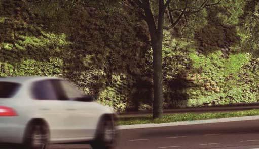
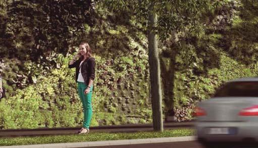


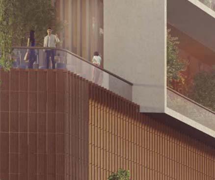
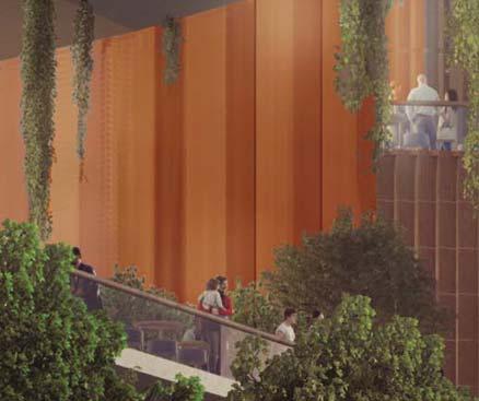


• Evolving technologies, including digital infrastructure provisions, will be integrated within future developments to provide better connected and informed communities.
• Consideration must be given to the relocation of all utilities to facilitate the closure of Barwell Avenue and Showground Road (between Pennant Street and Old Northern Road).
Orderly Development
• Any uplift would be contingent on the market consolidating the Focus Area into an amalgamated development site, including the relevant processes with Council and Transport for NSW relating to the closure of Barwell Avenue and eastern portion of Showground Road. This is a key barrier that must be overcome by the market for redevelopment opportunities in this location.
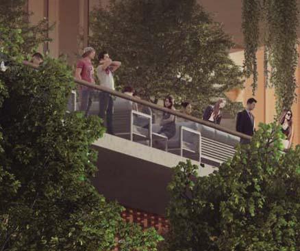
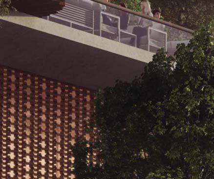
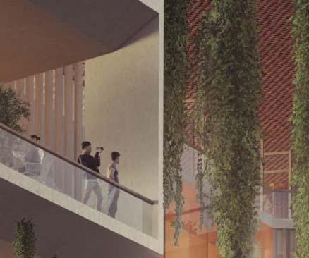
• Redevelopment will transform the frontage to Old Northern Road, as the Ring Road extension and subsequent road closures will reimagine the role and function of these areas. This poses an opportunity to create a highly pedestrianised environment, as these sites will no longer be inhibited by a high traffic arterial road through the middle of the Town Centre (given it will now wrap around the Town Centre). This will enable the commercial area to seamlessly integrate with the southern part of Castle Towers, which is also partially envisaged to transform into a designated commercial area.
The Hills Shire Council Draft Precinct Plan Castle Hill Strategic Centre 65 Cas s Caastltle le e T Towwewerers U s sU b rbabanD D n n Deesi s essiggn gn n Stu uSt dy y | A |A A rch rcch chite teecctu tu cttus
Illustration
Artist Impression of Pennant Street (Source: Buchan Group)
Metro Line (Underground)
Council-Owned Land
Privately Owned Land
On the western side of McDougall Lane, there are approximately 25 lots of varying sizes in fragmented ownership. The lots are generally rectangular in shape and range in size from less than 300m² to over 2,000m². This land includes a range of uses including a service station, the Hillside Hotel, a medical centre and other health related services, Anytime Fitness, grocers, real estate agencies and food outlets. These businesses generally front Old Northern Road, with services and vehicular access provided at the rear via McDougall Lane.
In order to deliver the broader goals for the Castle Hill Strategic Centre, the planning framework for this area is being re-evaluated to identify a contextually appropriate vision for the land, that responds to the arrival of the Sydney Metro Northwest and the opportunities offered by the University of Canberra Campus.
This Focus Area is a key location where additional employment capacity can be accommodated near the Metro Station and existing services within Castle Hill Town Centre. It is imperative that future development within the Focus Area capitalises on its proximity to the Castle Hill Metro Station and the new University Campus, which will be a catalyst for change and an opportunity for Castle Hill to emerge as a thriving and competitive commercial and education precinct.
A dedicated commercial area is earmarked for the western side of this Focus Area, given its proximity to Castle Towers, which is also partly envisaged for commercial purposes (Focus Area 2). The designation of land for solely commercial purposes is critical in managing the potential impact of residential developments ‘crowding out’ and impacting the viability of commercial activity.
A special use pocket is flagged in the south eastern corner of this Focus Area, reflecting the new University of Canberra Campus which specialises in nursing. This Plan envisages the opportunity for potential expansion of the University (or similar educational uses) into the commercial area or broader mixed use development on the neighbouring car park in the longer term future.
A mixed use area is identified for the eastern side of the Focus Area. The underlying focus of this area will continue to be employment growth and capacity, however some complementary residential development may be appropriate in dedicated areas. The delivery of any residential development is heavily contingent the following:
• Capitalising on the proximity to the new University of Canberra Campus to be a catalyst for employment growth and attracting knowledge intensive jobs and highly skilled workers.
• Ensuring commercial uses comprise no less than 70% of the overall GFA in areas identified for mixed use outcomes.
• Demonstrating that any residential yield can be adequately serviced by infrastructure and accommodated in an appropriate built form, having regard to the current and future character of the locality.
Improving movement and connectivity through this part of the Strategic Centre will be a key outcome of any future development. Coupled with the outcomes articulated in Focus Areas 14 and 17 of this Plan, it is intended that pedestrian-friendly streets will be encouraged, particularly along Castle Hill Main Street and McDougall Lane, with the intent of enhancing amenity, safety and walkability in the public domain, rather than predominantly focusing on traffic and service vehicles.
Metro Line (Underground)
Focus Area
Proposed Road / Road Widening
Commercial Offices
Mixed Use
Special Use
Urban Plaza University
Pedestrian Link
Extension of Main Street
*Note: Potential road widening may be required at the corner of Cecil Avenue and Old Northern Road to accommodate the extension of the Ring Road (refer to Focus Area 3 - Ring Road Completion), subject to more detailed design, investigations and consultation with Transport for NSW.
Draft Precinct Plan Castle Hill Strategic Centre
Figure 44. Indicative Layout Plan
Various design principles have been developed to guide future outcomes for this Focus Area, as follows:
Land Uses
• A designated commercial area is earmarked for the western portion of the Focus Area to provide certainty and capacity for Castle Hill to emerge as a thriving and competitive location for commercial development.
• Opportunity will be provided for mixed use development on the eastern side of McDougall Lane. Employment and education related uses will remain the primary objective in this portion of the site, however some residential tower elements may also be appropriate.
• Employment opportunities and everyday services will be prioritised, especially on lower levels of buildings.
• Similar land uses are to be clustered together to create functional and desirable working and living environments.
• Any future planning proposal must include a planning mechanism (such as a local provision) that ensures minimum non-residential development outcomes are achieved on the land (a minimum of 70% of the floor space within the Focus Area will be designated to commercial uses for areas identified for mixed use outcomes). This certainty is crucial to ensuring the appropriate land use mix and distribution, as well as sufficient employment floor space capacity to achieve the outcomes identified for the broader Strategic Centre.
• Active uses will be incorporated into ground floor levels to create a desirable and vibrant streetscape.
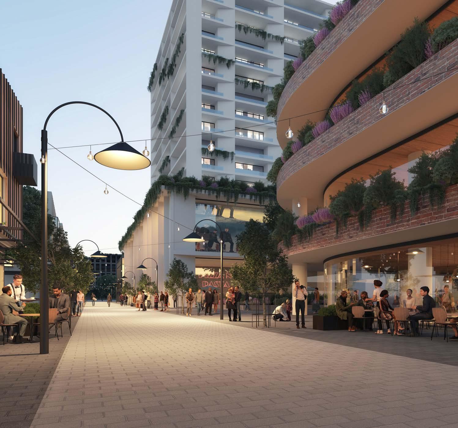
• McDougall Lane will be transformed into a vibrant ‘Eat Street’ while the services functions are consolidated.
• A special use pocket is identified in the south eastern corner of the Focus Area, being the new University of Canberra Campus.
• Any residential dwellings should feature a diverse array of housing typologies of differing sizes, consistent with Council’s Housing Diversity provision (Clause 7.11 of LEP 2019).
68
Artist Impression of McDougall Lane Eat Street (Source: Tome Visuals)
Built Form
• The tallest buildings will vary up to 22 - 25 storeys in height, strategically positioned at the gateway location on the corner of Old Northern Road, Crane Road and McDougall Lane.
• Tower forms will be tall and slender and will display a high standard of architectural design, distinctly marking the heart of the Strategic Centre.
• Tower elements are to be strategically interspersed (above a lowscale podium built form of approximately 4 storeys) and designed to maximise solar access, natural ventilation and views (both into and through the site and from key vantage points in the public domain). This is particularly important given the steep topography and north-south orientation of the Focus Area.
• Buildings should be sited to maximise district views in all directions, particularly to the southeast
• Smaller podiums are to be provided adjacent to public domain areas, to sympathetically frame these areas and reduce visual impacts.
• Building articulation is to be provided to soften the visual impact of towers and develop a pedestrian and human-scale built form.
• A consistent built form edge should be provided along street edges, particularly the Main Street frontage along Old Northern Road and the ring road frontage on Terminus Street.
• Layouts of commercial buildings should be flexible and adaptable to suit the diverse needs of potential tenants, with maximum floorplates of 1,500m².
• Residential tower floor plates are to be a maximum GFA of 750m².
• Building lengths are to be a maximum of 50m.
Public Domain and Open Space
• Public domain will be attractive, safe, functional, and accessible, with high quality treatments including generous paving, widened footpaths, integrated seating, landscaping and public art.
• Large public plazas will be strategically located in the heart of the Focus Area providing a space for residents, workers and visitors to enjoy and connecting with planned links on adjacent sites.
• High quality urban plazas are to be incorporated and located in centralised areas.
• Incorporate public art and informative way finding signage to strengthen Castle Hill’s identity.
• Maximise active movement opportunities by providing pedestrian through site links and re-thinking the role of McDougall Lane.
• Buildings will be sited to encourage passive surveillance of the public domain.
• Activation of buildings at street level is to be encouraged with urban plazas and open space areas provided for civic gathering and enjoyment.
• Accessible bicycle parking should be provided.
• Generous and continuous pedestrian shelter (including colonnades or awnings) should be provided along the ground level or first floor level.
• Publicly accessible plaza areas to be delivered and maintained by private developers.
Connectivity
• Improve pedestrian connectivity with new publicly accessible through site links and a pedestrian bridge across Cecil Avenue.
• Improve connectivity between Terminus and Old Northern Road to better integrate the commercial and mixed use areas with nearby residential areas.
• McDougall Lane will be widened and realigned to facilitate a shared zone (serving a dual function as an ‘Eat Street’, with consolidated services access).
• Vehicular access to individual properties from McDougall Lane or Old Northern Road is discouraged, with opportunities to be explored for a limited number of consolidated access points from Terminus Street, with access to individual properties via rights of carriageway.
Connectivity (cont.)
• Future redevelopment must ensure that vehicular movement within and surrounding the Focus Area is safe and efficient.
• Future development will be transit oriented by reducing car dependency and encouraging walking and cycling to and from the nearby Castle Hill Metro Station.
• Active movement opportunities will be encouraged by providing pedestrian links.
• Reduced parking provisions (for non-residential uses) to encourage a shift towards public transportation, away from the current cardependent model.
• Residential parking rates will be implemented in accordance with Council’s Housing Diversity provision (Clause 7.11 of LEP 2019).
Infrastructure
• Tangible infrastructure solutions (including traffic, open space and water management) and an appropriate funding and delivery mechanism will be required to ensure that the uplift can be appropriately serviced.
• Evolving technologies, including digital infrastructure provisions, will be integrated within future developments to provide better connected and informed communities.
Orderly Development
• Site amalgamations along Old Northern Road would be required to facilitate orderly development and capitalise on the development opportunities identified in this Plan. The consolidation of services access to make space available for more development opportunities relies on a master-planned development outcome over a large site area to succeed.
The Hills Shire Council Draft Precinct Plan Castle Hill Strategic Centre 69
4.1.5 Focus Area 5 - Terminus Street East
The Terminus Street East Focus Area is situated on the eastern side of the Ring Road, bound by Terminus Street to the west, Crane Road and residential strata development to the north, Orange Grove to the east and Cecil Avenue to the south. It has an area of approximately 4.5 hectares and is approximately 300m to 750m walking distance from the Metro Station.
The commercial office area comprises a mix of older style 2-3 storey strata titled office buildings which contain a cluster of medical practices, allied health and educational/tutoring groups in addition to localised business services and a number of restaurants. This area includes vacant land of approximately 1,680m² at 11-13 Terminus Street.
This Focus Area, whilst located near the Metro Station and central areas within Castle Hill, faces walkability challenges due to the topography and the major vehicular barrier created by the arterial Ring Road. The change in levels between Terminus Street and Orange Grove (between 7-15 metres), overland flow paths, flood prone land and fragmented ownership, will require careful consideration and a master planned response.
The R1 General Residential zone currently applied along the Terminus Street and part of the Cecil Avenue frontage permits a range of commercial uses including business premises, offices, hotels, restaurants and cafes. It was intended to provide a transition from retail parts of the centre to adjoining residential areas. However, the zone has been reported to cause confusion among investors considering commercial development (refer to Economic Analysis in Section 2 of this Precinct Plan).
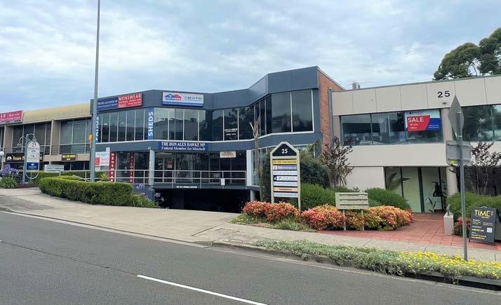
Should the market be able to overcome the relevant constraints, it would be appropriate for the Focus Area to be redeveloped to facilitate a mix of uses and varied built form outcomes. It is envisaged that future development would provide an appropriate transition between higher density predominately commercial development along Terminus Street and medium/higher density residential development central to the Focus Area and along Orange Grove.
Redevelopment of this area is challenged by strata title arrangements. It is anticipated that redevelopment of the residential apartments and townhouses to the north east of the area (as shown in Figure 45) will not be feasible and these sites have therefore not been included as part of the Focus Area. It is expected that current planning controls will remain unchanged for this location.
The Focus Area contains a variety of land uses ranging from older detached residential dwellings along the Orange Grove frontage, a church and school along the Cecil Avenue frontage (early learning and junior school K-4 for Hills Adventist College) and a small commercial office precinct along the Terminus Street frontage.
The largest land holding is the church/school site with an area of approximately 1.327 hectares. A vacant landholding of approximately 1,600m² adjoins the school site to the west and is the subject of a development application for a boarding house (intended for student accommodation).
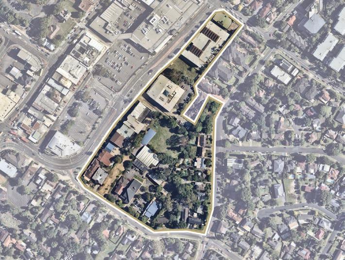
Cutlack Walk provides a 3.5m wide pedestrian connection from Terminus Street to Orange Grove Reserve which is a small, treed pocket park around 1,370m² in size that predominately serves a drainage function.
Maintaining and enhancing a commercial focus for buildings along Terminus Street frontage (lower levels) will assist in connecting the area to the central core, capitalises on the proximity to the Metro Station and responds to the identified shortfall of commercial floor space for the strategic centre.
Walkability to central parts of the Precinct and the transport interchange will be enhanced through the provision of active interfaces with Cutlack Walk, extending Orange Grove Reserve to the west and south, providing a grade separated pedestrian crossing at Terminus Street/Crane Road and activating street frontages (refer to Focus Area 10).
Creation of a service lane through the centre of the Focus Area will minimise the impacts of vehicular access and parking on the design of buildings and will facilitate the delivery of active frontages along Terminus Street.
Whilst guidance is provided in this Precinct Plan, it is anticipated that future uplift will be facilitated by landowner-initiated planning proposals for larger amalgamated sites (at least 8,000m² for mixed use outcomes). Detailed built form testing will be required that responds to the Focus Area constraints and informs appropriate controls and the optimal way to masterplan amalgamated sites.
Associated site specific Development Control Plans will also be required to establish a suite of controls to guide redevelopment, along with appropriate infrastructure solutions and mechanisms.
70
Figure 45. Aerial View of Focus Area 4.1.5 (Source: Nearmap Aerial Imaagery, Copyright Nearmap)
Terminus Street Frontage
Cutlack Walk
Focus Area
Proposed Road / Road Widening
High Density Residential
Commercial Offices
Mixed Use
Special Use
Open Space
Heritage Precinct
Signalised Intersection
Pedestrian Bridge
Urban Plaza
Roundabout University
Pedestrian Link
Extension of Main Street
T
Various design principles have been developed to guide future outcomes for the Focus Area, as follows:
Land Uses
• Development will strike an appropriate mix of land uses to create a lifestyle precinct.
• Employment opportunities and everyday services are to be prioritised for the Terminus Street and Cecil Avenue frontages, which may be complemented by some residential living on the upper levels of commercial development.
• Any future planning proposal that seeks to rezone land to MU1 Mixed Use must include a planning mechanism that ensures a predominance of employment development outcomes (minimum 70% floor space for designated commercial uses).
• Any residential dwellings should feature a diverse array of housing typologies of differing sizes, consistent with Council’s Housing Diversity provision (Clause 7.11 of LEP 2019).
• Low rise apartment development or medium density townhouse or terrace development that responds to the environmental constraints is envisaged for the south-eastern portion of the Focus Area on amalgamated sites, ensuring appropriate stormwater management and providing a transition to new residential opportunities on the eastern site of Orange Grove (refer Focus Area 11).
Built Form
• Deliver a high-quality built form that transitions in height from the western side of Terminus Street, through to the lower scale medium and high-density housing east of the Focus Area (2-5 storeys).
• On larger amalgamated sites which have a minimum area of 8,000m², building heights are envisaged to vary between 8-10 storeys with lower rise commercial outcomes located along the road frontage and taller building elements behind.
• Building heights will be carefully sited to respond to the topographic constraints and minimise potential overshadowing and impacts on sensitive residential uses and public domain areas.
• Active uses with a range of dining, retail and entertainment opportunities will create vibrant streets at lower levels and an interface with development on the western side of Terminus Street.
• Commercial building layouts should be flexible and adaptable to suit the diverse needs of potential tenants.
• Buildings should be carefully sited to avoid overland flowpaths.
Public Domain and Open Space
• Development should capitalise on the proximity to the Metro Station and seamlessly integrate with the central parts of Castle Hill.
• Functional outdoor spaces will be provided for the enjoyment of workers, including green roof terrace areas.
• Orange Grove Reserve will be extended to the south and west, increasing its size by approximately 2,000m². It will be enhanced with facilities in accordance with the open space hierarchy in Council’s Recreation Strategy.
• Incorporate public art and informative way finding signage to strengthen Castle Hill’s identity.
• Buildings will be sited to encourage passive surveillance and activation of the public domain, including the enhanced Cutlack Walk.
• Accessible bicycle parking should also be provided.
• Continuous awnings are to be provided along Terminus Street.
Connectivity
• Future development will be transit oriented by reducing car dependency and encouraging walking and cycling to and from the Castle Hill Metro Station.
• Active movement opportunities will be encouraged by providing an enhanced landscaped Cutlack Walk and expansion of Orange Grove Reserve. Through site connections should be provided to link to this central spine.
• Efficient vehicular access to be provided for servicing and basement parking off a new 6m service lane running from Cecil Avenue through to Crane Road. The service lane could feature a shared pedestrian and cycling environment, whereby safety and pedestrian movements are prioritised over vehicles.
• Reduced parking provisions (for non-residential uses) to encourage a shift towards public transportation, away from the current cardependent model.
• Residential parking rates will be implemented in accordance with Council’s Housing Diversity provision (Clause 7.11 of LEP 2019).
• A pedestrian bridge will be provided over Terminus Street (refer Focus Area 10).
Infrastructure
• Tangible infrastructure solutions (including traffic management, pedestrian connectivity, open space and water management) and an appropriate funding and delivery mechanism will be required to ensure that the uplift can be appropriately serviced.
• The acquisition for the expansion and subsequent embellishment of Orange Grove Reserve will be considered for inclusion as a new local infrastructure item within Contributions Plan No. 17, as discussed further in Section 5 of this Plan.
• Evolving technologies, including digital infrastructure provisions, within future developments to provide better connected and informed communities.
• Substantial upgrades to existing old stormwater pipes will likely be required as redevelopment occurs.
72
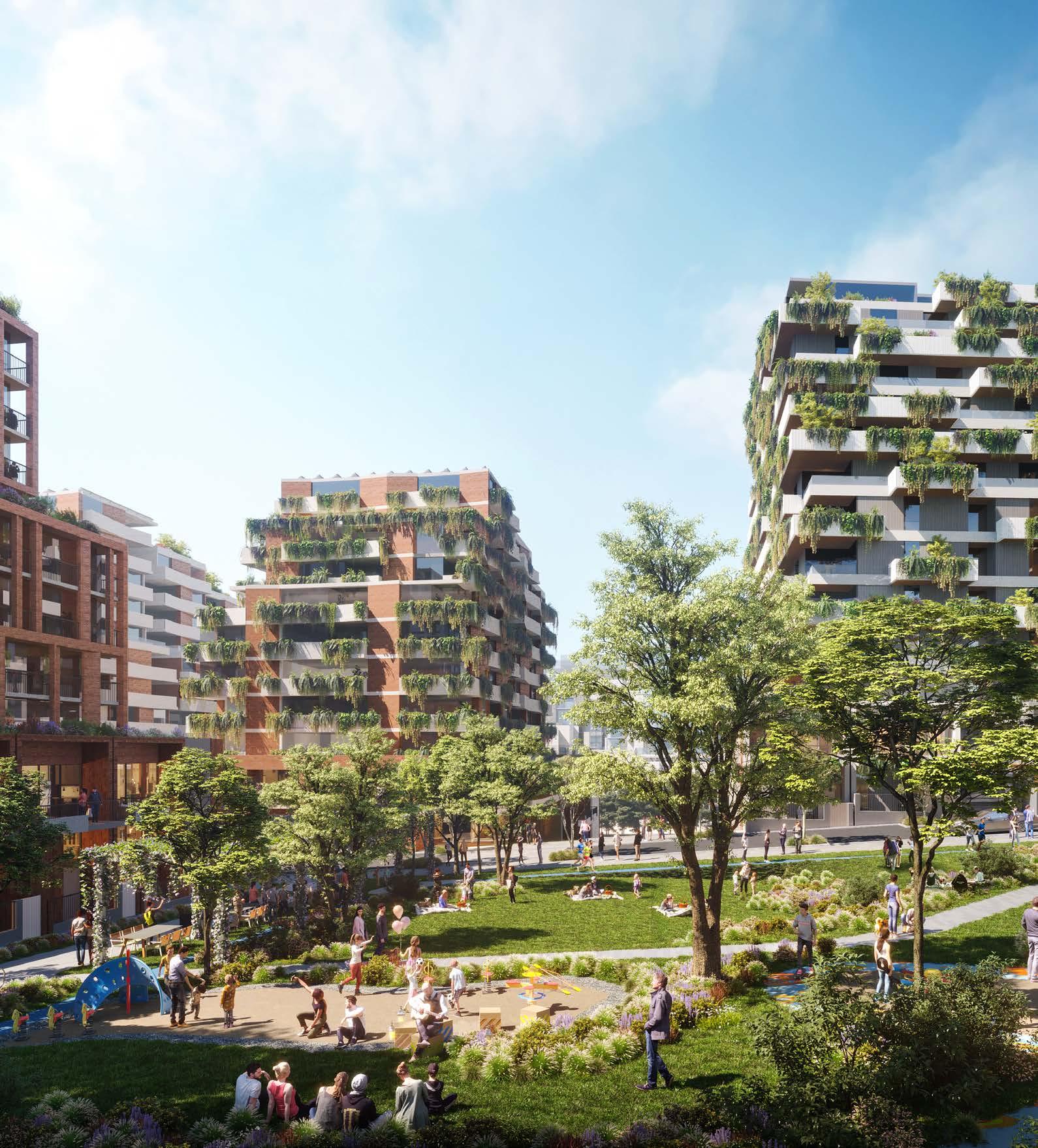
Indicative Outcomes for Future Streetscape
(Source: Hatch Roberts Day)
4.1.6 Focus Area 6 - Kentwell Avenue
The Kentwell Avenue Focus Area is a large cluster of sites in consolidated ownership opposite Castle Towers Shopping Centre. It is bound by Castle Street to the north, Pennant Street to the east, Showground Road to the south and Kentwell Avenue to the west. It has a combined area of approximately 4 hectares and is largely undeveloped, except for some detached residential dwellings fronting Kentwell Avenue. It is between 400m and 750m walking distance from the Castle Hill Metro Station.
This Focus Area does not include Castle Hill Library and the existing residential development at the intersection of Castle Street and Pennant Street (known as Castle Grand), which is expected to remain unchanged.
A new private Indoor Sports Centre is envisaged at the corner of Showground Road and Kentwell Avenue, which will provide sporting opportunities including a skate bowl and climbing wall. It will act as a key destination extending from the emerging entertainment district, with potential for additional commercial growth in the longer term (beyond the 2036/2041 horizon).
Strategic planning for Castle Hill to date has earmarked this land as a key area to accommodate employment growth. Specifically, this site is one of a number of sites that will comprise the designated commercial areas within the Precinct.
The delivery of high density commercial office spaces on each of these sites will be critical in achieving the District Plan and LSPS job targets set for Castle Hill Precinct (being 7,920-11,420 additional jobs between 2016 and 2036, to facilitate a total of between 16,000 and 19,500 jobs in the Precinct by 2036). Having regard to holistic outcomes across the broader Strategic Centre, this Plan identifies the need for land within this Focus Area to accommodate no less than 1,700 new jobs (with potential for additional longer term capacity beyond this in the special use area at the junction of Kentwell Avenue and Showground Road).
It is envisaged that the Focus Area will emerge as a new retail, restaurant and employment precinct, as a logical extension of the Castle Towers Shopping Centre on the opposite side of Pennant Street. In recognition of the benefits of a mix of uses all occurring near each other, some increased residential development has been identified on the north-west corner of the Focus Area fronting Kentwell Avenue and Castle Street.
This will provide a logical transition in land uses towards the adjoining residential areas to the north and west. The delivery of this residential development within the Focus Area will be heavily contingent future development:
• Ensuring commercial outcomes remain the core objective of development, representing no less than 50% of the total future floor space proposed on the site.
• Retaining a designated commercial area capable of accommodating no less than 1,700 jobs (this refers to the capacity of the land and planning controls, rather than specifically the amount of take-up by the market within a specific period).
• Demonstrating the ability to service any residential development proposed with appropriate local and state infrastructure, including new passive and active open space (playing fields); and
• Demonstrating that the proposed quantum of floor space proposed can be accommodated within an appropriate built form and urban design outcome on the site.
Whilst guidance is provided in this Precinct Plan, it is anticipated that future uplift will be facilitated by a landowner-initiated planning proposal for the subject site. This is intended to further explore key matters such as the strategically appropriate mix of uses, land use zoning, height of building controls, maximum floor space ratio controls, facilitation of an orderly local road network and delivery of key infrastructure outcomes.
A planning proposal should secure the reconfiguration of the local road network as well as new pedestrian linkages, to enhance permeability and support traffic flows throughout this portion of the Strategic Centre. It is expected that new road links will be constructed as part of any future redevelopment and transferred to Council, at no cost. A new public park will also be provided within the site.
A new pedestrian bridge will also be provided over Pennant Street to enhance and prioritise the pedestrian experience and link the mixed use and commercial areas to Castle Towers Shopping Centre and the Metro Station (it is noted that this pedestrian bridge is currently identified and funded through Contributions Plan No. 17 – Castle Hill North Precinct).
An associated site-specific Development Control Plan would also be required to establish a suite of controls to guide redevelopment, along with appropriate infrastructure solutions and mechanisms.
It should be noted that in October 2022, a site-specific planning proposal was lodged by the landowner for this Focus Area. While (at the time of preparing this Precinct Plan) assessment of this proposal has not yet been completed, it is acknowledged that the landowner does have an alternate view with respect to appropriate development outcomes on the site, which markedly differs to the strategic outcomes previously envisaged for this land and those articulated within this Precinct Plan. The planning proposal seeks to permit a floor space ratio of 4.5:1 and maximum building heights of up to 28 storeys. With respect to land uses, the planning proposal seeks to enable residential outcomes as the dominant use on the site, comprising around 90% of the floor space proposed, with only a small portion of non-residential floor space interspersed throughout the site with potential capacity of up to 700-900 additional jobs.
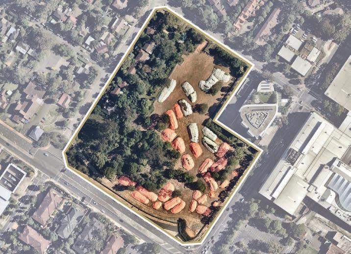
While the assessment of this planning proposal will concurrently progress through the appropriate pathway, it remains relevant as context for consideration of this Precinct Plan and the broader strategic outcomes for the Centre, especially as they relate to employment and the provision of new jobs. The Focus Area is well-located adjoining Castle Towers Shopping Centre and within walking distance to the Castle Hill Metro Station (with future connectivity improvements identified in this Plan likely to further enhance accessibility to and from this Focus Area).
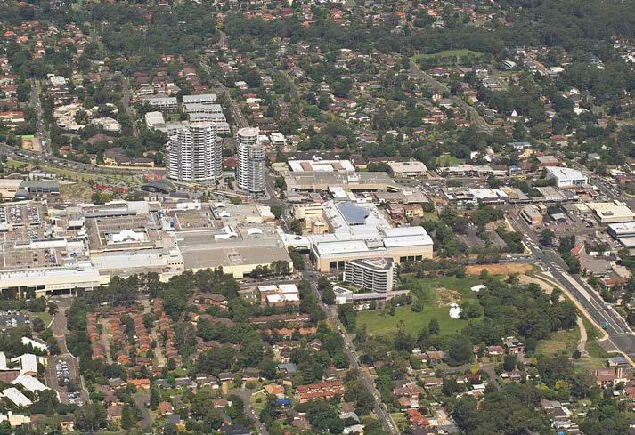
74
Figure 47. Aerial View of Focus Area 4.1.6 (Source: Nearmap Aerial Imaagery, Copyright Nearmap)
Aerial View of Kentwell Avenue Precinct and Surrounds
T H
Various design principles have been developed to guide future outcomes for the Focus Area:
Land Uses
• Employment growth is the key underlying goal for the site. Commercial outcomes should represent no less than 50% of the total future floor space proposed on the site, with a designated commercial area capable of accommodating no less than 1,700 jobs (this refers to the capacity of the land and planning controls, rather than specifically the amount of take-up by the market within a specific period).
• A private Indoor Sports Centre is envisaged at the corner of Showground Road and Kentwell Avenue, with potential to be incorporated into future commercial development (providing additional longer-term job capacity beyond the 1,700 anticipated in the remainder of the dedicated commercial area).
• A new entertainment and restaurant precinct is to be provided as an extension of the Castle Towers Shopping Centre.
• Whilst some residential outcomes may be appropriate, this should not be at the expense of employment opportunities and this must have regard to infrastructure capacity within the locality and appropriate built form outcomes, providing a transition to housing fronting Kentwell Avenue.
• Any residential dwellings should feature a diverse array of housing typologies, of differing sizes, consistent with Council’s Housing Diversity Provision (Clause 7.11 of LEP 2019).
• Active uses will be incorporated into the ground floor level to create a desirable and vibrant streetscape.
Built Form
• Building heights are envisaged to vary between 9 and 14 storeys, with taller buildings strategically located towards the southeast of the site, providing a height transition to the residential areas towards the west.
• Shorter podium elements, with active frontage and non-residential uses will surround a new public park, to sympathetically frame the park and reduce visual impacts.
Built Form (Cont.)
• Tower elements are to be strategically positioned to maximise solar access, natural ventilation, and views (both into and through the site and from key vantage points in the public domain). Slender towers should be designed to maximise solar access to the public park.
• Building articulation is to be provided to soften the visual impact of the towers and develop a pedestrian and human scale built form.
• A consistent built form edge should also be provided along street edges.
• Residential tower floor plates are to be a maximum GFA of 750m².
• Encourage larger commercial tower floor plates (maximum GFA of 1,500m²).
• Building lengths are to be a maximum of 50m.
Public Domain and Open Space
• Incorporate public art and informative way finding signage to strengthen Castle Hill’s identity.
• Maximise active movement opportunities by providing cycling routes, pedestrian through site links and re-thinking the street structure.
• Buildings will be sited to encourage passive surveillance of the public domain.
• Create a pedestrian dominated environment that is accessible to residents and workers.
• A local park will be strategically located in the heart of this Focus Area providing a space for residents, workers and visitors to enjoy.
• The local park will be a functional space that features practical elements (such as seating, shade structures, playgrounds, BBQ and picnic facilities, landscaped elements etc.), in accordance with the open space hierarchy within Council’s Recreation Strategy.
Connectivity
• Future development will be transit oriented by encouraging walking and cycling to and from the nearby Castle Hill Metro Station.
• Active movement opportunities will be encouraged by providing a strong, functional and accessible cycling and pedestrian network.
• Reduced parking provisions (for non-residential uses) to encourage a shift towards public transportation, away from the current cardependent model.
• Residential parking rates will be implemented in accordance with Council’s Housing Diversity provision (Clause 7.11 of LEP 2019).
• A pedestrian bridge will be provided over Pennant Street, improving connectivity to Castle Towers Shopping Centre and future development in the Heritage Precinct (Focus Area 2) from this Focus Area and Worthing Avenue Focus Area (Focus Area 7).
• The local road network will be reconfigured to provide enhanced permeability through the Strategic Centre, including a new road connection between Kentwell Avenue and Castle Street, as shown in Figure 48.
• Accessible bicycle parking should be provided.
Infrastructure
• Tangible infrastructure solutions (including traffic management, pedestrian connectivity, open space and water management) and an appropriate funding and delivery mechanism will be required to ensure that the uplift can be appropriately serviced.
• The acquisition for the delivery and subsequent embellishment of the new local park will be considered for inclusion within Contributions Plan No. 17, as discussed further in Section 5 of this Plan. Alternatively, a future planning proposal may be able to incorporate delivery of this outcome as a public benefit.
• Evolving technologies, including digital infrastructure provisions, within future developments to provide better connected and informed communities.
76
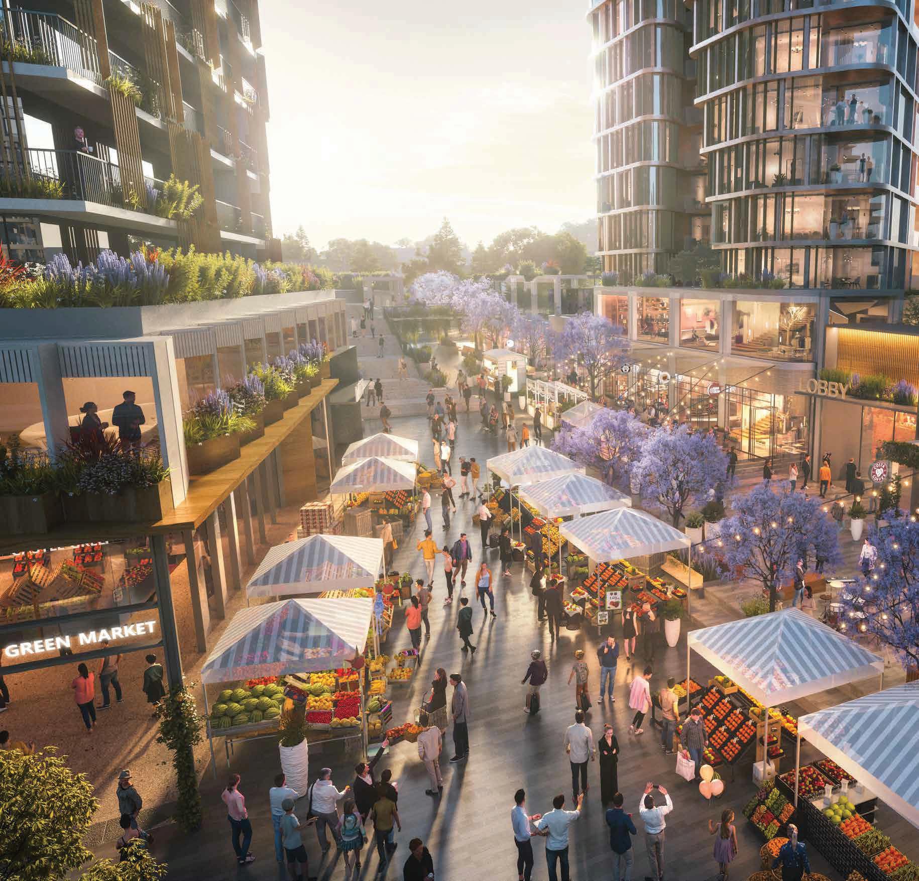 Artist Impression of Mixed Use Outcomes (Source: Hatch Roberts Day)
Worthing Avenue Reserve
Various design principles have been developed to guide future outcomes for this Focus Area, as follows:
Land Uses
• High density residential uses are identified for the Focus Area.
• Future residential development should feature a diverse array of housing typologies, of differing sizes, consistent with Council’s Housing Diversity Provision (Clause 7.11 of LEP 2019).
• Integration of active uses on the ground floor level of highdensity residential developments to help create vibrant and lively streetscapes and provide for the day-to-day needs of residents in closer proximity of their homes.
Built Form
• Deliver a high quality built form outcome that seamlessly transitions from the residential developments on the opposite side of Kentwell Avenue, through to the existing lower density residential areas (approximately 2-3 storeys in height) west of the Focus Area.
• Lower scale apartment developments must be sympathetically designed to minimise adverse amenity impacts on existing low density residential areas.
Public Domain and Open Space
• Worthing Avenue Reserve will be expanded to provide additional passive open space areas for the enjoyment of residents.
• Buildings will be strategically sited to provide casual surveillance of the public domain.
Heritage
• Future development will showcase the local heritage item at 30-34 Showground Road.
• New buildings and structures will not obscure the street elevation view of the existing building and must be setback further from the street than the existing building.
• New buildings will be strategically sited to retain significant site features.
• Any alterations to the heritage building will be undertaken in a sympathetic manner that ensures the retention of the existing fabric and character of the building.
• Any future planning proposal will also be accompanied by heritage investigations to enable a greater understanding of the heritage value of the site and what components of the place are significant, including identification of a curtilage and view corridors where appropriate.
Connectivity
• Future development will be transit oriented by reducing car dependency and encouraging walking and cycling to and from the nearby Castle Hill Metro Station.
• Active movement opportunities will be encouraged by providing a strong, functional and accessible cycling and pedestrian network.
• Improve pedestrian connectivity between Castle Street and Showground Road with new publicly accessible through site links.
• Residential parking rates will be implemented in accordance with Council’s Housing Diversity provision (Clause 7.11 of LEP 2019).
Infrastructure
• Tangible infrastructure solutions (including traffic management, pedestrian connectivity, open space and water management) and an appropriate funding and delivery mechanism will be required to ensure that the uplift can be appropriately serviced.
• The acquisition for the expansion and subsequent embellishment of Orange Grove Reserve will be considered for inclusion as a new local infrastructure item within Contributions Plan No. 17, as discussed further in Section 5 of this Plan.
• Evolving technologies, including digital infrastructure provisions, will be integrated within future developments to provide better connected and informed communities.
Orderly Development
• Amalgamations will be required to facilitate orderly development and the achievement of holistic and master planned development outcomes. The significantly fragmented land ownership patterns is a key barrier that must be overcome by the market for all redevelopment opportunities in this location to be realised. This may lead to staged roll-out of future development over the broader Focus Area.
The Hills Shire Council Draft Precinct Plan Castle Hill Strategic Centre 79
Focus Area
Proposed Road / Road Widening
Medium Density Residential
High Density Residential
Commercial Offices
Mixed Use
Special Use
Signalised Intersection
Pedestrian Bridge
Left-in-left-out Intersection
Urban Plaza
Heritage Item
University
Pedestrian Link
Extension of Main Street
T H
Various design principles have been developed to guide future outcomes for the Focus Area, as follows:
Land Uses
• Employment growth will be the key underlying goal for this Focus Area and the site will principally accommodate commercial office floor space, with some complementary retail floor space.
• Active ground floor uses will be encouraged to facilitate a vibrant streetscape.
• Residential uplift is not appropriate for this site as it would not align with the economic and employment goals for the Precinct and would be beyond the residential population that can be serviced by the necessary infrastructure. Allowing residential uses in designated commercial areas would reduce the long-term viability of the employment area.
Built Form
• Maximum building heights of up to 12 storeys are envisaged for the site.
• Taller buildings are to be strategically located towards Cecil Avenue and integrate with the anticipated built form outcomes of the adjoining mixed use development.
• Building heights will be varied creating visual interest and minimise potential overshadowing impacts on surrounding properties.
• Building heights must be sympathetic to the heritage items and their curtilage.
• Development will be sited, angled and designed to provide high levels of solar access.
• Reduced front setbacks will allow for active frontages.
• Layouts should be flexible and adaptable to suit the diverse needs of potential tenants, with larger floorplates (maximum of 1,500m²) encouraged.
• Parking will be provided underground.
Heritage
• Future development will not obscure any important views to and from adjoining heritage items.
• New buildings and structures must be setback further from the southern boundary.
• Any future planning proposal will be accompanied by heritage investigations to enable a greater understanding of the heritage value of the adjoining site and what components of the place are significant, including identification of a curtilage and view corridors where appropriate.
Public Domain and Open Space
• The public domain will be attractive, safe, functional and accessible and will comprise well defined and comfortable public places for people to gather, including informal seating.
• A unified hierarchy of materials and furniture elements will be used to create a sense of place and clear brand for Castle Hill.
• Landscaping will be provided to create a sense of place.
• Generous deep soil zones with landscaping and trees will be provided to enhance the public domain and provide shade for workers.
Connectivity
• Future development will be transit oriented by reducing car dependency and encouraging walking to and from Castle Hill Metro Station.
• Reduced parking provisions to encourage a shift towards public transportation and reduce car dependency
• Future redevelopment must ensure that vehicular movement within and surrounding the site is safe and efficient.
• A new pedestrian bridge along Cecil Avenue connecting the site to the Terminus Street West Focus Area (Focus Area 4) will increase permeability and walkability from residential areas in the south to commercial and retail development towards the heart of the Precinct.
Infrastructure
• Tangible infrastructure solutions (including traffic and open space) and an appropriate funding and delivery mechanism will be required to ensure that the uplift can be appropriately serviced.
• Evolving technologies, including digital infrastructure provisions, will be integrated within future developments to provide better connected and informed communities.
Orderly Development
• Amalgamations will be required to facilitate orderly development and the achievement of holistic and master planned development outcomes. The significantly fragmented land ownership patterns is a key barrier that must be overcome by the market for all redevelopment opportunities in this location to be realised. This may lead to staged roll-out of future development over the broader Focus Area.
The Hills Shire Council Draft Precinct Plan Castle Hill Strategic Centre 81
Focus Area
Proposed Road / Road Widening
Medium Density Residential
High Density Residential
Commercial Offices
Mixed Use
Special Use
Roundabout
Pedestrian Link
Focus Area viewed from Cecil Avenue and Orange Grove
Various design principles have been developed to guide future outcomes for the Focus Area, as follows:
Land Uses
• The Focus Area will accommodate a medium to high density residential outcome.
• Future residential developments should feature a diverse array of housing typologies, of differing sizes, consistent with Council’s Housing Diversity Provision (Clause 7.11 of LEP 2019).
• Consider opportunity for integration of some active uses on the ground floor level of high-density residential developments to help create vibrant and lively streetscapes and provide for the day-today needs of residents in closer proximity of their homes.
Built Form
• Maximum building heights of up to 10 storeys are envisaged for this Focus Area.
• Buildings will be located west of the overland flow path.
• Taller buildings are to be strategically located towards Cecil Avenue to contribute to a seamless transition down from the adjoining developments.
• Development will be sited, angled and designed to provide high levels of solar access.
• Extensive landscaping will be provided on the site, particularly in the eastern areas of the site and will maintain the existing overland flowpath traversing the site.
• Parking will be provided underground.
Public Domain and Open Space
• The public domain will be attractive, safe, functional and accessible.
• A unified hierarchy of materials and furniture elements will be used to create a sense of place and clear brand for Castle Hill.
• Landscaping and common open spaces will be provided to create a sense of place.
• Generous deep soil zones with landscaping and trees will be provided to enhance the public domain and provide shade for residents.
Connectivity
• A pedestrian through site link will offer residents further south of Orange Grove more direct access to the designated commercial area.
• Future development will be transit oriented by reducing car dependency and encouraging walking to and from Castle Hill Metro Station.
• Future redevelopment must ensure that vehicular movement within and surrounding the Focus Area is safe and efficient.
• Residential parking rates will be implemented in accordance with Council’s Housing Diversity provision (Clause 7.11 of LEP 2019).
Infrastructure
• Tangible infrastructure solutions (including traffic and open space) and an appropriate funding and delivery mechanism will be required to ensure that the uplift can be appropriately serviced.
• Evolving technologies, including digital infrastructure provisions, will be integrated within future developments to provide better connected and informed communities.
Orderly Development
• Amalgamations will be required to facilitate orderly development and the achievement of holistic and master planned development outcomes. The significantly fragmented land ownership patterns is a key barrier that must be overcome by the market for all redevelopment opportunities in this location to be realised. This may lead to staged roll-out of future development over the broader Focus Area.
The Hills Shire Council Draft Precinct Plan Castle Hill Strategic Centre 83
Focus Area
Proposed Road / Road Widening
High Density Residential
Mixed Use
Open Space
Signalised Intersection
Pedestrian Bridge
Urban Plaza
Roundabout
T
Existing Development
Various design principles have been developed to guide future outcomes for the Focus Area:
Land Uses
• This Focus Area is envisaged to accommodate a mid-rise residential apartment development.
• Future residential development should feature a diverse array of housing typologies, of differing sizes, consistent with Council’s Housing Diversity Provision (Clause 7.11 of LEP 2019).
• Consider opportunity for some integration of active uses on the ground floor level of high-density residential developments to help create vibrant and lively streetscapes and provide for the day-today needs of residents near their homes.
Built Form
• Height variation is to be provided through a stepped building design, with the tallest building element (up to 6 storeys) to be located on the western side of the Focus Area (closest to the Atmosphere building) and heights transitioning down towards the south-east.
• Building height variation will create visual and minimise potential overshadowing impacts on surrounding properties.
• Generous setbacks are to be provided along the Crane Road and Terminus Street frontages to facilitate sufficient spatial separation between dwellings and a future pedestrian bridge.
• Parking will be provided underground.
• Built form should be sympathetic to the scale of existing residential development adjoining the site to the north-east and the current and future character of residential land to the south-east.
Public Domain and Open Space
• The public domain will be attractive, safe, functional and accessible.
• A unified hierarchy of materials and furniture elements will be used to create a sense of place and clear brand for Castle Hill.
• Generous deep soil zones with landscaping and trees will be provided to enhance the public domain and provide shade for residents.
• Landscaping is to be provided along the Crane Road frontage to maintain the privacy of residents from users of the future pedestrian bridge.
• The ground plane will allow for common open space.
Connectivity
• Future redevelopment must ensure that vehicular movement within and surrounding the site is safe and efficient.
• Road widening will be required on the eastern side of the Crane Road and Mercer Street intersection.
• A new pedestrian bridge along Crane Road, connecting the Focus Area to the Atmosphere apartment complex and commercial development on Terminus Street will increase permeability and walkability between residential areas and the commercial area. Sufficient landing area for the pedestrian bridge is to be provided as part of any redevelopment of the site.
• Pedestrian bridge to be constructed at an appropriate height that does not inhibit the movement of trucks and other taller vehicles along this critical freight route.
• Residential parking rates will be implemented in accordance with Council’s Housing Diversity provision (Clause 7.11 of LEP 2019).
Infrastructure
• Tangible infrastructure solutions (including traffic, open space and water management) and an appropriate funding and delivery mechanism will be required to ensure that the uplift can be appropriately serviced.
• Capital costs for the intersection upgrades and pedestrian bridge will be considered for inclusion as a new local infrastructure item within Contribution Plan No.17, as discussed further in Section 5 of this Plan.
• Evolving technologies, including digital infrastructure provisions, will be integrated within future developments to provide better connected and informed communities.
The Hills Shire Council Draft Precinct Plan Castle Hill Strategic Centre 85
4.1.11 Focus Area 11 – Orange Grove West
Encouraging diverse housing opportunities within walking distance from the Metro Station will create a highly liveable and transit oriented precinct.
It is expected that land north of Cecil Avenue and west of Ludlow Road could potentially be developed for low scale high density residential outcomes, at a density of 96 dwellings per hectare. Whilst these areas are generally zoned for low density residential outcomes (except for a small strip of high density residential living along Cecil Avenue), these have been previously flagged for potential increased medium to high density residential opportunities as part of Council’s previous Residential Direction and Council’s Local Strategic Planning Statement.
Medium density residential uses are envisaged for areas east of Ludlow Road and south of Cecil Avenue at a density of approximately 39 dwellings per hectare. This is anticipated to provide a suitable transition to existing lower density housing types in the broader locality. This is further discussed in Focus Area 15 of this Plan.
To facilitate higher density development within this Focus Area, new and enhanced linkages are required to form better connected blocks and provide a good level of accessibility and walkability for residents. Currently, there is a lack of street permeability due to the number of cul-de-sacs in this area.
It is envisaged that the expansion and further embellishment of Olola Avenue Reserve will assist in meeting the passive open space needs of the surrounding community whilst also providing a key north south site link for pedestrians between Olola Avenue and Crane Road.
Various design principles have been developed to guide future outcomes for the Focus Area, as follows:
Land Uses
• This Focus Area is flagged for potential medium to high density residential outcomes, as shown on the Indicative Layout Plan in Figure 58.
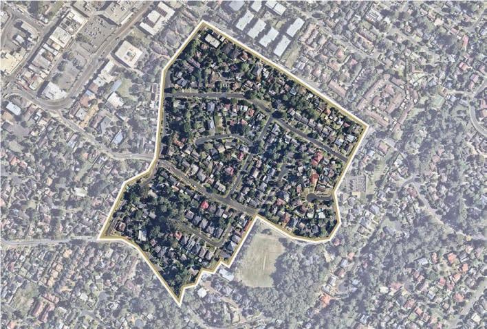
• Future residential development should feature a diverse array of housing typologies, of differing sizes, consistent with Council’s Housing Diversity Provision (Clause 7.11 of LEP 2019).
• Consider opportunity for some integration of active uses on the ground floor level of high-density residential developments to help create vibrant and lively streetscapes and provide for the day-today needs of residents in closer proximity of their homes.
Built Form
Land to the south of Crane Road, bound by Crane Road, Orange Grove, Francis Street and Cecil Avenue, has redevelopment potential for medium to higher density residential outcomes. This pocket of land is approximately 330m – 900m from the Castle Hill Metro Station and consists of ageing housing stock between 10-20 years old. These are predominately single dwellings with some medium density strata developments.
The Focus Area features Olola Avenue Reserve, which has an irregular shape and area of 920m². It includes a playground, grassed areas, landscaping and park seating.
There are also some remnant bushland and areas of biodiversity importance to the south of the Focus Area which contain pockets of significant vegetation. This area comprises of Sydney Turpentine Ironbark Forest which is classified as an Endangered Ecological Community. Future development must have regard to these unique environmental sensitivities and ensure that development is compatible with surrounding uses, providing a seamless transition from higher density areas through to the wellestablished low density residential areas.
Land ownership within this Focus Area is highly fragmented, with established housing and high land values. Therefore, feasible redevelopment in this area is likely to be a long-term prospect, subject to amalgamations to establish suitably sized development sites and achieve orderly development outcomes.
It is anticipated that future residential uplift within this Focus Area will be facilitated through landowner-initiated planning proposals in the future (guided by the design principles set out in this Precinct Plan). Site-specific DCP amendments will also be required to guide future development outcomes, as well as appropriate infrastructure solutions and mechanisms.
It is expected that a council-initiated planning proposal will be required for the rezoning of the Olola Avenue Park expansion. The acquisition and subsequent embellishment of this land will be considered for inclusion as a new local infrastructure item within the applicable Contribution Plan, as discussed further in Section 5 of this Plan.
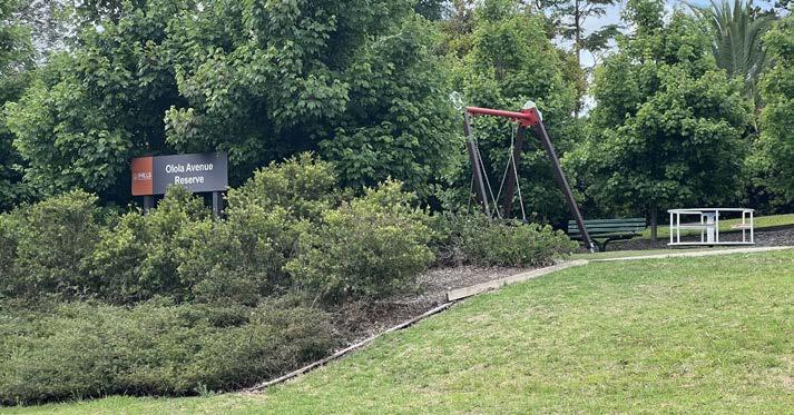
• Deliver a high-quality built form outcome that seamlessly transitions from the high-density residential areas (approximately 4-5 storeys) through to the existing low and medium density residential areas (approximately 2-3 storeys).
• Lower scale apartment developments must be sympathetically designed to minimise adverse amenity impacts on existing low and medium density residential areas and community title subdivisions.
• Explore opportunities for a mix of dwelling typologies, comprising apartments transitioning to terrace style housing.
Connectivity
• Improve pedestrian connectivity with new publicly accessible through site links as indicated in Figure 58.
• Future development must ensure that vehicular movement in and around the area is safe and efficient.
86
Figure 57. Aerial View of Focus Area 4.1.11 (Source: Nearmap Aerial Imaagery, Copyright Nearmap)
Olola Reserve
Focus Area
Proposed Road / Road Widening
Low Density Residential
Medium Density Residential
High Density Residential
Commercial Offices
Mixed Use
Special Use
Open Space
Heritage Precinct
Signalised Intersection
Pedestrian Bridge
Urban Plaza
Roundabout
University
Pedestrian Link
Extension of Main Street
T
The Hills Shire Council Draft Precinct Plan Castle Hill Strategic Centre 87
Metro Line (Underground)
Focus Area
Proposed Road / Road Widening
High Density Residential
Special Use
Open Space
Potential Options Identified
Signalised Intersection
Urban Plaza
Pedestrian Link
T
Various design principles have been developed to guide future outcomes for the Focus Area:
Land Uses
• This Focus Area is earmarked for high density residential outcomes.
• Future residential development should feature a diverse array of housing typologies, of differing sizes, consistent with Council’s Housing Diversity Provision (Clause 7.11 of LEP 2019).
• Consider opportunity for some integration of active uses on the ground floor level of high-density residential developments (particularly along the Old Northern Road and Brisbane Road frontage) to help create vibrant and lively streetscapes and provide for the day-to-day needs of residents near their homes.
Built Form
• Deliver a high quality built form outcome that seamlessly transitions down from the tallest building elements (approximately 12 to 16 storeys fronting Old Northern Road) through to the surrounding established residential areas at the rear (approximately 2-3 storeys in height).
• Building heights will be carefully sited having regard to the topographic constraints across the site.
• Tower elements are to be strategically positioned to maximise solar access, natural ventilation and views (both into and through the site and from key vantage points in the public domain).
• Buildings will be appropriately setback from the street to minimise building bulk and create a highly desirable pedestrian environment.
• Residential tower floor plates are to be a maximum GFA of 750m².
• Building lengths are to be a maximum of 50m.
Public Domain and Open Space
• Public domain areas will be attractive, safe, functional and accessible. They will also feature high quality treatments including generous paving, integrated seating, landscaping and public art.
• High quality urban plazas are to be incorporated and located in centralised areas.
• Incorporate public art and informative way finding signage to strengthen Castle Hill’s identity.
• Through site links will be provided to increase pedestrian and cycling accessibility and permeability.
• Buildings will be sited to encourage passive surveillance of the public domain.
• Accessible bicycle parking should also be provided.
Connectivity
• Brisbane Road will be realigned, to rectify the existing dog-leg and better align the road as a fourth leg of the intersection with Old Northern Road and McMullen Avenue.
• A left-turn slip lane will be provided off Old Northern Road heading into Brisbane Road.
• Development should facilitate reservation and consolidation of the necessary land areas to enable planned signalised intersection upgrades at the Old Northern Road, Brisbane Road and McMullen Avenue intersection to occur.
• Through-site links will be provided to enhance accessibility to the broader strategic centre, particularly across to the Metro Station, Castle Towers, Arthur Whitling Reserve and nearby commercial areas.
• Suitable connection to existing and planned cycle paths along Old Northern Road.
• Residential parking rates will be implemented in accordance with Council’s Housing Diversity provision (Clause 7.11 of LEP 2019).
Infrastructure
• Tangible infrastructure solutions (including traffic management, pedestrian connectivity, open space and water management) and an appropriate funding and delivery mechanism will be required to ensure that the uplift can be appropriately serviced.
• Evolving technologies, including digital infrastructure provisions, will be integrated within future developments to provide better connected and informed communities.
Orderly Development
• Amalgamation and/or coordination with landowners within the Focus Area will be required to facilitate orderly and holistic and master planned development outcomes. This is a key barrier that must be overcome by the market for redevelopment opportunities in this location.
• Ideally both sides of Brisbane Road will be developed as a single site, however both sites may still be developed separately if deemed necessary.
The Hills Shire Council Draft Precinct Plan Castle Hill Strategic Centre 89
Metro Line (Underground)
Focus Area
Proposed Road / Road Widening
Medium Density Residential
High Density Residential
Commercial Offices
Mixed Use
Retail
Special Use
Open Space
Potential Options Identified
Signalised Intersection
Pedestrian Bridge
Urban Plaza
Roundabout
High Density Residential with Retail Uses on the Lower Levels
Pedestrian Link
Extension of Main Street
T
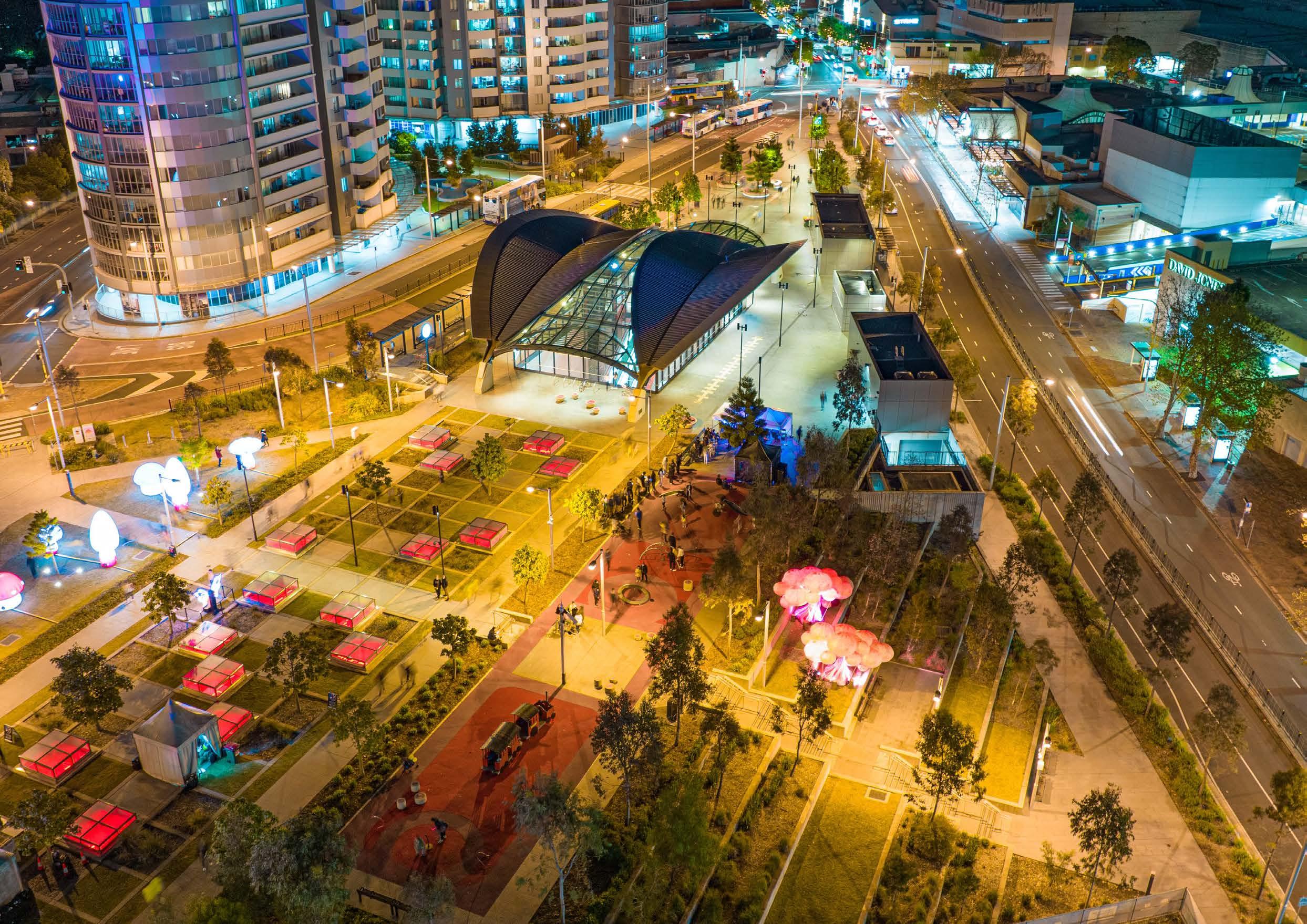 Aerial View of Arthur Whitling Reserve and Surrounds
Option 1: Expansion of Arthur Whitling Reserve
This Option would see land at 4-12 Old Castle Hill Road identified for the purpose of public recreation and consolidated into Arthur Whitling Reserve, allowing for the existing reserve to be expanded into a large consolidated open space across the entire Metro Station block bound by Old Northern Road, Old Castle Hill Road and McMullen Avenue.
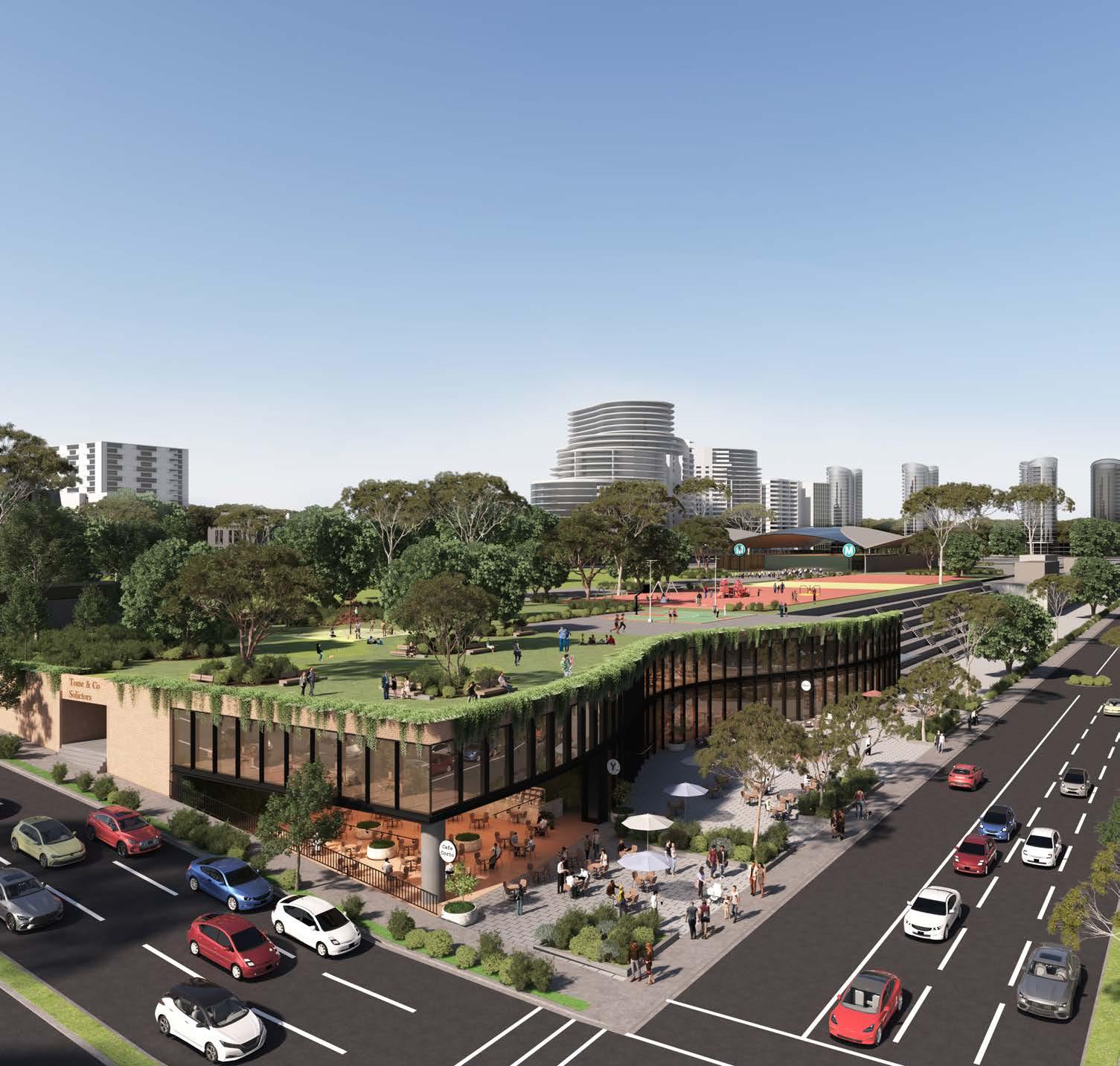
The potential expansion would bring the total area of the Reserve to in excess of 2 hectares (although it is noted that a portion of land at the south-eastern corner will be required for the realignment of Brisbane Road and McMullen Avenue intersection in the future) and would, in part, address the scarcity of options for new public open space throughout Castle Hill. Arthur Whitling Reserve will become increasingly important and regularly utilised as densities increase in the vicinity of the Metro Station.
Consideration could be given to expanding the area of passive recreation, potential small court spaces for informal active recreation or a combination of these outcomes. It would also present the opportunity to improve access between Brisbane Road, Old Northern Road, the Reserve and Old Castle Hill Road.
Noting these sites are directly north of the Reserve, additional built form beyond that permitted under the current planning framework would likely result in overshadowing and a loss of amenity to the existing Reserve. In addition to expanding the area of the Reserve, the identification of these sites for public recreation would also ensure that the current levels of solar access and amenity are maintained.
As part of any future expansion of the Reserve, further consideration will need to be given to appropriate site planning and design to address significant change in level between the existing park and the Old Castle Hill Road frontage of 4-12 Old Castle Hill Road. This may allow for some potential for small scale development fronting Old Castle Hill Road (such as cafes or community uses) as a 1-3 storey undercroft beneath the at grade extension of the Park over these sites.
If pursued, this Option would likely necessitate a rezoning of this land for public recreation and would represent a significant acquisition cost to Council, which would need to be funded through a future update to the contributions framework applicable to the Strategic Centre.
92
Artist’s Impression for Arthur Whitling Reserve Option 1 (Source: Tome Visuals)
Option 2: Low Scale Redevelopment
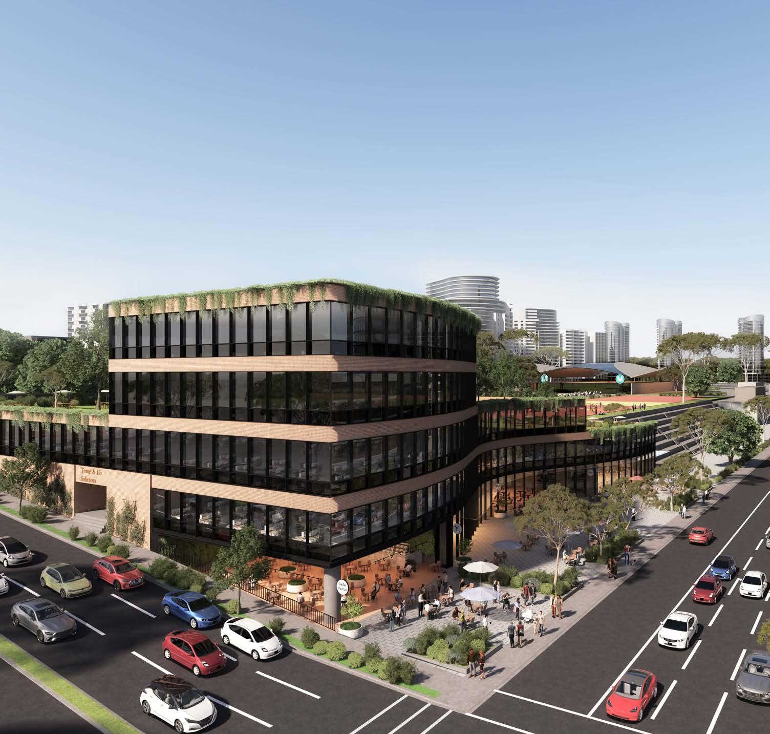
It may be appropriate to permit some low scale redevelopment of land at 4-12 Old Castle Hill Road to occur, for commercial, retail and community outcomes, generally in accordance with the current planning settings applicable to the land (being a maximum floor space ratio of 1:1 and a maximum building height of 16 metres (4-5 storeys).
If redevelopment of this land was to occur, the appropriate height limit would ultimately need to be determined having regard to achievement of satisfactory outcomes on the adjoining Reserve in terms of solar access and amenity. Any redevelopment should not result in additional overshadowing of the adjoining passive open space in comparison to outcomes permitted under the current controls.
Taking into account the slope of the land, there may be potential for a higher built form (4-6 storeys) along the Old Castle Hill Road frontage, transitioning down to a level at the rear of these sites (adjoining the Reserve) which does not protrude further than 1-2 storeys above the current ground level of Arthur Whitling Reserve. This would also present an opportunity for development to have active frontages to both Old Castle Hill Road (at the ground level) and Arthur Whitling Reserve (at the rear of the 3rd or 4th storey) with potential for some community uses within the development opening out onto the ground plane of the Reserve.
The Hills Shire Council Draft Precinct Plan Castle Hill Strategic Centre 93
Artist’s Impression for Arthur Whitling Reserve Option 2 (Source: Tome Visuals)
4.1.14 Focus Area 14 - Connectivity and Pedestrian Permeability
Connectivity and pedestrian permeability is currently limited within the Castle Hill Strategic Centre, largely due to significant barriers including:
• High volumes of traffic and at grade crossings on the Ring Road, which increases the wait time for pedestrians.
• Large impermeable lots with no through site links which increase the time and distance for pedestrians to reach their destinations.
• The undulating topography that characterises the wider Precinct makes walking a less attractive option for residents and workers.
• The subdivision pattern in the suburban part of the Precinct, which is characterised by cul-de-sacs limits permeability.

• Lack of enticing areas of public domain and activity drawing pedestrians to different parts of the Precinct.
As a Strategic Centre, Castle Hill is expected to provide access to a wide range of goods, services and jobs close to people’s homes with high levels of amenity and walkability.
Expanding and improving the pedestrian and cycle network will be pivotal to the success of the Castle Hill Precinct, delivering an attractive, safe and liveable area whilst also encouraging a shift away from private car use to more sustainable transport options.
This Precinct Plan seeks to encourage effective and seamless connectivity to the Castle Hill Metro Station and the surrounding core of the Precinct, by way of a comprehensive network of walking and cycling paths. Old Northern Road will form an attractive main street corridor with an intensity of land uses and prioritisation of pedestrian and cycle connections. By improving permeability and providing more direct links to Main Street, residents and workers will find walking and cycling a more convenient and attractive option than driving.
A range of measures are needed to respond to these barriers and facilitate safe, direct and comfortable pedestrian accessibility.
Metro Station
Metro Line (Underground)
Castle Hill Strategic Centre
Proposed Road / Road Widening
Open Space
Potential Options Identified
Signalised Intersection
Proposed Pedestrian Bridge
Left-in-left-out Turn
Roundabout
Existing Cycleway
Proposed Cycleway
Pedestrian Link
94
M T
Pedestrian tunnel between Castle Towers and Castle Hill Metro Station.
Various design principles have been developed to guide future connectivity and pedestrian permeability within the Precinct, as follows:
Connectivity
• Create a walkable area within 800m from the Castle Hill Metro Station and align with existing and planned cycleways and open space corridors to the north, south, east and west to facilitate cycling trips to the and from the Metro Station.
• Establish priority walking and cycling corridors along Castle Hill Road and Old Northern Road that facilitate direct connections to key land uses
• Strategically locate higher intensity land uses (including shops, offices, community and entertainment facilities) along the Old Northern Road priority corridor.
• Explore options to slow local vehicle traffic down and to ensure safe pedestrian use of the streets and access to all public amenities, such as providing grade separated pedestrian access across the high traffic volume Ring Road.
• Create a permeable grid like urban structure, with shorter block lengths broken up by through site links, local road links, pedestrian and cycle links and new open spaces.
• Provide urban plazas around key destinations as places for people to meet, stop, enjoy and interact with others.
• Identify opportunities for through site links to open up areas where connectivity is constrained by cul-de-sacs.
• Identify low speed zones for high pedestrian activity areas (including Main Street and McDougall Lane).
• Provide dedicated footpaths adjoining development sites.
• Provide way finding signage throughout the Precinct.
Through Site Links
• Break up longer blocks and provide direct connections to key destinations and links on adjacent sites, with a width of 4-5 metres and a minimum of 500m of landscaping (maximum height of 800mm) along each side.
• Direct and convenient paths, through sites, designed to encourage pedestrians to move along the link and not linger.
• Publicly accessible and clearly identifiable with signage to enable easy wayfinding.
• Maintain the privacy of adjacent developments which adjoin the link with building setbacks to be assessed on their merits.
• Ensure adequate passive surveillance and adequate lighting to improve safety.
Planning work already carried out for the Castle Hill North Precinct identifies improvements to pedestrian paths and cycleway connectivity including:
• Road upgrades and widening for Castle Street and Old Castle Hill Road which will include improved verge widths for widened pedestrian footpaths.
• Pedestrian Bridge crossing Pennant Street, from Eric Felton Reserve to the Castle Towers site, on the eastern side of the junction of Pennant Street, Old Castle Hill Road and McMullen Avenue.
• Pedestrian Bridge crossing Pennant Street, from Castle Towers to the Kentwell Avenue Focus Area.
• Embellishment of Maurice Hughes Reserve, Larool Crescent Reserve and Eric Felton Reserve including landscaped pedestrian and cycle paths.
• North south through site links to be delivered as development occurs connecting both sides of Larool Crescent, both sides of Garthowen Crescent, Gay Street/ Pennant Street and Gilham Street/Les Shore Place.
Through Site Links (Cont.)
Additional measures identified as part of this Precinct Plan that will enhance connectivity and movement include:
• Old Northern Road (between Castle Street and Cecil Avenue) to be developed as a shared pedestrian and vehicle environment, whereby safety and pedestrian movements are prioritised over vehicles (extension of the existing Main Street further west to Cecil Avenue).
• New urban plazas and local parks and expansions to existing parks to be embellished with landscaped pedestrian/cycle paths.
• Identification of centralised locations for high quality urban plazas that can enhance the pedestrian experience, along key active movement routes.
• Shared paths associated with road upgrades.
• A new pedestrian bridge over Crane Road and Terminus Street, connecting the Atmosphere Development nearby commercial and residential developments.
• Pedestrian Bridge crossing Pennant Street, on the northern side of Castle Street, near the current Castle Hill Police Station.
• A new pedestrian bridge crossing Cecil Avenue from the new University to the mixed use and commercial developments on the southern side of Cecil Avenue.
• Through site links at key locations connecting activity areas.
• The existing and planned pedestrian and cycle connections are identified in Figure 62.
Implementation Mechanisms
• New pedestrian bridges and open space will need to be incorporated into Contributions Plan No. 17 - Castle Hill North to ensure an appropriate funding mechanism is in place to deliver the bridges in the future.
• Landowner initiated planning proposals will secure a number of local parks, road and pedestrian connections.
• Associated site specific DCP amendments will also be required to establish a suite of controls to guide redevelopment consistent with the vision and guiding principles.
• Through site links and footpaths adjoining development sites will need to be delivered as development occurs.
The Hills Shire Council Draft Precinct Plan Castle Hill Strategic Centre 95
4.1.15 Focus Area 15 – Encouraging Medium Density Residential Outcomes
This Focus Area applies to existing parcels of land zoned R3 Medium Density Residential, as well as some sites zoned R2 Low Density Residential that would be appropriate for a medium density outcome given their proximity to the Metro Station.
The achievement of feasible and cohesive turnover of older building stock into high quality medium density housing typologies has been a focus of Council for a number of years. While there has been some policy movement by State Government, typically these policy approaches have inadvertently focused on new greenfield developments without giving due consideration to the more nuanced challenges and constraints associated with redevelopment in established infill locations.
Factors such as existing subdivision pattern layouts, lot amalgamation and highest and best use options within the broader land use permissibility framework have led to relatively low take up of new medium density development opportunities in established suburbs, with the exception of some smaller piecemeal development that generally does not achieve optimal design outcomes or the high quality housing stock envisaged.
This challenge is highlighted within Council’s Metro Station Precincts, where increased development uplift is warranted in response to the new Metro infrastructure and where medium density housing stock would be highly desirable, but the land fragmentation and value within the established local neighbourhoods such as Castle Hill do not enable for feasible medium density development by the market.
The achievement of desirable medium density housing typologies such as terrace-style development with rear laneways is an even greater challenge given the cohesion required to facilitate an integrated laneway network.
Council has sought to incentivise terrace-style developments through development control plans and a Council-initiated planning proposal, however the State Government did not support the proposal as put forward by Council.
It is evident that the current State Government planning framework, whilst well intended, is not conducive to medium density redevelopment in established infill suburbs such as Castle Hill, even in locations where medium density is the most appropriate strategic and site specific planning outcome desired by both state and local government.
The Hills has demonstrated its ability to meet and exceed its identified housing targets and there is no shortage of existing and strategically identified low density and high density housing outcomes. There is a need for greater focus and collaboration with State Government to incentivise the delivery of more diverse medium density housing typologies to address this unmet demand in the market in these key locations and achieve the Government’s vision of providing the ‘missing middle’.
A diversity of housing types and choices creates variety in the market with different price points. This is one part of the solution to housing affordability. It is important to provide options for different lifestyles and living choices not just broadly within The Hills, but also within the walkable catchment of high frequency public transportation options.
The areas mapped as part of this Focus Area are the ideal location for future medium density housing development (refer Figure 63). However, given the challenges identified above, they are not expected to turnover in the near future and there would be limited benefit in Council prematurely increasing development potential on these sites (beyond the prevailing controls) before feasible redevelopment can occur, as this would artificially increase land values without actually unlocking any viable redevelopment opportunities.
Should individual landowners be able to demonstrate the achievement of high quality medium density outcomes such as townhouses or terrace-style developments, Council will entertain Development Applications (where the outcome is already permitted but has not yet been taken up) or alternatively, landowner-initiated planning proposals to facilitate this outcome (where the existing planning controls do not already allow it).
While it is acknowledged that high density residential development would likely be viable on this land, this is not considered to be the appropriate outcome, noting the extent of existing and planned opportunities for high density outcomes resulting in the loss of key areas where medium density housing (the missing middle) should occur if the right settings can be established between Council, Government and the market.
Council will advocate for the Department of Planning and Environment, the Housing Delivery Unit and the Greater Cities Commission (GCC) to have a renewed focus on resolving this issue at the policy level in acknowledgement that the current framework is not facilitating the desired outcomes for the delivery of medium density housing by the market and a different approach (potentially beyond the core planning controls and framework) is required to facilitate housing diversity and increased housing supply of this typology.
Metro Station
Metro Line (Underground)
Castle Hill Strategic Centre
Proposed Road / Road Widening
Locations to Encourage Medium Density Residential Outcomes
96
M
4.1.16 Focus Area 16 – Activating High Density Residential Areas

The COVID-19 Pandemic has highlighted the importance of having access to everyday necessities and feeling connected within a ‘5-minute neighbourhood’. Future high density residential areas provide the opportunity to create great places to live that positively influence people’s lifestyle.
Developments within high density residential areas should be active and provide a strong connection between buildings and the street to help create vibrant and walkable neighbourhoods. Encouraging appropriate active uses on the ground floor of high-density residential developments will be essential to providing safe and lively streetscapes whilst also providing for day-to-day conveniences in closer proximity to residents.
Street activating uses typically include non-residential uses on ground level that enhance the liveliness of a neighbourhood by providing places to shop, sit or socialise. These include ‘neighbourhood shops’, ‘neighbourhood supermarkets’, ‘business premises’ and ‘cafes and restaurants’.
Currently, there are limited opportunities to provide active uses in the R4 High Density Residential Zone under Council’s Local Environmental Plan, with ‘neighbourhood shops’ being the only active use that is permitted with consent (noting that other such uses such as ‘neighbourhood supermarkets’, ‘business premises’ and ‘restaurants and cafes’ are prohibited).
Developers in higher density residential areas such as land within the Showground Station Precinct in the Norwest Strategic Centre have sought to incorporate active uses in recent years. However, due to land use permissibility constraints, they have been unable to do so, and have subsequently been removed from applications and replaced with ground floor apartments.
In other areas such as the Norwest Central Precinct in the Norwest Strategic Centre, various planning proposals have sought to incorporate active ground floor uses by listing additional permitted uses within Schedule 1 of Council’s Local Environmental Plan (such as 2 Natura Rise and 40 Solent Circuit). These proposals have been supported by Council given the merits of the outcomes sought.
To encourage more vibrant high density residential developments within the Castle Hill Strategic Centre, a Council-initiated planning proposal is proposed to permit more activated uses within some of the high-density residential areas in the Castle Hill Strategic Centre (likely to be listed as additional permitted uses under Schedule 1 of Council’s Local Environmental Plan). The planning proposal will explore suitable locations for activation, prioritising R4 High Density Residential zoned areas that are located in closer proximity to the Metro Station and along main thoroughfares.
While this outcome will not achieve uniformity across the area, the opportunity for developers to choose to incorporate these outcomes into their residential developments will allow for a scattering of these uses throughout the area.
It is anticipated that restrictions on the size of these active uses will also be required to strike the right balance between providing flexibility for developers, managing potential amenity impacts and ensuring opportunities do not detract from the established centres hierarchy. Consequential amendments may also be required to the Development Control Plan and Public Domain Plan to reflect the revised land use permissibility.
Metro Line (Underground)
Castle Hill Strategic Centre
Proposed Road / Road Widening
High Density Residential
The Hills Shire Council Draft Precinct Plan Castle Hill Strategic Centre 97
M
Example of Activated Ground Floor - Whole Cafe Norwest
4.1.17 Focus Area 17 – Public Domain

Castle Hill offers ideal locations for civic functions, community facilities, recreation and social interaction, reinforcing its role as the major civic, retail and leisure destination within the Hills Shire.
Areas of urban renewal have been earmarked adjacent to older established areas, creating breaks in the urban pattern and connections, which in turn discourage the use of the public domain and its amenities. Establishing a coherent, well-connected, high quality and functional public domain will be a key focus when master planning large undeveloped and underdeveloped sites within the Castle Hill Strategic Centre.
This Plan envisages that urban plazas and open space areas will be interspersed throughout the Strategic Centre, providing conveniently located places where residents and workers can relax and enjoy. Given the urbanised nature of the Castle Hill Precinct, urban plazas will be a defining feature, especially adjoining the ground floors of future commercial developments. This will assist in meeting recreational needs, contributing to the overall amenity and lifestyles available within the Centre and increasing connectivity and the attractiveness of walking through the Precinct.
More generally, there is a great opportunity to break down the monotony of streets and establish different levels of space activation and social interaction throughout the Strategic Centre.
Whilst it is acknowledged that public domain improvements will be a precinct-wide focus for the Strategic Centre, there are also key areas that have significant potential to contribute to the vibrancy of the Castle Hill Strategic Centre and define the quality of the public domain. These include McDougall Lane, Main Street and Old Castle Hill Road.
*Note: This Focus Area is intended to apply to the Centre as a whole, rather than being specific to individual sites. Therefore, it has not been visually shown on a map in a similar way to the other Focus Areas within this Plan.
The key strategies for achieving an interesting and activated public domain involve:
Explore options to slow local vehicle trafic down and to ensure safe pedestrian use of the streets and access to all public amenities.
Optimise retail frontage and ground floor activation.
Design a variety of public spaces with varying scales of gathering areas.
Identify opportunities for trees and planting to maximise greenery. Integrate water sensitive urban design measures to increase green infrastructure


Review existing materials and furniture and consolidate palettes to better define the character of different zones.

Identify areas in the city centre for night life activities and place-making.
Review streetscapes movement priorities. Maximise footpaths and implement, where possible, dedicated (on-road) cycleways both in residential and central areas.
Provide way finding signage throughout the Precinct.
McDougall Lane Eat Street
It is envisaged that McDougall Lane will transform into an attractive, engaging and vibrant ‘Eat Street’ with an urban plaza provided for civic gathering and enjoyment. The future redevelopment of the Terminus Street West Focus Area (Focus Area 4) presents a unique opportunity for McDougall Lane to transform into an activated link with fine-grain shops and eateries.
Future building design should aim to provide a flexible platform for multipurpose use that allow for an overhaul of the existing traffic situation, converting from a road to a shared zone optimised for pedestrian utilisation whilst still maintaining flexibility for service vehicles.
Activation of buildings at street level is to be encouraged where a diversity of activities and uses can occur and where a viable day/night economy can exist. The redevelopment of this area should involve the embellishment of this space with street elements including street furniture (i.e. seating and benches), wide footpaths, high-quality landscaping and lighting. McDougall Lane will also serve as a primary pedestrian link that will connect the southern parts of the Precinct to the Town Centre and Metro Station.
The proposed widening and realignment of McDougall Lane will be critical in achieving this vision, to facilitate appropriate service access and activated frontages / dining opportunities. This is further discussed in Focus Area 4 and shown on the respective Indicative Layout Plan.
Seating, Retractable Awning/Umbrella and Clearance for Pedestrian Traffic (min. 4m)

Pedestrian-Focused Shared Zone (min. 6m)
Active Use
Commercial Use
Mixed Use
A A B A B 98
Figure 65. Indicative Street Profile for McDougall Lane
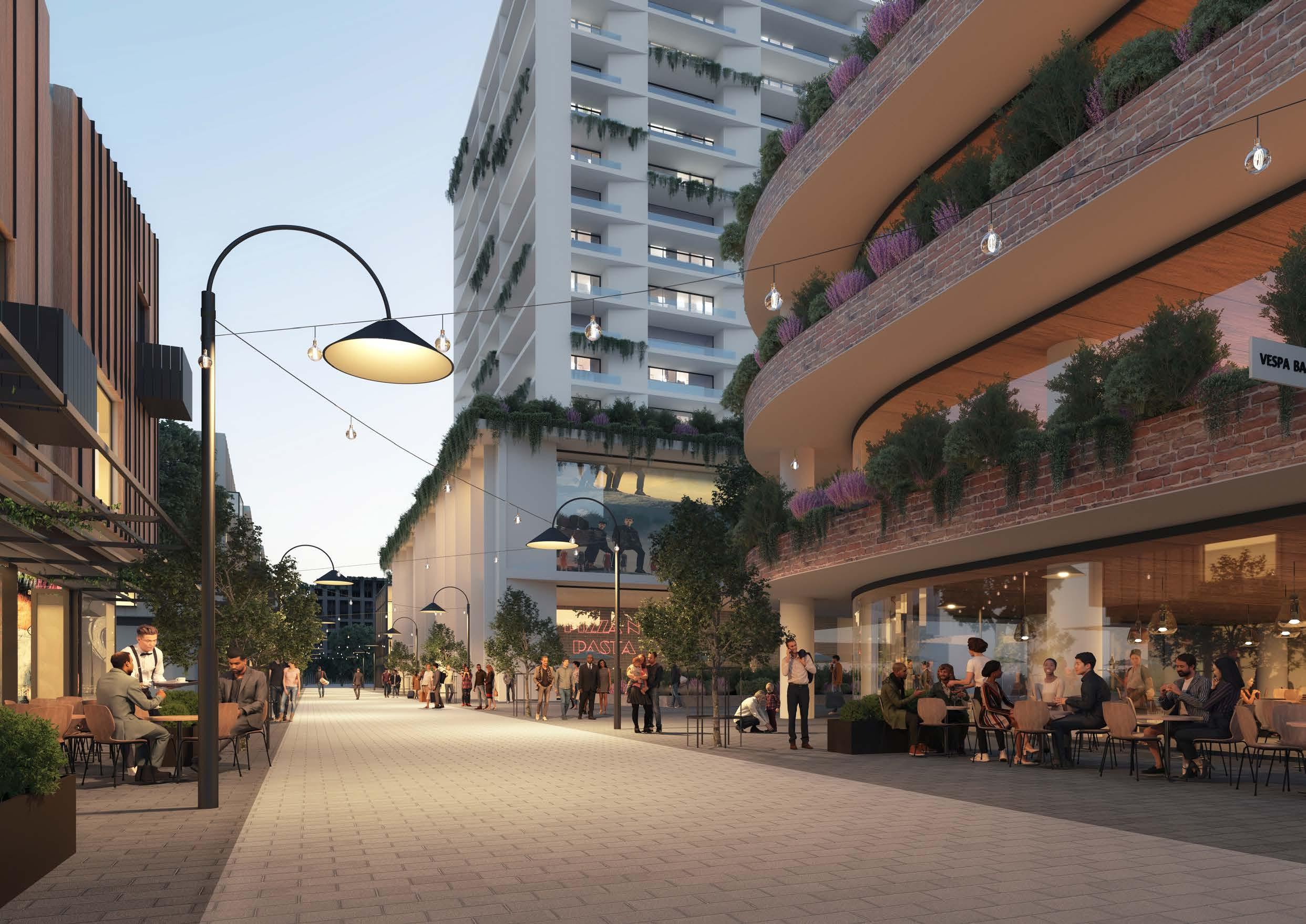 Artist’s Impression of McDougall Lane (Source: Tome Visuals)
Metro Line (Underground)
Castle Hill Strategic Centre
Potential Options Identified (refer to Focus Area 13)
Embellish Existing Main Street
Extension of Main Street Public Domain Treatments
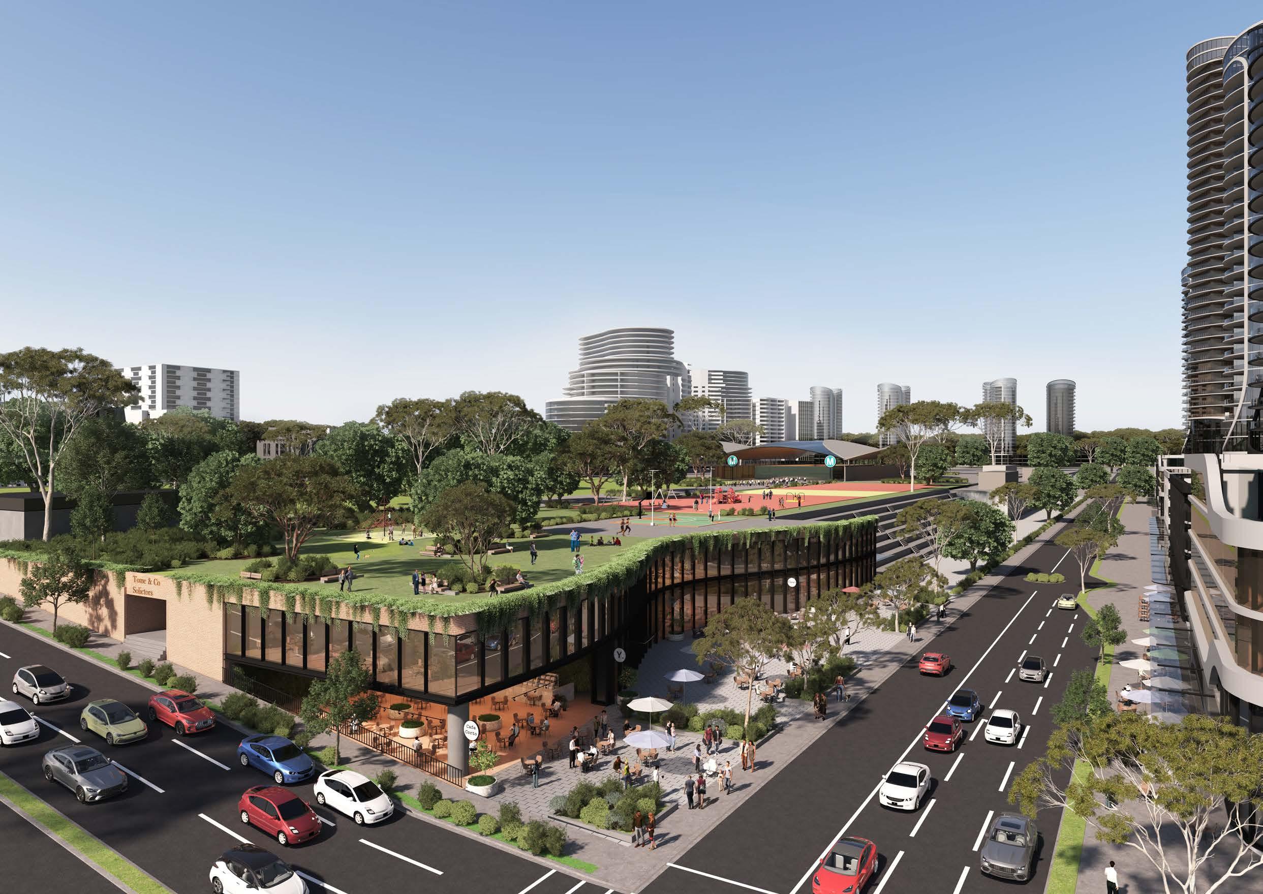 Potential Artists Impression for Arthur Whitling Reserve and Surrounds (Source: Tome Visuals)
4.2 Structure Plan
Connectivity
• Regional Connections: Council will continue to lobby the NSW Government for the funding, early planning and delivery of regional transport connections, as they are critical to the success of the Castle Hill Strategic Centre moving forward. Primarily, this will include the planned connection of the Sydney Metro from Tallawong Station to St Marys Station, the planned mass transit corridor from Norwest to Parramatta and the rapid bus connection from Castle Hill to Parramatta.
• Enhanced Connectivity: New local roads, along with various other traffic related works, are identified to improve the flow of traffic within the Castle Hill Strategic Centre. This will assist in breaking up large sites and improve pedestrian permeability. Enhanced pedestrian and cycle paths are identified to encourage alternative modes of transport and reduce reliance on private vehicles as the main mode of transportation. Pedestrian bridges across major roads, such as Pennant Street, Terminus Street and Cecil Avenue will also be critical in improving pedestrian permeability.
• Ring Road Completion: Completion of the Ring Road from Pennant Street through to Cecil Avenue and Old Northern Road is earmarked within this Plan. This critical upgrade is intended to enhance vehicular movement throughout the Precinct (given the Ring Road link will remain the primary thoroughfare through the Castle Hill Strategic Centre) and relieve pressure on other areas which can then be prioritised for pedestrian and public domain.
• The design principles for redevelopment of sites in Castle Hill will encourage an urban structure where pedestrian movements are dominant over vehicles.
Metro Station
Metro Line (Underground)
Castle Hill Strategic Centre
Proposed Road / Road Widening
Open Space
Potential Options Identified
Signalised Intersection
Proposed Pedestrian Bridge
Left-in-left-out Turn
Roundabout
Pedestrian Link
Existing Cycleway
Proposed Cycleway
102
M T
Land Use
• Mixed Use: Castle Towers will be the heart of the Precinct, offering a mix of retail, business, office, leisure, entertainment and community uses, and some higher density housing. It will be supported by designated mixed use pockets in the surrounding areas, such as Terminus Street, Crane Road and Cecil Avenue.
• Designated Commercial Area: A designated commercial area is identified to safeguard key employment land for commercial offices, enabling Castle Hill to transform into a highly competitive employment destination. The establishment of commercial only areas will be pivotal in enabling job targets to be met and in attracting a variety of knowledge intensive jobs that meet the needs of the highly skilled population. It will support the function of the centre in proximity to the mixed use area and the abundance of housing opportunities.
• Retail: A new entertainment and restaurant precinct is envisaged adjacent to Main Street to meet the needs of workers and the rapidly growing residential catchment. It will build on the success of the existing Piazza area that is frequented regularly by residents, workers and visitors.
• University: Castle Hill is home to a University of Canberra Campus. There is scope to expand its offerings as part of future mixed use developments with the adjoining car park site and designated commercial area.
• New Open Space Areas: Various new open space areas and publicly accessible plazas are flagged throughout the Precinct to be delivered as part of future master planned developments (such as Castle Towers, Terminus Street West and Kentwell Avenue) or as expansions of existing open spaces (such as Arthur Whitling Reserve, Worthing Avenue Reserve, Olola Reserve and Orange Grove Reserve).
• Diverse Housing: The Castle Hill Strategic Centre will contain a diverse range of housing opportunities, spanning from well-established low to medium residential areas on the periphery of the Precinct through to emerging high density apartment buildings and mixed use developments closer to the Metro Station.
Metro Line (Underground)
Castle Hill Strategic Centre
Proposed Road / Road Widening
Low Density Residential
Medium Density Residential
High Density Residential
Commercial Offices
Mixed Use
Special Use
Environmental
Public Open Space
Private Open Space
Potential Options Identified
Heritage Precinct
Urban Plazas
University
Term Job Growth
High Density Residential with Retail Uses on the Lower Levels
Extension of Main Street / Eat Street
The Hills Shire Council Draft Precinct Plan Castle Hill Strategic Centre 103
Density
• The floor space ratio controls will be the primary control that dictates density.
• Future density will have regard for transit oriented development, with higher density developments strategically located near transport hubs. These areas in easy walking distance of retail centres and the Metro Stations are also areas that have the greatest potential for change. These developments will transition to lower densities on the edge of an 800m radius.
• Highest densities for new development will be located near the Castle Hill Metro Station, Castle Towers, Main Street, Terminus Street West and along the Ring Road. Lower scale apartment development at 1.2:1 and medium density housing will be towards the periphery of the walkable catchment from the Metro Station, having regard to sensitive interfaces and environmental constraints (such as well-established residential areas that will remain unchanged, topographic constraints, public domain, heritage items and open space areas).
• Indicative floor space ratio outcomes should not be viewed as an entitlement. Floor space ratio controls will be subject to detailed built form modelling and urban design analysis throughout the subsequent planning processes to ensure they are appropriate, functional and viable. Implementation will also make use of base and incentive FSR controls as contained in Clause 7.11 of LEP 2019 for residential outcomes.
• Areas on the periphery of the Castle Hill Strategic Centre will remain unchanged. These are well-established low and medium density areas that greatly contribute to the diversity of development outcomes within the Castle Hill Strategic Centre. These are generally areas where strategic planning work has already been completed, noting however the advocacy needed to encourage medium density uptake (refer Focus Area 15).
• Some areas are not earmarked for any change, being areas where the existing character and outcomes are to remain or areas where appropriate redevelopment potential already exists under the current planning controls.
104
H S U Metro Line (Underground) Castle Hill Strategic Centre 1.2:1 1.5:1 1.5:1 - 2:1 1.9:1 2:1 2.04:1 2.2:1 2:1 - 2.6:1 2.3:1 - 2.7:1 2.3:1 - 3:1 2.5:1 2.5:1 - 3:1 2.88:1 3:1 - 3.6:1 3:1 - 4:1 3.5:1 4.3:1 4.8:1 6.4:1 Potential Options Identified Further Detailed Testing Required A B C D E F G J K L M N O P Q R
Built Form
• There will need to be a transition of building heights to facilitate a varied and interesting skyline, with potential for distinct views to the east and west of the Precinct. Development surrounding Castle Hill Metro Station and Castle Towers will have opportunities for tall and varied buildings heights that are key landmarks for the Strategic Centre.
• Building heights will be sympathetic to the surrounding established low density residential areas. There will be opportunity for taller buildings over varying heights. Tallest building elements (varying up to 25 - 30 storeys) will be strategically positioned in Gateway locations, with setbacks that incorporate quality landscaping and public domain improvements.
• Higher built form controls beyond that required to achieve indicative FSR outcomes may be utilised to encourage higher quality and elegant development (rather than short and box-like developments), with low scale podiums beneath interspersed towers and improved ground plane outcomes through generous landscaping, setbacks, plazas and building separation.
• Future built form will also be sympathetic to the topographic constraints within Castle Hill. Where possible, buildings will be strategically positioned to optimise views and minimise overshadowing. Building height controls will be subject to detailed built form modelling and urban design analysis throughout the subsequent planning processes to ensure they are appropriate, functional and viable.
• No changes are proposed to low-medium density areas (2-3 storeys in height) around the periphery of the Castle Hill Strategic Centre, where the existing character and outcomes are to remain. No changes are proposed to areas where separate planning work has already been completed (e.g., Castle Hill North Precinct, site-specific planning proposals, development applications have been recently approved or well-established residential areas).
The Hills Shire Council Draft Precinct Plan Castle Hill Strategic Centre 105
Metro Line (Underground) Castle Hill Strategic Centre 2-3 Storeys 3 Storeys 3-5 Storeys 4-5 Storeys 4-6 Storeys 4-8 Storeys 4-12 Storeys 4-15 Storeys 4-18 Storeys 4-20 Storeys 4-22 Storeys 4-25 Storeys 5-6 Storeys 8 Storeys 8-10 Storeys 9-14 Storeys 10 Storeys 12 Storeys 13-18 Storeys 16 Storeys 18-23 Storeys 20 Storeys 30 Storeys Potential Options Identified Further Detailed Testing Required A B C D E F G H I J K L M N O P Q R S T U V W
Figure 70. Built Form (Storeys)
4.3 Character Areas
A
Development in the designated commercial area will have regard for transit oriented development principles, with the tallest buildings (up to 25 - 30 storeys) located towards the Metro Station. It will serve a pivotal function in providing jobs close to home for our residents and activating the Precinct during the day and into the night. Technology will be at the heart of the Precinct, enabling the Castle Hill to transform into a ‘Smart Place’ where businesses want to establish themselves. Buildings will integrate with the public domain utilising robust materials and transparent frontages to activate streets as places. The heritage precinct surroundings the former Police Station and school buildings will be an open plaza that respects the heritage significance and character of the buildings. The identity of the Precinct will be strengthened by using public art and informative way finding signage. It will be a highly walkable and pedestrian focussed destination.
B
A dedicated mixed use spine will build on the Precinct’s commercial office focus and cement itself as the premier retail destination for North West Sydney. It will feature buildings ranging in height up to 25 – 30 storeys in key locations and provide a range of regional level retail facilities, including leisure and entertainment opportunities, to meet the diverse needs of residents, workers and visitors. It will feature activated ground floor uses to create a sense of vibrancy and draw people to the area. Active movement will be prioritised by implementing additional pedestrian links and re-thinking the street structure. Improved footpaths, public furniture, street awnings and outdoor dining opportunities will also be prioritised, comprising durable materials. Established trees will be integrated with the new urban fabric to create a strong urban identity.
C
Commercial Area Mixed Use Main Street Precinct
Main Street will feature activated ground floor uses to create a sense of vibrancy and draw people to the area. Active movement will be prioritised by implementing additional pedestrian links and a new road structure. Improved footpaths, public furniture and outdoor dining opportunities will also be prioritised, comprising durable materials, shading, awnings and landscaping. Established trees will be integrated with the new urban fabric to create a strong urban identity and provide shade to cool the outdoor spaces.
McDougall Lane
McDougall Lane will be developed as the ‘Eat Street’ of Castle Hill, with development designed to capitalise on distinct views and connect Old Northern Road and Terminus Street. A focus on dining, entertainment and recreation opportunities will create an exciting, busy and lively destination for residents, workers and visitors. It will continue to an extension of the entertainment and night time economy of Castle Hill. This area will be transformed into a shared zoned optimised for pedestrians, whilst still maintaining the capacity for service operations and access.
Arthur Whitling Reserve
Arthur Whitling Reserve will be expanded to provide spacious landscaped outdoor spaces on the north-western corner fronting Old Castle Hill Road. It will be a key open space to support the growing population of Castle Hill and will be a prominent feature for Metro users arriving into the Precinct. This area will become the active heart of the Precinct, with potential for some civic events and smaller court active open spaces within the proposed park expansion. Leveraging off the unique topography, small scale development such as cafes or community uses may form an undercroft and active frontage to Old Castle Hill Road that will be regularly utilised by residents, workers and visitors. This area will feature established landscaping to cool the outdoor spaces, shading, public furniture, improved through site links and wayfinding measures.
High Density Residential Apartments
Areas with high density residential apartments will be green and walkable, providing a lifestyle alternative to the traditional suburban home. Buildings will frame the streets and create an appealing sense of openness, providing generous street setbacks to facilitate significant tree planting and landscaping. Buildings will be diverse in structure and form and utilise a variety of materials and colours and green elements. The highest density development will be located closest to the well-established Town Centre and Metro Station, transiting to lower densities at the periphery of the walkable catchment. Activated ground floor uses are also encouraged to create vibrant streets, visual interest for pedestrians and frame public spaces.
D E F G
Low and Medium Density Residential Housing
Medium and low density housing will be encouraged to provide a diversity of housing types and to define the boundaries of the precinct. These areas will remain unchanged or continue to be developed under the existing controls. Generous setbacks (of at least 6m) will also be encouraged, along with landscape streets, public domain elements and high quality open spaces. High levels of permeability will be provided through quality pedestrian and cycling links.
106
Figure 71. Character Areas
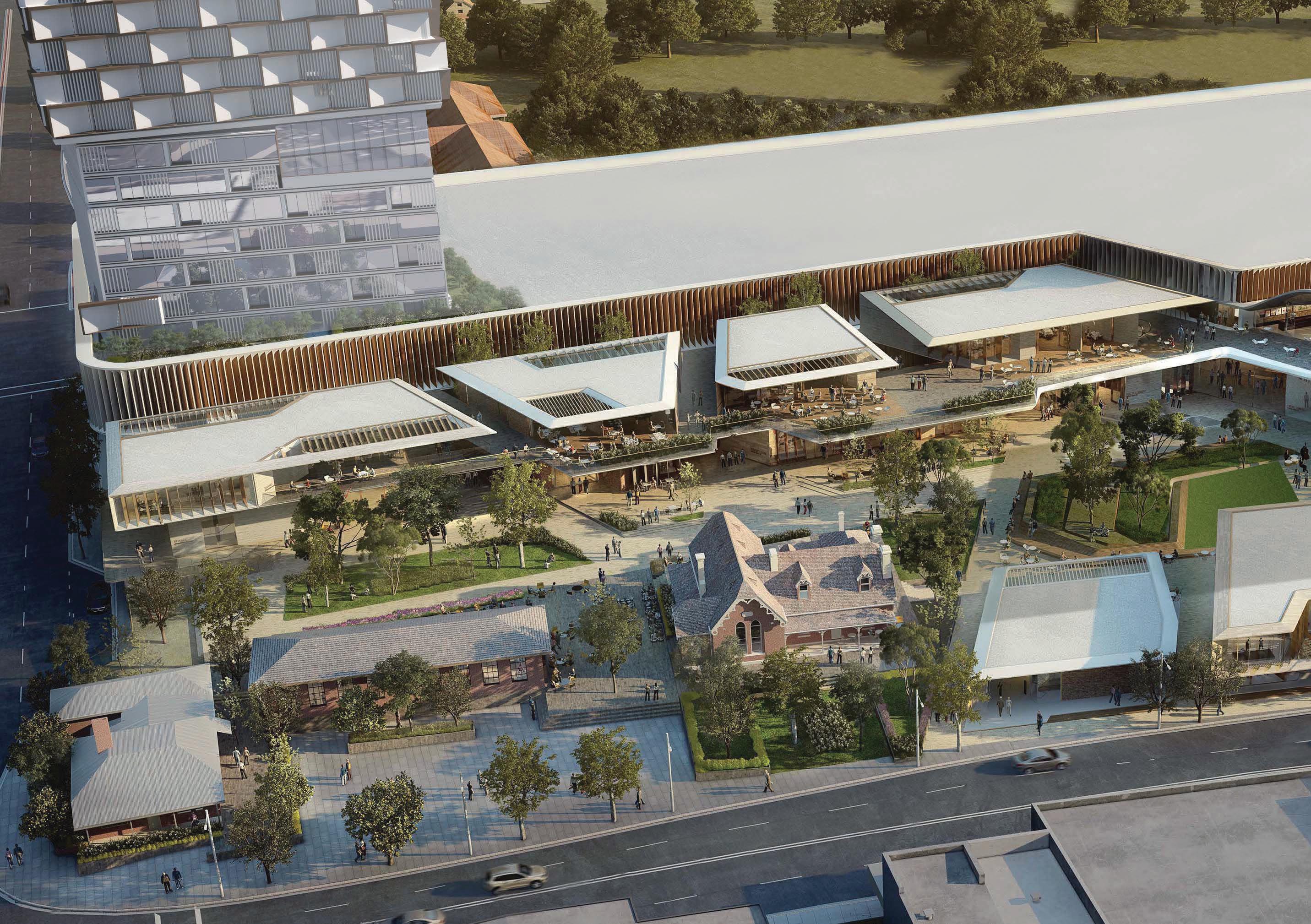 Indicative Concept of Heritage Precinct (Source: Architectus)
4.4 Yields and Projections

• In 2016, there were 3,717 dwellings within the Castle Hill Strategic Centre accommodating an existing population of approximately 7,430 people (based on an average occupancy rate of 2 people per household). Under this Plan, it is anticipated that there is growth potential for approximately 6,760 additional dwellings by 2036 (approximately 13,520 additional people), and approximately 7,415 additional dwellings by 2041 (approximately 14,830 additional people). Residential yields are based upon uptake rates of between 65% - 90% by 2036 and 70%95% by 2041.
• In 2016, there were approximately 8,080 jobs within the Castle Hill Strategic Centre. Under this Plan, the Castle Hill Strategic Centre is expected to accommodate approximately 11,400 additional jobs by 2036, and approximately 13,530 additional jobs by 2041 (depending on market factors). These assumptions are based upon uptake rates varying between 30-80% by 2036 and between 53-85% by 2041.
• Not all properties will be subject to redevelopment at the same time and uptake rates have been applied to each development type within each identified development area. The uptake rates which have been applied depend on the density being proposed and the extent of development, which is likely to occur, having regard to opportunities and constraints affecting the land. Higher uptake rates are applied where higher densities are envisaged. However, in locations that are subject to development constraints, a lower uptake rate has been applied. Longer term investigation sites have also been given lower uptake rates given they are unlikely to be feasible in the short to medium term and may be contingent on the market solving certain issues or delivering certain outcomes.
Metro Station
Metro Line (Underground)
Castle Hill Strategic Centre
108
M A B C D E F G H
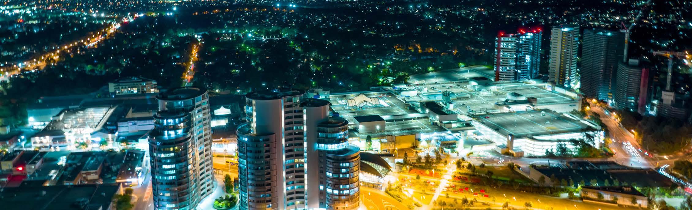
The Hills Shire Council Draft Precinct Plan Castle Hill Strategic Centre 109
Table 7. Residential Yield Analysis
2016 Dwellings 2021 Dwellings Residential Uptake Rate (2036) Additional Dwellings (2036) Residential Uptake Rate (2041) Additional Dwellings (2041) Total Dwellings (2041) A 233 233 90% 1,113 95% 1,175 1,408 B 205 205 90% 1,621 95% 1,711 1,916 C 154 154 80% 887 90% 997 1,151 D 1,090 1,090 80% 371 90% 417 1,507 E 243 243 75% 456 80% 487 730 F 1,011 1,011 70% 404 80% 462 1,473 G 470 1,393 70% 1,681 80% 1,921 2,391 H 311 311 65% 228 70% 246 557 Total 3,717 4,640 6,760 7,415 11,132 2016 Jobs 2021 Jobs Employment Uptake Rate (2036) Additional Jobs (2036) Employment Uptake Rate (2041) Additional Jobs (2041) Total Jobs (2041) A 3,326 3,825 70% 7,614 80% 8,702 12,028 B 827 951 80% 80 85% 85 912 C 1,556 1,789 65% 3,371 80% 4,149 5,705 D 252 252 N/A N/A N/A N/A 252 E 65 65 N/A N/A N/A N/A 65 F 706 812 30% 338 53% 597 1,303 G 382 382 N/A N/A N/A N/A 382 H 966 966 N/A N/A N/A N/A 966 Total 8,080 9,292 11,404 13,534 21,614
Table 8. Employment Yield Analysis
Aerial View of Castle Hill Strategic Centre.
4.5 Actions and Phasing
This Plan sets a holistic vision and ‘blueprint’ for the Castle Hill Strategic Centre. It includes a list of actions that will be subject to future processes and decisions of Council. It will be necessary to work through these actions over time, to establish the planning framework that facilitates the vision and outcomes articulated in the Plan.
The Plan identifies areas where strategic work has been completed and where development is expected to either remain unchanged or continue to roll-out under the current planning framework. It then groups actions into three distinct phases, having regard to potential timing and responsibility for each action.
*Note: While there are some additional actions identified within Phase 1 and 2, they are holistic to the Centre, not specific to individual sites and therefore not shown on the map above.
The figures within this Draft Precinct Plan depict “Option 1” for the Arthur Whitling Reserve Focus Area, however as part of the consultation process feedback is sought with respect to both potential outcomes for the Focus Area. Having consideration for the feedback received as part of the exhibition, the Precinct Plan will be amended to reflect the preferred Option. Refer to Focus Area 13 in Section 4 for further detail.
Metro Station
Metro Line (Underground)
Castle Hill Strategic Centre
Strategic Work Complete
Phase 1 - Housekeeping Amendments
Phase 2 - Council-Led Change
Phase 3 - Market Driven Change
Potential Options Identified
Strategic Work Completed
Areas where strategic planning work has already been completed or where no further change to the planning controls is anticipated. Development is expected to either remain unchanged or continue to roll-out under the current planning framework (including development applications and/or construction).
Phase
1: Housekeeping Amendments*
Areas where Council-led housekeeping amendments are recommended to facilitate improved and/or orderly development outcomes.
Phase 2: Council-Led Change*
Short to medium term actions that could be led by Council. For example, Council-initiated changes to the planning controls to allow for the achievement of the vision and outcomes in this Plan.
Phase 3: Market Driven Change
Actions that will be market driven. It is considered that the market is best placed to determine the appropriate timing for amendments to the planning controls in these instances (having regard to development demand, life-cycle of existing assets and feasibility) and put forward development outcomes and infrastructure solutions consistent with the strategic framework and Council’s vision articulated within the Plan.
Whilst some market driven solutions may be achievable in the short to medium term, feasible redevelopment in other market driven areas is unlikely to occur until beyond the short-to-medium term horizon. Changes to the planning framework would be driven by landowner-initiated planning proposals, along with associated amendments to the Development Control Plan, Public Domain Plan and appropriate infrastructure contribution mechanisms.
In terms of timing, it is expected that planning proposals for land in short to medium term areas would eventuate over the next 5 to 10 years. Market driven solutions and planning proposals for sites in longer term areas are unlikely to eventuate within this same period and are expected to occur beyond a 10-year horizon (1020 years), as these are either substantially more complex, require amalgamation of fragmented areas or are unlikely to be feasible (at an appropriate density and scale outcome) within this initial 10-year horizon.
110
PHASING
M
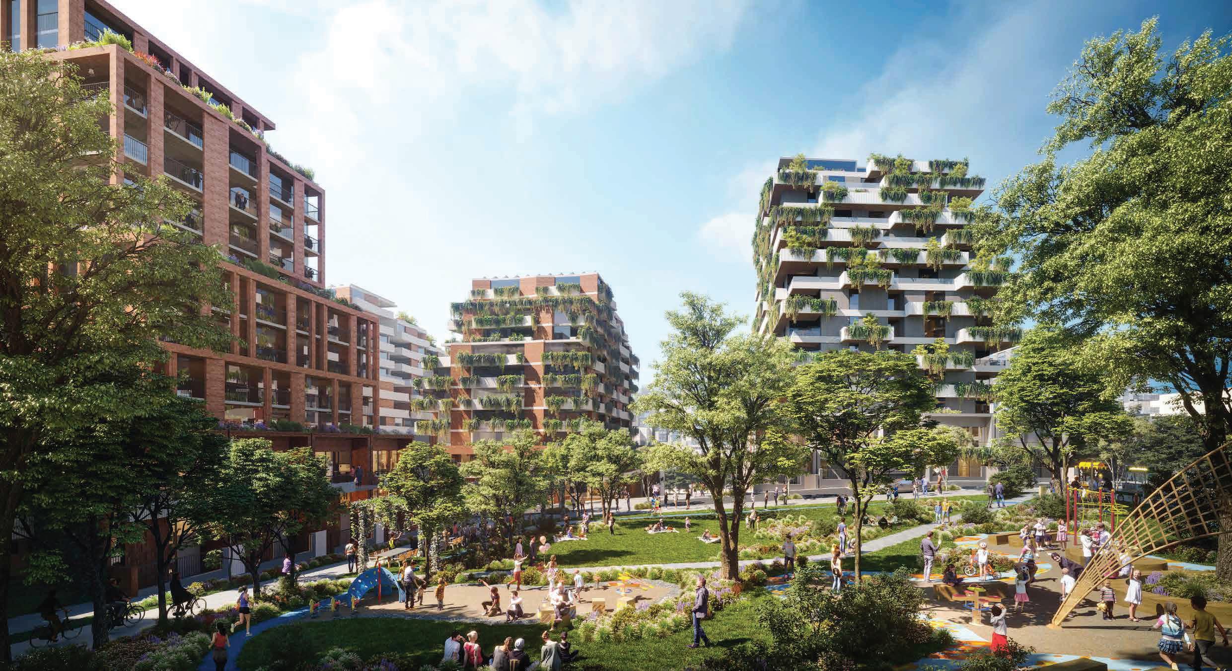 Artist Impression of Future Development (Source: Hatch Roberts Day)
Housekeeping Amendments (Phase 1)
Council-Led Change (Phase 2)
Action A1 – Activating High Density Residential Area: Amend The Hills Local Environmental Plan to permit additional uses within appropriate high density residential areas. Consequential amendments may also be required to the Development Control Plan and Public Domain Plan.
Action A2 - Public Domain Plan: Council will prepare a Public Domain Plan for the Castle Hill Strategic Centre to facilitate some of the outcomes envisaged under this Precinct Plan, including character outcomes set out in Section 4.3 of this Plan.
Action A3 – Development Control Plan Amendments: Council will prepare Development Control Plan amendments for Castle Hill Strategic Centre to facilitate some of the outcomes envisaged under this Precinct Plan, including the environment and smart places outcomes set out in Sections 3.4 and 3.5 of this Plan.
Action A4 – Open Space: Reservation of key areas for future expansion of open space will be facilitated through a Council-led rezoning. Acquisition and subsequent embellishment, will be considered for inclusion as new local infrastructure items within Contributions Plan No. 17 - Castle Hill North, as part of a concurrent review of the Contributions Plan.*
*Note: Subject to potential options - refer to Focus Area 13 in Section 4.1.13 for further detail.
Action A5 – Missing Middle: Council will advocate to State Government for State Policy amendments that would improve and incentivise the delivery of high quality medium density housing typologies (townhouses and terrace-style developments) for land identified within Focus Area 15.
Market Driven Change (Phase 3)
Action A6 – Castle Towers Mixed Use: Future uplift will be facilitated through a landowner-initiated planning proposal for Castle Towers, having regard to the outcomes and design principles set out in Section 4.1.1 of this Plan (Focus Area 1). Site-specific DCP amendments will also be required to guide future development outcomes, as well as appropriate infrastructure solutions and mechanisms.
Action A7 – Castle Towers Entertainment and Heritage Precinct: Future uplift will be facilitated through a landowner-initiated planning proposal for Castle Towers, having regard to the outcomes and design principles set out in Section 4.1.2 of this Plan (Focus Area 2). Site-specific DCP amendments will also be required to guide future development outcomes, as well as appropriate infrastructure solutions and mechanisms.
Action A8 - Ring Road Completion: Future uplift will be facilitated through a landowner-initiated planning proposal for the Ring Road Focus Area, having regard to the outcomes and design principles set out in Section 4.1.3 of this Plan (Focus Area 3). Site-specific DCP amendments will also be required to guide future development outcomes, as well as appropriate infrastructure solutions and mechanisms.
Action A9 - Terminus Street West: Future uplift will be facilitated through landowner-initiated planning proposals for land areas amalgamated by the market in the Terminus Street West Focus Area, having regard to the outcomes and design principles set out in Section 4.1.4 of this Plan (Focus Area 4). Site-specific DCP amendments will also be required to guide future development outcomes, as well as appropriate infrastructure solutions and mechanisms.
Action A10 - Terminus Street East: Future uplift will be facilitated through landowner-initiated planning proposals for land areas amalgamated by the market in the Terminus Street East Focus Area, having regard to the outcomes and design principles set out in Section 4.1.5 of this Plan (Focus Area 5). Site-specific DCP amendments will also be required to guide future development outcomes, as well as appropriate infrastructure solutions and mechanisms.
Action A11 - Kentwell Avenue: Future uplift will be facilitated through a landowner-initiated planning proposal for the Kentwell Avenue Focus Area, having regard to the outcomes and design principles set out in Section 4.1.6 of this Plan (Focus Area 6). Site-specific DCP amendments will also be required to guide future development outcomes, as well as appropriate infrastructure solutions and mechanisms.
Landowner / Developer
Landowner / Developer
Landowner / Developer
Landowner / Developer
Landowner / Developer
Landowner / Developer
112
Responsibility
Table 9. Overview of Phasing and Implementation
Phase Action
Council
Council Council Council Council
Market Driven Change (Phase 3) (Continued).
Action A12 - Worthing Avenue: Future uplift will be facilitated through landowner-initiated planning proposals for land areas amalgamated by the market in the Worthing Avenue Focus Area, having regard to the outcomes and design principles set out in Section 4.1.7 of this Plan (Focus Area 7). Site-specific DCP amendments will also be required to guide future development outcomes, as well as appropriate infrastructure solutions and mechanisms.
Action A13 - Southern Corner of Cecil Avenue and Old Northern Road: Future uplift will be facilitated through a landowner-initiated planning proposal for the Cecil Avenue Commercial Focus Area, having regard to the outcomes and design principles set out in Section 4.1.8 of this Plan (Focus Area 8). Site-specific DCP amendments will also be required to guide future development outcomes, as well as appropriate infrastructure solutions and mechanisms.
Action A14 - Cecil Avenue and Orange Grove: Future uplift will be facilitated through a landowner-initiated planning proposal for the Cecil Avenue Residential Focus Area, having regard to the outcomes and design principles set out in Section 4.1.9 of this Plan (Focus Area 9). Site-specific DCP amendments will also be required to guide future development outcomes, as well as appropriate infrastructure solutions and mechanisms.
Action A15 – Crane Road and Mercer Street: Future uplift will be facilitated through a landowner-initiated planning proposal for the Crane Road and Mercer Street Focus Area, having regard to the outcomes and design principles set out in Section 4.1.10 of this Plan (Focus Area 10). Site-specific DCP amendments will also be required to guide future development outcomes, as well as appropriate infrastructure solutions and mechanisms.
Action A16 - Orange Grove West: Future uplift will be facilitated through landowner-initiated planning proposals for land areas amalgamated by the market in the Orange Grove West Focus Area having regard to the outcomes and design principles set out in Section 4.1.11 of this Plan (Focus Area 11). Site-specific DCP amendments will also be required to guide future development outcomes, as well as appropriate infrastructure solutions and mechanisms.
Action A17 – Brisbane Road Focus Area: Future uplift will be facilitated through landowner-initiated planning proposals for land areas amalgamated by the market in the Brisbane Road Focus Area, having regard to the outcomes and design principles set out in Section 4.1.12 of this Plan (Focus Area 12). Site-specific DCP amendments will also be required to guide future development outcomes, as well as appropriate infrastructure solutions and mechanisms.
Landowner / Developer
Landowner / Developer
Landowner / Developer
Landowner / Developer
Landowner / Developer
Landowner / Developer
The Hills Shire Council Draft Precinct Plan Castle Hill Strategic Centre 113
Phase Action Responsibility
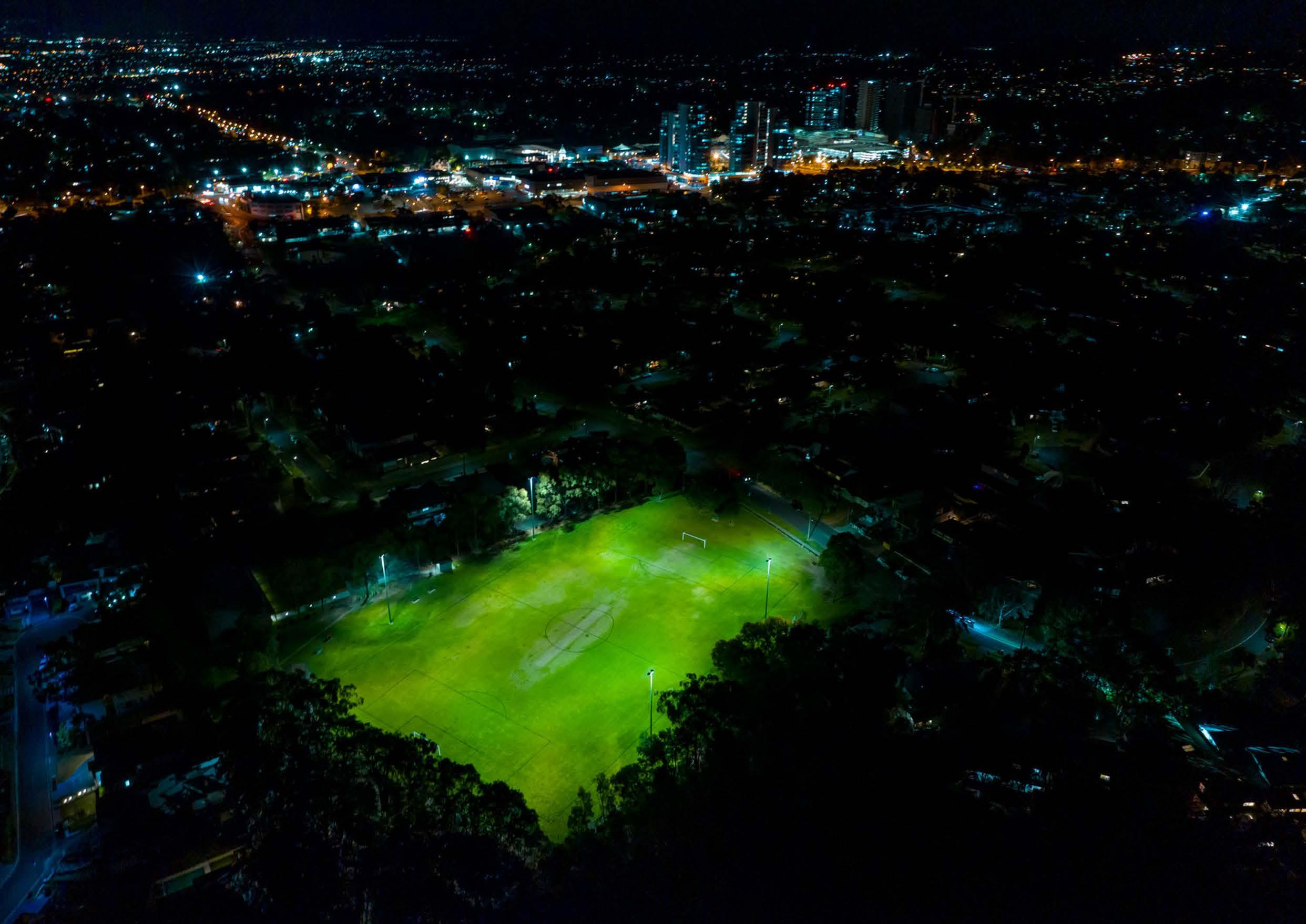 Greenup Park.
Infrastructure 05
5.1 Infrastructure Analysis
The level of growth expected within the Castle Hill Strategic Centre will place increased pressure on existing local and regional infrastructure. One of the guiding principles for this Precinct Plan is that existing and future growth will be appropriately catered for with new local infrastructure, as these facilities are integral to the daily lifestyles of residents and workers. This includes local infrastructure such as playing fields, parks, traffic and transport works, community facilities and stormwater works.
This section focuses on the infrastructure required to service the uplift proposed through this Precinct Plan. Areas which have been subject to previous investigations to identify the required local infrastructure, and where this Precinct Plan is not proposing any significant change, do not form part of the analysis. This mainly includes the Castle Hill North Precinct, which is covered by Council’s Contributions Plan No. 17 – Castle Hill North. However, infrastructure upgrades that are already planned and identified for funding are acknowledged for a holistic understanding.
Local infrastructure can be delivered by Developers or Council and is funded through a combination of Contributions Plans and Planning Agreements. Contributions Plans include a schedule of infrastructure and costs and establish contributions rates.
As development occurs, Developers pay contributions, and these contributions are allocated toward the rollout of infrastructure listed within the Plan. Alternatively, Developers can enter into a Planning Agreement with Council. These Agreements can include land, works or monetary contributions for local infrastructure. Planning Agreements are voluntary and are typically entered into as part of site-specific proposals to increase density, where the infrastructure that is required to support the growth is not included within an applicable Contributions Plan. These Agreements can also be effective where the land undergoing uplift is controlled by a single owner.
The Strategic Centre is currently covered by various contributions plans, including the following (as shown in Figure 74):
• The Hills Section 7.12 Contributions Plan: This Plan applies Shirewide and came into force on 1 November 2011 (previously known as the Section 94A Plan). It seeks to capture monetary contributions from small incremental developments, primarily in established areas. These fees are allocated toward the provision, extension or augmentation of public facilities. It is not intended to be utilised to capture additional development uplift.
• Contributions Plan No. 9 – Castle Hill Town Centre: This Contributions Plan only levies for commercial and retail developments and does not cater for (or envisage) the level of growth anticipated under this Precinct Plan. It came into force on 16 May 1995 and was envisaged to have a lifespan until 2023.
• Contributions Plan No. 17 – Castle Hill North: Contribution Plan No. 17 applies to the Castle Hill North Precinct. It identifies infrastructure upgrades and new facilities that will support future development within the Castle Hill North Precinct including roundabouts, road widening, intersection re-alignment, new playing fields, upgrade of local open spaces and new stormwater management facilities. It came into force on 29 September 2020.
A handful of Voluntary Planning Agreements also apply to sites within the Castle Hill Strategic Centre, including 93-107 Cecil Avenue and 9-10 Roger Avenue, 6-12 and 16-20 Garthowen Crescent and Castle Towers. Council maintains a register of planning agreements that is available on Council’s Website.
*Note: Council’s Section 7.12 Contribution Plan applies Shire-wide.
Metro Station
Metro Line
Castle Hill Strategic Centre
Voluntary Planning Agreement
The Hills Section 7.12 Contributions Plan (only)*
Contributions Plan No. 9Castle Hill Town Centre
Contributions Plan No. 17Castle Hill North
Contributions Plan No. 19Showground Station Precinct

116
M

Bidjigal Reserve
5.1.1 Active Open Space
Active open spaces are areas for physical activity and organised sport. This Precinct Plan assesses the expected active open space needs of future residents and recommends solutions to address demand.
Existing Situation
There is one active open space facility within the Castle Hill Strategic Centre being Greenup Park. Greenup Park is located on Cecil Avenue and features a single sports field with a synthetic cricket pitch located in the centre, which is covered during the winter months and is best suited to lower level local sports. It also features lighting for training, a kiosk, change rooms and a playground.
Additionally, there are five (5) other active open space facilities in the broader vicinity. These include:
• Coolong Reserve.
• Castlewood Community Reserve.
• Holland Road Reserve.
• Eric Mobbs Reserve.
• Fred Caterson Reserve.
As the existing active recreation facilities are already at capacity, any new growth proposed through this Precinct Plan (over and above what has already been planned for Castle Hill North and catered for in Contributions Plan No. 17 – Castle Hill North) will need to contribute toward the delivery of new active recreation infrastructure.
Proposed Demand
Council’s Recreation Strategy indicates that dwellings should be located within 1-2km of a local active open space facility, where possible. The preferred benchmark provision is 1 playing field per 2,000 people for low density areas and 1 playing field per 4,000 people (2,000 dwellings) for high density residential areas.
Based on these benchmarks, the proposed capacity for residential growth within the Castle Hill Strategic Centre, being more than 8,000 dwellings, will generate demand for at least 4 additional playing fields.
Proposed Solutions
New playing fields should ideally be located within a 2km catchment, although in exceptional circumstances, sites that are located further away outside of this catchment can be considered. The following potential solutions have been identified:
• Expansion of Holland Reserve from 1 playing field to 4 playing fields. The facility will include 2 cricket pitches. This upgrade is already planned and partially funded by Contributions Plan No. 17. The 3 additional fields can be wholly allocated to service the additional demand within the Castle Hill Strategic Centre.
• Delivery of 1 additional playing field at Eric Mobbs Reserve.
• Potential for some smaller court active spaces within the proposed expansion of Arthur Whitling Reserve.
Castle Hill Strategic Centre
Current Active Open Space
Future Active Open Space
2km Catchment Buffer
118
5.1.2 Passive Open Space
Passive open spaces are areas primarily for play and quiet relaxation, providing an opportunity to connect with the community and outdoor environment and includes local parks, urban plazas and green corridors containing footpaths and cycleways. This Precinct Plan assesses the expected passive open space needs of both residents and workers and recommends solutions to address demand.
Existing Situation
Currently the Castle Hill Strategic Centre accommodates 13 local and neighbourhood parks. These areas are dispersed throughout the Precinct. Figure 76 shows all existing passive open space areas within the Strategic Centre (shown in light green), with a 400m walkable catchment around each open space.
Proposed Demand
Council’s Recreation Strategy indicates that dwellings should generally be located within 400m of passive open spaces. Where possible, existing parks will be enhanced to a higher quality. It is also acknowledged that local parks do not only service residents but are also important for workers. They play an essential role in attracting and retaining employees as they provide places for workers to have breaks. They assist in achieving good urban design outcomes, enhancing the image of the Castle Hill Strategic Centre and provide amenity for residents, workers and visitors.
Proposed Solutions
While there is a distribution of passive open space throughout the Precinct, additional residents, workers and visitors will create demand for new and expanded open spaces, especially within central areas of the Strategic Centre. This Precinct Plan identifies the opportunity to expand various existing parks, including the following:
• New park between Kentwell Avenue and Pennant Street
• Expansion of Worthing Avenue Reserve.
• Expansion of Orange Grove Reserve.
• Expansion of Olola Avenue Reserve.
• Expansion of Arthur Whitling Reserve (refer to note under Figure 76).*
These expansions could be funded through Contributions Plans and Planning Agreements. However, where the future open space land is fragmented, with multiple land owners, the inclusion of the land within the applicable Contributions Plans will be the most appropriate mechanism to provide certainty that the open space will be delivered.
As this Precinct is further master planned, additional opportunities for new parks and plazas will also be investigated, especially as part of future development outcomes in the Focus Areas identified in Section 4.1 of this Precinct Plan. Land identified for future urban plazas will be retained in private ownership and will have a public right of access. Where open space is proposed as part of a Focus Area, consideration will be given to transferrable floor space in lieu of the inclusion of the open space within an applicable Contributions Plan. Whilst some specific areas have been identified within this Precinct Plan, this is a baseline, and it is expected that Developers will explore every opportunity to provide additional open space areas to improve the amenity of residents, workers and visitors to the Centre.
Metro Line (Underground)
Castle Hill Strategic Centre
Realignment / Road Widening
Future Passive Open Space
Current Passive Open Space
400m Catchment
Potential Options Identified*
Future Plaza
The Hills Shire Council Draft Precinct Plan Castle Hill Strategic Centre 119
the exhibition, the Precinct Plan will be amended to reflect the preferred Option. Refer to Focus Area 13 in Section 4 for further detail.
5.1.3 Traffic and Transport
The Strategic Centre is dominated by an arterial network that connects Castle Hill with other major centres and is used by many commuters in the area. While the network provides easy access by motor vehicle, it hampers good accessibility by pedestrians to the heart of the Precinct which contains the businesses, services and transport hub.
The existing Town Centre is located at the junction of Showground Road and Old Northern Road and is surrounded by a Ring Road’ that enables vehicles to pass around and through the Town Centre.
Showground Road is a key arterial road that provides connectivity to the neighbouring Norwest Strategic Centre and Old Northern Road is the key north-south arterial link connecting the rural areas in the northern parts of the Shire to Baulkham Hills, Parramatta and the Sydney CBD.
Pennant Street and Terminus Street form part of the Ring Road, framing the existing Town Centre and providing connections to the broader local road network and surrounding residential areas.
The roads are heavily congested during morning and evening peak periods, causing long delays for road users. Future growth will substantially increase traffic volumes within the Strategic Centre, particularly along Showground Road, Old Northern Road, Pennant Street and local feeder roads. While it is expected that road users will likely experience some worsening traffic congestion, even with planned road upgrades, it will be the focus of traffic and transport planning to ensure that the future road network operates at an acceptable level of service.
A balance is required between facilitating the required road upgrades and improving and prioritising pedestrian connectivity throughout the Precinct. Ensuring that the road network continues to operate at an acceptable level of service will require the implementation of a combination of measures. These include:
• Reduced parking rates that recognise the accessibility of high frequency public transport services to and from the Centre.
• Modal shift toward increased public transport usage to access the Strategic Centre (assisted through reduced parking rates, improved access to the Metro Station, the delivery of future regional transport connections and connectivity and public domain improvements).
• Upgrades and expansion of certain roads and intersections to increase capacity. This will contain the impact, as much as possible, to the walkable catchment of each Metro Station, whilst ensuring that traffic continues to flow efficiently.
These matters are discussed further within this Section.
Metro
120
Line (Underground)
Castle Hill Strategic Centre Arterial Major Collector
Private
Minor Collector Local
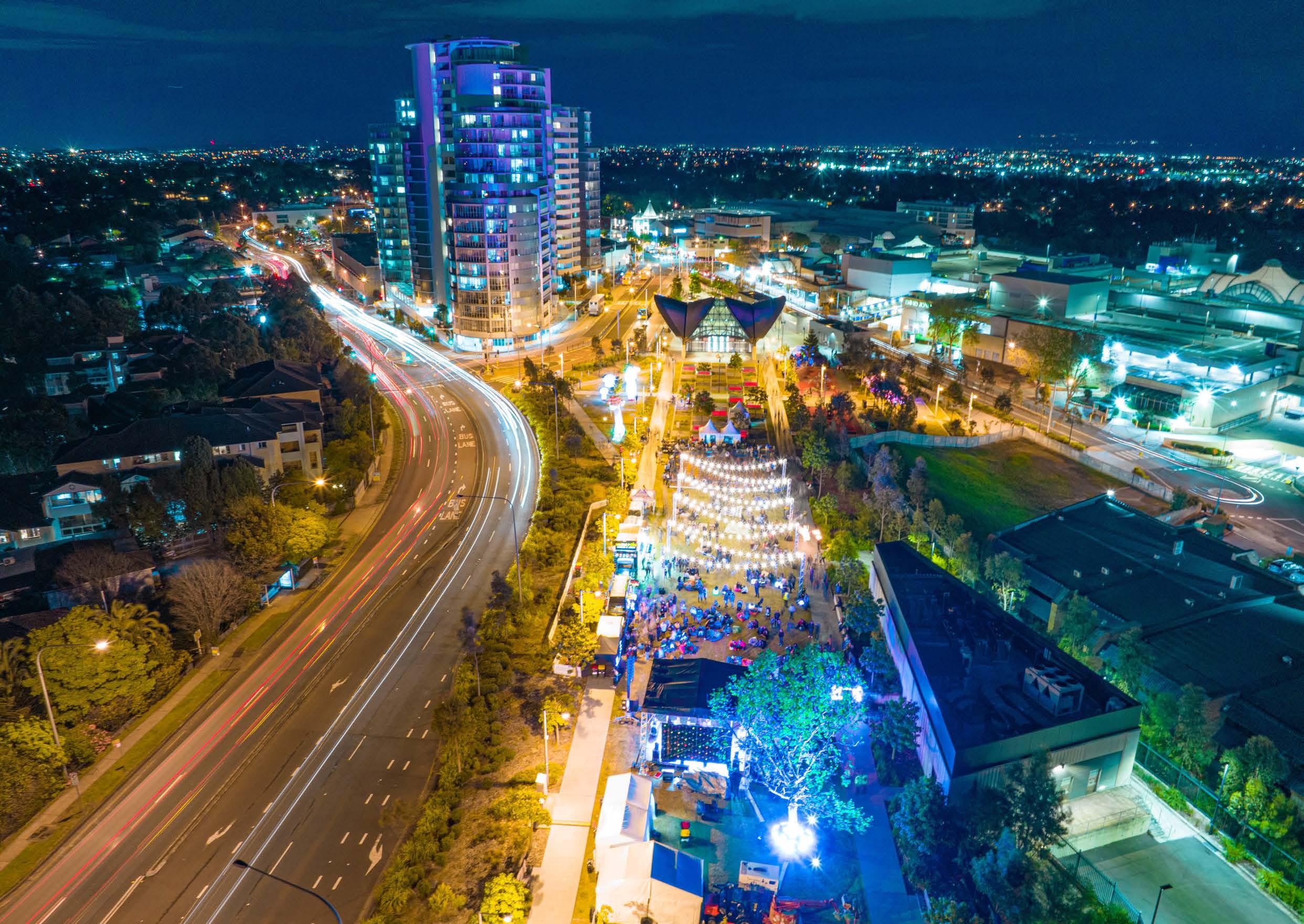 Old Northern Road and surrounds.
Regional Road Network
The NSW Government (Transport for NSW) is responsible for the regional road network, which includes Showground Road, Old Northern Road, Pennant Street and Terminus Street.
Regional Traffic Modelling is currently being finalised by Cardno (an external Traffic Engineering Consultancy) to assess capacity for growth and potential upgrades required within the Castle Hill and Norwest Strategic Centres. It is anticipated that the findings of this modelling will identify that if existing policy settings are retained, the expected growth within the Strategic Centres will result in unacceptable impacts on the road network, with most intersections on the regional road network failing during both the AM and PM Peak Hours by 2036.
Various upgrades are identified to assist in increasing the capacity of the regional road network (for land within the Castle Hill Strategic Centre), as shown in Table 10. The delivery of the upgrades would primarily be the responsibility of the NSW Government.
Upgrade of Showground Road between Old Northern Road and Cecil Avenue
Upgrade of Old Northern Road between Cecil Avenue and Francis Street
Signalisation upgrade at Old Castle Hill Road, Pennant Street and McMullen Avenue intersection
Signalisation upgrade at Les Shore Place and Pennant Street intersection
Signalisation upgrade at Castle Street and Pennant Street intersection TfNSW
Signalisation upgrade at Pennant Street and Showground Road intersection
Signalisation upgrade at Cecil Avenue and Old Northern Road intersection
Signalisation upgrade at Old Northern Road and Francis Street intersection
Completion of Ring Road (from Pennant Street to Old Northern Road)
Metro Station
Metro Line (Underground)
Castle Hill Strategic Centre
Item
Arterial Roads
122
1 5 4 3 6 9 7 2 8 No. Item Description Responsibility
Table 10. Regional Road Network Upgrades
TfNSW
TfNSW
TfNSW
TfNSW
TfNSW
TfNSW
TfNSW
TfNSW
M 1 2 3 4 5 6 7 8 9
Local Road Network
In addition to the regional road upgrades, several local road improvements (including new road connections, intersection upgrades, new signalised intersections, roundabouts, left-in-left-out upgrades) are identified within the Castle Hill Strategic Centre (as detailed in Table 11). These are principally feeder roads onto the regional road network and provide local vehicular access to existing and future development sites. These improvements will result in the following benefits:
• Ease traffic congestion.
• Improve vehicular connectivity.
• Facilitate active transport links.
• Facilitate improved amenity for residents and workers.
The suite of local road improvements will work in tandem with reduced parking rates, improved public transport services and improved connectivity and public domain. Typically, local road improvements will either be funded through local Contributions Plans or will be delivered by Developers (at no cost to Council) as redevelopment occurs. Some of the upgrades listed in the following table are already identified for delivery and funding responsibilities. The strategically identified items have not yet been finalised and do not have a current funding source. Where needed, Council can consider including the capital and land acquisition costs associated with upgrades within an applicable Contributions Plan. Where appropriate, land required for road widening will be zoned for acquisition within The Hills Local Environmental Plan (LEP).
No. Item Description Responsibility
Roundabout – Old Castle Hill Road and Gilham Street
Roundabout – Castle Street and Carramar Road
Roundabout – Gilham Street and Carramar Road
Roundabout – Garthowen Crescent and Old Castle Hill Road (northern junction)
Signalised Intersection – McMullen Avenue and Brisbane Road and Realignment of Brisbane Road Council
Road upgrade and widening of Old Castle Hill Road (from Eric Felton Reserve to Gilham Street) – including road widening on both the eastern and western sides of Old Castle Hill Road Council
Road upgrade and widening of Castle Street (from Grand Way to Cecil Avenue) –including road widening on the northern side of Castle Street Council
Roundabout – Orange Grove, Crane Road and Mercer Street (including realignment of road) Strategically Identified
Completion of Ring Road from Pennant Street to Cecil Avenue (including potential widening as well as closure of Barwell Avenue and the far eastern section of Showground Road between Pennant Street and Old Northern Road) Strategically Identified
Left-in-left-out upgrade from Cecil Avenue into and out of the Ring Road Extension Strategically Identified
Upgrade of Crane Road between Terminus Street and Orange Grove Road Strategically Identified
Widening and Realignment of McDougall Lane Strategically Identified
5 pedestrian
in various locations Council (2 bridges) and Strategically Identified (3 bridges)
Identified
The Hills Shire Council Draft Precinct Plan Castle Hill Strategic Centre 123 1 5 4 3 6 9 7 2 8 13 11 12 13 13 13 13 14 10
Figure 79. Local Road Upgrades
Table 11. Local Road Network Upgrades
Council
Council
Council
Council
bridges
Metro Station Metro Line (Underground) Castle Hill Strategic Centre Item M 10 11 12 13 14 1 2 3 4 5 6 7 8 9
Widen the verge / footpath on the western corner of Pennant Street and Les Shore Place Strategically
Car Parking
The Hills Shire currently has high private car ownership rates and usage patterns, with nearly 80% of trips made by private vehicles. With the population set to increase over the next 20 years, this will drastically increase the number of cars on the road network (estimated to be an additional 72,000 cars across The Hills Shire based on existing car ownership levels), subsequently placing increased pressure on the road network.
As previously discussed, Regional Traffic Modelling is currently underway to assess capacity for growth and potential upgrades required within the Castle Hill and Norwest Strategic Centres. Whilst this work has not yet been completed, preliminary findings have identified that if existing policy settings are retained, the expected growth within the Shire’s Strategic Centres will result in unacceptable impacts on the road network, leading to catastrophic impacts for road users, even if all identified upgrades are completed.
The application of reduced parking rates that recognise the accessibility of the Strategic Centre with high frequency public transport services, will substantially reduce traffic generation. The reduced traffic generation coupled with road upgrades will assist in minimising the impact of growth on the level of service of the road network. This will contain the impact, as much as possible, to the Strategic Centre, whilst ensuring that traffic continues to flow efficiently and the road network functions at an acceptable level.
Reduced parking rates also have many other benefits, including encouraging a modal shift towards public transportation and prioritising transit oriented development principles. It will also assist in enhancing local amenity and creating great places that attract residents, workers and investments.
They also improve commercial feasibility, with many developers challenged by the high cost of parking within a construction project, combined with high minimum parking rates and the need for public domain improvements. It is estimated that basement parking spaces cost on average between $50,000 - $60,000 per space. Therefore, introducing more constrained parking rates will make redevelopment more economically attractive, enable Developers to develop at a high design standard and provide a greater contribution towards the embellishment of the public domain.
Council already has a reduced residential parking rate of 1 space per dwelling within the Station Precincts. This rate is proposed to be retained. However, for non-residential development, it is recommended that the proposed reduced parking rates, based on walkable catchments (as shown in Figure 80), be rolled out within the Strategic Centre. This would occur through an amendment to The Hills Development Control Plan 2012, in line with the recommendations contained within the Transit Centres Parking Requirements Report prepared by PeopleTrans (2021).
The commercial parking rates proposed represent a significant reduction to the current parking requirements. If applied, the proposed rates would enable the development outcomes envisaged under this Plan to occur with a reduction in the number of commercial parking spaces available in the Castle Hill Strategic Centre, in comparison to what could be expected to occur at full development under the current controls.
Coupled with targeted upgrades to the local and regional road network, this will assist in mitigating some of the potential for increased traffic congestion associated with higher density development.
Metro Station
Metro Line (Underground)
Castle Hill Strategic Centre
Proposed Road / Widening
Inner Catchment
Outer Catchment
Proposed Commercial Parking Rates
Minimum Maximum
Inner Walkable Catchment:
1 space per 100m² of GFA
Outer Walkable Catchment:
1 space per 75m² of GFA
Proposed Retail Parking Rates
Inner Walkable Catchment:
1 space per 75m² of GFA
Outer Walkable Catchment: 1 space per 60m² of GFA
Minimum Maximum
Inner Walkable Catchment:
1 space per 60m² of GFA
Outer Walkable Catchment:
1 space per 50m² of GFA
Inner Walkable Catchment: 1 space per 30m² of GFA
Outer Walkable Catchment: 1 space per 25m² of GFA
124
Table 12. Proposed Parking Rates
M
Active Transport Network
The delivery of a safe and well-connected pedestrian and bicycle network is essential to improving the amenity of the Castle Hill Strategic Centre and achieving a transit oriented centre. The existing impediments to cycle and pedestrian movement within the Castle Hill Strategic Centre are:
• Regional Roads (Barriers): The Strategic Centre is bisected by busy roads such as Terminus Street, Pennant Street and Showground Road. Access points across these roads are currently limited.
• Large Impermeable Lots: Large lots with no pedestrian throughsite links reduces permeability and increase the time and distance for pedestrians to walk between different points within the Strategic Centre. Improved connections will be required as part of any redevelopment within the broader Centre.
• Incomplete Network: There are already existing pathways and cycleways, which assist in facilitating active transport. However, in certain parts of the Castle Hill Strategic Centre the paths are incomplete.
The above issues can be mitigated through the following:
• Provide shared paths in association with road upgrades.
• Identify through site links to improve pedestrian movement.
• Complete missing portions of the cycle network.
• Require footpaths adjoining development sites.
• Identify pedestrian bridges (or improved pedestrian access) across roads with high traffic volumes.
Council’s policies and controls aim to improve the active transport facilities by integrating active transport methods with other forms of available transport modes in the Castle Hill Strategic Centre to increase public transport use and promote a healthier lifestyle. For example, dual-mode travel can be encouraged by providing an integrated network of active routes ensuring good local connections between residential areas and attractors, such as educational institutions, shopping centres, major bus interchanges and secure bicycle parking facilities.
Metro Line (Underground)
Castle Hill Strategic Centre
Up to 5 minute walk (400m)*
5 to 10 minute walk (800m)*
Signalised Intersection
Pedestrian Bridge
*Note: Accounting for new connections proposed in this Plan.
Roundabout
Pedestrian Link
Proposed Road
Existing Cycleway
Planned Cycleway T
The Hills Shire Council Draft Precinct Plan Castle Hill Strategic Centre 125
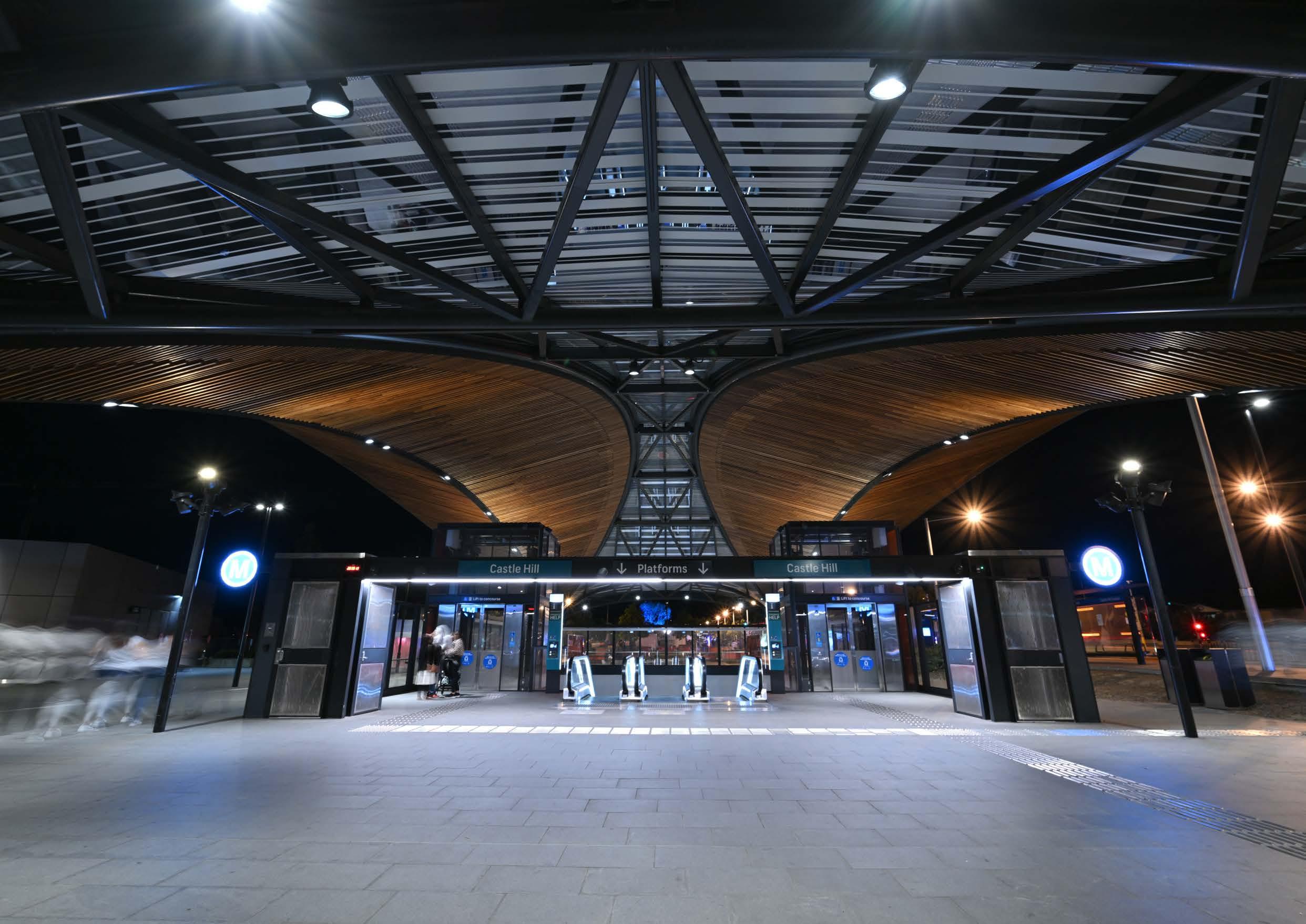 Castle Hill Metro Station
5.1.4 Regional Public Transport
It is imperative that the Precinct is accessible and has frequent and efficient public transport connections to surrounding regions and economic centres. This will make Castle Hill a viable and attractive option for future residents, businesses and workers.
The Sydney Metro Northwest addresses the critical east-west connection along the Macquarie Park / Chatswood and City Economic Corridor. The extension of the Sydney Metro Northwest from Tallawong Station to St Marys Station will also greatly improve public transport to the Western Sydney Employment Area and future Western Sydney Airport. Castle Hill is strategically located to benefit from these important linkages.
Currently connections between Parramatta and the Hills Shire are principally via arterial roads (Windsor Road, Old Windsor Road and Old Northern Road). These roads are extremely congested during peak periods. Even with the completion of local and regional road upgrades this congestion will only worsen as the population grows.
The NSW Government’s Greater Sydney Region Plan and Future Transport also nominate a city-shaping link between Norwest and Parramatta as a 1020 year visionary project with no firm commitment to planning at this stage. The Castle Hill Strategic Centre would benefit from this link as it would provide an additional public transport option to the Parramatta CBD. Future Transport also identifies a future rapid bus services between Castle Hill and Parramatta. To safeguard these connections earmarked by the NSW Government, it is pivotal that the NSW Government progressively conduct feasibility studies to preserve the transport corridors and transport hubs to protect these transit links.
Council will continue to lobby the NSW Government for the funding, early planning, and delivery of these regional transport connections, as they are critical to the success of Castle Hill moving forward. Mass transit links between The Hills Shire and Parramatta will secure the long-term viability of the Shire’s Strategic Centres and support the growth of the Greater Parramatta and Olympic Peninsula (GPOP) economic corridor, cementing Parramatta’s role as the Central River City CBD.
The following key actions will be required as part of the long term planning for improved public transport services to and from Castle Hill:
• Collaborate with State Government in the preparation of a business case for the mass transit link between Norwest and Parramatta. This will include the type of service required and identify options for a corridor.
• Collaborate with State Agencies as part of the planning and delivery of a rapid bus service between Castle Hill and Parramatta.
• Collaborate with State Agencies as part of the planning and delivery of the extension of the Sydney Metro Northwest from Tallawong to St Marys Stations.
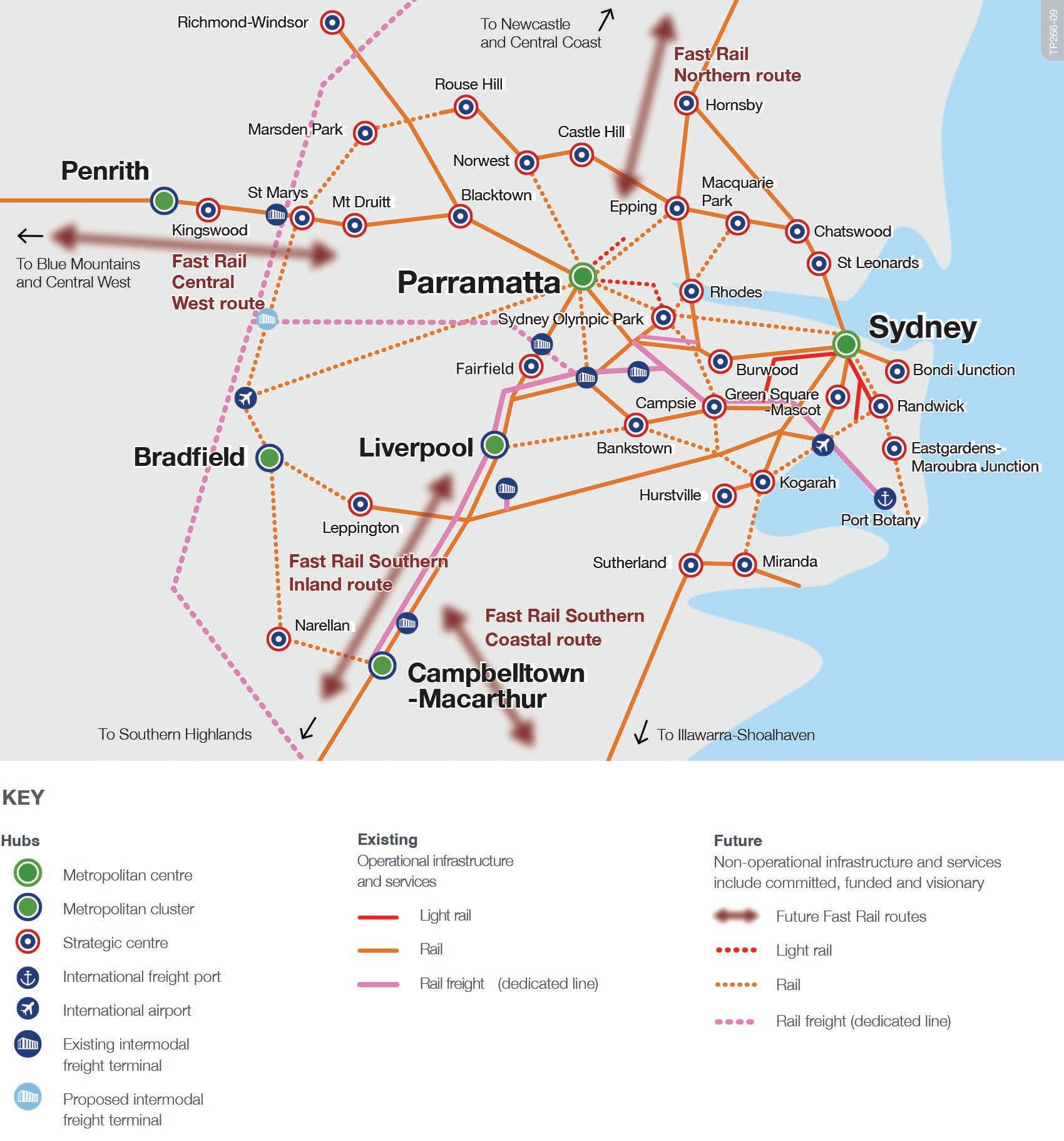
The Hills Shire Council Draft Precinct Plan Castle Hill Strategic Centre 127
Figure 82. Potential Regional Connections (Source: Transport for NSW – Future Transport Strategy)
5.1.5 Community Facilities
Existing Situation
The Castle Hill Strategic Centre contains Castle Hill Library, which is located on Pennant Street opposite the Castle Towers Shopping Centre. The library has a total floor area of 1,900m² and provides a range of services from book loans, digital services to a café and financial payment services. The diversity of services demonstrates versatility and ease of access, which is essential to the ongoing operations of library facilities.
The Pioneer Theatre and Community Centre is a cultural asset co-located with The Hills Shire Council library on the ground floor of the Castle Grand building on the corner of Castle and Pennant Streets. The theatre features a flat floor 350+ seat configurable performance space designed for theatrical works, acoustic and contemporary music, cabaret, large corporate functions, school events, conferences and social usage including weddings, family gatherings, film screenings and parties. It is an intimate and versatile ‘black box’ style theatre, with configurable seating, staging and layout options enabling it to provide a range of experiences to audiences.
Population growth within the Strategic Centre and surrounding suburbs will warrant the provision of new library and community facilities. Whilst there is currently a lack of such facilities within the North West Region, this is largely since Council is unable to fund the capital cost for these types of facilities under local Contributions Plans (as they are not on IPART’s Essential Works List).
Projected Demand
The delivery of new community floorspace within the Strategic Centre will service the needs of new residents and will also relieve pressure on other nearby libraries by drawing users from existing facilities.
Proposed Solutions
Opportunities will be explored to provide new community floor space within the Castle Hill Strategic Centre, especially as part of the redevelopment of the Focus Areas earmarked in this Precinct Plan such as Terminus Street and/or floor space fronting Old Castle Hill Road beneath the proposed expansion of Arthur Whitling Reserve. Opportunities will also be investigated to improve the utilisation of the existing floor space and, where possible, increase the usable floor space within the existing Castle Hill Library.
It is noted that funding for some community floorspace in Castle Hill has already been identified within Council’s Section 7.12 Contributions Plan. However, this does not cater for the level of growth envisaged within this Precinct Plan and would need to be funded through appropriate sources in the future.
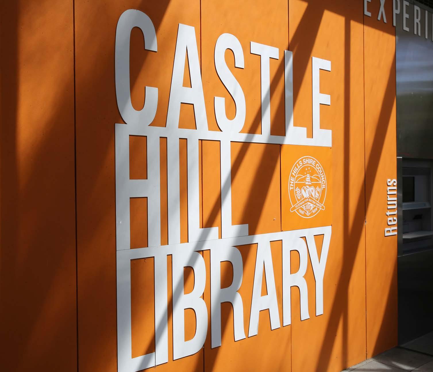
128
Castle Hill Library and Community Facility
5.1.6 Education Facilities


The delivery of high quality primary and secondary schools is an integral part of ensuring liveable neighbourhoods and servicing the needs of our family dominated demographic.
The projected growth (capacity for approximately 8,000 additional dwellings) will generate significant demand for new school infrastructure, for both primary and secondary schools. Some of the demand may be met through additional private schools and/or expansion of capacity within some existing schools. The remaining demand will need to be catered for through new NSW Government schools. This will be a matter for further consultation with the NSW Government.
Metro Station
Metro Line (Underground)
Castle Hill Strategic Centre
Excelsior Public School
Castle Hill Public School
Murray Farm Public School
Oakhill Drive Public School
Baulkham Hills North Public School
Samuel Gilbert Public School
Metro Station
Metro Line (Underground)
Castle Hill Strategic Centre
Castle Hill High School
Crestwood High School
Muirfield High School
Cherrybrook Technology High School
Pennant Hills High School
Model Farms High School
The Hills Shire Council Draft Precinct Plan Castle Hill Strategic Centre 129
Figure 84. Secondary School Catchment Area
M
M
5.1.7 Water Management
Stormwater Network
Applications for future development and proposals to upzone land will need to be supported by a Stormwater Assessment to identify the capacity of the existing stormwater network and its hydrological level of service. The assessment will also need to identify what upgrades will be required to facilitate safe and sustainable development.
Overland Flowpaths
There are numerous overland flowpaths throughout the Castle Hill Strategic Centre, predominately located on existing roads and dedicated drainage lines. However, some of the flowpaths are located on private land, including between Les Shore Place, Larool Crescent and Carramar Road and between Pioneer Place and Winchcombe Place in the northern area of the Precinct. Various overland flowpaths also traverse through residential areas to the south of the Precinct, as shown in Figure 85.
Overland flowpaths convey stormwater during storm events. Underground stormwater pipes have a limited capacity. When these pipes are blocked, or when the volume of stormwater exceeds the capacity of the pipes, the stormwater will spill over and flow over land until it reaches a creek or basin. These flowpaths are to be reserved from development and must be kept clear.
Where an overland flowpath is located on private land, future development must be designed to avoid the flowpath. Where possible through site links and future roads will be strategically located to align with these flow paths so that the stormwater pipes can be located within road reserve. Development in these areas will also need to manage the stormwater through detention pits and pipes to redevelop.
The following key actions will be required as part of the long term planning for improved stormwater management:
• Future landowner initiated proposals will need to identify and deliver upgrades to the stormwater network.
• Reinforce, through development controls, the need for development to avoid overland flowpaths. Where possible, locate through site links and new roads long these flowpaths.
• Prepare a Flood Study for the Castle Hill Strategic Centre to identify capacity of the existing stormwater network and identify required upgrades. The costs of future upgrades to the stormwater network will be included within applicable contribution plans.
Metro Station
Metro Line (Underground)
Castle Hill Strategic Centre
100 Year Flood Extent
Creek Lines and Overland Flow Paths
Catchment Boundary
130
M
5.2 Infrastructure Actions
The delivery of regional infrastructure will be the responsibility of State Government (regional traffic, mass transit corridors and schools etc.). Whereas Council will be responsible for the delivery of local infrastructure (land and capital works) including playing fields, parks, traffic and transport upgrades, community facilities and stormwater works.
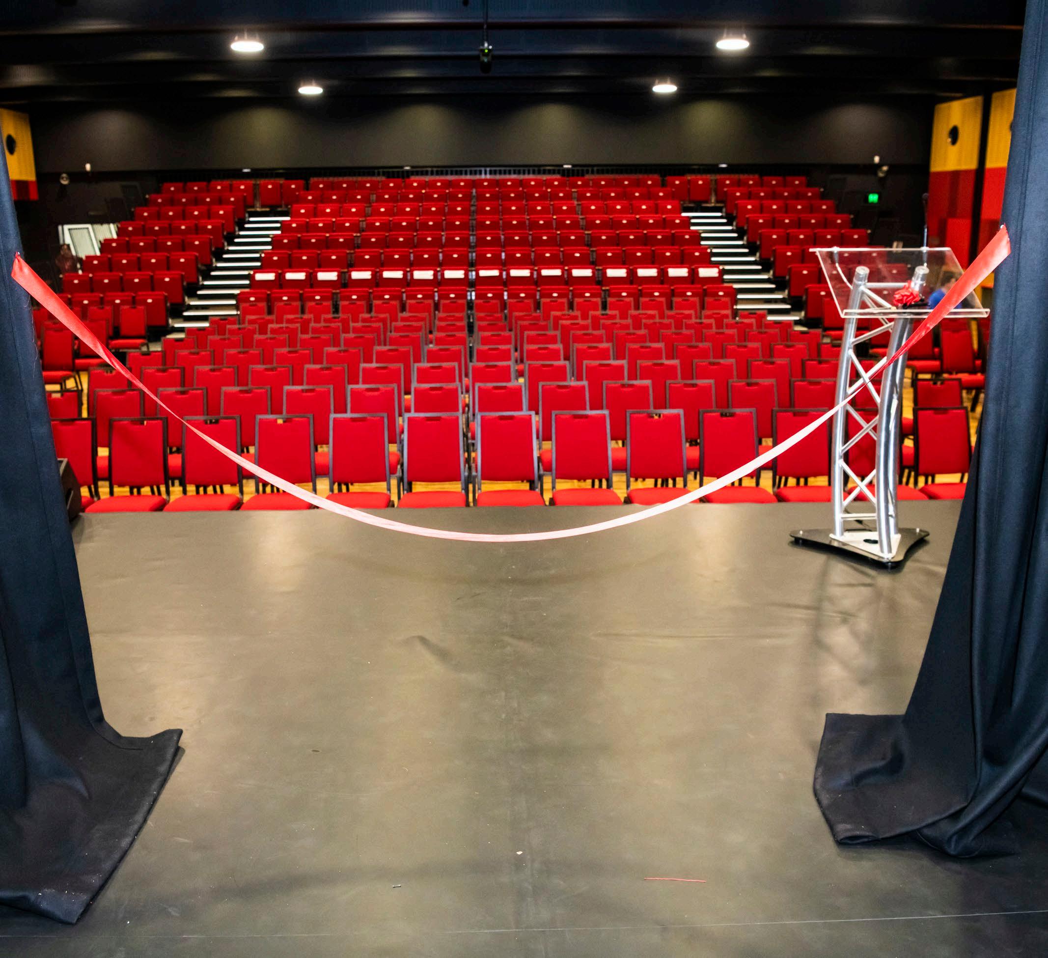
The existing contribution framework for the Castle Hill Strategic Centre is set out within Section 5.1 of this Precinct Plan, along with the future infrastructure necessary to service the growth projected within this Plan. This Plan recommends a review and rationalisation of the Contributions Plan Framework applicable to the Castle Hill Strategic Centre. This would include additional land and capital costs for new items identified through this Plan and streamline, to the maximum extent possible, the Contributions Framework and Developer levies across the Precinct.
Future growth is expected to occur through the redevelopment of large master planned development sites, with any necessary changes to the planning framework to occur through market driven planning proposals. Any planning proposal must consider and identify the appropriate infrastructure solutions and establish the necessary mechanisms for development contributions and/or delivery of works-in-kind.
The Hills Shire Council Draft Precinct Plan Castle Hill Strategic Centre 131
Pioneer Theatre, Castle Hill.
Phase Action
Housekeeping Amendments (Phase 1)
Council-Led Change (Phase 2)
Action B1 – Collaboration with Schools Infrastructure NSW: Council to work with Schools Infrastructure NSW to investigate opportunities for potential new schools to service the existing and proposed population.
Action B2 – Collaboration with State Government: Collaborate with State Government in the preparation of a business case for the mass transit link between Norwest and Parramatta. This will include the identification of the type of service required and potential options for a corridor.
Action B3 – Collaboration with State Government: Collaborate with State Agencies as part of the planning and delivery of the rapid bus service from Castle Hill to Parramatta.
Action B4 – Collaboration with State Government: Collaborate with State Agencies as part of the planning and delivery of the extension of the Sydney Metro Northwest from Tallawong to St Marys.
Action B5 – Development Control Plan Amendments: Council will amend The Hills Development Control Plan 2012 to implement reduced nonresidential parking rates and reflect the planned pedestrian and cycle links for the Castle Hill Strategic Centre.
Action B6 – Contribution Plan Amendments: Council will review and update the contributions framework applicable to Castle Hill Strategic Centre to reflect key local infrastructure outcomes set out within this Plan.
Market Driven Change (Phase 3)
Action B7 – Market Driven Sites: Council will work with landowners to ensure the delivery of infrastructure in association with site-specific planning proposals or establishment of appropriate infrastructure contribution mechanisms.
Responsibility
Council / Schools Infrastructure NSW
Council / State Government
Council / State Government
Council / State Government
Council / Landowners / Developers
132
N/A -
Council Council
Table 13. Infrastructure Actions
 Castle Hill Heritage Park
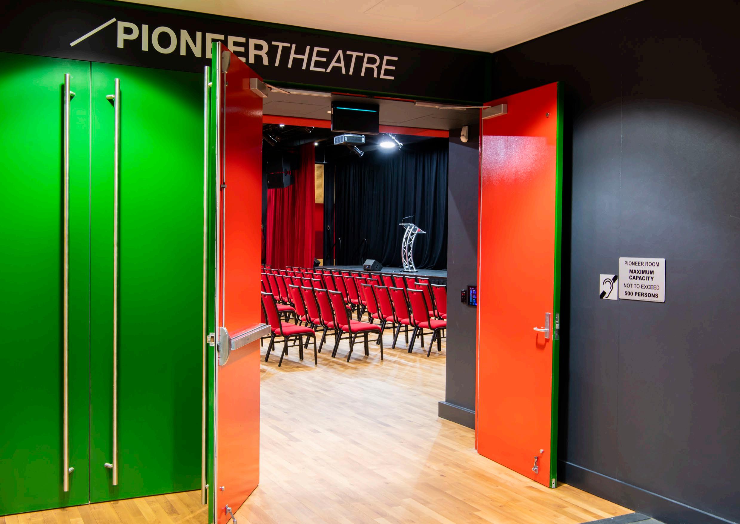 Pioneer Theatre
06
Implementation Plan
This Plan sets a holistic vision and ‘blueprint’ for the Castle Hill Strategic Centre. It includes a list of actions that will be subject to future processes and decisions of Council. It will be necessary to work through these actions over time, to establish the planning framework that facilities that visions and outcomes articulated in the Plan.
The Plan identifies areas where strategic work has been completed and where development is expected to either remain unchanged or continue to roll-out under the current planning framework. It then groups actions into three distinct phases, having regard to potential timing and responsibility for
individual sites and therefore not shown on the map above.
The figures within this Draft Precinct Plan depict “Option 1” for the Arthur Whitling Reserve Focus Area, however as part of the consultation process feedback is sought with respect to both potential outcomes for the Focus Area. Having consideration for the feedback received as part of the exhibition, the Precinct Plan will be amended to reflect the preferred Option. Refer to Focus Area 13 in Section 4 for further detail Refer to Section 1.3 of this Precinct Plan for the location of sites that have been flagged for short to medium term change and longer term change (Figure 4).
Metro Station
Metro Line (Underground)
Castle Hill Strategic Centre
Strategic Work Complete
Phase 1 - Housekeeping Amendments
Phase 2 - Council-Led Change
Phase 3 - Market Driven Change
Potential Options Identified
Strategic Work Completed
Areas where strategic planning work has already been completed or where no further change to the planning controls is anticipated. Development is expected to either remain unchanged or continue to roll-out under the current planning framework (including development applications and/or construction).
Phase 1: Housekeeping Amendments
Areas where Council-led housekeeping amendments are recommended to facilitate improved and/or orderly development outcomes.
Phase 2: Council-led Change
Short to medium term actions that could be led by Council. For example, Council-initiated changes to the planning controls to allow for the achievement of the vision and outcomes in this Plan.
Phase 3: Market Driven Change
Actions that will be market driven. It is considered that the market is best placed to determine the appropriate timing for amendments to the planning controls in these instances (having regard to development demand, life-cycle of existing assets and feasibility) and put forward development outcomes and infrastructure solutions consistent with the strategic framework and Council’s vision articulated within the Plan.
Whilst some market driven solutions may be achievable in the short to medium term, feasible redevelopment in other market driven areas is unlikely to occur until beyond the short-to-medium term horizon. Changes to the planning framework would be driven by landowner-initiated planning proposals, along with associated amendments to the Development Control Plan, Public Domain Plan and appropriate infrastructure contribution mechanisms.
In terms of timing, it is expected that planning proposals for land in short to medium term areas would eventuate over the next 5 to 10 years. Market driven solutions and planning proposals for sites in longer term areas are unlikely to eventuate within this same period and are expected to occur beyond a 10-year horizon (1020 years), as these are either substantially more complex, require amalgamation of fragmented areas or are unlikely to be feasible (at an appropriate density and scale outcome) within this initial 10-year horizon.
136
PHASING
M
Phase Action Responsibility
Housekeeping Amendments (Phase 1)
Council-Led Change (Phase 2)
Action A1 – Activating High Density Residential Area: Amend The Hills Local Environmental Plan to permit additional uses within appropriate high density residential areas. Consequential amendments may also be required to the Development Control Plan and Public Domain Plan.
Council
Action A2 - Public Domain Plan: Council will prepare a Public Domain Plan for the Castle Hill Strategic Centre to facilitate some of the outcomes envisaged under this Precinct Plan, including character outcomes set out in Section 4.3 of this Plan.
Action A3 – Development Control Plan Amendments: Council will prepare Development Control Plan amendments for Castle Hill Strategic Centre to facilitate some of the outcomes envisaged under this Precinct Plan, including the environment and smart places outcomes set out in Sections 3.4 and 3.5 of this Plan.
Action A4 – Open Space: Reservation of key areas for future expansion of open space will be facilitated through a Council-led rezoning. Acquisition and subsequent embellishment, will be considered for inclusion as new local infrastructure items within Contributions Plan No. 17 - Castle Hill North, as part of a concurrent review of the Contributions Plan.*
*Note: Subject to potential options - refer to Focus Area 13 in Section 4.1.13 for further detail.
Action A5 – Missing Middle: Council will advocate to State Government for State Policy amendments that would improve and incentivise the delivery of high quality medium density housing typologies (townhouses and terrace-style developments) for land identified within Focus Area 15.
Market Driven Change (Phase 3)
Action A6 – Castle Towers Mixed Use: Future uplift will be facilitated through a landowner-initiated planning proposal for Castle Towers, having regard to the outcomes and design principles set out in Section 4.1.1 of this Plan (Focus Area 1). Site-specific DCP amendments will also be required to guide future development outcomes, as well as appropriate infrastructure solutions and mechanisms.
Action A7 – Castle Towers Entertainment and Heritage Precinct: Future uplift will be facilitated through a landowner-initiated planning proposal for Castle Towers, having regard to the outcomes and design principles set out in Section 4.1.2 of this Plan (Focus Area 2). Site-specific DCP amendments will also be required to guide future development outcomes, as well as appropriate infrastructure solutions and mechanisms.
Action A8 - Ring Road Completion: Future uplift will be facilitated through a landowner-initiated planning proposal for the Ring Road Focus Area, having regard to the outcomes and design principles set out in Section 4.1.3 of this Plan (Focus Area 3). Site-specific DCP amendments will also be required to guide future development outcomes, as well as appropriate infrastructure solutions and mechanisms.
Action A9 - Terminus Street West: Future uplift will be facilitated through landowner-initiated planning proposals for land areas amalgamated by the market in the Terminus Street West Focus Area, having regard to the outcomes and design principles set out in Section 4.1.4 of this Plan (Focus Area 4). Site-specific DCP amendments will also be required to guide future development outcomes, as well as appropriate infrastructure solutions and mechanisms.
Action A10 - Terminus Street East: Future uplift will be facilitated through landowner-initiated planning proposals for land areas amalgamated by the market in the Terminus Street East Focus Area, having regard to the outcomes and design principles set out in Section 4.1.5 of this Plan (Focus Area 5). Site-specific DCP amendments will also be required to guide future development outcomes, as well as appropriate infrastructure solutions and mechanisms.
Action A11 - Kentwell Avenue: Future uplift will be facilitated through a landowner-initiated planning proposal for the Kentwell Avenue Focus Area, having regard to the outcomes and design principles set out in Section 4.1.6 of this Plan (Focus Area 6). Site-specific DCP amendments will also be required to guide future development outcomes, as well as appropriate infrastructure solutions and mechanisms.
Landowner / Developer
Landowner / Developer
Landowner / Developer
Landowner / Developer
Landowner / Developer
Landowner / Developer
The Hills Shire Council Draft Precinct Plan Castle Hill Strategic Centre 137
Table 14. Overview of Implementation and Actions - General
Council Council Council Council
Market Driven Change (Phase 3) (Continued).
Action A12 - Worthing Avenue: Future uplift will be facilitated through landowner-initiated planning proposals for land areas amalgamated by the market in the Worthing Avenue Focus Area, having regard to the outcomes and design principles set out in Section 4.1.7 of this Plan (Focus Area 7). Site-specific DCP amendments will also be required to guide future development outcomes, as well as appropriate infrastructure solutions and mechanisms.
Action A13 - Southern Corner of Cecil Avenue and Old Northern Road: Future uplift will be facilitated through a landowner-initiated planning proposal for the Cecil Avenue Commercial Focus Area, having regard to the outcomes and design principles set out in Section 4.1.8 of this Plan (Focus Area 8). Site-specific DCP amendments will also be required to guide future development outcomes, as well as appropriate infrastructure solutions and mechanisms.
Action A14 - Cecil Avenue and Orange Grove: Future uplift will be facilitated through a landowner-initiated planning proposal for the Cecil Avenue Residential Focus Area, having regard to the outcomes and design principles set out in Section 4.1.9 of this Plan (Focus Area 9). Site-specific DCP amendments will also be required to guide future development outcomes, as well as appropriate infrastructure solutions and mechanisms.
Action A15 – Crane Road and Mercer Street: Future uplift will be facilitated through a landowner-initiated planning proposal for the Crane Road and Mercer Street Focus Area, having regard to the outcomes and design principles set out in Section 4.1.10 of this Plan (Focus Area 10). Site-specific DCP amendments will also be required to guide future development outcomes, as well as appropriate infrastructure solutions and mechanisms.
Action A16 - Orange Grove West: Future uplift will be facilitated through landowner-initiated planning proposals for land areas amalgamated by the market in the Orange Grove West Focus Area having regard to the outcomes and design principles set out in Section 4.1.11 of this Plan (Focus Area 11). Site-specific DCP amendments will also be required to guide future development outcomes, as well as appropriate infrastructure solutions and mechanisms.
Action A17 – Brisbane Road Focus Area: Future uplift will be facilitated through landowner-initiated planning proposals for land areas amalgamated by the market in the Brisbane Road Focus Area, having regard to the outcomes and design principles set out in Section 4.1.12 of this Plan (Focus Area 12). Site-specific DCP amendments will also be required to guide future development outcomes, as well as appropriate infrastructure solutions and mechanisms.
Landowner / Developer
Landowner / Developer
Landowner / Developer
Landowner / Developer
Landowner / Developer
Landowner / Developer
138
Phase Action Responsibility
Phase Action Responsibility
Housekeeping Amendments (Phase 1)
N/A
Council-led Change (Phase 2)
Action B1 – Collaboration with Schools Infrastructure NSW: Council to work with Schools Infrastructure NSW to investigate opportunities for potential new schools to service the existing and proposed population.
Action B2 – Collaboration with State Government: Collaborate with State Government in the preparation of a business case for the mass transit link between Norwest and Parramatta. This will include the identification of the type of service required and potential options for a corridor.
Action B3 – Collaboration with State Government: Collaborate with State Agencies as part of the planning and delivery of the rapid bus service from Castle Hill to Parramatta.
Action B4 – Collaboration with State Government: Collaborate with State Agencies as part of the planning and delivery of the extension of the Sydney Metro Northwest from Tallawong to St Marys.
Action B5 – Development Control Plan Amendments: Council will amend The Hills Development Control Plan 2012 to implement reduced nonresidential parking rates and reflect the planned pedestrian and cycle links for the Castle Hill Strategic Centre.
Council / Schools Infrastructure NSW
Council
/ State Government
/ State Government
Market Driven Change (Phase 3)
Action B7 – Market Driven Sites: Council will work with landowners to ensure the delivery of infrastructure in association with site-specific planning proposals or establishment of appropriate infrastructure contribution mechanisms.
Council / Landowners / Developers
The Hills Shire Council Draft Precinct Plan Castle Hill Strategic Centre 139
Table 15. Overview of Implementation and Actions - Infrastructure
-
Council
Council
Action B6 – Contribution Plan Amendments: Council will review and update the contributions framework applicable to Castle Hill Strategic Centre to reflect key local infrastructure outcomes set out within this Plan. Council Council
/ State Government
 Castle Hill Heritage Park.
Appendix A
Acronyms
Acronym Meaning
CBD Central Business District
CP Contributions Plan
DA Development Application
DCP Development Control Plan
DPE NSW Department of Planning and Environment
DRP Design Review Panel
EP&A Act Environmental Planning and Assessment Act 1979
FSR Floor Space Ratio
GCC Greater Cities Commission
GSC Greater Sydney Commission
HoB Height of Building
LEP Local Environmental Plan
LGA Local Government Area
LoS Level of Service
LSPS Local Strategic Planning Statement
NWRL North West Rail Link
NSW New South Wales
PoM Plan of Management
PDP Public Domain Plan
RDA Restricted Development Area
RL Reduced Level
Acronym Meaning
SEPP State Environmental Planning Policy
SME Small-Medium Enterprise
SSDA State Significant Development Application
TfNSW Transport for New South Wales
THSC The Hills Shire Council
VPA Voluntary Planning Agreement
WSUD Water Sensitive Urban Design
142
Assumptions
Employment Density
Future job capacity within the Castle Hill Strategic Centre has been calculated as follows:
• For vacant land, where available, the projected floorspace has been determined based on development application or planning proposal data. Otherwise, it has been calculated by multiplying the land area by the applicable or assumed floorspace ratio controls, then applying an assumed employment yield.
• For developed land, an analysis was undertaken to determine the existing employment floorspace. Then the net achievable additional floorspace was calculated based on assumed floorspace ratio controls. An assumed employment yield was then applied to determine the job capacity.
It is recognised that in this current climate, employment density ratios remain uncertain given the transition towards remote working. This may result in businesses wanting to reduce their long-term floorspace requirements due to the increased acceptance of working from home. It may also result in increased demand for new office formats within The Hills Shire, including small office suites and co-working spaces.
Higher floorspace per worker ratios may be required to accommodate social distancing for workers who remain in the office. There is also uncertainty around the nature of hybrid working and proportion of days each week workers will spend remote rather than in the office.
Council’s Productivity and Centres Strategy anticipates an employment yield assumption of 30m² of gross floor area per job for business parks. However, Castle Hill is envisaged to emerge as a commercially attractive high density employment location. This, coupled with changing working patterns, has led to a revised employment density assumption of 1 job per 25m² of gross floor area being utilised for the purposes of this Precinct Plan.
The appropriateness of this employment density assumption will continue to be monitored over time, and adjusted if necessary, in response to market demands and other credible evidence bases that may become available in the future.
This Plan identifies employment targets for some designated commercial land in terms of a specific job target within a specific horizon. However, it is important to note that these targets have been established based upon the abovementioned employment density assumption of 1 job per 25m² of gross floor area, and may fluctuate depending on the employment density assumptions utilised. No residential uses are permitted in these areas and these are presented as an approximate baseline expectation only.
Conversely, having consideration for Castle’s Hill’s traditional role as a major retail destination, this Plan identifies employment targets for some mixed use and retail areas in terms of a minimum percentage of non-residential uses required, rather than a stated job target within a specific time horizon. Identification of employment floor space objectives in this manner ensures that future development opportunities remain flexible to accommodate the range of uses that are expected around the existing retail hub in Castle Hill and recognises that these land uses will be characterised by a range of different job density outcomes, that are not as easily quantifiable as standard commercial office development.
This approach recognises that the Castle Hill Strategic Centre and its growing catchment will continue to evolve. It also recognises Castle Hill’s role to date as a retail destination, coupled with the diverse array of land uses anticipated within the Castle Hill, to ensure that the assumptions are sufficiently flexible to accurately reflect the diverse job growth anticipated for Castle Hill.
In the context of the abundance of opportunities to meet and exceed residential dwelling targets for Castle Hill (and The Hills more broadly) and the limited capacity for the infrastructure network to accommodate more residential yield, identifying and protecting sufficient land and capacity for short, medium and longer term employment objectives represents prudent land use planning to ensure that the Castle Hill Strategic Centre can continue to serve its intended role and function within The Hills and the surrounding Region beyond the 2041 development horizon.
The residential targets for Castle Hill set out within this Plan should be achievable, noting the capacity for uplift already permitted within the Castle Hill North Precinct and the range of other residential opportunities across the Precinct. The achievement of the job targets however, will be difficult and will be contingent on creating significant capacity for new and dense employment outcomes on land within and along the Ring Road and fostering an environment where investment in Castle Hill is an enticing prospect for the market, through key placemaking objectives and Council’s concurrent work on the Economic Growth Plan.
While this Precinct Plan sets the vision for the Precinct until 2041, it is critical that it has consideration for commercial development potential beyond this horizon to ensure that key employment land is safeguarded to futureproof employment prospects for future generations as The Shire’s population continues to grow. For this reason, projected achievement of a particular number of jobs within a specific planning horizon is not grounds to allow for further residential development on strategically identified employment land.
Residential Density
Future residential yield within the Castle Hill Strategic Centre has been determined based on the following:
• For vacant land, where available, the projected number of dwellings has been determined based on development application or planning proposal data. Otherwise, it has been calculated by applying the density assumptions outlined in this Precinct Plan together with a dwellings per hectare rate (identified within Table 16).
• For developed land, the same approach specified above has been utilised, however an analysis of the existing number of dwellings was undertaken first to determine the net additional residential yield.
• This Precinct Plan also assumes an occupancy rate of 2 people per household.
Uptake Rate
It is not envisaged that all properties will be subject to redevelopment at the same time and uptake rates have been applied to each development type across the Centre. The uptake rates which have been applied depend on the density being proposed and the extent of development which is likely to occur. Higher uptake rates are applied where higher densities are envisaged. However, in locations that are subject to development constraints, a lower uptake rate has been applied. The uptake rates were previously included within the yield table in Section 4 of this Precinct Plan.
The Hills Shire Council Draft Precinct Plan Castle Hill Strategic Centre 143
Table
Employment Ratio (m² per job) Employment Ratio 1 job per 25m² of Gross Floor Area * Dwelling Gross Floor Area (GFA) per apartment Average 100m² per apartment Dwelling Occupancy Rate Average 2 persons per apartment
16. Density Assumptions
Glossary
Active Frontage: Street frontages where there is an active visual engagement between those in the street and those on the ground floors of buildings.
Active Transport: Modes of transit that include walking, cycling, skateboarding and scootering that promote increased sustainability, personal wellbeing and healthy, active lifestyles.
Contributions Plan: A Plan prepared by councils to levy new development to fund additional or improved local, public infrastructure needed by the development and used by the whole community.
Community Strategic Plan: A document that identifies the aspirations of The Hills Shire community. It identifies a vision for the next 10 years, details how the vision will be achieved and outlines how the effectiveness of the outcomes will be measured.
Core: The ‘Core’ of Castle Hill includes sites within the Ring Road as well as sites that have frontage to the Ring Road, with a focus on commercial and retail outcomes.
Density: A measure that indicates the size and scale of a development (often dictated by a Floor Space Ratio control).
Development Contribution: A contribution made by a developer towards the infrastructure needed to support the development.
Development Control Plan: A detailed guideline that stipulates the controls that apply to a particular type of development or in a particular area.
Floor Space Ratio: The primary measure of the density of development on an individual site.
Housekeeping Amendments: Minor amendments intended to correct insignificant or immaterial errors.
Land Use Zoning: A categorisation that dictates what land uses can take place and guides the local character within a specific area.
Liveability: How suitable a place is to live in; where the built environment supports and responds to the way in which people live, promoting safety, comfort, enjoyment, environmental quality, and access to services. Where a place contributes to the overall quality of life experienced by its residents and the broader community.
Local Government Area: This refers to the land that encompasses The Hills Shire.
Local Environmental Plan: A statutory instrument prepared for a specific area that defines what purpose land may be used for. It consists of a written instrument and maps and includes legal definitions of development that is permissible in each zone. It also contains key development standards and special provisions to address land constraint issues, such as land acquisition, biodiversity and flood prone land.
Local Strategic Planning Statement: A local policy that supports future planning decisions as well as drive future land use planning and informs how Council will manage population, housing, and economic growth in The Hills. It draws on an understanding of economic, social and environmental needs over the next 20 years and sets planning priorities and corresponding actions that will provide more housing, jobs, parks and services.
Mass Transit: A large-scale public transport system provided in a specific area which supports ease of use and improved connectivity. It usually comprises buses and trains/metro services.
Mode Share: The share of people using a particular mode of transport (including cycling and walking) within the overall transport usage of an area.
Permeability: Refers to the ability to move freely and efficiently throughout an area.
Place-based planning: Place-based planning examines locations in their entirety – land use, function, look and feel, design of buildings, environment – and plans and manages them as places for people rather than simply locations. It considers an area’s existing character as well as its desired future character, which in large part is informed by its community.
Planning Agreements: Voluntary agreements entered into by Council and a person, usually a developer, to deliver public benefits. Public benefits may include the dedication of land to Council, monetary contributions, public infrastructure, community facilities, affordable housing, any other material public benefit or any combination of these.
Planning Proposal: A document that explains the intended effect of a proposed local environmental plan (LEP) and sets out the justification for making that plan. A planning proposal is submitted when a change is proposed to an existing LEP.
Public Domain: Public spaces used with little or no restriction on a daily basis by the community, including parks, plazas, streets and public infrastructure
Precinct Planning: A Plan for an area which involves investigations into appropriate land use and built form options, physical environment constraints, infrastructure requirements, community values and expectations.
Rezoning: When the zoning of land is change in a planning instrument. For land to be rezoned, a planning proposal is required to be submitted and go through the Gateway process and be made with the Minister’s (or a delegate’s) approval.
Smart Technology: The delivery of information to enhance the quality of services, such as energy, transportation and infrastructure, to improve the liveability and sustainability of a city or region.
Smart Places: Places that integrate technologies into the built environment to capture and convey data and insights.
Specialised Retail Premises (Bulky Goods): A building or place that is used for the sale, hire, or display of goods that are of a size, weight or quantity, that requires a large area for handling, display or storage.
State Environmental Planning Policy: State policies prepared by the NSW Government that deal with land use and urban and regional development in a state-wide context.
Strategic Centre: Flexible, diverse places targeted to attract high levels of private sector investment that will co-locate a range of activities. Within The Hills Shire, they include Norwest, Castle Hill and Rouse Hill.
Structure Plan: A plan that indicates where we will focus jobs and housing in strategic centres over the next 20 years. For the purposes of this Precinct Plan, it focuses on desired land uses built form, density and connectivity.
Sustainable: Relates to the endurance of systems, buildings, spaces, and processes – their ability to be maintained at a certain rate or level, which contributes positively to environmental, economic and social outcomes.
Transit Oriented Development: The concept of maximising the density of development (be it housing, employment, retail, services and leisure) within walking distance of public transport and creating walkable and high-amenity precincts.
Value Added: The value of output after deducting the cost of goods and services inputs on the production process.
Walkability: The ability to safely walk to amenities within a reasonable distance, usually defined as a walk of 15 minutes or less.
30-Minute City: Where people can access jobs and services in their nearest metropolitan and strategic centre within 30 minutes by public transport, seven days a week.
144
Disclaimer and Copyright Notice on Flooding and GIS Data
Disclaimer
The information presented on the flood map is assembled from multiple sources and is the best information currently held by The Hills Shire Council (THSC) in relation to the subject site. In using this flood map, the user acknowledges the following:
• The flood map is for exhibition purposes only.
• THSC does not warrant that the flood map does not contain errors and that THSC shall be in no way liable for any loss, damage, or injury suffered by a legal user or any other person or corporation consequent upon the existence of errors in the flood map.
• The flood map or part of it will not be copied, lent, resold, altered, decompiled, disassembled, or otherwise disposed of without the consent of THSC. The user shall use all reasonable efforts to protect the flood map from unauthorised use, reproduction, distribution, or publication and to ensure that the information, which is confidential to the data custodian, and to which the user may have obtained access because of the exhibition, is not made available to any other party or used for any other purposes.
• On termination of the exhibition, the user shall cease using the flood map and erase the same from all forms of storage.
• THSC may, at any time, revise the flood map without notice.
Copyright Information
• Flood maps and other flood related data copyright remains with THSC and Sydney Water.
• Base cadastre copyright remains with Land and Property Information NSW (LPI).
• Cadastre updates (including Council generated data) copyright remains with THSC.
• Contour information copyright remains with THSC and the Department of Climate Change, Energy, the Environment and Water (formerly known as The Department of Environment and Climate Change).
• Topographic survey data remains the property of THSC.
The Hills Shire Council Draft Precinct Plan Castle Hill Strategic Centre 145
146
