Development Application Process Fact Sheet

Page 1

DEVELOPMENT APPLICATION PROCESS

WHERE DO I START?

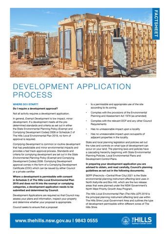
Do I require a development approval?

Not all activity requires a development application.

In general, Exempt Development is low impact, minor development. If a development meets all the predetermined standards and criteria as set out in either the State Environmental Planning Policy (Exempt and Complying Development Codes) 2008 or Schedule 2 of The Hills Local Environmental Plan 2019, no form of approval is required.

Complying Development is common or routine development that has predictable and minor environmental impacts and provides a fast track approval process. Standards and criteria for complying development are set out in the State Environmental Planning Policy (Exempt and Complying Development Codes) 2008. Complying Development approval comes in the form of a Complying Development Certificate (CDC) which can be issued by either Council or a private certifier.

Where a development is permissible with consent in Schedule 2 of The Hills Local Environmental Plan 2019 and does not fit into the exempt or complying categories, a development application needs to be submitted and determined by Council.

Development Applications are required so that Council may assess your plans and information, inspect your property and determine whether your proposal is appropriate.

Council seeks to ensure that a proposal:

• Is a permissible and appropriate use of the site according to its zoning

• Complies with the provisions of the Environmental Planning and Assessment Act 1979 (as amended)

• Complies with the relevant DCP and any other Council Requirements

• Has no unreasonable impact upon a locality

• Has no unreasonable impact upon occupants of adjacent properties in the locality.

State and local planning legislation and policies set out the rules and controls on what type of development can occur on your land. The planning laws and policies have a cascading hierarchy beginning with State Environmental Planning Policies, Local Environmental Plans and Development Control Plans.

In preparing your development application you are advised to obtain, and read carefully, Council’s planning guidelines as set out in the following documents;

SEPP (Precincts—Central River City) 2021 is the State environmental planning instrument affecting land uses in North Kellyville and Box Hill, which are the two release areas that were planned under the NSW Government’s North West Priority Growth Area Program.

The Hills Local Environmental Plan (The Hills LEP) 2019 is the principal planning instrument affecting land use within The Hills Shire Local Government Area and outlines the type of development permissible within different zones of The Hills Shire.

www.thehills.nsw.gov.au | 9843 0555
FACTSHEET

The North Kellyville, Box Hill Growth Centre Precincts and The Hills Development Control Plan (DCP) communicates the planning, design and environmental objectives and controls against which the Council will assess Development Applications (DAs).

Key Documents

Below are links to our website for further information.

*Development Approvals

www.thehills.nsw.gov.au/Building/Development-Approvals

*Planning Guidelines

www.thehills.nsw.gov.au/Building/Planning-Guidelines

What Information do I need to submit with my DA?

The requirements for DA submission are set out on page 4 of this document and also in the Development Application Lodgement Checklist. A Schedule of Fees can be obtained from Council’s Customer Service Centre. The calculated fee is based on the estimated construction cost of the proposed development.

Development Application Forms Directory

www.thehills.nsw.gov.au/Council/Application-Form- Directory

Political Donations and Gifts

Any applicant is required to disclose the reportable political donations and gifts (if any) made by the applicant or any person with a financial interest in the application within the period commencing two (2) years before the application is made and ending when the application is determined. Refer to Council’s Political Donations and Gifts Disclosure Statement Form for more information.

How to lodge an application?

As of July 2020, all Development Applications need to be lodged via the NSW Planning Portal available at: https:// www.planningportal.nsw.gov.au/.

The NSW Government has released a comprehensive guide available at: https://www.planningportal.nsw.gov.au/ support/how- guides.

Before formally submitting the DA, it is advisable that you contact Council’s Customer Service Centre by calling +61 2 9843 0555 and discuss your application with a Development Advisor.

A Development Advisor will be able to assist you to understand the application process requirements as Council will not accept incomplete applications. It is necessary to book online if you would like to make an appointment to meet with a Development Advisor at Council’s Customer Service Centre.

For more information or to book a meeting, please access Council’s online Development Advisor Booking Request Form. For all larger scale residential, industrial, commercial and subdivision applications, it will be necessary to make an appointment for a formal pre-lodgement meeting. For more information or to book, contact Council’s Customer Service Centre or access Council’s online Pre-lodgement Meeting Request Form.

WHAT HAPPENS NEXT?

What happens once a Development Application (DA) is submitted to Council?

The majority of DAs will be processed using the following assessment processing steps. The steps outlined below only provide an indicative guide as the process can vary depending on the individual DA.

• Administration Review & Lodgement

It is the responsibility of the applicant to ensure that a DA has the required information necessary for Council to conduct an assessment of the proposal. Once a DA has been appropriately prepared it can be submitted to Council for an initial review by our Customer Service Team. This initial review is provided to ensure that a DA provides adequate detail to enable Council to undertake an assessment and make a determination. DAs suitable for assessment will be lodged and applicable assessment fees are required to be paid at this time.

All documents provided will be registered into Council’s record management system. Key documents will be available to be viewed on Council’s Development Application Tracking Portal within one business day of payment and formal lodgement into Council’s application processing system.

• Initial Assessment Review

The relevant assessment team undertakes a preliminary review of the application to ensure that the information provided is satisfactory. The application is assigned to a Development Assessment Officer who will oversee the assessment of the application.

• Notification and Submissions

Adjoining owners will be advised in writing of the lodgement of a Development Application and are given time to lodge a submission (usually 14 days). The degree to which the submission may impact on an application will depend on a range of matters including the content and relevance of the submission in relation to the application. Some applications may not require notification depending on the nature of the proposal.

Further information regarding notification requirements are contained within Part A – Introduction of the Hills Development Control Plan. For more information on making a submission please visit Council’s website and search for Information on Making a Submission on an Exhibition.

• Referrals (Internal and External)

Council has specialist staff who may also need to comment on different matters relating to a DA. In these cases, the DA will be referred to applicable specialist departments within Council for their analysis and comment e.g. Health Officer, Landscape Officer or an Engineer.

www.thehills.nsw.gov.au

| 9843 0555

Comments provided from these referrals are included in the overall assessment of the DA. Also, some DAs may need to be referred to another government agency which has specific roles in providing comment in relation to an area of expertise e.g., NSW Rural Fire Service or Transport for NSW (Roads and Maritime Services).

• Application Evaluation

This is the part of the process when the assessing officer will conduct their full assessment of the application. This will usually involve the officer conducting a site inspection and an evaluation and review of all the documentation submitted to Council. The officer will also review any submissions received and consider a range of matters as outlined in Section 4.15 of the Environmental Planning and Assessment Act 1979 and any other relevant legislation, Council requirements and guidelines. It is during this part of the process that the applicant will be advised of any issues that may need to be addressed or amendments that may need to be considered. Applications can be tracked online on Council’s Development Application Tracking Portal or via the NSW Planning Portal.

Below are some key documents and links with relevant information that can be accessed on Council’s website at:

• Notice of Council Decision

All applicants are advised in writing of the determination of a Development Application i.e. approval subject to conditions of refusal of an application. Objectors are notified by letter of decisions made. Development Applications may be determined through a variety of delegations including; Delegated Authority, Development Assessment Unit (DAU), Local Planning Panel (LPP) or Sydney Central City Planning Panel (SCPP). Advertisement is also placed in the local media, Council’s website and social media pages to communicate final outcome.

A copy of the development consent and final plans are also made available on Council’s Development Application Tracking Portal.

Key Documents

Below are some key documents and links with relevant information that can be accessed on Council’s website at: www.thehills.nsw.gov.au/Building

Information on Development Application Assessment NSW Planning Portal

NSW Planning Portal - Quick Reference Guides

DA DOCUMENTATION LODGEMENT GUIDELINES

In 2019, the NSW Government passed the Environmental Planning Assessment Amendment (Planning Portal) Regulation 2020. This amendment introduces requirements for certain planning applications to be made through the

NSW Planning Portal and enacts the Premier’s mandate of ePlanning Digital Services.

As of 1st July 2020, The Hills Shire Council only accepts development applications (DAs) through the NSW Planning Portal. As of 31st December 2020, all Sydney Metropolitan, Illawarra, Central Coast and Hunter/Newcastle area councils and Principal Certifying Authorities will be processing 100% of their applications this way.

Council does not accept physical documentation, plans, and dioramas/models of proposed developments.

Will my application be available to the public online?

To assist compliance with the Government Information (Public Access) Act 2009 and the notification requirements of the DA assessment process, portions of your DA and supporting documentation are made available on Council’s DA Tracking Portal within one business day of payment of application fees to the Council.

What are the digital submission requirements?

All lodgement of documents at time of submission and during the application process must be through the NSW Planning Portal. All digital submissions should comply with the following:

• PDF format

• Submitted as individual files (see file structure below and next page)

• Unlocked and not password protected

• Landscape plans and reports must not contain floor plan details

• Do not place signatures on supporting documents or plans i.e. colour schedule Waste Management Plan, Statement of Environmental Effects etc

• Files must not exceed 20MB. Large files must be split into smaller sized files

• Legible and to nominated scale as required.

What naming conventions should I use?

Electronic files provided to Council should be provided using the following naming convention:

[DOCUMENT TYPE] - [PROPERTY ADDRESS]

Example: Acoustic Report - 3 Columbia Court Norwest This allows Council to readily access relevant documents in a timely manner.

On the next page you will find Council’s approved document description list, any file not correctly labelled may not be accepted if it cannot be easily identified.

Submitting additional information

When submitting any additional information please ensure to include the application number in the document description.

www.thehills.nsw.gov.au

| 9843 0555
www.thehills.nsw.gov.au | 9843 0555 DOCUMENT DESCRIPTIONS / NAMING CONVENTIONS Document Type Document Description Displayed on website Aboriginal Heritage Assessment / Report Aboriginal Heritage Assessment ADDRESS Yes Acoustic Report Acoustic report ADDRESS Yes Altogether Group Approval Altogether Stamped set of plans ADDRESS No Assessor Certificate NatHERS Certificate ADDRESS Yes BASIX Certificate BASIX Certificate NUMBER ADDRESS Yes Bush Fire Risk Assessment Bushfire Report ADDRESS Yes Colour Schedule/External Finishes Colour schedule ADDRESS Yes Cost Summary Report Cost Summary Report No Ecological Assessment Ecological Assessment ADDRESS Yes Estate Design Approval Estate Design Approval ADDRESS No Flood Study Report Flood Study ADDRESS Yes Geotechnical Report Geotechnical Report ADDRESS Yes Heritage Impact Statement Heritage Impact Statement ADDRESS Yes Light Spill Diagram Light Spill Diagram ADDRESS No On-site Sewer Management Plan/Report On-site Sewer Management Plan ADDRESS On-site Sewer Management Report ADDRESS Yes On-site Stormwater Detention (OSD) Plan On-site Stormwater Detention Plan ADDRESS Yes Owner’s Consent Owner’s Consent Form Yes Photomontage Photomontage ADDRESS Yes Plans – Contour Survey Plan All building plans should be submitted in three files as follows: Full set of plans ADDRESS No Floor plans ADDRESS No Notification plans ADDRESS Yes NOTE: The notification plans should be the same as the full set of plans with internal details either redacted or omitted. Plans – Demolition Plans – Elevations Plans – Erosion and Sediment Control Plan Plans – Floor Plan Plans – Landscaping Plans – Parking and Access Plans – Sections Plans – Shadow Diagrams Plans – Site Plans – Stormwater Drainage Plan Plans – Plan of Subdivision Subdivision Plan ADDRESS Yes Plans – Concept Engineering Plan Concept Engineering Plan ADDRESS Yes Pre-lodgement Meeting Notes Pre-lodgement Notes ADDRESS No Quantity Surveyors Report Quantity Surveyors Report ADDRESS No Site Contamination Report Site Contamination Report ADDRESS Yes Statement of Environmental Effects (SEE) Statement of Environmental Effects ADDRESS Yes Stormwater MUSIC Modelling Stormwater Music Modelling ADDRESS No Traffic Report Traffic Management Report ADDRESS Yes Waste Management Plan Waste Management Plan ADDRESS Yes

ABORIGINAL HERITAGE ASSESS/REPORT

Description:

An Aboriginal Heritage Report considers the effect of the proposed development on the heritage significance of a place and any Aboriginal object. The report is to address the National Parks and Wildlife Act 1974 including an assessment and recommendations. These are to be undertaken by a suitably qualified consultant. A list of heritage related consultants is available from the NSW Heritage Office.

Required for sites with identified archaeological significance, including areas identified in the Development Control Plan, Local Environment Plan, heritage review, or a search through the Aboriginal Heritage Information Management System (AHIMS).

More Information:

Visit the Heritage NSW website at: https://www.heritage.nsw. gov.au/

Refer to Council’s Development Control Plan – Part C Section 4 – Heritage, available at: https://www.thehills.nsw.gov. au/Building/Planning-Guidelines/The-Hills-DevelopmentControl-Plan

ACOUSTIC REPORT

Description:

An Acoustic Report assesses the development in the context of the surrounding area. These reports are to be undertaken by a suitably qualified acoustic consultant (e.g. a member of the Australian Acoustical Society, Engineers Australia, The Association of Australian Acoustical Consultants or a person with appropriate professional qualifications).

Required for noise sensitive or noise generating development such as; child care facilities, shopping centres, industrial developments and residential developments in proximity to classified roads.

ASSESSOR (ABSA) CERTIFICATE (NATHERS)

Description:

The Australian Building Sustainability Association (ABSA) Certificate refers to the Nationwide House Energy Rating Scheme (NatHERS) Certificate issued from the online generation system by an approved software provider. A formal Thermal Comfort Certificate (ABSA or NatHERS) is only required if the thermal assessment has been undertaken as a SIMULATION method by an Accredited Thermal Assessor. The Thermal Certificate number will be referenced to in the BASIX certificate.

Thermal Comfort Protocol: To complete a Thermal Comfort Index of a BASIX assessment, applicants can choose either a RAPID method (simple non flexible standards), a DIY method (minimum insulation, flexible glazing assessment) or the SIMULATION method which is a detailed assessment carried out by an Accredited Assessor. Required for all residential development that requires a BASIX Certificate where an applicant chooses the SIMULATION method for Thermal Comfort Index by an Accredited Thermal Assessor.

More Information:

Visit the ABSA website at: https://www.absa.net.au/aboutbuilding-sustainability/what-is-building-sustainability/

BASIX CERTIFICATE

Description:

BASIX (Building Sustainability Index) is an online planning tool that is designed to check elements of a proposed design against set sustainability targets. The BASIX Certificate must have an issue date of not more than 3 months prior to the lodgement of the development application. The BASIX certificate must reflect site conditions including alternative water supply (recycled water), additional development items and solar access. Information included in the BASIX Certificate is to be reflected in the submitted plans.

A BASIX certificate is required for BASIX affected development including dwellings, swimming pools and spas.

More Information:

Visit the BASIX website at: www.planningportal.nsw.gov.au/ basix

BUSH FIRE RISK ASSESSMENT REPORT

Description:

Planning laws in NSW require all new developments on bushfire-prone land to comply with the provisions of the ‘Environmental Planning and Assessment Act 1979’, the ‘Rural Fires Act 1997’ and the ‘Planning for Bushfire Protection 2019’, a NSW Rural Fire Service (RFS) publication outlining the bushfire protection measures to be included when planning subdivisions and constructing or modifying buildings on bushfire prone land.

Required for all development on property that has been identified by the NSW Rural Fire Service (RFS) as being wholly or partially bushfire affected.

• A Single Dwelling Application Kit (available from the RFS website) may be completed and lodged for relevant developments. These are applicable to single dwellings including any alterations, additions, or ancillary development such as pools, retaining walls, carports, garages, sheds and pergolas.

• For all other developments, a Bushfire Report must be prepared by a suitably qualified bushfire consultant. A list of suitably qualified consultants is available from the NSW RFS website.

More Information:

Visit the NSW Rural Fire Service website at: www.rfs.nsw.gov.au

Single Dwelling Kit - Self Assessment for Building in Bushfire prone areas: https://www.rfs.nsw.gov.au/data/assets/pdf_ file/0017/4355/Guidelines-for-Single-Dwelling-DevelopmentApplications.pdf

Planning for Bushfire Protection 2019 (PPB 2019): https:// www.rfs.nsw.gov.au/data/assets/pdf_file/0005/130667/ Planning-for-Bush-Fire-Protection-2019.pdf

www.thehills.nsw.gov.au

| 9843 0555

COLOUR SCHEDULE/ EXTERNAL FINISHES

Description:

A Schedule of External Colours and Finishes will detail the external colours and finishes of a development. Items are to be clearly itemised with indicative samples. Details are to be provided as a separate document or shown on the architectural plans.

Generally required for external works and particularly where the works are visible from the street.

COST SUMMARY REPORT

Description:

A cost summary report details the costs of the proposed development.

• Cost Summary Reports for developments between $100,000, and $3 million are to be submitted by a suitably qualified person. A qualified person includes: a builder who is licensed to undertake the proposed works, a registered architect, a qualified and accredited building designer, a registered quantity surveyor or a person who is licensed and has the relevant qualifications and proven experience in costing of development works at least to a similar scale and type as is proposed. The Australian Institute of Quantity Surveyors provides technical guidance on estimating costs and methods of measurement in the Australian Cost Management Manuals.

• Detailed Cost Reports for developments greater than $3 million are to be submitted by a Registered Quantity Surveyor registered as a member of the Australian Institute of Quantity Surveyors.

Required for developments with costs of $100,000 and greater.

More Information:

Refer to the Development Contributions section of Council’s website at: www.thehills.nsw.gov.au/Building/PlanningGuidelines/Development-Contributions

Report templates can be found on Council’s website in Council’s Application Form Directory available at: https:// www.thehills.nsw.gov.au/Council/Application-Form-Directory

ECOLOGICAL ASSESSMENT

Description:

An Ecological Assessment is an assessment of the ecological values of an area and considers the likely impacts of a development on biodiversity. An Ecological Assessment must be undertaken by a person with a tertiary qualification in Environmental Science or a related discipline and who can demonstrate expertise in the ecological matters being assessed. A list of ecological consultants is provided on the website of the Ecological Consultants Association of New South Wales.

Please note: obtaining advice from an ecological consultant in the early stages of the design of the proposed development with respect to the ecological values of the site may identify and avoid any significant impact of the proposal.

Required when a development proposal is likely to impact (either directly or indirectly) on native vegetation or fauna habitat. Development would be likely to affect potential habitat if it would affect any of the following: remnant native vegetation, including bushland; living or dead trees containing hollow limbs or trunks; a wetland or vegetation surrounding a wetland; a creek; or a bridge or culvert.

More Information:

Visit Council’s ‘Tree and Vegetation Management’ Fact Sheet section of the website at: https://www.thehills.nsw.gov.au/ Council/Fact-Sheet-Directory

ESTATE DESIGN APPROVALS

Description:

Certain areas of The Hills Shire Council require separate approval from a design review panel. Applicants should provide evidence that consent has been granted. All plans and relevant documentation must be stamped by the review panel and a determination letter must be issued. The stamped plans and determination letter must be provided when the application is lodged.

Required in specific areas of The Hills Shire Council, including but not limited to: Norwest Estate (including areas of Bella Vista), and The Gables Estate.

FLOOD STUDY REPORT

Description:

A developmental proposal on land that is identified as flood affected will need to ensure that the proposal is compatible with a land’s flood hazards and addresses the potential impact on identified flooding or drainage patterns particular to the property and its surrounds.

It is also advised that the report addresses compliance of design of the proposed development with any flood level requirements on the property.

A flood study report will need to be prepared by a suitably qualified consultant.

Council has undertaken some flood studies of particular areas and may be able to offer additional flood information for a site if available.

Required when a property is identified as being flood affected. Please note: it is not mandatory to provide a Flood Study Report on initial lodgement of a development proposal on flood prone land, yet such a report may be requested during the assessment process.

More Information:

Refer to Council’s Development Control Plan – Part C Section 6 – Flood Controlled Land, available at: https://www. thehills.nsw.gov.au/Building/Planning-Guidelines/The-HillsDevelopment-Control-Plan

www.thehills.nsw.gov.au | 9843 0555

ALTOGETHER GROUP APPROVAL

Description:

Flow Systems Pty Ltd is a private water utility providing sewage and stormwater supply services under licence to the Box Hill/Gables area. The approval shows compliance with the Flow Systems for stormwater management in The Gables masterplan. All development applications must be submitted to Stocklands for The Gables Design Review Panel’s approval. The landscape plan, drainage plan and BASIX Certificate must be stamped by the Flow systems section of the Gables review process. This information must be provided when the application is lodged with Council.

Required for developments in The Gables Master Plan.

More Information:

See the Flow Systems webpage for Box Hill Home Owners at: https://askus.flowsystems.com.au/hc/en-us/ articles/205088694--Box-Hill-Home-Owners

GEOTECHNICAL REPORT

Description:

A Geotechnical Report identifies the subsurface conditions existent at a site and must certify the design of all structures and ensure that the application is suitable and that an acceptable level of risk is achieved. The development proposal will need to ensure that the design is responsive to the geotechnical constraints of the land.

A geotechnical report is to be prepared by an Engineer qualified as a corporate member of the Institution of Engineers of Australia or similar recognised industry body (and who is experienced in the fields of landslides, soil and rock mechanics, slope stabilisation and residential developments). Submitted plans must reflect the requirements necessary for the design as outlined in the report.

Required for land with indication of geotechnical affectation.

HERITAGE IMPACT STATEMENT

Description:

A Heritage Impact Statement considers the effect of the proposed development on the heritage significance of the site. These are to be undertaken by a suitably qualified consultant. A list of heritage related consultants is available from the NSW Heritage Office.

Required for sites with identified heritage or archaeological significance. This includes heritage items/areas identified in the Development Control Plan, Local Environment Plan, or heritage review.

More Information:

Visit the Heritage NSW website at: https://www.heritage.nsw. gov.au/

Refer to Council’s Development Control Plan – Part C Section 4 – Heritage, available at: https://www.thehills.nsw.gov. au/Building/Planning-Guidelines/The-Hills-DevelopmentControl-Plan

LIGHT SPILL DIAGRAM

Description:

A Light Spill Diagram identifies the potential impact of the erection of floodlighting as part of a proposal. A Light Spill Diagram should include: details of lighting fixtures, location, height of light poles and illustrations demonstrating the fall of light (and associated intensities); and illustrate the location of adjoining residencies, location of windows and use of respective rooms where affected.

Required for development proposals that includes floodlighting including sportsgrounds, tennis courts and applicable industrial and commercial development proposals.

ON-SITE SEWER MANAGEMENT PLAN/ REPORT (WASTE WATER REPORT)

Description:

A Waste Water Report identifies site conditions and includes details of an appropriate sewage management system. The report specifically includes scaled plans, specifications, site assessment, effluent disposal area, operational and maintenance details, and compliance with Council Local Approvals Policy.

Required for proposals that involve the installation or alterations to existing on-site sewage management system. This includes rural zoned properties that do not have Sydney Water sewer infrastructure.

Note: A separate approval is also required for the Installation/ Amendment of an On-site Sewage Management System under Section 68 of the Local Government Act 1993 and requires the lodgement of an ‘Approval to Install or Amend a System of Sewage Management Application Form’ and associated documents. Application fees also apply and are variable depending on the size of system to be installed.

More Information:

Visit Council’s website at: https://www.thehills.nsw.gov.au/ Services/Our-Community/Community-Health-Safety/Onsite-Sewage-Management-Systems

www.thehills.nsw.gov.au

| 9843 0555

ONSITE STORMWATER DETENTION (OSD) PLAN

Description:

On-site Stormwater Detention (OSD) is the method of collecting stormwater that falls on a site, storing it temporarily and then releasing it slowly so that it does not adversely impact downstream flooding. An OSD plan will be prepared in conjunction with the hydraulic/stormwater plans submitted with the application and should be prepared by a suitably qualified engineer.

An On-site Stormwater Detention Plan should include:

• Catchment Plan showing contours, area of site effected and area of site not collected

• Drainage design summary

• Calculations to confirm volumes and pipe sizes

• Detail Plan and sections

• Design Levels for top water/overflow, inverts of all drainage pits, pipelines and storage areas, overflow weir, centreline of orifice, surface of all drainage pits and surfaces designed to detail and direct stormwater

• Dimensions of storage areas, drainage pits, overflow weirs, maximum head, high early discharge head and depth of storage.

• Please also refer to section ‘Plans – Stormwater Drainage Plan’ (within this document) for further items that may be required to be shown on the plan.

See attached checklist for a guide on when this item may be required.

More Information:

Visit Council’s website at: https://www.thehills.nsw.gov.au/ Building/Development-Approvals/Subdivision/SubdivisionEngineering-Specifications-Drawings

OWNER’S CONSENT

Description:

Signed Owner’s Consent form by property owner/s consenting to applicant submitting an application.

PHOTOMONTAGE

Description:

A photomontage is a collection of 3D computer generated images depicting the proposal in relation to the streetscape and overall context of the development.

Required for large scale developments identified in a formal pre-lodgement meeting as part of the major development application process.

PLANS – CONTOUR SURVEY PLAN

Description:

The survey plan must be prepared and signed by a registered surveyor (including registration number) and be provided with all development proposed on a vacant block of land (newly subdivided land).

A survey plan should include:

• Site boundaries and dimensions

• Contours or Australian Height Datum ground levels

• Natural drainage lines/water courses

• Existing services/easements

• Any geotechnical hazards or restricted development areas

• Location of existing buildings/structures

• Location of existing trees (including girth and spread of canopy) and significant vegetation/ topographical features

• Street features

• Undertaken within the last 12 months.

See attached checklist for a guide on when this item may be required.

PLANS – DEMOLITION

Description:

A Demolition Plan should show any existing structures that are proposed to be removed as part of the development. A Demolition Plan should include:

• A recognised metric scale of 1:100 or 1:200 or similar suitable scale

• A site plan indicating the location of all buildings and structures to be demolished and any structures to be retained

• Details of property boundaries and location of structures on adjoining land

• Location of any drainage easements

• Details of age and condition of the buildings and structures to be demolished.

Required for all development proposals involving demolition.

PLANS – ELEVATIONS

Description:

Elevation plans are an external side view of the building. Elevation plans should include:

• A recognised metric scale of 1:100 or 1:200 or similar suitable scale

• All aspects of the building (i.e. north, south, east, west)

• Relationship of elevations to natural ground level and indication of proposed cut and fill for excavation works

• Fencing details fronting public streets

• Indication of materials and colours used in external finishes

• Window and door schedule showing all dimensions

• Heights and levels of building must be indicated including roof pitch, ridge height and floor to ceiling height of each storey of the building

• Maximum building height requirement must also be indicated

• Retaining wall details, including TOW and BOW. Required for all development involving construction or alterations of buildings.

| 9843 0555
www.thehills.nsw.gov.au

PLANS – EROSION AND SEDIMENT CONTROL PLAN

Description:

An Erosion and Sediment Control Plan provides details as to how a development site will be managed to prevent stormwater pollution, erosion of soil on the site and sedimentation matters.

An Erosion and Sediment Control plan should include:

• Site plan details indicating property boundaries, existing levels of the land in relation to the building, roads and where stormwater surface flows enter and leave the site

• Location of stabilised construction access points

• Location of perimeter sediment/erosion controls

• Identify ‘No-Go’ areas that are not to be disturbed

• Location of stockpile areas

• Location of proposed temporary and permanent site drainage

• Detail of the specific measures to be implemented to prevent pollution of stormwater assets.

Required for development involving substantial construction and/or earthworks.

PLANS – FLOOR PLAN

Description:

A floor plan is a bird’s-eye view of the internal layout of rooms within the development. Floor plans should include:

• A recognised metric scale of 1:100 or 1:200 or similar suitable scale

• Room names (intended use of each part of the building), partitioning, room dimensions and areas of the components of the development including total floor area

• Window and door locations and sizes

• Floor levels and steps in floor levels – Reduced Levels (RL’s)

• Type and thickness of wall structures.

Required for development involving construction or alterations of buildings.

PLANS – LANDSCAPING

Description:

A landscape plan is a bird’s-eye view of the site detailing the landscaping features such as planting, car parking, outdoor structures, furniture and lighting. Landscaping plans must be prepared by a suitably qualified person and in accordance with Council’s ‘Landscaping’ Development Control Plan –Part C – Section 3.

Landscape plans should include:

• All existing trees, landscape features and prominent structures

• A schedule of proposed planting, including botanic name, common name, expected mature height and stacking requirements

• Details indicating a minimum of 300mm of good quality topsoil to all garden beds

• Details indicating a minimum of 150mm of good quality topsoil to all park areas

• All garden bed areas to be clearly defined by brick, concrete or timber edging with its top edge finishing flush with the surface of the adjacent grass areas

• A table showing compliance with relevant DCP landscaped area requirements and area sizes

• Labelling of landscaping components used including turf, ancillary items and pot size of planting.

• Landscape plans must not contain floor plan overlay.

Required for development involving landscaping works.

More Information:

Refer to Council’s Development Control Plan – Part C Section 3 – Landscaping, available at: https://www.thehills.nsw.gov. au/Building/Planning-Guidelines/The-Hills-DevelopmentControl-Plan

PLANS – PARKING AND ACCESS

Description:

Parking and Access plans detail the provision of parking and associated access. Parking and Access plans demonstrate the number of car spaces provided and the design of parking facilities are in accordance with Australian Standard 2890.1.

Parking and Access plans should include:

• Parking calculations

• Site plan – including applicable submission requirements as detailed in Council’s ‘Parking’ DCP – Part C Section 1.

Required for development to demonstrate compliance with car parking requirements.

More Information:

Refer to Council’s Development Control Plan – Part C Section 1 – Parking, available at: https://www.thehills.nsw.gov.

au/Building/Planning-Guidelines/The-Hills-DevelopmentControl-Plan

| 9843 0555
www.thehills.nsw.gov.au

PLANS – SECTIONS

Description:

A section plan is a diagram showing a vertical cut through the development that shows the relationship of the different levels of the building.

Section plans should include:

• A recognised metric scale of 1:100 or 1:200 or similar suitable scale

• Outline of existing building/development on-site

• Section names and where they are shown on the plan

• Room names

• Room and window heights

• Details of chimneys, fire places and stoves

• Roof pitch and covering

• Floor/ceiling heights to each level of the development.

Required for all development involving construction or alterations of buildings.

PLANS – SHADOW DIAGRAMS

Description:

The shadow diagram is a view of the site, building, and surrounding properties from above. The shadow diagram shows the extent of shadow created from the proposed development.

Shadow diagrams should include:

• Shadows cast by the proposal during mid-winter and summer

• Diagrams are to delineate shadows cast during early morning, middle of the day and afternoon (9am, 12 noon and 3pm – Winter and Summer Solstice – June 21st/22nd and December 21st/22nd)

• A schedule of calculations may be necessary to demonstrate the area of private open space receiving sunlight at various times between 9am to 3pm

• Profile shadow diagrams in addition to plan views may be requested where appropriate.

Required for alterations or new buildings with heights of two or more storeys. Shadow diagrams may also be required for buildings of single storey height where there is potential for impact to the surrounding area.

PLANS – SITE

Description:

The site plan is a view of the site or property from above. This plan shows the design and layout of the proposal. A site plan should include:

• A recognised metric scale of 1:100 or 1:200 or similar suitable scale

• Site coverage depicting building envelopes, car parking driveways and all other built features

• Delineation of open space areas

• Schedule of calculations including site area, site coverage, floor areas and associated floor space ratios (if applicable) and private open space/landscape areas

• The location, boundary dimensions, site area and north point of the land

• Existing vegetation and trees on the land

• Existing levels of the land in relation to the building and the roads

• The location and uses of buildings on sites adjoining the land

• Application for retaining walls to include top of wall and bottom of wall.

Required for all development to show the extent of the proposal on the site.

PLANS – STORMWATER DRAINAGE PLAN

Description:

The purpose of a concept stormwater drainage plan is to identify how stormwater runoff from your site will be managed. This document is required to demonstrate how stormwater is adequately disposed of on the property in alignment with Council requirements. In the event that a specialised system is required (e.g. OSD or absorption trench), a suitably qualified engineer will be required to prepare the plans.

A concept stormwater drainage plan should include:

• Location of rainwater tank (if required in BASIX certificate)

• Roof water drainage details

• Location of downpipes

• A diagram indicating where underground stormwater lines are located and location of proposed legal point of discharge

• Inter-allotment drainage – if required.

See attached checklist for a guide on when this item may be required.

More Information:

Visit Council’s ‘Subdivision and Engineering Specifications’ section of the website, available at: https://www.thehills. nsw.gov.au/Building/Development-Approvals/Subdivision/ Subdivision-Engineering-Specifications- Drawings

www.thehills.nsw.gov.au | 9843 0555

PLANS – PLAN OF SUBDIVISION

Description:

A Proposed Plan of Subdivision details the proposed lot allocation and the configuration of a subdivision proposal. A Proposed Plan of Subdivision should include:

• North point and bar scale

• Suitable scale (preferably 1:500)

• Existing boundaries, dimensions and lot descriptions shown in broken lines and lettering

• Boundaries of proposed lots showing dimensions and areas

• Proposed lots to be consecutively numbered and must illustrate any proposed easements and restricted development areas

• Name and dimensions of existing frontage roads

• Dimensions of all proposed roads (Carriageway and footpath verge), proposed road widening and splay corners

• Position of all intersecting adjoining property boundaries

• Location of existing roads or property boundaries of land on the opposite side of all existing roads adjoining the subject site

• Draft Management Statement

• Draft Development Contract.

More Information:

Refer to Council’s ‘Subdividing Land’ section of the website available at the following link: Subdividing Land.

PLANS – CONCEPT ENGINEERING PLAN

Description:

Concept engineering plans are to be prepared by a suitably qualified consultant and should include engineering details relevant to the proposed development. It is the responsibility of the consultant to ensure that the designs, calculations and specifications comply with any applicable Consent Conditions, Engineering Guidelines, relevant Australian Standards and other applicable Council documents. See attached checklist for a guide on when this item may be required.

More Information:

Visit Council’s ‘Subdivision and Engineering Specifications’ section of the website at: https://www.thehills.nsw.gov.au/ Building/Development-Approvals/Subdivision/SubdivisionEngineering-Specifications- Drawings

QUANTITY SURVEYORS REPORT

Description:

A Quantity Surveyors report is a detailed and comprehensive breakdown of construction costs associated with the development. Costs should be broken down into the various different disciplines involved in the construction process. Required for all proposals with a construction value or capital investment value of $3 million or greater.

SITE CONTAMINATION REPORT

Description:

A Site Contamination Report identifies whether the site is suitable for its intended purpose, including human occupation and any remediation measures. This report is to be prepared by a suitably qualified consultant and includes the following:

• Identification of all past and present potentially contaminating activities

• Identification of potential contamination types

• Discussion of the site condition

• A preliminary assessment of site contamination

• An assessment of the need for further investigations.

A ‘Detailed Site Investigation Report’ and further information may be requested based on the findings of the Preliminary Site Investigation Report.

Required for developments where there is potential of contamination.

STATEMENT OF ENVIRONMENTAL EFFECTS (SEE)

Description:

The Statement of Environmental Effects (SEE) describes the proposal, potential impacts and how these impacts will be minimised. A SEE includes consideration of planning matters including policies and controls.

A Statement of Environmental Effects includes:

• Description of the site

• Description and scope of the proposed development and/or land use

• Details of compliance with the relevant environmental planning instruments i.e. The Local Environmental Plan 2019 and the relevant Hills Development Control Plan (THDCP)

• Written justification to vary any development standard contained within a section of THDCP

• Details of how the development satisfies the provisions of Section 4.15 of the Environmental Planning and Assessment Act 1979

• Environmental impacts of the development

• How the environmental impacts of the development have been identified

• The steps to be taken to protect the environment or to lessen the expected harm to the environment.

Required for all Development Applications and similarly for any Section 4.55 Modification Applications.

| 9843 0555
www.thehills.nsw.gov.au

TRAFFIC REPORT

Description:

The traffic report demonstrates that the proposed development and surrounding area is not adversely affected as a result of the proposal. A traffic and car parking study must be prepared by a suitably qualified consultant and address the following:

• The existing traffic environment including recent traffic volume counts

• The traffic expected to be generated as a result of the proposed development

• The cumulative impact of the proposed development and any other nearby developments on the surrounding road network

• The need for traffic improvements to the road network as a result of the proposed development

• The impact of the proposal on intersections that access arterial/sub-arterial roads

• A detailed assessment of the proposed access arrangements including the suitability of the sight distance and

• Any other relevant safety issues

• An assessment of the proposed parking provision and layout.

Required for subdivision, and substantial residential, commercial, and industrial developments and land uses.

WASTE MANAGEMENT PLAN

Description:

This plan outlines measures to minimise and manage waste generated during demolition, construction and the ongoing use of the premises. A Waste Management Plan template is available on Council’s website.

A Waste Management Plan should include:

• An outline of the proposed development

• Volume, type of waste material and how the waste will be managed during demolition, construction and ongoing use of premises as applicable

• Details of any demolition contractors and skip bin companies

• Details of waste bins and waste storage areas in relation to ongoing waste management.

A waste management plan is required for developments that involve any demolition, building works, or land uses that generate waste in its operation.

More Information:

For a copy of Council’s Waste Management Plan and additional waste information please visit Council’s website at: https://www.thehills.nsw.gov.au/Services/For-Residents/ Waste-Recycling/Builders-Renovators-Plan-Your-Waste

www.thehills.nsw.gov.au | 9843 0555

This checklist provides an overview of the main documents and plans that are required to be submitted when lodging your Development Application to the Hills Shire Council.

4 Required

8 Not required

? Check Development

Application Document

Descriptions to see if required or contact Customer Service on 9843 0555.

Please note:

Additional documents may be required under specific site circumstances (eg: sloping sites, visibility and adjoining properties).

Additional documents may also be required depending on the nature of the development (eg: internal or external works and extent of potential impacts).

RESIDENTIAL 1 2 3 4 5 6 7 8 9 10 11 12 13 14 15 16 17 18 19 20 21 22 23 24 25 Dwelling House - 2 Storey 4 4 4 4 4 4 4 4 4 4 4 4 4 ? 8 4 4 8 4 4 4 8 8 8 4 Dwelling House - 1 Storey 4 4 4 4 4 4 4 4 8 4 4 4 4 ? 8 4 4 8 4 4 4 8 8 8 4 Dwelling Alterations /Additions - Ground Floor 4 4 8 4 ? 4 ? 8 8 ? 4 4 4 ? 8 ? 4 8 ? 4 ? 8 8 8 4 Dwelling Alterations /Additions - First Floor 8 4 8 4 ? 4 8 8 4 ? 4 4 4 ? 8 4 4 8 ? 4 ? 8 8 8 4 Dual Occupancy 4 4 4 4 4 4 4 4 ? 4 4 4 4 4 ? 4 4 8 4 4 4 ? 8 8 4 Secondary Dwelling (Granny Flat) 4 4 4 4 4 4 4 8 ? 4 4 4 4 ? 8 4 4 8 4 4 4 8 8 8 4 Boarding House 4 4 4 4 4 4 4 4 ? 4 4 4 4 4 4 4 4 ? 4 4 4 4 4 4 4 Multi-dwelling Housing 4 4 4 4 4 4 4 4 ? 4 4 4 4 4 4 4 4 ? 4 4 4 4 4 4 4 Residential Flat Buildings 4 4 4 4 4 4 4 4 4 4 4 4 4 4 4 4 4 4 4 4 4 4 4 4 4 Decks/Pergolas/Shade structures ? 4 8 4 4 ? 4 8 ? ? 4 4 8 ? 8 ? 4 8 ? 4 8 8 8 8 4 Garages/Sheds/Carports ? 4 8 4 4 ? 4 8 8 4 4 4 8 ? 8 ? 4 8 ? 4 8 8 8 8 4 Retaining Walls 4 4 8 8 4 ? 4 ? 8 ? 4 4 8 8 8 ? 4 8 ? 4 8 8 8 8 4 Fences 8 4 8 8 4 8 ? 8 ? 8 4 4 8 8 8 ? 4 8 ? 4 8 8 8 8 4 Swimming Pools & Spas 4 4 8 8 4 4 4 4 8 4 4 4 ? 8 8 8 4 8 8 4 8 8 8 8 4 Water Tanks (Above/Underground) 8 4 8 8 4 8 ? 8 8 4 4 4 8 ? 8 ? 4 8 8 4 8 8 8 8 4 Home Occupation 8 4 8 4 8 8 8 8 8 8 4 4 8 8 ? 8 4 ? 8 8 8 ? 8 8 4 Demolition 8 4 8 ? 8 8 4 8 8 8 4 4 8 8 8 8 4 8 8 4 8 8 8 8 4 Landscape works 4 4 8 8 8 8 4 4 8 ? 4 4 8 8 8 8 4 8 8 4 8 8 8 8 4 Earthworks 4 4 8 8 8 8 4 8 8 ? 4 4 8 8 8 8 4 8 8 4 8 8 8 8 4 COMMERCIAL / INDUSTRIAL 1 2 3 4 5 6 7 8 9 10 11 12 13 14 15 16 17 18 19 20 21 22 23 24 New Office / Commercial / Retail Building 4 4 4 4 4 4 4 4 4 4 4 4 8 4 4 4 4 ? 4 4 4 4 4 4 4 New Industrial Factory / Warehouse 4 4 4 4 4 4 4 4 4 4 4 4 8 4 4 4 4 4 4 4 4 4 4 4 4 Alterations and Additions - External ? 4 8 4 4 4 4 8 ? ? 4 4 8 ? ? ? 4 ? 4 4 ? ? ? ? 4 Internal Fitouts to Commercial Buildings 8 4 8 4 8 ? 8 8 8 8 4 4 8 8 8 8 4 8 8 8 8 8 8 8 4 Change of use for shops /offices 8 4 8 4 8 8 8 8 8 8 4 4 8 8 8 8 4 ? 8 8 8 ? 8 8 4 Signage 8 4 8 8 4 8 8 8 ? 8 4 4 8 8 8 4 4 8 8 8 8 8 8 8 4 New Childcare Centre 4 4 4 4 4 4 4 4 ? 4 4 4 8 4 4 4 4 4 4 4 4 4 4 4 4 SUBDIVISION - Please
‘Submission
Subdivision’ Checklist
Council’s website Contour Survey Plan Site Plan Site Analysis Plan Floorplan Elevations Sections Erosion & Sediment Control Plan Landscape Plan Shadow Diagrams Stormwater Details SEE Waste Management Plan BASIX Certificate Onsite Stormwater Detention Parking and Access Plan Colour Schedule Cost Summary Report (Cost of work greater than $100K) Acoustic Report Bushfire Risk Assessment on Bushfire Prone Land Ecological Assessment on Biodiversity Identified Land On-site Sewer destailsSites without Sydney Water SewageInfrastructure Traffic Report Pre-lodgement meeting notes Photomontage Owner’s Consent
see separate
Requirements Development Application For
available on

Turn static files into dynamic content formats.

Create a flipbook
Issuu converts static files into: digital portfolios, online yearbooks, online catalogs, digital photo albums and more. Sign up and create your flipbook.
Development Application Process Fact Sheet by thehillsshirecouncil - Issuu