7 minute read
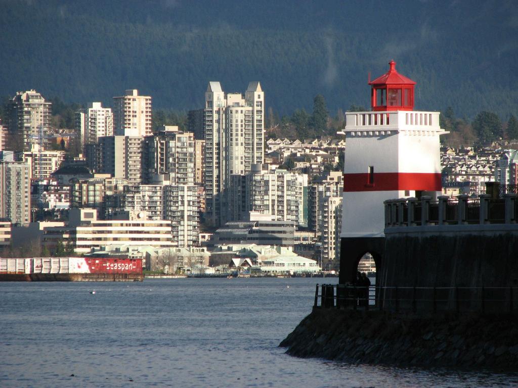
SHIPSHAPE

by theensign

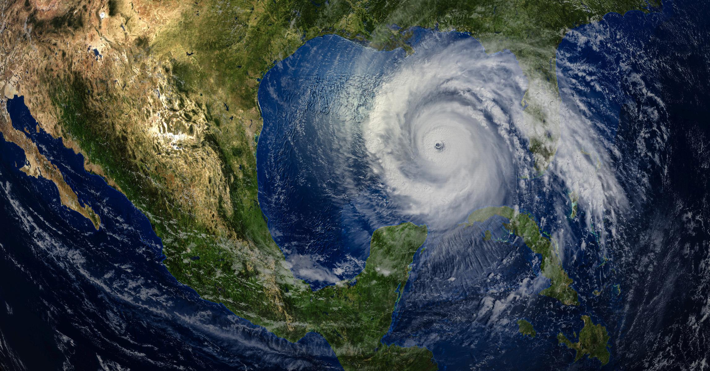
Preparing for the next Helene
BY DARA BROOKS
►As I pen this article, my husband, Joe, and I are hunkered down in our home on the Gulf side of Florida. For several days, all eyes have been on the storm that will become Hurricane Helene.
The National Weather Service warnings are in effect. Our county is sending us regular text messages telling us which zones need to prepare for evacuation and the steps to take. The television also emits loud, piercing notifications each time something changes. The manufacturer of our generator emailed its customers with whole-house generators. Our first major investment after we closed on our house, our Generex generator has brought us through every power outage; I anticipate we will be fine this time, too.
Both our homeowners’ and car insurance carriers have contacted us. With all the insurance companies that went belly-up rather than pay claims not so long ago, I cross my fingers that they will hold their end of the bargain for everyone needing to make claims this time.
With all that’s been going on, unless you live under a rock, you probably know a storm is brewing here in Florida.
What’s different about Helene?
Hurricanes are tropical cyclones that form in the warm waters near the equator. In the Northern Hemisphere, tropical cyclones are categorized by wind speed Once they reach over 74 mph, it’s called a hurricane. To form, hurricanes need waters of at least 80 degrees Fahrenheit. Warm water rises into the air, and as it rises, it creates lower air pressure beneath it. Nearby air rushes in, and the process repeats; the air warms, rises and then begins to cool. As that water vapor cools, it begins to condense and forms thunderstorm clouds, otherwise known as cumulonimbus clouds.
I can recall from previous hurricanes how loud and fast the wind was. The howling would send Joe and me to the floor. The crashing bolts of lightning so big and bright in previous months told us that Mother Nature had something to say. As this storm approached, however, I remember thinking that the storm wasn’t as loud or the wind as strong as previous weather events. I wondered why.
It turns out that the storm surge from Hurricane Helene poses the biggest danger in Florida. The cities along the Gulf of Mexico are particularly vulnerable to storm surge because of their shallow coastal shelf. The key is the potential amount of seawater that can be pushed onto land by a tropical system. With major storms, the amount of water that can surge onto shore can fill buildings and cause homes to collapse. It’s one of the most dangerous parts of a hurricane and a key reason why people who live along coastlines face mandatory evacuations ahead of major storms.
Weather generates business
In Florida, we are all about the weather. So, as we approached hurricane season, lots of attention moved toward preparedness.
Grocery stores began running ads urging customers to “stock up on the essentials before it’s too late!” Drugstores reminded us not to be caught in the hurricane without our medication and, oh, by the way, don’t forget to buy first aid kits and other essentials to get through the storms to come. The library had a desk staffed by people ready to discuss evacuation procedures.
I turn the volume up on my television as my local weather guy explains in detail what’s going on in our area. It wasn’t that long ago that I’d seen him in person. Sarasota Power & Sail Squadron had invited Bob Harrington, chief meteorologist for Sarasota’s ABC affiliate, to talk to us about hurricane season. No technical mumbo jumbo here; he broke it down and made it fun. Bob reminded us that weather is a big industry, and different stations vie for viewership, which translates into dollars.
What clubs and squadrons can offer
This brings me to America’s Boating Club | United States Power Squadrons and the services and resources we provide the recreational boating community through our educational offerings.
Weather teaches the fundamentals of weather dynamics, causes, types of weather and storms, general weather and marine forecasting. Technology is rapidly changing, making weather forecasting faster and readily available to the masses.
Weather for Boaters teaches students how to recognize signs of changing conditions to help predict approaching weather. Learning to read a weather map makes more sense with a foundational understanding of wind, fog and clouds, better equipping the boater to make those important decisions that could save a life.
Modern Weather Forecasting takes a look at modern forecasting tools and how to use them. And, of course, Hurricane Preparation for Boaters will help you prepare for the next Hurricane Helene.
While many of these classes can be taken online, I suggest you start with your local America’s Boating Club | United States Power Squadrons chapter, where hands-on instruction opens the door to a world of boaters ready to help you safely enjoy recreational boating ■
ABOUT THE AUTHOR
Joining Detroit Power Squadron in 2003, Dara Brooks began assisting longtime newsletter editor Dorothy Atwood, who became her mentor. She took over as editor in 2017. An artist and genealogist, Dara is interested in all things creative, including writing. Dara finds that her passion as a genealogist, preserving where we’ve been, where we are today and our journey into tomorrow spills over regularly into the publication. Now retired and living in Florida, Dara continues as editor, maintaining her full America’s Boating Club Detroit membership and an associate membership with Sarasota Power & Sail Squadron.
A VERSION OF THIS ARTICLE ORIGINALLY APPEARED IN THE DUMPING GROUNDS NEWSLETTER OF AMERICA’S BOATING CLUB DETROIT/9.
Conducting Aids to Navigation surveys
BY CHARLES “BO” IBACH III
►One fun activity in Cooperative Charting is getting out on the water to inspect navigation aids. When conducting an Aids to Navigation survey, you receive 15 credits for each verification and 25 credits if you find a discrepancy. A verification indicates that the aid is in its correct position and has no issues, and a discrepancy could include that the aid is out of position or needs attention.
To do a verification for individual credit, you will need to get reasonably close to the aid, whether it is a day beacon or a floating aid. Most day beacons are not in deep water, so be careful. If you determine that there is nothing wrong, take a time/date/GPS stamp photo of the aid using an app like Solocator, and then move on to the next one.
If you find problems, such as missing boards or numbers, or the aid is missing altogether, you need to report the discrepancy to the U.S. Coast Guard by VHF radio, phone, email or the USCG website. Be sure to get a receipt from them showing that you were in contact, and attach the receipt to the report that you submit to the Cooperative Charting Committee. You also need to take a photo of the defective aid or, if it is missing, of the area where it should be.
Check the Local Notice to Mariners lists to see if your finding has already been reported. Once you have collected your information, go to the America’s Boating Club Cooperative Charting website under the Executive Department, where you will find the necessary form to report your verifications or discrepancies plus a link to the NOAA site to report any discrepancies to them. Make sure that you access the Light List to identify the number for each aid that you are reporting on. Apps like AV Assistant can help you find this information. Once you submit your report, a Cooperative Charting Committee member will review it and award your credits. You should get an email acknowledging that your report has been reviewed.
The committee is also developing a program for reporting navigation issues like shoaling or other chart discrepancies to NOAA. Note that this is only for reporting discrepancies in the charts, not general items or ATONs.
If you have questions, please reach out to a Cooperative Charting Committee member. We are always glad to help. ■
THIS ARTICLE ORIGINALLY APPEARED IN THE SIDE LIGHTS NEWSLETTER OF AMERICA’S BOATING CLUB OF CHARLOTTE/27.