
MSc
URBAN DESIGN AND CITY PLANNING PROGRAMME CATALOGUE
The Bartlett School of Planning, UCL ville
birnin
ריע शहर chathair città
город ciudad

ﺮﮭﺷ
2016/17 ISSN 2399-5254 2016/17
URBAN DESIGN AND CITY PLANNING PROGRAMME CATALOGUE
The Bartlett School of Planning
Bartlett Faculty of the Built Environment University College London
2016/2017
ISSN 2399-5254
1
MSc
MSc Urban Design and City Planning Programme Catalogue
City: An Exhibition by MSc Urban Design and City Planning
The Bartlett School of Planning, UCL
ISSN 2399-5254
Coordinator of catalogue and exhibition:
Pablo Sendra
Coordination team of catalogue and exhibition:
Magdalena Jakubowska
Guillaume Rey
Hermion Yuenyau Au
Khalifa Abubakar
Becky Mumford
Programme Director:
Michael Short
Module Coordinators:
Elena Besussi
Matthew Carmona
Colin Haylock
Juliana Martins
Peter Rees
Pablo Sendra
Richard Simmons
Michael Short
Filipa Wunderlich
Graphic design of the catalogue:
Magdalena Jakubowska
Guillaume Rey
Graphic design of the exhibition:
Hermion Yuenyau Au
Khalifa Abubakar
Cover design:
Khalifa Abubakar
2
3
Foreword Course overview Term 1 Field Trip | Liverpool Term 2 Field Trip | Barcelona Locations of MRPs and Dissertations Major Research Projects Dissertations 6 8 8 18 20 30 34 36 66
CONTENTS
Academic staff:
Elena Besussi
Matthew Carmona
Colin Haylock
Juliana Martins
Taner Oc
Peter Rees
Pablo Sendra
Richard Simmons
Michael Short
Filipa Wunderlich
Stephen Marshall
Michael Edwards
Programme administrators:
Judith Hillmore
Nina Jasilek
Anthony Grout
Tutors:
Hooman Foroughmand Araabi
Patricia Canelas
Edward Jones
Diana Ibáñez López
Bianca Nardella
Wendy Clarke
Elisabeta Ilie
Valentina Giordano
Tatiana Souza
Stefania Fiorentino
Leo Hammond
Katy Karampour
Gualtiero Bonvino
Terpsi Laopoulou
Justinien Tribillon
Neha Tayal
Ming Cheng
Dissertation supervisors:
Pablo Sendra
Juliana Martins
Michael Short
Matthew Carmona
Taner Oc
Filipa Wunderlich
Wendy Clarke
Major Research Projects tutors:
Joost Beunderman
Ming Cheng
John Dales
Kathryn Firth
Tobias Goevert
Colin Haylock
Judith Loesing
Hugo Nowell
Peter Rees
Elanor Warwick
Matthias Wunderlich
4
Students:
Khalifa Abubakar
Hermion Yuenyau Au
Olivia Birtwistle
Roland Chanin-Morris
Chen Chen
Long Hei Jonathan Chow
Aoife Connaughton
James Cox
Kerry Csuka
Mengwei Gao
Martin Garcia Chavez
Samuel Gillatt
Jiayu Gu
Olivia Halper
Francesca Heathcote
Laura Heinritz
Kenji Holdsworth
Yuzhe Hu
Yuci Huang
Antonio Irranca
Magdalena Jakubowska
Ghaliah Korban
Hei Lau
Moonfier Li
David Liang
Zhijun Liu
Ahmed Mahgoub
Pui Man Mak
Mehrnoosh Mansoorgarakani
Agatha Morris
Rebecca Mumford
Stefania Pizzato
Ekaterina Proskurina
Guillaume Rey
Elisa Sanchez Del Rio
Wensi Shen
Chen Su
Ziyue Zou ORIGINS
Safeer Shersad
Yiwei Sun
Liyao Wang
Yiting Wang
Yarden Woolf
Yongchao Xu
Yu Yue
Mengqi Zhang
5


The MSc Urban Design and City Planning is a globally unique masters programme at one of the world’s leading institutions in the study of the built environment, building upon a recognised long-term urban design research specialisation of the Bartlett School of Planning. The programme seeks to address key challenges in planning through the lenses of urban design, equipping students with creative problem-solving abilities that are in high demand in the world of practice. Students are recruited from across the globe with a broad range of backgrounds in terms of first degree and who have a diversity of interests in undertaking the programme. Likewise, the staff who teach on the programme come from across the globe and have backgrounds in urban planning, urban design, conservation, architecture and public administration. The intersection of these interests leads to a highly creative and dynamic environment for the students to explore some of the key challenges facing built environment professionals.
6
FOREWORD
Dr Michael Short Programme Director
Dr Pablo Sendra Exhibition and Catalogue Coordinator
This catalogue first introduces the taught modules at the MSc in Urban Design and City Planning, illustrating them with examples of coursework and photos of site visits. It also explains both fieldtrips: Liverpool and Barcelona. For the fieldtrip to Barcelona, it showcases the winners of the photography competition. Finally, the catalogue presents a selection of final dissertations and major research projects from our students. Part of the unique appeal for students on the programme is that there is an option to choose one of two forms of final research work to complete their studies. Both types of final works are in-depth explorations of a complex topic or research problem that somehow synthesises the interests developed throughout the year. The dissertation is an analytical and reflective project undertaken with a deep engagement with methodologies and methods to illuminate a key issue in our fields. The major research project focuses on a particular site, method or process and is be propositional, delivering a vision, and working it out in depth so as to exhibit its potential, but also reflect upon its limitations.
This catalogue is a celebration of the class of 2016-17’s final students’ work. It records the outstanding level of excellence of our students on the MSc Urban Design and City Planning programme at the Bartlett School of Planning, UCL.

When deciding the title of this year’s exhibition and catalogue, the students aimed to find a concept that could define the work developed during the course, the programme and the cohort of students. The most accurate definition of their experience studying the MSc in Urban Design and City Planning is the word ‘city’ in the 15 different languages spoken by the students. This multilingual title represents the diversity of the course and also the multiple interpretations of the word city studied across the different modules of the programme. It represents the complexity of understanding cities, their history, the people that live there, the memory attached to their places, their environmental impact, their planning and urban design.
The following pages show the journey of the students from their enrolment to the programme to the submission of their dissertation or major research project. The exhibition and catalogue have been put together by a group of students coordinated by academic staff. They aim to be an epilogue to their journey and a welcome to a new cohort of students.
7
Module: Design and Real Estate
Location: King’s Cross
Module: Urban Design: Layout, Density and Typology
Location: Earls Court and surrounding areas
Module: Design and Real Estate
Location: Victoria
8
COURSE OVERVIEW | TERM 1
Module: Design and Real Estate
Location: Shoreditch
Module: Urban Design: Place making
Location: Stratford
Module: Design and Real Estate
Location: Broadgate
Module: Design and Real Estate
Location: Canary Wharf
9
10
BENVGPD5
City Planning
Module coordinator: Dr Richard Simmons
Tutors:
Patricia Canelas, Hooman Foroughmand
Aarabi and Justinien Tribillon
This module introduces students to the practice of city planning. It aims to develop a sound understanding of the purpose and goals of city planning, how it is practised, how it differs from urban design, what principal issues city planning has to deal with, and what key structures, techniques and methods are used to produce its plans.
Teaching and Learning Methods:
A combination of lectures and reading-based, student-led seminars. Each week, a two-hour lecture session is followed by a one-hour seminar. The seminar discusses one of the issues raised during the course lectures. Subject to numbers, students will be divided into eight seminar groups. Four groups take part in a seminar one week. The following week the other four groups take the seminar. Students each attend a total of four seminars and share leadership of one of them.
Aims & Outcomes:
By the end of the module, students should:
• Understand important elements of planning theory and practice to enable them to participate in the discourse of city planning;
• Have a working knowledge of the main goals of city planning;
• Be aware of the key issues facing city planning in the 21st Century;
• Be able to discuss city planning’s tools, techniques, structures and practices in an informed way;
• Understand why city planners approach the preparation, writing and delivery of plans in the ways that they do;
• Be aware of some of the differences between how city planning is approached in different cultures and polities;
• Be able to form judgements about the value of planning and alternatives to it.
11
BENVGTC2
Urban Design: Layout, Density & Typology
Module coordinator: Dr Juliana Martins
Tutors:
Dr Juliana Martins, Prof Stephen Marshall, Colin Haylock, Neha Tayal
Core for MSc Urban Design and City Planning; Specialism for Msc Spatial Planning and MSc International Planning; Open Elective for MSc Sustainable Urbanism, MSc Housing and City Plannig, MSc International Real Estate and Planning, MSc International Real Estate and Planning, MSc Urban Regeneration, MSc Infrastructure Planning, Appraisal and Development, MSc Transport and City Planning, MRes Inter-disciplinary Urban Design.
This module is the first part of the Urban Design Specialism. It provides an opportunity to critically investigate the spatial characteristics and qualities of the built environment, with a focus on layout, density, and typology, and explore the use of different typologies in the development of design proposals. It aims to develop knowledge and a range of skills for carrying out urban design investigations and proposals.
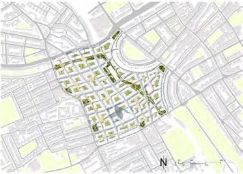
Considering a hypothetical scenario in which the Mayor of London aims to revise the existing scheme for the contentious redevelopment of Earls Court site in West London, students are asked to undertake two interrelated tasks;
• Task 1: Comparative analysis of two urban building types (individual work, 4 weeks) is an introduction to the concepts of density and typology and aims to develop an understanding of the spatial structure and scale of the built environment, and how these characteristics relate to the qualities and perceived character of place, as well as analytical and graphic skills;
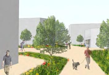
• Task 2: Urban design proposal (group work, 6 weeks) consists of developing an alternative vision and masterplan for Earls Court by exploring and testing different typologies. This exercise aims to foster the ability to engage with design as an iterative process and includes: an analysis of the urban context; the development of an overall strategy and two options that explore alternatives for redevelopment; a final masterplan.
This project-based module combines lectures and weekly tutorials. Students are encouraged to explore relevant theory to inform the analytical and design work.
12
Sample works:


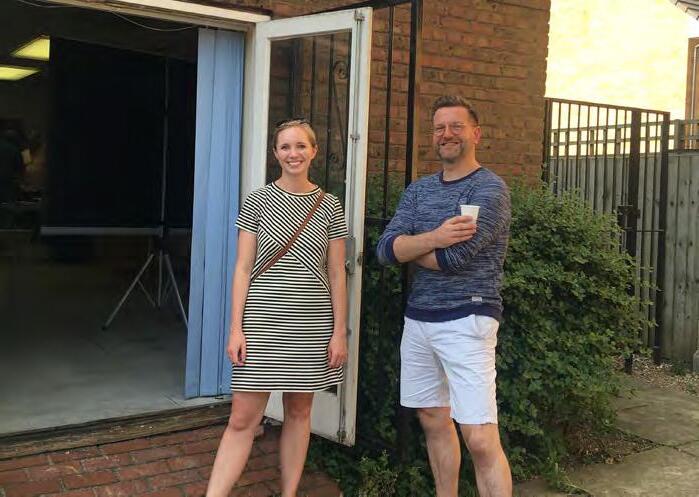
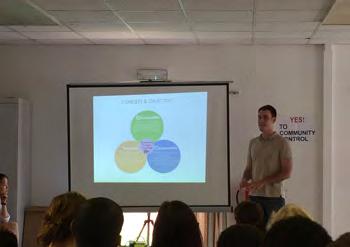
Presentations for West Ken and Gibbs Green Communities:
13
Pedestrian Utopia | task 2
Redesigning Earl’s Court | task 2
BENVGPD1
Design and Real Estate
Module coordinator:
Prof Peter Rees
Tutors:
Dr Patricia Canelas, Dr Ed Jones
The best examples of British urban regeneration are created by collaboration between the development industry, architects and local planners. Through site visits, presentations and critical interrogation, we learn how this is achieved. The absence of municipal master planning in the UK creates opportunity and flexibility for the development sector, but requires unique planning skills to shape projects and represent the needs of the community. Students visit areas of major commercial development in Central London and receive presentations from senior property professionals, architects and planners. The course covers key elements of master-planning, architectural design, real estate and project management, which combine to produce successful development projects in London, a world business city.
Through tutored walks, critical discussions and team work students develop the ability to:
• Analyse existing urban neighbourhoods and their regeneration/development potential;
• Communicate area assessments and opportunities, both orally and graphically.
Student teams are assigned to one of the featured locations to identify the unique set of characteristics that form its identity as a place. This activity is complimented by gathering information on local transport provision, accessibility and land use and a review of the local planning policies relating to development. These studies will culminate in team presentations “selling” the key attractions of the location, as a potential commercial investment opportunity, to a panel of development professionals at the final session. In addition, an individual submission will describe the merits and urban character of a London neighbourhood. This combination of team-working and concise presentation mirrors the “real world” of real estate.
14
Sample works:
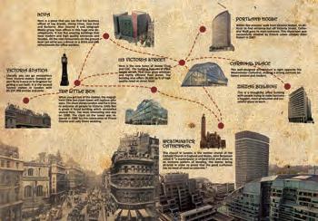
Victoria presentation brochure | task 2
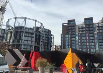
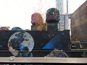
Site visits:
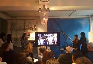
Presentations:


Shoreditch presentation brochure | task 2
15
ShoreditchEmergesasnightlifemusicculturalhub 1 4 3 2 Industries and large businesses compete for floor space in London's old city center Old Street, Moorgate & Liverpool stations, Shoreditch developed an agglomeration of techscale startups Limited supply & higher mobility increase connectivity & the area's GDP to soar, establishing it as much sought after center Shoreditch, an emergent result of neglect from the city- is now a much sought after cultural, business hub with influences on the city of London increase connectivity & Government recognizes areas potential & emergent culture, induces marketing strategy of TechCity grungey bars & Large warehouse floorplates & thriving nightlife, unavailable the City Center, caused slow 1960 James Burbage playhouse in East England, quaintly Curtain Road, Old Street & Great Eastern are laid out as centers of trade Arrival of the Rail, extends to Liverpool 1760-1820's 1860's 1860's IndustrialRevolution VictorianPeriod Meanwhile,attheedgeofLondon Residential properties Decrease in Population due to overcrowding. The Edge of the City The Rise of Shoreditch What next? Future Projections for Shoreditch LSCC Corridor Finance & Real Estate derelict east Growth Time Cultural Identity Heritage Digital & Tech Hotspot Tech firms per sqkm
BENVGPLC
Urban Design: Place Making
Module coordinator: Prof Matthew Carmona
Tutors:
Wendy Clarke, Elisabeta Ilie, Velentina Giordano, Dr Tatiana Souza, Stefania Fiorentino, Leo Hammond, Dr Hooman Foroughmand Araabi, Katy Karampour, Dr Pablo Sendra, Gualtiero Bonvino, Terpsi Laopoulou
This module draws on the extensive theoretical underpinning of urban design as a means to i) explore approaches to appraise the character of the built environment, and, ii) forward practical and even visionary proposals aimed influencing the quality, liveability and value of urban space as a key contribution to sustainable place making. The module illustrates the potential of design as a creative problem solving process, a process necessary to deliver the types of public and private investments in the built environment that will continue to return social and economic value to their users and investors over the long-term.
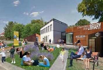
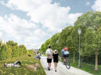
In 2016 the focus was on Stratford High Street. In the context of the transformative projects already occurring in Stratford, and the development pressures that the High Street and its hinterland is currently
facing, the module sought to develop a new vision for the high street to guide its successful transformation over the next 20 years. Groups were asked to develop a set of solutions that restore the integrity of Stratford High Street as a ‘place’ and not just a traffic artery, whilst considering the opportunities within and beyond its surrounding areas. The project provided an opportunity to rediscover the value and potential of one of London’s historic streets, the network of waterways in the areas, its historic assets and green spaces, its role as a public transport loci and node on the local roads network, its commercial, leisure and residential functions, and its role as an important but often forgotten part of one of London’s fastest transforming historic urban villages.
16
Sample works:
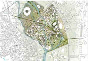
Stratforward | task 3
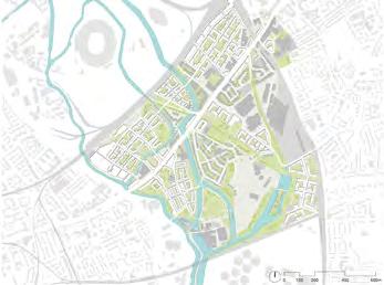
Stratford Canals | task 3
Site visits:

17
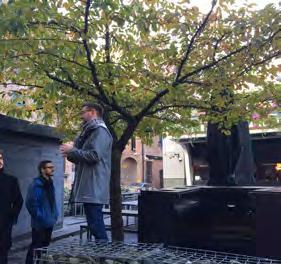
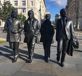
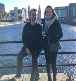
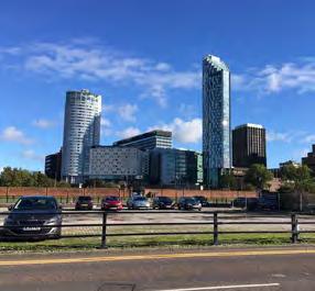
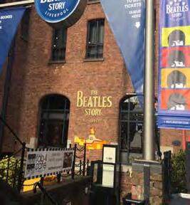
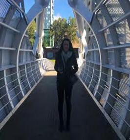
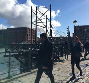
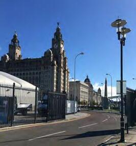
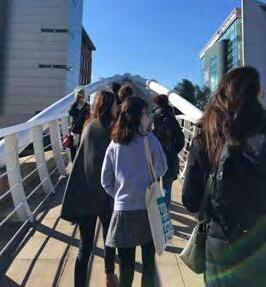
Our field trip to Liverpool took place in October, and the main purpose of it was to ‘break the ice’ and for the staff and students to get to know each other.
The programme included guided walking tours around the city, as well as a dinner and evening activities. The 2-day trip helped us to come together as a group and get to know each other better. Looking back at the Liverpool field trip, it surely helped us to form strong bonds between each other and made everyone feel welcomed and confident on the course, which made it group work easier and more enjoyable.
The field trip was also an opportunity for the students to familiarise themselves with British culture, architecture and cityscapes; Liverpool being a World Heritage Site with a range of issues in its current redevelopment.


18
| LIVERPOOL
UDCP FIELD TRIP
19
Module: Urban Design: Guidance, Incentive, and Control
Colindale and Burnt Oak
Module: Urban Design: Guidance, Incentive, and Control
Mill Hill East
Module: Urban Design: Guidance, Incentive, and Control Location: Haringey Heartlands / Wood Green
Module: Urban Design: Guidance, Incentive, and Control Location: Harrow
Module: Urban Design: Guidance, Incentive, and Control Location: Highgate
Module: Urban Design: Guidance, Incentive, and Control Location: Fortune Green and West Hampstead
Module: Urban Design: Guidance, Incentive, and Control / Critical Debates in Urban Design and City Planning Location: Kentish Town / Camden Town
Module: Critical Debates in Urban Design and City Planning
Location: Clerkenwell, King’s Cross, Euston and Fitzrovia
Module: Collaborative City Planning Strategies
Location: Hayes
Module: Urban Design: Guidance, Incentive, and Control Location: Southhall
Module: Urban Design: Guidance, Incentive, and Control
Central Ealing
Module: Critical Debates in Urban Design and City Planning Location: Seven dials and Neal’s Yard
Module: Critical Debates in Urban Design and City Planning
Location: Chelsea
20
Location:
Location:
Location:
COURSE OVERVIEW | TERM 2
Module: Collaborative City Planning Strategies
Location: Ilford
Module: Urban Design: Guidance, Incentive, and Control
/ Critical Debates in Urban Design and City Planning
Location: Dalston
Module: Collaborative City Planning Strategies
Location: Barking
Module: Critical Debates in Urban Design and City Planning
Location: Bethnal Green
Module: Sustainable Futures by Design
Location: Poplar
Module: Urban Design: Guidance, Incentive, and Control
Location: Woolwich
Module: Urban Design: Guidance, Incentive, and Control
Location: Canada Water
Module: Critical Debates in Urban Design and City Planning
Location: Shoreditch and Hoxton Square
Module: Critical Debates in Urban Design and City Planning
Location: Barbican
Module: Urban Design: Guidance, Incentive, and Control
Location: Brixton
Module: Urban Design: Guidance, Incentive, and Control
Location: Vauxhall, Nine Elms and Battersea
Module: Urban Design: Guidance, Incentive, and Control
Location: Hackbridge and Beddington Corner
Module: Urban Design: Guidance, Incentive, and Control
Location: South Wimbledon and Colliers Wood
21
COURSE OVERVIEW | TERM 2
BENVGPD3
Collaborative City Planning Strategies
Module coordinator:
Elena Besussi
Tutors:
Elena Besussi, Dr Pablo Sendra, Dr Michael Short
Just Space support: Michael Edwards
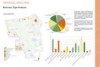
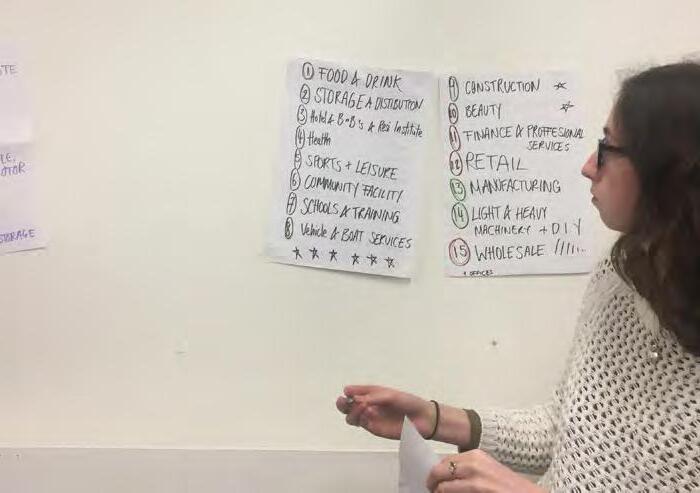
This project-based module aims to apply the more theoretical concepts of city planning to a real life project and undertake a collaborative and applied approach to the understanding and inclusion of community visions and agendas in city planning.
The project will enable students to work with community groups and to consider options for delivering inclusive development for a specific urban area in London.
Students will be asked to develop a design and policy response to urban development issues brought forward by local communities of residents and businesses affected by London’s need for urban intensification.
The module is designed and delivered in partnership with Just Space. Just Space is a London-wide network of voluntary and community groups working together to influence planning policy at the regional, borough and neighbourhood levels. It grew from sharing information, research and resources on the Further Alterations to the London Plan in 2007.
Just Space also works with The Bartlett School of Planning to facilitate research collaboration between community/activist groups and university staff and students.
22
Sample works:
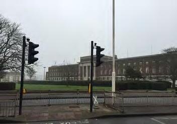
Southall | part 2
Site visits:
Presentations:
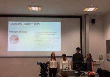
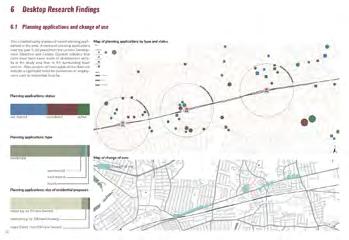
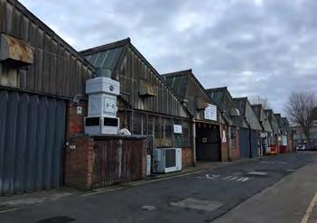
Ilford | part 2
23
BENVGPD2
Critical Debates in Urban Design and City Planning
Module coordinator: Dr Filipa Wunderlich
Tutors: Dr Filipa Wunderlich, Dr Juliana Martins, Dr Pablo Sendra, Dr Michael Short, Dr Hooman Foroughmand Araabi
This module invites students to dive deep into the field of urban design knowledge. It will give an insight into the complex nature of urban design theory and encourage students to construct their own understandings of topics and rationale for urban design interventions. Rather than assimilating facts, students will be learning ‘to think urban design’, while also contribute to the constant evolution and up-grading of urban design knowledge.
The module has further a practice focused component which enables students to apply and test their understanding and thinking about particular urban design topics through analytical and propositional project work that runs alongside the course.
This module has two components:
1.Weekly critical debates seminars with a focus on the above two key areas of debate. Under each of these areas of debate, each week will focus on a different topic to focus on (see details below); Students will need to deliver complete of a preparatory note for each class – a synop-sis, and will be assessed based on this and their participation (see Assessment below and de-tail explanations in appended doc)
2.Group project focusing on ‘The principles and urban design: literature review and learning through experience’. Student will submit a final report at the end of the module.
24
Sample works:
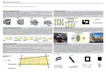
Brixton | group project
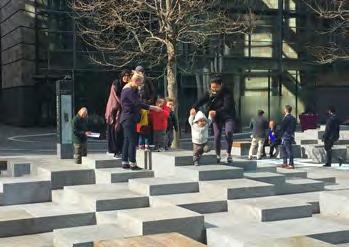
Site visits:
Presentations:
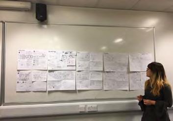
Regent’s Place | group project
25
BENVGPD4
Sustainable Futures by Design
Module coordinators:
Dr Pablo Sendra and Dr Michael Short
Tutors:
Dr Pablo Sendra, Dr Michael Short, Diana Ibáñez López
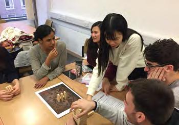
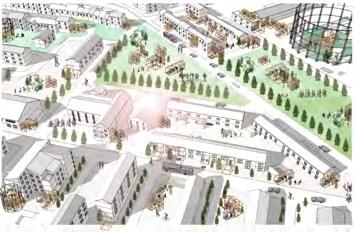
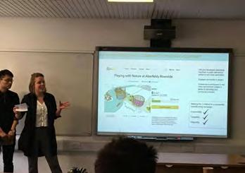
The aim of the course is to provide the student with a holistic approach to all the aspects of sustainability: social, cultural, economic and environmental. It seeks to make the student reflect on possible sustainable future cities by addressing issues that are currently at the forefront of the debate on urban design and city planning: how to make cities more inclusive, collaborative, consume less resources, interact with nature and, at the same time, strengthen its design and maintain and reuse its heritage. The module combines design and theoretical reflection through a series of lectures, workshops and a design proposal.
The key topics of sustainability that the lectures and workshops address are:
• City and nature: interaction between humans, non-humans, city and nature. Land use, food, waste, urban metabolism, urban fauna and flora.
•Urban character and heritage: what makes a place, townscape, urban conservation.
•Collaborative urbanism: participation, co-production, co-design, collaborative economy.
•Inclusive cities: social justice, culture, gender, age, democracy and welfare delivery.
26
Sample works:
Board game | individual portfolio
Site visits:
Presentations:
Sustainable intervention

27
BENVGTC4
Urban Design: Guidance, Incentive & Control
Module coordinator:
Colin Haylock
Tutors:
Wendy Clarke, Dr Hooman Foroughmand Araabi, Velentina Giordano, Justinien Trebillon
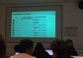
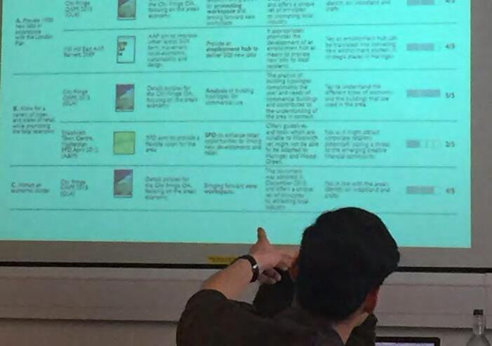
The module focuses on the relationship between design and indirect public sector processes of influencing design outcomes through guidance, incentive and control –typically in the form of strategies, development frameworks, guidelines, guidance, site briefs etc.
The extent to which design is recognised as a legitimate interest planning has been a matter of great controversy dating back to the evolution of the planning system in Britain. In reality, the majority of decisions planners make will be design related in one form or other - albeit at very different scales of operation - from those dealing with settlement form, to those dealing with land use mix, to those concerned with detailed design and individual site layout.
To that extent planning is undoubtedly a design discipline and planners need to be aware of, and concerned with, the design consequences of their decisions on the ground.
This module explores the processes and tools that will enable planners to demonstrate the power of the discipline to change real places for the better.
It uses recent plans for differing parts of London at scales from the strategic to the local neighbourhood as vehicle for exploring how planning and planners seek to shape better places through influencing the actions of others.
Working in small groups students explore how the guiding of change in one area of London has been approached in the recent plan for the area. Following a comparison of approaches between the groups they then establish their own vision for the area and their approach to delivering this vision through their own plan for it.
The learning experience of group working is complemented by students making an opening assessment of the existing plan and then writing a critical review of the working of their group and their contribution to it.
28
Sample works:
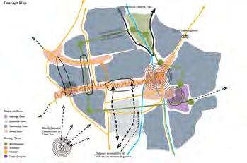
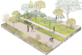
Wimbledon and Collierswood |
Site visits:
Presentations:
29
South
task 3
Colindale | task 3














UDCP FIELD TRIP | BARCELONA






Our field trip to Barcelona had an exciting programme that included: guided tours to explore the transformations and challenges facing the city centre, new urban projects such the supermanzana, a visit to the community-led social and cultural centre Can Batlló, a visit to the Gaudi’s Parc Güell, and also talks and workshops at the Universitat Politècnica de Catalunya: one on public spaces in Barcelona and a talk and workshop on gender and urban space. It also included social gatherings… and a reinvigorating visit to the beach!
The trip was a stimulating and enriching learning experience. It provided an opportunity to experience and debate on site many of the theories and concepts discussed in the programme, and engage with local academics, professionals in the fields of architecture, planning, and urban policy, and community activists. The trip also provided an arena for informal socialization between students and staff and, of course, have some fun!
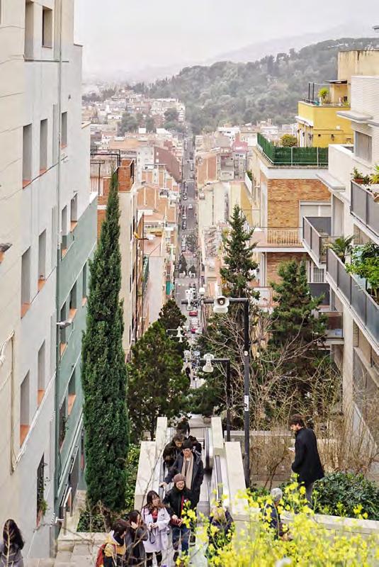
To maximise the opportunity of observing and experiencing first-hand the city of Barcelona, a photo competition ran during the field trip to select the best photographs under three categories: city, artistic, people.
The photos were submitted through Instagram with the hashtag:
#BcnUrbanDesignUCL
See the winning photos on the following pages.
30
31
by Laura Heinritz and Kenji Holdsworth
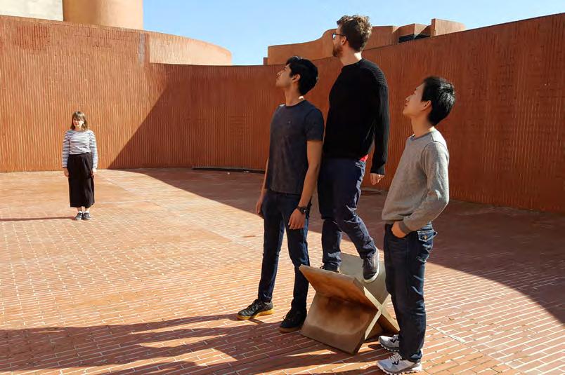 by David Liang
32
| BARCELONA
UDCP FIELD TRIP
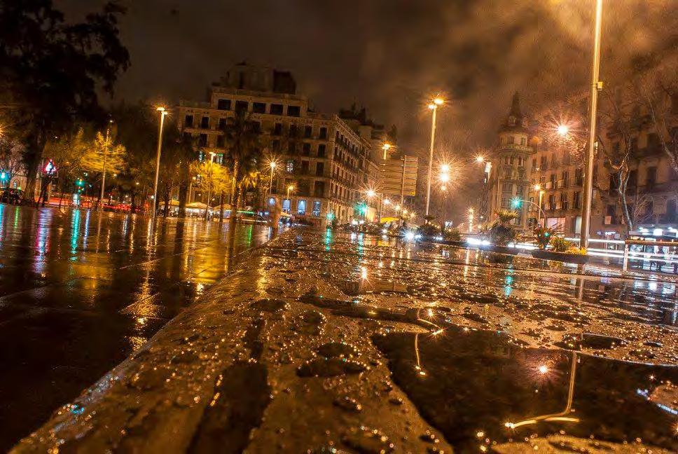 by Martin Garcia Chavez
33
34 Dubai Birmingham Kashgar Shanghai Hong Kong Singapore Rochester London Detroit
Guadalajara DISSERTATION AND MAJOR RESEARCH PROJECT
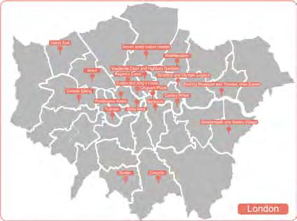
35 LOCATIONS OF MRPS AND DISSERTATIONS Seven Sisters Indoor Market
36
MAJOR RESEARCH PROJECTS
Module coordinator:
Dr Filipa Wunderlich
To complete the MSc Urban Design and City Planning programme, students are given the option to submit a Major Research Project. This project typically focuses on a key area of knowledge covered in the programme, eg. urban design, urban design guidance and control, housing and development, sustainable urban design, sustainable transport, or other.
A Major Research Project represents an indepth exploration of a complex topic or problem. It is a demonstration of knowledge, a critique, and the application of this knowledge and critique into a project. The project focuses on a particular site, method or process and is propositional, delivering a vision, and working it out in depth as to exhibit its potential, but also reflect upon its limitations. The major project embraces the complexity of the chosen topic and applies knowledge in a critical and reflective manner. Overall, the project prepares students to enact positive change through design and is an opportunity to develop both research and problem-solving skills and abilities whilst entering in-depth a particular area of studies and explore a problem that is up-to-date, critical and complex.
A Major Research Project integrates a literature review and analytical research, but also, and most importantly it is propositional. Students look ahead, seek opportunities to imagine a different world and explore and test innovative approaches to planning, design and or development in the city.
The major project may take various forms: a)test a particular theory through practice, b)investigate planning and design strategies, c) investigate methods through which to tackle a problem, d) bring forward a vi-
sion and attempt to design /build parts of this vision in order to test the possibilities, e)investigate relationships between built form, society and culture, developmental processes and sustainability within an interdisciplinary and project-based dialogue. As part of this, students test and apply their ideas in a practical exercise. These can take the form of a regeneration framework, a delivery strategy, an opportunity development framework, a masterplan, a neighbourhood plan, a design code, development brief, town charter, etc. , or indeed any other form of practical method which may catalyse, guide or manage change in an urban environment.
The Major Research Project is the culmination of the Urban Design and City Planning Masters degree. It is the student’s chance to synthesise knowledge in a major and largely self-managed study, what he or she has gained from the programme and, possibly, to integrate it with elements from previous studies or professional experiences. The Major Research Project is something the students take with them, demonstrate their expertise and launch the next stage of your career.
37
Transit Space: Between buildings? Or between nature?
Hermion Yuenyau Au
yuen.au.16@ucl.ac.uk
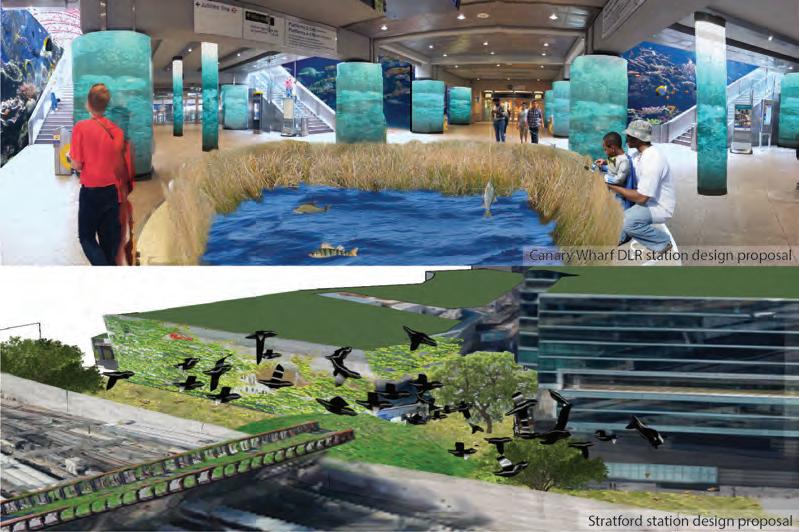
The issue of lacking nature in our daily life is turning into a severe problem to our mental health. The encouragement of efficiency leads to a fixed routine of life and reduced our chance to explore the natural environment. The highly urbanized city setting also isolated us from contact with nature. However, as human beings, it is our innate desire to get in touch with nature. The current built environment ignoring this and keeps us indoors. It is necessary to bring nature back into our lives.
Although professionals are starting to become aware of this issue, most focus on the places we stay. Limited attention had been paid to transit space, where is mainly used for commuting so people rarely stay. However, transit space occupies a role in our daily lives. Nature should be reconnected in the transit spaces.
38
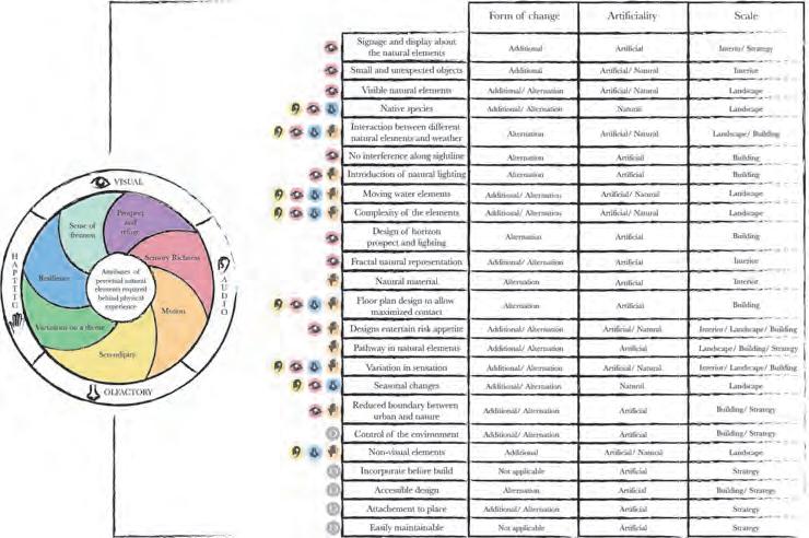
The significance of reshaping the transit space with natural elements will relieve our stress caused by nature deficit. It can be achieved through influencing the sensorial experience in these spaces. An application toolkit is thus derived based on the natural elements proposed by scholars for stress restoration. It expands the existing studies on the effect of nature to stress recovery through interlinking different approaches to form a structural framework for implementation. Biophilic approach as the major tool of realizing nature in the transit spaces will lead to sensorial changes in terms of visual, auditory, olfactory, and haptic, that construct our intangible understanding of the space. It, therefore, serves as a stress recovery place instead of creating stress.
After the study of the two sites, design proposals are suggested by applying the
toolkit. It is believed that these proposals may bring benefit to our psychological health and other perspectives like ecology. They work as the examples of the possible implementation of this application toolkit in real life for stress recovery. The future application of this toolkit may be transferred to different places for the purpose of exploring our inner nature to connect with the natural environment for stress restoration.
To conclude, this research serves as a starting point on natural design of transit spaces for stress restoration. It extracts existing theories to contrive a practical perspective striving for the mental health of users. In the future, this project may inspire scholars as a fundamental piece of research regarding mental health and transit spaces to enhance quality of life of everyone.
39
Industry in a Time of Density: Transforming inner-city industrial land into high-density industry + mix
Roland Chanin-Morris roland.chanin-morris.16@ucl.ac.uk
There is increasing interest in the planning and urban design fields in reconsidering the place of industry in the city. On the one hand, there is growing concern about the loss of urban industrial space under pressure from residential and commercial development, and its negative effects on cities’ economic and social function. On the other, there is new interest in how industry could be accommodated in more dense, mixed and urban settings - in contrast to the current pattern of low-intensity, functionally-separated industrial areas. Ongoing changes in the nature of industry make this increasingly possible, and potentially beneficial.
For existing industrial land, this raises the possibility of mixed-use intensification: using land more efficiently, while introducing non-industrial mix at various scales. This promises a ‘silver bullet’ solution which helps deliver compact growth, while also providing improved employment space that meets the needs of industrial businesses. This is particularly relevant in fast-growing cities, and inner-city industrial sites. However, many questions remain around whether such approaches can work in practice.
40
In this context, this research project seeks to:
Explore the potential to transform a complex inner city industrial area into ‘industry + mix’
Experiment with very high industrial and residential densities and close co-location of the two
Explore the extent to which this is compatible with (a) protecting and strengthening the existing economic functions of the area; (b) successful urban places in terms of scale, character and amenity (c) financial viability; and (d) flexibility and adaptability.
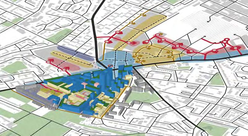
Debates on intensification and industrial land are becoming highly topical in London. The project tests a toolkit of approaches in part of London’s Old Kent Road Opportunity Area, a critical inner city industrial area identified as a major development location, and the site of a live planning debate

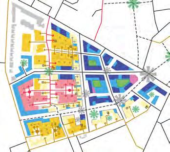
The project develops design proposals at two linked scales: an overall spatial framework covering 50 hectares of industrial land, and more detailed design for a smaller part of this area. These seek to deliver existing planning aspirations (including housing targets) where possible, while preserving the existing business base and more than doubling the amount of industrial floorspace.
The project suggests that both highdensity industrial mixing, and the intensification of existing industrial land, could be successful responses in the right contexts. The findings can be applied to other urban industrial areas; development of new industrial space in other high-density contexts; and for strategic industrial land policy.

41
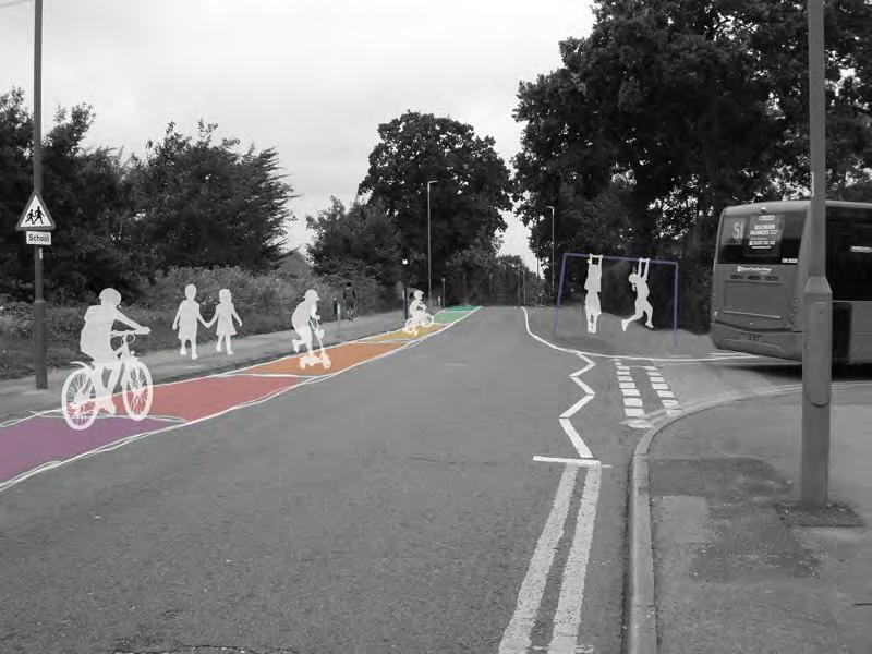
Influencing school journey transportation modes of primary school children in UK suburban areas towards more active, sustainable modes of transport.
Aoife Connaughton
aoife.connaughton.16@ucl.ac.uk
Transportation choices can have significant and wide ranging impacts from the personal to the global scale. Therefore, it is essential to make efforts to establish healthy, active and sustainable transport habits in children, which they will carry into adulthood. This project aims to investigate the rationale for school journey transportation mode choices in primary school children.
The research question for this project is: what role can a better understanding of children’s aspirations for school travel play in promoting active, sustainable transport to school?
Significant barriers currently exist to active, sustainable school travel for primary school children. One of the most significant barriers is parental concerns, which are largely related to traffic safety and “stranger danger”. This is problematic as it leads to a situation whereby parents drive their children to school due to fears of child traffic injury; this increases the traffic volume and hence the risk of injury for children still taking active modes of transport to school. Fears around “stranger danger” can be more complex and less grounded in reality.
42
This project focuses on addressing these issues and barriers in a UK suburban context, using two schools in the London Borough of Sutton as application sites. The schools were selected based on their proximity to A-roads, green spaces, local amenities and public transport links.
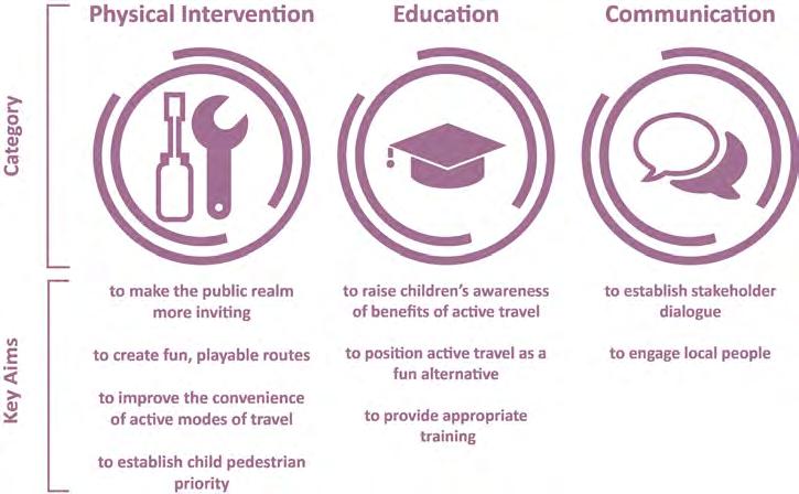
The tools proposed in this project are designed to tackle different barriers and issues, they are divided into three categories: physical intervention, education and communication. The tools are interrelated and should be implemented together as progressive, incremental changes. By focusing on children’s aspirations for school journey travel, the tools developed are intended to better encourage active, sustain-
able transport in children by responding to their desires. This approach plays a significant role in creating environments that are perceived to be physically fun and engaging by children.
This project concludes that it is essential to engage children on the topic of their journeys to school in order to be able to better understand their aspirations and respond to these appropriately. To fully achieve the goals of active, sustainable transport to school it is imperative to provide a range of interconnected, incremental interventions that aim to induce behaviour change using targeted combinations of approaches that respond to the context of the school.
43
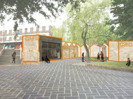
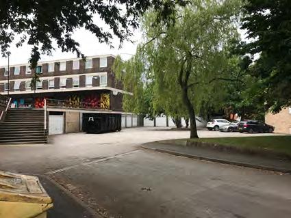
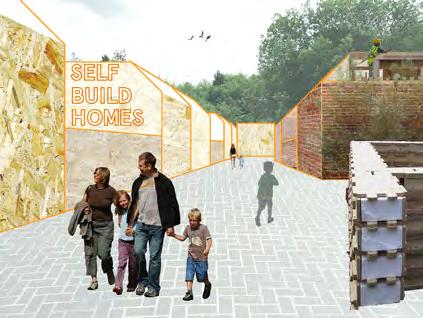
Forgotten Land, Forgotten People: How housing associations can help to end homelessness through the regeneration of garage sites as sites for self building homeless communities.
James Cox
james.cox.15@ucl.ac.uk
A lack of affordable decent homes, a result of our so-called housing crisis, is affecting everyone. Pricing thousands of people out of their homes and for many onto the street. Homelessness is a problem which isn’t going away fast without major change and whilst housing associations play a role of providing accommodation and support, their work is becoming increasingly scrutinised following several new policies and legislations.
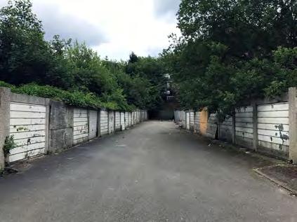
Forgotten Land, Forgotten People researches into better using under-utilised pieces of land, namely garage sites within the ownership of housing associations, as sites for self-building homeless communities.
Building upon the Housing First movement, the project explores a holistic approach to ending homelessness and repeat homelessness, particularly focussing on the provision of housing, new technology and how the process of self-building can help with reintegration of homeless populations back into society through building skills and resilience amongst participants.
Through a partnership with Trident Housing Group, a site in Edgbaston, Birmingham has been selected. The project presents a viable option for its regeneration for the aforementioned purposes, as well as a detailed process plan and a business case which can be applied to similar sites across the country.
44
45
Applying the Common Touch: Utilising the Commons to Capture Community and Place Identities in Suburbia
Kerry Csuka
kerry.csuka.16@ucl.ac.uk
Central government austerity policies and reduced local authority spending has sparked a renewed interest in the management of our cities.
Tonkiss (2013) states that we are in a state of “austerity urbanism”. With central government cuts affecting the ability to deliver community services, local community advocates have taken it on themselves to deliver these.
Austerity has been felt most acutely in city suburbs all around the world – the core of cities experiencing investment whilst the peripheries suffering disinvestment. With local authorities inclined to make a quick buck to mitigate their budget deficits, suburbs are witnessing an influx of private development, public space commodification, gentrification and displacement. This is leading to a loss of place identity, creating homogenous suburban centres similar to the urban core.

46
This project explores the use of the Commons – in simple terms, community-managed resources - to rediscover place identity in the London Borough of Bexley, confronting suburbia’s identity and austerity crisis. This project will investigate how participatory planning and urban design can together reclaim land and achieve a new model of governance for the common good. This project also investigates whether the private sector can work collaboratively with communities to create Commons – with a growing number of local authorities having less money to spend, financial support from companies to take care of primary tasks has been growing.
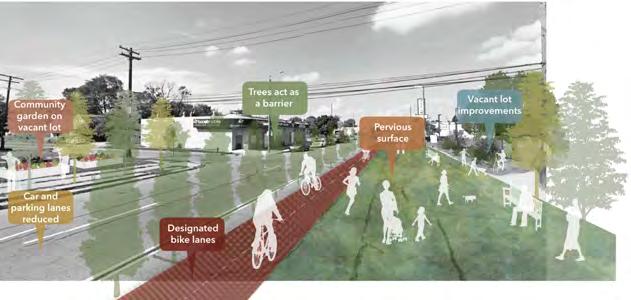
The key outcomes of this project are that the tools to common can be applied to the suburban setting just as effectively as the urban, both displaying similar issues of gentrification, vacant land and the privatisation of public space. The study application part of this project proves that London’s
suburbia is characterful and this character can be unlocked through commoning to enhance place identity.
This project also shows that a partnership can be achieved between the private sector and communities to create Commons. This can be realised through brand exposure and community projects reactivating vacant shopping units.
This project reframes the basis on which citizens, the private sector and the public sector can work together to build commons, with the private sector becoming an endorser rather than the enemy of community enterprise and spirit.
The future must focus on the innovative capabilities of retrofitting suburbia on a local level by and for the people who live there.
47
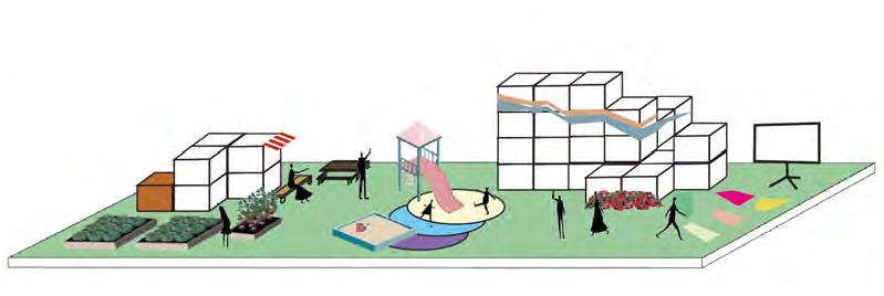
ALLOTMENTS + COMMUNITY CAFE + PLAY SPACE + COMMUNITY CENTRE + POP-UP CINEMA
Reclaiming Children’s Right to the City: School Zones as A Supportive Approach to Promoting Healthy Living for Children.
Jiayu GU
jiayu.gu.16@ucl.ac.uk
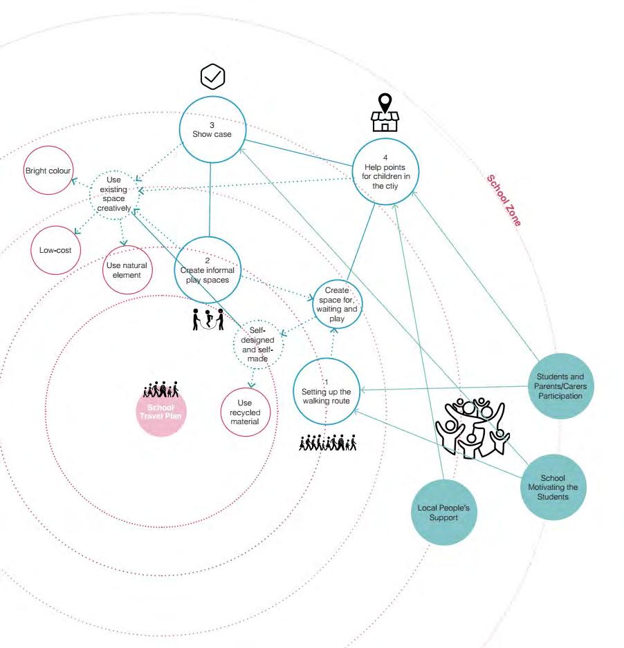
Based on the review of the successful interventions on health inequalities, the research project explored what could be the next step in promoting health conditions. As a healthy start of life plays a crucial role in a healthy life, the project is focused on promoting children’s health. The findings reveal that children’s freedom to move and play in the city is the priority, which is violated by the inhospitable urban environment. Therefore the project proposes to reclaim children’s right to the city.
Firstly, help children build up the ability to learn about the urban area and to move safely. In the meanwhile, encourage informal play in the city. Next call for the support from the community and raise the awareness among people. Finally alleviate the ‘culture’ of fear and claim that children are competent to move and play in an urban area.


48
49
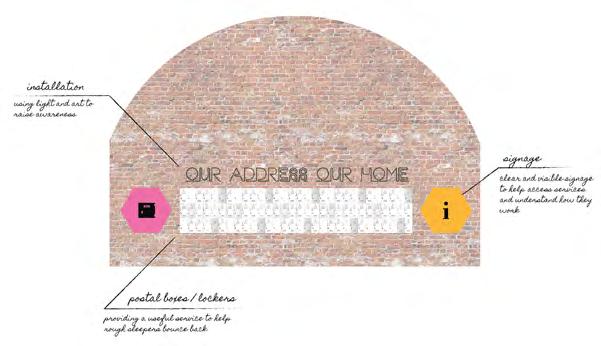
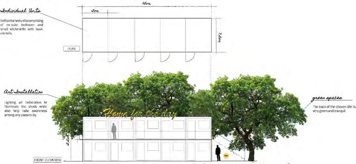
Bounce Back - Service provision for rough sleepers within the public realm
Francesca Heathcote Sapey francesca.sapey.16@ucl.ac.uk
Homelessness is an extremely complex phenomenon growing worldwide, particularly within cities. In the United Kingdom, homelessness has risen by 30% in the past five years and data indicates that 1 in 13 people have slept rough at least once in their life. Rough sleepers are defined as the most vulnerable homeless group, as they are forced to struggle to survive in the public realm, with nowhere else to go. However, the public realm is not designed to provide those services that housed people benefit from within the domestic
and professional spheres of everyday life. Additionally, hostile design of public realm further alienates rough sleepers. Even though various services are provided to aid homeless people, many rough sleepers do not use them out of fear or ineligibility, among many other factors. Therefore, can we design public realm that provides services to rough sleepers in order to help them bounce bank and reintegrate into society?

50
The project will explore the right to the city and to public realm for rough sleepers; the role of design and art in aiding rough sleepers bounce back as well as raising awareness among the housed population; the relevance of bottom up approaches to empower marginal social groups with autonomy and self-esteem; and, finally, the relationship between housed society and rough sleepers within urban public realm.
The site for this project will be in Walthamstow in northeast London, as it has seen a rise in homelessness in the past 10 years, while also undergoing urban changes and redevelopment. In conclusion, the aim of this project is to test how to help temporary and episodic rough sleepers bounce back and reintegrate into society through the design of service provision within the urban public realm.
51
(Re)capturing Community: An inclusive strategy for neighborhood transformation in Detroit
Laura Heinritz
laura.heinritz.16@ucl.ac.uk
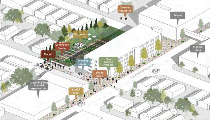
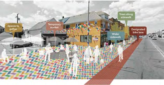
Communities that remain in Detroit and other shrinking cities are primarily connected socially rather than through physical proximity. However, academics agree that place-based sense of community is important in neighborhood transformation. Current planning and development trends in Detroit do not authentically prioritize the needs of existing communities but for Detroiters to evolve with their city, it is critical that their bond to the place they live strengthens in order to mitigate further shrinkage and decline of their neighborhoods. An opportunity exists for a new strategy of neighborhood transformation
to occur. The strategy proposed in this project places the needs of the residents at the forefront of the discussion and empowers them to be critically involved in the transformation process.
A literature review reveals that in a shrinking city, urban design and planning methods can foster a place-based sense of community, however, participation and management are also essential components for neighborhood transformation. These three components are explored through a series of case studies, followed by a summarizing toolkit for planners that offers spatial and
52
delivery strategies, and a framework that illustrates the actors and process of transformation. The resulting proposal for the Banglatown neighborhood of Detroit utilizes this toolkit and framework to explore how the community, planners and various actors can work together in the production of a catalyst intervention and neighborhood network of public spaces.
This project concludes that strengthening the place-based sense of community in a shrinking city requires innovative approaches to the unique challenges that exist. Collaborative opportunities for urban
designers and planners redefine traditional relationships between professionals and community members by acting as enablers and mediators. In addition, planning for a shrinking city’s future involves addressing a history of racial and socioeconomic unjust that is woven into its narrative. Therefore, the story that planners and urban designers tell must reflect that complex nature of these cities. This project does not seek to ‘fix’ Detroit, however, it will offer a unique perspective from which to view the city’s complex problems by placing critical value on its incomplete landscape and the communities disbursed between.
53
Planting a Healthier Urban Image. Designing a toolkit: Reducing mental health concerns through the use of biophilic design principles in urban public streets and open spaces.
Kenji Holdsworth
kenji.holdsworth.16@ucl.ac.uk
This report explores how biophilic design can be used as a tool in reducing Common Mental Disorders (CMDs) in urban settings. The research investigates what factors are associated with CMDs, and aims to reduce them through the use of biophilic elements within the public realm.
The literature review and case studies explore the links between mental health and biophilic design, while revealing a number of various considerations that need to be taken into account when designing spaces for mental health.
Along with the literature review and case studies, interviews, and anonymous surveys were conducted in order to address what factors cause the most concern for those suffering from CMDs within an urban environment. The methods listed above were deemed to be the most appropriate for the sensitive nature of this research, despite limitations associated with online surveying.
54
The toolkit created based on the methodologies, addresses how environments can be appropriately designed to facilitate not only entering a public space, but also staying within the area itself. This fed into the creation of the design intervention toolkit that allows biophilic design elements to be applied within practice.
The delivery site chosen for the application is Ealing Broadway, London. The location was chosen due to high levels of people suffering from CMDs within the borough. The use of site-specific surveys and sensory walks allowed to identify the key areas with the potential for enhancement. The selected spaces were then re-designed in accordance with the design principles identified in the toolkits.
The research allowed to draw key conclusions and assess the potential successfulness of the approach, with key limitations within the delivery, maintenance aspects and accessibility concerns that are associated with this particular design approach. Nevertheless, the approach shows strong correlation between biophilic design and the reduction of symptoms associated with CMDs.

55
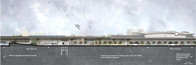
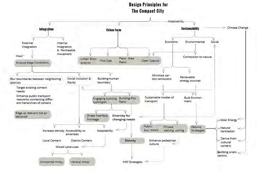
How can climate-sensitive infill strategies on edge communities mitigate linear sprawl towards a more compact city and encourage pedestrian culture in Dubai?
Ghaliah Korban
ghalia.korban.16@ucl.ac.uk
Urban fractals is a response to sprawling cities in the face of climate change. It advocates compact developments at a neighborhood scale in Dubai, a city consistently practicing unsustainable methods of development built around the automobile, in oblivion to current significant fluctuations in its social demographic and disadvantaged communities, at the detriment of its environment.
‘ Edges in Transition’ targets the edge communities of urban cores, by providing
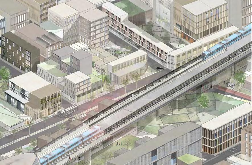
mixed use centers of a smaller scale, objectifies compactness along the edges of urban cores along existing infrastructures, and triggers an urban acupuncture integrating into its wider dispersed context. It acts as a guide for local authorities on how to efficiently carry out city extensions as a consequence of growth. Any form of new settlement will need compromises, and the context is all-important. In the case of climate change, accommodating new development in an existing neighborhood will be the most efficient.
56
Questioning what constitutes the compact city, it advocates to a more social perspective aiming to develop a sustainable neighborhood model that in itself will provide a better quality of life for its inhabitants, and increase accessibility by providing the basic amenities within a walking distance, as well as mass transport options to external urban cores. By showcasing both bottom-up and top-down strategies
in edge communities, it explores how we can re-visualize our cities towards an improved accessibility to its amenities, and how when applied in multiplicity, can redirect movements away from automotive dependence towards compact, walkable fabrics- reclaiming it back to its people as a city of resilience accommodating a constantly changing demographic, and an improved quality of life.
57
Living with water: How to apply water sensitive urban design (WSUD) into a high-density neighbourhood to improve its flood resilience?
Zhuyun Liu
zhuyun.liu.16@ucl.ac.uk
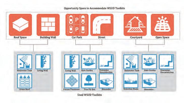
Flooding issues will become more common in the future because of global warming and urbanization. Thus, people need to live with water and use suitable methods to tackle the flooding issues. Most of the existing flood control toolkits have restrictions and cannot address flooding issues completely. WSUD can overcome part of their constraints because it has such advantages as small effects on nature, forming a stormwater recycle to address water shortage and acting as place-making toolkit to provide pleasant urban space.
WSUD is a better solution to address flooding issues. However, existing research about WSUD is limited. Previous studies mainly focus on its stormwater treatment function and place more emphasis on its technical and engineering perspectives but neglect its urban design strategy. In addition, existing applications of WSUD are mainly in low-density areas and open spaces, but few is related to high-density areas. However, increasing high-density urban areas can be easily foreseen in the future under housing pressure.
58
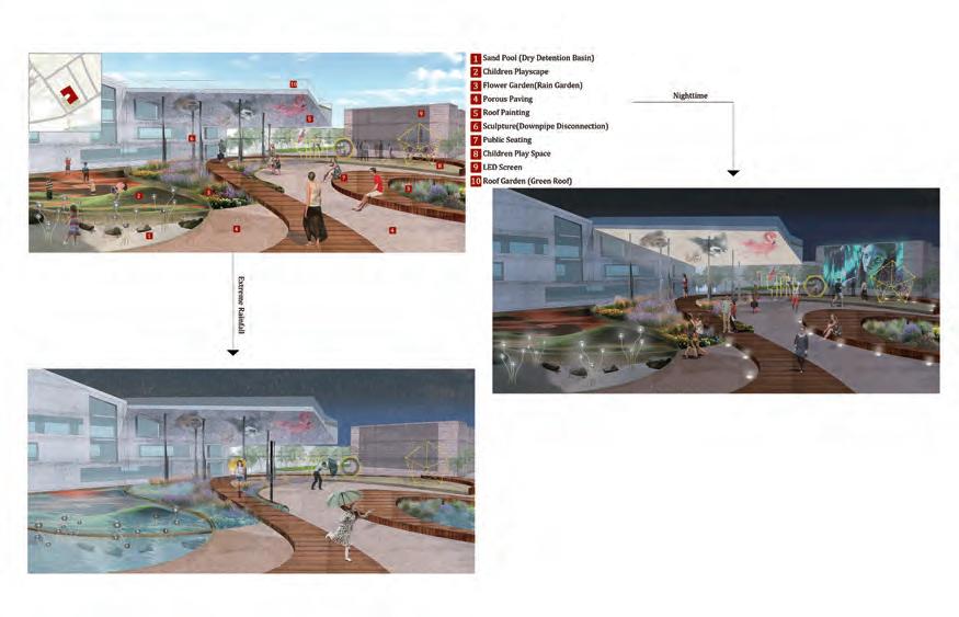
To fill the research gap, my project aims to explore strategic approaches for WSUD applications in densely-developed residential area. It also tries to explore the possibilities that WSUD not only serves as stormwater treatment but also has place-making functions. London is chosen as application area, as England is a flood-prone area with a growing housing demand.
The project firstly summarizes common WSUD toolkits in different scales and their spatial limitation, combining with characteristics of high-density environment to explore the possibilities of WSUD appli-
cation into densely-built area. Moreover, by extracting WSUD elements from case study and concluding the potential function of urban space that WSUD creates, I can possibly get the design features of WSUD and find out its place-making discipline. The study shows transferable WSUD toolkits in high-density residential area and the character of urban space created through WSUD design principles.
59
The Circular Economy of Everyday Life: Regeneration of modernist housing estates to facilitate the transition to the circular economy
Rebecca Mumford
rebecca.mumford.11@ucl.ac.uk
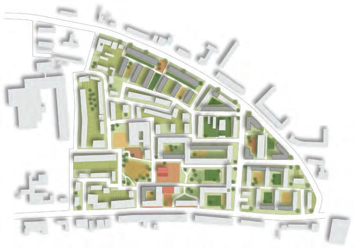
Inner city modernist housing estates, and the regeneration processes that demolish and rebuild them, are the product of the linear economy. Here resources are manufactured, consumed and disposed of, resulting in climate change and widening inequality.
The circular economy functions as an alternative, holistic, model for thinking about resource ows that mimics natural systems
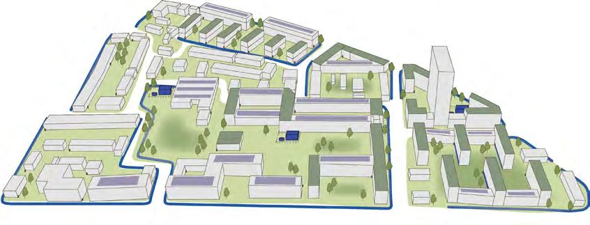
with the overall goal of decoupling environmental pressure from economic growth. This project develops a framework for the regeneration of modernist estates that addresses their challenges whilst facilitating the transition to the circular economy. In particular, it involves reconsidering the way residents engage with the spaces they occupy through active participation and multi scalar collaboration.
60
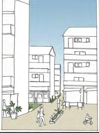
The framework involves refurbishment, repair and densification, over demolition, and productive redesign of open space. In addition, the implementation of local energy, food, waste and water management strategies that mimic natural resource flows through use of renewables, circulation and sharing. This is tested in Northumberland Park, Haringey, a deprived ward in north London set to undergo regeneration as part of the Haringey Development vehicle.
Regeneration from the perspective of the circular economy leads to good urbanism through redesign and reuse of space. It creates walkable, green and lively spaces to work meet and play that is home to diverse groups of people. Furthermore, a collaborative approach to rethinking resource use in an urban residential area also serves as a tool for strengthening community ties.
61
Everyday life spaces as a tool of empowerment for low income women to own and shape their cities according to their needs and experiences
Elisa Sanchez elisa.rio.16@ucl.ac.uk
Feminists have been fighting for the women´s right to the city for a long period. Their struggle has been regarding their participation in public life, protecting space for women and redefining the concept of public space. Nevertheless, gender is still a topic in planning and urban design that needs special attention from its practitioners. The binary conception of the space has brought as a consequence the marginalization of women and their segregation to the private sphere and consequently women, especially from deprived neighbourhoods have been denied from the benefits that cities bring to their inhabitants such as
exchange, education, transport, well-paid jobs and others. However, it is in the public space where the decisions that shape our cities are taken. The research works the concept of “everyday life spaces” as they are the scenario of lives, work, leisure, consuming, relations with others, forging identities, but most importantly, spaces for political action and democracy. Due to safety issues and the fact that women are given the primarily role of taking care of others according to the patriarchal society we live in, women are more restricted spatially than men. Therefore, women are experts of everyday life and they are also
62
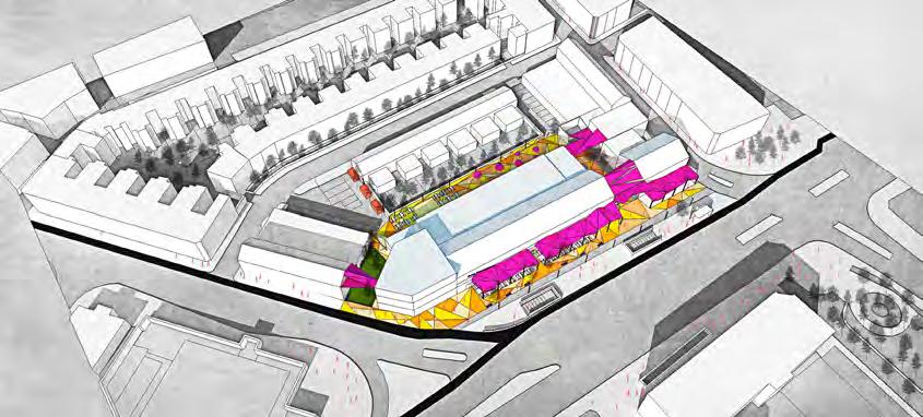
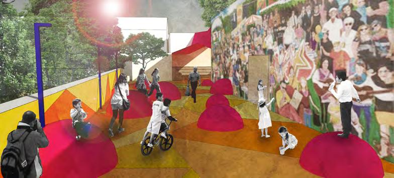
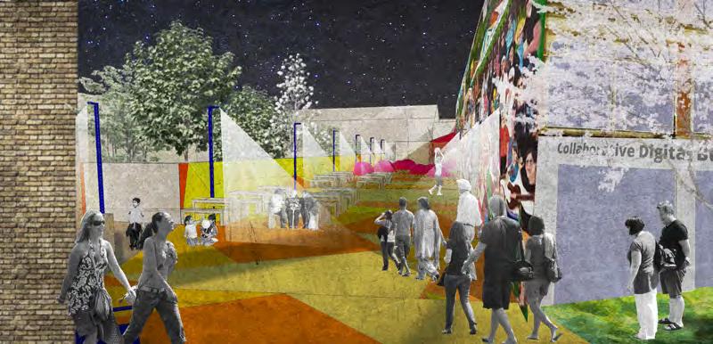
the voice of others like children or the elder. Hence, the unmapped daily spaces gain importance as places to acknowledge and make visible women´s experiences and needs. This project will propose tools and recommendations regarding urban design to include women of low income neighbourhoods to appropriate their everyday life public spaces. The project
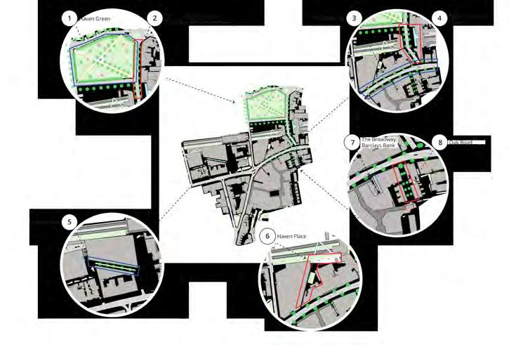
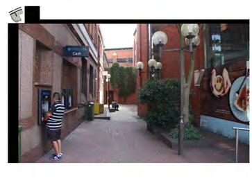
suggests gender inclusive design proposals for the Seven Sisters market area in London, where a regeneration scheme is jeopardizing the work space for many Latin and other minorities families, but especially for women who run most of the businesses in the indoor market.
63
From non-place to third place: Re-appropriating privately managed public spaces in international business districts for play
Safeer Shersad
safeer.shersad.16@ucl.ac.uk
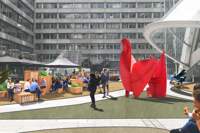
Privately owned public spaces in international business districts are becoming increasingly devoid of social opportunities for their inhabitants, partly due to the excessively formal environments created through design, and partly due to overt levels of control by managing authorities. The effects of incorporating elements of play to these privately controlled areas are explored with the intention of improving sociability amongst users, who are primarily employees of surrounding office buildings. This is done by developing a practical toolkit based on academic literature as well as case studies, which is then tested in a
pilot study in Finsbury Avenue Square in the Broadgate estate before being applied to CityPoint Plaza, in the City of London. The literature review first draws out the concept of sociability and approaches to public space design, after which it outlines the relationship between play and disorder in urban design. Play is identified to be beneficial for employees of international business districts, as it supports the shift in behaviour from the instrumental rationality of work to the creative freedom of play. The case studies selected illustrate the current challenges faced by practitioners, and also details some of the initiatives to overcome
64
these hurdles, such as playable strategies, playable installations and reclaiming existing built elements for play.
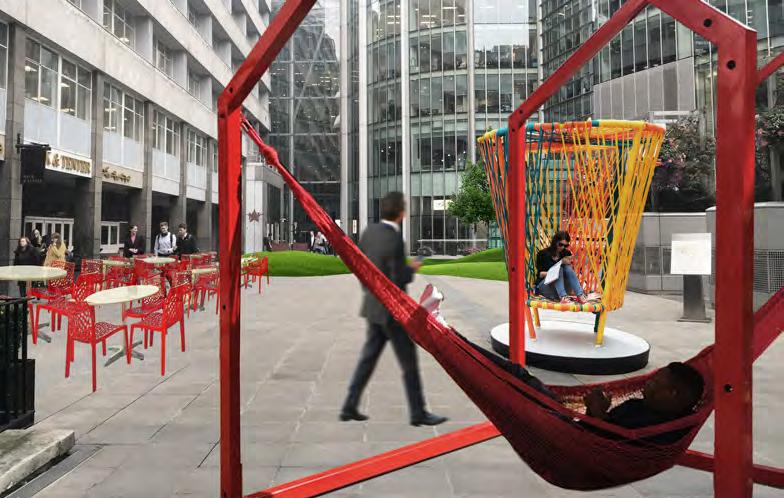
The resulting practical toolkit includes guidance for site management as well as physical design, as these were identified to be the key drivers in maintaining the longevity of privately managed public space. Design principles include barrier-free access, including relaxing elements of control, the provision of loose space, the installation of flexible elements of play, facilitating triangulation by providing opportunities to observe playful acts and an attractive environment which supports play. Management principles included
the nature of programmed intensification activities as well as the need for a modular methodology during the implementation process. Applied interventions should be implemented slowly, as mediating play and the instrumental rationality of work requires a paradigm shift for inhabitants of the space. During the application process, it was seen that physical design must be underpinned by management who are willing to effect change and invest in their public spaces.
65
66
DISSERTATIONS
To complete the MSc Urban Design and City Planning programme, students can also choose to submit a dissertation. The dissertation represents an academic research study of a specified topic. Students will normally draw from available theory or debates on a particular subject and submit them to a critical analysis based on a review of the literature and the gathering and interpretation of primary and / or secondary data. Primary data is information collected by the students for the specific purpose of the research. This entails the use of case-studies and the methods of surveys, interviews and or direct observations. Secondary data is information which is readily available, documents, reports, databases, and others. Students will most often concentrate on the use of primary data, in order to practice, put into action and demonstrate their fieldwork research skills and complement this with secondary data when pertinent. Occasionally, depending on the topic and justification, dissertations may draw from secondary data only, in which case, they will cover a robust and diverse amount of data. Drawing from this type thorough analysis, the student then advances concludes by reflecting on the findings and bringing forward recommendations for change.
The dissertation is typically divided into three main research only components:
1) the literature review; 2) the analytical chapter, where case-studies, fieldwork and other data sources are described and the information gathered is analysed and discussed; and, most importantly, 3) the methodology chapter, where the student demonstrates robust academic knowledge in social sciences methodological research, and selectively presents his/her research strategy to successful conduct
the proposed research work. As with all research works, the student completes the dissertation by reflecting upon and drawing conclusions from his/her research work.
Overall, the dissertation develops students’ research skills and abilities, offering them the opportunity to follow a rigorous academic programme and think through and design their own research strategy; as much as it allows students to explore – in depth – a particular and usually complex area and / or question covered in the course and some of its specialist teaching. The student demonstrates abilities in research topic design, execution and presentation and a capacity for in-depth critical thinking in their chosen area of study. This is the culmination of their MSc programme, a major and largely self-managed study, where students put into practice and synthetize what he or she has gained from the course. The dissertation is something students take with them, and use to demonstrate their expertise in a particular urban design related subject, like this, launching the next stage of their career.
67
Burgess Park: Black and Minority Ethnics in Placemaking
Khalifa Abubakar
khalifa.abubakar.15@ucl.ac.uk
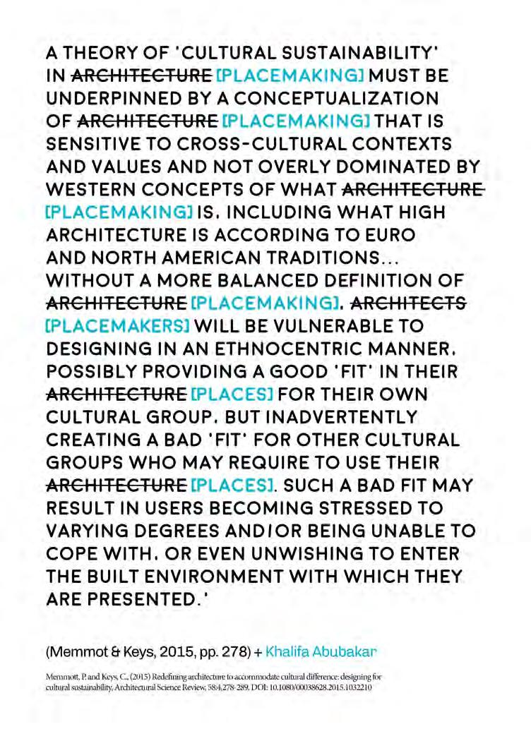
Amongst fields of the built environment, expressly here in the UK, there seems much use of the term ‘placemaking’ of late. The expression is at once attractive, ambiguous, highly marketable and suggestive of a special kind of development ethos sitting above standard practice. This special approach is commonly understood as one which takes a holistic and inclusive view of place and its making. The motivations of placemaking may be interpreted as ones which seek to harmoniously account for the ambitions of sustainable development by prioritising the social impetus of space.
Using the redevelopment of Burgess Park as a case study and by looking into the experiences of Black and Minority ethnics (BMEs), with focus on Black ethnic minorities, this work questions whether the practice of placemaking is fulfilling the social responsibilities it proclaims.
The text begins by expressing the political context in which it is situated, a fragmented Britain dealing with Brexit. Then in building up a framework for analysing Burgess Park, the work looks through literature for a definition of placemaking. In addition, it examines a series of writings linking the place experiences of BMEs. Through first establishing an appreciation of placemaking’s social determinations and then building up an understanding of BME experiences in public spaces, the study then proceeds to analysing the relationship between the park’s recent placemaking and the experiences of BMEs. The work relies on document analysis and intercept surveys with Black minority ethnics in the park as its principal sources of data.
68
69
Metropolitan Planning Strategies and their Implementation at Minor Scales of Intervention: The Compact City Model at the Plot Scale in Guadalajara, Mexico
Martin Garcia
martin.chavez.16@ucl.ac.uk
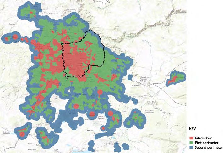
The compact city model, as a metropolitan urban planning strategy, has been adopted in cities because of its benefits, such as the provision of services and amenities in a compact area and mitigation of urban sprawl. However, whereas consolidated cities in regions such as the Global North find this model convenient because of their several constraints, developing cities in the Global South might not find this model appealing. Bringing this strategic vision to a minor scale requires a series of conditions that may not apply adequately at this level.
The purpose of this dissertation is to find whether the compact city model works at the plot scale while understanding how existing frameworks and governance strategies are helping in its delivery. The research explored the way current practices and interventions at the plot level affect the liveability of residents. A thorough understanding of the phenomenon was possible by choosing the Mexican municipality of Guadalajara, Jalisco as a case study. Conducting interviews with local professionals allowed in-depth analysis of the compact city model and its implementation at the plot scale.
70
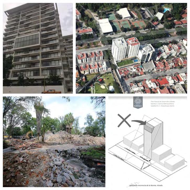
The findings conclude that the young compact city model does not work properly at the plot level, as practices and interventions at the plot scale end up being detrimental to the condition of existing neighbourhoods. Plot scale interventions cannot be conceived without acknowledging metropolitan strategies for development. Flexibility in conservation policies should be encouraged to facilitate plot scale interventions in city centres.
This model has to rely on social participation, particularly at the neighbourhood level. Although plot scale interventions have mostly detrimental effects, it is premature to assume the model of development will not change since it is relatively young, and improvements can still be made in its implementation.
71
Sense of Community in Public Space in Hong Kong: Investigating Quality of the Space as a Factor
Long Hei Jonathan Chow
long.chow.16@ucl.ac.uk
Sense of community (SOC) has always been an important topic in urban studies. Initially suggested by sociologists and psychologists, the term has also been explored by urbanists to see how it is related to space, and urban planners and designers are increasingly interested in how the design of the city can foster SOC. Despite some previous researches on how public space helps to construct SOC, the mechanism is not clear enough to inspire public space design, as researches focus-
ing on the intrinsic characteristics of the public space are lacking. Focusing on the case of the compact Hong Kong, this paper questions: How does quality of space affect SOC in public space in Hong Kong? Two secondary research questions are also explored: (1) How can SOC in public space be measured?; and, (2) How is SOC in public space constructed?
72
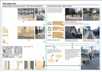
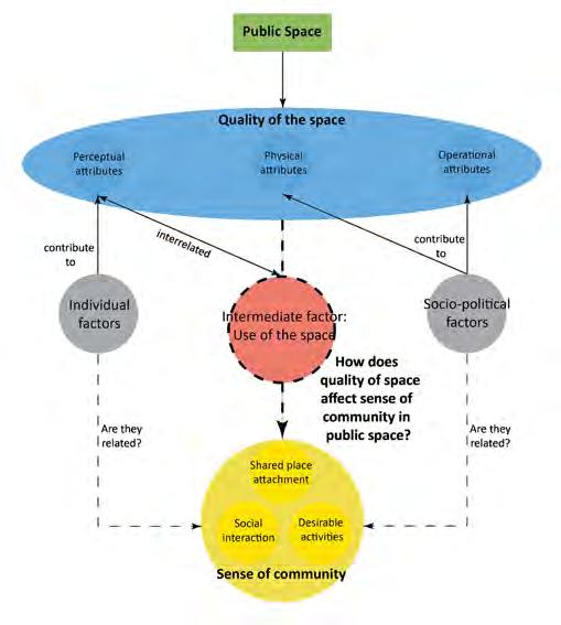
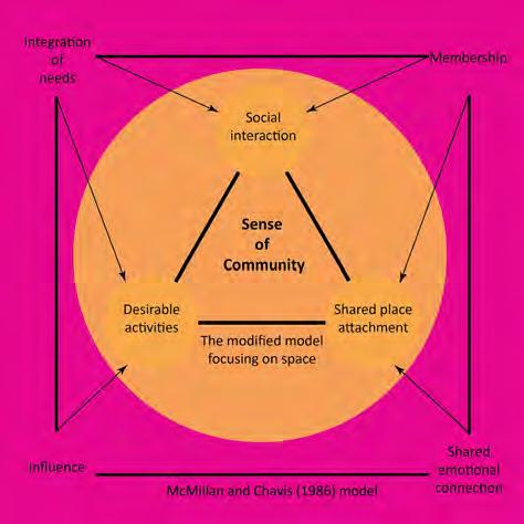
As qualitative methods are lacking in the study of SOC and space, interviews and observations are conducted in this research. Two public spaces in the old district of Kwun Tong in Hong Kong are chosen for case study: one representing the traditional type of urban park emerging in Hong Kong in the 1970s, and another one designed jointly by experts and residents in 2009. Interviews are conducted with the residents found in the sites to discuss about the quality of the space and how they experience community in the space. The responses are analysed according to the indicators in the theoretical model (figure 1), formed by modifying a range of literatures critically.
The paper finds out that some aspects of quality are more relevant to SOC, which are landscape, amenities, and the perception of comfort. However, the causality
between these elements and SOC are not guaranteed, as it is intervened by individual and socio-political factors. Nonetheless, it gives insights to planner and designers into how to manipulate these elements to foster SOC. The analysis also shows that the SOC components have varying degrees of relevance to public space quality in the case of Hong Kong. Social interaction is the most relevant to quality of space, followed by desirable activities, and shared place attachment the least. While the results may only apply to Hong Kong, the theoretical framework that elaborates quality of space and SOC and the model to evaluate SOC specifically in relation to space (figure 2) can be employed in similar research.
73
The Role and Effectiveness of Urban Design Guidance
in Urban Regeneration-Case Studies of Rochester Riverside and South Fulham Riverside.
Yuci Huang
yuci.huang.16@ucl.ac.uk
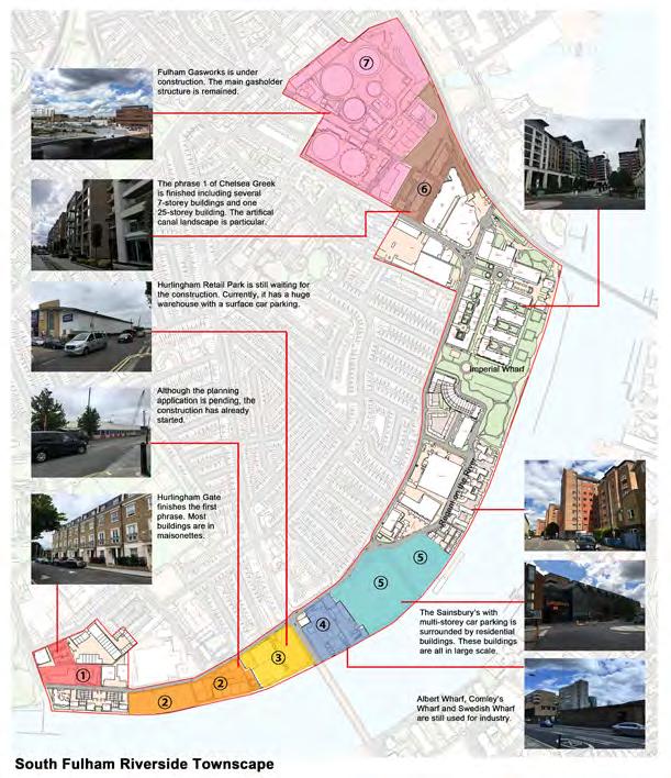
Urban design has been highlighted Towards an Urban Renaissance, and urban governance is becoming a significant tool in the contemporary urban regeneration process. Therefore, it is important to focus on the study of urban design guidance in urban regeneration. This paper uses the two cases of Rochester Riverside and South Fulham Riverside projects which adopted their urban design guidance after 2010, to focus on the role and effectiveness of urban design guidance in urban regeneration According to the literature review, the following hypothesis is set: urban design guidance could facilitate the realisation of more successful urban regeneration processes by enhancing physical, economic
and social outcomes. In order to prove this hypothesis, this paper examines the preparation, formulation, implementation and outcomes of urban design guidance in both two cases based on the Cowan’s urban design guidance checklist. It not only examines the urban design guidance itself, but also figures out the external factors and elements which will influence the role and effectiveness of urban design guidance in urban regeneration. This research is a new attempt, linking the urban design guidance which is mostly used as a tool in the policy making process with its actual outcomes in the urban regeneration projects.
74
75
How can historical built environment be successfully readapted to serve the contemporary needs, while still maintaining its heritage value and distinctiveness?
The case of extension to Tate Modern.
Magdalena Jakubowska
magdalena.jakubowska.13@ucl.ac.uk
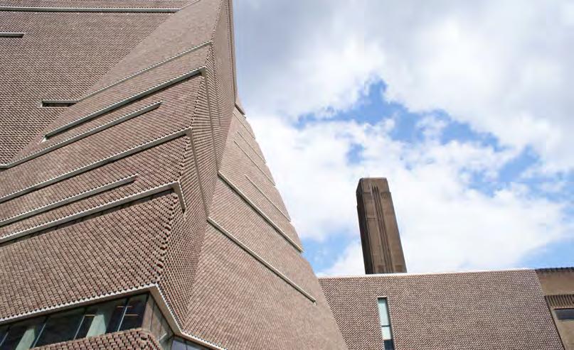
The research aims to identify how the case study of Tate Modern can contribute to existing knowledge on the topic of urban conservation, through the analysis of the adaptation process of the former Bankside Power Station into a museum of contemporary art. Moreover, the research scrutinises the extent to which the recent extension to the museum, the Switch House, has been designed and built while respecting the urban form of the former power station and the surrounding area of Southwark’s riverside.
The innovative approach resulting in the Southwark Council to issue a Certificate of Immunity from Listing rendered the process of readaptation possible. While this might have posed a threat to the originality and authenticity of the Bankside Power Station, it has saved the industrial legacy of Bankside, and contributed to the economic development of the area. Although the Switch House tends to respect the original building with regard to the retention of the architectural features, including its height and massing, it also, to some extent, failed
76
to respond to the wider environment, in ways that include the street-level interactions and the privacy of residents in the nearby Neo Bankside development.
The research methodology included interviews with actors involved in both the readaptation of the Bankside Power Station and the design process of the Switch House. Moreover, observations and photographic evidence have been gathered to support the arguments presented in the analysis. An important part of the findings was the examination of the planning documents submitted to Southwark Council. Objective understanding of the process, and the establishment of a timeline of actions are direct products of this process.
The research has showcased the innovative approach that has been taken to transform a disused power station into one of the most famous museums of contemporary art in the world. Although some may say that the project is inauthentic, and the Switch House did not respond to the neighbouring areas well, including the poor street-level interaction the building has with the area, the former Bankside Power Station is still an important historical building on the London’s skyline, being a reminiscence of the area’s industrial past.
It is hoped that this research may influence the general thinking on conservation practice and help to generate a new way of responding to the historical environment.

77
Towards a happier commute: The design characteristics of metro station and journey experience
Hei Lau
hei.lau.16@ucl.ac.uk
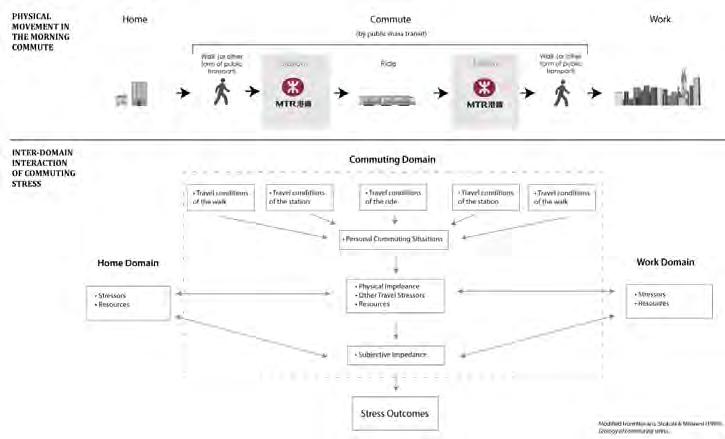
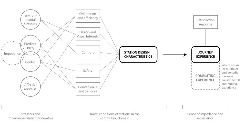
Commuting stress is considered to a major urban problem in cities around the world, regardless the commuting mode. In an East Asian context where most commuters use metro, this study examined how metro stations, as a common venue where many of commuters pass through, can be improved to deliver better journey experience and hence reduce commuting stress. Previous literature suggests that impedance and stressors are the main source of commuting stress, however, research is lacking in some journey episodes such as metro stations.
The research sought to answer two questions: what are the preferred design characteristics in station; and how do station design characteristics affect trip-makers’ satisfaction of the station. Case studies of two stations in Hong Kong were conducted. Key station design characteristics were identified to form an evaluation framework. Structured questionnaires and interviews were used to collect data at the stations to examine journey satisfaction and attitude of trip-makers towards the identified design characteristics.
78
Outcomes from this research indicate that station designs do have an impact on journey experience, though some design characteristic are more powerful than the other. Trip-makers in Hong Kong are more concerned with efficiency, comfort and safety while they use metro stations. Inferring from the rating differences between the two investigated stations, trip-makers prefer stations to have entrances of better aesthetic quality, natural lighting, exterior view, artworks, less crowds, good
temperature control, and easily reachable customer services. In addition, other design characteristics, such as inclusion of natural elements, natural light and exterior view in stations are also recommended to heighten their journey experience.
79
The impact of urban green space sizes on happiness in compact central business district: A case study of Bank and Canary Wharf, London.
Amy Mak
pui.mak.16@ucl.ac.uk
The benefit of urban green space (UGS) on human health and well-being is well-established by previous research. UGS is beneficial to both physical and mental health by promoting physical activity and creating a restorative environment. In addition, the important role that nature plays in human life has led Wilson (1984) to propose the Biophilia thesis. He suggests that as nature has provided our ancestors with resources for survival, green spaces could be thought of as a new way humans could have their primary needs fulfilled by connecting and experiencing nature in the midst of the cityscape. Later studies also support that people would feel happy and improve their psychological well-being when they visit green spaces. Moreover, psychologists have given evidence that a lack of exposure to nature could lead to unhealthy results such as nature deficit disorder, and its effect includes obesity, depression and myopia.
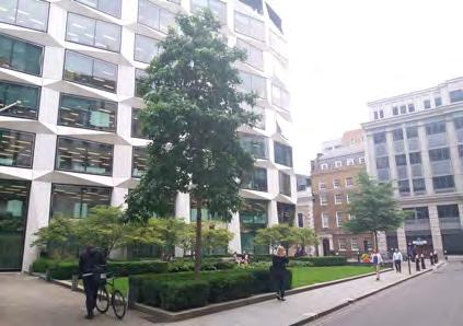
As urbanisation increases, coupled with planning policies of densification in city centres, the removal of green space from people’s workplace accelerates, especially in cities that are developing or with the limited developable land, like Shanghai and Hong Kong. However, people may feel unhappy while working due to stress, unhealthy working environment, and lack of social interaction. An unhappy workforce might result in a reduction in productivity, attention, and motivation causing economic loss. It is, therefore, crucial to provide UGS in workplace ensuring daily exposure to nature as not everyone have access to green-space near their home. My study, therefore, aims to provide an insight on how to optimise the delivery of UGS in compact CBD. The study uses Bank and Canary Wharf as case study subjects. Data is collected by using questionnaire and is then analysed using regression model.
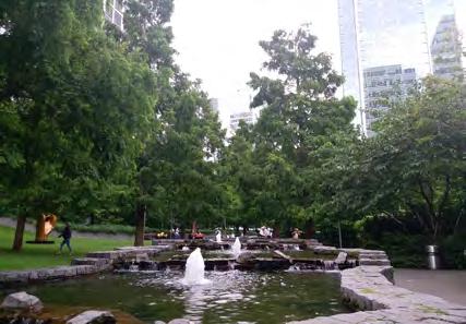
80
The result shows that people are generally happier after visiting UGS. However, sizes of UGS are designed to encourage certain types of activities which then affect happiness.
Small UGS is more likely to be seen as a destination for stationary activities than large UGS and large UGS is more likely to be incorporated in the daily route to work
than small UGS. Furthermore, the longer the person stays in large UGS, the happier one is. Additionally, the result suggests that socialising is a significant variable in explaining the increase in happiness, regardless the size of the UGS.
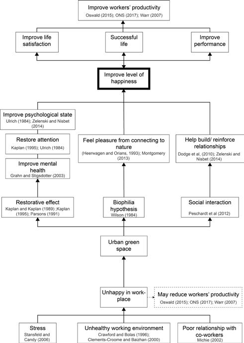
81
Empowerment in Participatory Planning Processes: a Case for Civic Crowdfunding?
Agatha Morris
agatha.morris.16@ucl.ac.uk
Platforms facilitating citizen-led civic improvement projects have emerged independent of government mechanisms due to dissatisfaction with formal processes of participation in planning, a lack of change where citizens believe it is needed, and reductions in public spending.
Civic crowdfunding – the pooling together of donations from members of the public, organisations, grant-giving bodies and government – is a means through which citizens can fund and thus deliver solutions to civic problems. This necessitates a shift in power from planning ‘professionals’ who traditionally define problems in civic space, and develop, design and deliver solutions to these problems, to the public. Whether this shift in power is felt by users of the UK-based civic crowdfunding platform Spacehive is the subject of this research. Case studies of successfully crowdfunded
civic projects and semi-structured interviews with initiators of these projects, reveal that involvement in civic crowdfunding can change the amount of power citizens feel they have to shape civic space.
This change is firmly grounded in feelings of empowerment rather than disempowerment, due to restructuring the relationship between citizens and local authorities, and having increased control over and ability to decide upon and deliver local area improvements.
82
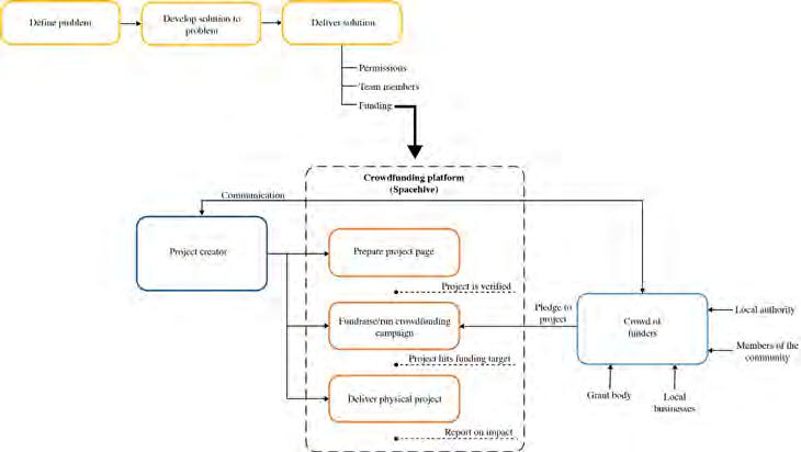
83
Between heritage conservation and sinicisation, the controversial renovation of Kashgar Old Town.
Guillaume Rey g.rey.12@ucl.ac.uk
Kashgar, the case study of this research, is part of the Xinjiang Uyghur Autonomous Region (XUAR) and is home to the Uyghurs, a Muslim Turkic ethnic minority with a rich heritage. The old centre of Kashgar, Kashgar Old Town, is believed to be one of the best-preserved example of traditional Islamic city in Central Asia.
The research investigated the renovation of this old town. It aimed to assess whether the reported alteration of built heritage in the city is a by-product of modernisation, or reflects a State-sanctioned policy to dilute the Uyghur culture as part of a wider sinicisation agenda.
Based on the literature review, the researcher assumed that the claims of sinicisation, whereby the Uyghur culture is being altered or erased for political reasons, presents a rigid dichotomy between a minority society and an authoritarian state. This gives the analysis of the transformation of the urban environment a distinctly political flavour, when there might be more than political forces influencing the Uyghur built heritage.
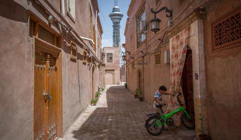
84
In an attempt to move away from this bias, materials and insights from both Chinese and Western sources were used.
The research was designed around the use of primary data, including discussions with experts, residents and tourists, as well as with architects involved in the renovation scheme. Primary data was combined with analysis of planning documents, observations and photographic evidence. This combination of data enabled to understand the decision-making process behind the renovation of Kashgar Old Town, as well as its implementation and the subsequent impact on the built heritage. The results from this study revealed that while the renovation of Kashgar Old Town was successful from both an architectural and social point of view, it disclosed a potential for sinicisation, not revealed by heritage destruction but rather by heritage manipu-
lation, whereby Uyghur heritage is utilised to reinforce the legitimacy of the State.
The research is hoped to shed light on the renovation of Kashgar Old Town, explore the concept of sinicisation in the context of urban transformations in XUAR, and illustrate ways in which built heritage can be manipulated for political purposes. Finally, it contributes to the debate on the challenge of balancing urban development with built heritage conservation.
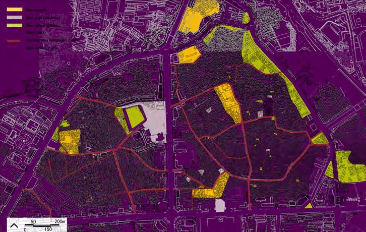
85
From Industry to Greenery: Exploring How Users Experience the Regent’s Canal in Relation to its Spatial Attributes
Yarden Woolf
yarden.woolf.16@ucl.ac.uk
The way users experience public places has long stood in the heart of urban design. However, there are ongoing debates as to how to define experience and which spatial attributes of public places shape and affect it. Various studies addressed this gap in the context of common types of public places, such as parks and streets, while overlooking newer ones, such as
post-industrial canals. Previous studies also tend to focus on one dimension of experience at a time, ignoring its complex and individual nature. This research addresses these gaps by exploring how users experience the Regent’s Canal in relation to its spatial attributes, with a focus on individual experience.
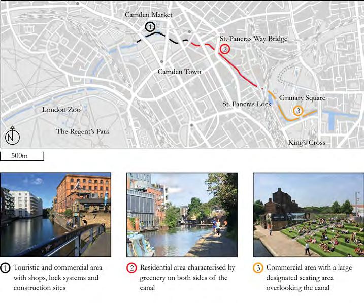
86
The study proposes a research framework that includes a multidimensional definition of experience and applies it to a single case study of the Regent’s Canal in London. Observation and walking interviews are adopted as research methods to collect qualitative data about the way users experience the canal. These are complimented by secondary data, such as maps, and information from relevant bodies, such as The Canal and River Trust and the London Canal Museum. Interviewees were chosen to reflect different users of the canal, such as joggers, cyclists, walkers, individuals and families. They were all people who live in the London area and use the canal regularly.
Findings reveal that the canal’s spatial attributes have a significant impact on the way users experience it. In particular, the findings illustrate which spatial attributes of
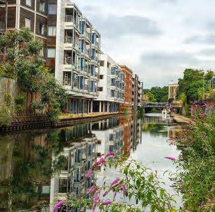
the canal affect each of the dimensions of experience. The canal’s location affected the way people used it, and the activities users performed in it. The canal’s natural elements influenced both the sensory and emotional dimensions, suggesting they are strongly related. Findings also show that the form of the canal was the most dominant factor which influenced all three key dimensions of experience. The canal’s spatial attributes make it a successful and flexible public place that transforms from a transportation route during weekdays to a vibrant recreational place on weekends. Also, the spatial attributes of the Regent’s Canal demonstrate the complexity of experience and the need to research it from an individual perspective, contributing to current debates in literature.
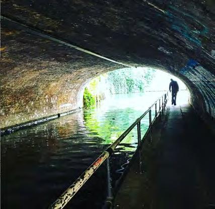
87
88

2016/17 ISSN 2399-5254


 by David Liang
 by Martin Garcia Chavez


