2022/2023
The Bartlett School Of Planning, UCL ISSN 2399-5254

2022/2023
The Bartlett School Of Planning, UCL ISSN 2399-5254

Layers of the City: An Exhibition by MSc Urban Design and City Planning
The Bartlett School of Planning, UCL
Programme Catalogue
2022 / 2023
ISSN 2399-5254
Coordination team of the exhibition and catalogue:
Bowie Yung
Fiera Alifa
Hana Younes
Pablo Sendra
Paullomi Raja
Roby Robbany
Scarlett Waller
Skye Langmuir
Cover design:
Roby Robbany
Programme Director:
Pablo Sendra
Programme Administrator:
Yvonne Sibblies
Module Coordinators:
Elena Besussi
Fangzhu Zhang
Filipa Wunderlich
Juliana Martins
Matthew Carmona
Pablo Sendra
Paula Morais
Peter Rees
Richard Simmons
Module Staff and Tutors:
Bahar Drinkwater
Becky Mumford
Bianca Maria Nardella
Colin Haylock
Dimitrios Panayotopoulos-Tsiros
Efstathia Kostopoulou
Elena Besussi
Fabio Santos
Hanadi Samhan
Jingyi Zhu
Juliana Martins
Julie Plichon
Leo Hammond
Mat Proctor
Matthew Carmona
Matthew Wong
Melissa Barrientos
Mengci Xiao
Omar Sherif
Pablo Sendra
Paula Morais
Peter Rees
Raj Rooprai
Sonja Baralic
Stephen Marshall
Terpsi Laopoulou
Tse-Hui Teh
Valentina Giordano
Wendy Clarke
Zahira El Nazer
Zulfikar Putra
Dissertation Supervisors:
Matthew Carmona
Valentina Giordano
Juliana Martins
Major Research Project Supervisors:
Joost Beunderman
Ming Cheng
Elad Eisentein
Kathryn Firth
Colin Haylock
Judith Loesing
Chris Martin
Lucía Morato
Peter Rees
Neha Tayal
Elanor Warwick
Matthias Wunderlich
Adi Wiratama Banjarnahor
Anika Ananna
Anna Baxter
Ashley Ng
Ben Chan
Beth Hughes
Bowie Yung
Cameron Cooke
Chaemin Yoo
Christopher Lee
Christos Petrou
Daniel Lui
Diran Shalabana
Fiera Alifa
Hana Younes
Hillary Chow
Howell Hui
Jacqueline Lau
Jake Snooks
Jiacheng Liu
Joe Chan
Kexin Xu
Kirstie Brittain
Krystal Lyu
Laura Bucero Descalzo
Laurie Edwards
Liz Gulino Torres
Luke Tassell
Luyao Wang
Mahmoud Sahmoud
Marie Kaune
Max Charles
Meng Xue
Michelle Lin
Muhamad Daniel Aizat Hj Abd Rahman
Myranda Morrison
Ningna Song
Nora Nanova
Paco Poon
Paullomi Raja
Renee Blain
Roby Robbany
Ryan Leung
Ryan Shean
Saheel Birewar
Sanjana Harkawat
Scarlett Waller
Skye Langmuir
Susherrie Suki
Theodora Shum
Tin Wai Chan
Vanessa Wang
Wesley Wong
Xiaoqing Mo
Xiaoyu Yu
Yutian Han
Zayn Abdallah
Zoe Brown
The MSc Urban Design and City Planning is a globally unique masters programme at one of the world’s leading institutions in the study of the built environment, building upon a recognised long-term urban design research specialisation of the Bartlett School of Planning.
The programme seeks to address key challenges in planning through the lenses of urban dsign, equipping students with creative problem solving abilities that are in high demand in the world of practice. Students are recruited from across the globe with a broad range of and have backgrounds in terms of first degree and who have a diversity of interests in undertaking the programme. Likewise, staff who teach on the programme come from across the globe and have backgrounds in urban planning, urban design, conservation, architecture and public administration. The intersection of these interests leads to a highly creative and dynamic environment for the students to explore some of the key challenges facing built environment professionals.
This catalogue first introduces the taught modules at the MSc in Urban Design and City Planning, illustrating them with examples of student coursework. The catalogue then presents a seleciton of final major research projects and dissertations where students carry out in-depth explorations of a complex topic or research problem that synthesises each student’s specific interests developed throughout the year. The major research project focuses on a particular site, method or process and is propositional - delivering a vision and working it out in depth so as to
exhibit its potential, while also reflecting upon its limitations. The dissertation is an analytical and reflective project undertaken with a deep engagement with methodologies to illuminate a key issue in our fields. These final projects are organised into six categories within the catalogue, drawing on the topics of adaptability, movement, housing, public space, people and sustainability.
What follows is a celebration of the class of 2022-2023 and their work, and records the outstanding level of excellence of the students on the MSc Urban Design and City Planning programme at the Bartlett School of Planning, UCL.
“LAYERS
Throughout the course, we have rigorously analysed the different layers that make up a city. We present our work here through the lenses of people, movement, adaptability, sustainability, public space and housing.
Urban Design: Layout, Density, Typology
BPLN0056
Urban Design: Placemaking
BPLN0042
City Planning
BPLN0035
BPLN0056
Coordinator: Paula Morais
Tutors:
Prof. Stephen Marshall, Dr. Juliana Martins, Dr. Tse-Hui Teh, Omar Sherif
This module is the first part of the Urban Design Specialism at the Bartlett School of Planning. It provides an opportunity to critically investigate the spatial characteristics and qualities of the built environment, with a focus on exploring and testing urban form and density in the development of design proposals. This project-based module aims to develop knowledge and a range of skills for carrying out urban design investigations and proposals. It is complemented by the second module in the specialism (BPLN0057) which focuses on design as a tool of public policy, through guidance, incentive and control.
Understanding the characteristics of the urban spatial structure, density and built form (at several scales) is at the core of the Urban Design discipline. Studies of the morphological dimension of urban settlements have expanded our understanding of processes of urban change and historical development, identified the basic elements of urban form and space (such as street and block pattern, plots, buildings, and open natural spaces) and the inter-relationships between these, and explored the impact of different spatial configurations and urban building types. Hence, this module
explores this interface between knowledge drawn from the existing urban tissue and its application in designing space.
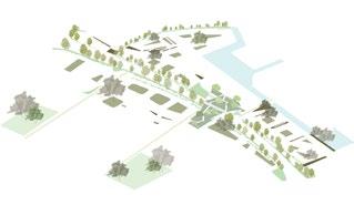
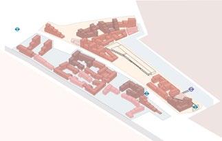
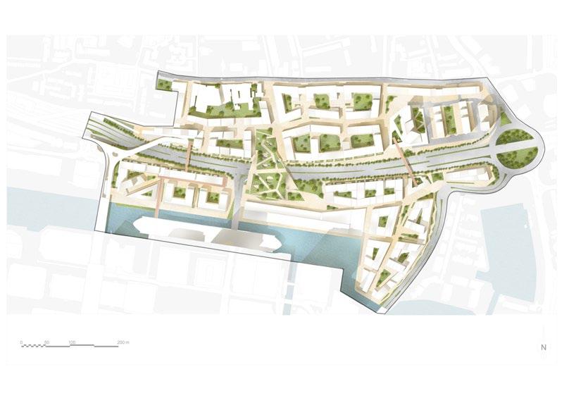
Specialism module 1 is thus organized in two parts: an analytical stage and a design stage. Students will work individually and in teams and will be asked to produce an urban design proposal for the Billingsgate Fish Market and South Poplar area in London, which aims to foster a critical dialogue between the multiple dimensions of urban design and current London planning and development contexts with




BPLN0042
Coordinator: Professor Matthew Carmona
Tutors: Wendy Clarke, Matthew Wong, Efstathia Kostopoulou, Juliana Martins, Valentina Giordano, Raj Rooprai, Paula Morais, Melissa Barrientos, Jingyi
Zhu, Leo hammond, Zahira El Nazer
This course drew on the extensive theoretical underpinning of urban design as a means to explore approaches to appraise the character of the built environment, and, as a result, to forward practical and even visionary proposals focussed in the quality and liveability of urban space as a key contribution to sustainable place making.
The course used the method of ‘place critique’ in which we take the time to learn from existing developments – how they are successful and how they are not – in order to more successfully shape places in the future.
The module provided students with an introductory yet comprehensive overview of urban design theory. It also offered an opportunity to turn urban design theory into practice through the completion of one project in two parts. The first encompassed a deep analytical dive into a particular project, with different groups taking different recently completed developments in London. The second focussed on proposing a series of creative interventions to these same projects in order to understand how we could learn from each place and, in an ideal world, re-
shape them for the better.
The projects chosen were each systematically analysed against the six substantive dimensions of urban design covered in the lecture programme, while tutorials focussed on what this meant in the context of each environment. Sharing the analysis and proposals allowed groups to learn from each other and demonstrated the variety of challenges and opportunities we face when shaping cities.
How
The Core as a focal point of the development
Stepped open space that connects places and the community

GROUND
LOWER GROUND

uneven topograa landscape. common space for

GROUND

space

community cafe where resident volunevents. It will socialise whilst over-


Stepped terraces can be used to mitigate the effects of uneven topography by allowing people to move between different levels of a landscape. It can also foster a sense of community by providing a common space for people to gather, socialise and interact.
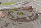
This strategy creates a new green bridge crossing the lake in a park that is currently underutilised. It serves as a new landmark to enhance legibility, and also improving connectivity towards the central plaza and community centre area. Car access and parking are replaced by other active uses to
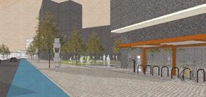
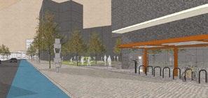

This strategy creates a new green bridge crossing the lake in a park that is currently underutilised. It serves as a new landmark to enhance legibility, and also improving connectivity towards the central plaza and community centre area. Car access and parking are replaced by other active uses to create more pleasant and human-centred walking experience.


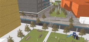
The Barking Riverside Bike Repair Cafe will act as a community cafe where cyclists can store and repair their bikes, and it will be run by resident volunteers. Profits will go towards community organisations and events. It will also act as a point of gathering where residents can socialise whilst overlooking the green space.


The central plaza will provide a range of amenities including general practitioner services and restaurants. We anticipate that these animated frontages will increase the attractiveness of the central hub. The facade of the community centre will be redesigned by referencing the industrial past of the area to enhance its heritage value and uniqueness.


The central plaza will provide a range of amenities including general practitioner services and restaurants. We anticipate that these animated frontages will increase the attractiveness of the central hub. The facade of the community centre will be redesigned by referencing the industrial past of the
to

and





Coordinator:
Dr. Richard Simmons Tutors: Hanadi Samhan, Zulfikar PutraThe aim of the module is to introduce students to the practice of city planning. It enables students to develop a sound understanding of the purpose and goals of city planning, how it is practised, how it differs from urban design, what principal issues city planning has to deal with, and introduce key structures, techniques and methods used to produce its plans.
By the end of the module, students should:
• Understand important elements of planning theory and practice to enable them to participate fully in the discourse of city planning;
• Have a working knowledge of the main goals of city planning;
• Be aware of the key issues facing city planning in the 21st Century;
• Be able to discuss a selection of city planning’s tools, techniques, structures and practices in an informed way;
• Understand why city planners approach the preparation, writing and delivery of plans in the way that they do;
• Be aware of some of the differences between how city planning is approached in different cultures and polities;
• Form judgements about the value of planning and the alternatives to it
The lectures discuss issues which face city planning, some of the principal tools and techniques that it uses, and the ways in which they are applied. Each seminar, in turn, is structured around students’ critical engagement with set readings. The course is assessed based on seminar participation, an essay on a selected topic and an exam.
Critical Debates in Urban Design
BPLN0032
Collaborative City Planning Strategies
BPLN0033
Sustainable futures
BPLN0034
Urban Design: Guidance, Incentive and Control
BPLN0057
BPLN0032
Coordinator:
Juliana MartinsTutors: Bahar Drinkwater, Dimitrios Panayotopoulos-Tsiros, Terpsi Laopoulou
Urban design is a field of knowledge where theory and practice are closely related. A ‘Critical’ knowledge of theory together with analytical practices are the necessary foundations for applied urban design that can shape the spaces of the city in a meaningful way. Urban design theory supports and informs urban design practice in many ways. It raises awareness and provides a more robust understanding of present-day spatial and social problems in cities, can provide a rationale for creative urban design approaches, and can assist analytical practices by providing methodological approaches for urban analysis, drawing on urban design and other related fields of research.
Urban design theory covers a wide field with no clear boundaries and strays into various others disciplines such as architecture and social sciences. The multi-disciplinary nature of urban design, the close interrelation of theory and practice, and its ‘wicked’ subject underpin the complex field of urban design knowledge.
A conscious debate is necessary to keep the field moving and to help constantly redefine and calibrate urban design theory and practice approaches.
This course invites students to explore the field of urban design knowledge. It will give an insight into the complex and contested nature of urban design theory and encourage students to construct their own understandings of topics and rationale for urban design interventions. Rather than assimilating facts, students will be learning to critically think and debate urban design, and contribute to the constant evolution and upgrading of urban design knowledge.
Urban Design as a field of knowledge and research by Dr Juliana Martins
Precarity of refugees: the case of Basmane-Izmir, Turkey by Dr Bahar Durmaz-Drinkwater
Research by Design / Research in Practice by Dr Juliana Martins
Panel discussion: The future of urban design theory - emergent questions and debates with Lawrence Barth, Kathryn Firth and Lily Moodey
SEMINAR A
The Nature and Role of Urban Design
SEMINAR B
Streets & Blocks: Qualities of Urban Design
SEMINAR C
Public Space: Social Dimensions
SEMINAR D
Mix: Spatial and Social Perspectives
SEMINAR E
Place: Perception and Experience
Tutors:
Hanadi Samhan, Bianca Maria NardellaThis module brings together community groups and planning students in the coproduction of planning knowledge. It defines co-production as a process of collaboration between different experts: communities and future planners, which has the intent to transform pre-existing understanding of the position and expertise that both parties represent.
This year’s project focuses on the preparation of a planning brief for a large area in a central London Borough (Hackney). The students’ proposal will need to respond to the outcomes of a community-led survey, identify indicators of social value, outline a planning brief that explores how planning can provide guidance to a development that positively address locally articulated needs and use social impact assessment methods to corroborate the proposed planning guidance.
A key aspect of this project is the critical analysis and challenge to mainstream assumptions of what constitute value in planning.
The module is assessed by the submission of one group report. The project leading to the preparation of the report is organised in two stages.
In Stage 1 students will:
1. Collection and analyse data and other qualitative information to identify local community priorities and social values
2. Design social impact indicators and social impact assessment tools based on community priorities 3. Measure the social impacts (via social impact assessment) of council’s strategies on indicators of “social value” (as defined above).
In Stage 2 students will:
1. Translate community priorities into core planning objectives and planning parameters
2. Prepare a planning document for allocated area which incorporates the planning parameters into policy guidance for future development.
3. Evaluate of the proposed planning guidance by application of the social impact assessment tool developed in stage 1.
4. Provide recommendations for MOPS’ current campaign.


“The



BPLN0034
Coordinator: Dr. Pablo Sentra
Tutors: Julie Plichon, Sonja Baralic, Becky Mumford and Tse-Hui Teh
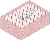
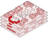
This module provides students with a holistic approach to all the aspects of sustainability: social, cultural, economic and environmental. Students will reflect on possible sustainable future cities by addressing issues that are currently at the forefront of the debate on urban design and city planning: how to make the city more inclusive, collaborative, consume less resources, interact with nature, address the challenges of climate change and, at the same time, strengthen its design and maintain its heritage.
The module combines design and theoretical reflection through a series of lectures, workshops and design proposals.
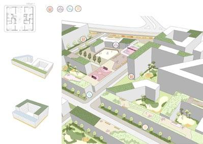
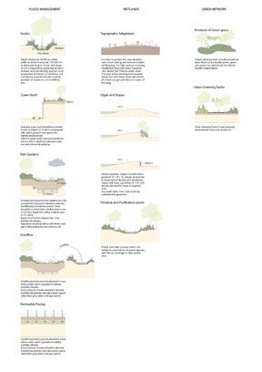
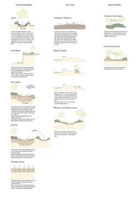
There were two assessments. The proposal were for the Wandle Valley in South London. The first one was an A3 portfolio with the three workshops. The second one was one A1 poster and a 500word essay in an A4. Both assessments were done individually.
The key topics discussed were sustainable futures, actions to tackle climate change, co-operative strategies, and finally sustainable vision for the future.




BPLN0057
Coordinator: Professor Matthew Carmona
Tutors:
Wendy Clarke, Mat Proctor, Valentine Giordano, Colin Haylock
This module explored the role of government in intervening to secure a better designed built environment, one that will return greater value to its users over time. Increasingly governments around the world, both national and local, are waking up to their responsibilities in this regard and have been exploring the range of tools at their disposal through which to both define and implement clear public design aspirations on urban design.
To explore the governance of design, lectures examined both the theoretical case for, and challenges associated with, urban design as a focus for public policy as well as the different tools of urban design governance and their purpose, scope, means and effectiveness. Learning was reinforced through a single group project in two parts.
The first part of the project involved a quick-fire collective analysis in which the whole year analysed different aspects of the chosen area and shared their results with each other. The second stage focussed on the preparation of an urban design code for this large and complex site in London. Tutors worked with groups during the designated studio periods to conduct their analysis and develop and refine their design proposals.






DESIGN AND REAL ESTATE
BPLN0031
BPLN0057
Coordinator: Professor Peter Rees
Tutors: Mengci Xiao, Fabio Santos
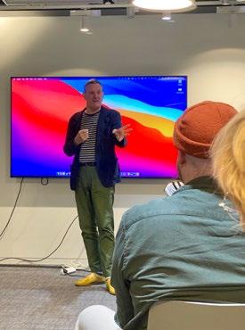
The best examples of British urban regeneration are created by collaboration between the development industry, architects and local planners. Through site visits, presentations and critical interrogation, we learn how this is achieved. The absence of municipal master planning in the UK creates opportunity and flexibility for the development sector but requires unique planning skills to shape projects and represent the needs of the community.
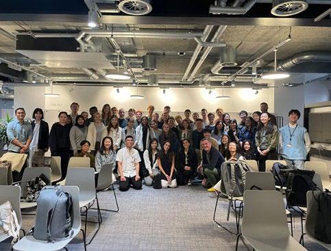
Students visit areas of major commercial regeneration in Central London and receive presentations from senior property professionals, architects and planners. The course covers key elements of masterplanning, architectural design, real estate and project management, which combine to produce major development projects in London, a world business city.
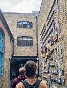
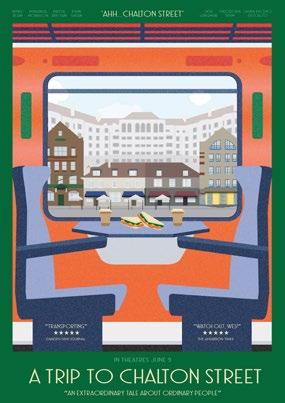
Students are awakened to their natural, often latent, sensitivities to the form and character of places, in preparation for future careers in the footsteps of the practitioners they meet. The “openbrief” project provides an opportunity to sharpen these senses and allow students to bring their diverse skills to bear on the challenge of place-making.
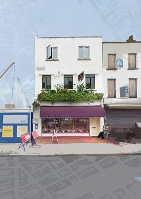
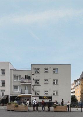
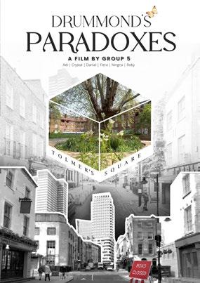
Student groups are assigned a Central London to identify the unique set of characteristics that form its identity as a place. This activity is complimented by gathering information on the location including (but not limited to) significant real estate proposals and local planning policies relating to the neighbourhood. These studies will culminate in a team presentation, illustrating the key characteristics of the area, and its potential, to a panel of development professionals at the final session. The need for a combination of creative teamworking and concise presentation mirrors the “real world” of real estate.






BPLN0052
DISSERTATION IN PLANNING
BPLN0039
BPLN0052
Coordinator: Dr. Filipa Wunderlich
Supervisors:
Ming Cheng, Ela Eisentein, Colin Haylock, Judith Loesing, Chris Martin, Peter Rees, Neha Tayal, Elanor Warwick, Matthias Wunderlich
To complete the MSc Urban Design and City Planning programme, students are given the option to submit a Major Research Project. This project typically focuses on a key area of knowledge covered in the programme, eg. urban design, urban design guidance and control, housing and development, sustainable urban design, sustainable transport, or other.
A Major Research Project represents an in-depth exploration of a complex topic / problem. It is a demonstration of knowledge, a critique, and the application of this knowledge and critique into a project. The project will focus on a particular site, method or process and will be propositional, delivering a vision, and working it out in depth so as to exhibit its potential, but also reflect upon its limitations. The major project should embrace the complexity of the chosen topic and apply knowledge in a critical and reflective manner.
Students will be assigned a practice-based supervisor from amongst consultatns working within the Sustainable Urbanism
and Planning, Design and Development fields. This year, students were supervised by professionals working in consultancies that included: Urban Initiatives Studio, Urban Architecture, Urban Movement, East Urban Design Landscape Architects, Haylock Planning and Design, Clarion Housing Group.
All students have 4 individual face-toface supervision meetings to discuss their project with their practice-based supervisors, and 2 workshops, in which students will need to present their project and will receive feedback from across the team of supervisors and students involved in this Major Research Project route.
Supervisors:
Juliana Martins, Matthew Carmona, Valentina GiordanoTo complete the MSc Urban Design and City Planning programme, students can also choose to submit a dissertation. The dissertation represents an academic research study of a specified topic. Students will normally draw from available theory or debates on a particular subject and submit them to a critical analysis based on a review of the literature and the gatjering and interpretation of primary and / or secondary data. Primary data is information collected by the students for the specific purpose of the research. This entails the use of case-studies and the methods of surveys, interviews, and or direct observations. Secondary data is information which is readily available, documents, reports, databases, and others. Students will most often concentrate on the use of primary data in order to practice, put into action and demonstrate their fieldwork research skills and complement this with secondary data when pertinent.
Overall, the dissertation develops students’ research skills and abilities, offering them the opportunity to follow a rigorous academic programme and think
through and design their own research strategy; as much as it allows students to explore - in depth - a particular and usually complex area and / or question covered in the course and some of its specialist teaching. The student demonstrates abilities in research topic design, execution and presentation and a capacity for in-depth critical thinking in their chosen area of study. This is the culmination of their MSc programme, a major and largely selfmanaged study, where students put into practice and synthesise what he or she has gained from the course. The dissertation is something students take with them, and use to demonstrate their expertise in a particular urban design / planning related subject, launching the next stage of their career.
“LAYERS
Throughout the course, we have rigorously analysed the different layers that make up a city. We present our work here through the lenses of people, movement, adaptability, sustainability, public space and housing.
The built environment echoes with the threads of a settlement’s legacy, carries the whispers of time. The projects explores the intricate resilience to finds its home in the sanctuary of the sturdy walls.
People make the city. These projects look at how the city can become a more inclusive, welcoming, safer and healthier place for the people that live, work and visit.
Ease of movement is central to a well-functioning city. These projects explore patterns of movement and propose potential solutions to improve people’s journeys across the city.
These projects illuminate the city’s transformation, erasing the boundaries between nature and urban living. They infuse vitality into empty spaces, foster vibrant communities, and bolster resilience.
Across diverse urban landscapes, our surroundings have mirrored our journeys. These projects explore reshaping urban neighborhoods, embracing inclusivity, and reimagining public spaces as the soulful pulse of human connection.
In the urban narrative, city stories weave ancient echoes into sustainable design, nurturing green networks, embracing passive structures for a zero-emission, and sowing verdant hope for harmonious future life.
Major Research Project
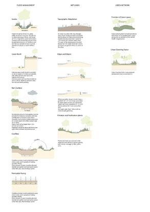
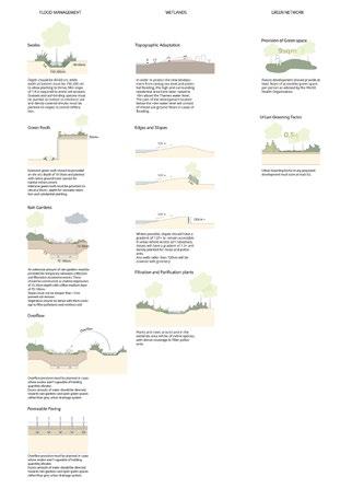
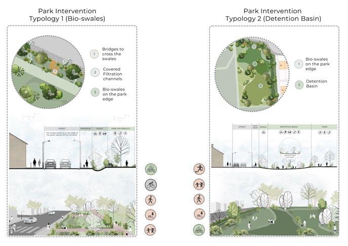
Urbanisation and climate change have altered the urban landscape in recent decades, resulting in a proliferation of impermeable surfaces and increased intense rainfall events. These factors have heightened the hazard of urban flooding in cities worldwide, posing formidable challenges for urban planners and designers. This study critically examines the integration of green and social infrastructure into urban planning and design to mitigate the pressing issue of urban flooding while fostering social cohesion in vulnerable areas.
The study reveals that existing policies and technical guidelines for sustainable stormwater management are primarily geared towards new developments, leaving retrofitting initiatives for existing neighbourhoods unaddressed. While policies acknowledge social dimensions and amenities, no specific guidelines exist for incorporating them into sustainable drainage systems (SuDS). The findings from the precedent study of the research emphasise the significance of contextually-driven Sustainable Drainage Systems initiatives, promoting the need for customised approaches that balance community amenities and environmental enhancements in different contexts.
In response to these findings, the proposed solution introduces a green network framework that conceptualises green spaces as nodes and streets as corridors, integrating social infrastructure to address flooding issues and foster stronger community cohesion. It presents a parameter-based strategy for urban design elements, which facilitates the implementation of adaptable Sustainable Drainage Systems and community amenity interventions tailored to each site’s unique characteristics. The adaptable design methodology has the potential to transform into a pragmatic checklist, enabling the implementation of SuDS interventions in diverse contexts. This study offers a comprehensive analysis of how stormwater management might be improved, focusing on promoting community involvement and ecological welfare guiding urban planners, designers, and academics in developing sustainable urban design principles.
Keywords: Sustainable Drainage System (SuDS), Social Cohesion, NeighbourhoodScale Green Network, Urban Flooding, Sustainable Urban Design Principle.

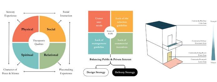
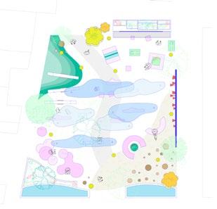
The promotion of mental wellbeing in high dense cities is increasingly concerned as global mental health continues to decline. Therapeutic spaces in everyday contexts are important environments for daily stress recovery and healing. Its development by the public sector is, however, increasingly challenged by the lack of land, budget and management capacity.
Amid the high dense, land hungry and increasingly commercialised urban context, it is questioned whether privately owned public spaces can be curated into therapeutic spaces.
The report structure is twofold. The research and analysis section identifies qualities and strategies for the design and delivery of such spaces. The toolkit design and application section attempt to curate a network of multi-level spaces into therapeutic landscapes. As such, this study aims to raise awareness and provide insights towards designing for better mental wellbeing from the lens of urban design for every urban dweller.

Climate change has increased the frequency and severity of natural disasters, leading to more severe weather events and increased instances of people losing their homes. In response, governments commonly construct temporary post-crisis housing as an interim housing solution for victims, normally designed for periods up to 2 years. In reality, these temporary postcrisis housing developments are often used well beyond their intended lifespans, with residents living in temporary housing for as long as 5-6 years. In many cases, temporary housing built in response to crises do not have clear future uses and are often demolished, raising sustainability and financial critiques around this type of housing solution.
The reality of ‘temporary’ post-crisis housing being used for years on end raises issues revolving around physical and cultural adequacy and liveability. This project aims to investigate how temporary post-crisis housing can be designed with liveability in mind such that these communities can be meaningful components of our cities beyond their role as temporary housing.
Major Research Project
By doing so, cities around the world have an additional, feasible and potentially attractive new housing stock available and reduce waste at the end of crisis recovery programmes. It additionally allows residents of temporary post-crisis housing to enjoy a higher level of liveability and satisfaction during crisis-recovery processes.
This project has undertaken research to bridge the gap between temporary postcrisis housing and liveability, and created a toolkit to guide future design processes of such housing. An application of the toolkit is demonstrated at the end of the project to illustrate how the toolkit can translate into more liveable outcomes.

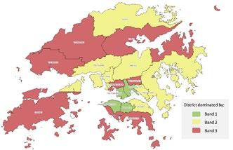
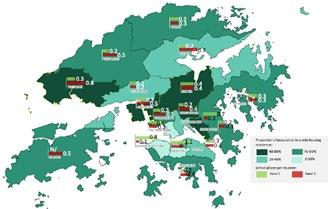
This dissertation explores the intersection of spatial justice, housing, and education in urban environments, with a particular focus on Hong Kong. In a rapidly globalising and financialised world, housing has transformed from a basic human necessity into a privilege that grants access to better living conditions and social capital.
Public housing schemes have emerged as a response to soaring property prices, aiming to provide affordable housing, especially for those who cannot afford the market rates.
However, the effectiveness of public housing in achieving justice, particularly in the context of education, remains a subject of debate. This study employs quantitative case studies to evaluate the relationship between public housing estates and the distribution of secondary schools in Hong Kong, with a keen eye on three key spatial justice indicators: school quality, availability, and accessibility.
Major Research Project
It studies the historical evolution of public housing policies and their impact on housing distribution across the city, contrasting this with the distribution of educational resources. By analysing the geographical data, this research uncovers an inverse correlation between public housing density and access to quality education, shedding light on the spatial dimension of social justice in urban settings. This dissertation contributes to the ongoing discourse on spatial justice and its relevance in the context of public housing and education.

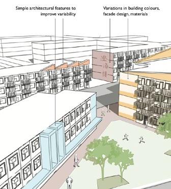
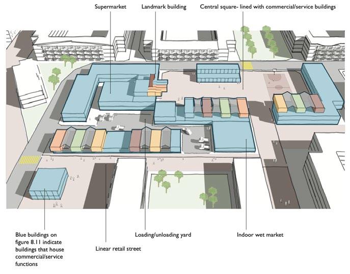
This paper investigates how communal spaces in multi-story developments can be designed to foster social interaction. Multi-story living has a very negative reputation in countries like the UK, where it is seen as the root of many social problems. The government’s response is often to simply redevelop the entire estate, causing other social and environmental issues. To improve the reputation of multi-story living and avoid costly redevelopment schemes, this MRP has developed a toolkit that may help to transform semi-public / public spaces into effective spaces for social interaction.
Through extensive literature review, it is clear that the main barriers to social cohesion are the high turnover rates, small dwelling sizes, and the lack of defensible spaces within multi-story estates and that the communal spaces must be defensible, comfortable, and functional to encourage social interaction. The present study has identified children, stay-at-home parents, the elderly, and people working from home being the main users of communal spaces. Case studies were used to highlight design strategies that can satisfy factors for social interaction and the needs of different user groups.
Based on the key findings, a toolkit was developed. Splitting into overarching principles and a matrix, the toolkit can assist designers to create a more effective communal space that can foster social interaction. This is applied to a section of Aylesbury Estate in Southwark, London, which is currently undergoing a complete estate redevelopment under the New Deal for Communities initiative set up by the New Labour government. This MRP concludes that the toolkit can effectively create the desired communal spaces, but the specifics of the matrix may need to be adjusted according to socioeconomic context and that the success of which relies heavily on the designers’ industry knowledge and their willingness to work in the residents’ best interest.
The number of music venues in the UK’s capital is declining, with one small music venue closing every month on average in the past two years.
Music venues contribute toward the wider music ecology of a place in supporting communities, the local economy and the wider arts and cultural offerings in cities. Existing literature recognises the social value contribution of these venues, though there is little research that explores if this same relationship is evident across the planning process, and if so how it is handled by planning practitioners. Exploring the role of planning and the intricacies of the regulatory process is particularly significant in this context, given that planning has been challenged with the opportunity to alleviate the loss of these music venues primarily through policy interventions, despite there being little understanding of the existing policy context.
This study bridges the gap between policy and practice. How specific areas across the regulatory planning process can be more effective in attending to the current ambiguity connected to social value is also advised in this study. The findings of this research can be used to inform policy makers and music-industry stakeholders on conceptualisations of value to protect and promote music venues in urban settings at threat of redevelopment in the future.
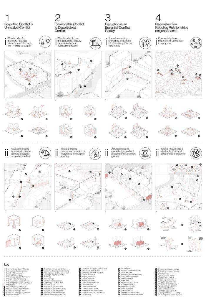
Memories are spatially bound. Monuments, museums, and statues are obvious examples of how a certain, often exclusive, version of the past is projected, remembered, and celebrated through the built environment. Yet, what about the rest of the post-conflict city? What about its everyday, non-memorial spaces produced under reconstruction, regeneration, and urban sprawl? What is their relationship with memory and, if any, how can we more democratically remember the past through them? Interestingly, these questions are especially relevant for wartorn cities in their pre-resolution stage, where the built environment is required to support a multiplicity of competing politics, memories, and aspirations for the contested city.
This study expands the memoryscape of cities by looking at how the design of nonmemorial spaces encourages a productive and inclusive revisiting of the past, one which fuels criticism for the present as well as political action for the future. To do that, it studies such spaces in a set of postconflict cities and proposes 4 principles for a memory-led reconstruction.
Major Research Project
Its principles actively go against both urban design orthodoxy and reconstruction paradigms to advocate for emancipatory possibilities beyond amnesic spaces of beauty, comfort, and calmness. Rather, they embrace an engagement with conflict spaces which is disruptive, uncomfortable, real, and illegible, demanding a conscious effort to be figured out both physically and politically. In that, it argues that conflict should be an unabated part of the healing process. What is ignored is never healed, and what is forgotten is bound to be remain unresolved. Conflict confrontation is thus an essential pre-requisite to conflict resolution. In the words of Austrian poet Rainer Maria Rilke (1996): “Wie viel ist aufzuleiden!” (How much suffering there is to get through!)
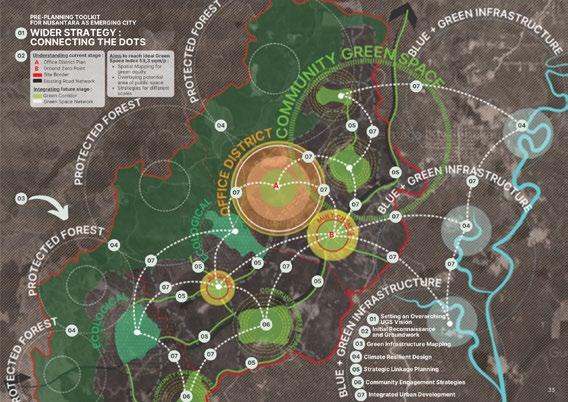
Urban riverfronts present complex design challenges and opportunities for fostering sustainable and socially inclusive revitalization, while aiming to influence the restoration of the city-river harmony to reclaim urban rivers back into society. However, many riverfront redevelopment projects have prioritized economic growth over ecological health and river access. Urban regeneration, often viewed as the solution for improving river spaces, further optimised riverfront corridors as a “by-product” for riverside developments. On the contrary, existing riverside neighbourhoods, such as residential estates, due to a lack of policy guidance and support, have yet to bring attention to its neglected riverfronts.
Investigating through an evidence-based approach with mixed-methods, the study situates in London in an attempt to examines alternatives to conventional large-scale urban regeneration approaches, retrofitting urban riverfront for today and future public interests, integrating concepts such as landscape ecology, human-river interaction, adaptive design, flood-risk consideration, and more.
Key findings demonstrate opportunities for sensitive retrofits and infill to enhance habitat, hydrology, and river access through public-private partnerships and grassroots stewardship initiatives.
This research contributes conceptual design guidance and policy implementation support for riparian owners and stakeholders in riverfront transformation grounded in environmental sustainability, social equity, and participatory local identity. It advances theories and practices for local sustainable neighbourhood riverfront revitalisation.

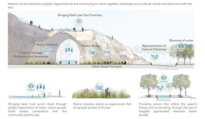
Most Lebanese waterfronts have been disregarded and completely disconnected from the city, affecting the relationship between the public realm, the social community, the city and the sea.
The community’s socio-cultural dialogue and their rooted connection to the sea is slowly fading away, affecting peoples’ sense of belonging while leaving the coastal city with no identity. This is all due to the violation of maritime properties through illegal encroachments and privatized gated coastal developments catering for private interests, which resulted in the lack of provision of public space.
When waterfront projects are supposed to connect the local communities back to the sea, these projects are only repressing them, following commercially led developments that target touristic audience, benefiting private developers.
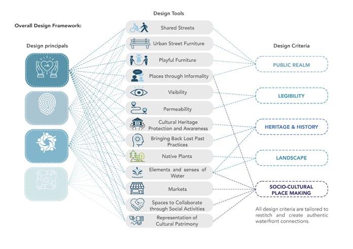
Therefore, this research project works to show the importance of enhancing the socio-cultural community dialogue along the public realm of historic coastal cities, to recover a connected cohesive waterfront.
Major Research Project
This topic has not been appreciated or considered while designing waterfront projects, whereas, it is in these small cherished moments the community has with exchanging experiences, sharing memories, and really mesmerizing their connection with the sea, that enhances the coastal city’s identity. People have always been drawn towards the sea, as it is considered sacred to many, a place that reflects peace, and creates sociocultural values and activities for the local community.
A design-led methodology is followed, where from literature, case study review, and on site exploration on the coastal city of Sour, in Lebanon, key principles and toolkits of urban design interventions were proposed to intensify the sociocultural community dialogue along the public realm of waterfronts. Meaningful authentic interventions of public realm, landscape, heritage and history, legibility, and socio-cultural placemaking were integrated along the coastal city of Sour to test and enhance this dialogue.
Introduction: Back alleys are often perceived as problematic spaces in cities. Unregulated dumping of waste, breeding of flies, unpleasant odours and ambiguous ownership issues are common in urban alleys; however they do serve and accommodate many functions that are essential to our everyday life. This interesting dilemma has prompted the researcher to understand the ways to redesign back alleys in high density commercial districts to address its range of problems while reinforcing and preserving their functions.
Context: High density commercial district is selected as the context mainly due to the paucity of back alley-related research in this context. It is also an ideal context to study back alleys since they usually have the greatest development pressure which in turns create numerous narrow alleyways between buildings.
Methodology: This is a research-led project, and a qualitative approach is adopted to analyse twelve back alleys in Causeway Bay, a high density commercial district in Hong Kong. Observations and photodocumentation are conducted to record the physical elements and user activities. Uses adjacent to the back alleys are mapped graphically to establish their relationship with the problems and activities found in the alleyway space. User perceptions and patterns are inferred and deduced using observation. Signage analysis and desktop research are performed to analyse the existing regulations and ownership issues that exist in back alleys. The collected firsthand data are then sorted and translated as the foundation of the design toolkit.
Design Toolkit: The toolkit consists of two sections. The first part concerns the pre-design tools that enable designers to familiarise with the site, and the second part lists out all actual design tools for applying to the site. Tools in the second part are applied to one of the twelve surveyed back alleys and the results are visualised.


Major Research Project
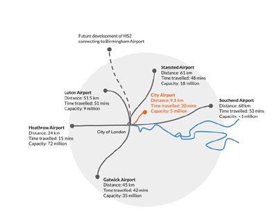
In recent years, the demand for commercial air travel continues to grow accompanied by the potential value of urban development around airports. In the context of globalisation and technological advancements, there is a growing need for enhanced connections to facilitate business opportunities. This research addresses the benefits of maximising the contribution of airports to city development as well as seeking to propose innovative airport development designs and strategies, positioning airports as catalysts for local global market expansion.
The main objective of this research is to create a comprehensive design toolkit that preserves airports as major transportation hubs within cities, while effectively mitigating the negative impacts of urban airport development. By grappling with inherent constraints such as building height restrictions, land acquisition challenges and secure boundary requirements, this research aims to refine urban planning approaches. Emphasis will be placed on enhancing connectivity to major transportation nodes and formulating development policies for airports and surrounding areas to stimulate future growth.
The research methodology involves an amalgamation of literature reviews, analysis of existing planning frameworks, and policy examination to distil contemporary trends in airport city design. Through case studies and design-oriented investigations, the research will yield a conceptual framework with three main strategies for airport future development.
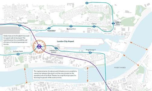
A key contribution of this research is the creation of a tailored toolkit focusing on airports situated in urban cores, with 2 potential sites: London City Airport and Berlin Tempelhof Airport, respectively. The design is striving to conceive an adaptable prototype plan amenable to diverse urban airport contexts. Ultimately, the research seeks to enhance interconnectedness, centralising airports’ role to promote clustering effects around its development and addressing constraints that impact potential business hubs.

Research Project
In recent decades, the theory and practice of the urban commons have been the subject of extensive research, arising from the necessity of transition from current unsustainable and inequitable urban systems to more collaborative, resilient, and fair ones. Situated within the broader framework of the Social and Solidarity Economy, the urban commons have the potential to address complex and interrelated social, environmental, and economic challenges by recentering ‘use value’ at the core of the relationships between people, land, and urban resources.
Additionally, through commoning practices of self-governance and selfmanagement, existing structures in post-industrial cities can be creatively reconfigured into something new by a community of end-users, in ways that promote community wealth and wellbeing. Nonetheless, although the urban commons are gaining strength as a design framework, the general lack of institutional support in the UK, on top of neoliberal and austerity policies and privatisation trends, hinders long-term financial, spatial, and social resilience.
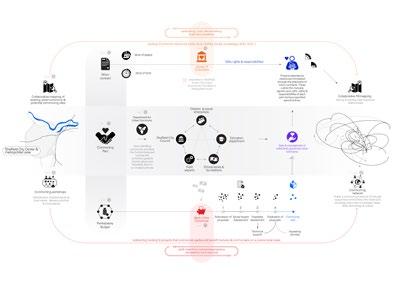
This project argues for the development of new institutional tools to reconcile mainstream institutions and policy frameworks and innovative ways of socio-spatial organisation. Thereby, infrastructuring the urban commons by supporting their (re)emergence, longterm sustainability and resilience, and transferability to other contexts. Employing a research-by-design methodology, key narratives and strategies from a literature and case study review are identified to inform the design of a portfolio of institutional tools that aims to bridge this gap.
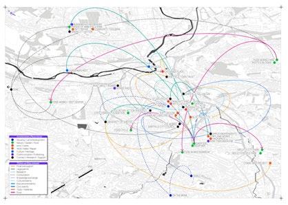
The portfolio comprises funding and organisational mechanisms that might enable communities of commoners, government and educational institutions and diverse stakeholders to collectivise the provision, care and management of urban spaces, resources, and services. Sheffield is taken both as the case study and the site to test the proposed tools. Understanding ‘infrastructuring’ as a verb, the project emphasizes the negotiation and re-articulation process both in the design and in the contractual practice of the commons.

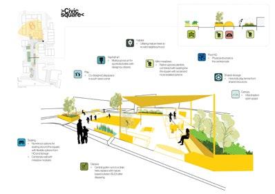
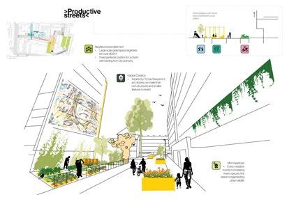
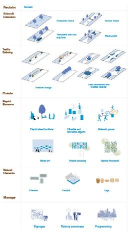
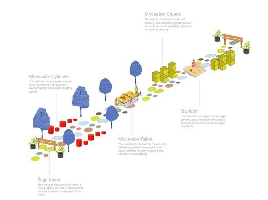
Currently at a time of multiple and overlapping crises, there is an urgent need to change the unsustainable patterns of living that the western world has vehemently adopted. This system change will need to be applied to many urban facets. This research focusses on streets as ideal sites of experimentation using the emerging Co-City framework to test hyperlocal system change and build the case for scaling street reclamation through collaborative and participative governance. Such governance allows street space to be stewarded, managed by citizens through a collaborative pact with the city authority.
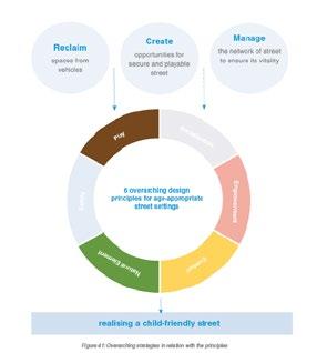
This project proposes a combined regulatory and physical toolkit that creates multifunctional street space, integrated and convenient sustainable mobility, deep participation and a holistic method of accounting for value. It argues that street space is currently underutilised; reclaiming street space for people through collaborative governance will create conditions for front-door flourishing, sustainable lifestyles and improvements in social justice. Assets and benefits are shared, resources are integrated in the “street pool”.
Major Research Project
This project adopts a mission-oriented innovation approach when carrying out literature review and case studies to identify levers that would help create transformative streets. Four missions and six design principles were created to guide the creation and application of the toolkit. Data and spatial analysis were used to select disadvantaged neighbourhoods to which the toolkit was applied. These neighbourhoods have on average 54% of people who do not own a car, and yet 100% of the street is dedicated to car parking or open road.
After creating the street pool 56% of space is reclaimed for people, the environment and shared mobility. This demonstrates how designing a full stack of interventions would transform streets into “street pools” where resources are shared to the benefit of the majority, increasing resilience and unlocking the transformative potential of the street.

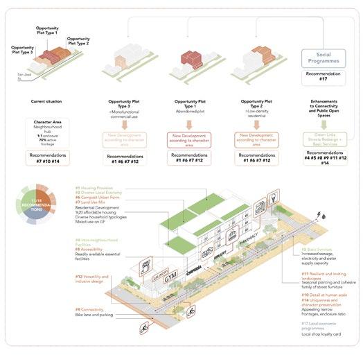
The urban landscape continually evolves in response to growing populations and changing societal needs, expanding the horizons of urban planning. Beyond infrastructure and economic growth, today’s urban planning strives to create socially vibrant, inclusive cities amidst rapid urbanisation (Talan et al., 2020). Maintaining a delicate equilibrium between development and social sustainability is paramount to fostering thriving communities.
Within this context, the relevance of plotbased urbanism, a traditional yet effective approach, comes to the forefront. While it gradually optimises serviced land, it faces the challenge of aligning growth with community sustainability. Rapid plotbased development often struggles with issues related to state efficiency, planning mechanisms, and community involvement, ultimately leading to fragmented and unequal urban environments (Ünlü, 2011).
Major Research Project
This research explores the dynamic relationship between urban development and social sustainability within everchanging urban landscapes at neighbourhood scale. It uncovers challenges and opportunities in harmonising plot-based urbanism and community well-being, emphasising the need for coordinated, inclusive urban development that preserves community cohesion and cultural roots. By examining socio-spatial implications and case studies, this research offers insights and actionable recommendations for urban stakeholders. Its ultimate aim is to reshape planning in contexts with weak state sectors, nurturing urban spaces that facilitate growth and a deep sense of belonging and well-being

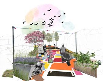
Suburbia, characterised by sprawling detached and semi-detached singleoccupancy dwellings, automobiledependent lifestyles, and often fragmented communities, faces barriers to strong social cohesion. In turn, this major research project develops a design-led toolkit to address these challenges within the context of Circular Development. Recognising that suburbia’s current design and planning paradigms contribute to social isolation, this project puts forward solutions to strengthen social cohesion across various spatial scales.The research employs a research-led design approach.
Through academic literature, policy and case study reviews, the project engages with suburban characteristics to understand the requirements for greater suburban social cohesion. Barriers to social cohesion were identified, as are the benefits of pursuing a Circular Development-oriented context. This culminated in a design-led toolkit, guided by the strategies of: prioritise humanscale activities, intensify social interaction and Circular Development.
The research project’s outcomes aim to inspire communities in ways to retrofit suburban areas across spatial scales in the hopes of transforming them into socially cohesive and environmentally sustainable communities.
This research addresses the pressing issues of suburban social cohesion in light of a growing suburban population, placing pressure on already thin social infrastructures. Additionally, this research aims to fill a gap in professional practice. Through the review phase of this project, case studies that satisfy all three significant elements of this project - social cohesion, suburbia and Circular Developmenthave not emerged.

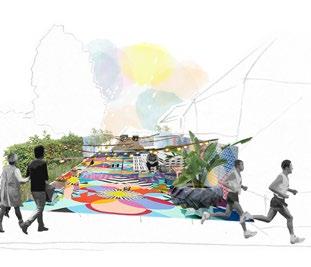

People are key assets for cities in achieving sustainable development and therefore it is crucial to build community capacity to stimulate growth socially and economically in cities to reach sustainability. However, building community capacity is challenging in the context of ‘lower populated cities within lower populated countries’ (LPCC) due to reasons such as lack of population, presence of dense social interaction and knowledge transfer that is required for growth and higher gaps in knowledge and skills leading to reduced labor market and human capital. Although, low populated cities do have its own advantages such as tighter knit community and reduced urban problems and have the potential to overcome their shortcomings through hard and soft urban design interventions.
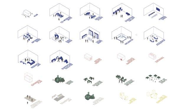
This project focused on adaptive reuse as the catalyst for building community capacity and is based on southeast Asian region context specifically on the country of Brunei Darussalam to further understand the issue of building community capacity in LPCC and proposing design toolkit. Literature review and review of case studies are conducted within this research which informed the design toolkit proposed. The design toolkit is then
tested on three different sites within the capital city of Brunei Darussalam, Bandar Seri Begawan.
This research argues that physical urban design interventions play a crucial role in stimulating and supporting building community capacity within LPCC however non-physical interventions are also important in initiating, increasing scale and monitoring building community capacity. This research concludes that amplify factors are highly important in the context of LPCC which includes technology use, international collaboration, and enthusiasm of cause. There is also a need to encourage more attention and research from urban design and planning literatures on understanding the challenges for low populated cities which have not been discussed extensively to achieve global urban agenda such as sustainable development.


Major Research Project
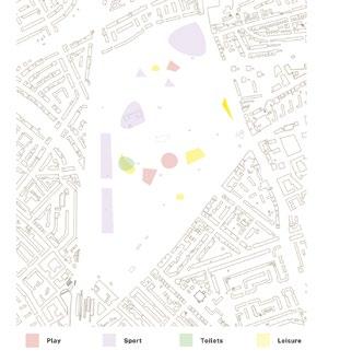
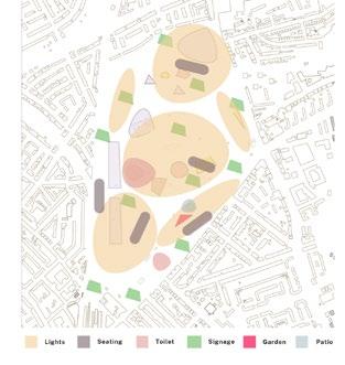
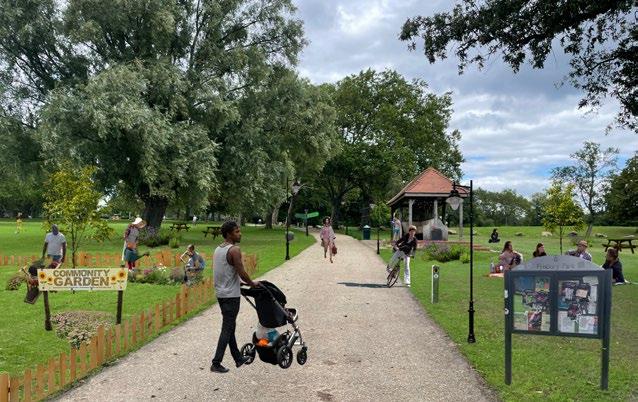
In today’s socio-political climate, noncisgendered and non-heteronormative behaviours and forms of expression are viewed as an act of rebellion or a political statement. To be transgender or gender non-conforming, specifically within an urban setting, is to experience a vastly unique way of life than those who are cisgendered, this is a given. But how do these people experience the city? How do transgendered individuals interact with the city? How can public spaces impact these individuals and their relationship to their surroundings?
Currently, there is no concrete methodology or in-depth literature in relation to the design of urban public space for gender non-conforming populations. Relevant literature includes queer and gender theory, with attention towards how women and queer individuals navigate public space, yet there is still a gap regarding the usage of public spaces from those who identify as gender nonconforming.
This project thus aims to bridge that gap, and create a framework to better understand how to not only include gender nonconforming people, but to put them at the forefront of planning and design measures.

Major Research Project
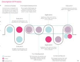
This research explores the potential for generative AI to enhance traditional urban design processes, proposing an integrated framework that leverages the strengths of both approaches.
Through a literature review, the paper examines the evolution of AI in urban design and highlights key capabilities like rapid option generation and performance optimization as well as limitations around interpretability and reliance on potentially biased data. It outlines the traditional urban design process, noting strengths in incorporating intangible qualities and strategic thinking along with weaknesses like time-consuming iterations and oversimplification.
After reviewing prominent generative AI tools, the paper introduces a conceptual framework for targeted integration of AI techniques to accelerate data-driven tasks while preserving human creativity and contextual sensitivity.
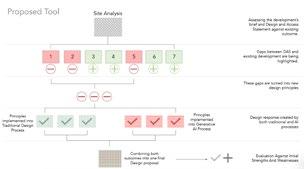
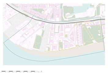
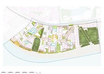
A site analysis of London’s Royal Wharf development reveals gaps between the original design principles and current realities. New principles emphasizing green networks and mixed uses are defined, informed by policy analysis to establish standards.
The principles are implemented through separate generative AI and traditional design processes, enabling comparison. While AI enables efficient exploration, the traditional process better captures intangible local factors. Merging the proposals reveals unique strengths, which are combined into a final design improving public amenities, activating waterfronts, and distributing community facilities.

Major Research Project
Mega-events are exploited as a leverage to upgrade urban infrastructure, accelerate policy decisions, and promote a bright city image to attract investments. As such, more cities compete to become the host of mega-events, thus forming a trend of event urbanism in the 20th century. However, creating a positive event legacy is easier said than done given such events’ immense scale and complexity. Host cities could be left with long-term socio-economic burdens and fragmented communities if their vision is not fully translated into practice.
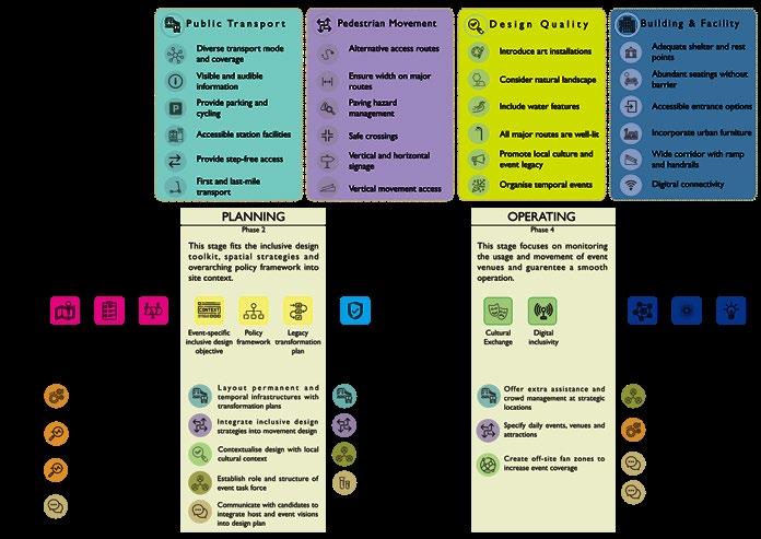
This project aims to understand megaevents’ capacity as a catalyst for creating inclusive neighbourhoods. This researchled project will develop a toolkit with the best inclusive design strategies extracted from previous mega-event proposals, case studies and technologies. It is set to guide inclusive design in four criteria, namely public transport, pedestrian movement, design quality and buildings & facilities.
The toolkit is accompanied by a legacyled event process, which emphasises the importance of a site-specific development objective and legacy transformation plan.
A legacy-led approach in the megaevent planning process is believed to facilitate coordination between actors and produce better-quality design outcomes. It also guides a smooth delivery timeline and effective transition between event episodes. It is essential that these interventions can accommodate temporal event needs while capable of transforming into future neighbourhood use.
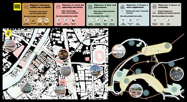
The toolkit and process were then applied to Saint Denis in Paris, an area that will become the host of the 2024 Olympic Games. It is found that the current proposals are event-led and fail to address all local issues. Compatible best practices were then extracted from the toolkit to formulate a site-specific legacyled development plan.
Objectives: Urban loneliness has been recognised to affect the mental and physical health of the young and old generation. In this report, our objective is to analyse the effects and suggest possible solutions to decrease urban loneliness through placemaking interventions.
Methods: The secondary research was the literary review followed by case studies research on the urban interventions focused on social isolation, urban factors, public and community spaces that might encourage interaction have been explored. The primary research consisted of site visits to allotment gardens and community spaces, which were conducted to understand the real-time experience of the users through interviews, observation, sketch and photo documentation.
Results: While there are currently a bunch of programs by boroughs and community centers catering to solutions for the aging community’s loneliness, there is a lack of interest in the younger generations loneliness. Intergeneration contact zones need to be established to give the younger and older generation opportunities and activities to share their experiences. Existing community spaces that have a consistent crowd
attending events and have a potential to expand their activity rota are ideal for the placemaking interventions.
Conclusions: This research project introduces new ways of thinking, applying and designing public spaces to encourage social interaction. Placemaking interventions in well placed areas will potentially reduce urban loneliness. A design toolkit for intergenerational contact zones has been designed to assist current and new communities to adapt the new interventions suggested in the report.




Major Research Project
Play is a product of possibility, and a driver as well. Playful practices are a vital part of society in which people step beyond instrumentality, obligation, convention, and predictability to the pursuit of new and uncertain experiences. The diversity, contradiction from rational social practices, and creativity of play contribute not only to human well-being but the development of the social whole. Public spaces create multiple possibilities, aside from fulfilling human needs rationally, urban design attributes within the space enhance the exploration of new desires and immediate pleasure. The desire for play becomes manifest in bodily behaviors through articular physical settings within the urban context. Yet, there is a research gap between adult play and the spatial design of the built environment.
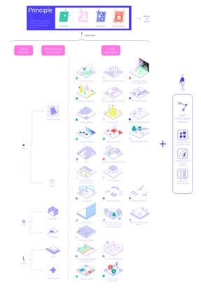
This project has concentrated on the theoretical aspect of play and various playful forms happening in public spaces to better understand the relations between people’s playful perceptions and behavior, and the design of the urban environment. Also, urban settings where play can be stimulated are highlighted, including paths, intersections, boundaries,
thresholds, props, and the space itself. Four principles for a playscape construction are proposed in response to the nature of play, which aided in proposing a toolkit to guide designers to retrofit public spaces. Rather than suggesting practical solutions for promoting a specific form of play, this project emphasizes the support of adventurous, diverse, and continually changing characteristics which urban public space provides to play. Wan Chai, a dense but dynamic district in Hong Kong is chosen to proceed design application. Playscape not only provides room for uncontrolled and irrational creativity and actions but also helps to spark individuals’ imagination towards the city. In that, this study aims to raise the awareness of urban adult play and provokes further investigation of playscape in different urban contexts.

Dissertation
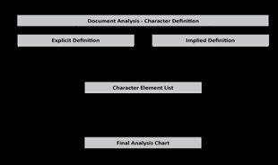
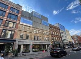
Conservation areas play a pivotal role in protecting character in distinctive urban places, but despite the ubiquitous usage of character within planning policy, there is debate on the definition, measurement, and application of the term. Character is complex, encompassing physical attributes such as built form and heritage, and experiential attributes relating to the relationship between people and the urban fabric.
This dissertation examines how character is defined and regulated in conservation areas, and how effective those policies are in protecting both physical and experiential character. The research utilises the South Shoreditch Conservation Area in London, England as a case study to explore the effectiveness of conservation policy both quantifiably and through public perception. It performs an analysis of planning documents to understand their approach in defining and regulating character, followed by an exploration of urban change within the conservation area and public perception thereof. Findings reveal an evolution of the definition and regulation of character, with physical character being dominant in
early policy documents and experiential character policies introduced over time. This evolution happened slower than urban change in the neighbourhood, and while policies were generally effective in protecting physical character, public perception of urban changes determined that the experiential character had been subsequently lost.
Recommendations are made on how to harness the public in policy making decisions to balance development pressures with priorities of residents to protect important aspects of character during times of urban change.


To truly enable socially sustainable futures, we need to think beyond the gender binary and mobility-centric idea of inclusivity and cater to non-conformist identities. Counter the inherent heteronormative and patriarchal design of cities.
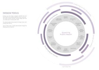
A need to enable gender-diverse cities emerges. This project aims to explore how urban design interventions facilitate a built environment that is inclusive to diverse gendered and social identities. And further looks at how alternative forms of space-making can facilitate this. The project proposes queering as the process of designing queer inclusive spaces that cater to the needs and are welcoming to LGBTQIA+ identities and more importantly, create urban environments that celebrate difference and thrive on tolerances.
To do the same, the project takes a research-led design approach. With insights gained by literature review of spatial logics of queer spaces, urban planning and design implications and lived experience of LGBTQIA+ people, key priorities and themes for enabling
Major Research Project
gender diverse cities are understood. For the feasibility of the MRP the secondary further research focuses on public realm, through case studies possible spatial design strategies and good and bad practices are explored.
The key takeaways are further discussed with an professional expert. With an iterative process of formulating design tools and testing them on a site in Vauxhall, London, the MRP proposes an urban design toolkit for enabling queer inclusive public realm.
Keywords- LGBTQIA+, Heteronormativity, Social Sustainability, Public Realm, Queering, Hybrid space-making

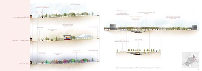
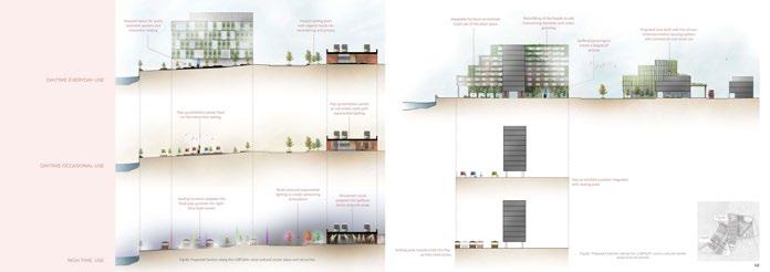
Major Research Project
The global commitment to combat climate change has made it urgent to achieve net zero emissions. To contribute to this goal, the United Kingdom has set a target of becoming net zero by 2050. To achieve this target, there is a need for comprehensive measures to improve energy efficiency in the country’s housing stock. This is especially important in areas with high energy consumption and carbon emissions. The use of building fabric retrofitting and innovative technologies presents promising opportunities to reduce energy consumption and carbon emissions in residential and public buildings.
In order to identify best practices and potential challenges, extensive research has been conducted on building retrofitting, net zero objectives, and their socio-economic consequences. By analysing successful retrofitting projects worldwide, valuable insights can be gained.
Additionally, the research explores financing mechanisms and potential co-benefits of public support to foster
community engagement and ensure equitable outcomes. The London Borough of Hounslow is one such region, where over 50% of homes have poor wall energy efficiency. To address this challenge, the focus of this research is on achieving net zero emissions in a London neighbourhood of Hounslow through building fabric retrofitting and upgrading public spaces. By investigating the existing conditions, and carbon emissions in Hounslow, this research aims to develop a comprehensive retrofitting plan aligned with the borough’s journey towards net zero emissions.


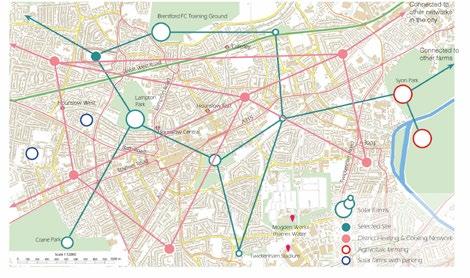
The global commitment to combat climate change has made it urgent to achieve net zero emissions. To contribute to this goal, the United Kingdom has set a target of becoming net zero by 2050. To achieve this target, there is a need for comprehensive measures to improve energy efficiency in the country’s housing stock. This is especially important in areas with high energy consumption and carbon emissions. The use of building fabric retrofitting and innovative technologies presents promising opportunities to reduce energy consumption and carbon emissions in residential and public buildings.
In order to identify best practices and potential challenges, extensive research has been conducted on building retrofitting, net zero objectives, and their socio-economic consequences. By analysing successful retrofitting projects worldwide, valuable insights can be gained.
Additionally, the research explores financing mechanisms and potential co-benefits of public support to foster
community engagement and ensure equitable outcomes.
The London Borough of Hounslow is one such region, where over 50% of homes have poor wall energy efficiency. To address this challenge, the focus of this research is on achieving net zero emissions in a London neighbourhood of Hounslow through building fabric retrofitting and upgrading public spaces.
By investigating the existing conditions, and carbon emissions in Hounslow, this research aims to develop a comprehensive retrofitting plan aligned with the borough’s journey towards net zero emissions.

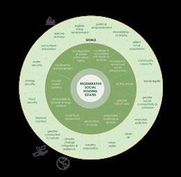
There has been an extensive body of research on both estate regeneration practices and regenerative design strategies, but nothing as of yet that combines the two.
The demolition of social housing estates in London has both social and environmental consequences. This project explores how regenerative design principles, which have largely been applied to new constructions, can be used in the retrofit and redevelopment of social housing estates vulnerable to demolition, avoiding social fragmentation and the release of embodied carbon, while bringing longterm benefits for both people and nature.
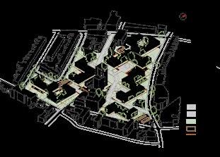
The proposed regenerative design toolkit is applied to the West Kentish Town Estate (WKTE) in North West London - an estate which has been confirmed for demolition and redevelopment led by architects Allford Hall Monaghan Morris for Camden Council.
The redevelopment proposal is an example of dominant estate regeneration practice. This project explores how this process could be done differently, producing a radically different proposal on the same site, in a way that prioritises residents’ needs and boosts ecosystem health.
INDICATIVE PHASING PLAN

SITE BEFORE

SITE AFTER TOWER OCCUPATION

Major Research Project
Stairs are inherently intimidating. They exhaust, challenge and marginalise. Perceiving it as a physical detour to the everyday navigation of the urban realm, however, conceals the vast potential it inherently contains. Situating the urban research context in London, a topographically flat city equipped with an intrinsic hunger and demand for development, there is a tendency for schemes and plans to compromise the delivery of accessible quality public open space.
Anchored on the anomaly of incorporating verticality to the prevalent horizontality, this research attempts to position stairs as a potential antidote to the lack of public open space in London. It challenges the contemporary practise that minimises stairs to their mere functionality and follows one fundamental question - how and why are stairs capable?
Informed by field observations at seven sets of stairs in London, overseas initiatives, and secondary literature on urban navigation, social conceptions of space, place identity, and the social and
physical behaviour of using public space, a conceptual toolkit is formulated with the forging ambition to act as design guidance for urban designers, planners and associated practitioners. A design application at Custom House station then follows, a site where the railway tracks of Elizabeth Line and Docklands Light Railway physically disenable north-south mobility.
The wealth of different agendas observed on stairs, the specific architectural form unparalleled by any other urban assets, the pressing need for the city to rejuvenate public urban enjoyment, all in all, underscore the necessity of perceiving stairs beyond its functional nature.
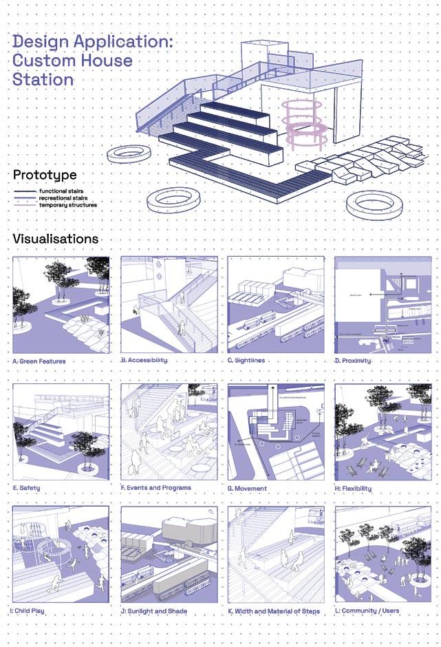
Stairs are inherently intimidating. They exhaust, challenge and marginalise. Perceiving it as a physical detour to the everyday navigation of the urban realm, however, conceals the vast potential it inherently contains. Situating the urban research context in London, a topographically flat city equipped with an intrinsic hunger and demand for development, there is a tendency for schemes and plans to compromise the delivery of accessible quality public open space.
Anchored on the anomaly of incorporating verticality to the prevalent horizontality, this research attempts to position stairs as a potential antidote to the lack of public open space in London. It challenges the contemporary practise that minimises stairs to their mere functionality and follows one fundamental question - how and why are stairs capable?
Informed by field observations at seven sets of stairs in London, overseas initiatives, and secondary literature on urban navigation, social conceptions of space, place identity, and the social and physical behaviour of using public space, a conceptual toolkit is formulated with
the forging ambition to act as design guidance for urban designers, planners and associated practitioners. A design application at Custom House station then follows, a site where the railway tracks of Elizabeth Line and Docklands Light Railway physically disenable north-south mobility.
The wealth of different agendas observed on stairs, the specific architectural form unparalleled by any other urban assets, the pressing need for the city to rejuvenate public urban enjoyment, all in all, underscore the necessity of perceiving stairs beyond its functional nature.



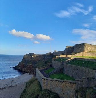
NEWCASTLE UPON TYNE TERM 1 FIELD TRIP
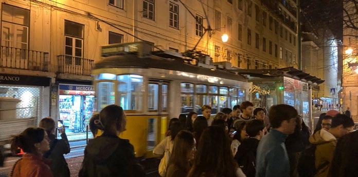
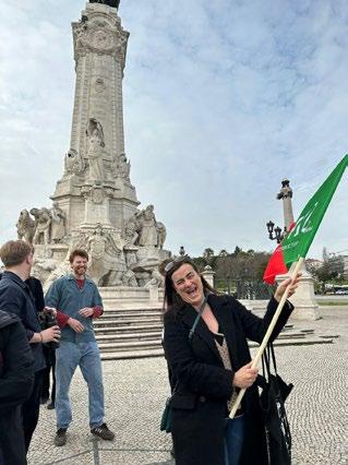
LISBON, PORTUGAL TERM 2 FIELD TRIP
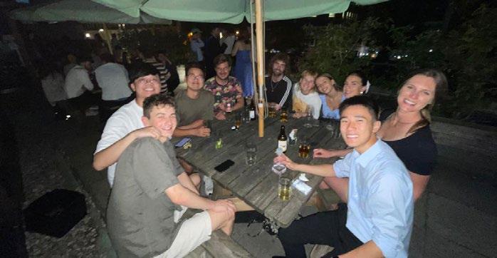
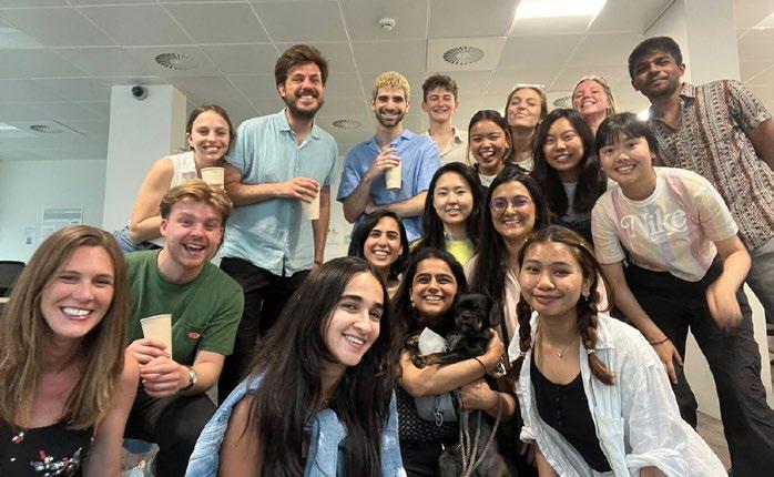
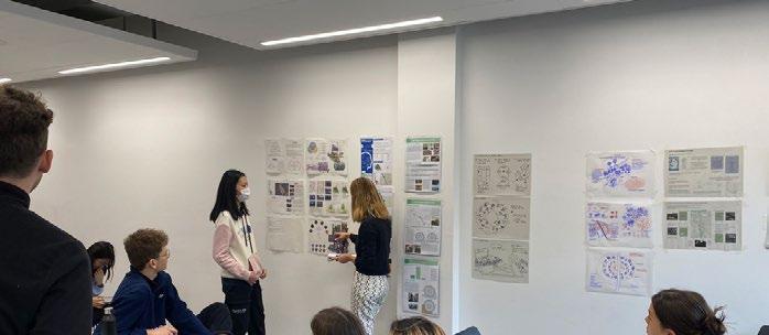
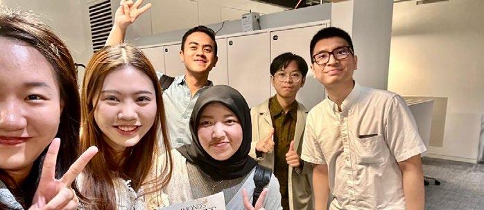
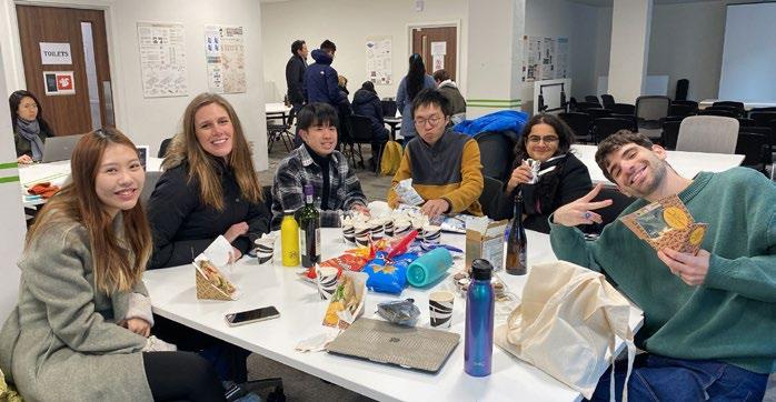
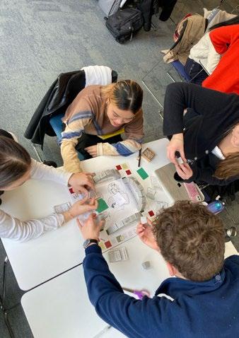
UDCP STUDENT LIFE 2022-2023
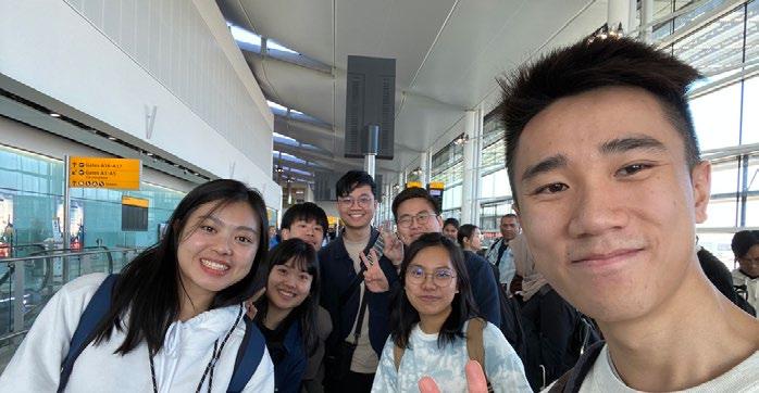
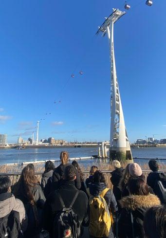
Students were taken on a social trip from London to Newcastle




Students were taken on a social trip to Lisbon, Portugal.


