LANDSCAPE ARCHITECTURE
MUYUN ZHU

CONTACT
+31 657464181
muyun.zhu@outlook.com
https://www.linkedin.com/in/ muyun-zhu/
SKILLS
PS/AI/INDD
LANGUAGE
EXPERIENCE
Stijgroep
Junior landscape architect & Urbanist
Freelance researcher
Urban Green Space (UGS) management and maintenance
Suzhou Zhonghai Architectural Design Co., Ltd.
Internship - assistant landscape designer
EDUCATION
Wageningen University & Research
Master of Science, Landscape Architecture
Thesis: AKtivate! Design to promote unstructured physical activities for young adolescents in Kerkrade
Nanjing Agricultural University
Bachelor of Engineering, Landscape Architecture
Thesis: Revitilizing Fuxing island
HONORS
& AWARDS
Nature-based Future Challenge Top10
Wageningen University & Research
ASLA Student Award
Magical foodscape: A guidebook for re-planning the cities based on the culture, food and the built environment
Outstanding Graduate
Nanjing Agricultural University
National Scholarship
Ministry of Education of the People's Republic of China
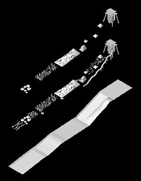
Academic projects Werkprojecten
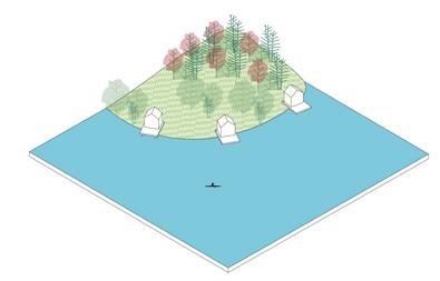
1
LIVING WITH WATER
Regional design
2
5
Renovatie buurtplein
6
Master's thesis Natuurrecreatiegebied
3
Regional design
4
Urban public space design
7
Landschappelijk wonen
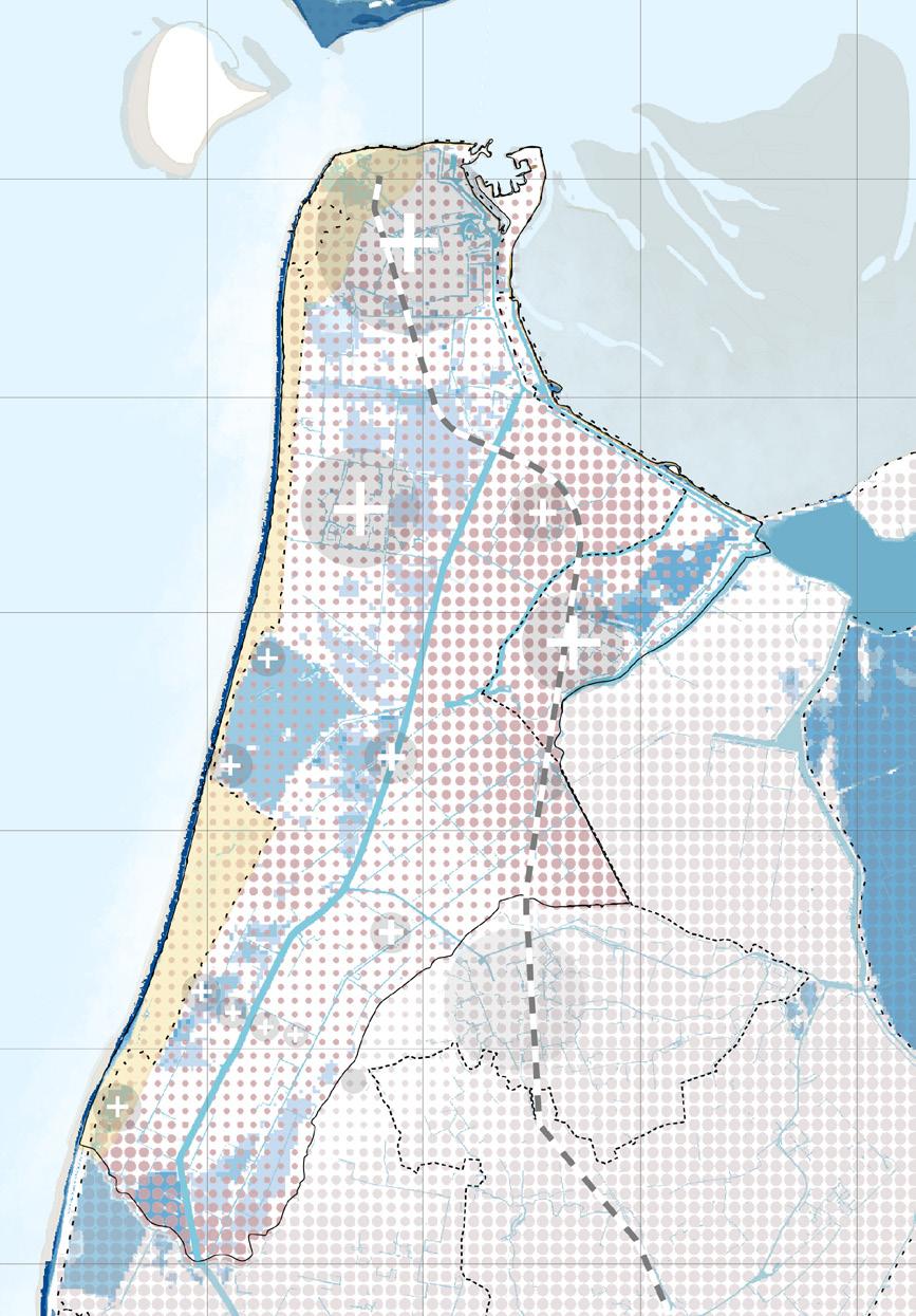
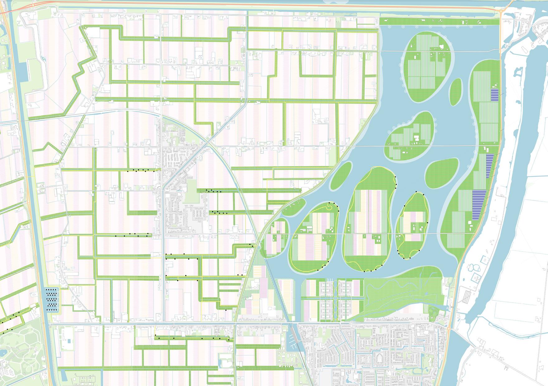
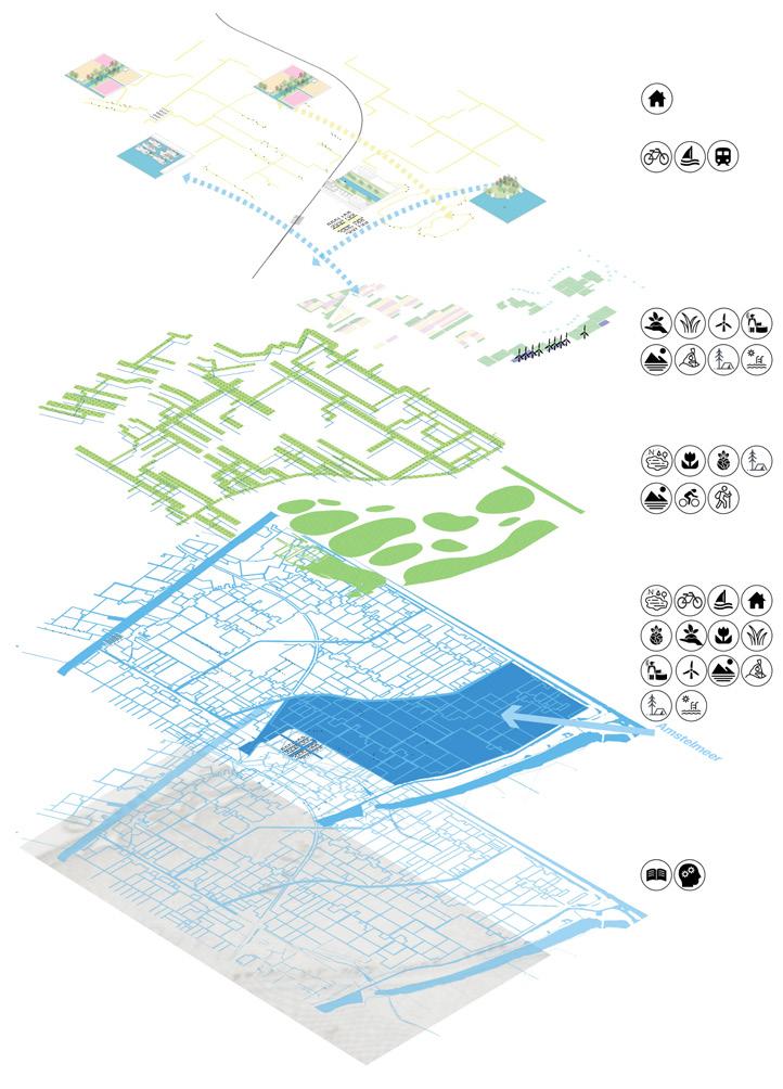
LIVING WITH WATER
Exploring the synergy between water solutions and new housing in Kop van Noord-Holland
Invidual academic project
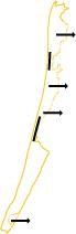
Noord-Holland, the Netherlands
~16,200ha
3.2022 - 5.2022
Tutor: Christian Nolf
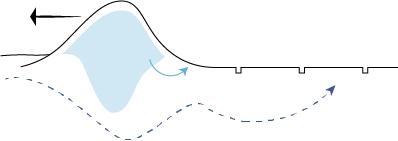
The cultural landscapes of Kop van Noord-Holland narrate how this area's inhabitants have lived with water since ancient times. The dunes and polders have protected people from the sea, while bulb cultivation has brought prosperity. However, climate change and the massive mono-cultivation of bulbs have cast a shadow on traditional life, and have made the area more vulnerable to water-related problems such as flooding and salinization.
Handled properly, challenges can turn into opportunities. Solutions to these problems create conditions for a healthy and attractive living environment for the new settlements. Water is the core, the approach, the infrastructure, and the context of this project. By establishing a nitrogen buffer system based on the existing spatial structure of the irrigation-drainage water system and making the element ‘water’ more tangible and accessible, the historical and cultural landscape is strengthened. After solving the water-related problems, the water and the landscape offer opportunities for new housing, improved mobility, enhanced nature, and sustainable agriculture. The region is thus shifting towards a more sustainable, climate-proof, and resilient future.
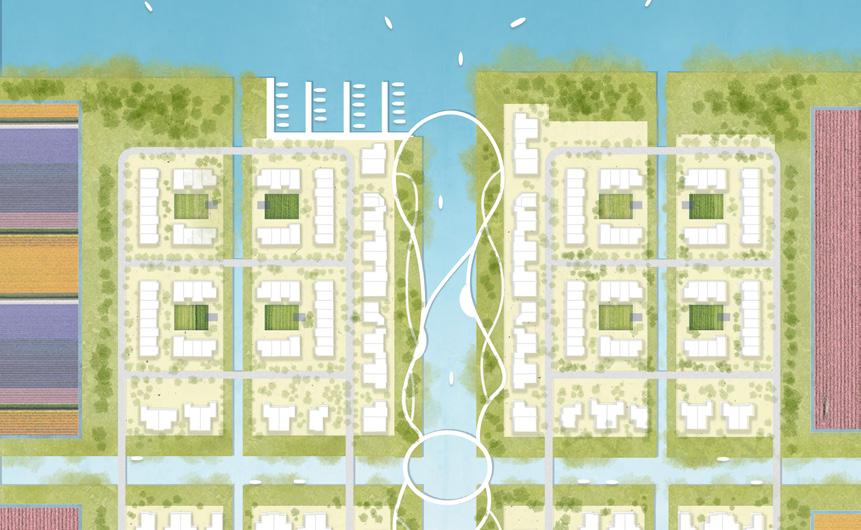
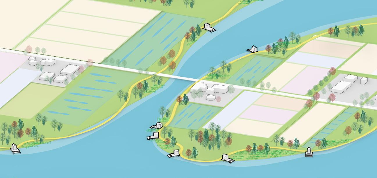
Spatial concept


Housing typology
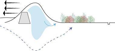
Dune expansion
Dike in dune
Wetland buffer zone (WBZ)
Depoldering

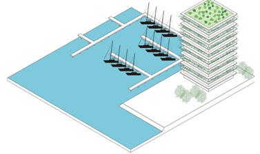
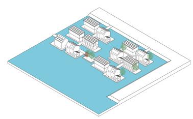
c. Marina Landmark
g. Urban enclave
d. Floating house
Pier house
a. Dike house
e. Bridge house
b. Seepage house
f. WBZ house
Strip1
Strip2 Strip3
Regional design


Paludiculture
Aquaculture
Wind turbine
Organic bulb
Wetland buffer zone
(WBZ)
Nature
WBZ house
WBZ house
WBZ house
Den Helder
Juliana Dorp
Floating house
Transit center
Elevated train track
Breezand
Anna Paulowna
New enclave
Pier house
Settlements in WBZ
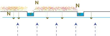
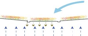
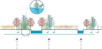
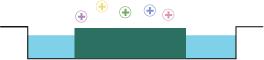
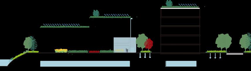
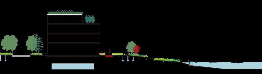
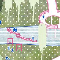
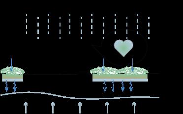
Wetland buffer zones are well-known for removing agricultural water pollutants, such as Nitrogen. A critical area to buffer is the intersection of the pollution loading area and runoff generating area, and the WBZs are often more effective along small/low-level streams. It is also suggested that better removal effects take place where shallow groundwater flows through and is confined within the WBZ plant root zone. Fortunately, the study area has a shallow groundwater level. The WBZ system not only accentuates the polder structure and strengthens the cultural landscape, but also serves as the ecological corridor. On top of that, it provides a beautiful environment for living and tourism. It also allows for the development of a slow mobility system, mainly for cyclists and hikers.
Life on islands
The depoldering creates connection to Amstelmeer , which is a metaphor for the region’s historical intimacy with water. The contrast between the islands’ organic shape and WBZ’s linear structure is a reminder of the local history and culture: from ‘conquering water’ in the past to ‘living with water’ in the resilient future, and also gives the region a new identity.
The change in land use and development of nature complete the Nitrogen buffer system. Pier houses are located on the islands. They can be reached by bikes and boats.
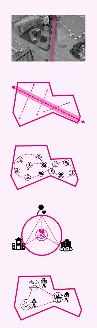
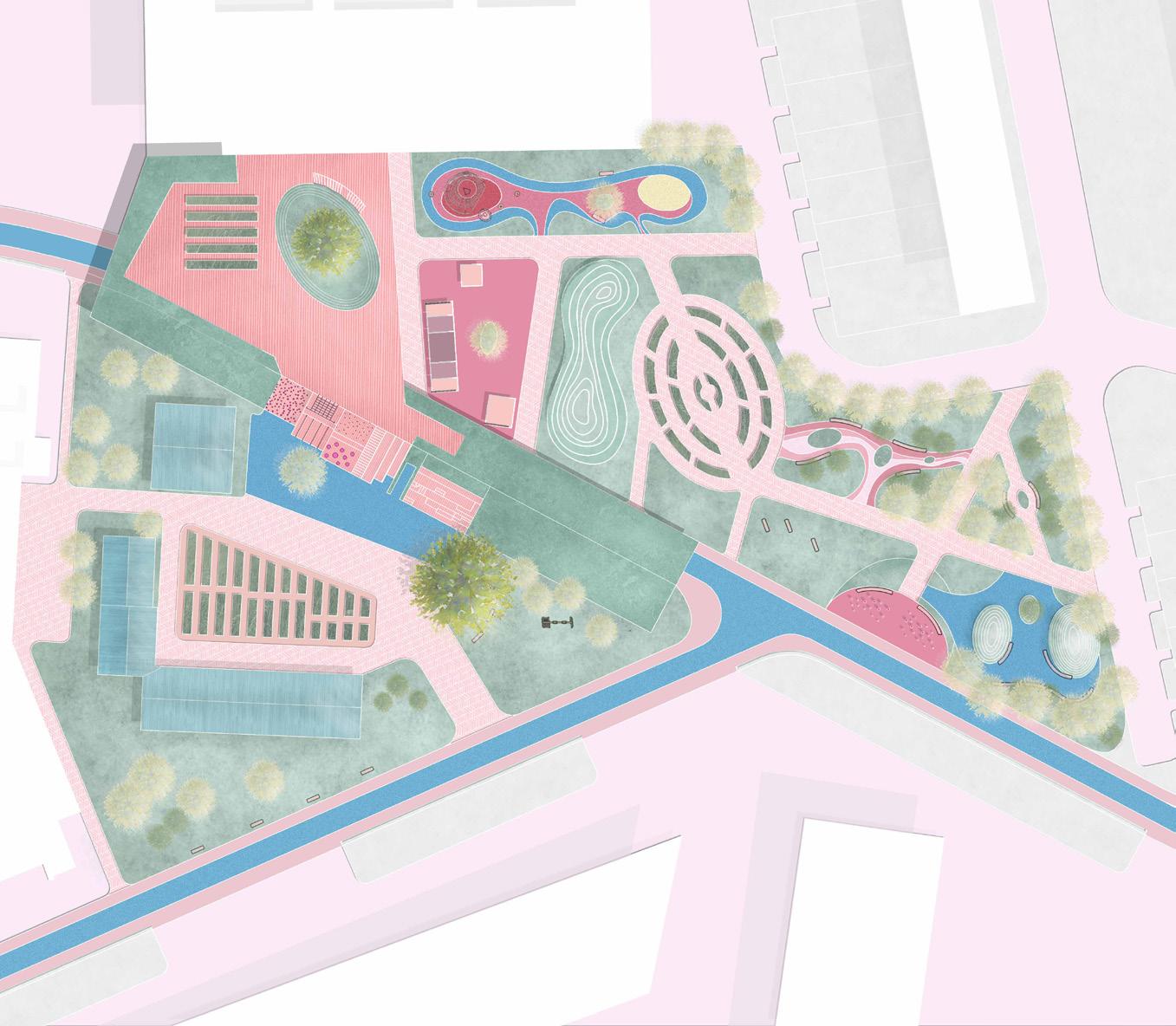
AKtivate!
Design to promote unstructured physical activities for young adolescents in Kerkrade
MSc thesis
Kerkrade, The Netherlands
~2,215ha
12.2022 - 10.2023
Supervisor: Agnès Patuano, Lenneke Vaandrager
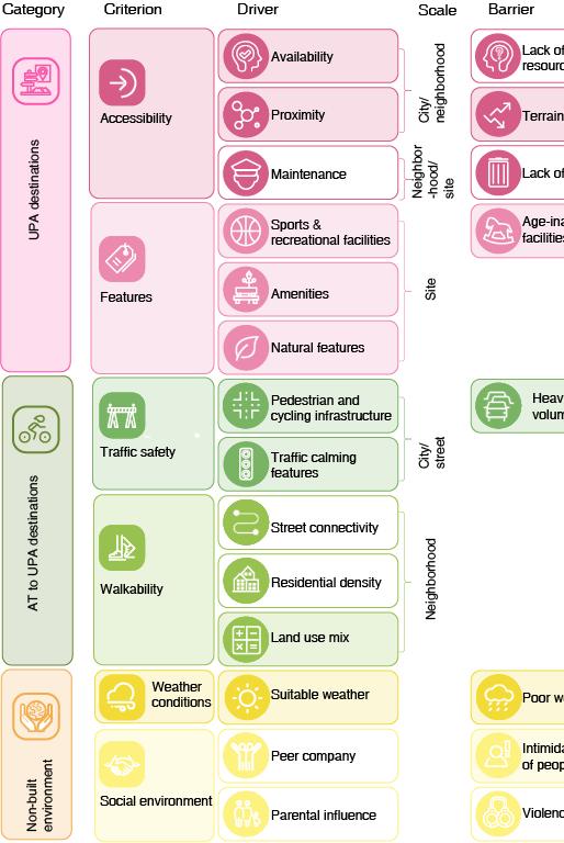
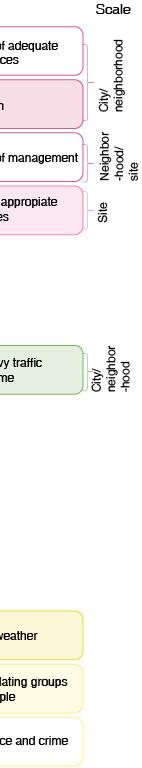
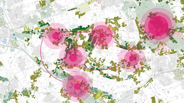
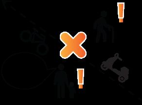
Compared to other Dutch cities, Kerkrade’s population is less healthy due to lack of physical activities. This issue is particularly evident among young adolescents (10-14 years old children).
Supported by affordance theory stating that affordance, i.e., the functional attributes of the environment can be directly perceived by people and thus change people’s behavior, this thesis attempts to design an outdoor environment for Kerkrade that provides more affordance to young adolescents’ unstructured physical activity (UPA) behavior with the instructions of salutogenic design principles. It is an attempt to bridge landscape design and health promotion.
Degisn Qetion:
How can an outdoor environment that promotes young adolescents’ unstructured physical activity (UPA) be designed in Kerkrade?
Sub Research Question (SRQ)1:
What evaluation criteria for an outdoor environment that promotes young adolescents’ UPA can be formulated based on the environmental drivers and barriers for such behavior in Kerkrade?
SRQ2:
What design guidelines can be formulated based on the spatial distribution of the drivers for promoting young adolescents’ UPA in Kerkrade?
SRQ3:
What design interventions can be proposed to promote young adolescents’ UPA in Kerkrade?
General barriers
Literature review
General drivers
Kerkrade barriers Workshop
Kerkrade drivers
Spatial analysis - city scale Spatial analysis - site scale
Questionnaire
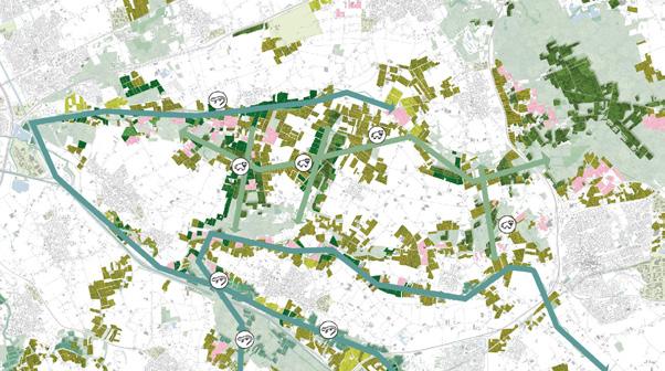
City scaled design principles


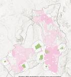
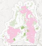
1.Take advantage of Kerkrade existing public green spaces and adapt them for potential UPA destinations
2.Provide more UPA destinations within or around neighborhoods with high population density
3.Take advantage of Kerkrade existing infrastructures for cyclists and plan AT routes basing on them
4.Improve existing infrastructures for AT to complement the AT – UPA
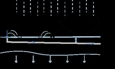
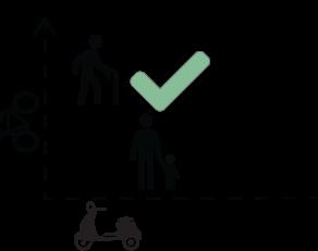
5.Improve road intersections to create a safer traffic environment for young adolescents
City design vision
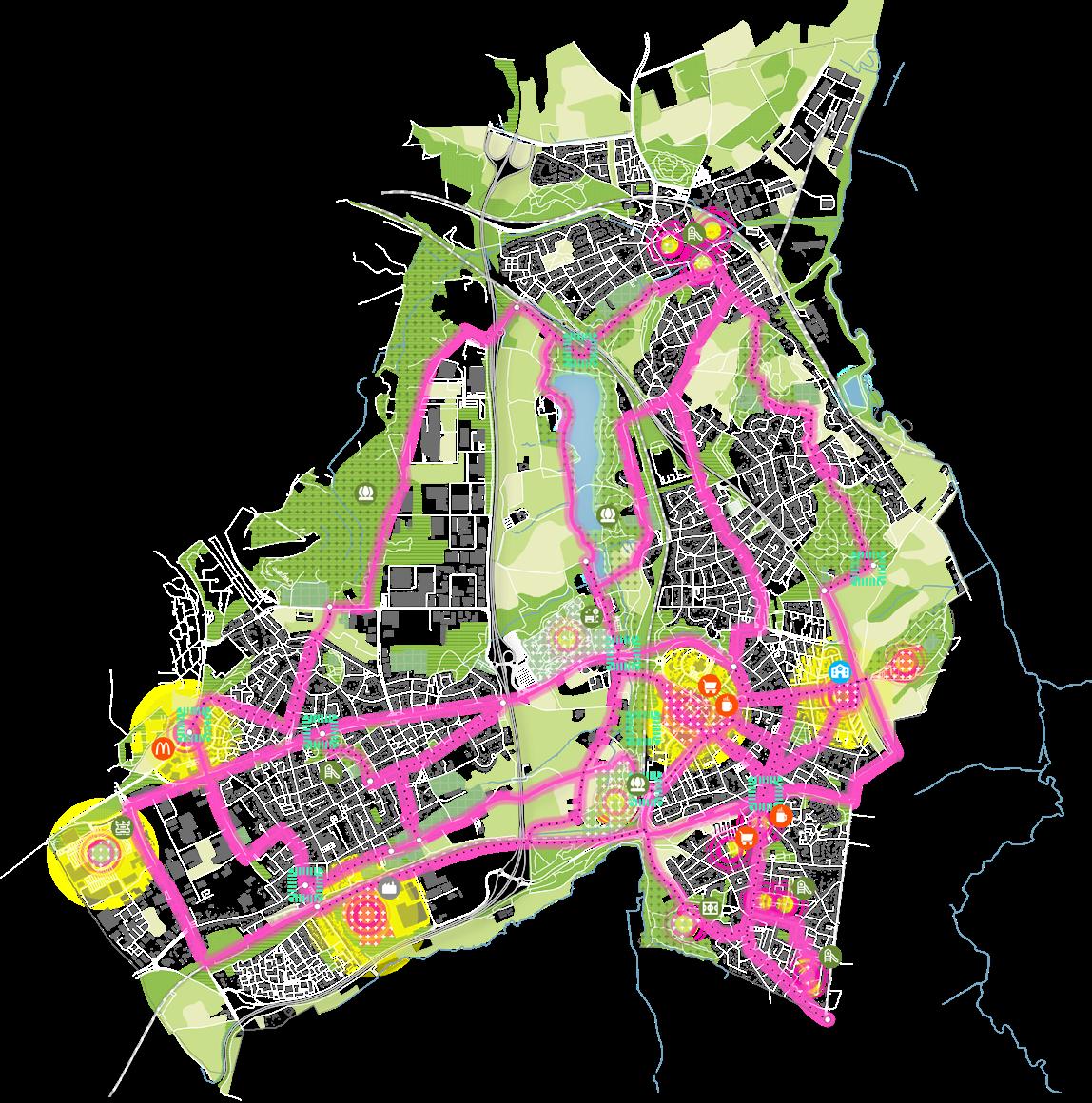

Cycling infrastructure to be improved
Intersection to be improved
Existing UPA destination
Proposed UPA destination
Site design location
Site scaled design principles
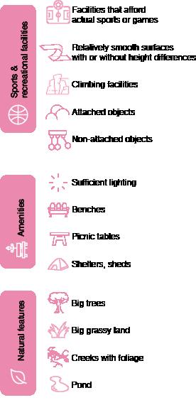
1. Provide more sport and recreational facilities to afford young adolescents’ diverse UPA through more facilities that afford actual sports or games, relatively smooth surfaces with or without height differences, climbing facilities, attached objects and non-attached objects
2. Provide varied age appropriate and accessible facilities that afford actual sports or games.
3. Arrange the affordances and preferences, especially varied relatively smooth surfaces with or without height differences in a clear way.
4. Provide varied climbing facilities, attached objects and nonattached objects other than trees and rocks.
5. Provide varied amenities, especially sufficient lighting, benches, picnic tables and shelters and sheds to afford more UPA destination visitation
6. Utilize natural elements not only affordances for UPA, but also for creating narrative and identity
7. Extract design elements from Kerkrade's coal mining heritage to strengthen the UPA destination's narrative
8.Utilize the site terrain to provide diverse affordances to UPA and to strengthen the UPA destination's identity
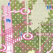
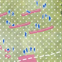
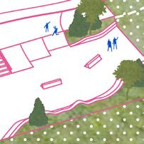
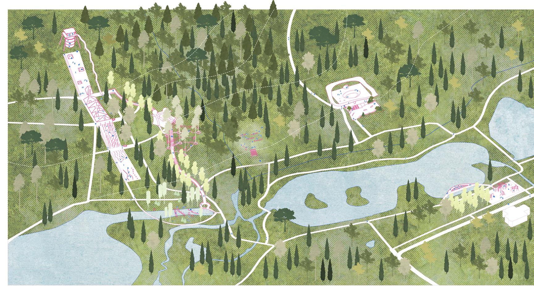
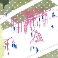
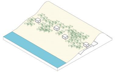
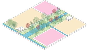
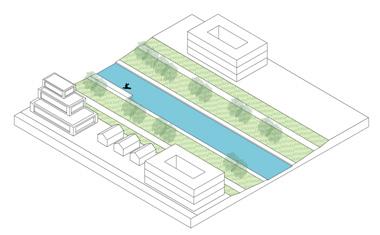
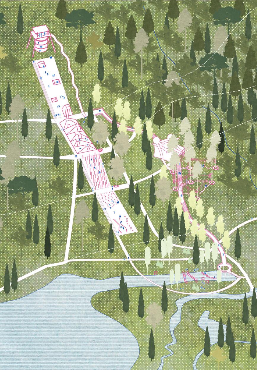
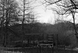
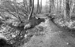
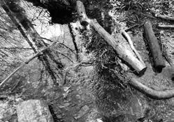
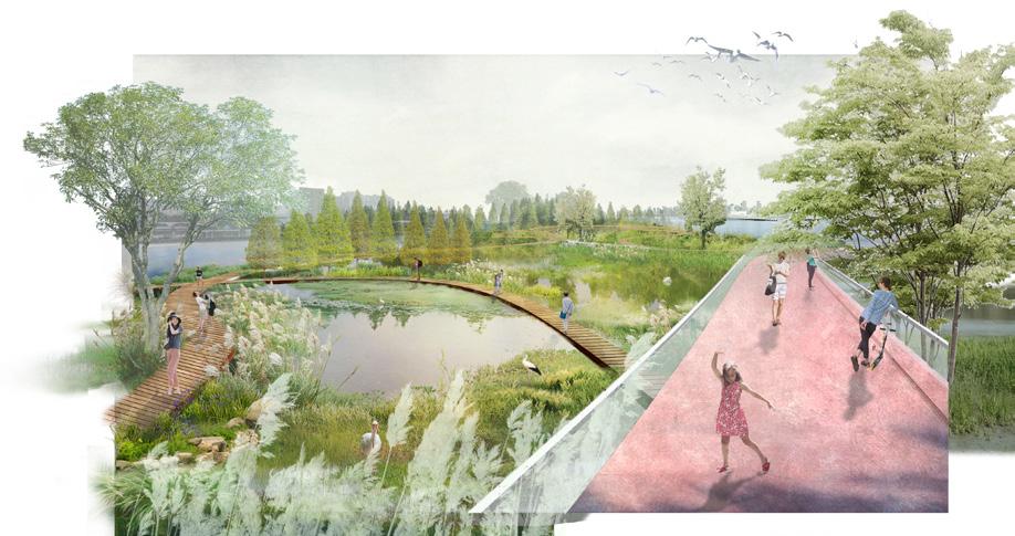
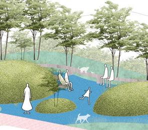
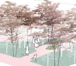
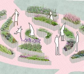
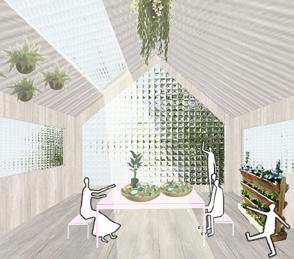
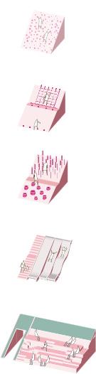
Forest walk
Climbing hill
Water fun
Water fun
Leisure grassland
Skateboard park
Outdoor gym
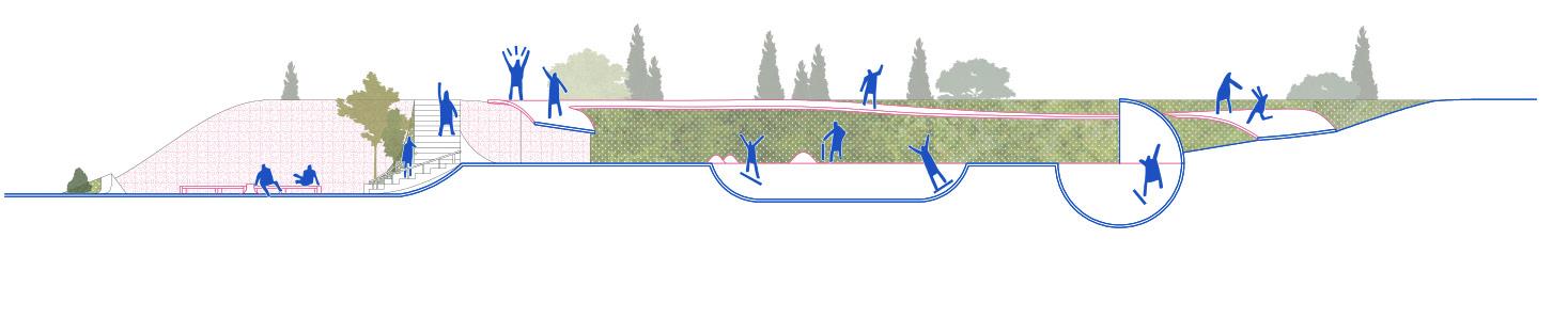
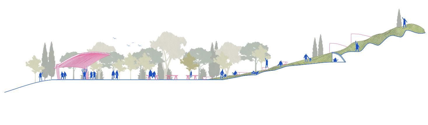
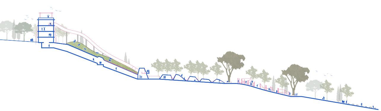
Section 2-2'
Section 1-1'
Section 3-3'
Climbing hill
Leisure grassland
THE LOOP
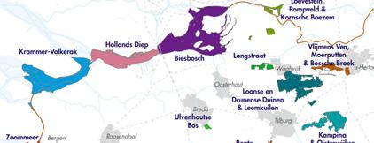
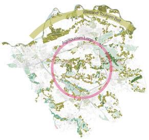
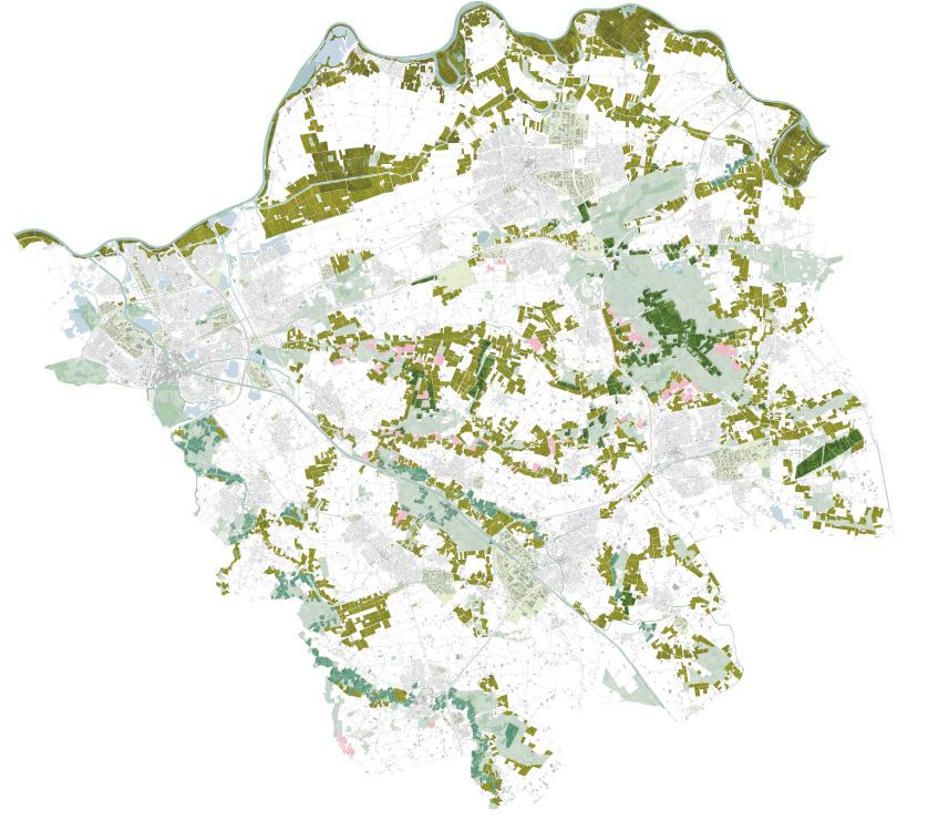
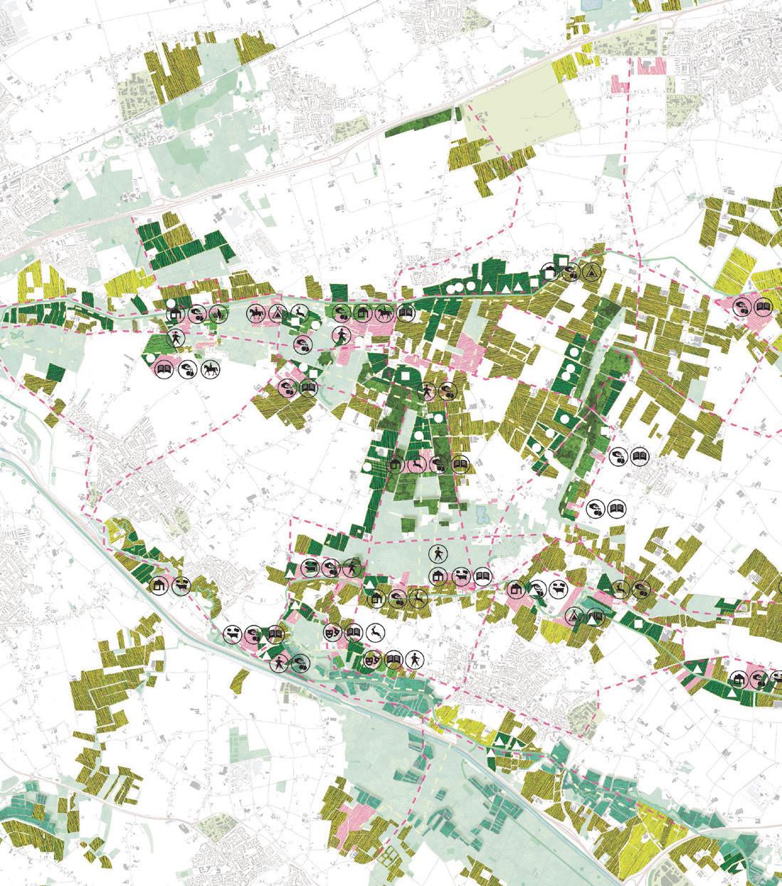
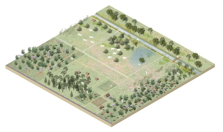
Establishing a Nature-NIA-Agritourism network for northeast Noord-Brabant
Invidual academic project
Noord-Brabant, The Netherlands
~32,000ha
3.2021 - 5.2021
Tutor: Timo Matti Wirth
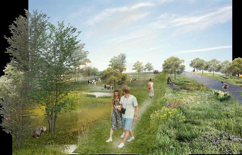
Agriculture is an essential sector for the study regio. However, traditional farming has led to environmental problems. This, in turn, impacts recreation, another crucial sector. To address the dilemma of conflicting agriculture and nature, this project explores a sustainable future for NoordBrabant by proposing a Nature-Inclusive Agriculture (NIA) and Agritourism network.
NIA serves as the cornerstone, functioning as stepping stones to complete ecological corridors and upgrade Natuurnetwerk Brabant. This synergy between agriculture, nature, and recreation has the potential to foster a circular economy, promoting resilience and regeneration for the environment. Agrotourism acts as a catalyst, providing economic alternatives for farmers and showcasing the symbiosis between agriculture and nature. Together, these initiatives aim to reconcile the conflict between agriculture and the natural environment, offering a sustainable pathway forward for the study region.
Landscape analysis
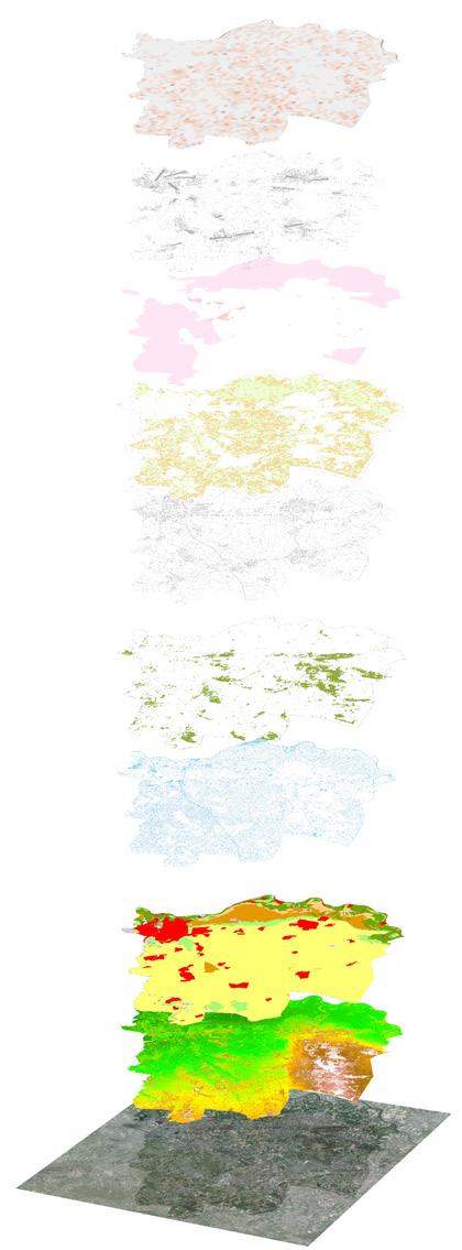
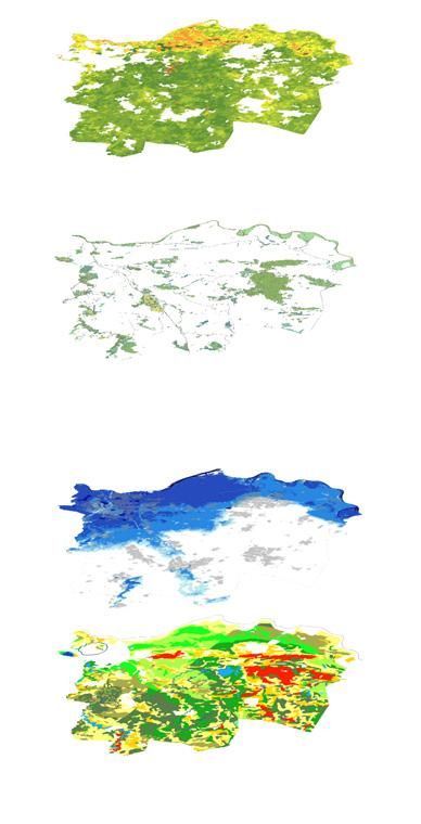
Fragmentation
Homogeneity
Deterioration
Biodiversity Decrease


Other parts of Noord Brabant: Nature is important to the recreation sector vs.
Study region: Nature is less appealing and uncompetitive
Agriculture is vital to the region's economy
Monoculture vs. circular economy
Income inequality
Conceptual framework
Ecological connections
Diversify landscapes
Reduce pollution
Increase landscape resilience
Increase biodiversity
Improve nature quality
Develop other types of recreation
Agriculture remains the driving force in ecomomy
Progressive transformation
Increase income via different approches
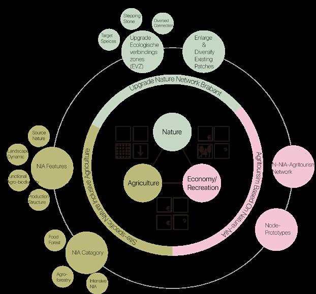


Nature Inclusive Agriculture
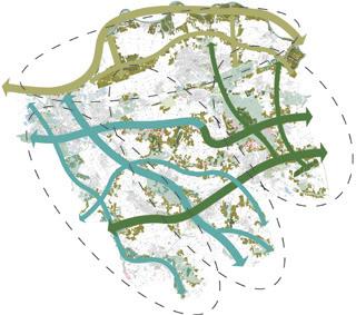
Nature-NIA-Agritourism network
Ecological corridors
Food forest
Intensive NIA
Agrisilviculture (Crops+Trees)
Silvopastoral (Grasslands+Trees)
Agrosilvopastoral (Crops+Grasslands+Trees)
Agritourism routes
Agroforestry
Prototype 1: Eco Village
Location: along Groote Wetering/other canals
Suitable for several small farms to collaborate
Prototype 2: Alley Crop
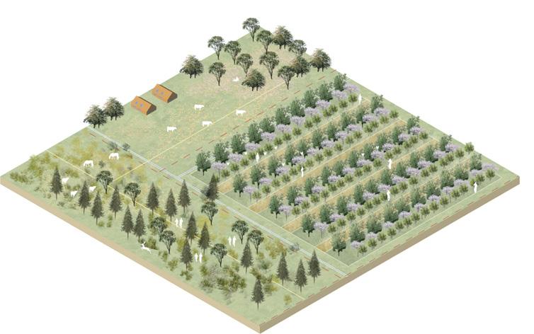
Location: Inner Heeswijk-Dinther
Suitable for individual farmers
Prototype 3: Permaculture Lab
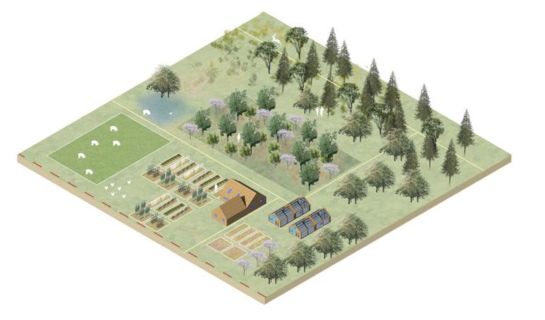
Location: Heeswijk-Dinther
Suitable for individual farmers
Prototype 4: Agropark
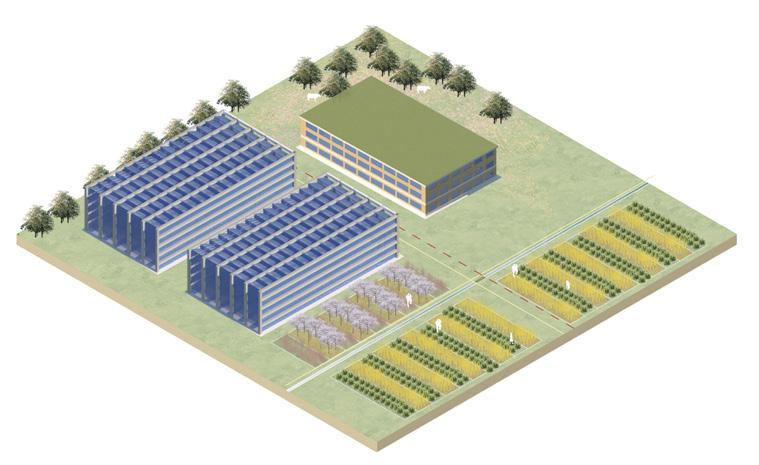
Relatively intensive production in order to maintain food supply
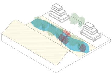
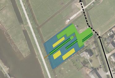
COMMON GROUND
Community's public living room in Oslo
city fringe
Invidual academic project
Oslo, Norway
~600m2
9.2019 - 10.2019
Tutor: Songlin Wang
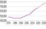
Oslo is one of the fastest-growing cities in Europe, and Hovinbyen is proposed as a key development area in response to Oslo’s anticipated population growth. The site's proximity to the inner city and mixed-use surroundings make it a pilot area to connect livability to green public space, locals to immigrants, and past to future. It gathers the community and provides a common ground in the city's transformation.
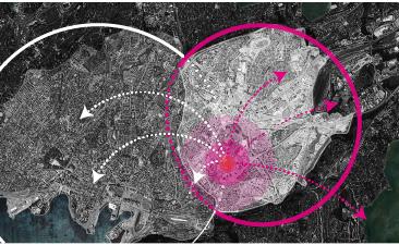
Hovinbyen
Site analysis

User analysis


'Fjord'
'Forest'
'Aurora'
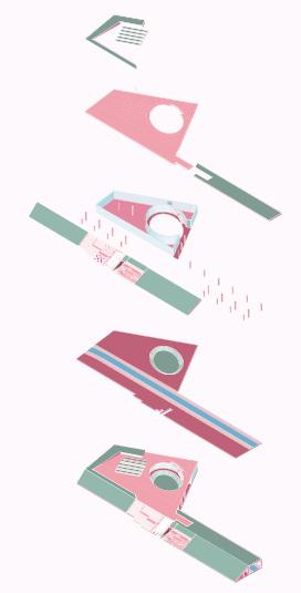
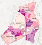
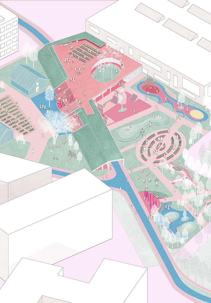
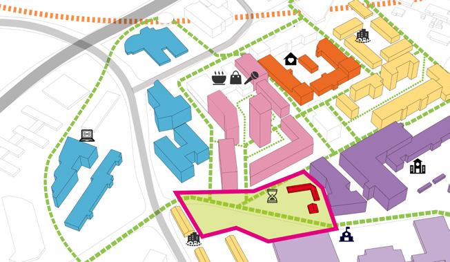
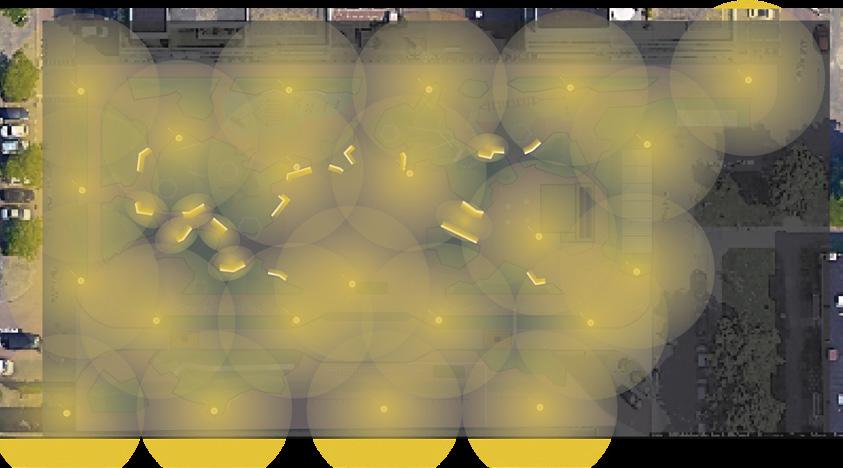
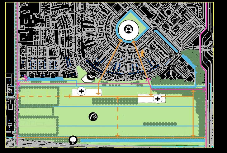
MINERVAPLEIN
Rotterdam, Zuid-Holland
Opdrachtgever: Bewonersorganisatie 110-Morgen
Visie opgesteld met de bewoners
Op de bewonersavond in 2023, uit de wens van de bewonersorganisatie kwamen verschillende onderwerpen naar voren. Als we deze samenvatten komen de volgende hoofdonderdelen aan bod: Klimaatbestendig, Veilig en Collectief. De onderwerpen werden georganiseerd in visiekaarten om de deelname te vergemakkelijken.
In navolging van de visies blijf ik het Minervaplein herontwerpen, niet alleen om de gestelde doelen te bereiken, maar ook om het een aangename en energieke openbare ruimte te maken waar de bewoners vaker naartoe gaan.
Hittestress verlichten Voetgangersveiligheid Regentuinen
Concept
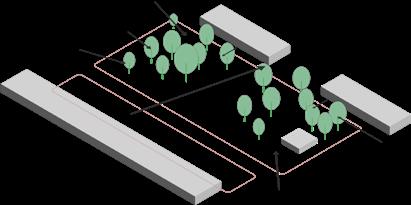
Behoud de bestaande bomen
Leid meer bezoekers naar het plein
Scheid fietsers en scooterrijders van voetgangers
Inpassing snackbar Aanpassing busbaan
Creëer regentuinen Creëer gebieden voor verschillende activiteiten
Verhoog klimaatbestendigheid en biodiversiteit Creëer kronkelende routes voor belevingen
Speeltuin
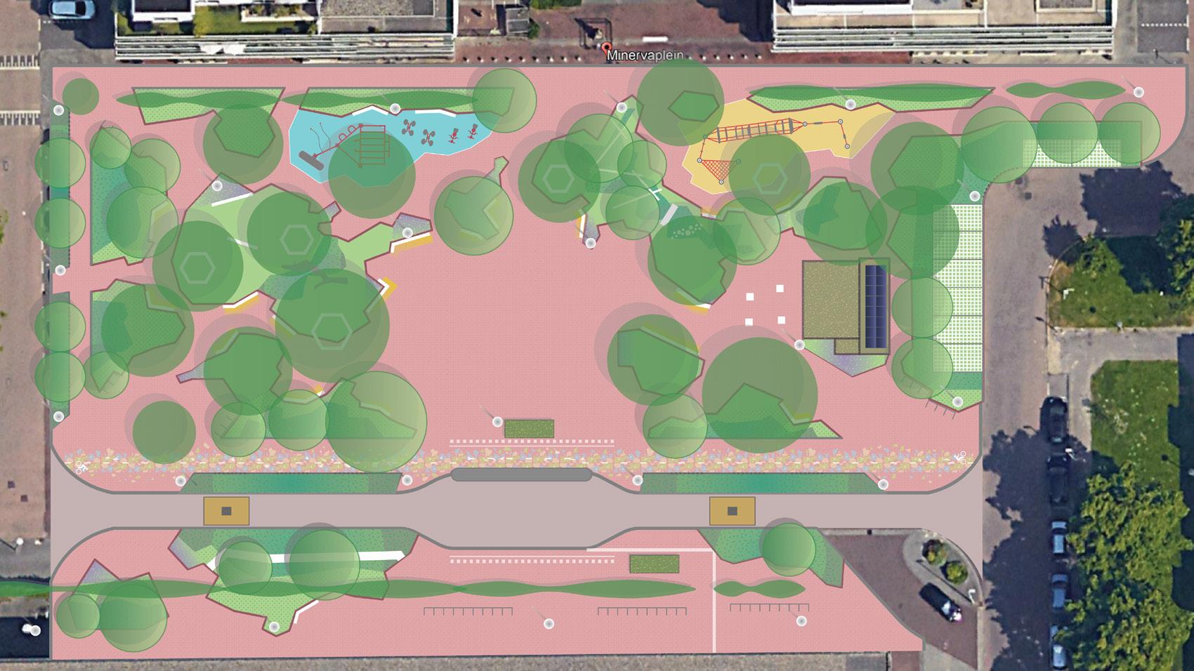
Gras

Regentuin
Boomstam
Buiten fitnessruimte
Zitplaatsen onder boom
Open ruimte voor diverse activiteiten
Stapstenen
Zonnepaneel
Groene bushalte
Markering van het fietspad
Bodembedekkende planten

Hoogbloeiend gras/ vaste planten


Nieuwe bomen
Bestaande bomen
Bestaande leibomen
Zitplaatsen met verlichting
Straatlantaarn
Parkeren
Fietsnietjes
Stoeprand inlaten
Bussluis
Groendak
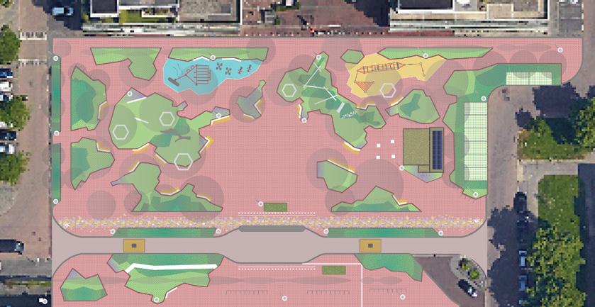
zonder bomen
Profielen

Profiel 1-1’
Profiel 2-2’
Verlichting
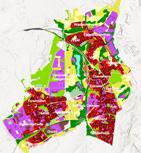
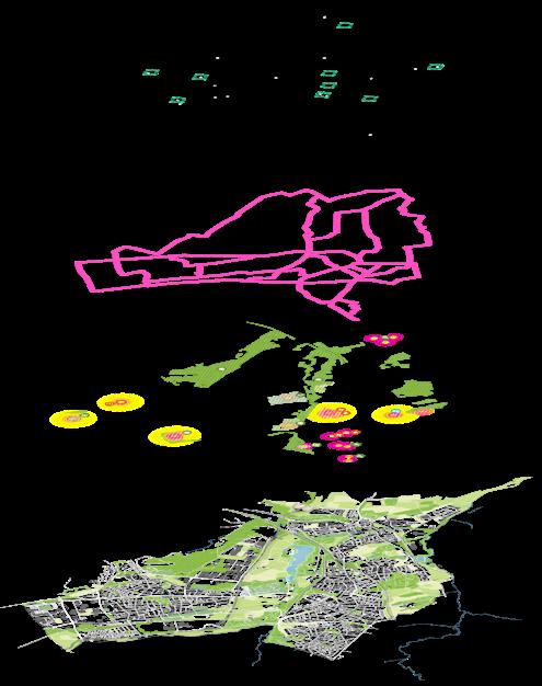
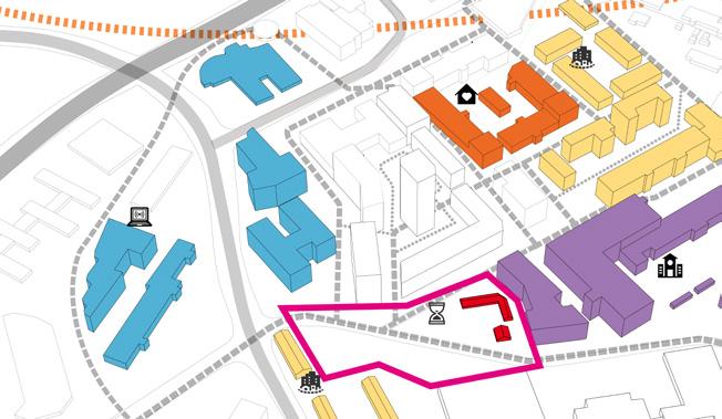
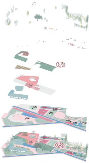
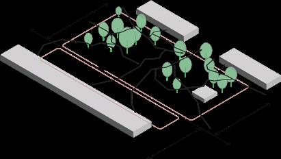
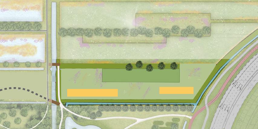
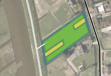
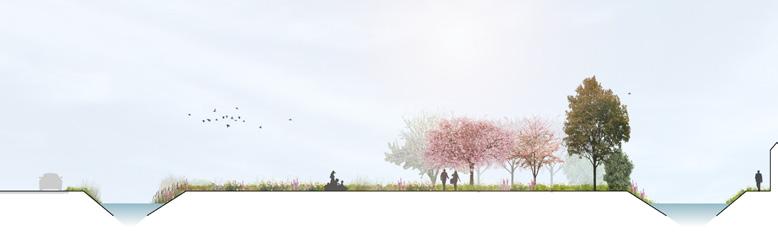
VREDENBURGHZONE
Waddinxveen, Zuid-Holland
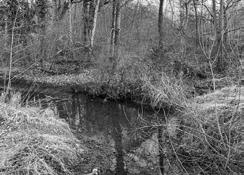
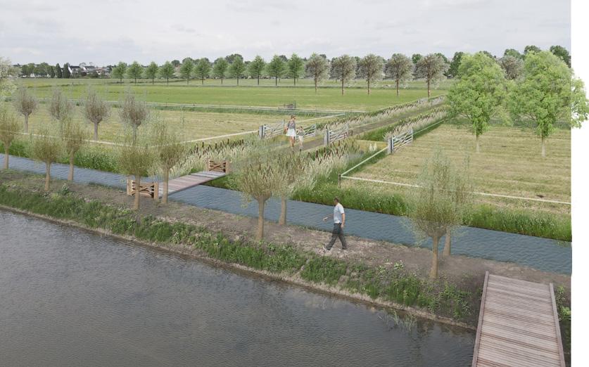
Opdrachtgever: Gemeente Waddinxveen, De Raad
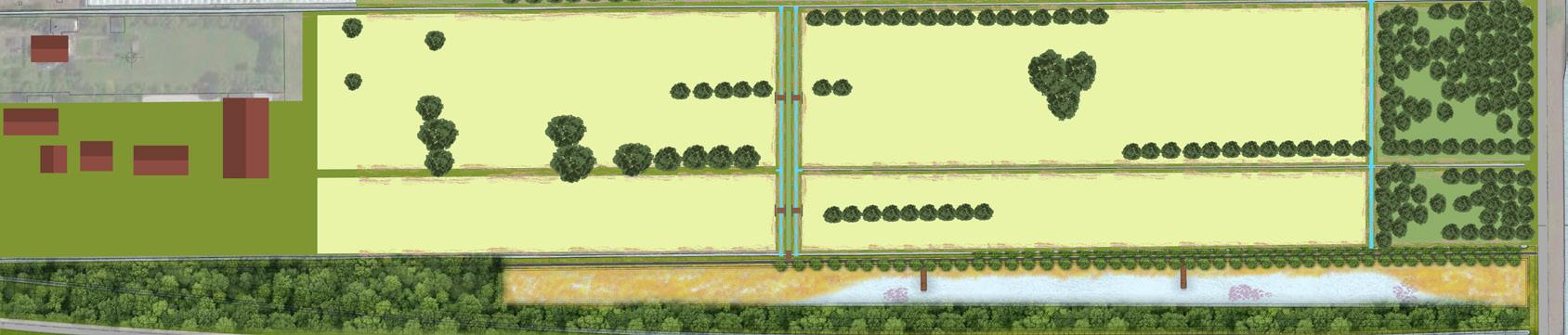
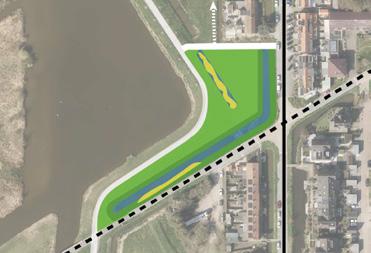
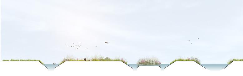
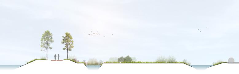
De Vredenburghzone is een natuurrecreatiegebied ten zuidwesten van de gemeente Waddinxveen. Het project is in 2018 gestart en in 2024 is een deel van het oorspronkelijke ontwerp gerealiseerd. In de huidige fase is het de taak om de overgebleven percelen in het grotere geheel te integreren. Ik haal inspiratie uit het polderlandschap en zoek naar mogelijkheden om de connectiviteit en functionaliteit te versterken.
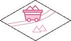
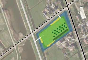
Perceel 1 Distripark heeft plannen over de ontwikkeling van gronden ten zuiden van de A12, waarbij een andere locatie gevonden moet worden voor de daar aanwezige waterplassen. De benodigde waterberging is tenminste 4.500 m2 op het -7,10 meter waterpeil. In overleg met het waterschap is besloten het huidige aangrenzende beeld van een plasdraszone voort te zetten over het perceel tot aan het hondenlosloopgebied.
Alternatieven voor een wandelpad door de manege in perceel 2 worden aan de eigenaar voorgelegd om een betere landschappelijke kwaliteit te onderhandelen met een hogere connectiviteit en biodiversiteit. Ook worden de mogelijkheden verkend om een recreatiepark te creëren in het overgangsgebied tussen het woongebied en het polderlandschap.
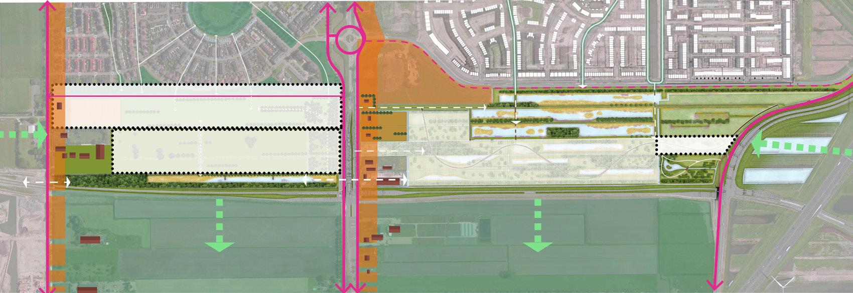
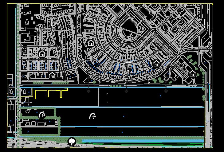
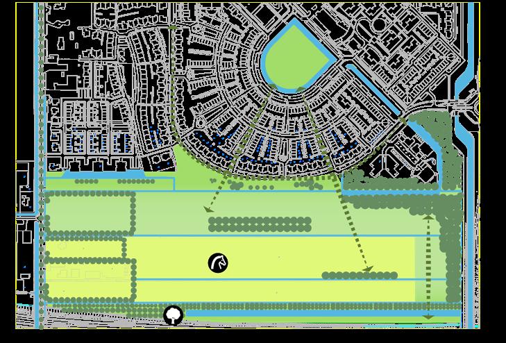
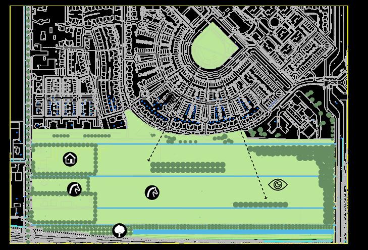
3 Recreatiepark
2 Manege
Toegankelijk nat recreatiegebied Bos
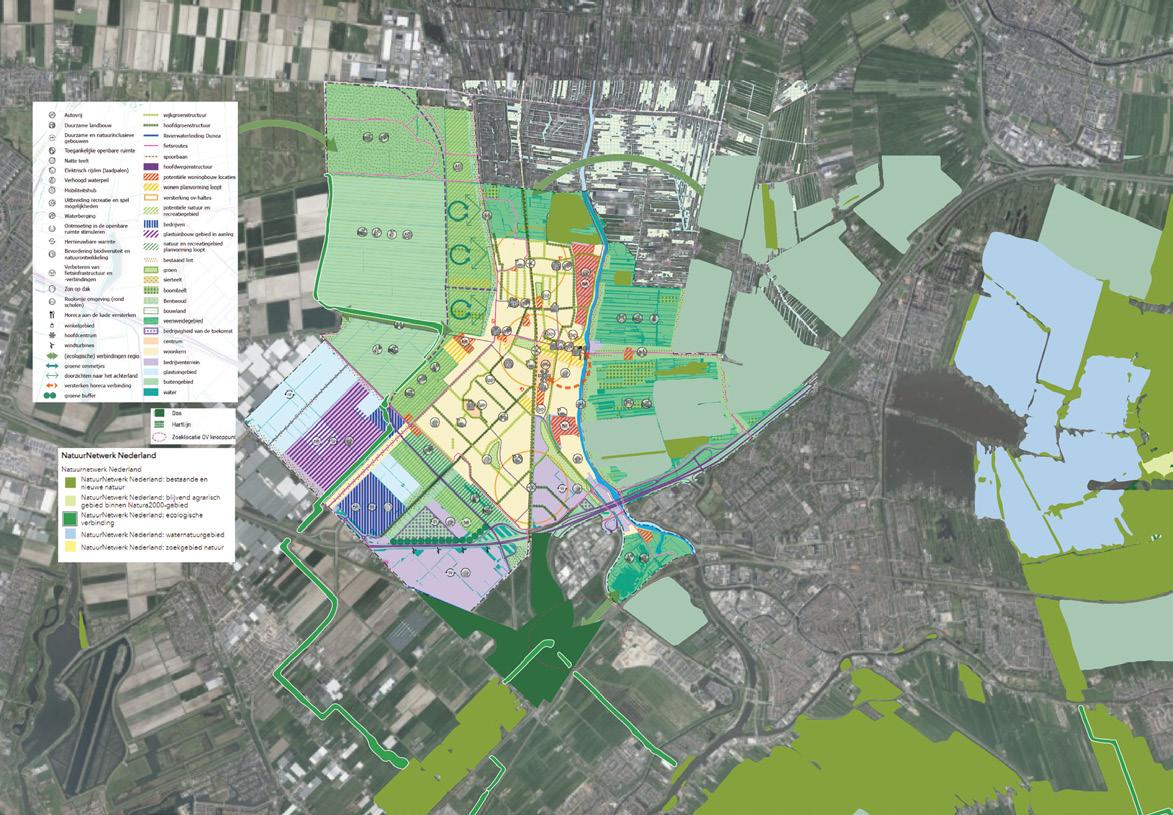
Toegankelijk nat recreatiegebied
Ransuilhabitat
Nat natuurgebied
1 Distripark
Hondenlosloopgebied
Vredenburghzone
Bestaande natte natuur
Pad met brug
Onderhoudsdijk met losse bomenlijn
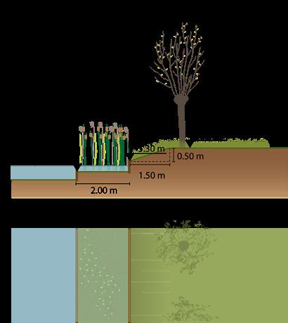
Grasland Plasdrasgebied
Rietland
Voorlopig ontwerp - waterberging


Rietland
Grasland met rijke bloemen Plas-dras Plas-dras


Nieuwe plas-dras waterpeil -7.10 indien overstroomd


Altijd onder water waterpeil -7.10
Bestaande plas-dras waterpeil -7.10 indien overstroomd
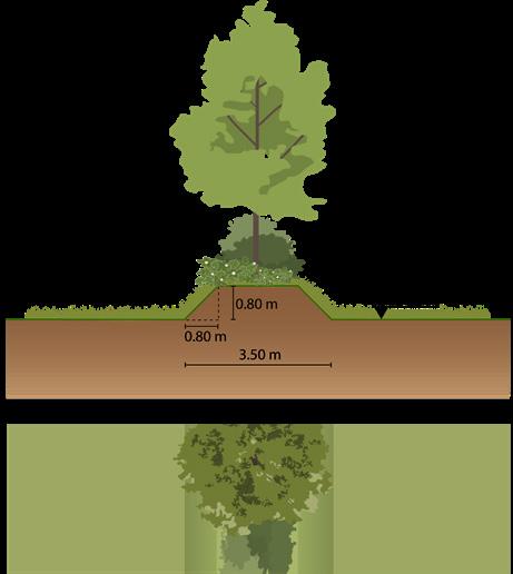
Nieuw te planten bomen
Pad
Brug


Toekomstige paden
Bestaande bomen

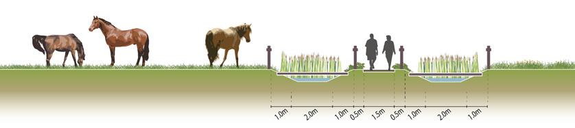
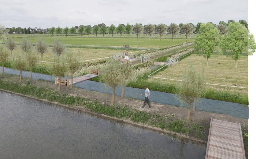
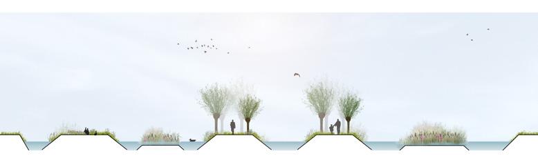
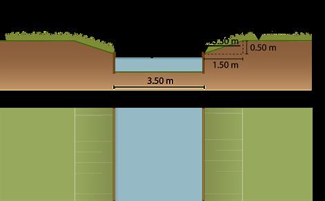
Profiel 4-4' met lage brug
Indruk van lage brug
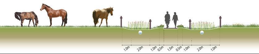
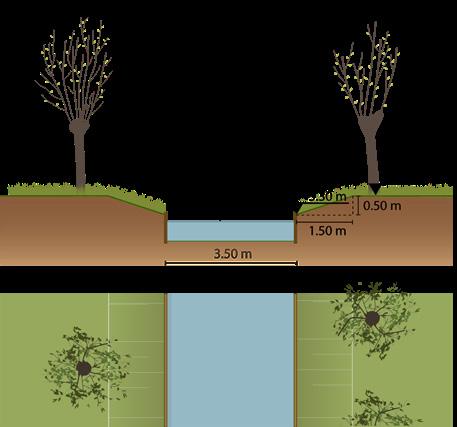
Profiel 4-4' met duiker
Indruk van duiker
1. Hoe creëer je een park dat aansluit op het woon- en plattelandslandschap?
3. Verbetering van de landschappelijke continuïteit via blauwgroene infrastructuur
2. Het creëren van vergezichten en het versterken van het coulissenlandschap
4. Het voortzetten van het stedelijk weefsel, het creëren van connectiviteit en nieuwe programma's
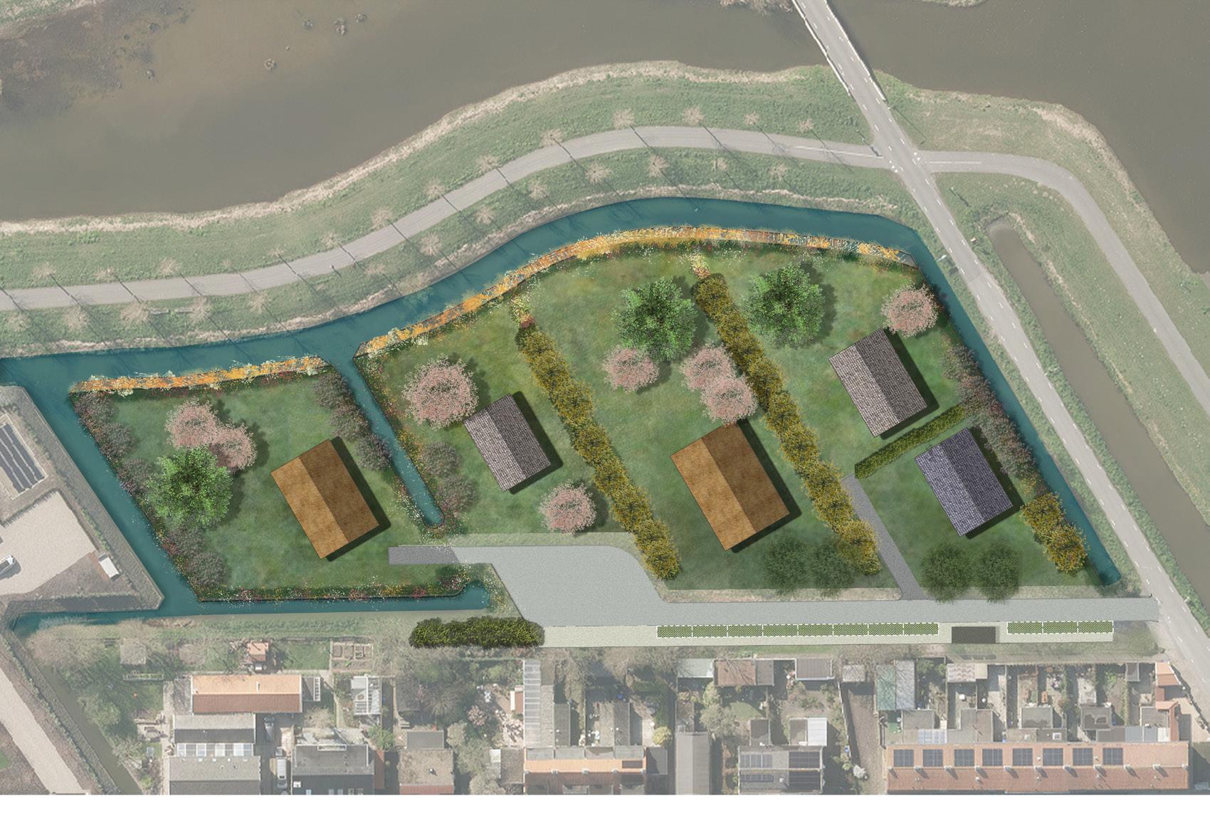
groenzoom
Lansingerland, Zuid-Holland
Opdrachtgever: Gemeente Lansingerland
1 Groene kamers
De gemeente transformeert de agrarisch percelen aan de Noordersingel ten behoeve van een betere leefomgeving en woningbouw. De transformatie van de Groene kamers volgens de volgende vier pijlers: water(-berging), recreatie en natuureducatie, natuurontwikkeling en landschapsbeleving. Naast het bereiken van de functionaliteiten, integreert ons ontwerp zich in het landschap en geeft elk kamer een unieke identiteit. Voor de wonenkavers stellen we regels op om ervoor te zorgen dat de nieuwe woningen het landschap volgen en maken we een kavelpassort om de landschappelijke ontwikkeling te begeleiden.
Kamer 4 - cultuurkavel met variatie aan natuur en cultuurakkers - landschapstypen: rietland, broekbos, griend
Schetsontwerpen
kleine zoogdieren, amfibie: insecten: OPTIE/ WENS
doelsoorten: vogels: weidevogels,
Profielen
Kamer 1
Kamer 3 - cultuurkavel milieu met boomgaard, bloemrijk gras en natuuroevers - landschapstypen: boomgaard, bloemenweide, rietoevers OPTIE/ WENS
Kamer 2
Ruimte voor ruimte opgave: 52 woningen, waarvan 10 reeds gerealiseerd
doelsoorten: vogels: tuinvogels,
kleine zoogdieren, amfibie: insecten:
Kamer 2 - nat graslandmilieu met plasdrasland en natuuroevers - landschapstypen: kruidenrijk grasland, open sloot, gras- en rietoevers
doelsoorten: vogels: weidevogels, amfibie: insecten:
1 - landelijk milieu met watergang en wadi (gras en riet) - landschapstypen: kruidenrijk grasland, open watergangen, wadi met riet
Kamer 3
Gebiedsvisie / Bestemmingsplan: transformatie van de kavels Noordersingel
doelsoorten: vogels: akkervogels,
kleine zoogdieren, amfibie: insecten:
Kamer
Locatie 1
Locatie 3
Locatie 4


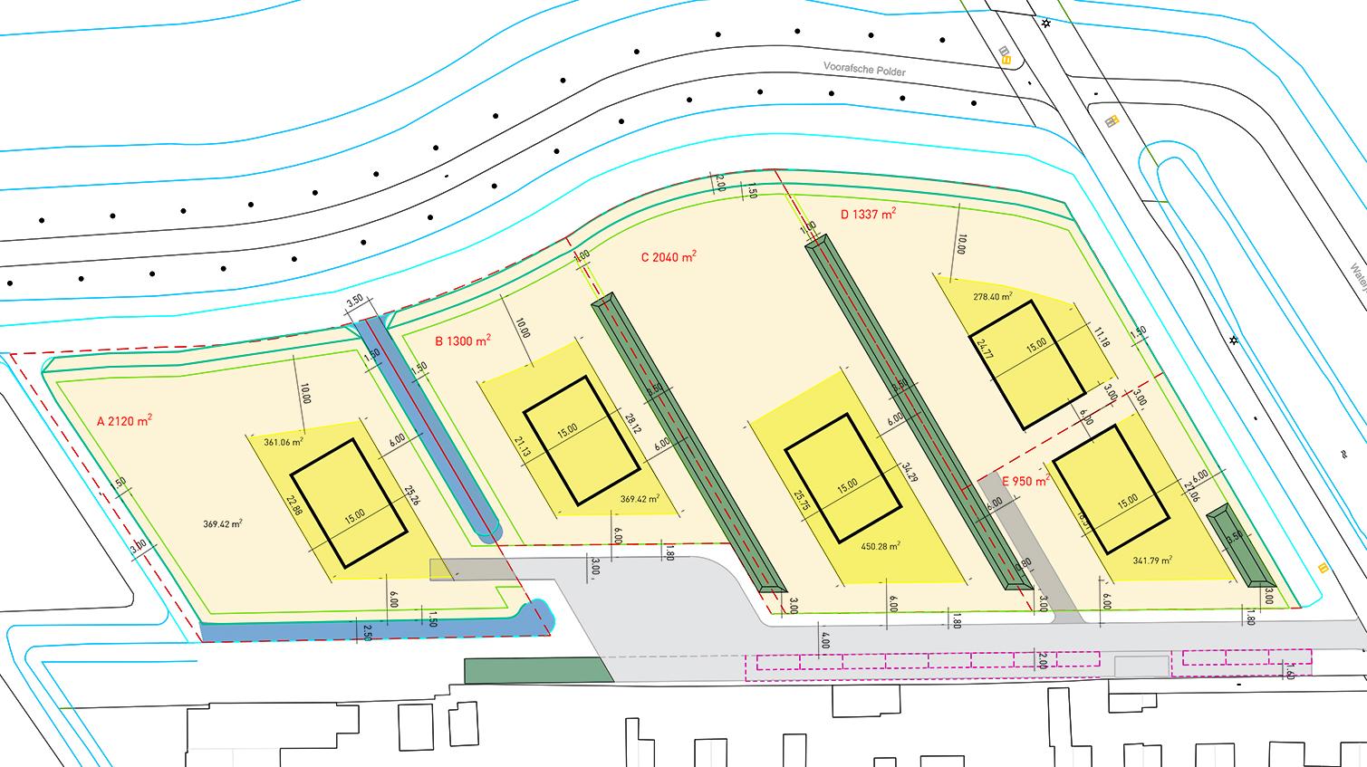
Kavel 7470 m2
Kavel 7470 m2
Uitgeefbaar 7747 m2
Uitgeefbaar 7747 m2
Uitgeefbaar 7747 m2

Profiel A-A'
Profiel A-A' optie
Profiel C-C'
Profiel B-B'