OFF-ROADING BLOODY BASIN ROAD: Located near Black Canyon City, Bloody Basin Road is an easy rated trail which spends much of the trip going through the Agua Fria National Monument. Take time for side trips to see archaeological sites and petroglyphs. The highest point of the trip
This twisty and fun road passes between many mines hidden on the hillside and offers some narrow, steep, and rocky spots on the route. Taking your 4x4, dirt bike, side-by-side, or truck out onto this run just might be the perfect way to spend your day. 34.591651° N, 111.998572° W
Learn More: funtreks.com/off-road-trails/blue-monster
BROKEN ARROW: Rated difficult, this short 3.8 mile trail may be the most memorable in Arizona! This trail is
CINDER HILLS RUN: Cinder Hills is is an
off-road destination approximately 13,500 acres in size and its numerous volcanic cinder cones and craters surrounded by ponderosa pine forest gives the area an otherworldly quality. This run can vary in levels of difficulty depending on your path but does offer mostly easy hills compatible to most types of off-road vehicles. Looking for a bit more of a challenge? Take the steep climb to Double Crater where the loose graveling ash is soft like sand. 35.32856° N, 111.523117° W
Learn More: funtreks.com/off-road-trails/cinder-hillsohv-area
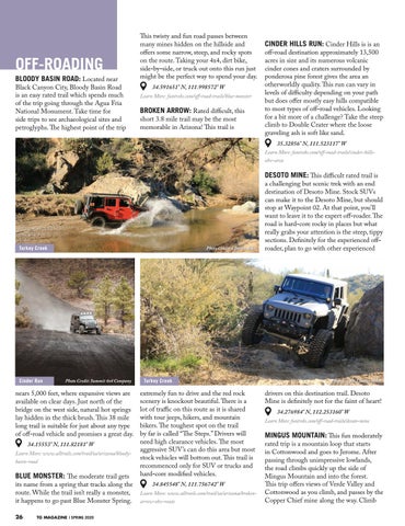
Turkey Creek
Cinder Run
Photo Credit: Charles Ables
Photo Credit: Summit 4x4 Company
nears 5,000 feet, where expansive views are available on clear days. Just north of the bridge on the west side, natural hot springs lay hidden in the thick brush. This 38 mile long trail is suitable for just about any type of off-road vehicle and promises a great day. 34.15553° N, 111.82181° W
Learn More: www.alltrails.com/trail/us/arizona/bloodybasin-road
BLUE MONSTER: The moderate trail gets
its name from a spring that tracks along the route. While the trail isn’t really a monster, it happens to go past Blue Monster Spring.
26
TG MAGAZINE | SPRING 2020
Turkey Creek
extremely fun to drive and the red rock scenery is knockout beautiful. There is a lot of traffic on this route as it is shared with tour jeeps, hikers, and mountain bikers. The toughest spot on the trail by far is called “The Steps.” Drivers will need high clearance vehicles. The most aggressive SUV’s can do this area but most stock vehicles will bottom out. This trail is recommenced only for SUV or trucks and hard-core modified vehicles. 34.845548° N, 111.756742° W
Learn More: www.alltrails.com/trail/us/arizona/brokenarrow-ohv-route
DESOTO MINE: This difficult rated trail is a challenging but scenic trek with an end destination of Desoto Mine. Stock SUVs can make it to the Desoto Mine, but should stop at Waypoint 02. At that point, you’ll want to leave it to the expert off-roader. The road is hard-core rocky in places but what really grabs your attention is the steep, tippy sections. Definitely for the experienced offroader, plan to go with other experienced
Photo Credit: Charles Ables
drivers on this destination trail. Desoto Mine is definitely not for the faint of heart! 34.276984° N, 112.253160° W
Learn More: funtreks.com/off-road-trails/desoto-mine
MINGUS MOUNTAIN: This fun moderately rated trip is a mountain loop that starts in Cottonwood and goes to Jerome. After passing through unimpressive lowlands, the road climbs quickly up the side of Mingus Mountain and into the forest. This trip offers views of Verde Valley and Cottonwood as you climb, and passes by the Copper Chief mine along the way. Climb


