4TH Year Fall
1 Page 2
3
4
5
2 Page 4 Page 6 Page 8 Page 10 Page 12
6
3RD Year Spring 3RD Year Fall 2ND Year Spring 2ND Year Fall II 2ND Year Fall I
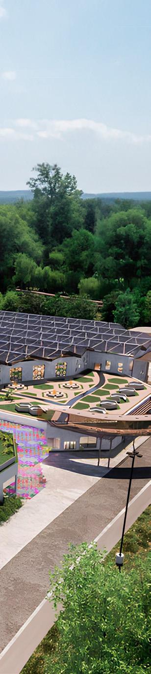
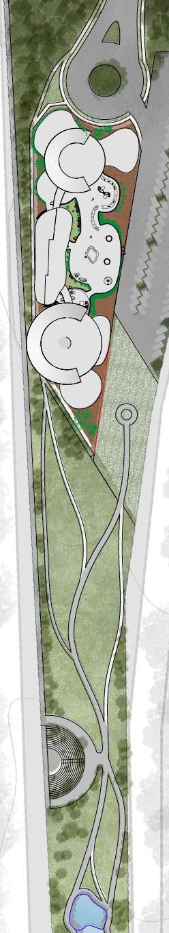
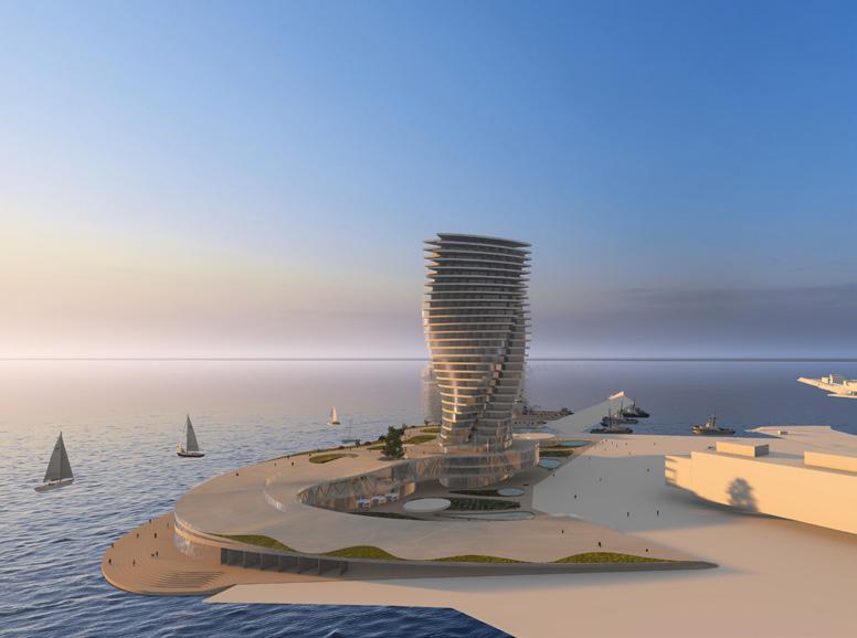
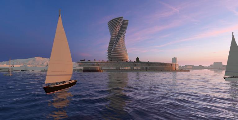
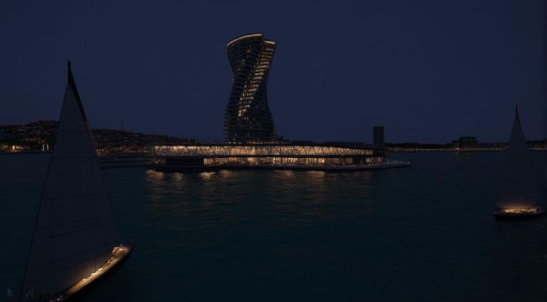
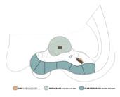
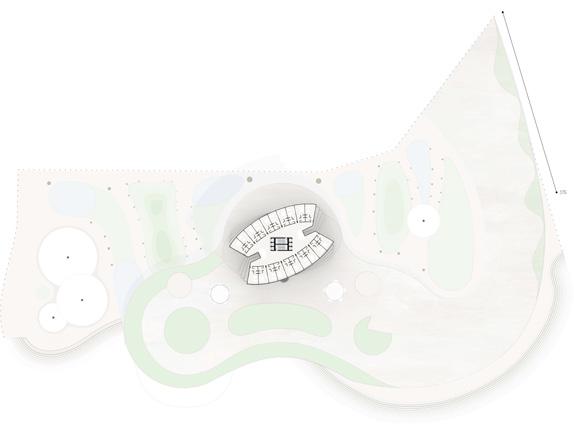
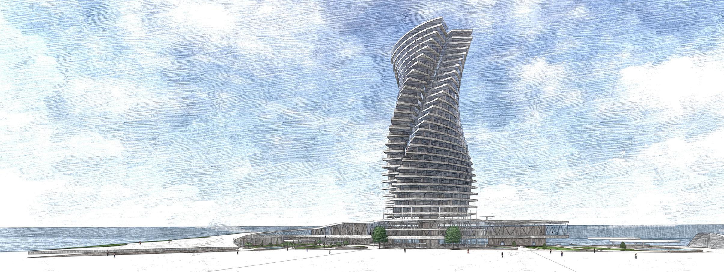
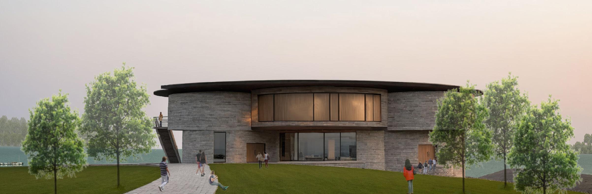
Merging Zones: Ascend to the Sea
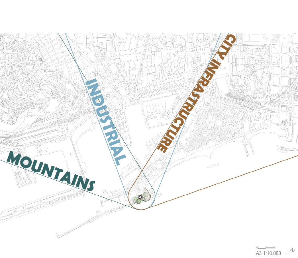
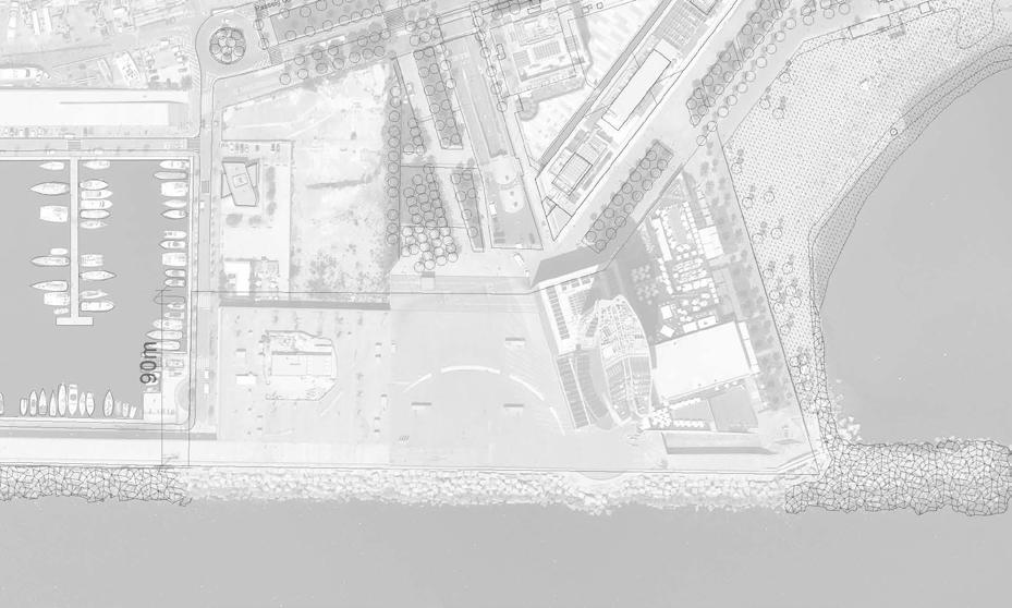
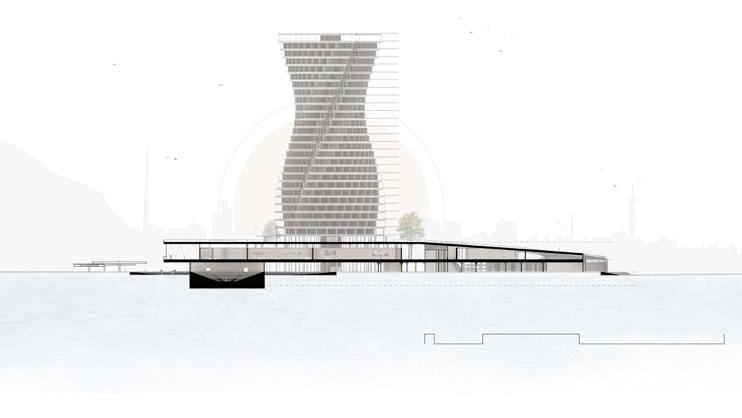
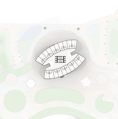
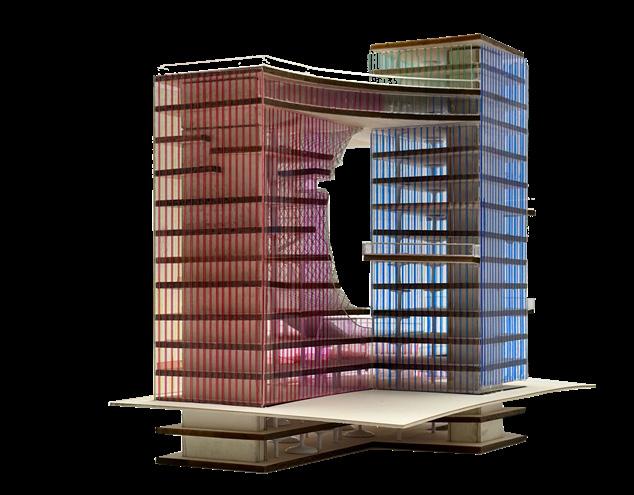
THE MAIN OBJECTIVE OF THIS PROJECT WAS TO DEVELOPE A DESIGN THAT WOULD REPLACE THE EXISTING W HOTEL ON BY THE MARINA IN BARCELONA, SPAIN. THE PROPOSAL WAS DEDICATED TO CREATING A PUBLIC AND RESIDENCE FOR THOSE PARTICIPATING AND OR INTERESTED IN THE AMERICA’S CUP SAILING COMPETITION. THE GOAL WAS TO CREATE A DESIGN THAT INFLUENCED BY THE THREE ZONES SURROUNDING THE SITE TO RESTORE IT TO BARCELONA’S ARCHITECTURAL INTEGRITY.
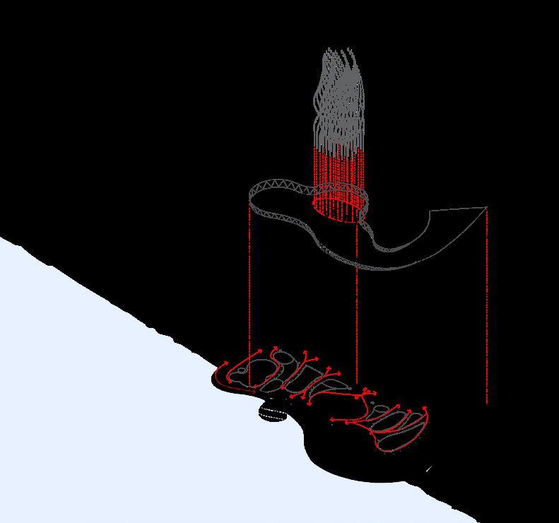
MY CONTRIBUTIONS THROUGHOUT THE PROJECT INCLUDE ALL THAT IS SHOWN THROUGHOUT THE PROJECT EXCLUDING THE EXPLODED AXON AND SECTION PERSPECTIVE DRAWING.
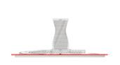
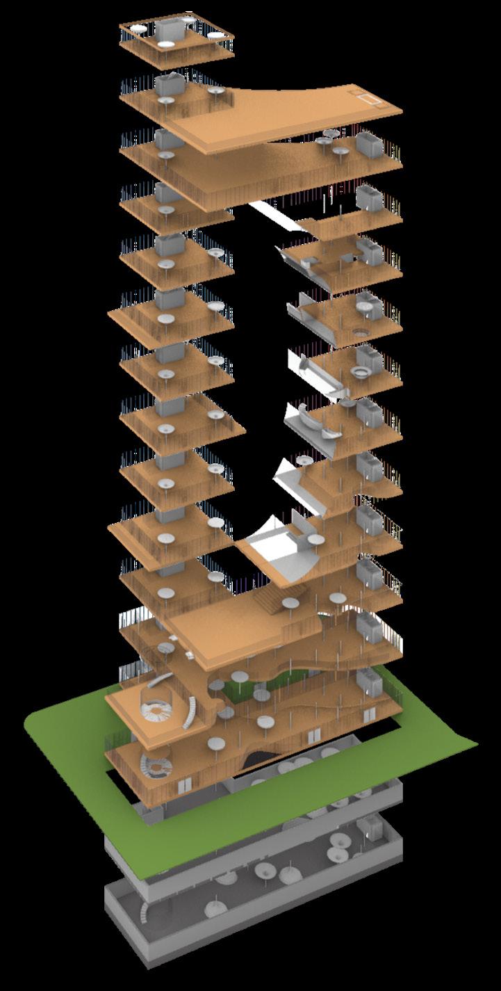
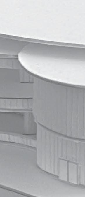
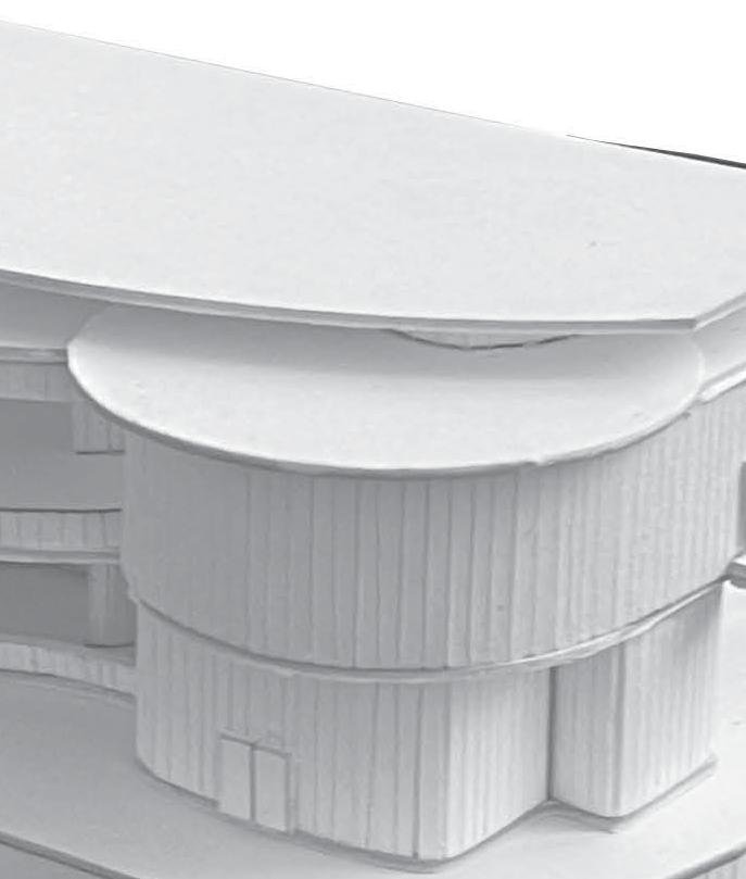
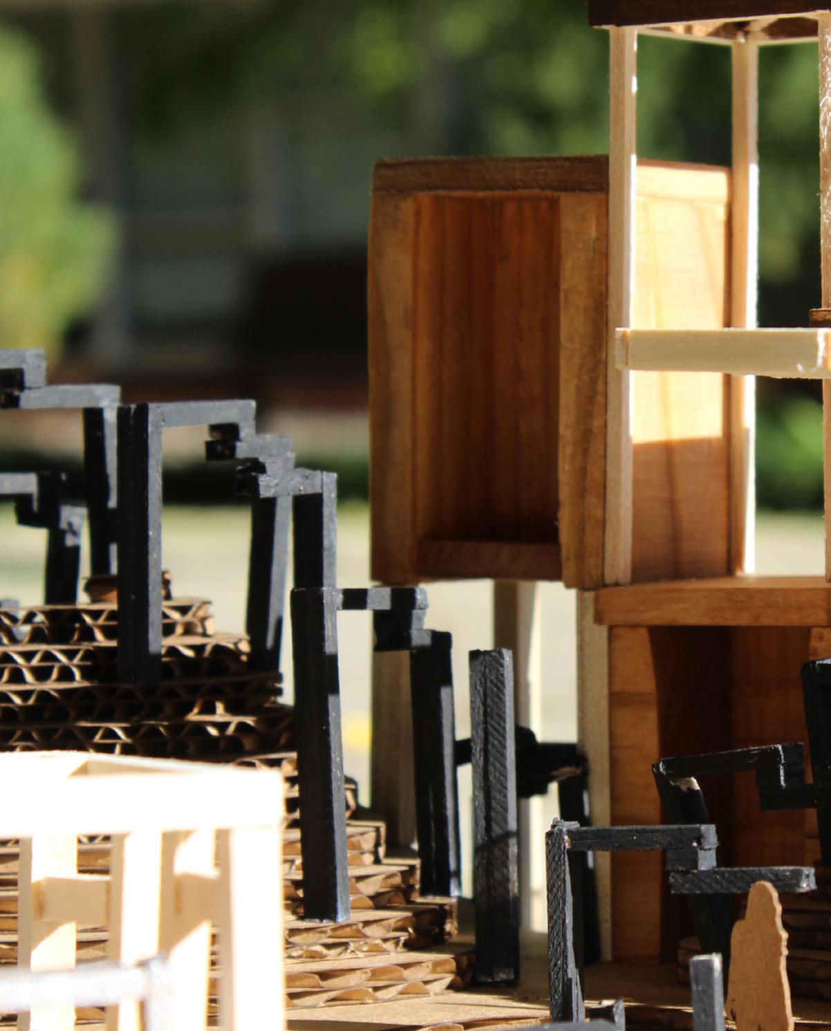
Exploded Axon showing the materiality of the design
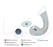
Diagram showing the use of combining of city zones to influence the design
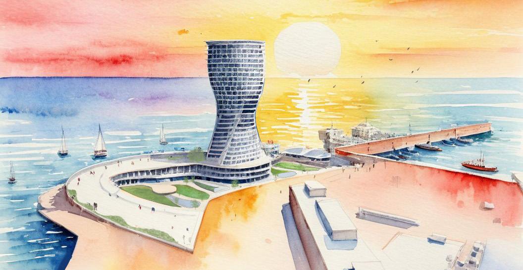
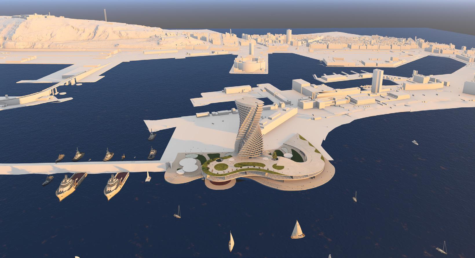
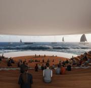
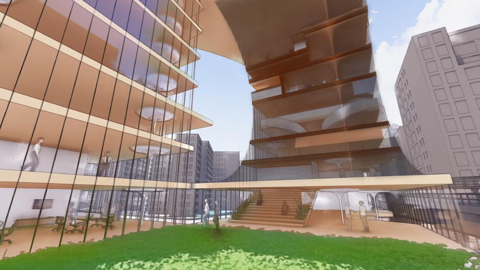
Rendering showing the radiance of the building next to the sea at night
Rendering of the building in the evening glow
Rendering
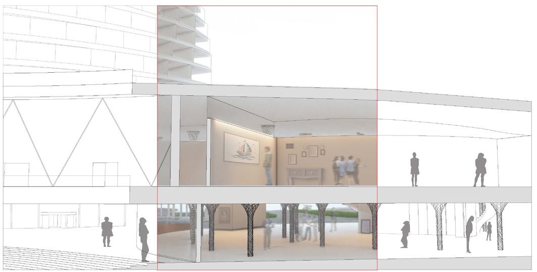
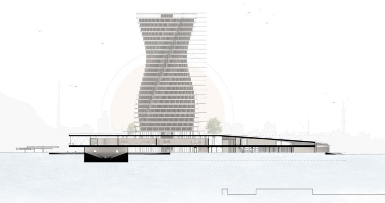
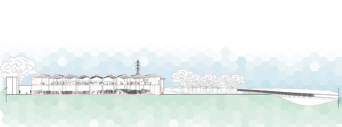
Section
Co-developers: Holly Caccamisi & Maggie
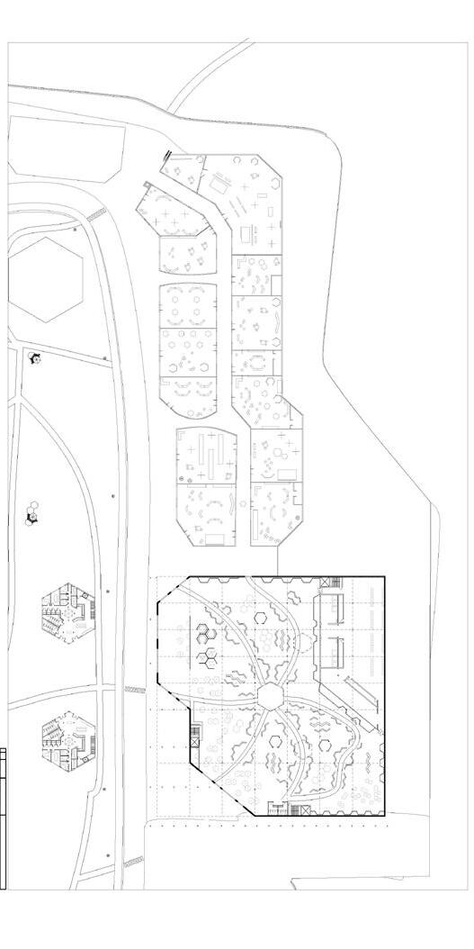
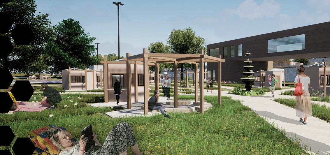
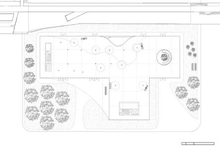
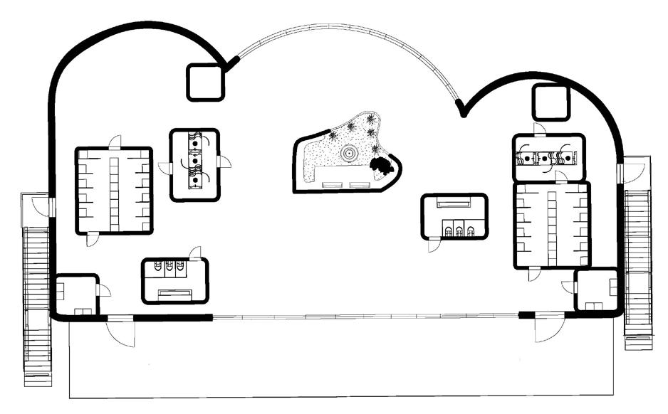
of the overall view of the pathways, mall, office spaces, and market
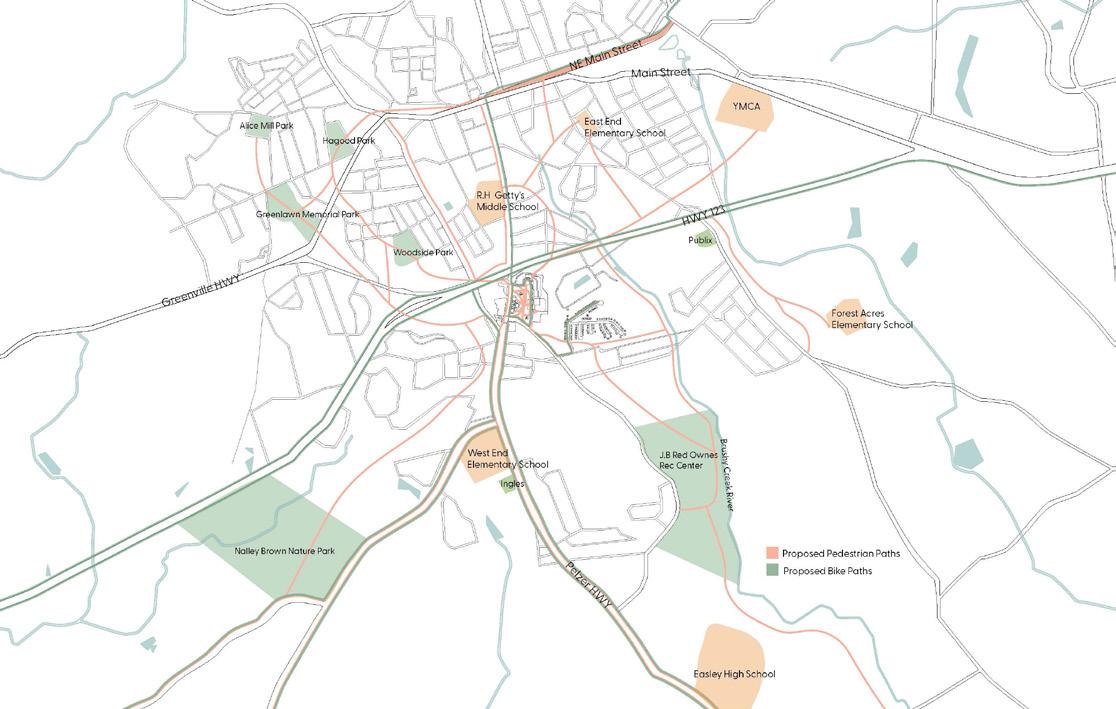
Diagram of the schools surrounding the site in relationship to the proposed bicycle and pedestrian pathways for safety and convenience
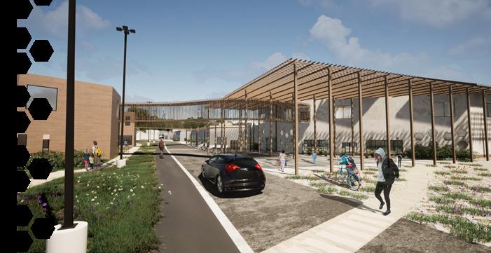
THE GOAL FOR THE BIG BOX DEVELOPMENT WAS TO FOCUS ON THE INCLUSION OF PASSIVE SPACE, COMMUNITY INTERACTION, WALKABILITY, RESOURCEFUL SPACING, STUDENT-SAFE PATHWAYS, BICYCLE PATHWAYS, AND GREENERY TARGETING THESE ASPECTS SOLVED MANY PROBLEMS IN EASLEY, SC WHICH INCLUDES LARGE SPANS OF ASPHALT GROUNDS DISCONTINUED PATHS, AND NONDISTINCTIVE WALKING AREAS. THE PLAN WAS TO GET RID OF THE EXISTING ASPAULT, WHICH CREATES MANMADE BARRIERS FOR WALKABILITY HAS NO CLEAR DIRECTION, CREATES ISOLATION, AND REDUCES GREENERY
MY CONTRIBUTIONS THROUGHOUT THE PROJECT INCLUDE THE 3D-MODEL MAKING, MANMADE VS NATURAL DIAGRAM, EXPLODED AXON, AND SECTION B.
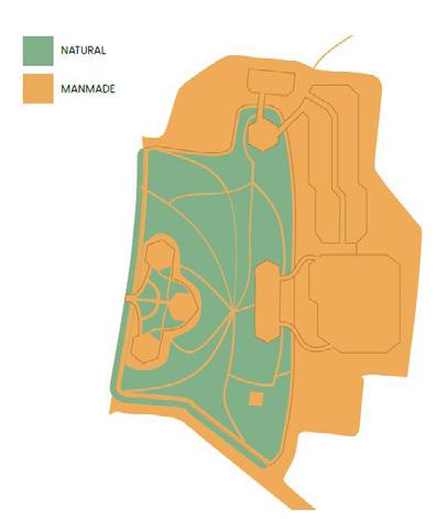
Diagram of the proposed natural and manmade components of the design
Diagram of the proposed site design in relationship to the proposal for the pathways
Rendering
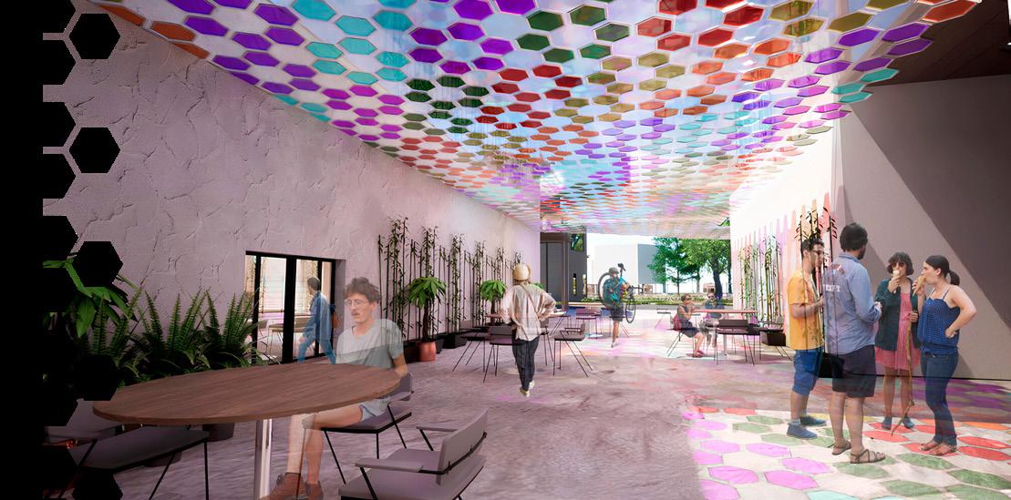
Rendering of the view below the covered pathway between the mall and the market
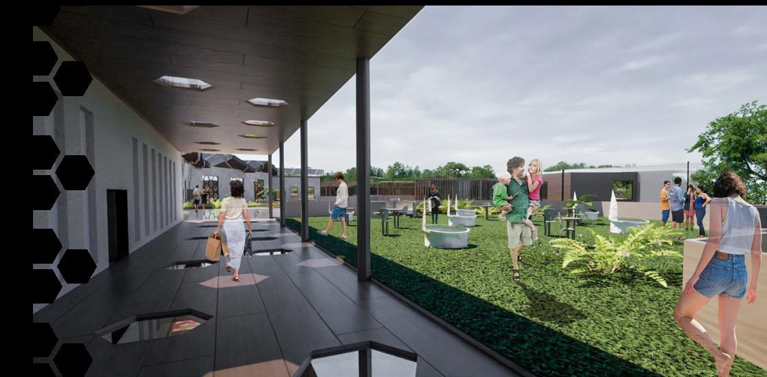
Rendering of the view from the covered porch area on the green roof of the mall
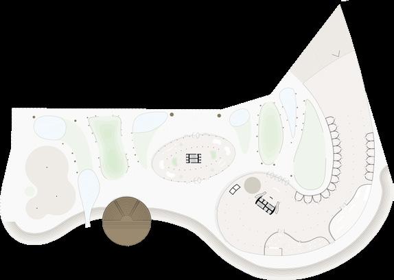
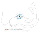
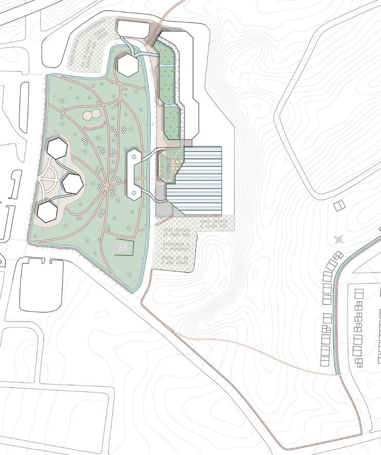
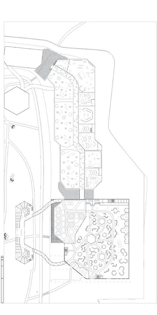
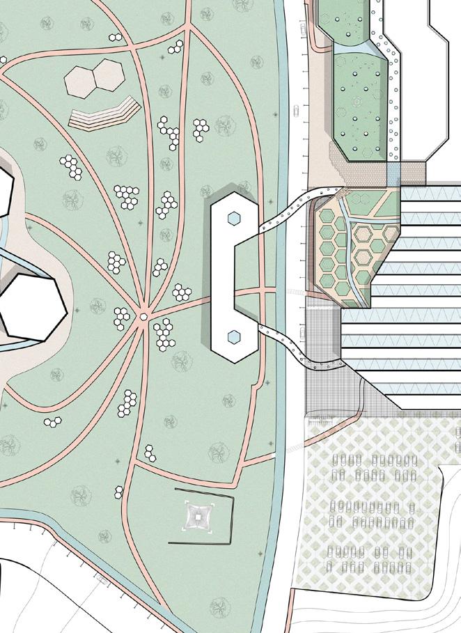
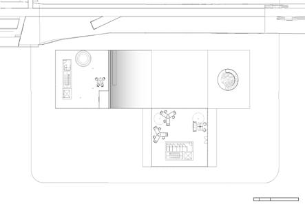
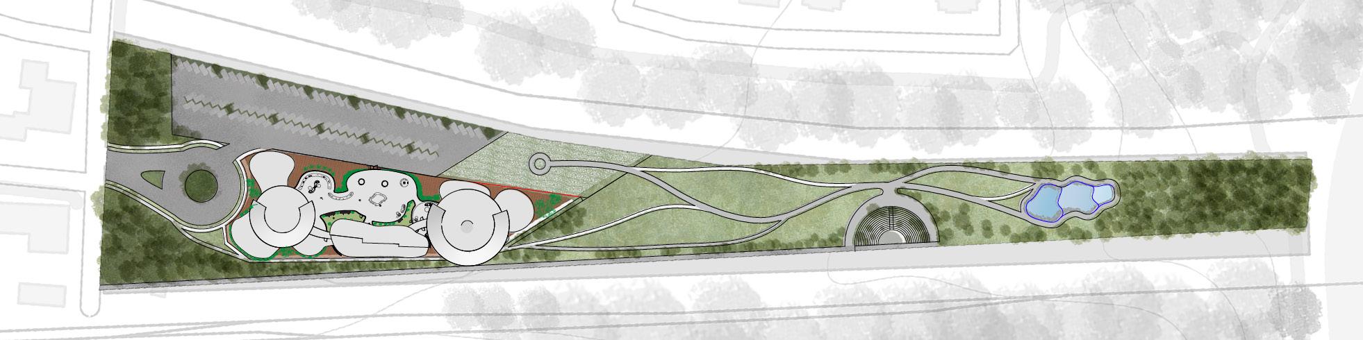
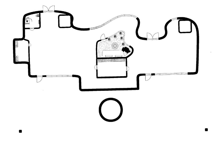
Masterplan of the overall site design
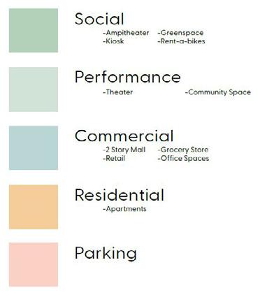
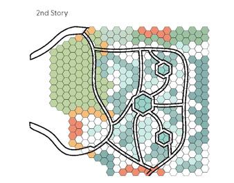
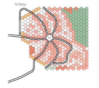
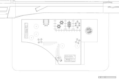
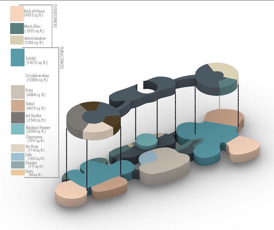
Diagram showing the site’s programming zones
Section perspective of the upper and lower levels of the market
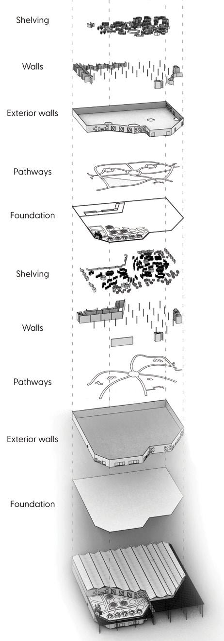
Exploded axon showing the building contents and layout
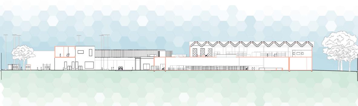
Section
Diagrams showing the programming for the two levels of the market
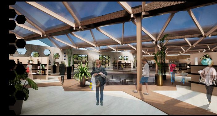
Rendering of the interior of the market’s upper level and roof design
Rendering of the pathways between the market and office spaces
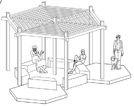
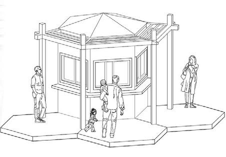
Enlarged drawings of the kiosks circled on the site
Rendering showing the circulation around and interaction with the kiosks around the site
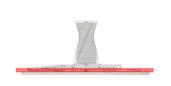
3RD YEAR FALL
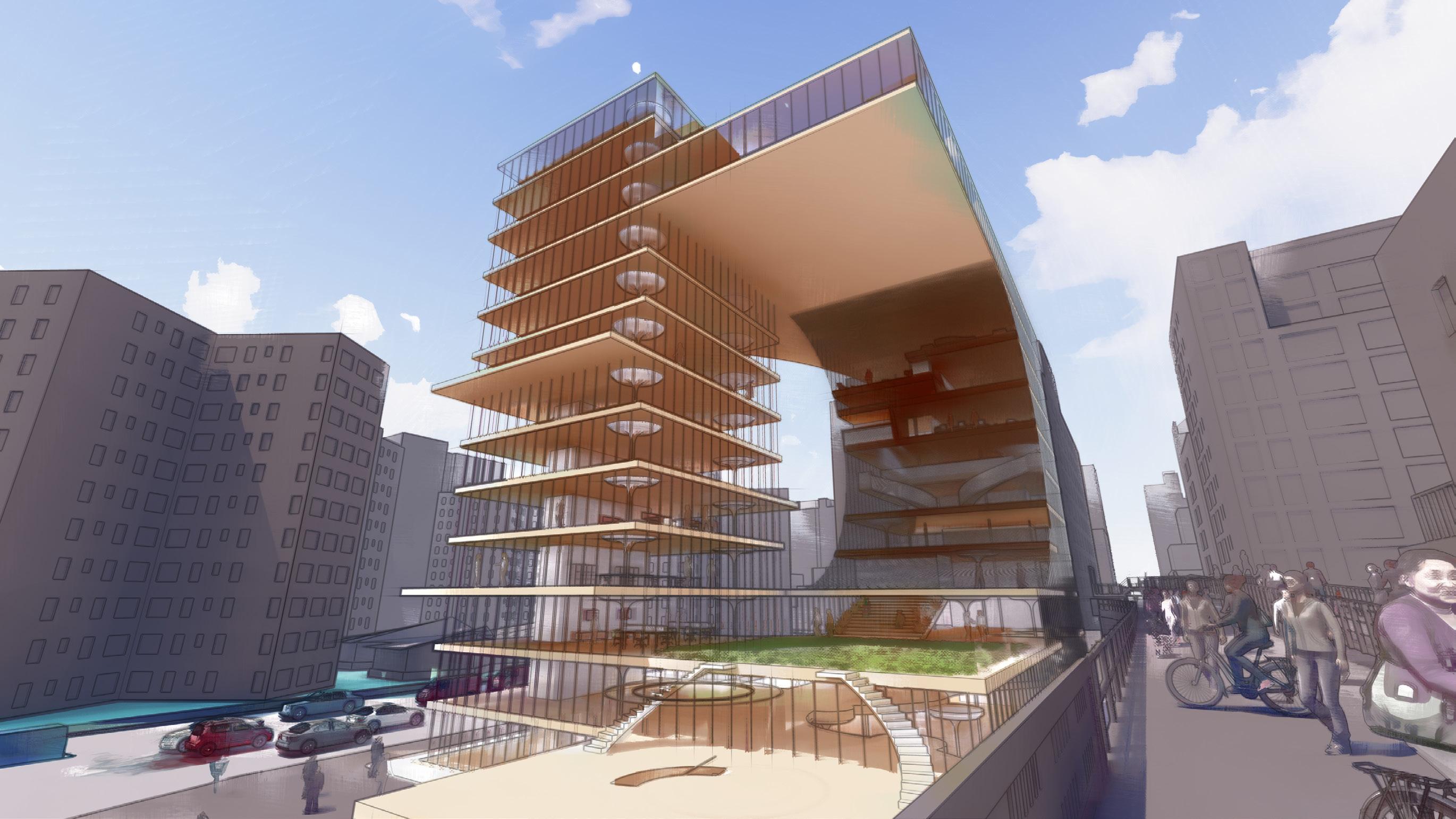
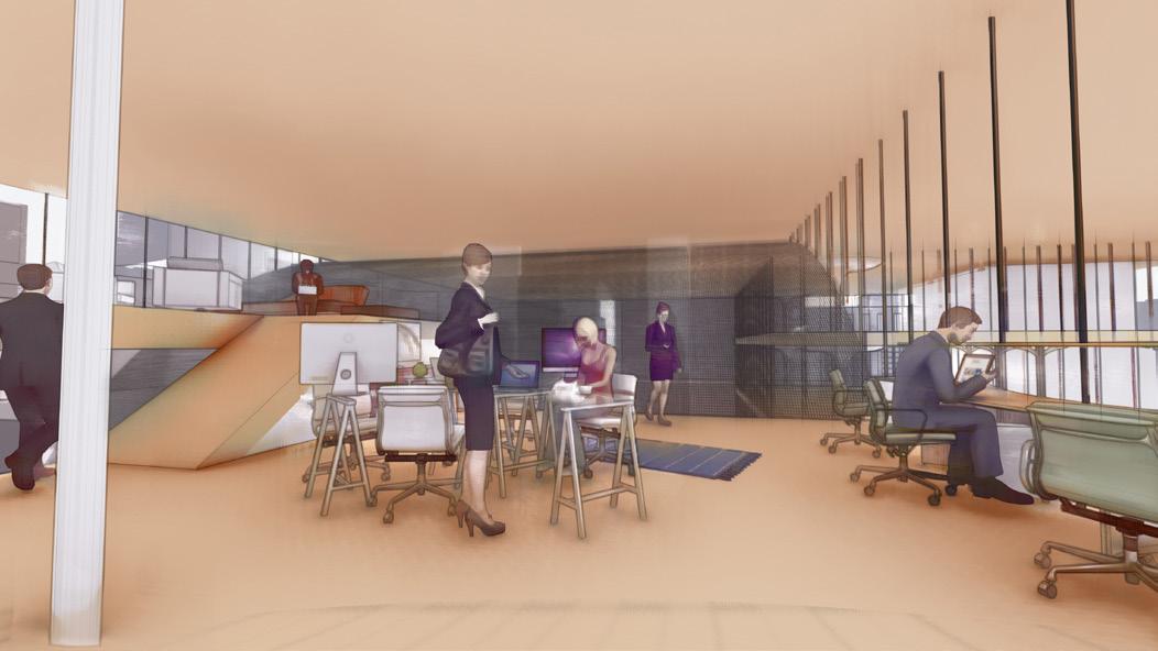
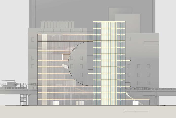
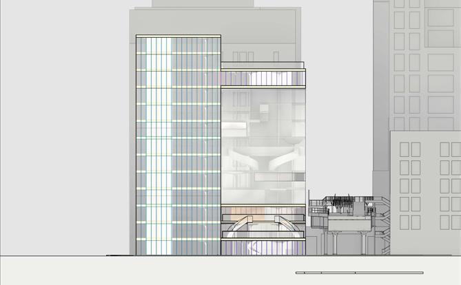
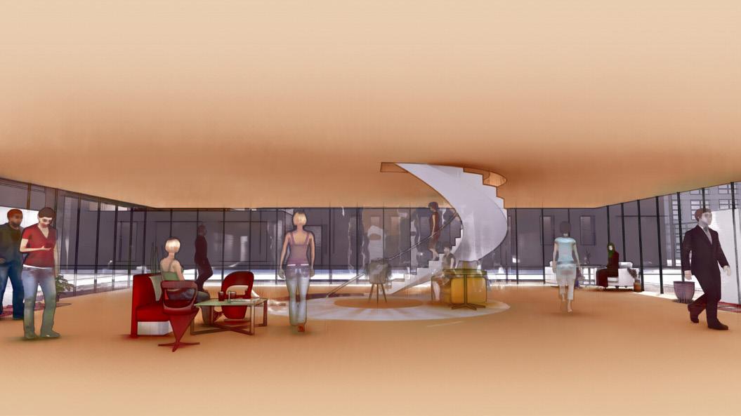
THE PRIMARY FOCUS OF THIS PROJECT WAS WORK IN NEW YORK CITY. THE GOAL WAS TO RESEARCH AND MAINTAIN AN UNDERSTANDING OF THE CONTEMPORARY CITY AND WORKPLACE TO DESIGN A OFFICE FOR WORKERS AND THE BUILDINGS THAT PLAY A ROLE IN THE URBAN CONTEXTS IN WHICH THEY ARE PLACED. WE WERE CHALLENGED TO WORK THROUGH THE COMPLEX INTERRELATIONSHIP BETWEEN BUILDING FORM, PROGRAM, AND SITE
MY CONTRIBUTIONS THROUGHOUT THE PROJECT INCLUDE THE 3D MODEL-MAKING, DETAIL DRAWING, SECTION DRAWINGS ALL PHYSICAL MODELS, AND ALL PHYSICAL MODELS.
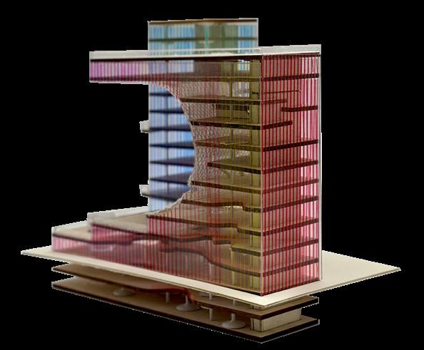
Rendered axon showing each floor’s contents
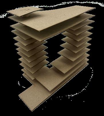
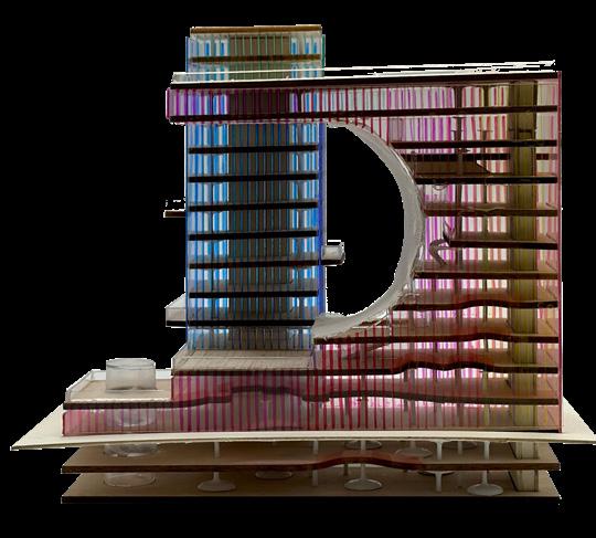
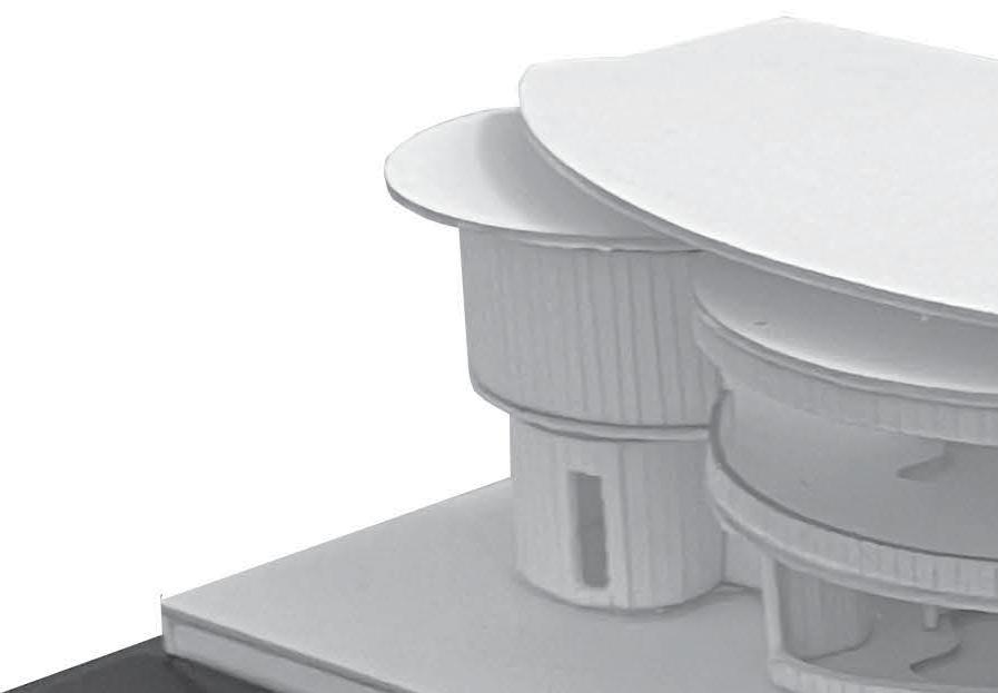
Study model created to test the conceptual structure
Axon for the proposed programming and circulation of the building
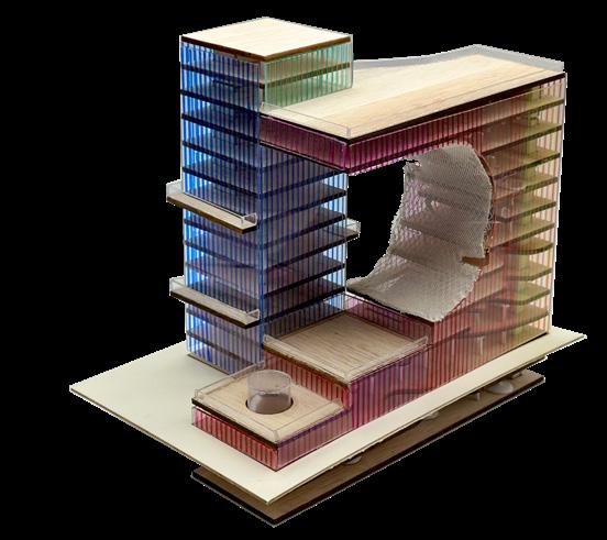
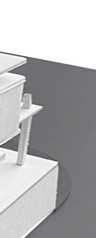
Column model created to test stregth capability
Interior rendering of the circulation around and use of the columns
Detail drawing of the materiality and structure of the tower’s curve
Detail model created to test the proposed structure and material of the building’s curve
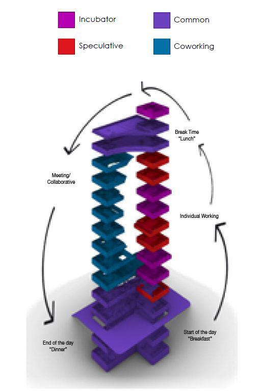
Incubator
Speculative Common Coworking
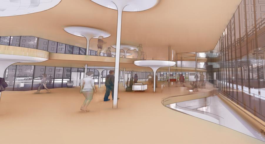
Rendering showing the flexibility in the floor plates of the building creating easy transitions between the spaces
Elevation of the building from the street
Rendering showing the circulation on the ground floor and the interaction with the staircase
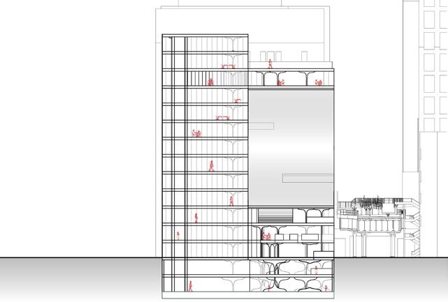
Section through the building with the curve showing the building’s flexibiltity
Section through the building with the curve showing the relationship between the two buildings and the curve
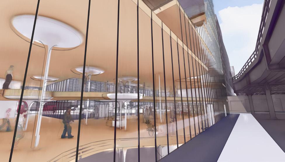
showing the relationship between the building and the highline
Ground level of the building in relationship to the site
Mid-level of the proposed structure where the buildings split into two
Level where the two buildings merge to create a large common space/ break room
Rendering showing the curve of the mesh material of the building curve and the courtyard space
Rendering
Right elevation of the building along the highline
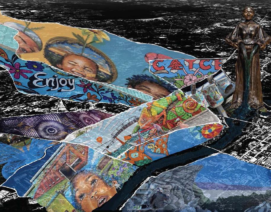
THE GOAL OF THIS PROJECT WAS TO CREATE AN ART CENTER CATERING TO THE LOCAL COMMUNITY OF CAYCE, SC. A COMPREHENSIVE APPROACH WAS ADOPTED WITH THE COMPLETION OF RESEARCH ON CAYCE, SC TO OBTAIN INSIGHT FOR THOROUGH SITE ANALYSIS AND THE CONSIDERATION OF RESTRICTIONS IN THE DESIGN PROCESS. AT THIS POINT IN THE ARCHITECTURE PROGRAM, LEARNING ABOUT, CONSIDERING, AND INCLUDING PROGRAMING WAS ESSENTIAL, MAKING THESE IMPORTANT FACTORS TO THE DESIGN. A HOLISTIC CONSIDERATION OF THE DESIGNATED SITE WAS ALSO IMPORTANT AS COLLABORATIVE GROUPS WERE FORMED TO ENGAGE IN THE COLLECTIVE DESIGN TASKS.
MY CONTRIBUTIONS THROUGHOUT PROJECT PRODUCTION INCLUDE 3D MODEL-MAKING AND ALL OF THE WORK SHOWN.
Diagram showing the programming of the structure
Massing studies for the thought process in determining the design of the building exterior
Art diagram showing the artwork throughout the city of Cayce, South Carolina
Massing studies demonstrating the form creation and the relationship between the overlapping areas of the design
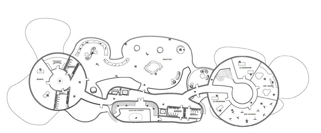
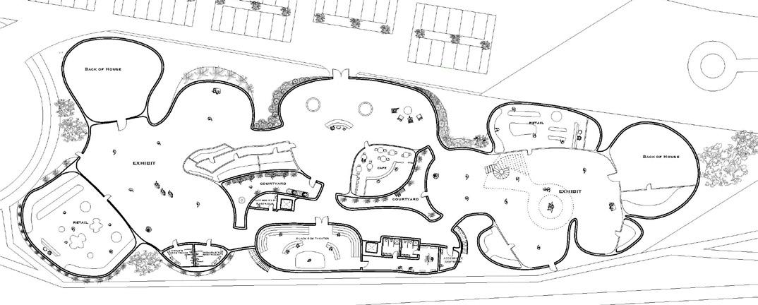
Floor plan of the upper level of the art center
Floor plan of the ground level showing the art center’s interior and the site design
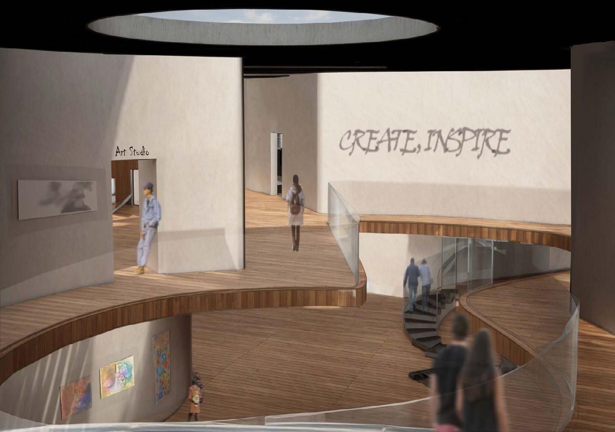
Rendering of the roof skylight, second floor, and view of first floor through the cutout of the second floor
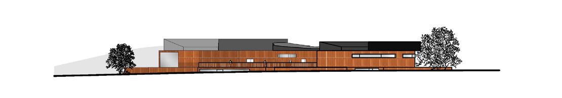
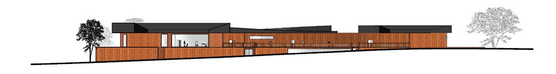
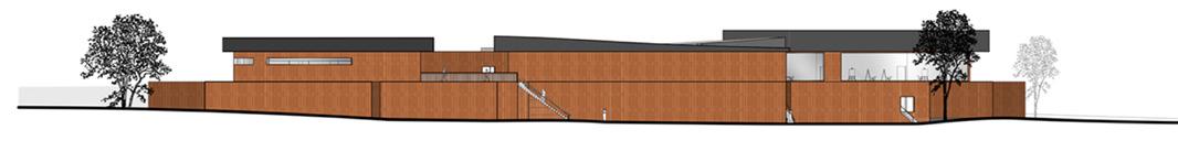
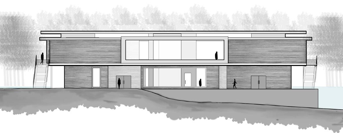
Front Elevation
Back Elevation
Left Elevation
Right Elevation
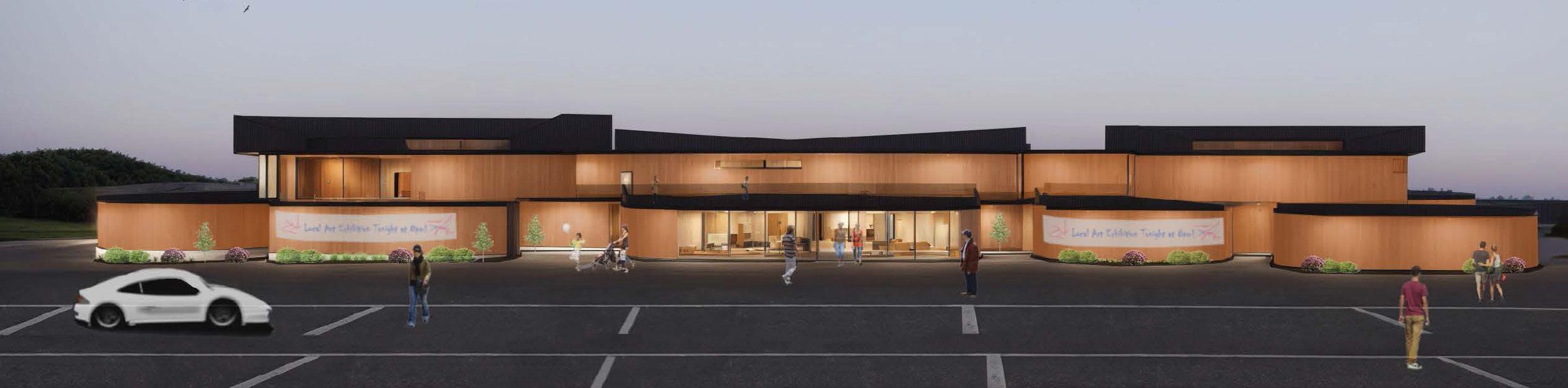
Rendering of the front of the building, the parking lot, and the entry
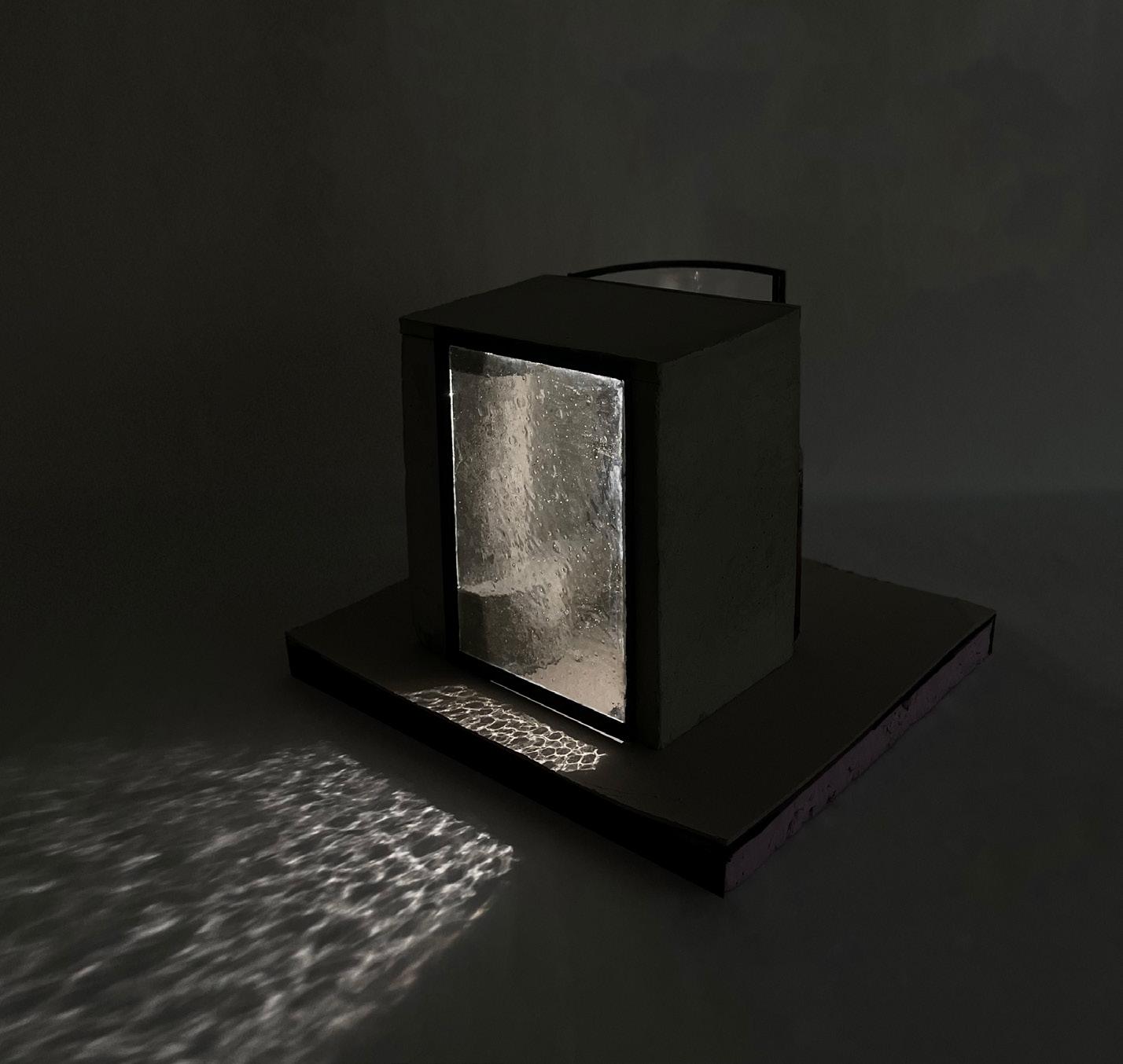
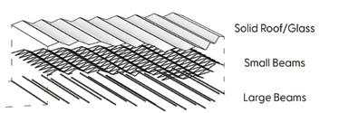
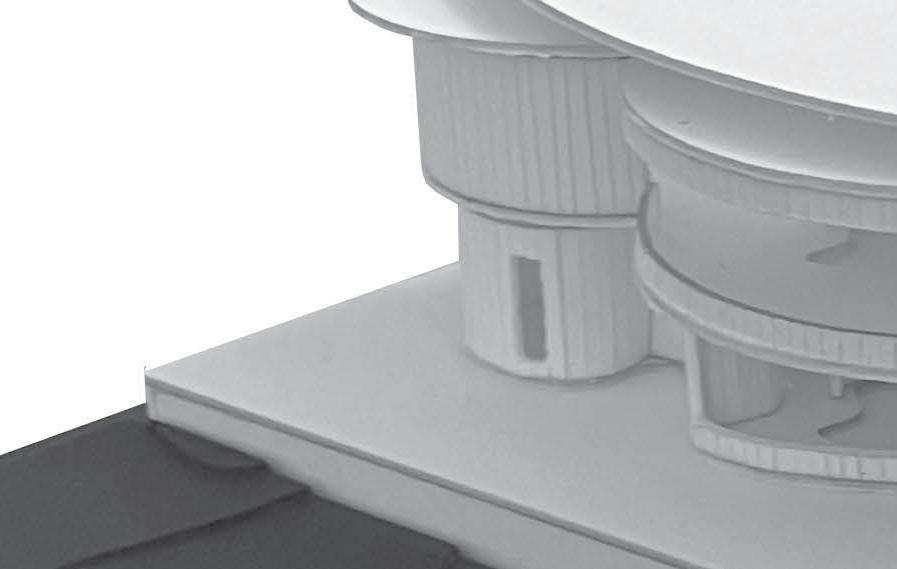
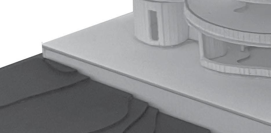
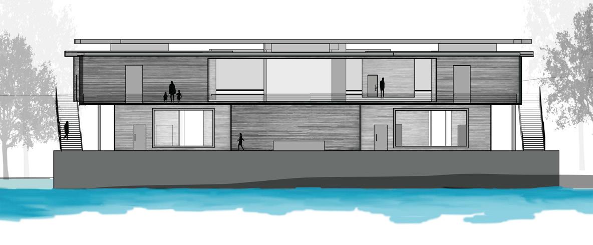
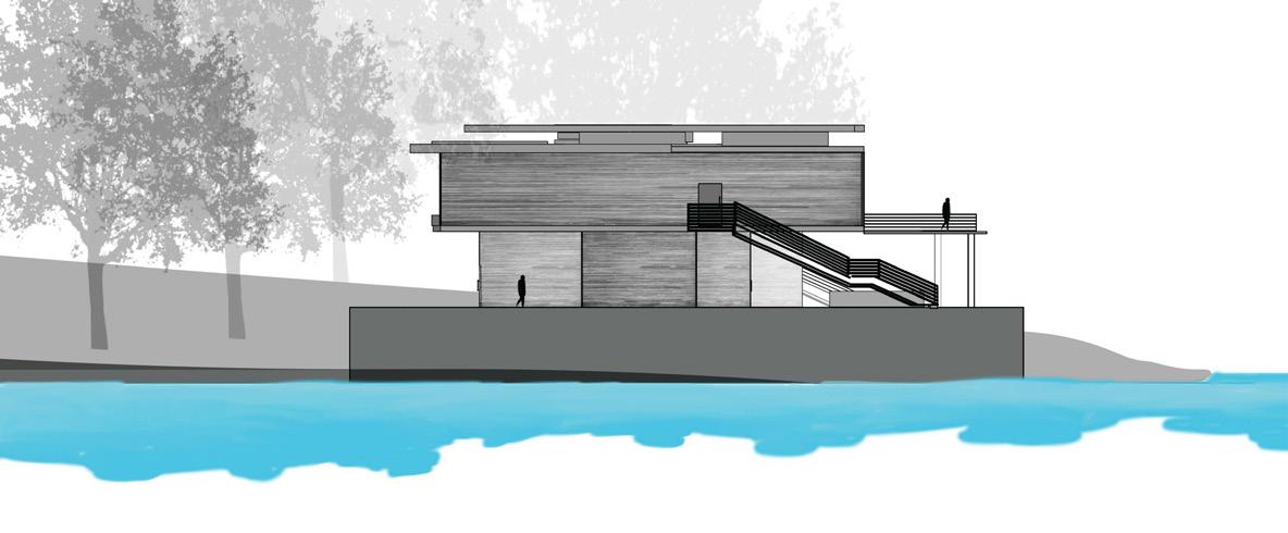
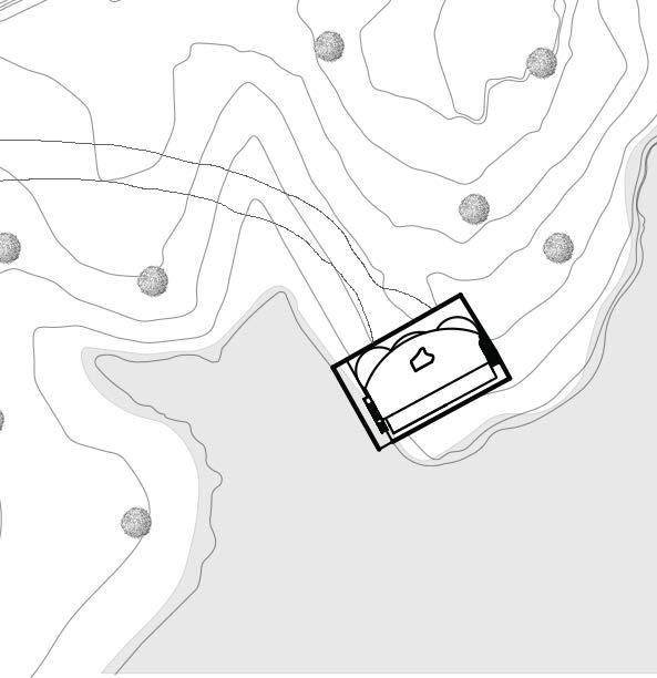
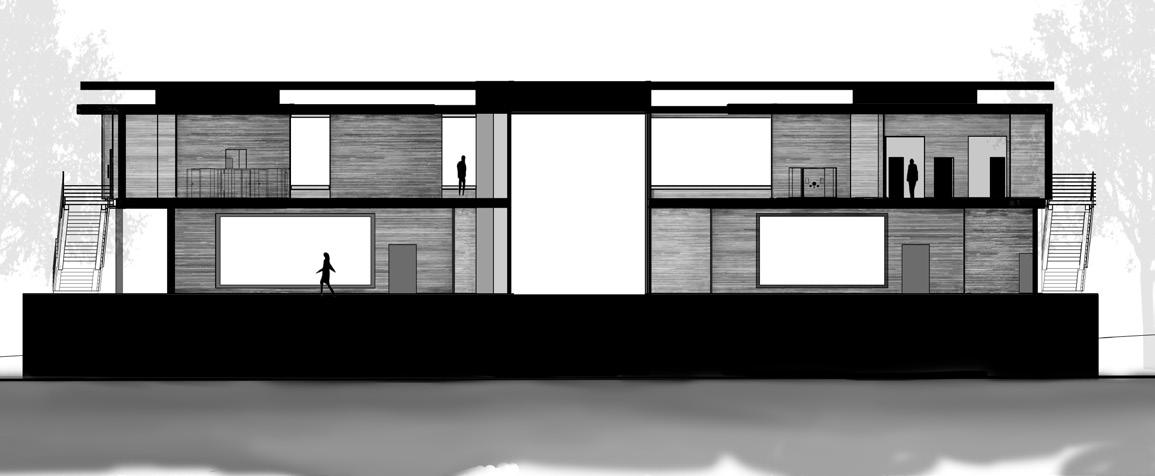
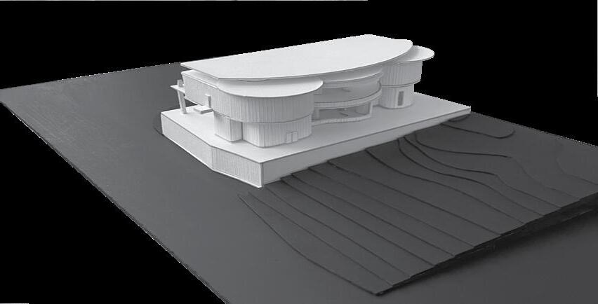
THE OBJECTIVE WAS THE ESTABLISHMENT OF A SNOW CENTER IN CLOSE PROXIMITY TO THE ROWING DOCKS IN CLEMSON, SC. THE INITIATION PHASE INVOLVED THE SELECTION OF PRECEDENTS TO SERVE AS GUIDING REFERENCES AND SOURCES OF INSPIRATION FOR MATERIAL RELATIONSHIPS, DESIGN STRATEGIES, AND RELATED CONSIDERATIONS. MY CHOSEN PRECEDENT WAS THE THERME VALS BY ARCHITECT, PETER ZUMTHOR, IN SWITZERLAND, WITH PARTICULAR EMPHASIS ON THE EXPRESSIVE USE OF CONCRETE AND GLASS WITHIN THE ARCHITECTURAL FRAMEWORK STARTING THE PROJECT, A CAREFUL EXAMINATION AND CONCEPTUALIZATION OF A DETAILED SHOWER BECAME THE FOCAL POINT, INTENDING TO SEAMLESSLY INTEGRATE ITS ATTRIBUTES INTO THE FINAL DESIGN OF THE ENTIRE STRUCTURE
MY CONTRIBUTIONS THROUGHOUT PROJECT PRODUCTION INCLUDE 3D MODEL-MAKING AND ALL OF THE WORK SHOWN.
- Big Slab: 2400up x 1200up x 20/30 mm
- Half Slab: 2400up x 600/700up x 20/30 mm
- Cut-to-size: 600 x 300, 600 x 600, 800 x 400 in 20or
30 mm thick
- Customize available
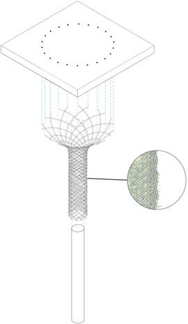
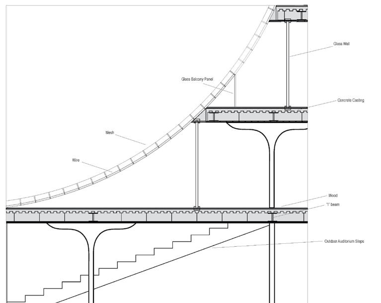
Detail drawing displaying the structure and materiality of the shower design
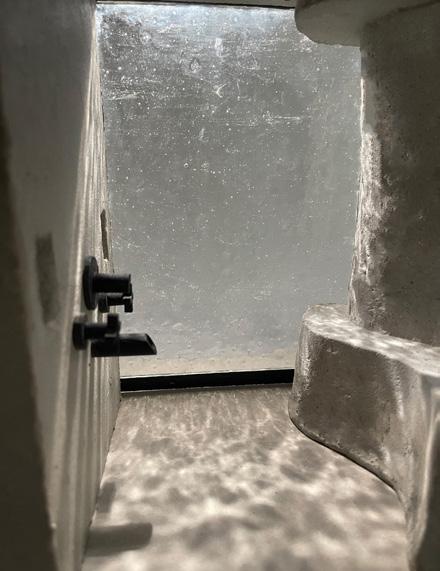
Rendering of the shower design for the field house
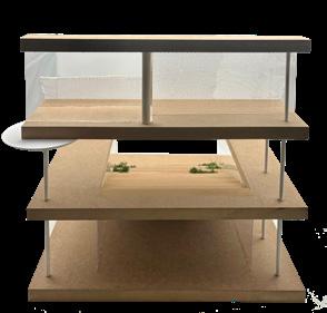
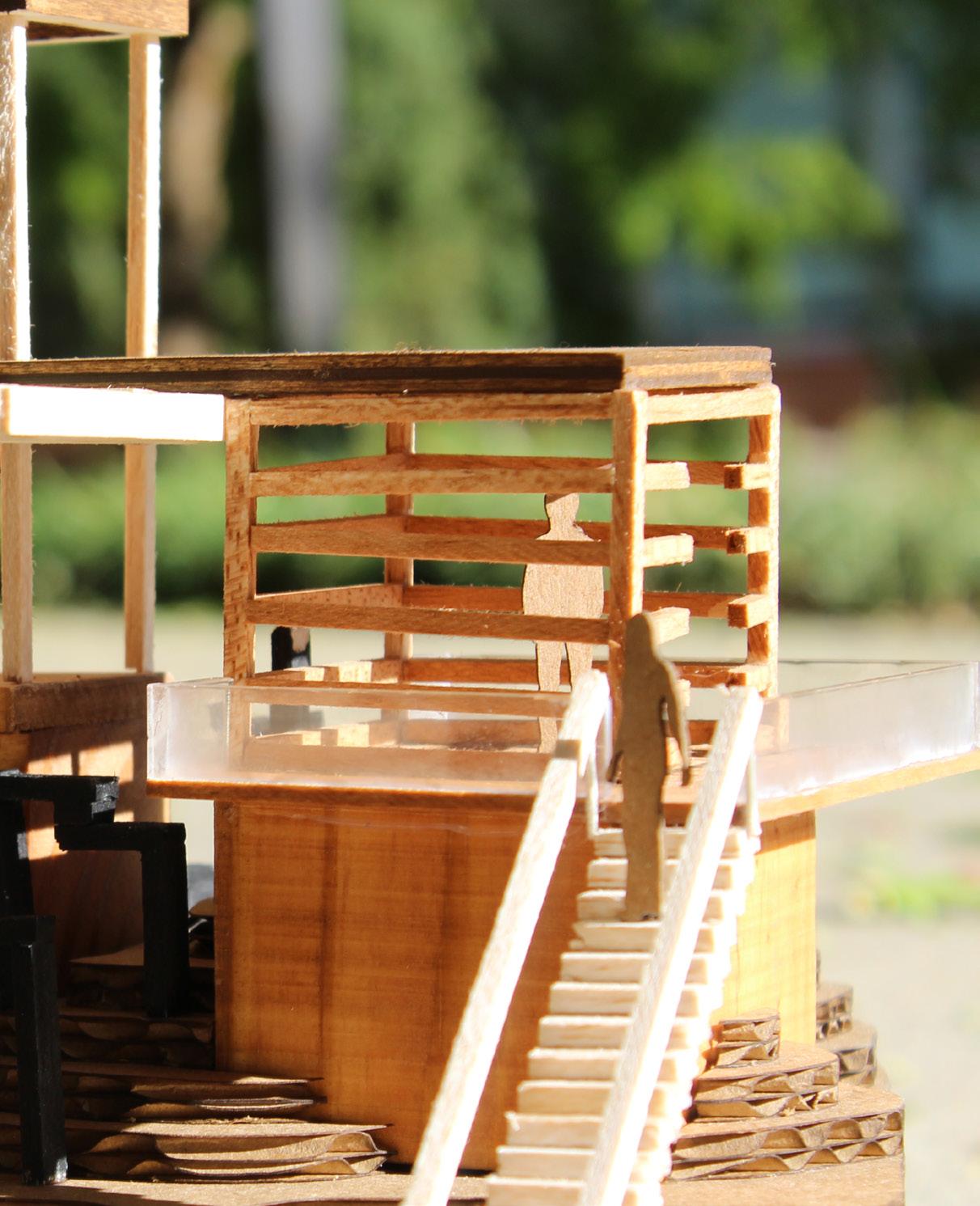
Model of the field house shower design showing the materiality and light reflection in dim lighting
Valser Quartzite Slab
Model
Front elevation
Back elevation
Left elevation
Long building section of interior spaces
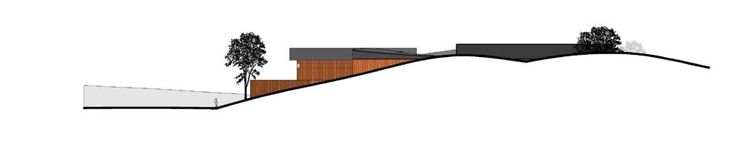
Site plan of the relationship between the building to topography
Rendering of field house and circulation around the design
2ND YEAR FALL I
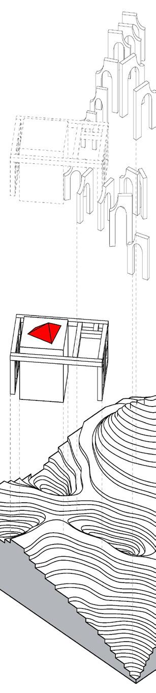
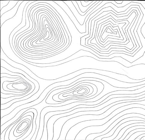
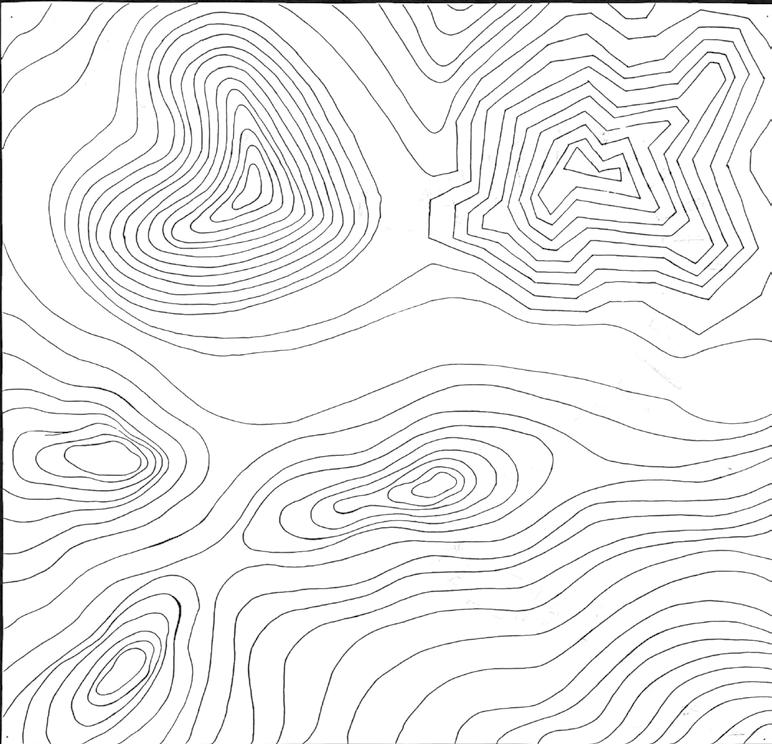
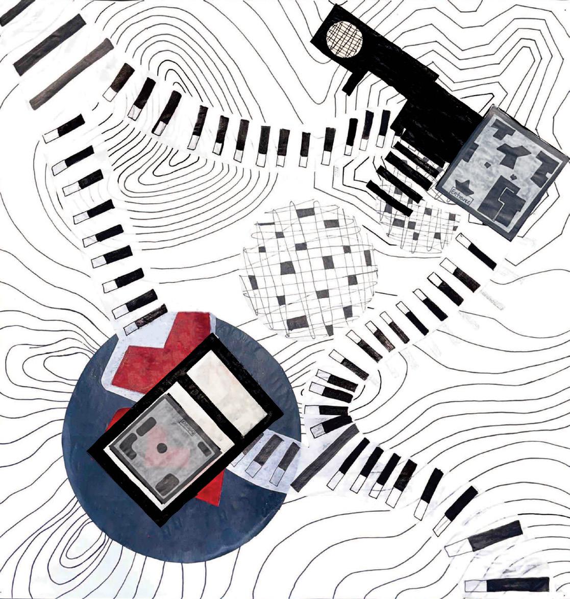
Topography diagram showing the meaning and song lyric connection for each area
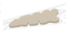
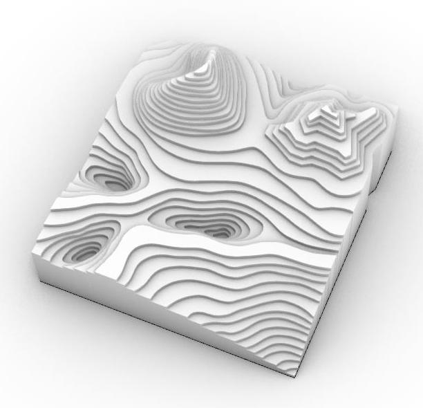
Topographical map of the proposed topography design based on the impact of the lyrics in the song “Love Yourz” by J.Cole
THE DEVELOPMENT OF THIS DESIGN REQUIRED AN IN-DEPTH EXPLORATION OF THE PRINCIPLES AND PRACTICAL APPLICATION OF TOPOGRAPHY. THE OBJECTIVE WAS TO MANIPULATE AND INTEGRATE TOPOGRAPHICAL FEATURES INTO THE DESIGN OF ONE OR MULTIPLE STRUCTURES. THE GUIDING FRAMEWORK FOR SHAPING THE TOPOGRAPHY WAS DERIVED FROM A THOROUGH ANALYSIS OF A SELECTED SONG. SUBSEQUENTLY, THE ENSUING PHASE OF THE PROJECT ENTAILED THE DEVELOPMENT OF STRUCTURAL FORMS, INTRICATELY INFLUENCED BY THE THEMATIC ELEMENTS OF THE CHOSEN SONG
MY CONTRIBUTIONS THROUGHOUT PROJECT PRODUCTION INCLUDE THE ALL DIAGRAMS, TOPOGRAPHICAL MAP, AND PLAN SEQUENCE CREATION AND DEVELOPMENT.
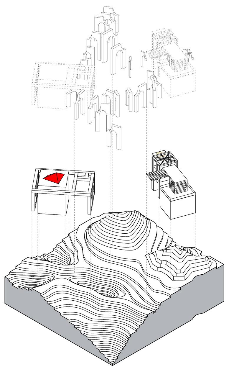
Design decision diagram for the development of each form used in the design
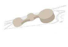
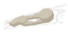
Rendered topography model Exploded axonometric drawing of the topography design elements
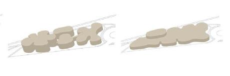
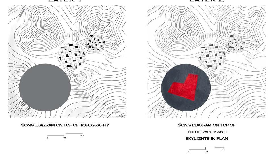
Song diagram on top of topography Song diagram on top of topography and skylight in plan
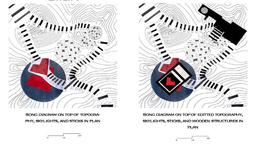
Song diagram on top of topography, skylights, and arches in plan
Song diagram on top of topography, skylights, arches, and wooden structures in plan
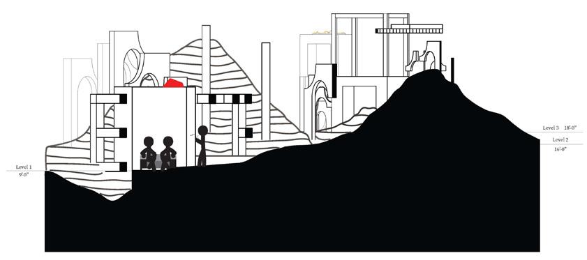
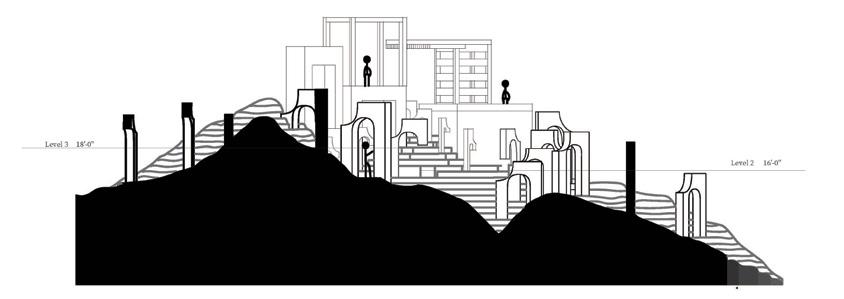
Sections showing the large structure, small structure, and arches creating the pathways throughout the topography design
Song diagram on top of the topography including skylights arches, and floor plan design
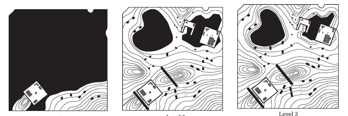
Plan cuts at specific levels of the topography revealing more information with height progression
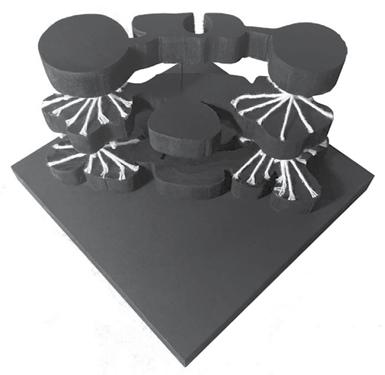
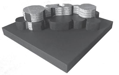
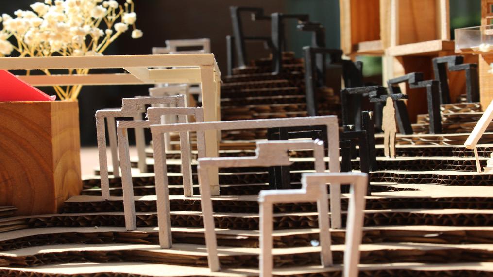
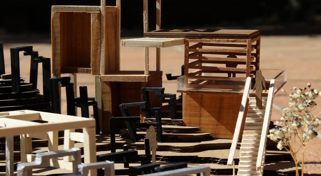
Model photo showing the large structure, which represents fame, imperfection, and complications
Layer 3 Layer 4
Plan Cuts Sections
5
Model photo showing the split pathways of the design leading to the two different structures