
PROPERTY FEATURES


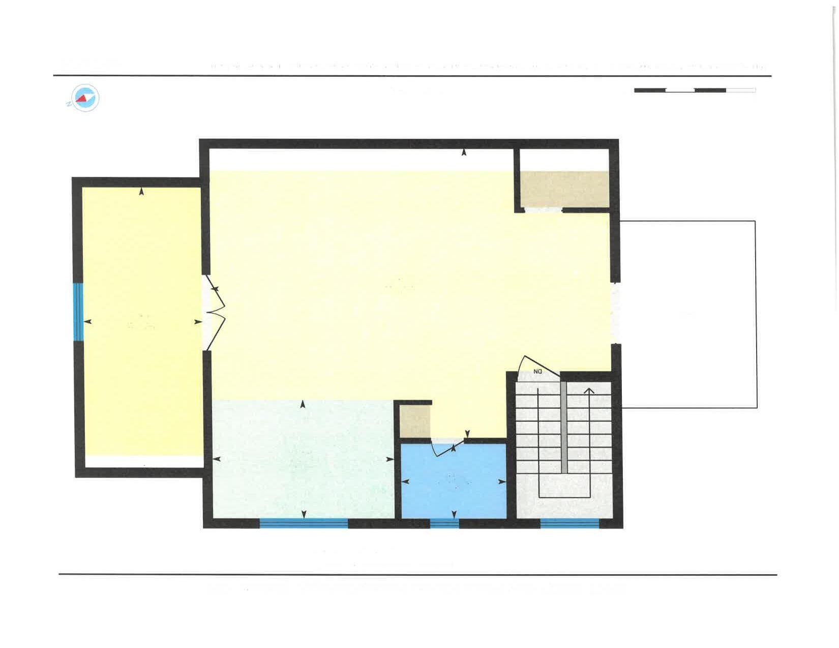
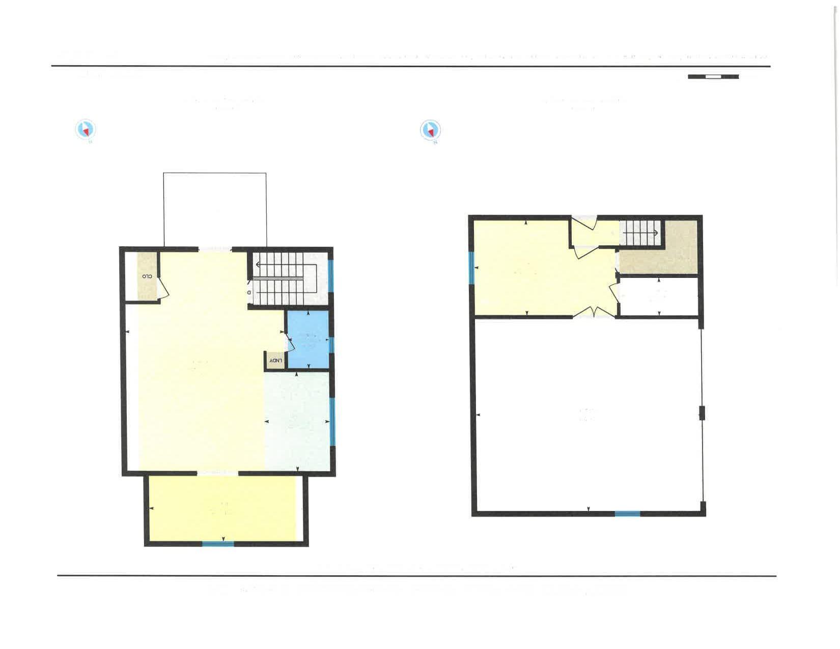
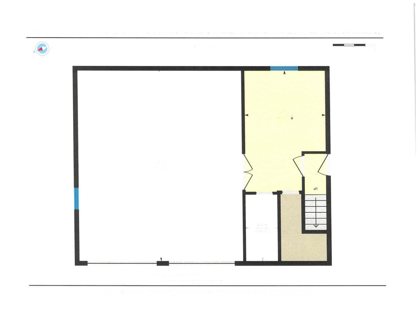
MainFloor FinishedArea2352.86sqft UnfinishedArea616.96sqft
BottomFloor FinishedArea1963.51sqft UnfinishedArea82.38sqft


Report Date: 1/27/2025 7:04:33 AM
The information and maps presented in this report are provided for your convenience. Every reasonable effort has been made to assure the accuracy of the data and associated maps. Deschutes County makes no warranty, representation or guarantee as to the content, sequence, accuracy, timeliness or completeness of any of the data provided herein. Deschutes County explicitly disclaims any representations and warranties, including, without limitation, the implied warranties of merchantability and fitness for a particular purpose. Deschutes County shall assume no liability for any errors, omissions, or inaccuracies in the information provided regardless of how caused. Deschutes County assumes no liability for any decisions made or actions taken or not taken by the user of this information or data furnished hereunder.
Review of digital records maintained by the Deschutes County Assessor s Office, Tax Office, Finance Office, and the Community Development Department indicates that there are County tax, assessment, or property development related notations associated with this account and that have been identified above. Independent verification of the presence of additional Deschutes County tax, assessment, development, and other property related considerations is recommended. Confirmation is commonly provided by title companies, real estate agents, developers, engineering and surveying firms, and other parties who are involved in property transactions or property development. In addition, County departments may be contacted directly to discuss the information.
Related accounts apply to a property that may be on one map and tax lot but due to billing have more than one account. This occurs when a property is in multiple tax code areas. In other cases there may be business personal property or a manufactured home on this property that is not in the same ownership as the land.
Service Providers Please contact districts to confirm.
OR
ELEMENTARY SCHOOL ATTENDANCE AREA SISTERS ELEMENTARY SCHOOL (541) 549-8981 611 EAST CASCADE AVE, SISTERS, OR 97759
MIDDLE SCHOOL ATTENDANCE AREA SISTERS MIDDLE SCHOOL (541) 549-2099 15200 MCKENZIE HWY, SISTERS, OR 97759
HIGH SCHOOL ATTENDANCE AREA SISTERS (541) 549-4045 1700 MCKINNEY BUTTE RD, SISTERS, OR 97759
EDUCATION SERVICE TAX DISTRICT HIGH DESERT EDUCATION SERVICE DISTRICT (541) 693-5600 145 SE SALMON AVE, REDMOND, OR 97756
COLLEGE TAX DISTRICT CENTRAL OREGON COMMUNITY COLLEGE (541) 383-7700 2600 NW COLLEGE WAY, BEND, OR 97703
PARK & RECREATION DISTRICT SISTERS PARK & RECREATION DISTRICT (541) 549-2091 1750 W. McKINNEY BUTTE RD, SISTERS, OR 97759
LIBRARY DISTRICT DESCHUTES PUBLIC LIBRARY (541) 617-7050 601 NW WALL ST, BEND, OR 97703
LIVESTOCK DISTRICT DESCHUTES COUNTY LIVESTOCK DISTRICT NUMBER 5 (541) 388-6623 1300 NW WALL ST, BEND, OR 97703
GARBAGE & RECYCLING SERVICE HIGH COUNTRY DISPOSAL (541) 548-4984 1090 NE HEMLOCK AVE, REDMOND, OR 97756
Planning Jursidiction:
Urban Growth Boundary: Deschutes County No No
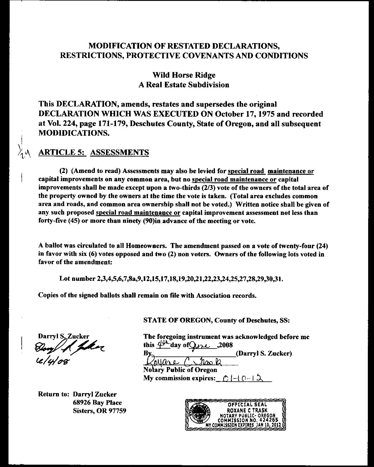
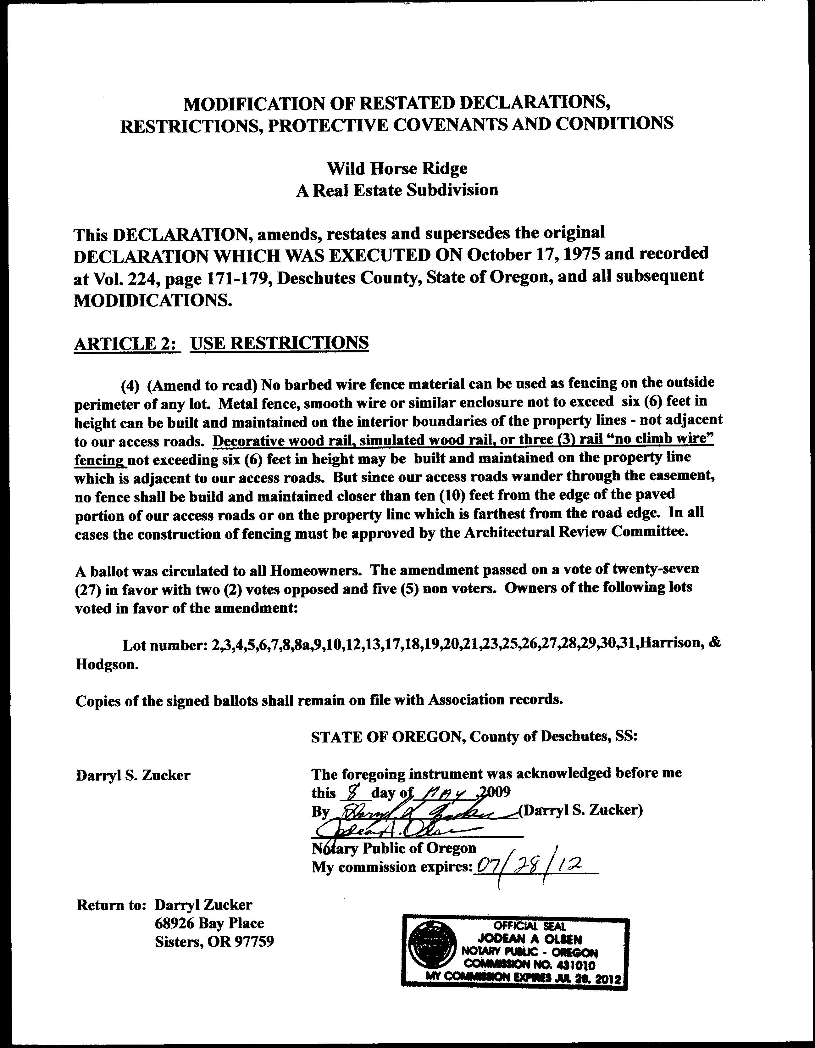
County Zone Description RR10 RURAL RESIDENTIAL - 10 ACRE MINIMUM AS AIRPORT SAFETY COMBINING ZONE
Urban Reserve Area:
County Development Details
Wetland (National or Local):
Conservation Easement:
FEMA 100 Year Flood Plain:
TDC/PRC Restrictive Covenant:
Not Within a Mapped Wetland
No Conservation Easement Recorded
Not Within 100 Year Flood Plain
No TDC/PRC Restrictive Covenant Found
Ground Snow Load: 36 #/sq. ft.
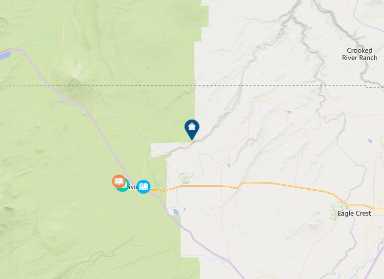
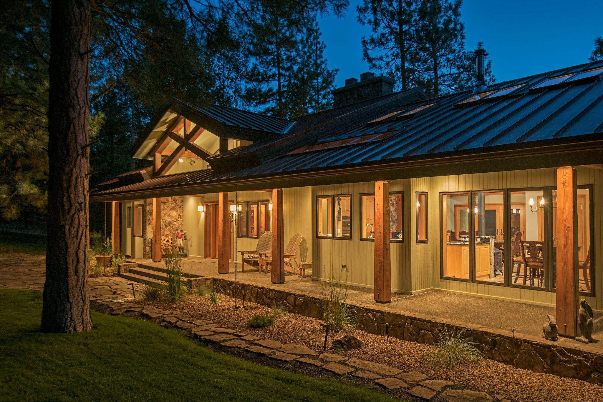
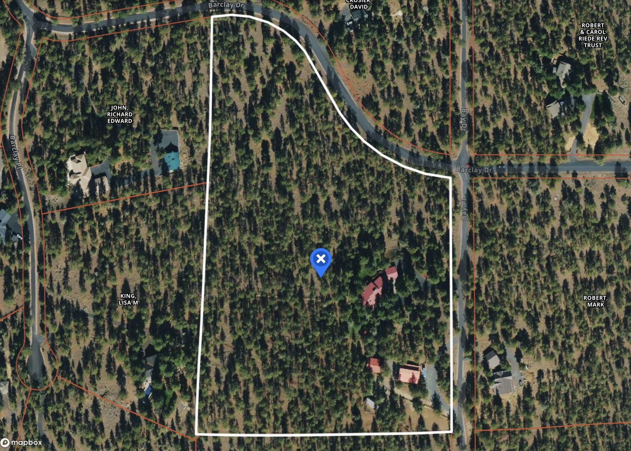
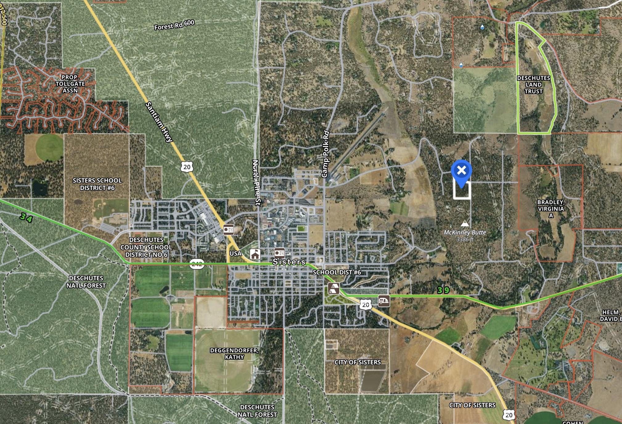
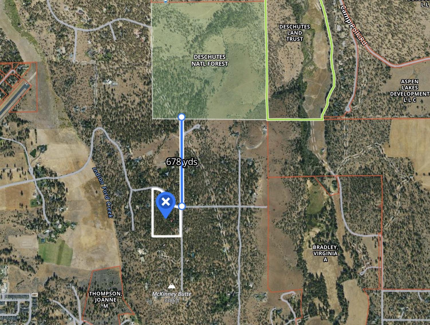
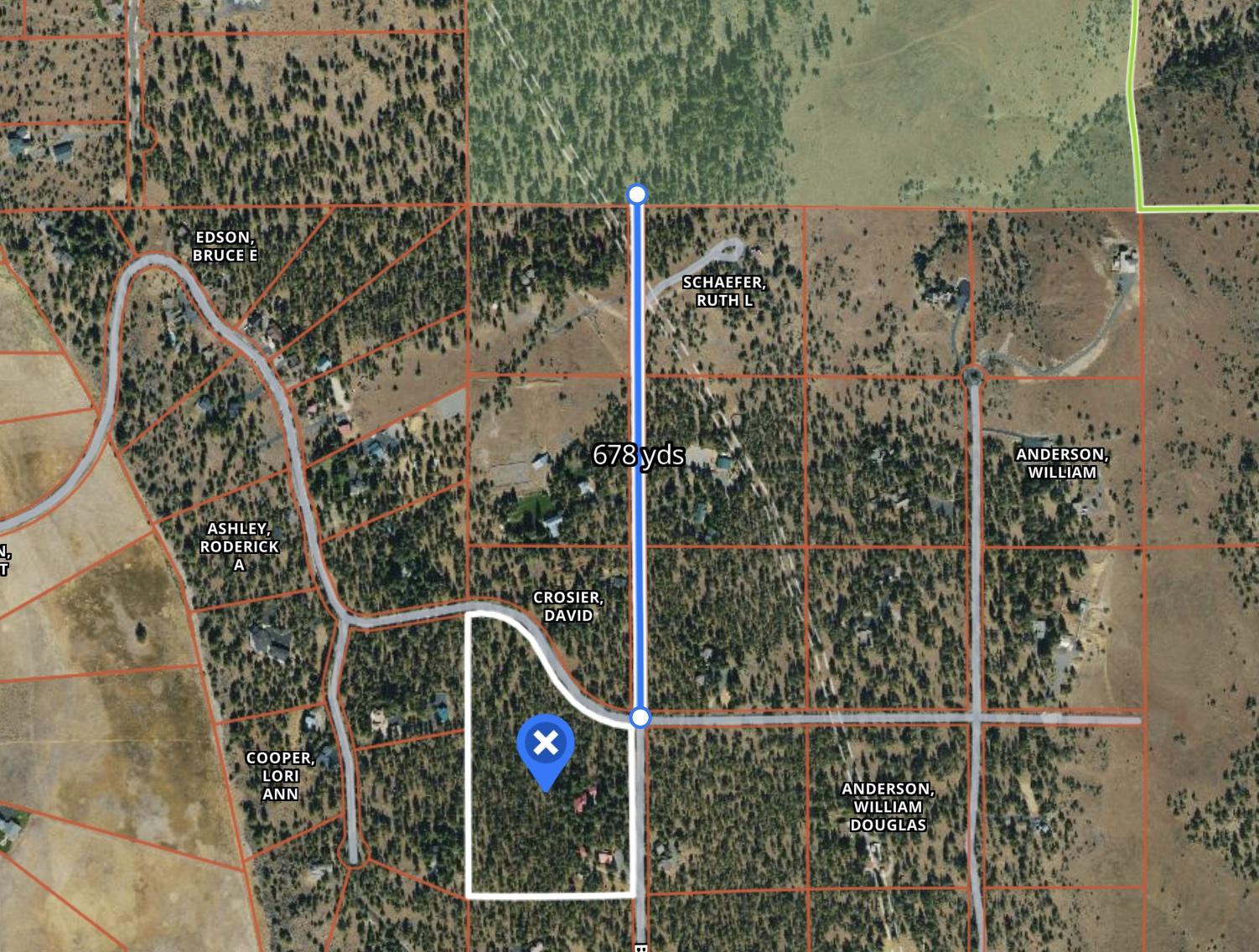
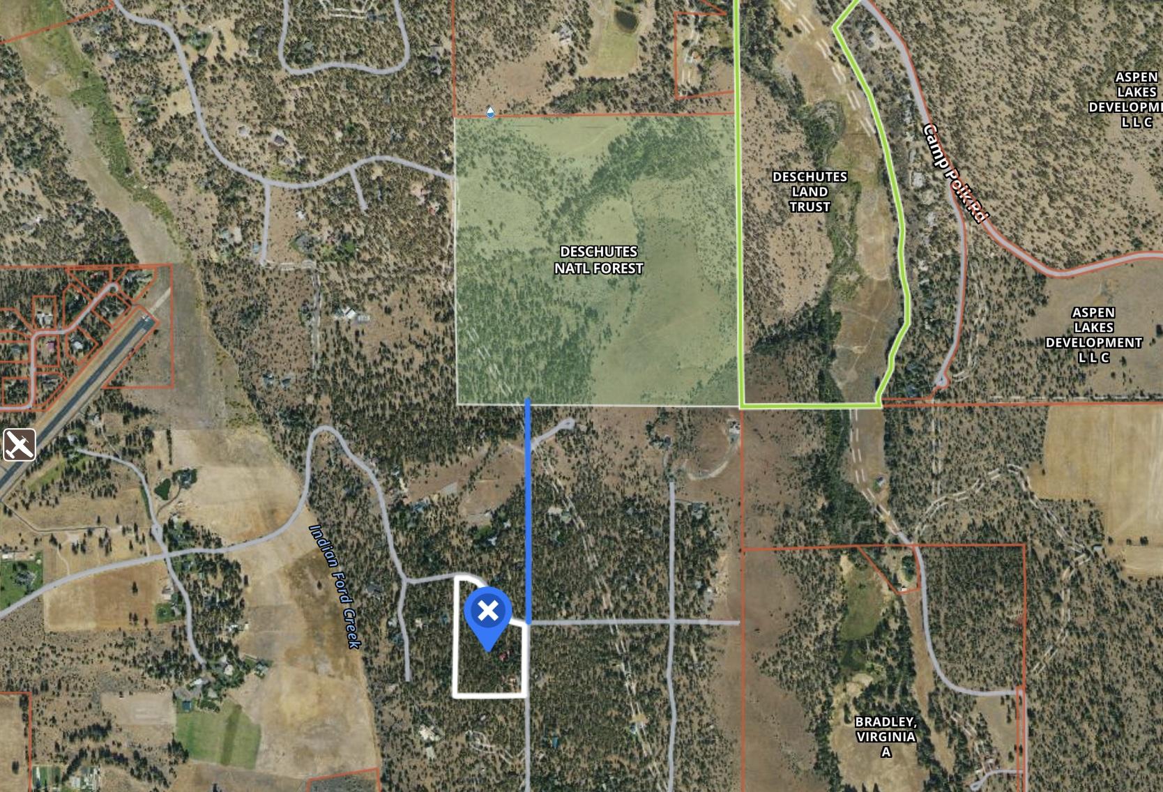
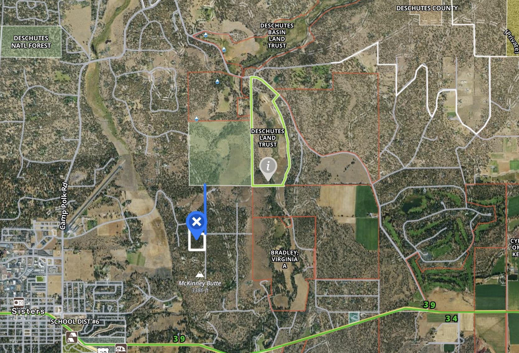
SITUS ADDRESS:
69027 BAY PL SISTERS
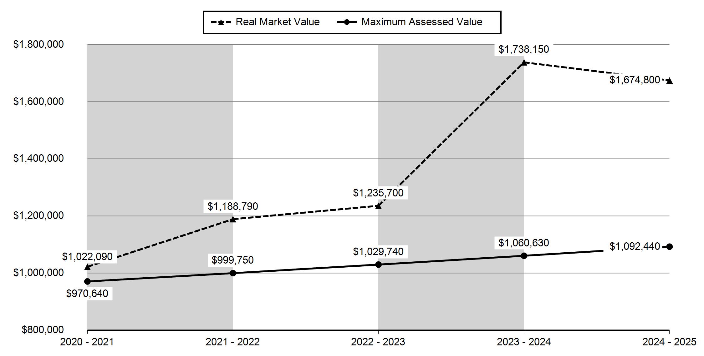
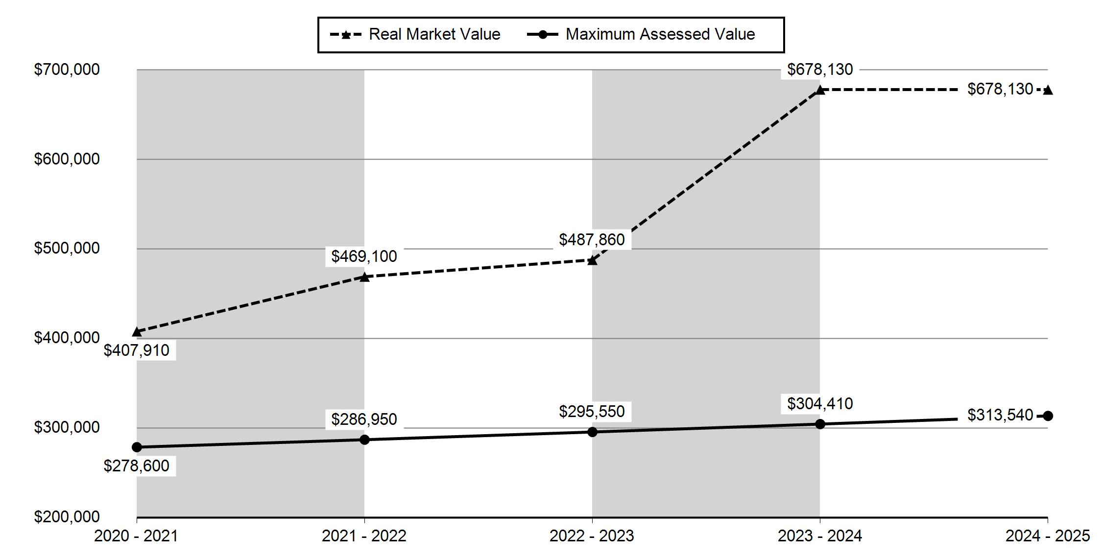
(RMV)
your net
Please include this coupon with payment. Please do not staple, paper clip or tape your payment. TAX ACCOUNT: 135832
Please select payment option
Full Payment (3% Discount)
Two-Thirds Payment (2% Discount)
Next Payment Due
One-Third Payment (No Discount)
Next Payment Due
Please make checks payable to Deschutes County Tax Collector
Full Payment with 3% Discount Discount is lost after due date and interest may apply PAYMENT OPTIONS: * Online
$16,469.90
* By Mail to Deschutes County Tax, PO Box 7559 Bend OR 97708-7559
* Drop Box located at 1300 NW Wall Street, Bend
Payment Due November 15, 2024 TAX ACCOUNT: 135832 (Mailing address change form on reverse)
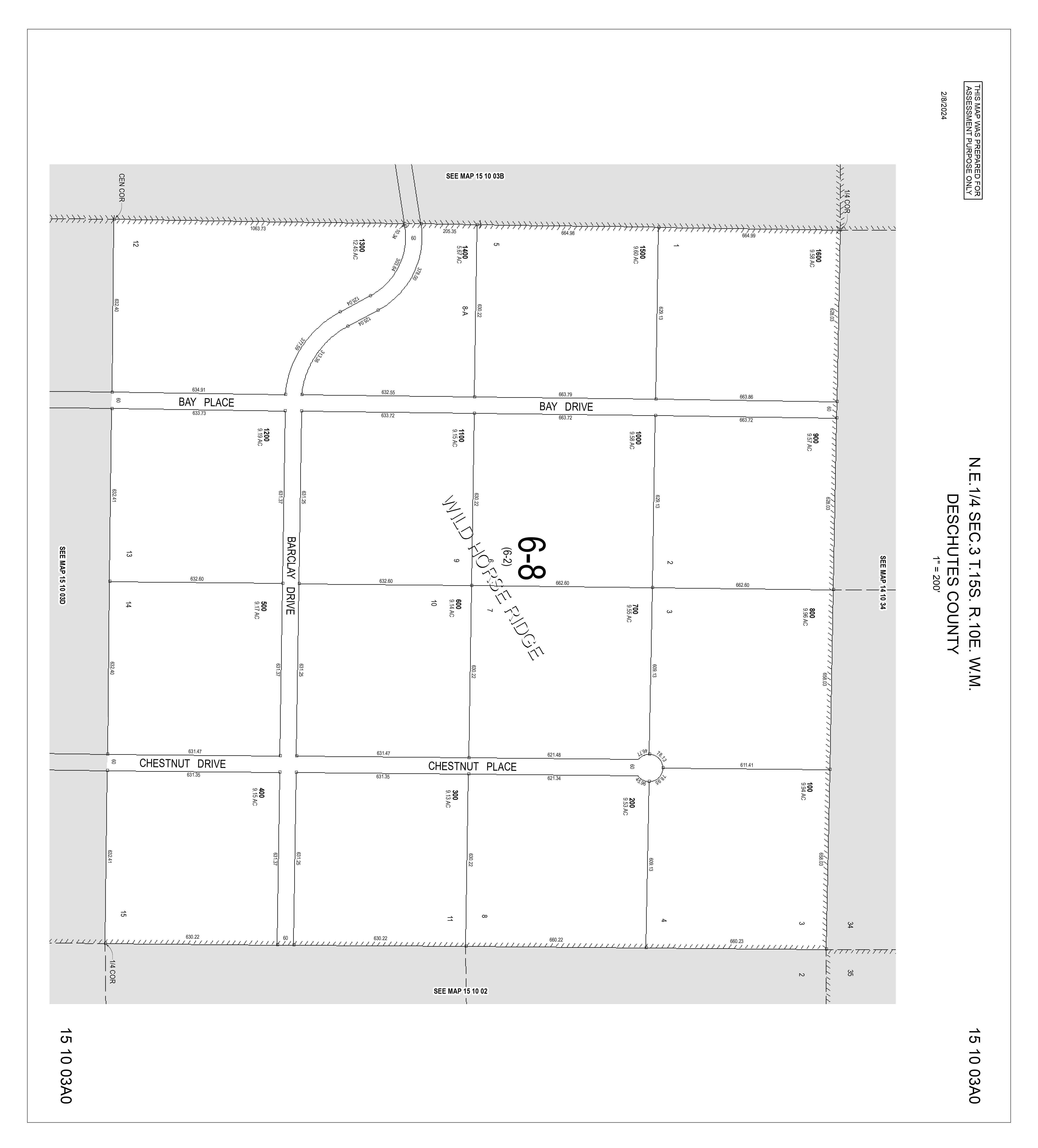
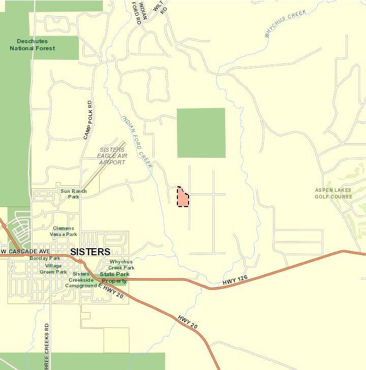
Roa d Map

Report Date: 1/27/2025 7:05:27 AM
The information and maps presented in this report are provided for your convenience. Every reasonable effort has been made to assure the accuracy of the data and associated maps. Deschutes County makes no warranty, representation or guarantee as to the content, sequence, accuracy, timeliness or completeness of any of the data provided herein. Deschutes County explicitly disclaims any representations and warranties, including, without limitation, the implied warranties of merchantability and fitness for a particular purpose. Deschutes County shall assume no liability for any errors, omissions, or inaccuracies in the information provided regardless of how caused. Deschutes County assumes no liability for any decisions made or actions taken or not taken by the user of this information or data furnished hereunder.
Review of digital records maintained by the Deschutes County Assessor s Office, Tax Office, Finance Office, and the Community Development Department indicates that there are no special tax, assessment or property development related notations associated with this account. However, independent verification of the presence of other Deschutes County tax, assessment, development, and additional property related considerations is recommended. Confirmation is commonly provided by title companies, real estate agents, developers, engineering and surveying firms, and other parties who are involved in property transactions or property development. In addition, County departments may be contacted directly to discuss the information.
Related accounts apply to a property that may be on one map and tax lot but due to billing have more than one account. This occurs when a property is in multiple tax code areas. In other cases there may be business personal property or a manufactured home on this property that is not in the same ownership as the land.
MICHAEL & KARI SCHNEIDER TRUST SCHNEIDER, MICHAEL D & KARI D TTEES 69027 BAY PL
69027 BAY PL SISTERS 97759
& KARI SCHNEIDER
151003-A0-01300 CODE: 6002
SITUS ADDRESS:
69027 BAY PL SISTERS
MARKET (RMV)
If your net taxable value has grown by more than 3% from last year and you have any questions, please contact the Assessor's office at +1 (541) 388-6508.
Please select payment option
Payment Due November 15, 2024
ACCOUNT: 252370 (Mailing address change form on reverse)
Please make checks payable to Deschutes County Tax Collector Full Payment with 3% Discount Discount is lost after due date and interest may apply PAYMENT OPTIONS: * Online * By Mail to Deschutes County Tax, PO Box 7559 Bend OR 97708-7559 * Drop Box located at 1300 NW Wall Street, Bend or 411 SW 9th Street, Redmond * In Person 1300 NW Wall Street, Ste 203, Bend (2nd Floor)
$3,824.59
Roa d Map


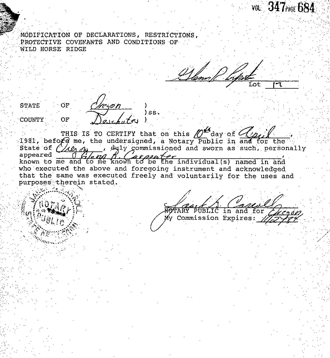
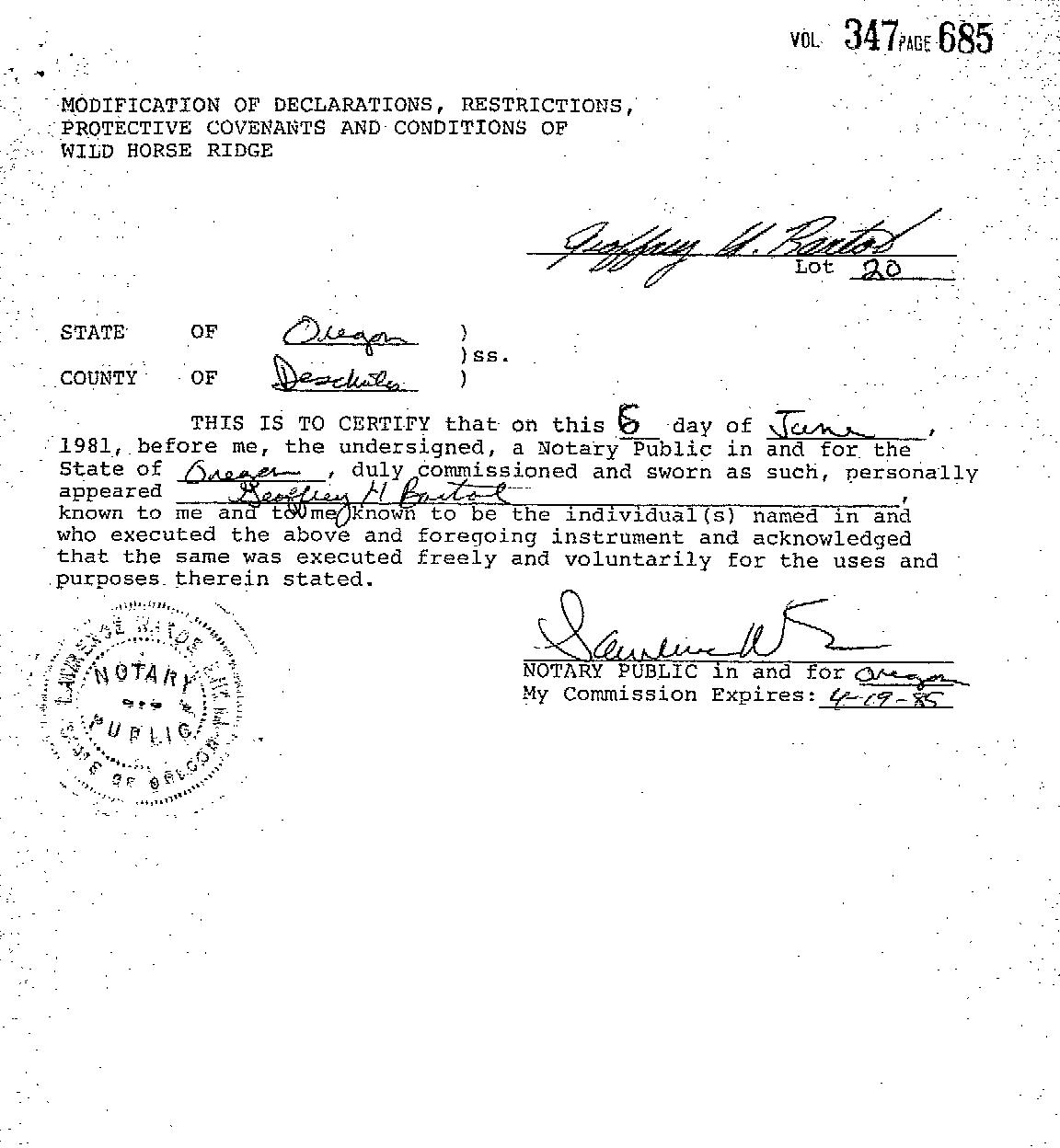
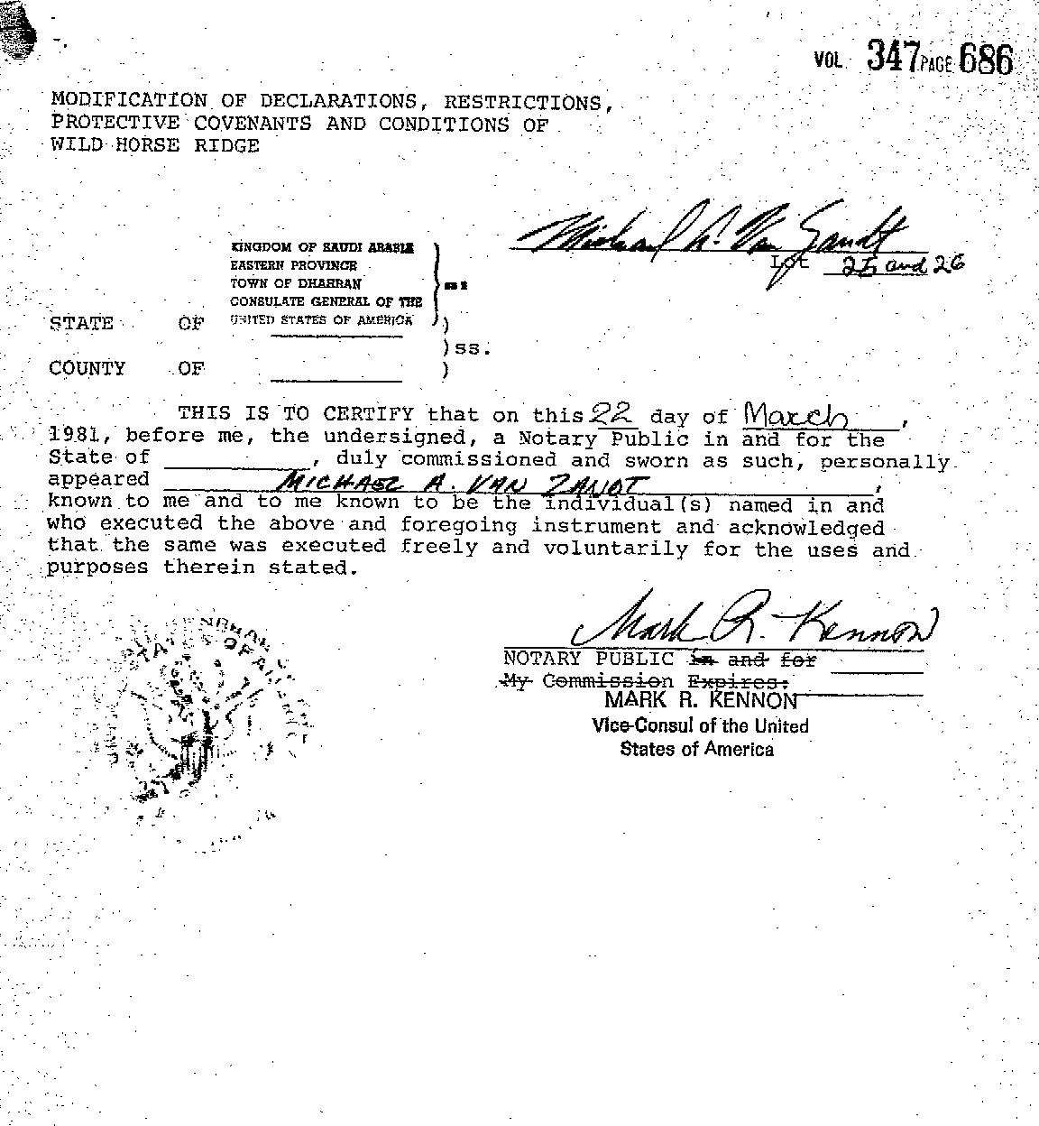
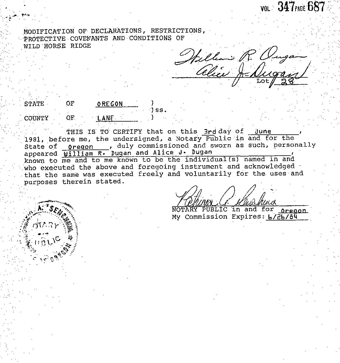
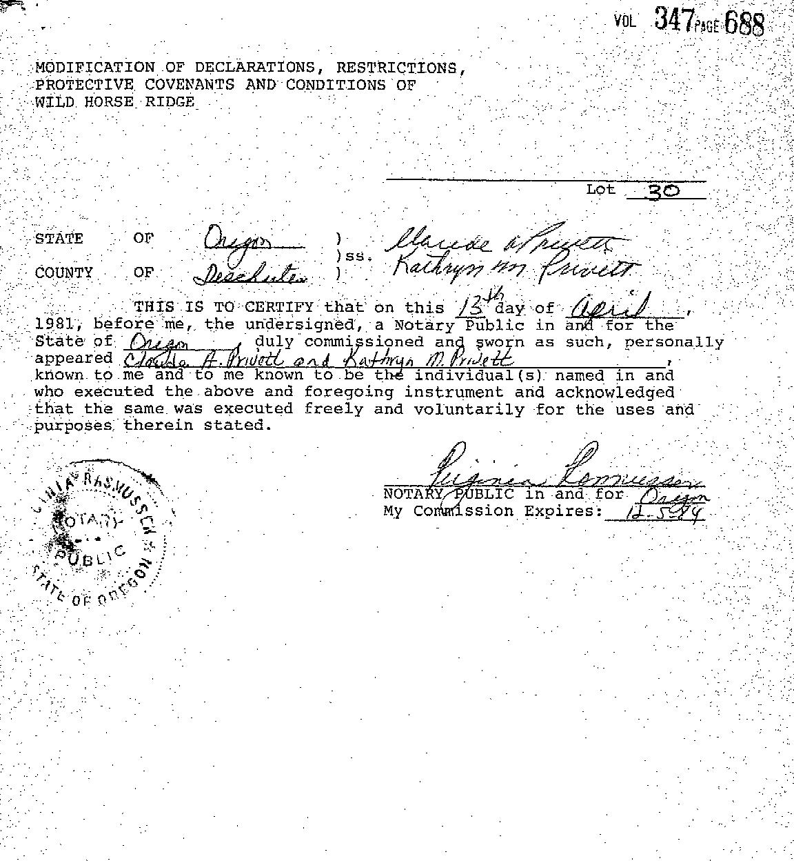
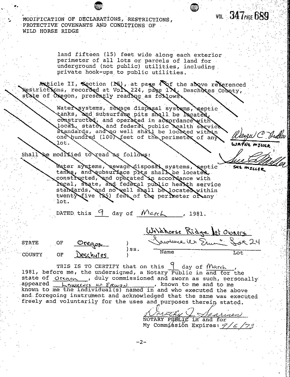
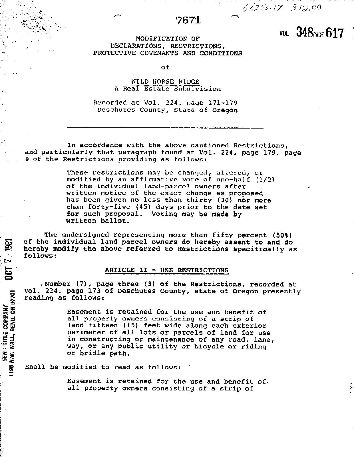
Omitted from the attached document is any covenant or restriction that is based upon, but not necessarily limited to, race, color, religion, sex, sexual orientation, familial status, marital status, disability, handicap, national origin, ancestry, source of income, gender, gender identity, gender expression, medical condition or genetic information, as set forth in applicable state or federal law, except to the extent that such covenant or restriction is permitted by applicable law. Oregon Version 20150707


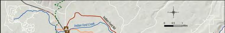
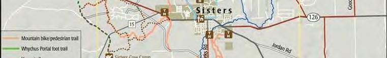
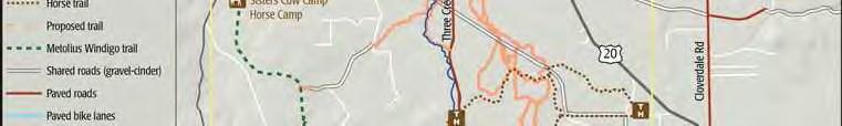


Description of Peterson Ridge Hiking and Biking Trail (PRT)
The Peterson Ridge Mountain Bike and Hiking Trail was designed as a ladder system. It consists of two linear trails, the PRT West and PRT East trails, with numbered connectors marked by junction posts that allow riders and hikers to design their own riding or hiking experience. We have included a loop option guide showing the distances from our Sisters Trailhead.


—Dogs must be kept on physical leash AT ALL TIMES. Please clean up after your pet.
—Pedestrian travel only: no bike, horse, or motorized vehicle use.
—Stay on roads and trails and respect restrictions as posted.
—Removal or disturbance of plants, wildlife, and historical artifacts is prohibited.
—Catch and release fishing with barbless hooks is permitted subject to applicable state regulations.
—Commercial use and private events are prohibited.
—No hunting, motorized vehicles, camping, campfires, smoking, or unmanned aircraft use.
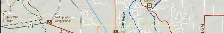
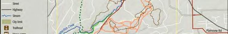
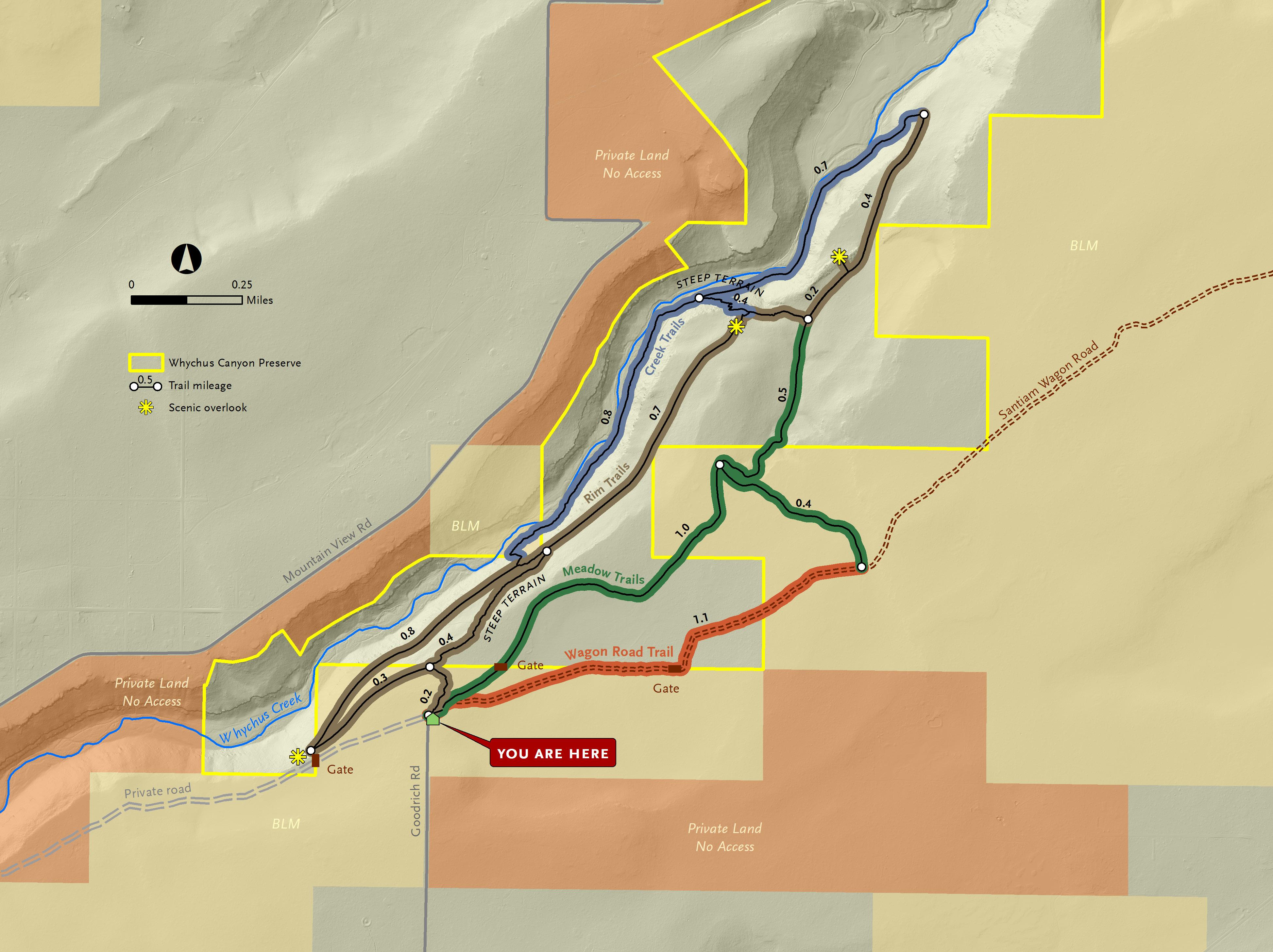
whychus canyon preserve suggested routes
Wagon Road and Meadow Loop: This route follows a portion of the historic Santiam Wagon Road. Interpretive signs along the way share the story of the Wagon Road east of the Cascades and the role it played in the settlement of Central Oregon. This fairly flat trail is lovely in the spring when desert wildflowers begin to bloom.
From the trailhead, follow signs to Wagon Road + Meadow Trails. When you see a Santiam Wagon Road interpretive sign on the right, veer off of the road and follow the dirt Wagon Road Trail. After 1.1 miles, you’ll reach a junction. Turn left and follow the trail through juniper and pine forest until you reach another junction after 0.4 miles. Turn left to continue on the Meadow Trail 1 mile back to the trailhead. Total Distance: 2.5 mile loop.
Long Canyon Route: Head down into the canyon to Whychus Creek, then stroll along the creek before heading back to the top of the canyon. This beautiful hike is challenging and involves steep trails with 300 feet of elevation gain/loss. Enjoy stunning displays of spring wildflowers, mountain views, and tranquil creekside breaks.
From the trailhead, follow signs to Rim + Creek Trails. At the first junction, turn left and walk .3 mile to a stone bench and overlook. The trail will begin to head down into the canyon for .8 miles. You’ll reach an intersection midway down the slope. Follow signs for the Creek Trail to reach the valley floor and walk downstream along Whychus Creek for 0.8 miles. At the next junction, continue straight through a sagebrush meadow for another 0.7 miles. The trail will then turn and begin to climb out of the canyon. Enjoy another scenic overlook before reaching the next junction at the top of the canyon. Follow signs for Meadow Trails and Trailhead for 1.5 miles back to the trailhead. Total Distance: 4.9 mile loop.
Mid Canyon Route: This route is for those looking for a quicker route that still dips into the Whychus Creek canyon without all the elevation gain/loss. Enjoy stunning displays of spring wildflowers and mountain views with 150 feet of elevation gain/loss.
From the trailhead, follow signs to Rim + Creek Trails. At the first junction, turn right and head down a steep route into the canyon for 0.4 miles. At the next junction, follow signs for the Rim Trail and turn right. After 0 7 miles along a rolling mid-canyon trail, you will reach a scenic overlook and bench with views into the northern portion of Whychus Canyon Preserve. Continue past the overlook to the next junction and turn right. After 0.2 miles you’ll reach another intersection. Turn left to add a quick 0.4 mile detour to another overlook. Or, turn right and follow signs for Meadow Trails and Trailhead for 1.5 miles back to the trailhead. Total Distance: 3.0 mile loop.
Download a georeferenced map of Whychus Canyon Preserve to help with navigation. Scan the QR code to the right to download.

210 nw irving, suite 102 ∙ bend, oregon 97703 (541) 330-0017 deschuteslandtrust.org