PROPERTY FEATURES


Report Date: 1/24/2025 1:17:59 PM
The information and maps presented in this report are provided for your convenience. Every reasonable effort has been made to assure the accuracy of the data and associated maps. Deschutes County makes no warranty, representation or guarantee as to the content, sequence, accuracy, timeliness or completeness of any of the data provided herein. Deschutes County explicitly disclaims any representations and warranties, including, without limitation, the implied warranties of merchantability and fitness for a particular purpose. Deschutes County shall assume no liability for any errors, omissions, or inaccuracies in the information provided regardless of how caused. Deschutes County assumes no liability for any decisions made or actions taken or not taken by the user of this information or data furnished hereunder.
Review of digital records maintained by the Deschutes County Assessor s Office, Tax Office, Finance Office, and the Community Development Department indicates that there are County tax, assessment, or property development related notations associated with this account and that have been identified above. Independent verification of the presence of additional Deschutes County tax, assessment, development, and other property related considerations is recommended. Confirmation is commonly provided by title companies, real estate agents, developers, engineering and surveying firms, and other parties who are involved in property transactions or property development. In addition, County departments may be contacted directly to discuss the information.
Related accounts apply to a property that may be on one map and tax lot but due to billing have more than one account. This occurs when a property is in multiple tax code areas. In other cases there may be business personal property or a manufactured home on this property that is not in the same ownership as the land.
No Related Accounts found.
Service Providers Please contact districts to confirm.
DISTRICT SISTERS CAMP SHERMAN FIRE
(541) 549-0771 301 SOUTH ELM ST, SISTERS, OR 97759
SCHOOL DISTRICT SISTERS SCHOOL DISTRICT #6 (541) 549-8521 525 EAST CASCADE AVE, SISTERS, OR 97759
ELEMENTARY SCHOOL ATTENDANCE AREA SISTERS ELEMENTARY SCHOOL (541) 549-8981 611 EAST CASCADE AVE, SISTERS, OR 97759 MIDDLE SCHOOL ATTENDANCE AREA SISTERS MIDDLE SCHOOL (541) 549-2099 15200 MCKENZIE HWY, SISTERS, OR 97759
HIGH SCHOOL ATTENDANCE AREA SISTERS (541) 549-4045 1700 MCKINNEY BUTTE RD, SISTERS, OR 97759
EDUCATION SERVICE TAX DISTRICT HIGH DESERT EDUCATION SERVICE DISTRICT (541) 693-5600 145 SE SALMON AVE, REDMOND, OR 97756
COLLEGE TAX DISTRICT CENTRAL OREGON COMMUNITY COLLEGE (541) 383-7700 2600 NW COLLEGE WAY, BEND, OR 97703
PARK & RECREATION DISTRICT SISTERS PARK & RECREATION DISTRICT (541) 549-2091 1750 W. McKINNEY BUTTE RD, SISTERS, OR 97759
LIBRARY DISTRICT DESCHUTES PUBLIC LIBRARY (541) 617-7050 601 NW WALL ST, BEND, OR 97703 WATER SERVICE PROVIDER AVION WC - SQUAW CREEK CANYON (541) 382-5342 60813 PARRELL RD, BEND, OR 97702
ROAD TAX DISTRICT SQUAW CREEK CANYON ROAD DISTRICT , GARBAGE & RECYCLING SERVICE HIGH COUNTRY DISPOSAL (541) 548-4984 1090 NE HEMLOCK AVE, REDMOND, OR 97756
Jursidiction:
County Development Details
Wetland (National or Local): Conservation Easement:
TDC/PRC Restrictive Covenant:
FEMA 100 Year Flood Plain: Not Within a Mapped Wetland No Conservation Easement Recorded No TDC/PRC Restrictive Covenant Found Not Within 100 Year Flood Plain Ground Snow Load: 36 #/sq. ft.
Deschutes County Permits Permit
247-24-000879-
247-24-000371AUTH Septic
24-Jan-2025
HEAGEN FAMILY TRUST HEAGEN, EDWARD TTEE
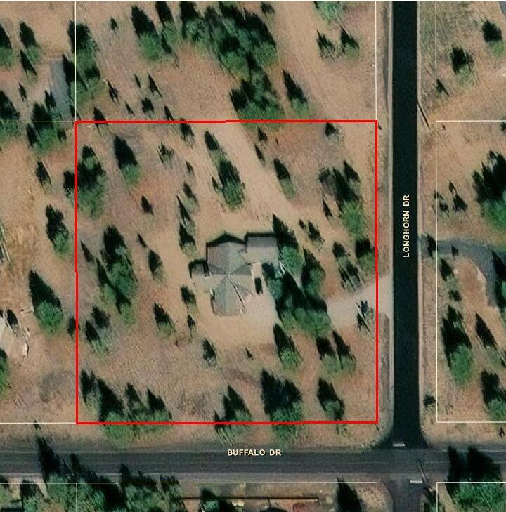
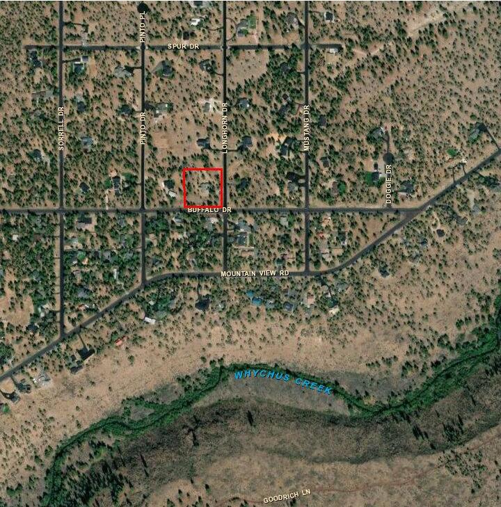
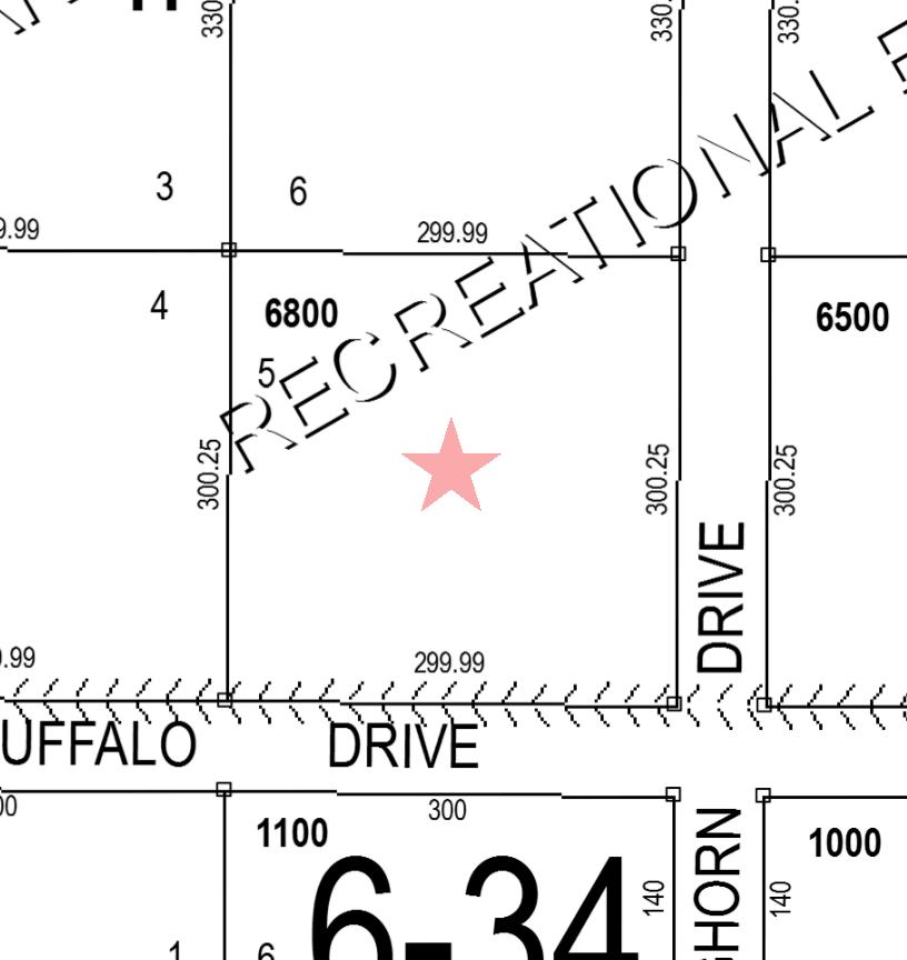
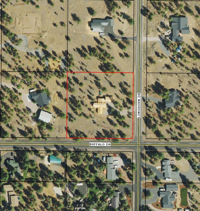
SITUS ADDRESS: MAP: 401 CLASS: 141119-C0-06800
70163 LONGHORN DR SISTERS
(RMV)
your net taxable value has grown by more than 3% from last year and you have any questions, please contact the Assessor's office at +1 (541)
$6,101.46
By Mail to Deschutes County Tax, PO Box 7559 Bend OR 97708-7559
Drop Box located at 1300 NW Wall Street, Bend or 411 SW 9th Street, Redmond
In Person 1300 NW Wall Street, Ste 203, Bend (2nd Floor) For Property Information: dial.deschutes.org
Please include this coupon with payment. Please do not staple, paper clip or tape your payment.
Please select payment option
Please make checks payable to Deschutes County Tax Collector Full Payment with 3% Discount Discount is lost after due date and interest may apply PAYMENT OPTIONS: * Online
Payment Due November 15, 2024
ACCOUNT: 166847 (Mailing address change form on reverse) Full Payment (3%
Roa d Map Map an d Tax l ot: 14111 9C 006800
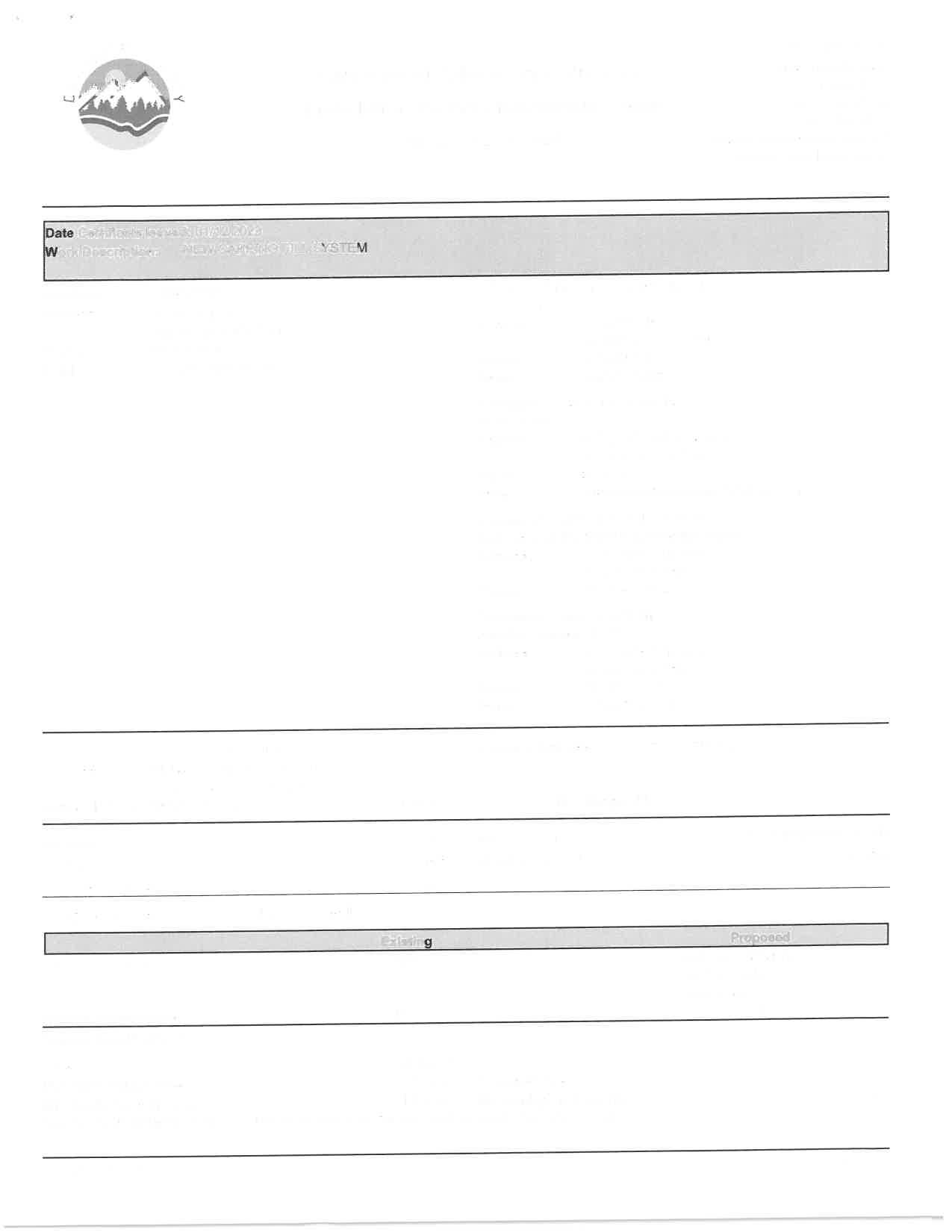
Date Certificate Issued: 01/12/2023
Work Description: NEW CAPPING FILL
Applicant: DANNYBUILT LLC
Address:
PO BOX 1154
REDMOND OR 97756
Phone: 5414206110
Email: dannybuilt@msn.com
Deschutes County
117 NW Lafayette Ave. PO Box 6005
Bend, OR 97708
541-388-6575
cdd-webmaster@deschutes.org
Website: deschutes.org/cd
Owner: HEAGEN FAMILY TRUST
Address: 119 W AVENIDA CORDOBA SAN CLEMENTE CA 92672
Primary Contractor: DANNYBUILT LLC
CCB: 235852
Address: PO BOX 1154
REDMOND OR 97756
Phone: 5414206110
Email: dannybuilt@msn.com
Contractor: TEWALT & SONS INC
CCB: 76888
Address: 447 E JEFFERSON AVE SISTERS OR 97759
Phone: 5414195172
Email: tewaltandsonsexcavation@gmail.com
Contractor: Tewalt & Sons Excavation
DEQ Installer/Maintenance Provider: RM192
Address: 447 E Jefferson Ave
Sisters OR 97759
Phone: (541) 549-1472
Contractor: Tewalt & Sons Inc.
Installer License: 35215
Address: 447 E Jefferson Ave
Sisters OR 97759
Phone: (541) 549-1472
Email: drt@yahoo.com
Address:
Longhorn Dr, Sisters, OR 97759
Date Certificate Issued: 01/12/2023
Work Description: NEW CAPPING FILL SYSTEM
Drain Field Specifications
Drain Field Type: System Distribution Type: Capping Fill
Drainfield Sizing: Distribution Method:
Undisturbed Soil BetweenTrenches:
Special Requirements
Groundwater Type:
Groundwater Depth: Not Applicable N/A
Other Special Rquirements: FAILURE TO READ ALL THE INFORMATION ON THIS PERMIT MAY RESULT IN COMPLICATIONS WITH YOUR INSTALLATION, INSPECTIONS AND OBTAINING A FINAL/CERTIFICATE OF SATISFACTORY COMPLETION ON YOUR PERMIT(S). SUBMITTAL OF A COMPLETED AS-BUILT FORM IS REQUIRED PRIOR TO SCHEDULING AN INSPECTION.
Date Certificate Issued: 01/12/2023
Work Description: NEW CAPPING FILL SYSTEM
In accordance with Oregon Revised Statute 454.66 and Oregon Administrative Rules 340-71, this Certificate is issued as evidence of satisfactory completion and installation of components as described in the permit at the location identified.
System Inspection: Operation of Law - 7 Days Notice:
Comments: Yes No The system that was installed, inspected, and approved is accurately represented by the as built and materials list.
Inspector
Keoni Frampton 7020 Pre-cover
Pre-Cover Inspection Waived Per 340-071:
01/12/2023 Approved
Kevin Hesson 7999 Final Septic 09/12/2022 Partial
Keoni Frampton Environmental Health Specialist I
ATTENTION:Oregon law requires you to follow rules adopted by the Oregon Utility Notification Center. Those rules are set forth by Oregon Administration Rules. You may obtain copies of the rules by calling the center. (Note: The telephone number for the Oregon Utility Notification Center is 1-800-332-2344.)
No
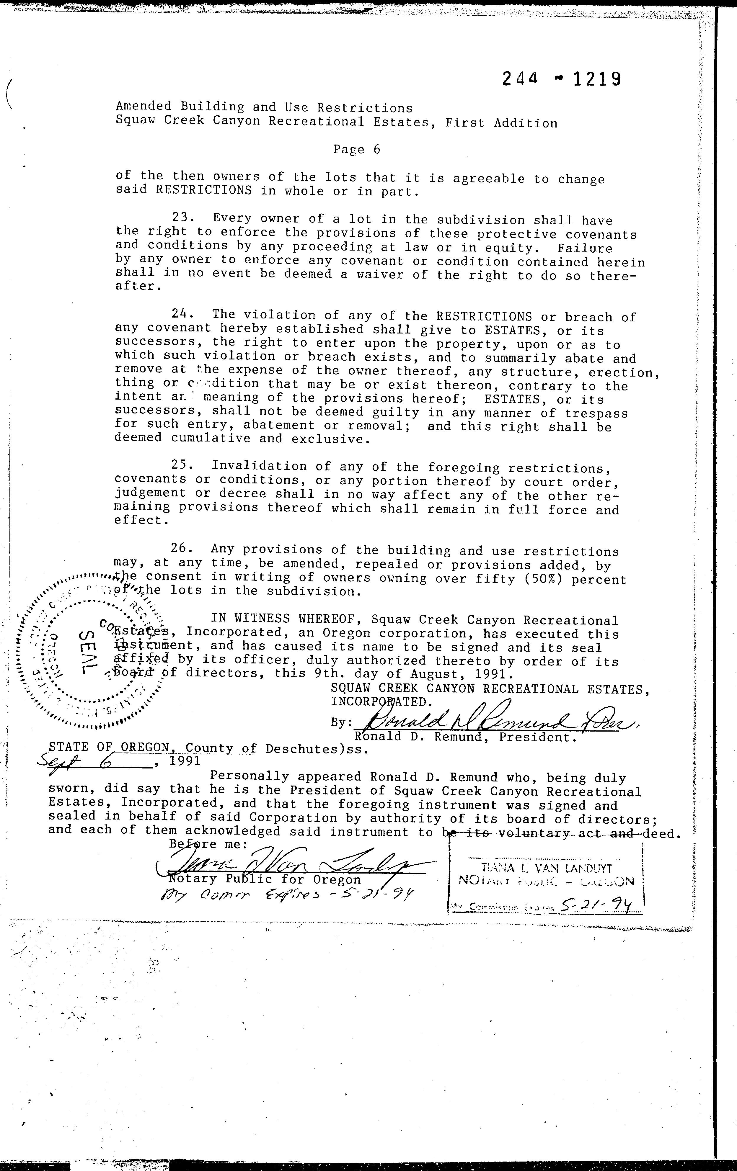
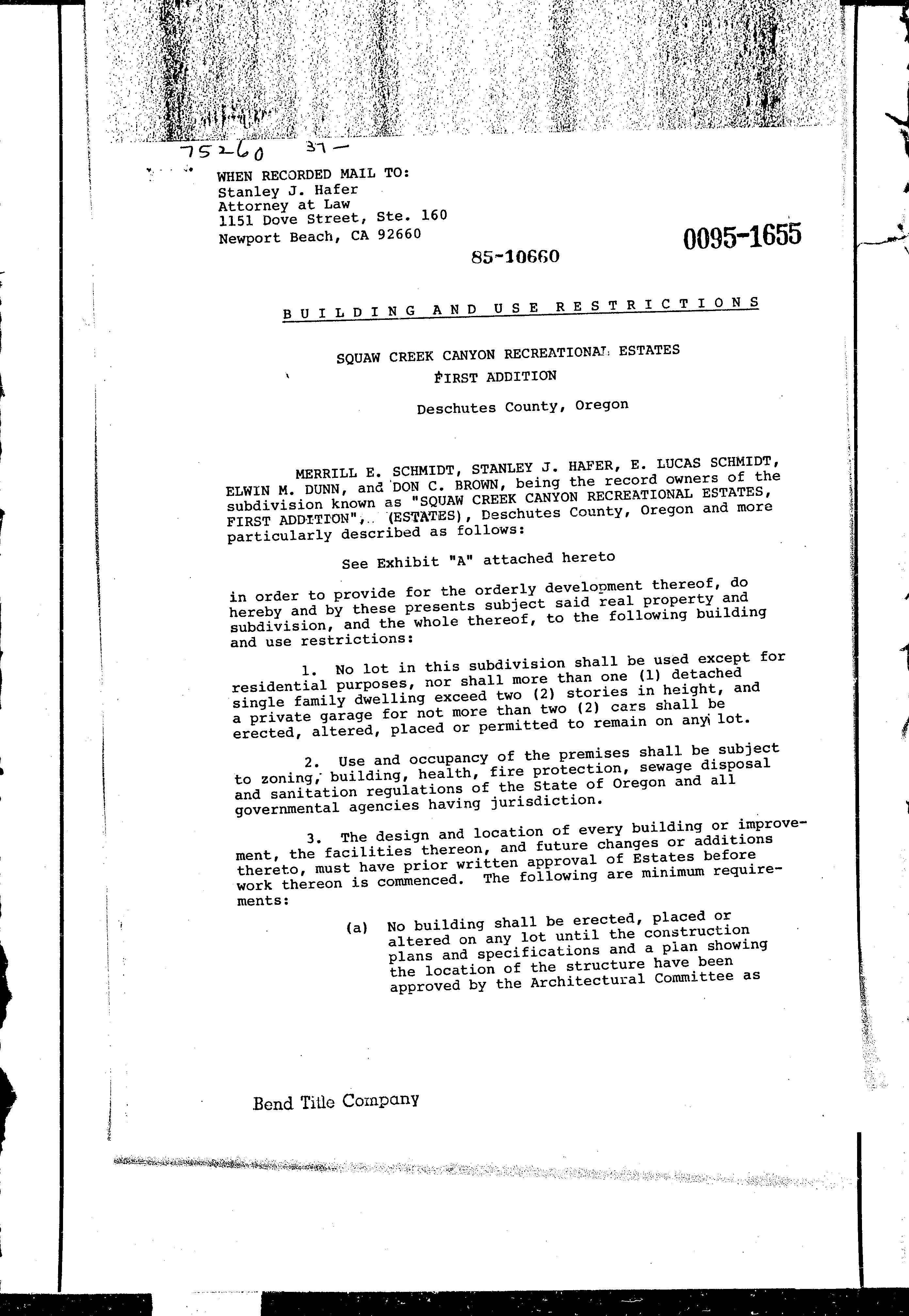
Omitted from the attached document is any covenant or restriction that is based upon, but not necessarily limited to, race, color, religion, sex, sexual orientation, familial status, marital status, disability, handicap, national origin, ancestry, source of income, gender, gender identity, gender expression, medical condition or genetic information, as set forth in applicable state or federal law, except to the extent that such covenant or restriction is permitted by applicable law.


—Dogs must be kept on physical leash AT ALL TIMES. Please clean up after your pet.
—Pedestrian travel only: no bike, horse, or motorized vehicle use.
—Stay on roads and trails and respect restrictions as posted.
—Removal or disturbance of plants, wildlife, and historical artifacts is prohibited.
—Catch and release fishing with barbless hooks is permitted subject to applicable state regulations.
—Commercial use and private events are prohibited.
—No hunting, motorized vehicles, camping, campfires, smoking, or unmanned aircraft use.
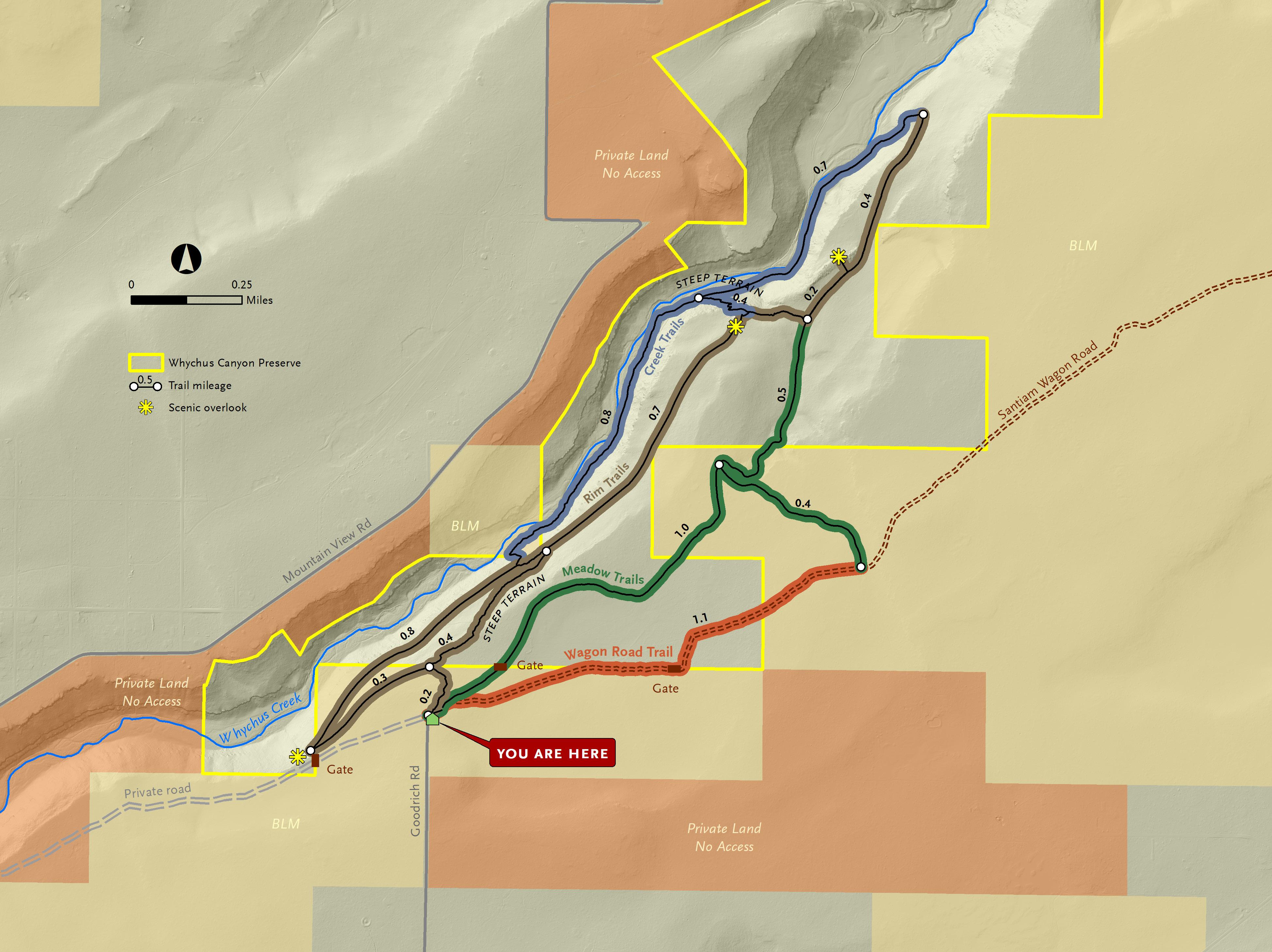
whychus canyon preserve suggested routes
Wagon Road and Meadow Loop: This route follows a portion of the historic Santiam Wagon Road. Interpretive signs along the way share the story of the Wagon Road east of the Cascades and the role it played in the settlement of Central Oregon. This fairly flat trail is lovely in the spring when desert wildflowers begin to bloom.
From the trailhead, follow signs to Wagon Road + Meadow Trails. When you see a Santiam Wagon Road interpretive sign on the right, veer off of the road and follow the dirt Wagon Road Trail. After 1.1 miles, you’ll reach a junction. Turn left and follow the trail through juniper and pine forest until you reach another junction after 0.4 miles. Turn left to continue on the Meadow Trail 1 mile back to the trailhead. Total Distance: 2.5 mile loop.
Long Canyon Route: Head down into the canyon to Whychus Creek, then stroll along the creek before heading back to the top of the canyon. This beautiful hike is challenging and involves steep trails with 300 feet of elevation gain/loss. Enjoy stunning displays of spring wildflowers, mountain views, and tranquil creekside breaks.
From the trailhead, follow signs to Rim + Creek Trails. At the first junction, turn left and walk .3 mile to a stone bench and overlook. The trail will begin to head down into the canyon for .8 miles. You’ll reach an intersection midway down the slope. Follow signs for the Creek Trail to reach the valley floor and walk downstream along Whychus Creek for 0.8 miles. At the next junction, continue straight through a sagebrush meadow for another 0.7 miles. The trail will then turn and begin to climb out of the canyon. Enjoy another scenic overlook before reaching the next junction at the top of the canyon. Follow signs for Meadow Trails and Trailhead for 1.5 miles back to the trailhead. Total Distance: 4.9 mile loop.
Mid Canyon Route: This route is for those looking for a quicker route that still dips into the Whychus Creek canyon without all the elevation gain/loss. Enjoy stunning displays of spring wildflowers and mountain views with 150 feet of elevation gain/loss.
From the trailhead, follow signs to Rim + Creek Trails. At the first junction, turn right and head down a steep route into the canyon for 0.4 miles. At the next junction, follow signs for the Rim Trail and turn right. After 0 7 miles along a rolling mid-canyon trail, you will reach a scenic overlook and bench with views into the northern portion of Whychus Canyon Preserve. Continue past the overlook to the next junction and turn right. After 0.2 miles you’ll reach another intersection. Turn left to add a quick 0.4 mile detour to another overlook. Or, turn right and follow signs for Meadow Trails and Trailhead for 1.5 miles back to the trailhead. Total Distance: 3.0 mile loop.
Download a georeferenced map of Whychus Canyon Preserve to help with navigation. Scan the QR code to the right to download.

210 nw irving, suite 102 ∙ bend, oregon 97703 (541) 330-0017 deschuteslandtrust.org

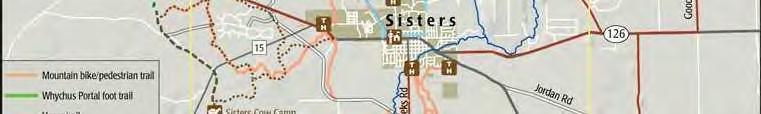
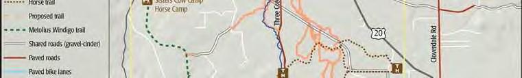
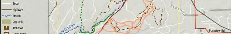
Description of Peterson Ridge Hiking and Biking Trail (PRT)
The Peterson Ridge Mountain Bike and Hiking Trail was designed as a ladder system. It consists of two linear trails, the PRT West and PRT East trails, with numbered connectors marked by junction posts that allow riders and hikers to design their own riding or hiking experience. We have included a loop option guide showing the distances from our Sisters Trailhead.