County Comprehensive Plan
December 12, 2023
County Comprehensive Plan
December 12, 2023
Brian Stanley, Chairman, District 1
Eurika Tyree, Vice Chair, District 3
Gene Brooks, District 4
Robert K. Saunders Jr., District 5
Ronald Tavernier, District 2
Planning Commission
Steve Rosen, Chairman
Hubert Allen, Vice-Chairman
Stephen Donahue
Matthew Seal
Harry Donohue
Kevin Meadows
William Flippen
County Staff
Derek Stamey, County Administrator
Kemper Beasley, County Attorney
Jennifer Crews, Assistant County Administrator
Stephany Johnson, Planning Director and Zoning Administrator
Planning Consultant
Summit Design and Engineering


This document is intended to update and supersede the Cumberland County Comprehensive Plan, adopted August 13th, 2013, and provide guidance as the County's active comprehensive plan. The Plan refines the County’s strategic approach to planning for the future and incorporates the best practices in planning and design to ensure that a high quality of life results from development in targeted areas while the rural landscape and agricultural economies are preserved. The plan is centered around four "central themes," to achieve this goal:
Village Centers.
Preserve Cumberland.
Through the public input process, the community made its voice heard. While giving guidance on certain principles that seek to develop thriving centers of community, the Plan also understands that it does not cover every great idea or need the County may have. As a living document, it can be amended at any time to meet the community’s needs.
The plan is organized around specific goals and objectives underlying each central theme. These help the community see where they can get involved, help decision-makers evaluate development proposals, and provide the County with various projects to initiate.
Finally, the Plan incorporates “Strategies for the Future” and planning recommendations that act as a tool for the County to steer growth.
Thank you for being invested in the future of Cumberland County!
The Comprehensive Plan is a long range guiding policy document for the County to use in its decision-making about land use, transportation, and a variety of other “comprehensive” topics related to public interests in the community over the next twenty to twenty five years.
It has been ten years since Cumberland’s adopted its last Comprehensive Plan on August 13, 2013. Much has happened in the County and the surrounding region over the past decade. Residents and visitors alike continue to enjoy the County’s rural setting, active farms, parks and trails, and historic architecture, however, growth from neighboring metropolitan areas could spread to the County and create new challenges.
The Plan is a result of community input, local official’s comments, and consultant recommendations to achieve a common vision for the future of the County, shaping development, planning improvements, and setting expectations. However, this document is not set in stone once adopted. The Plan is to be reviewed every five years to determine if it needs updating, making it a “living” document that is subject to change over time depending on shifts, new trends, or desired changes in goals and strategies.
County staff, the Planning Commission, and the Board of Supervisors use the Plan for recommendations on legislative land use applications. The Plan also lists planned infrastructure and public facility improvements.
The community can read the County’s vision and give public comments on legislative land use applications.
The Plan outlines the County’s goals and expectations of new development. This guidance helps streamline expectations, feedback, and negotiations.


Chapter 22, Article 3: §15.2-2223 through §15.2-2232 outlines the legal authority and requirement that all localities prepare, recommend, and adopt a Comprehensive Plan. The Comprehensive Plan “shall be made with the purpose of guiding and accomplishing a coordinated, adjusted and harmonious development of the territory which will, in accordance with present and probable future needs and resources, best promote the health, safety, morals, order, convenience, prosperity, and general welfare of the inhabitants, including the elderly and persons with disabilities.”
Upon this plan’s adoption by Board of Supervisors, it will supersede the previous Comprehensive Plan, adopted in 2013. Many ideas have been borrowed and updated for contemporary times from the previous planning documents. Previous plans should be archived for tracking the trajectory of trends and effectiveness of planning processes in the County.
The comprehensive planning process defines where the County is, determines where the County wants to be, and then determines the steps it will take to get there. The creation of this Comprehensive Plan took place over the course of a year, beginning with meetings between County staff and the consultant, and a presentation to the Board of Supervisors.
The planning team then gathered a great deal of data from the United States Census and the American Community Survey as well as ESRI’s Business Analyst, to create an Existing Conditions analysis, which forms the factual basis for the Plan.
The planning team published a summary of each step of the process as a discrete deliverable, posting each on the Plan website: the Existing Conditions Report, the Survey Results Summary, the Vision, Goals, Objectives and Strategies document, and the Strategies for the Future exercise. All of these documents have been incorporated into this plan.
There were three main work sessions with the Planning Commission and Board of Supervisors. The first kicked off the process. The second next concentrated on the Draft Goals, Objectives and Strategies. Finally, the Strategies for the Future exercise was open to the public for comment as well. All recommendations were created by the planning team based on public input, existing conditions and planning best practices. The Planning Commission and Board of Supervisors has reviewed, discussed, and considered each recommendation in the final plan document.
Community Vision
Goals, Objectives, Strategies
Existing Conditions Data
The Comprehensive Plan works in conjunction with other Cumberland plans and ordinances. These include the Zoning and Subdivision Ordinances, future Capital Improvement Plans, the Parks and Recreation Master Plan, or the Facilities Master Plan.
The Zoning and Subdivision Ordinances are two sections of Cumberland’s County code that are direct regulations for the location, form, and character of private development. The Comprehensive Plan gives guidance and ultimately should influence updates to these ordinances to ensure that the goals in the Plan get implemented in a timely manner. This allows the Board of Supervisors or the Planning Commission to review a project for compliance with regulatory standards and meets the vision embodied by the Comprehensive Plan.
Capital Improvement Plans are fiscal management tools used to plan for the location, timing, and financing of a community’s capital improvements over time. Capital Improvements are major, non-recurring physical infrastructure or equipment that requires funding. Virginia’s Code §15.2-2239 states that the Board of Supervisors may direct the local Planning Commission to prepare and update a Capital Improvement Plan every 5 years that reflects the community’s needs. The Comprehensive Plan can help guide the Capital Improvement Plan and make sure the County’s vision and priorities are aligned.
Cumberland County is part of the Commonwealth Regional Council, the regional Planning District Commission, features roads maintained by the Virginia Department of Transportation, and other agencies that plan in relation to the County. This Plan should be utilized in ensuring the County’s vision is aligned with any plan that may affect the community. There are also many plans and further studies mentioned within this Comprehensive Plan, these will need to be undertaken and aligned with the Plan to ensure its implementation and achieve its goals.
The last Comprehensive Plan for Cumberland 2013-2018, was adopted in 2013, and featured extensive high quality information for the public. This Plan has been intentionally crafted to be attractive and easy to understand to ensure its active use. There are many details about Cumberland that have not been fully captured by this Plan, however, this document contains the building blocks for active participation and flexibility so that the County’s residents can see a direct connection between their public input and the actions taken as a result of planning efforts. If something is found to be missing, a new challenge arises, or there is a great new idea for the Plan, it can be amended and adopted into this document.
The Vision, Goals, Objectives, and Strategies in this plan are informed by a combination of community input, data, and planning best practices. For the ease of use of the document, this Plan presents the recommendations first, followed by data and community input.
Vision Statement Cumberland County

“To ensure safety, opportunity, and prosperity for all residents while respecting and preserving the rural, historical, and agricultural heritage of Cumberland County.”
The Draft Vision Statement for Cumberland County and its accompanying goals, objectives, and strategies are presented in this document. These words set the tone and direction of the plan and help with the organization for the rest of the chapters. This document is the first step towards drafting the full plan.
The vision statement is an important piece of the comprehensive plan, derived from the community’s expressed needs and desires. It sets the tone and direction of the document by outlining the high level aspiration the County wishes to achieve. The vision statement speaks to the community’s desire to create opportunities while preserving its agricultural heritage. The plan will seek an increased effort to promote quality economic development, new public spaces, and other amenities that will make life in the County’s Villages more safe, enjoyable, and prosperous.
The Comprehensive Plan update is based on both empirical data and community visioning. The Existing Conditions Report, presented later in this document, is a collection of data and analysis that sets the foundation for drafting the plan document. Public engagement is also solicited and analyzed during this time to provide more information. From this, the plan is drafted directly in response to both the community’s desires and what the Existing Conditions report reveals. The Draft Vision and its accompanying goals, objectives, and strategies are at the beginning of the Comprehensive Plan document. These words set the tone and direction of the plan and help with the organization for the rest of the plan’s chapters.
The Plan features a strong vision for the future of Cumberland County. The vision itself is reflective of the community’s desires and sets the course for the future. Beneath the vision are four thematic areas: Village Centers, Preserve Cumberland, Creating Opportunity, and Stewardship. These topics explain how Cumberland will reach and implement its vision. The goal’s objectives and strategies will explain how it will be achieved.
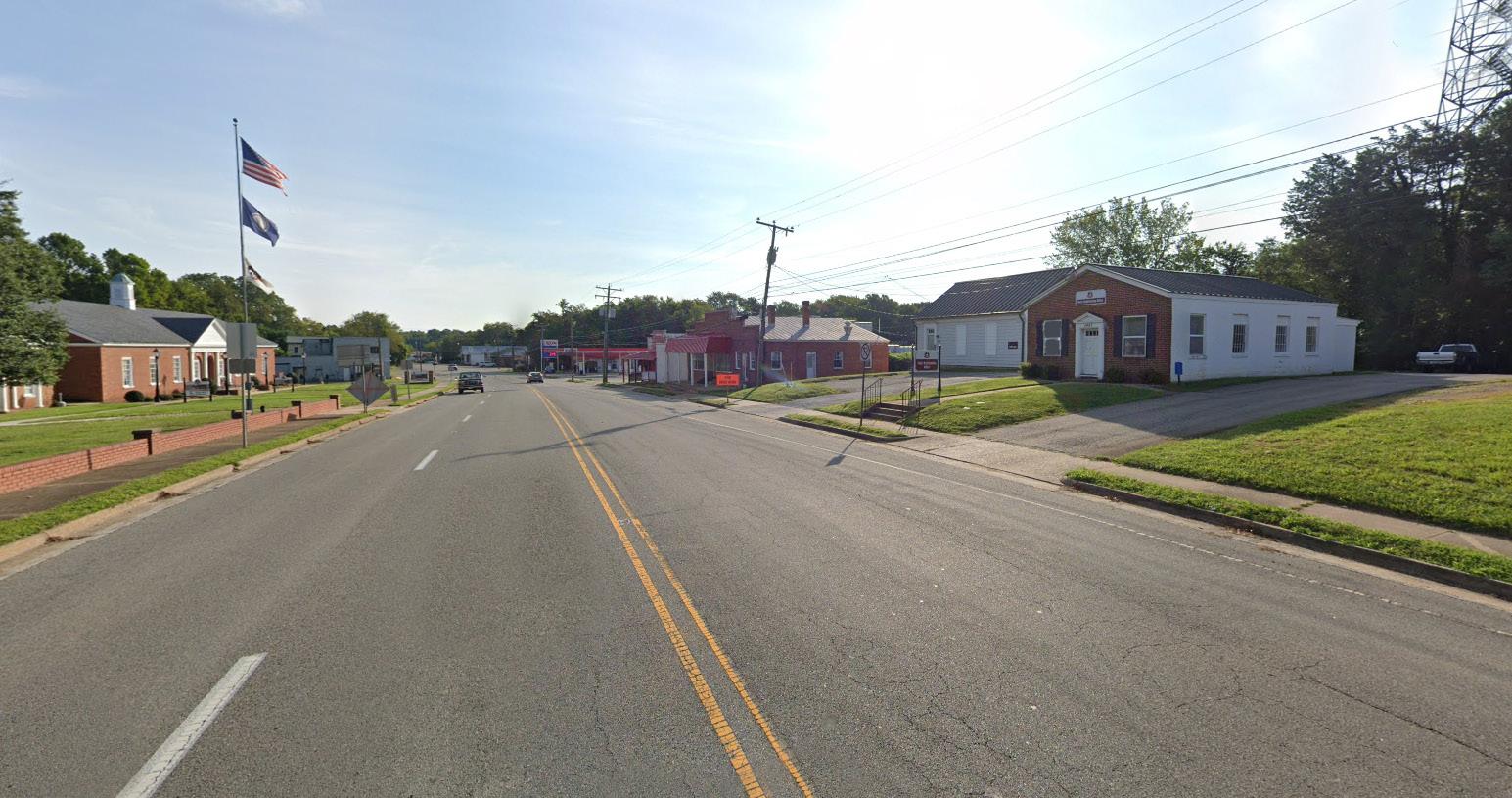
One repeatedly mentioned fact about the County was that there are three distinct areas. The area north of Farmville considers itself part of the Town. The center of the County considers the Cumberland court house area to be their main hub. In the northern portion of the County, the Cartersville community has a strong local identity. All areas of the County head off in their respective direction for shopping, recreation, or employment often outside of Cumberland itself.
This vision and the rest of the Comprehensive Plan seek to promote the County’s identity as a unifying force while preserving the rural character and uplifting the community’s village centers as areas for opportunity and growth. Through this, the plan is to inspire pride in the County and make it known as a wonderful place to live.

Under the vision statement are four “Central Themes” for this Comprehensive Plan. These “central theme” areas are written based on community input and existing conditions data that is presented after this section of the document and focus the County’s efforts on how it will seek to improve quality of life for all current and future residents.
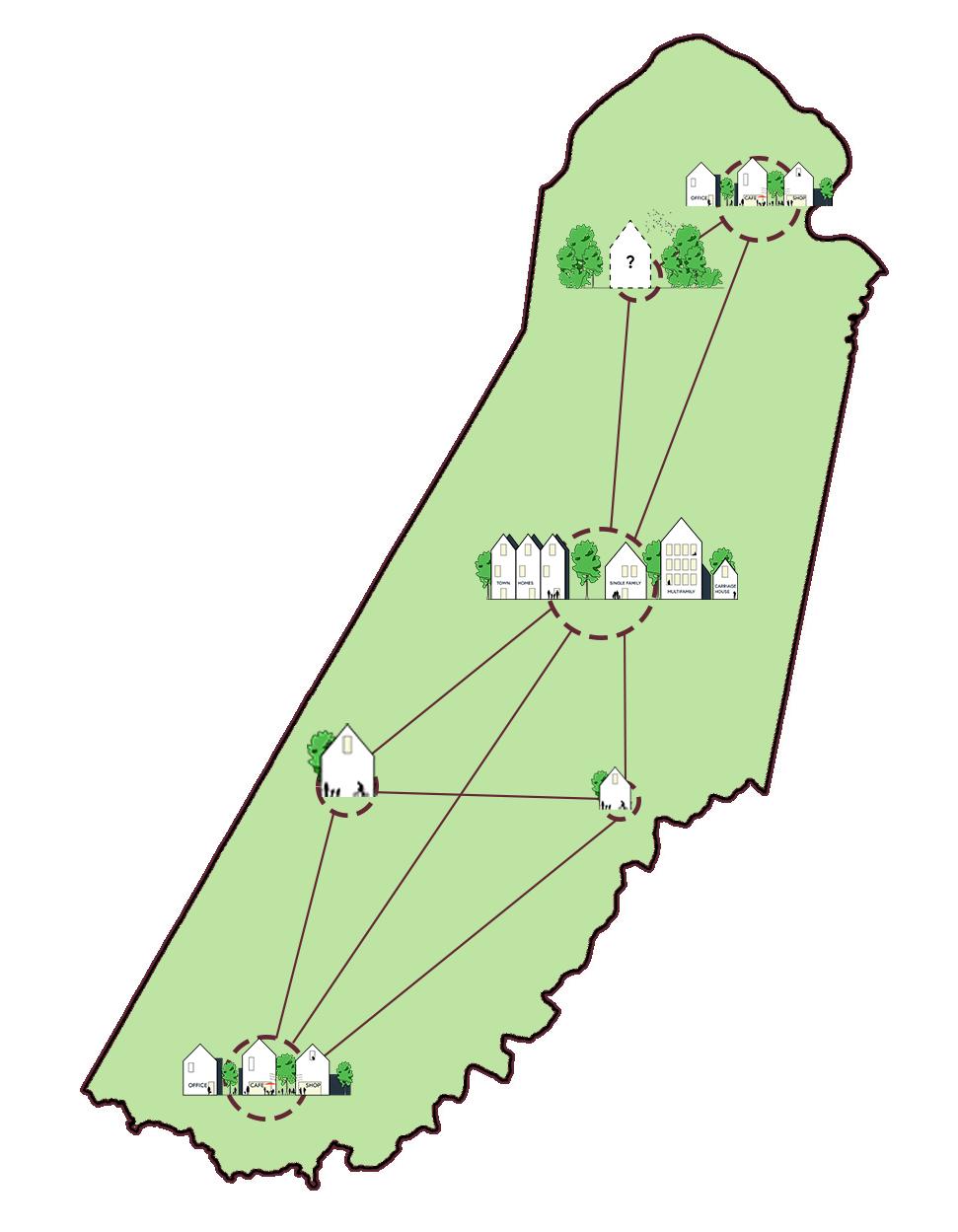
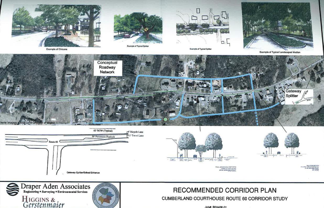
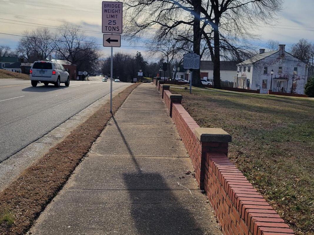
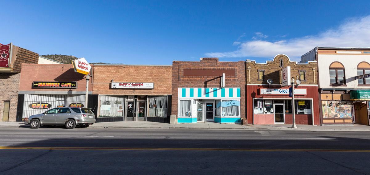
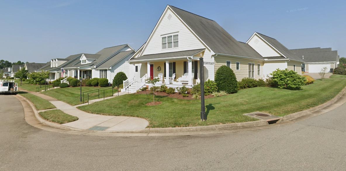
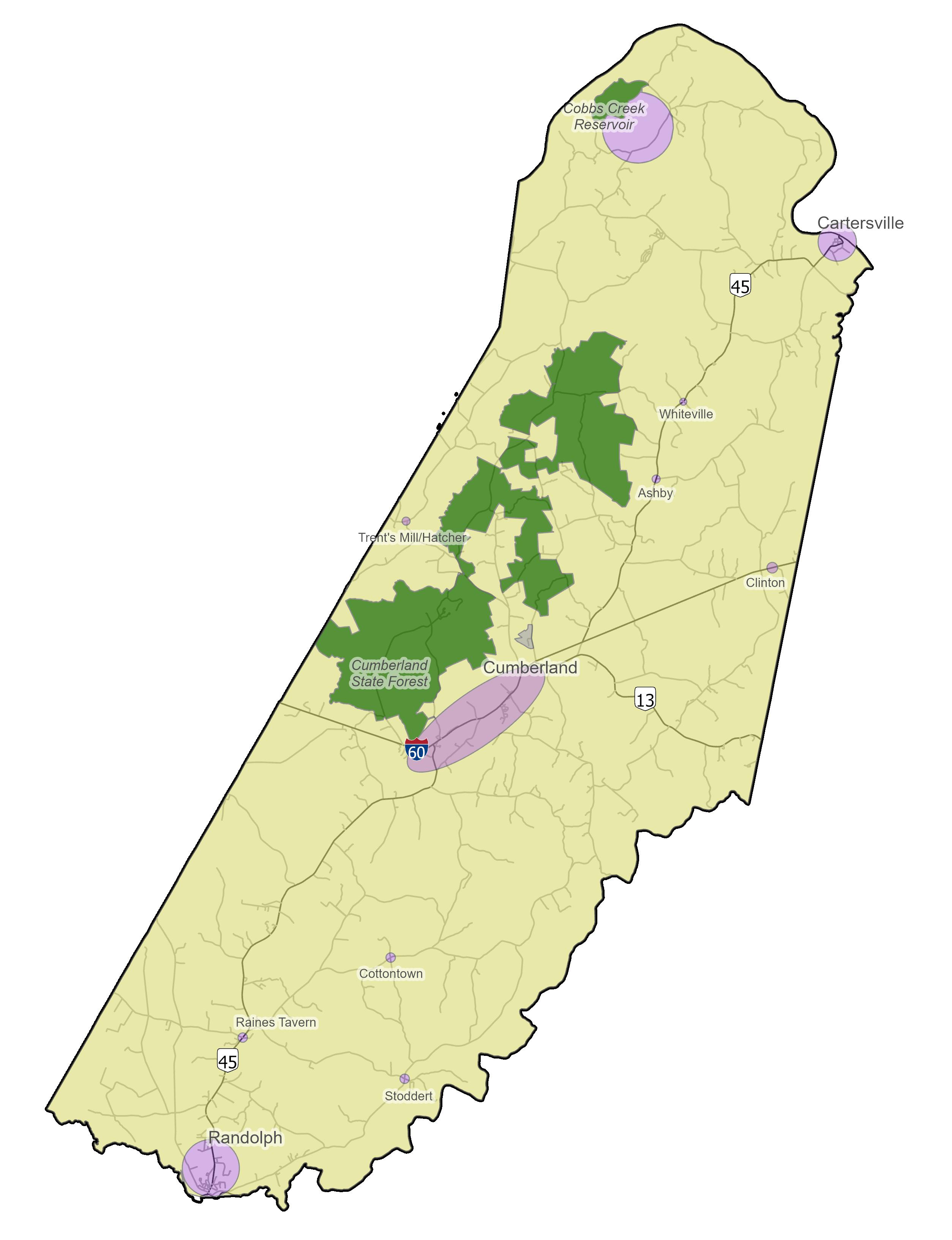
Directing growth to central village centers will help create local environments for Cumberland’s citizens to thrive in. Rather than allowing development to sprawl across the County and encroach on agricultural areas, high quality development can be maintained in specified village centers. These village centers include the Randolph area, north of Randolph, the Cartersville area in the north of the County, Cobbs Creek Reservoir area also in the north of the County, identified “Rural Crossroads” throughout the County, and Cumberland’s namesake and central court house area.
Cumberland is fortunate to not have the issues many other localities face due to its strong rural preservation. These objectives focus on preserving the quality of the County’s soil, air, and water, and maintaining the rural character and agricultural economies. Achieving these goals will make Cumberland an excellent place to live for future generations.

All localities need opportunities for their community. Whether it’s finding housing, a new job, a place to start a business, everyone needs opportunities to make a life for themselves. These goals will provide Cumberland with the policy framework to attract and retain businesses, provide new employment, or allow families to find an affordable place to live. Over time, this will make the County stronger and more competitive amongst its neighbors.

Cumberland County is a special place with a strong sense of community. Everyone may not agree on the ways to resolve an issue, but they do want to live in a prosperous and successful County. The objectives under this theme help the County provide for great services and amenities that will build an even stronger sense of community and allow for all members to care and feel cared about into the future.


Supporting the “Central Themes”
Under each of the “Central Themes” are a list of “Goals” followed by “Objectives” and “Strategies” for Cumberland County to implement over time. The objectives and strategies will provide more specific guidance for steps towards achieving the goal. Through community input and existing conditions data, these steps were drafted as recommendations that will allow the County to reach its future vision.
1. Foster Community Identity
2. Use Land Efficiently 3. Create Village Centers 4. Ensure Safe and Efficient
Cumberland will be home to vibrant “village” communities, where residents and visitors can dine, shop, and gather. These “nodes of development” provide centralized access to housing, commerce, or amenities while protecting the County’s rural countryside from development that would take the land out of agricultural use. Together, they work to improve Cumberland’s overall sense of county-wide identity while allowing for local distinction. By constraining development primarily to the village center, the County can more efficiently target where transportation improvements are needed for safety and begin focusing on creating a network to facilitate movement between them. The designated village centers are:
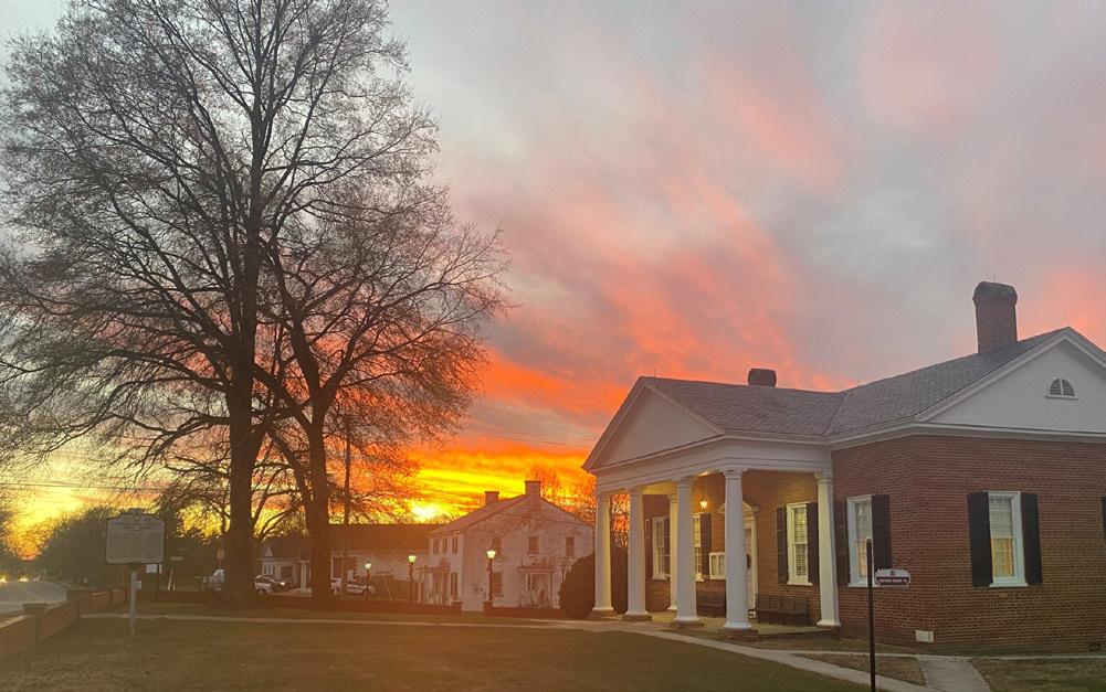
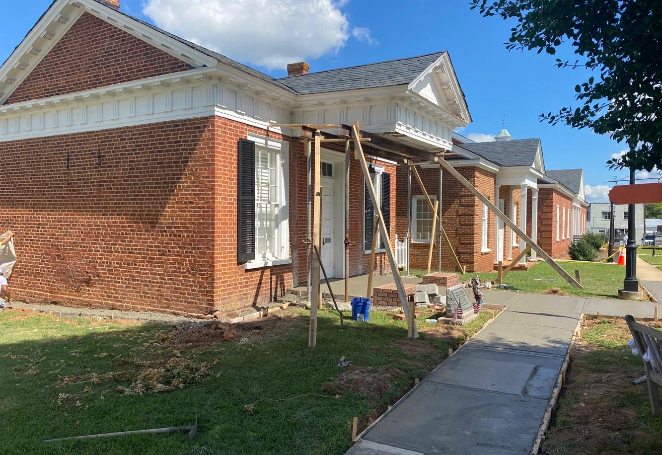
This is the County’s most significant growth center. As the County seat, namesake, and historic heart of the County, the Cumberland court house area provides a targeted area for new mixed, commercial, and residential growth with amenity-filled public spaces for the community to gather.
This village center generally encompasses the developed area north of Randolph. The growth in this center should be supportive of development related to its proximity to Randolph while supporting a community with amenities and public space, commercial units, diverse housing options, and comfortable pedestrian and alternative transportation connections to the Town of Farmville.

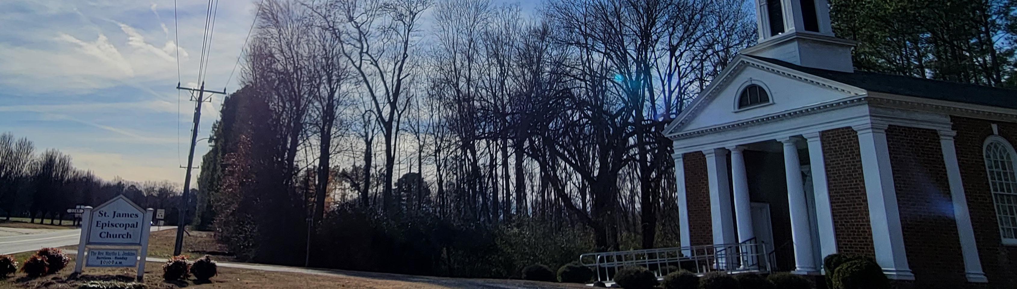
This village center on Cumberland County’s northern end has a strong local identity, historic architecture, and a prominent place along the James River. While some growth is anticipated here to add commercial and residential options, it is expected to be less dense than the other village centers.
While currently under development, the Cobbs Creek Reservoir will be a potential catalyst for new development and attract many visitors. Growth in this area will be oriented towards keeping new construction near the reservoir itself.

Across all of Cumberland, residents of the County live no further than a stones throw from a nearby named “Rural Crossroad.” Trents Mill, Hatcher, Hamilton, Whiteville, Ashby, Stoddert, Raines Tavern, Cotton Town, or Angola, are all examples of this type of village center. These village centers are very targeted to the crossroads they are along and accommodate smaller scale stores or new housing units that help improve quality of life across Cumberland. They are not intended to allow sprawling growth to encroach on the rural countryside and agricultural economy.

Create a united and local sense of identity both in Cumberland as a County and in subcommunities.
Cumberland’s long north to south orientation lends itself to some challenges. It was often mentioned that those living in the northern part of the County will go to Goochland County to shop or participate in events. Those in the central Cumberland area of the County, will often go east to Powhatan to do their shopping. Those in the Randolph area think of themselves as members of the Town of Farmville community. While identifying with multiple places is not a problem, it appears that Cumberland County’s self-identity needs reinforcement. Cumberland is not its neighbors and may have similar or completely different challenges unique to its residents. The historic name “Cumberland” may be utilized across the country, but there is only one Cumberland County, Virginia. It is a special place with beautiful landscapes and hardworking, compassionate people.
Objective 1.1: Provide for local event planning in each village center/core
a. Continue efforts of the Human Services Committee to communicate and provide unified services throughout the County.
b. Continue to provide County centric marketing with community specific events and programs.
Objective 1.2: Allow for each village center core to have its own sub-branding beneath the County level hierarchy
a. Provide incentives and promote the participation in the Cumberland Courthouse Square Historic District Design Guidelines so that the surrounding environment is developed in a style sympathetic and supportive of the historic character of the public buildings.
b. Promote high quality architectural and site designs that are compatible with the village a proposed project is located in. Encourage cohesive landscaping, signage, and scale of development that are tied to the village’s identity.
c. Cumberland County to design and install village specific signage along roadways that mimic existing County branding and signage.
1.1 1.2 1.3
Objective 1.3: Encourage and support cohesive community design
a. Encourage sidewalks where appropriate.
b. Seek out alternative transportation funding opportunities to fund, design, and construct sidewalks or other improvements.

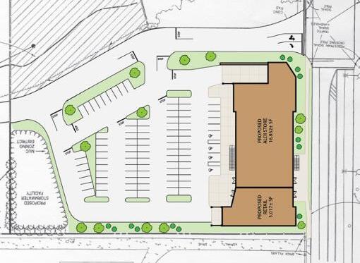
Growth should be guided to Cumberland’s identified “village centers” of Cumberland Court House, Randolph, Cartersville, Cobbs Creek Reservoir, or limited to one of the County’s named “Rural Crossroads,” of Raines Tavern, Cotton Town, Stoddert, Trent’s Mill, Hatcher, Ashby, or Whiteville. Within these village centers, taking cues from “Traditional Neighborhood Design,” development should follow compact, mixed-use, and walkable design to accommodate new opportunities for Cumberland’s residents and visitors. “Sprawl” development that erodes the rural landscape and takes away from the County’s agricultural heritage outside of the identified village centers should not be approved. Cumberland is in a fortunate position to have avoided “sprawl” development thus far, though the population needs more opportunities for commerce and employment. Compact and mixed-use development also allows for the more efficient delivery of utilities and services, whereas “sprawling” development often cannot pay for the cost of infrastructure required to sustain it over time.
Objective2.1: Develop a plan for the Cobb’s Creek area, and rezone immediately after plan adoption to stay ahead of development or speculative property acquisition
a. Coordinate and maximize recreational use of the Cobbs Creek Reservoir with local development creating a self-sufficient community.
b. Identify and develop utility capabilities and infrastructure.
Objective 2.4: Ensure the preservation of natural areas and open space in conjunction with the TND master planning process Land will be utilized in pursuit of an optimal potential, including preserving land where it makes sense and developing land where it is conducive to a vibrant community.
Objective 2.2: Develop intentional Small Area Plans for each village center/core
a. New growth should be targeted to villages and other designated growth areas.
b. Coordinate plans and policies to guide new development into Designated Growth Areas.
c. Work to address water and sewer capacity in the court house area and along Route 45.
Objective 2.3: Provide for open public spaces to socialize or gather around the village center/cores
a. Identify locations and develop according to the Public Facility and Parks and Recreation Master Plans.
b. Encourage developers to set land aside for potential public uses as part of proposed development.
2.1 2.2 2.3 2.4
a. Encourage reuse of existing buildings.
b. Encourage density towards the center of villages and taper to less density at the edges of villages.
2.5
a. Establish appropriate locations to satisfy Village Development Area developable acreage requirements in the Courthouse Village Development Area for residential and commercial land uses with development densities that promote Traditional Neighborhood Design (TND) growth.
b. Promote a mix of diverse residential types and non-residential land uses that reflect TND planning objectives.
c. Plan for the phasing of new TND development within the Courthouse development area consistent with anticipated population and employment growth.
d. Explore financial and other incentives to encourage development within the Village Development Area rather than scattered throughout the outlying agricultural areas.
e. Evaluate the potential for the Village Development Area to serve as a receiving area for any future Transfer of Development Rights (TDR) program established by the County.
f. Prioritize funding for housing, economic development, public transportation, and infrastructure projects within the Village Development Area.
g. Develop applicable Overlay Districts for use in implementing traditional neighborhood design.
2.6
a. Encourage sidewalks where appropriate.
b. Begin to consider and identify feasible opportunities installing public amenities such as street trees, sidewalks, fencing, lighting, and street side furniture.

Cumberland’s growing nodes will become “Village Centers” for the community with more specific designed plans for public spaces and walkable streets.
Cumberland’s growing village centers will be areas where all of the community can come and participate in events, enjoy local parks, or walk around and catch up with neighbors. By encouraging development in concentrated centers, it preserves the surrounding countryside while still providing all of the opportunities that new growth and development brings for the local population. This could be new amenities, new businesses, tourism opportunities, re-use of historic buildings, or more. Within the centers the street grid and building design can follow new guidelines that create safer, more walkable, and interesting streets.
3.1
Objective 3.1: Establish a street grid as opportunities become available in each village center/core that provide more residential, commercial, or mixed-use development opportunities
a. Allow for alternative transportation options. Improve, pedestrian, horse and buggy accommodations and alternative transportation.
b. Complete the trail connection from the Court House to Bear Creek Lake State Park.
3.2
Objective 3.2: Reduce setbacks and parking requirements in the cores.
a. Decrease the amount of “negative space” around the core areas – space that primarily serves to separate activities and structures.
b. Create design guidelines for “big box” stores that encourage better parking lot design and building architecture.
c. Consider eliminating and reducing requirements for buffer yards and setbacks in “village center” areas such as Randolph, Cumberland court house, and Cartersville that increase the amount of distance between varying uses. Encourage better spatial organization through the reduction of building setbacks, lot widths, and front and side yards, and the incorporation of smaller lot sizes.
d. Encourage parking to be located in ways that do not inhibit pedestrian or alternative transportation access to the use, particularly in the “village center” areas.
Example of how parking can be located at the rear of a property, rather than occupying the front.
3.3
Objective 3.3: Create new public open spaces in Village Centers, with amenities such as seating areas or play elements.
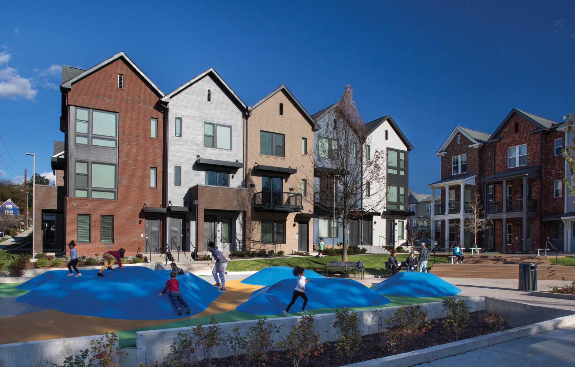
Play area and seating next to new town homes.
Source: The Congress for the New Urbanism (CNU), award winning design by Smith Gee Studio.
a. County should acquire land in the Courthouse area for a public park or square, which can offer passive recreational benefits as well as programmable space for events like a farmers market.
b. Restore the “Old Jail” building as a County “Welcome Center/Visitors Center.”
3.4
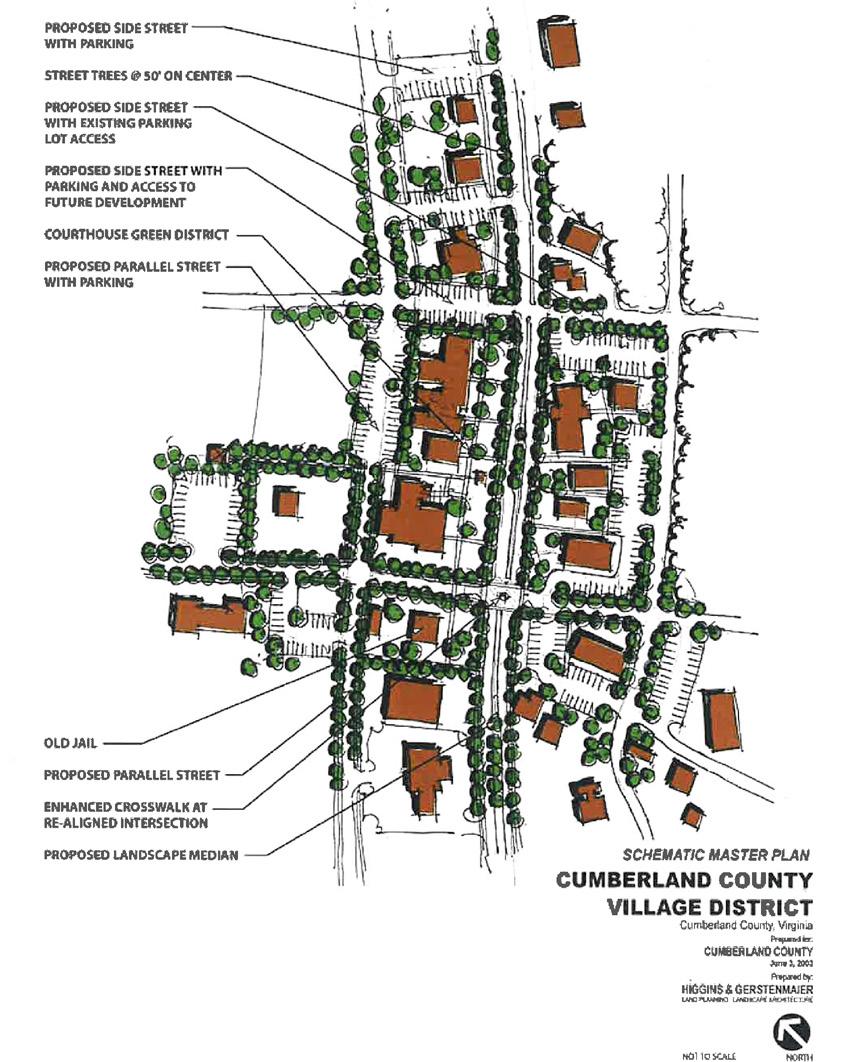
Objective 3.4: Develop small area plans for village centers.
a. To achieve the vision of the village centers as dense, traditional, walkable areas with a mix of uses, more details need to be worked out. To give these important areas the attention they deserve, a “small area plan” should be created. This process should involve outreach to property owners in the area, and should focus on the mix of uses, the public realm, and architectural details. Small area plans should include details regarding streetscape improvements, desired mix of uses, guidelines for architectural design, and other features that will guide development and County decisions.
Credit: Richard Amore, CNU

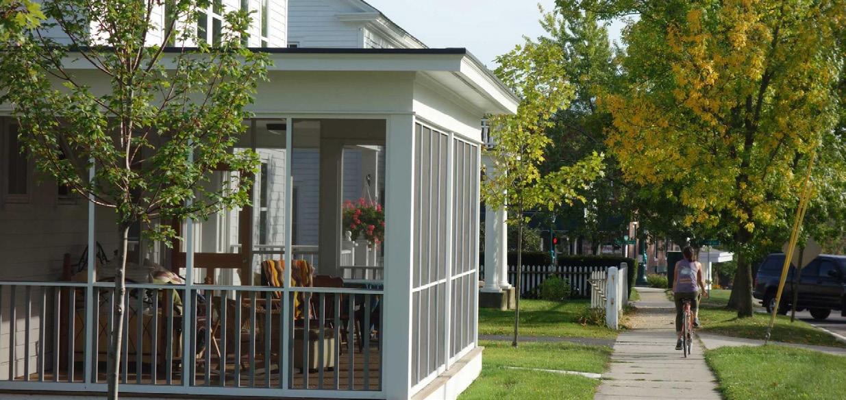
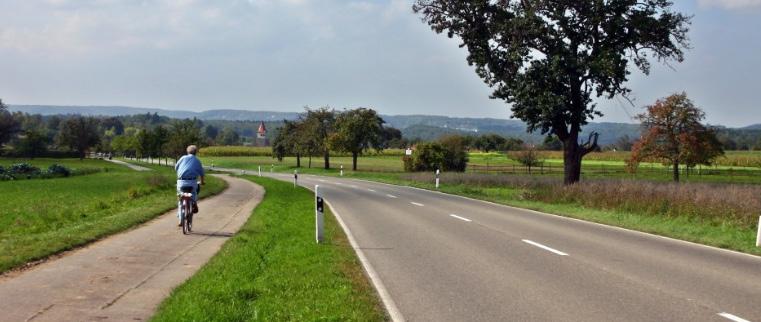
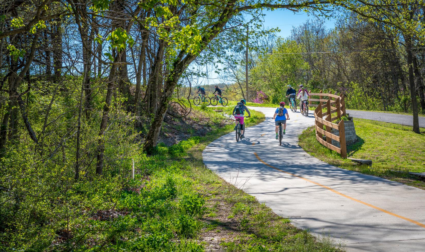
Almost everyone in rural areas like Cumberland are reliant on cars to get around. However, not everyone has access to cars, such as younger children, the elderly, and those who cannot afford a car. Improving transportation options and safety for all populations in Cumberland will improve access, improve health, and community safety and security.
Everyone should be able to get around Cumberland County safely. Whether you walk, bicycle, drive a car, or horse and buggy, Iit should be with convenience and confidence that you will arrive at your destination. When automobile-centered planning became the movement of the last few decades, roads were planned without any accommodation for other modes of travel. Despite this, many people still use other methods of transportation along rural roads. Ensuring that car travel is managed at safe speeds, intersections are improved, and making land use decisions that target growth can help make Cumberland a more prosperous, enjoyable, and safe place to live or work.
4.1
Objective 4.1: Plan for a County-wide multi-modal transportation system that will effectively serve the current and future needs of Cumberland County
a. Work with the Virginia Department of Transportation to achieve the appropriate upgrade of existing unimproved, graded and drained, gravel and soil surfaced roads within Cumberland County.
b. Seek grant funding for the implementation of special transportation enhancement projects.
4.2
Objective 4.2: Improve opportunities for alternative transportation
a. Secure funding and create trail from Courthouse to Bear Creek State Park.
b. Coordinate efforts with VDOT to identify roadway safety improvements for the Amish community.
Objective 4.3: Improve opportunities for safe travel by walking, particularly in the Village Centers
a. Ensure that new development in village centers includes sidewalks.
b. Work with the Virginia Department of Transportation (VDOT) to provide lanes or shared use paths in Village Centers for alternative transportation use and for the Amish community.
c. Work with VDOT to reduce speeds in Village Centers.
d. Research and pursue sources of funding pedestrian and alternative transportation infrastructure.
4.3 4.4
Objective 4.4: Work with VDOT to improve safety at key intersections
a. Work with VDOT, expressing the need for pedestrian and alternative transportation safety across the entire County, even if safe standards are not fully implemented or adopted at the state level.
Objective 4.5: Work with local property owners and developers to ensure pedestrian and alternative transportation accommodations are facilitated with new development.
a. Incorporate pedestrian-friendly road and street designs within new developments.
b. When possible seek to establish standards for enhanced street landscaping, pedestrian improvements, and pavement design.
c. Establish connectivity between internal road and pedestrian networks within Traditional Neighborhood Design (TND) projects, providing a grid rather than cul-de-sac street pattern.
d. Promote the interconnection of new TND streets with existing streets and roads.
e. Explore opportunities for “through-route” easement connections across properties that do not necessarily follow the existing road network, but make alternative travel more convenient.
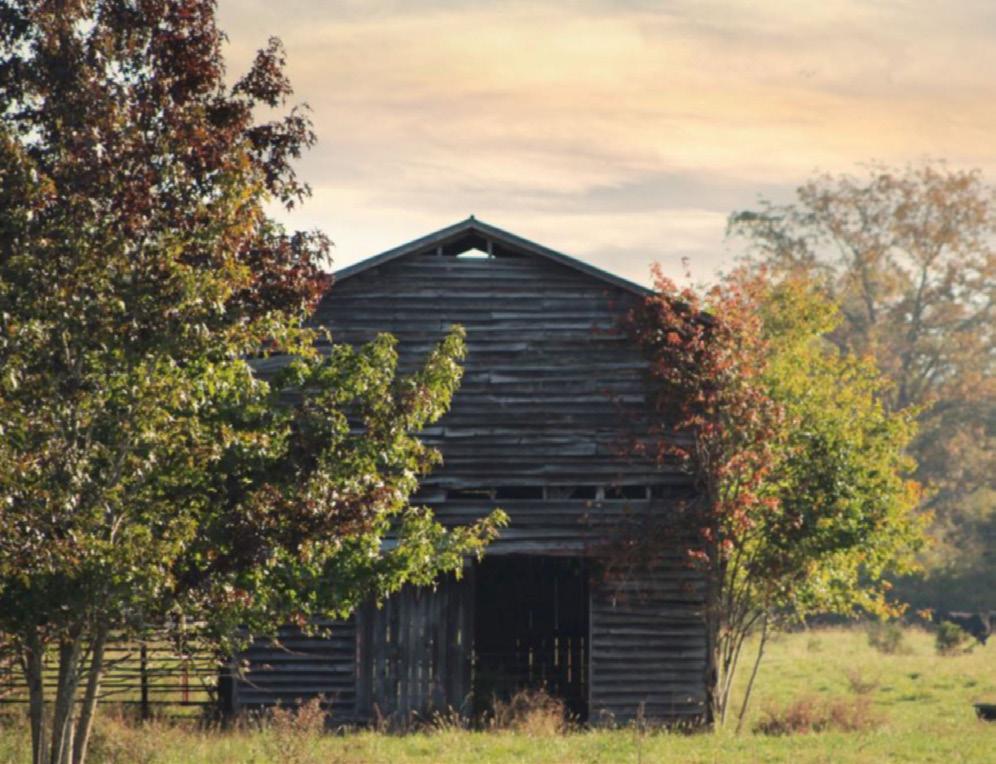
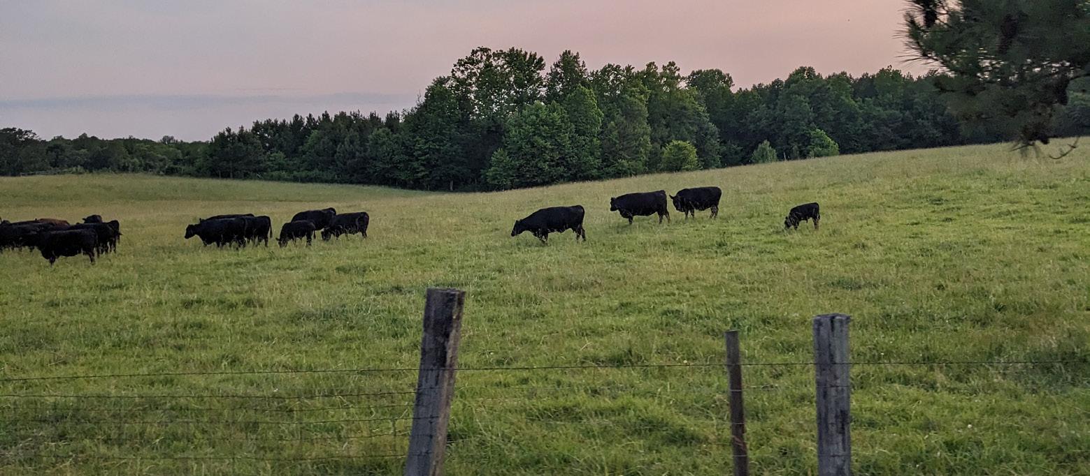
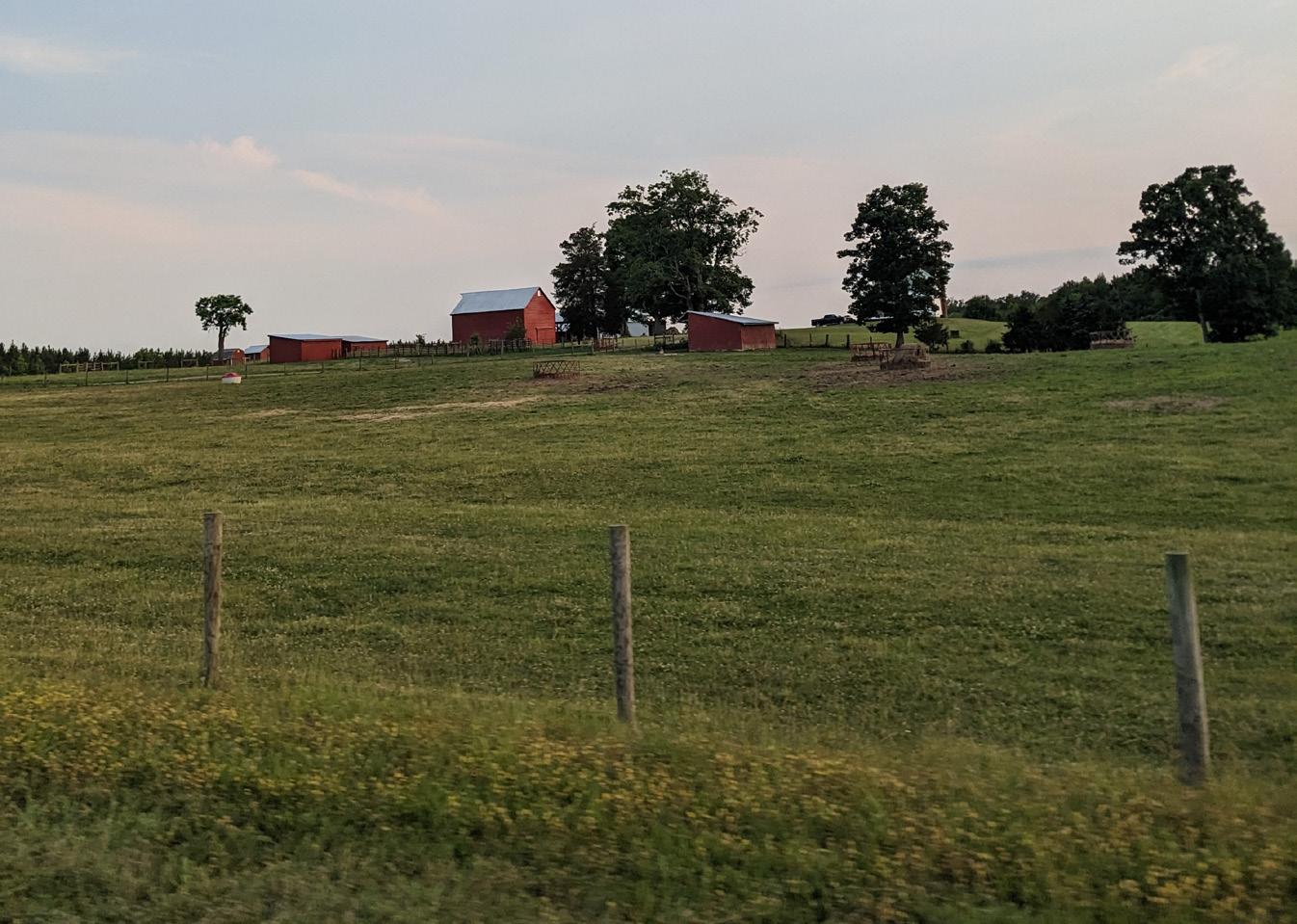
Cumberland preserves its rural character and agricultural economy for future generations, providing farmland, forests, environment, and recreational opportunity. Rural character in the Cumberland is about more than farming or the aesthetic value of open space. It is a mosaic of resources and values, including natural systems, public expenditures, lifestyle choices, local history and culture. Cumberland’s rural character has historically been preserved by the economic value of the land for agricultural use. However, the current interplay between growing nearby populations, diminishing agricultural profits, and the attractiveness of the rural landscape to nearby communities for more affordable housing or lifestyle is creating strong pressures for non-agricultural development. Ultimately, protection of rural character will require “limiting what’s out there.” The amount of development the landscape can accommodate while maintaining its character is directly related to the development’s location, design, and use.
The County has done a great job protecting its rural character thus far. This has prevented the development of “sprawling” growth along major roads typical of many other localities both in Virginia and across the country. Preserving arable land has enabled many localities to embrace agriculturally based tourism opportunities including farm-to-table restaurants, wineries and breweries, or other attractive uses for locals and visitors to enjoy. Cumberland is in the beginning of embracing these opportunities and these objectives will ensure that rural areas are preserved and growth is guided to where it makes sense.

Preserving clean soil, water, and air are all essential for providing for a healthy and high quality of life for Cumberland’s citizens. The objectives and strategies in this chapter outline the steps the County can take to ensure that the environment is protected from pollution and that future generations may enjoy excellent living conditions. While agricultural uses are one of Cumberland’s planning goals, often the use of fertilizers can cause issues with stormwater runoff in local waterways. This is an example of an area where interests need to be balanced using the latest research and standards to protect the County’s prosperity.
Parks, trails, fields, courts, and other recreational amenities are also essential for improving quality of life in Cumberland. These amenities provide every member of the community of all ages with a place to live an active life and stay healthy. They also offer the opportunity to allow residents to enjoy Cumberland’s outdoors by improving access to rural settings or waterways. Parks also become social places, providing for a place for neighbors to meet one another and build community and pride in the County that they call home.
Preserving Cumberland for its future generations means many different things, yet together they are all related in making the County a great place to live. Ensuring that Cumberland’s water, air, and soils remain protected and clean is important for the community’s health. Protecting historic and cultural sites throughout the County is important to continue to educate and share Cumberland’s story with new generations. Preventing the loss of the County’s agricultural economy and rural countryside maintains the character of the area while also creating growth in targeted locations.

Preserving rural character and economies may help to maintain the unique identity and culture of the county. By encouraging strong local businesses, protecting natural resources, and promoting agri-tourism, the community can begin to sustain itself economically and attract new residents who value a rural lifestyle. These efforts can also help to preserve the land and environment for future generations.
5.1
Objective 5.1: Maintain the rural character of the County through the preservation of Cumberland’s scenic, agricultural, and natural resources for the optimal benefit of current and future citizens.
a. When appropriate, guide residential development to: Minimize visual impact with roadway buffers; include significant open space; plan placement of new buildings; preserve natural features on site; be sensitive to existing topography and land forms; minimal clearing, grading, and impervious surfaces; clustering of building lots.
b. Preserve open space of scenic, agricultural, and natural significance through the use of federal, state, and local programs.
c. Provide incentives to encourage development within designated Village Centers.
5.2
Objective 5.2: Encourage the preservation and use of historic resources within the County, including historic sites, churches, cemeteries, homes, and community facilities
a. Market and support agriculture related businesses (agri-business) as part of the County’s tourism efforts.
b. Focus on developing agri-tourism assets.
Objective 5.3: Preserve the historic Cumberland court house area along with all of the historic buildings
a. Permit and promote the use of “pop-up” temporary uses in vacant buildings in the Courthouse area until a permanent use is interested in the location.
b. Re-develop the “Old Jail” into a County Welcome Center.
c. Seek grant funding or historical tax credits to assist homeowners in renovating and preserving historic homes.
Objective 5.4: Understand and preserve working agricultural supply chains and support businesses
a. Support the Cumberland County Agriculture & Producers Initiative.
Local and regional food systems are critical aspects of healthy, resilient, and equitable communities.
Objective 5.5: Ensure that the character of Route 60 is maintained
a. Review the Zoning Map and consider recommendations for changing zoning along Route 60.
5.3 5.4 5.5 5.6
Objective 5.6: Amend subdivision ordinance to ensure that new residential development is in keeping with rural character
a. Amend the subdivision ordinance to add clustering, buffers, open space preservation, and mode choice in new residential development.
a. Update the Cumberland County Zoning Ordinance to reflect the Future Land Use Map and land use designations.
b. Amend zoning ordinance to allow working farms to diversify their income through compatible uses such as farm based sales, agritourism, farm events, and other agricultural enterprises.
c. Explore the development of new agricultural product opportunities and industries supporting local farming including those relating to processing of agricultural produce, packaging, marketing and transportation.
d. Protect prime agricultural lands through compliance with state and federal requirements and provide incentives for the implementation of agricultural best management practices.
e. Strengthen the zoning ordinance to more effectively regulate and limit development in agricultural areas that are incompatible with agricultural interests.
f. Amend zoning map to establish large lot zoning and conservation areas in appropriate locations.
g. Review the Zoning Ordinance to allow for “agriculture-adjacent” businesses, such as maintenance, manufacturing, warehousing, or parts stores to be developed.
h. Promote local agricultural products through the expansion of the county farmers’ market and increased opportunities for the sale of local products within the county.
i. Support the Cumberland County Agriculture & Producers Initiative.
5.8 5.9 5.10
Objective 5.8: Explore the feasibility and interest in establishing policy tools within Cumberland County to conserve and protect prime farm and forestlands
a. Strategies could include improved clustering for subdivisions that incorporates active agricultural use, Transfer or Purchase of Development Rights programs, or other incentives to preserve arable land.
Objective 5.9: Assess current incentives for agriculture, horticulture, and forestry land uses and determine how to modernize these measures without compromising County revenue streams.
Objective 5.10: Connect the public with education and access to share the importance of agriculture to the County.
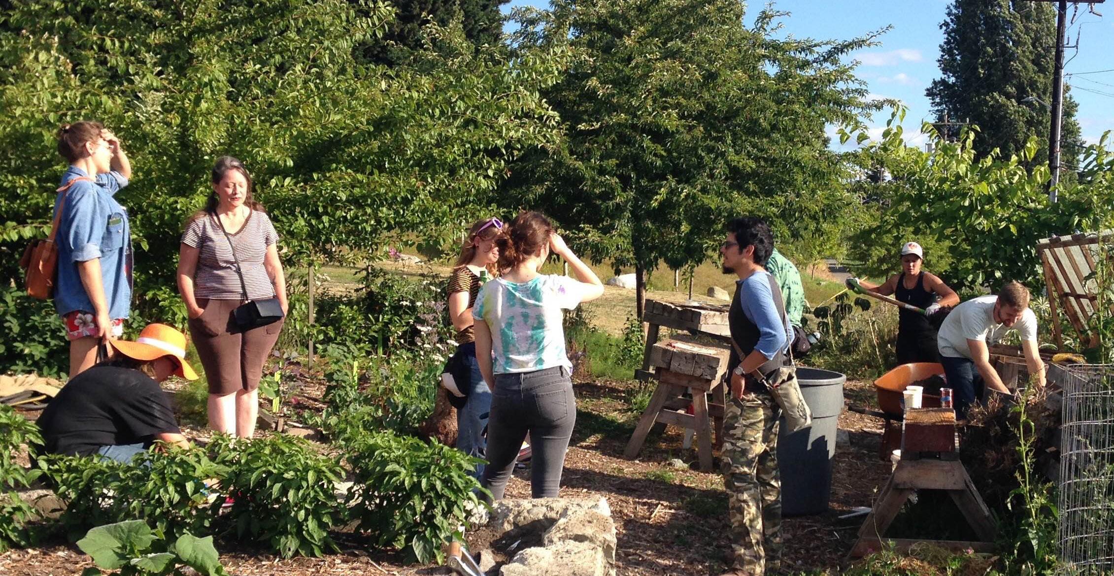
a. Strengthen agricultural education and support county-wide.
b. Collaborate with the Virginia Cooperative Extension, Cumberland County Parks & Recreation, and the Peter Francisco Soil and Water Conservation District to provide event programming and other learning opportunities.

The Cumberland County office of Virginia Cooperative Extension is the local connection to Virginia‘s land-grant universities, Virginia Tech and Virginia State University. Through educational programs based on research and developed with input from local stakeholders, they help the people of Cumberland County improve their lives. The Office provides education through programs in Agriculture and Natural Resources, Family and Consumer Sciences, 4-H Youth Development, and Community Viability.
The Peter Francisco Soil and Water Conservation District (PFSWCD) is a political subdivision of the Commonwealth of Virginia and is responsible under State Law for soil and water conservation work within the boundaries of Buckingham and Cumberland Counties. The District’s purpose is to encourage and initiate land use practices that help improve water quality and reduce soil erosion as well as educating the community in protecting our natural resources.

Preserve the environment in Cumberland by protecting the quality of Cumberland’s ground and surface water, soil, and air, effectively managing the County’s natural resources for the benefit of current and future citizens.
a. Research and utilize federal, state and local programs to preserve open space of scenic, agricultural, and natural significance.
b. Create policy and other incentives to encourage development primarily within designated growth areas such as around Cumberland court house, Randolph, and Cartersville. Outside of these areas, strictly limit development.
c. Work with federal, state, and local agencies to implement nutrient management measures to protect ground and surface waters.
d. Enact zoning/land use regulations to restrict development in environmentally sensitive areas, including sensitive areas along the James River and Appomattox River.
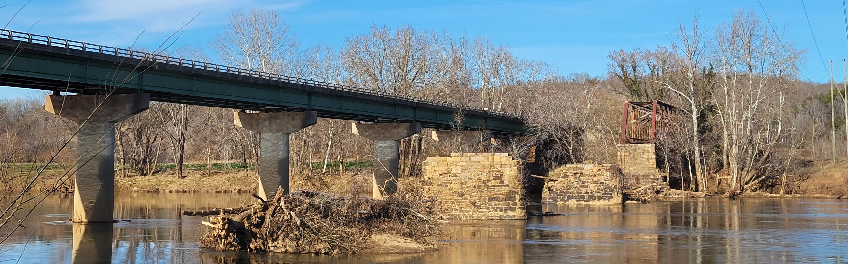
e. Work with the Department of Conservation and Recreation to have the James River, where it forms the County’s northern border, included in Virginia’s Scenic Rivers System.
f. Work with state and local agencies to develop events and programs designed to higlight agriculture, such as “Ag. Days.”

The Agriculture Council of America and the National Ag Day program was started in 1973.
The Agriculture Council of America (ACA) is an organization uniquely composed of leaders in the agriculture, food and fiber communities dedicated to increasing the public awareness of agriculture’s vital role in our society.
Cumberland can utilize their resources to organize a local event.
6.2 6.3
Objective 6.2: Enforce existing environmental standards and provide incentives where applicable.
a. Enforce soil sediment and erosion control and stormwater management regulations to protect surface waters.
b. Protect rivers and streams through compliance with state forestry requirements and provide incentives for the implementation of agricultural and forestry best management practices.
c. Provide incentives to encourage regular pumping of septic systems.
Objective 6.3: Update County-wide energy policies.
a. Consider future policy around utility scale energy projects, in addition to the existing Solar Ordinance.
b. Amend County ordinances, regulations and policies to accommodate alternative forms of energy where feasible.

Solar and other types of development do not need to threaten or challenge existing agricultural activities or culture.

7.1
Objective 7.1: Cumberland will utilize the Parks and Recreation Master Plan to pursue funding and timely implementation of recreational assets to enhance public health and quality of life in the community.
a. Explore feasibility of establishing public/private partnerships, special authorities, boards or committees to help develop, maintain and operate parks, recreation and open space facilities within Cumberland County.
b. Utilize the Parks and Recreation Master Plan to identify needs and funding through the Capital Improvements Plan (CIP). The County will strive towards an excellent and well-maintained system of parks and recreational facilities and improve public access points to public waterways across the County for citizens of all age groups and socio-economic backgrounds.
7.2 7.3
Objective 7.2: Public restrooms, concessions, picnic benches, and grills are all ways to improve or otherwise co-locate County amenities. New public access points may also be acquired and planned for improvement.
a. Seek opportunities to fund the co-location of public restrooms, concessions, playscapes, or other amenities to improve the diverse ways Cumberland’s park spaces can be used, maintained, and secured.
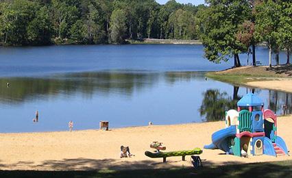
Objective 7.3: Work with state agencies to develop and promote Cumberland State Forest, Bear Creek Lake State Park, and High Bridge State Park.
a. Cultivate relationships at Virginia Tourism Corporation (VTC), the Virginia Department of Recreation (DCR),
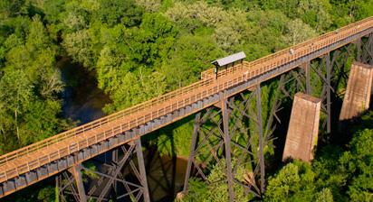
High Bridge Trail, Randolph, Virginia
Credit: VA Department of Conservation and Recreation
7.4
Objective 7.4: Maintain scenic and natural buffer areas along and adjacent to the James, Willis and Appomattox rivers.
7.5
Objective 7.5: Develop a long-term plan and conduct community engagement for the Cumberland Community Center to address the need for additional youth and senior services and recreational and fitness facilities.
For more information, please see the County’s Parks and Recreation Master Plan.

Cumberland County residents want to start businesses, work jobs, and make a living for their families. However, this can be difficult to find within the County itself. During the public engagement process, residents expressed challenges with their commutes, inability to see how a business could be profitable in Cumberland, and their having to do shopping outside of the County. At different scales of large economic development projects and small like starting new local businesses, the County needs to diversify and grow its local economy. With this plan, growth and opportunity do not have to come at the expense of other important goals, such as preserving agricultural land. Local economic development may even enhance it by growing the market demand for locally grown goods.
With Cumberland residents doing most of their shopping outside of the County for goods and services, the locality is missing out on collecting revenue that it can use to improve quality of life inside its borders. At a variety of scales, County residents need local economic opportunities to gain experience, provide an income, and learn skills. Pursuing this goal will require a variety of approaches including looking at the Zoning Ordinance, examining local resources for business assistance, and creating materials to try and attract new businesses to the County with ready sites. There is no one solution that will completely improve the economy in Cumberland, however, by taking the approach that a diverse economy is desirable and guiding new uses to where they are deemed appropriate, the current conditions can change.
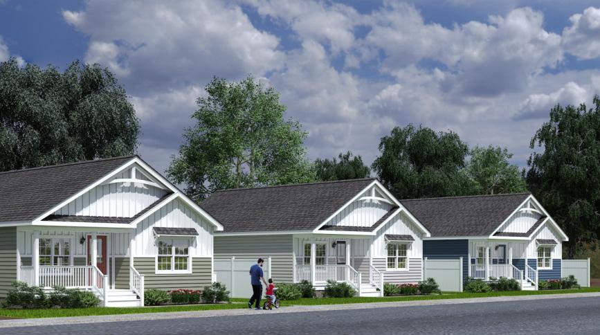
Cumberland County’s housing stock is currently predominantly single family detached houses. While comparatively affordable to other areas of Virginia, this situation can change very quickly if growth pressure from Charlottesville, Lynchburg, Randolph, or Richmond begins to impact the County. To be proactive, the County can encourage diverse types of housing including single family attached or multifamily units within the previously mentioned village centers. These allow for people from varying walks of life, whether a young professional or an elderly person looking to downsize, to be a part of the community. It also expands the local economy in these village centers and creates new business opportunities.

The majority of Cumberland residents do not work inside the County. The lack of economic opportunities means less young adults move back to Cumberland after education or stay in Cumberland to find a job.
Investing in diverse economic opportunities within the county was a high priority for many residents.
8.1 8.2
Objective 8.1: The County will encourage the economic development in well-connected village centers such as Randolph, Cumberland, and Cartersville.
Objective 8.2: The County will encourage the development of service and retail businesses to meet the needs of the current and future population of the community.
a. Develop an asset-based economic development strategy that identifies target businesses and long-term economic goals.
b. Support the County’s economic development strategy with an incentive program to attract desired businesses, this could include tax incentives, reduced utility hook-up fees, expedited permitting, or others.
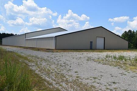
c. The County will explore the feasibility of site improvements for the Cumberland Business Park and Riverside Industrial Parks and monitor the success of both parks and acquire new land for additional sites as needed.
d. Promote the County’s available business and industrial sites such as Riverside Industrial Park, Cumberland Business Park, Cartersville an the Farmville Regional Airport through marketing to prospective industries and businesses.
e. Explore developing an incentive program for industries and businesses that offer competitive wages and other benefits.
f. Seek additional food industry uses such as restaurants or groceries that are particularly sought after as both employers and contributors to quality of life in the community
g. The County will study and identify gaps in the goods and services available within its jurisdiction to determine what uses are missing and plan for how to “fill the gaps.”
h. Ensure that every “village center” has a diverse mix of uses that include “Third Places,” or places that are not home or work where people can spend time. Examples of this include coffee shops, bars, or restaurants.
Credit: Adobe Stock
Objective 8.3: Cumberland County will capitalize on its natural and cultural resources to create a thriving hospitality, recreation, and ecotourism industry for both residents and visitors.
a. Allow for the development and expansion of nature-based recreation facilities to accommodate hunting, fishing, birding, hiking, biking, and equestrian activities or more, incorporate these uses as part of the County’s branding and marketing.
b. Capitalize on the economic development potential of water-based recreation on the Appomattox River, James River, Bear Creek Lake, and Cobb’s Creek Reservoir.
c. Open a Visitor’s Center or tourism office in the “Old Jail” to develop its full potential as a tourism destination.
d. Study and explore the feasibility of promoting the development of a local beer and wine industry.
e. Explore amending the Zoning Ordinance to allow for the development of “agri-tourism” opportunities, where local farms are encouraged to co-locate accommodation with food and learning experiences.
f. Improve marketing efforts to bring tourists and tourism related business by continuing use of the County’s brand, social media presence, and distribution of promotional materials.
h. Collaborate with non-profits, state and local agencies, or other groups to promote nature-based, cultural, and historical tourism within the County.
i. Designate a scenic highway in Cumberland County (i.e. Rt. 13 and possible other secondary roads). Develop standards that enhance the natural beauty and rural viewsheds along highways.

Currently, Cumberland residents need to travel outside of the county for most goods and services, including groceries. Community feedback has made it clear that residents want more opportunities to shop and patronize local businesses closer to home.
8.4 8.5
Objective 8.4: Facilitate the conditions needed for new and small businesses, particularly in Village Centers.
a. Rezone all village centers, and make sure there are no unnecessary barriers to the creation of horizontal and vertical mixed use.
Objective 8.5: The County will utilize all available resources to maximize the organization and effectiveness of economic development efforts.
a. Support the County’s economic development strategy by reviewing relevant ordinances, regulations, and policies for consistency.
b. Develop an asset-based economic development strategy for the County which identifies target businesses and long term economic development goals.
c. Support the County’s economic development strategy with marketing efforts and County branding to target desire businesses.
d. Amend the Zoning Ordinance to allow for the development of hospitality services in the County, including restaurants, hotels and motels, recreation-oriented businesses, bed & breakfast accommodations, or “eco-tourism” uses in appropriate locations.
e. The work of the Cumberland County Economic Development Authority, Cumberland Board of Supervisors, Cumberland Planning Commission, County staff and other appropriate groups will be coordinated through constant communication.
f. The County will coordinate with local economic development efforts at the regional and state levels.
g. Economic development will be coordinated with the capacity and resources available through other organizations, neighboring jurisdictions, regional organizations, state agencies, federal agencies, and the Commonwealth Regional Council.
h. Identify and consider acquiring additional industrial sites for future development.
i. Develop necessary infrastructure to support the development and sustainability of service and retail businesses.
j. Develop an incentive program to attract appropriate service and retail businesses to the County.
f. Work with the Virginia Department of Transportation to promote the development of multi-modal transportation systems to support the needs of economic development and community members safe access to employment.
g. Work with the Virginia Department of Transportation to achieve the appropriate upgrade of existing unimproved, graded and drained, gravel and soil surfaced roads within Cumberland County.
h. Locate commercially and industrially zoned lands based on appropriate planning criteria including: availability of utilities, vehicular accessibility, traffic volume counts, adjacent land uses, likely impacts on adjacent land uses and other environmental factors.


Whether downsizing or looking for a larger accommodation, all new and existing residents need to find housing. Diverse housing options allows for the elderly to “age in” their community, and it also allows for young people or new families to locate in Cumberland County.
Objective 9.1: Facilitate the development of diverse housing types
Objective 9.3: Incentivize the development of affordable housing for Cumberland County 9.1 9.2 9.3
a. Adopt zoning overlays and/or new zoning districts that allow for the development of single-family attached homes, duplexes, triplexes, 4-plexes, and 6-plexes by right in each village center.
b. Amend the County’s Zoning Districts to allow for more multi-family housing options.
Objective 9.2: Ensure that new housing development is well-connected to existing neighborhoods
a. In accordance with the Code of Virginia Sec 15.2-2223.5, ensure that manufactured homes remain a source of affordable housing by preserving existing manufactured housing communities or providing for the creation of new manufactured home communities.
b. The County will identify and utilize all state and federal funding sources to help low- and moderate-income residents to gain access to decent and standard housing opportunities.
9.4
Objective 9.4: Support housing where it currently exists with services and other amenities equitably throughout the County.
a. The County will seek to establish public and private partnerships to preserve the existing housing stock.
9.5
Objective 9.5: Strive to eliminate substandard housing through code enforcement.
Source:
This plan is reflective of data and public input directly influencing what planning recommendations are made and presented to elected and appointed officials. It appears that Cumberland’s community all have their own ideas about how power is expressed and how different outcomes are reached. This goal is to make the decision making process more transparent and clearly tied to planning documents so that all members of the public can see what decisions are reflective of. It also sets the objective for maintaining consistent engagement and input so that the community feels heard. Communication methods can also be improved so that everyone is aware of what is going on in the County. Over time, in coordination with the other goals of this plan, Cumberland can facilitate a high trust environment and reduce conflict.
Cumberland’s taxpayers should feel confident that their funds are being used in the best ways to improve their quality of life. This goal is centered around ensuring money is invested equitably across the community to address needs and that the Capital Improvements Plan is well utilized to provide detailed information on how funds are being spent. With excellent fiscal stewardship, the County can be excited about improvements to local facilities.
The County’s residents enjoy quality public facilities and services, including schools, offices, parks, or emergency services. These objectives continue the efforts to provide quality facilities and seeks to set the groundwork for further improvements. Seeing how a community invests in itself is also a key factor in attracting visitors or further investment.
Similar to fiscal stewardship, it is important that any growth coincides with planned utility improvements. These objectives seek to improve the infrastructure that supports life in Cumberland.

To build trust across the community, decisions should be clearly tied to publicly available analysis and information. Planning documents, such as this Comprehensive Plan, can guide the public to understand why certain decisions are made to balance the County’s various interests.
10.1
Objective 10.1: The Comprehensive Plan and other guiding documents will be consulted for considerate decision-making. Cumberland will ensure that trust is fostered in the County through social inclusion and that principles of stewardship and pride that are evident as a result of careful decision-making.
a. The Comprehensive Plan will be reviewed or updated by the County’s Planning Commission every five years, according to the Code of Virginia.
b. Public Facility Master Plan, Capital Improvement Plan, Parks and Recreation Master Plan, and CCAP Initiative should be reviewed every three years in conjunction with Comprehensive Plan.
10.2
Objective 10.5: Develop and update a County Strategic Plan every four years.
a. Identify strategic management objectives that guide decision making, goals, and objectives.
b. Identify strategic objectives aimed at ensuring a well run and fiscally sound govenrment.
c. Identify operational goals and objectives that embrace the desired vision for Cumberland County.
10.3
Objective 10.3: Maintain consistent engagement. “The County will strive to flexibly address citizen needs and encourage innovation.”
a. Conduct “town halls” or surveys on resident satisfaction in every represented district. Keep data to ensure all voices in the community are being reached.
b. Encourage community suggestions for “pilot projects” testing where, in areas such as Randolph, Cumberland, and Cartersville, new amenities such as outdoor seating areas, playspace, or ‘pop-up’ events or businesses could be located.
c. Once the trail from the court house to Bear Creek Lake State Park is completed and fully implemented, monitor it for success and solicit suggestions.
d. Continue to produce “Connect Cumberland” program guide.
10.4
Objective 10.4: “The County will be an excellent regional partner, coordinating with its neighboring partners to enhance quality of life for the local community and invite visitors.”
a. The County will continue to engage with the Commonwealth Regional Council to identify trends and plan for the future.
b. Study regional tourism trends to identify areas to further develop the County’s opportunities and recognition as a place to visit.
c. The County will maximize other regional partnerships for Cumberland citizen benefit including Piedmont Regional Jail and Regional Economic Development efforts.
10.5
Objective 10.5: Improve public outreach and communication through use of web and social media.

Improving confidence and trust in local government includes ensuring that officials are stewarding funds sustainably. Visibility and openness about past issues and future plans can build trust in the county’s use of their budget.
Objective 11.1: Ensure that the County’s resources are invested equitably across the community’s represented districts, particularly in village centers.
a. Utilize the County’s Capital Improvements Plan (CIP) program to ensure equitable investments county-wide.
b. Ensure public participation for community based and publicly accessibly community investments.
c. As part of the staggered review of other planning documents, ensure efforts for equitable community engagement and placement of resources.

Education is the cornerstone of the future of a community. While Cumberland County continues to have a very high quality education system, it is important that educational priorities are maintained into the future to ensure that public facilities, educational quality, and staff are maintained.
12.1 12.2 12.3 12.4 12.5
Objective 12.1: Support the delivery of quality education through assisting in the attraction and retention of quality educators through County policy. This connects areas such as Housing” or park facilities and other amenities with the ability to make Cumberland the ideal place to work in education.
Objective 12.2: Adopt and maintain a Capital Improvements Plan, to ensure the counties resources are invested equitably across the communities represented districts.
a. Ensure that revenues adequately support current and future service and infrastructure needs.
b. Ensure that all local government facilities are well maintained, efficient, and functionally appropriate to meet all requirements.
c. Ensure that all school facilities are well maintained and meet all applicable standards; that facilities are efficient and functionally appropriate to meet current and foreseen instructional requirements at all grade levels; and that school facilities can accommodate appropriate technology advances in computers, telecommunications, the sciences and athletic facilities.
Objective 12.3: Continue cooperative relationships with neighboring school divisions to share facilities and to improve overall cost effectiveness of school investments, where feasible.
Objective 12.4: Secure funding for pedestrian and alternative transportation improvements in the vicinity of Cumberland County school facilities to connect the property with the rest of the court house area.
Objective 12.5: Explore making public school facilities such as fields, tracks, or playgrounds, or other equipment available for public use outside of school hours.

Improving confidence and trust in local government includes ensuring that officials are stewarding funds sustainably. Visibility and openness about past issues and future plans can build trust in the county’s use of their budget.
Objective 13.1: Continue to develop and fund a 25 year Capital Improvement Plan (CIP). Update the CIP every five years.
a. Balance the 5 Year CIP as required by State Code.
b. Update the CIP annually as part of the annual budget process.
c. Identify one-time funding sources such as grants, donations, and in-kind sources to develop capital amenities.
d. Identify CIP items that equitably serve residents while limiting impacts to County resources.

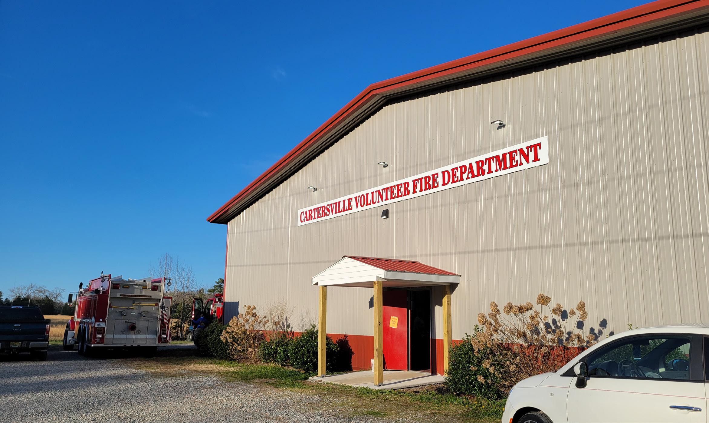
Residents may not always know where to turn when they have a medical or personal crisis. Thus, emergency services and social safety nets are important to provide support and assistance to vulnerable individuals and families, ensuring basic needs are met and improving overall societal well-being. In addition, these services instill a sense of security and confidence in the community, fostering trust in local authorities and promoting a stable and resilient society.
Objective 14.1: Adopt and maintain a capital improvements program for all emergency services facilities to ensure that those facilities, equipment and personnel are well maintained, efficient and functionally appropriate to meet current and foreseen needs of the citizens.
Objective 14.2: Develop a long-term master plan for the County’s emergency services facilities to accommodate the foreseen emergency requirements for all areas of the County. This would include the provision of appropriate and inter-operable communication systems and technology for E-911 and other emergency services.
Objective 14.3: Support neighboring hospitals and emergency centers to help to develop the best possible emergency medical and long-term services for the citizens of Cumberland County and the surrounding region.
a. Maintain mutual aid agreements with neighboring jurisdictions and procedures for effective response and coordination of services in times of emergency.
Objective 14.4: Support the development of other basic healthcare services within Cumberland County including medical, optical, dental, elderly care, pediatrics, and pharmacies. Review the Zoning Ordinance to ensure the ease of opening such facilities.
Objective 14.5: Maintain established hazard mitigation measures to afford protection against the impacts of the full range of natural hazards (including floods, winds, and drought) and manmade hazards (such as hazardous materials and bio-solids).
Objective 14.6: Maintain an up-to-date Emergency Operations Plan.

Energy and infrastructure security overall is deeply connected to the lives of individual people. After all, entire communities have a stake in the success and reliable operation of their local utilities. By empowering and equipping utilities across the county with the knowledge, skills, resources, and technologies needed to bolster their utility, the county can make great strides toward improved access and operations of Cumberland County’s utilities.
Objective 15.1: Maximize the utilization of existing utility systems (sewer and water) in the Cumberland Court House Village Center area by connecting new users.
Objective 15.2: Explore the feasibility of extending public water and sewer services to other high growth areas such as Cumberland court house, near Randolph, the Cobbs Creek Reservoir, or Cartersville.
Objective 15.3: Improve voice, data and communications services and seek the expansion of high-speed internet throughout the entire county.
Objective 15.4: Develop and maintain appropriate and cost-effective solid waste management facilities, services and programs to serve the needs of citizens, businesses, industries and the environment.
Objective 15.5: Identify future water sources, ground and surface, for use by the citizens of Cumberland County.
See the Utility Rate Study in the Appendix for more information about utilities in the Cumberland Court House area as well as recommendations on system maintenance, improvements, and rates.
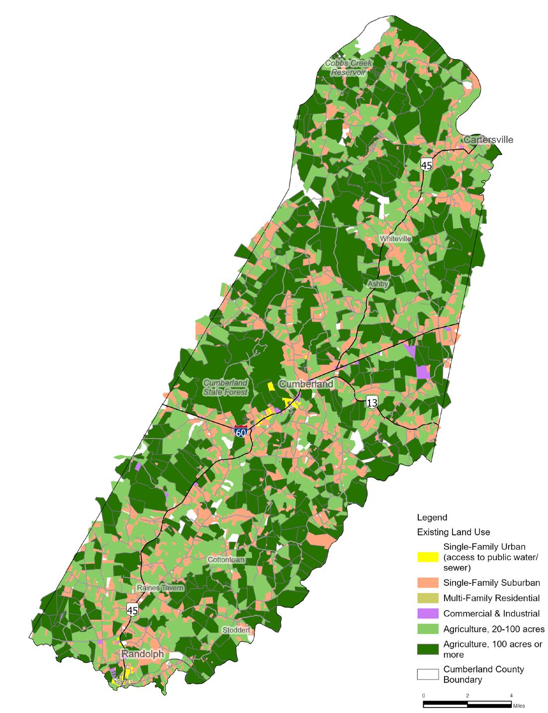
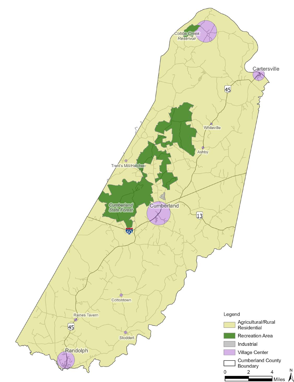
The categories on the following pages show the current use of land and potential uses for each parcel in the future. Potential uses are based off the existing trends in the County along with planning best practices. This helps to determine what scenario will allow for a high quality of life in Cumberland by balancing infrastructure, environmental, social, or economic needs with future growth. For this Comprehensive Plan, growth has been recommended to be limited to “Village Centers.” These are core areas where amenities and mixed commercial and residential development can take place while preserving the rural landscape outside of the centers.
“Village Center” or “Agricultural / Rural Residential” are important categories in assisting communities envision what future development they want in an area. However, it is a broad category that does not get into all of the specifics of how buildings, streets, or other public spaces will be built and designed. Categories are written and mapped with varying characteristics that guide the intent and style (look and feel), with a list of uses that are encouraged in the area.
Map designations give guidance to decision-makers on the Planning Commission and Board of Supervisors regarding development in Cumberland County, but they are not legally binding in the way Zoning Ordinance regulations or Development Standards are. There may be more than one zoning district that fits into the desired goals of a category or parts of a future designated area may develop incrementally. Cumberland’s Planners will reference the Future Land Use Map to make recommendations on development applications to the Planning Commission and Board of Supervisors. The public or prospective land developers can view the map to understand the expectations for development in an area for the future. Requests for rezoning parcels of land may be submitted to drive development in a way that aligns with the County’s intent for each designated area.

Areas intended to maintain active agricultural use, forest cover, or low-density residential development to protect the rural character of Cumberland County.

Areas designated for industrial development or other intensive commercial business that may not be compatible with commercial, residential, or mixed-use development.


Areas intended for active use as sites of recreation while preserving open spaces, natural habitat, and rural character. Non-parcel-specific areas intended to provide attractive mixed-use centers for growth and development in Cumberland County. A diverse mix of residential housing types and commercial units are encouraged to provide the community with new opportunities.
How did the “Strategies for the Future” map get created?
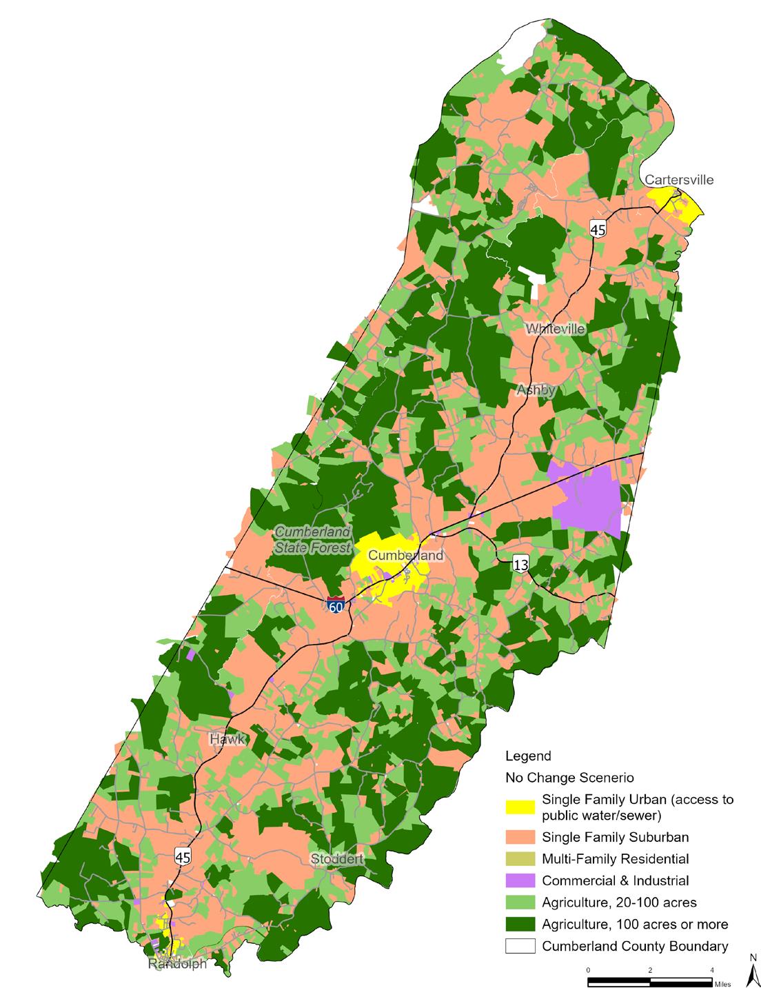
The maps below show the current and existing use of land in Cumberland County, a simulated scenario showing what future growth could look like in the County as people convert active farmland to build new houses. A certain amount of houses are allowed “by-right” by County’s Zoning Ordinance on landowners’ property. Over time, if growth from neighboring localities expands into Cumberland, property values may entice landowners to sell their properties for residential development. While this is within their private property rights, every new residential development has an impact on the rural landscape. This scenario is depicted on the second map. While there is still plenty of active farms, the main corridors, such as Route 45 and 60, will see more homes and potentially increase traffic as people commute to work likely outside of the County.
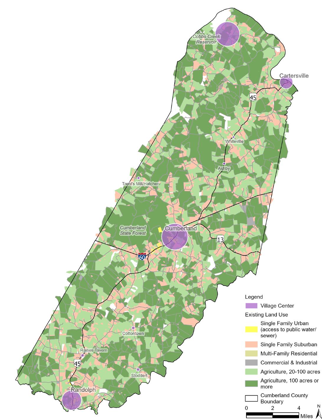
To avoid this second map becoming a reality, the Comprehensive Plan’s recommendation of “Village Centers” in specific areas to incentivize and target growth towards is shown in the third map. New development opportunities within the Village Centers can provide Cumberland’s residents with new employment, commercial, and residential growth in a way that prevents that growth from expanding unplanned and sprawling into the countryside or occuring within the centers without any unifying features.
The Village Centers seek to incentivize growth in areas that can help strengthen Cumberland’s economy, sense of community, and ensure that any new investments are efficiently making the County an even nicer place to live.
Simulated growth over 20 years, if trends in neighboring Counties continue.
The “Strategies for the Future” map and “Strategic Categories” only express what the County envisions the future looking like for any particular area for the County. It does not change the underlying Zoning District or otherwise affect private property rights. The recommendations for Village Centers are not tied to any specific parcel, and all of the properties under the Agricultural / Rural Residential still retain generally the same characteristics and guidance for land use that they have had under the previous Comprehensive Plan.
The “Industrial” category is only mapped where existing industrial development currently exists, future industrial projects that do not fall under the guidance for the Agricultural / Rural Residential areas would require a Comprehensive Plan Amendment to map new incoming projects where the County envisions them.
The “Recreational” category is generally areas that are outside of the County’s jurisdiction, however, they are meant to document the existence of publicly owned land in the instances that there is development in the County adjacent to these sites.
Comprehensive Plan’s “Strategies for the Future” over Existing Land Use.
“Strategies for the Future” map.
Areas intended to maintain active agricultural use or low-density residential development to protect the rural character of Cumberland County.
Cumberland recognizes that one of its richest assets is agricultural, forestall and rural lands. Therefore, the County seeks to protect these areas and natural resources to ensure that a rural quality of life is maintained. By limiting subdivisions and suburban style growth in these areas, agricultural and forestall production may continue alongside the conservation of natural and historic resources. Tools such as conservation easements, transfer or purchase of development rights, and other tax incentive programs may be utilized by the County and used to encourage minimal development in these areas.
Development may include residential growth limited to what is allowed by the Zoning and Subdivision Ordinances and active agricultural or agricultural supportive uses.
Areas designated for industrial development or other intensive commercial business that may not be compatible with commercial, residential, or mixed-use development.
These areas will have a concentration of industry and intensive commercial businesses that may not be compatible with commercial, residential, or mixed-use development. These areas will be designated with careful consideration to transportation routes, infrastructure and impact on the natural environment and existing communities. Where possible, multiple industrial uses will be concentrated on the same or adjacent properties. The County will continue to look for areas that can serve as a hub of light industrial and commercial activities.
Areas intended for active use as sites of recreation while preserving open spaces, natural habitat, and rural character.
Recreational areas are an important part of maintaining rural quality of life and providing community gathering places. The County has recreational areas, such as Bear Creek Lake State Park. Future recreational areas may include land surrounding the proposed reservoir and land adjacent to the James and Appomattox Rivers, as well as the proposed High Bridge State Park along the former Norfolk Southern rail line. The objective of these areas will be to protect natural habitats while permitting sensitive use and development of the land, which may include residences and businesses that offer related goods to the recreational areas, such as eateries and equipment rental businesses.

Non-parcel-specific areas intended to provide attractive mixed-use centers for growth and development in Cumberland County. A diverse mix of residential housing types and commercial units are encouraged to provide the community with new opportunities.
One of the Comprehensive Plan’s important tools for preserving rural character is the establishment of “Village Centers.” By studying where development and population growth has occurred in the past, as well as considering existing and future infrastructure and services, certain areas of the County are ideal for future community development and provide a mix of both residential and economic development opportunities. Encouraging development in such specifically designated areas will limit sprawling, suburban-type, low-density development throughout the rural areas. New growth in the Village Centers will provide needed goods and services, employment and increased tax revenues to meet the expressed needs of Cumberland’s residents alongside attracting new visitors.
The growth areas will include a mix of uses and a variety of housing types, including affordable housing for residents of all income levels, encouraging development at higher densities. Such areas are where utilities, services, community facilities and businesses will be concentrated and where the transportation network will be expanded to create more connections. These areas will have a focus on good design that creates a sense of place and respects the existing architectural fabric. Within these Village Centers will be varying intensity levels of development. Four main Village Centers have been identified: Cumberland Court House, Cartersville, Randolph, and Cobbs Creek. Individual smaller centers have been identified at the following “Rural Crossroads:” Trents Mill, Hatcher, Hamilton, Whiteville, Ashby, Stoddert, Raines Tavern, Cotton Town, and Angola. Depending on the existing infrastructure and existing land use, appropriate densities and growth patterns will be determined for each of these areas. For example, the Cumberland Courthouse village will permit a higher density than the Cartersville area, and will serve as a commercial and mixed-use zone, serving as both a central core and gateway to the County. Each Village Center is encouraged to have its own small area plan in the coming years to plan at a higher level of detail.
If development within the Village Centers includes multiple buildings or a large tract of land as part of one development, it should be based on the principles and features of Traditional Neighborhood Design to achieve transportation and other benefits over typical suburban development. Features of Traditional Neighborhood Design include:
• Pedestrian and bicycle-friendly road design.
• High quality public spaces programmed with seating areas and other amenities.
• Interconnection of new local streets with existing local streets and roads.
• Preservation of natural areas.
• Mixed-use neighborhoods or buildings with commercial and residential units.
• Mixed housing types, including single family detached, attached, duplex, or apartment units.
• Reduction of typical front and side yard building setbacks.
• Reduction of street widths and turning radii at subdivision intersections.
The purpose of these Traditional Neighborhood Design features is to bring commercial and residential uses closer together, and to increase the transportation efficiency of new development. While typical suburban development separates the places where people live, work, and shop into separate areas, this development mixes uses so that trips between them are shorter. By focusing on a connected pattern of streets, rather than suburban cul-de-sacs, and by providing sidewalks and other pedestrian amenities, some trips may even be accomplished by walking or biking rather than driving. These features support the overall land use goals for all Village Centers in Cumberland.
If a project involves a small footprint of a few buildings or less, this development should be viewed as “filling in” by contributing to the opportunities available to the community at that Village Center. Buildings should have active ground floors with “leftover” spaces on sites not dedicated to parking offering amenities such as seating areas or additional landscaping. Buildings may be anywhere from 1 to 4 stories, depending on the context.
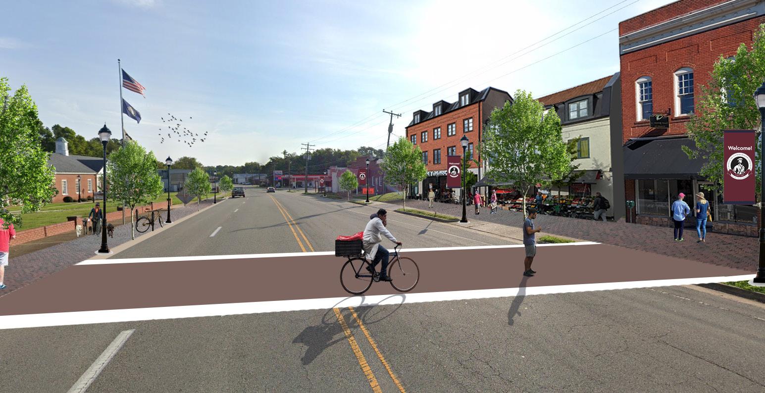
Cumberland Court House is a Village Center that is both historically and physically the heart of the County. This area, which sits at the crossroads of major County roadways Route 45 and US Route 60, has a concentration of businesses, community services, and residents. The schools, County Administration, County Court House, private residences, Bear Creek Lake State Park, Cumberland State Forest, and several local businesses are all located in this area. Cumberland Courthouse is served by public sewer and public water west of the courthouse to the Community Center on Route 628 and east of the courthouse to Route 13 (Old Buckingham Road). Due to infrastructure and traffic patterns along US Route 60 and the courthouse village, this area would be well suited to new mixed use, residential, commercial, or light industrial uses. The nearby Cumberland Business Park on Commerce Road offers industrial sites. It offers opportunities for industrial and manufacturing businesses to locate inside the county along the US Route 60 corridor and in close proximity to county services and existing infrastructure.
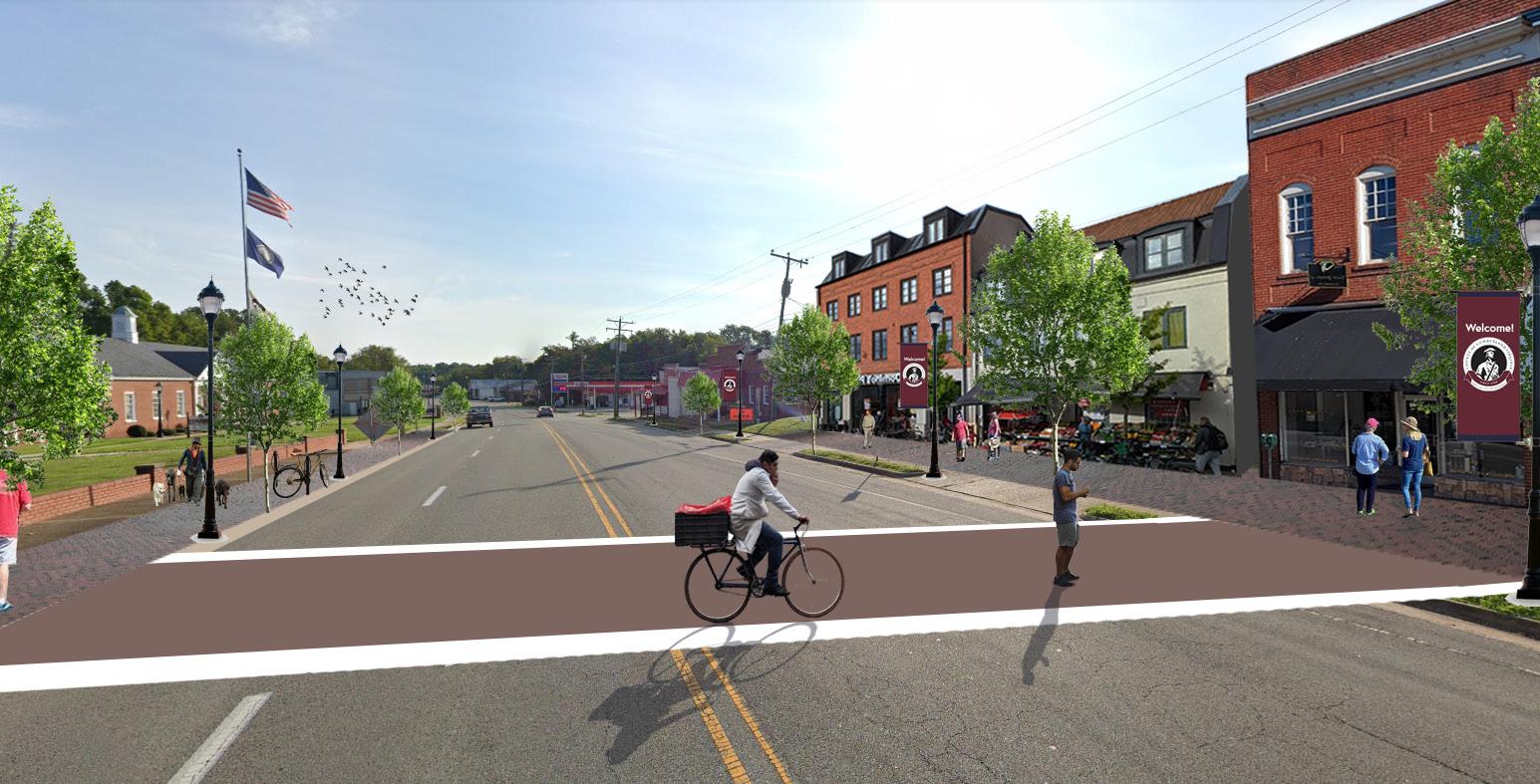
The image to the left shows an example of how new development could be built along Cumberland’s Route 60 corridor in the Court House area.
The image to the right shows pedestrian, streetscape improvements, and example gateway signage welcoming visitors to the Court House area.
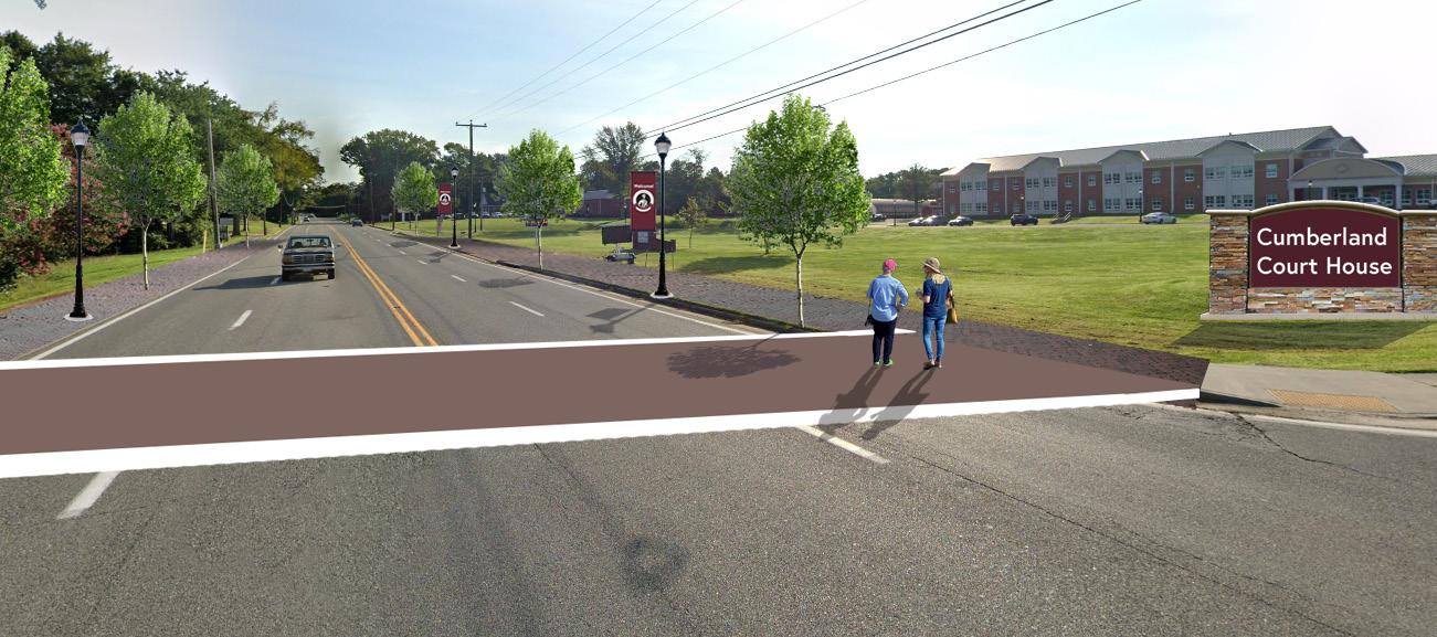
At the southern end of the County along Route 45, near the Town of Farmville, is the Randolph Village Center. Proximity to Farmville has encouraged growth and development beyond the town limits. The area contains existing residential and commercial growth, as well as the Riverside Industrial Park. Creating a Village Center around the town’s outer limits encourages new development in this area that benefits the County. The growth area here encompasses land adjacent to both Route 45 and Route 600 (Plank Road). This area is served by public water and sewer from Farmville.
Located in the northern part of the county along the banks of the James River, Cartersville is a small historic village and is listed as a National Register Historic District. The area includes small businesses, churches and limited public utilities. The Village Center here will be limited to low intensity residential and small commercial development and will enhance the existing village and services while protecting the farmland and watershed in the vicinity.
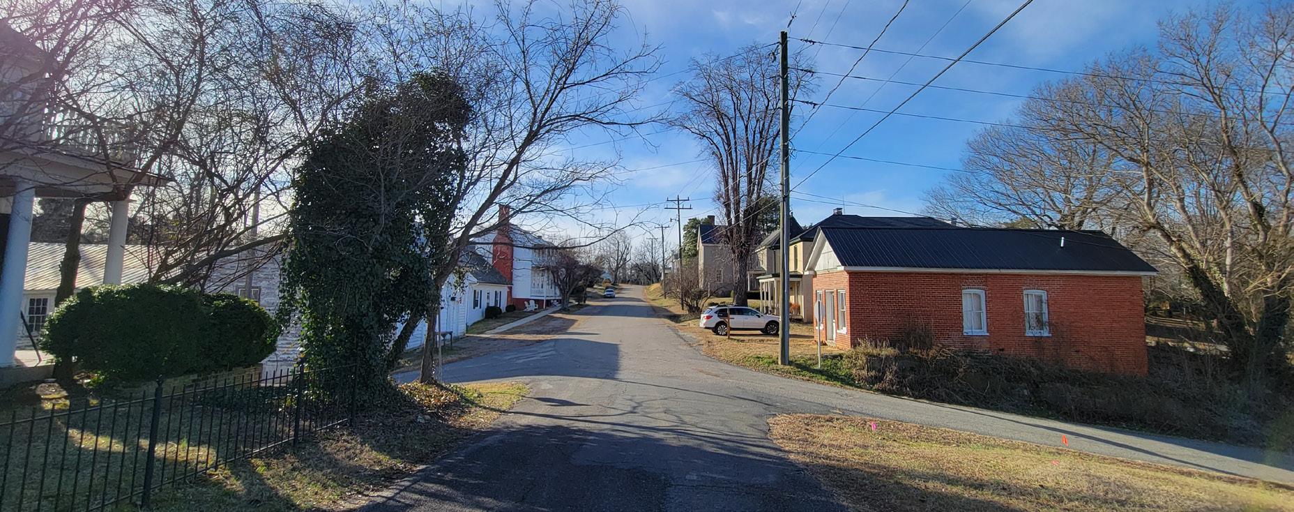
The Cobbs Creek Reservoir is a new feature developed by Henrico County, within northern Cumberland County as an additional water supply. This reservoir will provide new access to recreational benefits as well as development opportunities within the County. Any residential or commercial growth around the reservoir should be carefully planned and include features of Traditional Neighborhood Design.
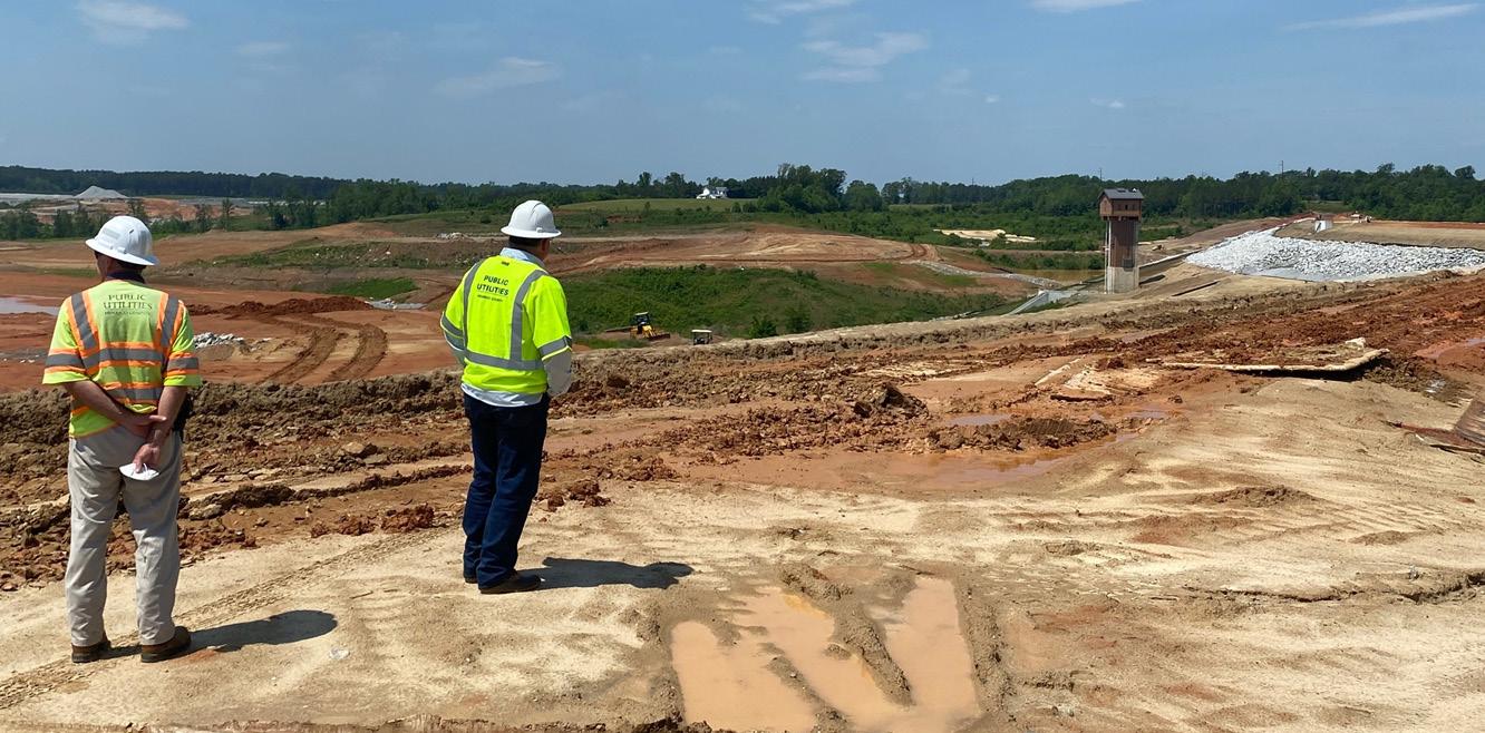
At various rural crossroad intersections throughout the County, such as Trents Mill, Hatcher, Hamilton, Whiteville, Ashby, Stoddert, Raines Tavern, Cotton Town, and Angola. These may include small country stores or gas stations, small housing units of varying types, or restaurants. Development at these nodes is not intended to encroach on the rural landscape or agricultural economy, but rather to complement it and emulate the historic ability to support the local community through business.
The Comprehensive Plan update is based on both empirical data and community visioning. The Existing Conditions section is a collection of data with analysis that shows how Cumberland County exists today. Information about the local population from many different perspectives and data points creates a “baseline” for making decisions about the County’s vision for the future.
People tend to have subjective understandings of their own community based on their individual experiences. It is important to understand different perspectives; however, it is also important to rely on objective data - demographic, economic, geographic, and more - to help ensure all stakeholders are on the same page at the beginning of the planning process.
The data is then used to inform all of the Comprehensive Plan’s recommendations. Preserving agricultural land or providing for new housing opportunities are based on the data that is collected from the United States Census and American Community Surveys or other sources.
Most of the data comes from the 2021 American Community Survey, released on December 8, 2022, by the United States Census Bureau, however this document also utilizes other decennial census counts, Virginia Employment Commission, and Zillow data.
The total population of Cumberland County is estimated to be 9,669 people as of the 2021 American Community Survey 5-Year Estimates. The more accurate, but now outdated count in the 2020 Census is estimated at 9,675.
The graph to the right shows the County’s population increase since the 1970s. Notably, the population dropped by about 400 people between 2010 and 2020. As of 2022, the population has not dropped further.
Across Virginia, many rural localities are struggling with the impacts of population loss. However, Cumberland appears to be remaining stable.
The University of Virginia’s Weldon Cooper Center for Public Service provides population projections for the Commonwealth’s localities. While down from the 2020 population of 9,675, it is expected to rise slowly over the next decades to 9,847.
While not experiencing growth or loss, it is important to plan for infrastructure that accommodates the needs of current and future residents.
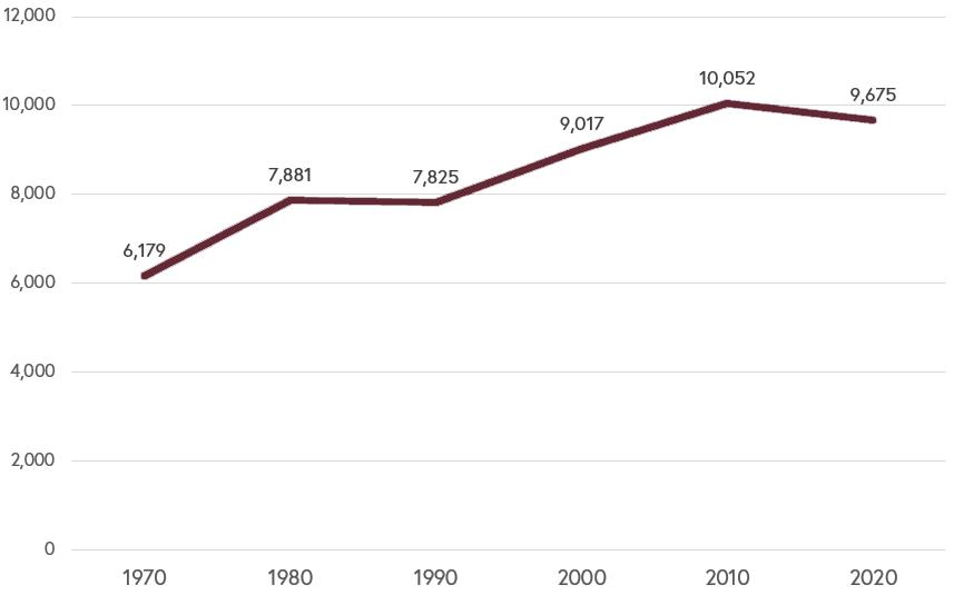
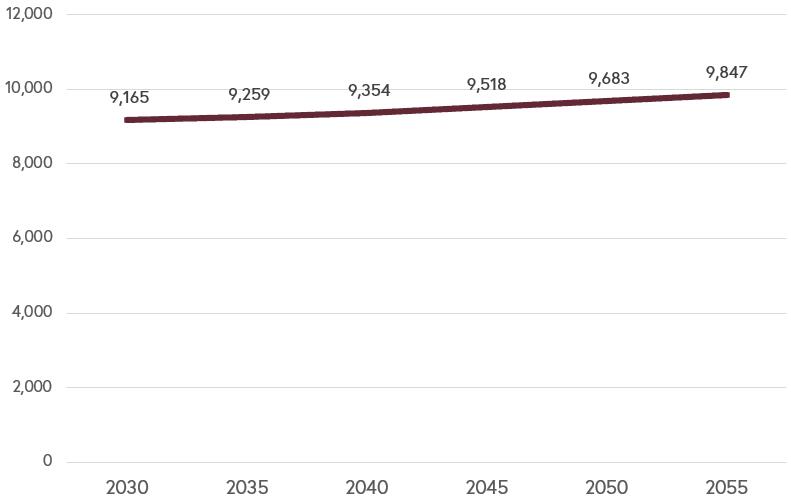
Cumberland has experienced slight population decline over the past decade; however, growth in surrounding counties, such as Powhatan and Goochland may put pressure on Cumberland in the coming years.
The United States Census has two major sources of demographic information. The decennial census, required by the Constitution and conducted every ten years since 1790, is a short survey of every household in the country. The American Community Survey (ACS) is a longer form containing more questions, taken throughout all years, and its most reliable dataset is published yearly as rolling five-year estimates. The decennial census has a smaller number of data points, like population, sex and race, with a lower margin of error. The ACS has a much larger number of data points (like social, economic and housing characteristics) and a wider margin of error. A mix of decennial census and ACS data is used to form the empirical basis for the Comprehensive Plan, to make up as accurate a picture of a community as possible.
This plan uses a combination of 2020 Decennial Census data and 2021 ACS data, which is the most recently available data as of the collection of this document.
The graph below shows population change by percentages between the 2010 and 2020 Decennial Census with comparisons to other neighboring and rural localities in Central Virginia. While not growing as quickly as others localities that are closer to more dense urban centers, Cumberland’s population has remained relatively stable in recent decades.
Data Source: 2010 & 2020 Decennial Census
The median age in Cumberland County is 45.4. For comparison, the median age in Virginia is 38.8. Comparing the percentage of age groups in each category with an age pyramid displays this information. While there is a stable foundation of young members of the community, the population is aging as evidenced by larger percentages of the population in their 50s and older.
Sex
The population in Cumberland is split generally evenly between 50.4% men and 49.6% women. This typical of other localities, Virginia, and the United States as a whole.
According to 2021 American Community Survey data, 63% of Cumberland County identifies as “White alone,” while 29.1% identify as Black or African American. Other racial groups, such as Asian, Pacific Islander, American Indian, or Other Race Alone make up only 1.26% of the County. 4.5% of the population identifies as Bi-racial.
Educational Attainment
The population of Cumberland County that is over the age of 25 totals approximately 7,228. Of this total, 88% are high school graduates or higher while only 17.3% of the population holds a Bachelor’s Degree and only 8.1% hold a Graduate or Professional Degree. Cumberland’s economy has not been historically reliant on the need for higher education as a primarily agricultural and forestall County. However, as technology, high speed internet access, or other resources become available, new businesses may locate in Cumberland County. Additionally, members of the community leaving to pursue higher education may choose to return to the County again with new skills and education to further develop and contribute to the agricultural and forestall economies.
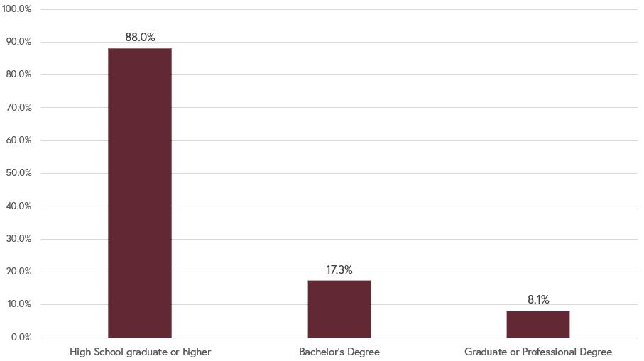
Data Source: 2021 American Community Survey, 5-Year Estimates
Cumberland County has a long and narrow shape, bound by the James River in the North and the Appomattox River in the South. In addition to the prominent rivers at the county’s edges, Cumberland is home to streams, lakes, and wetlands, which are critical to the rich soils ideal for agriculture and horticulture. The county is largely flat, with most land in the range of 200 - 500 feet above sea level.
The county’s land area is approximately 191,845 acres. Large portions of the County are conserved through Bear Creek Lake and High Bridge Trail State Parks, which total 433 acres, and the Cumberland State Forest and designated Natural Areas, which total 16,398 acres.
Two main roads traverse the county, Cartersville Rd. (Virginia Route 45), which runs North/South, and Anderson Highway (US Route 60), which runs East/West.
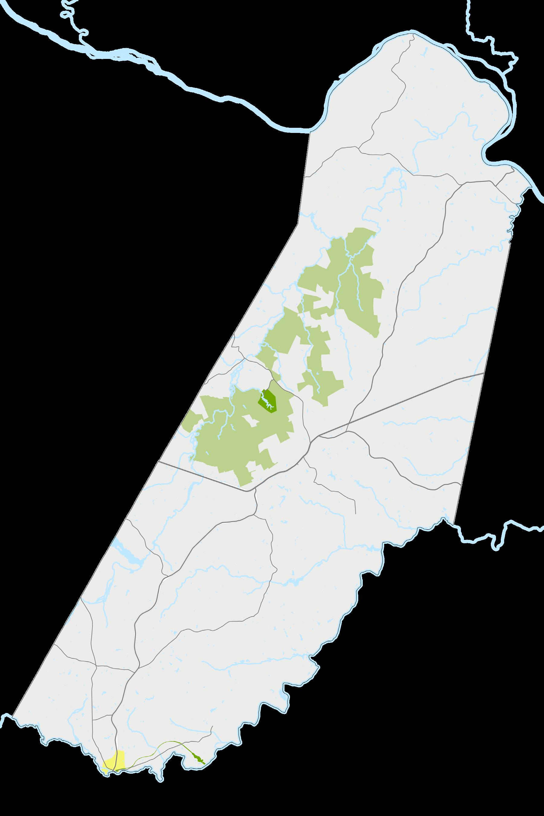
Cumberland County is located in central Virginia, bordered by the Counties of Fluvanna, Goochland, Powhatan, Amelia, Prince Edward, and Buckingham. The northern portion of the Town of Farmville is within Cumberland County, and the recently unincorporated community of Columbia is north of Cumberland’s border with Fluvanna.
As shown on the following maps, Cumberland is about 150 miles from Washington, D.C., 150 miles from Virginia Beach, 55 miles from Charlottesville, and 50 miles from Richmond.
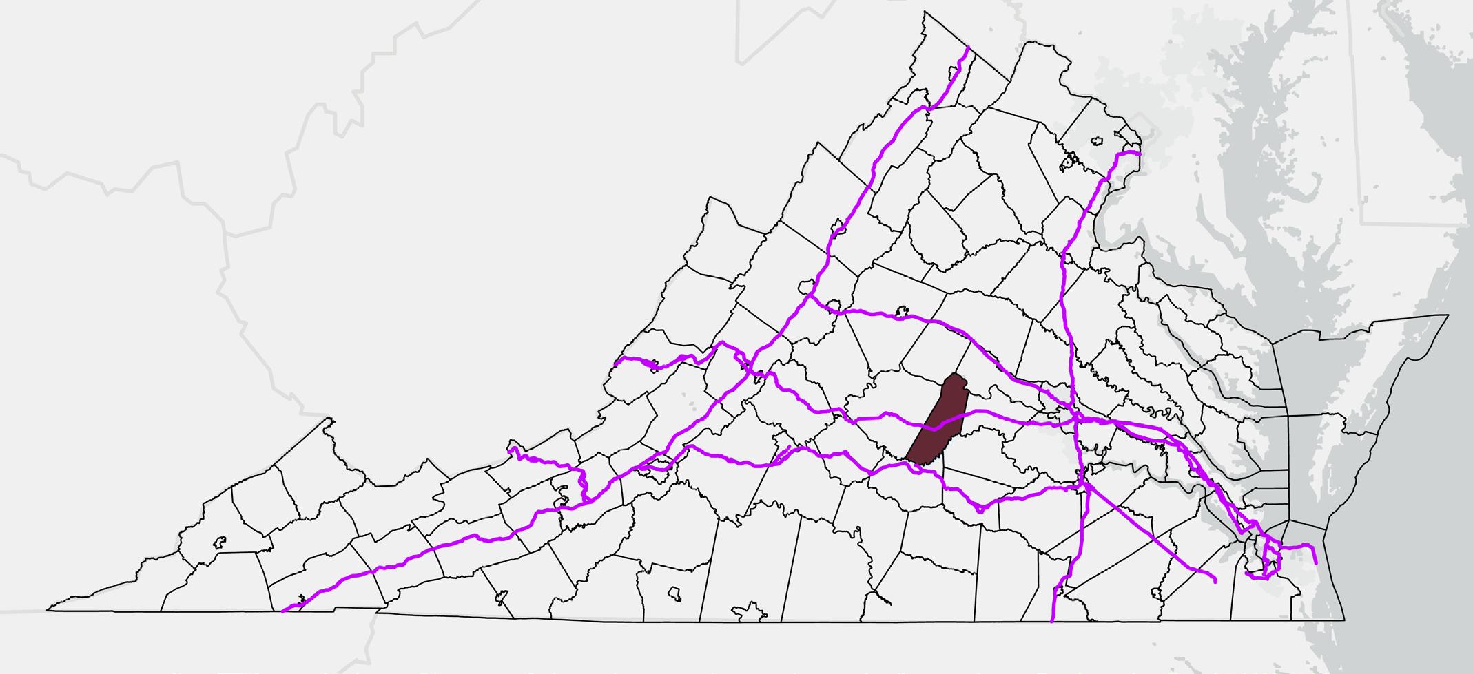
hours (~150 miles) to
~1 hour, 10 minutes (~55 miles) to Charlottesville
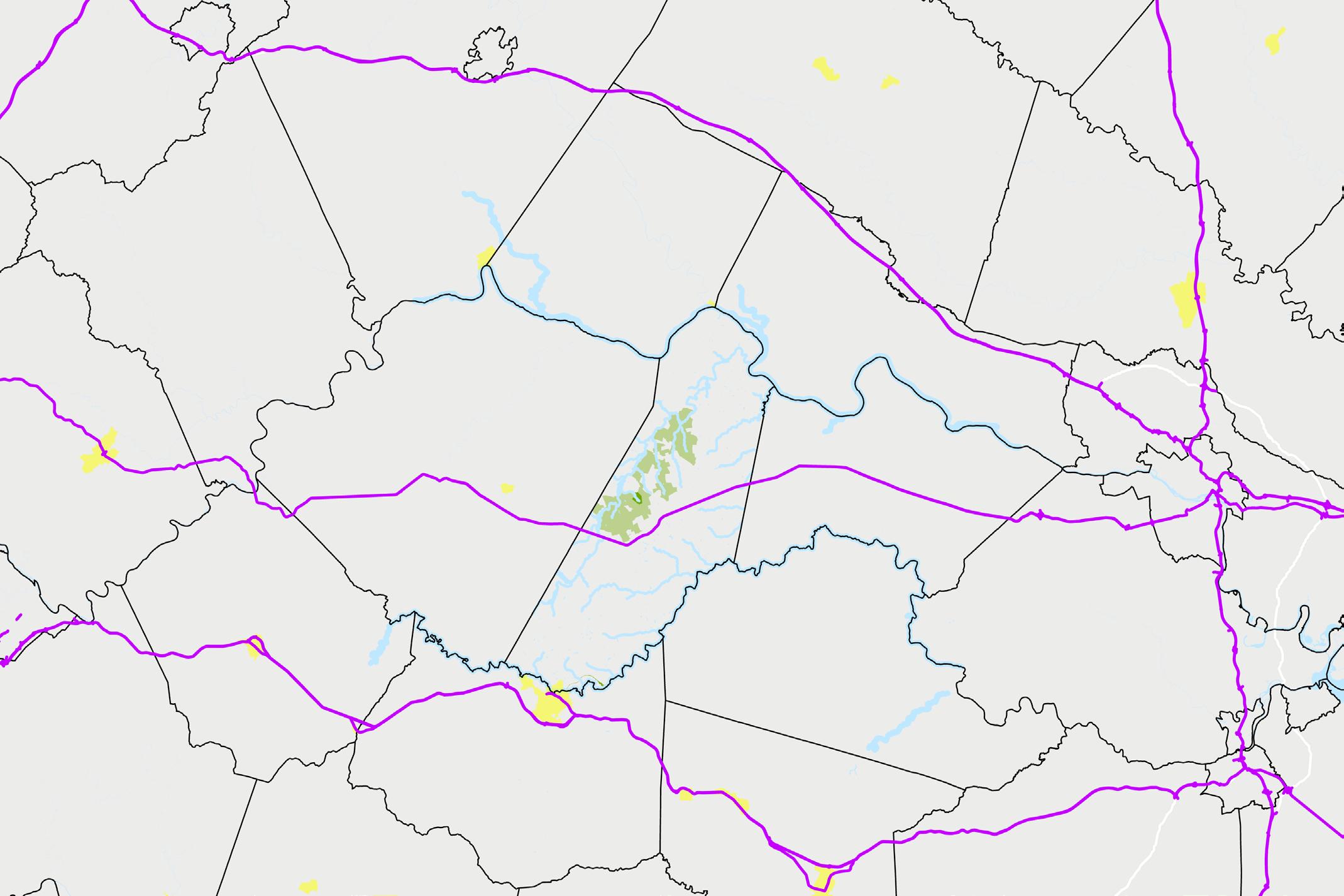
(~50 miles)to Richmond
A metropolitan statistical area (MSA) one definition of region used by the US Census Bureau. Generally speaking, an MSA consists of a core area that serves as a “population nucleus” and surrounding areas that have a “high degree of economic and social integration” with that core. MSAs are delineated, in part, through commuting patterns.
Cumberland is located near the MSAs anchored by Richmond, Charlottesville, and Lynchburg. While it is feasible for Cumberland residents to commute to one of the nearby cities, the county’s exclusion from the nearby MSAs indicate that Cumberland does not have clear ties to one area in particular.
While Cumberland is not part of a Census-recognized region, the County generally identifies with the Counties of Amelia, Buckingham, Charlotte, Nottoway, Prince Edward in terms of regional collaboration.

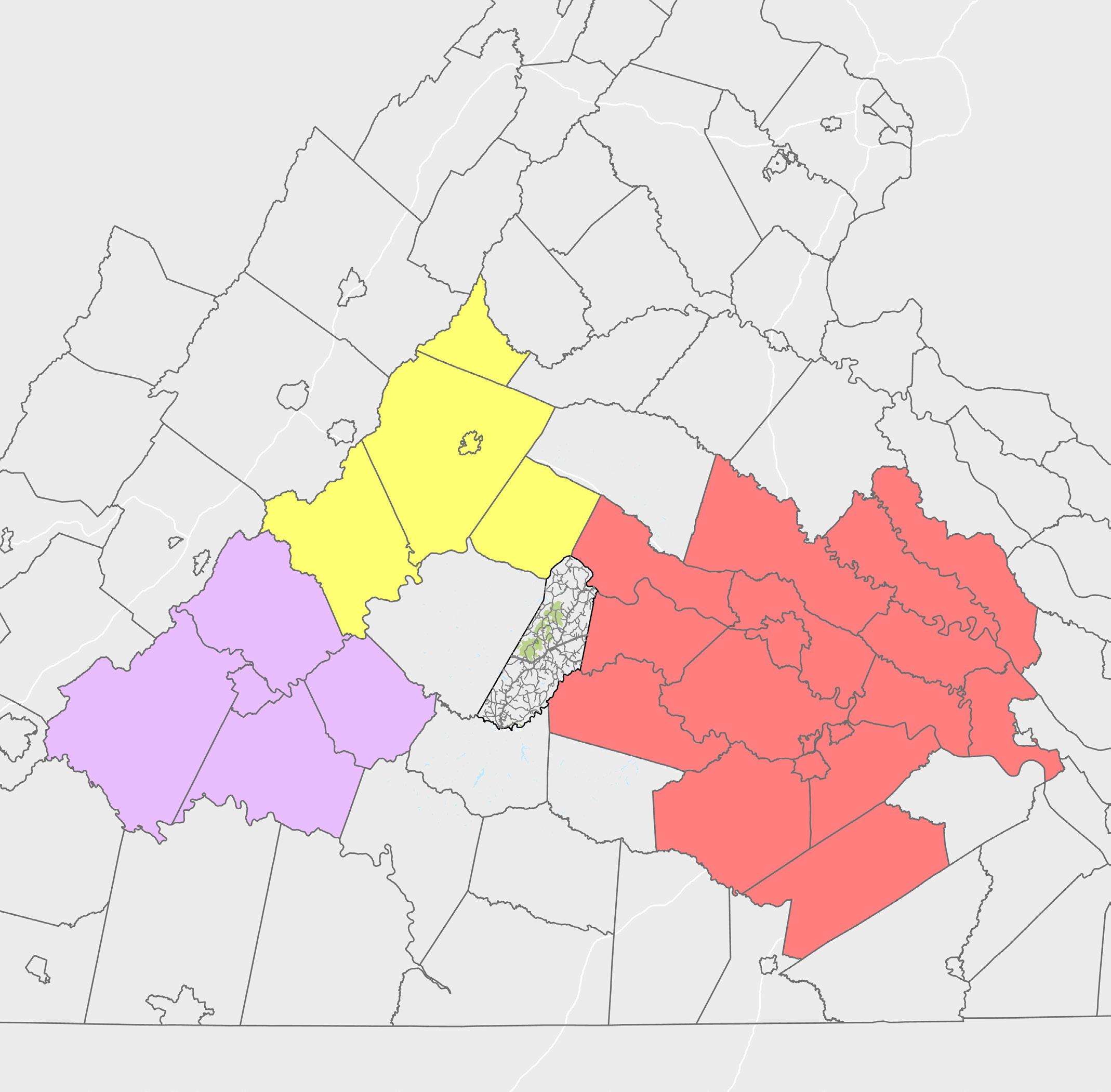
Households are comprised of one or more people living together. This includes families related by birth, marriage, or adoption, as well as other combinations of people, such as roommates.
The total number of households in Cumberland County is estimated to be 3,990 with an average size of 2.42 people per household.
Average Size: 2.42 per Household
Single-family detached homes predominantly make up 72.5% of the housing stock in Cumberland, or an estimated 2,893 units in total. The county has some attached single-family homes (townhomes) estimated at 66 units, and 155 multi-family units (apartments), as well as an estimated 876 manufactured homes. The Comprehensive Plan is required by Virginia’s State Code to provide for Manufactured Housing as a source of affordable housing. Currently, almost a quarter of the County’s housing is currently of this more affordable type. Ideally, housing options are diverse to meet many different lifestyle needs, such as downsizing, raising a family, or simply wanting to live in one type of housing over another. Determining suitable locations for developing multifamily or single-family attached homes would help diversify the housing stock.
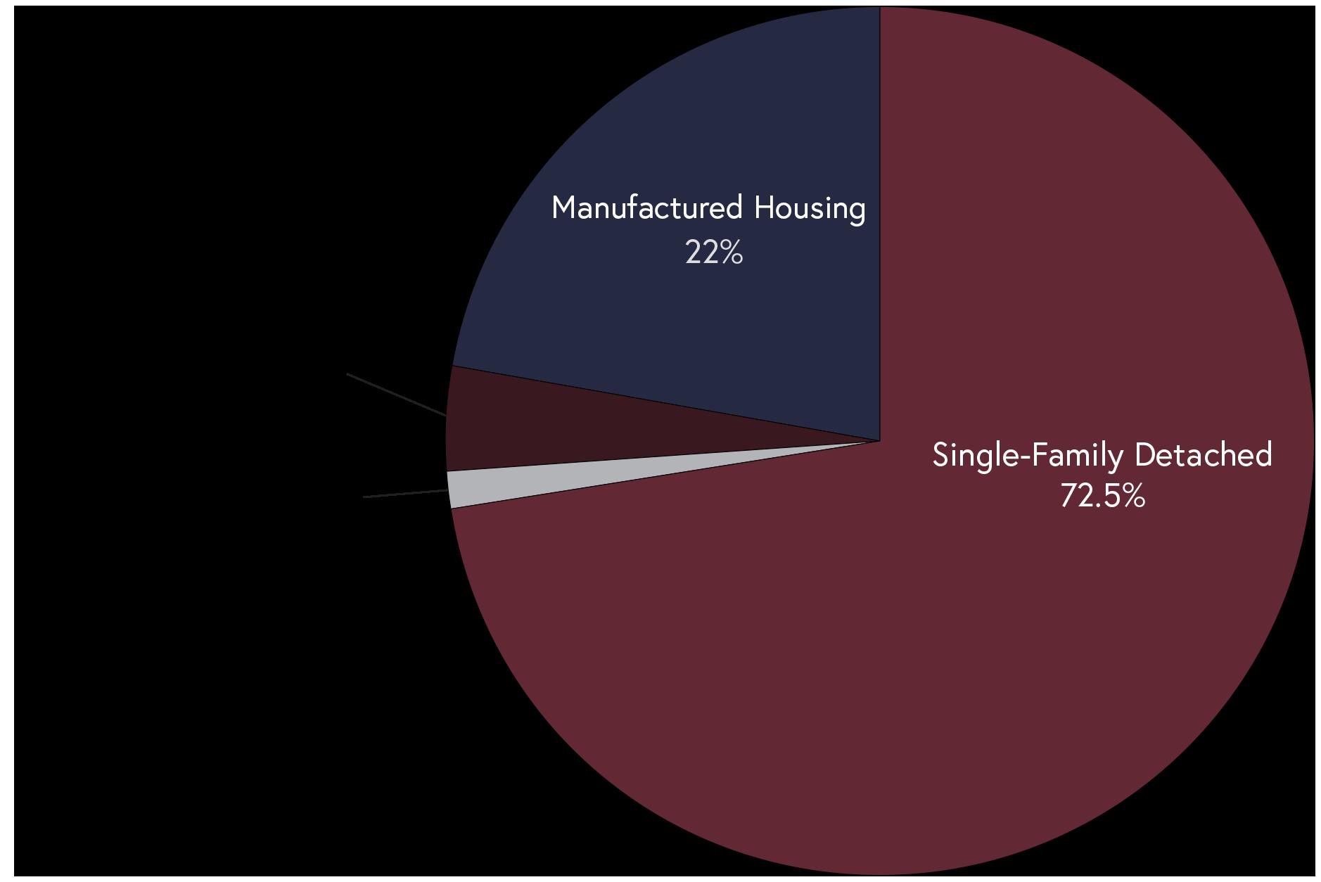
Cumberland has roughly 4,600 housing units in total, about 4,000 of which are occupied. Cumberland has a mix of older housing (60+ years old) and relatively new housing (less than 25 years old). As seen in Cartersville and other parts of the county, the condition of older homes varies. More homes were constructed in previous decades than are currently being constructed.
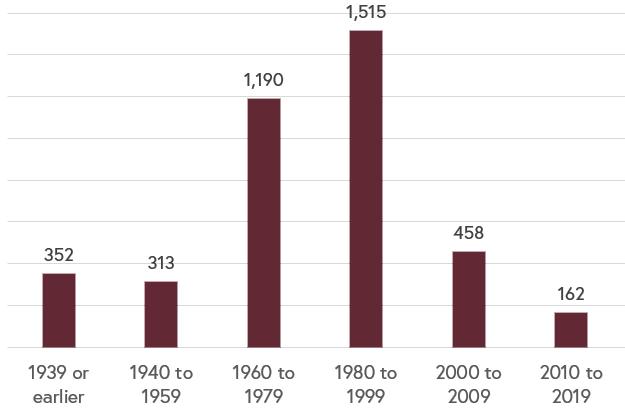
Of the 3,074 owner-occupied housing units, the median home value (including lot value, where applicable)was estimated at $170,100 in 2021. Approximately 64% of homes have values less than $200,000. For comparison, the median home value in Virginia was estimated at $295,000, making Cumberland County a more affordable place to live. However, in the future, as nearby metropolitan areas begin to grow, housing prices may begin to rise significantly if there is no new construction.
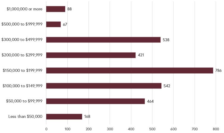
Data Source: 2021 American Community Survey, 5-Year Estimates
Homeownership is regarded as one of the most effective ways to “plant roots” in a community and build intergenerational wealth. It is also important to provide affordable, high-quality rental housing for young professionals and other residents who may not have the means to purchase a home or may be not want to purchase a home.
Out of the 3,990 estimated occupied housing units in the County, 77% are owner-occupied and 23% are renter-occupied. Cumberland’s mix of housing is fairly standard for rural localities in Virginia.
Data Source: 2021 American Community Survey, 5-Year Estimates
Housing in Cumberland is some of the most affordable in the area, with a median housing cost of $746 per month. Cumberland is one of the few counties in the area where median housing costs for those renting are cheaper than those for homeowners. The disparity in housing costs between Cumberland, Fluvanna, Goochland, and Powhatan provide an incentive for some to live in Cumberland and commute to work in one of the larger surrounding counties.
(Neighboring County)
(Neighboring County)
(Cumberland)
(Cumberland)
The majority of Cumberland residents spend less than 20% of their household income on housing costs each month; however, roughly 21% of residents meet the Department of Housing and Urban Development criteria for “housing cost burdened” by spending more than 30% of the monthly income on rent/mortgage payments, utilities, and any other bills or fees associated with housing. Additionally, another 23.1% of residents are spending between 20% to 29% of their income on Housing costs. If housing costs continue to rise, more members of the community will struggle afford life in the County.
cash rent
Roughly 13% of housing units in Cumberland are vacant, as reported by the 2020 Decennial Census. The northwestern portion of the county has a disproportionately high vacancy rate of 33% (vacancy rate for all housing in the Census Block Group).
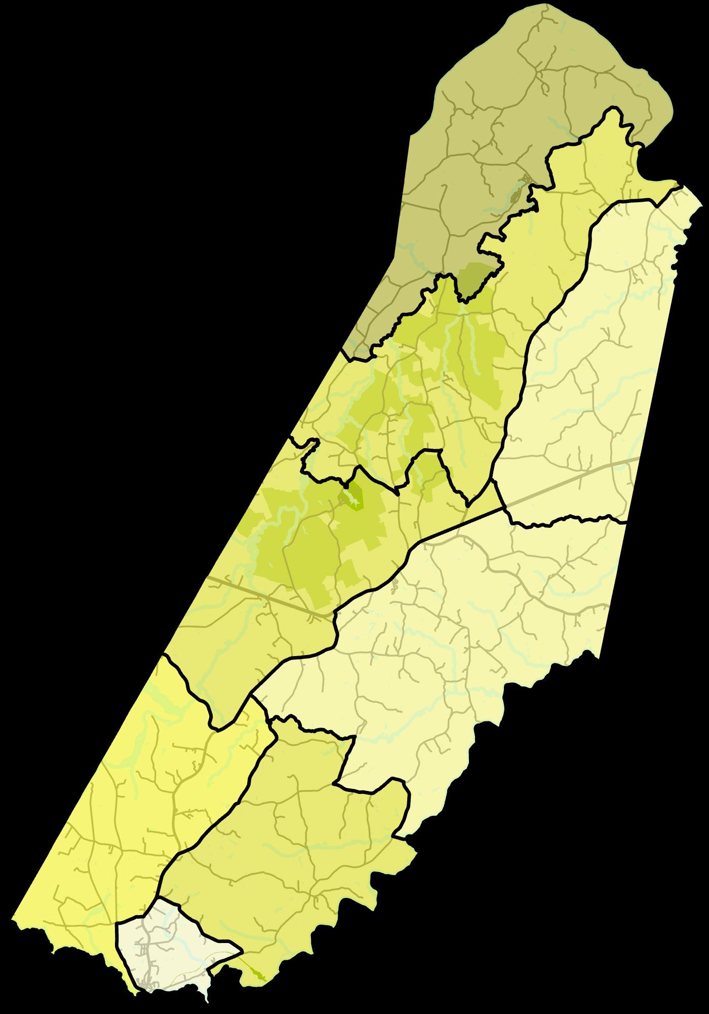
Data Source: 2021 American Community Survey, 5-Year Estimates
The median household income in Cumberland County is $57,586, with roughly 40% of households earning between $35,000 and $75,000 annually. Cumberland’s median household income is about $23,000 less than the statewide median of $80,963.
Household Income: $57,568
Data Source: 2021 American Community Survey, 5-Year Estimates
As shown in the bar graph below, median household income in Cumberland increased 43.4% between 2010 and 2021 (ACS estimates, not accounting for inflation). Cumberland is similar to the other rural localities in the region in terms of household income.
Median Household Income: 2010 and 2021
Data Source: 2010 & 2021 American Community Surveys, 5-Year Estimates
There are significant differences in economic indicators for households in various parts of Cumberland County. As shown below, there is a difference of over $50,000 between the highest and lowest median household incomes for the Census Block Groups in Cumberland. A higher median household income is not clearly correlated with a lower proportion of households living below the poverty line, which indicates that households are not strictly clustered based on economic status. These maps illustrate that people of different socioeconomic status live throughout Cumberland.
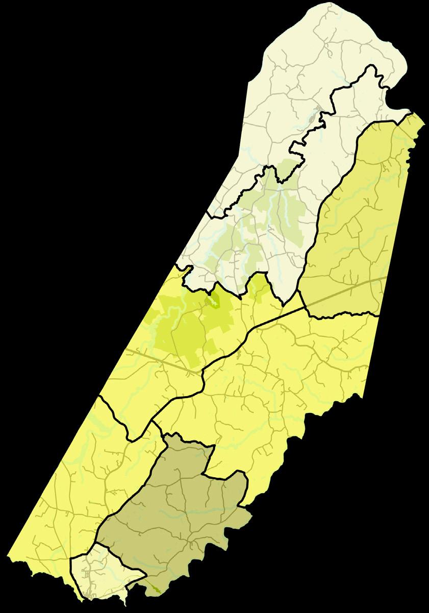
Cumberland County has a poverty rate of 7.1% overall, compared to 9.9% for Virginia. When broken out by age, those under the age of 18 years have the highest poverty rate of 9.2%. Racial demographics for poverty roughly follow those for the county of the whole. Of individuals below the poverty level, 60.7% identify as white, 26.6% identify as African American, and 12.8% identify as two or more races.
Data
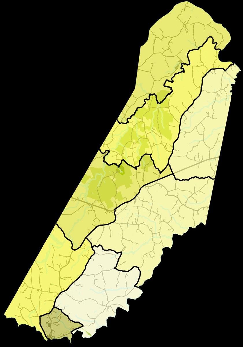
The Labor Force Participation Rate (LFPR) is the percentage of all people of working age who are either working or actively seeking work (Employed + Unemployed). Cumberland County’s LFPR is 64.2%, which is similar to the national rate of 61.8% and Virginia’s at 63%. The chart below shows the percentage of each age cohort’s percentage of the population participating in the labor force. Relatively low LFPR for individuals between 30 and 44 years old underscores the importance of creating jobs in Cumberland County in the coming years.
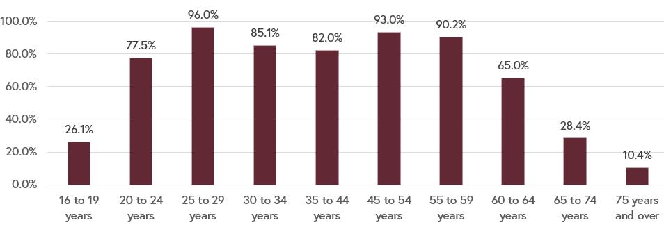
Data Source: 2021 American Community Survey, 5-Year Estimates
Most people in the County are employed in “Educational services, and health care and social assistance,” this is typical for most localities. Notably, many people in the County are employed in Construction. Employment data is difficult to track and is subject to seasonal shifts and mis/under-reporting. This may be the case for the low number of people employed in Agriculture, forestry, fishing and hunting, and mining.
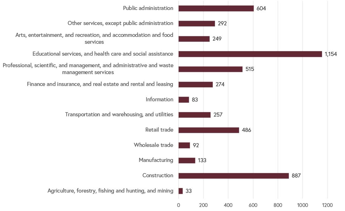
Data Source: 2021 American Community Survey, 5-Year Estimates
ESRI Business Analyst uses the U.S. Bureau of Labor’s Quarterly Census reporting on employment numbers. These can be somewhat inaccurate as to the employment numbers, however, they offer a snapshot of local employers that is useful.
Data Source: ESRI Business Analyst, 2023
The unemployment rate in the County in 2021 was estimated at 2.7%. Over time, it appears to have fallen almost 8 percent. While other localities struggled with high unemployment rates through the COVID-19 pandemic, it appears Cumberland’s economy has employed more people during and after the pandemic than it had been in the previous decade. For comparison, the rate was higher than Virginia and the United States overall rates at the beginning of the decade, but has since dropped below.
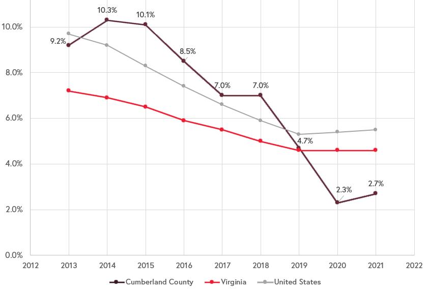
Data Source: 2021 American Community Survey, 5-Year Estimates
All public roads within Cumberland County are owned and maintained by the Virginia Department of Transportation.
90.9% of Cumberland’s residents get to work by commuting in a car, truck, or van. This is typical of other localities. 6.6% of the working population work from home, which may be part of a nationwide trend from the COVID-19 pandemic towards more teleworking options. 1.5% of the population walks to work in the County and 0.9% utilize other means, such as bicycles, while 0% reported Public Transportation use. Although Cumberland is a rural County, if there is further growth and development it may burden the local road system with greater traffic. If development is targeted around more dense unincorporated communities, there is the opportunity to allow for a greater share of the community walking and bicycling to daily needs, or even a public transportation service for the County.
The largest percentage of Cumberland’s workforce is commuting 60 or more minutes to work (30.4%). This is enough travel time to mean they are likely commuting to one of the three nearby metropolitan areas of Lynchburg, Charlottesville, or Richmond. Shorter commutes to nearby places of employment can greatly improve quality of life through happiness and wellbeing. Long commute also come at a higher cost in vehicle maintenance and fuel. As Cumberland grows, if this share of commuters traveling for that distance continues the County may take on the character of a “bedroom community,” referring to a community in which people go to sleep in one locality, but spend their money and free time elsewhere.
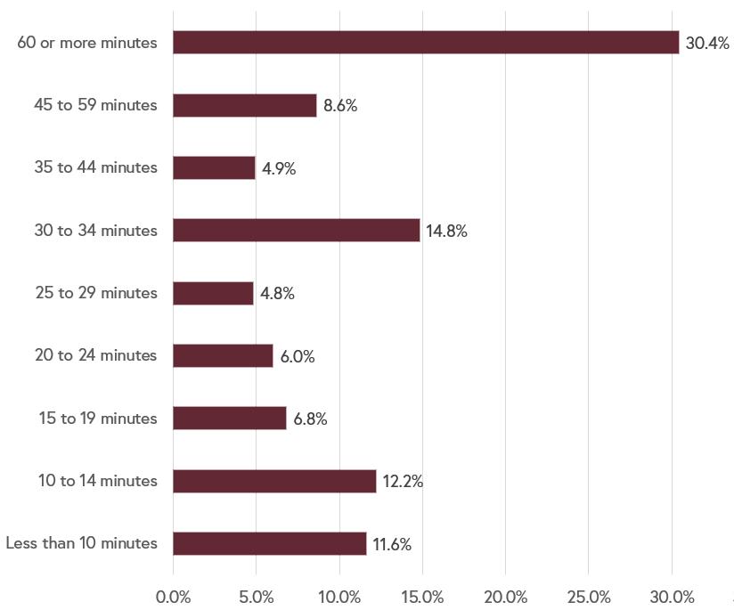
When commuting times are cross-referenced with the place of work, it is noticeable that 68.3% of the population works outside of the County. As mentioned previously about “bedroom communities” or the impacts of longer commutes on quality of life, it is important to examine transportation patterns and ensure that places of employment, recreation, residency, and commercial uses are all available locally.
The tables below, provided by the Virginia Employment Commission, show where workers are coming in to Cumberland County and where they are going if they work elsewhere.
Source: U.S. Census Bureau, OnTheMap Application and LEHD Origin-Destination Employment Statistics, 2014.
The Federal Highway Administration (FWA) classifies roads based on mobility (how fast vehicles can move from one point to another) and access (the number of opportunities for vehicles to enter or leave that road). These designations influence decisions regarding maintenance and infrastructure projects.
Roads are designated with one of the following classifications:
High Mobility (High Speed)
• Interstates
• Other Freeways & Expressways
• Principal Arterials
• Minor Arterials
• Major Collector
• Minor Collector
• Local Roads
High Access (Lots of Places to Enter/Exit)
Data Source: Virginia Department of Transportation

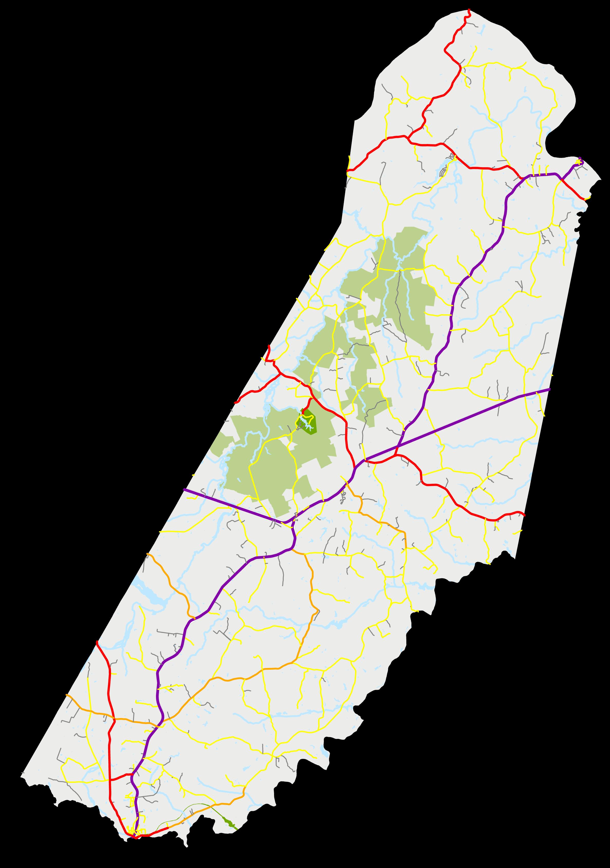
Annual average daily traffic (AADT) is a measure of how many vehicles travel a section of a road each day, expressed as an average value from traffic counts taken over the course of a year. The Virginia Department of Transportation (VDOT) will generally prioritize maintenance or upgrade projects for roads with higher AADT.
The section of VA 45 within Farmville Town limits (N Main St) is the most trafficked road in the county with 9,800 trips each day, on average. US 60 (Anderson Hwy) between Cartersville Rd and Cumberland Rd (both VA 45) has 9,200 trips each day, on average.
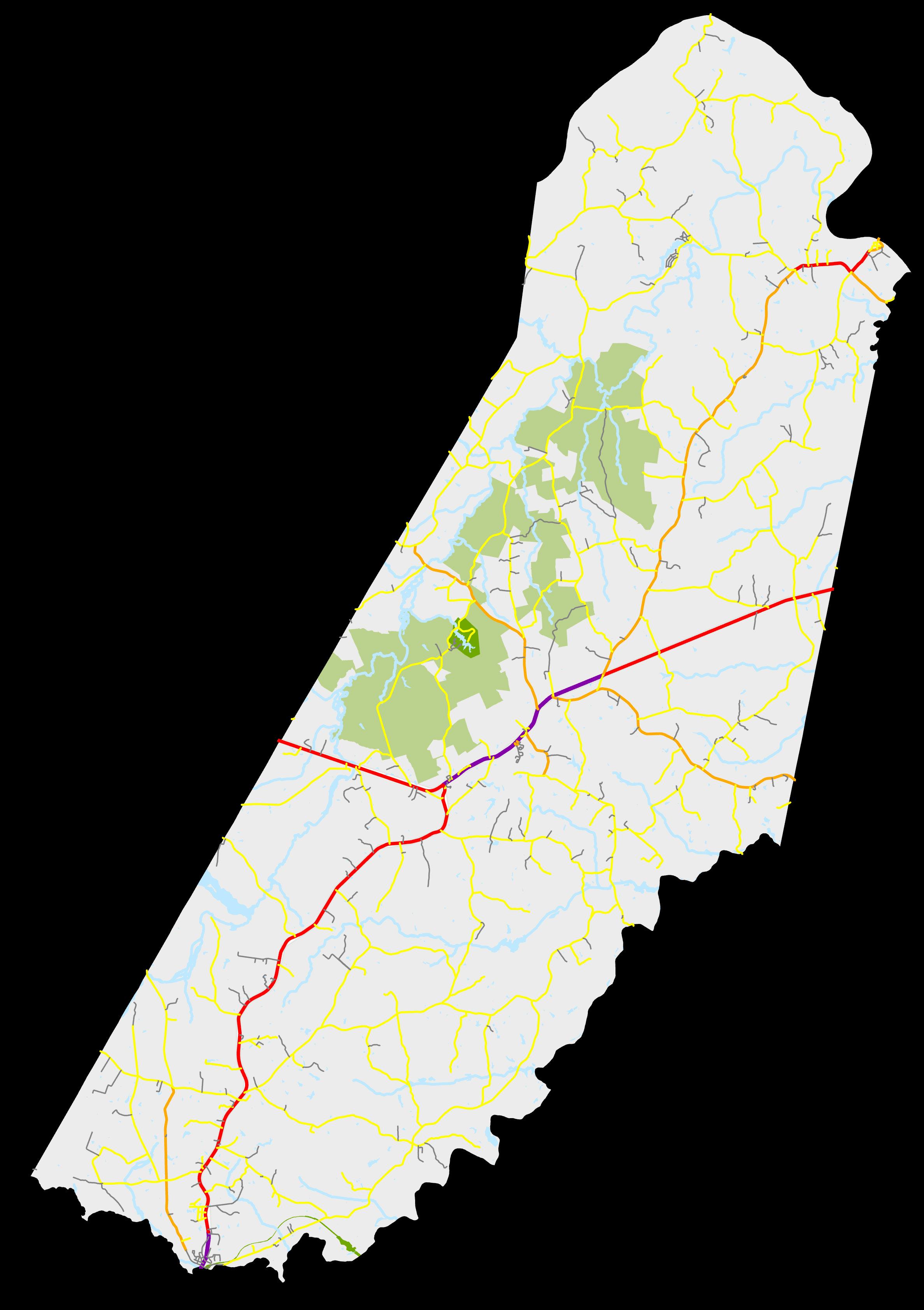
Data Source: Virginia Department of Transportation

The map below shows crashes that took place in Cumberland from January 2018 through October 2022 (there is a delay in reporting by VDOT). More crashes generally take place on roads that are traveled by more vehicles each day, such as US 60 and VA 45.
There were 10 fatal crashes in Cumberland during the study period of nearly 5 years. Eight of these crashes took place on either US 60 or VA 45. In addition, there was one fatal crash on Carter Rd and one fatal crash on Oak Hill Rd. One of the fatal crashes on VA 45 (Cumberland Rd) took place in October 2021 when a driver struck a horse-drawn buggy near Davis Ln, killing two adults and severely injuring eight children.
Cumberland County looks to implement safety standards on all their roads that exceeds VDOT minimum standards for rural roads.
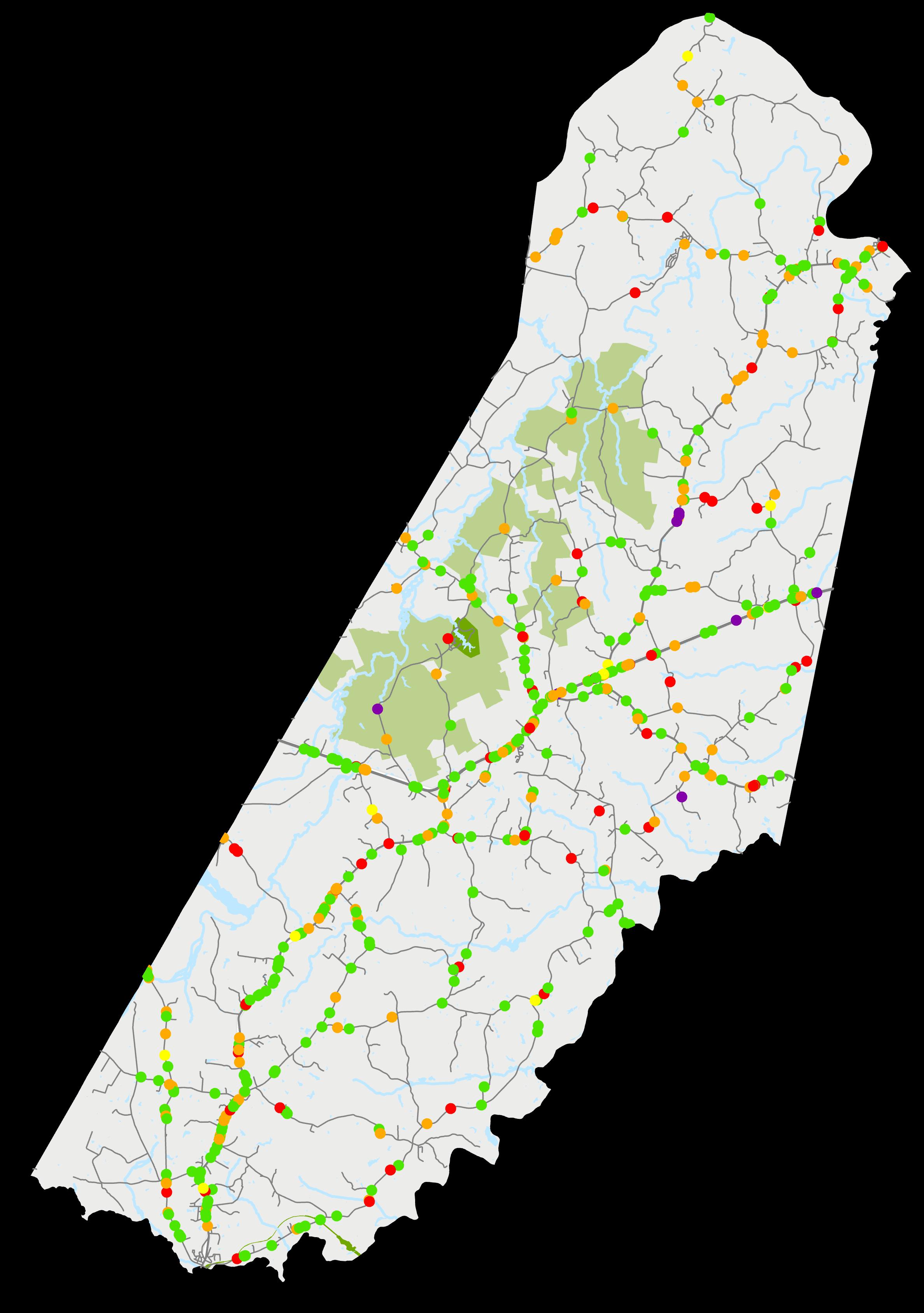
Data Source: Virginia Department of Transportation
VDOT worked with the Commonwealth Regional Council, which serves as the Planning District Commission (PDC) for the region, to develop the 2035 Rural Long Range Transportation Plan (RLRTP). This plan was released in 2011, and covers the geographic areas of Amelia, Buckingham, Charlotte, Cumberland, Lunenburg, Nottoway, and Prince Edward Counties. As is the case with a Comprehensive Plan, the RLRTP is visionary in nature and provides recommendations that are not financially constrained.
The map below highlights the transportation system deficiencies in Cumberland County identified in the RLRTP. These deficiencies and recommendations are outlined in the table on the following page. Recommendations range from installing additional signage to reconstructing sections of roads.
*A potential project listed on the RLRTP is not guaranteed to be completed by VDOT. Through this planning process, the County will identify priority transportation projects using the RLRTP as a guide
The RLRTP can be accessed at www.virginiasheartland.org/wp-content/ uploads/2013/03/Commonwealth_ Regional_Council.pdf
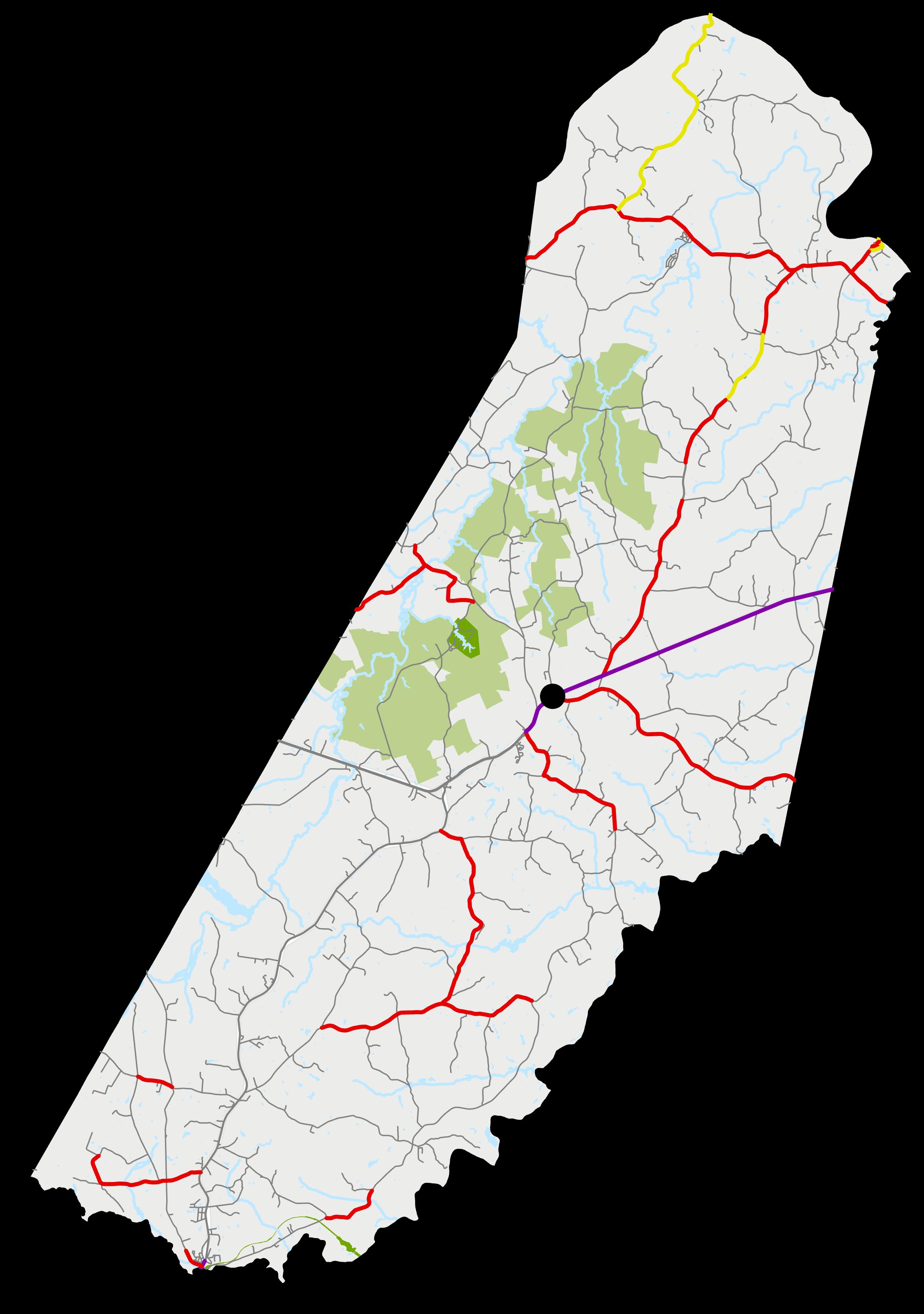

1 US 60 & VA 13 Intersection Operation & Safety
Short-term install signage; Mid-term add turn lanes or reconstruct to make a four-leg intersection.
2 VA 45 High St Goochland Line Short-term install advance warning signs; Long-term reconstruct intersection to improve geometric deficiencies.
3 Columbia Rd Duncan Shore Rd Fluvanna Line
Safety Long-term reconstruct roadway to current design standards and provide turn lanes for boat landing access.
4 US 60 Stoney Point Rd VA 13 Operation Long-term widen to urban four lanes with median.
5 US 60 VA 13 Powhatan Line
6 Duncan Store Rd Buckingham Line VA 690
7 Columbia Rd VA 714 VA 610
8 Columbia Rd VA 45 VA 714
9 VA 45 VA 684 High St
Operation Long-term reconstruct road to address geometric deficiencies (including full-width lanes and shoulders).
Geometric Long-term reconstruct road to address geometric deficiencies (including full-width lanes and shoulders).
Geometric Long-term reconstruct road to address geometric deficiencies (including full-width lanes and shoulders).
Geometric Long-term reconstruct road to address geometric deficiencies (including full-width lanes and shoulders).
Geometric Long-term reconstruct road to address geometric deficiencies (including full-width lanes and shoulders).
10 High St VA 45 S VA 655 Geometric Long-term reconstruct road to address geometric deficiencies (10-foot lanes).
11 High St VA 655 VA 45 N
12 VA 684 VA 45 Powhatan Line
13 VA 45 VA 690 VA 684
14 VA 45 0.117 km N VA 610 VA 690
15 VA 45 VA 663 0.718 km S VA 684
Geometric Long-term reconstruct road to address geometric deficiencies (10-foot lanes).
Geometric Long-term reconstruct road to address geometric deficiencies (including full-width lanes and shoulders).
Geometric Long-term reconstruct road to address geometric deficiencies (including full-width lanes and shoulders).
Geometric Long-term reconstruct road to address geometric deficiencies (including full-width lanes and shoulders).
Geometric Long-term reconstruct road to address geometric deficiencies (including full-width lanes and shoulders).
16 VA 45 US 60 VA 616 Geometric Long-term reconstruct road to address geometric deficiencies (including full-width lanes and shoulders).
17 VA 13 US 60 VA 654 W
18 VA 13 VA 654 W Powhatan Line
19 Stoney Point Rd VA 710 VA 654
20 Davenport Rd VA 45 Putney Rd
21 Putney Rd Davenport Rd John Randolph Rd
22 John Randolph Rd VA 640 Putney Rd
23 John Randolph Rd Putney Rd VA 600
24 Cedar Ln VA 635 VA 600
25 S Airport Rd VA 45 VA 716
26 River Rd VA 677 0.51 miles E of VA 657
27 Bolden Rd Buckingham Line Bear Creek Lake Rd
Geometric Long-term reconstruct road to address geometric deficiencies (including full-width lanes and shoulders).
Geometric Long-term reconstruct road to address geometric deficiencies (including full-width lanes and shoulders).
Geometric Mid-term add guide signs to direct airport traffic. Long-term reconstruct road to address geometric deficiencies (including full-width lanes and shoulders)
Geometric Long-term reconstruct road to address geometric deficiencies (11-foot lanes).
Geometric Long-term reconstruct road to address geometric deficiencies (including full-width lanes and shoulders).
Geometric Long-term reconstruct road to address geometric deficiencies (11-foot lanes).
Geometric Long-term reconstruct road to address geometric deficiencies (11-foot lanes).
Geometric Mid-term add guide signs to direct airport traffic; Long-term reconstruct road to address geometric deficiencies (10-foot lanes).
Geometric Long-term widen roadway to current two-lane standards (11-foot lanes) and add wayfinding signs to improve access to the airport.
Geometric Long-term reconstruct road to address geometric deficiencies (including full-width lanes and shoulders).
Geometric Long-term reconstruct road to address geometric deficiencies (including full-width lanes and shoulders).
28 Bear Creek Lake Rd VA 672 Bolden Rd Geometric Long-term reconstruct road to address geometric deficiencies (including full-width lanes and shoulders).
29 Trents Mill Rd Bolden Rd Oak Hill Rd Geometric Long-term reconstruct road to address geometric deficiencies (including full-width lanes and shoulders).
30 Oak Hill Rd VA 666 Bear Creek Lake Rd Geometric Long-term reconstruct road to address geometric deficiencies (including full-width lanes and shoulders).
31 VA 45 0.718 km S VA 683 VA 611
32 VA 45 Appomattox River Bridge (N) Osborn Rd S
33 Plank Rd VA 45 Farmville Line (N)
Safety Short-term reconstruct roadway to current rural two-lane standards.
Operation Long-term construct new roadway running parallel to and east of Main Street.
Geometric Long-term reconstruct as urban two-lane roadway.
Transportation improvement projects that are recommended for funding by VDOT feature in the SixYear Improvement Program (SYIP), which can be viewed at http://syip.virginiadot.org/Pages/allProjects.aspx. These projects meet may have featured on the region’s RLRTP.
There are ten road improvement projects in Cumberland that feature in the FY2023 - FY2028 SYIP, nine of which are resurfacing projects. Improvements to the Fowlkes Bridge over the Appomattox River, which is part of VA 621, is the other Cumberland roadway improvement project on the SYIP. The installation of a roundabout at the intersection of VA 45 (Cartersville Rd) and VA 690 (Columbia Rd) recommended in the SYIP.
The SYIP improvements on the map, as well as Countywide projects and services provided by VDOT, are listed on the following page.
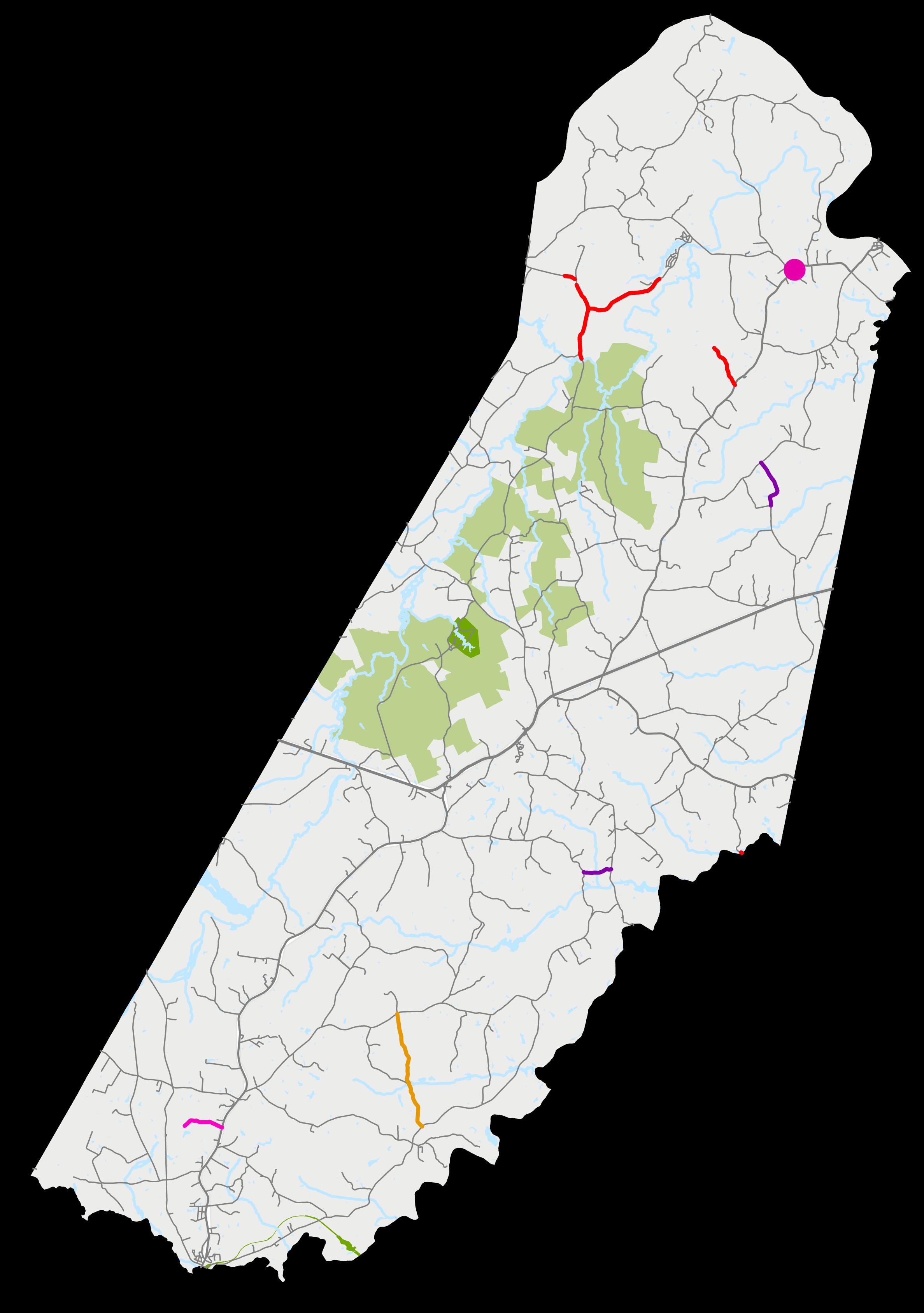
Data Source: Virginia Department of Transportation
Cumberland is home to mature forestland with significant ecosystem services and high conservation value, as well as forestland that supports a strong lumber industry in the county. The Virginia Department of Forestry (VDOF) classifies forestland based on its conservation value.
Areas shown as yellow or green on the map below are forested areas with high, very high, or outstanding conservation value. These are areas where logging or other activities are less appropriate.
*Please note that forestland within the Cumberland State Forest, Bear Creek Lake State Park, and Natural Areas within the county are not included in the Forest Conservation Value data.

Data Source: Virginia Department of Forestry
Farming is an essential part of the economy and culture in Cumberland. As such, maintaining significant farmland is a key element of land use planning in the county. The Natural Resources Conservation Service (NRCS), which is part of the US Department of Agriculture, classifies farmland by its physical and chemical properties.
The map below shows Prime Farmland and Farmland of Statewide Importance, both of which are essential to the production of food, feed, fiber, forage, and oil seed crops. Directing development away from significant farmland is essential to maintaining the agricultural productivity and rural character of Cumberland.

Data Source: US Department of Agriculture
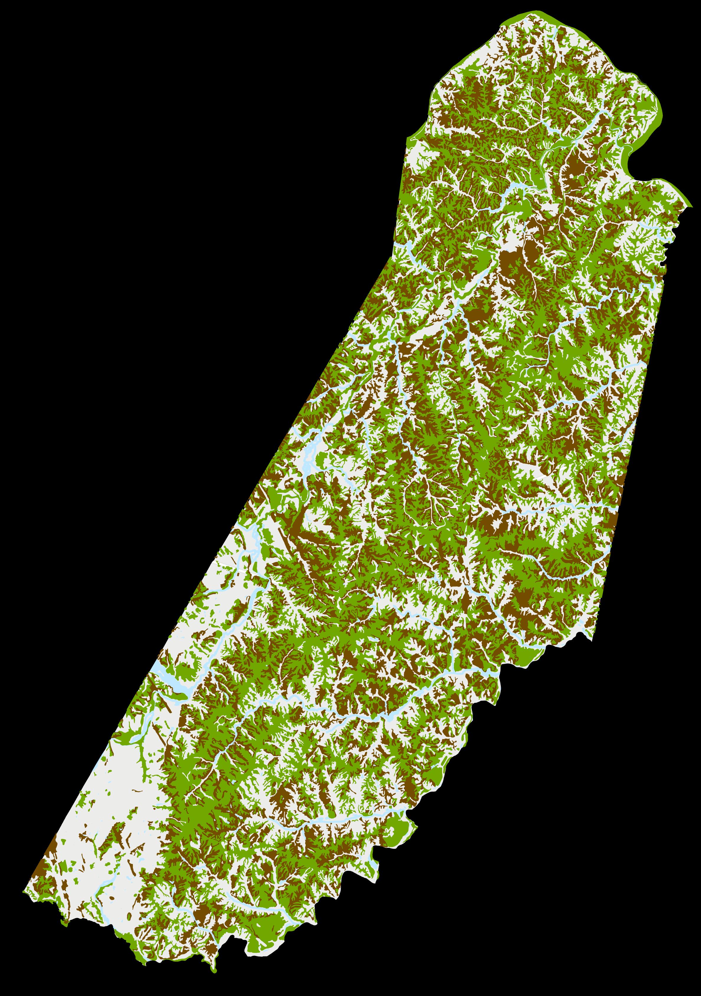
NRCS conducts soil surveys, which outline soil types and characteristics that are present in certain areas. This data has been simplified in the map below.
The soil type present in an area is one factor in determining which types of development are feasible in an area. For example, loamy soils (mixtures of sand, silt, and clay) are best suited for wastewater treatment, as opposed to soils with a high clay content that restrict water percolation. The type of soil present may also influence structural engineering decisions for a building in an area.

Data Source: US Department of Agriculture
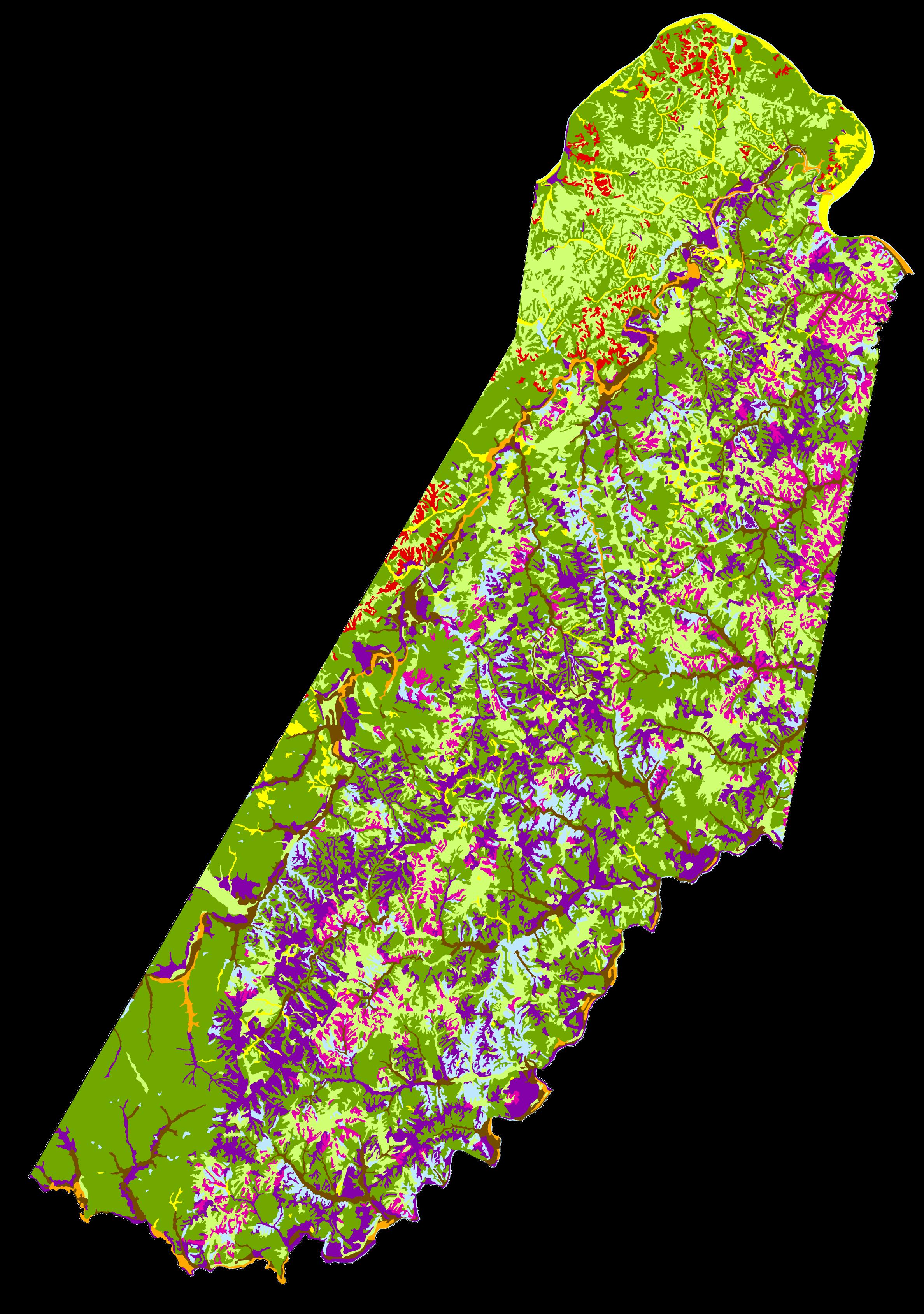
Wetlands are some of the most productive ecosystems in the world, as they are home to various plants, animals, and microbes. Over onethird of all endangered and threatened species live in wetland habitats. In addition, wetlands help protect adjacent areas from flooding.
Due to the high importance of wetlands, the Virginia Department of Environmental Quality (DEQ) requires that a Virginia Water Protection (VWP) permit be obtained before disturbing a wetland or stream by clearing, filling, excavating, draining, or ditching.

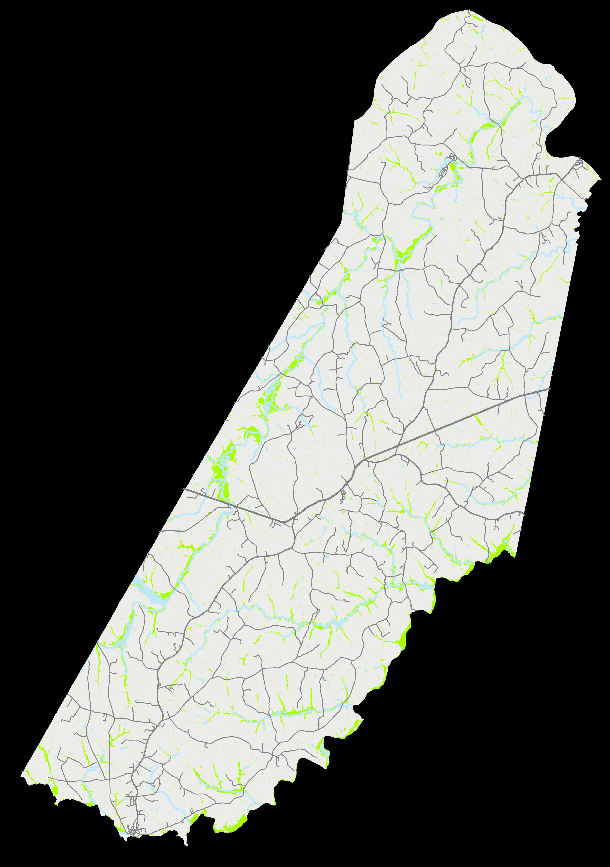
Data Source: Virginia Department of Conservation & Recreation
Water bodies are defining characteristics of Cumberland County, including the James and Appomattox Rivers that form the northern and southern boundaries of the counties, the smaller Willis River that runs through the county, and numerous creeks and lakes. Managing the risk of potential flooding during severe weather events is an essential part of land use planning. While floodplains can be productive agricultural land, more intense development should generally be directed away from floodplains.
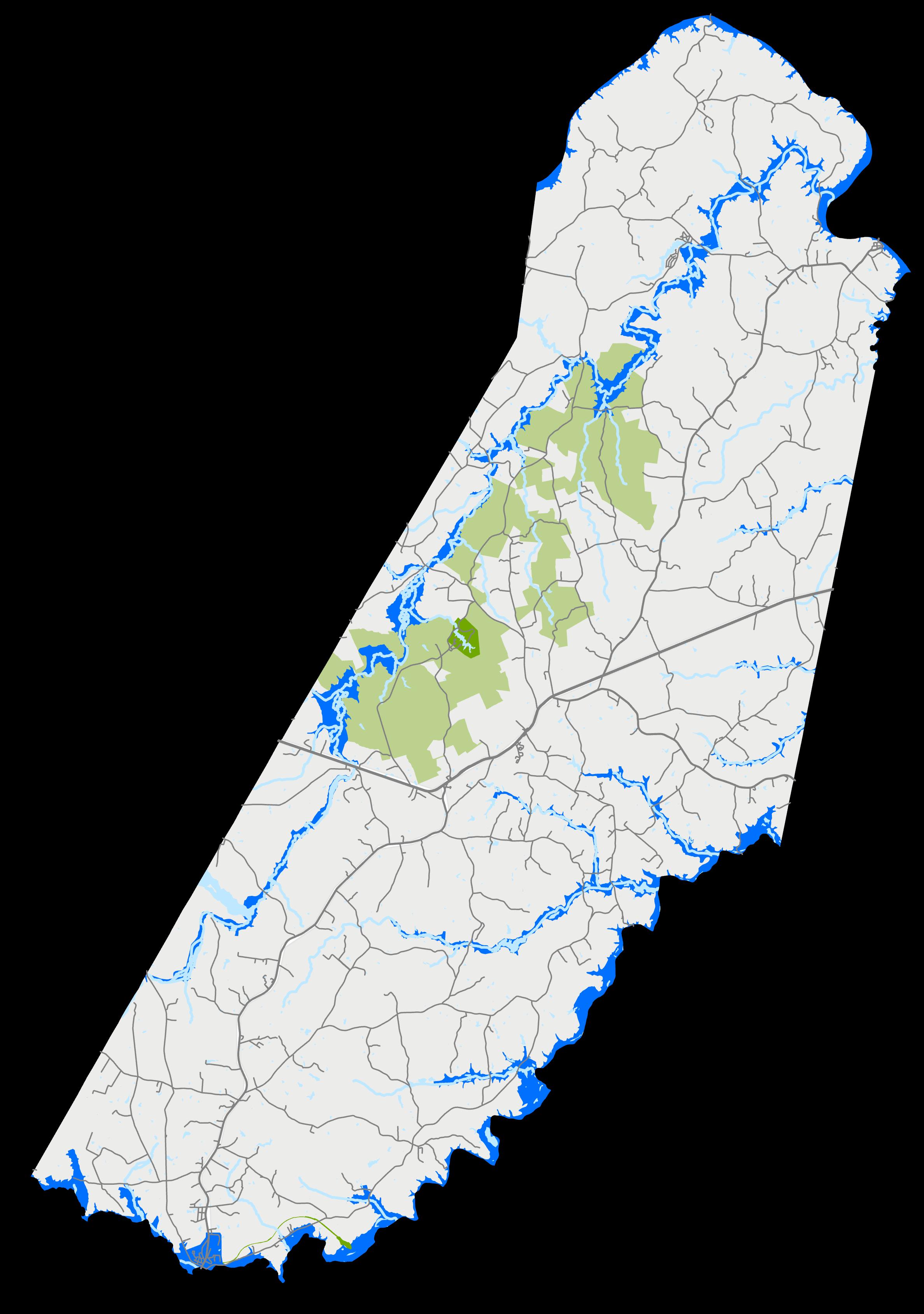
Public facilities in Cumberland include government buildings, schools, emergency resources, and recreation facilities. These facilities may be funded wholly or in-part by tax dollars, and they are accessible to the community at-large. As shown on the following maps, there is a cluster of schools and government administration buildings in the Courthouse area (shown on the map on the following page). Along with the central location of the Courthouse area, the high concentration of community facilities helps establish the area as a potential focal point for future development. The County’s Public Facilities Master Plan has been included as an insert to this document.
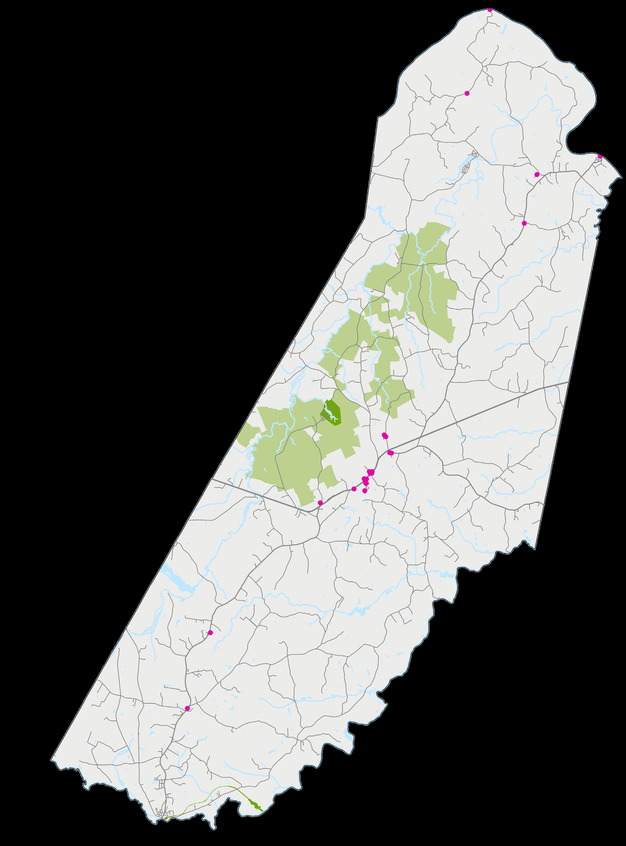
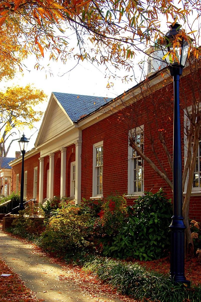
This chapter provides facility recommendations that address service needs within the next 5-25 years. Due to changing external and internal factors affecting these recommendations, the Plan and its recommendations should be updated every five years in conjunction with the County’s Comprehensive Plan.
The sections of the chapter are:
General Government:
Provide facilities to ensure clean, safe, and adequate space for County resources.
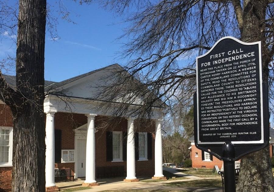
The public facilities chapter does not address project funding, debt capacity, or other financial concerns or issues. Furthermore, this plan does not address operational factors such as staffing, programming, design, equipment or other operational factors. Facility location recommendations should be viewed as general recommendations to promote flexibility. Facility recommendations are not listed in any kind of priority order. Prioritization and funding of facilities shall be determined by the Board of Supervisors, with staff recommendations, and input provided by citizens through separate processes outside the scope of this document. The Public Facilities Master Plan is divided into several sections based on the department responsible for providing that particular public facility or service.
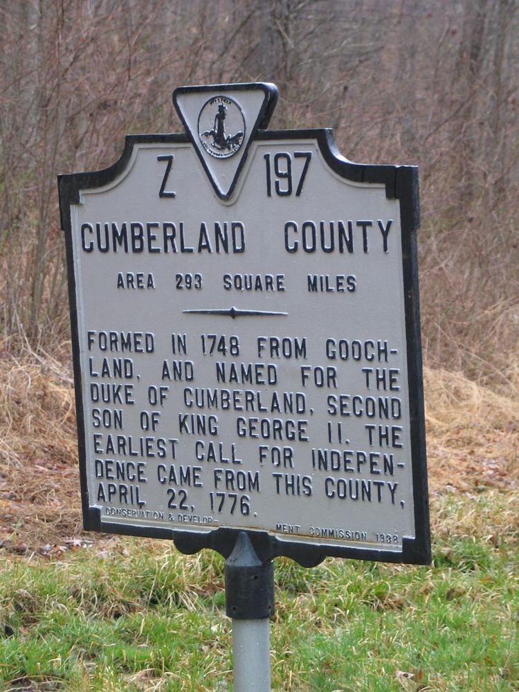
Public Safety: Provide for and protect the health and safety in the County through the continuous support of Public Safety agencies.
Solid Waste: Provide facilities to ensure adequate options for solid waste disposal throughout the County.
Library: Provide library facilities to meet the needs of current and future County residents.
Parks and Recreation: Provide park and recreation facilities to meet the needs of current and future County residents.
Public Education: Provide a superior education system that serves as an asset to the community and to provide quality education facilities to serve all of our citizens.
Public Utilities: Provide the orderly expansion of and improvements to the County’s utility infrastructure.
Providing and maintaining public facilities and public services are essential to the protection of the health, safety, welfare, and quality of life for the residents and businesses in Cumberland County and enhances economic development capabilities.
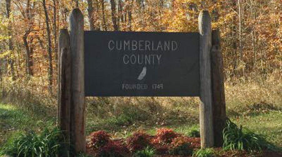
The County should strive to allocate adequate land for public facilities to maintain and increase levels of service and to identify land allocation needs for public facilities before development occurs. The County’s Comprehensive Plan recognizes the importance of planning for public facilities. It is also important for the County to remain flexible so it can respond to growth and service in a fiscally sustainable manner, and provide services when and where they are needed. To these ends, public facilities should be designed and built to maximize existing infrastructure, to be cost efficient, and to facilitate private investment when appropriate.
Public facilities like schools, parks, and libraries contribute to the identity of a community and provide public gathering places. When these facilities are provided in an exemplary manner, they contribute to higher property values because of the increased appeal of the community. This chapter provides an overall roadmap and guidance to identify the future needs for public facilities, their locational requirements, and the criteria for future decision-making processes. The planning for public facilities is based on existing infrastructure data and inventories, locational criteria as well as professional standards, industry practices, and departmental benchmarking. Decision-making parameters and facility policies are provided in this document, as well as an inventory and description of existing facilities, a needs assessment, locational criteria, and other key decision-making standards.
The following parameters are intended to act as guidelines for County decision-making related to design, location, and acquisition of new or remodeled public facilities.
1. Consider whether the location of new public facilities to be in substantial accord with the Comprehensive Plan when addressing the locational and planning policies of this chapter.
2. Encourage co-location and potential multiuse of existing and future public facility infrastructure and sites.
3. Locate, design, and use facilities in a manner that mitigates and minimizes disruption to existing land use and does not negatively impact the County’s rural character.
4. Utilize appropriate and high-quality design that allow public facilities to maintain and enhance the rural character of Cumberland County
5. Locate facilities to make them accessible via existing and proposed roadway networks, serving the largest concentration of population and employment areas.
6. Locate facilities to enhance or to improve response times and overall levels of service.
7. Coordinate the design, construction and improvements of new and existing facilities in conjunction with private development and the standards set forth in the Comprehensive Plan.
8. Encourage new development in areas where public water and sewer services are available.
9. Identify locations where projected growth is expected and pursue acquisition of these sites in advance of potential development.
10.Identify and consider the possible need for modification or expansion of existing facilities when reviewing development proposals.
Cumberland County government, as of 2023 consists of 17 buildings and 7 outdoor spaces. Total building square footage is approximately XXXXXX square feet. Buildings include areas for public safety & court facilities, general administration, parks and recreation, and human services.
Facilities range in age from 180 years old to recent construction and range in terms of overall condition. The majority of Cumberland County’s General Government operations are located at the center of the County within the Courthouse Village.
The General Government operations include the following; County Administration, Finance, Community Development, Information Systems, Parks and Recreation, Public Works, Social Services, Courts, Fire and Rescue Administration, School Administration, Sheriff’s Department, Treasurer, Commissioner of Revenue, and the Registrar. These functions are spread out between (2) campuses: the Courthouse Complex and the Luther P Jackson Complex.
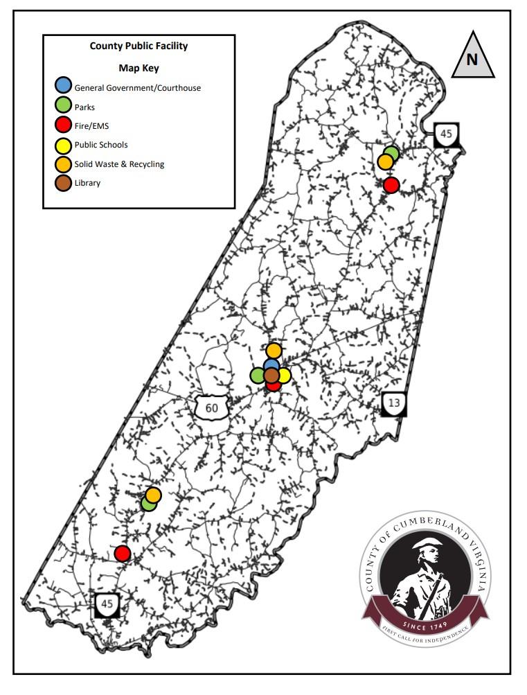
Locational Criteria: The following goals or strategies should be considered when locating general government facilities.
1. Utilize existing infrastructure to its maximum efficiency, capacity, and layout.
2. Attempt to locate functions centrally within the geography of Cumberland County as well as in conjunction with growth and existing populations.
3. Identify County functions that have significant and mild deficits in terms of current and projected space needs.
4. Co-locate general government functions while meeting their immediate and future needs.
5. Utilize existing buildings and infrastructure as appropriate.
6. Synchronize general government facility needs with school system needs and repurpose vacated space.
The following items are recommended and/or funded in the FY 23-48 Capital Improvement Plan.
It is recommended that renovations to the Luther P Jackson Community center be completed to allow for a transition of County Administrative functions to the complex. Please see below.
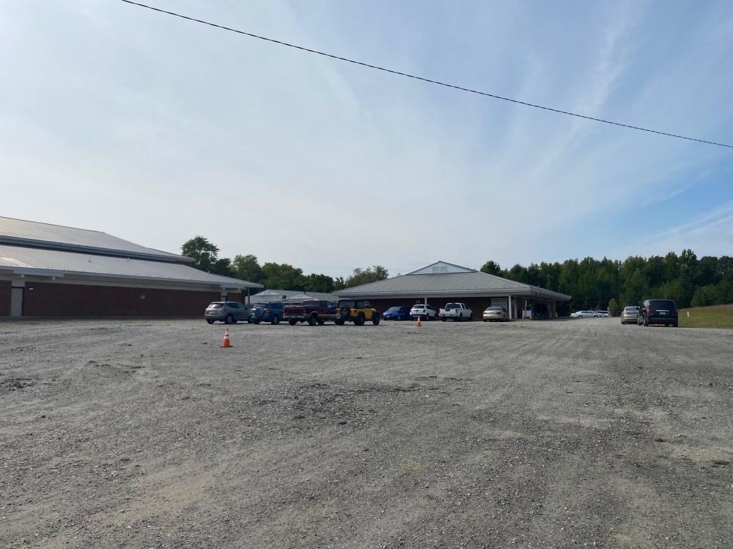
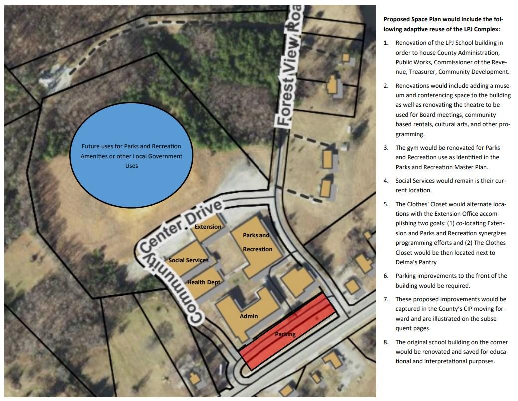
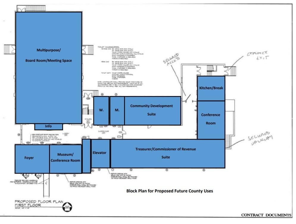
The Luther P Jackson complex will be renovated internally to allow for enough space to meet the needs of non-Court and Public Safety related functions for the next 25 years.
Block planning for the first floor renovations include suites for the Treasurer and Commissioner of Revenue, a museum and conference room, as well as a large multipurpose meeting space that can be utilized for both government functions and for community based uses. ADA accessibility, security, and access will be addressed as well.
Detailed architectural design will take place in the future as funding becomes available.
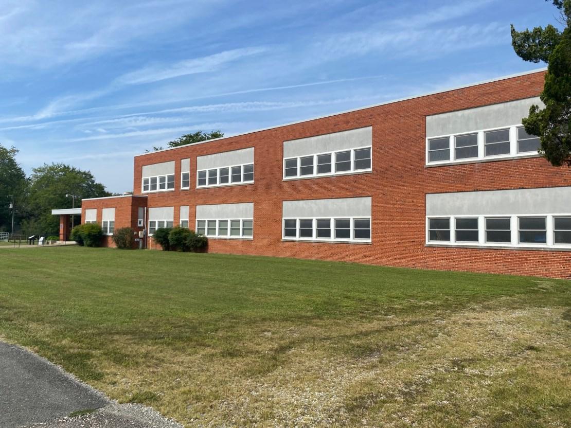
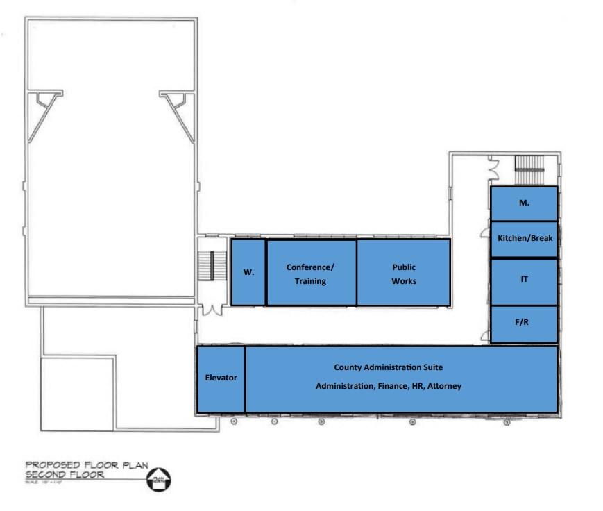
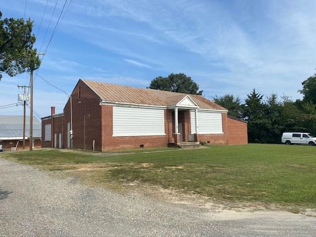
The second level of the Luther P Jackson complex will house the County Administration suite that will include County Administration, Human Resources, Finance, and the County Attorney’s office.
Information Technology and Fire and Rescue administration will be housed here as well. All block planning is designed to accommodate county facility needs for the next 25 years.
Detailed architectural design will take place in the future as funding becomes available.
The Sheriff's Office is a multi-faceted law enforcement agency providing many public safety services for the residents of Cumberland County. The Sheriff's office supervises the County's enhanced 911 system and dispatchers, other police agencies, and fire-rescue units 24 hours a day. In addition, deputies enforce all criminal and traffic laws and investigate the criminal complaints in the County. The Sheriff is also responsible for the security of the courthouse, the movement of prisoners, and enforcement of court orders. Also deputies transport inmates to and from court appearances, medical appointments, and Department of Corrections transfers.
Deputies provide security to the Cumberland General District and Juvenile and Domestic Relations Combined Courts and to the Cumberland Circuit Court. They maintain safety and control in the courtrooms and prevent unauthorized entry of weapons and contraband into the courthouse. Deputies serve civil papers which include garnishments, summonses and other court orders and carry out court ordered evictions, levies, and mental commitments.
The Sheriff’s Office currently occupies 1 building within the Courthouse/Admin Complex located separately from the Courthouse across Foster Road.
Cumberland County operates 1 building related to court services. The building includes the Circuit Court, the Combined General District Court, and the Commonwealth’s Attorney
The current buildings occupied by the Sheriff’s Office and Courts functions are aging and the separation of functionality is not an ideal situation. The Sheriff’s Office and the Court system functions have been identified in the County's space analysis and CIP as needing both additional space as well as appropriate and co-located space.
Public Safety and Courts are currently undergoing a needs analysis that is slated for completion in the Fall of 2024. Once those findings are complete, the Public Facility Master Plan can be amended to reflect those findings and recommendations.
It is recommended that Sheriff’s Office and Court system resources be located centrally within Cumberland County.
The following recommendations should be used to guide new facility development.
1. Maintain an active exchange of information between the Sheriff’s Office and County Administration to address future needs for law enforcement services in the County.
2. New /Renovated/Re-purposed Combined Courts Building The project proposes to begin allocating funding for the planning, design, and eventual construction of a new Combined Court building. It is recommended that the proposed Court building would be located on the grounds of the existing County Courthouse Complex.
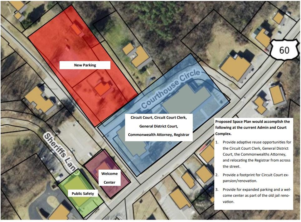
3. It is recommended that the Sheriff’s Office be maintained as it is with general improvements completed as outlined in he County’s CIP and facilities condition report. The only Sheriff Office function not part of this facility will be the temporary holding facilities, which are to be located with the court facilities. This will allow for the building to be divided into a public access portion and a secure portion with separate entries accessed from separate public and secure parking areas. For the Courts function, it is recommended to redevelop the courthouse to house Circuit Court, Clerk of the Court, General District Court
and Clerk, Juvenile Court, Adult and Juvenile Probation, and the Commonwealth Attorney. The goal of this recommendation is to provide a central public security screening point and separate public, staff and detainee circulation throughout the facility. The only point where these three disparate circulation types will meet is within each of the courtrooms. At other staff/ public interaction points appropriate passive physical security and separation are to be provided. It is recommended that the courthouse have access from separate public and secure parking.
4. Any new development shall strive to maintain the historic structures and courthouse green for public or county use in the future. A full Courthouse Analysis is currently underway.
Cumberland County Fire and EMS, in conjunction with the Cumberland County Volunteer Fire Departments and contracted EMS providers, provides fire and rescue response to the County. The Department also coordinates the County’s Emergency Operations Plan.
Fire & EMS provides countywide, 24-hour emergency medical service and cooperates with surrounding counties to provide and receive mutual aid as needed. Emergency units operate out of three stations/companies which operate together to provide fire protection and emergency medical care.
There are currently (3) Fire Stations, (1) County owned and (1) Rescue Squad building - County owned in Cumberland.
Level of service standards are based on call volume, distance, and response time. This will determine where future stations will be required to provide optimal public fire/rescue response. EMS response service areas are periodically revised due to growth and development trends. . An existing framework of a 15 minute standard for all calls is currently being used as a
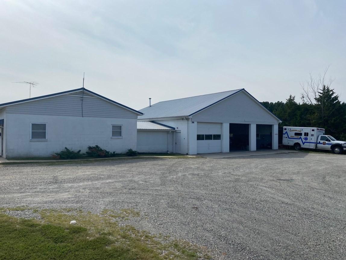
benchmark. It should be noted that these are in line with state mandated standards for EMS response and are not the national standards that the Department strives for
The following items should be taken into consideration when assessing both the need of a new fire station or renovating an existing station.
1. Ensure that fire and rescue station have all of the resources and work areas needed to sustain a 24/7 operating facility.
2. Ensure that fire and rescue stations are all OSHA compliant and meet all minimum guidelines.
3. Facilities should be safe for overnight sleeping accommodations.
4. Facilities should have enough overnight accommodations for 24/7 operations for future expansion of services.
5. Facilities should meet minimum response times.
6. Facilities should address overlapping and extensive call volume in any given district.
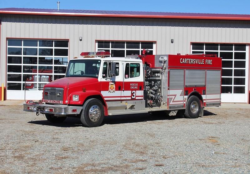
Efficient and timely response to emergency and medical calls with the personnel and equipment appropriate for the situation is critical for improving the safety of both the residents and the responders. Fire-Rescue operates equipment to respond to all hazards such as vehicle accidents, fires, illness, injury, and to provide pre-hospital emergency care for medical emergencies including Advanced Life Support and special cardiac care. Periodic advances in equipment and technology and upgraded spaces for operations are to be expected. New development and growth will necessitate additional fire stations in order to maintain safe and effective response standards. As call volume increases the need for additional staffing will be required.
Planning for additional and replacement equipment and assuring specialized training will become increasingly important. Apparatus funding is expected to be addressed through development of an “apparatus replacement plan” incorporated into the County’s Capital Improvement Program (CIP) budgeting process.
County planning efforts which address public safety. The need for new or modifications to existing fire and rescue facilities will be estimated utilizing the following criteria; Current levels of service, estimated future demand, and additional factors influencing needs.
The location of fire stations is critical and response times are an important methodology in the selection of future fire station locations. The following criteria should be considered when identifying locations for fire and rescue facilities. The location of fire stations is critical and response times are an important methodology in the selection of future fire station locations. standards.
Fire and Rescue is funded by a combination of tax dollars, grants, and tax deductible donations. Funds should be allocated for the purchase of replacement ambulances on a seven-year cycle and other vehicles on a fifteen-year cycle; this would enable the Department to maintain a modern fleet of reliable vehicles.
The following criteria should be considered when identifying locations for fire and rescue facilities.
1. Locate fire and rescue facilities in order to obtain easy access to north/south and east/ west roadway access.
2. Identify sites that can accommodate large equipment and pull through opportunities.
3. Locate fire and rescue facilities on sites that allow for future expansion. It is recommended that fire station sites be a minimum of 5 to 8 acres.
4. Locate fire stations to minimize negative impacts to surrounding neighbors and development.
5. Locate Fire and Rescue stations to meet minimum service level standards.
6. Relocate/renovate current fire rescue stations to meet minimum service level standards.
7. Facilities should support one another from a resource standpoint.
8. Projected County growth both in residential and commercial corridors.
9. Growth in current station coverage areas.
10. Location of facilities to reach economies of scale (ie. Fuel stations, convenience centers, recreation)
It is recommended that the County continues to utilize the current Volunteer and County owned and based fire stations for fire and EMS services while utilizing the locational criteria to address long term needs through the County’s CIP program.
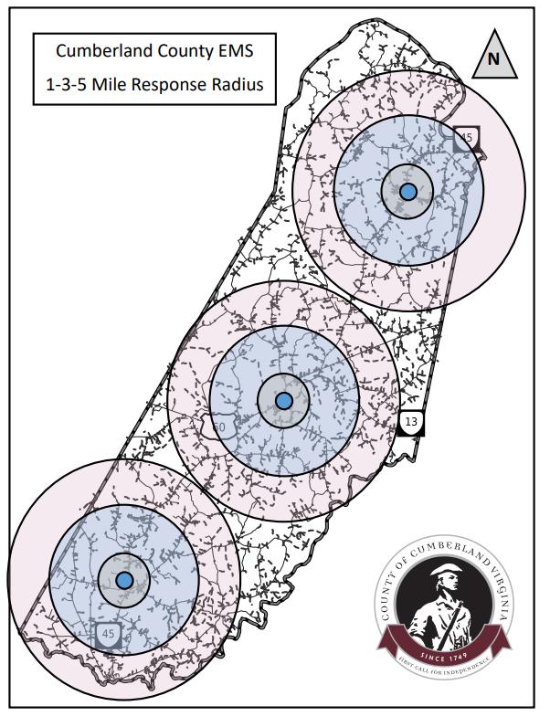
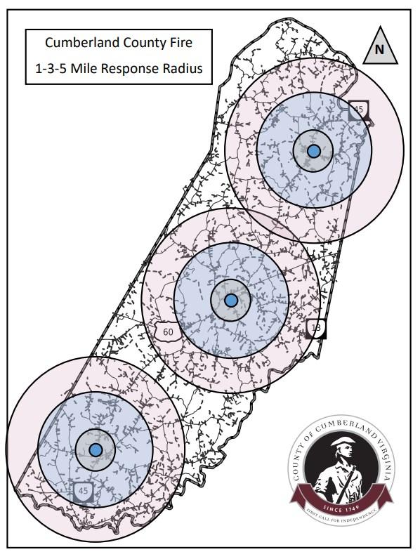
The Department of Animal Protection also provides public safety services for the County. Animal protection officers provide 24 hour per day services for citizens 365 days a year.
This office enforces all state and local animal welfare ordinances and has the following additional responsibilities:
1. Work to prevent the spread of rabies to humans and domestic animals.
2. Investigate dog bites and potential vicious dog cases.
3. Ensure through education and disciplinary actions, that all domestic animals in the County are provided adequate care and are treated humanely.
4. Confine all stray domestic animals and impound them at the animal shelter.
5. Maintain the animal shelter.
6. Find permanent homes for unclaimed animals through adoptions to citizens and networking with animal rescue organizations.
The County currently has one animal shelter located on Commerce Road. Increasing animal populations, along with more stringent State mandates requiring more separation among animal populations in municipal shelters will require the ongoing monitoring of facility needs and space.
Citizens have an increased expectation of services including routine evening services in addition to the current emergency services provided. The Animal Protection Office will be doing a Needs Assessment to help determine future staffing levels that would be required to maintain adequate level of service.
Criteria Animal Protection should be centrally located to ensure equitable service geographically.
It is recommended to monitor County population and Animal Control trends to ensure that the Animal Shelter’s capacity is meeting standards. At this point in time there are no recommendations to expand or relocate the facility within the next 5 years.
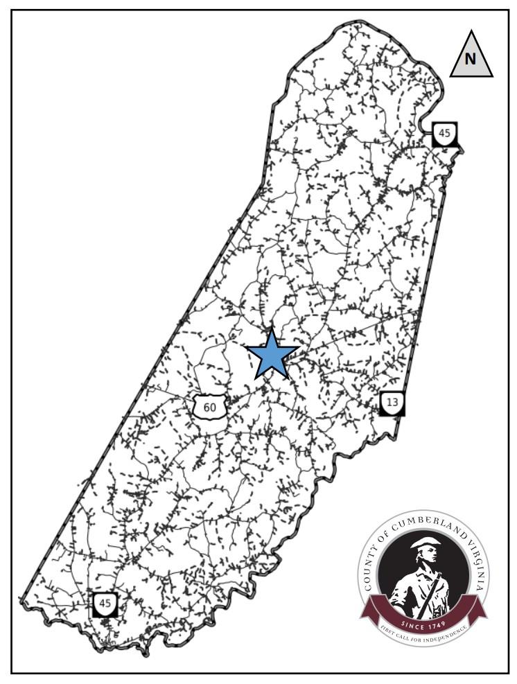
The public brings solid waste to the convenience centers where it is compacted and transported to private landfills. Cumberland County utilizes service agreements negotiated with local vendors to provide refuse processing and recycling services in an efficient and cost effective manner.
Some of these services include: Drop-Off Recycling at both convenience centers which includes: all types of metals, glass, plastics (#1 and #2 only), paper and paper products, batteries, appliances, propane tanks, and tires. Other items collected include household hazardous waste items such as: oil, oil filters, antifreeze, paints, and gasoline.
The following criteria should be considered when selecting site locations for future convenience centers;
1. Provide conveniently located solid waste management facilities.
2. Ensure solid waste facilities are compatible with adjacent land uses.
3. When possible, locate recycling services at solid waste management facilities.
4. Consider public/private partnerships for environmentally sound and efficient waste management, collection, recycling, and disposal.
5. Continue to promote citizen and private sector programs in all recycling and waste management collection program
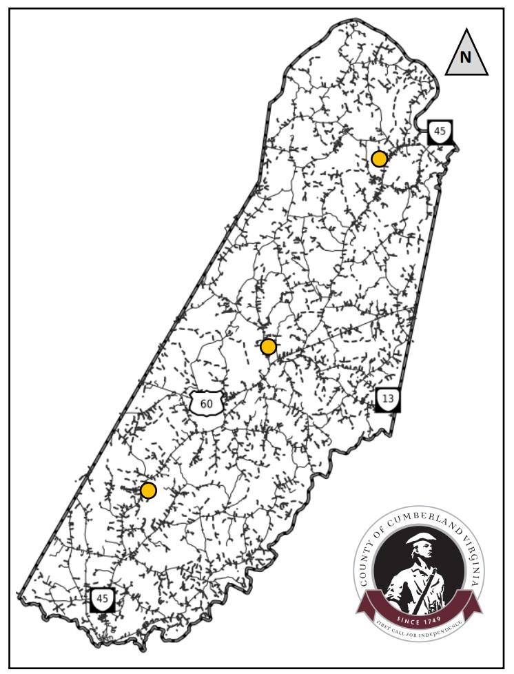
North Hamilton Transfer Station, 43 Samuels Drive, Cartersville, VA 23027
Central Madison Transfer Station, 77 Commerce Road, Cumberland, VA 23040
South Randolph Transfer Station, 2632 Cumberland Road, Farmville, VA 23901
There are no recommendations for additional transfer stations given their locations throughout the County.
Open hours and collection times should continue to be evaluated and increased as resources allow.
The Cumberland County Public Library consists of one standalone building totaling approximately 5,250 square feet. The building includes administrative space as well as a conference room/multi-use meeting space.
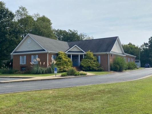
Localities in Virginia typically utilize the “Standards for Virginia Public Libraries,” Per those standards, Cumberland County is underserved. The County is below the “A” level which is considered the lowest level. The lowest level is calculated by a common multiplier, in this case .6 per resident for square footage. The current service level for County residents is 0.54.
To estimate the future demand for library facilities, the current level of service can be applied to the projected future population. This demand would apply only to the public portion of the libraries. In addition to new public space needs, the administrative/headquarter operations space may need to be expanded to accommodate the increased demand for services.
The following standardized criteria should be considered when identifying locations for library facilities and resources:
1. Select sites that would expand the service radius and impact to County residents.
2. Use existing location for potential expansion.
3. Seek to co-locate facilities with other services such as parks, convenience centers, or schools.
4. Identify existing facilities or rental properties that could be used for future needs.
1. It is recommended that given the County’s projected population growth and the location of the current library, that no additional facilities be pursued.
2. It is recommended to potentially add onto the existing building as appropriate to meet levels of service standards and population growth
3. Partner with the Public School system as much as possible to maximize resources.
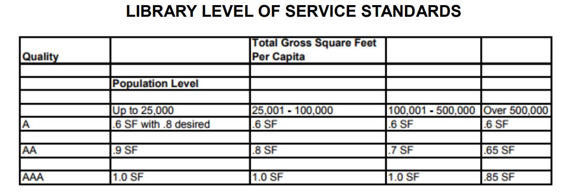
The Department of Public Utilities is responsible for the provision and maintenance of county water and sewer services. Public water and sewer is located in the central portion of the County along Route 60 in the Courthouse area.
Additional sewer infrastructure runs from the Courthouse area along Route 45 south to Farmville. The Department sends all wastewater to Farmville.
The water source for the system is from an aquifer that is located underground throughout the Courthouse area. The water is treated through conventional flocculation, sedimentation, and filtration processes.
The system serves approximately 250 customers and has a daily allocation of XXX.
In general, the water system improvements program involves improvements to water supply, water storage, and water distribution to ensure adequate supply and pressures throughout the planning period.
Location criteria for sewer and water facilities relate primarily to the acquisition of easements for the location and installation of sewer lines relative to the slope of the land. The following criteria should apply to location of new sewer and water facilities .
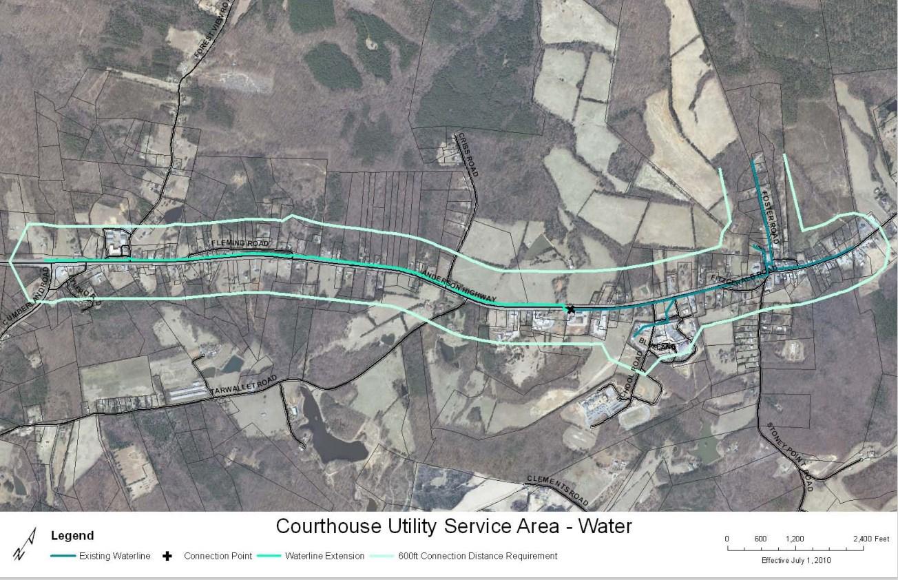
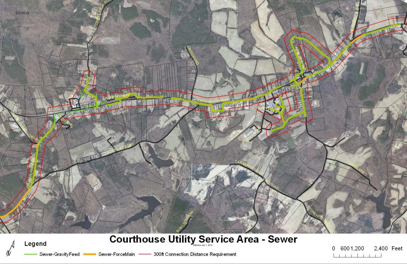
The following recommendations should be utilized to guide the decision making related to water and sewer improvements and/or expansion.
1. It is recommended that the County complete a Public Utility Master Plan to analyze current infrastructure as well as potential infrastructure related to the Cobbs Creek Reservoir.
2. Continue to maximize and encourage appropriate development within the Courthouse Village area.
3. Support projects and system improvements identified in the 25 year Capital Improvement Plan.
4. Focus on maximizing development in the Courthouse area in order to add users to the current Public Utility system.
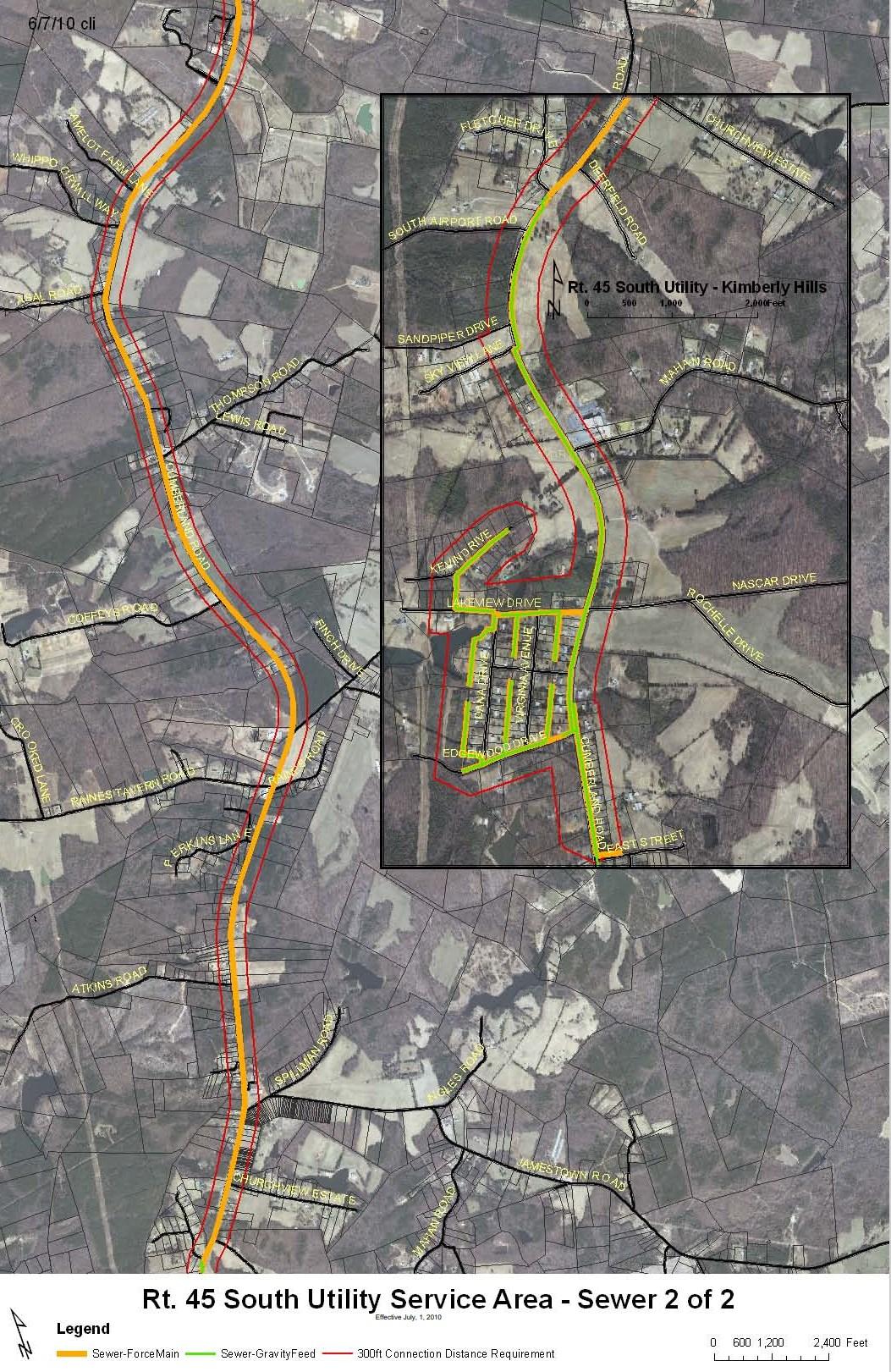
Park and recreation facilities are valuable community assets. The social, communal, and personal benefits derived from park, recreation, open space, and leisure opportunities are increasingly important as development increases and the overall pace of life quickens. Quality park and recreation facilities enhance the quality of life and health of County residents. Additionally, parks and recreation facilities provide public gathering places and contribute to the identity of a community.
When facilities are provided, they contribute to community pride and reinforce the County’s commitment to high quality development. The value and services provided by the Recreation Division extend beyond the provision of playgrounds and athletic fields. The Division provides comprehensive year-round programs for youth and adults which includes athletics, leisure skill classes, fitness, arts and crafts, cultural opportunities, general recreational classes, special events, social trips, and educational enrichment. The result of population growth on the demand for Parks and Recreation services should be considered. In addition to the continual maintenance required for new and existing facilities, periodic capital expenditures are necessary to purchase, construct, expand, or reconstruct Parks and Recreation facilities.
Per the 2013 Virginia Outdoor Plan, there is additional need for park land and public open space in the County. The Parks and Recreation Department operates six outdoor recreational facilities including three parks.
Consideration should be given to the acquisition and development of park and open space to serve the needs of all County residents. Development plans should be reviewed with this in mind. The County has the opportunity to do long range park and recreation planning. The current Parks and Recreation Master Plan consists of a comprehensive needs assessment and an inventory and analysis of existing resources. As part of the park development process, the County should seek to develop parks of
different types. The three primary types of park facilities are community parks, district parks, and regional parks.
Community park is typically no larger than 30 acres and features basic, passive recreation amenities.
District park is typically between 30 and 80 acres and is capable of providing both passive and active recreational opportunities such as baseball fields.
Regional park is typically 80 + acres, can serve a large group of people at one time, and has multiple features of both passive and active recreation. Regional parks also seek to conserve historical or provide access to natural resources not typically found in other park facilities.
Parks and Recreation currently operates 4 outdoor facilities and 2 indoor facilities. Over XXX acres of parkland is in the County’s inventory and 20,000 square feet of indoor recreation space.
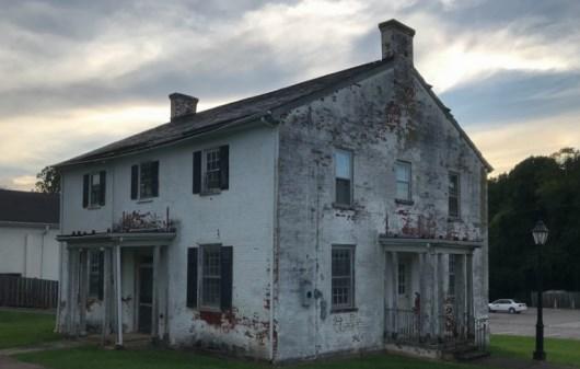
A needs assessment was conducted as part of the 2016-2020 Parks and Recreation Master Plan process. In order to assist in the planning of parks and recreation facilities, a “levels of service” standard is often employed. Level of service standards typically establish a quantity of units per population and park standards typically require an acreage requirement. This type of analysis can determine if there are gaps in-services. Utilizing the Virginia Outdoors Plan as well as a myriad of citizen surveying and feedback techniques, Parks and Recreation was able to identify levels of service deficits as benchmarked against other localities in Virginia.
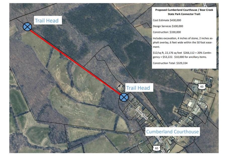
The following locational criteria should be considered when identifying locations for new parks and recreation facilities.
1. Select park locations to expand service areas to underserved areas of the County.
2. Locate sites in close proximity of future residential development.
3. Co-locate parks and recreation site with other County services based facilities to achieve economies of scale.
4. Locate parks and recreation facilities that maximize natural resources and aesthetics.
5. Locate parks and recreation sites to minimize operational impacts to the annual operating budget.
It is recommended that the public facility master plan seek to implement the strategies and facilities identified in the Parks and Recreation Master Plan.
The Cumberland County Public School System is a small, rural, model school division located one hour west of Richmond, Virginia. Approximately 1,250 students attend school in the division, which is composed of one high school, one middle school, and one elementary school. Cumberland County Public Schools has approximately 125 classroom teachers, library/media specialists, school counselors, and other teaching personnel focused on meeting the educational needs of our students. The School Board is committed to providing the human and capital resources which are necessary for teachers and staff members to implement an instructional program that is rigorous and challenging for all students.
Vision: The Cumberland County School System will be a model school system that serves as the educational and resource center for the community.
Mission: Our mission is to inspire and prepare all students with the confidence, courage and competence to achieve their dreams; contribute to community; and engage in a lifetime of learning. Purpose: Our purpose is to prepare all students to be successful learners, workers, and citizens. School Board Goals:
1. Cumberland County Public Schools will be student centered.
2. Cumberland County Public Schools will expand opportunities that are equitable and collaborative for learning that empowers students.
3. Cumberland County Public Schools will develop committed stakeholders who build positive relationships. Stakeholders are defined as students, faculty and staff, parents, and community members.
4. Cumberland County Public Schools will use division resources to effectively and efficiently support staff.
The County has one elementary school, one middle school, and one high school, located on School Road. Additional buildings located on the campus include a bus shop, central office, and agriculture/band building. Several athletics fields and a field house also exist.
Cumberland County Public Schools is centrally located to ensure equitable services geographically.
The Capital Improvement Committee recommends the following upgrades to our facilities:
Construction of a CuCPS transportation facility (shop, office area)
Construction of a concession/locker room facility at athletic complex
Installation of lights on the softball and baseball field
Upgrade the lights at the football field
Parking at CCES for athletics
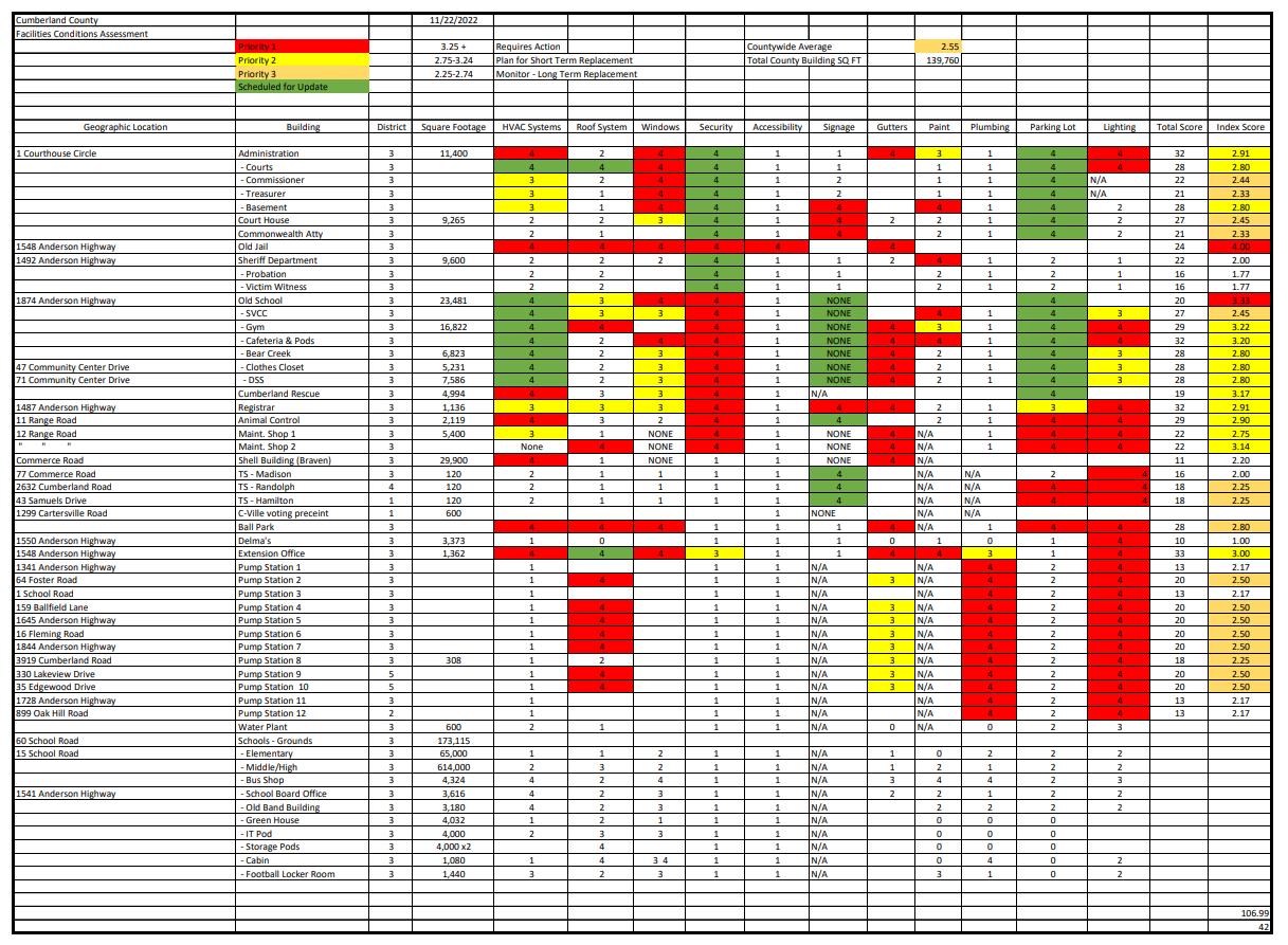

Community Facilities (Courthouse Area)
As shown on the map below, a significant number of community facilities are located in the Cumberland Courthouse Area. Moving forward, the County should address safe multimodal connections in the area to leverage the proximity of these facilities. For example, a student could make the 10-minute walk from the high school to the Cooperative Extension Office, but that route needs to be safe and comfortable
County Admin Building
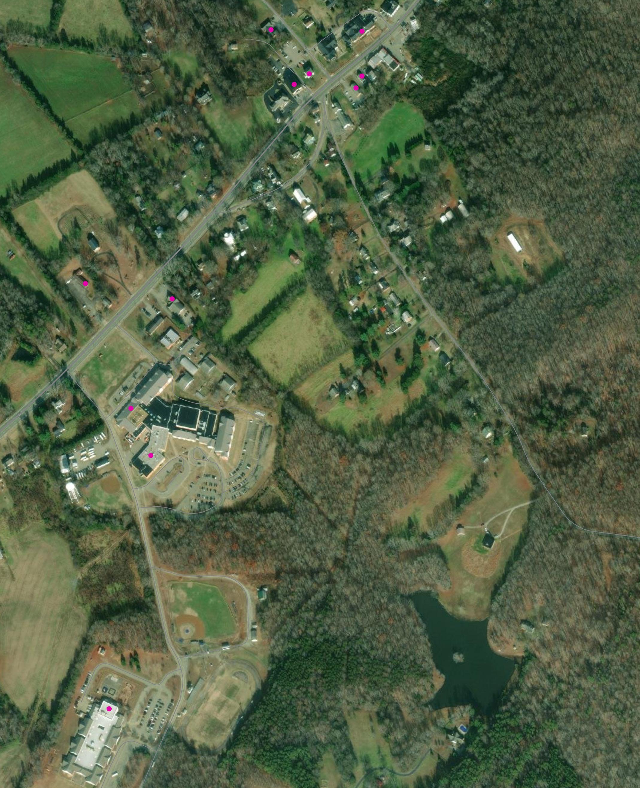
Internet access has become increasingly important with the rise of remote work, the use of technology for school work, and the prevalence of digital communications. The onset of the COVID-19 pandemic brought attention to the significant amount of households, especially those in rural areas, without access to high speed internet. In response, state, federal agencies, and Cumberland County itself, are making efforts to close the “digital divide” and promote equitable access to broadband.
For the Census Blocks shown in purple below, at least 80% of households have access to internet with minimum speeds of 25 Mbps for downloads and 3 Mbps for uploads. For Census Blocks shown in orange below, at least 80% of households have access to internet with minimum speeds of 100 Mbps for downloads and 20 Mbps for uploads, which is the threshold for a “broadband network.” A majority of Cumberland County has access to broadband; however, there are clear gaps in coverage along the western border with Buckingham County. The following pages detail some of Cumberland County’s efforts to improve connection countywide.
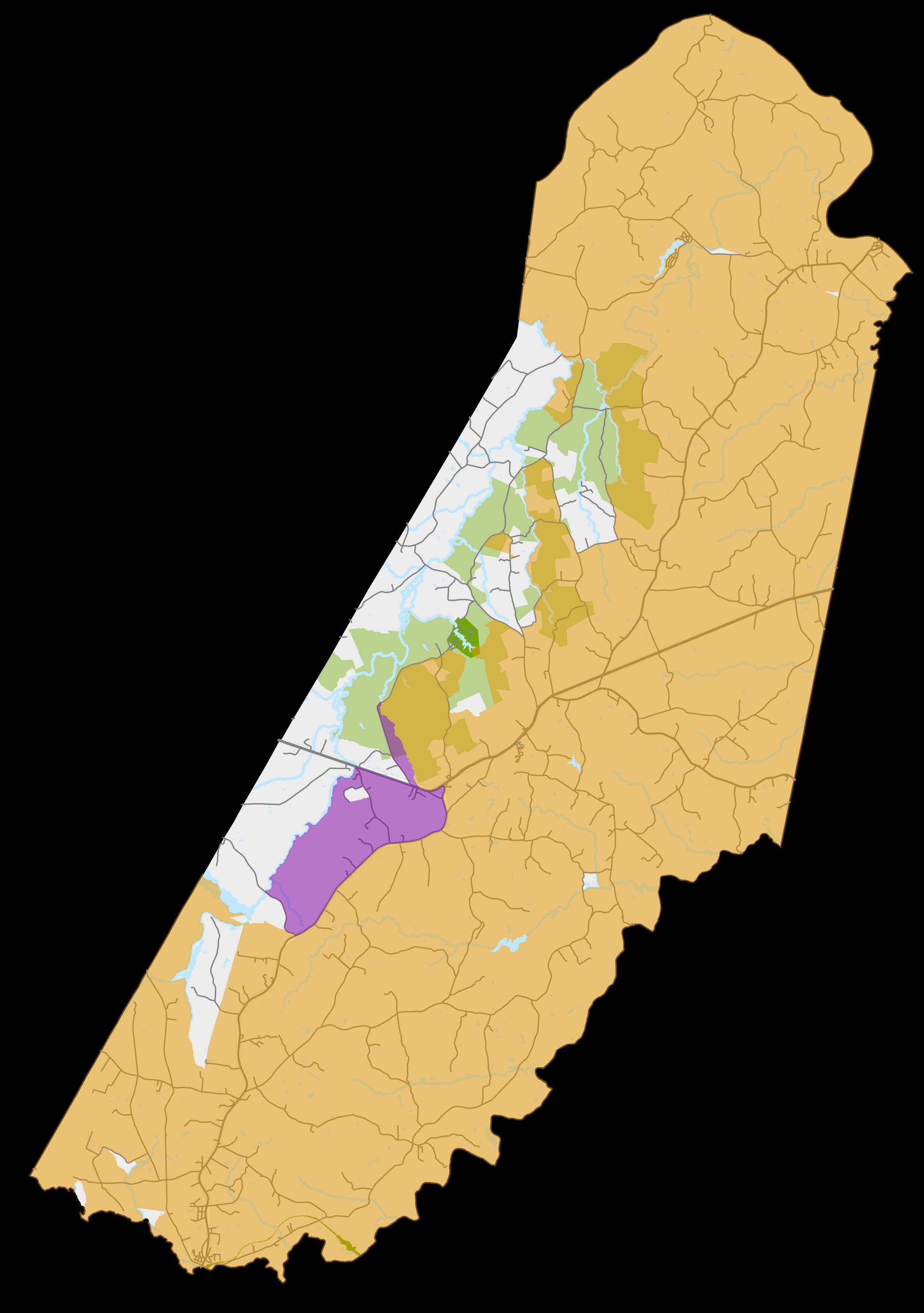


Cumberland County is currently partnering with (2) Companies: Firefly and Kinex to provide broadband to Cumberland Businesses and Residents.
Partnerships are Critical to Cumberland County’s Broadband Initiative
- Firefly - Central Virginia Electric Cooperative, Dominion Energy, and the Thomas Jefferson Planning District Commission
- Kinex – Cumberland, Prince Edward, and Lunenburg Counties, and the Commonwealth Regional Council

Total Broadband Investment in Cumberland County: ~ $15,839,060
Total Broadband Funding Invested by Cumberland County: $586,250 or 3.7% of the Total Cost
Cumberland Funding was accomplished through CARES and ARPA Funding.
Approximately 380 miles of Fiber Total, 4,416 Total Passings
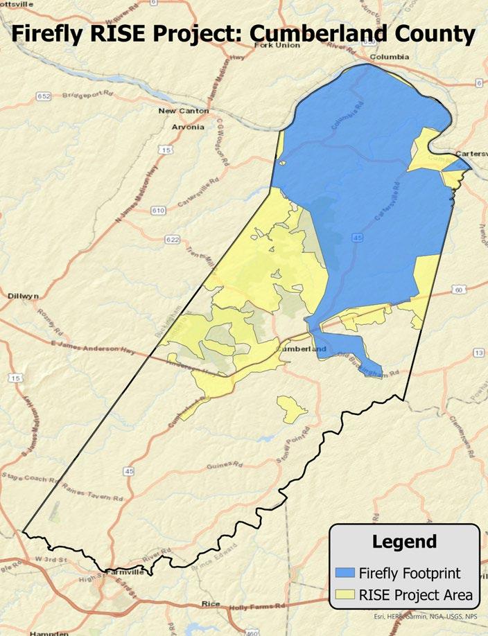
Firefly VATI and RISE Project Highlights for Cumberland County
• VATI Project Total- $5,759,320, 64 miles of fiber
• CAF Project Total- $1,579,740, 23 miles of fiber
• Total RISE Project Total- $7,339,060
• VATI Award Total for County- $1,017,728
• Approved County Match Contribution- $386,250
• Total passings within RISE and CVEC- 2,470
• CVEC electric accounts- 1,310
• Total Miles of Fiber – Approx. 140 miles
• VATI Award Total- $79,027,930
Firefly VATI and RISE Project Highlights for Cumberland County
• Generally, assume six months from start of construction until first in home connections. Will continue to work until all who would like service are connected.
• Each area requires several steps before connections can be made:
• Data collection (Firefly - NTS)
• Design (Firefly - Conexon)
• Make ready engineering
• Make ready construction
• Fiber construction (Firefly - S&N)
• Splicing (Firefly - S&N)
• Service extensions to homes (Firefly - S&N)
• Final connection (Firefly)

Have questions on whether your location is in our RISE Project?
Visit: https://www.fireflyva.com/rise/


Kinex Broadband Project Highlights for Cumberland County
1,946 total passings, 239 miles of Fiber
Total Project Construction Costs: $8,500,000
Construction Timeline: Completed Build Out 2026
Kinex Broadband Rural Digital Opportunity Fund (RDOF) Project Highlights for Cumberland County
- First 250 miles of project are in Prince Edward and Lunenburg Counties in an effort to meet FCC requirements.
- An incremental increase in coverage will lead to an ultimate completion of Cumberland County by the end of 2024.
Kinex Rates for High Speed Internet
• $49.95 for 50/10 Mbps
• $59.95 for 100/20 Mbps
• $69.95 for 150/20 Mbps
• $79.95 for 200/20 Mbps
• $99.95 for 300/50 Mbps
Check construction and Sign Up Status at the Kinex Website
Kinex Website: https://kinextel.net
The Virginia Department of Housing and Community Development (DHCD) administers the Virginia Telecommunication Initiative (VATI) to extend broadband service to currently unserved areas. VATI “prepares communities to build, utilize, and capitalize on telecommunications infrastructure with the goal of creating strong, competitive communities.”
Broadband projects in areas served by the Commonwealth Regional Council were awarded $15 million for the FY2022 cycle of VATI funding. Work on these projects began in June 2022, and the contract is scheduled to expire in June 2025. As shown on the map below, this funding will help expand and improve broadband access in Cumberland. The insert following these pages details an update on the progress for expanding broadband coverage countywide.
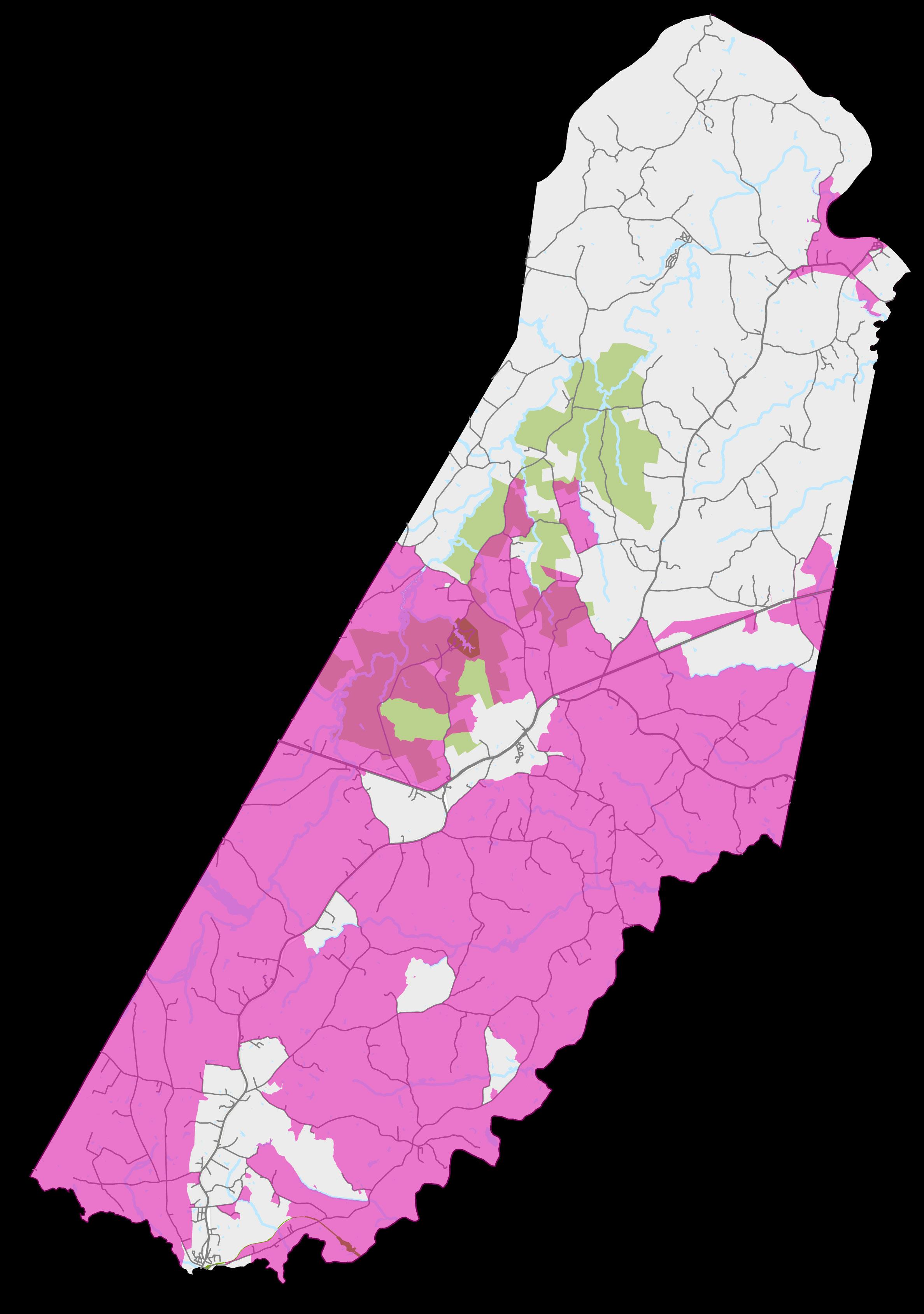

This map shows how land is currently being used in Cumberland County, according to the Treasurer’s Office tax assessment data. Residential uses are showed in yellow, salmon, and beige colors, while commercial or industrial are showed in purple. All dark green or light green parcels are used for agriculture.
The Comprehensive Plan’s recommendations were based on this map in order to help direct growth.
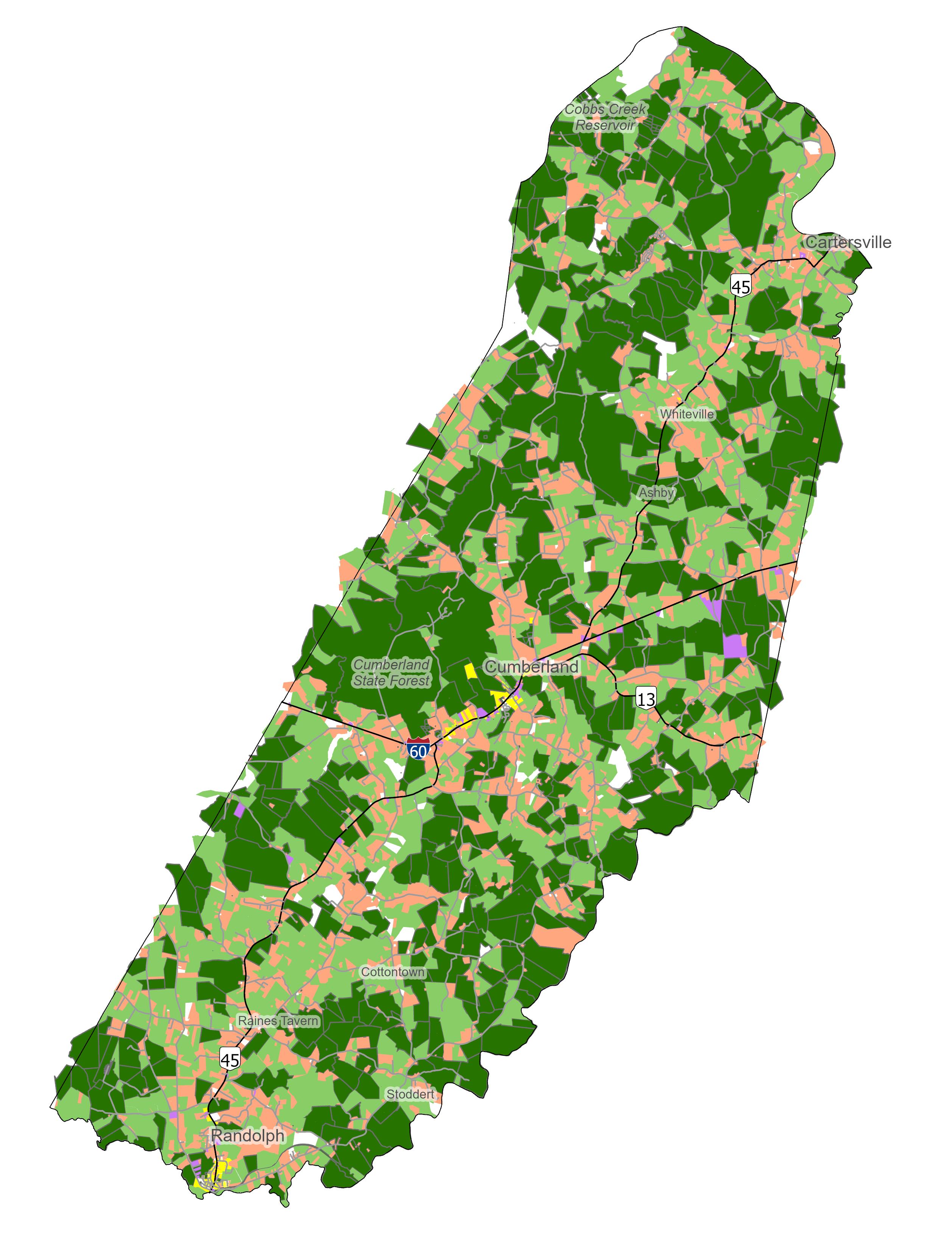
Zoning is a set of regulations that dictate how land can be used in certain geographic areas. Cumberland’s Zoning Ordinance outlines Zoning Districts, each of which has its own regulations for uses, structures, landscaping, etc.
The majority of Cumberland is currently zoned A-2 for general agriculture. There are several areas with R-2 zoning for general residential uses, including housing, schools, offices, and certain businesses. There are several small areas in Cartersville, near the Courthouse, and near Farmville zoned for business (B-1, B-2, or B-3). Several areas in the county are zoned for industrial uses, such as welding/machine shops, manufacturing, and meat processing. The land extending from US 60 toward Bear Creek Lake is zoned for recreational access.
As Cumberland recommends changes in land use through the Comprehensive Planning process, updating the Zoning Ordinance is an essential step in implementing these changes.
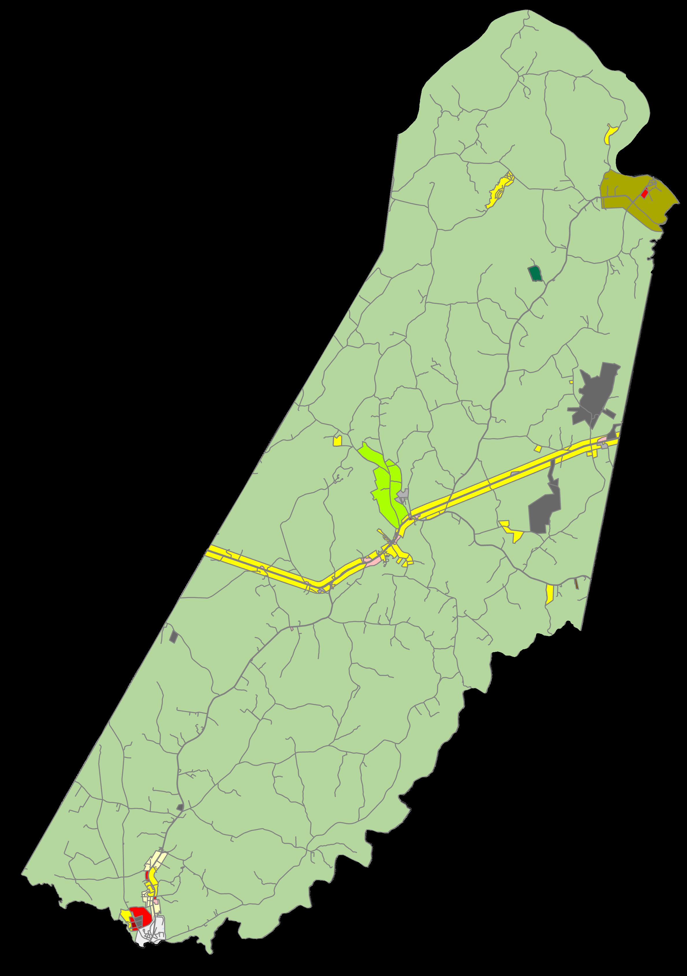

The existing zoning in the county has been designed to cluster residential, commercial, and some industrial uses along the Route 60 (Anderson Hwy) corridor. The majority of the land within a quarter-mile of Route 60 is zoned R-2, which allows subdivisions, single-family houses, duplexes, modular housing, schools, churches, offices, and barbershops/beauty parlors by-right, among other allowed uses. Other areas along the corridor, including the Courthouse area, are zoned B-1, which allows offices, retail, restaurants, and service stations by-right, among other allowed uses. This pattern of zoning contributes to a strong reliance on Route 60 for the movement of goods, residents, and workers.
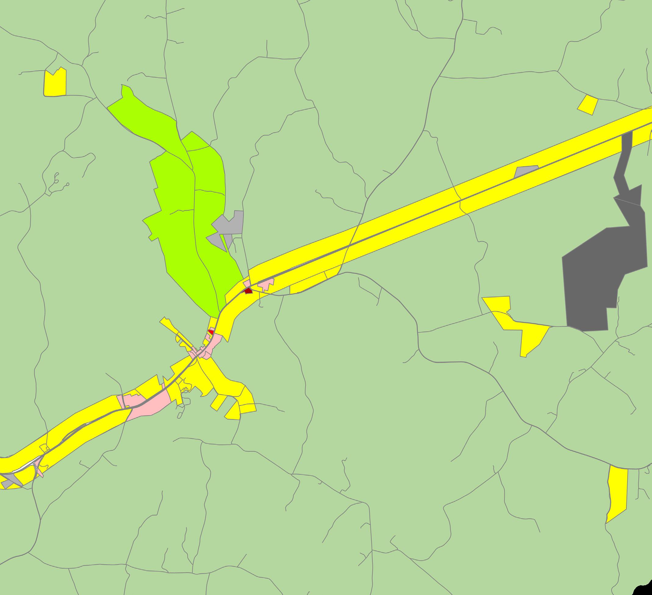

The area along Route 45 north of Farmville has a mix of residential, commercial, and industrial zoning districts. The Plank Rd corridor just to the northeast of Farmville Town limits includes areas zoned M-2 for the most intense uses, including meat processing, asphalt mixing, and furniture manufacturing. The Plank Rd corridor also includes land zoned for manufactured housing and limited commercial uses. A mix of uses near the Town of Farmville helps establish the area as one of the hubs of Cumberland County.
*It should be noted that while part of Farmville is within Cumberland County, the Town has its own Zoning Ordinance.
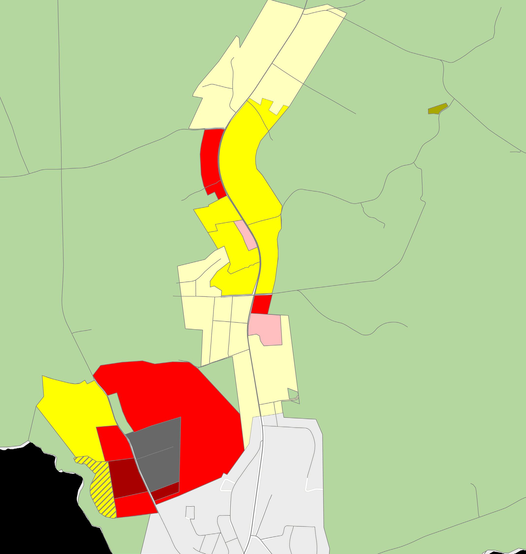
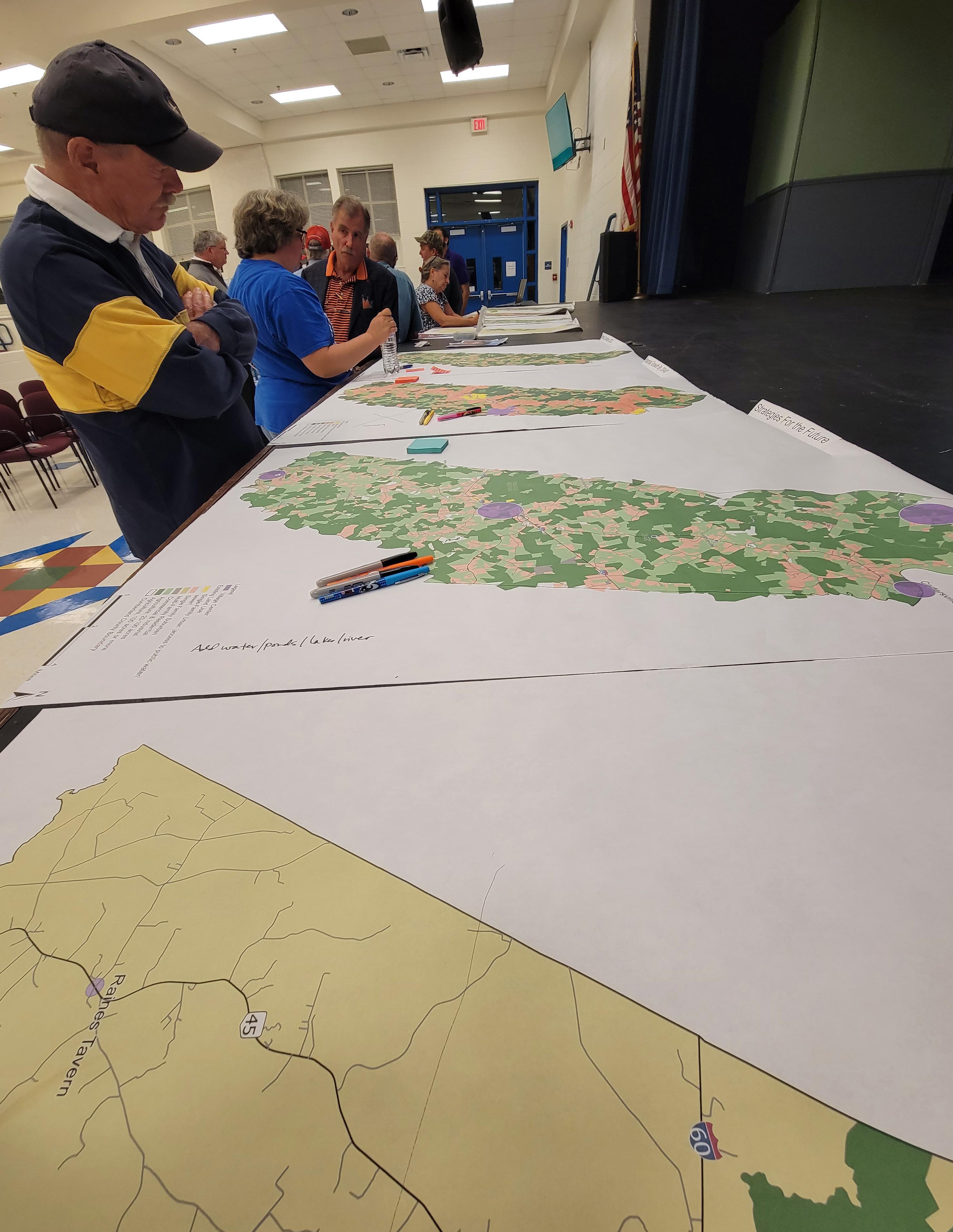
Over the past year, there have been many opportunities for Cumberland County’s community has had many opportunities to make their voice heard and participate in the planning process. The planning team conducted several in-person public engagement focus groups and events to solicit feedback and additional survey responses. For example, the team attended the Juneteenth event and Ruritans’ Baked Potato Social at the Cartersville Volunteer Fire Station. We met with the Social Services Committee, which included members from many different departments in the County. Two firehouse meetings were attended. In addition, the team conducted focus groups with Cumberland County Public Schools high school students and faculty as well as an Agricultural community focus group. Finally, a “Strategies for the Future” event was conducted to allow the public a chance to give feedback on the draft future land use map and categories. All of these events were attended by different segments of the population in Cumberland County, with approximately 150 total participants for all in-person events.
Cumberland Human Services Committee - Tuesday, January 23rd, 2023.
Cumberland Planning Commission and Board of Supervisors Plan Kick-Off - Tuesday, January 23rd, 2023.
Cartersville Ruritans Baked Potato Social - Saturday, March 18th, 2023.
Cumberland High School Student Focus Groups 1 & 2 - Tuesday, March 28th, 2023
CCPS Faculty/Staff Focus Groups 1 & 2 - Wednesday, March 29th, 2023.
Agricultural Focus Group - Tuesday, April 4th, 2023.
Juneteenth Celebration - Saturday, June 17th, 2023.
Cumberland Volunteer Fire Station Meeting - Monday, June 5th, 2023.
Randolph Volunteer Fire Station Meeting - Wednesday, June 19th, 2023.
Cumberland Planning Commission and Board of Supervisors Joint Work Session - Thursday, September 14th, 2023.
Comprehensive Plan Public Engagement Meeting - Monday, October 2nd, 2023.
The summaries below capture the general feedback we received as part of each in-person event.
Cumberland Human Services Committee
The Human Services Committee brings together many organizations that look after the needs of Cumberland’s residents. While listening, we heard about the large need in the County for jobs, access to food, transportation, and other issues that are covered by the Comprehensive Plan. We also heard about the connections in different areas of the County feeling more a part of whatever area they are closest to, such as Farmville, rather than being part of Cumberland County itself. Access to the internet, particularly in isolated areas, was noted as a difficult issue in the County.
Planning Commission and Board of Supervisors Kick Off
The joint kick off between the Planning Commission and Board of Supervisors convened Cumberland’s elected and appointed leaders to start the comprehensive planning process and discuss initial thoughts and suggestions for the Plan. Generally, leaders expressed their desires to protect the County’s rural landscape and agricultural economies while improving opportunities for residents.
Community members expressed general concerns that the rural landscape of Cumberland County would eventually be transformed. There was acknowledgement that lacking a grocery store was a big inconvenience to life in the County. People expressed that there are “distinct” communities in the County that tend to keep to themselves rather than seeing each other as a unified larger community. There were concerns expressed over the recent repeal of the forestall districts program.
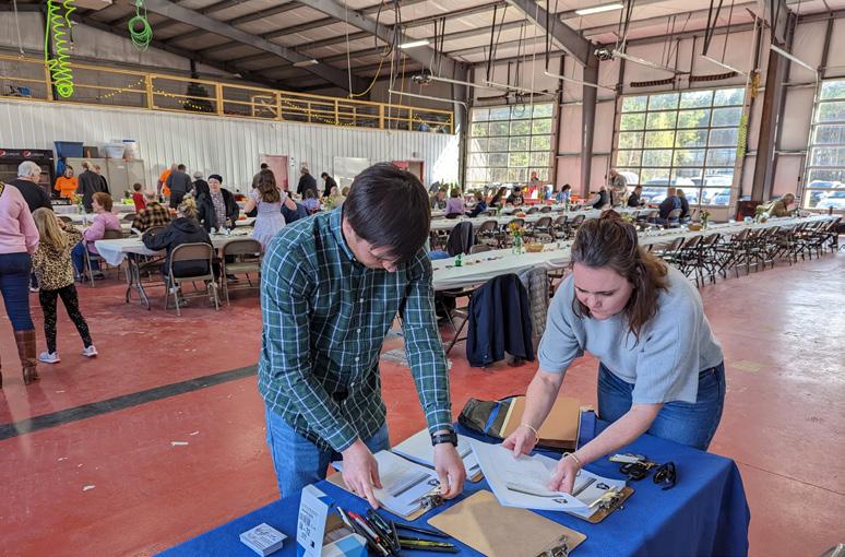
The agricultural focus group produced many interesting insights into its role in Cumberland’s economy. With its own complex inputs, supply chain, and transportation needs to bring agricultural products to market, there was the general feeling that the economy was not as robust or layered as it could be to support active farmers. One example is the lack of nearby integrators or feed mills and processing plants. As in many communities, there were concerns that the necessary “nuisances” of odor or noise that accompany farming would create conflict with growing residential areas, thus preventing any necessary expansions or growth of operations. For example, a slaughterhouse was voted down despite many farmers in the County raising cattle. Ideas were suggested about further integrating education and work opportunities for Cumberland’s population to learn more or seek employment through local farms. There were also ideas for expanding agriculturally based tourism, local farmers markets, and other ways to keep farming economically sustainable and share what’s great about Cumberland’s landscape. Solar development is seen as a concern as it takes up arable land and is not considered “farming” despite being sometimes called a “solar farm.” One overlooked area of the potential of the reservoir is the possibility of serving aquaculture, green housing, food processing, or other agricultural uses. There was also speculation on other agricultural uses that could be further developed, such as a sawmill, or breweries and wineries.
The student focus groups brought students of varying backgrounds and ages together and separately a group of faculty members to discuss what the strengths and challenges were regarding life in Cumberland. Students were asked about their plans for the future after graduation and many stated clearly that Cumberland was a place maybe for retirement or having a family, but they would not be returning immediately and were excited to get out. One of the major issues that Cumberland’s students faced was the lack of jobs in their area. One student was interested in becoming a doctor but could not see a way that opening a clinic would be affordable in the County. Another student expressed the difficulties in having to find work outside of the County and commute back from night shifts on dark winding roads. The students also desired more “things to do” and places to go for entertainment, noting that it felt like you had to leave the County to go shopping or “do something for fun.”
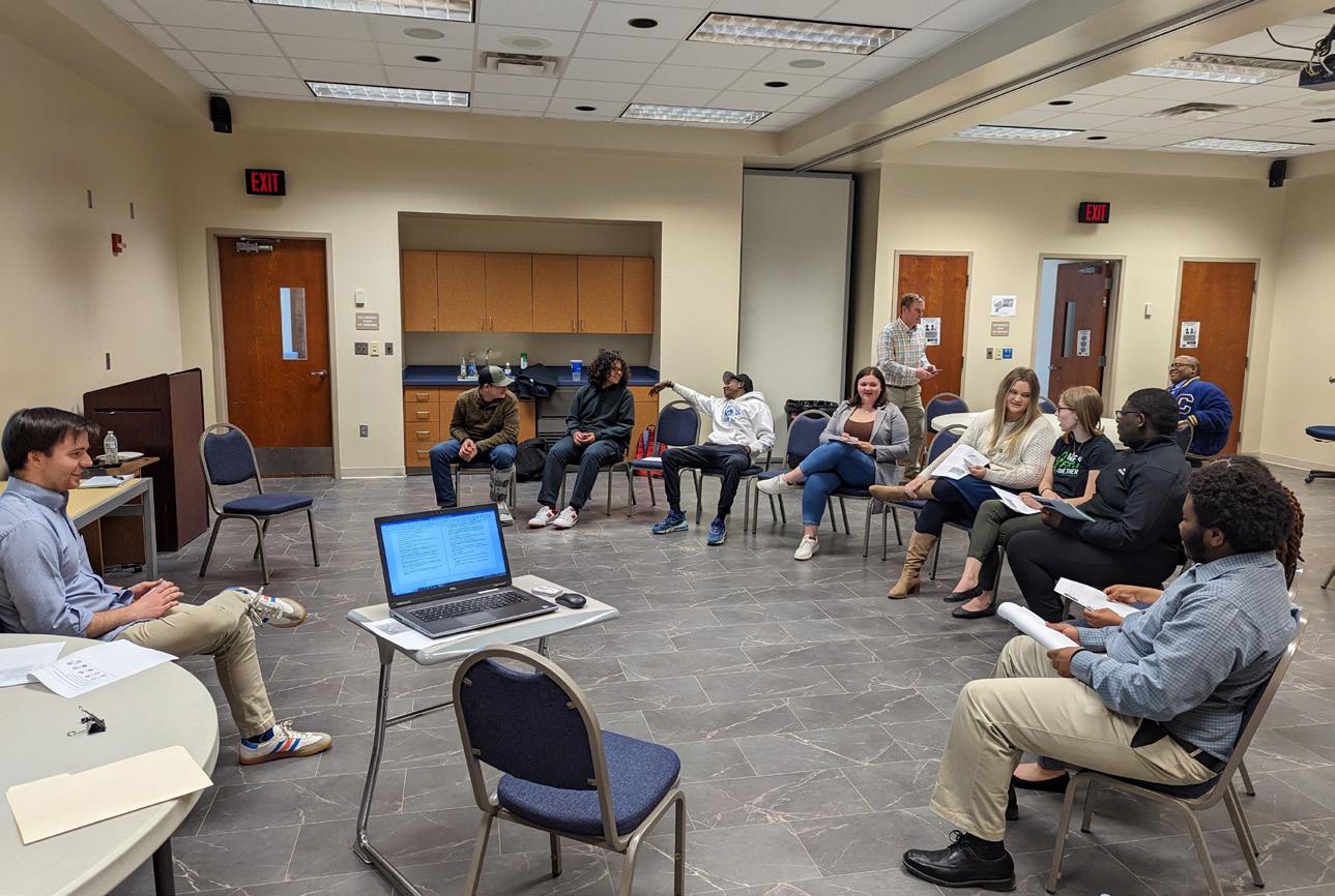
The faculty generally echoed the sentiments of the students. Cumberland’s students receive a high-quality education, but it is difficult to attract students back to the area after they graduate. Teacher recruitment and retention is a problem seen across Virginia, but it is particularly difficult in Cumberland where there are not many opportunities for housing within the County at the price point a new teacher can afford. While there are a lot of resources available to the County’s public schools, there is growing concern over the quality of facilities due to age. There is also a feeling that sports facilities and equipment could be better funded and maintained to develop local talent as well as serve as a community resource. Internet service across the County was seen as a critical need, with students often driving to the school to use Wi-Fi in the parking lot.
The community members at the Juneteenth Celebration noted that they enjoyed the County’s rural landscapes and strong sense of community. However, there were concerns expressed about local housing conditions, such as affordability and available stock, as well as enforcement to ensure that landlords are maintaining housing units to a livable standard. There was also an expressed desire to improve access to health services, fresh foods and grocery stores, and new opportunities for public transportation.
These meetings helped further community engagement efforts by sharing the community survey with volunteer firemen. Comments were received wanting to keep the County rural while also being considerate of the safety of the Amish community’s use of the roads.
The Planning Commission and Board of Supervisors convened to review the Comprehensive Plan’s vision, goals, and objectives. There was some discussion and feedback over whether certain recommendations were necessary or how certain goals were phrased. These led to edits in the document, but there was general consensus on the direction of the Plan.
This engagement session featured maps created to explain the Comprehensive Plan’s recommendations for land use. Members of the community, Planning Commission, and Board of Supervisors attended and shared their thoughts on how to best guide growth and development in Cumberland, while trying to preserve agricultural land and the rural landscape. The planning team noted that growth in neighboring metropolitan areas had exploded past forecasted numbers, and that although Cumberland was not growing yet, similar growth from Lynchburg, Charlottesville, or Richmond could reach the area. The community members generally agreed with the concept of “Village Centers,” and saw it as a way that they could have new housing opportunities and commercial options, particularly a grocery store. However, there was concern from some community members about the quality of development that would result without further policy or control over growth. New “Rural Crossroads” nodes were recommended and the Cumberland Court House center was expanded. The community agreed with the atmosphere and types of amenities they’d like to see in the “Village Center” areas.
Survey Questions Summary
When the comprehensive planning process first kicked off, an online survey to collect community engagement was published online. This report summarizes the feedback received from this process, conducted between January and November 2023. The survey is now closed.
Three hundred and fifteen people answered the survey online or in person (as of November 1, 2023). The survey had a total of 20 questions with many of the questions providing a short answer option for participants to provide their feedback. The survey included demographic questions to determine if respondents overall matched the demographics of Cumberland County. Overall, survey respondents seemed most interested in ensuring a balance of growth and preservation.
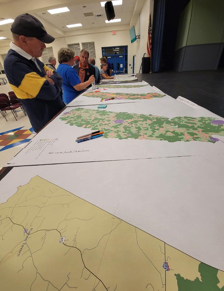
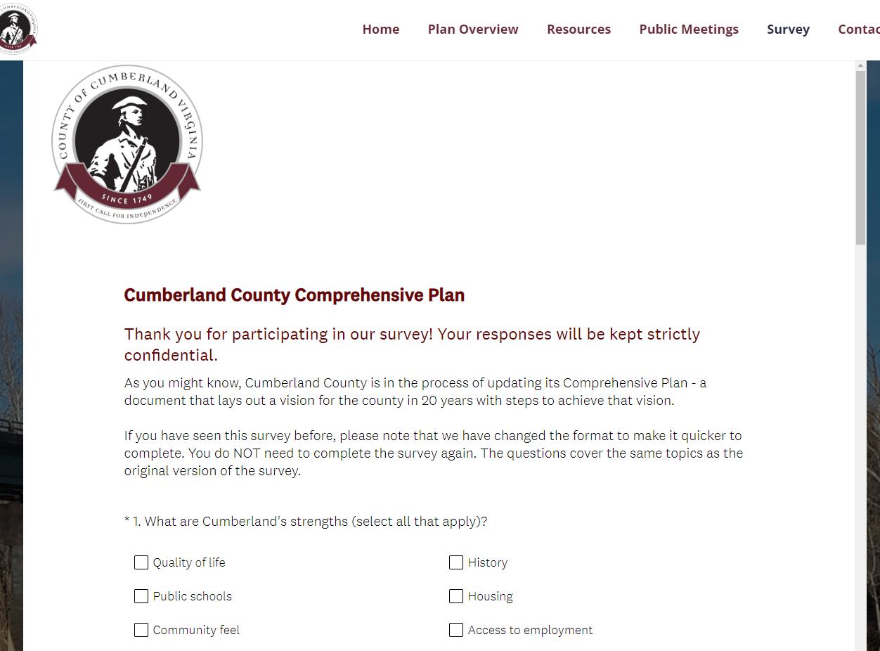
Question 1: What are Cumberland’s strengths?
Survey respondents rated “Location within Virginia” (52%), “Community feel” (39%), and “Quality of Life” (39%) as Cumberland’s greatest strengths. For respondents who chose “Other,” many wrote in “low crime rate” and “rural lifestyle.”
Question 2: On a scale of 1 (lowest) to 10 (highest), rate the quality of life in Cumberland. The average rating for the quality of life in Cumberland County is 6.15 out of 10.
Question 3: What do you enjoy about Cumberland County?
Survey respondents choose “rural character” (76%) and “peace, privacy, quiet” (75%) as what they enjoy most about Cumberland County.
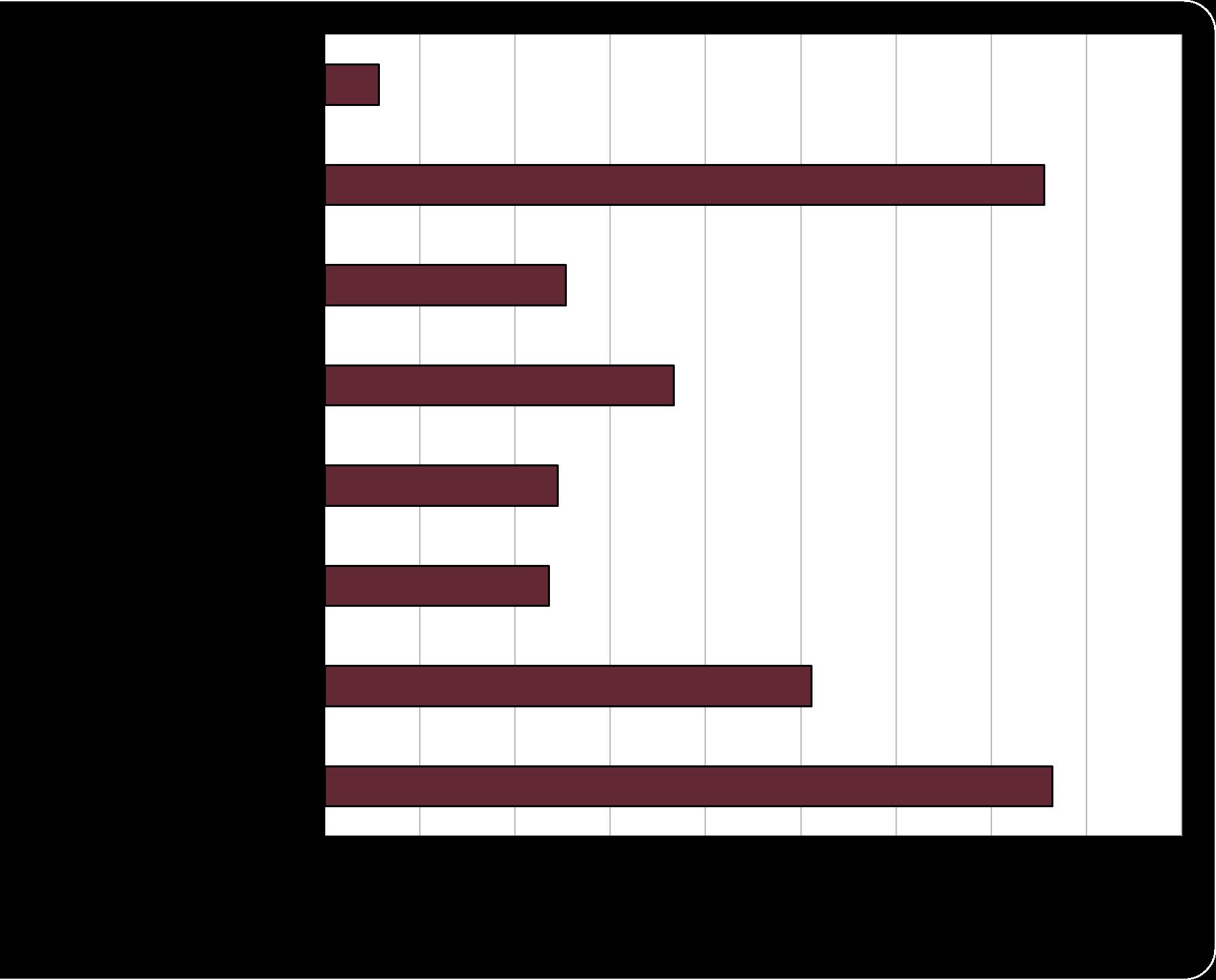
Question 4: What is challenging about living/working in Cumberland?
Survey respondents chose “access to groceries and shopping” (83%) as the most challenging thing about living/ working in Cumberland County. This was followed by “limited job availability” (61%), long travel times to work (54%), and broadband access (54%). Of respondents who answered “Other,” lack of youth programs, limited medical care, and run down homes/properties were mentioned. Answer
Question 5: What is missing/what do you wish Cumberland had more of?
86% of respondents wish the County had a grocery store. 57% of respondents wish the County had restaurants, followed by entertainment/leisure options (35%), retail/shopping (36%), and youth programing (31%). Of respondents who answered “Other,” people mentioned industry to attract employment, childcare services, and affordable housing.
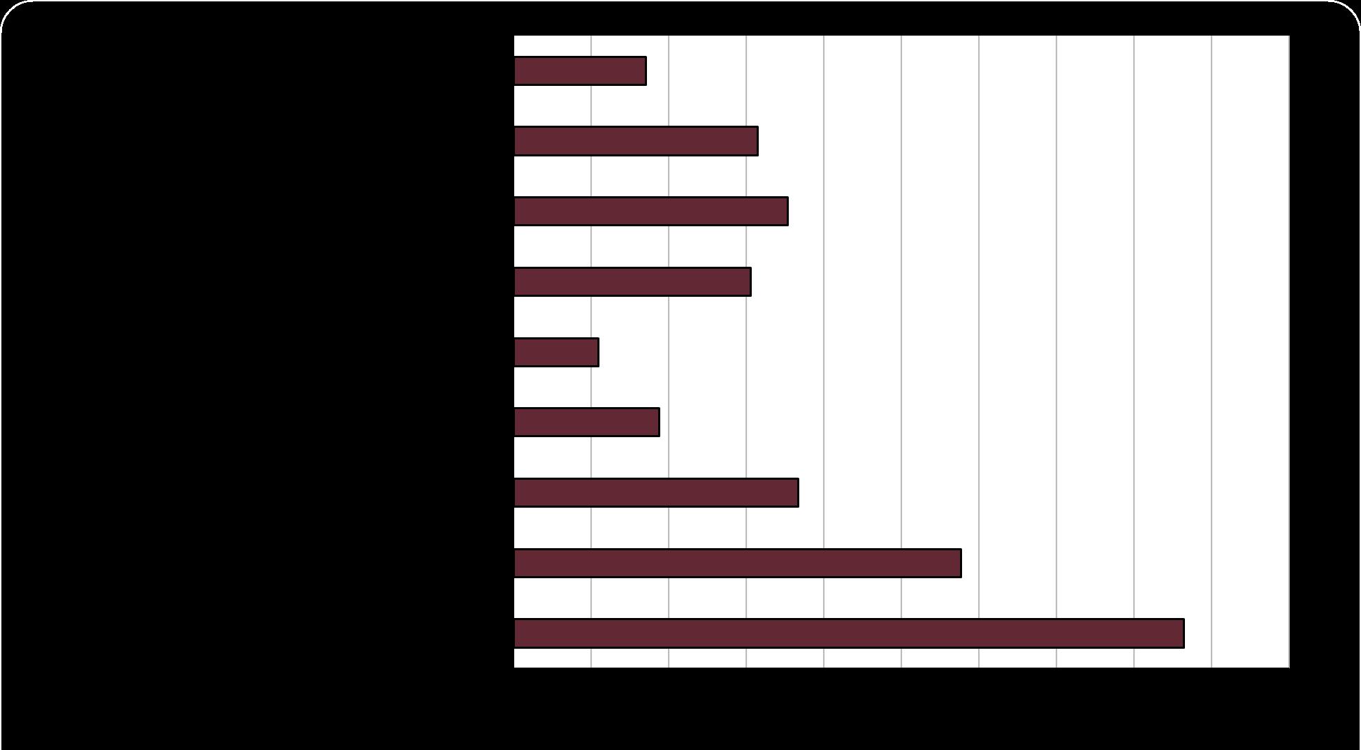
Question 6: Where in the county is new development appropriate?
Survey respondents think that new development is most appropriate in the Cumberland County Courthouse area (52%). This is followed by Near Major Roads (37%), Anywhere (27%), Farmville area (21%), and Cartersville area (16%). Of respondents who answered “Other,” many mentioned ensuring that new development doesn’t affect the rural feel of the County by appropriately siting development.
Question 7: How important are the following items in terms of future development?
Jobs (60%) and Broadband access (77%) were most chosen as very important by survey respondents. Walkability (50%) and availability of cultural activities (30%) were most chosen as not important.
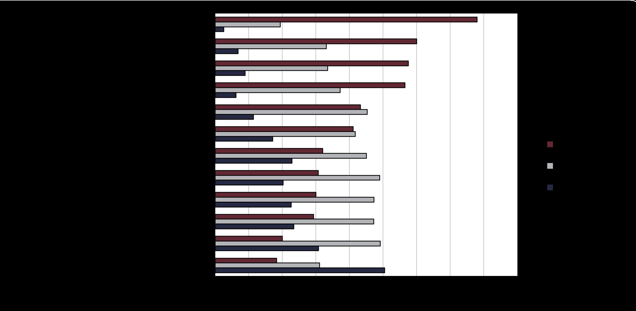
Question 8: What concerns you about the future of Cumberland County?
Respondents are somewhat equally concerned about several different aspects of Cumberland County’s future. This includes “Economic development/business attraction” (55%), “Giving youth a reason to live in Cumberland” (50%), “Resistance/hesitance to growth” (48%), and “Tax burden/county revenue” (51%). Of respondents who answered “Other,” many respondents mentioned worries about putting a landfill within the county.
Question 9: What is your hope for Cumberland County’s future?
Many respondents hoped for new business (60%) for Cumberland County’s future. This was followed by maintaining rural character (55%), economic growth (49%), and opportunities for residents to improve their standard of living (51%).
Question 10: What is your home zip code?
The majority of respondents are located in the 23040 zip code, which includes the Cumberland Courthouse area. The other two highest zip codes, 23901 and 23027, include the area outside of Farmville and the Cartersville area respectively. There was also at least one responses from each of the following zip codes: 24040, 23936, 23063, 23940, 23102, 23960, 23103, 23824, 23229, 24590, 23049, 24413, 23224.
Question 11: If you are employed, what industry do you work in?
Survey respondents work in a variety of industries. These include the education, medical, and public administration fields. Of those who answered “Other,” respondents mentioned working in retail, public safety, and insurance. 20% of respondents are retired.
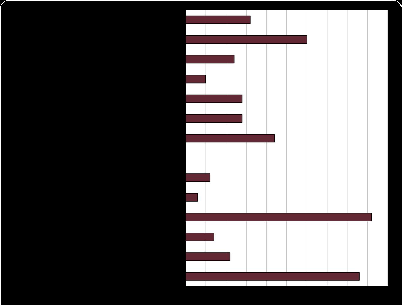
Question 12: If you are employed, where do you work?
The majority of survey respondents work either in Cumberland County (28%) or the greater Richmond area (18%). Other respondents work in Farmville (7%), Powhatan (6%), Chesterfield, Henrico, and other smaller jurisdictions.
14: How old are you?
Compared to Cumberland County census data, there were fewer responses received from under 18-year-olds and slightly more responses from 35-64 years old. (Survey respondents left, Census right) Survey respondents Census data
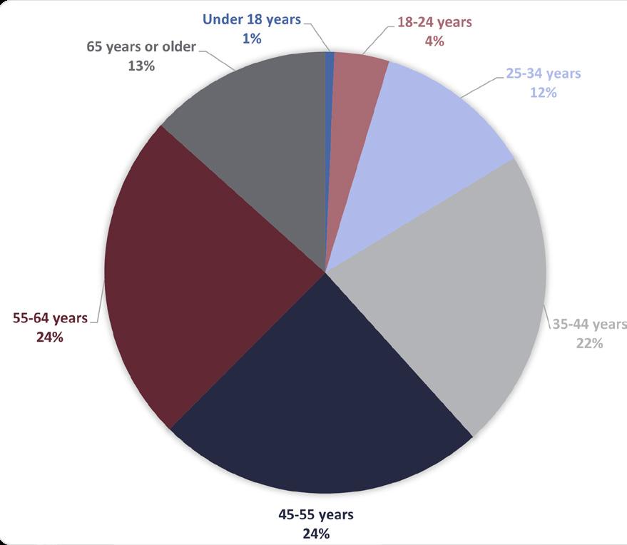
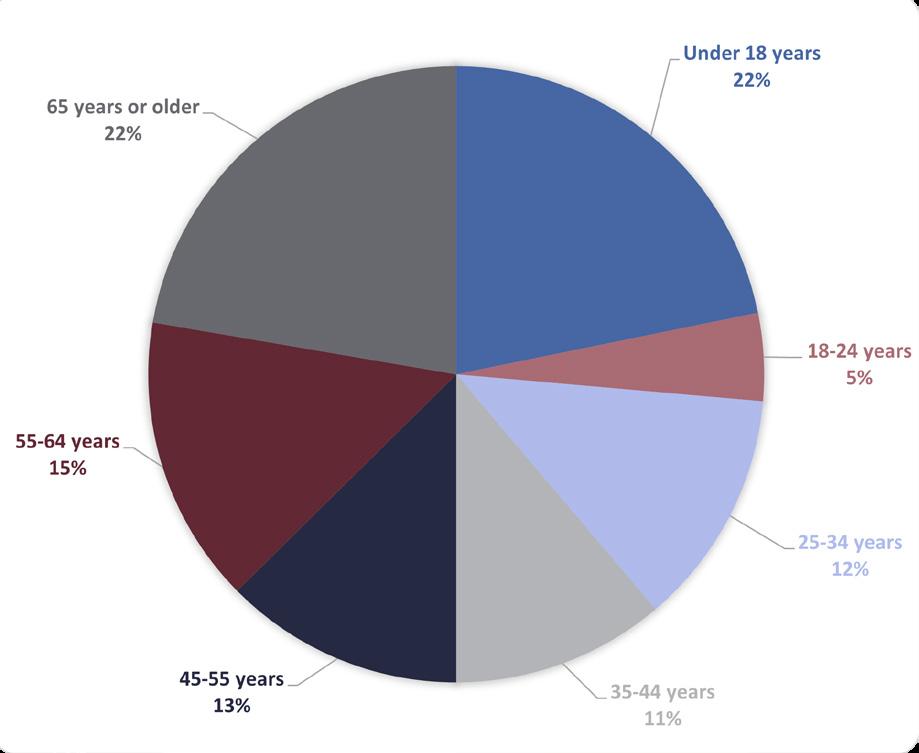
Though compared to Cumberland County census data, the respondents were more female than the residents of the county, the gender of respondents was roughly reflective of the county’s demographics. (Survey respondents left, Census right)
Survey respondents
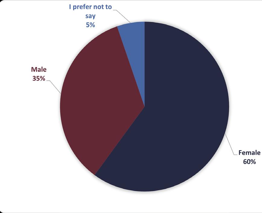
Census data
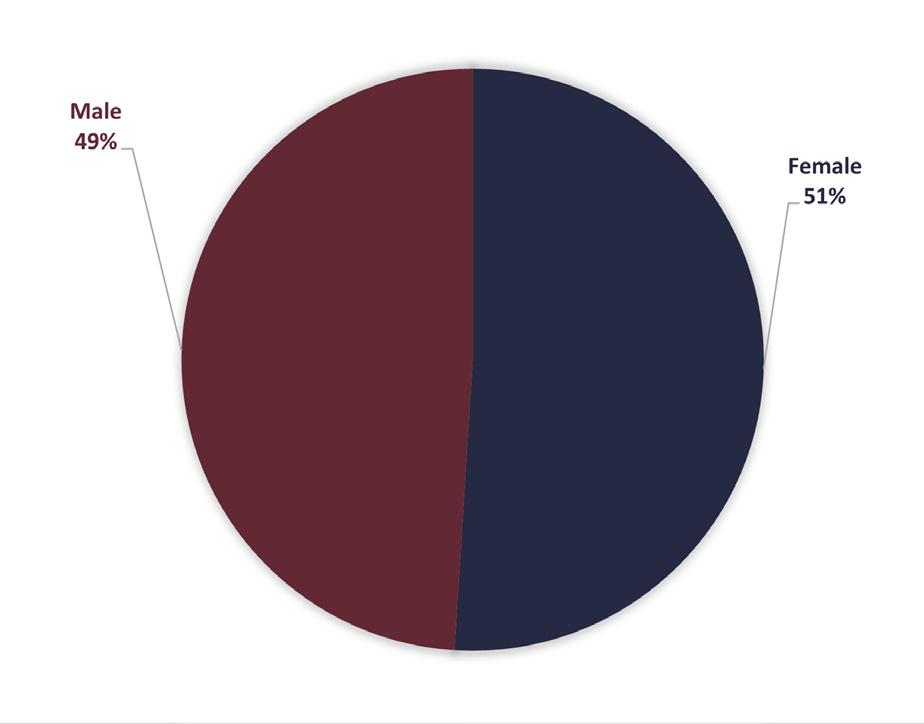
16: What is your connection to Cumberland County?
Most respondents live in Cumberland County (87%) and many (51%) own property in Cumberland County. Other respondents work in Cumberland County or live in an adjacent County or Town. Of those who answered “Other,” at least 10 respondents said they grew up in Cumberland County or called it their hometown.
Question 17: If you live here, how long have you lived in the County?
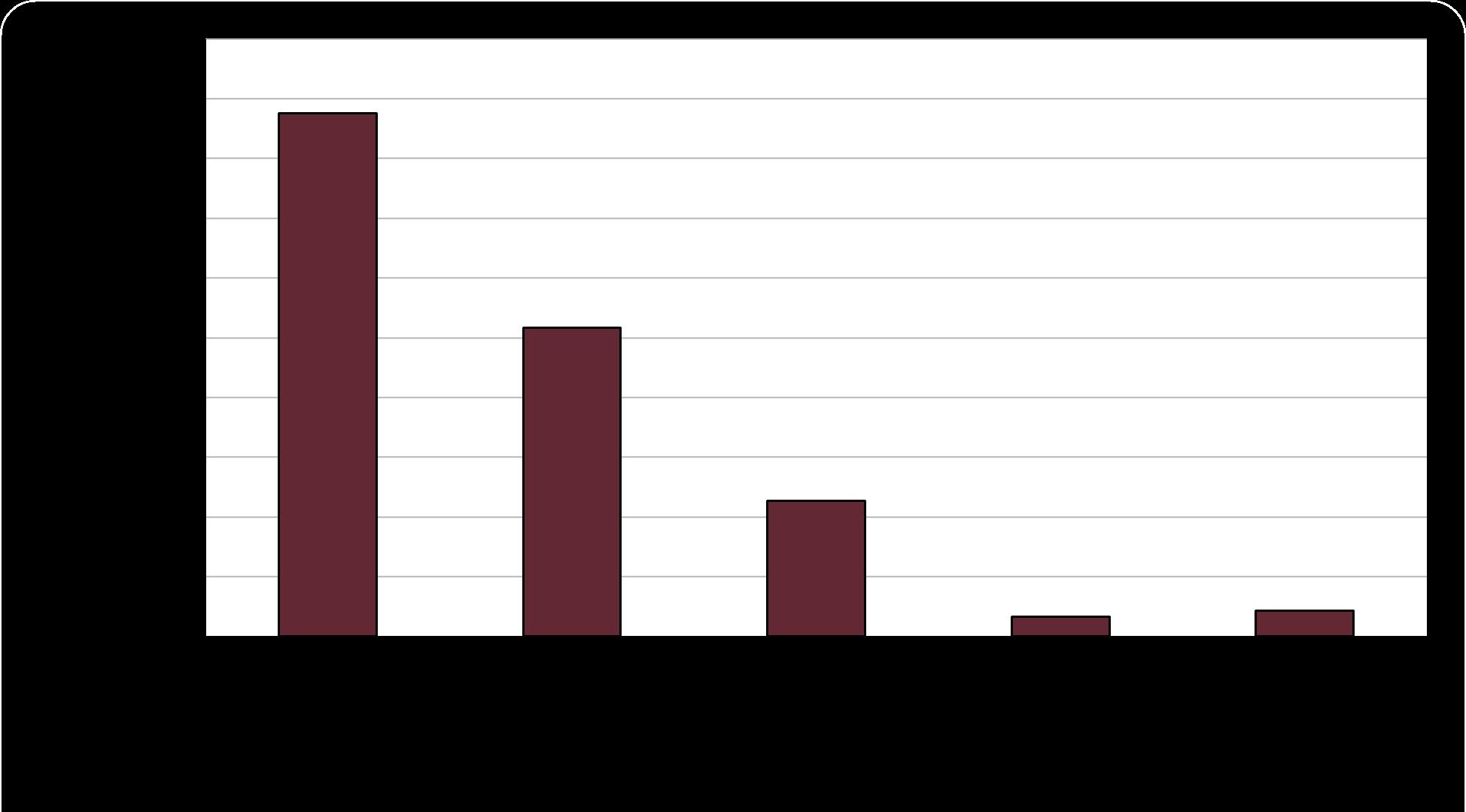
Most respondents (44%) have lived in Cumberland County for over 20 years. 22% have lived in the county for 10-20 years. 14% have lived in the county for 5-10 years. Twelve percent have lived in the county for less than five years. 6% of respondents do not live in the County.
Question 18: What is the highest level of education you have completed?
The respondents to our survey were more educated than Cumberland County overall compared to Census data. 39% of respondents to the survey had completed a bachelor’s or associate degree and 17% have a graduate or professional degree. According to Census data, 17.30% of Cumberland County residents have a bachelor’s or associate degree or higher.
Question 19: What is your racial identity?
Though compared to Cumberland County census data, the respondents were more white and less mixed race and Black/African American than the residents of the county, the racial makeup of respondents was roughly reflective of the county’s demographics. (Survey respondents left, Census right)
Survey respondents
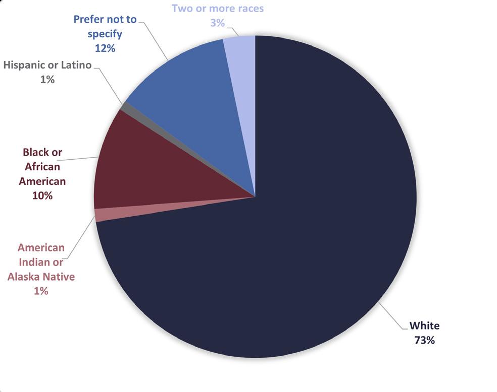
Census data
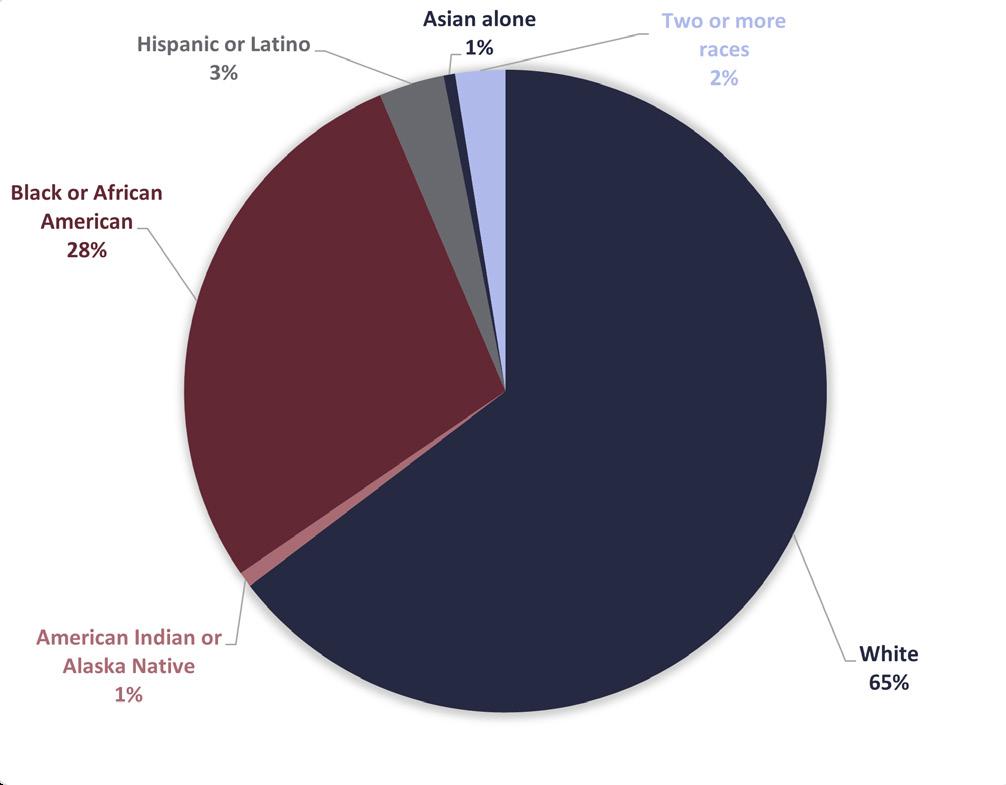
Question 20: What is the combined annual income of all working adults in your household?
The respondent’s household income approximates the actual household income for Cumberland County residents, with slightly less respondents from the under $35,000 category. (Survey respondents left, Census right)
Survey respondents
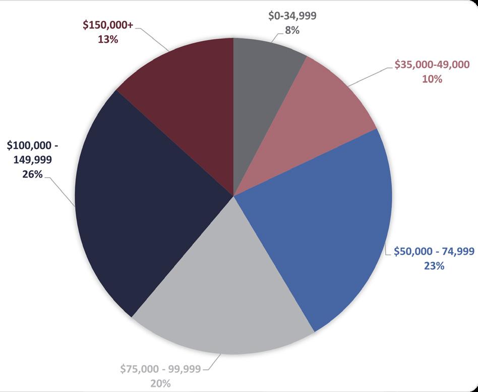
Census data
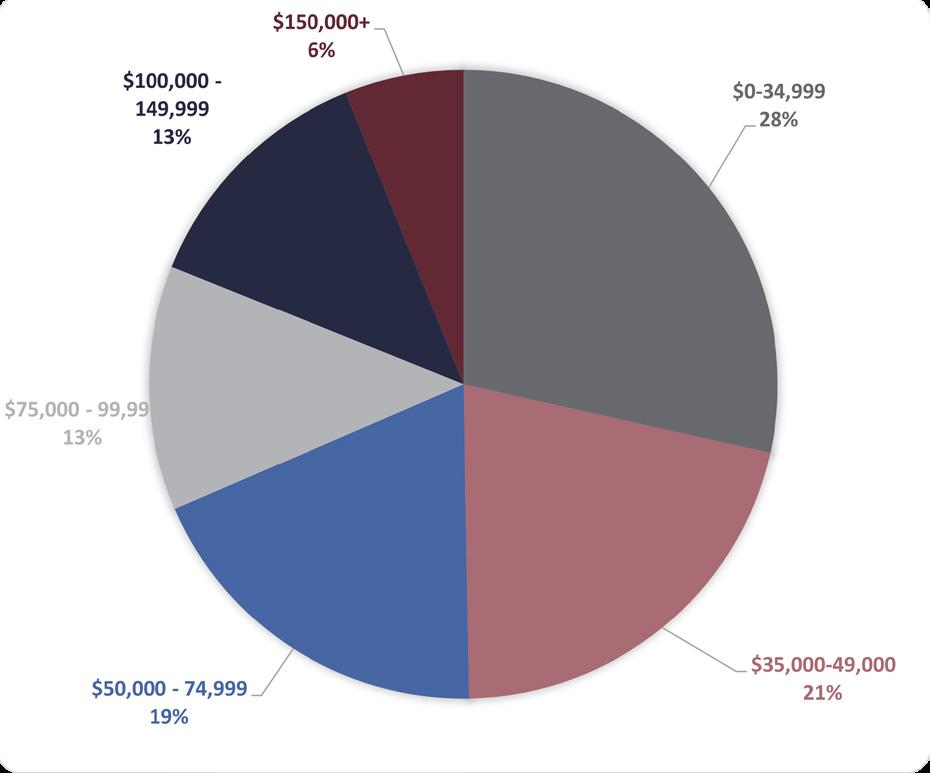
Respondents indicated that maintaining their rural character and lifestyle was very important to them. However, it seemed that the majority of respondents wanted a balance of growth with preservation of farmland and rural character. For example, one respondent said “My hope is for Cumberland County to remain a quality place to live without sacrificing it’s rural character.” Another respondent had similar thoughts, along with some specific ideas: “Make [Cumberland Courthouse] area of the county pleasing and enjoyable. Clean it up, create some developed spaces such as retail space, a grocery store, a small park, etc. This will make our county more attractive! A great example of development but also keeping it a small town feel would be the Powhatan Courthouse area.”
A majority of respondents seemed in favor of having a grocery store in Cumberland County. Many respondents cited concerns with the cost and food options at the current grocery options, such as Dollar General. Some respondents also provided their lists of additional needs for Cumberland County, including medical care, retail, and restaurants. Again, respondents want future commercial space to go “in a location where it fits the landscape and overall character of the area.” Respondents also noted the lack of water and sewer as a potential hindrance for future commercial development.
Respondents indicated concern over the previously approved landfill. Concerns were centered around additional litter, proximity to other non-compatible uses, and the importing of trash. In addition, many respondents mentioned existing issues with litter in central areas, such as the Courthouse area, that should be dealt with. One respondent said “There is no need to be the mid -atlantic dumping ground - you’re ruining the beauty of Cumberland.”
Respondents indicated that there was a lack of activities for children and teens, as well as a lack of draw for young adults to stay in or return to Cumberland. Respondents mentioned additional youth programs and childcare options as a priority for the county. One respondent said “If you want your kids to stay you need to develop industry that will keep them here.”
On the other hand, respondents also mentioned the need for senior centers or housing and transportation options for seniors. This may be especially important as Cumberland County has an older population when compared to Virginia as a whole. One respondent mentioned the need for public spaces for people of all ages to meet, such as “parks, arcades, picnic spots, or jungle gyms.”
Overall, Cumberland County has many strengths that can be bolstered and weaknesses that can be addressed through the Comprehensive Planning process. With its central location in Virginia, between the cities of Richmond, Charlottesville, and Lynchburg, Cumberland County will continue to feel the pressures of development in the future. It is up to the residents of Cumberland County what future development will look like, feel like, and where it will be allowed.
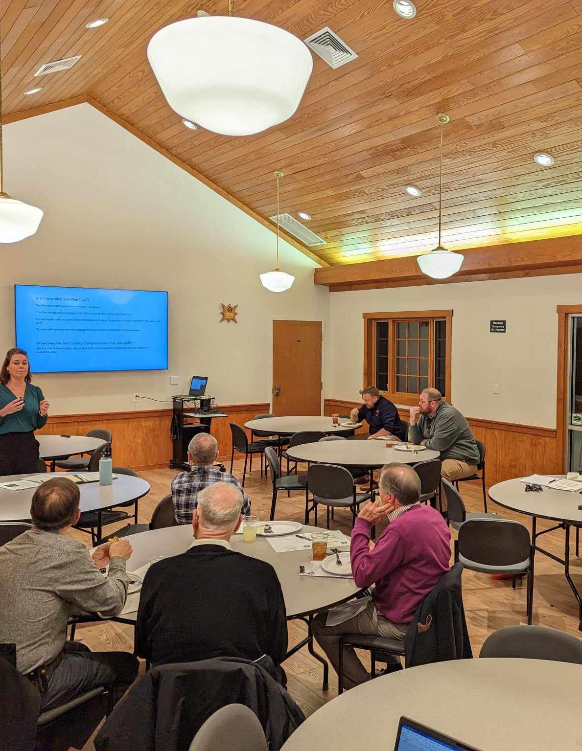
Adopted Master Plan 2023-2027
Table of Contents
Introduction (pg. 2)
Executive Summary (pgs. 3-5)
County Characteristics and Demographics (pgs. 6-9)
Needs Assessment (pgs. 10-15)
Inventory of Existing Facilities (pgs. 16-17)
Master Plan Recommendations (pgs. 18-29)
Short Term Facility Development
Cumberland County Parks and Recreation Mission Statement:
To enhance the quality of life of all Cumberland County residents through the development of quality facilities and the implementation of desired programming, while advocating and collaborating with community organizations.
The Cumberland County 2023-2027 Parks and Recreation Master Plan is Cumberland’s effort to strategically plan for future parks and recreation facilities and services. The master plan is necessary to evaluate citizen demand for services versus current services provided, to guide planning for future facilities, and to support cost effective allocations of valuable County resources.
The plan consists of several sections. The Master Plan will; describe current service levels as it pertains to current facilities and programs, identify state and national level of service standards, summarize the data collection and analysis methodology to support the plan’s recommendations, summarize the plan’s recommendations, and provide a discussion on budget/funding implications for the recommendations.
The Master Plan aims to guide parks and recreation decision making in the County for the next five plus years and further intends to be the foundation for future funding and policy decisions. Ideally, the Master Plan will augment other County planning efforts including the County’s comprehensive plan. Importantly, the Plan seeks to complement and not to supersede the mission of any public agencies or other policy documents or plans.
The purpose of the Cumberland County Parks and Recreation Master Plan is to help identify and meet the facility and programming needs of current and future residents of Cumberland County. This plan is intended to provide clear cut direction to County staff elected officials in their efforts to provide and enhance current and future leisure and recreation services.
Cumberland Parks and Recreation Facility Overview: County Parks and Recreation facilities currently include the Madison Sports Complex, an 8 acre baseball and softball facility as well as a gymnasium, weight room, and classroom located at the Luther P Jackson Community Center.
Other non-County public recreation facilities are found in Cumberland County. Bear Creek Lake State Park, High Bridge Trail State Park, and the Cumberland State Forest offer an array of outdoor recreational activities for County residents and visitors to enjoy. In addition, there are 3 boat launch sites located in or adjacent to the County boundary, 2 along the James River to the north as well as one to the south on the Appomattox River.
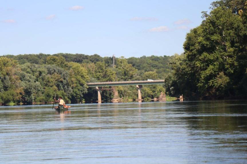
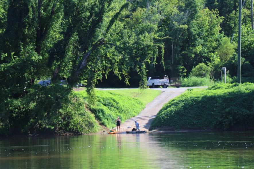
Recommendations on facility enhancement/ development and programming strategies focused on the following parameters;
1. Align with Board of Supervisor’s Goals and Objectives.
2. Facility development would meet the desires/needs of the citizens.
3. Facility development would address deficits in levels of service standards.
4. Complete existing projects and facilities as a priority.
5. Improve high volume use areas and areas of historical significance.

All facilities and programming would be designed and implemented in a way as not to add significant impacts to the operating budget of Cumberland County while positively contributing to the quality of life of Cumberland citizens.
Facility Development – recommendations made on facility development would look for an intersection of two concepts. The first line would be the desires and needs of the citizens identified through the data collection methodology. The second line would flow from the identified level of service standards and deficits identified for Cumberland County. The intersection of lines would be the focal point for facility and programming recommendations. Existing Facilities – Existing facilities are awaiting improvement. The Plan looks to finish those endeavors as a priority. High Volume Areas – The Plan identifies high volume use areas and endorses the upgrading of those high traffic areas to meet existing and future citizen demand.
Programming efforts of the Department were examined, analyzed, and compared to other service providers in Cumberland County. These service providers include other government agencies, local nonprofit organizations, and local businesses. An attempt was made to identify service providers who already provided programming and Parks and Recreation would seek not to directly duplicate efforts. Some overlap does occur but this is due primarily to citizen demand for certain services. Even at times of overlap, programming differential is attempted and is conscientiously maintained through Recreation staff efforts. Programming recommendations are also tied to cost recovery, staffing resources, programming locations within the County, and through citizen feedback

The Parks and Recreation department will be wholly committed to citizen engagement as part of its operating format. The Master Plan recommends the creation of a Board of Supervisors appointed Recreation Advisory Commission, one member from each district within the County, that will advise the department and County Administration as it relates to public recreation policies, procedures, and initiatives. In addition, it is recommended that the County pursue the recreation of a non-profit youth athletic league structure as well as work to support local non-profit agencies in their missions to improve the quality of life of all Cumberland County residents.
Cumberland County is located in central Virginia on the western edge of the Richmond Metropolitan Area and approximately 50 miles southeast of Charlottesville, 50 miles to the west of Richmond, and 60 miles to the east of Lynchburg. The County is approximately 293 square miles in area and the 2020 population estimate is 9,675. The James River flows along the County’s northern border with the Appomattox River to the south. Neighboring localities include Buckingham, Fluvanna, Goochland, Powhatan, Prince Edward, and Amelia Counties.
Route 60 traverses the central part of the County from east-to-west, and Route 45 runs the length of the County from north to south.
Population Trends April 1st, 2010 and 2020 Decennial Census Counts for Virginia and its Counties and Cities
* Census data and visuals courtesy of DATA USA
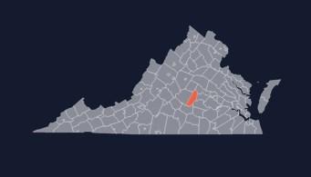
* Census data and visuals courtesy of DATA USA
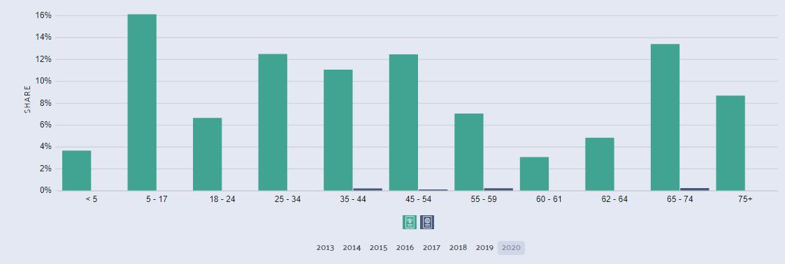
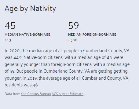
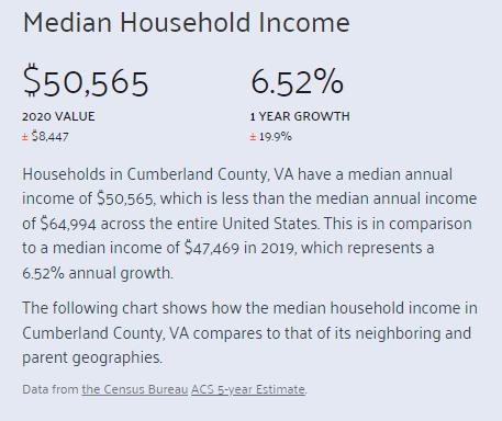
The data shared is targeted data as part of our survey for Cumberland County residents. This data is important for a couple of reasons. One, to truly program and make recommendations to benefit your residents, the community make up should be understood. The data also further validates survey results even though the amount of survey responses didn't meet the targeted number.
When analyzing census data versus demographic results related to the survey, two key indicators for survey representativeness dovetail. The age of respondents closely represents the median age for the County as does the data associated with household income.
* Census data and visuals courtesy of DATA USA
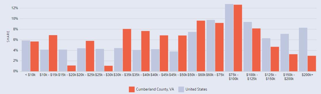
The needs assessment was conducted utilizing the Master Plan survey. The survey consisted of both questions aimed at gathering both quantitative and qualitative data. Surveys sought to identify the following; location of respondent, current attitudes and uses towards existing parks and recreation amenities, programming trends, and thoughts on future development.
The Parks and Recreation Master plan process began in March 2022. The project has consisted of the following efforts:
a. Public Input – surveys, public meetings
b. Current Park and Programming Inventory
c. Levels of Service Analysis – state level
d. Trends Analysis locally and state wide
e. Recommendations & Proposals – area and facility development/ improvement and program/service development

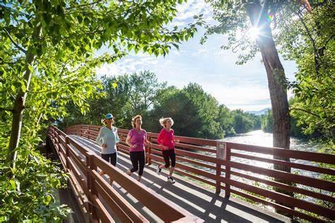
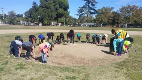
Data was collected through the use of a simple random survey. The survey was distributed utilizing county email, social media, handouts at special events and programs. The data collected included 196 responses.
The data told us the following;
1. Based upon our sample size in relation to our estimated population, we have a confidence level of 95% with a confidence interval of 7%. SO WHAT DOES THIS MEAN? Most survey studies shoot for these levels and intervals on average. We are 95% confident in our answers and our margin of error is 7%.
2. The highest responding area of the County was the central portion of Cumberland followed by the northern end. The southern portion of the County had the lowest response rate.
3. Most respondents are between the ages of 35- 44, are overwhelmingly employed, and make between $50,000 and $75,000 per year as a household. Many respondents are empty nesters followed by homes with 1-4 children. The majority of homes with children in them have children between the ages of 7-10. Ages 16+ are the second largest grouping, followed by 0-3.
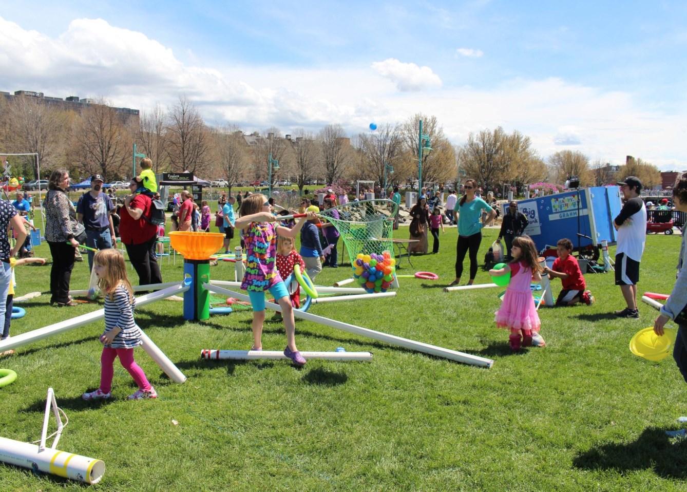
True statement based upon the 196 individuals surveyed:
1. Parks and open spaces should be important considerations on future land use decisions.
2. A community’s quality of life is enhanced through a well developed park system.
3. Park visitation: Most folks are willing to drive 10-20 minutes to participate in activities/ parks.
4. Amenities of Park Development: Highest Desire: Trails, Playgrounds, Picnic Areas, Multipurpose Fields, Senior Center.
5. Awareness: Folks receive information about their services by word of mouth, newspaper, Internet, and other publications.
6. Activities/Programs: Most highly desired programs and activities: exercise, weightlifting, water/river sports and activities, outdoor concerts, fishing, jogging, football, and baseball/softball.
For more detailed data on survey based citizen feedback, please see the appendix
In an effort to gather a representative sample of residents, all zip codes were surveyed or were attempted to be surveyed by the Parks and Recreation Department. The respondents identified walking trails, multipurpose athletic fields, playgrounds and picnic areas as the most desired new facilities.
According to survey data and the current level of service standards, Cumberland currently sits in deficit in regards to adult sized baseball/softball fields, tennis courts, picnic shelters, playgrounds and trails. These deficits could potentially be met with modest funding and additional community involvement.
It should be noted that level of service standards does not address geographical facility deficits. Many factors influence the demand for park and recreation facilities. Primary factors include the following; population size, age distribution, popularity and satisfaction of existing and desired recreational sites, facilities, and programs.
In order to assist in the planning of parks and recreation facilities, a “levels of service” standard is employed. A level of service standards typically establish a quantity of units per population and park standards typically require an acreage requirement. This type of analysis can be determine if there are gaps in services. The National Recreation and Parks national levels of services were used as was the Virginia Outdoors Plan.
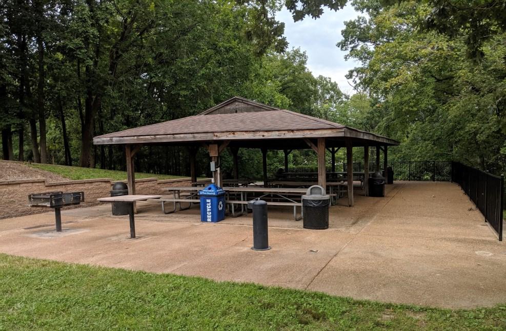
From a level of service standard perspective, the following locally owned parks and recreation based amenities were shown to be in significant deficit—trails, playgrounds, picnic shelters, tennis courts, and basketball courts. Softball fields were shown to be in slight deficit. Please note that amenities at state park locations were not included in the analysis because entry into the facilities are fee based. In addition, the analysis and level of service standards also included public school facilities.
Utilizing the Virginia Outdoors Plan and National Recreation and Park Association standards, Parks and Recreation was able to develop criteria for the establishment of local standards and identify levels of service deficits as benchmarked against other localities in Virginia. Deficits were both mild and significant. Significant deficits included playgrounds, picnic shelters, and trails. Mild deficits were seen in outdoor basketball courts, youth soccer fields, tennis courts, bicycling, and equestrian areas.
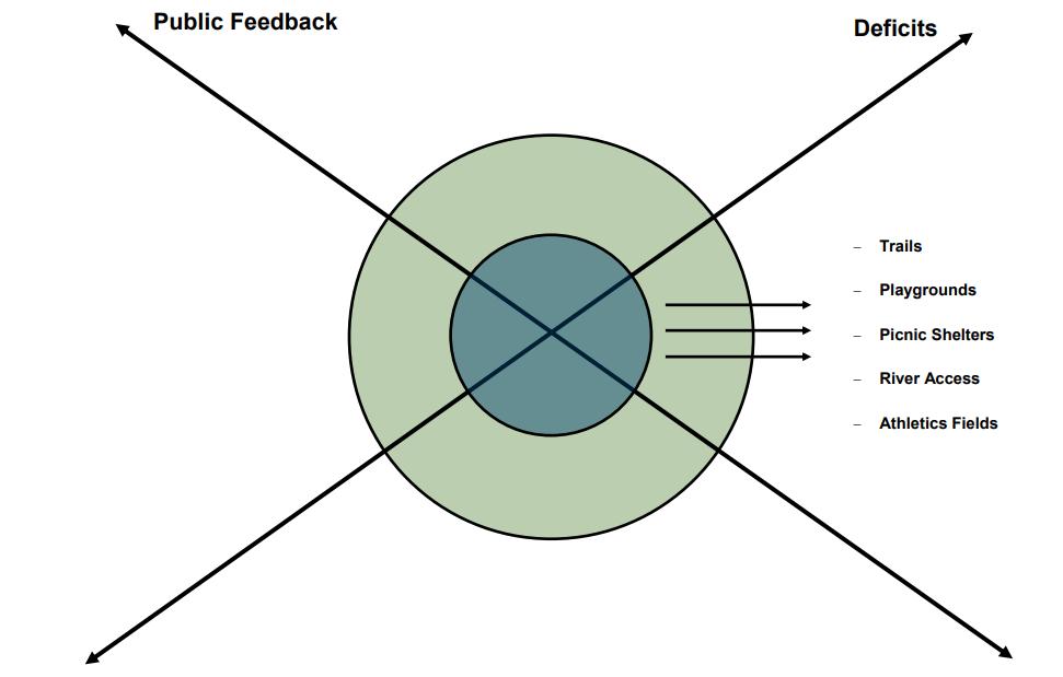
Recommendations:
• Trails
• Playgrounds
• Picnic Shelters
• Multipurpose Fields
Bear Creek State Park
22 Bear Creek Lake Rd., Cumberland, VA 23040; Phone: 804-492-4410; Email: BearCreek@dcr.virginia.gov
High Bridge Trail State Park
(Mailing address) 6888 Green Bay Rd., Green Bay, VA 23942; Phone: 434-315-0457; Email: highbridgetrail@dcr.virginia.gov
Cartersville Boat Ramp
2396 Cartersville Road
Cartersville, VA 23027
Columbia Boat Ramp
Route 690 and James River Columbia, VA
Madison Sports Complex (MSC)
6 Old Buckingham Road
Cumberland, Va 23040
Luther P Jackson School/Community Center (LPJ)
71 Community Center Drive
Cumberland, Va 23040
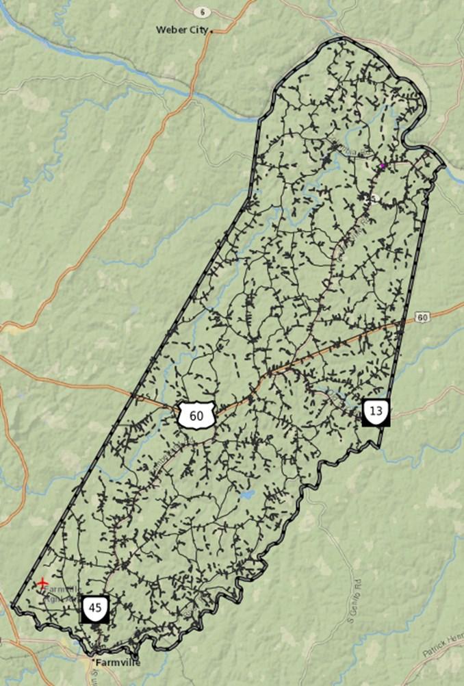


Bear Creek State Park
22 Bear Creek Lake Rd., Cumberland, VA 23040; Phone: 804-492-4410; Email: BearCreek@dcr.virginia.gov
High Bridge Trail State Park
(Mailing address) 6888 Green Bay Rd., Green Bay, VA 23942; Phone: 434-315-0457; Email: highbridgetrail@dcr.virginia.gov
Cartersville Boat Ramp
2396 Cartersville Road
Cartersville, VA 23027
Columbia Boat Ramp
Route 690 and James River
Columbia, VA
Madison Sports Complex (MSC)
6 Old Buckingham Road
Cumberland, Va 23040
Luther P Jackson School/Community Center (LPJ)
71 Community Center Drive
Cumberland, Va 23040

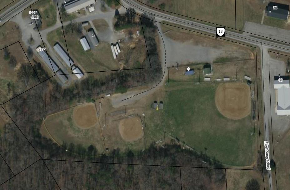
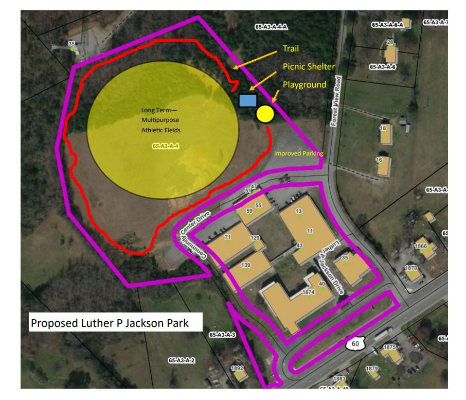

Additional Parks and Recreation Development would Include the Following as it Relates to Indoor Facilities:
1. Maintain the Gym, cafeteria, kitchen area, and adjacent classroom for parks and recreation indoor specific use only.
2. Renovate the existing auditorium in order to create a multipurpose theatre environment which would be used for programming, rentals, and meetings.
3. Develop the exterior rear of the facility into lighted multipurpose athletic field areas.
4. Future identified uses of the Luther P Jackson School are still in development for both the front building as well as the currently occupied pod buildings located to the rear. The County’s 25 Year Public Facility Master Plan will guide further facility based decision making.
Total Estimated Cost: $3.5 million
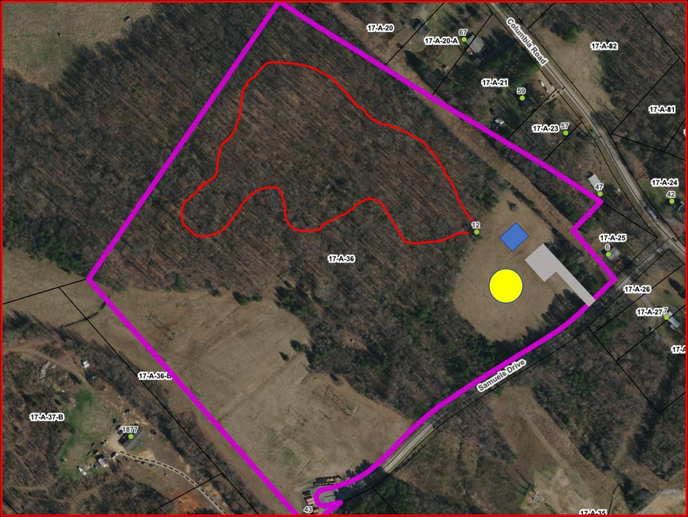

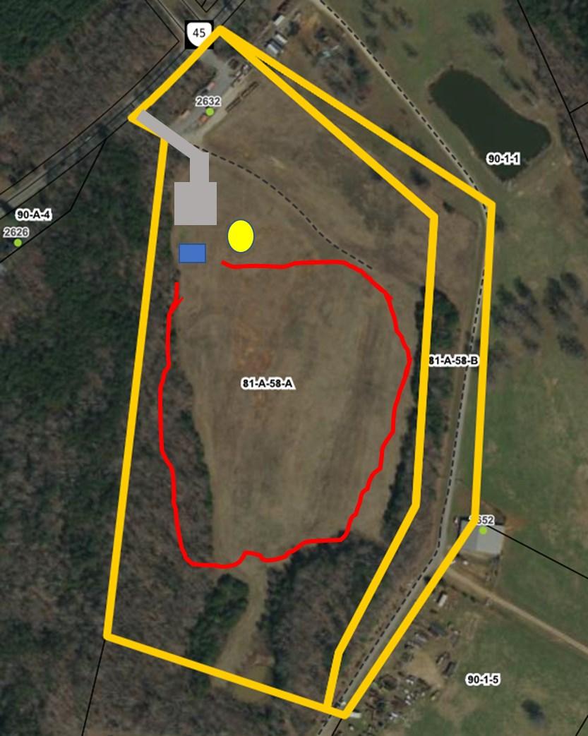
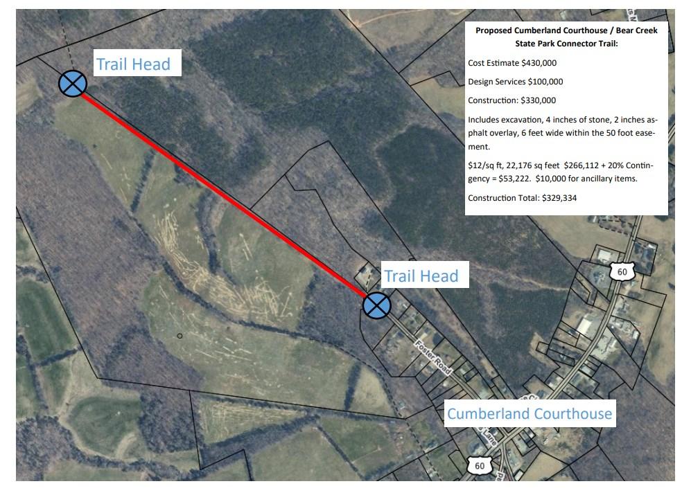
Historical Jail Renovation
1. Remove non-historical related features
2. Power wash off the white paint.
3. Seal the exterior envelope of the building.
4. Renovate the interior to serve as the home of the County’s visitors center
5. Would also serve as the gateway to the proposed Bear Creek Lake State Park connector trail.
Total Estimated Cost: $600,000
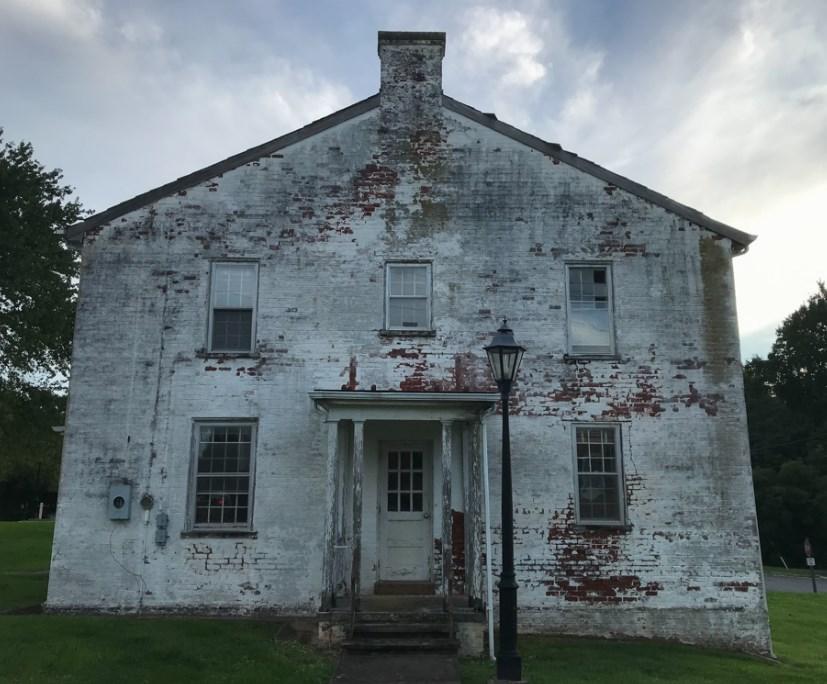
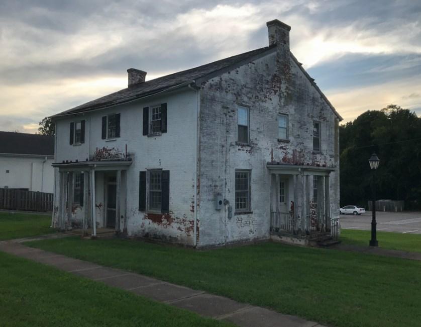
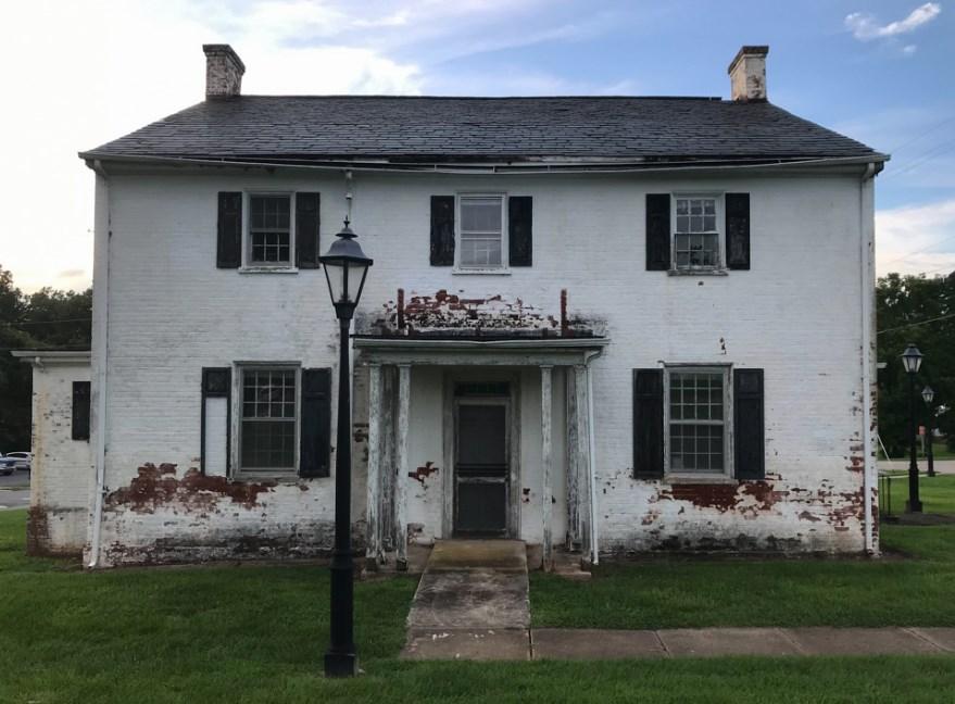
Cobbs Creek Reservoir
1. Public Boat Launch is already identified and constructed as part of the project.
2. Work with Henrico County to identify additional public access points around the 1,117 acre reservoir.
3. Collaborate with Dominion Energy to utilize utility easements for multi-use trails.
4. Total Estimated Cost: $250,000
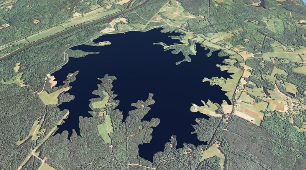
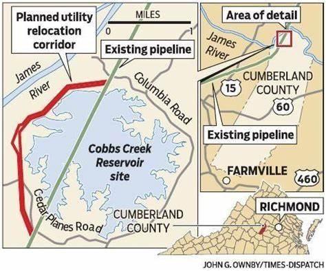
• Currently $250,000 is funded and appropriated. County anticipating an additional $100,000.
• Grant opportunities do exist, most likely requiring matching funds for all projects identified in this plan.
• This plan is purely conceptual in nature and does not set aside additional funds for any of the above projects. All projects would be required to be approved by the Board and funding identified prior to work beginning on any above project.
It is recommended that County staff approach the creation, design, implementation, and evaluation of parks and recreation programs utilizing a high level cost recovery approach. This would include the utilization of contracted instructors as well as part time staff in the implementation of programming. Contracted instructors would be compensated on a pay as you go/registration method where county costs are covered by each registrant. Part time staff costs would be factored into each program’s fee structure.
It is recommended that programming be conducted on a 3 season cycle - Winter/Spring, Summer, and Fall, managed with hard deadlines for program development and contractual infrastructure. Contracted instructors would be compensated using an 80/20 split for paid programs.
It is recommended that the Parks and Recreation department develop complimentary programs to other organizations within the County including the Public Library and the Cooperative Extension. Staff will be responsible for cataloguing programming efforts to ensure no duplication occurs and that partnerships are appropriately leveraged to maximize all resources.
It is recommended that the County works to develop 501c(3) non-profits to implement the County’s youth sports program as well as to assist with the development and implementation of County special events. Given the level of County resources and limited staffing component of the parks and recreation department, this model will be the most effective, freeing the Parks and Recreation Director from directly managing the county youth athletic leagues and events—taking on more of a facilitation and support role for both.
It is recommended that the Parks and Recreation business plan be reviewed and modified annually to ensure that all recommendations are being implemented and evaluated properly.
It is recommended that the Parks and Recreation department work with County Administration and the Board of Supervisors in creating a Recreation Advisory Commission consisting of 5 appointed individuals to represent each District. The Commission will serve as an advisory group that will advise the county on policy matters, budget requests, and assist with programming and special events. Additionally, it is recommended that Parks and Recreation routinely survey program participants and visitors to the County park system.
It is envisioned that the Recreation Advisory Commission would meet every other month in order to conduct the business necessary to advise the Recreation department and would conduct open ot the public, properly noticed meetings where the public has an opportunity to speak to the RAC on matters pertaining to Recreation services. It is important to note that the RAC is an advisory body only and would not have the final say in operational matters.
It is recommended that Parks and Recreation spearhead the production of the “Cumberland County Community Guide” that will be produced in conjunction with the programming cycle. This guide will include information from all of the human service related organizations that meet the County’s deadlines for information submission. Parks and Recreation will serve as the “conduit” for information exchange.
In addition to the print guide, it is recommended that Parks and Recreation expand its footprint via social media as well as within the Farmville Herald. Targeted communication of programs will need to occur.
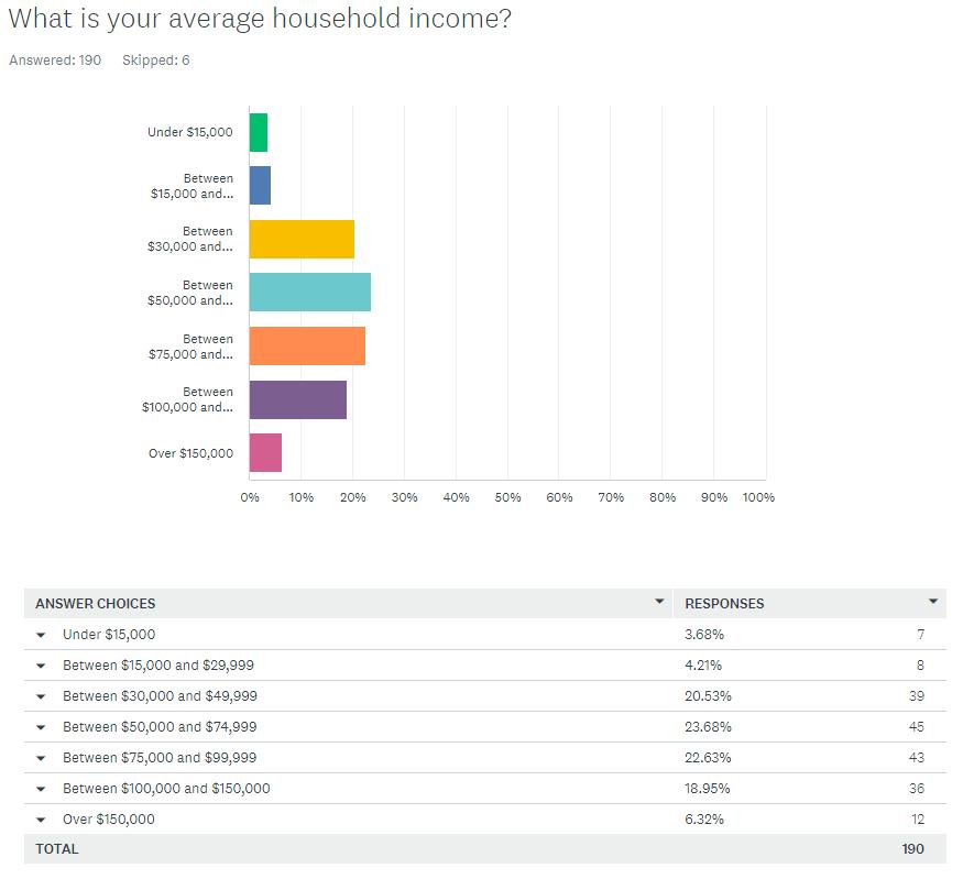
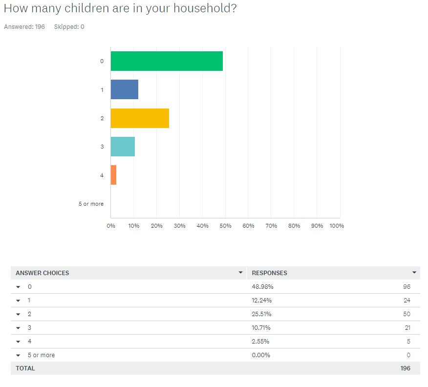
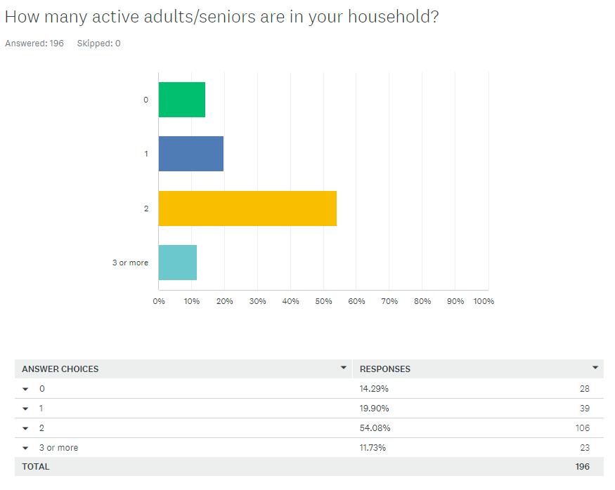
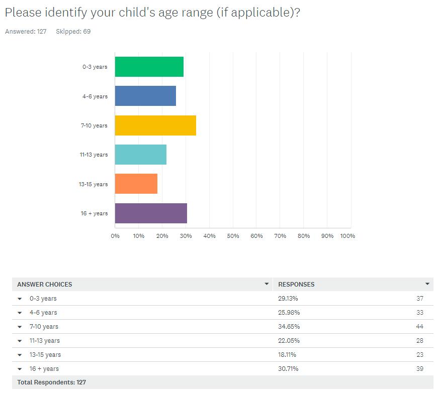
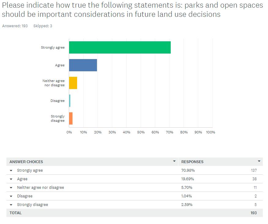
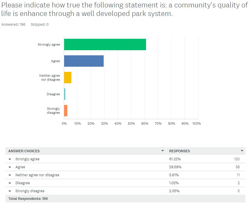
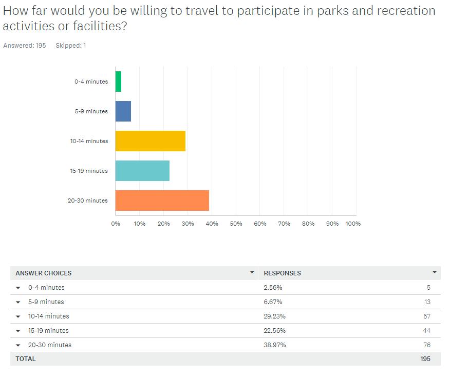
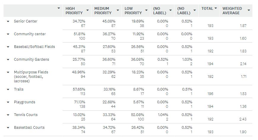
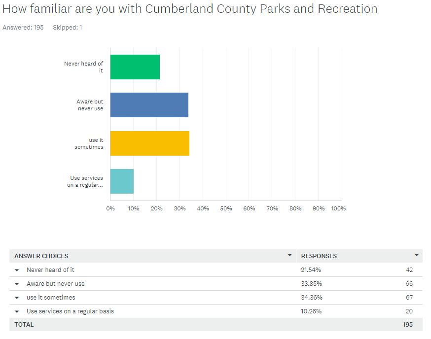
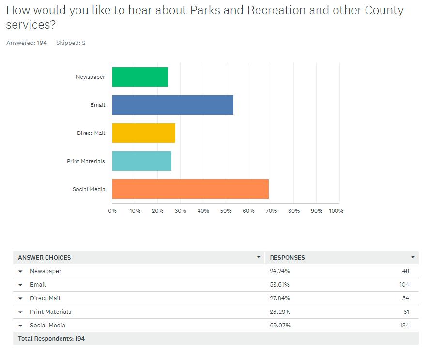
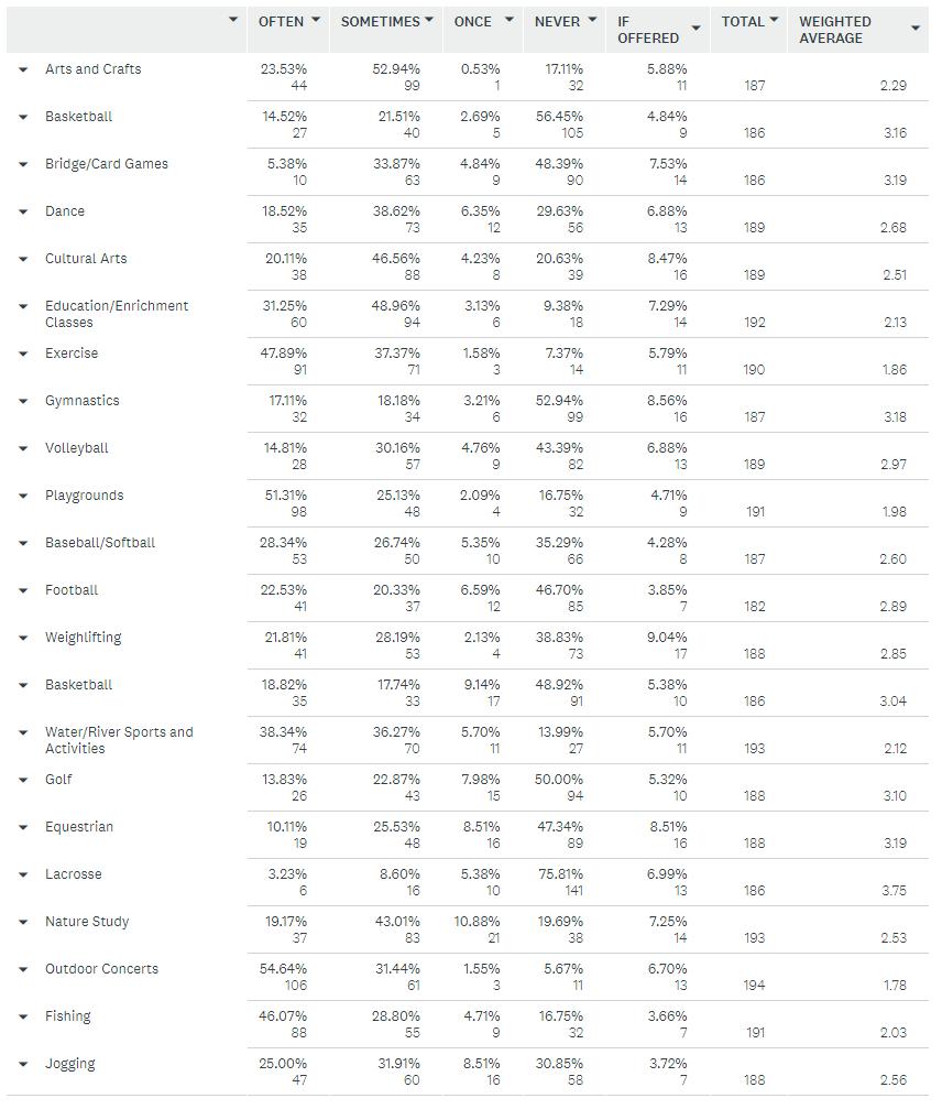
To: Derek Stamey
From: Sheryl Stephens
Date: August 3, 2023
Re: Analysis of Water and Wastewater Rates and Fees
Cc: Mike Haggerty
Job # 508863
The purpose of this memorandum is to provide a summary of the findings and recommendations related to the Analysis of Water and Sewer Rates. This memorandum references the PowerPoint presentation shared with the Board of Supervisors at a meeting held in April 2023.
Overview:
The purpose of the project is to review revenues and expenses of the water and wastewater systems in Cumberland County and provide recommendations for rate increases over the upcoming five or more years. The goal was to recommend rates that would be adequate to pay all the expenses of the systems while remaining reasonably affordable for the residential and business customers.
Ideally, water and sewer systems operated by local governments should generate revenues that are adequate to fund the operating expenses of the systems, pay any debt service and pay for capital projects. Additionally, utilities should be funding a "replacement reserve" which enables the utility to replace or rehabilitate major system components as the components reach the end of useful life.
The Cumberland County water and sewer systems do not generate enough revenue to pay all the expenses of the systems. The FY23 Budget includes a County subsidy of approximately $95,000 to the water system and $32,700 to the sewer system. The County subsidy equates to 1.48 cents of the tax rate. (See slides 16 and 24)
The water and sewer systems do not generate enough revenue to address routine capital needs and there is no capital reserve dedicated to the utilities. The General Fund is relied on to provide capital for the system needs, including unexpected capital needs due to failure of equipment Additionally, Cumberland County has not routinely reserved funds dedicated to future replacement or rehabilitation of the water and sewer systems.
The County water system serves approximately 174 customers and the sewer system serves approximately 303 customers. Even though the water customers are billed based on metered water usage, many of the sewer customers pay "flat" monthly rates because they do not have Countyprovided water.
Memorandum to D. Stamey
August 3, 2023
Page 2
The attached PowerPoint presentation provides data describing the customer base, the current rates and fees, and the annual water and sewer budgets. (See slides 5 through 9 for water data and slides 11 through 14 for sewer data)
Residential customers in Cumberland County pay $31.50 per month for 3,000 gallons of water ($29.00 for 3,000 gallons plus $2.50 service charge). This rate is comparable and favorable when compared to similarly sized water systems in Virgina. Additionally, when compared to surrounding counties, Cumberland County's residential rate is similar to rates in Powhatan and Fluvanna Counties, but rates in the other nearby counties are slightly lower. (See slides 8 and 9)
In order to balance the budget for the water system – which means paying all operating expenses, eliminate the County subsidy and set aside moderate amounts for capital projects, the water rates would need to increase by approximately 100%. Alternatively, if rates were increased to cover all operating costs and the capital expenses, but NOT eliminate the subsidy, the rates would still need to increase by 20%, or more than $6.00 per month. (See slide 17)
Residential customers in Cumberland County pay $35.50 per month for sewer service ($33.00 flat rate plus $2.50 service charge) This rate is comparable and favorable when compared to similarly sized sewer systems in Virgina. When compared to surrounding counties, Cumberland County's residential rate is $3.00 to $4.00 more than the average and median rates. Cumberland's rate is very similar to the rate in both Goochland and Powhatan and similar to the average in Virginia. (See slides 12 and 13)
In order to balance the budget for the sewer system – which means paying all operating expenses, eliminate the County subsidy and set aside moderate amounts for capital projects, the rates would need to increase by approximately 30%. Alternatively, if rates were increased to cover all operating costs and the capital expenses, but NOT eliminate the subsidy, the rates would still need to increase by 16% to 20%, or more than $5.00 per month. (See slide 25)
County management and staff, as well as elected officials recognize that the rate increases outlined above are too significant to implement.
One of the challenges faced by the County is that there is very little growth in the systems, therefore any additional revenue must be garnered from the existing customer base.
Over the next 5 -8 years, it is recommended that the County implement small increases to the residential rate of $2 - $3 per year, or every other year, to, at a minimum, try to keep up with

Memorandum to D. Stamey
August 3, 2023
Page 3
inflationary increases. However, these minimal increases will not allow the County to fund capital projects or to accrue a capital reserve. And minimal increases will not reduce the County subsidy of the utilities. Non-residential rates would also increase at a percentage equal to the residential rate increases.
Recommendations:
Over the upcoming few years, it is recommended that the County make small but consistent increases to the user charges for the water customers each year, or every other year. It is recommended that the County increase the base rate for all customers, increase the consumption charges, and consider charging a higher rate for water usage that exceeds 5,000 gallons per month. (See slide 20)
Incremental increases in the wastewater rates should be implemented as well. Both the base fees and the usage rates should be increased incrementally and the increases to the residential rates should be mirrored in the non-residential rates. (See slides 26 and 27)
It is likely that consistent year-over-year increases in the rates will cause the rates in Cumberland to be higher than those in some of the neighboring localities. However, it is important to recognize that smaller systems, and systems where the customer base is not very dense, tend to have higher rates. For example, in the Town of Farmville, not only is the customer base much larger, but those customers are more densely concentrated. This is one of the reasons that Farmville can offer lower water and sewer rates.
One area of opportunity for the County lies in the update of the Comprehensive Plan. As the County considers future land use and zoning, it is recommended that the County consider focusing or directing growth in the areas where water and sewer service are available. It is recommended that the County consider increased density and mixed residential and commercial uses in the water and sewer service areas.
Most utilities can serve additional customers within the service area without significant increases in operating expenses and without significant capital expenditures. Over the short term, growth in the customer base is one of the ways the County can generate additional water and sewer revenue without incurring significant capital expenditures or increases in operational costs Both the water and sewer systems have adequate capacity to serve additional customers.
Considering the type of growth the County and its citizens would like to see in the County and encouraging that growth in the water and sewer areas could enhance the ability of the water and sewer systems to become financially self-sufficient


Purpose of Study Overview of Customer Base Cumberland User Rates Compared to Other Utilities
The Annual Water and Sewer Budget The Water and Sewer CIP Subsidy from General Fund Recommended Water and Sewer Rates

Customer Base, the Rates, Comparison to Other Communities
Average Residential Water Usage is approximately 3,000 gallons per month
Residential
Businesses
Governmental & Education
$25 for first 2,000 gallons; Additional usage: $4.00/1,000 gallons
$25 for first 2,000 gallons; Additional usage: $5.00/1,000 gallons
$115 for first 2,000 gallons: Additional usage: $17.00 per 1,000 gallons
All customers pay an administrative fee of $2.50 or $3.50 in addition to the rates listed above
Approximately 43% of the customers use 2,000 gallons or less per month.
Recommendation: The minimum usage (2,000 gallons) is appropriate.
Compared to other smaller systems, Cumberland County's monthly water rate for the average residential customer is comparable.
Average Rate of these localities is $31.31
Median Rate is $32.29
Residential Water Charges

Cumberland, Powhatan and Fluvanna County have similar rates$31 - $33 for 3,000 gallons.
All of the others are less than $30.
Customer Base, the Rates, Comparison to Other Communities
Majority of customers are residential
Most customers pay a “flat rate”
Any sewer customers with metered water and usage in excess of 50,000 gallons per month pay $33 per month (2,000) gallons and $5.00 per 1,000 gallons of water usage.
Majority of revenue is from residential users and the government / schools
Cumberland County’s flat residential sewer charge ($33 plus $2.50) is reasonable when compared to other smaller systems
The average rate is $44.81 and the median is $39.60.
Source of Data: DAA/TRC Annual Rate Survey, 2022

Based on Rates in Effect in January 2023
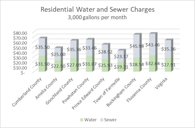
Cumberland's water charges are among the highest in the region
Cumberland water charges are higher than the average in across Virginia
Sewer charges are comparable to or lower than rates in four of the neighboring utilities
Sewer charges are comparable to average sewer charges across Virginia
Source: Rate information is from the locality websites, average rates in VA are from Draper Aden/TRC Companies 2022 Annual Water and Sewer Rate Report
Projected Revenue and Expenses and Opportunities to Reduce the County Subsidy
Current and Projected Revenues and Expenses - WATER
County provides approximately $95,000 annual subsidy (from the General Fund)
Equates to 1.1 cent of the tax rate
In order to eliminate the subsidy, the water rate / fees for every customer would have to double (100% increase).
Growth: How many additional water customers would be needed to “balance the budget”
Higher Rates: Rate increases needed to “balance the budget”
234 additional customers – a mix of residential and business customers could eliminate the subsidy
20% increase across all customer types would enable the county to fund the CIP, but the subsidy would remain
92% increase could eliminate the subsidy
Base Rates for all customers are increased by $1 to $4 in FY24.
Consumption over 5,000 gallons = higher rate
Each year, consumption charges increase
Admin Fees and Availability Fees Do Not Change
More of the cost is shifted to
1) Residential customers using 5,000 gallons or more, per month
2) Business customers, especially those who use more than 5,000 gallons per month
3) Government and Education
Increases Annual Revenue from Rates by $60,000 and enables County to Reduce Subsidy by <$40,000.
County provides $32,700 annual subsidy (General Fund transfer)
Equates to .38 cent of the tax rate
In order to eliminate the subsidy, the sewer rates for every customer would have increase by approximately 28%.
Sewer Fund
Cashflow Projections
Growth: How many additional customers would be needed to “balance the budget”
Higher Rates: Rate increases needed to “balance the budget”
160 additional customers – a mix of residential and business customers could eliminate the subsidy
17% increase across all customer types could balance the budget – with small annual increases in following years
30% increase could eliminate the subsidy
Consider increasing sewer rates by $5 in FY24
Increase “Grinder Pump” customers to = flat sewer rate
Try to “equalize” the monthly water rate and the monthly sewer rate –needs to be equalized over several years
After initial increases – continue to implement smaller increases each year.
Increase the “Overage rate” – also, equalize at $5.50
• Most residential and business customers will have a $2 increase per month each year.
• The businesses and gov/educ customers will have increases that are the same % increase as the residential
• Over the 5 year period, the CIP can be funded and subsidy should be reduced by about $20,000.
Will be difficult to eliminate the deficits and the General Fund subsidy without growth and rate increases
Year-over-year increases to rates may cause Cumberland’s rates to exceed what is considered affordable and may out pace the rates in neighboring localities
Update of Comprehensive Plan is an opportunity
Consider encouraging growth and denser development in the areas where water and sewer service is available.
Consider mixed residential and non-residential uses in the service area.