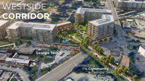
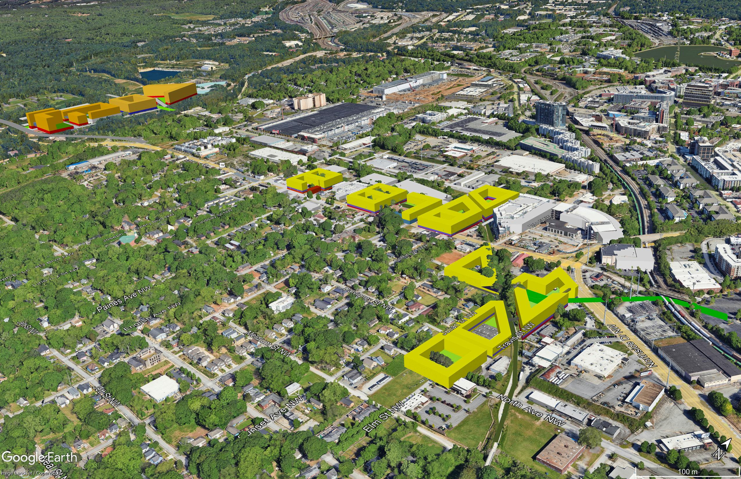
WESTSIDE CORRIDOR
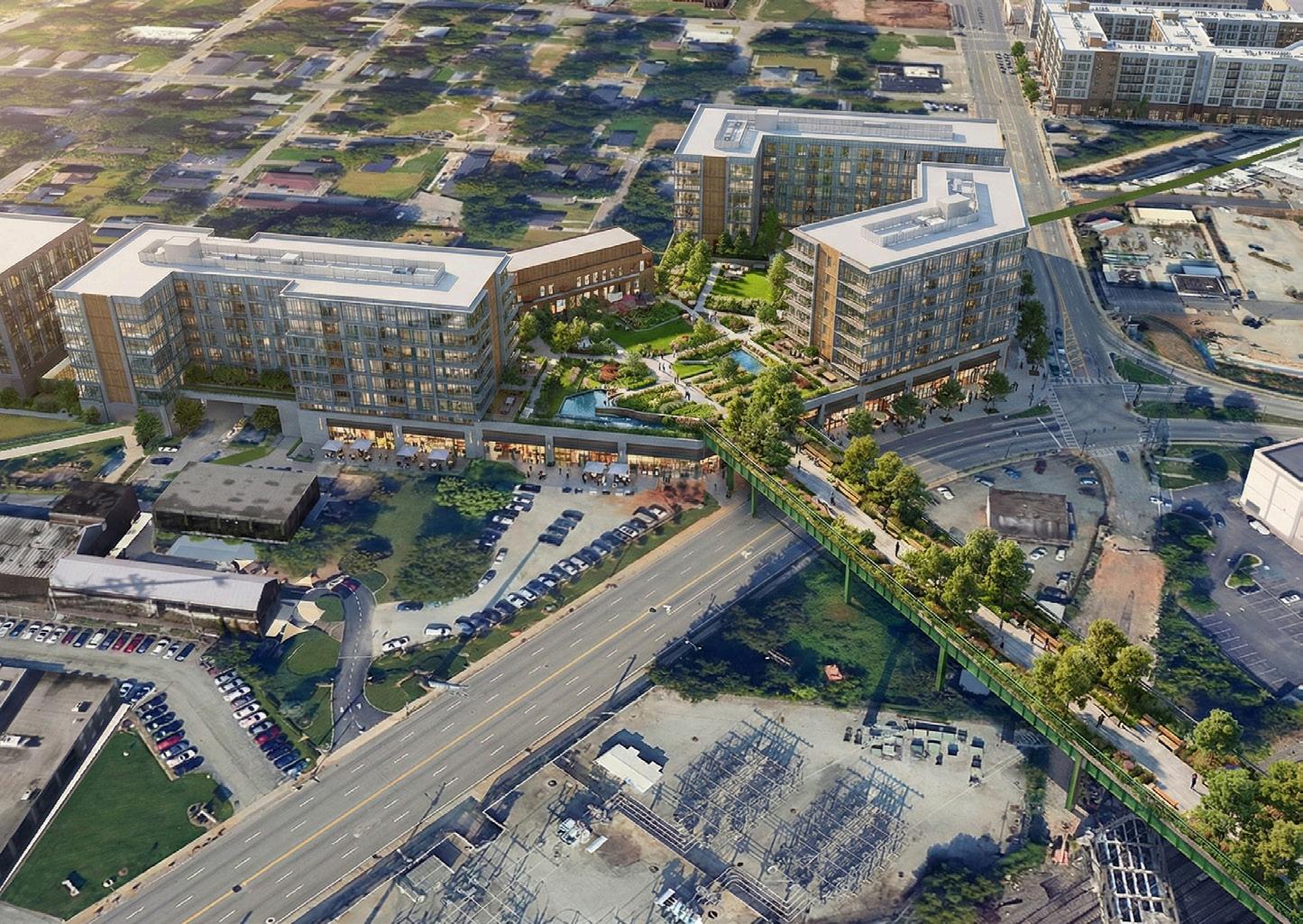
Connecting Georgia Tech & the Community
Connecting the Community & Georgia Tech
Connecting Georgia Tech & the Community
Connecting the Community & Georgia Tech

Herman Howard
Principal
Tate Hansen

Debmalya Ghosh
Design Lead
Tate Hansen

Summer Walker
Designer
Tate Hansen

Saheli Ghosh
Design Lead
Tate Hansen

Nicole James
Designer Georgia Tech Student

Evyn Harris Researcher
Tate Hansen/ Tulane Recent Grad

Clifford Harris Land Owner Briar House Holdings

BJ Kerr Advisor
Regents Custom Homes

Steve Brock Land Owner Brock Built

Adam Brock Land Owner
Brock Built

Jason Tucker Advisor Tucker Homes

Charlie Tate Land Owner
Vida Companies

Joe Martinez Land Owner
Vida Companies
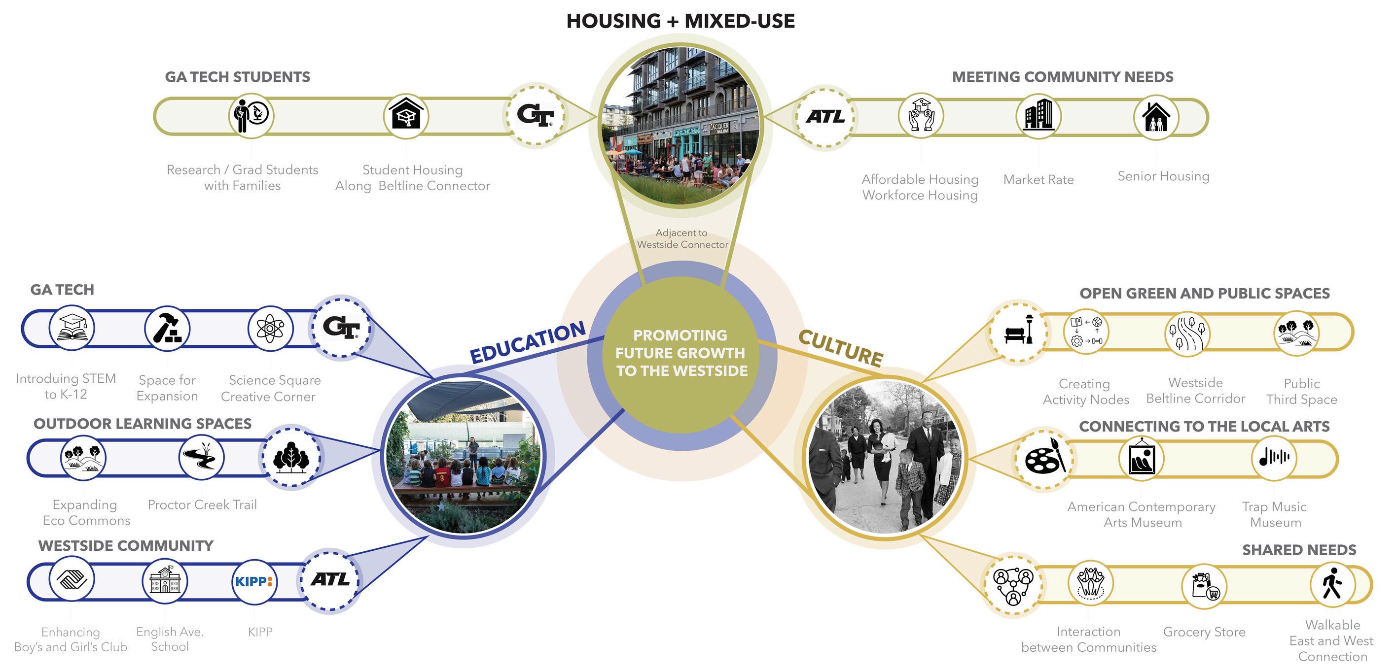
Connecting Georgia Tech and the Community
Connecting the Community and Georgia Tech
Introduction • Vision, Goals, Opportunities for Georgia Tech & the Community
Connecting Georgia Tech to the Westside and Connecting the Westside to Georgia Tech
The Bridge to Somewhere
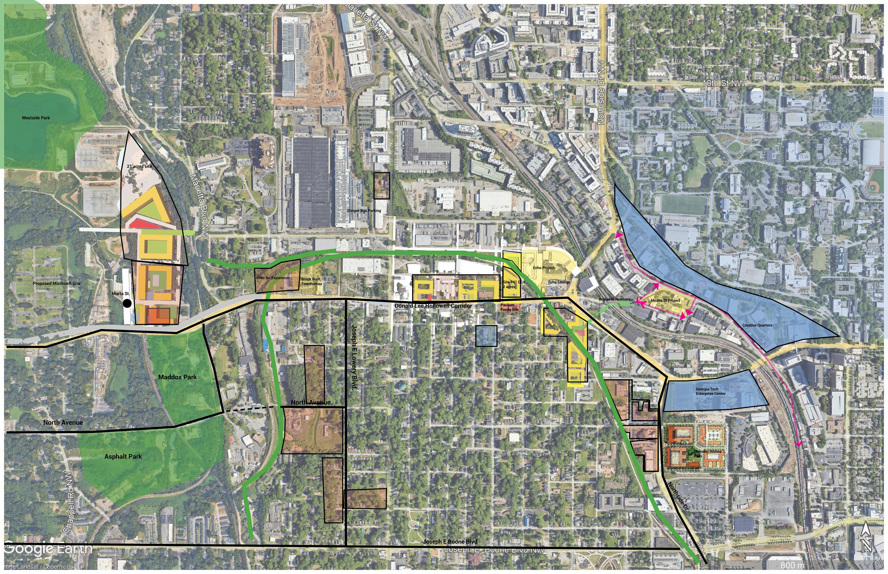
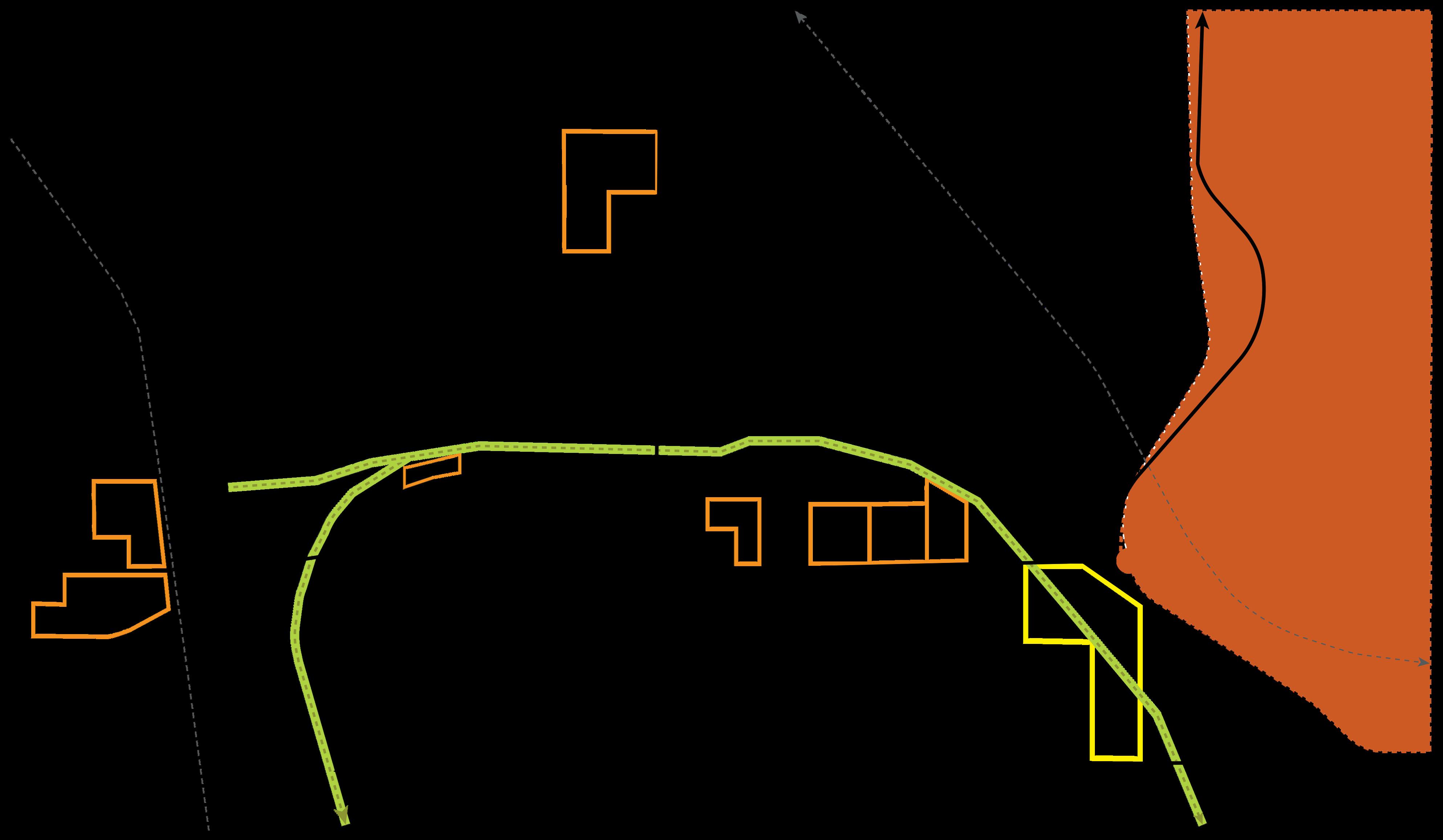
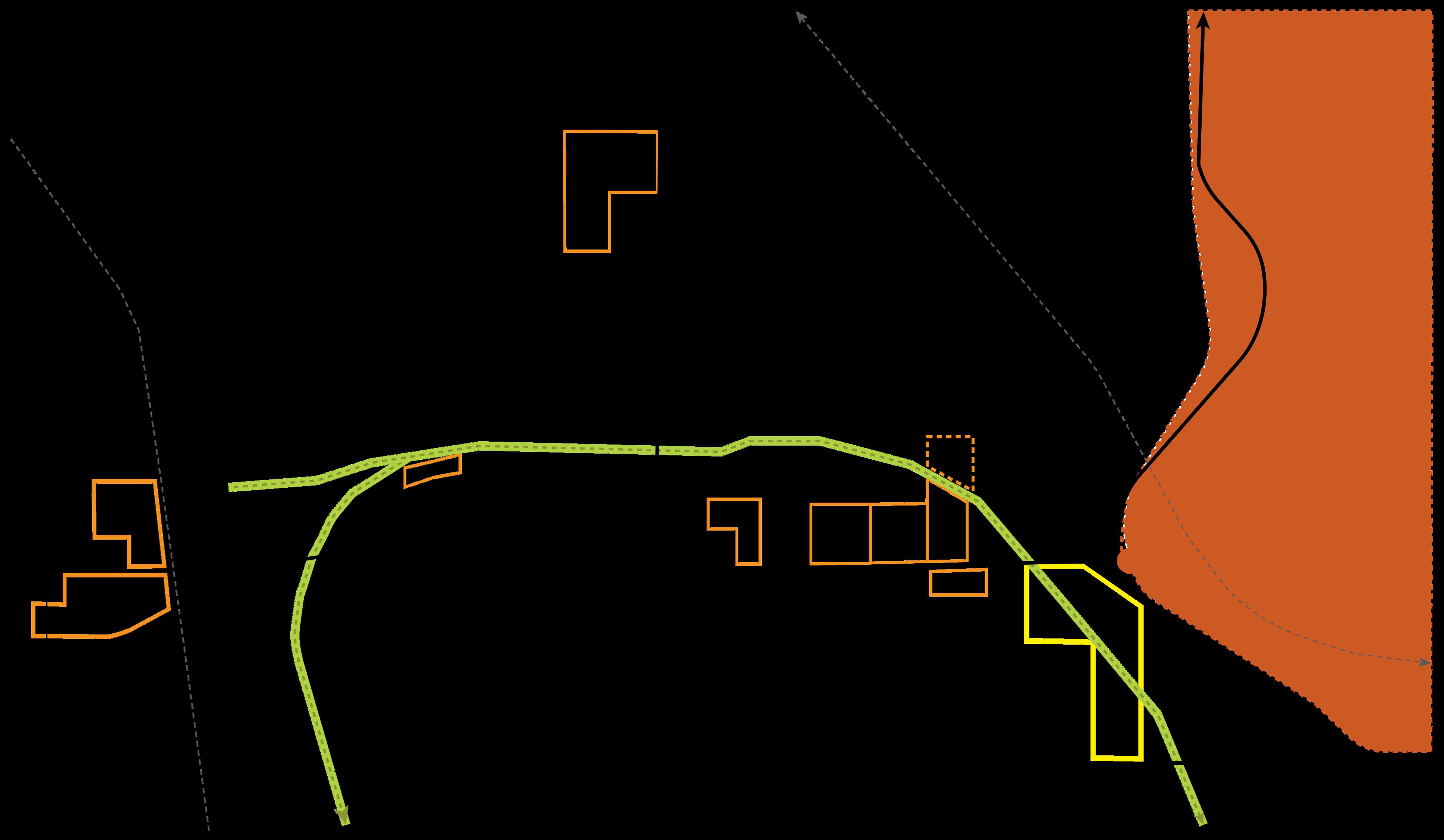
Parcel Ownership, Opportunities
Design Concepts Questions, Open Discussion
Next Steps


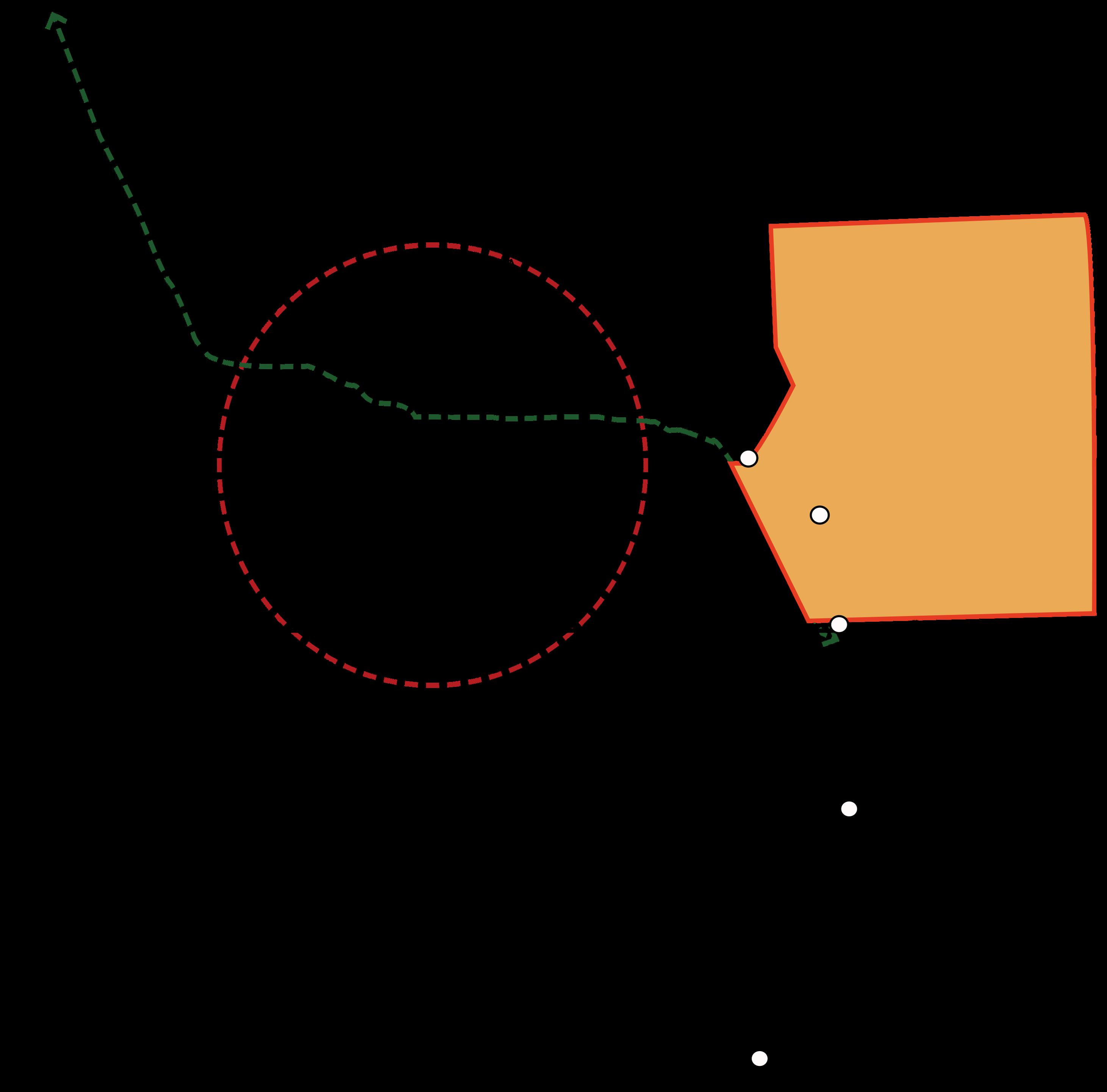
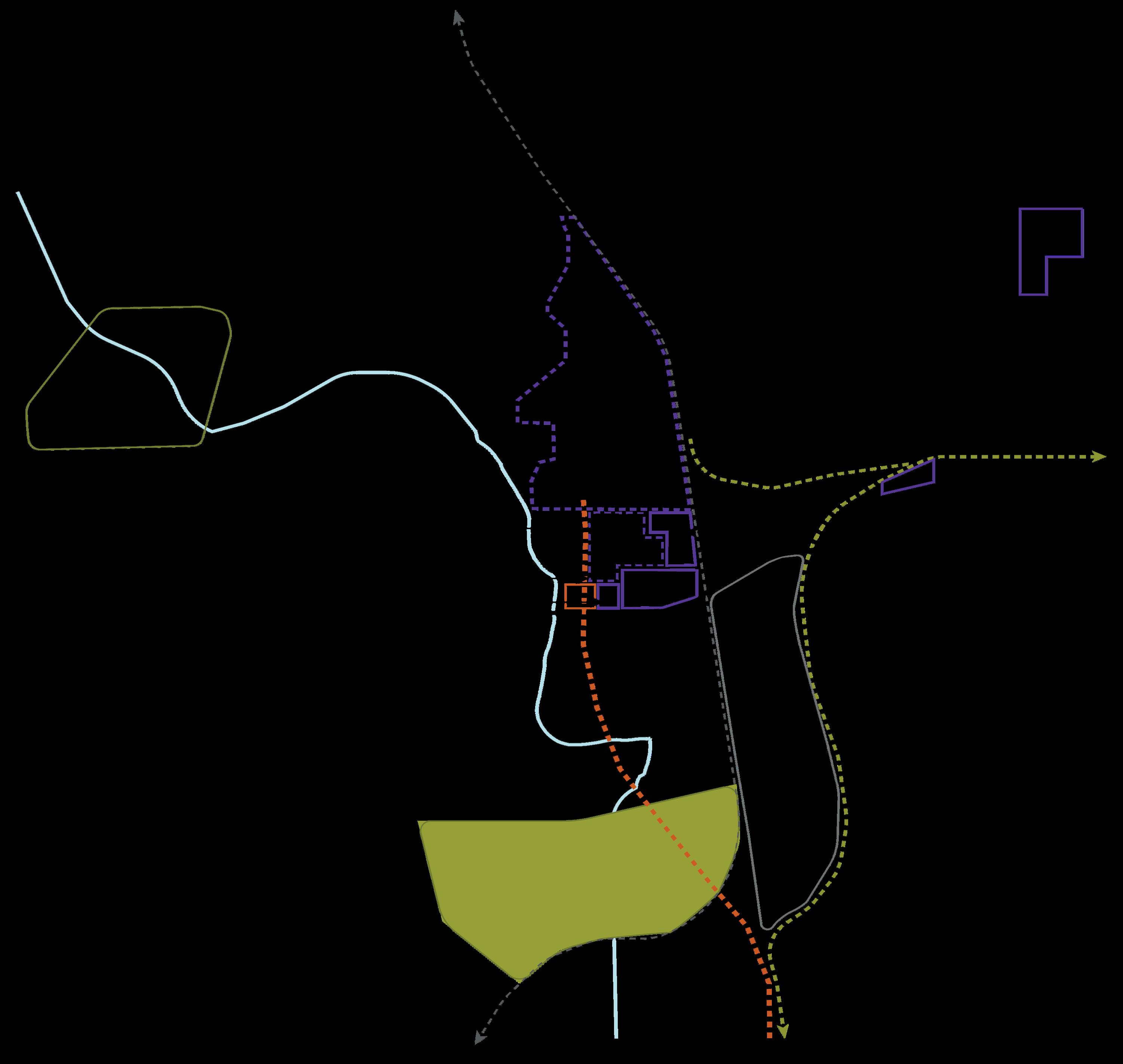
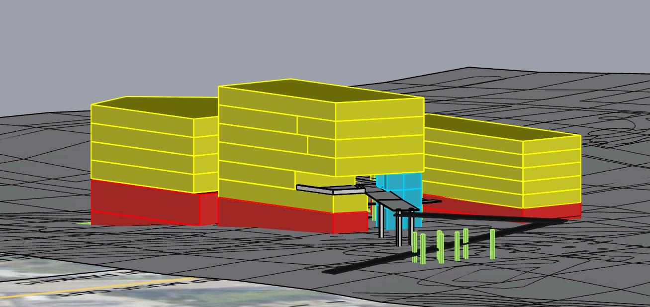
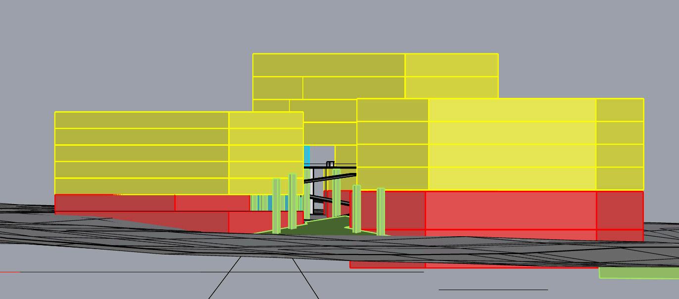
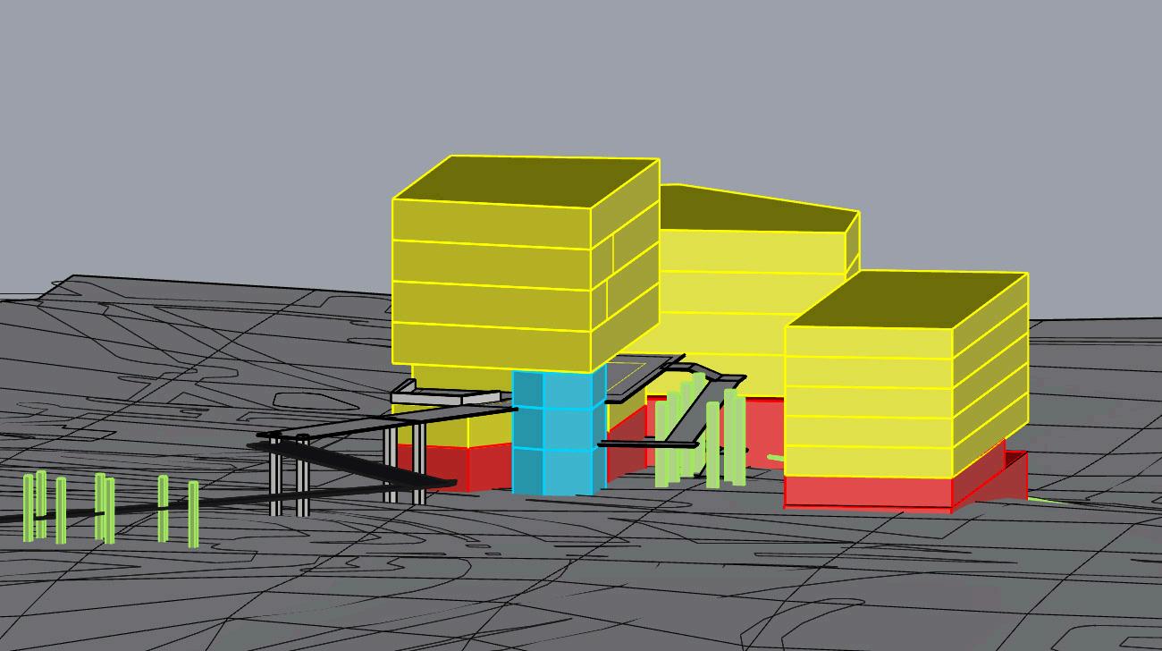
Bring Students across Northside Dr
Soft seamless transition
(Park walking trail that transitions into a bridge and feeds back into another green space
Close off framing view
(allow lower level circulation under building)
Density hugs the transition back down to path of the bridge
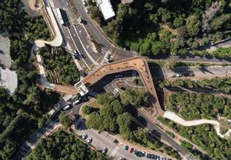
Precedent: The Technion


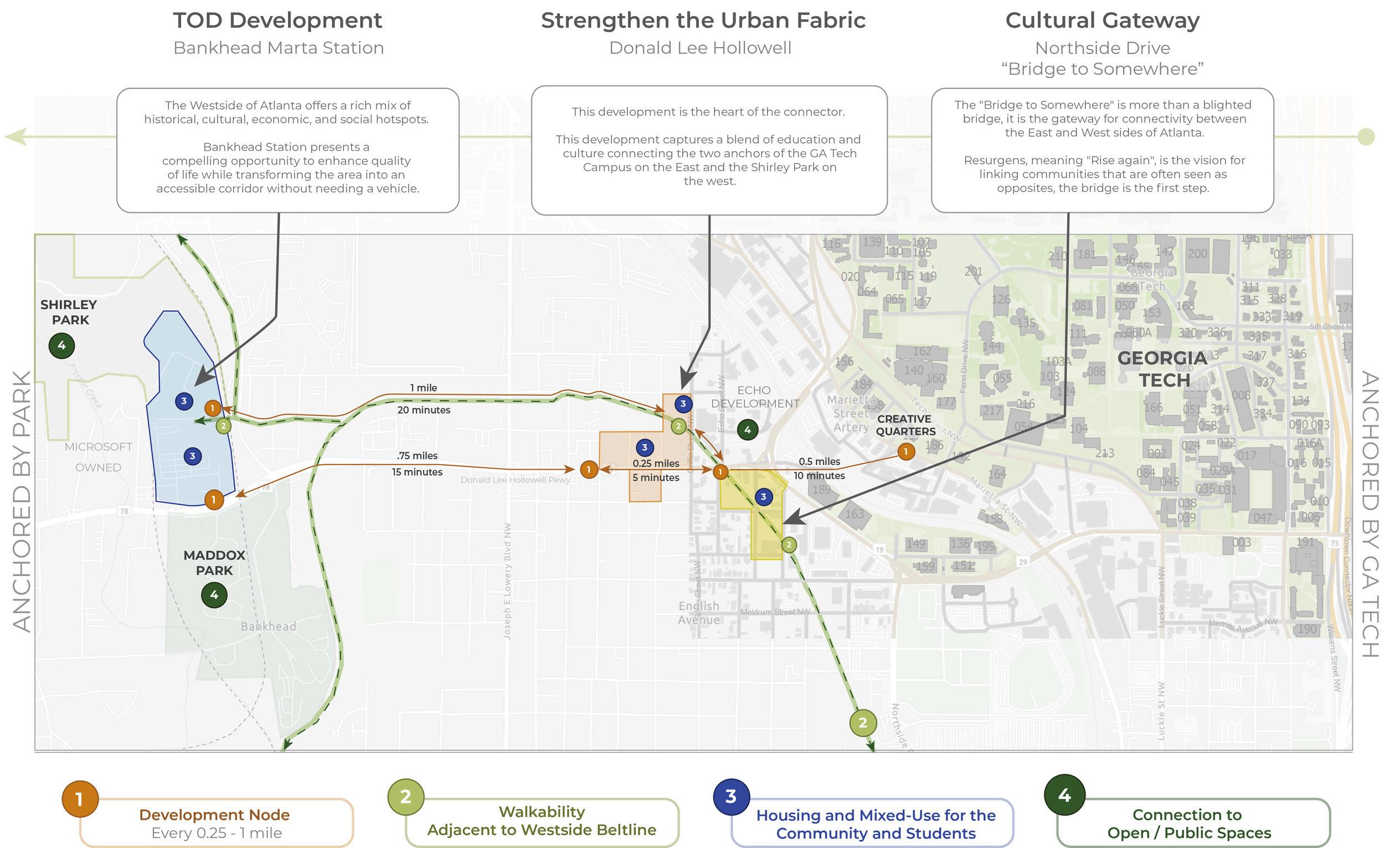
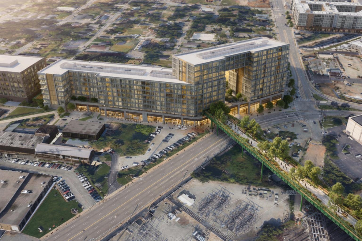
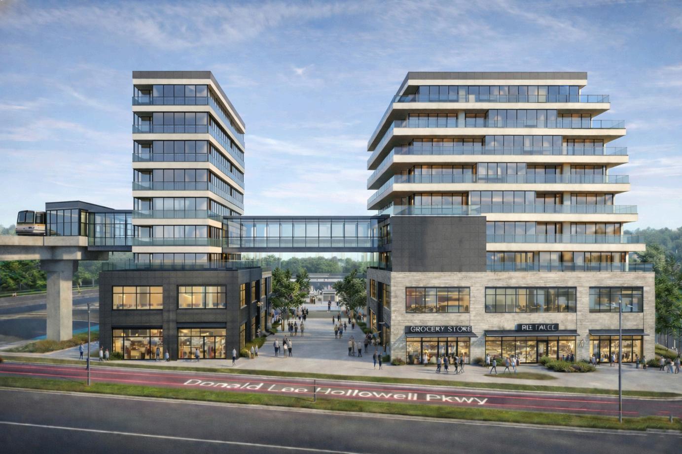
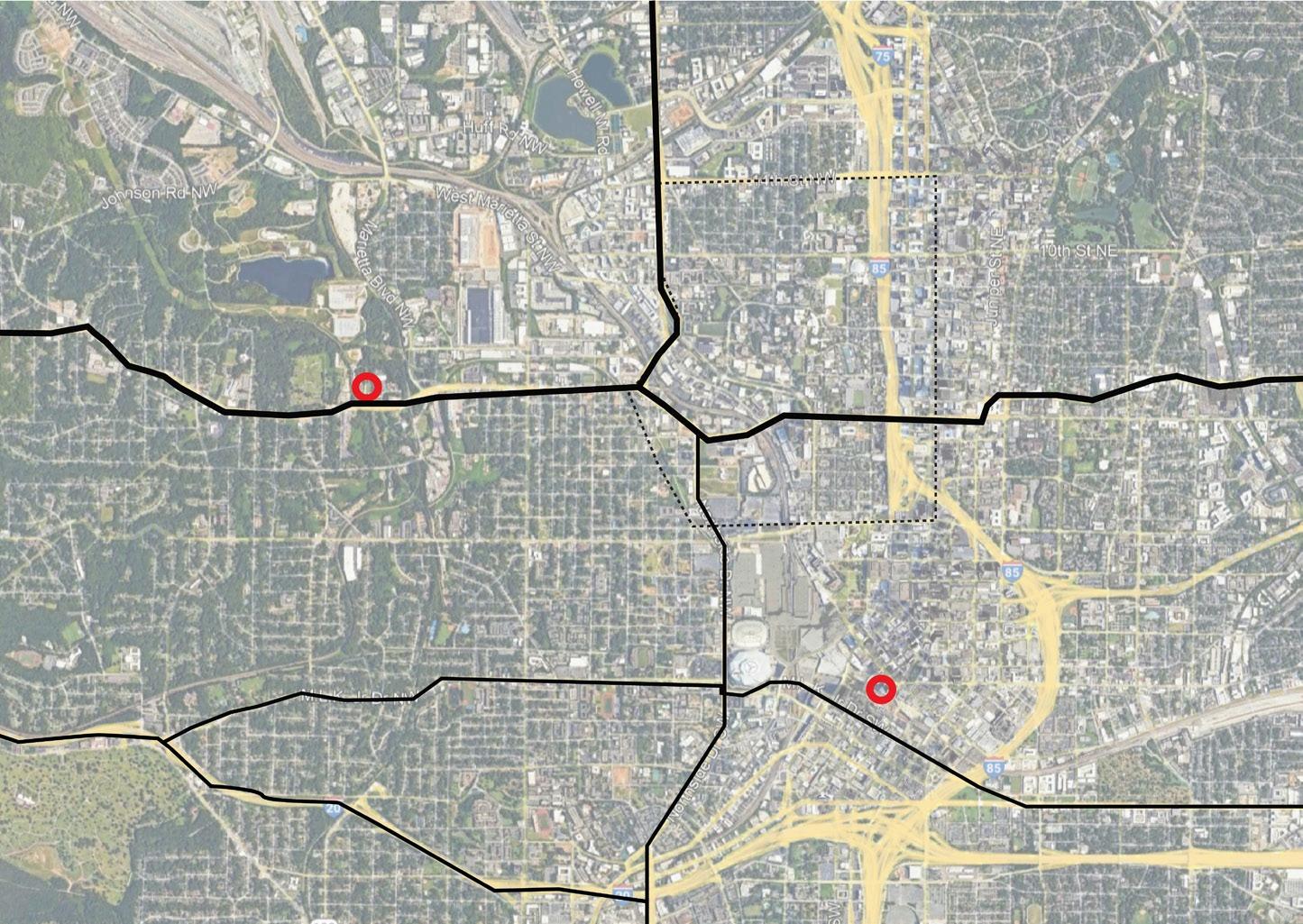
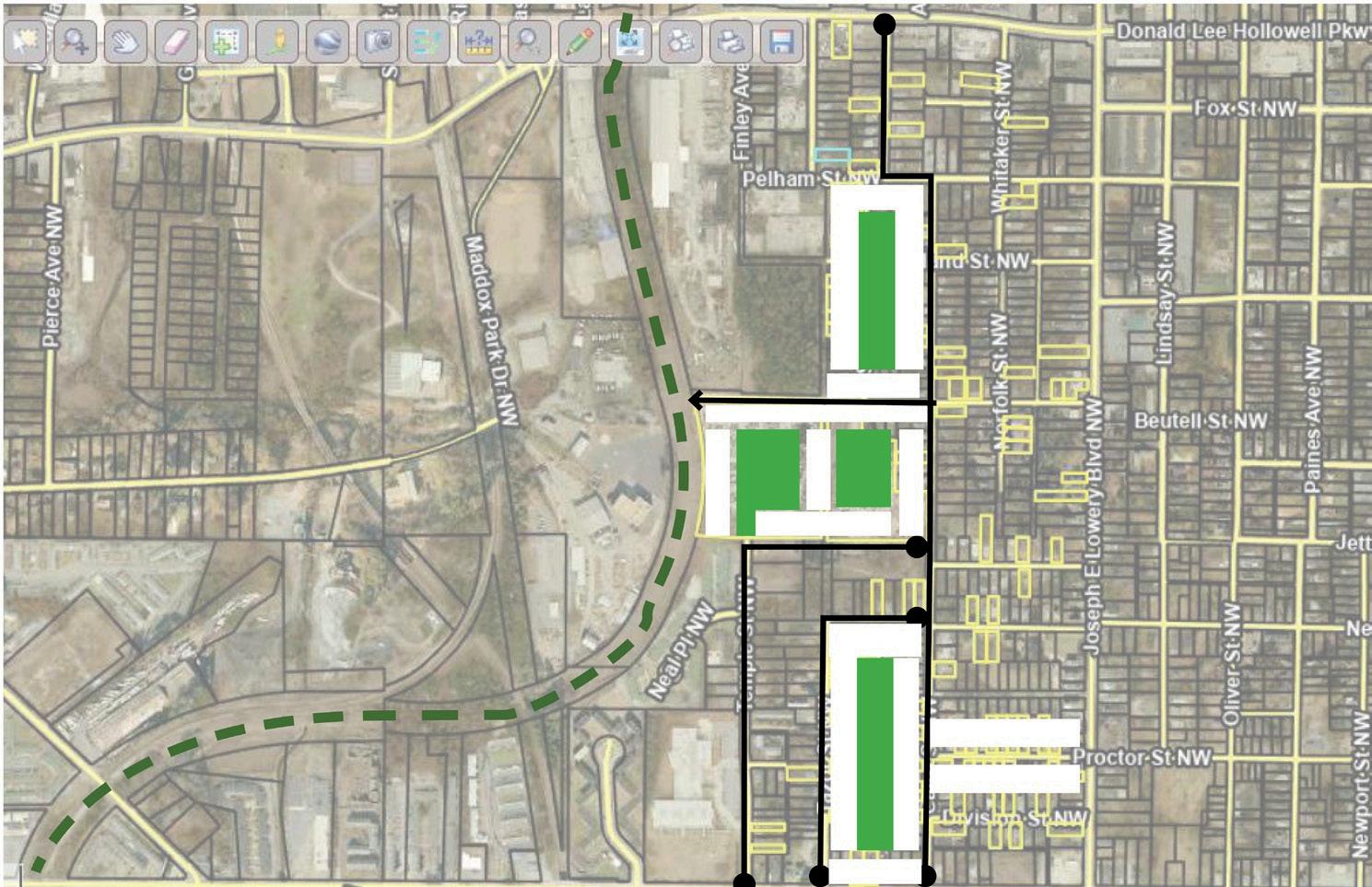
Conceptual Vision for Bridge Landing at intersection of Northside Drive and Donald Lee Hollowell Corridor
Conceptual Vision for Hotel at Corner of Northside Drive and Donald Lee Hollowell Corridor
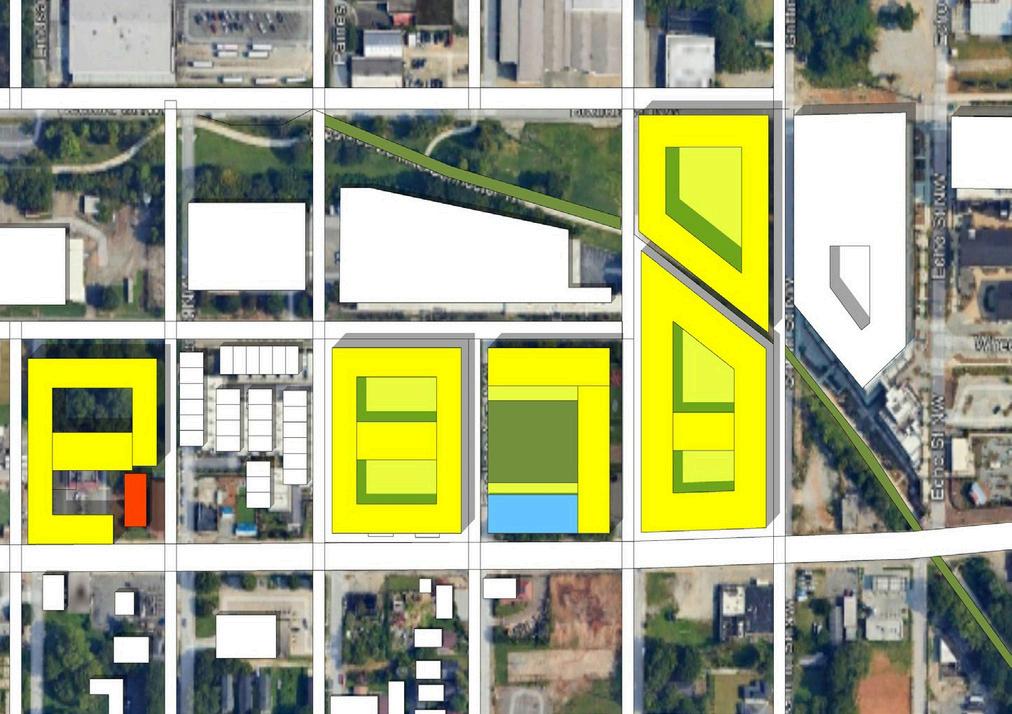
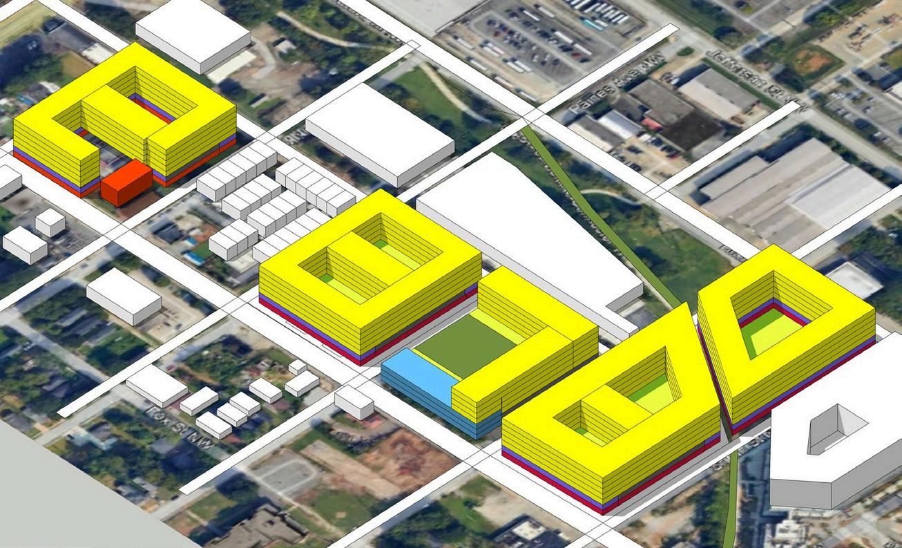

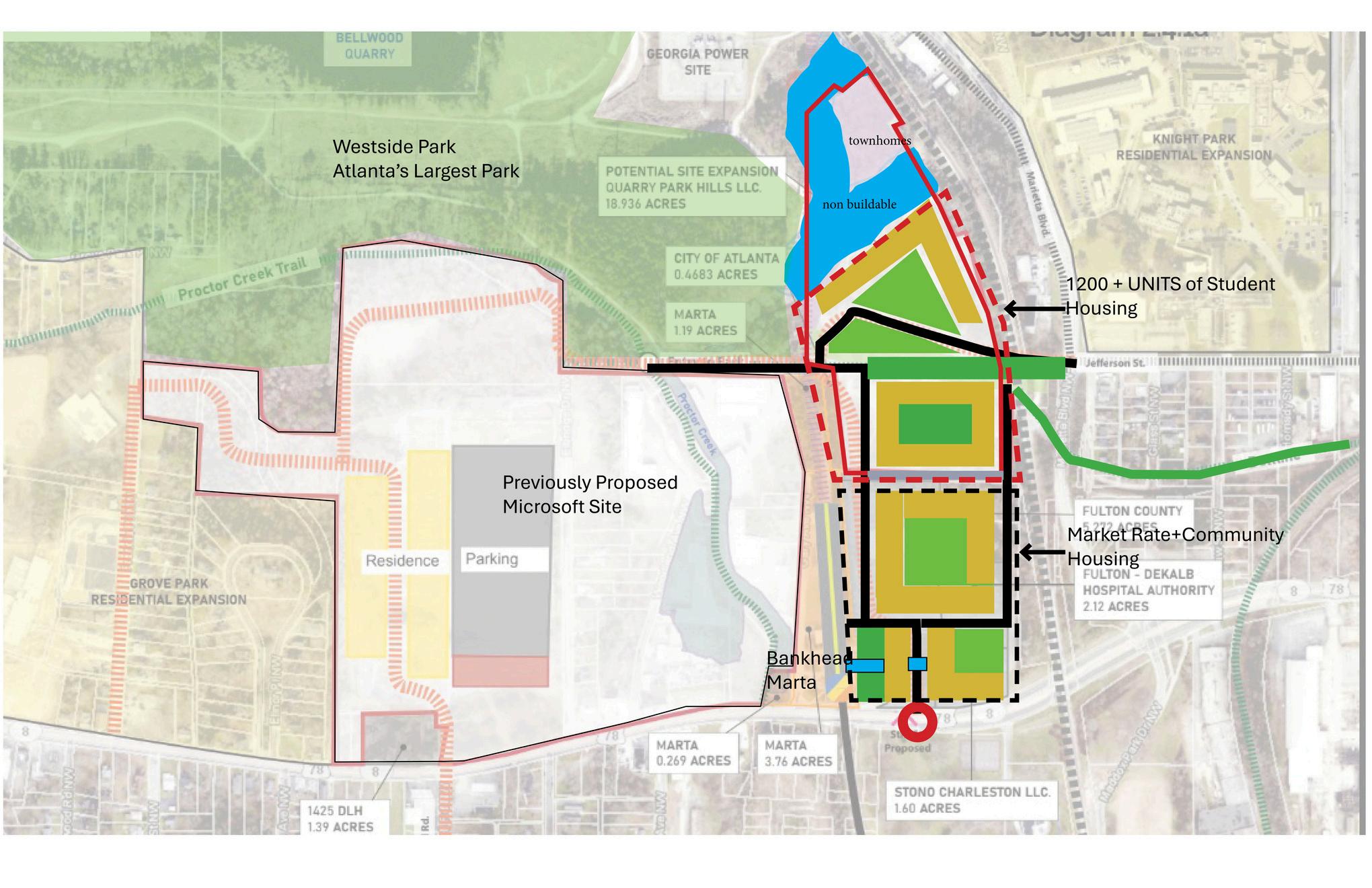

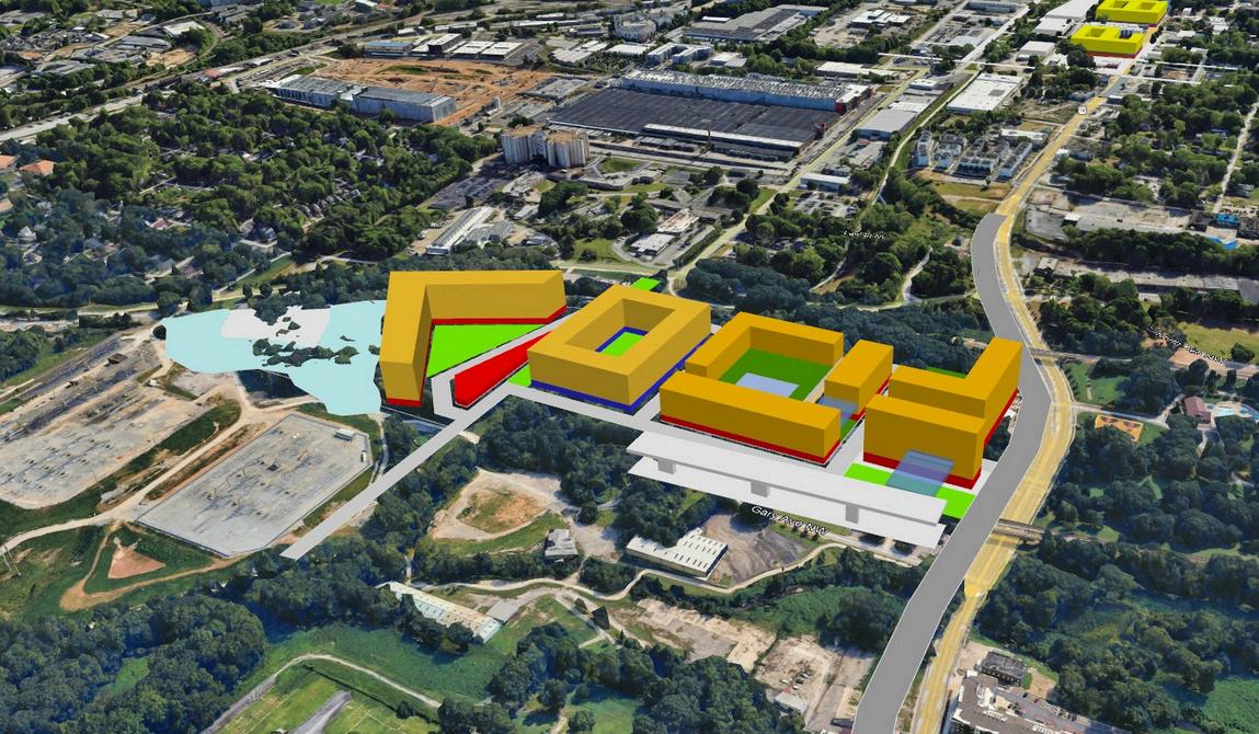
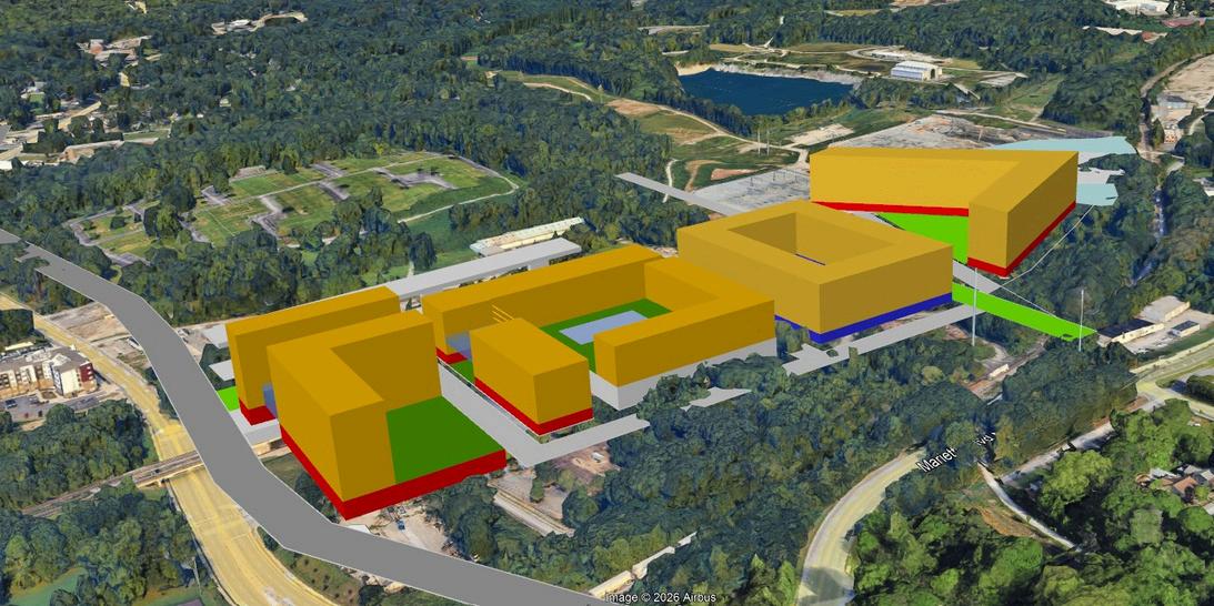
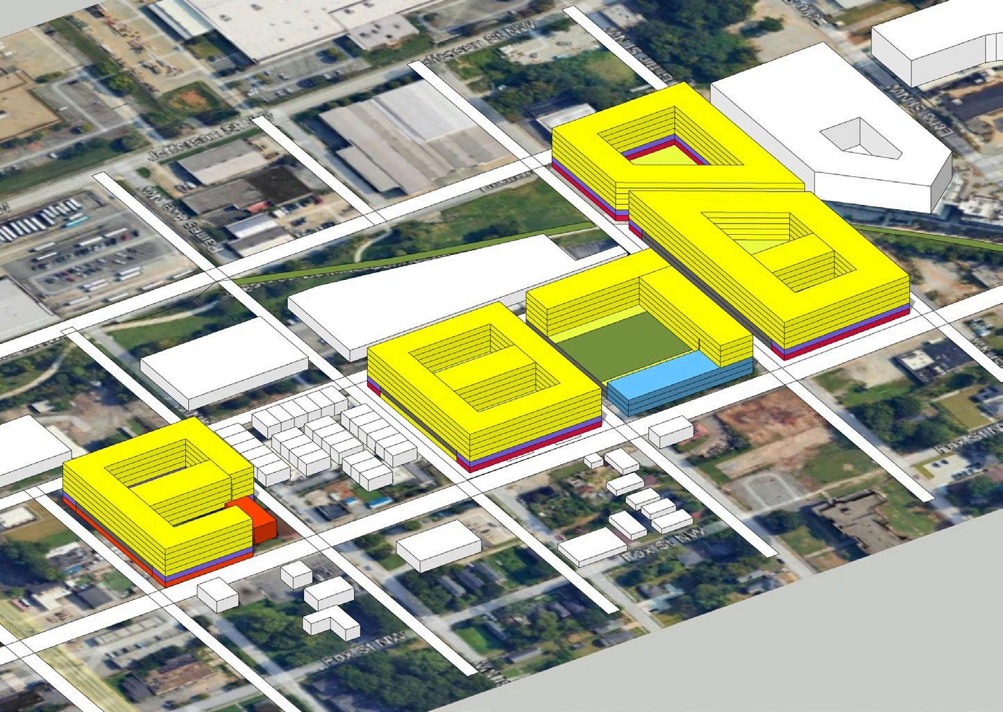
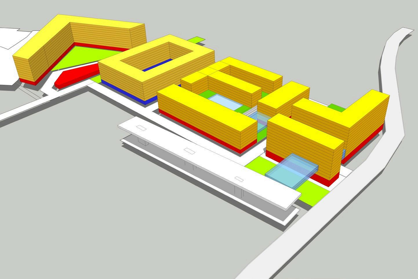
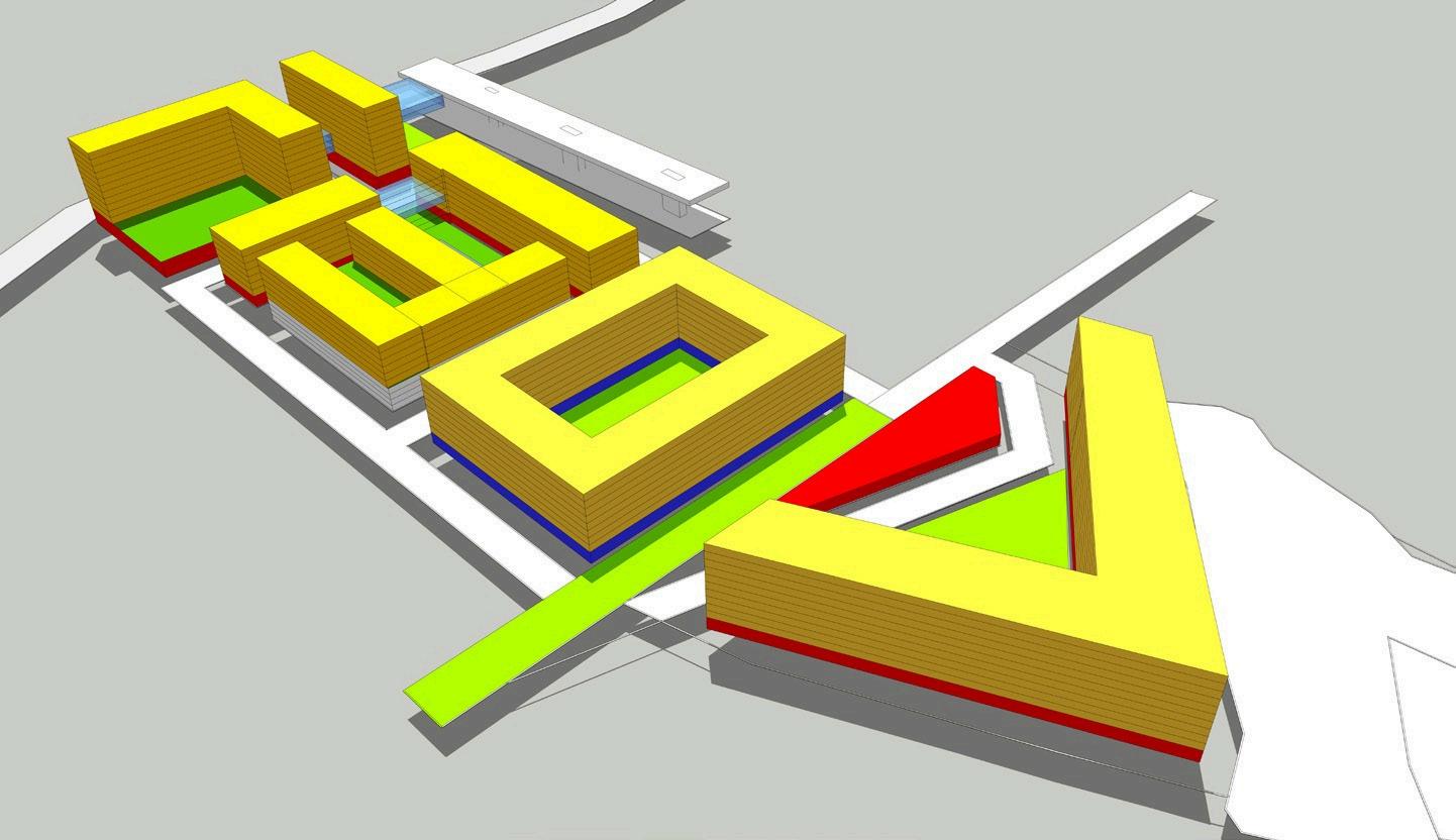
Program Summary (Approx. 30 Acres) Bankhead MARTA Area
Consolidated Program + Cost Table (Including Parking)
Total Hard Construction Cost
“Sincewecannot find theuniversal andbeloved community, create it”- Josiah Royce (1913)


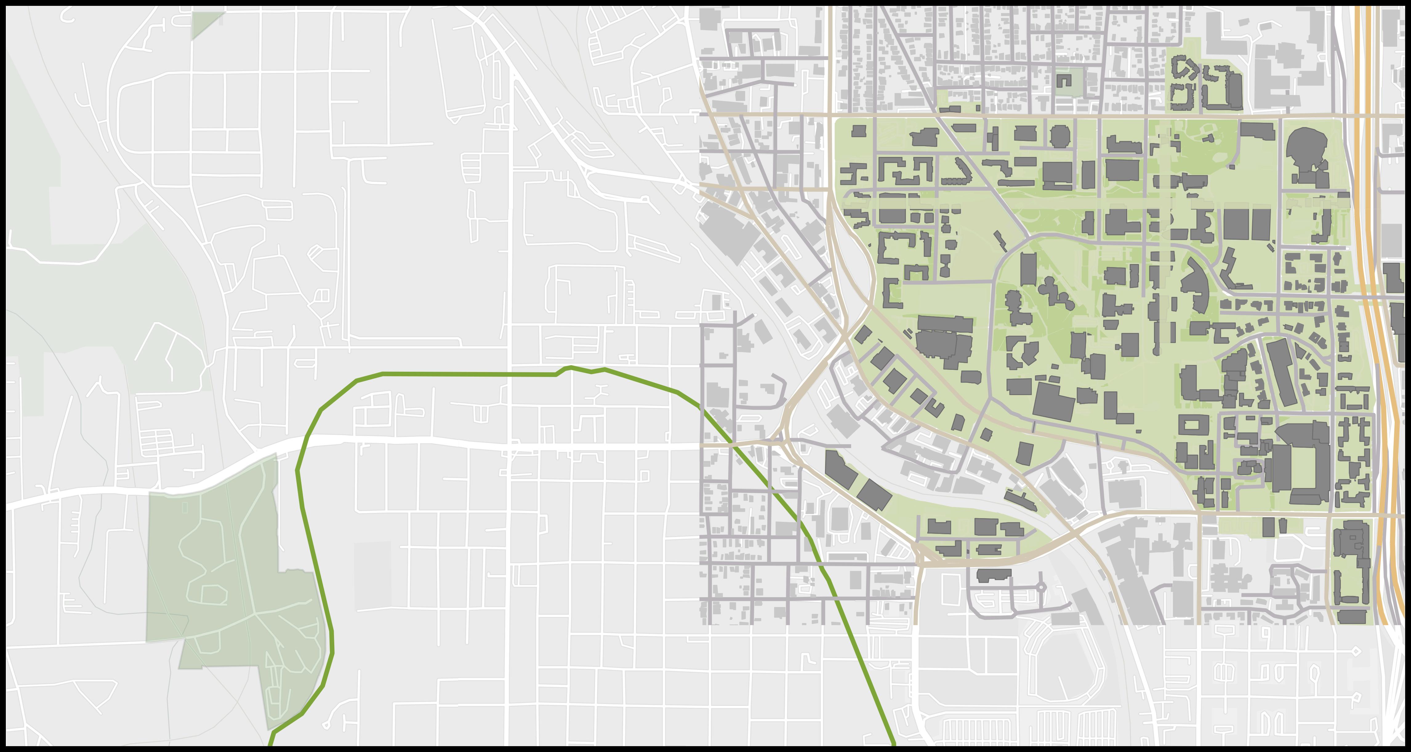
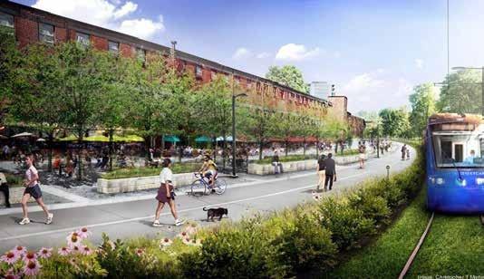
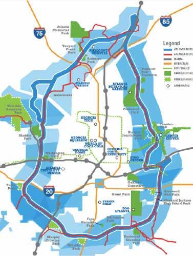
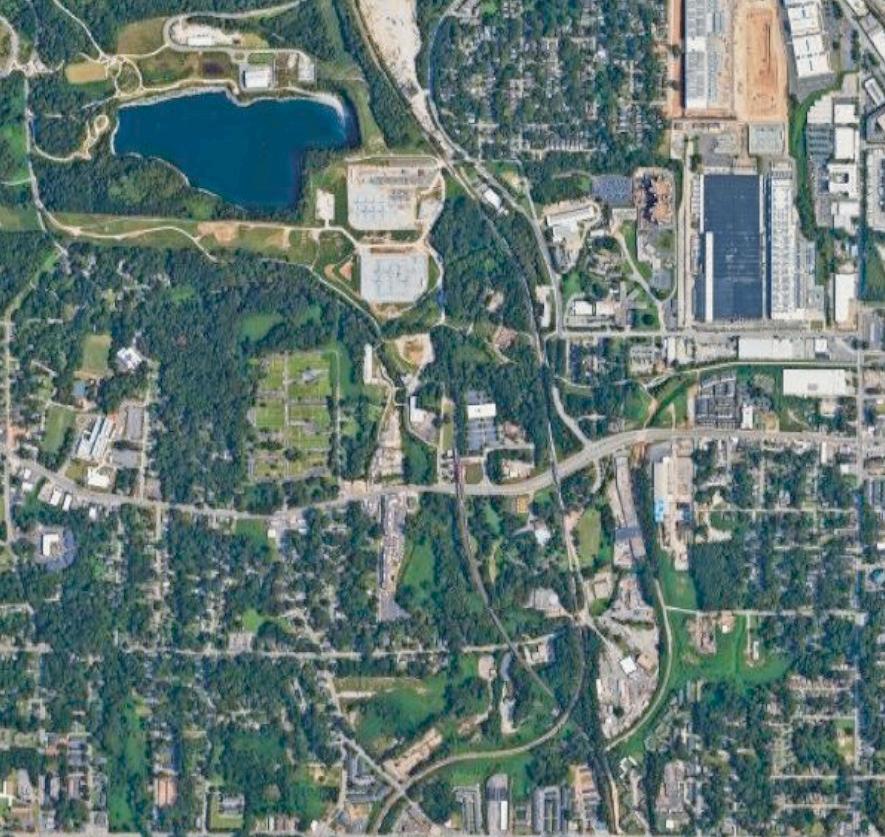
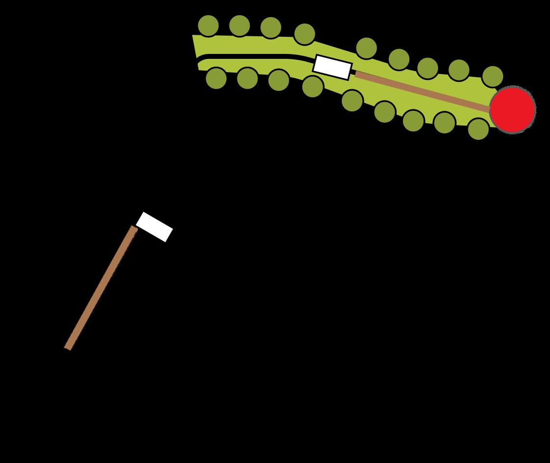
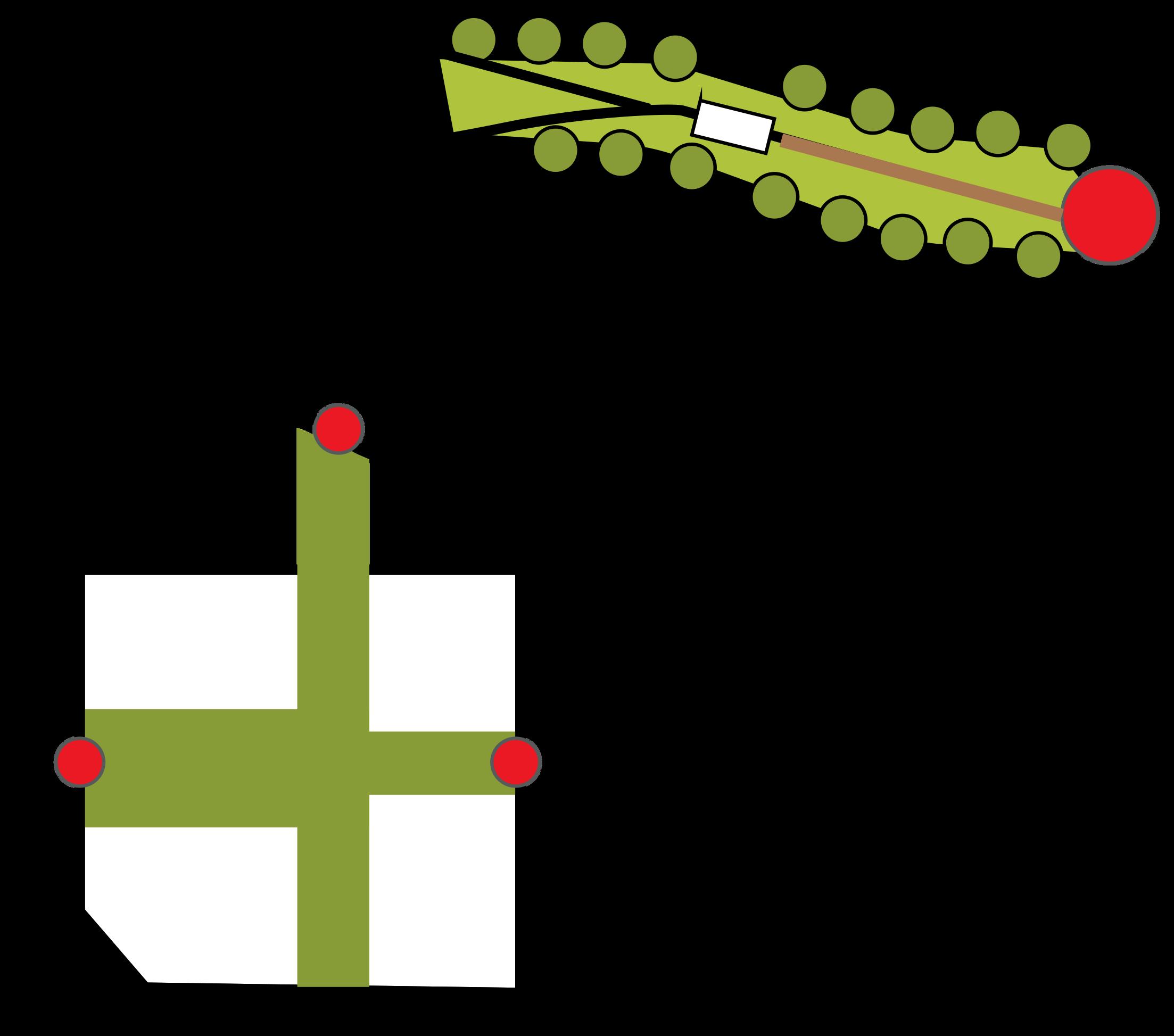
Westside Connector Green Corridor ~ 2.36 Miles


Boys & Girls Clubs STEM & K-12 Education
Engish Avenue School
Georgia Tech
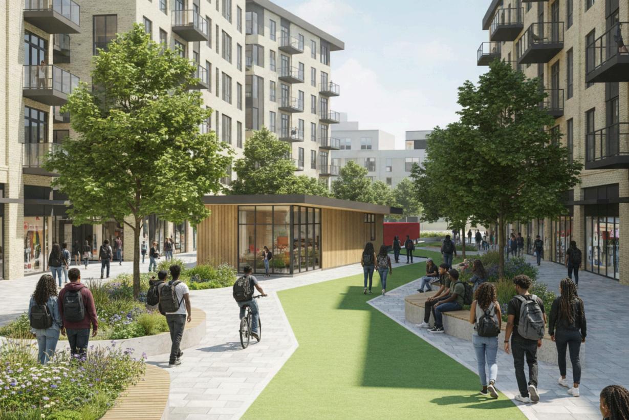
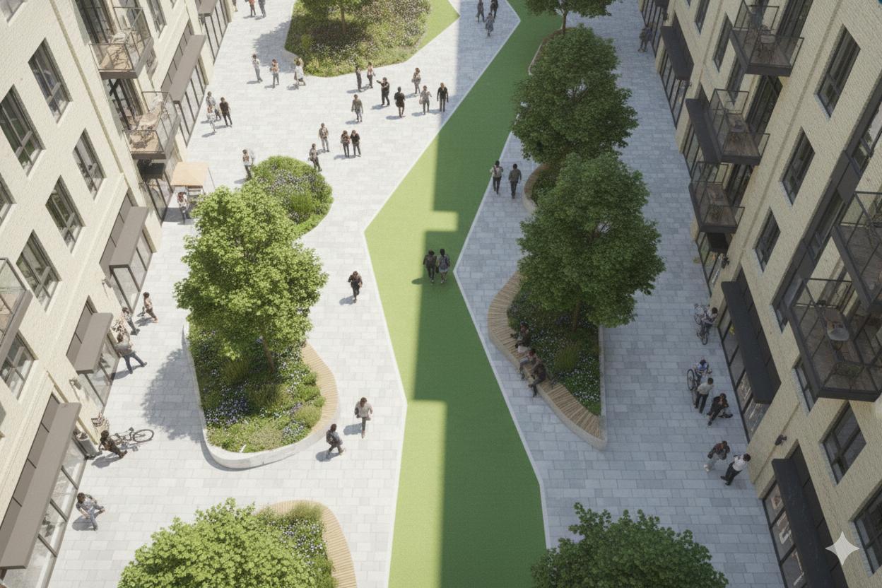
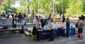
Connecting Green Spaces
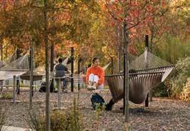
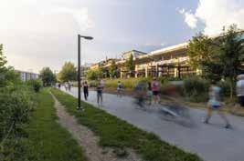
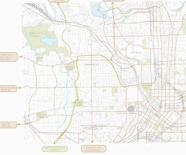
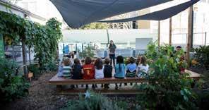
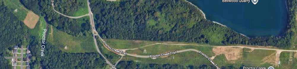
Westside Corridor offers opportunites for outdoor classrooms like EcoCommons at Georgia Tech, as well as connectivity to the Beltline and Proctor Creek Trail, multi-modal living, and mixed-use developments with green roofs or parks attached.
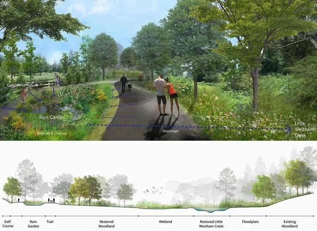
This multi-use trail includes stormwater features, native plantings, and outdoor classrooms, enhancing campus-neighborhood ties similar to Westside’s boundaries.
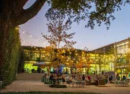
Westside Corridor can be one of Atlanta’s most successful TODs.
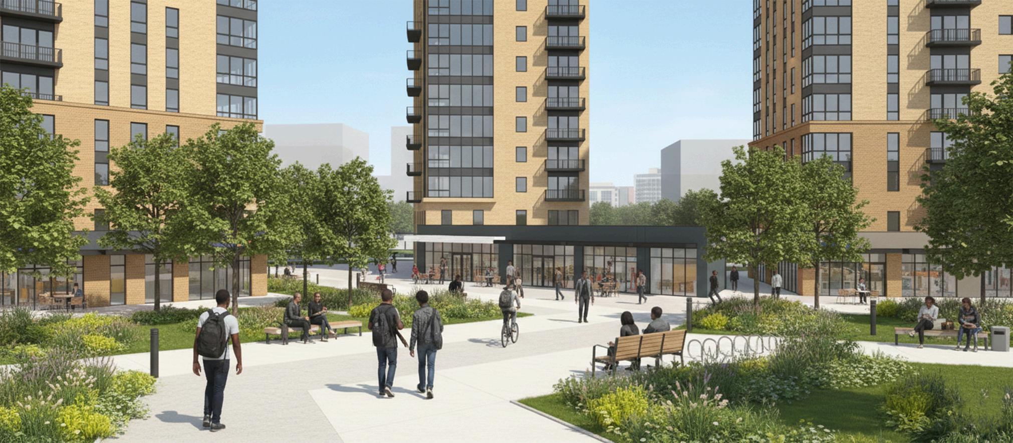
A successful Transit-Oriented Development (TOD) creates a vibrant, high-density, mixed-use community within walking distance of transit hubs, prioritizing people over cars. Key elements include compact, walkable design; a mix of residential, commercial, and civic uses; reduced, managed parking; and high-quality public spaces.
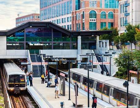
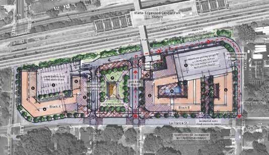
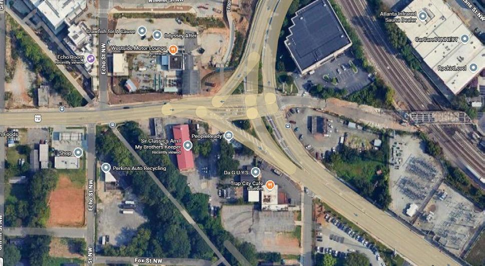
Bankhead Marta Station Platform Expansion
• Due to be completed by 2027
• Extension of the existing platform to ac-
commodate eight rail cars rather than the current two rail cars
• Designed for integration with future Transit-Oriented Development
• Connectivity to 21 acres of potential mixed use development
• Connectivity to Parks
The 6.4 acre development offers:
• Marta train and bus access
• Walkability to Little Five Points and Edgewood shopping center
• Local restaraunts and cultural facilities
• Parking decks
• Residential Space
• Commercial / Office Spaces
• Community green space
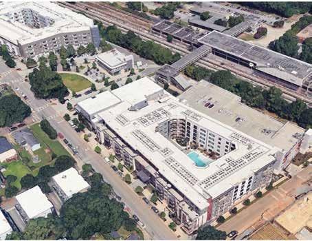
The total investment to develop the Edgewood-Candler Park MARTA Transit-Oriented Development (TOD) area is approximately $95 million. This multi-phase project, which transformed underutilized parking lots into a mixed-use hub, includes 350+ residential units, a public park, retail, and a 393-space parking deck.
InvestAtlanta announced that its subsidiary,Atlanta Emerging Markets, Inc. (AEMI), has been awarded a $75 million allocation of New Markets Tax Credit (NMTC) by the U.S. Department of the Treasury’s CDFI Fund.
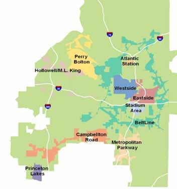
Westside Neighborhoods Recieving the Funds: • Atlanta
University Center • English Avenue • Vine City • Bankhead •
Upper Westside • Summerhill/ Peoplestown • Southwest
Atlanta R e quirements
• $ 5 Million Project or More
• Create a strong social impact but have a funding gap and/or a struggle to acquire traditional capital
• Enity must be located in an eligible census track
• Funds can be layered
The Mayor’s 5.1 Billion & Where is it Going?
• 1.9 billion for expanded transit networks
• $1.5 billion in trails & greenspace
• $1.3 billion in affordable housing (both single
• $170 million in health centers, recreation, and grocery
• $88 million for small business and commercial development
• $81 million in public infrastructure
The 5.1 billion seeks to integrate projects withing the existing TADs. The goal is to layer this funding with the TAD initiatives. & multi-family)
*Not readily available as of February 2026
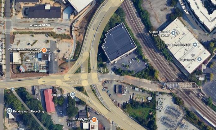
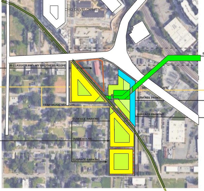
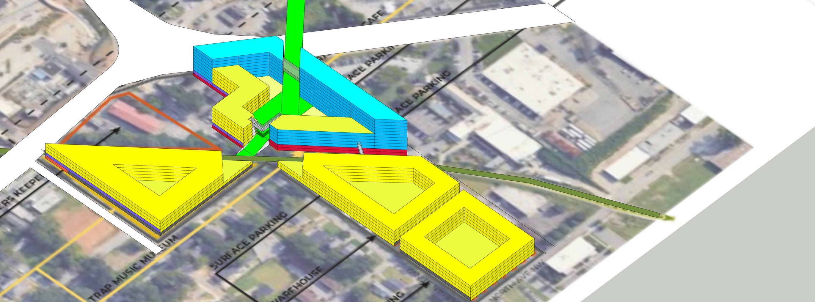
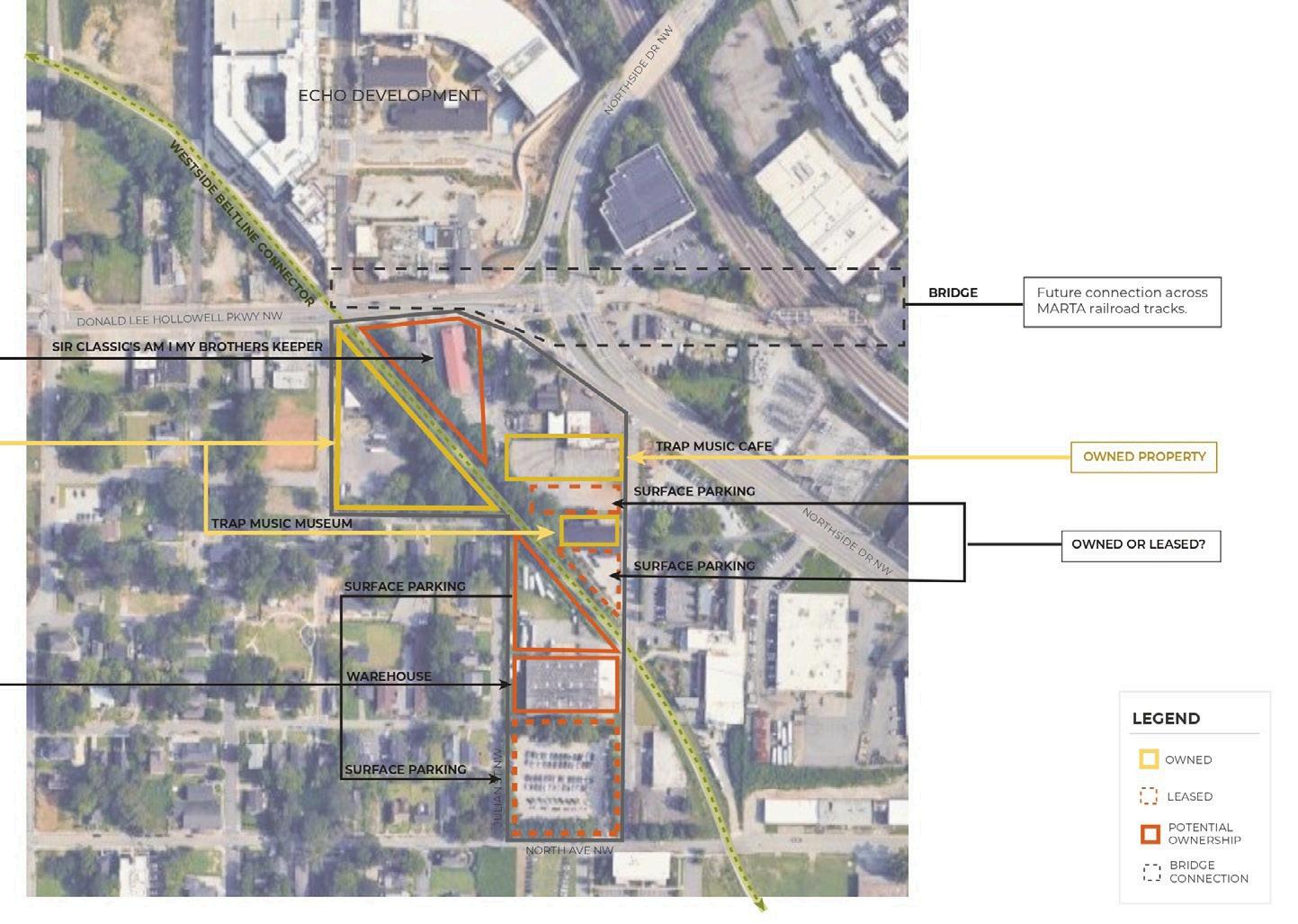
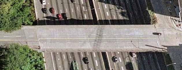
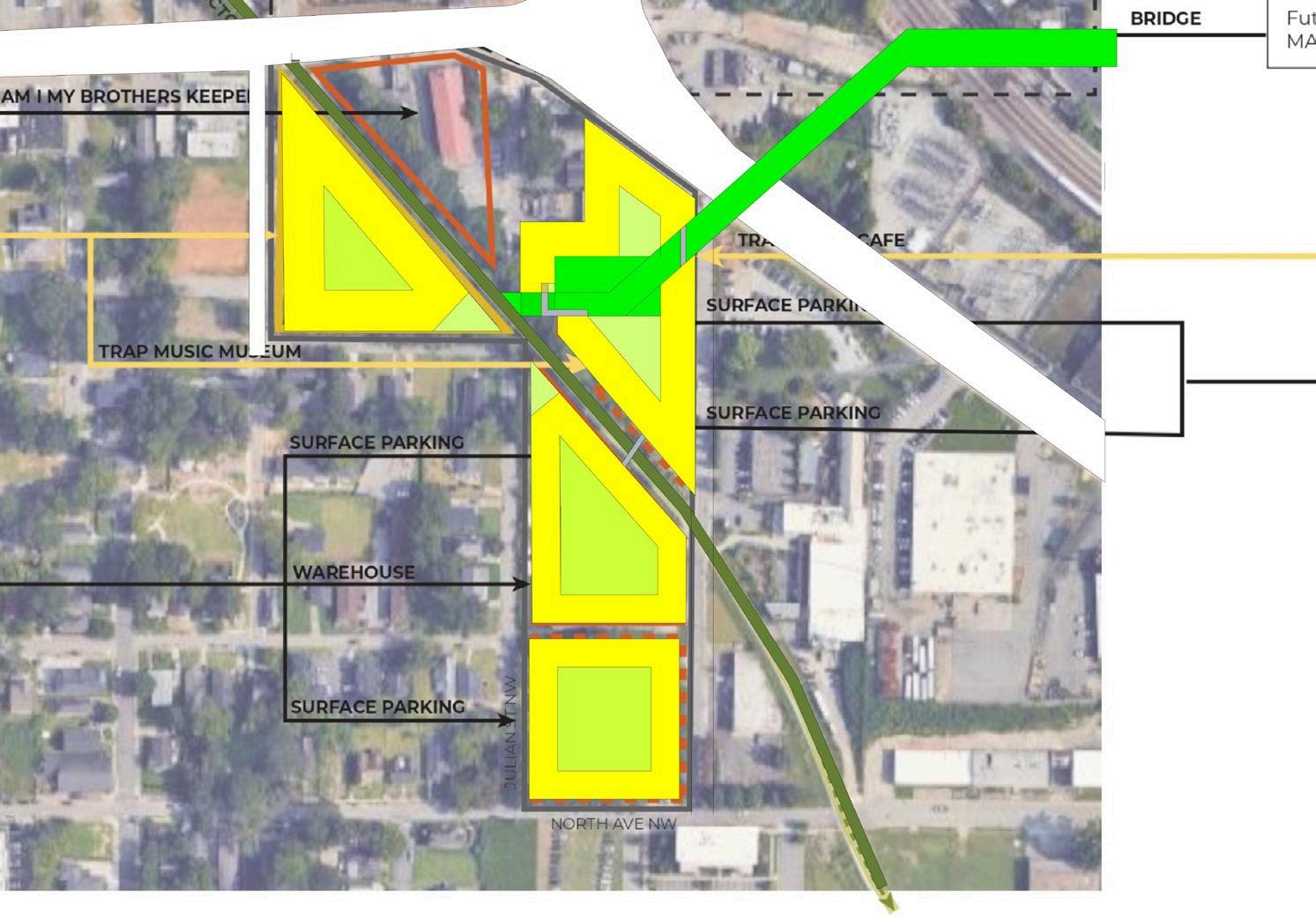
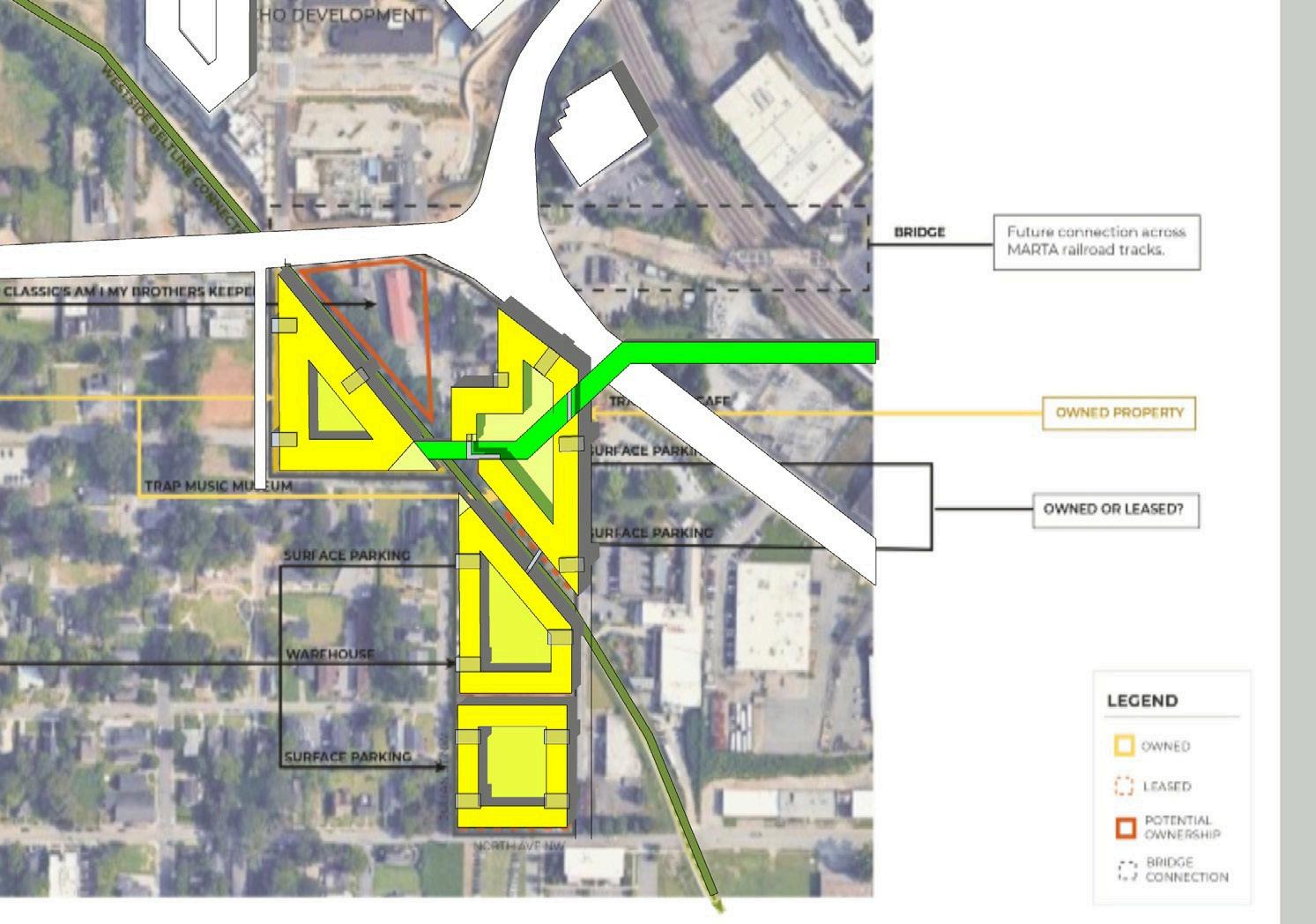
Ownership and boundary Trap Museum and Adjacent Sites
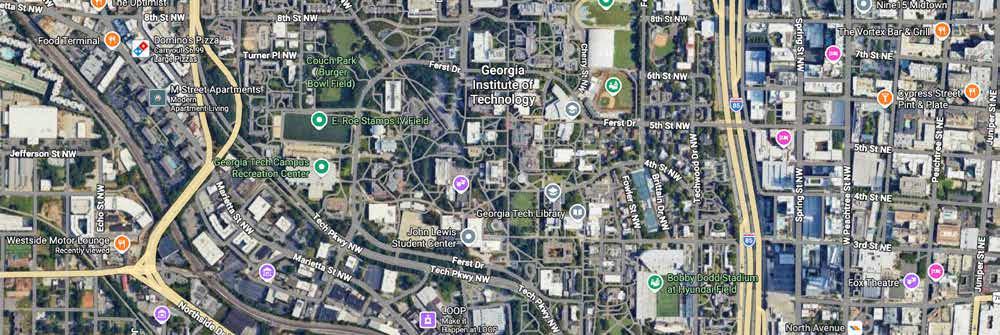
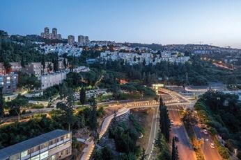
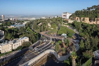
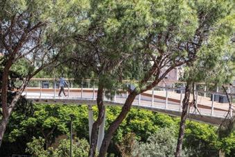
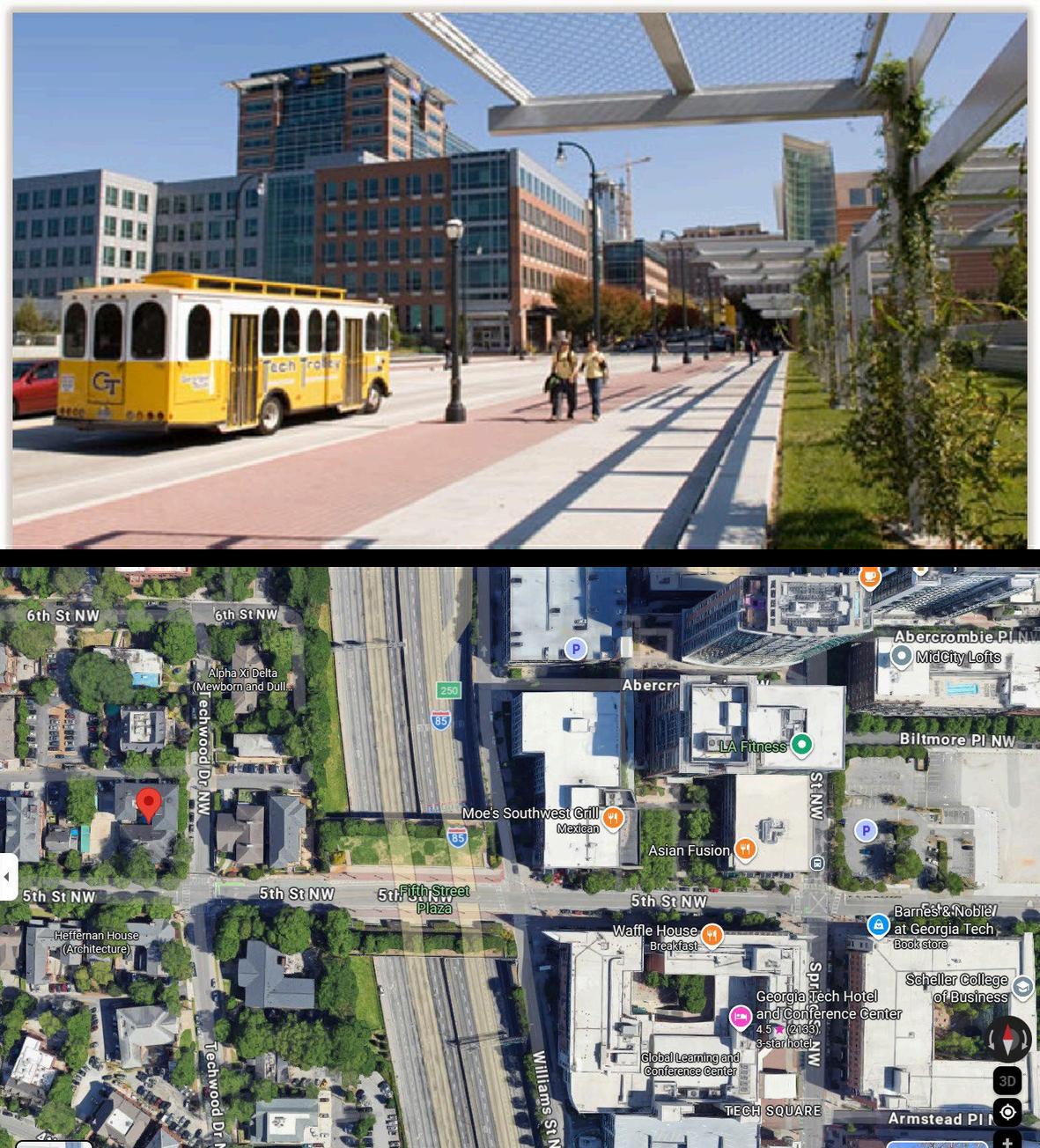
The Fifth Street Bridge Park Expansion
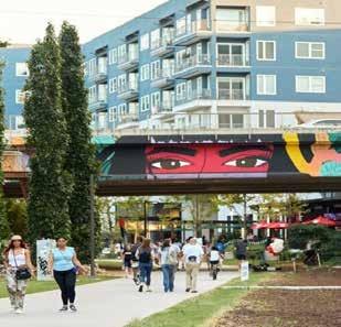
created a direct link to Georgia Tech’s campus, Tech Square and the Midtown business community, therefore creating economic growth for local businesses and offering safe pedestrian access to off-campus community events for students.
• Incorporated elements: 24 foot wide
sidewalks, seat walls, lighting, planted landscape area, and bike lines
Bring Students across Northside Dr
Soft seamless transition
(Park walking trail that transitions into a bridge and feeds back into another green space
Close off framing view (allow lower level circulation under building)
Density hugs the transition back down to path of the bridge
Precedent: The Technion Entrance Gate Bridge
Supports and strengthens the existing street fabric

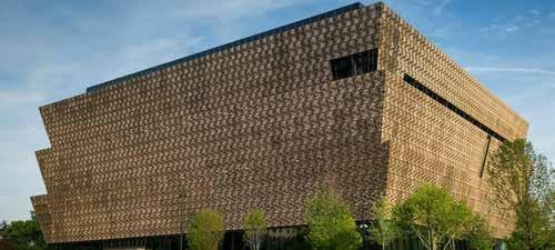
Freelon designed the museum to be a “portal” into the African Diaspora, focusing on the movement of people from Africa to other parts of the world. The building’s glass façade features a three-story mosaic mural of a young child’s face, composed of hundreds of individual photographs, represent- ing the collective voices of the diaspora. Cultural Moment.
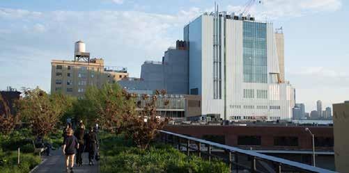
Symbiotic Connection: The building is set back slightly from the park, creating a pocket of open space. A subtle staircase and elevator connect the ground-level plaza directly to the High Line entrance. Offering connectivity to culture and green space.
The facade’s “masonry-framed” windows of varying proportions are inspired by the rhythmic patterns of Harlem’s historic apartment buildings and brownstones. It is something that transforms 125th street and represents renaissance for harlem - culture on the corridor.
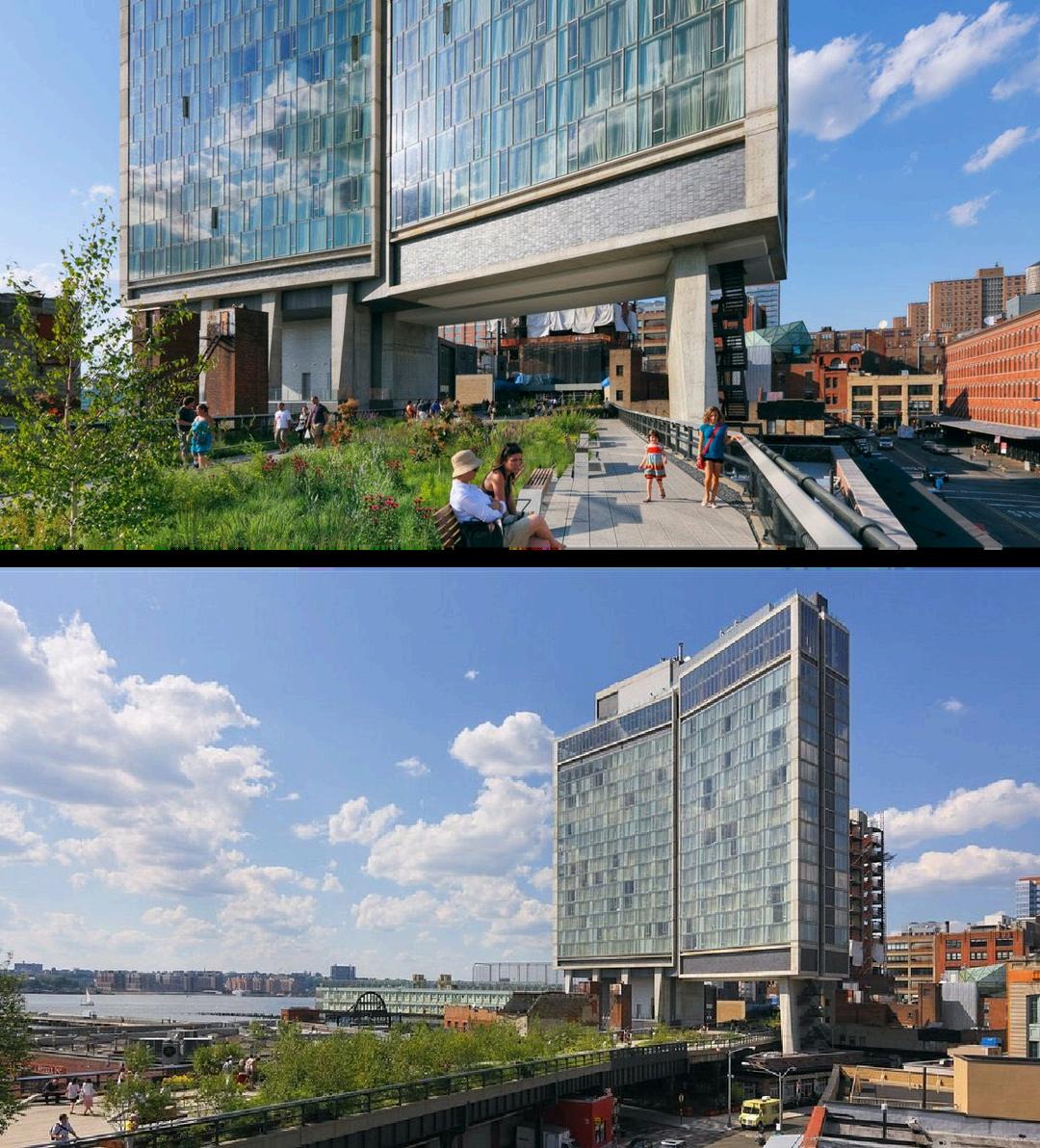
TheHigh Line physicallypassesunderneath the hotelbuilding,turningthe structure into an inhabited bridge rather than a standalone object.
The hotel mass is lifted above grade, creating a clear pedestrian corridor where the park flows uninterrupted — architecture yields to public movement.
Instead of blocking the High Line, the building frames it, compressing the space momentarily and then releasing it creating a cinematic sequence of approach → underpass → reveal.
Guests experience the park vertically:
High Line users look up into hotel rooms and lounges.
Hotel occupants look down into the moving landscape of the park.
This creates constant visual exchange between private (hotel) and public (park), activating both realms.
Structural columns are minimized and pushed to edges so the High Line feels like it is sliding through the building, not merely passing beside it.
Ground-level permeability is preserved — the High Line remains continuous, readable, and dominant as urban infrastructure.
The underside of the hotel becomes an urban room: framed views controlled shadows acoustic softening intimate scale before opening back into wider park segments.
Retail, lobby, and hospitality programs are deliberately positioned to front the High Line, turning circulation into commerce and social activity.
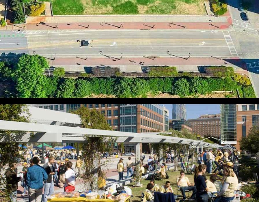
The plaza operates as a habitable bridge, transforming a former traffic-only crossing into a pedestrian-first urban connector over I-75/85. Instead of reading as infrastructure, the deck becomes public ground people experience it as plaza space, not a highway bridge. The intervention reconnects two disconnected urban fabrics: Academic core (Georgia Tech campus) Innovation/commercial district (Tech Square) Pedestrian movement is choreographed as a sequence, not a shortcut: campus edge planted forecourt bridge-plaza urban arrival Landscape elements (trees, planters, seating) mask the scale and noise of the interstate, psychologically compressing the highway and expanding the pedestrian realm. Seating edges and widened sidewalks encourage lingering, converting what was once a transition zone into a destination. Views across Midtown are deliberately framed, while downward views to traffic are softened — shifting perception from infrastructure to urban room. The plaza works as a social condenser: students crossing between classes researchers moving between buildings informal meetings outdoor study and pause zones Lighting, paving texture, and street furniture establish a distinct identity, signaling arrival into Tech Square while maintaining continuity with campus character.


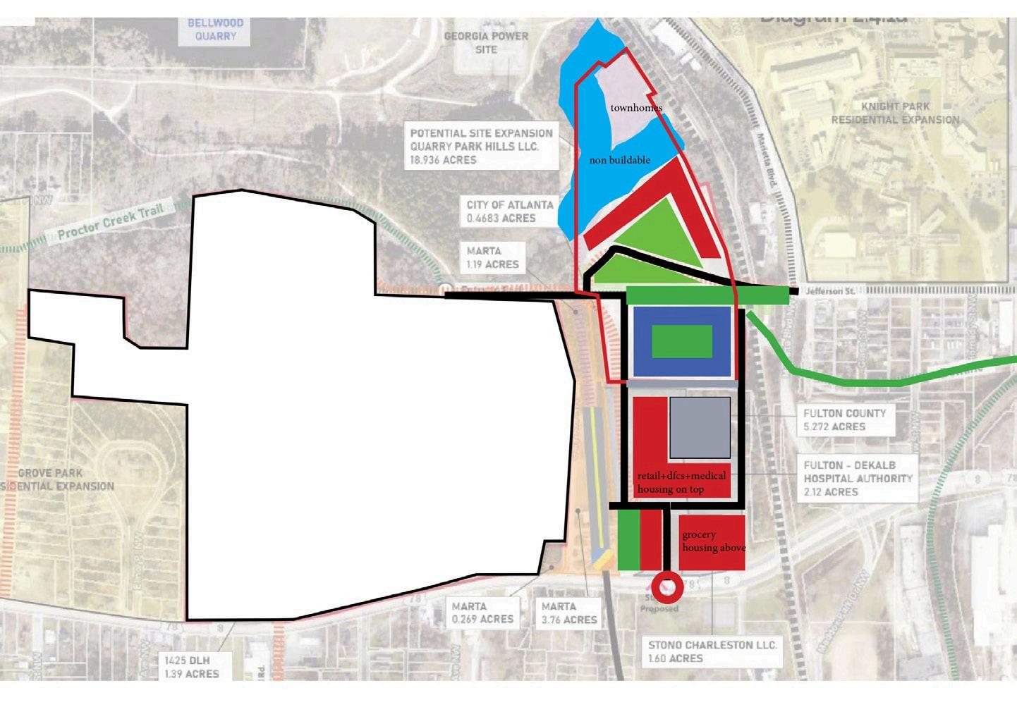
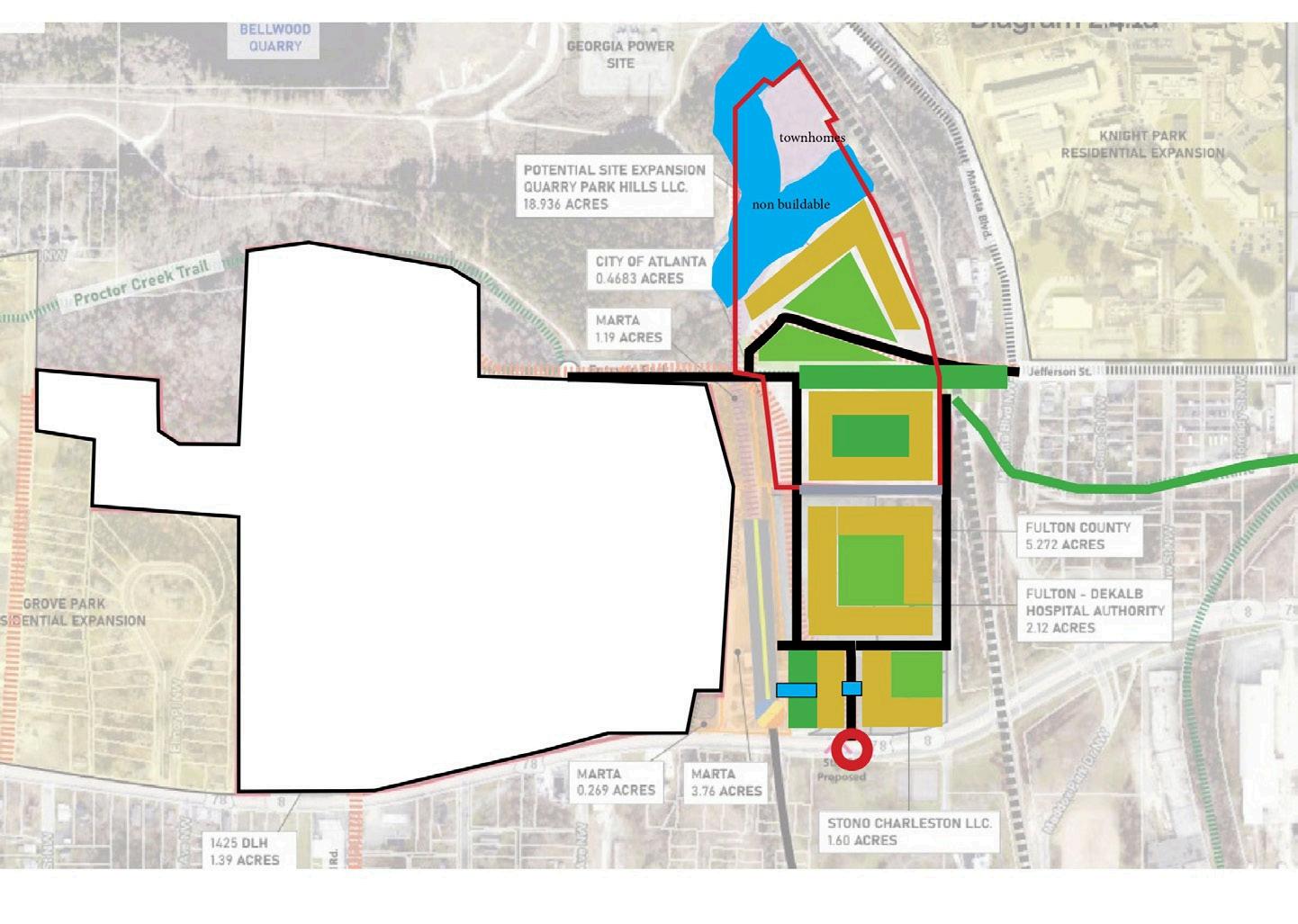
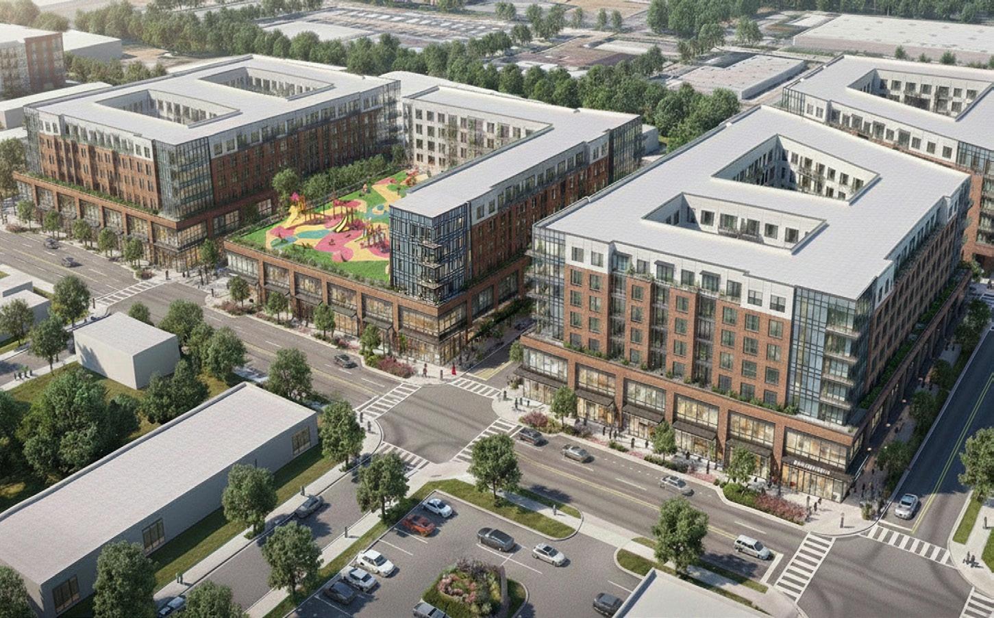
Grocery Store- 50,000 SF
Retail + Community Needs- 40,000 SF
Office Spaces + Healthcare - 60,000 sf
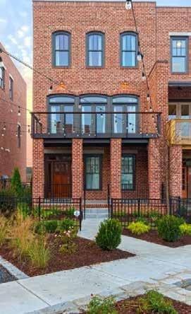
Housing for Community+Market Rate - 1500 units
@ 850 sf per unit
Student Housing - 1000 units

Grocery Store- 50,000 SF
Retail + Community Needs- 40,000 SF
Office Spaces + Healthcare - 60,000 sf
Housing for Community+Market Rate - 1500 units
@ 850 sf per unit
Student Housing - 1000 units