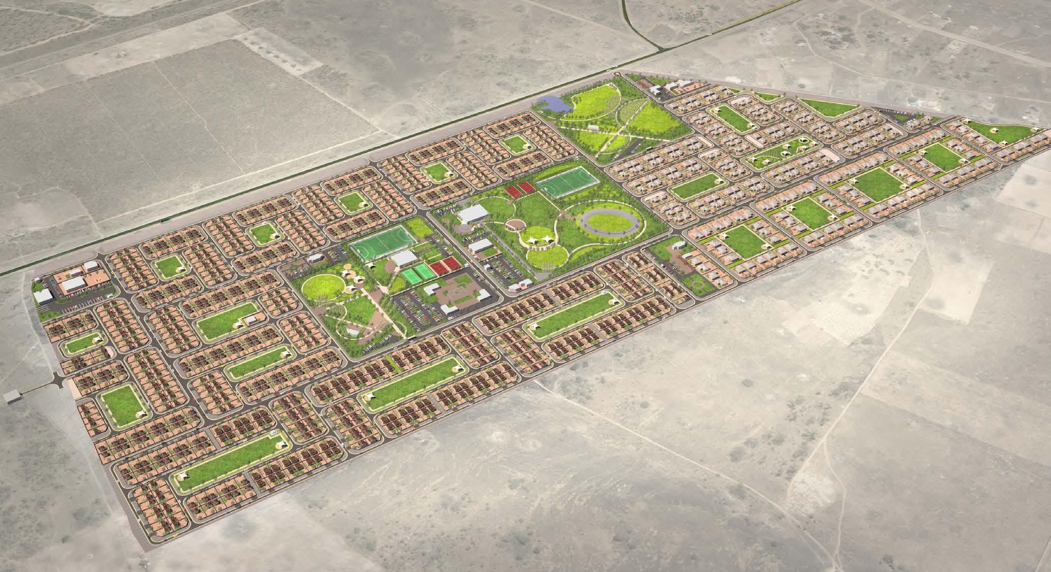
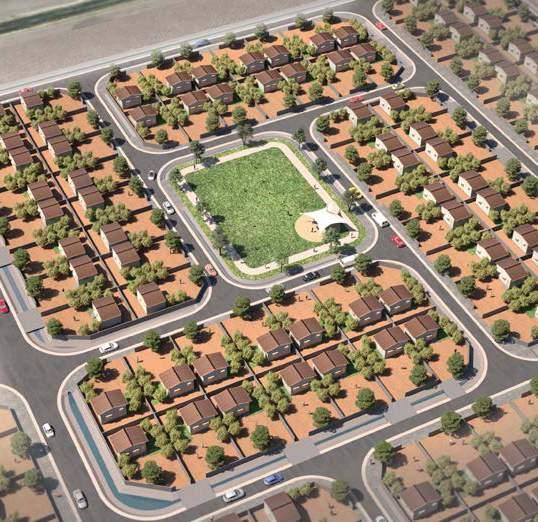
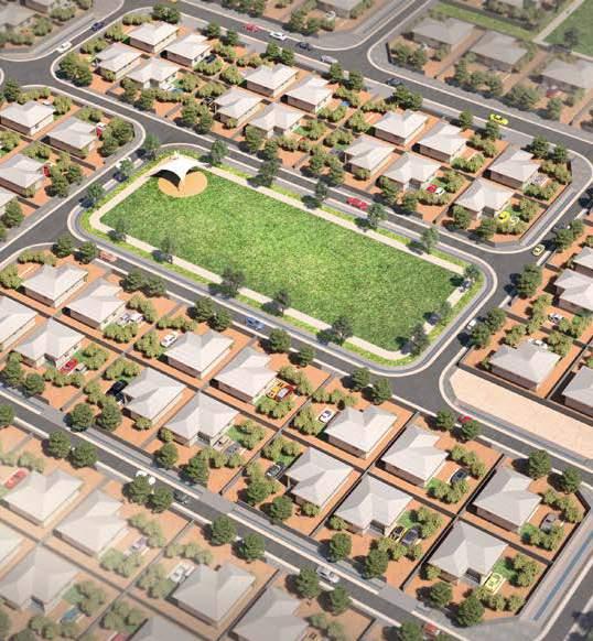
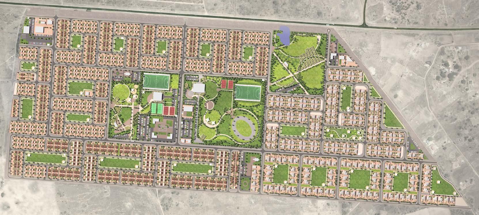
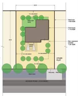
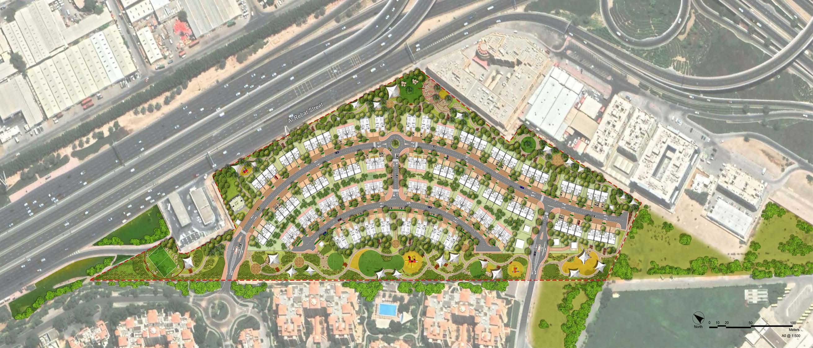
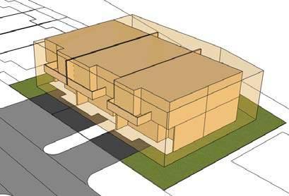
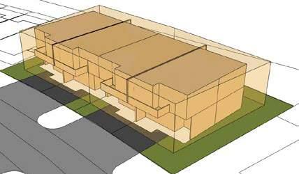
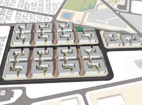
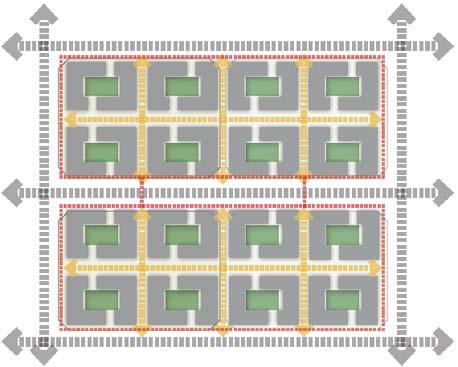
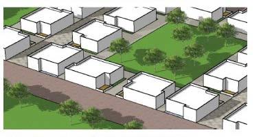
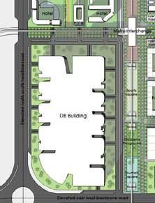
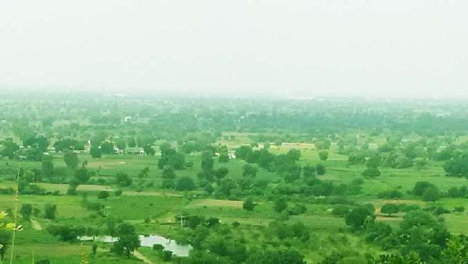
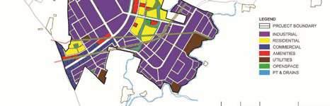
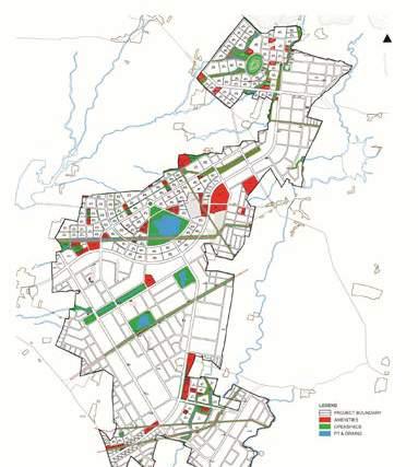
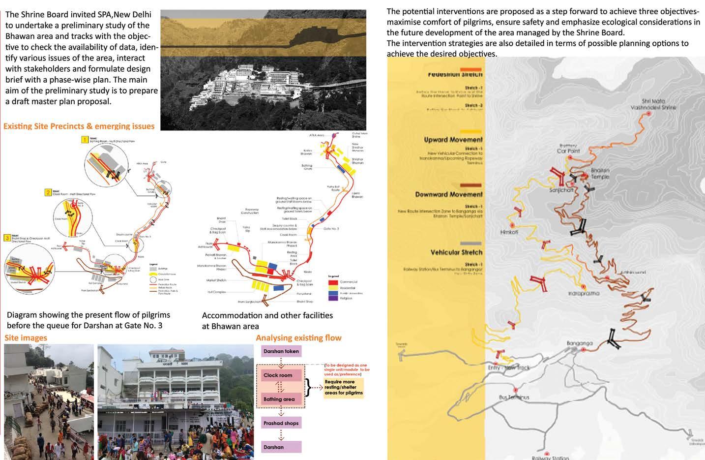
In the Darwendale Project which is a greenfield project, a permanent housing policy and scheme is to be established to accommodate the mine employees. The project had total four stages -Final stage to detail the concept master plan along with the detailed concept design for the infrastructure provision and architecture. The project aims at the larger welfare of the employees keeping the view that a better housed workforce includes greater labor stability and improved productivity. The project is expected to be highly beneficial to the working group, which cannot access a satisfactory housing solution due to the severe supply and affordability gaps affecting the housing sector in the region.
An Integrated and practical design approach has been adopted for building the architectural narrative with respect to environment, technology, socio-cultural aspect, functional and aesthetic determinants.
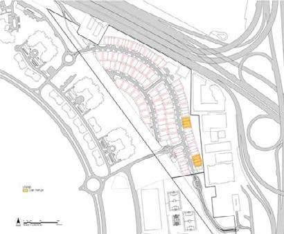
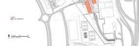
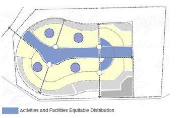
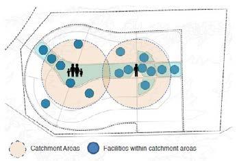
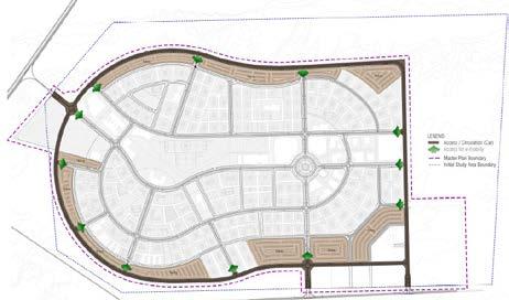
A key goal in locating the uses was to integrate them with the transport network to promote sustainable transport, to support the viability of the use, with schools and other community infrastructure in locations where they could be easily shared amongst all the neighborhoods. All the utilities which serve the larger population (town level) are placed near the highway for easy accessibility.
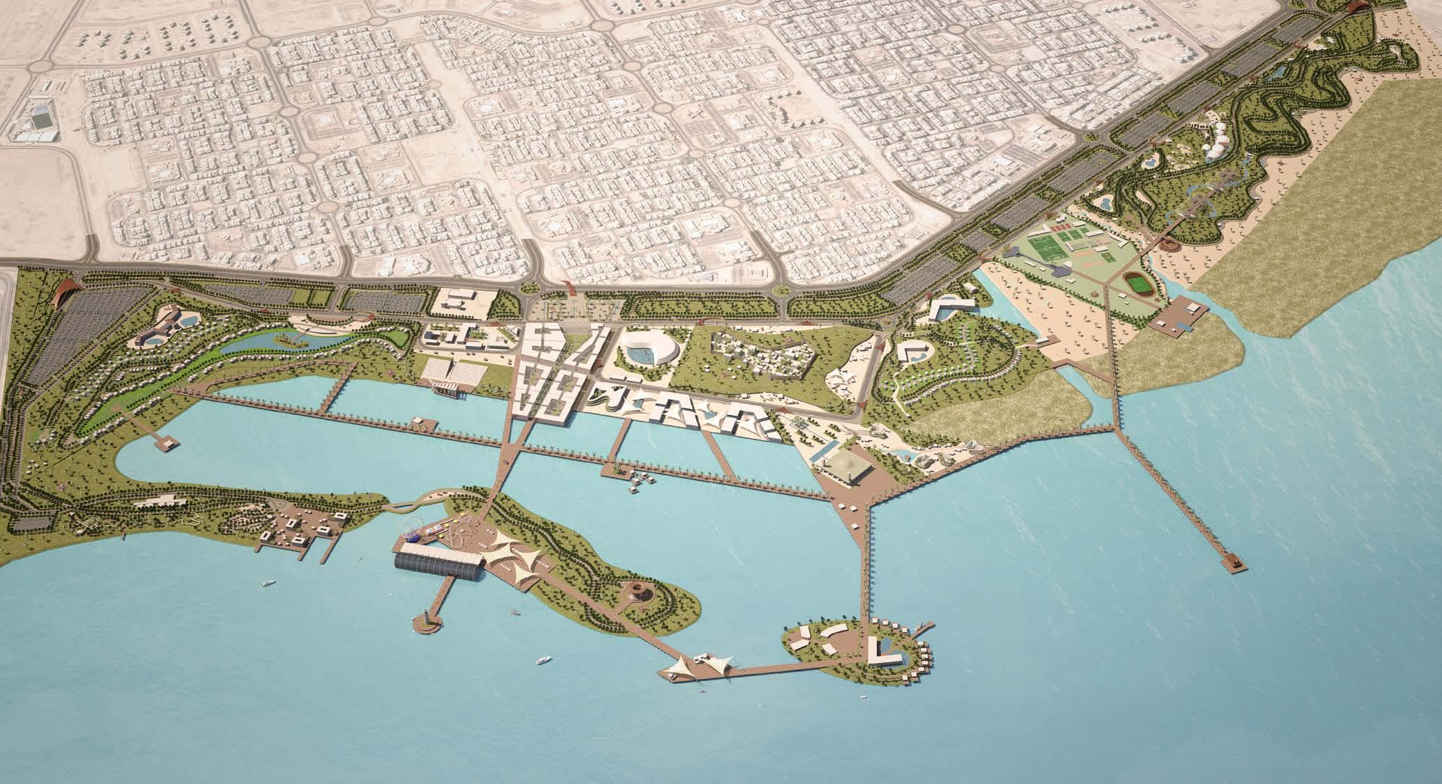
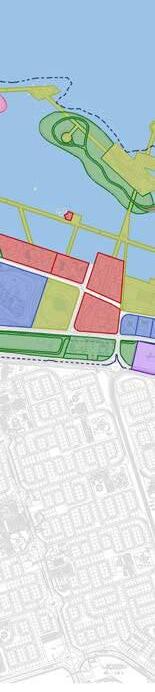
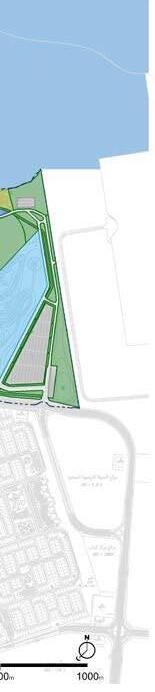
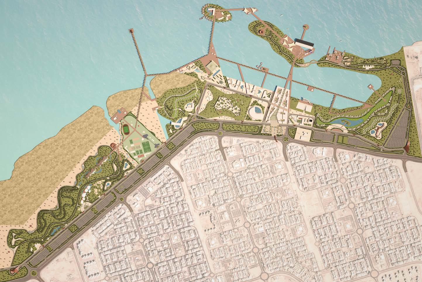
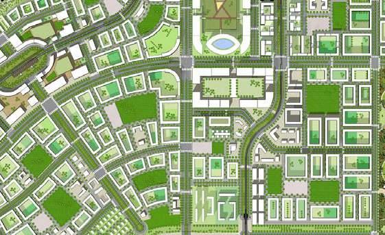
MASTER PLAN OF AL JAHRA WATERFRONT
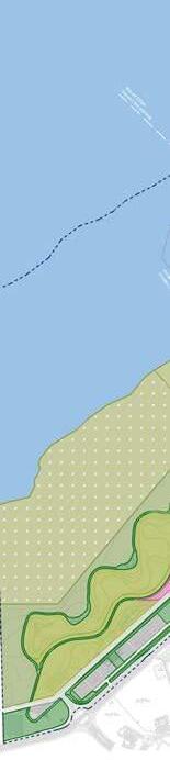
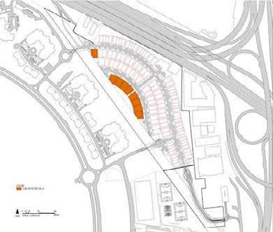
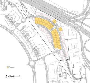
The project is based on the opportunity to promote the development of Al Jahra waterfront as a key recreational area at city and neighbourhood level in line with Kuwait physical development plan.
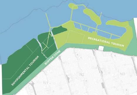
The vision for Al-Jahra Waterfront envisages a holistic transformation of the 7.3 km2 water strip into a pole of leisure and touristic entertainment, while meeting the needs of both the local residents of the area and the economic partners of the project.
Vision and Objectives
Some of the potentials of the site
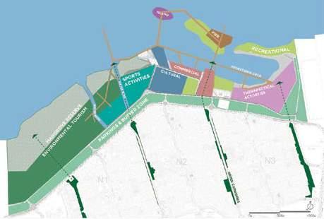
The project is expected to create an identity for the place adding to the existing features of the site. The main drivers of the adopted development approach are
Environmental sustainability
Urban Integration
Smart and light mobility
Social and cultural acceptance
Economic and financial sustainability
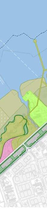
Use the Jahra Natural Pools reserve and the seafront to change the image of Al
Attractiveness offered by the intertidal zone and accessible waterfront.
Competitive site positioning supported by the current market trends to develop touristic recreational and hospitality sectors.
Proximity of Jaber Al Ahmed city (JAC) to support the development.
Potential to continue the green corridors from the JAC leading to waterfront.
Approaches adopted for urban/ regional level spatial integration are:
Opening up water edge for the public
Some of the constraints are:
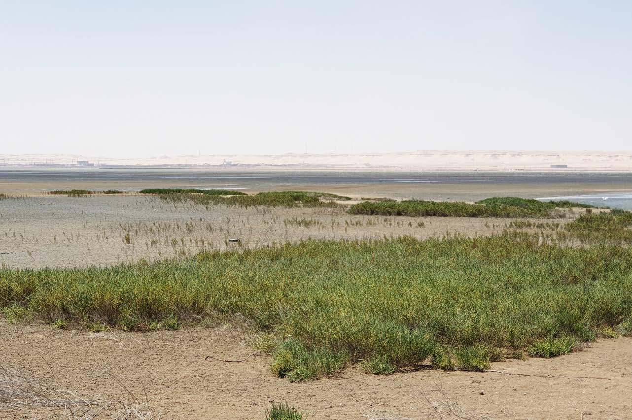
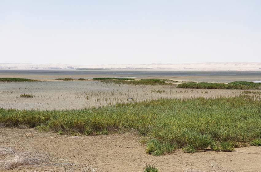
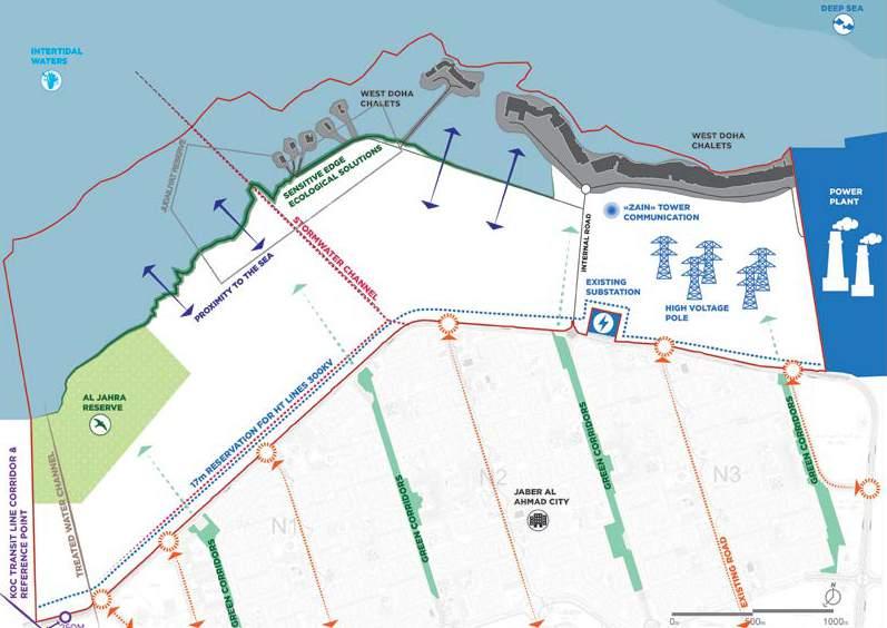
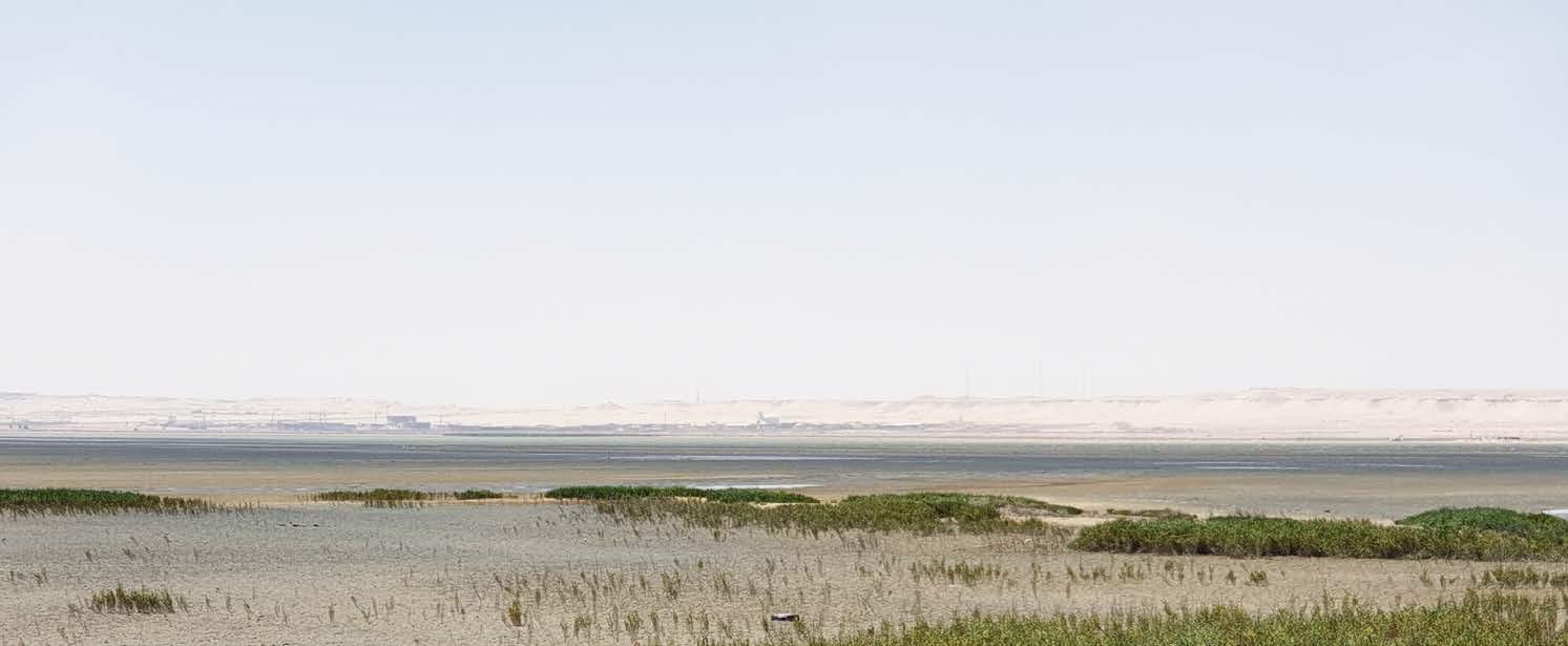
Fragile and sensitive vegetation and ecological edge.
Proximity to power and desalination plant.
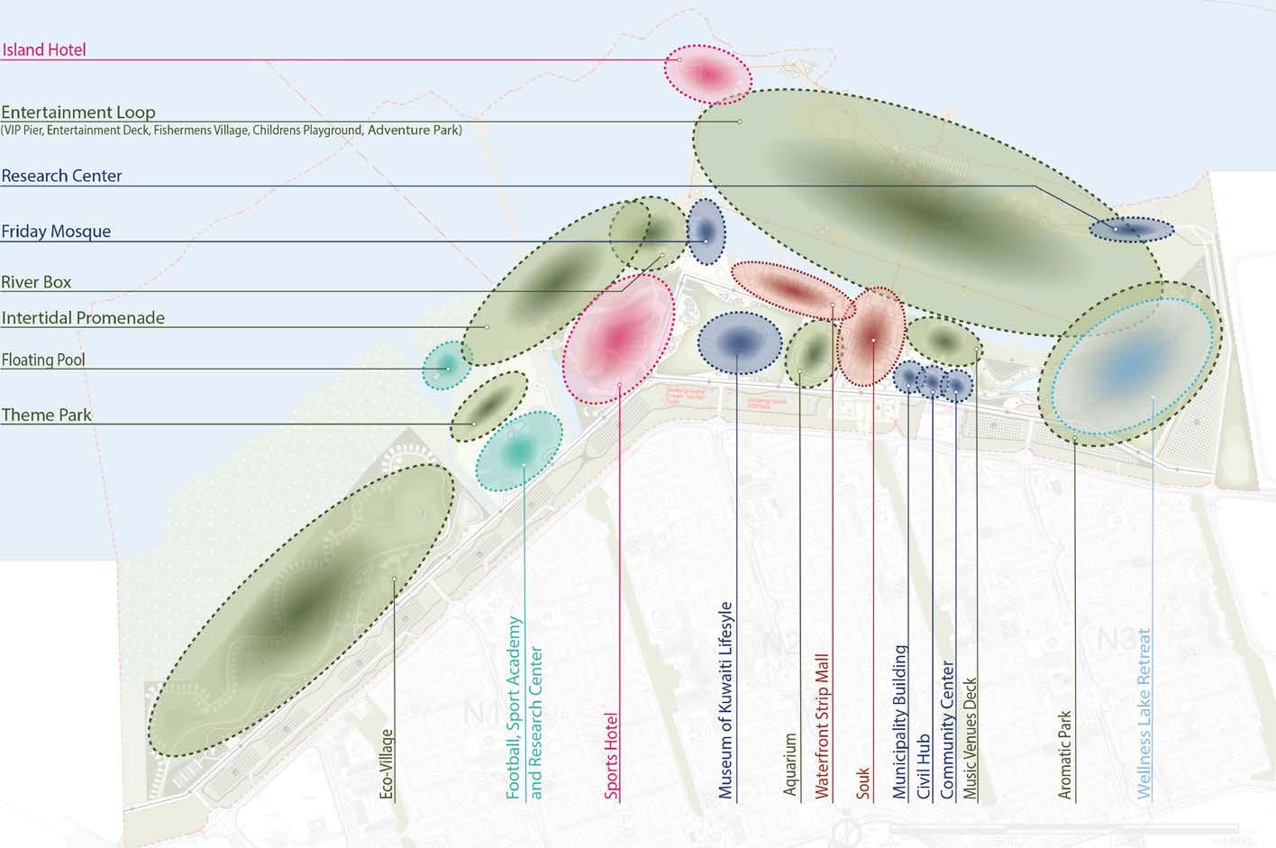
Asserting the tangible identity of the place by utilization of intertidal water edge
Asserting intangible identity of the place by giving urban activities that thrusts the Kuwaiti lifestyle and identity, its traditional art forms and architecture
Existing High Voltage (HV) overhead power transmission towers and proposed route onsite.
Storm water discharge channel. Presence of west Doha chalets.
Use the Jahra Natural Pools reserve and the seafront to change the image of Al Jahra.
Attractiveness offered by the intertida zone and accessible waterfront.
Competitive site positioning supported by the current market trends to develop touristic
recreational and hospitality sectors.
Proximity of Jaber Al Ahmed city (JAC) to support the development.
Potential to continue the green corridors from the JAC leading to waterfront.
The main concept focuses on the following:
other side creating more interactive inner development.
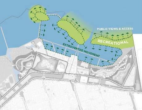
Meet the sea withwith minimal or no environmental impact
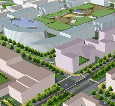
• The development will integrate different land uses that will address Nature (the environmental asset of the site), Heritage, Culture, Sports and Edutainment (education and entertainment).
The development will integrate different land uses
Commercial activities will cater for the area’s need and will contribute to the liveliness and vibrancy
Creating an active interface with water
Two hills benefit from the topography in the east from the power plant proximity
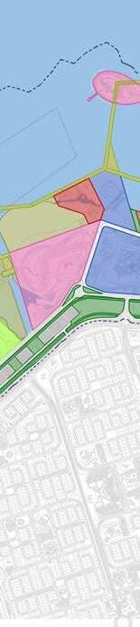
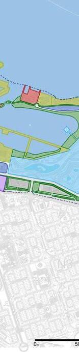
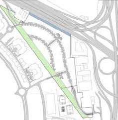
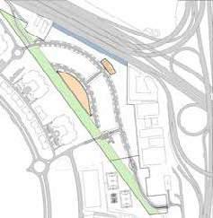
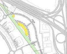
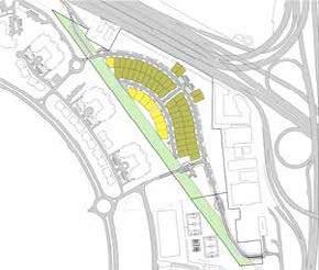
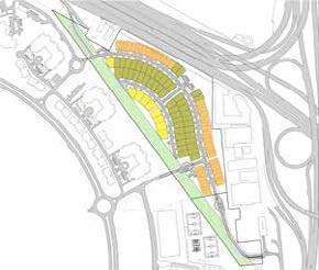
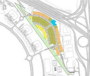
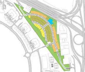
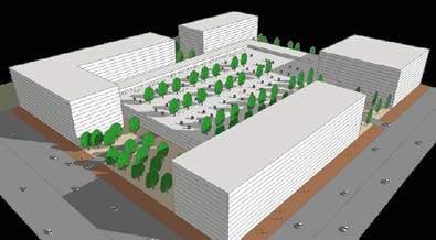
Detailed Master Plan without Chalet
side of Kuwait.
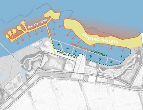
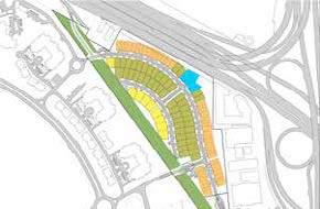
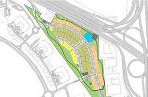
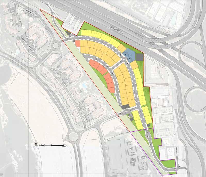
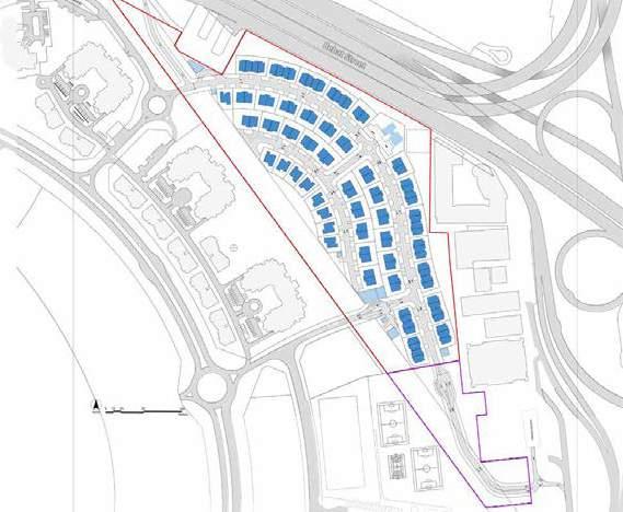
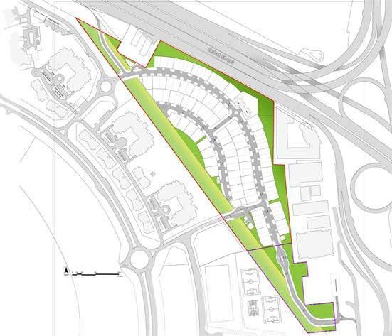
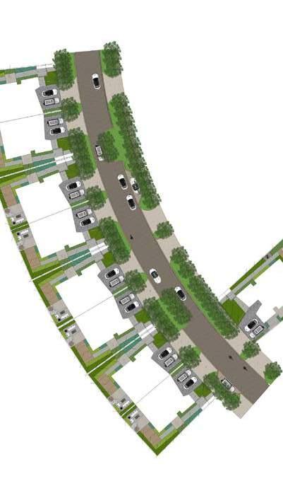
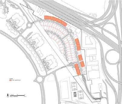
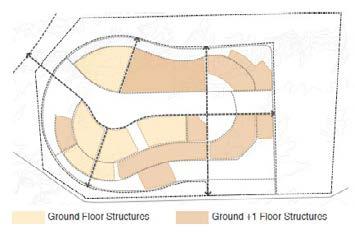
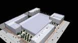
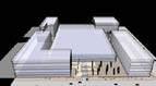
Option 2 In this option, the chalets are kept as is. The recreational activities along the inner lagoon will still give it the characteristics of a tourist destination. However, the development will not benefit from an open sea frontage, thus giving it an introverted feel. All the maritime mobility that might connect the project along the sea will also have to be ignored in this case.
Existing Chalets Introverted Movements Double Sided Views and Activities
The two main nodes of the project
The chalets area is incorporated in the project.
Figure 2-11:
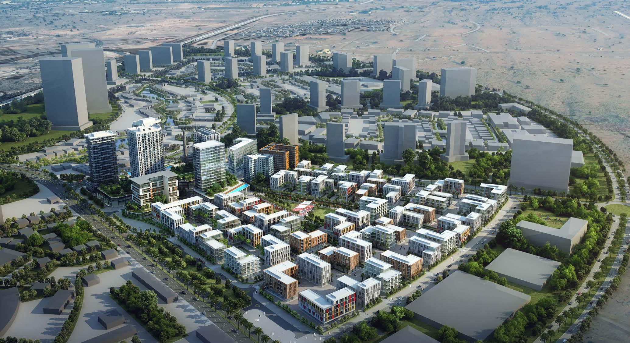
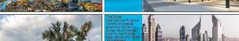
CITY OF ARABIA
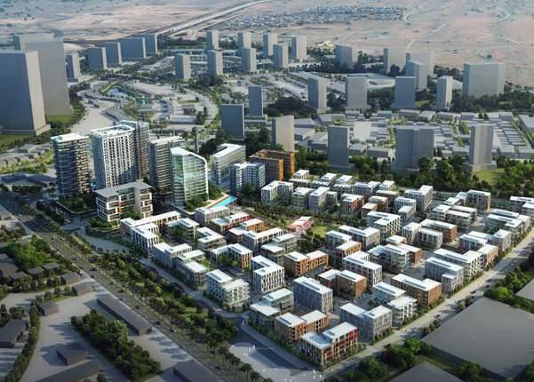
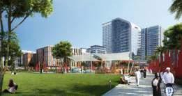
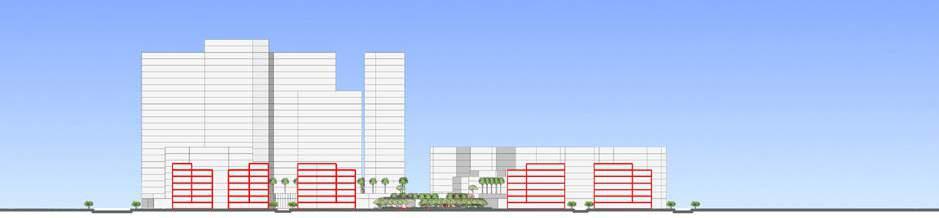
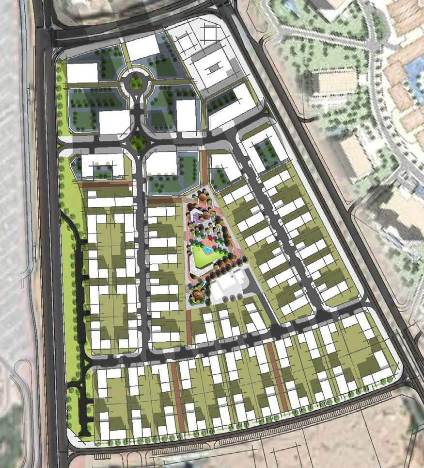
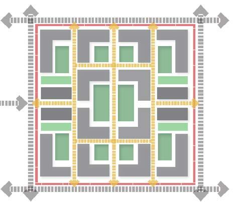
The proposed project site is within the City of Arabia development in Dubai which is a self-contained city consisting of multibillion retail, residential, commercial and entertainment destination located at the gateway towards DUBAILAND.
The project aims at creating a livable community development that enriches neighbourhood and at the same time better utilizing the land assets and proposeing the best parcels for land sale that matches market.
maximum which run face exposed by reWorld
Vision and Objectives Concept Master Plan
The project site is a part of the City of Arabia, and is located at the southern half of the development zone designated as “Downtown World” in the Dubailand master plan.
The core objectives of the project are;
Creating plots for land sale.
Creating a livable community development .
Benefiting from the close proximity to the IMG World Theme Park.
2.5 Conclusive Assessment
Creating a place that enhances the infrastructure, viability.
Design Perspectives
Inferences from Urban Planning and Design Perspectives
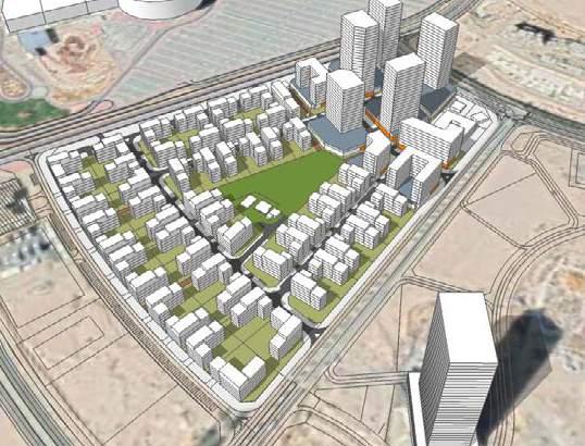
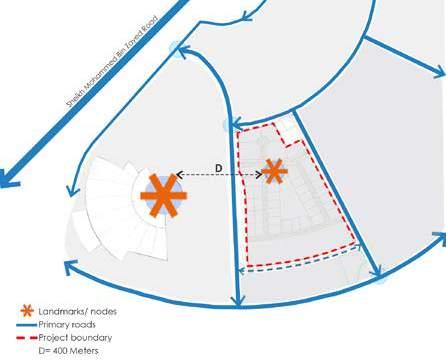
and Location of Landmarks
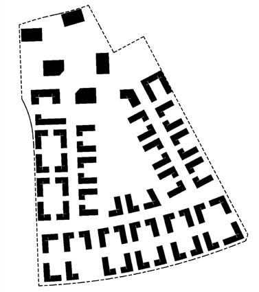
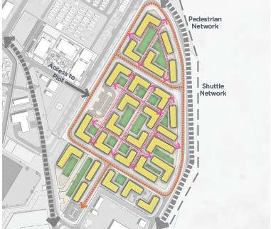
y To be a climatologically responsive design, maximum number of plots are to be accessed from roads which run North- South thus making the access to these plots face east or west. These plots will thus have its lengths exposed
y In order to benefit from the close proximity to the IMG World Theme Park which is to the west of the plot, the project site
Figure 43: Access and Location of Landmarks
To be a climatologically responsive design
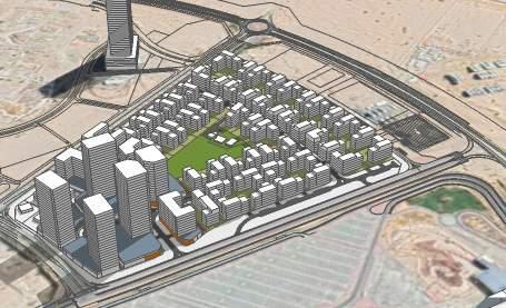
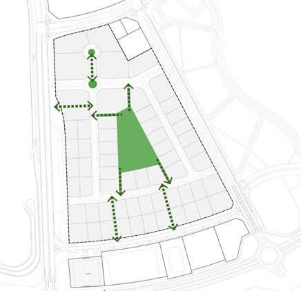
The project site should cater for an excellent hotel location which is accessible from the adjacent western road.
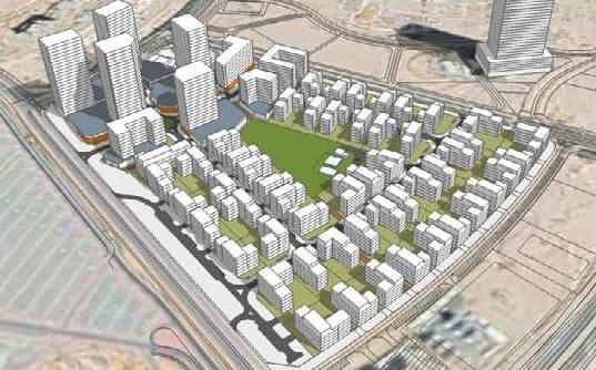
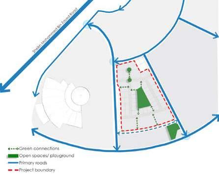
Figure 44: Provision of Community Facilities Figure 45: Open Spaces And Connectivity
44: Provision of Community Facilities
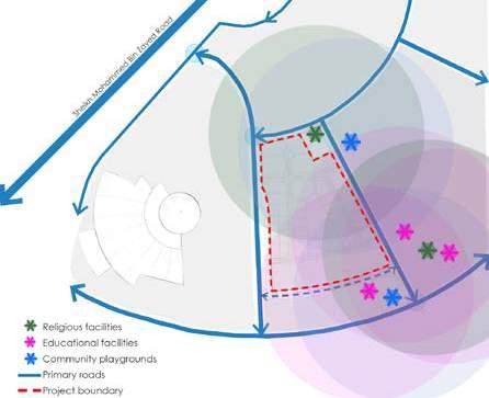
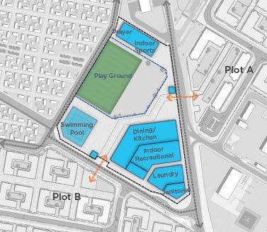
The site benefit a local mosque, Community playground, Nursery, Kindergarten, school and
45:
y As the site benefit a local mosque, Community playground, Nursery, Kindergarten, school and even Juma Masjid within the stipulated distance, these will not be provided within the project site.
Locating hotel site within 100- 150 m from the entrance to the site.
y To be a climatologically responsive design, maximum number of plots are to be accessed from roads which run North- South thus making the access to these plots face east or west. These plots will thus have its lengths exposed maximum to North or South directions which there by reduces the heating up of the buildings.
y In order to benefit from the close proximity to the IMG World Theme Park which is to the west of the plot, the project site
y The presence of open space/ playground to the south eastern corner of the site has to be taken into account in the planning and design.
y As the site benefit a local mosque, Community playground, Nursery, Kindergarten, school and even Juma Masjid within the stipulated distance, these will not be provided within the project site.
Figure 43: Access and Location of Landmarks Figure 44: Provision of Community Facilities Figure 45:
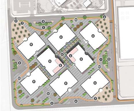
There is a sequence of green parks and alleyways that allows many of the residential building apartments of 5 floors to have wider views on greenery and optimizes privacy matters instead of one big park.
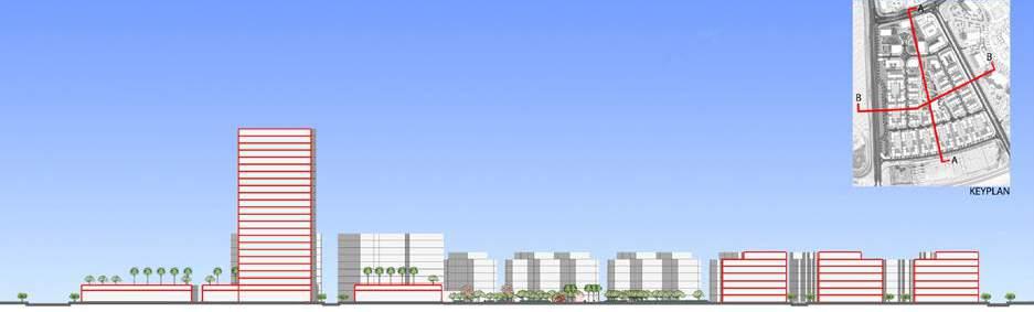
This network stretches till the southern adjacent park at the edge of the site. The activity area is an east-west retail street of 10 floors high with residential and office in the upper floors, a hotel tower and a residential tower at the north-western edge of the development.
The development is composed of 80% of residential plots of 1.8 FAR and a main retail street with all the activities and mixed used functions with quite a high GFA and two towers.
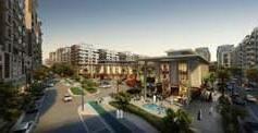
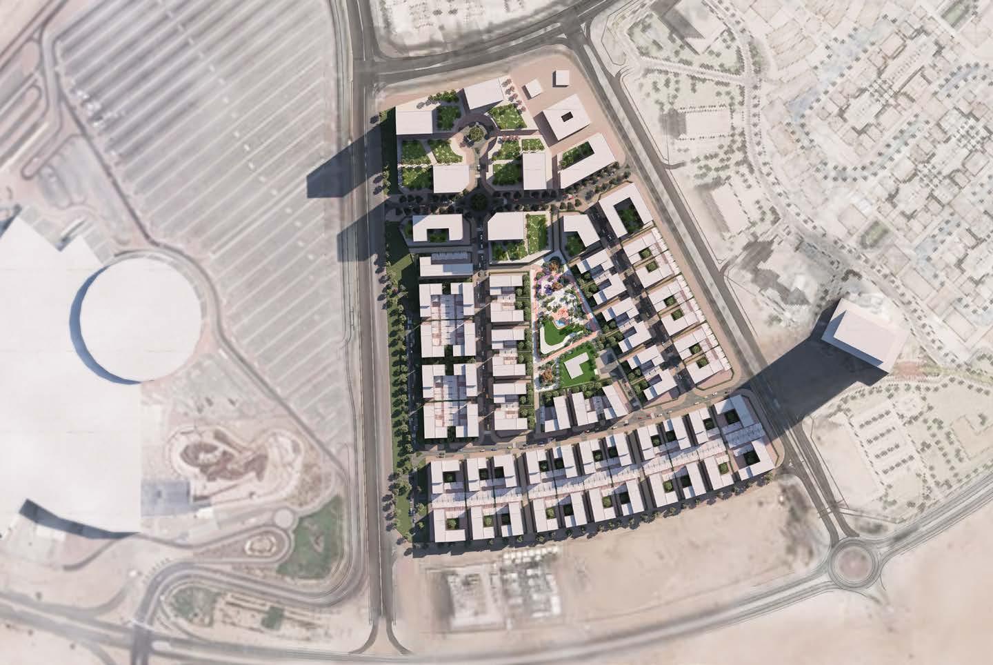
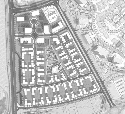
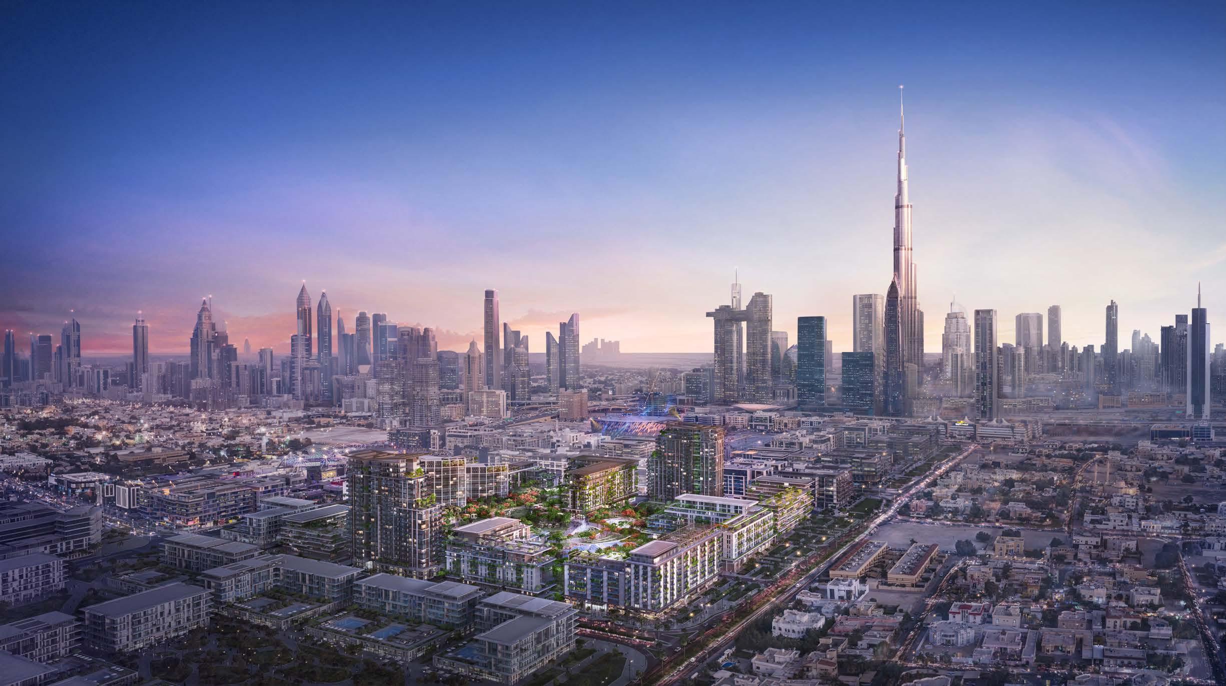
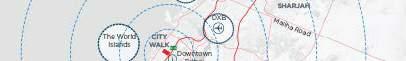
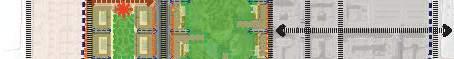
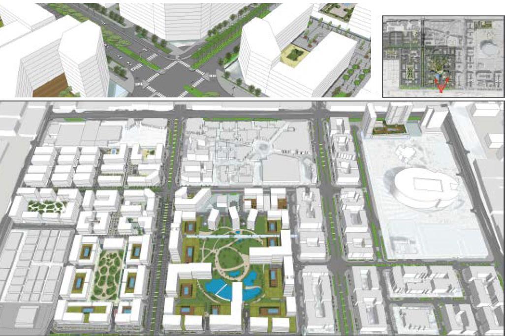
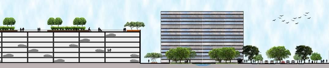
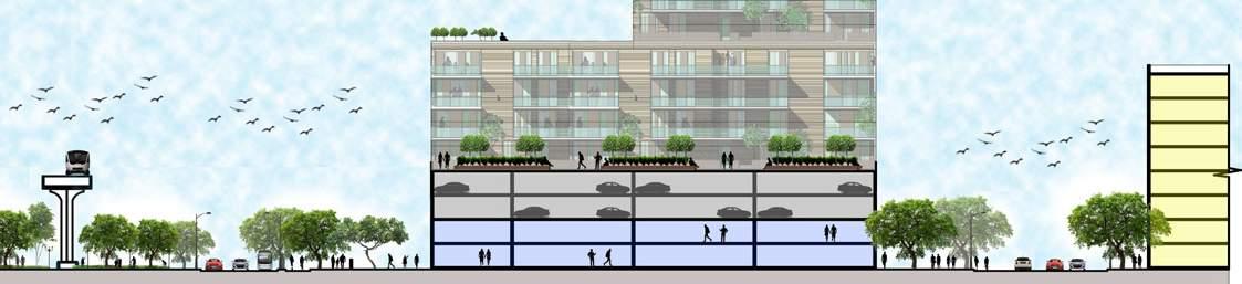
DUBAI CITY WALK
and Infrastructure
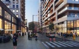
City Walk is a Mixed use development comprising Residential, Commercial, Retail and Leisure activities among other things, located within close proximity to Downtown Dubai. The design vision approach for City Walk is to create a walkable community with access to large private garden spaces within proximity to key urban spaces.
It will be developed in 3 phase. City Walk seeks to celebrate this legacy, offering a diverse range of activities for the Neighbourhoods in the heart of Dubai with hundreds of exclusive international retail offerings, upscale gourmet destinations, covetable residences, and plush hotels.
There were 3 volumes done for this project - Validation of concept Master plan & Preparation of Final Master Plan, Urban design Guidelines and Plot development sheets
‘A Neighbourhood that breathes’.
With City Walk already being recognized by its highend creative lifestyle destination, the vision for City Walk seeks to celebrate this legacy, offering a diverse range of activities for the Neighbourhoods in the heart of Dubai with hundreds of exclusive international retail offerings, upscale gourmet destinations, covetable residences, and plush hotels.
The project development strategy is based on the following factors.
Creation of Mixed Use Development.
The Development nature is Mid rise residential buildings.
Affordable apartments with acceptable standards.
Provision of Sufficient Social Services.
Opportunities
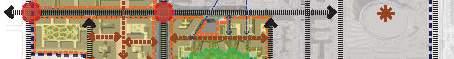
Neighbourhoods- City Walk can be thought of as a collection of ‘Neighbourhoods’ bounded by the main road network around its perimeter
Neighbourhood Cores-Each ‘Neighbourhood’ is activated by a central core, embodying the theme of the said area.
Walkable Neighbourhoods-Connecting the Neighbourhood cores are a series of key public realm routes which form the main pedestrian links across City Walk.
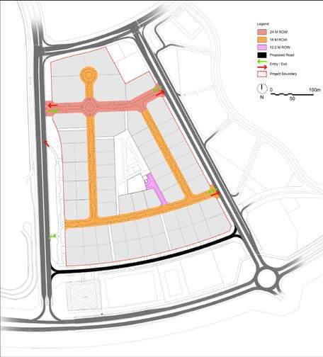
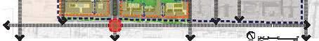
The structure plan documents the current status of the City Walk and outlines the key components, which include:
Medium and high density mixed use residential plots.
Leisure and recreational uses including club house.
Key vehicular routes; and Pedestrian circulation throughout the site with connection between the phases and the existing parts of City Walk.
Hospitality uses including a Hotel in Phase 3.
Establish a block structure which enhances the structure already established by the earlier phases
Respect and maximise key views across the development especially towards Burj Khalifa
The main Land Uses for Phases 3, 4.01 & 5 are predominantly Residential/Commercial plots. This is supported by Public and Recreational facilities as well as Parks and Open Spaces. Minor utilities are strategically located to address ease of connection to main roads. The plan sets out the key uses in City Walk including high density rise residential/commercial developments, Open spaces including central parks and between plots public realm, Low density residential towards the south of Phase 3.
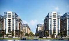
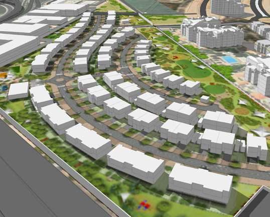
DUBAI FESTIVAL CITY-
Zone-6 Villa project is covering 1.5% of the total DFC master plan. It was originally planned as a residential apartments and later converted to low density residential with multiple prototypes of villas. It is positioned as a premium product primarily targeting Arab expats, Emiratis and South-east Asians in the upper middle end of the single-family market.
The vision of the development is to create a modern residential community keeping in mind the livability aspect in terms of urban environment, public realm, public safety.
Vision and Objectives Concept Master Plan Framework Evolution
The vision of the development is to create a Modern Residential Community. The project’s unique selling points include:
Exclusivity and Accessibility.
Improving the urban environment with an attractive \ active public realm.
Re-Utilize the plot use to respond to the housing demand in Dubai.
Creating attractive investment opportunities that will assure Successful and quick project development. 4.0 CONCEPT MASTER PLAN
The design scheme for DFC- Zone 6, follows very clear principles that are intended to achieve the Client’s goals and targets.
The proposed Curved networks will strongly enhance the sense of place and give a clear direction to the residents as well as the visitors.
DFC Zone 6 will be a one of the unique communities in Dubai. It will provide residents with safe, secured and accessible homes.
4.9. Key Highlights
CREATING PREMIUM LIVING SPACE
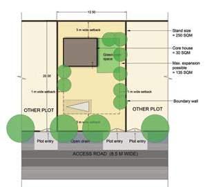
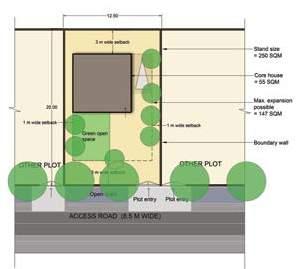
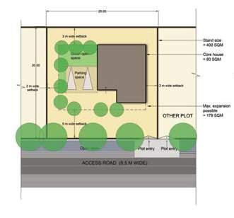
The residential units planned within the development are proposed to accomodate a population of 1000.
accounts up to (14,810 sq.m) 17 % of the total site area. The residential untis are planned with reasonble set-backs between them so as to provide proper experience of exclusivity to each unit of home.
PLANNED CENTRALIZED COMMUNITY FACILITIES
The masterplan includes planned common facilities such as community centre, nursery and local mosque
ACTIVE AND ENGAGED OPEN SPACES
RANGE OF HOUSING TYPES
100+ premium housing units ranging from 3BHK to ultra premium detached 5BHK units.
FRIENDLY INTERNAL ROAD NETWORK
Approximately 2+km of predestrian friendly vehicular network with side walks planned on both the sides of the road.
17% of the site is planned for green open spaces. SIte buffer of 30m is planned along the edge of the site so as to restrict the outside vehicular distraction and sound pollution.
The proposed development is planned with only two access points which will ensure limited entries thus enhancing safety and security of the residents in new neighbourhood.
CREATING SHADED OPEN SPACES
The planned pocket parks and the 600m linear park include shaded open spaces for varios activities and recreation. The shaded areas are planned to provide comfort from the outdoor harsh climate.
CREATING EXCLUSIVE SPACE FOR RESIDENTS
The build area accounts up to (14,810 sq.m) 17 % of the total site area. The residential untis are planned with reasonble set-backs between them so as to provide proper experience of exclusivity to each unit of home.
ENGAGING ACTIVE MOBILITY
Continuous Cycle networks and pedestrian routes are proposed with the green buffer along the site and within the linear park which can be later connected to cycle tracks proposed in DFC corridor.
SAFE AND SECURE COMMUNITY
The proposed development is planned with only two access points which will ensure limited entries thus enhancing the safety and security of the residents in the new neighbourhood.
Concept Master Plan Strategies
Majority of the land has been utilized for residential development followed by circulation and open space. The utility corridor, which acts as linear park occupies 20% of the site area.
Green Buffer Section at AA’
Detached Villa Twin Villas
Quadruplex Villa Road Road
Linear Park
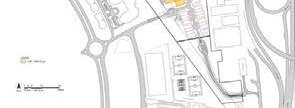
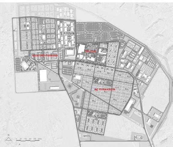
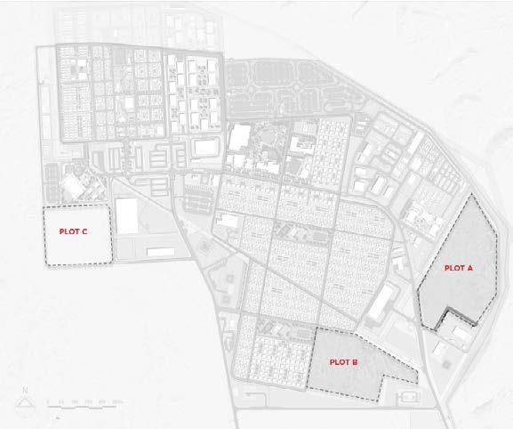
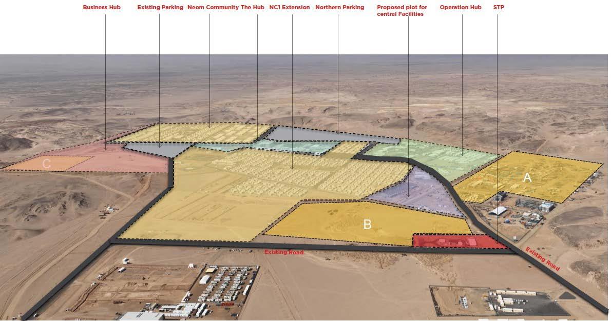
NC1 HIGH DENSITY DEVELOPMENT -
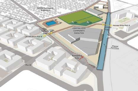
NEOM’S HIGH DENSITY COMMUNITIES -PLOT A,
B & C is proposed to address the shortfall of coming years, the demand Residential Units and Offices Buildings will be increased due to the impact of the Spine on the north clusters within NC1. The proposed accomodation has to be a modern, safe, environment friendly and connected development with expansive open spaces offering best-in-class liveability standards. The strategic pillars of this vision are to:
-Develop the world’s next generation of staff accommodation.
-Create large, modern and diversified residential units including globally best-in-class design Features
Charater Districts
There are broadly 3 character districts, characterized by their typologies and functions. They are:
Residential Character Districts: The plots A & B are exclusively high-density residential plots with G+3 and G+2 structures respectively.
Centralized Community Facilities: proposed in between the Plots A and B.
Office Commercial Districts: The plot C is dedicated to office commercial buildings
The plot C is exclusively of Administration land use. They have beenproposed office commercial development. G+1=6 blocks, G+2=2 blocks
Total BAU=42,030 sqm.
The centralized community facilities plot is located in good proximity for the Plots A & B. The different facilities included in the centralized community facilities plot have been listed below.
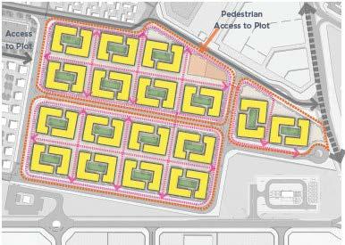
The plot A is a high density residential development. They have been proposed for semi-family dwellers with an average household of 1.5.
No of Units=1502
Total Land Area= 101,100.40 Sqm.
The typical cluster arrangement of buildings in plot A follows a grid pattern where the buildings are places within sub-plots. The grids are formed by wither pedestrian pathways which are shaded.
The buildings shall be placed in the north-south orientation as possible. It shall be placed in such a way that the longer side of the building doesnt receive direct sunlight.
Total Footprint Area = 38,925.97 sqm.
Total Builtup Area= 17,329.63 sqm.
No of Units=500
The plot B is a high density residential development. They have been proposed for family dwellers with an average household of 3.5.
Total Land Area= 78,467.42 Sqm.
The typical block massing has a setting of buildings positioned around a central green open space. There will be pedestrian pathways connecting the residential buildings and the open spaces within the plot.
Plot A (G+3 structures) Plot C (G+1, G+2 structures) Community Facilities District, (G, G+1)
Plot B (G+2 structures)
PROFESSIONAL VILLAGE
CONSTRUCTION OF A 5000 APARTMENT
Concept and Detailed Master Planning
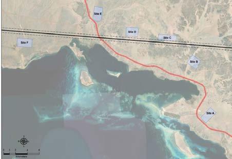
NEOM intends to develop a 5,000 units village dedicated to the NEOM’s staff which is termed as NEOM Village A. The space program will consist of various types of residential units along with supporting facilities/amenities such as entertainment, sports, religious, retail and healthcare. The scope also includes complete infrastructure for the development area and a helipad. The location of sites underwent multiple iteration and assessment process to arrive at six probable site locations for NEOM Village A.
The project is envisaged to be developed into worldclass professional village with a smart and integrated development. The master plan is envisioned to offer quality of life, work and play as well a safe and healthy environment.
STRUCTURE PLAN STRATEGIES
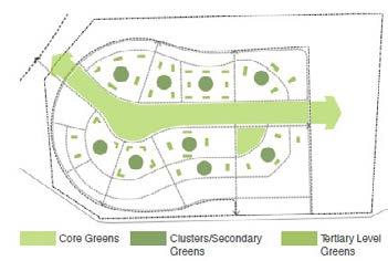
The development has a prominent central core area that is surrounded by the different residential communities.
The major road network runs along the edges of the proposed core area district, comprising of community facilities, centralized sports facilities, educational institutions, mosques and retail shops and health centers.
Every residential community is characterized by block-level community open spaces and larger open spaces.The community facilities, opening up to a central open space make the core area more active and functional for the people.
Site Context Landuse Plan Residential Districts
The location of sites underwent multiple iteration and assessment process to arrive at six probable site locations for NEOM Village A.
Site E was finalized after multiple assessment.
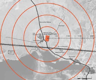
Site E identified is about 3.3 sqkm and is located adjacent to the existing Sharma- Dubba Highway which provides existing regional level connectivity.
Site E is about 40 km away from the NEOM bay airport.
It is positioned about 3kms away from ‘The Line’ which is expected to be the development on which the NEOM Village A may depend for connectivity, employment etc.
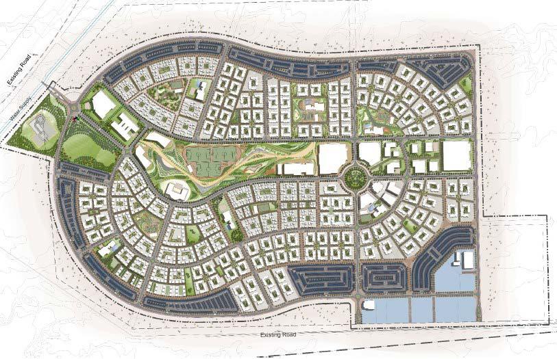
Majority of the land use is residential with 43.77%. There are common community facilities and amenities at an overall site level as well as cluster level. Almost 17% allocated for roads and pathways, 12% for parking 13% for community facilities and 12% for open green/recreational spaces.
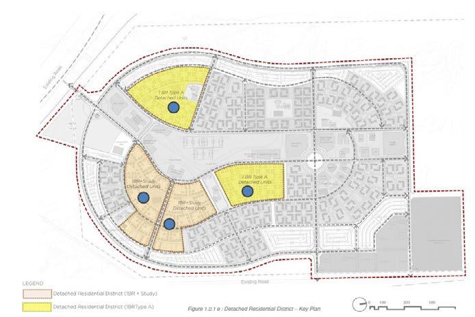
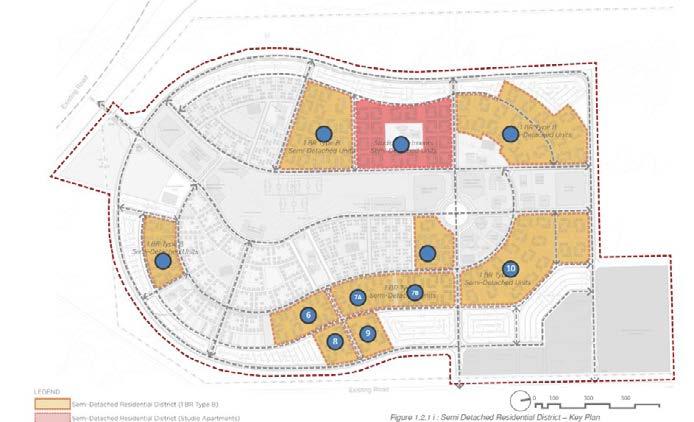
Residential landuse is further subdivided based on the typology of residences like-1 Bedroom + Study Area (2 rooms / 2 bath), 1 Bedroom Type A (1 bed / 1 bath) 1 Bedroom Type B Apartments (1 bed / 1 bath) and Studio Apartments (1 bed / 1 bath) Access Plan Open space Network Plan
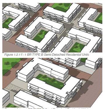
Detached Residential District (1BR + Study area and 1 BR Type A)
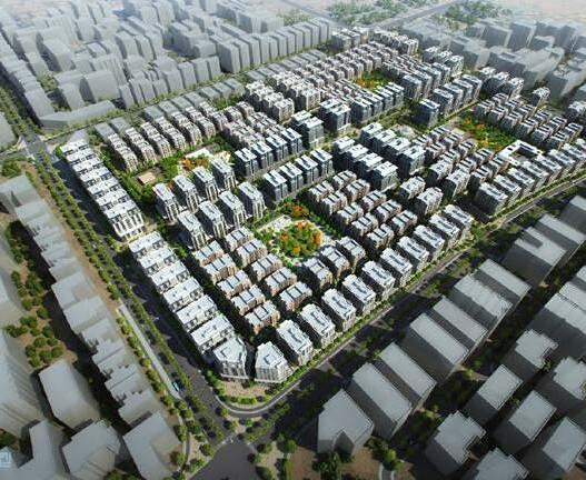
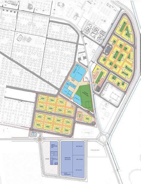
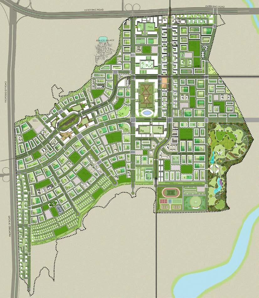
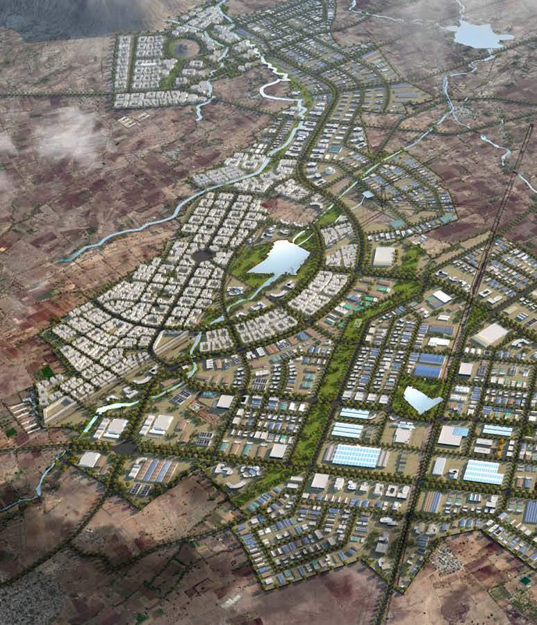
SURAT DREAM CITY, MASTER PLANNING
Gujrat
Ha Diamond Research and Mercantile (DREAM) City Limited
Planning and Infrastructure
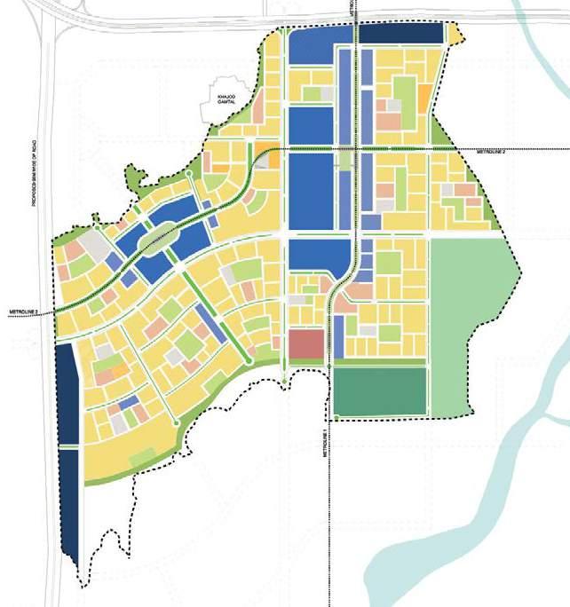
The Government of Gujarat has initiated a planning process for the realisation of Diamond Research and Mercantile (DREAM) City at Surat. This Smart City is projected on a 700 hectare site in the southern part of Surat, adjacent to the village of Khajod, the Outer Ring Road and close to the Dumas airport
4.1 Introduction
The DREAM City Master Plan is primarily a zoning plan in which main urban functions are located and regulated. This zoning plan will be explained in paragraph 2.
In the second place the Master Plan is an urban design plan in which public space and urban form get a specific shape and expression. tThis part of the Masterplan is explained in paragraph 3. The differences between this Draft Master Plan and the Conceptual Master Plans are explained in Appendix 9 and are summarised in the next page
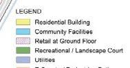
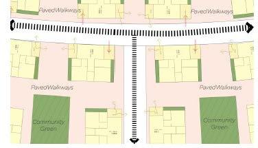
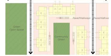
Residential: perimeter blocks typology
Residential will be organised mainly in perimeter blocks; apartments will be organised one unit deep around a green and sheltered courtyard. The small to average sized perimeter blocks will have single unit walls, the large blocks can have double unit walls around a large courtyard with an access for the fire brigade. The perimeter blocks are closed to create a sheltered and quiet courtyard.
All apartments and entrances will be oriented to the street. There is no setback; the buildings facades are positioned on the border of the right of way. Parking will be organised under the building and under the courtyard. Apartments at ground level may be elevated half floor height (1,5 m) above street level, for parking under the building and courtyard under the condition that parking basement is
Residential Block Section
not visible from the street. The parking in the courtyard will
risk of congestion especially as staff travels in masse by car and when all these cars have to be stored in a concentrated parking facility. Increasing the FSI is attractive since it is an easy way to increase profits, but it will lead to congestion and a sub optimal quality of the city. Sectors / clusters –superblocks / buildings blocks The DREAM City project area is divided in 4 smaller sectors which are bordered and accessible from the main corridors and which are the basis for the Phasing Plan (see Chapter 9: Phasing Plan). The sectors are dived in clusters (residential) or ‘Superblocks’ (commercial) which represent the plots or units which will sold and developed by private parties. This large size is chosen deliberately to be able to guarantee that the private developments will be designed, built, managed and maintained as comprehensive and integrated units. The clusters and super-blocks contain the individual buildings or building blocks which can be recognised as the basic spatial unit in DREAM City.
In residential areas some plots are reserved for individual buildings in which special residential functions can be housed. These buildings will be organised in a more traditional way: they will stand as individual volumes on a
The same applies for public amenities in residential areas such as schools and community buildings; they will also be treated as individual buildings on a plot with setbacks at all sides. These plots will be fenced and will have green
Concept Master Plan Strategies Illusrative Master Plan Layout
The zoninging was done based on the following:
4.2 Land use plan / zoning plan
The zoning plan is based on the premise that DREAM City will be a new urban core in Surat South West. In the future
DREAM City will contain its urban central precinct and some first residential quarters around it.
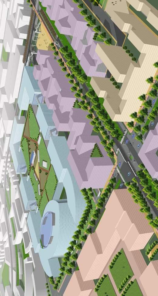
Centralized location of Surat Diamond Bourse accessible from the main road corridors and the two metro lines meet.
the city will grow all around DREAM City. DREAM City will contain its urban central precinct and some first residential quarters around it. For this reason the transportation system is designed as expandable in the future, to allow easy access from future expansions to the heart of DREAM City. The best accessible locations in DREAM City are
Around this centre the emphasis is on residential development.
concentrated in its heart where the main road corridors and the two metro lines meet. Exactly in this meeting point the Diamond Bourse is projected on the location agreed upon with Surat Diamond Bourse. It will be served optimally from metro stations and road system. This also the location of a concentration of commercial, retail and leisure and urban vibrancy. Around this centre the emphasis is on residential development. Proposed Landuse
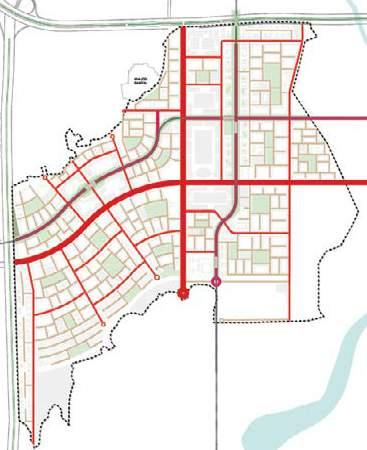
This framework consists of the two metro lines and the road system. The location of the metro lines is based on the
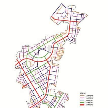
The main corridors: the north-south and east-west corridor, connect DREAM City with the present and future highways in the north and west. Beyond that, they will connect with the airport, Surat and future urban expansions around DREAM City. These corridors will 60 m wide, will have 2 x 4 lanes with service roads,
The Avenues: the avenues are urban access roads, typically 40 m wide with 2 x 2 lanes, bicycle paths and sidewalks. Some of these avenues have the metro line in
Local roads, residential roads: these are the roads create the finest grid and give access to buildings blocks. They are typically 16 m wide, will have two lanes, parallel parking and sidewalks.
the metros station there. Along the Outer Ring Road and the western highways strips of peripheral commercial are located. They are meant for activities such as workshops, drive-in restaurants, DIY-shops and marriage halls which don’t fit in the city centre. Thse strips function as a buffer between the highways and residential areas.
Residential quarters are distributed on the second rank; still on walking or bicycle distance from the metro system and served by the avenue roads. Public amenities are distributed over the residential clusters.
A framework of green lines and green spaces combined with walkways and bicycle paths spans over DREAM City.
Densities and FSI
Densities in DREAM City are moderate and this is planned deliberately in order to create a good balance between over-all quality and sustainability of the city and especially of public space and the built volume. The Diamond Bourse has a
of 4,
and in the
of
Creating an efficient urban structure i.e. the arrangement and organisation of the public domain and private land parcels.
Ensuring a high level of accessibility, permeability, and particularly walkability.
Creating a Integrated and Balanced human Scaled Environment.
Creating Identity and Character.
have a
is on
Mixed use Commercial - Institutional
Super-block Diamond Bourse
The sectors are dived in clusters (residential) or ‘Superblocks’ (commercial) which represent the plots or units which will sold and developed by private parties. The clusters and super-blocks contain the individual buildings or building blocks which can be recognised as the basic spatial unit in DREAM City.
Super-blocks (commercial) and Clusters (residential) are created by the higher order road system and are roughly 500x 500. Where possible, the subdivisions within Super-blocks or Clusters should aim to be of the order of 120X120 metres
Diamond Bourse is vital for DREAM City as the first major settler; it will be formidable anchor for the DREAM City development and it will present itself as a symbol of Surat entrepreneurship and organisation talent. The building is of enormous proportions: the present programme comprises a building volume of 540,000 sqm reserved for offices and related facilities. It will be the largest of its kind in the world. A plot of 14,4 hectare is reserved for the Bourse.
In this Master Plan a volume proposal is integrated
answering the guidelines and principles of this Master Plan (see also Chapters 5 Transportation and 6 Urban Design Guidelines). Surat Diamond Bourse has made a design which deviates of these guidelines. Steering Committee can decide to accept the present design for Diamond Bourse and that Diamond Bourse will have its own set of guidelines and regulations as an exemption.
In the case Diamond Bourse will not be built on the chosen location it is advised to split the 14,4 hectare plot in two or three super-blocks.
This specific mixed use refers to a super block with a mix of institutional buildings and commercial buildings. The typology will be the same
An illustration of the office block with central parking platform and terrace garden
Mixed use central retail and leisure typology
The mixed use areas concentrate in central urban areas. These areas will combine retail and leisure functions on ground floor and optional also on the second floor. Above, they will house offices or residential floors. Parking is available on the intermediate floors. Entrances for parking services and functions on higher floors are oriented on the street at the back. The entire front is oriented on the Green
Strip or Diamond Esplanade. The fronts together create a continuous shopping and leisure street at both sides of the Esplanade. An urban street at the front side gives access to the shops; this street with 2 lanes in one direction will provide for a wide sidewalk, bicycle track and (paid) parking places parallel to the street. The space between these blocks will be car free pedestrian areas and will be designed as spaces to stay and rest.
In a row of four blocks two separate blocks can be combined into one block, providing space for specific large scale shopping and leisure offers.
Mixed Use Blocks Section
Commercial: super-block typology
and Infrastructure 3292.4 Ha
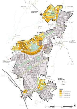
AURIC Bidkin is a part of the AURIC Shendra-Bidkin Industrial Area promoted by Aurangabad Industrial Township Limited (AITL) is formed between the MIDC and DMIC Implementation Trust.
This project is located in the district of Aurangabad in the Marathwada region of Maharashtra. Bidkin Industrial Area (BIA) comprises an area of 3296 hectares of land spread over 8 villages; the site is strategically positioned for direct connection to major state highways which provide connections to the city of Aurangabad on through SH-148 (Paithan Road) and National Highway (NH) 211.
Vision and Objectives
The core objectives of the project are;
The vision for AURIC BIA is to creat a new ‘global’ city and not merely an industrial park or a township’ through intelligent spatial distribution of a healthy mix of land uses, a highly sustainable and vibrant community is desired.
Developing an integrated sustainable township that withholds the unique cultural heritage of the region.
The development will preserve and enhace the quality of life for its citizens by providing a comprehensive mix of uses and high quality public space.
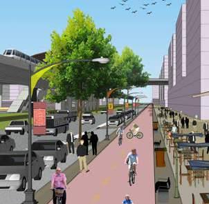
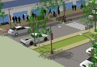
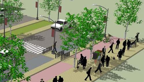
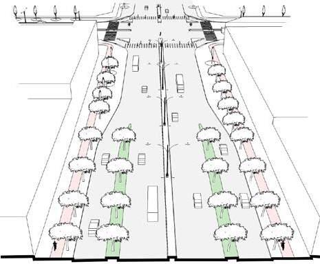
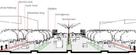
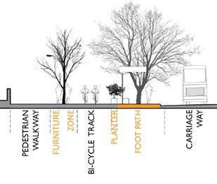
A well designed street enhances safety, efficiency and ease of movement for pedestrians of all ages and abilities:
The key elements of a street are as follows:
Pedestrian Pathway
Bicycle Lane
Plantation Strip
Carriageway and Service Lane
Median
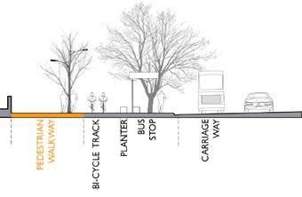
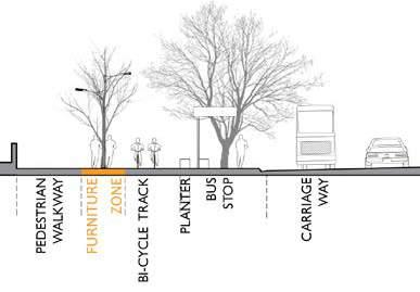
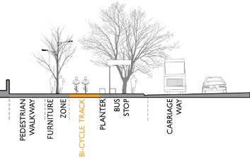
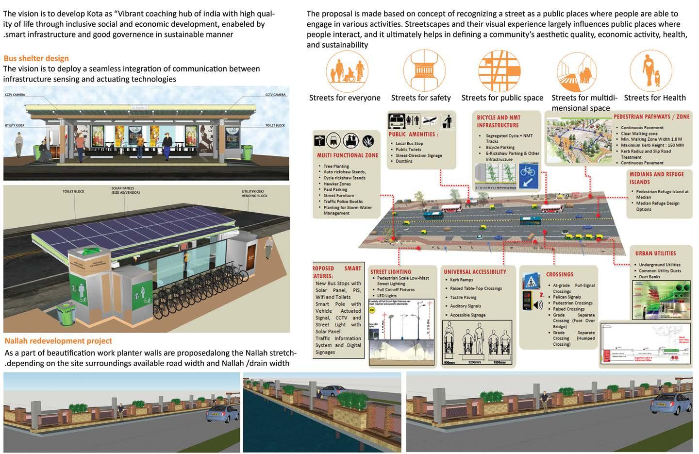
SMART ROAD (KOTA,RAJESTHAN SMART CITY)
Vision and Objectives
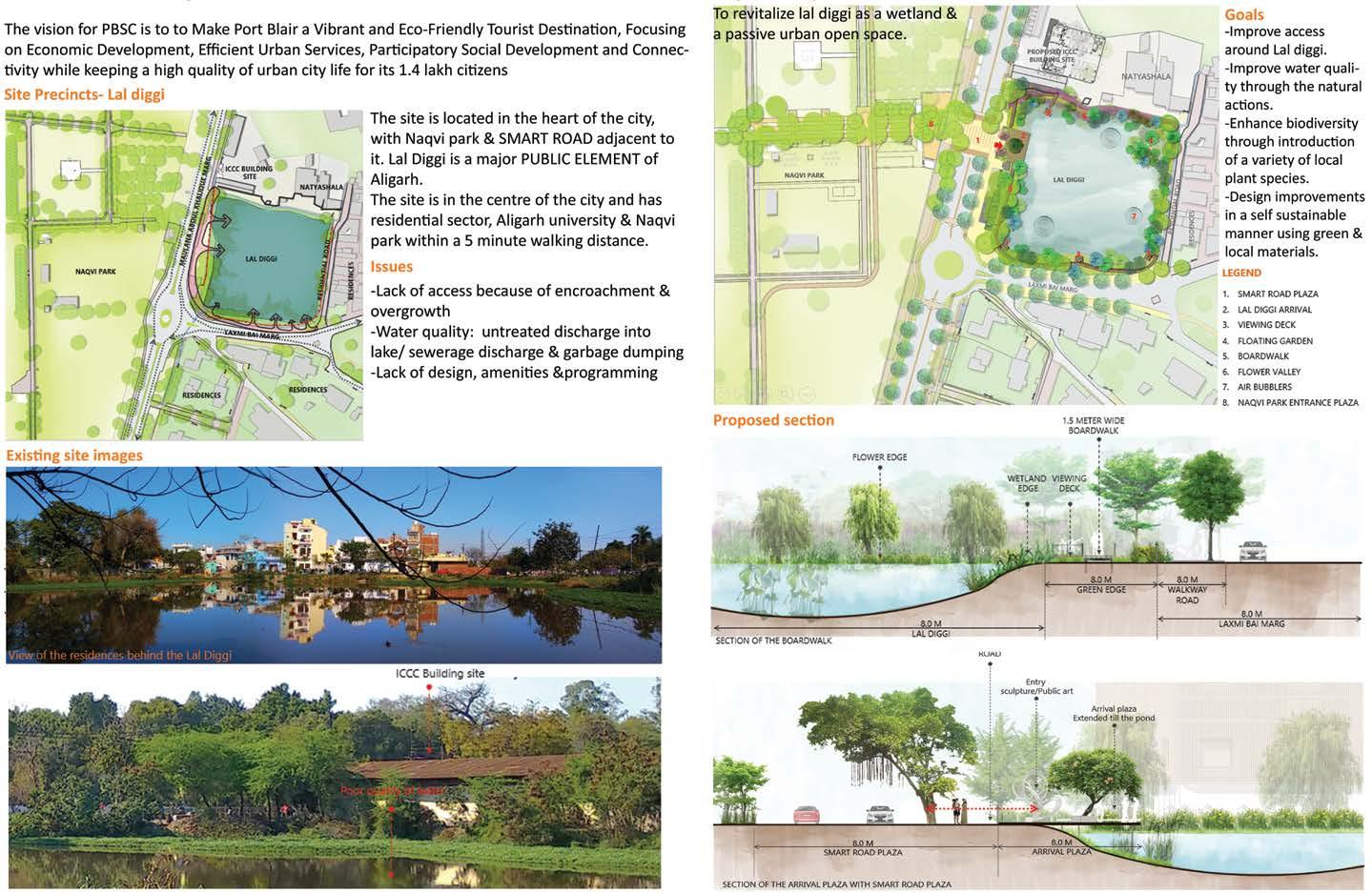
WETLAND REVITALIZATION (ALIGARH SMART CITY)
Vision and Objectives Proposed Design Smart Road Elements
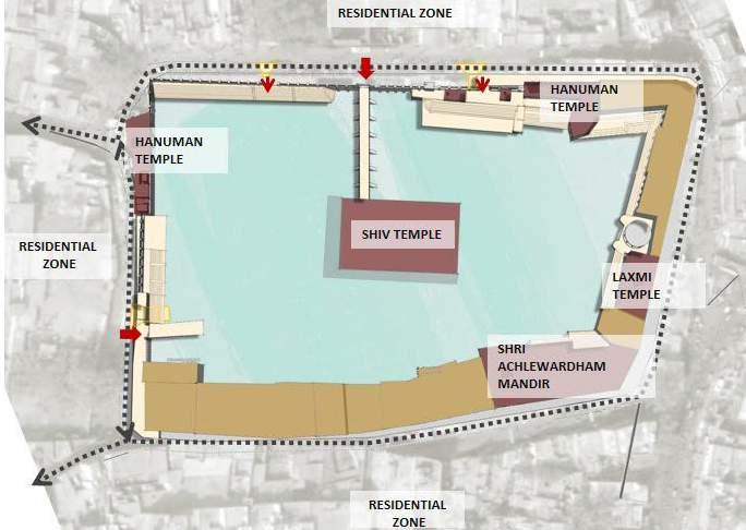
ACHAL TAL
REVITALIZATION PROJECT (ALIGARH SMART CITY)
Vision and Objectives
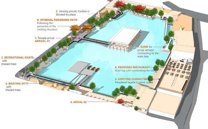
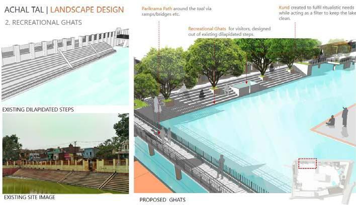
To revitalize achal tal as an urban, cultural & recreational open space by improving its water quality , access/circulation & programming.
Strength
location- heart of the city (proximity to smart road)
Presence of water feature
Cultural significance
Open public spaces
Proximity to residences
Goals Weakness / issues
No sense of arrival- entrance lacks connection with complex
No parking space available outside the complex
Multiple ownership-leads to challenges with coordinated improvement
Revitalize Achal Tal as an urban & cultural & recreational open space Presence of water feature
Improve access -to & within achal tal
Improve water quality of achal tal & stop sewerage discharge
Design improvements in a self sustainable manner
Proposed Plan
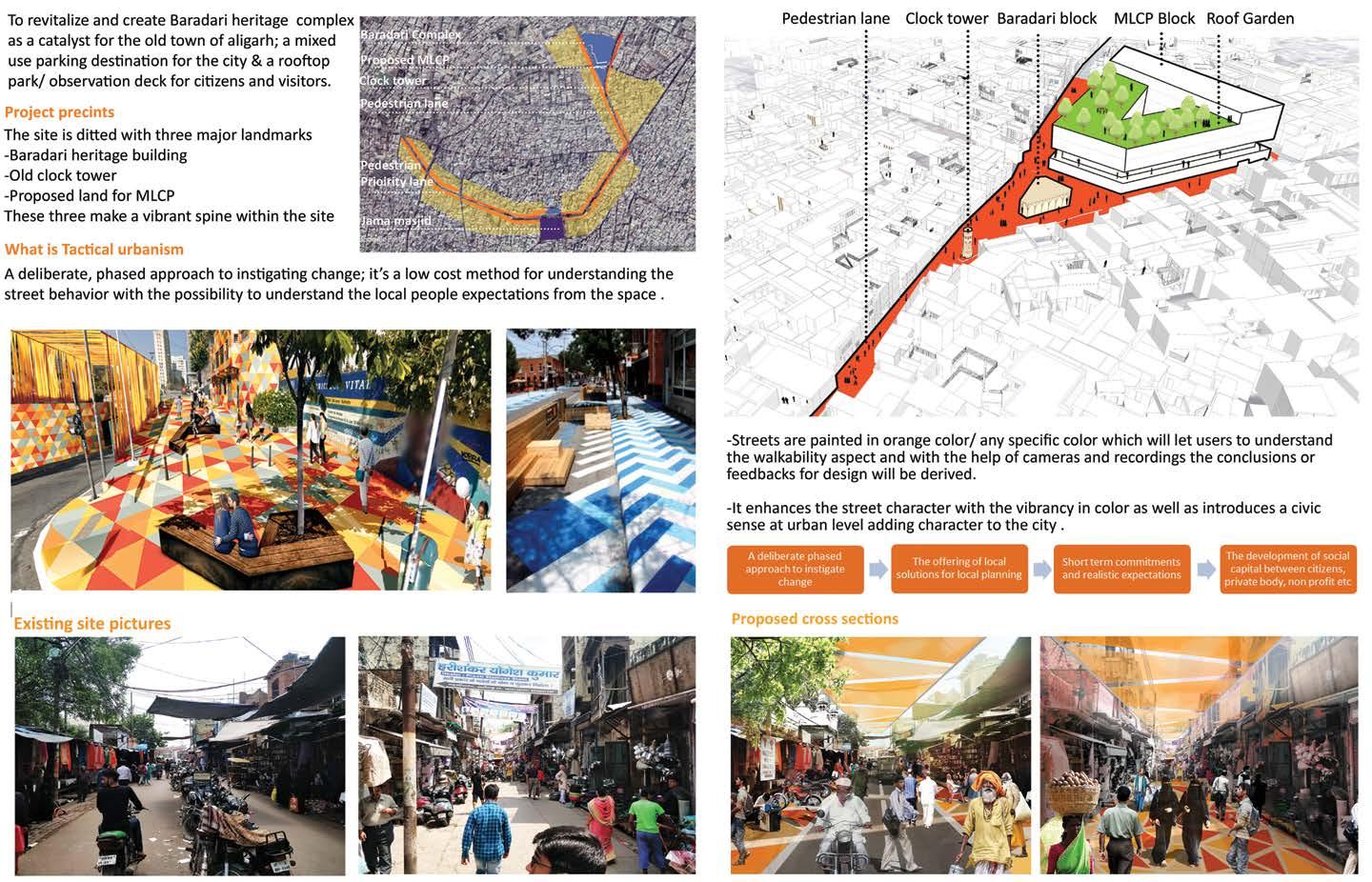
REVITALIZATION OF HERITAGE PRECINCTS (ALIGARH SMART CITY)