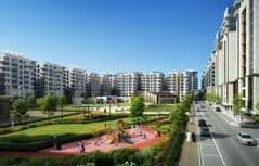
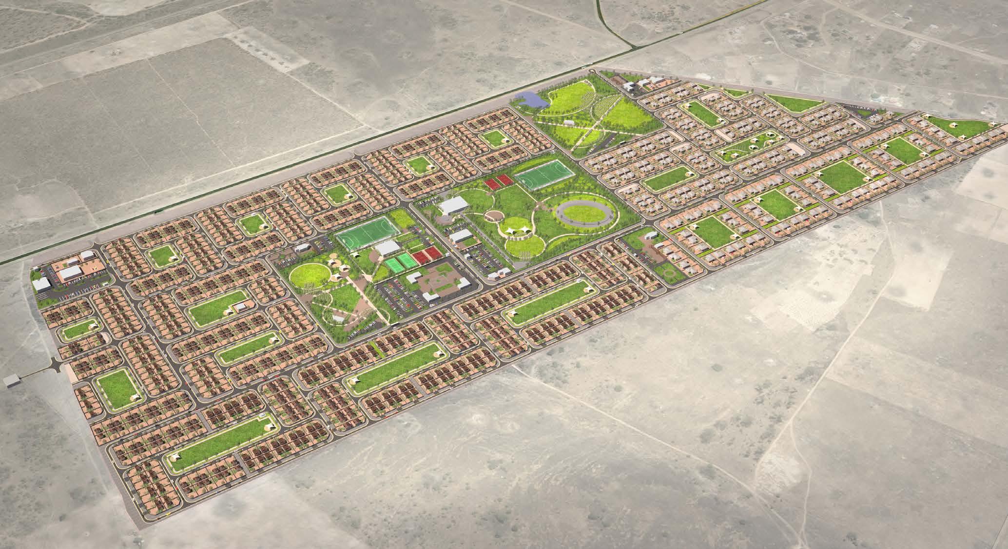
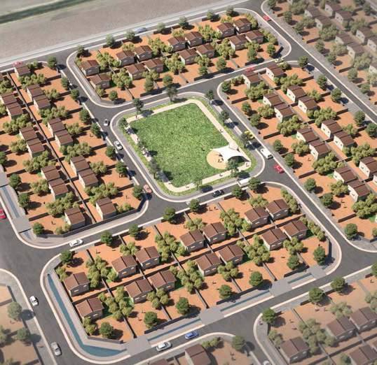
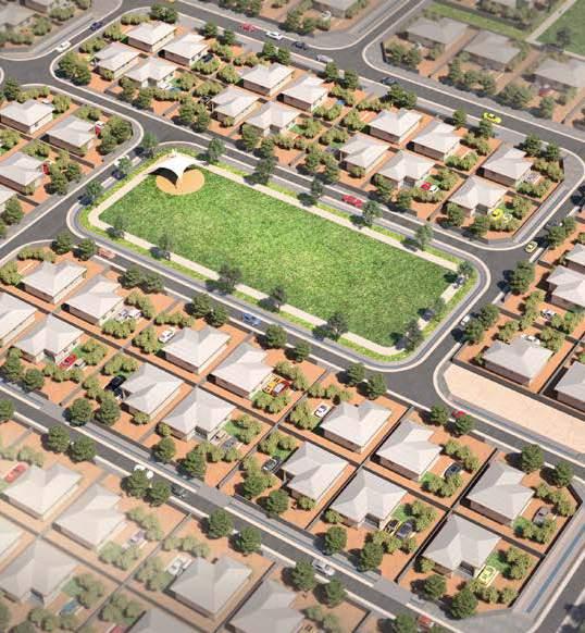
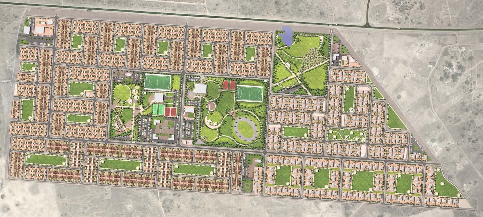
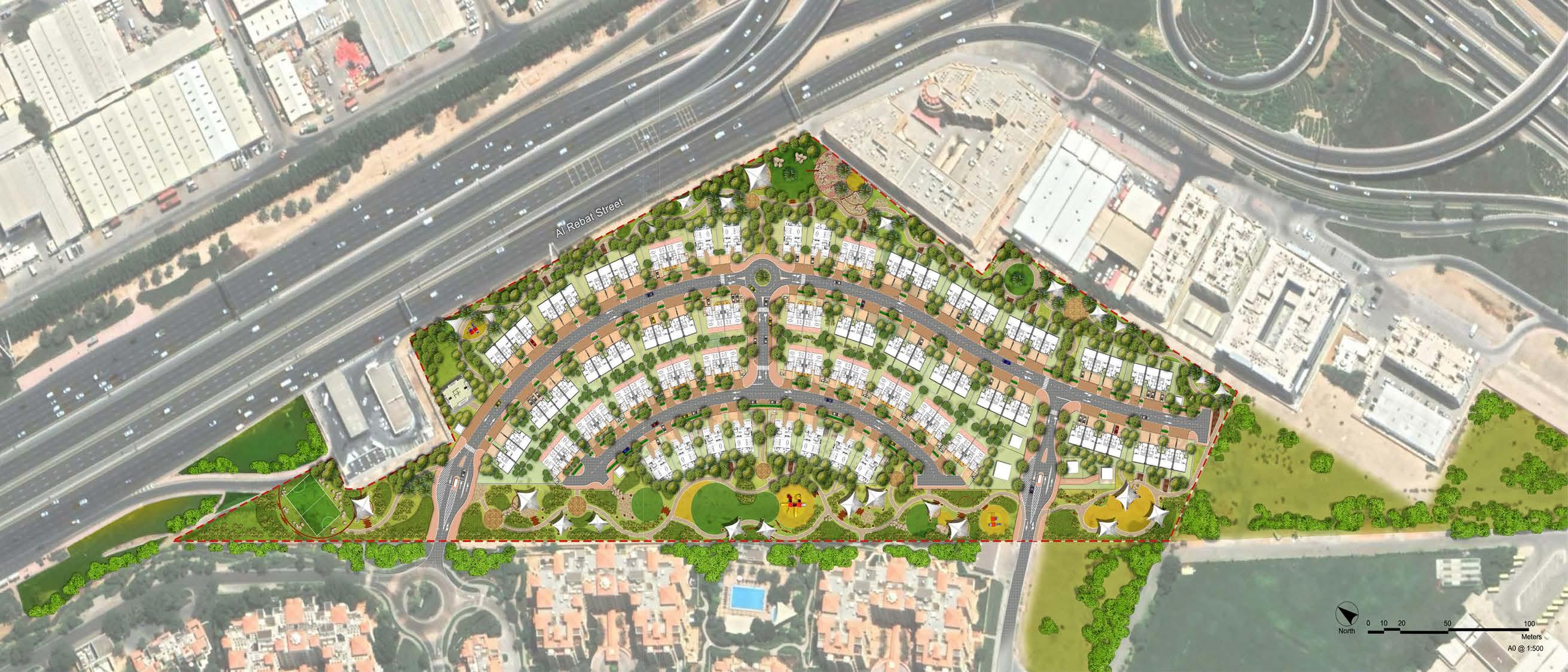
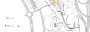
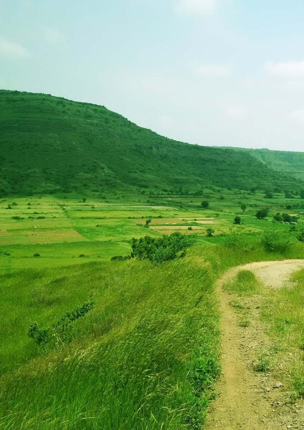
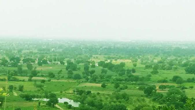
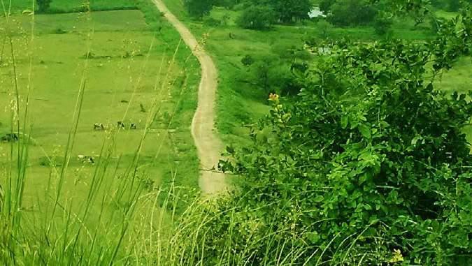
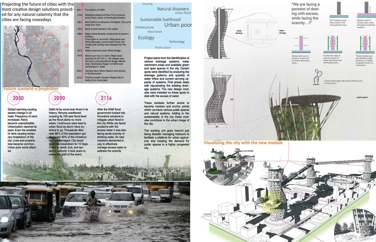
In the Darwendale Project which is a greenfield project, a permanent housing policy and scheme is to be established to accommodate the mine employees. The project had total four stages -Final stage to detail the concept master plan along with the detailed concept design for the infrastructure provision and architecture. The project aims at the larger welfare of the employees keeping the view that a better housed workforce includes greater labor stability and improved productivity. The project is expected to be highly beneficial to the working group, which cannot access a satisfactory housing solution due to the severe supply and affordability gaps affecting the housing sector in the region.
An Integrated and practical design approach has been adopted for building the architectural narrative with respect to environment, technology, socio-cultural aspect, functional and aesthetic determinants.
A key goal in locating the uses was to integrate them with the transport network to promote sustainable transport, to support the viability of the use, with schools and other community infrastructure in locations where they could be easily shared amongst all the neighborhoods. All the utilities which serve the larger population (town level) are placed near the highway for easy accessibility.
Vision and Objectives
Some of the potentials of the site
The project is expected to create an identity for the place adding to the existing features of the site. The main drivers of the adopted development approach are
Environmental sustainability
Urban Integration
Smart and light mobility
Social and cultural acceptance
Economic and financial sustainability
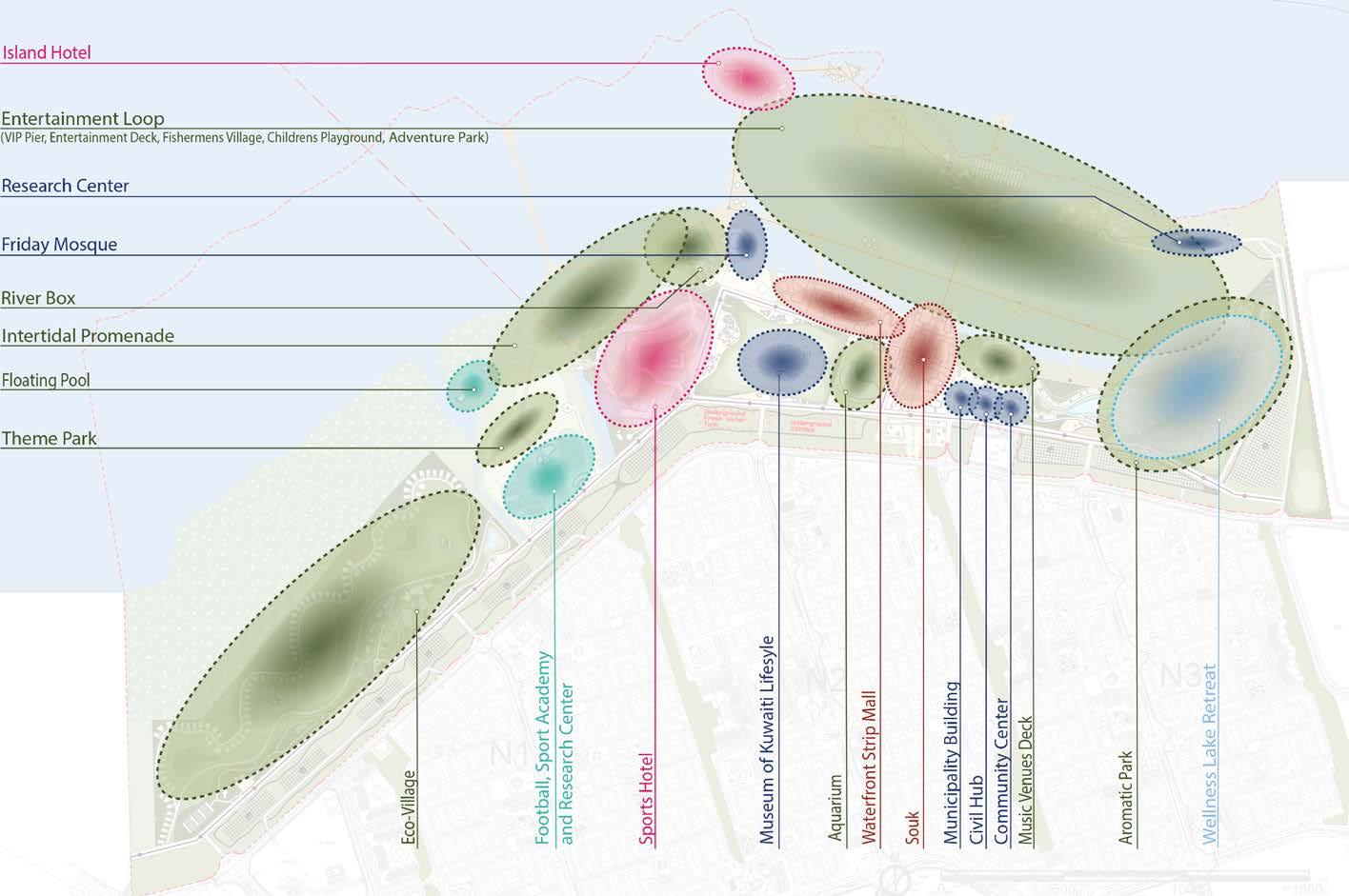
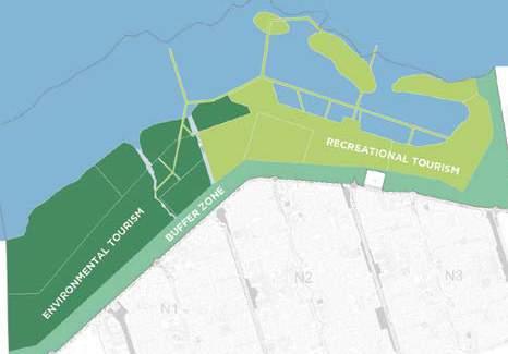
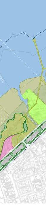
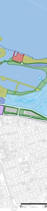
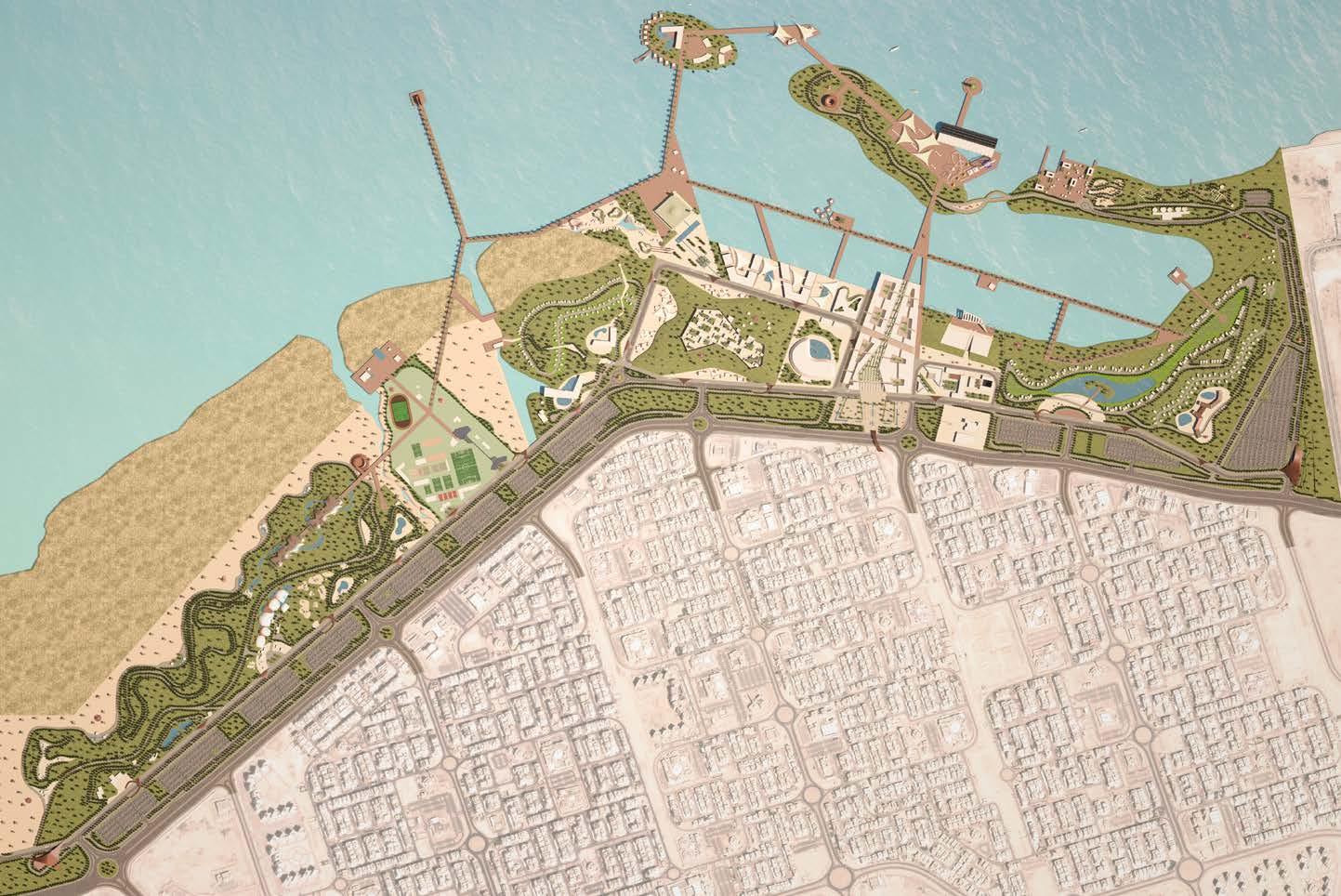
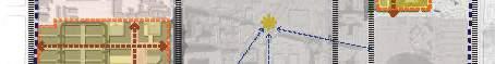
Use the Jahra Natural Pools reserve and the seafront to change the image of Al
Attractiveness offered by the intertidal zone and accessible waterfront.
Competitive site positioning supported by the current market trends to develop touristic recreational and hospitality sectors.
Proximity of Jaber Al Ahmed city (JAC) to support the development.
Potential to continue the green corridors from the JAC leading to waterfront.
Approaches adopted for urban/ regional level spatial integration are:
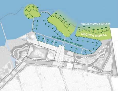
Opening up water edge for the public
Some of the constraints are:
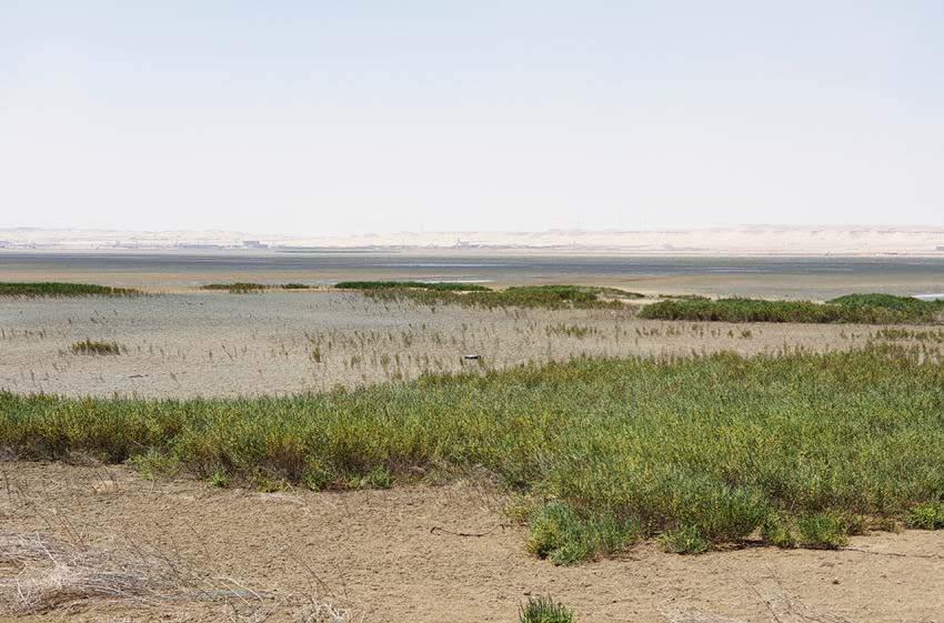
Fragile and sensitive vegetation and ecological edge.
Proximity to power and desalination plant.
Asserting the tangible identity of the place by utilization of intertidal water edge
Asserting intangible identity of the place by giving urban activities that thrusts the Kuwaiti lifestyle and identity, its traditional art forms and architecture
Existing High Voltage (HV) overhead power transmission towers and proposed route onsite.
Storm water discharge channel. Presence of west Doha chalets.
Use the Jahra Natural Pools reserve and the seafront to change the image of Al Jahra.
Attractiveness offered by the intertida zone and accessible waterfront.
Competitive site positioning supported by the current market trends to develop touristic
recreational and hospitality sectors.
Proximity of Jaber Al Ahmed city (JAC) to support the development.
Potential to continue the green corridors from the JAC leading to waterfront.
The main concept focuses on the following:
other side creating more interactive inner development.
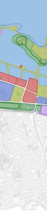
Meet the sea withwith minimal or no environmental impact
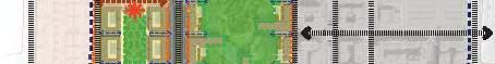
• The development will integrate different land uses that will address Nature (the environmental asset of the site), Heritage, Culture, Sports and Edutainment (education and entertainment).
The development will integrate different land uses
Commercial activities will cater for the area’s need and will contribute to the liveliness and vibrancy
Creating an active interface with water
Two hills benefit from the topography in the east from the power plant proximity
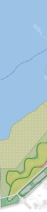
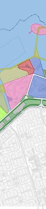
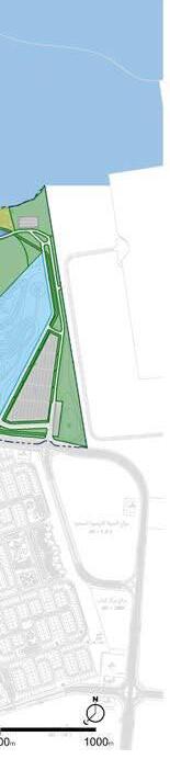
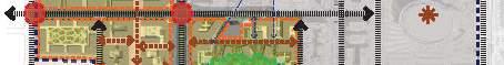
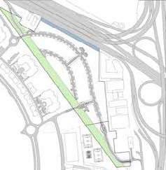
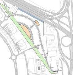
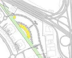
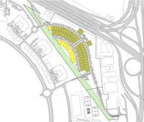
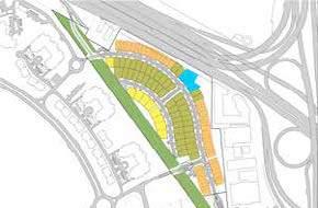
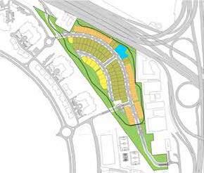
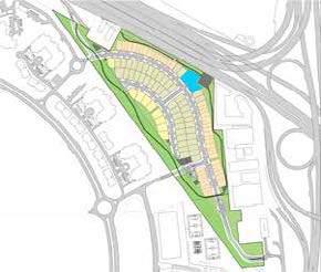
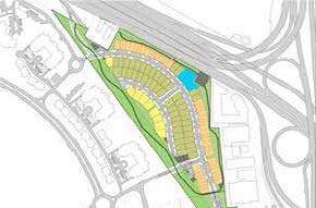
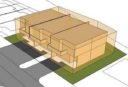
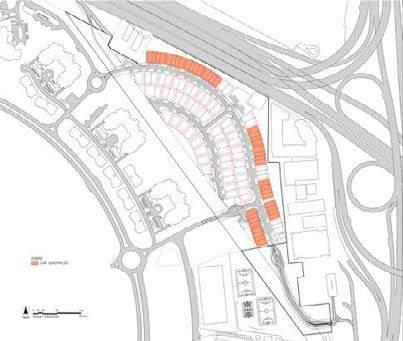
Detailed Master Plan without Chalet
side of Kuwait.
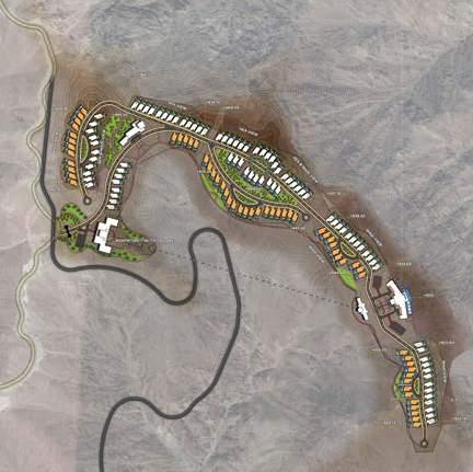
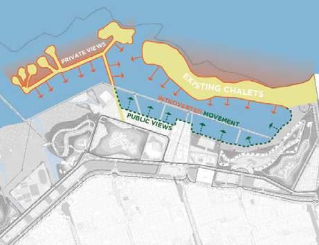
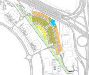
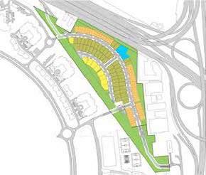
Option 2 In this option, the chalets are kept as is. The recreational activities along the inner lagoon will still give it the characteristics of a tourist destination. However, the development will not benefit from an open sea frontage, thus giving it an introverted feel. All the maritime mobility that might connect the project along the sea will also have to be ignored in this case.
Existing Chalets Introverted Movements Double Sided Views and Activities
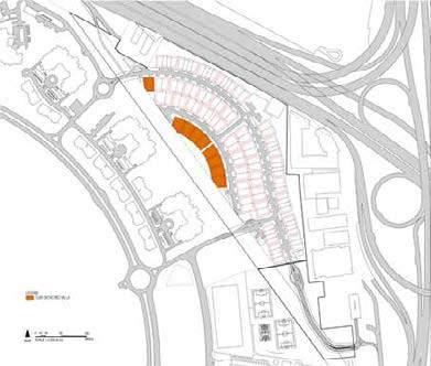
The two main nodes of the project
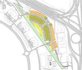
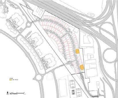
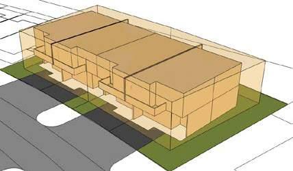
The chalets area is incorporated in the project.
Figure 2-11:
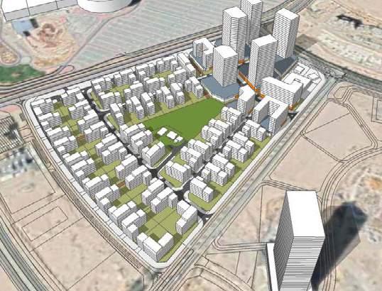
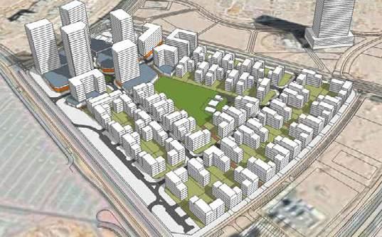
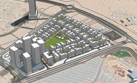
CITY OF ARABIA
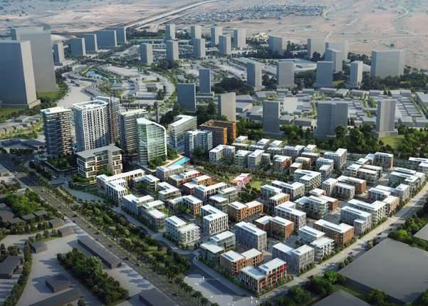
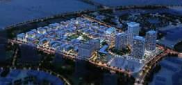
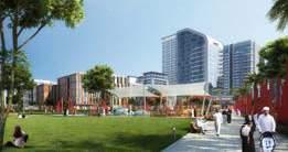
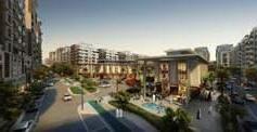
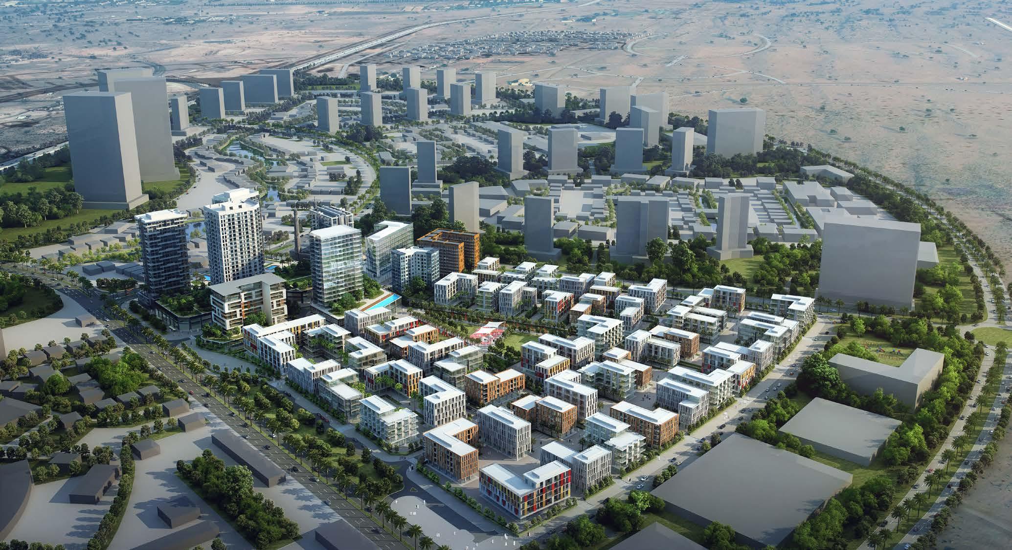
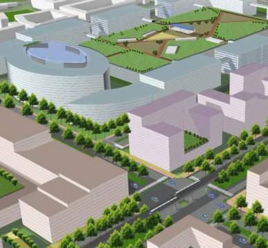
The proposed project site is within the City of Arabia development in Dubai which is a self-contained city consisting of multibillion retail, residential, commercial and entertainment destination located at the gateway towards DUBAILAND.
The project aims at creating a livable community development that enriches neighbourhood and at the same time better utilizing the land assets and proposeing the best parcels for land sale that matches market.
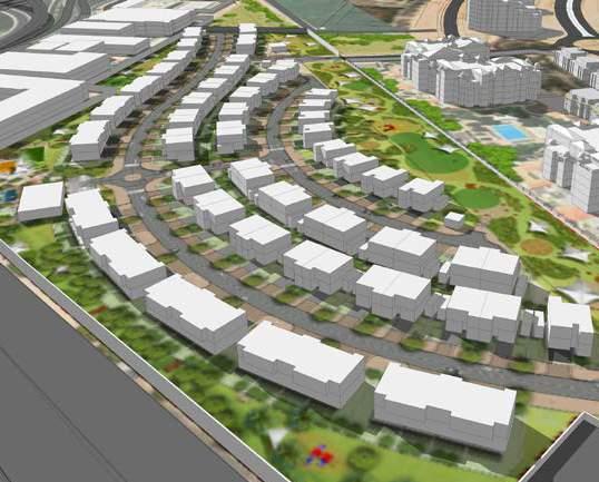
There is a sequence of green parks and alleyways that allows many of the residential building apartments of 5 floors to have wider views on greenery and optimizes privacy matters instead of one big park.
This network stretches till the southern adjacent park at the edge of the site. The activity area is an east-west retail street of 10 floors high with residential and office in the upper floors, a hotel tower and a residential tower at the north-western edge of the development.
The development is composed of 80% of residential plots of 1.8 FAR and a main retail street with all the activities and mixed used functions with quite a high GFA and two towers.
‘A Neighbourhood that breathes’.
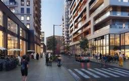
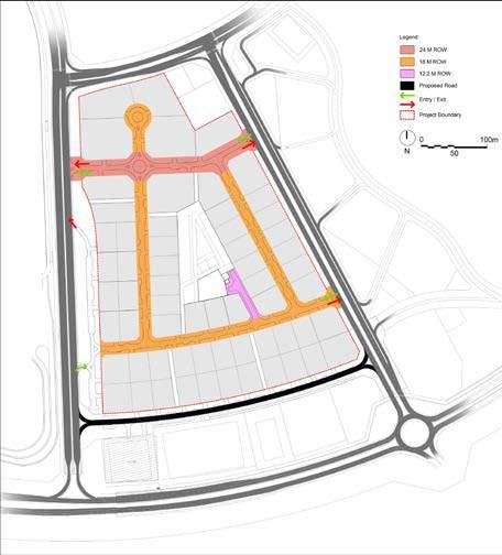
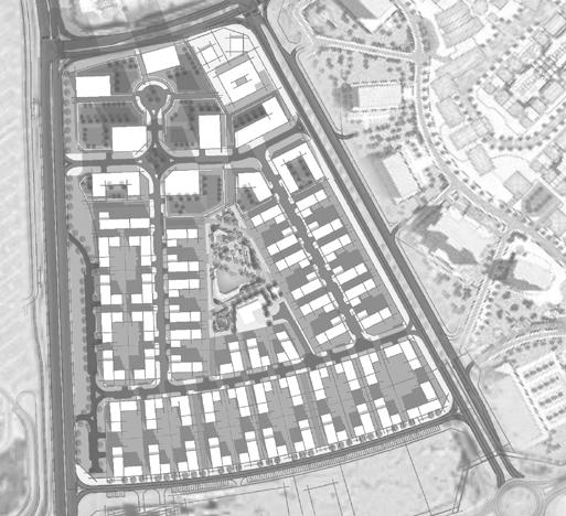
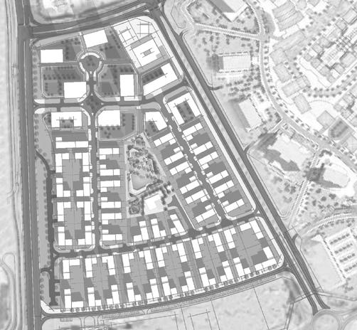
With City Walk already being recognized by its highend creative lifestyle destination, the vision for City Walk seeks to celebrate this legacy, offering a diverse range of activities for the Neighbourhoods in the heart of Dubai with hundreds of exclusive international retail offerings, upscale gourmet destinations, covetable residences, and plush hotels.
The project development strategy is based on the following factors.
Creation of Mixed Use Development.
The Development nature is Mid rise residential buildings.
Affordable apartments with acceptable standards.
Provision of Sufficient Social Services.
Opportunities
Neighbourhoods- City Walk can be thought of as a collection of ‘Neighbourhoods’ bounded by the main road network around its perimeter
Neighbourhood Cores-Each ‘Neighbourhood’ is activated by a central core, embodying the theme of the said area.
Walkable Neighbourhoods-Connecting the Neighbourhood cores are a series of key public realm routes which form the main pedestrian links across City Walk.
The structure plan documents the current status of the City Walk and outlines the key components, which include:
Medium and high density mixed use residential plots.
Leisure and recreational uses including club house.
Key vehicular routes; and Pedestrian circulation throughout the site with connection between the phases and the existing parts of City Walk.
Hospitality uses including a Hotel in Phase 3.
Establish a block structure which enhances the structure already established by the earlier phases
Respect and maximise key views across the development especially towards Burj Khalifa
The main Land Uses for Phases 3, 4.01 & 5 are predominantly Residential/Commercial plots. This is supported by Public and Recreational facilities as well as Parks and Open Spaces. Minor utilities are strategically located to address ease of connection to main roads. The plan sets out the key uses in City Walk including high density rise residential/commercial developments, Open spaces including central parks and between plots public realm, Low density residential towards the south of Phase 3.
DUBAI FESTIVAL CITY-
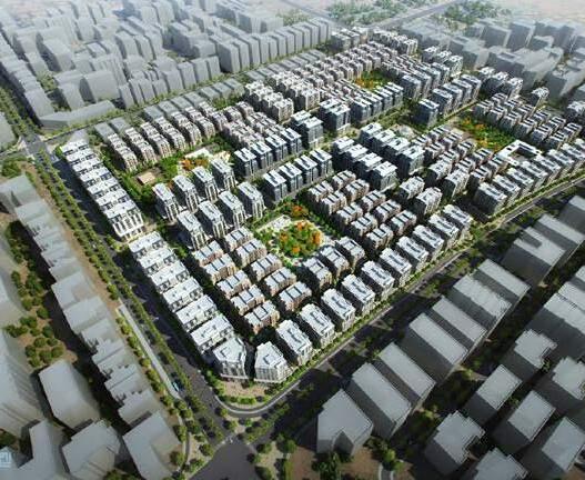
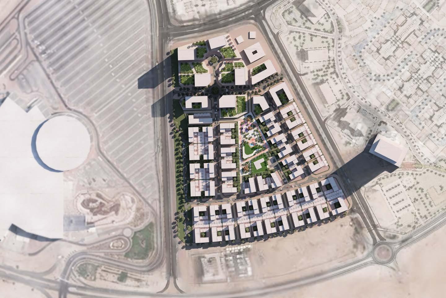
Zone-6 Villa project is covering 1.5% of the total DFC master plan. It was originally planned as a residential apartments and later converted to low density residential with multiple prototypes of villas. It is positioned as a premium product primarily targeting Arab expats, Emiratis and South-east Asians in the upper middle end of the single-family market.
The vision of the development is to create a modern residential community keeping in mind the livability aspect in terms of urban environment, public realm, public safety.
Vision and Objectives Concept Master Plan Framework Evolution
The vision of the development is to create a Modern Residential Community. The project’s unique selling points include:
Exclusivity and Accessibility.
Improving the urban environment with an attractive \ active public realm.
Re-Utilize the plot use to respond to the housing demand in Dubai.
Creating attractive investment opportunities that will assure Successful and quick project development. 4.0 CONCEPT MASTER PLAN
The design scheme for DFC- Zone 6, follows very clear principles that are intended to achieve the Client’s goals and targets.
The proposed Curved networks will strongly enhance the sense of place and give a clear direction to the residents as well as the visitors.
DFC Zone 6 will be a one of the unique communities in Dubai. It will provide residents with safe, secured and accessible homes.
4.9. Key Highlights
CREATING PREMIUM LIVING SPACE
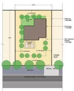
The residential units planned within the development are proposed to accomodate a population of 1000.
accounts up to (14,810 sq.m) 17 % of the total site area. The residential untis are planned with reasonble set-backs between them so as to provide proper experience of exclusivity to each unit of home.
PLANNED CENTRALIZED COMMUNITY FACILITIES
The masterplan includes planned common facilities such as community centre, nursery and local mosque
ACTIVE AND ENGAGED OPEN SPACES
RANGE OF HOUSING TYPES
100+ premium housing units ranging from 3BHK to ultra premium detached 5BHK units.
FRIENDLY INTERNAL ROAD NETWORK
Approximately 2+km of predestrian friendly vehicular network with side walks planned on both the sides of the road.
17% of the site is planned for green open spaces. SIte buffer of 30m is planned along the edge of the site so as to restrict the outside vehicular distraction and sound pollution.
The proposed development is planned with only two access points which will ensure limited entries thus enhancing safety and security of the residents in new neighbourhood.
CREATING SHADED OPEN SPACES
The planned pocket parks and the 600m linear park include shaded open spaces for varios activities and recreation. The shaded areas are planned to provide comfort from the outdoor harsh climate.
CREATING EXCLUSIVE SPACE FOR RESIDENTS
The build area accounts up to (14,810 sq.m) 17 % of the total site area. The residential untis are planned with reasonble set-backs between them so as to provide proper experience of exclusivity to each unit of home.
ENGAGING ACTIVE MOBILITY
Continuous Cycle networks and pedestrian routes are proposed with the green buffer along the site and within the linear park which can be later connected to cycle tracks proposed in DFC corridor.
SAFE AND SECURE COMMUNITY
The proposed development is planned with only two access points which will ensure limited entries thus enhancing the safety and security of the residents in the new neighbourhood.
Concept Master Plan Strategies Illusrative Master Plan Layout
The zoninging was done based on the following:
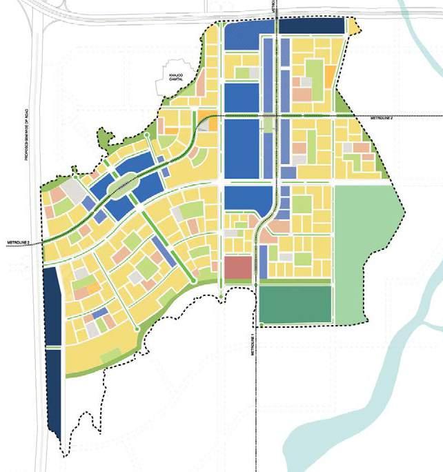
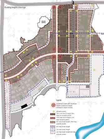
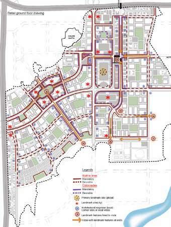
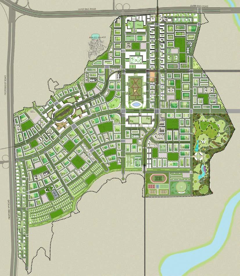
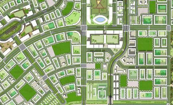
4.2 Land use plan / zoning plan
The zoning plan is based on the premise that DREAM City will be a new urban core in Surat South West. In the future
DREAM City will contain its urban central precinct and some first residential quarters around it.
Centralized location of Surat Diamond Bourse accessible from the main road corridors and the two metro lines meet.
the city will grow all around DREAM City. DREAM City will contain its urban central precinct and some first residential quarters around it. For this reason the transportation system is designed as expandable in the future, to allow easy access from future expansions to the heart of DREAM City. The best accessible locations in DREAM City are
Around this centre the emphasis is on residential development.
concentrated in its heart where the main road corridors and the two metro lines meet. Exactly in this meeting point the Diamond Bourse is projected on the location agreed upon with Surat Diamond Bourse. It will be served optimally from metro stations and road system. This also the location of a concentration of commercial, retail and leisure and urban vibrancy. Around this centre the emphasis is on residential development. Proposed Landuse
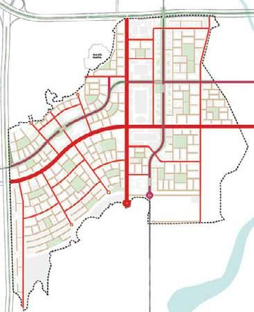
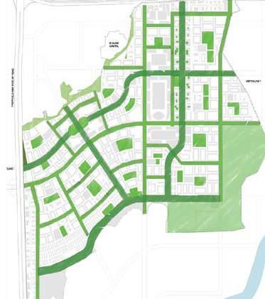
This framework consists of the two metro lines and the road system. The location of the metro lines is based on the
The main corridors: the north-south and east-west corridor, connect DREAM City with the present and future highways in the north and west. Beyond that, they will connect with the airport, Surat and future urban expansions around DREAM City. These corridors will 60 m wide, will have 2 x 4 lanes with service roads,
The Avenues: the avenues are urban access roads, typically 40 m wide with 2 x 2 lanes, bicycle paths and sidewalks. Some of these avenues have the metro line in
Local roads, residential roads: these are the roads create the finest grid and give access to buildings blocks. They are typically 16 m wide, will have two lanes, parallel parking and sidewalks.
the metros station there. Along the Outer Ring Road and the western highways strips of peripheral commercial are located. They are meant for activities such as workshops, drive-in restaurants, DIY-shops and marriage halls which don’t fit in the city centre. Thse strips function as a buffer between the highways and residential areas.
Residential quarters are distributed on the second rank; still on walking or bicycle distance from the metro system and served by the avenue roads. Public amenities are distributed over the residential clusters.
A framework of green lines and green spaces combined with walkways and bicycle paths spans over DREAM City.
Densities and FSI
Densities in DREAM City are moderate and this is planned deliberately in order to create a good balance between over-all quality and sustainability of the city and especially of public space and the built volume. The Diamond Bourse has a
of 4,
and in the
of
Creating an efficient urban structure i.e. the arrangement and organisation of the public domain and private land parcels.
Ensuring a high level of accessibility, permeability, and particularly walkability.
Creating a Integrated and Balanced human Scaled Environment.
Creating Identity and Character.
have a
is on
and Infrastructure 3292.4 Ha
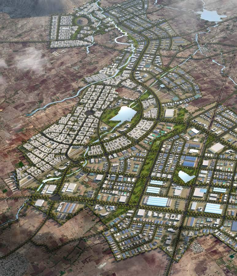
AURIC Bidkin is a part of the AURIC Shendra-Bidkin Industrial Area promoted by Aurangabad Industrial Township Limited (AITL) is formed between the MIDC and DMIC Implementation Trust.
This project is located in the district of Aurangabad in the Marathwada region of Maharashtra. Bidkin Industrial Area (BIA) comprises an area of 3296 hectares of land spread over 8 villages; the site is strategically positioned for direct connection to major state highways which provide connections to the city of Aurangabad on through SH-148 (Paithan Road) and National Highway (NH) 211.
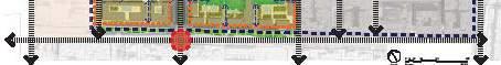
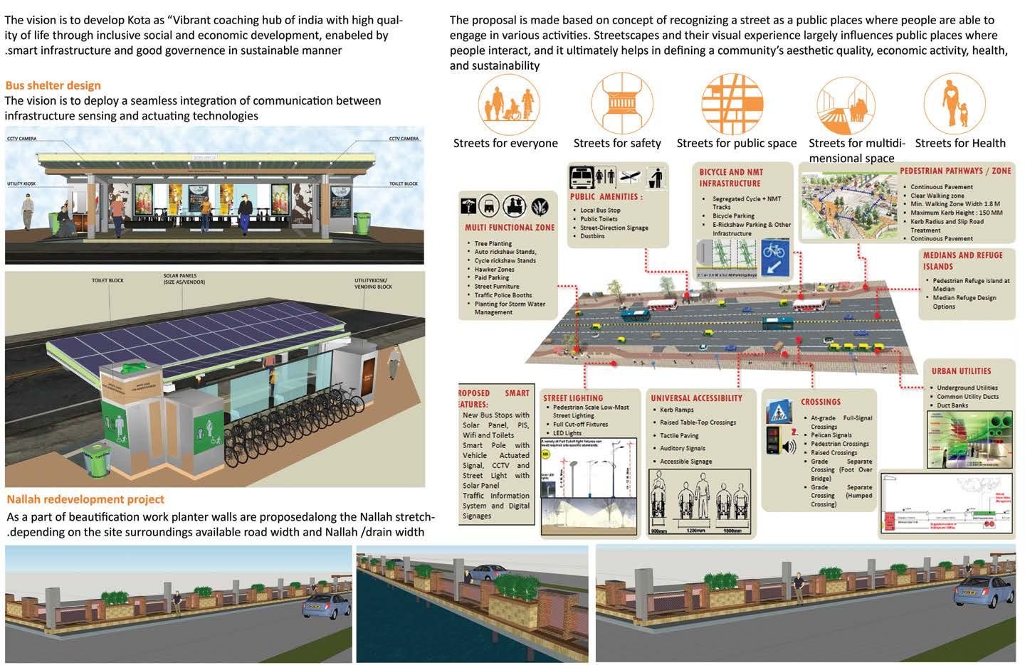
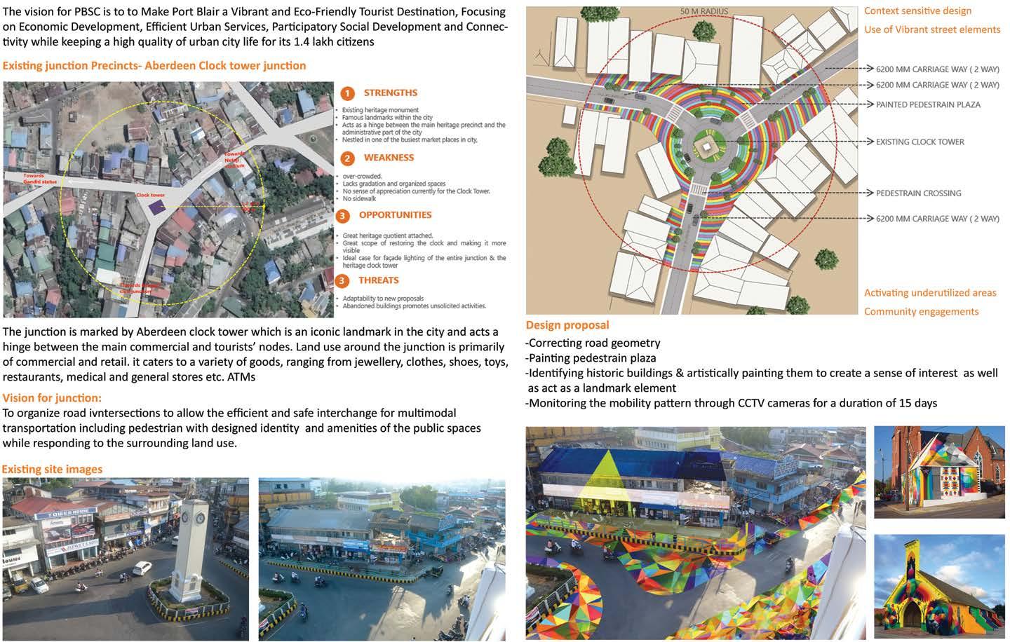
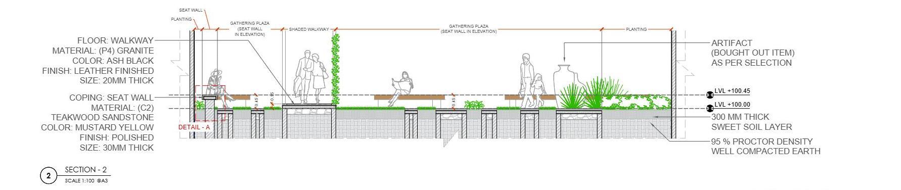
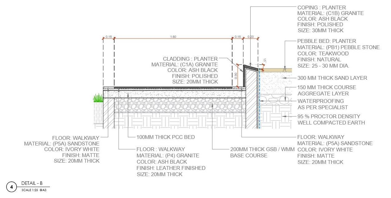
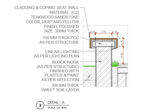
SMART ROAD (KOTA,RAJESTHAN SMART CITY)
Vision and Objectives
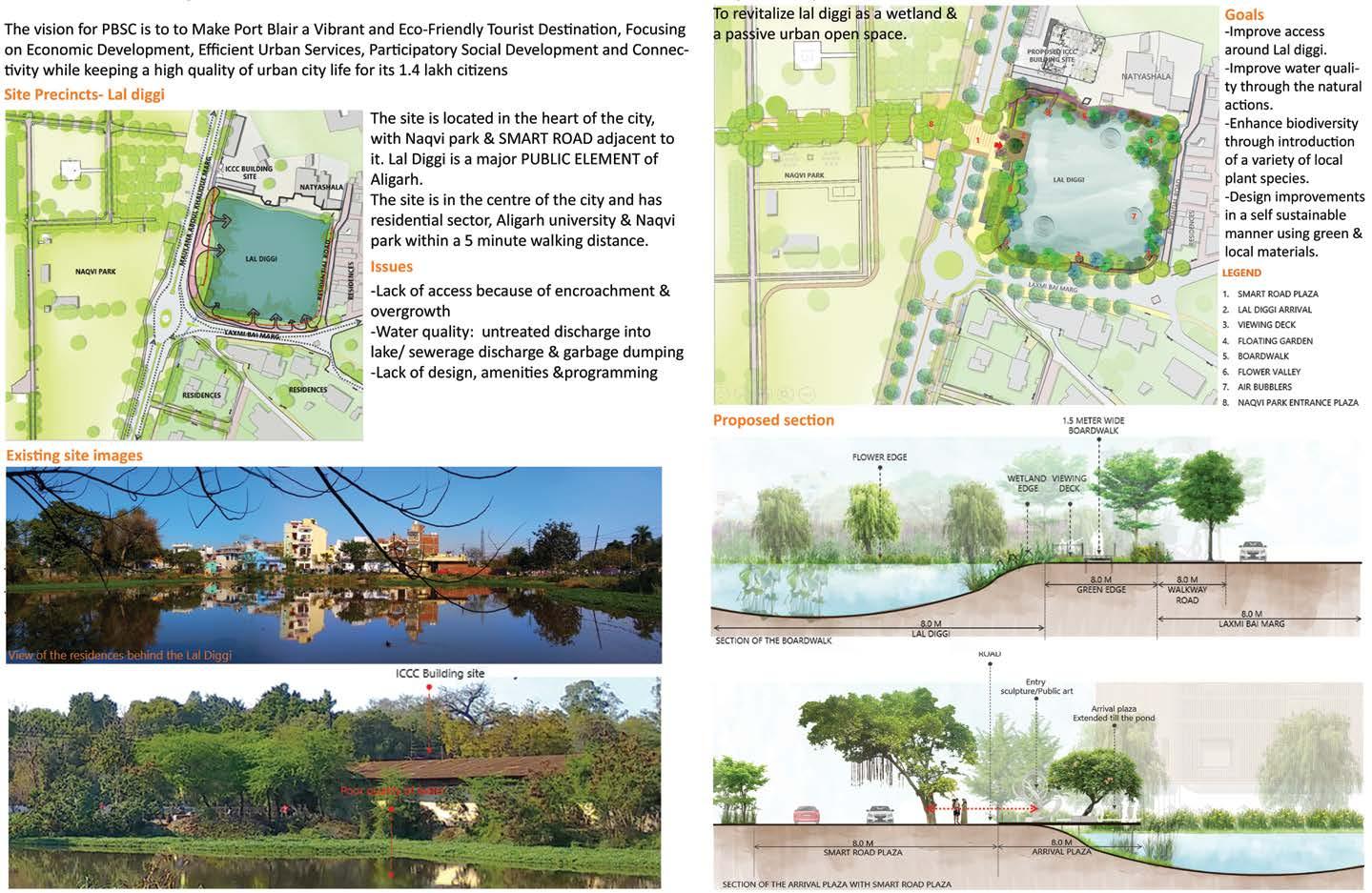
WETLAND REVITALIZATION (ALIGARH SMART CITY)
Vision and Objectives Proposed Design Smart Road Elements