
EASTERN MASSACHUSETTS


OTHER BOOKS FROM BRIGHT LEAF
House Stories
The Meanings of Home in a New England Town
BETH LUEY
Bricklayer Bill
The Untold Story of the Workingman’s Boston Marathon
PATRICK L. KENNEDY AND LAWRENCE W. KENNEDY
Concrete Changes
Architecture, Politics, and the Design of Boston City Hall
BRIAN M. SIRMAN
Williamstown and Williams College Explorations in Local History
DUSTIN GRIFFIN
Massachusetts Treasures
A Guide to Marvelous, Must-See Museums
CHUCK D’IMPERIO
Boston’s Twentieth-Century Bicycling Renaissance Cultural Change on Two Wheels
LORENZ J. FINISON
Went to the Devil
A Yankee Whaler in the Slave Trade
ANTHONY J. CONNORS
At Home
Historic Houses of Eastern Massachusetts
BETH LUEY
Black Lives, Native Lands, White Worlds
A History of Slavery in New England
JARED ROSS HARDESTY

At Home
Historic Houses of Central and Western Massachusetts
BETH LUEY
Flight Calls
Exploring Massachusetts through Birds
JOHN R. NELSON
Lost Wonderland
The Brief and Brilliant Life of Boston’s Million Dollar Amusement Park
STEPHEN R. WILK
Legends of the Common Stream
JOHN HANSON MITCHELL
I Believe I’ll Go Back Home Roots and Revival in New England Folk Music
THOMAS S. CURREN
Minds and Hearts
The Story of James Otis Jr. and Mercy Otis Warren
JEFFREY H. HACKER
Letters from Red Farm
The Untold Story of the Friendship between Helen Keller and Journalist Joseph Edgar Chamberlin
ELIZABETH EMERSON
The Combat Zone
Murder, Race, and Boston’s Struggle for Justice
JAN BROGAN
Trail Running Eastern Massachusetts has been supported by the Regional Books Fund, established by donors in 2019 to support the University of Massachusetts Press’s Bright Leaf imprint.
Bright Leaf, an imprint of the University of Massachusetts Press, publishes accessible and entertaining books about New England. Highlighting the history, culture, diversity, and environment of the region, Bright Leaf offers readers the tools and inspiration to explore its landmarks and traditions, famous personalities, and distinctive flora and fauna.
Copyright © 2022 by University of Massachusetts Press
All rights reserved
Printed in the United States of America
ISBN 978-1-62534-635-3 (paper)
Designed by Deste Roosa
Set in Quadraat and Calluna Sans
Printed and bound by Books International, Inc.
Cover design by Deste Roosa
Cover photo by Ben Kimball, Three women running along a scenic trail in eastern Massachusetts, 2021. Courtesy of the photographer.
Library of Congress Cataloging-in-Publication Data
A catalog record for this book is available from the Library of Congress.
British Library Cataloguing-in-Publication Data
A catalog record for this book is available from the British Library.
Portions of the introduction were previously published in Trail Running Western Massachusetts (Lebanon, NH: University Press of New England, 2015). Copyright © 2015 University Press of New England.
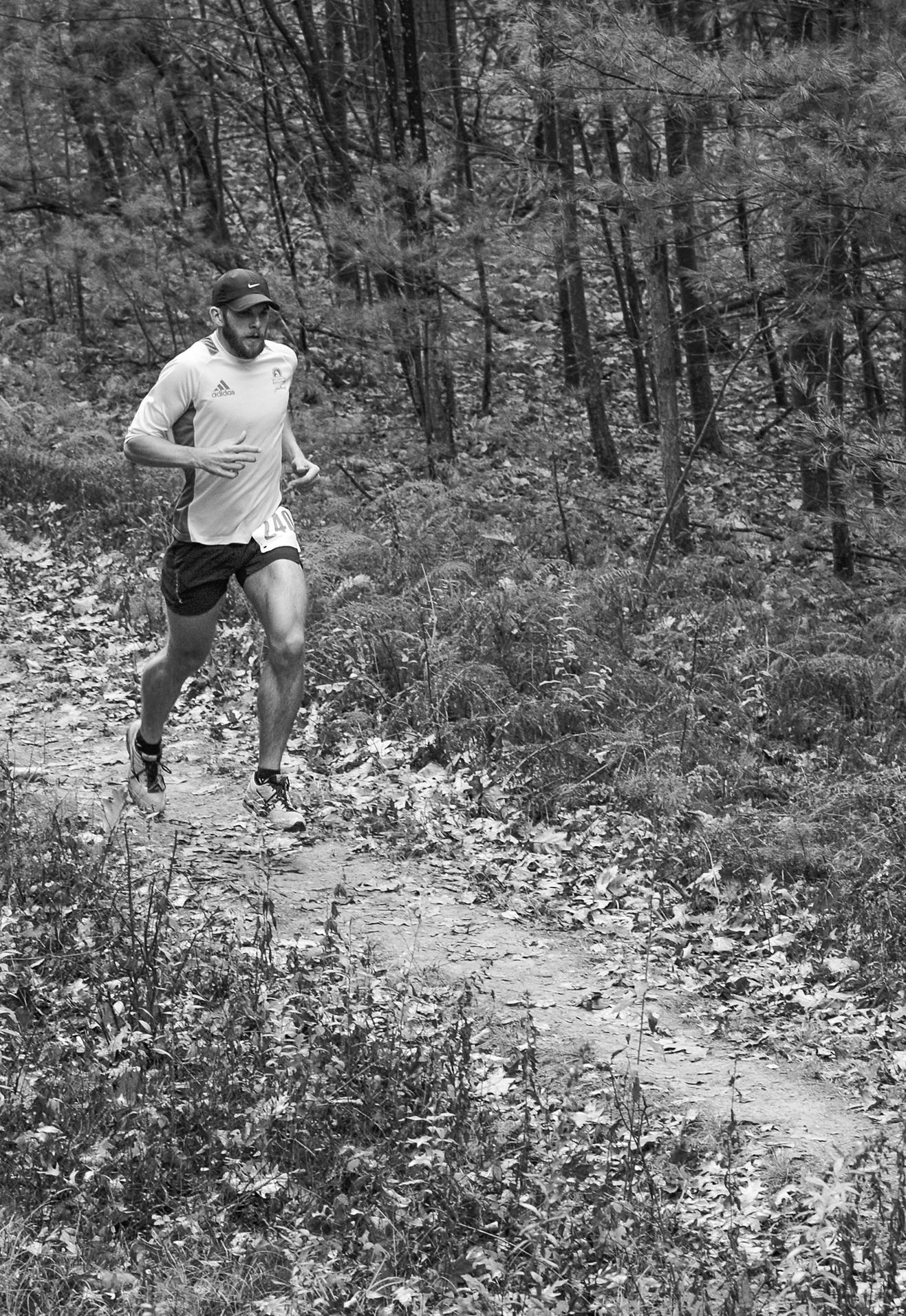
page i Trail racing at Callahan State Park in Framingham.
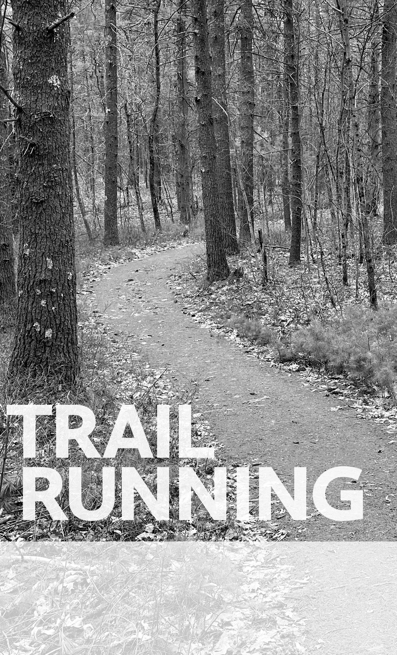
page iii Inviting trail curve at Groton Town Forest.
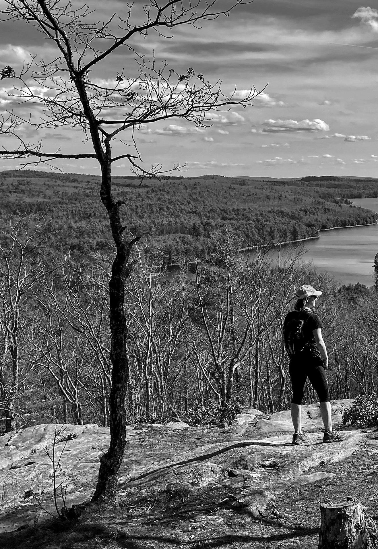
pages x–xi Quabbin Reservoir vista from Soapstone Hill in Petersham.
All photos and maps by Ben Kimball.
This guide was created with the support and assistance of countless friends in the regional running community. First, my awesome partner, Jennifer Garrett, once again helped with everything, including GPS work, editing, and logistics, not to mention endless encouragement. Others who provided invaluable advice, insight, or company include Pete and Tara Abele, Rufus Chaffee, Jason Como, Tom Davidson, Micah Donahue, Bob Fitzgerald, Brenda Fortin, Chase Fuller, Chris Gaughan, Paul Jahnige, Jay Kelly, Lydia Kimball, Orin Parvin, Amy Rusiecki, Jason Sarouhan, Tom Van den Broeck Raffensperger, Jesse Veinotte, Anne Marie Winchester, and Chris Wristen. Special thanks to Síofra Cléirigh Büttner, Katrina Coogan, and Jennifer Garrett for their positive energy and high spirits on a hot day during the cover photo shoot. Many organizations and resources proved useful for researching trails, including Massachusetts Department of Conservation and Recreation (DCR), the Trustees, various land trusts and conservation groups, and several online mapping sites. All profiled routes were visited and mapped in person, however, and any errors in them are entirely my own. Most of the base-map layers and some of the connecting trails data were obtained from MassGIS and various municipalities. Thanks also to the terrific production staff at UMass Press; they ensured every stage of this project ran very smoothly. Finally, special thanks to the local conservation organizations, land trusts, recreation departments, hiking clubs, trail running clubs (particularly TARC), mountain bike clubs (particularly NEMBA), friends groups, and volunteers who help build and maintain the wonderful trails of eastern and central Massachusetts.

Whether swiftly gliding through the woods, leaping over fallen logs, or soaring along scenic mountain ridges, trail runners always seem to be enjoying themselves. This is hardly surprising, since trail running combines the best aspects of many healthy and enjoyable activities. Among other things, it provides opportunities for achieving good fitness workouts, spending time outdoors exploring new terrain, and connecting to the natural landscape in a direct and personal way. The appeal of trail racing has become apparent to the broader running community, and the sport remains extremely popular.
Trail running is a particularly tactile experience, constantly forcing you to be mindful and aware of the world around you. Since it frequently requires the body to balance and stabilize itself, it strengthens different sets of muscles than running on pavement and generally results in less impact on the legs. No special gear is needed, though trail-running shoes improve grip and comfort in various conditions such as mud, grass, and loose rocks; handheld water bottles or hydration packs can be very helpful on longer runs; and traction is useful in winter.
Hiking is often an integral part of trail running, especially on steep slopes, but (pro) you can cover more miles in less time and (con) potentially move more quickly past sights. You also feel the ground differently—flowing over it rather than just stepping on it—and you make crucial, split-second decisions about where to place your feet with each stride.
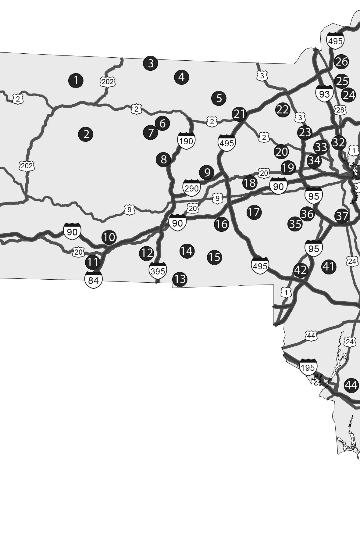
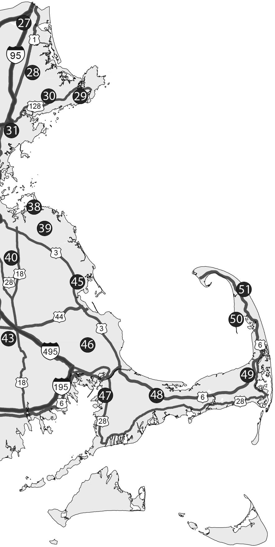
East E rn Massachus E tts t rail s it E s Eastern Massachusetts offers an incredible number of great trail-running opportunities, from outand-back runs on popular long-distance routes, such as the Midstate Trail and the Bay Circuit Trail, to little-known loops hidden away in the woods. Though many areas are heavily populated, with urban and suburban development limiting the number of options available,
The bulk of each chapter is given over to detailed, sometimes turn-by-turn trail descriptions of the route itself that—along with a judicious use of the maps contained in this book—should get you from start to finish without making a wrong turn or becoming mystifyingly lost in the wilderness. These sections often include optional extensions for lengthening a given run or—alternatively—trims for shortening if you don’t want to tackle the entire trail that day.
Finally, each site profile spotlights other nearby sites that are good for trail running (there are a lot more than fifty-one!).
tE r M inology Trail running uses some descriptive lingo that general readers (and some runners) may not be familiar with. The following frequently used terms appear throughout the profiles:
4-way intersection A crossing of two trails
Bootleg trail An unofficial trail or faint “trace” path
Braid When a trail splits then later comes back together
Doubletrack A trail wide enough for two people side-by-side
Fork Like a Y-junction, only with two of the trails tighter together
Lollipop loop Loop route that starts/ends with an out-and-back stem
Runnable A highly subjective term indicating “not too steep or rough”
Saddle Low point or notch between two summits
Singletrack A trail wide enough for one person
Switchback A tight S or Z where the trail changes direction on an ascent or descent
Technical A trail with more rocks and roots than dirt, often with steep pitches
T-junction When one trail ends at another; perpendicular to it
Woods road/dirt road Similar to doubletrack, but slightly wider
Y-junction A 3-way intersection, often with equal angles
Distanc E 4.4 Miles t own Royalston
Difficulty r ating Moderate t rail s tyl E Loop
t rail t y PE Singletrack t otal a sc E nt 270 Feet
Arguably straddling the border between eastern and western Massachusetts in the North Quabbin region, Tully Lake is definitely a top trail-running site for the state. The Lake Trail (a.k.a. the Tully Lake Loop Trail) is a spectacularly scenic route featuring lakeside views, lovely streams, forested hillsides, and a roaring waterfall. The loop is well marked with blue blazes and makes a terrific trail run for athletes of any ability. Though this site is frequently crowded on weekends, it’s generally only lightly visited otherwise. Tully Lake is part of a U.S. Army Corps of Engineers flood-control project, and portions may be flooded in early spring; check with the Trustees, who run the lake’s campground, or ACOE for current conditions. The bugs are notoriously brutal at times, and you may want to bring a head net or fly patches in midsummer.
Dir E ctions From Athol, take Rte. 32 north for 4 miles to Tully Dam, where there are paved parking lots on both sides of the street. It’s also possible to park at and start this loop from the boat ramp just north of the dam, Tully Lake Campground north of the lake, or the Doane’s Falls trailhead above the northeast side of the lake.
g P s “Tully Lake Disc Golf Course”
t rail At the parking area on the south end of Tully Dam, look for the trailhead kiosk. Following the blue-blazed Lake Trail into the woods, take an immediate left and pass the first tee of the disc golf course, then drop down the hill through the trees. At the bottom, veer left

and cross an open field. The trail briefly follows an old road, passes tee 2, crosses the broken pavement of another old road, and passes by several more disc-golf tees.
For a mile and a half, gently wind through the woods along the south and east shores of the lake; much of it is very runnable. The surface is soft and smooth most of the way, with occasional rocks and roots. Several stream crossings may be difficult in spring or after rain events, but they’re easily manageable during drier times.
About 2 miles from the start, swing right, away from the lake, and begin climbing at an easy, then moderate, grade on a doubletrack path. At a signed curve where the wide path swings right, bear left onto singletrack again and then ascend at a moderate grade to Athol Road. Turn left and briefly follow the pavement shoulder downhill and across the bridge over Lawrence Brook to the small upper parking lot for Doane’s Falls. Just past the bridge, turn left and descend the trail to Doane’s Falls. This series of cascades is one of the state’s more spectacular waterfalls when water levels are high. Keep following the trail down the steep slope below the falls, then veer right and arrive at the lower parking area.
Go left on Doane Hill Road, following blue-blazed posts and crossing over Tully River, to Tully Lake Campground on the left. The trail reenters the woods at a sign near the parking lot. Follow the rolling trail through the woods along the edge of the lake. Several side spurs lead left to open lakeside views along this pretty peninsula. The main trail veers sharply left just before reaching the road again and then traces the northwest shore of the lake for about a mile to the boat launch; this section can be somewhat rough due to rocks, roots, and muddy stream crossings, but it becomes gentler as you approach the well-used picnic area. Look for short side trails up to a beaver pond and down to a scenic point on the lake.
At the boat launch, briefly follow the paved ramp left down toward the water, then bear right and head up into an open grassy field at a yellow gate. This part is lightly marked; look for a blue-blazed wooden
Eastern Massachusetts offers incredible trail-running opportunities, ranging from popular long-distance routes like the Bay Circuit Trail to lesser-known loops that run through the mountains and forests of the Quabbin watershed and Merrimack Valley region, and trails that pass alongside the shores of Cape Cod. All over the Bay State, there are trails suitable for runners of all levels waiting to be discovered and explored.
Avid trail runner Ben Kimball offers a selection of fifty-one of eastern Massachusetts’s most spectacular trail sites, including detailed trail descriptions, topographic maps, directions, parking information, safety tips, and much more. Both experienced and novice trail runners will find Trail Running Eastern Massachusetts to be an invaluable resource for exploring nature and getting a good workout, in the Boston area and beyond.
“Trail Running Eastern Massachusetts is written for trail-running fans, wherever they might live, and designed to guide them to the best trailrunning opportunities in eastern Massachusetts.”
—Amby Burfoot, editor of “Runner’s World” Complete Book of Running
“With a casual tone that is welcoming and engaging, Trail Running Eastern Massachusetts will appeal to all who partake in trail running, whether they are a beginner or an expert.”—Ken MacGray, coeditor of AMC’s Southern New Hampshire Trail Guide
ben kimball is a photographer, editor, and cartographer based in Greenfield, Massachusetts. He is author of Trail Running Western Massachusetts.
COVER PHOTO Ben Kimball, Three women running along a scenic trail in eastern Massachusetts, 2021. Courtesy of ZZ photographer.
COVER DESIGN Deste Roosa


BRIGHT LEAF books that illuminate An imprint of University of Massachusetts Press Amherst & Boston www.brightleafbooks.com
