PORTFOLIO
Stanislav Skorobogatov
Architect
Contacts
Minsk, Belarus
stskpraca@gmail.com
Links
https://www.behance.net/ d38780cb
https://www.linkedin.com/in/ stskprc/
Skills
AutoCAD, Revit, Archicad, SketchUp, QGIS, MapInfo, Photoshop, Illustrator, InDesign, AI.
Languages
Belarusian - native Russian - native English - intermediate
Čeština - intermediate
Hobby Digital art, music creation.
Architect with 2 years of experience in designing public spaces and preparing project documentation. In my work, I integrate new trends in the field into my own design solutions. I have experience in solving customer problems, coordinating my own ideas regarding the requirements of related specialists and regulatory documentation. Aimed at creating the architecture of tomorrow for today.
Professional experience
5, 2021 - present moment.
Architect, "Institute for Regional and Urban Planning", Belarus
A leading state planning organization, that specializes in the development of urban planning documentation, scientific and reference documentation in the field of territorial planning
• Developed several urban planning projects with a total profit of up to 150,000 US dollars;
• Worked with various types of urban planning documentation, which in general covers up to 1200 hectares;
• Coordinated the work of a group of related specialists;
• Represented projects at public meetings, city councils and supervised the passage of expertise;
• Took part in competitions of concepts for the development of public spaces.
Education
07.2016 - 06.2022
Bachelor, Belarusian National Technical University, Minsk, Belarus Diploma topic “Environmental renovation of the Narochansky National Park”
Work projects
• General plan of Karma urban settlement. Adjustment. Gomel region, Belarus 2021
• Detailed plan of the estate building area in Starobin, Minsk region, Belarus 2022
• Detailed plan of the area of multi-apartment development in Fanipolm, Minsk region, Belarus 2022
Participation in contests
• Nanjing Dajiaochang Airport Renewal Plan Runway Park 2018
• "Multi-comfort house "Saint-Gobain" 2019
• Konkursu Koncepcyjnego KOŁO „Projekt Łazienki 2021”
• Nature Inspired Youth Center 2022
• Competition for the creation of public spaces in Mogilev 2023
... ...
Content
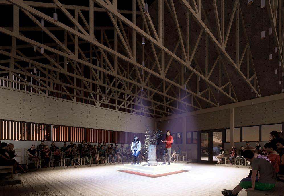
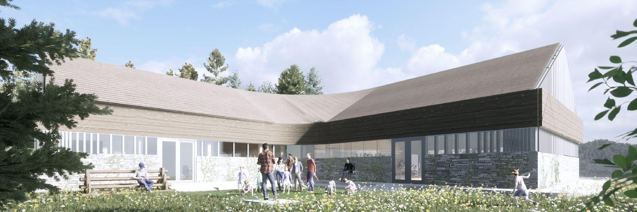
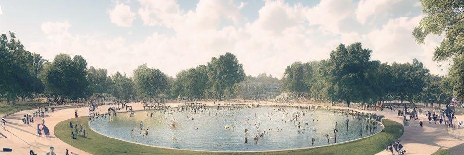
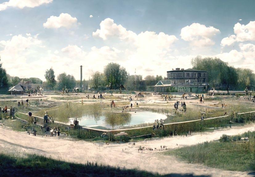
Service object at Huciska glade KOŁO 2021. Competition, as part of a team.
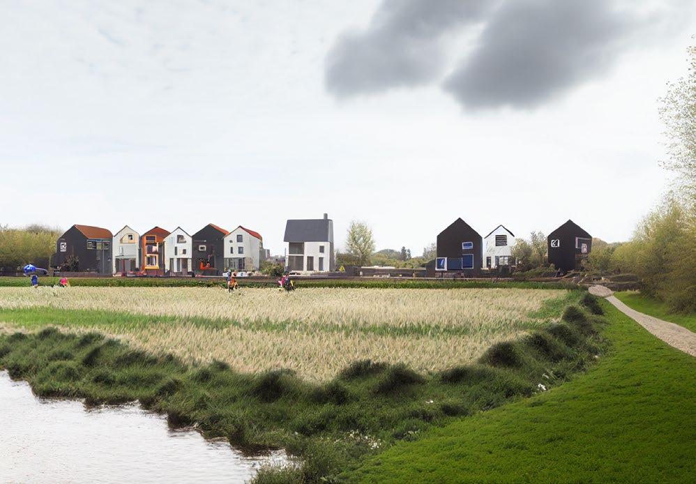
Youth center in the suburbs of Vancouver "GladeHood" 2022. Competition, as part of a team.
Detailed plan of the estate building area in Starobin 2022. Implementation.
Detailed plan of the area of multi-apartment development in Fanipol 2022. Working draft.
Greenery Materials Trace Water
The territory with its own history, traditions and forms. The goal is to adapt to the context.
Several factors, that were taken into account in the formation of the service object in the reserve.
the processes of interaction between it and nature.
In order to reduce the load on the ecosystem, scenarios for reducing the impact on nature have been developed.
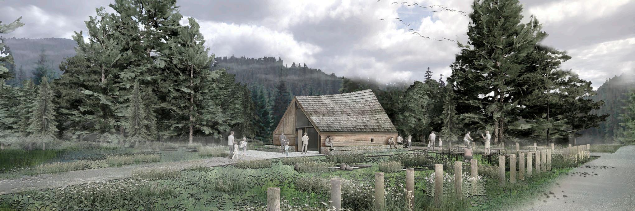
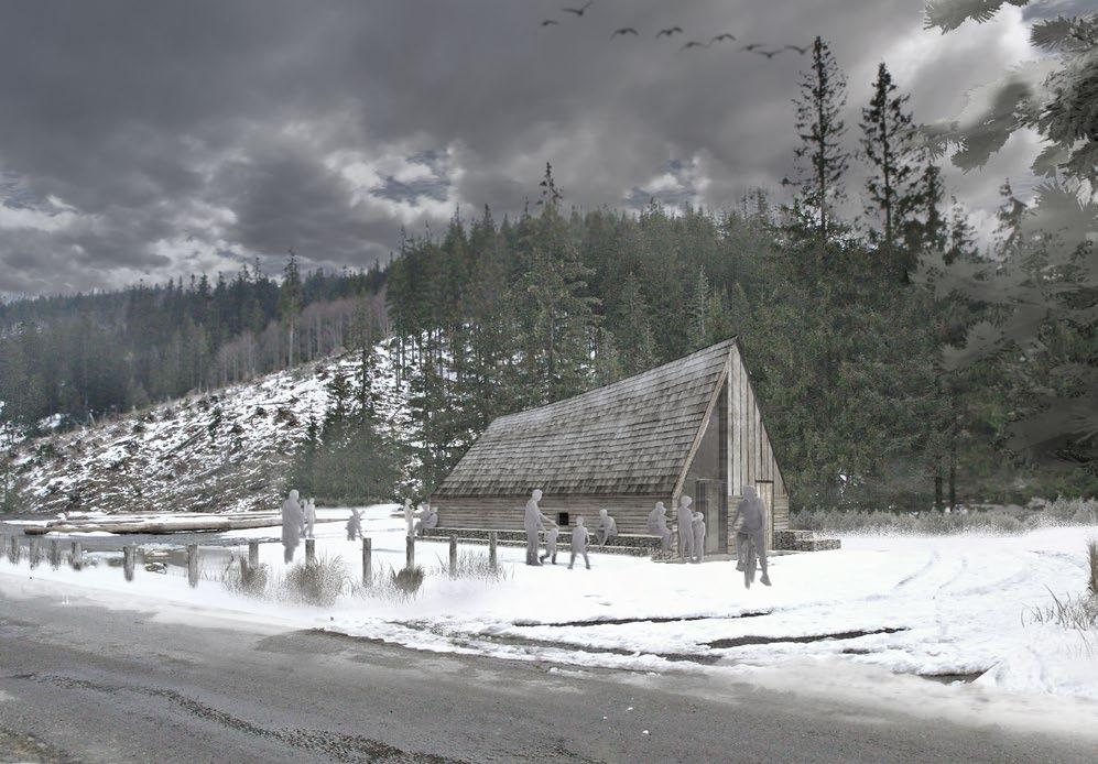
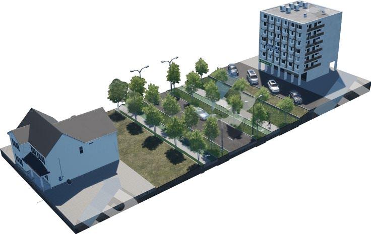
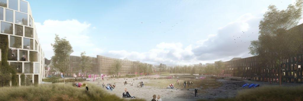
The site opposite the school should become an additional leisure place for children and teenagers in the area.
On the territory of 2500 m2 there is a building that forms a connection between the interior space and its environment.
The idea was inspired by the local interaction between locals and nature.
Establishment of functional volumes
Orientation to the cardinal points
Integration into the total volume
Community "lives" on free glades between forests.
Creating transition parts
Forming entry points
Opening surrounding through a form
So, was created an active recreation area integrated into the environment.
Transition between inside and outside creates new opportunities for interaction
Requirement in nature neutral building also inspired idea of "transparent", living and breathing volume.
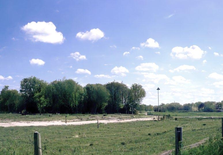
The project area is located on a picturesque slope of a forest hill in the suburbs of Vancouver.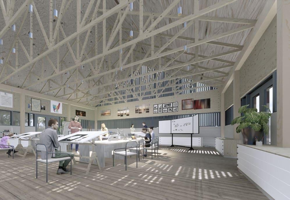
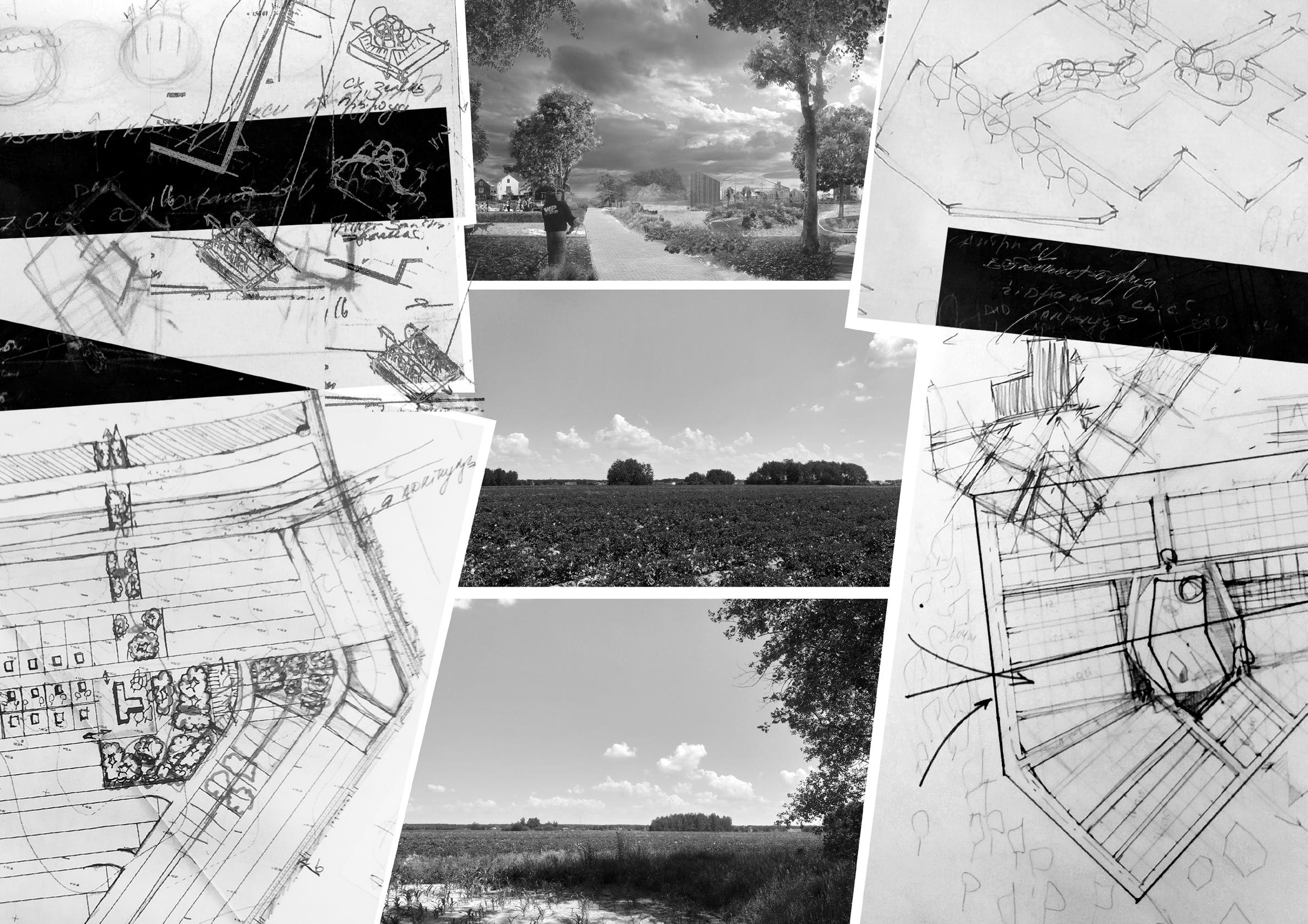
Today, the territory is represented by water bodies in the form of canals and water intake ponds. Around them were formed forests and an urbanized landscape, represented by the surrounding buildings, streets and agricultural land.
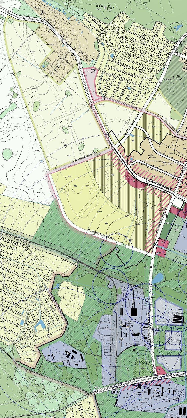
SOCIETY
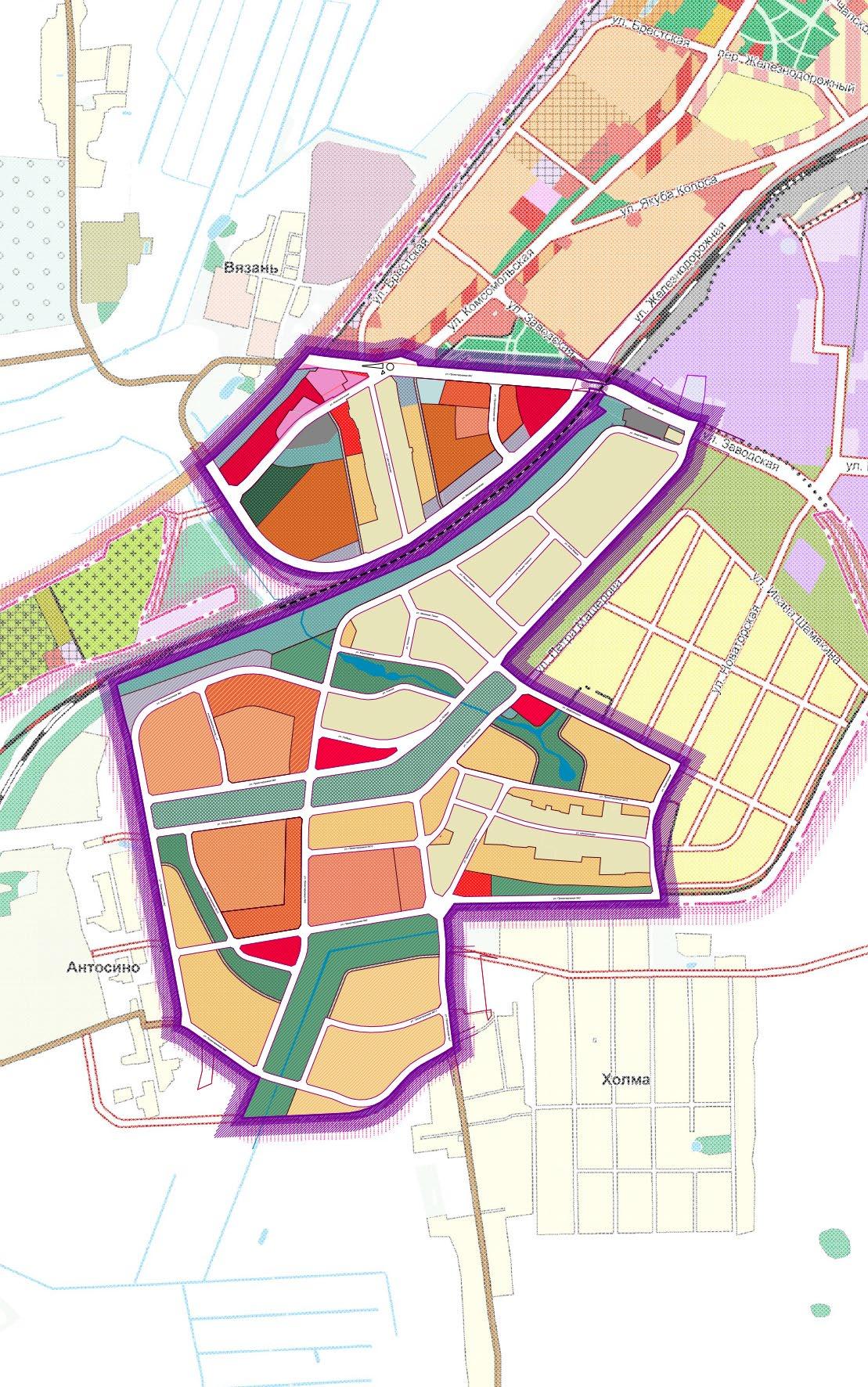
The aim of the project is the formation of manor buildings area on the territory of an agricultural field. people and continue the development of the city. The area of the territory is 69 hectares.

NATURE HOUSING
Once this natural landscape was transformed into agriculture, now this area should become a home for
Fixing things as they are. Using the provisions of the master plan.
Городская черта г.п. Старобина
Территория детального плана
Усадебная застройка Лес
Кустарно-древесные насаждения (Вымочки⁴⁾)
Сельскохозяйственные земли
Formation based on a stored system.
жилья Улицы городского значения
Creating a starting point for city development.
УСЛОВНЫЕ ОБОЗНАЧЕНИЯ
Границы территорий
граница детального плана ;
красные линии;
Detail plan boundary
Red lines
Building regulation lines
Boundaries of plots
Functional areas:
линии регулирования застройки;
Residential
границы участков
Функциональные зоны
Жилая:
Residential buildings of low density
Residential buildings area representative
Ж-2.1 Жилая усадебная низкоплотная застройка;
Recreational:
Ж-2.4 Жилая усадебная низкоплотная репрезентативная
застройка;
Рекреационная:
Common with high loads
Р-1.1 Рекреационная общего пользования с высокими
рекреационными нагрузками;
Common with low loads
Р-1.2 Рекреационная общего пользования со средними рекреационными нагрузками;
Engineering:
Инженерной инфраструктуры:
И-1.1 Инженерных коридоров подземных коммуникаций;
Engineering infrastructure
Прочие
Общественная;
Public:
О-2.3 Школьных и дошкольных учреждений;
School and preschool institutions
О-2.5 Торгово-обслуживающих предприятий;
Trade enterprises
Автобусные остановки;
Others:
Живые изгороди
Bus stops
Территории под водными поверхностями;
"Green" fences
Деревья
Площадка сбора ТБО;
Пешеходно-транспортная часть ( проезжая часть, тротуар, тротуар с
возможностью подъезда транспорта, велодорожка);
Water surfaces Trees
Внутриквартальный проезд( проезжая часть, тротуар, тротуар с
возможностью подъезда транспорта);
Проезд, разметка машиномест на автостоянках;
Land for solid waste
Велодорожка, пешеходная дорожка;
Main streets
Трансформатарная подстанция 10/0,4 кВ;
Intra-quarter trips
Газорегуляторный пункт;
Коллективные огороды в составе Р-1.1;
Территория за границами детального плана:
Parking lots
Cycling ways, pedestrian ways
Существующая жилая усадебная застройка; Сельскохозяйственная (пашни).
Transformer
Экспликация:
Engineering gas regulating structures
1.Торгово-обслуживающий объект с расширенным спектром услуг; услуг; 2. Учебно-педагогический комплекс на 300 мест.
Collective gardens
Areas outside the detailed plan:
Existing building
Agricultural lands
в г.п. Старобин Солигорского района. Эскиз застройки. М 1:2000.
Community-based
Local community development
Often this type of neighborhood on the border with the suburbs is in a depressed state, as it cannot enjoy the advantages of the city and the suburbs. Was offered a different plan of life in it.
Proposed to form on the basis of the existing nature of the points of "entry/exit" of people.
Preservation of natural elements and their transformation into public spaces.
Such spaces helps to tie to this area and neighboring areas, in which a significant shortage of public space has been identified. When all of the main planning elements will be connected to a design street system of the master plan, these territory will turn into one citywide structure that will develope the city.
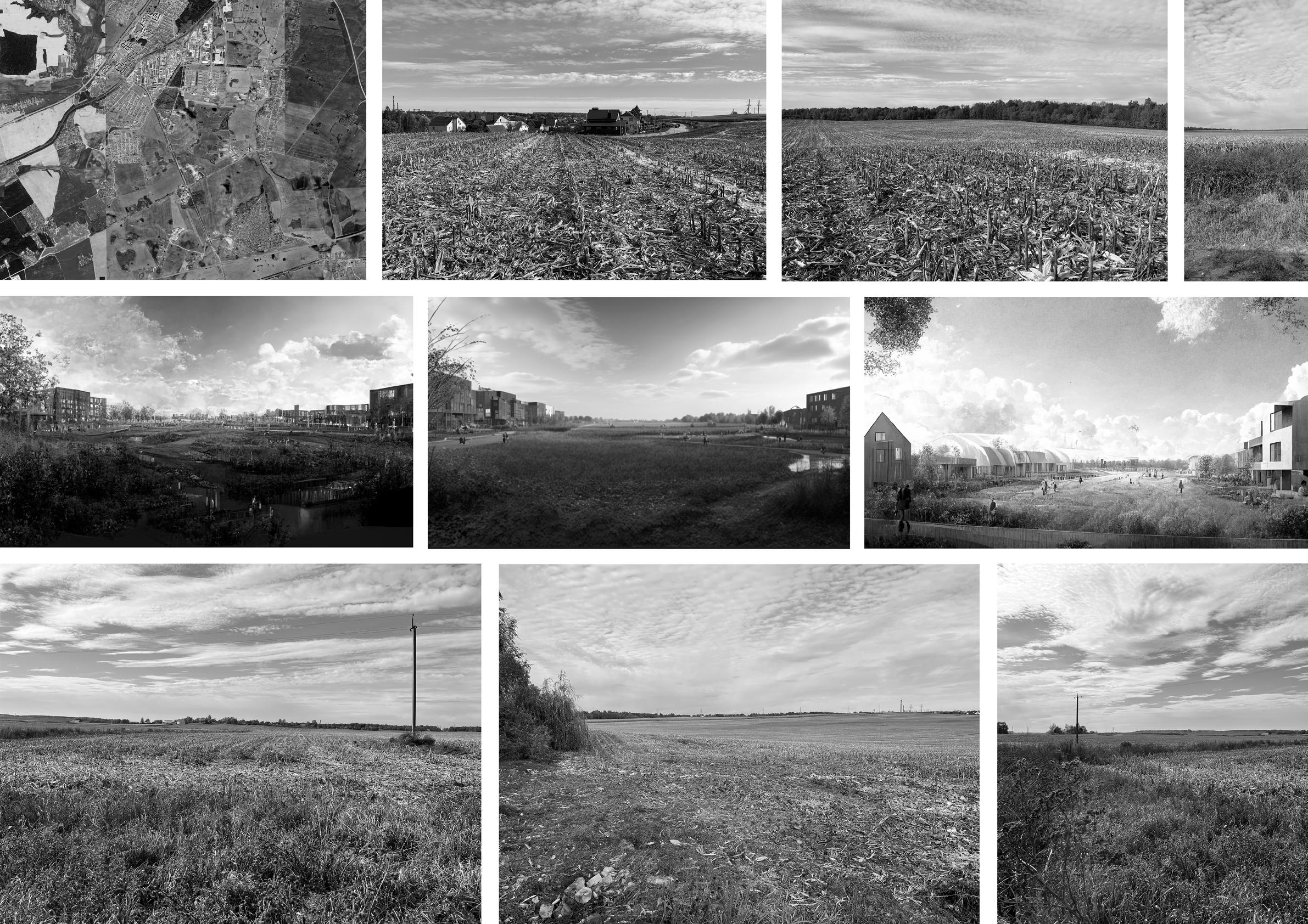
Located not far from the capital city - Minsk, Fanipol is at the same time integrated into the natural landscape. The new district is designed to preserve the natural and urban balance.
The territory, "sandwiched" between the highway and the railway, fields and channels, is a platform where multiple structures will have to gather.
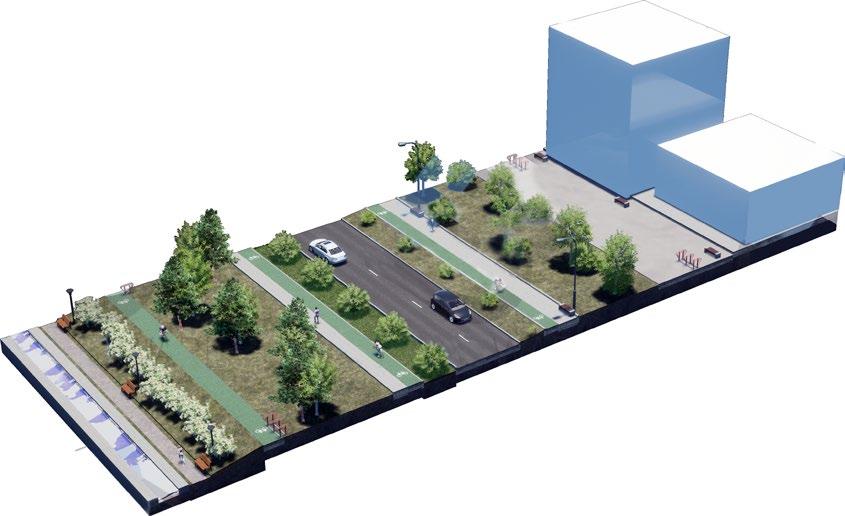
The area is connected with the outside world by a network of transport communications. New territory is created with the priority to pedestrians with goal of forming a citywide route.
The voids between the urbanized and green frames will be filled with various residential and public areas, which additionally form intra-district links.
The border location of the project area requires a long-term vision.
There is a hilly terrain on the territory, the qualities of which must be taken into account.
Public transport routes are placed on the created streets.
Residential zones are designed to preserve the "transitional" state of the territory.
Transitions from a citywide pedestrian system to a suburban one are being formed.
The remaining "green" areas connect residential areas with nature.
The main public facilities are inextricably linked with "green" areas.
At the same time, green areas act as a buffer for collecting rainwater.
To reduce the contrast between apartment buildings and homesteads, a street greening program is proposed, which will also reduce the impact of technogenic irritants.