ACTION PLAN FOR WALKING + BIKING

FEBRUARY 2021
ST. LOUIS COUNTY

ST. LOUIS COUNTY EXECUTIVE
Dr. Sam Page
ST. LOUIS COUNTY COUNCIL
Rita Days, District 1

Kelli Dunaway, District 2
Tim Fitch, District 3
Shalonda Webb, District 4
Lisa Clancy, District 5
Ernie Trakas, District 6
Mark Harder, District 7
DEPARTMENT OF TRANSPORTATION & PUBLIC WORKS
Stephanie Leon Streeter, Acting Director
John Hicks, Project Manager
Larry Welty, Project Manager
CONSULTANT TEAM
Alta Planning + Design
Access Engineering
CBB Transportation
Shockey Consulting Trailnet
CORE TEAM
Department of Transportation & Public Works
Joseph Kulessa, Acting Deputy Director
Glenn Henninger, Assistant Division Manager, Planning & Programming
Kori Neely, Engineer Program Manager
John Shrewsbury, South Area Engineer
Adam Spector, North & West Area Engineer
Ryan Pierce, Traffic Operations Manager
Christopher Hauber, Traffic Studies Project Manager
Milan Khadka, Project Manager 1
David Wrone, Public Information Manager
Department of Planning
Jacob Trimble, Senior Planner
Melissa Wilson, Planner
Department of Public Health
Kate Donaldson, Assistant Division Director, Division of Health Promotion and Public Health Research
Sara Mohamed, Public Health Coodinator
Keith Street, Health Education Coordinator
Department of Parks and Recreation
Tobi Moriarty, Design & Development Group Manager
Mallory Box, Citizens for Modern Transit
Kim Cella, Citizens for Modern Transit
Kelly McGowan, Gateway YMCA
Mike Hennies, Missouri Bicycle and Pedestrian Federation
Sarah Coyle, Paraquad
Derek Wetherell, Paraquad
Michelle Fricks, St. Louis Arc
Rhonda Hembree, St. Louis Arc
Pat Kelly, St. Louis County Municipal League
Lisa Hautly, St. Louis County Older Adult Commission
ShaRhonda Thompson, St. Louis County Resident
Pam Holman, St. Louis County Resident
Mike Boerding, St. Louis Homebuilders Association
Myisa Whitlock, Urban Strategies
Matthew Bernstine, Washington University in St. Louis
Clara Steyer, Washington University in St. Louis
Lori Kelling, West County Chamber of Commerce
Todd Antoine, Great Rivers Greenway
Angelica Gutierrez, Great Rivers Greenway
Mark Vogl, Great Rivers Greenway
Wesley Stephen, Missouri Department of Transportation
Shaun Tooley, Missouri Department of Transportation
Betherny Williams, Missouri Department of Transportation
Ryan Pearcy, Missouri Department of Transportation

Natalie Siebert, Metro Transit
Roderick Thomas, Metro Transit
Melissa Thiess, East West Gateway Council of Governments
Paul Hubmann, East West Gateway Council of Governments
Joseph Knight, City of Chesterfield
Tom Goldkamp, City of Florissant
Jonathan Raiche, City of Kirkwood
Rick Brown, City of Wildwood
Ted Medler, St. Louis County Department of Transportation
02
EXECUTIVE SUMMARY EC-1
Introduction
The Action Plan Vision Values and Goals
Key Findings
Public Input: What We Heard
PUBLIC ENGAGEMENT SUMMARY 11
Introduction
Advisory Groups
Phase 1 Engagement: Preparing to Engage and Early Awareness
Phase 2 Engagement: Issue and Needs
Phase 3 Engagement: Draft Plan Review
Lessons Learned
03
EXISTING CONDITIONS FOR WALKING AND BIKING 27
Introduction
1
Setting the Stage
Existing Sidewalks and Trails
Existing Bikeways
Walk and Bike Comfort
Safety and Crash Analysis
Demand for Active Transportation Facilities

Health Analysis
Equity Analysis


Walking and bicycling are essential to St. Louis County’s vision for the future. The 2013 strategic plan, Imagining Tomorrow, creates the framework and policies through which St. Louis County and its residents can grow, thrive, and prosper with healthy, engaged residents; desirable, connected communities; and accessible, attractive opportunities. A safe, comfortable, and connected network of walking and bicycling facilities can support healthy and active lifestyles, contribute to a community’s identity and sense of place, increase access to education and employment opportunities, and provide transportation options for many County residents who cannot or choose not to drive.
The Action Plan serves as a guiding document for investments in infrastructure, programs, and policies to support walking and bicycling. While the Action Plan focuses primarily on projects and actions for the St. Louis County Department of Transportation, it is also a valuable resource for other County departments, municipalities, MoDOT, Great Rivers Greenway, East West Gateway Council of Governments and other local governments.
Pedestrian and bicycle infrastructure recommendations are intended to:
• Increase safety and comfort for people walking and bicycling
• Address facility network gaps on County-owned and maintained roads and increase connectivity to important destinations and clusters of activity
• Provide practical strategies to implement the Complete Streets ordinance

• Update the Gateway Bike Plan’s recommendations for bicycle infrastructure based to better reflect shifting priorities and best practices in facility planning and design
Policy recommendations provide strategies to better integrate walking and bicycling into transportation investments and decisionmaking, increase community outreach and participation in all phases of County projects.
Vision statements guide planning processes by describing the long-term hopes and desired outcomes of transportation agency staff, residents, and other stakeholders. Vision statements indicate a plan’s importance and reasons why they are undertaken. They are repeatedly considered throughout a planning process to make sure the plan’s recommendations and priorities align with the long-term vision. The St. Louis County Action Plan for Walking & Bicycling vision statement is shown at right.

The Action Plan envisions a safe, connected, equitable, and inclusive transportation system that supports all people in accessing life’s many opportunities.
The County has identified seven essential values to guide the Action Plan’s development and recommendations. These values provide structure and direction for decisionmaking throughout the planning process. They guided the County’s recommendation development to help bring to life the Action Plan’s unifying vision. Each value is accompanied by a corresponding goal, which provides the overarching direction to advance that value through transportation-related decision-making and investments.
Create an environment in which people feel safe and comfortable traveling in St. Louis County, regardless of their mode of transportation.

Increase connectivity and access to key community destinations, like schools, parks, community centers, transit, and employment opportunities.
Enhance mobility options for those who can benefit most, including communities of color, children, seniors, and people with limited income and means.
Invest in public infrastructure and active transportation as pathways to a healthier St. Louis County.
Support walking and biking for all people, regardless of age or ability.
Provide a consistent, dependable environment for walking and bicycling across the County Road System.
Achieve shared goals for active transportation through interdepartmental and interagency partnerships.
The Action Plan documents the physical and policy landscapes throughout the County that influenced the plan’s recommended investments in active transportation. The character and quality of the transportation system plays an important role in how people choose to travel. Major findings from existing conditions analyses are summarized here and expanded in Chapter Three.
The County inventoried existing walking and biking facilities to understand the systems’ current connectivity and quality. The review found that 39% of roads on the County Arterial and Collector Roadway system (ARS/CRS2) have sidewalks present on both sides of the roadway, while 43% of roads have no sidewalks at all. Multi-use paths represent the type of bike facility found in the county most often. However, people walking can also use these pathways. There are 116 miles of existing multi-use path and 57 miles of bike lanes in St. Louis County.
St. Louis County, local municipalities, and many regional partners have a long history of planning for and supporting walking and biking. This plan’s recommendations build from previous initiatives.
The County used two analyses to study comfort of walking and biking along the St. Louis County ARS/CRS2. Pedestrian comfort is not uniform throughout the system. Nearly half of all ARS/CRS2 roads received the top two highest-stress scores for the Pedestrian Level of Service (PLOS) analysis that analyzed walking comfort. The Bicycle Level of Traffic Stress (BLTS) Analysis evaluates how stressful it is to ride a bike along County roads. Ninety percent of roadways scored received the top two highest-stress designations for biking. The results from these analyses show that pedestrian and bicycle mobility is limited by these high-stress roadways on the County road system.
The County conducted a demand analysis for walking and bicycling in St. Louis County showing concentrations of places people live, work, learn, play, shop, and take transit. Inner ring communities, historic commercial main streets in “streetcar suburbs” like Kirkwood and Ferguson, major employment centers like Westport Plaza and Downtown Clayton, parks, and greenways, contribute to the mosaic of places that people in St. Louis County travel to and from on a daily basis


A health analysis identifies locations in St. Louis County with high concentrations of health concerns to better understand health disparities and transportation needs. The County examined the rates of diagnoses of diseases and health indicators that have a stronger connection to transportation system and physical activity. The analysis showed a concentration of diseases and conditions in northeastern St. Louis County.
This analysis identifies concentrations of St. Louis County residents that have been historically disadvantaged or are otherwise considered vulnerable to unsafe, disconnected, or incomplete active transportation facilities. The composite shows greatest need in for walking and bicycling investments based on a combination of demographic indicators in northeastern St. Louis County, particularly in the area bounded by Olive Boulevard, I-270, Lindbergh Boulevard, and the City of St. Louis.
Community engagement was a key component of the planning process for the Action Plan. The Action Plan’s overall engagement strategy combined tactics designed to reach a lot of people, like public meetings and an online survey, and tactics designed to reach targeted groups less likely to participate, like intercept surveys and small group meetings. Phase 2 of engagement, which began in spring 2020, was disrupted due to the COVID-19 pandemic, but the County continued both large-scale and targeted outreach as much as possible.
Phase 1 engagement was designed to develop the engagement materials and protocols for the life of the project. Public engagement launched with mass email announcements, a project website, social media messages, and tabling at local events through the summer and fall of 2019. Tabling at high-traffic locations was a productive way to raise awareness for the planning effort and collect early feedback from the public.
Phase 2 engagement focused on gathering input on needs, opportunities, and preferences for walking and biking. The project experienced its highest level of engagement during this phase, reaching hundreds of people through four public meetings and an online survey. With 906 participants, the online community survey was the most utilized public engagement tool for the Action Plan.
Public meeting attendees and survey participants want the County to improve existing sidewalks, add more sidewalks, and add bicycle facilities. Survey respondents felt the most important factors to consider when setting priorities for improvements were:

• Demand, investing in routes with the most desire for walking and biking (40%),
• Efficiency, investing as opportunities arise through roadway projects (28%).
• Investing equally across the County (18%)
• Investing most in areas where car ownership is low (7%).
Phase 3 engagement efforts provided residents and stakeholders an opportunity to share their input on the draft plan recommendations. Residents expressed their desire to focus investments on sidewalk repair, new sidewalks, and off-street bike facilities like trails and sidepaths. The input received through the virtual open house reaffirmed draft pedestrian and bicycle network recommendations and helped the project team to refine these recommendations for the final plan.
Throughout the course of the plan, the County continuously reviewed and evaluated engagement efforts to identify gaps in outreach and participation and to seek opportunities to increase participation among communities of color, low-income residents, and residents of geographic areas not represented in early stages of engagement.
With the lessons learned from these equity audits, the County pursued a variety of engagement strategies to better reach underserved and underrepresented populations. These included outreach and events at public libraries; stakeholder meetings with community organizations and school districts; targeted mailings to random addresses in areas of high need for active transportation improvements. Transit intercept surveys were planned at high-volume MetroBus stops and MetroLink stations, but were canceled due to COVID-19 safety precautions.
The equity audits and corresponding actions helped to strategically expand equitable and inclusive outreach efforts.
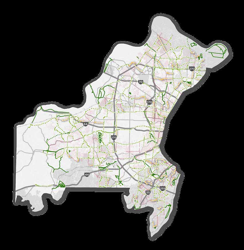
The recommendations for pedestrian improvements are located on County roads in both incorporated and unincorporated areas throughout St. Louis County. These projects address system gaps, replace deteriorating sidewalks, and support a safer, more accessible, and more comfortable pedestrian experience. The proposed pedestrian improvements are described below and shown in Map 1.
Recommendations for new sidewalks address corridor-level gaps in the sidewalk system along the Arterial and Collector Road Systems (ARS and CRS2). These proposed projects provide new connections to transit, schools, parks, commercial districts, and other important community destinations.
Sidewalk infill recommendations address minor gaps along corridors with disconnected sidewalks. Many of these proposed projects are located along ARS and CRS2 roadways that have experienced redevelopment in recent years, triggering requirements for new sidewalks, which in turn has resulted in fragmented sidewalk development. Creating contiguous pedestrian paths along these corridors will enhance pedestrian safety, connectivity, and access to transit, schools, shops, and other destinations.
Proposed sidewalk repair projects address sidewalks in poor state of repair or those that provide a poor level of service. These existing sidewalks present significant challenges for people with limited physical mobility or who use a mobility assistance device like a walker or wheelchair. While the sidewalk repair recommendations are likely to be expanded
through the County’s ADA Transition Plan, these proposed projects address key deficiencies in the sidewalk system located in high-density and high-need areas.
Recommendations for new sidepaths support both biking and walking. These represent the most significant recommended pedestrian improvement type by mileage, constituting more than two thirds of all proposed pedestrian facilities. For instances in which sidepath installation is determined infeasible due to lack of available right of way or other physical constraints, every effort should be made to provide a continuous, accessible pedestrian facility along these corridors.
While the focus of pedestrian improvements is the County road system, there are a small number of shared use path (trail) projects recommended in the plan. Some of these projects provide short connections between existing pedestrian facilities and major greenways like Grant’s Trail, and others are more substantial projects that will require significant resources and coordination with the Department of Parks and Recreation and local municipalities to develop.
Existing Proposed
Existing Sidewalk
Existing Sidewalk on County ARS/CRS2
Proposed Sidewalk on County Road
Shared Use Facility (Sidepath)
Shared Use Facility (Trail or Greenway)
Incorporated Areas
Unincorporated St. Louis County
The proposed bicycle network builds on decades of investments in bicycling infrastructure to create an interconnected, county-wide system of bikeways to support both local and regional bicycle trips. St. Louis County, MoDOT, Great Rivers Greenway, and many municipalities have all contributed to the 215 miles of existing on-street bikeways, trails, and greenways throughout the County. Their continued support for bicycle transportation and investments in related infrastructure is essential to close gaps between existing facilities and improve and expand the system to truly function as a safe, connected, and inclusive county-wide bicycle network.
The bike network recommendations are separated into three overarching categories based on implementation responsibilities and relationship to other planning efforts:
• The Action Plan Network: proposed facilities along roads owned and operated by St. Louis County
• The Gateway Bike Plan Network Updates: proposed facilities on MoDOT and locally owned and operated roadways that update recommendations in the Gateway Bike Plan
• Previously Planned Regional Bikeways: Regionally significant trails, greenways, and other facilities illustrated for network connectivity purposes
As St. Louis County and its community partners continue to implement projects within each of these categories, isolated bikeways will be connected, network gaps will be filled, and access to bicycling will be expanded into new areas of the County.
The Action Plan Network consists of on-street bikeways and shared use paths along St. Louis County owned and operated roads. The 325 miles of proposed Action Plan Network bikeways build upon the 38 miles of existing bikeways on the County-owned road system to enhance connectivity in unincorporated St. Louis County and strengthen connections to local bike networks, parks, greenways, business districts, and other destinations. More than half of these proposed facilities consist of shared use paths and physically separated bike lanes, reflecting the plan’s vision of a safer, more inclusive network that welcomes people of all ages and abilities.
The proposed Action Plan Bicycle Network is shown in Map 2. The facility types that comprise the Action Plan Bicycle Network are categorized and listed in the table below.
BICYCLE FACILITIES
Existing Proposed
Mixed Traffic Bikeway
Visually Separated Bikeway
Physically Separated Bikeway
Shared Use Facility (Sidepath)
Shared Use Facility (Trail or Greenway)

JURISDICTIONS
Incorporated Areas
Unincorporated St. Louis County
The combined recommendations for bicycle facility development in the Action Plan Network (St. Louis County) and the Gateway Bike Plan Network Update (MoDOT and local agencies), along with previously planned trails and greenways, serve as the blueprint for a county-wide bicycle system.
The complete future bicycle network is depicted in Map 3, and its components are listed below in Table 3 by facility category and type. With more than 1,100 miles of facilities, over 200 of which are already in place, the future county-wide bicycle system will be a realization of the County’s vision for a safe, connected, and equitable multimodal transportation system.
With more than 1,100 miles of bikeways, over 200 of which are already in place, the future county-wide bicycle system will be a realization of the County’s vision for a safe, connected, and equitable multimodal transportation system.
BICYCLE FACILITIES
Existing Proposed
Mixed Traffic Bikeway
Visually Separated Bikeway
Physically Separated Bikeway
Shared Use Facility (Sidepath)
Shared Use Facility (Trail or Greenway)

Previously Planned Trail/Greenway
Incorporated Areas
Unincorporated St. Louis County
The Action Plan presents a bold and ambitious vision for the future of walking and bicycling in St. Louis County. Bringing this vision to life will require a sustained commitment to active transportation for years to come, as well as the necessary leadership, resources, partnerships, and policy advancements to create a lasting impact on the county’s physical and cultural landscapes.
Whether reviewing programmed projects for opportunities to incorporate plan recommendations, advancing progressive and flexible design criteria, or strengthening partnerships across County departments and with agency partners, St. Louis County can concurrently pursue multiple implementation strategies to better support walking and biking as an integral components of the multimodal transportation system.
While the Action Plan is a long-range planning document guiding future investments in active transportation, early actions to implement the plan’s recommendations will be necessary to sustain momentum from the planning process and build a foundation for lasting change.
Early implementation actions include:
• Integrating Action Plan recommendations into programmed roadway improvements
• Developing an annual report to highlight the County’s efforts to implement the Action Plan and promote Complete Streets
• Evaluating policies and design criteria to better support walking and biking
• Moving forward with the ADA Transition Plan and Asset Management upgrades

Implementing recommended projects included in the Action Plan must take into account the potential impact of each project to support walking and biking and advance the Action Plan’s vision and goals. It is also necessary to consider the wider transportation system context, and the potential opportunities and constraints that may impact project programming and development.
The pedestrian and bicycle facility improvements recommended in this plan vary greatly in terms of length, location, facility type, land use context, and other characteristics. St. Louis County developed an evaluation methodology to determine the value of each recommended project on County-owned roadways with respect to the vision and value of the plan. Each of the evaluation criteria measure the extent to which recommended projects support SAFETY CONNECTIVITY
a corresponding value or goal of the plan. These evaluation criteria are listed below.
The results of this project impact evaluation are displayed in the maps on the following pages. Projects are grouped into three categories based on the results of the evaluation: high impact, medium impact, and low impact. These categories reflect the extent to which each project advances the vision and values of the plan and will be considered by the Department of Transportation in future project scoping and programming efforts.
While high impact pedestrian and bicycle projects can are located in nearly all areas of the county, the prevalence of high impact projects in north St. Louis County reflects the higher scores for health and equity factors. Many residents in north St. Louis County rely on pedestrian and bicycle facilities to access transit, schools, employment, and other local destinations.
PROJECT EVALUATION RATING
High Impact
Medium Impact
Low Impact
LOCAL JURISDICTIONS
Incorporated Areas
Unincorporated St. Louis County

PROJECT EVALUATION RATING
High Impact
Medium Impact
Low Impact
LOCAL JURISDICTIONS
Incorporated Areas

Unincorporated St. Louis County

The Plan’s recommendations amount to nearly $520M of investments in active transportation infrastructure ($274M for the Action Plan Network on St. Louis County roads, and $245 for Gateway Bike Plan Network Updates on state and local roads). Implementing the recommendations proposed in the Action Plan will require a combination of local revenue, costsharing with community partners, external grants, and other creative funding sources. Even modest targets for Action Plan and Complete Streets investments add strain to the growing budget challenges shown in Figure 1.
Given the current state of the County’s transportation system and its limited ability to fully fund even basic maintenance needs, the Department of Transportation must take an opportunistic approach to pedestrian and bicycle improvements. This includes leveraging limited resources to secure external grants and funding sources, partnering with local agencies and institutions to pursue projects that achieve
mutually beneficial goals and objectives, and identifying opportunities to align recommended projects in the Action Plan with scheduled roadway improvements. This opportunity-based strategy highlights the importance of regular review of potential projects as part of the programming process. Roadway resurfacing projects comprise a significant portion of the Department of Transportations annual budget. Many of these projects provide opportunities to incorporate recommendations for on-street bikeway facility installation through re-striping modifications like lane narrowing or road diets. They may also present the opportunity to incorporate adjacent sidewalks or ADA improvements and achieve economies of scale.
As the Department of Transportation reviews potential projects for inclusion in its annual and five-year capital improvements plans, the recommendations in the Action Plan and the impact ratings described in the previous section can serve as a valuable guide for incorporating Complete Streets design elements into future transportation projects.
Performance measures track plan implementation over time. County staff and other stakeholders can reference these performance measures to routinely track progress and check that the plan is achieving its desired goals and advancing towards its overarching vision. While there are many different ways to measure plan success, it is important to acknowledge the amount of time and effort necessary to compile, review, and analyze associated data. As such, the performance measures developed for the Action Plan are simple metrics that serve as the baseline for evaluating performance. These measures can be expanded upon or supplemented with additional measures as necessary to better examine key issues or themes.
The following performance measures are among those identified in the plan to be reviewed on an annual basis and communicated in the annual Action Plan report to the public:
• Miles of total pedestrian and bicycle facilities
• Miles of total pedestrian and bicycle facilities that are considered low stress / part of an all ages and abilities network
• Miles of pedestrian and bicycle facilities implemented in high need areas
• Number of fatal and severe injury-causing pedestrian - and bicycle-related crashes
• Walking and bicycling mode share
• Miles and percent of sidewalks repaired per year

Walking and bicycling, as well as safe and connected infrastructure to support these activities, are essential to St. Louis County’s vision for the future. The 2013 strategic plan, Imagining Tomorrow, creates the framework and policies through which St. Louis County and its residents can grow, thrive, and prosper with healthy, engaged residents; desirable, connected communities; and accessible, attractive opportunities. A safe, comfortable, and connected network of walking and bicycling facilities can support healthy and active lifestyles, contribute to a community’s identity and sense of place, increase access to education and employment opportunities, and provide transportation options for many County residents who cannot or choose not to drive.
The Action Plan for Walking and Biking is an ambitious blueprint for the future of walking and biking in St. Louis County. Like the County’s Complete Streets Ordinance adopted in 2013, the Action Plan acknowledges the importance of safe, accessible, and convenient mobility options to meet the diverse transportation needs
of St. Louis County residents. The Action Plan expands on the Complete Streets Ordinance’s underlying framework by envisioning a future transportation system that embodies the principles and values of the ordinance and by providing practical, incremental strategies to achieve it.

The Action Plan’s recommendations are grounded in data-driven analysis and research, guided by community and stakeholder engagement, and motivated by the vision of a safer, more equitable, and better connected transportation system that meets the needs of people of all ages, abilities, and backgrounds. Achieving this vision will require commitment, collaboration, determination, and resources from St. Louis County and its community partners over an extended period of time.
The Plan Overview Chapter provides important information about the Action Plan background and purpose, the planning process, the Plan’s vision and goals, and a brief description of each of the following chapters.
The Action Plan serves as a guiding document for investments in infrastructure, programs, and policies to support walking and bicycling. While the Action Plan focuses primarily on projects and actions for the St. Louis County Department of Transportation, it is also a valuable resource for other County departments, municipalities, MoDOT, Great Rivers Greenway, East West Gateway Council of Governments and other local governments.
Recommendations for pedestrian and bicycle infrastructure improvements are intended to:
• Increase safety and comfort for people walking and bicycling;
• Address facility network gaps on County-owned and maintained roads and increase connectivity to important destinations and clusters of activity;
• Provide practical strategies to implement the Complete Streets ordinance; and
• Update the Gateway Bike Plan’s recommendations for bicycle infrastructure to better reflect shifting priorities and best practices in facility planning and design.
Policy recommendations provide strategies to better integrate walking and bicycling into transportation investments and decisionmaking, increase community outreach and participation in the planning, design, and construction phases of County projects.

The Action Plan process began in the Spring of 2019 with creation of the Core Team, Community and Technical Advisory Committees, and formulation of a community engagement plan to guide input and participation. The County then began a thorough review of data, relevant planning documents, and transportation policies to develop a complete picture of active transportation on the County road system. Combining this thorough review of existing conditions for walking and biking with feedback from the public, the County was able to identify issues to address and opportunities to advance through the Action Plan.
In early 2020, building on these early engagement and analysis efforts, the County began to develop initial recommendations for physical, programmatic, and policy recommendations. These draft recommendations were shared with the Core Team and Advisory Committees for initial review and refinement before being shared with the public during the final round of engagement. With input obtained through a variety of virtual platforms, the County then worked to finalize the Action Plan recommendations and develop implementation strategies to advance the Action Plan’s vision and goals once adopted.

Vision statements guide planning processes by describing the long-term hopes and desired outcomes of transportation agency staff, residents, and other stakeholders. Vision statements indicate a plan’s importance and reasons why they are undertaken. They are repeatedly considered throughout a planning process to make sure the plan’s recommendations and priorities align with the long-term vision.
Streets, highways, and other transportation infrastructure owned and maintained by St. Louis County play an important role in shaping all road users’ experiences when traveling in and around St. Louis County. Creating safer, more accessible facilities for walking and biking on these county-owned streets will be necessary to realize the Action Plan’s vision.

The Action Plan envisions a safe, connected, equitable, and inclusive transportation system that supports all people in accessing life’s many opportunities.
The County has identified seven essential values to guide the Action Plan’s development and recommendations. These values provide structure and direction for decision-making throughout the planning process, recommendations, and action strategies that help the county bring to life the Action Plan’s unifying vision. Each value is accompanied by a corresponding goal, which provides the overarching direction to advance that value through transportationrelated decision-making and investments.
Create an environment in which people feel safe and comfortable traveling in St. Louis County, regardless of their mode of transportation.
When St. Louis County residents leave their homes, they need to be certain that they will be safe during their journey, no matter whether they are walking, bicycling, driving, or taking transit. Each person’s definition of ‘safety’ varies, but for this plan, we define safety according to the goal of reducing serious and fatal injury crashes on St. Louis County roadways. Transportation agencies create a culture of safety by responsibly designing roadways that help meet this goal. Although each traveler is responsible for traveling safely, safety is a systemic issue that must be addressed through planning, design, and engineering decisions. Walking and bicycling safety is especially important because people who walk and bike are often overrepresented in crash trends, especially crashes that result in injuries. When more people walk and bike, safety increases because these modes become more visible. Supportive infrastructure is especially important in encouraging people of all ages and abilities to walk and bike.
Increase connectivity and access to key community destinations, like schools, parks, community centers, transit, and employment opportunities.
A connected transportation system makes it easy for St. Louis County residents and visitors to get around. The existing roadway system is well developed for enabling travel by car. However, travel is more difficult by walking or bicycling. Increasing access to community destinations can improve an area’s livability and attractiveness for new and potential residents. Businesses also value good connectivity since that means customers can reach them by many forms of transportation. Increasing walking and bicycling access to transit is also important to creating a more multimodal transportation system. Connections to transit and other destinations are cost effective because they expand upon the County’s existing investments in the roadway and transit systems.
Enhance mobility options for those who can benefit the most, including communities of color, children, seniors, and people with limited income and means.
The transportation system connects County residents to jobs, education, parks, healthcare, and essential goods and services. Increasing access to these destinations and services for low-income residents, communities of color, households without access to a motor vehicle, children, and seniors is especially important, as many of these groups rely on walking, bicycling, and public transportation. This plan uses an equity lens to identify areas of the County with higher concentrations of people who can benefit from investments in walking, bicycling, and access to transit, and to propose new infrastructure and programs that can increase transportation options and access to opportunity.
Invest in public infrastructure and active transportation as pathways to a healthier St. Louis County.
Transportation infrastructure plays an important role in residents’ health. When residents walk and bike for more trips they are more likely to meet CDC recommendations for daily exercise. Meeting these recommendations is linked with positive physical and mental health benefits. Safe, connected, and reliable active transportation networks are necessary to encourage more people to walk and bike. This plan’s recommendations focus on installing low stress infrastructure that welcomes people of all ages and abilities.
Support walking and biking for all people
St. Louis County recognizes the importance of creating transportation networks that serve people of all ages, abilities, backgrounds, and travel modes, from people walking or using a wheelchair to people driving or taking public transit. St. Louis County aspires to provide an inclusive transportation system in which people walking and bicycling feel safe, comfortable, and connected to the people and places that are important to them. For people walking, this may mean interconnected sidewalks, conveniently-spaced roadway crossings with curb ramps and painted crosswalks, and paths designed to meet Americans with Disabilities Act (ADA) requirements. For people bicycling, this may take the shape of low-stress, dedicated bicycle facilities, connections to regional trails and greenways, and secure bicycle parking at popular destinations like schools, parks, and shopping areas.

Provide a consistent, dependable environment for walking and bicycling across the County Road System.
Residents trust that St. Louis County roadways are reliable ways to travel throughout their communities. However, walking and bicycling may currently be considered less reliable. This is due to gaps in the sidewalk network and the absence of dedicated bicycling infrastructure along the majority of County roadways. Reliable transportation networks inspire resident confidence; they represent sound investments that optimize limited resources.
Achieve shared goals for active transportation through interdepartmental and interagency partnerships.
Roadways throughout the county are owned by many transportation agencies. During a typical trip, residents might travel on some combination of roadways owned and maintained by their local municipality, St. Louis County, and the State of Missouri. Collaboration between these stakeholders is necessary to achieve the goals outlined in this section. Successful collaboration occurs early and often throughout the project planning process.

The Executive Summary serves as a condensed version of the full plan document, highlighting important elements from each chapter of the plan, including the Action Plan’s purpose, vision, goals, recommended improvements, and key implementation strategies to guide the County and its community partners in creating walkable and bikeable places.
The Plan Overview Chapter provides an introduction to the Action Plan, focusing on the Plan’s background, the overarching vision and goals that guided plan development, and the contents of the Action Plan document itself.

The Community Engagement Chapter summarizes the various channels through which community residents and stakeholders have shaped the planning process and highlights recurring themes, issues,
opportunities, and priorities expressed by community members through these engagement channels. From traditional open house public meetings and tablings at community events to stakeholder interviews, demonstration projects, and a virtual open house, the community engagement process reflects the County’s desire to connect with and learn from its diverse population and to adapt to changing social norms and restrictions to protect the public’s health and safety during the COVID-19 pandemic.
The Existing Conditions Chapter documents the physical and policy landscapes in which the Action Plan is being developed. This includes an inventory of existing facilities for walking and biking and analyses of transportation, land use, and demographic data to better understand issues, opportunities, and community needs for future investments in walking and biking infrastructure. The chapter also considers how related plans and policies affect walking and biking.
The Action Plan Pedestrian Network Chapter presents the proposed improvements to support pedestrian safety, connectivity, and mobility. Included in this chapter are an overview of the different types of pedestrian improvements like sidewalks, shared use paths, and roadway crossings, and specific locations for these improvements on the County road system. With over 50 miles of sidewalk projects and nearly 200 miles of shared-use path projects, the pedestrian network recommendations focus on increasing safety and access to everyday destinations for St. Louis County residents.
The Action Plan Bicycle Network Chapter presents proposed improvements to support bicycle safety and connectivity across St. Louis County. The chapter includes descriptions of the process for developing the bicycle network and the different types of facilities that are recommended in the

Plan. The proposed bicycle facilities are grouped into the Action Plan Network, which consists of projects on County-owned roads, the Gateway Bike Plan Network Updates, which consist of projects on State and locally-owned roads, and previously planned facilities that support county-wide (and regional) connectivity, like the Great Rivers Greenway’s River Ring trail network.
The Implementation Strategies Chapter presents a variety of strategies to advance Action Plan recommendations and integrate walking and bicycling into the County’s policies and procedures. Other considerations like funding, plan monitoring and evaluation, and ongoing maintenance and operations are also discussed in this chapter, providing the County with valuable guidance as it moves forward with implementing this long-range planning document.

Community engagement was a key component of the planning process for the Action Plan. It was critical that feedback from users help the County identify community needs and desires and residents have the chance to react to draft plan recommendations.
The Action Plan’s overall engagement strategy combined tactics designed to reach a lot of people, like public meetings and an online survey, and tactics designed to reach targeted groups less likely to participate, like intercept surveys and small group meetings. This dual emphasis was designed to encourage engagement from the population at large and from communities in which there are higher concentrations of disadvantaged populations who rely on walking, bicycling, and transit as primary modes of travel. Implementation of this strategy during Phase 2 of engagement, which began in spring 2020, was disrupted due to the COVID-19 pandemic, but the County continued both large-scale and targeted outreach as much as possible.
1,344
1,874
3,205
Two advisory groups were formed to advise St. Louis County in developing the plan. These advisory groups were the Technical Advisory Committee (TAC) and the Community Advisory Committee (CAC).
The County formed the Technical Advisory Committee to advise on technical issues related to plan implementation. The group met five times between summer of 2019 and the fall of 2020, including an initial launch meeting that combined both the Technical Advisory Committee (TAC) and the Community Advisory Committee (CAC). Membership included representatives from all major transportation agencies including St. Louis County Department of Transportation and Public Works, Missouri Department of Transportation, East West Gateway Council of Governments, Great Rivers Greenway, Metro Transit, and several municipalities.
The Community Advisory Committee (CAC) formed to advise St. Louis County on public outreach for the planning effort and offer a user perspective on development of the plan.

The group met five times between summer of 2019 and fall 2020. Membership of the group was intended to reflect a variety of community interests. Entities represented included:
• Citizens for Modern Transit
• Paraquad
• St. Louis Arc
• St. Louis County Older Adults Commission
• St. Louis County Commission on Disabilities
• Missouri Bicycle and Pedestrian Federation
• St. Louis County Municipal League
• West County Chamber of Commerce
• St. Louis Home Builders Association
• Gateway YMCA
• Washington University
Phase 1 engagement was designed to develop the communications and engagement materials and protocols that would support engagement over the life of the project. Work involved development of an engagement plan, branding for the project to make it easily recognizable across all communications platforms, development of a website and social media channels, creation of an extensive contacts database, and securing commitments from communication partners to support ongoing project communications, particularly social media.
Public engagement launched with mass email announcements, social media messages, and tabling at local events through the summer and fall of 2019. Tabling at hightraffic locations was a productive way to raise awareness for the planning effort and collect early feedback from the public.


Tabling was conducted at these community locations during the summer and fall of 2019.
• The Pavilion at Lemay
• Greentree Festival, Kirkwood
• Life Outside Festival, St. Vincent County Park
• St. Louis Community College, Wildwood Health Expo
• Ferguson Community Center
• Ferguson Health and Safety Fair
• Ferguson Farmer’s Market
The County focused Phase 2 engagement on gathering input on needs, opportunities, and preferences for walking and biking. The project experienced its highest level of engagement during this phase, reaching hundreds of people through four public meetings and an online survey.
Four public meetings were held throughout the County with combined attendance of 92 people. Displays showed residents information about existing conditions of the County’s transportation system; there were several opportunities for meeting participants to provide input, including a survey and interactive money game
where attendees could spend imaginary money on walking and biking priorities.
An online survey was launched along with promotion of the public meetings to gather input from County residents on their preference for walking and biking.
To encourage participation via the project website, the County developed an online mapping tool for community residents to share their input on current conditions for walking and biking, including preferred routes, popular destinations, and locations in need of improvement.

Phase 2 offered several opportunities for in-person engagement including public meetings and tabling at local events. These opportunities were continued from Phase 1.
Feedback received from in-person engagement aligns with survey results. Residents showed interest in improving existing sidewalks, adding more sidewalks, and adding off-road and on-road bicycle facilities.

One of the engagement activities offered at both public meetings and tabling events was a spending priorities game. Participants were invited to allocate pretend “Action Plan Dollars” to proposed improvements indicating which improvements were most important to them. While the game didn’t result in significant differentiation among the options, the top choices were consistent with survey results: more sidewalks, improvements to existing sidewalks, and more off-road bike facilities.
Another activity available at the public meetings involved evaluating Action Plan values. The draft values presented had been developed by the Core Team to be guiding principles for development of the Action Plan. Safety was the most popular option by a considerable margin, which is consistent with the public’s interest in separated facilities for both walking and biking. Following Safety, the most popular values were Consistency & Reliability, Equity, and All Ages & Abilities.
With 906 participants, the online community survey was the most utilized public engagement tool for the Action Plan. Data collection took place over a four-month period, September through December of 2019.
Overall Survey Results. Walking and biking are important to survey respondents’ quality of life. Seventyfour percent of survey respondents said walking improvements were important or very important to their quality of life. Coincidentally, 74% of survey respondents said biking improvements were important or very important to their quality of life.
Survey respondents felt the most important factors to consider when setting priorities for improvements were:
• Demand, investing in routes with the most desire for walking and biking (40%),
• Efficiency, investing as opportunities arise through roadway projects (28%).
• Other responses included investing equally across St. Louis (18%) and investing most in areas where car ownership is low (7%).
Survey Results Related to Biking. The comfort of survey respondents increases as the level of separation between bikes and cars increases. Only 15% of respondents felt comfortable sharing the road with drivers on a street with heavy traffic, while 97% reported feeling comfortable on a greenway and 93% feel comfortable on a protected path next to the road.
Reflecting the preference for more separate facilities, respondents indicated they would ride more if:
• There were more off-street areas for bicycles like greenways and trails (75%)
• Intersections felt safer to cross (59%)
• There were more designated on-street areas for bicycles like bike lanes (56%)
Survey Results Related to Walking. Survey respondents would walk more if:
• There were more destinations nearby (60%)
• Intersections felt safer to cross (60%)
• There were more sidewalks (59%).
Equity Audits were an essential component of the Action Plan’s overall engagement strategy which recognized the need to combine tactics designed to reach a lot of people, with those designed to reach targeted groups less likely to participate.

Of particular concern to St. Louis County was the ability to engage communities in which there are higher concentrations of disadvantaged populations who rely on walking, bicycling, and transit as primary modes of travel. Geographies in which these disadvantaged populations represent a significant proportion of area residents were initially identified in the Equity Analysis conducted as part of the existing conditions analysis and include people of color, youth, senior citizens, people living below 200% of the poverty line, people with limited English proficiency, and households with no access to a motor vehicle.
As anticipated, tactics utilized to generate participation from the general public during Phase 2 were successful in that they reached a wide audience - more than 1,000 people participated in activities that included the online survey, tabling at large events and public meetings. However, as is often the case and was anticipated here, these activities left significant gaps in participation that required targeted outreach tactics and review of overall engagement strategy.
Based on data around the effectiveness of Phase 2 engagement strategies, the project team observed these key findings:
• Survey results show higher participation in the West (34%) and Central (36%) Planning Areas and lower participation in the North (11%) and South (10%) Planning Areas. Public meeting attendance mirrored this pattern.
• Survey results are disproportionately white (82%), with black/African Americans (5%), Hispanic (2%), and Asian (1%) groups underrepresented when compared to the County population as a whole - White (68.2%), black/African American (24.9%), Hispanic or Latino (3%) and Asian (4.5%).
• Almost all (97%) of survey respondents report driving as one of their modes of travel and most of those (89%) report driving as their primary mode of transportation. In comparison, only 93% of households in St. Louis County have a vehicle or vehicles and likely rely on walking, bicycling, and transit.1 Of those who do walk and bike, the most frequently reported reason by far was health/exercise/relaxation as opposed to more functional reasons such as commuting to work or transit.
• Across all areas there was low engagement from senior citizens (over 70) and youth/young adults (Under 29), compared to other age ranges.
In order to fill the engagement gaps identified in the Equity Audit, the County conducted stakeholder interviews with community organizations offering insight into the needs of specific populations. The project team conducted five interviews with stakeholder groups representing underserved communities and other populations not represented through previous engagement efforts. These stakeholder groups included Generate Health, Beyond Housing, Ferguson-Florissant School District, Hancock Place School District, University Square, and University of Missouri-St. Louis students. Through
1 U.S. Census Bureau; American Community Survey, 2019 American Community Survey 5-Year Estimates, Table B08201.
these stakeholder interviews, the project team learned about specific transportation needs and challenges, including safe pedestrian facilities along major corridors, access to transit, safe routes to school, and access to community services and parks.
Beyond stakeholder interviews, the County considered conducting engagement strategies such as transit center intercept surveys and strengthening overall engagement outreach through grassroots tactics like handing out flyers or hanging door hangers to advertise public meetings. These strategies were not able to move forward due to COVID-19, which prevented almost all face-to-face contact.
The virtual open house included an interactive map where attendees
Phase 3 engagement focused on gathering input on the draft network and programming and policy recommendations. The feedback received during this phase of engagement provided the project team with valuable information necessary to refine draft recommendations to better reflect the values and desired outcomes of community residents, stakeholders, and local agency partners. Due to COVID-19 restrictions and the desire to promote public health and safety, St. Louis County shifted its engagement approach to connect with residents and stakeholders through online and virtual platforms.
The interactive map generated a 338 different projects proposed for Strong support was received for roadways including: sidepaths along proposed sidewalk along Ballas Road, bikeways along Ballas and Big Bend
Map users also commented on MoDOT which fall outside the purview of those comments will be shared with highlight the need for ongoing cooperation bicycle and pedestrian network.
A two-week long virtual open-house paired with a live Zoom webinar proved a very successful alternative to in-person meetings. Almost 1,900 people visited the virtual open house, more than 400 people completed the online survey, over 125 people joined the Zoom webinar, and over 1,000 comments on the draft plan map were submitted. By keeping the virtual open house accessible for a two-week period, the County was able to engage with more residents than might typically be able to attend a traditional open house in person.

Virtual engagement was used rather than in-person meetings due to COVID-19 and proved a great County residents. A virtual open house was available for just over two weeks from July 24 to August held on Wednesday, July 29 to complement the virtual open house; a recording of the live meeting open house page.
ABOUT PARTICIPANTS
Visitors to the virtual open house page
1,874 Completed online surveys
122
Attendees to online event
438
1,172
Comments to network map
As we seek Louis County that some perspectives in our virtual intentional and Under-represented
• African-Americans
• North and
• Transit
• Functional on walking rather than
We will be reaching community receive feedback of St. Louis
•Draft Plan Document Completed, Communication Protocol Developed for Implementation Projects – Fall 2020


•Final Plan for Walking and Biking is approved by County Council
•Implementation begins!
To support municipal collaboration and input on the draft network recommendations, St. Louis County held two virtual meetings with local agency representatives. These meetings provided local agencies with an overview of the network development process and the draft recommendations for pedestrian and bicycle improvements. The input provided by local agencies through these meetings and through follow-up meetings with individual municipalities provided guidance for the project team to revise plan recommendations to better connect to local active transportation networks and reflect local communities’ values and desires for walking and biking.
In mid-October of 2020, the Action Plan Core Team installed a temporary bike lane and crosswalk demonstration project on Midland Boulevard adjacent to Heman Park in University City. The temporary installation served two main purposes. First, it provided community residents with an opportunity to experience firsthand the recommended improvements in the Action Plan. Second, it offered an opportunity for the County to evaluate traffic impacts of and public response to one of the plan’s recommendations for a key corridor on the network.

WHAT WE HEARD Infrastructure, Policy, and Program Priorities
Residents expressed their ideas about infrastructure and other priorities during the virtual open house. These community priorities offer insight into the issues and values residents see as most important to walking and biking in St. Louis County. Feedback received regarding infrastructure priorities was consistent with what was
heard during Phase 2 engagement. Residents shared their desires to prioritize repair to existing sidewalks, construct more sidewalks, and construct off-road bike facilities. The input received through the virtual open house reaffirmed recommended infrastructure improvements proposed in the draft pedestrian and bicycle networks and helped the project team to refine these recommendations for the final plan.
Following months of analysis and consideration of hundreds of public comments, a draft network plan comment over the summer through a virtual open house and live Zoom meeting. Results reported here the two-week virtual open house which included both a user survey and interactive mapping tool.
Open House Summary
1Fill
into the issues and values residents see as most important to walking and biking in St Louis local agencies can use this community input to help guide investments to support active
TOP 3 Make it safer/easier for cyclists and pedestrians to cross busy streets 4 Improve comfort of sidewalks by adding planted buffers and street trees 5
BARRIERS TO WALKING AND BIKING
TOP 5 POLICY/PROGRAM PRIORITIES
5
1Encourage safe and responsible
2Host/sponsor fun events that
3Encourage safe and responsible
pedestrians to cross busy adding planted buffers and
1Encourage safe and responsible driver behaviors
TOP 5 BARRIERS TO WALKING
TOP 5 BARRIERS
3Encourage safe and responsible walking and bicycling activity
Sidewalks don’t connect to my destinations
No low-stress bike connecttions to my destinations
4Promote use of transit through policy and/or incentives
Common destinations are too far away
5 Promote shared micromobility (bike share and e-scooters) through policy and/or incentives
Concerns about safety from traffic
Concerns about crossing intersections safety
Concerns about safety from traffic
Concerns about crossing intersections safely
Bike facilities/roadways are in poor condition
These community priorities offer insight into the issues and values residents see as most important County. St. Louis County, MoDOT, and local agencies can use this community input to help guide transportation.
1Fill gaps in the sidewalk network
TOP 5 POLICY/PROGRAM
1Encourage safe and responsible
Build more off-street trails (multi-use paths for walking, running, and biking)
consideration of hundreds of public comments, a draft network plan was presented to the public for a virtual open house and live Zoom meeting. Results reported here reflect public engagement during which included both a user survey and interactive mapping tool.
Barriers to walking and biking are important considerations for St. Louis County, MoDOT, and local agencies as infrastructure improvements are planned. The concerns expressed by residents during the virtual open house echo results from the project’s online community survey. The lack of interconnected walking and bicycling facilities and perceptions of safety and comfort while traveling along and across busier roadways are among the most prevalent barriers that restrict people’s ability to travel by foot and bike.
3 Make it safer/easier for cyclists and pedestrians to cross busy streets
2 Repair broken/damaged sidewalks
2Host/sponsor fun events
3Encourage safe and responsible
4Promote use of transit
(multi-use paths for walking,
4 Improve comfort of sidewalks by adding planted buffers and street trees
5
5 Promote shared micromobility through policy and/or
Barriers to walking and biking are important considerations for St. Louis County, MoDOT, and local improvements. The concerns expressed by residents during the virtual open house echo results completed late last year.


1Encourage safe and responsible driver behaviors
2Host/sponsor fun events that encourage walking and bicycling
TOP 5 BARRIERS
and pedestrians to cross busy adding planted buffers and
sidewalks
TO
57% 49% 46% 42% 30%
Sidewalks don’t connect to my destinations
3Encourage safe and responsible walking and bicycling activity


57%
No low-stress bike connect tions to my destinations
4Promote use of transit through policy and/or incentives
Common destinations are too far away
5 Promote shared micromobility (bike share and e-scooters) through policy and/or incentives
Concerns about safety from traffic
Concerns about crossing intersections safety
Sidewalks are in poor condition
49% 46%
42% 30%
insight into the issues and values residents see as most important to walking and biking in St Louis and local agencies can use this community input to help guide investments to support active important considerations for St. Louis County, MoDOT, and local agencies as they plan for expressed by residents during the virtual open house echo results from the project’s community survey
No low-stress bike connecttions to my destinations
Concerns about safety from traffic
Concerns about crossing intersections safely
Bike facilities/roadways are in poor condition
Common destinations are too far away
29% 19%
Concerns about safety from traffic
Concerns about crossing intersections safely Bike facilities/roadways in poor condition
Common destinations are too far away
Poor weather on three of the five days during the demonstration period likely reduced the number of area residents who came out to experience the temporary bike lanes and crosswalk enhancements; however, feedback shared with the project team was very positive. Sixteen nearby residents responded to an online survey accessible via the project website and through a QR code posted on yard signs located throughout the project corridor. All 16 respondents were in favor of making these improvements permanent, and the vast majority indicated
that these improvements would encourage them to walk and bike more often.
In addition to public support, speed data collected by St. Louis County during the demonstration period also indicated a slight decrease in both average motor vehicle speed and percentage of motor vehicles traveling more than five miles over the speed limit. While the lane reconfiguration and motor vehicle lane narrowing may have contributed to this decrease, poor weather and driving conditions could have been a contributing factor as well.


YOU’RE INVITED!
@stlcountywalkbike
@stlcountywalkbike
While the team worked to improve participation in Phase 3 and implement recommendations in the Phase 2 Equity Audit, under-representation of some groups remained. Implementing many of the audit’s suggestions were not possible due to COVID-19, which prevented any high-touch engagement strategies, like intercept surveys at high-volume transit centers and stops. One strategy that did
#stlcntywalkbike
move forward was a targeted postcard mailing to 500 addresses identified by using factors considered in the Action Plan’s equity analysis. It is unclear what impact the mailing had on overall participation. Based on analysis of online survey results, we know that the following groups were under-represented: County residents age 18-29 and over 70, African-Americans, and functional (as opposed to recreational) users of walking and biking facilities.
For more information, visit our website www.stlcountywalkbike.com

The 18-month engagement process for the Action Plan was a significant public engagement effort by the St. Louis County Department of Transportation and Public Works that touched hundreds of County residents. Unlike project-specific public outreach when the County is often in a defensive position with some residents opposed to a particular project, the Action Plan gave the County the opportunity to be proactively in front of its public. The successes and challenges experienced during this effort provide valuable insights for how the County might continue to build its relationships with key stakeholders and the public.
With scores of meeting attendees, hundreds of survey participants, and thousands of online visitors, awareness of the County’s efforts to improve walking and biking are higher than ever, and the Department of Transportation and Public Works is in contact with more County residents than ever before. Staying in touch with these contacts proactively - outside of project specific engagement when emotions run high - will keep them interested and available to support Action Plan implementation. Occasional eblasts, newsletters, and social media could share progress on implementation of the Action Plan and rally support for project implementation.
In addition to establishing relationships with the public, the County has reached many community stakeholders that are important consumers and potential partners. School districts, community organizations like Beyond Housing and Generate Health, and
universities are all valuable links to diverse audiences that are not always part of transportation or active living discussions.
During the latter half of the planning process, which coincided with the outbreak of the COVID-19 pandemic, nearly all engagement activities were shifted to a virtual format out of respect for the health and safety of County residents. Results show that virtual engagement resulted in significantly higher levels of engagement. The Action Plan’s first round of four public meetings, held in fall 2019 in-person, drew a total of 92 people. The Zoom webinar for the Action Plan’s virtual open house held in summer 2020, drew 122 people. The webinar’s companion virtual open house, which ran for two weeks, drew over 1,800 visitors. Virtual engagement shows promise for increasing participation that could prove beneficial beyond the COVID era.
The Action Plan allowed the County to begin an important conversation with the community about walking and biking. Continuing that conversation over the course of the Plan’s implementation will help sustain the momentum and support needed to move forward.


People in St. Louis County rely on our transportation system to travel to work and school, to run errands, to walk the dog, and even just to go for a relaxing walk or jog. Our roads, sidewalks, bike lanes, and trails are essential to keeping our individual daily lives moving and to connecting us to people, places and opportunities.
The character and quality of the transportation system plays an important role in how people who live and work in St. Louis County choose to travel. Factors like the presence and condition of sidewalks, nearby bikeways and trails, convenient access to transit, distances to everyday destinations, and perceptions of safety and comfort can all play a role in one’s daily travel decisions.
These factors have an even greater impact on people with limited physical mobility, people who use a wheelchair or other mobility aids, and people who do not use a car and rely on walking, biking, and transit to get around.
This chapter describes the current state of walking and bicycling in St. Louis County, highlighting many of the factors mentioned above. The chapter also examines pedestrian and bicycle crash data, health and demographic data, land use and development patterns, and relevant plans and policies that shape the environment for active transportation. While the plan focuses on County-owned roadways, the chapter does include analysis of some state and local roads as well.
The information and analysis in this chapter forms the foundation for the Action Plan and the basis for recommended investments in active transportation. With an understanding of plans and policies developed in the past and the opportunities and challenges we face now, St. Louis County can create a path forward to a better future for walking and biking.
St. Louis County is a large, diverse community. Nearly one million residents live in 88 municipalities, ten unincorporated communities, and rural areas across the county. While their travel experiences may differ based on their location, their means, and their abilities, they all have one thing in common: they rely on the transportation system to get where they need to go.
The road system in St. Louis County is owned by multiple agencies and requires considerable coordination and resources to operate and maintain. The Missouri Department of Transportation owns and operates the interstate highway system and many of the major highways that cross the county, like Olive Boulevard (Route 340), Manchester Road (Route 100), Gravois Road (Route 30), and Lindbergh Boulevard (US Highway 67).
St. Louis County owns and operates over 3,100 lane miles and is one of the largest caretakers of public roadways in Missouri. These county-owned roads include all roads in unincorporated St. Louis County (except

state-owned highways), and designated arterial roads in many incorporated communities. Map 6 on the opposite page highlights these county roads.
Local municipalities also own and maintain local, collector, and even some arterial roads within their jurisdiction.
As people travel on the road system in St. Louis County, they move seamlessly between county, state, and locally owned roads, with little if any consideration of who owns or operates each road.
While focus of the Action Plan is on improvements to county-owned roads, much of the documentation and analysis of existing conditions in this chapter applies to other roads in St. Louis County, or to general demographic and land use patterns. In addition, facility improvements, and policy recommendations included later in the plan for state and local agencies, acknowledging the importance of interagency coordination and partnerships to create a safe and welcoming environment for active transportation.
ROADWAY SYSTEM
County-Owned Roadways

County-owned Arterial Roadway System (ARS)
Other County-owned Roads
Non-County Roadways
Interstate Roadways
Major Roadways
Secondary Roadways
LOCAL JURISDICTIONS
Incorporated Areas
Unincorporated St. Louis County
The way we build our neighborhoods, commercial districts, community destinations, and road networks has a direct impact on our travel choices and ability to walk or bike. From Pine Lawn to Pacific, from Shrewsbury to Spanish Lake, the form and character of St. Louis County communities varies greatly. More than 100 years of evolving development patterns can be generally grouped into the three development types described below.
Traditional Neighborhood Development

Closer to the urban core in eastern St. Louis County, many communities were built before most households had access to an automobile, so walkability and access to transit routes were essential design
components. This traditional neighborhood development pattern is characterized by shorter distances between different land uses (residential and commercial, for example), well-connected streets, a mixture of housing types, and a variety of amenities like parks, schools, shops, and places of worship within walking distance. Examples of the traditional neighborhood development patterns can be found in inner-ring suburban communities like University City, Lemay, Affton, and Jennings, and in streetcar suburbs like Kirkwood and Ferguson. Because walking and pedestrian activity was an important design consideration for these traditional neighborhood developments, sidewalks are very common in most of these communities today.
The housing market expanded rapidly following World War II, and shifting development patterns reflected new cultural values and the dominance of the automobile in American life. These suburban developments differed from previous development patterns in a number of ways. Housing was mass-produced, lower density, and separated from retail and employment; there was less street and neighborhood connectivity and greater distances from neighborhoods to everyday destinations; and commercial nodes or districts gave way to strip developments along major highways. All of these characteristics favored the private automobile at the expense of walking, bicycling, and transit.
Examples of this development type can be seen in Crestwood, Ellisville, Woodson Terrace, Bellefontaine Neighbors, and Concord. Sidewalks are not as common in these residential communities, but some communities have retrofitted arterial and collector roads with sidewalks.


At the edges of St. Louis County, north, south, and west, there are many large-lot residential and rural areas. Most of these communities are sparsely developed, constrained by steep topography, mature woodlands, or prevailing agricultural uses, and consist primarily of large-lot single-family residential development. In most cases, distances to everyday destinations like schools, parks, and retail are too far to walk or bike, and there are limited facilities to support active transportation. Examples include parts of the cities of Wildwood, Eureka, Hazelwood, Bridgeton, and unincorporated communities Spanish Lake and southwest St. Louis County.
St. Louis County, local municipalities, and many regional partners have a long history of planning for and supporting walking and biking. From early regional bicycle systems plans led by East West Gateway Council of Governments to more than 25 municipal bicycle and pedestrian master plans or trail plans, there has been no shortage of planning efforts to support walking and bicycling.
The Action Plan builds on these previous plans and initiatives, advancing transportation goals, incorporating previous recommendations for new pedestrian and bicycle infrastructure, and synthesizing various active transportation strategies into a singular, comprehensive framework for St. Louis County. The plans described in this section represent the most relevant documents to this plan. A complete review of plans and policies pertaining to the Action Plan is included in the appendix.
Adopted in 2013 by the County Council, Imagining Tomorrow, the County’s strategic plan, provides a data-driven analysis of the current state of the county, highlighting opportunities and challenges and presenting a policy framework to guide the County to grow, thrive, and prosper. Recommendations are grouped into three overarching themes: healthy, engaged residents; desirable, connected communities; and accessible, attractive opportunities. Enhancing mobility and connectivity, particularly through bicycle and pedestrian infrastructure, is a policy priority for St. Louis County.
In 2011, Great Rivers Greenway, with the support of local and state agencies, adopted the Gateway Bike Plan, a regional master plan for bicycle facility development in St. Louis City, St. Louis County, and St. Charles County. The Gateway Bike Plan recommends a network of 1,000 miles of on-street bikeways to link people to everyday destinations, like schools, parks, greenways, transit, and employment opportunities. The Gateway Bike Plan Network (existing and planned) in St. Louis County represents the foundation for the Action Plan’s bicycle network, and will be updated to better reflect County needs and opportunities, public input, and recent advancements in bikeway planning and design.
Twenty-five of the County’s 88 municipalities have developed standalone plans for active transportation. The majority of these plans have been completed in partnership with Trailnet, whose federally-funded Bikeable Walkable Communities Program helped to build interest in and support for active transportation at the local level.
Adopted by the County Council in 2013, the Complete Streets ordinance establishes guiding principles and practices for transportation projects to expand safe, reliable, efficient, integrated, accessible, and multimodal transportation options for people of all modes, ages, and abilities. The ordinance also established the County’s Interdepartmental Advisory Team and Peer Advisory Group to provide input and guidance on transportation plans and projects.
ROADWAY SYSTEM
Interstate Roadways
Major Roadways
Secondary Roadways

Municipalities with Bicycle & Pedestrian or Trail Plans (25 Total)
Unincorporated St. Louis County
Incorporated Area without a local plan
Imagine taking a walk from your home to your local grocery store or nearest bus stop. What is the best way to get there? Do you have to travel very far to reach your destination? Are there sidewalks along the route? Are they in good condition? Do you feel safe and comfortable walking along or crossing busy roads or intersections?
Depending on where you live in St. Louis County, the answers to these questions vary drastically. Some older, inner-ring and streetcar suburbs like Clayton, Ferguson, Maplewood, and Kirkwood have complete sidewalk systems and plentiful destinations within walking distance. For residents in rural and low-density areas, walking may not be a viable travel choice. For others, destinations may be close by, but traffic safety concerns or the lack of sidewalks can be discouraging.
The presence or absence of high quality sidewalks makes a big difference in how safe and comfortable you feel while walking in your community, especially along major roadways. The lack of a sidewalk or other walkway is likely to discourage someone from walking.
The more than six thousand miles of sidewalks and trails in St. Louis County represent the collective efforts of the County Department of Transportation, Great Rivers Greenway, MoDOT, local municipalities, homeowners associations, and private developers to provide safe places for walking. However, sidewalks are not distributed evenly throughout the County.

PEDESTRIAN FACILITIES
Public Sidewalk
Sidewalk on ARS/CRS2
Multi-use Path (Paved Trail)
TRANSPORTATION

Interstate Highway
US Highway, State Highway
Minor or Local Road
This chapter’s examination of existing walkways focuses primarily on the sidewalks located along St. Louis County’s Arterial and County Roadway Systems (ARS and CRS2). These roads are critical to the Action Plan for two important reasons.

First, these arterial and collector roads carry more travelers and provide vital connections to community destinations and links between municipalities. When people leave their neighborhood, they travel on these roads to get to school, parks, transit stops, and local shops and businesses. These roads are among the most important county-wide thoroughfares and support hundreds of thousands of motorists, pedestrians, and transit users every day.
Second, these roads are owned and maintained by St. Louis County Department of Transportation. The County will be responsible for any improvements, like new sidewalks or sidewalk repair, and can incorporate these improvements into roadway projects and funding applications.
The County conducted a thorough inventory of sidewalk presence and condition along these arterial and collector roads in 2013, and the results of this inventory provide valuable insight to guide investments in pedestrian improvements throughout St. Louis County. As the chart above shows, not all ARS/CRS2 roads provide safe spaces for pedestrian activity. Forty-three percent of all ARS/CRS2 roads do not provide a sidewalks for people walking.
Not all sidewalks on the County ARS/ CRS2 provide the same level of service for pedestrians. Over time, common sidewalk deficiencies can become major issues for people walking, jogging, pushing a stroller, or using a wheelchair. Common deficiencies like heaving, obstructions, and cross slope can limit a person’s ability to travel on the sidewalk system. These issues are of greater concern to children, older adults, people with limited mobility, and people who use mobility devices like wheelchairs and walkers.


Heaves: Uneven, cracked sidewalks can make travel especially difficult for people using wheelchairs, walkers, or pushing strollers.
Obstructions: Objects like light and utility poles or utility boxes are commonly found in walkways, thereby obstructing easy or safe walking.
Americans with Disabilities Act (ADA) Non-Compliant Slopes: Sidewalks that have steep slopes or cross-slopes (how much the sidewalk tilts to one side) present challenges for people with limited mobility and people with mobility assistance.

St. Louis County has made considerable investments in pedestrian facilities along the County Arterial and Collector Road System, however, there are still challenges with pedestrian network connectivity that limit people’s ability to safely and comfortably access everyday destinations on foot.
Many roads on the ARS/CRS2 were initially designed and constructed without sidewalks as they were primarily intended to serve automobile traffic. On some of these roads, like Berry Road in Glendale, continuous sidewalks have been installed as part of larger capital projects.
On other roads, like Heintz Road in Oakville and Old State Road in Wildwood, sidewalks have been installed piecemeal in concert with adjacent development and redevelopment.

While these sidewalks contribute to the overall sidewalk coverage on the County road system, in many cases parcels on either side of these developments lack sidewalks, and gaps in the sidewalk system persist.
In addition to sidewalk gaps and connectivity issues on County roadways, people walking may encounter sidewalk gaps on roadways owned by other agencies. As such, it is necessary that the County prioritize investments in pedestrian improvements along its Arterial and Collector Road System, and that it coordinate with these other agencies to provide a singular, seamless, and well-connected pedestrian network. This is a major challenge since policies of public agencies differ in providing sidewalks in their jurisdictions.

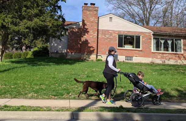
St. Louis County residents need safe, comfortable bicycle facilities that connect to all the places they need to go on a daily basis, from school to work to shops. St. Louis County, MoDOT, Great Rivers Greenway, and many local municipalities support bicycling by installing and maintaining bicycle facilities, which include on-street bikeways like signed bicycle routes and striped bike lanes, and off-street shared-use paths and greenways.
There are 275 miles of trails and roadways with bicycle facilities in St. Louis County. This includes facilities developed as part of the Gateway Bike Plan, municipal bicycle and pedestrian master plans, and Great Rivers Greenway’s River Ring network. This inventory does not include loop trails, soft-surface trails, and other internal park trails that do not serve a significant transportation purpose.
As displayed in Figure 4, multi-use paths compose the greatest percentage of the mileage of existing bicycle facilities in St. Louis County at 42 percent, followed by bike lanes (21 percent), shared lane markings (20 percent), and paved shoulders (11 percent).
For planned bicycle facilities, wide outside lanes compose 16 percent of the mileage, followed by paved shoulders (15 percent), and shared lane markings (14 percent). There are 90 miles of roadways designated as “Analysis Needed”. These roadways were identified in the Gateway Bike Plan as important corridors for bicycle travel, but an appropriate facility type was not identified at that time. Many of these “Analysis Needed” corridors are located on the County Arterial and Collector Road System and will be a key focus of the Action Plan.
BICYCLE FACILITIES
Existing | Previously Planned
Multi-use Path
Separated Bike Lane
Buffered Bike Lane
Conventional Bike Lane
Uphill Bike Lane
Bicycle Boulevard
Shared Lane Markings
Paved Shoulder Bike Route
Wide Outside Lane Analysis Needed
LOCAL JURISDICTIONS
Incorporated Areas
Unincorporated St. Louis County

There are 38 miles of existing and 173 miles of planned bicycle facilities on County ARS/CRS2 roadways. Bike lanes make up the majority of the mileage of existing bicycle facilities at 63 percent, with wide outside lanes accounting for another 24 percent. Facility type is undetermined for 39 percent of all planned bicycle facilities. Another 23 percent of planned facilities are wide outside lanes.
The Gateway Bike Plan’s vision of more than 1,000 miles of interconnected onstreet bikeways in St. Louis County, St. Louis City, and St. Charles County serves as the blueprint for regional network development. In St. Louis County alone, the plan recommended over 600 miles of bikeways to support bicycle travel between residential neighborhoods, schools, parks, greenways, commercial hubs, and employment centers. Since the plan’s adoption in 2012, 116 miles of the Gateway Bike Plan network have been implemented in St. Louis County, and 497 miles of planned facilities remain to be built.

The bicycle transportation system in St. Louis County varies widely in terms of coverage and connectivity. At the local scale, many municipalities like Kirkwood, University City, Richmond Heights, Wildwood, and Ferguson have worked to establish city-wide networks to support bicycle mobility. At the County-wide level, the lack of interconnected facilities along arterial and collector roads (both County and non-County), particularly those that support the “interested but concerned” group of bicyclists, limit the potential for longer trips between municipalities. To some degree, the greenway
system supports regional trips. However, it too suffers from a lack of connectivity between greenways, to existing on-street facilities, and to major trip generators.
Some areas of the County, like Ladue, Frontenac, and Creve Coeur lack meaningful bicycle facility coverage and will require longer thru routes to support regional connectivity. Where facility development along County roadways may be impractical or infeasible, local networks can also provide alternative routing to maintain network connectivity.

Separation from Motorized Traffic Facilities that provide a greater level of separation, like physically separated bike lanes and shared use paths, offer a higher level of quality and comfort for people bicycling and are more likely to be used by a wider variety of bicyclists, including people interested in bicycling but concerned about traffic safety and conditions on roadways. These facilities make up 42 percent of the total existing bicycle facility mileage across the County. Visually separated facilities (bike lanes, buffered bike lanes, climbing bike lanes, and paved shoulders) make up 33 percent of the mileage. Mixed traffic facilities (bicycle boulevards, designated bike routes, share the road signs, shared lane markings, and wide outside lanes) make up the remaining 25 percent.
The majority (71 percent) of bicycle facilities along the County Arterial and Collector Road System are visually separated from motorized traffic. This is due in large part to the County’s Bicycle Facilities Plan, a policy document that which specifies bicycle facility types that can be installed on County roads. The Bicycle Facilities Plan allows bike lanes and wide outside lanes. Another 29 percent of bicycle facilities along the County Arterial and Collector Road System are mixed traffic facilities. Physically separated bicycle facilities make up less than one percent of the mileage of bicycle facilities along the County Arterial and Collector Road System.


25% Mixed Traffic
42%
Physically Separated
33% Visually Separated

In the county-wide bicycle network, there are 130 miles of mixed traffic facilities on roadways with speeds of 35 mph and above. Most of the mixed traffic facilities on the County Arterial and Collector Road System are on roadways of 35 mph or higher. Mixed traffic facilities at these speeds may be uncomfortable for the “interested but concerned” bicyclists, who represent between 51 and 56 percent of the adult population.1
Most facilities on County arterial and collector roadways of 40 mph or higher are visually separated. Nearly all of these facilities are conventional bike lanes, which may be uncomfortable for “interested but concerned” bicyclists, who prefer physically separated facilities at these speeds.

Think about the last time you were out walking or riding a bike. Maybe you were walking to the park, biking to school or work, or catching a bus. What was your experience like on that walk or bike ride? Did you feel comfortable on your journey?
The character and quality of each section of sidewalk, road, or trail that you walk or bike on impacts your experience. Roadway characteristics like posted travel speeds, number of travel lanes, average daily traffic volume (ADT), and walking and biking facilities influence people’s walking and biking routes, as well as their decision to walk or bike at all.
National surveys estimate that 50 to 60 percent of people say they would ride a bicycle more (or start riding) if they had
access to facilities that provided more separation from traffic, lower traffic speeds, and/or lower traffic volumes.1 Additionally, evidence has shown that increasing the number of bicyclists on the road improves safety for all transportation modes. Cities with high bicycling rates tend to have lower crash rates. 2
Measuring the level of comfort for walking and bicycling on St. Louis County Roadways provides an understanding of the quality, connectivity, and need for improvement to better support active transportation for people of all ages and abilities. This plan uses two best practice analyses to quantify comfort: Bicycle Level of Traffic Stress and Pedestrian Level of Service.


The Pedestrian Level of Service (PLOS) Analysis quantifies the experience of walking along the road network by scoring roadways based on important factors like posted speed limit, number of travel lanes, and presence of sidewalks or sidepaths. Scores range from PLOS 1 as the least stressful to PLOS 5, the most stressful.
Roads scoring PLOS 1 are pleasant, enjoyable places to walk, like neighborhood streets with low posted speed limits of 25 MPH or less, only one lane of traffic in each direction, and sidewalks on both sides.
Roads scoring PLOS 5 are the most stressful for walking. These are multilane, high-speed roadways without dedicated space to walk. Roadways also score PLOS 5 if they have a sidewalk on only one side of the street, more than two traffic lanes, and 40 MPH or higher speed limit. Roadways within the County Arterial and Collector Road System were scored based on these considerations.
Pedestrian comfort is not uniform on the St. Louis County ARS/CRS2. Map 10 displays the results of the PLOS analysis. Stress levels vary considerably among roadways that were evaluated for PLOS. As shown in Figure 6, nearly half of all ARS/CRS2 roads received a high-stress score of PLOS 4 or 5. In comparison, less than a quarter of all roads received a low-stress score of PLOS 1 or 2.
In addition to varying across the network, walking conditions can also vary along a single corridor as the roadway conditions like posted speed limit, width, or presence of sidewalks change. The lack of sidewalk continuity often reflects decades of piecemeal sidewalk installation.
Pedestrian Level of Service provides an understanding of the travel experience from the pedestrian’s perspective and can serve as a valuable tool for the County to identify high-stress corridors and target investments to create a comfortable and accessible walking environment for people of all ages and abilities.
PEDESTRIAN FACILITIES
PLOS 1: Highest level of service
PLOS 2 PLOS 3 PLOS 4
PLOS 5: Lowest level of service
LOCAL JURISDICTIONS
Incorporated Areas
Unincorporated St. Louis County

The Bicycle Level of Traffic Stress (BLTS) Analysis evaluates how stressful it is to ride a bike in the presence of cars, trucks, and other motor vehicles. This analysis takes into account a street’s width, posted speed limit, ADT, and the presence and design of bike lanes. Not all streets in St. Louis County are included in this analysis, which looks specifically at roads on the County Arterial and Collector Road System, as well as roads that are part of the Gateway Bike Plan Network.
Each roadway segment and intersection is scored from one to four, with four being the most stressful:
LTS 1: most children would feel comfortable bicycling here
LTS 2: most adults would feel comfortable bicycling here
LTS 3: people who are already “enthused and confident” when bicycling would tolerate riding here, but would prefer having bicycle-only space away from car traffic
LTS 4: only people who are "strong and fearless" when bicycling would ride here. This excludes the vast majority of the population.
The majority of the roadway network analyzed for BLTS is composed of roads that are stressful for the majority of county residents. Just ten percent received a score of LTS 1 or LTS 2. The remaining 90 percent of roadways scored LTS 3 or LTS 4.
Major arterial roadways support longer distance travel and provide access to major destinations. However, these streets are
Bicycle Level of Traffic Stress measures the accessibility of the road system to different types of people traveling by bicycle. Only 10% of the streets analyzed in this study are comfortable and inviting for the majority of people to ride bikes for routine trips.
currently only accessible by “strong and fearless” bicyclists. Investing in bicycle facilities has a noticeable impact on creating lower stress environments. Lower stress roadways are generally busier streets with dedicated space for bicycling (e.g., bike lanes), low-speed and low-volume roadways in urban or suburban areas, or rural roadways with very low traffic volumes.
BICYCLE FACILITIES
BLTS 1: Lowest stress / most comfortable
BLTS 2
BLTS 3
BLTS 4: Highest stress / least comfortable
LOCAL JURISDICTIONS
Incorporated Areas

Unincorporated St. Louis County
For many residents of St. Louis County, safety is an important consideration when making everyday travel decisions, like what means of travel to use (walking, biking, driving, transit) and what route to take. For people walking and biking, who are more likely to experience severe injuries when involved in crashes with motor vehicles, the perception of safety weighs heavily on these travel choices.
In order to understand the safety needs of people walking and bicycling, the County
conducted a safety analysis examining pedestrian- and bicycle-involved crashes reported from 2013 to 2017. Through this analysis, the County identified crash patterns, trends over time, high-crash locations in need of improvements, and roadway types on which pedestrian- and bicycle-related crashes are most likely to occur. These findings will help target investments in walking and bicycling that improve safety for all road users.

During the study period, pedestrian crashes accounted for nearly three in every four crashes that involved people walking and bicycling. Ninety-seven percent of reported crashes involving people walking resulted in injury, and 81 percent of reported bicycle-involved crashes resulted in injury. This is a stark contrast There were no fatal bicycle crashes during the reported
period. Four percent of pedestrian crashes were fatal during the reported period.
While the overall number of crashes involving people walking and bicycling fluctuated during the five-year study period, the annual number of combined pedestrian and bike crashes is down 26 percent from 2013 to 2017. At least one person was killed while walking on a County road every year from 2013 to 2017.
CRASHES INVOLVING A PERSON
WALKING
Crash on/at a County Road
Crash on/at a Non-County Road
LOCAL JURISDICTIONS
Incorporated Areas

Unincorporated St. Louis County
CRASHES INVOLVING A PERSON BICYCLING
Crash on/at a County Road
Crash on/at a Non-County Road
LOCAL JURISDICTIONS
Incorporated Areas

Unincorporated St. Louis County
Roadway characteristics were analyzed to find trends between number of crashes involving people walking or bicycling and types of streets in St. Louis County. Crashes were also analyzed according to the community context where they occur, such as commercial areas or residential areas. Major findings that will inform the Action Plan include:
Crashes between drivers and people walking or bicycling disproportionately occur at intersections. Pedestrian crashes at intersections outnumber non-intersection crashes by a factor of nearly two. Bicycle crashes at intersections outnumber nonintersection crashes by a factor of four.
Arterial roadways are overrepresented in crash data involving people walking or bicycling, compared to the actual mileage of arterial roadways found in the county. Local and collector roadways are underrepresented.

The largest percentage of crashes involving people walking or bicycling occurred on 35 mph roads, even though they only account for 12 percent of all County roads.
Crashes involving people walking or bicycling occurred more frequently in commercial areas, near institutions, and in single family neighborhoods, compared to the total percent of land that each of these areas represents in the county. For example, 36 percent of pedestrian crashes occurred in commercial areas, even though these areas total only 6 percent of all land in the county.

Think about the area where you work or live. Are there schools, restaurants, parks, shops, libraries, or other destinations near enough for you to reach by walking and biking? When destinations are close together, they generate demand for walking and biking. For example, when an office building is across the street from a sandwich shop, people want to be able to walk across the street for lunch. If there are multiple office buildings and multiple restaurants on the street, the demand is even greater.
To find these areas with many destinations that are close together, the County conducted a demand analysis for walking and bicycling in St. Louis County showing concentrations of places people live, work, learn, play, shop, and take transit. The composite map shows orange and red “hot spots” of areas that could support higher numbers of walking and bicycling trips, if safe and comfortable active transportation networks were created to support these trips. Scores increase for areas that have
a high density of destinations that are close together, like a downtown. Scores decrease in areas with lower densities of destinations that are farther apart such as strip malls in suburban areas.
Nodes and corridors of high demand are located in every area of the county. Inner ring communities with a diverse mixture of uses, historic commercial main streets in “streetcar suburbs” like Kirkwood and Ferguson, major employment centers like Westport Plaza and Downtown Clayton, an excellent system of parks and greenways, and countless other amenities and destinations contribute to the mosaic of places that people in St. Louis County travel to and from on a daily basis. Current walking and bicycling access to these places varies significantly. These demand “hot spots” will be used as critical inputs in the development and prioritization of projects to enhance connectivity for people walking and bicycling.
LAND USE & TRANSITBASED DEMAND FOR ACTIVE TRANSPORTATION FACILITIES

Lower Need
Higher Need
Map 14. Land Use & TransitBased Demand for Active Transportation FacilitiesStreet design and land use changes that support healthy travel options have high potential to impact health outcomes in our communities. Increased physical activity can help reduce the risk of various diseases and health conditions.

This health analysis identifies locations in St. Louis County with high concentrations of health concerns to better understand health disparities and transportation needs, to develop recommendations for improving the transportation system, and to prioritize recommendations to have a greater impact on community health. The County examined the rates of diagnoses of diseases and health indicators that have a stronger connection to transportation system and physical activity. These indicators are:
• asthma
• diabetes
• heart disease
• high blood pressure
• mental health disorders
• obesity
While the available data do not represent all clinical diagnoses of these conditions, they provide a useful tool for comparing different geographic areas of the County.
A composite map was created by adding together the scores of each of the individual indicator. Results of the composite analysis are shown on the following page. The map indicates that there is a concentration of these diseases and conditions in northeastern St. Louis County. As noted in the St. Louis County Community Health Improvement Plan, supporting walking, bicycling, and access to transit can improve health outcomes. The Action Plan can support the County in strategically investing in areas with the greatest need to improve active transportation and health across the County.
Map 15. Need for Active Transportation Facilities Based on Health Indicators

HEALTH-BASED NEED FOR ACTIVE TRANSPORTATION FACILITIES
Lower Need
Higher Need
many people in St. Louis County will have a harder time getting to work, buying healthy food, seeing a doctor, going to school, or connecting with others. While communities in St. Louis County offer a variety of ways to get around, not everyone has equal access to a range of convenient, safe, and affordable means of transportation. Many communities rely on a variety of transportation modes to connect to basic services that are necessary to live productive, fulfilling, and healthy lives.
This analysis identifies concentrations of St. Louis County residents that have been historically disadvantaged or are otherwise considered vulnerable to unsafe, disconnected, or incomplete active transportation facilities. Accessible and interconnected transportation infrastructure helps create opportunities for St. Louis County residents and reduces the disproportionate economic and health burdens experienced by its most vulnerable residents.

relative concentration of six equity indicators, using block group estimates from the US Census Bureau:
• Limited English proficiency
• No access to a motor vehicle
• People of color
• Poverty
• Senior residents
• Youth
The combined map is valuable for identifying areas of focus for walking and bicycling improvements and prioritizing projects that serve people in the county who could benefit the most from these investments. The composite shows greatest need in for walking and bicycling investments based on a combination of demographic indicators in northeastern St. Louis County, particularly in the area bounded by Olive Boulevard, I-270, Lindbergh Boulevard, and the City of St. Louis.
Map 16. Need for Active Transportation Facilities Based on Equity Indicators

NEED FOR ACTIVE TRANSPORTATION BASED ON EQUITY INDICATORS
Lower Need
Higher Need

Safe, connected, and accessible sidewalks, intersection crossings, and other pedestrian facilities are necessary to establishing walking as a vital and valued mode of transportation. While St. Louis County and its many agency partners have worked for decades to include pedestrian facilities as part of the transportation system, the analysis of existing conditions revealed a variety of system deficiencies that limit or discourage walking as a means of transportation.
The proposed pedestrian network aims to provide a safe and comfortable environment for pedestrians of all ages and abilities. The improvements presented in this chapter are built on a thorough review of existing conditions and extensive public input gathered during the course of the planning process.

Given the enormity of St. Louis County’s roadway system, the current state of the existing pedestrian facilities across the county, and the limited resources with which to improve and expand the pedestrian network, the pedestrian improvements
proposed in the Action Plan represent key opportunities to direct resources in areas where improvements are most needed and where people are most likely to walk. At the time of publication, funding is not available to meet minimum system maintenance needs nor to prioritize many of the improvements detailed in this report.
The Action Plan Pedestrian Network chapter includes an overview of the network recommendations development process, descriptions of the different types of facilities that comprise the pedestrian network, and a summary of proposed pedestrian improvements that will advance the Action Plan goals and support walking as a viable mode of transportation for county residents.
The Action Plan envisions a safe, connected, and equitable transportation system that supports people of all ages and abilities. This begins and ends with a pedestrian network designed to support people of all cognitive and physical abilities, from children to seniors, from parents pushing strollers to people with limited mobility and those using a wheelchair or other mobility assistance devices. The design needs of pedestrians can vary significantly, and it is important that pedestrian infrastructure like sidewalks, shared use paths, and crosswalks include design elements that support safe travel and access for all.
As the County continues to improve pedestrian mobility through targeted infrastructure investments and ADA improvements as part of larger capital projects, it is important that the design needs of these most vulnerable road users are considered and addressed. These include sidewalk widths, passing widths and locations on narrow sidewalks, sidewalk obstructions, running slopes, cross slopes, ADA-compliant curb ramps, and tactile warning surfaces. The County’s continued commitment to pedestrian accessibility and inclusive design will be further supported by the upcoming ADA Transition Plan, which will further guide investments in pedestrian mobility.


The County established a methodology for identifying potential pedestrian improvements based on the Action Plan’s values and goals. This methodology relies on the vast amount of data and information collected and analyzed during the existing conditions phase of the project, as well as input provided by county residents through in-person and virtual engagement activities. As these data are layered on top of one another, a clear picture emerges of needs and opportunities for pedestrian investments.
By focusing on addressing sidewalk gaps and deficiencies in high-density and high-crash areas, St. Louis County can strategically allocate its limited resources to projects that can have a significant impact on pedestrian safety, connectivity, and accessibility. Through future studies like the ADA Transition Plan, the Department of Transportation will identify additional projects to increase pedestrian safety and accessibility. The data gathered and analyzed for the Action Plan can serve as a resource for project identification in the ADA Transition Plan.
Safe, connected, and accessible infrastructure is necessary to support pedestrian mobility. Sidewalks, shared use facilities like trails and greenways, and intersection and mid-block crossings are the basic building blocks of the pedestrian network. St. Louis County and its community partners like MoDOT, Great Rivers Greenway, and municipal agencies regularly incorporate these building blocks into infrastructure projects to address system gaps, increase connectivity to local destinations and transit, and address ADA-related accessibility considerations.
Each of these building blocks are described in greater detail below and on the following page. As the sample images of these building blocks illustrate, the character and design of these different pedestrian facilities can vary widely based land use and transportation contexts, intended user types and activity volumes and other considerations. National design guides and resources from AASHTO, FHWA, NACTO, and the United States Access Board provide valuable resources for tailoring these facilities to meet local conditions while adhering to standards.
Sidewalks provide a dedicated path for pedestrians, separated from motor vehicle traffic by a curb, tree lawn, or other physical element. Connected, accessible, and well-maintained sidewalks are critical to a functioning pedestrian network.


Shared use facilities include trails and sidepaths, which are used by people walking or bicycling. Sidepaths travel adjacent to a roadway and are used when roadways have high posted speed limits and high traffic volumes. Trails are typically located away from roadways in natural areas. Trails are often used for recreation, but they are also important utilitarian connections.


Safe, accessible roadway crossings are an integral component of the pedestrian network. Crosswalk markings, signage, signals, curb ramps, refuge islands, and other design features reduce conflicts at intersections and mid-block crossings. These design elements provide a safe, comfortable, and accessible experience for people walking. Accessibility concerns at pedestrian crossings are especially important for elderly pedestrians, children, people with limited mobility, and people who use a wheelchair, walker, or other mobility assistance device.


The recommendations for pedestrian improvements are located on County roads in both incorporated and unincorporated areas throughout St. Louis County. These projects address system gaps, replace deteriorating sidewalks, and support a safer, more accessible, and more comfortable pedestrian experience. The proposed pedestrian improvements are described below and shown in Map 17 on page 74.
Recommendations for new sidewalks address corridor-level gaps in the sidewalk system along the Arterial and Collector Road Systems (ARS and CRS2). These proposed projects provide new connections to transit, schools, parks, commercial districts, and other important community destinations.
Sidewalk infill recommendations address minor gaps along corridors with disconnected sidewalks. Many of these proposed projects are located along ARS and CRS2 roadways that have experienced redevelopment in recent years, triggering requirements for new sidewalks, which in turn has resulted in fragmented sidewalk development. Creating contiguous pedestrian paths along these corridors will enhance pedestrian safety, connectivity, and access to transit, schools, shops, and other destinations.
Proposed sidewalk repair projects address sidewalks in poor state of repair or those that provide a poor level of service. These existing sidewalks present significant challenges for people with limited physical mobility or who use a mobility assistance device like a walker or wheelchair. While the sidewalk repair recommendations are likely to be expanded
through the County’s ADA Transition Plan, these proposed projects address key deficiencies in the sidewalk system located in high-density and high-need areas.
Recommendations for new sidepaths support both bicycle and pedestrian activity. These represent the most significant recommended pedestrian improvement type by mileage, constituting more than two thirds of all proposed pedestrian facilities. For instances in which sidepath installation is determined infeasible due to lack of available right of way or other physical constraints, every effort should be made to provide a continuous, accessible pedestrian facility along these corridors.
While the focus of pedestrian improvements is the County road system, there are a small number of shared use path (trail) projects recommended in the plan. Some of these projects provide short connections between existing pedestrian facilities and major greenways like Grant’s Trail, and others are more substantial projects that will require significant resources and coordination with the Department of Parks and Recreation and local municipalities to develop.
PEDESTRIAN FACILITIES
Existing Proposed
Existing Sidewalk
Existing Sidewalk on County ARS/CRS2
Proposed Sidewalk on County Road
Shared Use Facility (Sidepath)
Shared Use Facility (Trail or Greenway)
Incorporated Areas
Unincorporated St. Louis County

The proposed bicycle network in St. Louis County embodies the Action Plan’s vision and values to create a safe, comfortable, and interconnected system for bicycling. As described in the preceding Action Plan Pedestrian Network chapter, safe and connected bicycling facilities are critical to making bicycling a viable, accessible, and enjoyable form of transportation. This chapter includes the following key sections:
• Building Blocks of the Bicycle Network
• Bicycle Network Planning
• Bicycle Facility Selection
• Bicycle Network Recommendations
• Supporting Infrastructure & Design Elements
The recommendations for bicycle facilities and supporting infrastructure proposed in this chapter offer strategic pathways through which the County and its community partners can realize the vision of a safe, accessible, and equitable transportation system for all.
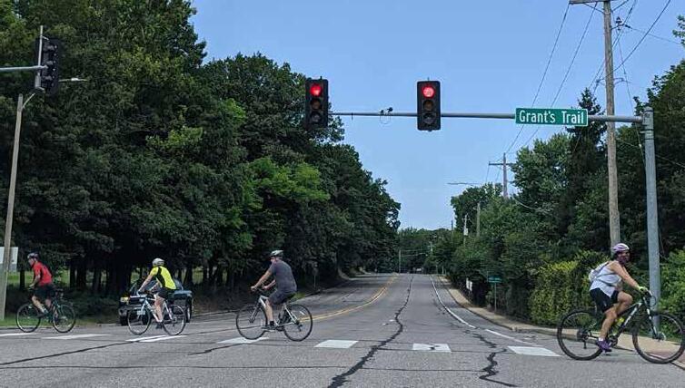
As with any plan, the recommendations included herein serve as a guide, supporting bicycle network development with facility recommendations that best achieve the plan’s vision and goals while respecting the unique land use and transportation context of each corridor.
As the County explores these recommended projects in greater depth through project scoping and development, it will be important to employ a flexible approach to facility design and network implementation in order to meet project-specific challenges and opportunities.
The proposed bicycle network includes many types of recommended street designs depending on the surrounding land use characteristics and the roadway’s current conditions, such as posted speed limit and traffic volume. The following designs are considered “building blocks” of the proposed bicycle network. On-street bicycle facilities are divided into three categories, based on the bikeway’s level of separation from motor vehicle travel lanes: mixed traffic bikeways, visually separated bikeways, and physically separated bikeways. While also physically separated from motor vehicle traffic, shared use facilities are listed separately because of their location adjacent to the roadway (or in a different right of way altogether), their unique design characteristics, and their ability to support a wide range of user types. Some of the facility types and markings included in this section are not accepted in the County’s current Design Criteria Manual, particularly those not approved in the Manual on Uniform Traffic Control Devices (MUTCD).


Mixed traffic bikeways are appropriate on roadways with low speeds and traffic volumes because people bicycling and driving share the same space. They include shared lane markings, bikes may use full lane signage, and steep roadways that feature an uphill bike lane and shared lane markings for bicyclists traveling downhill.


Visually separated bikeways use lane striping, markings, and signage to provide an exclusive space on the road for bicycling. This category includes bike lanes, buffered bike lanes, which add additional space between bicyclists and drivers, and paved shoulders or shoulder bike lanes.


Physically separated bikeways use physical barriers like bollards, curbs, planters, or even vehicle parking lanes to separate the bike lane from motor vehicle traffic. They may be at street level or sidewalk level, on both sides of the road (like conventional bike lanes), or on one side, depending on the selected design.


Shared use facilities include trails and sidepaths, which are used by people walking or bicycling. Sidepaths travel adjacent to a roadway and are used when roadways have high posted speed limits and high traffic volumes. Trails are typically located away from roadways in natural areas. Trails are often used for recreation, but they are also important transportation connections.


Similar to the process used to develop walking-related network recommendations, the network planning and facility selection process emphasized projects that would support people of all ages and abilities. Once the initial network was drafted, members of the public provided input via an online open house. The project’s interactive map allowed residents to provide feedback about proposed connections and share any ideas or questions. This feedback was incorporated into the final proposed network presented in this chapter.


Selecting the appropriate bicycle facility type for a given street requires careful consideration of intended or desired user types, roadway and traffic characteristics, adjacent land uses, and other important factors. To provide a framework for this selection process and narrow down the range of possible facility types that support a low-stress, “all ages and abilities” network, the County developed the bicycle facility selection matrix shown below. This matrix identifies desired and acceptable ranges of average daily motor vehicle traffic and
posted speed limits for different bicycle facility types to best support not just the “strong and fearless” or “enthused and confident” bicyclists, but also the “interested and concerned” bicyclists for whom separation from motor vehicle traffic can create more opportunities to increase bicycling activity. By setting the parameters for facility selection based on these key data points, the County could focus on corridor-specific characteristics like number of travel lanes, adjacent land uses, access to arrive at a final recommendation.
CALM STREET
ADVISORY BIKE LANES
MARKED SHARED ROADWAY
SIGNED SHARED ROADWAY
SHOULDER BIKEWAY
ON-STREET BIKE LANE
BUFFERED BIKE LANE
SEPARATED BIKE LANE
SIDEPATH
The proposed bicycle network builds on decades of investments in bicycling infrastructure to create an interconnected, county-wide system of bikeways to support both local and regional bicycle trips. St. Louis County, MoDOT, Great Rivers Greenway, and many municipalities have all contributed to the 215 miles of existing on-street bikeways, trails, and greenways throughout the County. Their continued support for bicycle transportation and investments in related infrastructure will be essential to closing gaps between existing facilities and improving and expanding the system to truly function as a safe, connected, and inclusive county-wide bicycle network.
The bike network recommendations are separated into three overarching categories based on implementation responsibilities and relationship to other planning efforts:
• The Action Plan Network: proposed facilities along roads owned and operated by St. Louis County
• The Gateway Bike Plan Network Updates: proposed facilities on MoDOT and locally owned and operated roadways that update recommendations in the Gateway Bike Plan
• Previously Planned Regional Bikeways: Regionally significant trails, greenways, and other facilities illustrated for network connectivity purposes
As St. Louis County and its community partners continue to implement projects within each of these categories, isolated bikeways will be connected, network gaps will be filled, and access to bicycling will be expanded into new areas of the County.
The Action Plan Network consists of onstreet bikeways and shared use paths along St. Louis County owned and operated roads. The 325 miles of proposed Action Plan Network bikeways build upon the 38 miles of existing bikeways on the County ARS/CRS2 to enhance connectivity in unincorporated St. Louis County and strengthen connections to local bike networks, parks, greenways, business districts, transit services, and other destinations. More than half of these proposed facilities consist of shared use paths and physically separated bike lanes, reflecting the plan’s vision of a safer, more inclusive network that welcomes people of all ages and abilities.
The proposed Action Plan Bicycle Network is shown in Map 18. The facility types that comprise the Action Plan Bicycle Network are categorized and listed in the table below.
BICYCLE FACILITIES
Existing Proposed
Mixed Traffic Bikeway
Visually Separated Bikeway
Physically Separated Bikeway
Shared Use Facility (Sidepath)
Shared Use Facility (Trail or Greenway)

JURISDICTIONS
Incorporated Areas
Unincorporated St. Louis County
For nearly a decade, the Gateway Bike Plan has served as the blueprint for regional bikeway development in St. Louis County, St. Charles County, and St. Louis City. With a focus on bikeway development on arterial and collector roads, many of the plan’s recommended facilities in St. Louis County were located along County and MoDOT roadways.
Updates to the Gateway Bike Plan Network recommendations on County-owned roadways were included in the proposed Action Plan Bicycle Network presented on the previous pages. The Gateway Bike Plan Network updates presented here focus on facilities owned by other jurisdictions like MoDOT and local municipalities. These updates align facility recommendations with the Action Plan’s vision and goals for a low-stress, inclusive network, expanding access to and opportunities for bicycling to all County residents.
The proposed Gateway Bike Plan Network Updates are shown in Map 19. The facility types proposed in the Gateway Bike Plan Network Updates are categorized and listed in the table below.
BICYCLE FACILITIES
Existing Proposed
Mixed Traffic Bikeway
Visually Separated Bikeway
Physically Separated Bikeway
Shared Use Facility (Sidepath)
Shared Use Facility (Trail or Greenway)

JURISDICTIONS
Incorporated Areas
Unincorporated St. Louis County
Previously planned bicycle and trail facilities are also critical to the success of the Action Plan and to bicycle network connectivity in St. Louis County. Most notable among these previously planned bicycle facilities are the 185 miles of planned greenways advanced in Great Rivers Greenway’s Regional Plan Update. These previously planned facilities are displayed on Map 20. Previously proposed facilities originated prior to the Action Plan. Nonetheless, they are important elements of the future bicycle network, including the wider regional greenway system. Previously proposed facilities should be reviewed and considered when developing bikeways included in the proposed Action Plan bicycle network. Continued partnerships between St. Louis County and local, regional, and state agencies will support and advance the region’s bicycle network.
The combined recommendations for bicycle facility development in the Action Plan Network (St. Louis County) and the Gateway Bike Plan Network Update (MoDOT and local agencies), along with previously planned trails and greenways, serve as the blueprint for a county-wide bicycle system. The complete future bicycle network is depicted in Map 20, and its components are listed below in Table 9 by facility category and type. With more than 1,100 miles of facilities, over 200 of which are already in place, the future county-wide bicycle system will be a realization of the County’s vision for a safe, connected, and equitable multimodal transportation system. The County cannot achieve this vision on its own. Strategies to support interdepartmental and interagency coordination and network development are presented in the following chapter.
BICYCLE FACILITIES
Existing Proposed
Mixed Traffic Bikeway
Visually Separated Bikeway
Physically Separated Bikeway
Shared Use Facility (Sidepath)
Shared Use Facility (Trail or Greenway)
Previously Planned Trail/Greenway
JURISDICTIONS
Incorporated Areas
Unincorporated St. Louis County
In addition to facility improvements, there is a range of supporting infrastructure and design considerations that makes the active transportation system easier, safer, and more enjoyable for people to use. These strategies can be pursued as standalone projects or integrated into scoping for larger facility improvements.


Intersection improvements support bicycle facility continuity, facility transitions, and facility intersections and are integral to the bicycle network’s functionality, effectiveness, and user experience. The Action Plan, which focuses primarily on linear recommendations along the County roadway system, does not identify specific intersection improvements. This does not diminish the importance of effective bicycle facility design at intersections, specifically those with known safety issues or bicycle crash occurrences.
During scoping, design, and engineering phases of project development, the Department of Transportation will consider context-sensitive intersection improvements as part of any project with a bicycle component. Additional design guidance and best practices can be found in the AASHTO Guide for the Development of Bicycle Facilities , the NACTO Urban Bikeway Design Guide, FHWA’s Manual on Uniform Traffic Control Devices and Separated Bike Lane Planning and Design Guide

A bicycle guide sign system includes coordinated signage that helps bicyclists easily navigate the bicycle network to reach their destination. Guide signs typically include information such as the direction, time, and/or distance to nearby routes or destinations. This increases the comfort, convenience, and utility of the bicycle network, and raises the visibility of the County’s active transportation network.
Directional signage serves both wayfinding and safety purposes, such as:
• Familiarizing users with the bikeway system
• Helping users identify the best routes
• Communicating travel time and distance
• Smoothing transitions between facilities
• Increasing rider comfort and confidence
• Alerting motorists of the bike route
Bicycle Guide signs are typically placed at key locations along bike routes, at decision points, and at intersections of multiple bikeways. Entities that maintain bicycle facilities should develop bicycle guide sign policies, based on facility type, that identify:
• Sign locations along existing and planned routes
• Sign type, design, and information that should be included
• Destinations that should be highlighted on each sign
• Approximate distance and riding time to each destination
The Manual of Uniform Traffic Control Devices (MUTCD) provides standards and guidance for the design and application of bicycle guide and route signage. General costs depend on the signage type and materials chosen for fabrication. Coordination with local municipalities, MoDOT, Great Rivers Greenway, and neighboring jurisdictions will be necessary to support continuity across local, county, and regional systems.
Walking, biking, and transit are integral components of St. Louis County’s multimodal transportation system. Metro Transit relies on the roadway network to provide transit service throughout the region. Its riders rely on sidewalks, trails, and bikeways to access transit stops.
As the County invests in pedestrian and bicycle network improvements, it will also consider connections to transit, including:
• Pedestrian circulation and access to transit stops
• Secure, context-appropriate bicycle parking
• Roadway and bicycle facility design that reduces conflicts between modes along transit corridors and at transit stops

St. Louis County’s continued coordination with Metro Transit during roadway and active transportation project development will be essential to successful transit integration.
The rise of active transportation, micro mobility, shared mobility, and other transportation solutions are shifting the way people navigate their communities. Agencies must also adapt to emerging technologies and shifting modes by transforming public spaces to support the diversity of transportation options available. Mobility hubs provide a central place for a variety of transportation-related services and amenities including strategic vehicle storage to make it more convenient for people to combine modes within a single trip.
St. Louis County will continue to monitor evolving trends in shared and micromobility and explore opportunities with potential partners to diversify transportation options for County residents.
Mobility hubs provide a central place for a variety of transportation-related services including shared fleets and wayfinding.

Secure, convenient, accessible bicycle parking is an integral component of any bicycle network. Without bicycle parking, people are less likely to ride a bicycle to their destinations. St. Louis County will conduct an inventory of bicycle facilities at County government buildings, parks, and other facilities to identify needed improvements, such as new bicycle racks or replacement racks. Based on the results of this inventory, the County will develop a strategy to provide high-quality bicycle parking at all government buildings, parks, and other facilities.
Bicycle parking can be categorized into short-term and long-term parking. Shortterm bicycle parking solutions include bike racks and corrals which provide a high level of convenience and moderate level of security. Short-term bicycle parking is typically recommended at commercial or retail destinations, parks and recreational areas, community centers, libraries, and other areas where people are likely to leave
their bike for relatively short amounts of time. Long-term bicycle parking solutions such as lockers and storage rooms and provide a higher level of security and are recommended at schools, multi-family residential buildings, and major employers.
More information on bicycle rack types and placement can be found in the Association of Pedestrian and Bicycle Professionals’ Essentials of Bike Parking: Selecting and Installing Bike Parking that Works

Other end-of-trip facilities such as bicycle repair equipment, changing rooms, showers, and lockers are particularly important when considering the needs of regular commuters, students, and shoppers.
In addition to increasing the supply of bicycle parking and other end-of-trip facilities at County government buildings, parks, and other sites, the County Department of Planning will explore updates to off-street parking and bicycling parking requirements in the zoning code to support the provision high-quality, well-sited bicycle parking.

The Action Plan presents a bold and ambitious vision for the future of walking and bicycling in St. Louis County. Bringing this vision to life will require a sustained commitment to active transportation for years to come, as well as the necessary leadership, resources, partnerships, and policy advancements to create a lasting impact on the County’s physical and cultural landscapes.
This chapter presents key strategies and considerations to implement the plan’s recommendations. Whether reviewing programmed projects for opportunities to incorporate plan recommendations, advancing progressive and flexible design criteria, or strengthening partnerships across County departments and with agency partners, St. Louis County will concurrently pursue multiple pathways to better support walking and biking as integral components of the multimodal transportation system.

The Implementation Strategies Chapter is comprised of the following sections:
• Early Actions
• Interdepartmental and Interagency Coordination
• Policy Recommendations
• Walking and Biking Programs
• Project Evaluation
• Project Programming
• Corridor Studies
• Funding the Plan
• Measuring Success
• Ongoing Maintenance
While the Action Plan is a long-range planning document guiding future investments in active transportation, early actions to implement the plan’s recommendations will be necessary to sustain momentum from the planning process and build a foundation for lasting change. St. Louis County will pursue the following early actions in 2021 and 2022 to initiate plan implementation and establish the foundation for long-term success.
Project programming refers to the identification and scheduling of roadway improvements in the short-term, usually between one and five years. St. Louis County regularly revisits this project programming process to account for changes to pavement quality, funding availability, and other factors. The proposed improvements in the Action Plan represent a new and important
factor for consideration. The Department of Transportation will actively look for opportunities to incorporate the Action Plan into newly programmed projects.
While the Department of Transportation issues a semi-annual report to the County Council summarizing Complete Streets implementation activities and the status of relevant projects, the Department lacks a communications tool through which it can share its implementation successes with a wider audience, including County residents, local municipalities, and other community partners. The Department will develop a public-facing annual report highlighting efforts to advance the Action Plan and the Complete Streets ordinance.

The policies that guide investments in pedestrian, bicycle, and Complete Streets infrastructure design, programming, and construction have long-term ramifications on the built environment. Physical improvements made today based on current policies will likely remain in place for years. Therefore, the Department of Transportation’s review and updating of policies impacting pedestrian and bicycle safety, connectivity, and accessibility is imperative to support the implementation of this plan’s proposed improvements. The Policy Recommendations section of this chapter provides guidance for the evaluation and revision of current policies related to active transportation, including the Complete Streets ordinance, the road diet policy, the sidewalk policy, and the design criteria manual. Changes to these policies will promote best practices and consistency with national guidance from the Federal Highway Administration, NACTO, and other leading transportation agencies and organizations.
In addition to updates to current policy, St. Louis County will explore opportunities to advance pedestrian and bicycle mobility through new policies and procedures to guide mid-block crossing improvements, outreach, and communications.

The pedestrian and bicycle crash analysis conducted as part of the Action Plan provides a high-level investigation of crash patterns, with a particular focus on highcrash locations and corridors and a systemic analysis of roadway characteristics on which crashes are most likely to occur. This analysis informed the plan’s bicycle and pedestrian network recommendations and will serve as a reference for County staff as it conducts more in-depth analysis of pedestrian and bicycle crashes on a project-by-project basis.
There are a variety of resources available to support the County in reviewing the analysis, including the Federal Highway Administration’s PEDSAFE and BIKESAFE Safety Guides and Countermeasure Selection Systems and the National Cooperative Highway Research Program’s Development of Crash Modification Factors for Uncontrolled Pedestrian Crossing Treatments
The Department of Transportation may identify specific treatments and design elements to advance pedestrian and bicycle safety that are not included or permitted in its current Design Criteria Manual. The Department will consider incorporating these treatments and design elements into future projects.
Walk audits are public engagement tools to collect feedback about existing conditions along a roadway. Walk audits may be organized by County staff to hear from residents or they may be organized by local community organizations.

Walk audits are an opportunity to collaborate across County departments and with other public agencies and stakeholders. This allows for a wide range of stakeholders’ perspectives early in a project’s planning process. Alternative formats to in-person walk audits may be developed to allow residents or others to participate individually at their own pace or via a web-based virtual walk audit. Multiple participation methods can increase the number of people who contribute opinions during the walk audit process. Walk audits should be inclusive of people with disabilities; for example, participants should know about the walk audit distance in advance. County staff contact information should be included in communications so that participants can request accessibility support, as needed.
As previously discussed in this plan, the forthcoming ADA Transition Plan will act as a strategic document to identify needed upgrades to St. Louis County’s pedestrian infrastructure to bring walkways and curb ramps to ADA compliance. The plan will consist of a self-evaluation to quantify infrastructure quality and establish policy for ADA compliance upgrades.
The County is currently developing an asset management tool. When complete, the tool will enable County staff to better document the County roadway system conditions at the individual asset level, understand system needs, and efficiently allocate resources to better integrate pedestrian and bicycle enhancements into roadway improvements through a multi-modal, systematic approach.
Realizing the Action Plan’s bold vision for a walkable and bikeable county will require continued coordination with the many state, regional, and local agencies that shape the built environment. Through its Action Plan for Walking and Biking, St. Louis County is charting a path for a longterm vision of walking and bicycling in the county. In addition to two committees established through the St. Louis County Complete Streets Ordinance, the Department of Transportation regularly coordinates with local agencies to address pedestrian and bicycle transportation.
Consisting of representatives of St. Louis County Transportation, Planning, Health, and Parks and Recreation Departments, the Interdepartmental Advisory Team (IAT) was established through the Complete Streets Ordinance to lead the institutionalization of Complete Streets principles and goals into County policies, practices, and projects. The IAT has and will continue to provide leadership for the County’s initiatives to advance active transportation. The team’s composition emphasizes the unique roles of each County department with regard to implementing the Complete Streets Ordinance and the shared responsibility of these departments to foster a safe, accessible, and connected multimodal transportation system for all county residents. The IAT will be responsible for implementing the Action Plan and delegating its recommendations among responsible departments and divisions.
The Department of Transportation routinely convenes a committee of transportation agency representatives, advocacy groups, trade representatives, and other relevant stakeholders to provide biannual updates on plan, projects, and other activities advancing Complete Streets in St. Louis County. While this Complete Streets Peer Advisory Committee serves a valuable role, the IAT, responsible for the Peer Advisory Committee’s formation and coordination, should seek opportunities to solicit greater participation and dialogue from the committee’s membership, as envisioned in the Complete Streets Ordinance. With greater participation and defined responsibilities, the Peer Advisory Committee may better offer its collective insight and expertise to advance Complete Streets and active transportation in St. Louis County. The Peer Advisory Committee will be instrumental in supporting the interagency coordination, delegation, and implementation of the Action Plan’s diverse physical, policy, and programming recommendations.
Regular meetings with state and local agencies keep all stakeholders apprised of developments within each agency. These meetings may happen informally, via the Complete Streets Peer Advisory Committee, or through another meeting. Regular coordination with local municipalities is necessary to coordinate upcoming and potential projects. County review of development plans and traffic impact studies adjacent to County roads would allow for interagency collaboration.
Ordinances, policies, and standards establish procedures and parameters for decisionmaking. These policy tools play an important role in planning, developing, and designing pedestrian and bicycle projects. As such, the project team researched existing policies to support plan implementation.
As the Department of Transportation seeks to better support walking and bicycling activity through its Complete Streets approach to transportation systems
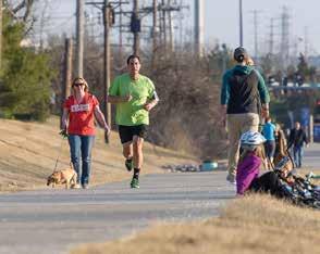

and roadway design, it is important that the policies and standards in use by the department reflect its aspiration for a multi-modal transportation system. This chapter provides tools and strategies to update and implement existing policies and presents new policy considerations to better integrate walking, bicycling, and Complete Streets principles into daily transportation practices and decision-making.

Complete Streets Policy

Communities across the county use a Complete Streets-focused approach to transportation planning and design. Complete Streets is a planning philosophy that enhances mobility for people using transit, walking, and bicycling, as well as driving. In 2013, St. Louis County adopted a Complete Streets Ordinance. St. Louis County continues to advance Complete Streets principles through the application of this ordinance to transportation planning, programming, project development, and system maintenance and operations.
Since then, the Complete Streets movement has evolved to focus more on implementation and equity. Many current model policies and policy frameworks include updated language to account for the needs of the most vulnerable road users. The Elements of a Complete Streets Policy scoring document and other resources from Smart Growth America and the National Complete Streets Coalition can serve as reference guides for St. Louis County staff to update internal policies and procedures to strengthen the County’s commitment to Complete Streets and multimodal transportation.
Road diets reallocate travel lanes to improve safety and provide space for other uses and travel modes. Road diets increase safety by decreasing conflict points, speeding, and weaving behavior while creating space for multimodal improvements such as bike lanes, transit lanes, curb extensions, median islands, and other infrastructure. The most common type of road diet converts a fourlane undivided roadway with two through lanes in each direction to a three-lane road with one through lane in each direction and a center two-way left turn lane. Under the right conditions, five-lane roadways may also be good candidates for repurposing the curbside lanes for other uses and modes.
diet by allowing the clear demarcation of new lane striping.” It is recommended that the Department of Transportation add an implementation section to the existing Road Diet Policy to clearly state that the current practice of evaluating the feasibility of a road diet for a particular road is done during the planning or design process for resurfacing projects and is part of the Complete Streets checklist process. The Department will continue to examine current practices for road diet implementation and design.
St. Louis County’s existing Road
Policy states it “will be applicable to County maintained multilane roadways which, upon review, are considered potential candidates for possible road diets.” While the policy does not explicitly state when road diets are to be implemented, it does provide that resurfacing projects “provide the best opportunity to implement a road
Pedestrian safety is a concern at midblock crossings. The installation of uncontrolled marked crosswalks should be done judiciously at points of pedestrian concentration that have a demonstrated need for pedestrian guidance. The Department of Transportation will continue to examine current practices for midblock crossing identification and design.

The current Sidewalk Policy determines which projects qualify for the sidewalk program and which funding source is appropriate for each, and prioritizes the pedestrian projects. While the Complete Streets Policy encompasses pedestrians and sidewalks, the Sidewalk Policy is important for specifically identifying projects and categorizing them for funding and implementation where they otherwise may not surface as a Complete Streets project if no other planning or design work along the roadway is occurring. However, if a roadway is undergoing planning or design and it has sidewalk gaps, the Complete Streets ordinance will apply and the sidewalk gap should be scored with the sidewalk policy ranking system and help to elevate the need for project implementation and funding. With the data and information generated as part of this planning process, particularly with regard to health and equity, St. Louis County should consider updating the sidewalk project ranking system to include new metrics that reflect the larger values and goals of the plan.

The Department of Transportation’s Design Criteria Manual and related standards for capital transportation projects include guidance and requirements for the design of sidewalks, on-street bikeways, shareduse paths, and other active transportation infrastructure. These evolving documents are updated regularly to incorporate and reflect standards and guidance from AASHTO, FHWA, and other leading national agencies and organizations.
As the Department of Transportation updates the Design Criteria Manual and other documents guiding the design of transportation facilities, it will explore opportunities to integrate national standards, guidance, and best practices to institutionalize innovative and contextsensitive pedestrian and bicycle facilities and treatments and support implementation of projects recommended in the Action Plan.
Communications and Outreach Strategy
Planning, design, and construction of County roadway projects benefit from clear communication. This is especially true in the case of introducing roadway designs that have not yet been used in the county. St. Louis County can build public trust and implement the Action Plan Pedestrian and Bicycle Networks through honest and open dialogue.
The Department of Transportation will collaborate with other County departments and will develop and utilize a communications and outreach strategy to develop clear communications objectives that support meaningful community dialogue during project planning, design, and construction. The following communications objectives and project messaging will be considered for bicycle and pedestrian projects, depending on project scale and complexity and on available capacity and resources. While smaller projects may not require the level of communication and engagement described below, larger projects can benefit from frequent communications and opportunities to build a shared understanding of project benefits, impacts, and relationship to broader transportation objectives like Complete Streets and Action Plan implementation.
Communications objectives change with each stage of a project:
• Planning: Report existing conditions, safety concerns and problems to be addressed in design process
• Design: Describe how the design solution(s) addresses safety
• Short-term Pilot Demonstration (if applicable): Project duration, how to
use the temporary infrastructure
• Construction: Communicate construction schedule, design changes, and construction mitigation measures
• Completion: Celebrate success while continuing to communicate mobility solutions, benefits, and process
• Post-Completion: Address negative and positive responses to project after completion
Throughout every project stage, messages should include answers to the following questions:
• Why is this project happening?
• What has been the process and progress to date?
• What is coming next?
The following are best practices for project messaging:
• Put projects in broader county/ community context.
• Report metrics clearly and concisely and compare metrics to other roadways.
• Use person-first language: put the person before the adjective and describe what the person ‘has’ not what the person ‘is’. Examples include discussing people experiencing homelessness or people with disabilities.
• Clearly identify when and how people can provide project input.
• Provide guidance for individuals to look up additional information and a designated contact person.
• Use plain language and avoid jargon.
• Use consistent language from start
to finish to describe project purpose, benefits, solutions and focus.
• Keep decision-makers informed about project background/context, events, and project status updates.
• Avoid soliciting input just for the sake of engagement.
Both the message and the means of communication should be tailored based on the target audience. Potential audiences include residents who live in the project area or regularly travel there, adjacent businesses, chambers of commerce, elected officials and public agency staff, utility and emergency service providers, and community organizations.
Supporting a thriving urban street in South Lake Union
Fall 2016 FACT SHEET
PROJECT BACKGROUND
South Lake Union (SLU) is rapidly becoming the gateway to Downtown Seattle. As the area attracts major employers and residents, we have to create a flexible transportation system that gives people real travel choices.
Over the last year, we’ve worked with the South Lake Union community to upgrade existing bike lanes throughout the neighborhood. With the Westlake Protected Bike Lane fully open and operating, we are ready to implement protected bike lane connections from Westlake to Denny Way.
PROJECT DESCRIPTION
Ninth Ave N is a desirable location for people to bike because it is relatively flat and south of Mercer St has a low volume of vehicles. The project maintains a travel lane in each direction on 9th Ave N. All onstreet parking will be consolidated to the east side of the street. The project upgrades existing bike lanes to include a 3-foot buffer with white plastic posts and fills the gap between Westlake Ave N and Roy St, creating a family friendly facility. Ninth Ave N will remain a reliable option for other modes (driving and walking).
WHAT IS A PROTECTED BIKE LANE?
Protected bike lanes combine the comfort of a multiuse trail with a conventional bike lane. These lanes physically separate people riding bikes from people driving and are distinct from the sidewalk. Learn more at www.seattle.gov/transportation/pbl.htm
Upgrade bike lanes to include a painted buffer and white plastic posts for a safer, more comfortable connection to SLU that is away from the streetcar tracks
Benefits: Supports more affordable and flexible transportation options by expanding the citywide bike network and connects people biking from the Westlake Ave protected bike lane to downtown
Organize streets by clearly defining space for people biking, walking, driving, and parking
Benefits: Improves predictability for all travelers
Improve intersections by reducing the distance people have to cross the street using paint and white posts
Benefits: Increases safety and mobility for pedestrians crossing the street
• Construction of phase 1 will happen late 2016 or spring 2017 and includes installation of a protected bike lane on 9th Ave N from Westlake Ave to Mercer St and along Roy St between 9th Ave N and Dexter Ave N.
• Construction on phase 2 will begin in 2017 and includes implementation of a protected bike lane on 9th Ave N from Mercer St to Harrison St.
• During the same timeframe, a separate project will install upgraded signal systems at the Mercer St and Denny Way intersections.
www.seattle.gov/LevytoMoveSeattle.

While the provision of dedicated facilities for walking and bicycling are critical to network connectivity and access to destinations, there are many additional factors that shape the walking and bicycling experience. These factors include pedestrian-scale lighting, shade trees, landscaping and vegetation, and street furniture like benches and trash receptacles. Incorporating these features into roadway projects can support placemaking objectives for commercial corridors and contribute to an area’s sense of uniqueness and sense of place. Landscaped buffers between the sidewalk and the roadway can add to pedestrian comfort while also incorporating stormwater best management practices like bioswales and raingardens.
The Department of Transportation can explore opportunities to incorporate these features into future roadway reconstruction projects, where financially feasible, and through collaborative partnerships with local municipalities that envision these streetscape enhancements as vital components of future plans for commercial districts and corridors.
Creating cohesive, complete networks for walking and biking requires cooperation across agencies. Agencies can create efficiencies by working together to install improvements on County and local roads simultaneously. The Department of Transportation should develop a cost participation policy and related program to support bicycle and pedestrian improvements on local roadways.
The County should provide for continuous bicycle and pedestrian travel through work zones. Internal policy for work zones should prioritize the safety of people walking and biking through work zones over parking and vehicle throughput and require that temporary traffic control plans include pedestrian and bicycle access. For pedestrians, first attempt to preserve the existing route and protect it from the work zone. If this is not possible, create a temporary pedestrian space physically protected from traffic, using parking or vehicle travel lanes. As a last resort, provide a pedestrian detour route.
For bicyclists, first attempt to provide a temporary bicycle lane of the same or better quality as the original bicycle lane by shifting, narrowing, or removing vehicle lanes or parking lanes. If this is not possible, bicyclists may be directed to merge with vehicle traffic (only if speeds and volumes are low) or with pedestrians in a temporary shared use path space. As a last resort, provide a bicycle detour route. Work zone policies developed by Portland, Oregon and Oakland, California should be consulted for reference.1
Demonstration projects are short term, low-cost, temporary roadway projects used to pilot potential long-term design solutions to improve walking, bicycling and public spaces. Demonstration projects allow public agencies, community partners, and people walking, bicycling, taking transit, and driving to evaluate potential infrastructure improvements before investing
1 https://www.portlandoregon.gov/transportation/ article/648243 and http://www2.oaklandnet.com/ oakca1/groups/pwa/documents/memorandum/ oak062315.pdf
in permanent changes. Improvements like bicycle lanes, crosswalk markings, curb extensions and median safety islands can be installed as demonstration projects.


The County should develop a process for planning, installing, and evaluating temporary demonstration projects. MnDOT’s Demonstration Project Implementation Guide should be consulted for reference. 2
2 http://www.dot.state.mn.us/saferoutes/documents/ mndot-demonstration-project-implementation-guidefinal.pdf
In order to realize the vision of a safe, connected, and equitable transportation system that values and supports walking and biking, it will be necessary to support infrastructure investments and policy change with education, encouragement, and engagement programming strategies. New or expanded education and encouragement programs for youth and adults will invite more people to consider walking and bicycling by empowering them with the tools, resources, and experiences necessary to feel confident walking and bicycling in their communities. Additionally, targeted evaluation programs like active transportation counts programs and regular crash data analysis can support continued planning for bicycle and pedestrian network and safety improvements.
In addition to conducting a scan of current programmatic offerings in St. Louis County and the surrounding region, the County reviewed programming offerings in five peer counties, each of which are part of the Bicycle Friendly Community program at the Bronze level or higher. Most comparison counties include suburban

and urban land development patterns similar to those of St. Louis County:
• Tucson-East Pima County Region, Arizona
• Arlington County, Virginia
• Dane County, Wisconsin
• Fairfax County, Virginia
• Hennepin County, Minnesota
The following table presents recommendations for walking and bicycling programs. These programs were selected based on a review of current programmatic offerings, opportunities for improvements, and success stories from peer communities. Included with each program recommendation are a brief description and suggested departments, agencies, or organizations to lead that effort. These breadth of recommended programs and the diversity of programming partners highlight the importance of interagency relationships and shared responsibility in supporting and encouraging walking and bicycling as valued, viable, and enjoyable means of transportation and recreation.
Description
Bicycle Safety Classes Free classes taught by League of American Bicyclists Certified Instructors cover a variety of topics and often include free safety equipment, such as reflective gear. Classes should be broadly publicized to community leaders and organizations to help promote the courses to youth, seniors, first time riders, and immigrants.
Public Service
Announcements (PSA)
Safety Education Pamphlet and Online Resources
PSAs can provide short educational messages about driving, walking, and bicycling safety. A video format allows for easy sharing on websites, social media, and media outlets. Example topics include yielding to pedestrians in a crosswalk and bike helmet fitting.
Short pamphlets about driving safety can be distributed online and at public service locations such as the DMV. Fairfax County, for example, offers “A Driver’s Guide to Bike Lanes in Fairfax County” pamphlet. Educational content should also be posted on County and partner websites.
Bike to Work Day Annual Bike to Work Day programming encourages more people to try commuting by bicycle. The County and its partners should continue to organize free “pit stops” to offer breakfast items, snacks, and educational materials to people riding to work.

Bike Month Bike Month is typically celebrated in May, June, or another warm month in Spring or Summer. Celebrations vary by community. They typically include activities such as bike to work challenges where local companies and organizations encourage staff to ride their bikes to work and compete for prizes. Other activities include “pit stops”along popular bike routes where riders can enjoy free breakfast and information about bicycling in the County.
Open Streets/Ciclovia Open streets events close roadways to car and truck traffic and open them for walking, bicycling, and other activities. Events are successful when they are in areas with varied commercial and residential land uses and publicized well in advance. Stakeholder collaboration is essential for a popular and well run event.
Bicycle and Pedestrian Route Maps
Walking with Kids Activities
Self-guided Walking Tours
Great Rivers Greenway has developed regional bicycling maps in the past. St. Louis County should continue to coordinate with Great Rivers Greenway to update these maps as new facilities are developed. In addition, many municipalities in St. Louis County also develop walking and/ or bicycling route maps. The County should support these efforts with information about County-owned facilities within these jurisdictions.
Activity sheets for kids, including games such as BINGO to play while on a walk.
Short, self-guided walks that link community destinations could be posted to the County’s website and other partners’ websites to encourage walking for transportation and recreation.

Fix-it Stands Free bicycle repair stands, including pumps and tools, would increase convenience and access to simple bicycle maintenance that may be needed as people travel on trails and other infrastructure in the County.
Safe Routes to School (SRTS)
Bicycle and Pedestrian Counting Program
Safe Routes to School programs develop routes for children to walk and bike to school by suggesting infrastructure improvements by schools. Many of these projects may be installed initially as low cost, temporary demonstration projects. SRTS projects also provide education and encouragement programs for students.
Continue and expand existing bicycle and pedestrian monitoring initiatives within the County. The program should use a combination of automated counters and volunteer or staff-collected data.
311 Service Request St. Louis County’s 311 Service Request platform allows residents to identify issues like potholes and broken sidewalks to be addressed by the Department of Transportation. 311 should be expanded to include additional bicycle and pedestrian-related infrastructure categories, like debris in bike lanes,poor trail surface conditions, malfunctioning pedestrian signal heads, and other common issues.
Complete Streets
Email Newsletter
A recurring email newsletter with news about Complete Streets projects would highlight County and municipal planning and construction projects. The newsletter could also promote educational resources and events led by the County or other partners.
The County should produce an annual report card to document Action Plan progress and Complete Streets implementation successes. Great Rivers Greenway routinely produces a report card to document walking and bicycling count data and infrastructure enhancements. Support local communities in seeking LAB Bicycle Friendly Communities Designation
Pedestrian and bicycle progress report

County staff should be prepared to assist local agencies with initial applications and renewals for the League of American Bicyclists (LAB) Bicycle Friendly Communities program. For example, St. Loius County may provide support in the form of data sharing regarding existing bicycle facilities, bicycle crash data, and other metrics used to evaluate Bicycle Friendly Communities applications.
Employee active transportation benefits program
Many employers in the region, including St. Louis County and other local agencies, value employee health and actively seek opportunities to support walking, bicycling, and physical activity. Providing benefits for employees who walk and bike to work through a wellness or active transportation benefits program is one such way that employers in St. Louis County can demonstrate their commitment to employee health and transportation choices. Benefits may include subsidies for a new bicycle, bicycling equipment (e.g.., lights, helmet), transit passes, fitness classes, or gym memberships.
Community Walk Audits
Driver, bicyclist, and pedestrian traffic safety courses
Community walk audits bring together a wide range of stakeholders to discuss opportunities for improving walkability. County staff should regularly participate in and/or lead walk audits, especially County-owned roadways. Walk audits are opportunities to discuss planned improvements and community members’ ideas.
For road users who receive a traffic violation citation, especially those relating to multimodal transportation like speeding in school zones or signal violations, traffic safety courses can be an instrumental educational tool to support safe and positive travel behaviors. Participation in these courses could supplement or reduce other violation-related penalties and/or fines.
Implementing recommended projects included in the Action Plan must take into account the potential impact of each project to support walking and biking and advance the Action Plan’s vision and goals. It is also necessary to consider the wider, complete transportation system context and the potential opportunities and constraints that may impact project programming and development.
The pedestrian and bicycle facility improvements recommended in this plan vary greatly in terms of length, location, facility type, land use context, and other characteristics. Each proposed project contributes to walking and bicycling differently. St. Louis County developed an evaluation methodology to determine the value of each recommended project on County-owned roadways with respect to the vision and value of the plan. Each of the evaluation criteria measure the extent to which recommended projects support a corresponding value or goal of the plan. These evaluation criteria and related scoring details are displayed in Table 11 on the following page.
The results of the scoring process for pedestrian and bicycle projects are shown in Map 21 and Map 22, respectively. Pedestrian projects consist of sidewalks and sidepaths along County-owned roads, while bicycle projects consist of on-street bicycle facilities and sidepaths along County-owned roads. As such, there is overlap between both maps through the inclusion of sidepaths, which support both walking and bicycling activity.
For both pedestrian and bicycle recommendations, projects are grouped into three categories based on the results of the evaluation: high impact, medium impact, and low impact. These categories reflect the extent to which each project advances the vision and values of the plan and will be considered by the Department of Transportation in future project scoping and programming efforts. High impact
projects, for example, address multiple plan goals, while low impact projects may only address one or two goals.
While high impact pedestrian and bicycle projects are located in nearly all areas of the county, the prevalence of high impact projects in north St. Louis County reflects the higher scores for health and equity factors. Many residents in north St. Louis County rely on pedestrian and bicycle facilities to access transit, schools, employment, and other local destinations.
The impact evaluation score does not reflect prioritization, project phasing, or sequential development of project recommendations, but rather is intended to serve as an additional metric through which the Department of Transportation can analyze pedestrian and bicycle projects to pursue in combination with a variety of other important factors.

PROJECT EVALUATION RATING
High Impact
Medium Impact
Low Impact
LOCAL JURISDICTIONS
Incorporated Areas
Unincorporated St. Louis County

PROJECT EVALUATION RATING
High Impact
Medium Impact
Low Impact
LOCAL JURISDICTIONS
Incorporated Areas
Unincorporated St. Louis County

St. Louis County Department of Transportation is responsible for maintaining, operating, and improving the second largest roadway system in the State of Missouri. Pedestrian and bicycle infrastructure represent one of the many important elements of this multimodal transportation system. Given the current state of the County’s transportation system and its limited ability to fully fund even basic maintenance needs, the Department of Transportation must take an opportunistic approach to pedestrian and bicycle improvements. This includes leveraging limited resources to secure external grants and funding sources, partnering with local agencies and institutions to pursue projects that achieve mutually beneficial goals and objectives, and identifying opportunities to align recommended projects in the Action Plan with scheduled roadway improvements.
This opportunity-based strategy highlights the importance of regular review of potential
projects as part of the programming process. Roadway resurfacing projects comprise a significant portion of the Department of Transportations annual budget. Many of these projects provide opportunities to incorporate recommendations for on-street bikeway facility installation through re-striping modifications like lane narrowing or road diets. They may also present the opportunity to incorporate adjacent sidewalks or ADA improvements and achieve economies of scale.
As the Department of Transportation reviews potential projects for inclusion in its annual and five-year capital improvements plans, the recommendations in the Action Plan and the impact ratings described in the previous section can serve as a valuable guide for incorporating multimodal, Complete Streets design elements into future transportation projects.
Many of the recommendations for pedestrian and bicycle improvements included in the Action Plan include substantial changes to the built environment. Whether adding a new sidewalk or sidepath adjacent to the road, or reconfiguring travel lanes to add on-street bike lanes, these improvements impact not just the look and feel of a roadway, but oftentimes the roadway’s capacity and other operational considerations.
The County studied 12 corridors in additional detail to better understand the opportunities and challenges of implementing recommendations proposed in the Action Plan. These corridors were selected based on preliminary recommendations for bicycle and pedestrian facilities that included, in most cases, a road diet or reconfiguration to the existing cross section. The 12 corridors, which constitute nearly 40 miles of roadways on the County Arterial Road System,
are shown in Map 23 on the following page and are listed in Table 12 below.
These corridor studies represent an important step in the project evaluation and development process. Each study includes a SYNCHRO traffic analysis (where applicable), conceptual cross sections detailing roadway striping and other geometric changes to the roadway, and “before and after” photo simulations visualizing future improvements. The studies are not intended to provide final concepts for development, but rather to offer technical analysis, facility selection guidance, and design options to support project development, project programming, and community engagement should these corridors be selected for active transportation improvements. The full corridor studies are included in the appendix of the plan.
STUDY CORRIDORS
County-owned Arterial Roadway System (ARS)
ROADWAY SYSTEM
Interstate Roadways
Major Roadways
Secondary Roadways
LOCAL JURISDICTIONS
Incorporated Areas
Unincorporated St. Louis County

Building the Action Plan Pedestrian and Bicycle Networks is no small undertaking. Collectively, the projects proposed in the Action Plan constitute a $519M investment in system enhancements and new infrastructure. This $519M figure is comprised of $274M for projects on the St. Louis County Action Plan Network, and $245M for Gateway Bike Plan Network Update projects on state and local roadways. The cost does not include the necessary system upgrades to complete the County’s ADA Transition Plan. While the County and its community partners have a number of established funding mechanisms to support active transportation and Complete Streets projects, implementing the Action Plan’s proposed projects will require creative, collaborative, and opportunistic funding strategies that leverage local resources to secure outside funding, like federal and foundation grants. This section of the plan presents a breakdown of cost estimates by network and facility type, current funding strategies and challenges in implementing the Action Plan, and potential funding sources to advance the Action Plan’s proposed facilities recommendations.
Cost estimates are an essential planning tool used for programming capital improvements and drafting applications for external funding sources. Probable opinions of cost were developed for each project facility type based on initial planning-level examples of similar constructed projects and industry averages. These costs were then applied to each recommended
project and refined with the assistance of County staff based on local experience and specific project conditions, like the need for right of way acquisition, roadway widening, and other important factors.
All facility designs and associated cost estimates proposed in this plan are conceptual in nature and must undergo final engineering design and review through coordination between all concerned departments in order to arrive at detailed project costs. Cost estimates are provided in 2020 dollars. Inflation should be included in costs in future years when bikeway improvements are programmed.
Construction costs will vary based on the ultimate project scope (i.e., combination with other projects) and economic conditions at the time of construction. When combined with larger roadway projects, the County can achieve economies of scale and maximize the value of every dollar spent on transportation infrastructure.
Table 13 on page 120 lists network cost estimates for St. Louis County Action Plan Network and Gateway Bike Plan Network Update projects, grouped by facility classification and facility type. Notes included below the table provide additional details regarding assumptions about right of way acquisition costs, engineering and design, and other contingencies included in these cost estimations. On-going maintenance costs are not included in these estimates, but should be considered during project development.
Right of Way included at 40 percent of initial project cost included for Off-Street/Shared Facilities, Physically Separated Facilities, Pedestrian Facilities, and Visually Separated Facilities that include roadway widening.
Engineering and Design at 15 percent of initial project cost included for Mixed Traffic and Visually Separated Facilities, 20 percent for Physically Separated Facilities, Off-Street/Shared Facilities, and Pedestrian Facilities.
Cut and Removal Contingency at 25 percent of initial project cost included for facilities that require roadway widening.
The County’s current funding strategies to support active transportation projects include a variety of internal and external sources. In addition to implementing on-street bikeways through its annual ARS Pavement Improvements Program, CRS Collector Pavement Improvements Program, and CRS Concrete Replacement/ Mill and Overlay Program, the County also incorporates bicycle and pedestrian projects into federally funded projects and has separate funding streams dedicated to safety improvements, ADA improvements, and Complete Streets trail and transit-related projects.
Internal revenue dedicated to transportation projects cannot support current needs for system maintenance and preservation, let alone enhancements to the system for bicycle and pedestrian improvements. In its November 2020 presentation to the County Council, the Department of Transportation
and Public Works highlighted the funding deficit between planned and needed investments to maintain the roadway system through 2030. As Figure 15 below illustrates, by the year 2025, the funding deficit will reach $50M and will be in that range for the remainder of the decade. Looking at the decade as a whole, the total deficit between needed and planned maintenance investments is more than $387M.
In light of this considerable maintenance funding shortfall, the financial picture for implementing the Action Plan is bleak without additional revenue sources. With a conservative 15 percent implementation target by 2030 (roughly $41M over 10 years, which amounts to roughly six percent of the total needed investments during that same period), the funding gap expands from $387M to $428M. This assumes a gradual increase in annual funding for Action Plan and Complete Streets projects from roughly $0.5M in 2021 to $10M by 2030.
While the 15 percent implementation target referenced on the previous page is hypothetical, it presents one of the most significant challenges to the success of the Action Plan by framing bicycle, pedestrian, and complete streets improvements in the larger context of competing funding needs and priorities. Even if that target were reduced to ten or five percent of the full cost of implementing the Action Plan, it would still be difficult to achieve.
Given the limited funding available for active transportation, it is imperative that the County leverage its limited resources to secure outside funding and maximize investments in active transportation. Whether the County pursues these recommended improvements as standalone projects or in combination with rehabilitation activities such as concrete slab replacement and the resurfacing of asphalt streets, there are a wide variety of external funding sources available for active transportation projects, from common federal programs like the Surface Transportation Program and the Transportation Enhancement Program to less traditional sources like foundations, corporate donations, and public-private partnerships.
The list of programs and sources included in the appendix can serve as a reference for County staff to utilize while seeking financial resources to advance projects recommended in the Action Plan. This list is not exhaustive, but rather a baseline survey of available resources that should be examined regularly and added to as new funding sources are identified.
While the external resources referenced above can stretch the County’s resources and maximize the value of investments in walking and biking, reliance on competitive grants and uncertain funding programs is not a sustainable longterm funding solution in and of itself.
St. Louis County must consider new revenue streams to address both system preservation and multimodal expansion. Whether through a bond issue, sales tax, gasoline tax increase, or other funding source, creating new revenue will require political will and public support. It will therefore be necessary for the Department of Transportation to demonstrate a clear and convincing need for additional revenue, provide a detailed plan for how that revenue will be spent, and a measurable benefit achieved through the projects funded with that revenue.
If and when discussions take shape regarding legislation for new revenue streams for transportation infrastructure, the Department of Transportation will be prepared to put forward specific high impact projects recommended in the Action Plan and communicate their benefit to decision makers and the general public.
Performance measures track plan implementation over time. County staff and other stakeholders can reference the performance measures to routinely check that the plan is achieving its desired goals and advancing towards its overarching vision. Many variables affect the outcomes associated with each performance measure. While some variables are outside of the County’s direct control, tracking these performance measures enhances an understanding of the plan’s impact and the general state of walking and biking throughout St. Louis County.
Evaluating the plan’s progress over time is also consistent with actions described in other local and state plans. At the national level, the FHWA’s Guidebook for Measuring Multimodal Network Connectivity describes best practices for measuring pedestrian and bicycling networks. This guide can serve as an important reference for the County moving forward.
Recommended performance measures are presented in Table 14. They are not exhaustive of all metrics that the County might track over time. Rather, they are meant as baselines to begin ongoing data collection and analysis. The Interdepartmental Advisory Team (IAT) should survey available data and determine additional metrics consistent with Action Plan’s vision and goals through which the County can evaluate implementation efforts. The IAT should also explore additional performance measures with the Complete Streets Peer Advisory Committee, as dictated in the Complete Streets Ordinance. The Peer Advisory Committee can also provide assistance with data collection and synthesis from sources external to the County. This work requires staff time and data availability. The following recommendations acknowledge these constraints.
Performance Measure Description
Miles of total pedestrian and bicycle facilities
• Measure miles of new infrastructure on the arterial and collector county road system, such as bike lanes and sidewalks
Miles of total pedestrian and bicycle facilities that are considered low stress / part of an all ages and abilities network
• Measure new infrastructure centerline miles of new infrastructure on the arterial and collector county road system. Examples include sidepaths and neighborhood greenways.
• Measure as a percent of the total bicycle and pedestrian networks
Miles of pedestrian and bicycle facilities implemented in high need areas
Number of fatal and severe injury-causing pedestrianand bicycle-related crashes
Walking and bicycling mode share
Miles and percent of sidewalks brought into ADA compliance per year
Number of ADA compliant curb ramps constructed
• Measure total centerline miles according to the equity analysis developed for this plan
• Measure these crashes as a percent of all pedestrian- and bicycle-related crashes
• Measure these crashes as a percent of total fatal and severe injury crashes
• US Census Bureau American Community Survey commuting (journey to work) dataset
• Measure the amount of sidewalk brought into compliance with the Americans with Disabilities Act (ADA) requirements
• Measure the number of curb ramps brought into compliance with the Americans with Disabilities Act (ADA) requirements
Desired Impact
Increase in miles of infrastructure
Increase in centerline miles of infrastructure
Increase in centerline miles of infrastructure
Decrease in number and severity of crashes
Increase in walking and biking mode share
Increase in miles of ADA compliant sidewalk
Increase in the number of ADA compliant curb ramps
Facility maintenance is essential for providing a safe and accessible environment for walking and bicycling, encouraging facility use year-round, and prolonging the useful life of infrastructure. Regular maintenance will support a high return on the County’s investment in active transportation. Sidewalk quality is a critical component of the County’s work to self-evaluate the sidewalk network, as part of the ADA Transition Plan. Sidewalk quality data can help guide pedestrian facility maintenance activities over time. The following facility selection considerations and maintenance practices will assist in providing well maintained pedestrian facilities throughout all seasons.
Effective, efficient maintenance starts with facility selection and design choices that keep maintenance in mind. Key elements of facility selection and design for ease of maintenance include:
• Consider current equipment and capabilities for maintenance. For example, sidepath entrances should allow for snow plowing and street sweeping vehicle access.
• Provide adequate space and/or engineered solutions to accommodate tree root growth to prevent sidewalk and sidepath heaving.

• When designing for new facilities or major roadway reconstruction project, avoid locating pavement joints parallel to the direction of travel within bicycle facilities. For example, bike lanes that are composed partially of a concrete gutter and a bituminous roadway surface can develop pavement issues along the gutter seam which degrade the bicycle facility.
• Plan for drainage and snow storage in the design process.
• Invite maintenance staff to review facility plans to identify preventable maintenance issues.
Routine maintenance of pedestrian and bicycle facilities should be part of the regular maintenance schedule and budget.
Note that pavement quality should be maintained to at least the standard for motor vehicles or higher. Small potholes and cracks can pose a greater risk for people bicycling and walking than for people driving.
Maintenance activities that should be incorporated in the regular maintenance schedule on an annual basis include:
• Litter and trash removal
• Tree and brush trimming
• Weed abatement
• Sign, pavement marking, and amenity inspections
• Crack sealing and surface repair
• Sweeping away debris (at least twice annually- after final snow melt in the spring and after leaf drop in the fall)
• Mowing shared use path shoulders
Take steps to ensure that maintenance of roadways does not negatively impact bicycle and pedestrian facilities. Street sweeping crews should be instructed to sweep close to the right edge of the roadway to avoid depositing debris in the bike lane. Snow plowing crews should avoid dumping snow onto bike lanes and sidewalks.
Remedial maintenance refers to the correcting of significant facility defects and the repairing, replacing, and restoring of major facility components. Remedial maintenance activities include periodic repairs like crack sealing or micro surfacing asphalt pavement; restriping of bike lanes; replacement of wayfinding and other signs; repainting, replacement of trail amenities and furnishings (benches, bike racks, lighting, etc.); and more substantial projects like hillside stabilization, bridge replacement, trail or street surface repaving; and trail repairs due to washout and flooding. Pavement markings and striping maintenance will depend on anticipated and actual product life cycle, which can range from one to ten years, depending on material type. Minor remedial maintenance for trails and greenways can be completed on a five to ten-year cycle, while larger projects should be budgeted on an as-needed or anticipated basis.