SA Today acknowledges the Boandik people as the Traditional Custodians of Mount Gambier and the surrounding area.
We recognise their deep connection to Country and the rich knowledge and culture they possess.
We pay our respects to Elders past and present, and to all First Nations People, for their continuing custodianship of the land on which we strive for a compassionate, respectful and just community.
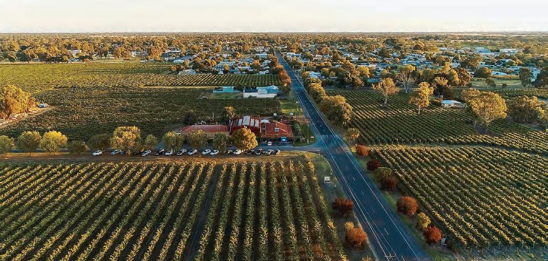
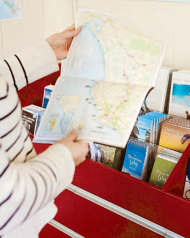
provides all the information and maps you need to discover South Australia’s Limestone Coast and South West Victoria, a beautifully diverse and unique part of Australia where nature, history, food, wine and adventure abound! We invite you to Stay Another Day!
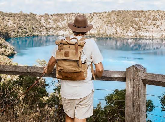
Discover the stunning Limestone Coast, stay awhile and enjoy the wide experiences it has to offer. With so much to see and do across the length and breadth of our landscape the classic Australian road trip becomes inevitable.
BE PREPARED
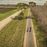
Have your vehicle serviced before you leave. Before setting out check your lights, wipers, oil level and tyre pressures. Rest regularly On long trips, stop and have a break for 15 minutes every 2 hours. Have a stretch, maybe clean your windscreen or take your kids to the playground. Better yet, share the driving with a family member or friend.
OBEY SPEED LIMITS
Speeding impairs a driver’s ability to make a sudden stop or react to avoid hazards. Speed limits do vary from state to state so heed the signs.
DRIVE WITH YOUR HEADLIGHTS ON LOW DURING DAYLIGHT HOURS
Always a bright idea in the Limestone Coast and it will make it easier for oncoming traffic to see you.
LET FAMILY AND FRIENDS KNOW YOUR TRAVEL
PLANS
If you are someone who still carries a road map or maybe an App be sure to let someone know if you change your plans. Watch out for wildlife Native animals and exotic species are often seen near roads, especially at dawn and dusk and near our forest reserves.
WILDLIFE CARE
Take care to avoid collisions with our wildlife that have no road awareness whatsoever. Remember “stay straight, don’t swerve, and brake!”
“BE APPY”
These days you can get apps for almost anything. Rest Stop Locators, Atlas of public toilets, entertaining the kids, Mobile Phone Road Mode, making it easy
Whether you’re a country or an interstate resident or a visitor from the city, driving in our beautiful corner of Australia can pose different risks.
To keep you and your passengers safe we have provided some helpful road safety tips and reminders for you.
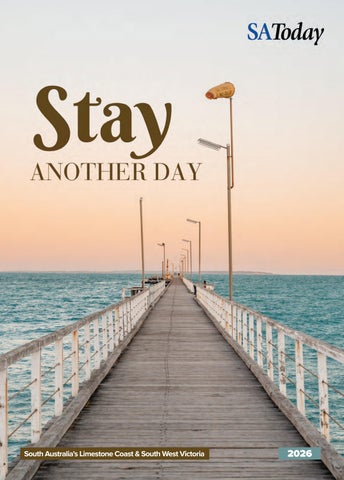
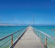
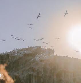
Cover photo: Beachport Jetty. (South Australian Tourism Commission/Jack Fenby)
to apply yourself to the complex task of driving.
BEWARE OF SOFT EDGES
Large stretches of our road network have grass or dirt raised edges and lack shoulder seals. Be aware that these edges may be soft, muddy, sandy or have loose gravel when pulling over. Worn roads can shred your car and trailer tyres.
OVERTAKING’S GOLDEN RULE
“If in doubt, don’t!” Wait until the road is clear for a long stretch or until an overtaking lane comes along.
WATCH FOR HEAVY VEHICLES
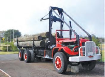
Some of our heavy vehicles can be up to 55m long. Expect to see over size log transports, wood chip trucks and milk tankers going about their daily freight tasks. When overtaking safely, warn the truck driver of your approach and allow plenty of distance to pass the vehicle (at least 1km), and be careful of those soft edges.
WATCH OUT FOR FARM VEHICLES.
Be alert for farmers’ transferring farming plant, for example, harvesters, combines and spraying units from paddock to paddock or vineyard to vineyard. Be conscious of their speed, length and width and adjust your driving accordingly.
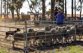
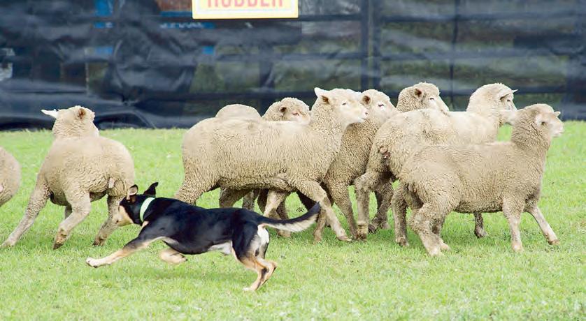
STOCK ON ROAD
Whether it is the drover using “the long paddock” on the roadside reserve or the farmer shifting a mob or stray livestock who happen to be on the wrong side of the fence at any time,
ENJOY THE LIMESTONE COAST IN SAFETY
slow down. Reduce to walking (droving) speed and be prepared to stop. Enjoy watching the skilful working dog and our premium produce on the hoof.
KEEP LEFT
A very smart move especially if you are from overseas. Still a good idea if a road train or other heavy vehicle is coming towards you on a single vehicle road, or overtaking you, slow down and move as far to the left as possible.
CONSIDER OTHER DRIVERS AND ROAD USERS
Please share the roads responsibly. Maintain at least a two second gap between your car and the vehicle in front of you.
CHECK ROAD CONDITIONS
Country (especially gravel and dirt) road conditions can change rapidly. You can check with the RAA, Police or tune into the local radio station to make sure roads are passable or suitable for your vehicle to travel. Extreme events do happen, eg. weather, road crashes, bushfires, flooding.
WATCH OUT FOR TRAINS
Freight trains still operate across the top of the Limestone Coast. Slow down as you approach a railway crossing and check to see if any trains are approaching.
DON’T RUBBISH OUR LIMESTONE COAST
Take your rubbish homes and use the bins provided in our wayside stops and towns. Many of our regional towns are RV friendly.
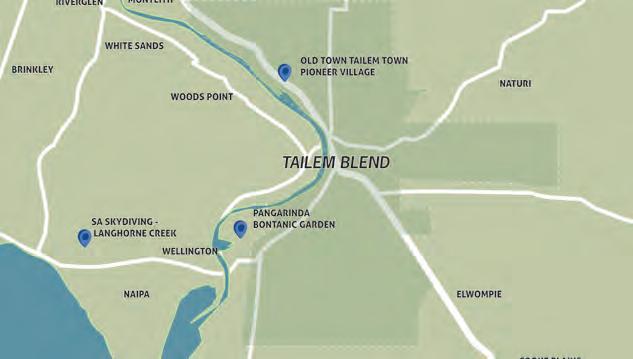
What’s in TAILEM BEND
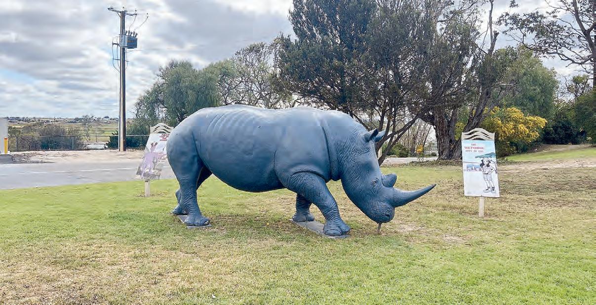
The Rhino attracts attention from those travelling along the Dukes Highway.
TAILEM Bend is the place to get your heart racing with The Shell V-Power Motorsport Park’s many exhilarating experiences and events or if you prefer a slower pace you could experience one of Old Tailem Town’s spine-tingling Ghost tours. In the 19th century, Tailem Bend was an important railway town until today where it is a commercial centre for the surrounding Mallee area.
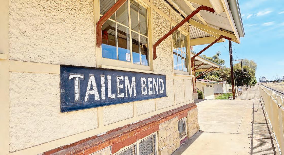
Tailem Info Station & Rail Museum
Tailem Bend’s most iconic building and strongest representation of railway history is the Railway Station. The town used to be a hub for train passengers and railway lifestyle. Aside from the appeal of the collection in the museum at the Railway Station, Tailem Bend also sees regular freight trains and the occasional interstate passenger trains which pass through but no
longer stop in town. TheCouncil office in the main street is also home to the Coorong Art Gallery with rotating exhibitions and artwork for sale. While in town, spot all the animals. For more information on Tailem Bend phone 08 8572 4277 or visit https://www.coorong.sa.gov.au/ tailembend
Tailem Bend’s Railway History
Tailem Bend’s railway identity
is also embodied by its human heritage – ex-railway workers and train drivers. Some of these retired railway personnel are now volunteers (fettlers) at the Tailem Info Station, giving tours of railway memorabilia. The Visitor Information Outlet explains the town’s strong historical links with transport. You can re-visit Tailem Bend’s railway heritage by following the Historic Rail Trail.
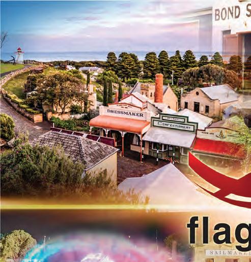
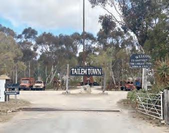
Old Tailem Town
Step back in time by visiting Old Tailem Town, comprising over 110 authentic historic buildings; popular ghost and paranormal tours are available.
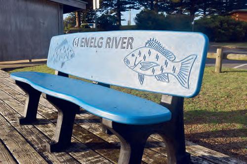
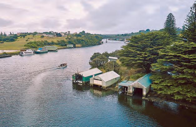
Fred’sLanding
Visit Fred’s Landing to launch a boat and enjoy a spot of fishing on the river, or a picnic at Dickson Reserve with its newly established pontoon.
Old Tailem Town.
Tailem Bend WALKING JOURNEYS
River Rail Road Trail
The River Rail Road Trail is an easy 2.5km walk that highlights some fantastic sights around Tailem Bend, including the beautiful Mighty Murray. Along the way are markers with health tips and facts to help you out every day. Come to Tailem and take a lap of the trail soon.
Geocaching Loop
Geocaching is a fun outdoor treasure hunting game that anyone with a GPS or smartphone can play.
The loop outlined in the Tailem Bend Walking Trails Map highlights the top caches around town. Take in many of Tailem Bend’s attractions including Dickson Reserve, the golf course,
the ferry and the Rotunda. You can ride this trail or walk it.
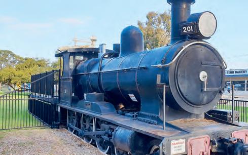
Main Street Attractions
A stroll down the main street that encompasses the Railway Park with its loco, the Station Master’s home, the Coorong Art Gallery and Rotunda. Keep an eye out for the green sheep in the playground.
River Bend Heritage Trail
The River Bend Heritage Trail is a loop trail along Australia’s mighty Murray River, between Tailem Bend and Wellington, South Australia.
This walking trail includes
many sites of interest:
1. Historic Jervois and its buildings of yesteryear
2. Historic dairy properties on the Jervois to Wellington Road
3. Levee bank of the Jervois irrigation lands
4. Murrundi Reserve with opportunity to view the river wildlife
5. Wellington East Pangarinda Botanic Garden
6. Historic Wellington cemetery
7. Mowantjie-Willauwar Conservation Park
Historic Rail Trail
Enjoy a rail themed walk, drive or ride amongst some of Tailem Bend’s buildings that make the town’s history. This Historic Rail
Trail will take you for a trip down memory lane and will feature many of the town’s historic facts and anecdotes along the way.
Lower Murray Canoe Trail
The trail is an adventurous way to explore the mighty Murray River and learn more about the Riverine Environment and History. It will be a memorable experience that will have you wanting to do it again. It has been designed to be as interactive as possible through educational signage and geocaches featuring topics such as 1956 floods, ferries locks and weirs, native fish, birds, vegetation and environmental water use.
TAILEM Bend has several walks/ trails, a number of them are available right within the town centre. Below are 5 different journeys in and around Tailem Bend: River Rail Road Trail, Geocaching Loop, Main Street Attractions, River Bend Heritage Trail and Historic Rail Trail.
Check out Tailem Bend.
Find the train at the playground.
What’s in MENINGIE
LOCATED 152 kilometres south east of Adelaide on the shores of Lake Albert, Meningie is the northern gateway to the Coorong. Meningie was established as a staging post and service centre for surrounding graziers. Serviced by paddle steamers from Milang, it formed part of the original Adelaide–Melbourne coastal route used by the early stage coaches. Today, Meningie is the perfect spot to unwind. Fishing, boating, skiing, walking trails and fabulous sunsets await visitors to this idyllic country town. A short walk to the Meningie Hill Lookout provides views over Lake Albert and the surrounding pastoral properties, while a wetland bird sanctuary is a haven for many birds seen in the Coorong.
Lions Jubilee Park
The Lions Jubilee Park in the centre of the town is a delightful spot to enjoy the lake, the many varieties of birds and follow the Pelican Path walk to learn about the history of the Indigenous as well as the European settlement of the area.
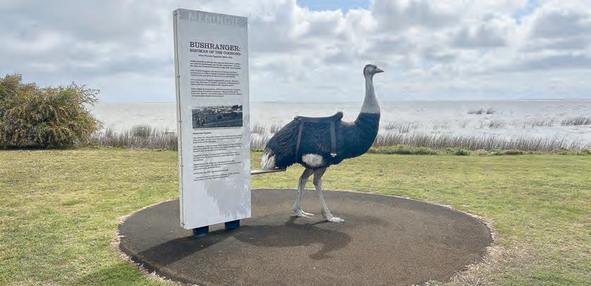
The Birdman of the Coorong A saddle-wearing ostrich on the shores of a lake seems like an unusual sight, you’ll find it near lake Albert at Meningie.
Discover the story of John Peggotty, South Australia’s only genuine bushranger who made his escape by riding an ostrich, having learned to ride them in South Africa. Read about his journey from Limerick, Ireland to Australia, to the Coorong, where he is credited for more than 12 hold-ups and the murder of several travellers.
Walking Trails
Explore one of the Lions walking trails that skirt the town through scrub, tracks that take in the cemetery, the lookout and seasonal orchid sites which allow you to see the local wildlife such as birds and kangaroos.
MENINGIE: The Birdman of the Coorong
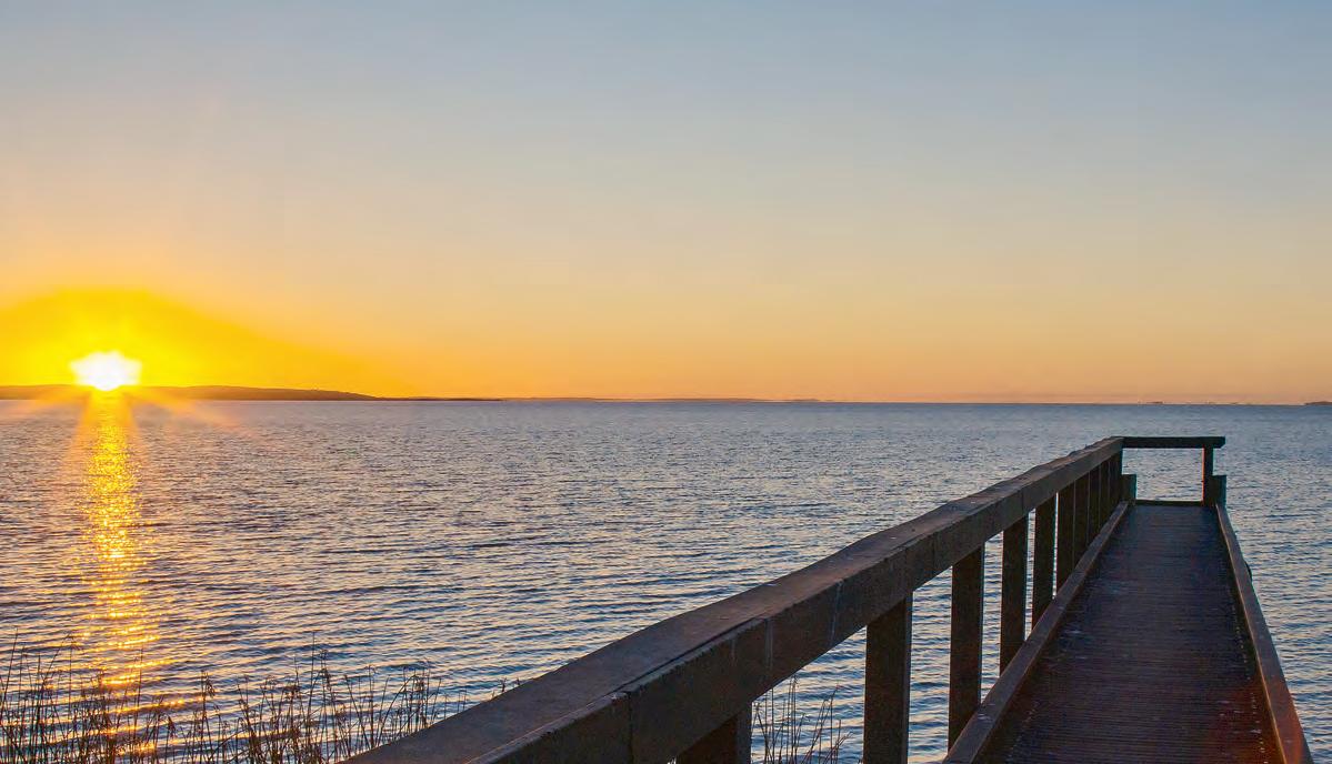
Meningie Jetty at sunset. (Supplied)
Meningie MUSEUM
The Meningie Museum in the old Cheese Factory is an excellent facility opened on January 1st, 2001 as a tribute to the founders and to show people of today how they lived and prospered throughout the district. There is a large display of farm machinery, vehicles and all manner of historical items on display. There is also a fascinating historic tour which you can do which takes you past numerous 19th century buildings in the town. Ask for the brochure at either motel, or in information centre outlets.
■ Location: 3 Fiebig Road, Meningie, SA
■ Hours: Daily, 8.30 am to 5.00 pm. Closed Good Friday and Christmas Day
The golf, sailing and lawn bowls clubs provide first class facilities and attract many groups from all over South Australia. Meningie has one of the best country golf courses in the State. Accommodation is serviced a motel, a hotel, a caravan park and several bed and breakfasts.
Seeing the Coorong
Good tracks enable
Enjoy the playground.
conventional vehicles to access all major features along the mainland side of the Coorong, which is over 100 kms in length and separated from the Southern Ocean by the sand dunes of the Younghusband Peninsula. It is recommended to visit Parnka Point, Long Point, Jack Point and 42 Mile Crossing.
Raukkan Church
The restored church at Raukkan is the church which appears on the Australian $50 note and the burial place of David Unaipon who is also on the $50 note. He was born at Point McLeay in 1872. He was a preacher, musician, orator and
inventor. In 1909 he patented an improved hand piece for sheep shearing. He was the first published Aboriginal writer.
Point Malcolm Lighthouse
A short ferry ride and you can see Point Malcolm Lighthouse, the only inland lighthouse in Australia. It was built in 1877 to guide vessels to the Narrows, the channel between Lake Alexandrina and Lake Albert. Cargo services began in 1860 and by the early 20th century there were three services a week between Milang, Narrung and Meningie.
Meningie Jetty.
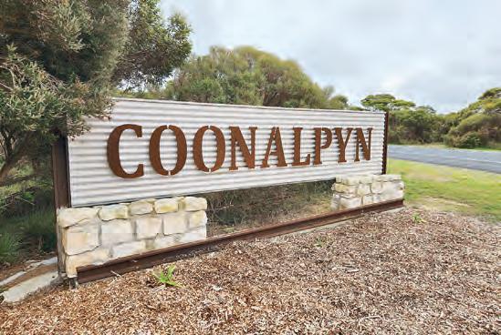
What’s in COONALPYN
ESTABLISHED in 1909 and like many small towns in regional Australia, Coonalpyn was adversely affected by the millennium drought as well as longer term changes in employment patterns and commercial/services operations. Many businesses closed, leaving the main street less lively than in previous decades.
The community, supported by Council, embarked on an arts led regional recovery plan thus ‘Creating Coonalpyn’ was born. It’s now great to once again see the bustle of people stopping to enjoy the businesses, public art and parks in Coonalpyn.
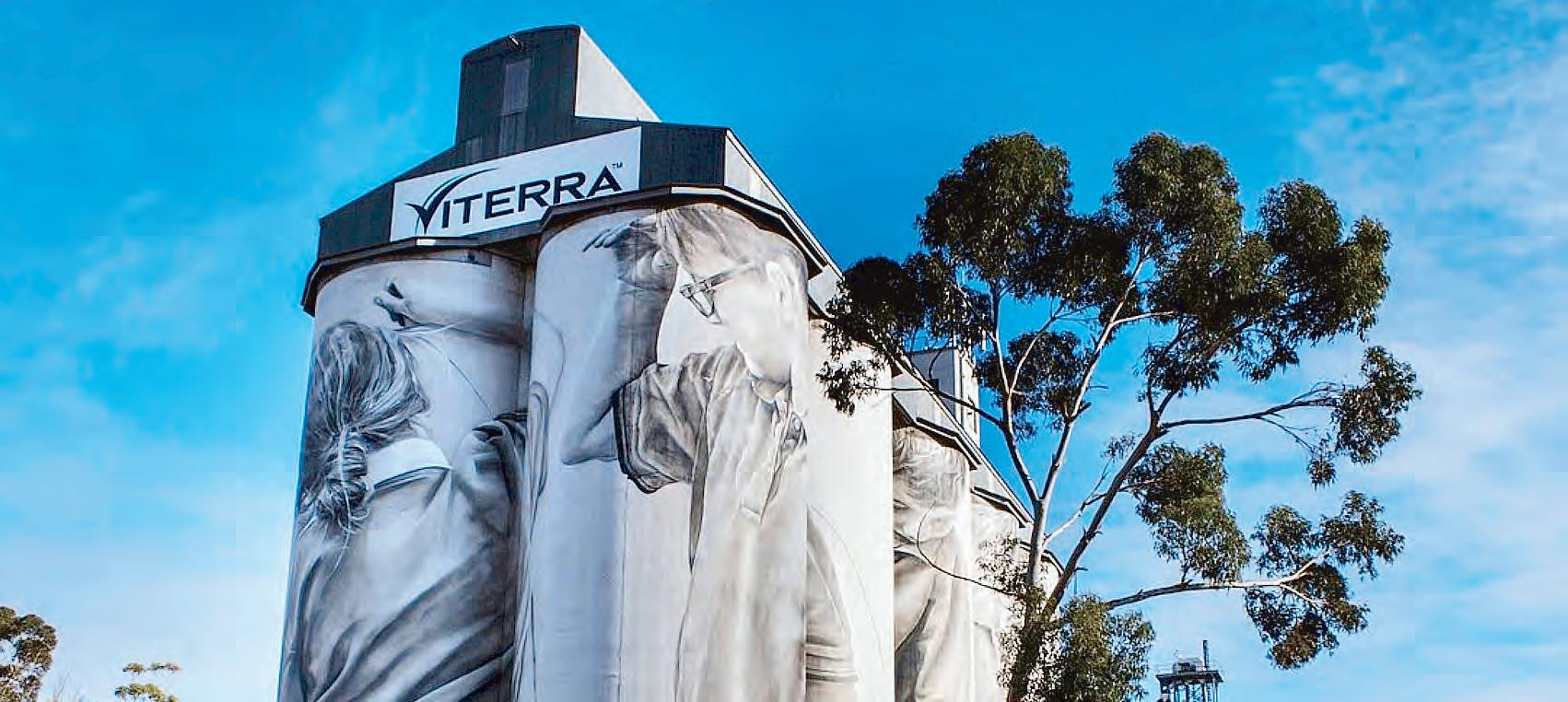
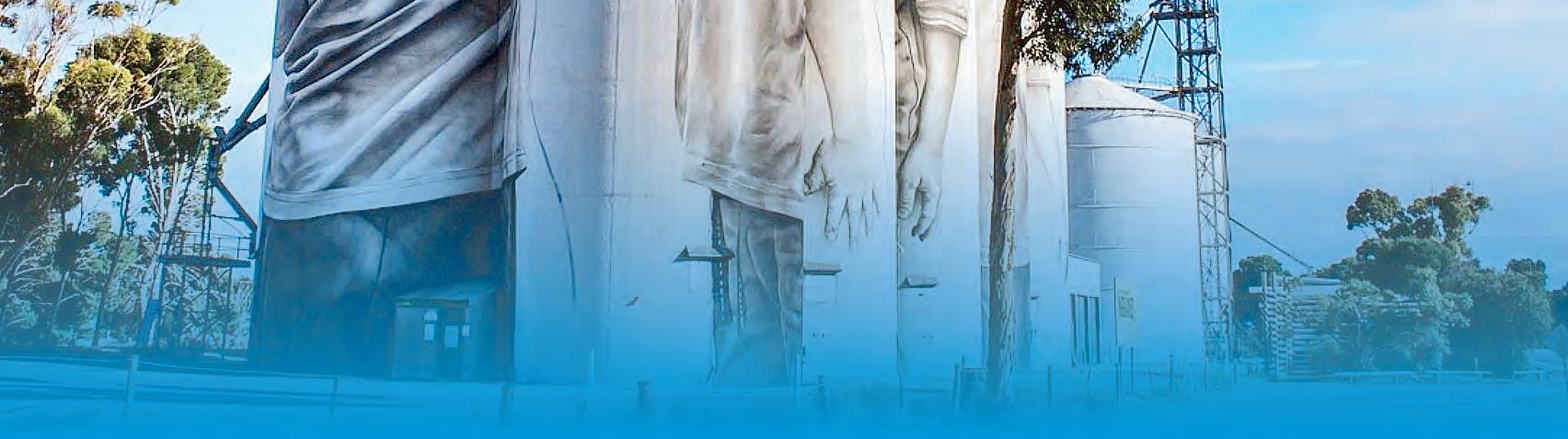
The program is a suite of six community projects with outcomes designed to activate spaces and reinvigorate the town. They illustrate the stories, history and fabric of Coonalpyn including South Australia’s first silo mural by artist Guido van Helten. Guido arrived in Coonalpyn on the 1st of February 2017 and spent the first week engaging with and photographing
members of the community before deciding to paint five Coonalpyn Primary School children on the Viterra silos. The design represents Coonalpyn’s hope for the future.
The project took six weeks with Guido using a 38m boom lift to first mark out a reference grid then reproduced the design using 200 cans of spray paint plus acrylic paint applied with brush and airbrush.
Spend some time in Coonalpyn and experience the Creating Coonalpyn Arts Trail.
For more information refer to www.coorong.sa.gov.au/ coonalpyn or contact Coorong District Council, 95-101 Railway Terrace, Tailem Bend, SA 5260. Phone 1800 785 277 or email council@coorong.sa.gov.au
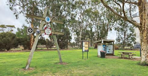
Coonalpyn town and district icons and places of interest include:
■ Border-Downs Tintinara Football and Netball Club
■ Coonalpyn Institute
■ Original site of the Coonalpyn Primar y School
■ Coonalpyn Soldiers
■ Gold Escort Route Monuments
■ Kangaroo Flat Rocks
■ Coonalpyn RSL Hall
■ Sanctuary Walking Trails
■ Tauragat Hill
■ Tauragat Well
■ BMX Track
■ Parking Bay – public toilets, “tunnel vision”, dog exercise park
■ Coonalpyn Swimming Pool
■ Playground
Memorial Park Gates
What’s in KEITH
Early Settlers Cottage
Built by William Davis in 1894, the cottage is constructed of local limestone and consists of a small four-roomed limestone rubble cottage with a low-pitched iron
roof and two massive fireplaces at one end, standing on one of the suburban allotments surveyed around Keith. The cottage has been bought by the National Trust and now operates as a house museum.
Davis Cottage is of heritage value as a relic of early agricultural settlement in the Tatiara.
■ Location: Emu Flat Road, Keith, SA
■ Hours: Open by
RECOGNISED as the “gateway to the South East and Limestone Coast”, Keith was proclaimed in 1889 with agriculture as its base.
Keith is also recognised as the “lucerne capital of Australia” with its distinctive purple paddocks. In the early days, a railway siding was established on the Adelaide line near Mount Monster to serve the pastoral leases that had been taken up in the surrounding district during the 1850s. The Keith district typifies “real Australian countryside”.
Today the township services a diverse agricultural area. Visitor information is available at the Gateway Café at the Dukes and Riddoch Highway junction and the Morning Loaf Bakery, Heritage Street, Keith.
Homemade treats are baked daily with gluten free choices offered in all ranges of food from vegan and vegetarian. Browse an ever changing range of gifts, homewares and fresh flowers.
Keith Soldiers Park.
1910 Congregational Church
First built in 1910 using local stone and labour, it was the only church in the town and parishioners of all denominations attended Sunday services together. The congregational church was very strong in the Tatiara, and a humble congregational chapel was built in the heart of Keith in 1899. In 1910 it was replaced by this very handsome church and manse.
The manse was sold in 1954. The church became the Uniting Church in 1977, and remained in use until 1987 when it was replaced by a new church on the southern outskirts of the town. Make sure to check out the stunning leadlight windows created by local residents depicting the history of Keith over the last 100 years.
■ Location: Heritage Street, Keith, SA
■ Hours: Open by appointment only
■ Contact: 0408 149 005
Ngarkat Conservation Park
Ngarkat group of conservation parks cover a total of 270,152 hectares. They include the original Ngarkat and adjoining parks of Mount Rescue, Mount Shaugh and Scorpion Springs.
This park features a mixture of mallee and heathlands covering a system of remnant coastal dunes. The park has a network of trails ranging from ten minute walks to five hour hikes.
It is also home to an array of wildlife including echidnas, pygmy possums, dunnarts, kangaroos, lizards and birds. Take one of the clearly marked 4WD tracks to experience the region’s vast terrain.
Most tracks are unsuitable for conventional vehicles. The oneway section of the Border Track closes each year during the fire danger period (mid-November to early April).
■ Please check with National Parks South Australia for 4WD access and conditions at www. parks.sa.gov.au Camping permits are
available online at www. parks.sa.gov.au Book online before you go at www.parks.sa.gov. au.
■ Location: Due to the vast size of Ngarkat Coservation Park, there are various ways to enter.
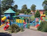
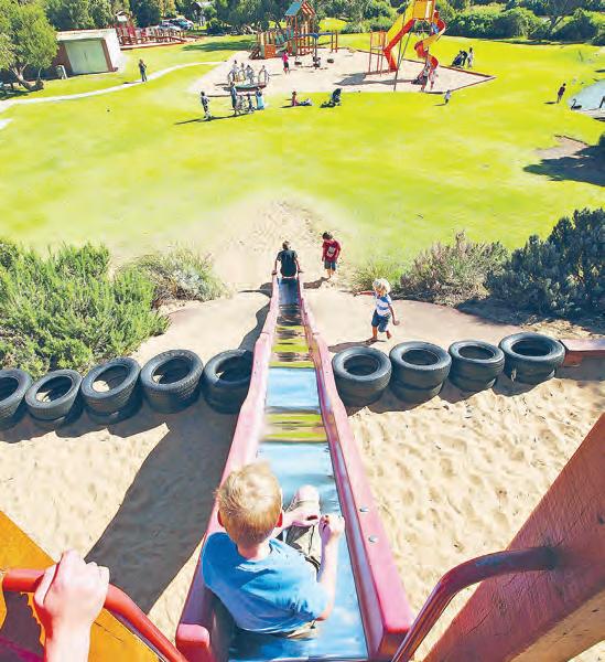
Don Moseley Memorial Playground is on Heritage Street. The newly-built playground is fun for kids of all ages.
Enjoy the nature-play based equipment or take a ride on the popular monorail.
Modern toilets are located here as well as a new sport and recreation centre alongside the football oval.
Enjoy the mural painted by local artists, cook on the BBQ, or sit in the heritage rotunda and watch the children playing in the playground.
■ Location: ANZAC Terrace, Keith, SA
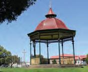
Keith Soldiers Park
The park is home to the water feature, “Circlework”.
Local artist James Darling created the piece to celebrate the cycle of water through the Australian landscape with particular reference to the region’s high table and extensive irrigation industry.
A poignant reminder of how important all forms of water are to this area.
■ Location: Heritage Street, Keith.
Andy Caldecott Memorial
Andy Caldecott (1964-2006) was an off-road motorcycle racer born in Keith.
He won the Australian Safari Rally four times consecutively (2000-2003) and was a competitor in the Dakar Rally in 2004 (DNF), 2005 (6th) and 2006.
In 2015 Andy was inducted into the Motorcycling SA Hall of Fame.
During the 2006 Dakar Rally he won the third stage, but later died from a neck injury suffered when crashing during the ninth stage.
Prior to his death, he had operated a motorcycle shop in Keith.
A memorial for the late Andy Caldecott can be found opposite Don Moseley Park Tourism Hotspot.
Location Dukes Highway, Pilmore Park, Keith
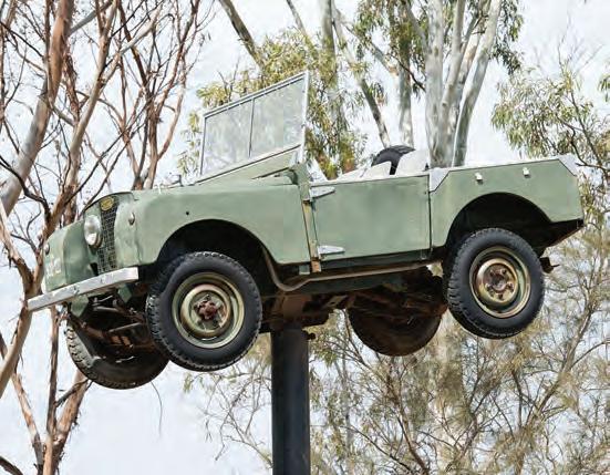
Land Rover on a Pole
In the 1950s, the AMP Insurance Company funded the development of vast areas of bushland into farmland, resulting in a large period of growth for Keith.
The AMP Memorial to this land development scheme consists of a Land Rover on a pole and one of the original Wiles Huts. The Wiles Hut is one of about 50 occupied by workers on the scheme at the time and was made of two prefabricated steel motor garages built by the Wiles Industrial Company of Mile End. The early Land Rover was essential to off-road travel. The memorial was erected in 1995.
refuel, recharge & relax at the gateway
come and enjoy a range of healthy food options made fresh daily, barista-made coffee as well as our famous country fried chicken!
your perfect stop between Adelaide and Melbourne
Landrover on a pole.
What’s in PADTHAWAY
THE picturesque village of Padthaway is situated on the Riddoch Highway about thirty minutes south of Keith. The district population of just over 200 is mostly engaged in primary production, including vines and wineries, onions, cropping, mixed farming and seed production.
It’s close to the Coonawarra, Wrattonbully and Mount Benson wine regions.
Rows of vineyards thread down either side of the Riddoch Highway. Padthaway, like many South Australian wine regions, has a warm climate, good rainfall and the terra rossa soil (soil that gives the grapes a special flavour due to the limestone layers) the Limestone Coast area is known for.
This produces wines with great flavour and intensity.
Grape vines span more than 62 kilometres of land.
Padthaway has a cluster of small shops located in the heart of town.
Padthaway Caravan Park
Situated at 75 BeeammaParsons Road in a tranquil garden setting overlooking the Padthaway Valley and surrounding vineyards. It has immaculate facilities and is located 500 metres from the township and is adjacent to natural bushland.
Apex Park
This beautiful park in the heart of the town is a popular picnic area with barbecues and toilet facilities set in two acres of lush green lawns, shrubs, shady gum trees and a state of the art skatepark.
Padthaway Marker
Carved from a huge block of local green granite and
Padthaway. (John Montesi)
exaggerated metal trellising, the Padthaway Marker represents horticulture, agriculture and viticulture.
Farmer’s Leap
Unique to Padthaway, this cellar door captures the essence of Farmer’s Leap.
A friendly warm environment with undeniable country hospitality.
They offer meals and light fare, wine tastings, weddings, events and functions.
Enjoy the sunshine and a glass of Destiny sitting on our verandah overlooking the vineyards.
In the cooler months stay inside next to the fire, to savour a glass of the Brave shiraz.
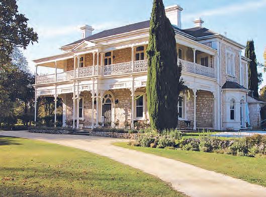
Padthaway Estate
The majestic Padthaway Homestead was built in 1882 by Scotsman Robert Lawson for his wife Eliza.
Nestled deep in the heart of quality vineyards, Padthaway Homestead is renowned for its fascinating history. The old
woolshed, built in 1901, houses the Padthaway Estate Winery where “Eliza“ was produced on Australia’s only traditional French Cochard Champagne press.
Padthaway Estate is easily accessible by road with the towns of Naracoorte, Bordertown & Keith a short drive away.
From a visit to the cellar door, a weekend stay, or a wedding in the majestic gardens, Padthaway Estate will engross you with its history, presence and attention to quality and detail.
Padthaway Conservation Park
Occupying an area of
almost 1000 hectares, the park has a variety of enjoyable bushwalking tracks which are accessible from the caravan park. The conservation park is host to an extensive range of native birds and animals such as koalas, wallabies, kangaroos and possums.
Padthaway Golf Course
Padthaway offers excellent sporting services including a nine hole winter Golf Course. Visitors are welcome to this country style course, uniquely carved out of bushland, adjoining the Caravan Park.
Padthaway Estate.
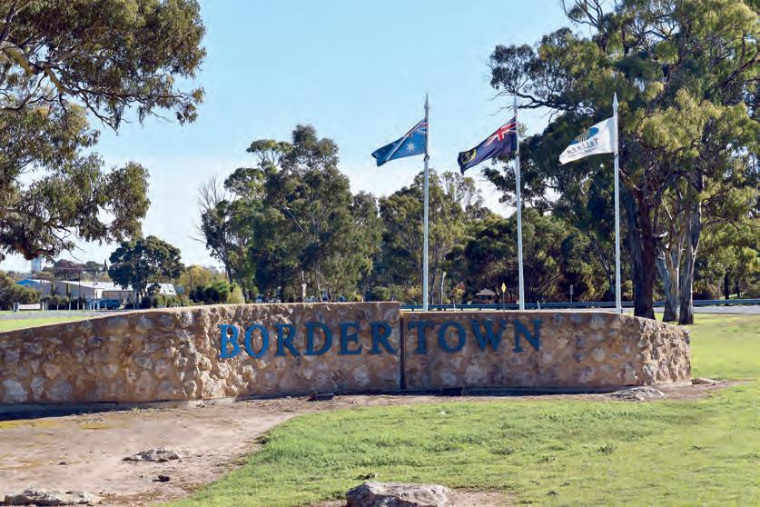
What’s in BORDERTOWN
WELCOME to Bordertown - the gateway to the state’s eastern border.
Situated on the Dukes Highway, Bordertown is 280 kilometres from Adelaide and 450 kms from Melbourne.
The town was established in 1852 adjacent to the Tatiara Creek and was the site of a basecamp created by police inspector Alfred Tolmer who was in charge of the gold escorts from the Victorian goldfields to Adelaide. These historic escorts saved the infant state of South Australia from bankruptcy.
Their importance is recognised by the granite stone markers and plaques along the gold route.
Tatiara Civic Centre
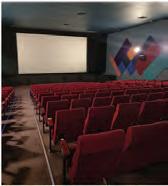
Officially opened in 2011 by Bob Hawke, the redeveloped Tatiara Civic Centre is considered the region’s premier venue and art space which features the Tatiara District Council Offices and Chambers, public library, art gallery, theater, cinema, main stage, conference facilities and the Bob Hawke collection and Visitor Information Centre.
■ Location: 43 Woolshed Street, Border town, SA
■ Hours: Monday – Friday
Visit Bordertown.
8.30am – 5pm, Saturdays 9.30am – 11.30am, closed public holidays
■ Contact: 08 8752 1044
■ Website: www.visittatiara. com.au
Wildlife Park
The famous Bordertown Wildlife Park was developed in 1968 and is situated just near the turn-off from the Dukes Highway at the eastern entrance of the town. The wildlife park is
famous for its White Kangaroos. They are not albino but a genetic strain of Grey Kangaroos. In the park there are also Western Grey Kangaroos and Dama Wallabies as well as a variety of birdlife. Visitors are able to drive or walk right around the 4.5-hectare park and its inhabitants are all quite easily observed through the fence.
Please note entrance to the park is not permitted and as the animals’ diets are monitored, feeding is also not allowed.
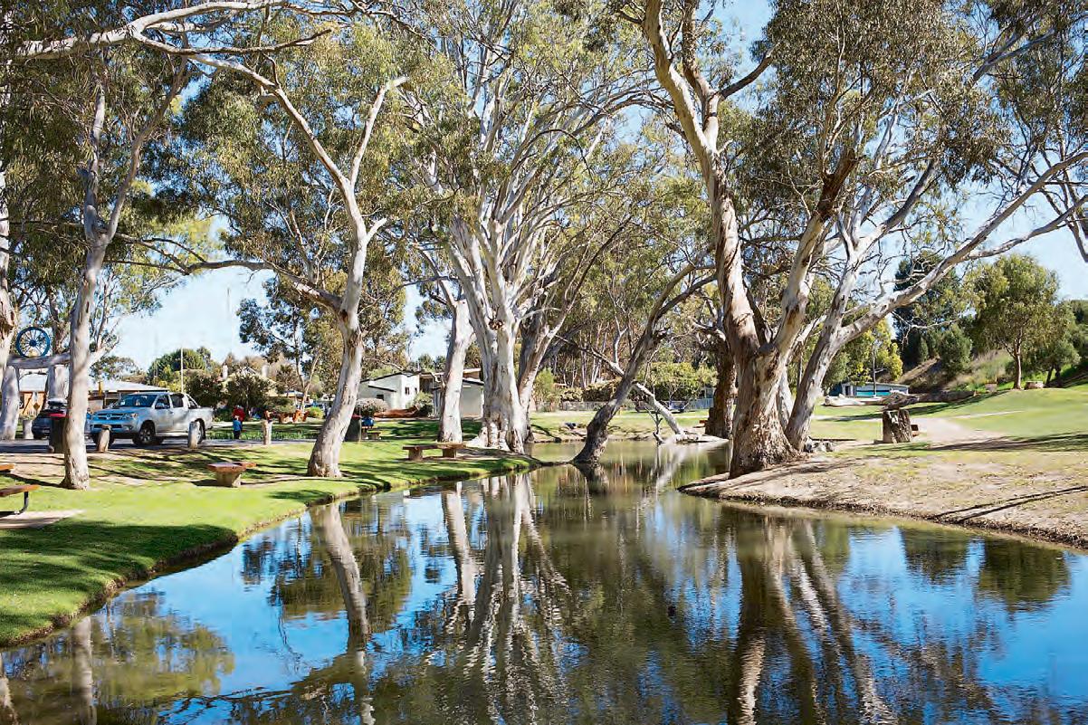
Tolmer Park
Tolmer Park consists of lovely old red gums and sweeping lawns alongside Tatiara Creek.
The interpretive signs and walks in the park will give you a brief history of the Bordertown area, and the picturesque park has several red gum artworks and outdoor tables and chairs.
Overlooking the park is the Morning Loaf Bakery - built around the old police station. Alongside, the old gaol has been converted to toilets.
More of BORDERTOWN
Apex Park at Bordertown.
Bob Hawke House
Stay in the birthplace of one of the nation’s most iconic leaders, Bob Hawke. Bob Hawke was born in Bordertown in 1929 and lived in this house, located in the heart of Bordertown, until his family relocated in 1935. The house has had many uses since that time, until 2021, when it was purchased by the Tatiara District Council in 2021. Photographs, memorabilia and stories highlight Bob Hawke’s life and achievements.
Bob Hawke Gallery
Bob Hawke is one of Australia’s most iconic Prime Ministers, he was born on 9th December, 1929, in Bordertown. The Panther motorbike on display is thought to be Hawke’s 1939 British Panther model 100. Purchased in the 1980’s at a Bendigo swap meet by Peter Matthews and was acquired and restored by the Tatiara District Council in April 2019.The gallery also features a collection of photographs, newspaper clippings, cartoons, paintings and memorabilia acknowledging and celebrating Bordertown as the birthplace of our former
The Bordertown Recreation Lake was created after the development of a by-pass near the centre of the town in 1988.
There are walking trails around the lake, a jetty and three public artworks - the Crooked Tank, the Horse Fence and the Sluice Gates.
Fishing is a popular pastime, with the lake regularly stocked with redfin, perch and other breeds of fish.
Canoeing is another suitable leisure activity.
Swimming is not permitted.
It’s a great picnic spot, with a shelter and electric BBQ.
There’s a toilet nearby and a toilet dump for caravans and motorhomes.
■ Location: Winter Road, Border town, SA
Clayton Farm Heritage Museum
A visit to Bordertown would not be complete without spending some time at the faithfully restored Clayton Farm Heritage Museum.
Just 3 kilometres from the town centre, the farm has a restored and refurbished homestead and a comprehensive range of vintage farm machinery where you can experience farm life as it was more than a century ago when the original settlersthe Wiese family - first occupied
the land.
■ Location: 147 Clayton Farm Track, Bordertown, SA,
■ Hours: Monday, Wednesday and Friday 11am to 4pm and most Sundays 1 to 3pm.
■ Other times by appointment
■ Contact: 0417 890 868 or claytonfhm@internode. on.net
Hawke House is open for guests.
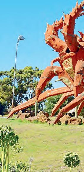
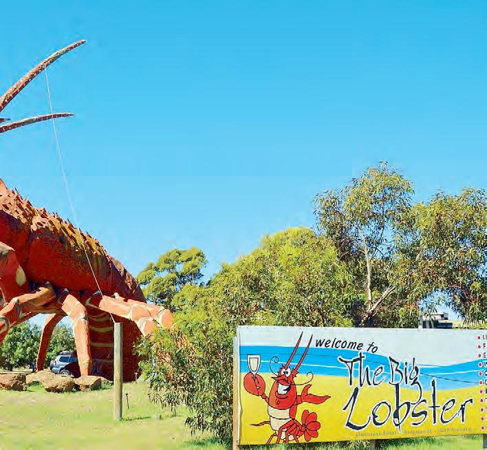
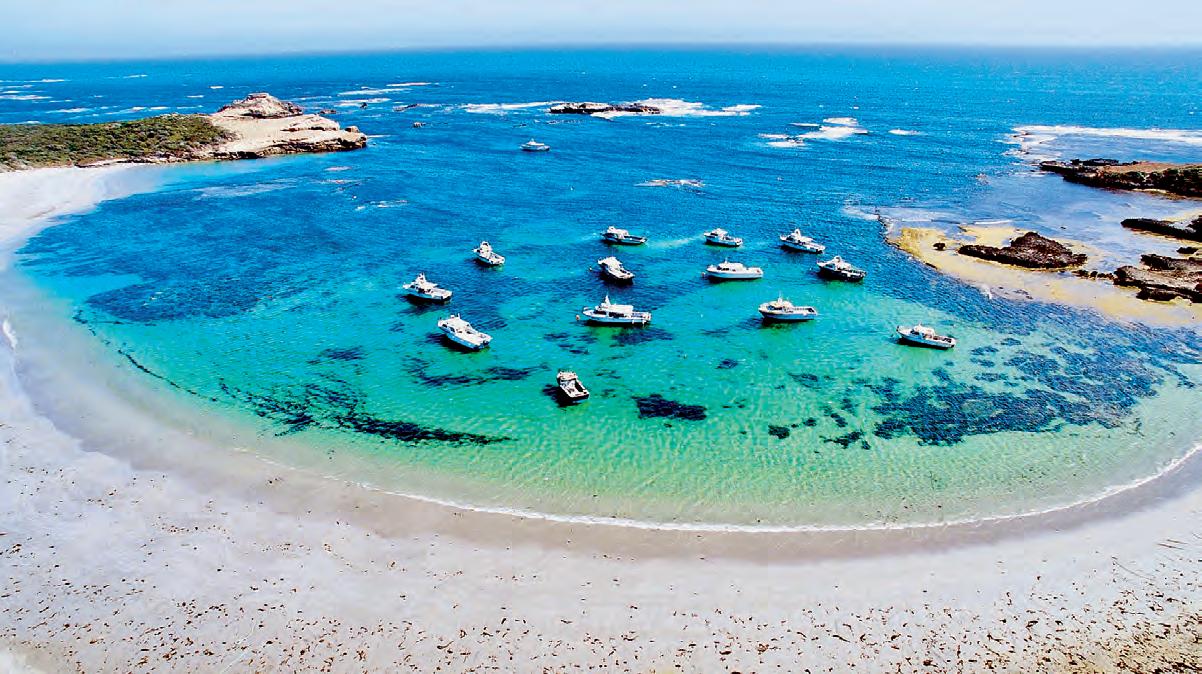
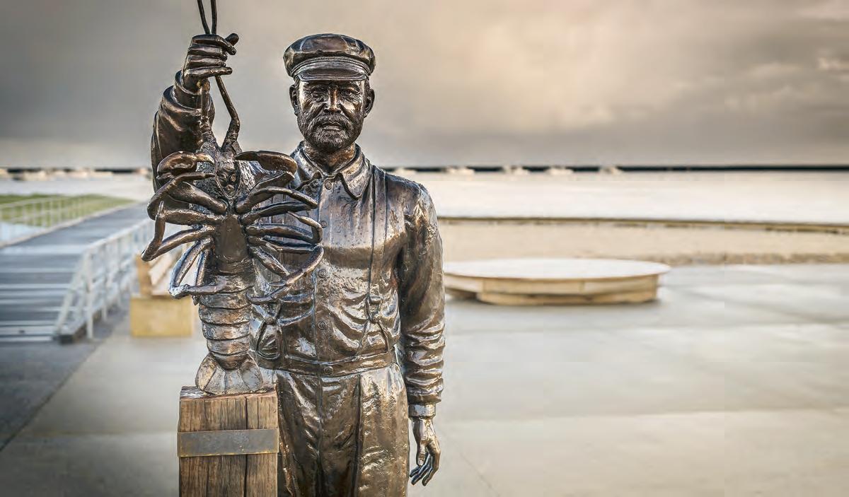
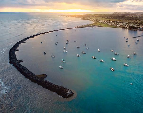
Experience KINGSTON SE
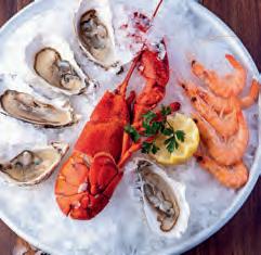
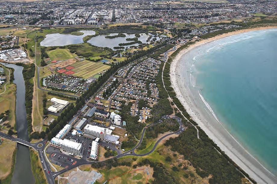
NESTLED on the picturesque waters of Lacepede Bay and home to the famous ‘Larry the Lobster’, Kingston SE is an ideal place for holidaymakers and families to relax and unwind.
There is much to like about Kingston SE, the fishing, local shops and cafes, seafood, wine, local produce, safe beaches, fantastic local events and great parks.
Located approximately 300 kilometres south of Adelaide, lies the Limestone Coast’s hidden gem, Kingston SE. Experience some of the safest beaches in South Australia, RV parks, visitor facilities, parks and gardens, sporting and recreational facilities and excellent recreational fishing.
The small seaside town is the perfect destination to holiday, its central location is ideal to stay and explore the nearby towns such as Robe, Beachport, Naracoorte, Millicent, Penola and Mount Gambier.
Stay Local
If you are looking to stay, Kingston SE hosts an array of accommodation options to suit your style, family and budget, from luxurious apartments, cosy bed and breakfasts, holiday homes, hotels and motels to camping under the stars. You can
even bring your canine on their own little holiday at the local boarding kennel or in the pet friendly holiday accommodation.
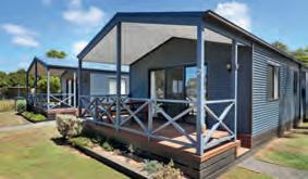
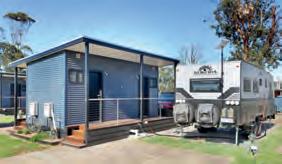
There is one RV park located on Marine Parade. The Maria Creek RV Park offers a stay of up to 6 days ($20 per 2 days) and is
situated right on the beach front, adjacent to the jetty and walking distance from local stores.The RV park allows motorhomes, caravans, camper vans, Wicked vans and 4x4 campers.
KINGSTON SE: Larry the Lobster. (South Australian Tourism Commission)
KINGSTON SE: Kingston SE. (South Australian Tourism Commission)
Visitor Information
If you are looking for ideas of where to stay or things to do while in Kingston SE, drop in and see the friendly staff at the Kingston Visitor Information Outlet (VIO). The VIO has state, regional and local information and details about all the forthcoming local events.
Kingston SE features an array of retail stores from homewares, gifts, fashion and wellness to art, candy and toys along with local fine foods and produce such as honey, meat and fish in selected stores.
Meander through the boutique shops throughout the main streets, however, be sure to keep
an eye out for the hidden gems. Enjoy the many indulgences that Kingston SE has to offer in the local cafés, takeaway stores, hotels and bakeries. For lovers of fine wine, experience the spirit, friendliness and hospitality of the Mount Benson winemakers and their families. Indulge in the delights of the regional essence, aromas and cellar door ambience of the Mount Benson wine region. Renowned for its limestone and terra rossa soils, that combined with a maritime, cool climate, the Mount Benson wine region produces wines of exceptional quality, interest and character. Experience the unique varieties each cellar door has to offer and stay for a gourmet platter and a game of Finska as you take in the surrounds.
Enjoy locally caught seafood.
3 HANSON STREET, KINGSTON SE
Cape Jaffa Lighthouse
Originally situated on the Margaret Brock Reef, eight kilometres out to sea from Cape Jaffa, this lighthouse became Australia’s first lighthouse to be dismantled and re-located onshore.
From its commanding position on Kingston SE’s foreshore, it offers spectacular views from the top deck as well as a glimpse into the incredible life of the lightkeeper in a very challenging workplace.
■ Location: 32 Marine Parade, Kingston SE, SA
■ Hours: 10am -4pm daily School Holidays or by appointment
■ Contact: 0427 854 175 or kingstonse@ nationaltr ustsa.org.au
■ Website: www. capejaffalighthouse.org.au
National History Trust Museum
Step back into history to view the museum’s extensive collection in the original 1876 J.J. Jarman building.
The museum features displays of household items used by early settlers, agricultural equipment, and Aboriginal artefacts.
Learn more about the fishing industry that to this day plays a big role in the region, and about the bark tanning industry - unique to this area from the 1870s.
The ship wreck display includes one of the most significant items in the museum’s collection, the 8 foot anchor from the Margaret Brock, the coastal trading ship that was wrecked on its way to Melbourne from Port Adelaide in 1852
■ Location: 23 Cooke Street, Kingston SE, SA
■ Hours: Every Tuesday 2pm – 4pm, School holidays 2pm - 4pm, or by appointment.
■ Contact: 0417 17 815 or kingstonse@ nationaltr ustsa.org.au
Relaxation starts here… watch the sunsets, stroll along the beach, relax and enjoy Kingston SE from our seaside Caravan Park.
⦁ Enjoy the peace and quiet – rediscover the delights of the unhurried holiday
⦁ Enjoy fishing, boating or sailing – along the spectacular coastline
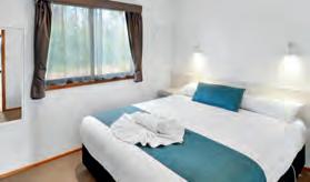
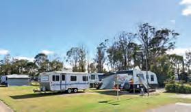
⦁ Enjoy the history – self-guided heritage tours, delicious fare and true country hospitality where everyone is welcomed. Choose from a range of accommodation options - well equipped and comfortable cabins (pet friendly and accessible options available) plus powered and unpowered sites.
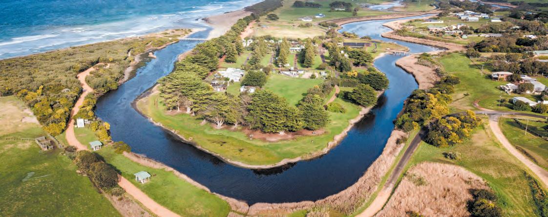
**Mention this ad to receive a discount at our Narrawong Island Holiday Park in South West Victoria**
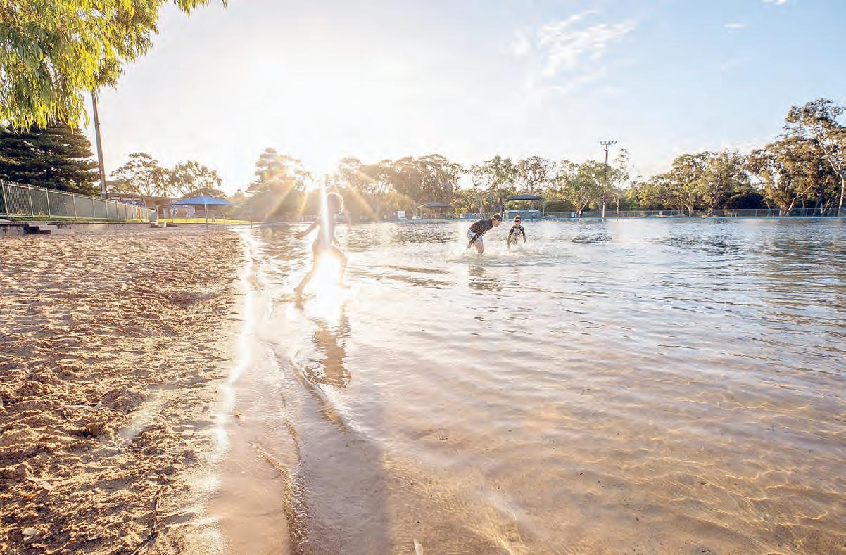
Naracoorte Swimming Lake
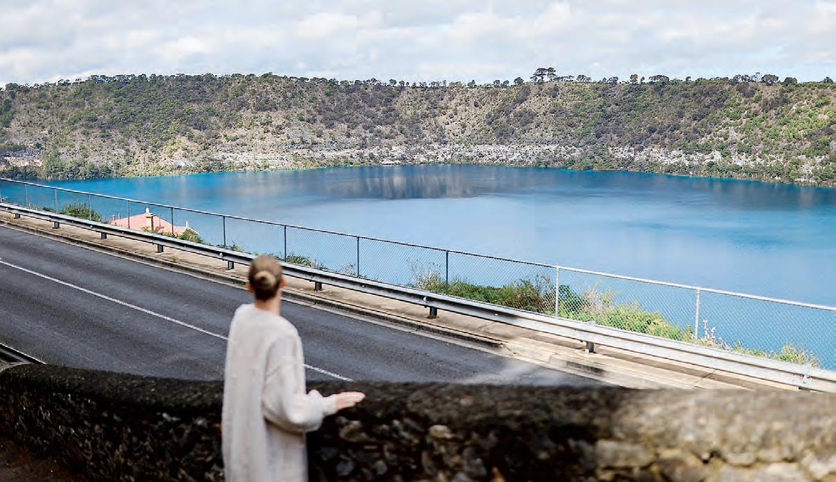
IN the heart of South Australia’s hidden gem the Limestone Coast, midway between Adelaide and Melbourne, lies the Naracoorte Lucindale district.
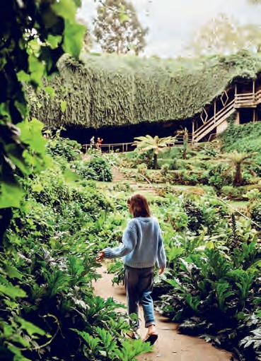
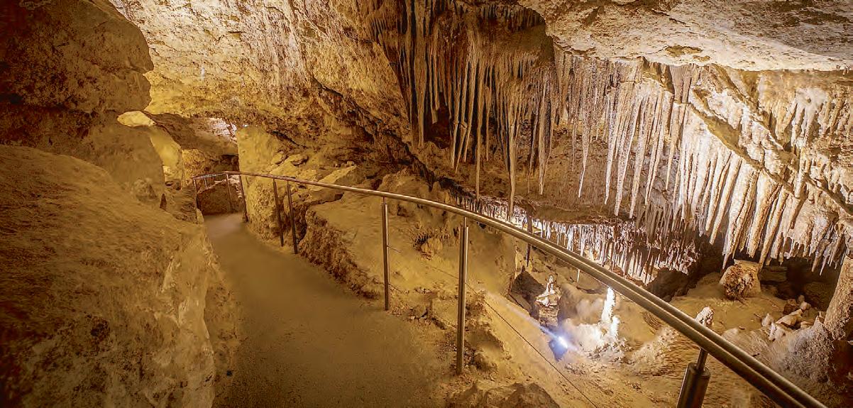
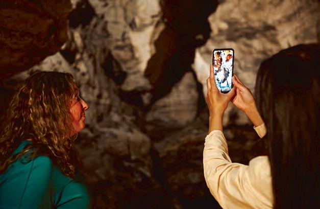
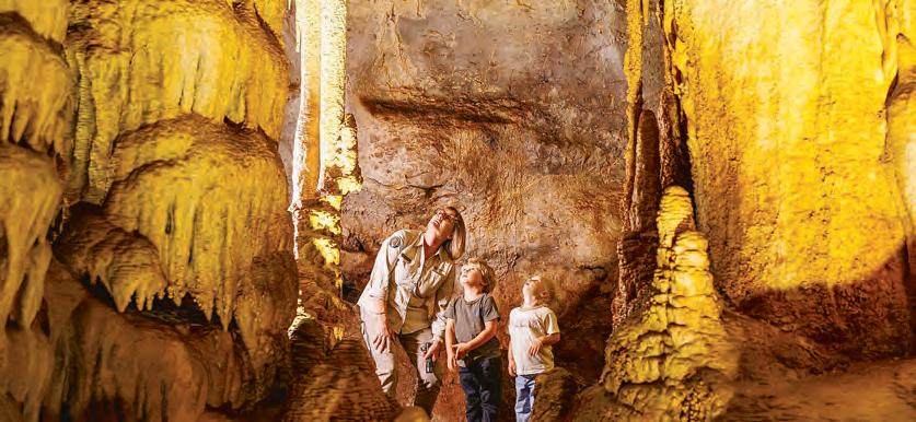
Naracoorte is home to South Australia’s only World Heritage listed site - the Naracoorte Caves National Park. The caves are World Heritage listed because of the importance of the fossils at the site, preserving Australia’s most complete marsupial fossil record.
Join an adventure caving tour or enjoy more leisurely options - all of which allow you to experience the incredible natural wonders of the caves and the National Park.
While in the Naracoorte area, also take the time to delight in the magnificent scenery and listen for the creatures of the wetlands at Bool Lagoon, a Ramsar wetland of international significance.
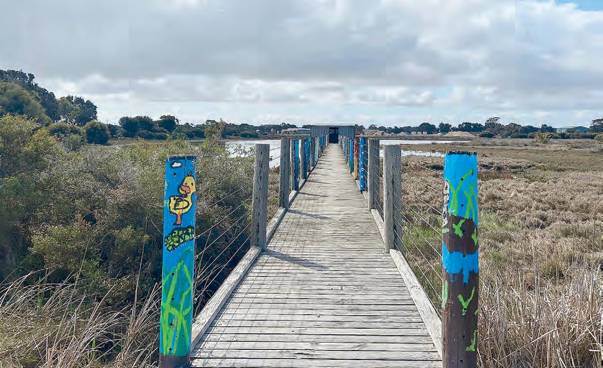
The lagoon is home to wildlife and is an essential refuge for birds. A boardwalk over the wetlands, gives the feeling of walking on water.
In the township of Naracoorte, the Market Square Recreation Area, Memorial
Parklands and Naracoorte Creek Walk offer something for everyone.
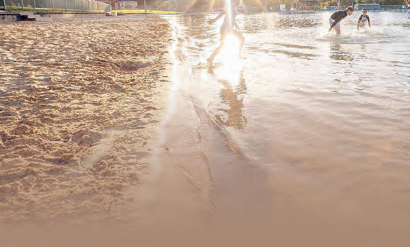
Naracoorte Swimming Lake
Swim in natural beauty set in glorious grounds. The Naracoorte Swimming Lake is a swimming
pool with a difference - the huge man-made lake with concrete floor and walls and chlorinated water ranges from 1m to 2m deep in the middle of the pool.
There are shallow sections for the littlies, deeper sections for lane swimming, a diving pontoon and an enclosed children’s area. The shaded ankle-deep section is the perfect place for toddlers
to splash around, and the sandy beach is perfect for kids to build sandcastles.
There is plenty of shade and space on the sand or green grass to roll out your towel. Spend a day here and just chill out and relax. Generally open from late November until the end of March.
Naracoorte CAVES
A destination for all seasons and can be explored on selfguided, guided and adventure caving tours. The Naracoorte Caves is one of only two known breeding places for the critically endangered Southern Bent-wing Bat.
On the Bat Centre and Blanche Cave Tour, watch and learn about the fascinating activities of the Southern Bentwing Bats in the Bat Observation Centre via infrared camera and see the bats move about their maternity chamber.
The tour then heads into the majestic Blanche Cave where in winter, you may see bats hibernating in a huddle on the cave roof. The tour incorporates a stroll through Blanche Cave.
In summer at dusk, from above ground, watch the bats’ spectacular flight from the Bat Cave as they head out for a feed of insects. If you’re an early riser, you can also see them return at dawn.
Other experiences include:
The Victoria Fossil Cave tour takes you through several decorated chambers on the way to the Fossil Chamber. You’ll get the chance to analyse complete skeletons of megafauna species. Tour duration: about 1 hour, including up to a half hour in the Fossil Chamber.
Alexandra Cave is a good introduction to the geology of the region and how the caves were formed. The 30-minute walk is easy, with plenty of opportunities to photograph the exceptional cave formations.
Fox Cave is an interesting and exciting three-hour experience.
After a tight entrance, there are high-ceilinged chambers, wide passages, low crawls and some exquisitely decorated areas.
Stick-Tomato Cave offers a great tour for the entire family. The squeezes and challenges are optional, allowing parents to watch children enjoy the caving experience.
The Blackberry Cave adventure tour includes lots of good crawls and squeezes. It’s suitable for the energetic and those who love a challenge.
The Starburst Chamber tour visits the Starburst Chamber and other spectacular parts of the Victoria Fossil Cave. The crawl is reasonably long, but less strenuous than Fox Cave.
Wonambi Fossil Centre - the park’s interpretive centre - is where science and theatre come together to provide a snapshot of ancient Naracoorte. Step back in time and discover what Naracoorte was like more than 200,000 years ago. Palaeontologists have been studying the fossils and bones found in the caves for more than 30 years. From them, they have been able to determine the range of species that made up Naracoorte’s ancient animal communities. Around 120 species of vertebrate animals have been
recorded to date. They represent four of the major vertebrate groups: amphibians, reptiles, birds and mammals. The interpretive centre also shows you how the caves have acted as pitfall traps, dens and roosts for more than 500,000 years, leading to a vast accumulation of skeletal remains of reptiles, birds and mammals. The Fossil Centre recreates a time when the local animal community was more diverse than today. For example, 200,000 years ago there were some 20 kangaroo species in the area -now there are just four. Come and enjoy fossil displays and a walk-through diorama with life-sized models of extinct animals in their ancient habitats.
■ Location: Located roughly 12 kms south of Naracoorte via Riddoch Highway.
■ Hours: Cave tours daily from 9.30am to 3.30pm.
■ Contact: (08) 8760 1210
■ Website: www. naracoor tecaves.sa.gov. au/
South Australia’s only World Heritage listed site
More of NARACOORTE
Naracoorte Visitor Information Centre
The Visitor Centre has a wonderful range of reasonably
priced locally made goodies to take home or give as genuine Australian gifts and provides local intelligence on events, activities and attractions.
Integrated with the Visitor
The Laundry Hub
With everything from candles, diffusers to jewellery and clothing!
Centre is The Sheep’s Back Museum - housed in an 1870s flour mill - which tells the stories of the Australian wool industry.
Discover how the wool industry developed culminating with the unique ‘Robotic Shearer’. Outside, explore the wonderful collection of old buildings depicting the struggles of the early settlers. Sit in the old schoolroom, drop into the post office, view a typical “dunny” and explore the farm machinery shed.
■ Location: 36 MacDonnell Street
■ Hours: Monday to Friday 9am-5pm, Saturday and Sunday 10am-4pm.
■ Public Holidays 10am - 4pm. Closed on Christmas Day and Good Friday
■ Contact: 08 8762 1399 or naracoor tevic@nlc. sa.gov.au.
■ Website: www. naracoor telucindale.com
Market Square Recreation Area
Located on MacDonnell Street, Naracoorte, is the recreation precinct with something for everyone, including an enclosed playground, skate park, basketball half-court, dog park, picnic areas, toilets and
long-vehicle parking.
The picnic area is inside the playground and is suitable for all weather with a gazebo covering the tables.
Dogs will love the dog friendly park where they can exercise unleashed and owners can relax as the park is fenced.
Memorial Parklands
Located on Price Avenue and Memorial Drive, the Memorial Parklands offer something for all ages.
Get fit on the adult exercise equipment, stroll or jog the 1.1 kilometre walking track or relax in the wide, open green space.
Children will love the nature play area where they can climb, play in the sandpit and play with water. Have a picnic or relax under the shaded gazebo, where there are tables and seats.
Dogs are welcome to exercise off their leash and there’s even a dog drinking fountain to quench their thirst after a runaround.
Rural ATTRACTIONS
Pioneer Park
Pioneer Park, situated on MacDonnell Street, Naracoorte, and only a short walk from the CBD, is a great spot to view the township of Naracoorte. Stop for a picnic or BBQ and enjoy the wide green lawn and undercover BBQ area.
Of interest to train buffs is the 1877 V9 class steam locomotivethe only one in Australia!
Explore the 50th anniversary memorial of the municipality of Naracoorte and the commemoration of the pioneering families of Naracoorte. The park was the former Naracoorte-Kincraig Cemetery.
Naracoorte Trails
Explore Naracoorte’s natural wonders, abundant wildlife and rich history by walking, running or cycling the various self-guided trails.
There’s a trail for everyone, from the 30-minute walk through the native bushland of the Naracoorte Nature Park, to the 14.7km long Naracoorte Caves Trail which connects the town of Naracoorte with the worldrenowned Caves.
Call in to the Naracoorte Visitor Information Centre at 36 MacDonnell Street to pick up your copy of the Naracoorte Trails brochure, which features maps of all of the trails. The brochure has been printed as a handy pocket-sized Z-card, so it can easily go everywhere with you!
You can also pick up an Art Trail pocket map at the Visitor Centre and explore more than 30 unique public artworks in Naracoorte, Lucindale and Frances.
More information is also available at www. naracoortelucindale.com
Bool Lagoon Game Reserve and Hacks Lagoon
Bool Lagoon, a seasonal wetland, is one of the largest and most diverse freshwater lagoon systems in southern Australia and is home to a wide range of wildlife, providing drought refuge for rare and endangered birds. Hacks Lagoon, adjoining the main basin of Bool Lagoon, is another wetland habitat to explore.
Hundreds upon hundreds of waterbirds flock to the freshwater wetland system including ibis, magpie geese, black swans and brolgas - the most spectacular of the 150 species of birds that visit the Lagoons.
Bool Lagoon, one of the most valuable wetland conservation areas in Australia, is recognised under the Ramsar Convention on Wetlands as a Wetland of International Importance. It is protected under the Japan/ Australia and China/Australia Migratory Bird Agreements because of the importance of the area as a summer refuge for migratory waders. Fees apply to enter and camp at these parks. Book online before you go at www.parks.sa.gov.au
Naracoorte Regional Art Gallery
The Naracoorte Art Gallery is the oldest regional gallery in South Australia.
Housed in a historic Georgian home once owned by a local doctor, and formerly the municipal offices of the Corporation of Naracoorte, the Gallery is now a showcase of traditional and contemporary visual arts.
The permanent collection of Australian art includes more than 60 etchings by famous engraver John Goodchild, Australian contemporary works on paper, Aboriginal prints, paintings and
ceramics.
■ Location: 91 Ormerod Street
■ Hours: 10am-4pm Wednesday – Friday, 10am-3pm Saturday and Sunday
■ Contact: 08 8762 3390
Naracoorte Library + Town Hall
The Naracoorte Library + Town Hall at 93-95 Smith Street is a flexible and vibrant space to meet the needs of a growing and diverse community.
Located in the heart of the town centre precinct, the Naracoorte Library + Town Hall is literally alive with opportunities to learn, connect and explore! Services, programs and events are ever-evolving, and everyone is encouraged to make use of
the modern, interactive and entertaining space.
Follow the Naracoorte Library + Town Hall Facebook page for updates @ naracoortelibrarytownhall
Take a stroll through Bool Lagoon
Naracoorte Art Gallery
Lucindale
Lucindale is a small country town with a community that’s big on hospitality.
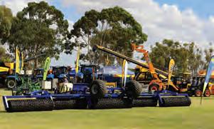
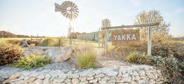
In March, join the thousands of people who flock to Yakka Park for the South East Field Days for exhibits on agriculture, technology, craft and services.
At Easter, competitors and spectators from all over South Australia gather at the Lucindale Country Club to play on the Limestone Coast’s only lawn courts at the annual Easter Tennis Tournament.
The Lucindale Country Club also boasts a scenic 18-hole, fully watered golf course with excellent clubrooms.
Take a break at Centenary Park in the centre of town and enjoy the fenced playground, skate park, basketball half-court, barbecue, rotunda, public toilets and the Lucindale War Memorial.
Nearby Jubilee Park offers a mini lake and wetland with a bridge to explore the central island.
The Lucindale Recreation Reserve is the town’s sporting hub with its football oval and netball courts, and Lucindale is also
home to the Lucindale Historical Society Museum which features a collection of restored local buildings and an intriguing array of district memorabilia.
Lucindale is great for independent travellers with campsites at the caravan park or Lucindale Country Club. There are self-contained accommodation options and an RV dump point.
Frances
Discover Frances on the border of South Australia and Victoria. Self-sufficient travellers can set up at the communityrun Frances Recreation Reserve, which is the sporting and community hub.
Features include an oval, tennis courts, netball courts, clubrooms, bowls club, War Memorial and toilet block.
While in Frances, enjoy a break in the Frances Town Square which features a nature play area, gazebo, gardens and five impressive sculptures acknowledging the area’s connection with the Red-Tailed Black Cockatoos.
Lucindale
Kybybolite
Travel the back roads and discover Kybybolite, a town with a rich agricultural history. Lying astride the Victorian border nearby is Mullinger Swamp, with its huge, ancient gums, plentiful birdlife and waters to canoe or paddle (subject to seasonal conditions). Adjacent to the swamp is the Limestone Coast’s largest living red gum, standing about 50 metres high with a circumference of 11.6 metres.
The tree is believed to be between 800 and 1000 years old and much of the base is hollow – in past times used as a changeroom for bathers!
The spacious Kybybolite Recreation Reserve is the town’s sporting and community hub. The gates to the reserve were erected in memory of those who served
in the two world wars.
Hynam
The hamlet of Hynam, located east of Naracoorte, was a large sheep run.
Today you can discover the stories of Hynam’s pioneer families at the heritage-listed old Hynam Cemetery.
The Hynam community continues to work on preserving and enhancing the historic and significant Hynam Cemetery by telling the stories of those who are buried there and making the stories available to visitors.
The heritage-listed Hynam Woolshed was the first stone shed in the district.
Situated on private property, the woolshed is not accessible but is easily viewed from the road.
Holidays: 10am–4pm
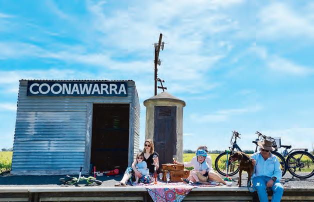
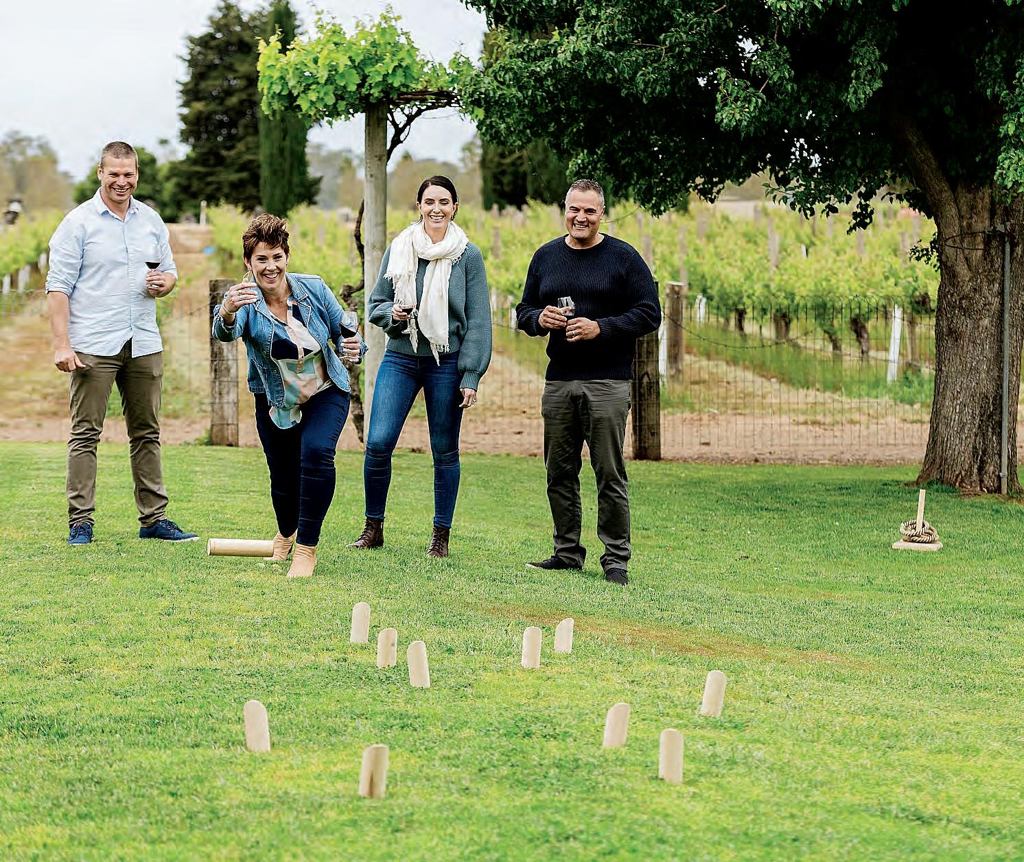
What’s in COONAWARRA
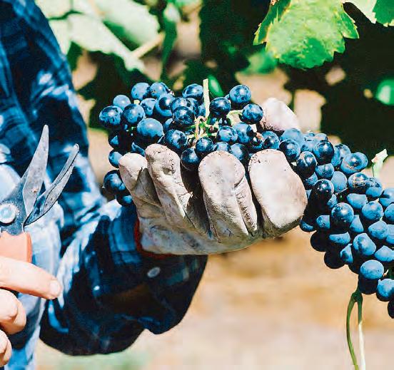
LOCATED around 10 kilometres north of Penola on the Riddoch Highway, Coonawarra is 60 kms east of Millicent via Penola, and 95 kms east of Beachport via Kangaroo Inn. Coonawarra is part of the Limestone Coast Tourism Region. Its secret lies in the magical marriage of rich red terra rossa soil, limestone, pure underground water and a long cool ripening season. Coonawarra offers visitors wine tastings at, in excess of 20 cellar doors. The local industries of Coonawarra are viticulture, agriculture, horticulture and tourism.
History
Scottish born John Riddoch was a prominent figure in Penola and Coonawarra’s history.
He settled in the area in 1861 and had a profound impact on the district.
In 1890 John Riddoch subdivided 1000 acres, which he sold to local people to establish the Penola Fruit Colony. Riddoch’s first vintage was in 1897.
This sowed the seed of Coonawarra’s internationally renowned wines.
The two-storey mansion “Yallum Park” was completed for John Riddoch in 1880.
Many of the early buildings in the district were opened or had their foundation stones laid by this man of vision. He was a local Member of Parliament for many years and the Riddoch Highway is named to acknowledge his contribution.
Riddoch’s original cellars, now Wynns Coonawarra Estate, is a local landmark
and popular tourist attraction. Coonawarra offers visitors the opportunity to taste quality red and white premium wines. A comprehensive list of cellar doors and opening times are available at the Penola Visitor Information Centre on (08) 8737 2855.
Famous Reds
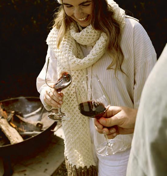
Think Coonawarra, and thoughts of sumptuous reds spring to mind – from the rich rust-coloured terra rossa soil for which it’s internationally recognised, to the prized red wines that have made it famous. The ageability of Coonawarra wines are world class, and it’s what sets their wines apart from others; a fact endorsed by generations of collectors around the world, who have cellared them for up to 60 years.
Wine Trail
Raidis Estate Ottelia
ROAD
Bellwether Wines
Coonawarra
Lindeman’s Coonawarra
Hollick Estates Banks Thargo Wines
Patrick of Coonawarra
Penley Estate
Redman Wines
Coonawarra.
Hit THE TRAIL
Coonawarra Rail Trail
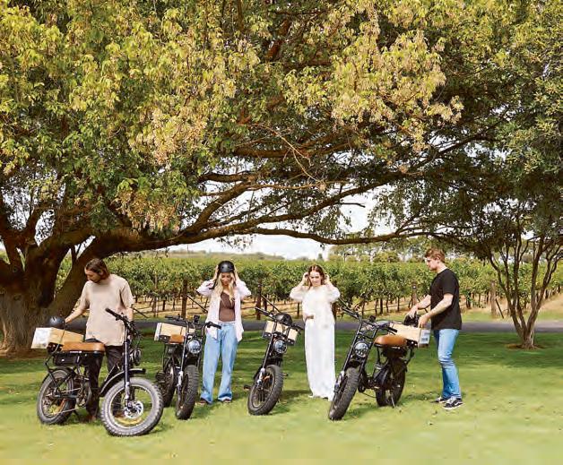
Walk or ride along Coonawarra’s newest tourism trail. Explore Coonawarra’s natural beauty, at your own pace along the unique 19km sealed trail. E-bike hire available in town.
Coonawarra Wineries
Walking Trail
Enjoy a stroll along the designated walking trails between the vines. The trail is just under 5 kilometres encompassing six cellar doors in the heart of Coonawarra.
The stunning Coonawarra Rail Trail is 19km in length and extends from the historic Penola township through the Coonawarra wine region, surrounded by vineyards and fertile farming land.
The sealed trail follows the unused Mount Gambier to Wolseley rail corridor which comes to an end near Father Woods Park — home to seven sculptures depicting the lives of Father Julian Tenison Woods and Saint Mary of the Cross Mackillop.
When using the trail, be wary of road crossings, as the traffic moves at highway speeds.
Penola to Coonawarra Railway Siding (10.5km)
The trail commences in the southwest district of Penola, near the Riddoch Street rail crossing. It can also be accessed at the Robe Rd and Jessie St crossings.
The original old station building is now a well-maintained private residence.
After passing through the old rail yards and station precinct, the trail crosses the Riddoch Highway on the northern edge of town.
The Penola to Coonawarra length of the trail is as straight as an arrow, passing by a combination of vineyards and grazing properties.
There are no steep or dangerous sections, corners or
deviations, but take care at road crossings.
Side Trail – Coonawarra Railway Siding to Coonawarra Township (1.3km)
At the Coonawarra Railway Siding turn right onto Memorial Drive. The small township of Coonawarra is an easy ride on the sealed road-side trail. There are several food outlets, including the Coonawarra Store and the award-winning Ottelia Restaurant. Here you will also find some of Coonawarra’s most renowned winery cellar doors, with Wynns Coonawarra Estate, DiGiorgio Family Wines, Zema Estate, Brands Laira Coonawarra Wines and Redman Wines all within a short distance of one another (connected via the Coonawarra Wineries Walking Trail).
The central community park offers shady seating areas, public toilets and a playground near the end of the road-side trail.
Coonawarra Siding to Glenroy – Bool Lagoon Rd (8.5km)
Heading north from the Coonawarra Siding, the trail continues on its straight path to its current end at the Glenroy to Bool Lagoon Road, passing through vineyards and grazing country.
Side Trail – Glenroy – Bool Lagoon Rd to Father Woods Park (7.0km) **
At the trail end, turn right onto the sealed road and follow 3.3km to the Riddoch Hwy. Turn left onto the highway and proceed 3.7km north to Father Woods Park.
Top drops in Coonawarra. (SATC/ Supplied)
Try an e-bike. (SATC/Supplied) Grapes.
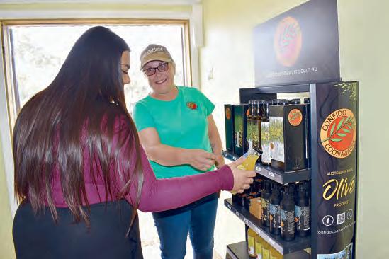
Trust IN CONFIDO
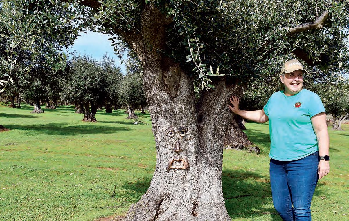
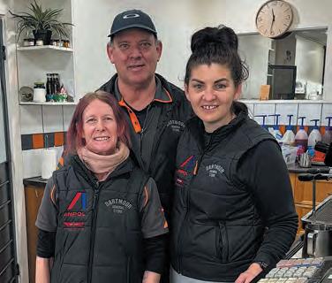
Elisabeth Champion NESTLED amongst vineyards and red soils of Coonawarra, a local olive farm is carving out its own place in the region’s rich agricultural landscape.
Confido Olive Farm, owned and operated by Heidi Boyd, produces small-batch, premium extra virgin olive oil from trees grown and hand-tended on the family property just outside Coonawarra township.
For Heidi, the business is deeply personal and has grown into a thriving operation that celebrates sustainability, quality, and community.
“Confido is Latin for I trust and it’s the motto on our family crest,” she said.
The dream began around nine years ago, when Heidi and husband Dave bought the property, which happened to have hundreds of kalamata olive trees, some of which are more than 70 years old.
“It was not the plan, it just happened to come with all these beautiful trees,” she said.
“It wasn’t a going business, the people did it as a hobby, and they’d had enough.
“We just wanted some land, because there’s 40 acres here, not
far from town.”
After a few years on the property, Heidi decided to try her hand at making some olive oil and after harvesting the trees by hand, with the help of the family, she sent them to be processed.
Fast forward several years, and Heidi had quit her job to work on the business fulltime and now runs a tasting room where she serves fresh olive oil which is pressed and bottled onsite.
It has been a learning process, but for Heidi, it has been worth the time to ensure a top quality product.
“I’ve been researching a lot of old traditional methods - I love
their old ways of doing things,” she said.
Sustainability is one of the key parts of the business, and Heidi ensures no part of the plants get wasted.
Tree offcuts are given to the local Men’s Shed to make handles for cheese knives and others are turned into bespoke jewellery.
Sharing her success with the community is part of the brand’s ethos - packaging, signage and labels are all made in South Australia, while design work, printing and other work is done locally in the Limestone Coast.
She has also partnered with local schools to help educate
the next generations, as well sharing her knowledge with local community groups.
“We lived at Kalangadoo for many, many years. We’re involved with the Kalangadoo Football Club. I lived in the canteen. That was my second home,” she said.
“We’ve always been very community linked, and we’ve always really liked that, and that’s something we’ve said we definitely want to maintain with the business and continue that community.”
In addition to olive oil, Confido offers balms, soaps and even pet shampoo.
It also features a lemon squash concentrate, made from lemon trees on the property.
While Confido remains a small operation, Heidi is looking ahead to new possibilities, including on-site cooking classes and collaborative experiences with nearby wineries.
There is more on the horizon for Confido as it continues to grow into a must-see destination.
You can find Confido at 1012 Old Comaum Road, bookings required.
Phone 0488 288 853, email admin@confidocoonawarra.com. au or visit the website at www. confidocoonawarra.com.au
Heidi Boyd is the owner of Confido. (Elisabeth Champion)
Check out Confido.
Stay and play IN PENOLA
PENOLA is located approximately 390 kilometres south of Adelaide and 424 kms west of Melbourne. Penola is in the east of the Wattle Range Council area. It is 50 kms from Millicent and 85 kms from Beachport.
The local industries are agriculture, viticulture, horticulture, forestry, natural gas and tourism.
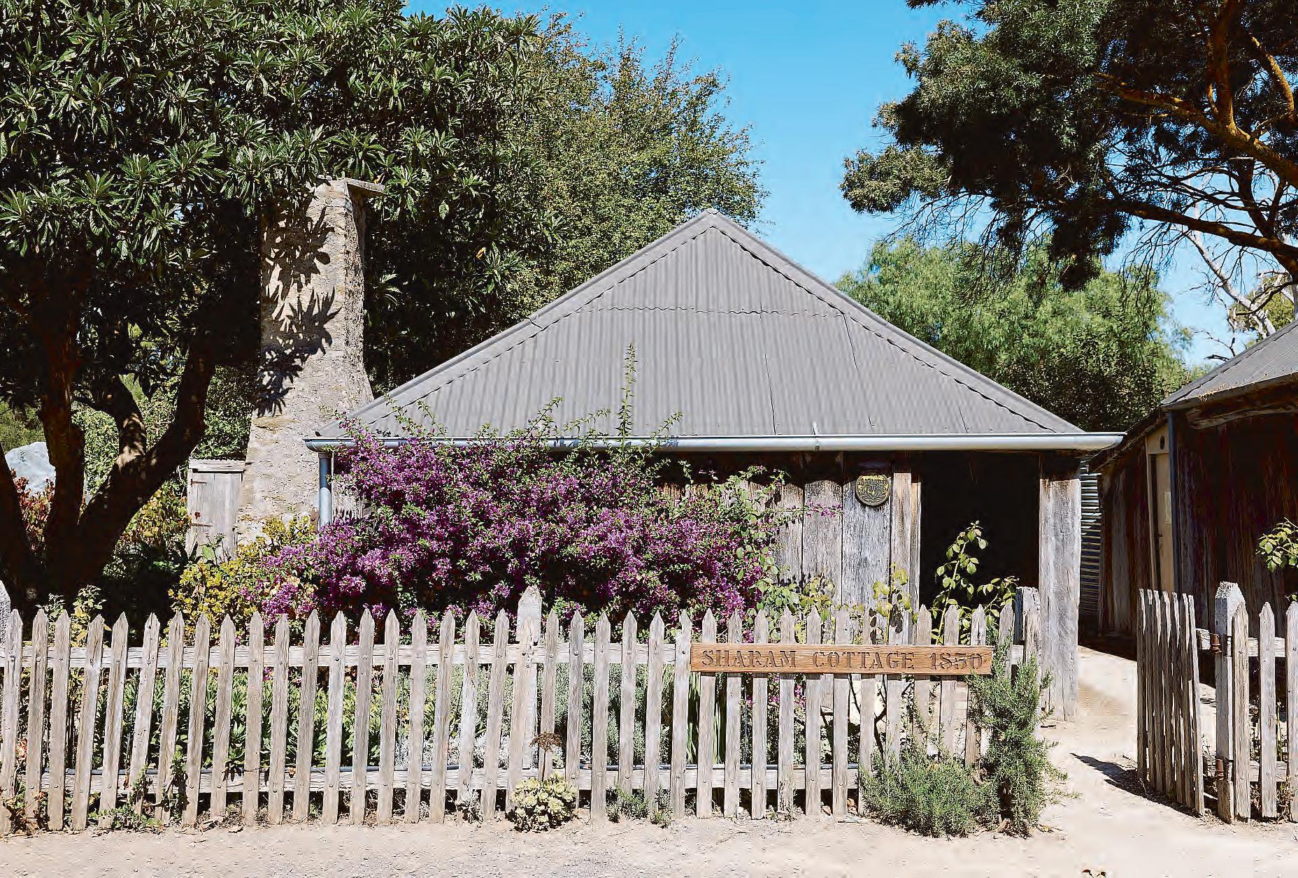
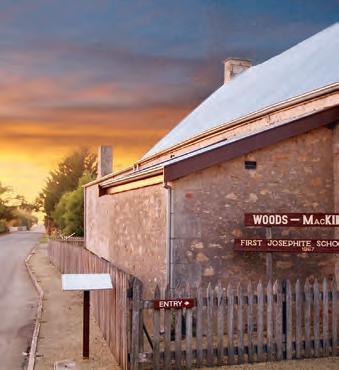
Scottish born Alexander Cameron and a pastoral pioneer who squatted in the area in 1845, formally founded Penola as a private township in 1850. He invited Mary MacKillop to Penola as governess to his children. She co-founded the religious order, The Sisters of St Joseph, with local priest and scientist Julian Tenison Woods.Cameron also invited Christopher Sharam to Penola,
as his bootmaker. Sharam built his slab cottage in Petticoat Lane in 1850. Another prominent figure in Penola’s history was Scottish born John Riddoch, who settled in the area in 1861. His crowning achievement was the establishment, in 1890, of the Penola Fruit Colony, which became known as Coonawarra in 1897.Use the SA Heritage mobile app to explore the history of the buildings in Penola.
Penola.
What’s in PENOLA
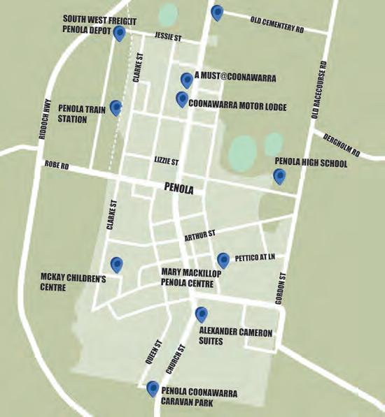
John Riddoch Centre
Discover the fascinating history and former famous residents of the region when visiting the John Riddoch Centre. This multifaceted centre incorporates:
• The Penola Visitor Information Centre – with a wide range of brochures, maps and souvenirs.
• The Local History Room –housing an extensive collection of records.
• The Wattle Range Council
Office – serving the community.
• Local History Display – featuring an overview of agricultural, economic and social history.
• The John Shaw Neilson Acquisitive Art Gallery - displays change regularly.
■ Location: 27 Arthur Street, Penola.
■ Hours: Open daily 9am5pm and 10am-4pm on weekends and public holidays
■ Contact: 08 8737 2855.
■ Website: www.wattlerange.
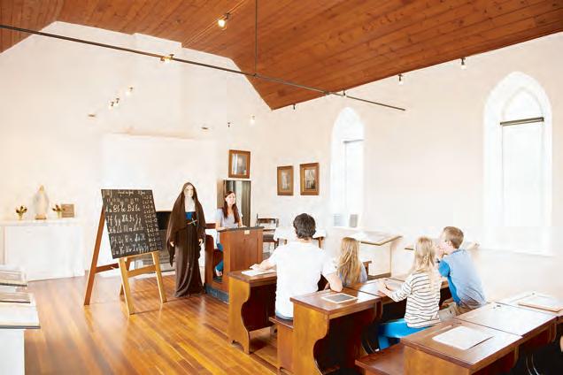
Mary Mackillop Penola Centre
The centre features fascinating exhibitions exploring the lives of Mary MacKillop and Father Julian Tenison Woods, as well as a range of books, souvenirs and memorabilia. It was in Penola in 1866 that Mary MacKillop, an outstanding young teacher, and Julian Tenison Woods, a priest and brilliant scientist, founded the uniquely Australian Sisters
of St Joseph. They provided a free Catholic education, initially for the isolated bush children of Penola.
■ Location: Corner of Portland Street and Petticoat Lane, Penola.
■ Hours:7 days from 10am – 4pm daily, closed on Good Friday and Christmas Day.
■ Contact: 08 8737 2092
■ Website: www. mackilloppenola.org.au
+ FULL DAY AVAILABLE! FROM $59! PREMIUM EBIKE HIRE IN WINE COUNTRY
sa.g ov.au
Penola Coonawarra eBike Hire. (South Australian Tourism Commission)
More of PENOLA
Penola Telegraph Station and Post Office
Officially opened on August 13, 1860, the Telegraph Station was built by contractor George Pannell following a petition signed by fifty people from Penola and the district.
The first station master was Terrance A Woods. The post office was built in 1876, covering both letters and telegrams, then in 1908, a telephone was added. The Post Office was replaced with a new one in 1963.
Penola Conservation Park
Approximately 10 kilometres west of Penola off the Robe Road, a signposted interpretative walk guides visitors further into the park, with picnic areas and bird viewing.
Penola War Memorial Park
Located on Church Street. A popular lunch spot. Tourist information map, barbecue facilities, playground, public
toilets, skate park, basketball ring and public swimming pool open November to March.
Petticoat Lane
Read the story of Christopher Sharam, his wife, nine sons and six daughters at the interpretive site behind the original slab hut cottage and venture along the lane to the Old Rectory, Gammon and Wilson cottages as this intriguing heritage site vividly portrays the pioneer living standards of the 1890s.Donations are gratefully accepted by the Penola Branch of the National Trust.
PENOLA: Penola’s Gateway to Kanawinka Geopark (Supplied/Holly Taylor)
Petticoat Lane
Coonawarra Park
Situated on Memorial Drive in Coonawarra, commemorates the beginnings of the fruit colony with plaques, sculptures, petanque piste, toilets, barbecue facilities, tables and seating.
Cameron Park
■ Located on Neilson Street, off Davis Crescent. BMX track.
Rose Gardens
Adjacent to the hospital, south entrance to the town.
Yallum Park Homestead
Considered “Living History”, this impressive two storey Victorian Mansion was built in 1880. Antique furnishings throughout (some original) and many features including a magnificent stained glass window and English wallpapers allow you to step back in time and experience a bygone era. Contact the Penola Visitor Information Centre for guided tour times.
Royal Oak Hotel
Alexander Cameron opened the Royal Oak Hotel in 1848 with one of the earliest hotel licences in South Australia. Cameron obtained a freehold title to 80 acres around his hotel on April 4 1850, and a year later, he transferred his licence to John Bowden, with the hotel becoming a hub for racing. In September
1880 Joseph Darwent became the licensee. It now serves as a modern hotel, while still honouring its historic roots.
■ Location: 31 Church Street, Penola.
Walk with History and Talking App
A heritage walk, marked by posts with heritage badges and green arrows, takes you past the major places of historic interest in the township.
A brochure for this is available at the Penola Visitor Information Centre.
Visitors can enjoy exploring Penola’s art galleries, specialty shops and restaurants, many of which are open seven days a week. The “Walk with History” is suitable for all ages and takes around an hour and a half at a leisurely pace to complete.
Cars can be parked at the John Riddoch Centre, formerly the Mechanics Institute, which now houses the Local History Collection and acclaimed display. It is ideally designed as a walk. Many take advantage of the set path and cycle it or even in the colder weather do it as a drive and view the sights from the comfort of their vehicle. This informative,
self-guided walk provides an opportunity to view architecture, historical sights and find out about the notable inhabitants of the past. The walk winds its way through the heritage precincts, streets and laneways of Penola and there is simply no better way to explore the rich historical and cultural tapestry of the town.
LARGE 4 BEDROOM HOUSE
Yallum Park.
Inside Yallum Park.
Slab Homestead - The cottage Mary lived in when she first moved to Penola in 1860. Previously located on Old Penola Station. Portland Street, Penola.
Woods MacKillop Schoolhouse - This purpose-built school building was completed in
May 1867 after Mary MacKillop’s classes outgrew a small cottage, St Joseph’s Church and a stable. Corner of Petticoat Lane and Portland Street, Penola.
Mary MacKillop Penola Centre - The centre features fascinating exhibitions exploring the lives of Mary MacKillop and
Father Julian Tenison Woods, as well as a range of books, souvenirs and memorabilia. Portland Street, Penola.
Mary MacKillop Memorial Park - A stable formerly located on the site housed Mary’s first school and marked the Josephite order’s beginning. There is an automated talk at the site. Corner Bowden Street and Queen Street, Penola.
working in Penola as a governess. Father Woods could often be found preparing sermons and celebrating mass beneath the shelter of the towering River Red Gum. Riddoch Highway, Glenroy (21km north of Penola)
St Joseph’s Church - Located on the original site of the first St Joseph’s church, completed by Father Woods in March, 1859. Portland Street, Penola.
Award winning restaurants – Treat yourself to a meal for a taste sensation of local produce matched with local wines.
Father Woods Park - A remarkable park located opposite Father Woods Tree containing timber sculptures of Father Julian Tenison Woods and Mary MacKillop, along with interpretive signage. Riddoch Highway, Glenroy (21kms north of Penola)
Father Woods Tree - Mary MacKillop first met Father Julian Tenison Woods while
Art Galleries – Penola is proud of its local artists with several local galleries as well as a thriving arts festival held each May.
Woods MacKillop Schoolhouse.
Aussie Camino (Liam Mills)
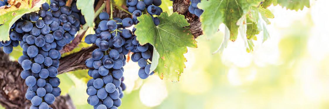
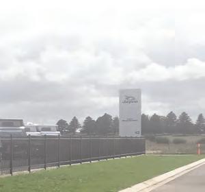
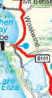
What’s in MOUNT BENSON
Mount Benson produces top drops.
MOUNT Benson is a unique coastal geographical indication situated around 300 kilometres from Adelaide and halfway between the historic townships of Kingston SE and Robe in the south east of South Australia.
As part of the greater Limestone Coast wine region, Mount Benson is cousin to other well-known winegrowing regions including Coonawarra, Padthaway, Wrattonbully, Penola, Mount Gambier and Robe. The region’s first grapes were planted in the 1980s by local farmers well attuned to Mount Benson’s unique and rugged climatic conditions. These grapes would later make way for the
region’s own style of delicate, cool climate, maritime-influenced wines which have already begun to make waves within a very competitive Australian wine industry. Pass through the region and you begin to appreciate the lifestyle that the people lead here, grazing sheep, tending to crops and fishing for crayfish, intermittently broken up with a trip to the beach to relax the mind and soul. This is the sense of
place we aim to convey in every bottle of wine they produce.
Mount Benson Wines
Their modest vineyard produces all the grapes for their unique bespoke wines that reflect the terroir of marvellous coastal environment and relaxed seaside lifestyle. If you’re looking for authentic South Australian
winemaking, then you’ll find it here at this idyllic estate
■ Location: 329 Wrights Bay Road, Mount Benson, SA 5275
■ Phone: 0417 996 796 or 0418 992 715
■ Email: sales@ mountbensonestate.com.
au
■ Website: www. mountbensonestate.com. au
329 Wrights Bay Road, Mount Benson SA 5275
Cellar Door Single Vineyard Wines - Sales & Tastings Gallery featuring Local & Australian Artists Coffee - Tasting Platters - Flammekueche
90 Seat Venue In An Operational Vineyard
Weddings - Receptions - Functions - Conferences - Special Occasions
Summer Opening 10AM to 6PM Most Days
Winter Opening 11AM to 4PM Most Days (Closed July)
Other times By Appointment
Brian 0417 996 796
Carolyn 0418 992 715 brian@mountbensonestate.com
www.mountbensonestate.com.au
What’s in ROBE
JUST 350 kilometres south east of Adelaide on the shores of Guichen Bay, Robe is a charming seaside town with a colourful and interesting history that goes back to the 1840s.
The spectacular expanse of beaches around the town means you’ll always find a private spot to enjoy a variety of water sports or a spot of fishing.
Activities include Tiger Moth joy flights, boating, fishing, 4WDing, sailing, surfing, swimming (beach), kayaking, SUPing, water skiing, kite surfing, bowls, golf, tennis, walking, bike riding and more.
Annual Events
■ Health Harmony & Happiness FestivalJanuary & June
■ Robe Run - February
■ Southern Ports Golf Tournament - February/ March
■ Easter Surf Competition - Easter weekend
Long Beach. (Offroad Images)
■ Robe Primary School Easter Fete - Easter Saturday
■ Sandmasters - August
■ Blessing of the FleetOctober
■ Robe Beer FestivalOctober (bi-annually)
■ Southern Ocean Art Prize - October/November
■ Robe Village Classic Golf Week of EventsNovember
■ Christmas Parade -
December
■ New Years Eve Fireworks Display - 31 December
■ See the Robe Visitor Infor mation Centre for more details.
Robe Visitor Information Centre and Public Library
Find out more about this quaint village and all the things to see and do when you visit
the friendly staff at the visitor information centre.
■ Location: 18 Mundy Terrace, Robe
■ Hours: Open MondayFriday 9am-5pm; Saturday and Sunday 10am-4pm; Public Holidays 10am1pm (hours vary in low season). Open everyday except Christmas Day.
■ Contact: (08) 8768 2465
The Obelisk. (Benjamin Goode)
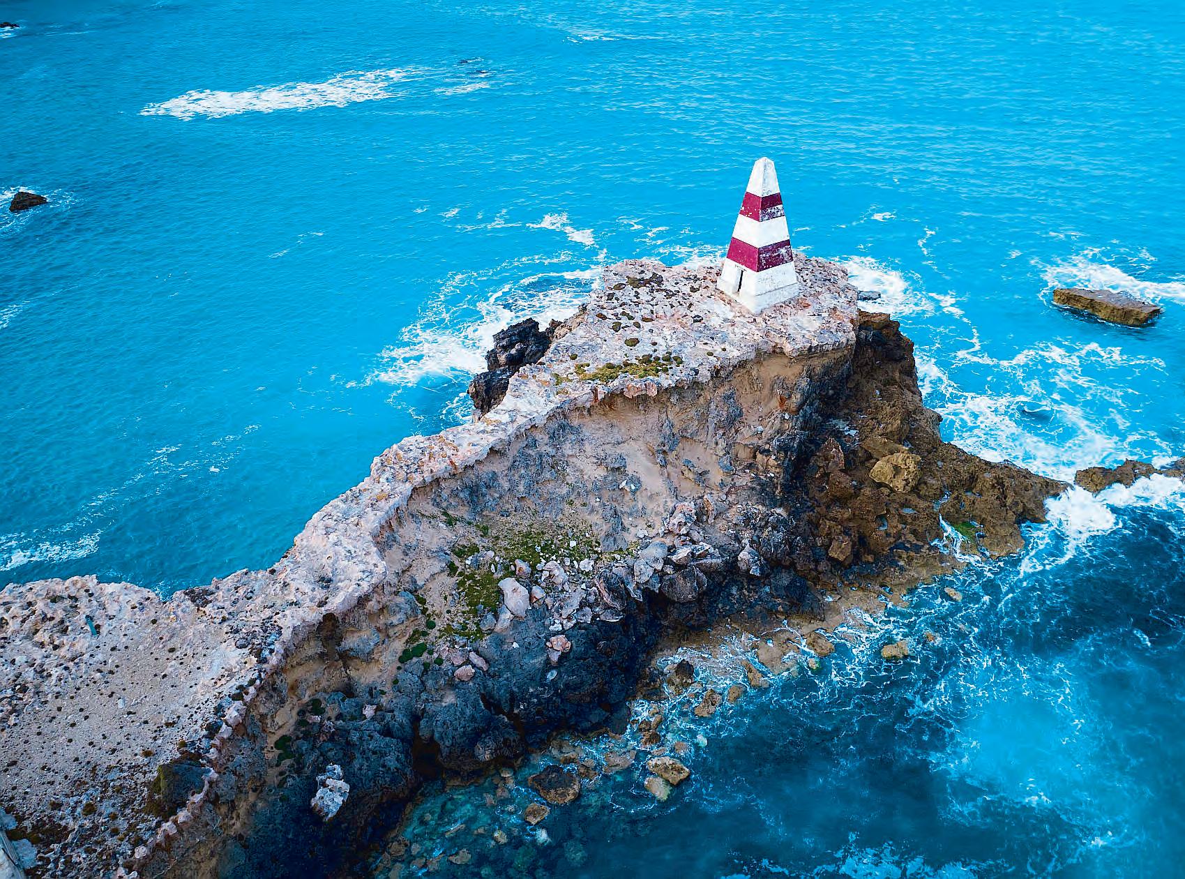
The Obelisk
The Robe Obelisk stands proudly on the point of Cape Dombey and was constructed by local builder George Shivas at a cost of £230 in 1855.
It was used to navigate the entrance to Guichen Bay and to store rocket lifesaving equipment.
The firing of rockets, carrying baskets to distressed ships to bring passengers ashore, saved many lives.
In 1862 the Obelisk was painted in its iconic red and white bands, due to complaints by the Captains that the then white Obelisk was difficult to differentiate from Long Beach’s white sand dunes.
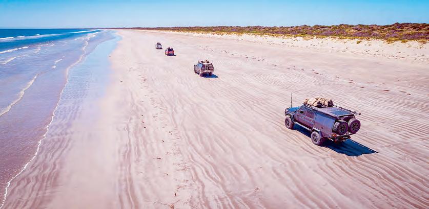
Long Beach
Long Beach was recently named as one of Australia’s top beaches for its pristine shores and gentle waves.
It’s popularity is in part due
to the fact it is one of the few beaches where you are able to drive your car onto the sand.
It is a great spot for swimming and surfing, or a game of beach cricket.
Lake Fellmongery
Set aside for water sports the lake has a good boat ramp and a small beach with barbecue, picnic and toilet facilities.
Lake Butler Marina
Lake Butler was once a natural lake, where fishermen moored their boats in Guichen Bay in the summer and pulled them up over the dunes to moor in Lake Butler during the winter. A channel to the sea was cut in 1964, making Lake Butler available for safe mooring all year round. The District Council of Robe is responsible for the care and control of Lake Butler Marina.
The Marina has both recreational and commercial berths. Diesel bowsers can be accessed 24 hours a day, by using a credit/debit card
with a pin code attached. A boat ramp ticket is required to use the Lake Butler Marina Boat Ramp.
ROBE: Long Beach, Robe (South Australian Tourism Commission)
More of ROBE
Robe Lighthouse
Established in 1973, the Robe Lighthouse is an automated unmanned lighthouse, built to replace the Cape Jaffa Lighthouse on Margaret Brock Reef which was converted to automatic operation after 100 years of manual service. The Cape Jaffa Lighthouse was eventually moved to Kingston as a museum.
The Robe Lighthouse is a starshaped concrete tower which was built in 1972. It is 3.5 metres wide at the bottom, and 5 metres wide at the top.
Surfing and Kite Surfing
There are some great surfing and kite surfing locations along the Robe coastline. For more information on surfing schools and hot spots, contact the Robe Visitor Information Centre. The local surf shop is a good source for inside information.
Historic Caledonian Inn
The Caledonian Inn at Robe was built in 1859 by fairly well-
to-do Scotsman, Peter McQueen. The building has many early historic associations of interest. Ships’ doors and some of the timbers used in its construction came from the Dutch ship “Koning Willem De Tweede” and the “Phaeton”, both of which were wrecked in Guichen Bay (named by the French explorer, Captain Nicholas Baudin, in 1802, just prior to his meeting with Matthew Flinders at Encounter Bay).
Royal Circus and Customs House
The Royal Circus was used as a turning circle for the bullocks transporting cargo to and from the port of Robe. The first survey line was struck with the theodolite from the Royal Circus with the streets of Robe Town radiating from that point.
Customs House is a historic building circa 1863 which houses a nautical collection of items relating to Robe’s colourful early history including tales of shipwrecks, smuggling and immigrants.
Location: Royal Circus, Robe, SA
Hours: Opening hours varyvisit the Robe Visitor Information Centre for more details.
Old Gaol Ruins
Robe was the site of the region’s first gaol.
It was opened in 1861 and consisted of a substantial stone building with four holding cells, a receiving yard and a keeper’s residence.
The facility was closed in 1870 and reopened two years later.
It was used as a functioning jail until 1881, when it was closed as there were not enough prisoners to justify keeping it open.
Most of the gaol was demolished and used as road rubble, but restoration work was completed to restore the lower part of the walls.
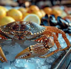
Fishing
Robe has a great variety of fishing spots. You can enjoy rock, beach, harbour, lake or marina fishing and if you have a boat,
offshore fishing. Whichever option suits you, there is a range of species to catch. Recreational fishing licences are not required in South Australia (except for crayfish).
Dept. Fisheries Kingston (08) 8767 2358.
Grab your tide charts from the Robe Visitor Information Centre.
ROBE: Robe Obelisk. (Elisabeth Champion)
ROBE: Robe Beach. (South Australian Tourism Commission)
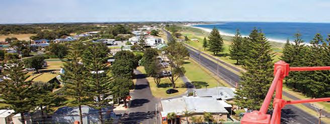
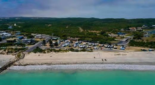
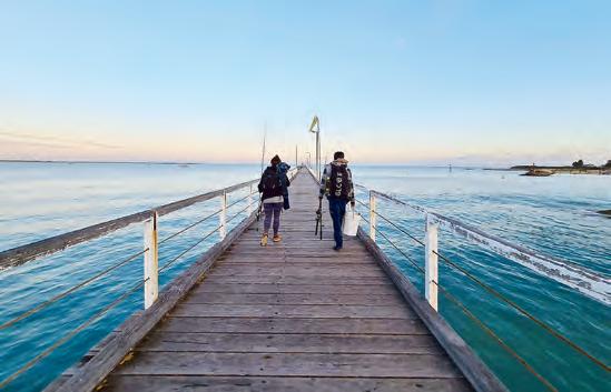
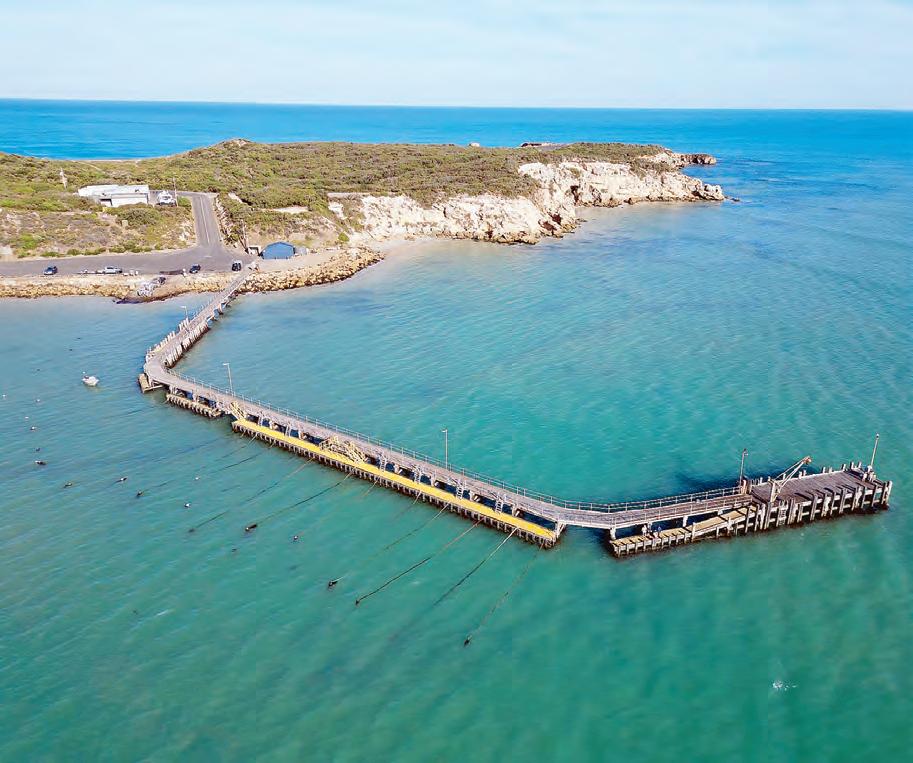
What’s in BEACHPORT
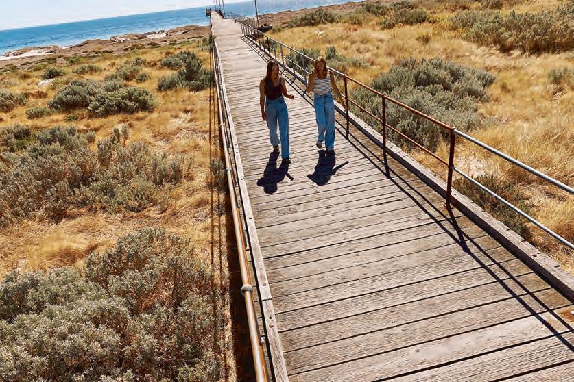
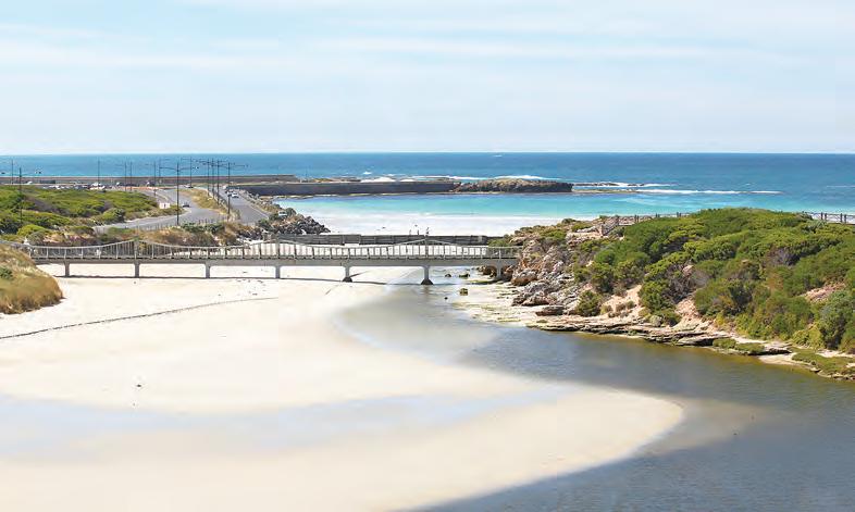
BEACHPORT’S quiet atmosphere and unspoiled beauty remains a constant pleasure for visitors and locals alike with sweeping sandy beaches on one side and rugged coastal scenery on the other. Boasting one of longest jetties in South Australia, Beachport is a popular spot for anglers keen to snare a tasty catch.
The town was first settled as a whaling station in the 1830s and remains a safe harbour for crayfishing boats. Beachport offers a location for a range of water sports such as boating, surfing, sailing, wind and kite surfing, diving, swimming, and kayaking on Rivoli Bay.
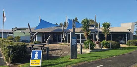
Beachport Visitor Information Centre
Discover everything there is to know and do in Beachport. Call in and collect a 4WD or walking trail brochure, or information on scenic drives, events, accommodation, eateries, and nearby attractions.
Also on offer are souvenirs, maps, free Wi-Fi as well as council services and a small onsite library offers books for locals and tourists.
■ Location: Millicent Road
■ Hours: Open Monday to Friday 8.30am-5pm, Saturday and Sunday & Public holidays 10am4pm.Winter Weekend Hours 10-1pm & Closed Christmas day
■ Contact: (08) 8735 8029
The Jetty
One of the longest jetties in South Australia, Beachport jetty reaches 772 metres out into the waters of Rivoli Bay. The jetty has been a part of the Beachport landscape for more than 120 years. It is just the place for anglers keen to snare Squid, Shark, Snapper, Mulloway and Whiting, to take a leisurely walk, have a swim or welcome the professional fishing fleet. Beachport is home to more than 20 professional cray fishing boats and some longline vessels.
Scenic Drive.
Lake George
Part of the Beachport Conservation Park the dense paperbarks protect the shores of Lake George. You can camp under the trees in Summer; however, the area may be too wet in Winter. Campsites can be booked online at - https:// www.parks.sa.gov.au/parks/ beachport-conservation-park/ booking/71531 or at the local Visitor Information Centre. At Five Mile Drift a large sand dune has drifted into Lake George creating a lovely white sandy beach.
Customs House
Before Federation, this tiny office collected customs fees. After Federation the building was used as a railway office and later as a museum for several years by the late Mr Tom McCourt who restored the building and maintained it for many years. For some time, it was leased from the District Council of Beachport by the ANZ Bank, as their Beachport Agency and held
claim to being the smallest bank in Australia. The agency closed in 1997 and the building was renovated and restored to show a working office as it was in the late 19th century. Location: Corner of Millicent Road and Railway Terrace.
Durant’s Lookout
Located on South West Terrace, Durant’s Lookout
provides spectacular sunset views of the township of Beachport, Rivoli Bay, Beachport Conservation Park and the Southern Ocean. The Rivoli Bay and Beachport Lions Club members built the raised platform on the site and it was named after the late Mr Doug Durant, a longtime resident of Beachport (car access only).
Woakwine Cutting
Said to be Australia’s biggest one-man engineering feat, the cutting was excavated to drain land behind the Woakwine Range, which is located approximately 12kms from Beachport. The cutting has a viewing platform, information boards and machinery on display. Free entry.
Bowman Scenic Drive
View the spectacular scenery of the Bowman Scenic Drive extending from the lighthouse along the rugged coast of the Southern Ocean. Take a leisurely walk down to the beach and wander out onto rocky outcrops at the Salmon Hole and Post Office Rock or view the sea from one of the many lookouts.
Centennial Park
Centrally located in Beachport, landscaped gardens surround a tranquil lagoon skirted by a walking trail and artwork. The area also provides play equipment, sheltered BBQ and picnic facilities, toilets, tennis courts, basketball half court, and a small skateboarding facility. Free entry.
Beachport playground.
Sea Urchins.
Penguin Island
Conservation Park
Drive to the seaside end of Foster Street and you can walk past the lighthouse to a lookout of Penguin Island. The lighthouse, which was built in 1878, used to be on Penguin Island but was moved to the mainland in 1960. Penguin Island is characterised by 10-15 metre cliffs and is the breeding ground for silver gulls and crested terns.
Memorial Lookout and Surf Beach
Memorial Lookout located at the Surf Beach, is dedicated to the memory of the first deaths on Australian soil due to enemy action. Two servicemen were killed dismantling a mine during WW2.
The lookout provides panoramic views across Rivoli Bay and Lake George. This beach is excellent for surfing. A parking area, toilets and cold shower are provided.
Woolley Lake
Woolley Lake is a small saltwater lagoon and is a favourite haunt for many small birds and wombats. A pleasant 45-minute walk skirts the lake.
Name plates have been provided alongside many of the plants. There is a short climb to a lookout, which provides views over Lake George, the coast and the Woakwine Range. Free entry.
Pool of Siloam
This unique salt lake is natural to Beachport with its grassy banks, small pier and a salt content supposedly seven times saltier than the sea. With the high salt concentration in the water, swimming is very easy as the water is extremely buoyant. Cold shower facilities, public toilets and sheltered picnic area make this an ideal spot for the family to relax. Located off McCourt Street.
Beachport Old Wool and Grain Store Museum
Built in 1879 as a shipping house and warehouse, the museum features displays about the local fishing industry, whaling, agricultural history and the Boandik people. A blacksmith shop is set up showing working conditions and a 1920s school room is complete with teacher and two student mannequins and books and writing materials over the ages, photographs and blackboard exercises. Several upstairs rooms have been set up as they were when they were used for accommodation in the early 1900s as a kitchen, music and dining rooms and bedrooms. Upstairs displays include cooking implements and clothing.
The Lobster PotBeachport
The Limestone Coast Fishermen’s Co-operative (LCFC) is proudly owned and operated by local South East
We look forward to welcoming you.
RIGHT: Pool of Siloam. (Supplied)
Jetty Fishing. (Supplied)
The small coastal township of Southend was the first seaport in the Limestone Coast.
First known as Grey town (named after Governor Grey) in 1846, between 1875 to 1879 it was known as Rivoli Bay South after which it was changed back to Grey town until 1971 when it was officially named Southend. Southend is now a working Cray fishing port and a holiday village, the ocean remains the focus of life here, with plenty of safe swimming beaches, good surf and popular 4WD spots. Southend is located around 27 kilometres north of Millicent and 20km south of Beachport on the Southern Ports Highway.
Southend offers a location for a range of water sports such as boating, surfing, sailing, wind and kite surfing, diving, swimming, and kayaking on Rivoli Bay.
You will need to supply your own gear. Fishing from the jetty, the beach or rocks or nature-based activities such as bird watching, camping and bushwalking.
Be sure to view the Geltwood Anchor Memorial at the lookout on Cape Buffon Drive, this lies as
Southend Jetty.
a memorial to all lives that have been lost there.
Canunda National Park
The Canunda National Park stretches for approximately 9300 hectares from Carpenter Rocks to Southend. The park offers well sign posted four-wheel drive tracks where you can enjoy scenic views, discover Aboriginal shell middens, and try your hand at beach fishing. Vehicles must stay on the designated track. Detailed maps with numbered posts and GPS points for Canunda National Park and are available from Millicent and Beachport Visitor Information Centres. All other National Park enquiries, call their office (08) 8735 6053
Walking trails
Cape Buffon Walking Trail 2 kilometres - This loop walk highlights how the forces of wind and waves have shaped the limestone cliffs, sea stacks, reef platforms, and vegetation along the coast. Cape Buffon shows the effects of wind and water on layers of soft rock under harder rock with undercut cliffs and eroding edges.
The Willichum Lookout Trail 1.6 kilometres - Willichum is the Boandik Aboriginal word for the ‘southern end’ of Rivoli Bay. Splendid panoramic views of the bay, the national park, and rocky cliffs reward walkers who reach the viewing platform.
The dune on which the lookout is situated was once drifting sand pushed up by relentless south-easterly winds. Plant life has stabilised the area and formed a layer of soil.
The Seaview Walking Trail 12 kilometres - The seaview hike showcases coastal features such as spectacular rock formations, sandy beaches, seabirds, and a myriad of plants, while offering stunning scenic views of the coastal environment.
The blue-green Coastal Daisy Bush Olearia axillaris features commonly along the walk. Evidence of wombats and Echidnas in the form of burrows and scratching are often visible.
Maps available at the Visitor Information Centres.
NANGWARRY What’s in
NANGWARRY is situated 20kms south of Penola on the Riddoch Highway. Nangwarry is closest to Penola, and is 49kms east of Millicent via Kalangadoo and 82kms south east of Beachport via Millicent. The main industry in Nangwarry is forestry (Radiata pine).
In 1939 a power station was erected to supply a timber mill, which was built in 1940.
The town grew out of a demand for housing for the labourers who travelled to the area for work, many in the forest. The government established homes, schools and shops.
Migrants made up the biggest percentage of the population in what was to become a multicultural community.
RIGHT: Nangwarry Forestry and Logging Museum
Nangwarry Forestry and Logging Museum
The static display is the only one in the region and is strengthened by artefacts such as an original fire truck, forest fire truck, crane truck, single men’s quarters and a variety of forestry equipment. Entry fee applies.
7 days. To gain entry, call Ras 0409 322 507 or Chris 0438 397 002 and they will open up for you any time. Welcomes advanced bookings for individuals, school groups and coach tours.
Other additions that make this unique exhibition a ‘must see’ ‘must do’ include an array of mill machinery and artefacts, historical maps and priceless photographs from a bygone era
MILLICENT What’s in
MILLICENT: Millicent is home to colourful murals
There is a great feeling of parkland and open green space around the town.
Proclaimed in 1870, it is named after Millecent Glen, wife of one of the early pioneers and daughter of the first Anglican Bishop of Adelaide.
Millicent moved into the 20th century as a rural centre and its identity developed when pine plantations were planted in the ranges near the township.
The town is the western most
point of the Volcanoes Discovery Trail, which runs from Millicent into Victoria. Mount Muirhead, the large hill that dominates Millicent, is one of the oldest volcanoes in the region. Mount Burr, Mount McIntyre and The Bluff are other features. Millicent has dramatically expanded artworks throughout the town in recent years and provide a colourful canvas throughout the pretty township. A great central base to stay while visiting the
Limestone Coast.
Visitor Information Centre
A great place to start is to drop into the Millicent Visitor Information Centre which houses an excellent gallery featuring art exhibitions, local timber art, local crafts and the entrance to the well regarded Millicent National Trust Museum. The friendly staff will answer all your questions
about attractions in and around Millicent.
There is a range of locally made souvenirs, maps, books, gifts and local produce.
■ Location: 1 Mount Gambier Road, Millicent,
■ Hours: 9am to 5pm Monday to Friday and 10am to 4pm on weekends
■ Contact: 08 8733 0904
■ Website: www. wattlerange.sa.gov.au
Millicent Museum.
MILLICENT serves as a major commercial hub for the coastal region as well as an important rural centre for the surrounding farms and timber industry.
Millicent Information Centre.
M ll M
National Trust Museum
The Millicent National Trust Museum, located on Mount Gambier Road, is considered one of the best rural museums in South Australia. It has been organised thematically with separate sections on the history of Millicent, artefacts from the Victorian era and Aboriginal rock engravings. Major displays include more than 70 restored horsedrawn buggies, carriages, farm wagons, a fully equipped blacksmith shop and saddle room. Farm machinery on display is still in working order and includes steam and fuel
engines. The Shipwreck Room houses the anchor from the ill-fated “Geltwood” along with other items that have spent over 100 years under the sea. There are two rooms dedicated to indigenous history including world class sculptures and George French Angus drawings of the Aboriginal people of this region. A T-class locomotive sits along-side a recreation of a country railway station. The centrepiece of the museum is the town’s original primary school which dates from 1873, while the most recent display is a multimedia presentation of the South East drainage system.
The museum is custodian to the Helen Hughes Costume Collection which includes items belonging to anthropologist Daisy Bates, a ballgown belonging to Lady Bonython, riding outfit of Sir Richard Hawker and lady’s riding outfit of the Mortlocks of Martindale Hall. The collection
is extensive and the display is regularly changed.
The museum is open from 9am - 5pm weekdays and weekends from 10am to 4pm. Last entry to the museum is one hour before closing. Access is through the Millicent Visitor Information Centre.
Millicent Gallery
South Australia’s first “A” class gallery outside of metropolitan Adelaide, adjoins the Library and Civic and Arts Centre. The Millicent Gallery has been showing a diversity of exhibitions since it opened in 1990. Renovated in 2004, the Gallery has been extended to allow more room for exhibitions. As well as local, regional, national, solo and group shows, exhibitions to coincide with events such as Millicent High School’s “Art on Display” during Senior Examinations.
■ Location: Ridge Terrace, Millicent
■ Hours: Monday - closed Tues, Wed, Thurs9am-5.30pm Friday - 9am-7pm Sat - 8.30am - 12.30pm Sun - 2pm-4pm when an exhibition is on only.
■ Contact: (08) 8733 0903
Towers History Room
The Towers History Room within the library complex was
built as a result of a bequest from the late Bruce Towers. Bruce was a well-known and respected historian, who lived for his love of community and history, particularly the history of his beloved Millicent area. Bruce dedicated much of his
You will always find an interesting exhibition at the Millicent Gallery to enjoy! Make it a place to visit. Exhibitions of local, regional and statewide artists.
Explore the local history collection and trace the past. Relax and enjoy, something for all. Call into the Library, free Wi-Fi and internet, access your emails, do your business. Borrow from our extensive collection and return anywhere in SA through the one card.
Ridge Terrace, Millicent | Phone: 08 8733 0903
time to writing and speaking about the history of Millicent. Bruce’s bequest to the Millicent Library enabled the Towers History Room to be built and the Millicent Gallery extended. The plans were officially unveiled in 2000 when Wattle Range Council Mayor Don Ferguson hosted a mayoral reception at the library and announced plans for the Bruce Towers History Centre, which now houses an extensive collection of furniture and local history items owned by Mr Towers, which was bequeathed to the library in 2002. Bruce was born into a pioneering Millicent family in 1913 and lived in the area all his life and has been active in a range of community
organisations. He wrote the booklet “Early Millicent,” and it was published by the local branch of the National Trust in 1974. Other writings have been published in “Tales of Early Canunda Settlers” and in the Royal Geographical Society of South Australia.
Situated on the outskirts of Millicent, on the MillicentBeachport Road, is Lake McIntyre, a native wildlife and vegetation reserve that has been created in an old quarry.
The lake is a bird sanctuary with a year-round water supply fed from a natural underground spring. A number of purposebuilt bird hides and viewing areas offer visitors the opportunity to catch a glimpse of the Freckled Duck or Great Crested Grebe.
The walking trail is 1.3km long, takes about 20 minutes, includes a 100-metre boardwalk,
and is graded moderate. There are free barbecues, picnic areas, and amenities. The park is open daily until dusk.
Millicent Swimming Lake
Swimmers and bathers have flocked to Millicent’s unique man-made swimming lake every summer for the past 50 years. The town prides itself on keeping the lake and garden-like surrounds in pristine condition. There is an artificial beach area with shade sails, and this is popular with young families. There are plenty of shady places, lawned areas, car
OTHER MUSEUM FEATURES:
Hiking in Canunda National Park.
parks and electronic BBQs at the Swimming Lake. No admission charges. The lake is drained each April and refilled the following November.
Canunda National Park
The Canunda National Park is a highly significant coastal park 40 kilometres long, stretching from Southend in the north to Carpenter Rocks in the south. The park features massive sand dune systems, which are forever changing, and scenic rugged cliffs and cliff tops. There is also a large expanse of
open beach. Walking trails and lookouts have been provided throughout the park. Oil Rig Square, Coola Out Station, Cape Buffon, and Boozy Gully are all accessible with 2-wheel drive vehicles. There is four-wheel drive access throughout the park along marked tracks. Camping is permitted in a number of areas throughout the park. Entry to the park is free, however fees apply for camping. Book before you go at www. parks.sa.gov.au. Enquire at the Millicent Visitor Information Centre for maps. Accessible at all times.
• Local Indigenous culture • Millicent & District history • Shipwreck disasters and genuine artefacts
• Interactive drainage display • Machinery and stationary engines used in farming pursuits
• Lifestyle of bygone eras
• Incorporating the South Australian Horse Drawn Vehicle and Costume Collection • Railway Train Display
Woakwine Range
The Woakwine Range is located on the Limestone Coast, one of Australia’s most prominent wind farming regions. The coastal area benefits from consistently strong winds coming off the Southern Ocean – ideal conditions for wind energy generation. The wind farms on the Woakwine Range make up 18 per cent of the state’s wind capacity. The 135 spectacular wind turbines in Canunda (23) and Lake Bonney 1, 2 & 3 (112) are located about 2km from the eastern shore of Lake Bonney SE, near Millicent and Tantanoola. The windfarms have a combined installed capacity of 325 MW and generate just over 850 gigawatt hours (GWh) of electricity, which is equivalent to supplying power to 120,000 homes per year. The towers of the Lake Bonney wind turbines were manufactured by Keppel Prince at Portland, the wind farm transformers from Wilson Transformers and cabling from Nexans Olex in Australia. Work on the Lake Bonney wind farm commenced in 1989, the Development Approval was granted in June 1999 by Wattle
Range Council.The Canunda and Lake Bonney wind farms were opened 31 March 2005. The wind turbines are connected by an underground 33 kilovolt (KV) electricity cable with the electric substation, where the voltage is steeped up to 132KV volts to be submitted into the Mayurra substation and then onto the grid. It takes a wind turbine three to six months to produce
the amount of energy that goes into its manufacture, installation, operation maintenance and decommissioning after its 25-year lifetime.
Kanawinka Geopark
Kanawinka Geopark Millicent is the western gateway to the Kanawinka Geopark, which
extends from Millicent almost to Melbourne.Mount Muirhead, the large hill that dominates Millicent, is one of the oldest volcanoes in this volcanic region. Mount Burr, Mount McIntyre and The Bluff are other features. Walking trails and lookouts have been developed at Lake Leake and Lake Edward and provide visitors with panoramic views of the surrounding area.
Mount Muirhead Western Gateway to the Kanawinka Geopark (Supplied/WRC)
Walking Trails
Walking trail brochures are available at the Millicent Visitor Information Centre. Some of the spectacular and exciting walks that Millicent has to offer are:
History and Art Trail Through Millicent (1km, 45min, moderate): Enjoy a short stroll through Millicent’s streets and see our historic buildings, beautiful town gardens and artist street murals and installations. Coola Outstation Historical Hike (8.5km, located 16 km from Millicent, 45min, moderate): This walking trail loop passes coastal vegetation, early farm machinery, wetlands (via a boardwalk) and the ruins of Coola Outstation to the shores of Lake Bonney. Along the way, splendid views of the lake, dunes and farm lands are captured.
Memorial Gardens and Rotunda
A beautiful place to relax and take time out with the surrounding gardens. Playground, barbecue area and toilet facilities available at the nearby Jubilee Park.The Rotunda in the memorial gardens was built in 1911 and one of Millicent’s historical attractions.
Millicent Street Murals
Imagine Millicent Arts Group (IMAG) have assisted in funding and commissioning over nine public art projects for Millicent since 2017. The murals include a vibrant 26 metre long mushroom mural in Davenport Street and a large squid painted on the surface of the town’s skatepark. A large two storey ’water goddess’ dominates its surroundings in the town’s main street. These murals complement several older
The Domain playground
artworks which date back at least 20 years.
Playground in the ‘Domain’
The ‘Domain’ Mega Playground is a great place for families. Children will spend hours playing on this large colourful, safe and fun playground equipment with a nature playground located alongside. Parents can relax, unwind, and enjoy the surrounding gardens and nearby barbecues and picnic areas. Located on Ridge Terrace, next to the skatepark. While the free Road Safety Centre on fifth street is place where the little road warriors learn the art of safe navigation on two wheels.
Glowing mushrooms mural in Millicent
What’s in MOUNT GAMBIER
WELCOME to Mount Gambier – South Australia’s Volcanic Heartland
Located between Adelaide and Melbourne on one of Australia’s most scenic drives, Mount Gambier is where ancient stories come to life. Set in a dramatic landscape shaped by volcanoes, sinkholes, caves and crater lakes, this regional capital is a destination unlike any other.
Discover the iconic Blue Lake/Warwar, wander through sunken gardens and limestone caves, or dive into the region’s rich geology that draws scientists and adventurers from around the world. Beyond the natural wonders, Mount Gambier offers a vibrant city centre filled with cosy accommodation, a thriving food scene and a calendar of events –all year round.
For more information visit www.visitmountgambier.com.au
Start your adventure at the Mount Gambier Visitor Centre
Before you tour through caves,
gaze into the volcanic craters or meander through the laneways, make your first stop the Mount Gambier Visitor Centre, your gateway to the very best in the area. Let the friendly local team help you craft a personalised itinerary. With insider tips, fascinating local stories, and maps to guide you from iconic sights to your next adventure, they’ll make sure your time in Mount Gambier is unforgettable.
There are amenities onsite including toilets with disabled access and free bike hire.
■ Location: 35 Jubilee Highway East, Mount Gambier (look for the yellow ’i)
■ Hours: Open daily Monday to Friday 9am – 5pm, and 10am –4pm on weekends and public holidays. Closed Christmas Day.
RIGHT: Visitor Information Centre. (City of Mount Gambier/Meaghan Coles Photographer)
Blue Lake/Warwar. (City of Mount Gambier/TUWY Media)
The Riddoch Arts and Cultural Centre
The Riddoch Arts and Cultural Centre features an annual program of local artists and arts organisations, original in-house curated exhibitions, touring exhibitions from national and state entities galleries, as well as curated displays from the Riddoch Art Collection. The Riddoch also designs a program of interactive spaces and hosts workshops for all ages. The Riddoch holds the state’s most significant regional art collection with over 1500 objects, ranging from paintings and prints depicting the people and history of the Limestone Coast to a significant collection of Aboriginal and 20th Century Australian Art, featured in curated collection exhibitions throughout the year.
■ Location: 1 Bay Road, Mount Gambier
■ Hours: Monday to Friday 10am-5pm, and 10am2pm on weekends and most public holidays
■ www.theriddoch.com.au
Craitbul and Volcano
Watch the world-class cinematic masterpiece ‘Volcano’; an hour long documentary telling the incredible story of the eight major eruptions that created Mount Gambier, lifting the lid on one of the most exciting stories to come out of Southern Australia in the last 120 million years. The actionpacked feature film was awarded a cinematography award for its explosive and breathtaking vision, and includes the short film ‘Craitbul’ which tells the Aboriginal dreamtime version of how the craters in Mount Gambier were formed. The iconic film ‘Volcano’ is free and screens daily.
■ Location: The Riddoch Ar ts and Cultural Centre, 1 Bay Road, Mount Gambier
■ Hours: Monday to Friday – 11am and 2pm, weekends and public holidays – 11am (screening times may vary due to function bookings)
Riddoch Arts and Cultural Centre. (City of Mount Gambier/Meaghan Coles Photographer)
Riddoch Arts and Cultural Centre. (City of Mount Gambier/Meaghan Coles Photographer)
Riddoch Arts and Cultural Centre. (City of Mount Gambier/Meaghan Coles Photographer)
Cave Garden/Thugi
Just south of the Riddoch Arts and Cultural Centre, in the centre of the city is Cave Garden/ Thugi which features a sinkhole exposing the cave below. Once the original water source for the town, visitors can experience this geological feature by walking the
ramp/steps leading down to a viewing platform, or experience another point of view from the viewing platform at the top.
There is also a beautiful rose garden and park close by with picnic tables.
Discover Cast In Blue, Mount Gambier’s striking new public artwork and the city’s first Beacon Art Project installation. Created by Huna Studios and crafted by Sculpture Co, this
mythical megafauna sculpture draws inspiration from the region’s ancient paleontological discoveries in local sinkholes and caves. Bold and otherworldly, the artwork stands proudly on Bay Road, outside the Riddoch Arts and Cultural Centre and the iconic Cave Gardens/Thugi. ■ www.theriddoch.com.au
Cast in Blue – Beacon Art Project
Cave Garden/Thugi. (City of Mount Gambier/Raising Wanderers)
Cave Garden/Thugi. (City of Mount Gambier/Meaghan Coles Photographer)
Mount Gambier Library
The Mount Gambier Library is a dynamic space for people of all ages to connect, play, learn, socialise and enjoy. With a wondrous Children’s Cave/ Yulangu Kanapinan inspired from local underwater caves, free pool table and table tennis table use, and a café overlooking the Cave Garden/Thugi area. Offering free Wi-Fi, computers, printing/ photocopying/scanning facilities, bike hire, disc golf hire and much more. Everyone is welcome and membership is free.
■ Location: 6 Watson Terrace, Mount Gambier
■ www.mountgambier. sa.g ov.au/library
Sir Robert Helpmann Theatre
The Sir Robert Helpmann Theatre is a fully equipped multi-purpose arts centre in the heart of this beautiful country and can accommodate a diverse range of conferences, performing arts, film screenings, seminars and product launches. Centrally located in the heart of Mount Gambier, the centre is within easy walking distance to the main retail shopping precinct, cultural attractions and fine restaurants. Conveniently located midway between Adelaide and Melbourne, the Sir Robert Helpmann Theatre provides the perfect stopover for touring productions enroute to Adelaide. The venue was named after the late Sir Robert Helpmann (1909-1986), a world renowned performer. He was born in Mount Gambier before pursuing an international career as an actor, dancer, choreographer
and director.
■ Location: 10 Watson Terrace , Mount Gambier
■ Hours: Wednesday to Friday 12.30-4:00pm
■ www.helpmanntheatre. com.au
Engelbrecht Cave
Be amazed by what’s beneath the streets of Mount Gambier and experience the ancient beauty of the landscape at Engelbrecht Cave. Take a paid tour guide down into the dry eastern and western caves, with a journey through the history, the geology and underground magic of Engelbrecht Cave. A 30-minute guided experience that is uniquely and distinctively Mount Gambier. Bookings are essential through website below.
Umpherston Sinkhole/ Balumbul is one of Mount Gambier’s most enchanting wonders. Long ago, the sinkhole was exposed when the top of the limestone cave chamber collapsed, with the topsoil now forming the beautiful sunken garden. Descend the stone steps and find yourself surrounded by cascading greenery. This peaceful oasis was transformed in the late 1800s by James Umpherston, who saw beauty in the void and created the gardens within. This sinkhole is listed on the Register
Cave (City of
ABOVE: Engelbrecht Cave (City of Mount Gambier/TUWY Media).
INSET: Umpherston Sinkhole/ Balumbul. (City of Mount Gambier/ Raising Wanderers)
of State Heritage Places and dogs/pets are not allowed in the sinkhole.
Mount Gambier Library. (City of Mount Gambier/Meaghan Coles Photographer)
Mount Gambier Library. (City of Mount Gambier/Meaghan Coles Photographer)
Engelbrecht
Mount Gambier/Meaghan Coles Photographer).
The Crater Lakes
The Crater Lakes area comprises of the Blue Lake/ Warwar, Valley Lake/Ketla Malpi, Browne Lake/Kroweratwari (now dry) and the Leg of Mutton Lake/Yatton Loo (now dry). This spectacular volcanic precinct is a part of one of the largest volcanic regions in the world.
Alongside the incredible lakes, there is a conservation park with native flora and fauna. Because of such, no dogs/pets are permitted in the park. The grassed area near Valley Lake/Ketla Malpi has picnic areas, barbeques, public toilets and a children’s playground; making it a popular place to visit.
■ Location: Mount Gambier, down in the crater
■ Hours: open daily from 8am – 6pm
Blue Lake/Warwar
Blue Lake/Warwar in Mount Gambier occupies one of the craters in the maar dormant volcano after which the city has been names. The lake provides an ever-changing blue colour throughout the year. Each November as the water warms,
the lake turns an intense deep turquoise blue, which stays until late February/March, when it changes to a darker steely blue over winter and colder months.
The 3.6 km road and walking track around the circumference of the Blue Lake/Warwar provides access to many viewing points.
Also within the Crater Lakes area, accessible via the car park, is a short steep walk to Centenary Tower. At 190 metres above sea level, it is the highest point in the area, with spectacular views over the lakes, the city and through to the sea.
The foundation stone for the building was laid on 3 December, 1900 to commemorate the 100 years since the sighting and naming of Mount Gambier by Lt James Grant aboard “The Lady Nelson”.
Illuminated at night, the tower can be seen from many points in the city and surrounding district. www.visitmountgambier.com. au/travel/centenary-tower/
Leg of Mutton Lake/ Yatton Loo
Leg of Mutton Lake/Yatton Loo is one of the four lakes that were formed when the volcano erupted around 4,000 – 5,000 years ago. The lake was formed from a vent where lava flowed following the eruption. It gets its name due to its shape, and although now dry, it is a great place for hikes and scenic walks.
Blue Lake/Warwar (City of Mount Gambier/CzechAusOut)
RailwayLANDS
One of the highlights of Mount Gambier’s Railway Lands is the nature play area, created by the City of Mount Gambier. The space encourages adventure, with children balancing upon logs, leaping from rock to rock across the stream which winds through the space, and building shelters upon the stick teepee frames housed on site. A large sandpit and mud pie making area, is a wonderful way for children to delight in the natural surroundings.
Pack a picnic or take the adventure further by walking or riding a bike along the over 12km long rail trail.
Wulanda, meaning ‘enjoy or cherish’ in Bunganditj language, is a gathering place for all to participate in sports, recreation, community activities and events, and welcomes both casual day visitors and members alike.
Only a 10 minute walk from the CBD, Wulanda houses a multitude of indoor and outdoor water facilities including a 25-metre lap pool, a 50-metre outdoor pool (open during warmer months), a children’s splash pad, and a warm water program pool. Along with six multi-purpose courts, a gym and allied services providing ample
opportunity to participate in sports and recreation.
■ Located: 7 Margaret Street, Mount Gambier
■ Hours: times vary, see website for details
■ www.wulanda.com.au
Vansittart Park Gardens
Stately memorial gates
A Caravan Park that feels
open onto immaculate gardens featuring a special garden for the blind and two rotundas, one of which houses a fully restored World War 1 Krupp field gun.
The adjoining playground makes a great break for the kids.
■ Location: Commercial Street West, Mount Gambier
Family owned and operated, located in a beautiful country setting - yet only minutes from the centre of town and within walking distance to the famous Blue Lake.
• Luxury glamping tents
• 1 and 2 bedroom cabins
• Large drive-through ensuite and powered sites
• Dog friendly accommodation
• Large unpowered camping area
• Camp kitchen and barbecue area
• Kids playground and jumpy pillow
• Dedicated off lead dog paddock
• Fire pits available for hire (seasonal)
• EV Charging Stations
Wulanda Recreation and Convention Centre. INSET: Aerial view.
SCUBA divers can plunge to the depths of Kilsby Sinkhole. Kilsby Sinkhole.
Discover KILSBY SINKHOLE
TUCKED away in Moorak is the Kilsby Sinkhole, a spot known for its crystal clear waters, unique geology and stunning scenery, but there is more to the location than meets the eye.
Fourth generation Kilsby Sinkhole owner Graham Kilsby said there would be some exciting additions to the already popular business in 2024.
In April 2024, Kilsby Sinkhole launched on-site luxury accommodation.
With four spacious twobedroom villas, the new Kilsby Sinkhole accommodation would allow travellers to escape the hustle and bustle without losing the convenience of being near Mount Gambier/ Berrin and other attractions.
The units offer everything needed for a luxurious rural stay including a large fire pit to keep you warm and cosy on a cold Limestone Coast night.
Each villa can accommodate between four to six people, and there is an opportunity to book
adjoining villas to sleep up to 10.
The brand new accommodation features artwork depicting the property and local landmarks through history.
History is something important to Graham and his family.
Just 30 metres from the accommodation is the sinkhole itself which holds thousands of years of history in the limestone formations.
As a child in the 80s Graham built the steps to the sinkhole with his father, and before that the sinkhole was used by the government for weapons research, in particular the classified testing of Barra Sonobuoys – a monitoring tool which could be deployed from aircraft and helicopters to detect, locate and classify submarines and surface ships.
However, for about 10 years now Graham has operated the site as a world class diving and tourism location.
Kilsby Sinkhole offers snorkelling tours for those who want to explore the magical
underwater world.
The bucket list experience offers some of the world’s clearest diving water which provides a clear view of the cave floor between 20 and 70 metres below.
When sunshine hits the water beautiful rays and streaks of light can be seen dancing below the surface.
For those a little less daring, dry sinkhole tours are also available.
Over 50 minutes the guided tour will give you a deeper appreciation for this natural wonder.
On both tours, visitors will also spot Turtie the Sinkhole Turtle- resident mascot and grass chomper- who has called Kilsby Sinkhole home for about three years.
If you want a bit more of a thrill at Kilsby Sinkhole, SCUBA diving is available for Open Water certificate holders through approved diving operators.
Kilsby Sinkhole is the only sinkhole in Australia where this is offered.
With many visitors commenting on the “gin-clear” waters of the sinkhole the Sinkhole Gin was born.
Previously made off-site, Sinkhole Gin is now made in a newly built distillery only 20 metres from the sinkhole.
Using muntrie berries grown on the Kilsby property- which provides a lovely floral scentthe gin is available in three styles, Sinkhole Contemporary Australian Gin, the divine Sinkhole Limoncello Gin and Blue Lake Gin, a 12 month dream.
The gin is not just inspired by the sinkhole, but also uses water from the aquifer in the distillation process; tasting is available with snorkelling and sinkhole tours.
Nestled in a paddock on a working sheep farm, bookings are essential to visit the Kilsby Sinkhole.
For more information visit kilsbysinkhole.com/ or contact sales@sinkholegin.com
Liquor Production & Sales License 57615872
Sinkhole Gin is distilled on site.
Getting around MOUNT GAMBIER
There are a number of taxi companies servicing the city as well as...
Free bike hire
The City of Mount Gambier provides free bike hire available at the Mount Gambier Visitor Centre (1800 087 187), The Riddoch Arts and Cultural Centre (8721 2563) and the Mount Gambier Library (8721 2540) Bookings are required and can be made by phone or in person.
services Running five days a week (Monday to Friday), the bus service offers three different loops, north east, north west and south east. This service does not
operate on public holidays. Each loop starts and finishes in Ferrers Street at the bus stop opposite the Coles carpark. This service is provided by Link SA, for more information, please visit their website. www.linksa.com.au
Bus
Mount Gambier/Berrin. (City of Mount Gambier/TUWY Media)
Stephen Esnouf OF CAVE CITY PROMOTIONS
Melanie Riley
Tell us about Cave City Promotions, how did you first get involved in music promotion and why was it your focus?
Cave City Promotions organises regular gigs around town for local and touring bands.
I work with a few different venues and City Council, basically as an advocate for local musicians. I started Cave City in 2024 after the need for a local promoter was brought up in a meeting with Music SA, and I hesitantly put my hand up to be the local guy and have been learning the ropes ever since.
What makes the local music scene unique in this area?
We have so many talented musicians in the region, as well as venues that have a history of hosting live music. Mount Gambier is home to Generations in Jazz, Australia’s largest schoolband competition, and has always been a stopover for bands travelling between Adelaide and Melbourne, and the town values music as a part of its culture and history.
Stephen Esnouf of Cave City Promotions. (Melanie Riley)
How do you think live music contributes to the tourism appeal of a town?
Live music makes a place feel alive! I’m a street-performer as well as a promoter, and I have so many conversations with tourists passing through about our local scene. People enjoy being around live music, whether it’s ambient background mood music or jumping around in a sweaty mosh-pit, and Mount Gambier offers both of these on any given weekend.
What has been the most memorable artist you have seen in Mount Gambier/ Berrin?
That’s so difficult. Slim Krusty holds a special place in my heart. Dole Manchild are an excellent Melbourne band that were a hell of a lot of fun as well. Locally speaking, I’m heartbroken whenever I can’t see the boys in Sexy As S**t. Gonna
Fox’s Chook House Chicken and Game Meat
say the Sexy boys.
What is on the cards for Cave City Promotions that you are especially excited about?
I would love to start pulling together a local festival that showcases all of our talented bands and puts them on a bigger stage. I’m also really excited to see how the scene keeps growing.
I run a fortnightly acoustic variety show (Tunes on Tap) at Woolstore Brewery which was my first initiative when starting this business. It’s been running for over a year and has become a real staple of the local scene, and I love watching the performers grow and evolve.
My focus is always on helping our next crop of local legends and so I’m excited about every single show with every single one of these excellent individuals, and I’m so lucky to share the scene with them.
All your BBQ favourites - Sausages, Patties, Steaks, Chops
• Award Winning Salt Bush Lamb
• 30-40 Day Dry-Age Steak
• Fresh Chicken
• Wagyu Brisket & Scotch
• Game Meat Varieties.
• Garlic & Bacon Rolls plus much much more.
Delivery available on request
Want something different come on in to Fox’s Chook House Trading Hours admin@foxschookhouse.com.au foxschookhouse.com.au Shop 3/193 Commercial Street West, Mount Gambier, SA 08 8773 8194 10 George Street, Millicent, SA 0422 133 779
FREE PRODUCTS
Bronte Ellard OF GIGS AND MUSIC CONNECT
Melanie Riley
Tell us about Gigs and Music Connect Mount Gambier, where did the idea come from and why was it your focus?
Great first Question, Gigs and Music started as a Facebook page to stop annoying my friends and family with local music content. It started simply as a way to help musicians in the local area communicate and find gigs close by. To think it’s now a hub for entertainers all over South Australia and beyond is wild.
Many musicians now post daily to the page and we’ve been so humbled with the growth. What makes the local music scene unique in this area?
Mount Gambier and surrounding areas don’t often have the funding that cities do. We really have to work together to make a splash and it’s so nice to see some of our artists finally getting noticed. We just had two incredible artists (Sexy As S**t and L.T Balkin) both up for the 2025 People’s Choice Electronic Award at the South Australian Music Awards recently and so many huge moments across the year. Mount Gambier is a hidden gem for artistic talents and unique music.
How do you think live music events and competitions help attract visitors to the area?
As our local music scene
expands, we’ve seen an increase in networking between other local music communities, which is slowly bringing bigger crowds here who may not have usually found themselves coming this way. The separation between us is so small, so to see huge improvements again in the scene as a whole is incredible.
You have run a few annual events, like the Battle of the Bands, how do you keep the excitement alive year after year?
Yes, slowly Battle of the Bands is gaining big interest again. We have all worked incredibly hard to keep building it. I think it’s a great way, especially in a regional space to see fresh and upcoming artists. It’s hugely important to our youth who often play these comps and move onto bigger venues and gigs. BOTB Mount Gambier never tends to lack excitement, it’s more just preparing for constant growth and changing with the community.
If you could describe Mount Gambier/Berrin’s music scene in three words for someone visiting for the first time, what would they be?
Electric, exciting and some seriously incredible talent in every corner. We’ve got something for every taste. When out of state musicians travel here, the feedback is always incredible in terms of how tight-knit our scene is.
8AM
8AM
Taste of FARM LIFE
UPON entering the gates at Echo Farm, you’re first welcomed by the donkeys and goats as you make your way up the winding driveway to the farm’s reception. Gray the cow.
Here, you’ll be greeted by Harry the peacock and Echo Farm owners Anthea and Damian Harrison.
The Harrisons made the move to Echo Farm in 2022 after getting stuck in Melbourne during harsh Covid-19 lockdowns.
The first stop on your selfguided tour of Echo Farm will see you visit the ducks, chickens, guinea pigs, rabbits and the cocky.
As soon as you open the gate the chickens and ducks will flock towards you, not being able to resist the allure of your bucket of grain.
After feeding your new feathery friends, you’ll have the opportunity to see the guinea pigs
and rabbits, and if you’re lucky you might even get a cuddle.
Before moving onto the medium animals say g’day to the cocky, but don’t stick your fingers in his cage- he likes to peck!
Every animal at Echo Farm has a name, and when you visit the medium-sized animals you’ll meet Carla the sheep, Ida the emu, and Alfie and Whisky the alpacas.
Don’t forget to head back to reception and pick up more feed before you visit the bigger animals because Big Red loves bread, and your attention.
When you’re feeding the cows look out of their big sloppy tongues!
Animals aren’t the only attraction at Echo Farm, with the property offering a step back in time in the farmhouse museum.
With displayed items collected from local deceased estates, the Harrisons were sure the museum was an accurate representation of not just the era, but the region too.
Inside you’ll find things like butter churners, typewriters, wash basins and memorabilia displays.
On the grounds you’ll have the chance to discover chainsaw carved cypress tree sculptures, which display a timeline of Australian history, explore outbuildings built before the 1890s from stones picked from
thepaddocksandevenenjoya
the paddocks and even enjoy a picnic if you want.
Echo Farm, located at 249 Tollner Road, Mount Gambier/ Berrin, is open Sunday to Friday from 10.30am to 5pm, with last admittance at 3.3pm.
Admission, including animal feed is: Child (2 to 16 years) $12, Adult $15, Family pass (2 adults/3 children) $50.
For more information visit echofarm.com.au/
Alfie the alpaca
Gernz
Melanie Riley
Tell us about Gernz, how did you guys start out and what’s your vibe?
Hi, we’re Gernz and we’re a three piece band from Mount Gambier. Three boys making big noise on the side of a dormant volcano. We’ve been close mates, playing in different bands together for years but Gernz really kicked off at the start of 2024. Gernz has a grungey, punk, Ausrock kinda vibe to it, with some songs being serious and other songs being pretty stupid but we make it as energetic and fun as possible. We’re all about having a good time, so we like to try to foster that sort of feeling at our live shows and we put a lot of effort into making that translate into the music we’ve recorded.
What makes the local music scene unique in this area?
Mount Gambier’s music scene is incredibly adaptable and genre diverse. It’s extremely high quality too. Equally as important though,
we have very kind and nurturing artists that really look after each other. That creates a sort of freedom in music expression that you don’t see in other places. For example, you’ll go out on a Friday night and see a punk band playing with an electronic band or a country artist playing alongside a pop artist and it never feels out of place. The result of this is a music scene where everyone is just trying to make the best art possible, rather than trying to fit into a particular crowd. We’d argue that Mount Gambier has probably one of the best music scenes kicking around in the country at the moment and it’s only getting bigger.
How has the local community supported your music journey as a band?
The support that the local punters have given us has been unreal. Every single show, people are rocking up dancing and singing to our songs. We’ve released music very slowly and really focused on our live shows,
Kyle Gleed, Bradley Frost and Liam Brown of Gernz.
so it’s an absolute trip for us to play a song that hasn’t been released yet and have a couple hundred people sing it back to us. The music scene is genuinely filled with kind and very fun people and we’ve been lucky enough to be on the receiving end of that. We’ve got so much love for our fans, they’ve been so good to us. We want more though, so look us up and if you like it, tell your mates.
Why would you encourage other musicians to include Mount Gambier/Berrin in their tour circuit?
We’ve talked about this for years but if you’re in a band and you’re not adding Mount Gambier to your tour circuit, you’re missing out. We’re smack bang in the middle of Adelaide and Melbourne with a population of about 27,000 full of people who love music. We’ve got great bands and even better crowds who want to support the music you’re performing. If you’re unsure who would suit the bill,
DM us on Instagram and tell us what you’re doing.
What is next for Gernz?
Gernz is releasing more music this year and we’re going to be playing some pretty cool venues around the region as well. If you like grungey, punky, Ausrock music, we might be the best band you’ve never heard of. The best way to support us is to follow us on the socials, buy a ticket to a live show, get some Gernz merch, stream the songs and share it with your mates! If we’re not your cup of tea, that’s alright because there’s a bunch of other bands from Mount Gambier that’ll scratch that itch.
Dinner and lunch ready made meals
Suzanne AND BRONTE DUO
Melanie Riley
Tell us your story - how did you start out as a duo?
We started playing music together in 2002, when Suzanne was invited to join the Classic Pub Rock band ‘Wet Ya Whistle,’ who played throughout the Limestone Coast for eight years. When ‘Wet Ya Whistle’ disbanded the new band of ‘Mischief and Mayhem’ was formed, performing at many festivals and events for twelve years, regularly front-lining the Mount Gambier New Years Eve festivities. During this time, Suzanne was also performing as a solo artist and then eventually Bronte joined in, playing as a duo on Friday nights, and with ‘Mischief and Mayhem’ on Saturdays. Sadly, Covid restrictions took its toll on ‘Mischief and Mayhem’ causing us to disband in 2020. Thankfully there were still opportunities
for smaller acts to survive these restricted times and we continued to perform throughout the South East region as a duo.
What makes the local music scene unique in this area?
We believe that the South East music scene is unique in many ways. Firstly, there are many exceptional musicians in this area that we have had the privilege of playing with on many occasions. We believe there is a common misconception that the really good musos are from the cities, but that music has no boundary or borders and that if you have the passion, drive and desire you can reach that high standard no matter where you live and thankfully for our region, we have many skilled artists.
We also believe that there is a strong comradery between the local musicians and entertainers in our region with many of them being good mates. There
•Caravan sales
is no competitiveness between the many acts and given the opportunity when they have a night free, you will regularly see other musicians and singers in the audience supporting one another and sharing each other’s advertising and social media posts. This is partly due to mutual respect they have and partly because they know that the live entertainment scene is suffering and needs support and promotion from us all to ensure there is a future platform for this industry to survive.
How has the local community supported your music journey?
We feel we have had amazing support throughout the Limestone Coast community from our loyal followers who will regularly come out even on a cold winters night for a dance and sing along. We have also had fantastic support from the local
•Repairs and service
•Second hand vans
venues who even whilst doing it tough through Covid and still recovering, have continued to support us with regular work. We would like to take this opportunity to say a huge thank you to those followers and venues who have supported us. The Commercial Hotel, The Bellum Hotel, Ary Bar and Bistro at the RSL, Globe Hotel, Metro Bakery and Café and many other venues in the region who are supporting our local live entertainment artists.
•View all our stock online
•Spare parts and accessories
•Now stocking Adventure Kings range of products
Suzanne and Bronte Duo.
What’s in
GLENCOE
Glencoe Woolshed
GLENCOE was originally the home of the Boandik people until settlement in 1844 by Robert Leake and his family. Together with Edward, his brother, Robert Leake hastily secured an occupation licence so they could establish Glencoe Station. Initially, the station was established on the shores of Lake Leake. However this was transferred to the site of the remaining buildings when Frontier House was built in 1856 with the erection of the Barn following in 1857.In 1863 the magnificent Glencoe Woolshed was completed with its cathedral style arches created using blackwood timber. At its highest point, the Leake owned station covered 53,000 acres freehold with up to 50,000 sheep shorn in the Woolshed. By 1893 under the management of the Riddoch’s, the Glencoe estate was running 85,000 sheep, 1400 head of cattle and 200-300 horses employing many station hands
and shearers. However, the winds of change began blowing from about 1888 when sections of the station were sold and leased for closer settlement. The process continued towards the end of the century, allowing settlement of smaller holdings by families keen to see the district develop through land clearance, establishment of a Cheese and Butter Factory (1901) and the planting of crops. The Post Office/General Store, the Primary School and Kindergarten along with active football, netball, tennis, cricket, indoor-bowling clubs all contribute to Glencoe being a cohesive rural community. Whilst Glencoe is unique in that it never developed a single business or town centre, it has always offered its residents and visitors a range of services and skills that allow it to be a vibrant welcoming community with easy access to Mount Gambier, Millicent and Penola.
Glencoe Woolshed
The Leake Brothers’ National Trust Woolshed, still in its original condition, is one of the most unique woolsheds in Australia. The stone shearing shed was built in 1863 for blade shearers and has never been converted to modern shearing plants.
It has cathedral-like arched blackwood beams and was donated to the National Trust in 1976.Interpretative panels in the woolshed tell the story of Glencoe Station and the Glencoe settlement.
■ Location: Corner of Glencoe Road and Woolshed Road Glencoe
■ Hours: Monday to Saturday and public holidays 9am to 5pm. Sunday 11am to 5pm.Call at Glencoe General Store for key.
Lake Leake is an extinct volcano. Fishing, canoeing, rowing, windsurfing, and water skiing are permitted on the Lake. Caution should be taken when water levels are low. Barbecue and toilet facilities are located near the boat ramp.
Keelap Glade
Keelap Glade has picnic facilities and a small playground. It was named after a cheese produced at the Glencoe Coop Cheese Factory. The word ‘Keelap’ was the name given to a small waterhole between Glencoe East Cheese Factory and Glencoe East Hall.
Lake Edward is also a volcanic lake. It is set amongst pine plantations and natural eucalypt forests and revegetated areas with a boardwalk and panoramic views.
A walking trail circumnavigates the lake giving the opportunity to observe flora and fauna, especially water fowl on the Lake.
As it was in 1863...
Beautifully preserved 19th century Woolshed, Master built from locally quarried Stone & hand-hewn Blackwood Timbers. Built by the Leake Family for 36 blade shearers to shear and bale the wool from some 50,000 sheep per season. It has never been converted to machine shearing and is a unique example of Pioneering life.
Lake Edward
Lake Leake
Glencoe Woolshed.
TANTANOOLA What’s in
TANTANOOLA is in the Wattle Range Council area 15 kilometres south of Millicent. A town was proclaimed at this location in 1879, originally called Lucieton after the Governor’s daughter.In 1879 the Beachport to Mount Gambier railway line was opened which caused much controversy as it separated the town down the middle from north to south. Within a few years the name of the town was changed to Tantanoola, a Boandik word, thought to mean woman’s retreat.
Tantanoola Cave
Tantanoola Cave, located 16 kms from Millicent, is a single chamber cave, with wheelchair access, which has been formed in an ancient coastal cliff. It is notable for its excellent decorations which include stalactites, stalagmites, columns, shawls and helictites. The strategically placed lighting enhances the caves natural beauty. The cave is recognised as one of the finest single chamber caves in Australia and in 2023 was listed on the State Heritage Register due to its significant geological and speleological features. It was first discovered by Boyce Lane in 1930 and since then has been a popular local attraction. A tour group is required to enter the caves. More details can be found within the cave’s entrance.
■ Location: Princes Highway, Tantanoola
■ Hours: September to April open daily 10am to 3pm, May to August Saturday, Sunday and Monday 10am – 3pm. Closed Christmas Day. Open SA & VIC school holidays and public holidays. Contact: (08) 8734 4153
In 1884 near Tantanoola in South Australia’s south east, a Bengal Tiger supposedly escaped from a travelling circus. A search was mounted, but the tiger was never found.
Over the next few years, there were many reports of missing sheep in the area and some suggested that the sheep had become the prey of the missing tiger.
It is claimed that the first sighting of the Tantanoola Tiger occurred in 1893 when a young
man riding near Tantanoola claimed he saw a large shaggy animal leap over a fence with a sheep in its jaws. Eventually the tiger was identified as a Eurasian wolf, an animal equally out of place in the Australian environment.
Tantanoola Railway Station
Tantanoola Railway Station was the second town of importance on the Rivoli Bay
The Tantanoola Tiger (Supplied/WRC).
to Mount Gambier railway line which was built in 1876, converted from narrow to broad gauge in 1956 and ceased operating in 1995. The historic Tantanoola Railway Station is listed on the South Australian Heritage Register.
Tantanoola Caves. (Supplied/SATC).
Tantanoola Football Club
Tantanoola Uniting Church
PostTantanoola LPO
To Millicent
What’s in CARPENTER ROCKS
CARPENTER ROCKS,
a quiet coastal village, is situated 40kms south west of Mount Gambier.
Excellent rock or surf fishing is on offer and huge stretches of coastline are there to explore. Buck’s Bay provides a safe harbour for the township’s rock lobster fleet. The Cape Banks Lighthouse area offers catches of salmon, and from the rocks or surf there are whiting, garfish or mulloway. A moderately easy walk from Buck’s Bay over the sandhills is Back Bay, and then on to Red Rock and the lighthouse - or stroll along the coast to the beautiful Cape Banks. Canunda Coastal Park has limited scenic drives for standard vehicles, while 4WDs have access to the entire area. The Cape Banks Lighthouse is a short drive from Carpenter Rocks, and well worth a visit to find out about the wreck of the S.S. Admella in 1859. Facilities are available in the township including accommodation, fuel, food and bait at the General Store.
Canunda National Park
The Canunda National Park stretches from Southend to Carpenter Rocks along South Australia’s Limestone Coast, being the second largest coastal park in the south east of the state.
There are three entry points to the park; Southend, via Millicent and Carpenter Rocks. The area, 9358Ha is dominated by huge sand dunes and spectacular coastline.
The park is some 40km in length and is sandwiched between the sea and Lake Bonney. Entry to the park is free, however fees apply for camping. Book before you go at www.parks.sa.gov.au.
Two Wheel Drive
Conventional vehicles can get to Cape Buffon and Boozy Gully from Southend and to Oil Rig Square/ Geltwood Beach via Millicent.
Rugged limestone cliffs, the sea, islands, sea stacks and offshore reefs can be viewed from the three walking trails in the northern section of the park. Several spots along the coast are popular for fishing. There is a safe swimming beach at Southend.
Four Wheel Drive
Four wheel drive (4WD) vehicles can travel the full length of the park by following the orange marker posts through the dunes.
Beach and dune conditions change regularly. Travel in company and carry recovery gear. Plan trips within your, and your vehicles capabilities. Take adequate water, food, fuel and spares for your vehicle. Check the proposed route and read the Canunda National Park information signs carefully regarding local conditions. Tyre pressure may need to be lowered to 15psi in soft conditions. Beach driving south of Oil Rig Square is not recommended by National Parks. Contact the Millicent Visitor Information Centre for the latest updates on beach conditions.
Canunda National Park plays a significant role in conserving coastal habitat, preserving
Aboriginal and European historical sites and providing for education and outdoor recreation.
The Walks
Cape Buffon Walking Trail:
This walk highlights how the forces of wind and waves have shaped the limestone cliffs, sea stacks and reef platforms, and the vegetation along the coast.
Seaview Walking Trail: The Seaview Walking Trail showcases a range of features along a cliff top including spectacular rock formations, sandy beaches, seabirds and a myriad of plants, while offering stunning scenic views of the coastal environment.
Willichum Lookout Walking Trail: Willichum is the Boandik Aboriginal word for the southern end of Rivoli Bay. Splendid views reward walkers who reach the lookout platform.
Carpenter Rocks from the air.
LEFT: Bucks Bay cray fleet at Carpenter Rocks.
What’s in PORT MACDONNELL
AFFECTIONALLY known as “The Bay”, Port MacDonnell is Australia’s Southern Rock Lobster Capital and is the largest Rock Lobster fishing port in the Southern Hemisphere.
With unspoilt coastline, its magnificent and rugged seascape and natural beauty, it has the intrigue of an authentic fishing village, which comes alive during Lobster fishing season from usually October to May each year.
Meander along secluded beaches, marvel at the contrasting coastline and discover a myriad of flora and fauna varieties with a walk through Germein Reserve.
The area is a Bird lovers’ paradise with the exploration of Bird Hide on Eight Mile Creek and discovery of the migratory and sea birds.
The traditional owners, the
Port MacDonnell Community Complex and Information Centre
For visitor information, boat ramp permits, souvenirs, art gallery, library, maritime museum, banking and government services.
■ Location: 5-7 Charles Street, Port MacDonnell, SA.
■ Hours: Open 7 days: Monday-Friday 9am-5pm, weekends and public holidays 11am-3pm. Closed Christmas Day, Good Friday, Australia Day and Anzac Day.
■ Contact: 08 8738 3000 / pmcc@dcg rant.sa.gov.au
Port MacDonnell breakwater. (Supplied/Adam Johnstone)
Boandik People, lived largely on produce from the sea.
Bronze fisherman (Supplied/ Ockert La Roux)
Port MacDonnell Maritime Museum
Uncover stories behind Port MacDonnell, once the state’s second largest trading port.
Discover how over 30 ill-fated ships came to grief along the rugged local coast, learn about the historic industries, migrating birds and how this authentic fishing village became known as “Australia’s Southern Rock Lobster Capital”.
■ Located: within the Port MacDonnell Community Complex. Entry fee applies.
■ Location: 5-7 Charles Street, Port MacDonnell, SA
■ Hours: Monday-Friday 9am-5pm, weekends and public holidays 11am3pm. Closed Christmas Day, Good Friday, Australia Day and Anzac Day.
■ Contact: 08 8738 3000 / por tmacmm@gmail.com
Cape Northumberland Heritage and Nature Park
Experience the magnificent rugged coastline, natural vegetation and uninterrupted ocean views at South Australia’s most Southern Point. Cape Northumberland is the site of the first mainland lighthouse in South Australia built in 1858, and the replacement lighthouse built 1882. It is one of the most spectacular locations for an uninterrupted view of the sunrise and sunset of the Southern Ocean. Free camping for self contained vehicles available in the park, and also at other sites around Port MacDonnell.
■ Free dump point is available in Port MacDonnell
■ Contact: 08 8738 3000 / pmcc@dcg rant.sa.gov.au
Ewens Ponds
Conservation Park
Three crystal clear freshwater ponds offer magnificent underwater visibility at Ewens
Ponds, 10 kilometres from Port MacDonnell. A natural wonder for snorkelling and scuba diving, the average water temperature is between 10-15 degrees. Please note Ewens Ponds closes to water- based activities each Spring, September-December, to let the system rest and rejuvenate. Enjoy this park for free, but snorkelling permits and bookings are required. Contact: (08) 7424 5770
Marvel at the spectacular Caroline Sinkhole from the viewing platform. More than 100,000 years ago this huge section of limestone collapsed, forming a sheer drop that will take your breath away.
■ Location: Dingley Dell Road, Port MacDonnell Contact: (08) 7424 5770 or visit https://www. parks.sa.gov.au/parks/ dingley-dell-conservationpark
Little Blue Lake
The 1.2 kilometre ‘Butterfly Walk’ and the 4.5km ‘Wombat Walk’ passes by interesting ant hills and bird life, including the Grey Fantail, Fairy Wren and Yellow Robin. This haven also provides a home for wombats, possums and gliders. Nearby is another sinkhole ‘Hell’s Hole’. This sinkhole drops 30 metres to the water, and can also be safely viewed from a new platform. Look for the signposting.
■ Location: Glenelg River Road, SA
■ Hours: Open daily
■ Contact: (08) 7424 5770 or Visit: https://www parks.sa.gov.au/parks/ penambol-conservationpark
Dingley Dell Conser vation Park
Dingley Dell Conservation Park is the former home of Australian poet, Adam Lindsay Gordon, (1864 until 1867). Although the Cottage is currently closed the surrounding conservation park remains accessible and is free for you to enjoy.
A deep, water filled sinkhole which provides a “window” into the underground water system. For those wanting to cool off, a floating pontoon gives experienced swimmers and divers easy access to the sparkling clear water.
■ Location: Mount Salt Road, Mount Schank, Limestone Coast, South Australia, 5291 Contact: 08 8738 3000 / pmcc@dcgrant.sa.gov.au
Mount Schank
With a spectacular view from the rim at sunrise, Mount Schank is one of the youngest dormant volcanoes in Australia’s most extensive volcanic province, the Kanawinka Geopark. A signposted walk 900m from the carpark to the top, and 1.9, around the rim of the crater, is rated moderate difficulty.
■ Location: 92 Mountain Path Road, Mount Schank, Limestone Coast, South Australia, 5291 Contact: 08 8738 3000 / pmcc@dcgrant.sa.gov.au
Mt Schank (Ockert La Roux)
Little Blue Lake (Supplied/ Ockert La Roux)
Penguin carvings. (Supplied/ Matilda Jones)
OPEN 7 DAYS 10AM - 3PM
Bookey Street • Port MacDonnell (next to Salt Cafe) 0418 846 123
What’s
in NELSON
Lower Glenelg National Park
The magnificent Glenelg River flows through this 27,300ha park.
The most spectacular feature is the Glenelg River gorge, around 15 kilometres long and up to 50 metres deep. Over thousands of years, water percolating through the limestone has formed some significant caves that are a refuge for bats. More than 700 species of native plants bloom in the park, including a wonderful array of wildflowers. Abundant bird life, great fishing, tranquil picnic areas and many water sport activities make this park an ideal family holiday spot. Amenities: Barbecue, picnic and camping areas, boat ramp, toilets. Water skiing is permitted in marked zones of the river only. Bookings and permits required for all camping sites.
Phone Parks Victoria on 131 963 or visit parks.vic.gov. au. Camp sites must be booked online.
Short Walks
There are numerous trails around Nelson and some offer lovely views of the river and the river mouth.
Pick up a short walks booklet from the Nelson Visitor Information Centre which highlights loop walks including Livingstone Island Walk, Gorge Walk, Lake Monibeong Walk and Sapling Creek Walk.
Great South West Walk
The Great South West Walk begins and ends at the Portland Visitor Information Centre. The walk offers short walks, full day walks or the entire 250 kilometre walk with opportunities to view enchanting forests, river gorges, capes and beaches along the way.
This unforgettable experience winds around three National Parks, hardwood forests, the pristine Glenelg River, the picturesque township of Nelson, Aboriginal heritage sites, the mighty Southern Ocean and vast sand dunes, sandy bays and beaches.
River views. (Melanie Riley)
Stay a while (Melanie Riley)
Nelson Gorge Walk
The Gorge Walk follows the Glenelg River with spectacular views of the river gorge, spring wildflowers and birdlife. A 10 kilometre walk of medium difficulty taking about 3.5 hours. This is potentially unsuitable for young children. The walk starts at the carpark near the intersection of North Nelson Track and River Road. Please note that River Road towards Sapling Creek is 4WD. Follow the Great South West Walking Track to the west along
the banks of the Glenelg River. At times the track is very close to the limestone cliffs so take care. Picnic facilities are available at the western end of the walk. From here you can either retrace your steps back to the carpark or make a loop walk by following the management vehicle track.
Wild Flowers
Best from late August to November and areas that have been burnt are usually better.
Some grow in the township but a short drive into the park provides numerous tracks to walk and photograph the abundant flora. Visit the local cemetery which abounds with spider, rabbits ears and donkey orchids to name a few.
Plant lists for the National Parks are available from the Visitor Centre.
Wild Fauna
There is a huge range of
wild animals and birds in the surrounding bush and beach. Due to the unique blending of the town with the bush and river, these are found roaming and living alongside the residences. The area also hosts a number of endangered species such as the rufus bristle bird and hooded plovers. The estuary is an important breeding ground for sea birds of many kinds. Bird lists are available from the Visitor Centre.
VICTORIA
Left: Part of the Glenelg River running through Nelson.
Across the estuary.
What’s in CAPE BRIDGEWATER
STUNNING Cape Bridgewater, located just a 15 minute drive west of Portland, Victoria is home to Australia’s best beach. The 4km long beach was voted one of the top 10 Best Secret Beaches in Australia for its great sand and crystal blue waters making it a great place to relax or start a new adventure. The village has many beautiful cape walks, taking in sections of the Great South West Walk including blowholes, petrified forest and seal walk. There are also great opportunities for water skiing at Bridgewater Lakes or sand boarding, swimming, surfing, fishing, bike riding, canoeing, caving and much more.
Bridgewater Bay and Beaches
The bay comprises 4kms of wide sandy beach and is the hub of the township. Facilities include a beachside café, public toilets, and surf life saving club which patrols the area on weekends and public holidays during the summer season, from the first week in December through to Easter from 10am to 5pm.
Stony Hill
Stony Hill is the highest cliff top on the Victorian coastline, towering 130 metres above sea level. It was once the western rim of a volcano, stretching between the Seal Caves and the springs. The evolution of a sand pit linked the island to the mainland, dunes formed and have since turned to limestone.
The Blowholes and Petrified Forest
Cape Bridgewater
Bridgewater.
Formed mainly of basalt (black) and scoria (purple) rock, these blowholes create spectacular spouts of sea spray during high seas. They are located 4kms past Bridgewater Bay, 100 metres from the blowholes car park. The Petrified Forest is only 50 metres walking distance from the blowholes carpark. Debate continues about the formation of the hard trunk-like columns. The columns look like petrified tree stumps but science tells us they are made from sand cemented by a mineral solution and now exposed by erosion.
Cape Bridgewater blowhole.
Cape
More of CAPE BRIDGEWATER
Experience the Seals
Get up close and personal to Australia’s only mainland breeding colony of seals. Cape Bridgewater is home to more than 2000 Australian and Long Nosed Fur Seals who play in the local waters year round. Take an exhilarating boat ride from Cape Bridgewater beach to see these playful animals, with the opportunity to view other wildlife such as dolphins. There are opportunities to snorkel or kayak alongside the seals in what is one of south west Victoria’s most amazing tourist attractions.
Tarragal Limestone Caves
Situated opposite the entrance to Bridgewater Lakes, a steep 50 metre climb to the caves provides an excellent view across Discovery Bay.
Cape Bridgewater Lakes
This is a popular recreational area for fishing, canoeing and waterskiing. If you’re interested in surf fishing, beach combing
or walking along 60kms of unspoiled beach, take the walk into Discovery Bay. To get to the lakes, take the scenic 10 minute
drive on Bridgewater Lakes Road from Shelly Beach.
See the seals
Seals at Cape Bridgewater.
Cape Bridgewater.
What’s in PORTLAND
PORTLAND is one of Victoria’s premier nature-based tourism destinations. With dramatic coastline and volcanic cliffs, isolated beaches and majestic forests, it is a wonderland for sightseeing being labelled one of the best locations to view whales, seals and gannets.
Portland is Victoria’s first European settlement with great displays of early architecture blending in with a working industrial port, the world’s biggest exporter of hard wood chip. This city is unsurpassed in options for either leisure or outdoor pursuits.
The beautiful city of Portland is steeped in history. Established in 1834, it is Victoria’s first European settlement with beautiful examples of colonial architecture, however its history reaches far deeper. The Budj Bim Cultural Landscape is one of the oldest examples of a permanent indigenous settlement, pre-dating the Egyptian pyramids, with examples of stone huts and eel
traps. Located at the western end of the Great Ocean Road, halfway between Melbourne and Adelaide, the city is home to a deep sea port, one of the oldest in Australia which has welcomed trade since the early 1800s. Portland offers a variety of accommodation, places to dine, retail boutiques and things to do such as fishing, surfing, bushwalking and whale watching. Ride the Portland Cable Tram for a scenic view of the harbour and the city’s tourist sites.
Plan your trip by visiting www.iamportland.com.au.
Maritime Discovery Centre
The region’s rich maritime history is showcased at the Portland Maritime Discovery Centre which is home of some of the region’s vast cultural collection. View numerous maritime artefacts, including the historic Portland lifeboat, sit inside the ribcage of a giant sperm whale skeleton or come face to face with a replica Great White Shark. Stop for a break in the café and absorb the stunning harbour views.
Whale Watching
Portland is Victoria’s whale
watching capital. There are many vantage points to watch these large ocean mammals on their winter migration, including the Wade Street viewing platform in the heart of town, which provides binoculars to watch. Whales frequent Portland year round with blue whales in the warmer summer months and southern right whales and humpbacks during the cooler winter months. To learn of the latest whale sightings visit www.whalemail. com.au for up to the minute alerts or visit the Whalemail Facebook page.
Cape Nelson Lighthouse.
More of PORTLAND
Fishing
Portland is Australia’s southern Bluefin tuna fishing capital with 100kg barrel catches a regular sighting from the local boat ramp.
The city is home of the ‘Hooked on Tuna’ fishing competition, held every weekend in April, and the ‘Hooked on Portland’ competition on the Australia Day long weekend which each attract hundreds of anglers from across Australia, eager to lure-in a prize winning catch. The fertile seas and local rivers provide a wealth of opportunities for keen fishers with waters stocked with salmon, King George whiting, snapper, mulloway, garfish, and kingfish.
These abundant supplies make the marina one of the busiest in Victoria. Ensure you get a fishing licence as they are essential in Victoria, which can be purchased from the Visitor Information Centre or local fishing retail outlets.
Portland Cable Tram
From the moment you board the wonderfully restored 1886 salon car, you will be surrounded by the sights and sounds of a bygone era. The beautiful and intricate coachwork speaks of a time when life moved at a more leisurely pace. Travelling along the 8 kilometre coastal harbour route, the tram links some of Portland’s
major tourist attractions.
The Gannets
The only mainland Gannet Rookery found in Australia is located on the tip of Point Danger, a short distance from the city centre. These birds are the overflow from the nearby colony on Lawrence Rocks. During the breeding season their numbers can swell to hundreds, providing a mesmerising view for visitors.
The birds are close relatives of the famous red-footed/ blue-footed/masked boobies that tourists spend thousands of dollars visiting in the Galapagos Islands. Keep an eye out for the gannets feeding. They are majestic
Gannet Rookery in Point Danger.
Left: The Port of Portland
in flight and are often seen gliding on air currents above the ocean and then suddenly go into an amazing high speed dive with enough momentum to carry them several metres below the surface to catch their prey.
Historical Buildings
The town’s historic past is to thank for the hundreds of beautiful historic buildings scattered throughout the city, many of which date back to the early 1800s. Discover more about 50 of these buildings on a selfguided historic buildings walk, or take in the city’s majestic Botanic Gardens, the second oldest in Victoria.
Explore PORTLAND
Hooked on Portland
This annual Australia Day long weekend foreshore celebration is a must-see event. Featuring a huge two-day fishing competition, keen anglers travel from across Australia in hunt of a big catch and chance to win the big prize pool. For those that don’t want to fish there is a huge foreshore party with top Aussie bands on the main stage, a great wine and beer bar, food truck park, plus lots of free activities for the kids. For the masterchef’s there is a huge cooking demonstration, showing budding cooks how to master cooking the best seafood dishes. To learn more visit facebook.com/ hookedonportland.
Cape Nelson Lighthouse
On 7th July 1884 the Cape Nelson Lighthouse was officially lit. The need for a lighthouse west of Portland had been apparent since the earliest years of European settlement. The state of navigation, the nature of sailing vessels and the treacherous coastline meant that vessels were in danger as they made their way to and from Melbourne to Adelaide. From time to time there were major ship wrecks. In 1854 a government committee recommended that lighthouses were built on a number of prominent headlands along the Victorian coastline, with a major open-ocean lighthouse to be erected at Cape Bridgewater. Portland Harbour master James Fawthrop submitted a report in 1856, asserting that ”a light exhibited on Cape Nelson would be preferable”.
His compelling arguments won the day and Cape Nelson became the preferred site. In 1987 the light was connected to main power and in the 1990s the lighthouse was “de-manned” or automated, ending an era of lighthouse keepers dating back to 1884. It continues its vital
role in keeping our regional seas safe. Operated by the Australian Maritime Safety Authority, its white group light, flashing four times every twenty seconds, can be seen some 21 nautical miles out to sea.
Botanic Gardens Curator’s
Cottage
The bluestone curator’s cottage was constructed in two stages, with the first stage erected in 1858 and the second stage in 1889. The cottage not only housed the curator and his family, but also doubled as a shelter for visitors to the garden during periods of inclement weather. Over the years seven curators lived in the cottage, the last being Gilbert Pritchard in 1963. In 1965 the cottage was restored and became home to the Portland Historical Society collection. It is open to the public as a house museum.
Great South West Walk
This iconic walk begins and ends at the Portland Visitor Information Centre, at the town’s foreshore. The walk offers short walks, full day walks or the entire 250km loop with opportunities to view enchanting forests, river gorges, capes and beaches. This unforgettable experience winds around three National Parks, hardwood forests, the pristine Glenleg River, the picturesque township of Nelson, Aboriginal heritage sites, the mighty Southern Ocean and vast sand dunes and beaches.
Portland Botanic Gardens
In 1850 an area of approximately 30 acres bounded by Glenelg Street, Bentinck Street and Salt Creek was set aside as a reserve for a botanical garden. The planting style in the gardens highlights “the art of gardening”. The facilities available to visitors
include BBQs, picnic tables and seating, public toilets, disability access and wheelchair friendly paths. Dogs on a leash welcome. The Portland Cable Tram stop is located at the main entrance.
Hooked on Portland.
Cape Nelson lighthouse.
Hello to HEYWOOD
ONCE a vital stopover on the way to Portland Bay, Heywood has grown from humble colonial beginnings into a town proud of its history and quietly confident about its future.
The area’s story stretches back to 1836, when explorer Major Thomas Mitchell crossed the Fitzroy River during his Great Western expedition. Just a few years later, settlers arrived, timber mills began to hum, and the foundations of a thriving community were laid.
Government Surveyor Lindsay Clarke officially named the township “Heywood” in 1852, after his English hometown - but
the new settlement quickly took on a life and identity of its own. It was here, on the banks of the Fitzroy, that Samuel Evans built the Bush Inn in 1839 - one of the district’s first licensed premises and, legend has it, the site of bushranger Frank Gardiner’s arrest in the 1850s.
Timber was the town’s lifeblood in those early years. In 1859, local entrepreneur James McGregor dammed the Fitzroy River to power what’s believed to have been Australia’s first water-driven timber mill. Bullock teams hauled great logs from the surrounding forests, fuelling both industry and identity.
Pioneer Wagon Shed and Museum.
The Heywood Pioneer Wagon Shed and Museum contains items from bygone days that the pioneers of the district used in
the bush, on farms, and the like. Heywood was a town reliant on wood, bullock teams and lots of perspiration. The Wagon Shed and Museum houses a display of items from the township’s history.
Heywood Library
and has grown to be a muchanticipated event on the annual calendar for many.
The Wood, Wine and Roses Festival is held on the last Saturday in February each year, offering a huge range of entertainment and activities for all people young and old. The festival was created to bring the past, present and future of the region together - the wellestablished timber industry, which has long been a part of the region, the growing number of vineyards on the outskirts of town, and the world-renowned Treloar’s Rose Farm and the 600 roses have been planted in the main street area by the local garden club. Begin your day with the much-loved street parade and then on to the entrance gates where the festival comes alive.
The Wood, Wine and Roses Festival was established in 1993
Stay and explore
For visitors, Heywood makes an ideal base to explore the region. Within an hour’s drive are the beaches of Portland, the volcanic landscapes of Mount Eccles (Budj Bim), and the rolling green of the Cobboboonee National Park. Closer to home, take a stroll through town to see its proud heritage buildings, the historic water tower, or the war memorial honouring local servicemen — including the four Lovett brothers from the Gunditjmara community, who each served in both World Wars and all returned home.
Wood, Wine & Roses Festival
Heywood Recreation Reserve.
Wood, Wine & Roses Festival.
What’s in PORT FAIRY
Explore the diverse natural attractions around Port Fairy, including parks, botanical gardens, and coastline for whale watching. Port Fairy is blessed with cafes, restaurants, pubs, boutique shopping and a vast range of accommodation. Follow the trail beyond Port Fairy to discover more of the Great Ocean Road’s natural wonders. There’s always something to see and do yearround in this fascinating town, the jewel in the Western District crown. The Port Fairy and Region Visitor Information Centre in Bank Street is open every day (except Christmas Day), 9am to 5pm. Phone 03 5568 2682.
Griffiths Island
In the 1830s, John Griffiths played a pivotal role in establishing Port Fairy’s whaling industry on the island, marking the beginnings of European settlement. This significant contribution led to the naming of the island as Griffiths Island, reflecting his pivotal role in the town’s early development. The island is home to a small population of swamp wallabies and is the summer rookery for a large colony of Short-tailed Shearwaters (mutton birds). These little birds arrive here late in September after a two-month, 15,000-kilometre trek from the Aleutian Islands near Alaska. Many return to the same mate and nest, year after year. Following the laying and incubation of their eggs in January, the birds leave again for the northern hemisphere in April.
Port Fairy Lighthouse
The Port Fairy Lighthouse was built in 1859 with basalt
quarried on Griffiths Island and is unusual for its sea level location. Still operating, the 12.5metre high lighthouse is occasionally open to the public. The bluestone lighthouse keepers’ compound was built at the same time but was later demolished in the 1950s.
Historic Buildings
Port Fairy has more than 60 heritage-listed buildings, many dating from the 1800s. Housing ranges from tiny stone or timber cottages to grander homes built for wealthy merchants. Many buildings, including hotels,
churches and former banks, are built from local basalt (bluestone), which is still quarried in the region (Port Fairy bluestone is famous for its purity and exported around the world). Sackville Street, the main shopping strip, largely retains its 19th-century appearance. A Heritage Trail map, National Trust listings and booklet Historic Buildings of Port Fairy, which contains a wealth of information on our early buildings, are all available from the Visitor Information Centre. A guided walking tour of the town, wharf or Battery Hill complex is highly recommended.
UNCOVER history at every turn in this charming fishing village at the end of the Great Ocean Road. The last destination on Victoria’s Shipwreck Coast, Port Fairy is famed for its preserved streetscapes, stunning beaches, river port and iconic folk festival.
Port Fairy Bay (Justin Williams)
Griffiths Island Lighthouse
Artistic Enclave
What is it about Port Fairy that artists find so inspiring? Is it the constantly changing seascapes, the history-laden streetscapes, or the verdant volcanic landscapes? Discover local artistic treasures and inspiration behind the work. Pick up a copy of the Port Fairy Art Map from the visitor information centre and explore the local galleries.
Food and Wine
Visit Port Fairy with forks drawn. Local chefs have the pick
of the crop with bountiful waters and fertile volcanic soil producing a delicious seasonal selection. Port Fairy boasts fabulous restaurants and cafes serving freshly ground coffee for breakfast through to catch-of-the day creations for dinner. Or buy fresh seafood straight off the boat, including locally caught crayfish during the season, to make your own feast.
Festivals and Events
Tap your toes, feast your eyes, and fill your stomachs. Port Fairy has a year-round calendar, packed full of interactive events.
The Port Fairy Folk Festival is the busiest event of the year, with over 40,000 visitors helping transform the town into one big party during the Labor Day long weekend in March. It features the finest artists from around the world in a four-day celebration of music, community, and culture.
Trails and Tracks
Make footprints in the sand, exploring a shipwreck coast. Walk back to the 1800s, on heritage walks around town or along the wharf lined with vessels, large and small. Hire an e-bike or mountain
Family Friendly
Kids of all ages are spoiled for choice in the Port Fairy region with patrolled beaches, playgrounds, skate parks, a giant slide at nearby Yambuk Lake, native animals and parks to explore. The only question is, will the kids have enough energy to do it all?
bike at the Visitor Information Centre and cycle along the rail trail to the Irish village of Koroit.
Rollers break at Port Fairy.
Port Fairy Folk Festival (Supplied)
NARRAWONG
Fishing at Narrawong. (File)
THE pretty village of Narrawong is on the northern edge of Portland Bay and sits alongside the mouth of the Surry River.
The foreshore is a popular spot for lazy summer holidays, with angling for bream and salmon in the river and mulloway and snapper in the surf. The local boat ramp at the camping ground is a popular launching
spot whilst the beach is patrolled during summer. Mount Clay State Forest’s Sawpit Reserve is a popular free camping spot, offering picturesque views of Portland Bay. For the adventurous, there is a track
for the keen mountain bikers, suiting all levels and experiences, whilst for bushwalkers there are many great tracks, providing opportunities to see native orchids, bush birds and native animals. Narrawong’s Esplanade
is a popular walking path and suitable for all fitness levels. The town’s historic cemetery is home to the grave of William Dutton, Portland’s first European settler.
BIG4 Narrawong Island Holiday Park is a picturesque retreat located 15 minutes east of Portland and 45 minutes west of Port Fairy on the Great Ocean Road.
Set along the scenic Surry River and just a short walk from the beach, the park offers a peaceful escape surrounded by lush bushland, making it ideal for a relaxing getaway.
•Self-contained cabins
•Caravan and camping sites
•Children’s playground
•Tennis courts Basketball ring
**Mention this ad to receive a discount at our Kingston Foreshore Caravan Park in South Australia**
www.narrawongholidaypark.com.au
Culture and COUNTRY
HIDDEN within the heart of Gunditjmara Country lies Budj Bim National Park.
Budj Bim Cultural Landscape comprises three surprisingly traditional components containing evidence of the Traditional Owners aquaculture system.
The Gunditjmara Country covers about 7000 square kilometres within the South Western corner of Victoria and extends over to the Glenelg River, west of Hopkins River and south of the Wannon River.
The Country includes major rivers, volcanic plains, coastlines and seas as well as limestone caves and a range of forestry types and wetland environments.
The northern component - named Budj Bim - is a Gunditjmara name meaning ‘high head’ while the central component is named Kurtonitj meaning ‘a crossing place’.
The southern component also has a traditional Gunditjmara name, Tyrendarra, meaning ‘where the rivers meet’.
With the national park’s landscape containing extensive evidence of modification and management of water flow and ecosystems from the Gunditjmara people, a number of cultural tours assist visitors to understand the traditional lifestyle from thousands of years ago.
The Gunditjmara people originally settled on the land due to its extensive food source, especially the kooyang - the traditional name for eel.
Budj Bim now offers a range of cultural tours to visitors in order to teach the traditional lifestyle of the Gunditjmara people.
Budj Bim marketing manager Harriet Keatley said tours were available between Wednesdays and Sundays as well as lunch and cafe opportunities at the adjacent Tae Rak Aquaculture Centre and Cafe.
Harriet said there were twohour, half day or full day tours
available which welcomed those of all ages.
“We do not have a minimum number but at the moment we usually accommodate up to about 45 people per tour,” Harriet said.
“We usually get between 20 and 25 people but we also get a lot of large school groups which come from all over which is exciting and we are also starting to get more people from Mount Gambier.”
She said schools were also beginning to take part in the cultural tours in hopes to incorporate cultural learning into the school curriculum.
“On a full day you see everything including the national park, you head to Kurtonitj which is where the eel traps are and the smoking tree, stone huts and then also Kurtonitj Indigenous Protected Area where there are more stone huts and more examples of a village,” Harriet said.
“There are also eel traps out there and more wildlife and trees which is what they talk about when they are out there and how they use them.”
The traditional eel traps were specifically designed by Traditional Owners to allow younger, smaller eels escape from the back of the traps while the larger ones would be taken for food and trading purposes
Harriet said the cultural tours also included further knowledge about the Gunditjmara seasonal calendar while the Tae Rak Cafe was often bustling with coffee and lunch goers.
“People can get the signature dish which is the Kooyang platter,” Harriet said.
“This is the local eel served four different ways but we also have a seasonal menu and there is a lot of bush tucker and things sourced locally on the menu as well so it is changing all the time.
“We have the Kooyang display tank and we do not use them in the cafe but we use it as an educational tool.”
She said the eel traps were
often a fascinating talking point for visitors who were eager to learn more about the traditional trapping methods.
“They varied in size and are designed so the little eels could swim out the end whereas the bigger ones were stuck in there,” she said.
“It helped with sustainability and taking what was needed, preventing overfishing and making sure there were still eels for the future.”
Harriet said people loved to see the eel traps were fitted between rocks in the water and often enjoyed watching the smaller eels swim out the end of the traps with the larger ones traditionally taken from the traps and stored in natural fridges. “Rocks were manipulated to fit the eel traps and make the fridges but people absolutely love to see the stone houses, everybody wants to see those,” she said.
The hidden cultural gem has recently seen an increase in visitors from Melbourne and other areas with history and truth telling a highlight on the trip.
“They love there are Gundtijimara guides and they are all different, they all tell the stories a bit differently but people just love the stories and the history whether it is good or bad,” Harriet said.
During the wetter months, Harriet said Tae Rak and the national park attracted a large range of animals including black swans, sea hawks and pelicans on the water with koalas and kangaroos often spotting during walks in the park.
She said all tours were tailored for inclusivity with families able to bring children and learn about the traditional hunting and gathering methods.
“When people come here they can do the tours, people have children and I suggest people tell us when they have children with them so I can group them with other families with children because our guides are trained to teach children, get on their level and engage with them as well,” Harriet said.
“We have preschools, primary schools and secondary schools come along but we also get university students and they are all at different levels and ask completely different things.
“People who come get an understanding of what actually went on and people walk away from here differently which is nice and that is the importance of this place.”
As well as the cultural tours, the Lava Caves and Lake Surprise are highlighted as must-see opportunities for visitors.
Visitors will be able to go underground in the Lava Cave and see where the lava flowed in and out of the cave before a leisurely walk around Lake Surprise, learning about the traditional hunting methods of kangaroos and other animals.
“It is beautiful out there especially after it has rained because there is so much to see, you do not have to worry about where you are walking and what you are doing,” Harriet said.
“I do not know of anybody who has walked in and said it was a waste of time here, most of the complaints would be they did not get to see everything.”
Budj Bim is open from Wednesday until Sundays with Tae Rak open on the same days between 10am and 4pm.
Bookings for cultural tours can be made online at the Budj Bim website.
Budj Bim.
What’s in DARTMOOR
SITUATED on the Glenelg River in western Victoria, Dartmoor has full amenities for travellers and tourists and prides itself on its commitment to community involvement.
The Dartmoor district has an intriguing appeal and history of its own, from Koori times, through surveying by explorer Major Mitchell and the age of pastoral expansion, to its growth as a lasting centre of prime grazing production and the epicentre of the softwood plantation industry.
Dartmoor is scenically situated
on the Glenelg River in South West Victoria about 400km from Melbourne and 500km from Adelaide on National Highway 1, the Princess Highway.
It is central to major tourist destinations such as the Grampians, the Coonawarra wine district and the Limestone Coast.
A rural aspect of Dartmoor.
The memorial tree Carvings in Dartmoor are unique and provide great interest for tourists.
Dartmoor’s World War 1 Avenue of Honour Memorial tree carvings and streetscape provides a unique point of interest for tourists.
Carved by chainsaw-sculpture Kevin Gilders, restorations have since been completed by Jon Dickson in 2017.
The avenue can be viewed as part of the Dartmoor Heritage Trail Walk, which also includes a visit to Fort O’Hare where Major Mitchell camped during his exploration of “Australian Felix“, situated
DARTMOOR
on the junction of the Glenelg and Crawford rivers.
The Dartmoor Rodeo is on annually. Check out Dartmoor.
What’s in WARRNAMBOOL
History
The Peek Woorroong Aboriginal people lived around Warrnambool, which was a rich environment with plentiful seafood, eels and birdlife.
The sealers and whalers who first settled in Portland and Port Fairy knew the bay, for although it did not give shelter to the dreaded easterlies and southeasterlies, it did give some shelter from the west.
Altogether, however, it was not a safe harbour.
There are 29 known shipwrecks in Lady Bay.
Great Shopping
Warrnambool has a vibrant shopping precinct with quality clothing stores, perhaps a legacy of the city’s s connection to Fletcher Jones.
With large retailers that you would expect to see and smaller boutique high end stores you will be spoilt for choice.
There is a good selection of interesting restaurants and cafes, particularly at the south end of Liebig St.
WARRNAMBOOL has a dramatic location on a plateau behind a steep bluff, defined by rivers to the east and west, overlooking sheltered Lady Bay.
There are interesting historical buildings and attractive streetscapes, but perhaps the biggest surprise is the range of superb beaches right at the city’s front door.
Across the Estuary.
The arts precinct, including an excellent regional gallery, is also at the south end of Liebig Street.
Lighthouse Theatre
The redeveloped Lighthouse Theatre is south-west Victoria’s premier cultural and entertainment
centre.
It is beacon for drama, music, dance and comedy and attracts performers of national and international renown.
Located within the CBD it is close to accommodation venues, restaurants and other attractions making it a perfect option for a great night out.
■ Location: 185 Timor St, Warrnambool, Victoria
■ Hours: Monday to Friday 11.30am to 4.30pm, and one hour prior to perfor mances
■ Contact: 03 5559 4999
■ Website: www. lighthousetheatre.com.au
Warrnambool.
More of
WARRANMBOOL
Natural wonders
Hopkins Falls and Hopkins River Hopkins Falls are set in lush dairy country. They make an ideal picnic, fishing and walking spot, with gas barbecues and toilets provided.
In early summer the falls are the scene for one of nature’s most extraordinary migrations, as shortfinned eels negotiate the falls on their migration to and from their spawning grounds in the Coral Sea (3000km away).
The Hopkins River mouth (and Blue Hole) with its beautiful cliffs, rock formations and rock pools is a popular fishing spot. In late spring, short-finned eels can sometimes gather in huge numbers waiting for access to the sea on their journey to the Coral Sea. Just up from the river mouth, boating, water-skiing and swimming are possible.
The National Trust-classified Proudfoots Boathouse is nearby. Location: Off Otway Road.
Merri River
The Merri River lies to the west of the city, meandering
through wetlands (now partly the Lake Pertobe adventure playground) before emerging at Stingray Bay, in the Thunder Point Coastal Reserve.
The Merri is regarded as one of Victoria’s finest brown trout streams.
The Merri River comes around the city from the west, and part of the old wetlands below the bluff have been transformed into the 20 ha Lake Pertobe
Adventure Playground.
The Hopkins River estuary is on the eastern side of the city. It’s a large and beautiful estuary with an important role in the lifecycle of short-finned eels (once a staple for a large Aboriginal population).
There are some elaborate historic boatsheds, now converted into a restaurant complex. To the east of the Hopkins lies Logans Beach and a specially constructed platform designed to overlook a whale nursery that is used every year by female Southern Right Whales and their calves.
Lake Pertobe Adventure Playground.
This 8ha adventure playground is paradise for kids with giant slides, flying foxes, a maze and boat rides. There are lovely walking tracks around the lakes, and the park features delightful picnic areas and sheltered BBQ facilities.
The Lake Pertobe precinct is also home to other sporting facilities such as lawn tennis courts, mini golf, an athletics track and nearby skateboard park.
Mini Golf by theSea
WarrnamboolGolf Club
Pertobe
Warrnambool Foreshore Reserve
Play in Warrnambool.
Middle Island, Warrnambool.
What’s in CASTERTON
NESTLED amongst the rolling hills and river red gums of the Glenelg River valley, Casterton is positioned roughly halfway between Melbourne and Adelaide, centrally located to the Great Ocean Road, Grampians, and Coonawarra wine region.
As an ideal overnight stop, Casterton will tempt you to stay longer as you explore the legendary history of Kelpie Country and the abundance of native flora and fauna. The town’s leafy streets, heritage buildings and friendly country hospitality make it a pleasure to stay and enjoy the wide range of amenities available to visitors including galleries, cafes, and boutique speciality stores.
Birthplace of the Kelpie
Warrock Homestead, north of Casterton, is the birthplace of the iconic Kelpie breed, recognised
for its intelligence and skill working cattle and sheep. The original pup, known as Kelpie, was born in 1871, her parents being a pair of black and tan Collies imported from Scotland by Warrock’s owner George Robertson. Robertson had a policy of not selling females from the stock but had given a pup to his nephew. Jack Gleeson,
a drover working at nearby Dunrobin Homestead, wanted to buy a female pup but could not obtain one from Robertson. The nephew initially refused to sell but was eventually persuaded to swap the pup for a horse which he fancied. Gleeson named the pup Kelpie, meaning a malignant water spirit haunting the fords and streams in the shape of a
horse. Shortly after, Gleeson left the district and Kelpie was mated with working dogs in Ardlethan, NSW.
The progeny created the bloodlines of the Kelpie breed, with one of the original litter going on to come equal first in a trial in 1878.
Australian Kelpie Centre
Casterton is home of the newly built Australian Kelpie Centre, paying tribute to the story of the iconic working dog. The Henty Street facility, situated in the heart of the Kelpie Trail, includes a Visitor Information Centre, meeting spaces, amenities and an interpretative display showcasing the history of the Kelpie working dog. Open seven days from 9am to 5pm, the centre provides an interpretative display on the working dog and the rich cultural heritage of the area. Take home a unique souvenir and plenty of information on things to see and do in the area.
Australian Kelpie Muster
The Australian Kelpie Muster, held each Queen’s Birthday long weekend in June, is globally recognised for celebrating the iconic working dog breed. The festival is filled with fun activities, novelty Kelpie events and working displays which celebrate and demonstrate the Kelpie’s amazing skills and temperament. The final day of celebrations
The Casterton Pump Track offers a continuous loop of bumps and turns for bikes, scooters, skateboards and rollerblades.
provides a unique chance to observe superior working dogs demonstrate their skills before being put up for auction. One dog fetched more than $35,200 in 2020, breaking the national record for the price of a single working dog. To learn more visit castertonkelpieassociation.com. au.
Kelpie Walking Trail
An easy walk around the town, the Kelpie Walking Trail links five unique sculptures to reveal the fascinating life and times of the Kelpie. The statues feature interpretative signage and the walker can select from three routes; including heritage themed streetscapes, wonderful river redgums and historic railway precinct, and a Glenelg river
The interactive Kelpie mural, painted by artist Jimmi Buscombe features on the side of the Glenelg Inn Hotel in Casterton.
walking trail.
Mickle Lookout
High above the town centre, Casterton’s Mickle Outlook offers a fantastic photo opportunity of the stunning rolling hills and CBD main street. The view back to the lookout from the main street features the Fleur De Lys (Scout) emblem which is illuminated at night.
Bilston’s Tree
This River Red Gum, which was a sapling in 1200AD, is reputed to contain the largest volume of millable timber of eucalypt species. The tree’s girth measures a mammoth 7.26 metres and it soars more than 40 metres tall.
Access to the short walking track and interpretative signboard is via Glenmia Road, 29kms along the Casterton-Edenhope Road. Glenmia Road is unsuitable for large or towing vehicles.
Bailey’s Rocks
Bailey’s Rocks are a collection of giant green granite boulders, formed more than 500 million years ago, in the Dergholm State Park.
The boulders are easily accessible by two well defined walking tracks, providing a great photo opportunity.
Camping, picnics, orienteering, scenic and four wheel driving are popular pastimes in this area.
Parks and Recreation
Casterton offers a number of picturesque recreation areas to suit all ages and abilities. Ess Lagoon offers a picnic and fishing area and is regularly stocked with trout. The Railway Reserve features a railway themed playground and shady rotunda. Apex Park is a popular barbecue stop. Both Bryan Park near the hospital and the Rotary Rest Point, near the Jack Gleeson statue on the riverbank have fun playgrounds. Island Park Recreation Reserve offers a full range of sporting facilities, and includes a caravan park,
JUNE 6-8
A kelpie at work.
barbecue area, playground, Olympic swimming pool, bowling green, croquet lawn, tennis and netball courts, and sports ovals. A modern skate park is located opposite Island Park. Casterton also has an 18 hole golf course, racecourse and indoor sporting facilities.
Flora and Fauna
The Wilkin Flora and Fauna reserve covers 3600 hectares with 4WD and 2WD track access. Mill Swamp is of interest to bird watchers – a bird list is available from the Casterton Visitor Information Centre. Along with birds, spring wildflowers are a beautiful attraction from August to October in the Long Lead
Swamp, Tower and Carmichael Track areas.
The Red Tailed Black Cockatoo, which is in danger of extinction, is only found in south west Victoria and south east South Australia. These magnificent birds feed on the seeds of Brown Stringbarks and Bulokes and nest in old River Red Gums or Yellow Gums, in this area.
Casterton town.
#VisitLimestone COAST
DISCOVER the Limestone Coast: The Power of #VisitLimestoneCoast
In today’s digital age, where social media plays a pivotal role in shaping travel decisions, the Limestone Coast region in South Australia has tapped into the power of shared stories to showcase its remarkable beauty. Since the launch of the #VisitLimestoneCoast hashtag in late 2020, this vibrant social media movement has grown into more than just a tag—it’s become a celebration of the region’s landscapes, its people, and the unforgettable experiences it offers. With over 9,000 posts and counting, the hashtag is putting the Limestone Coast on the map, one shared story at a time.
The Power of Shared Stories
The Limestone Coast isn’t just about stunning scenery—it’s about the stories that unfold in its vast, diverse landscapes. Every corner of this region tells a story, from the rugged coastal cliffs of Cape Northumberland to the hidden gardens of Mount Gambier, the world-heritagelisted Naracoorte Caves, to the uninterrupted vistas of Mount Monster. Each post tagged with #VisitLimestoneCoast helps to capture what makes this place unique. It’s not just about the “must-see” attractions; it’s about the moments—the spectacular sunsets over Robe’s Long Beach, a delicious lunch at a Coonawarra winery, or a thrilling dive into the region’s rich natural history. Every story shared online offers an authentic glimpse into the region’s charm.
By encouraging both locals and visitors to share their experiences, the hashtag has created a dynamic space for storytelling that goes beyond traditional tourism marketing. It’s a space where real-life experiences come to life and where every post offers a piece of the Limestone Coast’s heart.
Connecting the Community
What makes #VisitLimestoneCoast unique is its grassroots nature. It’s not just about promoting the region to outsiders; it reflects the deep sense of community. From a cray fisherman in Robe, a canola farmer in Willalooka, to a tour guide in Port MacDonnell, the hashtag is a thread that ties together the stories of locals, tourism operators, and visitors alike.
This initiative’s success is evident in how the community has embraced it. Business owners and residents have adopted the hashtag in daily social media happenings, creating an authentic and welcoming digital presence. You’ll find stunning photos, personal stories, and videos shared across regional social media handles like @ limestonecoast, where locals and visitors contribute to the growing collection of beautiful moments. These posts offer an authentic, behind-the-scenes glimpse into the lives of those who call the Limestone Coast home. This participatory approach not only attracts tourists, but also helps them feel like they’re part
of something bigger—a vibrant, welcoming community. It builds trust by showing real experiences from a wide range of voices, allowing potential visitors to see themselves in the stories being shared. The ripple effect is clear: as more people tag their moments with #VisitLimestoneCoast, curiosity grows, and excitement builds among future travellers.
Join the Wave of Limestone Coast Storytelling
As the #VisitLimestoneCoast hashtag continues to grow, its impact reaches far beyond social media. It’s creating deeper connections between the region and its audience—whether you’re a local, a visitor, or a first-time traveller. Your story matters. Next time you find yourself exploring this stunning part of the world, take a moment to snap that perfect photo,
share your experience, and tag #VisitLimestoneCoast. And be sure to follow @limestonecoast for even more inspiring photos, videos, and stories. Your story is part of the bigger picture, helping to showcase the unforgettable beauty of the Limestone Coast. Together, we can continue to inspire the world to discover all that this extraordinary region has to offer.
Umpherston Sinkhole/Balumbul (Czech Aus Out)
Beachport (Mike Haines)
Cape Northumberland (Adam Bruzzone)
JANUARY
Hooked on Portland
This annual Australia Day long weekend foreshore celebration is a must-see event. Featuring a huge two-day fishing competition, keen anglers travel from across Australia in hunt of a big catch and chance to win the big prize pool. For those that don’t want to fish there is a huge foreshore party with top Aussie bands on the main stage, a great wine and beer bar, food truck park, plus lots of free activities for the kids. For the master chef’s there is a huge cooking demonstration, showing budding cooks how to master cooking the best seafood dishes. To learn more visit facebook.com/ hookedonportland.
Coonawarra Vignerons Cup
Held in January at the picturesque Penola Racecourse, the Coonawarra Vignerons Cup is one of the major tourist drawcards to the region. Each year, the Coonawarra Vignerons hosts a premium trackside marquee, welcoming over 600 guests from all parts of Australia to enjoy a fully catered day out featuring gourmet food offerings with a smorgasbord of Coonawarra premium wines, live entertainment and thoroughbred racing action
FEBRUARY
Taste the Limestone Coast Festival
Celebrating all things Limestone Coast, the Taste Festival is held in Naracoorte every February. After some years on hold, it made a triumphant return in 2024.
MARCH
South East Field Days
Attracting thousands of visitors over two days in March, the Lucindale South East Field Days is a hub for all things agriculture.
Geltwood Craft
Festival
Held annually in MarchApril, the festival features craft exhibitions, displays, and demonstrations held over a week throughout the town. The Farmer’s Market is held on the first Sunday of the festival and provides a great opportunity to purchase fresh local products.
APRIL
Lucindale Easter Tennis Tournament
Also at Easter, competitors and spectators from all over South Australia gather at the Lucindale Country Club to play on the Limestone Coast’s only lawn courts at the Easter Tennis Tournament. The Lucindale Country Club also boasts a scenic 18-hole, fully watered golf course with excellent clubrooms.
Medieval Fantasy Fair
Held at the Mount Gambier Showgrounds, the fair celebrates all things Middle Ages.
Millicent Cup
Held at the Penola/ Mount Gambier Racecourse late Aprilearly May on Sunday. Important feature on the racing calendar, increased attendances, prize money, and fields. A wonderful day out for all the family!
MAY
Generations in Jazz
Generations in Jazz is a renowned jazz festival. Showcasing both well-known and emerging jazz artists, it also provides a platform for young jazz musicians.
Penola Coonawarra Arts Festival
In May, Penola and
Coonawarra celebrate the region’s rich history and artistic talents over four days with working artists, performances, exhibitions, workshops, walking tours, fabulous food and fine wine. The Penola Coonawarra Arts Festival is one of regional Australia’s leading arts festivals. It celebrates the literary and arts heritage of Penola and the fine wines of Coonawarra as well as the region’s premium produce. Visit www. artsfestival.com.au for more information.
JULY
Cellar Dwellers
Coonawarra Cellar Dwellers showcases beautiful back vintage, special release and aged wines from a wide range of participating Coonawarra wineries during the month of July.
SEPTEMBER
Australian Off-Road Racing
Annually in September. A round of the Australian Off Road Racing Championship for South Australia and Australia. Public get an up close and personal view of the buggies. Motocross: Friday night in November at the A and H Show. This is a nationally recognised event drawing all ages from throughout the South East and surrounding areas.
Wattle Range Photographic Exhibition: Held annually in September, photographs to focus on Wattle Range. Prizemoney up to $2000, winning shots to go in the Wattle Range Council Calendar
OCTOBER
Mount Gambier Show
Held on the third weekend of October, the show is the largest of its kind outside of the
Royal Adelaide Show and attracts around 10,000 people from around the region and further afar.
Naracoorte Show
Celebrating all things agriculture in Naracoorte.
Cabernet Celebrations
A celebration of all things cabernet sauvignon. Held in October, the Coonawarra Cabernet Celebrations offers more than 70 unique food and wine experiences designed to showcase and celebrate the Coonawarra wine region’s beautiful signature red wine: Cabernet Sauvignon.
NOVEMBER
Mount Gambier
Christmas Parade
Celebrate the start of the Christmas season with the Mount Gambier Christmas Parade.
Enjoy the large range of floats and bands as they work their way down Mount Gambier’s main street
Millicent Agricultural & Horticultural Show
Local produce, stock, exhibitions, stalls, sideshows, horse events, parades and more for the family.
Penola Show
The Penola Show features local produce, livestock, show rides and attractions.
Coonawarra Running Festival
The Running Festival raises money for mental health. With several running events, and the Wobbly Wine Walk, there is something for everyone on offer.