Designing Resilient Urban Landscapes: A Nature-based Solutions Toolkit for Local Governments
Boulder County Office of Sustainability, Climate Action and Resilience (OSCAR)
Special Thanks to the Participating Municipalities
City of Boulder
City of Louisville
City of Lafayette
City of Longmont
Town of Lyons
Town of Superior
Town of Nederland
Town of Erie
Town of Jamestown
Town of Ward
Contributing Partners
Cool Boulder Wildfire Partners
The Watershed Center
Xerces Society
Boulder Watershed Collective
Wright Water Engineers
Center for Regenerative Solutions
JVA Consulting Engineers
Project Team
(C) 2025 SUPERBLOOM ALL RIGHTS RESERVED.
750 Pennsylvania St Denver, CO 80203
superbloom.net
Phone: (720) 310-0255
Email: hello@superbloom.net
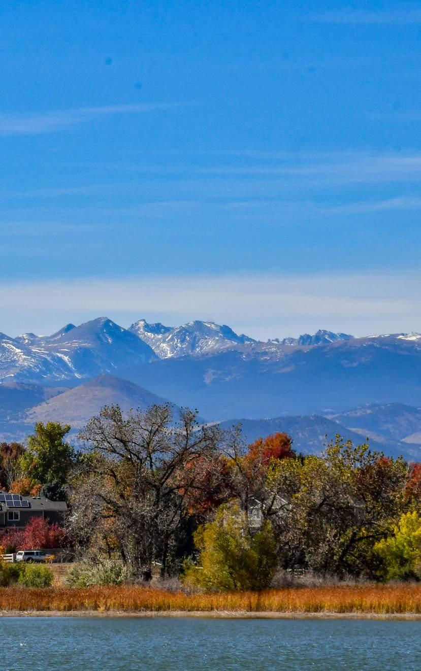
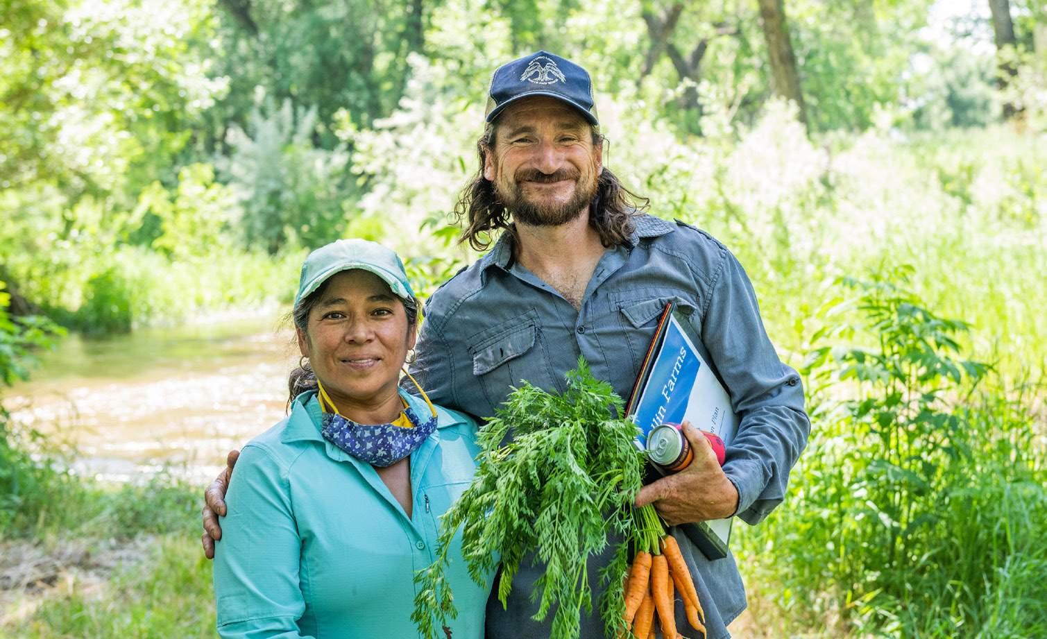
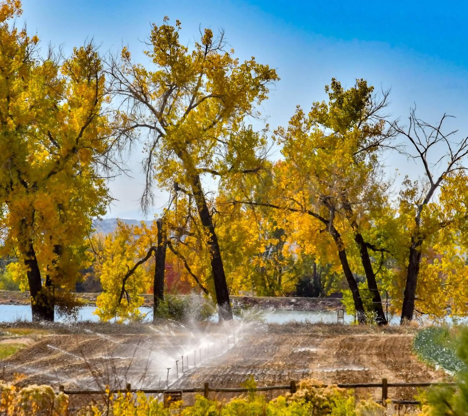
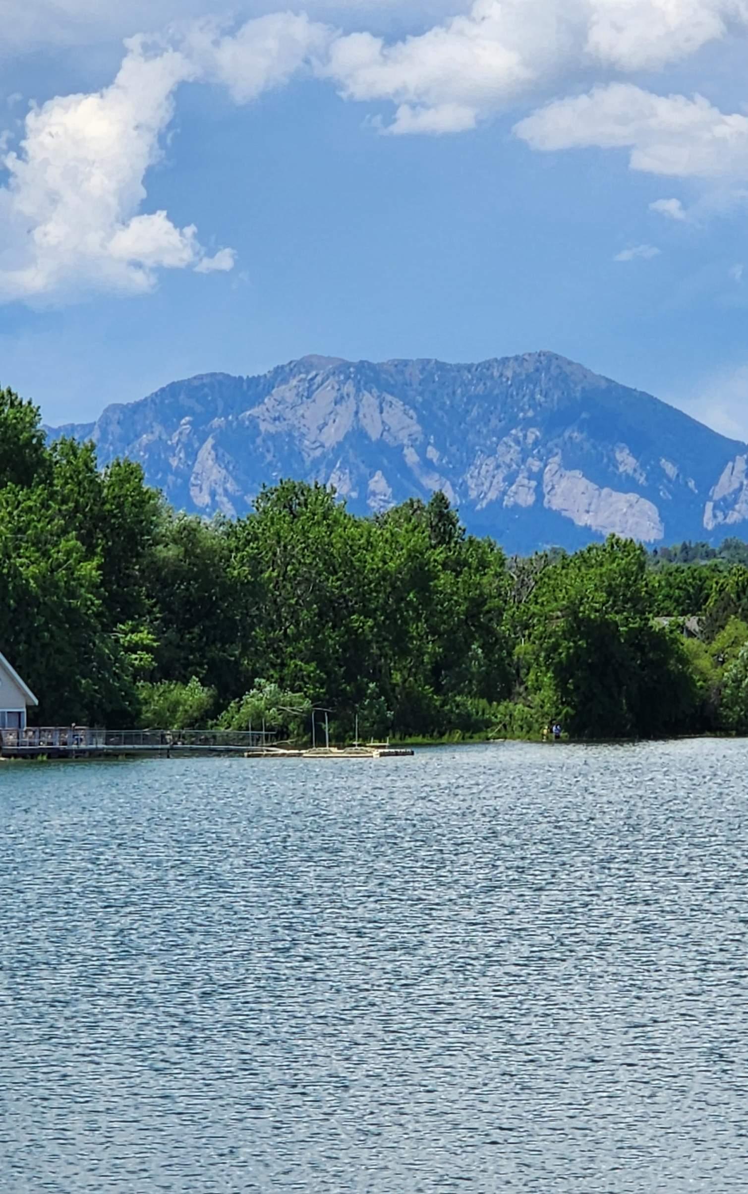
Source: City of Lafayette
Waneka Lake
Ashley Stolzmann Boulder County Commissioner
Welcome!
Boulder County is home to majestic mountains, sweeping plains, and vibrant cities and towns. These landscapes are part of daily life, shaping how we live, work, and connect—from bustling downtowns and neighborhoods to parks, trails, and open spaces. But climate change is already reshaping these places, bringing hotter summers, stronger storms, heightened wildfire risks, and worsening air quality.
The places we love are changing, but together, we can shape what comes next.
As these challenges grow, the way we design and care for our communities matters more than ever. By working with nature, we can reduce risks, improve resilience, and create healthier places to live.
In partnership with local municipalities, Boulder County developed this toolkit to help integrate nature-based strategies into urban planning, neighborhood design, and landscaping. Whether you’re a municipal leader, urban planner, landscape designer, or a resident invested in your community’s future, this guide offers clear, practical recommendations to help build climate resilience.
Because Boulder County spans diverse environments, these strategies are flexible and responsive to each community’s needs. We’re prioritizing the areas most at risk—not just to address climate impacts, but as part of our commitment to racial equity and equitable climate action.
The choices we make today will shape the places we live for years to come. By working with nature across our cities, neighborhoods, and public spaces, we can cool communities, reduce flooding and wildfire risks, support biodiversity, and create healthier, more connected places to live. We hope this toolkit serves as a valuable resource that helps communities take action today—building resilience that will last for generations.
— Ashley Stolzmann, Boulder County Commissioner
Introduction 01
What is this Toolkit?
What are Nature-Based Solutions?
Our Process
Our Equity Commitment
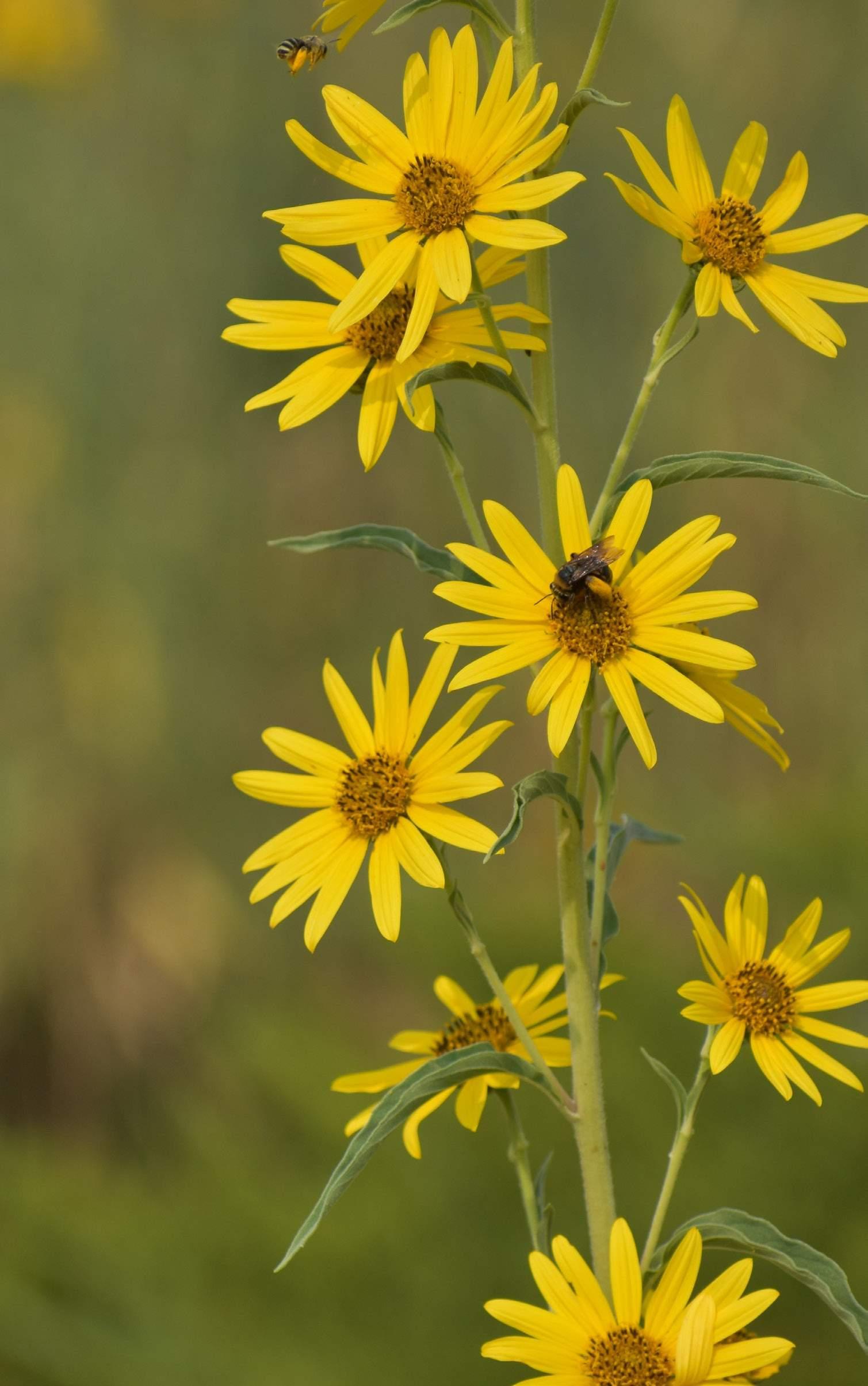
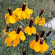
(Image Left) Bees Pollinating Native Plant
Source: City of Lafayette
What is this Toolkit?
This Nature-based Solutions (NBS) Toolkit provides practical guidance specific to Boulder County agencies that addresses climate challenges through sustainable, ecosystemdriven approaches. While many NBS resources are already available, they often overlook the unique environmental conditions of the urban Intermountain West, which include high-altitude, arid, alpine, and grassland ecosystems. This toolkit bridges that gap by offering tailored strategies that reflect the region's distinct ecological and climatic factors, delivering actionable solutions and policy suggestions for both climate adaptation and mitigation.
Developed through extensive research on local ecologies, climate
risks, and best practices—as well as interviews with regional experts in fire mitigation, floodplain restoration, and racial equity—the toolkit curates the most impactful NBS interventions for Boulder County’s urban municipalities (see section "Defining Urban"). While not exhaustive, it highlights strategies with the greatest potential for on-theground impact.
With a population of more than 300,000 and terrain spanning elevations from 4,949 to 14,256 feet, Boulder County presents a unique opportunity to test and model climate adaptation and mitigation strategies relevant to communities across Colorado and the Western U.S. Ultimately, this toolkit aims to achieve four key outcomes (1):
Primary Goals:
Climate Resilience
Building resilience to fire, drought, and flooding requires a multifaceted approach. This includes mitigating urban heat islands, enhancing biodiversity, managing forests, designing water-efficient landscapes, retaining water through wetlands and living infrastructure, and adopting regenerative soil practices.
Equitable Impact
Addressing the needs of communities disproportionately affected by climate change and pollution—including communities of color, low-income residents, and Indigenous populations—is critical for ensuring access to clean air, safe drinking water, and thriving natural spaces. Supporting these communities in climate resilience efforts helps create a fairer, healthier, and more sustainable future for everyone.
Ecological Connectivity
Improving ecological connectivity requires looking beyond traditional land use boundaries to ensure that natural systems remain linked across urban and rural landscapes. This toolkit provides strategies for strengthening wildlife corridors, waterways, and green spaces, helping to maintain ecological function and resilience even as communities grow.
Countywide Coordination
Climate change is complex, especially for local governments. This toolkit simplifies the process by consolidating resources into clear, actionable options tailored for municipalities throughout Boulder County. It provides municipalities with practical steps to build resilience and take meaningful action toward progress.
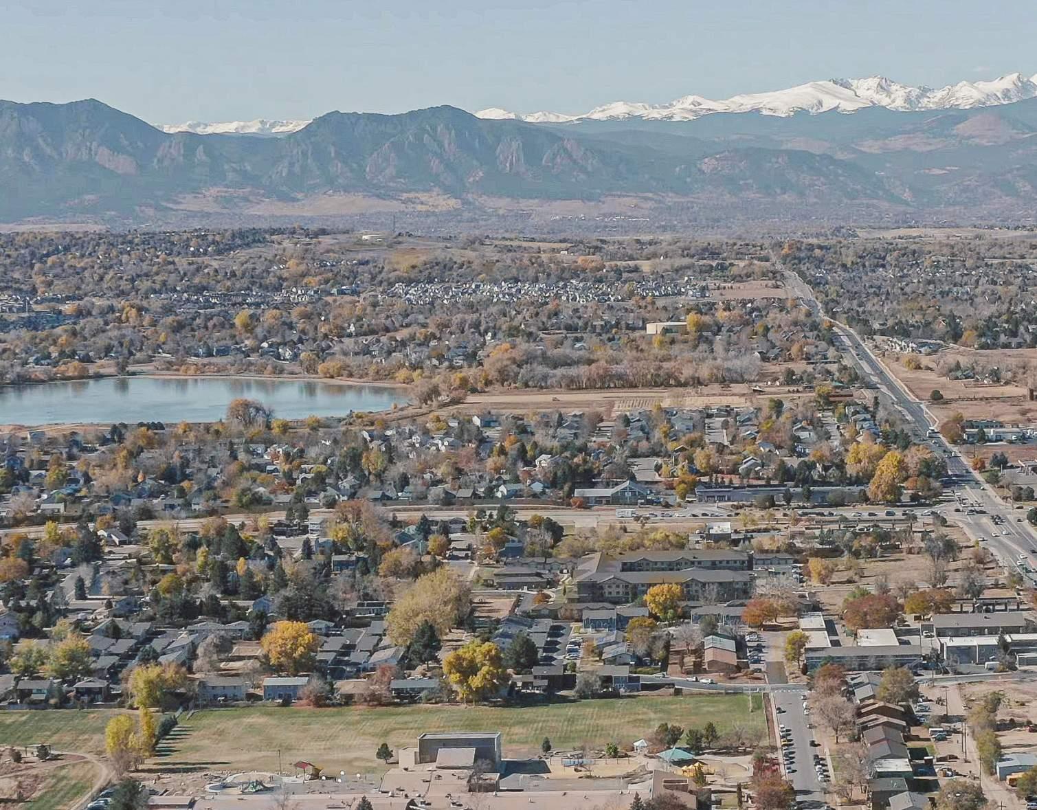
(Image Left) Aerial view of Boulder County, highlighting its diverse landscapes, from the bustling urban areas in the foreground to the expansive plains and the rugged foothills and Flatiron Mountains in the distance.
Source: Boulder County (OSCAR)
What Are Nature-Based Solutions?
Nature-based solutions (NBS) for climate action in urban areas leverage natural systems—such as urban forests, green spaces, and riparian corridors—to reduce climate impacts. They use natural features and processes to protect, conserve, restore, and sustainably manage ecosystems, while delivering measurable benefits to both people and nature (2). These approaches sequester carbon, manage stormwater, and reduce risks like flooding and extreme heat. Expanding urban tree canopies and restoring riparian zones capture carbon,
provide local cooling, and improve water quality. Additionally, green roofs, parks, and permeable surfaces manage stormwater, reduce the urban heat island effect, and improve air quality.
As Boulder County faces increasingly frequent and severe climate stressors, NBS provide practical strategies to address these challenges, delivering cost-effective climate mitigation along with co-benefits like improved public health, biodiversity, and community resilience.
Jamestown Ward
Nederland
Indian Peaks Wilderness
Rocky Mountain National Park
Boulder
Growing Urban Shade Forests
Expanding tree canopies to reduce heat islands, improve air quality, and support biodiversity.
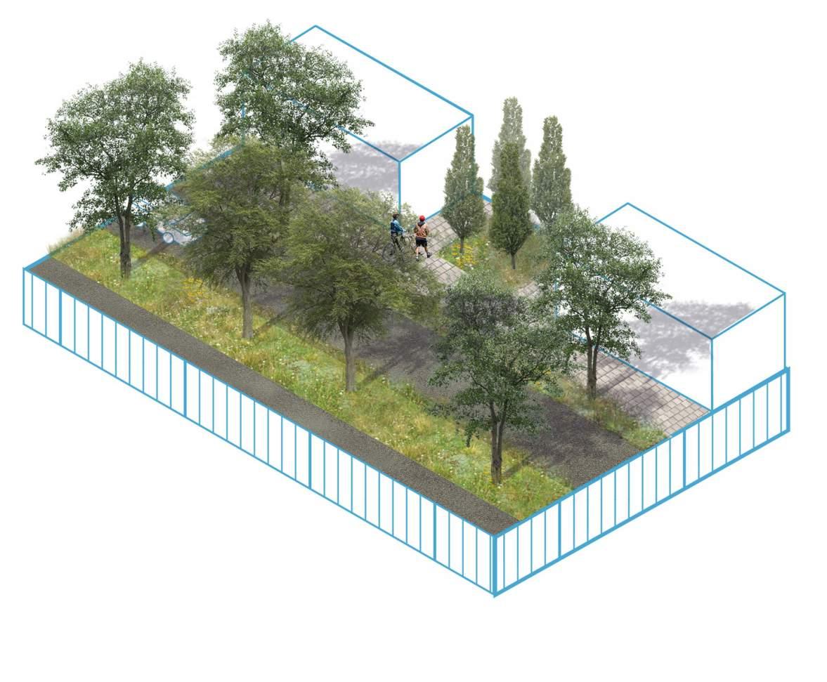
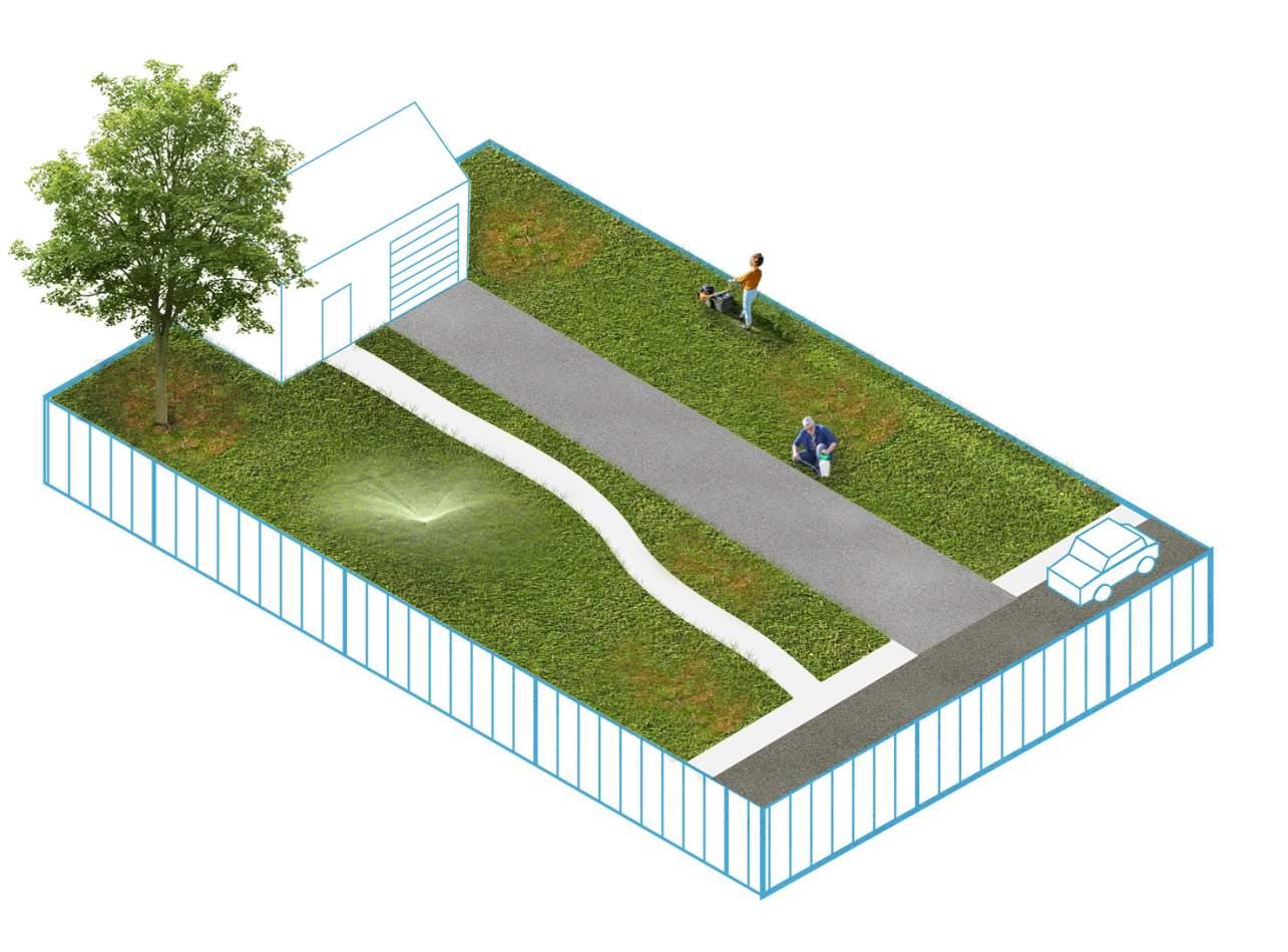
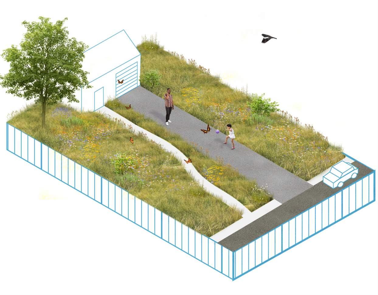
Transforming Turf
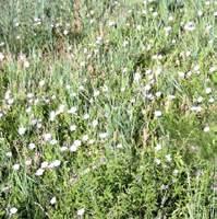
Converting nonessential lawns into drought-tolerant, pollinator-friendly landscapes.
Managing Urban Boundaries
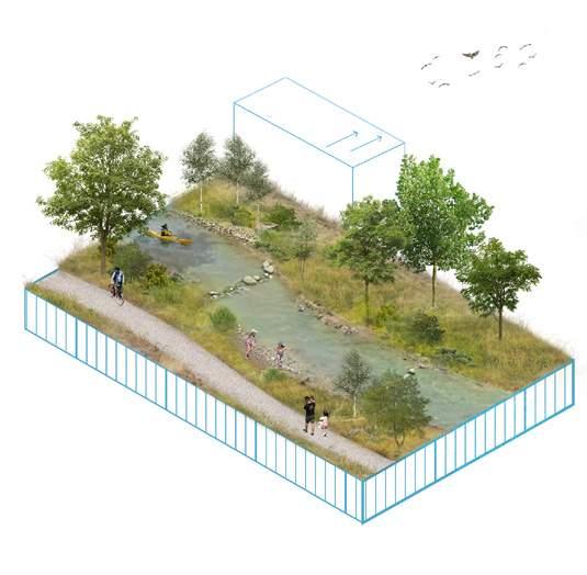
Restoring Floodplains & Streams
Enhancing natural waterways to reduce flood risk and improve water quality.
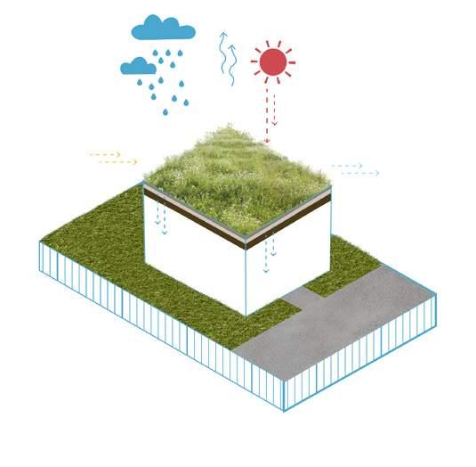
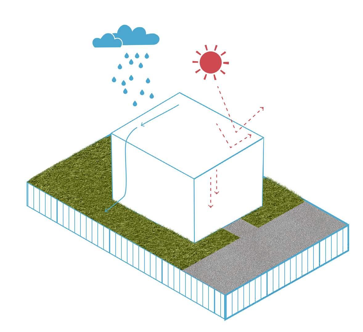
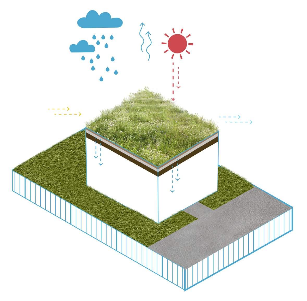
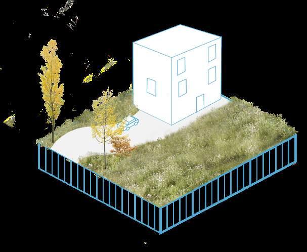
Creating Cool & Living Roofs
Using reflective materials and vegetation to lower building temperatures and manage runoff.
Urban development has fragmented habitats, reducing native plant and animal populations in green spaces.
Managing & Capturing Urban Stormwater
Implementing green infrastructure to slow, filter, and reuse stormwater.
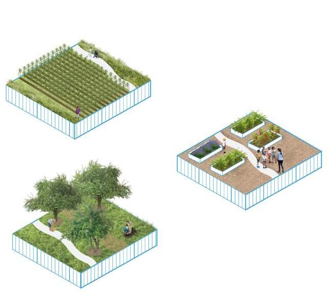
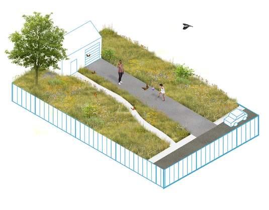
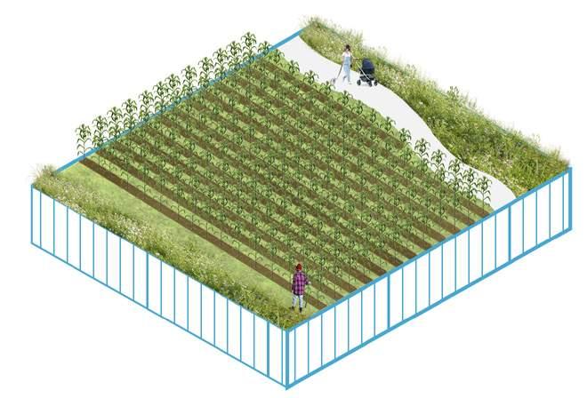
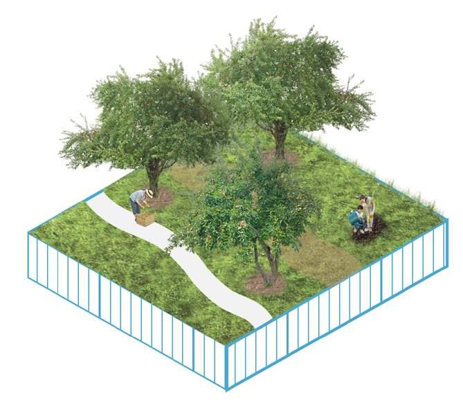
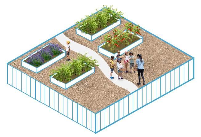
Urban Farms & Gardens
Expanding local food production and green space access in cities.
Lyons
Longmont
LeftHand Creek Boulder Creek St. Vrain Creek
Methodology
How was this Toolkit Developed?
Research
April - August 2024 01
The team conducted in-depth research and interviewed stakeholders, experts, and community members to gather insights and identify effective Nature-based Solutions (NBS) for Boulder County.
Finalizing NBS September 2024 02
Using the collected information, the team evaluated and selected NBS that align with the county's environmental priorities and practical needs.
Drafting & Review
November 2024 03
The team prepared a comprehensive draft and worked with OSCAR and industry professionals to review its accuracy, relevance, and usability.
Final Toolkit! February 2025 04
After incorporating feedback and refining the content, the team completed an actionable toolkit to support NBS implementation in Boulder County.
"While the principal focus of adaptation will vary with geography, all cities must prepare by degree for a few universal elements of rapid ecological change: extreme heat, rising water, and prolonged droughts. Compounding these imminent threats to urban populations is the capacity of critical infrastructures to anticipate and rebound from systemic failure." (3)
Dr.
Brian Stone, Jr. Professor, School of City & Regional Planning
Georgia Tech University
Our Equity Commitment
Racial equity and support for lowincome and vulnerable populations are central to this toolkit and essential for effective planning and implementation. Equity in local government involves ensuring that all communities—especially those historically underserved or disproportionately impacted—have meaningful access to resources, decision-making, and opportunities.
Boulder County follows the State of Colorado's definition of disproportionately impacted (DI) communities, (4), which includes low-income communities of color, housing cost-burdened households, linguistically isolated communities, historically marginalized groups, mobile home communities, and neighborhoods facing environmental and socioeconomic challenges. To learn more, refer to Colorado Enviroscreen.
DI communities bear the greatest environmental burdens, particularly from climate change impacts (5). This toolkit prioritizes NBS strategies for neighborhoods most vulnerable to these impacts and aligns with Boulder County’s Justice40 policy, which commits at least 40% of project implementation funding to DI neighborhoods (6).
Boulder County and its municipalities are also committed to amplifying diverse voices in government planning and decision-making. Recognizing the historical exclusion of marginalized communities, the county actively works to ensure inclusive engagement. The development of this toolkit included outreach to a range of community members, including DI residents and advocates.
In 2025, the NBS team in Boulder County’s Office of Sustainability, Climate Action, and Resilience (OSCAR) will build on these efforts by expanding equityfocused community engagement and outreach to guide the implementation of toolkit projects. Boulder County acknowledges the importance of building community trust and ensuring DI voices remain central to local planning efforts. It is important to note that any of the NBS strategies in this toolkit could contribute to green gentrification if implemented without care. While this document does not attempt to solve the broader issue of affordability in Boulder County, practitioners must carefully evaluate and mitigate against any potential negative impacts of NBS interventions on DI communities.
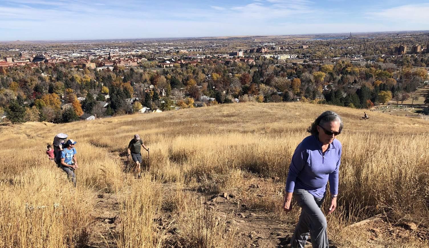
(Image Left) Kohler Mesa Trail, offering stunning views above the City of Boulder, nestled between the city landscape below and the iconic Flatirons above.
Source: Superbloom
Introduction References
1. Boulder County Government. (n.d.). About Boulder County. Boulder County. https://bouldercounty.gov/government/about-boulder-county/
2. International Union for Conservation of Nature (IUCN). (n.d.). Nature-based Solutions. https://iucn.org/our-work/nature-based-solutions
3. Stone, B., Jr. (2024). Radical adaptation: Transforming cities for a climate changed world. Cambridge University Press.
5. U.S. Environmental Protection Agency. (2021, October 19). EPA report shows disproportionate impacts of climate change on socially vulnerable populations. U.S. Environmental Protection Agency. https://www.epa.gov/ newsreleases/epa-report-shows-disproportionate-impacts-climatechange-socially-vulnerable
6. Boulder County. (2024, January 23). Federal and local leaders discuss climate crisis, environmental justice, and equity. Boulder County. https:// bouldercounty.gov/news/federal-and-local-leaders-discuss-climatecrisis-environmental-justice-and-equity/
(Image Right) Boulder County farmland, where agricultural landscapes interweave with urban areas and development, preserving the region’s rural heritage amid growth. Source: Boulder County (OSCAR)
BOULDER COUNTY
Douglas
El Paso
Clear Creek
Weld
Larimer
Grand
Gilpin
Jefferson
Broomfield
City of Denver
City of Fort Collins
City of Colorado Springs
City of Pueblo
Context 02
What is Urban?
A Region of Diverse Ecologies
A Climate Baseline for Boulder County
Boulder County's Major Climate Threats & Stressors
Image (left): Map showing Boulder County and the Eastern Counties in Colorado
A Climate Baseline for Boulder County Context
Boulder County’s natural beauty makes it a desirable place to live, but it also makes the area increasingly vulnerable to environmental risks: extreme heat, wildfires, drought, flooding, biodiversity loss, and poor air quality are intensifying due to climate change (1). Unlike buildings, which are closed systems, landscapes are open, interconnected, and dynamic—requiring consideration of context, scale, connectivity, and time. Every action we take has ripple effects, influencing the broader ecosystem and our ability to respond to climate challenges.
Most county residents live in urban centers, many of which have experienced destructive natural disasters. In 2013, flooding damaged or destroyed 1,800 homes, and in
2021, the Marshall Fire destroyed 1,084 homes (2, 3). Recovery from the 2013 flood has taken more than a decade, and recovery efforts for the Marshall Fire are still underway (4, 5). While these events impact everyone, DI communities are often hit hardest, facing greater risks from flooding, pollution, extreme heat, and other environmental stresses due to systemic inequities and limited resources (6).
Climate change is a pressing crisis, but it also offers a chance to shape how we respond. By building resilience and adaptability, we can lessen its impacts, strengthen communities, restore ecosystems, conserve resources, and advance equity through solutions that work with nature.
Nederland
Ward
Image: Map showing
Overland Fire
Recent Climate Event Timeline:
(Hottest day on record) = Major Flood Event = Major Wildfire Event
= D3 Category "Extreme Drought" Period
= Heat Event or Period
Jamestown
Boulder
Population: 105,898
5,430 ft
Population: 2,151
5,341 ft
Longmont
Population: 98,630 Elevation: 4,981 ft
Population: 35,269
Context
Defining "Urban"
In Boulder County, "urban" refers to its ten incorporated cities and towns, along with densely developed areas within unincorporated parts of the county. These areas house 91% of the county’s population (7) and feature concentrated residential, commercial, and public infrastructure. While Boulder County is often perceived as predominantly rural, cities like Boulder, Longmont, and Lafayette serve as key hubs for governance, services, and population.
Urban areas play a distinct role in climate adaptation and mitigation, requiring strategies that differ significantly from rural land management. In cities and towns, space is limited, development is highly regulated, and solutions must
integrate with existing infrastructure— focusing on approaches like green stormwater systems, urban tree canopies, cool roofs, and permeable pavements. In contrast, rural strategies often emphasize largescale land conservation, regenerative agriculture, and watershed restoration across more expansive landscapes.
This toolkit focuses on urban areas, which are defined not just by population density but also by legal and political factors such as zoning, property ownership, and municipal jurisdiction. By addressing the specific challenges and opportunities of urban settings, the toolkit ensures that NBS can be effectively implemented within the built environment.
Lafayette
Longmont
Nederland
Jamestown
A Region of Diverse Ecologies
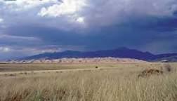
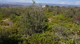
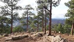
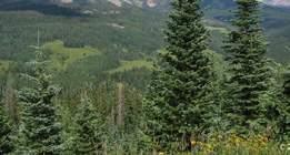
Boulder County is home to an extraordinary range of ecosystems, from montane forests to high plains, making it one of the most ecologically diverse regions in Colorado. These varied landscapes include the rugged foothills around Boulder and Lyons, the alpine communities of Jamestown, Nederland, and Ward, and the expansive high plains of Erie, Lafayette, Longmont, Louisville, and Superior.
Level IV Ecoregions
This diversity presents both unique opportunities and challenges in the face of climate change. The dramatic differences in elevation, climate zones, and ecosystems across the county—from forested mountains to grasslands and wetlands—require tailored approaches to climate adaptation and resilience.
The County of Boulder is incredibly bio-diverse, host to six Level IV, ecoregions. Level IV ecoregions are a detailed classification of the EPA's ecoregion framework. These provide a finer-scale understanding of ecological patterns based on factors such as climate, soil type, vegetation, land use, and hydrology.
Boulder County's Major Climate Threats & Stressors Context
A climate stressor is an environmental factor or condition that exerts pressure on ecosystems, organisms, and human systems, amplified in intensity and/ or frequency by climate change. This intensification disrupts natural and human-made systems, worsening environmental hazards and compounding challenges like resource depletion and infrastructure strain. In urban areas, these stressors often intersect with development pressures, creating conflicts over land use, resource management, and heightened vulnerability for communities, particularly those already disadvantaged. While climate stressors vary by region, Boulder County faces five primary categories of climate-associated stressors (8):
populations, especially in low-income neighborhoods with limited access to cooling resources, such as air conditioning or nearby green spaces. The increased temperatures in these heat islands also strain energy systems and contribute to poor air quality, compounding health risks for residents.
An extreme heat event -- also known as a heat wave -- is a period of unusually high temperatures lasting two or more days. In Boulder County, temperatures exceeding 90°F in foothill areas are considered extreme, while temperatures above 80°F qualify in higher elevations. These events impact local ecosystems and human health differently across regions (9).
The frequency and intensity of extreme heat events in Boulder County are increasing, affecting both human and wildlife health. Elevated temperatures alter water temperatures, food availability, and local climate patterns, resulting in shifts in USDA planting zones. Some plant species are thriving at higher elevations, while others face challenges (10).
Urban heat islands exacerbate these issues by trapping heat in densely developed areas. For instance, areas in Boulder lacking tree cover and dominated by impervious surfaces— such as roads and parking lots—can be up to 17°F hotter than shaded areas (11). This intensifies the risks for vulnerable
Wildfires are unplanned fires that occur in natural areas like forests, grasslands, and prairies, often affecting wildland-urban interfaces (WUI)--where 58% of Boulder County residents live (12, 13). Wildfires impact air quality, health, and ecosystems, with low-income communities facing disproportionate risks.
Historically, wildfires were a natural part of Boulder County’s ecosystem, clearing vegetation and maintaining ecological balance (14). Since the mid20th century, Boulder County’s forests have become more densely vegetated, due in part to fire suppression and land-use changes, increasing the risk of larger, more intense wildfires (15). In fact, wildfire impacts have increased significantly since 1980, with twice as many acres burned annually (16). This trend is linked to drier conditions,
changing vegetation, and fires occurring outside the traditional fire season, as seen with the Marshall Fire, which started on December 30, 2021.
Flooding in Boulder County, including both riverine and flash floods, is a natural part of the landscape, shaped by the region's steep terrain and weather patterns. However, urban development in floodplains and shifting weather patterns have made flooding events more frequent and severe. The 2013 flood, caused by upwards of 17 inches of rain, damaged over 1,800 homes and resulted in an estimated $2 billion in losses (17). Flash floods, exacerbated by Boulder County’s steep gradients and impervious surfaces, are particularly destructive.
As development encroaches on natural floodplains, these areas face greater risks of property damage and health hazards, such as waterborne diseases. Increasingly intense and frequent rainstorms demand a multifaceted approach to managing flood risks in Boulder County, combining technical solutions, sustainable urban planning, and ecosystem-based strategies.
Drought is typically described as a prolonged period of reduced precipitation, usually lasting a season or longer, that leads to a water shortage (19).
As climate change intensifies, prolonged dry spells and declining snowpack reduce water availability in Boulder County. Higher temperatures exacerbate the problem by increasing evaporation and, which intenifies water shortages. Drought impacts crops, wildlife, and ecosystems, while heightening competition for water resources among urban, agricultural, and environmental needs (20). These conditions are expected to worsen, placing increasing pressure on Boulder County’s water resources.
Drought occurs when below-average precipitation leads to water shortages, a significant concern in Boulder County’s semi-arid climate. With an average annual precipitation of around 19 inches (18)—primarily from winter snow—the county is especially vulnerable during periods of reduced rainfall.
Ecosystem loss disrupts migration patterns, spreads invasive species, and threatens Boulder County’s diverse landscapes, from montane forests to prairies. Rising temperatures and shifting precipitation further drive habitat loss, intensifying these impacts.
In the mountains, warmer conditions intensify pine beetle infestations, killing millions of trees and allowing invasive plants like cheatgrass to spread (21). These changes increase fire risk and contribute to higher carbon emissions. In the foothills and plains, invasive species such as Canada thistle, which thrive in warmer, drier conditions, are overtaking much of our grasslands (22). Pollinators like monarch butterflies and native bees are also struggling as changing bloom patterns disrupt their feeding cycles (23).
These changes weaken ecosystem resilience, raising the risk of wildfires and floods (24). Protecting Boulder County’s biodiversity requires active conservation efforts, ongoing monitoring, and climate adaptation strategies to mitigate these impacts on ecosystems and local communities.
Context References
1. Boulder County. (2022). Chapter 2: Climate. In 2022 Sustainability Plan (pp. 1–85). Boulder County. https://assets.bouldercounty.gov/wp-content/ uploads/2023/06/Ch02_Climate_BoCo-2022-Sustainability-Plan.pdf
2. Flanders, J. (2023, September 5). Almost unimaginable: The 2013 Colorado flood, 10 years later. Colorado Newsline. https://coloradonewsline. com/2023/09/05/almost-unimaginable-the-2013-colorado-flood10-years-later/#:~:text=16%2C%20the%20Front%20Range%20 experienced,according%20to%20the%20Colorado%20Encyclopedia.
3. National Oceanic and Atmospheric Administration. (2024, January 8). Looking back at Colorado’s Marshall Fire. NOAA Research. https://research. noaa.gov/looking-back-at-colorados-marshall-fire/#:~:text=Two%20 small%20fires%20become%20an%20inferno&text=Fanned%20by%20 relentless%20winds%20throwing,in%20less%20than%20an%20hour.
4. Boulder County. (n.d.). 2013 flood: Flood preparation and recovery. Boulder County Government. https://bouldercounty.gov/disasters/ floodpreparation/2013-flood/
5. Urban Institute. (2022, January 25). After the Marshall Fire, households with fewer financial resources are falling behind https://www.urban.org/ urban-wire/after-marshall-fire-households-fewer-financial-resources-arefalling-behind
6. U.S. Environmental Protection Agency. (n.d.). Climate change and health: Socially vulnerable people. U.S. Environmental Protection Agency. https:// www.epa.gov/climateimpacts/climate-change-and-health-sociallyvulnerable-people
7. Boulder County Government. (n.d.). About Boulder County. Boulder County. Retrieved January 27, 2025, from https://bouldercounty.gov/ government/about-boulder-county/
9. Federal Emergency Management Agency. (n.d.). Extreme heat. FEMA. https://community.fema.gov/ProtectiveActions/s/article/Extreme-Heat. [Page no longer available]
10. National Public Radio. (n.d.). Plant hardiness garden map: Nederland, CO. NPR. https://apps.npr.org/plant-hardiness-gardenmap/?name=Nederland&state=CO&lng=-105.505864&lat=39.963815
11. City of Boulder. (n.d.). Cooling our community. City of Boulder. https:// bouldercolorado.gov/projects/cooling-our-community
12. U.S. Forest Service. (2015). Historical fire regimes and forest management in the Front Range of Colorado (Report No. RMRS-RP-104). U.S. Department of Agriculture, Forest Service, Rocky Mountain Research
13. Colorado State Library. (n.d.). Boulder fire survey. https://cslc.colorado.edu/ boulder-fire-survey/
14. Boulder County. (n.d.). Wildfires. Boulder County Government. https:// bouldercounty.gov/disasters/wildfires/
15. Sherriff, R. (2002). The historic range of variability of fire in the montane zone: Past fire types and fire effects. University of Colorado Boulder. Retrieved from https://assets.bouldercounty.gov/wp-content/ uploads/2020/03/historic-range-of-variability-fire-montane-zone.pdf
16. Boulder County. (n.d.). Climate impacts. Boulder County Government. https://bouldercounty.gov/climate/impacts/
17. Flanders, J. Almost unimaginable.
18. NOAA Physical Sciences Laboratory. (n.d.). Boulder, Colorado monthly precipitation summary statistics. National Oceanic and Atmospheric Administration. https://psl.noaa.gov/boulder/Boulder.mm.precip.html
19. National Integrated Drought Information System. (n.d.). Drought basics. Drought.gov. Retrieved January 29, 2025, from https://www.drought.gov/ what-is-drought/drought-basics
20. Bjarke, N., Livneh, B., & Barsugli, J. (2024). Storylines for global hydrologic drought within CMIP6. Earth's Future, 12(6), e2023EF004117. https://doi. org/10.1029/2023EF004117
21. Bradley, B. A., Curtis, C. A., & Chambers, J. C. (2016). Climate change and cheatgrass invasion: A case for ecologically based invasive species management. Journal of Applied Ecology, 55(2), 619–627. https://doi. org/10.1111/j.1365-2486.2008.01709.x
22. Colorado State University Extension. (n.d.). Canada thistle (No. 3.108). https://extension.colostate.edu/topic-areas/natural-resources/canadathistle-3-108/
23. Convention on Migratory Species. (n.d.). Monarch butterfly and climate change [Fact sheet]. https://www.cms.int/sites/default/files/publication/ fact_sheet_monarch_butterfly_climate_change_0.pdf
24. Garibaldi, L. A., et al. (2013). Wild pollinators enhance fruit set of crops regardless of honey bee abundance. Science, 339(6127), 1608-1611. https:// doi.org/10.1126/science.1230200
03 The Nature-Based Solutions (NBS) Catalog
Boulder County can build stronger, more resilient communities that thrive in the face of the climate crisis by integrating more NBS into urban planning. The following recommended actions, policies, and examples provide a comprehensive guide to understanding, integrating, and sustaining NBS, in order to help municipalities create climate-resilient urban spaces.
Designed as a menu of options, this toolkit provides municipalities with practical, region-specific approaches to building climate resilience.
Each of these seven NBS recommendations addresses a pressing climate challenge while delivering long-term environmental and community benefits, and is described in detail throughout the remainder of this report.
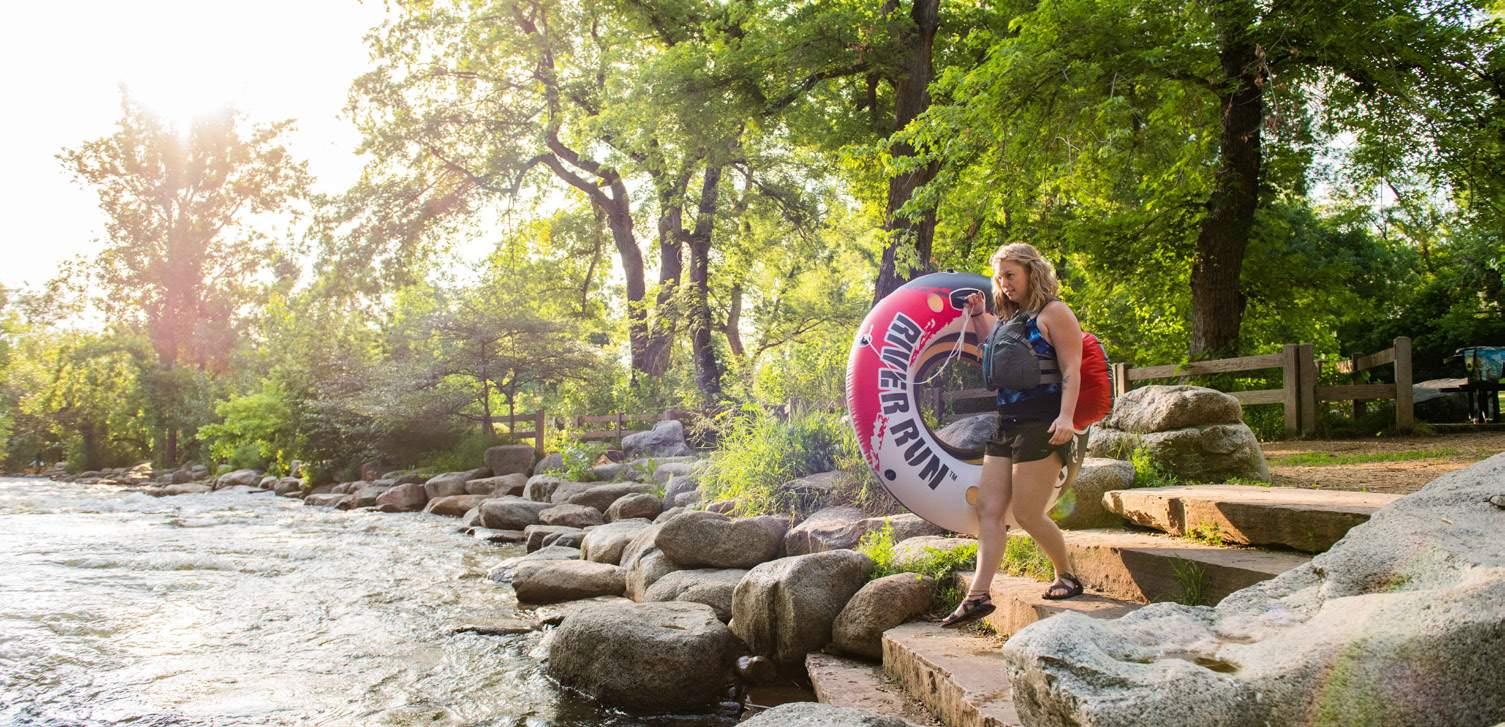
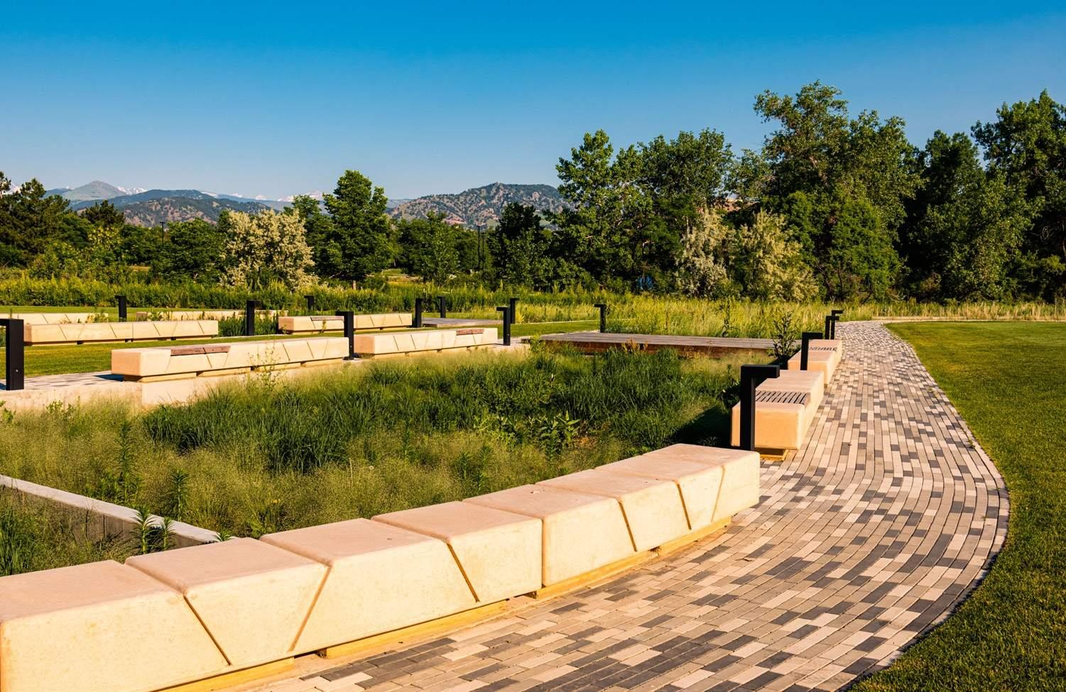
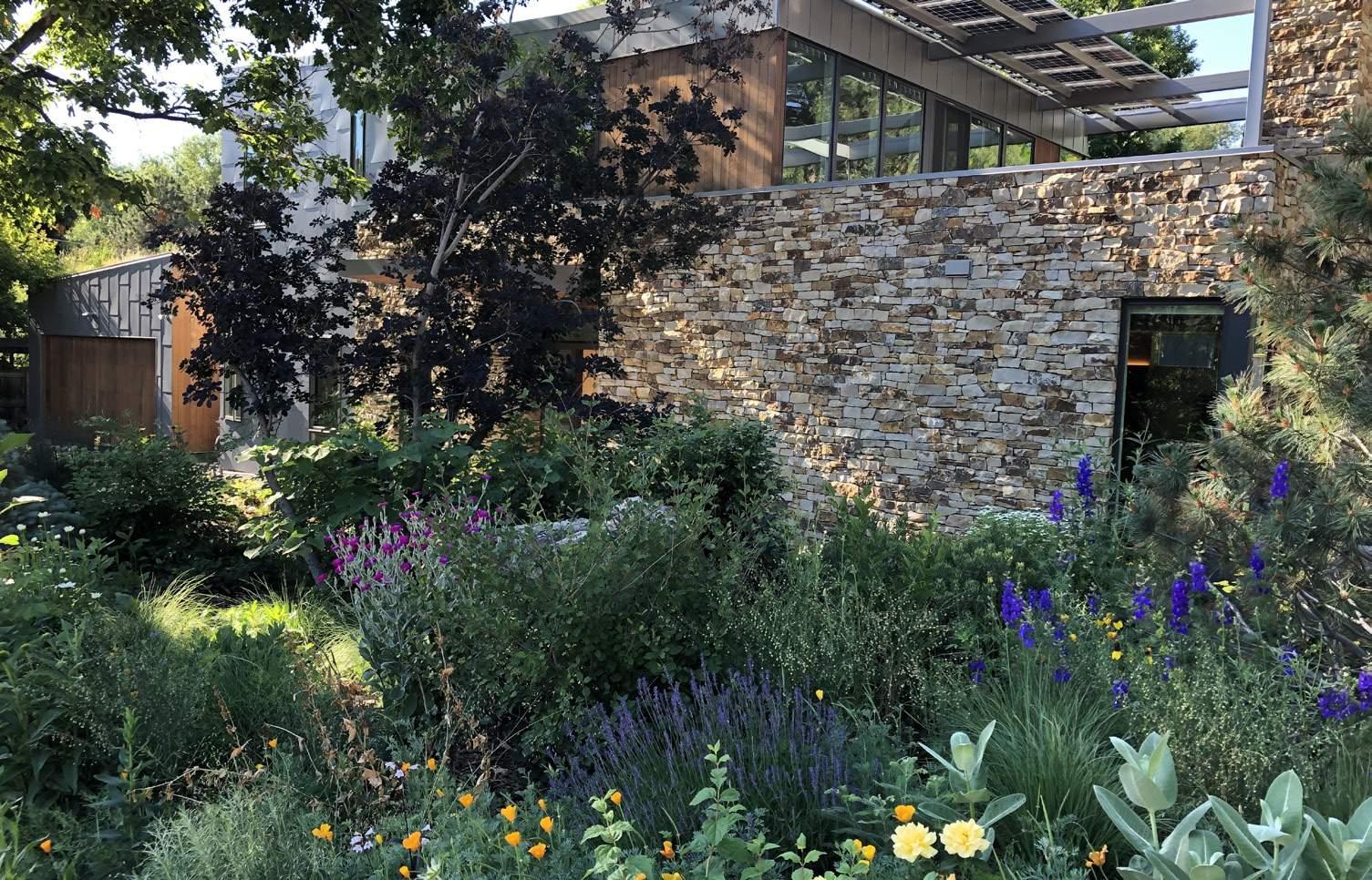
(Image Left) Cyclist enjoying Waneka Lake in Lafayette, CO.
Source: City of Lafayette
Key NBS Actions
Growing Urban Shade Forests 1 2
Expanding tree canopies to reduce heat islands, improve air quality, and support biodiversity.
5
Creating Cool & Living Roofs
Using reflective materials and vegetation to lower building temperatures and manage runoff.
6
Restoring Floodplains & Streams
Enhancing natural waterways to reduce flood risk and improve water quality.
Urban Farms & Gardens
Expanding local food production and green space access in cities.
7 Managing & Capturing Urban Stormwater
Implementing green infrastructure to slow, filter, and reuse stormwater.
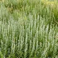
Converting non-essential lawns into drought-tolerant, pollinator-friendly landscapes.
Managing Urban Boundaries
Preserving open space and preventing climate-related landuse conflicts.
Management
Development
Growing Urban Shade Forests
Colorado’s average temperature is projected to rise 4°F (≈2.2°C) by 2050, with communities in Boulder communities facing approximately 43 days per year exceeding 92.5°F (33.6°C) (1, 2).
Urban and suburban areas are most susceptible to increased warming, as sparse vegetation, concrete, and asphalt create urban heat islands. These heat islands disproportionately impact low-income residents, renters in older multi-unit buildings without air conditioning, children, older adults, and individuals with chronic health conditions like asthma (3).
Expanding urban forests, micro forests, and increasing tree canopy coverage offer effective, equitable heat relief. Studies in Denver show that neighborhoods with more trees can be up to 9°F cooler than surrounding areas (4). Urban forests also reduce air pollution, save energy, increase property values, and improve public health (5). However, these benefits are often unevenly distributed, leaving vulnerable populations without sufficient cooling and shade.
A well-planned, diverse urban tree program can enhance urban cooling, support public and ecological health, and provide long-term community benefits. To build a more resilient urban tree canopy, Boulder County must move beyond conventional strategies focused solely on large-canopy trees that take decades to mature. Instead, transitional planting strategies should prioritize diversity, adaptability, and long-term ecological health. This approach includes incorporating species like aspen or other suckering trees, which provide shade and improve resilience to climate change, pests, and disease.
Boulder County spans three distinct ecological zones that influence urban tree-planting strategies (8):
High Prairie
4,800-6,000 ft
Mostly grassland, few natural trees.
Cottonwoods & willows near water.
Best for planting: Drought-tolerant, wind-resistant species.
Montane Foothills
6,000-8,500 ft
Ponderosa pines & aspen groves.
Best for planting: Fire-resistant native conifers.
Increased tree cover can
significantly reduce exposure to harmful ultraviolet-B (UV-B) radiation thereby decreasing the risk of skin cancer (6).
Alpine
8,500-12,000 ft
Fir & spruce forests.
Best for planting: Cold-hardy highelevation species.
Trees suitable for street planting (“street trees”) are not always the same as those better suited for yards, parks, and open spaces. Native species like cottonwood and aspen do not make for great street trees due to their short lifespan and low branches, which can obstruct roadways and visibility. Non-native species such as ash, honey locust elm, which have historically thrived in Colorado’s climate, are now increasingly vulnerable to disease and infestation. Adopting "right tree, right place" principles fosters innovative solutions that deliver immediate benefits, such as shade and habitat, while ensuring the health and sustainability of the canopy for future generations.
What is a Microforest?
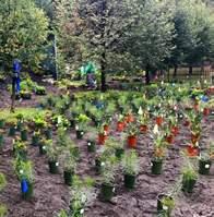
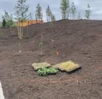
Microforests are small, densely planted areas of native trees and shrubs—usually under an acre—that mimic natural ecosystems for rapid growth and biodiversity. Using the Miyawaki Method, they pack diverse native species closely together, growing up to 10x faster than conventional urban tree planting. Unlike widely spaced street trees, microforests create self-sustaining ecosystems, requiring minimal maintenance after a few years. Their dense canopy cools cities, captures carbon, and supports rich biodiversity, making them a powerful tool for urban climate resilience (7).
10x
growth compared to traditional tree plantings (8)
100%
Organic, without chemicals, pesticides, or herbicides (8)
100x
biodiversity compared to traditional tree plantings (8)
40x up to
more carbon sequestration (8)
(Image Left) Managed forest in Boulder Open Space & Mountain Parks above Chautauqua Park in Boulder, CO Source: Superbloom
Reduced Community Health
Status Quo
Heat Island Effect
Reduced Tree Health
Less Habitat Availability
Heat Island Effect
Without urban forests, cities experience higher temperatures as paved surfaces absorb and radiate heat, intensifying the urban heat island effect.
Less Habitat Availability
The absence of trees reduces available habitat for birds, pollinators, and other wildlife, leading to a decline in urban biodiversity.
Reduced Tree Health
Without proper urban forestry management, existing trees may suffer from neglect, pests, and diseases, reducing the long-term viability of urban tree cover.
Reduced Community Health
A lack of trees and green spaces diminishes access to nature, reducing opportunities for recreation, stress relief, and mental wellbeing in urban environments.
Improved Health Outcomes
NBS Solution Implemented
Cool Microclimates
Reduction
Cool Microclimates
Urban forests create shaded areas that lower local temperatures, providing relief from heat and creating more comfortable outdoor spaces.
Air Quality
Trees filter pollutants from the air, improving overall air quality by absorbing carbon dioxide and releasing oxygen, which benefits community health.
Pollution Reduction
Urban forests improve water quality by filtering pollutants from stormwater, reducing runoff, and promoting groundwater recharge, which help keep water resources clean.
Improved Health Outcomes
Access to green spaces promotes physical activity, reduces stress, and enhances mental wellbeing, leading to healthier communities and better quality of life.
Program & Action Recommendations
Develop a Comprehensive Urban Forest Action and Management Plan Action #1:
A comprehensive urban forest action and management plan is essential for increasing tree canopy cover across Boulder County. This plan should include a detailed analysis and mapping of the existing tree canopy, identification of priority areas with low coverage, and strategies to expand and maintain a healthy urban forest. By leveraging data from Boulder County’s 2024 Urban Tree Canopy Assessment, the plan can set evidence-based canopy goals and guide future urban forestry initiatives. According to the Colorado State Forest Service, an ideal urban tree canopy for the semi-arid Front Range should range from 20-30% (9), with residential areas experiencing significant benefits around 25% (10). as of 2021, Boulder County’s canopy coverage stands at just 16.1%, leaving the county more vulnerable to climate impacts (11).
The plan should prioritize both expanding tree planting and ensuring long-term tree health. Strengthening the resilience of Boulder County’s urban forest requires diverse and adaptable species selection to enhance ecological resilience and adaptability to changing environmental conditions. To mitigate risks, tree selection should avoid drought-sensitive and disease-prone species while prioritizing fire-resistant species in fire-prone areas. Adopting the "Right Tree, Right Place" approach will ensure trees are suited to local climate and soil conditions, resistant to pests and disease, and capable of withstanding environmental stressors.
Strategic planting efforts should focus on key areas where trees provide the greatest benefits. Streets and paved areas should be prioritized to reduce heat islands, provide shade, and improve air quality. Additionally, planting on city-owned land, such as parks and other public spaces, can maximize accessibility and community benefits. Beyond new plantings, the plan must emphasize longterm maintenance to support tree survival and ensure lasting environmental benefits.
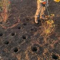
Successful tree establishment begins with proper site preparation. Many areas may require soil health improvements, drainage management, or invasive species removal before planting to create optimal conditions for growth. Providing clear guidance on identifying and addressing sitespecific challenges will help ensure new trees thrive and contribute to a more sustainable and climate-resilient urban canopy for decades to come.
Examples of Comprehensive Urban Forest Action & Management Plans:
The City of Boulder's Urban Forest Strategic Plan (12) Boulder, Colorado
The plan offers actionable strategies tailored to Boulder, providing a model for municipalities with similar urban forestry goals. It’s a relevant local reference for addressing canopy expansion and environmental challenges.
Salt Lake City Urban Forest Plan (13) Salt Lake City, Utah
The plan provides a comprehensive approach to urban forestry, balancing environmental and social goals. It’s a great example for municipalities aiming to combine tree planting with community engagement and equity.
Program & Action Recommendations
Action #2:
Complete an Urban Canopy Equity Assessment
Identify DI neighborhoods with low tree canopy cover and prioritize improvements in these areas. Resources like Tree Equity Score can guide the identification of these areas. Neighborhoods should aim for at least 20-30% tree cover (14, 15).
Action #3:
Create and Consolidate Urban Forestry Task Forces
To strengthen urban forestry efforts, municipalities with populations over 50,000 should establish dedicated Urban Forestry Task Forces to coordinate tree planting and maintenance. These task forces should include representatives from city departments, community groups, and local environmental organizations, ensuring a diverse range of expertise and perspectives in planning and implementation. A key priority should be diverse leadership, ensuring that the needs and voices of underrepresented communities are central to urban forestry initiatives. This approach promotes more equitable access to the benefits of trees, fostering a healthier, more sustainable, and resilient urban environment for all.
Additionally, task forces should analyze tree canopy expansion requirements alongside available resources. Boulder County’s recent analysis suggests increasing the county’s tree canopy from its current 16% to 25% over the next 25 years (12). While such a goal would have significant environmental and social benefits, it may be overly ambitious given current resources. To ensure feasibility, municipalities should set clear, achievable canopy coverage goals for 2050 based on projected funding and a comprehensive assessment of impervious surfaces, plantable areas, and existing canopy coverage.
Smaller, neighborhood-level targets should also be considered, such as establishing a 25% tree canopy goal in disproportionately impacted (DI) communities by 2050. Plans must also account for anticipated tree losses due to development, pest infestations (such as the emerald ash borer), flood mitigation efforts, and other potential hazards. By taking a strategic, data-driven approach, municipalities can expand tree cover effectively while ensuring longterm urban forest sustainability.
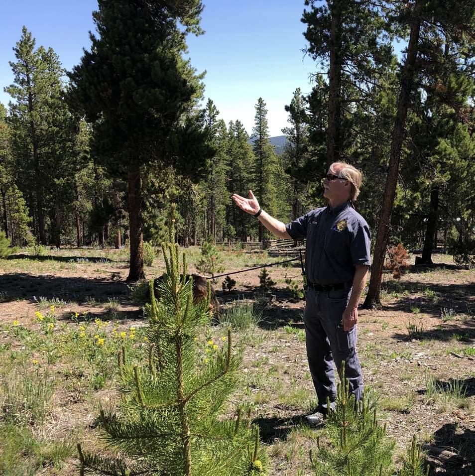
(Image Right) Managing defensible space and forests requires collaboration with owners, municipalities and fire departments. Mud Lake Open Space in Nederland, CO.
Source: Superbloom
Create Tree Planting Programs for Public Spaces Action #4:
To expand urban tree canopy coverage, municipalities should partner with tree-planting organizations such as One Tree Planted, the Colorado Tree Coalition, and the Arbor Day Foundation to plant 1,000–2,000 new trees annually in areas with less than 20% canopy cover. Priority planting locations should include streets, residential properties, parking lots, community facilities, schools, and parks. Municipalities should also launch dedicated tree planting programs, modeled after the Boulder Street Tree Program, with a goal of planting 500–1,000 new street trees per year in residential and commercial areas with low tree density (e.g., fewer than 10 trees per block). Additionally, municipalities must develop long-term irrigation plans to ensure newly planted trees can grow and thrive in Colorado’s semi-arid climate. While permanent irrigation systems are ideal, cities should implement sustainable watering strategies that provide ongoing tree care, regardless of the irrigation system in place.
Program & Action Recommendations
Action #5:
Create Tree Planting Programs for Private Land
To enhance urban resilience and expand tree canopy coverage, municipalities should develop residential and private-land tree planting programs, particularly in heat-vulnerable neighborhoods with low canopy cover. Programs modeled after initiatives like Denver’s Community Tree Planting Initiative can help mitigate urban heat islands and improve air quality while fostering community engagement. Priority should be given to disproportionately impacted (DI) neighborhoods, ensuring that tree-planting efforts are equitable and accessible. Meaningful community engagement should be a core component of these programs, incorporating outreach, bilingual services, and partnerships with communitybased organizations to maximize participation and long-term success.
Action #6:
Initiate Volunteer Tree Care Programs
Sustaining a healthy urban forest requires more than just new plantings—long-term tree care programs are essential to ensuring trees reach maturity and provide lasting environmental benefits. These programs should offer resources for watering, pruning, and soil management, helping municipalities maintain tree health despite challenges like high water costs and limited resources. To promote equitable tree survival, municipalities should provide targeted support for tree maintenance, particularly in areas with the greatest need. Volunteer engagement can play a key role in tree care efforts. Partnering with local organizations like the Boulder County Master Gardener Program (16) can help ensure that trees receive consistent maintenance. Municipalities should aim to recruit 100–200 volunteers annually, with each volunteer caring for at least 5–10 trees, focusing especially on privately owned trees in high-need areas where maintenance costs are often higher.
To make volunteer programs inclusive and representative of the community, recruitment efforts should actively engage individuals from diverse backgrounds, cultures, and neighborhoods. Supporting volunteer-driven initiatives like the PLAY Boulder Tree Tender Program will further strengthen urban tree care efforts. Offering 2–4 annual workshops in English and Spanish will provide residents with hands-on training in proper watering, pruning, and planting techniques, ensuring that tree care knowledge is widely accessible.
Expand Youth Workforce Development Action #7:
Establish a youth workforce development program, recruiting and training 10–30 youth per year to help maintain newly planted trees while equipping them with valuable career skills, fostering environmental stewardship, and empowering them to become future leaders in urban forestry. Provide equitable, living wages for all hired workers. Collaboration with schools or other organizations and organizing volunteer weekend events can help accommodate planting activities.
Subsidized Pruning and Maintenance for Old Growth Canopy Action
Provide subsidies covering 50-75% of the cost of pruning and maintaining old-growth canopy trees in low-income neighborhoods. Set a target of pruning 150 mature trees per year with priority given to neighborhoods with higher than 25% tree cover. Establish a citywide budget for subsidized tree care.
#8:
Policy Options
Policy #1 :
Mandate Tree Planting in Parking Lots
Mandate tree planting in parking lots, with requirements for planting trees every 10-15 parking spaces (e.g., Tempe, AZ requires 1 shade tree per 12 parking stalls) (17). Include provisions for shading requirements (e.g., 50% shading of the parking lot within 15 years – refer to Sacramento, CA example) to reduce heat island effect and increase stormwater capture. Use basins to capture rainwater wherever possible. Note that Colorado's regulations currently allow rainwater harvesting only for residential properties. While this practice can conserve water and support healthier tree growth, it must comply with local regulations, especially for non-residential or public spaces.
Implement Tree Preservation Policies for Private Developments Policy #2 :
Implement tree preservation policies that protect existing mature trees on-site, requiring developers to design around these trees. If tree removal is unavoidable, the policy should mandate the replacement plantings at a ratio of 2:1 or higher, or the appraised value of the tree.
Policy #3 :
Implement a Tree Mitigation Fee for Developers if they cannot replace the tree
Implement a tree mitigation fee for developers who remove trees without providing adequate replanting or replacement. Funds collected through these fees could support urban forestry initiatives, particularly in underserved or heavily paved areas.
The industry standard for calculating tree value is the Guide For Plant Appraisal (9th or 10th edition) (18), based on the plant appraiser’s discretion. For example, a fee of $150–$300 per caliper inch means that removing a tree with a 12-inch diameter could incur a fee of $1,800–$3,600. Reference the City of Bulverde Municipal Code (19) for an example of a similar regulation. Municipalities should direct these in-lieu fee payments toward NBS, such as urban tree planting, green infrastructure, and other environmental initiatives aimed at climate mitigation and improving community resilience.
Policy #4 :
Create a Tree Protection Ordinance
A tree protection ordinance should establish and enforce regulations that safeguard existing trees while providing clear guidelines for removal and replacement. The ordinance should require the protection of all trees with a trunk diameter of six inches or more, as well as coniferous trees with a trunk diameter of three inches or greater. If removal is necessary, the policy should mandate either tree replacement or compensatory payment. Replacement trees must have a combined trunk diameter equal to those removed to maintain overall canopy coverage. Exemptions should be granted for hazardous trees or those located within designated Wildfire Defensible Space zones. A model for such regulations can be found in the Portland Heritage Tree Program (20).
A strong tree protection ordinance should clearly define the responsible authority for managing trees on both private and public property, establish clear standards for tree care to ensure proper maintenance, and prescribe protections against unnecessary damage and removal. Tree preservation should also be incorporated into land development, zoning, subdivision, and landscape codes to prevent avoidable tree loss, delegate enforcement authority, and provide penalties or incentives for developers to minimize tree damage. By embedding tree protection into municipal policies, communities can strengthen urban forestry efforts, preserve mature trees, and maintain a sustainable canopy for future generations.
Policy #5 :
Require Green Space in All New Developments
Require 20% canopy cover per dwelling unit in residential developments, referencing San Francisco’s municipal code for green space requirements (21). For non-residential developments, mandate that 10–20% of the lot area be designated as green space, with at least one shade tree per 500 square feet of green space. Refer to the City of Colorado Springs' landscape code (22) for similar requirements.
Policy #6 :
Policy Options
Establish Tree Planting Guidelines for Parks & Open Spaces
Implement tree planting initiatives to enhance shade in parks and open spaces, prioritizing clusters of trees at trailheads, parking areas, park edges, and play areas. Design sites to funnel rainwater toward newly planted trees to support their growth. Avoid planting junipers near homes or structures, as they are not firewise; instead, place them in open spaces well away from dwellings. Strive for at least 20% tree cover in non-programmed areas, using site-appropriate tree species. Adjust planting recommendations to accommodate higher elevations.
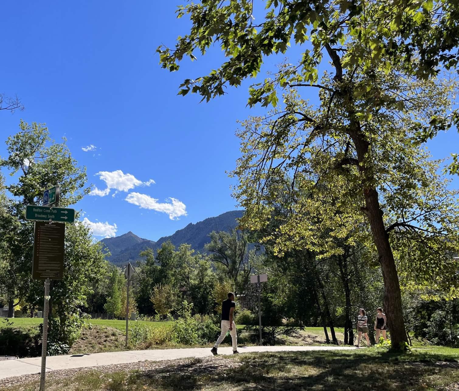
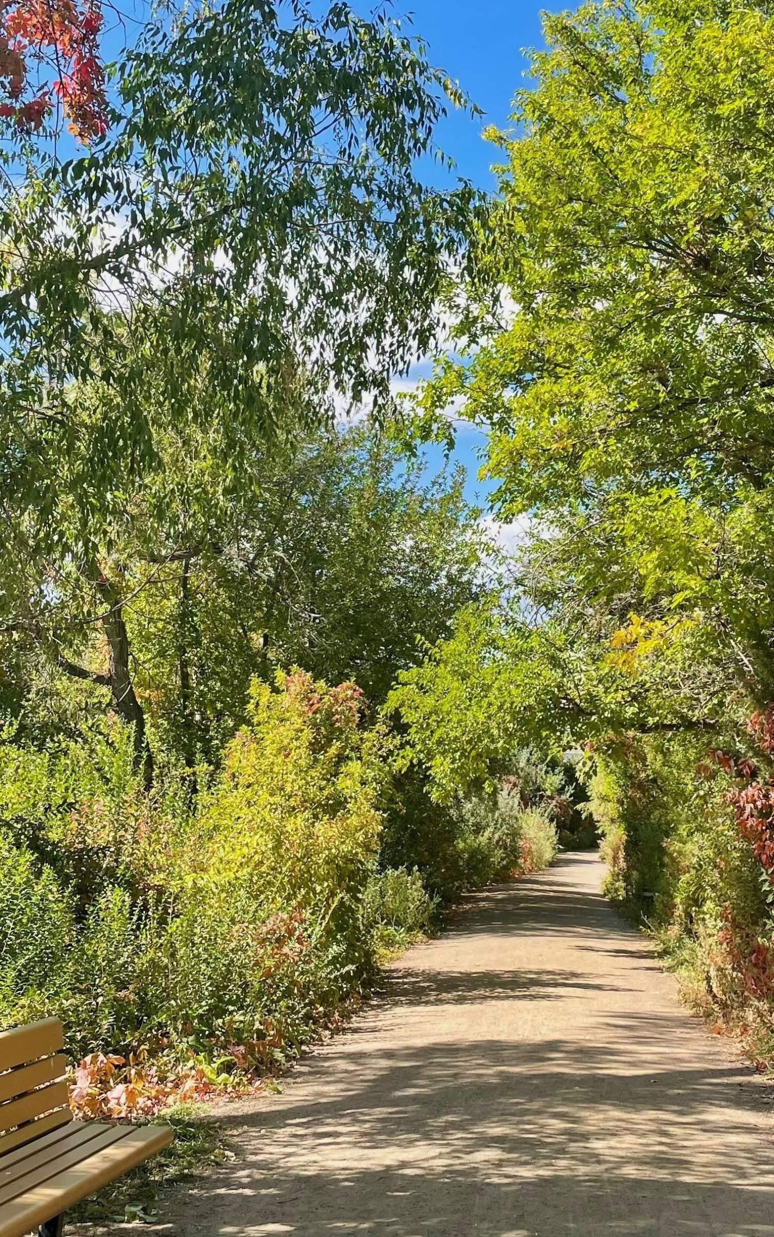
(Image Below) Public multi-use trails in Civic Center Park, Boulder, highlight the importance of trees for shade and environmental health, with a diverse range of tree species enhancing the park’s beauty and comfort.
Source: Superbloom
Implement Street Tree Planting Guidelines or Standards Policy #7 :
To promote a resilient and diverse urban canopy, municipalities should establish tree diversity guidelines that limit any single species to no more than 10% of total plantings, no more than 20% from any one genus, and no more than 30% from any one plant family within a defined planting area. This strategy reduces the risk of pest and disease outbreaks that can devastate uniform tree populations. A recommended street tree list should be developed based on elevation, with species suited to the High Prairie zone (4,800–6,000 feet). Reference materials such as the Front Range Recommended Tree List by CSU, or approved tree lists by the City of Denver and the City of Boulder and City of Longmont (23, 24,25, 26).
Ensuring adequate soil volume is essential for healthy root development and long-term urban canopy success. Tree planting areas should be a minimum of 5 ft wide and provide a soil volume of 750–1,000 cubic feet per tree to support healthy root development. Tree spacing should vary by species, with smaller trees—such as crabapples or hawthorns—planted 15–20 feet apart, while larger species, including ash, oak, and maple, should be spaced 30–40 feet apart to allow for proper canopy growth. New trees should be 1.5–2 inches in caliper and 6–12 feet tall at planting. For city-maintained projects, such as public parks, smaller trees may be preferred for easier longterm maintenance by municipal forestry teams. For additional guidance on soil volume requirements, refer to Deep Root’s running list of cities with soil volume standards, which provides insight into best practices and regulations across various urban environments (27).
Proper planting distance from utilities is also critical. Trees should be planted at least 10 feet away from water or sewer lines, light poles, and overhead utility poles and must adhere to public works requirements for placement near intersections, streets, and public safety equipment such as fire hydrants.
To support tree health, a 3-inch layer of shredded wood mulch should be applied around the base of each tree, extending in an 8-foot diameter circle or to the outer edge of the planting hole, while ensuring mulch remains 4–6 inches away from the trunk to prevent rot and pest infestations.
Reference Policies & Programs
Reference #1 :
Community Forestry Corps Program (28)
City of Boulder, Lafayette, and Louisville, CO
Description:
Community Forestry Corps employs youth throughout Boulder County to plant and sustain tree canopy in climate-vulnerable communities. This program launched in several communities across the U.S. in 2024 and will further grow in 2025. Most participants in the 2024 City of Boulder/Boulder County crew are Spanish-first speakers.
Reference #2 :
Tree Protection and Mitigation Requirements (29)
Telluride, CO
Description:
Development codes require protection of all existing cottonwood or aspen trees with a trunk diameter of 6 inches or more, and all other deciduous or coniferous trees with a trunk diameter of 3 inches or more. If tree removal is necessary, tree mitigation by replacement or payment is required. New trees must be replaced with a total trunk diameter equal to those removed. Hazardous trees or those within Wildfire Defensible Space zones are exempt from this requirement.
Reference #3 :
Green Space Zoning Requirements (30)
Aspen, CO
Description:
Aspen's Land Use Code (see Title 26), outlines zoning regulations requiring green space in new developments. Specific requirements include minimum open space percentages for various zoning districts (eg, 60-100 square feet of green space per dwelling unit in residential projects or 10-20% minimum lot coverage for non-residential properties), mandates for tree planting, and guidelines for the protection of existing vegetation. These measures ensure that adequate green spaces are integrated into urban planning, providing natural cooling and enhancing community health.
Reference #4 :
Streetscape Tree Planting Guidelines (31)
Fort Collins, CO
Description:
Fort Collins’ Streetscape Standards provide comprehensive guidelines for the design and management of public street environments to enhance the city's aesthetic and functional quality. Key elements include the incorporation of tree-lined streets, landscaped parkways, and medians to enhance the urban shade canopy. These standards provide useful details for minimum soil volumes, tree spacing and distances from utilities to optimize the health of individual trees and the urban forest at large.
Reference #5 :
Parking Lot Tree Shading Requirement (32)
Sacramento, CA
Description:
Sacramento’s City Code requires surface parking lots to achieve 50% shading within 15 years by planting and maintaining trees. Exceptions include single-unit and duplex parking, structures, carports, enclosed spaces, and certain truck areas. Developers must submit a tree plan before approval, and city staff conduct inspections to ensure compliance. After 15 years, lots are assessed, with penalties for noncompliance. These rules support urban shade and reduce heat islands.
Reference #6
:
Parking Lot Tree Shading Requirement (33)
Tempe, AZ
Description:
Tempe, AZ, requires surface parking lots to achieve at least 20% shade coverage within five years through tree planting or shade structures. Developers must submit a landscape plan, ensuring at least one tree per 12 parking spaces and incorporating landscape islands for larger lots. The city enforces compliance through inspections, and property owners who fail to meet shading requirements may face penalties or be required to add missing shade. These regulations aim to reduce heat islands, improve air quality, and enhance urban aesthetics.
Growing Urban Shade Forests References
1. Colorado State University. (n.d.). Chapter 2: Temperature and precipitation. Climate change in Colorado. https://climatechange.colostate.edu/ chapters/2_temp_precip.html
2. ClimateCheck. (n.d.). Boulder, CO climate risk report. ClimateCheck. https://climatecheck.com/colorado/boulder
3. Chen, P. (2024). Inequality in heat: The role of spatial patterns of urban green infrastructure. Urban Climate, 53, 101820. https://doi.org/10.1016/j. uclim.2024.101820
3. The Colorado Sun Staff. (2024, July 17). Denver's heat islands intensify with climate change. The Colorado Sun. Retrieved from https://coloradosun. com/2024/07/17/denver-heat-islands-climate-change-weather/
4. Nyelele, C., & Kroll, C. N. (2020). The equity of urban forest ecosystem services and benefits in the Bronx, NY. Urban Forestry & Urban Greening, 53, 126723. https://doi.org/10.1016/j.ufug.2020.126723
5. Grant, J. (2002, April 22). The importance of shade trees in urban environments. Purdue University News. https://www.purdue.edu/uns/ html4ever/020422.Grant.shade.html
6. Creating Tomorrow’s Forests. (n.d.). The Miyawaki method for creating forests. https://www.creatingtomorrowsforests.co.uk/blog/the-miyawakimethod-for-creating-forests
7. The Trust for Public Land. (n.d.). Pocket forest initiative. The Trust for Public Land. Retrieved January 31, 2025, from https://www.tpl.org/our-work/ pocket-forest-initiative
8. Colorado State University. (n.d.). Recommended tree species for Colorado Front Range communities. https://rockies.audubon.org/sites/default/files/ csu_tree_list.pdf
9. Colorado State Forest Service. (2021). Colorado Front Range urban forestry expansion strategy: Full report. https://static1.squarespace. com/static/640a89b6111ebd6cf9229aa2/t/665f5ef6c5c8a331b21248 9f/1717526273058/Colorado%2BFront%2BRange%2BUrban%2BForestry%2 BExpansion%2BStrategy-Full%2BReport.pdf
10. PanIT Geo, Inc. (in press). Boulder County urban tree canopy assessment. Boulder County Government.
11. City of Boulder. (2018). Urban Forest Strategic Plan. City of Boulder. https:// bouldercolorado.gov/media/2105/download?inline
12. Salt Lake City. (2023). Urban Forest Action Plan. Salt Lake City. https://www. slcdocs.com/Planning/Master%20Plans/Urban%20Forest%20Action%20 Plan/Urban%20Forest%20Action%20Plan.pdf
13. American Forests. (n.d.). Tree Equity Score. https://www.treeequityscore.org/
14. City of Boulder. (in press). Urban Forest Strategic Plan 2024.
15. Colorado State University Extension. (n.d.). Colorado Master Gardener program. Colorado State University. Retrieved from https://boulder. extension.colostate.edu/gardening-horticulture-native-plants-communitygarden/colorado-master-gardener/
16. City of Tempe. (n.d.). Parking lot landscape requirements. https://www. tempe.gov/government/community-development/code-complianceopen-m-i-n-d/business-owner/violations/site/parking-lot-landscape
17. Council of Tree and Landscape Appraisers. (2018). Guide for plant appraisal (10th ed., revised). International Society of Arboriculture.
18. City of Bulverde. (2022). Chapters 16: Code Amendment Per-Caliper-Inch Cash Value for Replacement Trees . [PDF file]. https://www.bulverdetx.gov/ AgendaCenter/
19. City of Portland. (n.d.). Heritage trees. Portland.gov https://www.portland. gov/trees/heritage
20. San Francisco Planning Department. (n.d.). San Francisco planning code. American Legal Publishing Corporation. Retrieved January 29, 2025, from https://codelibrary.amlegal.com/codes/san_francisco/8603be9c-75e74ea5-be6f-d64d913f45ba/sf_planning/0-0-0-18381
21. City of Colorado Springs (2023). Landscape code and policy manual (June 5, 2023). https://coloradosprings.gov/system/files/2023-06/cos_ landscape_code_and_policy_manual_6_5_23.pdf
22. Colorado State University Extension. (2024). 2024 Front Range tree list. https://planttalk.colostate.edu/wp-content/uploads/2024/04/2024-FrontRange-Tree-List.pdf
23. City and County of Denver. (n.d.). Approved Street Tree List. https:// denvergov.org/Government/Agencies-Departments-Offices/AgenciesDepartments-Offices-Directory/Parks-Recreation/Park-OperationsForestry-Open-Space-Management/Office-of-the-City-Forester/ Property-Owner-Resources/Denver-Approved-Street-Tree-List
24. City of Boulder. (2019). Approved species list. https://bouldercolorado.gov/ sites/default/files/2021-05/approved-species-list-final-12-12-2019.pdf
25. City of Longmont. (n.d.). City-maintained trees and services. LongmontColorado.gov. https://longmontcolorado.gov/forestry/citymaintained-trees-and-services/
26. Marritz, L., & Hunter, K. (2022, January 24). Soil volume minimums for street trees organized by state/province. DeepRoot Blog. https://www. deeproot.com/blog/blog-entries/soil-volume-minimums-organized-bystateprovince-2/
Growing Urban Shade Forests References
(Continued)
27. Nature-Based Climate Solutions. (n.d.). Community Forest Corps. https:// naturebasedclimate.solutions/community-forest-corps
28. Town of Telluride. (n.d.). Telluride land use code § 3-505. Telluride Municipal Codes. https://telluride.municipal.codes/LUC/3-505
29. City of Aspen. (n.d.). Aspen land use regulations § 26. City of Aspen Aspen.gov. https://library.municode.com/co/aspen/codes/municipal_ code?nodeId=TIT26LAUSRE
30. City of Fort Collins. (n.d.). Streetscape design guidelines. https://www. fcgov.com/planning/pdf/streetscape-doc.pdf
31. City of Sacramento. (n.d.).Tree shading requirements for parking lots (§ 17.612.040). Sacramento Municipal Code. https://codelibrary.amlegal.com/ codes/sacramentoca/latest/sacramento_ca/0-0-0-39381
32. City of Tempe. (n.d.). Parking lot landscape requirements.
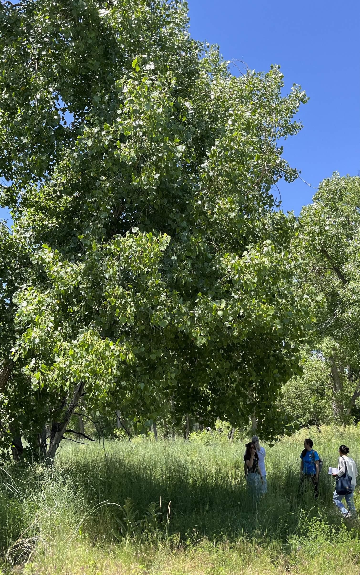
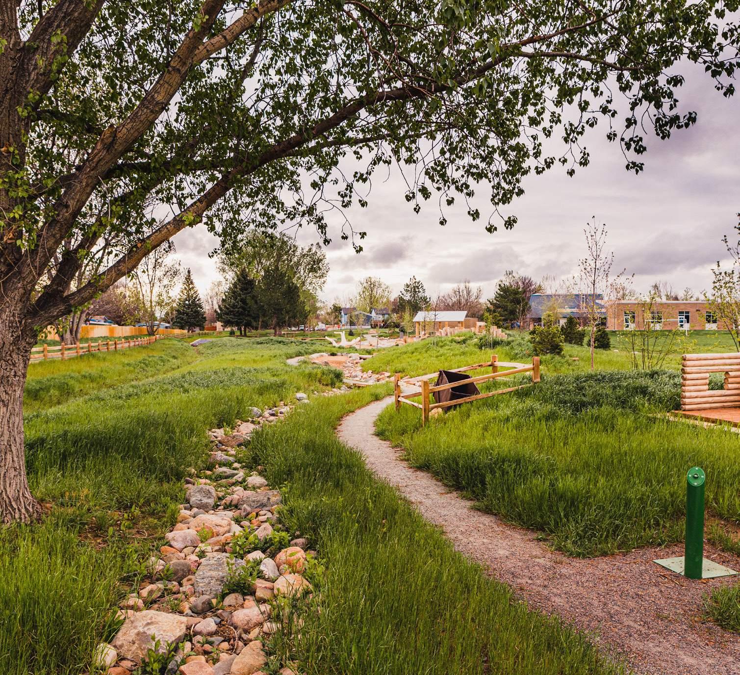
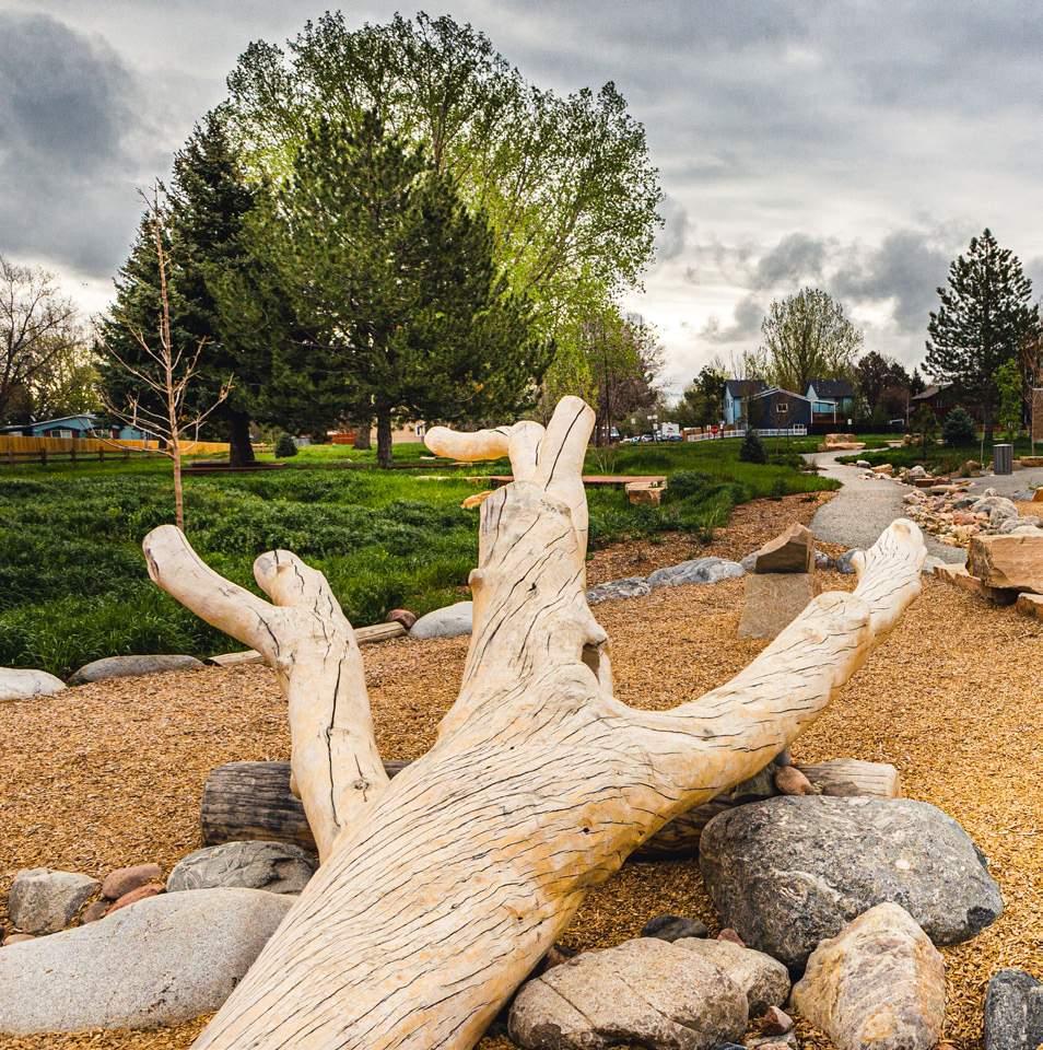
(Image Right) Native plains cottonwoods thrive in riparian zones, where access to groundwater supports their growth. This photo shows a mature cottonwood stand along the stream corridor in Primos Park, North Boulder, CO. Source: Superbloom
Restoring Floodplains and Streams
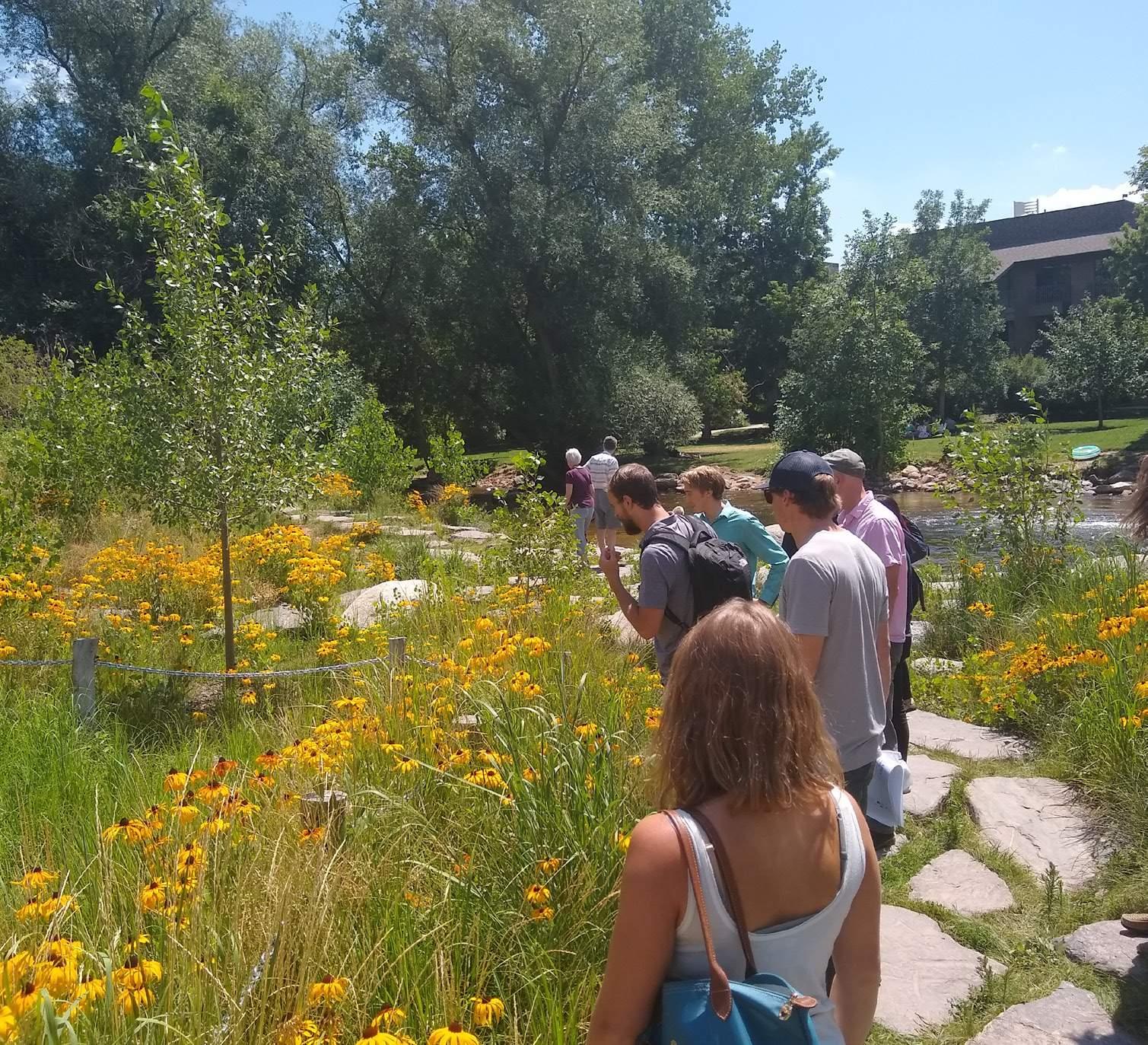
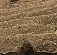
Boulder County’s dry climate occasionally faces sudden and extreme cycles of rain and snow that can lead to flooding. Flood risk is heavily influenced by the condition of surrounding floodplains and riparian wetlands. When these ecosystems are healthy, they absorb water and help mitigate flooding. However, when they are degraded, they lose their ability to absorb water, increasing the likelihood of flooding.
Historically, natural floodplains and riparian zones played a crucial role in managing flood hazards. Yet, wetlands across the U.S. are rapidly deteriorating and disappearing. In urban areas across Boulder County, mining, reservoir conversion, agriculture, and urban development have substantially reduced and disconnected floodplains and riparian areas, increasing flood risk for residents and business owners in these zones.
Reconnecting and restoring floodplain landscapes adjacent to creeks, rivers, and streams can act as a natural buffer to floods and mitigate water scarcity by retaining water in the ground. These areas also provide valuable ecosystem services, such as returning nutrients to surrounding floodplain soils and filtering stormwater. Beyond their ecological benefits, floodplain and creekside areas serve as vital public spaces in urban environments, offering gathering spaces, recreational opportunities, water activities, and peaceful reflection.
(Image Right) Flooding is a social justice issue, disproportionately impacting disadvantaged communities who face greater exposure — and fewer resources to respond and rebuild (2).
Source: Boulder County (OSCAR)
56% of buildings in unincorporated Boulder County located in the special flood hazard area (SFHA) flooded at least once between 2019 and 2050 in the simulation (1).
Flooding is a social justice issue because it disproportionately affects disadvantaged groups which are typically more vulnerable and more exposed to flooding (2).
& Streams
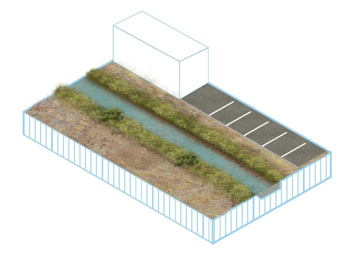
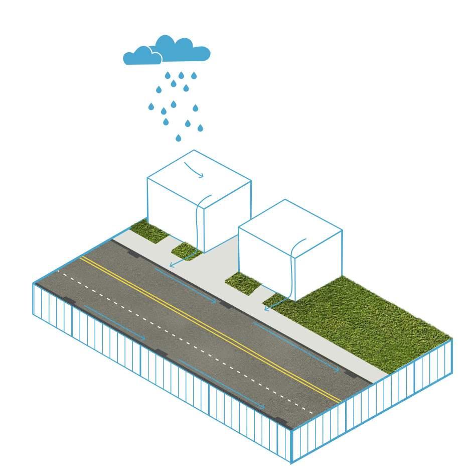
Channelized Stream Banks
Status Quo
Runoff
Reduced Floodplain Capacity
Limited Recreation Access
Urban Runoff
This increases the velocity and volume of water flow leading to more erosion, sedimentation, and increased pollution.
Channelization & Incised Stream Banks
This practice disrupts natural flow patterns, increases erosion, reduces habitat complexity, and impairs the stream’s ability to support diverse aquatic and riparian ecosystems.
Reduced Floodplain Capacity
This increases The reduction of floodplain capacity increases the risk of flood and reduces the land’s ability to slow and absorb water.
Limited Community Access
Few clear access points available for stream access and interpretive opportunities.
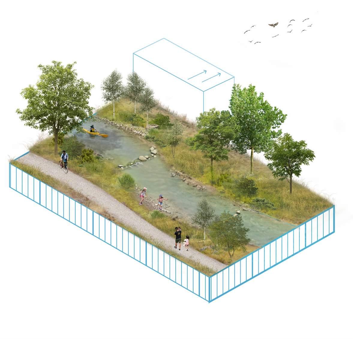
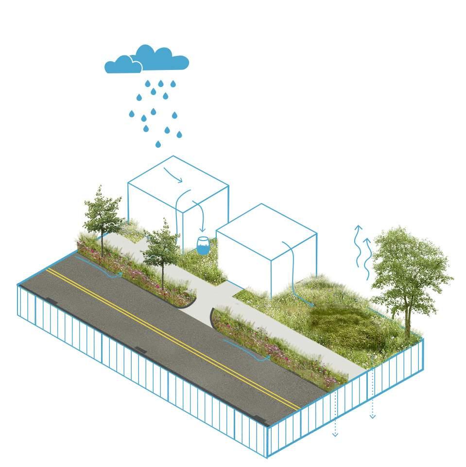
Urban
Increased Flood Capacity
NBS Solution Implemented
IncreasedBuildingFloodplainSetback
Reduced Impervious Surfacing
More Recreation Opportunity
Reduced Impervious Surfacing
Replacing pavement with permeable surfaces increases water infiltration, reducing runoff and flood risk.
Increased Flood Capacity
Restoration helps reduce flash flooding from mountain runoff, improves water retention, and supports Boulder’s aquifers and riparian ecosystems.
A Healthier Ecosystem
Restoring streams and floodplains improves habitat diversity, supporting more wildlife and enhancing overall ecosystem functions.
A Healthier Ecosystem
More Safe & Abundant Recreation Opportunity
Natural floodplains provide green spaces for hiking, kayaking, and outdoor activities, enhancing public access to nature.
Program & Action Options
#1:
Update Countywide Flood Mitigation and Creek Restoration Planning
Regularly update the Floodplain Management and Transportation System Resiliency Study and Action Plan (3) every five years to ensure it reflects current restoration needs and opportunities. Conduct ongoing assessments of Boulder County’s urban creeks and floodplains to monitor their condition and evaluate the effectiveness of preservation efforts, focusing on urban areas since much of the county’s rural land is already protected (4). Identify damaged or restricted floodplains and highlight opportunities for restoration, expansion, or land acquisition to restore former wetlands and reconnect waterways.
Partner with organizations such as the Land Trust Alliance and Mile High Flood District, and explore voluntary buy-outs of previously flooded properties, establishing a dedicated fund to support these efforts. Identify priority sites on publicly owned land—including parks, right-of-ways, and transportation corridors—for stream restoration, daylighting piped streams, and reconnecting wetland patches. Where possible, integrate restored areas into the local transportation network by incorporating bike paths and walking trails, creating a connected system of greenways.
Expand Funding & Incentive Programs
Support Private Landowners in Flood Zones: Develop a financial incentive program for private property owners in flood-prone areas—particularly larger commercial, industrial, and campus properties—to encourage wetland restoration and floodplain reconnection. Offer incentives for relocating out of high-risk areas or enhancing waterways on private land, using the Boulder County Flood Buyout Program (5) as a model. Leverage federal programs where possible, including the Hazard Mitigation Grant Program (6), Flood Mitigation Assistance Grant Program (7) Grant Program, Building Resilient Infrastructure and Communities Program (8), Community Development Block Grant (9), and Emergency Watershed Protection Program (10).
Encourage Development Outside of Flood Zones: Offer tax breaks or permitting incentives for building outside or above the 500-year flood zone, using policies like the City of Fort Collins’ flood-safe building practices (11) as a guide.
Expand State Buyout Funding Programs: Explore state grants, revolving loan funds, and bonds to support floodplain buyouts, allowing the acquisition of properties from willing sellers to relocate people and structures out of harm’s way. Ensure all parks, trails, and open spaces in creek and floodplain areas meet ADA compliance standards, providing equitable access to recreational opportunities.
Strengthen Land Use Policies for Industrial and Agricultural Areas Near Waterways
Conduct a comprehensive study of industrial and agricultural land uses near floodplains, rivers, and streams to identify potential environmental and flood risks. Implement stricter regulations to reduce erosion, runoff, and pollution from these land uses. Where feasible, develop a plan to buy out land immediately downstream of industrial or agricultural sites and convert it into publicly owned open space to minimize flood risk and enhance ecological resilience.
Upgrade Infrastructure and Improve Stormwater Management
Invest in upgrading or removing outdated flood control infrastructure that no longer meets modern resiliency standards. Identify aging or inadequate stormwater systems, particularly in low-income neighborhoods, and prioritize green infrastructure improvements in these areas. Expand no-build zones in public floodplain areas to accommodate larger storm events, such as 500-year floods, ensuring long-term climate adaptation and risk reduction.
Action #3 :
Policy #1 :
Policy Options
Mandate Green Infrastructure for Flood Mitigation in New Developments
Require the use of green infrastructure in new developments to manage stormwater and reduce flood risks. Techniques may include rain gardens, retention ponds, and restored wetlands.
Policy #2 :
Prohibit New Development in Undisturbed Floodplain Areas
Restrict new development in undisturbed urban floodplains to preserve natural flood mitigation functions. For infill development in floodplains, require green infrastructure such as permeable surfaces, riparian buffers, and flood-resilient vegetation.
Policy #3 :
Zoning Incentives for Wetland and Floodplain Enhancement
Offer zoning incentives such as variances and density bonuses for developments that enhance wetlands and floodplain areas. Developers may shift density to non-floodplain areas in exchange for preserving or restoring floodplain zones.
Policy #4 :
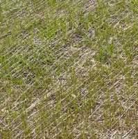
Promote Native Vegetation and Control Invasive Species
Encourage the use of native vegetation and the removal of invasive species in floodplain and riparian areas to support habitat restoration and improve ecosystem resilience.
Policy #5 :
Strengthen Erosion Control and Stream Bank Stabilization
Ensure that development in floodplain areas addresses slope and soil conditions to prevent erosion. Require the stabilization of stream banks using native vegetation, bioengineering, and erosion control methods to protect water quality.
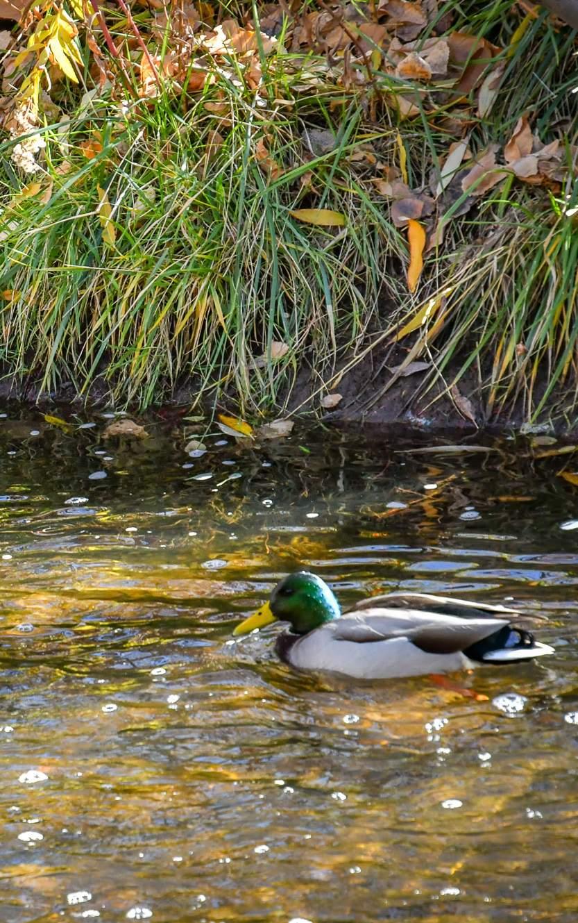
(Image Left) Mallard at Coal Creek in Lafayette, CO.
Source: The City of Lafayette
Policy Options
Prioritize the Creation of Recreational Areas Along Waterways Policy #6 :
Incorporate recreational areas such as fishing spots, boat docks, and rafting access points into creek and floodplain developments while maintaining the ecological health of the waterway.
Restore Stream Meandering and Reshape Banks for Flood Resilience Policy #7:
Implement stream meandering and bank reshaping techniques in floodplain and riparian zone projects to restore natural water flow patterns, reduce erosion, and improve habitat.
Enforce Zoning and Development Codes for Floodplain Protection Policy #8 :
Strengthen zoning and development codes to preserve and protect floodplain and riparian areas. Require new projects adjacent to these areas to incorporate green infrastructure such as bio-swales, wetlands, and permeable pavements to enhance flood resilience.
Establish Material Standards for Creekside Development Policy #9 :
Mandate the use of impermeable, non-toxic, and flood-resistant materials in floodplain and riparian area developments to minimize ecosystem disruption. Prioritize natural materials such as stone and wood over concrete, and incorporate natural stabilization structures such as log jams and rock formations. Refer to the State of Colorado Floodplain Development Guidelines (12) and FEMA Recreational Guidelines (13) for best practices.
Reference Policies & Programs
Reference #1 :
City of Boulder Storm & Floodwater Master Plan (14) Boulder, CO (2022)
Description:
The City of Boulder’s Storm & Floodwater Master Plan outlines strategies for managing stormwater and flood risks in the region, with a focus on enhancing flood resilience, improving water quality, and reducing flood damage in urban and suburban areas.
Reference #2 :
Boulder Creek Restoration Master Plan (15)
Boulder County, CO (2015)
Description:
This master plan provides planning guidance to improve resiliency along Boulder Creek from the confluence with Fourmile Creek, in Boulder Canyon, to the confluence with the St. Vrain Creek in the City of Longmont.
Reference #3 :
MILE HIGH FLOOD DISTRICT (MHFD) FLOODPLAIN REGULATION (16)
Denver Metro, CO (Last updated 2019)
Description:
Established in 1969, the MHFD assists local governments in the Denver metropolitan area with multi-jurisdictional drainage and flood control challenges. Their floodplain regulations provide standards for minimizing flood losses in areas subject to flood hazards and promote the wise use of the floodplain through the development of sound floodplain management practices.
Restoring Floodplains & Streams References
1. Boulder County. (2020, February). Floodplain management and transportation system resiliency study action plan. Boulder County. https://assets.bouldercounty.gov/wp-content/uploads/2020/02/ floodplain-management-transportation-system-resiliency-study-actionplan.pdf
2. U.S. Environmental Protection Agency. (2022, September 8). EPA report shows disproportionate impacts of climate change on socially vulnerable populations. U.S. Environmental Protection Agency. https://www.epa.gov/ newsreleases/epa-report-shows-disproportionate-impacts-climatechange-socially-vulnerable
3. Boulder County. (n.d.). Floodplain management and transportation system resiliency study and action plan. Boulder County Government. https://bouldercounty.gov/transportation/floodplain-management/ floodplain-management-and-transportation-system-resiliency-study-andaction-plan/
4. Boulder County. (n.d.). Acres of open space managed by Boulder County. Boulder County Government. https://bouldercounty.gov/open-space/ management/acres/
5. Boulder County. (n.d.). Flood buyout properties. Boulder County Open Space. https://bouldercounty.gov/open-space/management/floodbuyout-properties/
6. Federal Emergency Management Agency. (n.d.). Hazard mitigation grants. https://www.fema.gov/grants/mitigation/learn/hazard-mitigation
7. Federal Emergency Management Agency. (n.d.). Flood mitigation assistance. https://www.fema.gov/grants/mitigation/learn/floodmitigation-assistance
8. Federal Emergency Management Agency. (n.d.). Building resilient infrastructure and communities. https://www.fema.gov/grants/mitigation/ learn/building-resilient-infrastructure-communities
9. U.S. Department of Housing and Urban Development. (n.d.). Community Development Block Grant Program (CDBG). https://www.hudexchange. info/programs/cdbg/
10. U.S. Department of Agriculture, Natural Resources Conservation Service. (n.d.). Emergency watershed protection program. https://www.nrcs.usda. gov/programs-initiatives/ewp-emergency-watershed-protection
11. City of Fort Collins. (n.d.). Chapter 10: Floodplain regulations and floodplain management. https://library.municode.com/co/fort_collins/codes/ municipal_code?nodeId=CH10FLPRPR
12. Colorado Secretary of State. (n.d.). Rules and regulations for floodplain management (8 CCR 1507-16). https://www.sos.state.co.us/CCR/ GenerateRulePdf.do?ruleVersionId=3960
13. Federal Emergency Management Agency. (n.d.). FEMA P-2181: Fact sheet 5-1: Parks and recreational facilities. https://www.fema.gov/sites/default/ files/documents/fema_p-2181-fact-sheet-5-1-parks-recreational.pdf
14. City of Boulder. (n.d.). Comprehensive flood and stormwater master plan. Retrieved https://bouldercolorado.gov/projects/comprehensive-floodand-stormwater-master-plan
16. Urban Drainage and Flood Control District. (n.d.). Floodplain management services. https://www.mhfd.org/floodplain-management
Managing and Capturing Urban Stormwater
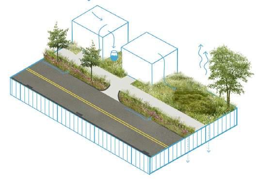
In arid regions like Boulder County, effective urban stormwater management is essential for reducing flood risks, protecting water quality, and maximizing the use of rainwater. The region's erratic weather, combined with aging infrastructure, widespread impervious surfaces, and rapid urban development, often turns typical rainfall into major flood events. These events overwhelm drainage systems, pushing pollutants into local waterways, harming aquatic ecosystems and degrading water quality. This is especially harmful as many overflows throughout the county flow directly into watersheds like Boulder Creek without treatment.
A major challenge in Boulder County, as in other arid and semi-arid regions, is designing urban landscapes that traditionally shed water rather than retain it. This outdated approach must shift toward water-retentive landscapes that mitigate flood risks and improve water quality by naturally filtering pollutants. Stormwater management strategies should prioritize capturing and utilizing water, transforming it from a liability into a valuable resource.
Rainwater harvesting is a key strategy for managing stormwater, especially in arid regions like Boulder County. However, water rights laws in the American West complicate its implementation. In Colorado, residential rainwater collection is permitted under specific conditions, such as using up to two rain barrels with a combined capacity of 110 gallons (1). Municipalities face stricter regulations that limit large-scale rainwater harvesting to prevent interference with existing water rights.
(Image Right) Bioswale at CU Boulder Department of Aerospace Engineering in Boulder, CO. Source: JVA Consulting Engineers
Annually, from 2004 to 2014, urban flooding alone cost communities an average of $9 billion in direct damages (2).
In 2023, the EPA allocated $531,000 to Colorado for stormwater collection upgrades and sewer system improvements under the Sewer Overflow and Stormwater Reuse Municipal Grant program (3).
In urban areas, particularly those upland of streams and floodplains, NBS like rain gardens, bioswales, permeable pavements, and constructed wetlands help manage stormwater, retain water in the landscape, and filter pollutants by mimicking natural processes. Treating rainwater as a valuable resource allows communities to reduce flooding, alleviate water scarcity, and enhance groundwater recharge.
Wetlands, ephemeral streams, and natural washes—features that flow only during storm events—play a critical role in regulating water flow, supporting biodiversity, and filtering pollutants. Shifting toward landscapes that capture and utilize rainwater—through both active collection systems and passive design strategies—will help Boulder County protect water quality, build climate resilience, and ensure long-term water sustainability.
Case Study
The Bentway: Stormwater Management
Through Creative Infrastructure (4)
Project Overview:
Located in downtown Toronto, The Bentway spans 1.75 kilometers beneath the expressway, transforming a formerly neglected space into a vibrant public realm. The project was developed to enhance connectivity, provide recreational opportunities, and implement sustainable stormwater management solutions in an urban setting.
Stormwater Management Strategies:
The Bentway incorporates multiple stormwater management features that mitigate urban runoff and enhance environmental resilience:
Permeable
Surfaces & Rain Gardens
Green infrastructure lowers flood risk. Provides cultural and recreational spaces. 1 2 3 4 5
Rainwater
Harvesting
Native Plantings
Flood Mitigation Community Engagement
Reduce runoff and enhance water infiltration.
Collects and reuses runoff for irrigation.
Improve biodiversity and mitigate urban heat.
&
Increased Flood Risk .
Status Quo
Water Pollution
Increased Flood Risk
Inefficient stormwater management leads to overwhelmed drainage systems during heavy rainfall, resulting in flash flooding that can damage property and infrastructure.
Erosion and Sedimentation
Loss of Groundwater Recharge
Water Pollution
Poorly managed runoff can carry pollutants, debris, and chemicals into local waterways, degrading water quality in Boulder Creek and affecting aquatic ecosystems.
Erosion and Sedimentation
Excessive runoff can cause soil erosion, destabilizing banks and increasing sedimentation in rivers and streams, which harms habitats and aquatic life.
Loss of Groundwater Recharge
Ineffective stormwater capture decreases water infiltration into the ground, reducing local aquifer replenishment and limiting water availability during dry periods.
NBS Solution Implemented
Bioswales effectively manage stormwater runoff, filtering pollutants and promoting water infiltration, which reduces flooding and improves water quality in local streams.
Collecting rainwater for reuse helps conserve potable water, reduces runoff, and provides a sustainable water source for irrigation during dry periods in Boulder.
Designed to absorb and manage excess rainwater, rain gardens enhance groundwater recharge, improve local biodiversity, and provide habitat for pollinators and other wildlife.
Reducing pavement allows for better water absorption, minimizing runoff, decreasing flood risk, and promoting healthier ecosystems in urban areas.
Rain Gardens
Rain Barrels
Bio Swales
Limited Impervious Surface
Rain Gardens
Rain Barrels
Bio Swales
Limited Impervious Surface
Program & Action Options
Action #1 :
Develop Green Infrastructure Standards
Create and implement a green infrastructure strategy that prioritizes natural solutions over engineered ones in new developments. Where regulations allow, integrate rainwater reuse systems, such as rainwater harvesting for irrigation, landscaping, or non-potable uses, to reduce municipal water dependence and minimize stormwater runoff. Refer to the City of Boulder Green Infrastructure Strategic Plan for best practices in incorporating green infrastructure and rainwater reuse into urban planning (5). Ensure that low-income, marginalized, and underserved communities are prioritized for green infrastructure investments, especially where they experience higher levels of pollution, flood risk, and heat islands. Equity-focused zoning and incentives should direct resources to historically underserved neighborhoods to ensure equitable access to cleaner, cooler environments. Work with community organizations and stakeholders to gather input on neighborhood-specific needs and preferences.
Integrate Green Infrastructure for Flood Management Action #2:
Establish guidelines for incorporating green infrastructure into flood management strategies. Prioritize the use of bioswales, rain gardens, constructed wetlands, bioretention ponds, and natural features like washes or arroyos to manage stormwater, improve water quality, and enhance flood resilience. These solutions should be designed to integrate seamlessly with the landscape, addressing both environmental and community needs. Prioritize flood-prone, vulnerable, and historically marginalized communities for beneficial green infrastructure such as rain gardens, bioswales, and wetlands.
Educate and Promote Green Infrastructure Practices Action #3:
Develop and distribute materials on green infrastructure, rain gardens, and water rights to promote natural water retention methods in private developments. Refer to the Green Infrastructure Implementation Strategy by CDOT (6). Develop materials in multiple languages to ensure equitable distribution.
Incentivize Green Infrastructure Adoption
Create incentive programs to encourage private landowners to adopt green infrastructure practices, such as bioswales, rain Gardens, green Roofs, and permeable pavements. Offer tax rebates or grants for businesses and residents implementing green stormwater solutions. Refer to the San Francisco Green Infrastructure Grant Program (13). Provide incentives for transitioning from traditional concrete stormwater infrastructure to green solutions. Design incentives for adopting green infrastructure practices to support lowincome households, small businesses, and communities of color. Offer targeted subsidies, low-interest loans, or matching funds for private landowners in underserved neighborhoods to implement rain gardens, bioswales, or permeable pavements. This could also include providing technical support, education, and outreach in languages relevant to those communities to ensure everyone has access to the resources needed to adopt green infrastructure practices.
Action #4:
Program & Action Options
Repurpose City-Owned Land for Green Infrastructure
Identify city-owned properties, including parking lots, parks, and underutilized spaces, that experience stormwater issues. Convert existing gray infrastructure into green infrastructure solutions to manage runoff and improve water quality. Incorporate permeable pavements, rain gardens, and bioretention areas into parking lot redesigns to reduce stormwater runoff and support sustainable landscaping. Additionally, consider using drought-tolerant native plants to reduce water use and enhance biodiversity. Minimize the parking footprint by adding landscape islands, which can improve the environmental and aesthetic qualities of these spaces. Incentivize these changes through targeted grants, zoning bonuses, and development programs that reward property owners and developers for implementing green infrastructure solutions on city-owned land.
Invest in modern stormwater infrastructure, such as detention ponds, underground retention tanks, and treatment facilities, to manage runoff effectively. Upgrade aging infrastructure to handle increased precipitation due to climate change. When upgrading public stormwater infrastructure, prioritize areas with the highest vulnerability and DI communities, ensuring that upgraded infrastructure enhances quality of life and promotes equitable access to environmental benefits.
Upgrade Stormwater Infrastructure
Action #7:
Engage the Community in Green Infrastructure Projects
Establish a green infrastructure conservation corps or residential stewardship program to engage residents in installing and maintaining green infrastructure solutions. Ensure community outreach programs actively engage vulnerable populations, such as low-income communities, people of color, and people with disabilities, in stormwater and green infrastructure efforts. Programs should include educational initiatives in multiple languages, as well as culturally appropriate materials, to ensure diverse communities understand the benefits and implementation of green infrastructure. Offer direct financial support for these communities to help overcome financial or logistical barriers to participation.
Policy #1 :
Policy Options
Establish Design Standards for Rain Gardens and Bioswales
Develop clear standards for designing and implementing rain gardens, bioswales, and bioretention cells, incorporating best practices from the Mile High Flood District and other regional guidelines. These systems should be engineered to capture and slow stormwater, either through long-term retention (wet basins) or temporary storage during storm events (dry basins), to reduce downstream flooding. Design specifications should include a maximum slope of 4:1 (horizontal to vertical), a minimum longitudinal slope of 2%, and a setback of at least 10 feet from building foundations to maintain structural integrity.
Policy #2 :
Implement an Impervious Surface Impact Fee
Establish an impact fee for all new impervious surfaces (excluding buildings) to offset the increased stormwater runoff caused by development. Direct revenue from this fee to municipalities within Boulder County for watershed-positive projects that improve water quality, enhance stormwater/ rainwater management systems, and restore natural habitats, following regional standards such as the Mile High Flood District’s Urban Storm Drainage Criteria Manual (7). To ensure equitable benefits, prioritize funding for low-income neighborhoods and disproportionately impacted (DI) areas. Prevent the displacement of small businesses by considering financial incentives, technical assistance, or rent subsidies to mitigate potential rent increases caused by green infrastructure improvements. Engaging affected communities early in the planning process will help identify and address concerns, ensuring stormwater management benefits are distributed fairly.
Strengthen Natural Stormwater and Rainwater Management Regulations Policy #3 :
Require the integration of rain gardens, bioswales, and bioretention cells as essential components of stormwater and rainwater management. These natural systems should be designed to capture and temporarily store stormwater using materials such as soil, gravel, sand, and hydromorphic vegetation. Expanding the use of these sustainable water management solutions will help improve local water quality while promoting ecological resilience.
Enforce Vegetation and Plant Selection Guidelines Policy #4 :
Mandate the use of native, drought-tolerant, medium-sized, and salt-tolerant plants in all green infrastructure systems. Refer to the planting guidelines provided by the Colorado Stormwater Center (9) and the Mile High Flood District’s Ultra Urban Green Infrastructure Guidelines (8) to ensure plant selection supports long-term ecosystem health and resilience.
(Image Below) Vegetated Swale at Sanchez Trail in Layfette, CO.
Source: JVA Consulting Engineers
Managing &
Capturing
Reference Policies & Programs
Reference #1 :
Ultra-Urban Green Infrastructure Guidelines (8) and Denver Green Continuum Streets Guidelines (12)
Denver, CO (2022)
Description:
The City and County of Denver have integrated green infrastructure into the city’s long-term stormwater management strategy by combining largescale and site-specific green infrastructure solutions. These guidelines provide detailed strategies for managing stormwater, enhancing urban cooling, and improving air quality through the implementation of green spaces such as rain gardens, green streets, and permeable pavements.
Reference #2 :
Green Infrastructure Grant Program (13) San Francisco, CA
Description:
The Green Infrastructure Grant Program funds the design and construction of green stormwater infrastructure on large properties and in the public right-of-way, with the goal of reducing stormwater runoff while delivering public benefits that enhance the quality of life for all SFPUC rate payers.
Reference #3 :
GreenPlan-IT (14)
California Region
Description:
GreenPlan-IT is a versatile, open-source toolset that supports municipalities in planning and evaluating the placement of green infrastructure. The tool also tracks the effectiveness of these installations in reducing stormwater run-off, PCB, and mercury in receiving waters.
(Image Right) Restored Wetland in Boulder Civic Center Park in Boulder, CO.
Source: JVA Consulting Engineers
Managing & Capturing Urban Stormwater References
1. Boulder County. (2020). Floodplain management & transportation system resiliency study action plan. Boulder County Transportation Department. https://bouldercounty.gov/transportation/floodplain-management/ floodplain-management-and-transportation-system-resiliency-study-andaction-plan/
2. American Society of Civil Engineers. (2021). Stormwater infrastructure. Infrastructure Report Card. https://infrastructurereportcard.org/cat-item/ stormwater-infrastructure/
3. U.S. Environmental Protection Agency. (2023, February 15). EPA offers Colorado $531K for stormwater collection, sewer system upgrades. U.S. Environmental Protection Agency. https://www.epa.gov/newsreleases/ epa-offers-colorado-531k-stormwater-collection-sewer-system-upgrades
4. American Society of Landscape Architects. (2019). The Bentway. ASLA 2019 Professional Awards. https://www.asla.org/2019awards/635136The_Bentway.html
5. City of Boulder. (2017). Green infrastructure strategic plan. https://bouldercolorado.gov/sites/default/files/2021-02/ greeninfrastructurestrategicplan.pdf
6. City and County of Denver. (n.d.). Green infrastructure implementation strategy. Denver Department of Transportation and Infrastructure. https:// www.denvergov.org/Government/Agencies-Departments-Offices/ Agencies-Departments-Offices-Directory/Department-of-Transportationand-Infrastructure/Programs-Services/Green-Infrastructure/ Implementation-Strategy
7. Mile High Flood District. (n.d.). Criteria manual. https://www.mhfd.org/ criteria-manual
8. Urban Drainage and Flood Control District. (2019). Ultra-urban green infrastructure guidelines. https://www.denvergov.org/Government/ Agencies-Departments-Offices/Agencies-Departments-OfficesDirectory/Department-of-Transportation-and-Infrastructure/ProgramsServices/Green-Infrastructure/Ultra-Urban-Guidelines
9. Colorado State University Stormwater Center. (n.d.). General resources. http://stormwatercenter.colostate.edu/resources/general-resources/
10. Mile High Flood District. (n.d.). MHFD criteria manual: Volume 3 –Landscape, irrigation, and vegetation. https://www.mhfd.org/criteriamanual-volume-3
11. Mile High Flood District. (n.d.). MHFD criteria manual: Volume 3 –Landscape, irrigation, and vegetation. https://www.mhfd.org/criteriamanual-volume-3
12. City and County of Denver. (n.d.). DOTI-ES-018.0: Green continuum streets guidelines. Denver Department of Transportation and Infrastructure. https://www.denvergov.org/files/assets/public/v/2/doti/documents/ standards/doties-018.0-green-continuum-streets-guidelines.pdf
13. San Francisco Public Utilities Commission. (n.d.). Green infrastructure grant. https://www.sfpuc.gov/programs/grants/green-infrastructure-grant
14. San Francisco Estuary Institute. (n.d.). GreenPlanIT. https://greenplanit.sfei. org
Transforming Turf
(Converting
Non-Essential Turf Lawns to Low-Water, Pollinator Friendly Planting)
Extensive turf landscapes contribute to water scarcity and environmental strain. In Boulder, lawn maintenance accounts for up to 40% of the city’s water use each year (1). Many urban areas in Colorado rely on bluegrass (Poa pratensis), a coolseason, sod-forming grass native to Europe and northern Asia. This species, which thrives in a vastly different climate than the Mountain West, requires 50–80% more water than native grasses like buffalo grass (Bouteloua dactyloides) and blue grama (Bouteloua gracilis) (2). The widespread use of bluegrass has increased pesticide dependence, exacerbated water scarcity, contributed to environmental degradation, and heightened energy consumption.
In response to ongoing water shortages and recent Colorado state legislation, many municipalities are shifting away from traditional bluegrass lawns (3). Turf removal—replacing water-intensive, non-native grass species with droughttolerant plants—is an essential strategy for arid regions like Boulder County. Converting to drought-tolerant and native species while integrating low-water plants, materials, and design elements enhances climate resilience by improving habitat, reducing stormwater runoff, promoting soil health, and lowering water costs. Additionally, minimizing pesticide use supports pollinator species, water quality, and food safety.
(Image Right) A perennial and native grass garden offers a low-water alternative to traditional turfgrass at a private residence in the Boulder, CO.
Source: Superbloom
When watered and maintained effectively, replacing your turf with Xeriscape can reduce your outdoor water use by up to
60%
Additionally, on average, 50% of household water is used for landscape irrigation. (4)
Every year across the country, lawns consume nearly 3 trillion gallons of water a year, 200 million gallons of gas (for all that mowing), and 70 million pounds of pesticides. (5)
As part of broader sustainability efforts, turf removal initiatives are growing more common in urban areas, often paired with shade improvements to mitigate urban heat islands. For example, Las Vegas requires that at least 50% of turf removal areas be replaced with shade-providing elements, a strategy that helps reduce heat island effects, decrease reliance on water-intensive grass, and create cooler, more livable spaces. Shade can be incorporated through a combination of trees, shrubs, and trellises with climbing vines, providing multiple ecological and aesthetic benefits, such as improved air quality and enhanced biodiversity (6).
At the county level, a successful transition away from nonessential turf requires coordinated efforts, including public education, property owner incentives, and a shift in landscape design and maintenance expectations. Implementing these practices would allow Boulder County to conserve water, reduce pesticide use, improve soil health, and promote ecologically diverse environments, particularly in underserved and DI communities. Prioritizing water conservation in these efforts is also critical to strengthening the resilience of drinking water supplies and ensuring water availability for other essential uses, especially given that Boulder County’s urban areas rely on local reservoirs for their water needs.
The City of Aurora, Colorado, has implemented a turf conversion initiative to enhance water conservation in public parks (7).
Objective: To conserve water while maintaining high-quality outdoor spaces for residents.
Strategy:
• Replace Kentucky bluegrass turf with water-efficient alternatives.
• In low-usage areas, convert to native grasses.
• In high-usage areas, introduce drought-tolerant Bermuda turf.
Expected Outcomes:
• Achieve a 70% reduction in water usage in the converted areas.
• Conserve millions of gallons of water annually.
• Continue providing ample space in parks for public use and enjoyment.
How effective was this program in 2024?
18 acres
estimated annual water savings converted to native grasses 9.8 million
(Image Left) A lawn-free garden in Boulder showcases native plants like milkweed and Rocky Mountain penstemon in the foreground, creating vital habitat for pollinators such as monarch butterflies throughout the landscape. Source: Superbloom
Turf Conversion Prep & Process
Plant Types & Seed Selection
The first step in replacing turf with native plants is to select your replacement plants. Plant species that are native to Boulder County will support local biodiversity and have a better chance at successful establishment and growth. Determine whether your site is full sun, part sun or mostly shade, choose a mix of cool- and warm-season grasses and forbs, with a nurse crop to establish initial growth. Native plant suitability is often determined by the elevation of the site.
A nurse crop protects the soil and aids in establishing native plants by providing temporary cover.
e.g. Annual Wheat & Oats
These grow in late April to early May when temperatures are cooler and extend foraging availability/aesthetic ground coverage.
e.g. Wheatgrass & Junegrass
Forbs are generally nonwoody, not grass-like, and usually produce flowers. They often require more time to mature compared to grasses.
e.g. Prairie Sage & Yellow Coneflower
These grow in Late May to early June, require little water and develop a deep root system, preventing erosion.
e.g. Little Bluestem & Blue Grama
Nurse Crop
Cool - Season Grass
Warm - Season Grass
Forbs
2
Preparation of the Site
(3-6 Months)
The existing turf on site will need to be removed before being replaced with native plants. Before seeding can occur, the best practices is to allow the weeds to grow in order to assess and mitigate as needed. Soil testing is important and will provide the required amendments to aid in a healthy soil structure, providing a healthy base for the seeds or plugs.
3
Remove Sod
The existing turfgrass must be completely removed from the site.
Allow Weeds to Express Remove Weeds
Allow weeds to emerge during cool and warm seasons, monitor exposed soil, and determine removal methods.
Installation of the Seed
Weed removal includes pulling, flame, mowing, smothering, or spot spraying, with rhizomatic weeds needing selective removal and soil replacement.
Soil Testing
Take a few soil samples and use local university services to determine what amendments needs to be made.
(1-2 Days or Longer for Larger Sites)
Once the soil is prepared, it is time to spread the seed mix. This is best done in late fall (October) or Mid-May to June (after the final snow of the season) .
(Proceed to step 4b only if using Live Plants)
Scarify the Soil
Seeding Method A Seeding Method B Water
Scarification mechanically loosens compacted soil to improve structure, ensuring seedto-soil contact for germination or preparation for live plants. Drilling Hand Broadcasting
For larger seeded areas, a Truax skid steer-mounted drill seeder is preferred, which allows for various sizes of grass and for seeds to be planted at the proper depth.
Distribute seeds evenly by sweeping your hand across the soil, then lightly rake or press them in with a flat board.
Water gently to avoid displacing the seeds, keeping the soil moist until the seeds germinate.
4a
Establishment & Maintenance of Seeded Areas
Once the soil is prepared, it is time to spread the seed. This is best done in late fall (October) or Mid-May to June (after the final snow of the season) .
YEAR 1
Immediately After Install (Fall/Spring)
Install biodegradable jute or coir fabric over newly seeded areas to prevent soil erosion and seed loss.
4b
Install Fabric (May/June or Sept/Oct)
Cool-season grasses and nurse crops germinate. Install fabric over plants.
Monitor for Weeds (During Establishment)
Monitor regularly for weeds and manage with hand removal or other organic method.
Installation, Establishment, & Maintenance of Live Plants
Planting live plants is most successful in the spring or early fall when temperatures are moderate, and moisture is more consistent. Live plants establish more quickly than seeds, ensuring better growth and survival.
YEAR 1
Plants Arrive
Plants arrive to the site and quantities and species are verified.
Layout Plant Mixes
Planting mixes are flagged and/or painted indicating Species locations on bare soil or mulched beds.
Confirm Layout
Plant similar species in large swaths to mimic natural plant communities, creating visual impact, and reducing competition from weeds.
Planting the Containers
After the Layout is reviewed, container plants are planted by shovel and/or by mechanical planting drills.
=
= Keep seeded areas moist with regular waterings to aid in establishment
Reduce or eliminate irrigation, if the grass is sufficiently established.
YEAR 2
Do Not Mow! (Summer-Early Fall)
Cool-season grasses and nurse crops grow, warm-season grasses begin to germinate, and forbs are likely not visible.
Mow (Late Fall)
Mow between October and November to 4”-6” to control weeds and aid seed establishment.
YEAR 3
Maturation (Summer)
Nurse crops are gone; final seed mix is established, longterm species are small but still maturing.
YEAR 2
Early Growth of Plugs
Some growth will be seen in the first year -- especially from the grass species. The forbs will take longer to mature.
Summer
Growth After 1 Year PostPlanting Using Live Plants is Significant.
Monitor for Weeds
Monitor for weed growth during establishment period. Depending on weed species, determine the appropriate methods of removal.
Plant Replacement
Plants that are dead can be replaced on an as-needed basis.
Status Quo
Increased Maintenance
Low Biodiversity
High Water Use
Increased Maintenance
Lawns require regular mowing, watering, and care, resulting in higher time and resource investment.
Pesticide
& Fertilizer Runoff
Maintaining lawns often involves fertilizers and pesticides, which can harm local ecosystems and water quality.
High Water Use
Lawns require significant irrigation, stressing local water resources, especially during dry seasons.
Pesticide & Fertilizer Runoff
Low Biodiversity
Lawns provide minimal habitat for pollinators and wildlife when compared to diverse native plantings.
Cooler Microclimate
Healthier Soils + Root Systems
NBS Solution Implemented
Reduction in Water-Use
Increased Biodiversity
Healthier Soils + Root Systems
Converting to native plants enhances soil health by promoting deeper root systems, which improve soil structure, increase water infiltration, and boost microbial activity.
Cooler Microclimate
Native landscapes with varied plant heights and shading cool the surrounding air, reducing local temperatures and creating more comfortable outdoor spaces.
Reduction in Water-Use
Native plants are adapted to Boulder’s climate, requiring far less water than traditional lawns, helping conserve water during drought periods.
Increased Biodiversity
Turf conversion supports a wider range of plant species, attracting more pollinators, birds, and beneficial insects, enhancing local ecosystems.
Program & Action Options
Action #1 :
Develop Financial Incentives Programs for Turf Conversion
Create and implement a range of financial incentives to encourage property owners, HOAs, local businesses and municipalities to implement replacement of non-essential turf. This could include rebates for turf replacement, grants for native plant installation, tax breaks for water-efficient landscaping, and incentives for reducing water consumption and pesticide use. Ensure these programs are accessible to Disproportionately Impacted (DI) communities to promote equity and avoid displacement due to rising land values. Promote Colorado’s Turf Replacement Program as a resource for funding and support in turf replacement efforts (see: Colorado's Turf Replacement Program (8)).
Integrate Green Infrastructure for Flood Management Action #2:
Create a comprehensive turf replacement program with financial incentives (see above), educational resources (see below) and technical support to help property owners, local businesses, and municipalities replace water-intensive turf with drought-tolerant, native, and pollinator-friendly plants. Ensure that all new installations adhere to Colorado Bill SB24-005 (9), which prohibits local governments and special districts from installing nonfunctional turf, artificial turf, or invasive plant species in new development or redevelopment projects. Create guidelines to ensure adequate watering during landscape transformation projects, prioritizing the health of existing trees. Encourage the use of natural, dye-free woody mulches or compost to retain soil moisture, improve plant survival, and support healthy ecosystems in pollinator-friendly landscapes. Prioritize outreach and support for DI communities to ensure equitable participation.
Action #3:
Conduct Turf Assessments & Develop a Conversion Master Plan for Public Lands
Perform thorough assessments of existing turfgrass on public lands and create a strategic, phased plan for converting non-essential turf areas to low-water landscapes. Analyze the cost of irrigation and evaluate the return on investment for converting 10–20% of non-functional turfgrass in public
open spaces over the next three years. Include a review of the use of non-essential turf in other public areas, such as libraries, municipal campuses, roads, and sidewalks. Use these analyses to inform the final master plan, which should focus on maximizing climate resilience, water conservation, and habitat restoration across municipal properties. Develop water budgets for municipal properties to optimize water use, especially for large areas with significant turfgrass. Phasing strategies should prioritize conversions in DI neighborhoods and properties with significant water consumption. Include a maintenance plan where possible.
Action
#4:
Expand Availability of Native, DroughtTolerant Plants
A key barrier to converting landscapes to native and pollinator-friendly plantings is the cost and accessibility of native plants. To address this, explore partnerships with local growers and nurseries to expand the availability and affordability of native and drought-tolerant plants. Collaborate with local horticultural experts, landscape architects and allied organizations to develop appropriate plant lists. This effort would not only support the success of conversion projects but also promote the growth of a robust local market for native plants. Offer incentives and rebates to businesses and residents in underserved areas to improve access to sustainable landscaping options.
Action
#5:
Launch an Education and Outreach Program
Develop an ongoing public education program to raise awareness about the benefits of and available financial resources for turf conversion, including workshops, online resources, and community events. Develop a Boulder Countyspecific training program and online resources to guide residents in converting lawns to native plant gardens through DIY methods. Reference the Colorado Water Conservation Board and Colorado WaterWise standards (10). Focus on making this information available to DI communities and empower local residents to participate in sustainability efforts.
Policy Options
Policy #1 :
Develop and implement environmental stewardship policies for municipal properties that prioritize water efficiency, sustainable land management, and equitable access for DI communities.
Turf-to-Native Conversion Guidelines: Develop guidelines for converting non-functional turf to native grasses and pollinator-friendly plants in municipal properties, ensuring that the guidelines are designed to be affordable and accessible to DI communities. Reference the Denver Water Sustainable Landscape Conversion Handbook (11) for planting character examples and recommendations.
Target Major Water Users: Identify properties with high water consumption (private properties, schools, campuses, and large commercial sites) and promote turf conversion and water-saving measures, focusing on providing support for DI communities facing water scarcity and climate resilience challenges. Develop Environmental Stewardship Standards for Publicly Owned Land
Policy #2:
Coordinate Countywide Landscape Regulations to Limit Turf
Develop universal landscape standards for development codes and zoning that prioritize low-water-use landscapes and limit turf areas in new developments, with a particular focus on ensuring equitable access to these resources for Disproportionately Impacted (DI) communities. Potential regulations by zoning type include:
Residential Landscapes: Prohibit turfgrass in the front yard and limit its size to 500 square feet or less in the backyard, with special consideration for low-income neighborhoods where access to water-efficient resources may be limited.
Commercial Landscapes: Ban non-essential or high-water turfgrass and artificial grass. Landscaped areas should include low-water plants, such as buffalo grass, blue grama, or other native grasses, with incentives or grants for businesses to adopt these practices.
Recreational Parks: Limit turfgrass to functional areas and restrict its use in all other spaces. Prioritize parks in DI neighborhoods for conversion to low-water landscapes and equitable access to green spaces.
Public Parks and Schools: Convert 10–20% of non-functional turf to low-water-use plantings during renovations and upgrades, especially in underserved areas that would benefit most from reduced maintenance costs and improved green infrastructure.
Policy #3:
Conduct Turf Assessments & Develop a Conversion Master Plan for Public Lands
Implement water-efficient irrigation practices for all landscaping projects. Take care to consider the effect of any regulations on vulnerable DI areas where access to waterefficient technologies may be more challenging.
Outdoor Watering Restrictions: Limit outdoor watering to three days per week, with a maximum of one 8-minute cycle per station or 15-minute cycles for water-conserving systems. Ensure that water-saving technologies are accessible to renters and low-income communities.
Watering Hours: Prohibit outdoor watering, including hand watering, between the hours of 10 a.m. and 6 p.m. to minimize evaporation.
No Runoff: Prohibit runoff onto streets or gutters from irrigation systems, focusing on sustainable infrastructure in DI neighborhoods that lack adequate stormwater management.
Water Budgets: Require submission of water budgets for all new developments and commercial or municipal renovations to optimize water usage, particularly for properties with significant turfgrass areas. Establish maximum water budgets by size and/ or programming. Take care to develop budgets that still allow for adequate shade tree planting in urban areas. Analyze and review budgets annually or every 2-3 years.
Violation System: Establish a violation system with warnings for first offenses, followed by fines for non-compliance, while ensuring that low-income and DI communities are not unduly penalized for lack of resources or infrastructure.
Policy Options
Expand Availability of Native, DroughtTolerant Plants Policy #4:
Strengthen landscape requirements to enhance water efficiency and support long-term sustainability. Options to consider include:
Water-Efficient Turfgrass: When functional turf is necessary, require drought-adapted cool season varieties like Texas Hybrid or warm-season alternatives such as Buffalo grass, Dog-Tuff, Tahoma 31 bermudagrass or Blue Grama. Incentivize warm-season varieties where possible.
Hydrozoning: Mandate hydrozoning in new landscape designs, grouping plants based on their water needs.
Municipal Hydrozone List: Create a municipal hydrozone plant list with approved species grouped by water requirements. Refer to Town of Castle Rock Approved Plant List (12), but collaborate with local extensions and landscape professionals to develop a list best suited to the unique microclimates in your municipality. Because nursery cultivars may vary and change over time, build flexibility into the list to accommodate new plants and their water requirements.
For additional code considerations, refer to Colorado Department of Local Affairs (DOLA) Template Land Development Codes (13).
Reference Policies & Programs
Reference #1 :
Las Vegas “Save Our Water” Initiative (LVMC Title 14.11) (14)
Las Vegas, NV
Description:
The City of Las Vegas promotes turf substitution with shade elements to reduce water use and mitigate the urban heat island effect. A key requirement mandates that at least 50% of the area where turf is removed must be shaded. This guideline is part of broader water conservation measures, including restrictions on non-functional turf and other landscaping changes to align with water-efficient practices. Planting shade trees, particularly in areas such as parking lots and urban developments, is strongly encouraged to provide cooling and reduce water consumption.
Reference #2 :
RESOURCE CENTRAL (15)
Boulder County, CO (2015)
Description:
Municipalities in Boulder County can enhance water conservation efforts by expanding partnerships with Boulder-based nonprofit Resource Central. Towns such as Erie, Lafayette, Louisville, Superior, Longmont, and Boulder already offer rebates for lawn replacement, discounts on Gardenin-a-Box kits, and incentives for water-efficient sprinklers and drip systems. Discounts range from a $25 discount toward Garden-in-a-Box kits to $700 lawn replacement stipends. Such programs could be expanded as incentivization for new low-water landscaping requirements in new construction and major renovations (See Policy Options section).
Reference #3 :
Aurora Water’s Lawn Replacement Initiative & Greatscapes (16) Aurora, CO
Description:
Aurora Water offers up to $3 per square foot of turf removed through its Water-Wise Landscape Rebate Program. The program targets nonfunctional turf and encourages homeowners to plant low-water alternatives such as drought-tolerant perennials, shrubs, and pollinator-friendly native plants.
Reference Policies & Programs
Reference #4 :
Castle Rock Water’s Coloradoscape Rebate Program (17)
Castle Rock, CO
Description:
This rebate program provides financial incentives to residents and businesses who replace turf grass with water-efficient landscaping, such as xeriscaping, to reduce water usage. The program encourages the use of drought-tolerant plants, drip irrigation, and other sustainable landscaping practices, helping conserve water resources while promoting attractive, low-maintenance landscapes.
Reference #5 :
Fort Collins’ Xeriscape Initiative Program (18)
Fort Collins, CO
Description:
Fort Collins offers a Xeriscape Incentive Program that provides rebates to residents who replace their grass lawns with water-efficient, droughttolerant landscaping. Their program is unique in that it offers benefits for residential customers (can receive up to $750 for turf replacement, with a $0.75/square foot rebate for up to 1,000 square feet. An additional $0.25/ square foot is available for planting at least 80% native Colorado plants, with a maximum rebate of $1,000), commercial customers (can receive $1.50 per square foot of area converted up to $15,000 per project.), parkway projects, and funding through the outdoor water conservation
Reference #6 :
Longmont Turf Conversion Study (19)
Longmont, CO
Description:
The City of Longmont’s Water-Wise Turf Conversion program tested transitioning Kentucky bluegrass to water-efficient wheatgrass in medians and low-traffic areas, reducing water use by 30-50%, carbon emissions from mowing operations by 50%, and cutting annual costs by $4,600. The project includes signage for education, encouraging adoption by residents and businesses. Key lessons involve careful tree watering and avoiding soil tilling during the transition. This initiative aligns with Longmont’s Water Efficiency Master Plan.
Reference Policies & Programs
Reference #7 :
Grass Replacement Incentive Program (GRIP) (20)
Aurora, CO
Description:
Aurora Water offers up to $3 per square foot of turf removed through its Water-Wise Landscape Rebate Program. The program targets non-functional turf and encourages homeowners to plant low-water alternatives like drought-tolerant perennials, shrubs, and pollinator-friendly native plants.
Additional Resources
:
Reference #8:
Longmont Water Conservation (21)
Reference #9:
Colorado Native Grass Guide (22)
Reference #10:
CO Springs’ Utilities Water Wise Plants Native Grass Solutions (23)
Transforming Turf References
1. Boulder Reporting Lab. (2024, February 9). Boulder saw significant water savings in 2023: 12% reduction for the year and 20% dip through the rainy summer months. Boulder Reporting Lab. https://boulderreportinglab. org/2024/02/09/boulder-saw-significant-water-savings-in-2023-12reduction-for-the-year-and-20-dip-through-the-rainy-summer-months/
2. City and County of Broomfield. (n.d.). Native landscape conversionsFAQ and how-to. https://www.broomfield.org/4105/Native-LandscapeConversions---FAQ-and-H
3. Colorado General Assembly. (2024). SB24-005: Prohibit Landscaping Practices That Use Turf. https://leg.colorado.gov/bills/sb24-005
4. Resource Central. (n.d.). Replacing turf with a low-water garden. Resource Central. https://resourcecentral.org/replacing-turf-with-a-low-watergarden/#
5. Natural Resources Defense Council. (n.d.). More sustainable and beautiful alternatives to the grass lawn. Natural Resources Defense Council. https:// www.nrdc.org/stories/more-sustainable-and-beautiful-alternatives-grasslawn#
6. Vanos, J. K., Middel, A., & Jenerette, G. D. (2023). Shade is an essential solution for hotter cities. ResearchGate. https://www.researchgate.net/ publication/372666206_Shade_is_an_essential_solution_for_hotter_cities
7. City of Aurora. (n.d.). GreatScapes program. https://www.auroragov.org/ residents/water/water_conservation/GreatscapesProgram
8. Colorado Water Conservation Board. (n.d.). Turf replacement program. Retrieved January 30, 2025, from https://cwcb.colorado.gov/turf
9. Colorado General Assembly. (2024). SB24-005: Prohibit Landscaping Practices That Use Turf. https://leg.colorado.gov/bills/sb24-005
10. Colorado WaterWise. (n.d.). Best practices guidebook 4.5: Waterwise best practices. https://coloradowaterwise.org/BestPractices
12. Town of Castle Rock. (2024). Town of Castle Rock plant list. https://www. crgov.com/DocumentCenter/View/7016/Town-of-Castle-Rock-Plant-List2024-PDF?bidId=\
13. Colorado Department of Local Affairs. (n.d.). Land Use Codes. Colorado Department of Local Affairs. https://dlg.colorado.gov/land-use-codes
14. City of Las Vegas. (2024). Best practices for water use. https://files. lasvegasnevada.gov/planning/Sustainability/Best_Practices_LV_Water_ Use_pamphlet-March-2024.pdf
15. Resource Central. (n.d.). Water conservation programs and services. https://resourcecentral.org/?srsltid=AfmBOoocCEh_Z8DuGxIeA_ Rv6q2FRw0MdpWv3_jO3t7-Lq77uGjKLsgB
16. City of Aurora. (n.d.). Water-wise landscape rebate https://www.auroragov. org/residents/water/rebates/water-wise_landscape_rebate
17. Town of Castle Rock. (2024, March 18). Castle Rock Water increases ColoradoScape rebate to $2,000. Castle Rock Water. https://www.crgov. com/CivicAlerts.aspx?AID=2284&ARC=3729
18. City of Fort Collins. (n.d.). Xeriscape incentive program. https://www.fcgov. com/utilities/residential/conserve/water-efficiency/xeriscape/incentiveprogram
19. City of Longmont. (n.d.). Action W-1: Water conservation and efficiency. https://indicators.longmontcolorado.gov/sustainability/actions/W-1
20. City of Aurora. (n.d.). Turf conversion & water conservation. AuroraGov. https://www.auroragov.org/things_to_do/parks__open_space___trails/ park_listing/planning__design___construction/turf_conversion___water_ conservation
21. City of Longmont. (n.d.). Water conservation. City of Longmont. https:// longmontcolorado.gov/water/water-conservation/#
Green roofs, also known as living roofs, integrate vegetation into building rooftops, providing a wide range of environmental, economic, social, and aesthetic benefits. These systems consist of multiple layers, including a waterproofing barrier, drainage and filtration components, a growing medium, and plants selected to reflect local ecology and the unique growing conditions at height. Green roofs provide vital ecosystem services, such as supporting biodiversity, improving air quality, and enhancing urban aesthetics.
A key benefit of green roofs is their ability to manage stormwater. By absorbing and retaining moisture, they significantly reduce the volume of water entering urban drainage systems, helping to alleviate flood risks and prevent waterway pollution. Additionally, green roofs help lower the urban heat island effect by reducing surface temperatures through plant absorption of sunlight and evapotranspiration, which in turn improves energy efficiency by reducing air conditioning demand.
The albedo (reflectivity) of a roof also plays a role in temperature control. Cool roofs, which use reflective materials, increase albedo, reflecting sunlight away from buildings and minimizing heat absorption. When combined with green roofs, cool roofs offer a dual benefit—lowering temperatures through plant cooling effects while enhancing reflectivity to reduce solar heat gain.
A 2017 Colorado State University study found that green roofs reduced summertime heat flux by up to
50% compared to a black roof (1).
(Image Below) Sedum mixes with grasses and annual cosmos, creating a vibrant, low-maintenance display on a green roof in Boulder, CO.
Source: Superbloom
A green roof's vegetation and substrate absorb water, which is used for evaporative cooling (2).
35 gallons of water =
2,000 pounds of ice evaporated provides cooling equivalent to melting
Blue roofs provide another stormwater management solution by temporarily storing and gradually releasing rainwater. Unlike green roofs, which prioritize vegetation, blue roofs use reservoirs or water-harvesting technologies to capture rainwater. This approach can be particularly effective in managing large volumes of water in urban areas. However, in the Western U.S., water rights regulations complicate the implementation of blue roofs, as water collection often requires navigating complex legal frameworks. Further research is needed to explore the full potential of blue roofs in this region.
While green roofs offer numerous benefits, they come with challenges, particularly in Colorado’s dry climate. Maintaining adequate moisture levels can be difficult, as many plant species that thrive in wetter environments may not be suitable for semi-arid conditions. Successful green roofs in Colorado require drought-tolerant species that can survive with minimal irrigation. Additionally, high winds, intense sun, and occasional heavy snowfall can stress a green roof’s structural integrity. Proper planning, professional expertise, and adherence to local building codes are critical to ensuring both long-term viability and structural safety. Green roofs must be installed in compliance with fire and building codes to prevent risks associated with rooftop vegetation.
Given these challenges, focusing green roof installations in dense urban areas with high urban heat island effects can maximize their cooling and environmental benefits. While green, blue, and cool roofs can improve urban resilience, their accessibility for vulnerable populations remains a concern. Most green and blue roof systems are feasible only for new construction designed to accommodate them, limiting their applicability for affordable housing or retrofits of existing structures. In contrast, cool roof strategies—such as reflective coatings—are a more scalable and cost-effective intervention for existing buildings, offering immediate cooling benefits. Despite high upfront costs, investment in green and blue roofing strategies can be supported through incentive programs, rebates, and financing options that encourage broader adoption, particularly in cities pursuing climate resilience solutions.
Roof Slope
Roof Pitch & Snow Considerations for Green Roofs
Additional Considerations:
30°to45°
What is the ideal pitch for snow-prone areas? topreventsnow buildup&structural stress. 1 2 3
Low-pitch or flat roofs (<15°) may lead to snow accumulation, requiring snow retention systems or reinforcements.
Snow can insulate plants but excess buildup may harm vegetation when it melts.
Use hardy, drought-tolerant plants and ensure proper drainage to prevent waterlogging.
No Protection from Storms
Status Quo
Building Warming
Heat Reflected
No Pollinators Supported
Urban Runoff
Without living roofs, rainwater flows directly into storm drains, increasing flood risks and pollution in Boulder County's creeks and streams.
Building Warming
Uncovered Roofs absorb heat, contributing to higher indoor temperatures, increased energy use, and worsening Boulder’s urban heat island effect.
No Pollinators Supported
Without living roofs, these spaces remain unused for habitat, reducing opportunities for pollinators in urban areas.
No Protection from Storms
Traditional roofs offer less buffer against heavy rain or hail, leaving buildings more vulnerable to storm damage and rapid water runoff.
Urban Runoff
Creating Cool & Living Roofs
NBS Solution
Implemented
Reduced Impervious Surfacing
Living roofs absorb rainwater, decreasing runoff and flood risk while helping filter pollutants from the water.
Building Heat Reduction
Living roofs provide natural insulation, reducing the amount of heat absorbed by the building, lowering indoor temperatures, and decreasing the need for air conditioning.
Pollinator Habitat
Living roofs provide critical habitat for bees, butterflies, and other pollinators, supporting Boulder’s native plant species and biodiversity.
Vegetation and soil on living roofs act as a natural buffer, reducing the impact of heavy rain, hail, and strong winds on buildings.
Creating Cool & Living Roofs
Action
Program & Action Options
#1 :
Develop a Gray to Green Grant Program
Implement a “Gray to Green” grant program to support the conversion of impervious surfaces—such as rooftops and parking lots—into green infrastructure. Eligible projects could include green roofs, bioswales, and other Nature-Based Solutions that provide stormwater management, habitat creation, and energy savings while enhancing urban resilience.
Suggested Funding: Grants can cover green roof installation costs, ranging from $7.50 to $15 per square foot, with a $50,000 project cap. Additional funding should support structural assessments for older buildings to determine their suitability for conversion.
Eligibility: Grants should prioritize residential and commercial buildings in DI neighborhoods that meet water retention requirements and have long-term maintenance plans. The program could also expand to include projects such as parking lot conversions or bioswales in road medians, ensuring these benefits reach underserved communities. To further advance equity goals, project applications could be scored higher if they directly benefit underserved community members, ensuring that funding supports those most affected by environmental and climate challenges.
Action
#2:
Develop a Stormwater Fee Credit Program
Establish a stormwater fee credit program for properties that reduce impervious surfaces or implement green infrastructure, such as green roofs, to manage stormwater. Credits should be based on the effectiveness of the green infrastructure in reducing runoff and improving water quality. Ensure that the credit system incentivizes participation in underserved communities, offering financial relief to low-income property owners and encouraging widespread adoption of stormwater management practices. See The City of Minneapolis, MN’s Residential Stormwater Credits Program for an example program that offers tiered credits to address equity issues (3).
Credit Calculation: The credit will be based on the reduction of impervious surface area achieved by green roofs, ranging from $0.10 to $0.50 per square foot of green roof area.
Water Retention: Offer additional credits for green roofs that retain more than 1 inch of rainfall per storm event. Property owners must document the amount of retained water to qualify for higher credits.
Maximum Credit: A total fee reduction of up to 50% of the annual stormwater fee can be applied if the green roof is particularly effective in runoff management.
Performance Monitoring: Require annual reports from property owners to monitor the water retention performance of green roofs, ensuring that they continue to contribute to stormwater management over time.
Action #3:
Develop Incentives for Participation in High Level Sustainability Programs
Offer incentives for developers who exceed BuildSmart standards (8) by incorporating high-level sustainability certifications such as LEED, SITES, or the Living Building Challenge. Provide benefits like expedited permitting or fee reductions for projects that meet these certifications. These incentives would encourage the adoption of innovative, highperforming solutions and support broader integration of green infrastructure and energy-efficient building practices.
(Image Below) Red feathers (Echium amoenum), a striking, drought-tolerant wildflower, thrives on this green roof in Boulder, CO.
Source: Superbloom
Program & Action Options
Launch an Education and Outreach Program Action #4:
Launch public awareness campaigns to inform property owners and developers, particularly in underserved communities, about the benefits of green infrastructure and available incentives. These campaigns can be combined with other NBS awareness campaigns. Suggestions for community engagement include:
Workshops & Webinars: Organize workshops for community members, especially in DI neighborhoods, on green roof design, installation, and maintenance. Host webinars featuring experts on successful case studies and funding opportunities, making sure content is accessible to non-English speaking residents. Encourage elected and agency officials to participate at events to optimize attendance.
Pilot Projects: Install demonstration green roofs on public buildings (e.g., community centers) in high-need areas to showcase benefits and generate interest.
Online Resources: Create a comprehensive website with FAQs, cost-benefit analyses, and resources for green roof installation and maintenance, with materials available in multiple languages and tailored to different community needs.
Networking Groups: Establish or promote local groups where interested property owners and advocates can share resources, and experiences, and support each other in installations.
Partnerships: Partner with local water conservation organizations and ensure internal partnership with local government agencies including the Water Department to participate and support outreach efforts.
Policy Options
Implement Green Roof Recommendations Policy #1:
Encourage the installation of green roofs in new large commercial and residential developments, incorporating cool roofs or energy efficiency upgrades based on project needs. This policy applies to new commercial buildings over 25,000 square feet and new residential developments with 10 or more units. Existing buildings undergoing roof replacements covering more than 50% of their total roof area should also comply.
To maximize environmental benefits, at least 30% of the roof should be covered with green roofing. Alternatively, developments may combine a smaller green roof with solar panels to promote energy efficiency. Green roofs should be designed to retain at least 1 inch of rainfall per storm event, reducing stormwater runoff and alleviating pressure on urban drainage systems. In addition to stormwater management, green roofs help mitigate the urban heat island effect, increasing green space, reducing ambient temperatures, and potentially lowering energy costs by 10–15% due to reduced air conditioning demand.
Recognizing that green roofs may not be feasible for all projects, alternative compliance options should be available. Property owners may contribute an "in-lieu fee" toward public green infrastructure projects or implement high-performance cool roofs or energy efficiency upgrades instead.
Note: This toolkit does not recommend a mandatory green roof requirement for all developments, recognizing the challenges this could pose, particularly for lower-income or multi-family properties. A flexible approach will help ensure equitable implementation while still promoting urban resilience and sustainability.
Policy Options
Encourage Shade and Cool Roofs for Heat Mitigation Policy #2:
Promoting shade-providing elements as part of green infrastructure strategies can further mitigate the urban heat island effect. Every green roof installation should incorporate shade elements such as trees, shrubs, or structures like pergolas to enhance comfort and reduce heat exposure, particularly in high-temperature areas.
To maximize impact, green infrastructure projects should be prioritized in neighborhoods with significant heat island effects, helping lower temperatures and improve public health. These efforts should focus on neighborhoods with the highest heat exposure, particularly those with low-income residents and vulnerable populations, ensuring equitable access to cooler, shaded spaces in the communities that need them most.
Reference Policies & Programs
Reference #1 :
Green Building Ordinance (4) Denver, CO
Description:
New buildings (25,000 ft² or larger) must install a cool roof and meet additional sustainability requirements. Options include green roofs, solar energy, or green building certifications. Green roofs must cover at least 80% of the roof within 3 years, with allowances for renewable energy devices and certain structures. This ordinance offers a reference for municipalities considering similar policies but may require flexibility and further research due to implementation challenges in Denver.
Reference #2 :
Green
Roof Incentive (5) Denver, CO
Description:
If a green roof occupies more than 50% of the total area of any building’s primary roof surface, the minimum requirement for pitched roof provision will be waived provided the building design complies with the other major standard intentions.
Reference #3 :
Stormwater
Initiatives (6) Philadelphia, PA
Description:
The Philadelphia Water Department offers the Stormwater Management Incentives Program (SMIP) and the Greened Acre Retrofit Program (GARP) to encourage the installation of green infrastructure on private properties. These programs provide grants to offset the costs of implementing stormwater management practices.
Minneapolis offers residential stormwater credits, enabling property owners to reduce their stormwater utility fees by installing practices like green roofs. Residents in designated “Green Zones” (DI communities) can receive up to a 45% reduction, while those outside these zones can receive up to a 35% reduction.
Creating Cool & Living Roofs
Creating Cool & Living Roofs References
1. Water Education Colorado. (n.d.). Denver’s new green roof law has some surprising implications for water. Fresh Water News. Retrieved March 21, 2025, from https://watereducationcolorado.org/fresh-water-news/ denvers-new-green-roof-law-has-some-surprising-implications-forwater/#/
2. U.S. Environmental Protection Agency. (2019, August). Green roofs: A solution for semi-arid and arid regions in the Midwest. U.S. Environmental Protection Agency. https://www.epa.gov/sites/default/files/2019-08/ documents/greenroofssemiaridaridwest_508.pdf
3. City of Minneapolis. (n.d.). Residential stormwater credits. City of Minneapolis. https://www.minneapolismn.gov/resident-services/utilityservices/stormwater/residential-stormwater-credits/
4. City and County of Denver. (n.d.). Green buildings ordinance https://www. denvergreenroof.org/the-ordinance/
5. Denver Green Roof Initiative. (n.d.). Denver green roof initiative. https:// www.denvergreenroof.org/the-basics/
6. Philadelphia Water Department. (n.d.). Stormwater management incentives. https://water.phila.gov/stormwater/incentives/
7. City of Minneapolis. (n.d.). Stormwater management. City of Minneapolis. https://www.minneapolismn.gov/resident-services/utility-services/ stormwater/
8. Boulder County Land Use Department. (n.d.). Boulder County BuildSmart regulations. Retrieved from https://bouldercounty.gov/property-and-land/ land-use/building/buildsmart/
(Image Right) Native plants bring seasonal beauty and vibrant interest to this garage rooftop in Boulder, thriving in harmony with the local landscape. Source: Superbloom
Urban Farms and Gardens
Urban farms and gardens offer substantial benefits, including improved food security, community resilience, and sustainability. However, for these solutions to thrive, they must be accessible, convenient, and affordable. Community gardens often serve not only as recreational and educational spaces but also as critical sources of food security and community engagement. Typically located in underused or vacant spaces, these gardens are sometimes supported by municipal funding, creating opportunities for all members of the community to engage in food production.
While community gardens and urban farms share similarities, they function differently. Community gardens are typically small, individual plots designed to meet local food needs, while urban farms are larger, more permanent operations that may focus on both food production and local economic development. Each offers unique opportunities to integrate regenerative agriculture practices—such as soil health management, water conservation, and crop diversity—that can promote long-term ecological and community benefits. These practices are especially important in urban areas, where healthy soil and local food systems are crucial to creating sustainable and resilient communities.
Regenerative agriculture, which emphasizes soil regeneration, biodiversity, and sustainable farming techniques, aligns well with the goals of urban farming and gardening initiatives. Integrating regenerative practices in urban environments enhances soil quality, supports biodiversity, and reduces the environmental impacts typically associated with conventional urban landscapes.
Training programs are vital to the success of urban farms and gardens. Providing access to educational resources and skill-building opportunities enables community members, especially those from historically under-resourced populations, to take leadership roles in sustainable food systems. These programs can teach essential skills in regenerative agriculture, creating pathways for community members to participate in and benefit from local food production.
Urban agriculture contributes
15-20% of the global food supply. (1)
(Image Below) Ollin Farms in Longmont, CO.
Source: Boulder County (OSCAR)
A global analysis in Earth’s Future found that urban agriculture can account for 180 million tons of food a year. That translates to 10% of the global output of legumes, roots, and tubers, and vegetable crops. (11)
Equity must remain central in the development of urban farms and gardens. By focusing on areas with disproportionately impacted populations, municipalities can ensure these spaces meet both food security needs and cultural preferences. This could involve growing culturally significant foods or medicinal herbs, fostering community connections, and preserving important traditions.
While the scale of urban farms in Boulder County may be small, they still play a vital role in fostering resilience and sustainability. By supporting biodiversity, enhancing soil health, managing stormwater, and creating local economic opportunities, these spaces can contribute to a more equitable and sustainable future. Through education, collaboration, and inclusive planning, urban farms and gardens can empower communities to grow healthier, more sustainable urban landscapes while strengthening local connections.
(Image Below) Red Wagon Farm at Thomas Farm Open Space.
Source: The City of LaFayette
Case Study
Denver Urban Gardens (DUG) is a non-profit organization dedicated to providing access, skills, and resources for individuals to cultivate healthy food within their communities and revitalize urban green spaces. Established in 1985, DUG has been instrumental in fostering community engagement and promoting sustainable urban agriculture in the Denver metropolitan area.
Key Programs:
• Community Gardens: DUG manages over 190 community gardens across six counties in the Denver Metro area, including more than 60 school-based gardens. These spaces serve as hubs for neighbors and residents to come together, build community, and grow food. (3)
• Educational Programs: DUG offers a variety of programs to equip individuals with the knowledge and skills needed for successful gardening and community building. These include youth programs, skill-building workshops for adults, community-centered events, volunteer workdays, and compost training.(4)
• Health & Research: In partnership with the Colorado School of Public Health, DUG has engaged in research to understand how community gardens support healthy living. Studies have shown that community gardeners report higher fruit and vegetable intake and increased physical activity compared to non-gardeners.
Impacts:
Farms & Gardens
Minimal Species Diversity
Status Quo
No Food Production
Heat
Reflected
Degraded Soil
Lacking Community Public Space
Degraded Soil
Compacted, nutrient-poor soils with low organic matter, unable to support healthy plant growth, water absorption, or carbon storage.
No Food Production
Urban landscapes dominated by lawns, pavement, and nonproductive areas, offering no local food sources or agricultural activity.
Minimal Species Diversity
Limited variety of plant species, leading to reduced habitat for pollinators, birds, and other wildlife, weakening ecosystem resilience.
Lacking Community Public Space
Sparse communal spaces for informal social interactions, contributing to weaker community bonds and fewer opportunities for connection.
Local Food Production
NBS Solution Implemented
Carbon Sequestration
DrylandAgriculture
Local Food Production
Urban farms provide fresh, locally grown food, reducing dependence on distant agriculture and strengthening food security.
Heat Island Mitigation
CommunityGardens
Community Resiliency
Orchards
Heat Island Mitigation
Gardens and green spaces reduce the urban heat island effect by cooling the air, providing shade, and absorbing heat.
Community Resiliency
Urban farms foster stronger social connections, local economies, and selfsufficiency, making communities more adaptable to challenges.
Carbon Sequestration
Healthy soils and plants capture and store carbon, helping mitigate climate change and reduce atmospheric CO2 levels.
Program & Action Options
Action #1 :
Expand Urban Agriculture and Community Gardens
To support urban agriculture and community gardens, municipalities should identify and map available urban land suitable for conversion into farms or gardens. This process should involve partnerships with local energy providers, solar production initiatives, and apiaries to enhance community resilience and maximize land use efficiency.
Establishing municipal grant programs can further encourage urban farming by providing supplemental funding for projects on vacant or underused lots. Funding should prioritize low-income and historically marginalized communities, ensuring equitable access to urban agriculture opportunities.
To strengthen community engagement and education, municipalities should develop resources for homeowners' associations (HOAs) on how to create and maintain community gardens. Support for youth workforce programs focused on garden management in underserved neighborhoods will also foster long-term sustainability. Hosting workshops and training sessions will equip residents, community groups, and local organizations with urban gardening skills, while collaboration with horticultural experts will improve the success of these initiatives across Boulder County.
Empowering marginalized communities through urban farming initiatives is critical for fostering food security and cultural inclusion. Programs should provide access to land for food production and cultural practices, including growing culturally significant foods and medicinal plants. By ensuring equitable access and cultural relevance, urban agriculture efforts can better serve diverse community needs.
Action
#2:
Promote Regenerative Farming Practices
Develop education programs for urban farmers and community members to promote regenerative farming practices. These programs should target a wide range of participants, from urban growers to rural farmers, emphasizing sustainable food systems and soil health. Foster mentorship and knowledgesharing networks within local communities to amplify the reach of regenerative agriculture.
Raising awareness of existing financial incentives is another critical step. Programs such as the Boulder County Soil Health Initiative (5) and the Sustainable Food and Agriculture Fund (6) already provide financial assistance for regenerative farming equipment and soil health testing. Increasing visibility and access to these programs will make sustainable farming more affordable and accessible for urban growers.
Encourage the use of organic soil amendments and sustainable fertilizers to help reduce reliance on synthetic fertilizers, particularly on public land projects. However, municipalities should engage stakeholders and land management organizations to balance organic methods with community concerns about environmental impact.
Updating Integrated Pest Management (IPM) plans will further promote sustainability by reducing harmful petrochemicals such as herbicides and pesticides. Implementing biodiversityfriendly pest management will support healthier urban ecosystems while protecting human and environmental health.
Action #3:
Offer Zoning Incentives for Urban Agriculture
Implement zoning bonuses and other incentives for developments that include community gardens, ensuring these spaces are accessible and beneficial to all residents, particularly in neighborhoods lacking green space.
Policy #1 :
Policy Options
Build Partnerships with Local Organizations to Strengthen Urban Agriculture Efforts
Partner with local organizations like Growing Gardens (7) to support outreach efforts, provide resources, and share best practices for urban farming and community gardening in Boulder County.
Incentivize Urban Farming Through Financial Support Policy #2 :
Create financial incentives, such as tax breaks and grants, to encourage property owners and developers to transform underutilized or vacant lots into urban farms and gardens. Focus incentives on increasing access for low-income and historically underserved communities.
Establish Urban Garden Regulations to Promote Local Food Production Policy #3 :
Develop regulations for community and urban gardens that promote sustainability, accessibility, and community engagement. Key components should include:
Ensure Accessibility for All: Require ADA-compliant pathways and adaptable raised beds to accommodate diverse physical abilities.
Promote Sustainability: Require on-site composting facilities and integrate community orchards for increased food production and biodiversity.
Support Security and Community Engagement: Provide locked tool storage and rest areas to encourage social interaction and security within garden spaces.
Ensure Minimum Size and Irrigation Standards: Set a minimum garden size (100 square feet is typical) and require irrigation systems to support water-efficient gardening.
These regulations should be flexible enough to apply to both private and community gardens, and municipalities can consider zoning adjustments to further encourage urban agriculture.
Modernize Zoning Codes to Support Urban Agriculture Policy #4:
Revise municipal zoning codes to allow urban agriculture as a primary use in designated urban zones, making space for diverse agricultural practices and increasing local food production. Consider incentives for developers who include agricultural features in new developments.
Regulate Pesticide and Fertilizer Use for Health and Environmental Protection Policy #5:
Implement regulations that limit the use of synthetic pesticides and fertilizers on both public and private properties, encouraging organic and sustainable land care practices to protect public health, local ecosystems, and water quality. Consider models like Portland, Maine’s Pesticide Ordinance, which includes guidelines for managing landscapes like golf courses and sports fields. Boulder County should evaluate similar policies while considering local sensitivities, particularly with regard to City of Boulder Open Space & Mountain Parks (OSMP) land management practices.
Reference Policies & Programs
Reference #1 :
Denver Food Vision (8)
Denver, CO
Description:
Denver has implemented a comprehensive set of guidelines and policies to support urban agriculture, with a focus on resilience, inclusivity, and public health. Web resources include rigorous progress reporting.
Reference #2 :
P-Patch Community Gardening Program (9)
Seattle, WA
Description:
Seattle’s zoning code integrates urban agriculture to increase food access, particularly for underserved communities. The program supports lowincome gardeners through fee assistance, with a focus on BIPOC and marginalized groups. It also facilitates food donations to meal programs, promoting both food security and community resilience. This initiative can serve as a model for municipalities aiming to incorporate equity in urban farming and gardening.
Reference #3 :
Farmers’ Market SNAP Requirement (10)
Golden, CO
Description:
Golden’s municipal code mandates that farmers' markets accept SNAP benefits and offer SNAP-eligible foods, ensuring that affordable, healthy local food is accessible to all residents. This policy highlights the importance of embedding equity into local food systems, making it a useful reference for municipalities aiming to improve food security.
Reference #4:
Portland Maine Pesticide Use Ordinance (11)
Portland, ME
Description:
Portland’s ordinance restricts synthetic pesticide and fertilizer use on public and private properties, encouraging organic practices to protect health and the environment. It also includes fines for violations, creating a framework for municipalities looking to promote sustainable land care while addressing environmental concerns. A city-appointed Pesticide Management Advisory Committee (PMAC) oversees implementation, reviews exemption requests, and educates the public on compliance.
(Image Below) Greenhouse at Esoterra Farm in Boulder County, nurturing young plants and extending the growing period during the edge seasons (spring/fall).
Source: Superbloom
Urban Farms & Gardens References
1. U.S. Department of Agriculture, Climate Hubs. (n.d.). Urban agriculture. U.S. Department of Agriculture, Climate Hubs. https://www.climatehubs.usda. gov/hubs/international/topic/urban-agriculture
2. Gillespie, T. (2018, February 15). Scholars estimate the global potential of urban farming. Bloomberg. https://www.bloomberg.com/news/ articles/2018-02-15/scholars-estimate-the-global-potential-of-urbanfarming
3. Denver Urban Gardens. (2015). Best practices for urban gardening. Retrieved from https://dug.org/wp-content/uploads/2015/02/BestPractices.pdf
4. Nature and Health Alliance. (n.d.). Denver Urban Gardens (DUG). https:// www.natureandhealthalliance.org/tln/case-studies/denver-urbangardens-dug
5. Boulder County. (n.d.). Soil Health Initiative. Boulder County Government. https://bouldercounty.gov/climate/soil-health-initiative/
6. Boulder County. (n.d.). Food and Agriculture Grant. Boulder County Government. https://bouldercounty.gov/climate/food-ag-grant/
8. City and County of Denver. (n.d.). Denver Food Vision. Denver Government. https://www.denvergov.org/Community/Food/Vision
9. HistoryLink.org. (2021, March 31). Seattle's land use and zoning history: From the early 1900s to the present. HistoryLink. https://www.historylink. org/File/20662
11. City of Portland. (2022). Landcare Ordinance (Code of Ordinances Chapter 34, Sec. 34-1, Rev. 9-19-2022). https://content.civicplus.com/api/ assets/cbe6782e-55ca-469e-9aea-69f6102f154c?cache=1800
(Image Right) Boulder County boasts a rich agricultural heritage, once known for its thriving apple orchards and cider-making traditions. Source: Ava Miller Photography
Managing Urban Boundaries
In Boulder County, the boundary between urban and rural areas is increasingly blurred, with farmlands, forests, grasslands, parks, and open spaces forming a complex landscape matrix at the urban edge. This transition zone—known as the wildland-urban interface— is particularly vulnerable to development pressure, as 58% of the county’s population resides within it (1). The ongoing affordable housing crisis has further intensified demand for new development in these areas (2).
While Boulder County has successfully preserved large tracts of open space, limited land remains available for further acquisition. Given this constraint, managing the urban edge through land use policies and zoning initiatives will be essential to limiting development, protecting natural landscapes, and mitigating urban sprawl.
One approach is to establish urban growth boundaries, setting clear limits on expansion to prevent unchecked sprawl and protect surrounding ecosystems. Additionally, avoiding unnecessary land conversion will help preserve undeveloped areas by restricting their transformation into urban or industrial land, safeguarding critical habitats and resources.
Rather than expanding outward, municipalities should prioritize infill development, directing growth to underutilized urban land and revitalizing existing areas. This approach reduces reliance on new land acquisition, making efficient use of available space while minimizing environmental impact.
Another critical strategy is to create wildfire buffer zones around urban boundaries, reducing the risk of wildfires spreading into developed areas. These buffer zones act as protective barriers, helping to shield both communities and natural landscapes from fire threats. However, recommended approaches differ between forested and grassland areas, requiring tailored solutions based on landscape conditions.
By implementing these strategies, Boulder County can balance development needs with environmental preservation, ensuring that urban growth occurs thoughtfully and sustainably while protecting the county’s unique landscapes and ecological integrity.
More than 95%
of the carbon in native warm-season grasses, such as Buffalograss and Blue Grama, is stored below ground as soil organic matter, significantly contributing to carbon sequestration and soil health. (3)
(Image Below) Kohler Mesa in Boulder, CO. Source: Superbloom
50% of Boulder County’s grasslands have already been lost to agricultural practices or other disturbances. (4) approximately
Status Quo
Wildlife & Plant Habitat
ForestEcosystem
Green Corridors
Wildlife & Plant Habitat
Intact forests and grasslands in Boulder County offer vital habitat for diverse wildlife and plant species, supporting biodiversity and ecosystem health.
Green Corridors
Green corridors allow for the natural movement of plants and animals which results in more resilient ecosystems.
Low Species Diversity
Development
Car-Dependent Neighborhoods
Low Species Diversity
Traditional car-centric neighborhood design limits species diversity by reducing natural habitats and disrupting ecosystems.
Development
Many intact ecosystems are developed and ecological value is lost in addition to the benefit it could have had to residents within its proximity.
NBS Solution Implemented
Green Corridor Stays Intact
IntactGrasslandOr ForestEcosystem
High-Density Development
EstablishUrbanGrowth Boundary
Targeted Access to Green Space
OpenSpace Management
Directed Development
Higher-Density Development
High-Density Development
Higher-density development helps protect ecosystems by reducing urban sprawl, preserving natural habitats, and allowing more land to remain undeveloped for wildlife and plants.
Directed Development
Redirecting development to more densely populated areas creates better community and protects healthy land on the edges of populated areas.
Green Corridor Stays Intact
Existing corridors of movement for wildlife can remain intact and displacement is avoided.
Targeted Access to Green Space
When visitors know where to or not to go in an open space, you can more easily protect certain areas of ecological importance.
Program & Action Options
Action #1 :
Establish or Preserve Urban Growth Boundaries and Limit Land Conversion
To prevent sprawl and preserve critical ecosystems, agricultural land, and open space, municipalities should prioritize infill development through rezoning initiatives, ensuring that new growth occurs within existing urbanized areas rather than encroaching on undeveloped natural landscapes. Introducing taxes or fees on development in sensitive areas can further discourage expansion into these spaces, while providing grants or tax breaks can incentivize large-scale landowners to engage in habitat restoration and conservation.
Supporting local stewardship initiatives through volunteer programs and community education will also help protect natural areas by fostering public engagement in conservation efforts. Partnerships with conservation organizations and land trusts can expand protected land, further promoting biodiversity and ecological resilience in Boulder County.
Action #2 :
Expand Protected Lands and Incorporate Undeveloped Areas into Parks
Ensure that parks and open spaces are integrated into long-term conservation strategies. This will enhance their role in preserving and restoring local ecosystems, particularly grasslands and forests. Municipalities should explore partnerships with land trusts and buyout programs to acquire undeveloped landscapes and farmlands, securing them for permanent conservation and public use.
Restore
and
Manage
Grasslands to Enhance Biodiversity and Reduce Wildfire Risk Action #3:
Grasslands play a critical role in ecosystem health, biodiversity, and climate resilience, but also present unique wildfire risks that require proactive management. Following the Marshall Fire of 2021, it is essential to develop grassland preservation strategies that integrate fire mitigation, biodiversity, and ecosystem restoration to enhance long-term resilience.
Key actions should include implementing rotational grazing to improve soil health and plant diversity, while also removing invasive species that threaten grassland ecosystems.
Reintroducing native plant species can further restore natural plant communities and improve habitat quality for wildlife. To encourage fire-safe land management, municipalities can offer tax incentives to property owners who adopt fire-mitigation practices, fostering community-wide resilience to wildfires. Additionally, targeted programs should be developed to control noxious plants and invasive species that degrade grassland health. Exploring the potential for bison reintroduction could further restore natural grazing patterns, enhance biodiversity, and improve ecosystem function in restored grasslands.
(Image Below) Urban Boundary at Coyote Ridge Open Space in Superior, CO. Source: Superbloom
Program & Action Options
Expand Fire-Resilient Landscaping and Public Education Programs Action #4
Green infrastructure can play a critical role in reducing wildfire risks while also improving stormwater management in areas vulnerable to both wildfires and flooding. Integrating fire-resilient landscape design into new developments, public spaces, and existing neighborhoods will strengthen climate resilience and protect communities from escalating climate threats.
A key component of this strategy is educating homeowners about creating defensible space around structures and incorporating fire-resistant landscaping into both new construction and retrofits. Expanding public awareness efforts through partnerships with realtors and landscape professionals can help ensure that wildfire risk mitigation is prioritized at every stage of development and homeownership. Recent efforts, such as Wildfire Partners’ wildfire landscape training for realtors and landscaping companies, provide a model for how professionals can be equipped with the knowledge to design, create, and maintain fire-resilient landscapes. Information about wildfire risk, defensible space, and the Wildfire Partners program should also be made readily available to homeowners through realtors, ensuring that residents have the tools and resources needed to safeguard their properties.
Policy Options
The following policy options are organized from least to most prescriptive, starting with incentives and voluntary actions, and progressing to mandatory regulations and requirements for land use. Please note that some but not all municipalities may already have such policies incorporated into their rules and regulations, so some of these recommendations may not apply to every municipality.
Integrate Fire Resilience with Ecological Management Policy #1 :
Develop a municipal wildfire preparedness strategy, prioritizing ecological health and biodiversity protection. Promote prescribed burns and biomass reduction to maintain healthy ecosystems and mitigate wildfire risks.
Policy #2 :
Encourage Fire-Safe Landscaping
Promote the use of fire-resistant (also known as “firewise”) plants in landscaping to reduce fire risk while enhancing ecological value and resilience. Encourage native plants where possible.
Policy #3 :
Use Transfer of Development Rights (TDR) to Preserve Open Space
Implement Transfer of Development Rights (TDR) to preserve open space and farmland while transferring development density to infill urban sites. Learn more about TDR (5) from the Lincoln Institute of Land Policy.
Policy #4 :
Policy Options
Implement Conservation Easements
Enforce conservation easements on critical natural areas to prevent land use changes and protect biodiversity.
Policy #5 :
Reduce Parking Minimums
Lower parking minimums to create more space for affordable housing and reduce land consumption for unnecessary parking infrastructure.
Policy #6 :
Prohibit Conversion of Natural Grasslands
Prevent the conversion of natural grasslands into developed areas to protect ecosystems, support biodiversity, and avoid releasing stored carbon.
Policy #7 :
Require Environmental Impact Assessments for Sensitive Areas
Mandate environmental impact assessments for developments in sensitive areas to ensure they do not harm ecosystems or wildlife habitats.
Policy #8 :
Create Defensible Space and FireResistant Design Requirements
Require fire-resistant building materials and designs in high-risk areas, especially in the wildland-urban interface (WUI).
Policy #9 :
Limit or Prohibit Development on Open Space
Prohibit development on open spaces at the urban-rural interface within municipal boundaries, especially on public lands, to preserve natural landscapes and ecological functions.
Reference Policies & Programs
Reference #1 :
Smart Growth Principles for Open Space Conservation (6)
USA
Description:
Review Smart Growth principles as part of a comprehensive plan for growth and development in concert with the Nature-based Solutions in this toolkit. The principles of smart growth focus on sustainable, long-term planning that reduces sprawl, promotes efficient land use, and preserves open space for future generations.
Reference #2 :
Land Use Best Practices (7)
Colorado
Description:
Refer to Colorado’s Land Use Best Practices for strategies to develop attainable and affordable housing while adopting sustainable growth and development patterns. These strategies focus on compact development, affordable and diverse housing, growth management, the effective use of districts and subdivisions, mobility, and resource conservation.
Reference #3 :
Wildfire Partners Program (8)
Boulder County, CO
Description:
Wildfire Partners provides homeowner education, financial assistance, and expert guidance to help property owners create defensible space and implement fire-resilient landscaping. A model for integrating wildfire risk reduction into local land-use policies, this program demonstrates how development and conservation efforts can align to increase wildfire resilience in the WUI.
Managing Urban Boundaries References
1. Center for Sustainable Landscapes and Communities. (n.d.). Boulder County fire survey. Center for Sustainable Landscapes and Communities. https://cslc.colorado.edu/boulder-fire-survey
2. Hernandez, M. (2023, December 4). Colorado housing shortage worsens as climate change and growth collide. Inside Climate News. https:// insideclimatenews.org/news/12042023/colorado-housing-shortageclimate-change/
3. Tennessee Native Grass Planting Project. (2020). Native warm-season grasses: Establishment and management. University of Tennessee Institute of Agriculture. https://nativegrasses.tennessee.edu/wp-content/uploads/ sites/184/2020/10/NWSG-white-paper.pdf
4. Harris , E. (2022, March 1). Native Grasslands of Boulder County. (2022) https://bouldercountyopenspace.org/i/science/native-grasslandsboulder-county/#:~:text=Shortgrass%20prairie%20once%20 dominated%20the,to%20agriculture%20and%20other%20disturbances.
5. Lincoln Institute of Land Policy. (2018, September 20). Transfer of development rights for balanced development. https://www.lincolninst. edu/publications/articles/transfer-development-rights-balanceddevelopment/
6. U.S. Environmental Protection Agency. (n.d.). About smart growth. https:// www.epa.gov/smartgrowth/about-smart-growth
7. Colorado Department of Local Affairs. (n.d.). Land use best practices. https://dlg.colorado.gov/land-use-best-practices
Nature-based solutions (NBS) can individually contribute to climate resilience, but their true strength lies in their synergy and connectivity—how they interact and interlink to amplify their impacts. In urban areas, landscapes are often fragmented by development, making large-scale solutions difficult to implement. While a single intervention can provide localized benefits, an interconnected network of NBS generates broader, more far-reaching impacts across a neighborhood or region, with their effectiveness growing as they expand in size and connect to larger landscape patches and mosaics. Further, the elements of landscape systems are not confined by the rigid boundaries of politics or human-made structures; they are dynamic and constantly changing. Water and sediment flow across regions, and climate impacts can ripple across multiple areas simultaneously. This interconnectedness and fluidity emphasize the importance of implementing nature-based solutions as part of a cohesive system, fostering resilience not only in isolated areas but across entire landscapes.
Examples of these networks include greenways, open space corridors, park systems, and neighborhood green spaces, all of which facilitate the movement of people, wildlife, water, cooler temperatures, and cleaner air. In Boulder County, this could also involve connecting critical habitats such as grasslands, wetlands, forests, and riparian zones, ensuring the continuity of wildlife corridors and water systems. Even new development projects can contribute to these networks by incorporating multiple NBS elements—such as green roofs, shade trees, bioswales, community gardens, and native, low-water-use plantings—aggregating their benefits to have a larger, more impactful effect on the surrounding ecosystem.
(Image Right) Aerial photo of the City of Boulder & Foothills Range Source: Superbloom
Program & Action Options
Neighborhood Scale:
Action #1 :
Develop a vibrant network of flowering plants throughout the neighborhood to actively support bees, butterflies, and other vital pollinators. Establish Pollinator Pathways
Action #2 :
Create Connected Microforests/ Microhabitats:
Plant small, densely packed areas to enhance habitat diversity and promote a thriving ecosystem for various species.
Action #3 :
Develop Ecodistricts
Design integrated neighborhoods or new mixed use developments that prioritize sustainability by incorporating renewable energy sources, green buildings, and communal gardens.
Action #4
Implement Connected Canopies
Launch tree-planting initiatives aimed at creating continuous, overlapping tree cover across streets and parks to improve air quality, provide shade, and enhance visual appeal.
Action #5 :
Set up community gardens and farms to boost local food production, foster education, and encourage community engagement. Launch Urban Farms
City-Scale Linear Landscapes:
Action #1 :
Expand Greenway Networks
Refer to the Boulder Greenway Plan to enhance connectivity through dedicated green spaces. See Boulder Greenway Plan.
Action #2 :
Enhance Planting Along Roadways
Plant small, densely packed areas to enhance habitat diversity and promote a thriving ecosystem for various species.
Action #3 :
Transform Utility Corridors for People
Design integrated neighborhoods or new mixed use developments that prioritize sustainability by incorporating renewable energy sources, green buildings, and communal gardens.
Action #4 :
Construct Wildlife Corridors/Animal Bridges
Launch tree-planting initiatives aimed at creating continuous, overlapping tree cover across streets and parks to improve air quality, provide shade, and enhance visual appeal.
Program & Action Options
Regional / Watershed
Scale:
Action #1 :
Initiate Restoration Projects
Restore degraded habitats, wetlands, and streams to enhance ecosystem health and resilience.
Action #2 :
Adopt “Room for the River” Strategies
Modify landscapes to allow rivers to naturally expand during floods, minimizing risks to surrounding communities.
Action #3 :
Create Wildlife Corridors
Establish connections between fragmented habitats to enable free movement of wildlife and maintain genetic diversity.
(Image Right) Weneka Lake Trail in LaFayette, CO
Source: City of LaFayette
Measuring Success Over Time
A logical next step would be to establish a system for tracking success. This could involve creating a scorecard that allows municipalities to monitor and evaluate the outcomes of implemented solutions. The scorecard would not only track the policies put into action but also provide key performance indicators (KPIs) specific to the nature-based solutions (NBS) outlined in the Toolkit. By aligning these KPIs with the desired outcomes of each intervention, municipalities can effectively measure progress and make data-driven adjustments over time. For example, it could measure aspects such as:
Biodiversity Gains
(e.g., species richness, pollinator surveys, habitat restoration)
Climate Resilience
(e.g., reduction in urban heat island effect, number of trees planted, energy use reduction)
Water Management Effectiveness
(e.g., stormwater retention, improved water quality)
Community Engagement & Benefits
(e.g., public use of green spaces, health benefits, jobs created)
Each KPI would have specific metrics tied to them, with scoring criteria to assess progress. This scorecard could be used periodically to evaluate the impact of nature-based solutions (NBS) and identify areas for improvement or adjustment.
Additionally, it could include a feedback mechanism where municipalities can report challenges and successes. This information would be valuable not only for improving local strategies but also for sharing insights with other communities or refining the toolkit for broader application.
By including the development of this scorecard in the toolkit, municipalities would have a clear, standardized process to track success, adapt strategies, and ensure long-term progress. This type of tool encourages transparency, accountability, and collaboration across Boulder County.
(Image Right)Design Team Meeting for Town of Superior Coyote Ridge Open Space Source: Superbloom
Creating a Lasting Legacy of Resilience
At every scale, these initiatives support not just individual ecological functions but also community well-being. A green roof, for example, contributes to a broader neighborhood’s pollinator pathways, which in turn support urban farms and enhance local biodiversity. These efforts don’t just stand alone—they weave together into a resilient, thriving urban ecosystem that is greater than the sum of its parts.
As Boulder County continues to adapt to a changing climate, the success of these Nature-based Solutions will depend on sustained commitment, collaboration, and community engagement. By creating interconnected green networks—across neighborhoods, watersheds, and entire landscapes—we can ensure that NBS strategies work not just for nature, but for its people as well. With thoughtful planning and intentional action, municipalities can transform these ideas into tangible, lasting change, shaping a more livable, equitable, and climate-resilient future for all who call Boulder County home.
Resources and Appendix
Glossary Acronyms
(Image Left) Red Wagon Farm at Thomas Farm Open Space
Source: City of LaFayette
Glossary
Blue Roofs
Blue roofs, also known as controlled flow roof drain systems, are detention stormwater management practices that provide temporary storage and slow release of rainwater on a rooftop.
Climate Stressor
A condition, event, or trend related to climate variability and change that can exacerbate hazards.
Co-Benefit
Green infrastructure can support hazard mitigation outcomes while generating a range of other environmental and social benefits, sometimes referred to as co-benefits, including stormwater management, air quality, habitat, and aesthetic value. FEMA
Code
A formal collection of laws or regulations that govern specific areas, often with enforcement power; legally binding.
Community Gardens
Community gardens are collaborative projects on shared open spaces where participants share in the maintenance and products of the garden.
Cool Roofs
A cool roof is designed to reflect more sunlight than a conventional roof, absorbing less solar energy. This lowers the temperature of the building just as wearing light-colored clothing keeps you cool on a sunny day.
DI Community
Colorado defines disproportionately impacted communities at the census block group scale. The census block group scale is the smallest geographic scale of data available from the U.S. Census Bureau, typically containing 600 to 3,000 people. Disproportionately impacted communities include Low-income communities,
Communities of color,
Housing cost-burdened communities, Linguistically isolated communities, Communities with environmental and socioeconomic impacts,Tribal lands, Mobile home communities, Historically marginalized communities, Colorado Dept of Health
Equity
The fair treatment and meaningful involvement of all people regardless of race, color, national origin, or income.
Green Gentrification
The process of environmental greening leading to increases in perceived local desirability that result in higher property values and rents.
Green Roofs
Also known as ‘vegetated roofs’ or ‘living roofs’ — are ballasted roofs consisting of a waterproofing membrane, growing medium (soil), and vegetation (plants) overlying a traditional roof.
Guideline
Recommendations or best practices that help implement policies, codes, or regulations but are not enforceable by law.
Level IV Ecoregion
Ecoregions are areas where ecosystems (and the type, quality, and quantity of environmental resources) are generally similar. The relative importance of each characteristic varies from one ecological region to another regardless of the hierarchical level. A Roman numeral classification scheme has been adopted for different hierarchical levels of ecoregions, ranging from general regions to more detailed: EPA
Microforest
A densely and diversely populated area with many trees, bushes, and other native species that create a small but immersive forest.
Nature-Based Solution
Nature-based Solutions leverage nature and the power of healthy ecosystems to protect people, optimize infrastructure, and safeguard a stable and biodiverse future. IUCN
Ordinance
A local law passed by a municipal or local government; legally binding and enforceable within that jurisdiction.
Policy
Per the CDC, “Policy is a law, regulation, procedure, administrative action, incentive, or voluntary practice of governments and other institutions. Policy decisions are frequently reflected in resource allocations.”
Regenerative Agriculture
The process of restoring degraded soils using management practices (e.g., adaptive grazing, no-till planting, no or limited use of pesticides and synthetic fertilizer, etc.) based on ecological principles.
Regulation
Detailed rules made by government agencies based on laws; enforceable by government agencies.
Toolkit
A resource intended to help local governments, elected officials, and recycling program coordinators simplify the process of starting or improving recycling programs in their communities.
Urban
For the purposes of this toolkit, "urban" refers to the ten incorporated cities and towns in Boulder County, as well as densely developed areas within unincorporated Boulder County. These areas are characterized by higher population density, concentrated infrastructure, and legal and political frameworks such as zoning and property ownership. Urban areas serve as key hubs for governance, services, and climate adaptation efforts distinct from rural land management.
Urban Farms
The practice of cultivating crops, livestock, or types of food in an urban environment.
Wildland-Urban Interface (WUI) the zone of transition between unoccupied land and human development. It is the line, area, or zone where structures and other human development meet or intermingle with undeveloped wildland or vegetative fuels.
Acronym Guide
BIPOC
Black, Indigenous, and people of color
BOCO
Boulder County
DI COMMUNITY
Disproportionately Impacted Community
NBS(S)
Nature-Based Solution(s)
OSCAR
Office of Sustainability, Climate Action, and Resilience