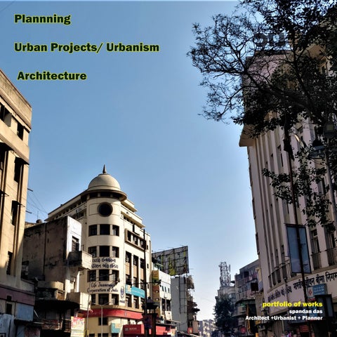
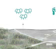
Urban Projects/ Urbanism Architecture
 portfolio of works spandan das Architect +Urbanist + Planner
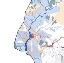
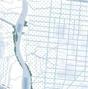
master plan - Jamsh c l master plan - ICZM ctto m master plan - Laksh ep i trial master plan - G u r ban s tree gn & planning - Ma nd e y M a r g m u ltimo tegration & T.O.D - D C project
PLANNING Industrial Master Plan- Gaya Development of Project Islands of Lakshadweep - toruism master plan Integrated development plan for the Eco-sensitive zone of Dandi- coastal master plan ADDENDUM TO JAMSHEDPUR MASTER PLAN 2027 - city master plan URBAN PROJECTS/ URBANISM Integrated Road Corridor Development project of Mangal Pandey Marg,DelhI - Urban Street Design Delhi Metro Phase 3 Station Development - MMI & TOD professional projects
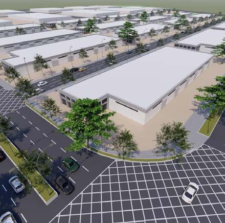
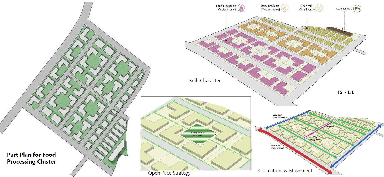
Interated Manufacturing Cluster at Gaya
ORGANIZATION: ECOFIRST SERVICES LTD (TCE)
STAKEHOLDERS: NICDC, BIADA
STATUS: Ongoing
NICDC, the premier apex body overlooking industrial estates and corridor development financed through GoI, in partnership with various state governments has recently identified development of an industrial node in Gaya district in the state of Bihar.
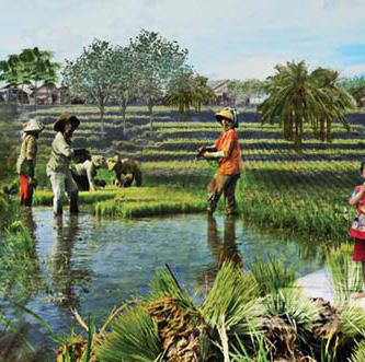
The idea is to develop low intensity manufacturing clusters of multiple sectors ranging from garment manufacturing to food procrssing units. A detailed market study was carried to propose a suitable prod uct mix in consul;ttaions with multiple stakeholders both public and private organizations.
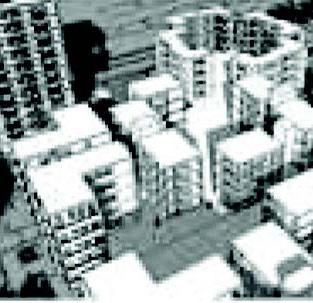
The development is a greenfield development project with a site area of about 700 Ha, and industrial cat egories ranging between low pollution induscing or ange category industries to green category industries have been considered for the purpose of development.
The development is backed on the rationale of its proximity to an upcoming dedicated freight movement corridor, that is developed across the entire span of the country connecting strategic nodes of important industrial and manufacturing zones.
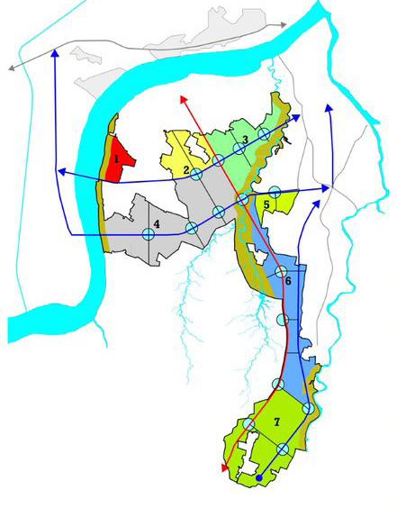
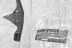
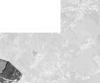
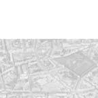
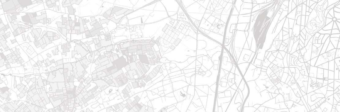
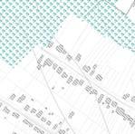
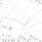
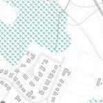
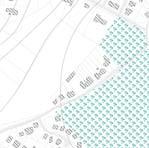
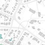
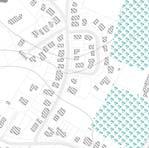
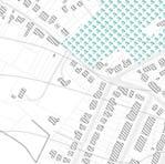
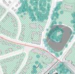
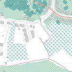
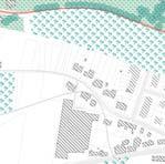
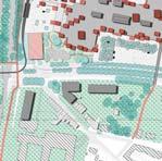
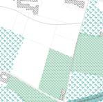
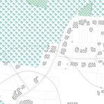
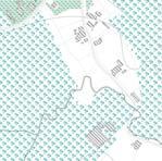
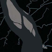
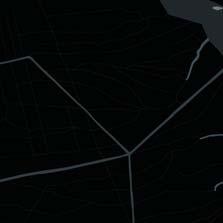
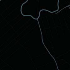
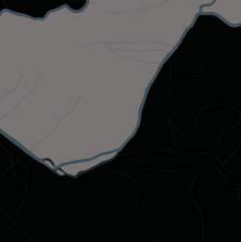
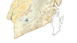
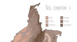
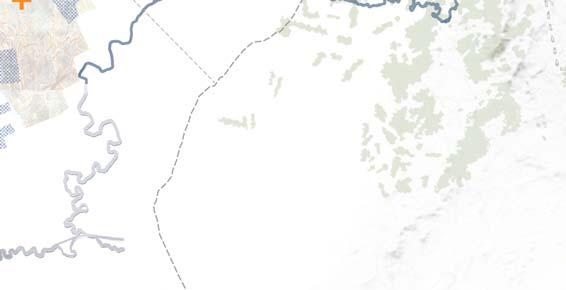
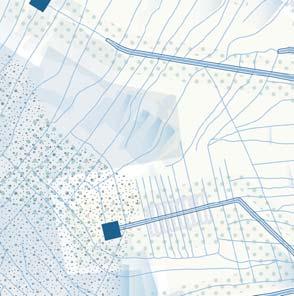
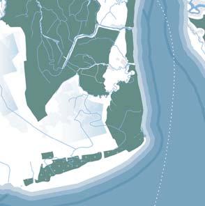
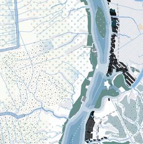
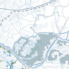
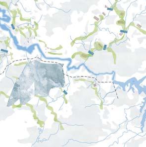
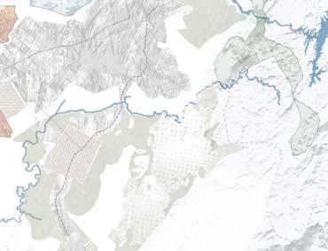
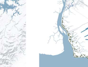
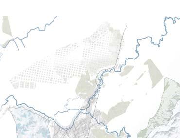
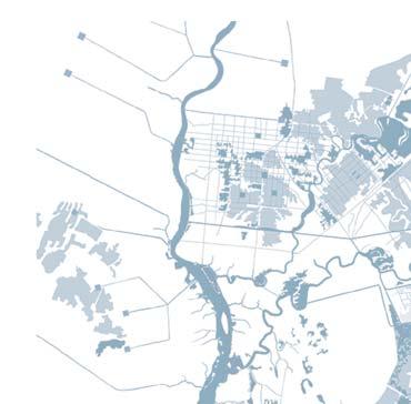
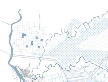
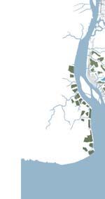
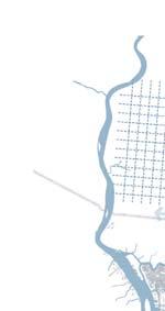
The site is located in theDobhi block of Sherghati sub-division of Gaya district and the site is composed of 13 revenue villages.
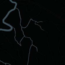
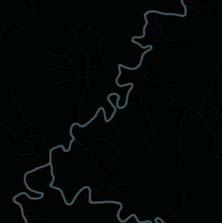
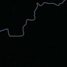
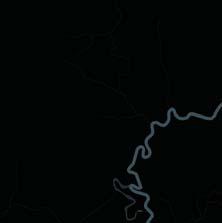
It is a greenfield area sizing almost about 700 Ha, with a prominent land cover of agricultural activities. The site edges with Phalgu river, which is a seasonal, but culturally a prominent river, and forms a cru cial natural feature along the west ern edge of the site. An overflow channel emerging out of the Phalgu river, traverses the site from north towards the South Western site and forms another crucial natural fea tures that divides the sites in differ ent zones.
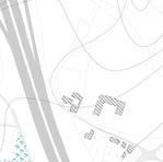
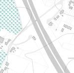
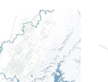
The project site is closely located to crucial connectivity infrastrcture like the National Highway 19 con necting Delhi & Kolkata, and is also known as Grand Trunk Road, locat ed about 7 kms from the site. Na tional highway 22, connecting Gaya to Chatra in Jharkhand is about 3 kms to the site.
Gaya International Airport is lo cated about 25 kms from the site, while the new upcoming DFC cor rdor and its interchange station at New Paharput is about 35 kms from the site.
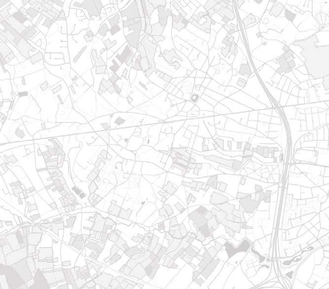
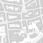
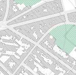
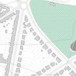
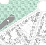
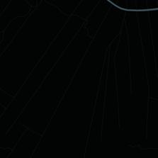
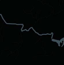
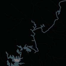
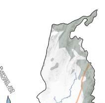
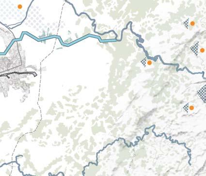
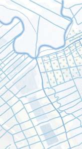
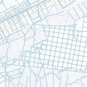
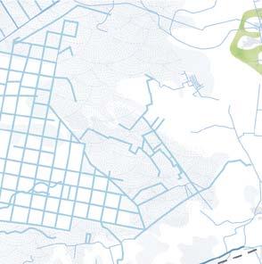
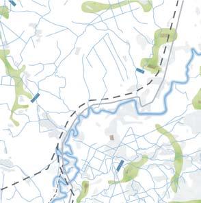
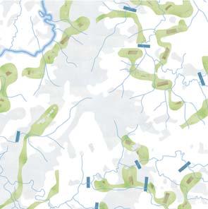
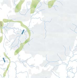
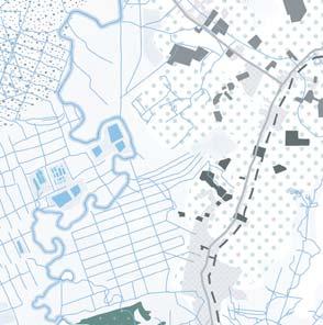
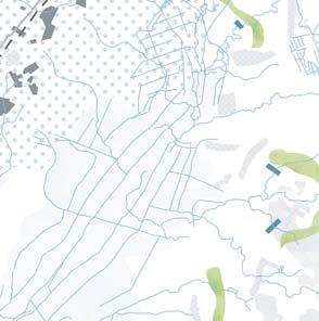
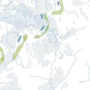
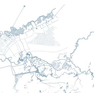
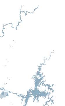
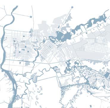
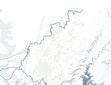
 Schematic Map of Gaya District
SITE MAP ILLUSTRATION
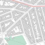
Schematic Map of Gaya District
SITE MAP ILLUSTRATION
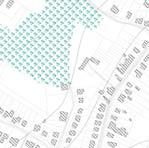
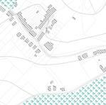
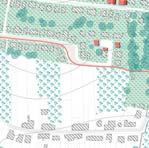
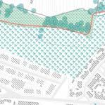
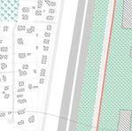
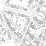
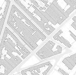
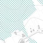
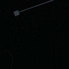
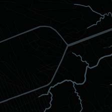
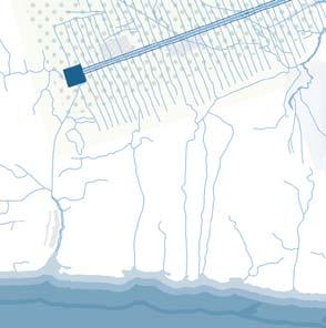
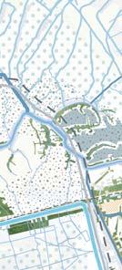
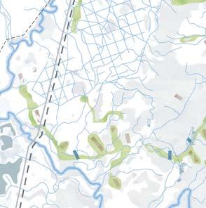
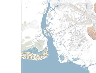
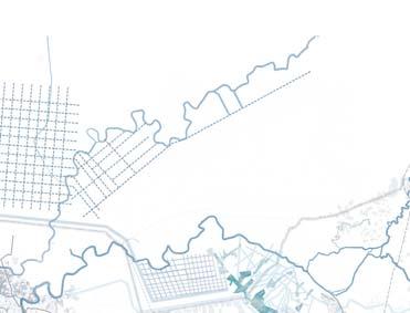
Site was analysed based on the existing site features, especially the physical features such as the water chan nel within the site, and the river on the west of the site.
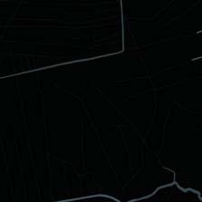
The existing road networks, were also taken into con sideration, to anticipate the pertaining site structure, based on which the proposition was made to restruc ture it and organize. it.
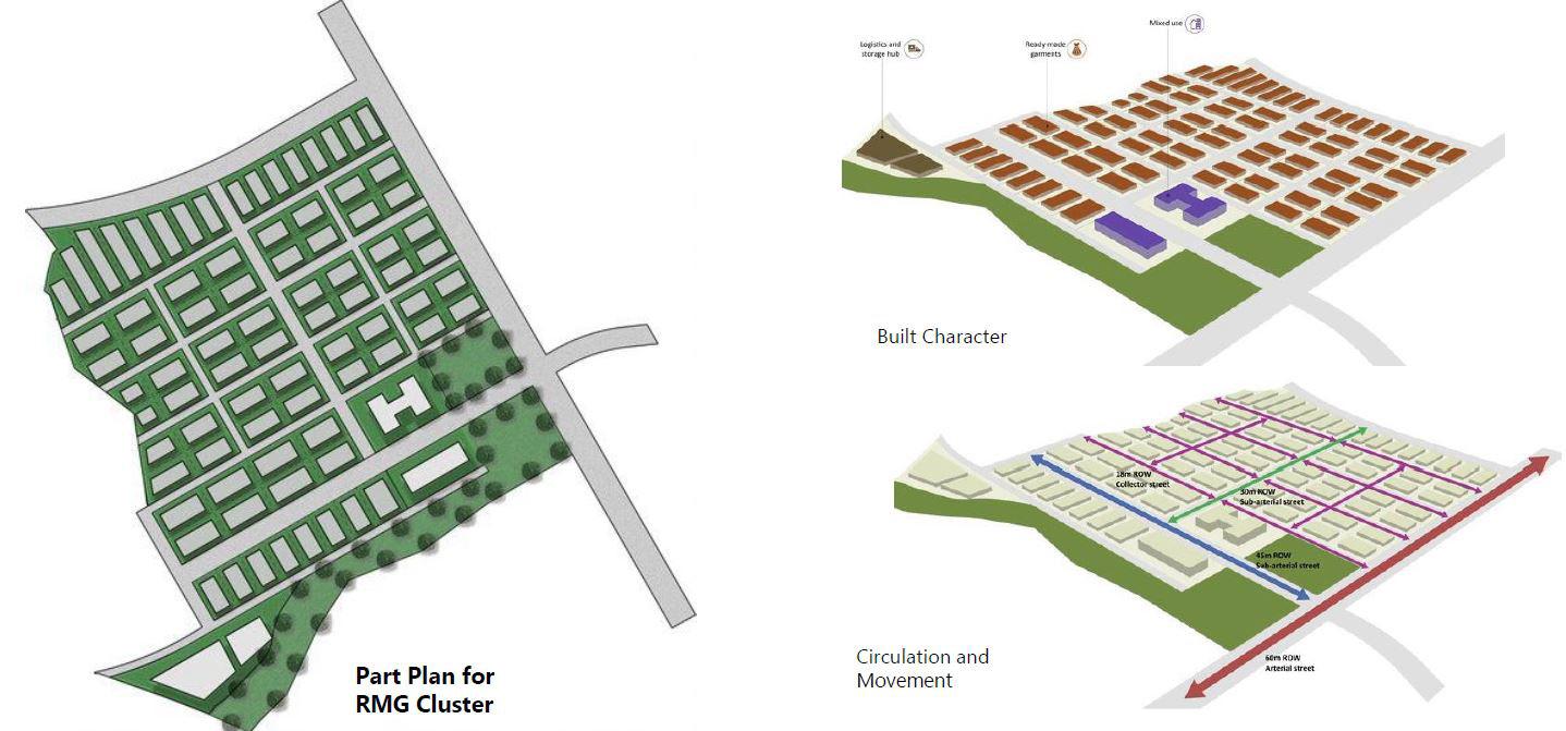
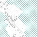
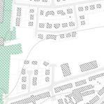
Since it is a greenfield development and the master plan prepared is for hosing multiple manufacturing clusters of various sectors, the approach to conceive the mas ter plan was to facilitate the most simple, organized and easily achievable grid layout. Understanding the merits of Gris-Iron pattern planning, this method was appropriated to be adapted for the preparation of the Concept layout of the Master Plan.
The space allocation of the plots are easy to distribute, the trunk infrastructure layout will be easily imple mentable, and most importantly the access and mobil ity flow will be efficient. For the purpose of accommo dating prospective changes in the future, a Grid Iron pattern also emerges as a preferred choice of planning method, given its merits, of easy phasing options, the structure can be be easily developed through develop ment of connectivity infrastrcture and large zones of different clusters can be chnaged at the time sale due to the land use flexibility which can be acheived.
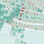
THE PROCESS
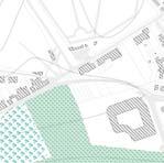
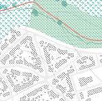
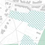
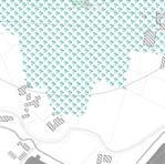
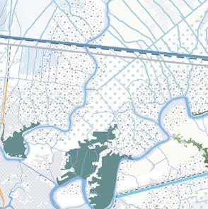
Identifying Natural Buffers & Existing Site Structure
Identifying zones of existing site structure
Identifying primary connection Nodes and Secondary Connections
Finalizing the site structure and new development zones
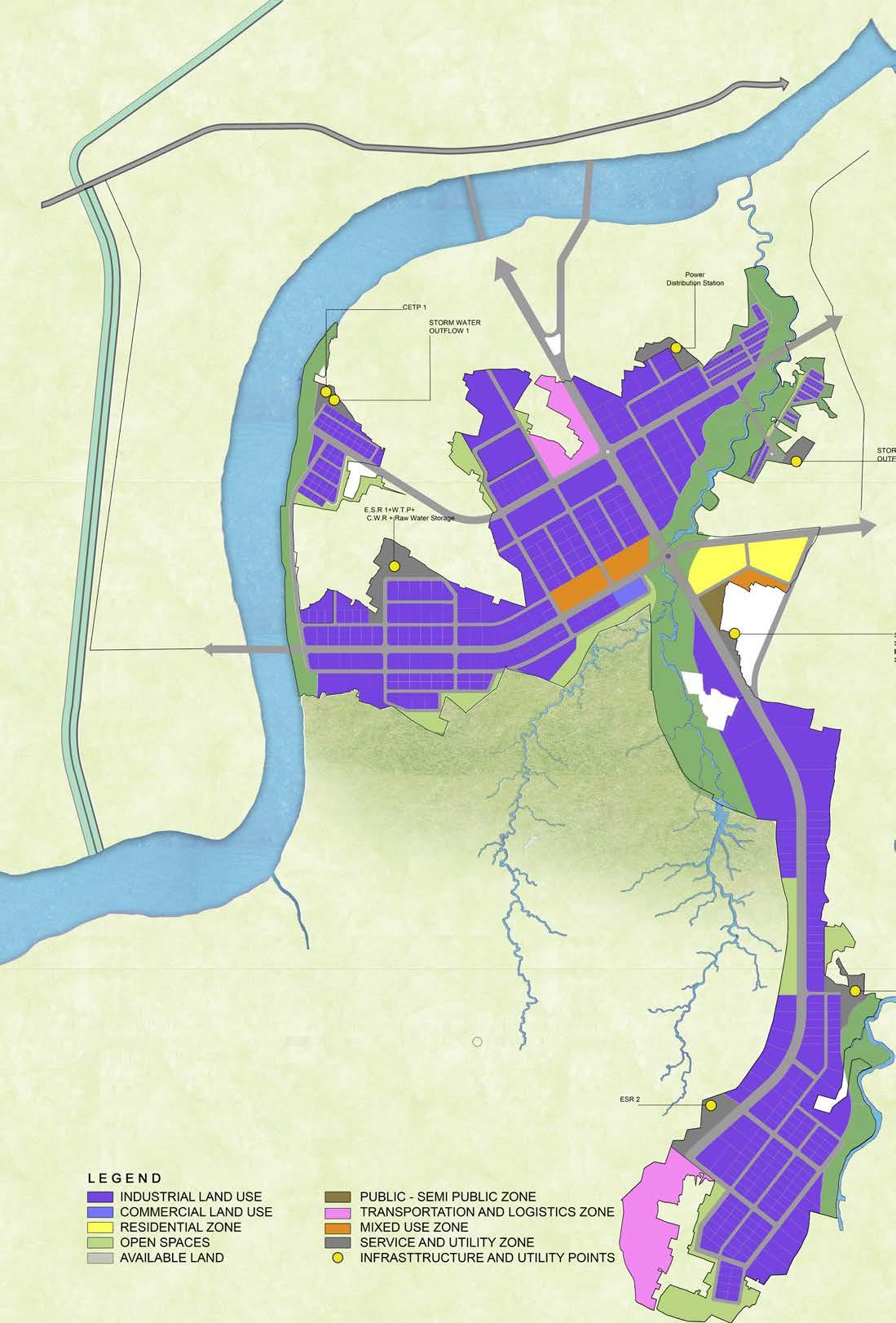
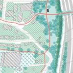
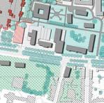
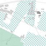
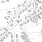
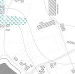
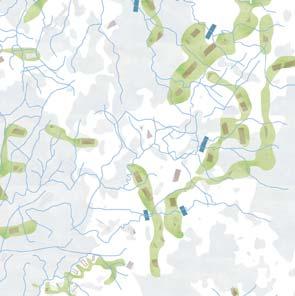
Land Use Plan
of
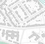
Demonstrative Building Mass Plan
the Development
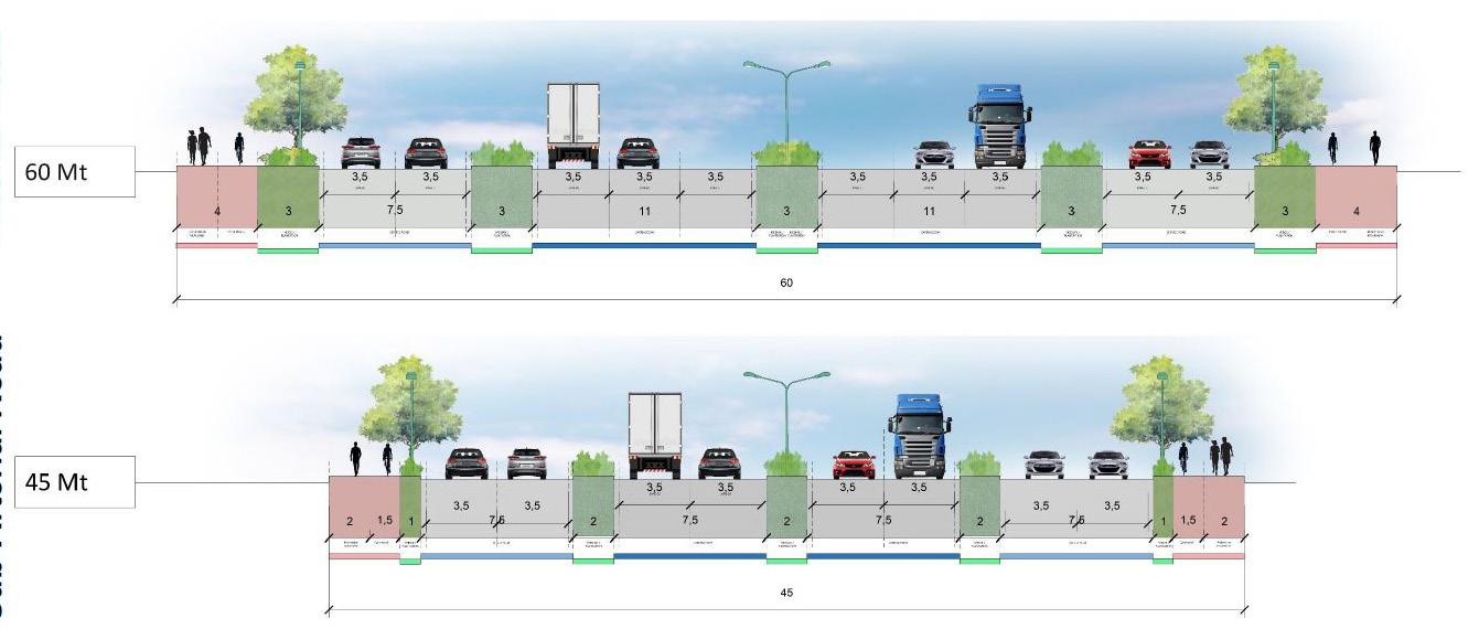
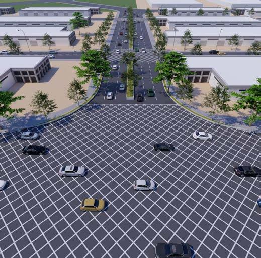
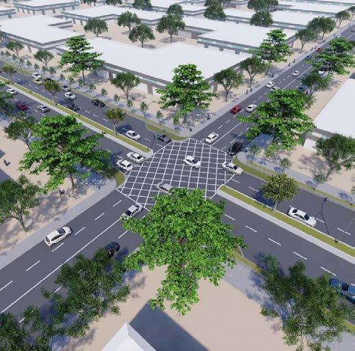
Proposed Street Sections- Arterial & Sub-Arterial Connections
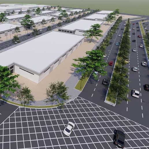
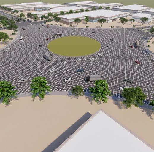
Suggestive Development Character of different manufacturing clusters
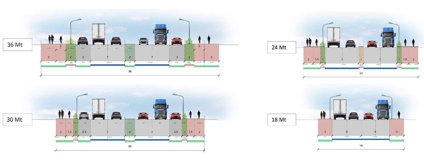
Proposed Street Sections- Connector& Local Streets
Suggestive
Development Character
of
different
manufacturing
clusters
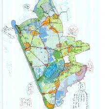
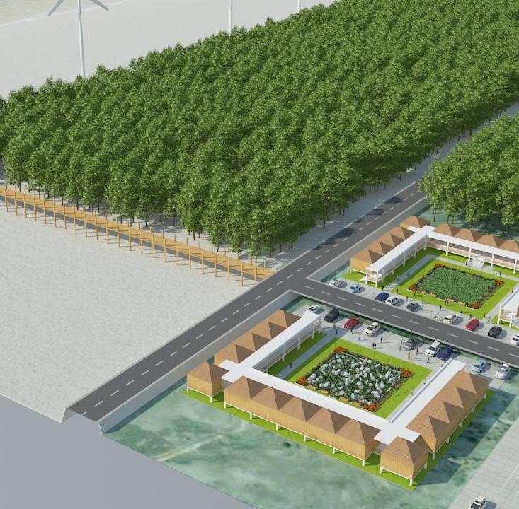
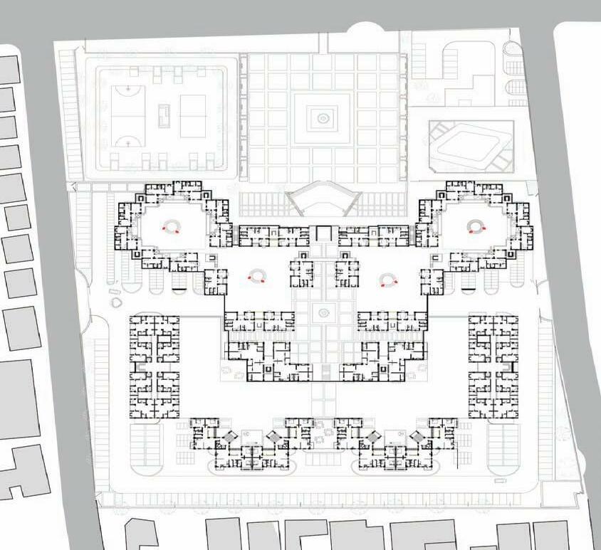
Holistic Development of Project Islands of Lakshadweep

ORGANIZATION: IPE GLOBAL Ltd.
STAKEHOLDERS: NITI Aayog, UT of Lakshadweep STATUS: Ongoing
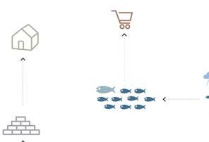
NITI Aayog, the premier think tank to the GoI, had commissioned the project of 5 islands of Lakshadweep to IPE Global Ltd, Delhi for a preparataion of Holis tic Planswith a special focus on Tourism. The proj ect is the first of its kind in India and also explores the potential of the untouched ecology and geology of the Lakshadweep islands. The project aims to bring about long term solutions of 5 project islands mostly focussing upon bringing and capitalizing the existing tourism domain in the islands and to tap the unique ecology of these islands.
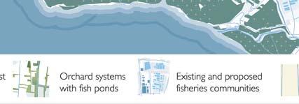
The Master Plan to be prepared would be served as Vision Documents and aims at forming guidelines and framework for overall development strategies for the islands besides tourism as well. The project also aimed at promoting and better organizing the Fishing Industry and the Coconut industry by engaging lo calcommunity and enhancing the micro economics of the islands. The projected tourism growth also aimed at creating local jobs for the islanders thereby making the vision of the project to reverbrate with the holistic sense of it.
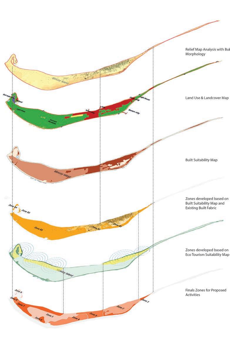
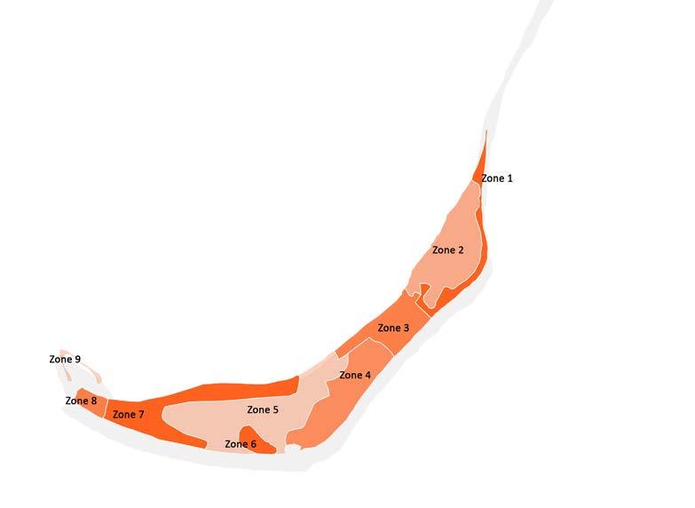
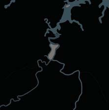
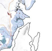
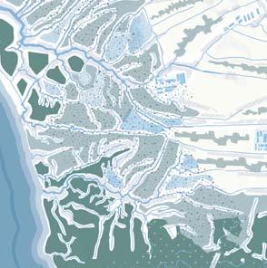
The 5 islands; of which only 1 was inhabituated and rest 4 were unhabituated, tourims promotion areas were identified for all the islands, besides creatinga tentative Structured growth pattern for the islands through Land Use mechanisms. Due to the fragile and sensitive ecological systems of the islands, there were thorough study & analysis that were made at various levels of the activity mapping, marine zoning of activi ties, ecological profiling and land suitability analysis.
The process of understanding the islands was really a task in hand as first it was the lesser known and unexplred territory, which brought along undocumented pristine territories and an ecolo gy; both terrestrial and marine.
Initial Zoning were carried out mostly based upon Land & Land based activities, to understand its potential asssets which may be conducively utilized for the Tourism Promotion strategies.
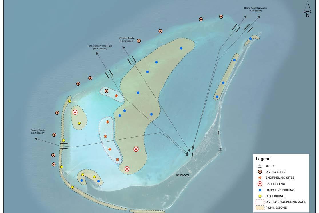
The Marine Zoning were equally important to understand the ten tative usage of the lagoon areas. Some of the islands already had Tourism activities both on land and Lagoon, hence they were easier to observe and under stand. Also through local consul tation with the fishermen or the islanders tentative zones on the lagoons could be identified where there are rich marine life, greater depth shallow corals etc to ideate the tentative activity allocation if tourism were to be followed and proposed.
A series of ecological & environ mental based studies were also done to form larger zones based suitability potential of its devel opment.
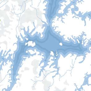
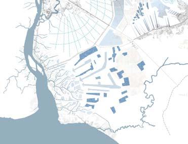
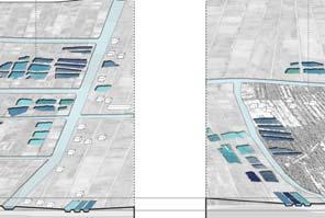
Shown here are examples of the study mappings of the Minicoy island, being one of the exempla ry islands of the 5 islands. Ma rine zoning, Land Zoning and
MARINE ZONING (ACTIVITY BASED)
ACTIVITY & ASSET MAPPING (LAND)
ACTIVITIES
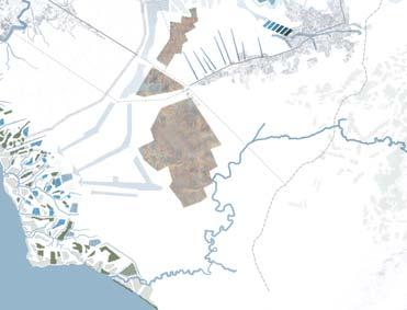
OVERLAY OF VARIOUS LAYERS
FINAL SEGREGATED
ZONES FOR
VARIOUS
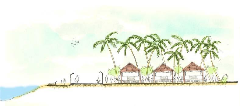
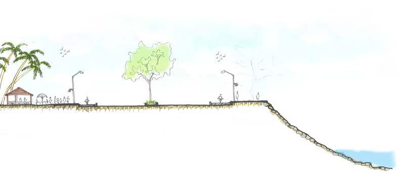
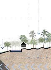
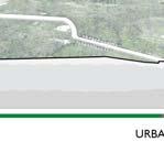
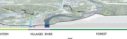
SCHEMATIC SECTIONS OF THE ISLAND EDGES
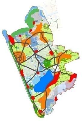
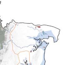
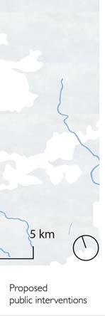
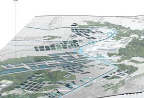
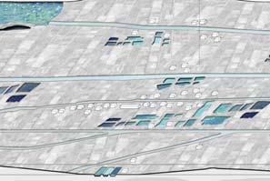
HOLISTIC VISION FOR ALL THE PROJECT ISLANDS
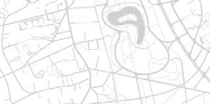
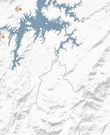
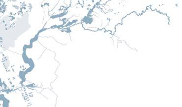
The schematic map shows the larger vision or framework for the realisation of the Tourism Master Plan, with identified themes for each island and broader aspects of tourism pack aging. The map also defines & establishes the broader connectivity aspects, keeping Kochi as the main head and also Agatti island as one of the focal points within the archipelago.
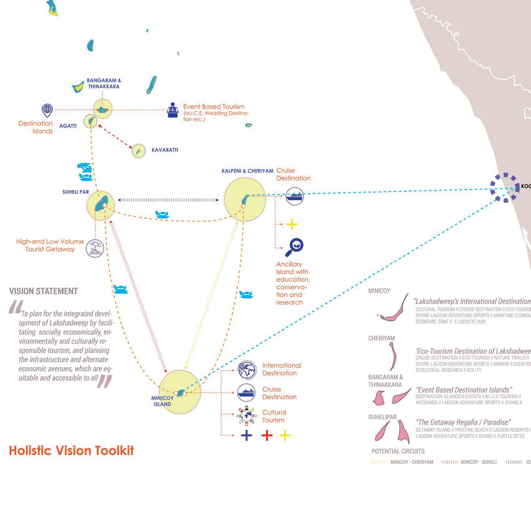 HOLISTIC VISION MAP FOR THE 5 ISLANDS
 CONCEPTUAL SCENARIO BUILDING FOR MINICOY ISLAND
CONCEPTUAL SCENARIO BUILDING FOR CHERIYAM ISLAND
CONCEPTUAL SCENARIO BUILDING FOR MINICOY ISLAND
CONCEPTUAL SCENARIO BUILDING FOR CHERIYAM ISLAND
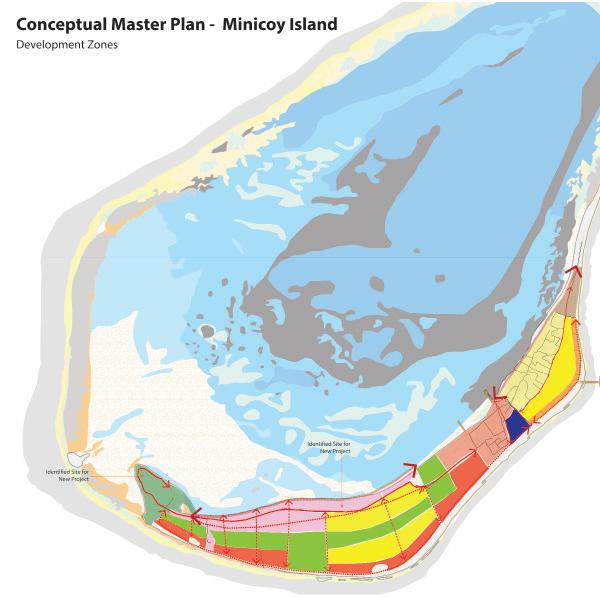
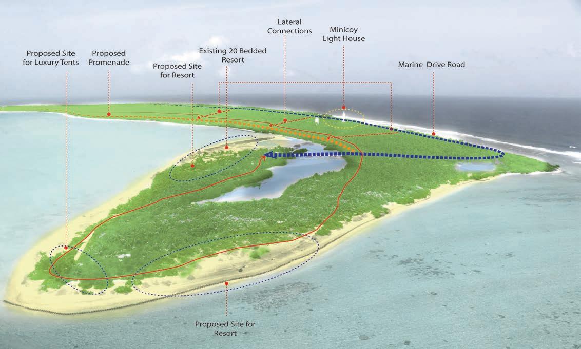
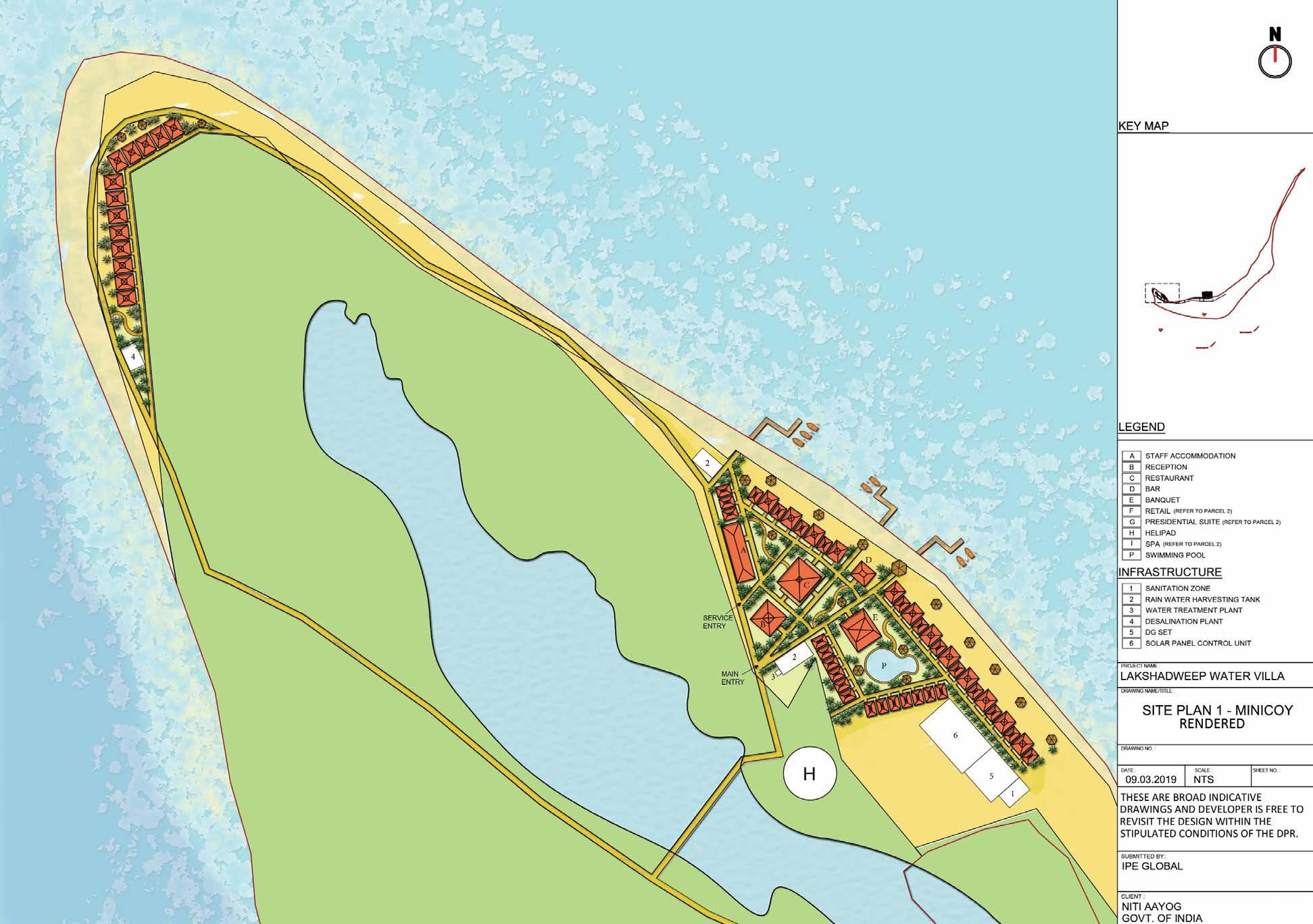
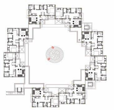
CONCEPTUAL MASTER PLAN FOR MINICOY ISLAND
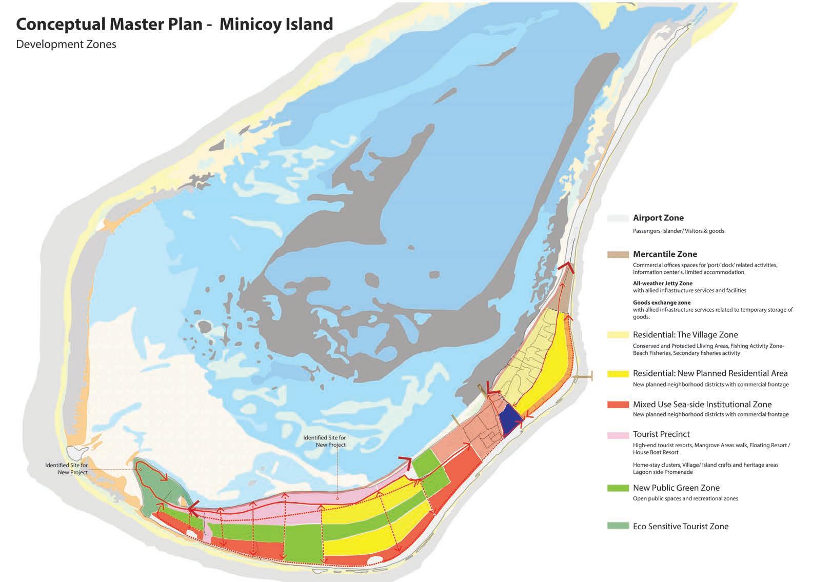
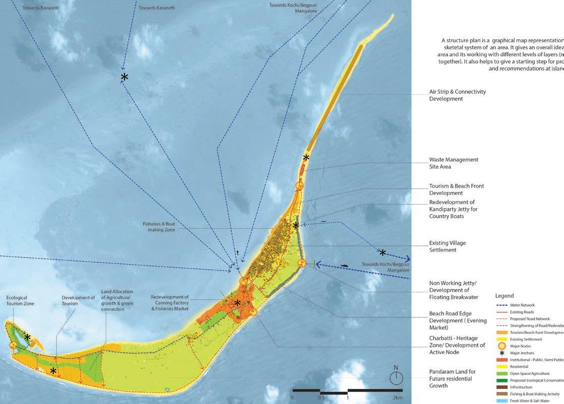
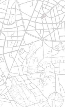
In the example shown above, is the conceptual plan for the Mini coy island. This island has been specifically taken up as an ex ample due to its complexity, distant proximity to the other is lands and the Indian mainland, and also because this is the only populated island. With a population over 10,000 people, with a very strict and a rigid traditional and societall setup, the tourism industry has not boomed that much.
In the plan as seen above, the population centre is mainly resid ing at the northern half of the island segregated into 11 villages, where as the southern half is used for the present tourism ac tivities. The guiding principle for this island was to reinforce the sea side edge through a larger connecting road infrastructure
connecting the Jetty from the north to the Tourism areas of the south directly so that the existing population is not disturbed. Also, to ensure the sanctity of the community most of the Tour ism promotion areas are located in the southern tip of the island, hence maintaining that distance from the villages. The central portion is identified as the potential new residential and mixed use development which shall enhance once the Touirsm activi ties picks up pace.The ideated residential and mixed use zones are kept in reserve keeping in mind the future when the people from the village would start moving towards the newly developed areas, as there were already instances of sporadic developments in this part of the island.
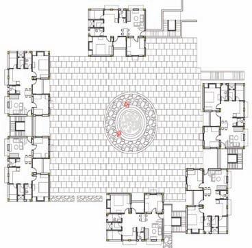
FINAL LAND USE PLANFOR MINICOY ISLAND
FInal Master Plans for the islands were guided by the overarching principles or thematic discourses that were ideated and concep tualized for each of the islands seperately, based majorly upon their tourism potential, proximity, accessibility and developable area available.
In the Final Land Use plan/ Zoning plan; as seen above in the case of Minicoy, which is the only habituated island of the 5 is lands, the consideration was laid equally to the existing condition of the villages and its community. The land revenue records and the surveys were duly considered, and partially even resurveyed by the Lakshadweep Administration to revise the plot boundar ies and delineate the government area and the privately owned areas. It was done jointly by the NITI Aayog (primary client), the
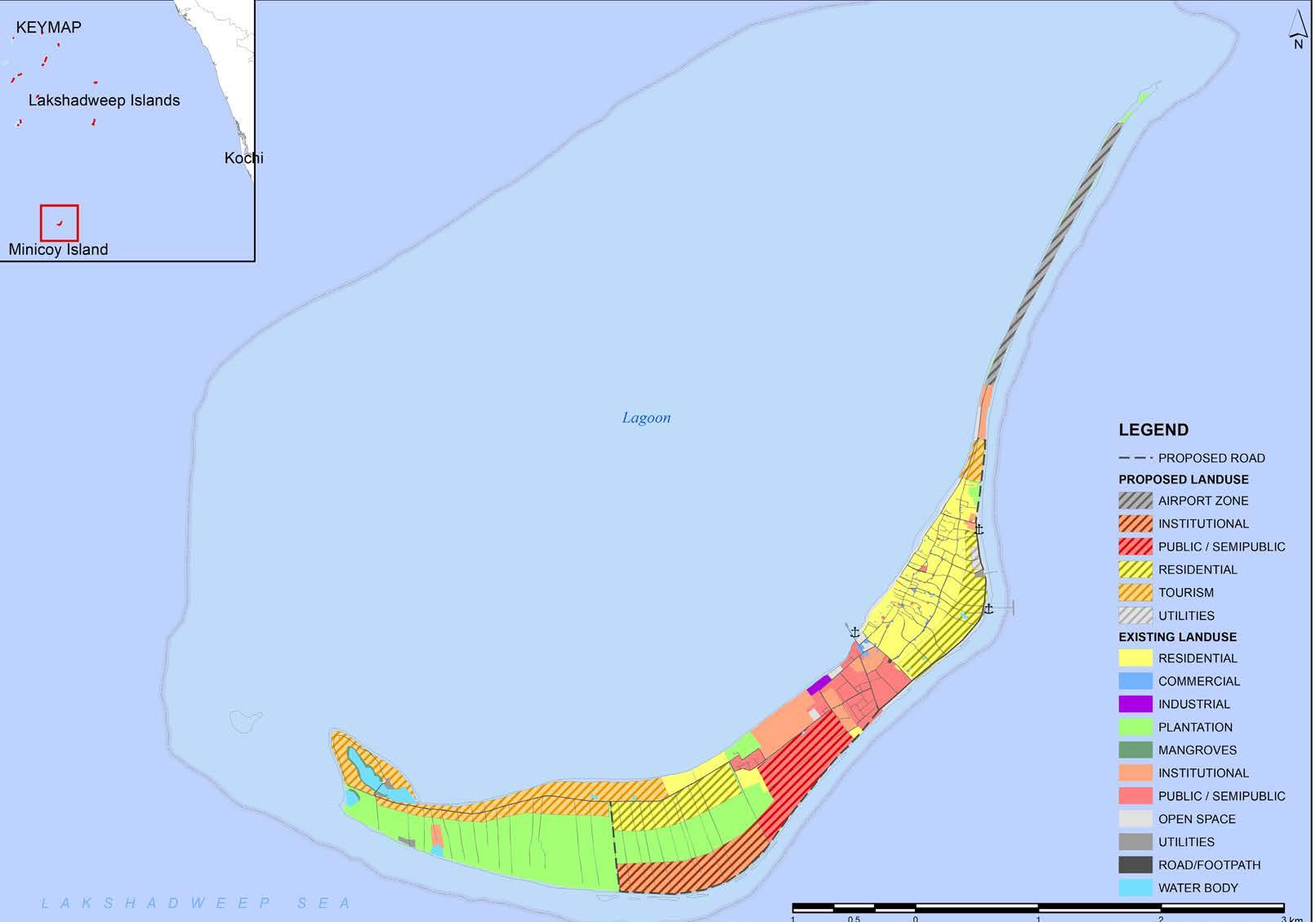
UTLA (secondary) and IPE Global (consultants) so that there is an outright approval of the final boundaries right from the in ception of the exercise. These boundaries were instrumental for getting the final developable areas for tourism promotion without any obligation, and also to identify potential spots for the future infrastructural setups.
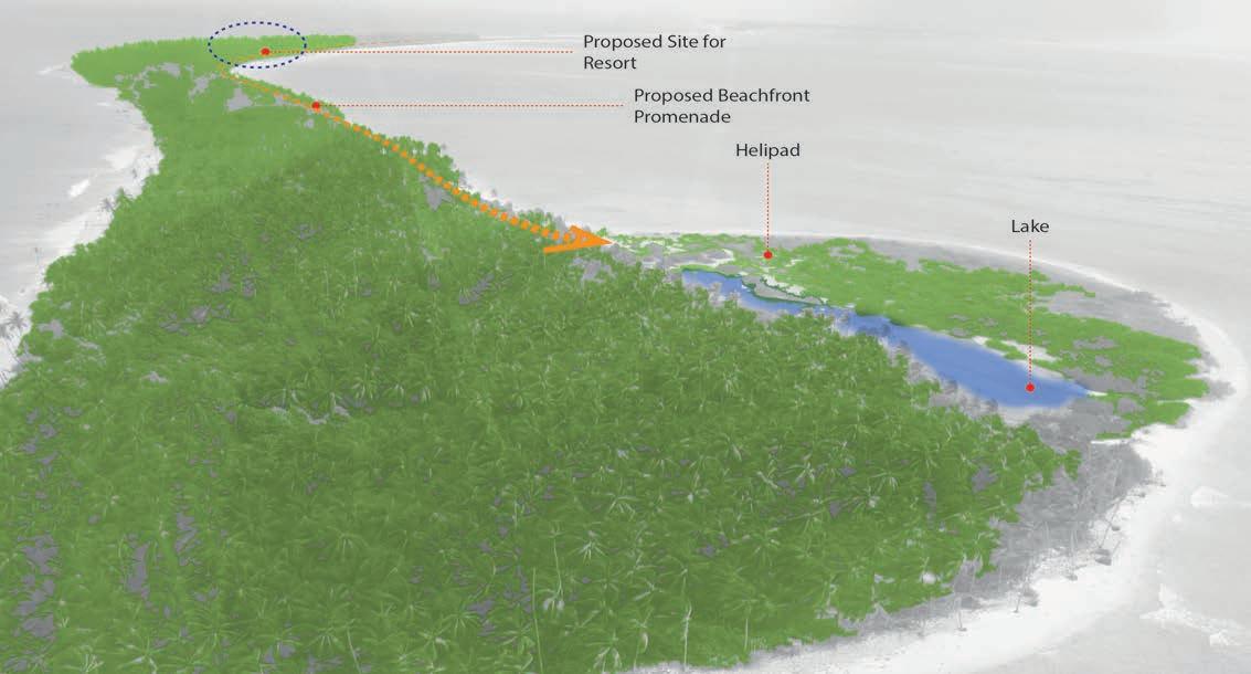
As marked Site 1 & Site 2 in the map above, the detail design of these sites were also submitted to NITI Aayog as an exeplary outline of the final output of the Tourism promotion areas will be like. Seperate DPR’s were generated to pitch to potential inves tors with Project Strcuturing, Financial Feasibility and Design of the sites.
SITE 1 SITE 21 - SITE PLAN
Seperate Detailed Project Reports were made for these 2 project sites in Minicoy island, besides 2 other project islands. The maps shown here shows the kind of development, its language and flow which can be implemented and executed in a consition like this.
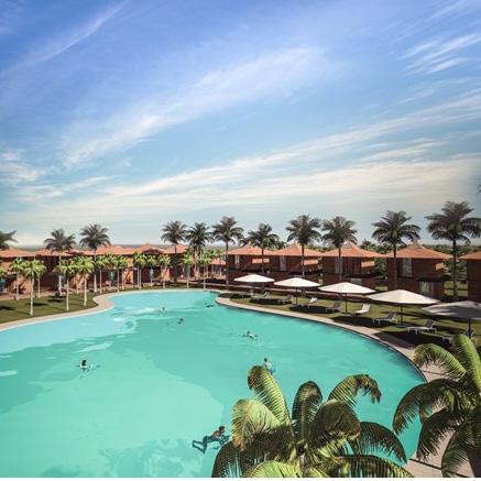
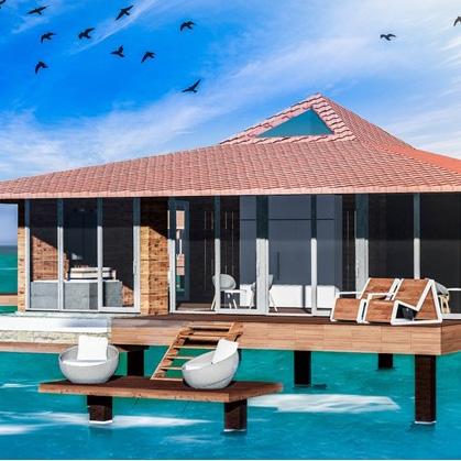
The main idea was to open up maximum towards the Lagoon side and its serene environment, as it is the calmer part of the sea. The resorts were majorly categorized into 2 types; Beach Resort and the Water Villas. In principle approval, based on the Lagoon assessment of the Marine life and the desirable depths based on the Bathyometric Charts had been taken by relevant authorites to make the project a practically implementable project.
More than 100 keys were proposed along with nature trails and water based activities to enhance the Tourism Promotion areas. The number of keys were projected on the basis of a complex methodology of Carrying capacity asseessment that were seper ately ratified by relevant authorties.
The carrying capacity also helped in the assessment of the re quired infrastructure, both for the Tourism activities and the gen eral population, besides merely providing a figure for the number of keys that can be planned for.
SITE
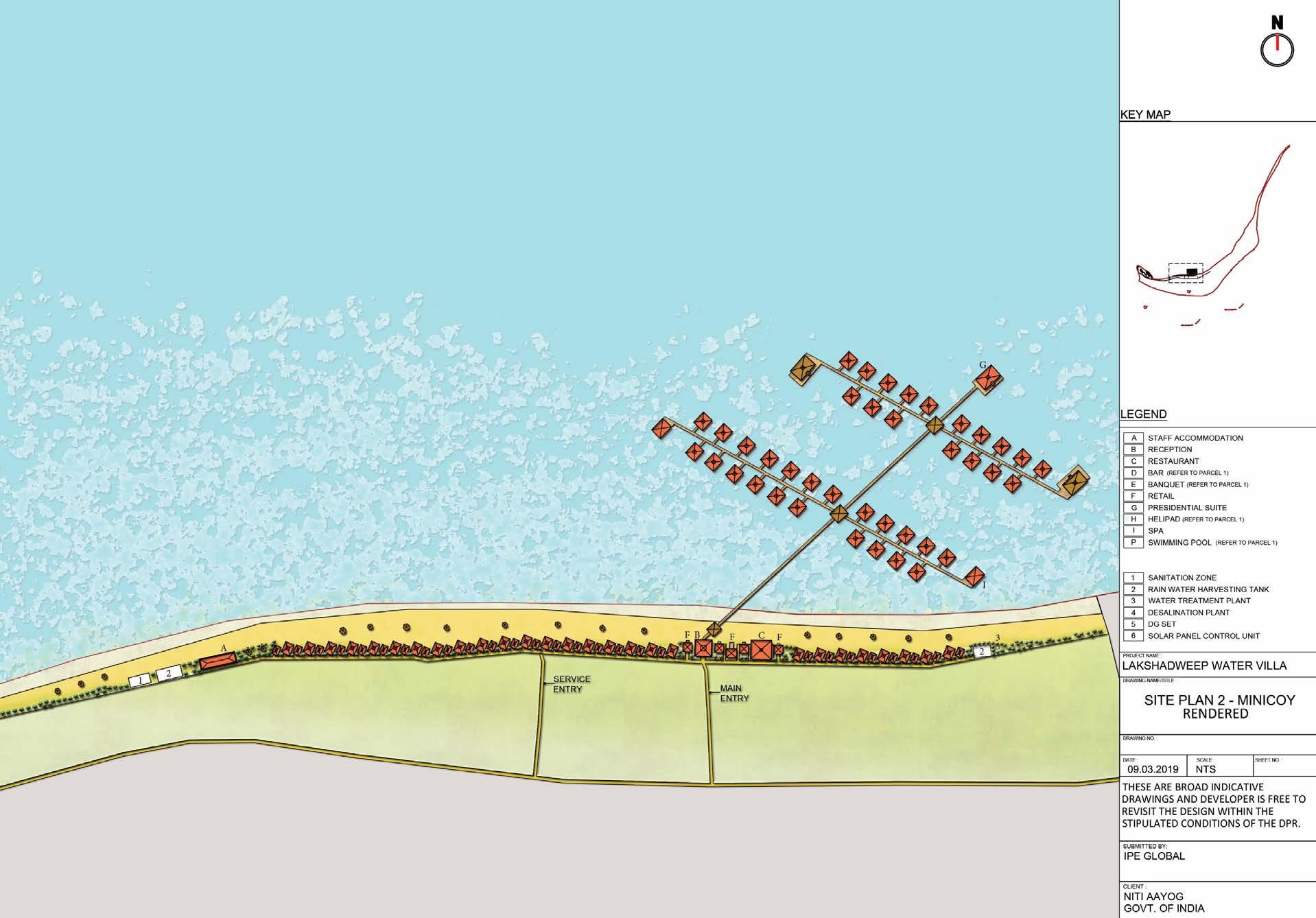
SITE 2 - SITE PLAN
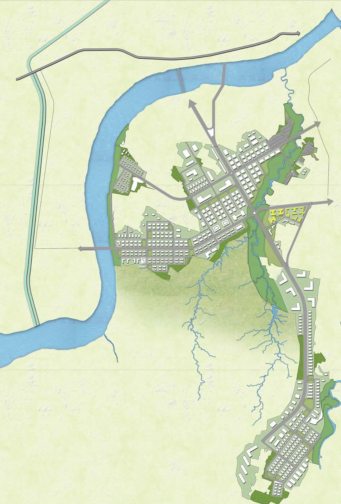
Integrated development plan for the Eco-sensitive zone of Dandi, Gujarat
ORGANIZATION: IPE GLOBAL Ltd. STAKEHOLDERS: SICOM, GEC, WORLD BANK - ICZM Project
STATUS: Completed
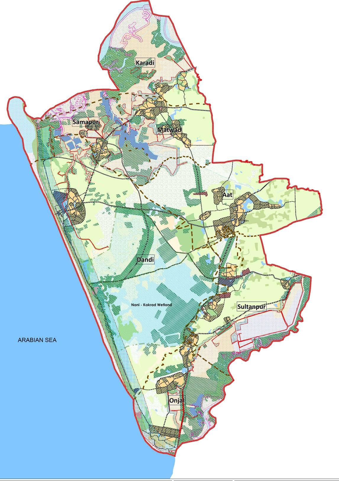
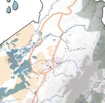
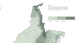
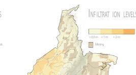
Government of India (GoI) along with Government of Gujarat (GoG) has declared the Dandi Area comprising the villag es of Dandi, Samapor, Matwad, Sultanpur, Aat, Onjal and Karadi (in Taluka Jalalpur, District Navsari, Gujarat), as eco-sensitive zone under the Environment (Protec tion) Act, 1986.
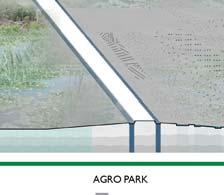
Accordingly the master plan has been prepared in lines with the ICZM objectives of conserving the natural resourc es and heritage of the area, and embody the Gandhian val ues of village development & environmental conservation while respecting CRZ regulations.
The total population of the all the 7 villages is 20,429 as per Census 2011 and it is expected to be around 21,954 by 2031 considering the growth trend of the region. The total project area is around 95.4 sq.km.
Alternative-1: Emphasis on high conserva tion while low priority for de velopment
Alternative-2: Emphasis on low conserva tion while high priority for de velopment
Alternative-3: Balanced ap proach with equal emphasis on conservation and develop ment
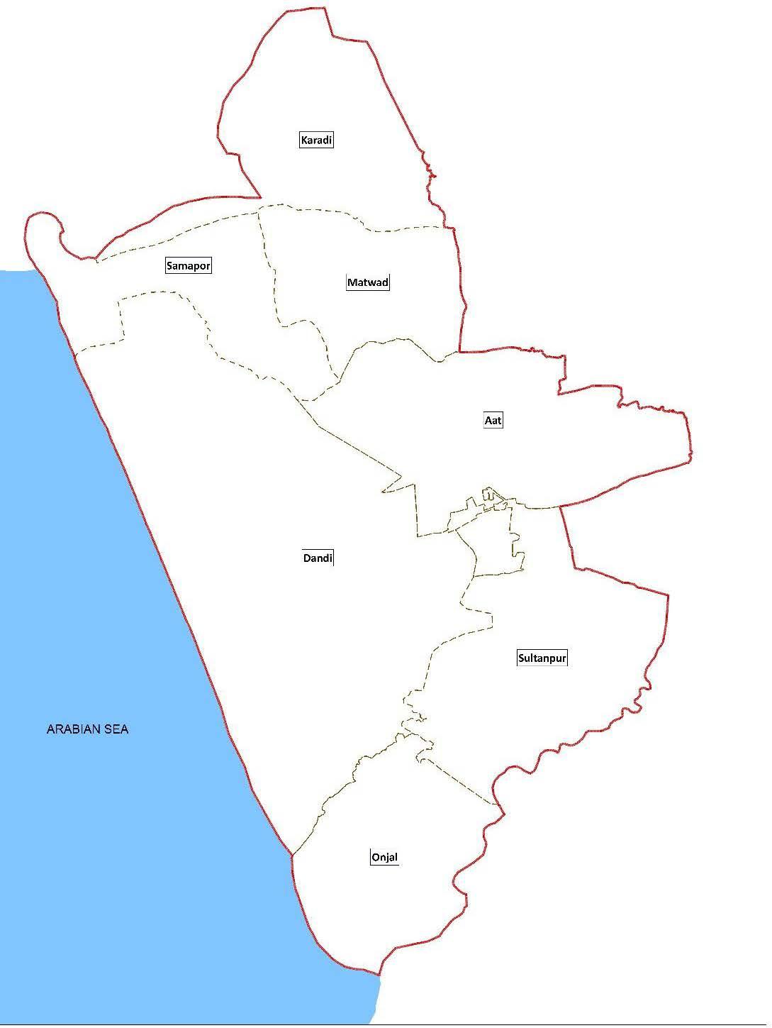

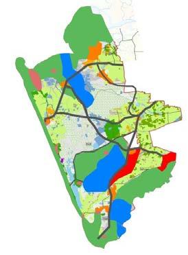
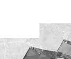
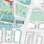
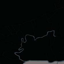
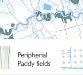
PROJECT AREA with all 7 Villages
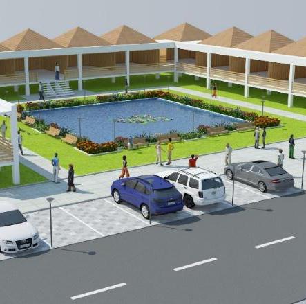
CONCEPTUAL ALTERNATIVES for DEVELOPMENT: - Three alternatives have been prepared without physical or financial constraints but ensuring that each of them followed the declared intent of the Dandi Eco-Sensitive Zone Notification including the Dandi Memorial Complex Project and the relevant regulations applicable to the project area.
PRINCIPLE CONCEPT: EQUAL EMPHASIS ON CONSERVATION AND DEVELOPMENT
An equal emphasis has been laid on the en vironmental conservation (considering the nature of the project area falling under eco-sensitive zone) and the developments (to improve the socio-economic status of the local people and to increase livelihood op portunities).
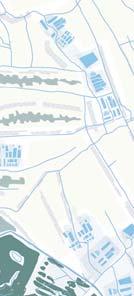
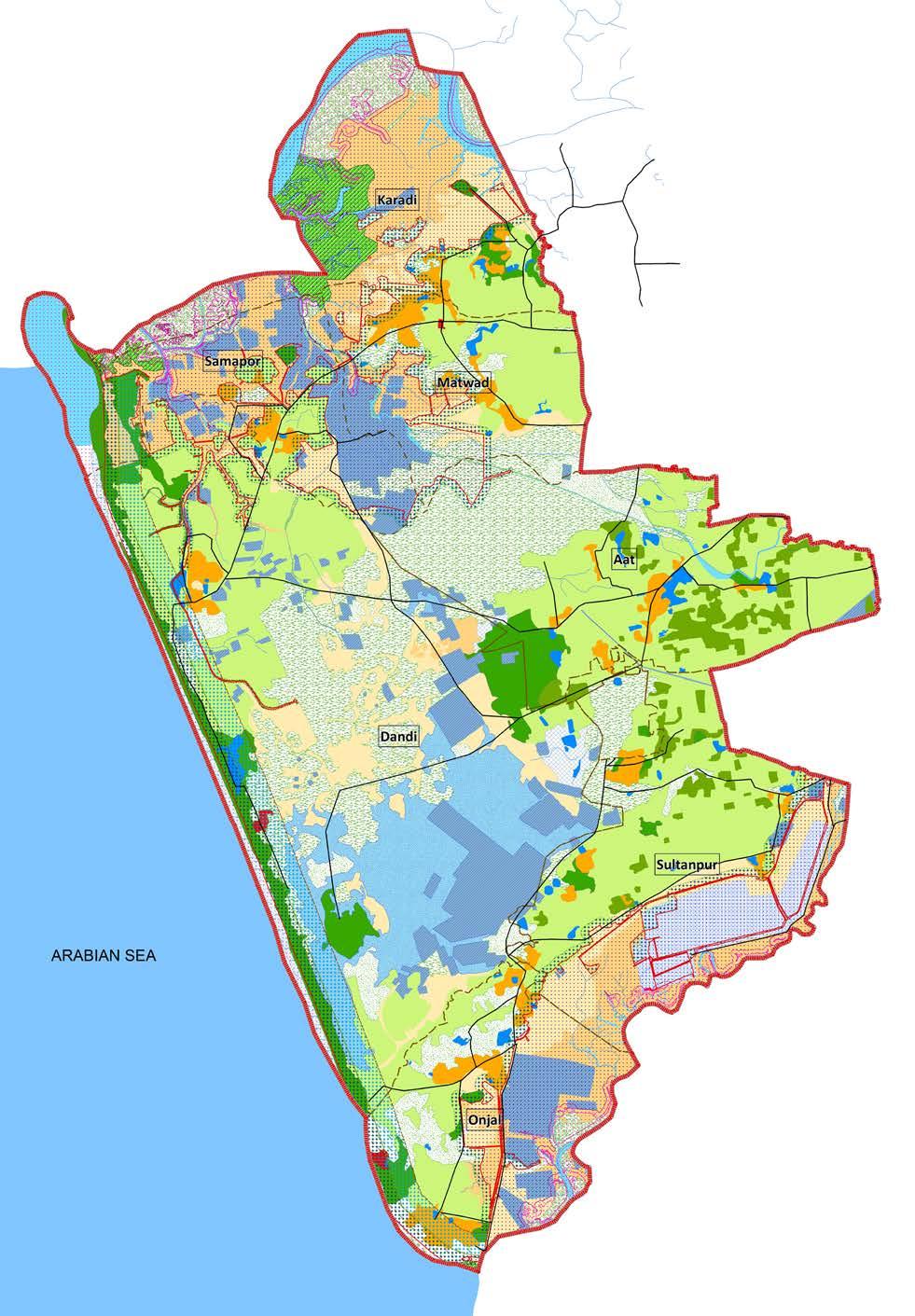 EXISTING LAND USE MAP OF THE PROJECT AREACONCEPT IDEA
 PROPOSED LAND USE MAP OF THE PROJECT AREA
DIFFERENCES BETWEEN EXISTING & PROPOSED LAND USE OF THE PROJECT AREA
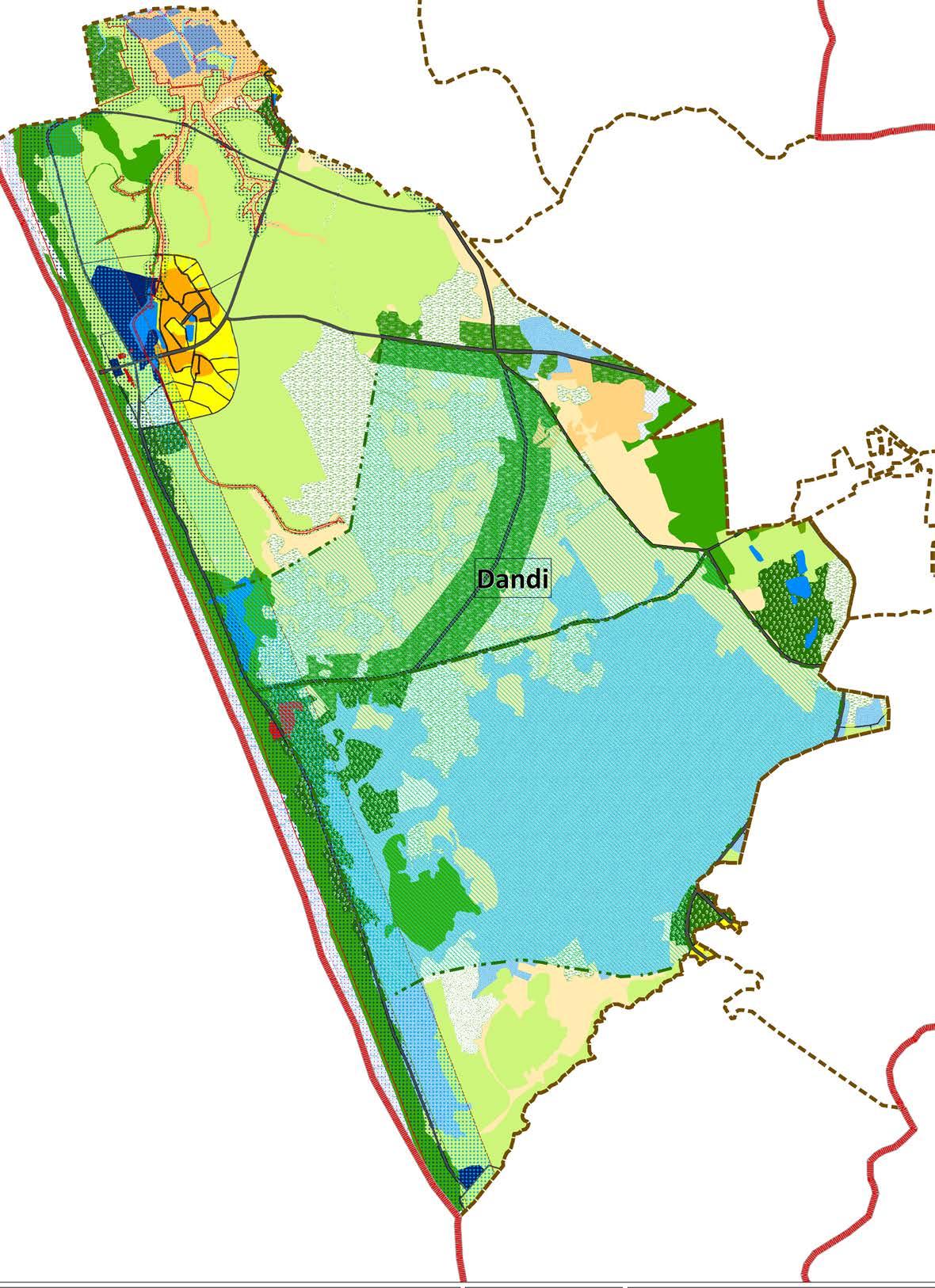
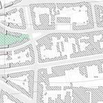
NOTE*Dandi is just one of the 7 villages in the over Integrated Plan and is just shown as an exemplification. Similar details has been pro duced for each of the 7 villages.

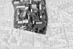
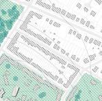
EXISTING LAND USE - DANDI VILLAGE
PROPOSED LAND USE - DANDI VILLAGE
NOTE*Dandi is just one of the 7 villages in the over Integrated Plan and is just shown as an exemplification. Similar details has been pro duced for each of the 7 villages.
NOTE*Dandi is just one of the 7 villages in the over Integrated Plan and is just shown as an exemplification. Similar details has been pro duced for each of the 7 villages.
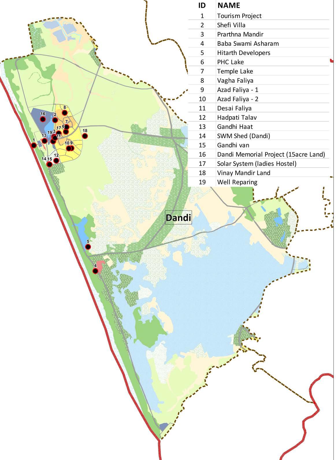
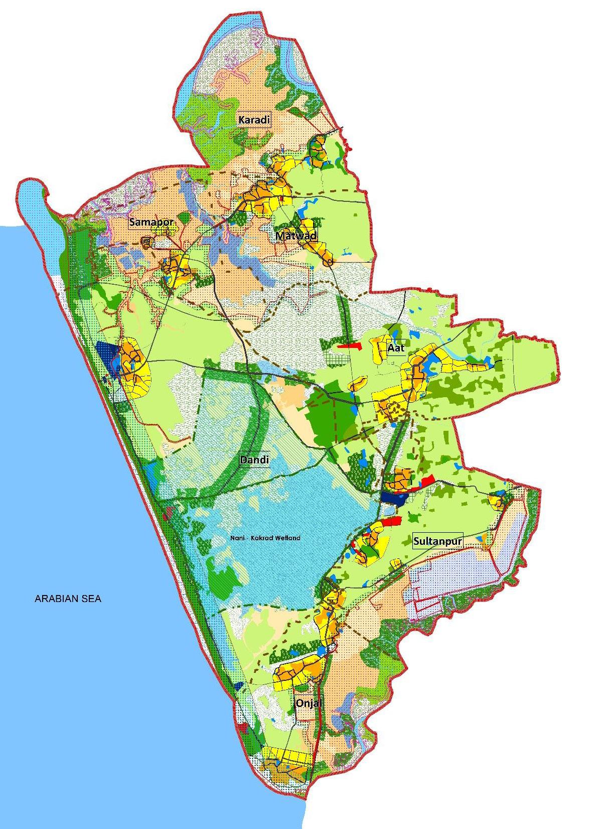
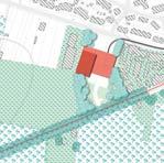
PROPOSED PROJECT SITES FOR DANDI VILLAGE
development scenario as per Gandhianprinciplesproposed bioshierlds/ shelterbelts proposed rural market
proposed bund cross section
OVERALL PROPOSALS IN THE PROJECT AREA
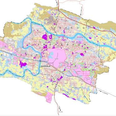
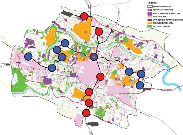
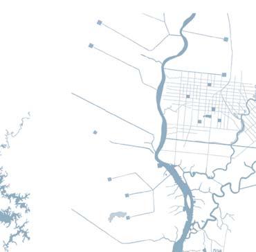
TO JAMSHEDPUR
MASTER PLAN 2027
a GIS based Master Plan for the additional area based on the AMRUT guidelines
ADDENDUM
ORGANIZATION: Superior Global Infrastructure Pvt. Ltd

STAKEHOLDERS: JNAC, UDHD, Jharkhand
STATUS: Notified
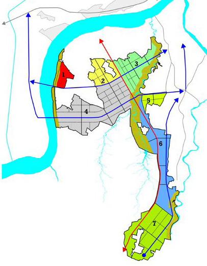
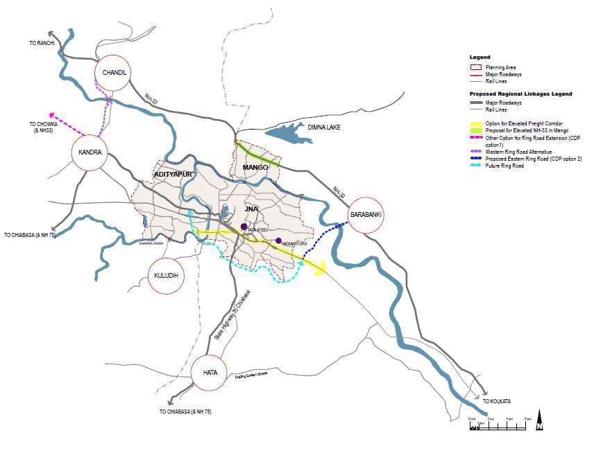
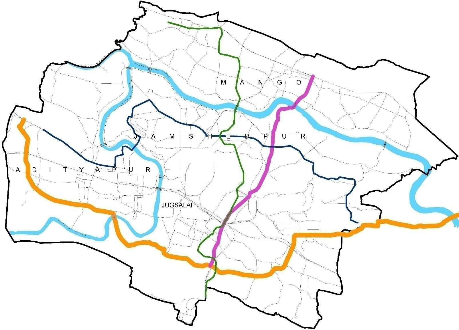
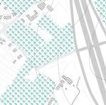
The project is an addendum to the existing Master Plan for the hori zon year of 2027. This project was essentially to pre pare a Master Plan for the Addition al area of Jamshedpur as shown in the map besides. The prime fo cus was to juxtapose the addition al area of the Jamshedpur Urban Area, with the additional area with the guiding principles like:-
1.Larger Regional connectivity corridors to ease of the Industrial Logistic Traffic
2.Transit Oriented Development through LRT corridor development

3.Densified Mixed UseDevelop ment
4.Pedestrian friendly environment

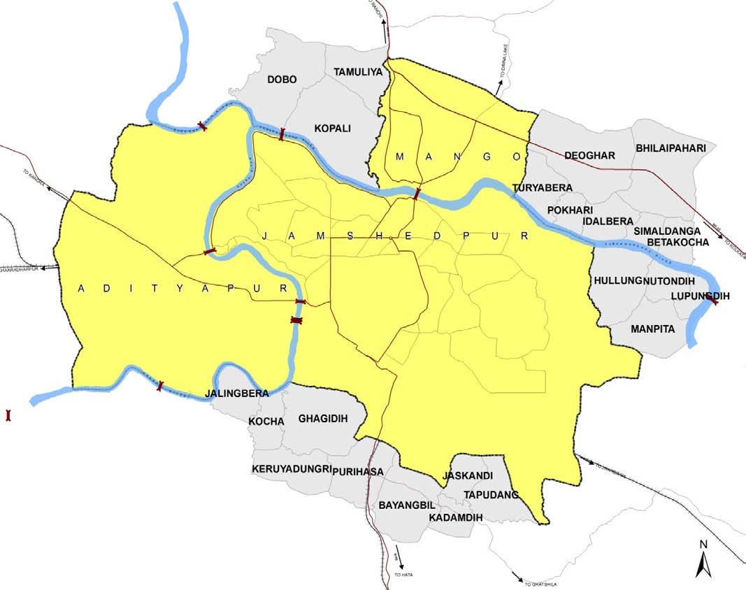
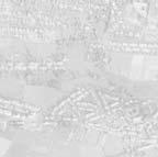
ORIGINAL AREA - 149.23 SQR KM
ADDITIONAL AREA -71.97 SQR KM
MAP SHOWING ADDITIONAL AREA FOR PLANNIING
Larger Regional Connectivity Mass Transit Connectivity Pedestrian Friendly Streets High Desnsity HousingGUIDING PRINCIPLES FOR MASTER PLAN PREPARATION
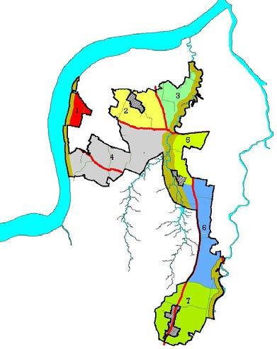
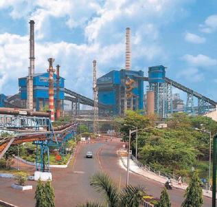
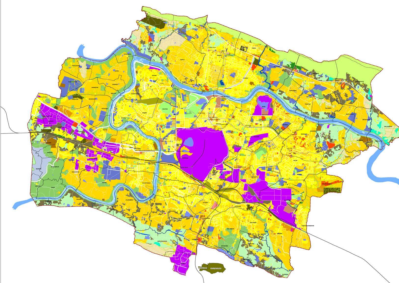
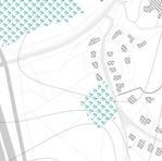
The existing conduitions of the Urban Area of Jamshed pur is very sporadic in its nature and focussed with the Industrial Core at Sakchi, which was the origin of the city. The TATA industries established right at the heart of the city has acted as the core of its urban growth with other usages organically spreaded around it.
Most of the Land in the city is owned by the TATA and also used for the functions of or related to TATA’s ac tivities. The Residential as existing in the centre area of the city is mostly Low Density and have inefficient Land utilisation. The entire urban area is comprised of the Jamshedpur Notified Area, and in the additional area 3 other ULB’s; Adityapur Municiapl Corporation, Mango Notified Area and Jugsalai Municipality, are added to form a larger Urban Agglomeration to suffice the pro
jected need of the benchmark year.
As seen in the map below, the sporadic distribution o fthe Residential area (low rise, low density mostly) is one of the major issues which was sought to be rec oncilled, redenisified & intensified. The core of the city is the TATA Industries and as the morphological es tablishment of the built environemnet around the core centre was planned initially only sought to create larger Bungalow type residential fabriic, slowly transformed and gentrified over the times.
However, the prime focusses were to organize and syn chrobnise the housing densities, interweave the urban fabric with an efficient Transit Systems and promote Pedestrian freindly environment.
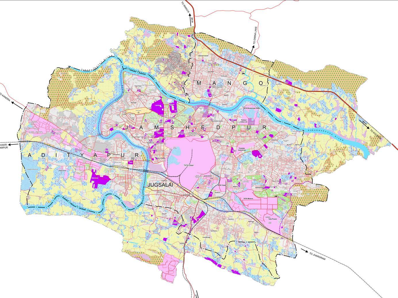
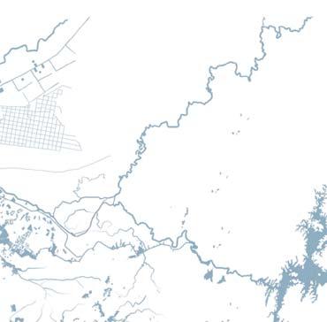
EXISTING LAND USE MAP WITH THE ADDITIONAL AREA
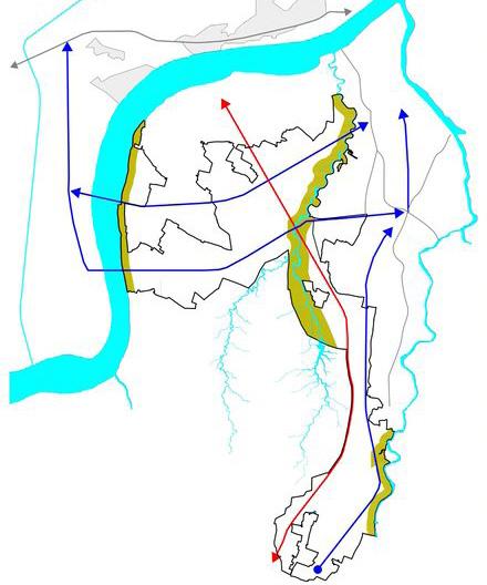
TRANSIT AS THE KEY STRATEGY
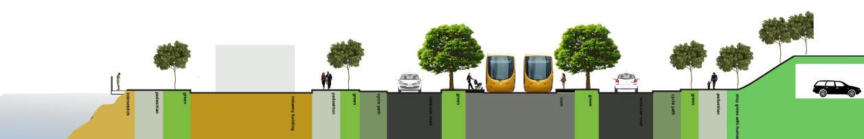
As previously described, one of the prime focusses and the strategy for the proposed development shall be and will be around the concept of TOD; Transit Oriented Development, which will insure better & faster Oublic Transport systems, through a proposed North-South & East-West LRTS alignments.
Through the very centre of the City, the LRTS is pro
posed, which shall also become focal points of the fur ther development models. The TOD affected or impacted zones were connecting the ends of the additional areas to the present urbanized areas towards the core. These TOD zones shall guide the Development Regulations based on the context of the LRTS stops. Regulations would be based upon Redevelopment & Redensifying models mostly and shall promote safer pedestrian en vironments
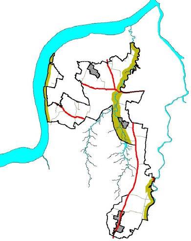
CONCEPT MAP FOR LAND USE
PROPOSED LAND USE
SCHEMATIC PROPOSAL FOR THE LRTS ALIGNMENT
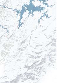
PROPOSED REGIONAL LINKAGES
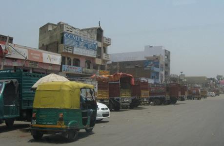
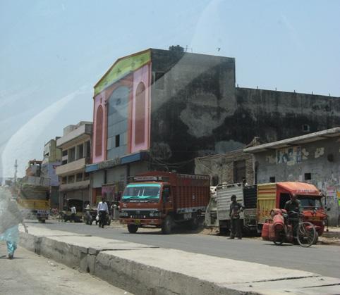
Jamshedpur, as we all know is a industry centric city, the TATA industry sits right at the centre as seen in the maps above. The transportation logistics and related traffic movement is taxing to the city and its functions. The road infrastrcuture, existing and in the proposed Master Plan are one of the key components to be fo
cussed upon. The map above shows a strategic layout for the suggestive logistic transportation movement along the edges of the city, to connect it to the nearby towns and urban areas of sinilar industrial activities. Larger links, are intercepted through larger elevated corridors for the Logistic movement.
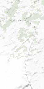
DIMNA CHOWK
BALIGUMA
NIT
JILINGBERA
LBSM COLLEGE JASKANDI
MAGISTRATE COLONY
TATA MOTORS
PIPLA LUYABASAPROPOSED ELEVATED CORRIDORS
 ANNA CHOWK
GAMHARIA BLUESCOPE
ISPLANT BASTI
PARDIH CHOWK
ANNA CHOWK
GAMHARIA BLUESCOPE
ISPLANT BASTI
PARDIH CHOWK
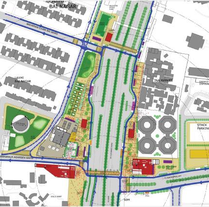
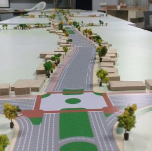
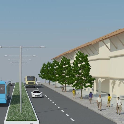
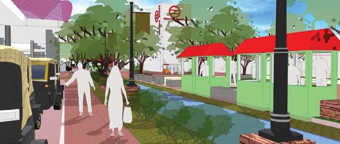
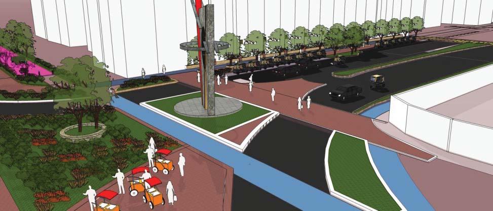
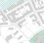
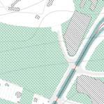
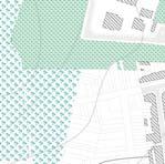
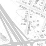
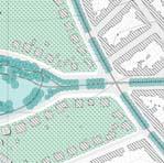
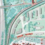
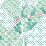
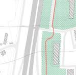
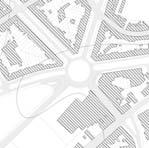
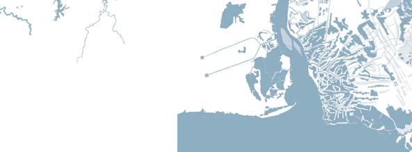
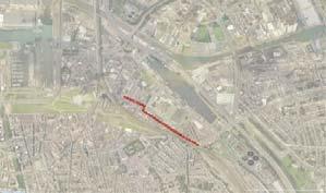
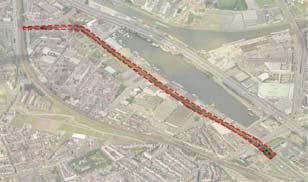
Integrated Road Corridor Development project of Mangal Pandey Marg,Delhi
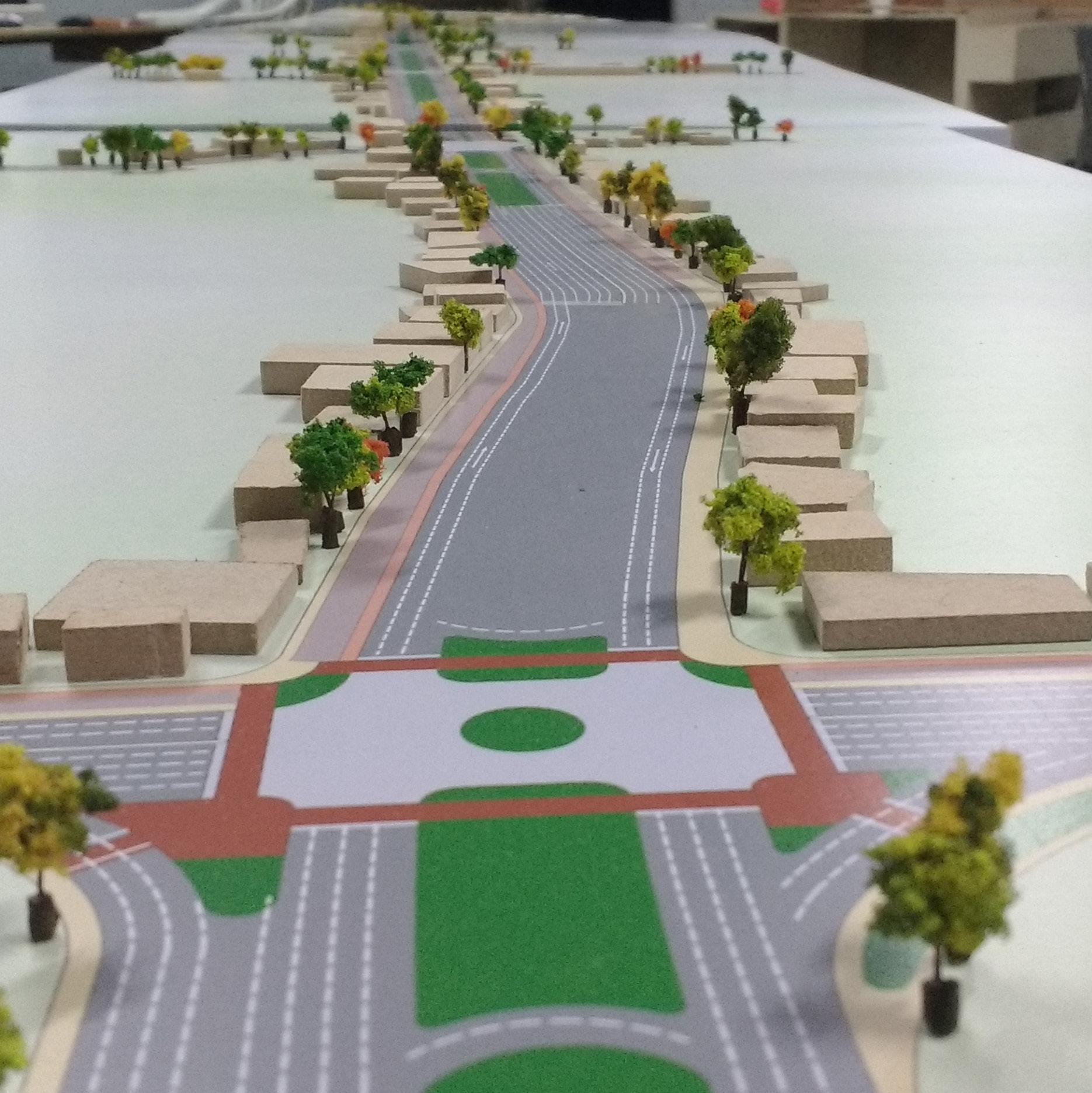
Integrated Road Corridor Development project of Mangal Pandey Marg,Delhi
ORGANIZATION: Superior Global Infrastructure Pvt. Ltd STAKEHOLDERS: PWD Delhi, UTTIPEC STATUS: Approved and Finished, To be Implemented
The project entails preparing of Corridor Development Plan and detailed design of all intersections and mid-sections based on detailed traffic and feasibility studies for Mangal Pandey Marg, from foot of Signature Bridge at Khajuri till Bhopura Bor der.
The Development Plan would entail as a Comprehensive study of Traffic (all modes including Pedestrian/NMT)movement along the corridor/network considering that Future Transpor tation (Metro /BRT) proposals along and around the influence zone, identifying the mobility issues on the study corridor and proposing recommendations towards improving the transpor tation environment and enhancing mobility.
The preparation of the Integrated Transit Corridor was ma jorly based upon the UTTIPEC guidelines and standards with detailed design of intersections, mid-sections and all other fea tures.
The major focus were to comprehensively address and encom pass: -
- Traffic Circulation system, Network and Connectivity plan for the corridor and network under the influence zone.
-Prepare a public transport oriented specific last/first mile connectivity plan for the entire influence zone
-Prepare Multimodal integration plan for the intense zone around all Metro stations ( 3-4 stations) along the corridor
-Prepare ‘On- Street’ parking plan, if any, on the corridor/ network and identify suitable ‘Off-Street’ parking sites within the influence zone.
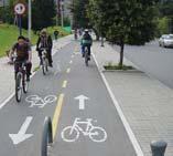
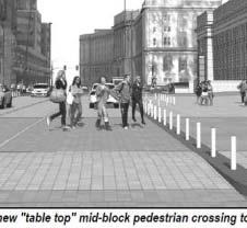
-Prepare design of all signages, road markings along with oth er road features required to facilitate all road users as part of UTTIPEC Street Design Guidelines
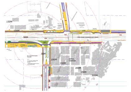
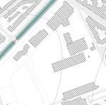
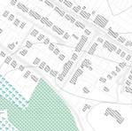
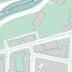
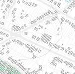
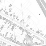
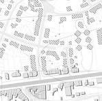
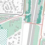
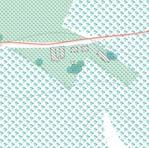
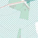
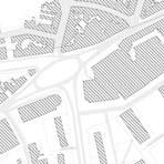
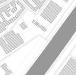
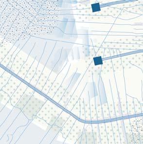
LOCATION OF ACTIVITY POINTS WITHIN THE PROJECT AREA
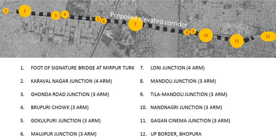
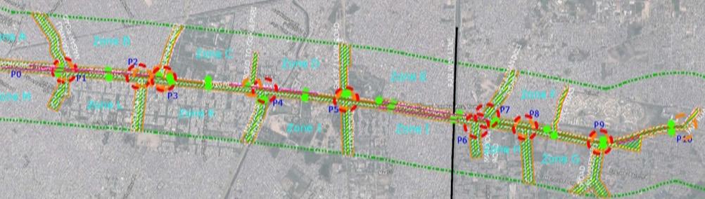 PROJECT AREA WITH JUNCTION & SUBSIDIARY ROAD ARMS
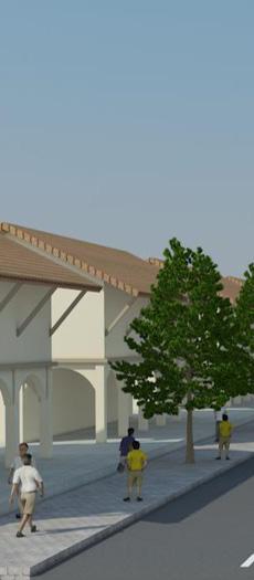
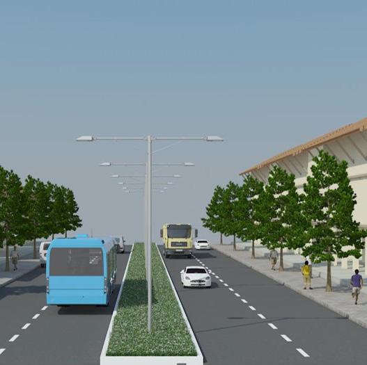
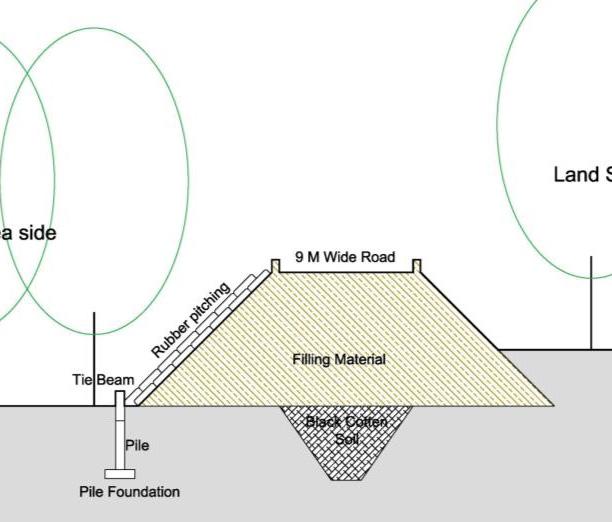
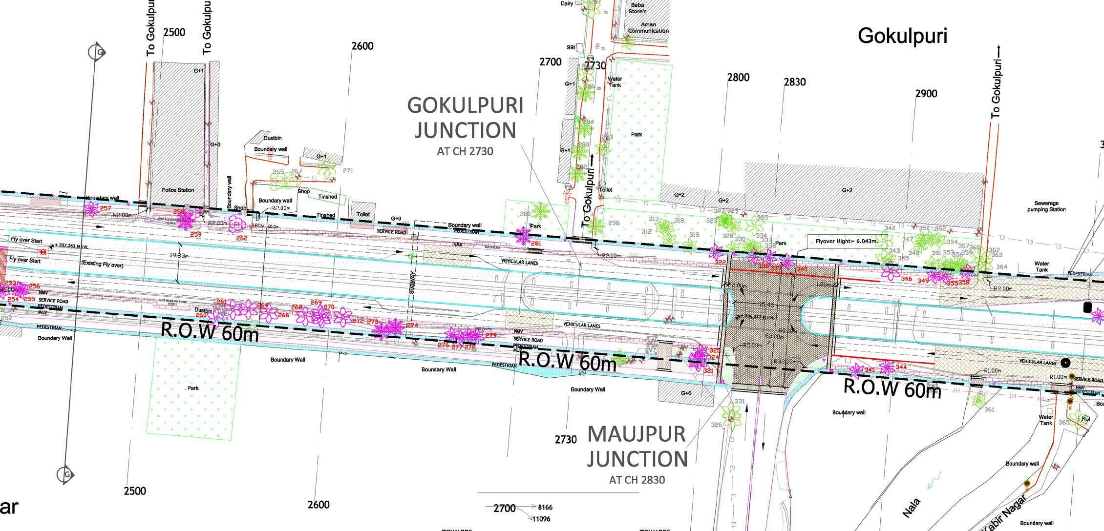
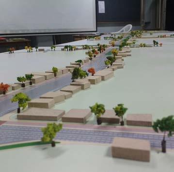
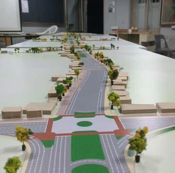
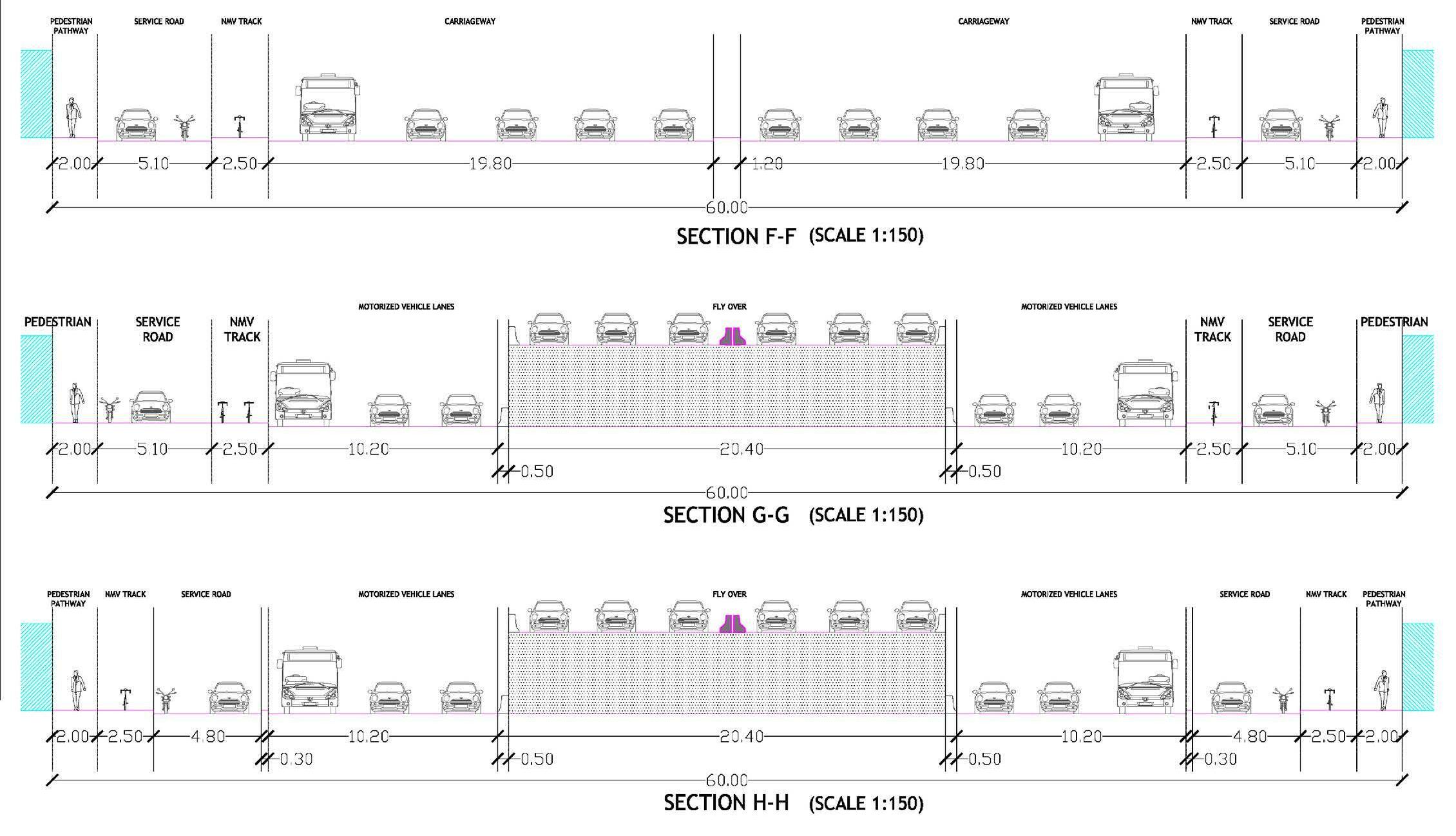
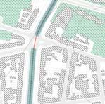
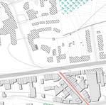
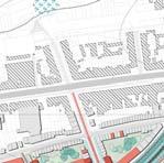
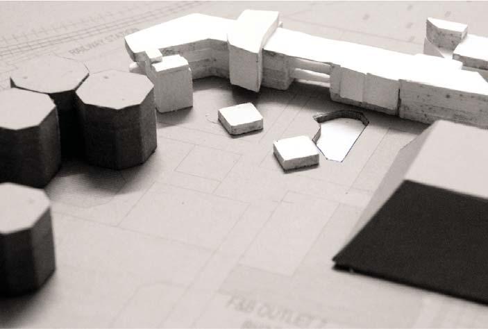
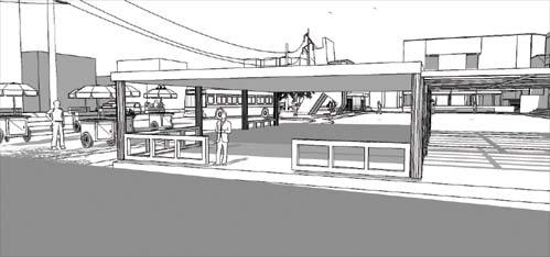
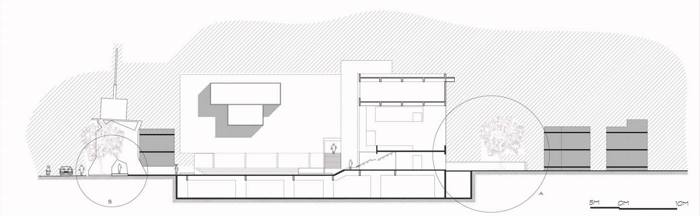
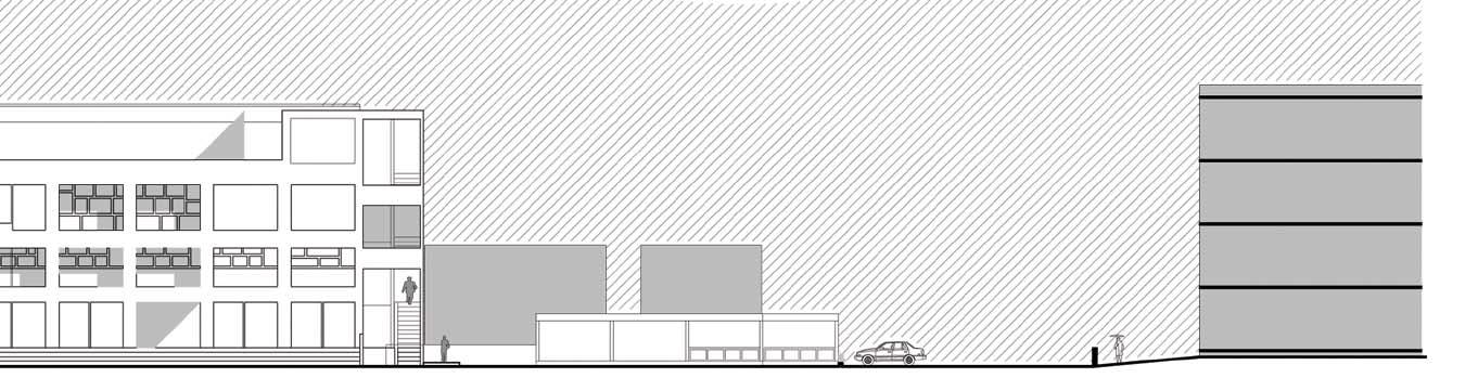
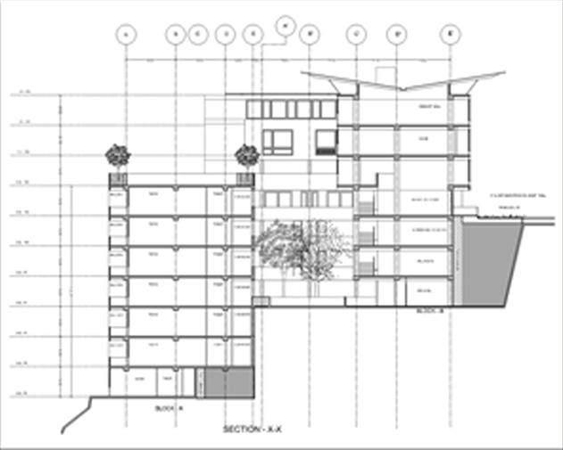
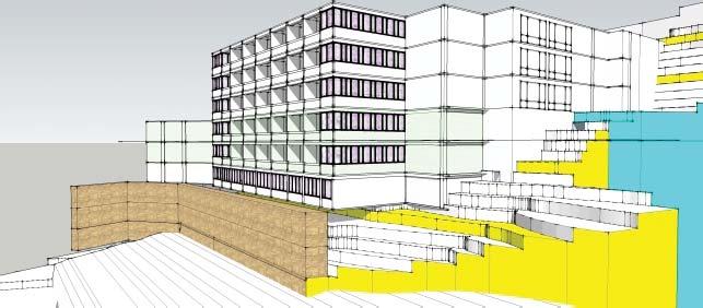
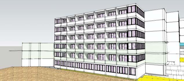
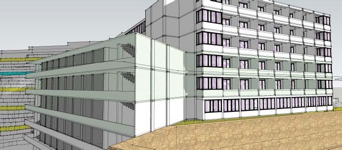
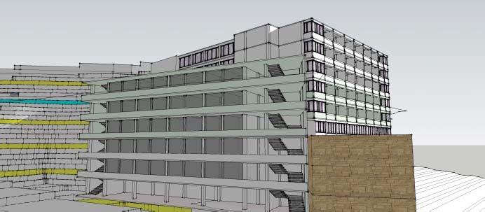
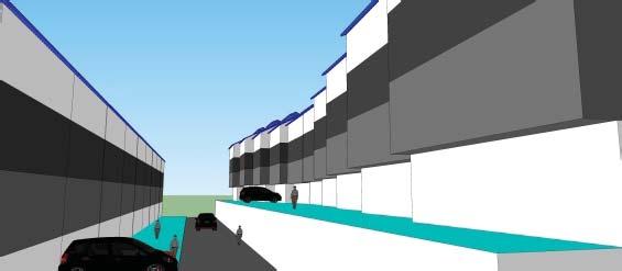
Shown in the images are part plan and sections of one of the junctions of the entire align ment of 6.3 kms, with a pro posed ROW of 60 mts.
The project is proposed in 2 phases: -
The Short Term proposal en tails the implementations of all the junction resolution with immediate construction of all the elevated corridors and 1 underpass proposal at Loni Junction. This will ensure an efficient and functional utili ty of the actual carriage way available at dispense and aims to smoothen the vehicular traf fic at the earliest.
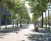
The second phase or the Long term ensures and sees the full utilisation of the 60 mts ROW, with almost 8-10 mts of the Road shoulders dedicat ed towards NMV and Pedestri an movement along the edges, once the short term proposal ensures the smooth function ing of the vehicular movement.
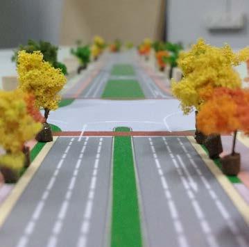
PART PLAN OF ONE JUNCTION AS AN EXAMPLE EXEMPLARY SECTIONS
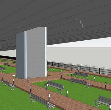
VIEWS (MODEL +3D)
PART PLAN OF ONE JUNCTION AS AN EXAMPLE
PART PLAN OF ONE JUNCTION AS AN EXAMPLE
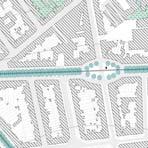
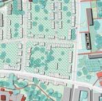
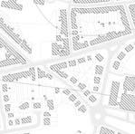
DELHI METRO PHASE 3, M.M.I PROJECT TRANSIT ORIENTED DEVELOPMENT
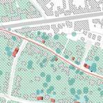
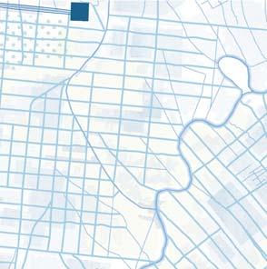
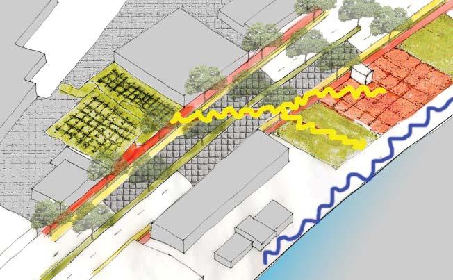
MOTIBAGH STATION is one of the newer station that is coming up on the Outer Ring Road system of Delhi and acts as an important intermediate junction to reach to various important institutional areas of Delhi. Thus, a very careful planning of the Multi-Modal Integration had to be done apart from the development of the pedestrian realm. This particular junction is perhaps an important junction as model of M.M.I more than the pedestrian realm development because of locational vicinity important areas close to it.
STRATEGIC LAYOUT for MOTIBAGH, DELHI
DETAILED LAYOUT for MOTIBAGH, DELHI
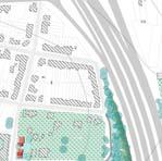
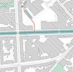
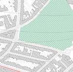
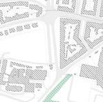
SOUTH CAMPUS STATION was one of the priority stations for its imporatnce as a institutional hub that attracts a lot of student passengers. Public Realm development was one of the prime focus in all the stations that were to be designed. Also because the station is located in one of busiest junctions on the OUTER RING ROAD of Delhi, so there was all the more issues of a very seam less controlled traffic and the location of Para- Transit modes that had to be solved within the Project Definition.
STRATEGIC LAYOUT for SOUTH CAMPUS STATION, DELHI
DETAILED LAYOUT for SOUTH CAMPUS STATION, DELHITRANSIT NODE JUNCTION LAYOUT PEDESTRIAN CROSSING PEDESTRIAN REALM SCHEMATIC LAYOUT of ROAD SECTION for SOUTH CAMPUS STATION, DELHI
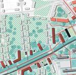
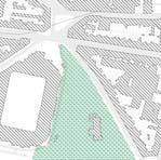
I.N.A MARKET STATION is an important junction in the new phase of Delhi Metro, as there is already an existing station from the previous phases which is in this phase being made as an interchange station between different metro lines. This brings all the more pressure on this station due to volume of ridership that is estimated to be doubled and also because of the surrounding fabric having important places in Delhi, like the INA market itself, and also DILLI HAAT a touristic destination, and close to it is a huge residential fabric of mostly Governemnet servant quarters.
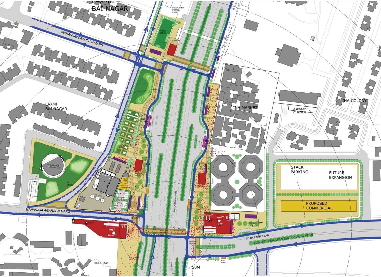 STRATEGIC LAYOUT for I.N.A MARKET STATION, DELHI
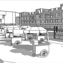
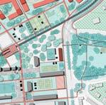
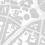
Major focus was again laid upon bring up the pedestrian realm in the whole design and strategically merge it with existing activities of vending and hawkers and also with incorporate with the Para-Transit model. It was one of the prime guiding lines in almost all the urban design layouts of all the stations to keep the prime focus on the pedestrian zone, but in this particular case a well elaborated segment had to be drafted of the concourse level with the existing service outlets on the ground and carefully managing the design so that the new introductions of the Para-Transit nodes and the pedestrian realm do not interfere the heavy traffic of the Ring Road.
 DETAILED LAYOUT for a segement at the I.N.A MARKET STATION
VIEW of the TRANSIT NODEVIEW of the PEDESTRIAN REALMPROPOSED PUBLIC TOILETS
DETAILED LAYOUT for a segement at the I.N.A MARKET STATION
VIEW of the TRANSIT NODEVIEW of the PEDESTRIAN REALMPROPOSED PUBLIC TOILETS
of freedom- ‘apaseo’ nticeship at PPA, Ga


at anand at
a p
in diversity - mass
work-
story
DE AM - neighbouroodpl gw rbanism + regionalp ng evolution of everyda insertion
H
Otrophy, Annual NA
011
h g dation
archite
academic projects
POST GRADUATION - K.U Leuven, Belgium the revolution of everyday life - city planning studio, brussels water urbanism + regional planning studio - banjarmasin, indonesia (UN Habitat collaboration) DEN DAM is at the heart of all the values - neighnorhood planning & participatory planning GRADUATION-School of Architecture, VDA, Gujarat University the story of freedom- ‘a paseo’... urban design studio- urban insertion at anand a parity in diversity - mass housing apprenticeship at PPA, Gangtok HUDCO trophy - ANNUAL NASA foundation works - architecture
the revolution of everyday life... - city planning studio, brussels
THE REVOLUTION OF EVERYDAY LIFEthe re-appropriation and modifications to refix the daily lives.
‘Right to the city’‘Livin a less aliented life by engaging in a more participatory culture’ (Lefebvre, Henri: ‘Critique of everyday life, 1947)

�... �. If' . "·"' '� , ., ' , I(_• ,I -
the revolution of everyday life . . .
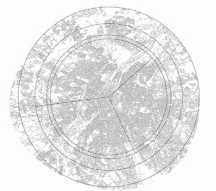
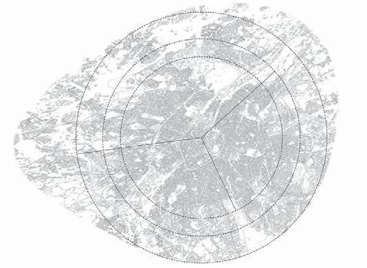
The studio challenged the design groups of studio with practical challenges of urban living scenario of Brussels; the apparent and the administrative center of European affairs. Brussels, a city progressing with time is going towards a scenario of becoming a Global metropolitan. With its pluralistic demographic composition, it has got every complexity of an urban living with its spatial formation and transformation over time, its natural ecological setup and the typical challenges of its infrastructural provisions.
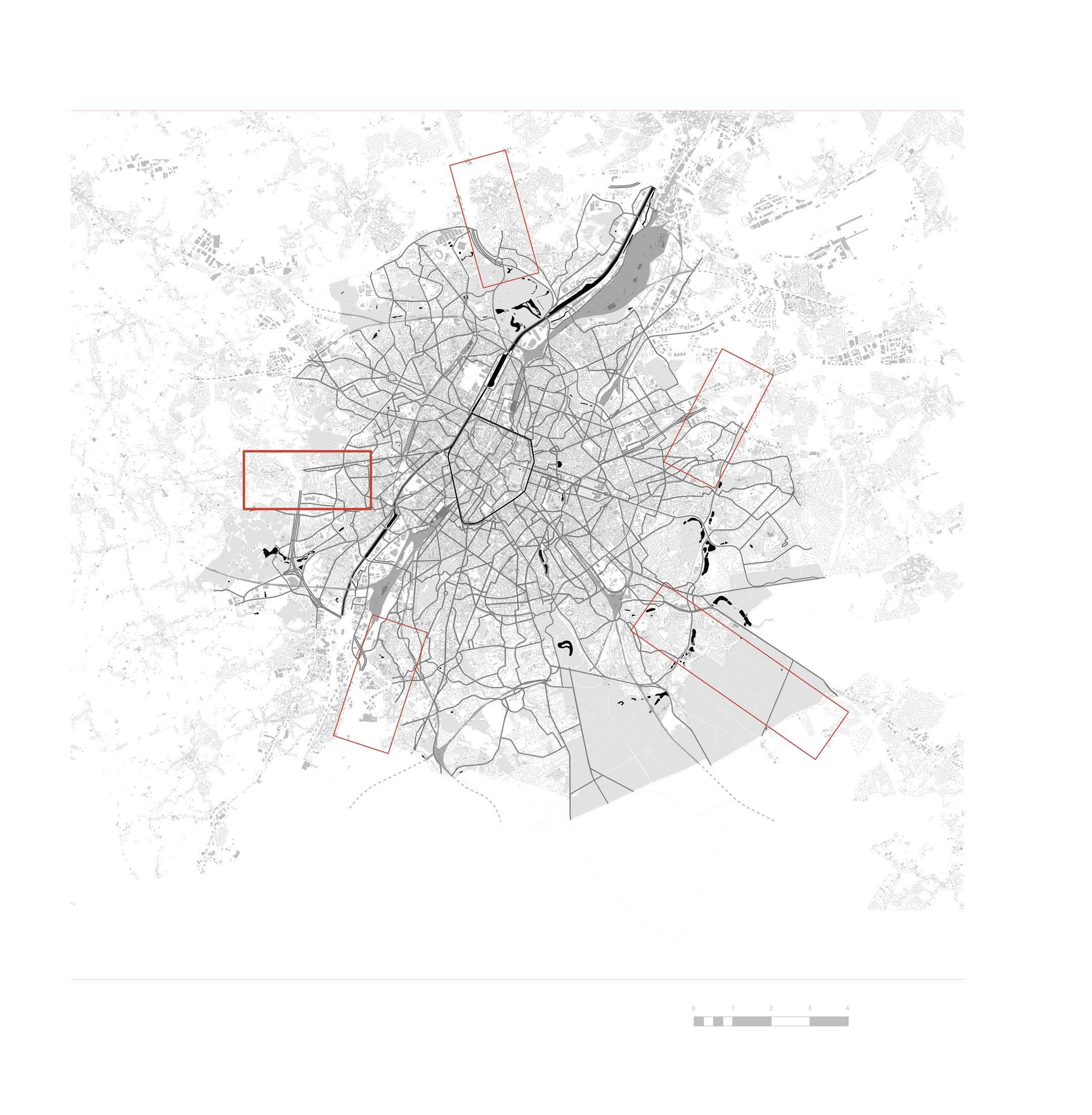
As a group of designers and spatial researchers, we tried to get into much of its layered depths and tackle the societal realm of social housings, the public life(s) there, building an ethnographical understanding of the spaces, people and their contemporary living ide ology, the whole studio group worked upon the 5 chosen areas spread across the peri-urban boundaries of Brussels region. The most challenging part of our study was to understand the economic, social and spatial difference within our area and then strategising a re-appropriation for the same.
However, we as a group of young professionals and designers chose to get into the more ethnographical ideology of our sample beyond its spatial modality and understanding, and attempted to strategise a systematic development which would not only induce more social cohesion within our sample amongst the various ethnic groups and mi grant groups but would also revaluate and reinforce their SOCIO-ECONOMIC outset.
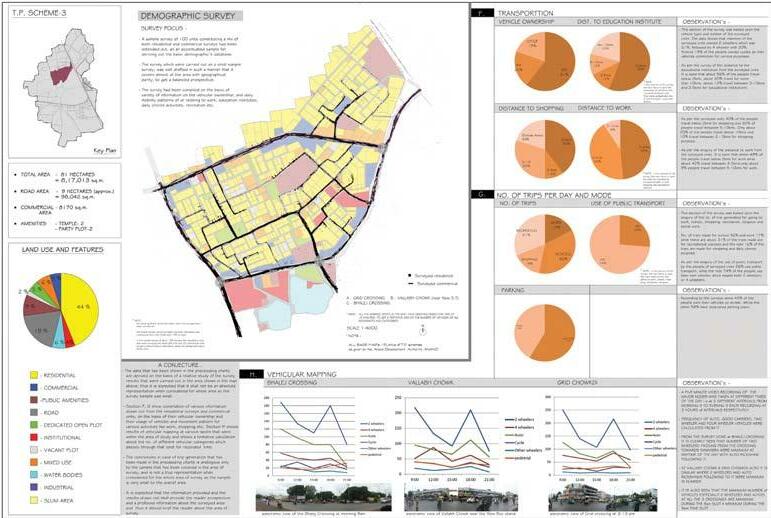
CITY PLANNING, BRUSSELS STUDIO, FALL 2015-16
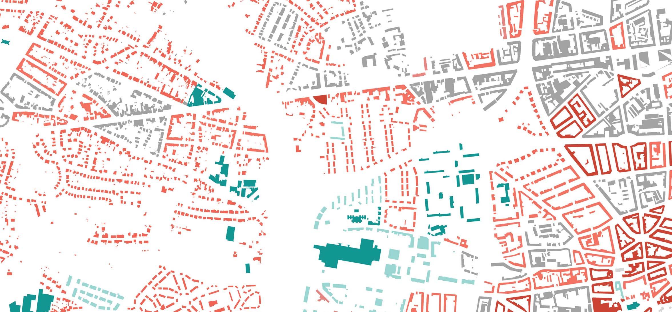
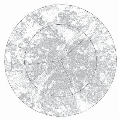
SPATIAL MORPHOLOGY of the AREA
OBSERVATION’s
Distortion of travel time of three different areas at the same distance (4.5km) from or to the city center
•There is no big public transport (tram, underground) in the sample
•Travel time by bus: 32 minutes. Last place
•Travel time by car: 19 minutes. Last place
•Car is faster than the bus
•The worst accessibility of the three, by car and bus.
•No good connection towards the public transport nodes (which could offer opportunities to work and enjoy social life).
FROM EVERYDAY LIFE
STRATEGIES for EVERYDAY LIFE socio


SCHEMATIC systemic transect of the STRATEGIES


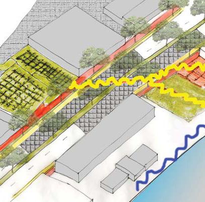
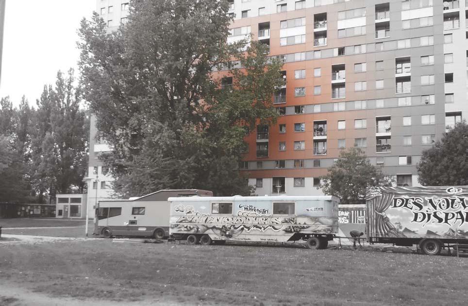
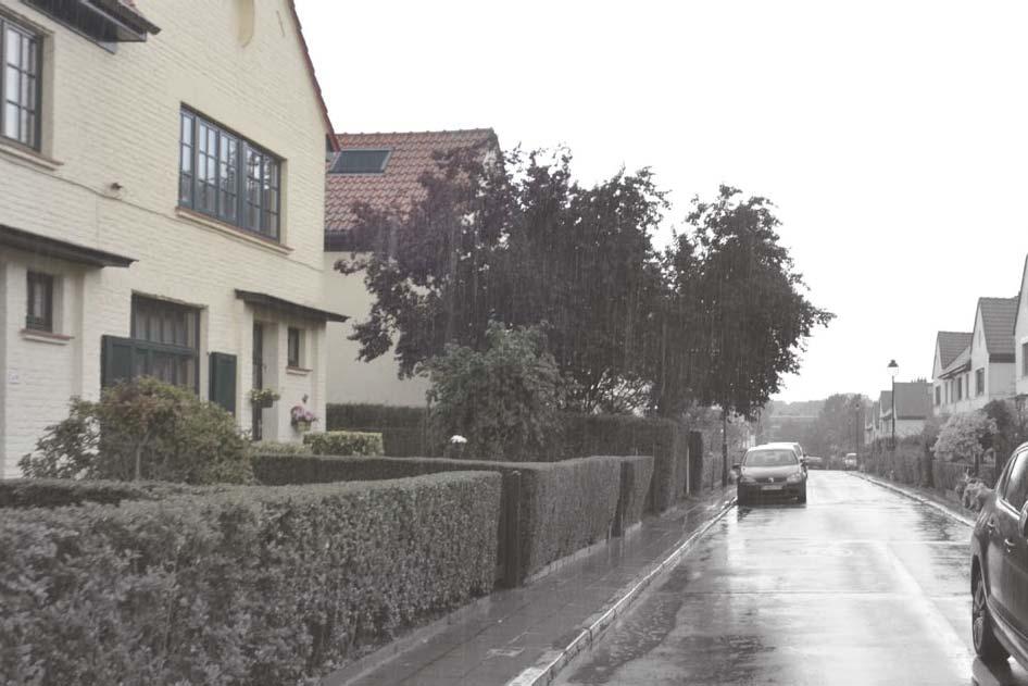
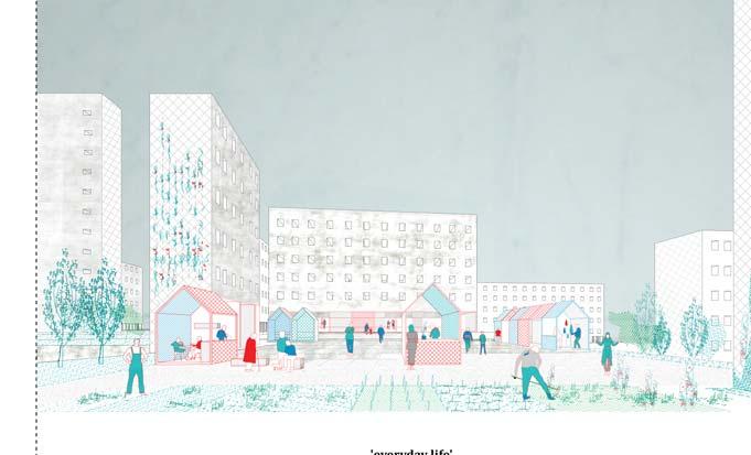
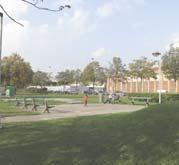
the present strategies and concepts are of socio-economic reformation and enhncing the self-sustainability aspect of the social realm of the chosen context of Peterbos in Brussels and its peri-urban part of Dilbeek falling in the Flemish region of Belgium. this is primarily a settlement which is mainly dominated by a larger prevailing group(s) of multi-ethnic migrants and is often connoted negatively for a wide reasons of social problems. Not very popular fo the right reasons domicile and surrounding context becomes the main focus of our strategies, to engrain the seeds of changes of its future, by enabling and providing opportunities for the people to reclaim their social stature.


the main strategies and the integrations are that of the opportunities of community farming, self-employment activities and in the proposal it is done through intensifying the neighborhood and inculcating different opportunities of community supportive agriculture and local markets, by the means of which they find a mean of co-production and self-involvement in their own growth. in the overall proposal it is attempted to physically and mentally connect the neighborhood to its urban vicinties through an establishment and extension proposal of the TRAM line along its corridors and through connecting the activties of the regional market of Brussels and the productive landscape of Pajjotenland in the Flemish region. it is enviosoned that the surplus of the Pajjotenland and the surplus of regional market of Brussels can be used, processed and re-cultivated into the intensified zone of the Peterbos neighborhood by establishing various small scale processing units, local markets in and around the neighborhood itself and of course the new productive landscape of the neighborhood itself by inculcating varieties of orchards, community agriculture and reclaiming the surplus road surface for production of ‘MUSHROOMS’ to begin this practice of this new revolution of socio-economic setup through which they can regain there position in the city and enable themselves as well.
tram Small scale industry Cooperative agriculture - production Farming Green houses Westland shopping center Package Sell - local markets Local market Common activitiesOccupationsLocal marketCommute tramCommuteAbattoir Cooperative agriculture and package process Transport labour occupations green houses providing occupations Agriculture selling Tramline ‘connecting media’West stationPackage proces and local market Pajottenland Westland Shopping centerPeterbos Abattoir Metropolitan distribution zone - Abattoir Peterbos Productive zone
-
economical development and agriculture as an economic base for cooperative production and housing
STRATEGIC LAYOUT
the idea(s) of the infrastructure, strategic project(s), and the inter-connectivity [physical + mental]


500m2500 Dilbeek center Dilbeek sprawl Peterbos North andMoortebeek Westland Shopping Ninoofsesteenweg 1 2 5 43 6 A B C G I D E F H J K L DESIGN MAP a translation of the concepts and strategies on the physical space
PETERBOS - the intensified zone
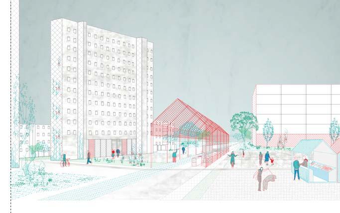
scene from the new social life with local market scene from the new social life at the plaza with the new tram stop
project phasing
the above sequences of visualisations is envisioning the life after the integration and the execution of the project and its strategies. a much detailed aerial view of the neighborhood of the neighborhood at Peterbos supports the idea of the intensified reclaimation of the physical space.
however it is still much to do with the societal mindset of the inhabitants, but as a urbanist this module of ‘SOCIAL-based-URBANISM’ is an attempt to ideate a new realm for the neighborhood to be mentally included within the context of the city for all the right reasons and make an effort to adhere the idea of ‘productive-self-sustainability’.
SEQUENCES OF EVERYDAY LIFE
-
(a scenario from the future.......)
The story of yesterday, today and everyday Temporal interventions as experimental thing and to incrase safety Temporal interventions and C.S.A. Temporal spaces can become an infrastucture to build on, like infrastructural points for C.S.A. Temporary interventions, C.S.A., processing and packaging
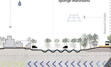
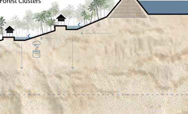
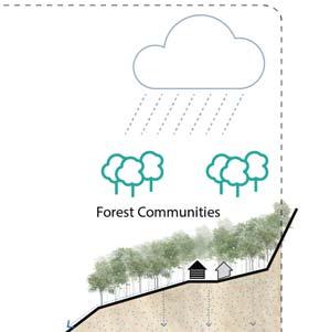
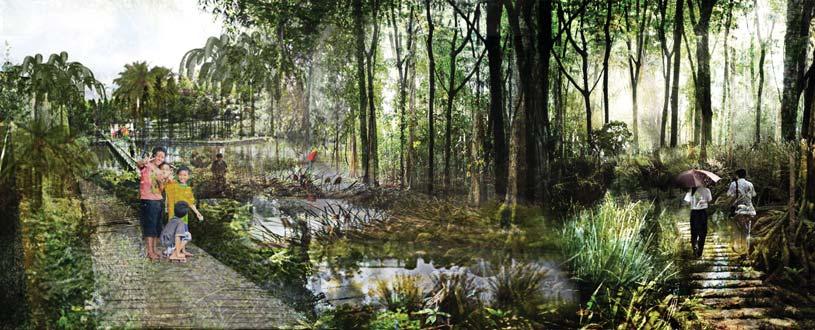
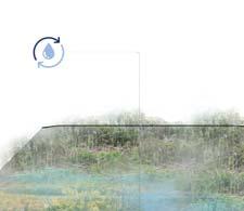
directed wetlands - enhancing the landscape through a cyclic waterscape . . .


WATER


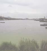
Water is one of the main tools in landscape design. In the context of Kalimantan and Banjarmasin area, this is even more true. Water, a resource of life, can become a danger if it can not find its way to join the sea or to extend when needed.
Looking at the evolution of the territory is a way to rediscover what the soil is truly made of, what can be best produced and where the water used to be as well as how human appropriated the landscape and natural resources. Currently, the space for the water to migrate through the territory is constantly shrinking.


This situation leads to a patchwork landscape made of stitches and pockets that are juxtaposed and where the water try to flow down. The water can be trapped by people uses, infrastructures, ineffective artificial water network, or a lack of drainage for example.


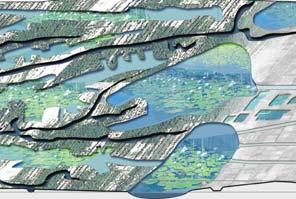
URBANISM & REGIONAL PLANNING STUDIO, BANJARMASIN, INDONESIA SPRING 2015 NOTE* PLEASE VISIT at the following links for the publications of the project (Vol1 & 2) VOL 1 - http://issuu.com/spandandas/docs/kul2015_banjarmasin_vol1_exploratio?e=25408125/37071792 VOL 2 - http://issuu.com/spandandas/docs/kul2015_bjm_vol2_design_investigati?e=25408125/37071778
enhancing the landscape through a cyclic waterscape . . Water is / could be one of the most instrumental aspects in defi ning the landscape of a region or a territory and in the context of Kalimantan region and Banjarmasin area, this is even more crucial.
The water plays a strong role in the landscape and becomes a crucial spatial element, organizing the region and acting as an economic spine and social corridor for the city and the whole stretch.

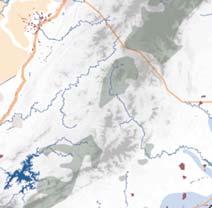
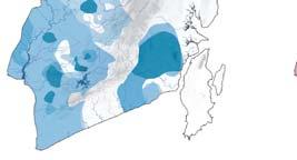
A fi rst analysis of the region of South Kalimantan, which Banjarmasin and Banjarbaru are part of, allows understanding the general dynamics of the area and the role that the cities and their surroundings play in a larger context. South Kalimantan region is part of the Borneo Island and is mainly made of low lands, such as marshland and wetland, crossed by Meratus hills chain and irrigated by the Barito River.

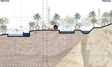
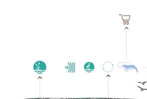
The idea is to manage water and landscape in such a way that it allows to provide space to extend for the city but also for the economic activities and most certainly for water itself. To reach those goals, the strategy is to connect people, green and water to form one common language.

The idea is to boost a compact development north-south of the cities in order to reinforce their own and distinct identities and to preserve a natural protected area between the two urbanized zones. This way we can direct water through this corridor instead of to the cities and reorganise productive landscape and waterscape.

DIRECTED WETLANDS
ANALYSIS SYNTHESIS of the REGIONAL CONTEXT
CONCEPTS & STRATEGIES

SYSTEMIC TRANSECT of the STRATEGIC PROPOSAL


S
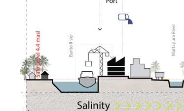
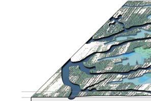
The approach is to create a blue corridor between the cities to give a path to the excessive water from the foothills down to the sea and to reduce pressure on Martapura river and Banjarmasin.
The city becomes an island using infrastructure like dikes and doors letting the water cross or blocking it following the needs. Coming from the foothills water has different itineraries to join the sea without flooding Banjarmasin: an almost completely man-made and controlled system in the north with the polders and canals network, a mostly controlled system through Martapura river and Banjarmasin city, an almost not controlled and natural system in the south through the creek landscape.
Taking time into account, the strategy is to reinforce drainage and storage of excessive water during the wet season while increasing flows and irrigations during the dry season to ensure production, life and security.
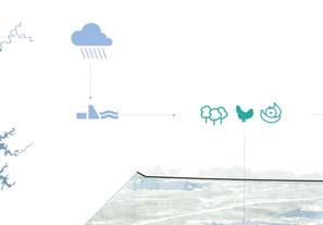
Through our strategic layout of the water system, rather say the re-creation of the new water management system we not only adhere to the urging problems of saline intrusion or the infiltration, but also wish to tackle the problems of flooding over the entire region. This we try by devicing a systemic generation of different landscap(e)ing techniques where we priortize the movement of the water; from the main source or from the rain source.
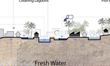
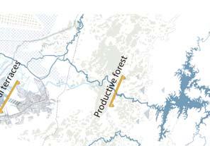
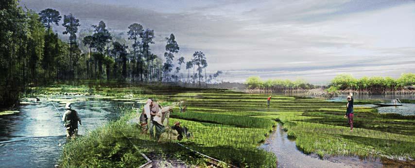
On the map one may witness a composition of atleast 3 to 4 different territorial demarcating different landscape characteristics. One of the first major territorial landscape creation right after the Martapura river starts descending from the main source of the Dam or Rain, just before entering the urbanised context. That is the territory marked as the ‘productive forst’ in proposition where it is directly used by the local farmers and aqua-farmers to sustain their agricultural practices.
The second territorial expansion is within suburban bounds of the Martapura city where it is held in the wetlands more precisely the polluted water, to be cleansed before further directing towards the city core of Martapura and Bajarbaru. These are also abbreviated as the agricultural terraces, as these wetlands allows a natural system of cleansening and also a much intensified agricultural production takes place apart from the cleansening.
REGIONAL DESIGN
MAP


The development plan of Banjarbakula is mainly in line with the presented strategies. Whereas industries and unified urbanized area are not part of the strategies, several actions are similar (forest, peat, mangroves, fisheries etc.

The crucial points are developed in order to manage the main water issues while protecting the cities and redirecting the flows.
Wetlands and Gambut as indigenous territories offer efficiency to tackle the contemporary water management problems: DRY SEASON from November to March.
The rivers and wetlands are choreographed to respond to TIDAL CONDITIONS.
PHASING OF STRATEGIES & THE LANDSCAPE
Lines are reinforced while offering more specified opportunities to middle scale stakeholders in order to intensify the potential of the region.
Small scale appropriations of the new landscape and waterscape are implemented, collecting the benefits and multiplying stakeholders in a more individual scale.


The rivers and wetlands are choreographed to respond to RAINY SEASON from April to October
The rivers and wetlands are choreographed to respond to EXTREME CONDITION of heavy rainfalls
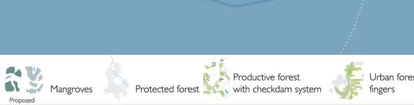
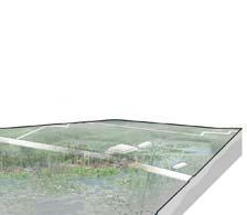
THE PRODUCTIVE & PROTECTIVE FOREST in the FOOTHILLS

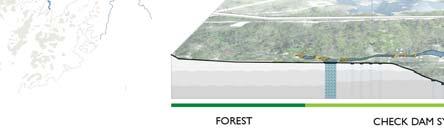
In the foothills, the protective and productive forest is reinforced to keep water longer. Using small scale check-dams the water is slowed down, favouring infi ltration, recharging the aquifer and protecting topography from erosion while supporting economic local productions.
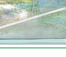
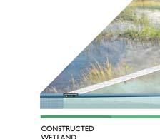
THE AGRICUKTURAL TERRACES & WETLANDS


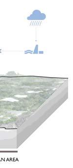
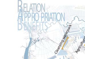
The wetland is associated with cleansing systems, storage areas and intensive productive landscapes that defines the transition between the city and the wetland. The waters of Banjarbaru are collected to be cleaned in a park mixed with orchards before joining the wetland.

SHAPING OF THE LANDSCAPE MORPHOLOGY
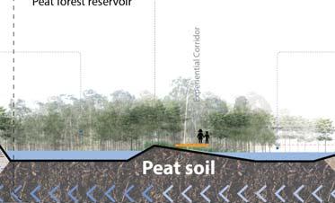
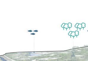
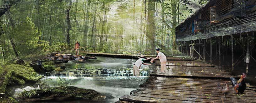
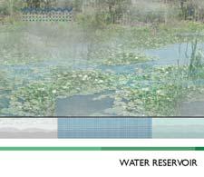
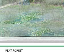
THE CLEANSENING WATERPARK & PEAT FOREST
After the wetland, the water passes through a cleansing waterpark forest before joining a storage area. Forest and storage are located in productive peat forest in order to take advantage of the high retention capacity of peat soil while protecting the region of ground fires in dry season.
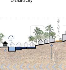
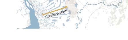
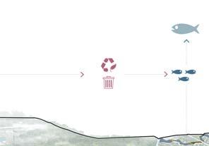
THE CREEK SYSTEM


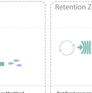
The creek system acts as a sponge. Coming from the sea, a productive mangrove forest aims to become a buffer zone, consolidating the river bank and reducing saline intrusion.

a guide to DAM - neighbourhood & participatory planning
DAM IS AT THE HEART OF ALL THESE VALUES . . .


NOTE* PLEASE VISIT at the following link for the publication of the project - LINK: http://issuu.com/spandandas/docs/studio_ssp_fall_2014?e=25408125/37071753
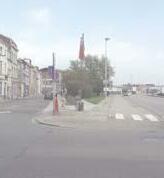
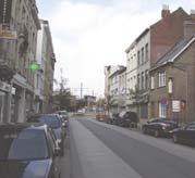
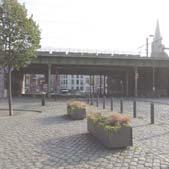
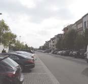
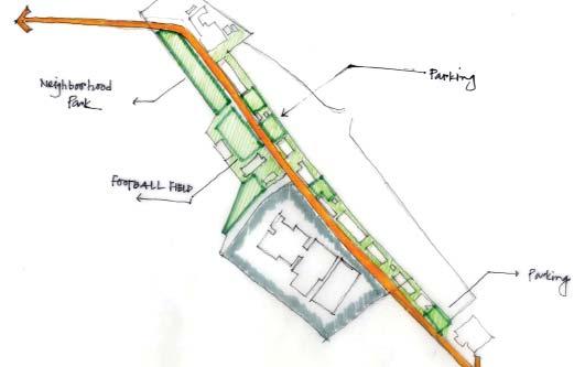
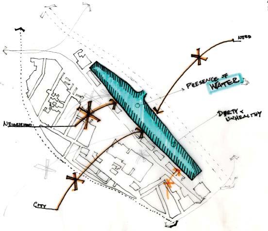
Dam neighbourhood in Antwerp city is strangely very crucially located on its physical map, but still does not really lies on the mental map or image of the city dwellers and its habitants.

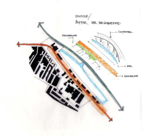
Tthe focus of the studio was to bring in to light the capacity & capability of DAM as a strategic location and a worthy fabric, especially in context of the large Slaughter house site, that will under go a massive urban revitalization project, to be held through design competiotion in the future and this project will be really crucial for many actors and the city and most importantly the nieghbourhood itself.
One of the interests of the studio was to prepare a detailed study of the area and enlist critical values and spatial elements that would be crucial for the future designers to know, who will be participating in the design competition.
We as a team collaborated ideas and vision of the DAM people, through a mid-review workshop and sorted out their needs and formed VALUES for the neighbourhood that would correspond to certain spatial elements of the DAM itself
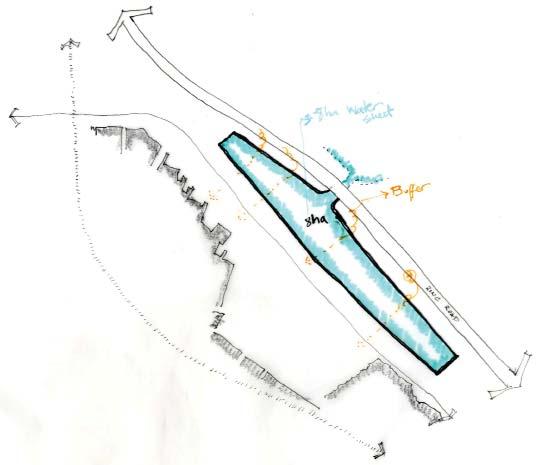
The Dam neighbourhood feels the challenges of its own needs and is overshadowed by the large projects of mobility, environment and economic development. The diagram is an abstract of the possible impacts on the neighbourhood due its proximity to large scale projects. The impacts are measured on the aspects of mobility, effect on land values, environment and variables such as water.
WHAT IS DAM ALL ABOUT ? ? ?
Lobroekdok Slachthuislaan
Slachthuissite Lange Lobroekstraat
‘DAM IS COMPLEX SURROUNDINGS OF HEAVY INFRASTRUC”TURAL INVESTMENT’s OF THE CITY, FOR THE CITY; BUT NOT PRECISELY FOR THEM” . . . . . .
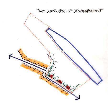
SPATIAL ELEMENTS OF THE NEIGHBORHOOD
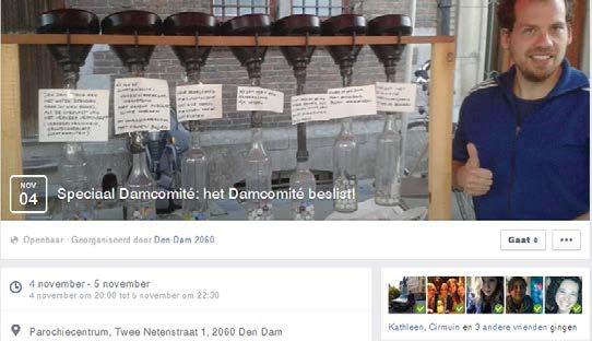
WORKSHOP ADVIES VAN HET DAMCOMITÉ
The Mid-Semester Panel discussion proved to be a crucial one and perhaps one of the most interesting one as well, for it involved true and honest feedback from the people of the neighborhood. Hence, based on the learnings of this discussion we as a whole studio group could proceed further and started chalking and drafting out possible plans for the future. One of the major task was to keep in mind that we do not design but do ‘something’ that was valuable for the people and the designers fo the futur competeition project to be taken place.
PROCEEDINGS OF THE PUBLIC FORUM
A SOCIAL MEDIA PLATFORM TO KEEP IN CONSTANT
TOUCH
WITH
THE COMMITEE
OF
THE NEIGHBORHOOD
EQUITY
HERITAGE
After reading the advice of the Dam, based on various meetings of the neighborhood and after the public forum idscussion on the midsemester panel, which would accompany the project definition, we tried to associate the aspirations and statements of the advice to certain values that are intrinsic to the neighbourhood.
These aspirations translate to the values; -Integrated neighbourhood -Heritage + Living by the water -Selfsufficient neighbourhood -Saftey + Comfort
-Equity.
As we realised that we are not really going to design anything that matters the transformation of the physical space there, and rather deal with more of the intangible parts, these values comes up as one of the most important inventories of the research output.
Based on the findings of these values concerning over the physical space, we understand that over the whole neighborhood tissue, the pressence of various existent physical spaces which contains one or the other value(s).
Hence, we start seeing this neighborhood not just as a physical space but as a composite of different meanings, legibilities and values the people of the neighbor hood hold for these spaces in the neighborhood.
Based on these findings, we as a smaller part of the studio group organised a small design charette just to make some possible suggestions for the designers.
VALUES FROM THE NEIGHBOURHOOD NEEDS . . .
INTEGRATED NEIGHBOURHOOD
SELF SUFFICIENT NEIGHBOURHOODSAFETY & COMFORT
HOW ALL VALUES CO - EXISTS OVER THE DAM NEIGHBOURHOOD
Towards the end there were some basic design idea’s and gestures that were explored just as to check, whether the process of finding values was of any use to deesign or not for the future designers.

This i would personally recommend as one my most memorable experiences of an academic project which included importance of people’s role in the transformation process of a physical process. This is something very new and unique for the background i come from which has more TOP-DOWN approach in large public projects.


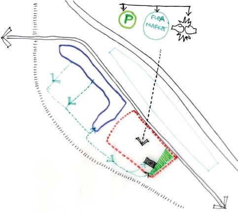
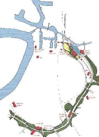
 CONCEPTUAL DIAGRAM of the STRATEGIC POINT SHOWING VARIOUS POSSIBLITIES
a public realm
public green
safe crossing
public spacecycle friendly environment
green boulevard
urban garden / vegetation
CONCEPTUAL DIAGRAM of the STRATEGIC POINT SHOWING VARIOUS POSSIBLITIES
a public realm
public green
safe crossing
public spacecycle friendly environment
green boulevard
urban garden / vegetation
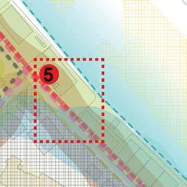
RESULT OF THE DESIGN CHARRETTE . . . zone 5
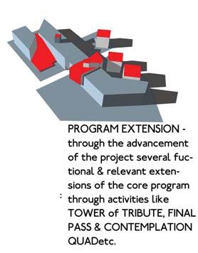
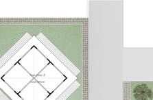
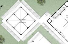
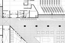
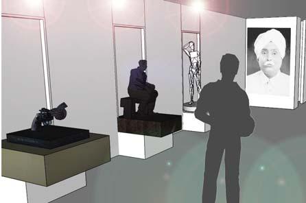
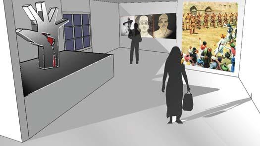
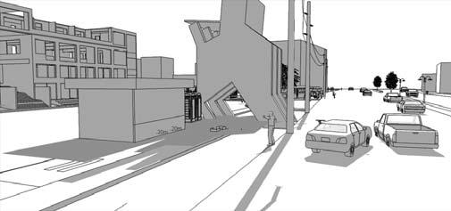
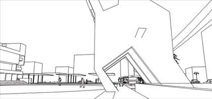
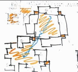
THE STORY OF FREEDOM - a paseo a tribute to the freedom fighters... (undergradtuation architectural thesis project)
NOTE* -
FOR VIEWING THE ENTIRE DISSERTATION PLEASE VISIT THE FOLLOWING LINK: http://issuu.com/spandandas/docs/the_story_of_freedom_-__a_paseo_?e=25408125/37181582

PROPOSAL -
the primary idea was to inculcate the story of INDIAN FREEDOM STRUGGLE as a built mass based on the principles of not only architecture but also the integral social and cultural backdrops of modern history of INDIA. a self asserted project according to the understanding of the need of todays modern times and the society of present day INDIA. the project is primarily targeted at the youth of INDIA especially the studying category to reiinstate the ideas of such strong dedication by our forefathers who did a lot struggle to get INDIA free from the colonial rule...
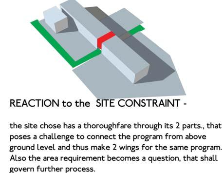
THE SETTING -
the site chosen for the insert was absolutely obnoxious to its realm. Set amidst a large scale expo and convention center in PRAGATI MAIDAN, it does not follow the prejudiced idea of setting it at the whims and realm of other memorials in NEW DELHI, dedicated to honour of single persons and their contributions. It is thus intendly done so as to differ out its purpose of showcasing the whole struggle of 190 years and highlighting the events and many other persons who are not usually reckoned by us. Thus the chosen site proposition is easily accessible and attracts more than a million visitors through the year and the insert was anticipated on such grounds that it shall be easily accssible to large masses in numbers.
the process was mainly through the idea of acheiving a mass that will not only be a form which is monolithic in nature, because of the nature of the project but also it shall reflect upon the crudenes of the matter through its development as a built mass . . .

the form of the mass was thus a gigantic block which interprated as the long course of time frame of the whole freedom strucggle of India from the colonial rule . . .
THE
CONCEPTUAL & DESIGN PROCESS


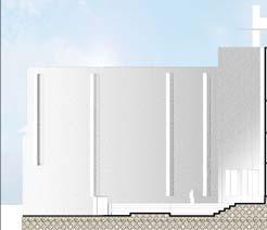


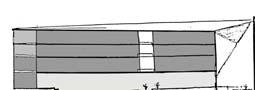
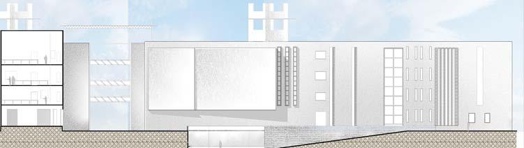
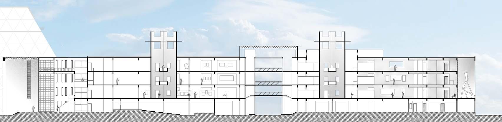
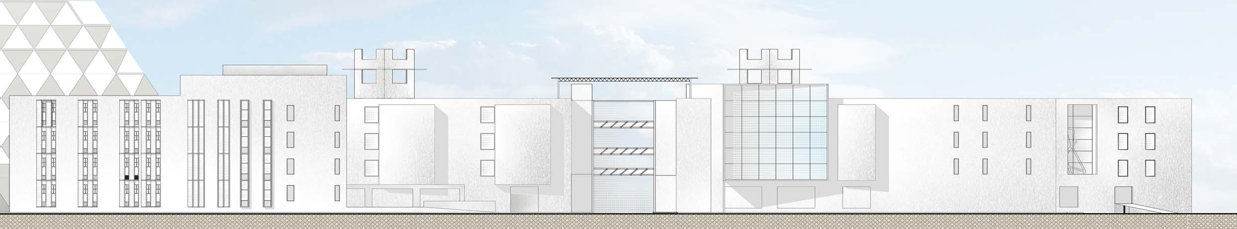
SECTIONS & ELEVATIONSFLOOR PLANS


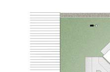
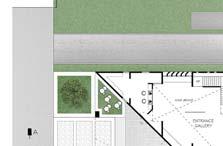
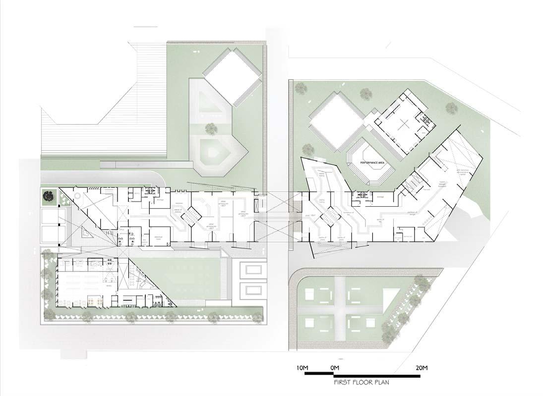
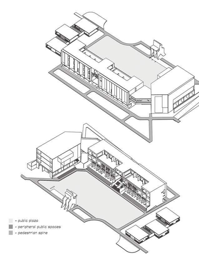
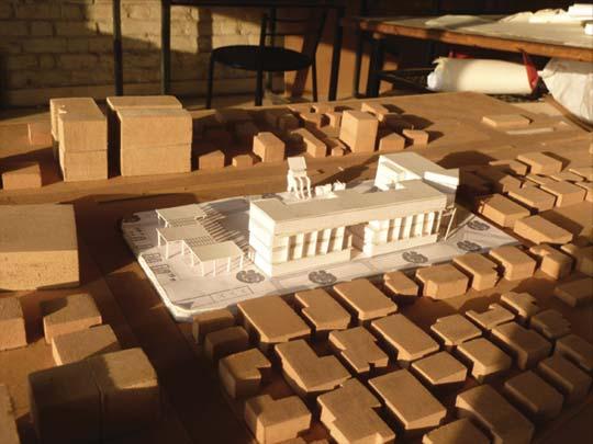
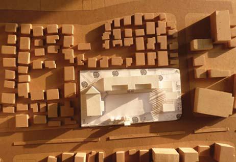
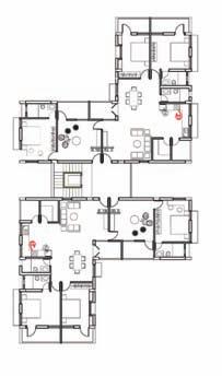
URBAN DESIGNcity level study - understanding the layers and dynamics of a city . . . urban insert project

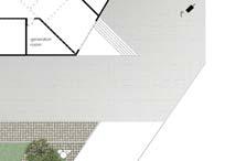
as a foundation for the urban insertion project to be proposed and designed, it was really important as a student to understand the various layers of it and its fabric, and the factors associated to it. . . in the initial stages the city of ANAND had been documented, studied and physically mapped to bring forth the underlying dynamics of the city and factors affecting its functioning . . . also it was important to understand the understand the overall matrix including the socio - cultural and economical dynamics so as to understand the true needs of the people and the place in totality . . .

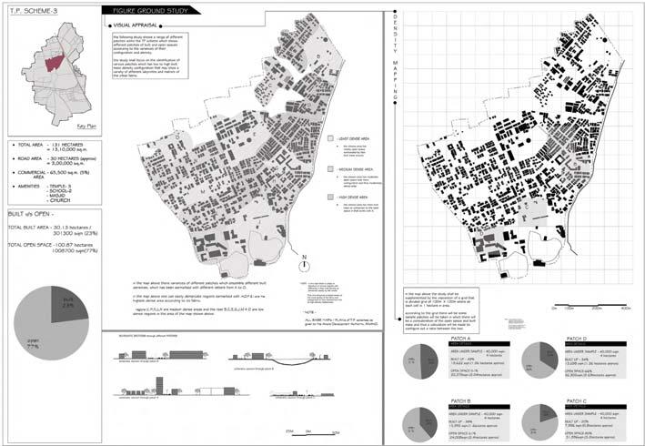
THE RESEARCH
- CITY LEVEL STUDY - understanding the layers and dynamics of a city . . .PANELS FROM FIELD WORK
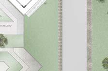
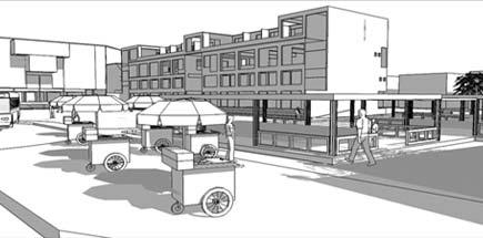
THE PROPOSAL -
simply it was termed as a CIVIC CENTER, constituting a variety of functions of public interest as well as keeping the function of gallery space specific to the heritage of the region was albeit the prime focus. As a matter of fact the project was self asserted to be UNbuilt MORE . . . It simply meant to occupy the least footprint of the building and give more to the public as a lot of cultural and festive activities were anticpated.
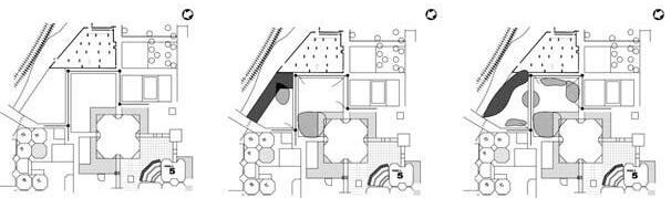
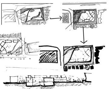
UNDERSTANDING THE SITE / CITY & CULTURE - Anand city was studied at various layers that forms an urban matrix of the city, based on which the broader level imageability was carried out, thus concluding upon various selected sites and drawing out different programmes for each that will suit the public of the city with respect to the various sites.... also important was to understand the need of the place, not in terms of physical environment but at a SOCIO CULTURAL BACKDROP . . . so as to interpret the nature of the proposal and then its design . . .
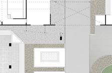
SITE PLAN
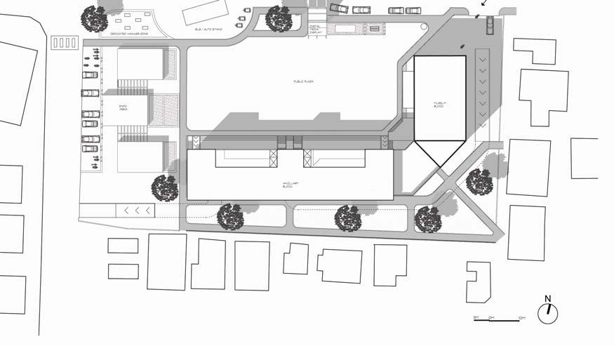
few driving points towards the design1.MINIMUM BUILT- to provide more opportunities of public activities including large social and cultural events . . .
2. OPEN SPACE as its UNIQUENESS- keeping the public court clear, plain and simple with multiple options of different activities around, the sense of a place is woven by the open court surrounded by the built and serves as its unique identity.
3. VISUAL APPEAL - the fore ground of the court to the built mass is mainly to enable clear visual penetration for the people and thus making it feel a more familiar space for them . .
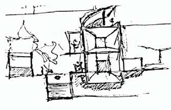
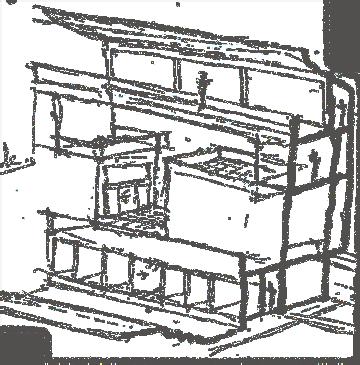
CONCEPTUAL SKETCHES
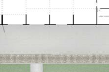
 SECTION
THROUGH BUILDING
SECTION
THROUGH SITE
SECTION THROUGH SITE

FLOOR PLANS
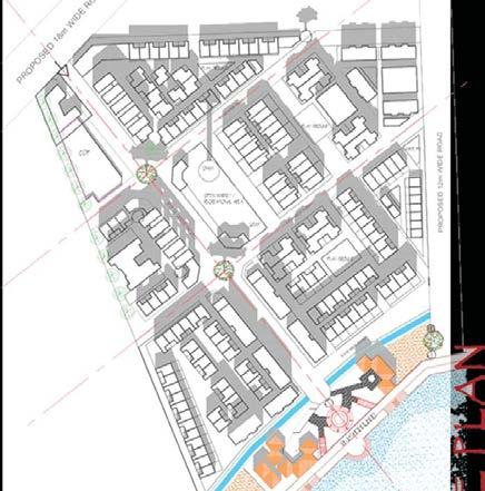
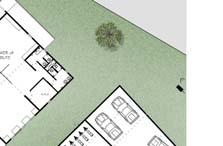
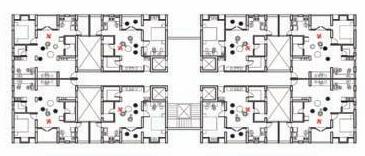
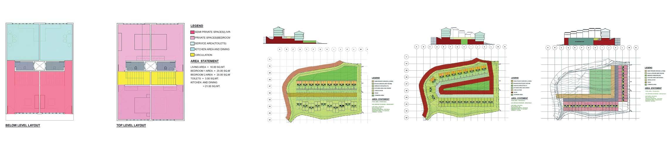
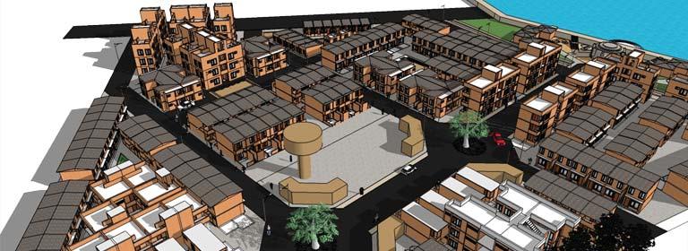
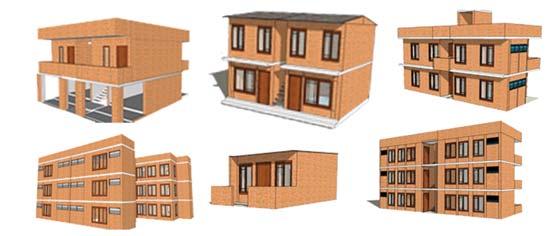
A PARITY in DIVERSITY, MASS HOUSING STUDIO, BARODA, GUJARAT.
a uniquely formulated program, based upon the idea of community living & co-existence, which was not defined by the economic quo, but by their professional and occupational variations....
QUICK FACTSSITE AREA - 3 hectares (2 hectares for housing & 1 for community & neighborhood development). CLIMATE - HOT & DRY (GUJARAT, INDIA)
PROPOSAL
HOUSING - 380 UNITS ( 190 UNITS / HECTARE), NEIGHBORHOOD LEVEL - PUBLIC PLAZA & FOOD COURT, PUBLIC HEALTH CENTER & YOUTH RECREATIONAL CENTER.
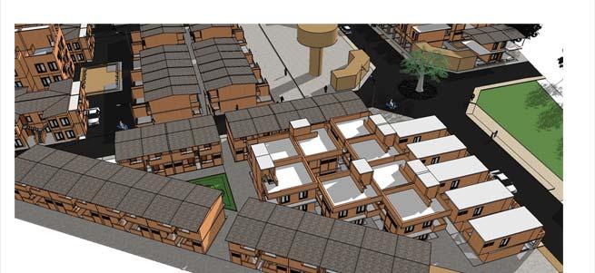
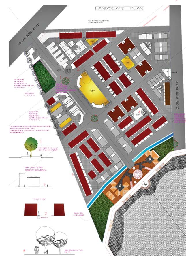
SITE PLAN

BUILT VOLUME AND FUNCTION’S
INDIVIDUAL PROFESSIONAL
AUTO DRIVERS / DOMESTIC HELPERS
INDUSTRIAL WORKERS / LABOURS
NUCLEAR FAMILIES
FAMILY WITH TENANTS
CONCEPT & PROCESS
few driving points towards the design -
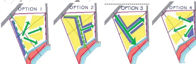
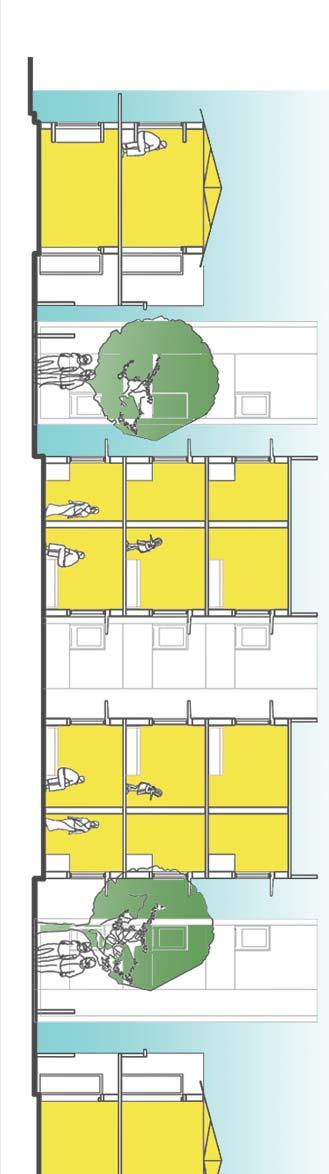
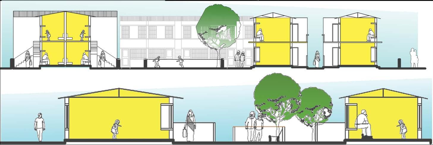
1.SEPERATE DISTRICTS FOR DIFFERENT USERSto avoid the clash of the lifestyles between dif ferent user types; this shall also encourage more cultural activities amongst user of similar types based on thier occupation.
2.INTERCONNECTED OPEN SPACESto encourage more daily interactive activities amongst the habitants apart from bigger cultur al activities which shall happen on a regular ba sis during festivals.
3.A VISUAL HIERARCHYa dense fabric was ought to be attained but at the same time the volumes and space constraint was a guiding factor in deciding the volume of the fabric weaving; a visual appeal vista was thus conceived.
it is better that we understand that human race is a social animal and simply desires a community to survive and co exist.. thus the man always tries to look forward to a newer and better environ to live, a secured neighborhood to feel safe and serene fabric to nourish... unlikely to make divides on economical and social bind every single being is, but equal, in respect of thier abilities, physical attributes and zeal for living and hence looks upon a community and a habitat to live in...
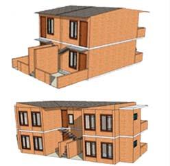
DIFFERENT LAYOUT’s FOR EACH USER TYPOLOGY -
SITE SECTIONS
the proposal was absolutely based upon the idea of providing maximised and integrated open spaces so as to increase the opportunity of having a better com munity spaces . . . the anticipated spaces are more precisely carved out to bring in variety of cultural activities together and producing a more robust nature of cultural amalgamation . . .
DESIGN MAP
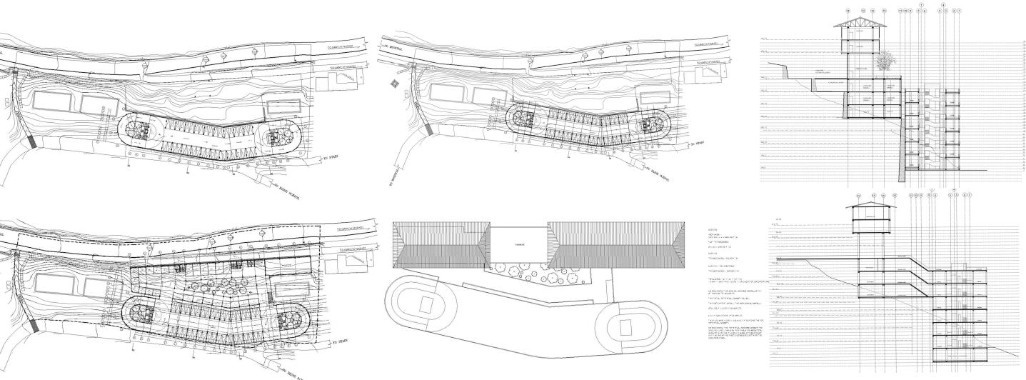
apprenticeship, PPA, Gangtok
After the 18th september, 2011 earthquake in Sikkim, a shelter designed on principle of easy mobility and assemblage was designed by P.P.A as a self initiative, to provide quick and ressilient relief to the victims especially to the population of North Sikkim which was devasted the most. A prototype construction was also tried and tested for its structural and aerodynamical stability so that it could be eventually proposed to the Govt. of Sikkim for further mass production and sent out to the disaster areas.
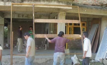
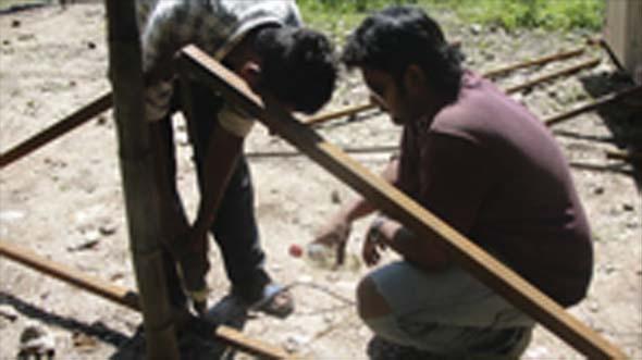
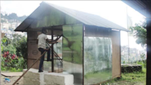
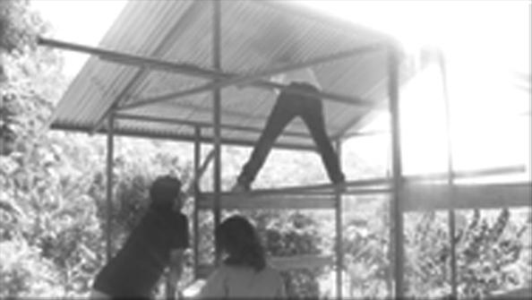
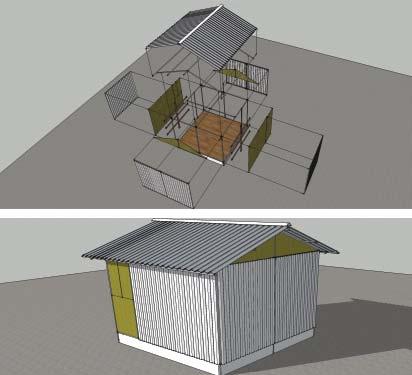
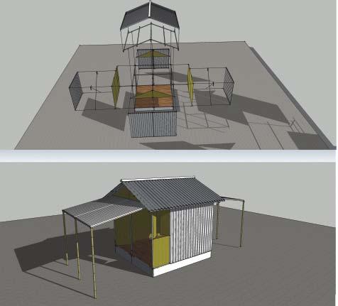
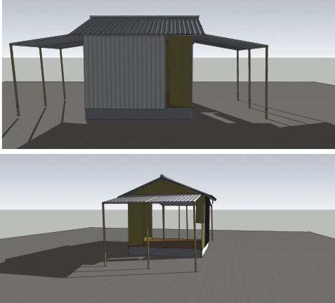
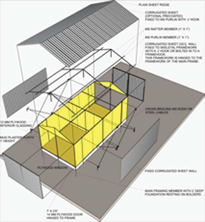
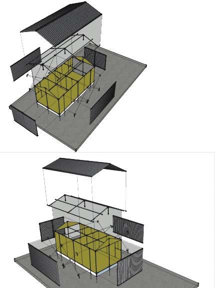
EARTHQUAKE SHELTER - PROTOTYPE
CONSTRUCTION DRAWINGS
VIEWS of the SHELTER
IMAGES of the PROTOTYPE ERECTION
 CROSS
CROSS
SECTION
PRESENTATION DRAWINGS
3D
VIEWS
HOTEL BLUE FERN, NAMCHI, SIKKIM.
PLANS SECTIONS
One of the major projects from the Govt. of Sikkim for creating new socio-economic hubs that promotes local traders and businesses. A series of similar local supermarkets were conceived by the government at various strtaegic location of Sikkim. This Bazar (market) at Namchi is set in Southern parts of Sikkim.
HOUSING PROJECT in BHUTAN
CONCEPTUAL PRESENTATION DRAWINGS
A social housing project conceptualised and drafted for the presentation purpose. A minimum number of Units and types of units were to be achieved as a target, optimising it with 3 different layout options promoting a central common space in all the options as seen.
3D VIEWS
KISAN BAZAR, NAMCHI, SIKKIM
HUUDCO T TROPPH H HY Y - (comppetti i ittioon n p project)
the competition was mainly focussed on mass housing for the E.W.S of the society.
the idea in the proposal is to mainly inculcate the existing 2 around the site and also cultivate a provision for those inhabitants in the new proposal, also provide maximum number of vocational and employement opportunities so as to make it an income generative prospect.


SITE PLANCONCEPTUAL LAYOUT
DIFFERENT BLOCKS
CONCEPTUAL PROCESS
various zones and blocks are dedicated to different categories of groups so as to make a comfort zone for each of them; also to intensify the character and indispensibility of each zones commercial zoning has benn done carefully so as to provide to all...
SITE SECTIONS
TYPICAL
FLOOR PLAN
LANDSCAPE PLAN
HUMAN ARMATURE -
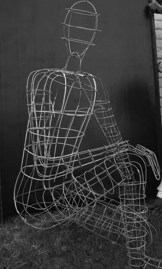
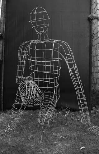
the excercise was totally based upon the un derstanding the propotioning system of human body and hence extrapolate that to live scale strctural armature, thereby bringing in the logics of structure and stability . . .
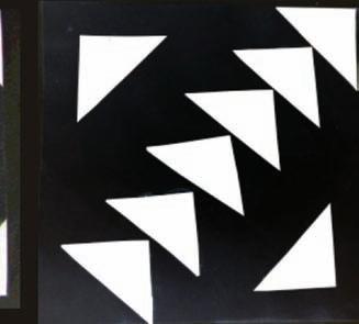
GENERATIVE FORMS -

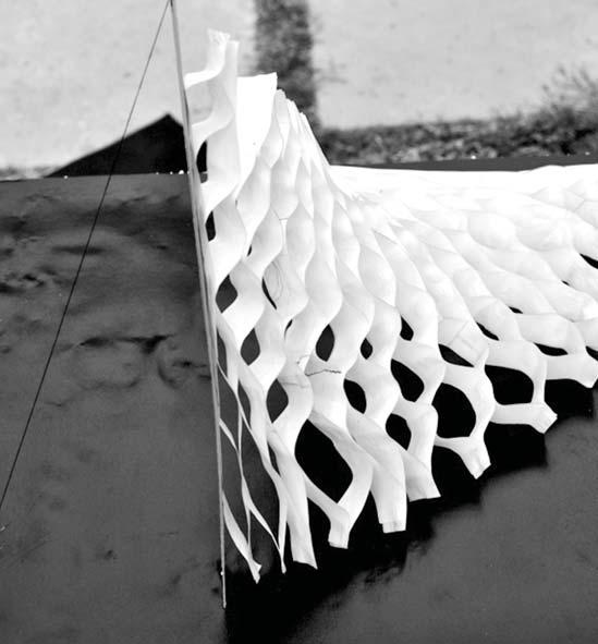

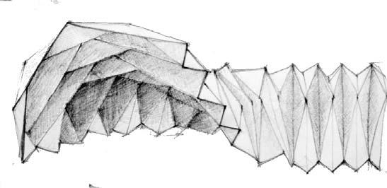
the excercise was based upon the understanding the idea of a GENERATIVE FORM and the underlying principles of such structures . . .
the exploration was made through producing models of such n ature with different materials keeping in mind the idea of space making . . .
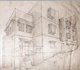
FOUNDATION WORK - ARCHITECTURE
FOUNDATION WORK - ARCHITECTURE
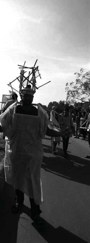
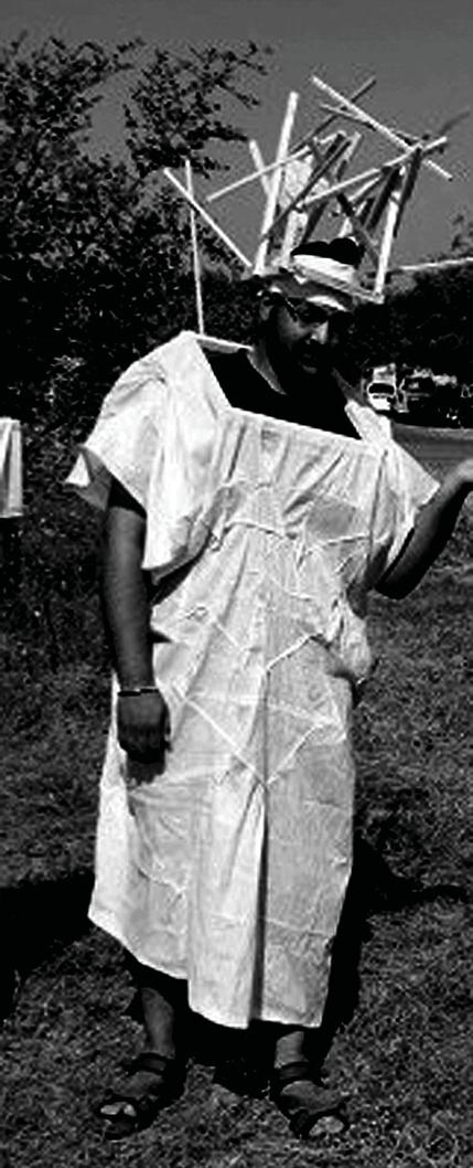
WEARABLE ARCHITECTURE - conducted by FRENCH architect and academician Mr. XAVIER WRONA, the prime idea of this workshop was to funnel out an existing social problem which has striking reslts and represent an abstraction of that through various ideas and elements of architecture and structure and produce a wearable replica of the same which reciprocates to the addressed issue the chosen material were KHADI ( local INDIAN fabric ) and WOOD SECTIONS...
THE PRODUCT -

the identified problem was a PEER PRESSURES ON THE YOUTH of INDIA, in terms of the competitions at various levels of performance in academics, carrers, monetary issues that result into a lot of disbalce in their life and harmony.... the representation was made through a well knit white robe made of KHADI to represent the perceived calmess of the youth on the outside and a HEADGEAR made of the KHADI & WOOD SECTIONS, totally architectonic and loud in its appearence so as to represent the mental pressures which a youth ges through . . .

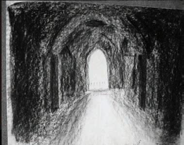


FOUNDATION WORK - ARCHITECTURE

FOUNDATION WORK - ARCHITECTURE
photography . . .

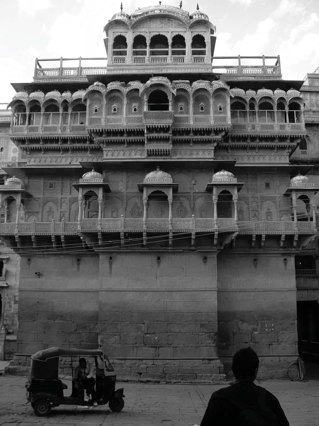
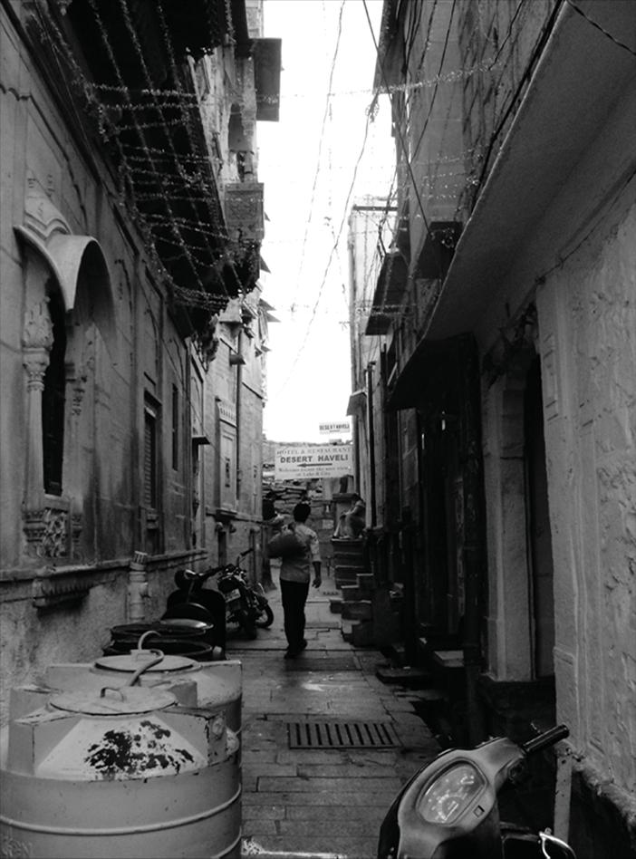
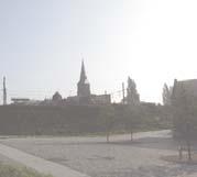
PHOTOGRAPHS from JAISALMER, 2011.
JAISALMER, RAJASTHAN, INDIA, 2011 (edited)
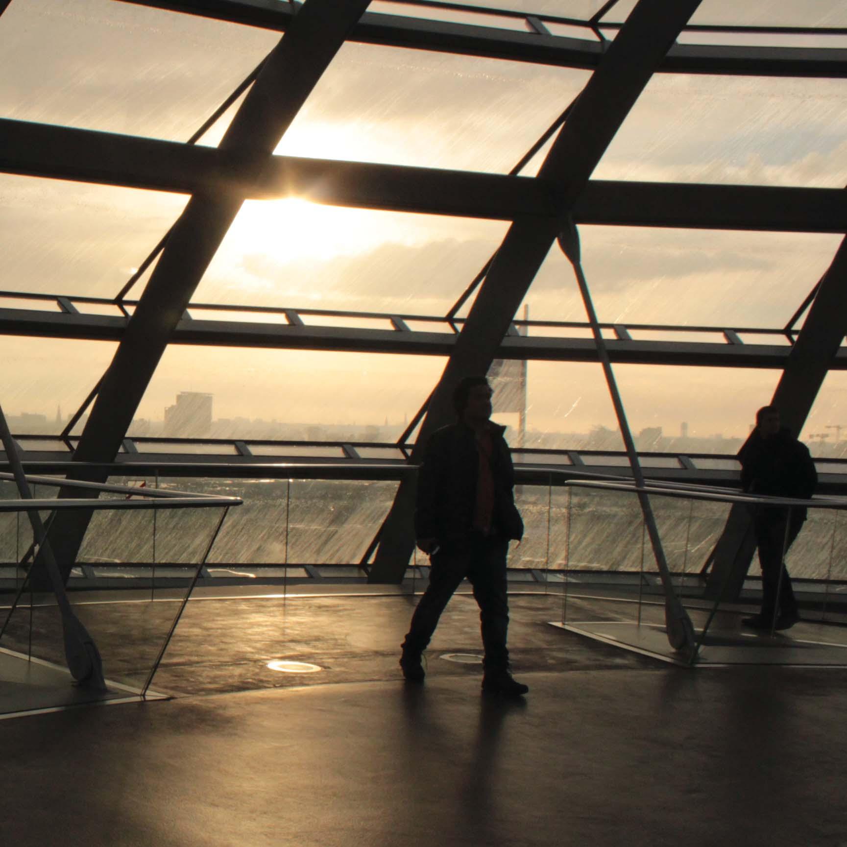
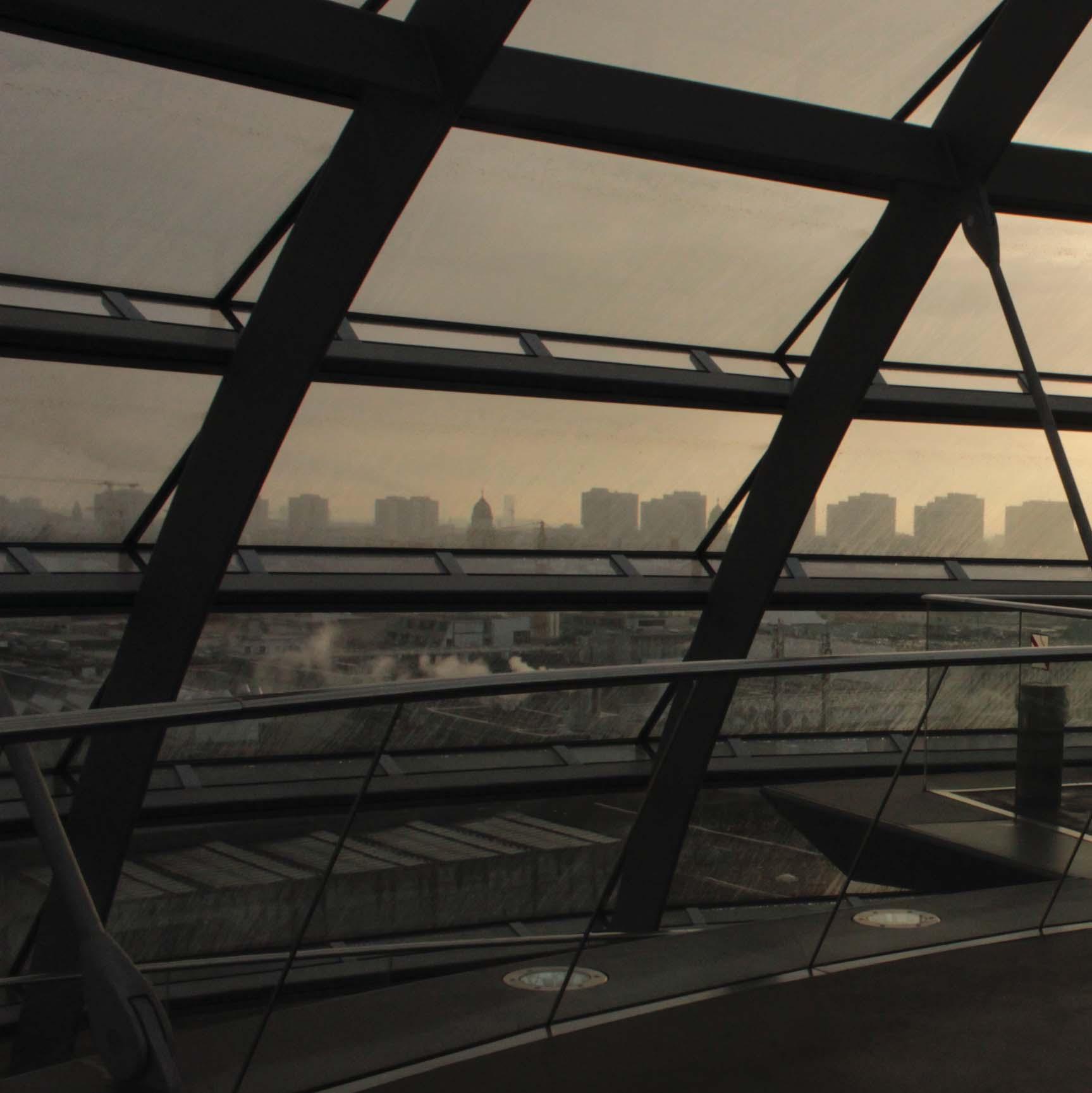 REICHSTAG - BERLIN PARLIAMENT, BERLIN, GERMANY, 2016. (unedited)
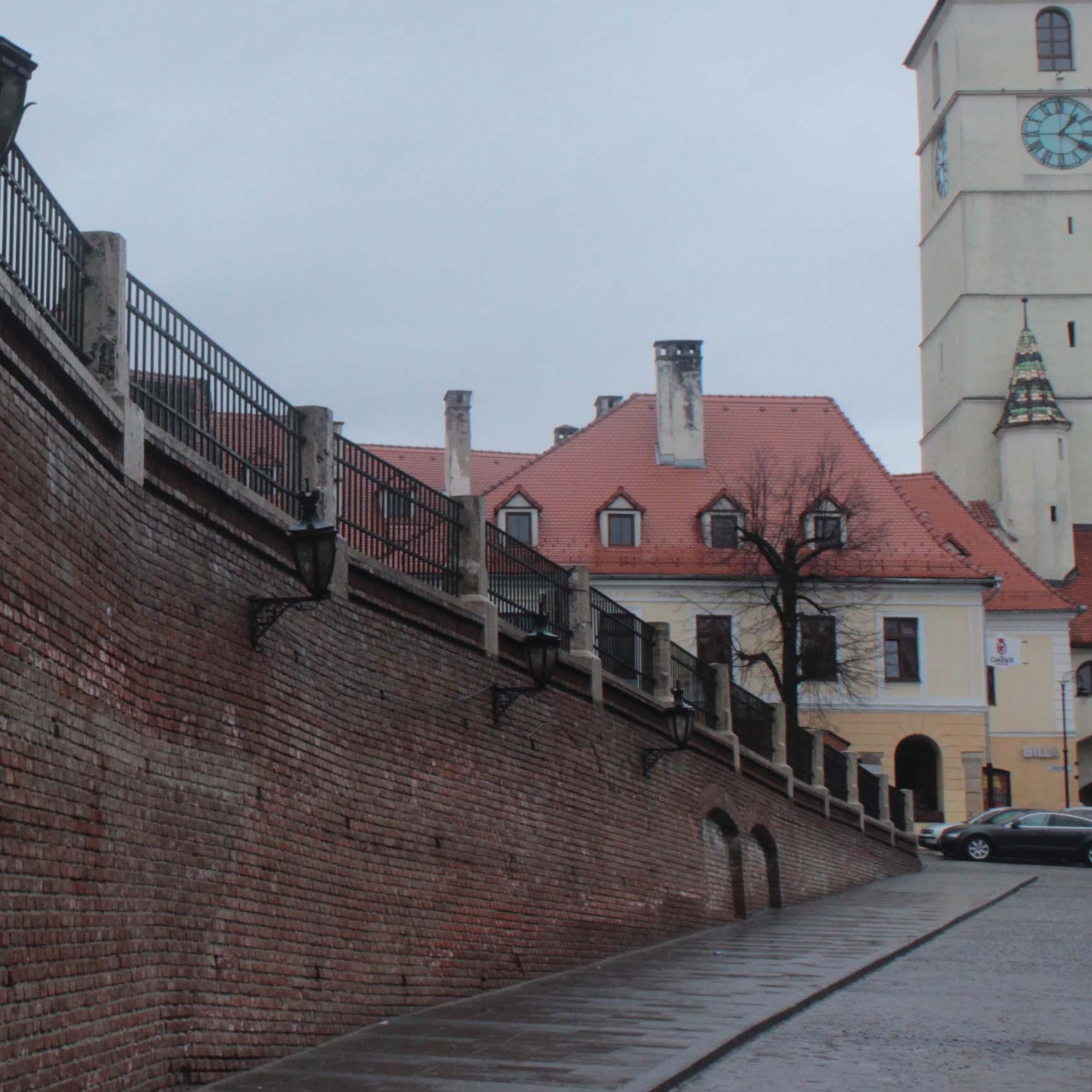
 SIBIU, ROMANIA, 2016. (unedited)
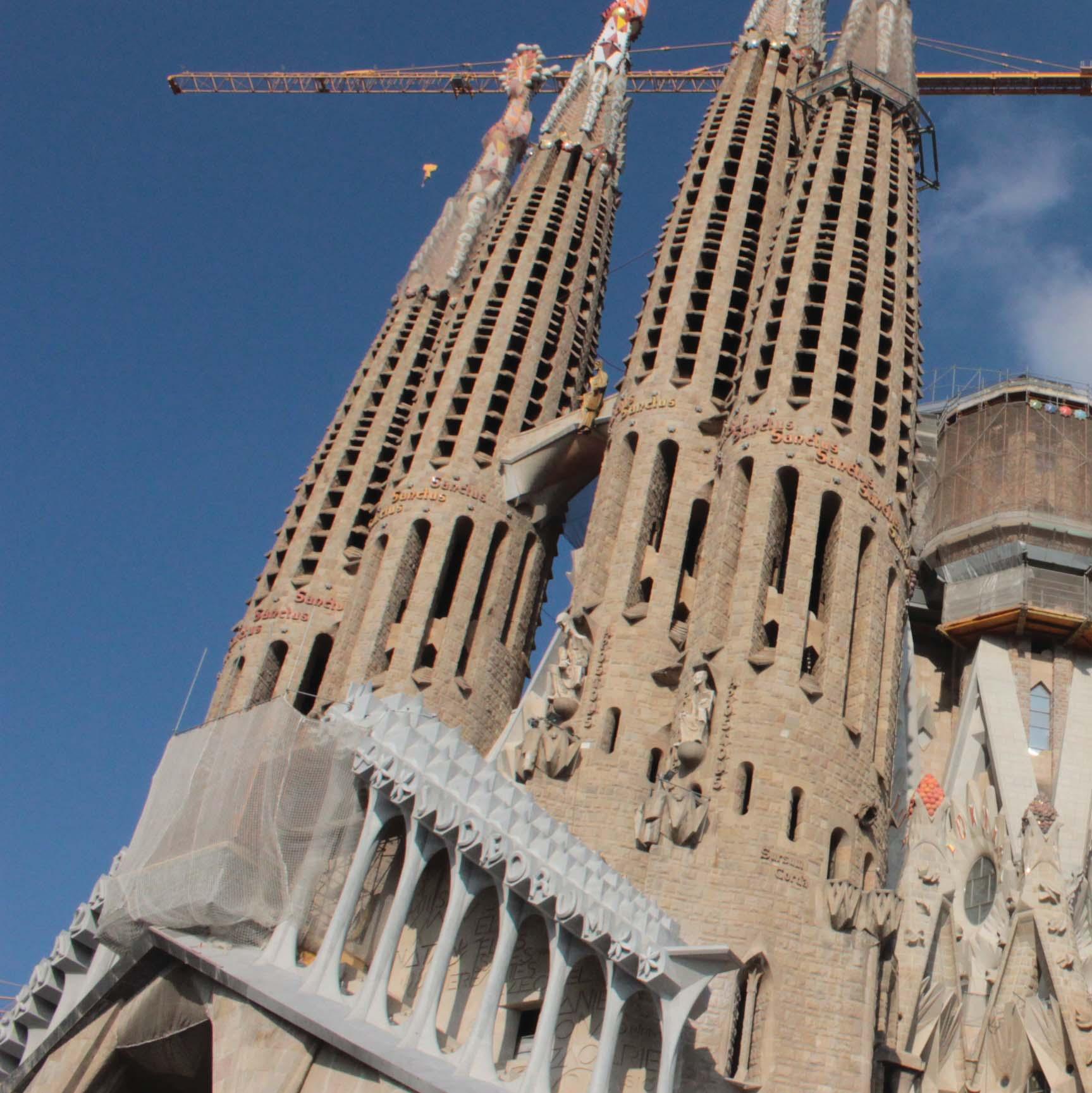 SAGRADA FAMILIA, BARCELONA, SPAIN, 2016. (unedited)

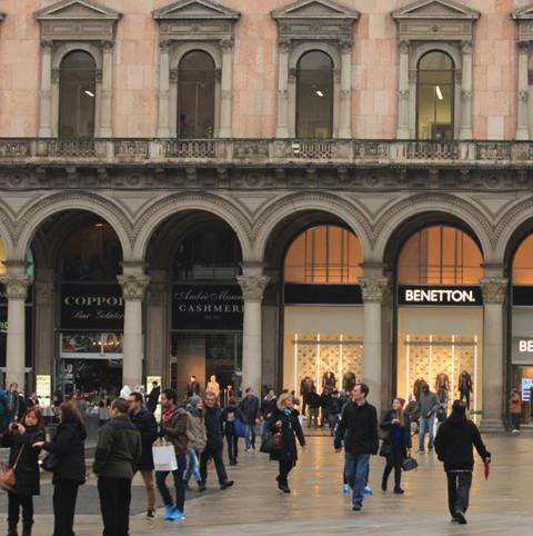 DUOMO, MILAN, ITALY, 2016. (unedited)
 MEHRANGARH FORT, JODHPUR, INDIA, 2014. (unedited)

TOWARDS THE END, THERE WAS AN AWAKENING, AN AWAKENING WITHIN SELF, TO REGATHER SELF, AND BOW UPON THE PATH AHEAD WITH ALL THAT WAS LEFT WITH ME, OR SAY INSTILLED IN ME, WHILST I HAD ALREADY ENVISAGED UPON A TREK, A JOURNEY FULFILLING ME, MY VOIDS, MY URGES, A JOURNEY WHICH HAS FILLED ME WITH WISDOM
PATIENCE
INTEREST
FOR ANY ENQUIRIES please get back to me at: spandandas121988@gmail.com (M) - +91 7042 817 239
FOR VIEWING OTHER ACADEMIC WORKS PLEASE VISIT: https://issuu.com/ spandandas FOR ACADEMIC WRITTEN WORK (drafts) PLEASE VISIT: https:// kuleuven.academia.edu/SDas
THANK YOU FOR YOUR
&
. . .