The South Florida Water Management District (District) is a regional governmental agency that covers 16 counties from Orlando to the Florida Keys and serves a population of over nine million residents . Residents and visitors rely on our water management system every day . Created in 1949, the District is responsible for managing and protecting the water resources of South Florida by balancing and improving flood control, water supply, water quality and natural systems . From the headwaters of the Kissimmee River south to Florida Bay, significant progress continues on key Everglades restoration projects that are improving the quantity, quality, timing and distribution of water within the Greater Everglades Ecosystem .
WHAT WE DO
• Advance Everglades restoration
• Improve water quality
• Restore and protect South Florida’s natural ecosystems
• Manage, safeguard and expand regional water supplies
• Monitor weather conditions and manage water levels throughout the District’s water control system
• Provide flood protection for the communities in Central and Southern Florida
• Advance scientific data and research to ensure the region’s water resources and ecosystems are resilient now and into the future
ABOUT THIS GUIDE
Central and Southern Florida offer many opportunities to explore the outdoors . Whether you are an avid adventurer or you just want to enjoy the Florida sunshine, you will find activities for all ages and skill levels in this comprehensive recreational guide . The District acquires, restores, protects and manages environmentally sensitive lands for water storage and hydrologic benefit . As the steward for more than 1 million acres of public land, the District has taken great strides to expand and enhance the recreational opportunities on land purchased with public dollars . These activities are compatible with the District’s efforts to protect natural resources .
SAFETY GUIDELINES
Be prepared for Florida’s changing weather and other potential hazards . Keep a safe distance from wildlife . Note the distance of trails, carry essential items like water, and remember to leave no trace . Call 911 if you experience an emergency .
VOLUNTEERING
The District’s team of volunteers helps protect and care for the region’s public lands and water resources . From developing and maintaining hiking trails to organizing clean-ups and hosting guided tours, the volunteers share their time and talents to help preserve Florida’s ecosystems .
Interested in volunteering? Email recreation@sfwmd.gov to learn more.
THINGS TO KNOW BEFORE YOU GO
For your safety and the protection of the environment, each recreational area has its own rules and regulations Please look for the following icons throughout this guide to help you plan your outing For more information, please call the District Recreation Hotline at 866-433-6312 or email recreation@sfwmd.gov.
Closures and Notices: Stormwater treatment areas (STAs) are periodically closed for maintenance . Up-to-date information is available by visiting SFWMD.gov/Recreation .
*Camping and Other Special Uses: A Special Use License may be required for vehicle access to District lands with locked gates or for some activities, such as camping or horseback riding . Special Use Licenses are issued by the District at no cost . To apply for a license, visit SFWMD.gov/SUL or call 866-433-6312 .
*Hunting & Fishing Licenses: The Florida Fish and Wildlife Conservation Commission (FWC) manages hunting on District lands . Licenses for hunting or fishing must be obtained from the FWC . Please visit myfwc.com regarding hunting dates, regulations, detailed license information and more .
*Geocaching: Permission is required for geocaching on District lands . Please visit SFWMD.gov/Geocache to submit the Geocaching Request Form . Geocaching is prohibited in STAs, reservoirs and other impoundments
*Pets: Dogs must be leashed and under control at all times . Check signage before entering District lands . Pets are not allowed at
and some other sites
UPPER LAKES MANAGEMENT REGION
The Upper Lakes Management Region includes portions of Orange, Osceola and Polk counties . Recreational opportunities in the region are centered around the Upper Kissimmee Chain of Lakes, which form the headwaters of Lake Okeechobee and the Everglades . From elevated boardwalks over cypress swamps to sand hill trails and shady oak hammocks, this region has something for everyone . Activities include hiking, primitive waterfront camping, air boating and more . You may find deer, foxes, swallow-tailed kites, a multitude of reptiles, and a variety of songbirds .
Shingle Creek
Upper Reedy Creek: Intercession City
Lake Marion Creek Wildlife Management Area: Torrelli South, Horse Creek, Huckleberry Island, Snell Creek, Baker Dairy and Lake Marion
Gardner-Cobb Marsh and Cypress Lake
Rough Island and Johnson Island
Catfish Creek, Rolling Meadows, Lake Hatchineha, C-37 and Drasdo
Lake Kissimmee Islands, West Shore and East Shore
Grass Skipper on a Bristle Thistle
Scrub Jay
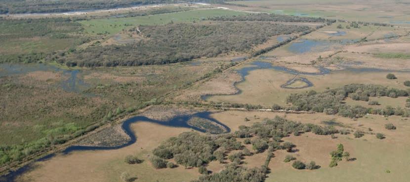
Shingle Creek
GETTING THERE
• Hunter’s Creek Vistas Trailhead: 12930 Hunter’s Vista Blvd ., Orlando, FL 32837 . From the trailhead, follow signs north 0 .3 miles to the property entrance .
• Hunter’s Creek Middle School Trailhead & Canoe Launch: 13400 Town Loop Blvd ., Orlando, FL 32837 . The trailhead is closed when students are on campus . Follow signs to entrances and parking areas south and west of the school .
Shingle Creek
ABOUT THE SITE
Located in southwest Orange and northwest Osceola counties, Shingle Creek is a great place to bike, hike, fish, kayak, canoe and view wildlife . Shingle Creek is the major water source for Lake Tohopekaliga, which is part of the Kissimmee Chain of Lakes and forms the headwaters of the Everglades . Because of the land’s significance to the Everglades, Shingle Creek is a featured site along the Everglades Trail
RECREATIONAL ACTIVITIES
Upper Reedy Creek: Intercession City
GETTING THERE
• Intercession City Trailhead: Located at the east end of Wile Avenue .
City Trailhead
ABOUT THE SITE
Located just south of US 17/92 in Intercession City, visitors can enjoy the beauty of trails under pines and explore transitional zones between pine flatwoods and a dense basin swamp
There is a parking area and picnic bench for those seeking a lunch break or a short trip on the weekend
White-tailed deer and wild turkey are common species you may come across
RECREATIONAL ACTIVITIES
Lake Marion Creek Wildlife Management Area (WMA):
Torrelli South, Horse Creek, Huckleberry Island, Snell Creek, Baker Dairy and Lake Marion
GETTING THERE
There are multiple trailheads for this area. Please see details on adjacent page .
Swallowtail on Hairy Chaffhead, Huckleberry Island
Trailheads for this area are located between Haines City and Poinciana:
• Huckleberry Island and Snell Creek Trailheads: Located on Cypress Parkway .
• Horse Creek Trailhead: Located off Horseshoe Creek Road .
• Torrelli South Trailhead: Located at the end of Baltic Road .
• Baker Dairy Trailhead: Located off Baker Dairy Road .
• Lake Marion Trailhead: Located off Lake Marion Creek Road near Cypress Parkway .
ABOUT THE SITE
Hilly scrub, pine flatwoods and riverine swamp forest provide habitat for a variety of Florida’s native plant and animal species at the Lake Marion Creek Wildlife Management Area .
At the Torrelli South Trailhead, you can take a quiet hike along the sugar-sand hills where you may see a rare scrub jay . At lower elevations you will find shady, fern-carpeted tree hammocks .
At the Huckleberry Island Unit, hikers and bicyclists frequently travel along a trail that stretches through open flatwoods and shady swamps . At the two-mile mark, visitors will find a primitive camping site and picnic tables .
Hunting is managed by the Florida Fish and Wildlife Conservation Commission . Visit myfwc.com for hunting dates, regulations and detailed license information .
RECREATIONAL ACTIVITIES
Kissimmee Chain of Lakes (KCOL)
Wildlife Management Area (WMA): Gardner-Cobb Marsh and Cypress Lake
GETTING THERE
This area is only accessible from the water. Please see details on adjacent page .
Gardner-Cobb Marsh at Lake Hatchineha
The closest boat ramp is located on the east side of Cypress Lake:
• Joe Overstreet Landing: 4900 Joe Overstreet Rd ., Kenansville, FL 34739 .
• Coleman Landing: 1450 Shady Oak Dr ., Lake Wales, FL 33898 .
You can find additional information on boat ramps in the region by visiting the FWC Boat Ramp Finder at GIS.MyFWC.com/BoatRampFinder .
ABOUT THE SITE
The Gardner-Cobb Marsh is located in the Kissimmee Chain of Lakes watershed between Cypress Lake, Lake Hatchineha and Lake Kissimmee . Accessible only by boat or airboat, Gardner-Cobb Marsh is the largest District property in the Upper Chain of Lakes region . Take in the pine flatwoods, swamps and wet prairie, where you can view wildflowers in the fall and spring . Rest in a shady oak hammock, explore the vast marsh on your airboat, or set up camp at a primitive campsite after you park your boat along the sandy shoreline . Hiking is best during the dry season . Hunting is managed by the Florida Fish and Wildlife Conservation Commission Visit myfwc.com for hunting dates, regulations and detailed license information .
RECREATIONAL ACTIVITIES
Kissimmee Chain of Lakes (KCOL)
Wildlife
Management Area (WMA): Rough Island and Johnson Island
GETTING THERE
This area is only accessible from the water. Please see details on adjacent page .
The closest boat ramp is located on the east side of Cypress Lake:
• Joe Overstreet Landing: 4900 Joe Overstreet Rd ., Kenansville, FL 34739 .
• Coleman Landing: 1450 Shady Oak Dr ., Lake Wales, FL 33898 .
You can find additional information on boat ramps in the region by visiting the FWC Boat Ramp Finder at GIS.MyFWC.com/BoatRampFinder .
ABOUT THE SITE
Located in the Reedy Creek watershed, this area features picturesque views amid a mosaic of floodplain swamp, wet prairie, mesic flatwoods and scrub . You can enjoy this biologically diverse treasure by boat, starting from the closest boat launch at Cypress Lake .
Take a break at the “Cowboy Camp” established in the 1920s on Rough Island South, enjoy shady oaks and a large hammock on the south end of Rough Island North, or spend some time at the picnic area at the south end of Johnson Island . Hiking is best during the dry season .
Hunting is managed by the Florida Fish and Wildlife Conservation Commission Visit myfwc.com for hunting dates, regulations and detailed license information .
RECREATIONAL ACTIVITIES
Rough Island at Reedy Creek
Kissimmee Chain of Lakes (KCOL) Wildlife
Management Area (WMA): Catfish Creek, Rolling Meadows, Lake Hatchineha, C-37 and Drasdo
GETTING THERE
This area is only accessible from the water. Please see details on adjacent page .
Lake Hatchineha
The closest boat ramps are located on Lake Hatchineha:
• Port Hatchineha: 15050 Lake Hatchineha Rd ., Haines City, FL 33844.
• Joe Overstreet Landing: 4900 Joe Overstreet Rd ., Kenansville, FL 34739 .
• Coleman Landing: 1450 Shady Oak Dr ., Lake Wales, FL 33898 .
You can find additional information on boat ramps in the region by visiting the FWC Boat Ramp Finder at GIS.MyFWC.com/BoatRampFinder .
ABOUT THE SITE
Nestled on the shores of Lake Hatchineha, this area offers many recreational opportunities and beautiful vistas . Catfish Creek is a popular landing for airboats . When the water level is high, you can enjoy a canoe or kayak ride along the cypress strand . Paddle between marshy vegetation on the lakeside and cypress on the land side, or explore the property by foot along grassy trails . Watch for wildlife, including wading birds, deer, turkey, alligators, bald eagles and turtles . Rolling Meadows is a great place to take a break from the water Stop at a covered picnic pavilion and view waterfowl living within this restored wetland . Primitive camping is available along the C-37 Canal and at the oak and cypress-lined berm on Lake Hatchineha’s shoreline on the Drasdo property . Hiking is best during the dry season . Hunting is managed by the Florida Fish and Wildlife Conservation Commission Visit myfwc.com for hunting dates, regulations and detailed license information .
RECREATIONAL ACTIVITIES
Kissimmee Chain of Lakes Wildlife (KCOL)
Management Area (WMA): Lake Kissimmee Islands, West Shore and East Shore
GETTING THERE
This area is only accessible from the water. Please see details on adjacent page .
Lake Kissimmee
The closest boat ramps are located on Lake Kissimmee:
• Joe Overstreet Landing: 4900 Joe Overstreet Rd ., Kenansville, FL 34739 .
• Coleman Landing: 1450 Shady Oak Dr ., Lake Wales, FL 33898 .
You can find additional information on boat ramps in the region by visiting the FWC Boat Ramp Finder at GIS.MyFWC.com/BoatRampFinder .
ABOUT THE SITE
Lake Kissimmee collects water from the upper lakes region, which flows south to the Kissimmee River and onto Lake Okeechobee before eventually reaching the Everglades . The Lake Kissimmee Islands, East Shore and West Shore provide great opportunities for boaters looking to explore this incredible lake and its associated shorelines . The area provides great opportunities to view wading birds and snail kites . Make a stop at one of the covered picnic pavilions or primitive camping sites . Hunting is managed by the Florida Fish and Wildlife Conservation Commission Visit myfwc.com for hunting dates, regulations and detailed license information .
RECREATIONAL ACTIVITIES
The Kissimmee/Okeechobee Management Region includes portions of Glades, Highlands, Okeechobee, Osceola and Polk counties . Visitors can enjoy views of the restored Kissimmee River, hike along sections of the Florida National Scenic Trail and explore a variety of cypress swamp, oak and marsh habitats . The region provides critical habitat for many native species, including wading birds, waterfowl, burrowing owls and bald eagles .
RECREATIONAL AREAS IN THIS REGION INCLUDE:
KICCO Wildlife Management Area and Blanket Bay Slough
Oak Creek, No Name Slough, Starvation Slough, Boney Marsh and Bluff Hammock
Hickory Hammock Wildlife Management Area and Istokpoga Canal Boat Ramp Area
MICCO Landing, Fort Basinger, Turkey Hammock, Cornwell Marsh and 4E’s
Chandler Slough, Seaboard, Yates, Telex, S-65D Boat Ramp Paradise Run and S-65E Impoundment
TREATMENT AREAS (STAs):
Taylor Creek STA and Grassy Island (East Side) Nubbin Slough STA
Bluff Hammock
Kissimmee River Public Use Area:
KICCO Wildlife Management Area (WMA) and Blanket Bay Slough
GETTING THERE
• KICCO Trailheads: Located on River Ranch Boulevard and KICCO Grade Road .
• Blanket Bay Slough: Accessible only by water . The closest boat ramp is the S-65 South Boat Ramp, located off Highway 60 at the northern end of the property .
KICCO WMA
ABOUT THE SITE
KICCO WMA, which is pronounced kiss-oh, is a place where you can get the real feel of “Old Florida . ” In this region you will enjoy a rich patchwork of habitat extremes from scrub to marsh .
Experience the natural beauty of this area by camping at any of the five primitive campsites, bicycling a ten-mile dirt road, hiking 11 miles of the Florida National Scenic Trail, or riding your own horse . Remember your fishing pole Bass lurk in the waters of the C-38 Canal and the oxbows of the Old Kissimmee River .
Blanket Bay Slough offers primitive waterfront camping on the east side of the river . There are no trails on Blanket Bay Slough, as it is mainly marsh, however during the dry season from November through March, you can hike along the river and take in a refreshing view of the water .
Hunting is managed by the Florida Fish and Wildlife Conservation Commission . Visit myfwc.com for hunting dates, regulations and detailed license information .
RECREATIONAL ACTIVITIES
Kissimmee River Public Use Area:
Oak Creek, No Name Slough, Starvation Slough, Boney Marsh and Bluff Hammock
GETTING THERE
• Bluff Hammock Trailhead: Located on Bluff Hammock Road .
• Oak Creek and Starvation Slough Trailheads: Located on MICCO Road .
Starvation Slough
ABOUT THE SITE
Located along the eastern edge of the Kissimmee River floodplain, Oak Creek has many old-growth oaks, some spanning nearly five feet in diameter . Enjoy the shade while you look toward the water’s edge . On a spring day, you will delight in watching butterflies fly from wildflower to wildflower .
The Starvation Slough Airboat Launch also provides access to Starvation Slough and No Name Slough . If you walk far enough west into the floodplain anywhere along No Name Slough, you will see backfilled portions of the former C-38 Canal resulting from river restoration . You may ride a horse at both sloughs . Hunting is managed by the Florida Fish and Wildlife Conservation Commission Visit myfwc.com for hunting dates, regulations and detailed license information .
RECREATIONAL ACTIVITIES
Kissimmee River Public Use Area: Hickory Hammock Wildlife Management Area (WMA) and Istokpoga Canal Boat Ramp Area
Majestic live oaks line both sides of the hiking trail as you enter Hickory Hammock . Marshes, patches of scrub and oak, along with hickory and cabbage palm hammocks await exploration . With all of this diversity, it’s easy to see why Hickory Hammock is a stop along the Great Florida Birding Trail and the Everglades Trail .
The Istokpoga Canal Boat Ramp Area features boat ramps and an airboat ramp It also has access to the Hickory Hammock trailhead with primitive camping and parking for equestrian trailers .
Hunting is managed by the Florida Fish and Wildlife Conservation Commission . Visit myfwc.com for hunting dates, regulations and detailed license information .
RECREATIONAL ACTIVITIES
Kissimmee River Public Use Area:
MICCO Landing, Fort Basinger, Turkey Hammock, Cornwell Marsh and 4E’s
GETTING THERE
• MICCO Landing, Fort Basinger, 4E’s Trailheads: Located on US 98 .
• Turkey Hammock Trailhead: Located on Locks Access Road, off US 98 .
MICCO Landing ABOUT THE SITE
Take in the beauty of picturesque flowering marsh plants . Pink marsh mallow “hibiscus,” purple pickerel weed, yellow primrose, creamy water hemlock and button-bush flowers are on display . The property also features a boat ramp, surrounded by grandfather oaks, a cypress dome and cabbage palms .
At Cornwell Marsh, split by the Kissimmee River, you will find canoe and kayak access at the 4E’s non-motorized boat ramp and airboat launch off US 98 .
The 4E’s entrance and Fort Basinger have been designated by the District as stargazing sites . Amateur astronomers can gaze at the natural wonders of the night sky from these sites far from bright urban areas . Hunting is managed by the Florida Fish and Wildlife Conservation Commission . Visit myfwc.com for hunting dates, regulations and detailed license information .
• Seaboard Marsh South and S-65E Boat Ramp: Located on Underhill Road .
• Yates Marsh: Located on Lofton Road approximately 5 .2 miles west of US 98 .
The closest boat ramp for Telex Marsh is located at:
• Platt’s Bluff Public Boat Ramp: 15925 NW 56th St ., Okeechobee, FL 34972 .
ABOUT THE SITE
Chandler Slough is a beautiful tract of cypress swamp, oak and cabbage palm hammocks and marsh habitats . This is a great spot to watch wildlife, including wading birds and waterfowl, and hikers can also access the Florida National Scenic Trail which runs through the property .
To the south, overhanging oak limbs frame a view of the Old Kissimmee River as it winds its way between Telex and Yates marshes . You can also visit Seaboard Marsh to the north by boat . Watch for bluegill beds in the spring and summer in the shallows of the riverside . Yates Marsh, accessible by car, also features a section of the Florida Trail . Hunting is managed by the Florida Fish and Wildlife Conservation Commission . Visit myfwc.com for hunting dates, regulations and detailed license information .
RECREATIONAL ACTIVITIES
Kissimmee River Public Use Area:
Paradise Run and S-65E Impoundment
GETTING THERE
• Paradise Run: Can be accessed off SW Rucks Dairy Road and SR 78 .
• S-65E Impoundment: Only accessible by water . The closest boat ramp is the Kissimmee River Fishing Resort (private, small fee) . Platt’s Bluff Public Boat Ramp, located at 15925 NW 56th St ., Okeechobee, FL 34972, can also be used .
S-65E Impoundment
ABOUT THE SITE
At the end of the old Kissimmee River, on the north side of S-65E, you’ll find an expanse of thick marsh that is virtually inaccessible, except for cuts in the old river The old river resembles the look of the C-38 Canal here because it is very wide as it runs through the overgrown marsh . The more adventurous might want to park by the marshy pasture at the north end and walk to higher ground to find a shady oak for a picnic .
The western border of Paradise Run resembles the edge of a puzzle piece because the old Kissimmee River, with its snaking switchbacks, forms the boundary . Fishing is good in the old river .
This is an outstanding location for bird watching . There are a variety of wading birds including inland shorebirds, waterfowl, songbirds, raptors, and other upland birds .
Hunting is managed by the Florida Fish and Wildlife Conservation Commission Visit myfwc.com for hunting dates, regulations and detailed license information .
RECREATIONAL ACTIVITIES
Taylor Creek Stormwater Treatment Area (STA) and Grassy Island (East Side)
The Taylor Creek Stormwater Treatment Area (STA) is located east of Taylor Creek on a portion of publicly held land previously known as the Grassy Island Ranch in Okeechobee County . The area features a stand of ancient cypress trees . Native wildlife species and a variety of birds can also be seen here
This STA removes phosphorus from water headed to Lake Okeechobee .
The Grassy Island (East Side) site is located just west of the Taylor Creek STA . Both sites offer many recreational activities including bicycling, hiking, bird watching, picnicking and wildlife viewing . At the Grassy Island site, visitors will also find bicycling trails, equestrian trails and geocaching opportunities
RECREATIONAL ACTIVITIES
Chickee Hut Shelter at Taylor Creek STA
Nubbin Slough Stormwater Treatment Area (STA)
GETTING THERE
• Nubbin Slough Trailhead: Located on SR 710 E .
Great Blue Heron at Nubbin Slough STA
ABOUT THE SITE
Located in Okeechobee County, the Nubbin Slough Stormwater Treatment Area (STA) cleans water going into Lake Okeechobee, which ultimately leads to a healthier Everglades
The area includes many recreational opportunities . With more than seven miles of levees, this is the perfect place to access a hiking trail, go bicycling, fishing and see wildlife such as Florida sandhill cranes, snapping turtles, American bald eagles, and eastern meadowlarks
RECREATIONAL ACTIVITIES
EAST COAST MANAGEMENT REGION
The East Coast Management Region includes all of St . Lucie, Martin and Palm Beach counties . Visitors can take advantage of miles of multi-use trails, paddle around small islands in the Indian River Lagoon or camp under the stars . Nature enthusiasts will love spotting wildlife throughout the region, which is home to alligators, bobcats, otters, and many species of wading birds .
AREAS IN THIS REGION INCLUDE:
Ten Mile Creek Water Preserve Area
Lakeside Ranch Stormwater Treatment Area
Allapattah Flats Wildlife Management Area
C-44 Stormwater Treatment Area
DuPuis Wildlife and Environmental Area
John C . and Mariana Jones/Hungryland Wildlife and Environmental Area
Loxahatchee River/Cypress Creek Management Area
Stormwater Treatment Area 1 West Public Small Game Hunting Area
Stormwater Treatment Area 1 East
A-1 Flow Equalization Basin Public Small Game Hunting Area
Stormwater Treatment Area 3/4 East and Harold A . Campbell Public Small Game Hunting Area
Fran Reich Preserve – Site 1
Ten Mile Creek Water Preserve Area
GETTING THERE
• Ten Mile Creek Water Preserve Area: Parking area located off of Gordy Road .
Ten Mile Creek ABOUT
THE SITE
Ten Mile Creek Water Preserve Area offers great opportunities to see a variety of birds and wildlife along five miles of hiking and biking trails . Located in St . Lucie County, the area is adjacent to the Ten Mile Creek . It provides water storage and treats water flowing from the creek
The preserve is next to the Ten Mile Creek Gordy Road Recreation Area, which is managed by St . Lucie County and provides additional recreational opportunities, including a disc golf course
The Ten Mile Creek Preserve Canoe/Kayak Launch, located off Gordy Road outside of the Ten Mile Creek Water Preserve Area, is a popular spot for canoeing and kayaking
RECREATIONAL ACTIVITIES
Lakeside Ranch Stormwater Treatment Area (STA)
GETTING THERE
• Lakeside Ranch Trailheads: Located on US 441 and SE 126th Boulevard .
River Otter at Lakeside
ABOUT THE SITE
Located in western Martin County, the Lakeside Ranch Stormwater
Treatment Area (STA) plays a crucial role in the restoration of the Lake Okeechobee watershed by improving the quality of water flowing into the lake
Lakeside Ranch STA is open to the public to enjoy hiking, bicycling, wildlife viewing or simply relaxing
The recreation area is surrounded by levees that are accessible to visitors on foot or on bicycle
RECREATIONAL ACTIVITIES
Allapattah Flats
Wildlife Management Area (WMA)
GETTING THERE
• Allapattah Flats WMA Parking Areas: Located within 3 miles of the intersection of Martin Highway (CR 714) and Allapattah Road (CR 609), or along Fox Brown Road to the west .
Pelicans and Egrets Wading in the Marsh at Allapattah Flats
ABOUT THE SITE
Featuring an expanse of predominately wet flatwoods that has mostly been converted to improved pasture, the Allapattah Flats recreational area offers excellent hiking and bicycling opportunities Visitors may hike and bike along a 1 .5-mile long, user-friendly shellrock road leading to a panoramic open vista of marsh frequented by wading birds . You can also enjoy the land by following the equestrian trails on horseback . he dark night sky in this rural area makes Allapattah a great place for stargazing . In addition, the area is open for hunting at certain times of the year . Whatever way you choose to explore, be sure to bring a picnic lunch and take a relaxing break . Hunting is managed by the Florida Fish and Wildlife Conservation Commission . Visit myfwc.com for hunting dates, regulations and detailed license information .
RECREATIONAL ACTIVITIES
C-44 Stormwater Treatment Area (STA)
GETTING THERE
• C-44 STA: Located in western Martin County approximately 2 miles east of SR 710 on SW Citrus Boulevard .
Wilson’s Snipe at C-44
ABOUT THE SITE
Future recreational activities at the C-44 Stormwater Treatment Area (STA) will include hiking, bicycling, wildlife viewing, photography and limited entry waterfowl and alligator hunts .
Audubon of Martin County also leads birding tours at the STA . Birdwatchers can spot sandhill cranes, snail kites, great blue herons, great egrets, mottled ducks, along with roseate spoonbills, white pelicans, wood storks and migratory shorebirds . Please visit audubonofmartincounty.org for more information on birding tours . Hunting is managed by the Florida Fish and Wildlife Conservation Commission . Visit myfwc.com for hunting dates, regulations and detailed license information .
RECREATIONAL ACTIVITIES
DuPuis Wildlife and Environmental Area (WEA)
GETTING THERE
• DuPuis WEA: Located off Kanner Highway (SR 76) between Beeline Highway (SR 710) and US 441 . GATE 1 is vehicular access and family camping; GATE 2 is hiking trailhead; GATE 3 is equestrian and trailer camping .
DuPuis Fishing Pier
ABOUT THE SITE
This multi-use natural area is interspersed with numerous ponds, wet prairies, cypress domes, pine flatwoods and remnant Everglades marsh . The area provides miles of hiking and horseback trails, an equestrian center, graded vehicle roads, backpack and group campsites and seasonal hunting . DuPuis is far from urban areas, and its dark night sky lends itself to excellent stargazing . Other activities include fishing from the partially covered pier, picnicking or enjoying primitive group and family camping . There are 22 miles of hiking trails, including a segment of the Ocean to Lake Trail, and an equestrian campground with access to 40 miles of horseback riding trails . Hunting is managed by the Florida Fish and Wildlife Conservation Commission . Visit myfwc.com for hunting dates, regulations and detailed license information .
RECREATIONAL ACTIVITIES
John C. and Mariana Jones/Hungryland Wildlife and Environmental Area (WEA)
GETTING THERE
• John C. and Mariana Jones/Hungryland WEA: The main entrance is located 1 .5 miles north of SR 706 on the west side of SR 711 . Additional entrance points are located from the south off SR 706, from the southeast at the end of Old Indiantown Road, and from the north off SW Pratt Whitney Road .
John C. and Mariana Jones/Hungryland WEA
ABOUT THE SITE
Outdoor enthusiasts can take advantage of several miles of established, multi-use trails for hiking, bicycling and horseback riding Some are wet, so be prepared . Trail use is best during the drier, winter months
In addition, the canal levees provide great hiking, bicycling and horseback riding opportunities . The area is great for observing wildlife . Alligators, otters, bobcats, deer, hogs, and several species of wading birds and hawks are commonly seen .
(Tent)
(Tent)
(Group)
The extensive canal network is excellent for fishing, and a great spot to catch pan fish . There are also a few old borrow pits that hold some large bass . The Florida Fish and Wildlife Conservation Commission (FWC) manages the John C . and Mariana Jones/Hungryland Wildlife and Environmental Area and oversees a number of quota hunts and a small game season during the fall . Please visit myfwc.com for more information
(RV/Trailer)
Loxahatchee River/ Cypress Creek Management Area
GETTING THERE
• Loxahatchee River/Cypress Creek Management Area Parking: Located on Gulfstream Road off the north side of Indiantown Road (SR 706) . The area can also be accessed from Riverbend Park via a bridge under SR 706 .
Kayak on the Masten Dam at the Loxahatchee River
ABOUT THE SITE
South Florida’s first federally designated Wild and Scenic River, the seven-mile Northwest Fork of the Loxahatchee, begins its journey at Palm Beach County’s Riverbend Park . You can rent a canoe or kayak at the park and explore the serene, cypress-soaked waters of the tannin-stained river . The river meanders north through the District’s Loxahatchee River/Cypress Creek Management Area and then on to Jonathan Dickinson State Park .
A two-mile segment of the Ocean to Lake Trail goes through Riverbend . Look for trail signs . Take advantage of the numerous nature trails as well . Bicycling, fishing and picnicking are also available .
RECREATIONAL ACTIVITIES
Stormwater Treatment Area 1 West
(STA-1W) Public Small Game Hunting Area
GETTING THERE
• STA-1W: Located on CR 880, approximately 3 .8 miles west of Twenty Mile Bend .
Alligators at STA-1W
ABOUT THE SITE
Located in central Palm Beach County, Stormwater Treatment Area 1 West (STA-1W) features a 200-foot viewing platform with gazebos overlooking the wetland A three-mile levee trail can be used by hikers, bicyclists and photographers Bird enthusiasts may be able to spot great blue herons, mottled ducks and black-bellied whistling ducks, along with roseate spoonbills, white pelicans and wood storks . There is a composting toilet available .
The area is open from sunrise to sunset on Fridays, Saturdays, Sundays and Mondays except during hunting season, when the area is closed to the public one day per weekend .
STA-1W is a constructed wetland designed to reduce phosphorous entering the Everglades . The plants within this constructed wetland are consuming phosphorus and cleaning the water as they grow
Hunting is managed by the Florida Fish and Wildlife Conservation Commission . Visit myfwc.com for hunting dates, regulations and detailed license information
RECREATIONAL ACTIVITIES
Stormwater Treatment Area 1 East (STA-1E)
GETTING THERE
• STA-1E: Located on South side of US 441, approximately 2 .6 miles west of Seminole Pratt Whitney Road .
Snail Kite in STA-1E
ABOUT THE SITE
Visitors have a great opportunity to experience Florida’s native wildlife in the midst of this Stormwater Treatment Area (STA) . This vast wetland offers hiking, bicycling, bird watching, fishing and nature photography . The recreation area is open from sunrise to sunset on Fridays, Saturdays, Sundays and Mondays . Boating is not permitted . STAs are man made wetlands designed to clean the water before it reaches the Everglades . Levees and canals ring the perimeter of the treatment areas, which are divided into several cells . Some cells have open water with submerged aquatic vegetation, and others have very dense cattail growth . Hunting is managed by the Florida Fish and Wildlife Conservation Commission . Visit myfwc.com for hunting dates, regulations and detailed license information .
RECREATIONAL ACTIVITIES
A-1 Flow Equalization Basin (A-1 FEB)
Public Small Game Hunting Area
GETTING THERE
• A-1 FEB: Entrance is located on the west side of US 27 at Mile Marker 53, approximately 5 .25 miles north of the Broward-Palm Beach county line .
and Fishing at A-1 FEB
ABOUT THE SITE
The A-1 Flow Equalization Basin (A-1 FEB) is an amazing place to enjoy the sights and sounds of vibrant wildlife and abundant natural landscapes . If you are seeking adventure or family fun, you can enjoy activities such as kayaking, bicycling, and wildlife viewing from approximately 30 miles of levees . The geography of the A-1 FEB makes it excellent for kayaking and canoeing
The recreation area is open all day on Fridays through Sundays for regularly permitted activities . Hunting is managed by the Florida Fish and Wildlife Conservation Commission . Visit myfwc.com for hunting dates, regulations and detailed license information
RECREATIONAL ACTIVITIES
Stormwater Treatment Area 3/4 East (STA-3/4)
and Harold A. Campbell Public Small Game Hunting Area
GETTING THERE
• STA-3/4 East: From US 27, travel west along the paved L-5 Levee Road about 1/2 mile and turn north into the STA-3/4 East site .
• Harold A. Campbell: From STA-3/4 East, travel west about 5 miles and turn north .
Killdeer on Nest at STA-3/4
ABOUT THE SITE
Stormwater Treatment Area 3/4 East (STA-3/4) in rural Palm Beach County is one of the largest constructed wetlands in the world . The accompanying public use area gives visitors access to vast wetland habitat where bicyclists and hikers can see a variety of native wildlife . STA-3/4 features a covered information kiosk, paved parking area, sidewalk path and a composting toilet . This site is also a waterfowl and alligator hunting area . The Harold A . Campbell Public Small Game Hunting Area is located just west of STA-3/4 . This area features covered information kiosks, paved parking areas, concrete sidewalks and a composting toilet . The area also offers a public dual-lane boat ramp that serves as a gateway to 23 miles of perimeter canals . Trails are open Fridays, Saturdays, Sundays and Mondays sunrise to sunset . Hunting is managed by the Florida Fish and Wildlife Conservation Commission . Visit myfwc.com for hunting dates, regulations and detailed license information .
RECREATIONAL ACTIVITIES
Fran Reich Preserve – Site 1
GETTING THERE
• Fran Reich Preserve - Site 1: Located in Palm Beach County on the north side of Lox Road approximately 6 .25 miles west of US 441/SR 7 .
ABOUT THE SITE
This area located just south of the Loxahatchee National Wildlife Refuge provides opportunities for hikers and bicyclists to view wildlife along miles of trails . Recreational freshwater fishing for bass, gar, catfish, and exotic species like clown knifefish in man-made lakes and canals attracts anglers to this area
You may see deer, bobcats, alligators, native butterflies and snakes across the upland and wetland habitat . Bird enthusiasts will enjoy watching a variety of wading birds foraging in wetlands and raptors hunting over the marshes
RECREATIONAL ACTIVITIES
WEST COAST MANAGEMENT REGION
The West Coast Management Region includes all of Lee, Collier and Hendry counties and portions of Charlotte and Glades counties . Enjoy nature while exploring the region’s unique ecosystems and diverse population of plants and animals . The combination of native upland and wetland habitats support a variety of rare species, including the Florida panther, wood stork, roseate spoonbill and the crested caracara .
AREAS IN THIS
Corkscrew Regional Ecosystem Watershed (CREW) Wildlife and Environmental Area: CREW Marsh, Cypress Dome, Bird Rookery Swamp and Flint Pen Strand
Stormwater Treatment Area 5/6 Public Small Game Hunting Area Green Heart of the Everglades Public Small Game Hunting Area
Corkscrew Regional Ecosystem Watershed (CREW) Wildlife and Environmental Area North: CREW Marsh and CREW Cypress Dome Trails
The Corkscrew Regional Ecosystem Watershed (CREW), located in Lee and Collier counties, provides natural flood protection, water purification and aquifer recharge . The watershed also serves as an important habitat for species such as the endangered Florida panther, snail kite and wood stork . CREW is known for its spring wildflowers, although you may find flowers blooming at any time . CREW includes the CREW Marsh and Cypress Dome Trails, Flint Pen Strand and Bird Rookery Swamp .
FOR MORE INFORMATION
For information about guided hikes, events, school field trips, and other programs offered at CREW, contact the CREW Land and Water Trust at 239-657-2253 or visit crewtrust.org .
Hunting is managed by the Florida Fish and Wildlife Conservation Commission . Visit myfwc.com for hunting dates, regulations and detailed license information .
ABOUT CREW NORTH
The CREW Marsh area offers six miles of interconnected hiking and bicycling trails through open pine flatwoods, seasonal ponds, sawgrass marshes and shady oak hammocks . There are two boardwalks and an observation tower .
The Cypress Dome area offers 5 .8 miles of trails through scrubby flatwoods, mixed oak/pine forest, two cypress domes, and seasonally wet popash slough . The Cypress Dome Trails connect to Conservation Collier’s Caracara Prairie Preserve adjacent to CREW . These trails offer three additional miles of hiking .
Corkscrew Regional Ecosystem Watershed (CREW) Wildlife and Environmental Area South: Bird Rookery Swamp and Flint Pen Strand
The CREW Bird Rookery Swamp and Flint Pen Strand are located in the southern area of CREW . The Bird Rookery Swamp offers 12 miles of hiking and bicycling trails, including a 1,400-foot boardwalk with wheelchair access . Bird Rookery Swamp is adjacent to Audubon’s Corkscrew Swamp Sanctuary .
The trails are old tram roads used when the area was logged many years ago . he maple-cypress swamp is home to alligators, otters, Florida panthers, bobcats, white-tailed deer and various birds, including short-tailed hawks, swallow-tailed kites, and many songbirds and wading birds .
The Flint Pen Strand area offers three parking areas which provide access to a variety of trails (including the Billy G . Cobb Memorial Trail) for hiking, bicycling and horseback riding . The area offers a variety of habitats for wildlife including fox squirrels, white-tailed deer, bobcats, otters and bald eagles . Swallow-tailed kites can be seen soaring over sections of the red trail when they return each winter to nest
AT CREW
(RV/Trailer)
Stormwater Treatment Area 5/6
(STA-5/6) Public Small Game Hunting Area
GETTING THERE
• STA-5/6: Take CR 835 from the north or south to Deer Fence Canal Road, cross the bridge at STA-5/6, and continue on the unpaved road to the parking area east of the tower .
Savannah Sparrow at STA-5/6
ABOUT THE SITE
Located in eastern Hendry County, Stormwater Treatment Area 5/6 (STA-5/6) has become a premier bird watching area in Florida through a long-standing partnership with the Hendry-Glades Audubon Society . More than 200 bird species have been spotted on the seasonal, guided tours offered by the local Audubon chapter . The site is also a waterfowl hunting area .
Hiking, bicycling and bird watching are among the activities visitors can enjoy from the public use area . In addition, a portion of the Florida National Scenic Trail runs along the L-3 Levee on the west side of the STA . The recreation area is open from sunrise to sunset on Fridays through Mondays for regularly permitted activities . On designated weekends, the area is closed to the general public for waterfowl and alligator hunts . The section of the Florida National Scenic Trail is open all day year-round . Hunting is managed by the Florida Fish and Wildlife Conservation Commission . Visit myfwc.com for hunting dates, regulations and detailed license information .
Green Heart of the Everglades
Public Small Game Hunting Area
GETTING THERE
• Green Heart of the Everglades: Located adjacent to Everglades City in Collier County, just west of SR 29 and both north and south of US 41 .
Mangroves
ABOUT THE SITE
Located in Collier County, Green Heart of the Everglades offers some of the most unique landscapes in South Florida . The upland habitat is home to the endangered Florida panther and the Big Cypress Fox Squirrel .
Travel south and you will transition to coastal marshes and a maze of mangrove swamps rich with Gladesman culture and diverse wildlife . Find your tranquility by paddling among the mangroves or hiking through the cypress forests . Recreational opportunities also include world-renowned fishing and seasonal hunting . Hunting is managed by the Florida Fish and Wildlife Conservation Commission . Visit myfwc.com for hunting dates, regulations and detailed license information .
RECREATIONAL ACTIVITIES
EVERGLADES MANAGEMENT REGION
The Everglades Management Region includes all of Broward, Miami-Dade and Monroe counties . Visitors enjoy hiking, bicycling, bird watching and more in the region’s vast wetland sites . This region provides habitat for many rare plants and animals that cannot be found in other parts of Florida . It is home to the snail kite and the American crocodile
Biscayne Bay Coastal Wetlands
Frog Pond and Rocky Glades Public Small Game Hunting Areas
Southern Glades Wildlife and Environmental Area
Biscayne Bay Coastal Wetlands (BBCW)
GETTING THERE
Multiple access points to this area. Please see details on adjacent page .
Biscayne Bay Coastal Wetlands
• BBCW Old Cutler Rd: 18551 Old Cutler Road, Cutler Bay, FL 33157; Parking is located along the south side of 184th Street .
• Black Creek Flow way: Just north of SW 97th Avenue and SW 232nd Street; Parking is on the west side of SW 97th Avenue, north of C-1/Black Creek Canal .
• BBCW North Access: Follow SW 248th Street east until road ends at L-31E Canal .
• C-102 Canal: Pedestrian access only; no formal parking .
• G-95 Canal: Pedestrian access only; no formal parking .
• C-103 Canal: Pedestrian access only; no formal parking .
• BBCW South Access: Follow SW 328th Street east until road ends at L-31E Canal .
ABOUT THE SITE
Biscayne Bay Coastal Wetlands extends from Culter Bay to the North Homestead area and provides access to five recreation sites . This includes new facilities opening in 2025/2026 along the constructed Cutler Bay flow way and the C-102 Canal . Starting on the north end of this expansive region, the locally coined ‘Coastal Ridge Preserve’ is a hidden gem . Stroll along a short shell path and admire the restored uplands . Moving south, an overlook at the Cutler Bay flow way will provide opportunity to observe local birds in the adjacent wetland areas .
Heading further south, you can enjoy views of Biscayne Bay and learn about the ongoing efforts to restore freshwater flows to the bay at the C-102 Canal levee pathway . Several picnic tables are available for you to enjoy a picnic lunch Additional hiking, bicycling and fishing opportunities can be found along the G-95 and C-103 Canal levees .
RECREATIONAL ACTIVITIES
Frog Pond and Rocky Glades
Public Small Game Hunting Areas
GETTING THERE
• Multiple access points to this area. Please see details on adjacent page .
• Pump Station S-332D Access: SW 217th Avenue and SW 308th Street, pedestrian access along C-113 Canal and over the L-31N Bridge, no formal parking .
• Frog Pond North Public Small Game Hunting Area: C-111 Canal and Ingraham Highway . The trailhead is located on the north side of Ingraham Highway just over the bridge . Equestrian parking available .
ABOUT THE SITE
The Frog Pond and Rocky Glades areas provide access to the L-31 Canal levees . From the levee, you can access flow ways available for small game and duck hunting managed by the Florida Fish and Wildlife Conservation Commission (FWC) . The 100-acre, FWC-managed, Frog Pond Dove Field is the only one of its kind in southeastern Florida and is available for seasonal quota hunting . A boat ramp located on the north side of Ingraham Highway can be used for kayak/canoe access into the L-31 Canal . Bic yclists and bird enthusiasts can roam the various levees and catch sight of the elusive white-tailed kite or other native birds foraging over the fields, prairies, and remnant pine rocklands . Hunting is managed by the Florida Fish and Wildlife Conservation Commission . Visit myfwc.com for hunting dates, regulations and detailed license information .
RECREATIONAL ACTIVITIES
Southern Glades
Wildlife and Environmental Area (WEA)
GETTING THERE
• Multiple access points to this area. Please see details on adjacent page .
Grass Pink Orchid at Southern Glades
Southern Glades Parking Area and Trailheads moving west to east:
• Glen Garrett Memorial Park/Rocky Glades Boat Ramp: 39801 SW 237th Ave ., Homestead, FL 33034; Parking on the north side of Ingraham Highway .
• L-31W Canal Trail: Ingraham Highway and SW 237th Avenue; Parking on north and south side before going over the bridge into Everglades National Park .
• Aerojet Road Trail: South side of Ingraham Highway at Aerojet Road .
• Southern Glades C-111E Trail: South side of Ingraham Highway, east and west of the bridge over the C-111 East Canal .
• FDOT Everglades Academy Southern Glades Entrance: South Dixie Highway and SW 424th Street; trail access is just west of the FDOT Everglades Academy .
• US 1 Boat Ramp and Trail: East side of South Dixie Highway and Southern Glades Trail, south of C-111 Bridge (C-111 Canal does not lead out to Florida Bay) .
ABOUT THE SITE
This area offers miles of hiking and bicycling trails and accessible fishing platforms within an expanse of Everglades wetlands and muhly grass prairies dotted with tropical hardwood hammocks and cypress forests . This site provides critical habitat for the Cape Sable seaside sparrow, the American crocodile and over 200 species of birds . Hunting is managed by the Florida Fish and Wildlife Conservation Commission . Visit myfwc.com for hunting dates, regulations and detailed license information .
RECREATIONAL ACTIVITIES
UPPER LAKES MANAGEMENT REGION
RECREATIONAL OPPORTUNITIES INDEX
RECREATIONAL OPPORTUNITIES INDEX
EAST COAST MANAGEMENT REGION
WEST COAST MANAGEMENT REGION
South Florida Water Management District
Learn more about recreation in Central and Southern Florida by signing up for the District’s emails . Visit SFWMD .gov and click on “Subscribe for Email Updates.”