Three walking trails through the historic village of Hartshorne in South Derbyshire For
Introduction
Hartshorne has always had two centres. At the time of the Domesday Book in 1086, there were two long-established manors at Hartshorne. One was arable land cleared in the forest and extending to around 480 acres, and the second was in “another Hartshorne” and about half the size.
Nowadays this is interpreted as the Upper Manor centred around the church and the Lower Manor centred around ‘Nethertown’ on the road towards Repton. This thinking is clearly reflected in Hartshorne’s geography.
The village car park on Manchester Lane near the Bull’s Head, the church, the ‘Old Manor House’ and the houses in this part of the village have an elevated (‘upper’) position. They are separated from the lower part of the village that starts around the Admiral Rodney and the junction with Repton Road by the grassland surrounding the school and the ‘Rodney Meadow’ – the field on the other side of the road.
The older part of this ‘other’ (lower) part of the village extends towards the building and settlement marked as Nether Hall on the 1884 OS map. This is further along Repton Road, close to the junction with Sandcliffe Road.
The road to Repton runs parallel with Repton Brook, which started as a spring in the woods to the southeast of the village, fed a once prominent mill pond and turned the impressive water wheel that you can see at the Mill Wheel. Given that the Old Manor House is also known as Upper Hall, this all seems to fall into place.
Trail 1
Manchester Lane to Manor Farm
In a record of the Leicestershire and South Derbyshire Coalfield, it is stated that in 1606 Hartshorne was a small mining centre. The names of ancient fields, reached via Slack Lane, the track off to the left (about 50 metres beyond the car park), suggest that mining took place towards the end of this lane before it enters the new plantation, as well as further northeast (see Coal Lane). A village legend concerns Nan Kirkham, who was killed on Manchester Lane in the 1800s; her ghost was said to appear on the lane.
Beyond Slack Lane and the relatively recent houses lies the pinfold. After the 1766 Enclosures Act was passed for this area, the overseers were charged with reconstructing the existing pinfold. This was done in 1790 at a cost of 10s for stone, 12s/6d for lime for mortar and £1 19s for labour costs. The pinfold was where stray animals were impounded; owners had to pay a fine to the pinder (or pinner) to get them back. Pinfold Cottage is immediately adjacent.
Further along Manchester Lane, having passed through a deep cutting that presumably aimed to remove the otherwise steep gradients of the road to Ashby, on the right-hand side and set down in the valley is Short Hazels Farm. This Grade II listed coursed squared sandstone and red brick farmhouse dates back to the 17th Century with early 19th Century additions. Possibly the site of a monastic grange, the previous building on the site, with malt room and kiln, was occupied by the Royle family until 1638, when it and the mill at Nethertown were bought by the Glover family. The mill in Nethertown is known today as Glovers Mill. In the mid-1900s Short Hazels was owned by the Webster family, notable because the parents were both deaf and non-verbal.
In the late 1800s, the Hartshorne and Seales Rural District Council constructed a clean water system that fed water into the village along Manchester Lane, as described later. Manchester Lane, the road to the south-east towards Ashby de la Zouch, has several points of interest.
Cobweb Cottage, 6-8 Manchester Lane
This attractive Georgian cottage with fine brickwork (double-Flemish bond with fine lime mortar joints) was built around 1700 to 1720. The southern, now brick, gable end of the house hides a timber framing dating back to the 15th or 16th Century, when this wall was the northern gable end of 8 Manchester Lane (now demolished). If you look closely, you will see a brick panel that is set back a little from the front line of the main part of No. 6 and the roof line has a step in it; this was where the passageway between the two houses used to exist. The stables to No. 8 sit to the rear of the parking area and were mirrored by stables behind No. 6 that are now gone. These were two houses of some significant status. Take a while to look at the style of the house as it’s typical of that elsewhere in the village, such as the horizontal (dentilled) brick pattern just below a blue tiled roof.
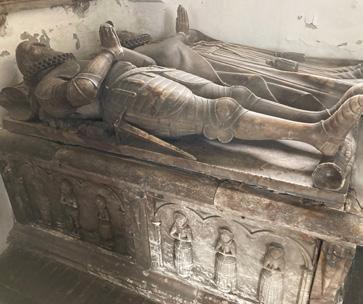
Dethick Hall
This is the site of the Boys’ School founded by an endowment of £100 in the will of Reverend William Dethick in 1624. William’s parents, Humphrey and Eliza Dethick, are the subjects of alabaster effigies on an ‘altar tomb’ in a corner of St Peter’s Church. (William is one of the six children depicted on the front of the tomb). The school was rebuilt in 1813 at a cost of around £170 and was intended for 80 boys, with an average attendance of 50. It was closed in the middle of the 20th Century and replaced with the village hall, the modern facade of which now fronts onto Manchester Lane.
The Bulls Head
While the front of this building and the main part of the structure is Georgian and probably built around 1700, it was added to a much older building. This is seen in the lower part of the side on Manchester Lane, between the front and the Dethick Hall, and is thought to be as early as the late 16th Century.
The brickwork in this older part is different – the bricks are thinner, with a different pattern (or bonding), and of a poorer quality than the more uniform bricks laid in double Flemish bond with fine mortar joints on the front of the building.
All the business of the village historically appears to have been conducted from here, including sales of property and parish, private and Enclosure affairs.
The back parlour of the Bulls Head and the room above used to be a tiny house. Higher up there are bricks of a different age and quality and the blue tiled roof is protected at each end by brick pediments (or coped gables). There is a dentilled cornice below the roofline –a line of bricks in which every other brick is set back so that it looks like teeth. This is the same pattern as in Cobweb Cottage (see 1), the cottages on Main Street (see 6), Brook House Farm (see 25) and elsewhere in the village, making it an example of the vernacular architecture of Hartshorne.
The car park across the road is owned by the church and is home to Hartshorne Church Hall, which was built by the Manpower Services Commission in the early 1980s.
Dinmore Farmhouse
The present brick structure with oak beams inside was built around 1740, but it sits on older stone foundations. These are thought to date back to the 14th Century, when they supported a timber-framed building. It was the major farm in Upper Hartshorne and had a barn extending to the rear, most of which is now incorporated into the house.
Dinmore Close is where Dinmore Farm’s outbuildings and yards used to be, with a high boundary wall between it and what are now gardens behind the cottages on Main Street.
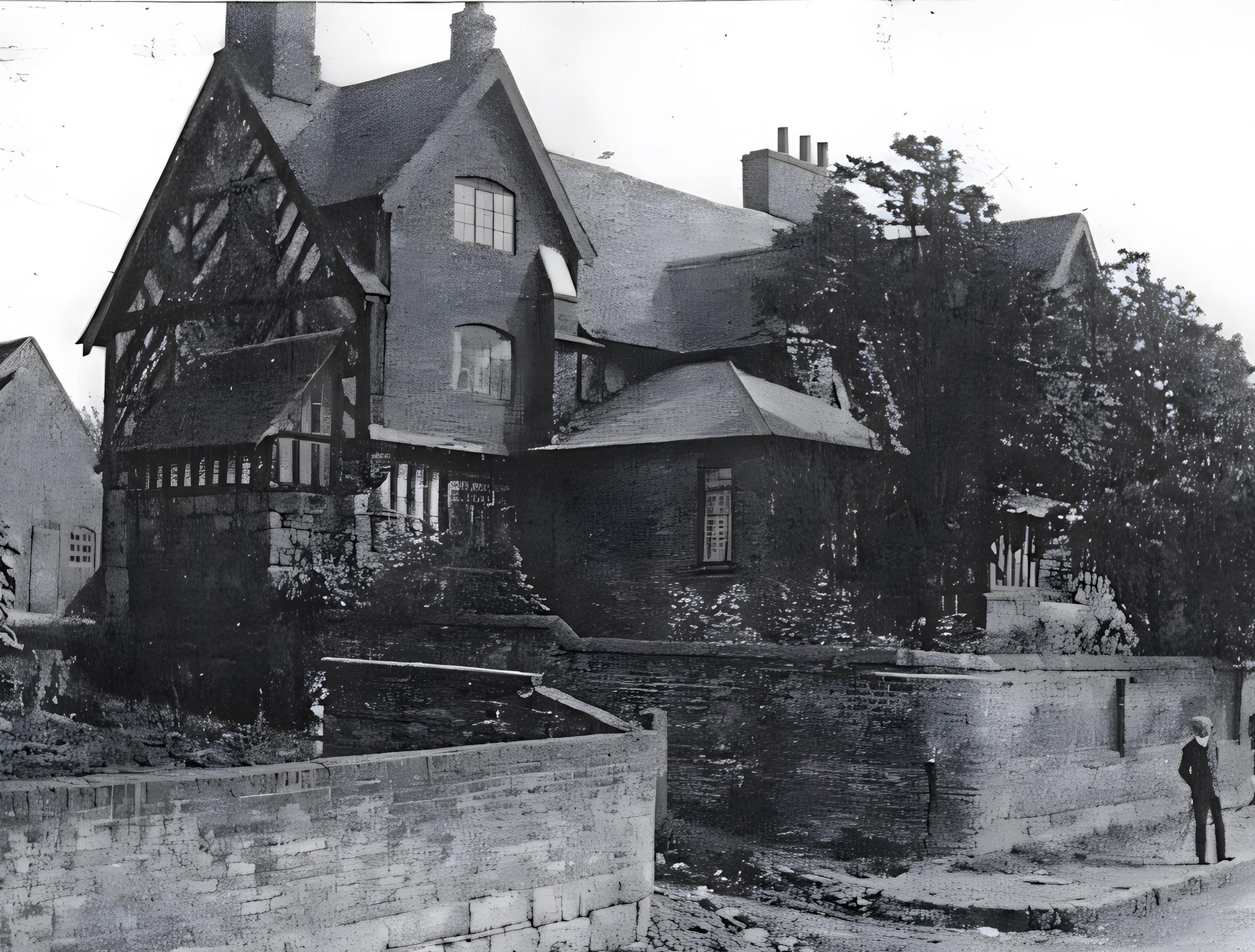
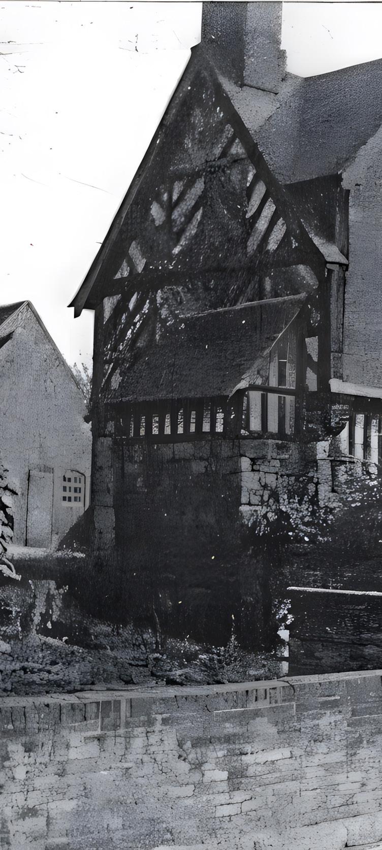
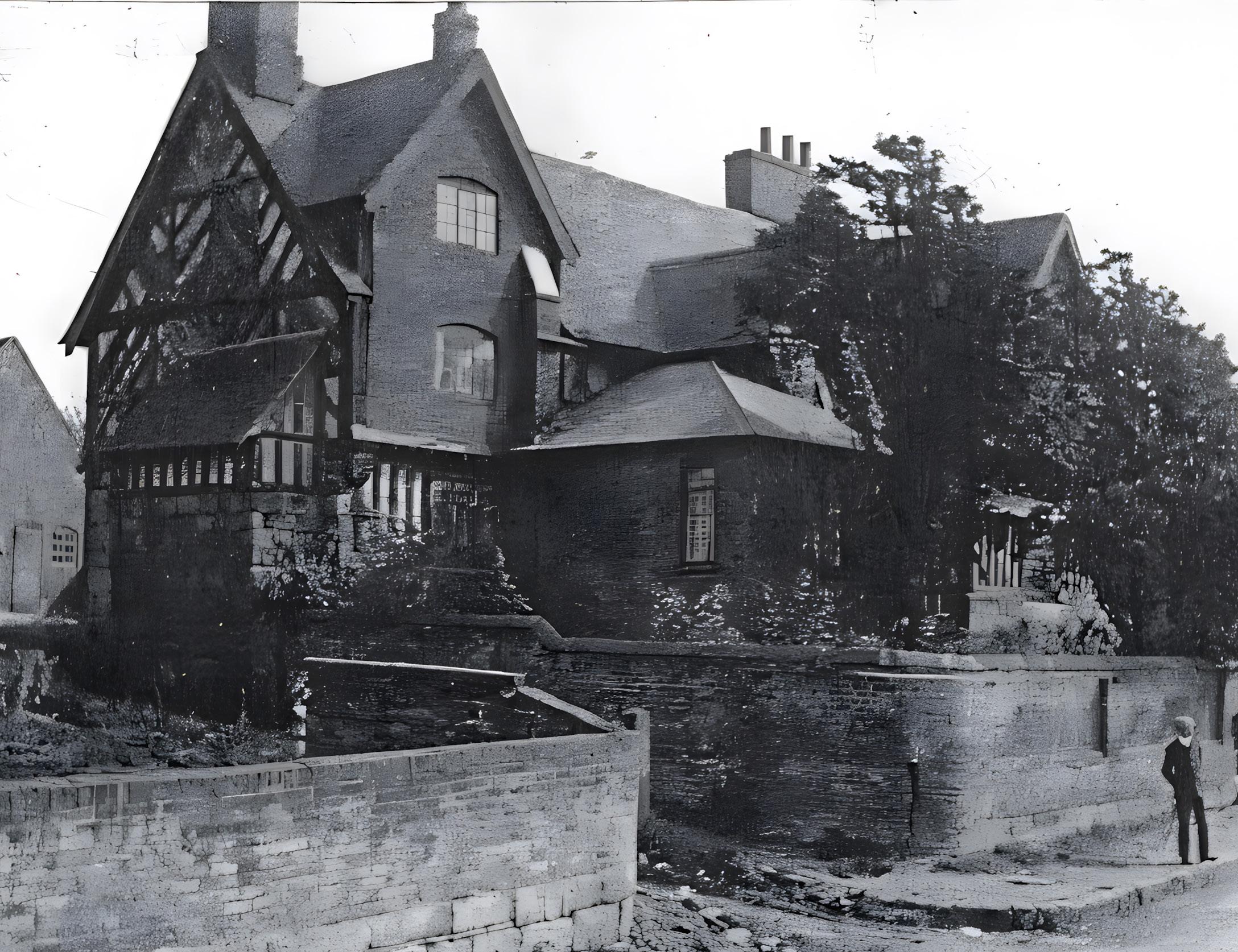
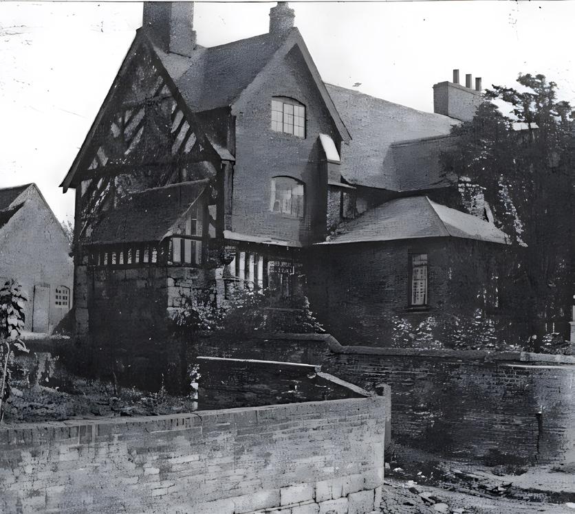
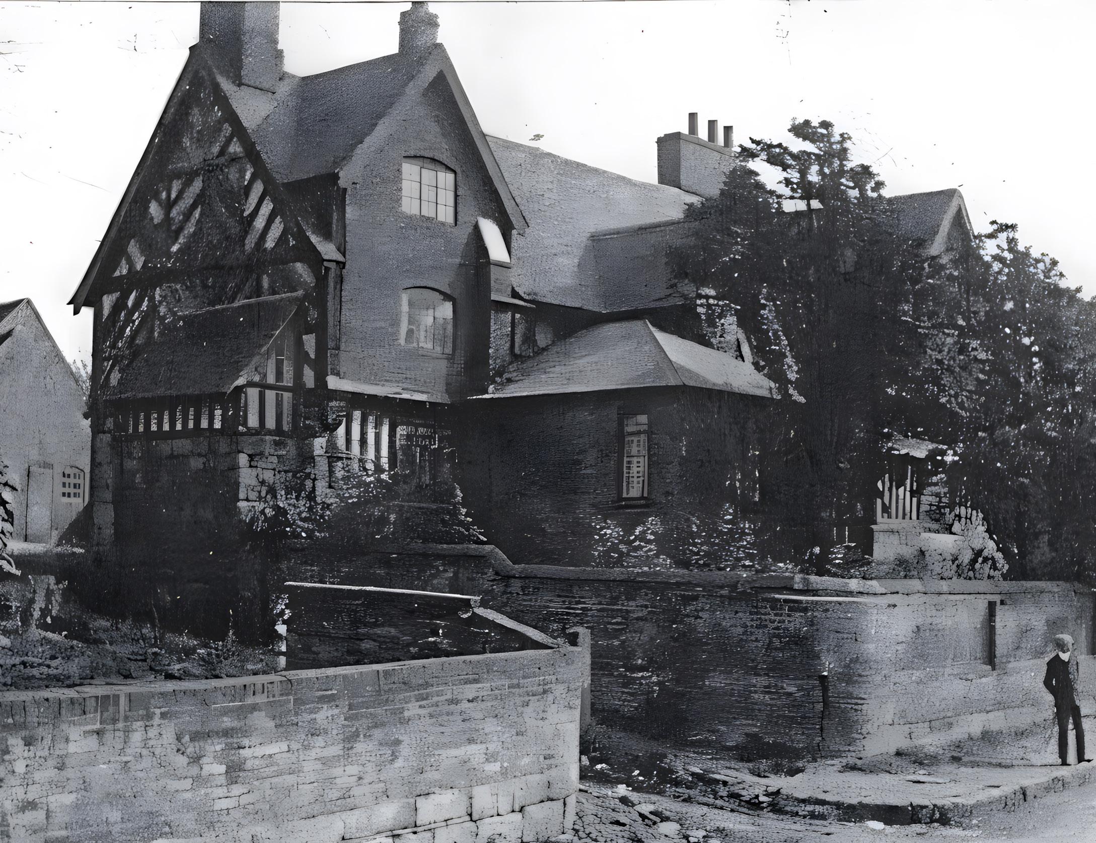
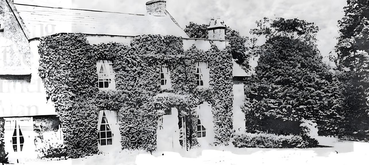
Upper Hall, known as the Old Manor House
Built in the 1620s, this Grade II* listed building exhibits an extravagant use of timber in the form of vertical close studding below a herringbone pattern above – almost as much oak as ‘daub and wattle’ infill – sitting on a stone plinth. Originally built as one grand house, it was split into three dwellings by George Wilkinson, who bought it from the Bretby Estate in 1910 for £270, with an additional front door to the right of the porch and a two-storey brick extension to the rear.
These alterations were sympathetically reversed in the 1970s to create the two houses you see today – the main range of the house, and the parlour wing at right angles to the south. It has six cellars, one with a salting trough to preserve meat, two domed brick ovens and extensive outbuildings including what was a maltings.
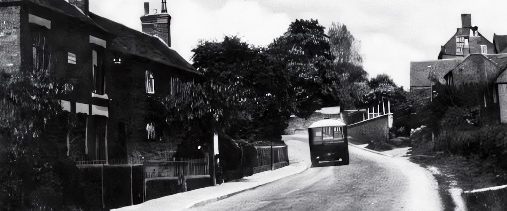
Woodville Road and Beyond
The road to Woodville, about one mile to the south-west of Hartshorne, provided a direct transport link to the railway. It was first upgraded in the 1770s by a Turnpike Trust, funded by local investors. The Trust had a duty to ‘repair and amend’ the road from Wooden Box (as Woodville was previously called) to “Scaddow Gate” and on to Ticknall, part of a Turnpike road from Swarkestone Bridge to Overseal. At Wooden Box, the road linked to the Ashby to Burton Turnpike and thence to shipping on the River Trent. The Trent became navigable as far as Burton in 1699.
Transport links for trade (the railway arrived in 1850) and leisure (the train from Woodville station advertised a service to Blackpool) were important to Hartshorne as it opened up the village to the world.
The five-way roundabout in Woodville is known locally as Tollgate island, the toll bar (or gate) originally, legend has it, having a shelter in the form of half a port wine butt, and it is this wooden shelter that gave its name to Wooden Box. This is a more convincing derivation than the wooden signal box on the railway, since Wooden Box is listed as “a prosperous hamlet where are many pottery works, in which the inhabitants are almost exclusively employed” in an 1835 Commercial Directory of Derbyshire – some 15 years before the railway arrived.
The Cottages
The cottages sweeping around the corner from Woodville Road to Main Street are also old, consisting of brick with a dentilled band below the tiled roof. Note the filled in windows and doors, which happened when the 8 original cottages were converted into 4 larger houses. At one time, one of the cottages housed a farrier, an important occupation when horses were essential for both transport and agricultural work. The first house fronting on to Main Street, now painted white and once two dwellings, housed a small shop.
Beyond the Cottages
The area of land immediately beyond these cottages was the site of the village smithy (as shown on the 1881 OS map) and a wheelwright’s yard. The waterwheel at the Screwmill site was used as a furnace in the 17th Century (some deposits of iron were found in the village) and in 1765 it is recorded as accommodating a smithy; it was in the late 1700s it was converted to manufacture screws. Like the Post Office, the smithy occupied different sites in the village. The site’s initially curved brick boundary wall reaches back to the edge of the old Dinmore farmyard. This would have been a noisy and smelly hive of activity, with horses being shod and iron being hammered into shape.
Carter’s Yard
The first house facing Church Street with the timber barge boards and framing at the top of the gable end once sported a sign “Villiers”. Villiers is listed as a baker and grocer in the 1887 and 1895 Gazetteers. Beyond this used to stand a brick building – only a single brick wall sitting on a stone plinth remains. Construction on a stone plinth reflects a particular vernacular feature of many of the oldest buildings in Hartshorne, such as Upper Hall (5), the cottages on Main Street (6) and Manor Farm (12). The movement of anything sizeable or in bulk would have needed to be transported by a horse and cart, making a carter an essential village occupation.
1, 3 and 5 Church Street
1 Church Street is an early 19th Century red brick and tiled roof house with a symmetrical front of three bays and is a Grade II listed building. The central doorway and the flanking tripartite casement windows are each recessed in a segmental arch, with shallow Gothic arches above. In the upper floor there are three two-light casement windows with pointed lights under segmental arches. While the purpose of the unusual one story building attached on its west side is unclear, it has an opening high up in its gable end. A little further along, 3-5 Church Street is said to have housed an infants’ school. The larger dwelling was originally the relatively unadorned school building and the smaller was the schoolmaster’s house, although no documentary evidence has been found to support this. The level area behind this building is supported by 5m-high buttressed walls.
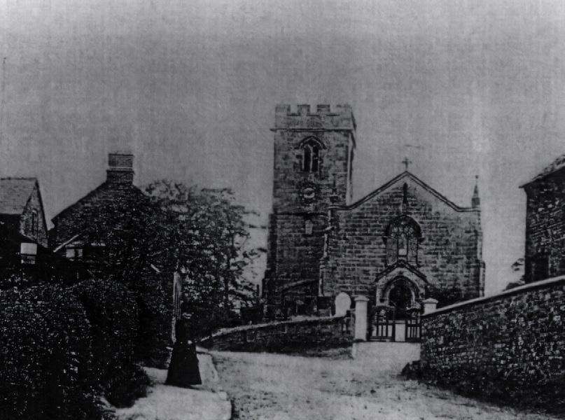
Saint Peter’s Church
11
The church was constructed in the 15th Century from local sandstone, with a tower at the west end. Only the tower remains of the original building, with the nave having been rebuilt in 1835, at a cost of £1,400. The north aisle and chancel were added in 1903. The font is believed to be 14th Century and of the six bells, one (the tenor) dates back to Tudor times. The tower has four gargoyles, five interestingly carved stones below the window in the west face, and some uniform round holes reputedly made by musket balls. A little further down Church Street is the former Rectory, a substantial stone residence built in 1832.
Manor Farm
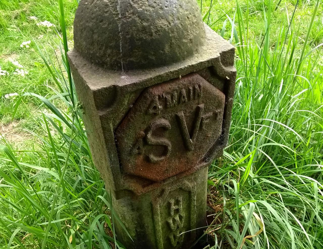
Cast iron marker of Hartshorne Water Works
An early clean water system was constructed to serve the village. The water originated from springs emerging from the hillside below Several Woods Farm (to the east of Manchester Lane) that fed two reservoirs (known as the Limehouse Dams), from where the water was piped to the water works on Manchester Lane, just above Slack Lane, treated with lime and piped into the village. Cast iron markers with “HWW” can still be seen in various places.
The farmhouse was built in 1677. It is of sandstone and brick construction that has since been rendered and etched with lines to give the appearance of stone blocks. The detail includes banding at first floor level and a dentilled eaves cornice. T-shaped in plan, it is of two stories with attics. The broad three-bay north elevation has an early 19th Century ashlar door case with pilasters, a hood mould, and a Georgian fanlight. There are remains of 17th Century panelling in the hall.
Trail 2 Church Street to the Millpond
Site of Community Centre Hall and Working Men’s Club
The first building on this site was the Community Centre Hall, a simple rectangular suspended timber structure. The Community Centre was replaced by a brick structure, known as the Working Men’s Club, which consisted of two large rooms, a kitchen and a games room, and was a hive of activity in the mid-20th Century. This was demolished and later replaced by the Manor View housing development you can see today. These are very recent houses, of course, but the architects will have studied the buildings in the village to ascertain the ‘vernacular architecture’ (the local historical building style) and reflected this in the look of the new homes. As you go through the village, it is interesting to see the different styles of houses – those in St Peter’s Close, for example, have wide but relatively shallow high up windows reminiscent of weavers’ cottages, and the timbers that support the roof protrude. Moreover, this feature, and houses further down Main Street that have timber decoration, is reminiscent of Upper Hall (5). They all go to make up the diversity of the village, whether the styles appeal or not, and inevitably also reflect the fashions of the time they were built.
Hartshorne Primary School
This Girls’ and Infants’ School was funded by subscription and built in 1864. Note how close it is to the road, the footpath on this side of the road being a later addition: the original footpath between upper and lower Hartshorne was on the other side of the road only. The adjoining house was the schoolmaster’s house.
Hartshorne Girls’ School
The original Hartshorne Girls’ School was on the site of the small car park to the left (south) of the Admiral Rodney. A tall and narrow brick building with a gable end facing the road and the main space stretching back, this school complemented the Boys’ School (on the site of the Dethick Hall – see 2) and the Infants’ School on Church Street (opposite the Church – see 9). When it ceased to be used as a school, an opening was created in the gable end, turning it into a barn-like structure, and it was here that the landlord of the Admiral Rodney kept the second car to be owned in the village.
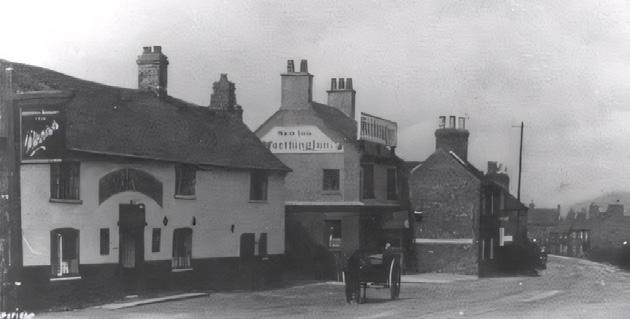
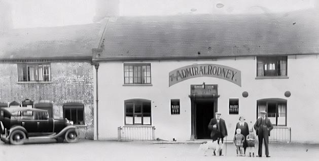
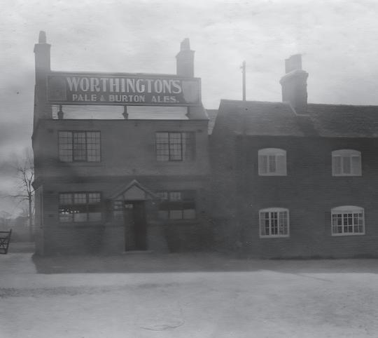
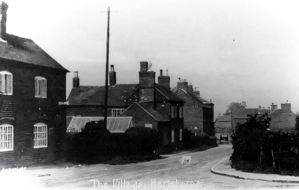
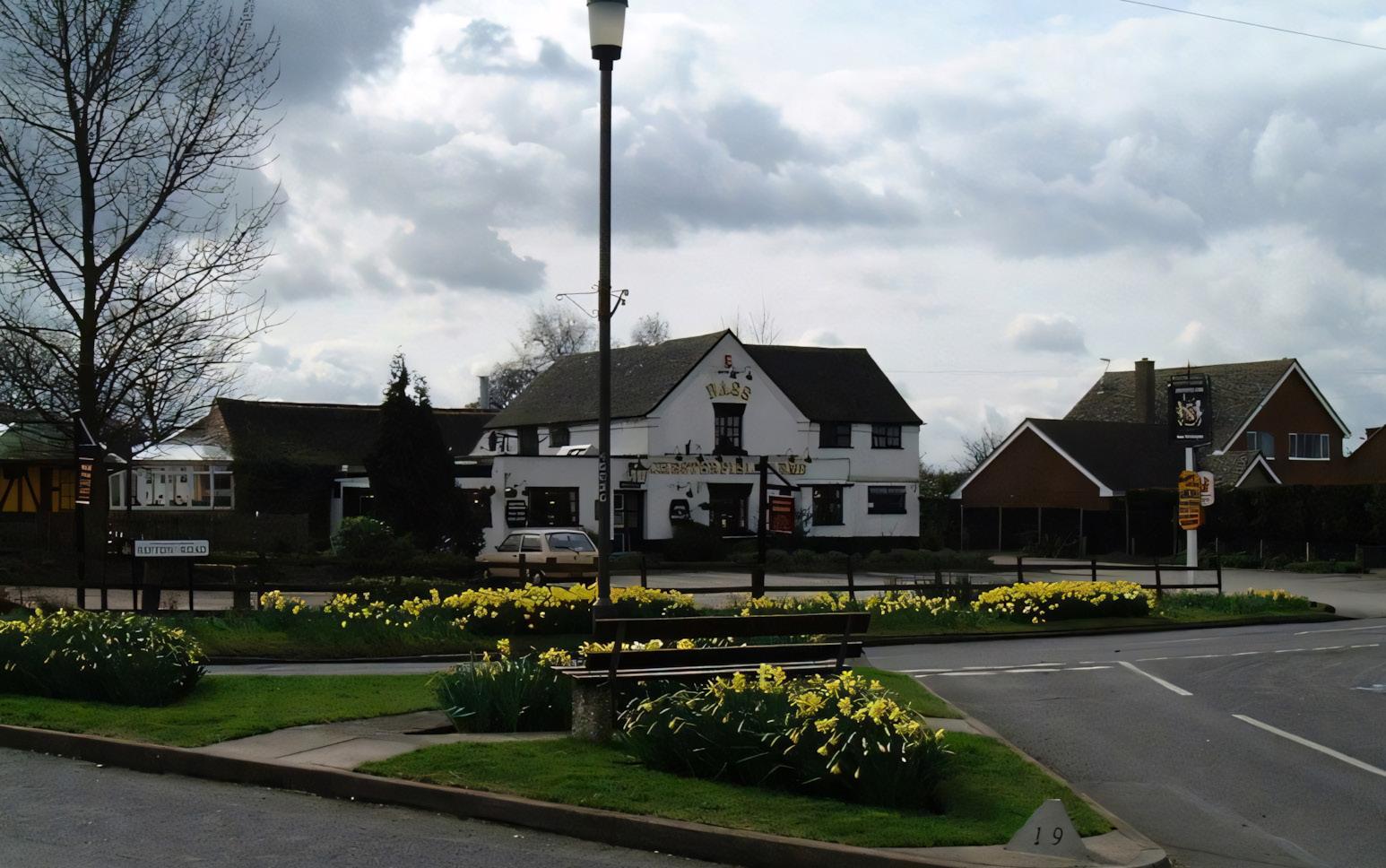
The Admiral Rodney
This building has a substantial front aspect, but the door is not central. It was, however, central to the original pub, the additional ‘bay’ to the right originally being a stable that was enclosed and extended into once the stable was no longer needed. This extra space requirement might have had something to do with the demise of the two pubs on either side – the Red Cow adjacent to what is now the white house to the left is listed as operating in 1829, and the more recent New Inn on the site of the main car park (see 22). The field behind the Admiral Rodney was turned into a cricket pitch in 1959; note the undulations that make cricketing just a little more interesting – these resemble a ridge and furrow pattern that suggests mediaeval farming took place here.
Baptist Chapel
The last service held at Hartshorne Baptist Chapel was in 1939. The chapel was subsequently sold to a local small haulage company, who made a short extension at the rear of the building, knocked out the back wall and inserted a large sliding door to allow lorries to be housed inside. The chapel is now a house. The large ornate cast iron ceiling rose was originally retained, but otherwise the internal chapel features were removed. The chapel building was sold in 1982, when an embargo on residential development was still in place because the sewer system at that time was at capacity. To get round this, a case was made that the building constituted work premises, there were no toilet facilities, and they were not connected to the mains sewer. On this basis, permission was granted to connect to the sewer, whereafter an application was immediately made for planning permission to change the use of the building to a dwelling.
Bagnalls Row and Mill House
Further along Ticknall Road, before you get to the Mill Wheel are two old houses of particular interest set back from the road. The first is a cream-coloured, rendered, brick house with a plain tiled roof that has an unusual feature of a set of three ‘eyebrows’ above the windows that face east towards the Mill Wheel. These appear to have been created to accommodate larger, or higher, windows that cut into the dentilled cornice. This is the only remaining house of a terrace known as Bagnalls Row, and which was constructed to face onto the brook (now culverted as it passes under the road and runs towards Repton), rather than being aligned with a road. The second is Mill House, a substantial Grade II listed red brick house with plain tiled roof – it has brick coped gables and a dentilled eaves cornice like many other houses in Hartshorne.
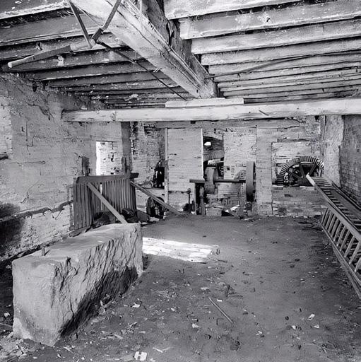
Screwmill
Originally a corn mill powered by a large waterwheel – the current 24-foot (7.2m) wheel is renowned as one of the finest in the country –the mill was converted in the 17th Century to drive the bellows of an iron smelting furnace. In 1767, it was converted into a screw mill employing 59 people, including children, and, in 1784, the mill building was reconstructed in the form you see today. In 1796, employees were paid between 1/6d and 19 shillings a week. These ‘screws’ were what we would now call bolts – there was no pointed end, so a pilot hole to the screw’s full length needed to be drilled in the wood before the screw could be inserted and driven home. The mill produced 1200 screws a week (8-9 a minute) from 36 lathes, powered by the wheel and a constant flow from the millpond. Production of screws stopped in about 1846 when the manufacture of (pointed) wood screws as we know them today was perfected. Not only did production stop, but many of the workers were attracted away from the village to staff the new Nettlefold screw works in Birmingham. In 1943, the mill was employed in corn grinding and wood sawing and, some years later, coffins were made in the redundant mill building. It was completely renovated in 1987.
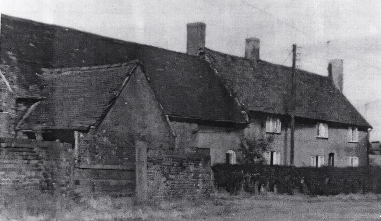
Screwmill Row
20
This was originally the site of a charcoal furnace, the waterwheel having been changed from powering a corn mill (there was another mill downstream in the village to cover this need) to power bellows. This area also housed a smithy at this time when the millpond (see 21) was known as ‘furnace pond’. It was the further transformation into a screwmill that led to these cottages being built for the mill workers. These cottages were relatively small and basic and have bedroom floors made from lime ash, a durable material not unlike concrete. At one point, one of the cottages housed a shop and there is still evidence of an off-licence painted on the wall. The mill manager’s house is a more substantial house set back from the road and facing towards the mill building. The pattern of the bricks – Flemish bonding – is unusual and a central window has been bricked in using larger bricks.
Ticknall Road
The road to Ticknall climbs past a row of old cottages, angling away on the left, to the brow of the hill where it meets Coal Lane, which is said to have got its name from 18th Century coal mining. This was carried out by the bell pit method, which involved relatively shallow workings but of which there is now no trace. Opposite Coal Lane, on the corner, the road at this point lay on the Wooden Box (now Woodville) to Ticknall Turnpike Road; there was a toll house here and tolls were collected at “Scaddow Gate”. At the top of the hill, on the left, is Foremark reservoir, which supplies most of the village with drinking water. This is supplied by a borehole pumping station at Stanton-by-Bridge. A little further on is an area known as The Scaddows. Ted Moult, a farmer and TV personality who was a household name in the 1960s-1980s, lived at Scaddows Farm. Ted was credited with inventing “pick your own”; in his case, strawberries. As well as conventional farming of arable and sheep, the present occupants have planted a vineyard and produce local wine with the label of “Scaddows Vineyard”.
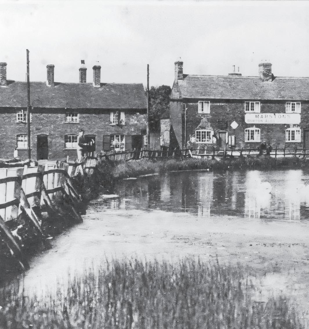
Site of the Millpond
The millpond occupied a large area on the inside bend of the road and was separated from the road by a simple wooden post and rail fence. Originally known as furnace pond when the mill was used to work iron, the pond was a popular village feature, especially in the hard winters before the war when skating was possible. There were, at that time, resident swans that would visit nearby houses, looking for people to feed them. They were almost treated like pets. The pond was infilled in the 1970s.
21
3
Site of New Inn to Wilder Green Cottage
Site of New Inn
Hartshorne was well served with public houses, or inns, and perhaps strangely three were clustered at this point in the centre of the village. The New Inn was where the Admiral Rodney’s car park is now, while on the other side of the Admiral Rodney (just beyond the site of the Girls’ School) was an inn called the Red Cow. Next to the New Inn was a cottage from which the Post Office was run in the 1950s and 1960s. One corner of the living room was partitioned off for this purpose, allowing only one person to be served at a time. In this period, people had to purchase such things as a wireless licence and a dog licence. The occupants would take messages or pass messages on for villagers in the days when it was a rarity for people to have telephones.
Methodist Churches
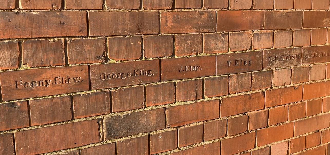
The Old Methodist Church – 44 Repton Road; now a house – is on the right-hand side before you reach this newer, far bigger and grander structure, the foundation stone of which was laid by Reverend C Holman in October 1904. The names of 120 children are embossed in bricks laid around the church at a readable height. These include local names familiar to longtime residents, such as Blood, Bloor, Willkins, Shaw, Wilkinson, James and Jacques.
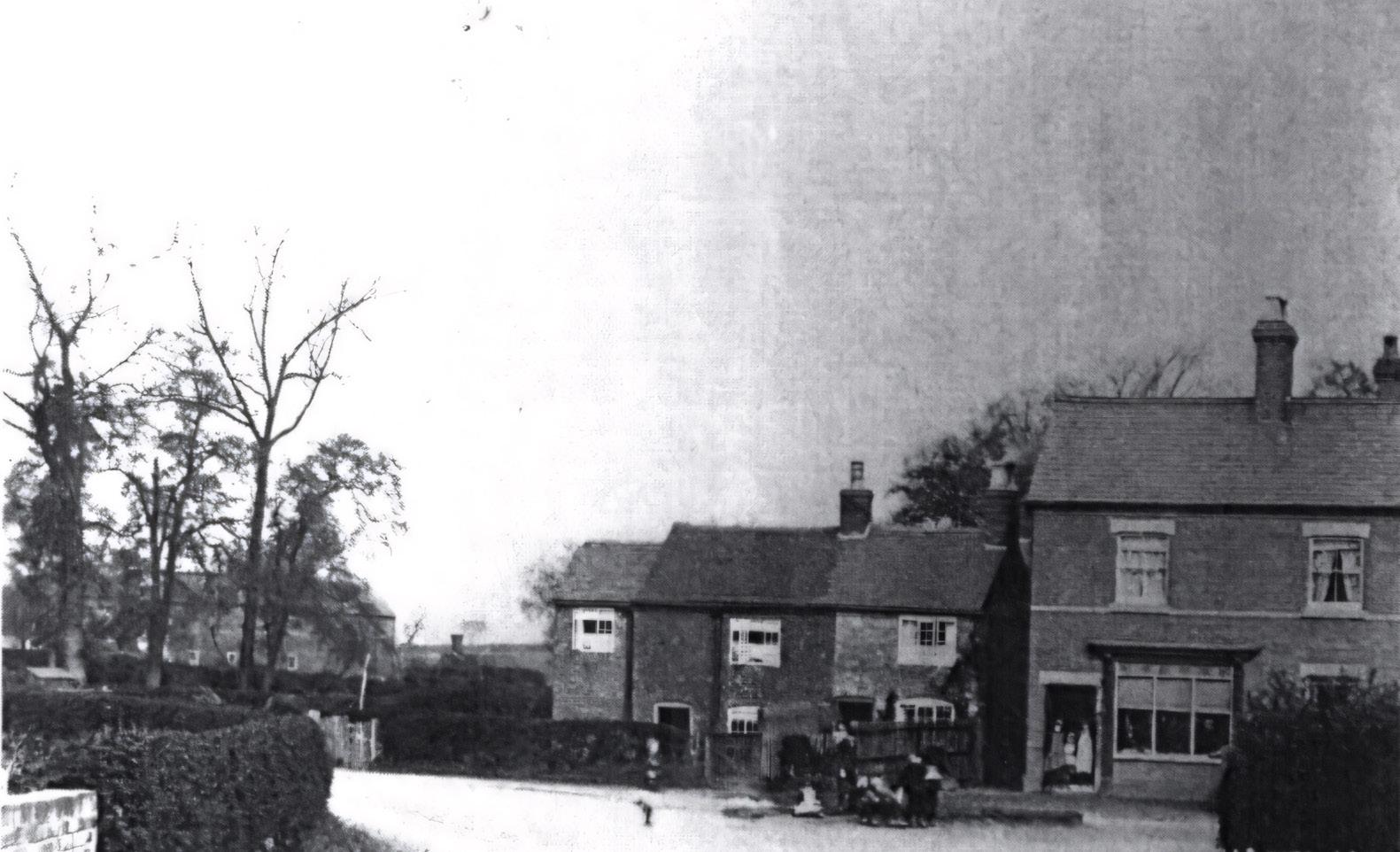
Continuing past Pear Tree Close (built on land previously occupied by Pear Tree Farm), you will come to the triangle of grass that is The Green. Nearly opposite is Adams Close, named after Derek Adams (a local councillor), that was built on the site of The Chesterfield Arms. A little further along Repton Road on the right-hand side, but no longer present, were Jail Yard Cottages. There being no evidence of a village ‘lock up’ (unlike Ticknall and even Smisby), did one of the buildings here serve this purpose? For those who believe in such things, there is said to be a ghost of a lady who walks behind these cottages to Nether Hall Cottage.
Dakin’s Butcher’s Shop and Orme’s Shop & Bakehouse
Villages such as Hartshorne would have needed to be self-sufficient in shops, since travel to local towns would not have been straightforward or cheap. Orme’s’ bakehouse and shop was a significant commercial activity and is remembered well by many of the village’s more senior residents, some of whom worked there.
The Brook
Turning off Repton Road into Brook Street, there are some old brick houses on the left-hand side. 11 Brook Street is the Old Post Office, which appears thus named on the Ordnance Survey Map of 1888 – the function moved around the village. The road curves down to the brook and an old set of terraced houses. Although the flow looks modest, this stream, which rises from springs below Several Woods Farm and flows around 3 miles to the Trent beyond Repton, served a remarkable range of purposes. The Limehouse Dams were built to provide clean water to the village (piped to Hartshorne Water Works on Manchester Lane above the village car park) and were once a very well-known visitor site for fishing. It fed the village pond that fed the Screwmill (21 and 19) and, becoming Repton Brook, fed the ponds near Nether Hall (to run Glovers corn mill), then further on a leather mill, Bretby Mill (flour), osier beds (willow for baskets) and then ponds in Repton.
Brook House Farm
This handsome three-story Grade II listed building was constructed between 1700 and 1750, with early 19th Century additions. Until relatively recently, it was named Brick House Farm. Its architectural style is typical of a high-status house in the village, with brick pediments (or coped gables) at either end of the roof forming the top of the gable ends, a blue tiled roof, a dentilled cornice below the roofline, and high-quality brickwork. The doorway has a traceried rectangular Georgian fanlight set above the door. Its farm buildings have been converted into dwellings.
Old Hall
A gateway to Old Hall lies a little beyond Brook House Farm, yet the original winding track to it leaves Repton Road just beyond The Green. Old Hall is likewise named on the 1888 Ordnance Survey map and consists of a large, rendered house with several outbuildings, including a very impressive early 17th Century large brick barn with an irregular pattern of several narrow vertical ventilation slits and a suitably large barn door. The extensive grounds include two large ponds. The very close proximity of Brook House Farm and Spring Farm emphasises the importance of agriculture to the village. The farmhouse is all that remains of what was a larger residence befitting possibly the Lord of the Manor of Nether Hall.
Spring Hill
Spring Hill is variously known as the Hill on the Gravel, Gravelpit Hill or Tattle Hill. Near to the top of the hill, before the junction with Greysich Lane, lies a sandstone quarry which, when exhausted, was used as a landfill site in spite of spirited village protests. Villagers once marched with placards and prams from the Chesterfield Arms along Brook Street and up the hill to the quarry site to make their objections known to councillors on a site visit. Many then caught a coach to the County Council Offices to attend the subsequent planning meeting in Matlock, though obviously in vain. Further on, at the brow of the hill, is a settlement of residential caravans on the site of what was once an Italian prisoner of war camp. The prisoners were employed on local farms.
Looking to the far past, pre-enclosure routes ran west from Brook Street as it begins to rise to skirt the south-western edge of Caukley Wood and east up ‘Dark Lane to Original Brick House’. Transport routes have therefore varied greatly over the years, one important consideration being the contours that draft animals would have had to navigate to transport sandstone from Hartshorne’s quarries (there being far more quarried than was needed in the village) to other places.
Wilder Green Cottage
During the Second World War, this was an off-licence that sold cigarettes individually and, according to hearsay, black market goods. Apparently, this contraband was hidden from the authorities in a natural sandstone cave located in the near edge of Caukley Wood. This was accessed from the footpath that runs across the field from the cottage directly to the wood. The natural cave has an extremely narrow entrance. The cave is formed in the same sandstone as the locallyfamous Anchor Church by the River Trent, which was carved into the rock, looks like a small house and allegedly once housed a hermit.
Nether Hall and Beyond
Repton Road leads to the area known as Nether Hall (The Woolsey on this site faces you across a newly planted wood) and on to pass Hoofies Farm (across the valley to the left). As the road emerges from the trees, on the left the lowermost of a sequence of five reservoirs (or fishponds) constructed on the Bretby Estate can be seen. The Repton Road is not an ancient track, but was constructed following the Enclosures Act of 1766. Further along, Watery Lane leads to Bretby village and Bretby Hall.
Spring Farm
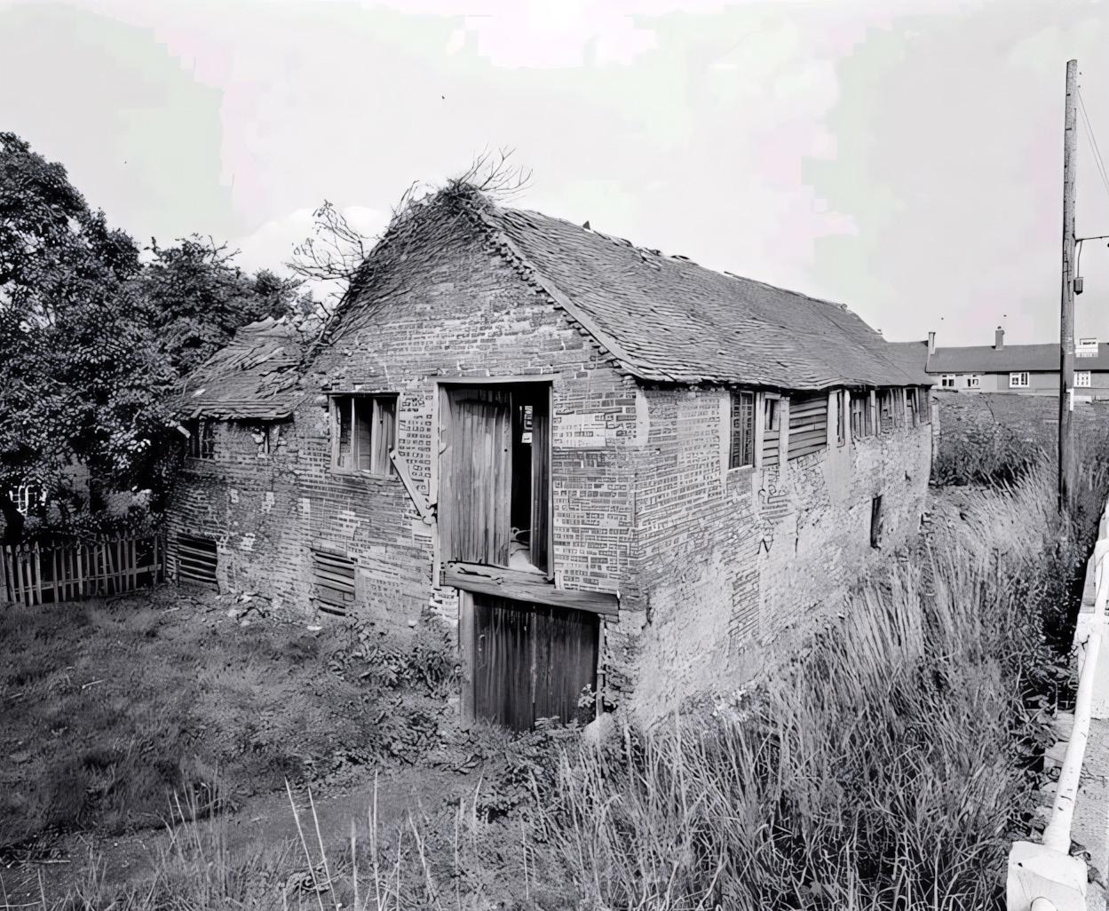
The farmhouse is thought to be of 17th Century and later construction and consists of rendered brick and timber framing with a plain tiled roof. While it is now effectively derelict, both the farmhouse and attached barn are Grade II listed, indicating the importance of its structure and internal detail, which includes a massive fireplace and stop chamfered beams. One has to try hard to imagine how prosperous it would have been in the past.
For more walking routes, events and local information please visit www.visitsouthderbyshire.co.uk
Compiled and written by Hartshorne Village Residents Association. The authors thank the following for source material: the villagers of Hartshorne, The Magic Attic, Neil Jenkinson and “At the Sign of the Bull’s Head” (ed. Janet Spavold). The old photographs first appeared on a village website more than 15 years’ ago; the three new photographs are supplied courtesy of Chris Rogers. Any errors, omissions and inadvertent infringement of copyright will be corrected in future editions. Designed by Adam Leese Design Studio