Informationisdeemedreliablebut not guaranteedandshouldbeindependentlyverified "Equal HousingOpportunity"
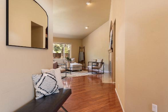
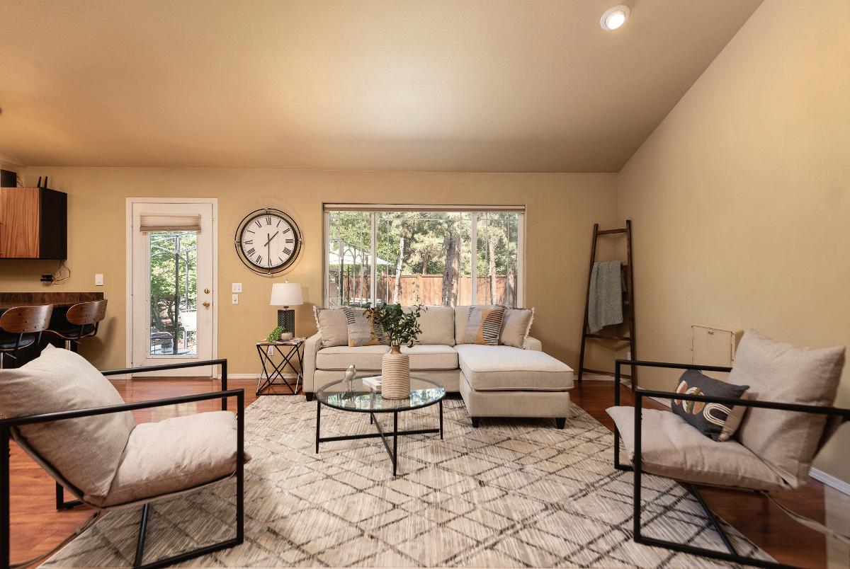
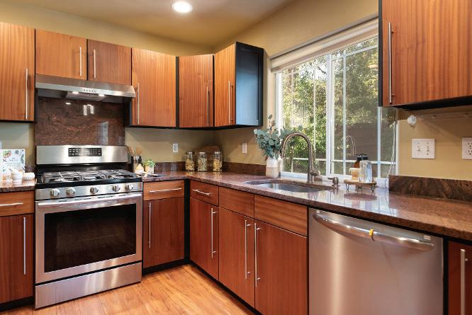
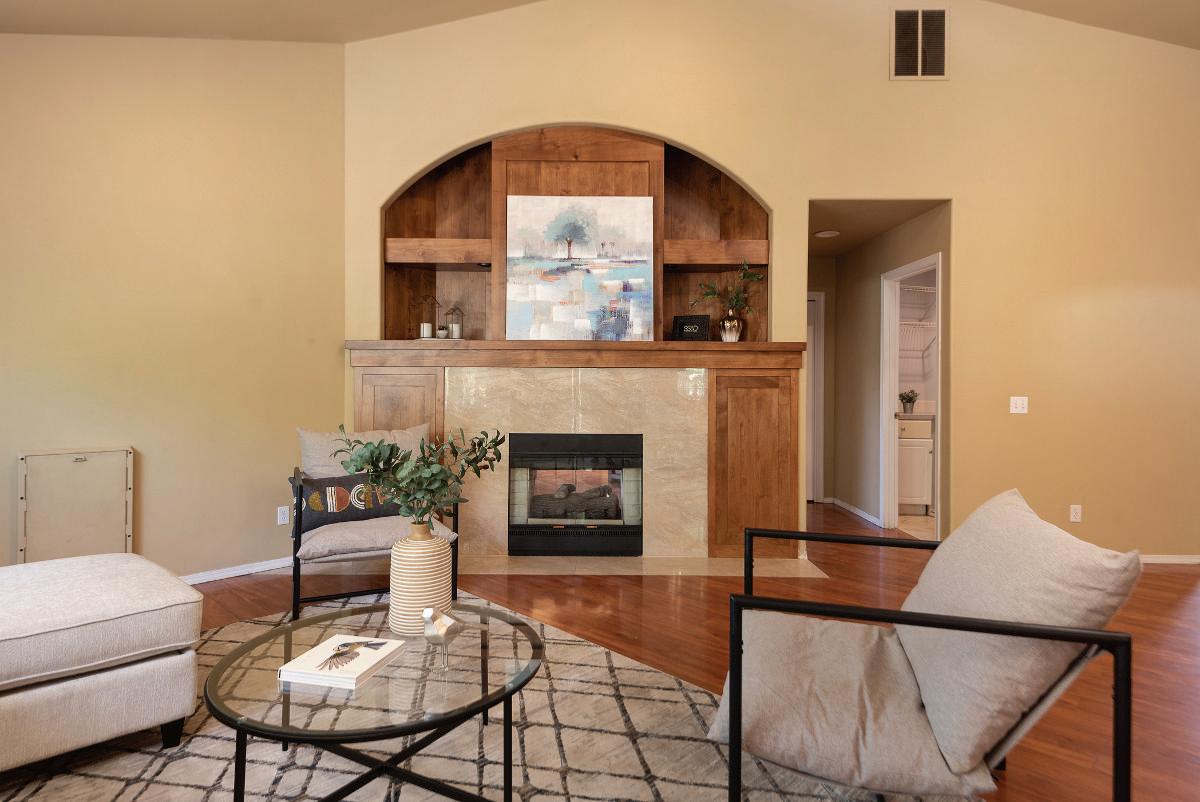
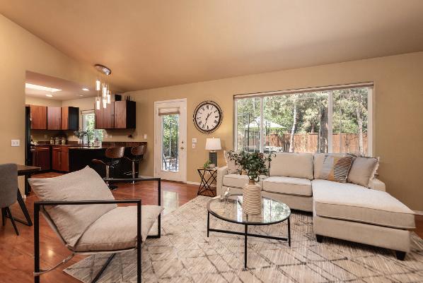
INVITING LIVINGAREA AND GOURMET KITCHEN
The heart of thehome is a beautifully remodeled kitchen featuring sapele cabinetry and granite countertops This space is designed for both functionality and style, offering bar seating that opens into a spacious livingarea. Thegreat room features a stunning see-through gas fireplace with handcrafted woodwork and vaulted ceilings, providing a cozy and elegant space for entertainingor relaxing.
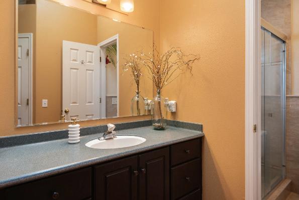
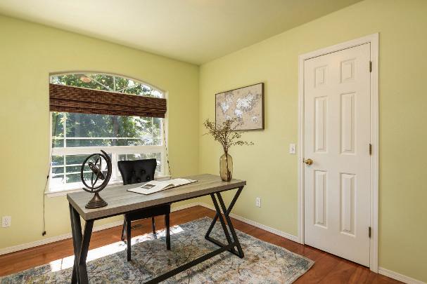
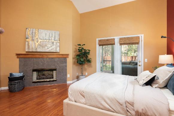
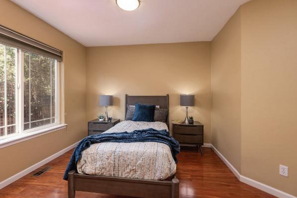
LUXURIOUSBEDROOMSAND OFFICEROOM
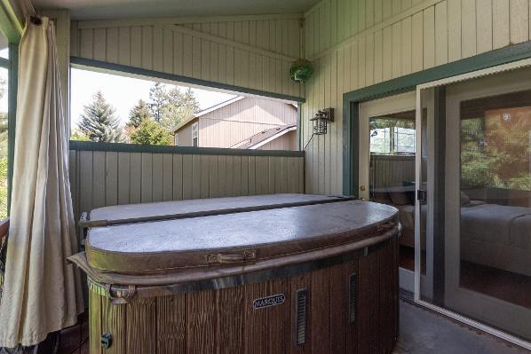
Theprimary suiteisaluxuriousretreat, featuringa gas fireplace, a walk-in closet, and a private deck with a hot tub. The en-suite bath is elegantly appointed with modern fixtures. The additional bedrooms are generously sized, with one offering flexibilityasahomeoffice,ideal for remotework or aquiet studyarea.
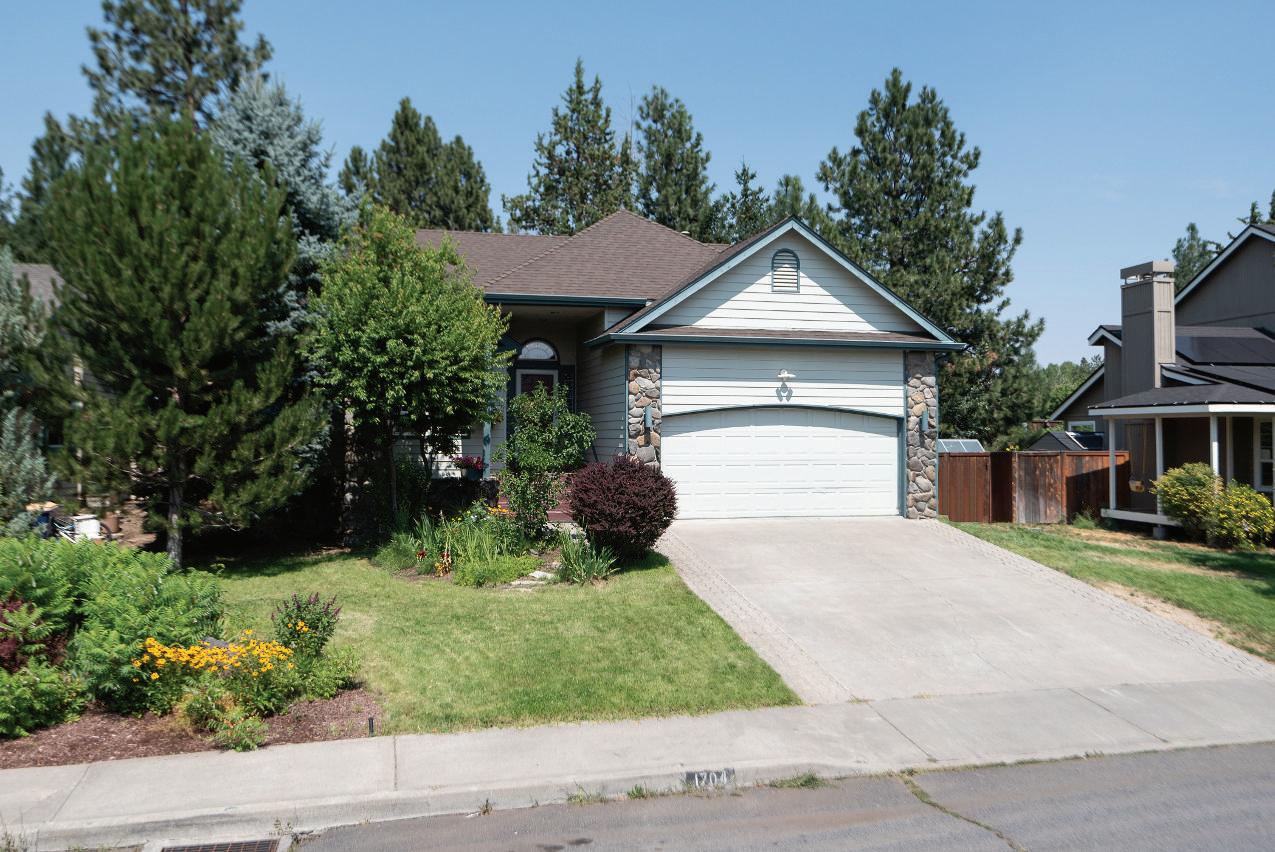
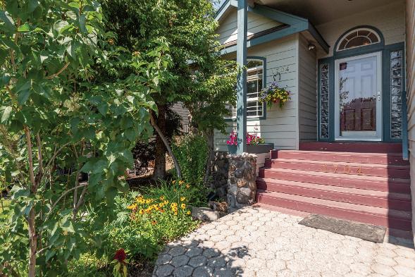
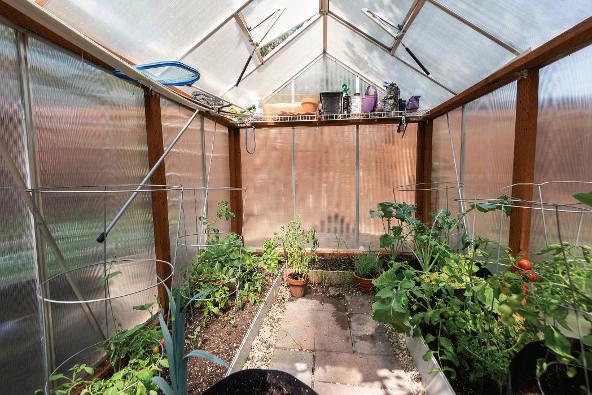
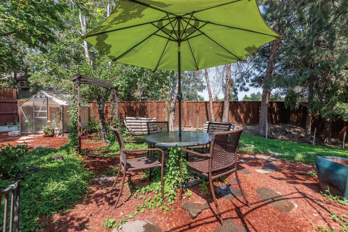
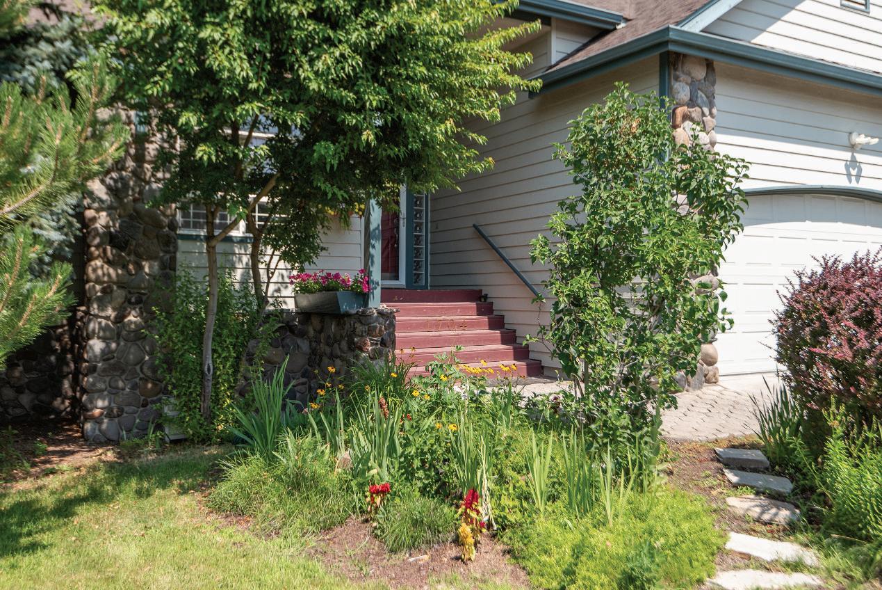
OUTDOORFEATURES:
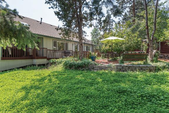
Step outside to enjoy the fully fenced backyard, perfect for gatherings or quiet afternoons The patio is complemented by shaded seating areas, raised garden beds, and a greenhouse, all surrounded by lush landscaping. Thedeck extends thelivingspaceoutdoors, offeringaprivateretreat withahot tubfor ultimaterelaxation
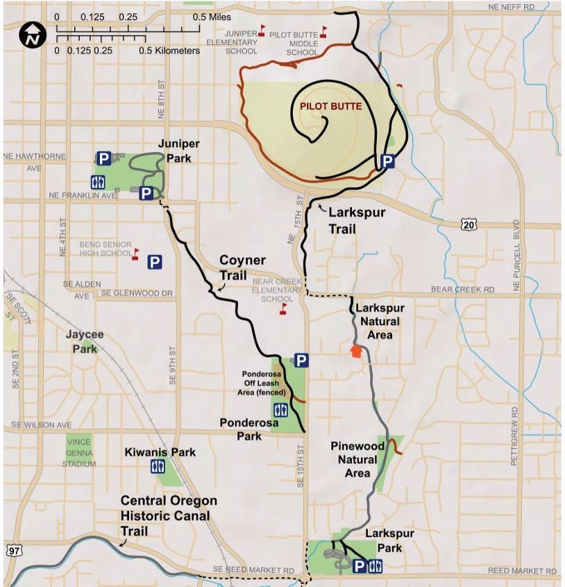
OTHERFEATURE, ACTIVITIES, AND NEARBYPARKS:
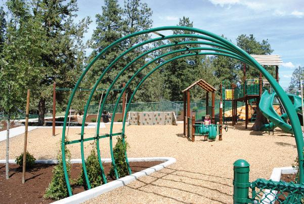
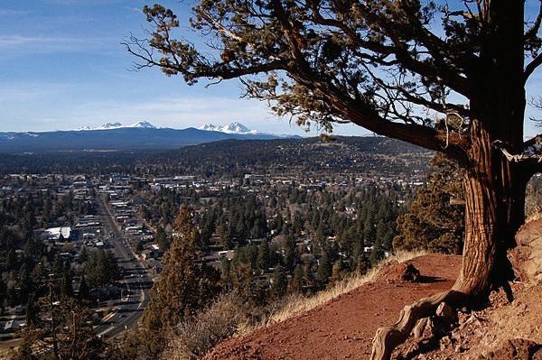
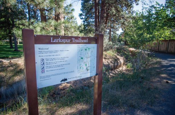
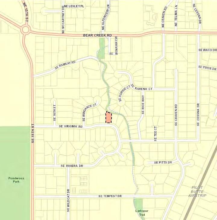
This property is perfectly situated for outdoor enthusiasts. Just steps away from the Larkspur Trail, residents can easily access miles of walking and biking paths. Nearby parks such as Ponderosa Park and Pilot ButteStatePark offer avariety of recreational activities, includingpicnicareas, playgrounds, andstunningpanoramicviewsof theCascadeMountains.
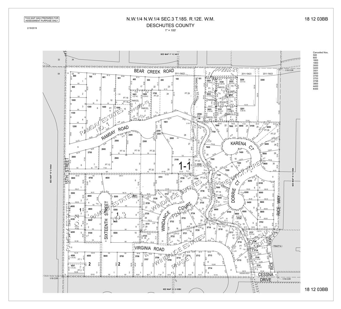
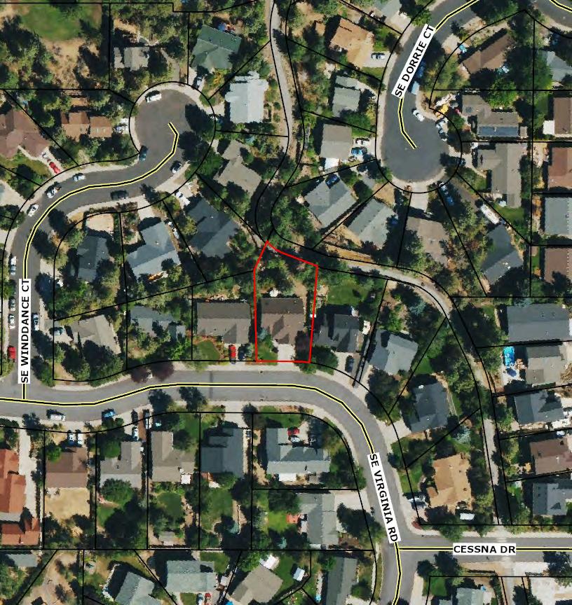
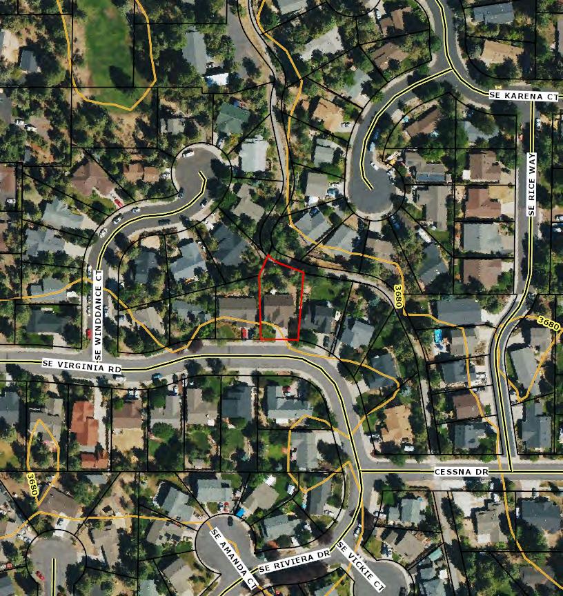
Deschutes County Parcel Information
Parcel #:182500
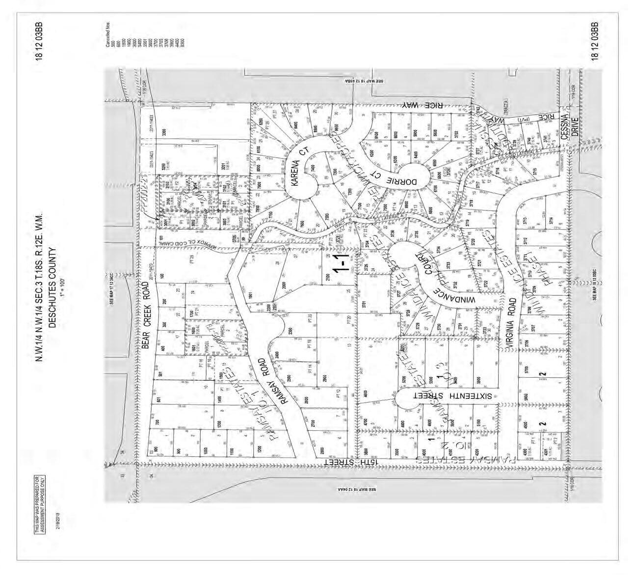
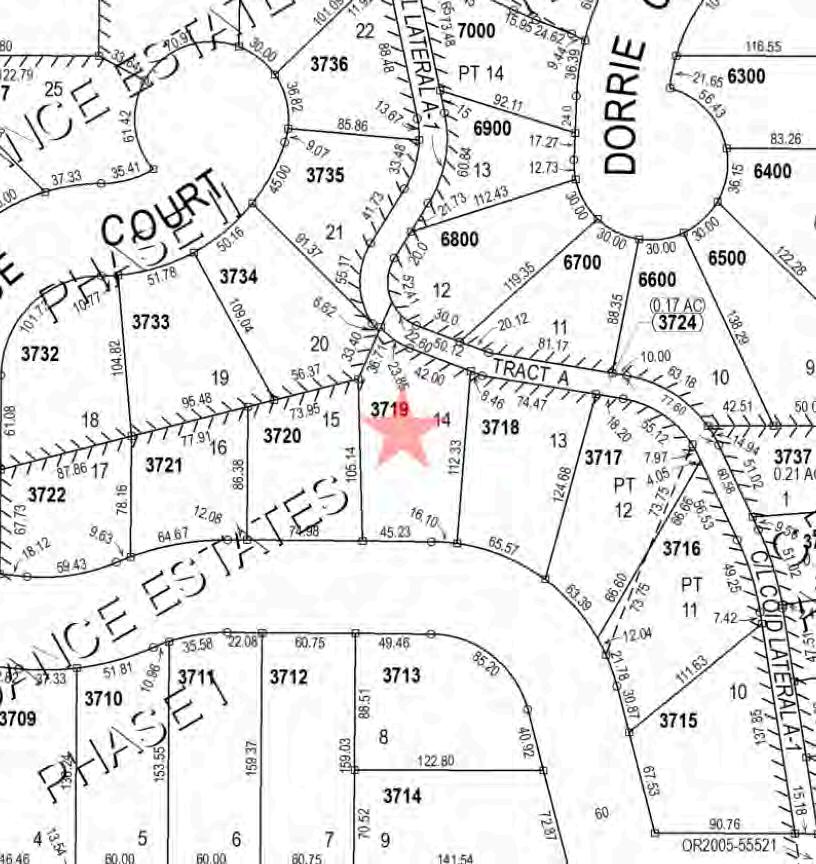
Tax Lot:181203BB03719
RecordType:Residential
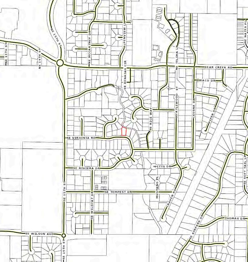
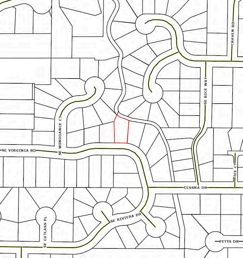
SiteAddress:1704 SE Virginia Rd
Bend OR 97702 - 1537
Owner:StephanieAStuart Rev LivingTrust
OwnerAddress:1704 SE Virginia Rd
Bend OR 97702 - 1537
Twn/Range/Section : 18S / 12E / 03 / NW
Parcel Size:0.19Acres (8,276 SqFt)
Plat/Subdivision:Windance Estates Ph 01 Lot:14
Block: Census
Tract/Block: 001802 / 1000
Waterfront:
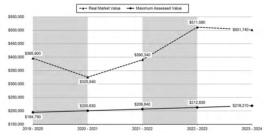
Market Value Land: $166,850.00
Market Value Impr: $334,890.00
Market ValueTotal: $501,740.00
Assessed Value: $219,210.00
Levy CodeArea:1-001
Levy Rate:15.9868
TaxYear:2023
AnnualTax:$3,504.45
WINDANCE ESTATES PHASE I Lot: 14
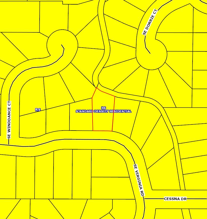
County Land Use:101 - Residential - Improved (typical of class) Land Use Std:RSFR - Single Family Residence
Zoning:City Of Bend-RS - Standard Density Residential Neighborhood:4
Watershed:McKenzie Canyon-Deschutes River School District:1 - Bend-La PineAdministrative
Primary School:Bear Creek Elementary School
High School:Bend Senior High School Year Built:1994
Middle School:Pilot Butte Middle School
SqFt
1st Floor:1,264 SqFt AtticArea: Bathrooms:2
2nd Floor:
BsmtArea: Full/Half Baths:2 / 0
Fireplace:1 Garage:444 SqFt Carport:
Sentry Dynamics, Inc. and its customers make no representations, warranties or conditions, express or implied, as to the accuracy or completeness of information contained in this report.
Western Title & Escrow CO - Oregon
Bend, OR 97702
Single-Family Homes
This week the median list price for Bend, OR 97702 is $850,000 with the market action index hovering around 38. This is less than last month's market action index of 40. Inventory has increased to 210.
Market Action Index
This answers “How’s the Market?” by comparing rate of sales versus inventory.
Real-Time Market Profile
Slight Seller's Advantage
Market conditions have been consistently cooling in the past several weeks. Because we’re still in the Seller’s zone, prices have not yet begun to drop. It may take a few more weeks of slack demand for prices to reflect and begin to fall. Expect prices to fall if the index persistently falls to the Buyer’s zone.
Median List Price
Market Segments
Each segment below represents approximately 25% of the market ordered by price.
Slight Seller's Advantage
Area Profiled:
Report Date: 06/28/2024
Sales Dates: 11/01/1999 - 05/08/2024
Number of Parcels: 32
Waterfront Parcels: 0
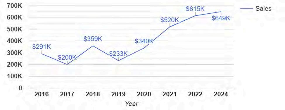
Average Sale Price byYear: 01/01/2016 - 06/28/2024
* 18 sale(s) are included in the graph
Sales Statistics byYear:
01/01/2016 - 06/28/2024
18 sale(s) are
Parcels with Views: 0
Length of Residence
2 parcel(s) with no sale date are excluded from the calculation
Age of Homes
Assessed Values
Deschutes County Property Information
Report Date: 6/28/2024 7:50:25 AM
The information and maps presented in this report are provided for your convenience. Every reasonable effort has been made to assure the accuracy of the data and associated maps. Deschutes County makes no warranty, representation or guarantee as to the content, sequence, accuracy, timeliness or completeness of any of the data provided herein. Deschutes County explicitly disclaims any representations and warranties, including, without limitation, the implied warranties of merchantability and fitness for a particular purpose. Deschutes County shall assume no liability for any errors, omissions, or inaccuracies in the information provided regardless of how caused. Deschutes County assumes no liability for any decisions made or actions taken or not taken by the user of this information or data furnished hereunder.
Summary
Warnings, Notations, and Special Assessments
Review of digital records maintained by the Deschutes County Assessor’s Office, Tax Office, Finance Office, and the Community Development Department indicates that there are no special tax, assessment or property development related notations associated with this account. However, independent verification of the presence of other Deschutes County tax, assessment, development, and additional property related considerations is recommended. Confirmation is commonly provided by title companies, real estate agents, developers, engineering and surveying firms, and other parties who are involved in property transactions or property development. In addition, County departments may be contacted directly to discuss the information.
Tax Payment History
Related accounts apply to a property that may be on one map and tax lot but due to billing have more than one account. This occurs when a property is in multiple tax code areas. In other cases there may be business personal property or a manufactured home on this property that is not in the same ownership as the land.
WATER SERVICE PROVIDER BEND WATER DEPARTMENT (541) 317-3000 62975 BOYD ACRES RD, Bend, OR 97701
LIVESTOCK DISTRICT DESCHUTES COUNTY LIVESTOCK DISTRICT NUMBER 2 (541) 388-6623 1300 NW WALL ST, BEND, OR 97703
IRRIGATION DISTRICT ARNOLD IRRIGATION DISTRICT (541) 382-7664 19604 BUCK CANYON RD, BEND, OR 97702
IRRIGATION DISTRICT CENTRAL OREGON IRRIGATION DISTRICT (541) 548-6047 1055 SW LAKE CT, REDMOND, OR 97756
GARBAGE & RECYCLING SERVICE CASCADE DISPOSAL (541) 382-6660 1300 SE WILSON AVE, BEND, OR 97702
Development Summary
City of Bend Permits
Deschutes County Permits
Permit Detail
Inspections
No inspection records found. 247-E27640
Permit Number: WINDANCE DEVELOPMENT INC
Permit Name: MITCHELL CONSTRUCTION INC Contractor:
Linked Permit: Electrical Permit Details
Service Description: RESIDENTIAL WIRING THRU 1500 SQ FT(1) RES WIRING EACH ADD. 500 FT OR PORTION(1)
Inspections
Date Init. Comments
06/02/1994 CFD FINALED (HOT TUB WILL NOT BE INSTALLED AT
04/07/1994 MWT APPROVED FOR COVER & SERVICE
Details
Inspections
Assessor's Office Supplemental Information
STATEMENT OF TAX ACCOUNT
1704 SE VIRGINIA RD BEND 97702
1001
SITUS ADDRESS:
181203-BB-03719
1704 SE VIRGINIA RD BEND
(RMV)
Please include this coupon with payment. Please do not staple, paper clip or tape your payment.
Due November 15, 2023
$3,399.32
Deschutes
Road Map
Deschutes County GIS
Map and Taxlot: 181203BB03719
Parcel ID: 182500
SiteAddress: 1704 SE Virginia Rd
Sentry Dynamics, Inc. and its customers make no representations, warranties or conditions, express or implied, as to the accuracy or completeness of information contained in this report.
Parcel ID: 182500
SiteAddress: 1704 SE Virginia Rd
Sentry Dynamics, Inc. and its customers make no representations, warranties or conditions, express or implied, as to the accuracy or completeness of information contained in this report.
Sentry Dynamics, Inc. and its customers make no representations, warranties or conditions, express or implied, as to the accuracy or completeness of information contained in this report.
Parcel ID: 182500
Sentry Dynamics, Inc. and its customers make no representations, warranties or conditions, express or implied, as to the accuracy or completeness of information contained in this report.
Parcel ID: 182500
Sentry Dynamics, Inc. and its customers make no representations, warranties or conditions, express or implied, as to the accuracy or completeness of information contained in this report.
Parcel ID: 182500
Sentry Dynamics, Inc. and its customers make no representations, warranties or conditions, express or implied, as to the accuracy or completeness of information contained in this report.
Parcel ID: 182500
Sentry Dynamics, Inc. and its customers make no representations, warranties or conditions, express or implied, as to the accuracy or completeness of information contained in this report.
Parcel ID: 182500
Central Oregon Local Services Guide
Electricity
Central Electric Co-op
541-548-2144
Midstate Electric 541-536-2126
Oregon 811 - Underground Utilities Locator
Pacific Power
Gas
AmeriGas
Cascade Natural Gas
CoEnergy
Ferrell Gas
Suburban Propane
Water
Agate Water Company
800-332-2344 or 811
888-221-7070
541-548-7449
888-522-1130
800-510-5886
541-382-1161
800-776-7263
541-382-2855
Avion Water Company 541-382-5342
City of Bend - Water
541-388-5515
City of La Pine - Utility Services 541-536-1432
City of Madras - Water/Sewer 541-475-2344
City of Prineville - Water/Sewer 541-447-5627
City of Redmond - Water Division 541-923-7765
Deschutes Valley Water District 541-475-3849
Laidlaw Water District 541-389-1255
Sunriver Utilities Company
541-593-4197
Water Wonderland Improvement District 541-593-5902
St. Charles Health System - Prineville 541-447-6254
St. Charles Health System - Redmond 541-548-8131
Public Libraries
Crook County Library
541-447-7978
Deschutes Public Library - Bend Downtown 541-617-7050
Deschutes Public Library - East Bend 541-330-3760
Deschutes Public Library - La Pine 541-312-1090
Deschutes Public Library - Redmond 541-312-1050
Deschutes Public Library - Sisters 541-312-1070
Deschutes Public Library - Sunriver 541-312-1070
Jefferson County Library 541-475-3351
Public Schools/Colleges
Bend-La Pine School District
541-355-1000
Central Oregon Community College 541-383-7700
Crook County School District 541-447-5664
Culver School District 541-546-2541
Jefferson County School District 541-475-6192
Oregon State University - Cascades 541-322-3100
Redmond School District
541-923-5437
Sisters School District 541-549-8521
Chamber of Commerce
Bend Chamber of Commerce
541-382-3221
Crook County Chamber of Commerce 541-447-6304
La Pine Chamber of Commerce 541-536-9771
Madras-Jefferson County Chamber of Commerce 541-475-2350
Redmond Oregon Chamber of Commerce 541-923-5191
Sisters Chamber of Commerce 541-549-0251
Sunriver Area Chamber of Commerce 541-593-8149
City Government
City of Bend
541-388-5505
City of Culver 541-546-6494
City of La Pine 541-536-1432
City of Madras 541-475-2344
City of Metolius 541-546-5533
City of Prineville 541-447-5627
City of Redmond 541-923-7710
City of Sisters 541-549-6022
Central Oregon Branches
Bend Branch 541-389-5751
Madras Branch 541-460-5107
Prineville Branch 541-447-7861
Redmond Branch 541-548-2911
Sisters Branch 541-548-9180
15th St. is a natural surface trail on easement that will be upgraded once the property develops.
CASCADE HIGHLANDS TRAIL Good for mountain bikers and walkers alike, this trail begins at Overturf Park on 17th St. and travels west up and over Overturf Butte through the Skyliner Summit neighborhood to the roundabout at Mt. Washington Dr. It then continues west through Cascade Highlands, before connecting to the Forest Service Phil’s Trail system. 4.6 miles in total length, the trail provides a mix of paved and unpaved surfaces.
CENTRAL OREGON CANAL TRAIL
From Blakely Park, the trail follows along the west side of Brookswood Blvd. and then heads southwest through Central Oregon Irrigation District (COID) property to an intersection with the Deschutes River Trail. At this point trail users can go either up or down stream along the
river. Or, from Blakely Park, trail users can cross to the east side of Brookswood Blvd. and head south to the Central Oregon Canal and take the ditch-road east along the canal to American Lane where the COID trail currently ends. Total trail distance is 3.5 miles from Reed Market Rd. to the Deschutes River.
TRAIL ACCESSIBILITY It is the goal of Bend Park & Recreation District to provide trail access for all. However, not all existing trail segments have been evaluated nor are all trails intended to be fully accessible routes. The trails on this map may present obstacles, running slopes, cross slopes, narrow tread widths and unstable surfaces, making them inaccessible for some users. Trails at Farewell Bend, Riverbend, Pioneer and
The Bend Urban Trail System and the Deschutes River Trail are managed by the Bend Park & Recreation Distri ct. To report trail concerns, call Park Services Dept. at 541-388-5435. After business hours and on weekends call 541-410-3319.
The Adopt a Trail and Adopt a Park programs give community groups, families and individuals an opportunity to keep our parks and trails beautiful and fun for all. Adopters help with litter clean up, special projects and reporting concerns to the district. For more information on these programs call the Bend Park and Recreation District at 541-389-7275.
the
are
wildlife habitat. Please do not walk along the river bank. Motorized vehicles are not allowed on the trails. Bicyclists are not allowed on some sections of the trails. Please observe pedestrian-only trail sections. City ordinances require that dogs must be on leash at all times within the city limits (except at designated off-leash areas) and their waste properly removed. Dog “rest stops” along the trails provide you with disposal bags and trash cans. Do not litter. Trash cans are located throughout the park system. No camping, drinking alcohol, smoking or fires allowed. ADOPT A PARK OR TRAIL
Please
on the
trail.
are on
Please
WELCOME TO THE DESCHUTES RIVER TRAIL!
AWBREY REACH
the
and
for all users: Some sections of the
RIVER RUN REACH
PIONEER REACH
The Bend Park & Recreation District, along with the City of Bend and private land owners, is working toward implementing the community’s vision for an uninterrupted river trail. The trail will parallel the Deschutes River running through the heart of Bend. Once fully completed, the 19 mile trail will extend from Tumalo State Park to Meadow Camp with further connections to Sunriver. This map shows only existing trails and access points open to public use. The map also shows the river as a water trail and access points to it. Trail users should respect private proper ty and sensitive riparian areas by staying on the trail. The river trail is divided into five reaches, defined by the surrounding landscape character.
This northernmost section of the Deschutes River Trail is constructed on top of the buried Tumalo irrigation canal. It has an unpaved surface and includes a few moderate hills. Along the middle stretch of this reach, the river drops into a deep canyon, but the trail stays high on the canyon wall, offering spectacular views of the river below and of the Three Sisters in the distance. A steep climb up the Archie Briggs Canyon Trail connects to Mt. Washington Drive. Visitors can best access the trail from Sawyer Park. There is limited on-street parking at Sawyer Uplands Park with a connecting route down to the river trail.
OLD MILL REACH
SOUTH CANYON REACH
This section of river trail is located on the west bank of the river over the Tumalo irrigation canal pipe. The wide trail surface is unpaved and relatively flat. It runs between the river and a high canyon wall, and passes through the River’s Edge golf course and adjacent neighborhoods. A newer section of the trail located on the east bank connects Pioneer Park to Revere Avenue. Boat landings at First Street Rapids Park and Riverview Park provide water trail access. There are several wetlands in this reach, inhabited by songbirds, trumpeter swans, otter and beaver. Osprey frequently nest and fish here.
This reach passes through the oldest and most established sections of Bend. The trail isn’t always along the river, sometimes following sidewalks through neighborhoods and downtown. The trail passes through beautiful Drake Park on Mirror Pond and ends at McKay Park and Colorado Street. There are several footbridges along the way offering opportunities to cross the river. Access the trail from any of the adjacen t parks. Boat landings at McKay, Drake, Harmon and Brooks parks provide water trail access.
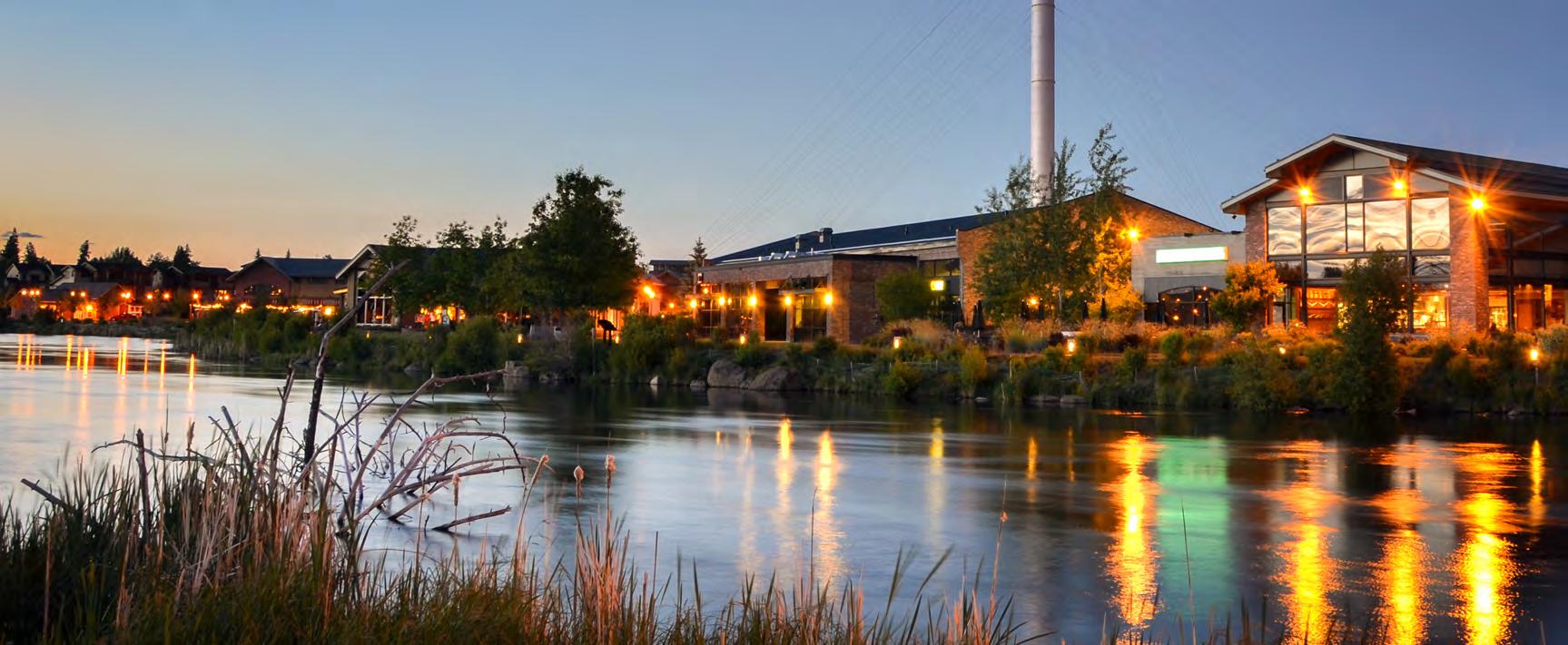
Once the site of two large ponderosa pine lumber mills, today the Old Mill reach is a mix of river parks, trails and the Shops at the Old Mill District (see inset). Trails exist on both sides of the river in addition to an extensive private trail system throughout the Old Mill District. Three footbridges connect trail legs on either side of the river, providing convenient walking loops. On the east side, the trails are paved from the Shops at the Old Mill District to the upper end of Farewell Bend Park at the Bill Healy Bridge. The trail on the west side offers a mix of paved and unpaved surfaces. Farewell Bend and Riverbend parks provide boat landings for paddlers using the Deschutes River water trail.
This reach has trail sections on both sides of the river, connected by a footbridge approximately 1.5 miles upstream of the Farewell Bend Park bridge. The river flows fast here through a beautiful canyon, cascading over rocks and logs.
WEST SIDE: The trail on the west side of the river passes through Mt. Bachelor Village. Bicycles are not allowed on this section of the river trail, but there is an alternative mountain bike route that connects the Bill Healy Bridge to the Haul Road Trail along Century Drive.
WATER TRAIL
FLOATING THE RIVER Floating is popular from Riverbend Park at Columbia Street (across from Farewell Bend Park) to Drake Park on Riverside Blvd. Be cautious. The current is stronger above the Colorado Street dam than it appears. Watch for the warning signs and exit the river on the left above the Colorado Str bridge. Floaters must leave the river and portage around the dam. The Ride-the-River shuttle operates between these two parks throughout the summer season. For a schedule visit the Cascades East Transit website at cascadeseasttransit.com or call 541-385-8680. For non-motorized boat launch sites, look for the “crossed oars” symbols on the map.
Look for this symbol along the Deschutes River Trail:
EAST SIDE: The east side trail at the northern end of this reach is unpaved, narrow and rocky in places. The trail continues to the South Canyon Footbridge and crosses to the west side to loop back to town. Users can choose to divert up to Brookswood Blvd. on a side trail that originates just upstream of the COID power plant and short timber bridge. At Brookswood, the trail follows the sidewalk through various neighborhoods before reaching Wildflower Park then ultimately River Rim Park.
The Deschutes River corridor provides for both land and water-based trail opportunities. The water trail allows paddlers to enjoy the river and connect to parks and other destinations along its bank. Access points and boat landings are available at several locations along the water trail. Be aware that the river difficulty changes dramatically from gentle moving water to Class 4 rapids above the Bill Healy Bridge. Floating the section above the Healy Bridge is recommended only for expert boaters. The Colorado Street, Bend Hydro and Tumalo Irrigation dams require mandatory portaging.
Bend The Ale Apothecary - Tasting Room 30 SW Century Drive Suite 140(541) 797-6265https://thealeapothecary.com
Bend The Cellar - A Porter Brewing Company 206 NW Oregon Ave Suite 2(541) 382-1645http://www.cascadelakes.com/
Bend Van Henion Brewing Company 63067 Plateau Dr https://vanhenionbrewing.com/ Bend Worthy Brewing 495 NE Bellevue Dr(541) 639-4776http://Worthybrewing.Com
Sunriver Pub
Sky 21690 Neff Rd 5 acres, fenced
unfenced areas
CENTRAL
Regional Population: 259,127
(2022 estimates from Portland State University)
Regional Labor Force: 123,953
(Seasonally adjusted total for 2021 from Oregon Employment Department)
Bend-Redmond MSA GDP Per Capita:
(2020 estimate from the Bureau of Economic Analysis)
*Bureau of Economic Analysis data is only available for the Bend-Redmond MSA
$54,390
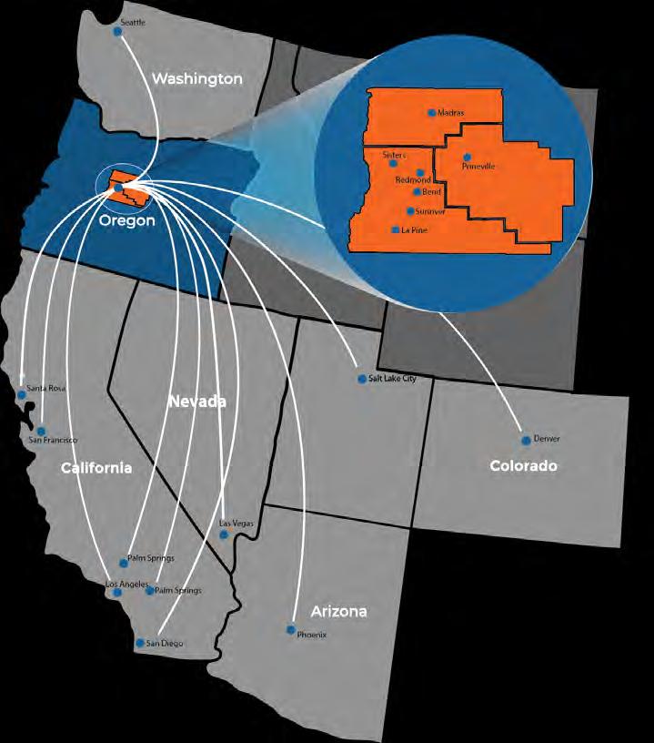
Access outside and within the region has never been easier, with five national carriers flying up to 54 segments daily to 12 airports and major freight routes to the I-5 and I-84 corridors, all the while maintaining average commute times of less than 24 minutes between workforce centers around the region.
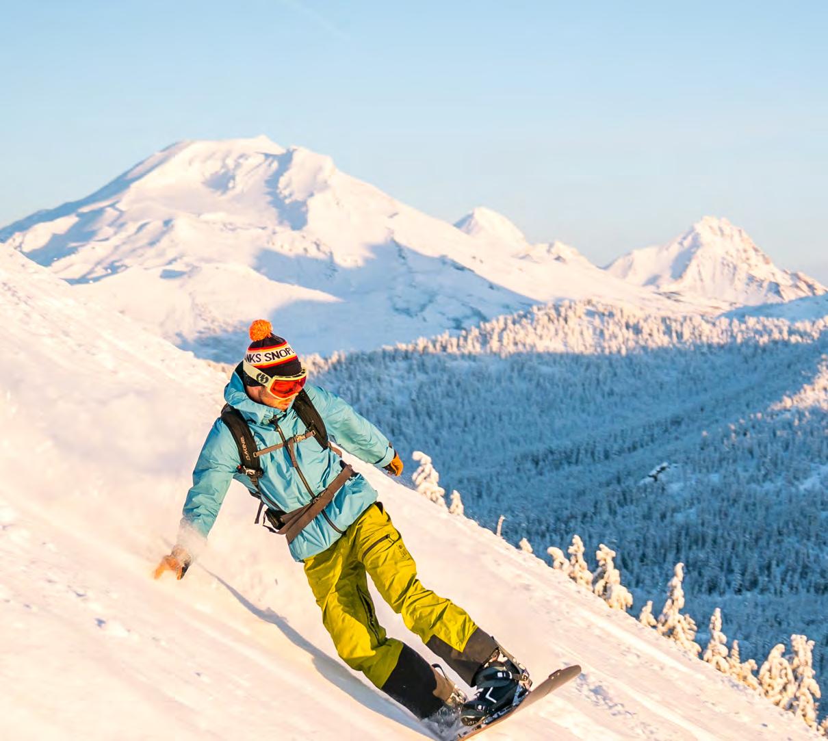
Located on the eastern slopes of the Cascade Range, where vast forests give way to the arid high desert, Central Oregon boasts year-round adventure, a rare mix of city amenities and world-famous outdoor recreation. The region offers the slower speed of a small town with access to toprated healthcare and infrastructure to support continued economic growth.
#1 TOP 10 COOLEST PLACES TO LIVE IN AMERICA -FORBES, 2021
#2 MOST FITNESS FRIENDLY PLACE IN THE U.S. -SMARTASSET, 2022
#10 BEST SMALL CITIES FOR BUSINESS
-U.S. CHAMBER OF COMMERCE, 2022
#8 BEST SKI TOWNS FOR ALPINE ADVENTURES IN THE U.S. -PACASO, 2023
#9 MOST DYNAMIC METROS
-HEARTLAND FORWARD REPORT, 2022
#5 BEST MOUNTAIN TOWN IN THE UNITED STATES -OUTSIDE, 2023
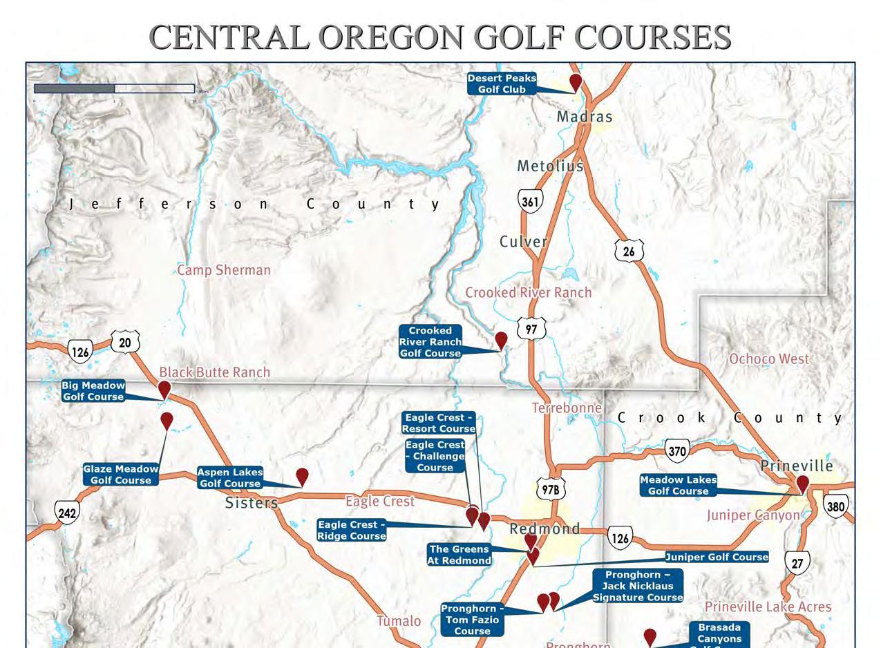
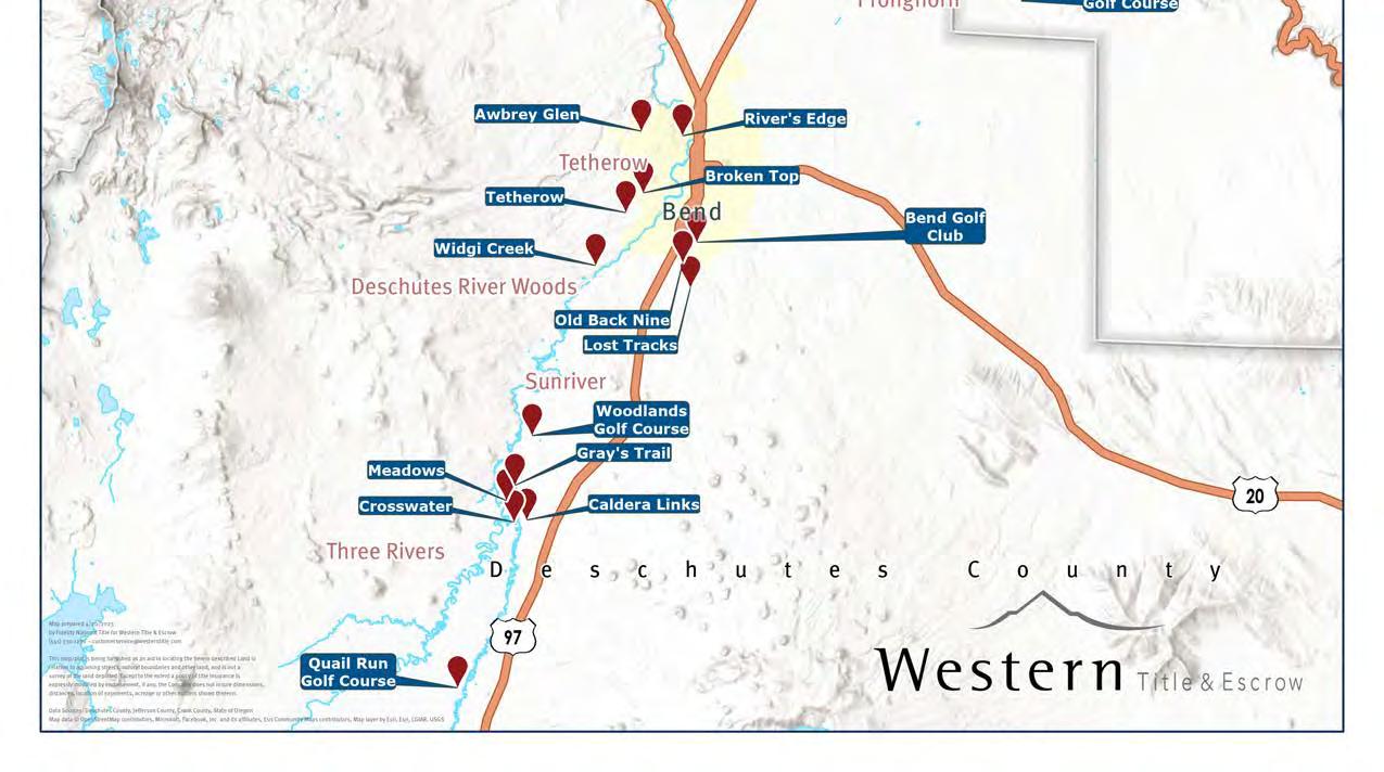
30+ Golf Courses
Flourishing Arts & Culture Scene Miles and Miles of Trails