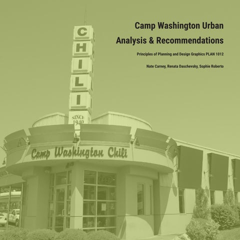
Principles of Planning and Design Graphics PLAN 1012
Camp Washington Urban Analysis & Recommendations
Nate Carney, Renata Daschevsky, Sophie Roberto
Table of Contents
Introduction
Page 3
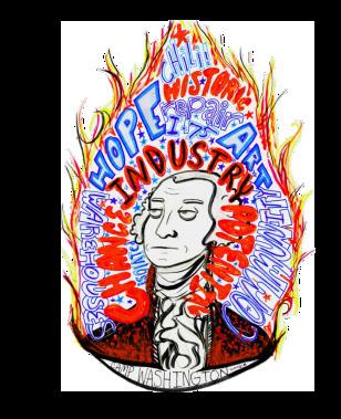
First Impressions
Key Takeaways
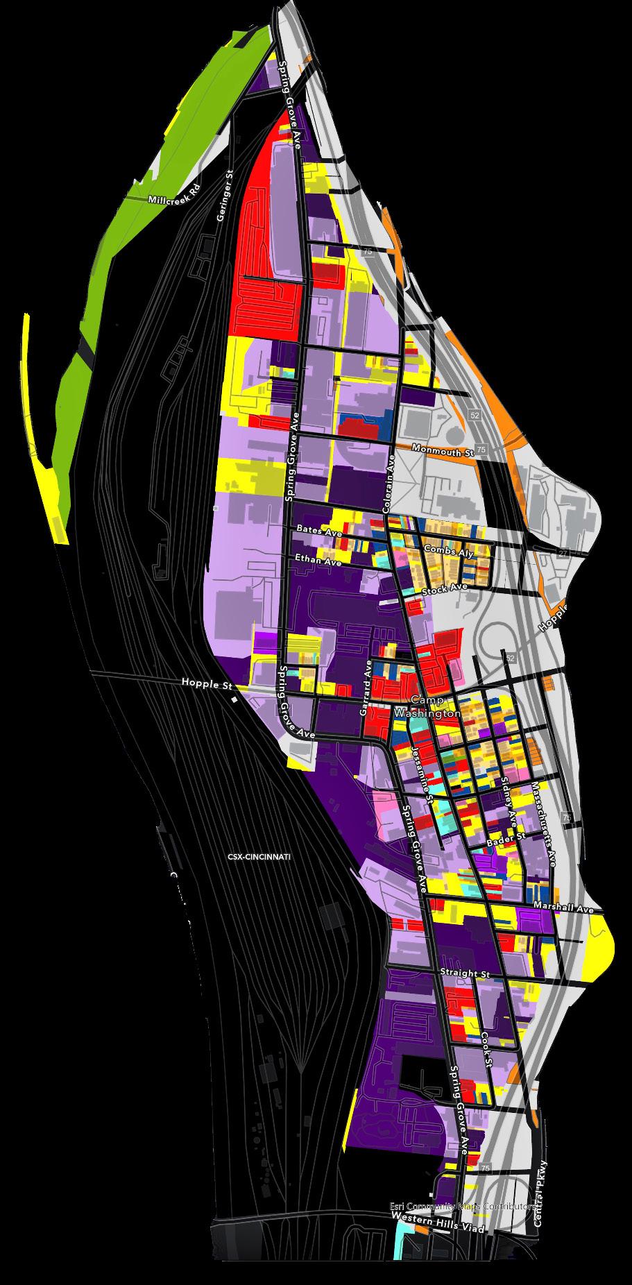
Impression Map
Thematic Map
Artistic Haven
History & Data
Key Takeaways
Data Maps
Inforgraphics
Page 4-5
Page 6
Page 7
Page 8
Page 9
Page 10-11
Page 12
Page 13
Page 14-15
History Timeline
Urban Design
Key Takeaways
Land Use
Social Institutions
CBD
Neighborhood Impact
Key Takeaways
Issue Connections
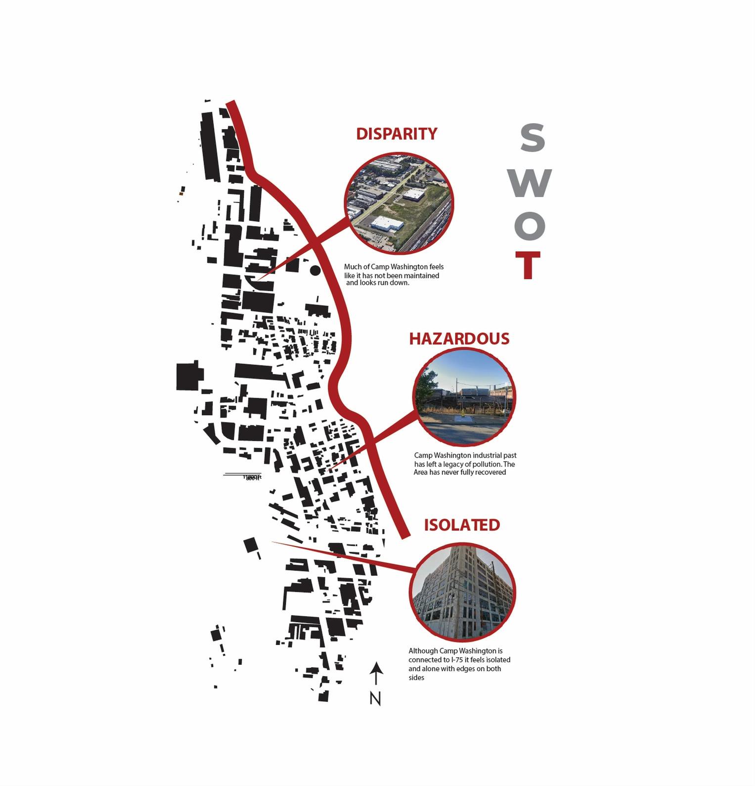
SWOT Maps
Page 16-17
Page 18-19
Page 20
Page 21
Page 22
Page 23
Page 24-25
Page 26
Page 27
Page 28
Issues
Sustainable Alley
Connections
Mom n 'Em
Centralizing the CBD
Hopple Renovation
Page 29-30
Page 31-24
Page 35
Page 36
Page 38
Page 39
2
Introduction
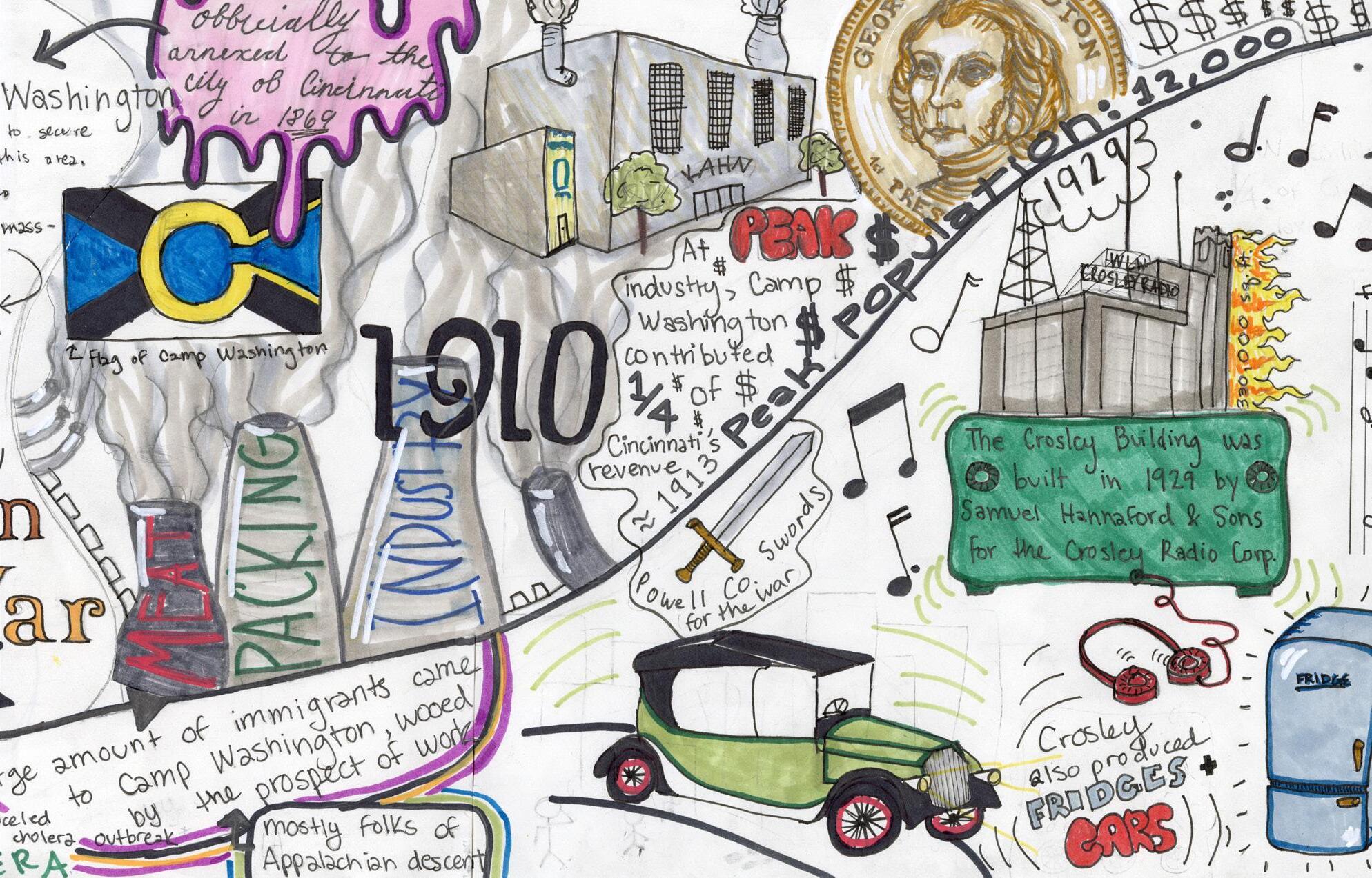
Camp Washington is a neighborhood in Cincinnati that has a heavy industrial past. Located near Mill creek in the Cincinnati basin, the neighborhood only has a population of 1,234 which is down from a peak of 10,901 in 1890. In 1890 the area boasted live work infrastructure, with local residents being employed in Meat packing and other industrial practices located in Camp Washington, returning to their homes closer to the hill that goes up to Clifton. This dynamic produced a healthy neighborhood before the rise of the automobile and sprawl.
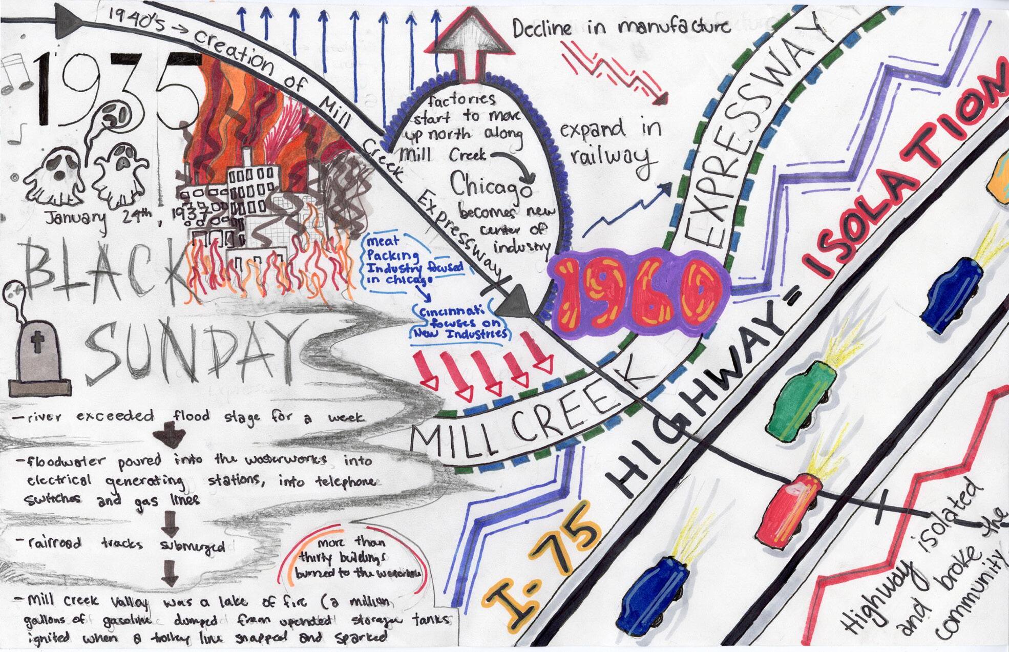
Sprawl destroyed Camp Washington, before the construction of I-75 the area was not dislocated from the rest of uptown. With the construction in the 1960’s, residential units were destroyed and many residents found 6 lanes between them and the rest of the immediate city. This story follows many areas in America that have been disconnected for the benefit of cars and suburban commuters.
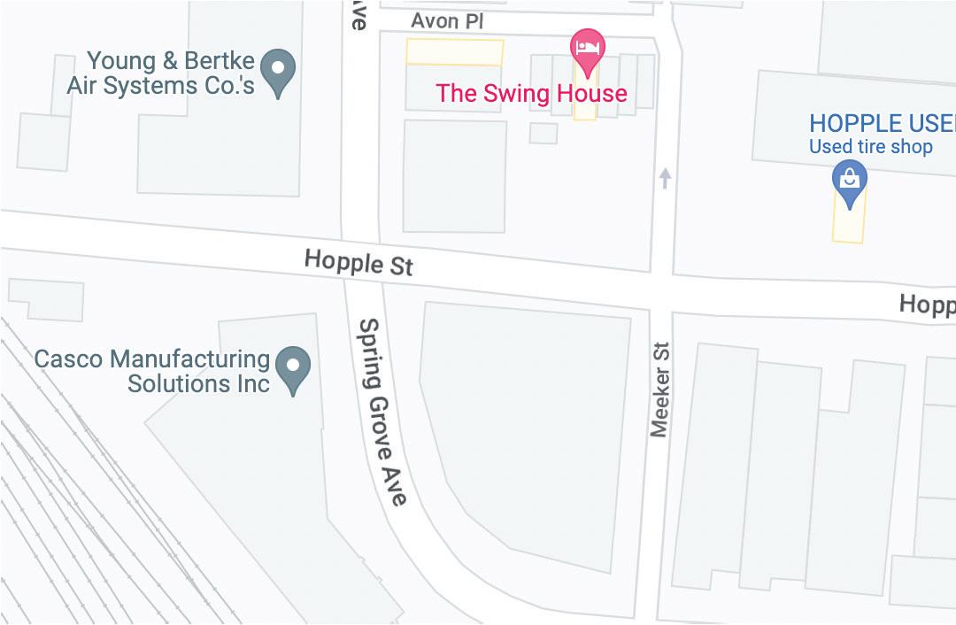
Still, Camp Washington maintains a healthy industrial base, with clients like KAO and Rhinegheist. The neighborhood also has deep historical architecture that has been attracting an artistic community. Places like Mom n ‘Em, the Swing House, the stair house, and multiple art galleries have opened in the area attracting a new younger demographic into an aging area. The question moving forward is how do we develop Camp Washington?
4
First Impressions
First Impressions
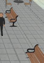
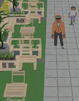
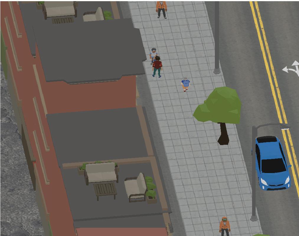
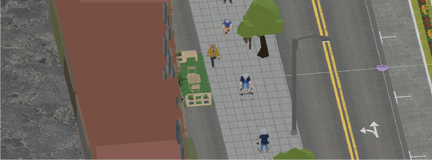
Camp Washington upon first impression does not offer much. The Crosley building is the tallest building in the skyline, and it’s abandoned exterior is ultimately an eyesore, although it could be a very cool building. The streets have vacant lots and abandoned buildings, mixed with vibrant businesses like Camp Washington Chili and mom n em. There is a noticeable lack of green infrastructure, with some streets being tree lined, but lacking use able and relaxing space. There is also no feeling of a central business district due to sporadic location of operating businesses.
5
Key Takeaways
Lacking Green - there is minimal park space and the biggest park in the area is bordered by a drug correctional institute. Most of the neighborhood is paved over as well.
1 2 3 4 5
The Railyard - limits access to the mill creek, creates a hard edge, adds a hazardous feel to the area.
Lacking Centrality - there is no CBD that someone who lives in Camp Washington could go to get all their basic needs.
Industrial - many operating and abandoned factory and warehouse space exists along the border with the railyard.
Architecture - historical architecture is in Camp Washington offers an opportunity to become a bohemian neighborhood.
6
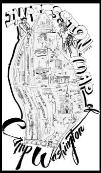
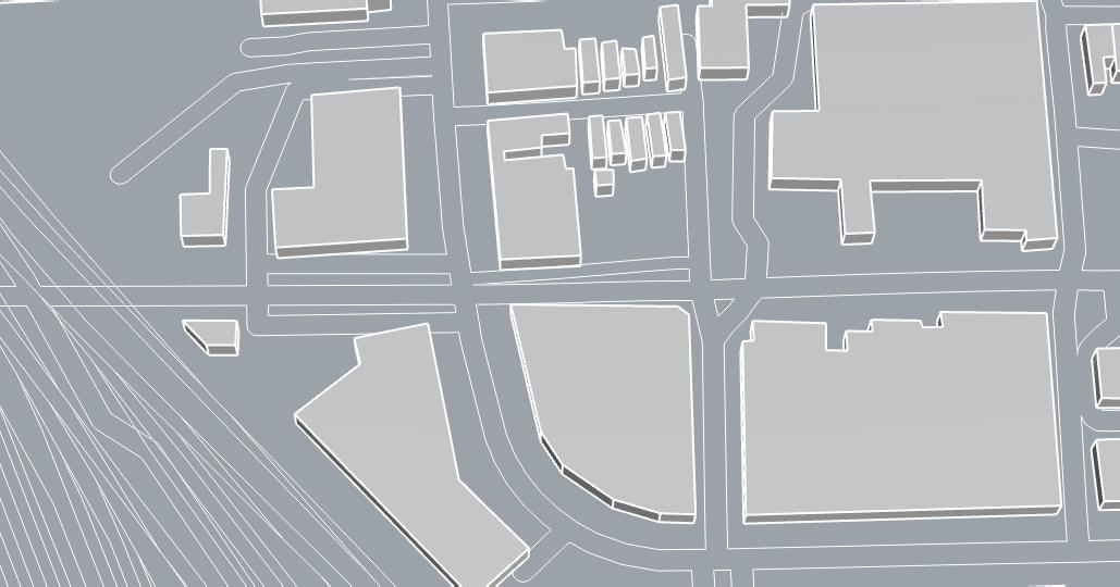
Impression Map
What makes Camp Washington, Camp Washington? Featuring the railyard, Western Hills Viaduct, Camp Washington Chili, George Washington Mural, I-75, and the Hopple Colerain intersection, this impression map highlights the core aspects of the neighborhood.
7
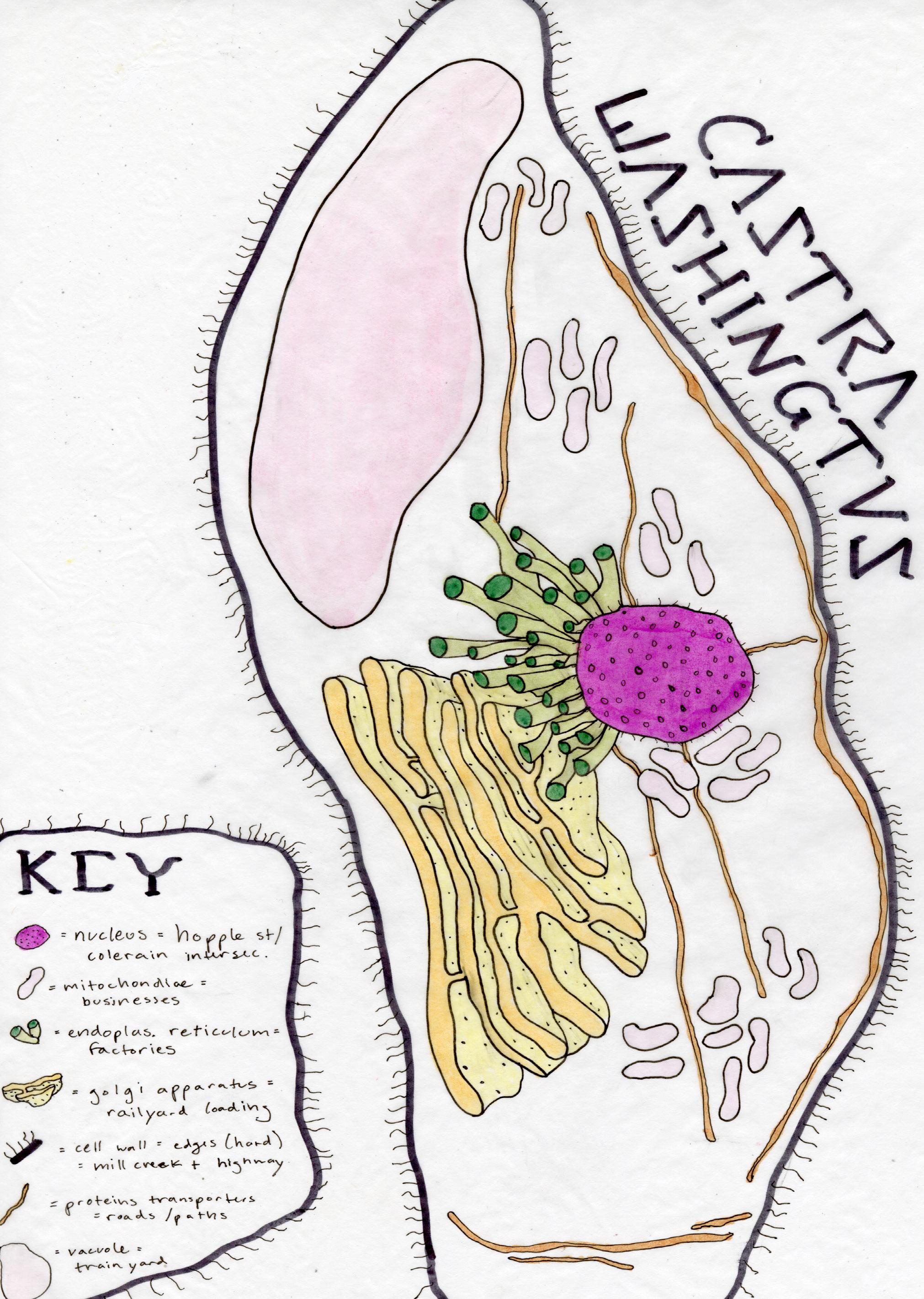
Thematic Map
Camp Washington can be considered a cell, every organelle working together to create a functioning neighborhood.
8
Artistic Haven
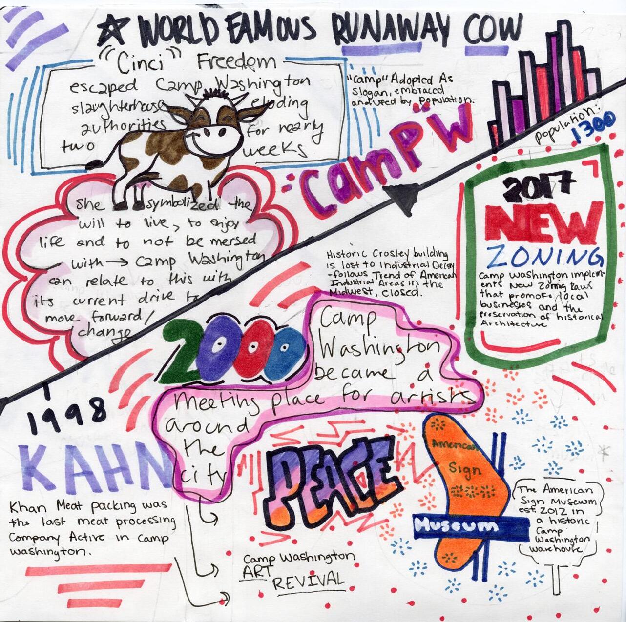
Camp Washington now is slowly rebranding to an artistic community. Following the lead of Cincinnati as a whole. The area also hosts the American sign museum which has recently moved into Camp Washington. The congregation of these artistic institutions has a snowball effect, attracting more artists, more murals and more galleries.
When considering the rise of artistic communities, there has to be intervention to stop the market from naturally gentrifying and displacing the local community. Things that can be done to prevent this include requiring a quota of affordable housing with new development. Stopping landlord renting corporations from entering a market can also be beneficial in preventing the average rates in an area from going up.
To attract more artists the area would need to be fixed up. The abandoned and vacant buildings add a negative perception to the neighborhood and the removal of live work in the same area has left many people who live in Camp Washington finding their employment out of town. Camp Washington has the opportunity to be a truly diverse area, with different races, incomes, genders, ages and sexualities coming together. A potential way to create this is to use the unique zoning in Camp Washington to create mixed use artistry and living.
10
History and Data Analysis
Camp Washington is a neighborhood that peaked during the Industrial age, leading it to become an overly-paved and non-walkable neighborhood. The demographic makeup originally consisted of Appalachian roots, Camp Washington also has unique employment patterns, green space makeup, and population density.
11
Historically industry was the main employer in Camp Washington leaving a legacy of pollution .
Proximity to the mill creek and downtown has always been important.
Key Takeaways 1 2 3 4 5
Residents are mostly white.
Weak tree canopy compared to other Cincinnati neighborhoods, increases risks and hazards.
The construction of I-75 has led to a decrease in population.
12
Population Density Tree Canopy Commute

Camp Washington ranks 49th of Cincinnati’s neighborhoods for tree canopy. A staggeringly low less than 5% of Camp Washington is covered in trees. This adds to negative mental and physical health and adds to a decreased life span and higher levels of pollution.

Most residents of Camp Washington live north of Hopple Street. With less residency South of Hopple, that area is prone to more crime and violence.
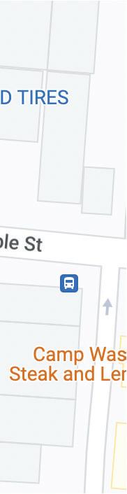
Many of the businesses lie off of the highway. Industrial factories to the west are the main employers in the area. Most residents take the bus to get to work. This map highlights the 3 major bus stops in Camp Washington.
13
Legend Legend 8 households train track road train track road Legend train track road trees factories bus stop
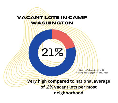
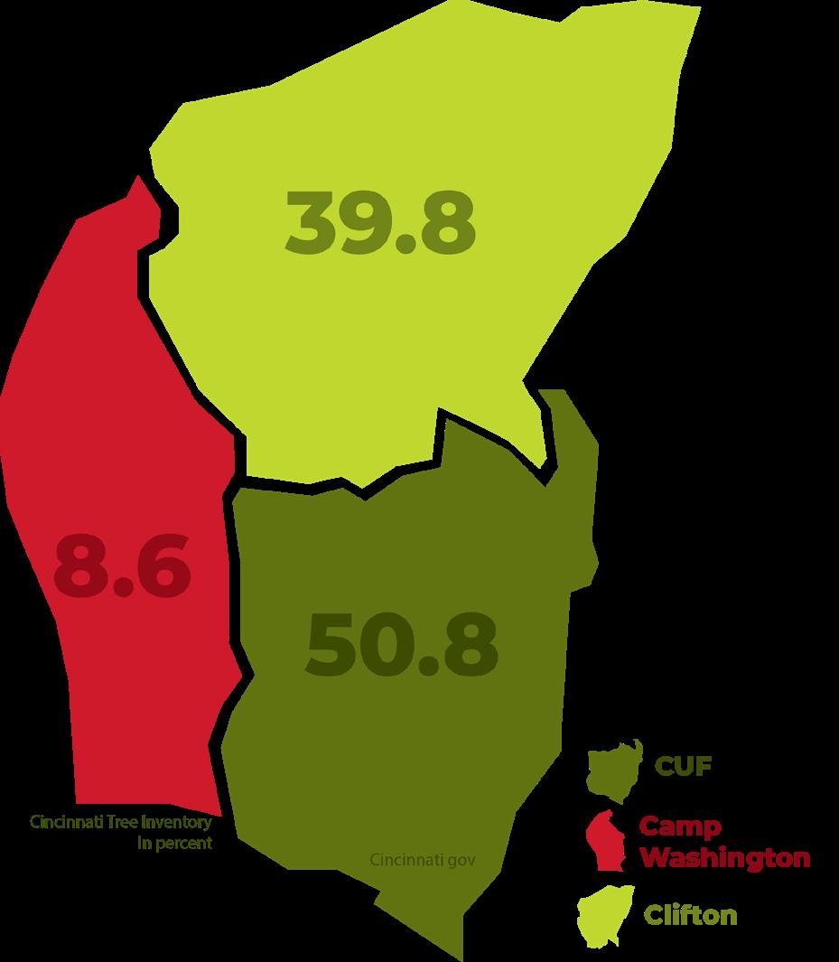
Employment Tree Canopy Vacancy
Most of Camp Washington is employed in industry and manufacturing
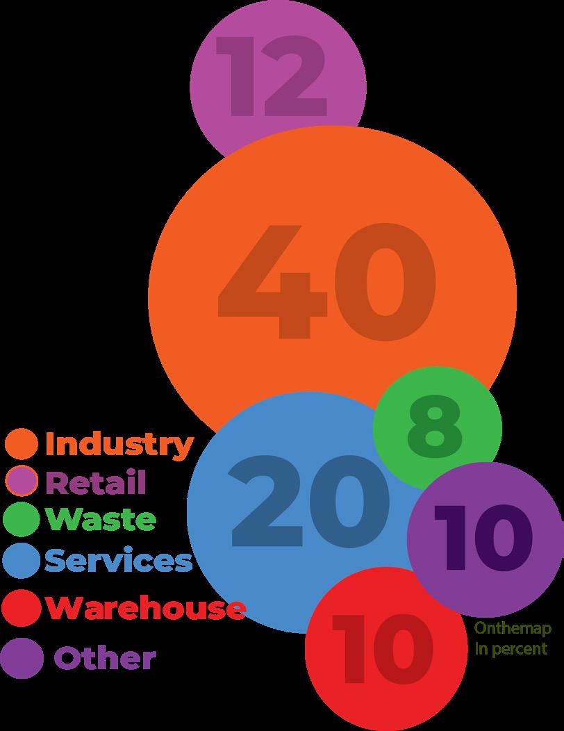
The tree canopy compared to other neighborhoods in uptown is much lower
Camp Washington has higher vacancy levels than the rest of Cincinnati.
14
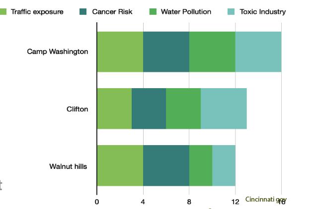
Hazards Education Population
Camp washington compared to other neighborhoods ranks higher on all pollutants than surrounding uptown neighborhoods.
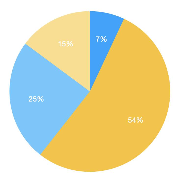
54% of residents have some high school education, 25% have some college education, 15% have a college degree, and 7% have no high school degree.
The total population is 3612, with 43% male and 57% female. The racial makeup of Camp Washington is 68% white, 25% black, 3% Latin, and 1% other.
15
History Timeline

16
17
18
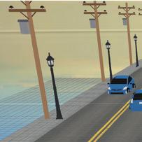
Urban Design Analysis
Camp Washington has a functioning network of streets, but a lot of room for improvement. By changing the amount of lanes on certain streets and rebuilding a central business district, the neighborhood has the opportunity to
19
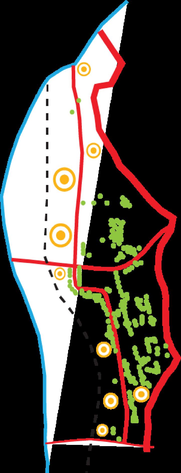
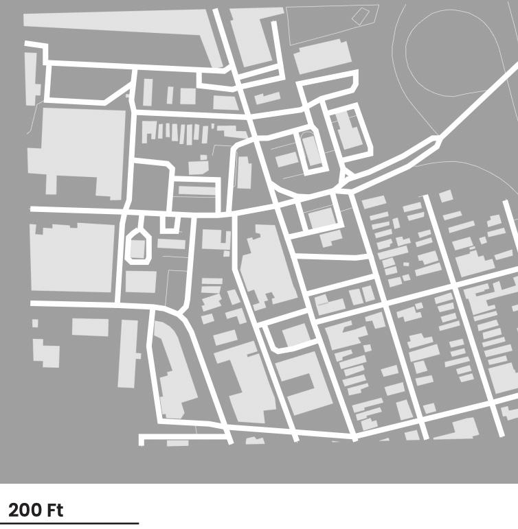
A large portion of Camp Washington is taken up by the railyard.
Most of Camp Washington is a 15 minute walk from the center of the neighborhood.
Key Takeaways 1 2 3 4 5
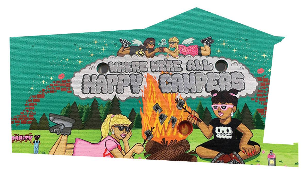
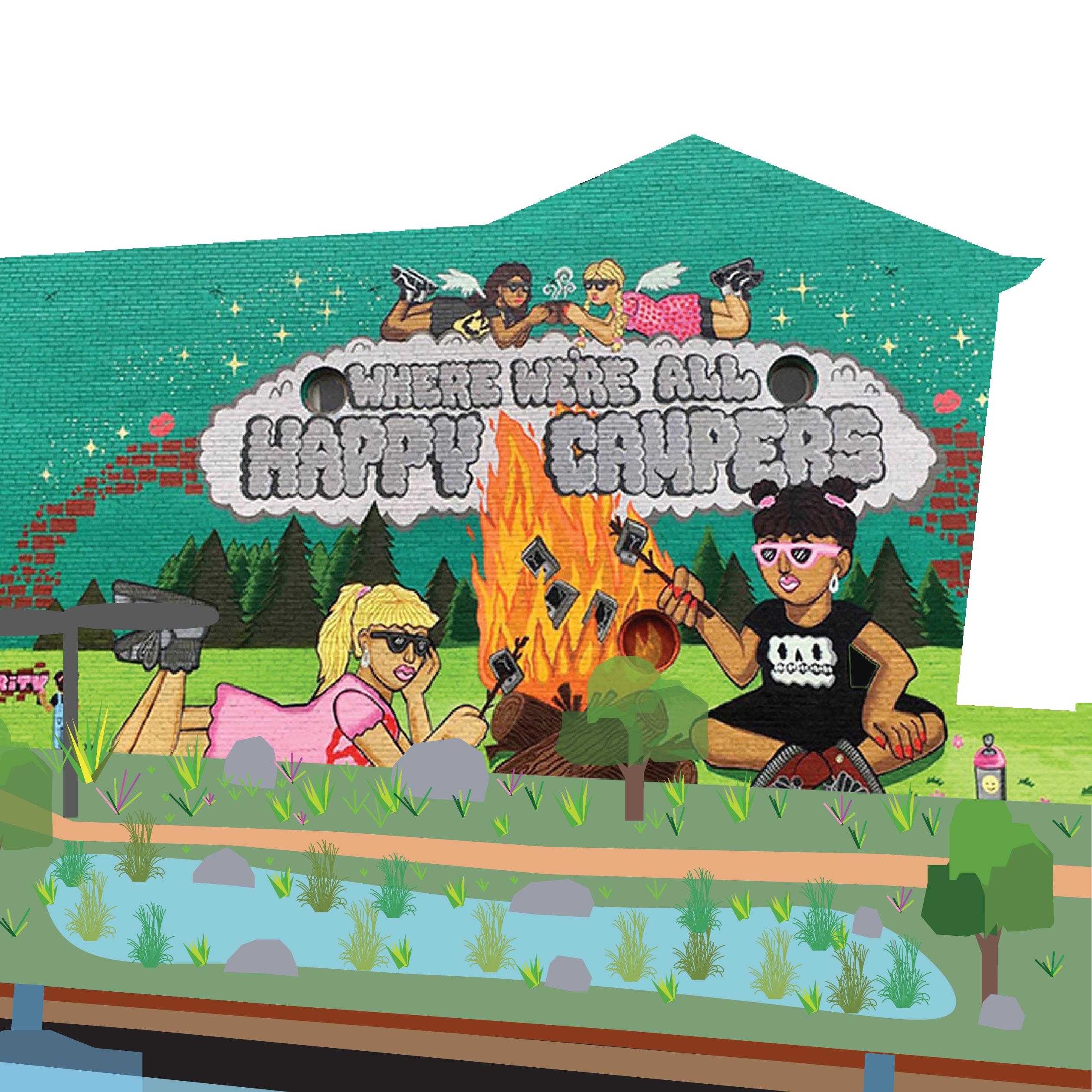
Mom n ‘Em is a major business that attracts people from other neighborhoods.
Camp Washington is already pretty walkable because of the shape, however it is not an enjoyable experience.
Many people leave the neighborhood for resources such as doctors appointments and groceries.
20
21
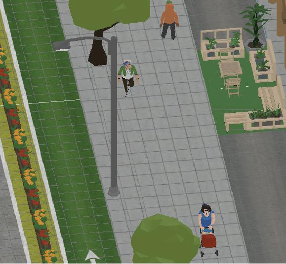
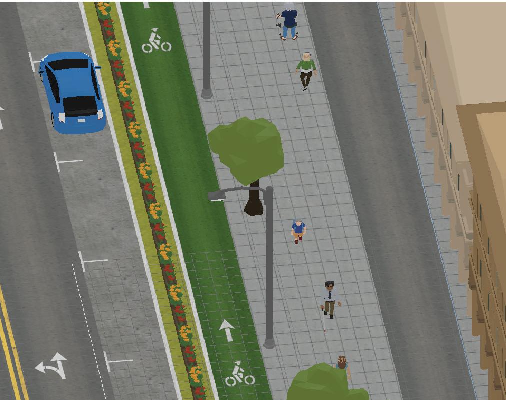
Land
Base map Legend Building Street Legend Legend Pedshed Small Xing Larg Xing
Linkages
Use
Social Institutions
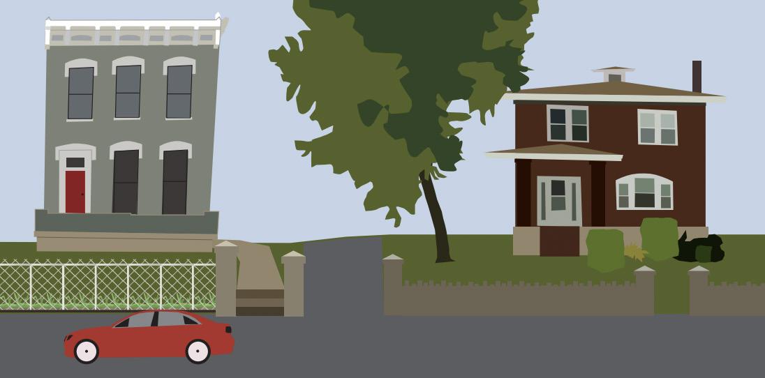
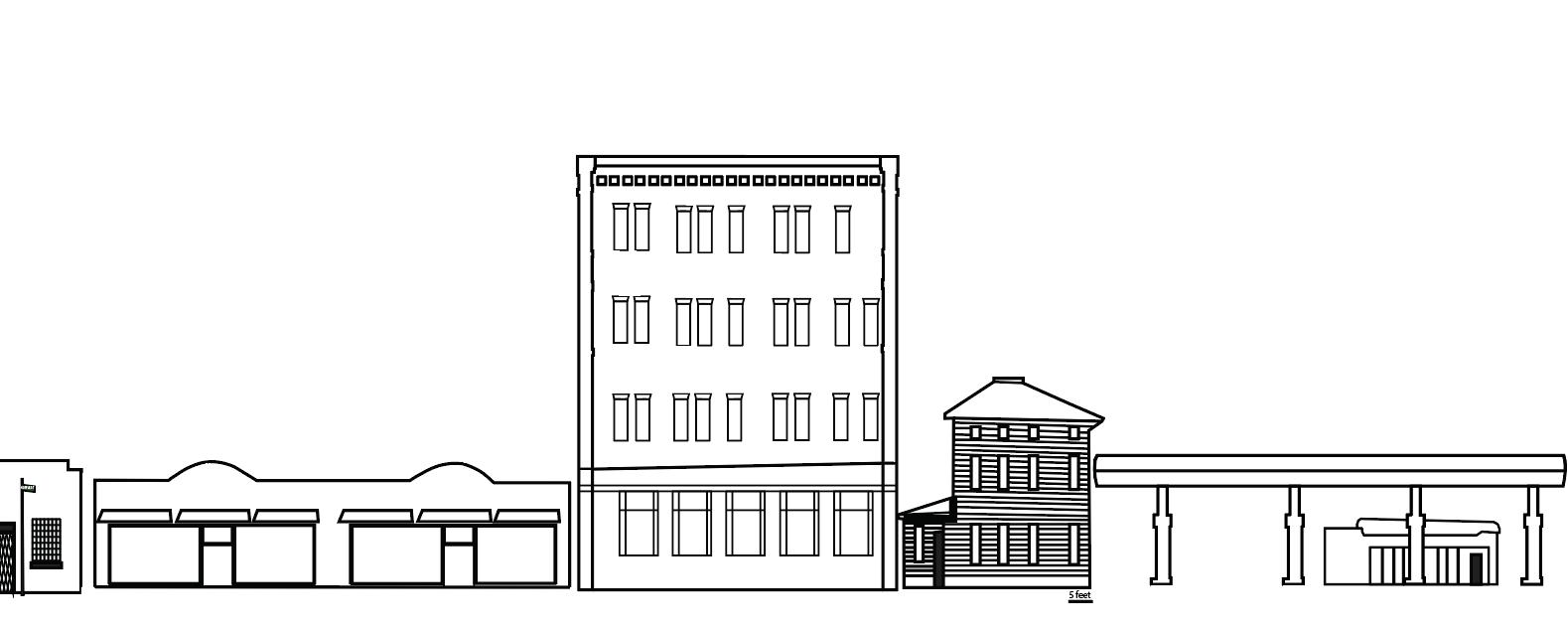
Building Footprints
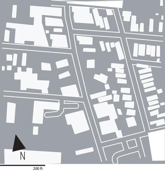
Shown are Mom n Em, and a single family house neighboring it. The coffee shop was built as a single family residential house, then renovated and converted into a restaurant. The two buildings sit on a gradual hill. The Italianate on the left and the American Four Square on the right are just two examples of the historic architecture in Camp Washington.
22
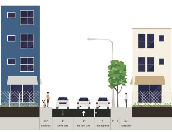
Cross-section
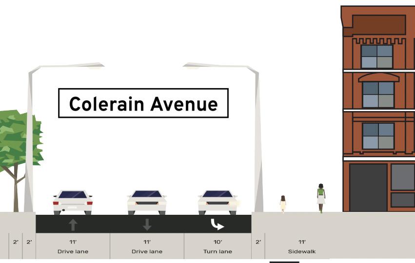
Colerain Avenue
Ethan Avenue
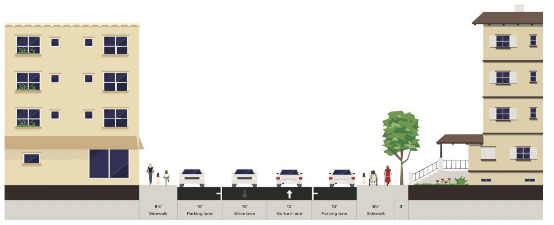
Central Business District
Camp Washington near the Hopple road interchange is relatively narrow, while still serving as a transport hub The area is the center of the neighborhood, but is overwhelmingly paved and lacks depth.
23
Building Footprints
Cross-section
Hopple Street
Colerain Avenue
24
Neighborhood Impact
The neighborhood impact of Camp Washington is defined by its past. The systems of manufacturing, and their abandonment left Camp Washington abandoned too. Vacant buildings, lack of greenery, unmaintained infrastructure and a shrinking population all define Camp Washington right now.
25
Neglected infrastructure has been unmaintained with potholed filled residential streets and cracked uneven sidewalks.
Opportunity filled these vacant lots and buildings are opportunity for new development and new life in the area
Key Takeaways 1 2 3 4 5
Camp Washington is overly paved, increasing physical and mental health risks and adding to the levels of pollu-
Locally decentralized, lacking a pedestrian, service and business oriented core.
I-75 disconnects the neighborhood from the rest of the city.
26
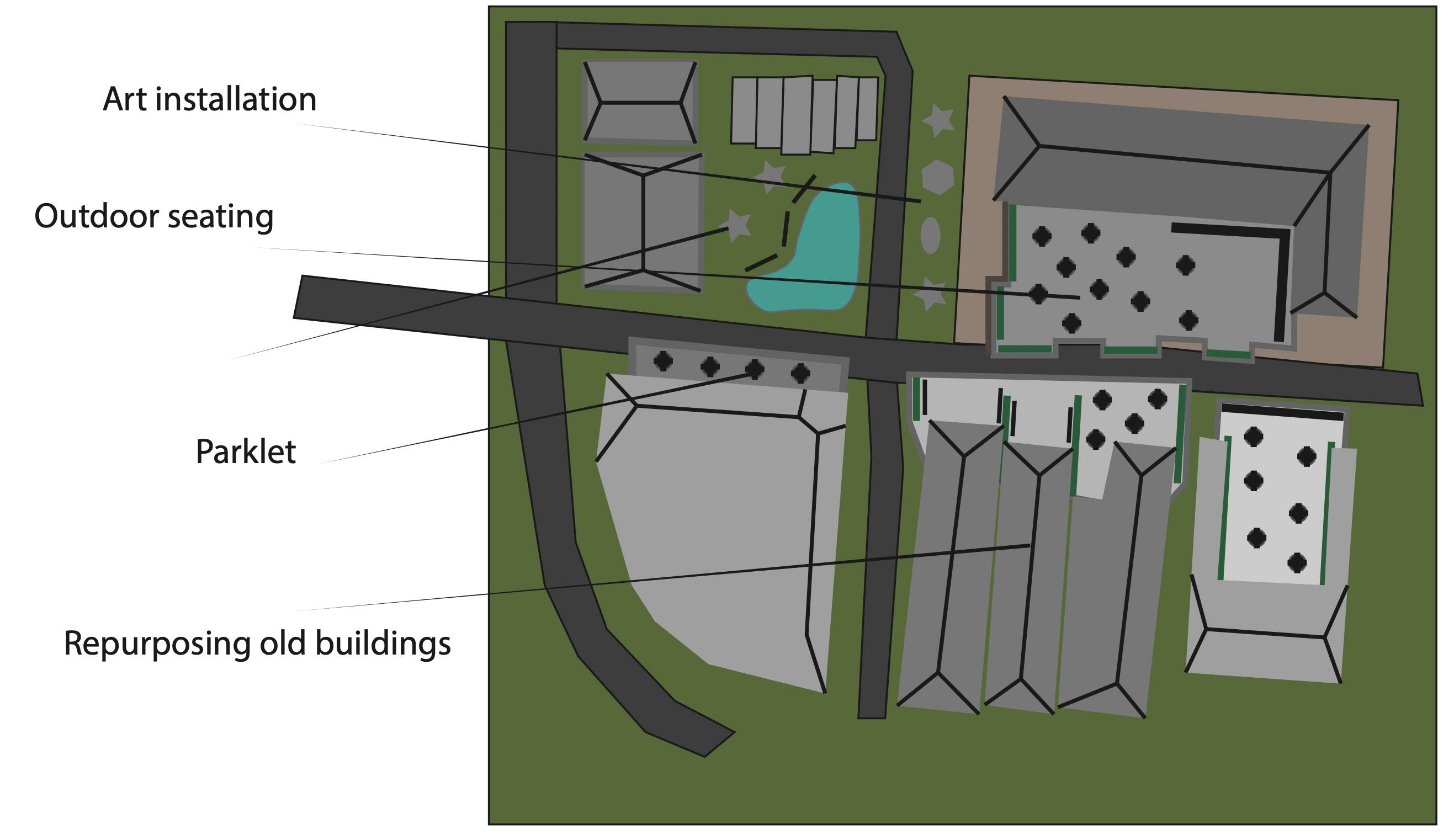
SOLUTIONS: HOW DO THEY CONNECT?
How do the Issues Overlap?
Reconnect to the city
• bring in more resources such as doctors, groceries, dentist
Recirculate tra c
• build new I-75 exit on Marshall Ave
• take two lanes o Hopple St
• raised crosswalks to slow tra c, increase pedestrianization
Centralize the CBD
• parklets
• pedestrianize part of the Hopple bridge
• invest in restaurants and shops along Hopple towards the bridge
• add resources/15 minute neighborhood
• pedestrianize part of Hopple bridge
Eliminate hazards
• raised crosswalks to slow tra c
• protected bike paths
• rainwater ltration systems
• green infrastructure
Provide more greenery
• parklets
• green alleys/infrastructure
• add more parks
27
Historic
Most of Camp Washington was built before 1950. This has preserved a historic character that many of the local residents value.
Artistic
Camp Washington has become an artistic location within Cincinnati. An increase of galleries, art studios and art themed cafes, restaurants and the American Sign Museum have been opening up. Swing house, stair house, and Mom n Em are other examples of new artistic oriented development.
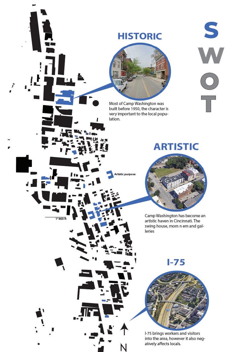
I-75
I-75 which cuts through Camp Washington, also brings people e into the neighborhood and allow commuters to easily get to and from work. It also provides easier access to amenities that are lacking in Camp Washington like grocery needs.
28
Blighted
Large abandoned buildings are scattered throughout Camp Washington, this adds a negative perception to what could be very interesting architecture. It also creates a feeling of neglect in the area.
Vacant
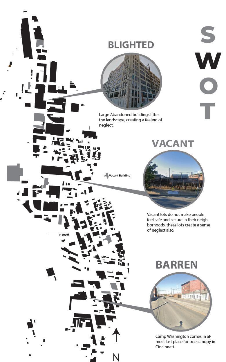
Vacant lots are also scattered throughout the landscape of Camp Washington. These lots creates holes in the fabric of the neighborhood and add to a feeling of neglect.
Barren
Camp Washington lacks tree canopy, ranking very low among the neighborhoods in Cincinnati for tree canopies.
29
Vacant
Although the vacant lots are considered a weakness they are also an opportunity for Camp Washington to redesign itself and mix historic with modern, create parks, or encourage housing.
Central
Camp Washington is centralized, being located in the basin of the city it has easy access to downtown, I-75, UC, Cincinnati State, and the innovation district.
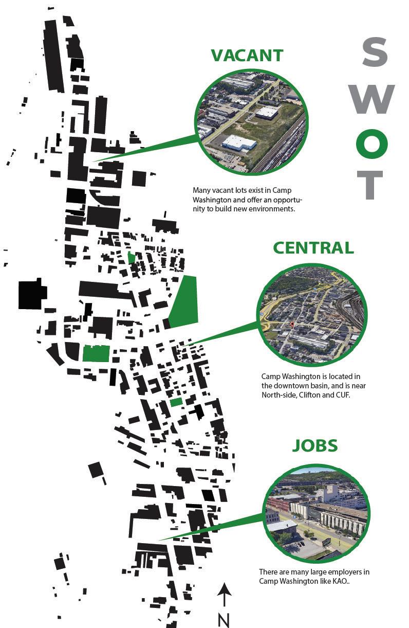
Jobs
There are a couple large industrial employers in Camp Washington, like KAO and Rhinegheist. Many people who work in the neighborhood do not live in the neighborhood which could be attributed to the I-75 access.
30
Defining the Issues
Traffic Circulation Disconnect
The Hopple St. exit off of I-75 creates a significant amount of traffic in Camp Washington. The cars inefficiently flow right to the intersection of Hopple and Colerain, creating unsafe pedestrian crossings and excessive speeding.
With a major highway on the right and a major rail yard on the left, Camp Washington becomes an urban island disconnected from the rest of Cincinnati. This disconnect makes it hard for CW to receive the resources in needs.
32
Lack of Green
With only one public park, Camp Washington is not a haven of green space. Because of this, less people see themselves living and raising a family in the neighborhood.
Lack of CBD Hazards
Camp Washington’s major businesses are unevenly spread throughout the neighborhood, creating a feeling of no central business district, affecting the identity of the neighborhood.
Camp Washington was once a heavily industrial neighborhood, and the lasting effects have created environmental hazards such as poor air quality and potential rail yard malfunctions.
33
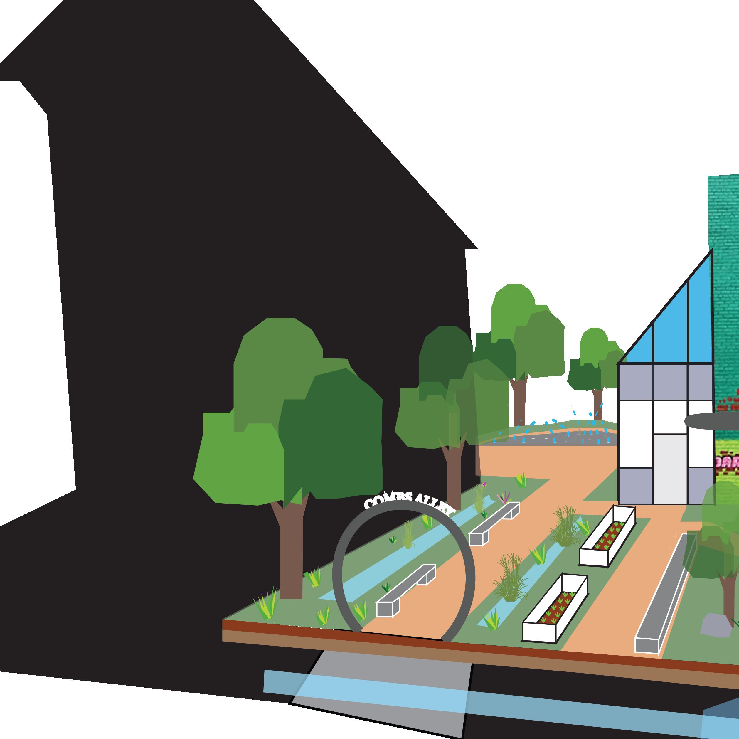
Greenhouse Cafe
The Sustainablle alley park would involve a renovation of the current Combs Alley, and also implementation of water filtration infastructure to create walkable areas that are also sustainable.
New Greenhouse cafe expansion off of mom n em to attract more business and give more life to the alley.
Vegetable Planters
Permeable
34 44ft
Rain Garden
Mom n em’
Greenhouse seating
Patio Seating
Planted Bioswale
Continues to Bates Alley
Combs Alley Continues
Water to Mill Creek
Urban Meadow
Water Play area
Pavement
New Alley connection
Stacked Render
Built Environment


Pathways
Surface features

Water Path

35 100ft
Centralizing the CBD


Hopple Bridge
Hopple Street
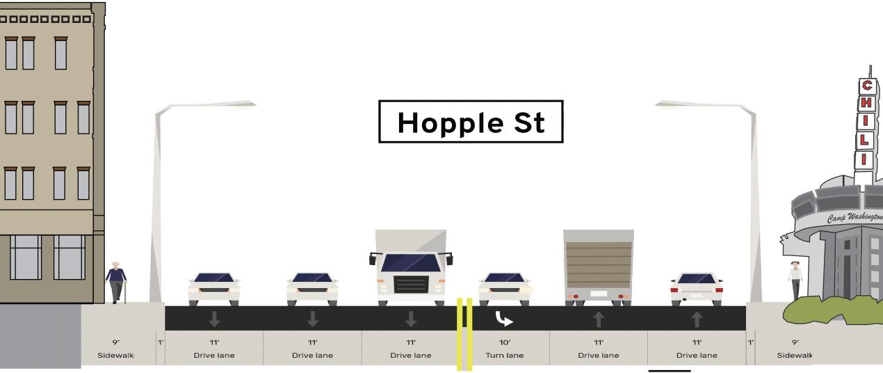
Two lanes will be taken out of Hopple to introduce parklets to the area. These will encourage visitors to sit and stay for a while, enjoying the central business district. A bike lane will also be introduced, as well as widening the sidewalks
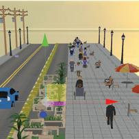
Hopple Bridge
Pedestrianizing part of the Hopple bridge would lead people into the CBD that sits right off of the end of the bridge. This also helps connect the neighborhood with the rest of the city.
Hopple Street
38
to two lanes Add bairers between road and parklets
pedestrian pathway Add bike lane
lets outside of the business Multi-use buildings with residence on the top and businesses on the bottom
Reduce
Widen
Park
Hopple Street
Hopple Revitalization
Hopple CBD Overlay
This area has the potential to become a hip artistic hangout, helping to identify more of a identity for the neighborhood. Two lanes will be taken out of Hopple to introduce parklets to the area. These will encourage visitors to sit and stay for a while, enjoying the central business district.
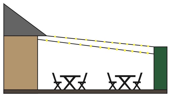
Outdoor seating
When the weather is warm and dry, seating will be open and uncovered. String lights will brighten the space and create ambiance. A tall green barrier creates
Proposed parklet
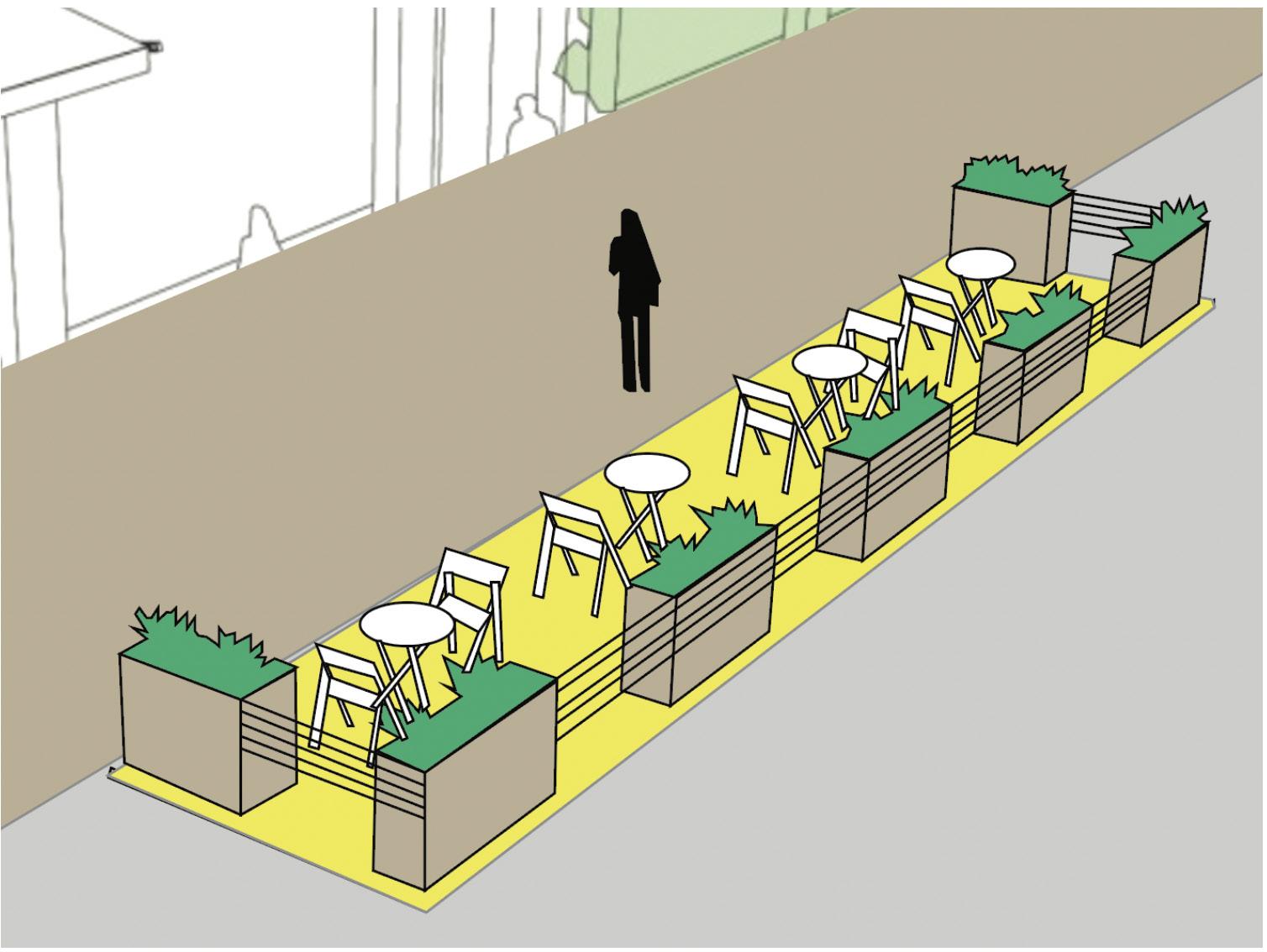
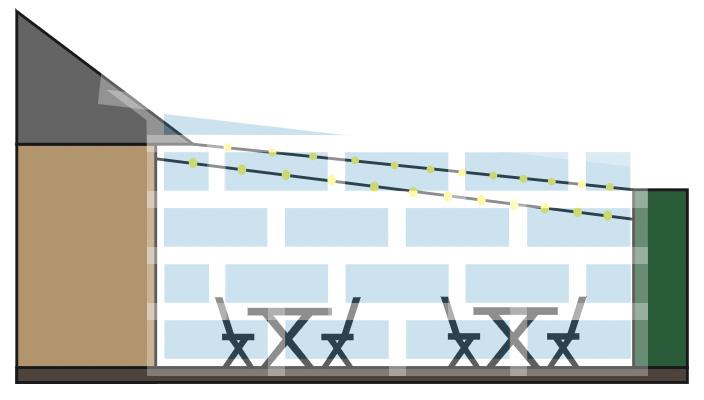
Outdoor seating will still be an option for dining in the cold and rain. A collapsible greenhouse structure provides warmth and shelter from the rain. The same
39