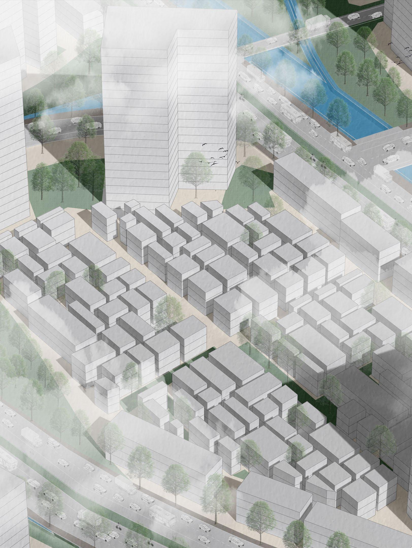
Bangkok, Thailand is below the median amount of open space compared to other large metropolitan areas. In the densely populated neighborhood, Khlong Toei, all interactions with nature are beneficial, but also superficial. Residents are not surrounded by nature but have individual moments with plants in their urban environment.
The Biophilic City satisfies humans innate need to be connected with the outdoors but in a dense, urban environment. The goal of this biophilic design is to create a good habitat for residents to live comfortably in their homes and community.
Locals will have repeated and sustained engagement with the large swaths of nature throughout the neighborhood, which is unique in the Bangkok metropolitan area and will attract other residents and tourists to Khlong Toei.
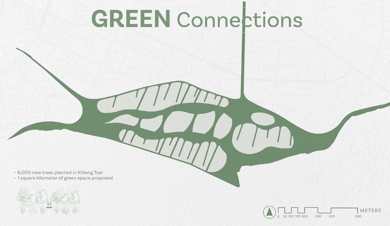
+ GREEN CONNECTIONS
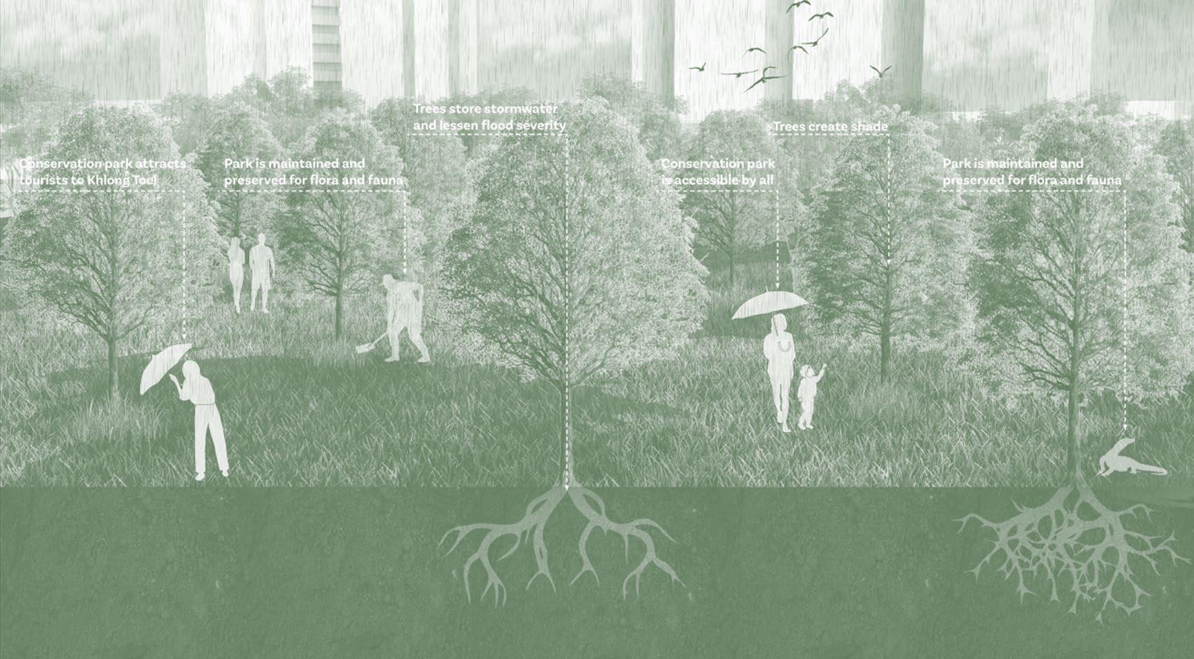
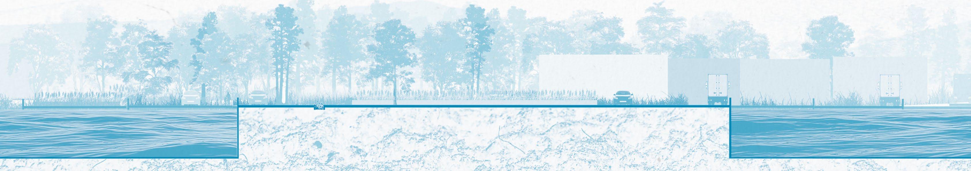
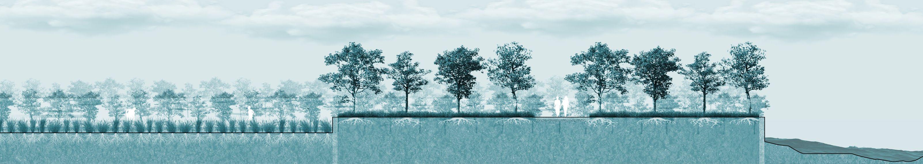
Green connections allow for cooler temperatures during the hotter months, retain water during the rainy months, and for wind to enter into the housing communities. The new green system will foster positive and sustained interactions among people in their environment and the same sense of a strong community that is already present will grow even stronger.
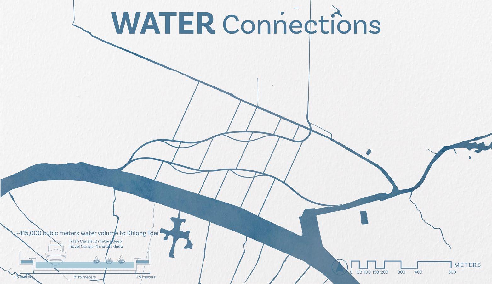
+ WATER CONNECTIONS
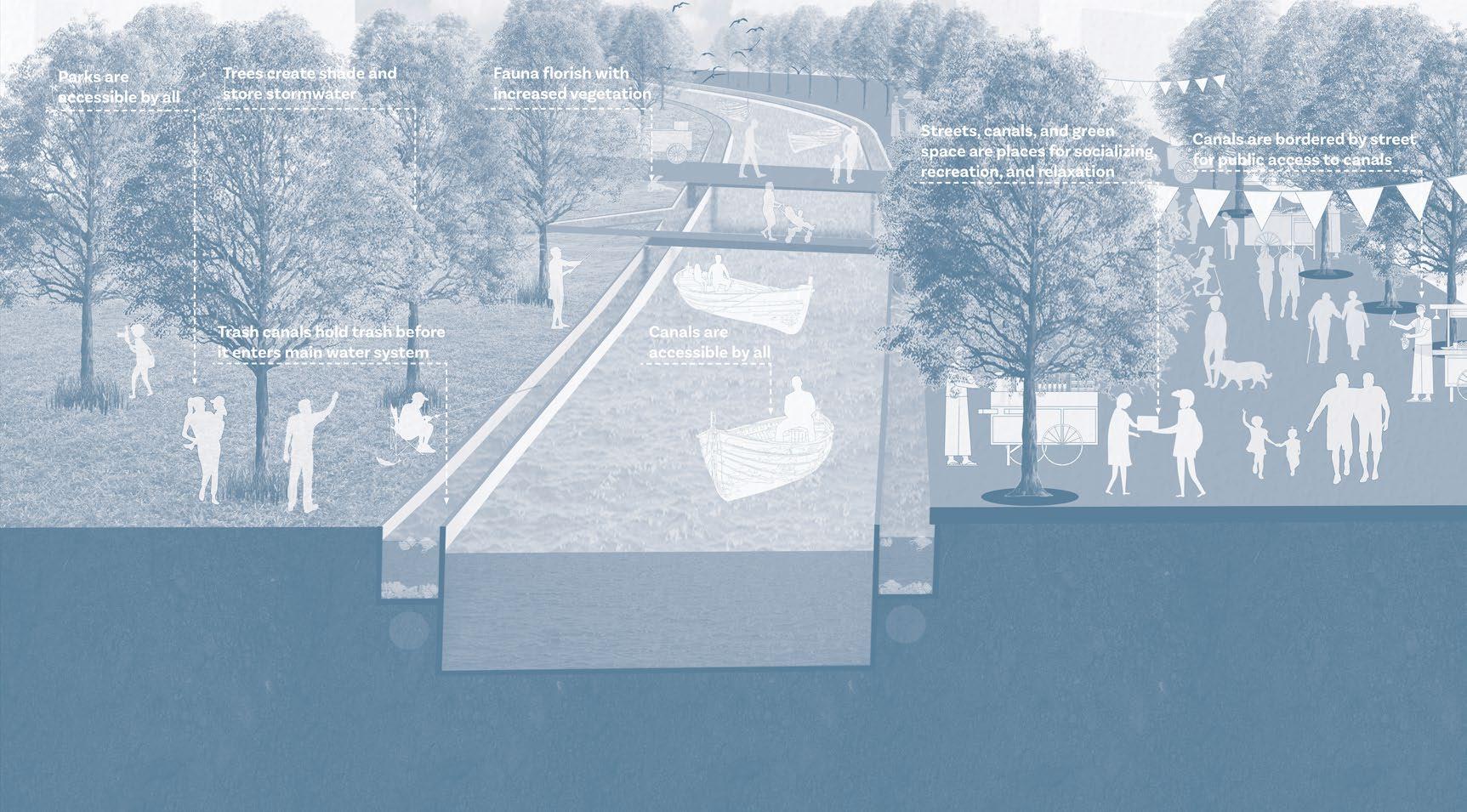
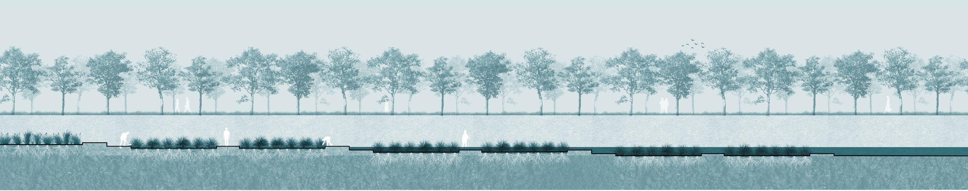
The canals act as a bathtub to hold water during the rainy season. Between the green space and canals, stormwater will have somewhere to go and the streets of Bangkok will be less likely to flood.
+ PUBLIC SPACES
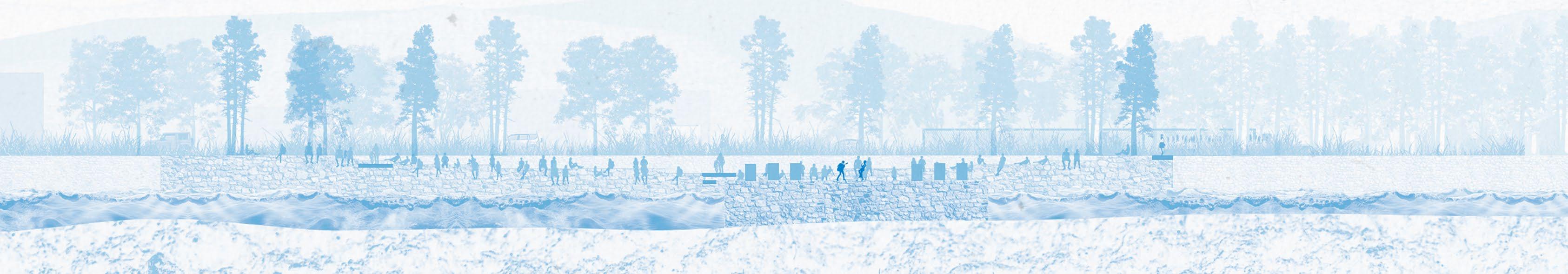
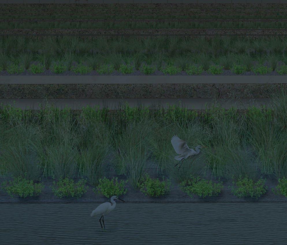
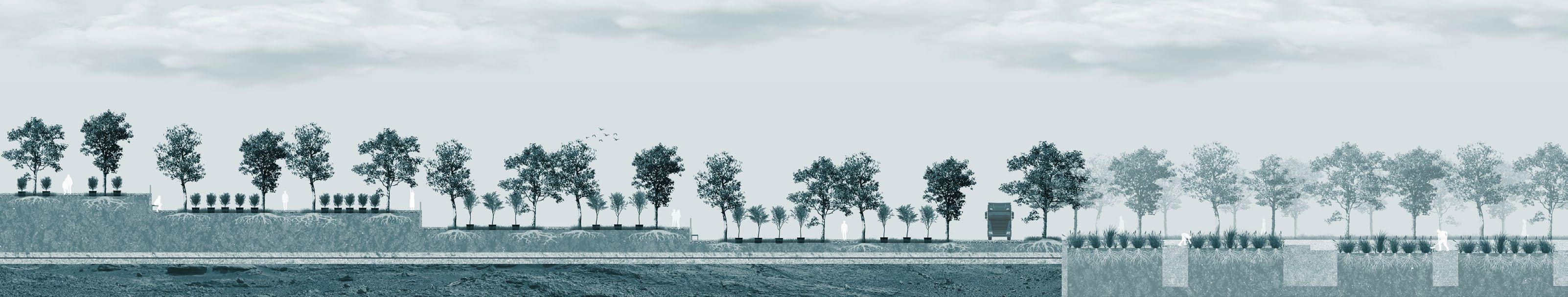
Green spaces, canals, and streets are the main public sphere where people can socialize, buy or sell goods, or relax. Additionally, the Biophilic City uses intersections between the green spaces, streets and canals as main programmatic spaces, as they can be accessible easily by car, boat, bike, or foot. This green network, streets, and canals are open and accessible by all in Khlong Toei. The canals are bordered on each side by green space or a street to force a no-building policy to keep the canals public to all residents.
+ COMMON GROUND
The Biophilic City highlights the natural environment and equity in Khlong Toei by emphasizing the shared green spaces, canals, and streets. This common ground includes numerous public spaces, vegetation, and accessibility to everyone in the community while also improving the overall mental and physical health of all residents.
AutoCAD, Adobe Illustrator, Adobe Photoshop
Rhino 7, Adobe Illustrator, Adobe Photoshop
Rhino 7, Adobe Illustrator, Adobe Photoshop
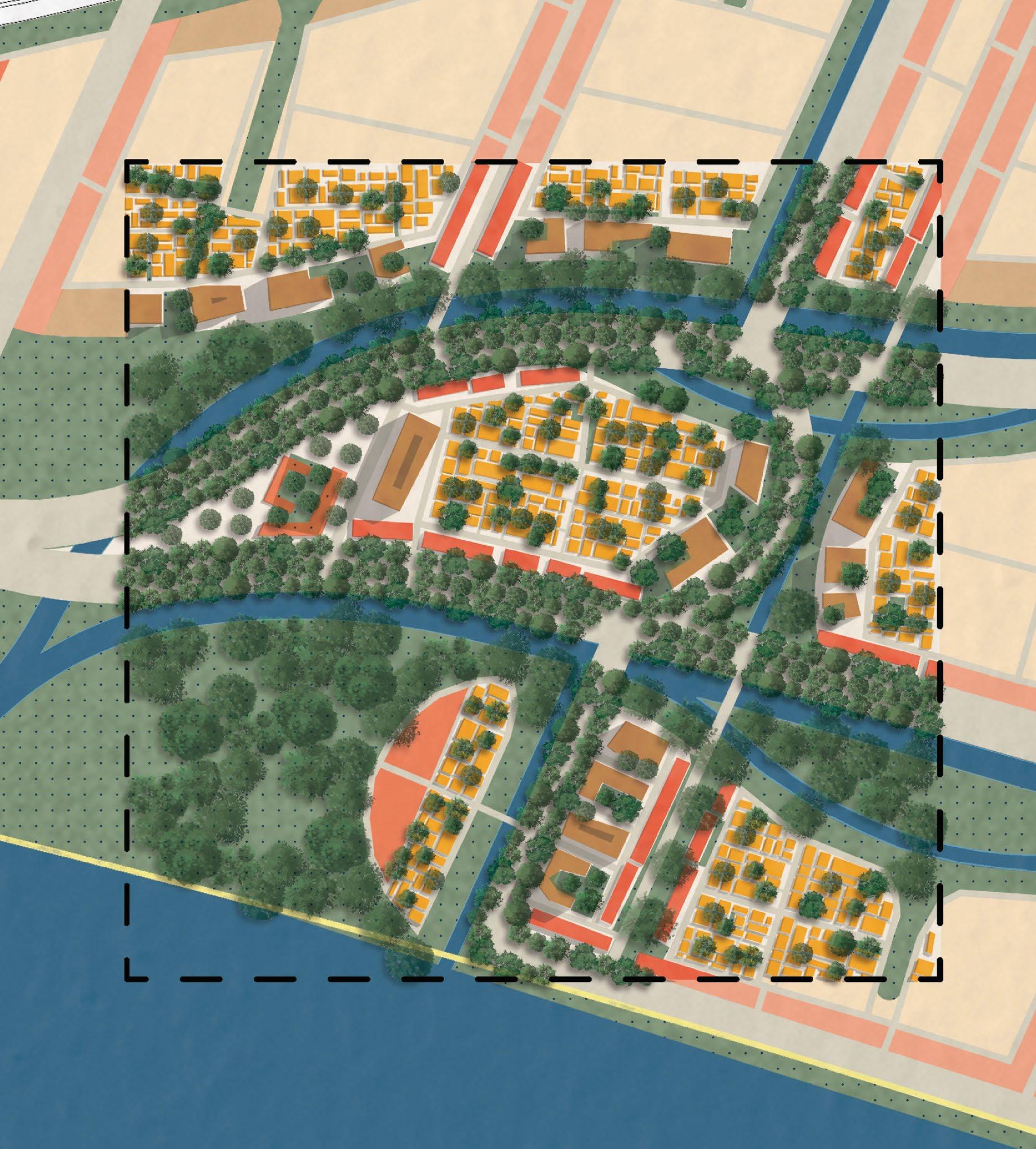
Plan view of Biophilic City Green Connections
Connections
Adobe Illustrator
Intersections between Green Connections, Water Connections, and Streets.
LOTS OF LIFE! 02.
FALL 2024
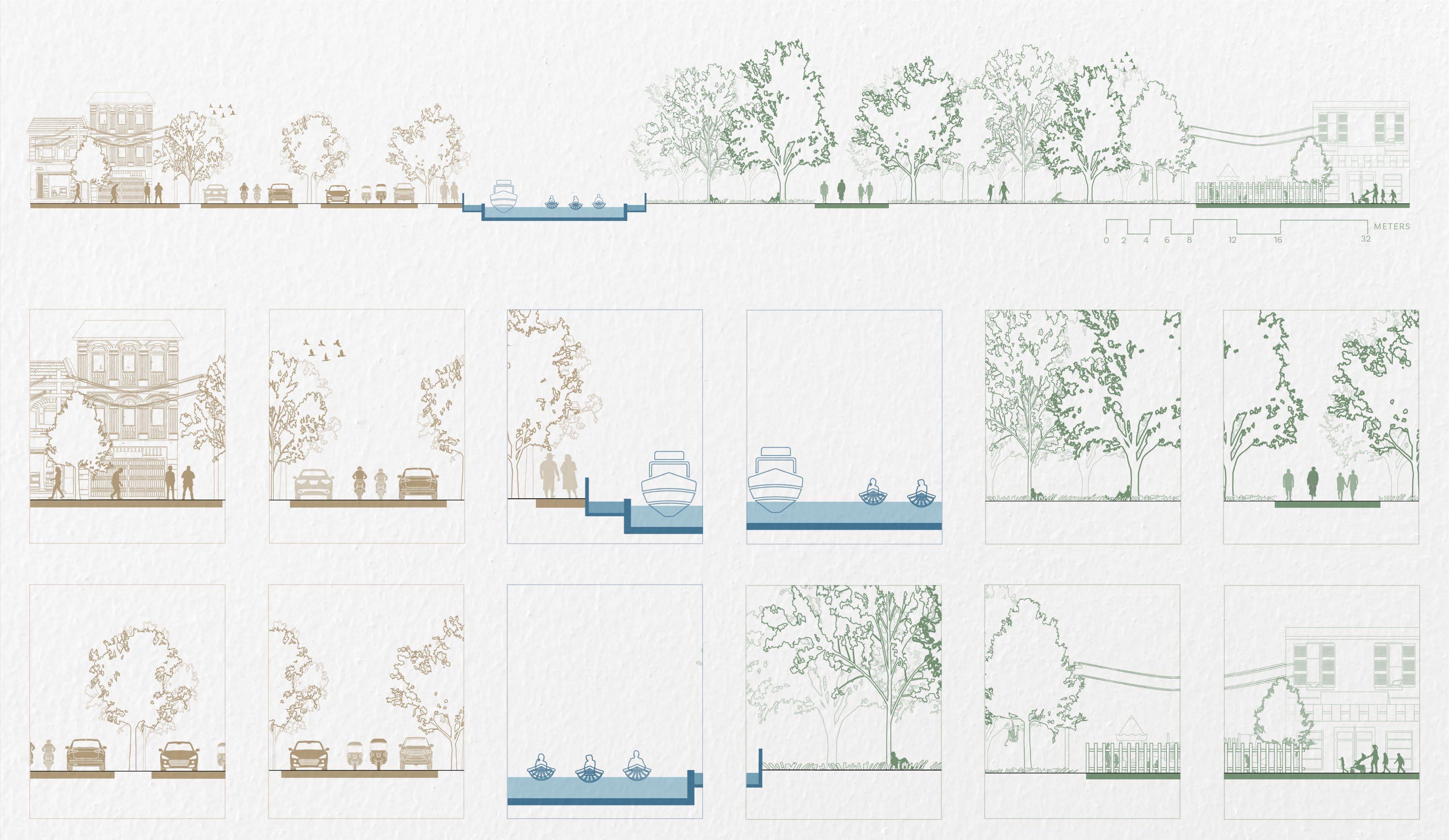
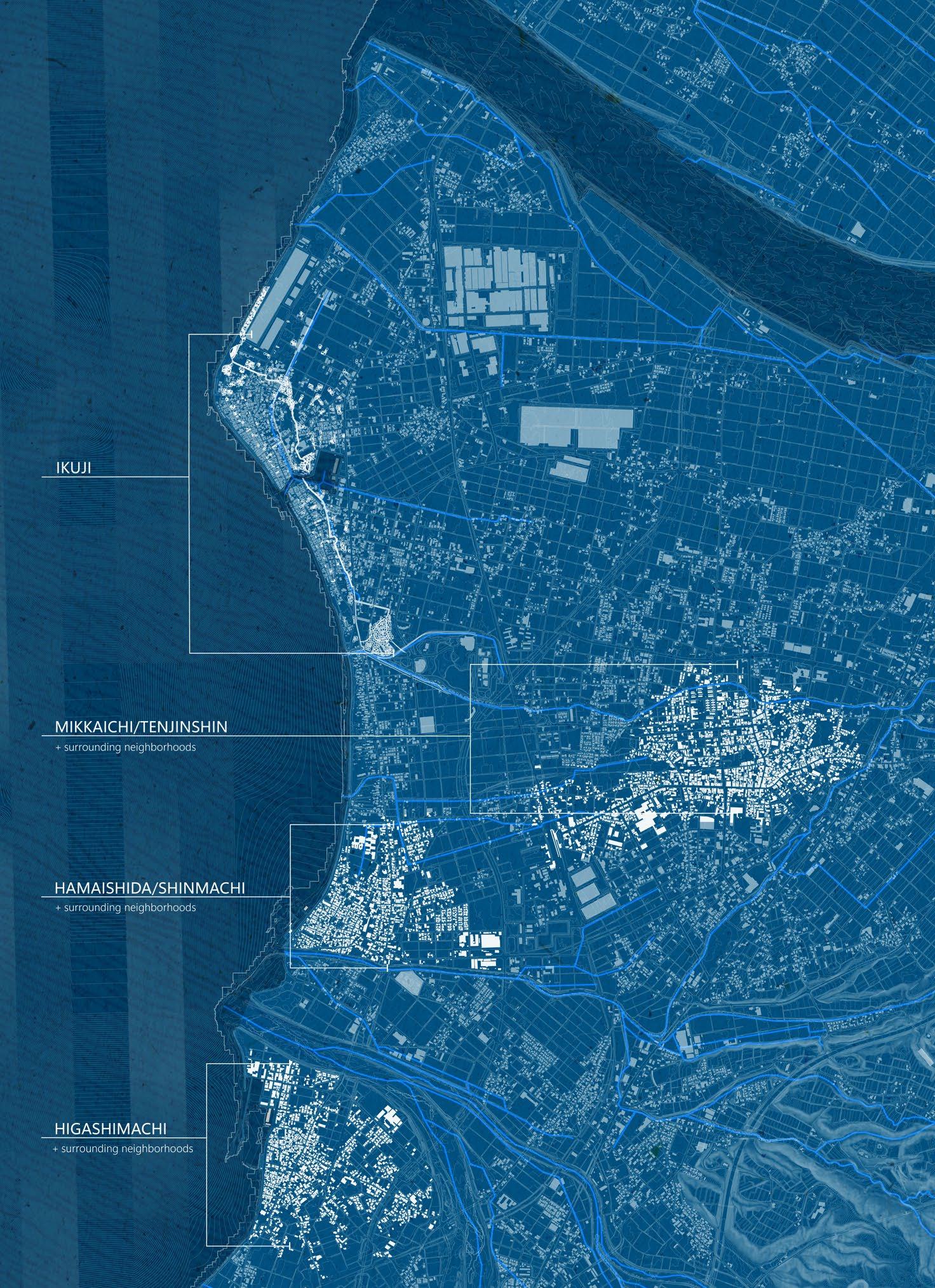
Ikuji, a coastal neighborhood on the western edge of Kurobe, is surrounded by water.
The Toyama Bay and the port are essential to fishing, which is the leading industry of Ikuji. Springs pump water daily from groundwater for everyday usage by residents and visitors. And lastly, large water channels collect storm runoff and quickly transport the water to the central fishing port. The multitude of water provides for all residents, but currently, the water is not used to its full potential. Residents do not utilize the water for socialization, recreation, transportation, and other activities.
In Ikuji alone, more than 200 undocumented lots lay empty with little maintenance. These empty lots vary in size and are comprised of a variety of materials, including sporadic vegetation, gravel, and, most of all, concrete.
Therefore, my design, Lots of Life, transforms empty parcels into an amphitheatre, a learning landscape, and an improved nature reserve that offers learning, gathering, recreation, and participation for people of all ages. These lots emphasize the importance of water while providing ample infrastructure and vegetation for a functional, comfortable, and beautiful Ikuji.
ArcGIS, Adobe Illustrator, Adobe Photoshop
ArcGIS, Adobe Illustrator, Adobe Photoshop
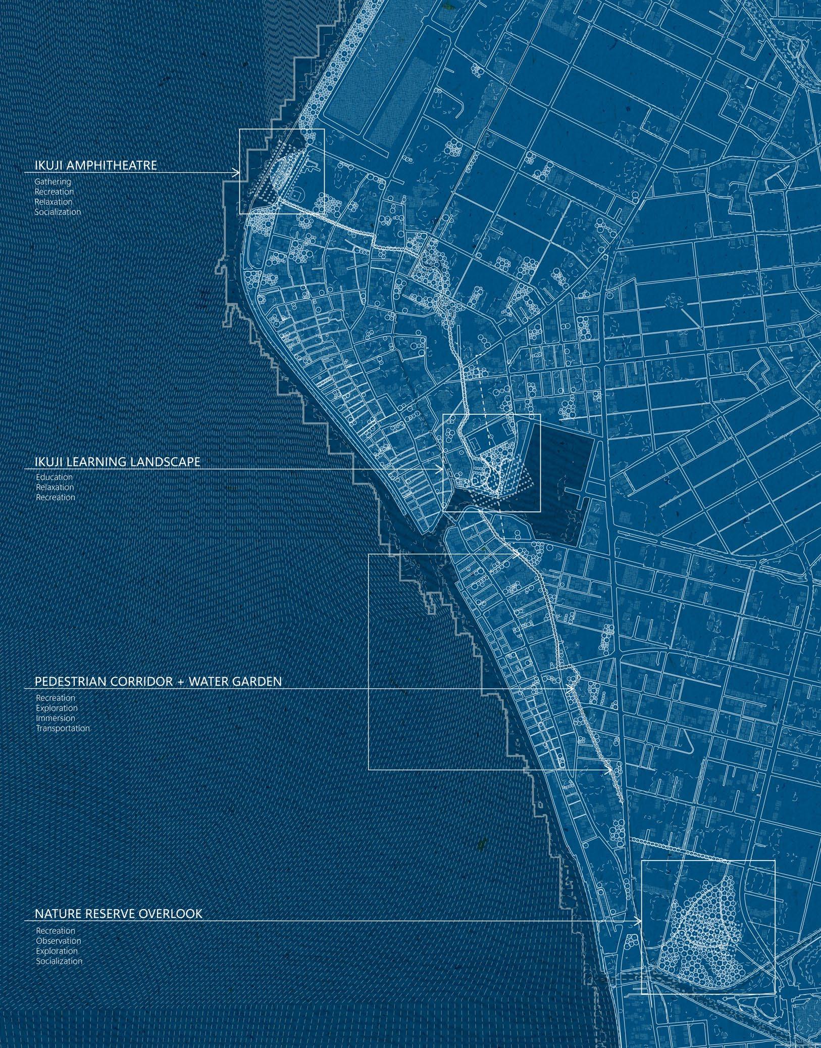
Ikuji Neighborhood Map Showcasing Three Designed, Public Spaces
Kurobe City Scale Map Showcasing Developed Neighborhoods
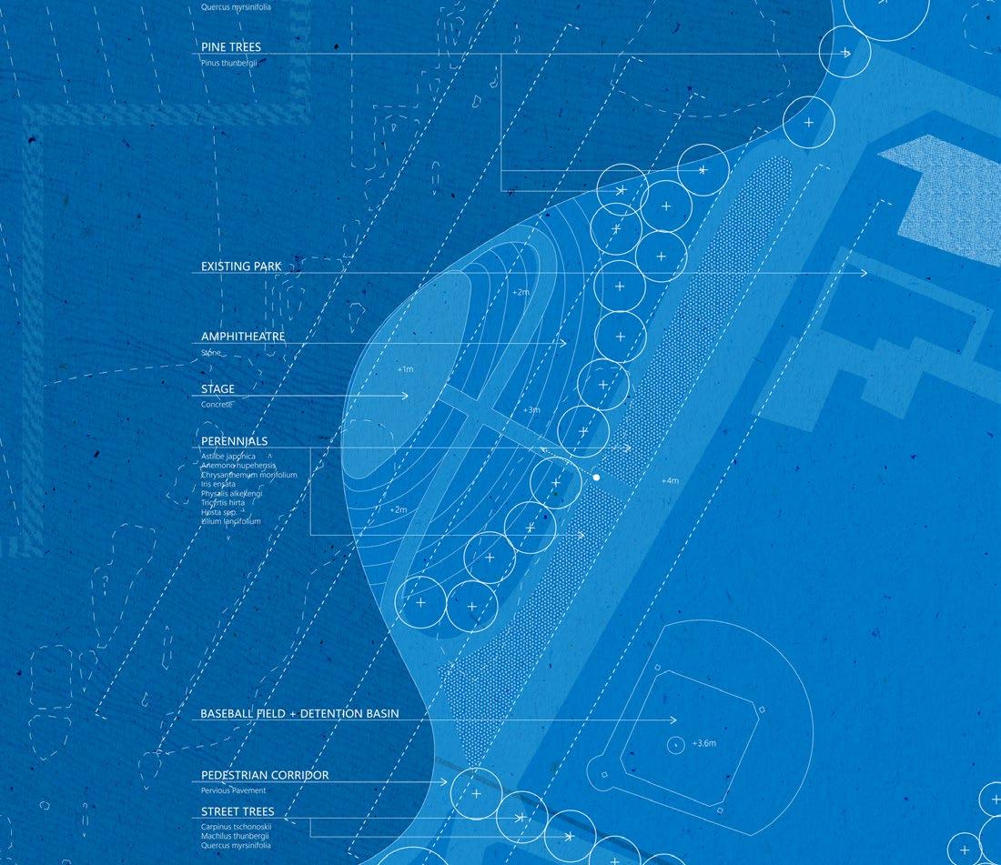
The Ikuji Amphitheatre attracts people into the neighborhood for events, such as concerts or festivals, or can be utilized for relaxation, recreation, and much more. The amphitheatre is terraced for the accommodation of people but can also hold water during large storm events.
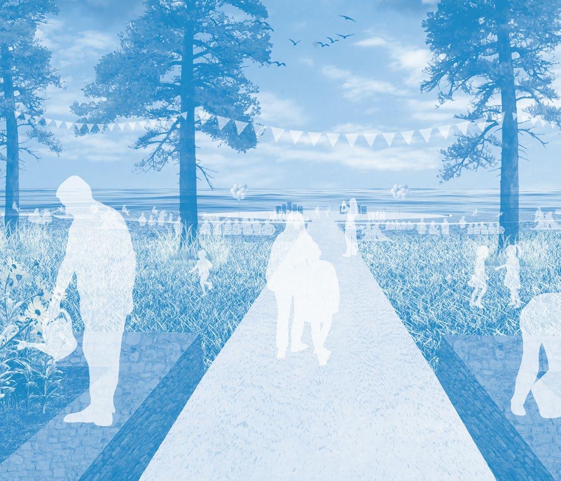
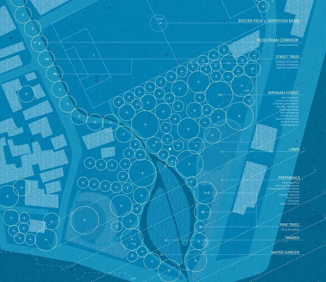
At the Ikuji Learning Landscape, children learn about trees, marshes, perennials, water cycles, and much more, all within a short walk of their school building. The updated soccer field functions as a water detention basin during rain events for increased percolation into the ground water.
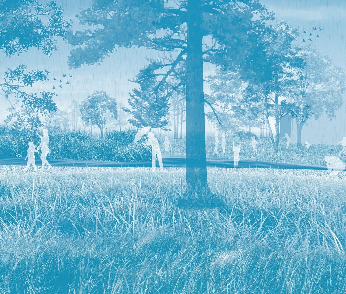
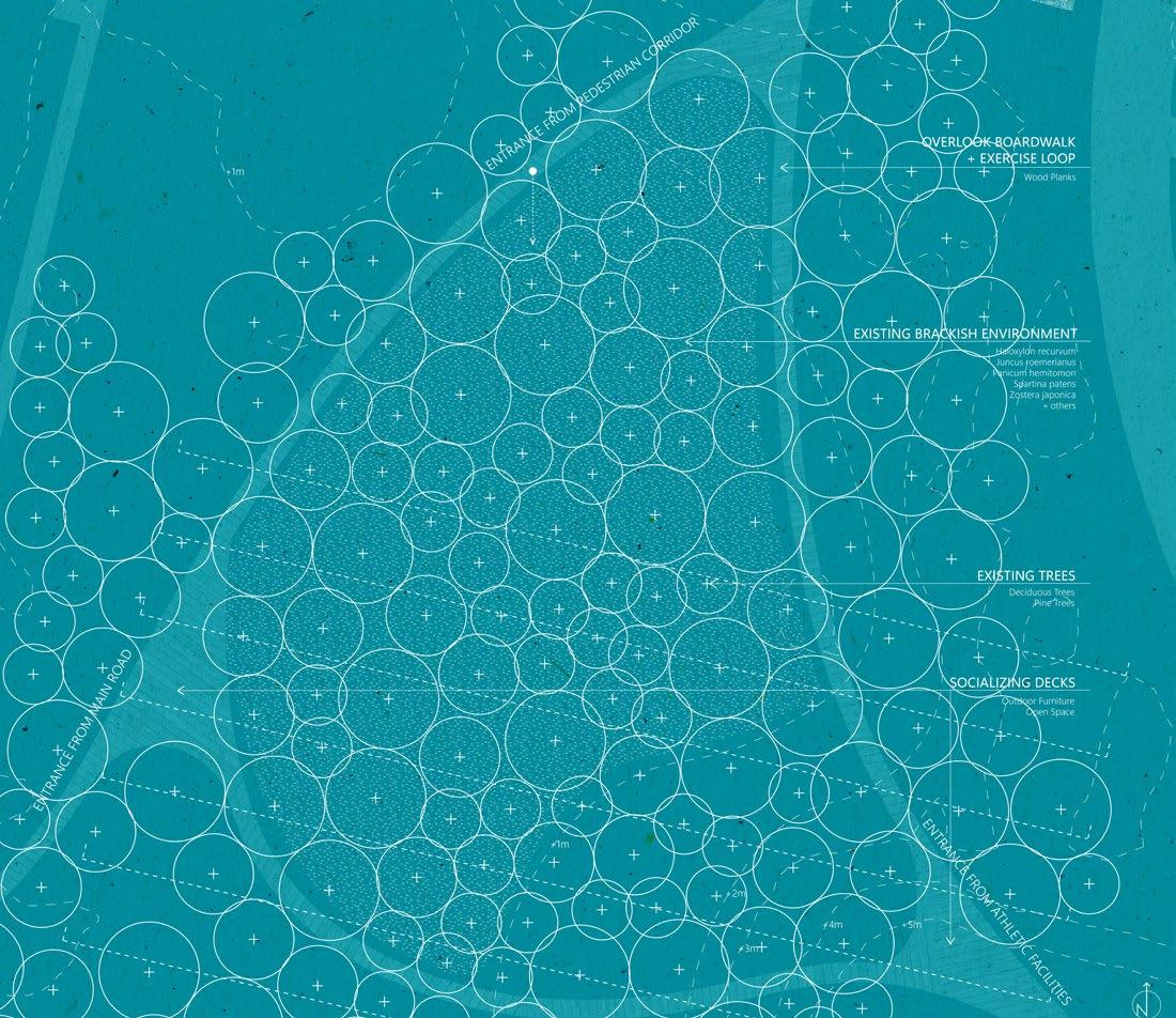
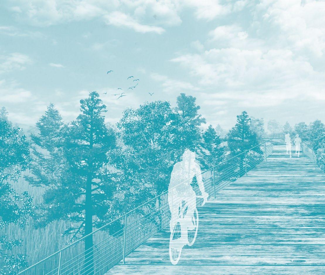
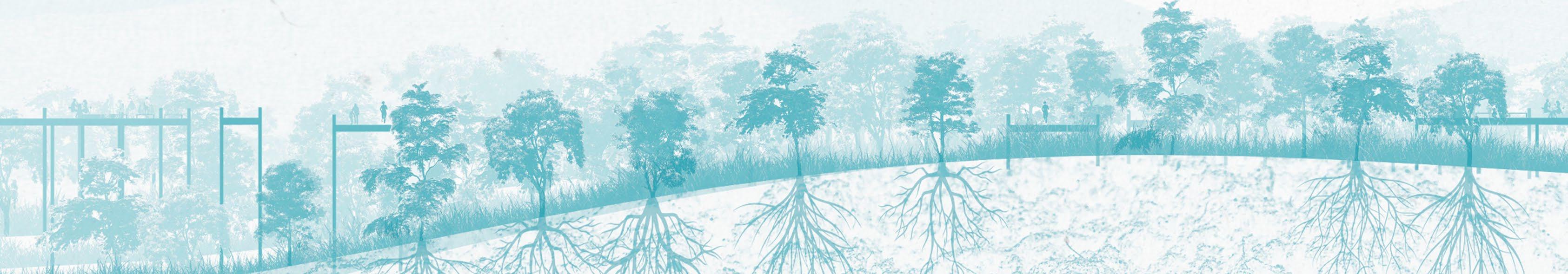
The Ikuji Nature Reserve holds an overlook boardwalk which is constructed with little disturbance around the existing trees, as people are mere observers of this landscape. Residents and visitors can walk, run, and bike on the boardwalk for recreation and exploration.
Site One: Ikuji Amphitheatre
Site Two: Ikuji Learning Landscape
Site Three: Ikuji Nature Reserve
Rhino 7, Adobe Illustrator, Adobe Photoshop
Rhino 7, Adobe Illustrator, Adobe Photoshop
Rhino 7, Adobe Illustrator, Adobe Photoshop
Site Three: Ikuji Nature Reserve
Site Two: Ikuji Learning Landscape
Site One: Ikuji Amphitheatre
TOP-TIER RAIL NURSERY 03.
FALL 2023
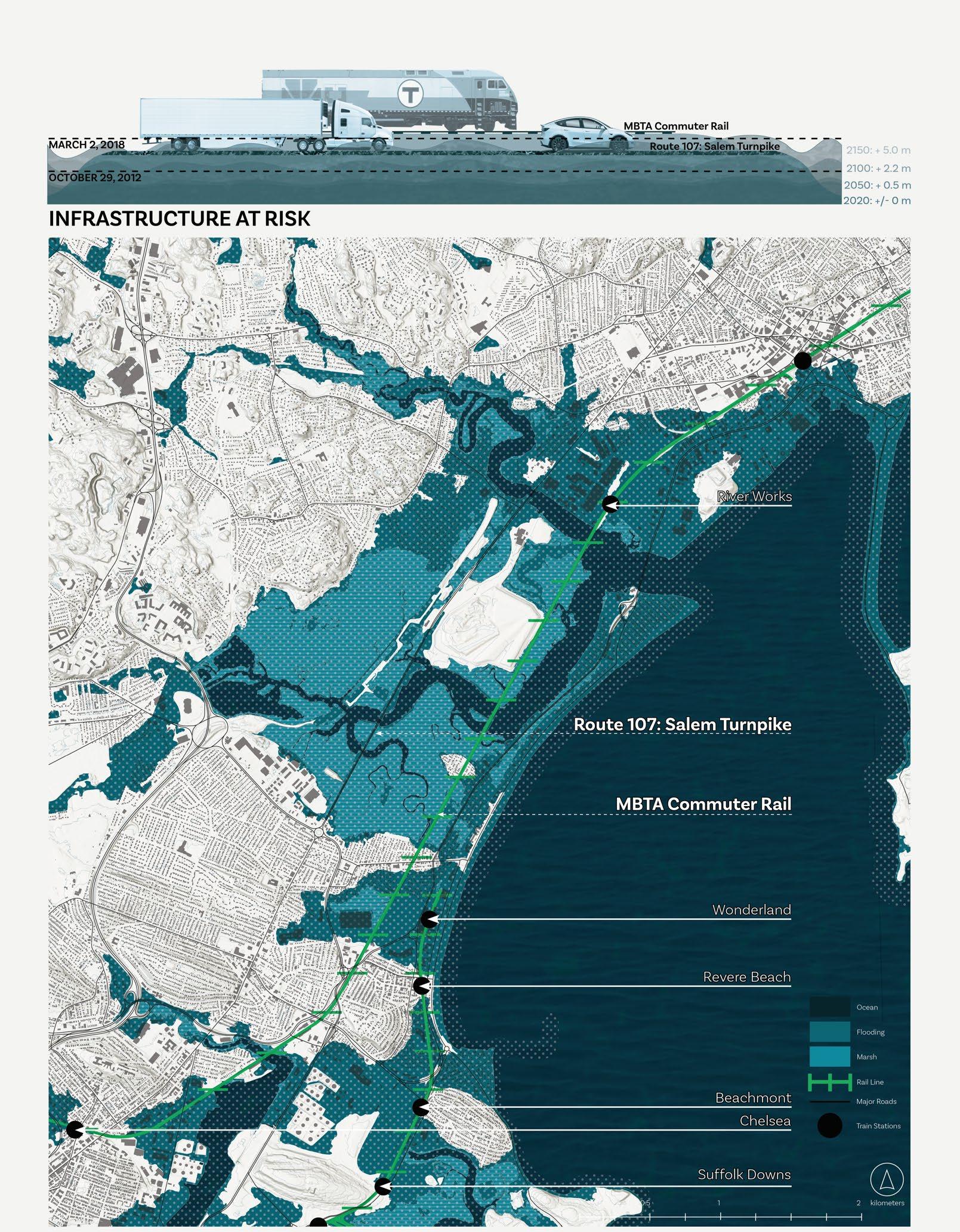
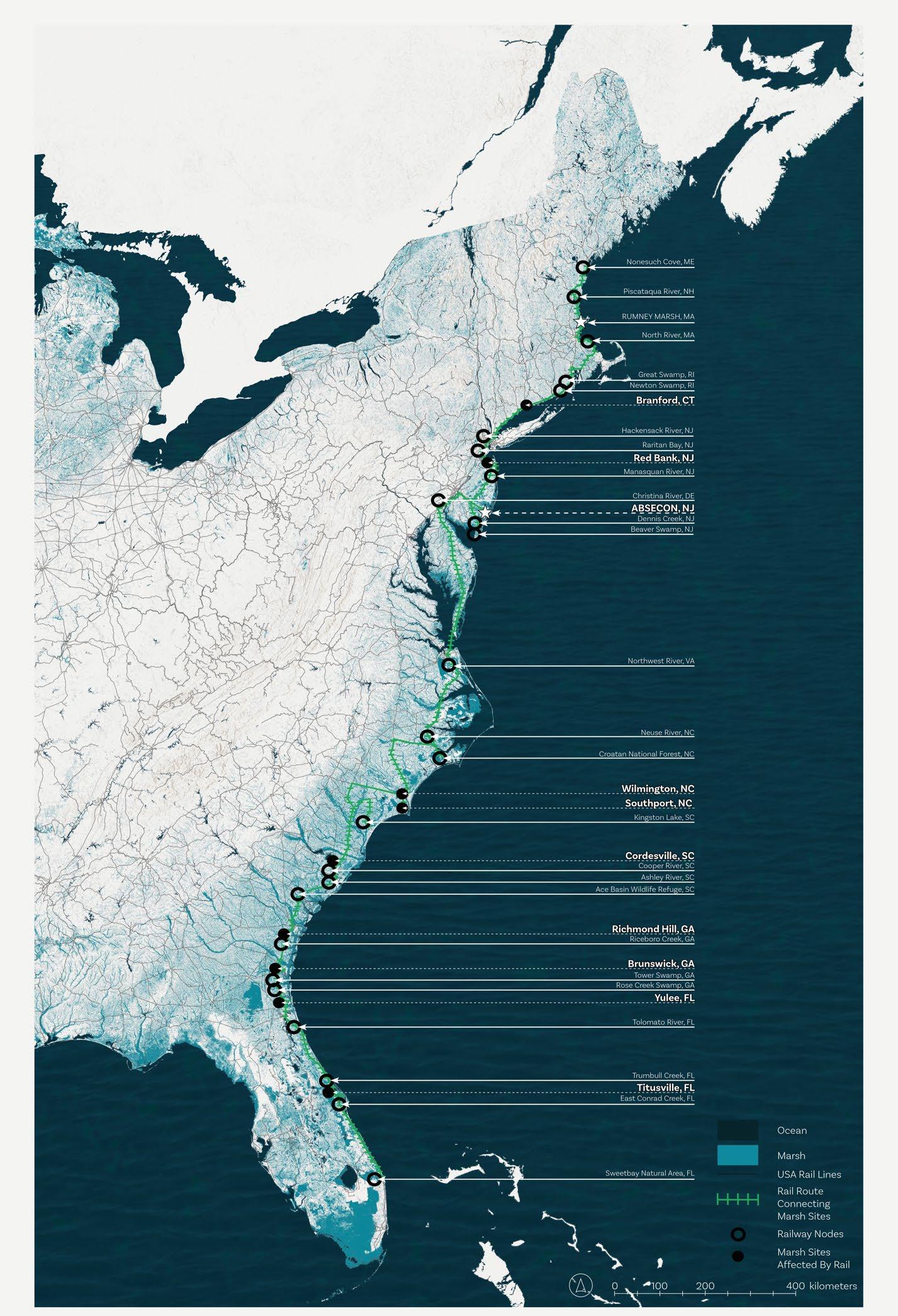
Rumney Marsh is just one marsh along the eastern coast of the United States that is overwhelmed with infrastructure which diminishes the marsh’s ecology and function. The interference and destruction of these marshes affects the ability of the marsh to absorb water during heavy rain, hurricanes, and sea level rise.
At Rumney Marsh, the Massachusetts Bay Transportation Authority (MBTA) commuter rail and Route 107 cuts through the marsh and abuts the Wheelabrator landfill on both sides. In the near future, they will be submerged underwater due to sea level rise and increasingly intense storm events due to climate change. Both the highway and the rail line are directly impacting the health of the marsh, as they cut off water flow and split the marsh into separate parcels.
To begin the process of restoring Rumney Marsh and other coastal marshes back to health, the Wheelabrator landfill and Rumney Marsh are transformed into a rail-based, marsh nursery to grow and distribute plants to regenerate marsh ecology.
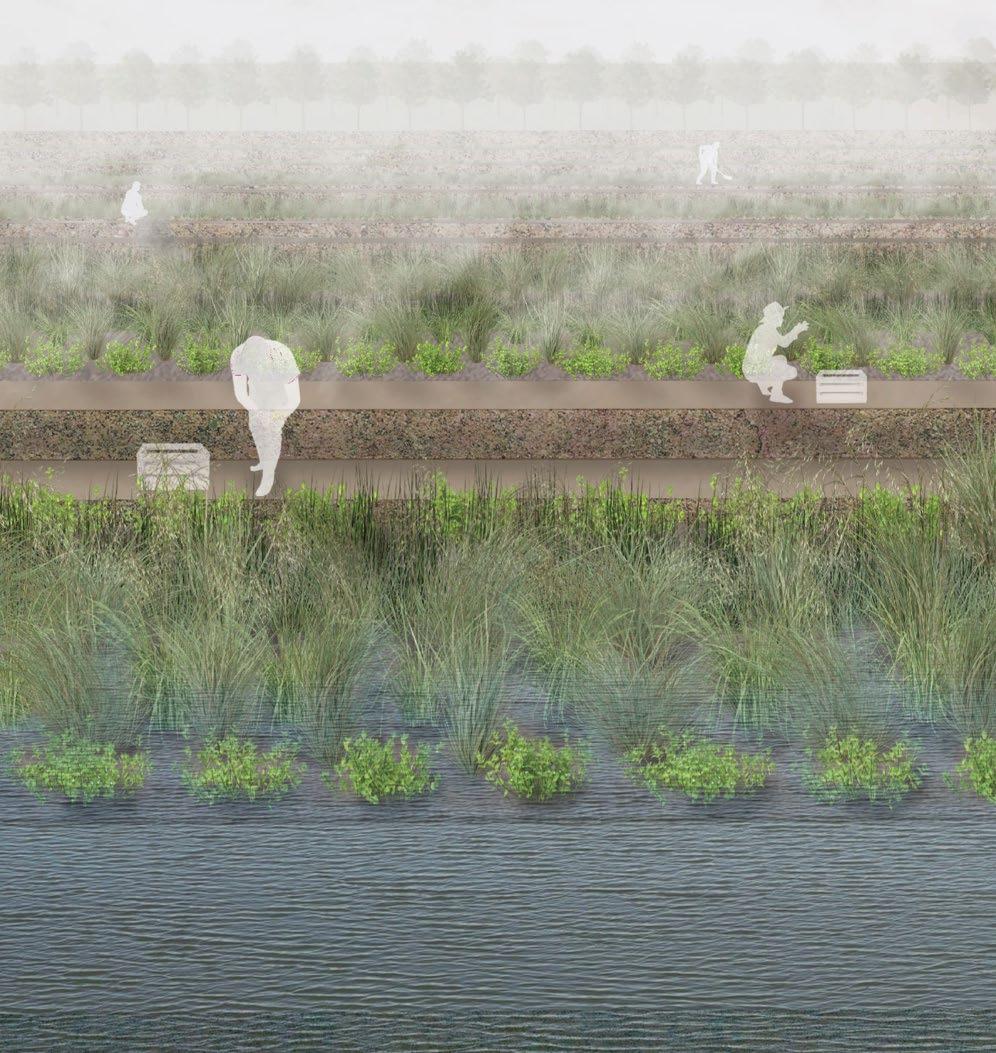
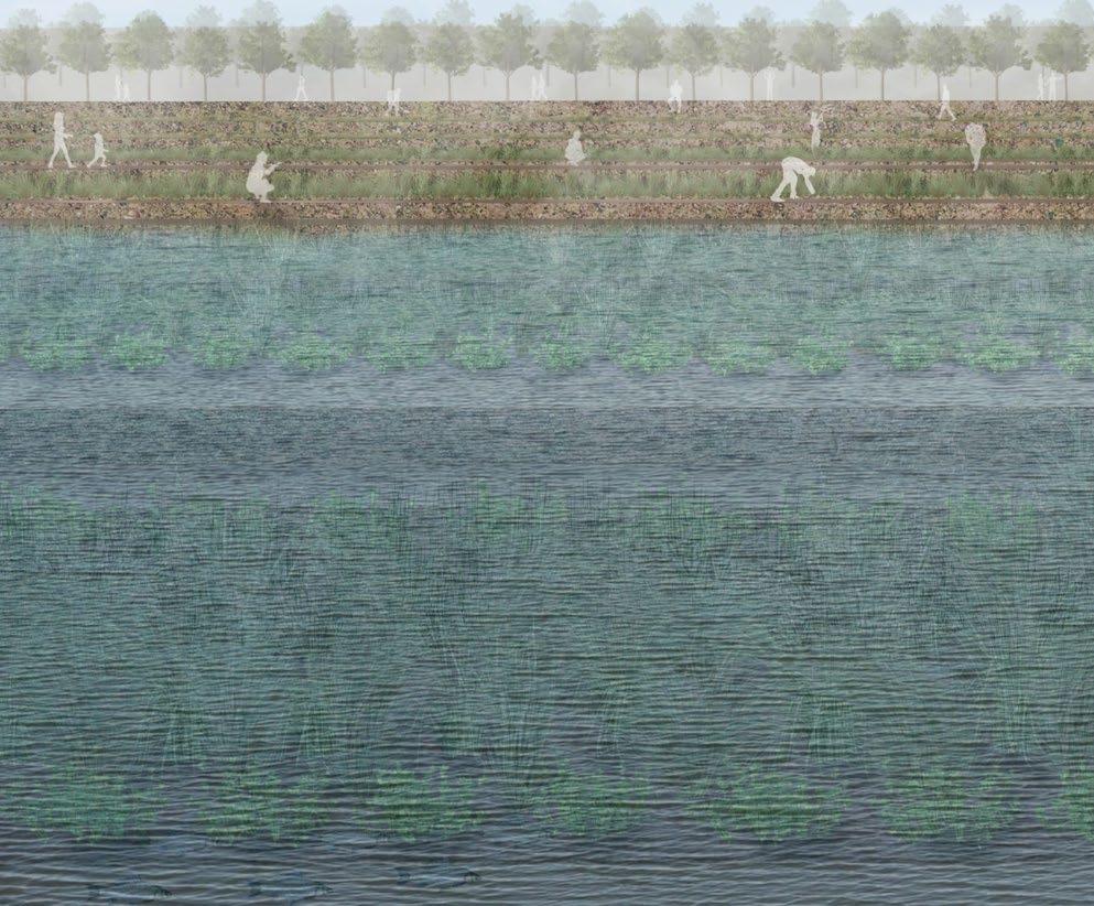
To accommodate the ideal conditions of marsh plant growth, the landfill is graded into a series of terraces that extend beyond the protective sheet pile wall into the marsh itself.
These terraces supply all types of salt-resistant marsh plants, including plants that thrive in flooded conditions and plants that need more protection.
Upland plants, including salt-resistant trees and shrubs are positioned and organized on the top terraces above the existing Wheelabrator landfill.
+ FUNCTION
The terraced marsh plants forge new habitats for animals, insects, and other creatures located in Rumney Marsh. When the marsh plants are young and thriving, they are harvested and transported by rail to other struggling marshes along the east coast.
The nursery creates jobs and financial stability for the towns of Lynn and Saugus year round. Employees harvest, plant, fertilize and water the plants regularly.
Other jobs include operating equipment and vehicles to maintain and transport plants and managing the nursery.
PLANT SKETCHES
SPRING 2024
Drawn in Procreate.
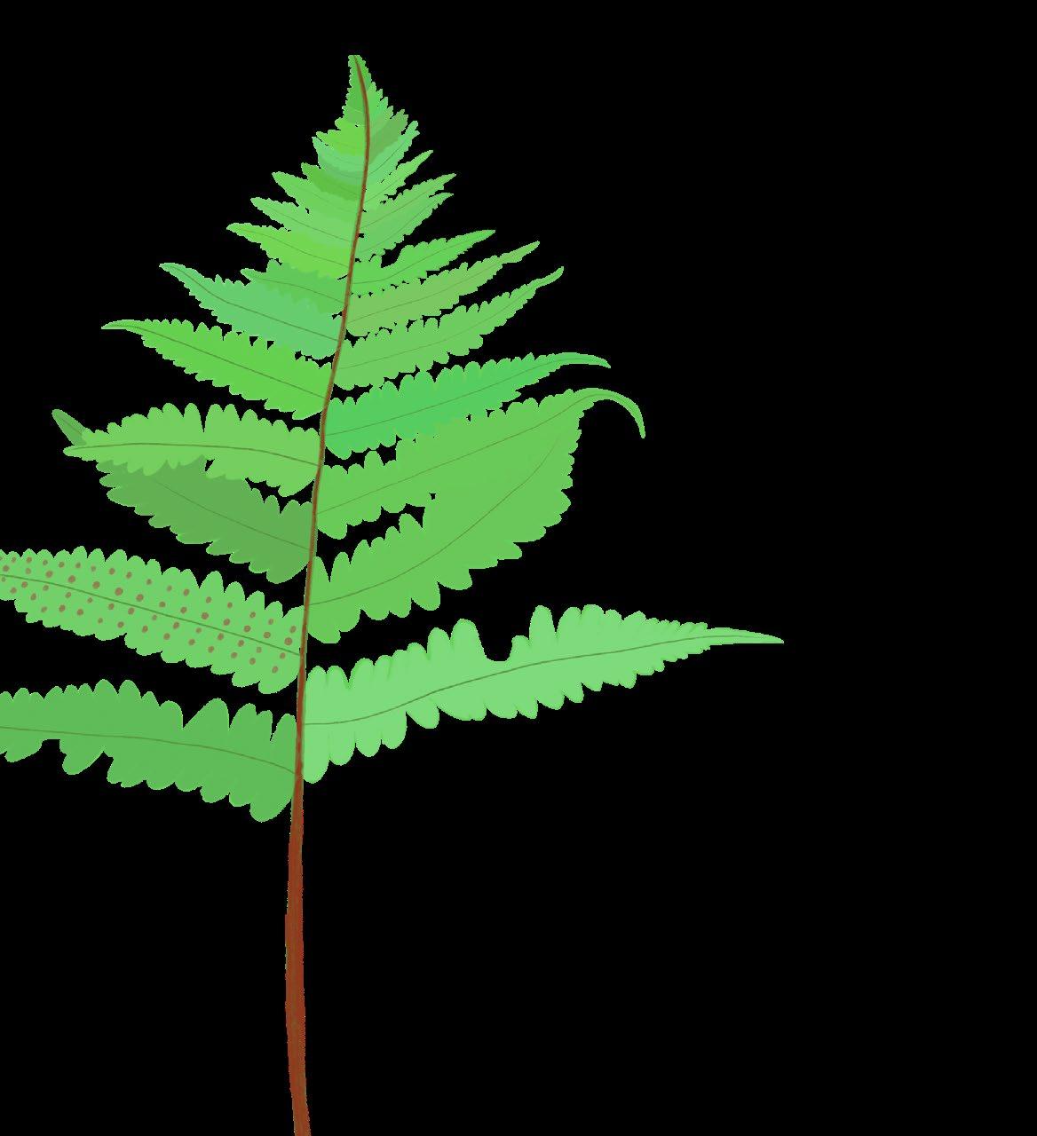
Athyrium angustum
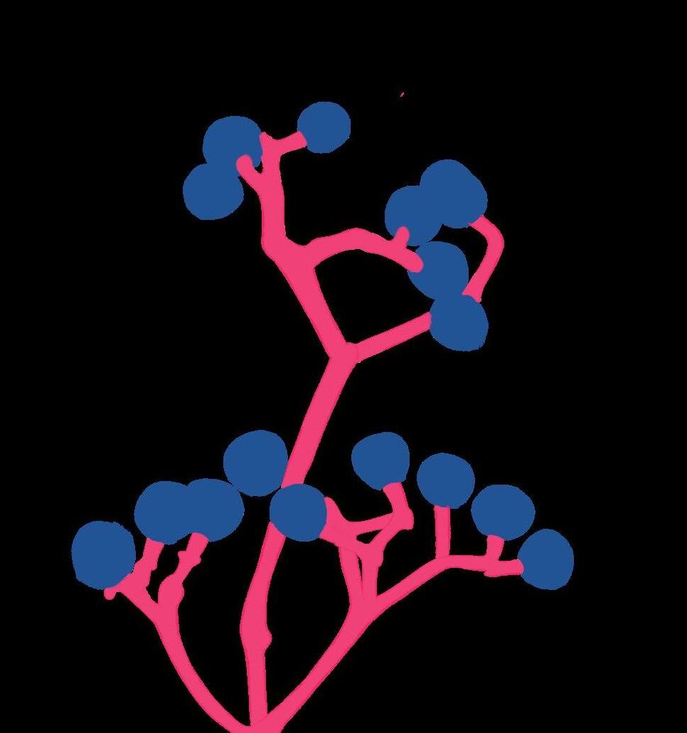
Parthenocissus quinquefolia
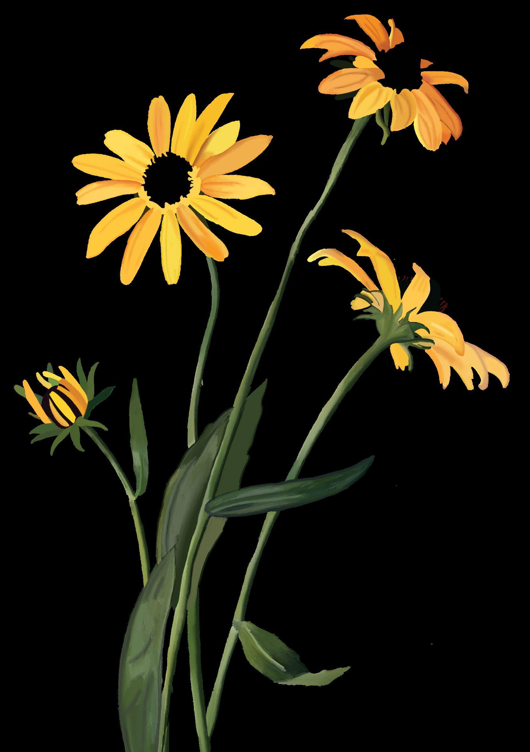
Rudbeckia hirta
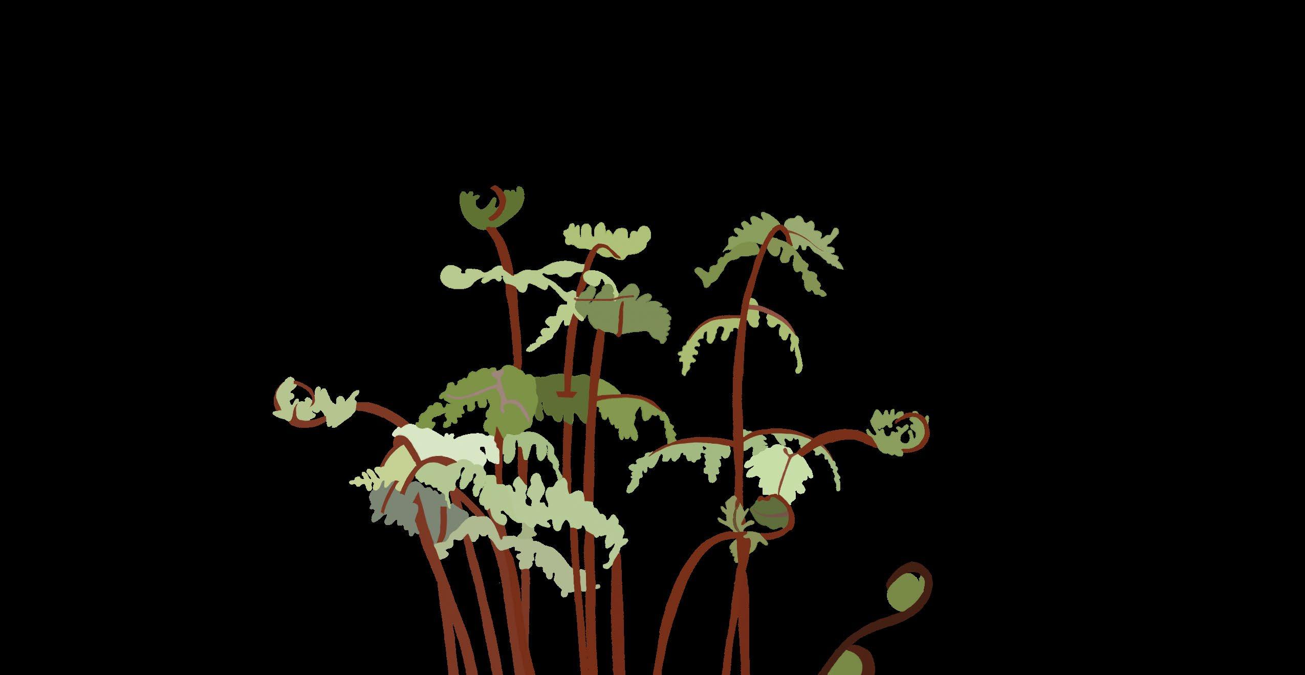
Brassica oleracea var. gemmifera
Athyrium angustum
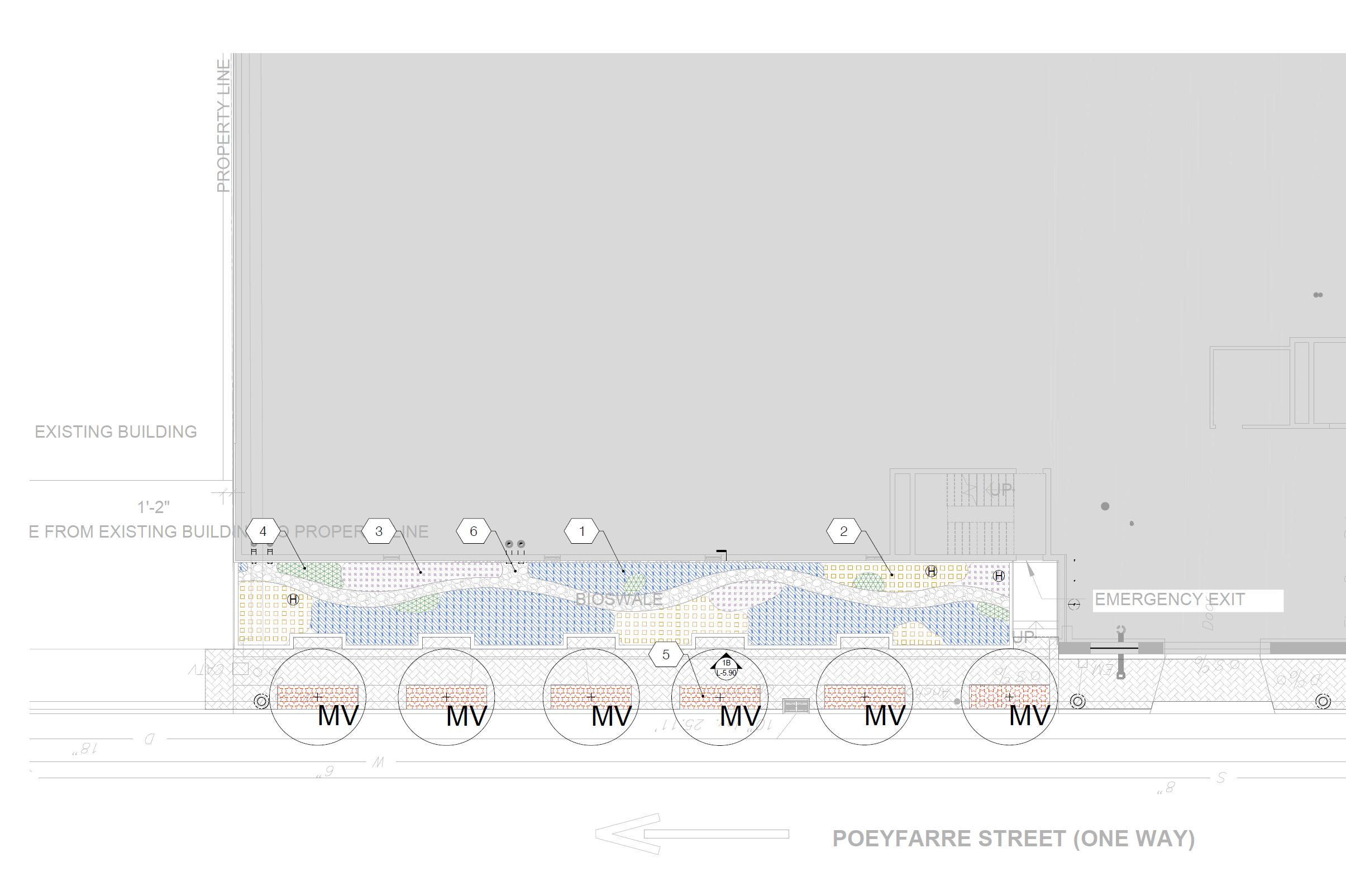
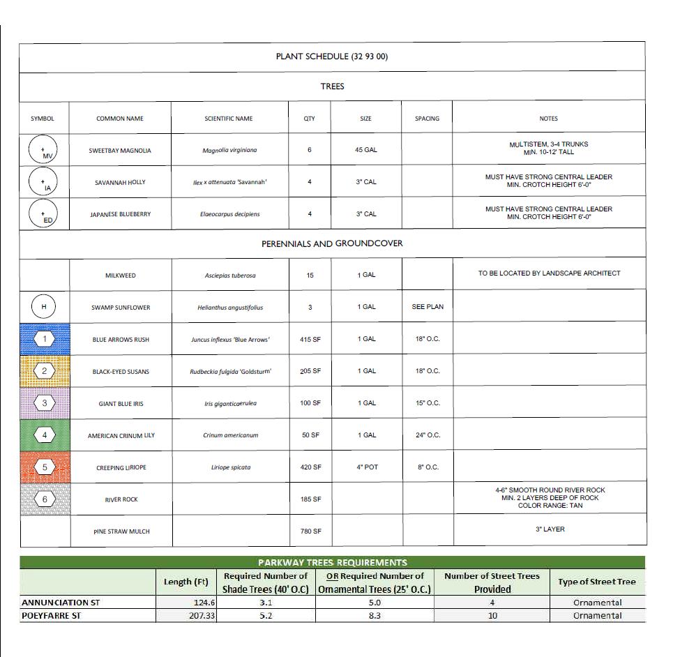
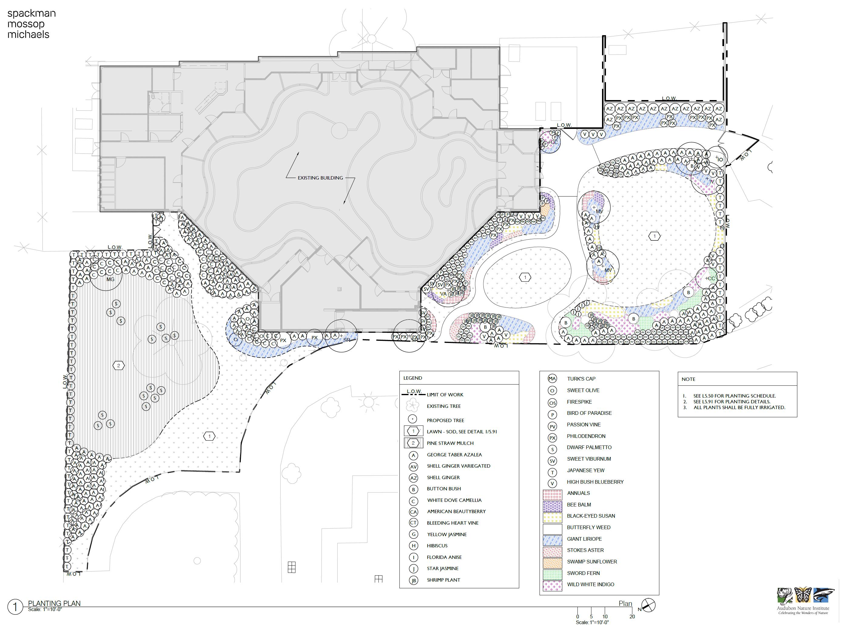
ANNUNCIATION STREET
COMPLETED AT SPACKMAN, MOSSOP, MICHAELS
Produced in AutoCAD.
1031 Annunciation Street New Orleans, Louisiana 70130
Planting Plan
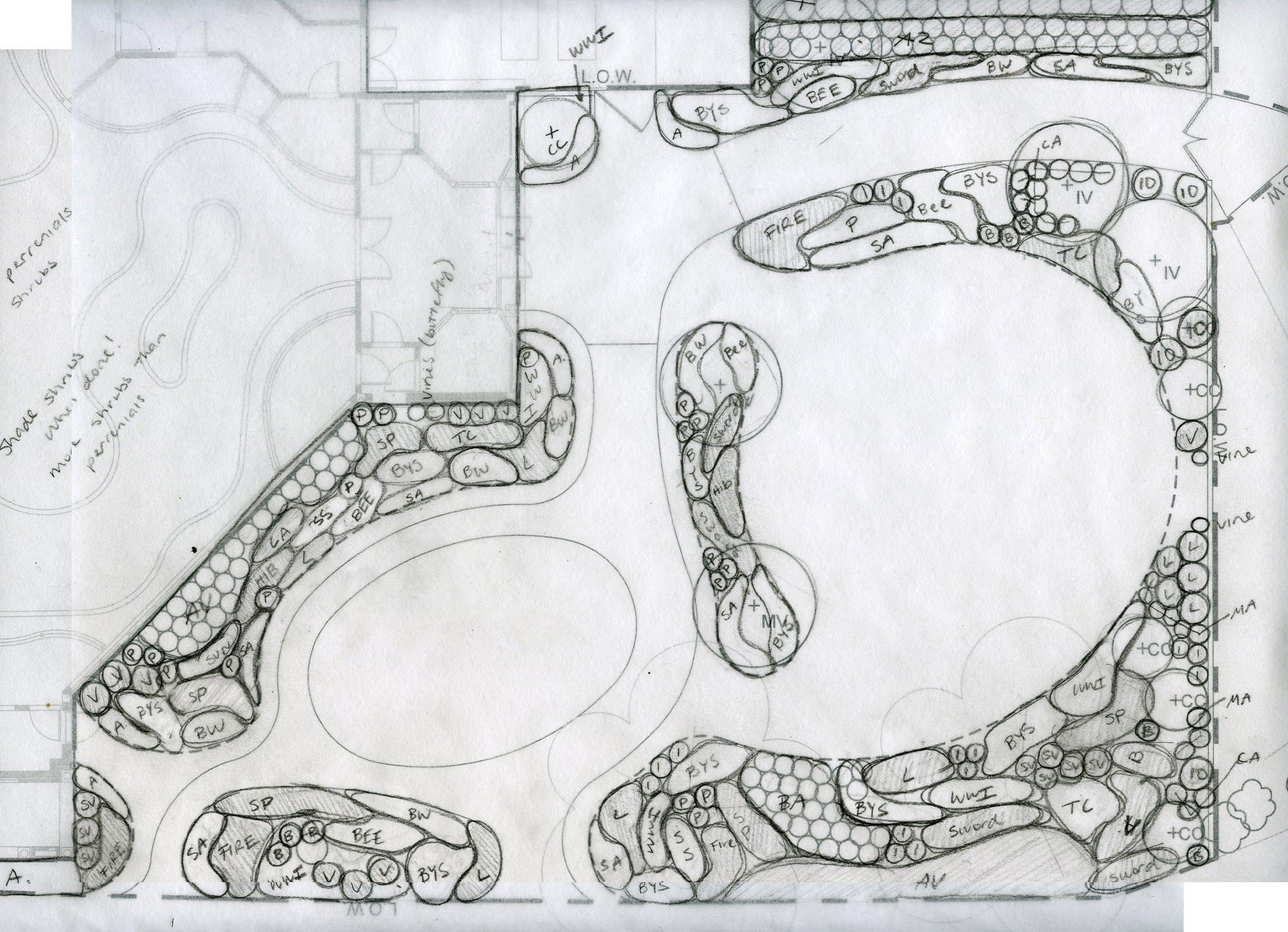
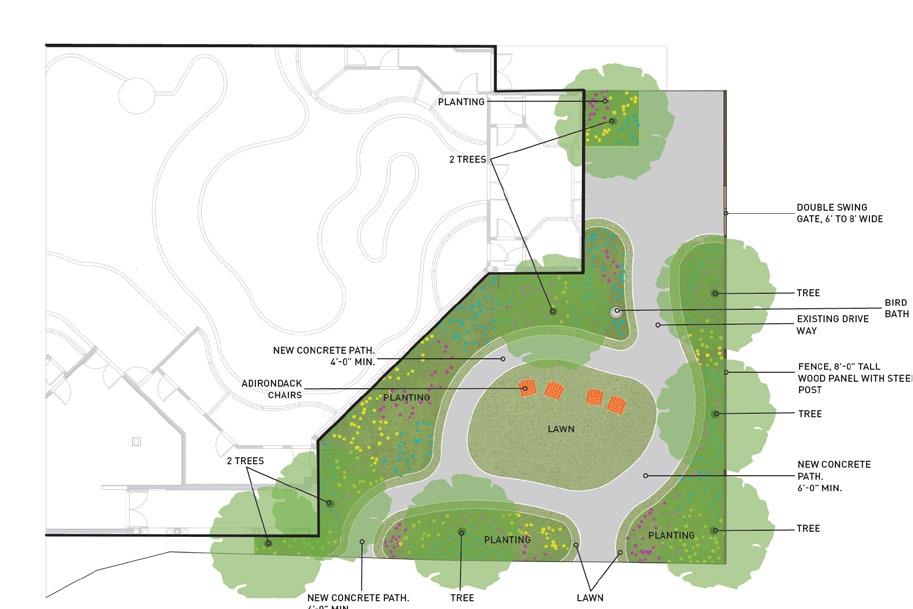
AUDUBON ZOO BIRDHOUSE
COMPLETED AT SPACKMAN, MOSSOP, MICHAELS
Sketch completed with Associate. Drawn digitally in AutoCAD.
6500 Magazine Street New Orleans, Louisiana 70118
Planting Plan Sketch
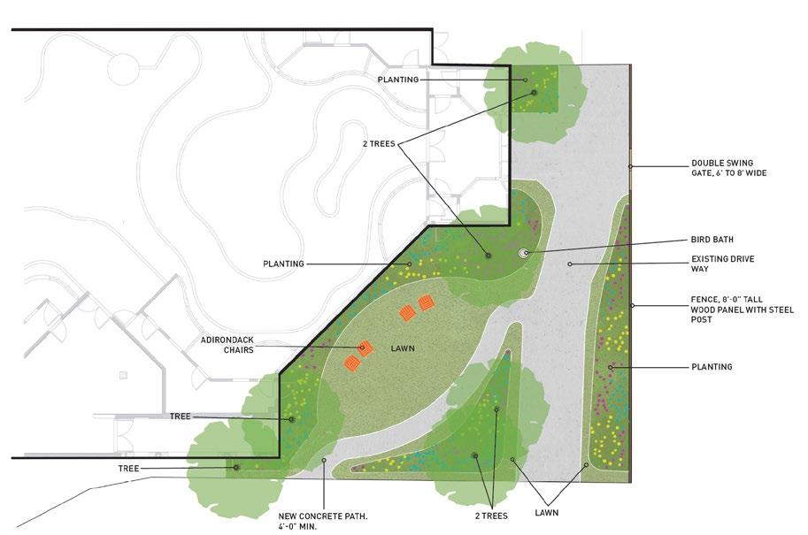
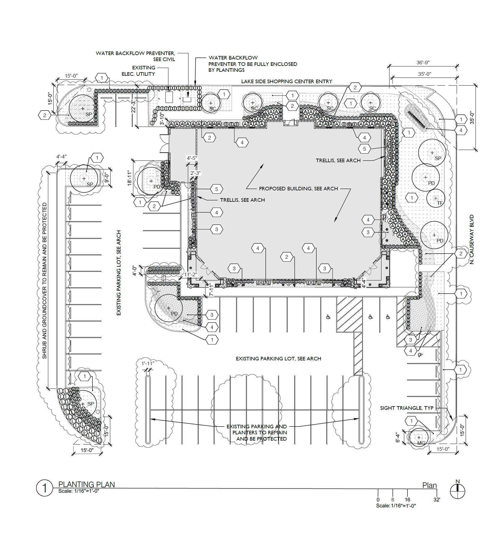
LEE MICHAEL’S
COMPLETED AT SPACKMAN, MOSSOP, MICHAELS
Produced in AutoCAD.
3020 North Causeway Boulevard Metairie, Louisiana 70002