


I am in my journey of becoming a professional urban planner at the University of the Witwatersrand. I am interested in uncovering the underlying forces in things that seem to be normal. I am always open to learn about the issues
South Africa is www
I am studying Urban and Regional planning because I have a great passion for housing, particularly as it relates to working with underprivileged people, especially seeing that housing is one of South Africa’s biggest issues.


Dear Reader
I am pursing my passion of becoming a spatial scientist at the University of the Witwatersrand. Not only am I a patient young lady, who is open-minded and willing to learn new things at every given opportunity, I am still very cultured and strong willed.


I have set my sights on a Urban and Regional planning qualification because the urban landscape is constantly evolving and I am keen on becoming a contributing factor. I am a driven individual who strives for excellence and is always prepared to go the extra mile.
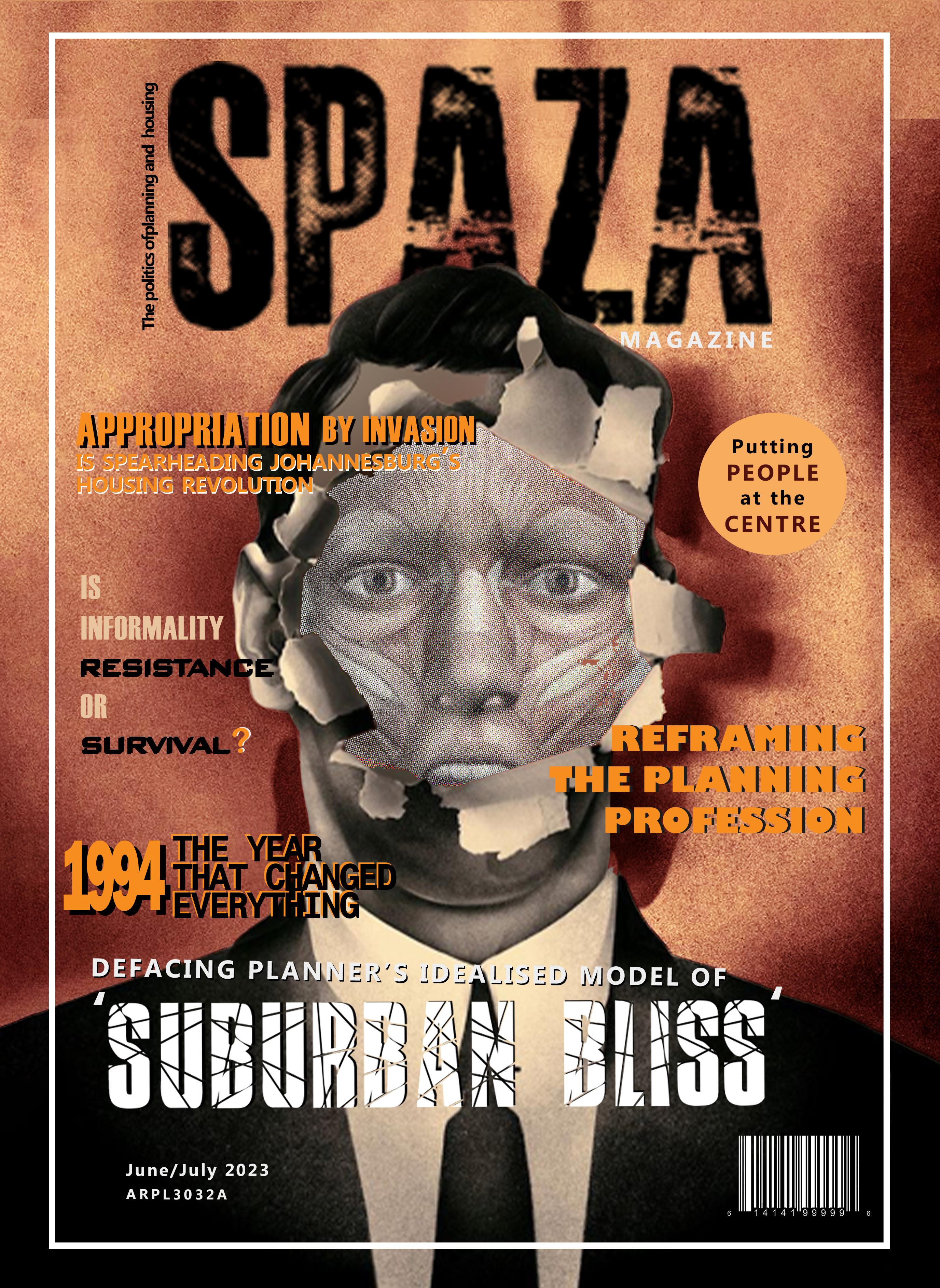
Welcome to the first issue of SPAZA magazine, the magazine that tells the tales of appropriation in South Africa’s cities from the perspective of those who appropriate. Planners have a misplaced preoccupation with orderliness and formality when it comes to development. What they consider to be formal and orderly is imported Western rationality and does not resonate with the complexity and heterogeneity that characterises the actual lived reality of the urban poor. This disjuncture results in the proliferation of unplanned parts of the city which represent what people end up doing for themselves when the state fails to do it for them. This is appropriation, and it is spearheading Johannesburg’s housing revolution. In this issue, we meander into this new urbanism by defacing planner’s misfit idealised models and uncovering the lived experiences of the urban poor.
This magazine is for you, the people who challenge the status quo, who shake things up, who stand up and do things for themselves to survive.
The SPAZA team is delighted to bring you this issue and I hope that as you flip through its pages, you will find something that speaks to your heart, echoing a newfound reverence and appreciation for abaphazamisi and their stories.
Igenimus eossecae nus maxime sum (title TBD)
-Professor Marie Huchzermeyer
The word ‘Spaza’ originates from the Zulu and Xhosa word, isiphazamiso which means disturbance (Gastrow, 2019).
The term was developed during the 1960s resistance to the apartheid regime. It first emerged when black people from townships boycotted white businesses, and opened their own house-shops. They called them Spaza shops as they were seen to be disturbing the formal enterprise that came with the apartheid system (Spiegel, 2003). These businesses are not registered with state authorities and thus operate informally from peoples’s houses. Nonetheless, they have spread significantly across all South African urban settlements as but one symbol of the way people have appropriated spaces, thereby disturbing planner’s utopian models of space.
The basis of our research in this magazine is laid against the backdrop of this radical interpretaion of the term ‘Spaza’.
SPAZA magazine will explore the idea of appropriation as isiphazamiso, a hindrance, impediment and disturbance to the utopian vision that planners have when developing urban spaces.

Public spaces are gathering spaces and interaction hubs (Gehl and Matan, 2009). Their role within our societies cannot be overemphasised because public spaces provide people with the opportunity to share thoughts and information (Gehl and Matan, 2009; Rad and Ngah, 2013). The idea of the concept of appropriation in the context of public spaces introduces a viewpoint that enhances our understanding of their use and metamorphosis. The objective of this article is to provide a thorough description and analysis of the concept of appropriation as it relates to public spaces, thereby elucidating its intricacies and related implications. Appropriation of public space denotes the engagement by individuals or groups in activities that diverge from the original design of spaces (Karimnia and Haas, 2020). This engagement incorporates: using, modifying, and repurposing public spaces in ways that cater to specific needs, and desires (Tillu, 2011). It involves an active engagement and metamorphosis, whereby the spatial characteristics of these urban spaces are modified to align with the people’s needs and desires. Concentrating on Region F within the City of Johannesburg (CoJ) we identify that individuals and collectives invade public spaces to cater for their own needs and interests. This often leads to conflicts among different stakeholders, as the individuals or collectives may have non-identical needs and desires (Ojeda and Pino, 2019). There are various forms of appropriation within public spaces, including temporary appropriation and appropriation by invasion. Temporary appropriation is a concept that has reemerged within the urban social landscape and is considered a multidimensional phenomenon (Lara-Hernandez et al., 2019). On the other hand, appropriation by invasion refers to the unauthorized occupation of public spaces. Both temporary appropriation and appropriation by invasion are associated
with the informal use of public space. The magazine focuses primarily on the appropriation of public spaces through invasion. As previously mentioned, appropriation by invasion involves utilizing public spaces without obtaining consent from local authorities. This behaviour disregards the regulations set by the authorities and is, therefore, deemed illegal.One specific aspect of appropriation by invasion that the magazine will emphasize is squatting. Squatting involves occupying developed or vacant land without permission from the government. The act of squatting leads to an increase in the urban population. Consequently, it gives rise to numerous issues such as urban sprawl, congestion, and inequality, all of which significantly taint the fundamental principles of urban planners. These core principles encompass the pursuit of equality, inclusion, and social cohesion, which are challenging to achieve when individuals appropriate space illegally. According to Malife (2023), “Sihlasela lasifuna khona, masi ngawutsatsi umtsetso etandlani tethu kute hulumende langakwenta, singalala singakadli.” This statement, when directly translated, means that we invade public space because we are striving to make ends meet. The government fails to address our needs and interests, thus compelling us to plan our own spaces. Nevertheless, appropriation fosters ownership and enhance social cohesion.In conclusion, appropriation stimulates liveliness, vibrancy and inclusivity within the public realm. It embodies a dynamic process where people and the societies actively participate and engage in shaping and rebuilding their urban environments.
“Appropriation denotes the engagement by individuals in activities that diverge from the original design of spaces”
The above research question has guided our research and answers to it will be implicit throughout the magazine. Methodology constitutes approach used to answer the question. To make sense of the processes and patterns of appropriation by invasion and their ambiguity, we have employed an eclectic mix of radical people-centred approaches including positivism, critical post-modernism, and counterhegemony. Positivism is a paradigm concerned with uncovering the truths and present ingit in empirical ways. According to positivism, human behavior is considered passive, meaning that it is controlled or propelled by external factors. This approach will be valuable in unpacking on how the vision of suburbian bliss that planners have propel appropriation by invasion in South Africa. A critical post-modern approach will help in interrogating the findings instead of taking them as they are to search for more than one storyline. Lastly, counter-hegemony is necessary to oppose the hegemonic authority that urban planning now wields. This study will make use of Miraftab’s (2009) definition of counter-hegemony, which is the act of disrupting existing alliances. In this work, the utopian ideal that planners are promoting and seeking to realize is the normalized relation. The growth of informality in space is the practice that works to destabilize. Therefore, this technique will be utilized to show how appropriation by invasion is a behavior that denotes planning failure.
The methods constitute steps taken to ascertain the response to the question and they include:
Content analysis involved intellectual and research-based engagement with relevant literature related to our theme.
Quantitative data collection involved drawing data from statistical reports to increase the validity and credibility of our research
Qualitative data collection involved field sketches, photographs and ocular observation, as well as interviews. This method was helpful in capturing the depth and richness of human experiences and providing a deeper understanding of quantitative findings Mapping involved translating collected data into high-quality graphic formats consistent with the conventions of analysing urban space in planning for easier reading
Through ethnography, we became what we researching, which is abaphazamisi (page 20-21) to gain rich, contextually embedded knowledge and nuanced understandings of our subjects and their urban practises, free of assumptions.
List of respondents
1) Reframe what is considered to be orderly or formal so that it is in-step with the South African context
2) Explain the processes that has caused the emergence of appropriation which resulted in different forms of invasion
3) Shed light on and acknowledge the complexity and heterogeneity of communities and actual social practices
4) Consolidate people led morphological processes as progressive and legitimate as new paradigms for understanding urban culture
Open ended questions that require respondents to provide detailed comprehensive responses, beyond, a simple ‘yes or no’, were asked. Each respondent was asked a different set of questions due to the fact that the information required from each of them being different.
Participation in our study was voluntary. Respondents were photographed and recorded with their permission. Consent was given through verbal agreement.
“Is appropriation by invasion a form of resistance or survival?”Name Description Mrs Mokwena Mrs Mokwena is a waste picker residing in Kwa Mai Mai informal settlement. She is originally from Kwa Zulu Natal and moved to Johannesburg to ‘gereza’
Planning is a field of study or technical process that focuses on the improvement of human settlement through the development and design of different land uses and the built environment using policy according to the diversity of needs. The practice of planning as a profession is fundamentally about forming agreements between people and communities, as well as crafting the interface between space and society, into seams that can knit urban areas together, in pursuit of Friedmann termed ‘the good city’ (2000). Planners in South Africa are tasked with puting the good of the community first, making it a people-centred profession is entrenched in social determinism. This nuanced view of the profession in South Africa has been shaped by unique historical, political and social realities prevalent most importantly, in the 20th century. Before we track these realities on a timeline, let us acquaint ourselves with the conditions of cities in the eras preceeding the era of interest to us that led to the emergence of planning in South Africa. There are at least two major sources of planning in South Africa, during the nineteenth century. These stimuli came in, in efforts to restrict the movement of black people in urban settlements (Mabin & Smit, 1997). The second stimuli were the regulation of private subdivision of land for urban uses in the late nineteenth century. In the 1880s and 1890s, the government was faced with uncoordinated urban growth and costly results of private development. Through the recognition of the townships law in 1894, the Free State was the first state to establish an apparatus to control urban form after the 1899-1902 war. After this, there was the establishment of new local authorities that were signed by the British regime to remake the urban environment. People with British experience were appointed to be the ones to drive the process of reconstruction, including Lionel Curtis who had experience and knowledge of restructuring from London. Now, moving into the 20th century, in 1905, the government took control over township establishment or subdivision of land for use. The newer boards were coming in planning Curtis started to face powerful opposition from those who wanted to capitalize from land development. Due to applicants requiring land for different uses developers started consulting with quantity surveyors. While the power to reconstruct was still limited, planning institutions were then created. During the whole
process, planning was still focused on the technical side. After the 1914-1918 war town planning was used as a weapon to accomplish social improvements. In Johannesburg, an architects’ association proposed the formation of an organization that aimed to push for planning. Local authorities undertook planning in 1924. The municipalities were responsible for controlling the technical side of planning such as land use, density, building size, and position. Throughout the evolution of planning in South Africa, Britain was seen as the center of intellectual that guide the processes of planning. Despite the economic depressions of the 1920s and 1930s and the disruption of World War I, the economy had entered the early stages of industrialisation. Urban development became a more complex matter and, following the inclusion of town planning as a provincial function in 1925, the Transvaal in 1931 introduced the first provincial ordinance to add land use regulation to township establishment as the second element of urban planning. The 1931 Transvaal ordinance was followed by similar ordinances in the other three provinces. After the introduction of the 1931 Transvaal ordinance, municipalities somewhat slowly prepared town planning schemes during the 1930s but, with the intervention of World War II, the first town planning scheme only came into being in 1946. The relevance of this political structure under which town planning operated lies in the way in which the purpose of urban planning was understood at that time. The understanding
was shaped by social attitudes, economic circumstances and the legal framework in which urban development took place. After World War II and for the next 20 years, South African cities consisted of a single central business area – the CBD1, well-defined industrial areas, and surrounding residential suburbs. The conventional wisdom was that any growth in economic activity was already provided for in the town planning scheme which was seen as the plan for future land use. The only “planning” that was necessary was for the creation of new residential areas to accommodate population growth and for land use control. This was taken care of by the process of township establishment.
The present day planning landscape in South Africa is characterised by a mix of planning approaches that are guided by the principles of inclusive development, sustainable growth, and spatial transformation with the aim of addressing historical inequalities. Plans are articulated in national development plans (NDPs), spatial development frameworks (SDFs), integrated development plans (IDPs), development agendas, and other similar documents. Overall, integrated development planning, spatial rebalancing, public participation, and land-use management are central features of planning in South Africa. The spatial landscape is on the other has is still heavily influenced by Western concepts like Radburn planning and Howard’s Garden City (Brocket, 1996), because planners continue to be enamored with European planning tools which no longer work in South Africa’s reformed polity. This has contributed to the inadvertent reproduction of inequitable apartheid era spatial patterns. Post-apartheid people-led morphogenic processes such as Africanisation, assimilation and more importantly, appropriation are attempting to mediate this (Sihlongonyane, 2020).
“Planners continue to be anamored by with European planning tools which no longer work in South Africa’s reforemed polity. This has contributed to the reproduction of inequitable apartheid era spatial patterns”
1AD
The Khoisan
Traditional hunter gatherer society arrived from Botwana and settled in south western South Africa . They were nomadic and lived in disposable dome-like structures and practised extensive pastoral agriculture


Approx. 401 BC - Approx. 1300 AC
Classical and Medieval Europe
• Focused on a fortress abbey
• Planned for military purposes
• With organic growth focused on walking around
Approx. 10 000BC - Approx. 3000 BCE
Neolithic Era
• Stone tools were created
• People started farming and producing food
• Permanent settlement around agriculture
Approx. 1000 BC - Approx. 500 AC
Pre-classical or Epic Age
• Examples of deliberately planned and managed cities
• Introduction of the grid pattern with hierarchy of streets
1650 - Approx. 1980
Enlightenment Europe/ Baroque Planning/ 19th Century Industrialisation
• Attempts at redesigning their capital cities as a showpiece
• Disasters were often a major catalyst for planned reconstruction
1900 - 1910
Approx. 1000 BC - Approx. 500 AC
Renaissance Europe
• Cities in fortified walls were still focused
• Cities no longer grew organically
1795
1886
1893 - 1910 City Beautiful Movement
• Aimed to build large structures to attract more tourists
• Lead by middle and upper classes
• Meant to deal with rising issues about sanitation, over population and crime
1913
Black Land Act
Prohibited blacks from owning or renting land outside of ‘reserves’
1945 - 2016
Greenbelt City Highways
• Called a post-world consumer world
• Families moved away from city centres in a political economic period.
• 20th century industrialisation made it possible for families to buy big houses
1950s

Rational Conprehensive Planning
• The approach emerged as a response to mpacts of industrialization such as pollution and congestion and produced masterplans

1923
Native Urban Areas Act
1st phase of racial segregation, seperate development and fragmented growth in SA
1945 - 1978
Post WWII Urban Reconstruction

• Industrialization grew its momentum and led to rapid urbanization and second wave of northward expansion in Johannesburg
1959
Incremental Planning
1970s
Radical Planning
TIt emerged to critique that planning was being centralized around decisions made by those in power.
• The approach emerged to fight the power structures
•
1976 - 1989
Widespread mobilisation and extended uprisings
1981
Communicative Planning
Emerged to promote communication and mutual understanding between disagreeing parties
1991
Group Areas Act Repealed Townships upgraded and integrated
2013
2007
1981
Promotive Planning
Johannesburg Expansion
Expansion of residential suburbs north of the ridge
1905 - 1940
Garden City Movement
• Aimed to divide cities into sections by zoning
• It was initiated in 1898 by Sir Ebenezer Howard in the UK. Garden cities were intended self-contained communities
1910
Independence
Becomes a Union with 4 provinces
1935 - 1945
World War II
This increased work opportunities and further stimulates African migration into towns.
1940 - 1970
Radiant City Movement
• Aimed for efficiency
1948
Apartheid Begins
Rolls out laws that pull South African cities apart
1950 Group Areas Act
1965
Advocacy Planning
Emerged to advocate for the marginalized groups that are were not considered in planning processes.
1973
Transactive Planning

• This approach emerged as a critique to Rational approach
• Friedman stated that planning is political and should consider different actors in society
1975 - 2016
Post Modern, Globalisation and Sustainability
• It emerged to empower previously disadvantagedgroups, dismantle oppressive paternalistic structures
1994 -2004
Integrated Development Plans adopted by all municipalities
The first national planning law, Spatial Planning and Land Use Management Act (SPLUMA, 16 of 2013) is promulgated
• Aimed at decreasing sprawl by adopting more sustainable and integrated urban systems
Democratisation of South Africa
Nelson Mandela wins the first democratic election and the market opened up. Reformative laws were promulgated and new policies such as RDP, SDI, IDZ were implemented to construct a new spatial order and foster economic development Migration significantly increased and cities began to urbanise rapidly and there was also white flight. Municipal boundaries were redemarcated.

Graeme is Director of Research at the Gauteng City-Region Observatory, where he works with a team of researchers to define and drive the research agenda of the GCRO. He was a co-editor of Changing Space, Changing City: Johannesburg (2014).
This book offers detailed empirical analyses of changes in the city’s physical space, as well as a host of chapters on the character of specific neighbourhoods and the social identities being forged within them. Informing all of these is a consideration of underlying economic, social and political processes shaping the wider Gauteng province. A mix of respected academics, practising urban planners and experienced policymakers offer compelling overviews of the rapid and complex spatial developments that have taken place in Johannesburg since the end of apartheid, along with tantalising glimpses into life on the streets and behind the high walls of this diverse city.

With empirical data supported by new data sets including the 2011 Census, the city’s Development Planning and Urban Management Department’s information system, and Gauteng City-Region Observatory’s substantial archive, the book is has been an essential reference for our research and the maps on page 8 have were sourced from it.
Rum illentur? Eperunto dolenis doluptium et rataspit ut lignatiunt magnatur, si as rat autemporit fugias sante estianis perit offictinim am everitis doleceatia ipsaper iberror aut imus solorum sum rerum versperuptae nati aut aut atquos et quassit vellanihicto voloren digenis re, volum sum quia dus, veni aut quis aborepe rissimi ntibus, aut aut andici dolorehenis sumque voloriaes conessed et vernatustium quossin parum ut omnimus, officatem dolum evelita tiorrum idition niminvenis dolupta denistiorro beritati cus dicipsam nite re voloriberios untotatis eossunt ureribus eum cusanderit utatus exceserfero vellabor aut et ut a doluptur modis de aspid evendenis int aut dipiet veniet ventetusdae. Ectur asitis elestiorae nihiciento ommodit porerspel et, omnimillabor aspe aliquasimust velessit, consequi dolorest, nissit prorehe ndionse dissinciis aut placcup tiusdantur?
Equi quatusc idebita si untions equassi musdant aut ad mos aut volorep taturessitas destiis minciendi disque consed maximus estor rectur sum dest liati bearum facepel enihiciditio ima sustia vollorae nonsecaecum exceprem il et quiation nos magnitatis erchil inus et faciliquis exerori busciatusae ne optas iur?
Os del eiciate cus idempor ehendis mi, aliquasimus dolorehent. Agnatur, alistium fugitaquis resectam rent in repero ea dolut aut vellupta pore ventis is doloriberum sed quo quibus nonsequae seque nonecum volum evenihicatio estempo rrorepe lendae venisitatus milluptatur auta vel molenih illiquae non eosant ra dolenitin consequis sam ut labo. Itatias magnisit aut et volore sita doluptus et utatiis esto te voluptassita cum, id moles ra voluptur alis aut inctibus custia est, sus prateni enimendantis mil minimpe reicita ssernat quam eumquo es et ex etur, seque et moluptatur aut rem volorep udandae est arum quiae lis etur at.
Omnisimusam nimpor rem quis dolorep eribeati ut aut volecatem et, con re quid quos rem que ped quam essitate odi ulparciist labor
Comparing the 2002 and 2010 edge, we see that the urban edge is expanding. Also, the percentage urban land cover change is highest towards the edges, indicating urbanisation and sprawl.
This map shows high vacancy levelsaround Johannesburg CDB. This may be indicative of the capital disinvestment that is taking place in the city centre and resultant urban decay characterisised by absentee owners ans vacant buildings


Informal occupancy in innercity Johannesburg is most evident where the industries are aggregated as shown in Figure 2, as well as where there are signs of decay as shown in Figure 3.

Marie Huchzermeyer
Marie Huchzermeyer is a Professor in the School of Architecture and Planning at Wits University in Johannesburg, where she convenes the Masters in Urban Studies. She is also affiliated to the Centre for Urbanism and Built Environment Studies (CUBES) in the School. Marie’s expertise is in housing and informal settlement policy. She has advised and engaged extensively in attempts to unlock informal settlement upgrading in South Africa, and in particular in the City of Johannesburg in recent years. Her publications, including several books, have made critical contributions to the informal settlement upgrading debate

Nam rendistia dellabo. Nempore sequamenis necaeribus volupta turiti berrum est ex et qui voluptat. Ommolup tusanis truptas que dolupta dolorepro is etur alit ut esercim olupta volum eum is et esciet excerio volupta et lis et asinctio odi adignih illaut officipiet et doluptatur ab iliatur ad quunt odissitiae lacerum quaspiciis nonsedionsed magnimi, comniam sinctio voluptur solupta tinvelignit volupta tiuntiatus. Acienda nis restiam que cus es iusdanis dus aliquis eum sus, nimaximagni que nobitatibus. Fictate ndaerferum as utae ne eveliquas rem quis volorib eatquam rerat et quae volestiumque nimaio que abore ipsapis dolupta non por si denisque maionseratem que nis acestiatia et reri beatur aut res volor maxim rerumqu atemque none volorum quis magnimi, sant qui cume odit quam et et est atae perum andis dolent odi netus maxim nos am ut qui aci diam, qui aut lante pa nessin res et ex et, sincit odigenim sit od quaectuscias mossum fuga. Ehent, que nim esed quam rem represed magni versper itassit, ommo et in estion nissus, id minciis ent idelis molo eum eicia eos plit auta nos cusam, que labo. Itatur, odit volupta eperis asperatibus cullessit autestrum abo. Ficte simil et pa dolupturio idus ut derat quis aut everia sime coreriam volore poris re, si ullabor empedi officiatecae veniat omnistioris rehenisquis conestio. Nequasitas am a dolo idebit doluptatur? Comnis poresto tem venihicte non cus est, sitatur, sitiorp oraepro repudignimus nullist iassit debit, ommos sunt ut exces ut que ni qui secusci quis que pre pre porera nia que volorepro qui dempelit aceperitas aut quissimodi dolectatur, iusande llenihi llupta quaspis dolorrores nos sam facit, sitio most, ium fuga. Rovid quo et volorep erunt.
Xim qui consendi cus. Ullit, quam hillige nisqui bla qui te sedi ulparchil etus parum facient eiumquatur arumquia dollant, etur a venda cus eum aut faccus rerum venis nectaquam et volori consequatis enis aut eostotatum ut aute porror ma coresti dolenda mustium sedia voluptas rectia platin porepro is et verum rendere mporem. Itatium aspellore odi qui cum nullandi inti delit aute ius prempos venet porerem postrum quiaes sin pro iuntota turitio rempore a pa sendi dolores ecesti que voleserum utat.
Ucita ipis dolor si ditiisci debitas piscia quo tem harum vit fuga. Ita volupta tempero experch ilibea volupitat porrunt aut dolorep erupti ipsam que volo veliqui ut aut.
Accullabori dolorer ferchil laccum quid ut volento modit volorrum nonsed et ilit que nulpariam restrunt et aut volupta exceaquunte diate volorem quisqui imilitatem aut volessum sam et aut adis alictecaest, consecumquas esci te dolupta tatumqui sunto veriorest dellaborum fugit quam, voloribust, idus in net ipit, aborestibus sererro vitatur min rate ilibus doluptaquid el maio et ut ullatistio dolupta sperum quo cor si te nonsed quatias esti coreri deniet eici beatia quo que quas nis cullut dollatem quia ni nonsequ idunt.
Evenimendae dolupti stotatur?
Ulpa inimporerit landus nam velent, temolest, quodiati blanihi libusapiet exerchillist et ea cusa iuntota inctat ut facillabo. Tio tota volorem endandi scillup tatempere, sitius ea nulparu ptatio. Musdant aut aut everum quam, cus rem diatem que sint occum fugit aute omnihilissus ma nulparcient esse restibusam laccus eaque veri odis acipsametur? Pudiae omniet odi inctat.
Consequassim laccupic tempos evenian deressunt modiorendae lam im earum adi utem dipit aut lique nostruptur am dolore quam faccusa perat.
Hitae omni bearcitate quatum as ipitati iumquatatur mod quo es eos qui sum, es percipiet, tem que pressi doluptum idus conetur sam Exerorecus ipietus cullis autent fuga. Porrum que volutem ut lam ut quis dolupta temquatum dolupiet, ut plique quo temporum quos si ipisi te lit fuga. At doluptio. Ut omnihic tem quatur aut estiore natibus eritat ipid quos aceature noneces simint quianis et et, eum facculparum fugiatur serciaectem experuptatis repero beatemq uatus, utaqui natempora perum quibusda is voluptur molorior maximillis moles consequi doluptae as volorrum aut et voluptio. Labo. Ut laborem dolum ut volum sundis sument ped mi, volorro rrovitatus, cus apererum quae vit et hictius magnatur, serum fugita idi dollorrum rerovitate dolupisquas quis alignim undit poria doluptat.
Unt voluptur aliquae. Itatur sit, ius. Epudandaerum am intotat ibuscie nduntotas dolupta nullacea cume lacidic totassus dolore nimposam que commodit quod quae pro eseditate
Con re iur mo commossum el minulparum alitam, nis maio tecum serum, odist, ut*
National Spatial Development Perspective (1999)
National Spatial Development Perspective (NSDP, 2006): Developed in 1999, It is the lens taken by the state to understand the spatial outlook of the development in the country. This was bought forward by the state to eradicate the past injustices that resulted from colonial and apartheid exploitation (e.g., informal settlements, and unequal economic growth). It also responded to concerns that state spending patterns were perpetuating apartheid spatial patterns. It was a pro-city approach that focused on central growth in economic cores and only sought out social investment on perpheral regions.
National Development Plan (NDP, 2030):
Developed in 2011, It is a textual document that outlines the long-term perspective of how to achieve development goals, strategies, and policies. According to the NDP (2030), “these goals can be achieved by building capabilities, enhancing the capacity of the state, growing an inclusive economy, and promoting leadership throughout the region”. The aim of this is to reduce poverty and inequality by 2030.
National Spatial Development Framework (2014)
National Spatial Development Framework (NSDF, 2050):
Developed in 2014, It is a strategic planning document that outlines the long-term vision, goals, and strategies for spatial planning towards 2050. It is legally mandated by the main planning legislature (SPLUMA, 2013) and it aligns with the NDP. The NSDF is a planning tool that is utilised by the state to guide the spatial development of the region and it also aims at promoting sustainable development, efficient resources and balanced growth.
Integrated Urban Development Framework (2016)
Integrated Urban Development Framework (IUDF): Developed in 2016, It provided a framework for transforming cities. “This is a planning initiative that fosters a collective understanding across the state and community, on how to control and manage the rapid growth and simultaneously achieve economic growth and promoting sustainable development”.
Overall, these policies aim to address the past injustices, reduce inequality, and promote inclusive, and sustainable economic development within the region. However, these textual documents are rather more successful on paper but in reality it has limited implementation. The policies are more technocratic hence, it shifts slightly towards rational policy-making processes rather than it being social. This is depicted by the increase in invented and appropriated spaces.
The South African policy making process takes place in a highly linear process in which rational decisions are taken by those in power and those with authority. The rational decision-making process that is used takes place in a number of stages: Firstly, there is an understanding of the policy issue and problem, then different option to resolving the problem are explored and the best decision is made and lastly is the implementation phase. To further try to understand the South African policy making process there must be an understanding of the following aspects of the process which are the policy narratives, political interests and the actors and networks involved in the policy making process. Firstly, the policy narratives define the problem, show how the problem came about and what needs to be done to deal with it. Often times politicians or those who have authority often favour policy narrative that a simplified and tend to deal with those and they often sideline those that are complex and give those less attention.
Looking at the actors and networks in the policy making process, it is said that actors and alliances that have a shared vision and similar codes of conduct are important in ensuring that the narrative is spreading and its maintained. The problem with these alliances is that they often work for those that are in power and sidelines those that are marginalised, leaving the narratives of those that are marginalised out and carrying out the narratives of those that are at the top. The policy making process is still very political and contested, it is always said to be neutral and value free and, in most cases, it is usually termed in a legal or scientific way this emphasises its rationality. The fact that the policy making process is still very much political its hidden by the usage of technical language this shows that the policy making process still has a top-down approach that is hidden, and the technical language is very much political.
In as much the is an emphasis on public participation in the policy making process the policy makers are often restricted to making decisions based on the opinions of the dominant actors. The decision makers in the policy making process are often restricted to making decisions based on what dominant actors have to say, should there be pressures from the dominant actors to adopt a specifical policy those that are making decisions may not have any other option but to agree. Lastly a problem that is faced by the South African policy making process is implementations, the policy says something but implementations in real life says something else. The policy does at time have the best solutions and is inclusive but the problem implementation, the implementation part is a struggle.

TThe concept of suburban bliss has been romanticised as a promise of the just city. Thus, the main objective of the field of urban planning is developing utopian and technocratic plans, blueprints, and strategies of neighbourhood designs to serve this promise (Robins, 2002). This is often achieved by the development of well thought communities with rigid colonial spatial orders and architecture which promote safety and tranquillity (Matsipa, 2017). However, there lies a complex reality within the model of suburban bliss and it is represented as grotesque and uncivilised (Matsipa, 2017). In this article, I navigate the concept of defacing the planner’s idealised model of suburban bliss and highlight the challenges recalibrated with this. The term utopia conjures unrealistic and superficial notions of a perfect society (Segal, 2012). This is what planners are inclined to when designing neighbourhoods as they focus on creating ideal living spaces. Thus, the utopian versions incorporate well-planned and ordered suburbs with neat and spacious houses, fenced yards and ample green spaces, free from the perceived ills of urban living (Robins, 2002; Wakeman, 2016). These carefully orchestrated neighbourhoods effectively persuade numerous households to reside in secured residences, with low criminal activities. South African planners incorporate principles from other countries in the development of our new towns, to achieve the idealised model of suburban bliss. These principles were established because of the movements that emerged in the other countries (e.g., Britain). They emerged in response to the challenges that resulted from industrial revolution (Brockett, 1996). According to Brockett (1996) these movements are Garden Cities and Radburn and they aimed to uplift the people through improved working and living environments in Britain. However, our planners do not take this
Britain. In doing this, they forget that planning instruments cannot be copied into different institutional and cultural contexts (Gawronski et al, 2010). Our planners do not take into consideration that the principles they are adopting are from a different country, in a different location, with different environments, people, and challenges. The designs always appear to be foreign through the lens of the South African residents (Brockett, 1996). Thus, beneath the appearance of perfect houses lies a darker and deeper reality of South Africans and their actual lived experiences. That government utilises the suburban bliss and does not accommodate nor cater for the interests and needs of the “ordinary people” however prioritises investments. Historically divisive spatial patterns that were formed along racial lines continue to inform contemporary discussions. The apartheid era, resulted in the accelerated inequality, segregation and exclusion of ordinary people. The planners in South Africa, should address these past injustices by implementing a well thought physical layout plan, so that spatial justice is achieved, instead of incorporating principles, like Garden City, that do not accommodate the marginalised people yet they cater for the urban elites. The plans, and designs of cities do not cater for ordinary people however, serve as the planner’s idealised vision of what the people’s needs and interests are. Taking into consideration that, South Africa has a very high population with millions of economically disadvantaged individuals (Robins, 2002). The low-income residents, which are almost half of the country, are excluded from these conceptions of homogenous target populations because the suburban bliss emphasises on independence (Robins, 2002). Moreover, the suburban bliss focuses on having a limited population, of which is impossible to achieve in South Africa, specifically Gauteng as it is the economic hub of the country and it has
it has a high influx of people migrating to the different regions in this province. For decades planners plan spaces that incorporate privacy and independence, because they believe, it guarantees a blissful and fulfilling life. In practice, it results in the reduced liveability and vibrancy of public spaces. The living spaces are not walkable as individuals are reliant on private transportation. This leads to traffic congestion which is a major which contributor to greenhouse gas emissions and it contradicts with the planners’ aim at achieving green and sustainable living spaces (Kirdar and Cagdas, 2022). There is a social disconnection in the city because the proposed living spaces segregates the different land uses which leads to the exclusion of certain actors within specific regions. Low-income residents are not accommodated hence, there is, I’spazamiso, appropriation of space. Ispazamiso occurs because the suburban bliss is not the only definition of perfect living nor is it fulfilling the promise. The economically disadvantaged individuals contravene the prescribed norms and occupy land according to their self-interest. The urban poor invent their own spaces rather than occupy the invited spaces. This is an act of rebellion as now these individuals appropriate the space (e.g., informal trading in the streets) however, it allows for robustness as the urban space is used for different purposes. This incorporates diversity, the promotion consensus, social cohesion, and public engagement among citizens however, it also disrupts the idealised plan and increases informality (Gaventa, 2002).
Thus planners ought to cast away the deluded utopia of suburban bliss and explore other approaches to the development of neighbourhoods that accomodate the lived experiences of the urban poor. Their plans should reflect the dichotomy that the city embodies. This is vital in defacing from the traditional suburban neighbourhoods (Robins, 2002).

“Where do the millions of very poor South Africans fit into this planner’s fantasy of suburban bliss?”
Instead they are framed as oppositional and violent. They are seen as land invaders and percieved as social threats and the cause of depreciating land values. They are not considered to be rights-bearing citizens.


Locality map: global scale. Our research area is in South Africa which is on the continent of Africa.

Limpopo
North West Mpumalanga
Free State KwaZulu

Natal
Northern Cape
Western Cape
Region C
Western Cape
Locality map: national scale. South Africa consists of 9 provinces. Our research is based on the Gauteng province.
Soweto
Diepsloot Midrand
A

Woodmead
Northgate
Roodepoort
Region D
City of Tshwane
Mogale City
City of Ekurhuleni
Lesedi
Region G
Ennerdale
Orange Farm

Diepkloof
Randburg
Region B
Northcliffe
Rosebank
Parktown
Wynburg
Region E
Alexandra Sandton
Bruma
Inner City JHB
Aeroton
Region F
South Gate
Empuleni
Midvaal
Locality map: provincial scale. Gauteng province consists of 8 municipalities. Our research is based on the City of Johannesburg Metropolitan Municipality.


Locality map: regional scale. The City of Johannesburg municipality consists of seven regions; regions A-G. Our research is based on Region F.

1 644 km²

It is considered that the City of Johannesburg is the municipality with the most lively and diversified cultures. Due to its location in Gauteng, the country's most prosperous province, it serves as the economic hub of South Africa. It is the financial hub of the African continent, home to the Johannesburg Stock Exchange, the biggest stock exchange on the continent and the 16th largest in the world (Department of Cooperative Governance and Traditional Affairs, n.d.), and it holds the most wealth on the continent, valued at $248 billion. The City of Johannesburg municipality covers about 1644 square kilometers (Department of Cooperative Governance and Traditional Affairs, n.d.). The area has well-developed highways and a railway system that carries commuters between the peripheries and the city.

According to Statistics South Africa (2016), there were
1 853 369 households in the City of Johannesburg, of which 18% were informal dwellings. 57% of the households were in official housing, 13% lived in backyard flats, 6% were in apartments, and the remaining 6% were not identified (ibid). Those who occupy abandoned buildings and live beneath bridges make up the remaining 6%. Given that the city has reached its carrying capacity, it has been suggested that the city can still anticipate an increase in the number of households, particularly so in the indeterminate and informal residences.
about two-fifths of the figure in Gauteng: 4,951,135 about 10 percent of the figure in South Africa: 16,923,307
18% Households that are informal dwellings

about the same as the rate in Gauteng: 17,74% about 1.4 times the rate in South Africa: 12,96%
According to Statistics South Africa (2016), there were 1 853 369 households in the City of Johannesburg, of which 18% were informal dwellings. 57% of the households were in official housing, 13% lived in backyard flats, 6% were in apartments, and the remaining 6% were not identified (ibid). Those who occupy abandoned buildings and live beneath bridges make up the remaining 6%. Given that the city has reached its carrying capacity, it has been suggested that the city can still anticipate an increase in the number of households, particularly so in the indeterminate and informal residences.
Average annual household income

about the same as the amount in Gauteng: R29 400 about the same as the amount in South Africa: R29 400
An average of R29 400 is earned annually in these households, of which 18% make zero. Families without a steady source of income rely on the cash they earn from informal trade and other types of part-time employment to get by. It is clear that the City of Johannesburg is more than just a municipality with an economy focused on the formal sector; some residents also depend on the unofficial sector for their livelihood. The annual household income varies greatly; the majority make between R10,000 and R150,000. Some only make about R5,000 or less.

Approximately 351 000 persons worked in the informal sector in 2018 compared to 225 000 in 2008, making up 8% of the employed population. A 32,9% unemployment rate, which has dramatically climbed since 2018, is now present in the city.


In 2018 (ibid), 52,6% of the economically active population was employed. 77% of those in this percentage work in the formal economy. The most populated sector within this one is finance, which employs over 26,1% of the workforce.


With a score of roughly 123, Johannesburg has the highest overall crime index (ibid). According to reports, property crime is the municipality's worst issue in certain areas. This group includes the robbery of structures

Johannesburg Inner City is theCentral Business District (CBD), which houses bank headquarters and provincial government buildings, is part of Region F. It serves as the city’s financial district. A manufacturing and warehouse hub is located in the area and is called Aeroton. There are a few modest estates in South Gate that are steadily changing but still serve as crucial agricultural links to the nearby metropolis of Ekurhuleni. The Alberton CBD, high to middle-income suburbs like Alberton, Raceview, Meyerton, Brackenhurst, Brackendowns, Verwoerdpark, and Newmarket Randhart, as well as middle to low-income areas like Thokoza, Katlehong, and Vosloorus, make up the region as a whole. To the east are areas like these that are home to the majority of people. Residential areas make up a substantial portion of region F’s land usage. It is additionally described as a compact area with a balance between the residential population and integrated industrial and commercial capability. The region’s population increased from 975 000 in 2012 to 1.08 million in 2017, and there were 301 000 households with an average of 3 individuals per household (Ekurhuleni municipality, 2015). In the region, there are 664 000 persons of working age (2012), 400 000 of whom are engaged in economic activity, and a labor force participation rate of 60.15 percent. There are 199 000 individuals working, of whom 175 000 work in the formal sector, 24 500 work in the unofficial sector, and 167 000 are unemployed (ibid).
Johannesburg Central business district (CBD) and surrounds have been noted as areas in decline. Doornfontein, Ellis Park, Jeppestown, and Johannesburg CBD are most populated by industries that are noted to be in decline. These industries have been hijacked by people who require housing in Region F. Over the years there has been a development of informal settlements around places of opportunity like the Johannesburg CBD. From the above map, the informal settlements are nearby these industrial areas that are in decline, because the informal dwellers believe that there is less monitoring and patrolling by state officials.

Uditatet deliquae preicia et qui rerempeliqui nihitaspero veligni hillaut ommodita sitio. Ania volores simaximus atiorem reria ea cum que sum undi omnienectur re, sitaten delenda que sitemqui dolupta similig enihil inimus si sitae imodi ut omnis ideliqu untusci psaperr uptate nosam intem fugiaepuda doloritis eum nim aut fugitatur res doluptaque dolorio rionseque es dolupiende voloressita voluptat offic tet est, quiaerro expedit asperibus, comnit, quatioribusa quid maximi, ommo ea senihita velita nonse odisquam aspit, comnimp oriandi tiaecabo. Ur, voloritectem il ius, torunti ssundae nusci tecus dolore cum quaes ma aborecus, tempore
StatsSA defines an informal settlement as ‘unplanned settlement on land which has not been surveyed or proclaimed as residential, consisting mainly of informal dwellings (shacks)’. Huchzermeyer et al (2014) attests that this form of residence has been ‘mushrooming’ or ‘ballooning’ within the boundaries of the City of Johannesburg. When it comes to the Inner City, people move there to find employment and when they don’t most of them decide to stay in Johannesburg in hopes of finding employment in the future. But their lack of financial resources inhibits them from accessing the housing stock available in Johannesburg resulting in them putting up informal living structures anywhere that they can for survival’s sake. Most informal settlements in the Inner City such as Booysen, Longdale, and Denver East squatter camp are located next to industrial areas. This goes back to what was mentioned about people staying in Johannesburg in hopes of finding work in the future.


Building hijacking is another form of appropriation by invasion identified in the inner city. The democratic dispensation was accompanied by a process of white capital flight from inner-city areas that left many building abandoned and blighted and in arrears. Through hijacking, these buildings have become home to tens of thousands of urban dwellers who are struggling to find better places to stay due to high unemployment and resultant financial instability. These urban dwellers consist mostly of both domestic and foreign migrants. They are subject to dreadful living conditions which are not suited for human occupation in these buildings because they are often in a state of extreme infrastructural dereliction with limited access to water, waste collection and electricity (Wilhelm-Solomon, 2021). They are also under constant threat of eviction. Some of them have been taken over by criminals who unlawfully collect rental monies from tenants through intimidation.
When work opportunities in the formal market fail to avail themselves, people find themselves involved in what is called the ‘hustling’ culture. There are various forms of the so-called hustling culture such as street vending and waste-picking and they involve the appropriation of space for capital gain. Street vending in particular has proliferated the sidewalks in the Inner City. This invasive appropriation of sidewalk space is particularly significant in places like Kwa Madunusa which is a street where hundreds of informal thrifting stalls have situated themselves even extending beyond the sidewalk into the middle of the street resulting in its disuse. There are also street vendors located in almost every corner of the city some sell fruits and vegetables while others sell things like African food. There is also a culture of recycling for an income, people pick recyclable waste and take it to informal recycling plants. This is how poor urban dwellers make a living to ensure their livelihoods.
City of Johannesburg (COJ), 2011. Regional Spatial Development Framework (RSDF).
Development of Cooperative Governance and Traditional Affairs, n.d. City of Johannesburg Metropolitan GAU, Profile, and Analysis District Development Model. Available:https://www.cogta.gov.za/ddm/wp-content/uploads/2020/08/Take2_DistrictProfile_JHB1606-2-2.pdf Accessed:15 June 2023.
Ekurhuleni Metropolitan Municipality, 2015. Regional Spatial Development Framework: Region F.
Miraftab, F., 2009. Insurgent Planning: Situating radical planning in the global South. Planning Theory, 8(1), 32-50.
Statistics South Africa (2016) South African Community Survey 2016. Indicators derived from the full population Community Survey. https://wazimap.co.za/profiles/municipality-JHB-city-of-johannesburg/
Wazimap, 2016. Available: https://wazimap.co.za/profiles/municipality-JHB-city-of-johannesburg/ Accessed: 15 June 2023.
World Population Review, n.d. Johannesburg Population 2023. Available: https://worldpopulationreview.com/world-cities/johannesburg-population, Accessed: 15 June 2023.
Gaventa, J., 2002. Towards Participatory Local Governance: Six Propositions for Discussion. Institute of Development Studies, 28(n.d.), 2-11. [pdf]. Accessed: 5 June 2023.
Kirdar, G., and Cagdas, G., 2022. A decision support model to evaluate liveability in the context of urban vibrancy. International Journal of Architecture Computing, 20(3), 528552. [pdf]. Accessed 2 June 2023.
Matsipa, M., 2017. Woza Sweetheart! On braiding epistemologies on Bree Street. Thesis Eleven, 141(1), 31-48. [pdf]. Accessed: 5 June 2023.
Robins, S., 2002. Planning ‘Suburban Bliss’ in Joe Slovo Park, Cape town. Journal of the International African Institute, 72(4), 511-548. [pdf]. Accessed: 20 May 2023.
Segal, H.P., 2012. Utopias: A Brief History from Ancient Writings to Virtual Communities. [pdf]. Accessed: 6 June 2023.
Wakeman, R., 2016. Practising Utopia: An Intellectual History of the New Movement. [pdf]. Accessed: 6 June 2023.
Gehl, J., and Matan, A., 2008. Two perspectives on public spaces. Building Research & Information. 37(1). 106-109. Accessed: 29 May 2023. [Online]. Two perspectives on public spaces (tandfonline.com)
Karimnia, E. and Hass, T. 2020. APPROPRIATION OF PUBLIC SPACE: dialectical approach in designing publicness. Companion to Public Space. Mehta, V. and Palazzo, D. New York.
Ojeda, L., and Pino, A., 2019. Spatiality of street vendors and sociospatial disputes over public space: The case of Valparaiso, Chile. ScienceDirect. 95(n.d.). Accessed: 28 May 2023. [Online]. https://doi.org/10.1016/j.cities.2019.02.005
Rad, V. B., and Ngah, I. B., 2013. The Role of Public Spaces in Promoting Social Interactions. ResearchGate. 3(1). 184-188. Accessed: 30 May 2023. [Online]. The-Role-of-Public-Spaces-in-Promoting-Social-Interactions.pdf (researchgate.net)
Tillu, J.S., 2011. Spatial empowerment: the appropriation of public spaces by Filipina domestic workers in Hong Kong. MIT Libraries. 1-89. Accessed: 28 May 2023. [Online]. http://hdl.handle.net/1721.1/67244
Denzin, N.K. and Lincoln, Y.S. (1984). Handbook of Qualitative Research, Newbury Park: Sage Publications. Gastrow, V., (2019). Spaza (South Africa). Cape Town: University of Cape town. Spiegel, A., (2003). The Ethical Challenges of an Etymological exercise. The Ethics of Anthropology: Debates and Dilemmas, 210. COJ online 2023. Available at: About us (joburg.org.za) [Accessed 14 Jun. 2023]
De Villiers Street return to the hands of informal traders, 2023. Available at De Villiers Street Return to the Hands of Informal Traders who Dispose Waste on the Road - Opera News [Accessed 14 Jun. 2023].
The South African, 2022. Available at Nigerian nationals arrested, evicted from building they ‘hijacked’ in Joburg (thesouthafrican.com) [Accessed 14 Jun. 2023]
The Hijacked buildings of Johannesburg, 2015. Available at (20) The hijacked buildings of Joburg - YouTube [Accessed 14 Jun. 2023].
Huchzermeyer, M., Karam, A. and Maina, M., 2014. Informal settlements. Changing space, changing city: Johannesburg after apartheid, pp.154-75.
Wolmer, W., Keeley, J., Leach, M., Mehta, L., Scoones, I. and Waldman, L., 2006. Understanding policy processes: A review of IDS research on the environment. Brighton: Institute of Development Studies.
Alan Mabin & Dan Smit (1997) Reconstructing South Africa’s cities? The making of urban planning 1900–2000, Planning Perspectives, 12:2, 193-223, DOI: 10.1080/026654397364726
Evan D. Richert AICIP & Mark B. Lapping Guest Editors (1998) Ebenezer Howard and the Garden City, Journal of the American Planning Association, 64:2, 125-127, DOI: 10.1080/01944369808975966
Wilson, W.H., 1989. The city beautiful movement (p. 126). Baltimore: Johns Hopkins University Press.
Fieuw, W., 2013. Forging collaborative partnerships in the furnaces of informal settlement upgrading. Active Citizenship Matters, 66
More to come

