“Harnessing Renewable energy for Brownfield Redevelopment in aspiring Climate-Neutral Cities”
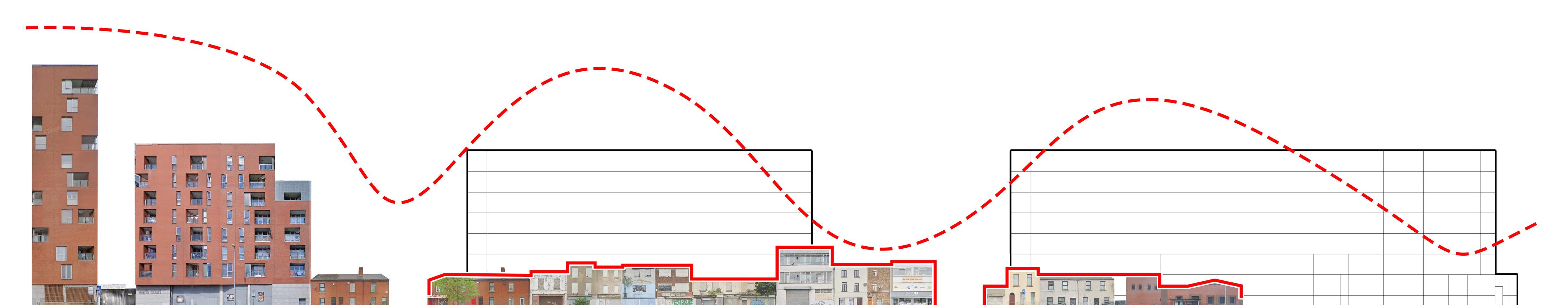
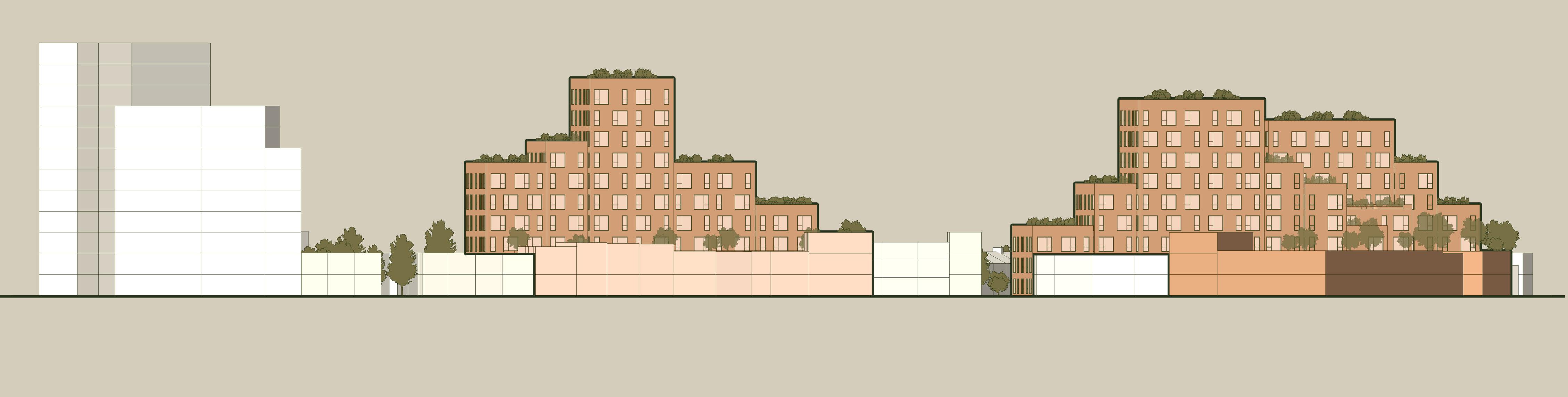
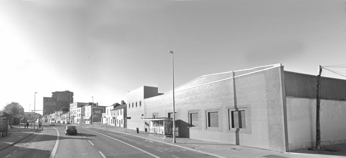
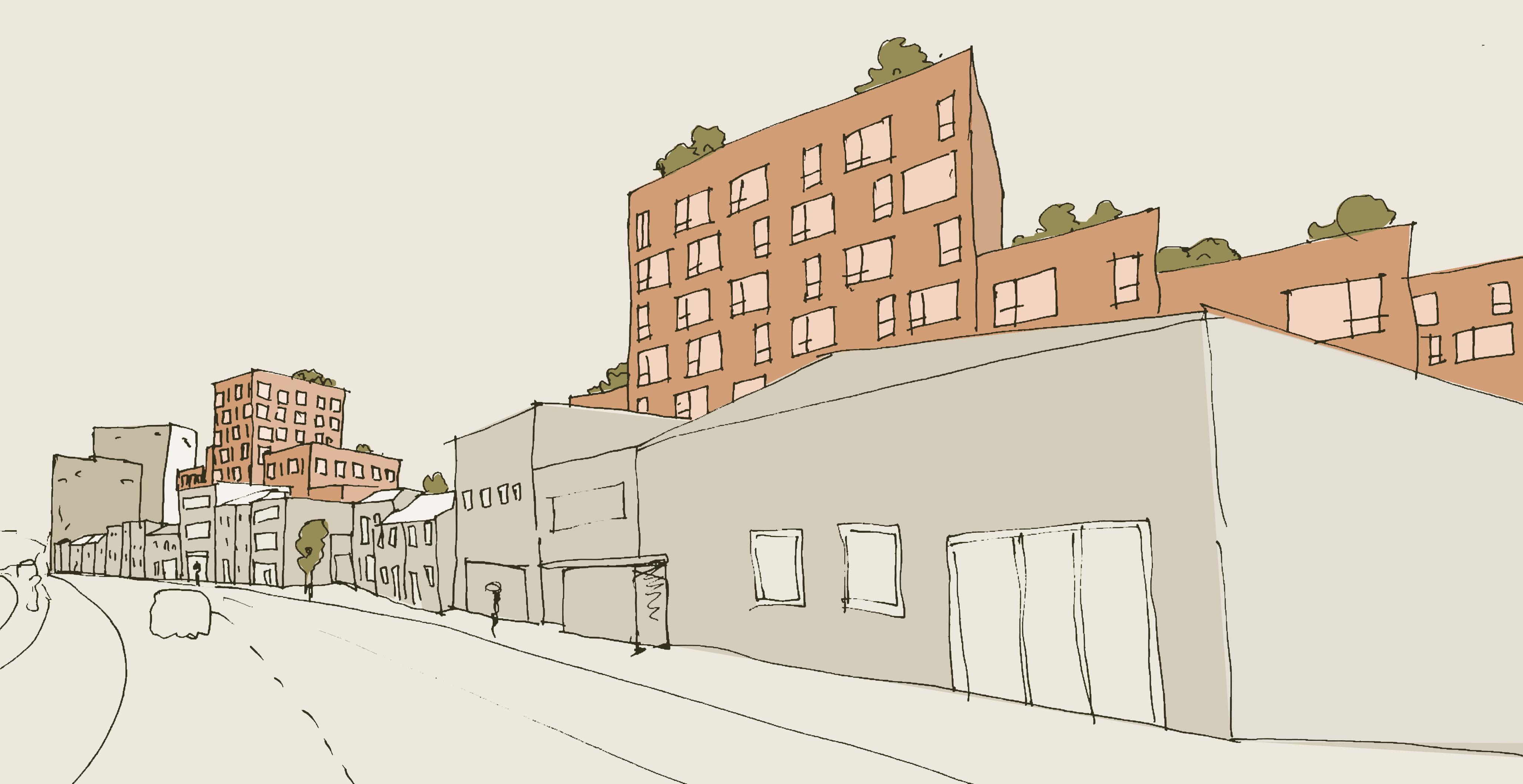
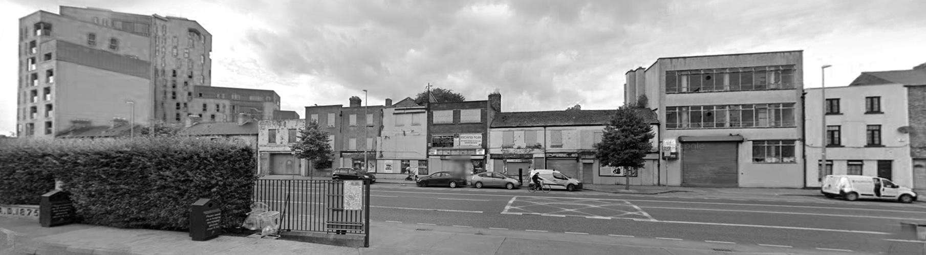
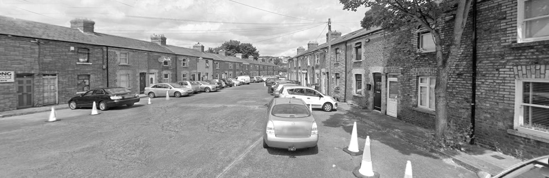
The focus of this design research project is centered on Dolphin Street in the Liberties area of Dublin. The project poses the question: “How can the integration of renewable energy systems within brownfield redevelopment projects contribute to the transition toward climate-neutral cities?”
Emphasizing a design proposal driven by a zero-carbon operational strategy, the project targets infill brownfield areas as sources for future housing developments. It explores the concept of energy communities, where positive energy buildings can be integrated into infill sites. These buildings would not only generate energy for themselves through photovoltaic (PV) systems but also produce surplus energy to power the entire neighborhood.
Identify Potential Buildable Areas and Retrofit Zones
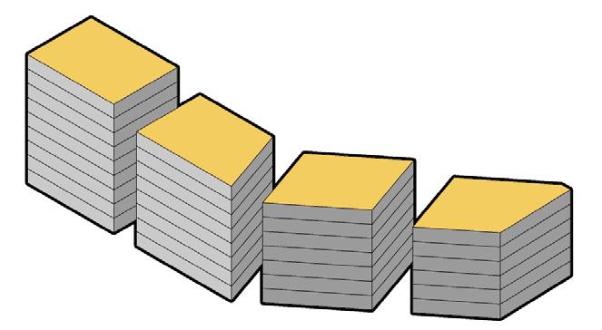
Potential for New Structures
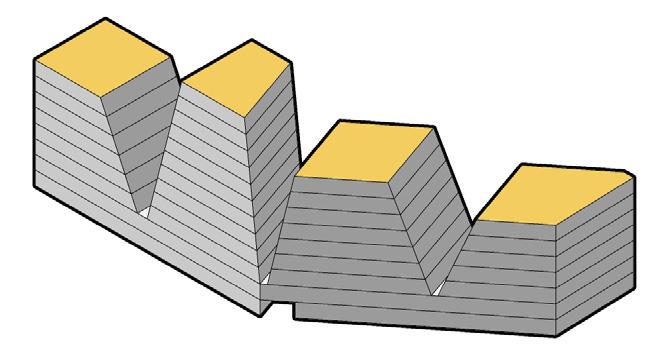
Potential for Retrofitting and Repurposing
DESIGN CONCEPT
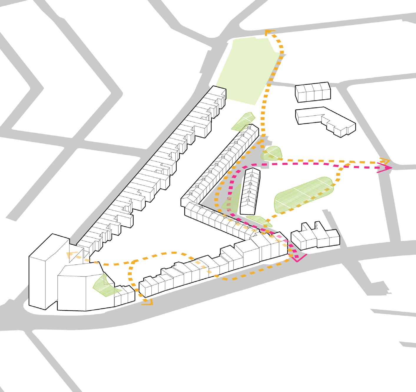
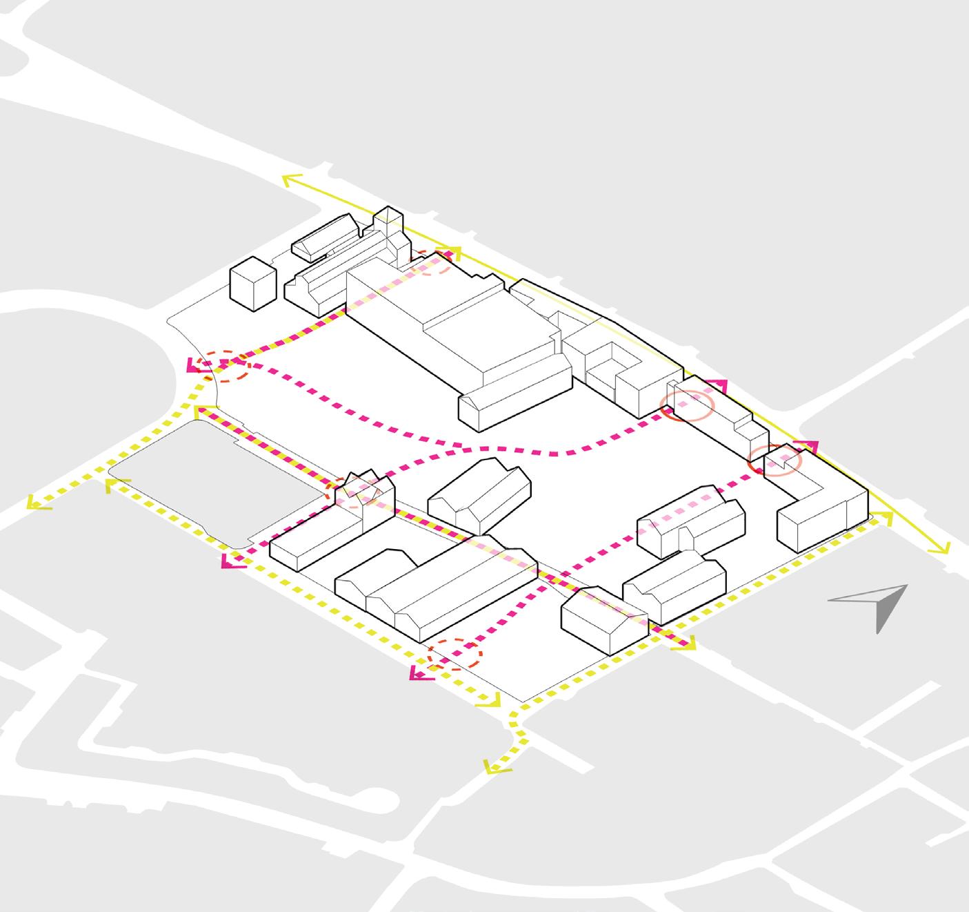
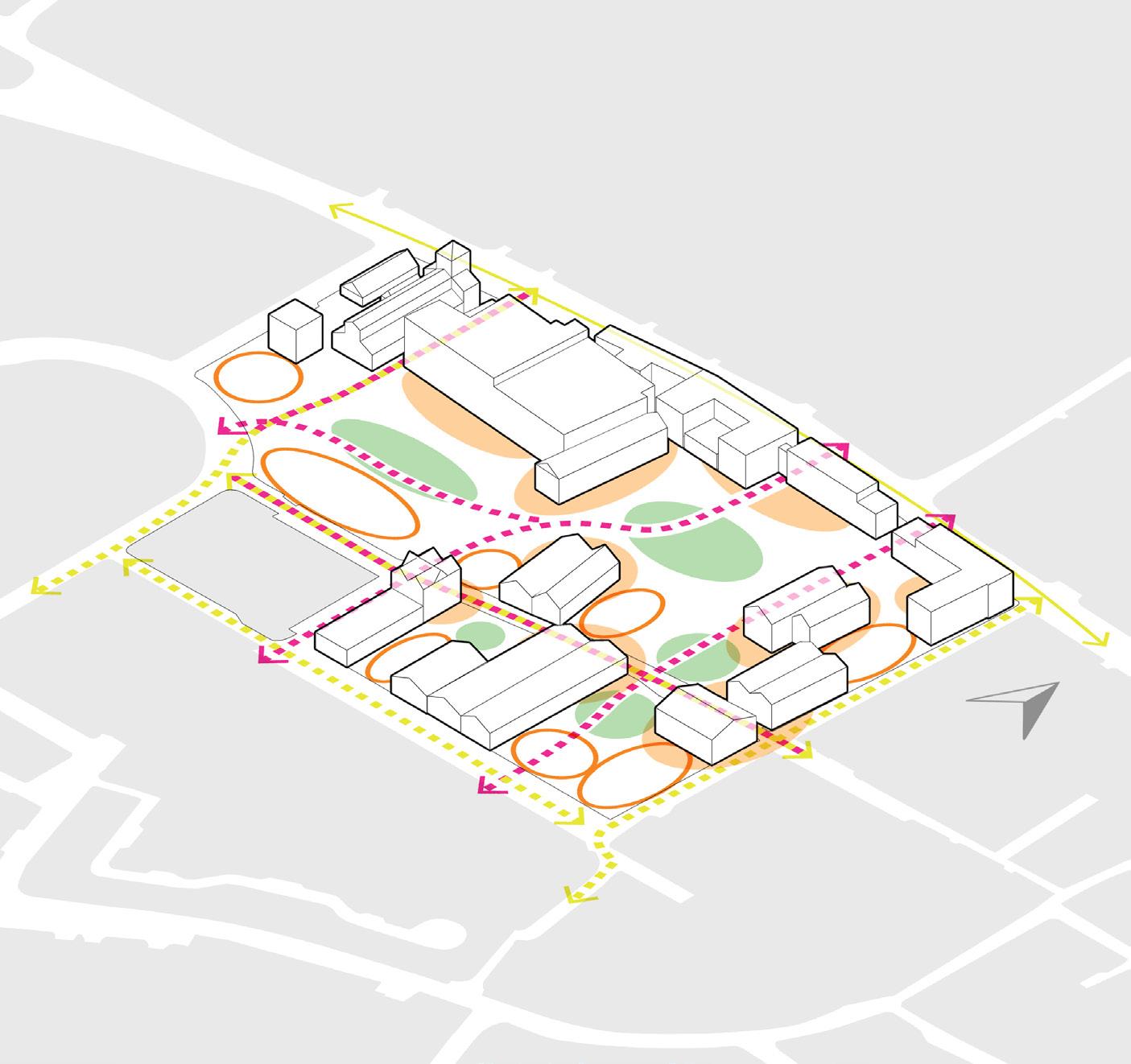
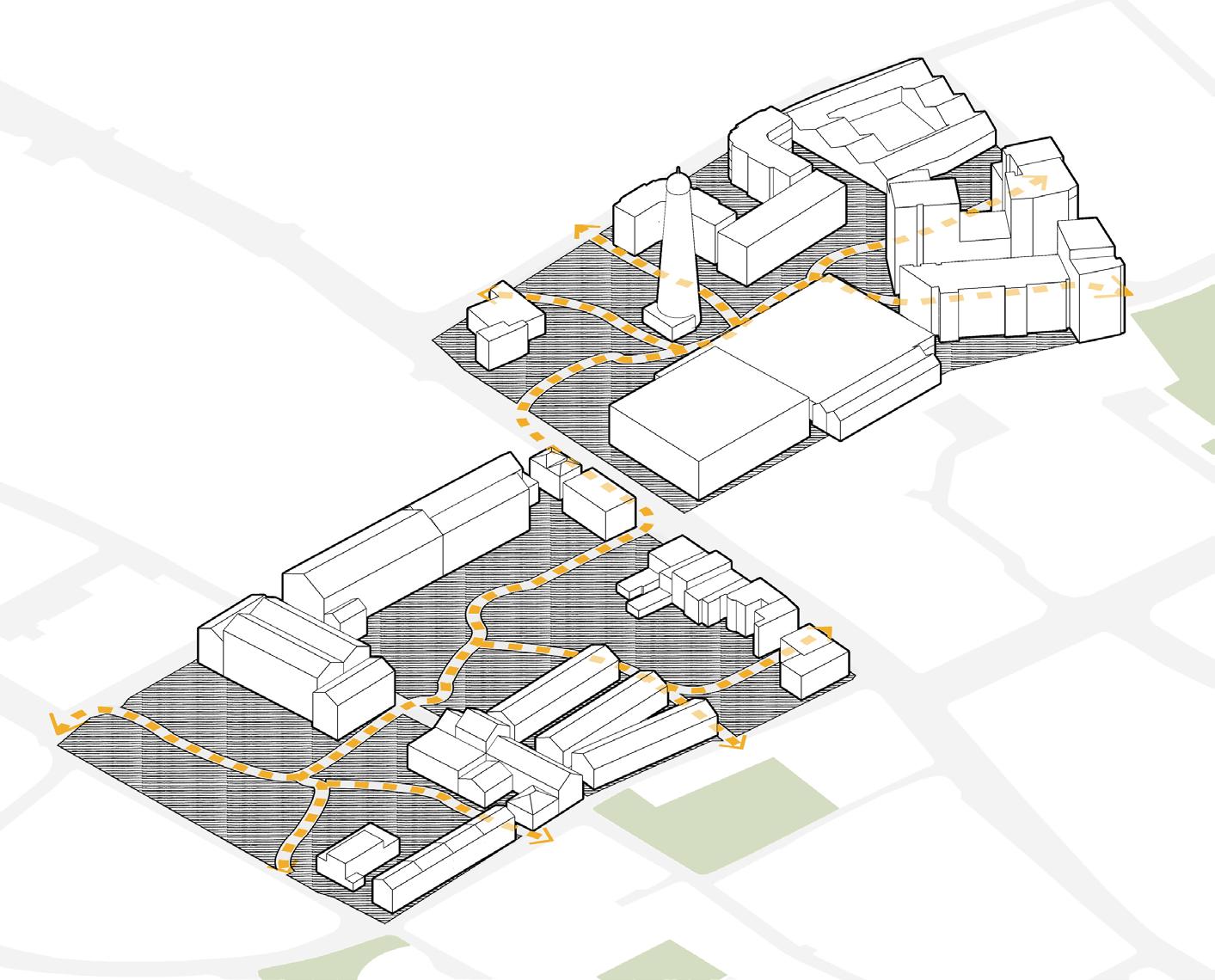
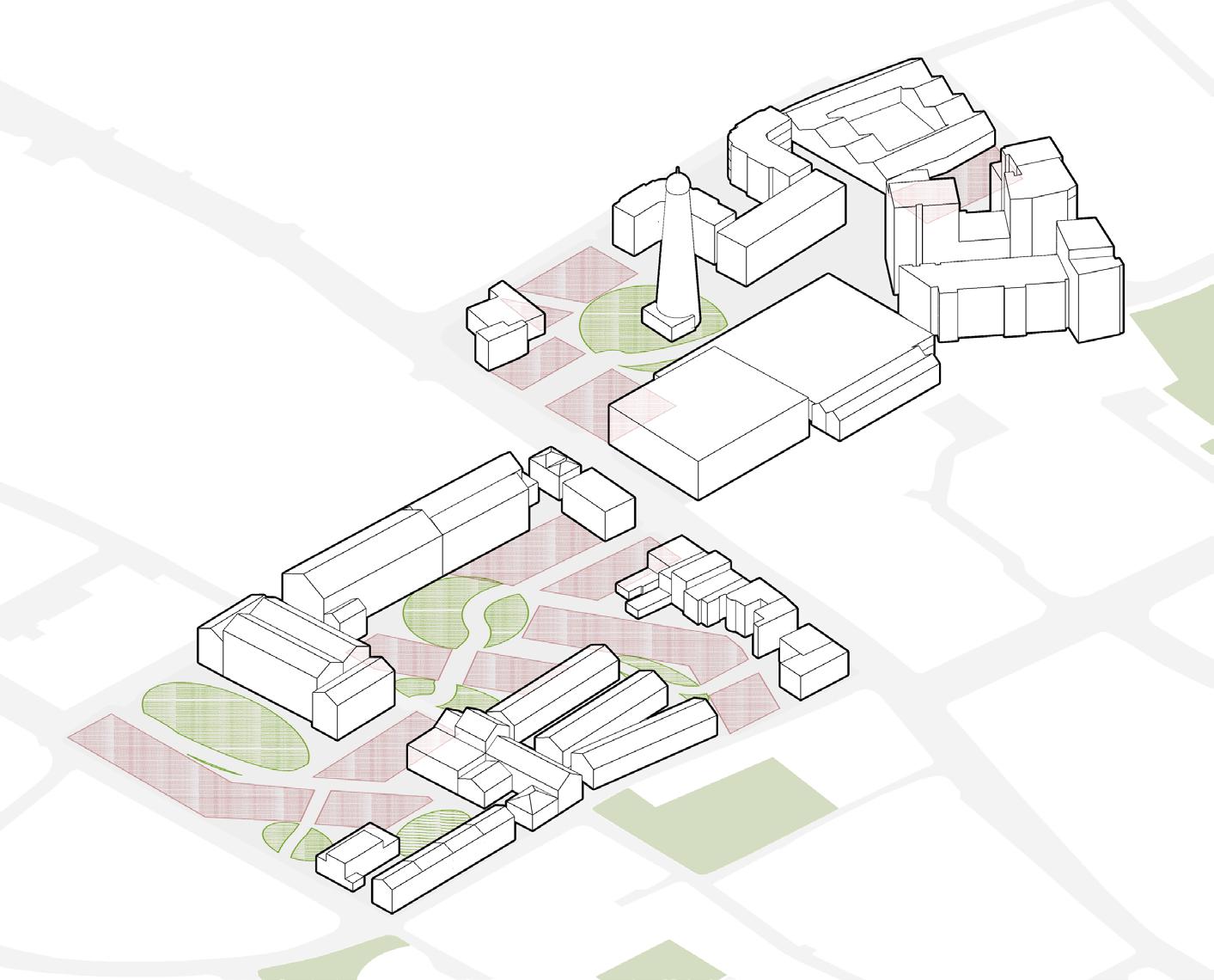
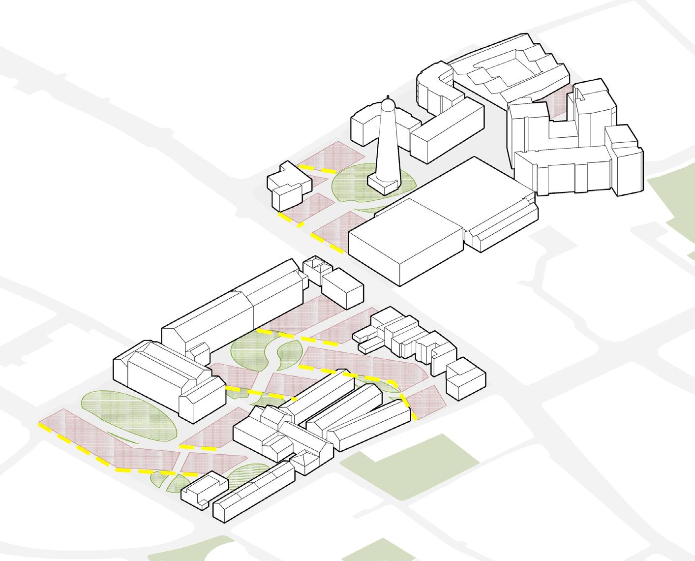
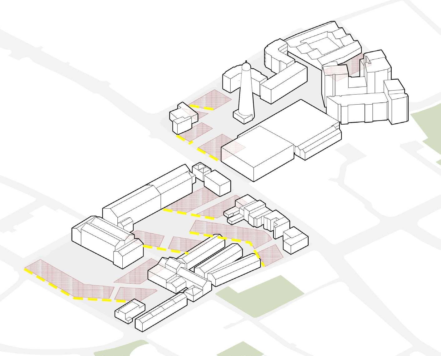
Develop Integrated Pedestrian and Automobile Networks with a Coherent, and Legible Public Green Space System
Proposed Green Spaces/Squares
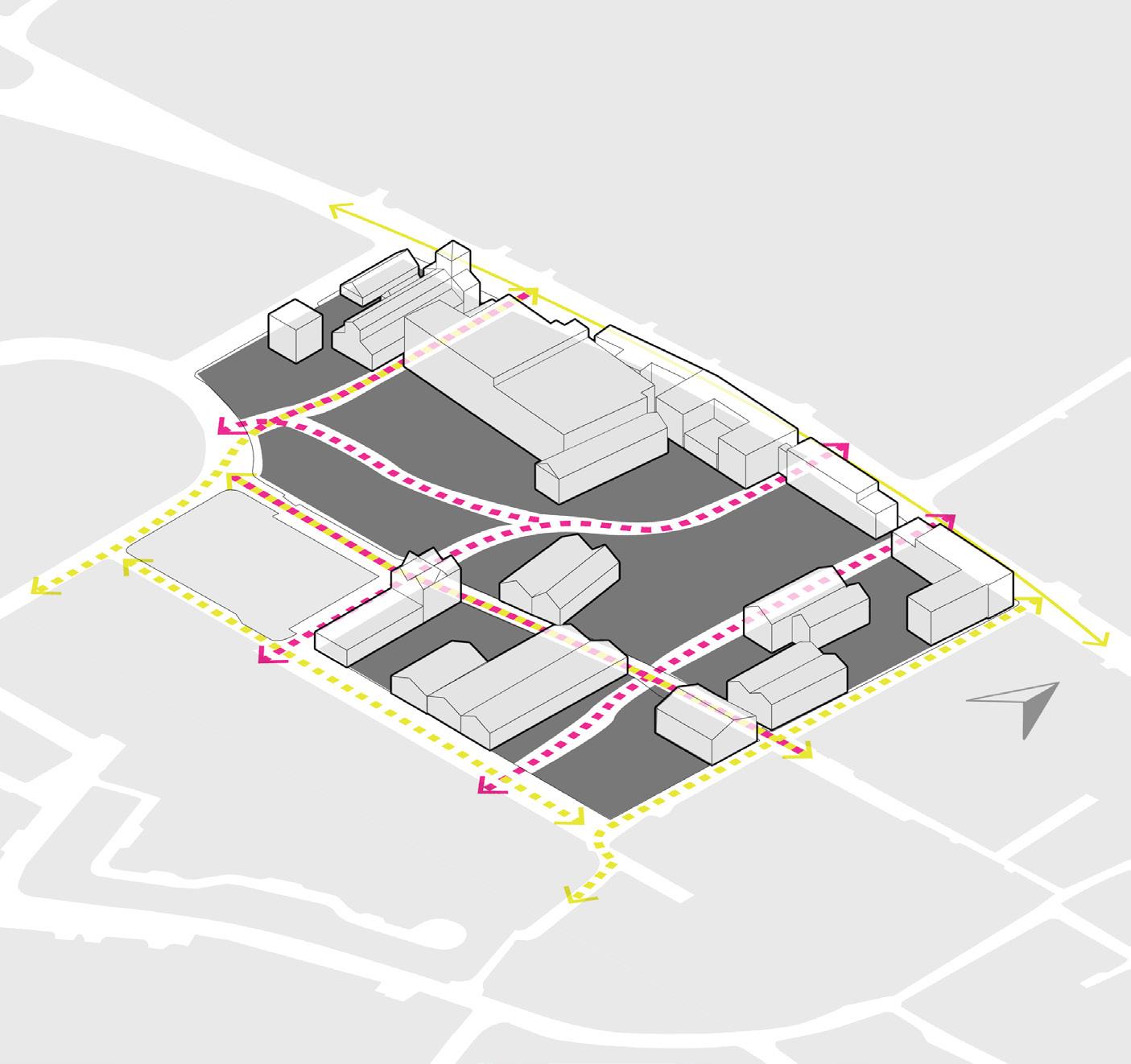
Proposed Pedestrian Networks
Proposed Automobile Networks
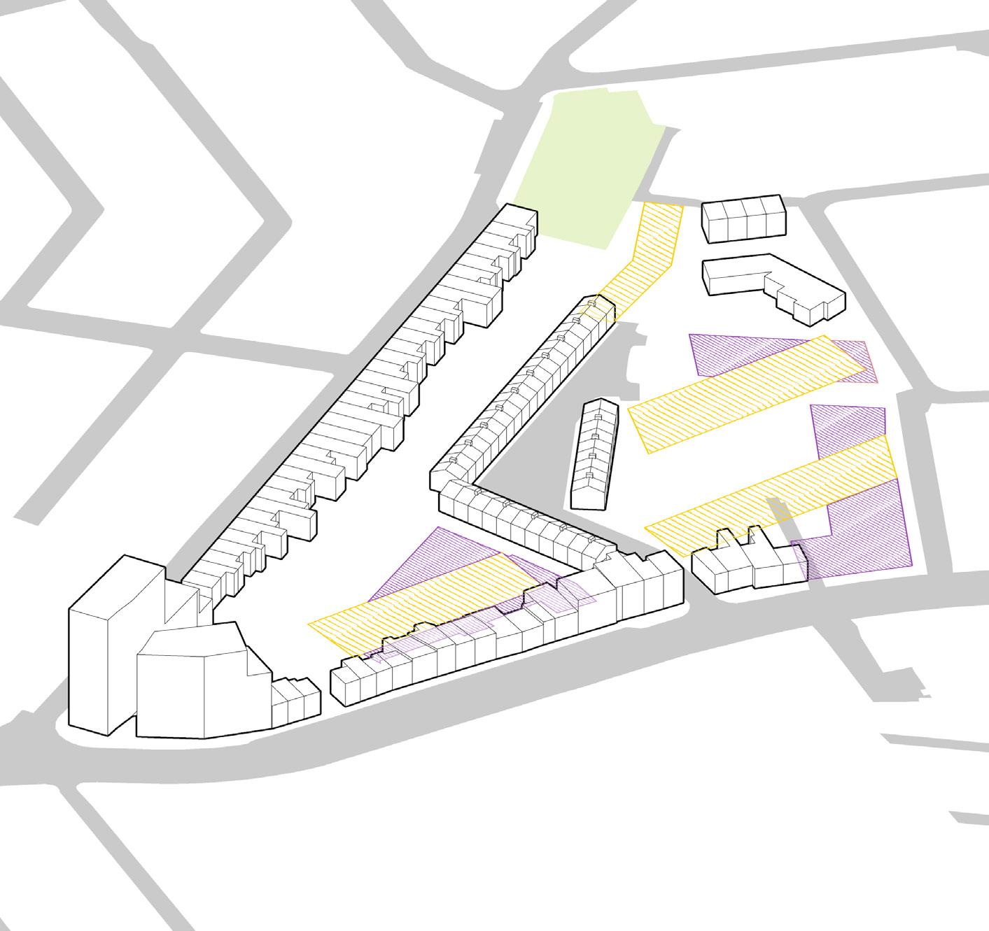
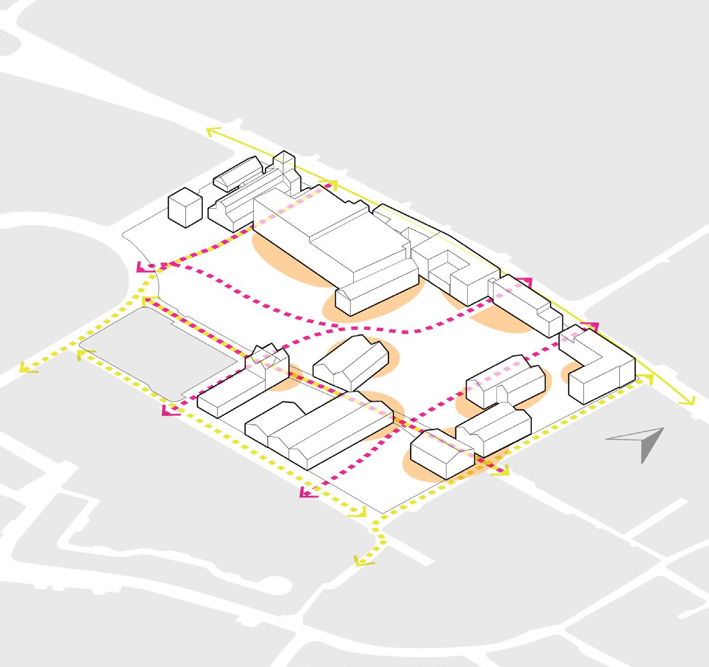
Plan Building Footprints According to Street Profile and Maximum PV Yield
Building Footprints suitable for street profile
Building Footprints suitable PV Yield
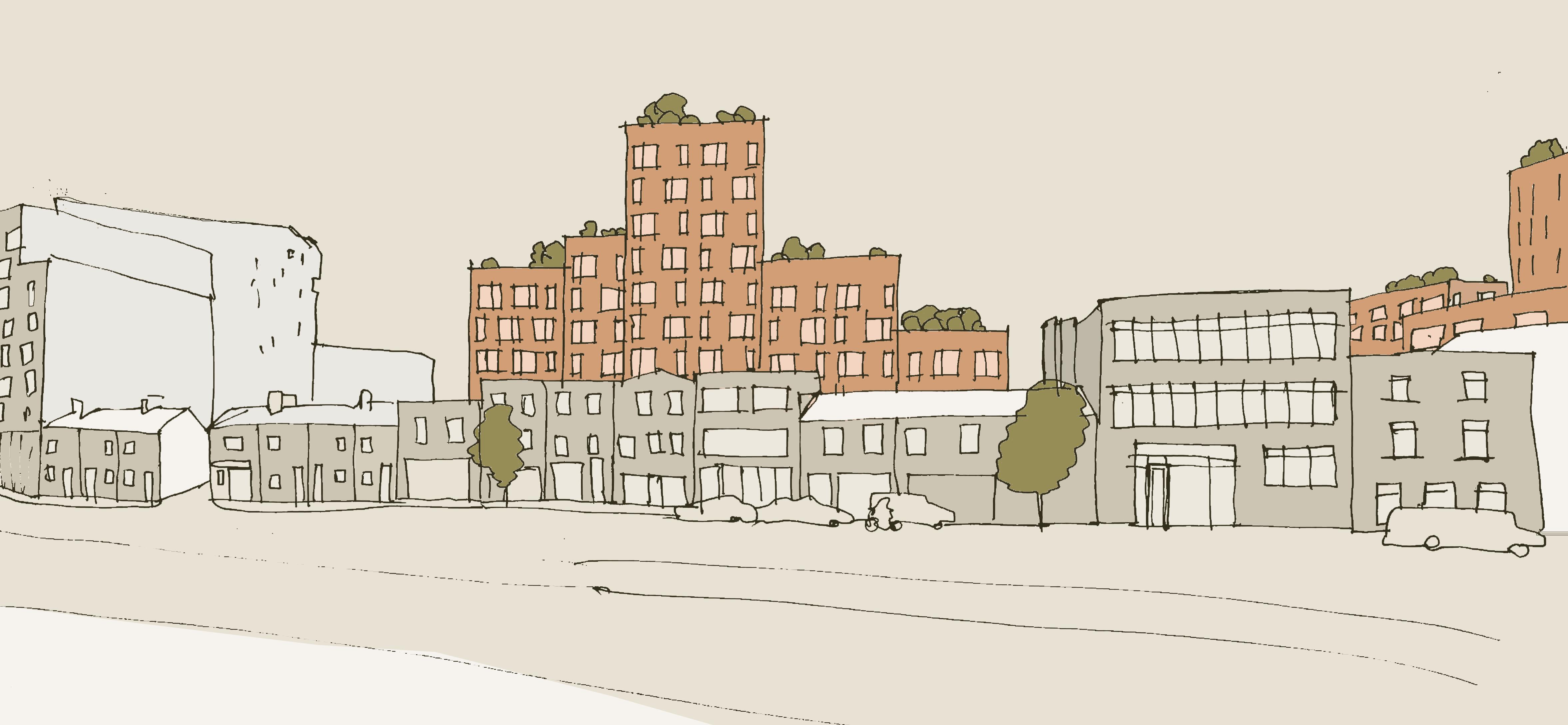
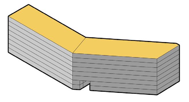
3D Diagram - Buildable Areas and Retrofit Zones - Source: Sardar Ahmed
Diagram
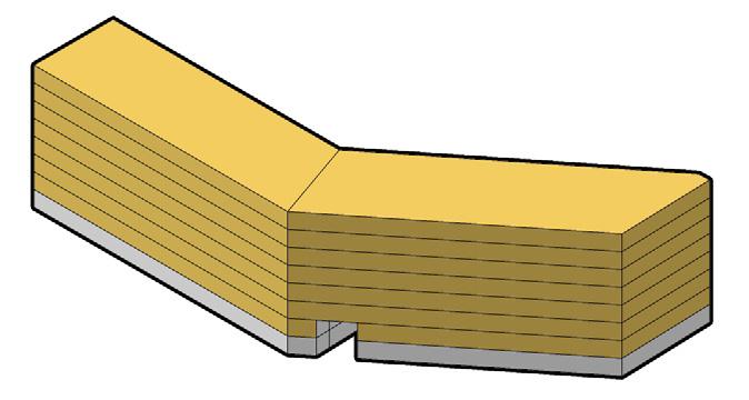
Public Green Spaces - Source: Sardar Ahmed
Diagram - Building Footprints Source: Sardar Ahmed
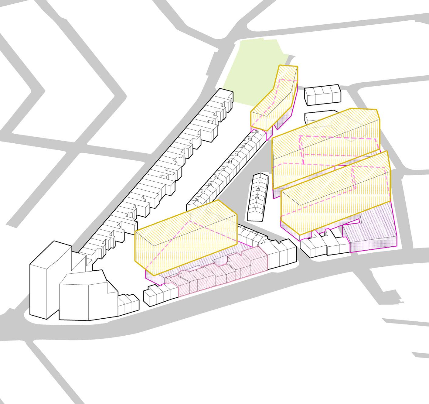
Extrude Two-Story Podiums for Optimal Street Profiles
2 story podiums suitable for street
Repurposed Buildings attached with new 2 story Podium
Place Additional Massing on Podiums for PV Yield
DESIGN CONCEPT
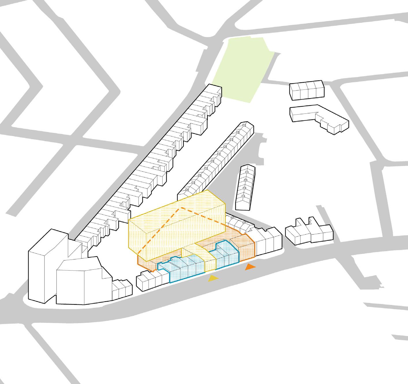
Strategize Repurposing of Buildings on Dolphin Street
2 story podiums suitable for street profile
Massing beyond 2 story on top of podiums
Porposed Commercial Use with existing buildings and a 2 story podium at the back
Porposed repurposed retrofitting for direlect structures
Porposed Residential Structure
Sardar Ahmed - Ubran Design
3D Diagram - GRepurposing Strategy - Source: Sardar Ahmed
3D Diagram - Massing on Podiums for PV Yield - Source: Sardar Ahmed
3D Diagram - Podiums for Optimal Street Profiles - Source: Sardar Ahmed
profile
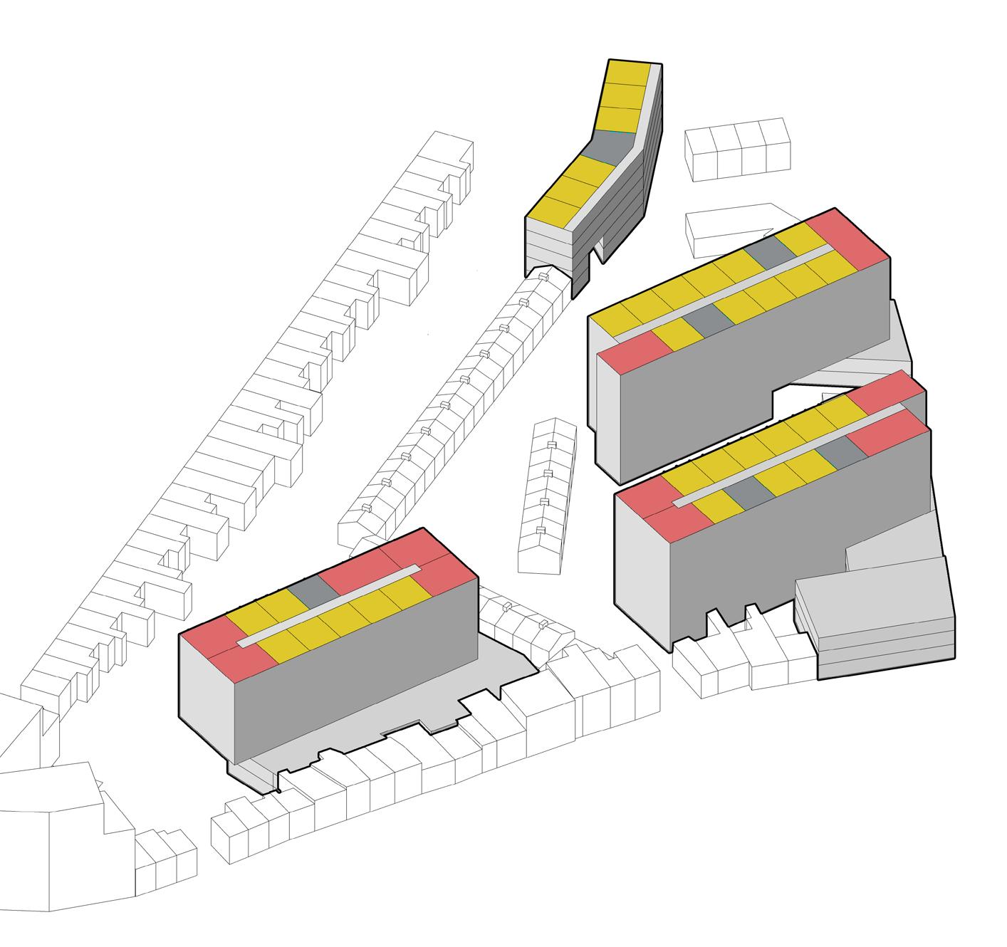
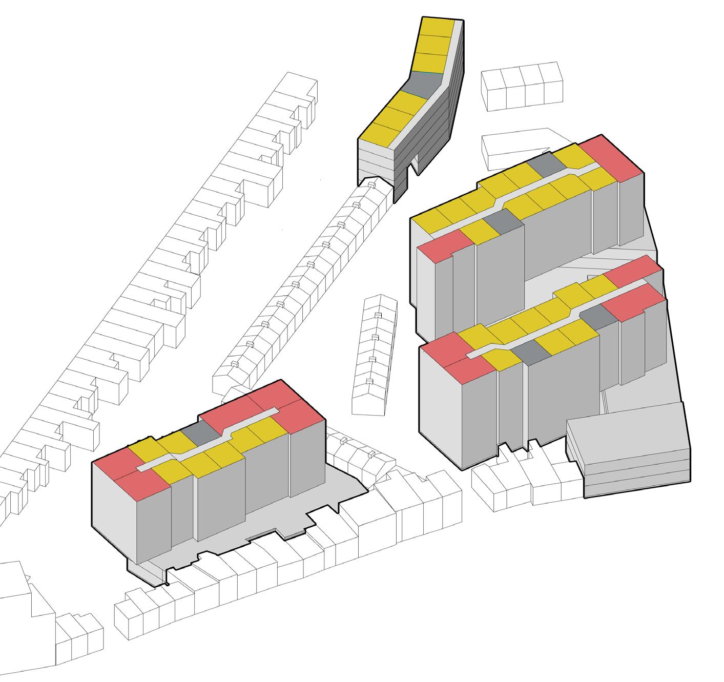
Apartment Typologies
Proposed Core Locations
One Bed Dwelling Unit
Two Bed Dwelling Unit
Shifting Apartment Typologies Height Strategy
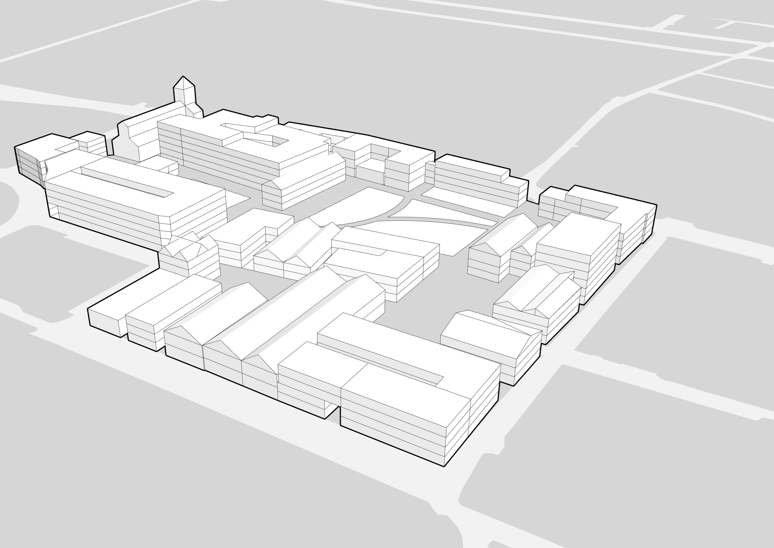
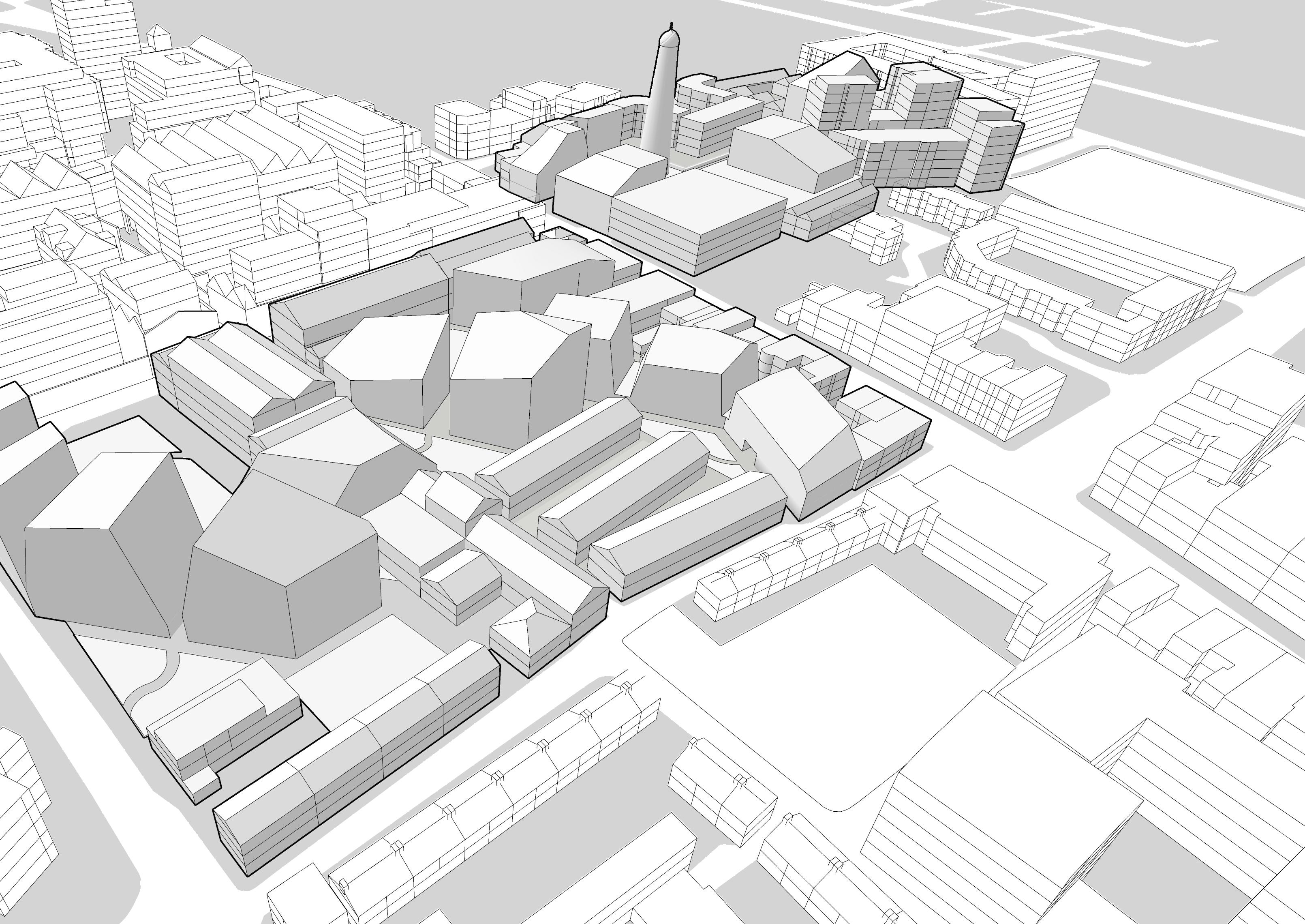
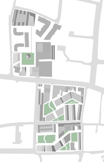
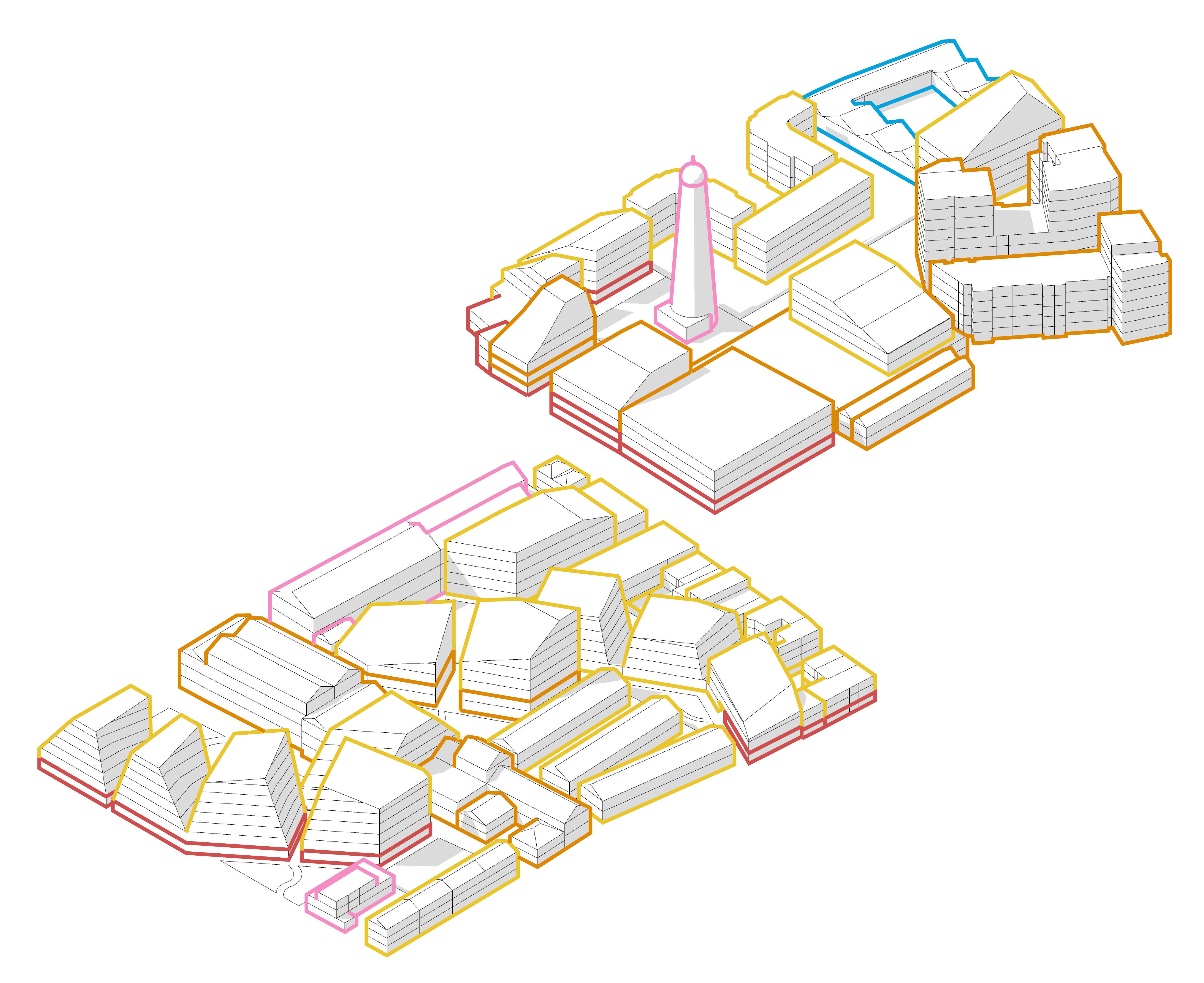
3D Diagram - Guinness Quarter Site with potential public parks and squares marked - Source: Sardar Ahmed
3D Diagram - Guinness Quarter Site with new uses marked on retained structuresSource: Sardar Ahmed
3D Diagram - Guinness Quarter Site with shapes of new urban blocks markedSource: Sardar Ahmed
source: Sardar
Existing Structures
Proposed Repurposed Structures
Proposed Structures
Exisiting Green Areas
Proposed Green Areas/Squares
Sardar Ahmed - Ubran Design Portfolio
DESIGN SKETCHES
Sardar Ahmed - Ubran Design Portfolio
DESIGN SKETCHES
Sardar Ahmed - Ubran Design Portfolio
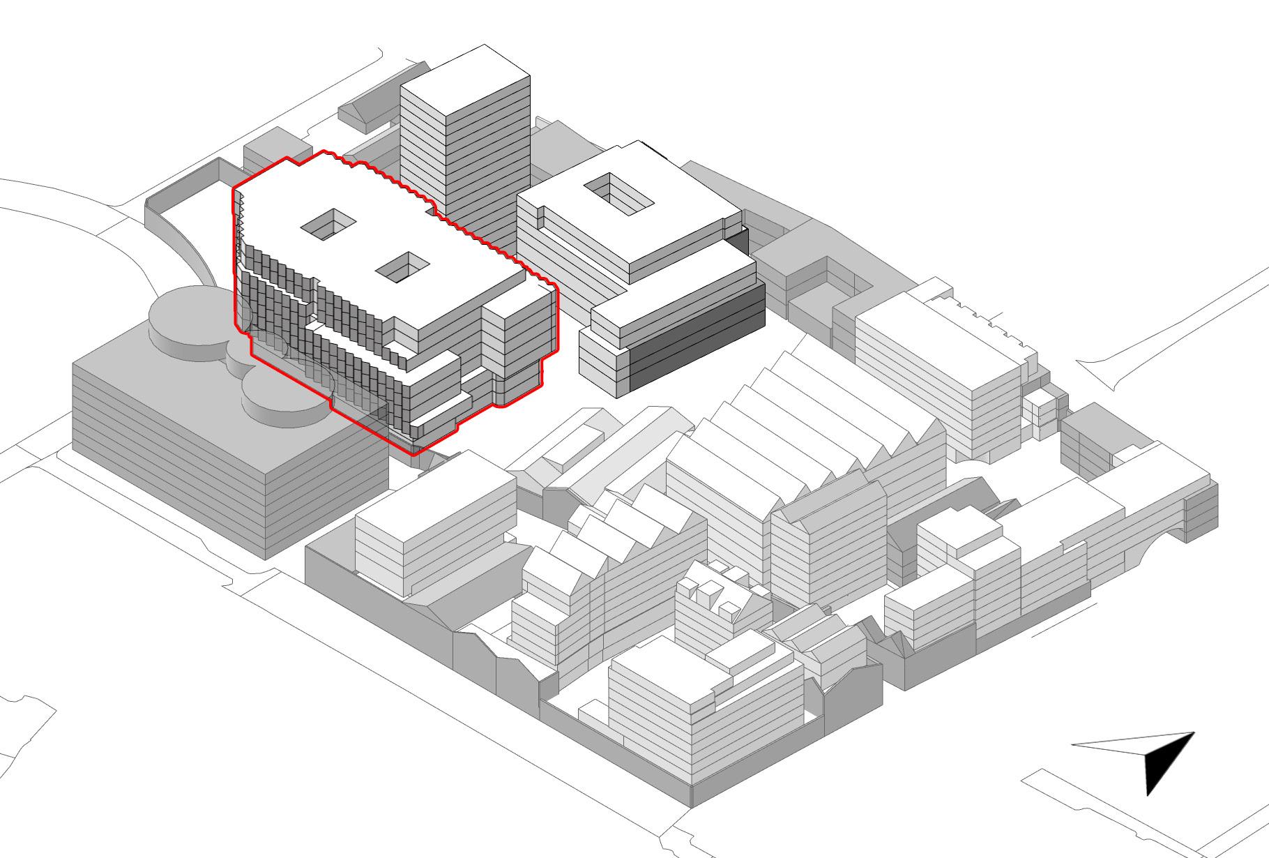
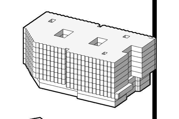
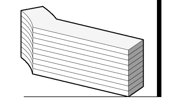
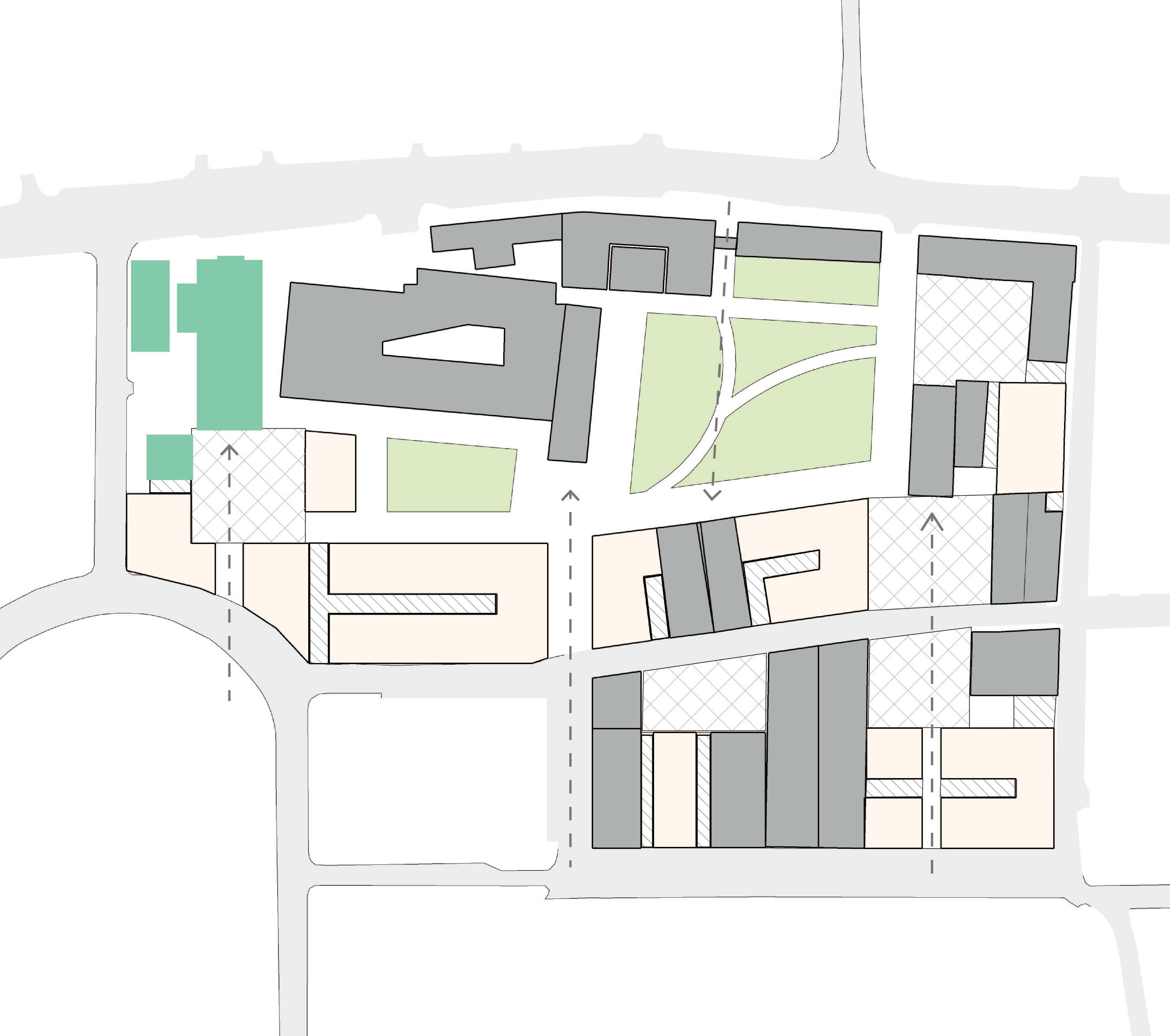
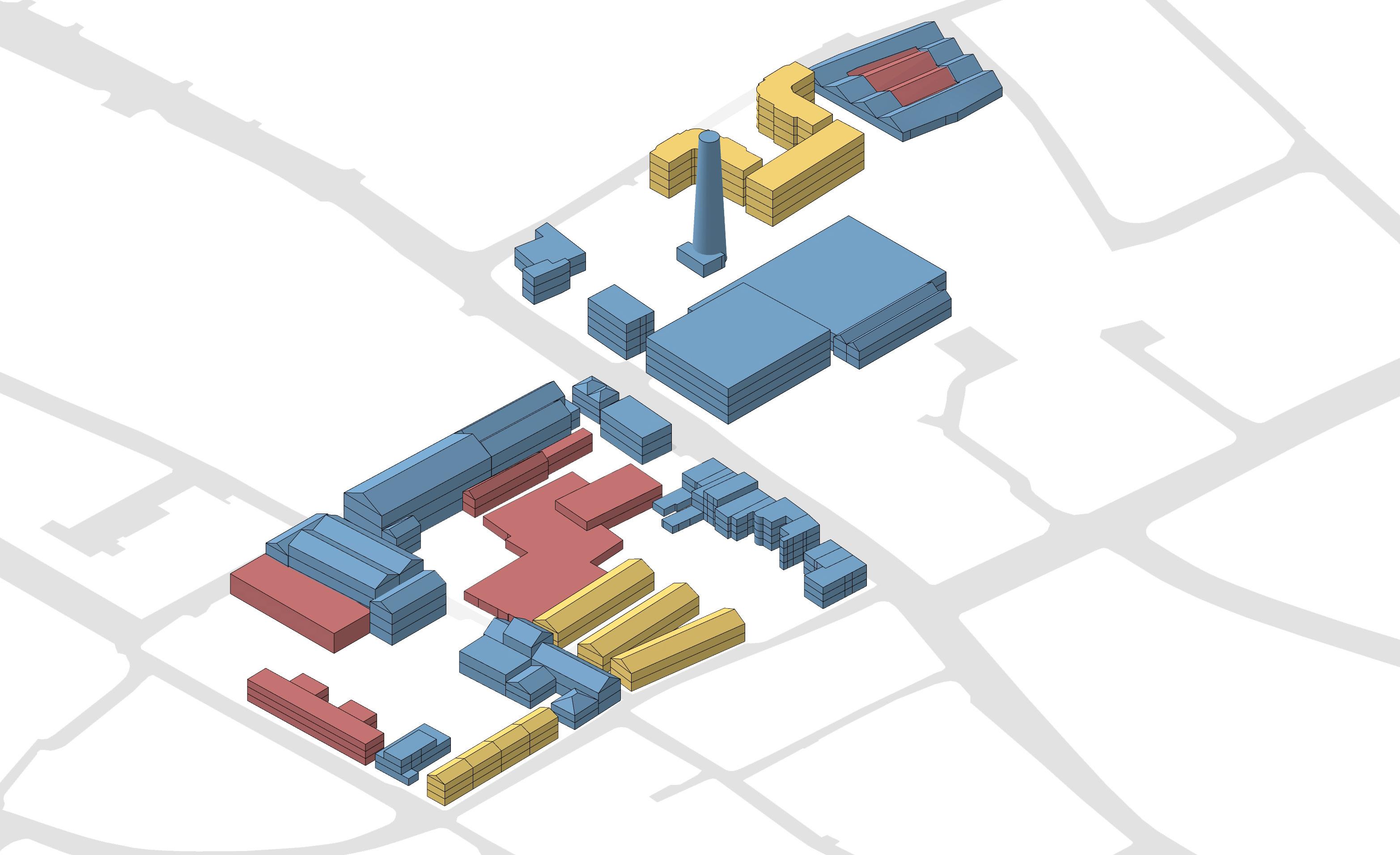
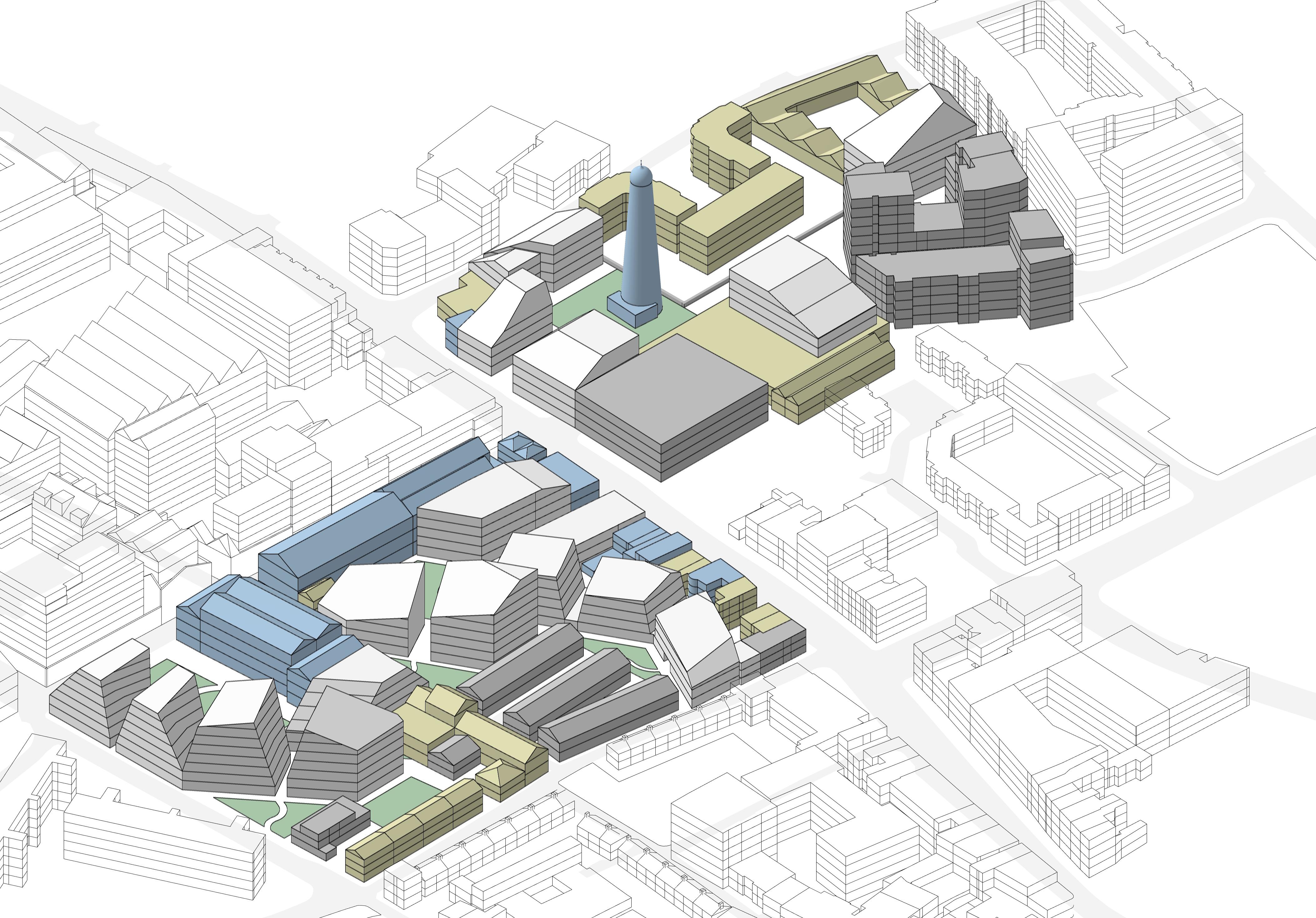
GUINNESS QUARTER: NET ZERO REGENERATION
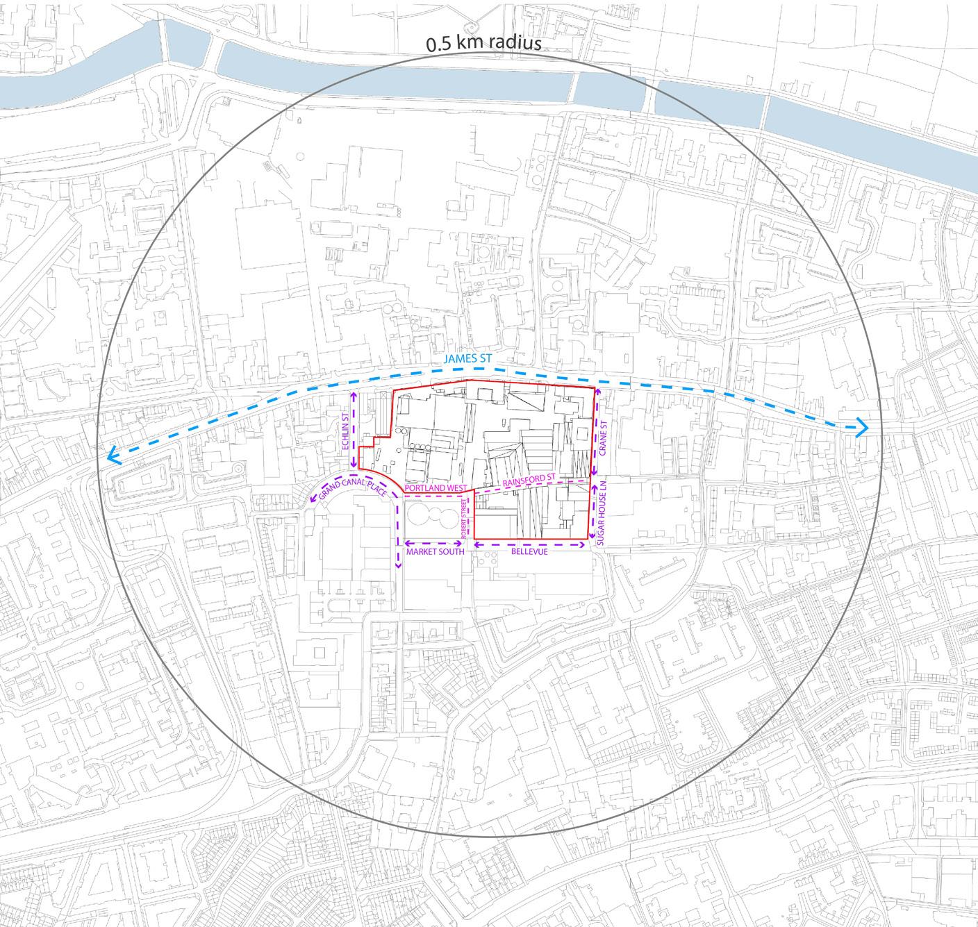
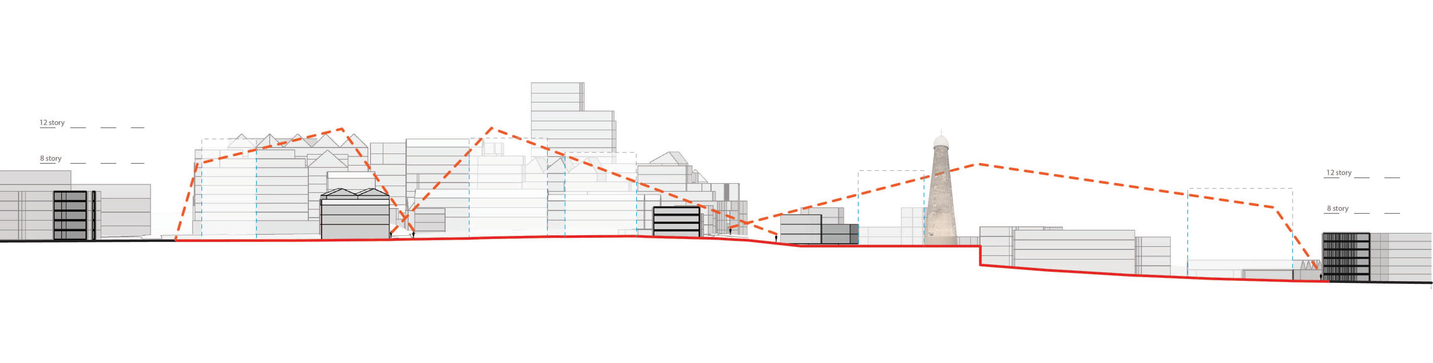
The focus of this design research project revolves around the area once integral to the James Gate brewery, now recognized as the Guinness Quarter following Diageo’s recent regeneration proposal. The project’s inquiries stem from the examination of the publicly available Diageo Guinness Quarter Regeneration Proposal, leading to the overarching question: “What is the optimum form of development to attain the Net Zero Operational Carbon target in the Guinness Quarter through solar generation capacity, while retaining its industrial heritage and enhancing urban connectivity?”
Emphasizing on creating an alternative design proposal driven by a zero-carbon operational strategy, the project seeks to draw conclusions through a comparative lens with the planning approved Diageo Development proposal. Central to this investigation is the operational carbon footprint of the Guinness Quarter development. The analysis of the Diageo Regeneration proposal will encompass both design quality and energy considerations, forming the foundational elements of the study.
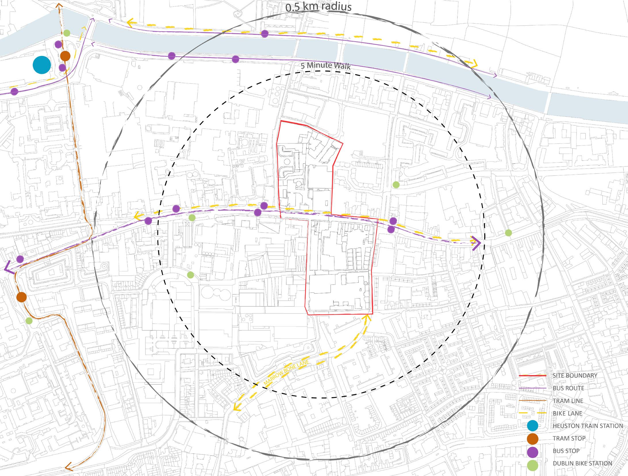
SECONDARY STREETS
PRIVATE STREETS
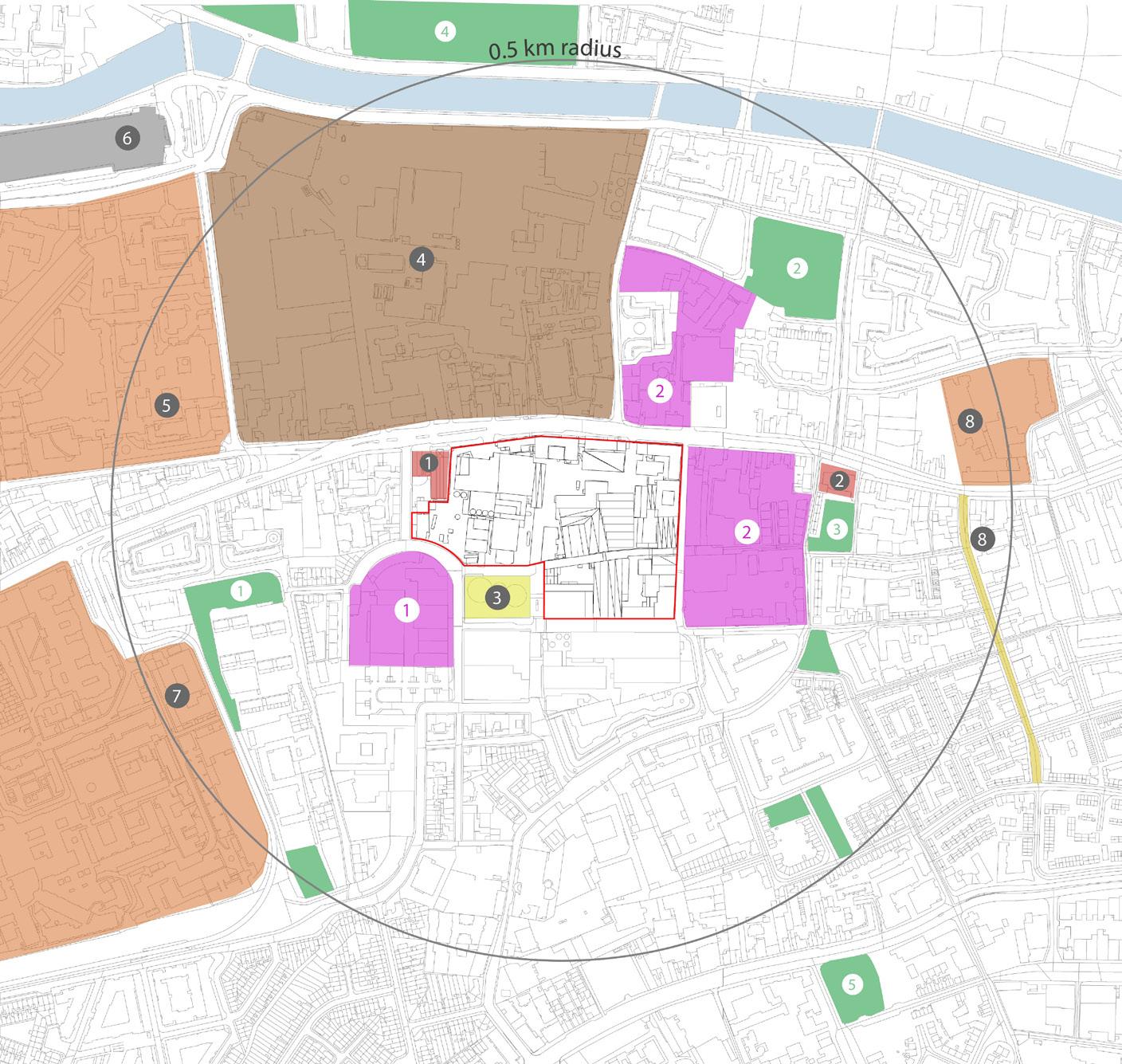
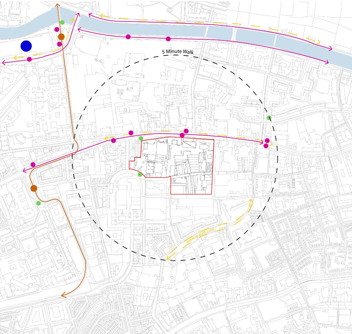
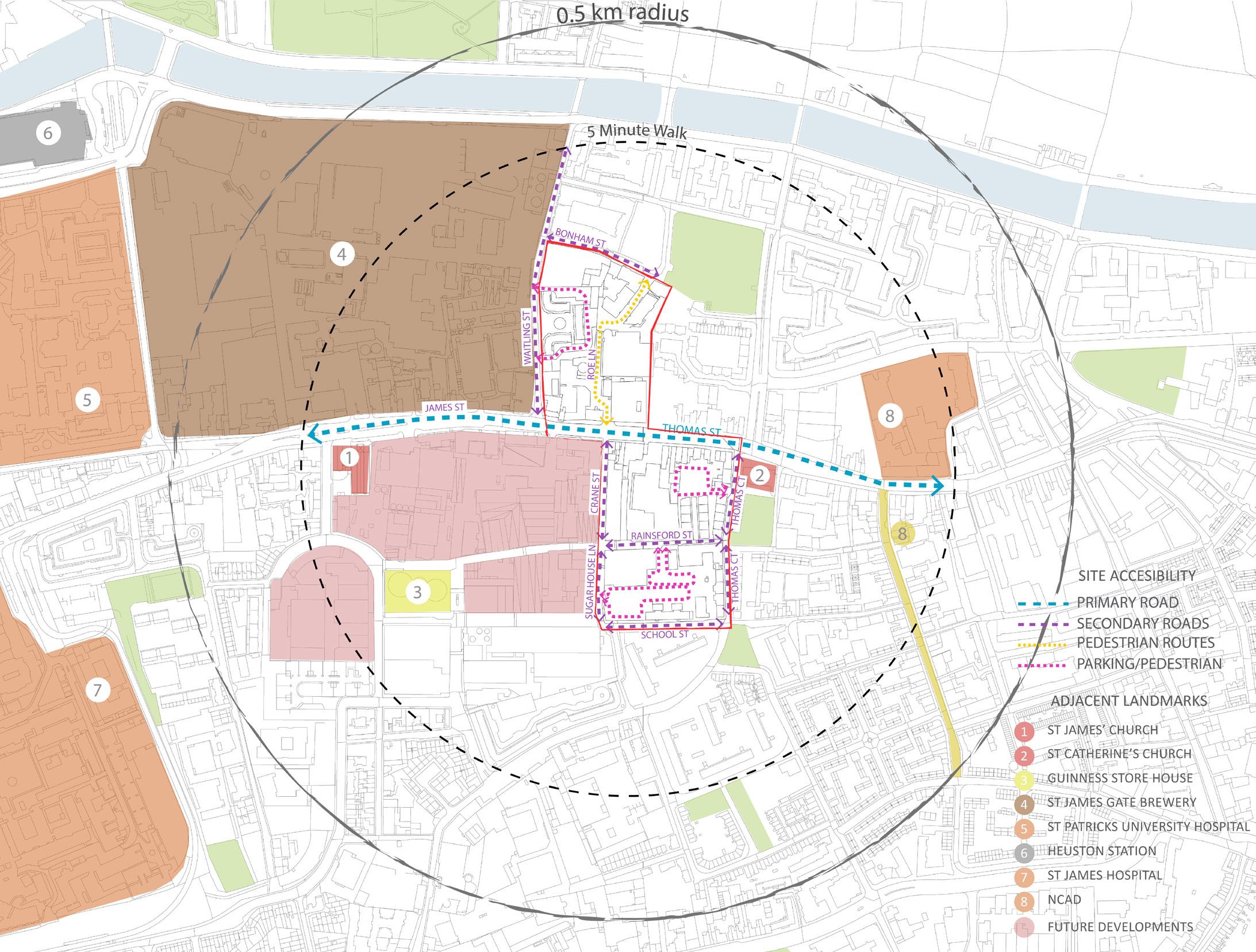
Map - Site road networks and accesibility Source: Sardar Ahmed Map - Surrounding Landmarks and Context Source: Sardar Ahmed Map - Public Trasnport Accesibility
Source: Sardar Ahmed
SCENERIO 1
MECHANICALLY VENTILATED BUILT FORM
SCENERIO 2
COURTYARDS INTRODUCED TO ENABLE BETTER NATURAL VENTILATION
BUILDING 1
USE: OFFICE
HEIGHT: 9 STORIES
SCENERIO 2
RADICALLY REDUCED FOOTPRINT TO ENABLE BETTER NATURAL LIGHT AND VENTILATION THROUGH-
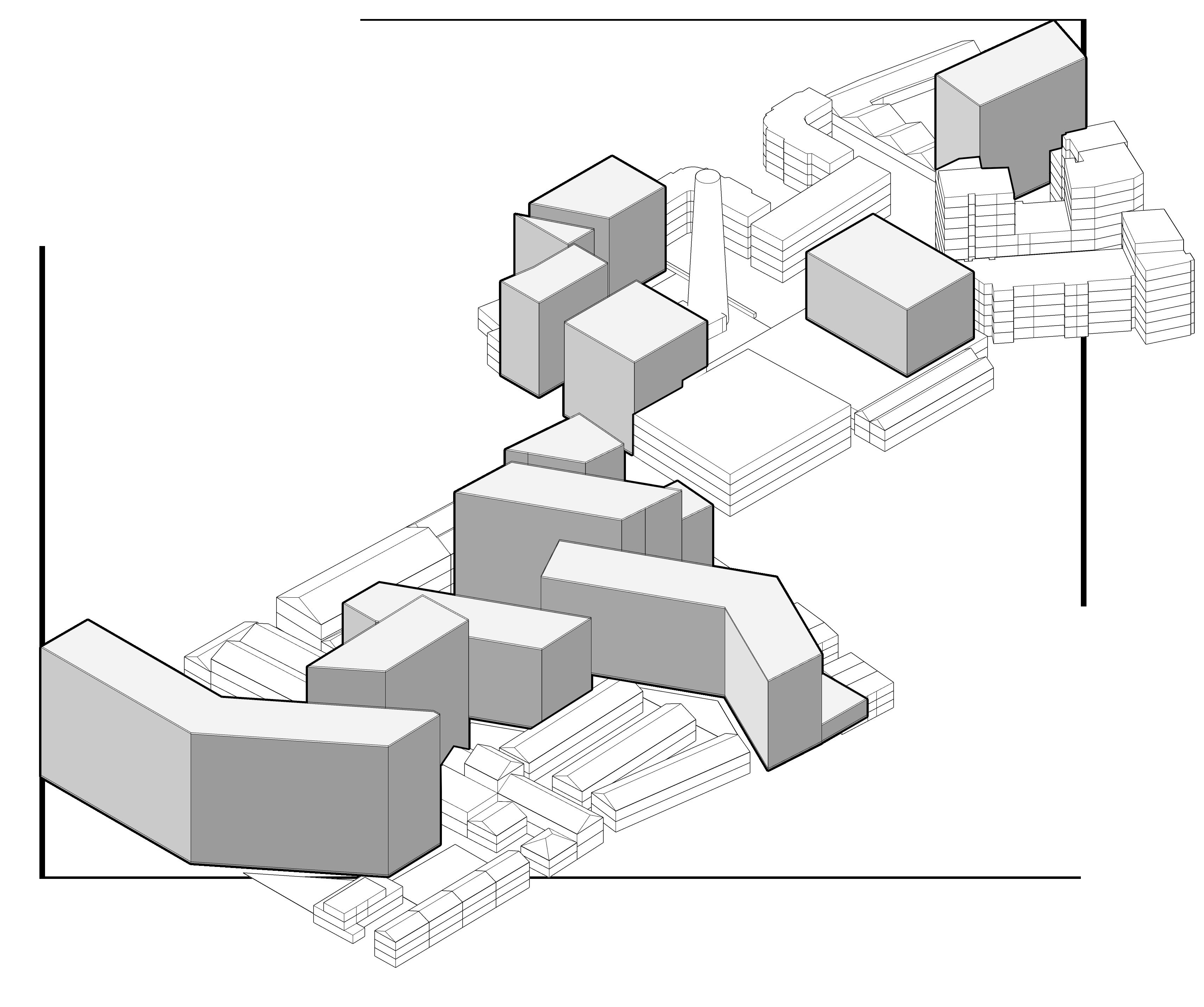
3D Diagram - Study Area Marked in Diageo Guinness Quarter Proposal Sketchup Model - source Sardar Ahmed
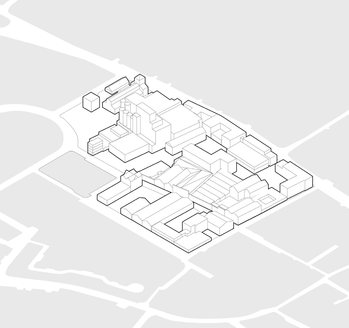
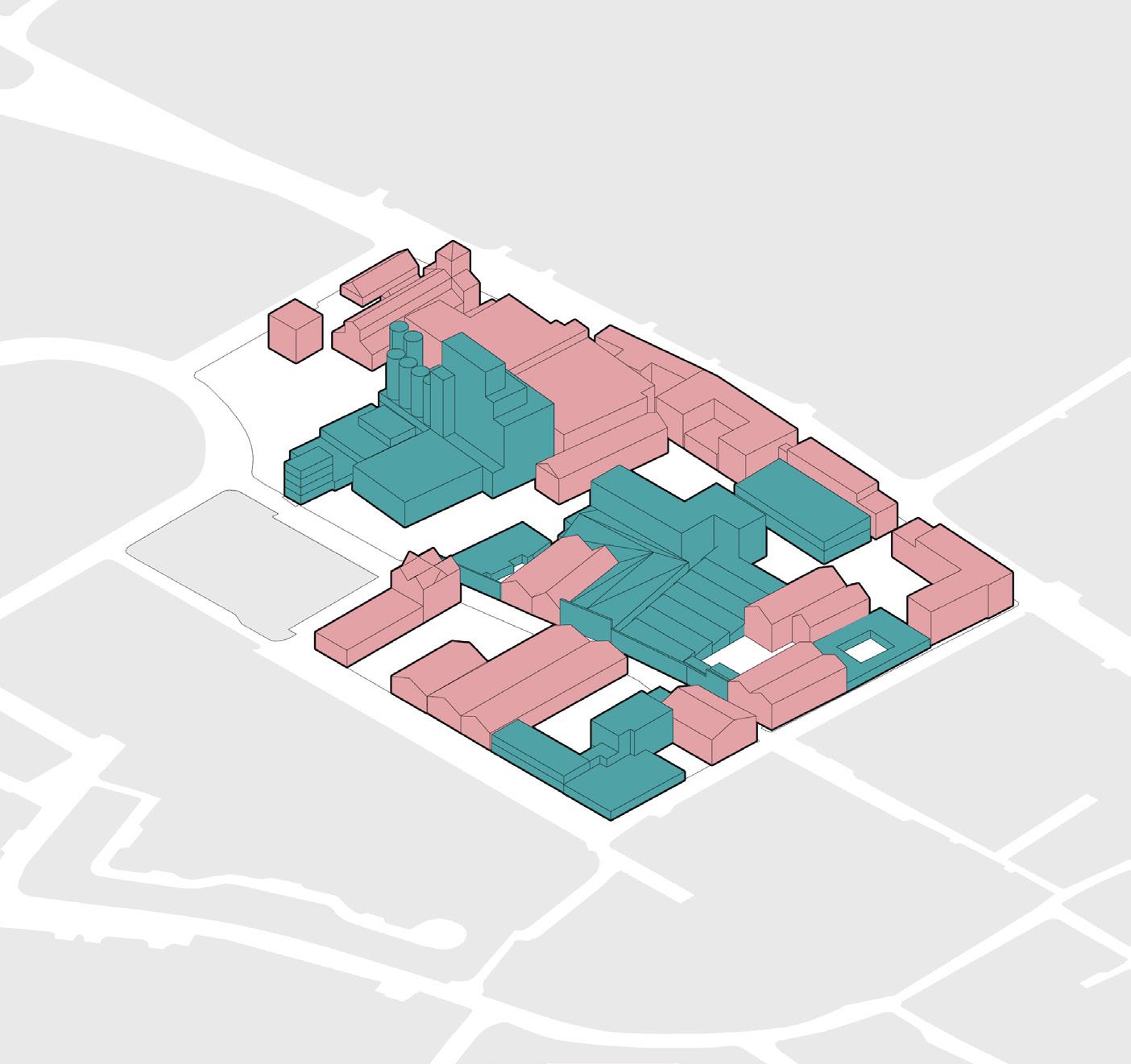
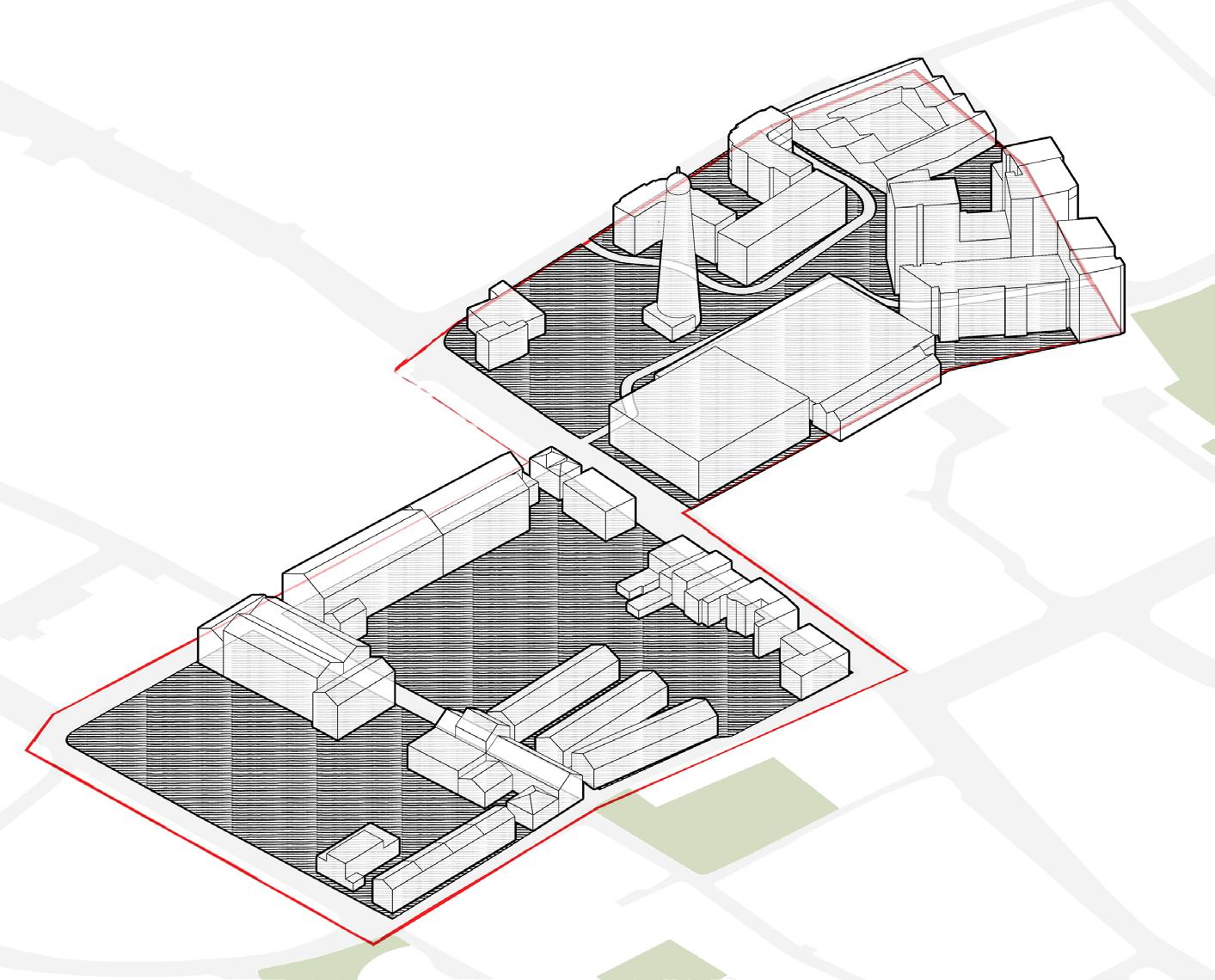
EXISTING INDUSTRIAL SITE FABRIC
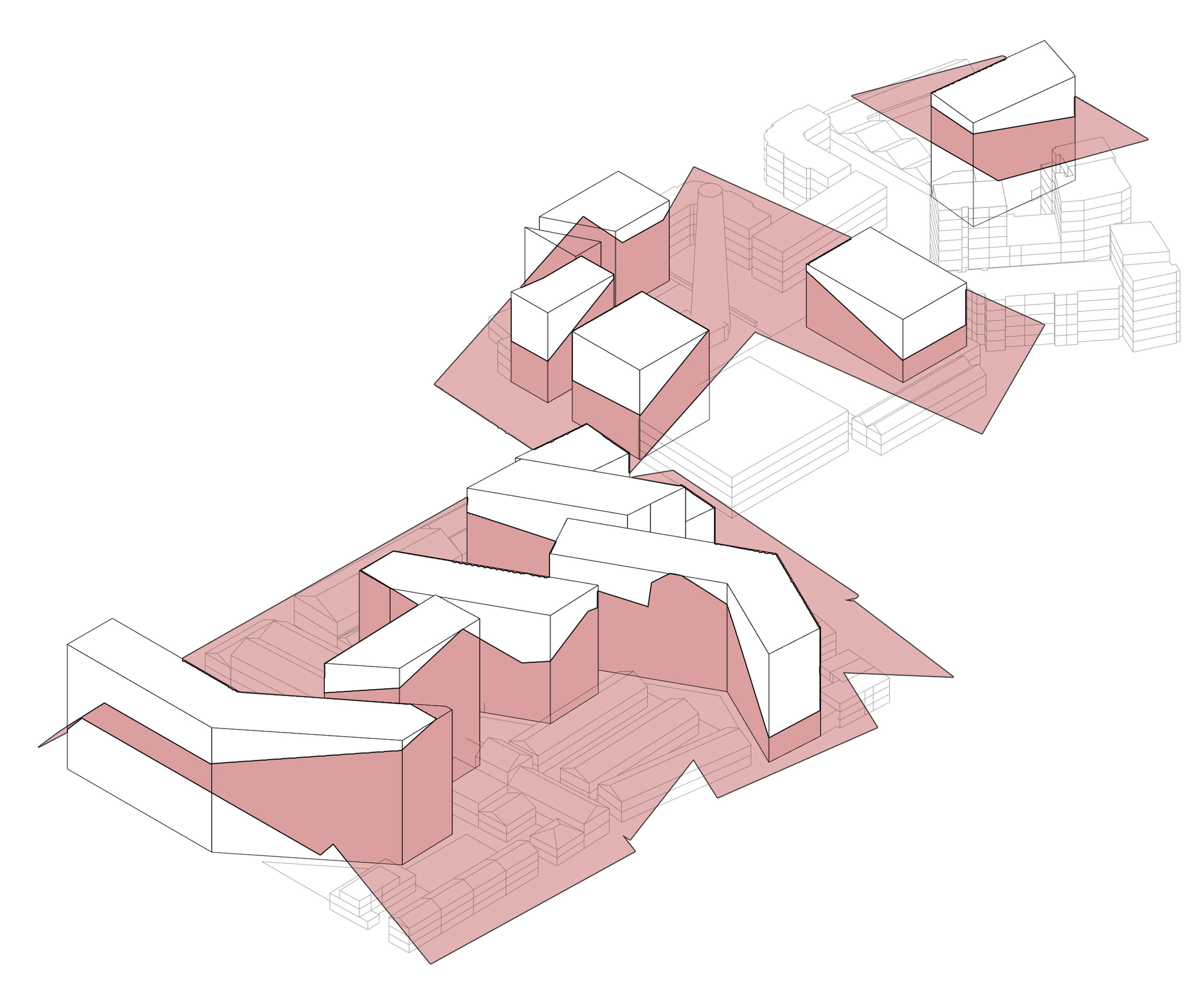
DESIGN CONCEPT | INDUSTRIAL HERITAGE RETENTION
INDENTIFIED HERITAGE RETENTION
RETAINED STRUCTURES IN THE DESIGN PROPOSAL
BUILDINGS TO BE DEMOLISHED IN THE DESIGN PROPOSAL
NEW SITE CANVAS
RETAINED STRUCTURES IN THE DESIGN PROPOSAL
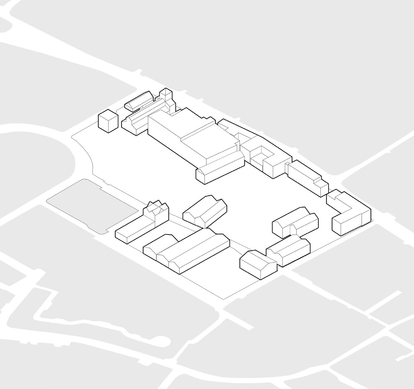
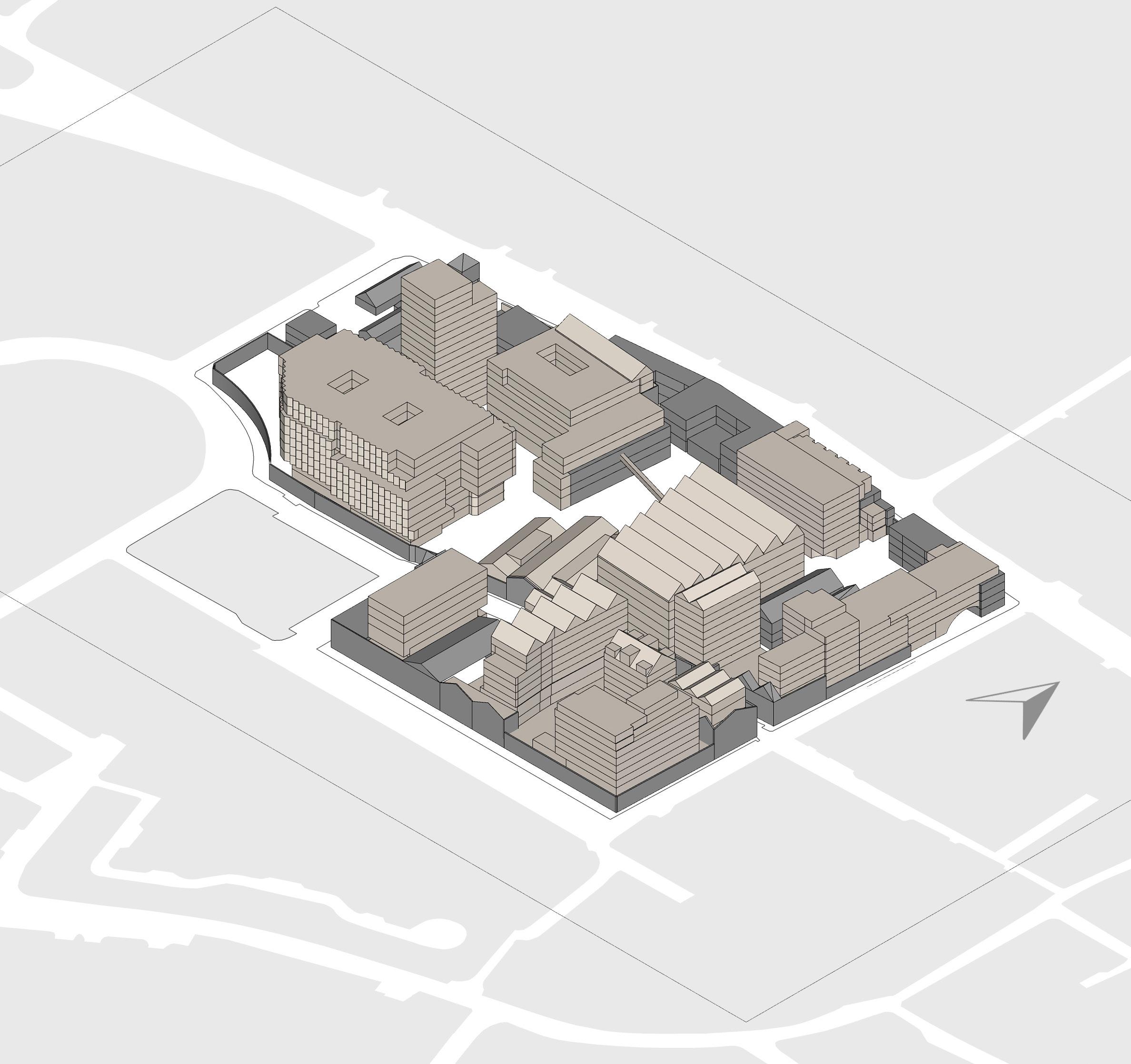
3D Diagram - Current built form of the Guinness Quarter Site - Source: Sardar Ahmed
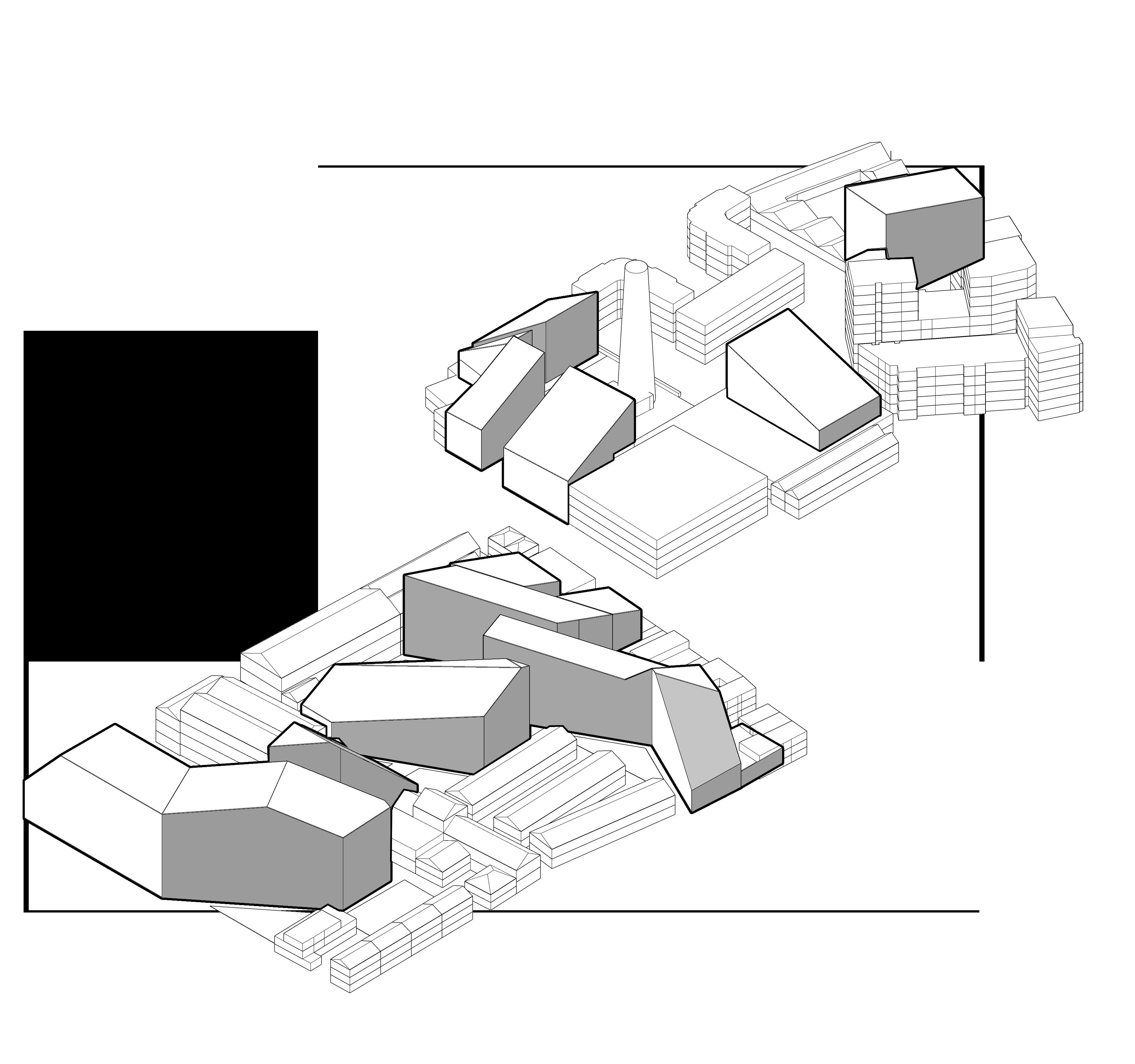
3D Diagram - Current built form of the Guinness Quarter Site with structure retention and demolition marked - Source: Sardar Ahmed
3D Diagram - Built form of the Guinness Quarter Site after Retention and Demolition Source: Sardar Ahmed
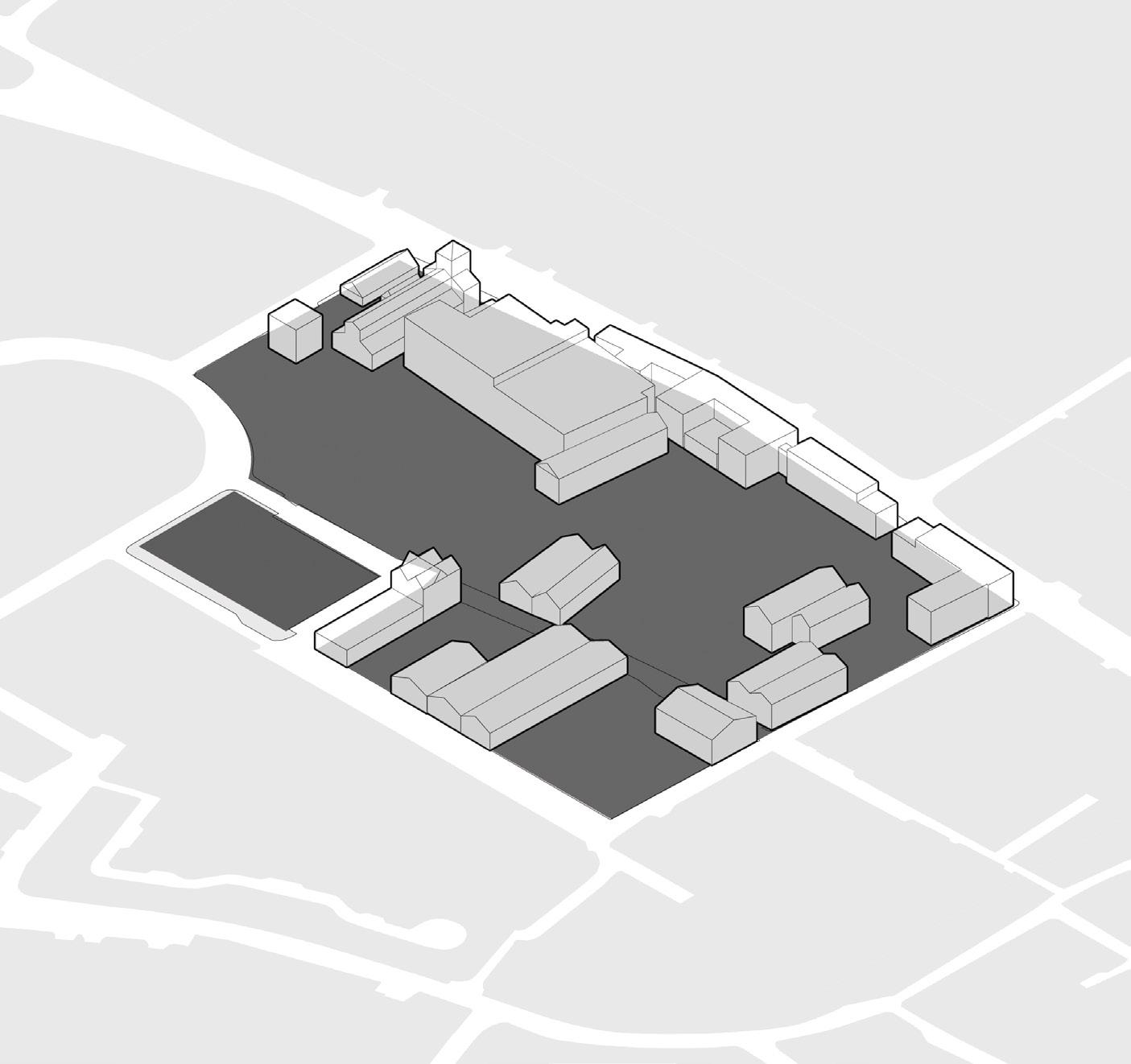
INDENTIFYING SHAPE OF THE URBAN BLOCK
DESIGN CONCEPT | ESTABLISH NEW CONNECTIONS
RETAINED STRUCTURES
IN THE DESIGN PROPOSAL
SHAPE OF THE BLOCKS
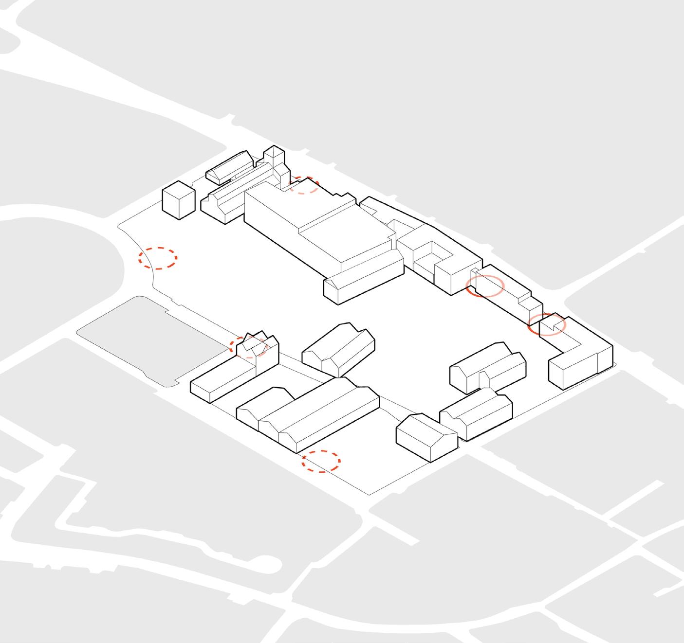
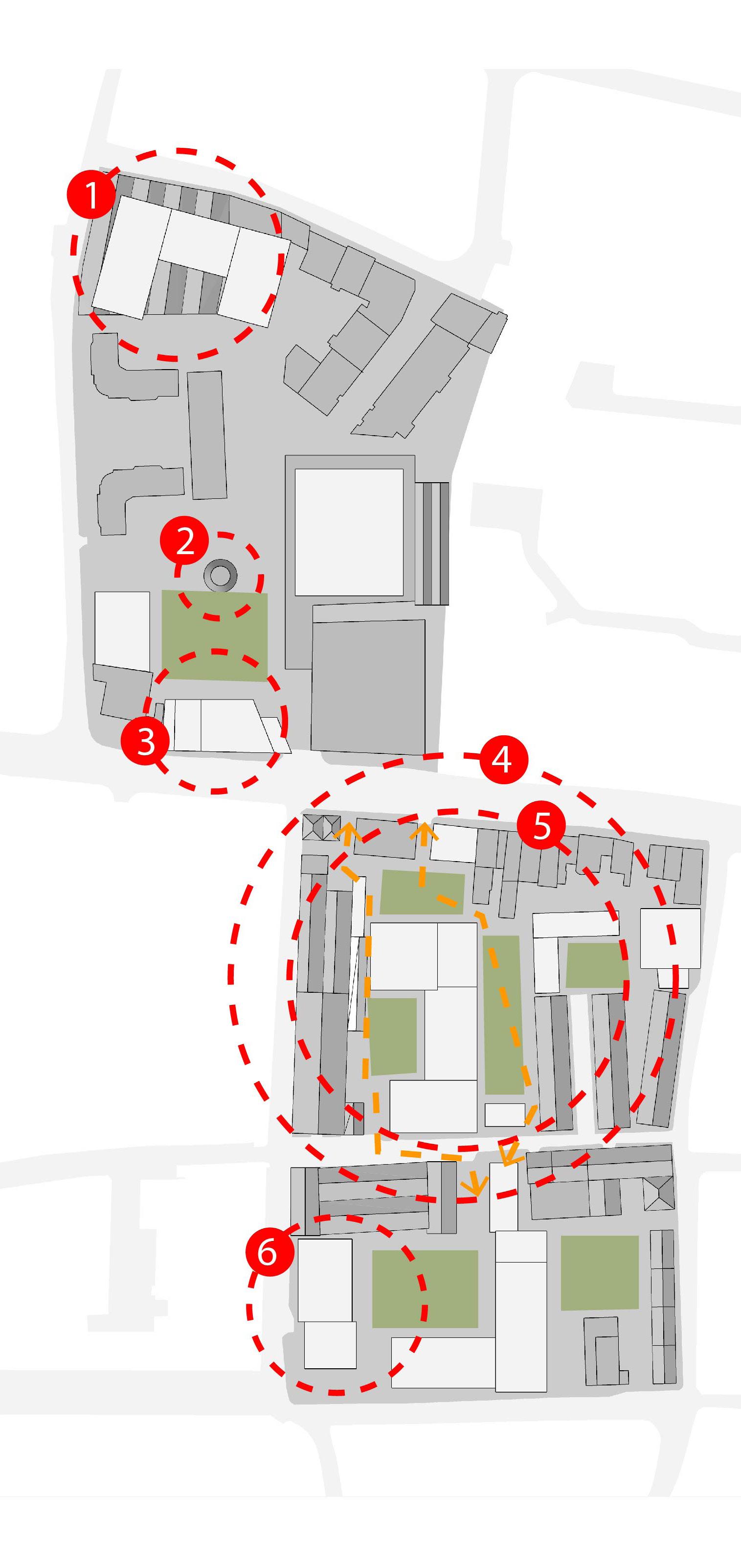
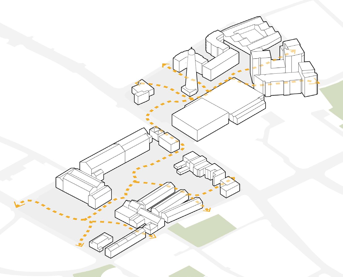
LOCATING POTENTIAL ENTRANCE NODES
INDENTIFYING POTENTIAL ROUTES
EXISITING ENTRANCES
POTENTIAL ENTRANCE NODES
NEW PEDESTRIAN ROUTES
NEW BIKE ROUTES
PEDESTRIAN + BIKE ROUTES
3D Diagram - Guinness Quarter Site with potential routes marked - Source: Sardar Ahmed
3D Diagram - Guinness Quarter Site with exisiting and potential nodes markedSource: Sardar Ahmed
3D Diagram - Guinness Quarter Site with shape of the Urban Block marked - Source: Sardar Ahmed
CREATE NEW SMALLER URBAN BLOCKS
DESIGN CONCEPT | INDUSTRIAL HERITAGE RETENTION
RETAINED STRUCTURES IN THE DESIGN PROPOSAL SHAPE OF THE BLOCKS
INTRODUCING NEW USES FOR THE RETAINED STRUCTURES
uses marked on retained structures -
INTRODUCING NEW BUILT FORMS FOR BETTER STREETSCAPE
-
INTRODUCTION OF COMMERCIAL / RETAIL / COMMUNITY
INTRODUCTION OF NEW BUILT FORMS
INTRODUCTION OF NEW PUBLIC SPACES OF SIMILAR FORM
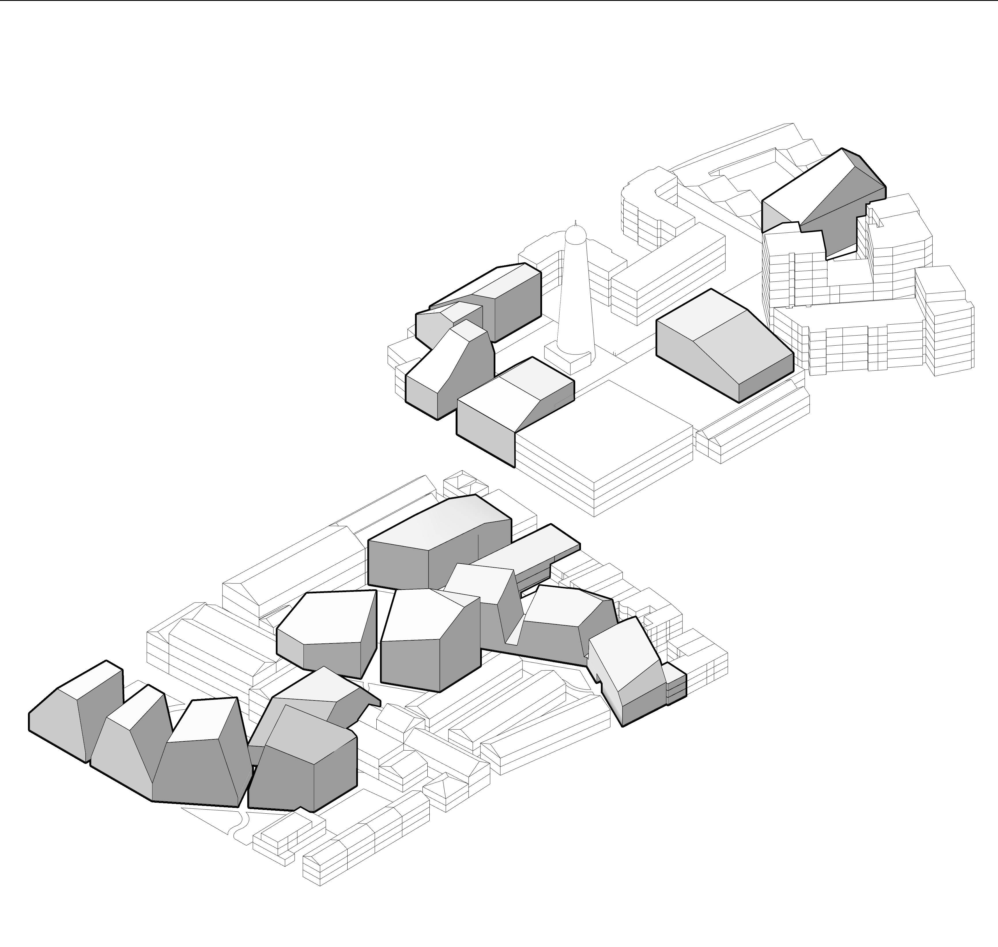
3D Diagram - Guinness Quarter Site with potential public parks and squares marked
Source: Sardar Ahmed
3D Diagram - Guinness Quarter Site with new
Source: Sardar Ahmed
3D Diagram - Guinness Quarter Site with shapes of new urban blocks markedSource: Sardar Ahmed
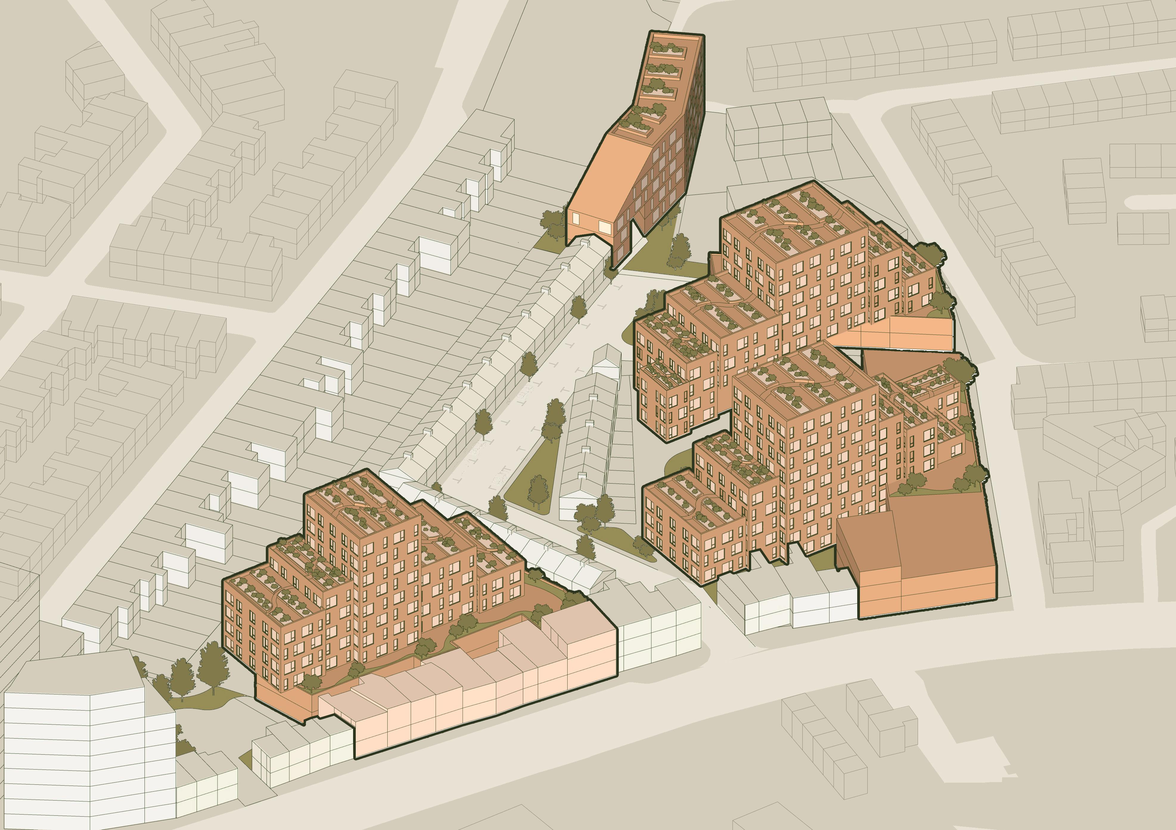
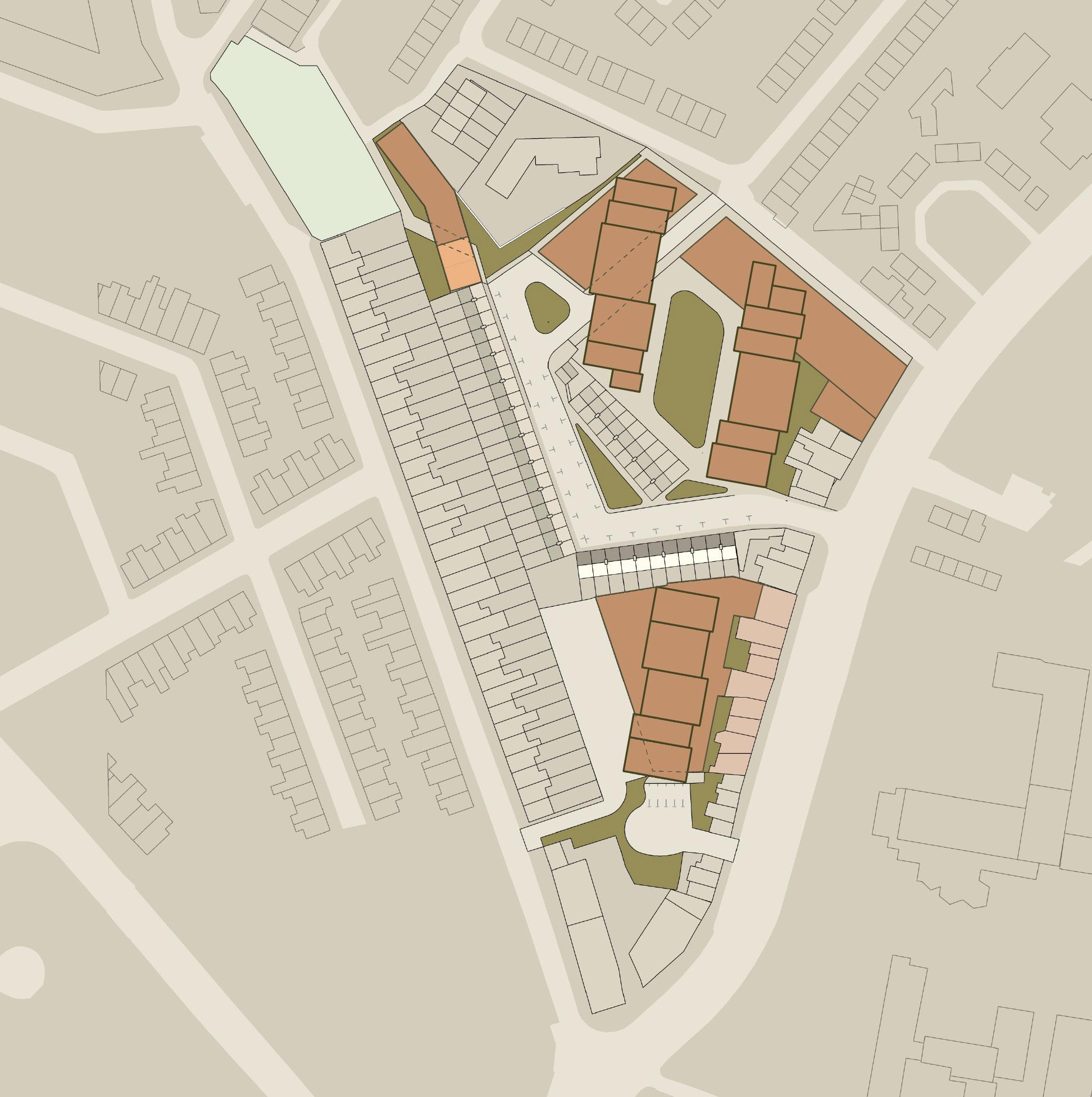
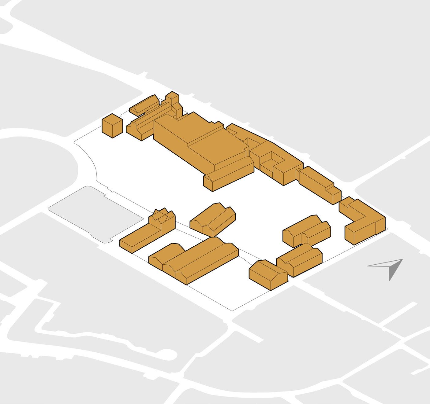
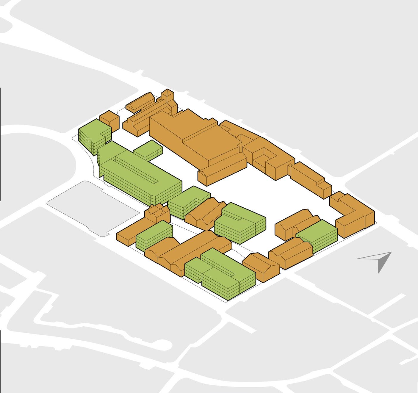
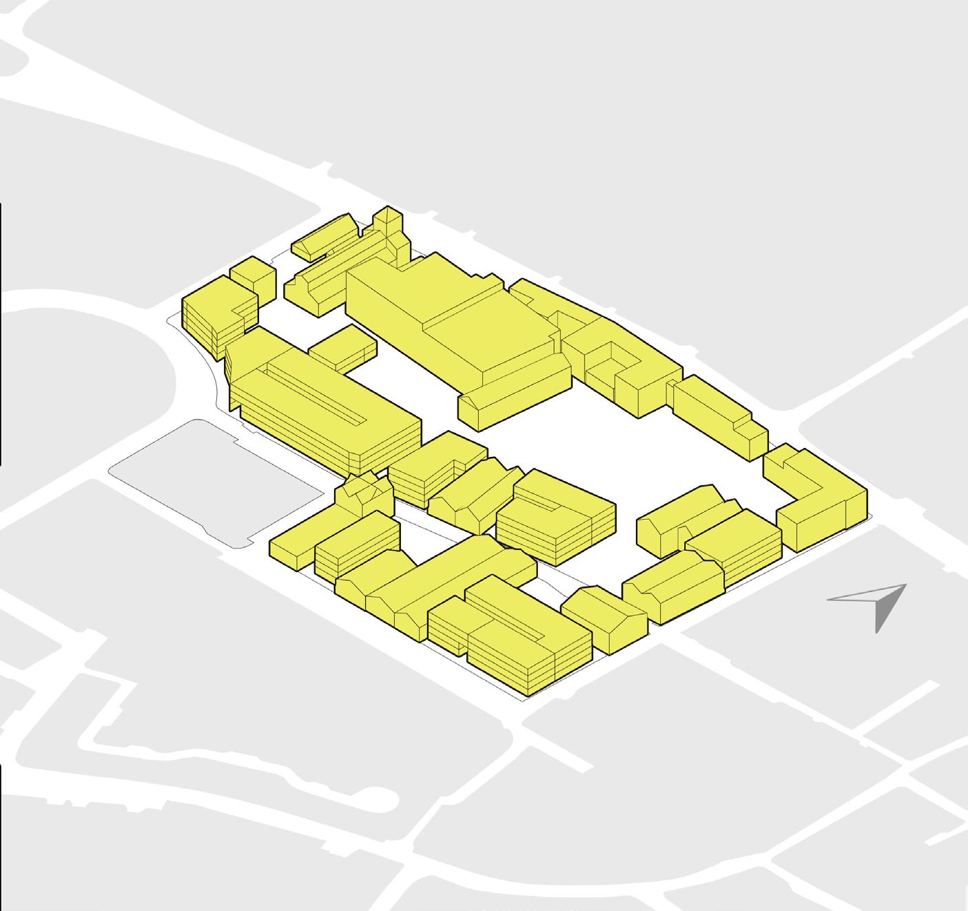
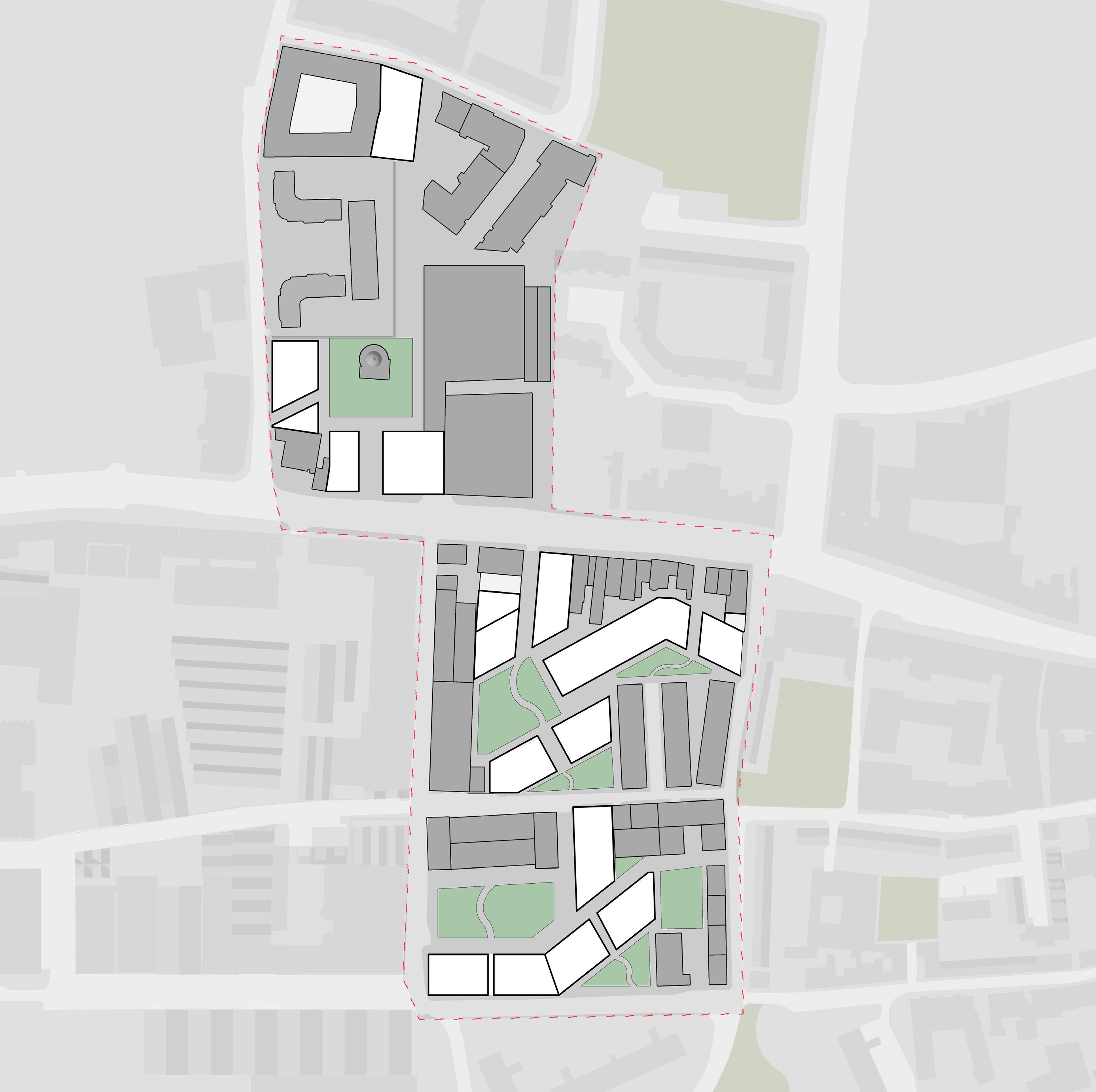
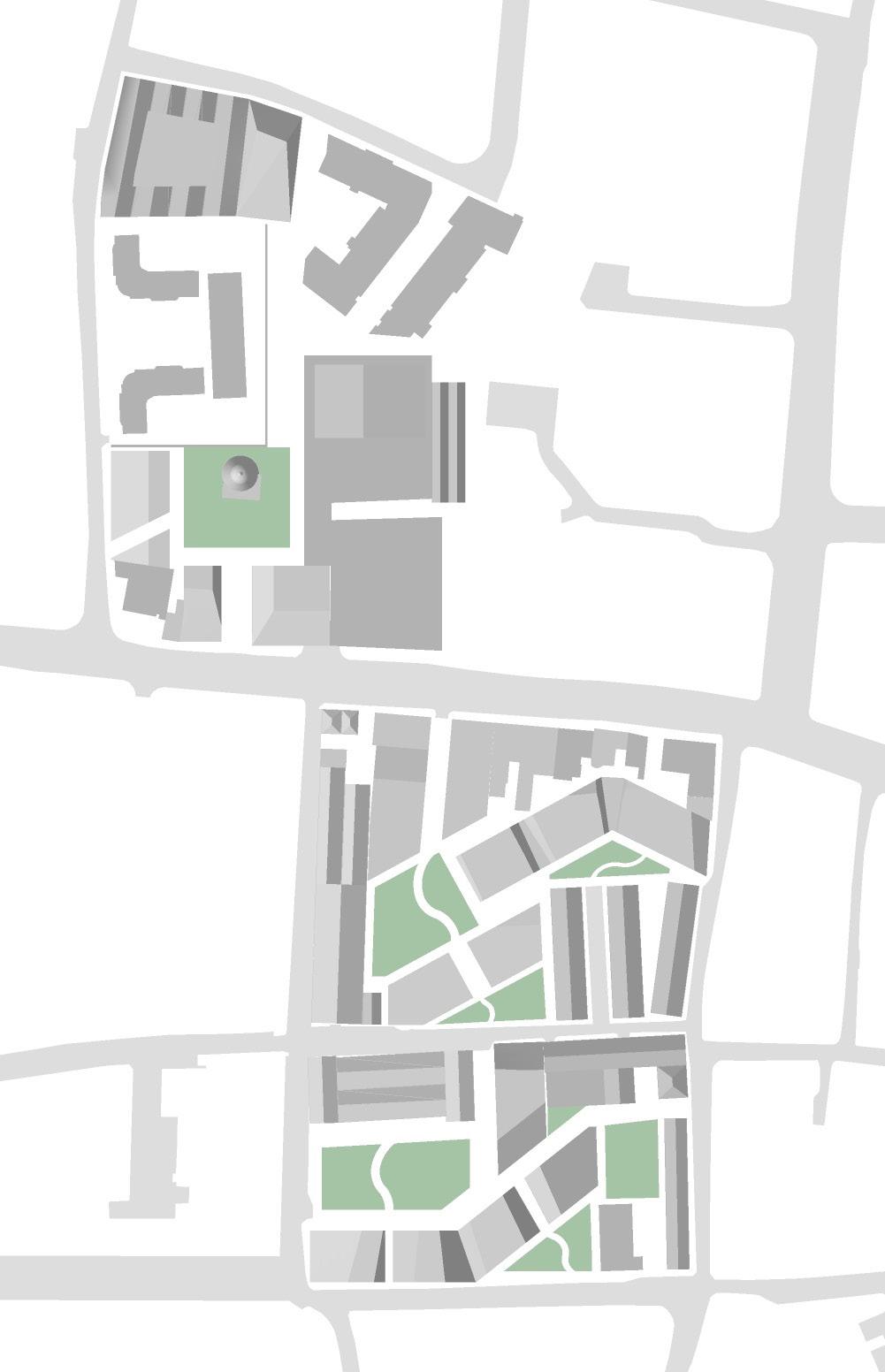
FINALISED MASTERPLAN
RETAINED STRUCTURES
PROPOSED STRUCTURES
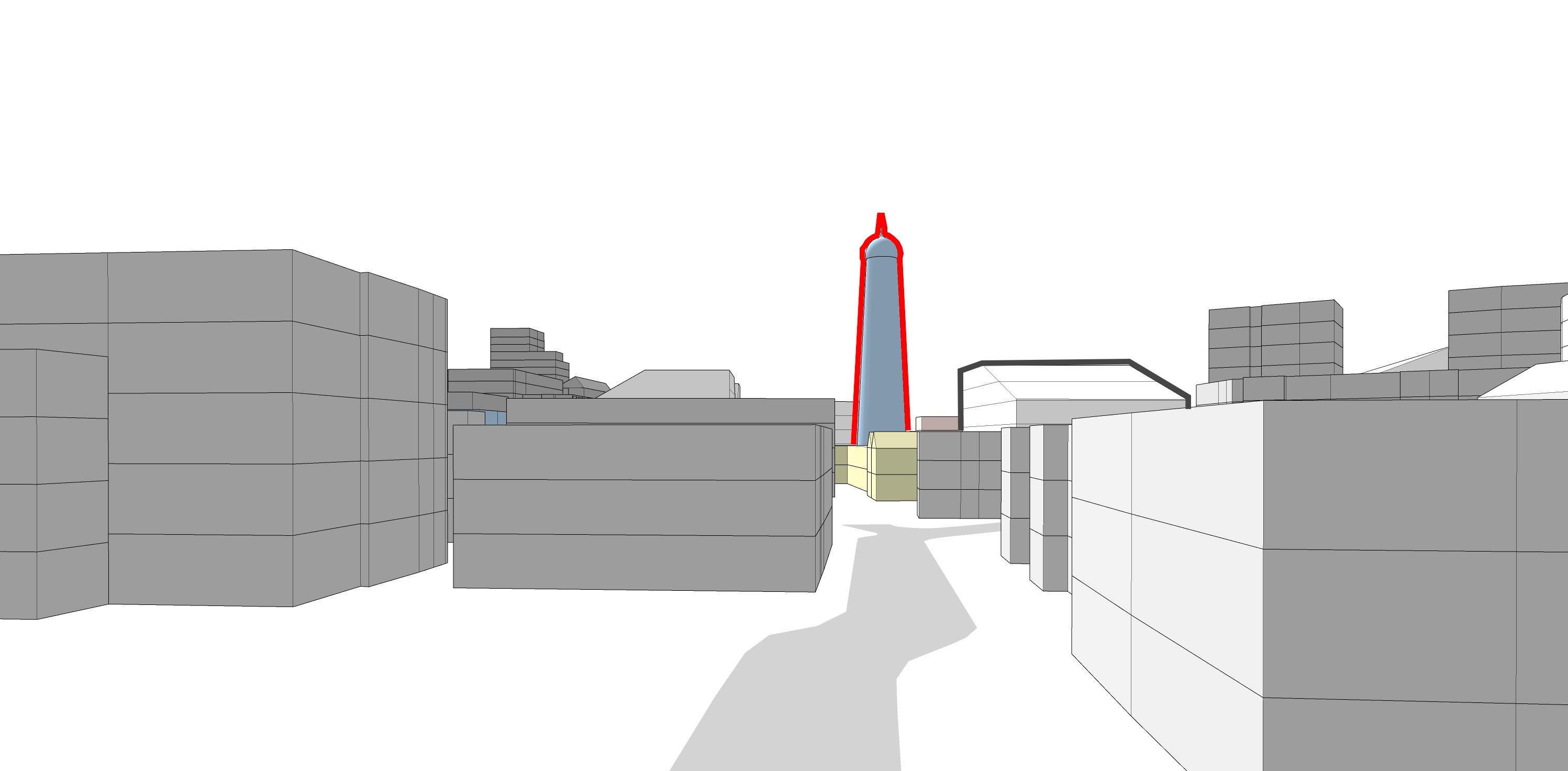
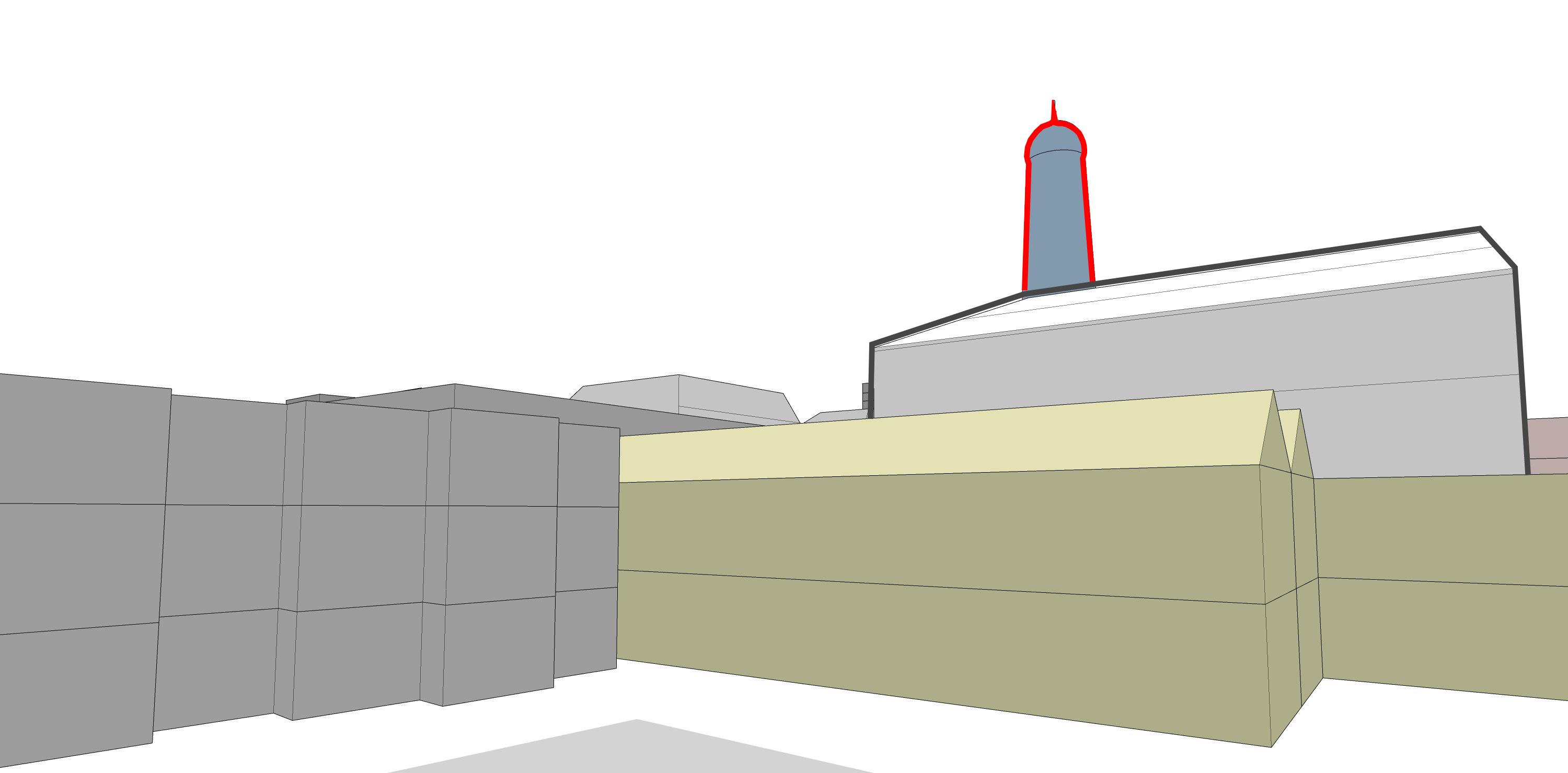
ST JAMES CHURCH
NEIGHBORHOOD SQUARES
PUBLIC SQUARES
SERVICE LANE
ENTRANCE VIEW DATUM
DESIGN PROPOSAL
REFRENCE SCALE - TEMPLE BAR
REFRENCE SCALE - TEMPLE BAR
Sardar Ahmed - Ubran Design
Source: Sardar Ahmed
RETAINED STRUCTURES’
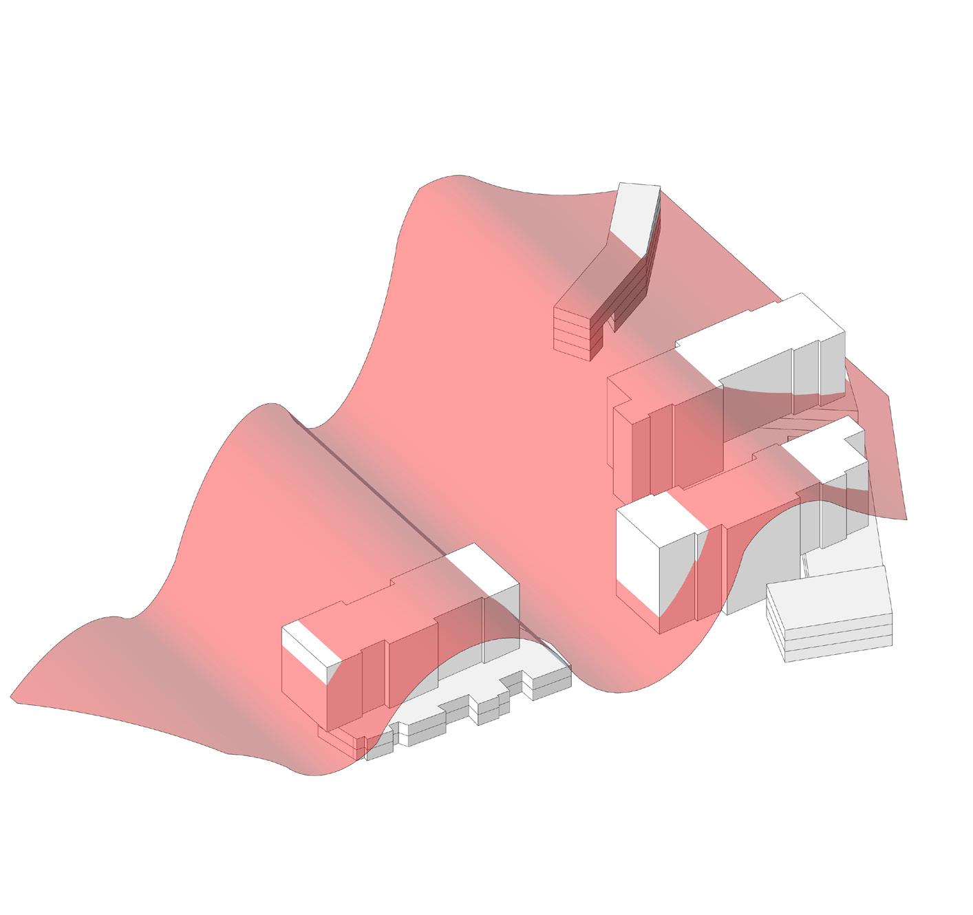
OPERATIONAL CARBON FOOTPRINT
PROPOSED STRUCTURES’ OPERATIONAL CARBON FOOTPRINT
OVERALL PROPOSALS OPERATIONAL CARBON FOOTPRINT
3D Diagram - Guinness Quarter Site with the average Operational Carbon Neutral Footprint shown - Source: Sardar Ahmed
3D Diagram - Guinness Quarter Site with Retained and proposed structures’ Opertional Carbon Footprint shown - Source: Sardar Ahmed
3D Diagram - Guinness Quarter Site with Retained Industrial structures’ Opertional Carbon Footprint shown - Source: Sardar Ahmed
DESIGN PROPOSAL
Diageo Proposal Alternate Proposal
336 Home Units
9200 sqm Retail/commercial/cultural Space 65,000 sqm Office Space
340 Home Units 13,000 sqm Retail/commercial/cultural Space
23,500 sqm Office Space
Sardar Ahmed - Ubran Design Portfolio
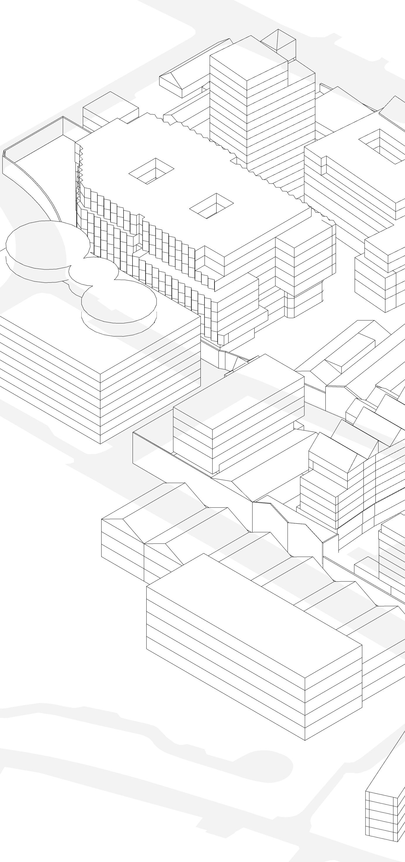
3D Diagram - Guinness Quarter Planning Approved Development by Diageo and Ballymore. source: Sardar Ahmed
3D Diagram - Guinness Quarter Research Design Proposal for Liberties Climate action Studio. source: Sardar Ahmed
ENERGY CENTRIC REGENERATION: DIGITAL HUB LIBERTIES
The focus of this design research project centers around the Digital Hub area in the Liberties, which is slated for regeneration with the introduction of new homes. The project aims to envision these new homes with energy considerations as the primary design drivers. Additionally, the visibility of these multi-resident structures from heritage streets is taken into account. The research question is: “What is the optimal form of development in Pear Tree Crossing for achieving a Net-zero Energy Neighborhood (NZEN)? What are the implications of balancing upfront embodied carbon in the proposed development?”
With an emphasis on creating an alternative design proposal driven by a zero-carbon operational strategy, the project seeks to draw conclusions through a comparative analysis with the LDA Pear Tree proposal. Implications of embodied carbon will also be explored throughout the project timeline.
Site Landmarks and Road Network - Source: Sardar Ahmed
Public Transport Accessibility - Source: Sardar Ahmed
LDA MASTER PLAN CRITIQUE
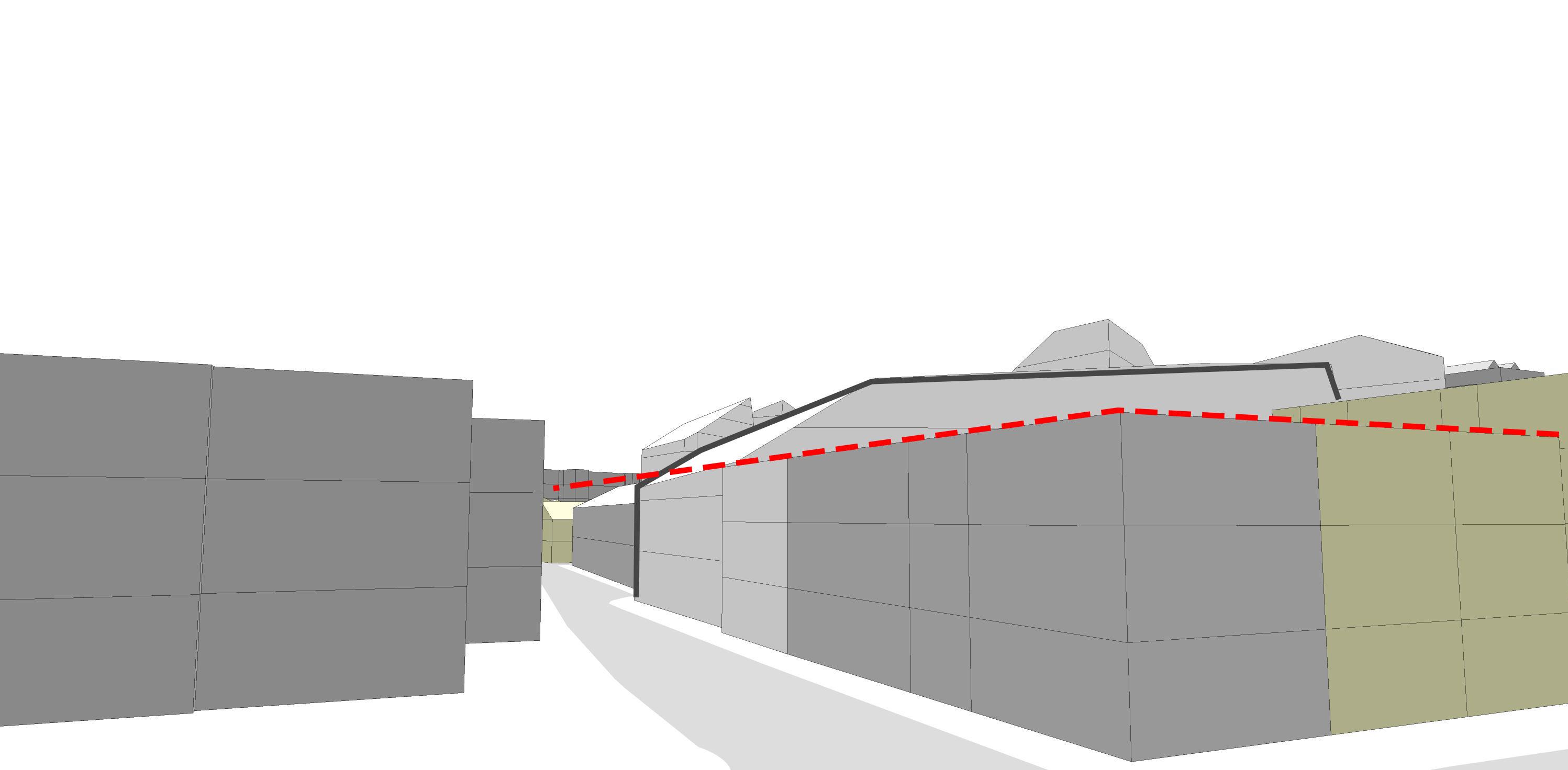
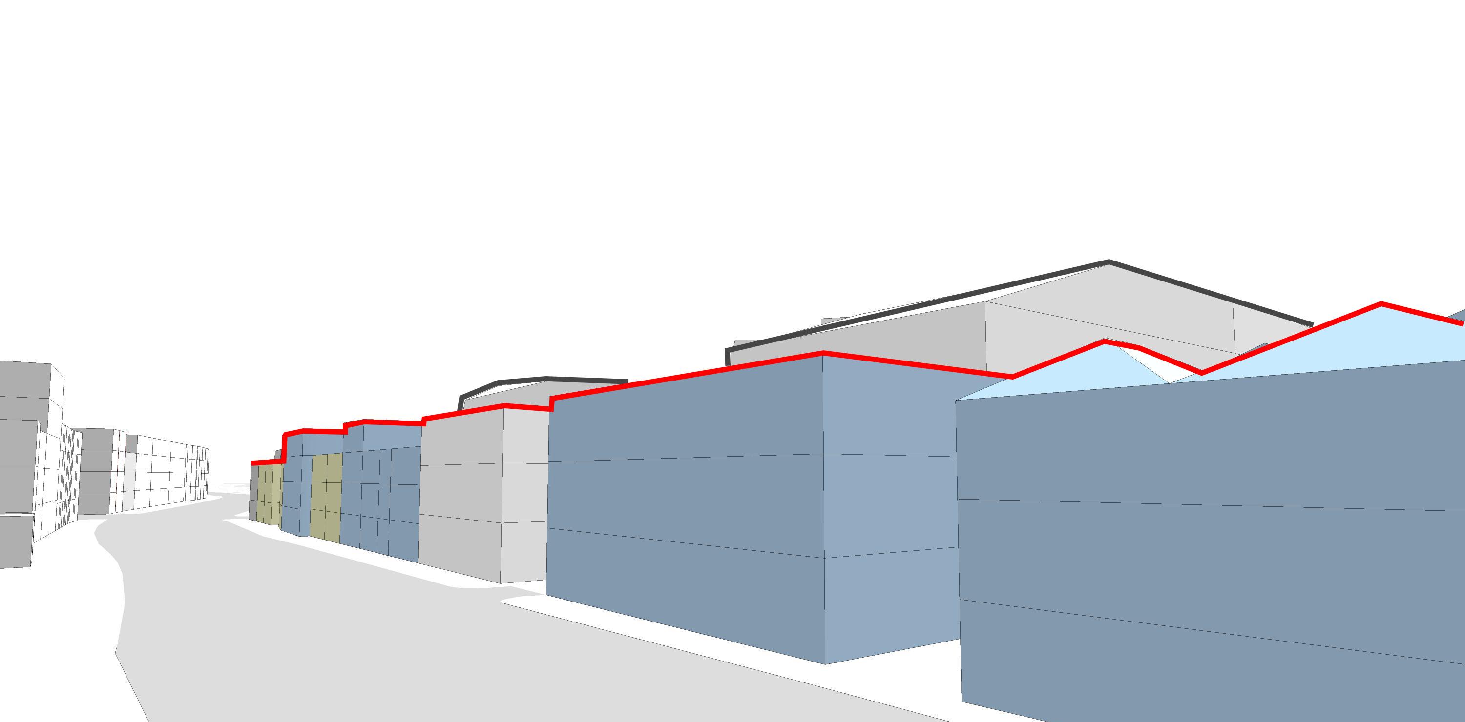
1 – Lack of Consideration for Warehouse Façade
2 – Lack of Consideration for Consideration for Axial Views of the Windmill
3 - No Sustainable Alternatives to Demolition
4 - Lack of Coherence in Public squares
5 - Weak North-South Connections
6 - Unbalanced Development for Urban Livability
Digital Hub Proposal Mcculloughmulvin Architects - Critique
1 - Consideration for Warehouse Façade
2 - Oversight of Public Space around the Windmill
3 - Disconnect with Existing Housing
4 - Fostering Connectivity
5 - Axial Views Consideration
6 - New North-South Connections
Sardar Ahmed - Urban Design
LDA Pear Tree Crossing Master Plan Critique
Digital Hub Proposal Mcculloughmulvin Architects
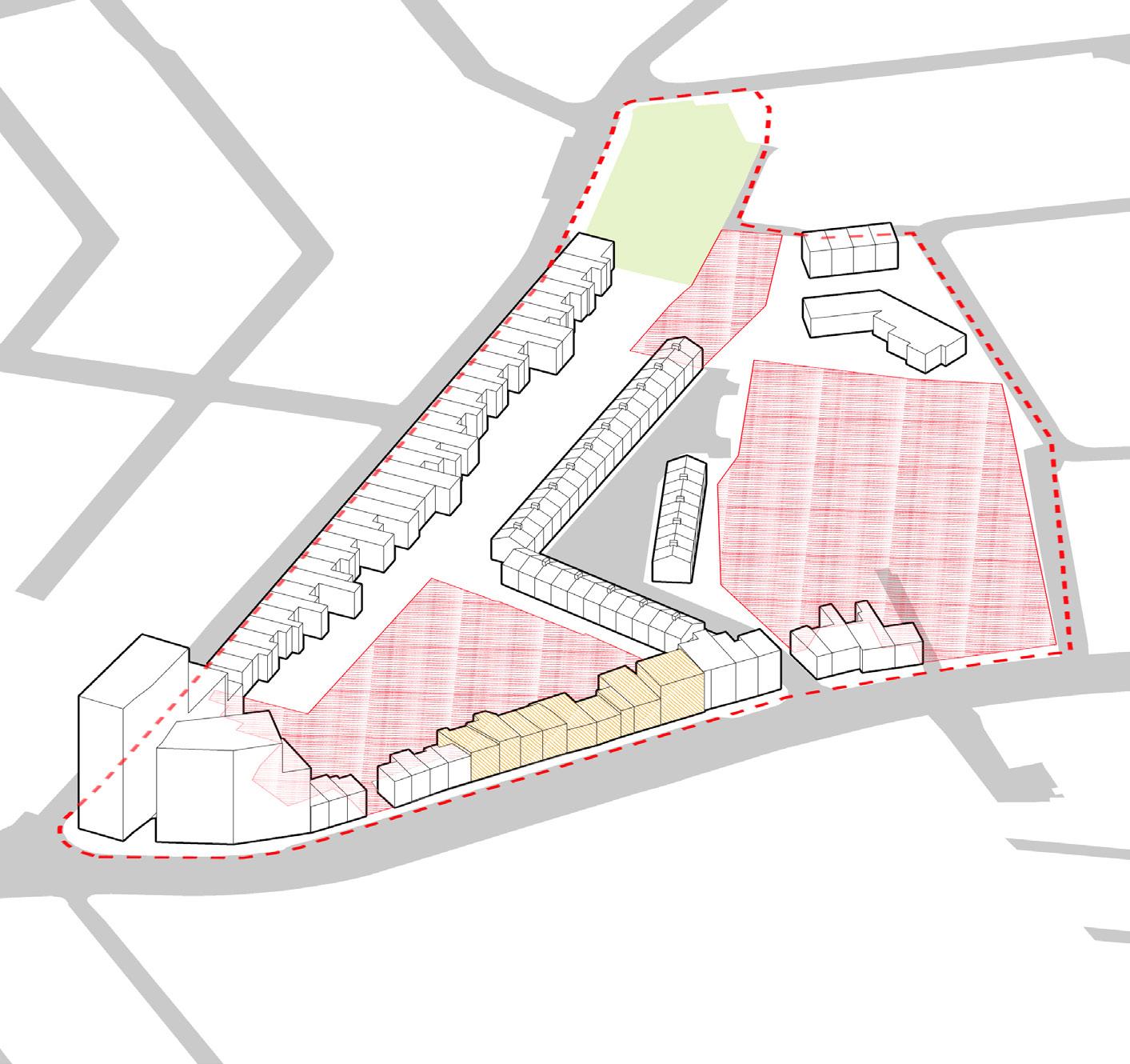
Analyze Existing Block
Structures and Pathways
Existing Block and Site Boundary
Introduce New Pedestrian Thoroughfares to enhance north-south connectivity
New Pedestriana and bike Routes
Boundary
Introduce Compact Blocks
New routes and Reshaped Blocks
Boundary
- Source: Sardar Ahmed
Establish a Hierarchical Network of Coherent and Legible Public Squares
Public Squares Placement
Proposed Pedestrian Network
Public Squares/ Green spaces
Proposed Footprints
Explore Building Placement with Solar Dynamics and Existing Plot Lines
Building Orientation
Southern Orientation Plot Lines
Intergrate Porposed Structures within the new Urban Landscape
Proposed Structures Placement
Proposed Pedestrian Network
Public Squares/ Green spaces
Proposed Footprints
Sardar Ahmed - Urban Design
- Source: Sardar Ahmed
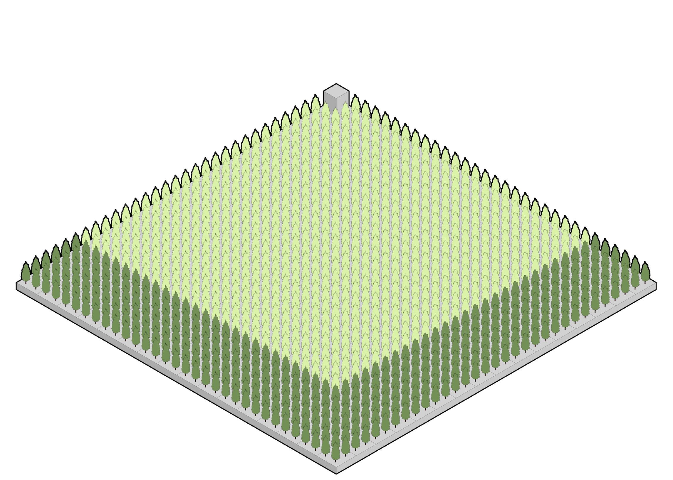
Energy consumption (Kwh/m2 per PV yield (Kwh/ m2 per year)
30 years for 2.5 Hectares of Forest 30 years for 16.5 Hectares of Forest