PORTFOLIO URBAN DESIGN X ARCHITECTURE

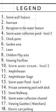
PROFESSIONAL WORK
I. Smart City project – Indore
II. Riverfront development, Pandharpur, India
III. Manohar Gardens, Pune, India
IV. Plotted development at Bhukhum, Pune, India
V. Heritage Tourism project, Chondi, Maharashtra
VI. Vinsan Promenade, Baga, Goa
VII. Horizon 180, Resort at Deviagar
ACADEMIC WORK
I. Water Urbanism – A case of Kolar, ( Thesis – Master’s in Urban design)
II. Airport City – Mysore
C O N T E N T S
PROFESSIONAL WORK
SMART CITY PROJECT, INDORE, INDIA
SECTOR – Urban design & Planning
LOCATION – Indore, India
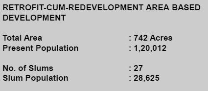
SCALE – 742 Acres
PHASE – Urban design drawing – ( Approved by Government of MP )
MY ROLE – Concept Development
Detailed Auto CAD Drawings
3D Models and renderings Presentations.
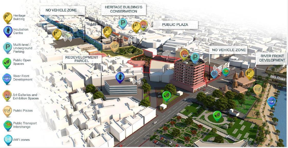
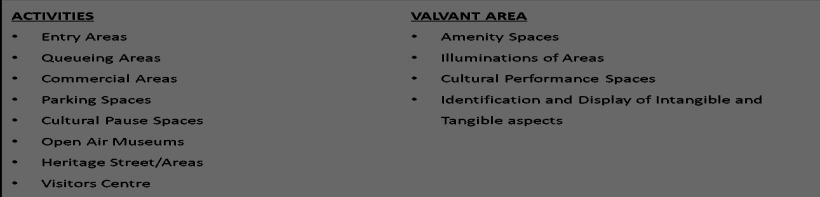
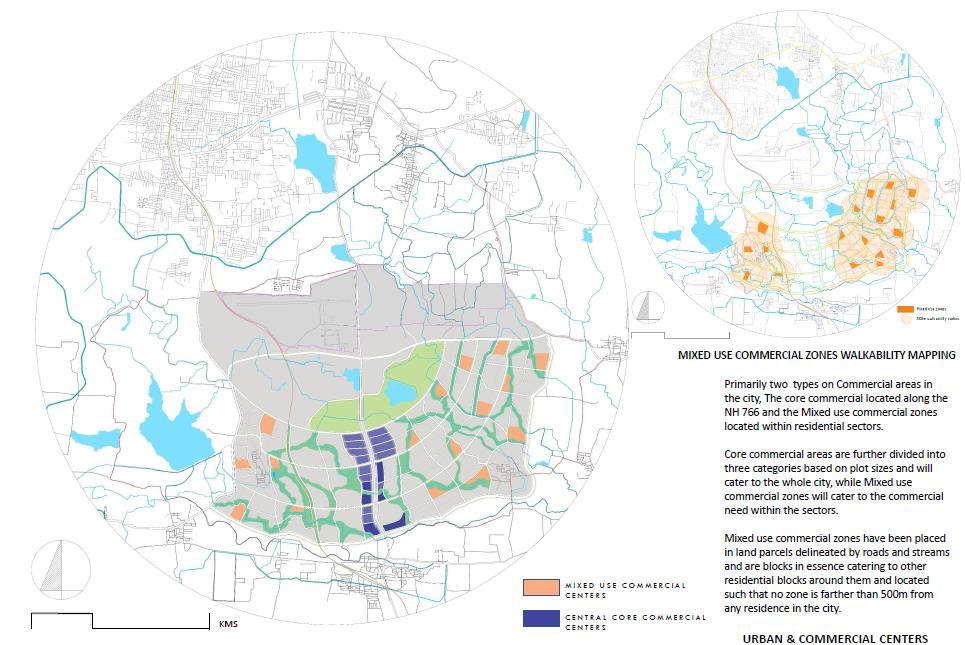
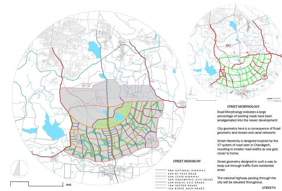
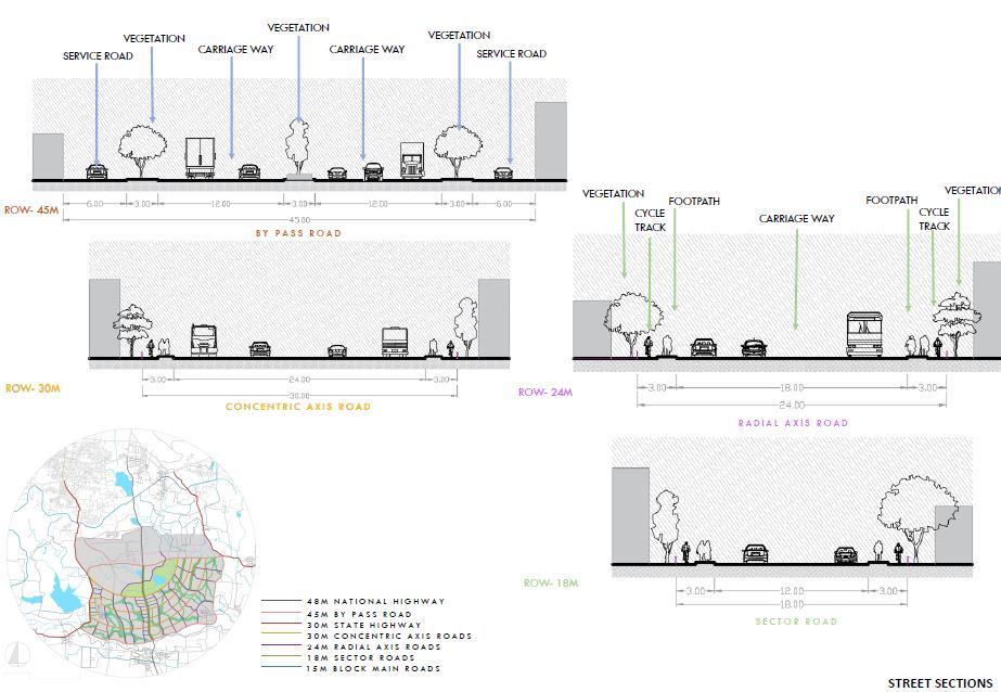
PROPOSED COMPONENTS AND ACTIVITIES
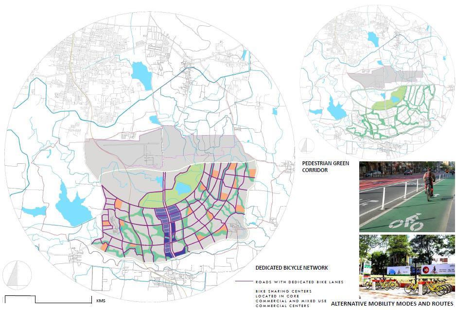
Enhanced Transportation and Mobility
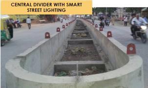
Development of roads and junctions as per street design guidelines ( integrated with underground ducting, smart signalization, surveillance and traffic management)
Multi–Level Parking equipped with smart components integrated with IT solutions and pan-city solutions.
Multi-Modal Interchange Facilities and network (Integration of NMT, public bike sharing, electric vehicle, and traffic management)
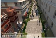
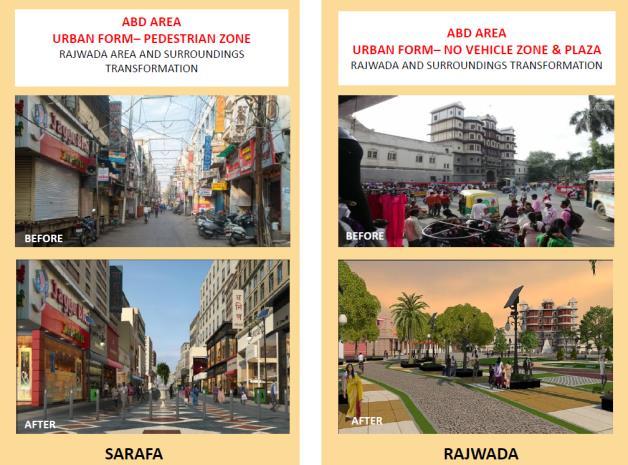
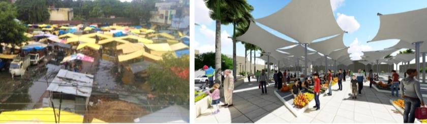
The pedestrianization of streets and Non-Motorized Zone (Pedestrianization of market area and heritage precinct designed as per street design guidelines and smart pedestrian infrastructure.)
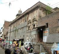
Heritage conservation and Promotion of Tourism
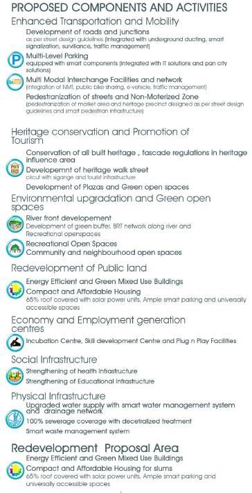
Conservation of all built heritage, facade regulations in heritage influence area
Development of heritage walk street circuit with signage and tourist infrastructure)
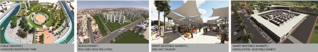
Development of Plazas and Green open spaces
Environmental upgradation and Green open spaces
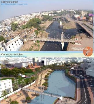
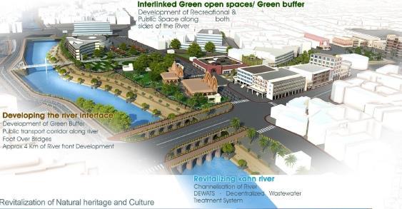
Riverfront development
Development of green buffer, BRT network along river and recreational open spaces
Recreational open spaces
Community and neighborhood open spaces
Redevelopment of Public land
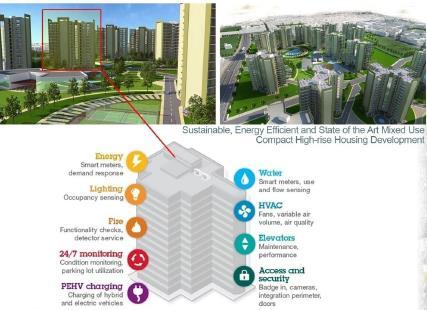
Energy-Efficient and Green Mixed-Use Buildings
Compact and Affordable Housing
65% of roofs covered with solar power units, Ample smart parking, and universally accessible spaces
Economy and Employment generation centers
Incubation centre, Skill development centre, and Plug n Play facilitates
Social Infrastructure
Strengthening of health Infrastructure
Strengthening of Educational Infrastructure
Physical Infrastructure
Upgraded water supply with smart water management system
100% sewerage coverage with decentralized treatment
Smart waste management system
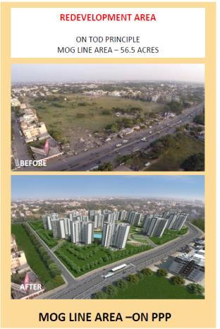
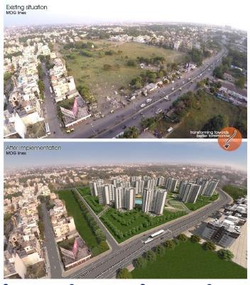
Redevelopment Proposal Area
Energy Efficient and Green Mixed-use Buildings
Compact and affordable housing for slums
65% roof covered with solar power units, Ample smart parking and universally accessible spaces.
INTERVENTIONS
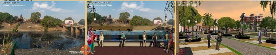
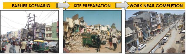
TRANSFORMATION OF THE PROPOSAL AREA
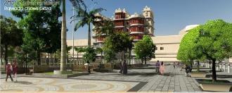
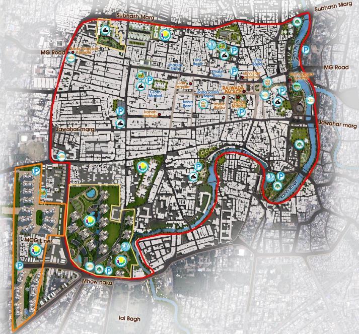
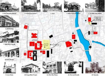
HERITAGE WALK
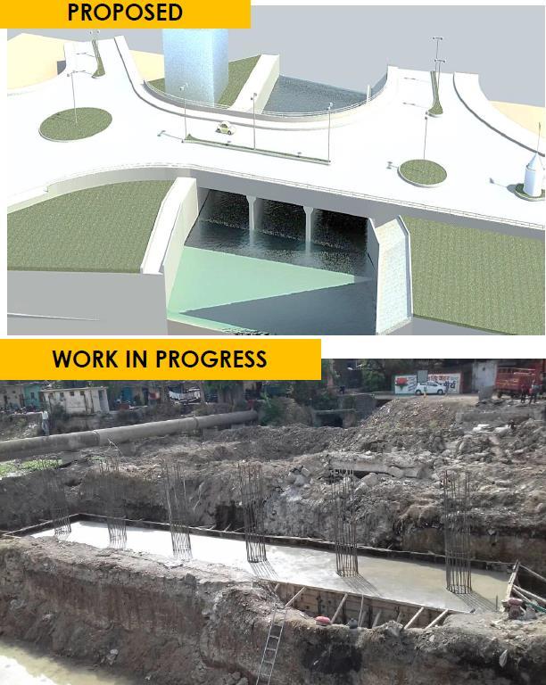
Work in progress in 2019
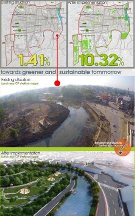
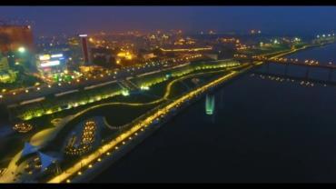
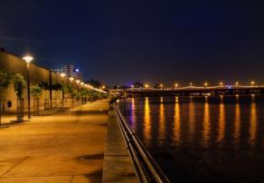
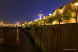
SMART CITY PROJECT, INDORE, INDIA
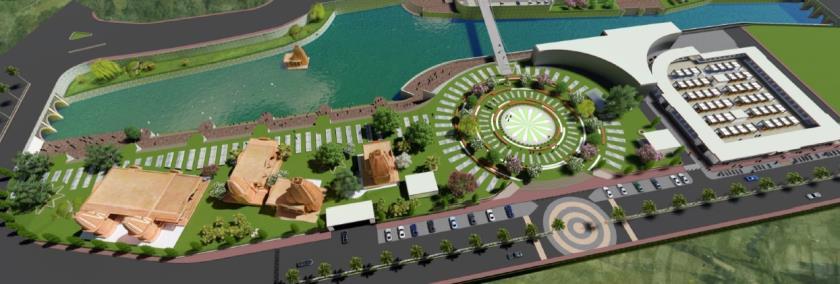
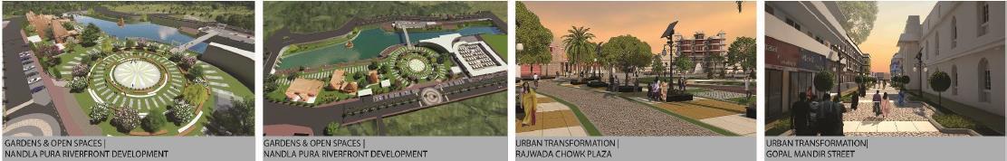
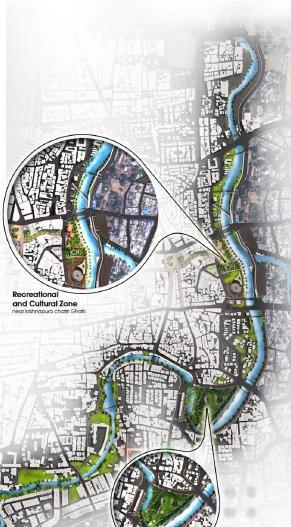
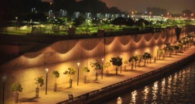
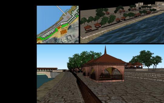
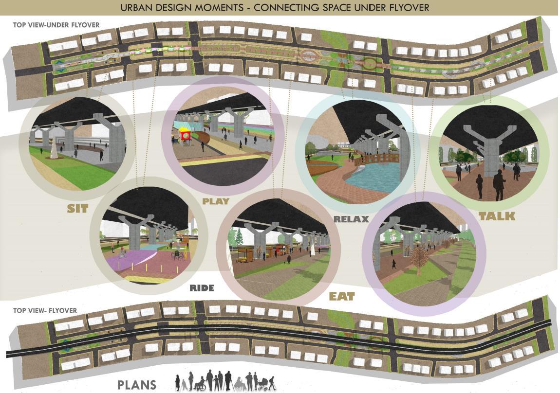
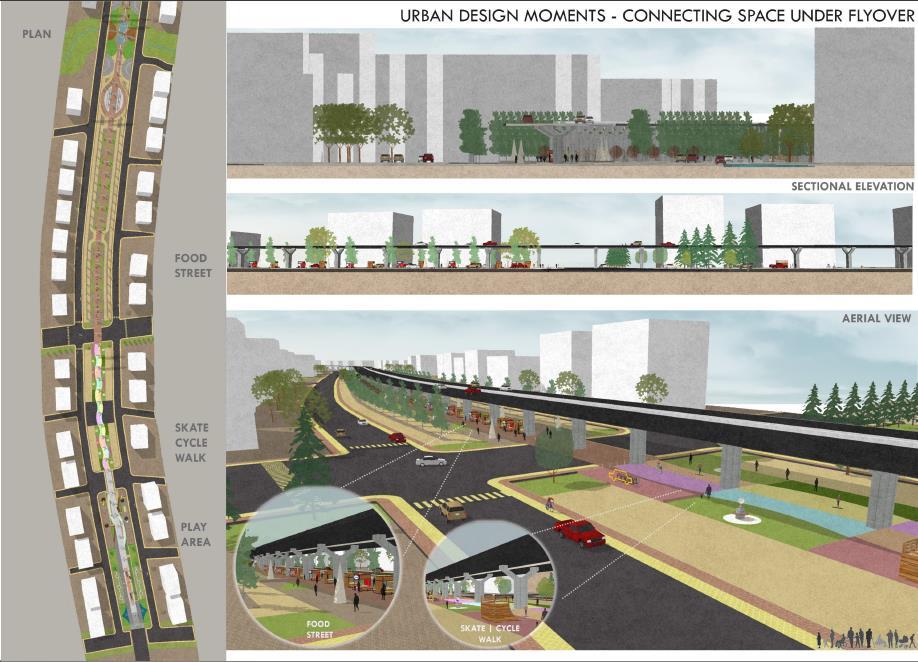
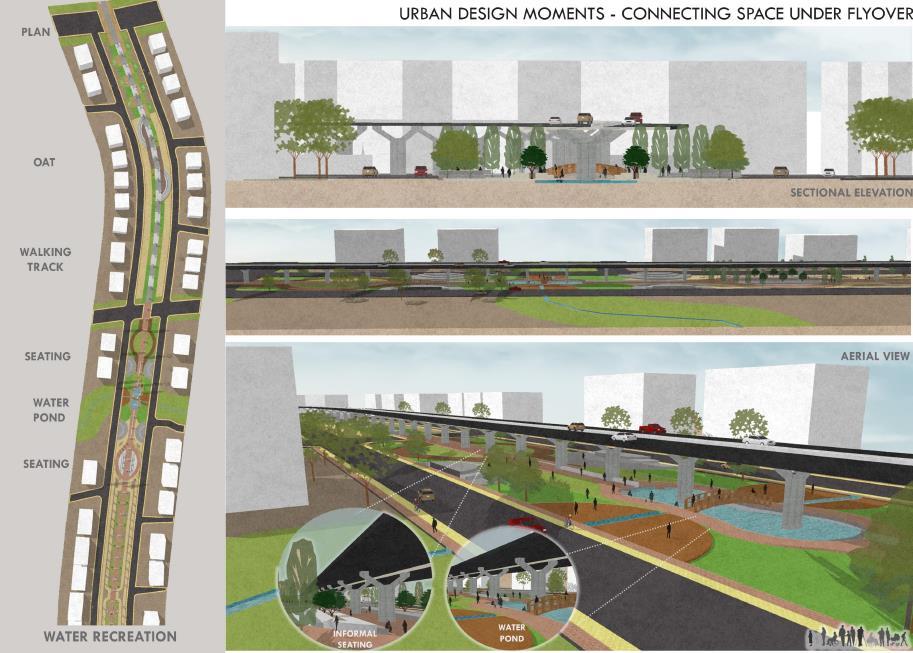
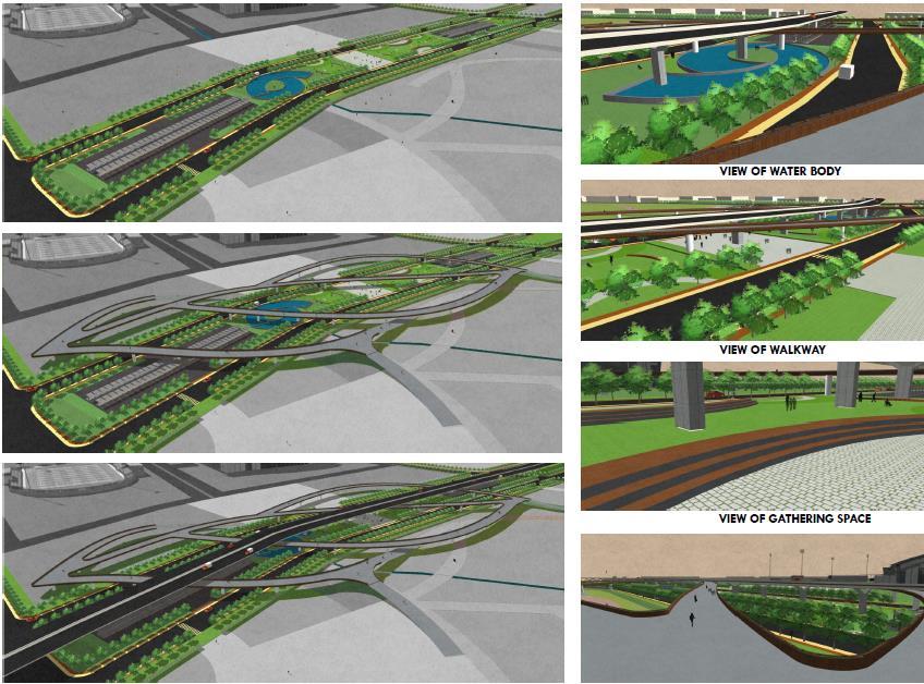
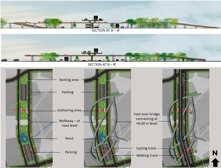
RIVER FRONT DEVELOPMENT AND PUBLIC OPEN SPACES
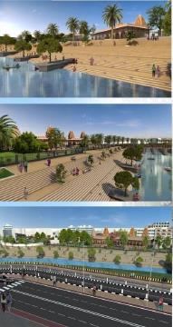
1. Development of Sector Parks
2. Improvement in other existing parks
3. Development of School Playgrounds
4. A large chunk of Green Urban Park is proposed to be developed adjoining the river bank.
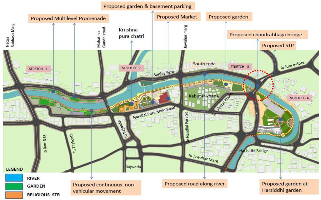
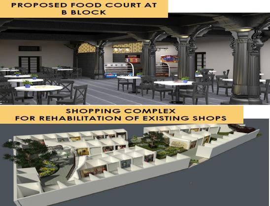
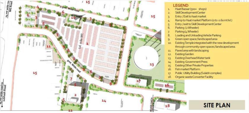
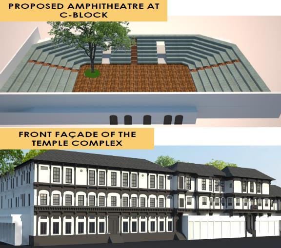
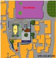
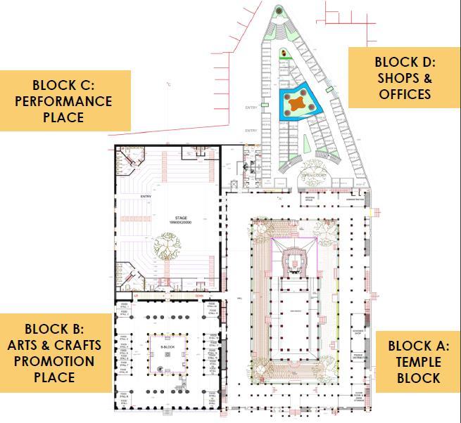
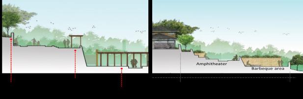
REDEVELOPMENT OF MARKET REDEVELOPMENT OF PUBLIC LAND • Pockets identified across the area – 164 acres • 50% of the residential area will be developed as mixed use, high density(3.0 FAR, residential density of 375 Dus/Ha • Open space seveloped – 33.68 Acres CONSERVATION OF BUILT HERITAGE GOPAL MANDIR PROPOSED FOOD COURT AT B BLOCK SHOPPING COMPLEX FOR REHABILITATION OF EXISTING SHOPS PROPOSED AMPHITHEATER C BLOCK FRONT FAÇADE OF TEMPLE COMPLEX
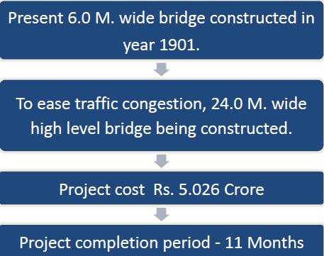
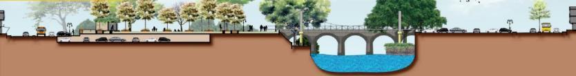
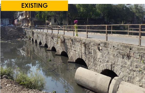
CHANDRABHAGA RIVER BRIDGE
RIVER
SECTOR – Urban design & Planning

LOCATION – Indore, India


SCALE – 9 Kms
MY ROLE – Concept Development Environmental Impact Study

3D Models and renderings Presentations.
FRONT
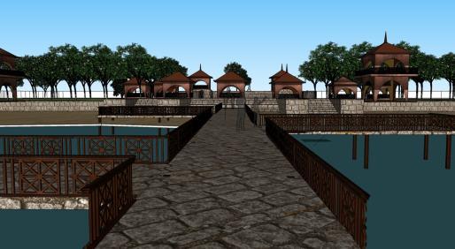
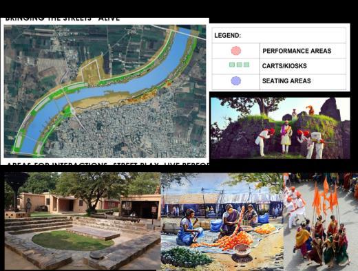
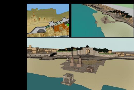
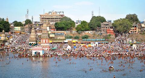
DEVELOPMENT, PANDHARPUR, INDIA
ENVIRONMENTAL IMPACT ANALYSIS OF THE PILIGRIMAGE ON THE TOWN
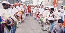
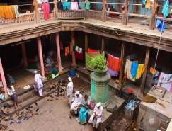
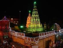
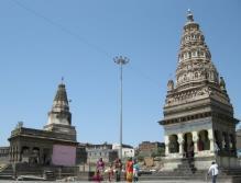
GLIMPSES OF PANDHARPUR: THE PILGRIM OF MAHARASHTRA
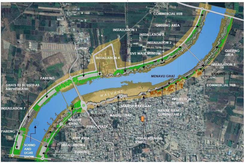
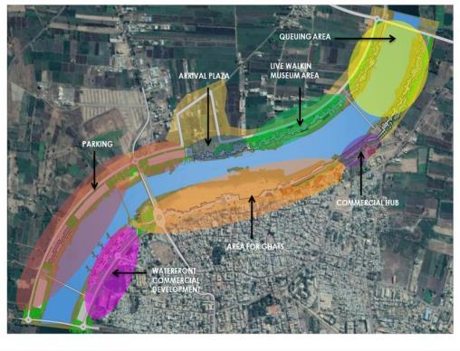
ZONING PLAN FOR THE ACTIVITIES MASTERPLAN
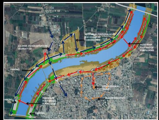
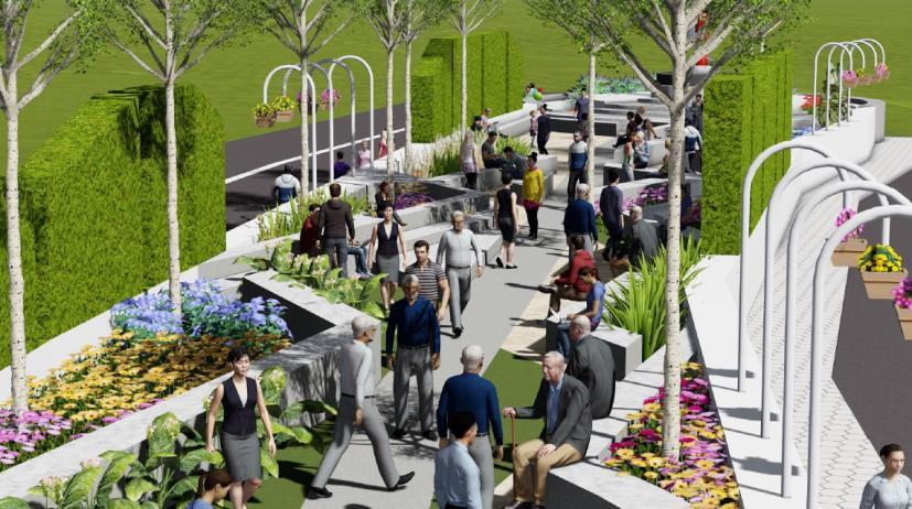
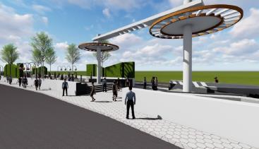
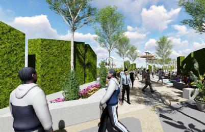
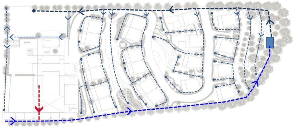
PROPOSED CIRCULATION PLAN
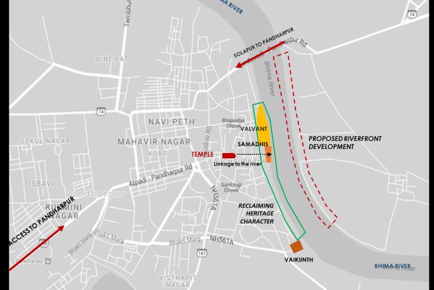 VIEWING DECK
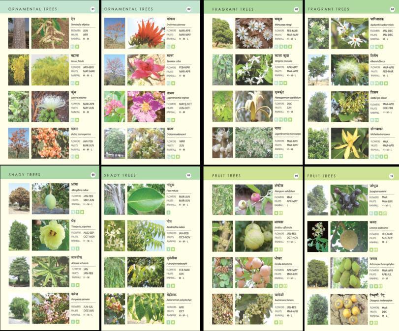
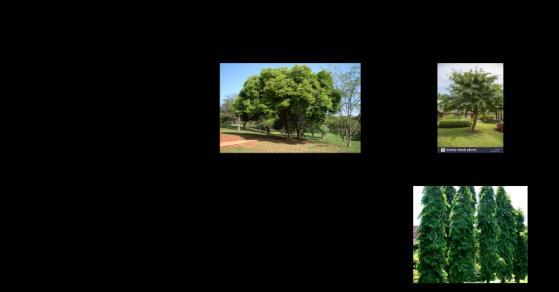
TREE PLANTING GUIDE
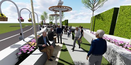
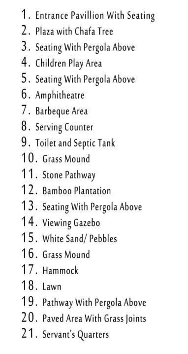
MANOHAR GARDENS, PUNE
SECTOR – Urban design & Planning
LOCATION – Pune,Maharashtra , India
SCALE – 0.3 Acres
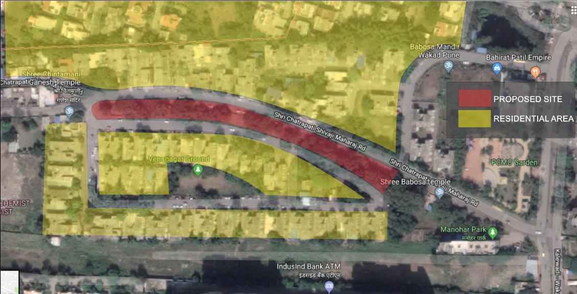
PHASE – Urban design drawing
MY ROLE – Concept Development
Master Planning
Detailed AutoCAD Drawings
Execution( Plinth level)
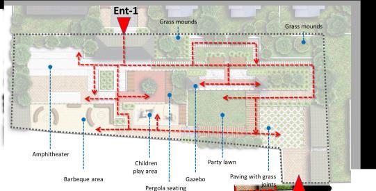
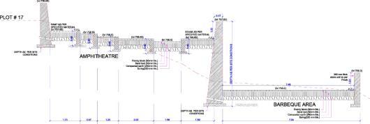
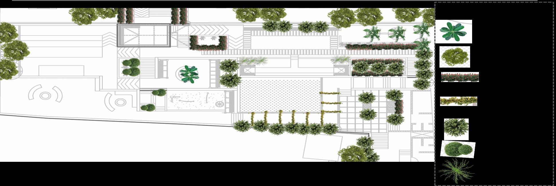
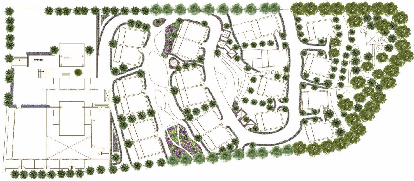
SITE PLAN
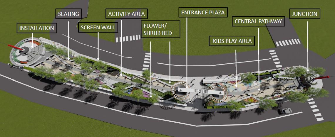
DESIGN CONCEPT
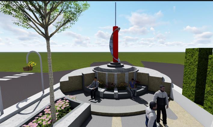
Gardens define community and spaces. The garden is located centrally amidst two roads which spreads length-wise. The idea is to create a buffer zone for the stake holders living in he dense housing fabric in the vicinity of the park. The park gets its character from explaining the cycle of the life of the people. This design is building a bridge to educate and uplift them by providing various activities like meditation, reading, working, relaxing and playing can happen in these spaces which creates harmony between people and encourages communication between people
The layout design has been conceptualized on the modernistic approach on the basis of intersecting lines, which creates triangular multiuse spaces. These alternate spaces acts as pockets which helps in the easy mixing of people and nature..
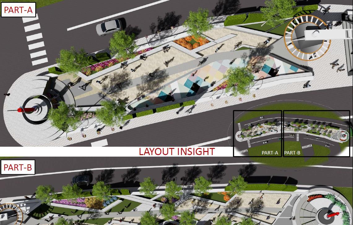
From a practical perspective, this central park adds up to the well-being of community and its citizens, encouraging active living and providing a crucial connection to nature. It has made activities, provision for amenities with diversity and variety. Versatile activities adds up to the characteristics of quality of life of people and children in the vicinity of the park.
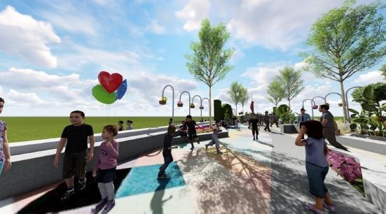
The hanging pots with flora Is designed in such a way that it adds up to the street ambience
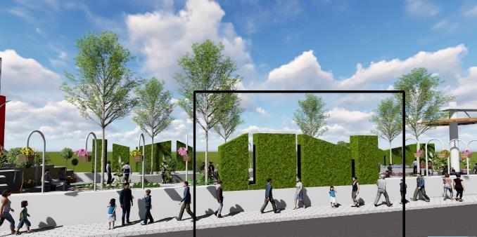
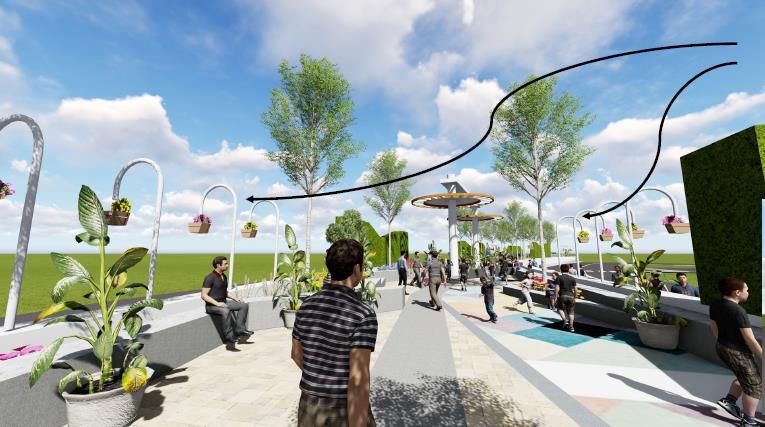
As well as the interior spaces of The park
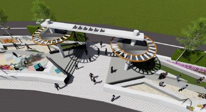
• Junction design creates spaces for people to sit and work with the natural settings.
• Open spaces designed for the kids with the multicolored flooring patterns develop interest and creativity to read, play and exchange ideas and speech amongst them.
• These zig zag staggered seating create spaces of interest for the elderly to sit, relax and have some quality time with their company as well as nature.
 Screen wall - The hedges acts as the screen wall
JUNCTIION DESIGN
Screen wall - The hedges acts as the screen wall
JUNCTIION DESIGN
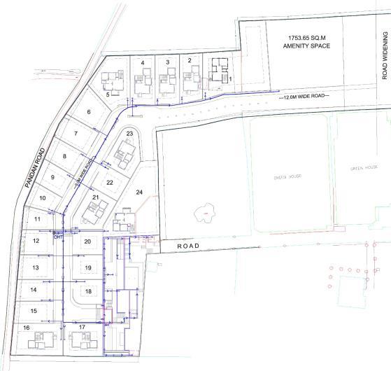
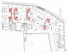
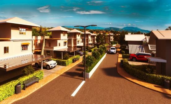
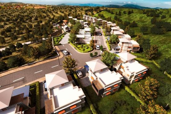
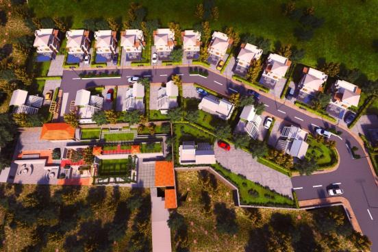
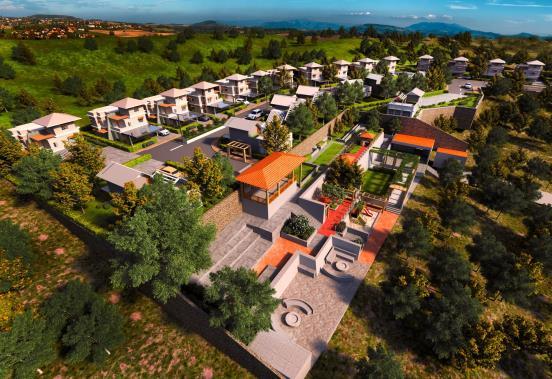
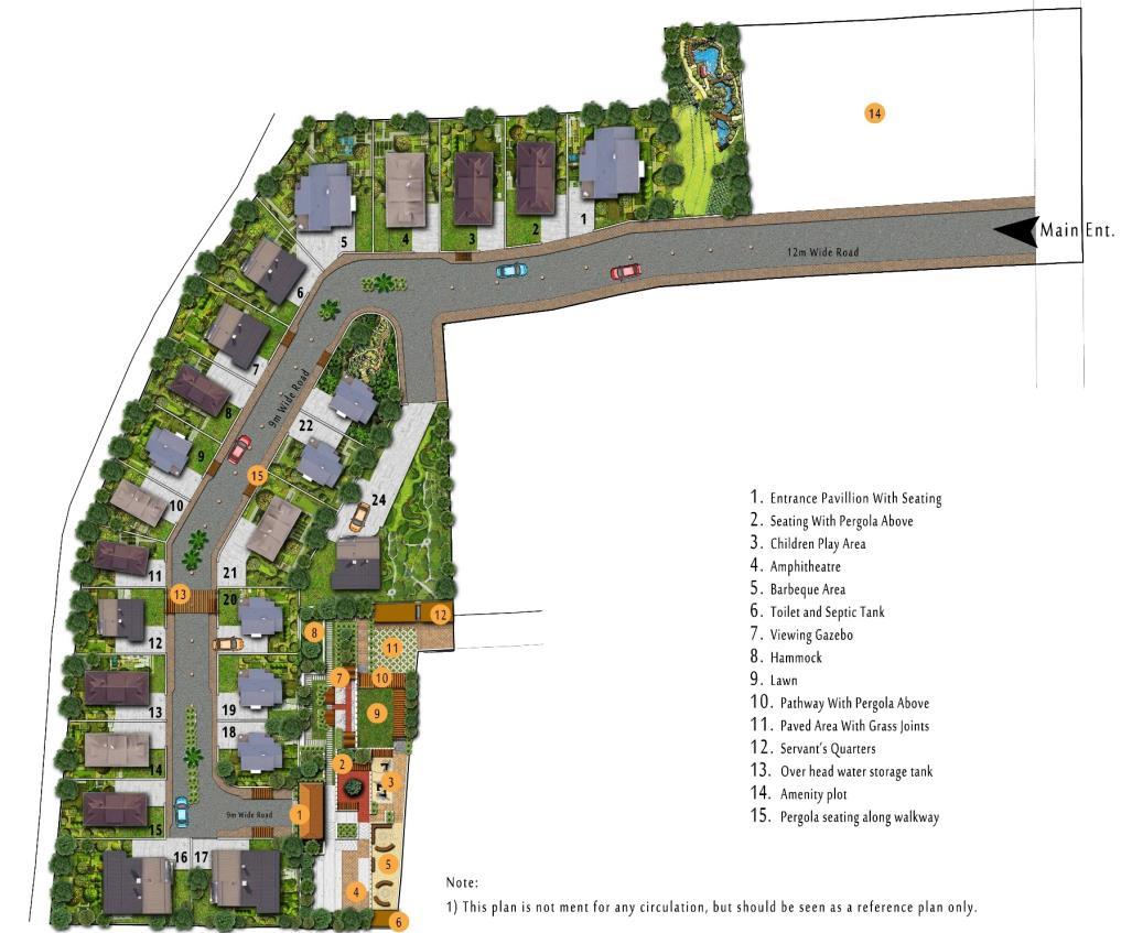
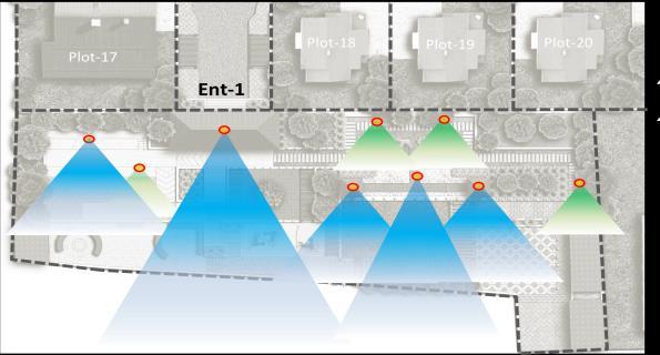
PLOTTED DEVELOPMENT AT BHUKHUM, INDIA
SECTOR – Urban design & Planning
LOCATION – Bhukhum, Maharashtra, India
SCALE –3.2 Acres
MY ROLE – Concept Development
Detailed AUTOCAD Drawings
3D Models and renderings
Construction drawings
PROJECT INTENTION
• Masterplan for the site and the character of the campus
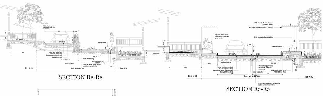
SECTIONS
Reports and tender documents with submission drawings.
Project execution
DESIGN CONCEPT
• Landscape proposal for open space for plotted development at Bhukum.
1. The neighborhood is designed as a socially inclusive conclave – low height compound wall and low height hedges along road
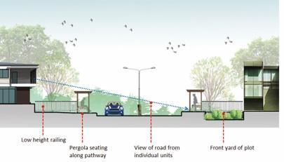
2. The entire campus has worked out slopes to implement rain water harvesting system
• At plot level the storm water will be percolated
• At campus level the water will be stored and percolated

3. 80% of vegetation will be of native species (apart from few feature plantation)
4. Maximum use of locally available and low embodied energy material for construction
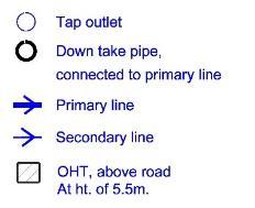
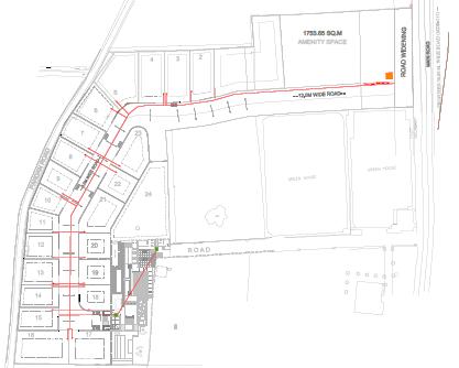
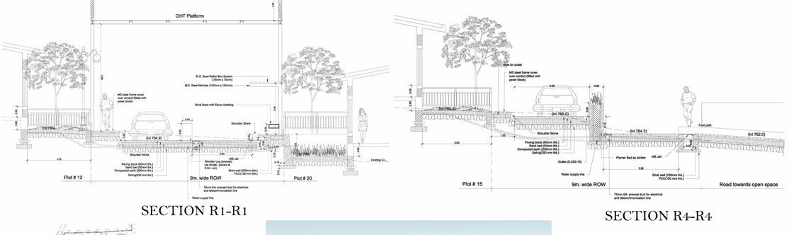
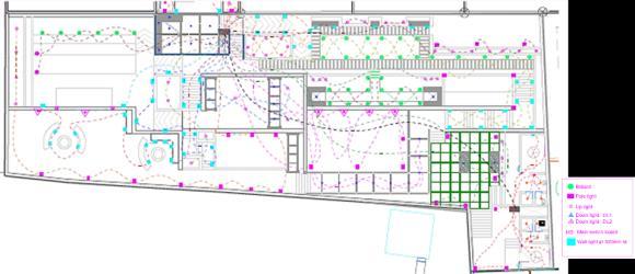
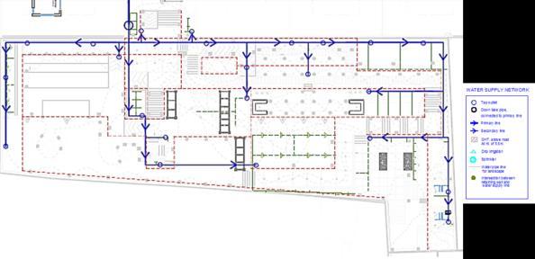
SERVICE DRAWINGS
Storm water system
Water supply system
Electric supply system
PLOTTED DEVELOPMENT AT BHUKHUM, INDIA
DESIGN CONCEPT

1. 80% of vegetation will be of native species (apart from few feature plantation)
2. Minimum cutting and filling – dividing the site in three zones (levels)
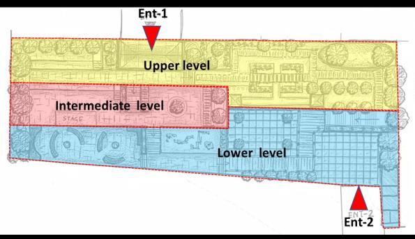
3. Maintaining the view lines of the surrounding valley – tall trees only on the north, west and south side.
4. Space for all age
5. Design of Isolated / tranquil spaces as well as party lawn
6. Rustic look for hard landscape – to give country look
SECTIONS


OPEN SPACE DESIGN
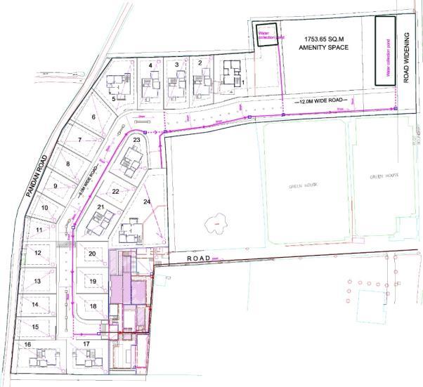
PLAN
MASTERPLAN CIRCULATION
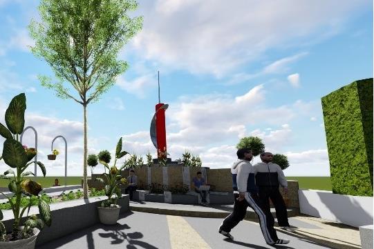
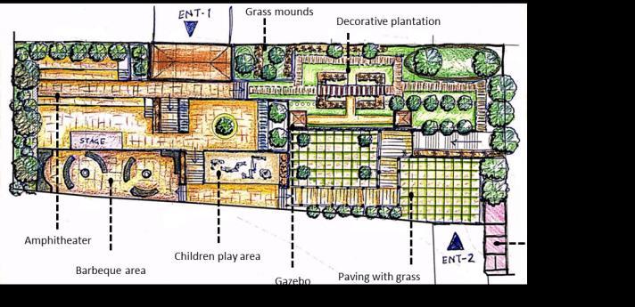
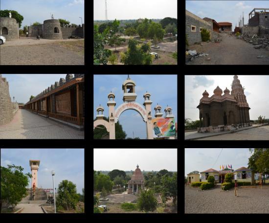
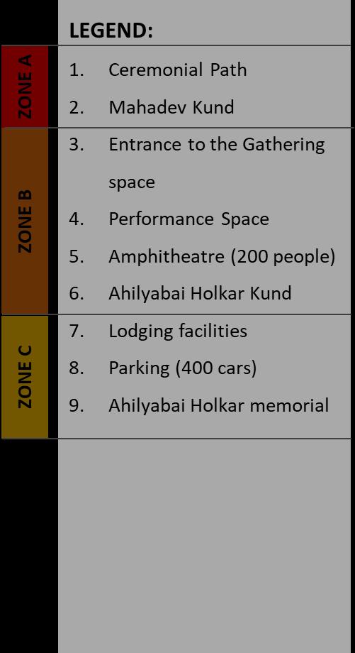
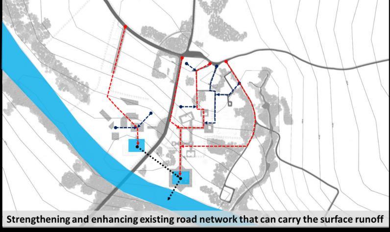
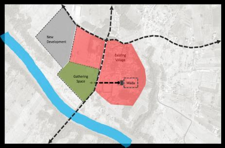
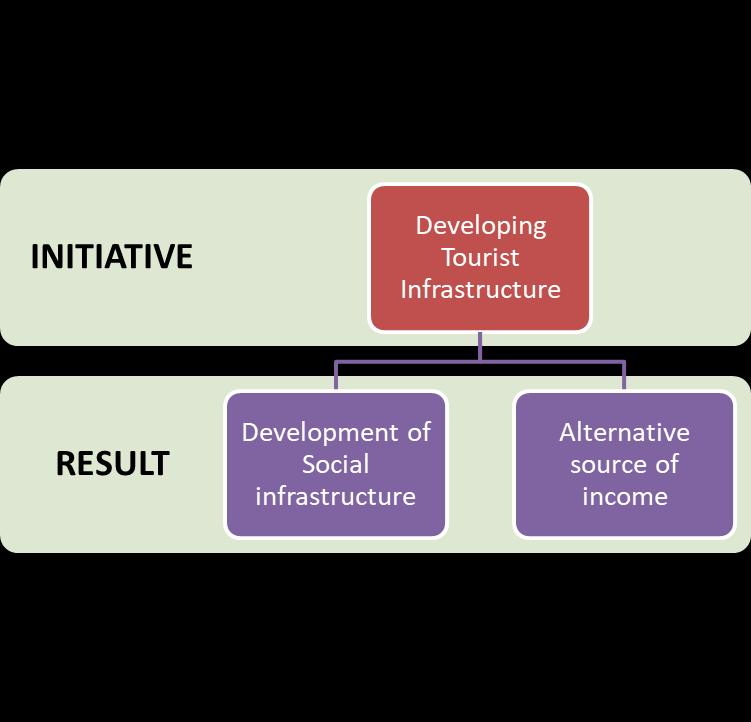
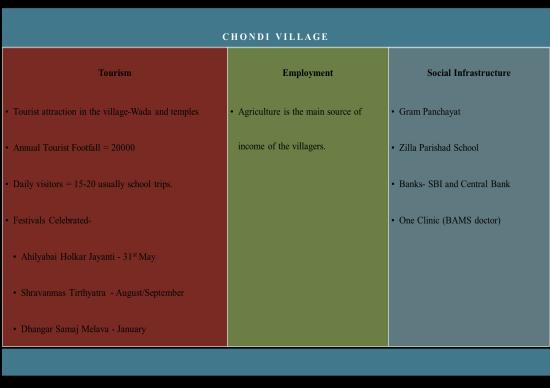
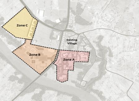
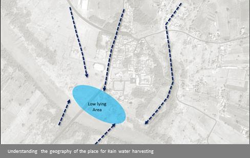
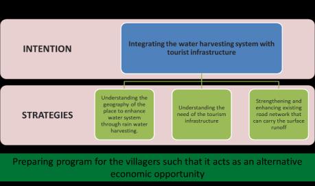
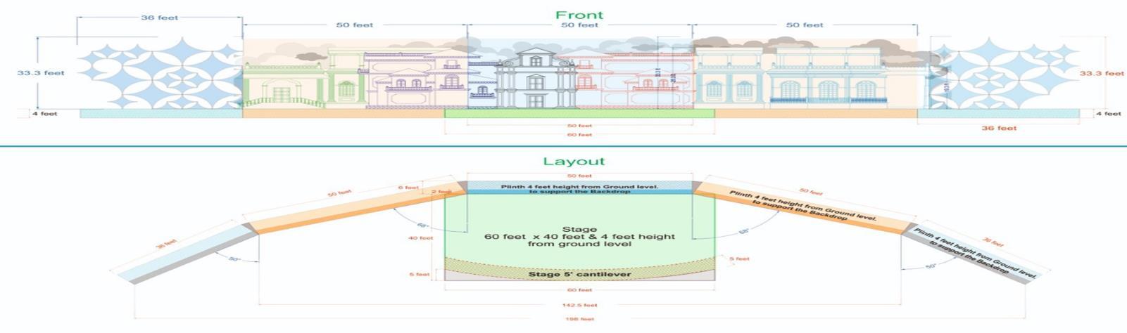
HERITAGE TOURISM PROJECT, CHONDI, INDIA
SECTOR – Urban design & Planning

LOCATION – Chondi Maharashtra, India
SCALE – 742 Acres
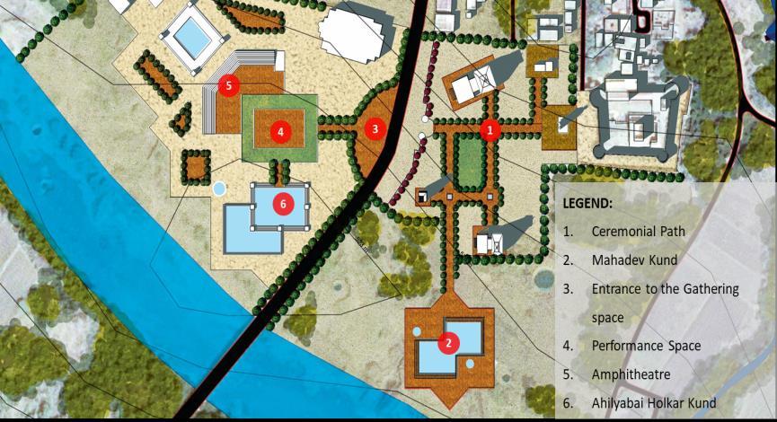
PHASE – Urban design drawing
MY ROLE – Concept Development Feasibility study Presentations.
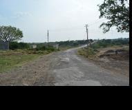
GLIMPSE OF THE PLACE
OBSERVATIONS - ISSUES
APPROACH
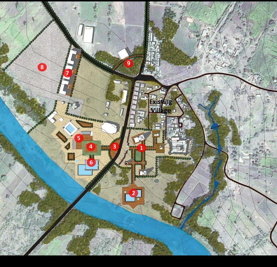
MASTER PLAN
INFERENCES:

• Chondi Village lacks in Tourist infrastructure in spite of high tourist footfall.

• The agricultural produce is tremendously affected due to its setting in drought prone area.
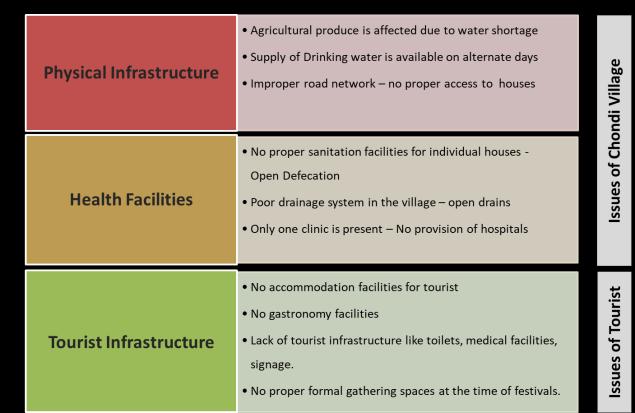
• Inadequate social infrastructure like gathering space and medical facilities for tourist during festivals.
STRATEGIES
CONCEPT PLAN

 PROFILE OF THE PLACE SWOT
ANALYSIS
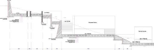
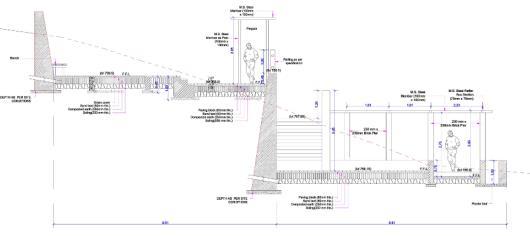
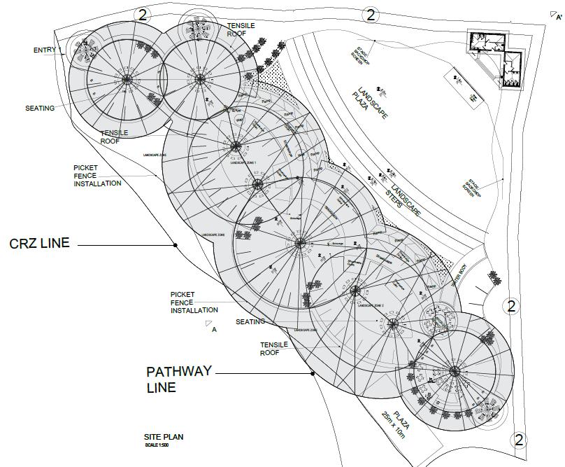
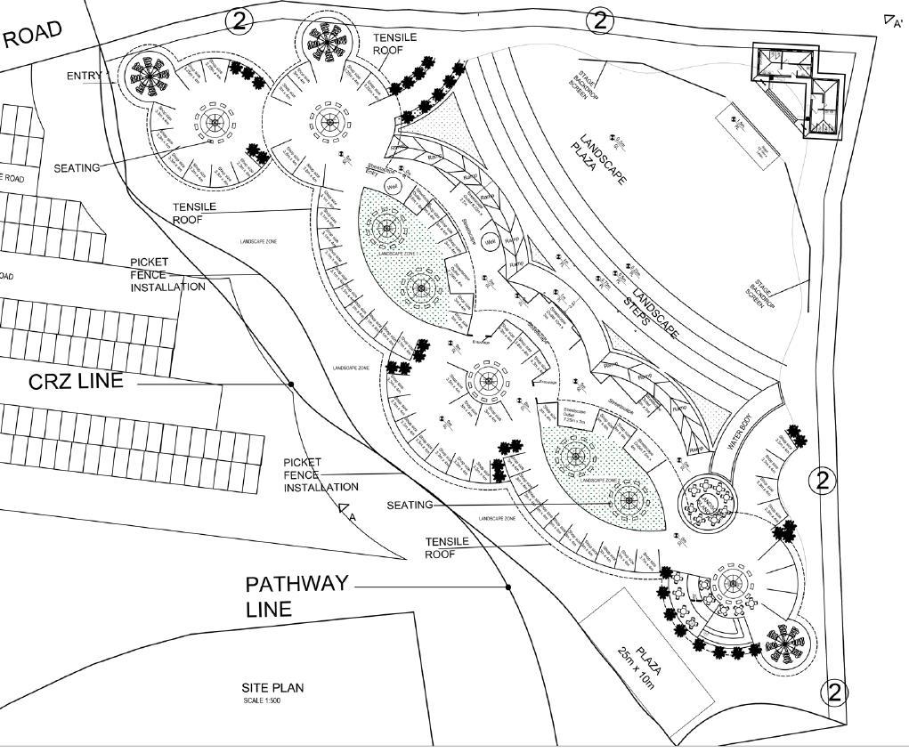
VINSAN PROMENADE, GOA
SECTOR – Urban design & Planning
LOCATION – Baga Goa, India
SCALE – 2.0 Acres
PHASE – Urban design drawing
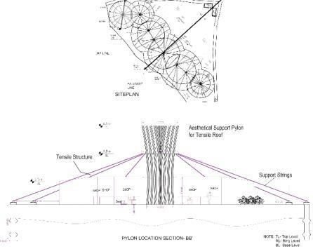
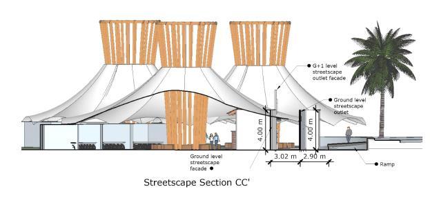
MY ROLE – Concept Development
Master Planning
Detailed AutoCAD Drawings
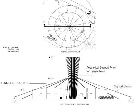
Execution( Plinth level)
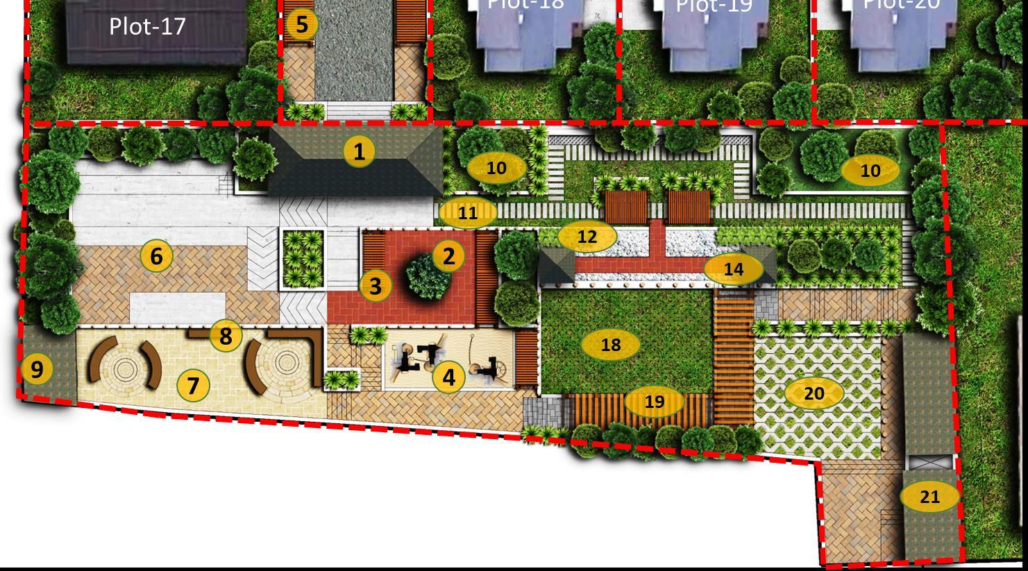
DESIGN CONCEPT
1. Make the coastline even more accessible and to attract more users.
2. By providing characteristic identity of goa through the façade.
3. A gathering space for cultural events that can go along during important tourist season

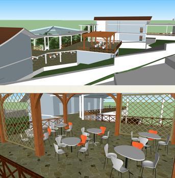
SITE PLAN
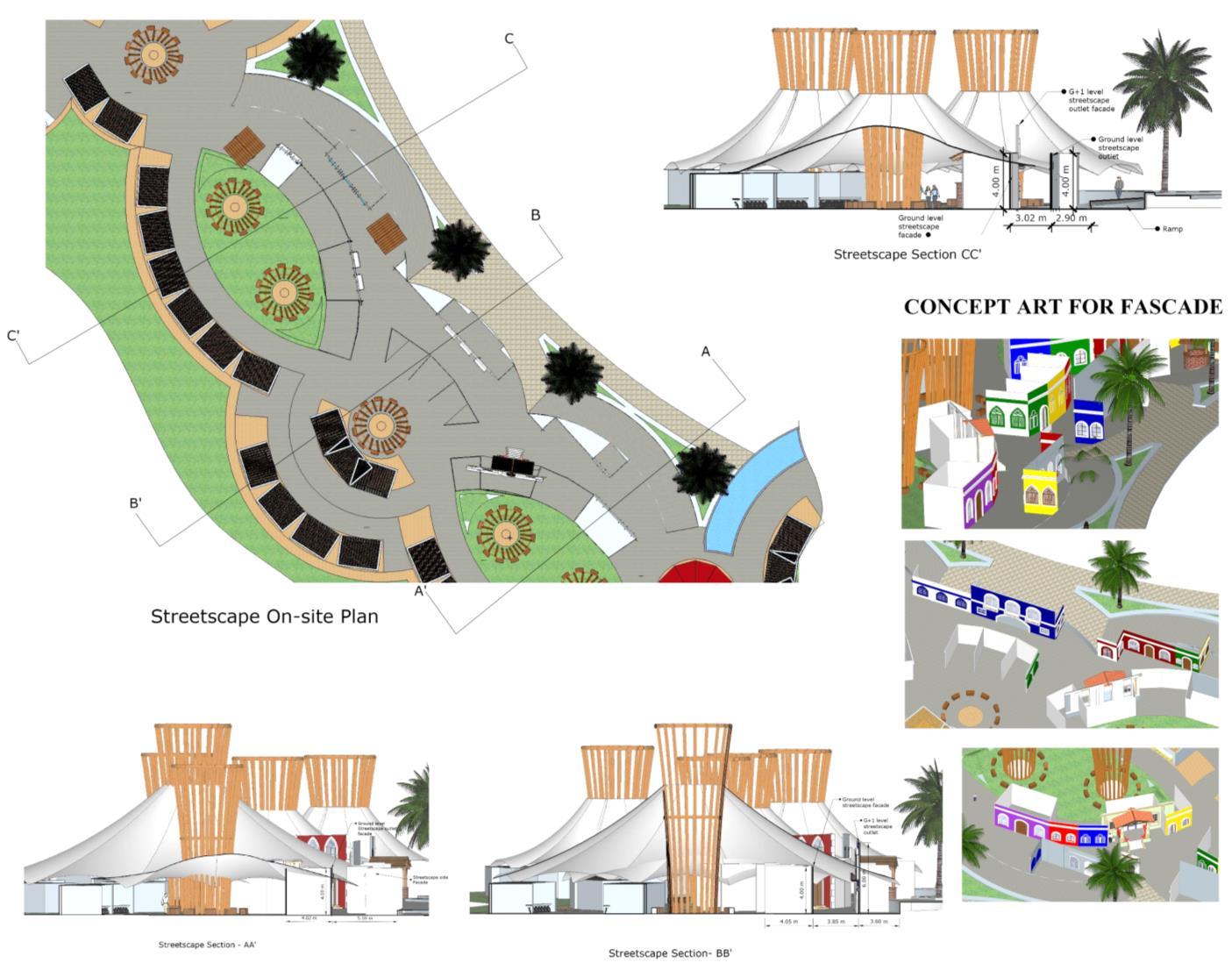
DETAILS OF SHOPS AND PYLONS PLYON AND
DETAILS
TENSILE
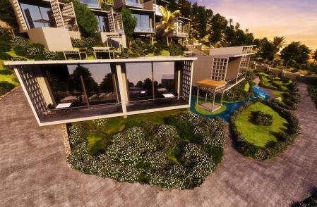
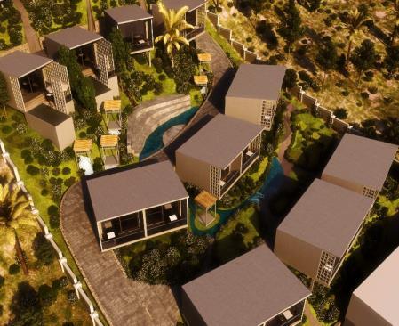
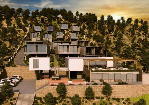
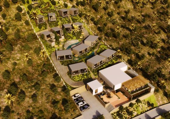
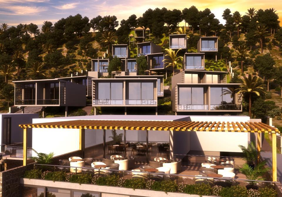
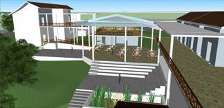
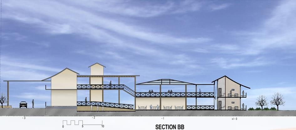
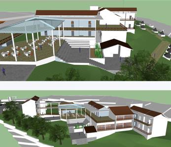
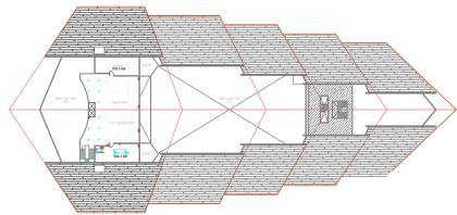
HORIZON 180
SECTOR – Architecture
LOCATION – Deviagar, Maharashtra, India
SCALE – 02 Acres.
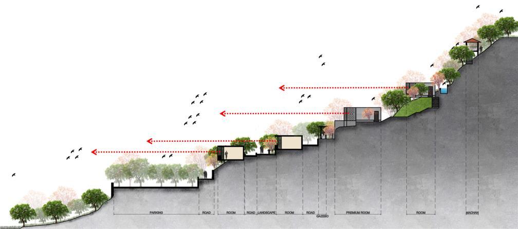
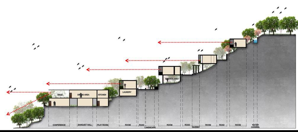
PHASE – Completed.
MY ROLE – Concept Development
Master Planning
Detailed AutoCAD Drawing
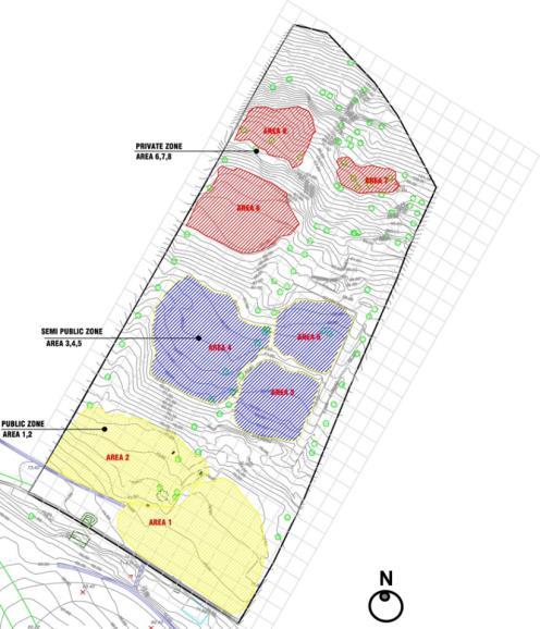
ZONING
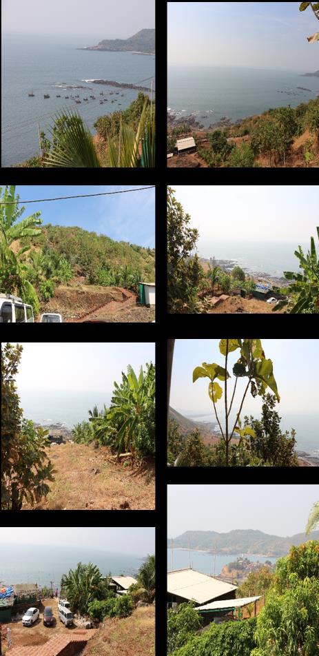
CONTEXT
• The site is a stand alone location with only nearest beach at Diveagar.
• Any intervention has to be such that it cater to all the needs of the tourist.
VIEWS FROM THE SITE
Duetotopographicalcharacteristics, formationofvariouszones

Zone – 1:
• Type: comparatively flatter,
• Use: public functions
• Building type: larger foot print
Zone – 2:
• Type: medium slope
• Use: semi-public
• Building type: medium size foot print
Zone – 3:
• Type: steep slope
• Use: semi-private
• Building type: small
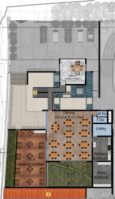
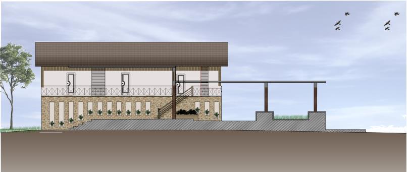
MASTER PLAN
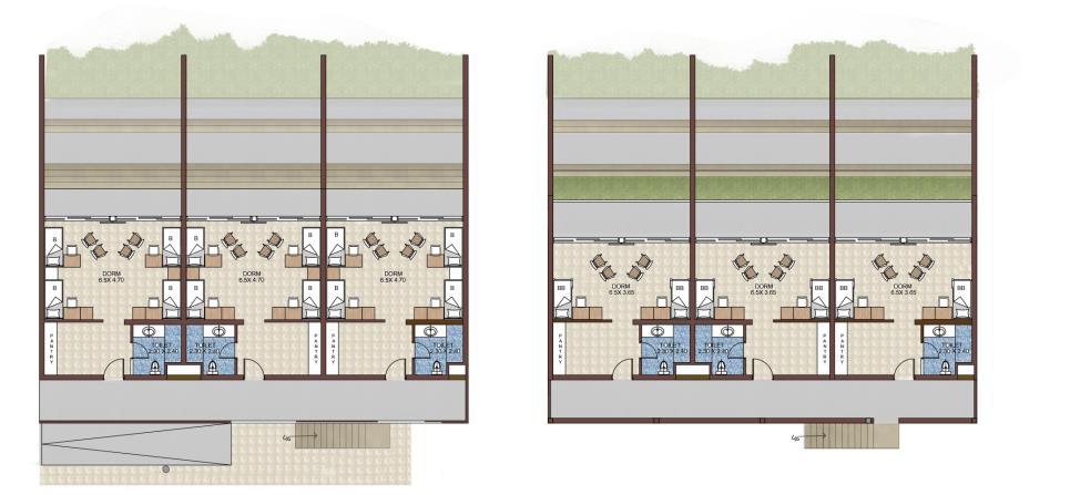
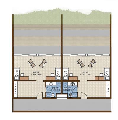
FIRST FLOOR PLAN
- A
GROUND FLOOR PLAN
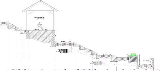
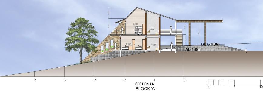
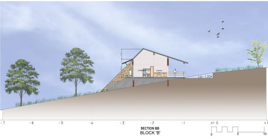
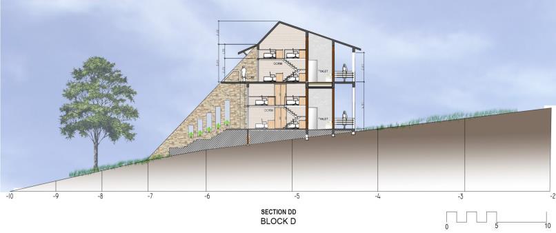
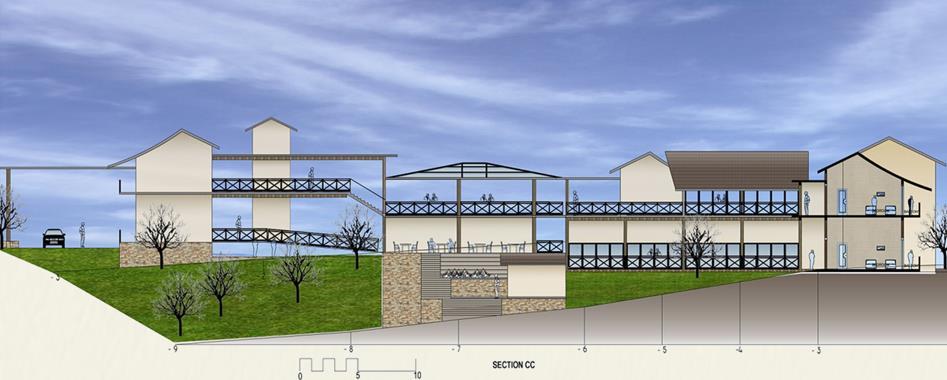
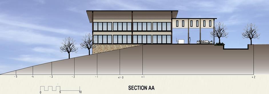
SECTION A
SECTION B - B
CIRCULATION PLAN
HORIZON 180
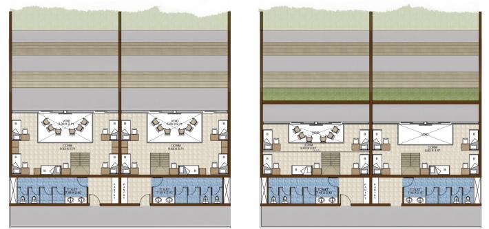
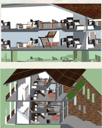
ROOM LAYOUTS
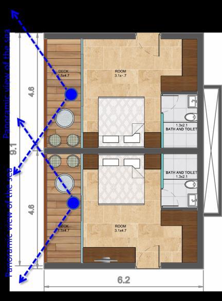
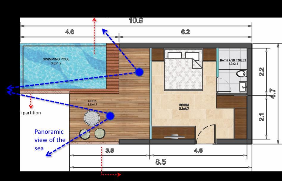
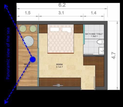
Singledetachedunits


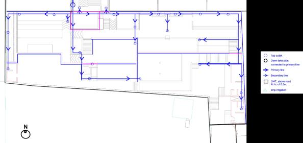
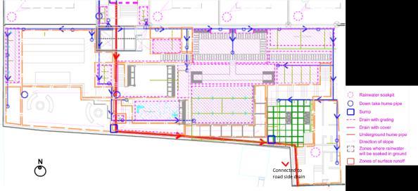
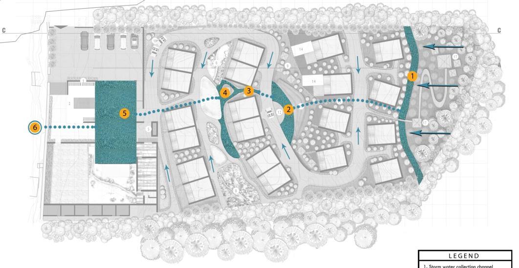
SERVICE DRAWINGS
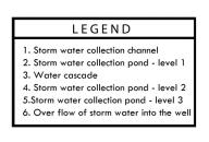
 STORM WATER HARVESTING SYSTEM
PLANT TYPOLOGY
DRIP IRRIGATION SYSTEM
STORM WATER HARVESTING SYSTEM
PLANT TYPOLOGY
DRIP IRRIGATION SYSTEM
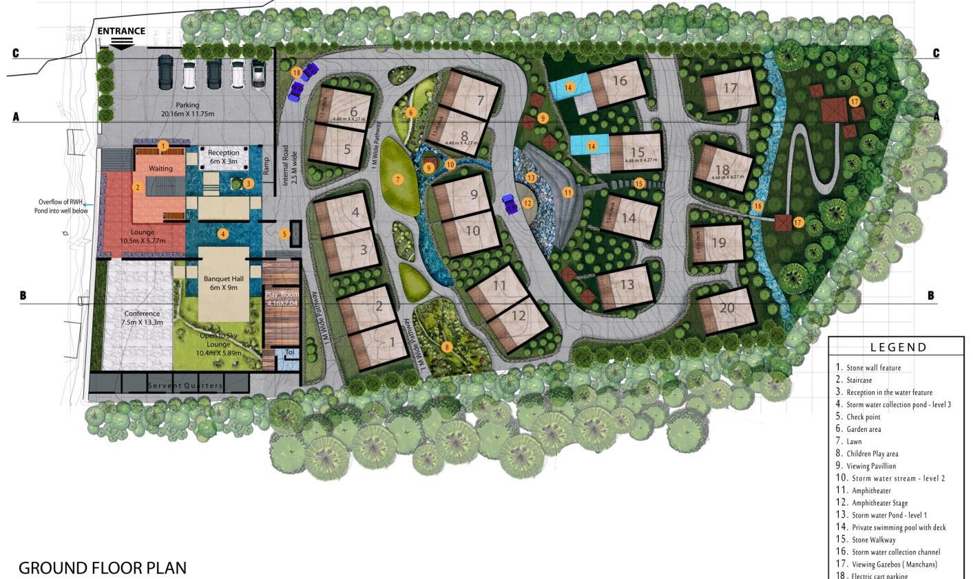
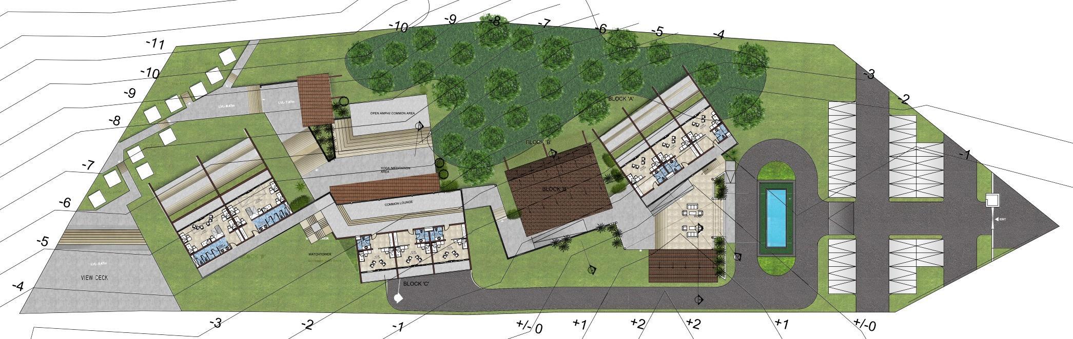
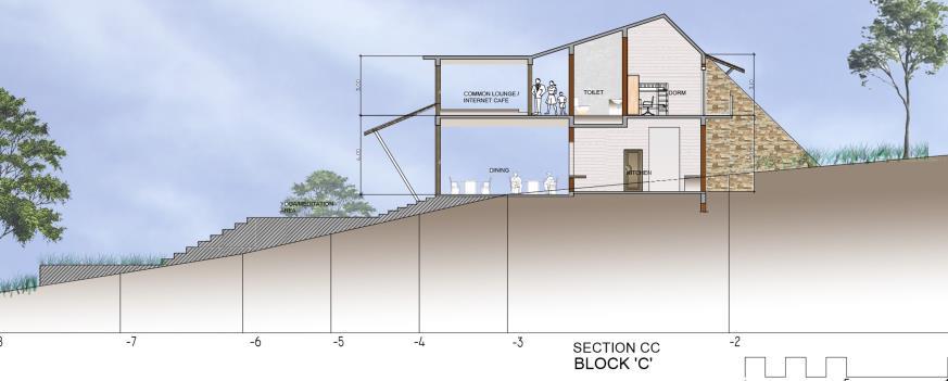
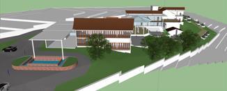
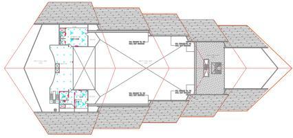
INTERNATIONAL TOURIST HOSTEL
SECTOR – Architecture
LOCATION – Gokarna, Karnataka India
SCALE – 02 Acres.
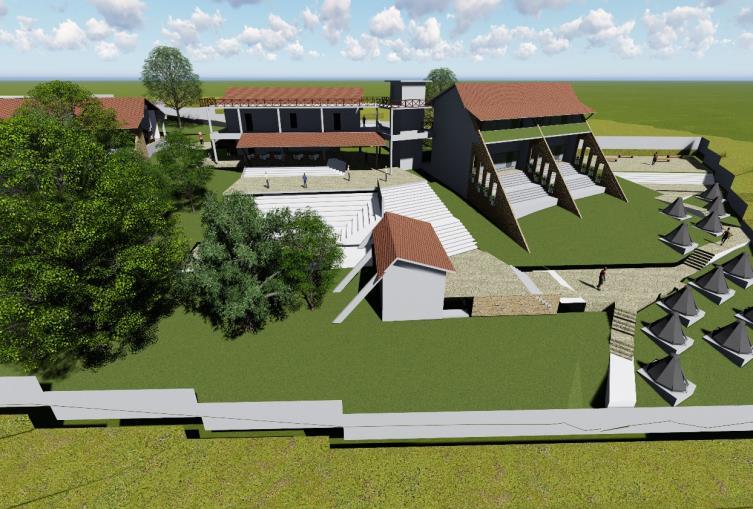
MY ROLE – Concept Development
Master Planning
Detailed AutoCAD Drawing
3D models and views Presentations
DESIGN CONCEPT
•The building has been designed to explore the contours on the site. Blocks have been placed in a manner that would make the user feel close to nature with views of the sea . Essence of contemporary Gokarna has been captured through this project.
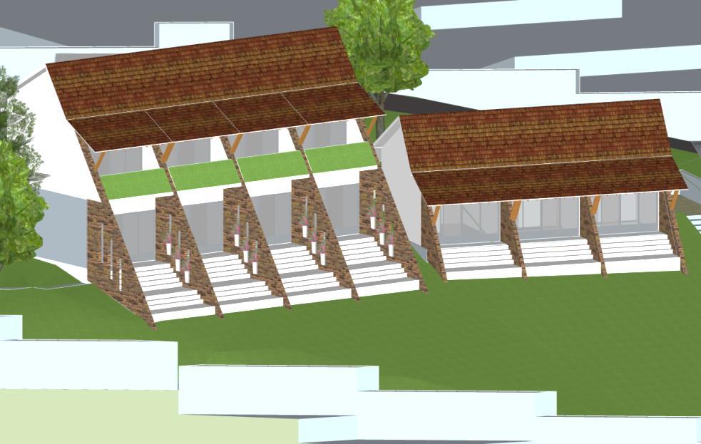
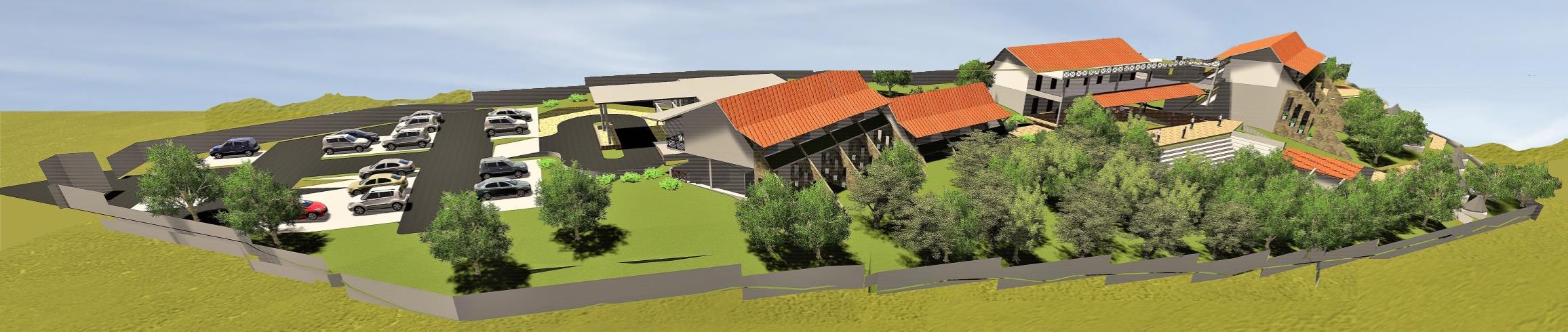
•Climatological factors and energy conserving features have been taken into consideration.
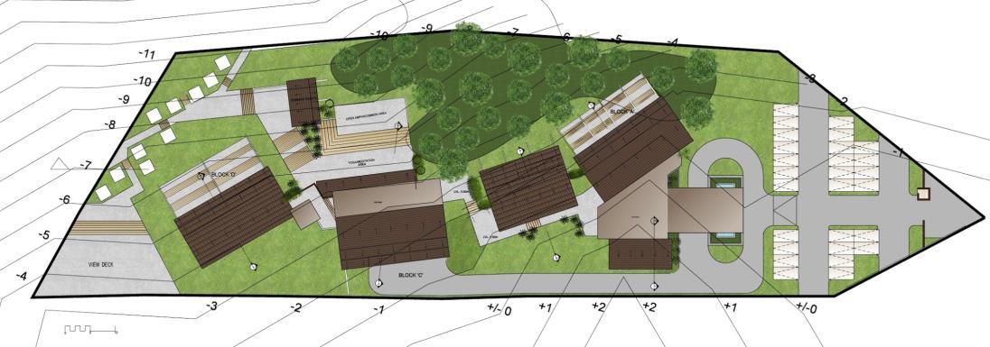
GROUND FLOOR PLAN

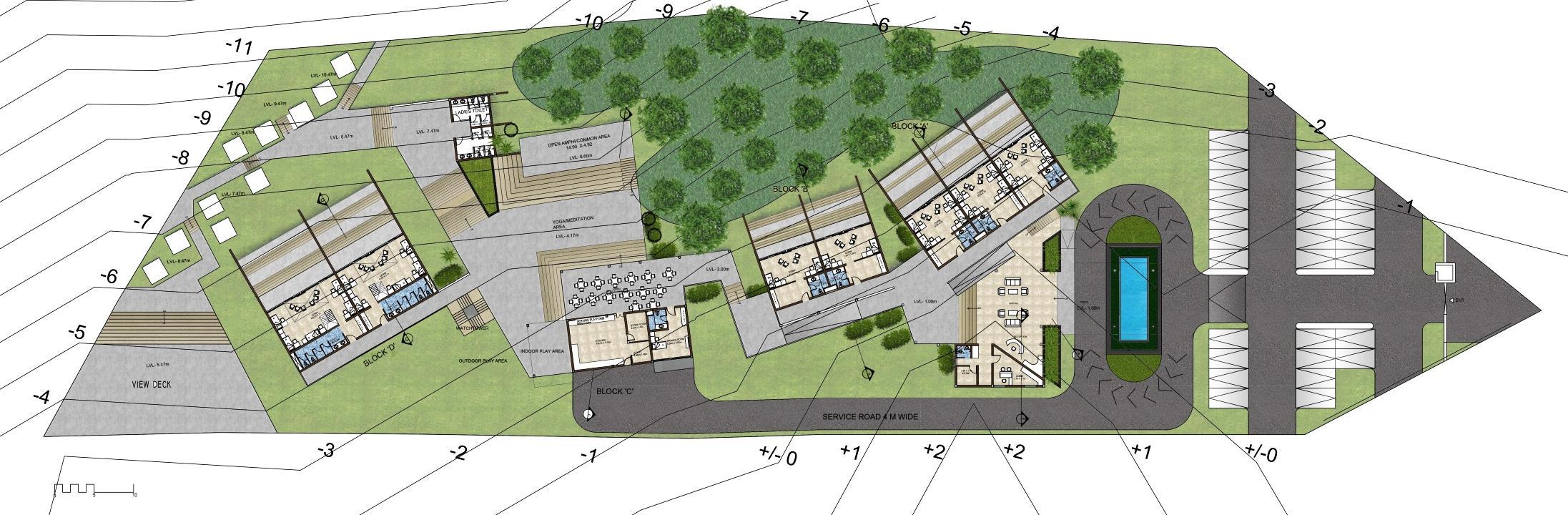
11.INDDOR PLAY AREA
13. DINING
16.
19.
SITE PLAN
ENTRANCE 2. WAITING AREA 3. RECEPTION 4. ADMIN 5. STORE 6. TOILET
WARDEN ROOM 8. STORE ROOM 9. UTILITY ROOM 10.KITCHEN
FIRST FLOOR PLAN 1.
7.
12.OUTDOOR PLAY AREA
14. YOGA/MEDITATION AREA
15. OPEN AMPHI/ COMMON AREA
COMMON TOILETS
17. TENT AREA
18. WATCH TOWER
SECURITY
A 1’-3’. ACCOMODATION FACILITY
B 1’-2’. ACCOMODATION FACILITY
D 1’-2’. ACCOMODATION FACILITY
A 5’-7’. ACCOMODATION FACILITY
C 1’-3’. ACCOMODATION FACILITY
D 3’-4’. ACCOMODATION FACILITY LEGEND
CABIN BLOCK
BLOCK
BLOCK
BLOCK
BLOCK
BLOCK

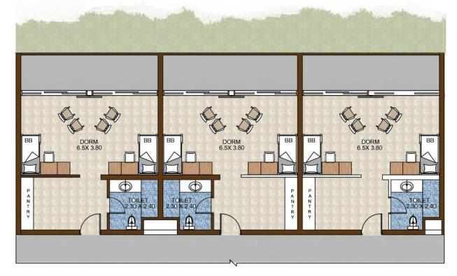
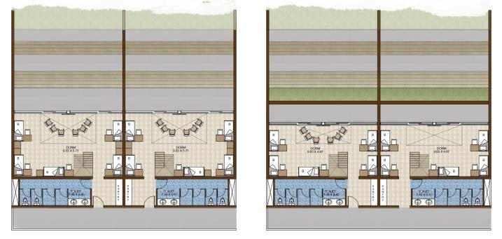
PLANS – DETAIL INTERIOR
INTERNATIONAL TOURIST HOSTEL BLOCK
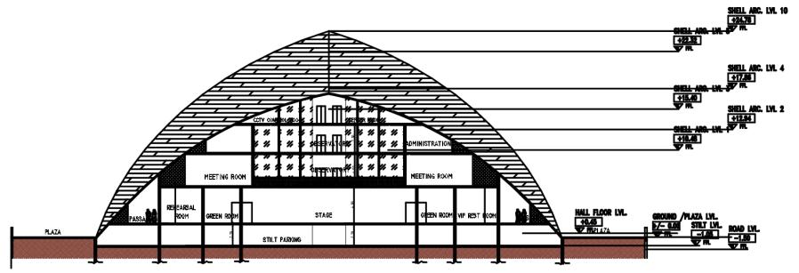
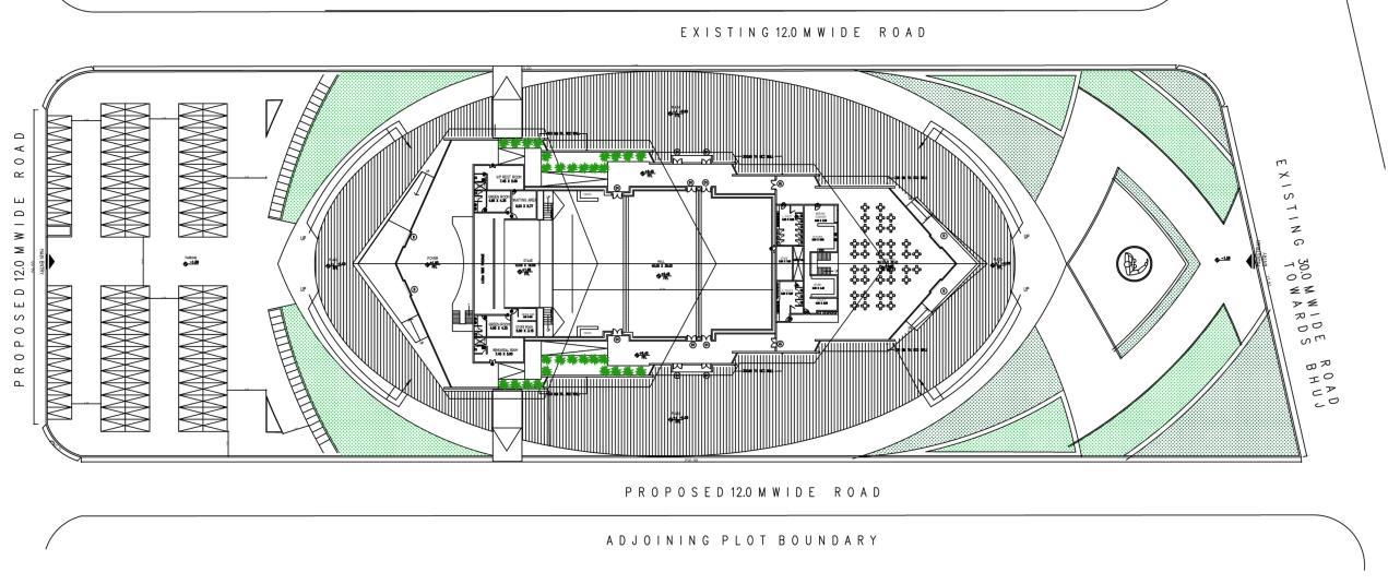
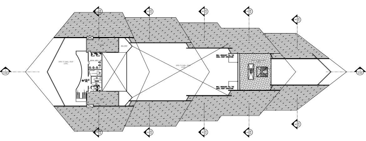
KANDLA PORT TRUST AUDITORIUM
SECTOR – Architecture
LOCATION – Kandla, Gujarat, India
SCALE – 3.4 Acres
MY ROLE – Concept Development
Master Planning
Detailed AutoCAD Drawing
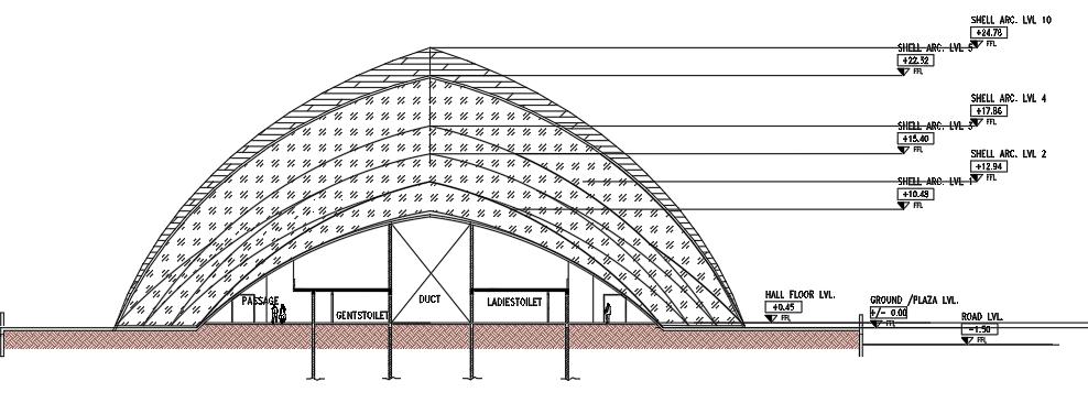
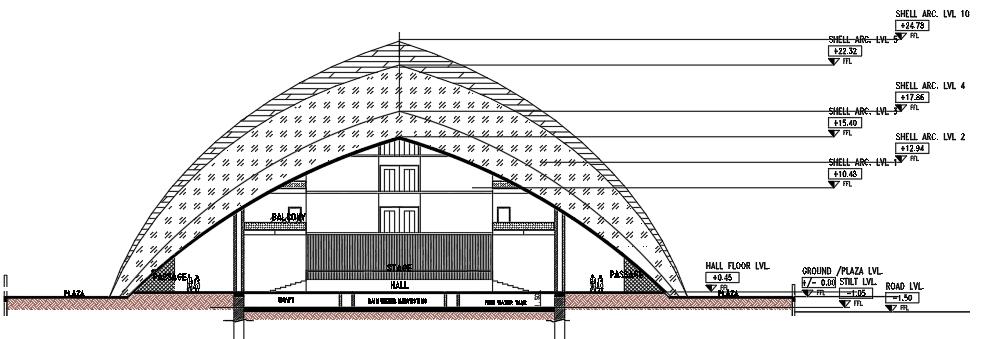
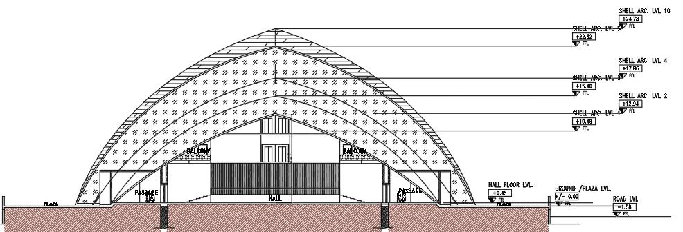
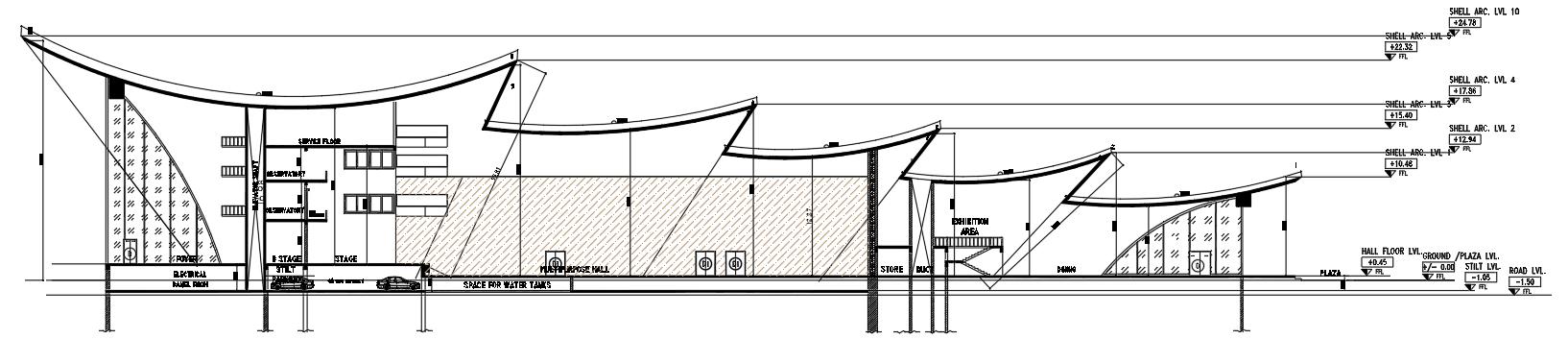
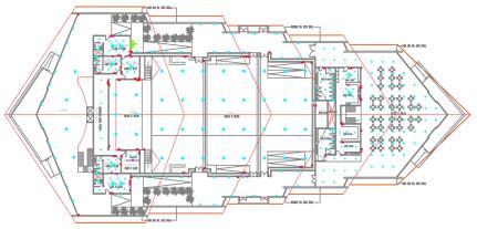

Electric Drawings
DESIGN CONCEPT
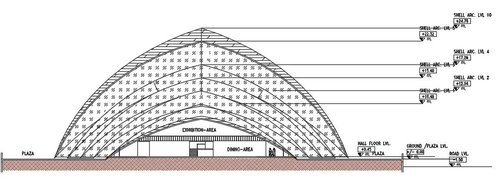
•The building has been designed as a iconic structure to attract visitors from around the world.
•The roof of the building forms an arc to form walls and it is from Fluorescent cement.
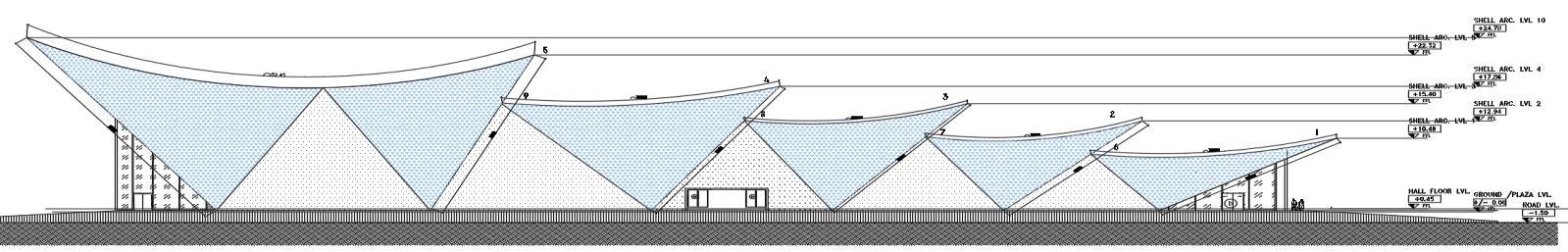
SITEPLAN
NORTHELEVATION
SECTIONA-A
SECTIONA-A
ELECTRICDRAWINGS
GROUNDFLOOR
SECTION4-4
FIRSTFLOOR
SECONDFLOOR
SECTION5-5
SECTION6-6
SECTION2-2
SECTION3-3
ACADEMIC WORK
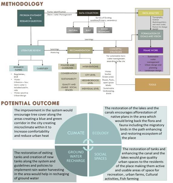
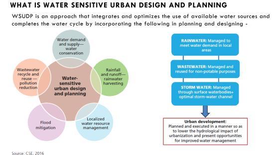
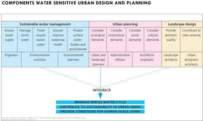
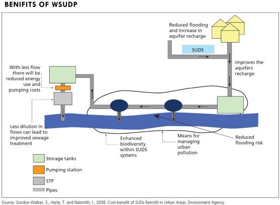
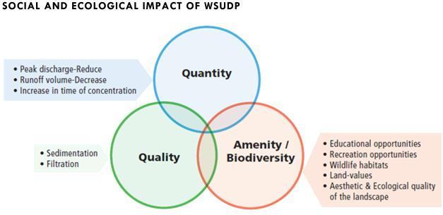
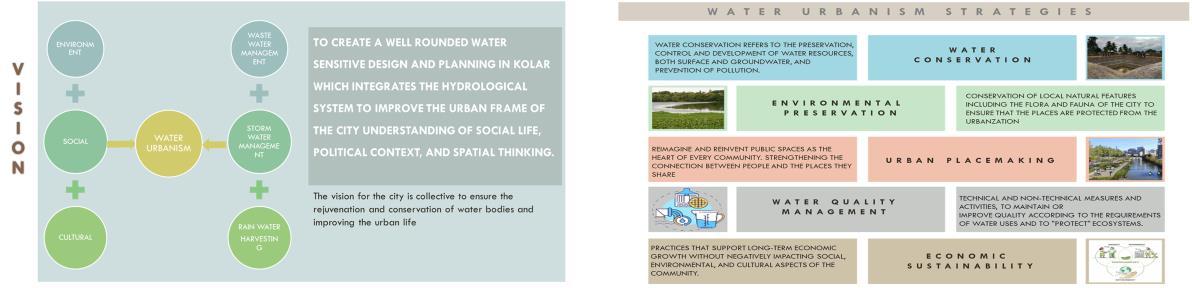
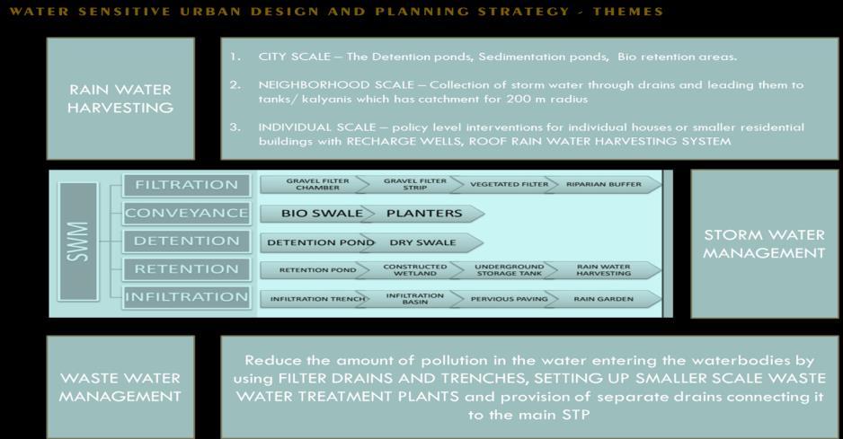
These systems- including rainfall, water retention, water harvesting, industry and agriculture use, re-collection and re-cycling culture, water access and sewage, are framed as opportunities within an urbanized ecology with the potential for design interventions along multiple points in the cycle.
Water Urbanism also implies a set of design practices that engage people with policy and to continuously manage the urban eco-system to promote resilient communities and participatory practices.
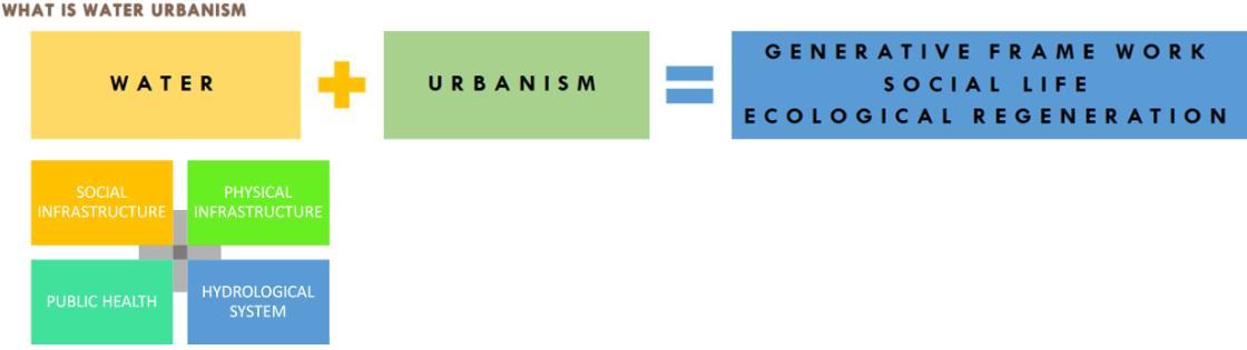
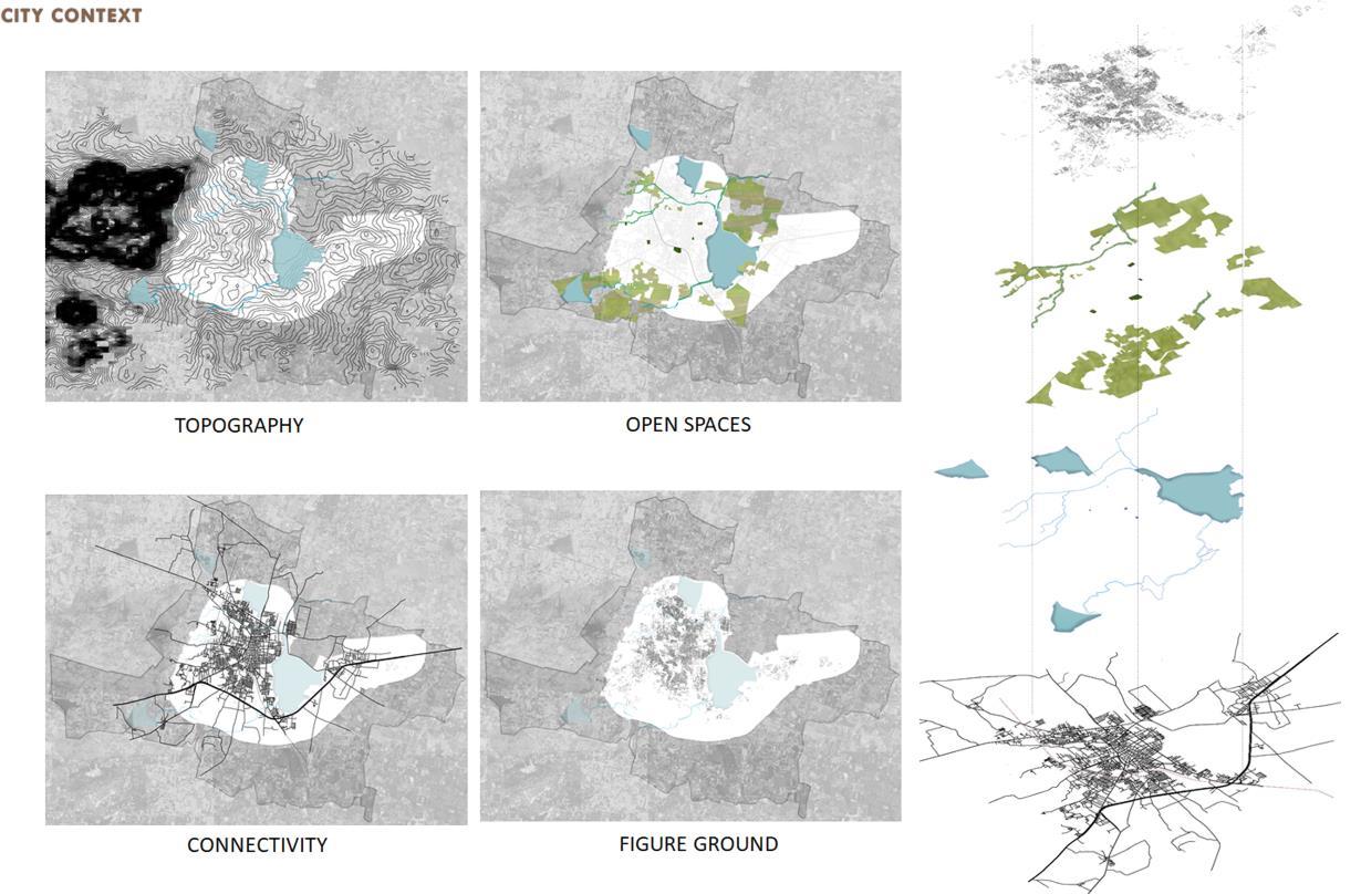
The goal is develop a comprehensive understanding of water systems and social life and how these systems interrelate with a specificity of context, land, economics, religion and urban-rural pattern.
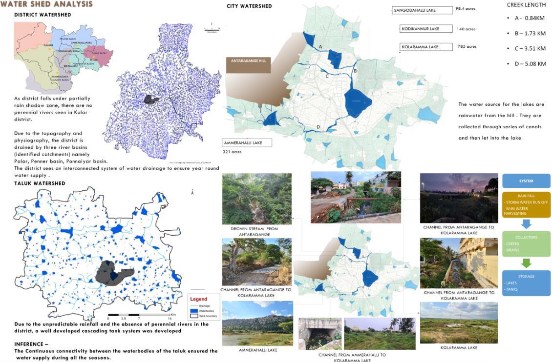
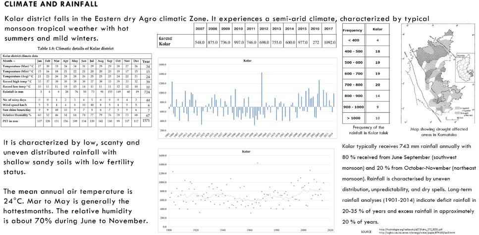
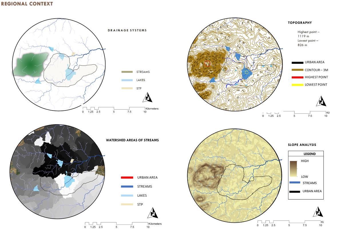
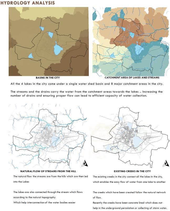
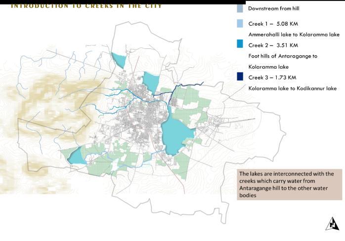
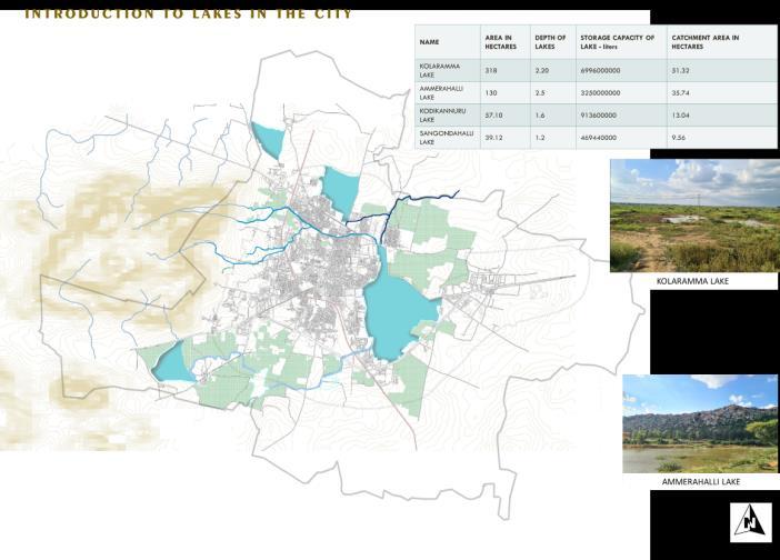
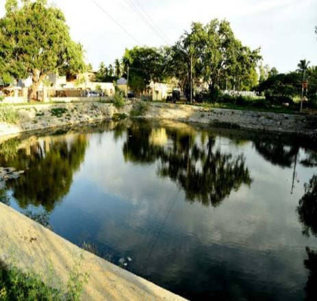
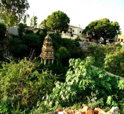
Kolar is a city in the Indian state of Karnataka. It is the headquarters of Kolar district. The city is known for its milk production and the gold mines. It is also known for Someshwara temple and the Kolaramma temple.
LOCATION –

It is located at a distance of about 70 kilometres (43 mi) from Bangalore, 50 kilometres (31 mi) from Bangalore International Airport, 32 kilometres (20 mi) from Kolar Gold Fields. The city is located on the southern maidan (plains) region of Karnataka. The hill to the west of Kolar, called the Shatasringa Parvata or 'Hundred-Peaked Mountain' is Antharagange’. The Ammerallikere, a tank, forms its eastern boundary. To the north is the Kodikannur tank, the main source of water supply to the city.
LOCATION - =Kolar , Karnataka
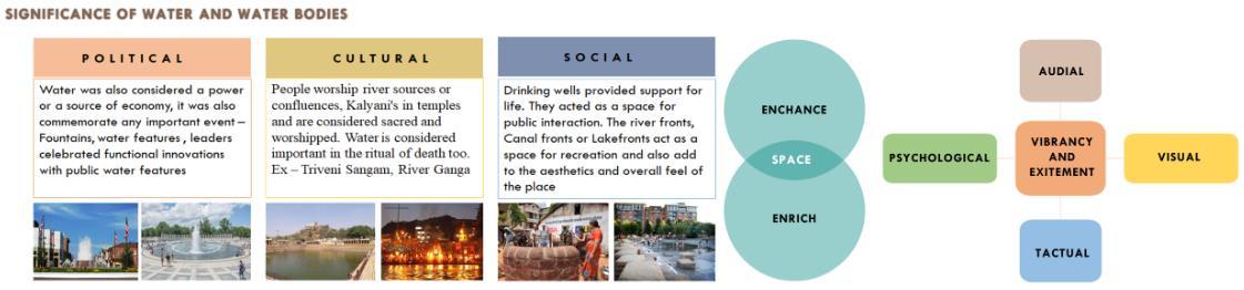
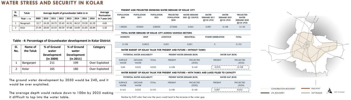
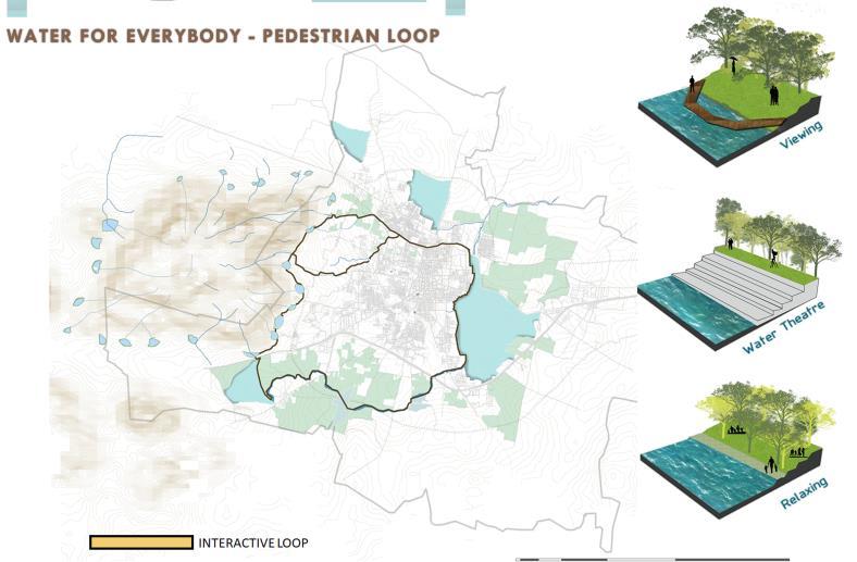
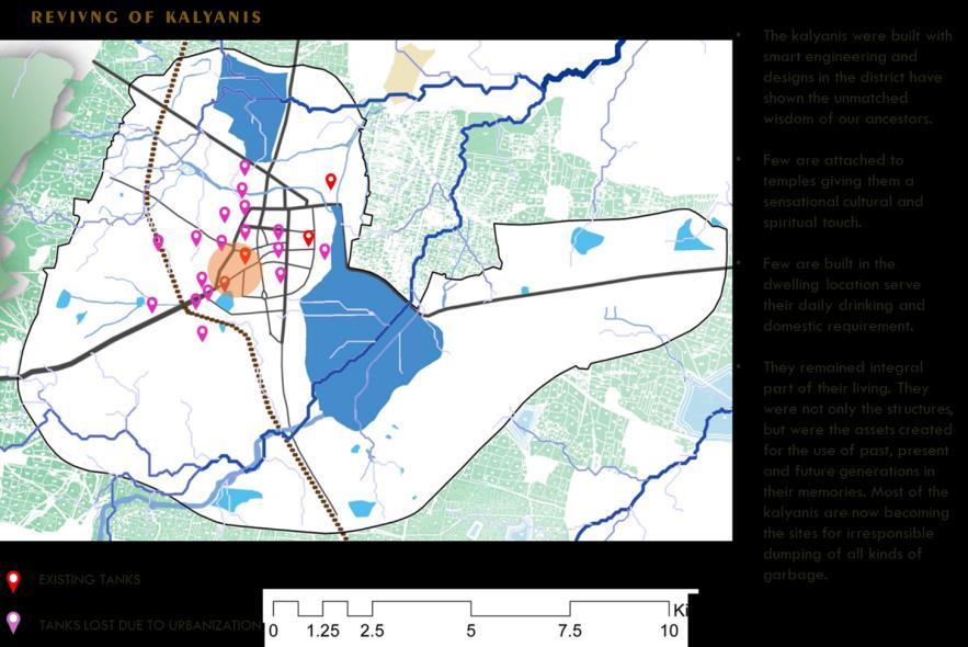
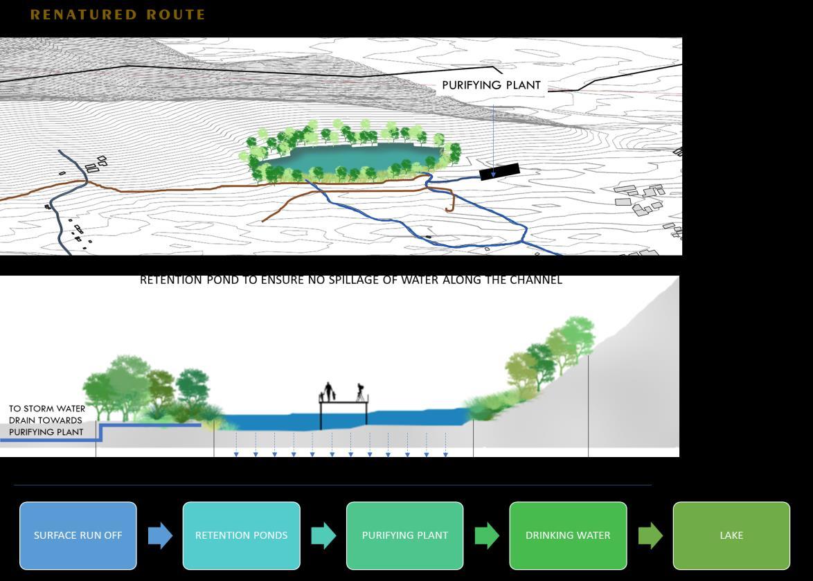
Restoration and rejuvenation of Waterscapes and Ground water level through hydrological, Ecological and Social interaction
• To investigate, analyze, and conclude solution for water management in kolar
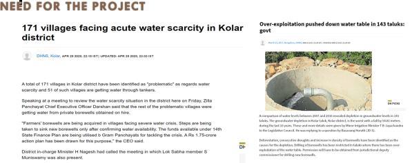
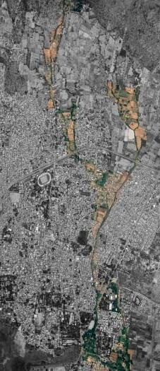
• Re-integrate de centralized waterbodies to the public realm with water sensitive urbanism
• Create toolbox of interventions on different scales and how water sensitive spatial planning and design to help create an water sensitive urban environment
• Create water sensitive public spaces within the urban context of Kolar
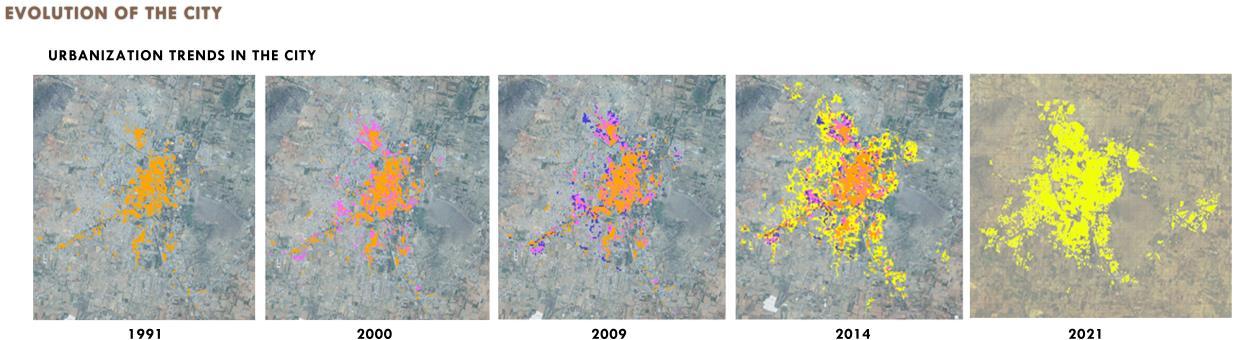
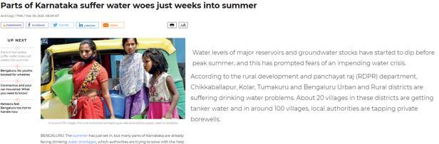
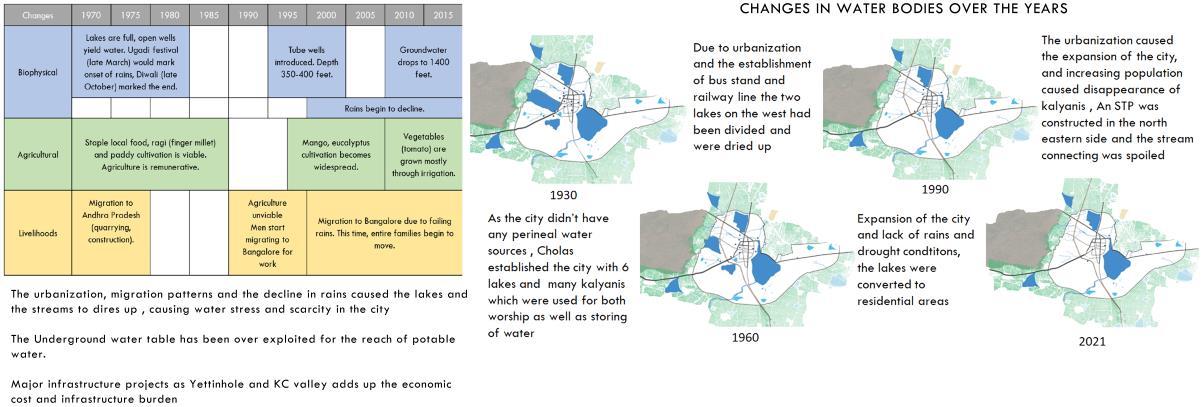
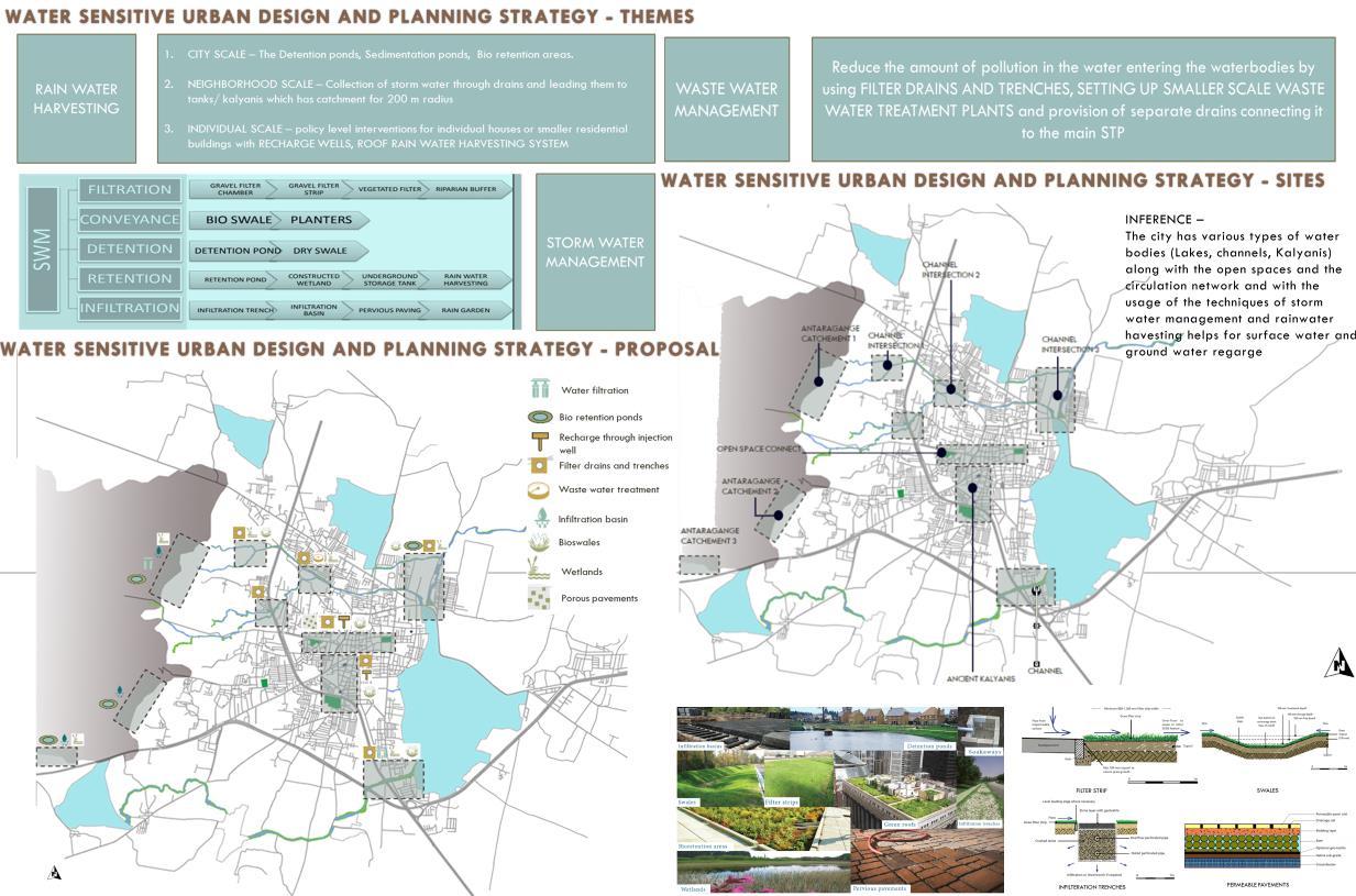
The city of Kolar depends on rainfall as the single source for water. Over the years the water shortage has increased due to urbanization and neglecting the need for water storage in the city. The problem has caused for government to come up with various initiatives depending on the external sources of water and creating large scale projects to meet the demand and manage the condition of drought in the city. The problem questions the future scenario of increasing demand on those resources and what would happen when the external sources get dry. This makes it important for the city to strive on it own a and manage the water efficiently .
As the city mainly depends on rainfall, it is mostly important to address the storm water management and the surface runoff in the city and make sure those resources are used to replenish the underground water table.
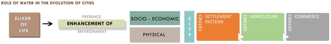
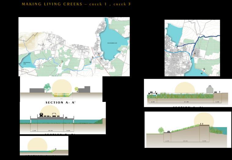
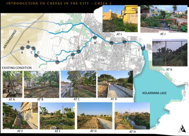
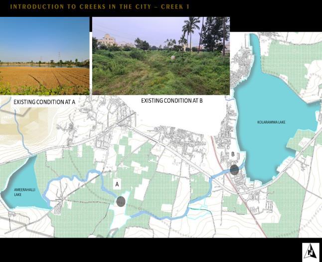
WATER URBANISM- A CASE OF KOLAR)
ABOUT THE CITY
WATER URBANISM- A CASE OF KOLAR)
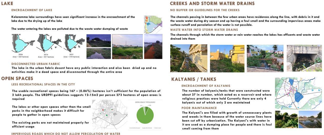

ISSUES WATER URBANISM-
CASE
KOLAR)
A
OF
WATER URBANISM- A CASE OF KOLAR)
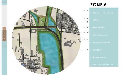
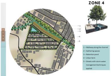
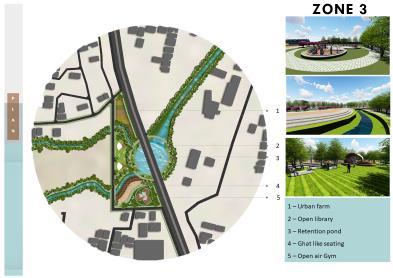
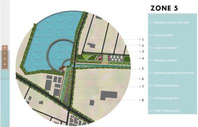
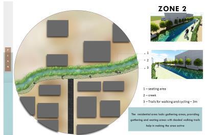
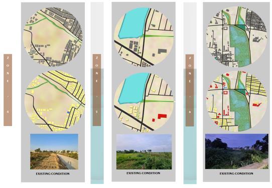
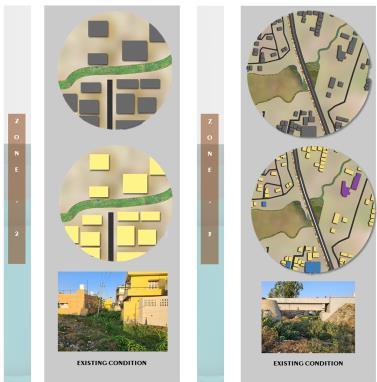

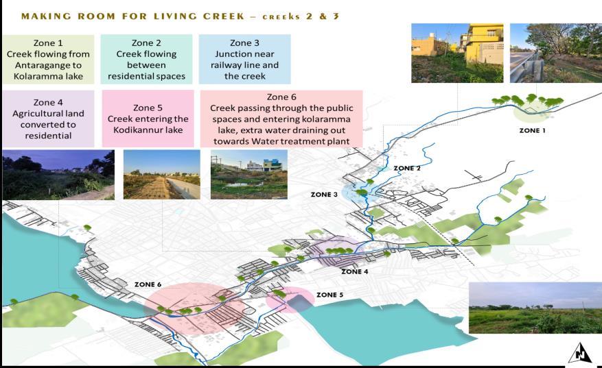
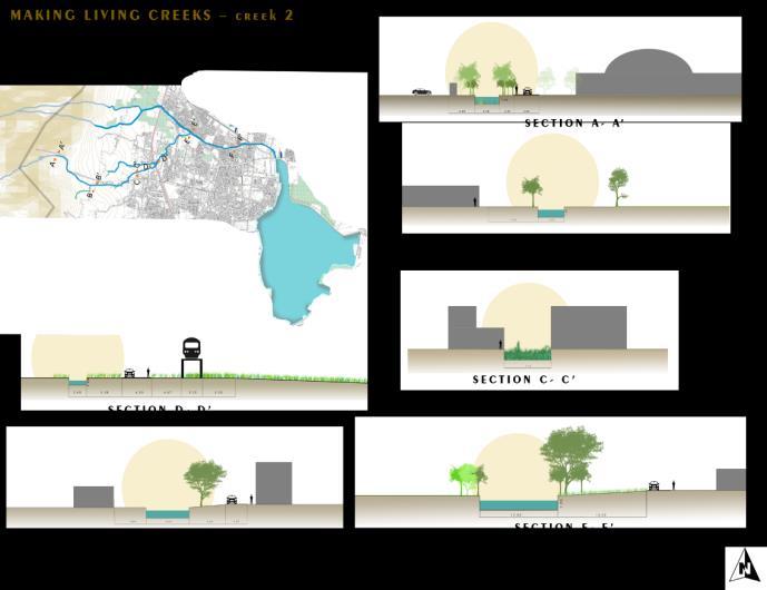

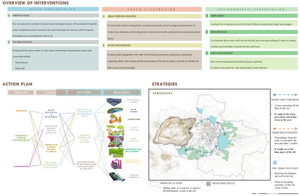
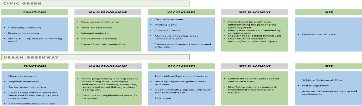
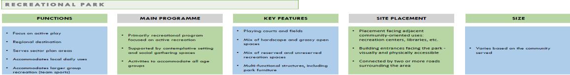
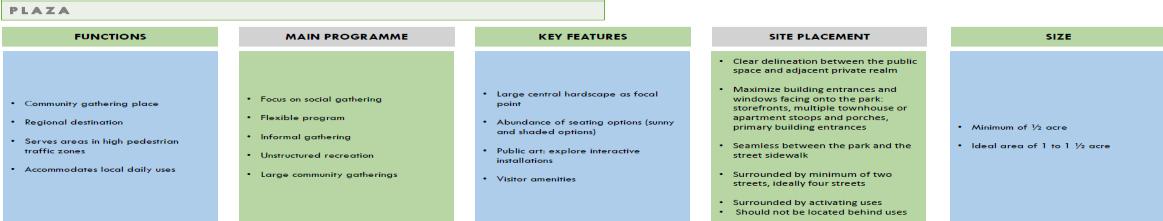
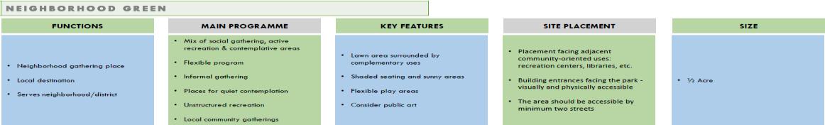
URBAN PLACEMAKING I N T E R V E N T I O N S
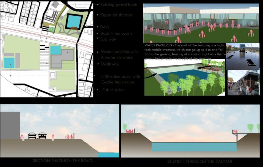
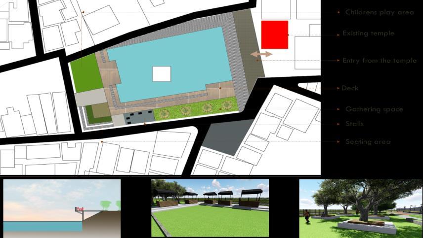
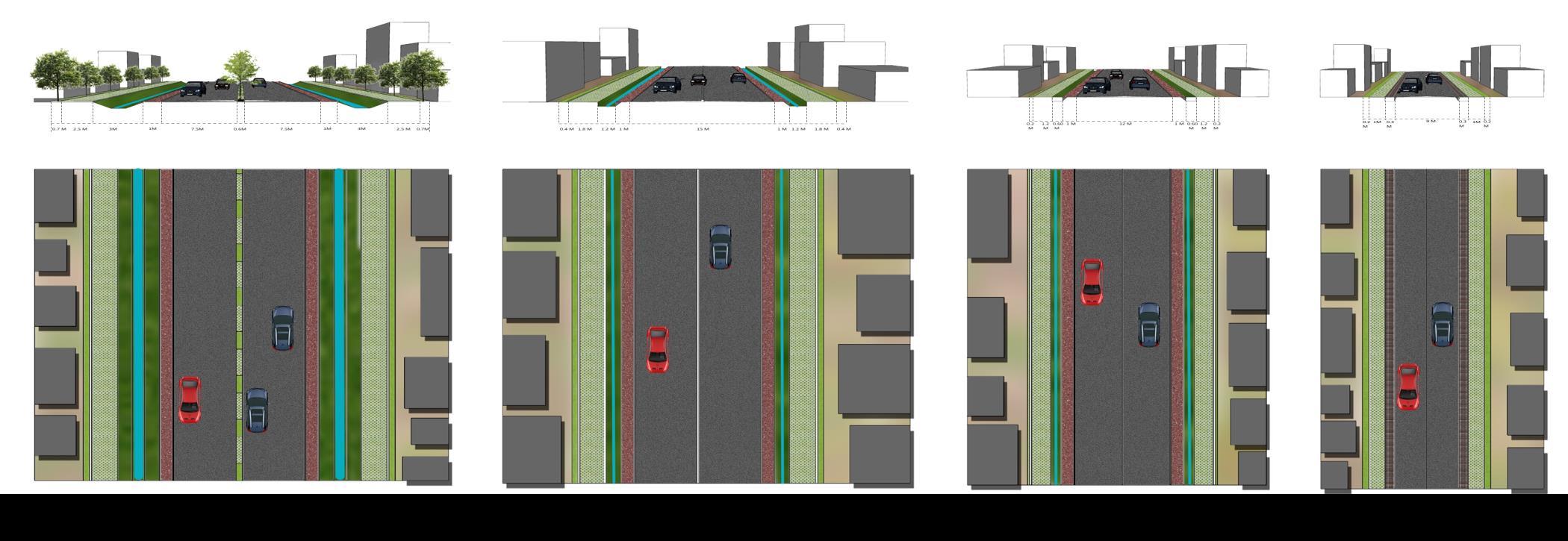

 GREEN
GREEN
STREETS WATER URBANISM- A CASE OF KOLAR)
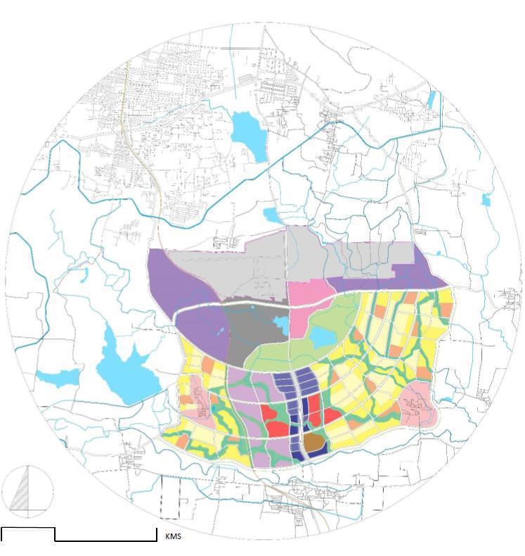
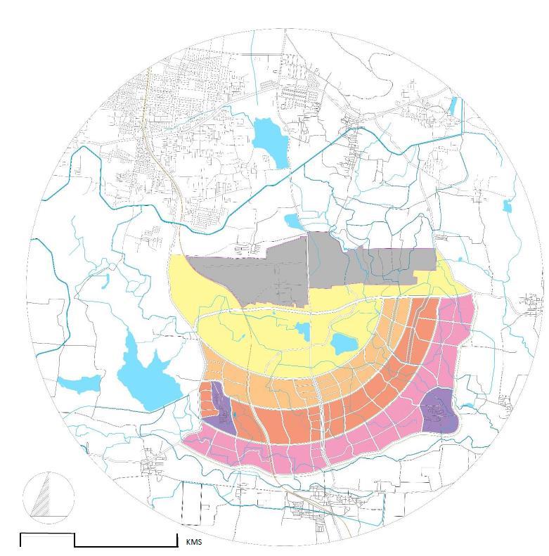
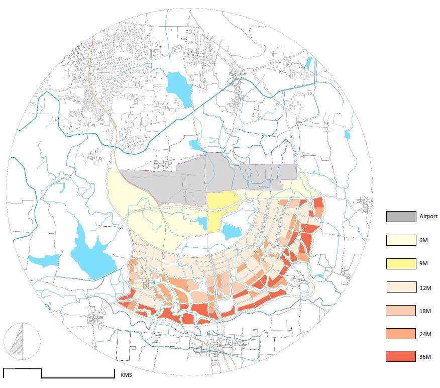
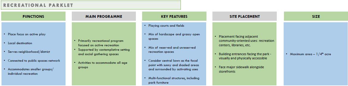
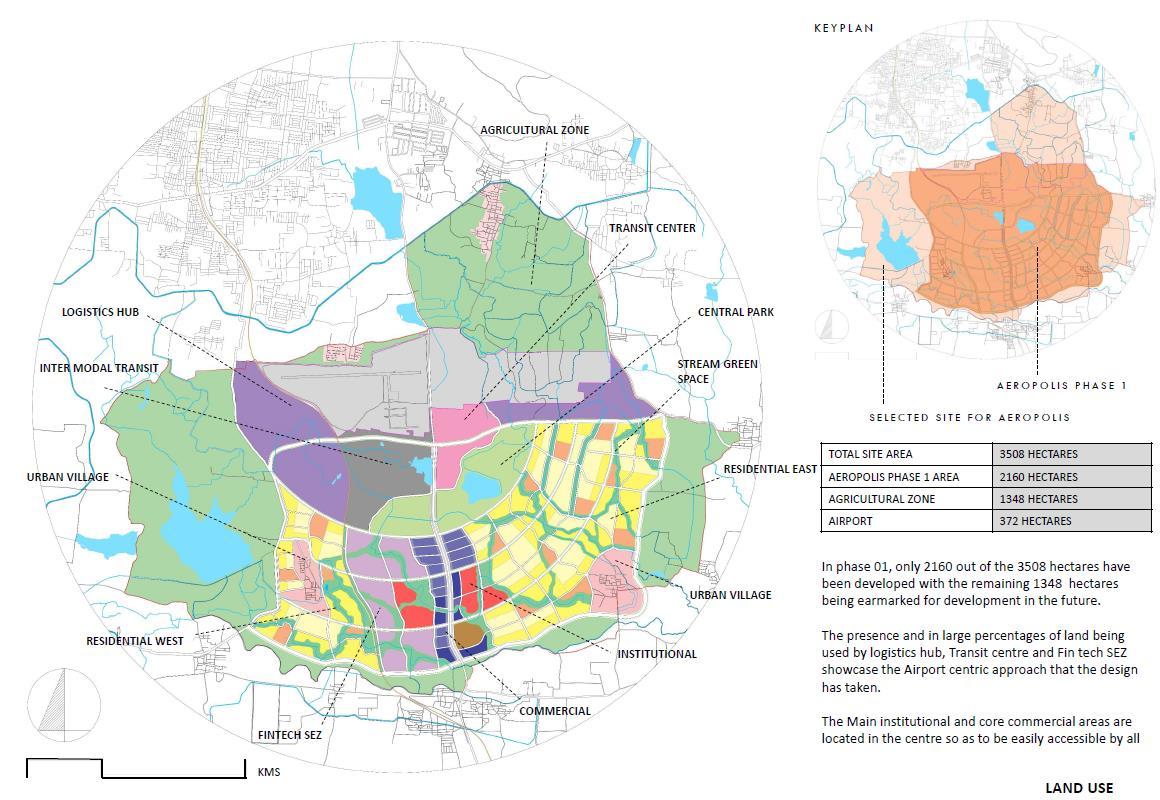
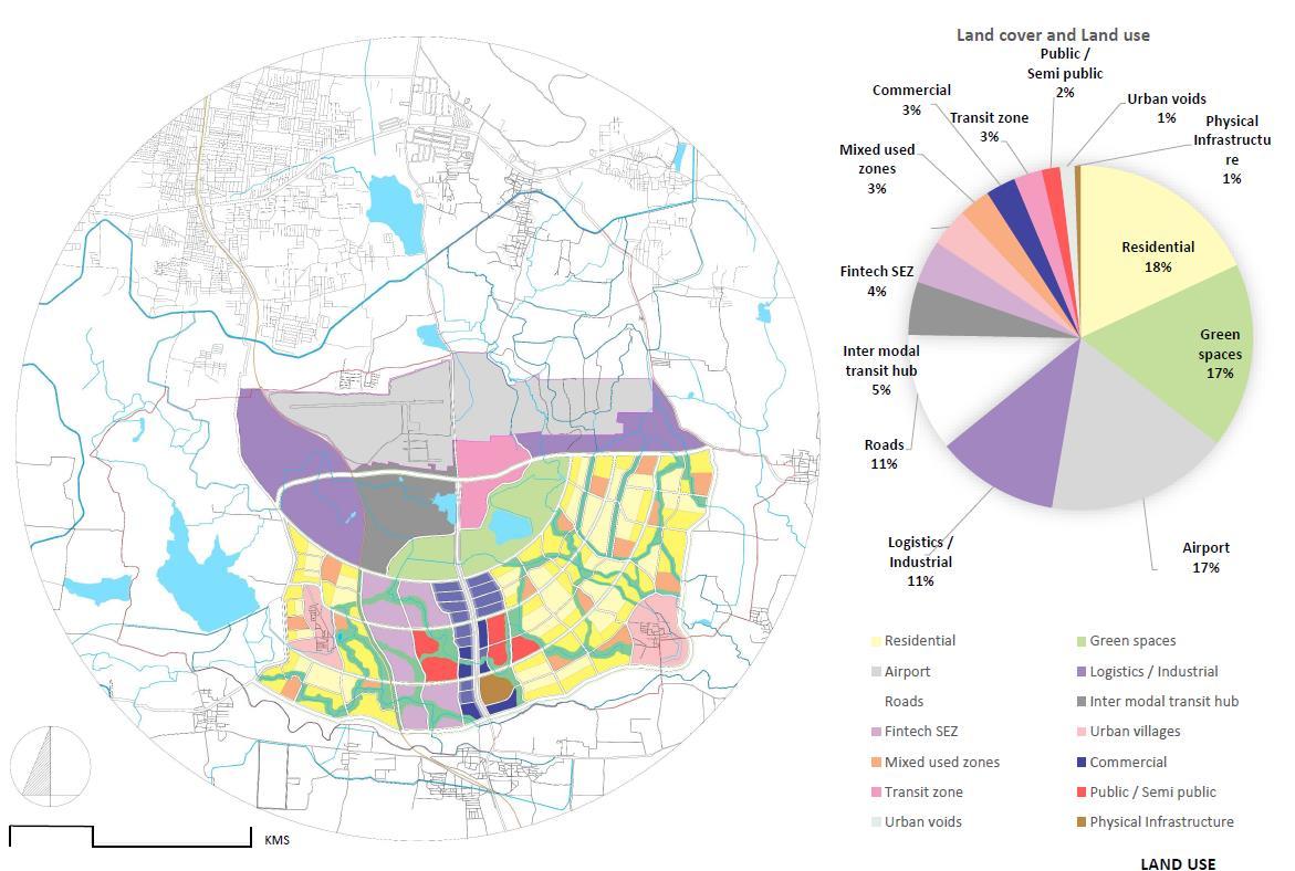
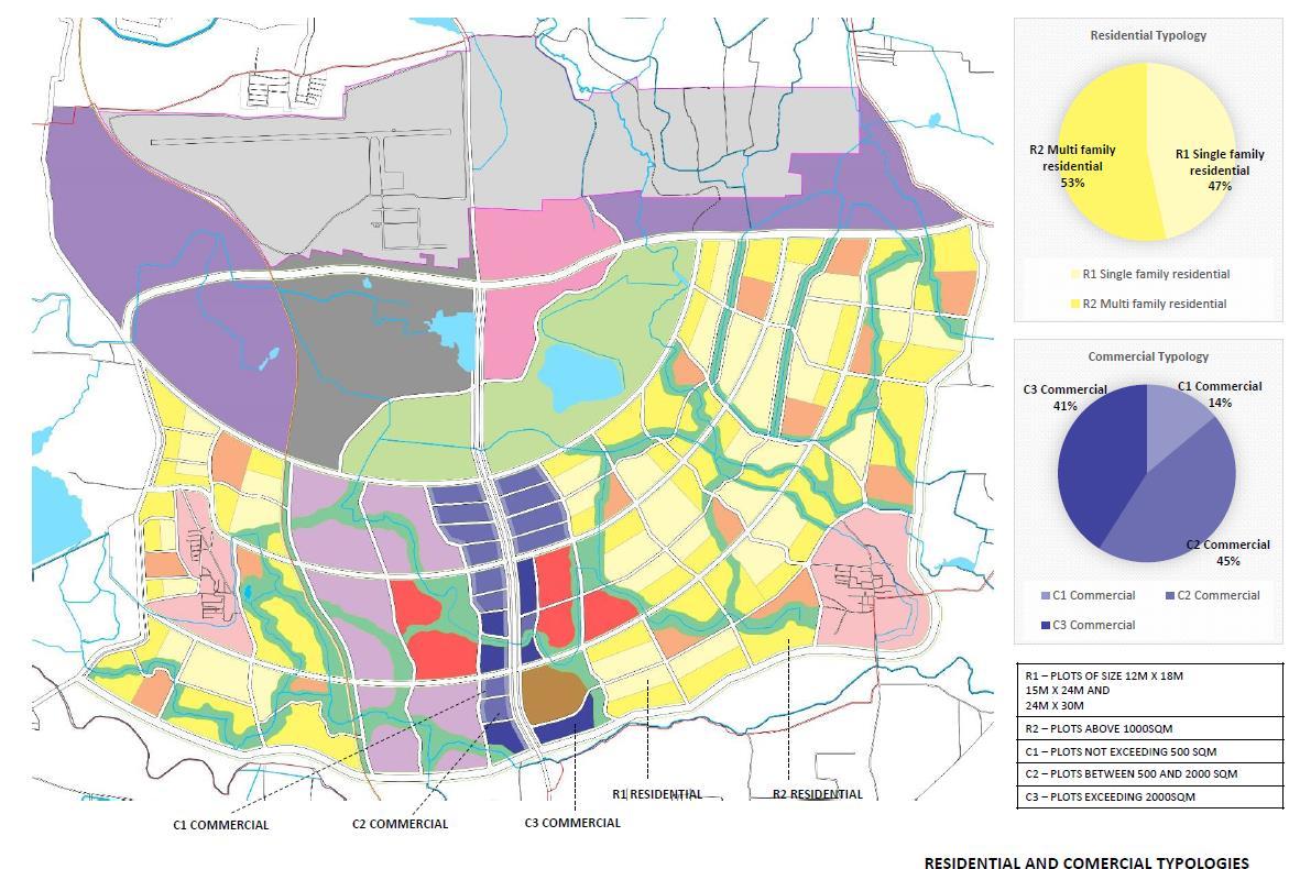
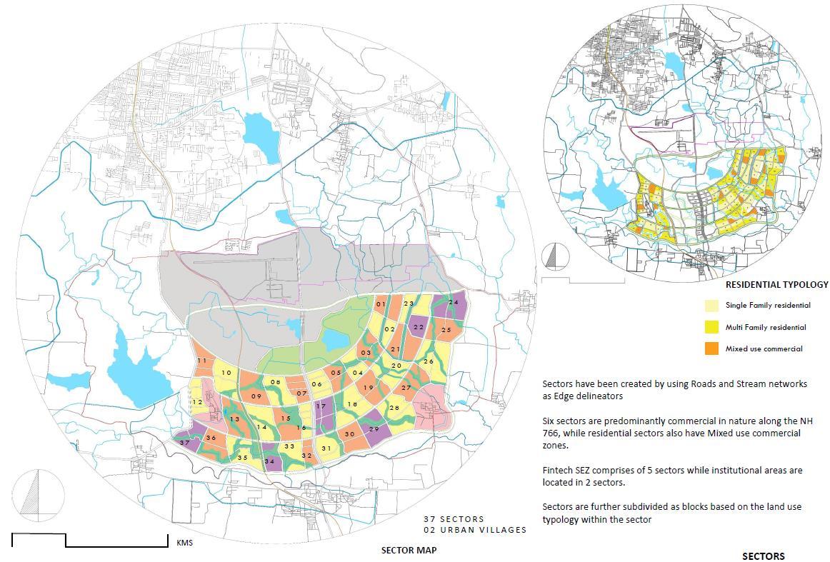
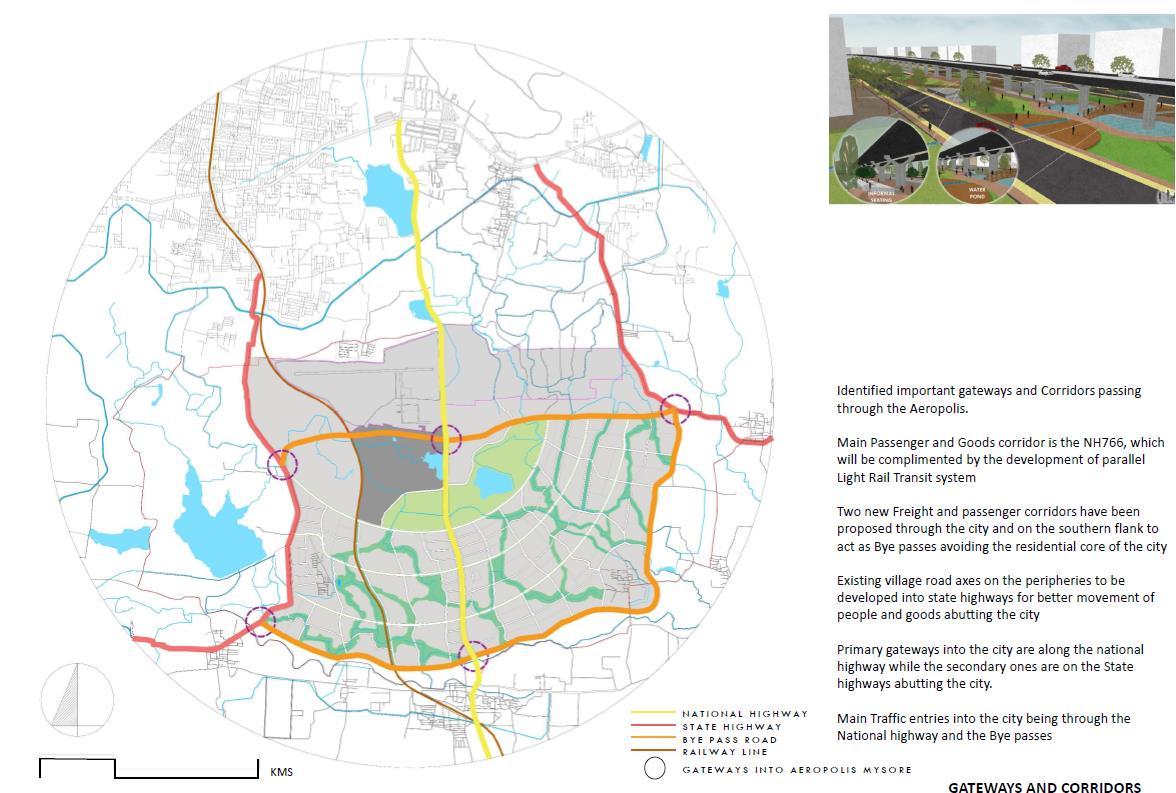
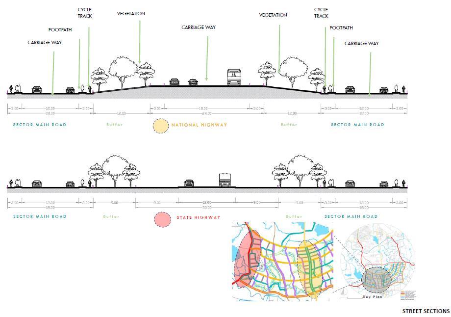
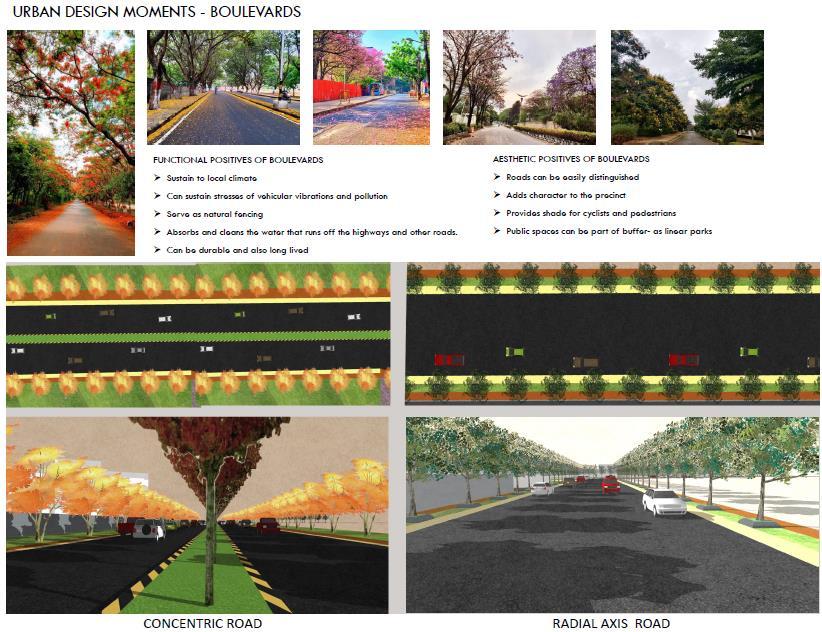
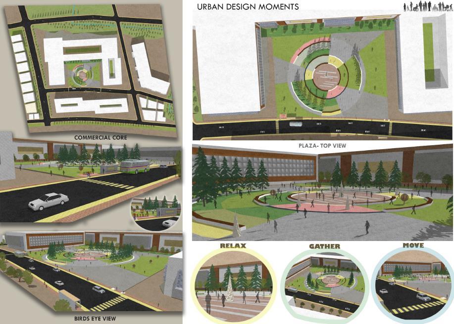
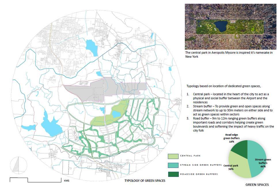
AIRPORT CITY (AERETROPOLIS) - MYSORE

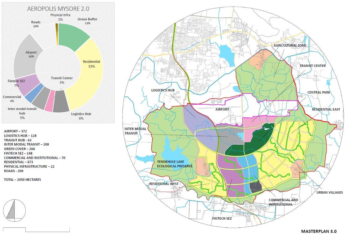
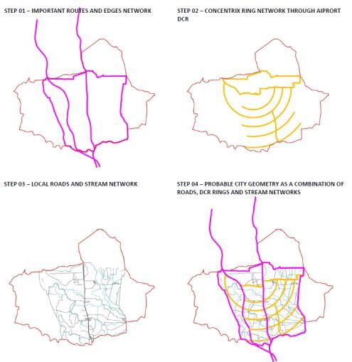
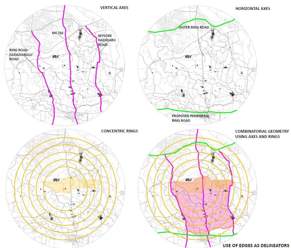


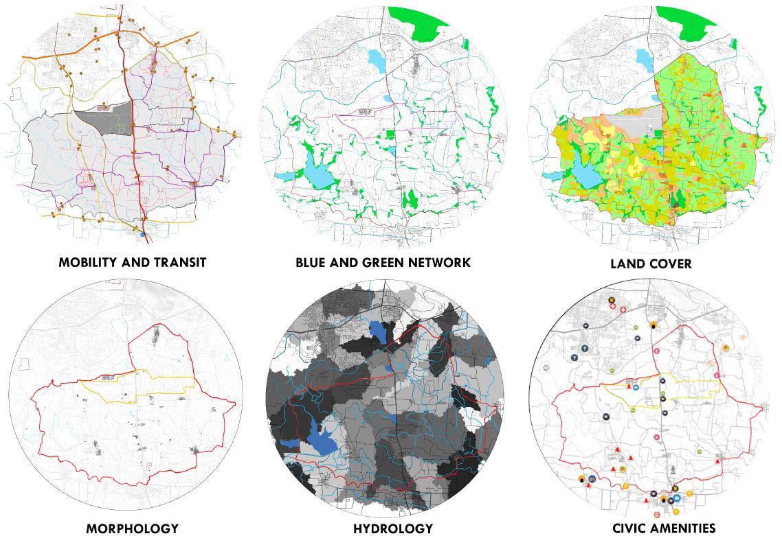
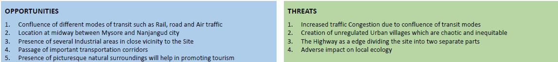

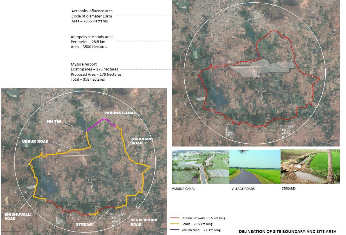
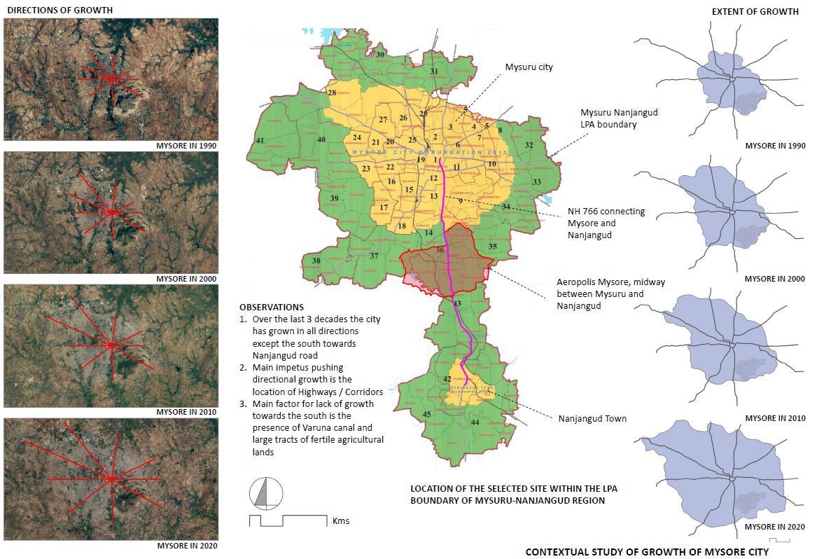

INTRODUCTION TO SITE SITE LAYERS
DEVELOPMENT MASTER PLAN
DESIGN
AIRPORT CITY (AERETROPOLIS) - MYSORE
PERMITTED LAND USES
DCR ZONES
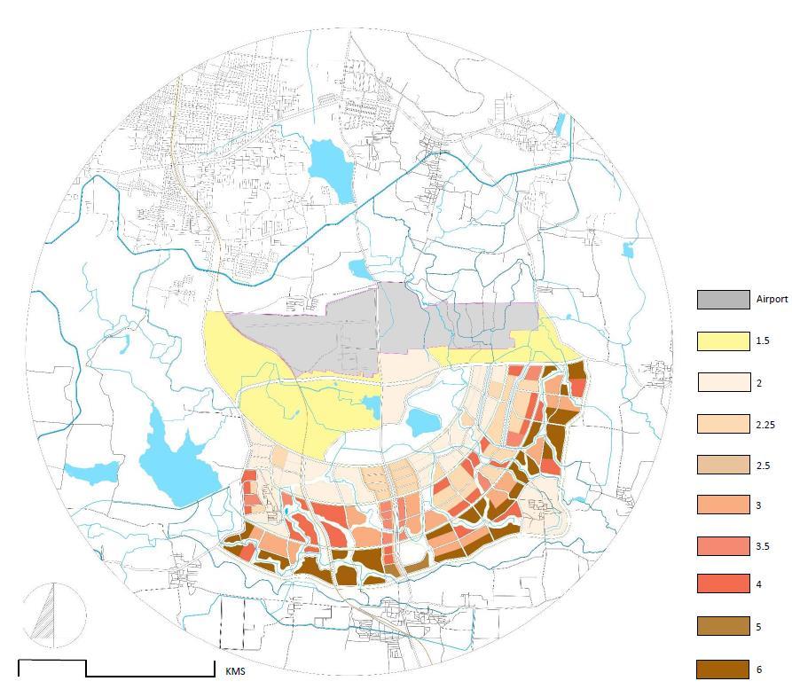
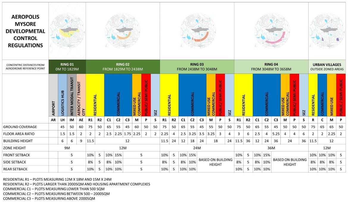


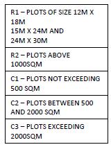
LANDUSE CATEGORIES
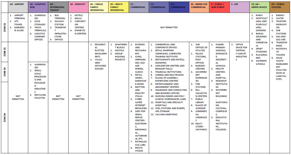
DEVELOPMENT CONTROL REGULATIONS
BUILDING HEIGHT REGULATIONS
BYE LAWS
FAR ZONES
AIRPORT CITY (AERETROPOLIS) - MYSORE
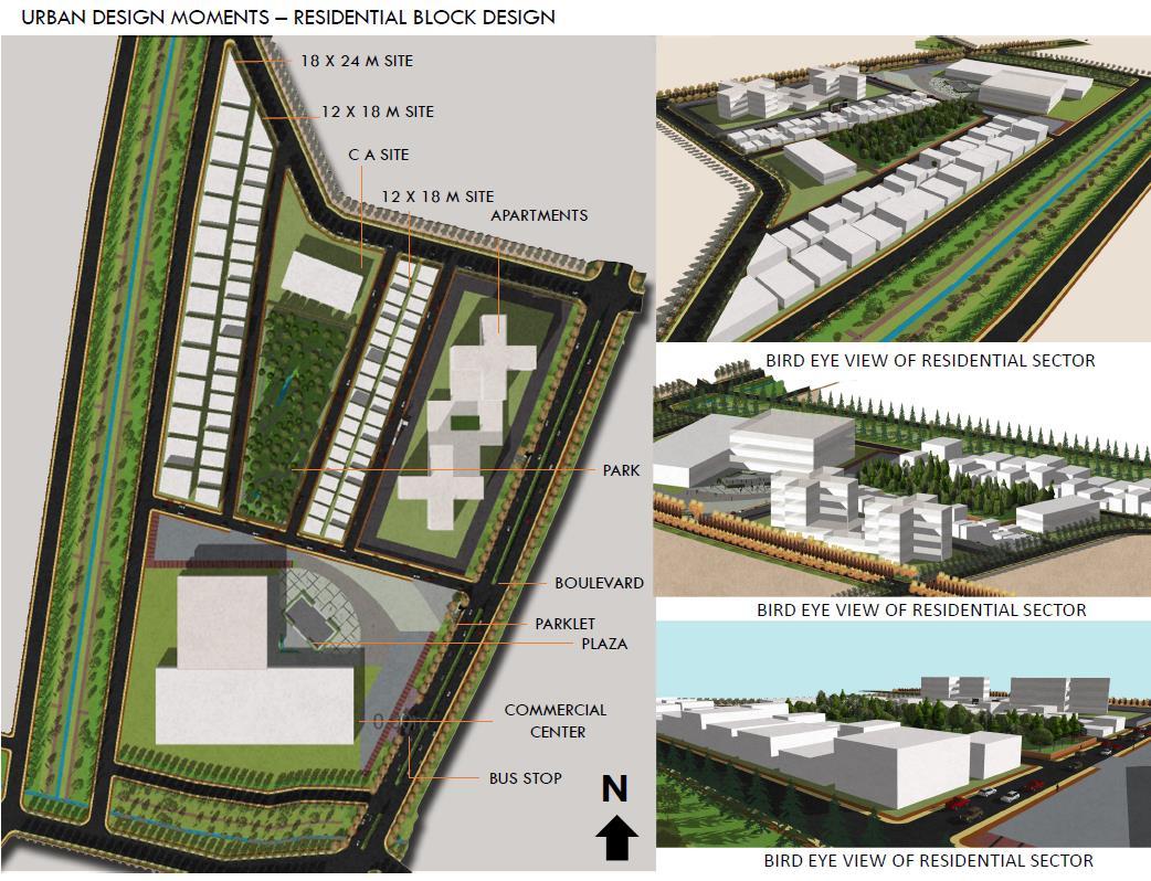
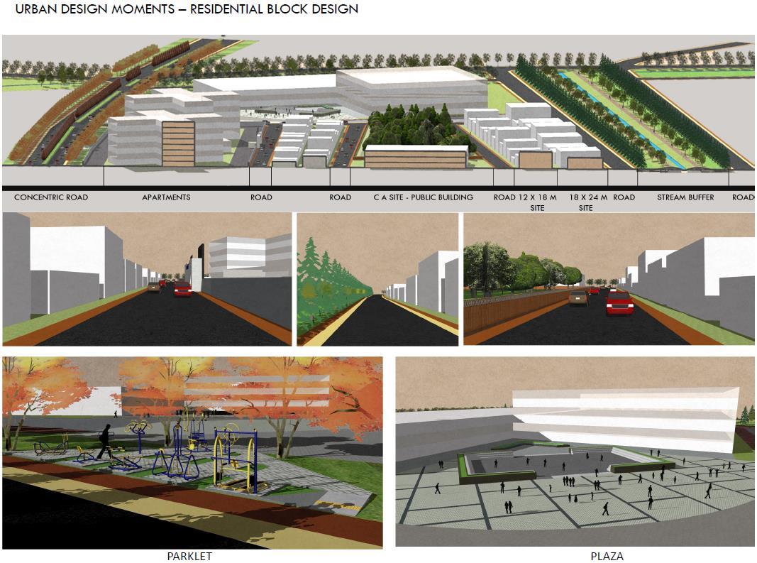
AIRPORT CITY (AERETROPOLIS) - MYSORE
AIRPORT CITY (AERETROPOLIS) - MYSORE
AIRPORT CITY (AERETROPOLIS) - MYSORE
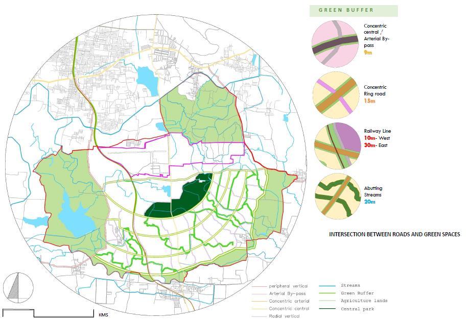
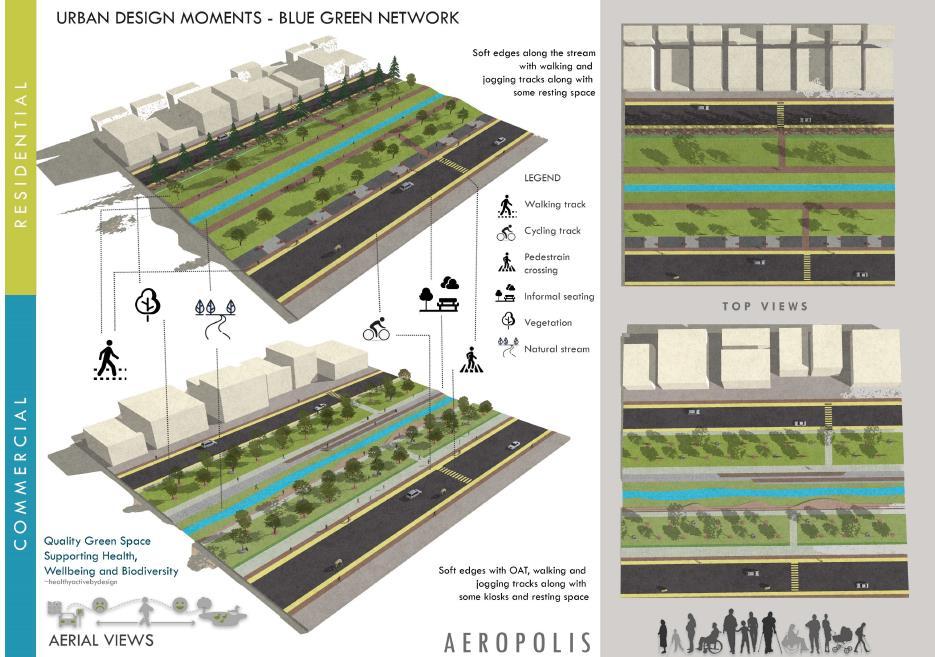
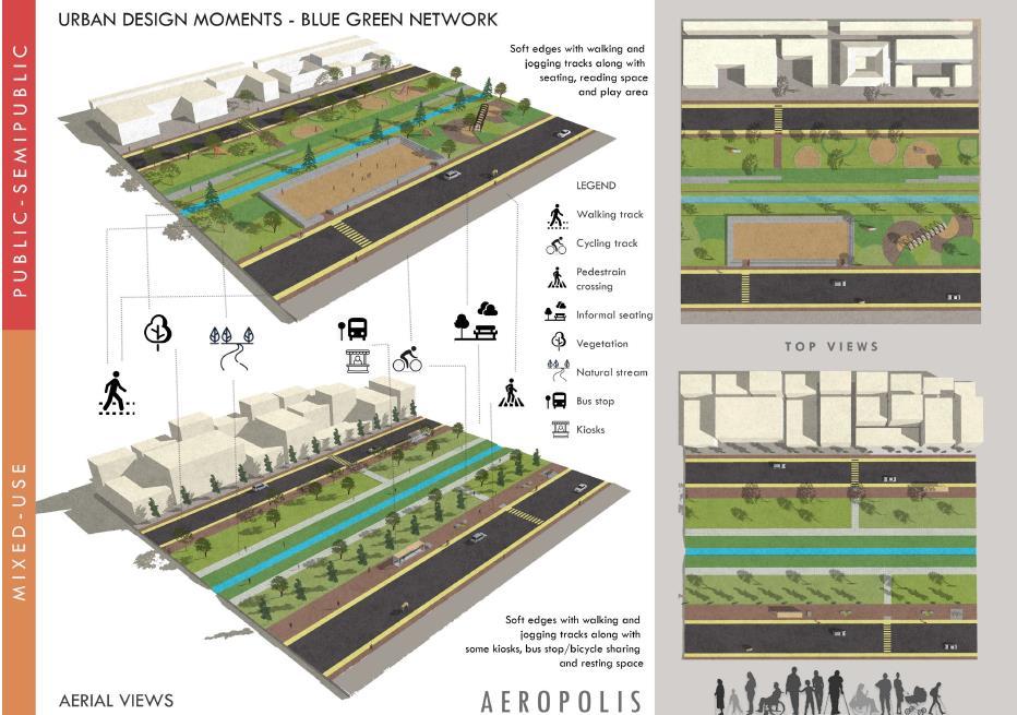
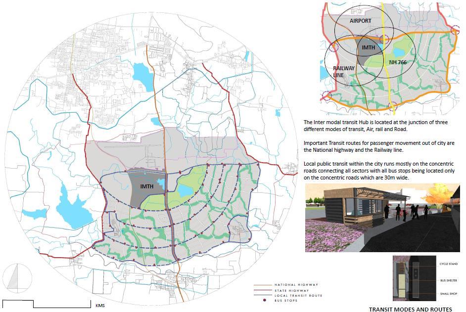
AIRPORT CITY (AERETROPOLIS) - MYSORE