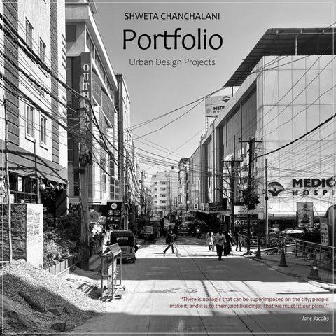
Portfolio
Urban Design Projects
“There is no logic that can be superimposed on the city; people make it, and it is to them, not buildings, that we must fit our plans.”
- Jane Jacobs
1. Revitalization of Pichola Lake, Udaipur
2. GIS based analysis – Mobility through the precinct
3. YUD 25’ – Reimagining a Critical Public Spaces
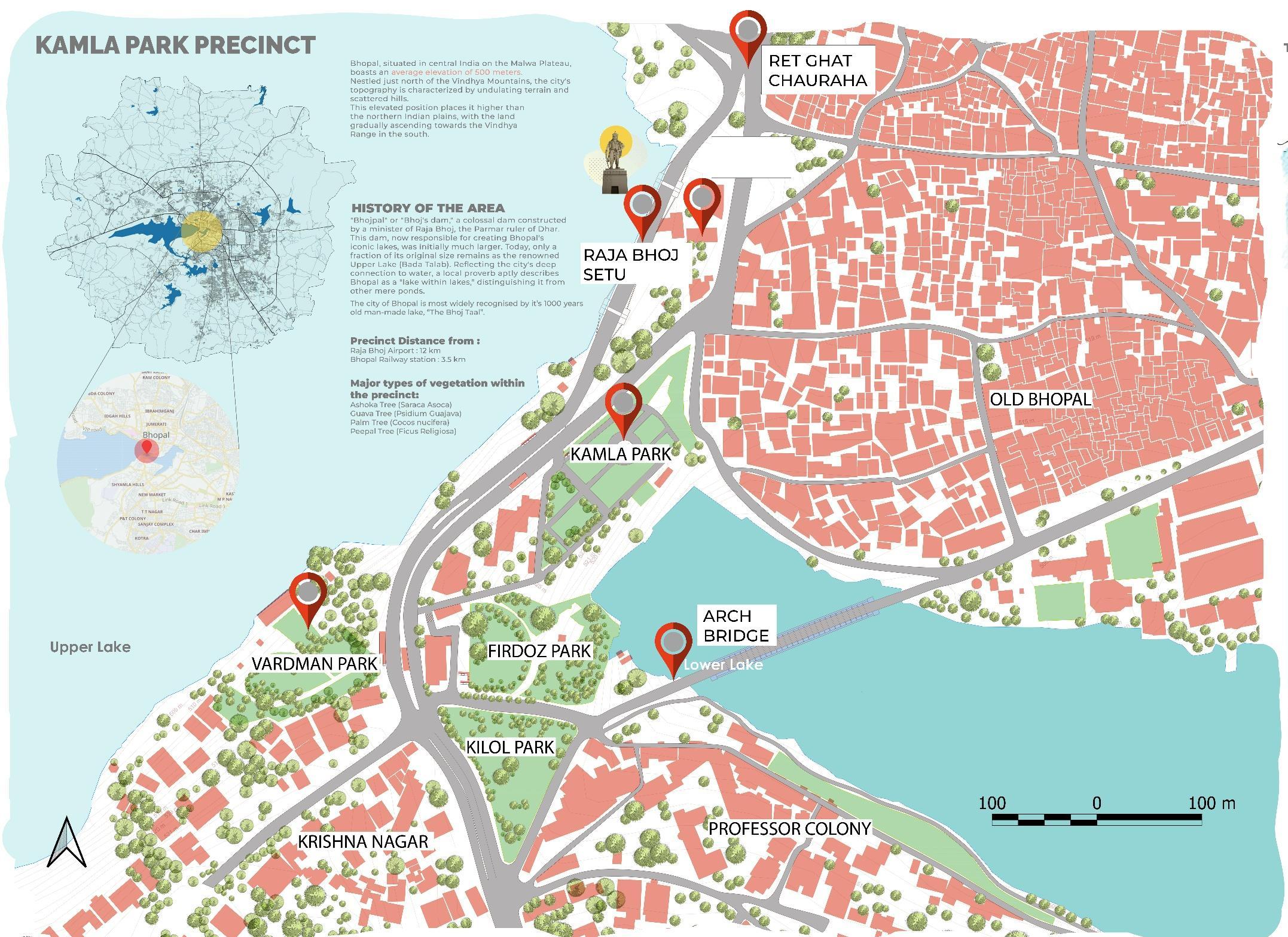
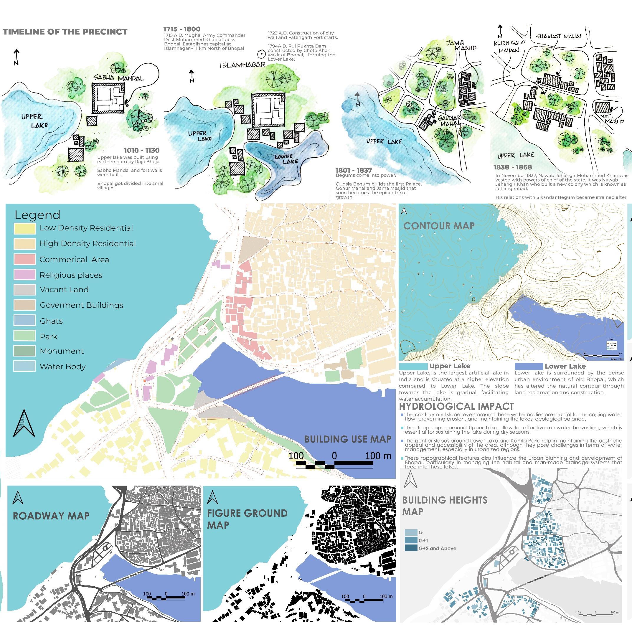
4. Kamla Park, Bhopal
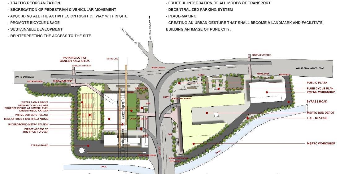
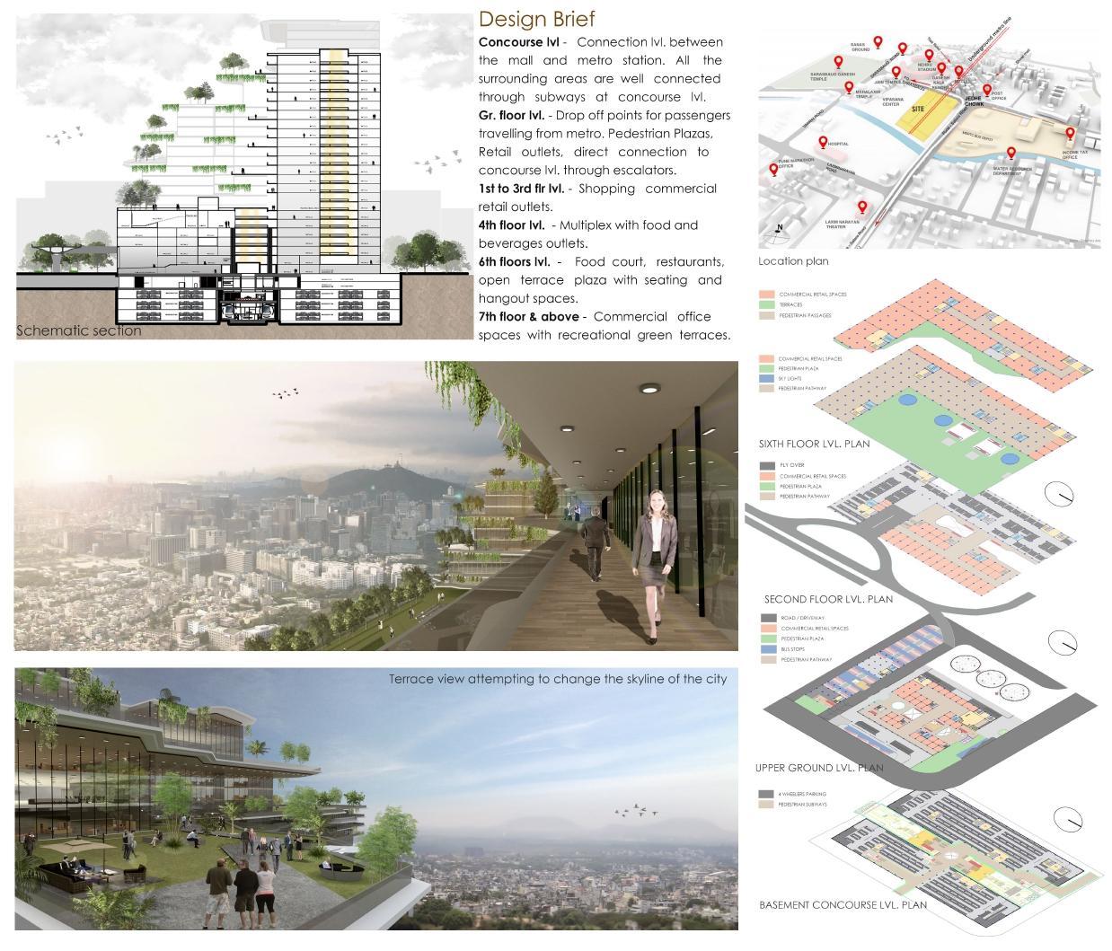
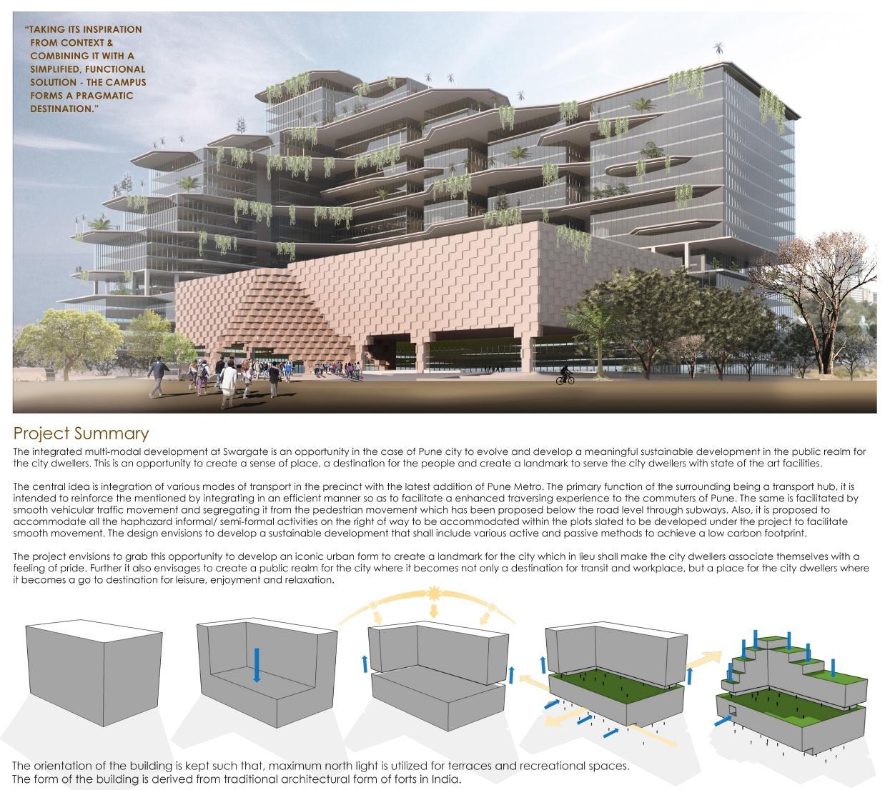
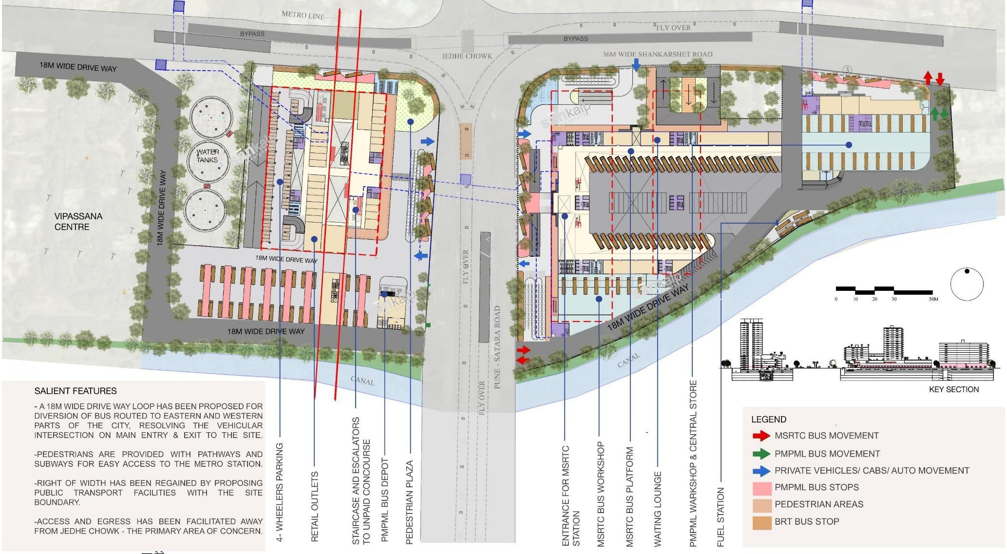
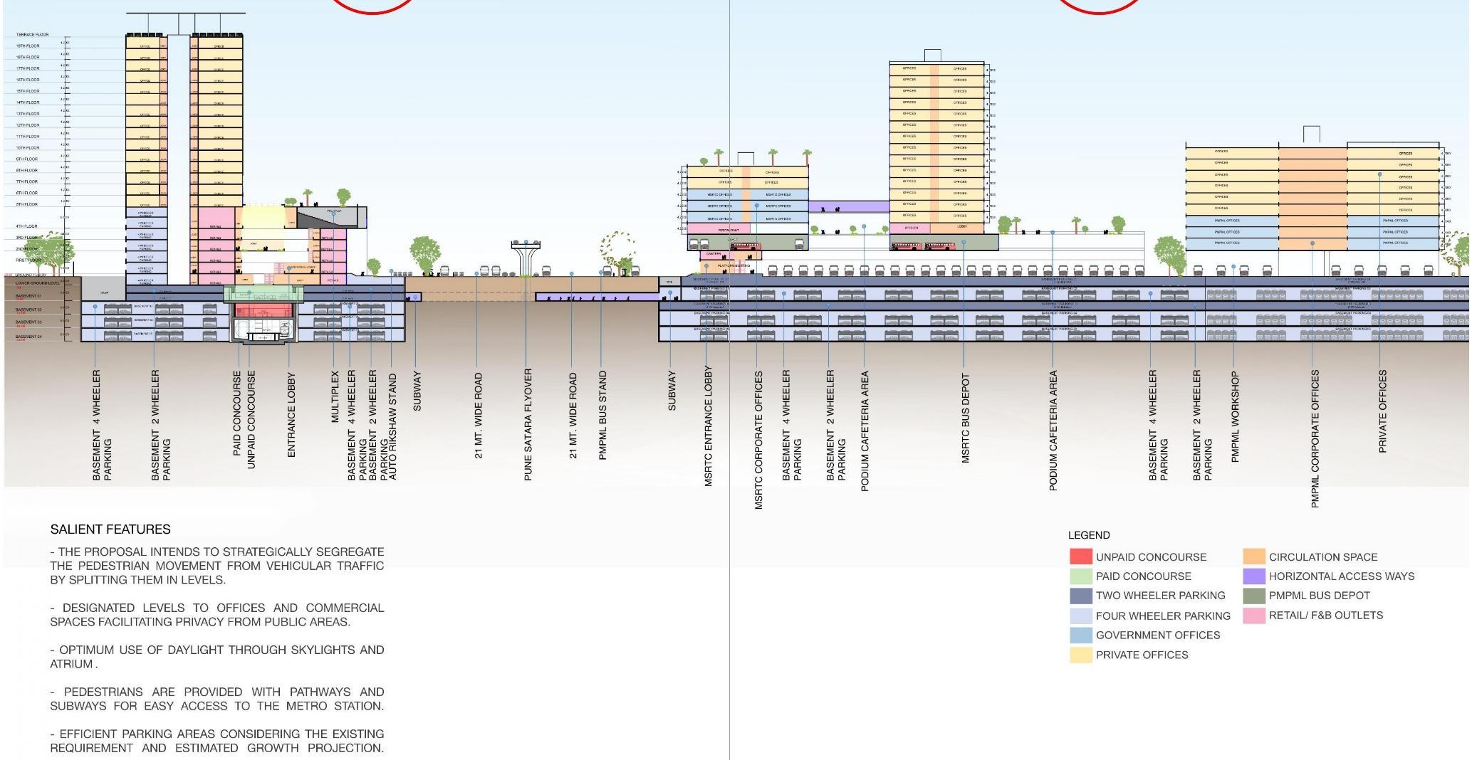
5. Swargate Multimodal Transit Hub, Pune
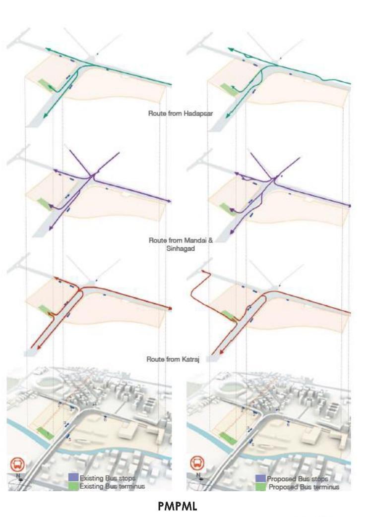
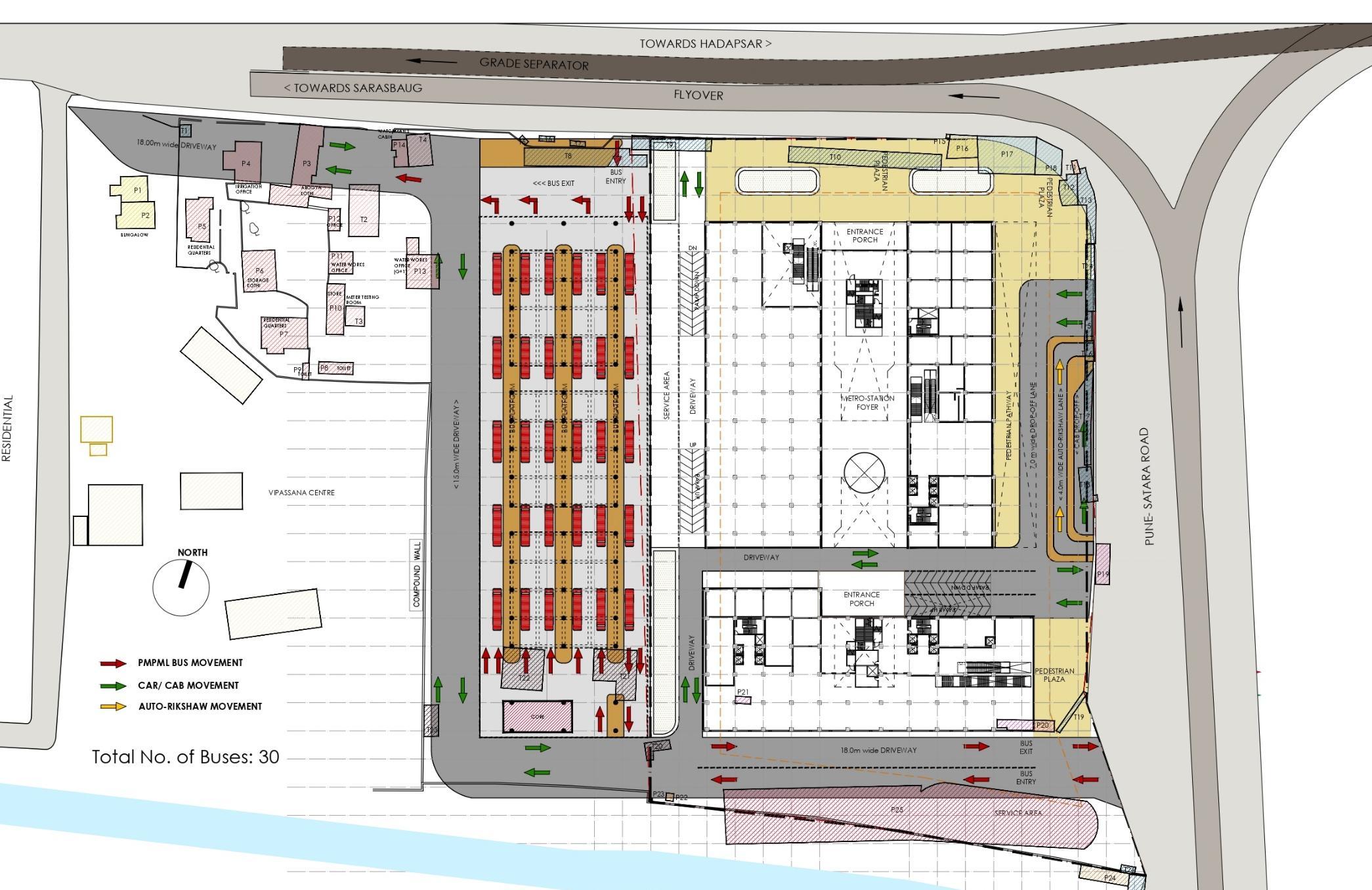
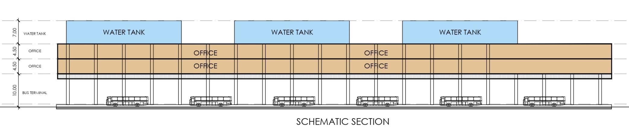
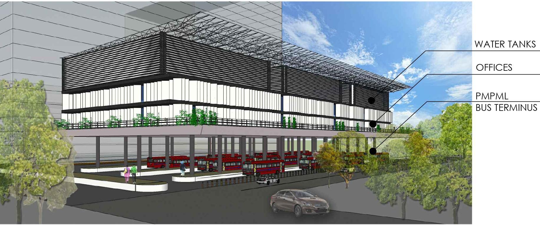
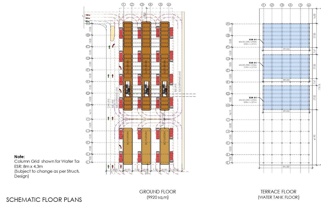
6. PMPML Terminus, Swargate, Pune
7. Swarnabhoomi, Raipur
8. Undergraduate Thesis Project Craft Souk at Pushkar
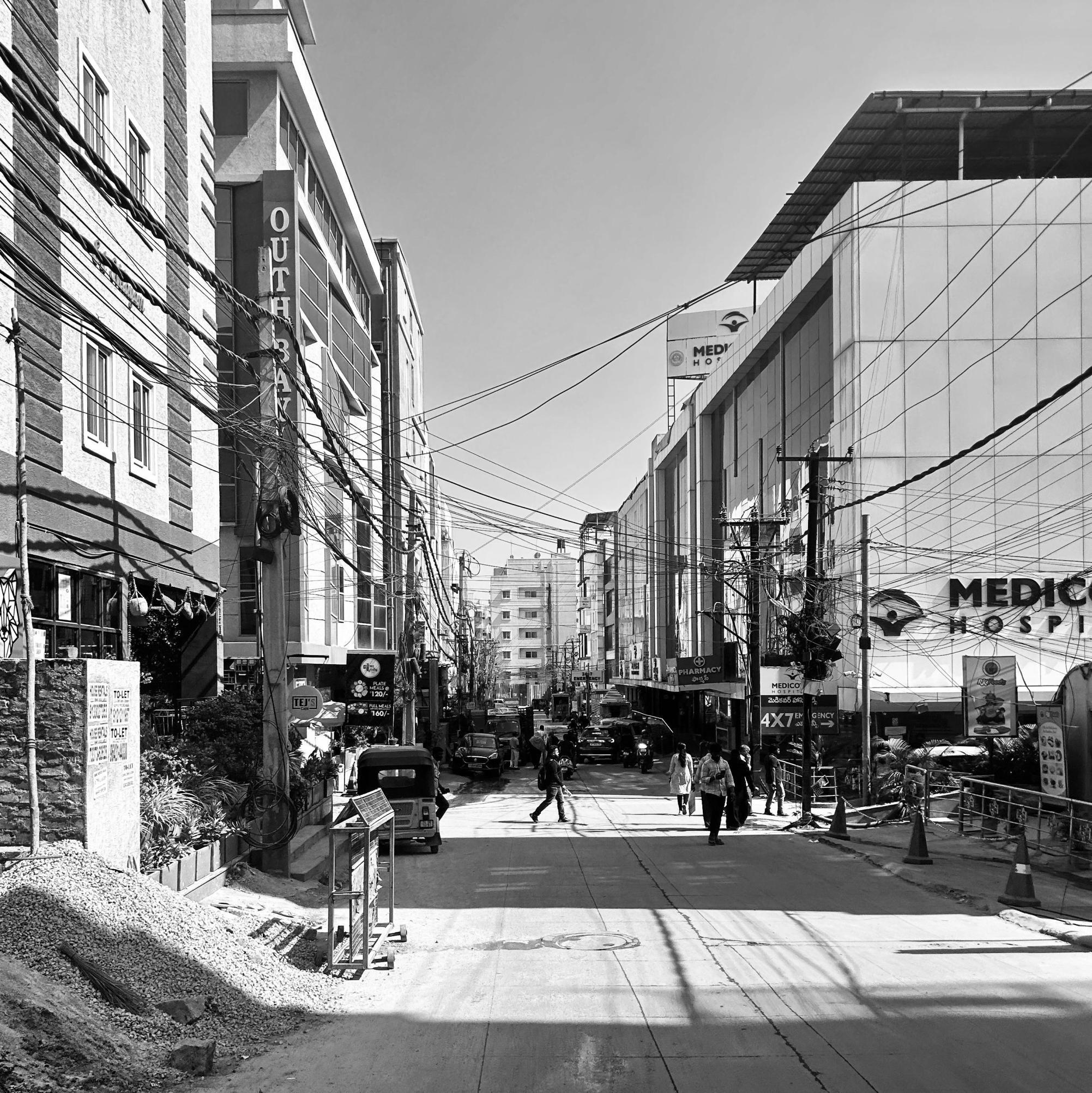
Urban Design Studio Project: Pichola Lake, Udaipur
2024 – REVITALISATION OF PICHOLA LAKE, UDAIPUR
STUDIO PROJECT – URBAN DESIGN
The purpose of this exercise was to create an understanding of the role of various physical, social, economic, and infra structural components and decision-making processes; the contribution of related disciplines associated with the production of the city
The outcome was also focused on acquiring skills of documentation, analysis and presentation of urban design projects and typological studies with emphasis on evolving urban design frameworks culminating into informed interventions. The final output focused on detailed site-specific recommendations, placemaking and representation.
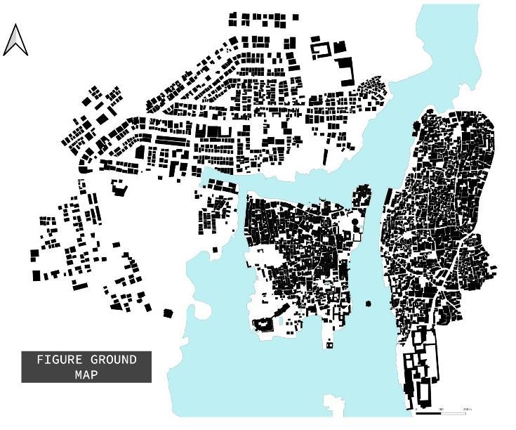
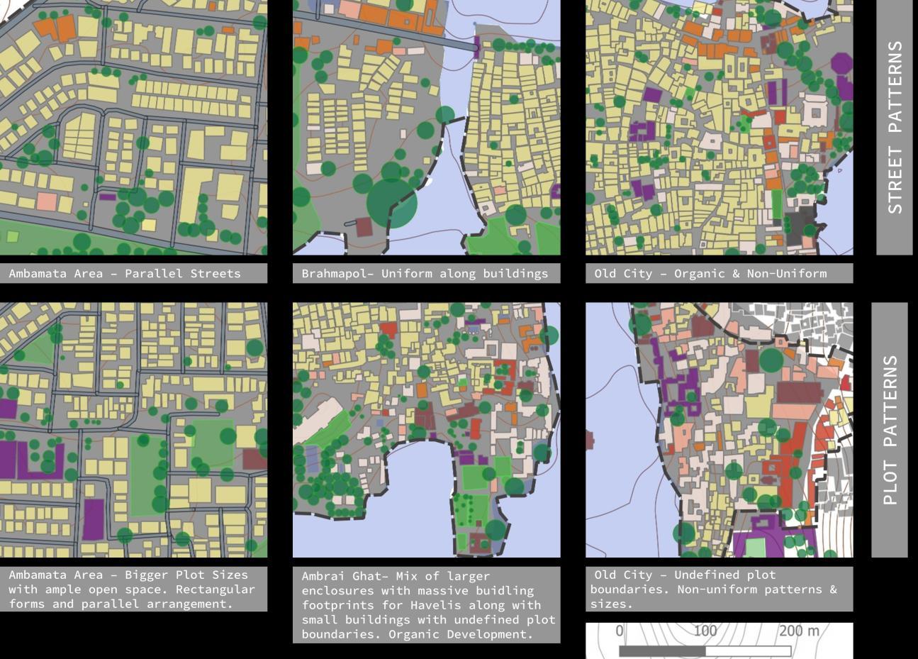
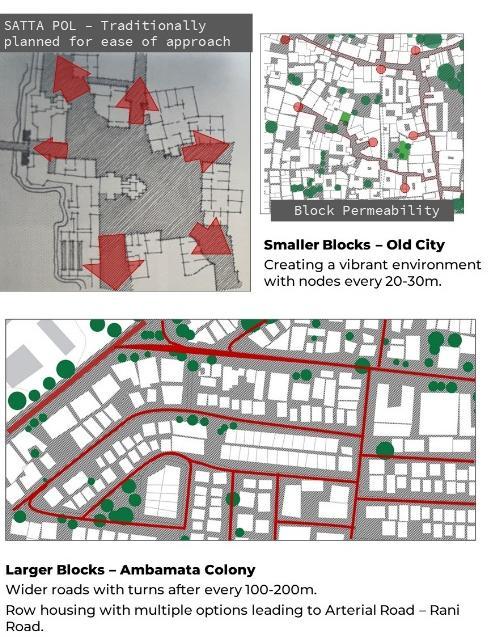
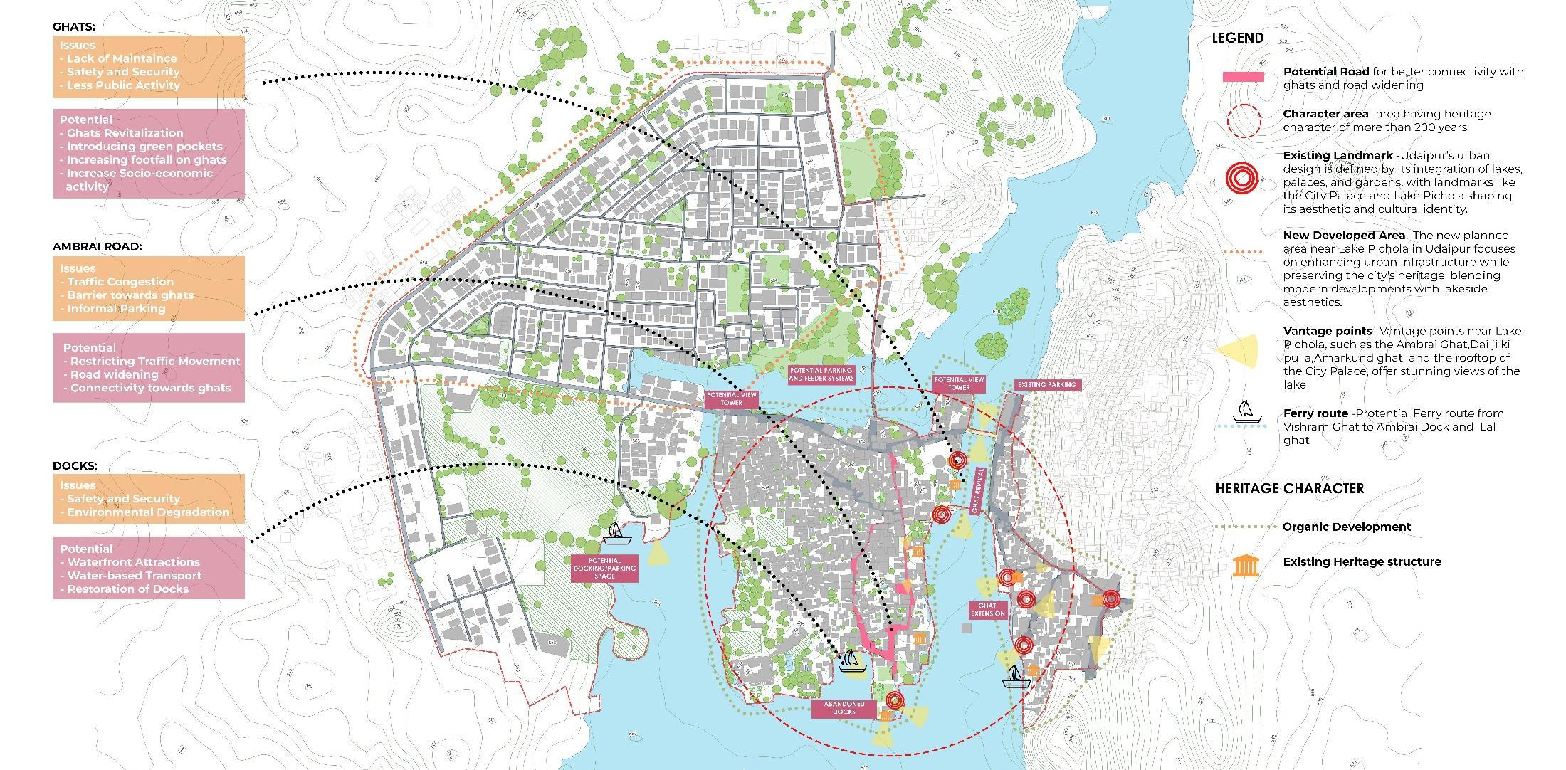
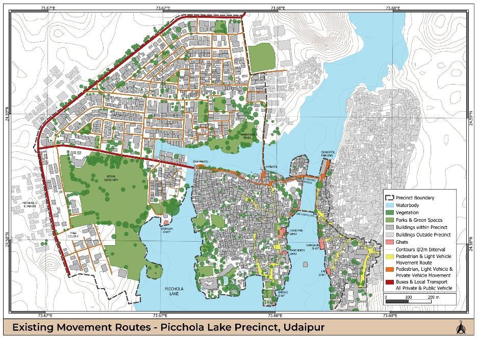
For the introduction of urban design terminologies, methods of surveys and site analysis, the study area was divided into four precincts of varied character and density patterns.
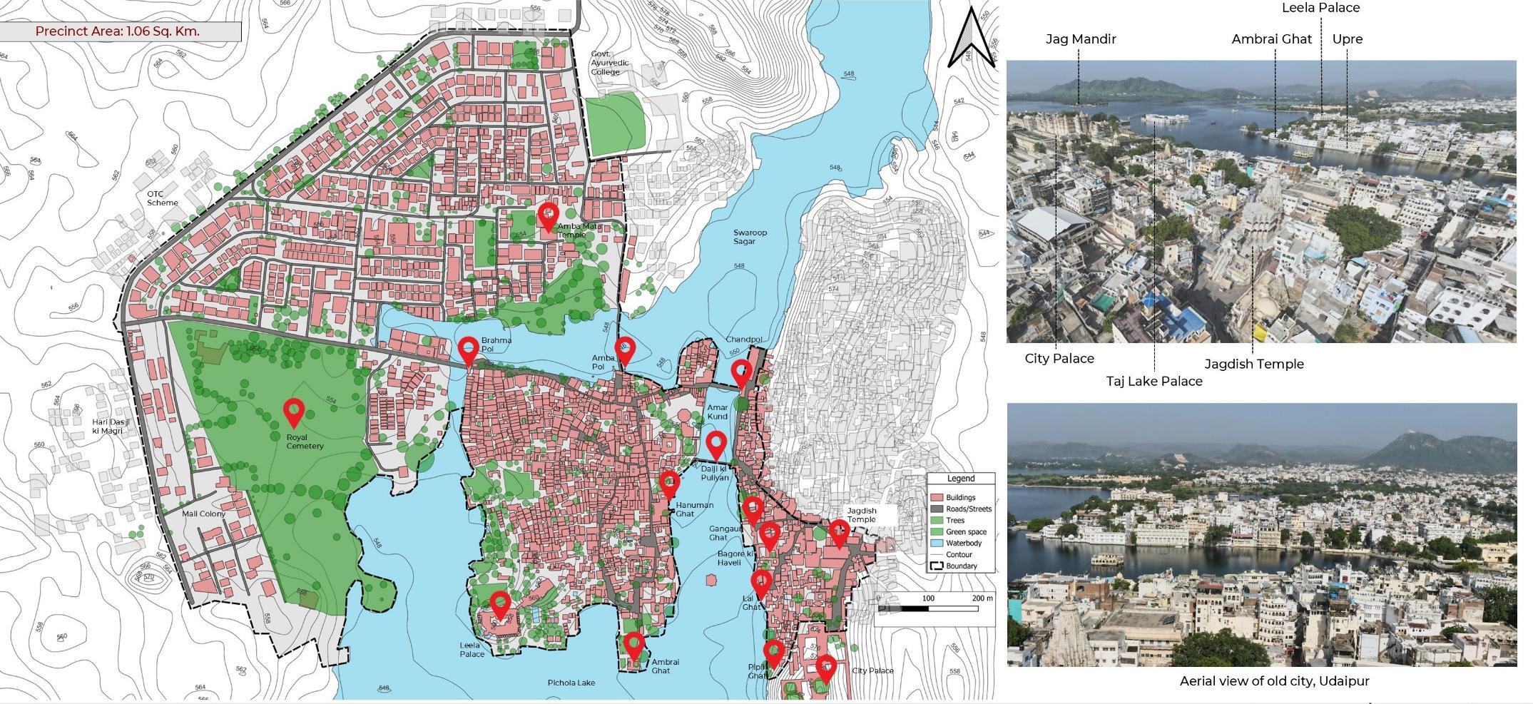
BASEMAP OF THE PRECINCT
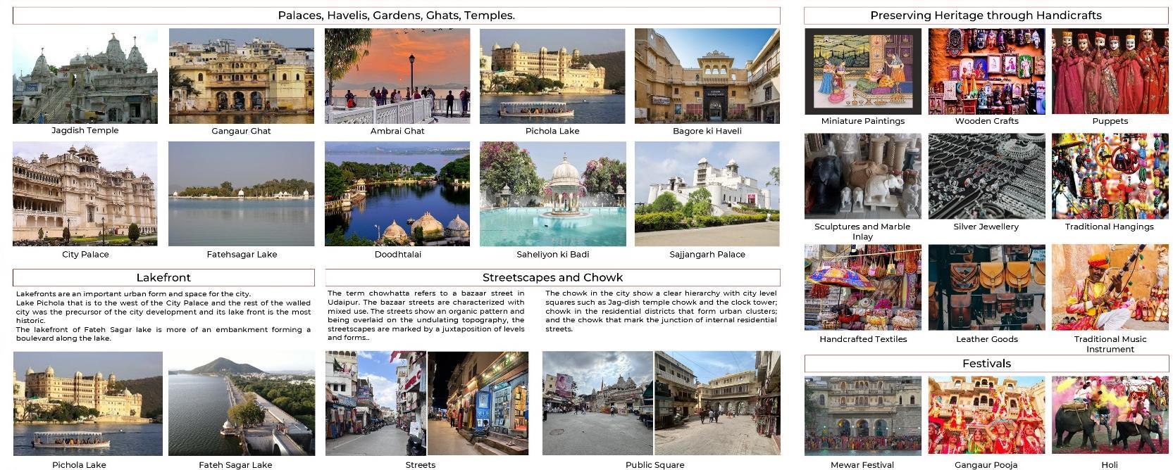
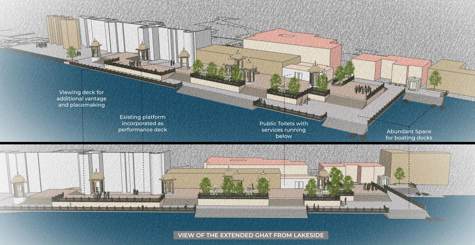
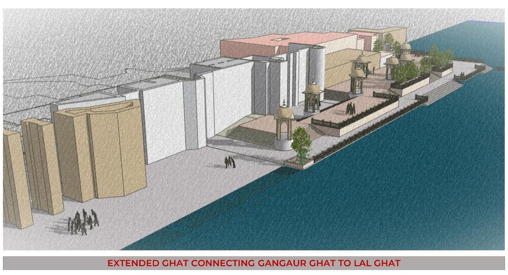
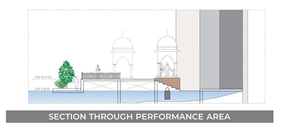
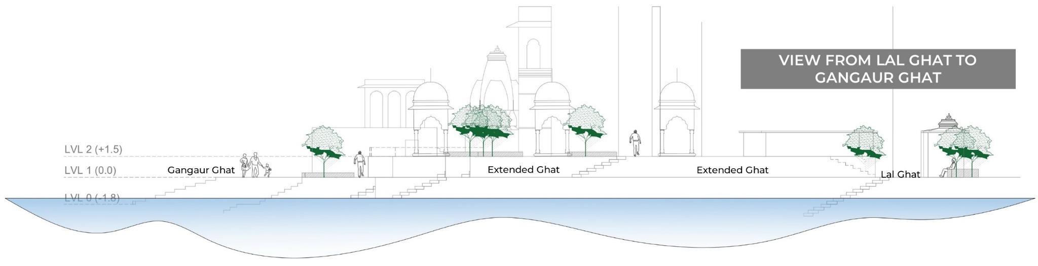
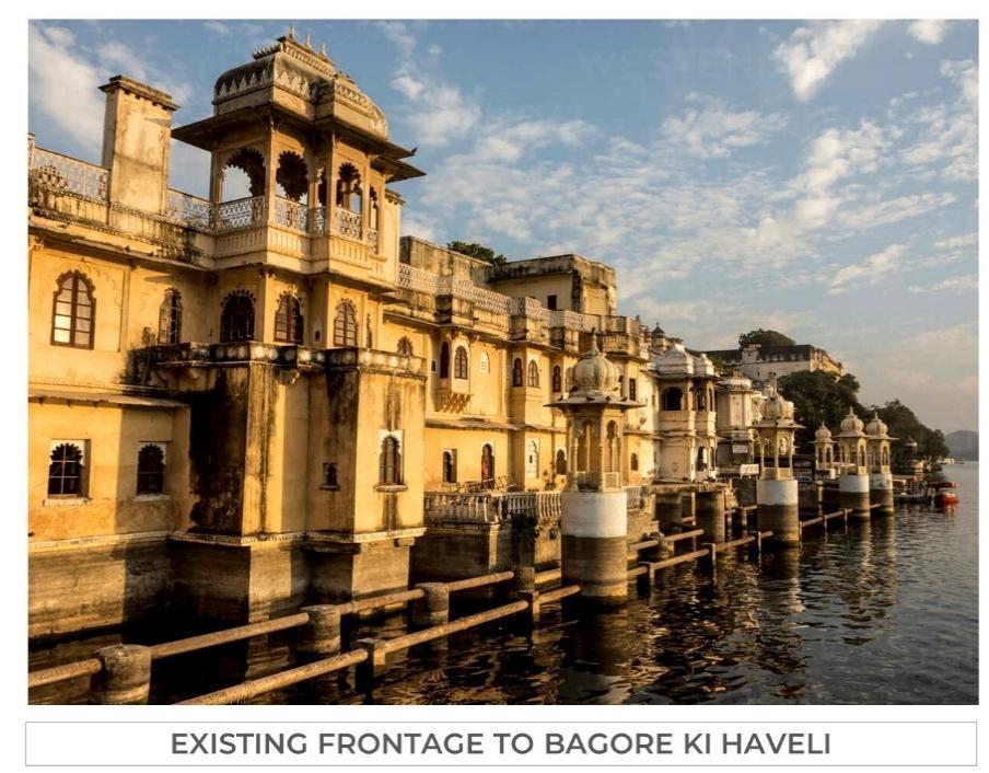
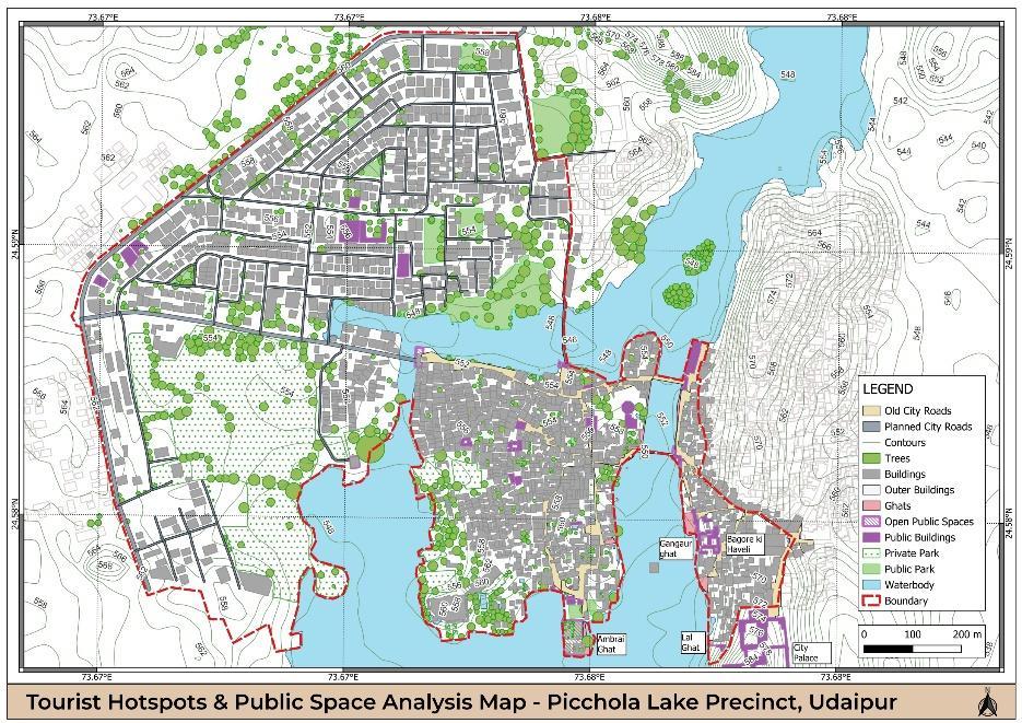
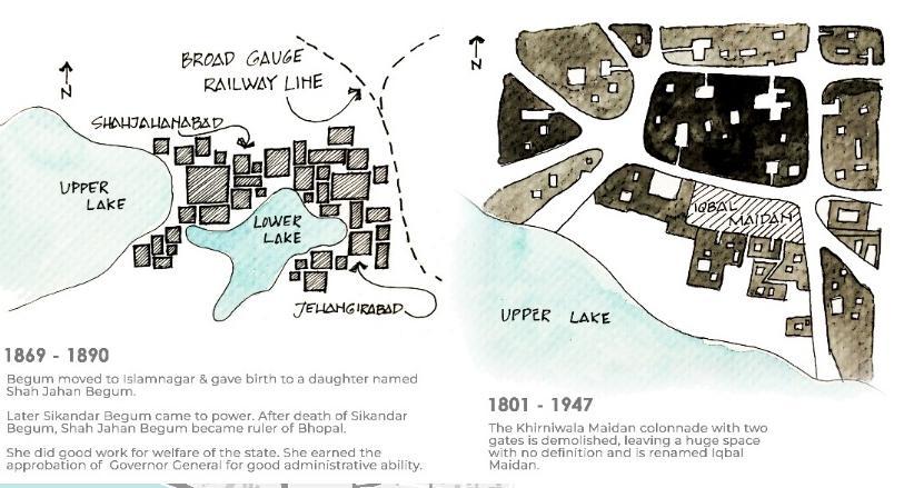
The southernmost precinct of Udaipur, extending from the City Palace in the old city to the Ambamata area, beautifully blends the city's rich history with its evolving modernity.
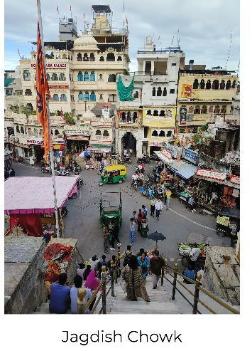
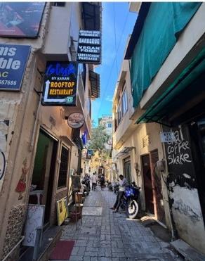
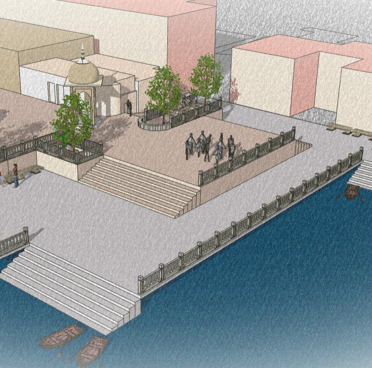
This area is home to iconic landmarks like the City Palace, Jagdish Temple, and numerous historic havelis, all reflecting the grandeur of Udaipur's royal past. Narrow lanes lined with centuries-old architecture lead to vibrant ghats along Lake Pichola, such as Gangaur and Ambrai Ghats, where locals gather for spiritual rituals and to enjoy scenic views.
The precinct also encompasses the Ambamata area, which marks the transition to newer settlements with residential and commercial developments while still preserving cultural traditions, particularly at the Ambamata Temple. This unique region captures the essence of Udaipur's cultural heritage and its dynamic growth, offering a harmonious blend of ancient and contemporary life.
Key Map
UDAIPUR CITY Fateh Sagar
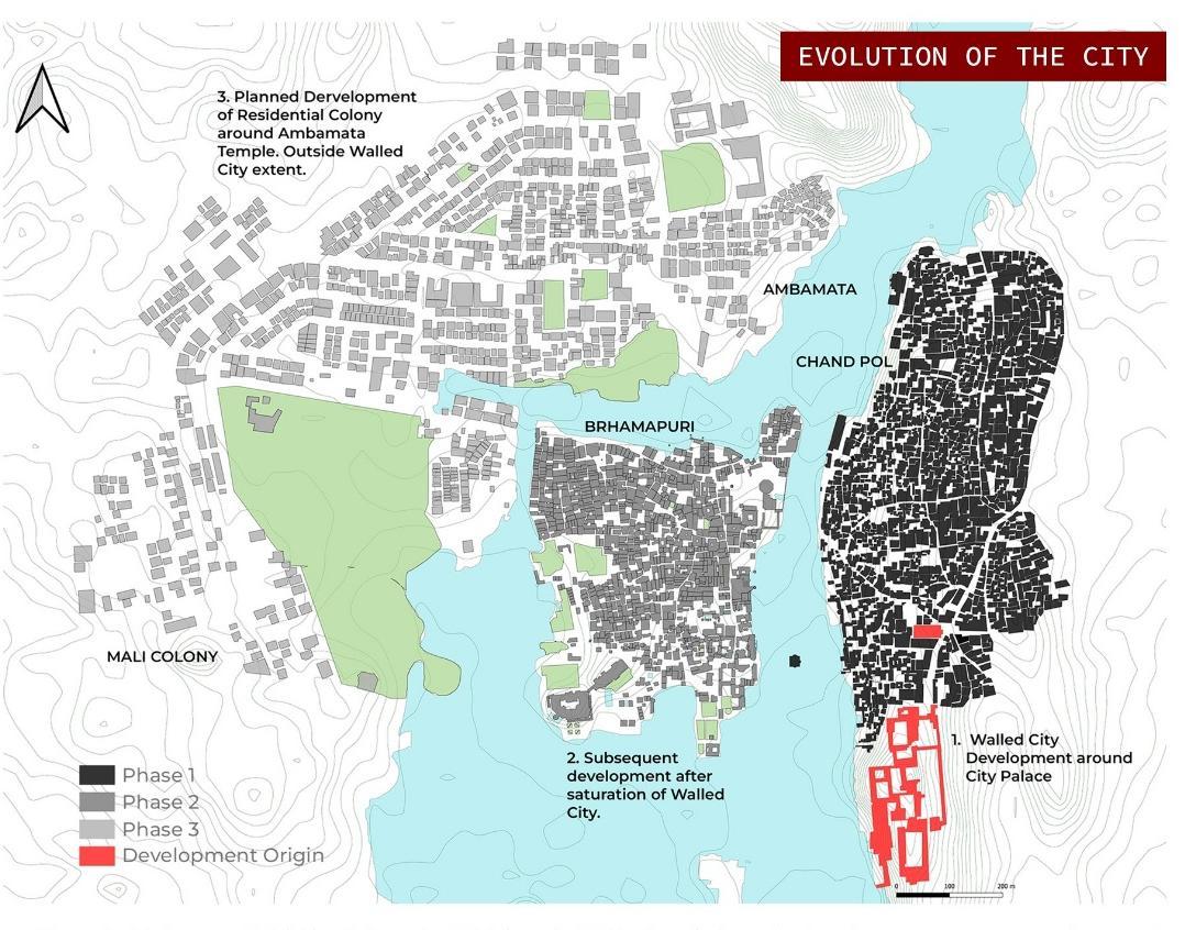
• Phase 1:- Maharana Udai Singh founded Udaipur in 1568. The city's early development was centred around Jagdish Mandir, the city palace and the lake.
• Phase 2:- Later when the residents of Udaipur were increasing, people started expanding on the other side of the lake, The main reason for that was that the people wanted to live near the city palace and Jagdish mandir.
• Phase 3: The latest phase of development took place recently, only 40-50 years back. This development took place under the Urban Improvement Trust.
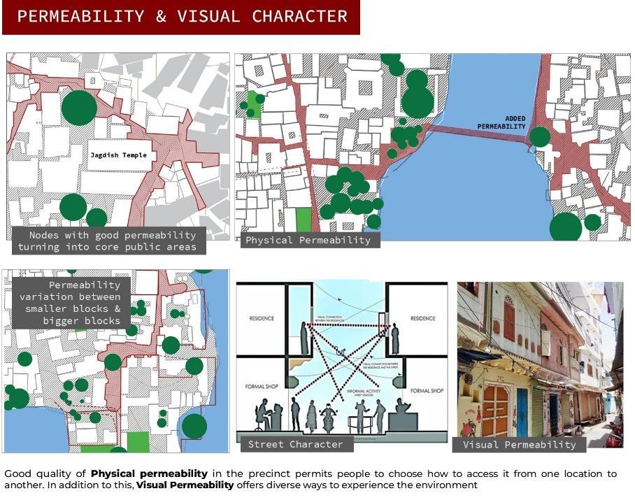
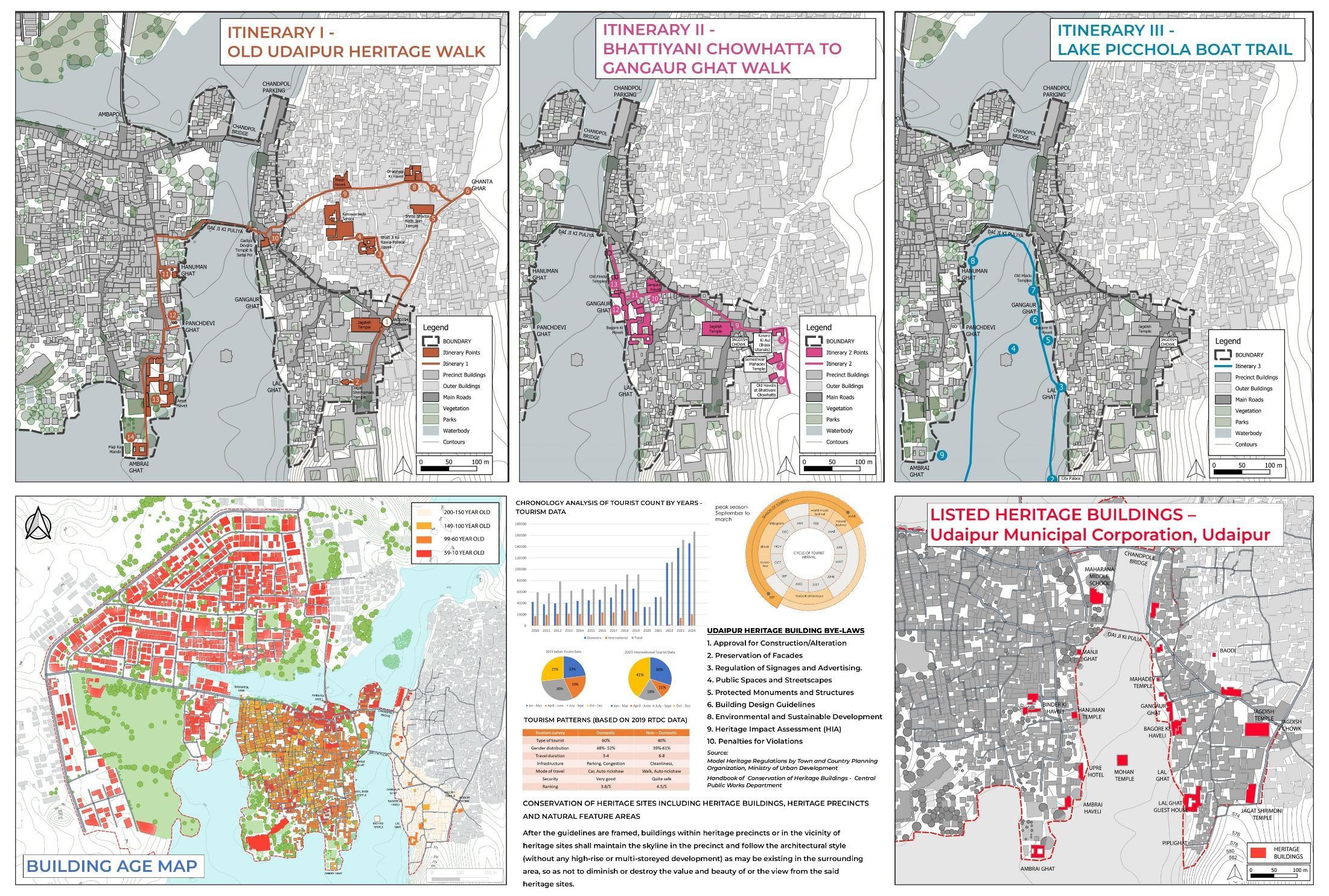
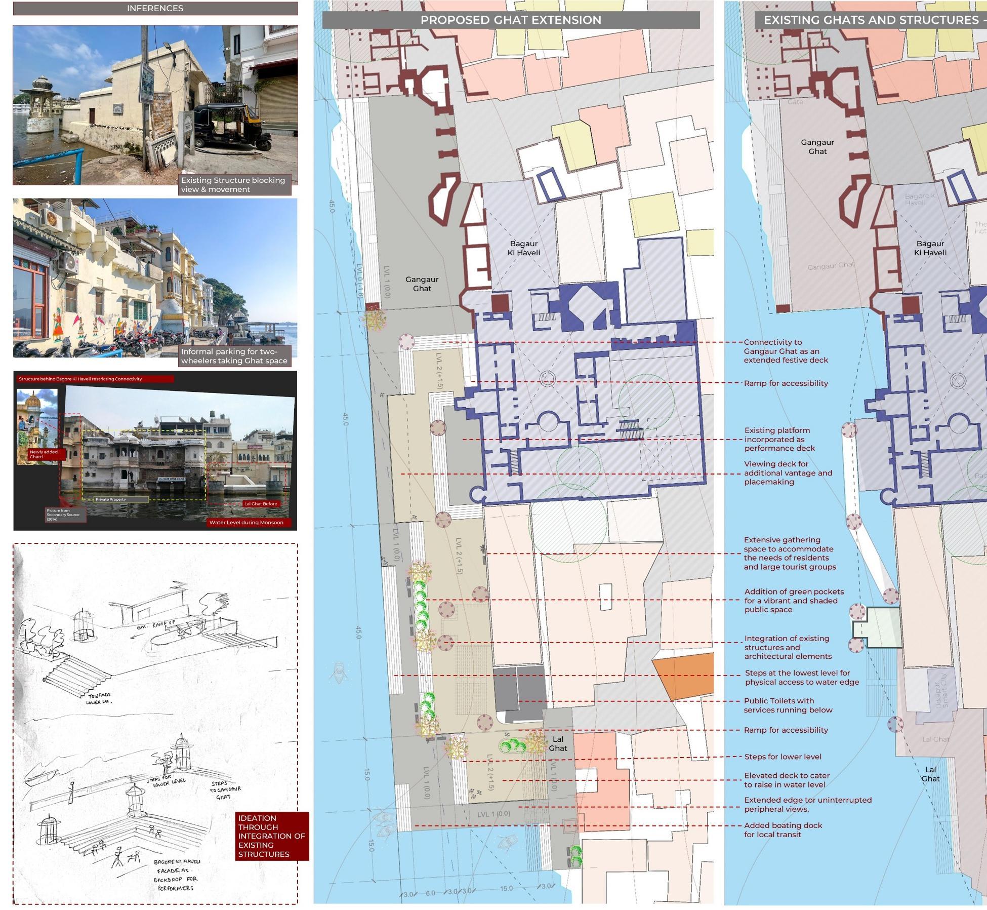
HERITAGE WALK THROUGH THE PRECINCT
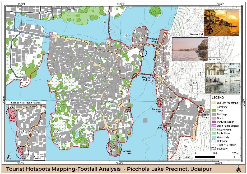
Other than the ghats, old temples and havelis woven in the complex morphology of the old city are a major attraction for the tourists.
STRUCTURE PLAN
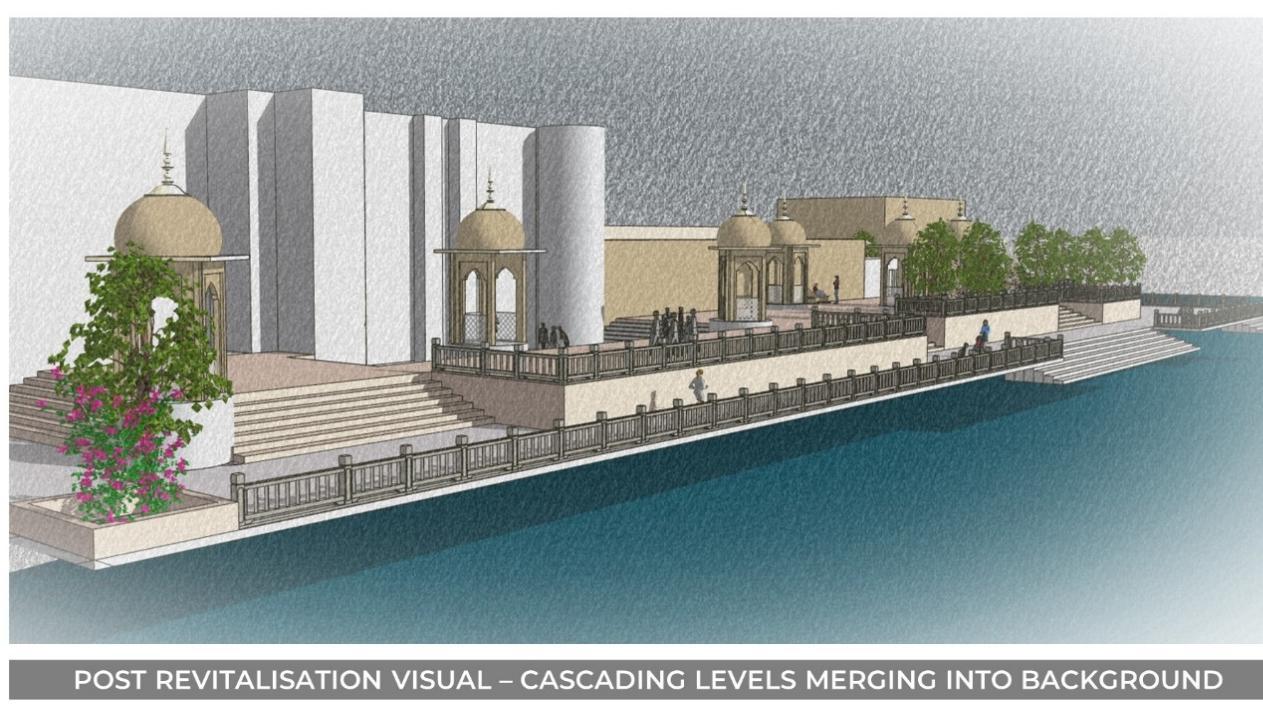
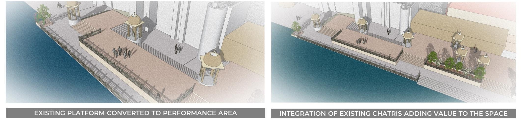
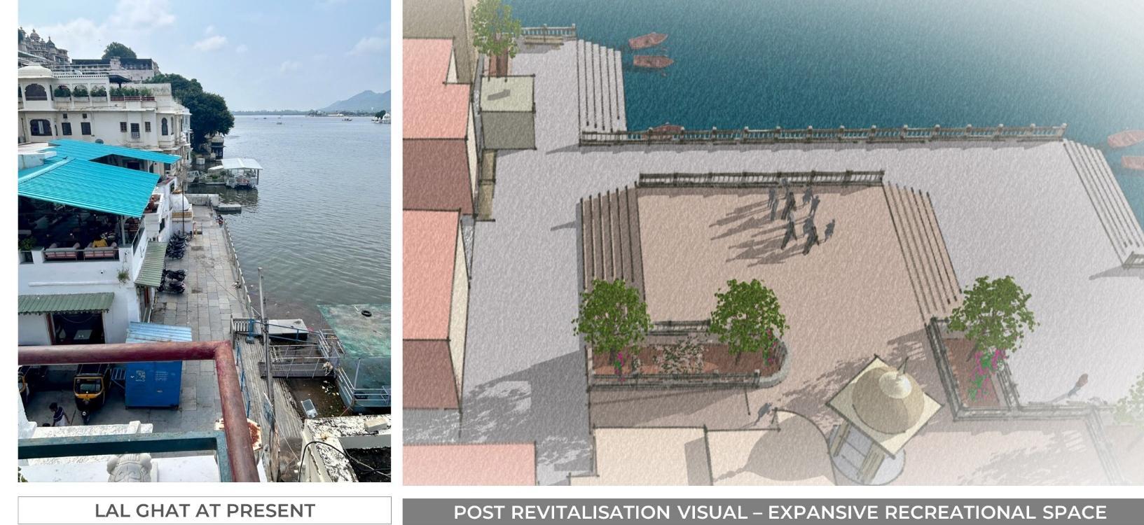
KEY LEARNINGS
• Use of existing infrastructure to enhance the quality of space.
• Recognising the potential of the space by careful consideration of social and physical interface.
• Finding infill spaces for further development with minimum intervention.
• Learnings from the organic development of a place from the past and adaptation of its cultural and social practices to envision a future with development proposals that serve the context, need and retain the sense of belonging for people.
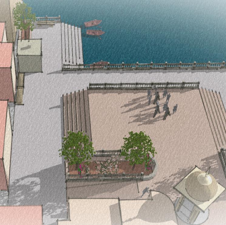
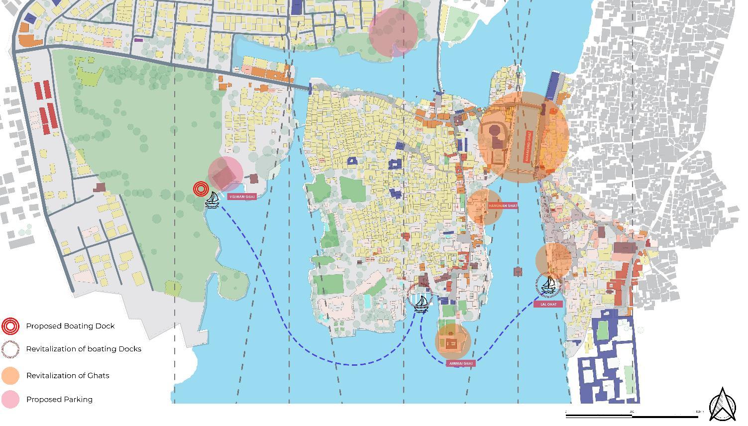
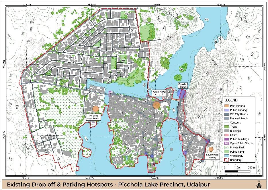
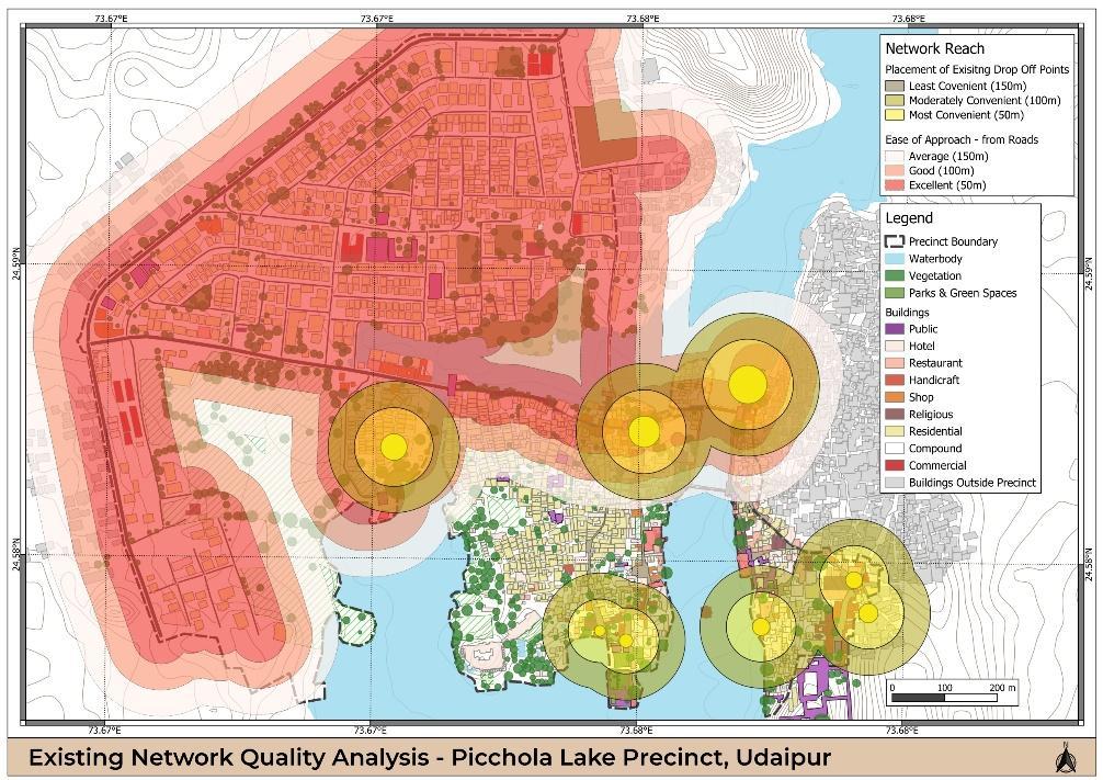
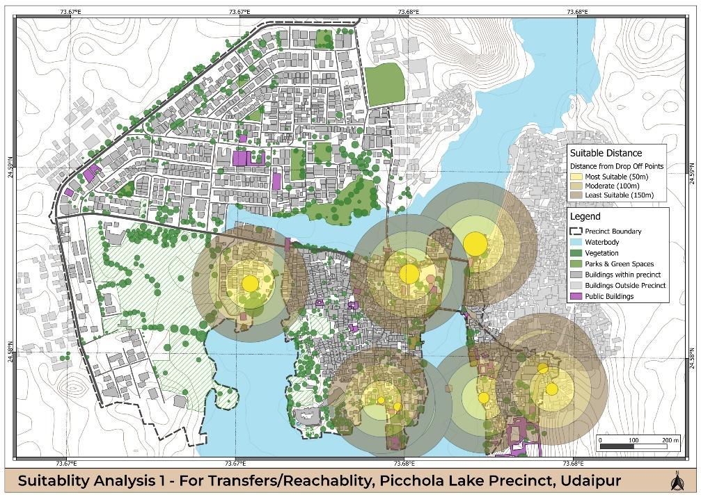
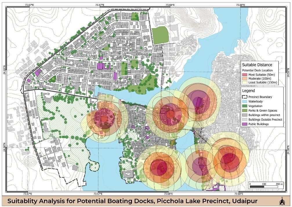
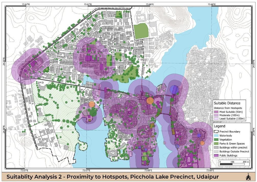
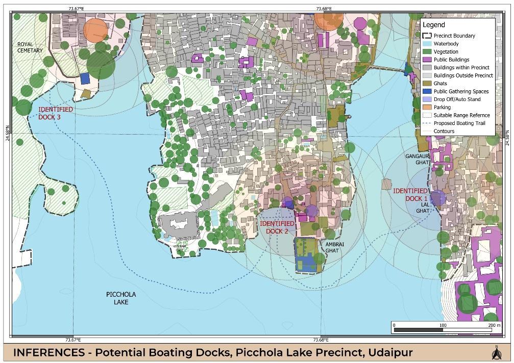
2024 – GIS BASED ANALYSIS – Mobility through the precinct
PROJECT BRIEF:
Abstract
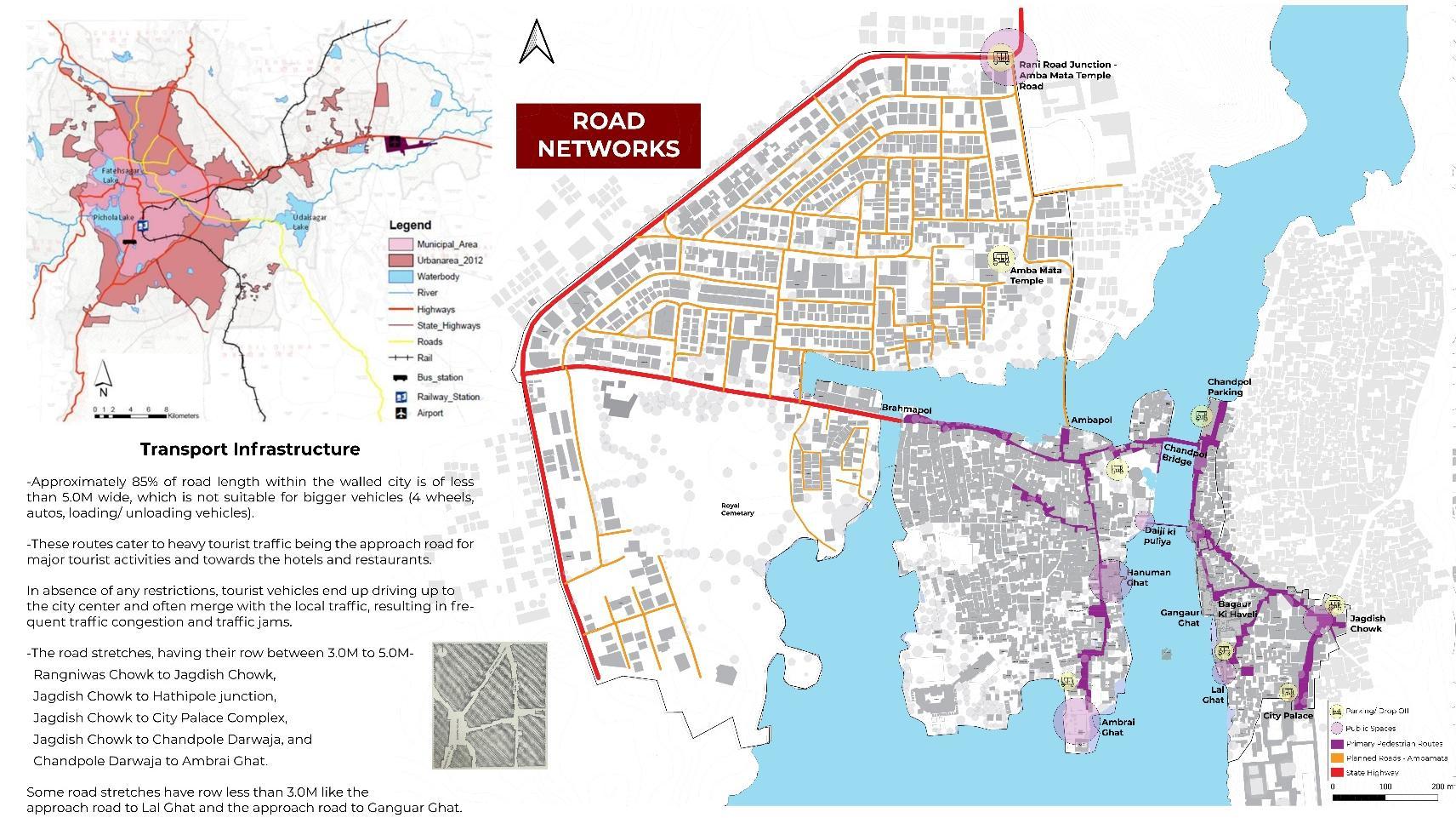
The Aim of this project is to thoroughly map and analyze the surface transit network in a defined study area. Using QGIS we will determine the most suitable locations for boating docks to facilitate a water transit system.
Need
The proposed study area in Udaipur Old City has restricted vehicular access due to narrow streets and large tourist footfall. We need to analyze and find the potential points for new transit routes to facilitate better pedestrian connectivity throughout the precinct that can also serve for increased footfall with future growth.
Expected Output
Mapping existing routes, highlighting gaps in connectivity networks and identification of potential routes for improved mobility across the precinct through Geo-Spatial Analysis. Generating a range of suitable areas from most suitable to moderate and least suitable areas to support the proposal for additional transit routes.
Challenge
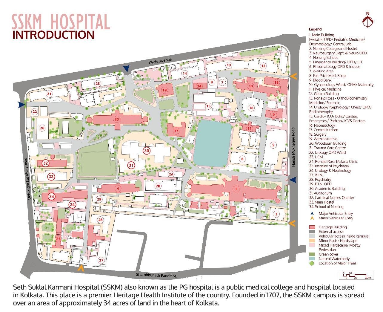
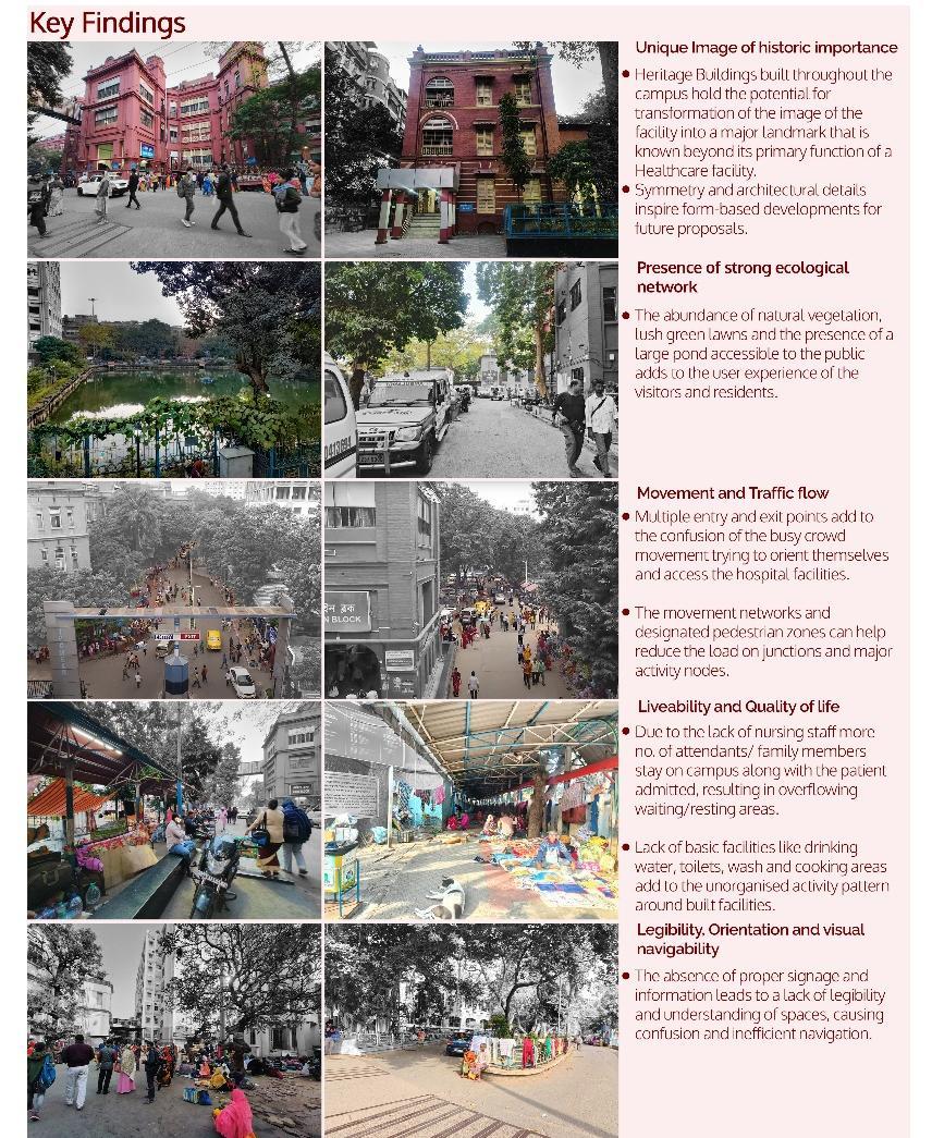
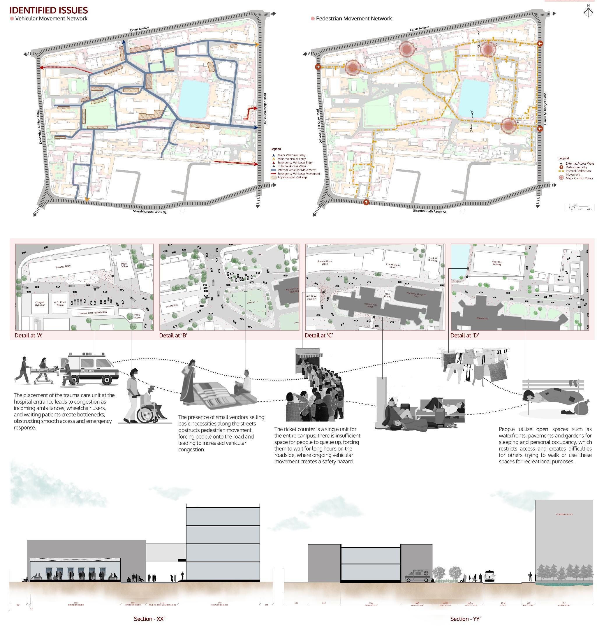
SSKM remains the single most important medical public destination of the state of West Bengal - a critical public space a
To cope up with the ever increasing need of expanding healthcare facilities, there have been several new constructions in the campus These have been done without an overall planning and vision - often insensitive to the historic ambiance and context
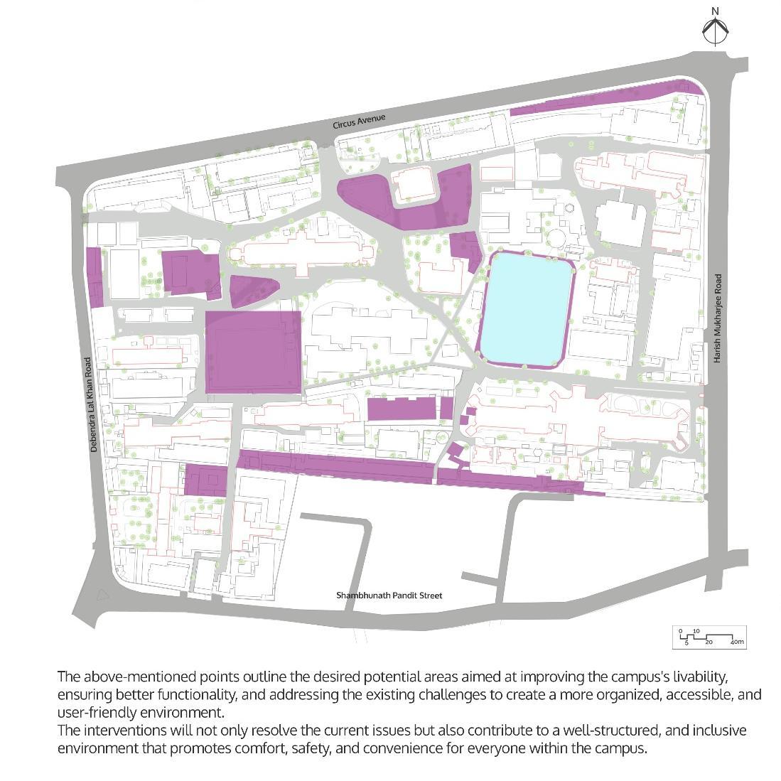
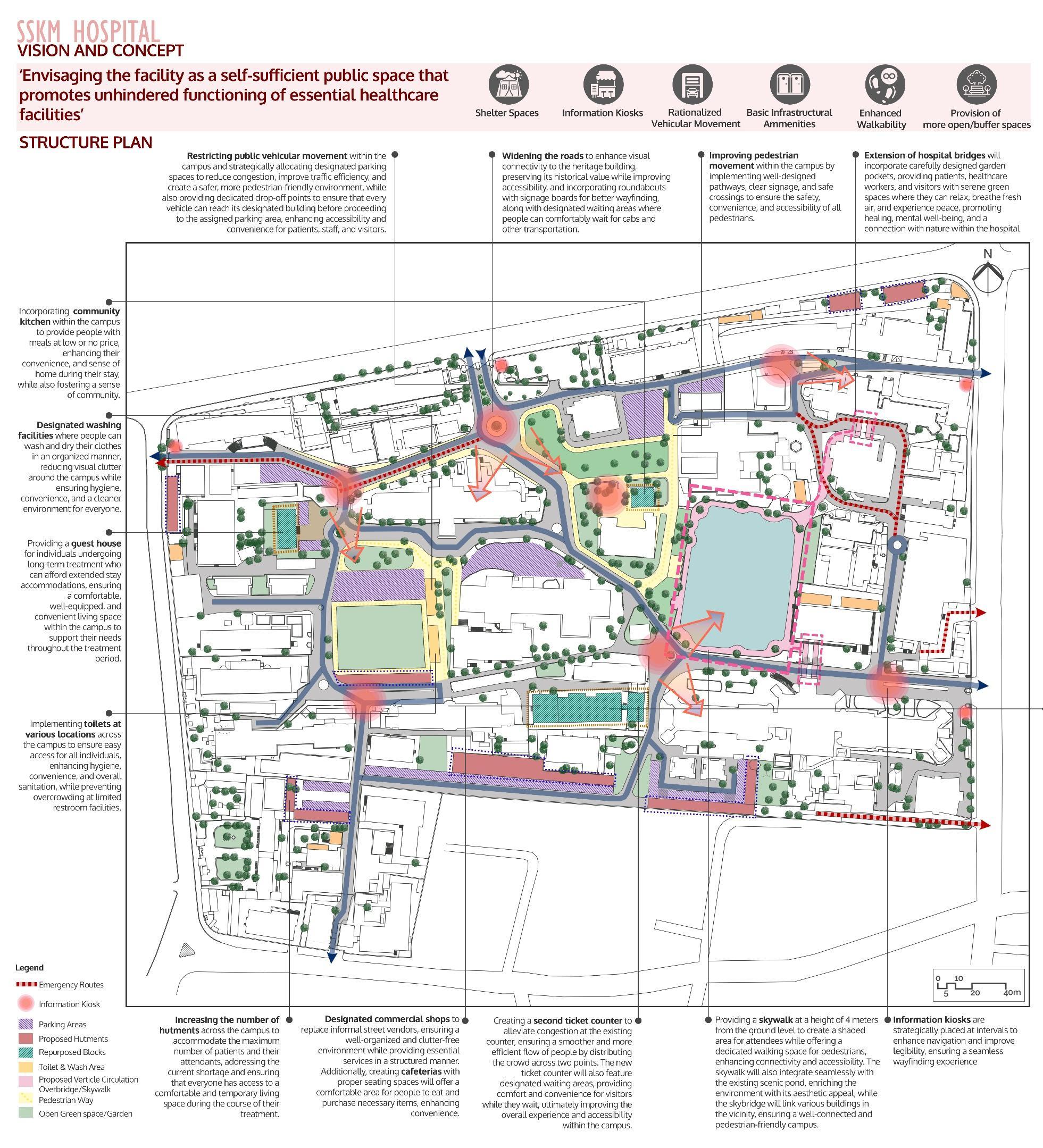
SSKM campus thus needs a well worked out development strategy to guide a sustainable transformation of this campus in line with its social position in the city.
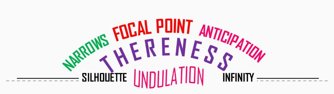
The Kamla Park precinct is a tapestry of architectural and natural elements that create a unique urban experience. The narrow lanes, with their tightly packed buildings, generate a sense of pressure and closeness, maintaining an intimate enclosure that gives the area its distinctive character. This sense of anticipation is palpable within Vardhman Park, where the lake and the skyline of the opposite shore tease the viewer. The full view remains hidden until the very end of the winding path, heightening the sense of discovery.
The Raja Bhoj Bridge serves as a symbolic focal point, its presence creating a powerful feeling of thereness a place where one longs to go but is held back by physical barriers. The silhouette of the buildings, seen in the distance, offers only an outline without revealing the details of material or texture, adding to the mystery of the precinct. The undulating paths, marked by wavy lines and motifs, reveal peripheral glimpses of the endless lake, playing with the viewer’s perception of space. As one walks uphill in Vardhman Park, the journey feels infinite, with the park appearing to stretch on endlessly, enhancing the surreal experience of this urban landscape.
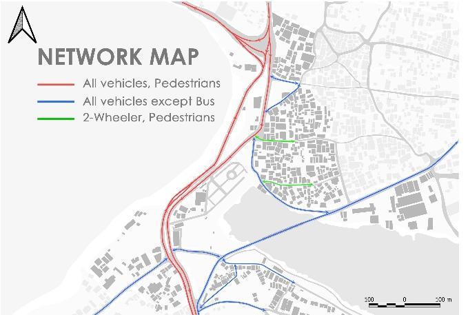
NETWORK MAP
The network around Kamla Park is well-structured, with Raja Bhọj Setu and an iconic arch bridge serving as key connections
Both bridges are equipped with pedestrian areas ensuring safe and convenient foot traffic across the span
The area also features a Bus Rapid Transit System (BRTS) lane, enhancing public transportation accessibility
Each side of the BRTS lane is serviced by two strategically placed bus stops, providing efficient connectivity for commuters
This integrated network of pedestrian paths, bridges, and bus routes makes the area around Kamla Park a crucial| transit hub, facilitating smooth movement for both pedestrians and public transport users
ROLE – PROJECT COORDINATOR & PROJECT ARCHITECT STATUS – ONGOING
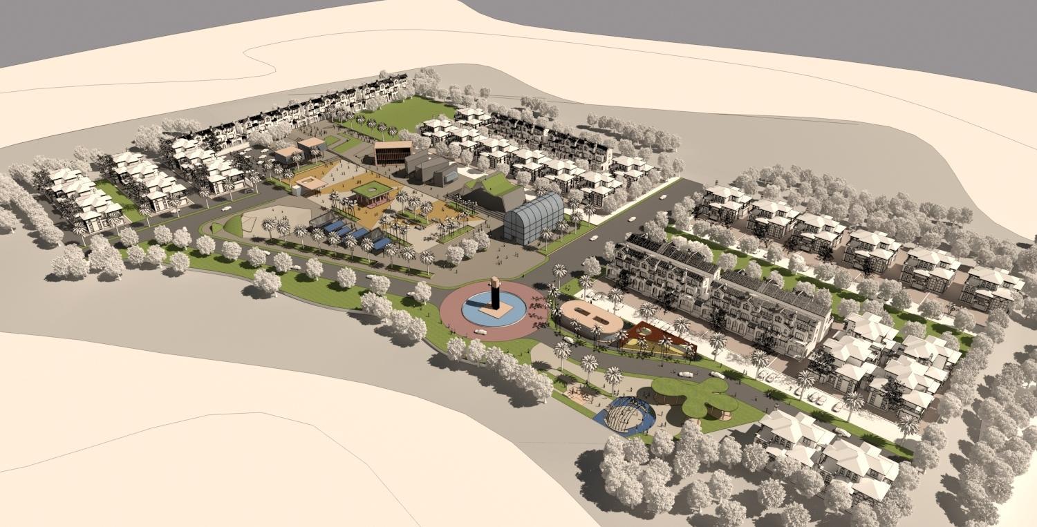
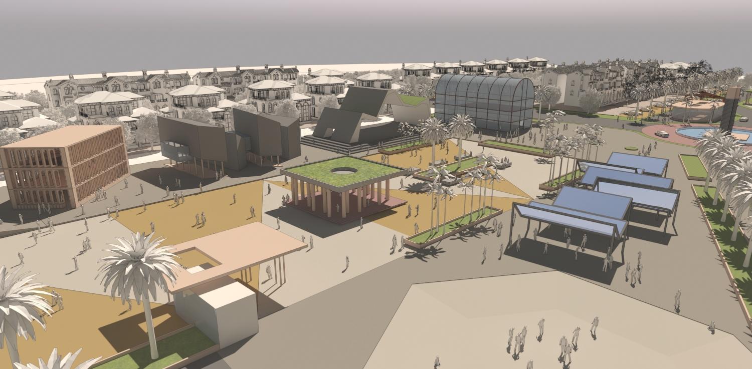
2016 – SWARNABHOOMI, RAIPUR
ROLE – DETAILING & VISULAIZATION, STATUS – ONGOING
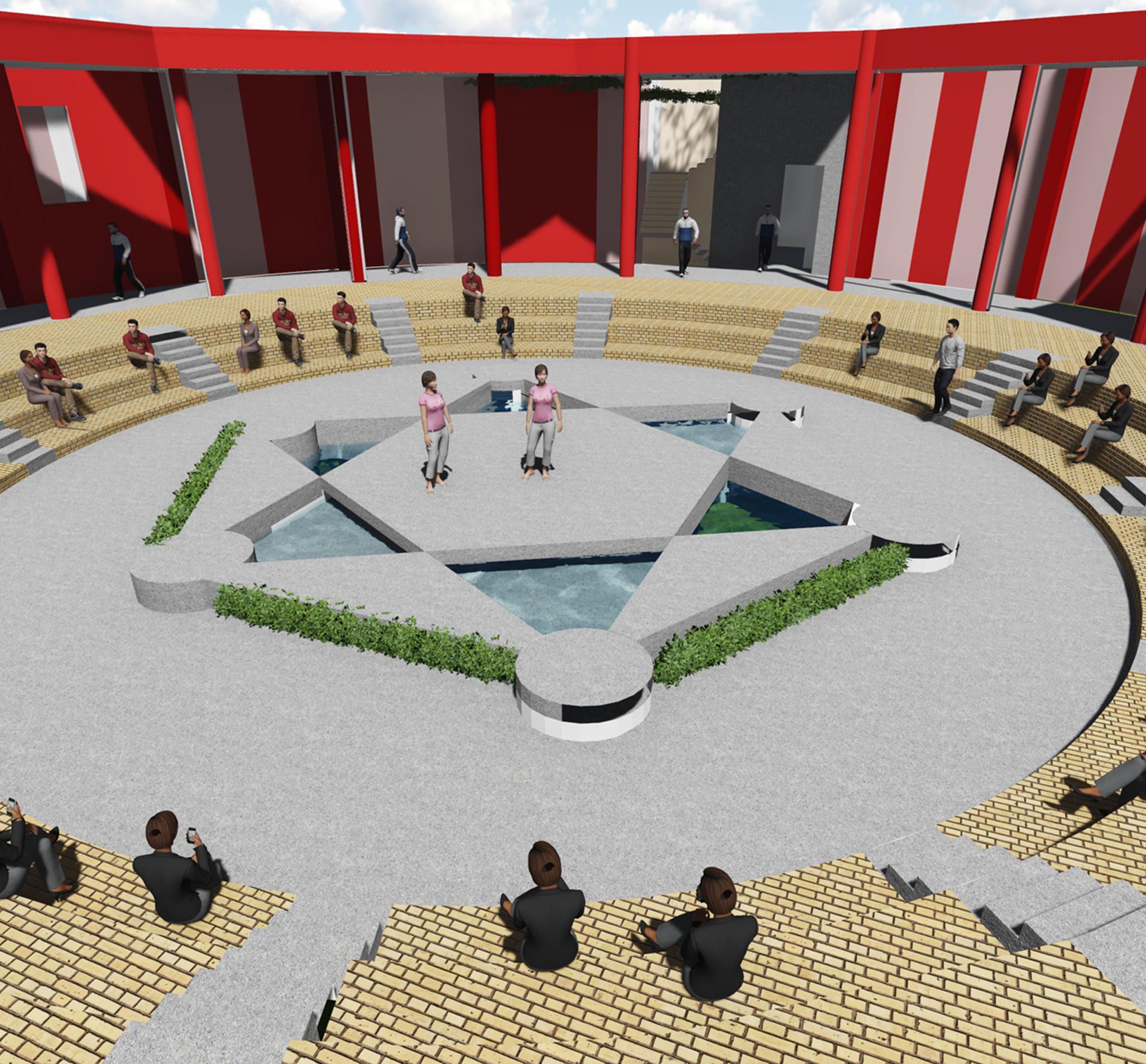
Public Square
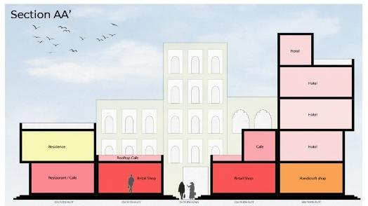
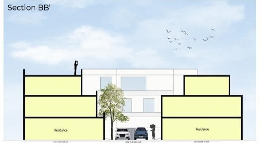
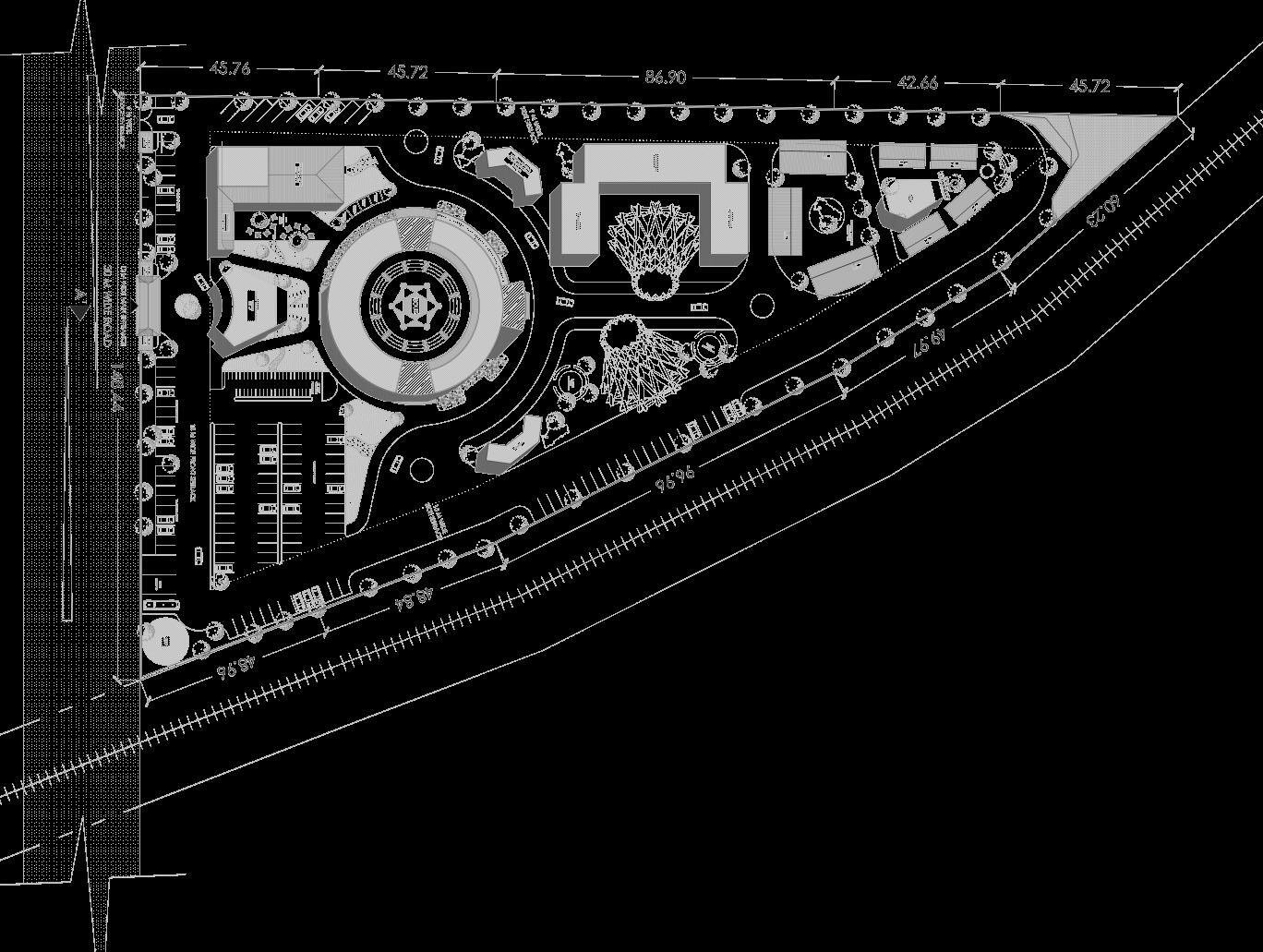
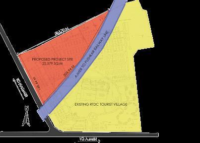
The concept of the ‘Craft Souk’ is a permanent fair for crafts, where artisans and craftsmen from Pushkar and all over India will provide a panoramic view of the richness and diversities of handicraft and artifacts. It would provide workshops and display areas for artisans to showcase the rich culture of food, art and handicrafts and enhance their skills.
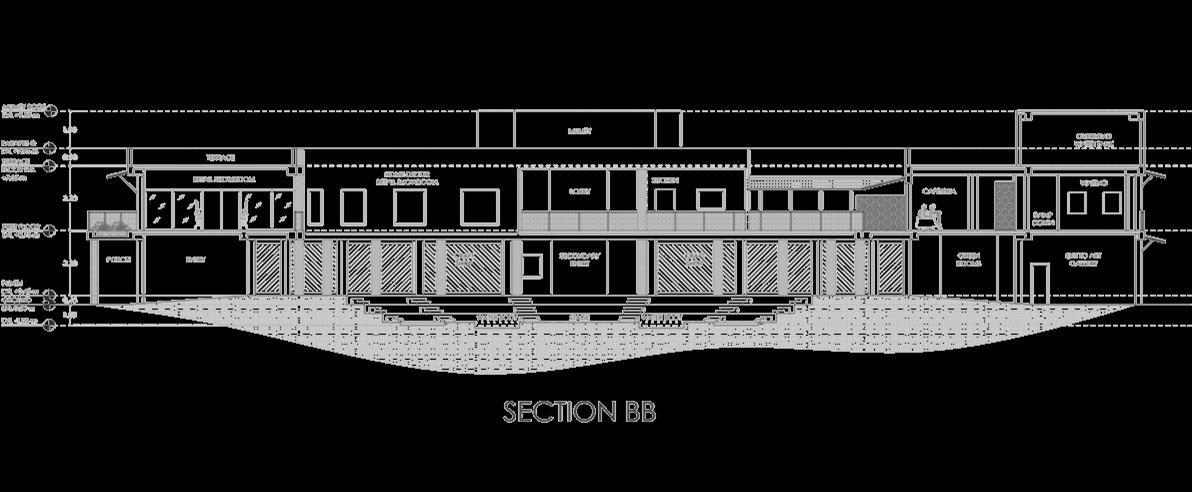
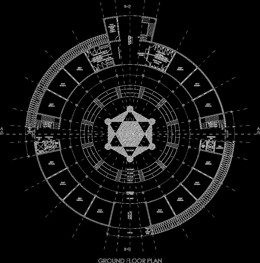
SITE
PLAN
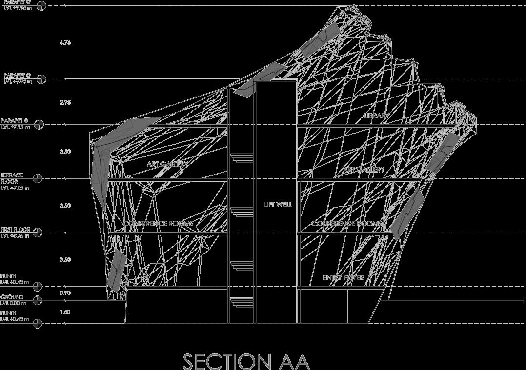
SERVICES :
A. Administration
B. Exhibit, Sales and promotion
C. Research and training
D. Workshops
E. Craft gallery
F. Supporting units
G. Facilities and recreation
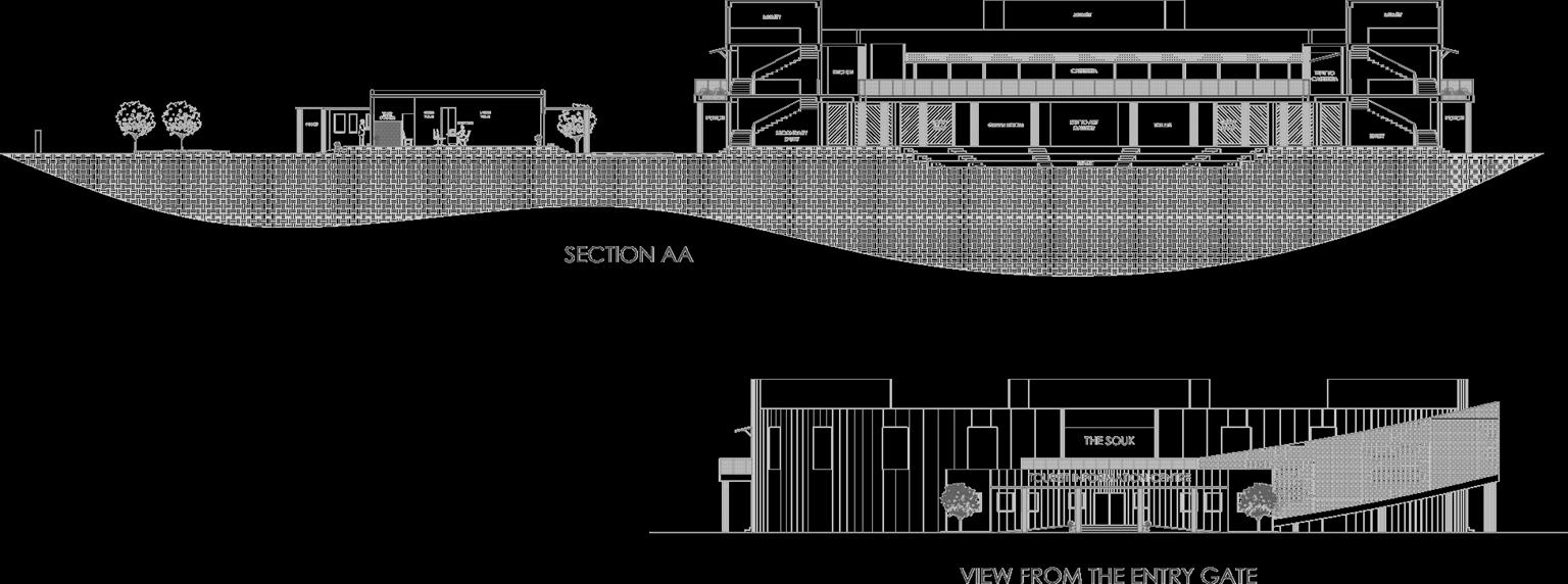
The basic theme of the project revolves around the Central Retail ZoneThe Souk All other activities are majorly supportive activities: their function as well as their forms develop around it. The souk, as the name suggests is inspired by form and setting of a traditional market place. All activities and building units incorporated in the premises primarily focus on the promotion of Handicrafts and Tourism through various cultural and commercial ventures.
THE SOUK
THE SOUK
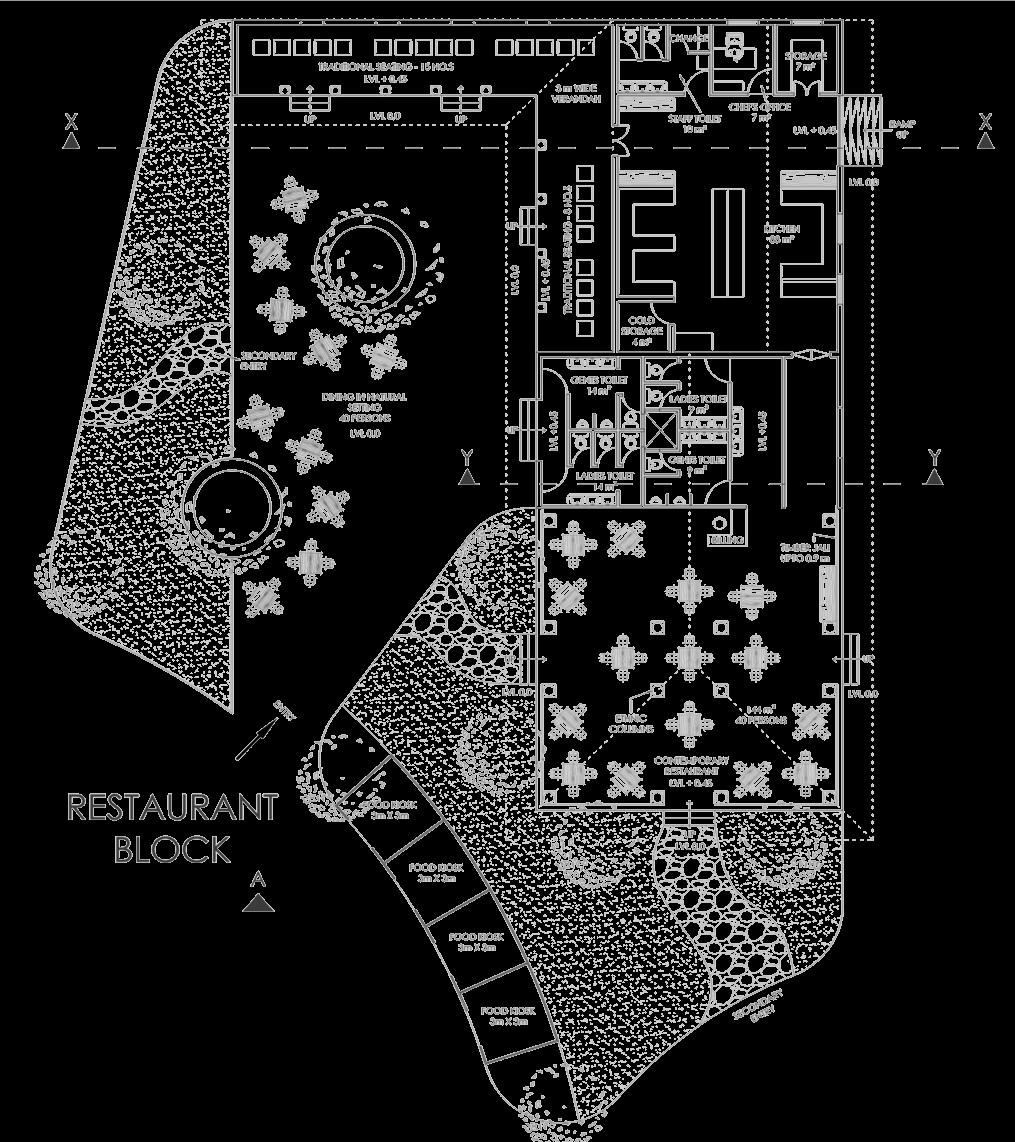
The zoning concept is based on the adjacency and relationship concept among the built forms. All the built forms are well related to each other as well as with the open spaces for interaction and recreation.
BUSINESS CENTRE
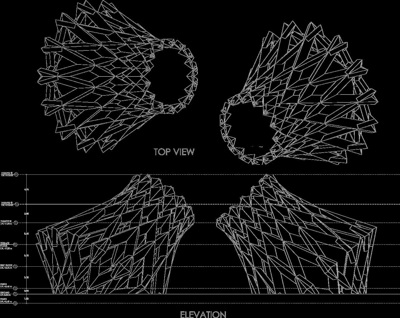
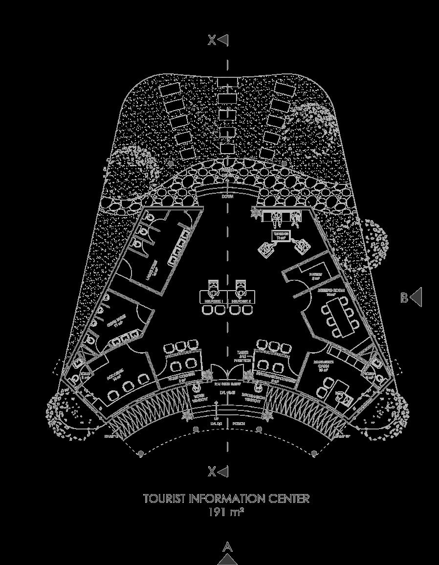
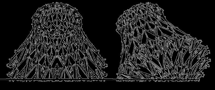
INFORMATION CENTRE