
Illinois tribes of native Americans inhabited the region until 1730 when the Sauk and the Fox tribes, who were being forced westward by the colonists, invaded and inhabited the region. The Native Americans called the river in the new territory “Sinnissippi,” meaning “rocky waters.”
In the early 1800s, the native Americans were again forced westward into Iowa. In 1831, Blackhawk, the Sauk chief, led his people in a series of raids back into Illinois to reclaim their ancestral lands. The battles that followed were known as the Blackhawk Indian wars. Chief Blackhawk was captured in 1832 and ordered to a reservation.
The Castle Rock area was settled by New Englanders early in the 19th century. This area was proposed as a state park in 1921 by the “Friends of Our Native Landscape,” who acquired some of the land they described as “a unique wilderness remnant of great natural beauty and scientific interest.” In 1964, the Natural Lands Institute, a non-profit natural lands preservation group, conducted a public fundraising campaign to preserve part of the Castle Rock area.
Castle Rock was recognized in Illinois as an outstanding area of major scientific importance in 1965. It was established as a project area, and land acquisition by the State of Illinois started in 1970. At the present time, Castle Rock consists of approximately 2,000 acres, 710 of which are designated as an Illinois Nature Preserve. The site was dedicated as a state park in 1978.
The basis for the acquisition of Castle Rock State Park is the protection of natural resources unique to Illinois. A thin layer of glacial till covers this region and several distinctive plant species, remnants of the native forest and prairie, still exist. In one valley, 27 different types of ferns have been identified. The park is one of the largest significant natural areas in the northern part of Illinois.
Most of the outstanding natural features are located in the dedicated Nature Preserve which is protected by state law. Use of the 710-acre preserve is restricted to scientific study and limited interpretation activities. The planned develop-ment of Castle Rock centers around the Nature Preserve. All development is limited by soil types. Soil types consist of silt loams and fine, sandy loams which are connected with the general high degree of slopes, which help to limit use and development at Castle Rock. These soils are subject to severe erosion under heavy use.
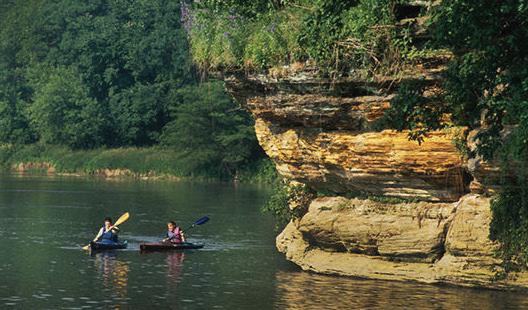
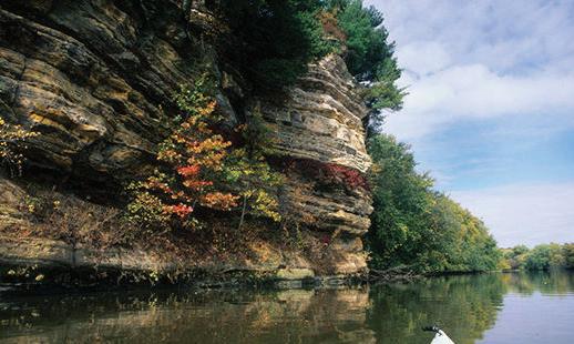
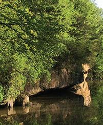
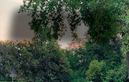
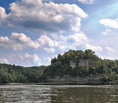
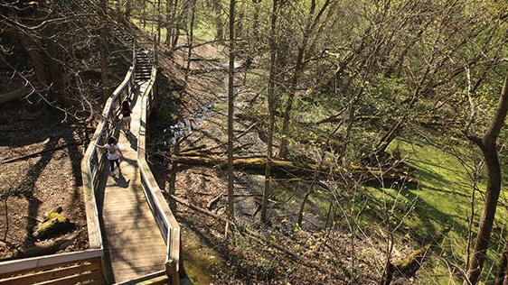
Castle Rock is a large sandstone butte situated between the Rock River and Ill. Rt. 2. The rock is made up of St. Peter sandstone. In only a few places in Illinois does St. Peter sandstone comes to the surface, even though it underlies practically the entire state.
Castle Rock State Park is located along the west bank of the Rock River in Ogle County, three miles south of Oregon, on Ill. Rt. 2. The park is centrally located in the Rock River Hills region of Illinois, and its rolling topography is drained by the Rock River. The park is representative of the Rock River Hills area with rock formations, ravines and unique northern plant associations. A sandstone bluff, adjacent to the river, has given the park its name. ■
Oregon, Illinois
One of the most picturesque sites along the Rock River is just north of Oregon in Ogle County. Legend has it that Chief Black Hawk, as he left the area after the Black Hawk War, talked of the beauty of the area and admonished his captors to care for the land as he and his people had.
Lowden State Park was established to care for the land and allow visitors to share in the beauty as well. The park serves as a memorial to Gov. Frank O. Lowden, who served Illinois during World War I.
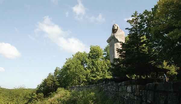
Just north of Oregon, the bluffs are graced with a ma-jestic image of an American Indian gazing over the Rock River Valley. This is no ordinary statue. It is a 50 foot, concrete-reinforced wonder that is aweinspiring. A tribute to all Native Americans, but more commonly associated with Chief Black Hawk, the statue was designed by sculptor Lorado Taft.
You can enjoy many wonderful views of the Rock River from the park, but the best view of the statue is from IL Rt. 2. While the setting sun seems to bring the statue to life, it is a spectacular view any time of the day and during all seasons. A restoration and preservation project involving the statue is currently underway.
In 1898, Chicago attorney Wallace Heckman, who also was assistant manager of the University of Chicago, pur-chased the land that was to become Lowden State Park. He and his wife had developed a great love of the outdoors while college students. In Chicago society, the Heckmans also became patrons of the arts. They combined these two interests as an artists’ colony established on their Rock River property.
The colony was called “Eagles’ Nest,” referring to a tall, dead cedar tree that clung to the high river bank. The bare, outstretched limbs of the tree inspired Margaret Fuller, a poet of the Concord Group, to write the poem, “Ganymede to His Eagle.”
For nearly 50 years, Eagles’ Nest was a popular home for creative people. The original group included artists Ralph Clarkson, Charles Francis Browne and Oliver Den-net Grove; writers Hamlin Garland, Henry B. Fuller and Horace Spencer Fiske; architects Irving D. and Allen B. Pond; sculptors Lorado Taft
and Nellie Walker; organist Clarence Dickinson; and University of Chicago Secretary James Spencer Dickerson. Although Taft was the moving spirit behind the colony, it continued to flourish until 1942, six years after his death.
About a year after the last of the artists and their fami-lies left the colony, Gov. Lowden died, and the legislature appropriated $25,000 toward the cost of a memorial to him. The citizens of Oregon and the vicinity, with help from the now Department of Natural Resources, matched that amount so that the former Eagles’ Nest land could be purchased as a memorial park. In 1945, the 63rd General Assembly designated the 273-acre site as Lowden State Park.
From page 4
Six years later, the 66 acres that comprised the actual Eagles Nest Colony were transferred to Northern Illinois University at DeKalb for use as an outdoor teacher education program. The site, called the Lorado Taft Field Campus, was renovated by NIU’s Industrial Arts classes, but is no longer used.
Lorado Taft, who created the 50-foot statue as a tribute to Native Americans, is said to have thought of the figure one evening as he and other members of the Eagles’ Nest colony stood gazing at the view from the bluffs. According to a story attributed to Taft, he and his colleagues tended to stand with their arms folded over their chests. The pose made him think of the Native Americans who were so reverent of the beauty of nature and who probably had enjoyed the same view.
With the help of John G. Prasuhn, a young sculptor of the Chicago Art Institute, Taft created a figure almost 50 feet tall, including a six-foot base. Reinforced with iron rods, the hollow statue is 8 inches to 3 feet thick. The interior is accessible to park employees through a door at the base. The outer surface, composed of cement, pink granite chips and screenings, is three inches thick.
The figure is estimated to weigh 100 tons and is thought to be the second-largest concrete monolithic statue in the world. Although Taft dedicated the statue to Native Americans, it has become commonly associated with Black Hawk. ■


Shabbona, Illinois
Just miles west of Chicago, off U.S. 30, urban landscape gives way to 1,550 acres of rolling prairie and a 318.8-acre man-made fishing lake. Shabbona Lake State Recreation Area provides a convenient, natural haven from the hustle and bustle of daily life.
A unique mix of grass-covered meadows, upland mesic woods, bottomland woods, and a native, undisturbed fen make this an ideal location for natural relaxation and out-door activity. You can see sedges, cattails, marsh marigold, horsetails, skunk cabbage, turtlehead, iris, blue joint grass and bulrushes. Also enjoy areas of prairie restoration throughout the park featuring prairie grasses such as big blue stem and prairie flowers such as purple coneflower.
With facilities for picnicking, camping, hiking, fishing, hunting and winter sports, Shabbona Lake SRA is a conve-nient and comfortable retreat where visitors can refresh and reinvigorate in a rare, unspoiled environment.
In addition, Shabbona Lake contains a 15-acre seasonal nesting area for migratory waterfowl such as canvasback, redhead and pintail ducks and Canada
geese. Originally home to tribes of Native Americans, the park derives its name from Chief Shabbona. Pioneer settlement of the area began in the 1830s. From Shabbona Grove, in the southeast corner of the park, homesteaders spread over the region and began farming the rich soil.
In 1965, a decision was made to develop a lake and rec-reation area on the site, and land acquisition began in 1969. By 1978, 1,550 acres had been obtained. In 1973, the lake area was cleared of trees, the shoreline was modified and earthen fishing piers and fish congregations were erected.
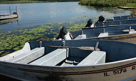
By 1975, a 3,000-foot-long earthen dam with a concrete spillway was completed and the lake was formed. Day use facilities were constructed in 1976 and continue to serve the public today. A restaurant, boat rental and bait and tackle facility opened for business in 1995. This facility provides a sit-down eating area serving breakfast, lunch and dinner as well as a fully stocked bait and tackle shop. Boat rentals include boats with and without motors. ■
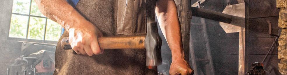
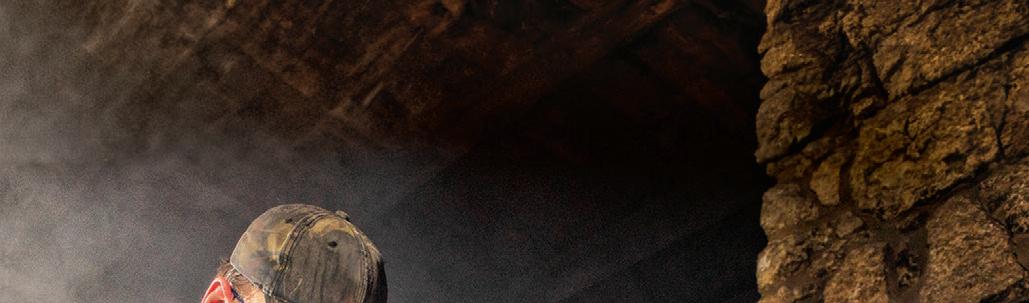

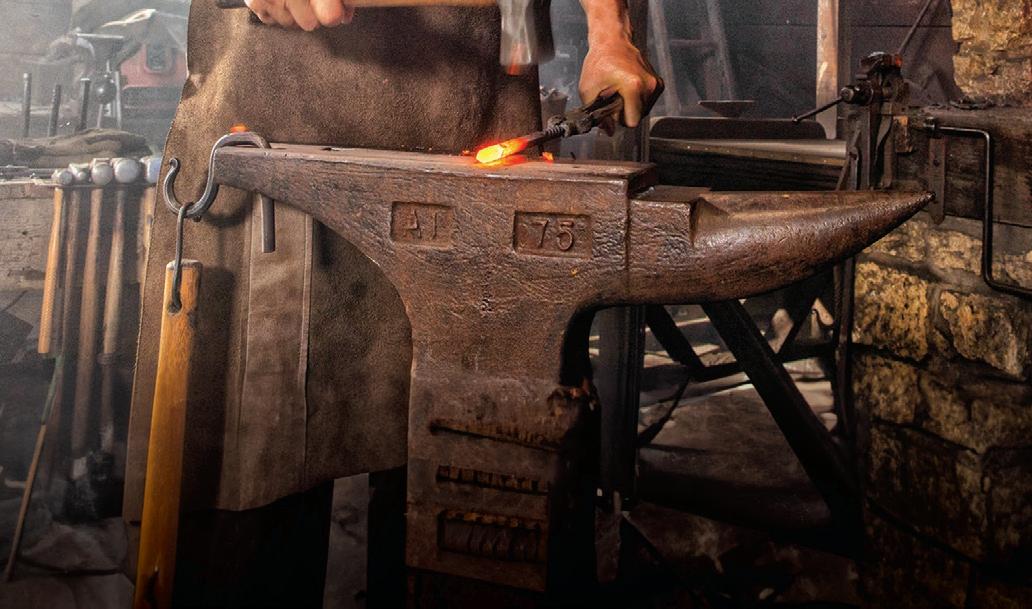

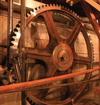
Stand in the spot where John Deere created the first commercially successful steel plow and relive the experience of his original blacksmith shop. Discover where John Deere history began – and changed the world of agriculture forever.


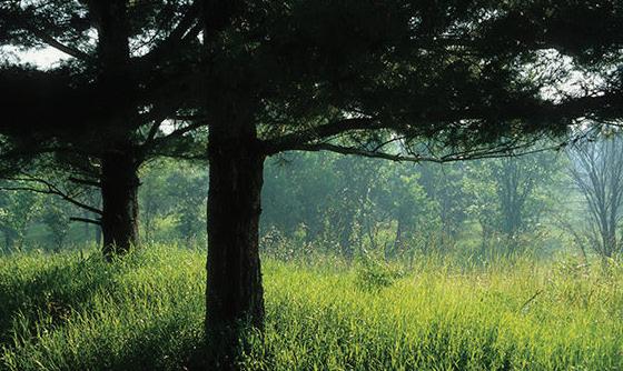
Nestled in the Rock River Valley, just 3 miles south of the town of Oregon, lies a 2,291-acre wooded area that is one of Ogle County’s most beautiful and historic sites. Its scenic qualities come from 120-foot bluffs along 3.5 miles of riverfront forested with hardwood and pine trees. The history stems from the individual who, in the early part of the 20th century, augmented the natural hardwood forest by planting pines.
Frank O. Lowden (1861-1943), Illinois’ governor from 19171921, ardently embraced proper land use and strongly believed in reforestation as a way to retard soil erosion. Over several decades, an estimated 500,000 trees were seeded directly by him or under his supervision.
Since 1992, the tract has been known as Lowden-Miller State Forest. But prior to that Gov. Lowden and his wife, Florence Pullam Lowden, called it Sinnissippi Forest. Sinnis-sippi is from American Indian terms meaning “rocky river” or “troubled waters.” It was part of a large and diverse farming operation that incorporated not only native hardwoods but pasture and sandy farmland.
Because the soil was of limited use for crops. Lowden experimentally planted white pines and other tree species to see what would grow productively. The earliest plantings of white pines occurred before 1910 and are believed to be the oldest in the state.The governor’s love of the land transcended his desire to continue in political office. In his 1916 campaign, Lowden insisted that he wanted to serve only one term as governor as he preferred to return to his farm and forest.
From page 10
In his biography, Squire of the Sinnissippi, Gov. Lowden wrote: “I like to think of this beautiful and fertile spot as the place where my children and my children’s children and their children after them will gather long after I have become dust, and in the shade
of the old trees my own hand had planted.”
The governor remained an avid student of forestry throughout his life. In 1938, he invited the new forestry department at the University of Illinois to conduct research on the developing forest. Today, with nearly 80 percent of all data on Illinois hardwood forest growth having been developed at Sinnissippi, the forest still serves as a field laboratory for the university.
The family’s Sinnissippi Forest Christmas Tree wholesale and retail business began providing high-quality firs and pines for the holiday in 1948, but the family closed their Christmas tree sales operation in 2010. In 1955, Sinnissippi Forest was designated the first Illinois Tree Farm.
In June 1992, the state of Illinois purchased a 1,186 acre parcel of the forest from a grandson of Gov. and Mrs. Lowden, Warren P. Miller and his wife, Nancy. Warren’s brother, Phillip Lowden Miller and his wife, Bonnie, sold an additional 1,039 acres to the state in 1993.
In offering their land for sale to the state rather than seeing it subdivided or rezoned for development, the family said they were achieving their goal of keeping the area an actively man-aged forest and preserving its beauty for future generations.
Named for the family, Lowden-Miller State Forest now totals 2,291 acres. It is located across the Rock River from another DNR property, Castle Rock State Park, which oversees its daily operations.
The Department of Natural Resources’ Forestry Division has ongoing forestry studies and projects such as controlling some exotic tree species and planting an oak seed orchard. Other forestry projects include thinning pines and working to control tree diseases. The forest’s purpose is to provide an outstanding outdoor facility for the public where forestry education can continue. ■
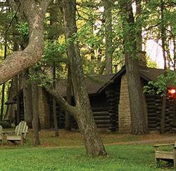
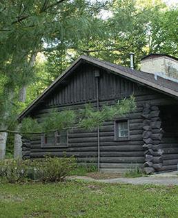
Located in the heart of the Rock River valley, the 385-acre White Pines Forest State Park is the south boundary of the historic Chicago-Iowa Trail. Today, the park is perfect for family getaways to enjoy hiking, fishing, camping and picnicking. With serene, picturesque beauty, and modern lodge facilities amidst a beautiful forest, there is no better place to retreat from the everyday routine than the open spaces at White Pines.
Along the meandering banks of Spring and Pine creeks, this scenic haven has magnificent trees that share moss-covered cliffs, strung with trailing vines. In season, colorful beds of blossoming trout lilies, solomons seals, bloodroot, blue-eyed grass, spring beauty and hepatica are everywhere.
Among the park’s most interesting features are the concrete fords that span the creeks, allowing visitors to drive through the flowing streams, with an accessible path leading to the stream bank for wildlife watching


and fishing.
Camping and picnicking are popular at White Pines, with shaded picnic areas along Pine Creek and more than 100 campsites and youth group campgrounds available.
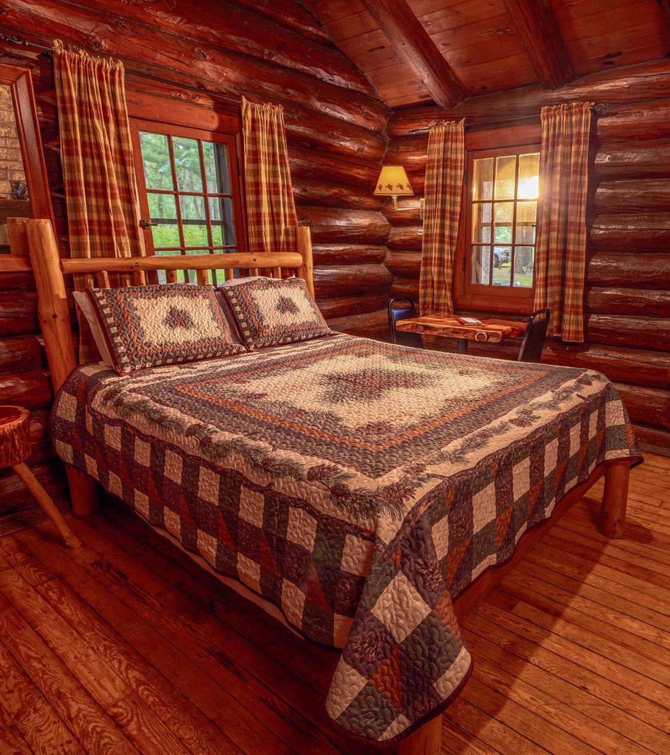
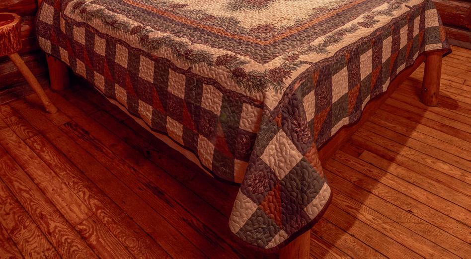
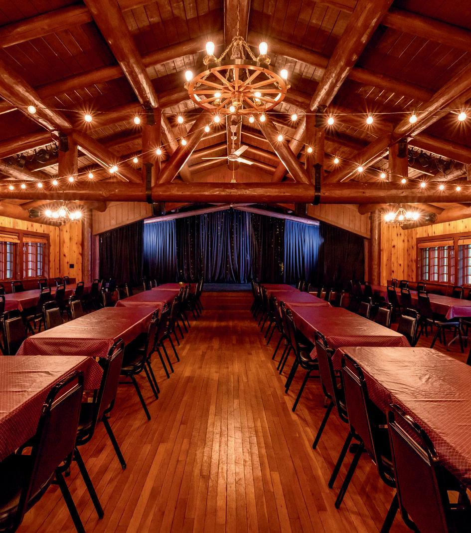
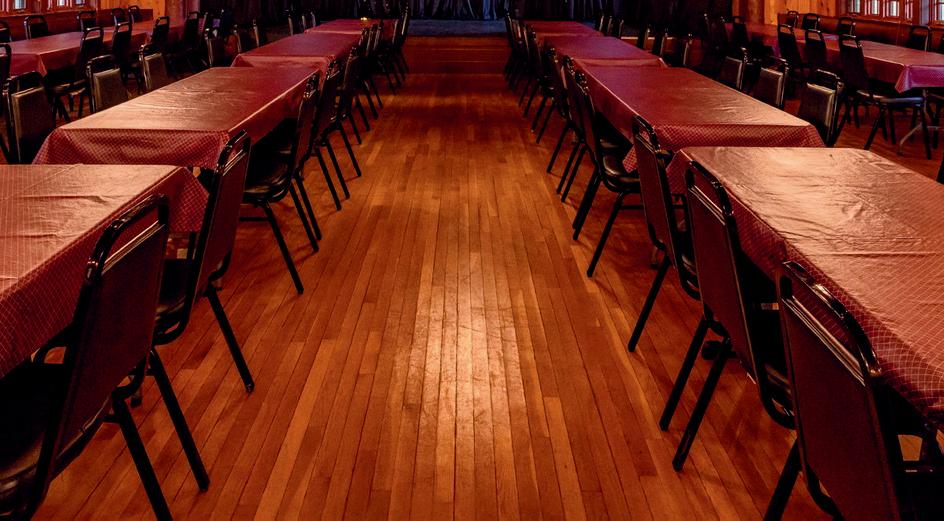
White Pines Lodge, originally constructed by the Civilian Conservation Corps in the 1930s, has modern amenities. There are 13 one-room cabins, 2 cabins with 4 rooms, and 1 cabin with 2 rooms, for a total of 23 guest rooms. The White Pines Lodge Restaurant features homemade delicacies, banquet facilities, and a dinner theater. White Pines Forest State Park has seasonal archery and firearm deer hunting and, when snow covers the ground, cross country skiing trails.
White Pines Forest lies in the heart of Black Hawk Indian country and is rich in historic accounts of the warriors who resisted the efforts of settlers to drive them from the beloved Rock River valley. Eventually, however, the Black Hawk War forced them out and Warrior Black Hawk himself was sent into exile in the custody of his rival, Keokuk.
When early settlers arrived, they found this 700-acre
forest of untouched pine extending for 1/4 mile along the east bank of Pine Creek. With a view to preserving one of Illinois’ last stands of native white pines and one of the southernmost stands of white pines in the United States, a movement was started in the early part of the 20th Century to set the area aside as a state park. Through efforts of Ogle County nature lovers, a bill appropriating $30,000 for purchase of land was passed by the legislature in 1903, but the measure was vetoed. In 1927, however, they had more success, and the forest was acquired. ■


Cozy Log Cabin Wine Bar & Tasting Room
Winter Hours (September-April)
Monday, Thursday, Friday & Saturday 11AM-7PM Sunday 12PM-5PM Tuesday & Wednesday Closed
Summer Hours (May- August)
Daily 11AM-7PM


W8170 Pilz Rd, Browntown, WI 53522
hawksmillwinery.com | (608) 966-HAWK (4295)

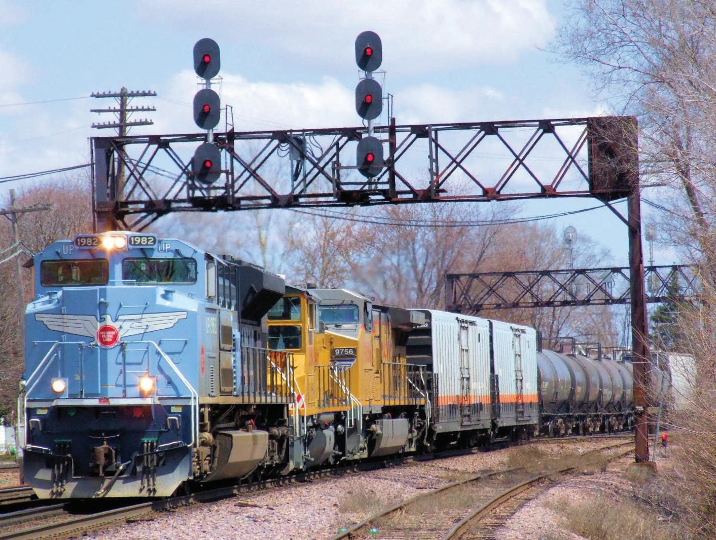
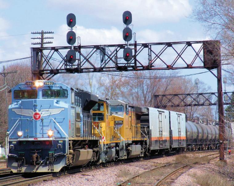
The Rochelle Railroad Park is the first park in the nation built just for visitors to see operating trains. The story of railroads in Rochelle begins in 1854 when the Air Line Railroad was completed between Chicago and the town of Lane (Lane was the first name of Rochelle).
The railroad later became the Chicago and North West-ern and today is owned by the Union Pacific (UP). Sixteen years later the Chicago & Iowa Railroad was built through Rochelle in 1870 and it crossed over the Air Line Railroad between 11th Street and 12th Street. The railroad was later called the Chicago, Burlington, and Quincy before becoming the Burlington Northern Santa Fe (BNSF). Today these two railroads daily haul millions of tons of merchandise on at least 80 to 90 trains a day through Rochelle in a 24 hour period. This has made Rochelle a “hot spot” for train watching, drawing visitors from every state in the nation and world wide. Because of
the number of visitors Rochelle acquired the land in 1995 and constructed a park just for train watching.
The park, which was dedicated August 30, 1998, includes a handicapped accessible observation pavilion with various vantage sites for the best visitor viewing and photography. Visitors can see locomotives from many different railroad companies pass through Rochelle. They include the Union Pacific and the BNSF. Other units from railroads of the Eastern United States, Mexico, and Canada also pass through from time to time. One will also see engines wearing their color schemes from past mergers, mixed within the power of a passing freight.
The radio transmissions that you are listening to are actual railroad communications from the dispatcher to the train crews and track workers. We monitor both main lines through Rochelle for the UP and the BNSF. Dispatching originates for the UP in Omaha Nebraska, and out of Fort Worth Texas for the BNSF. ■
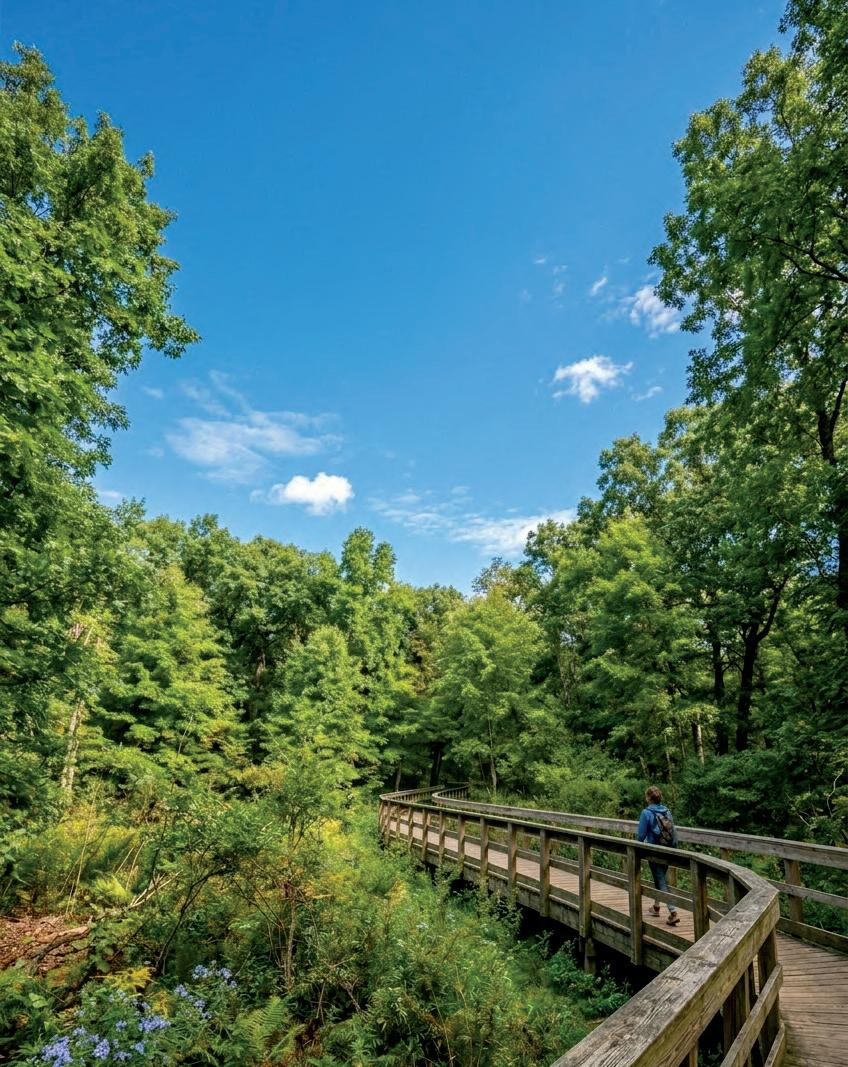
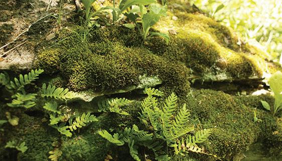
Franklin Creek State Natural Area is located in Lee County, northwest of the village of Franklin Grove and east of Dixon just north of IL Rt. 38. Beautiful Franklin Creek flows throughout the 882-acre park. Several large natural springs, hardwood forests, bedrock outcroppings and a large variety of flora and fauna comprise a pristine ecosystem.
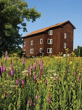
The mill spring, the largest in the park, provided water power for the largest grist mill in Lee County, constructed in 1847. The site includes a 198-acre nature preserve which is an outstanding and diverse natural area in a uniquely beautiful setting. Low-lying areas along the creek bed support a bottomland forest dominated by silver maple and hackberry. Ravines support mesic upland forest characterized by sugar maple and basswood and paw paw. On drier sites, a dry-mesic forest of white oak, red oak, black oak, shagbark hickory and hop hornbeam occurs. A small glacial drift hill prairie remnant is present in the preserve. The forested areas provide habitat for woodpeckers, flycatchers, thrushes, vireos and warblers; and, raccoons, chipmunks, gray and fox squirrels, beaver, and deer.
Nineteen species of fish have been recorded from Franklin Creek. Franklin Creek SNA picnic shelters can be reserved through ExploreMoreIL™.
Hiking and seasonal cross country skiing and snowmobile trails, along with equestrian trails, are popular destinations for site visitors. The equestrian area contains 12 miles of trails developed and maintained by the Rock River Trail and Horseman’s Association. Equestrian facilities include a picnic shelter, restrooms, drinking water and an outdoor show area.
Since 1987, the Franklin Creek Preservation Area Committee has been continuing their volunteer involvement by working to reconstruct the Franklin Creek Grist Mill. The original early-American corn meal and wheat flour producing mill was reconstructed and became operational in 1999. It is open to the public on weekend afternoons from April through October, and the mill building serves as a visitor center.
Pioneer families in the 1830s found the Franklin Creek area to be an inviting new home on the sometimes unfriendly prairie. Large, cool springs provided ample amounts of pure drinking water and early refrigeration, hardwood forests provided construction materials, and the creek provided fish for food and water power to run saw and grist mills.
The mill spring, the largest in the park, provided water power for the largest grist mill in Lee County, constructed in 1847. Deep, pleasant valleys protected by limestone and sandstone bluffs made ideal homesites shielded from cold winter winds. Many ponds and rock outcroppings along Franklin Creek carry names given them by pioneer families. ■
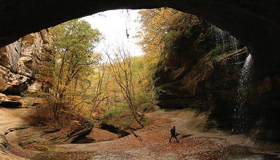


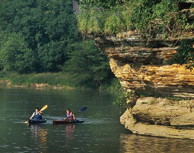
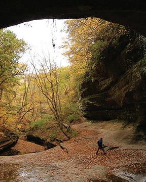
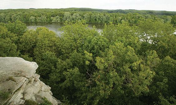
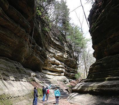
Starved Rock State Park, nestled along the Illinois River in La Salle County, stands out as one of the most stunning spots in Illinois. Established as the state’s second state park in 1911, it boasts 18 canyons with striking vertical walls of moss-laden St. Peter Sandstone, shaped by glacial meltwater over 14,000 years ago.
With over 13 miles of trails, visitors can explore rain-fed waterfalls, sandstone overhangs, and breathtaking viewpoints. The park is rich in diverse plant life, including white and red oaks, maples, hickories, white pines, eastern red cedars, and northern white cedars, all of which provide a habitat for a variety of wildlife.
There are numerous recreational activities available, including hiking, camping, fishing, boating, and hunting. Throughout the year, the park hosts special events, guided tours, and various programs. The Starved Rock Visitor Center welcomes guests year-round, while the historic Starved Rock Lodge, built in the 1930s, offers upscale ac-commodations, cabin rooms, and exquisite dining options.
This region has been inhabited by humans for over 10,000 years. The Hopewellian, Woodland, and Missis-sippian Native American cultures flourished here. Among the most recent and likely the most populous group were the Illinois people.
Various subtribes of the Illinois Confederation occupied this area from the 16th century until the early 19th century, with the Kaskaskia being one of those subtribes. They re-sided directly across from what is now known as Starved Rock State Park, in a place referred to as the Grand Village of the Kaskaskia or La Vantum by the French.
In 1673, French explorers Louis Jolliet and Jesuit missionary Father Jacques Marquette traveled through
this area while journeying up the Illinois River from the Mississippi. Known as “Pere,” which means “Father” in French, Marquette returned two years later to establish the Mission of the Immaculate Conception, marking Illinois’ first Christian mission at the Kaskaskia village.
In the winter of 1682-83, the French constructed Fort St. Louis on top of Starved Rock due to its advantageous position overlooking the Illinois River. However, facing pressure from small Iroquois war parties during the French and Indian Wars and dwindling resources, the French aban-doned the fort by the early 1700s, retreating to what is now Peoria, where they built Fort Pimitoui. Although Fort St. Louis became a refuge for traders and trappers, by 1720, all traces of the fort had vanished.
The name Starved Rock State Park is derived from a Native American legend. In 1769, Chief Pontiac of the Ottawa tribe was killed by a Peoria brave (a sub-tribe of the Illinois Confederation) while attending a tribal council in southern Illinois.
According to the legend, during the ensuing battles aimed at avenging his death, a group of Illinois, besieged by Potawatomi (allies of the Ottawa), sought refuge atop a 125foot sandstone butte, which is now known as Starved Rock. The Illinois people eventually found themselves encircled by the Ottawa and Potawatomi, which contributed to their downfall. This is just a tale though and not supported by any archaeological evidence or historical documentation.
Today, descendants of the Illinois Confederation, particularly the Kaskaskia and Peoria, continue to flourish as members of the Peoria Tribe of Oklahoma, located in Miami, Oklahoma. ■
Chiseled out of the state’s far northern region is Rock Cut State Park in Winnebago County. Nearby are other “rocky” landmarks - the mighty Rock River and the place where wagons once forded it, Rockford. It’s an area of rolling plains, interesting history and a wide variety of recreational opportunities.
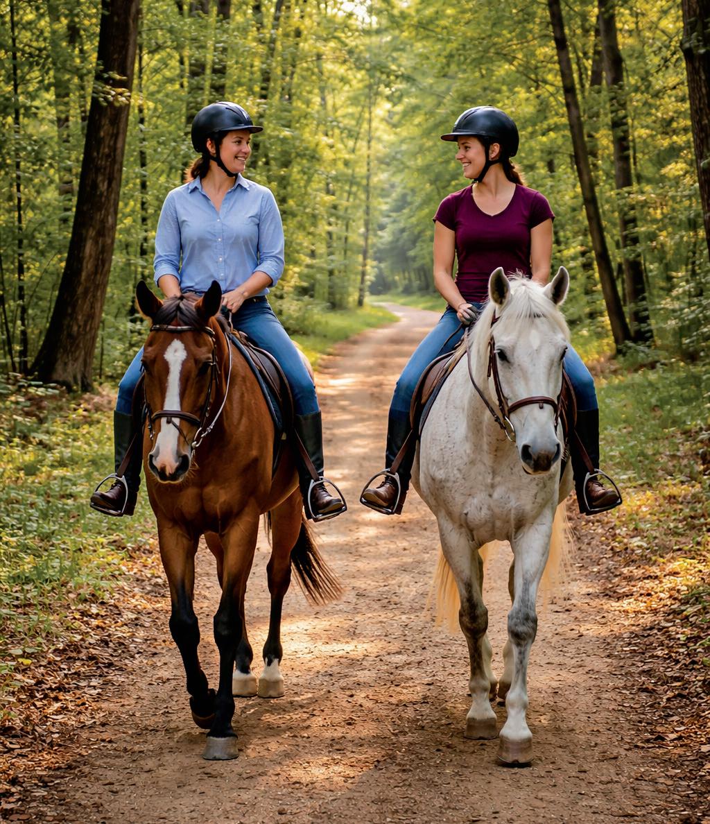
Rock Cut’s 3,254 acres include two lakes: Pierce Lake, with 162 acres, and Olson Lake with 50 acres offer a retreat for people wanting to fish, ice fish or ice skate. The park’ s hiking trails, horseback riding trails and cross-country skiing and wildlife watching, as well as seasonal hunting programs, make it a year round recreation destination.
The beautiful campground has 270 premium campsites, a rustic cabin, a youth group camp and shelters, with reservations available through ExploreMoreIL™.
Rock Cut is home to abundant wildlife with waterfowl, deer, fox, muskrat, woodchuck and beaver, opossum, raccoon and both gray and fox squirrel. Over 100 types of wildflowers offer a showy display each spring and summer, while hardwood trees dazzle visitors each fall.
By the middle of the 17th century, Miami-speaking tribes of Native Americans entered the region of Rock Cut State Park after the Iroquois drove them from territory on the southern end of Lake Michigan.
From about 1655 until 1735, the Rock River was within
the range of the Mascouten, who were also pushed westward by the Iroquois. The Winnebago ranged southward from Wisconsin to the Rock River from the 1740s until 1837, while the river’s upper portion was on the periphery of the Fox and Sauk territory from about 1765 to 1833.
By 1800, the Potawatomi, Ottawa and Chippewa nations had extended their range into the area, but they ceded their lands to the United States 32 years later following the Black Hawk War.
Settlement of Winnebago County began after the Black Hawk War. The region that is now Rock Cut State Park was settled partly by Scots around Argyle - named for their Scot-tish home of Argyllshire - and partly by Canadians, New Yorkers and New Englanders around the town of Harlem - named for New York City’s Harlem. The Illinois version of Harlem was moved in 1859 when the KenoshaRockford Rail Line was built.
The dammed waters of Pierce Lake now cover much of the railroad bed within the park, although portions of the railroad grade are visible along Willow Creek below the spillway. But blasting operations in a rock outcrop that railroad crews conducted during the 1859 construction left lasting im-pressions here - they cut through rock to provide a suitable roadbed and gave Rock Cut its name. ■


The first Ogle County Fair was held in October of 1853 on the lawn of the Ogle County Courthouse. In the early years, it was held at several places and on one occasion, in Byron.
In 1856 a group of citizens purchased 10 acres of land in the north section of Oregon along Illinois Route 2. An additional 10 acres was purchased in 1858 followed by the acquisition of 6 acres from Mr. E.S. Potter in 1901. Ten more acres were later purchased from the estate of James H. Cartwright. The grandstand was constructed in 1925 followed by the horse barn in 1927. The fair encompassed approximately 40 acres by 1968.
Moving forward to more current times the Ogle County Fair decided to discontinue operation and the last fair at the fairgrounds on the north edge of Oregon was 1991. The city of Rockford invented a festival called “On the Waterfront” and the attendance had dropped extremely and was no longer viable. Since the Ogle County Fairground was privately owned it was put up for sale. Twenty three acres were purchased by Grant and Janice Landis of Oregon and the remainder by the Oregon Park District. The Ogle County Fair needed to find a new home.
Since the fairgrounds were used for the Ogle County 4-H show each year a group of 4-H parents and concerned citizens was formed to find a new fairgrounds. This was a daunting task, but was achieved in 1993. There was a minimal fair held by the 4-H in 1992 at St. Mary Learning Center located West of Oregon, just off of Illinois Route 64.
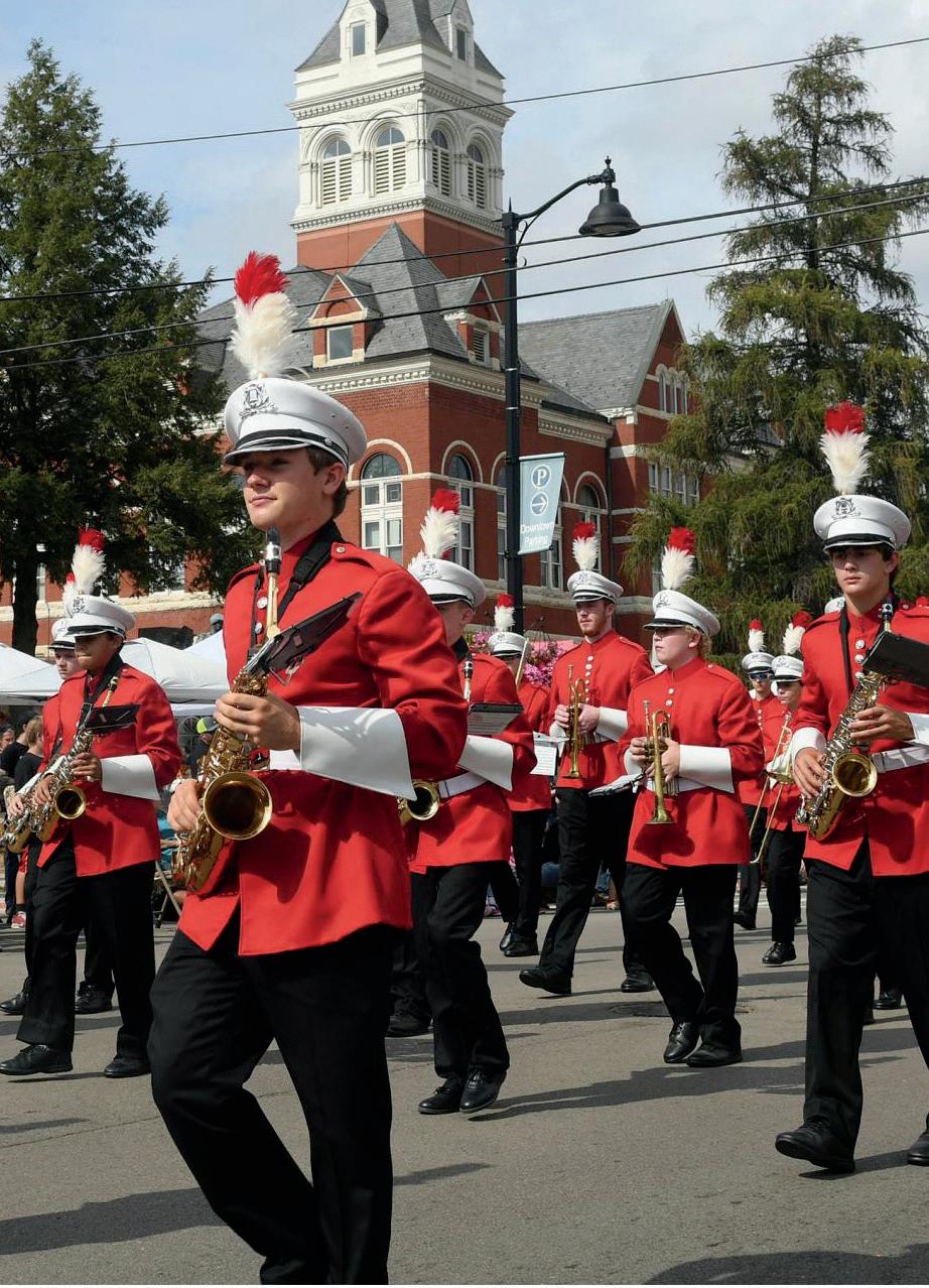
ByronFest, one of the finest family festivals in Northern Illinois, is held annually during the second full weekend in July. The festival is located in Byron’s downtown area. Additional events are held in other venues throughout the city, including athletic events at the Jarrett Prairie Center and quilt show at the Byron Museum of History.
ByronFest is a venture of the Byron Chamber of Commerce designed to encourage and promote tourism in the Byron area and to showcase the Byron
community to the many visitors who travel to Byron for the three-day event. In addition, the festival provides an opportunity for many not-for-profit organizations to raise funds for various projects. During the past thirty-seven years, ByronFest has returned more than $830,000 to local charitable groups. These organizations have in turn used the funds for community improvements and programs throughout the area.
Some local organizations that have taken advantage of this opportunity through-out the years include Byron Lions Club, Byron Kiwanis Club, Byron Key Club, Byron Firemen’s Association, Boy Scouts, Byron High School Cross Country, Byron High School Volleyball, Stillman Valley Boys Basketball, Da-kota Cheerleaders, and many others.
Stillman Valley in its early days was very community-ori-ented and had many activities for all ages. Among them were: an opera house in the early 1900’s, the Grange, S.V. Woman’s Club (founded by Julia Hull around 1915), quilt-ing bees, school plays, church programs, dances, community band, pool hall, nationally renowned recreation park (founded in 1921), village Christmas Tree (1935) and even a bowling alley (1946). The fall festival most certainly is a circulation of these events from our past, but it seems there were several significant occasions which played a key role in forming today’s festival.

continues on page 20


Polo Town & Country Days was first organized in 1966 by the Polo Jaycees as a way to raise money for the construction of a city pool. The first festival was a three day celebration which included such events as a carnival, kiddie parade, drum and bugle corps exhibition, and a large community parade to finish out the weekend.
Now – roughly 60 years later, the festival has expanded into a four day event that is kicked off with one of the most amazing fireworks displays in the area. The annual parade still closes out the celebration, and sandwiched in between are four days filled with fun for young and old.
Make plans to visit Polo during Town & Country Days the third weekend in June – you’ll be glad you did.
Come to Leaf River for Leaf River Daze. It is a great way to start the summer. Friday is all about food, music, a tractor rodeo, and fireworks. Saturday is the truck and tractor pull by the FFA Alumni, a tractor and farm equipment show, the Lions Club car show, free games and activities for the kids, and a variety of food. Sunday, before you stake your spot along the parade route, enjoy a pork chop BBQ prepared by the Ogle County Pork Producers and served by the Leaf River Lions Club.
The Lincoln Highway Heritage Festival, emphasizing family entertainmenet and community pride, is a celebration of Rochelle’s rich past and present history of transportation, business and industrial development.
We invite one and all to come celebrate with us at this festival. This community event is family-friendly and free to everyone attending. Enjoy three days of amusements, entertainment, food, vendors and crafters, fun things for kids and all ages.
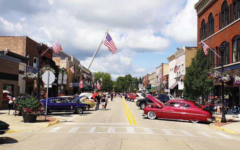
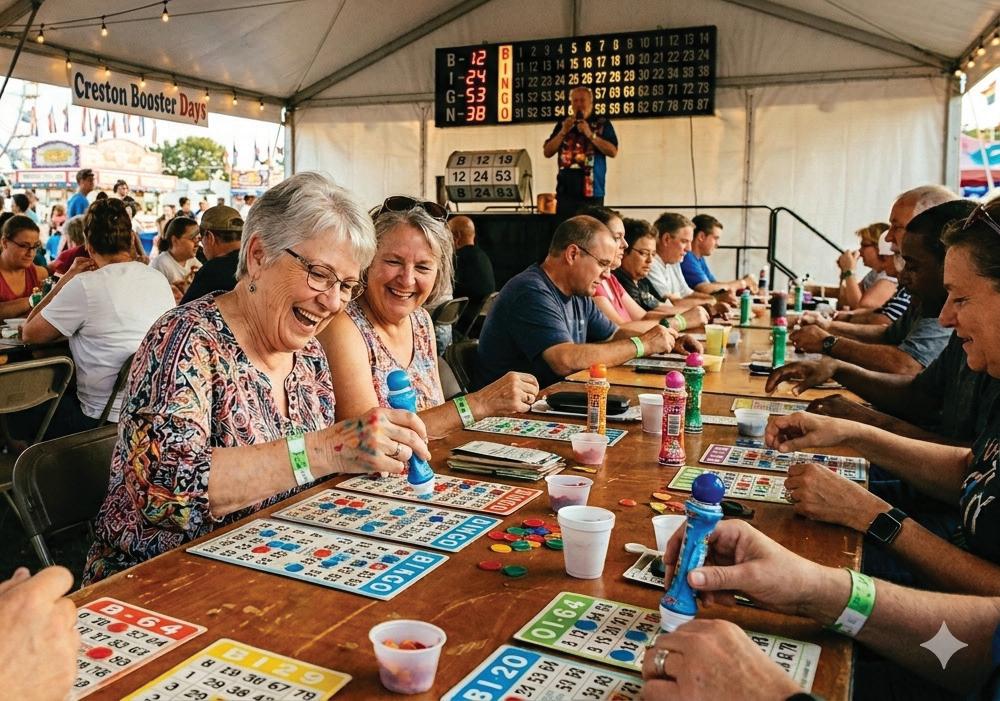
The annual Creston Booster Days is known throughout the region as one of the top, small-town festivals.
As in the past, the weekend features a parade, a carnival, live entertainment, a car show, booths, bingo and much more. Join us at the Creston Booster Park for food, rides, live music, vendors and lots of fun
Byron Hutchins moved to Oregon in 1969. He served as an advisor with the University of Illinois Extension Service helping to create several committees for the betterment of small communities. One of these committees was for a festi val. He was joined by other local leaders- Ray Appler, James Barnes, Ron Fafnis, Anne Jones, and Cecelia Zimmerman.
Seven booths lined up on Third Street on a rainy day in 1970 which has grown into an average of 180 booths surrounding courthouse square. Determination, some dreaming, and creative input-perhaps sprinkled with a few lofty ideas- has led to many additions and
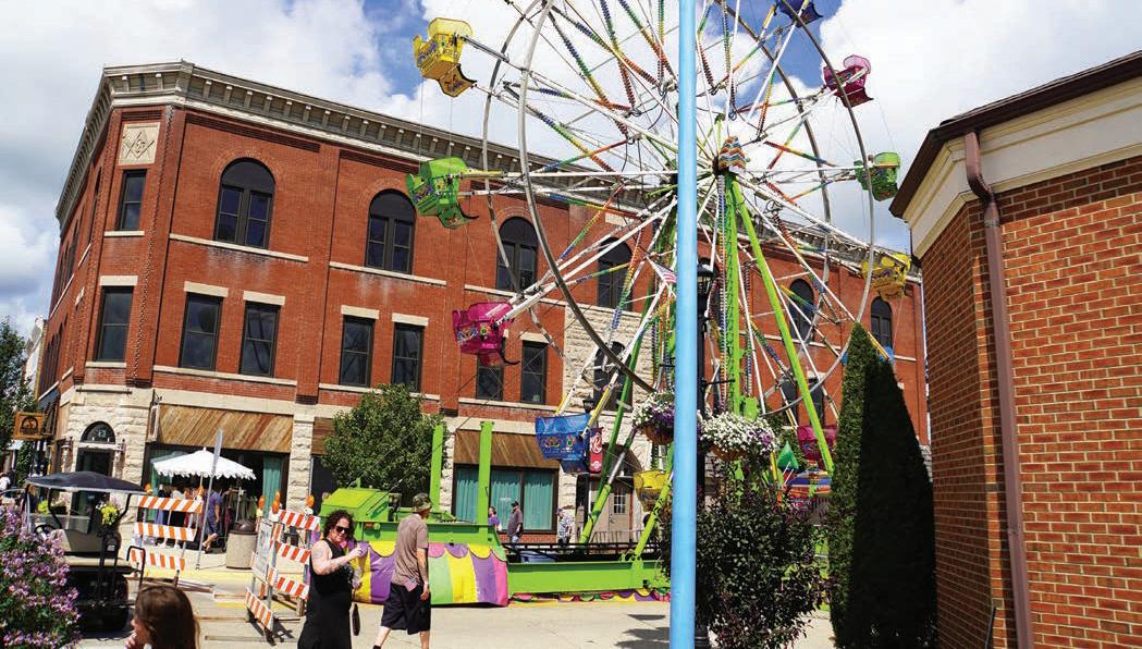
changes along the way. We’ve seen pig scrambles, canoe rallies, a fishing derby, Civil War Encampments, Quilt Shows, Big Wheel Races, the Duck Dash, many years of the Antique Tractor Shows and Auto Classics, as well as our ever fabulous parade.
We shine a light on our local histories like Chana School and the Depot Restoration and use our phenomenal parks and their services to support the needs of an event this size. Local civic and not-forprofit organizations form the backbone of the Food Court and then put their hard-earned profits right back into our community. City and Emergency services work closely to keep us safe, creating a seamless transition from managing a population of 3800 to an instant 75,000 passing through the community throughout the festival weekend.
We can share historical data, and oh so many photos from our hold it in your hand’s albums to our tuck it in your shirt pocket flash drives. But the essence of Autumn on Parade? That’s the spirit of the people. The people who work tirelessly all year round to create this one-of-a-kind experience and who are then joined by the people who attend, filling this event with life and our community with the spirit of kinship and kindness.


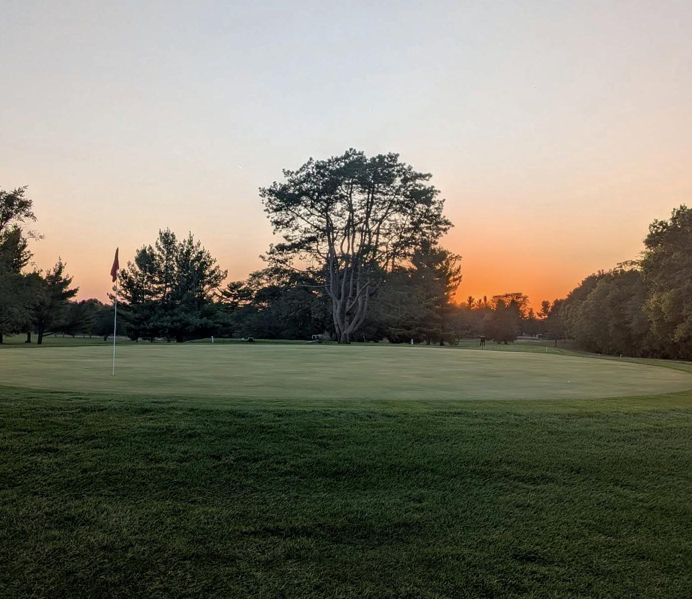
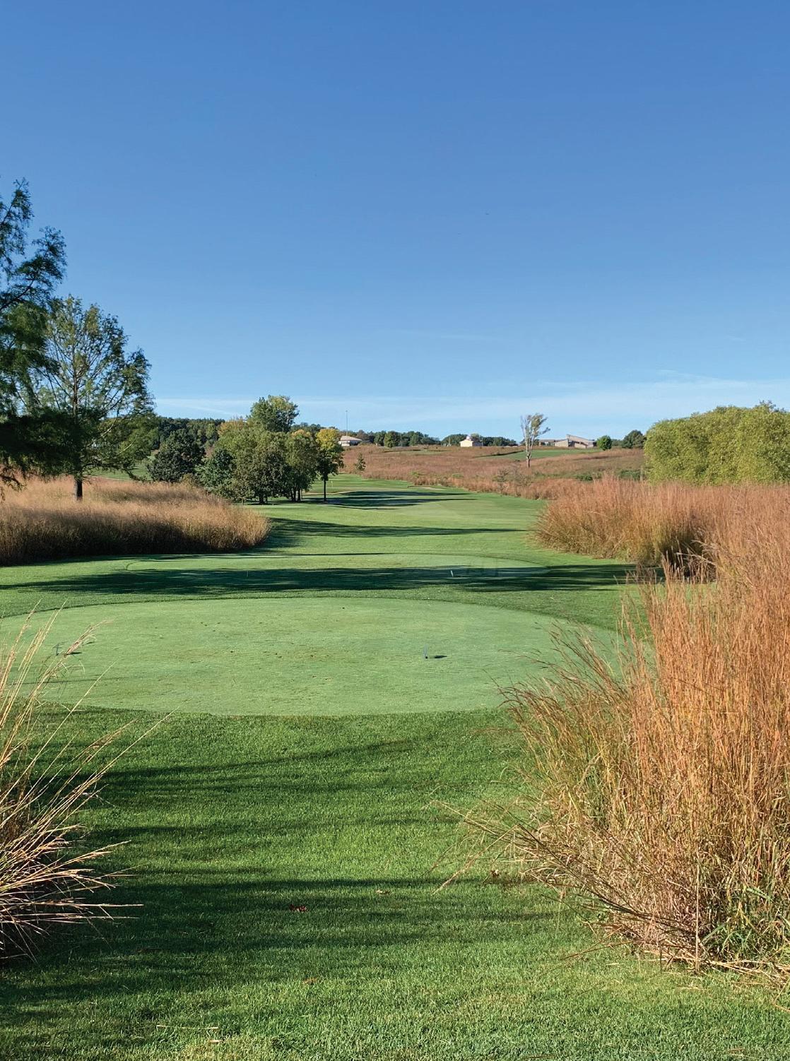
Located just off of Illinois Route 2 between Byron and Oregon, Silver Ridge Golf Course is a one-of-akind layout designed to test all abilities.The course is a unique mixture of hills and trees that makes you feel completely disconnected from reality. Come play Silver Ridge today so you can relax and block the world out for at least a few hours.
Owned and operated by the Byron Forest Preserve District, PrairieView’s bentgrass layout boasts beautiful views of restored dolomite prairieland that simply cannot be found elsewhere. Golfers are treated to a varied mix of tight tree-lined holes and open links-style holes. With challenging greens, dramatic bunkering, and supreme conditioning, the course will test the skills and nerves of every golfer.
Fairways Golf Course is a unique par-66 course designed by Perry Maxwell of the ASGCA. The 18-hole course has been open since 1929 and offers mature tree-lined fairways with country club course conditioning and an average round time of three-anda-half hours. For more information, contact Fairways Golf Course on Facebook, visit online or call the pro shop.
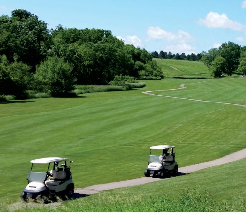
Sunset Golf Course was founded in 1937 by the Kable brothers and other prominent figures in Mount Morris Township.
The course’s most well known attraction is the 7th hole which is a 100 yard par 3 that requires golfers to hit their shot over a giant ravine known by locals as the Pit. What seems like such a simple hole has played mind games with golfers for years. Even the best golfers have managed to ruin their rounds after challenging this hole.
Located near the historic villages of Dixon and Oregon, Illinois — about 75 minutes west of Chicagoland — is Lost Nation Golf Club . . . a challenging, yet playable, 18-hole public beauty awaits your test and enjoyment.
Built in the mid 1960s as a private course for the adja-cent Lost Nation Woodland Homesteads community (now named Lost Lake), the course opened to public play in the 1970s. Today, the course is a local and regional favorite for many reasons, but most notably due to the course’s scenic natural qualities provided by surrounding forestland.