WHEREWE’VEBEEN AND WHEREWE’REGOING
SHARAYAH GRISWOLD
Undergraduate Senior Project Virginia Polytechnic Institute and State University
Landscape Architecture 2023

ACKNOWLEDGEMENTS
Thank you to...
Terry Clements
For advising me through this wild ride of a project and always encouraging me.
Greg Tew
For your passion and ideas for designing a sustainable future.
Bill Green
For sharing your knowledge of all the wonderful old things we both adore.
David Haas
For sparking my love for Syracuse five years ago and inspiring this project.
Virginia Tech LAR Faculty
For five years of advice, resources, and knowledge to push me to where I am today.
My Studio Mates
For all the laughs, late nights, and comaraderie. I will so miss you all.
My Family
For all the support the last five years and always wanting to hear about my projects.
This senior project is submitted in partial fulfillment of the requirements for the Bachelor of Landscape Architecture Degree in the College of Architecture and Urban Studies at Virginia Polytechnic Institute and State University.
Mintai Kim Professor + Senior Project Coordinator Terry Clements Senior Project Advisor + Landscape Architecture Program ChairABOUTTHEDESIGNER
My name is Sharayah, and I am a 5th year student graduating in landscape architecture at Virginia Tech in May 2023. I grew to appreciate the landscape through my love for the outdoors, specifically hiking and gardening. I am a student member of the American Society of Landscape Architects and a member of the Virginia Native Plant Society. My hobbies include collecting vintage prints (a few Syracuse industries are featured in this book) and growing things, whether it be indoor tropicals, vegetable gardens, or cut flowers. My sweet dog, Archie, accompanies me on many of my outdoor adventures and projects.
I currently work as a landscape designer for Cicada Design LLC in Hillsborough, NC designing pollinator gardens and native landscapes. I also have side projects designing and installing small residential gardens in Virginia and Tennessee. After graduation, I plan to move to North Carolina and work in civil engineering, but I hope to someday move to Syracuse myself.
ABOUTTHISPROJECT
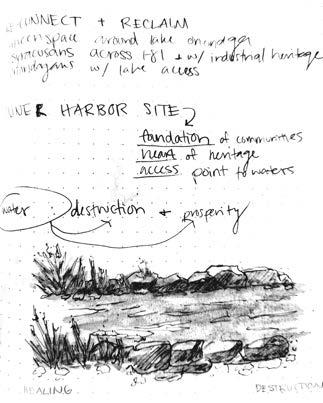
This project got started because of my affinity for Syracuse’s rich history. Like most former blue-collar industrial cities in the United States, Syracuse has brought amazing innovations to Americans while simultaneously bringing harm to communities and the environment. Since the decline of maufacturing in the U.S., the city of Syracuse has been left dotted with crumbling and abandoned post-industrial sites, leaving the city a patchwork of underutilized spaces. As the city moves towards a future of new growth in technology, reclaiming the former industrial sites is going to become ever important.
The design for this project seeks to bring residents and economic stability back to the lakefront by developing the historic inner harbor. In coordination with the city’s call for design input at the harbor in 2022, I am proposing a mixed-used community that will bridge the gap between the surrounding neighborhoods and Onondaga Lake and be a reflective reminder of Syracuse’s industrial legcay.
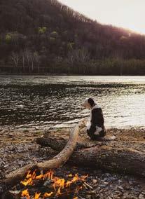
 CampingattheNewRiverinMcCoy,VA
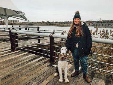
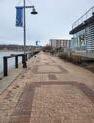
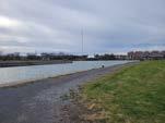
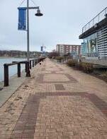
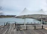
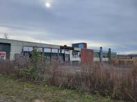
ProjectsitevisitattheinnerharborinSyracuse,NY
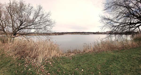
Innerharbor,Syracuse,NY- Novemeber 2022
CampingattheNewRiverinMcCoy,VA
ProjectsitevisitattheinnerharborinSyracuse,NY
Innerharbor,Syracuse,NY- Novemeber 2022
..
TABLEOFCONTENTS
PART ONE: WHEREWE’VEBEEN.........................................................................1-12
Locational Context..............................................................................................................................3-8
Historical Context...............................................................................................................................9-12

PART TWO: WHEREWEARE...............................................................................13-28
The Problem........................................................................................................................................15-16
The City’s Answer................................................................................................................................17-18
Site Inventory.....................................................................................................................................19-20
Site Ananlysis.....................................................................................................................................21-22
Case Studies.......................................................................................................................................23-28
PART THREE: WHEREWE’REGOING..................................................................
Goals and Objectives........................................................................................................................
Conceptual Design............................................................................................................................
Design Concept: Reflect...................................................................................................................
Design Concept: Reconnect.............................................................................................................
Design Concept: Revitalize
Inner Harbor Masterplan.................................................................................................................
Industrial Park
The Aquarium
The Promenade..............................................................................................................................
Bear Street
BIBLIOGRAPHY................................................................................................
01
WHEREWE’VEBEEN PART ONE:
02
ALEGACYOFINNOVATIONANDTHECOSTSOFPROGRESS.
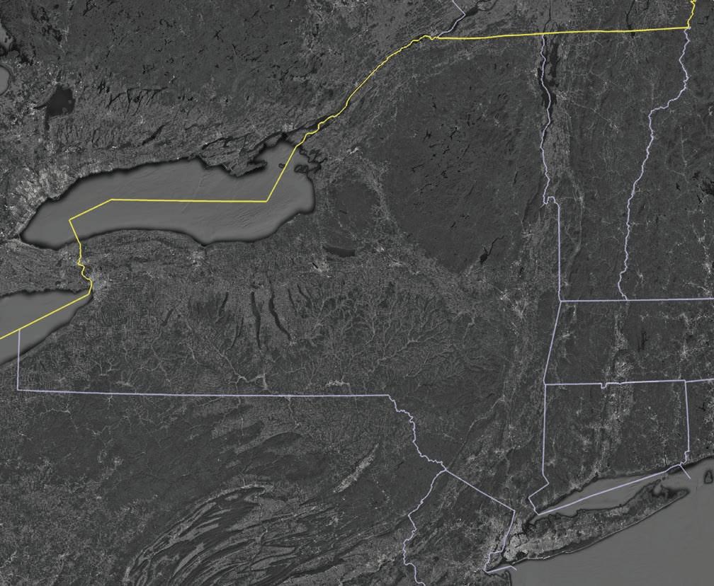
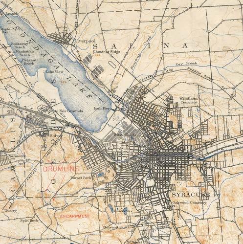
City of Syracuse NEW YORK VERMONT NEW HAMPSHIRE PENNSYLVANIA NEW JERSEY CONNECTICUT MASSACHUSETTS EMPIRE STATE TRAIL: ERIE CANALWAY TRAIL EMPIRE STATE TRAIL: HUDSON RIVER VALLEY GREENWAY 03
Syracuse is located in central New York at the heart of the state. Built upon the shores of Lake Onondaga, the city has its foundation in the salt industry that arose around the lake, earning its nickname, “The Salt City.”
The city is also on the former Erie Canalway, which though mostly deconstructed today, is now followed by the Empire State Trail, a major state greenway.
04
 City of Syracuse
Lake Onondaga
I-81
I-481
I-90
I-690
EMPIRESTATETRAIL
City of Syracuse
Lake Onondaga
I-81
I-481
I-90
I-690
EMPIRESTATETRAIL
05
OHACREEKWALK
Syracuse is right at the crossroads of I-81 and I-90, two major U.S. highways that bring people through and past the city. Auxillary roads, I-481 and I-691 also disect the city, dividing Syracuse roughly into four quadrants. The wedge-shaped land on Lake Onondaga’s southeastern shore and bounded by I-81 and I-690 is considered the lakefront neighborhood.
A city-scale greenway, the Onondaga Creekwalk, winds along Onondaga creek towards the lake, bringing pedestrians through various neighborhoods from the south, through the city, and up to the lakefront. It also connects to the Empire State Trail.
06

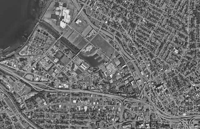
Inner Harbor Lake Onondaga OnondagaCreek Easy Washing Machine Co. Franklin Square OHACREEKWALK EMPIRE STATE TRAIL Destiny USA Mall Onondaga County Department of Water 07 I-81 I-690 Little Italy Westside Washington Square
Though the majority of the lakefront is underutilized former industrial sites, in 1990, Destiny USA Mall (fromerly Carousel Center) opened its doors right on the shores of Lake Onondaga to become the largest mall in New York State.
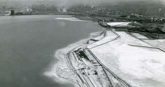
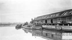
The chosen project site is at the historic inner harbor off of Lake Onondaga. Once covered in salt sheds and later an inlet from the Erie Canal, this place has a significant historical background.
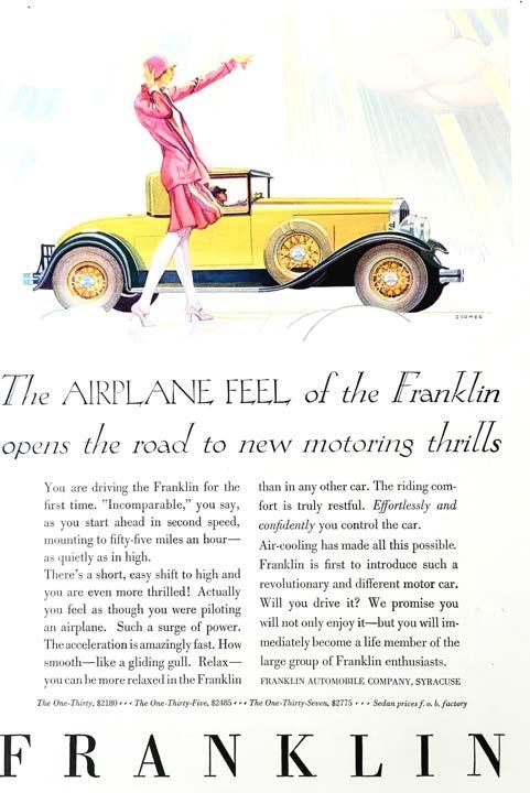
The majority of residential housing is outside the highway-bounded lakefront, with Little Italy and Washington Square to the north of I-81 and the Westside south of I-690. Franklin Square is a smaller community within the lakefront that today takes residence in the old factories of Franklin Automobile Co. (c. 1902-1934).
08
HISTORICAL CONTEXT: ANINDUSTRIALCITY


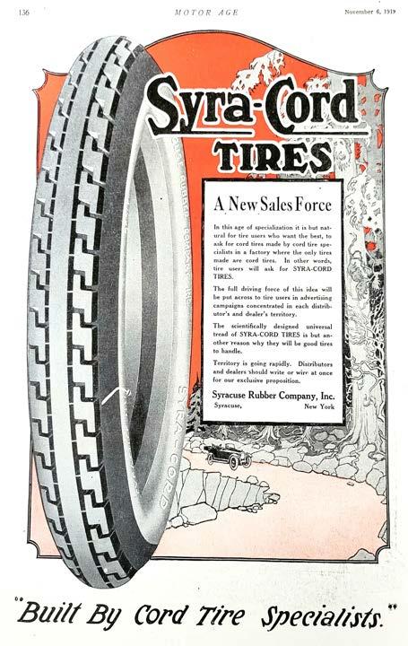
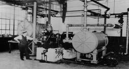
Syracuse has a rich industrial history and system of prominent neighborhoods, this former blue collar city is characterized by decades of innovation. The era of the American Dream (specifically the 1920’s-1960’s) led Syracuse to thrive as one of many booming cities where design and discovery met hand and hand as Americans strove for a more comfortable and enjoyable life. Syracuse’s industrial history starts at Onondaga Lake, where the salt industry once thrived, and with a significant portion of the western side of the city dedicated to its industrial legacy, the center of its industrial history falls upon the current day shopping mall and inner harbor. At its heyday, the city blossomed with infrastructure due to the completion of the Erie Canal, a major trade route that opened up the Midwest. Trade and expansion across the Nation led to economic growth for all cities on the major routes while connecting people further than ever before. Brilliant design, from works of architecture to land planning, to every day objects, came out of the industrial period of Syracuse, and much of this character is still visible throughout the city today. Glimpses of stained glass, brick mosaics, and even the ‘Syracuse China’ makers mark on the back of dishes are what give Syracusans pride in their city.
However, Syracuse, like many former industrial cities, has been in a state of economic decline since the 1980’s as industries left to head overseas. Paired with a global pandemic from 2020 and current day inflation, many places have been left abandoned as businesses go bankrupt. Thus, the city is left with a significant problem of underutilized structures and empty lots. From empty crumbling structures to land where only the scars of former vibrant industries thrived, shadows of the past still remain.
RiseandDeclineofU.S.Manufacturingc.1939-2022


ErieCanalThroughSyracusec.1919


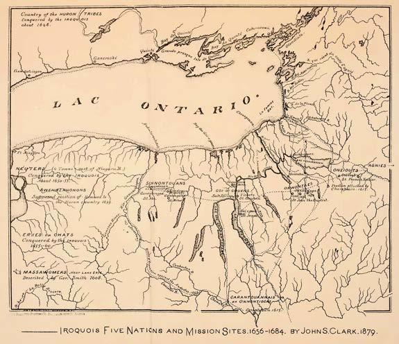
TheFiveNations:Iroquois(Haudenosaunee)ConfederancyandEuropeanMissionSites c.1879
HISTORICAL CONTEXT: ADIRTYLAKE
The Onondaga Nation (Gana’dagwëni:io’geh), one of the five nations of the Iroquois (Haudenosaunee) Confederancy, were the original keepers of Lake Onondaga and its shores but now reside on only a fraction of the land they once inhabited about 12 miles south of the lake they still cherish deeply. The Onondagans were once the incredible stewards of the land and natural water systems but after just 300 years of European colonizers and their innovations took up residence on the shores of Lake Onondaga, the lake gained the stigma of “the country’s most polluted body of water.” Innovationcomesatacost,andtheindustriesofSyracuseareno exception .
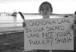
The biggest contributer to the lake’s pollution is the former Solvay Process Company (now known as Honeywell International), manufacturers of soda ash on the southwestern shores of Lake Onondaga. The soda ash industry ended up being “the engine that connected Syracuse to American expansionism in the Industrial Age” while also actively contributing to the dumping of up to 2000 tons of salty waste made up of chloride, sodium, calcium, and methyl-mercury into the lake and on its shores for nearly 200 years. White cliffs of this toxic waste on the western shores still exist and leech chemicals and heavy metals into the water today. At the same time, city sewage also drained into Lake Onondaga for two centuries bringing dangerous bacteria and high levels of amonia down Onondaga Creek and directly into lake and its downstream watershed.
In 1994, the U.S. Environmental Protection Agency declared it a Superfund site, a designation given to the worst cases. Eventually, Honeywell came to an agreement to fund a half billion cleanup project of the lake. Through dredging, installing filtration, and capping the the exposed wastebeds, they have managed to clean up enough that the water is now fishable for sport and eagles are beginning to return to its shores.
CurrentOnondagaLakeCleanupPlan
-Dredge up to 2.65 million cubic yards of contaminated sediments to a depth that will allow for a ‘cap’ to be built without the loss of lake surface area.
-Dredge in the in lake waste deposit to remove areas within ‘hot spots’.
-Install a cap over 579 acres of lake-bottom
-Treatment and/or off-site disposal of contaminated sediments.
-Treat water created by the dredging and sediment handling process to meet NYSDEC discharge limits.
-Extend the lakeshore and install a ‘barrier wall’ – a steel wall keyed into the clay layer beneath the lake along the southwest corner of the lake; build a pumping system on the shore-side of the wall to retrieve chlorinated benzenes.
SolvayWasteBeds“WhiteCliffs”
TheSacredLakeoftheOnondagaNation
-Operation, maintenance and monitoring program once the plan has been implemented.
10
ConstructionofI-81ThroughSyracusec.1960
HISTORICAL CONTEXT: ACITYANDNATIONDIVIDED
The age of innovation in Syracuse includes the construction of interstate I-81 through the city to carry travelers, freight, and locals more quickly through the city to the suburbs and beyond. With its construction in 1958 quite literally dividing the city in two, it still remains a loud and dangerous scar through the city today. Much like many other major cities, the viaduct cut through a significant black community in south Syracuse, displacing nearly 1300 familes and ensuring poverty, pollution, and a lack of resources to the people still living within its shadow. The Onondaga Nation, just 12 miles south of the city, faced the same casualties from the construction of I-81 with the cooridor also dividing their land in two and contributing to poverty and pollution as well. Today, the highway is way past due for repairs and reparations. Chunks of concrete have been reported falling on parked cars in parts of the city where the highway is elevated. Since it reached the end of its lifespan in 2017, the city government and locals have been in debate about what’s next: renew and re-build I-81 or remove it entirely in favor of a community grid?
For now, interstate 81 is going to stay unless citizens and stakeholders can convince lawmakers and the New York State Department of Transportation to consider re-routing the viaduct around the city on the existing I-81 bypass, I-481. Not only does the grid begin to resolve past failures in city planning, it is also the cheapest option. Reconnecting a divided city will bring once separated communities back together and make the city safer from the dangers of high-speed automobile traffic.
11
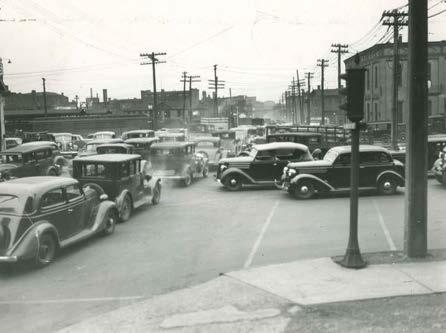
AutomobileTrafficc.1920’s
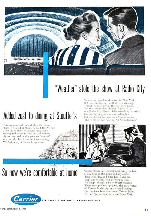
INNOVATION IN THE SALT CITY: THEGOOD,THEBAD
Syracuse has a mixed history full of industrial innovations, unique architecture, and strong communities as well as colonialism, racism, and significant pollution of the environment. Though innovation has brought technologies such as air conditioning, motorized vehicles, and washing machines to bring about an easier life for Americans, there are irrepairable damages left in the wake of advancement.
PROS:
-Expansion of trade and connections have enabled humans to maintain relations with others near and far.
-Brilliant works of architecture, technology, and everyday objects have come from great designers.
CONS:
-The results of European colonialism have destroyed and reduced indigenous nations and other historic communities.
-Lack of knowledge and planning has led to significant harm to the environment and incredibly reduced water and air quality.
-Progress has brought ease and comfort to the daily lives of Americans.
- A car-dependent society has become reliant on high-speed viaducts that divide communities.
12


13
WHEREWEARE PART TWO:
APLACEOVERLOOKED,UNDERUTILIZED,FORGOTTEN.

14
THEPROBLEM
For the last couple of centuries, the lakefront in Syracuse has primarily been a place of industry. As one of the last underdeveloped spaces in the city, they now seek to find new purpose for the underutilized landscape.
Through hundreds of years of salt extraction, manufacturing, and pollution, this site is now incredibly neglected and far from the natural landscape it once was. Now, the city is asking its citizens for input to revitalize the lakefront and inner harbor. With a rather rare waterfront opportunity, they seek to turn this area into a destination for locals and outsiders alike while also adding high-end residences to bring permanent inhabitants to the area. Reconnecting this quarter of the city to the surrounding neighborhoods and bringing in new economic support will certainly bring new life to the area, butentirelypavingoverthe pastisnotcongruentwiththelegcayandfuturevitalityofSyracuse.
15
DOWNTOWN URBAN CORE
THE LAKEFRONT: ANUNDERUTILIZED QUARTEROFTHECITY
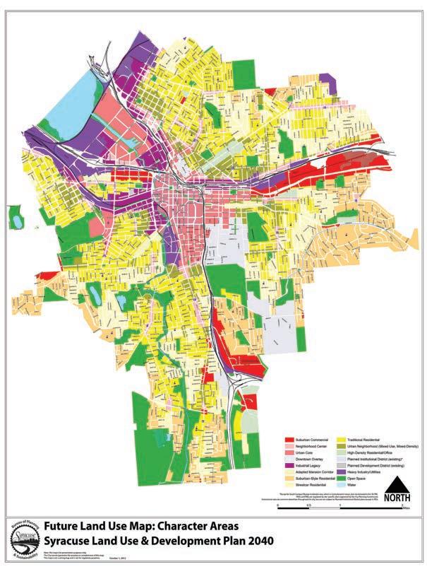
Syracuse is a melting pot of different people from various religions, cultures, and ethnicities. Today, the city is comprised of twenty-six neighborhood communities that all bring unique architectural character, distinctive foods, and other cultural influecnes to the region. However, the foundation of Syracuse at Lake Onondaga, now known as the Lakefront, sits mostly devoid of those things. With hundreds of years of manufacturing now gone and separation from the rest of the city due to I-81 and I-690, this quarter of the city has become an incredibly underutilized landscape despite being right on the waterfront.
There is opportunity to bridge this gap in the city’s fabric and reconnect the people of Syracuse back to the original foundation of the city: Lake Onondaga.
Racial Demographics 2022:
White: 53.44%
Black or African American: 29.39%
Two or more races: 6.95%
Asian: 6.95%
Other race: 2.34%
Native American: 0.92%
Native Hawaiian or Pacific Islander: 0.02%
Age Demographics 2022:
EXISTING INDUSTRY/UTILITY
EXISTING NEIGHBORHOODS SYRACUSE INDUSTRIAL LEGACY
INSTITUTIONAL (SYRACUSE UNIVERSITY)
Under 5 (pre-school age): 6.1%
Under 18 (school age): 21.7%
Between 18-65 (working age): 59.6%
Over 65 (retirment age): 12.6%
16
LAKE ONONDAGA THE LAKEFRONT
CITY PLANS: HIGHENDLIVING
The city hosted an open house on May 4, 2022 in the historic barge house to get feedback and ideas from the community for revitalizing the inner harbor. They plan to make this area a destination for Syracuse locals and other people from surrounding Central New York while also bringing income and permanent residents to reside in highend apartments. With Destiny USA Mall in close proximity, this area already draws in users from many different backgrounds and age groups. By adding apartments and other retail areas, they hope to bridge the mall with Franklin Square and the rest of downtown Syracuse.
Though the plans are not yet officially approved, the existing design does not seem to address the the historic legacy of the lakefront or allow for any significant amounts of greenspace. The city could opt for more open space and additional building uses to create a more complete neighborhood rather than designing a community in the usual modern-American way: a sea of pavement. In opening up the space and considering the area’s historic integrity, this can be a community with more of an identity than just closed-off blocks of apartments with parking in between.
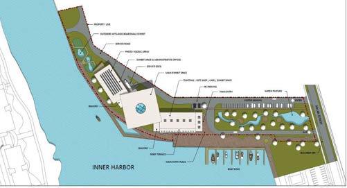
CITY PLANS: AN$85MILLIONAQUARIUM
One of the major attractions Onondaga County legislators recently approved on August 2, 2022 was to build a large aquarium at the inner harbor. They hope to draw in people from across the state to bring a new source of income into the city in coordination with the attraction of Destiny USA. However, a lot of locals are very unhappy about this $85 million project because they think the money should go towards improving city infrastructure.
As planned, the aquarium will sit right on the harbor with opportunity to overlook the water. The building, with its angular sides and stark color, will become a sort of eye-catching structure in this landscape. The aquarium invites opportunity to incorporate education in the landscape through a study of natural aquatic system and the practices of the original stewards of the local waters: the Onondaga Nation.
17
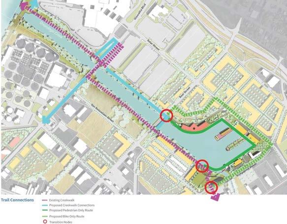
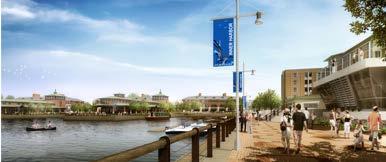
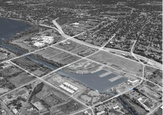
Inner Harbor Development Plan: HighEndResidentialandTrailConnections
Aquarium Proposal at the Inner Harbor
Inner Harbor Development Rendering
WITH THE CITY’S PLANS AS A GUIDELINE, HOW CAN THIS NEIGHBORHOOD BE RE-WORKED TO SERVE THE CITY’S AND PEOPLE’S ECONOMIC NEEDS WHILE ALSO REFLECTING THE INDUSTRIAL LEGACY OF THE AREA?
18
CIRCULATION
SITEINVENTORY

Circulation around and arrival to this site is heavily reliant on vehicular roads as it exists right now. Pedestrian access creeps in from the newly developed Franklin Square neighborhood in the southeast, but the pedestrian disconnect between neighborhood to neighborhood is still prevalent in this area. One major point of access is the exit off of i-81 that brings cars directly into the north side of the site, primarily used now for mall traffic. Another exit further east takes cars past the site, but this passive off-ramp is still worth noting when considering pedestrian safety.
There is one major bus route that goes through the south side of the site, bringing people from as far as the north side of the city where many old neighborhoods lie to the east side where Syracuse University is.
The slopes on site are very minimal with the majority of the site being quite
flat except for right where it drops at the banks of the water. There is still positive drainage throughout the site with water from all directions flowing into the harbor and Onondaga Creek where it meets Lake Onondaga and eventually Lake Ontario.
Flooding is not a sigificant issue for this site, but in the event of unprecedented major storms, water can back up and excede the banks around the waterway.
Pollutants from roads and buildings further in the city all dump into the Onondaga
Creek watershed. Destiny USA Mall in the far north of the site is one the largest contributers to automotive pollutants because of the massive parking lots and vehicle traffic from i-81. Lake Onondaga also has a significant history of chemical and sewage waste dumping, making it one of the most pollued lakes in the world. The federal government and the city of Syracuse hasve made vast efforts to decontaminate it.
VEHICULAR HIGHWAY (I-81)
HIGHWAY EXIT Circulation around and arrival to this site is heavily reliant on vehicular roads as it exists right now. Pedestrian access creeps in from the newly developed Franklin Square neighborhood in the southeast, but the pedestrian disconnect between neighborhood to neighborhood is still prevalent in this area. One major point of access is the exit off of i-81 that brings cars directly into the north side of the site, primarily used now for mall traffic. Another exit further east takes cars past the site, but this passive off-ramp is still worth noting when considering pedestrian safety. There is one major bus route that goes through the south side of the site, bringing people from as far as the north side of the city where many old neighborhoods lie to the east side where Syracuse University is.
VEHICULAR STREET PEDESTRIAN PATH
BUS STOP BUS ROUTE 974
On site, there is a significant portion of impervious paving and high-maintenance lawn. Both are harmful to the watershed in that they allow significant water runoff without any natural filtering or slowing of stormwater. Overhead vegetation is minimal, with the only true tree canopy in the southern-most part of the site where the creek walk enters.
There is vegetation, mostly brambles, along the creek and harbor, but themajority of it is invasive Japanese knotweed (Reynoutria japonica).
Syracuse has mild summers, with about 150 days of sun per year and temperatures only reaching a high around the mid-80’s. Winters are however incredibly cold with strong winds that blow in from the west across Lake Ontario and Lake Onondaga, bringing yearly lake-effect snow storms that drop several feet of snow at a time. Syracuse is known as the snowiest city in the country because of these snow storms.
SURFACE MATERIALS + VEGETATION
On site, there is a significant portion of impervious paving and high-maintenance lawn.
Both are harmful to the watershed in that they allow significant water runoff without any natural filtering or slowing of stormwater. Overhead vegetation is minimal, with the only true tree canopy in the southern-most part of the site where the creek walk enters. There is vegetation, mostly brambles, along the creek and harbor, but themajority of it is invasive Japanese knotweed (Reynoutria japonica).
ASPHALT PAVING
LAWN
VEGETATIVE BARRIER BUILDING FOOTPRINT
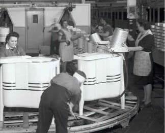
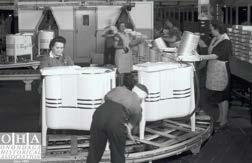
With its location right at the heart of the industrial legacy district of Syracuse, this site is significant historical place within the city. Syracuse gets its nickname, “The Salt City,” from the salt industry that sprung up around Lake Onondaga where salty brine water was brought to the surface and boiled off to produce the majority of the salt for the nation in the 1800’s. After the salt industry reached the end of its legacy, manufacturing industries quickly bloomed, including major car manufacturer, Franklin Automotive, and an appliance manufacturer, Easy Washing Machine Co. The harbor itself was formed to connect Lake Onondaga with shipping on the Erie Canal so goods could be brought into the city.
1770S-1920’S
1920’S-1980’S
MANUFACTURING: 1900s-1930s
Soil on site has been significantly compacted and degraded from the many industries that have resided here in the last 250 years. The sediment at the bottom of Lake Onondaga is incredibly polluted with hundreds of years of chemical and municipal waste collected at the bottom. However, the city has made great efforts in the last 50 years to clean it up and are still striving to revive the waterway.
1919-1963
Made Land (Chemical Waste)
SIGNIFICANT WATERSHED POLLUTANTS Na SODIUM

SYRACUSE, NY - LAKEFRONT 85 ACRES (7500 SQ FT)


VEHICULAR HIGHWAY (I-81) VEHICULAR STREET PEDESTRIAN PATH SURFACE MATERIALS + VEGETATION ASPHALT PAVING LAWN VEGETATIVE BARRIER BUILDING FOOTPRINT HISTORIC INDUSTRIES SALT WELLS:
WASHING MACHINE MANUFACTURING:
FREIGHT HARBOR:
HYDROLOGY SLOPE RUNOFF ONONDAGA CREEK
SUN + CLIMATE SUMMER SUN WINTER SUN AUTUMN: 60 F / 43 F WINTER: 32 / 18 F SPRING: 58 F / 39 F SUMMER: 82 F / 63 F WIND DIRECTION SOIL SURVEY Made Land (Chemical Waste) Made Land Ub Ub Ub ML ML ML Ma Ub ML Ma Urban Land BUS STOP BUS ROUTE 974
EXIT FLOODPLAIN
CIRCULATION
CAR
HIGHWAY
SIGNIFICANT WATERSHED POLLUTANTS NH 3 AMONIA P4 PHOSPHORUS CICHLORIDE Na SODIUM CH 3 Hg Ca
LAKE ONONDAGA
salty brine water was brought to the surface and boiled off to produce the majority of the salt for the nation in the 1800’s. After the salt industry reached the end of its legacy, manufacturing industries quickly bloomed, including a major car manufacturer, Franklin Automotive, and an appliance manufacturer, Easy Washing Machine Co. The harbor itself was formed to connect Lake Onondaga with shipping on the Erie Canal so goods could be brought into the city.
SITE CHARACTER
DESTINY USA
I-81
WASHING MACHINE MANUFACTURING: 1919-1963
CAR MANUFACTURING: 1900s-1930s
municipal waste collected at the bottom. However, the city has made great efforts in the last 50 years to clean it up and are still striving to revive the waterway.
BEARST
SOLARST
SIGNIFICANT WATERSHED POLLUTANTS
NH 3
AMONIA P4 PHOSPHORUS CICHLORIDE Na SODIUM
CH 3
METHYL MERCURY Hg Ca CALCIUM
LOCATION: SYRACUSE, NY - INNER HARBOR
SITE
THE INNER HARBOR
SIZE: 85 ACRES (7500 SQ FT)
W.KIRKPATRICKST
WATERSHED: ONONDAGA LAKE - FINGER LAKES
20
New York Native Plants for Water Quality Remediation


OPPORTUNITIES:
1. The majority of this area is vacant land from former industries that resided here. There is opportunity to bring permanent residents and create new public spaces and programming to bring people back into this part of the city which will connect this area to the surrounding neighborhoods.
2. The histroical significance of the site provides opportunity for reflection and celebration of the past in a way that ties the users back to their roots.
3. Because of the location right next to interstate 81 and its central proximity to existing neighborhoods and excessive mall parking, this site is ideal for a large public event space that will better serve the city than the closed-off streets downtown.
4. With the city already working on the cleanup of the lake and its watershed, there is opportunity to bring people back onto the water and reinvigorate its natural systems.
CONSTRAINTS:
1. Because of the years of salt wells and industrial machinery, the soil on site is compacted and leeched of important nutrients for significant plant growth.
2. Traffic noise from interstate 81 can be heard at all hours of the day from a significant portion of the northeast part of the site. Crossing the interstate is also a safety hazard.
3. Pollutants in the water of Onondaga Creek, and even worse pollutants in Lake Onondaga make water access currently undesirable and especially dangerous.
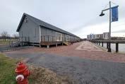
4. The barge house lacks windows and cannot be externally altered because of its historic registration, so programming for that structure will have to accomodate that.
22
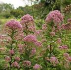
JOE PYE WEED - Eutrochiumpurpureum
MARSH MARIGOLD - Calthapalustris
WINTERBERRY - Ilexverticillata
BLACK WILLOW - Salixnigra
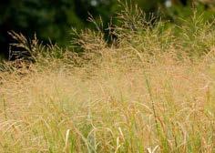
SWITCHGRASS - Panicumvirgatum
BUTTONBUSH - Cephalanthusoccidentalis
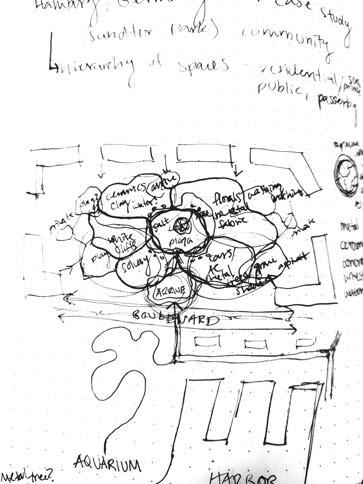
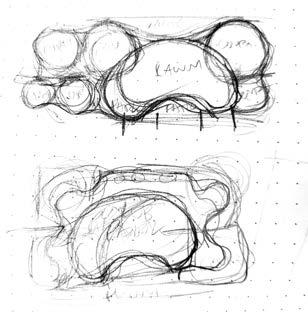
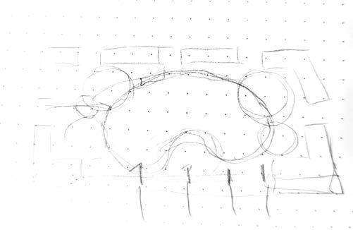
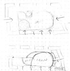
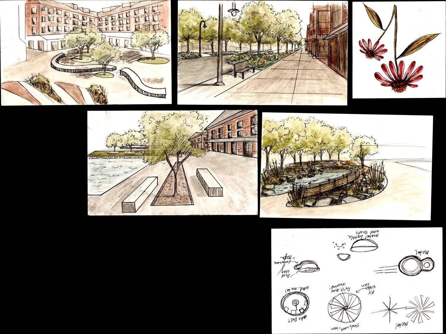
PROCESSSKETCHES

23
24

25
WHEREWE’REGOING PART THREE:
ACOMMUNITYOFHERITAGEANDAVIABLEFUTURE.

26
GOALSANDOBJECTIVES
1. UTILIZE THE CITY’S PROPOSED PLANS FOR THE INNER HARBOR TO CREATE A COMMUNITY THAT WILL BRING ECONOMIC STABILITY BACK TO THE LAKEFRONT.
a. Organize proposed structures to draw in outside users and encourage community connection.
b. Propose retail/restaurant space for smaller businesses around the harbor to accommodate smaller scale economic opportunities that the mall cannot provide.
c. Propose that the city add additional institutional facilities (post office, health clinic, elementary school, pharmacy, daycare) to the lakefront neighborhood for a more complete community development.
2. ESTABLISH A NETWORK OF GREEN SPACES + GREEN CONNECTIONS FOR THE INNER HARBOR AND SURROUNDING NEIGHBORHOODS.
a. Create a hierarchy of greenspaces for different user groups: semi-public + public.
b. Connect to the existing historic creekwalk to bring in users to the harbor from the city and state greenways.
3. CONNECT PEDESTRIAN ACCESS AT THE HARBOR TO THE SURROUNDING CITY GRID.
a. Propose safe pedestrian access bridges across I-81 at Bear St. and Court St.
b. Encourage walkable streets with traffic-slowing measures, sidewalk connections, and design at human scale.
4. BRING NEW YORKERS BACK ONTO THE WATERS OF LAKE ONONDAGA.
a. In coodination with Honeywell’s pollutant cleanup efforts at the lake, reduce stormwater runoff with a thickets of native vegetation before it enters Onondaga Creek and its watershed. Creek and its watershed.
b. Develop a docking system at the historic piers for water taxis, boat rentals, and private boat owners to utilize.
5. DESIGN A COMMUNITY THAT REFLECTS THE INDUSTRIAL LEGACY OF THE LAKEFRONT AND FITS INTO THE SURROUNDING URBAN FABRIC.
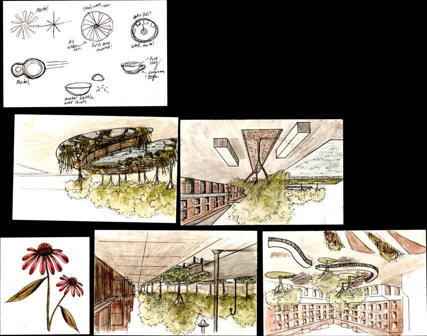
a. Use materials and shapes to reflect the processes of past industries.
b. Develop proposed structures with architectural styles that echo former industrial process, but still coordinate with surrounding context.
27
REFLECT
ON THE INDUSTRIAL HISTORY OF SYRACUSE: “WHERE WE’VE BEEN AND WHERE WE’RE GOING.”
RECONNECT

THE PEOPLE OF SYRACUSE TO THE WATER AND EACH OTHER.
REVITALIZE
THE INNER HARBOR TO SUSTAIN ITSELF ECONOMICALLY AND ENVIRONMENTALLY.
28
REFLECT: THEINDUSTRIALHISTORYOFSYRACUSE
With the industrial legacy district spanning a significant portion of the lakefront, the harbor is an ideal place for development that celebrates and reflects that rich history. From extracting and processing to manufacturing and transportation, this quarter of the city has seen hundreds of years of change. Now it’s time to reclaim this underutilized landscape and bring people back to lake.
A closer look at some of the specific industries that shaped Syracuse reveal the dedication of workers to their craft as they strove to provide for their families and their futures. Raw materials such as salty brine from deep under the earth around Lake Onondaga, limestone from the southern rim of the Mohawk River Valley, and iron ore shipped in on barges from mines in the Hudson River Valley all contributed to the making of p roducts that boosted the local economy. Innovation is also a major part of this incredible legacy. Ideas, such as the air-cooled engine and traffic lights are amongst many of the the innovations brought the modern comforts of today.
Because the inner harbor does not have many of the former factories or other structures, this design will utilize the city’s industrial past.
SYRACUSE
SYRACUSE INDUSTRIAL LEGACY
EXISTING INDUSTRY/UTILITY FORMER ERIE CANALWAY
SIGNIFICANT INDUSTRIES
29
CHINA (OHA POTTERY) + SOLVAY SALT + BARGES FRANKLIN AUTO + CARRIER AC EASY WASHING MACHINE CO.
GENERAL MOTORS
GENERAL ELECTRIC
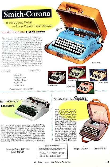
SMITH CORONOA TYPEWRITERS

 SmithPremierTypewritersc.1920
CarrierAirConditioningc.1922
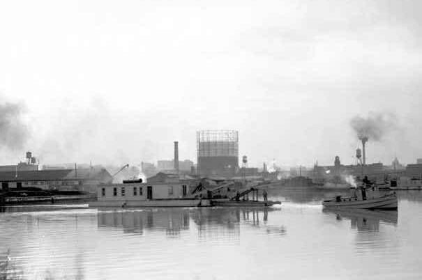
InnerHarborBargeCanalTerminalc.1923
SmithPremierTypewritersc.1920
CarrierAirConditioningc.1922
InnerHarborBargeCanalTerminalc.1923
RECONNECT: THEPEOPLEOFSYRACUSETOEACHOTHER
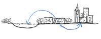
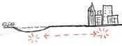
Like many cities in the United States, Syracuse is divided by swaths of high-speed interstates. This has led to separation of communities and reduced walkability of the streets. This city is fortunate however to have a city and state greenway for recreational use, encouraging people to be active and engaged with nature.
New Urbanism, an urban design movement started in the 1970s, is an idea that works to solve the problems of spreading cities and the ever increasing problems with a society that relies entirely on cars. By creating neighborhoods and cities with streets that are safe and enjoyable and offering alternative public transportation methods for travel outside one’s neighborhood, human health and connection to one another will improve.
This design will look at accessacrossI-81 citycreekwalk development around the harbor.
EXISTING OPEN GREEN SPACE
EXISTING BUS STOPS
EMPIRE STATE TRAIL
ONONDAGA HISTORIC CREEKWALK
31
KEY PEDESTRIAN ACCESS IMPROVEMENTS
TRAILHEAD EXTENSION TO GREENWAY
EDUCATION: WATER ECOLOGY GARDENS AT THE AQUARIUM
RECONNECT: THEPEOPLEOFSYRACUSETOTHEWATER
For hundreds of years, the southern end of Lake Onondaga has primarily been a place of industry. Other than the previous system of barges and shipping on the canals, the water has been widely unused and left to rot from centuries of indsutrial pollutants that contaminated the water beyond human useability.
With cleanup efforts at the lake finally allowing for some human access (fishing + boating), connecting people back to the lake is finally possible. The inner harbor, now only an industrial remnant, is the perfect place to bring people back onto the water due to its structure and close proximity to the lake.
ACCESS: BOATS AND PERSONAL WATERCRAFT VIEWING: PROMENADE WALK AROUND HISTORIC HARBOR
VIEWING: EXISTING HISTORIC CREEKWALK
NATURAL EDGE CONDITION (REVEALING)

Utilizing the existing creekwalk and concrete structure of the harbor itself, this design seeks to provide two different pedestrian walking experiences through the naturalvs.structuraledge conditions.For direct water access, the existing piers can be utilized for boat docking, and the proposed aquarium can serve to educateand promote the future vitality of the natural lake ecosystem.
HISTORIC CREEKWALK
PROPOSED HARBOR PROMENADE
VEGETATIVE EDGE CONDITION (TREES + UNDERSTORY)
32
REVITALIZE: THE INNERHARBORTOSUSTAINITSELF ECONOMICALLYANDENVIRONMENTALLY
The lakefront has been a designated industrial zone for many decades, but since the decline of U.S. Manufacturing in the last fifty years, this land is now vacant and incredibly underutilized.
In addition to walk the New Urbanist approach seeks to provide for human needs within the neighborhood, reducing the need for cars and decreasing the daily travel radius of people living in the community. By providingfordailyneeds such as a grocery store, post office, and clinic, as well as additional retail opportunities, the economy of the neighborhood can support itself and the people residing there. =
33
FURNITURE STORE (EXISTING) LIQUOR STORE (EXISTING) GROCERY STORE (EXISTING) AUTO REPAIR (EXISTING) HOTEL (EXISTING) AQUARIUM HIGH DENSITY RESIDENTIAL MIXED USE COMMERCIAL CIVIC ELEMENTARY SCHOOL HISTORIC BARGE HOUSE: BOAT RENTALS PHARMACY FAMILY CLINIC DAYCARE WATERFRONT RESTAURANTS CORNER MARKET COFFEE SHOP + BAKERY HAIR SALON (EXISTING) BREWERY (EXISTING)
34
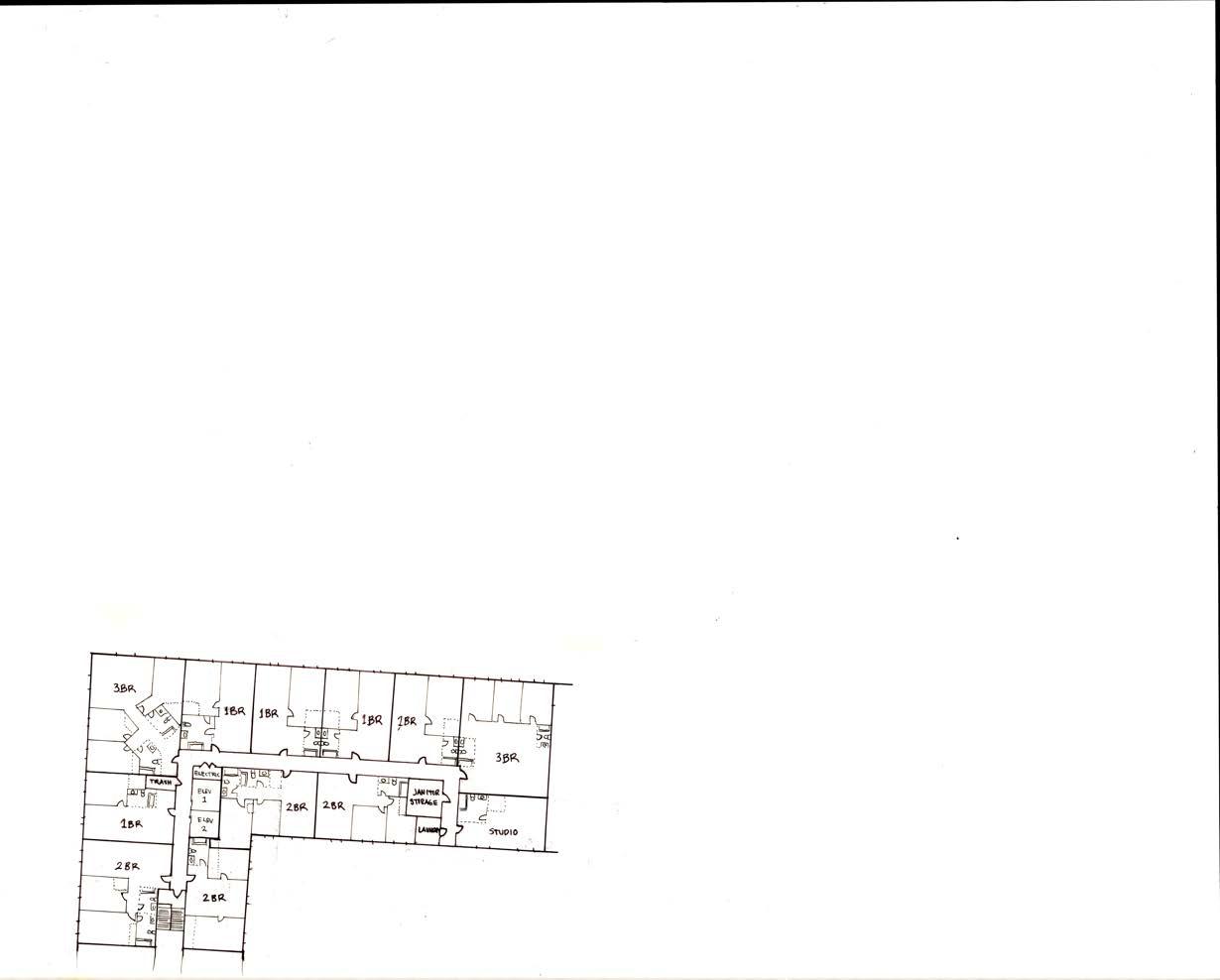
APARTMENT BLOCKS: SupportingaDiverseCommunity
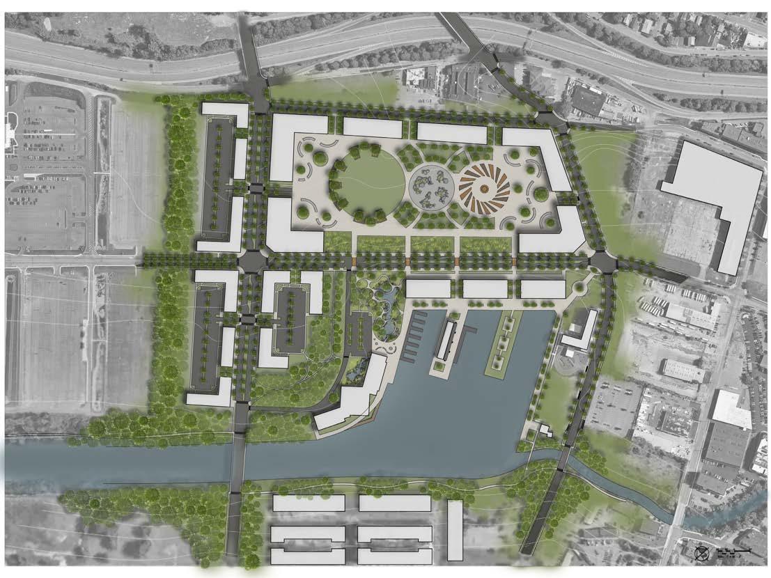
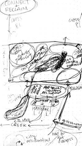
35 LEGACY PARK SYRACUSE AQUARIUM THE PROMENADE SOLAR ST. BEAR ST. BEAR ST. SOLAR ST. N. CLINTON ST. I-81 COURT ST. COURT ST. INNERHARBORCOMMUNITYMASTERPLAN KAYAK RENTALS AT THE HISTORIC FREIGHT HOUSE WATER TAXI DOCKS HYDROECOLOGY GARDENS AT THE AQUARIUM WATERFRONT RESTAURANTS + SHOPS ALOFT HOTEL HARBOR MASTERS HOUSE THE INNER HARBOR ONONDAGA CREEK ONONDAGACREEK
LEGACYPARK
This park is designed to reflect the rich industrial history of Syracuse. As the foundation of the city and a place that has seen centuries of movement, development, and deconstruction, this space deserves to become an important part of Syracuse’s future. Soon to be surrounded by both residential and commerical activity, this park will serve the gerneral public and residents of the inner harbor community with the event lawn, natural playground, public plaza, and bordering courtyards. By moving the surface parking underground, this allows for more open space, which both the citizens and the city of Syracuse need.
SYRACUSEAQUARIUM
The proposed aquarium to sit right at the edge of the harbor will draw in people from all over the state into Syracuse. Along with bringing needed economic income into the city, the aquarium will primarily be a place for education and recreation. This design proposes programming that will focus on the local ecology of Onondaga Lake: a study of what it once was to the Onondaga Nation and what it can be after centuries of industrial pollution due to human failures.
THEPROMENADE
The existing walk around the harbor is defined by the heavy concrete structure of the harbor iself. By bringing in additional commerical activity and enhancing the walkway with additional greenery and new seating options, this area can become a vibrant and lively space for people who visit and live at the waterfront.
36
Gear-Shaped Lawn with Semi-Private Nooks
Natural Playground: Limestone Boulders + Crushed Limestone
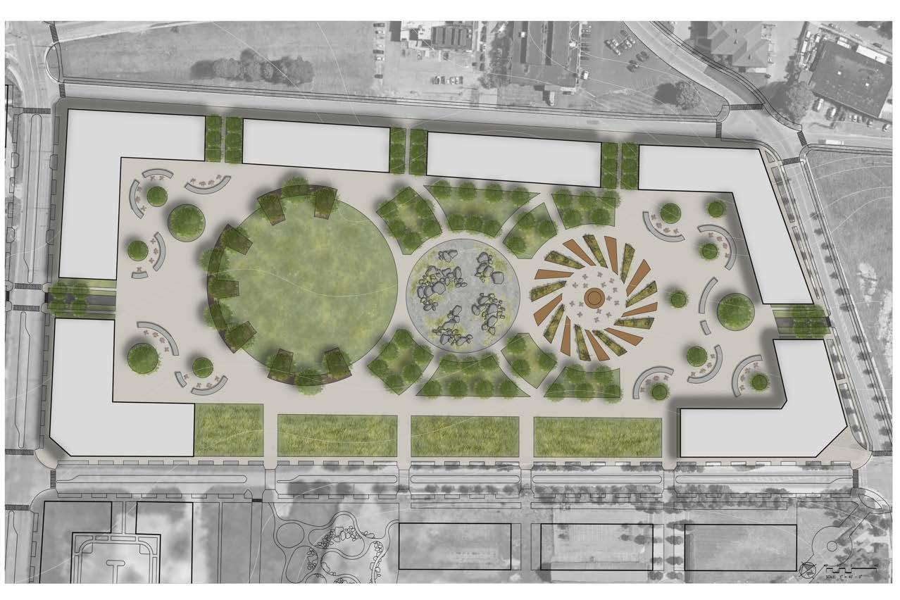
LEGACY LAWN SOLVAY PLAYGROUND FRANKLIN PLAZA
Ornamental Grass Entrance
Concrete Seating Wall
Courtyard Tables
Steel Plate
Native Plant Garden
37 LEGACYPARK
Plaza Shape of Air Inlet Fan
LEGACY LAWN
This space can serve as a city event space for many of the unique festivals and fairs the city hosts annually. The rest of the time, it is open to the public to enjoy for recreation such as picknicking, games, and other forms of play.

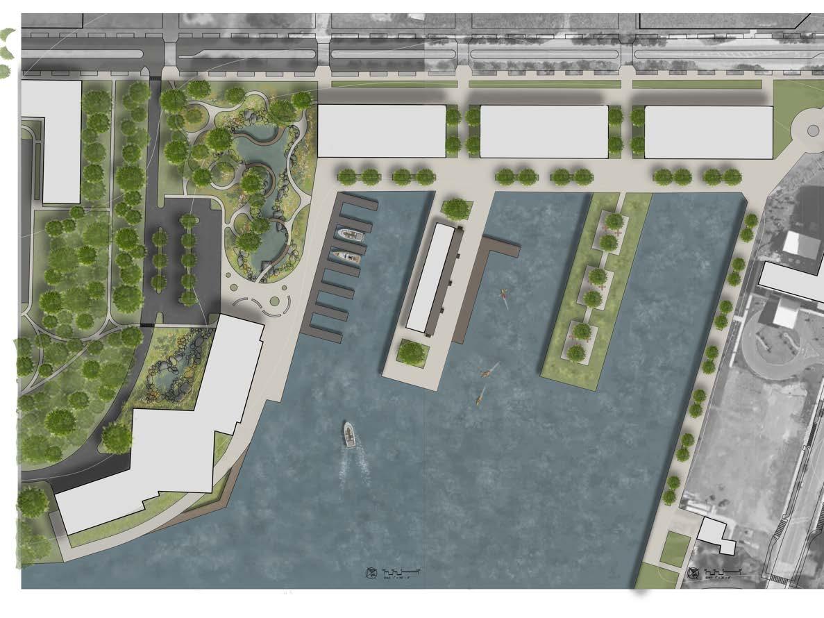
39 HYDROECOLOGY GARDEN
AQUARIUM
SYRACUSE
BOAT DOCKS
Timber Boardwalk
Native Plant Material
Aqarium Exhibit Main Entrance
Concrete Seat Walls
Harbor View Boardwalk
SYRACUSEAQUARIUM+ HARBORPROMENADE
HISTORIC FREIGHT HOUSE
KAYAK RENTALS
HARBOR PROMENADE
WATERFRONT RESTAURANTS + RETAIL
Service Access
PATIOS AT THE PIER

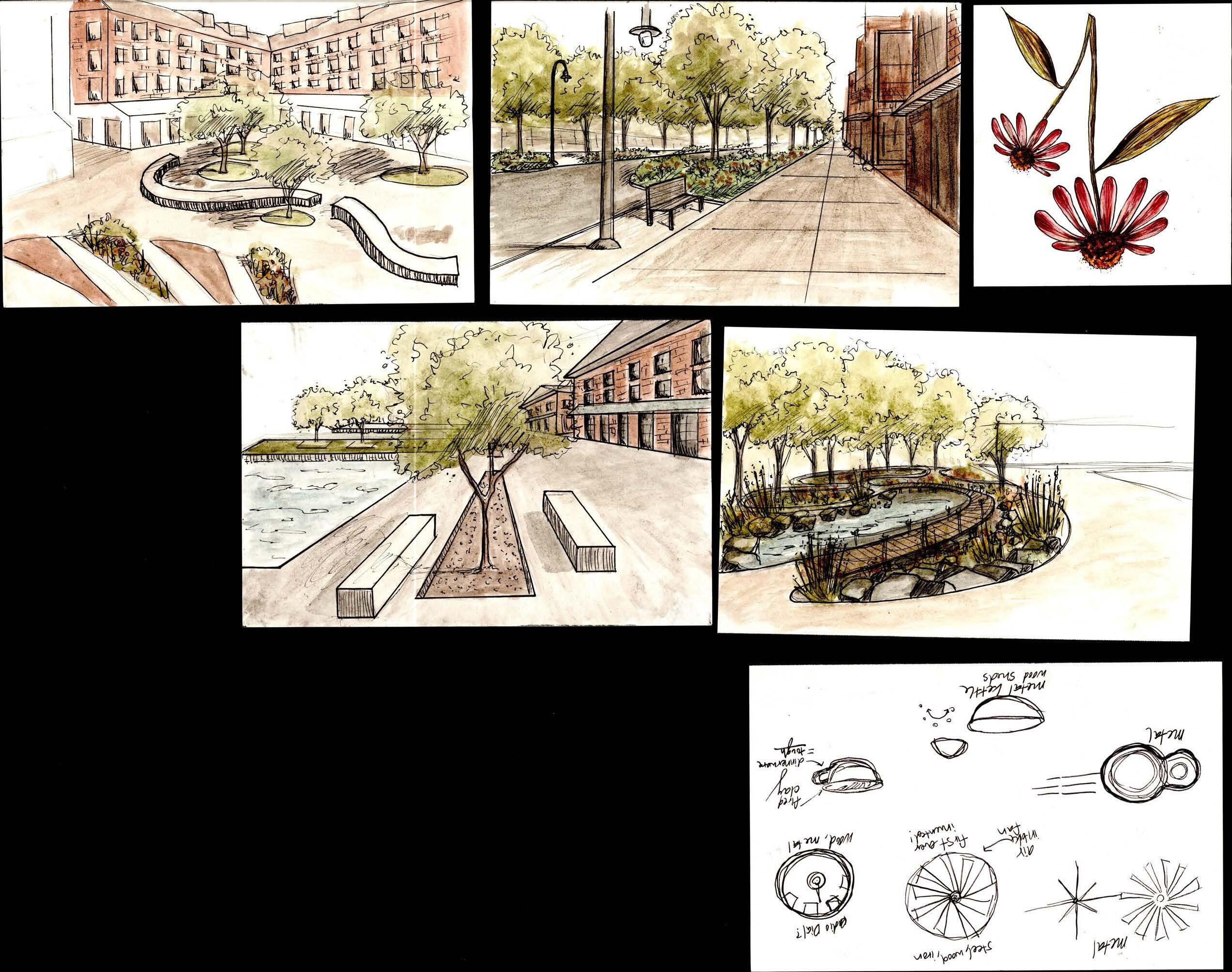
BEAR STREET
Overall this project aims to bring the city of Syracuse back together again. By reclaiming the lakefront, the link between downtown and the Lake Onondaga can be re-established.
42
REFERENCES
Brooklyn Botanic Garden Staff. December 20, 2012. “Native Plants for New York City Rain Gardens.” Brooklyn Botanic Garden, https://www.bbg.org/news/native_plants_for_new_york_city_rain_gardens.
“City of Syracuse.” – City of Syracuse, 8 May 2023, http://syrgov.net/Historic_Syracuse.aspx.
Croyle, Jonathan. “Syracuse Man Watches TV Months before the Rest of the City.” Syracuse, 22 June 2018, https://www.syracuse.com/vintage/2018/06/syracuse_man_watches_tv_months_before_the_rest_of_the_city.html.
Croyle, Johnathan. “1919: Navy Retreats from Inner Harbor, ‘Human Nostrils Have Their Limitations’.” Syracuse, Subscribe, 12 Oct. 2019, https://www.syracuse.com/living/2019/10/1919-navy-retreats-from-inner-harbor-human-nostrils-have-their-limitations. html?outputType=amp.
Featherstone, Steve. “Syracuse Unveils $108m Plan to Revamp Area around Onondaga Lake, Inner Harbor (Photos).” Syracuse, 22 Dec. 2022, https://www.syracuse.com/outdoors/2022/12/syracuse-unveils-108m-master-plan-to-revamp-undeveloped-areas-around-onondagalake-inner-harbor-photos.html.
“Forty Years of Falling Manufacturing Employment : Beyond the Numbers.” U.S. Bureau of Labor Statistics, U.S. Bureau of Labor Statistics, https://www.bls.gov/opub/btn/volume-9/forty-years-of-falling-manufacturing-employment.htm.
Gaskill, Matthew. “New York Still Gives 150 Bushels of Salt to the Onondaga People Every Spring.” Thevintagenews, 30 June 2018, https://www.thevintagenews.com/2018/06/30/onondaga-people/.
Hall, Brett. “Tear It down or Fix It up? Dec Terminates Clean up Agreement at Abandoned Syracuse Factory.” Syracuse News, Weather, Sports, Breaking News, WSTM, 16 Feb. 2018, https://cnycentral.com/amp/news/tear-it-down-fix-it-up/tear-it-down-or-fix-it-up-decterminates-clean-up-agreement-at-abandoned-syracuse-factory.
“Map Gallery.” Iroquois Genealogy Society, https://www.iroquoisgenealogysociety.org/map-gallery.
“Maps of the Erie Canal.” Erie Canal - Maps, https://www.eriecanal.org/maps.html.
Moriarty, Rick. “Syracuse Wants Your Ideas for Revitalizing Lakefront, Inner Harbor.” Syracuse, 2 May 2022, https://www.syracuse.com/business/2022/05/syracuse-wants-your-ideas-for-revitalizing-lakefront-inner-harbor.html.
Moriarty, Rick. ‘We Could Be Armory Square on Steroids’: What’s next for Syracuse’s Inner Harbor?” Syracuse, 14 June 2022, https://www.syracuse.com/news/2022/06/we-could-be-armory-square-on-steroids-whats-next-for-syracuses-inner-harbor.html.
Onondaga Historical Association. “The Story of a Piece of Syracuse China.” Onondaga Historical Association, 21 Apr. 2020, https://www.cnyhistory.org/2019/07/a-piece-of-syracuse-china/.
Onondaga Nation. “Onondaga Lake.” Onondaga Nation, 7 Feb. 2023, https://www.onondaganation.org/land-rights/onondaga-lake/.
“Remediation Management of Complex Sites.” Remediation Management of Complex Sites, https://rmcs-1.itrcweb.org/6-11-onondaga-lake-new-york/.
“Saving a Sacred Lake: A Century of Pollution Haunts the Haudenosaunee.” NMAI Magazine, https://www.americanindianmagazine.org/story/saving-a-sacred-lake.
Searing, Robert. “1792: ‘Intrepid’ Family Travels 170 Miles to Harvest Area’s ‘White Gold’.” Syracuse, Subscribe, 2 Mar. 2021, https://www.syracuse.com/living/2021/03/1792-intrepid-family-travels-170-miles-to-harvest-areas-white-gold.html?outputType=amp.
Searing, Robert. “1934: Victim of the Great Depression, the Final Franklin Rolls off the Assembly Line.” Syracuse, 5 Apr. 2021, https://www.syracuse.com/living/2021/04/1934-victim-of-the-great-depression-the-final-franklin-rolls-off-the-assembly-line.html.
Schramm, Carl. “By Forgetting Its Proud Economic History, Syracuse Loses Its Future.” Forbes, Forbes Magazine, 26 Feb. 2013, https://www.forbes.com/sites/carlschramm/2013/02/26/by-forgetting-its-proud-economic-history-syracuse-loses-its-future/?sh=609f63872fbf.
Syracuse, New York Population 2023, https://worldpopulationreview.com/us-cities/syracuse-ny-population.
Syracuse-Onondaga County Planning Agency, http://ongov.net/planning/cityplanning.html.
Wight, Conor. “Onondaga County Legislature Set to Consider $85 Million Aquarium Proposal.” WSTM, WSTM, 25 July 2022, https://cnycentral.com/news/local/onondaga-county-legislature-set-to-consider-85-million-aquarium-proposal-syracuse.
43
44