2
ECO-TOURISM / ENVIRONMENTAL REGENERATION
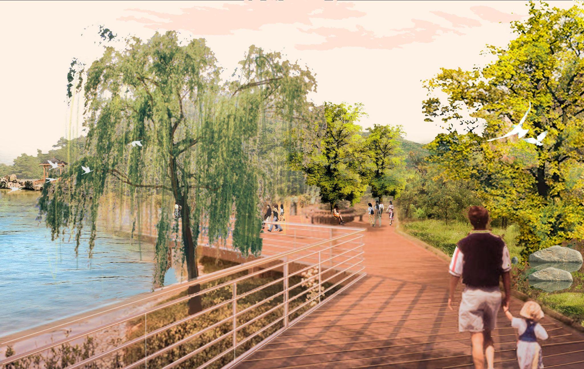
RE-EVOLUTION OF THE HERITAGE GATEWAY
THE CITY BEAUTIFUL INSIDE OUTSIDE NARNAUL CITY AND THE VANISHING HERITAGE
ADDITIONAL WORKS
3 CONTENT
2 3 1 4 5 6

THE CITY BEAUTIFUL INSIDE OUTSIDE NARNAUL CITY AND THE VANISHING HERITAGE
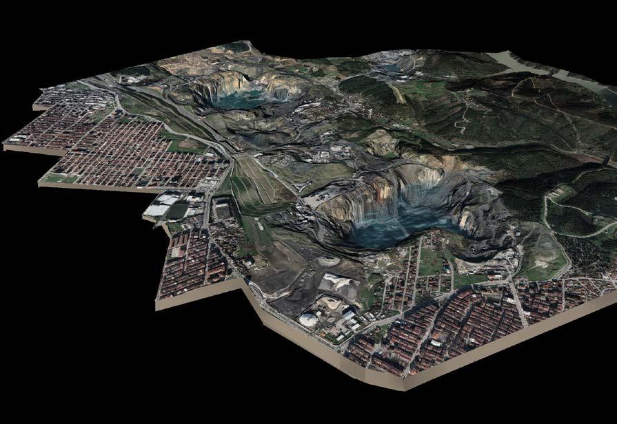
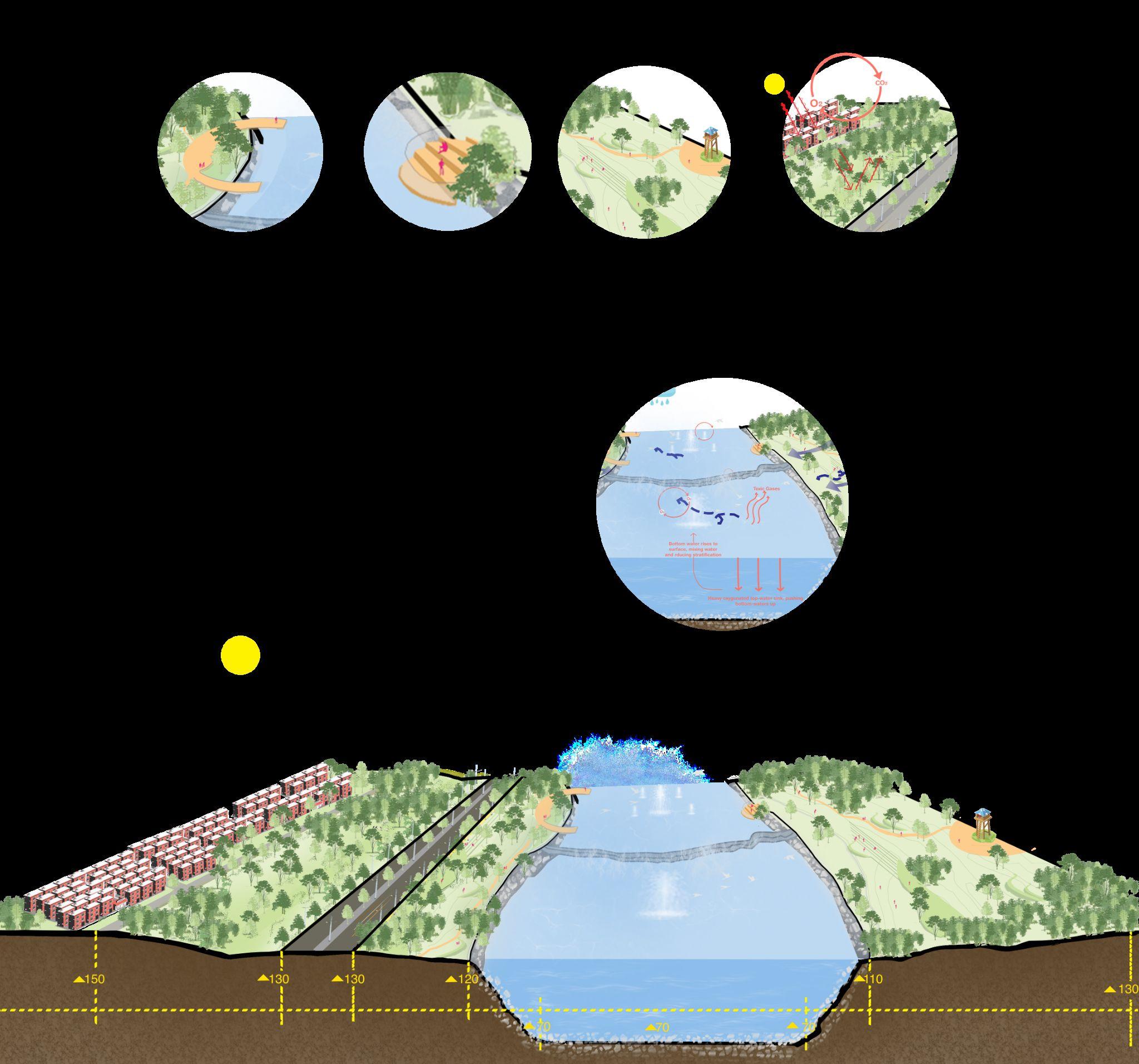
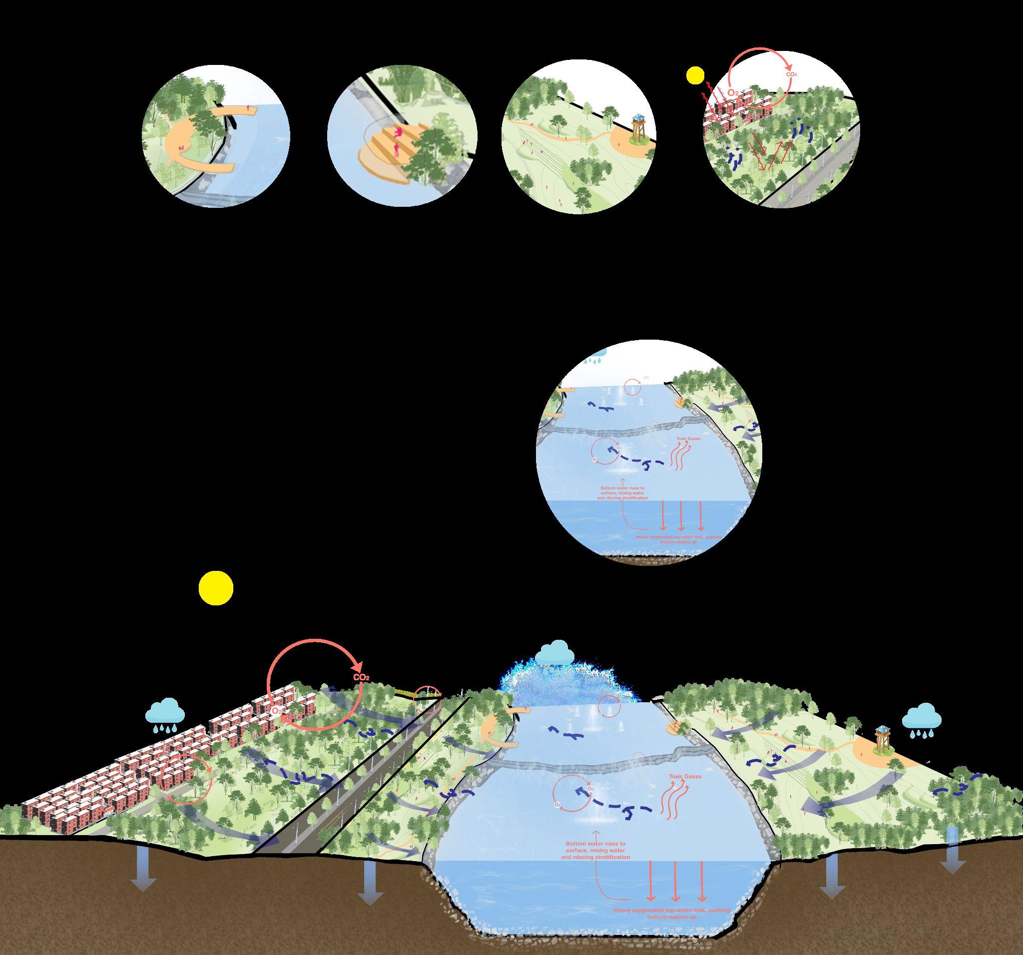
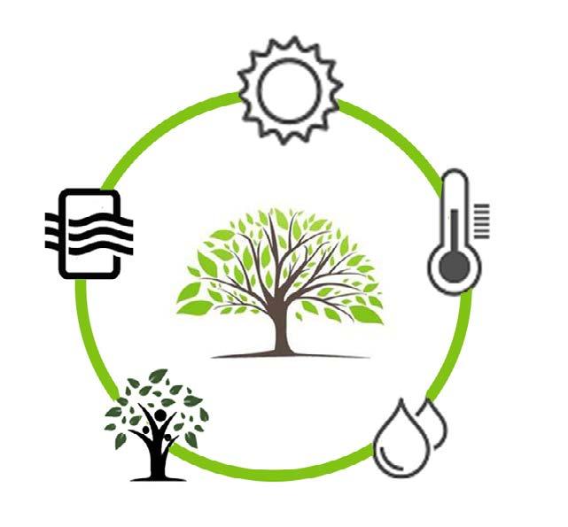
Istanbul went through an amazingly rapid industri alisation process. The stone material, which is the ba sic necessity for the built environment of the city, has been provided from the stone quarry areas surround ing the city. However, today these stone quarry areas are squeezed not only in the forests/green Landscapes but also near the Urban and Rural settlement areas. These smoke covered infertile landscapes are hav ing adverse effects on the surrounding, the people as well as the biodiversity. The Studies are evident and produce the fact that eco-tourism has the potential to create beneficial effects on the environment by con tributing to environmental protection and conservation.
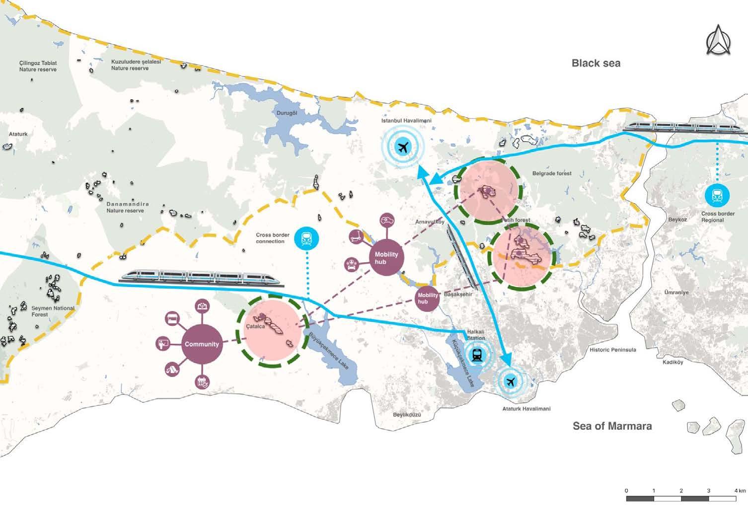
Site Location: Çay-Su Quarry, Istanbul, Turkey Site Area: 5.64sqkm
Scope of the project: This Project focuses on introducing and proposing Eco-Tourism as a key opportunity and strength in Re vitalisation of the Quarries of the Peninsula. Adopting the learnings from the detailed Analysis, the aim is to present vision for these Quarries in relation to the sur roundings and the impact it will have on the climate, biodiversity and the people in the following years.


To achieve full sustainability, it is not enough to change Unsustainable patterns but it is also crucial to Restore damaged environments. Considering the Quarries (damgaed landscapes of Istanbul), its time to see them as high potential grounds and adopt ideas in favour of humans, biodiversity and the climate.
Defined as the “responsible travel to natural areas that conserves the environment, sustains the well-being of the local people, and involves interpretation and education”.
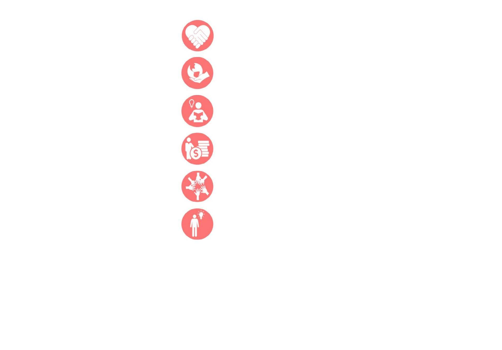
Ecotourism as opportunityEco-Tourism as Opportunities
Environmental protection Education
Income and job opportunities
Cultural interaction
Knowledge and awareness
Restore the Balance
Regain


Conserve Organis e
by Author
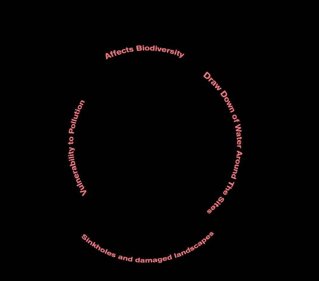
Restore the impact of degradation and revitalise the damaged lands.
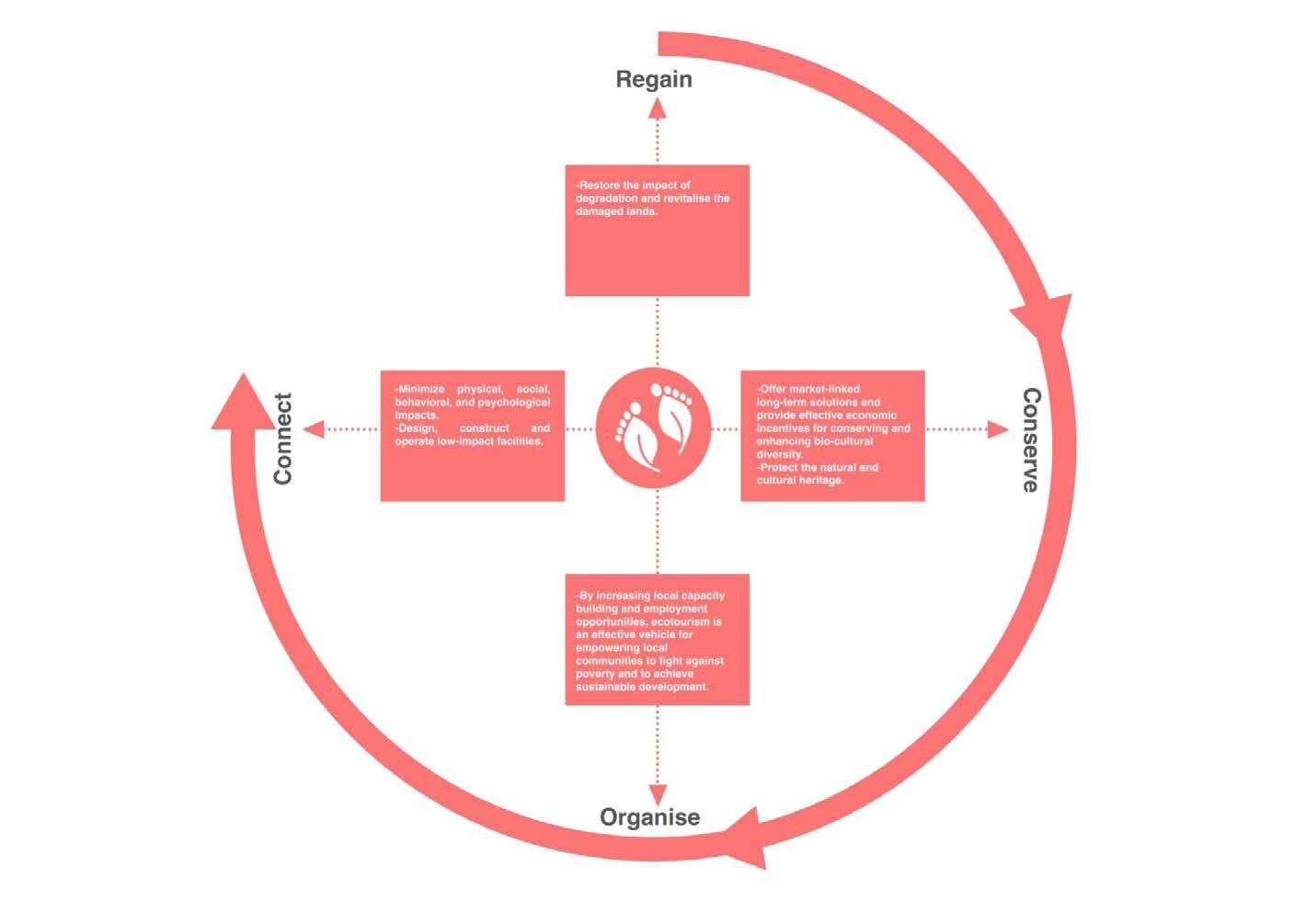

Protect the natural and cultural heritage.
Introducing interaction spaces while increasing employment opportunities and empowering the locals.
Environment Regeneration Economic Revitalisation Anthropocenic Revolution
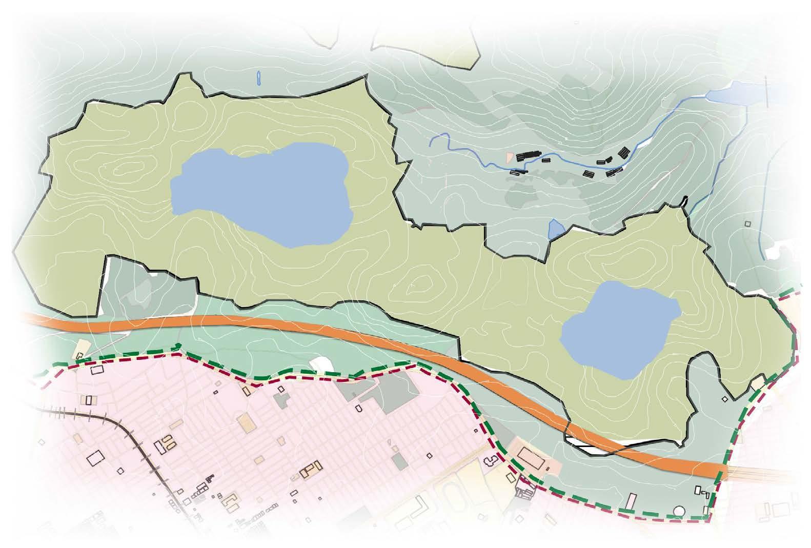
Sultangazi (Urban Settlement)
Catchment basins, Rivers, Elements of Climate solar radiation, temperature, humidity, precipitation, wind


 Buffer
Forest
Buffer
Forest
6 So the first question is what can be that idea that pulls all the 3 together while revitalising these landscapes?


Source: Evaluation of the environmental impacts of urbanization from the viewpoint of increased skin temperatures: a case study from Istanbul, Turkey
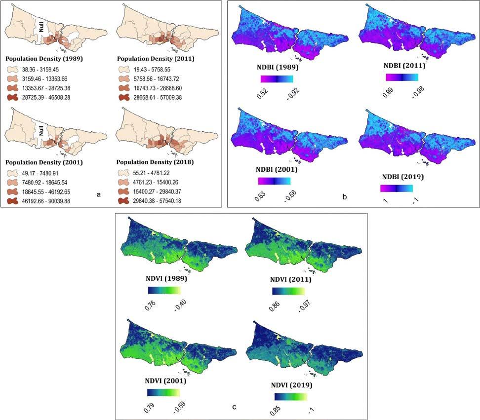
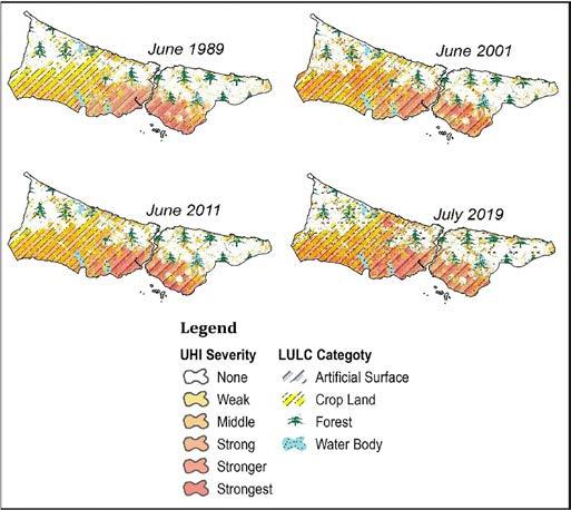
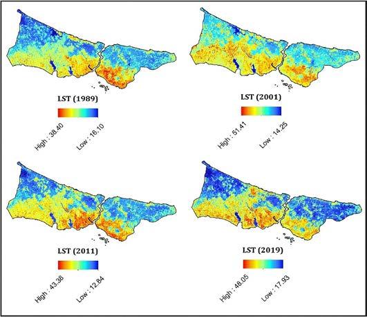
• Rise of temperature over the years and so is the increase in Land Surface Temperature and
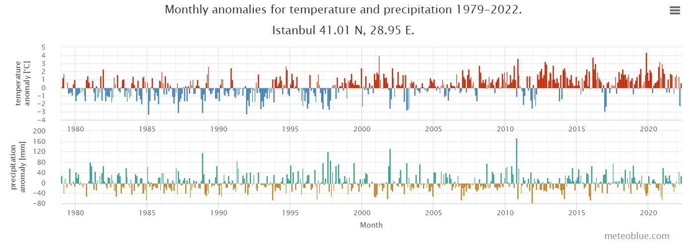
•
• Land Degradation and Air Pollution.
• Disasters that might occur due to climate change: Urban Floods, Heat Wave, Droughts.

• While major issues arise from the increase in built up index and decrease in vegetation index, some of the these issues are also arising from these long term operational Quarries (degraded landscapes)
Now, one of the most important question, How this Regeneration of Landscape as an Eco-touristic site will also act as an Environmental Resilient and Climate Responsive Landscape?
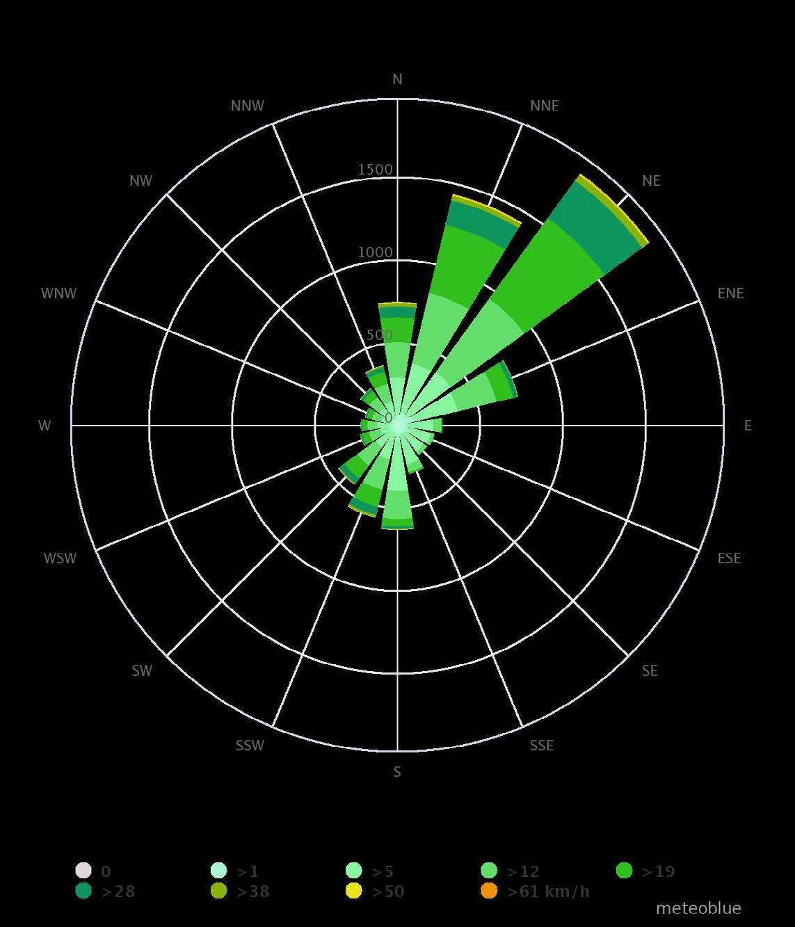
Source of information: Simulated historical climate & weather data for Istanbul,Meteoblue


HW02 Green Infrastructure: Trees, Green Buffer Planting trees to provide shade and to cool the air through evapotranspiration.
HW04 Cool pavement and Surfaces: reduces the urban heat island effect
HW05 Blue Infrastructure

UF01 Green Buffer and Dense vegetation grounds: act as both seepage grounds for Water and as barrier protecting the Urban Scapes
UF02 Flood Retention Ponds: Retention ponds can provide both stormwater attenuation and treatment.
UF03 Pervious Layer of green scapes, Green fingers running along the roads/streets.
D01 Green Buffer and Dense vegetation grounds: act as seepage grounds for Water restoring the ground water level
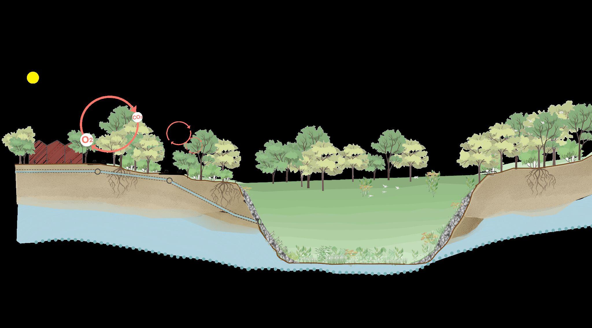
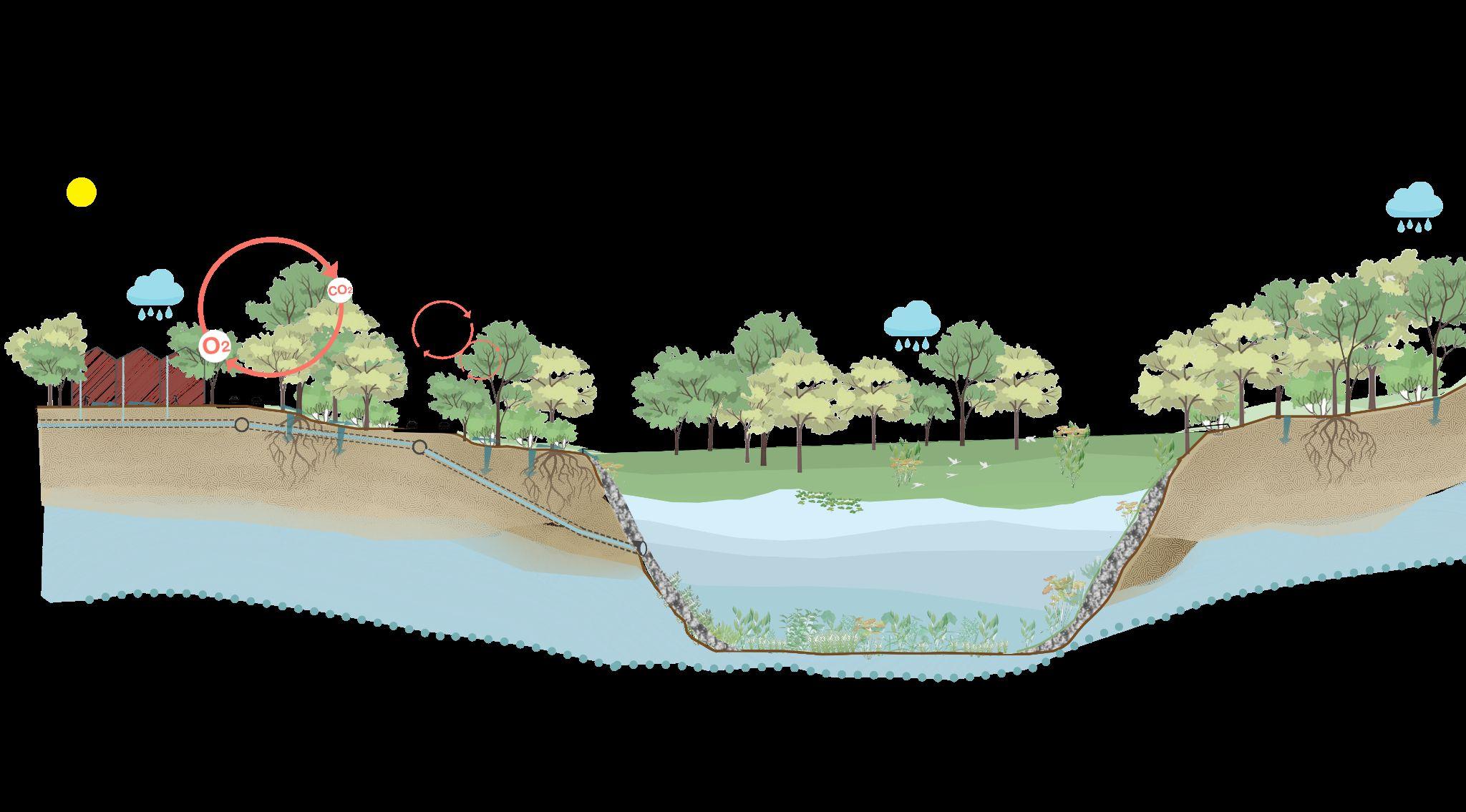
D02 Water Reservoir
D03 Pervious Layer of green scapes, Green fingers running along the roads/streets


Source: Images by Author
Source: Images by Author
Ground Water
Surface Water Runoff
Source: Images by Author
LD01 Restoring the degraded Landscapes and conserving the already existing Forest lands and Green Infrastructure.

LD02 Blue infrastructure

P01 Green Infrastructure: Green Buffer, Vegetation: Vegetation in buffers can affect local and regional air quality in three main ways: temperature reduction, removal of air pollutants, and energy effects on buildings. Lower air temperature due to trees and other vegetation can reduce emissions of many temperature-dependent pollutants.
Water Seepage into Ground (Through Pervious layer)
Sultangazi Green Buffer ForestExcess Water Flow/ Urban Floods Water Seepage/ Groundwater Recharge
Impervious absorbs
 Source: Images by Author
Impervious Surface absorbs more heat
Trees and other plants help cool the environment, making vegetation a simple and effective way to reduce urban heat islands.
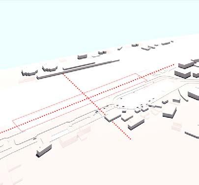
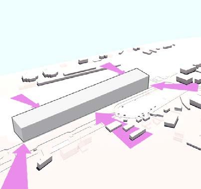
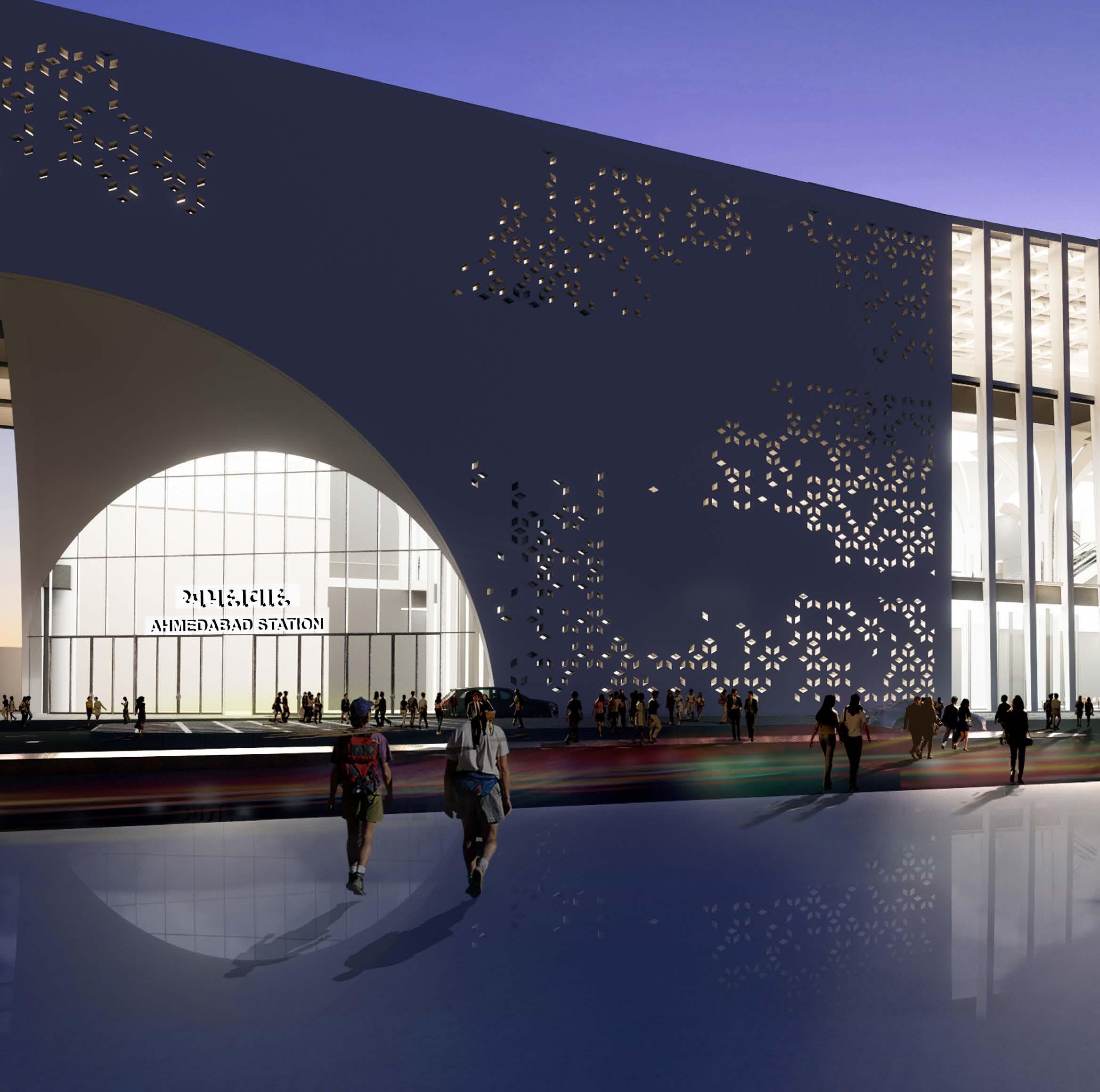
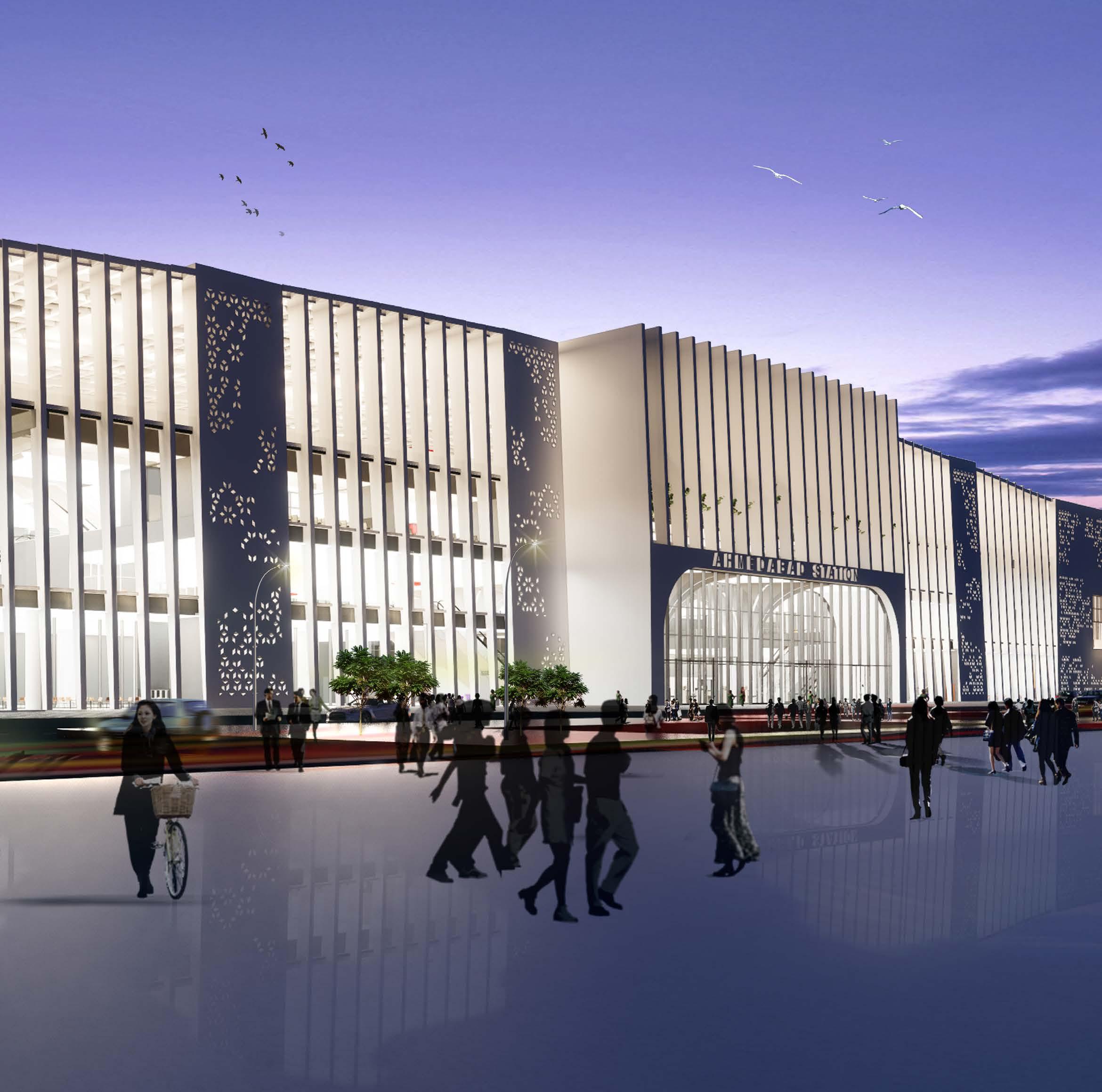
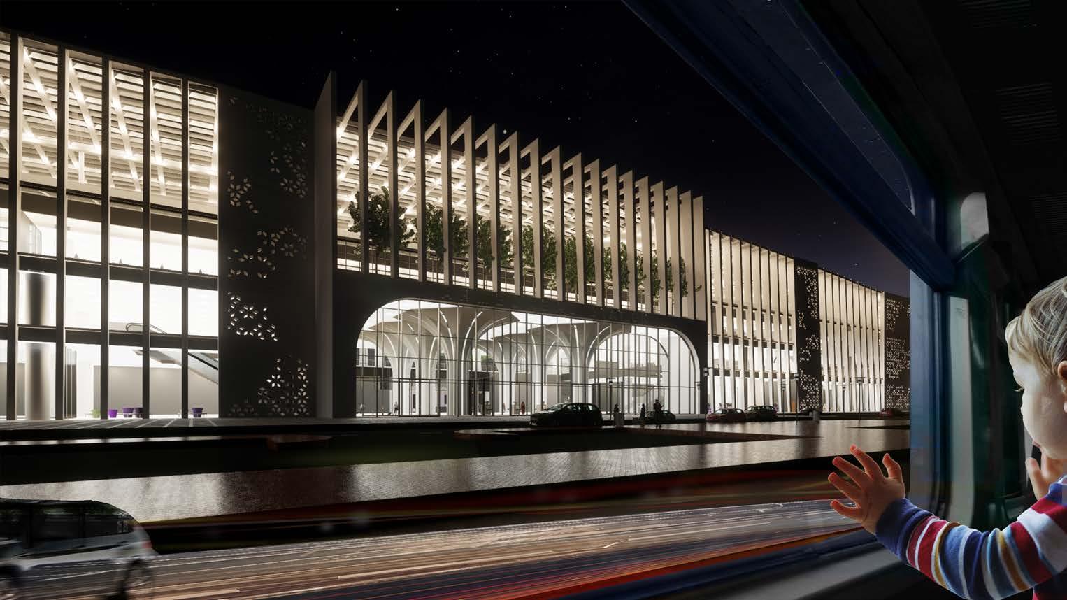
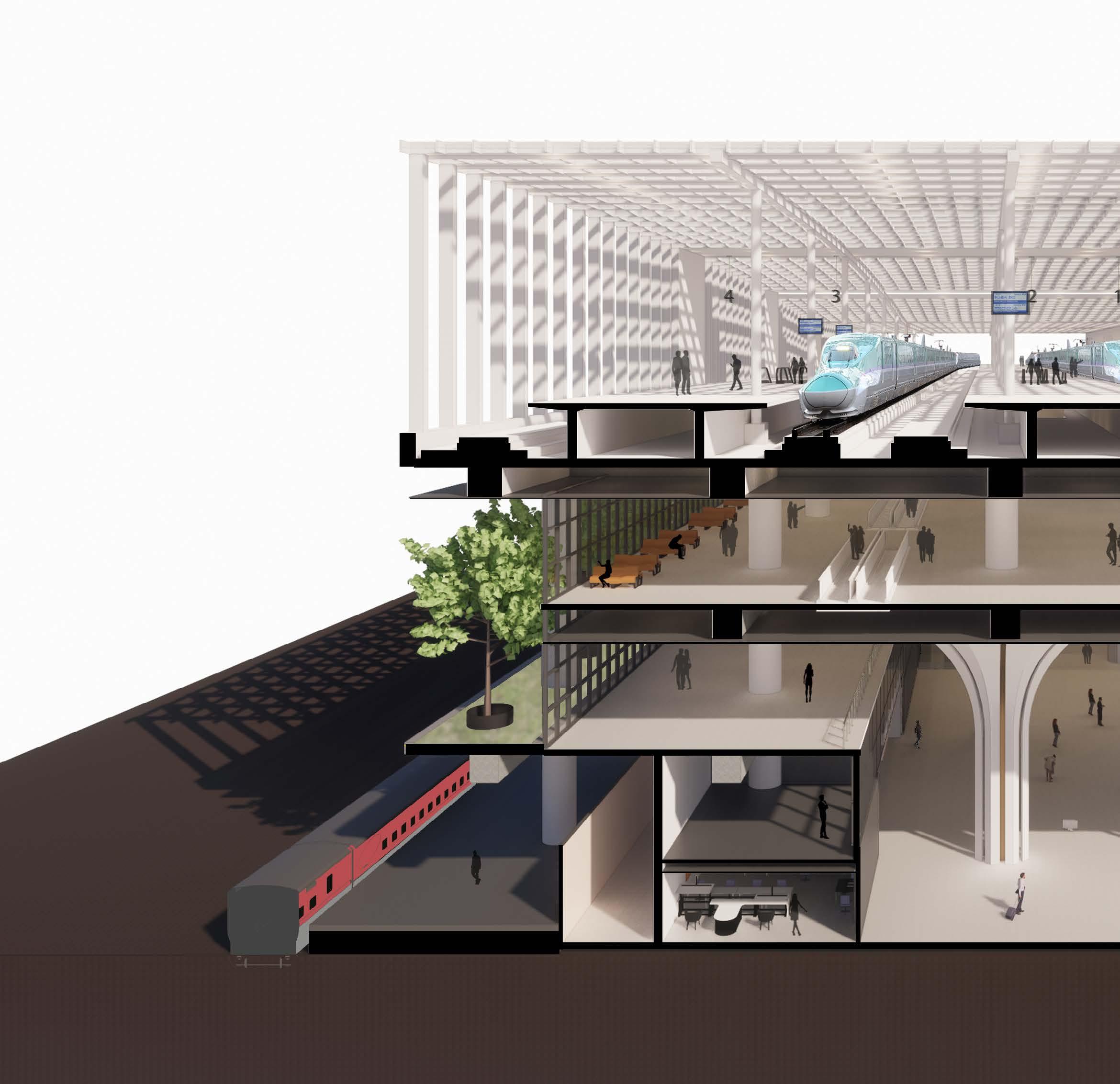
For any country to develop with the right momentum, modern and efficient Transport as a basic infrastructure is a must. Along with rapid economic growth in India, a sharp rise in the volume of people and goods being transported in the country has been observed. A route between Mumbai and Ahmedabad as the first high-speed railway section will be constructed. (start of service -2023)
Site Location: Ahmedabad, Gujarat, India Site Area: 60,000sqm
Scope of the project: Design Ahmedabad High-Speed railway Station with connectivity to other modes of transports (Metro, BRT, Conventional Railways etc.)
Located on the Saraspur Side of Ahmedabad Junction Station. The site lies in the center of the heritage city with minimum travel distance to all the landmarks as well as residential/commercial areas. The site is surrounded by mainly residential and industrial spaces with some institution zone as well.
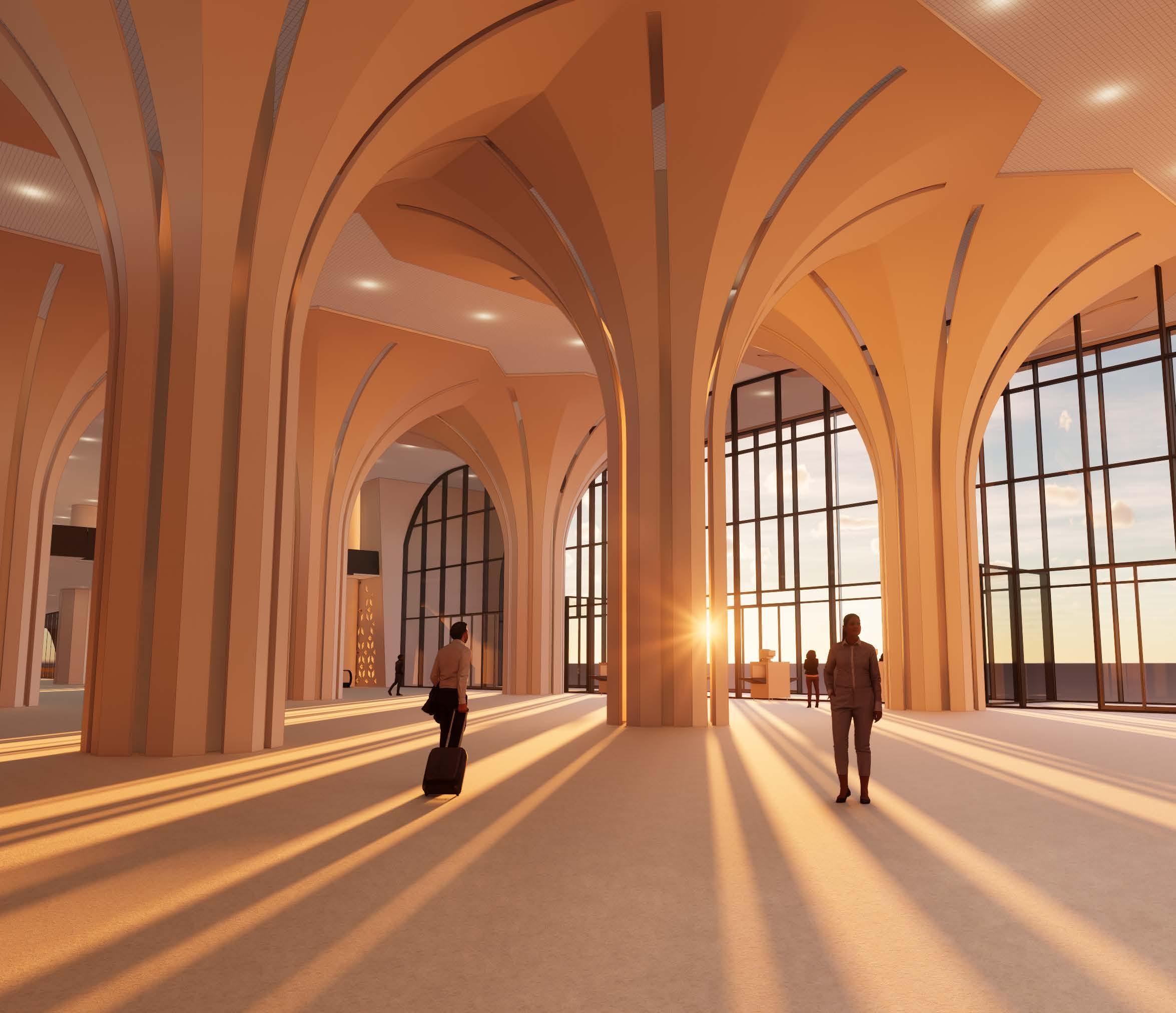
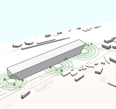
A station that will become the new landmark of the city, with an elegant architectural atmosphere and showing the dynamism of the country’s development. It will be a new Gateway of next Generation India’s Transit development. It needs good consideration and implementation of the following points:
• Sustainable, user-friendly, and efficient HSR station which is a first in the Indian Subcontinent.
• Understanding of Spaces and Volumes.
• Creation of an urban icon and standard-bearer of a modern vibrant city.
• Understanding the impact of development in terms of traffic, land-use, environment, and urban design and taking well-anticipated measures for these impacts.
• Respect the local identity and context.
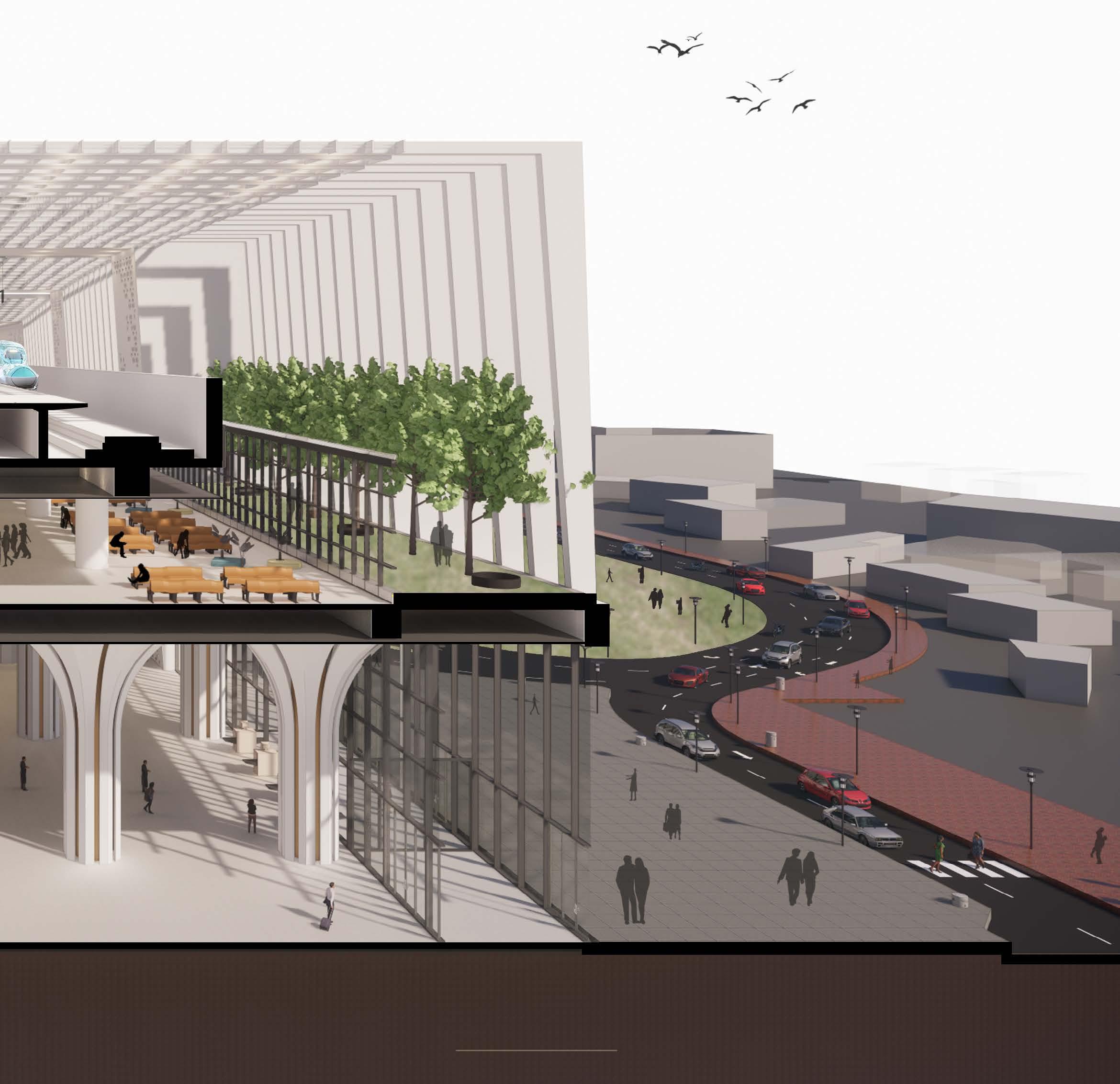
Proposed High speed Railway Tracks 18m above Ground Level
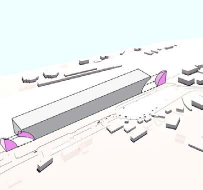
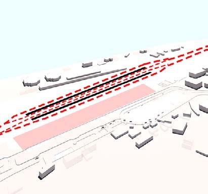
Symmetry was the first thought behind planning in the linear site
TAXI /AUTO/ PRIVATE VEHICLE
Proposed Access routes to and from site/building according to the master planning
FREE/UNPAID CONCOURSE
Edges of the Building were exploded to welcome the Visitors from north and south side
Proposed Plazas for three main access routes to the building
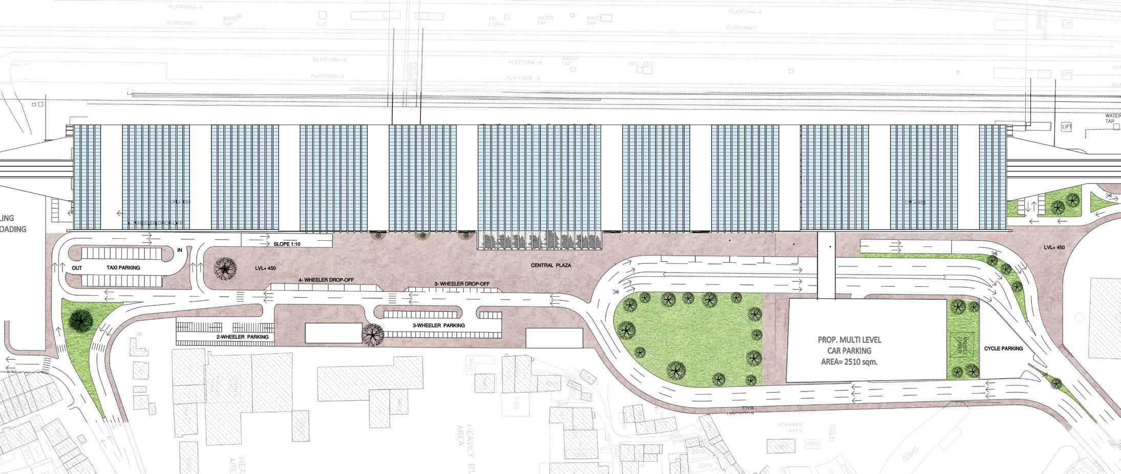
PAID CONCOURSE
TICKET OFFICE/ TOURIST INFO RETAIL SHOPSPLAZA(NORTH / SOUTH/CENTRAL)
CENTRAL HALL
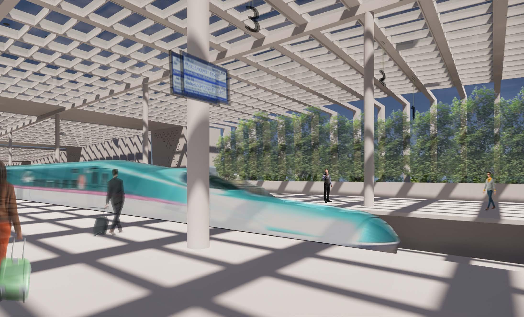
TICKET GATE RETAIL SHOPS WAITING AREA PLATFORM
TICKET OFFICEADI /BRT/MLCP
TICKET GATE TOURIST INFO/RETAIL SHOP RETAIL SHOPSPLATFORM
ADI /BRT/MLCP
CENTRAL HALL PLAZA(NORTH / SOUTH/CENTRAL)
TAXI /AUTO/ PRIVATE VEHICLE
Ground Floor Plan
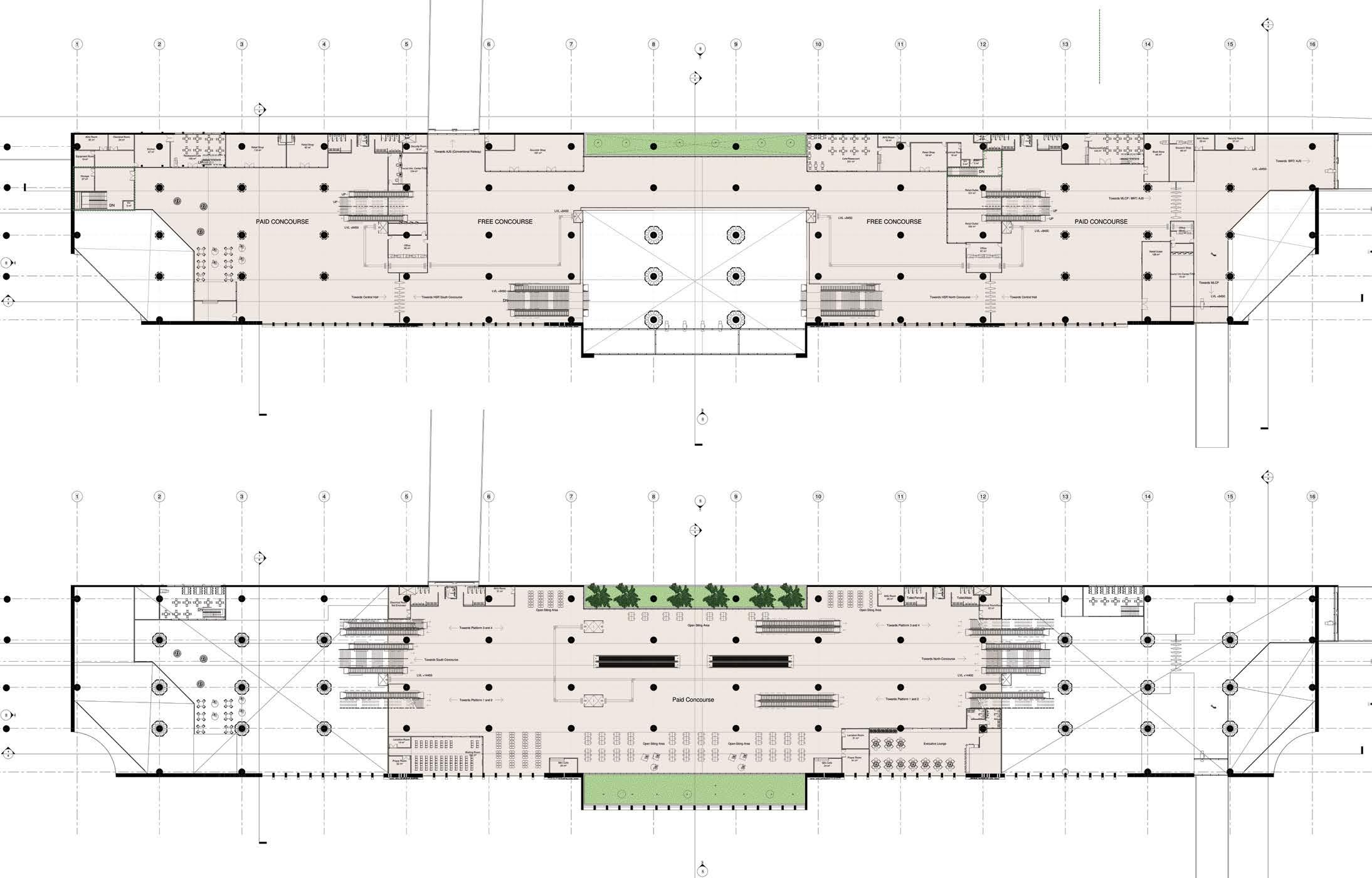
First Floor Plan
Second Floor Plan
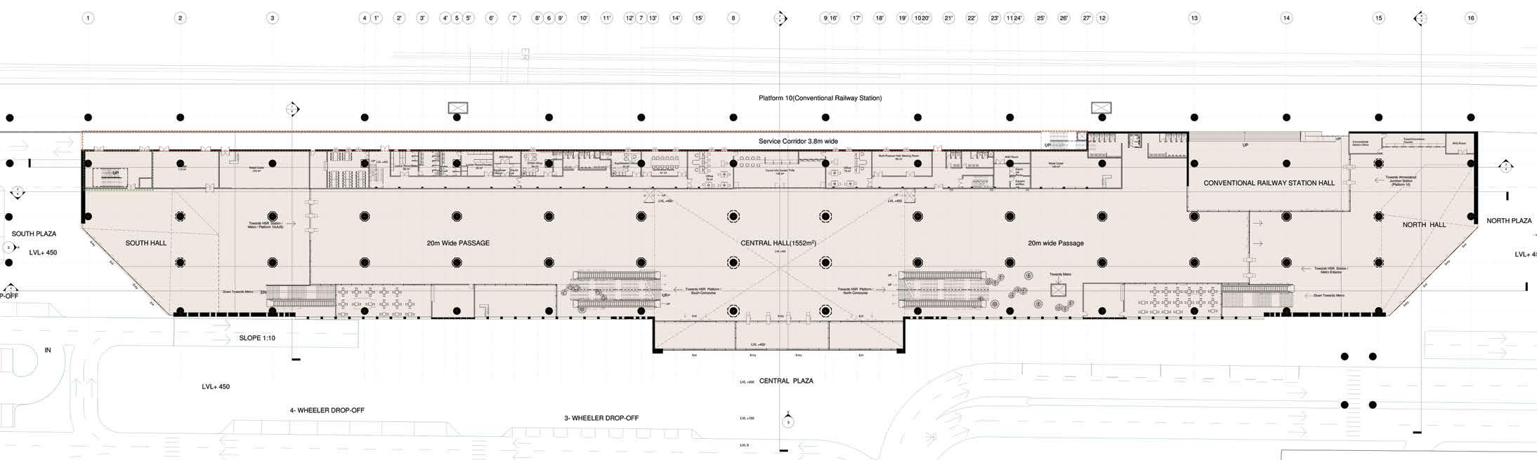
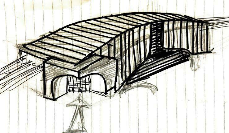
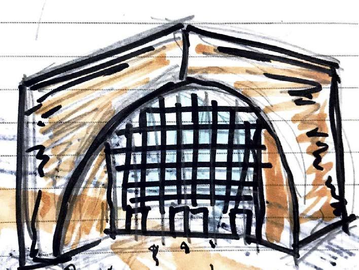
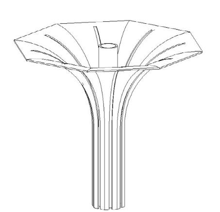
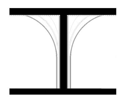
Arches evolved from the heritage buildings into the facade and the North and South Gates of the HSR Station and finally integrated into octagonal columns act a Gateway to the city.
01 Vertical Circulation
02 Waiting 03 Control Room
Under Platform Level
01Service Corridor
02 Service Rooms(MEP)
01 Open Waiting area
02 Executive Lounge
03 Lactation Room
04 Commercial 05 Prayer Room
06 Waiting Room
07 Green Open Space
08 Public Utilties
01 Open Waiting area
02 Ticket Office and Info Center
03 Passage Connectivity to MLCP , 2 Pedestrian bridges
04 Commercial
05 Green Open Space
08 Public Utilties
SECONDARY ENTRANCE FROM SOUTH PLAZA
01Commercial
02 Connectivity To Platform 10 (Conventional Railway Station)
03 Connectivity to Underground Metro Station
04 Ticket Office and Info. Center
05 Station Office
06 Locker Area and changing rooms
07 Staff Cafeteria
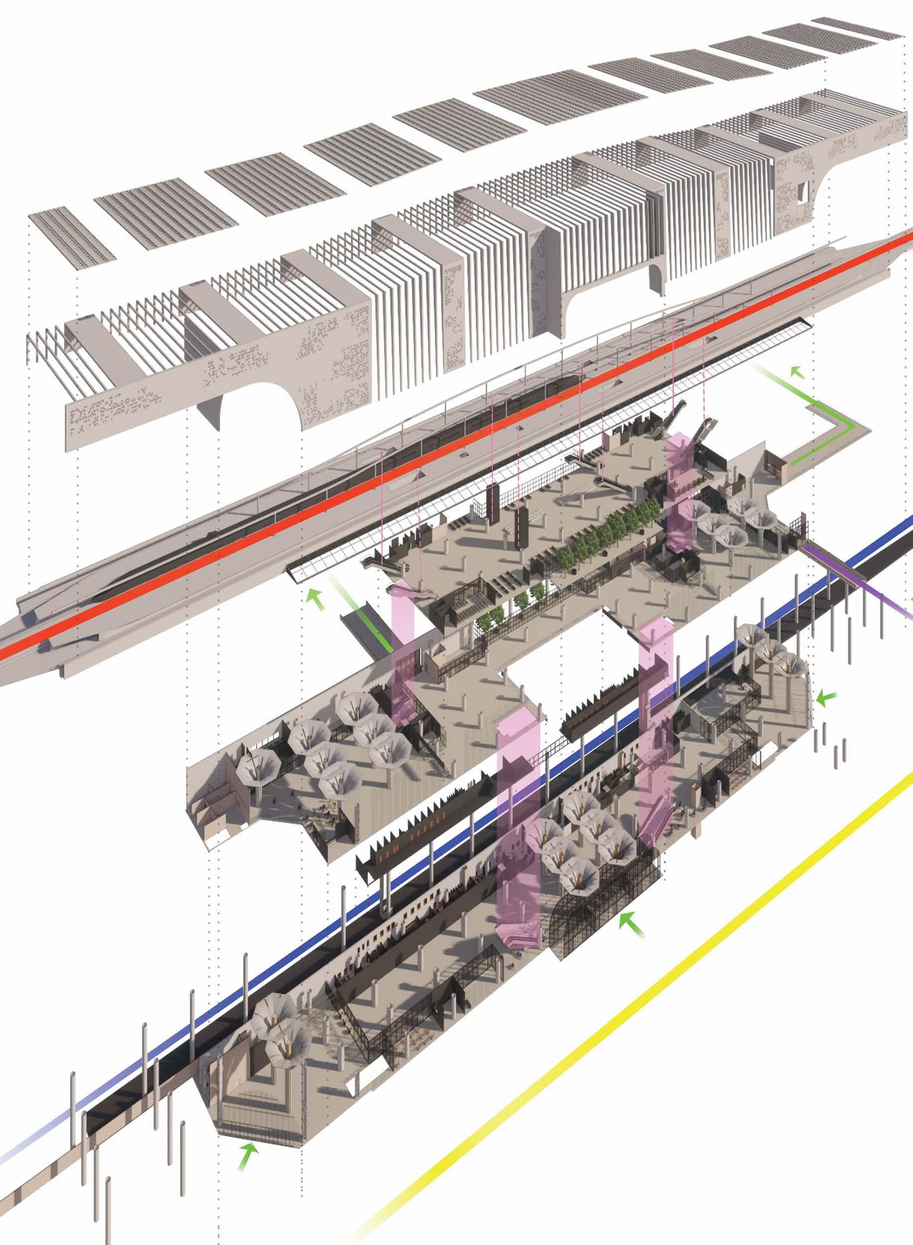
HIGH SPEED RAILWAY LINE
ADI CONVENTIONAL RAILWAY LINE
PEDESTRIAN MOVEMENT
PEDESTRIAN MOVEMEN TOWARDS MLCP
VERTICAL CIRCULATION INSIDE THE BUILDING
MAIN ENTRANCE FROM CENTRAL PLAZA SECONDARY ENTRANCE FROM NORTH PLAZA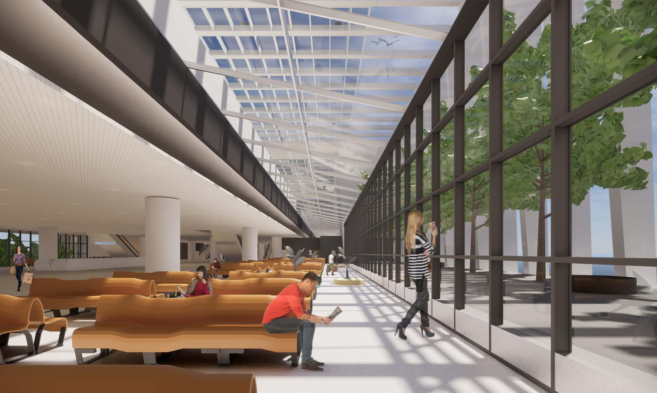


Chandigarh is known as one of the best experiments in urban planning and modern architecture in the twentieth century in India. The city is well known for its architecture and design. Planned as a Green City with an abundance of open spaces, Chandigarh ensures that every dwelling has its adequate share of three elements of Sun, Space, and Verdure. The concept of the city is based on four major functions: living, working, care of the body and spirit, and circulation.
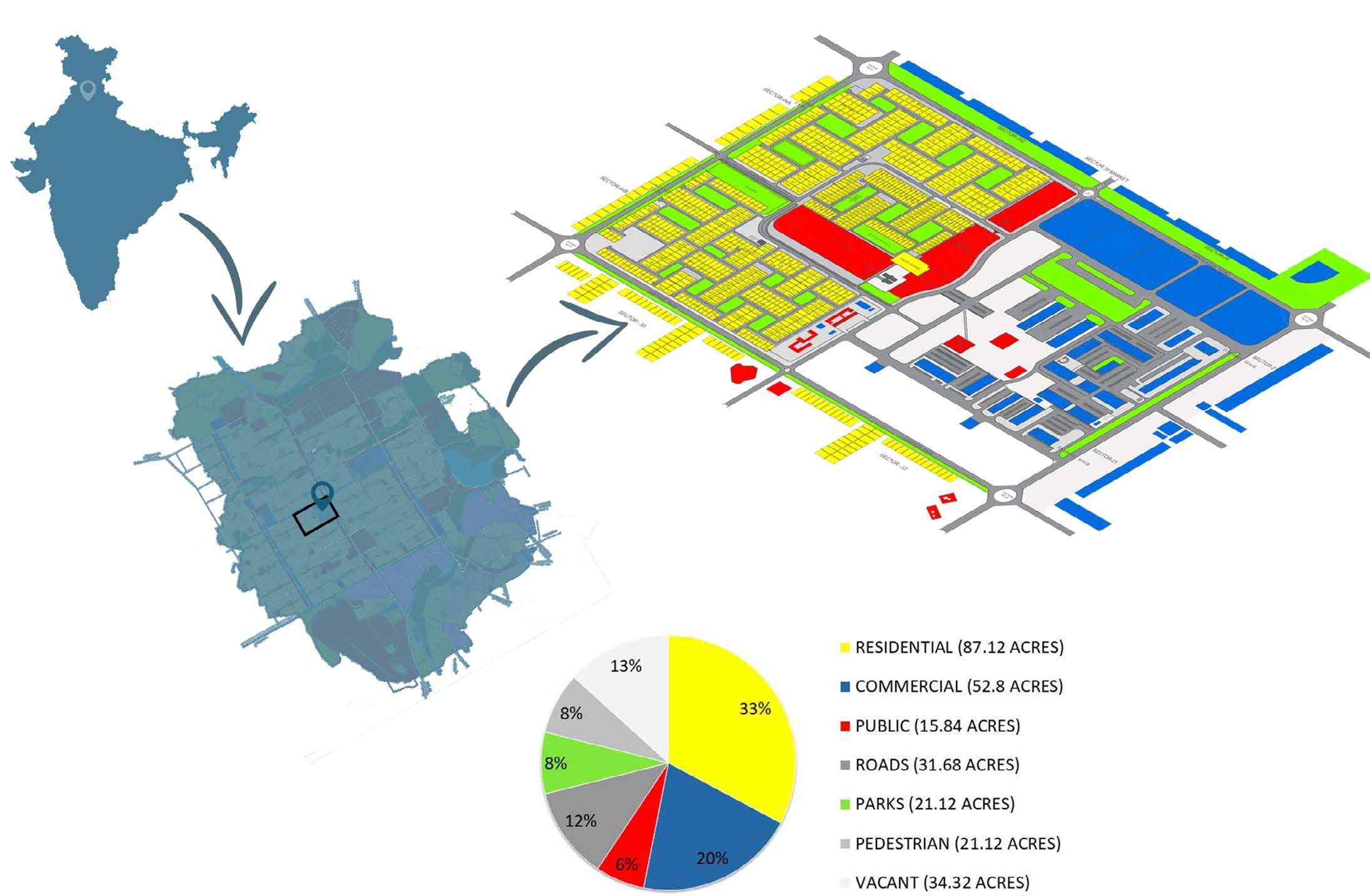
Location: Sector-34 , Chandigarh , India Area: 114sqkm
Scope of the project: Study and Analysis of Sector 34 , Chandigarh and Proposing Design Intervention in support to the alredy exsting Spaces and Urban Development.
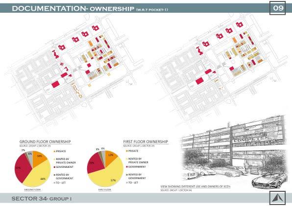
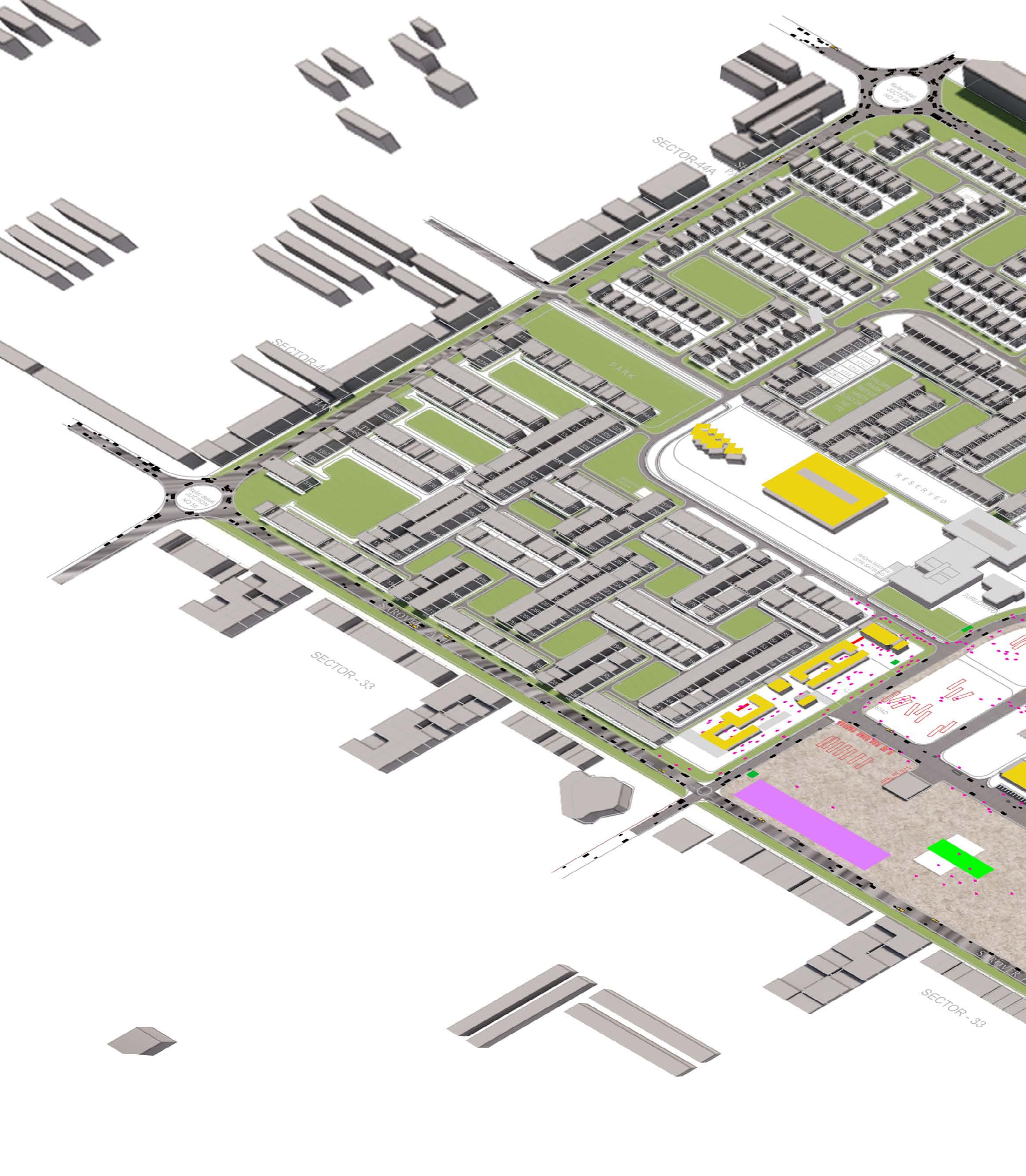
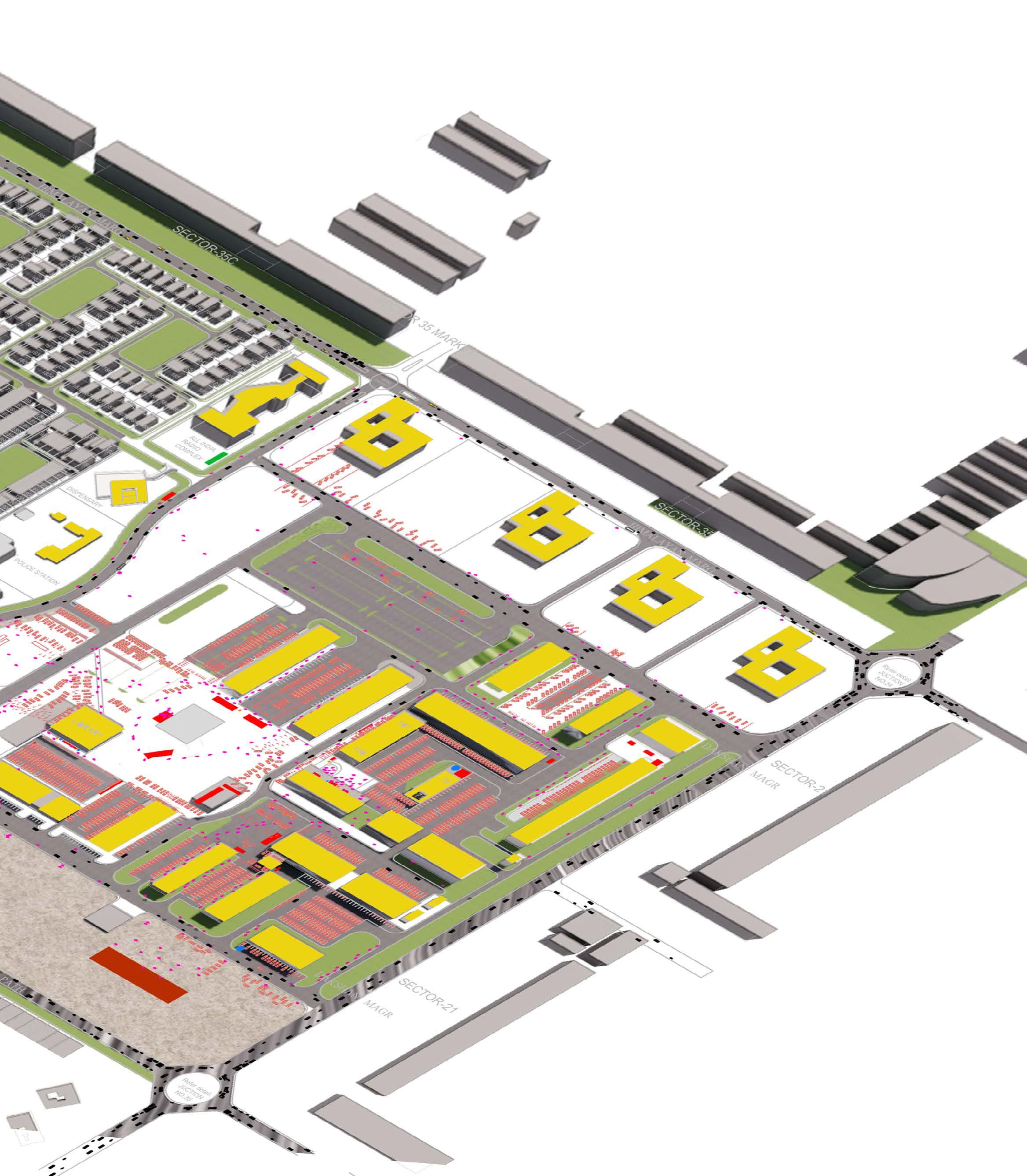
Sector 34 is another developing commercial sector after sector 17 and is mainly known as the sub-city center. It is surrounded by one of the most significant areas of the city that act as commercial, institutional as well as a cultural hub for the city. Sub City Centre of Sector 34 is planned to serve the 2nd phase southern sectors. This center will now also serve the 3rd phase residential sectors due to close proximity.
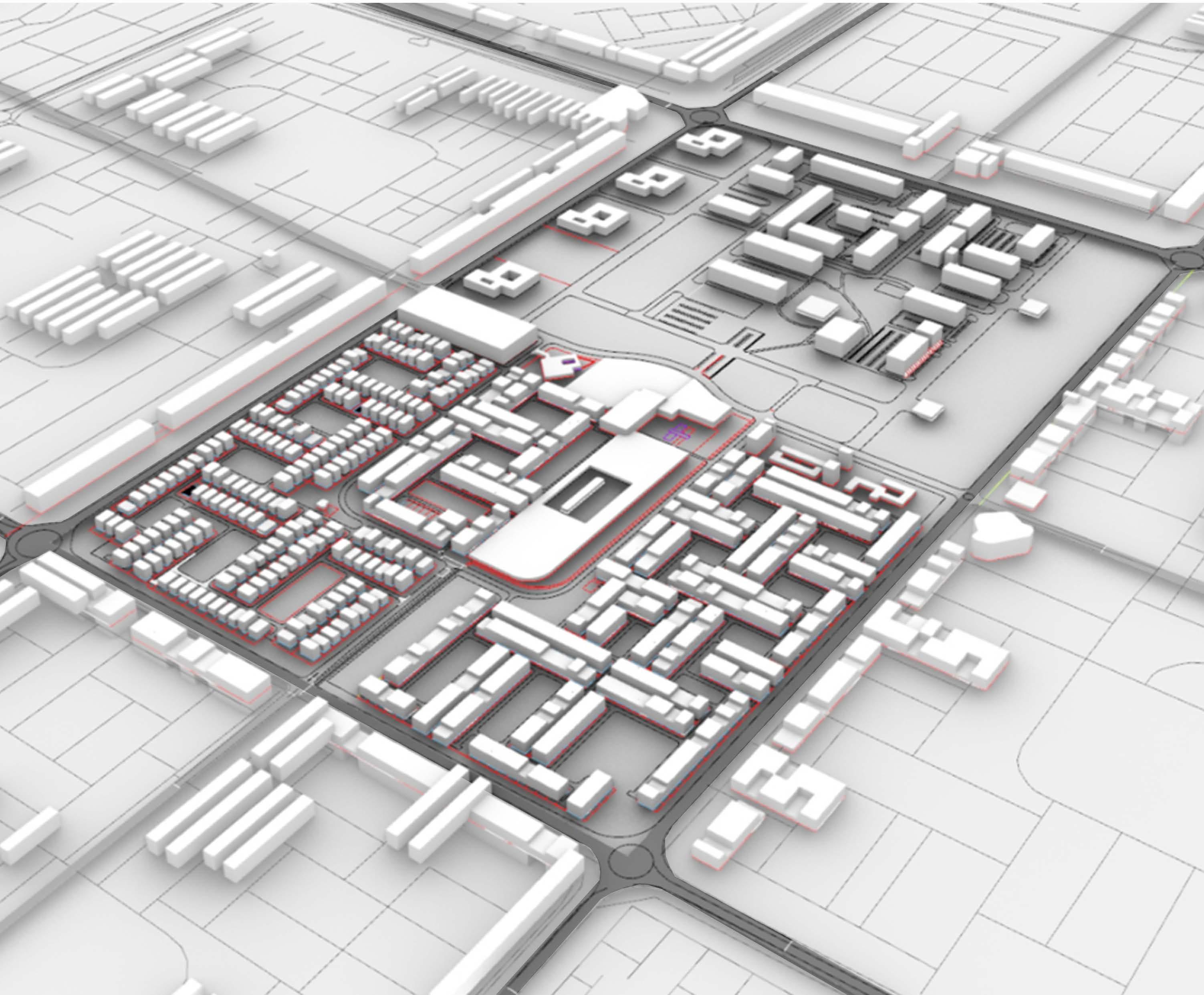
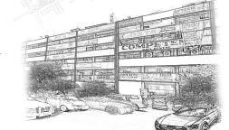
Present planning of the Sub City Centre, though a conventional interplay of linear blocks, lacks focus and identity which is usually associated with the collective synthesis of the built environment. There is no synergy with the neighboring sectors or with the adjoining residential areas. The Sector 34 commercial area, presents, by and large, a picture of neglect and chaos.
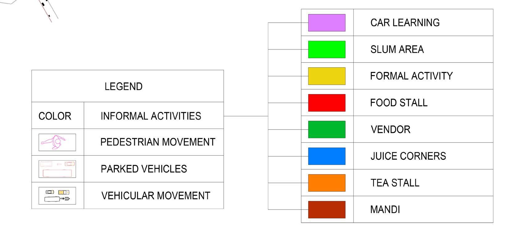
HARDSCAPE Unpaved Area Paved Area (Pavers)
Green Area
Paved Area (Metalled Road) Built-up Area
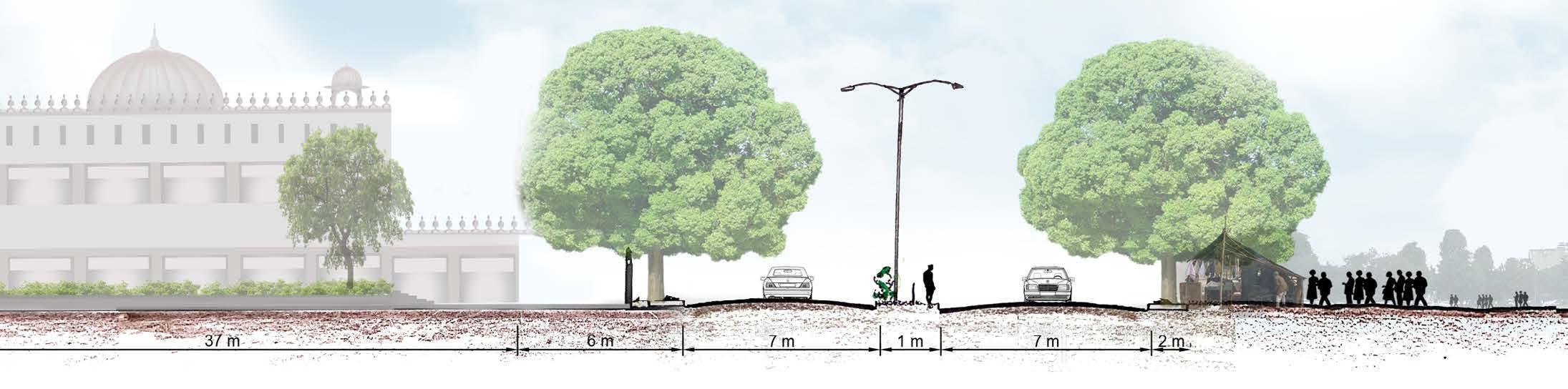
Paper Mulberry tree, Peepal , Bargad tree , Indian Cherry , Gulmohar
Street Lights Dustbin Benches Paths Landmarks Minor Landmarks Major Landmarks Edges Nodes District (Commercial) District (Residential)
Non Built-up Area (822564SQM)
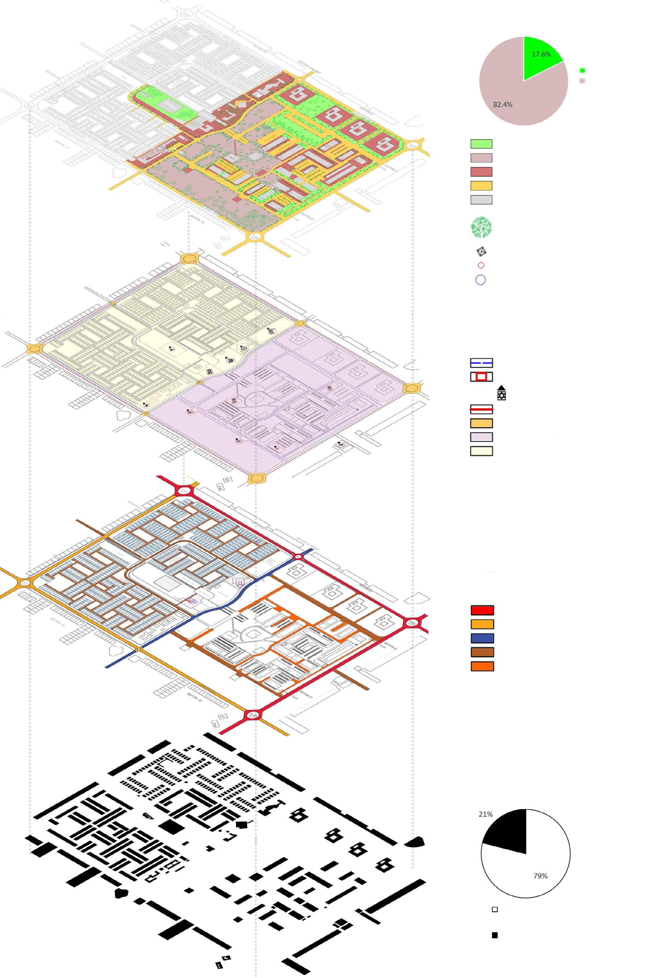
Built-up Area (217275.72SQM)
Total Area (1039839.76SQM)
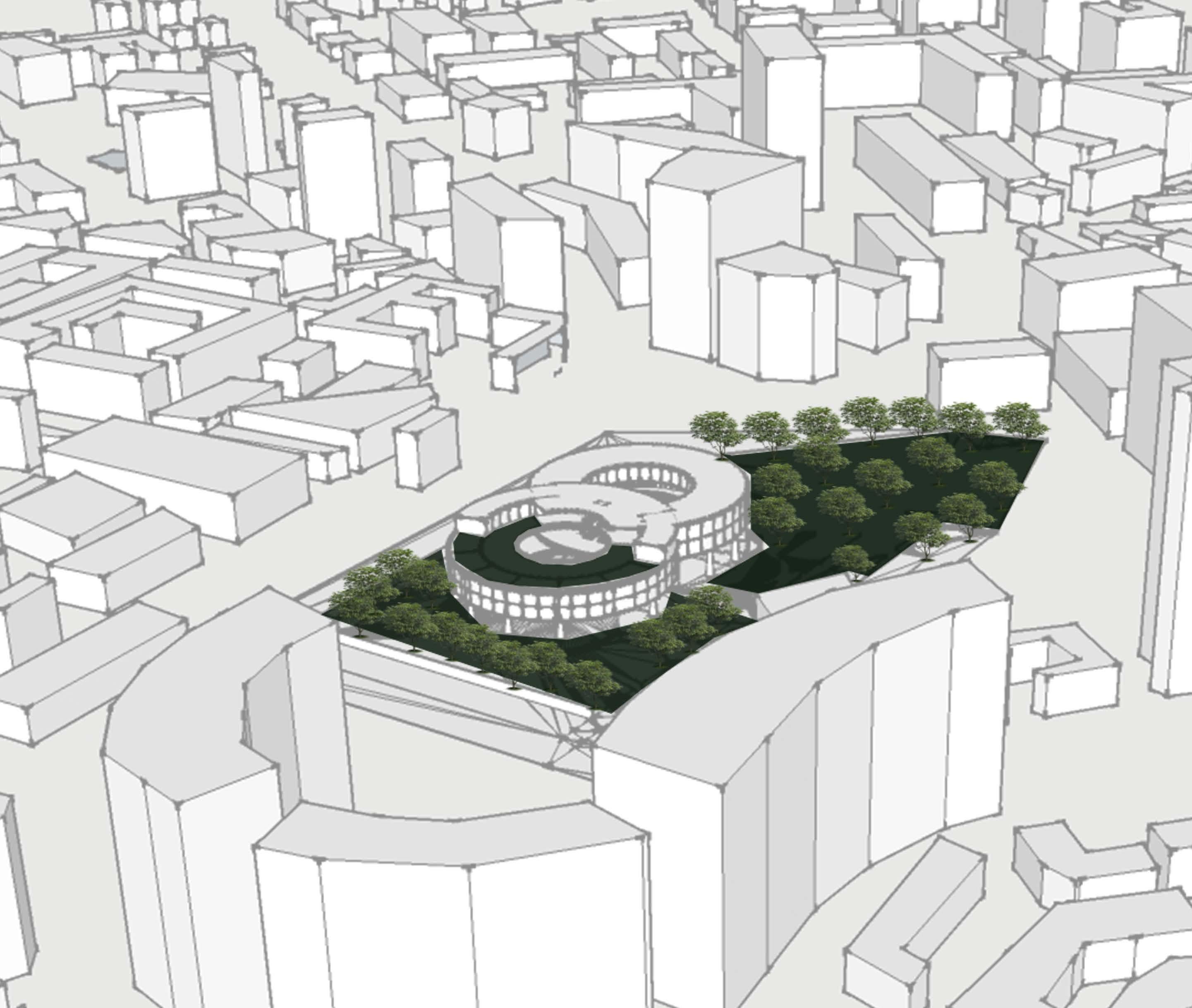
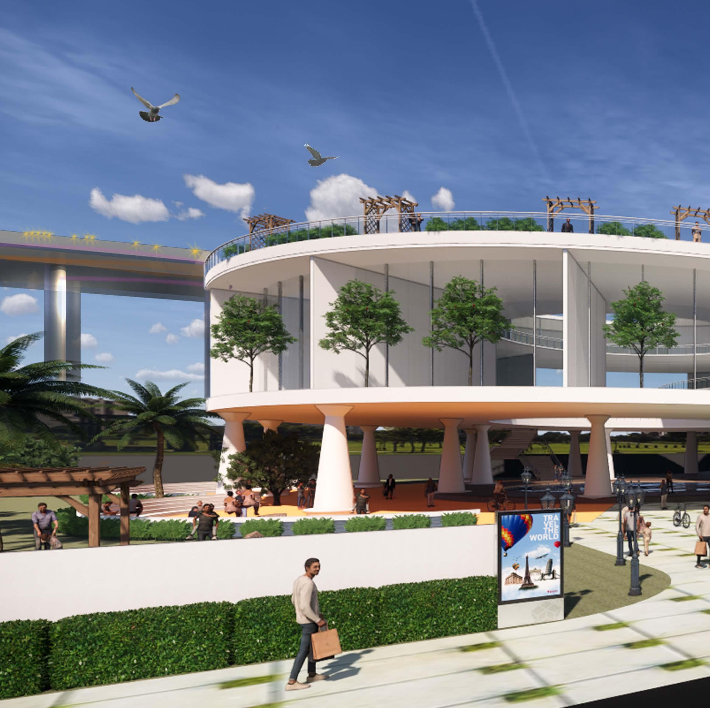
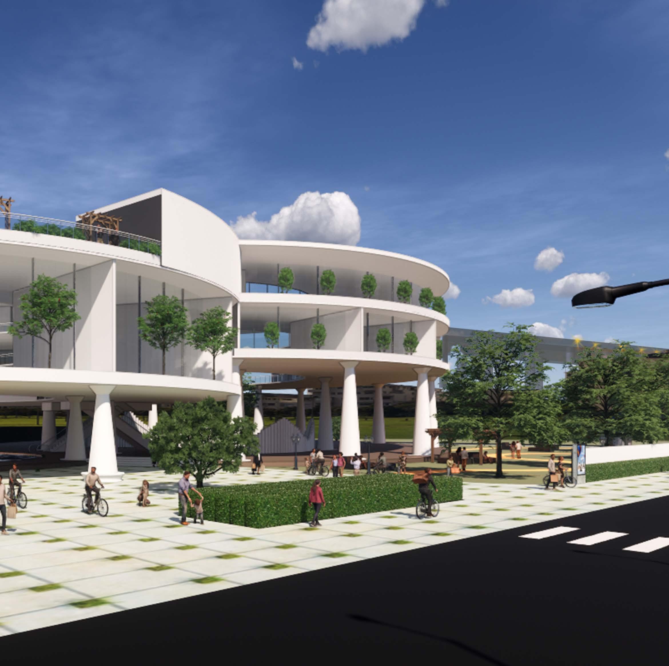
The proposed site is located in an area where the rising population demands a commercial complex in its close vicinity. The surrounding is packed with concrete structures where green spaces are decreasing with time and pollution is rising to its peak.
Location: Delhi, India
Scope of the project: Design a Commercial Complex that not only unites the population but a space that can also serve as an escape from the pollution and densely builtup areas.
Climate change has become a real problem today and it has been too long that we have exploited our natural environment and the resources. It’s time that we create an environment within the environment since the two are interdependent and help sustain one another.
• Bringing back the lost natural environment along with the newly built habitable spaces and reviving the essence of natural habitat.
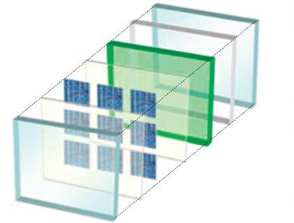
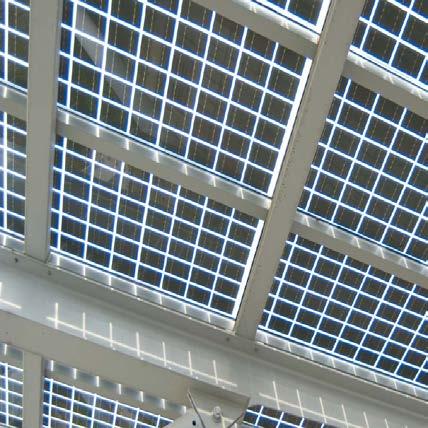
• Installing renewable energy source i.e solar panels so as to harness maximum electrical the energy with minimum or no impact on the Environment.
• Rainwater harvesting, storing, treating, oxidizing while making it fall as a replica of a waterfall and reusing for providing water to the garden areas as well as for various services.
• Creating a healthy and interactive environment for the users. These spaces designed will contribute towards decreasing pollution level as well as creating a healthier space amid the concrete jungle.
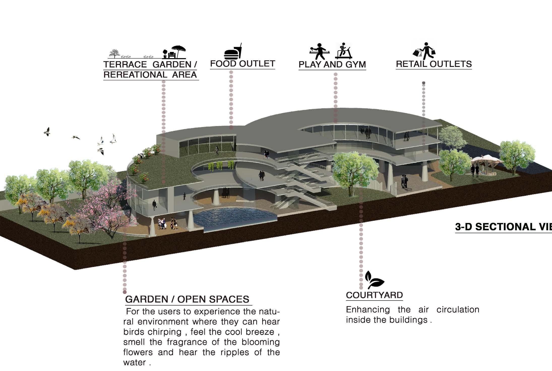
• Maximum use of daylight and ventilation and reducing the load on the mechanical system.
• Car-free zone within site premises so as to promote the environmental cause of reducing pollution level.
Roof Lvl
ENERGY ROOF: Solar panels installed on the roof produce sufficient electrical energy required by the building .
Gym/Play Zone
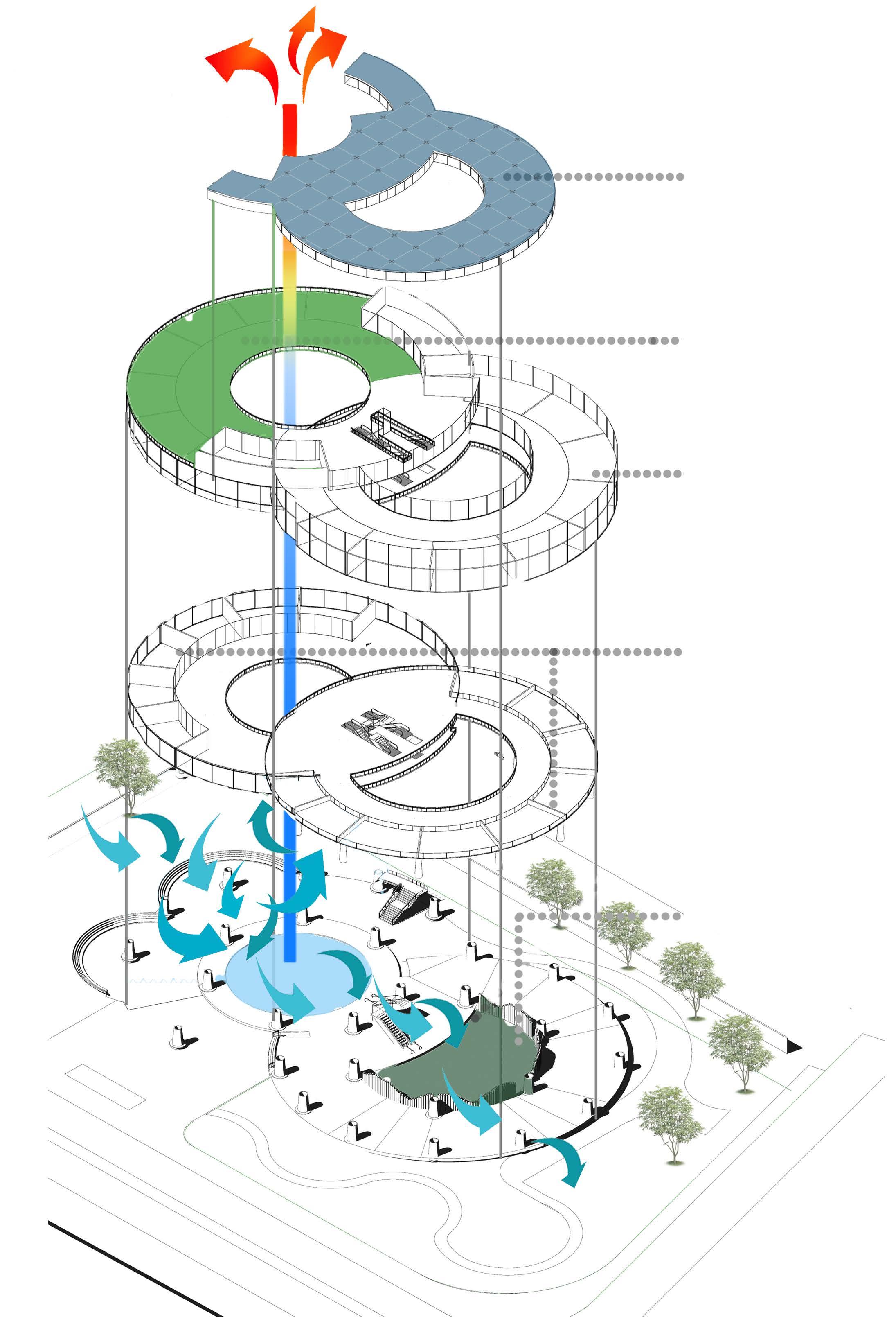
Second Floor
First Floor
Plinth Lvl
Courtyard
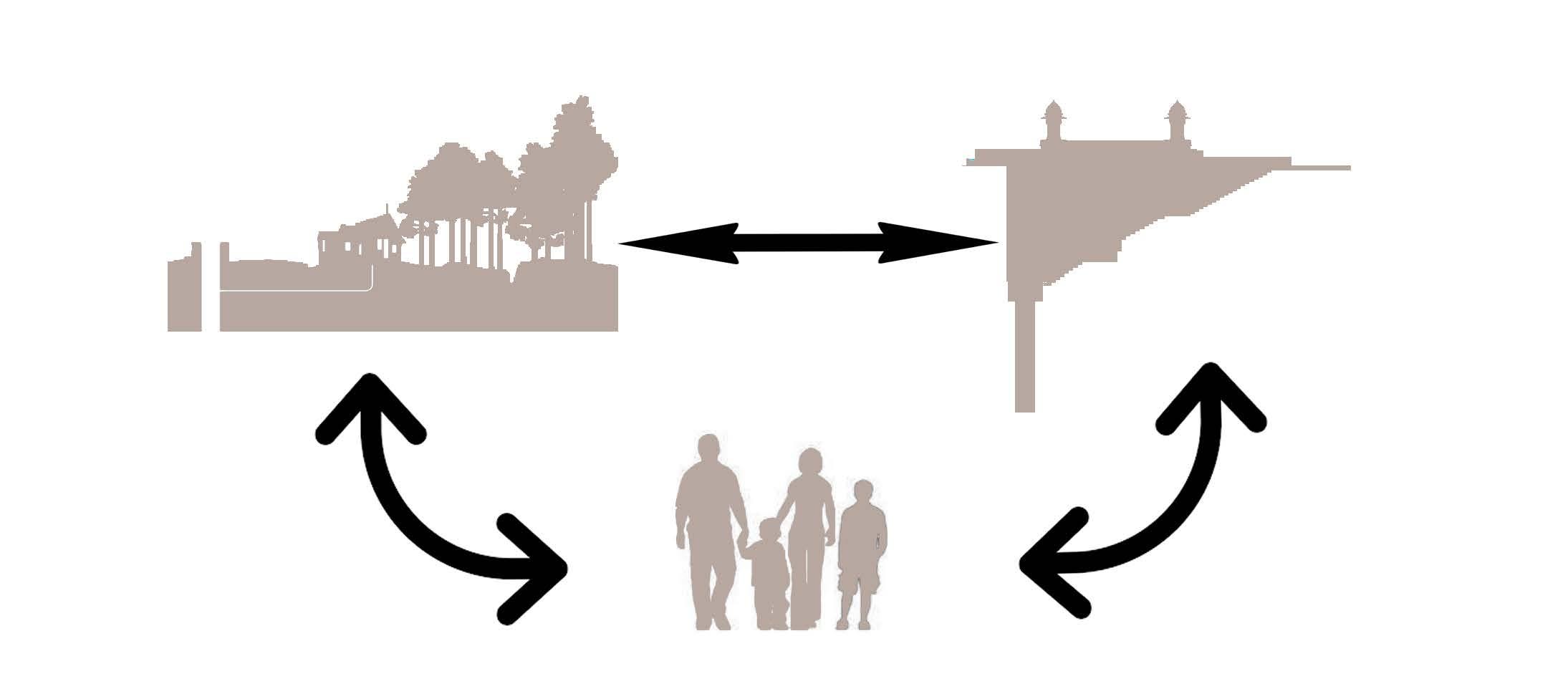
India is known for its rich heritage, culture, and Architecture which holds great historical, cultural, and socio-economic significance. An utmost need to create awareness about one such city known as Narnaul and its heritage, so that it can be preserved for today as well as for the future generation; so that they know about it, understand it and embrace our rich heritage.
Location: Narnaul , Border of Haryana and Rajasthan
Climate : Hot and Dry
Scope of the project:
1. Recognizing a city Narnaul having emotional, cultural, and use significance
2. Identifying the historical boundary of the city.
3. Listing of every structure having historical significance.
4. Documenting each structure having historical significance.
5. Understanding the importance and the need for revitalization and Proposing ideas for the same.
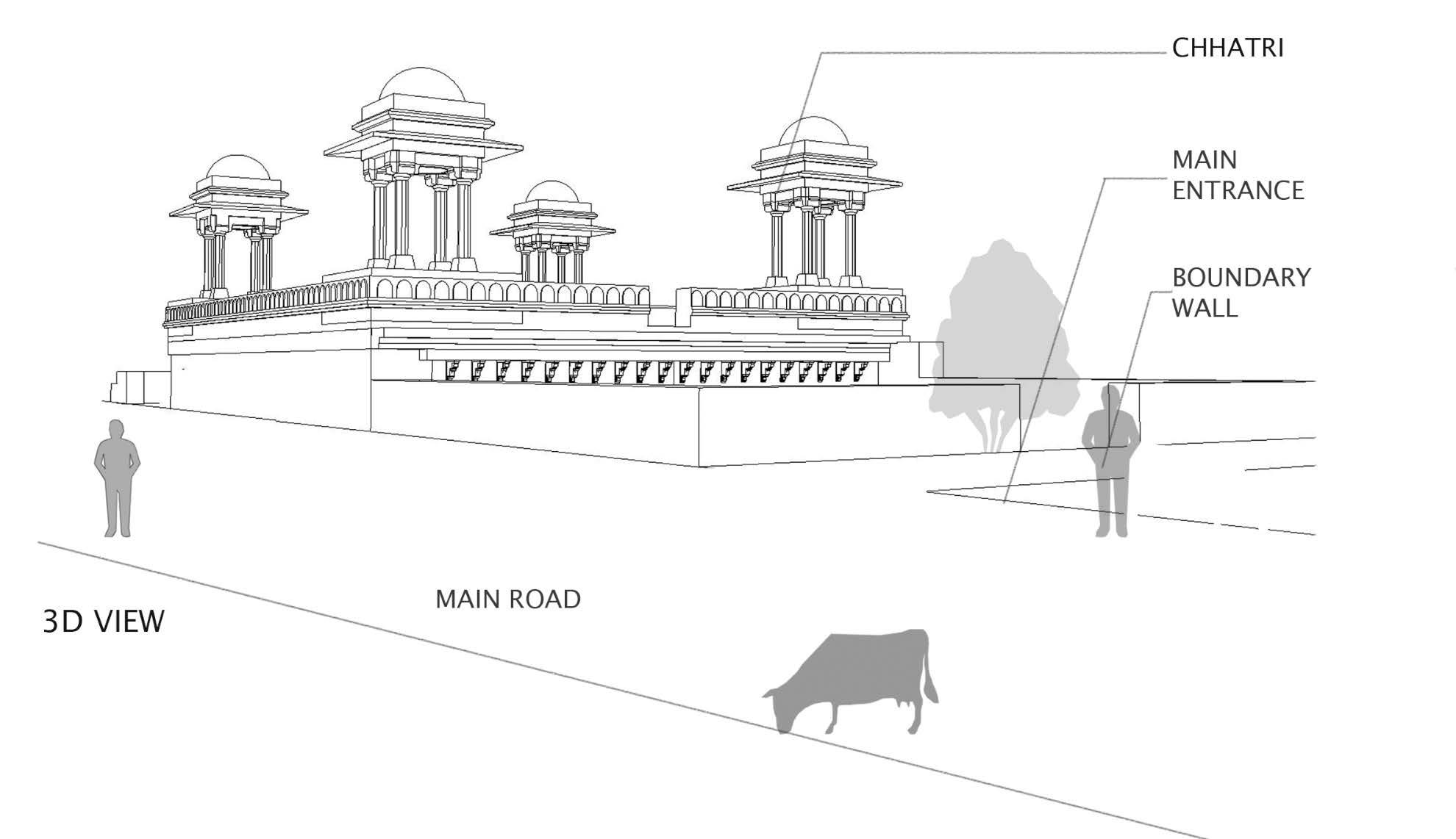
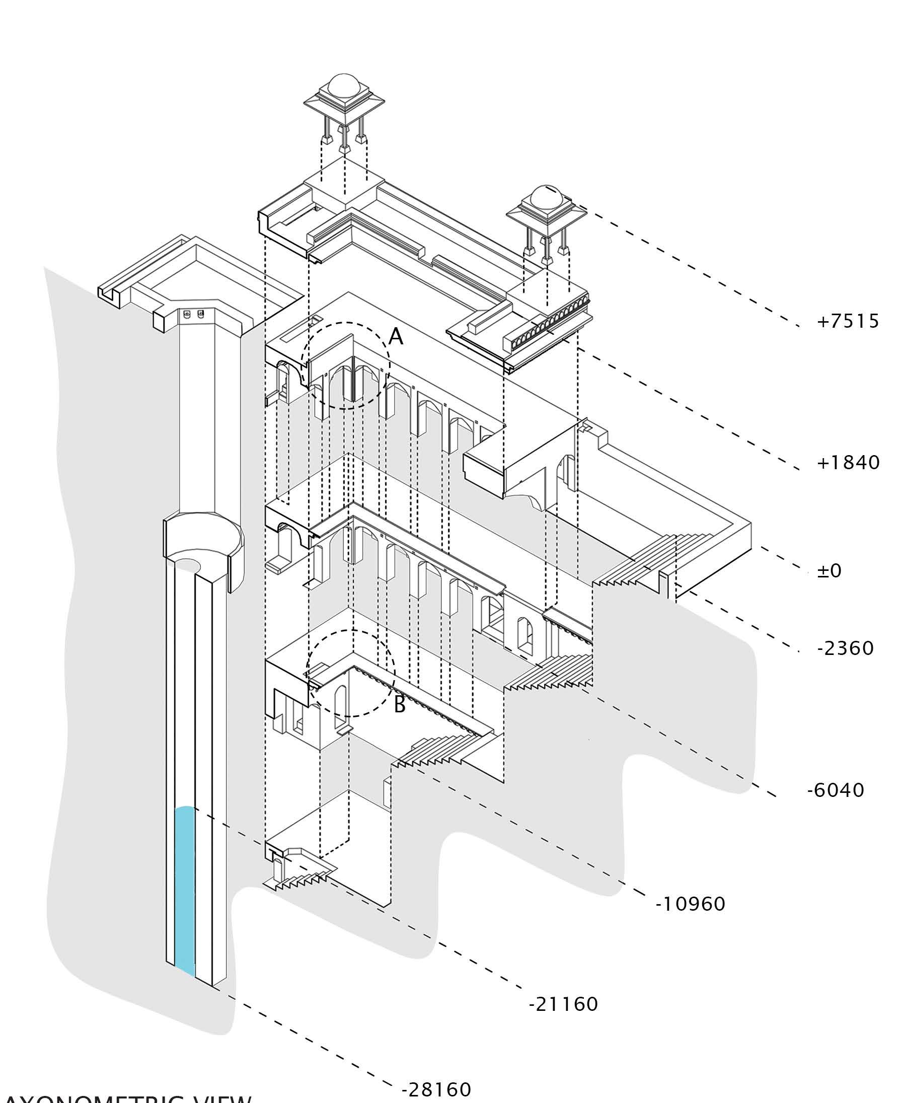
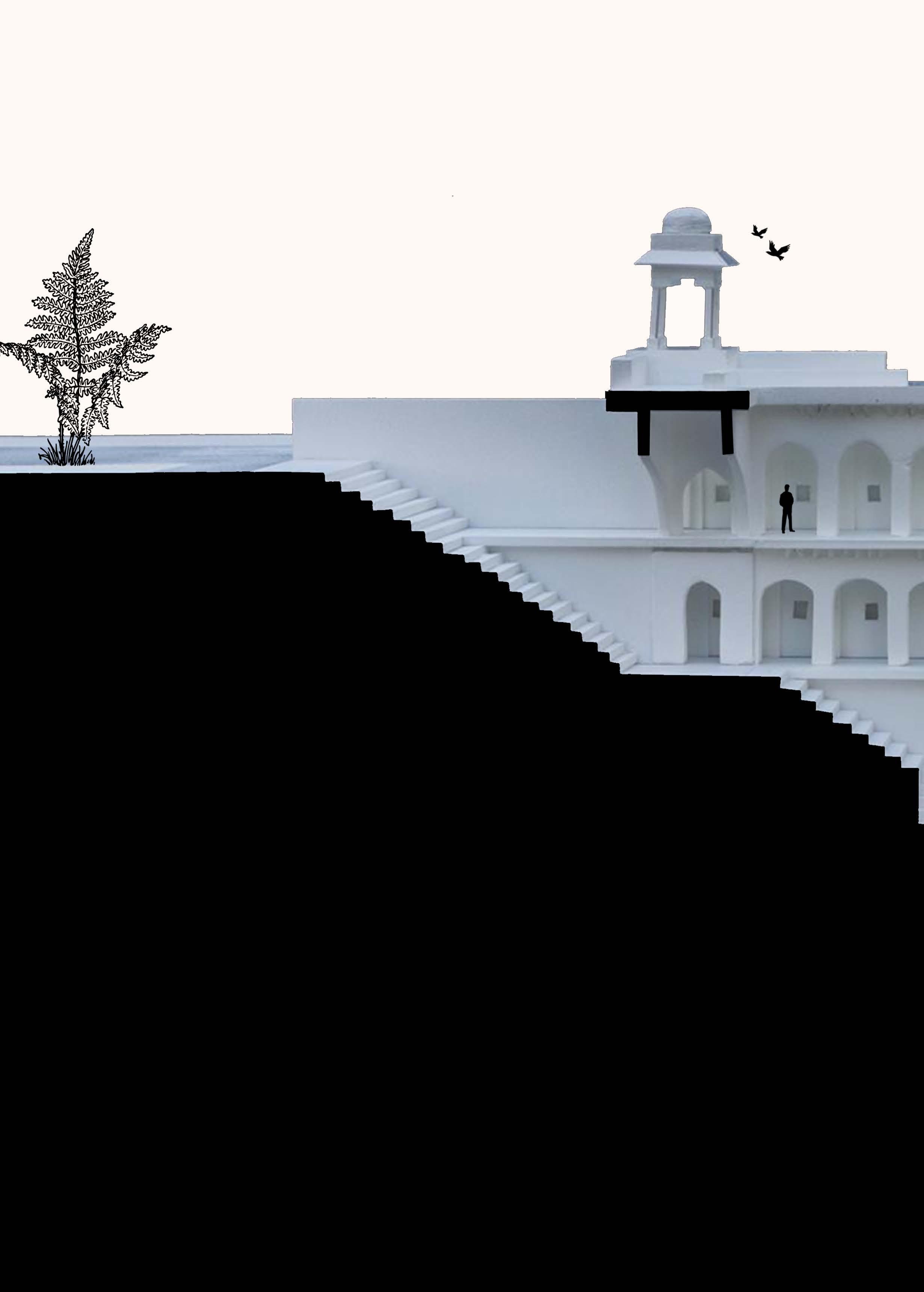
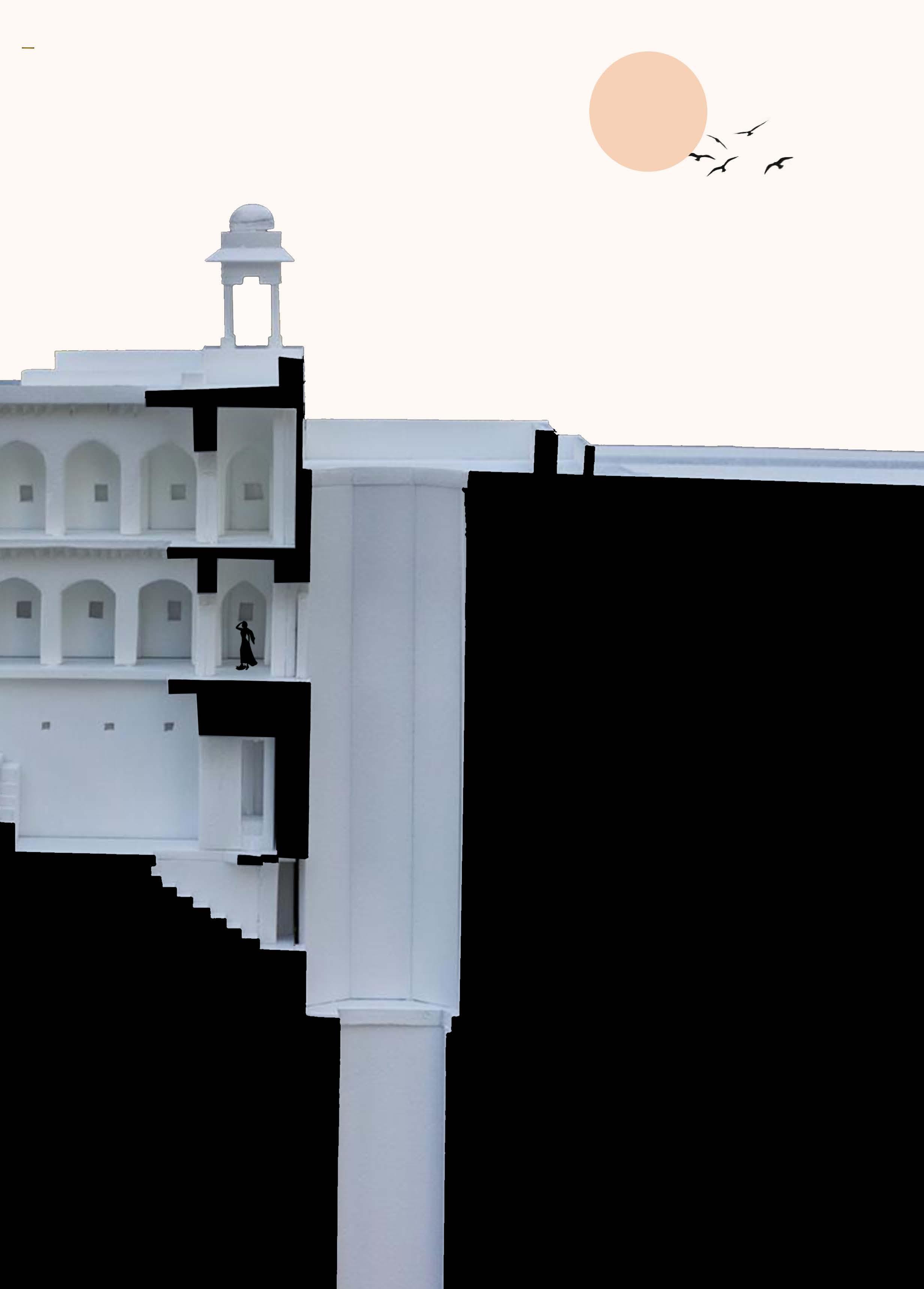
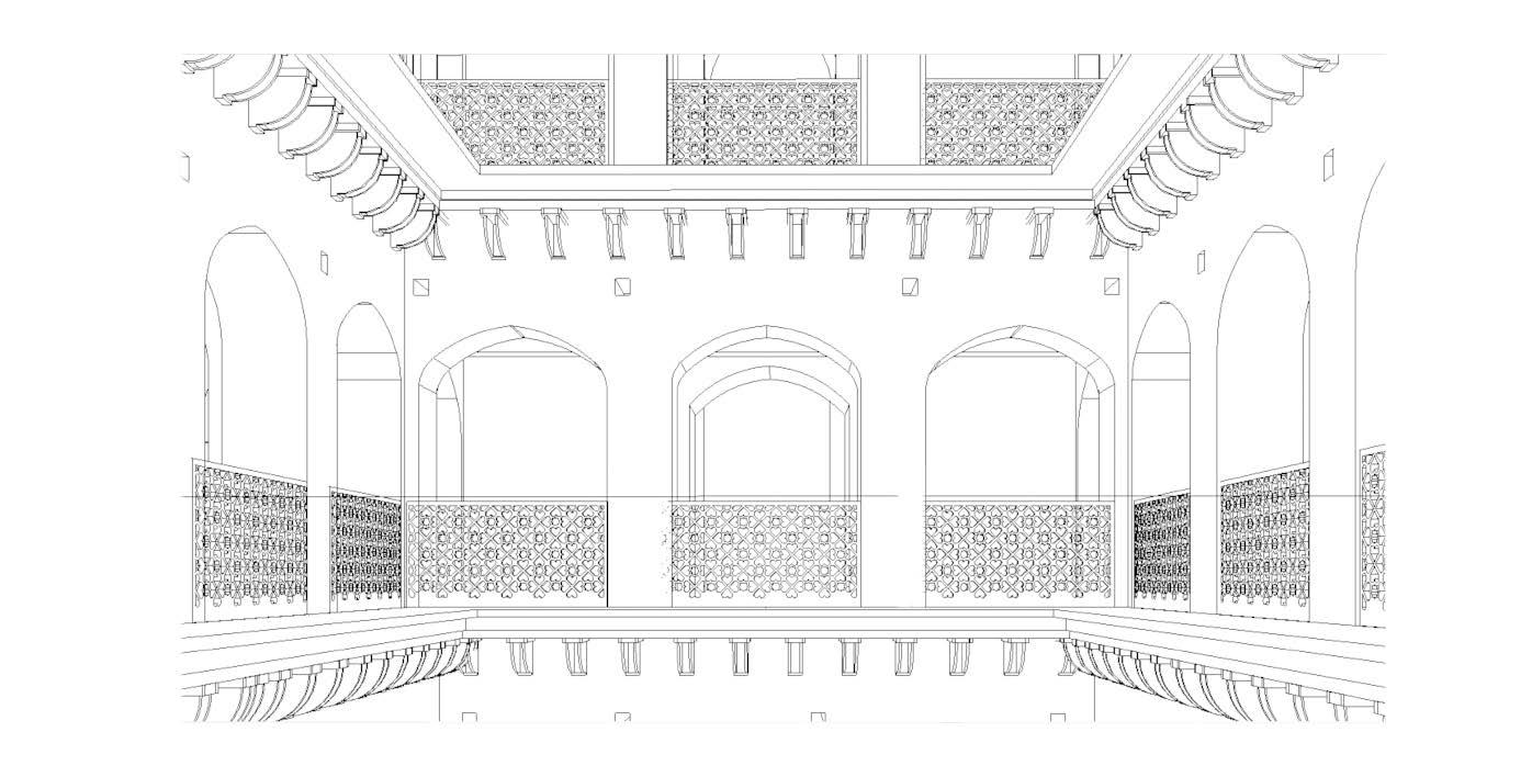
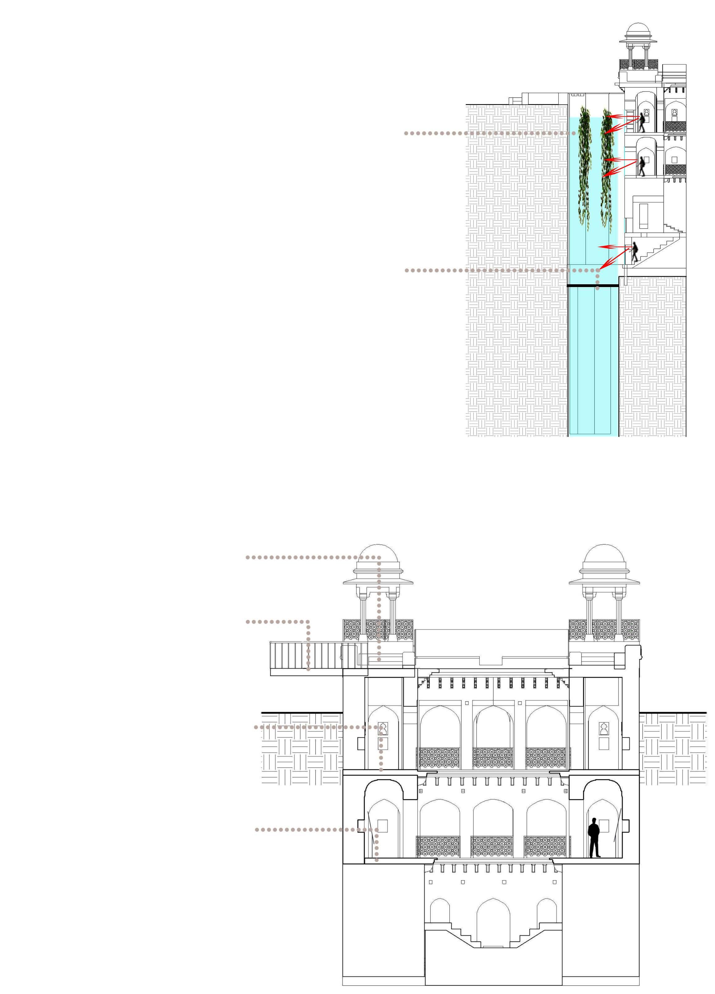
Mukundpura baoli is a one such water structure (a stepwell) located at the village Mukundpur which is situated at a distance of 7-8 km from Mahaveer Chowk in the heart of Narnaul city. It is believed that the baoli is 3-4 centuries old.
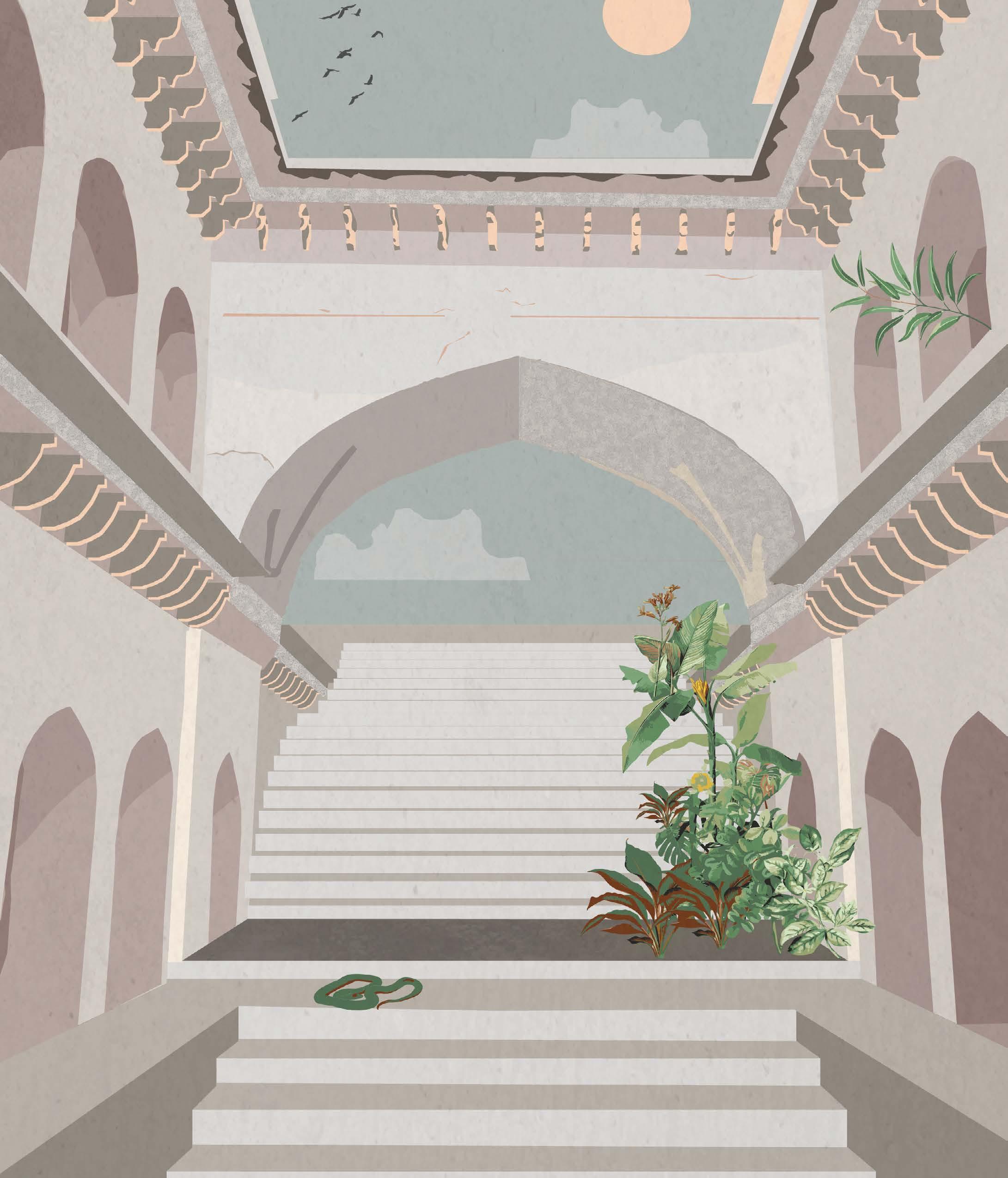
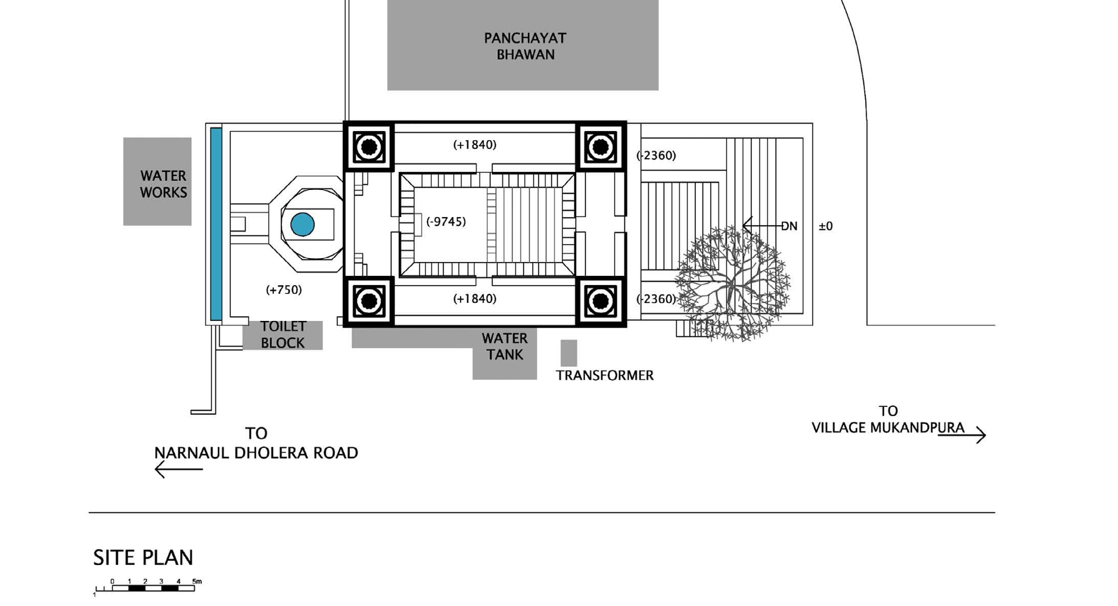
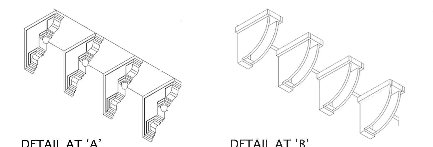
The structure is abandoned at present but it still appears to be in good condition. It is not blemished except for the few details like brackets on the first level, carvings over the niches, and plaster on the exterior façade that are worn-off. As a result of a new intervention, one water tank has been added to the northeast side of the baoli which has one wall in common to baoli. Due to this dampness is entering in the main structure of the baoli because of which plaster is getting chipped off the walls. One can see electric poles right next to the main road approaching the baoli which has unfortunately destroyed the landscape of the baoli.
The concept lies withIn the integration techniques, that makes a building stand out within its own kind.
Texture Colour Existence
Steel Smooth Grey/Black Modern
Using two materials also helps people distinguish between the old and the new.
Reviving the well basically for the 3 main purposes:
As a source of clean water
34 Stone Rough Mustard Ancient
Spreading awareness and values
Revival of the cultural Heritage of Narnaul
Use of oxygenated plants over ropes hung on steel bars fixed to the walls of the well so as to keep the water in the well clear and algae free. these plants grow and assimilate nutrients from the water through their leaves and release oxygen.
Screening at a level so as to prevent any debris from settling at the bottom of the well (that might restrict water flow ) and also act as the first level to clear the water.
Handicraft workshop and gallery space
Historical gallery on water structures of Narnaul
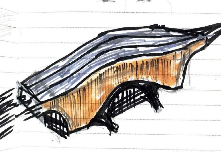
Location: Nishi-Tokorozawa , Japan
Scope of the project: Design a new entrance to already existing station
EKI-YA - A warm and welcoming station like “My Home “ combining tradition and modernity
• A wooden space brings the peace of mind and comfort that the user has returned to his home after a day of extremely hard work.
• The simple station building that takes into consideration the harmony with the surroundings has a presence even in high-density residential areas.
• Continuous wooden structure and distinctive texture make it easy for people to locate the existence of the station.
• The concourse with double-height gives a feeling of openness and connectivity with the exterior.

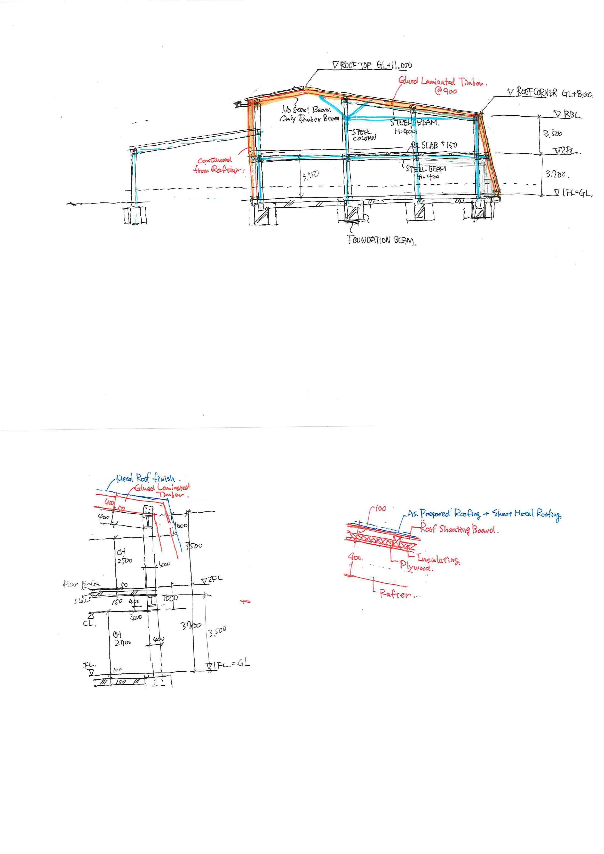 Schematic Planning and Structure Detail | Nishi-Tokorozawa Station
Comparative Studies of the “Impact of Water Management Systems of Evolution and Structuring of Urban Settlements”
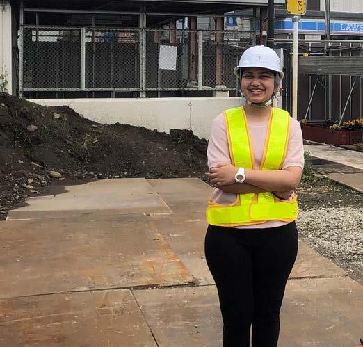
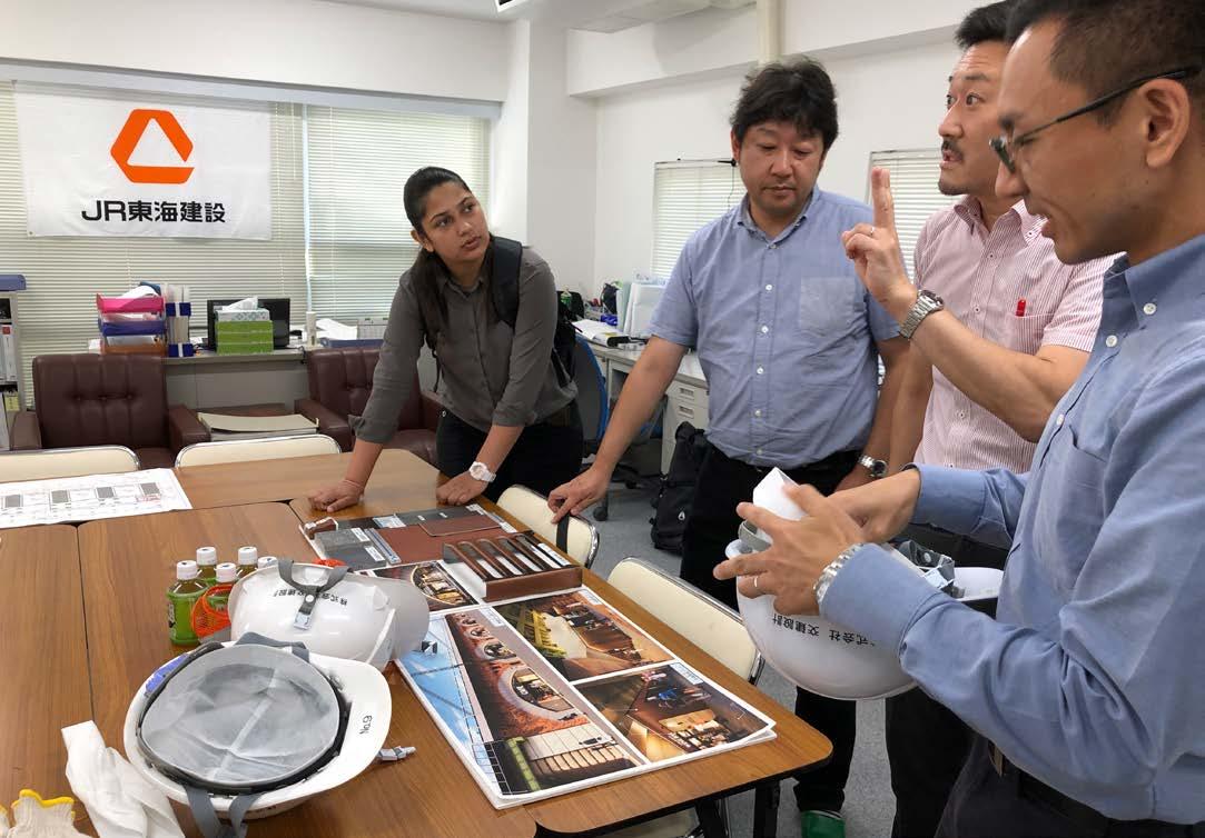
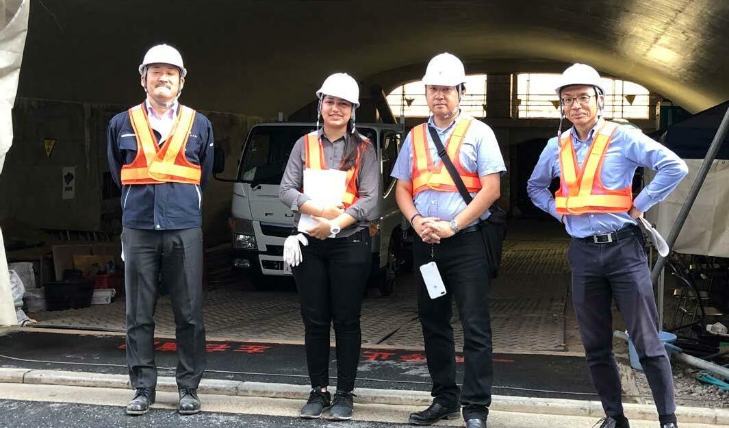
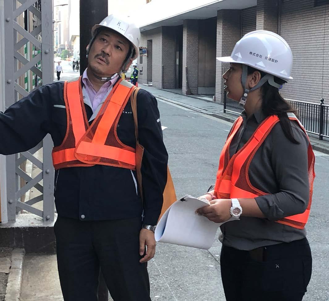

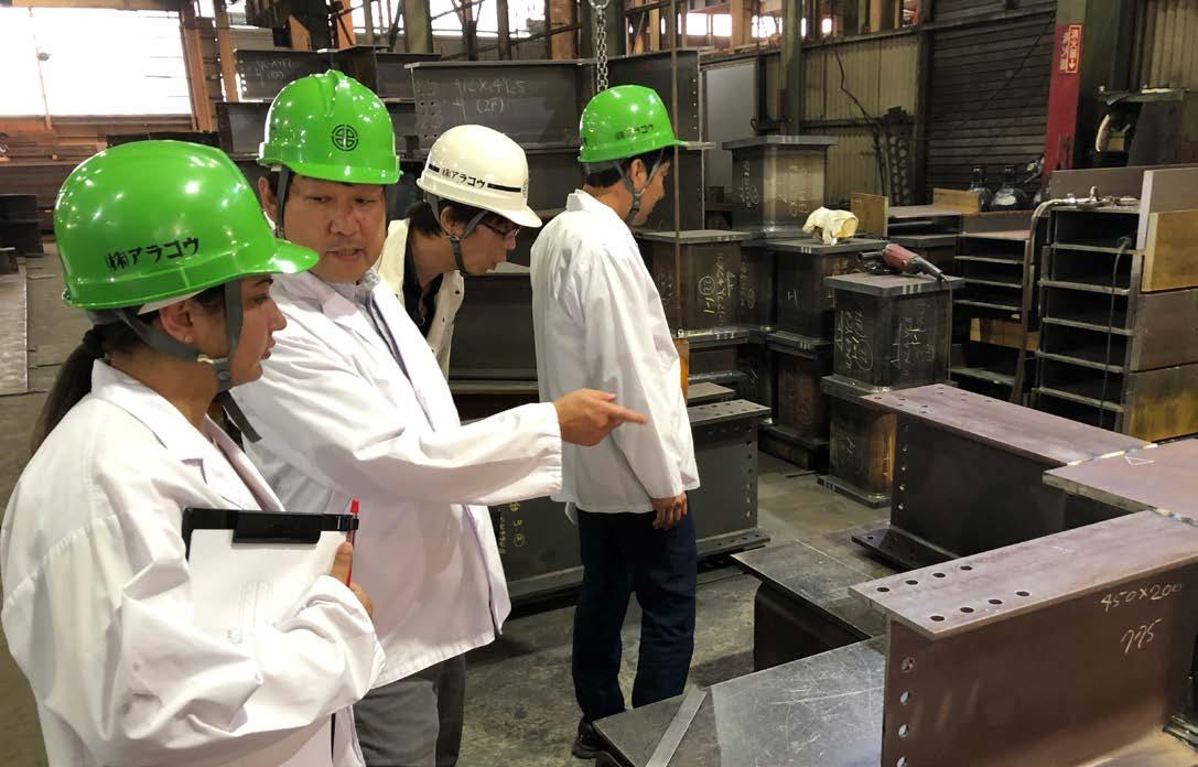
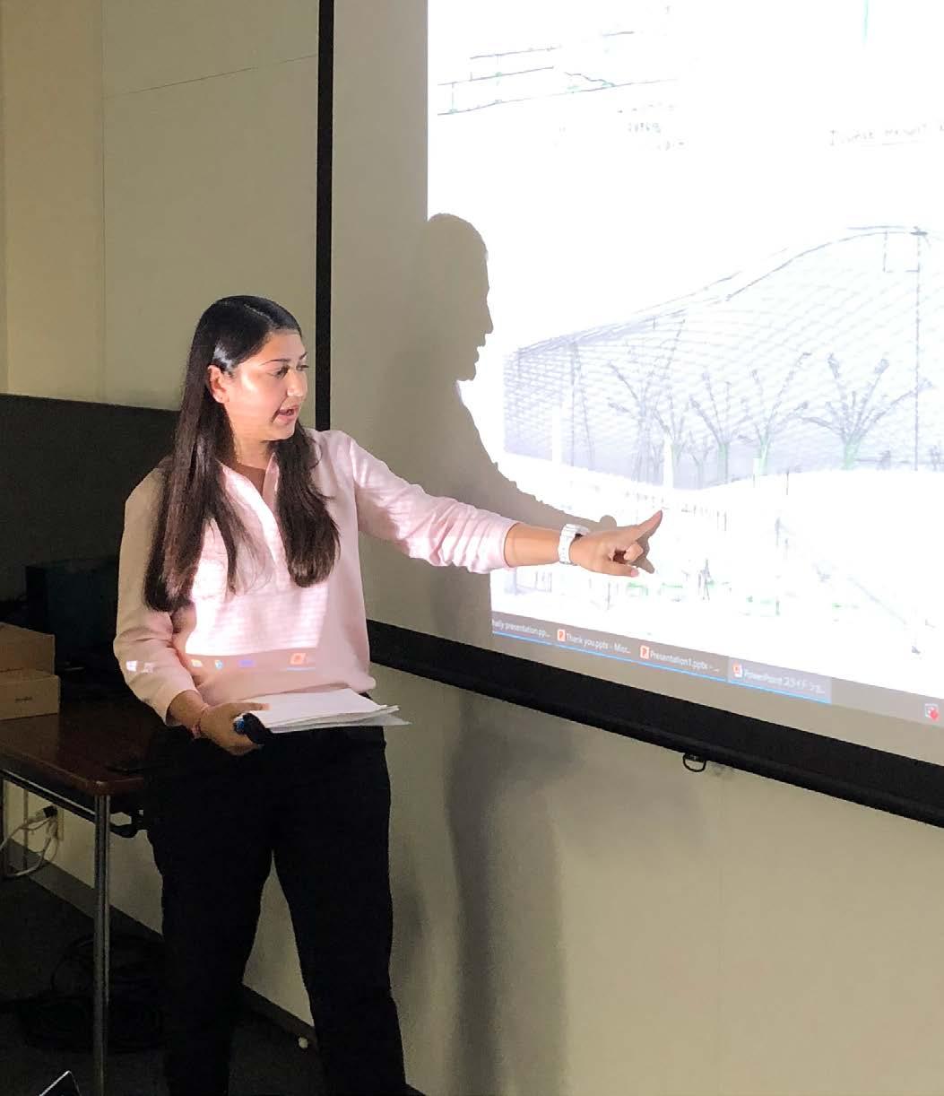
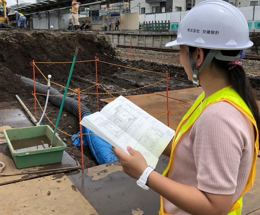 Site Visits
“ ”
Architects have the power to create and design beautiful spaces for the people. But it can only sustain itself, if it is created in balance with the context, environment, and climate.
-Shaily
shaily.s2108@gmail.com