

of Florida 2021 - 2023 Selected Works
PAYTON DANIEL ESTIS Graduate School of Architecture University
CONTENTS
04 COVETED RESOURCES

Qualities to inhibit spacial reference of the Saturn V space shuttle in Kennedy’s Space Center.
16 THE MIRROR TOOL


Fabricating space as a home for the machine. Assembling with an artificial arm.
24 CONGRUENT FLUX: MEASURED LANDSCAPE

A research center for sea level rise in the Panhandle region of Florida’s coastal edge.
34 MULTICULTURAL MUNICIPAL CENTER
Propagating the cities public space and re-framing boundaries.
44 SYMBIOTIC STRUCTURES
Typologies in the Pacific Northwest topographies. An adaptation of the lookout tower.
I I I I I I I I I I | |
COVETED RESOURCES
Qualities to inhibit spacial reference of the Saturn V space shuttle in Kennedy’s Space Center.

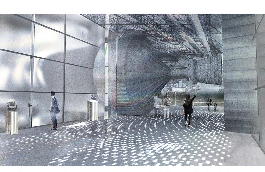
The Apollo/Saturn V Center pays homage to the people and machines that made the improbable possible and the future seem bigger than ever dared to dream. This attraction celebrates the unprecedented achievement of putting humans to the Moon and the complexities it took to get there. Aerogel, a synthetic, porous and ultralight material was a crucial resource utilized in the making of this space shuttle, relating its explored and innovative nature to its discovery. Contextualizing the material in its applications of science becomes the focal point for its relation and scale in a building. Coveted Resources engages the materialistic rarities used in the pursuits of these assemblies, exploring and conceptualizing their intricate attributes into space.
I Brevard County, Florida
I I I I I I I I
Kennedy Space Center
ARCH Graduate Studio II
Semester Spring 2022
P. 04 P. 05
Professor Jason Alread
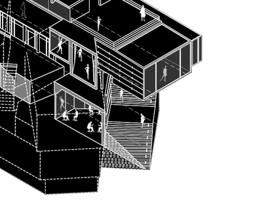
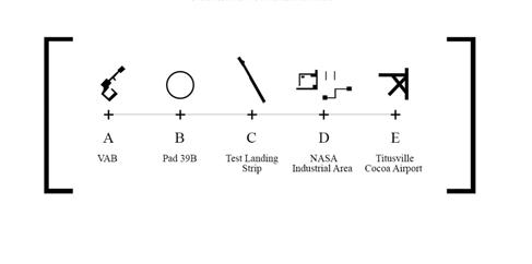
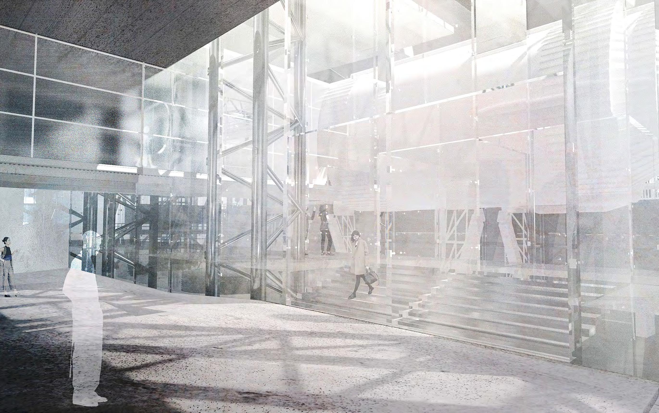
Given the center’s location and context in Merritt Island’s launch area, connection to its environment becomes focal. At a larger scale, the building articulates elements of surrounding infrastructure in the internal and external logic of its conception, performing a reference bounce throughout the space center grounds. Each facility and landmark represents and becomes part of Apollo V’s arrangement, circulation, detailing and articulation, segmented by the phases of the


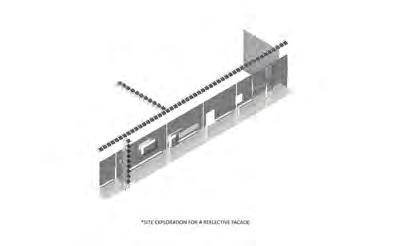
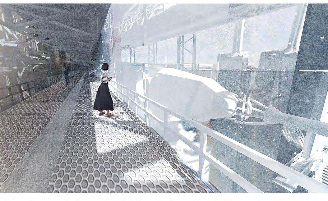
shuttle itself. Externally, this connection is carried through in the facade’s apertures, revealing fragments of Saturn V while mapping the relationships of these landmarks in the building. The entry ramp, guiding the occupant to the moon lander becomes reminiscent of a landing strip, entry points reflective of Titusville’s terminus’s, and programmatic organization following that of the VAB. Connections of a larger context to inform the intricacies of space.

I Brevard County, Florida P. 06 P. 07
I I I I I I I I
Kennedy Space Center
CHARACTERS IN CREATION
Site Map (left) / Cross Section & Facade Studies (above)


I I I Brevard County, Florida
I I I I P. 08 P. 09 I I
Kennedy Space Center
DETAILS OF REFLECTION

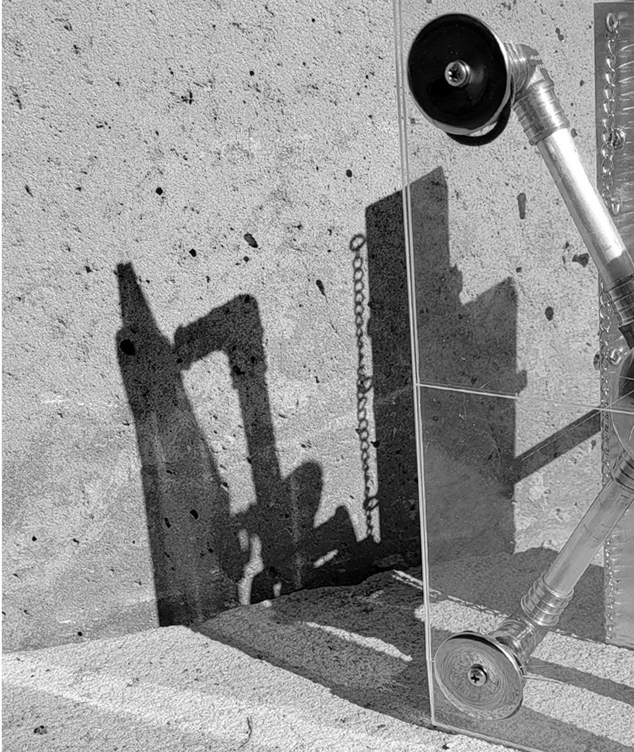
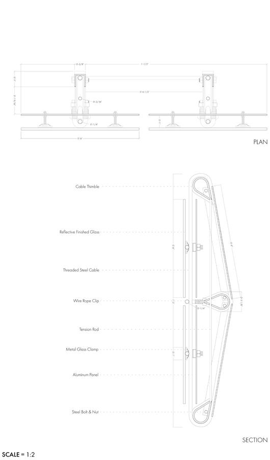
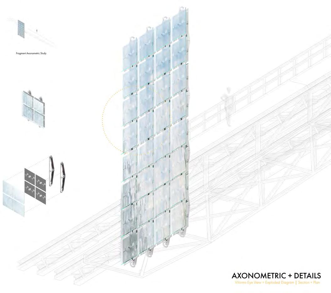
This facade seeks to encapsulate and negotiate the tectonic nature of reflection. A material that becomes the intermediary between the surrounding landscape and its operative skeleton. A complex system, something mechanical that breathes life and brings with it its own logic to hold dialogue with place and an internal monologue of its structure. The construct focuses on the hinge, tension, and rotation. Axial movements that break their rigidity when in conversation with each other and their surroundings. The facade is simplified as a surface and material, but finds its complexity in its framework and context.


I Brevard County, Florida Kennedy Space Center I I I I P. 10 P. 11 I I I I
1:1 Detail Model (above) / Detail Drawings (right) + Elevations (top)
MEANDERING AND GUIDINGTION

Life Safety Plan (above)
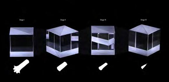
Identify and clearly mark primary and secondary emergency exit routes throughout the Saturn V Center. These routes should provide a direct and unobstructed path to safe areas outside the building. This drawing outlines appropriate fire detection and suppression systems, including, fire alarms and fire extinguishers in accordance with local fire codes.

I Brevard County, Florida
I I I I I I I I P. 12 P. 13
Kennedy Space Center

I I I I I I I P.. 14 P.153
Kennedy Space Center
I
I Brevard County, Florida
THE MIRROR TOOL

Fabricating space as an extension and home for the machine. Assembling with an artificial arm.

ARCH Graduate Studio II
Semester Spring 2022
Professors Jason Alread
The University of Florida has been at the forefront of advancements in machine fabrication, driving innovation and pushing the boundaries of what is possible in this field. Set within Gainesville’s Innovation District, the workshop seeks to expand UF’s campus space for fabrication. At the core of the Fabrication Nexus lies the mechanical arm, a multi-functional tool capable of a wide range of tasks. This arm serves as an extension of the human hand, enabling users to manipulate materials, tools, and components with incredible precision and efficiency. Whether it’s 3D printing intricate prototypes, carving intricate designs into wood, or assembling complex mechanisms, the mechanical arm is an invaluable asset in the fabrication process.
I Gainesville, Florida I I I I I I I I I P. 16 P. 17
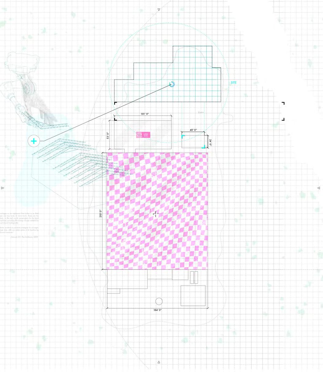
Designing flexible workstations and equipment placement is crucial for a versatile workshop. Utilize modular workbenches, tool carts, and mobile storage units that can be easily reconfigured or moved as needed. This adaptability allows for efficient workflow adjustments and accommodates the mechanic arm’s space requirements for different tasks and projects.
The open floor plan, clearance, adjustable fixtures, clear pathways, integrated utilities, and contribute to a well-optimized workspace. By implementing these design elements, a workshop can provide the necessary flexibility and adaptability to support the operations of a mechanic arm, enabling a wide range of tasks and projects to be carried out with precision and ease.


I Gainesville, Florida I I I I I I I I I P. 18 P. 19
A SYSTEM OF ORAGINZATION Site Plan (left) / Massing & Tryptich Studies (above)
THE HINGE

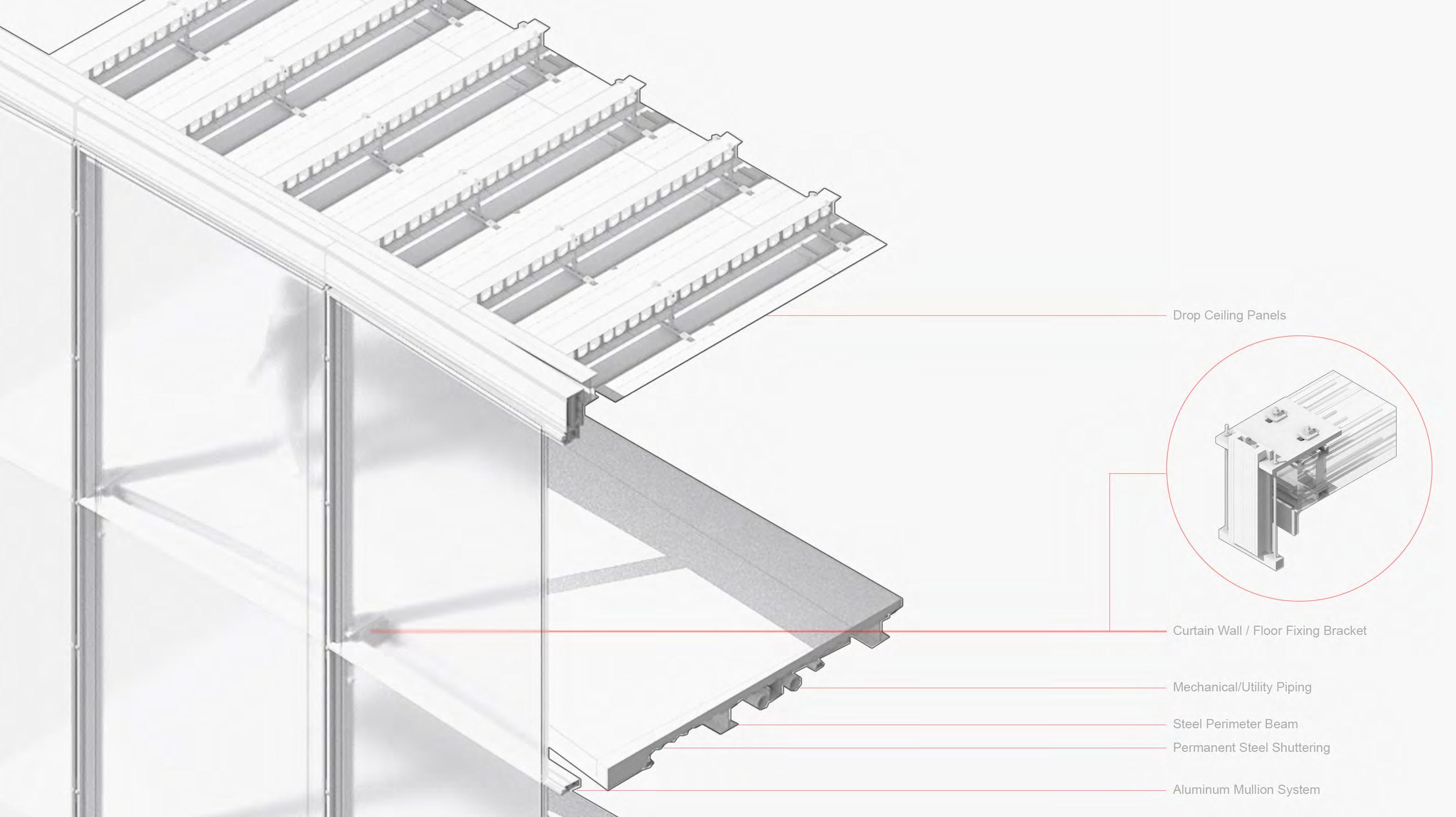
The metal and concrete frame of the glass curtain wall is hidden behind the glass panels, creating a seamless and uniform appearance. The frame is made of lightweight and durable materials, such as aluminum or steel, and is designed to support the weight of the glass panels while also providing structural stability. This sectional model outlines the structural assembly of the connecting glass facade of the lab facility to the workshop.
I Gainesville, Florida I I I I I I I I I P. 20 P. 21
HIGHLIGHTING
Axonometric Curtain Wall Assembly (left)
ACCESSABILITY OF THE ARM

Plans (left) / Workshop Perspective (above)
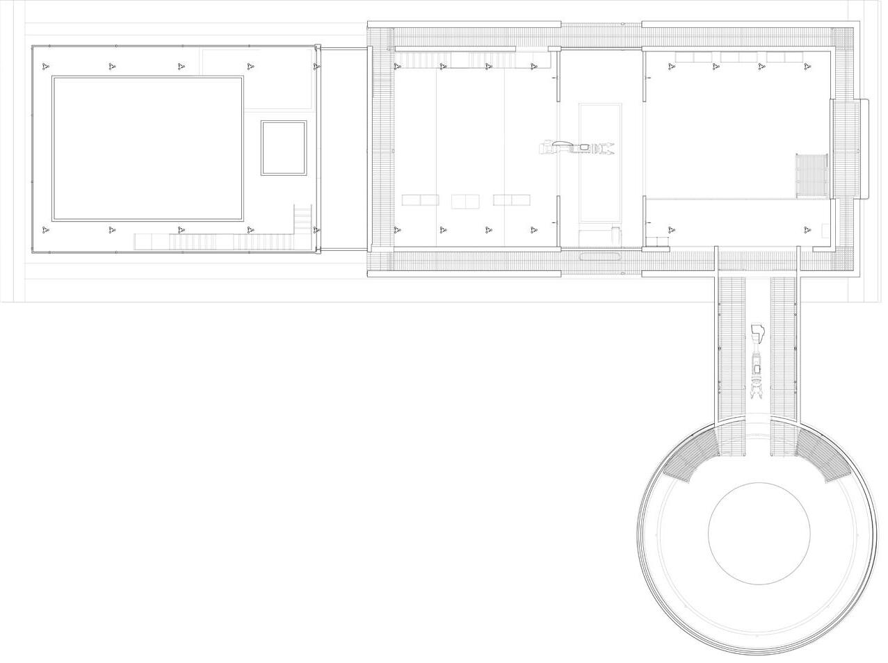
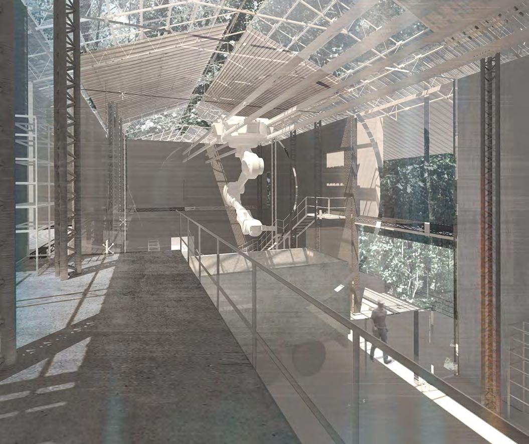
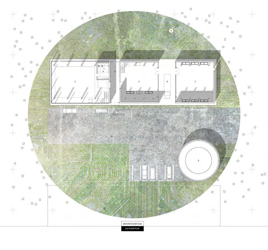
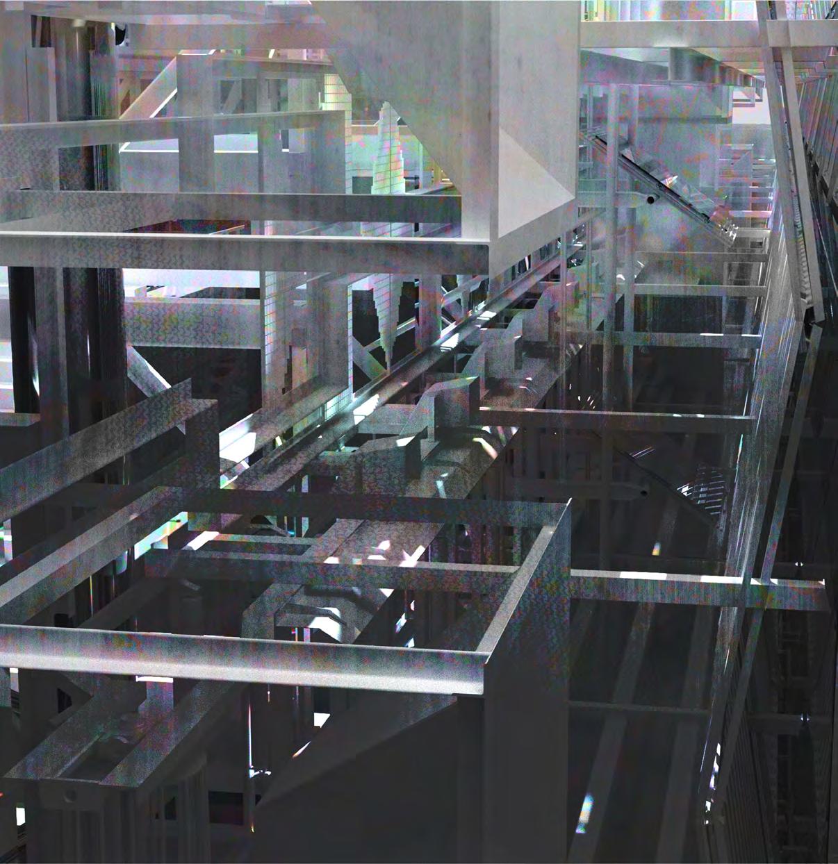
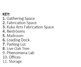
The workshop aims to address the challenges and opportunities related to the integration of a robotic arm into building environments, with a specific focus on ensuring accessibility for all individuals. Its focus is on identifying specific fabrication applications in buildings where a circulating robotic arm can be effectively utilized, such as 3D printing, assembly, material handling, and customization.
Providing the mechanical arm access and movability throughout the maker space encourages collaboration and a workflow that is streamlined through the multifunctionality and shared use of the arm. By sharing knowledge, experiences, and best practices, the workshop aims to advance design strategies, foster interdisciplinary collaboration, and develop innovative solutions that enhance the articulation of robotic arms in building fabrication projects.
I Gainesville, Florida I I I I I P. 22 P. 23 I I I I
CONGRUENT FLUX: MEASURED LANDSCAPE

A research center for sea level rise in the Panhandle region of Florida’s coastal edge.
ARCH Graduate Studio III
Semester Fall 2022
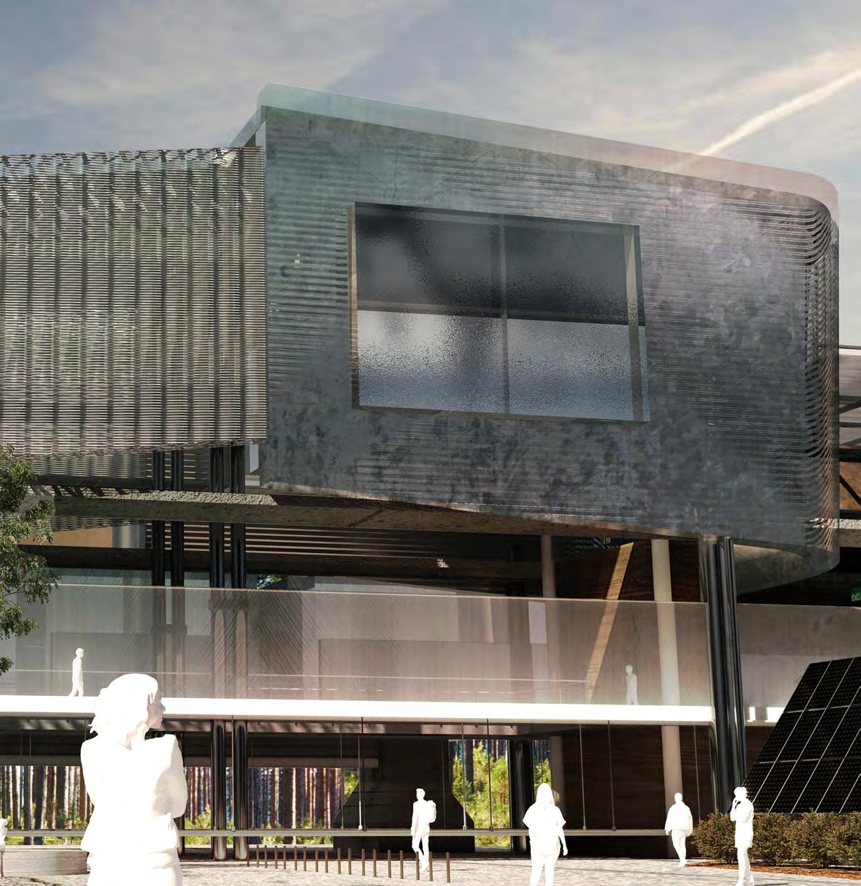
The NERRS (National Estuarine Research Reserve System) research facility on the coast of Cape San Blas plays a crucial role in tracking and measuring sea level rise and anticipating the effects of hurricanes. Located on the picturesque Gulf of Mexico coastline, this state-of-the-art facility serves as a hub for scientific exploration, data collection, and analysis to better understand the impacts of these natural phenomena. Cape San Blas, located on the Florida Panhandle, is susceptible to these powerful storms, and studying their effects is of paramount importance. Researchers at the facility analyze historical hurricane data, storm surge patterns, and atmospheric conditions to develop predictive models that aid in anticipating the intensity and trajectory of hurricanes. This research is instrumental in improving evacuation plans, emergency response strategies, and coastal infrastructure development to mitigate the risks associated with hurricanes. The research conducted at the facility contributes to the larger global understanding of climate change and its impact on coastal regions. The data collected and analyzed here not only provide valuable insights for local management and decision-making but also contribute to national and international efforts to mitigate and adapt to sea level rise and the increased frequency and intensity of hurricanes.
I Gulf County, Florida Cape San Blas I I I I I I I I I P. 24 P. 25
Professors Jeff Carney
POINT OF ARRIVAL

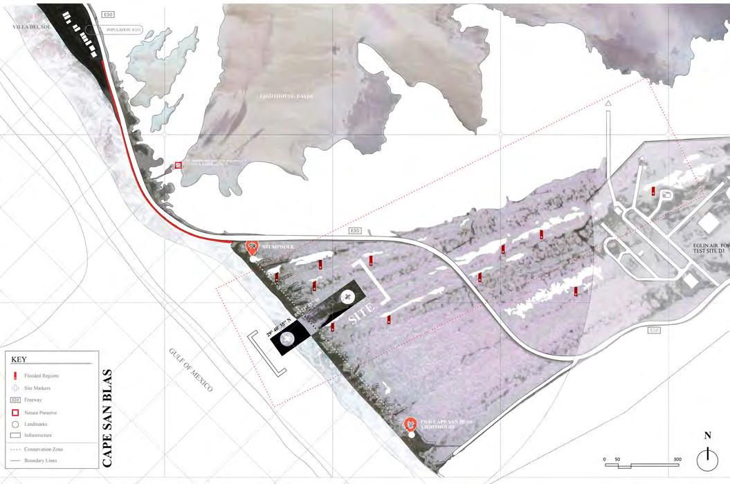
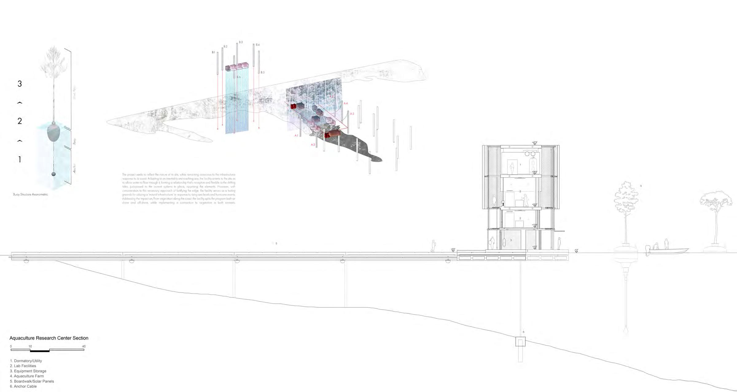
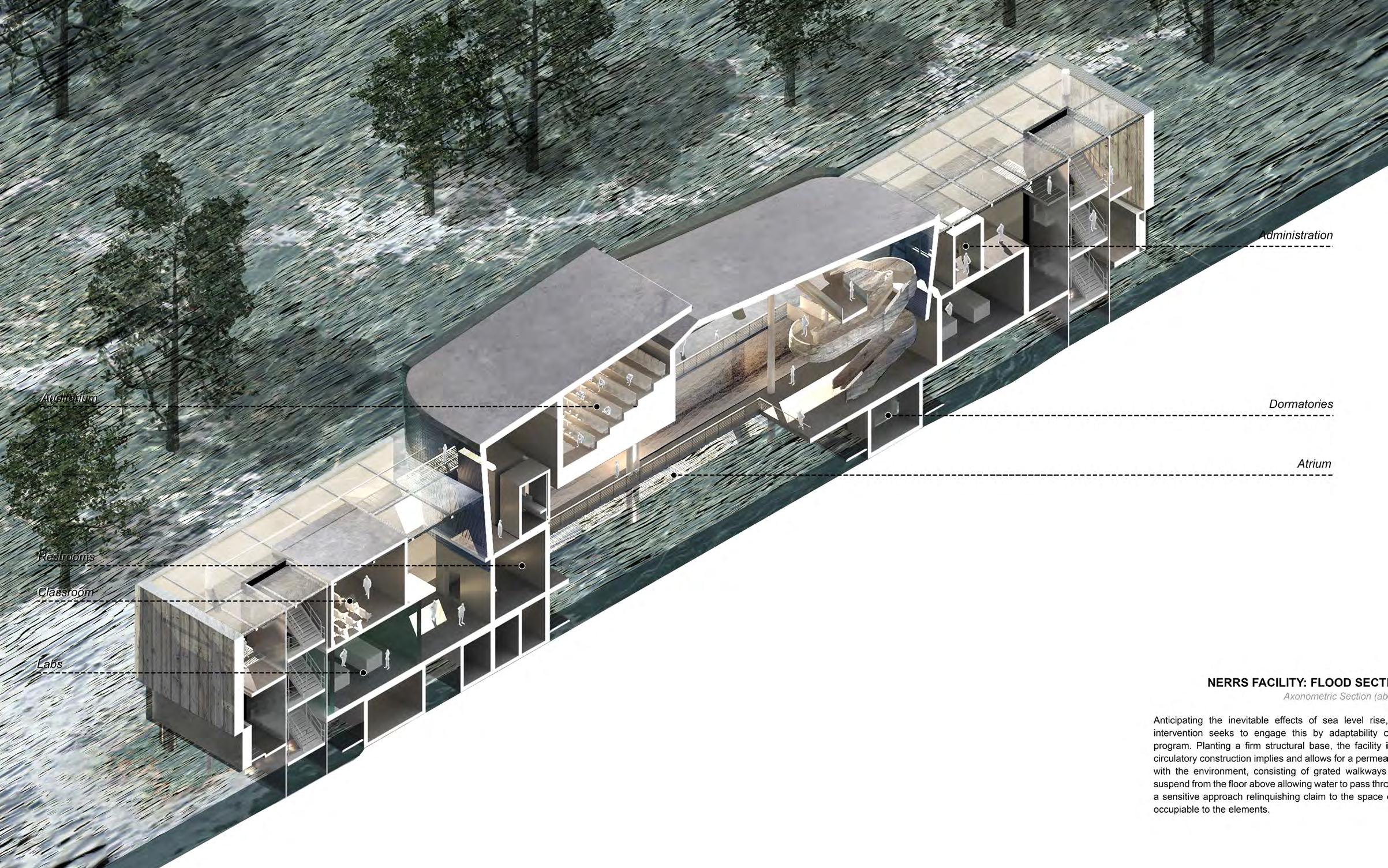
.Adapting to an inevitably encroaching sea, the facility orients to the site as to allow water to flow through it, forming a relationship that’s receptive and flexible to the shifting tides, juxtaposed to the current systems in place, opposing the elements. However, with consideration to this necessary approach of fortifying the edge, the facility serves as a testing grounds for utilizing a ‘natural infrastructure’ in response to rising sea levels and hurricane events. Addressing the impact


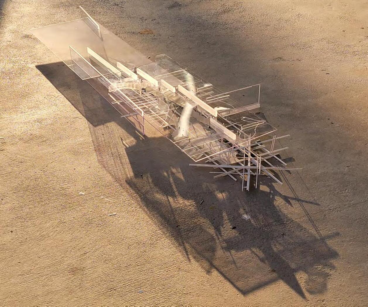
on / from vegetation along the coast, the facility splits the program both on shore and off-shore, while implementing a connection to vegetation in both contexts. Implementing the studies and mapping of the transect, the intervention explores methodologies of connecting, measuring, and testing conditions to an impermanent environment. Adaptive and permeable qualities become crucial to the longevity of this facility in its efforts to measure and engage the effects of sea level rise.

I Gulf County, Florida Cape San Blas I I I I I I I I I P. 26 P. 27
Site Map + Conceptual Sketches (above) / Transect Model (right)

I Gulf County, Florida Cape San Blas I I I I I I I I I P. 28 P. 29
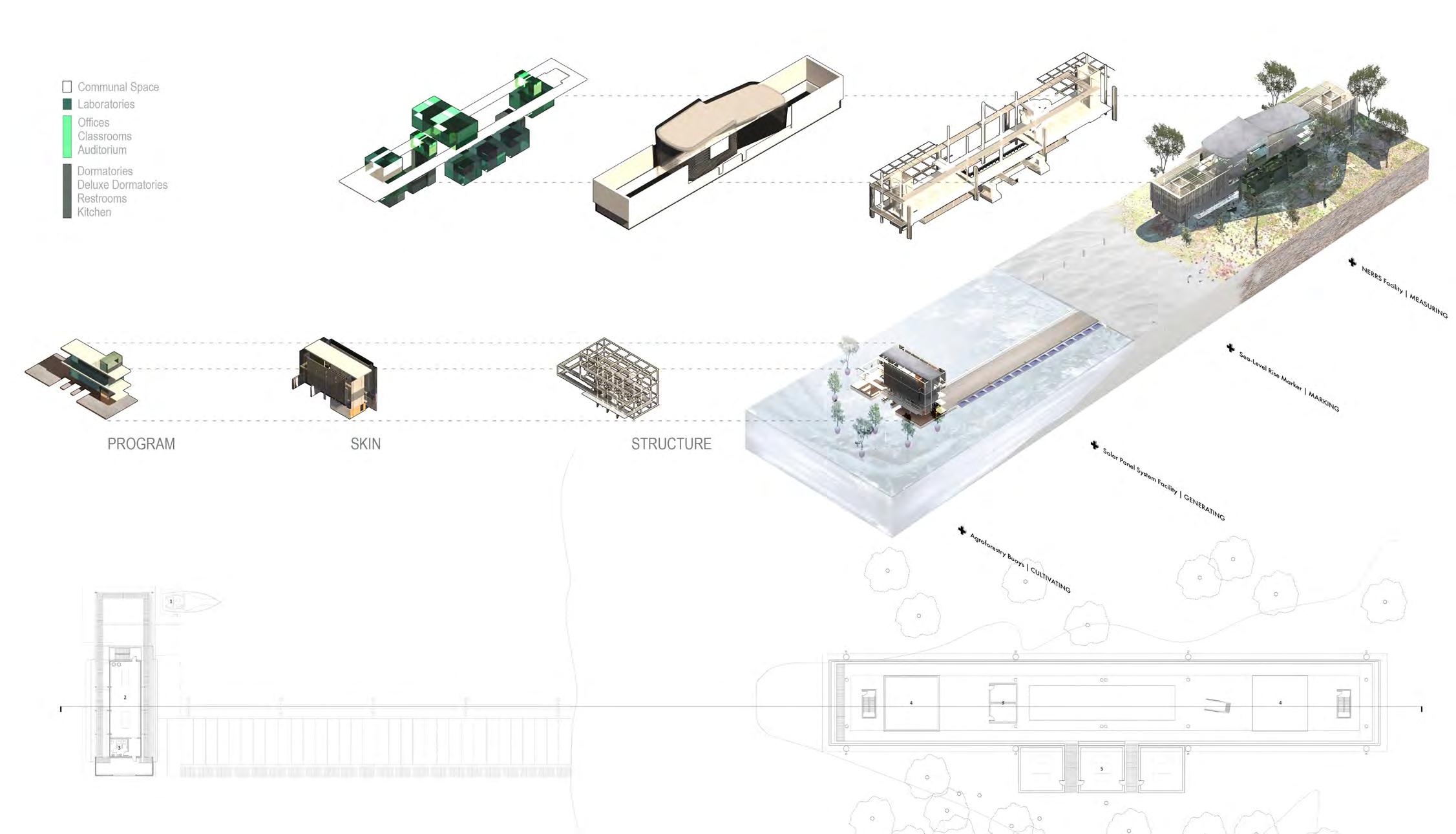
By extending the facility into the water, exposure to the elements becomes increasingly high. Inversely to the research center on land, engaging methods of permeability for sea level rise, this intervention seeks to resist it. Creating/ utilizing tree buoys, the harbor becomes a testing ground for hydroponic growth, measuring the potential for an artificial


berm through a system of trees tethered at the continental shelf. Eventually growing into a forest, this harbor would become both resistant yet adaptable to the effects of climatic changes and events. Anticipating the events of a hurricane in the region, the materiality of the facility reflects these considerations.
I Gulf County, Florida Cape San Blas I I I I I I I I I P. 30 P. 31
HYDROPONIC HARBOR Harbor Perspective (left) / Harbor Section (below)

Cape San Blas I I Gulf County, Florida I I I I I I I I P. 32 P. 33
MULTICULTURAL MUNICIPAL CENTER

Orlando, Florida, is a city known for its vibrant and diverse community, rich cultural heritage, and ever-evolving identity. This diversity and complexity are beautifully reflected in the city’s buildings, which serve as architectural representations of Orlando’s multifaceted character. From historic landmarks to modern structures, Orlando’s buildings tell a story of cultural fusion, innovation, and the interplay of various influences. In recent years, Orlando has witnessed a wave of urban revitalization, transforming neighborhoods and giving rise to innovative architectural projects. Buildings like the Dr. Phillips Center for the Performing Arts and the Creative Village downtown are examples of this revitalization, repurposing and transforming existing structures into vibrant cultural and community spaces.
Lake Eola Park, located in the heart of downtown Orlando, Florida, is a bustling urban oasis known for its natural beauty and vibrant community atmosphere. As a reflection of the city’s multicultural identity, Lake Eola Park is home to a unique multicultural building. This building stands as a testament to Orlando’s rich diversity, serving as a hub for cultural exchange, community engagement, and celebration of various traditions.

PROPAGATING THE CITIES PUBLIC SPACE ARCH D6 Studio Semester Spring 2020
Lee-su Huang I I Lake Eola Park I I I P. 34 I Orlando, Florida I I I I P. 35
Professors
Situated on a street corner, the intervention becomes public space is a captivating plinth meticulously designed to seamlessly extend the city street, serving as a dynamic hub of social interaction and cultural activities.

Ultimately, this architectural public space serves as a vital extension of the city street, pulling back from the edge, elevating the urban experience and offering a haven of creativity, cultural exchange, and communal gathering.


I I Lake Eola Park I I I P. 36
PUBLIC PLINTH
I Orlando, Florida I I I I P. 37
Massing Model (above) / Elevations (right)


I I Lake Eola Park I I I P. 38 I Orlando, Florida I I I I P. 39
By dedicating the ground level to public space, the building fosters a sense of community and belonging. It becomes a focal point for various events, markets, and cultural activities that bring people together, promoting social cohesion and enhancing the overall quality of life in the area. Residents, visitors, and local businesses benefit from the increased foot traffic, creating a vibrant and economically thriving district.

The conceptualized model articulates through massing the organization and separation between private and public function. The library becomes an interweaving of the two, creating multiple levels for a public library that provides direct access to the city. Transparency into the tower stack is crucial for natural light to enter during the day for readers while providing views, unobtrusive to other high rises.


I I Lake Eola Park I I I P. 40 I Orlando, Florida I I I I P. 41
ARTICULATING PRIVATE/PUBLIC SPACE Conceptual Model (left) / Interior Perspectives (above)


I I Lake Eola Park I I I P. 42 I
Florida I I I I P. 43
Orlando,
SYMBIOTIC STRUCTURES
Typologies in the Pacific Northwest topographies. An adaptation of the lookout tower.
For over a century, throughout the United States, state and federal governments have fought tirelessly to extinguish wildfires, primarily and extensively along the western region. Though many ecosystems in this region rely on fire as a facilitator for self-maintenance, we have historically considered fire suppression to be synonymous with virtuous preservation. Along the mountainous ridges, peaks and forests of the Pacific Northwest lie the relics of a past means of observation and surveillance of landscape, transitioning these structures to historical markers time-stamping a method of constructing for place.
Professors
John Maze

Michael Montoya
This thesis explores the role of the lookout tower in its modern context and initiates an adaptation of these constructs in their ever-changing conditions. Reflecting on the streamlined, industrial production of these structures, leading to a standardized identity in a sui generis landscape, the analysis strives to result in an idiosyncratic approach; entwining a programmatic symbolism as a solely observational and preventative typology, but how these constructs begin to operate, reflect, and engage in their environments as foreign inhabitants.

P. 42 I I I I
Range I
Cascade
ARCH PILOT Thesis
Semester Spring 2023
P. 43 I Washington, US I I I I
MIRRORED LANDSCAPES
Conserving a ruin, an intervention houses the relic/ artifact of the towers remaining structure, while posing as a new functioning tower to commemorate the history of Diamond Peak. Connection between peaks throughout the region will merge the context of the original site, becoming way-finders in a landscape. As the hiker sets out on their journey through the dense forest, they couldn’t help but feel a sense of trepidation. They had heard rumors of an abandoned lookout tower deep in the woods, and they were determined to find it. But the forest was vast and uncharted, and they knew it would be easy to get lost. As they walked, they noticed some unusual structures that seemed to have been intentionally placed throughout the forest, despite their unique constructions.
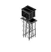

The structures were made of wood, and some were shaped like arrows, while others were tall and pointed, resembling obelisks. They were spaced out at regular intervals, and as the hiker walked, they realized that they were working as way-finders to guide them to their destination. The structures were spaced out perfectly, and each time the hiker saw a new one, they felt a sense of relief, knowing that they were still on the right path. The way-finders were placed at key junctions, leading the hiker down the clearest and easiest paths through the dense forest. As they followed the way-finders, the hiker moved through the forest with ease, knowing that they were on the right path. The forest was thick, and the underbrush was dense, but the structures led them through the clearest paths, showing the way forward.


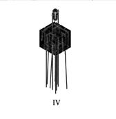
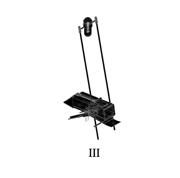
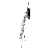
VI PROPOSED LOOKOUT FOLLIES I I I I Diamond Peak I P. 46
I I I P. 47
I Pend Oreille, Washington I


I I I I Diamond Peak I P. 48 I Pend
Washington I I I I P. 49
Oreille,
The lookout tower manifests from the old, encapsulating the original structure that registers with the mirrored lens that reflects out to the forest, symbolic of the purpose it once served. The morphosis of its structure adapts with its place, becoming a structure comprised of steel members at its foundation, but housing a traditionally wooden cab at its summit. Like its current state, in the result of a forest fire, the lookout follows a cycle of degradation, scorching the wooden structure that remains, leaving behind new remnants of an old standing structure, waiting to re-inhabited.


I I I P. 50 I Diamond Peak I
I Pend Oreille, Washington I I I P. 51 I
EYE IN THE FOREST Lookout Section (left) / Study Model (above)
Miners Ridge was so named thanks to an abundance of early 1900s mining activity in the area. The first lookout constructed on the summit was a 10’ x 10’ shake cabin in 1926, followed by a 20’ timber L-4 cab in 1938. In 1953, the L-4 cab was replaced by another 20’ treated timber L-4 cab, which is the structure that exists today.
Parts of the existing Suiattle River trail were a road until 1984 when the Glacier Peak wilderness was expanded. In 2015, the Suiattle River road reopened after a decade long closure due to severe flood damage.
As one of the few remaining posts actively in use during certain seasons, this graft seeks to assist in occupying during extreme conditions, shifting to all year habitation. Being a historic preservation, the machine becomes a delicate extension, and the Swiss knife of the lookout typology.


I I Miner’s Ridge I I I P. 52
I I I P. 53 B13
I Darrington, Washington
I
The lookout tower on Miners Ridge has been transformed into a state-of-the-art machine for living. The tower now boasts programmatic pods that can be easily swapped out based on the season, allowing for a comfortable living experience no matter the weather. Each pod is fully equipped with a bedroom, bathroom, and kitchenette, and designed to be modular for easy upgrading and swapping.


The pods are connected by a central staircase that winds its way up to the top of the tower. The tower’s new design is a testament to human creativity and innovation, showcasing how even abandoned places can be transformed into remarkable living spaces. The tower has become a beacon of hope and inspiration, attracting visitors from all over the world who come to marvel at its unique design and functional features.

I I Miner’s Ridge I I I P. 54 I Darrington, Washington I I I I P. 55
A MACHINE FOR LIVING
Regional Map (left) / Exploded Axonometric (above)


I I Miner’s Ridge I I I P. 56 1st Floor Plan Kitchenette / Water Tank Section I Darrington, Washington I I I I P. 57 2nd Floor Plan Bunk Room / Log Storage Section


8 9
I I P. 58
Miner’s Ridge I I I
I I P. 59
I Darrington, Washington I
I
COLLECTOR’S CONTRIVE

Whitestone was first established as a fire lookout camp in 1922, then an L-4 ground house was built in 1935 by the CCC for an approximate cost of about $900. By 1960, the cabin was in very poor shape due to age, weathering, and shifting of the rocks upon which the foundation was built.
A new lookout was proposed and a 20′ tower with R-6 cab replaced the L-4 in 1964. In 1985, a third structure was built on the summit, the existing 53′ steel tower with live-in cab. It remains staffed every summer.
While the intervention of maintenance plays a role in longevity, materiality itself marks a relationship with landscape. Material Ecology is an emerging field in design denoting informed relations between products, buildings, systems, and their environment.
 I Kanisku National Park, Washington I
I I
I I I P. 60
Whitestone Ridge
I I P. 61
I
CARVING A CLEARING
Deep in the heart of a dense and sprawling forest, nestled amidst a thick grove of trees stands a structure, serving an important purpose. The structure, growing in its surroundings, becoming the sum of its parts as it materializes from the forest, designed to support the process of thinning the surrounding woods. As the seasons change and the trees grow, they would often become overcrowded and compete for resources like water and sunlight. This could cause some trees to become stunted or unhealthy, and could even increase the risk of forest fires.
Whitestone Ridge I


To prevent these problems, the foresters who manage the woods would periodically thin the trees, carefully removing selected ones to create more space and light for the others. The facility is the central hub for this process. Inside lies a series of interventions within the structure, providing programmatic spaces of operation. A gathering space, where the foresters convene to plan their strategy and review their progress. A loading station connecting to a ban-saw for dimensional cutting and assembling.

I I
I I P. 62
I Kanisku National Park, Washington I I I I P. 63
Regional Map + Model Plan (above) / Axonometric Perspective (above)
Looking to longevity, what is its role and what is the value we place on this term? In what regard does this constitute the manufacturing and decision of materials? By nature, and in its rite, the material practice of craft is informed by matter, its method of fabrication, and by the environment. Ironically, the resources we use pull from the Earth, but often designed to outlive and withstand the timeline of elements in nature. But could there be a balance between vitality and a yield to nature, allowing for a

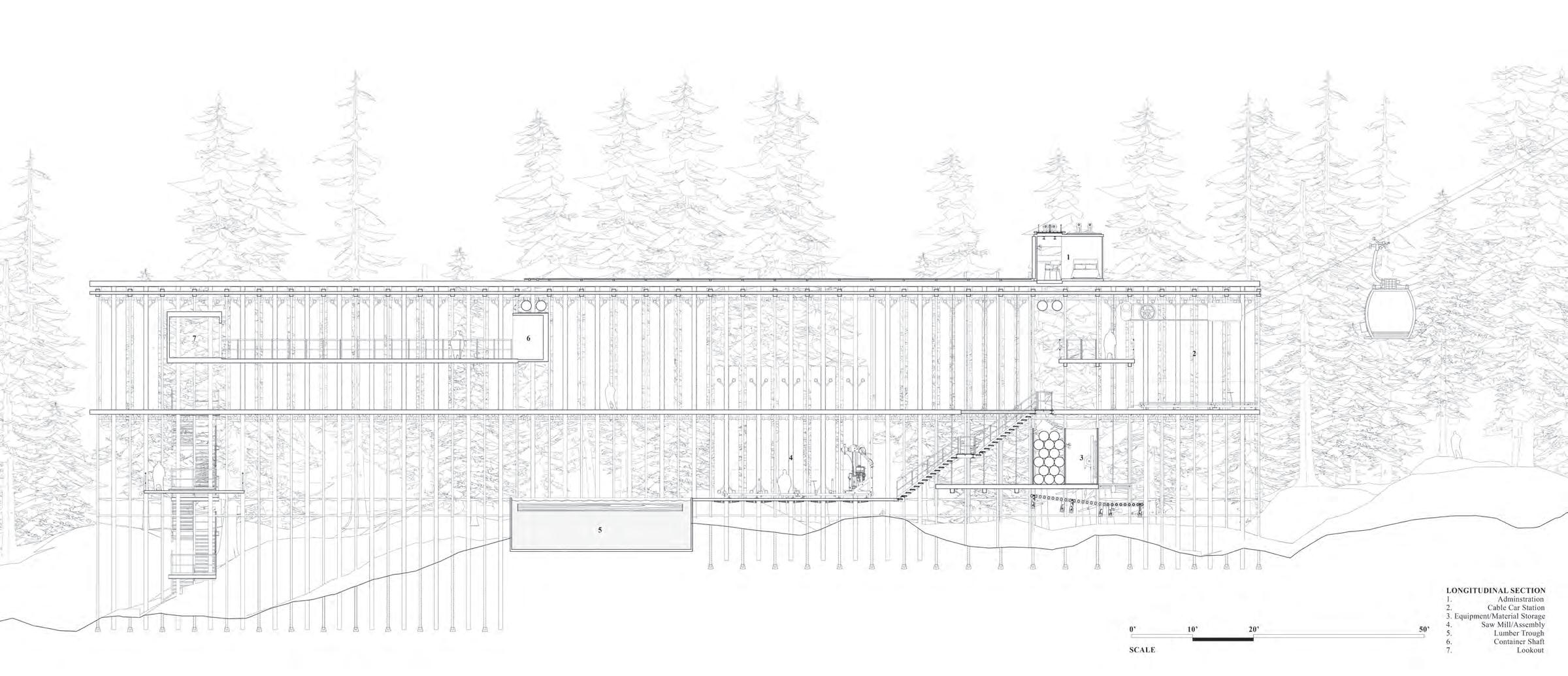
seamless integration into a place, allowing for the environment to lay claim or make architecture its home? While the intervention of maintenance plays a role in longevity, materiality itself marks a relationship with landscape. Material Ecology is an emerging field in design denoting informed relations between products, buildings, systems, and their environment. As the collector’s contrive extends, so does the programmatic insertion for gather. Lumber hoisted, cut, dropped and removed for an adapting structure, a living machine in the forest.
I I
I I P. 64
Whitestone Ridge I
PROCESS TO EXPANSION Longitudinal Section (above)
I I I Kanisku National Park, Washington I I P. 65
Through the logging process, in the aftermath of soaking the lumber for cutting, the rough cuts are hoisted up through pulley cables. This system serves two functions; for the foresters, it creates a wall on the second level circulation as protection from the elements while providing the lumber to dry and prevent pests and rotting to occur on the forest floor.


I I Whitestone Ridge I I I P. 66 I I I
I I P. 67
Kanisku National Park, Washington
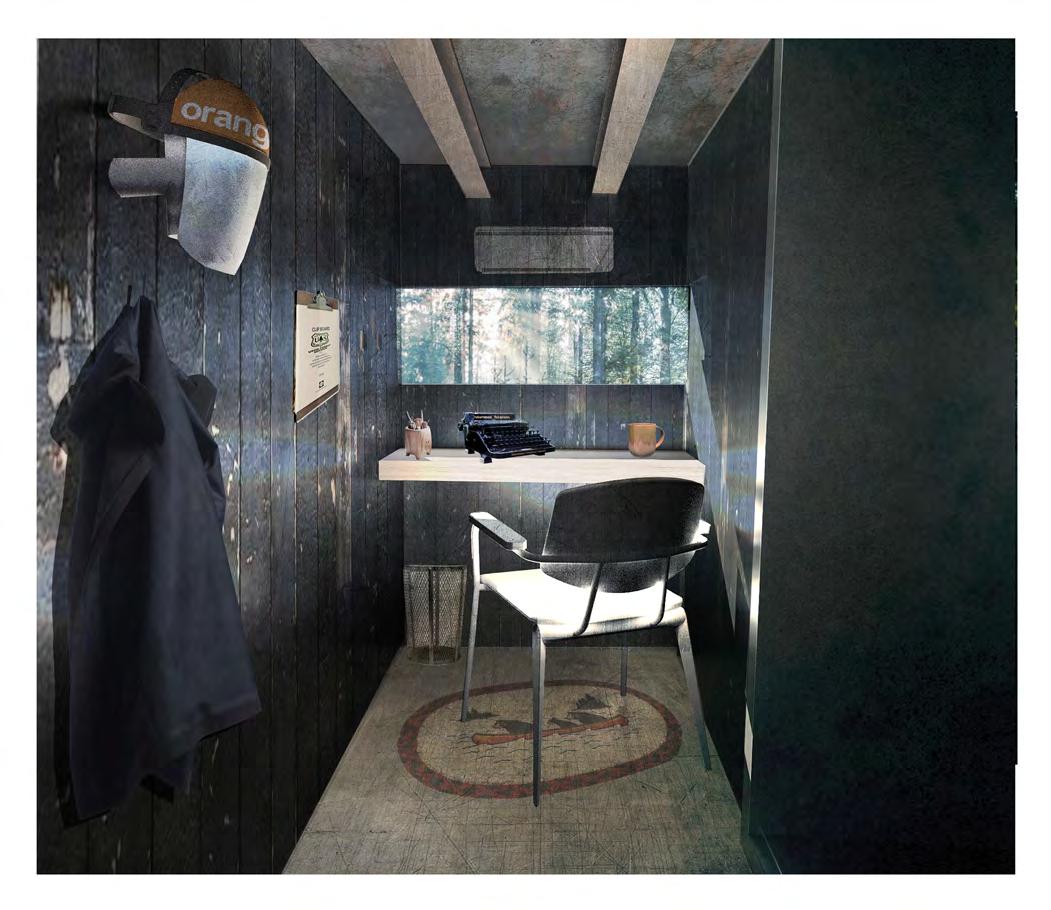
THE HOIST Cross Section (left) / Interior Perspective (right)
The cable tower serves a duel purpose for the collector. Along with transporting materials and passengers between the lookout and storage facility, a water tank hinges on the structure. Connecting to a sensor, the detector triggers in response to smoke, engaging the irrigation system for fire suppression, while providing a respite for the wanderer as a refill station. This segment conclusively remains open ended as to facilitate a conversation on intervention in nature. What degree to we go to be preventative, do we commodify and establish place beyond what’s existing? As the Collector’s Contrive grows, as does the lookout tower, becoming a symbiotic sprawl through the forest floor.


I I
I I P. 68
Whitestone Ridge I
I I P. 69
I I I Kanisku National Park, Washington
THE CABLE TOWER
Axonometric Model (above) / Forest Perspective (right)


I
I I P. 42
I Whitestone Ridge I
I I I P. 71
I Kanisku National Park, Washington I
PAYTON ESTIS
CURRICULUM VITAE
Email: paytonestis@live.com
Phone: (262) 497-2509
EDUCATION
2021 - 2023 University of Florida
Masters of Architecture
2017 - 2021 University of Florida
Bachelors of Science in Design
Magna Cum Laude Distinction
EXPERIENCE
2021 - 2022 Graduate Teaching Assistant
University of Florida
Gainesville, Florida
Spring 2019 Teaching Assistant
University of Florida
Gainesville, Florida
Summer 2019 Habitat for Humanity
Draftsman/Carpenter
Kenosha, Wisconsin
Summer 2017 Mike Jefferson Electric Electrical Assistant
Kenosha, Wisconsin
PUBLICATIONS
Expected graduation in May 2023
Prepared class schedules, assisted and evaluated students on their studio projects, and maintained record on progress/grades.
Assisted and worked with faculty in instructing second year design studio, mentoring students and leading classes in exploring precedent work for semester projects.
Conferred with managers to coordinate efficient site work and maintain a tight schedule. During this time I examined and gained understanding of specifications and assisted in assemblies.
Worked alongside electricians to prepare work sites and troubleshoot, test and diagnose electrical circuits.
2023 Medium REFERENCES
Project utilizing AI tools Spring 2023 John Maze maze@ufl.edu
2018 - 2019 Architrave 26 & 27
Numerous projects featured Michael Montoya Fall 2019 - Spring 2020 michael2086@ufl.edu
I I I I I | I I I I I |


 I Kanisku National Park, Washington I


