Biking and Rolling Plan
MARCH 2025


San Francisco’s Biking and Rolling Plan outlines a set of policies and actions that looks to make biking and rolling a safe and comfortable choice for getting around by improving connectivity between neighborhoods and by upgrading existing facilities.
Over the last decade, San Francisco has made great strides in its bicycle network adding over 450 miles of bikeways, increasing bikeshare and scootershare, and adding bicycle education programs. In 2023, it was named one of the safest big cities in the United States to bike in by People for Bikes. During the same year, there were also no bicycle-related traffic fatalities on city streets. Bicycling and rolling have also expanded into new and advanced technologies, including in e-bikes, cargo bikes, power chairs, and electric scooters. These devices are creating new opportunities to make getting around on humanpowered and low-speed devices more accessible and inclusive than ever before while also necessitating changes to infrastructure and policy to accommodate them.
One of the most important goals of the Biking and Rolling Plan is to put people first. As part of an effort to repair past harms and to foster a communitydriven planning process within six Equity Priority Communities, the Plan worked with five community organizations to develop community action plans for the Tenderloin, SOMA, Mission, Fillmore, Excelsior, and Bayview Hunters Point. These are areas in the city where previous roadworks, construction/redevelopment projects, or previous planning efforts excluded them, and caused lasting damage, reduced quality of life, and left them at greater risk of gentrification.
The Plan also understands that San Franciscans have a wide variety of transportation needs and preferences. Biking and rolling may not be for everyone or every trip that someone makes. The Biking and Rolling Plan’s policies and actions seek to create a safe and efficient transportation environment that is accessible and practical for all modes: people walking, biking, rolling, transiting, and driving.
San Francisco’s Biking and Rolling Plan has five primary goals with a set of objectives, policies, and actions by which to achieve them.
Make biking and rolling safe to increase fairness and lower harm, especially for those who experience greater risk on the street, including people with disabilities, Indigenous, Black, and Brown people, seniors, and youth.
The Plan has five primary goals with a set of objectives, policies, and actions by which to acheieve them
Policy 1. Prioritize the needs, trip patterns and mobility options of equity priority communities by closing gaps in the network as outlined in community action plans and Community Based Transportation Plans (CBTPs).
Policy 2. Work with community members and community-based organizations to identify, address, and remove barriers to access the biking and rolling network.
Policy 3. Co-create projects with historically marginalized communities, aligning Plan recommendations with their needs and values.
The Plan understands that San Franciscans have a wide variety of transportation needs and choices
Policy 4. Promote community health by prioritizing active transportation projects and neighborhood planning efforts that enable community freedom, excitement, and discovery as part of everyday life to elevate the quality of life for people in San Francisco.
Policy 5. Properly accommodate the needs of people with disabilities and others with limited mobility.
Policy 6. Support eliminating discrimination and racially biased policing of people using active transportation.
As an essential choice for people in San Francisco, the city must plan for a complete, well-connected and safe biking and rolling network for people on low-speed human or electric-powered devices. This North Star network is defined as All Ages and Abilities bikeway facilities within a quarter mile of all San Franciscans prioritizing access to schools and connecting residential areas to open spaces, job centers, transit hubs, and commercial districts.
Policy 7. Reduce traffic collisions between cars, people on bikes, pedestrians, and people using mobility devices by continuously working to expand and upgrade facilities on the North Star network towards hardened, protected lanes and slower, shared street typologies.
Policy 8. Create a sense of belonging for people who use biking and rolling as everyday transportation through design.
Policy 9. Ensure direct network connections to schools, parks, and open space to increase health, play, and skills of young riders to empower the next generation
Policy 10. Elevate routes to key destinations like job centers, transit hubs, and commercial districts to support access to mobility, goods, services, and jobs.
Policy 11. Build stronger connections between biking, rolling and transit use to support multiple mode trips in San Francisco.
Policy 12. Develop infrastructure to support adoption of electric devices to reduce private and commercial automobile trips.
Design active transportation to serve local needs while being mindful of vulnerable communities, neighborhoods experiencing displacement or gentrification, small business needs, transit corridors, space constraints, and implementation disruption.
Policy 13. Maintain support with Community-based organizations and develop new collaboration within historically marginalized communities and Equity Priority Communities.
Policy 14. Bolster economic vitality by designing a biking and rolling network that bring San Franciscans to the doorstops of small business safely, conveniently, and sustainably.
Policy 15. Engage with both citywide and local school communities in San Francisco to address safety concerns at all San Francisco schools and support increased in biking and rolling to school for those families who are interested in doing so.
Policy 16. Ensure close coordination and alignment with the SFMTA’s Transit Division to prioritize needs of vehicle operators and on-street operations and avoid conflicts when planning bicycle facilities.
Goal 4 • Delivering the Plan
Be accountable to communities and deliver the North Star network by stewarding the Plan as a living document and delivering it in stages, recognizing that the city needs to expand resources, recognize community readiness, and manage unique technical challenges. Start with projects have high network value defined by higher harm repair, network gap closure, and community agreement and lower risk, cost, and technical difficulty.
Policy 17. Deliver community assets including bikeways, design studies, and community action plans in locations that expand the north star network.
Policy 18. Deliver bikeways that have high value to the North Star network in the first stage,
Policy 19. Maintain the Biking and Rolling Plan as a living document
Policy 20. Reduce constraints on the SFMTA in delivering the assets in the North Star network.
Policy 21. Support connectivity between active transportation and transit, including regional transit.
Policy 22. Efficiently and proactively structure staff and processes to fund Plan implementation
Policy 23. Develop process improvements and increase coordination between the SFMTA, SF Fire Department (SFFD), SF Public Works, SF Public Utilities Commission (SFPUC) and SF Recreation and Parks Department (Rec and Park).
Policy 24. Support state-level legislation and state agency practices for further streamlining delivery of active transportation projects.
Policy 25. Secure local, regional, state, and federal funding for active transportation project implementation.
Policy 26. Demonstrate accountability to the public on Plan implementation and outcomes.
Provide programs, resources and assets that invite and support people, especially youth and low-income residents and workers, to use the network, such as safe device parking, education programs, travel choice incentives, and pilots to support emerging systems from the Plan.
Policy 27. Provide biking and rolling programs to expand people’s travel choices.
Policy 28. Improve awareness and safety through multilingual education campaigns.
Policy 29. Prioritize unbiased enforcement in places that are critical for safe travel, while implementing innovative and proven tools.
Policy 30. Address disproportionate access to bicycle repair in Equity Priority Communities.
Policy 31. Provide adequate parking for and protection of equipment and devices.
Policy 32. Ensure low-income people and equity priority communities have increased access to devices.
Policy 33. Partner with organizations providing access to adaptive devices.
Policy 34. Incorporate community assets beyond traditional facilities or programs in implementation efforts that encourage active transportation participation in communities exploring or gaining readiness.
In the Tenderloin, SOMA, Fillmore–Western Addition, Mission, Excelsior and Bayview Hunters Point, the community-based organizations Tenderloin Community Benefit District, SOMA Pilipinas, New Community Leadership Foundation, PODER, and Bayview Hunters Point Community Advocates developed community action plans outlining the neighborhood’s priorities for biking and rolling policy and infrastructure.
Each community-led action plan was created based on each neighborhood’s unique history and needs, and serves as a guide for how the city should work with the community to improve transportation, development, and other quality of life issues within their community.
» 29% of people bike or roll every week for commute, shopping, recreational, and social trips
» 10% of San Franciscans use a bike or other mobility device every day.
» »
» 18% of respondents reported using an assisted mobility device for some of their trips
» 53% of people say that they would bike or roll if the network was safer.
» Nearly 80% of people in San Francisco would like to bike and roll for some trips.

Biking and Rolling Team
Christy Osorio, Project Manager (March 2024 – completion)
Chris Kidd, Project Manager (2022 – February 2024)
Ben Frazier
Lydon George
Shayda Rager
Matt Lasky
Lauren Hiller
John Knox White, Biking and Rolling team manager
Casey Leedom
Jessie Liang
Jean Long
Leo Mašić
Mike Sallaberry
Vaidehi Shah
Maia Small, Planning Director
Matthew Thompson
Andy Thornley
Muwaffaq Usman
Darryl Yip
Kimberly Leung, Livable Streets Director
Viktoriya Wise, Streets Director
Julie Kirschbaum, Director of Transportation
SFMTA Board
Janet Tarlov, Chair
Stephanie Cajina, Vice Chair
Fiona Hinze, Director
Steve Heminger, Director
Mike Chen, Director
Dominica Henderson, Director
Community Partners
Bayview Hunters Point Community Advocates
New Community Leadership Foundation
PODER
San Francisco Bicycle Coalition
SOMAPilipinas
Tenderloin Community Benefit District
Consultants
Toole Design – planning and data analysis
InterEthnica – citywide and equity priority community
engagement
EMC Research – resident preference survey
Safe Streets Research – collision and safety analysis
Policy Working Group
Sara Barz
Luke Bornheimer
Peter Bratt
Lian Chang
Amy Cleary
Amanda Eaken
Annie Fryman
Oscar Grande
Trish Gump
Bert Hill
Sam Kwan
William Le Shaune Walker
Zach Lipton
Yahdaeh Mendoza
Meaghan Mitchell
Joshua Ochoa
Pallavi Panyam
Tom Radulovich
Kim Walton
Technical Advisory Committee
Jack Anninos
Forest Barnes
Nicole Bohn
Nicholas Danty
Deanna DeSedas
Capt. Ramon Flores
Becky Frank
Larson Holt
Darton Ito
Jennifer Johnson
Debby Kaplan
Adrian Leung
David Long
Jessica Look
Joel Mandella
Devan Morris

Hunter Oatman-Stanford
Kara Oberg
Mike Pickford
Shawn Rosenmoss
Maddy Ruvolo
Alex Sweet
Tam Tran
Peter Walsh
Danny Yeung
SFMTA land acknowledgment
On behalf of the San Francisco Municipal Transportation Agency, we acknowledge that we are on the unceded ancestral homeland of the Ramaytush (Rah-matush) Ohlone (Uh-lone-knee), who are the original inhabitants of the San Francisco Peninsula. Long before this land was known as San Francisco, it was Yelamu (Ye-la-moo), and it will always be Yelamu.
As the indigenous stewards of this land and in accordance with their traditions, the Ramaytush Ohlone have never ceded, lost nor forgotten their responsibilities as the caretakers of this place, as well as for all peoples who reside in their traditional territory. As guests, we recognize that we benefit from living and working on their traditional homeland, and we affirm their sovereign rights as First Peoples.
As the Department of Transportation in the City and County of San Francisco, we have a responsibility to resolve past harms caused by colonization, genocide, displacement and the erasure of Native peoples in public systems. We know that beyond land acknowledgements, we must commit to sustained, consistent, and intentional action to center American Indian communities in our work.
We have a responsibility to advance racial equity in Native American communities, and we are committed to doing so in a manner that affirms Native American culture.
San Francisco’s Biking and Rolling Plan (formerly the Active Communities Plan) envisions a citywide network connecting communities, making it easy for people of all ages and abilities to travel to school, work, shops, and parks by bike, scooter, skateboard, and other low-speed wheeled devices.
A strong biking and rolling network supports a safe and connected transportation system and aligns with the SFMTA’s Transit First Policy, the City and County of San Francisco’s Vision Zero Policy, and San Francisco’s Climate Action Plan and its goal that 80% of trips are made on lowcarbon modes by 2030.
For a glossary of terms used in the plan, see Appendix O.


Source: American Indian Cultural District

Make biking and rolling safe to increase fairness and lower harm, especially for those who experience greater risk on the street, including people with disabilities, Indigenous, Black, and Brown people, seniors, and youth.
As an essential choice for people in San Francisco, the city must plan for a complete, well-connected, and safe biking and rolling network for people on low-speed human or electric-powered devices. This North Star network is defined as All Ages and Abilities bikeway facilities within a quarter mile of all San Franciscans prioritizing access to schools and connecting residential areas to open spaces, job centers, transit hubs, and commercial districts.
Design active transportation to serve local needs while being mindful of vulnerable communities, neighborhoods experiencing or at risk of displacement or gentrification, small business needs, transit corridors, space constraints, and implementation disruption.
Be accountable to communities and deliver the North Star network by stewarding the Plan as a living document and delivering it in stages, recognizing that the City needs to expand resources, recognize community readiness, and manage unique technical challenges. Start with projects that have high network value defined by higher harm repair, network gap closure, and community agreement and lower risk, cost, and technical difficulty.
Provide programs, resources and assets that invite and support people, especially youth and low-income residents and workers, to use the network, such as safe device parking, education programs, travel choice incentives, and pilots to support emerging systems that meet Plan goals.
San Francisco has long been a unique center of rich cultural expression, a safe harbor, and a home for generations of families to thrive, and thus continues to ask for us to work together and think ahead.
To meet the future, we must knit together ample housing—that works for our many types of households where young people can expand their lives and elders can remain connected—to a diversity of jobs, schools, community centers, and places to play outside with generous, safe, and flexible transportation choices.
than driving, and offer health and climate benefits. They don’t work for everyone or every situation, but they are an essential part of our safe, reliable, and accessible transportation system—especially as more and more is demanded of it.
We are preparing for San Francisco’s housing future
As we prepare to support San Francisco’s recent housing plan that anticipates adding 82,000 units across the city, we must plan for the trips that those 150,000+ people will take to get groceries, to work, their kids to school or loved ones to medical appointments, and to see friends. And while we are already planning transit expansion, the roadways can’t grow—we can only think about how to use them much more efficiently.
The roadways can’t grow—we can only plan for how to use them more efficiently
Some of those trips will need a car, but increasingly San Franciscans are choosing trips by transit, walking, slow-speed vehicles, like bikes, skateboards, or scooters. Many people find them a convenient option because they can be taken closer door to door than nearly every other form of transportation, have predictable and efficient timing, are less expensive
Planning to include biking and rolling in our streets helps everyone who relies on them: it organizes the complex traffic which keeps cars, buses, and paratransit moving. It protects our city’s most vulnerable travelers, including people walking as well as biking and rolling. And this planning is vital to people who rely on rolling for their autonomy and primary way to get around every day— powerchair, wheelchair, and electric mobility scooter users.
Above all, creating a plan for biking and rolling gives us a chance to talk about and find agreement in what we all need, how we invest our city, to better understand each other, and build trust, so that government serves people fairly. After an intense decade of change, a plan helps us look ahead, prepare, and anchor some certainty.
Planning to include biking and rolling in our streets helps everyone who relies on them
Planning for housing and transportation together


The Housing Element 2022 update, which includes proposed rezoning areas, was adopted in January 2023 and is San Francisco’s plan for meeting our housing needs for the next 8 years. It is the City’s first housing plan centered on racial and social equity. Its policies and programs express San Francisco’s collective vision for the future of housing, guiding policymaking, housing programs, and the allocation of resources.
SF Planning


San Francisco has a long history of supporting the rights of people using a variety of modes of transportation. The city’s legacy of advocacy for cyclists, people with disabilities, children, seniors, and other travelers shows our commitment to the principles of safe biking and rolling. For some, rolling has been the primary mode of mobility, such as those in power chairs, while for others, it is their preference because it meets their needs or desires.
Historically, biking and rolling has been treated as “alternatives” to more traditional forms of transportation, such as walking, taking transit, or driving. Previous bicycle plans elevated recreation or distance commuting rather than trips that serve daily or local needs. This Plan recognizes biking and rolling as fundamental to the vitality of San Francisco and affirms that people who use low-speed devices belong on streets and in city parks and neighborhoods.
are not included as potential users” and only included the pronouns “he” or “him.”
Historically, biking and rolling was othered as a “transportation alternative” and populations were marginalized or excluded

The Biking and Rolling Plan advances beyond this older paradigm, centering process instead in the hands of local communities and populations with unique experiences to ensure that the issues and proposed solutions are relevant to their specific needs and circumstances. This new Plan marks a transformation from a traditional top-down model toward a truly inclusive, communitybased approach where local neighborhoods determine both the means of engagement as well as the policies. This is intended to center belonging and agency for everyone who wants to participate in this mode of transportation.
Accountability, or the commitments made to communities, are embedded throughout the plan’s policies and actions. This is made understanding that the SFMTA and the City do not control all factors that affect plan delivery, but the Plan sets clear intent and direction, provides a commitment to supporting these new relationships, and establishes a common language for communities and the agency to work towards aligned outcomes.

And while previous planning efforts aimed to create meaningful change, local communities have been disconnected all too often from the planning process and the policies and programs that are meant to serve them.
The users of many devices included in this plan— including skateboards, powerchairs, and electric scooters—have even been intentionally omitted or othered in previous plans. And various populations were marginalized or excluded, for example, the 1997 Bicycle Plan identified that “young children who need adult supervision to cross the street as a pedestrian
This Plan affirms that people who use low-speed devices belong on streets and in city parks and neighborhoods
The SFMTA is collaborating with five community partner organizations to develop community action plans that outline how the larger Plan will be implemented in their communities, where residents have experienced displacement or are at greater risk of gentrification. Each action plan highlights what biking and rolling means to the different community organizations and the communities they represent
Our community project partners include...
and why it is important for them to engage in this process. For almost two years, the partners have been engaging deeply with their local communities to develop context and a value-system for biking and rolling. Additionally, the San Francisco Bicycle Coalition supported outreach and engagement on a citywide level, ensuring planning workshops and open houses were broadly noticed in public spaces.


The Plan centers ownership of the process in the hands of local communities and populations

A safe and well-connected biking and rolling network serves all San Franciscans. In keeping with the core principles of equity and inclusion, the Plan emphasizes certain audiences to ensure full engagement.

Equity priority communities are census tracts with a higher concentration of under-served populations, including households with low-income and people of color.

San Francisco communities have historically rooted themselves in neighborhood centers for goods, services, and activities that reinforce identity and connection. The Biking and Rolling Plan seeks to meet their specific needs by focusing on local trips and addressing accessibility to the providers of such amenities.

Creating safe and reliable pathways to local schools and providing programs for families and caregivers to keep children safe is a primary goal for the plan.


Biking and rolling provides support for San Francisco’s aging population and people with disabilities who need more options for safe transportation.
Working closely with local community-based organizations, the SFMTA has listened and gathered feedback through a diverse assortment of outreach activities. We will continue to collaborate with our community partners to solicit ideas the implementation of the Plan.
Resident preference survey
Statistically significant survey of SF residents conducted March–May 2023. Understanding people’s experiences biking and rolling including sense of risk.
1,000+ survey responses
Outreach events
Spread of deep and broad community engagement, including fairs, presentations, interactive workshops, and open houses. Understanding people’s priorities on routes, facilities, and awareness of biking and rolling.
120+ events held
Community group 1:1s
Cultural, affinity and neighborhood groups. Identifying transportation-related challenges and proposing solutions.
40+ and ongoing listening sessions
Open houses
Held across the city. Presentation of three scenarios and 1:1 crossagency staff discussions and listening sessions with the public in person across the city.
See Open House Outreach Report
Appendix M.
10 events with 486 people

Policy Working Group
Comprised of subject matter experts or advocates, community group members, and thought leaders to discuss policy outcomes. Developing specific, measurable, achievable, relevant, and time-bound goals.
6 workshops
The Policy Working Group asked us to think big
Technical Advisory Committee
Comprised of subject matter experts from the SFMTA Transit Division, Mayor’s Office of Disability, SF Fire Department, SF Public Works, SF Public Utilities Commission, SF Recreation and Parks Department, SF Police Department and SF Planning Department. Improving processes and interagency coordination.
The SFMTA and SFFD began a structural working process in 2024 resulting in clearer certainty
10 coordination meetings
Business community 1:1s
SFMTA staff expressed concern about delivering under constrained resources
Comprised of merchant groups and advisors. Understanding merchant priorities and concerns.
6 dedicated sessions and on-going engagement


The SF Council of District Merchants Associations elevated the 3Ps: parking, people, and products and the 3Es: engineering, education, and enforcement
What was the outreach like?

10 open houses across the city engaged nearly 500 people in 1:1 in-person conversations with SFMTA staff


32 staff from across the SFMTA joined community members at events and rides bringing vast transportation and local expertise together


Community partners hosted 12 workshops in their neighborhoods Biking and Rolling went on the road! Participating or creating over 26 rides across San Francisco


The Biking and Rolling Plan was originally called the Active Communities Plan, but we heard from community that they weren’t clear on what that covered


Bike and Roll Weeks and Bike to Wherever Days were robust events where school groups, caregivers, and advocates focused conversation on school trips

San Francisco is one of the most bikeable cities in the US
Biking and rolling already play a big role in how people move around San Francisco and they have been growing modes for decades. The City has spent years growing and improving our bikeway network, including building 41 miles of protected bike lanes, 32 miles of Slow Streets, and seven miles of car-free streets, ranging from our South of Market protected bike network Downtown to JFK Promenade in Golden Gate Park. 29%* of people bike or roll every week for commute, shopping, recreational, and social trips, with 10%* of San Franciscans using a bike or other mobility device every day. We also boast the highest rate of commuting to work by bicycle (3.4%) of any major city in the United States.
Who are the people currently riding and rolling in San Francisco?
San Francisco is continuing to grow towards NACTO** standards
San Francisco’s bike network has grown from 302 miles in 2010 to 472 miles today
While young, male, white riders continue to ride more frequently than other groups, People of Color, women and older people are also well represented. Additionally, people with disabilities have slightly higher rates of e-bike and scooter use and a similar rate of biking compared to people without disabilities. When we surveyed San Franciscans about their transportation use, 18%* of respondents reported using an assisted mobility device, including a manual wheelchair, powerchair, electric wheelchair, or mobility scooter for some of their trips.
29% of people in SF bike or roll every week
San Francisco was also the safest major city in the US for bicyclists between 2017 and 2021. Bicycle injuries and fatalities have decreased by 50% in the last four years and in 2023 were at a historic low. Furthermore, on streets that receive quick-build interventions, bicycle trips increased by 27%*. And while these metrics are positive, rather than see them as an end point, they confirm the adaptations the SFMTA has taken over the past decade and affirm ongoing work.
Over half of households with children ride at least a few times a month, with over a third riding a few times a week.
18% of respondents reported using an assisted mobility device... for some of their trips
Bicycle injuries and fatalities have decreased by 50% in the last four years
10% of San Franciscans use a bike or other mobility device every day
On streets with Quick-Build interventions, bicycle trips increased by 27%

*See Appendix K, Bike Count Analysis
While the city’s bike network has grown significantly, an analysis has found that only about 8% of the existing streets include a bikeway for All Ages and Abilities users (NACTO* Description of All Ages and Abilities Users” on page 24). These include a much wider diversity of people including those with children. (See Appendix P for the All-Ages and Abilities Table.)
We learned through the plan’s citywide survey that over half of people say that they would bike or roll if the network was safer and nearly 80%* of people in San Francisco would like to bike and roll for some trips.
Bike counts completed in 2022 found that many riders prefer to ride on quiet residential streets with low car speeds and volumes not officially part of the bikeway network rather that on busier streets without separated or protected bikeways. Additionally, a citywide bicycle crash analysis identified collisions happening on roads that do not meet an All Ages and Abilities threshold, with Black people being overrepresented in the crash reports (See Appendix H for Collision Analysis).
What does biking mean to different communities?
Along with the statistics on the safety and usage of biking and rolling, there is deep cultural significance for many communities that make choosing the locations for future investments more complicated. For some residents biking and rolling is an easy, healthy, and practical way to get around, while for some of us it feels misaligned with our physical abilities. For some of us biking and rolling is a privilege of resources, time, and affluence, but for some of us rolling and biking is a marker of poverty
and a car is a sign of status. For some of us, street changes required to make rolling and biking safer feel disruptive, while for some of us there is freedom and discovery that is well worth temporary inconvenience during construction. For some of us, biking and rolling marks or precedes gentrification or social destabilization, while for some of us its newness is inviting. And some of us are also the so-called “invisible” cyclist, often including very low income or unhoused people, who can be unrepresented in infrastructure planning entirely for whom this is vital transportation, while some of us elevate biking as a source of identity and collective power. San Francisco has also hosted many groups for which biking or rolling has expressed call to action or form of protest—people taking over car space through Critical Mass, for example, which began in San Francisco in 1992 and spread to hundreds of cities worldwide.
Drivers and people who bike and roll want greater clarity and certainty
San Francisco has members of every one of these communities which is why this Plan is centered on people, recognizing that the diversity of lived experiences that enrich our city carry with it a responsibility when planning. The Plan also recognizes that while biking and rolling assets may not be traditional components of an biking and rolling network—such as bikeways or bike education classes— they may honor other cultural adaptations including spaces or events that expand shared community experience. The Biking and Rolling Plan identifies that community readiness is an essential part of how the SFMTA delivers the next generation of bikeways and assets that support these modes of mobility.
Nearly 80% of people in San Francisco would like to bike and roll for some trips
Over half of people we surveyed citywide would bike or roll if the network was safer
*See Appendix K, Bike Count Analysis
**National Association of City Transportation Officials
To achieve growth in bicycling, bikeway design needs to meet the needs of a broader set of potential bicyclists. Many existing bicycle facility designs exclude most people who might otherwise ride, traditionally favoring very confident riders who tend to be adult men. When selecting a bikeway design strategy, identify potential design users in keeping with both network goals and the potential to broaden the bicycling user base of a specific street.
Children School-age children are an essential cycling demographic but face unique risks because they are smaller and thus less visible from the driver’s seat than adults, and often have less ability to detect risks or negotiate conflicts.
Seniors People aged 65 and over are the fastest growing population group in the US, and the only group with a growing number of car-free households. Seniors can make more trips and have increased mobility if safe riding networks are available. Bikeways need to serve people with lower visual acuity and slower riding speeds.
People of Color While Black and Latinx bicyclists make up a rapidly growing segment of the riding population, a recent study found that fewer than 20% of adult Black and Latinx bicyclists and nonbicyclists feel comfortable in conventional bicycle lanes; fear of exposure to theft or assault or being a target for enforcement were cited as barriers to bicycling. Long- standing dis-investment in street infrastructure means that these riders are disproportionately likely to be killed by a car than their white counterparts.
Low-income riders Low-income bicyclists make up half of all Census-reported commuter bicyclists, relying extensively on bicycles for basic transportation needs like getting to work. In addition, basic infrastructure is often deficient in low-income neighborhoods, exacerbating safety concerns. An All Ages & Abilities bikeway is often needed to bring safe conditions to the major streets these bicyclists already use on a daily basis.
To achieve growth in bicycling, bikeway design needs to meet the needs of a broader set of potential bicyclists
Women Women are consistently underrepresented as a share of total bicyclists, but the share of women riding increases in correlation to better riding facilities. Concerns about personal safety including and beyond traffic stress are often relevant. Safety in numbers has additional significance for female bicyclists.
People riding bike share Bike share systems have greatly expanded the number and diversity of urban bicycle trips, with over 28 million US trips in 2016. Riders often use bike share to link to other transit, or make spontaneous or oneway trips, placing a premium on comfortable and easily understandable bike infrastructure. Bike share users range widely in stress tolerance, but overwhelmingly prefer to ride in high-quality bikeways. All Ages & Abilities networks are essential to bike share system viability.
People with disabilities People with disabilities may use adaptive bicycles including tricycles and recumbent handcycles, which often operate at lower speeds, are lower to the ground, or have a wider envelope than other bicycles. High-comfort bicycling conditions provide mobility, health, and independence, often with a higher standard for bike infrastructure needed.
People moving goods or cargo Bicycles and tricycles outfitted to carry multiple passengers or cargo, or bicycles pulling trailers, increase the types of trips that can be made by bike, and are not well accommodated by bicycle facilities designed to minimal standards.
Confident cyclists The small percentage of the bicycling population who are very experienced and comfortable riding in mixed motor vehicle traffic conditions are also accommodated by, and often prefer, All Ages & Abilities facilities, though they may still choose to ride in mixed traffic.
*National Association of City Transportation Officials

As of 2024, 8% of streets include an All Ages and Abilities bikeway

and abilities
Connecting people of all ages and abilities to the places that matter most to them via biking and rolling in an equitable, fair, and safe manner is at the core of how the network will be built. Through identifying key areas in the city that are needed for vibrancy and protection, the places where people with the most vulnerabilities go, and gaps in high quality facilities in the network, we can begin to start building connections.
Connecting people of all ages and abilities to the places that matter most to them via biking and rolling in an equitable, fair, and safe manner is at the core of how the network will be built. Through identifying key areas in the city that are needed for vibrancy and protection, the places where people with the most vulnerabilities go, and gaps in high quality facilities in the network, we can begin to start building connections.
The Connectivity Analysis (Appendix G) provides a spatial analysis of San Francisco’s existing bikeway network. 80% of residents live within a quarter-mile All Ages and Abilities (“high-quality”) bikeways; this demonstrates the agency’s commitment to upgrading bikeways in denser neighborhoods to efficiently serve more people.
This also means that the network does not extend fully across the city just yet, limiting the power of the network to connect to many destinations and provide greater access. While proximity to infrastructure is high, only 43% of residents can conveniently
80% of residents living within a quarter-mile of an all ages and abilities bikeway... demonstrates the agency commitment to upgrading bikeways that will get the most use first

All-ages and abilities network
Class I, Class IV, and Slow Streets
Class II with BCI > 80
Class III with tra c calming and BCI > 80
Major gaps between the network
and abilities network Class I, Class IV, and
with
Major gaps between the network
a coherent system where people of all ages and abilities can safely travel from their starting point to their destination. San Francisco’s existing network contains gaps that not only discourage potential riders, but also disproportionately impact vulnerable communities who rely on affordable transportation options. Currently, many San Franciscans find themselves navigating between separated bike lanes that suddenly end, forcing them into mixed traffic, or discovering that their intended route is interrupted by high-stress corridors without adequate infrastructure.
% of population % of EPC population
While access to transit stops is slightly higher in these communities (38%), the overall findings highlight on-going needs, including elevating community-led process.
Access to key destination types and to All Ages and Abilities facilities disconnected segments... create barriers for safe, continuous travel across the city
and
Connecting people of all ages and abilities to the places that matter most to them via biking and rolling in an equitable, fair, and safe manner is at the core of how the network will be built. Through identifying key areas in the city that are needed for vibrancy and protection, the places where people with the most vulnerabilities go, and gaps in high quality facilities in the network, we can begin to start building connections.


All-ages and abilities network
Class I, Class IV, and Slow Streets
Class II with BCI > 80
Class III with tra c calming and BCI > 80
Major gaps between the network
All-ages and abilities network Parks
All-ages and abilities network
Schools not near all-ages and abilities network
Schools near all-ages and abilities network

Connecting people of all ages and abilities to the places that matter most to them via biking and rolling in an equitable, fair, and safe manner is at the core of how the network will be built. Through identifying key areas in the city that are needed for vibrancy and protection, the places where people with the most vulnerabilities go, and gaps in high quality facilities in the network, we can begin to start building connections.
All-ages and abilities network
Class I, Class IV, and Slow Stre
Class II with BCI > 80
All-ages and abilities network
Major gaps between the network
Parks Libraries Not on the network
Class III with tra c calming and BCI > 80
Public recreation and community center
Not on the network


Historic San Francisco redlining map Redlining is a discriminatory practice in which financial services are denied people because of where they live, historically areas with significant numbers of racial and ethnic populations; in the United States, this was most directed against Black communities. Mid-20th century redevelopment or “urban renewal” overwhelmingly impacted and fractured communities of color, with the loss of thousands of housing units, political and financial capital, and businesses. Land use and housing dispossession related to race and wealth are complex and strongly affect mobility. For more information: https://belonging.berkeley.edu/rootsraceplace
As the SFMTA works with the community to develop an update to San Francisco’s biking and rolling network, we recognize and acknowledge the historical context in which transportation planning has uniquely influenced lived experience, sense of place, and mobility for diverse communities throughout the city.
Even as the second most densely populated city in the country, built around a 19th century grid that predates the automobile, the foundation of San Francisco’s street network was designed, and redesigned, to accommodate and prioritize vehicle traffic. The process of constructing a more car-centric street network transformed the physical and social landscape of the city. Widening of streets across the city, designed to move cars quickly and provide freeway access, permanently altered the character of
San Francisco Red-lining Map 1937
“Best”
“Still Des rable”
“De nitely Declining”
“Hazardous”
Redevelopment Areas as of 1979
neighborhood blocks. Freeways displaced residents by directly cutting through and dividing neighborhoods, creating physical and mental barriers between communities.
These wider streets were created to provide more convenient connections to the downtown job center, prioritizing job access for affluent neighborhoods and deprioritizing interneighborhood connectivity between communities. In the 1930s, a practice known as “redlining” made access to mortgages in older areas of the city effectively unattainable, areas characterized by sizable ethnic populations, proximity to industrial health hazards, and lower property values. This practice steered wealth to areas just west of the red-lined neighborhoods where mortgages were more easily attainable and legally restricted to “racially harmonious” groups, which referred to people of particular European ancestry. Car-centric boulevards were intentionally directed to bisect and/ or bypass the lower-income neighborhoods, such as the Fillmore, Mission, and Tenderloin, which continue to be populated by communities who historically have had less opportunity to accumulate wealth, intrinsically linked to their racialized experiences as non-white ethnic groups.
Formal and informal racial bias limited housing availability for Indigenous, Black, Brown, and non-white ethnic groups across the city. This concentrated these communities within “pass-
communities have settled in areas across the city, a strong cultural connection between them remains, such as the strong relationship between communities in Chinatown and the westside and southeastern communities, or between Bayview, Fillmore, and Tenderloin. Because of street design decisions with long-term impacts, neighborhood-oriented, cultural connection is not highly visible or accessible in the existing, downtown-oriented transportation network.
Often underserved by transit and lacking communityoriented connectivity, residents of lower-income neighborhoods were forced to adapt their daily lives around automobile use. The car became a lifeline, the main connection to family, work, school, worship, community organizations, and recreation.
isolated equity priority communities car dependent because of historic disinvestment
communities that bear the burden of people moving through them
Cultural Districts
SF Department of Health Areas of Vulnerability
But concurrently, for people with lesser financial means, owning a vehicle has a disproportionately higher cost, inhibiting their ability to invest in other parts of their lives. Providing these communities the opportunity to be less car-reliant by providing more safe and reliable choices is an ideal outcome; however, any potential changes must be weighed against possible negative impacts from loss of existing mobility.
With little physical space for new housing, eras of economic boom and bust have consistently and increasingly made once undesirable areas more attractive for prospective new growth. Historically denied the opportunity to purchase homes in their communities, and with less and less opportunities to find affordable housing for rent, longtime residents struggle to retain the home and sense of place they have created in San Francisco. These communities are resilient in their efforts to simply exist, to enjoy the family, friends, and fellowship that form a community, bonded through common culture and developed over generations.
Along with population and geographic disparities, historic government technical or technology choices continue to impact our ability to adapt or renovate systems today and reinforces car dependency. San Francisco has the highest density of cars per square mile of any US city, complicating decisions that reduce the amount of space for parked vehicles and travel lanes. Though it is the second densest city in the US, it does not have a citywide subway system, meaning transit is on-street and more embedded in congestion, resulting in less efficiency and reliability resulting in higher car use. San Francisco has a very high number of driveways, which affects decisions around design and policies that could result in carfree designs or reduces the safety effectiveness of protected bikeways.
San Francisco is also incredibly and famously hilly. Topography influences where key corridors have commercial strips, transit lines, arterials, and/or desirable bike routes on the same street; while e-bikes are changing accessibility and usage of steeper grades, not everyone has access to affordable models or parking options. The need for low emission transit and electric trolleys to allow buses to ascend steep streets led to the extensive OCS network, which affects design decisions, affects flexibility of where fire vehicles can stage, and can add millions to the cost of projects.


accountable
In advancing the Biking and Rolling Plan, the SFMTA acknowledges this history of divestment and inequity in transportation planning, as well as the resilience of communities in upholding their way of life, and is striving to move forward in a way that respects their experiences. Working with community partners, the SFMTA seeks to engage in community-led discussions, understand the unique needs of each community, and create an inclusive pathway to future mobility investment. This engenders an organic, communitycentered connection with biking and rolling, where future infrastructure will serve the needs of the people and be a reflection of their culture and continued existence in that space.
A successful plan charts a future path, but defines and measures accountability. In adopting this plan, the SFMTA Board sets in place a number of commitments that are consistent with the city’s general plan and transportation code changeable only by adopting new requirements.
First, this Plan recognizes that ongoing planning and community engagement efforts, combined with a rapidly changing technological environment, will require the Plan to be a living document.
Second, accountability in the Biking and Rolling Plan is achieved through regular, clear reporting on metrics and subjects defined in the policies of the plan, preferably in dashboard or easily updatable formats that are available to the public and reduce administrative burden on staff. Any reports should be short and concise, providing clear, honest, and transparent reporting out on the progress made toward commitments in the plan; for example, new and upgraded bikeway miles completed, programs launched, continued or discontinued, and other metrics.
Finally, public reporting gives members of the community an opportunity to provide additional input into the accountability process, calling out successes and areas for improvement that can be considered by both staff and the SFMTA Board. The SFMTA acknowledges this history of divestment and inequity in transportation planning and is striving to move forward in a way that respects the experiences of these communities
Previous bike plans have designated Silver Avenue as the east-west connector between the Portola and Mission Terrace. Indeed, it is the most level route. Upgrading Silver to an All Ages and Abilities facility would require eliminating all of the on-street parking. While such a trade-off may be reasonable in other neighborhoods, the residents along Silver Ave are largely working class and more heavily automobiledependent than other neighborhoods. Moreover, while removing the parking would create space for bike lanes, those lanes could not be protected due to the driveway pacing along the streets. Instead, this Plan proposes connecting nearby Gaven Street to an upgraded Alemany protected bikeway. This route is also fairly level and would not require parking removal.

Source: Google Street View
The SFMTA prepared an Equity Analysis that revealed important disparities in how different communities experience and access active transportation. The analysis found that while residents in Equity Priority Communities (EPCs) and People of Color are more likely to use active transportation daily for essential trips like commuting and errands, they face greater barriers to network access and comfort.
Key challenges in EPCs include lower coverage of high-quality facilities, fewer Slow Streets, and limited secure bike parking options. These communities also report higher rates of bike theft and greater concerns about device affordability. Safety disparities are particularly pronounced, with Black cyclists being disproportionately involved in crashes. Within EPCs, 81% of crashes occur along the High Injury Network. People with disabilities face additional challenges, reporting lower comfort levels on the network (26% uncomfortable compared to 20% citywide) and greater difficulty finding secure parking.
While these findings highlight the need for community-specific improvements in EPCs to create a more equitable network including
issues around secure parking and safe bikeways, many communities in equity priority areas, especially those that have experienced harm caused by historic government action, are focused on expanding participation in process and community-led decision-making. Agency and choice over proposed improvements may advance the next generation of community assets to ensure that transportation fairly serves all San Franciscans and repairs historic disparity.

how a new safe and connected network meets the needs of the people interested in riding in different parts of the city. As an example, most of the streets of the Western Neighborhoods have a high, positive BCI score, indicating that shared streets that create better shared spaces for people biking and rolling is facilities.
Rather than just focusing on bikeway users, this Plan seeks a more efficient and user-friendly transportation network for everyone.
First, by expanding and improving the biking and rolling network, we can create viable alternatives for trips that might otherwise be made by car thus reducing the number of vehicles on the road. In a preference survey of San Francisco residents (see Appendix F), most people who bike or roll do so to commute to work, run errands, or exercise and enjoy the outdoors.
Second, the Plan aims to strengthen the relationship between public transit and biking and rolling infrastructure through improved integration. Secure bike parking at transit stations, accommodations for bikes and rolling devices on public transit, and safe first/last-mile connections make it easier for people to combine these modes for longer journeys. The Plan also separates transit vehicles and people biking and rolling whenever possible to facilitate efficient travel for each.
Finally, for pedestrians, the Plan builds bikeways to deter people from biking and rolling on sidewalks. Well designed spaces that meet the needs of people walking and rolling helps create a more comfortable sidewalk and street environment for everyone, particularly seniors and people with disabilities.
By expanding and improving the biking and rolling network, we can create viable alternatives for trips that might otherwise be made by car
As more people choose biking or rolling, road and parking capacity is freed up for essential vehicle trips, commercial deliveries, and emergency services

Vision Zero is the city’s policy to end traffic-related fatalities. Adopted in 2014, the policy increases traffic safety by promoting safe speeds, protecting vulnerable road users, and promoting mode shift. In recent years, the number of bicycle fatalities has trended down, with zero fatalities on San Francisco streets in 2023. This trend is attributed to quick-build projects that improve bicycle facilities. On the other hand, scooter-related crashes and fatalities are overrepresented in overall crashes.

The San Francisco Fire Department (Fire Department) and the SFMTA each have strong mandates to keep our community safe. The SFMTA recognizes the importance of ensuring that the Fire Department’s emergency response times are maintained so they can respond to fire and medical emergencies.
When challenges arise between increasing traffic safety and mobility and the response times for emergency vehicles, both agencies should engage in intentional discussions and collaboration. The outcome should seek to develop 24-hour traffic calming and safe passage for people on bikes while also ensuring that emergency response times are acceptable and on-street operations can respond to fires and traumas. Opportunities for early collaboration include modal filter pilots and low traffic street designs.
Together both departments have identified highfrequency fire response routes that require extra
consideration. We are also identifying projects that speed up response times, including:
Transit red-lanes that are clear of traffic and provide ambulances fast crosstown access to hospitals and fire stations in denser urban areas. Opticom traffic signal preemption allows emergency response vehicles to turn traffic lights green in the blocks ahead of them, allowing traffic to move forward and out of their way.
Intersection red-curb daylighting which create space for drivers to move out of the way of responding vehicles as well as provide better sight lines for emergency responders to avoid collisions and conflicts.
Wider separated bikeways that accommodate emergency vehicles to bypass traffic and access buildings.
We will strive for options that increase traffic safety on our streets while maintaining, and even speeding up, emergency response capabilities

access routes
San Francisco’s trolley buses have made SF an international leader in low-carbon transit for decades. These climate benefits are powered by overhead lines that complicate fire response options, creating narrow windows of space for SFFD ladders to be raised during a time when seconds count. Trying to build protected bikeways in this environment can be nearly impossible given the existing constraints and the high expense of moving overhead wires.
This Plan recognizes that small retail businesses are a core part of the city’s legacy, culture, economic health and vibrancy. Businesses like cafes, restaurants, corner stores, and goods retailers are both a part of people’s daily lives and define the heart and identity of their neighborhoods.
The past decade has asked small retail businesses to overcome hardship and left many vulnerable to any form of disruption, including changes to adjacent curbs and streets. They have faced:
» customer habits shifting from local to big box stores and then online with each step impacting customer or delivery trips
» difficulty finding local labor given the ongoing housing shortage for working class households, and » the covid pandemic’s dramatic transformation of daily habits that intensively cut patronage.
While data from many studies show that bikeways predominantly improve customer access and business growth, the Biking and Rolling Plan recognizes that recent small business challenges feel insurmountable to many business owners, especially in constrained street environments with transit, commercial loading, curbside parking, and shared spaces.
Additionally, unlike many other cities, almost all storefront retailers in San Francisco must take their deliveries from the front, requiring frontdoor commercial loading and most small retailers have little control over delivery times. Over the past
decade, moreover, there has been a huge increase in demand for curbside deliveries, including Amazon, DoorDash, and other services.
Many cities offer various approaches for accommodating commercial deliveries while also creating safe bikeways, including:
» Night and early morning deliveries
» Urban freight hubs with electric cargo bike distribution
» Greater use of dollies for carrying deliveries from crossstreet loading zones
Some American cities, New York and Boston for example, also give us a preview of expanded e-bike delivery systems. They show that if space is not created for these emerging options, there can be increased stress at the curb and less safe conditions on sidewalks and streets.
The Plan recognizes that the business community is not a monolith. While some corridors are experiencing greater economic stress, others, like Jefferson and West SOMA, are eager to connect to the network
The American Industrial Center on Illinois Street in the Dogpatch has been home to industry since 1915, evolving from a cannery to hosting bespoke chocolatiers, the Museum of Craft and Design, and numerous start-ups. Today it serves as the nerve center for caterers, chefs, and makers alike requiring the consistent movement of goods in and out of their docks for daily operations. Illinois is also a vital route on the network connecting the Southeast to Downtown, SOMA, the Financial District, and beyond. People who use low-speed devices on Illinois desire a facility that separates them from the larger vehicles or ensures slow car speeds through Slow Streets. However, the width of the street and turning radius required for large delivery vehicles present design challenges that will require more study.

Source: Google Street View
Business corridors with shared spaces


The Plan recognizes that the business community is not a monolith and approaches each area uniquely. While some corridors are experiencing greater economic stress, others, like Jefferson and West SOMA, are eager to connect to the network. The Plan also recognizes two lessons from our conversations with merchants:


» Many corridors will require more detailed study and partnership with the adjacent community which is outside the scope of this plan.
» It’s important that implementation of the Plan is responsive to small business needs by providing certainty and clarity of where and when biking and rolling infrastructure will be implemented.


Make biking and rolling safe to increase fairness and lower harm, especially for those who experience greater risk on the street, including people with disabilities, Indigenous, Black, and Brown people, seniors, and youth.
Policy 1. Prioritize the needs, trip patterns and mobility options of equity priority communities by closing gaps in the network as outlined in community action plans and Community Based Transportation Plans (CBTPs).
Action 1.1.1. Identify a method of setting and tracking a minimum of asset investment in Equity Priority Communities as a proportion of overall program or project budgets to address previous disinvestment once final community work is complete and site-specific action and area plans are in place.
Action 1.1.2. Prioritize projects and programs that increase access to active transportation for residents with disabilities.
Action 1.1.3. Develop an annual equity-focused evaluation program, in collaboration with community partners and members that allows for assessing success in achieving Goal #1.
Policy 2. Work with community members and community-based organizations to identify, address, and remove barriers to access the biking and rolling network.
Action 1.2.1. Maintain existing programs and look to expand them while seeking to fund new ones. Combine programs with projects proposed in Equity Priority Communities to directly address community-based barriers to access.
Action 1.2.2. Implement short-term, high visibility bike and rolling projects in collaboration with community-based organizations that can e replicated and implemented throughout San Francisco.
Action 1.2.3. Give hiring and contract preference points to in-community individuals and organizations who provide programmatic services (training, education, maintenance shops, etc) in their neighborhood.
Policy 3. Co-create projects with historically marginalized communities, aligning Plan recommendations with their needs and values.
Action 1.3.1. Prioritize near-term implementation of projects identified in Community Action Plans and CBTPs.
Action 1.3.2. Engage in outreach in a way that reflects the demographic makeup of communities where projects are taking place.
Action 1.3.3. Explore models for program implementation led through local, community-based organizations.
Policy 4. Promote community health by prioritizing active transportation projects and neighborhood planning efforts that enable community freedom, excitement, and discovery as part of everyday life to elevate the quality of life for people in San Francisco.
Action 1.4.1. Develop a biking and rolling network that meets the needs of all ages and abilities to support local economic stability, public health and access to parks, schools, employment and shopping.
Action 1.4.2. Support programs that expand the use of street space to promote joy and thriving in line with community needs.
Action 1.4.3. Support activation of city streets through programs like Sunday Streets, Play Streets, and new partnerships with community organizations and local businesses.
Action 1.4.4. Continue to support a program for community-led street mural painting and greenery and look for opportunities to expand.
Action 1.4.5. Enhance the SFMTA’s school access efforts to develop guidelines and a plan to implement engineering improvements for building school streets, that would provide access to outdoor, pedestrianized space in front of schools and ensure direct connections to the all-ages-and-abilities biking and rolling network.
Policy 5. Properly accommodate the needs of people with disabilities and others with limited mobility.
Action 1.5.1. Universally design facilities to be inclusive of all ages and abilities.
Action 1.5.2. Ensure that biking and rolling infrastructure does not increase barriers for people with disabilities.
Action 1.5.3. Advocate for change in California State Vehicle Code so that wheelchair, power-chair, and personal mobility device users can legally use bikeways as needed.
Policy 6. Support eliminating discrimination and racially biased policing of people using active transportation.
Action 1.6.1. Analyze data of police stops and citations of active transportation device users, including a category for scooter violations and report findings annually.
Action 1.6.2. Support decriminalization of active transportation and related violations that do not connect to collisions and injuries.


Five community-based organizations, in partnership with the SFMTA, developed “Community Action Plans” to guide the process for enhancing San Francisco’s biking and rolling network in six historically marginalized communities.
For over two years, these organizations engaged in community-led dialogue with their respective communities to discuss transportation related needs and opportunities within their neighborhood. Through this process, community members identified priorities in addressing long-standing issues, highlighting the generational impacts of past transportation and landuse decisions, including freeway construction, road widening, and “urban renewal” on the quality of life of long-time residents (see page 30 “Acknowledging Past Harms”).
These Community Action Plans seek to acknowledge and reflect the experiences of those who have been less visible in past engagement, and to frame future active transportation development around these longstanding community issues and priorities.
Working with community partners, the SFMTA is advancing its goals to strengthen relationships with communities across the city, to take accountability for past decisions, and to repair past harms by prioritizing community needs in future planning efforts (see page 33 “Being Accountable”).
The following are summaries, with full community action plans available in Appendix A.
The SFMTA is advancing its goals to strengthen relationships across the city, to take accountability for past decisions, and to repair past harms by prioritizing community needs in future planning efforts.
Summary (Full Community Action Plan in Appendix A)
People Organizing to Demand Environmental and Economic Rights (PODER), is a grassroots environmental and economic justice organization. PODER organizes with Latinx immigrant families and youth in the Mission, Excelsior and other southeast San Francisco neighborhoods to create peoplepowered solutions that are locally based, community governed and environmentally just. We nurture everyday people’s leadership, cultivate cultural regeneration, and strengthen community power.
The dispossession of land, extractive and exploitative economies, and repressive enforcement and immigration policies have shaped how working class and immigrant communities move. Working class communities, dependent on reliable and affordable transportation, must be able to define our mobility and access to San Francisco in order to authentically participate in the full breadth of our city’s ecosystem. Bicis del Pueblo is committed to bolstering our agency to freely navigate our city in sustainable ways. Bicis cultivates bike riding practices as a healthy way to move in our city that curbs carbon emissions and deepens our relationships to place and each other. Our work fosters community, resiliency through health, and action for environmental justice. In this way Bicis del Pueblo is an expression of love for our planet, our relationships, the neighborhoods where we live, for those who came before us, and those who will inherit what we leave behind.
In acknowledgment of the many previous transportation projects led by the SFMTA that have contributed to inequities, caused harm, trauma, and displacement for communities of color, PODER/Bicis del Pueblo was contracted for the role of engagement and co-developing projects in neighborhoods where past bike network projects have been particularly divisive with historically marginalized communities. For PODER this work is important because BIPOC communities are underrepresented and underserved by active transit industries and public agencies. Bicis del Pueblo exists to hold space for the bike curious in our communities and cultivate the expertise and influence of people-powered planning processes. A
framework that centers past harms is addressing that opening a wound and community-led planning and decision making is part of the necessary work to rebuild credibility and trust.
The community
PODER recognizes that transit is positioned within a broader set of forces that facilitate access, development, and gentrification. This enduring legacy has resulted in negative perceptions among some in our communities that recognize bicycles as a symbol of gentrification and cultural erasure or do not identify with a cis white male “cyclist” archetype. This is particularly true in the Mission neighborhood which in recent years has experienced a loss of 10,000 Latinxs between the 2010 and 2020 censuses. Transit infrastructure can also disproportionately shape how working-class communities move. The Excelsior is surrounded by freeways, more strongly catering to vehicle-oriented transit needs and patterns. Falling far behind other parts of the city in active transit infrastructure, the Equity Analysis reports the Excelsior has the lowest bike commute mode share of all EPCs studied at 0.7% compared to the 3.1% citywide average.
Active transportation must be understood in the context of institutional forces and be addressed at the intersection of lived experiences with fundamentally related issues including housing, health and wellness, employment and economic development, culture and enforcement. Without significant improvements in local employment opportunities, job training, childcare and affordable housing, shifts in personal mode choice will remain non-viable.
Community engagement and priorities
As a partner in the Biking & Rolling Plan, Bicis del Pueblo has conducted community engagement through a range of events in the Mission and Excelsior
neighborhoods. This includes infrastructure audit bike rides, interactive workshops, and integrating bike skills to summer youth programming. In addition, our regular programmatic community offerings of weekly repair workshops and bi-monthly community bicycle rides have been a touch point for community engagement and input. As our organizational, programmatic, and biking & rolling scope of work all include both the Mission and Excelsior neighborhoods, this work has centered the social and cultural interconnectedness between these geographically severed communities.
More separation from cars, concerns about drivers, and affordability are among the top of many issues that came up across community engagement events. We found both clear distinctions as well as alignment with preferences outlined in the Equity Analysis. Our community engagement highlighted a strong emphasis on the interconnectedness to public transportation and housing, as well as an appreciation for experiential and relational learning opportunities. The study, for example, found “people living in EPCs have very similar preferences about facility type as those living in non-EPC neighborhoods. San Franciscans—whether living in an EPC or not— seem to agree that the most comfortable facilities are those with physical protection from vehicles….” Additionally “among EPC residents, there is a greater perception that owning or renting a bike, scooter, or active transportation device is not affordable.”
Our communities rely on the buses, driving, and active transportation. Transit planning and infrastructure improvements should be complementary and help eliminate conflict among us. Transportation accounts for the second largest form of greenhouse gas
Transit planning and infrastructure improvements should be complementary and help eliminate conflict among us
emissions in San Francisco, but without significant improvements in local employment opportunities, job training, childcare, and affordable housing, shifts in personal mode choice will remain non-viable and an ineffective strategy in curbing emissions. Planning efforts must acknowledge intersections with lived experience and strive to build knowledge and leadership through experiential and relational engagement. Communityscale connection is important where, presently, some of the highest volume micro-mobility corridors run through EPCs, leaving these communities to feel like pass-throughs. Special attention must be given to addressing the unique relationship between Mission and Excelsior neighborhoods that has been severed by highways. Social infrastructure is a critical component to cultivating active transit practices in BIPOC communities with an emphasis on experiential and relational opportunities for engagement and growth.


Summary (Full Community Action Plan in Appendix A)
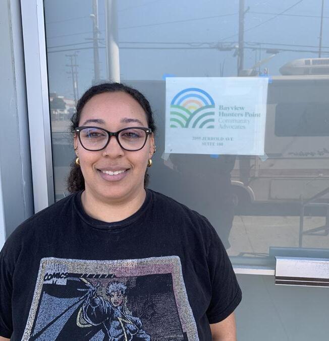
Bayview Hunters Point Community Advocates (BHPCA), established in 1994, is a grassroots organization founded, governed, and operated by long-term members of the vulnerable Bayview Hunters Point neighborhood in San Francisco. Our programs combine community organizing with education, advocacy, and direct services. We seek to build the neighborhood’s capacity as a selfdetermining, fully autonomous force for social change in today’s San Francisco.
The Advocates’ work has always connected residents with environmental justice issues in our neighborhood, seeking to increase community participation in environmental decision-making and to build skills in the community to support a cleaner environmental future.
The longstanding history of broken promises in Bayview Hunters Point underscores the need for an organized, unified community voice to shape important public issues. Our organization’s primary areas of focus are the adverse health impacts experienced by neighborhood residents due to poor air, soil, and water quality; crisis-level displacement pressures; and under-employment.
We aim to help Black people and immigrants remain and thrive in Bayview Hunters Point by taking strategic action to slow and reverse the rapid displacement of diverse working class populations from San Francisco. Through environmental advocacy, as well as workforce and economic development, we hope to preserve the diversity of our historic neighborhood.
Over the past two years, BHPCA facilitated three community workshops, conducting town hall conversations, enacting a community visioning process for a biking and rolling plan, and applying this vision through community mapping. With each workshop, BHPCA provided background and context related to biking and rolling, creating space for new input while building on ongoing conversations. Additional engagement took place at various meetings, cultural/ neighborhood events, and community bike rides across the Bayview and Hunters Point neighborhoods through tabling and group and individual conversations. These events include the Juneteenth Festival, BMAGIC’s Back to School, and Bayview Sunday Streets.

The SFMTA worked with Bayview communities to complete a Communitybased Transportation Plan in 2023. The SFMTA is committed to advancing its community priorities

Summary (Full Community Action Plan in Appendix A)
The Tenderloin Community Benefit District (TLCBD) is dedicated to transforming the lives of the Tenderloin community through organizing, advocacy, and amplifying the voices of residents. TLCBD works to improve the neighborhood’s conditions and lived environment. As part of these efforts, TLCBD led community engagement initiatives in collaboration with the Tenderloin Traffic Safety Task Force. Together, they sought to ensure that residents, community members, small businesses, and local organizations—particularly those most vulnerable to issues of street safety and accessibility—actively participated in shaping and implementing the Programs, Projects, and Initiatives outlined in the Biking & Rolling Plan (BRP). This collaborative process was essential for identifying key priorities and ensuring that the Plan truly reflects the community’s needs and aspirations for safety and accessibility.
community
The Tenderloin District, once celebrated for its vibrant nightlife and cultural attractions, has experienced significant shifts since the 1950s due to urban renewal and transportation policies. These changes prioritized car traffic and commuters over the needs of the local community, transforming two-way streets into wide, multi-lane thoroughfares and converting one-way streets into fastmoving routes for downtown drivers. As a result, the neighborhood’s sidewalks became narrower, and the environment less pedestrianfriendly. Today, the Tenderloin is home to 35,000 residents,
many of whom belong to historically marginalized communities. This includes people of color, transgender individuals, people with disabilities, seniors, and those living in single-room occupancies. For these residents, the need for safe, accessible, and community-oriented spaces is more pressing than ever. The BRP is essential in addressing these challenges by fostering a safer, more inclusive environment for everyone in the neighborhood.

Transportation and pedestrian safety are central concerns for those who live and work in the Tenderloin. Nearly every street in the area is part of San Francisco’s High Injury Network, which consists of just 12% of the city’s streets but accounts for 68% of severe traffic injuries and fatalities. The neighborhood has the highest concentration of youth and people with disabilities in San Francisco, as well as a significant population of seniors. The existing street conditions create daily hazards for these vulnerable residents, making it difficult for them to navigate their community safely. The BRP addresses these issues by prioritizing improvements to pedestrian and traffic safety. By focusing on the unique needs of the Tenderloin’s residents, this Plan aims to transform the neighborhood into a safer, more accessible space that better serves its diverse community.

Community engagement and priorities
Over nearly two years, the community engagement process for the Tenderloin BRP involved hundreds of residents and community members through tabling events, meetings, and workshops. The planning engagement involved a series of four workshops with over 150 community members, local organizations, small business leaders, and transportation experts.
These workshops focused on identifying key issues, gathering input on potential solutions, and fostering collaboration among stakeholders to develop a comprehensive biking and rolling plan.
The report supports findings from previous pedestrian and traffic safety outreach efforts. Including findings from community outreach efforts of the TL Community Action Plan, Safe Routes to School, Safe Streets for Seniors, TL Community Alternatives to Police, and Vision Zero Quick-Build Projects (Jones Street, Golden Gate Avenue, Turk Street, Leavenworth Street and Hyde Street).
While street safety is a top concern in the Tenderloin, the community also relies on diverse transportation options, including electric bikes, scooters,
The TL community action plan addresses these priorities by seeking a balance between parking needs and safety improvements
wheelchairs, and motor vehicles, to support daily activities. With only about 20% of residents owning cars, tens of thousands of vehicles still pass through the neighborhood daily, underscoring the need for accessible parking and safe mobility solutions. The increasing use of electric bikes and scooters— especially among low-income residents and gig workers—has heightened safety concerns on the narrow sidewalks and streets. The community action plan addresses these priorities by seeking a balance between parking needs and safety improvements. By organizing spaces for various modes of transport, the plan aims to create a more accessible and secure environment for everyone in the Tenderloin.

Summary (Full Community Action Plan in Appendix A)
New Community Leadership Foundation (NCLF) is a community-based organization whose mission is to restore the economic health and vigor of disenfranchised minority communities. NCLF provides technical assistance and capacity-building to nonprofit organizations; offers business-support services to small businesses and entrepreneurs; and supports projects and career pathways for artists. Through each of these programs, NCLF acknowledges and seeks to remedy the legacy of racism and disinvestment that have hurt community wealth and health.
NCLF, in partnership with Honey Art Studio, organized the Fillmore neighborhood to contribute to the SFTMA’s 2024 Biking and Rolling Plan. They worked to ensure that residents—particularly those harmed by past transportation and land use policies— had a significant role in shaping and implementing the Plan’s programs, projects, and initiatives.
The community
The Fillmore District in San Francisco was once a thriving, connected, complete community that was home to many ethnic groups and people of color excluded from other San Francisco neighborhoods. It grew into a thriving mixed-income Black community

with a huge cultural impact, sometimes called the “Harlem of the West.”

Beginning in the 1950s, the Fillmore was profoundly changed by urban renewal projects and the transformation of Geary Boulevard into a grade-separated expressway. New large, singleuse developments and superblocks displaced established residents and businesses, disconnected the neighborhood, and prioritized the convenience of commuters driving to job centers downtown.
Recent transportation and development projects have not addressed these historic harms and inequities. Meanwhile, growing housing and commercial costs have contributed to displacement of many Fillmore residents. Delays on key projects and lack of progress on stated racial equity goals have eroded community trust in the SFMTA.
The result of an inclusive, community-driven process, this Community Action Plan (CAP) has community buy-in and includes specific recommendations for addressing historical and current transportation inequities.
Community engagement and priorities
NCLF led a comprehensive engagement effort for the Biking and Rolling Plan. The process spanned almost two years, reaching hundreds of residents through numerous meetings and events. These efforts aimed to ensure that residents, particularly long-time
community members, helped identify community needs and priorities and shaped programs, policies, and projects to address them.
Through this process, the Fillmore community identified key priorities that seek to restore trust in the transportation planning process; focus on the needs of families, older adults, and low-income residents; recognize that bike infrastructure may not be compatible with current community priorities; and engage residents in planning and designing projects that meet specific local needs.
Priority policies of the Fillmore community address relationships between the SFMTA and residents as well as physical features of the neighborhood network. Fillmore residents would like to develop and strengthen programs for youth, enhance culturally relevant programs and activities, and increase the affordability of biking and rolling options. The community has also identified specific corridors and areas where additional considerations need to be made related to future infrastructure investments. The
Fillmore community identified key priorities that seek to restore trust in the transportation planning process


Summary (Full Community Action Plan in Appendix A)
SOMA Pilipinas, the Filipino Cultural Heritage District, was formally recognized in 2016 by the City of San Francisco, and is also recognized by the state as a California Cultural District. SOMA Pilipinas was created to address the gentrification and displacement impacts to the Filipino community in the South of Market including residents, communitybased organizations, and small businesses. The Cultural District focuses on cultural celebration, community development, and economic and racial justice in the South of Market. In order to ensure the planning process is community based, it is essential that working-class residents, tenants, and communities of color lead the process of change in their own neighborhood. As a community partner with the SFMTA’s Biking and Rolling Plan, we believe it is important that community members that are not historically engaged in this process are brought into the discussion to ensure voices of pedestrians, seniors, children, families, and people with disabilities are not left out. By including a broader representation of the SOMA community in decision making for the Biking and Rolling Plan, we can ultimately get a more meaningful and impactful plan in the South of Market.
community
There are many conflicting issues when it comes to transportation in the South of Market neighborhood. The South of Market is a neighborhood where families, seniors, and other residents live and walk, but from the perspective of drivers and many people using the biking and rolling network, SOMA is a thoroughfare to pass through as fast as possible.

Also, as a high-density neighborhood in San Francisco, with acute levels of income inequality, SOMA faces challenges in regards to lack of open space, affordable housing, and the necessary level of services for residents, that have an impact on and are impacted by the biking and rolling network. This results in numerous challenges including but not limited to pedestrian safety, recognition of SOMA as a neighborhood with families, children, youth, and seniors, evictions, displacement, and gentrification, intensive development, real estate speculation, stark income inequality, influxes of wealthy residents, and a history of non-inclusive top-down planning. As such, the SOMA Biking and Rolling Community Action Plan must prioritize the needs of children, families, seniors, people with disabilities, and working-class residents.
Existing trends and data in the South of Market related to biking and rolling points to a confirmation of the lived experience, issues, and concerns of


residents, workers, and community members. The data presented below helps to express that, and also points to several areas to address for the South of Market as it relates to biking and rolling. These include the following: 1) There are lots of conflicts and issues for bikers and pedestrians alike in many SOMA intersections, 2) there is a high volume of bike-share and scootershare usage and citations for misuse, 3) biking and rolling in SOMA is experienced as less comfortable than citywide, 4) for those that responded to the SFMTA’s biking and rolling survey, using active transportation as a SOMA resident is less affordable compared to residents citywide, 5) compared to citywide, a much higher number of residents in SOMA commute by bike to work and a much lower number use bikes for leisure or exercise, 6) the majority of SOMA residents do not own a car (66%), while only 4% commute by bike (though this is higher than the citywide rate of 3%), indicating a high proportion of pedestrian and public transit commuters, and 7) a large proportion of SOMA is undergoing gentrification, and compared to citywide SOMA has a higher proportion of rent-burdened households, limited English proficiency, and a higher proportion of people of color, residents with disabilities, seniors, and low income residents.
It is important that the Biking and Rolling Plan not just focus on people who use the biking and rolling network, but also people who do not use the network but are still impacted by it (i.e., pedestrians)
focused on the topics of introduction to the plan, discussion of issues, concerns, and hopes, visioning solutions through policies, programs, and projects, and finalizing the SOMA community action plan. Community meetings included SOMA residents, workers, and visitors. SOMA Pilipinas did additional outreach at the SOMA Slow Streets event and the SFMOMA Community Day.
Through this process, issues, concerns, ideas, and solutions were identified and will be incorporated directly into the SOMA Community Action Plan. The issue of pedestrian safety was one of the top recurring topics that we heard, and will be reflected in the final list of recommendations. As a result, it is important that the Biking and Rolling Plan not just focus on people who use the biking and rolling network, but also people who do not use the network but are still impacted by it (i.e., pedestrians).
SOMA Pilipinas held a series of five community meetings in 2023 and 2024, cumulatively attended by 125 community members, to direct the process of creating a SOMA community action plan within the citywide biking and rolling plan. These meetings

As an essential choice for people in San Francisco, the city must plan for a complete, well-connected, and safe biking and rolling network for people on low-speed human or electric-powered devices. This North Star network is defined as All Ages and Abilities bikeway facilities within a quarter mile of all San Franciscans prioritizing access to schools and connecting residential areas to open spaces, job centers, transit hubs, and commercial districts.
Policy 7. Reduce traffic collisions between cars, people on bikes, pedestrians, and people using mobility devices by continuously working to expand and upgrade facilities on the North Star network towards hardened, protected lanes, and slower, shared street typologies.
Action 2.7.1. Adopt definitions and operating characteristics for the following separated and shared facilities: Car-free, Protected, Separated, Shared Level I, II, III, and Bike lanes that ensure clarity on when each facility should be considered as a design solution
Action 2.7.2. Provide flexibility in defining which bikeway typologies are proposed for a specific corridor or area to allow for incremental development of facilities that allow for quicker buildout of the network, using quick-build materials, even if that results in earlier facilities achieving less protection/sharing than ultimately planned. As funding and opportunities arise, these facilities can be hardened to be more permanent protected facilities.
Action 2.7.3. Provide protocols for developing the North Star network that allow for opportunistic implementation of projects that meet the outcomes identified in goals one and two but are not included on the network maps.

Policy 8. Create a sense of belonging for people who use biking and rolling as everyday transportation through design.
Action 2.8.1. In communities where new facilities are not currently identified, look for opportunities to upgrade existing bike lanes, shared streets, and quick-build projects to create additional protection.
Action 2.8.2. Ensure all biking and rolling facilities will meet PROWAG standards.
Action 2.8.3. Develop and improve legibility of the biking and rolling network that gives visibility and deference to people biking and rolling.
Action 2.8.4. Design streets, sidewalks, parking, and open space infrastructure to have seamless and intuitive public use.
Action 2.8.5. Implement local biking and rolling design projects in collaboration with community-based organizations to locally root the network.
Action 2.8.6. Ensure that bikeway designs include safe operations of smallwheeled devices.
Policy 9. Ensure direct network connections to schools, parks, and open space to increase health, play, and skills of young riders to empower the next generation.
Action 2.9.1. Prioritize infrastructure projects that close key gaps in the network near schools by giving additional weight in project selection process.
Action 2.9.2. Develop a proactive traffic calming program to determine how and when to deploy traffic calming in areas within 1,000 feet of schools.
Understanding how different devices operate, how to accommodate the speed differential between different device types, and how to accommodate all network users is imperative to designing effective facilities.
The Personal Mobility Device Guidelines found in Appendix B provides guidelines on how to design for bicycles, electric scooters, electric skateboards, shared bicycles, powerchairs and e-bikes. San Francisco already applies (and even developed) the best practices identified.
Policy 10. Elevate routes to key destinations like job centers, transit hubs, and commercial districts to support access to mobility, goods, services, and jobs.
Action 2.10.1. Lower speed limits at schools, parks, high-injury locations, and commercial districts.
Action 2.10.2. Develop a network that provides access to local destinations in every neighborhood of San Francisco.
Action 2.10.3. Continue to expand and maintain a wayfinding program for supporting simple navigation within and between neighborhoods.
Policy 11. Build stronger connections between biking, rolling and transit use to support multiple mode trips in San Francisco.
Action 2.11.1. Continue to expand and design bikeways that provide first and last mile connections to transit
Action 2.11.2. Provide bike racks with minimal lifting on vehicles where possible, especially higher capacity models
Action 2.11.3. Provide secure and inexpensive bike parking options that fit a range of bicycle and rolling device types and sizes at transit hubs and stops especially that server light-rail.
Policy 12. Develop infrastructure to support adoption of electric devices to reduce private and commercial automobile trips.
Action 2.12.1. To prioritize cleaner, more-efficient e-bike and personal mobility options, prioritize active transportation facilities when there is conflicting demand for curb space with electric vehicle charging on streets identified on the North Star network bike and roll network map.
Action 2.12.2. Design active transportation facilities that can safely accommodate a broad range of user speeds.
An essential facility to supporting biking and rolling and encouraging more users is secure device storage. Changes in technologies and designs, as well as the unique constraints and characteristics of San Francisco housing, has shifted how parking should be designed.
While new developments include on-site parking for bikes, older buildings often were not designed for centralized bike parking facilities. Additional strategies to address these needs of residents and employees in existing buildings will be needed. The rise in popularity of e-bikes and cargo frames supports a wider range of trip purposes and users and will require changes to the size, placement, and location of bike storage as well as strategies to support battery charging. A detailed guideline on bike and device parking is located in Appendix C.

Upgrade

Work with Polk and Larkin Street communities on a corridor plan for a north-south bikeway through the saddle of Russian Hill and Pacific Heights
Upgrade the Wiggle
Partner with Fisherman’s Wharf CBD and Port to upgrade Jefferson Street as flexible event space and bikeway
Work with North Beach on a multimodal corridor plan for Columbus Avenue that addresses all the needs of the community.
Upgrade entire protected bikeways in SOMA grid as funding becomes available
Upgrade protected bikeway along Division, connecting Townsend to Valencia
Upgrade bikeways on Mariposa and 17th Street Partner with Port to complete protected bikeway along Illinois, creating continuous path from Ferry Building to India Basin Park
Work with American Industrial Center and other industrial users to ensure safe and efficient freight access

How do we get there?
The North Star map describes where we’d like to get to. But not all the work will start right away. We’ll propose projects that close gaps in the existing network. We’ll focus on projects that have a minimal impact on residents but provide a high return on investment for safety. We will also prioritize investments in resources that have been requested by our community partners and take community readiness into account. Examples of projects like this are below. Each individual project will go through a public vetting process and be voted on by the SFMTA Board of Directors before it’s finalized.
The North Star makes sure that added projects form a connected network
At the request of the Fisherman’s Wharf Community Benefit District and the Port, the SFMTA is currently working on designs to make Jefferson Street welcoming for people of all ages and abilities who want to bike and roll to get around. Making Jefferson Street bike-friendly will connect the Wharf to Fort Mason, Tunnel Tops Park, and the Ferry Building.
With the opening of Crane Cove, Bayfront Park and India Basin Park, the Eastern Waterfront is a major recreational destination for families. We believe a protected bikeway would make sense in this location, to connect the parks to the Ferry Building. This bikeway would need to accommodate industrial users like the American Industrial Center to maintain complete access for freight.
Mission-Glen Park-Sunnyside-Mission TerraceExcelsior
The area between the Mission and Excelsior in Glen Park is a major gap separating bikeway investments like Hearst, Cayuga, and Sanchez Slow Streets. In this location, we would recommend improvements to the San Jose Avenue bikeways, and a new two-way protected bikeway along the edge of 280 to connect to Hearst. We would also suggest improvements along Arlington, Bosworth, and Lyell to better connect to the Excelsior.
City College-SFSU-Zoo Building upon recent improvements to Frida Kahlo Way, we would suggest improving existing bike routes that will tie City College and SFSU to many
neighborhoods, extending along Holloway and Font and continuing via previously approved projects to the Zoo.
Both Geneva and Ocean avenues are challenging to make welcoming for people who bike and roll. Instead, we would recommend improvements along Rolph and Niagara, and pathway improvements in McLaren Park to connect these neighborhoods to essential services and parks.
Bayview-Portola-City College
Silver is the most level route connecting these neighborhoods, but its dimensions and driveway spacing make it impossible to provide a protected bikeway there. Instead, we would recommend building out the Slow Street network, as is recommended in the Visitacion Valley & Portola Community Based Transportation Plan. These streets could then be connected to Gaven Street, reopening Gaven’s connection to an improved Alemany bikeway. We would then propose improving the connection from Alemany to Cayuga, and add traffic calming on San Juan and Havelock to connect to the Havelock Bridge to City College.
VA-Lake-Clay-Pacific
This corridor extends the heavily used Lake Slow Street to Nob Hill via Clay and Pacific, and west to the VA via Clement.
Creating a protected bikeway along Upper Market and Portola would require rebuilding bridges and moving major retaining walls, projects that will likely have to wait until these facilities need a complete overhaul. Meanwhile, we would recommend traffic calming improvements along Corbett, and a new twoway Slow Street on Sydney and Ulloa. Sydney and Corbett could then be connected via a short two-way protected bikeway.
We are currently working with the San Francisco Fire Department to explore improvements on Sanchez and Steiner that would improve emergency response time for fire trucks at Station 6 while also providing a better bikeway in the Wiggle. We are also working with community-based organizations in the Fillmore–Western Addition to understand their needs for connections within their neighborhood and to other community assets. Extending Slow Streets along Scott or Steiner are possible options being explored.
The SFMTA made a commitment to complete projects prioritized by the community in the Bayview Community Based Transportation Plan. A key remaining project is the Bayview Community Connector, which connects key community assets in the neighborhood, like the Bayview Hunters Point YMCA, Bayview Opera House, Southeast Community Center, and KC Jones Playground.
Sunset
We would recommend implementing the “Neighborway” network that’s described in the SFCTA District 4 Mobility Plan. Neighborways are a lower-level investment than Slow Streets, and they focus on connections to schools, parks and commercial streets.
Richmond
We would recommend implementing improvements in the SFCTA District 1 Multimodal Transportation Study, including incremental upgrades to existing corridors.
The SFMTA is already in the process of implementing a strategy for expanding the bikeway network in SOMA. We are:
» Creating Quick-Build projects using available materials
» Refining the Quick Builds based upon community and engineer feedback
» Seeking grant funding to support the work
» Building out final designs in concrete, planters and other permanent infrastructure
SOMA is the best example of this process. We propose refining specific designs and seeking funding to complete the SOMA protected bikeway network in concrete.
We would recommend implementing the planned bikeway system proposed by the Treasure Island Development Authority (TIDA), along with the Bay Skyway, which would connect Treasure Island to Downtown San Francisco. https://mtc.ca.gov/ planning/transportation/bicycle-pedestrianmicromobility/bay-skyway
Ocean Avenue
Ocean Avenue is a critical connector for the Ingleside, City College, Mission Terrace, and the Excelsior. Train tracks, freeway ramps, commercial loading, and the Muni yard also make it impossible to provide a protected bikeway along it. To the west of City College, we propose connecting via new pathways in the Reservoir project via Lee to Holloway in order to serve the corridor. To the east of City College, we propose studying:
» A new bike-pedestrian bridge over the southbound 280 offramp
» Working with City College to provide a contour path connecting the bridge to campus
» Widening the sidewalk on the north side of the Ocean Avenue bridge over 280 to provide a 15-foot-wide shared path
» Working with Rec Park to provide a new shared path via the west side of the Balboa Park ballfield to Havelock Street
Columbus corridor
Columbus runs at a diagonal because it is the level route skirting Telegraph, Nob, and Russian hills. While its topography suggests it is the best bikeway through North Beach, it is also arguably the most complex street in the city. It is home to a vibrant commercial district with thriving curbside parklets, cable car tracks, and many Muni lines. Dimensions vary by block. There is a planned subway extension with two new stations. Turning Columbus into an All-Ages-andAbilities facility would require a complete rethinking of the street, an opportunity that might be created with the planned extension of the Central Subway.
Meanwhile, it may be possible to create a sort of North Beach “wiggle” that avoids the complexities of Columbus and follows the gentlest possible topography. We propose a North Beach community plan to explore the options.
Polk-Larkin
Polk Street runs through the saddle between Pacific Heights and Nob and Russian hills and is the most level north-south route connecting mid-Market Street to the Bay.

Polk Street corridor
Polk Street between Russian Hill and Pacific Heights is the most level north-south route between Market Street and the Bay, making it an important connection for biking and rolling. Street dimensions vary by block and the corridor is currently a mix separated bikeways, conventional bike lanes, and “sharrows” that do not meet current standards for a bikeway.
It is also an important and vibrant commercial corridor where almost all businesses must receive deliveries and pick-ups from the front door. Since the pandemic, commercial loading needs have increased significantly, along with use of parklets in the curb lane. These changes make it difficult to extend fully protected bikeways north along the blocks where sidewalks are wider and the street is narrower.
To provide an All-Ages-and-Abilities bikeway in this corridor, we will work with the community to explore how options on Larkin Street between Market and Vallejo, before shifting over to Polk. (North of Vallejo, Larkin is too steep.) Enhancing the current streetscape on Polk while investing in Larkin may create benefits for both merchants and people on bikes and other micromobility.
17th Street corridor
16th and 17th streets are the most level east–west routes connecting the Castro to the Bay. 16th is home to a major commercial corridor and a high frequency Muni line, so the SFTMA has long designated 17th at the primary bikeway. We have invested in significant improvements between Church and Sanchez, and between Potrero and Mississippi, as well as more modest improvements between Harrison and Potrero. Meanwhile, there are very narrow painted bike lanes through the most-used segment in the Mission District, and gaps between Mississippi and the Bay.
For the easterly gaps, we propose studying improvements on 16th between Mississippi and Terry Francois, and, more importantly, major upgrades along Mariposa, creating a pathway connection over the Caltrain tracks and connecting to the Mission Bay hospitals and Minnesota Slow Street.
In the American Indian Cultural District and Mission District, we will continue to support community-led discussions as elevated by the Community Action Plan as part of the Biking and Rolling Plan.
The Biking and Rolling Plan retains front-door access to every home and business in San Francisco by every mode of transportation, including cars and delivery trucks. While these maps include significant additional traffic calming measures, they do not currently propose any new car-free or “closed” streets beyond existing investments like JFK Promenade. Some promenade refinements are included, such as better connections between JFK and Overlook, and Middle to Great Highway. Several pathway improvements are also proposed in collaboration with the Recreation and Parks Department and other agencies, including in Stern Grove, Balboa Park, and McLaren Park, to help improve access to parks and schools.
Several community-based and merchant organizations are currently exploring car-free options on a variety of San Francisco streets, including Valencia, Hayes and Jefferson streets. These streets might be car-free fulltime, or only for certain times of day or days of week. The SFMTA is supporting these efforts and will update maps as communities reach recommendations.
The Biking and Rolling Plan retains front-door access to every home and business in San Francisco by every mode of transportation, including cars and delivery trucks
AND ROLLING PLAN | February 2025
Five Community Partners developed Community Action Plans (see summaries on pages 48–62 and Appendix A for final plans) for six historically marginalized communities in SF. Each of these partners engaged their community in identifying how best to move forward with building SF’s biking and rolling network. In each community, the message was similar: we support biking and rolling and want to see improvements to the network, but before we can move forward, there are other past harms that should be addressed. The SFMTA will work with city partners to ensure that these needs are identified and hopefully addressed while working to strengthen community relationships in support of future planning efforts.
Separated facilities are those that provide some kind of vertical separation between people biking and rolling and cars. All of these facilities are considered All Ages and Abilities.


These facilities do not have cars on them. They can be paths or car-free streets, they provide the highest level of All Ages and Ability access.


Protected facilities are onstreet facilities that provide a hardened, non-movable barrier between cars and people biking and rolling. Depending on vehicle volumes and speeds, the type of barrier will differ.


Separated facilities are best exemplified by San Francisco’s quick-build program, typically painted buffers with flexible posts and frequently including parking protection between moving vehicles and people biking and rolling.
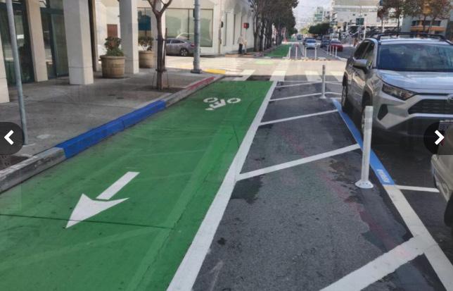

Shared facilities allow all roadway users to access and share streets. Shared facilities are designed to allow people biking and rolling as well as people driving for local access, services and delivery to interact safely on a roadway.
Slow Streets that meet low motor vehicle speed + volume thresholds.

Corridors like Page Slow Street would be further refined with permanent greening, stormwater mitigation, community art, and other infrastructure to meet thresholds while still accommodating local car traffic. An AllAges-and-Abilities facility.
“Neighborways” and “Bicycle boulevards.” Slow Streets with somewhat higher motor vehicle speed + volume thresholds and lower infrastructure investment. For example, Ortega Street would get added traffic calming to support safe access to the several schools in this corridor. An allages-and-abilities facility.
Traffic-calmed streets that manage motor vehicle speed not volume.
Corridors like Corbett are the mostlevel route for cyclists, but also the only available route for transit and neighborhood car and emergency vehicle access.
While painted bike lanes are a key tool in the current network, they may not support a large number of interested riders unless installed in specific lowerspeed/lower volume areas that have no more than two-lanes. Lanes are used on streets where separated facilities are not an option. MAP COLOR

Started during the pandemic, Slow Streets return some streets to more historical multimodal and community supporting uses. During this plan’s current five-year planning timeline, the Slow Streets program will look at how it can transition to include more green designs such as rain gardens, in street planters, etc. Looking at designs around the Bay Area and the world, the SFMTA will work with the Department of Public Works and Public Utilities Commission to develop design standards and assets to support increased greenery, reduced run-off, and to streamline processes for achieving these goals. The SFMTA will look to support and partner with the Love My Neighborhood program, leveraging these efforts through Public Works to iteratively work toward more permanent installations of green infrastructure that beautify all of our neighborhoods while providing space for the safe use of Shared Streets (Level I).


Design active transportation to serve local needs while being mindful of vulnerable communities, neighborhoods experiencing displacement or gentrification, small business needs, transit corridors, space constraints, and implementation disruption.
Policy 13. Maintain support with Community-based organizations and develop new collaboration within historically marginalized communities and EPCs.
Action 3.13.1. Prioritize and uplift the needs and ideas identified in Community Action Plans and CBTPs to honor and respect the work and relationships that resulted in them.
Action 3.13.2. Document community engagement and commitments and present to the SFMTA Board of Directors to ensure awareness and commitment through the creation and updating of Community Action Plans and CBTPs.
Action 3.13.3. Identify and maintain agency relationship points of contact with community organizations that strengthen connections within the community and provide opportunities for future engagement and development of facility design, program development and informed public input to the agency.
Action 3.13.4. Reinforce sharing information and trust-building processes within the SFMTA by ensuring that project managers have resources and capacity to coordinate bikeway and asset project details to ensure transparent, clear, and direct information and feedback supports community groups.
Action 3.13.5. Assign existing SFMTA planning Cultural Districts coordinator to track and expedite any bikeway or community asset being proposed by Cultural District representatives and as part of Cultural History, Housing, and Economic Sustainability Strategies (CHESS) reports in coordination with the Mayor’s Office of Housing and Community Development (MOHCD).

Policy 14. Bolster economic vitality by designing an biking and rolling network that bring San Franciscans to the doorstops of small business safely, conveniently, and sustainably.
Action 3.14.1. On commercial corridors where demand for the curb is high, treat businesses as destinations and prioritize loading needs.
Action 3.14.2. Engage in outreach with local business associations early in the process to gather feedback.
Action 3.14.3. Support businesses during facility construction with outreach and promotion efforts.
Action 3.14.4. Participate in SFMTA and Office of Workforce and Development (OEWD) working groups and processes to access key issues and economic conditions for future plan updates.
Action 3.14.5. Provide SFMTA planning staff time to contribute to OEWD provided efforts for economic grants and resources that support businesses in corridors where bikeway and asset projects are being planned.
Policy 15. Engage with both citywide and local school communities in San Francisco to address safety concerns at all San Francisco schools and support increased in biking and rolling to school for those families who are interested in doing so.
Action 3.15.1. Ensure that the SFMTA is engaged in all processes related to SFUSD school enrollment and selection to ensure families have as many transportation-to-school options as possible.
Action 3.15.2. Develop and support relationships with PTAs and PTOs, as well as specific school leaders to bring families further into SFMTA planning and transportation decision-making processes and identify how the agency can better support the communities.
Policy 16. Ensure close coordination and alignment with the SFMTA’s Transit Division to prioritize needs of vehicle operators and on-street operations and avoid conflicts when planning bicycle facilities.
Action 3.16.1. Maintain close relationships between bicycle planning and implementation teams and SFMTA Transit Planning and Muni Operations, including regular meetings to check in on the status of projects, planning and operational issues.


North Star with Muni service
The North Star network is designed to use alternative bikeway locations to not impact high usages areas for the SF Fire Department.
The North Star network is designed to use alternative bikeway locations to not delay or stress transit service, join on corridors where protected bikeways separate modes, and directly engage transit stations to facilitate usage.

accessibiity to key destinations.


Be accountable to communities and deliver the North Star network by stewarding the Plan as a living document and delivering it in stages, recognizing that the City needs to expand resources, recognize community readiness, and manage unique technical challenges. Start with projects that have high network value defined by: higher harm repair, network gap closure, and community agreement and lower risk, cost, and technical difficulty.
Policy 17. Deliver community assets including bikeways, design studies, and community action plans in locations that expand the north star network
Action 4.17.1. Build agency capacity that enables construction of projects on an earlier timeline.
Action 4.17.2. Improve delivery processes to use public funding more efficiently through process improvement efforts and stronger collaborations with key partner agencies.
Action 4.17.3. Publicly explain choices and decision-making in capital projects to maintain transparency of resource use.
Action 4.17.4. Recognize, develop and fund assets that support biking and rolling that are not bikeways, especially those identified in Community Action Plans in the Biking and Rolling Plan.
Policy 18. Deliver bikeways that have high value to the north star network in the first stage
Action 4.18.1. Deliver pipeline projects already approved by the SFMTA Board.
Action 4.18.2. Define and adopt “high network value” criteria to provide transparency on how projects will be phased and chosen.
Action 4.18.3. Align the SFMTA Five Year Capital Improvement Plan to plan funding of the high network value stage.
Action 4.18.4. Continue delivering projects through the Vision Zero QuickBuild program.
Policy 19. Maintain the Biking and Rolling Plan as a living document.
Action 4.19.1. Update the Biking and Rolling Plan incrementally, approximately every two to three years, to build it into institutional work, capital, and community planning process.
Action 4.19.2. Maintain list of accomplished Community Action Plan items.
Action 4.19.3. Reflect changes in technology, funding options, and cultural adaptations in Plan updates.
Policy 20. Reduce constraints on the SFMTA in delivering the assets in the North Star network.
Action 4.20.1. Reform and streamline internal administrative project development and implementation process, for example outdated technology or procedures in contracting, reporting, or interagency coordination while maintaining all city and state obligations.
Action 4.20.2. Study reforming and streamlining regulatory and approval processes that reduce administrative burdens while preserving and uplifting public participation.
Action 4.20.3. Provide greater clarity and transparency in agency process and decision-making to align community input early where it can be most meaningful and reduce community planning fatigue.
Action 4.20.4. Coordinate and integrate solutions to administrative burdens recommended by the SFMTA Project Management Office.
Policy 21. Support connectivity between active transportation and transit, including regional transit.
Action 4.21.1. Prioritize bikeway designs that support safe, fast, and reliable transit operations and minimize potential for conflicts between transit and bikes.
Action 4.21.2. Design bikeways that support first and last mile connections with transit hubs.
Action 4.21.3. Implement mobility hub pilot programs or install additional long-term device parking at key transit hubs and connection points.
Policy 22. Efficiently and proactively structure staff and processes to fund Plan implementation.
Action 4.22.1. Develop a work plan and staffing plan to support grant applications following the adoption of the Biking and Rolling Plan.
Action 4.22.2. Organize Street Division capital and grant funding to deliver North Star projects based on cost/benefit evaluation with other efforts such as aligning network upgrades with street repaving efforts.
Action 4.22.3. Advocate at regional and state levels to increase funding and reduce constraints.
Policy 23. Develop process improvements and increase coordination between the SFMTA, SF Fire Department (SFFD), SF Public Works, SF Public Utilities Commission (SFPUC), and SF Recreation and Parks Department (Rec and Park).
Action 4.23.1. Align Capital Planning processes between Public Works and the SFMTA.
Action 4.23.2. Coordinate Plan implementation with Public Works paving plan to deliver projects in a cost-effective way.
Action 4.23.3. Identify ways to engage with Public Works early in their annual repaving planning process to direct pavement improvements where they will benefit people who bike and roll.
Action 4.23.4. Support the creation of an identified manager at SF Public works who elevates bikeway opportunities and can coordinate with the SFMTA on biking and rolling projects.
Action 4.23.5. Develop shared work program between the SFMTA, Rec and Parks and other partner agencies to implement biking and rolling projects to increase access to parks and reduce the impact of parks as barriers to the citywide network.
Action 4.23.6. Continue to support strong collaboration with SFFD in pursuit of roadway and fire/emergency medical response safety.

Action 4.23.7. Build on the recommendations of the Controllers’ office guidebook for SFMTA and SFFD collaborations to further improve communications.
Action 4.23.8. Develop a semi-annual program with SFFD to identify key traffic calming tools for adding to the SFMTA’s toolkit.
Policy 24. Support state-level legislation and state agency practices for further streamlining delivery of active transportation projects.
Action 4.24.1. Include support for increased local design control on state roadways for safety projects in the annual legislative advocacy program.
Action 4.24.2. Support Caltrans and other state agencies in removing bureaucratic barriers to implementing biking and rolling safety projects in San Francisco.
Policy 25. Secure local, regional, state, and federal funding for active transportation project implementation.
Action 4.25.1. Identify local funding streams for Plan implementation, such as impact fees.
Action 4.25.2. Ensure the annual legislative program includes support for maintaining and increasing funding for the Active Transportation Program (or its successors).
Action 4.25.3. Work with California City Transportation Initiative (CACTI) to align CA cities priorities for increasing and including active transportation funding in climate, health and transportation funding decisions.
Policy 26. Demonstrate accountability to the public on Plan implementation and outcomes.
Action 4.26.1. Create an easily updateable, publicly-viewable, data dashboard on new and upgraded facilities built, % or stage of network completed, equity metrics and project evaluation summaries.
Action 4.26.2. Collect and share data on a regular basis to study the effectiveness of active transportation projects as outlined in the Safe Streets Evaluation Program.
While the North Star network sets a singular ambitious goal, San Francisco’s bikeway projects will arrive in increments. Project timing will be dynamic, allowing for both opportunities, such as street repaving, and long-term engagement, for projects like complex multimodal corridors. Each project will be evaluated with a level of “network value” based on priorities, conditions, and risks in the following categories:
Resource constraints
Capital funding
There is very little existing funding identified for building the North Star network. And, as the SFMTA is facing a once-in-a-generation financial challenge, projects will require competing for grant funding which will take a substantial staffing commitment and partnerships at many levels of government. If a potential project is underfunded or unfunded, there are agency risks for pursuing it.
Economic forecast
The overall health of the city’s economy and City’s budget affect the ability of the agency to hire and manage resources. As well, the SFMTA relies on the global material supply chain, construction and professional services industries, and labor trends which can dramatically or incrementally change overall project schedule and costs.
Staffing capacity
Project timing will be dynamic, allowing for both opportunities and engagement
Many people feel that other needs, such as pedestrian safety, parking, and driving mobility, should be prioritized over bikeways, especially if efforts repair historic injustice. Depending on the amount of effort, and resources, given to work with these communities to address their existing concerns and build trust, the timeline for building some sections of this network is variable.
The SFMTA’s design, engineering, and project management staff are already at capacity and current budget projections will not allow additional hiring. The SFMTA’s busy and responsive shops are also fully subscribed and would need to significantly staff-up. Without stable and on-going funding commitments beyond individual grants, staffing will continue to be a challenge. Maintaining trust and beginning a project when there is community readiness will substantially reduce staff time and project costs.
City departments and agencies
Coordination across jurisdictions is time-consuming and often regulatorily complex as other governmental functions have their own constraints, competing missions, and leadership directives requiring delicate navigation.
Many categories of projects identified in this Plan establish community agreement where projects can begin once technical and resources are identified: Community Action Plans, Community-based Transportation Plans, and communityled efforts in Equity Priority Communities.
Communities under pressure from housing cost burdens, wage decline, inflation, planning fatigue, or overall income inequity experience stress that can add pressure to all governmental interactions.
Community changes over time and so do the priorities and commitments of their leaders. Given the time horizon for the North Star network, it is not possible to map out a serious timeline to completion based on today’s areas of support or concern. However, this Plan is intended to serve as a guide to current and future leaders for making sure that the City builds towards an overall north star goal.
Technical constraints
As described on page 33, San Francisco has a unique combination of historic conditions that must solved project by project.
Car-dependent neighborhoods
Historically working-class neighborhoods with lower transit service levels and high car dependency are impacted by parking removal for bikeway projects more than most others. Consider project designs that avoid or reduce parking loss in these areas.
Street widths
Nearly all of San Francisco’s streets cannot be widened given private property boundaries. Making new or upgraded bikeways is limited by both how much street space exists and how it is allocated.
Narrow residential lots with frequent driveways limit the use of separated and protected bikeways due to safety, driver visibility, and turning radius requirements for all road users.
High Injury Network
The 12% of streets that represent the 68% of severe and fatal injuries are defined as the High Injury
Network. Projects on this network have high network value as they support Vision Zero.
School proximity
Projects that create All Ages and Abilities network segments within ¼ mile of a school support San Francisco’s goal for Safe travel to school have high network value.
Gap closure and community connections
Gap closure projects can provide a multiplying effect, connecting neighborhoods and bikeways providing both local and crosstown connection benefits. Short, gap-filling projects to important community resources have high network value.
Grade is a key consideration in both route selection and bikeway design. It is better to opt for longer, flatter routes over more direct, but steep ones. With the rise of e-bikes, secondary routes with medium grades (8 - 13%) are also acceptable options.
The city’s repaving program and utility projects offer cost-savings and efficient opportunities to expand the network as they often require street resurfacing and striping.
Provide programs, resources and assets that invite and support people, especially youth and low-income residents and workers, to use the network, such as safe device parking, education programs, travel choice incentives, and pilots to support emerging systems from the Plan.
Policy 27. Provide biking and rolling programs to expand people’s travel choices
Action 5.27.1. Include a prioritization strategy for which programs will be funded first.
Action 5.27.2. Include a funding strategy that prioritizes programs that are replicable, expandable and financially sustainable.
Action 5.27.3. Promote biking and rolling through transportation demand management.
Policy 28. Improve awareness and safety through multilingual education campaigns
Action 5.28.1. Provide bicycle education programming to encourage people to ride by supporting confidence in the rules of the road and individual abilities.
Action 5.28.2. Education for biking and rolling around transit.
Action 5.28.3. Train the Trainer classes to build community capacity for bicycle education.
Action 5.28.4. Continue to enable Safe Routes to Schools, in-school bicycle education programming in partnership with SFUSD.
Action 5.28.5. Develop awareness campaigns to promote upcoming projects and encourage active transportation.
Action 5.28.6. Support Vision Zero education campaigns that support safer driver behavior around people who bike and roll.
Policy 29. Prioritize unbiased enforcement in places that are critical for safe travel, while implementing innovative and proven tools
Action 5.29.1. Implementing speed cameras and other unbiased enforcement methods.
Action 5.29.2. Enforcing bike lane parking obstruction violations.
Action 5.29.3. Capture and report out on citation data, including demographic information to provide clarity on who is being cited and stopped and for which actions.
Policy 30. Address disproportionate access to bicycle repair in Equity Priority Communities.
Action 5.30.1. Develop a program to increase availability of bike shops, bike repair, and fix-it stations in Equity Priority Communities.
Action 5.30.2. Provide bike and device repair training for personal use or workforce development.
Policy 31. Provide adequate parking for and protection of equipment and devices.
Action 5.31.1. Develop overnight and long-term active transportation device parking options for people in new and existing low-income housing.
Action 5.31.2. Implement plentiful bike and device parking options at key destinations, including long-term parking options and facilities that accommodate adaptive bikes and mobility devices.
Policy 32. Ensure low-income people and equity priority communities have increased access to devices.
Action 5.32.1. Expand affordability of bikeshare and scootershare services.
Action 5.32.2. Ensure new devices for personal mobility include discounts or other forms of community benefits to low-income residents.
Action 5.32.3. Consider ways to incentivize new developments providing annual bikeshare memberships within the city’s TDM program for new development.
Action 5.32.4. Resource existing programs that lower barriers for kids and caregivers to get bicycles and rolling devices and learn how to safely ride them.
Action 5.32.5. Support programs that provide rebate and other support for e-bikes such as the SFPUCs program with the Department of Energy.
Action 5.32.6. Develop e-bike lending library programs, run in partnership with community-based organizations.
Action 5.32.7. Grow and support existing programming to transition food delivery and package services to electric devices such as the 2024 program run by the Department of the Environment.
.
Policy 33. Partner with organizations providing access to adaptive devices.
Action 5.33.1. Expand availability of adaptive bikeshare, scootershare, and other active transportation devices designed for the mobility needs of disabled and elderly users.
Policy 34. Incorporate community assets beyond traditional facilities or programs in implementation efforts that encourage active transportation participation in communities exploring or gaining readiness.
Action 5.34.1. Include community assets in grant applications.
Action 5.34.2. Partner with Public Works on their public realm improvement projects to add biking and rolling training or play space when feasible.
Action 5.34.3. Incorporate greening, seating, or other welcoming features that enhance the connecting between biking and rolling and walking.
Programs can encompass many aspects of the proposed work in the San Francisco Biking and Rolling Plan. For the purposes of this document, the organizing of the SFMTA Streets Division’s roadway design, bicycle parking, and other work programs that guide the implementation of the City of San Francisco’s work will be incorporated in the implementation section when this document returns for approval. The programs presented below are


external facing and engage with the public as the direct receiver of benefits of the program.
Programs are organized into three key areas that were identified and developed with community stakeholders to better identify what work was being proposed and approved in each of the key focus areas. See Appendix D for full program recommendations.

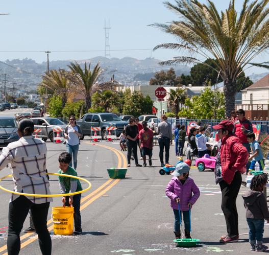
Affordability and access
Lending and sharing
Adaptive bikeshare
Scootershare
Bikeshare
Community bike shops
Reducing the cost
E-bike rebates and leasing


Education and encouragement
Mobility education
Safe driving program
Adult bicycle education
Scooter safety program

School safety programs
In-school bike education
Safe Routes to School
Events and event support
Sunday Streets
Tourist bike/roll support program
Bicycle/rolling event access education and outreach


Economic & workforce development
E-bike delivery support
Partnering with SF Environment
Business incentives and benefits
Partnering with the Office of Workforce and Development